Greeley: Long-term water planning reveals higher rates in the ratepayers future

A picture named fountainpavementdrawing

From The Greeley Tribune (Chris Casey):

As Water and Sewer Director Jon Monson looks at the sizable footprint of Greeley’s future — the 2060 comprehensive plan has the city growing heavily to the north and west — “I need to look up the river quite a ways, a long time, to make sure that water will be there when people need it.”

At the center of this multi-layered planning are residents, upon whom cities rely to fund operations and storage projects. The typical Greeley household water bill is $45.83 a month, and that, if a planned water acquisition occurs, would rise about $30 per month over the next 10 years. By comparison, rates have climbed $8.85 per month, or 24 percent, since 2003. “The only place we get our money is the ratepayers. It’s basically an investment in our water future,” Monson said. “… To grow into this area (of the 2060 plan) with the lifestyle we’re accustomed to, or we want, Tree City USA, takes water. And the time to get that water is now, when it’s available and it’s relatively inexpensive.”[…]

Monson’s department would like to buy $90 million worth of water in the next six years. While that would help ensure the city’s needs for several decades, water rates would likely climb 84 percent in the next 10 years, or by $30 per single-family home per month. That’s compared to rates rising, if no additional water is bought, 47 percent in the next decade, or $17 per home. If the city added the $13 per month to water bills for the overall acquisition — the initial $30 million buy coming in the 2011-12 budget — rates would be in the upper third of Front Range cities if other cities do not change their rates during the 10-year period…

“We’re not making money,” Monson said. “We’re not a for-profit agency. We’re just covering our costs.” The department’s annual costs currently are $30.5 million, breaking down to about $12 million for operations, $11 million for debt service, $6 million for depreciation and a $1 million from the general fund.

Greeley is involved in numerous regional water storage and delivery projects, including the Haligan and Milton-Seaman reservoir expansions in the Poudre Canyon area, the Windy Gap Firming Project west of Loveland and the Bellvue Pipeline in Larimer County…

Also, Monson said, the city is dealing with critical water maintenance projects, including headgate repair and replacement at the Boyd and Freeman ditch, from the recent flooding; ongoing cement-lining installation in older, rusting pipes in downtown; outlet gate construction at Milton-Seaman reservoir; and centrifuge replacement at the wastewater treatment plant. All those elements — plus rising electrical and power costs and the regional water projects that cost into the millions in permitting alone — factor into water rates. In Greeley, Monson said, about a quarter of a household’s water bill goes to maintenance costs…

Also, he said, elusive future water supplies will likely be lower quality. Greeley is trying to secure as much source water as possible from close to the Poudre Canyon mouth. If the city waited until primary water sources flowed close to town, it would need to do expensive reverse-osmosis treatment and lose the natural down-gravity flow from the canyon.

More Greeley coverage here.

Pagosa Springs: Long-term water supply planning group inaugural meeting recap

A picture named sanjuan

From the Pagosa Sun (Chuck McGuire):

In light of recent community unrest regarding future water planning and storage issues, the Pagosa Area Water and Sanitation District (PAWSD) Board of Directors asked that willing citizens step forward and assist in determining how best to assure long-term water supplies. By the June 9 meeting, 21 participants signed on, including local government officials, builders, Realtors, water experts and rate payers.

From the Pagosa Sun (Chuck McGuire):

Toward the end of another lengthy Pagosa Area Water and Sanitation District (PAWSD) Board of Directors meeting Tuesday night, some convincing community members moved what seemed an immovable object. As a result, the board suspended its construction-related Water Resource Fee (WRF) for six months.

More Pagosa Springs coverage here.

Energy policy — hydroelectric: Ridgway Dam hydroelectric retrofit

A picture named ridgwayreservoir

From The Telluride Watch (Gus Jarvis):

“We hope to have a permit in our hands inside 15 months,” Tri-County General Manager Mike Berry said at Monday’s Ouray Board of County Commissioner meeting in Ouray. “At that point in time, we will start designing this project.”

According to Berry, two weeks ago the federal Bureau of Reclamation issued a federal register announcement calling for applications, which are due by December. The process is open to anyone and is intended to be an open and competitive process. After the deadline, it could take the Bureau of Reclamation anywhere from three to six months to select an applicant and then complete negotiations for a permit…

“The size of the plant will be somewhere between 1.8 and 2.5 megawatts, depending on how we can configure the construction of it,” Berry said, adding that the cost of the hydroelectric plant could be anywhere from $9 million to $15 million. “We are still talking about exactly what we [would] build.”

If Tri-County is ultimately awarded a permit, Berry said it is the utility’s intent to run the plant on historical flows to “minimize the environmental impact” and to continue to maintain the Uncompahgre River’s water flow in similar form as it has in the past. “We are primarily responsible to provide water and irrigation down stream,” Tri-County Boardmember Frank Starr said. “So we will not alter the release of water in order to create power.”

Energy policy — nuclear: The Sheep Mountain Alliance is taking a close look at the Piñon Ridge Mill application

A picture named conventionaluraniummill

From The Telluride Watch (Karen James):

Throughout a long public process concerning the approval of what could be the nation’s first new uranium mill constructed in nearly three decades, project supporters have largely rejected arguments made by opponents as being overly emotional and lacking in sound, scientific substance.

But that criticism may have lost some of its sting last week when scientists hired by local environmental group Sheep Mountain Alliance to examine parts of a 15-volume radioactive materials license application submitted to state regulators last fall by Energy Fuels Resources Corp., a wholly owned subsidiary of the Toronto-based Energy Fuels Inc., presented their findings during two public meetings held in Telluride and Ophir…

A solution of sulfuric acid would be used to leach the desired metals from the ore, leaving behind a waste solution containing concentrated levels of heavy metals like arsenic, cadmium, chromium, and lead that would then be piped into lined evaporation ponds for containment. “You don’t want anything to come in contact with this,” [Jamie Holmes, managing scientist with the Boulder, Colo.-based environmental consulting firm Stratus Consulting that studied hydrological issues at the proposed Piñon Ridge mill site said. “You don’t want it in the groundwater, in surface water, you don’t want any wildlife coming in contact with it.” Historically, however, linings have leaked, and net systems designed to prevent wildlife interaction with the toxic sludge have failed. “Our biggest concern is that they will generate toxic waste, not control it properly and then leave it to taxpayers to clean up,” Holmes said. “That is a recurrent problem in this industry,” he continued, referring specifically to heavy metal mining and milling.

More nuclear coverage here and here.

Colorado-Big Thompson Project update

A picture named greenmountainreservoir

From email from Reclamation (Kara Lamb):

We’ve continued to drop releases from Green Mountain Reservoir to the Lower Blue over the past few days. It is likely, we will continue to drop through the weekend, as well. Inflows to the reservoir have been dropping and we are keeping pace. Today, the Lower Blue is flowing at just under 1200 cfs.

More Colorado-Big Thompson coverage here.

The Woodmoor Water and Santiation District purchases additional ag water rights on the Holbrook Canal

A picture named arkbasinditchsystem

From The Pueblo Chieftain (Chris Woodka):

Woodmoor, located north of Colorado Springs on the Douglas-El Paso county line, has approved spending almost $10 million this year for the purchase of water rights on the High Line, Excelsior and Holbrook ditch systems east of Pueblo. On Monday, its board approved spending another $1.7 million to buy 931.7 shares of the Holbrook Canal, about 5.8 percent of the ditch. Each share irrigates an acre. “We expect the yield to be about 800 acre-feet annually,” [Jessie Shaffer, manager of the district] said.

Earlier this year, the Woodmoor board voted to buy 47.8 shares of the High Line Canal, roughly 2 percent of the ditch. Each share irrigates 10 acres. The cost was a little more than $2 million, with an expected yield of about 700 acre-feet. The board also voted to buy part of the Stonewall Springs reservoir site and 771 shares of the Excelsior Ditch in Pueblo County for $5.85 million. That is expected to yield 380 acre-feet. “If everything goes through, we would be right at $10 million in assets,” Shaffer said. That works out to about $3,000 for each of the 3,300 taps in the district. Water users now pay a base fee of $6.81, with charges from $4.91 to $14.18 per gallon on a tiered scale that charges more per gallon as more water is used.

More Arkansas Basin coverage here.

Rafting rift settlement leaves questions about the ‘right to float’

A picture named raftingarkriver

From the Associated Press via the Fort Collins Coloradoan:

Colorado’s governor on Tuesday announced that a group of river rafters and a real estate developer who didn’t want paddlers floating by his property reached a four-year agreement…

The developer’s move [to close a certain reach of the Taylor River] prompted an intense debate over who owns riverways in Colorado, where tourists flock in summers to ride some of the West’s best freshwater rapids. The developer said that rafting trips would disturb a fishing preserve…

A state lawmaker from Gunnison tried and failed to protect rafting rights in a bill considered last session. After the bill failed, both sides vowed to seek ballot initiatives to put the question to voters, and 24 separate questions have been proposed. The four-year agreement announced Tuesday calls for both sides to agree to recall those proposals. Ritter hailed the decision to withdraw the flurry of ballot proposals “courageous.”

However, the “right to float” question isn’t settled. The agreement applies only to the stretch of the Taylor River in dispute, leaving unanswered the question of whether property owners with public rivers on their land can prevent paddlers, even if the rafters don’t stop on privately owned banks. “I do believe it needs to be addressed,” [Matt Brown, an owner of Scenic River Tours] said of permanent floating rights…

Ritter said he’s set up a panel of landowners, commercial and recreational river users and even police to propose a statewide procedure for settling river disputes. The report is due by the end of the year, in time for lawmakers to consider permanent rafting rules next session.

More whitewater coverage here.

Colorado-Big Thompson Project operations update

A picture named coloradobigthompsonmap

From email from Reclamation (Kara Lamb):

Due to the recent high-rate of snowmelt run-off, we thought it would be best to provide folks in and around the area of Lake Granby some information about possible operations at Granby Dam later this month. With the elevated inflows we continue to see at Lake Granby, it is very likely we will fill the reservoir by the last weekend of June. Once the reservoir is full, inflow will be bypassed on downstream using both the outlet at the dam and the spillway. The last time we utilized the spillway to bypass inflow was in the year 2000.

More Colorado-Big Thompson project coverage here.

EPA proposes removal of more than 2,500 acres at Rocky Mountain Arsenal from Superfund list

A picture named rockymountainarsenal1964

Here’s the release from the U.S. Environmental Protection Agency (Jennifer Chergo):

The U.S. Environmental Protection Agency (EPA) has announced a proposal to delete portions of the Rocky Mountain Arsenal (RMA) from the National Priorities List (NPL). The NPL is a list of the nation’s most contaminated sites, known as Superfund sites. EPA and the Colorado Department of Public Health and Environment have determined that all required cleanup activities are complete in the areas proposed for deletion. EPA is accepting public comments on the Notice of Intent to Delete for 30 days, from June 17 to July 19, 2010.

EPA is proposing to delete 2,500 acres of soil, sediment, surface water and structures from the central and eastern surface areas within the RMA boundaries. EPA is also proposing to delete the entire surface area just north of the RMA boundary. Groundwater underlying these areas is not included in this deletion and will remain on the NPL. All areas at RMA deleted from the NPL will continue to be subject to regular EPA review to ensure the protection of human health and the environment.

Deleting property from the NPL facilitates reuse of that property. Should the proposed deletion of the central and eastern surface area be finalized, its 2,500 acres will be transferred to the U.S. Fish and Wildlife Service (FWS) to become part of the Rocky Mountain Arsenal National Wildlife Refuge.

This is the fifth proposed partial deletion of land at RMA. Between 2003 and 2006, EPA completed four partial deletions consisting of 13,406 acres. Of the property deleted at RMA to date, 917 acres were sold to Commerce City for commercial development, 12 acres were transferred to South Adams County Water and Sanitation District for the Klein Treatment Facility, 126 acres were transferred to local governments for road-widening, and 163 acres were retained by the Army, primarily for water treatment systems. Another 12,188 acres were transferred to the FWS to become part of the National Wildlife Refuge, as prescribed in the 1992 Rocky Mountain Arsenal National Wildlife Refuge Act.

RMA is located in Commerce City, approximately ten miles northeast of Denver, Colo., in Adams County. RMA was established in 1942 by the U.S. Army to manufacture chemical warfare agents and munitions for use in World War II. Beginning in 1946, some facilities were leased to private companies to manufacture industrial and agricultural chemicals. Shell Oil Company, the principal lessee, manufactured pesticides at the site from 1952 to 1982. Industrial and waste disposal practices resulted in contamination of structures, soil, surface water and groundwater. EPA placed RMA on the NPL in 1987. Since that time, the site has been undergoing extensive environmental investigation and cleanup.

For more information, visit: http://www.epa.gov/region8/superfund/co/rkymtnarsenal/

More superfund coverage here.

Water conservation and future Colorado demand

A picture named waterfromtap

From the Grand Junction Free Press (Greg Trainor):

One of the key components of future water supply planning is water conservation. This is among other approaches that either create new water (like cloud seeding), capture existing water (like more reservoirs to hold back excess water in times like this spring), or transfer water from one use to another use.

It has been estimated that transfers of water from agriculture to the cities could result in 65 percent of Colorado’s irrigated agriculture disappearing by 2050. Is the demise of irrigated agriculture something we as Colorado residents wish to see? And, with agriculture gone, what would we eat?[…]

Water conservation, in its broadest sense, is anything that stretches water supplies. The idea is to keep water, which you already have, in place, and not use it until you absolutely have to. This happens in a number of ways like installing water efficient appliances, not running water while brushing your teeth, replacing lawns with xeric landscaping, or making improvements to water distribution systems by repairing leaks. So water conservation seems like something we can do to stretch our supplies without too much inconvenience or discomfort. Keep in mind that every acre foot saved should be used to make up for shortages in precipitation during times of drought, and not used to supply water to future population increases. To do so only puts us into a deeper hole when drought does occur. Less water, but more people with nothing to drink…

In 2004, the Colorado Water Conservation Board established steps for the development of a comprehensive conservation plan and water providers are required to address each of the following elements:

•Characterize water use and forecast demand

•Profile proposed facilities

•Identify conservation goals

•Identify conservation measures and programs

•Evaluate and select conservation measures and programs

•Integrate resources and modify forecasts

•Develop implementation plan

•Monitor, evaluate and revise conservation activities and the conservation plan[…]

Grand Junction, Ute Water Conservancy District and Clifton Water District have been working on many other cooperative efforts to ensure the Grand Valley is protected in times of shortages. For example, the three systems are interconnected. If there is a water shortage for one entity, it is considered a shortage for the others. Crews train together as well as have the authority to open up valves to supply water from other areas of the system…

For more information on area water conservation efforts, visit the Drought Information Response Project website at www.thedripwebsite.com.

More conservation coverage here.

Runoff news: A look ahead at operating the Arkansas River Voluntary Flow Program this summer

A picture named arkansasriverleadville

From The Pueblo Chieftain (Chris Woodka):

“At some point this summer, we are going to ask to exceed the releases of 10,000 acre-feet,” Tony Keenan of the Arkansas River Outfitters Association told the Southeastern Colorado Water Conservancy District Thursday.

The releases are made under a 1990 voluntary flow management program among several local, state and federal agencies. It allows Fryingpan-Arkansas Project water and other supplies from Turquoise and Twin lakes to be released into the Arkansas River at strategic times to maintain flows for recreation through mid-August and for fish and wildlife during the winter months.

This year, flows surged in late May and early June and temperatures rose and began to melt snow in the mountains. Already, the flows are dropping. “We have about half of what we had in the river 10 days ago,” said Steve Witte, Water Division 2 engineer. The Upper Arkansas River was flowing at about 2,300 cubic feet per second this week, down from more than 5,000 cfs earlier. The flow program calls for a target level of 700 cfs through Aug. 15.

While the program is capped at 10,000 acre-feet of releases, more has been released in the past, if the timing can benefit the Fry-Ark Project, or the needs of big water users like Pueblo, Colorado Springs and Aurora. “I think the water is going to be plentiful, it’s space that concerns us,” said Roy Vaughan, manager of the Fry-Ark Project for the Bureau of Reclamation. For the past two years, space in Lake Pueblo has been tight in the spring, meaning water stored by some users could spill. About one-third of the water in Lake Pueblo now is either excess-capacity or winter water. The lake level is about 131 percent of average. “We could be looking at the same problem next year,” Vaughan said, citing graphs that show Lake Pueblo inflows are running ahead of last year’s supplies.

At the same time, Reclamation is trying to make enough space in Turquoise and Twin lakes to contain water being brought in through the Fry-Ark Project. Projections for water this year are at about 56,000 acre-feet, slightly above average. So far, about 41,000 acre-feet have come over. “We’ve already lost some yield because of the hard runoff,” Vaughan said. When the Boustead Tunnel was carrying its maximum of 945 cfs of water, about 800 cfs was flowing into the Roaring Fork River at the tunnel’s diversion point on the other side of the mountains.

More Arkansas River Basin coverage here.

From The Grand Junction Daily Sentinel:

[White River National Forest] engineers said the agency may not know for several weeks just how much damage occurred as a result of recent accelerated snowmelt that resulted from high temperatures. Meanwhile, the public is being urged to be careful when approaching bridges, especially those having significant accumulation of debris on piers and footings. Such accumulation has been spotted on several bridges and may have caused structural damage requiring significant repairs. People also are asked to report any damage to the Forest Service as soon as possible. The forest’s supervisor, Scott Fitzwilliams, said in a news release, “Flood-damaged infrastructure will be costly to repair but we are committed to doing so as funding becomes available.” Officials got their first idea of the possible damages sustained on the forest when a hiker reported last week that the Lower Cross Creek Bridge in the Holy Cross Wilderness Area near Vail had been washed out.

Aspinall Unit update

A picture named bluemesa

From email from Reclamation (Dan Crabtree):

For those of you keeping a close eye on the flow in the Black Canyon and Gunnison Gorge, there have been some minor fluctuations the last few days as the Uncompahgre Valley Water Users increased diversions to the Gunnison Tunnel to its maximum capacity. Flows should remain stable until conditions warrant further change.

More Aspinall Unit coverage here.

Crawford: Water tank maintenance complete

A picture named orrmnwatertower

From the Delta County Independent (Kathy Browning):

The two water storage tanks for the Town of Crawford have been inspected, cleaned, maintained and repaired. The tanks were never drained. The work was done June 5-7. Bruce Bair, public works director, told the town council on June 2 that the work for the repairs would take just three days instead of the estimated three and a half days. That realized a $1,000 savings for the town. Inland Potable Services of Centennial, Colorado, did all the work. The original estimate for maintenance and repairs was $10,325. The final bill was just $9,350.

More infrastructure coverage here.

Denver Water: Dredging project for Strontia Springs Reservoir will close Waterton Canyon for a year

A picture named strontiaspringsdam

Here’s the release from Denver Water (Stacy Chesney):

Denver Water’s Strontia Springs Reservoir contains more than one million cubic yards of sediment — a result of forest fires and subsequent intense rains over the years. Increased sediment creates reservoir operational challenges and causes water quality issues that impact the functions of the Foothills and Marston water treatment plants. As a result, a Denver Water contractor will dredge the reservoir to remove at least 625,000 cubic yards of sediment — enough to fill the football field at Invesco to a height of more than 200 feet.

This large-scale project will require heavy machinery and equipment. To ensure the safety of those who recreate in the area, Waterton Canyon will be closed to the public for a number of months in 2010 and 2011 while the majority of the work takes place.

Waterton Canyon will be closed as follows:

* Monday, Aug. 2, 2010 until Sunday, Dec. 3, 2010
* Monday, Feb. 28, 2011 until Saturday, Dec. 31, 2011

Neither the parking lot at the canyon’s entrance nor the canyon will be accessible during the closure. Some contractor activity will precede this date but there will be flaggers to caution the public during July.

Access to The Colorado Trail (CT) from Waterton Canyon also will be closed during these times. The next closest access to CT Segment 1 is via the Indian Creek Trailhead on CO Hwy 67, 10.5 miles west of Sedalia (see http://www.ColoradoTrail.org).

“We understand that Waterton Canyon is a very popular recreation site for people of all ages, and we know some will be inconvenienced by this closure,” said Neil Sperandeo, manager of recreation for Denver Water. “When the full scope of the project was completed, it was determined it would be unsafe to leave the canyon open during construction. We hope to make the canyon even better for recreation when it reopens in 2012.”

For questions related to recreation, e-mail recreation@denverwater.org.

More Denver Water coverage here.

Orchard City: Environmental assessment is delaying waterline replacement project

A picture named orchardmesa1911

From the Delta County Independent (Hank Lohmeyer):

During a presentation at the town board’s June 9 regular meeting, the mayor and town administrator detailed their trials with being told to pay over $2,000 for protection of endangered fish in the Gunnison and Colorado rivers, and of being told that a local irrigation ditch is a protected historical artifact. The requirements are among dozens of stipulations that must be fulfilled as part of the Environmental Assessment (EA) process required on the project. Many of the stipulations have no bearing on the town’s water project but must be addressed anyway. The EA is a federal mandate. It is intended to be a simpler and quicker way of looking at possible impacts on government funded projects than a full Environmental Impact Statement would require. The regulations kick in because some wetlands may be disturbed during replacement of the town’s leaky water transmission line. That requires a federal Army Corps of Engineers permit which immediately triggers the EA process…

The Colorado State Historical Society came back with the comment that the project, which will replace an existing 40-year-old water line, threatens to disrupt a pair of “known” protected historical artifacts — the Green Valley Mine and the Childs Ditch. After the Historical Society’s letter arrived at town hall and all the guffawing it produced had subsided, town officials got busy dealing with the ridiculous regulatory regimen they were about to be saddled with…

For the mayor’s part, he got on the telephone to the State Historical Society. Explaining to the Society that neither the old mine works nor the irrigation ditch need historical surveys costing $5,500 to $7,500, he said he was able to get an agreement. With a promise from the Society for approval and “a quick turnaround,” the town was sending a letter last week asking for release from having to pay the thousands of dollars for a historical survey on the mine and the ditch.

Another regulatory snafu was handled by the trustees themselves. It was described by the mayor using serious language and dark terminology to say the town was being forced to pay under duress.

That problem involves yet more federal regulations that link Orchard City’s water line replacement project to endangered fish in the Gunnison and Colorado rivers – the razorback sucker, the Colorado pikeminnow (formerly known as the Colorado squawfish), the bonytail chub, and the humpback chub. The answer to solving the regulatory problem with the town’s pipeline project, to ensuring the town’s future domestic water supplies, and to protecting the fish, it turns out, can all be accomplished at once with a single check in the amount of $2,278 made out to the U.S. Fish and Wildlife Service. The mayor balked, describing the offer as a thinly-veiled, pay me now-or pay me later proposition. But, the town trustees relented, and voted 6-0 to pay the feds now instead of later.

More infrastructure coverage here.

Brush: New stormwater fees go into effect in July

A picture named stormwateroutlet

From the Brush News-Tribune (Jesse Chaney):

Effective July 1, the Brush storm-water fee will increase by an additional three cents per month for each linear foot of property that touches a public street equipped with a curb and gutter.
The Brush City Council unanimously approved a motion on Monday to increase the rate from 13 to 16 cents per linear foot. The city will use the extra fees to help repair parts of the city’s storm-water system, said Brush Administrator Monty Torres. The system is failing in several parts of town, he said, and the downtown area is currently the city’s top priority. Torres said the downtown storm-water system replacement project is expected to cost about $1.5 million.

More stormwater coverage here.

The Upper Colorado River named 6th most endangered river by American Rivers

A picture named coloradotransmountaindiversions

From The Aspen Daily News (Catherine Lutz):

For the third time in 25 years, the upper Colorado, from its headwaters in Rocky Mountain National Park to its confluence with the Roaring Fork River in Glenwood Springs, has made American Rivers’ top 10 list of most endangered rivers, which was released earlier this month. The nonprofit cited water diversions as the main threat to the upper Colorado, the central artery of a major ecosystem and a recreational gold mine for fishing, rafting and kayaking. After more than 100 years of diversions that have collectively degraded the river’s health, two major proposed diversion projects that would take water from the Western Slope to Front Range reservoirs could make it even worse, American Rivers’ report said.

Federal authorities are currently considering the expansion of the two diversion systems. The water authority governing the Windy Gap Firming Project, which transports water from a pipeline near Granby to the Front Range, wants to build a new reservoir that would take about 28,000 additional acre-feet of water per year across the Continental Divide. And the Boulder-area reservoir that’s on the receiving end of the Moffat Tunnel Collection System, which takes water from the Winter Park area, is proposed to be enlarged and would use an extra 18,000 acre-feet…

Another reason everyone should care about the upper Colorado’s issues is that it’s an example of what could happen in other watersheds, said [Ken Neubecker of Carbondale]. The Roaring Fork River, for example, already has the third and fifth largest transmountain diversions in the state: the Fry-Ark Project, which takes water from the upper Fryingpan River, and the Independence Pass Transmountain Diversion Project, which collects water for Twin Lakes from the headwaters of the Roaring Fork River…

…water quality is another issue people need to be concerned about if the increased diversions are approved. The water taken from the Winter Park and Granby areas is closer to the headwaters of the Colorado, and thus clean and pure. Further downstream, the river has picked up sediment, salts and other pollutants. And the more salts in the water the harder it is, said Neubecker…

Both diversion projects are currently making their way through a federal environmental analysis process, and various interested parties throughout the state are in negotiations over what the final projects will look like. Some environmental groups lately have been invited to the negotiating table, and the Glenwood Springs-based Colorado River Water Conservation District (CRWCB) is involved in the talks. Movement toward a final decision could happen sometime this year…

Neubecker, who is not involved in the process, said he doesn’t believe either water authority behind the two projects is looking at the cumulative impacts of their proposals. He added that Front Range diverters need to first “recognize that there is a problem,” and then accept an adaptive management strategy that would allow the river to get the flows it needs at certain times of the year to maintain its riparian health. He also said he wants to be able to revisit whatever agreement is reached in the next decade or so, in case some of the assumptions are wrong and it’s not working…

But CRWCB spokesman Jim Pokrandt said he sees hope in that Western Slope entities are more involved in talks than they had been before.“The good news is there are negotiations with the two projects that could provide improvements for the river, and can be a win-win for everybody,” he said.

More Colorado River Basin coverage here.

Runoff news

A picture named puebloleveearkansasriver

From The Pueblo Chieftain (Nick Bonham):

Restrictions were lifted Wednesday for boaters and tubers on the Arkansas River downstream from the Pueblo Dam. The rush of winter runoff from the mountains last week caused local officials to put recreation restrictions on the river’s high and dangerous water levels. “The water flows have dropped off significantly and the river is now open for all types of boating,” Monique Mullis, operations manager at Lake Pueblo State Park, said in a press release.

2010 Colorado elections

A picture named coloradoriverbasin

There has been a bit of controversy around Scott McInnis’ fellowship with the Hassan Family Foundation and the series of articles on land use and water that he contracted with the foundation to write. He made reference to the series on a recent radio program but no one had copies of the articles to distribute to the media. Ed Quillen mentioned the writing gig in his column in The Denver Post on June 3 asking, “Who is the best-paid writer in Colorado?” The answer:

Scott McInnis, a Republican candidate for governor. He received approximately $150,000 from the Hassan Family Foundation, for which, as he explained on a radio program, “I wrote a series of in-depth articles on water” that “could be used in a series for education on water in Colorado.”

I follow water stuff fairly closely, and I never saw the work. Jason Salzman, former media critic for the Rocky Mountain News, talked to everybody who might have reasonably encountered this hydrologic epic, and came up empty; McInnis’ office did not respond to his questions.

So $150,000 divided by zero disseminated words works out to something like infinity. Thus, Scooter must be the best-paid writer in our state. And if he doesn’t get elected governor, I want to engage him as my literary agent, since he knows how to cut some sweet deals.

Over the weekend the foundation posted (http://www.hasanfamilyfoundation.com/PDF/mcinnis.pdf) the articles. I read through them yesterday evening and all in all they are a good read. Of course readers understand that I’m a bit obsessed with Colorado water issues so I like a lot of arcane stuff. There are no sources cited for the most part so its hard to know the accuracy of his facts. He’s consistent in his message, bashing government and the Bureau of Reclamation specifically. He embraces the development of water and other resources and laments all the possible mineral mother lodes locked up by wilderness designation. He demonstrates a good understanding of water issues and the history behind Colorado’s present situation.

More 2010 Colorado elections coverage here.

Nestlé Waters North America’s Chaffee County Project to start delivering Arkansas Basin water to Denver bottling plant next month

A picture named nestlehaffeepipelinec

From the Colorado Independent (Scot Kersgaard):

Not everyone is happy about this. Buena Vista and Salida have birthed a protest movement that has been more noisy than effective. By some estimates, 80 percent of the roughly 17,000 people in Chaffee County are opposed to this diversion of water. Still, when it came time to issue permits, the three-member Board of County Commissioners was unanimous in approving Nestle’s plans. In the end, it was probably a combination of fear and Old-West style property rights values that carried the day for Nestle.

Commissioner Tim Glenn, the lone Democrat on the board, told a local reporter “Out and out denial of the permit… well you know what would’ve happened… we would have been sued.”

Commission Chair Frank Holman, on the other hand, thinks the Nestle deal is good for the county. “It is a good thing,” he said. “The county will get 12 to 15 new full-time truck driver jobs out of this. And those jobs are sorely needed,” he said…

Holman plays down concerns. He said that most of the water Nestle will be draining away would have flowed directly into the Arkansas, so the Aurora augmentation water more than makes up for what will be piped to Johnson Village and poured into trucks. He adds that the deal is now a matter of private property rights. Nestle now owns the land where the water originates, he said, and the company has leased the augmentation water to replace the water its carting away, so Nestle is well within its rights. “Nestle is a good neighbor,” he said. “They are giving us money to help with schools. They are creating a conservation easement on their land. And they are creating river access for fishermen.” Nestle has given $500,000 to two local school districts as an endowment from which the districts can spend the interest or earnings. The company has verbally promised to create a conservation easement on most of the land it has purchased, but no easement has yet been recorded…

Nestle is paying Aurora $160,000 a year for the water. The amount paid increases 5 percent a year for the first 10 years of the lease. After 10 years, Nestle has the option of requesting a second 10-year term. If Aurora agrees, the price will increase 3 percent a year for the final 10 years. Nestle can break the agreement at any time. Aurora can only break the deal if it can demonstrate that it needs the water for its own uses. The Aurora City Council voted 7 to 4 to approve this deal last year.

“The thing that gets me most fired up,” said Graham, “is how illogical it is to take our water, pipe it five miles to a truck plant, send 25 trucks of it to Denver every day, and then put it in plastic bottles. Considering that anyone can just turn a tap in their home and get the same water. It is just absurd.”

More Nestlé Waters North America’s Chaffee County Project coverage here and here.

Rafting rift settlement

A picture named taylorriver

Here’s the release from Governor Ritter’s office:

Gov. Bill Ritter announced today an agreement has been reached between commercial rafting outfitters and private property owners along the Taylor River. The compromise clears the way for sponsors of 24 competing ballot measures to withdraw their respective proposals from the November ballot, averting an expensive and divisive election fight.

The Governor had asked two outfitters, Three Rivers and Scenic River Tours, and the owners of the Jackson-Shaw property, in May to find a mutually agreeable solution to their dispute.

Gov. Ritter thanked the parties for their hard work and willingness to find common ground. “To reach this accord, both sides had to make difficult concessions, and I appreciate their willingness to do so,” the Governor said. “Today’s agreement marks an important step toward opening a dialogue between landowners and rafters. My hope is that this dialogue will then lead to a fair and efficient dispute-resolution process for the future.

“Colorado’s rivers are essential to all Coloradans, not only for the vital drinking and agricultural water they carry, but also to our overall economy and quality of life,” said Gov. Ritter, who is an avid fly-fisherman. “Anglers, rafters and private landowners may all have separate and unique interests, but they all share a common Colorado interest that is bound together by doing what’s best for our children and the future of our state.

“I also applaud the decision of the sponsors to withdraw their ballot initiatives,” Gov. Ritter added. “The decision of these parties to withdraw these ballot measures was courageous and puts the interests of all Coloradans above their individual interests.”

Said Lewis Shaw, chairman and CEO of Jackson-Shaw Co., which owns the Wilder on the Taylor fishing reserve: “We are pleased to announce a resolution to the dispute on the Taylor River involving commercial rafting and private fishing property. Gov. Ritter has offered much-appreciated guidance to both parties to reach this settlement privately, avoiding possible contentious legislative initiatives or impositions. The agreement permits rafting companies Three Rivers and Scenic River Tours structured access through the private Wilder Ranch property while respecting each parties’ positions for their mutual enjoyment of this beautiful natural resource.”/p>

“Over the years, Colorado’s property owners and rafters around the state, working on a case-by-case basis, have found ways to accommodate each other,” said John Leede, president of the Creekside Coalition, which represents about 600 riparian landowners across Colorado. “We believe this long-standing approach has served Colorado well by balancing the needs of various interests. Our ballot issues were introduced to protect against legislative and ballot proposals from the commercial rafting community that we believed were one sided and would have disrupted the delicate balance between rafters, fisherman and property owners across the state. We are appreciative of the Governor’s leadership in resolving this issue and we will continue to participate constructively in future discussions around these issues.”

The withdrawal of the ballot measures also clears the way for the creation of a task force that will propose a dispute-resolution process to address future conflicts on Colorado rivers.

Gov. Ritter will convene a task force of stakeholders to develop a proposal for resolving conflicts among landowners, anglers and the boating public. The task force will be charged with developing a framework for resolving disputes on Colorado rivers on a stretch-by-stretch basis as those disputes arise. This approach recognizes that disputes vary from place to place and that a one-size-fits-all strategy is unlikely to succeed.

The task force will be led by the Department of Natural Resources and the Governor’s Office. The task force will include representatives from landowners, commercial and recreational river users, local government officials and law enforcement, which has historically been tasked with intervening in such disputes.

The task force will be asked to deliver a report outlining its proposal to the Governor by Dec. 31.

More HB 10-1188 (State Representative Kathleen Curry’s bill to clarify navigation rights) coverage for background on the rift here. More background on the proposed ballot issues for this fall’s elections here.

2010 Colorado elections

A picture named sanmiguelriver

The three gubernatorial hopefuls were in Pueblo yesterday, according to a report from Peter Roper writing for The Pueblo Chieftain. From the article:

One of them will be elected governor in November, which is why Republicans Scott McInnis and Dan Maes, along with Denver Mayor John Hickenlooper came to Pueblo on Tuesday to woo Southern Colorado voters…

“You don’t just now learn about water,” McInnis declared to the audience of about 150 listeners, a reference to Maes saying that his past year of campaigning had taught him how important and complicated the issue is in Colorado…

On protecting rural water, the Denver mayor said conservation would be important, claiming his city had cut its per capita consumption by 20 percent.

McInnis had a bolder view, saying Colorado should pursue obtaining water rights in the massive Flaming Gorge Reservoir in Wyoming and piping it to Front Range cities, taking the pressure off Colorado river basins, such as the Arkansas River.

Maes said that as diverting water from the Western Slope to the Front Range was always a difficult subject, but he said that if conservation efforts were not enough, “that conversation needs to take place.”

More coverage from Joe Hanel writing for The Durango Herald. From the article:

Republicans Dan Maes and Scott McInnis and Democrat John Hickenlooper showed differences over water, oil and gas and their styles of politics when talking to the Colorado Cattlemen’s Association and Action 22, an advocacy group for Southeast Colorado. Colorado’s water crisis is most acute in the Arkansas Valley, and both groups asked the candidates to address water.

Maes said Colorado has plenty of water, but it needs to be trapped in reservoirs before it leaves the state. Because water belongs to the whole state, transfers from the Western Slope to Pueblo, for example, would be appropriate after the eastern cities have made “good faith efforts” to conserve water. But Maes told the cattlemen’s group that western Coloradans do not need to be threatened. “I say it in Pueblo County, and I say it in Montezuma County: Not a head of cattle or a field of crops will want for water because they need it for a green lawn in Denver,” said Maes, who ran a credit-reporting business in Evergreen.

McInnis said he thinks the best solution is a 400-mile pipeline from Southwest Wyoming to the Front Range, proposed by Aaron Million. “That project, the Million project, in my opinion is a long-term answer to the water needs,” said McInnis, a former congressman for the 3rd Congressional District that covers the west half of the state. In 2007, McInnis registered briefly as a lobbyist for Million’s company, Million Conservation Resource Group, according to records kept by Congress.

Hickenlooper, the Denver mayor, did not offer a specific project. Instead, he said the first task is to build trust and understanding around the state. It might take 20 years to get the Million pipeline built, and he cast doubt of Maes’ suggestion of a Western Slope water transfer to Pueblo. “That would never happen without a higher level of trust than we have right now,” Hickenlooper said.

More 2010 Colorado elections coverage here.

Salida: FIBArk events Thursday through Sunday

A picture named hooliganrace

From The Pueblo Chieftain (Tracy Harmon):

Snowmelt continues to buoy the river flow around 3,000 cubic feet per second which should make for some exciting finishes in the river events. Events kick off from 7 to 9 a.m. Thursday with a pancake breakfast in downtown Salida followed by a 10 a.m. Pine Creek Boater X rafting event…

The 62nd annual event is sponsored by New Belgium Brewing, maker of Fat Tire Amber Ale, making it a must for the brewing company to enter a floatable craft in the Hooligan race slated for 5:30 p.m. Saturday just upstream of the F Street Bridge. “The whimsical factor of FIBArks hooligan craft race is just off the charts — there is nothing like it,” said Shawn Hines of New Belgium Brewing. “We’ll have a homemade boat that we’ll enter and cross our fingers that it keeps us all dry.”

From The Mountain Mail (Arlene Shovald):

Former downriver champion Erich Seidel will be inducted into the FIBArk Hall of Fame during the Heart of the Rockies Chamber of Commerce Business After Hours from 5-7 p.m. Wednesday at Salida SteamPlant. Seidel won the downriver competition in 1953 when the FIBArk celebration was 5 years old. Seidel died in 2003 and his family will receive the honors posthumously on his behalf. His children, Tom Seidel and Christina Seidel-Harrison and grandson Craig Harrison will be in Salida for the ceremony Wednesday. “The family was proud and honored to learn of Erich’s induction into the FIBArk Hall of Fame,” Craig Harrison said. “Erich’s kids, Christina and Tom, both have kayaked casually and Tom competed in the FIBArk Juniors in the early 1970s.” Seidel, a German kayaker, was sponsored by Klepper when he came to Salida in 1953. He worked in Munich, Germany, and in New York for Klepper, primarily as a sales representative.

In 1953 he and a friend, Theo Bock, set up the first slalom course on the Arkansas River to demonstrate gate running and thus introduced that aspect to FIBArk and whitewater sports in America. Seidel and his wife, Helga, moved to Salida in 1954. He and his friend, Xavier Wuerfmannsdobler, explored and paddled rivers of the west and together influenced many local paddlers, among them Eric Frazee who, at 17, represented the United States in the World Champion Slalom in Germany in 1957. Seidel’s name lived on in the Salida area long after he quit competing, because of an event one spring when he made the first successful descent through Brown’s Canyon and fell into a huge hole. His Foldboat was ruined, but he escaped and today the name Seidel’s Suck Hole continues as a dreaded rapid. Seidel had a home in Maysville for awhile, then moved to New York and eventually returned to Germany where he continued kayaking until he was in his early 60s. His former wife was the only person in the family to see him compete at FIBArk, but his son, Tom, has been in Salida almost every year for the festivities and the rest of the family has been here several times. They said they and are delighted to be present for the ceremony Wednesday honoring Erich.

More whitewater coverage here.

Southern Delivery System: Negotiations between Colorado Springs Utilities and Reclamation hit cost snag

A picture named sdspreferredalternative

From The Pueblo Chieftain (Chris Woodka):

“The proposal you provided to us is unacceptable. It sounds arbitrary and capricious,” John Fredell, SDS project director, told Reclamation’s negotiating team. “Clearly you did not recognize that as in-basin users, we want to be treated fairly.”[…]

One of those [Colorado Springs Utilities] ratepayers, Walter Lawson, chided Reclamation for not revealing the whole cost to Colorado Springs, and said Reclamation is trying to “extort” money from Colorado Springs…

The morning session of negotiations centered on contract terms, as Reclamation rejected about 25 proposed changes. Most of those centered on Colorado Springs’ intention to wheel water through SDS to other El Paso County communities and to sell excess capacity in the oversized pipeline at the base of Pueblo Dam. The two sides staged frequent caucuses to discuss the finer points of the contract, but made little progress.

Late in the day, Reclamation Area Manager Michael Collins presented a proposal that would have allowed SDS participants to build an oversized pipeline from a new North Outlet Works to the point where Pueblo West would tap into it. The capacity of the line needed by SDS, 96 million gallons per day, would be retained by participants, while Reclamation would discount its rate for combined storage and conveyance by the amount of excess capacity it could sell in the North Outlet Works. Reclamation proposed a $75 per acre-foot fee for storage and conveyance — $25 less than the previous combined offer — plus the unspecified discount. It also stuck with its offer of $50 per acre-foot for exchange. The rates would increase by 3.08 percent annually…

At a May negotiating session, Colorado Springs proposed to sell the excess capacity in the line to future users as a way to pay for it. Colorado Springs also wants to pay just $17.35 per acre-foot, the same rate as the Pueblo Board of Water Works pays under a 25-year contract signed in 2000, with an annual increase of 1.79 percent. “At the next meeting, we’d like to hear why our proposal is unreasonable,” Fredell said.

Colorado Springs hired Joe Hall, a former Bureau of Reclamation area manager, to analyze some documents which Reclamation provided to justify its $50 per acre-foot rates. Hall said the basis for the rates is “confusing and inconsistent,” since it deals with some policies that are almost 30 years old and which apply to sales of former agricultural water to cities, rather than use of in-basin water rights. “I’m not saying your studies and analyses are bunk,” Hall said. “They are just not appropriate to what we’re trying to do here.”

Collins explained that federal laws give Secretary of Interior Ken Salazar broad concessions to set rates, and did not attempt to argue the basis with the Colorado Springs team. “We have some concerns about what’s been said,” he said. Reclamation will continue to control the excess capacity of the Fryingpan-Arkansas Project, Collins added.

The next session was set for July 15-16 in Fountain.

More SDS coverage from Chris Woodka writing for The Pueblo Chieftain. From the article:

Reclamation area Manager Micheal Collins made it clear at the beginning of Tuesday’s negotiating session that the record of decision, along with the EIS, would not be reopened. “We will not explore the record of decision conditions or the commitments that are tied to SDS,” Collins said in his opening remarks…

“Our belief is that there are important effects of the SDS project that have not been adequately addressed in the EIS or various other permits,” Jane Rawlings, assistant publisher of The Chieftain, told Reclamation during SDS contract negotiations on Tuesday. “These include water quantity, flooding, sedimentation issues and water quality issues including biological and mineral levels.”[…]

Rawlings said some of the impacts which have not been measured include lower levels at Lake Pueblo because of heightened use of SDS, the removal of the stormwater enterprise by the Colorado Springs City Council and the concept of selling excess capacity in the SDS pipeline. “Today, I challenge you, the Bureau of Reclamation, to use this negotiation process to think outside the box and consider the citizens — the people — who pay your salaries in Southeastern Colorado,” Rawlings said. “We believe you need a supplemental EIS to adequately address these vitally important issues.”

More Southern Delivery System coverage here and here.

Runoff news

A picture named cachelapoudre

From CBS4Denver.com:

Greeley and Weld County crews are digging a ditch to divert water that has burst through the banks of the Poudre (POO’-der) River…Water levels were expected to drop Tuesday but a flood warning is in effect through early Wednesday morning.

Colorado-Big Thompson Project update

A picture named coloradobigthompsonmap

From email from Reclamation (Kara Lamb):

We continued to reduce releases from Olympus Dam to the Big Thompson River yesterday. By yesterday evening, we were releasing about 127 cfs to the Big Thompson. We anticipate maintaining this release rate, unless weather conditions change again. We will see how the weather treats us, this week.

Meanwhile, inflows to Lake Estes are currently around 577cfs. We continue to run 550 cfs through the tunnel from Lake Estes to the hydro-electric power plants for power generation. This, combined with our release through the dam, is lowering the water elevation at Lake Estes just slightly.

More Colorado-Big Thompson Project coverage here.

Fryingpan-Arkansas Project update

A picture named ruedidam

From email from Reclamation (Kara Lamb):

Early this morning, we curtailed releases from Ruedi by another 50 cfs, putting 520 cfs in the Fryingpan River. With the Rocky Fork now running around 34 cfs, the gage at Ruedi is currently reading around 554 cfs. Later this afternoon we will drop another 50 cfs. Our release to the river will be around 470 cfs. The Ruedi gage will read about 500 cfs.

More Fryingpan-Arkansas Project coverage here.

Energy policy — nuclear: Schwartzwalder uranium tainted water cleanup to start in July

A picture named uranium

From The Denver Post (Bruce Finley):

Operators of a defunct uranium mine accused by the state of contaminating groundwater and a nearby creek have agreed to begin a cleanup by the end of July. “We intend to comply to the best of our ability,” Cotter Corp. vice president John Hamrick said. Cotter will pump and treat tainted water from inside its Schwartzwalder mine in Jefferson County, then seek a state permit before releasing treated water back into Ralston Creek, Hamrick said…

Cotter was responding to a cease-and-desist order issued June 1 by the Colorado Department of Public Health and Environment. Fines as high as $10,000 per day could be imposed. Cotter officials and state regulators have been negotiating.

Colorado Department of Natural Resources mining regulators sent Cotter a separate notice saying they have reason to believe Cotter has failed to comply with permit requirements designed to protect the environment.

State regulators have pressed to get the company to pump and treat the toxic water in the mine. “We’re in the process of establishing that system,” Hamrick said. State officials “have given us until July 31. We expect to have it by that date or before,” he said…

Residents of Denver, Arvada and the North Table Mountain Water and Sanitation District depend on the reservoir for drinking water. Municipal-water providers say their filtration systems remove uranium but aren’t designed specifically for this. Denver Water and others have been urging a swift cleanup.

More Schwartzwalder mine coverage here.

Runoff news

A picture named raftingarkriver

From The Denver Post (Scott Willoughby):

Representatives from the Arkansas Headwaters Recreation Area — part of the Colorado State Parks Department — have lifted the high-water advisories for the highly popular Numbers and Royal Gorge sections of the Arkansas River. Representatives from the Colorado River Outfitters Association (CROA) say the move signals a moderation in the heavy spring runoff on the upper Arkansas River, recognized as one of the nation’s most popular locations for whitewater rafting and kayaking on the most commercially rafted river in the world.

Here’s a roundup of whitewater news from Scott Willoughby writing for The Denver Post.

Southern Delivery System: The EPA and the U.S. Army Corps of Engineers are not planning a new EIS now that Colorado Springs’ stormwater enterprise is kaput

A picture named sdspreferredalternative

From The Pueblo Chieftain (Chris Woodka):

The Army Corps of Engineers and Environmental Protection Agency told state Rep. Sal Pace, D-Pueblo, that the EIS is sufficient and no further study for SDS is needed. Pace is disappointed with the response. “These federal agencies put no effort into their responses,” Pace said. Pace wrote to the federal agencies, including the Bureau of Reclamation, in April and requested additional environmental studies of how Fountain Creek will be protected without a stormwater enterprise…

Both the Corps and EPA said Colorado Springs has made commitments to protect water quality through Reclamation and Pueblo County 1041 processes. “The loss of the stormwater enterprise adds to Colorado Springs Utilities’ challenge in meeting relevant conditions of the various authorizations for SDS, but does not preclude it,” said Lt. Col. Kimberly Colloton, Corps district commander.

“EPA does not believe that the revocation of Colorado Springs’ stormwater enterprise in December 2009 affects these commitments made by the SDS participants to protect water quality,” said Larry Svoboda, NEPA compliance director for Region 8 of the EPA.

“They both sent one-page letters,” Pace said. “I was surprised how they didn’t address any of the numerous points I made. I would have expected a more thorough response from the agencies charged with protecting the waters of the nation and enforcing the National Environmental Policy Act.

More Southern Delivery System coverage here and here.

Energy policy — hydroelectric: Aspen Castle Creek hydroelectric project in conflict with instream flow needs

A picture named microhydroelectricplant

From the Aspen Daily News (Curtis Wackerle):

A city-commissioned report from Miller Ecological Consultants of Fort Collins found that that a minimum of 13.3 cubic feet per second of water needs to be in Castle Creek to ensure healthy fish and plant life, although the stream often doesn’t contain much more water than that…

The city plans to divert a maximum of 25 cfs from Castle Creek to run the turbine of the proposed facility, which would be located in a new building under the Castle Creek Bridge on Power Plant Road. After running the turbine, water would be fed back into Castle Creek. The plant could generate up to 5.5 million kilowatt hours of electricity annually. During spring runoff, Castle Creek can peak between 700 and 900 cfs, or even above like it did this year. But by August in an average year, the creek is running back below 100 cfs. Flows hang around 40 cfs for most of the fall. From about December until the runoff starts again in the spring, water levels in the creek are typically below 20 cfs.

If the Castle Creek hydro plant is built, water levels would be pushed to the minimum stream flow level for a few additional weeks at the beginning and end of the low water season before diversions were reduced or stopped altogether. “With the project in place, you’ll get a longer time period in the fall and spring when (low water) conditions occur,” city public works director Phil Overeynder said. “We’ll have conditions for months at a time when there simply isn’t enough water” and the plant will have to be shut down. The city is committed to maintaining a healthy instream flow in Castle Creek, Overeynder said. “We’re not about to back off of that,” he said…

The city has been working with the Colorado Division of Wildlife on the environmental impacts of the hydropower proposal. It is hoping to get a “conduit exemption” from the Federal Energy Regulatory Commission, which would not require a formal environmental impact statement or environmental analysis. City officials insist that this will save time and money, and that there will still be ample environmental review for the conduit exemption and at the state level.

More hydroelectric coverage here and here.

Colorado-Big Thompson Project update

A picture named vibratingwirepiezometer

Here’s a release from Reclamation (Kara Lamb):

The Bureau of Reclamation has scheduled a routine drill program for Granby Dike #3 near Grand Lake, Colo. Work will begin June 16 and continue through August.

The road around Lake Granby will remain open during the work. Traffic will be temporarily reduced to one lane to accommodate the drill crew. Initial work will occur off of County Road 6 and will not restrict or impede traffic. Lane reduction will begin after the Fourth of July Holiday weekend on July 7 or 8. One-lane restrictions will be in place day and night for the duration of work taking place on top of the dike.

Work is being conducted as part of Reclamation’s Safety of Dams Program. Safety of Dams provides an ongoing assessment of Reclamation’s facilities in the 17 Western states. Drilling programs collect information from dams and dikes for evaluation and also provide a means for installation of new monitoring equipment.

Reclamation owns Lake Granby, Granby Dam, and all four dikes. The Northern Colorado Water Conservancy District provides operations and maintenance of the facilities.

For additional information, please contact Kara Lamb at Reclamation’s Eastern Colorado Area Office, (970) 962-4326, or e-mail, klamb@ usbr.gov.

More Colorado-Big Thompson Project coverage here.

Runoff news: South Platte River levels still on the high side near Kersey

A picture named soplatteapril09

The Denver Metro area sends a lot of stormwater to Kersey and points north at times. Click on the thumbnail graphic to the right for a shot of the South Platte River near Kersey in April ’09. Here’s the link to the Kersey station. At 6:30 p.m. 12,100 cfs was rushing by.

From The Greeley Tribune:

Residents along the South Platte River from Greeley to east of Kersey moved their families and animals to higher ground as the river continued to rise from all the recent rain…

The Poudre and South Platte river converge just west of Kersey, and both rivers were high today, causing some residents to leave their homes. Janelle Gill, whose family lives along Weld County Road 388 north of Kersey, temporarily moved across the road to a house offered by a neighbor. They were up most of the night Sunday as floodwaters rose. “We moved the chickens, turkeys and goats into horse trailers because the barn and chicken houses were flooding,” Gill said. “The water in the barn is three feet deep.”

From CBS4Denver.com (Dominic Garcia):

The National Weather Service says a flood warning is in effect until Monday afternoon but the river is expected to fall below floodstage by the evening.

Aspen: City Council toughens stormwater regulations

A picture named stormwateroutlet

From the Aspen Daily News (Curtis Wackerle):

The “Urban Runoff Management Plan” lays out minimum standards and recommended practices for development and redevelopment projects. The manual is part of the city’s program to remove sediments and pollutants from stormwater runoff before the runoff reaches local rivers. Sediments and pollutants are often added to runoff as it crosses pavement, rooftops and other hard surfaces…

City policy outlined in the manual operates on a sliding scale: The more impervious — impenetrable by water — surface area on a site, the more water that has to be detained on site in a vault, settling pond, rain garden or by some other method. On-site detention allows sediments and pollutants in runoff to settle before the water flows into the city’s stormwater collection system. Green space on a site — either grass, vegetation of green roofs, all of which reduce actual runoff — offsets the amount of water that has to be detained, under the new guidelines. The manual also recommends pervious or modular paving, which employs large blocks with gaps in between that allow water to infiltrate the ground.

Previous city stormwater guidelines were focused on large rain events, Barker said. The new manual shifts the focus to smaller rain events, which make up the majority of rain in Aspen, and are most troublesome from a runoff perspective since the first bit of rain collects the most pollutants. The project also loosens rules for projects that result in less than 1,000 square feet of new impervious area. Before, any project with more than 200 square feet of disturbance had to hire a professional engineer to do a grading study. That requirement has now been eliminated for projects with less than 1,000 square feet of disturbance.

More stormwater coverage here and here.

Colorado Foundation for Water Education is hosting a tour of Fountain Creek on June 22

A picture named fountaincreek

Here’s the release from CFWE (Kristin Maharg):

Fountain Creek drains an urban watershed serving 1/2 million people from north of Colorado Springs down to Pueblo. Changes in the watershed have increased flooding and erosion, accelerated farmland and habitat loss, and destroyed the foundations of roads and homes. However, there is an exciting, collaborative initiative to restore the ecosystem’s health, integrity and sustainability.

Attend this fun all-day watershed tour on Tuesday, June 22 to learn how municipal districts, non-profits and state government are working together to create a vital amenity for the communities through which Fountain Creek flows. Participants will also be provided with hands-on education tools in related content areas. Secondary teachers receive 1/2 credit hour from Colorado School of Mines for attending the tour.

More Fountain Creek coverage here and here.

Flaming Gorge pipeline: Poudre School District is considering a water rights buy from Aaron Million’s pipeline

A picture named flaminggorgepipelinemillion

From the Fort Collins Coloradoan (Bobby Magill):

PSD irrigates many of its lawns with water from nearby irrigation canals or ditches. The district currently “rents” or leases much of that raw, or untreated, water from the city of Fort Collins and Colorado State University, said Jim Sarchet, PSD assistant superintendent of business services…

When the district rents irrigation water, it means PSD has the right to use that water for a year. City officials want to replace an existing water rental contract with the district requiring it to pay $6,500 per acre-foot for the water, according to PSD Board of Education documents.

District officials decided to reconsider when an opportunity arose recently to buy hard-to-get and less expensive water rights from Million Agricultural Investments Ltd., owned by Fort Collins entrepreneur Aaron Million…

PSD would pay Million about $5,200 per acre-foot for permanent rights to irrigation water from Pleasant Valley and Lake Canal Co. The PSD board approved the measure at its June 8 meeting, but Million said Friday no contract for the water has been signed yet. “Water rights continue to be a premium,” Sarchet said. “The cost of water per acre-foot has done nothing but go up. This is an investment not just in next year, but the future in the district.”

More Flaming Gorge pipeline coverage here and here.

Fryingpan-Arkansas Project update

A picture named fryingpanarkansasproject

From email from Reclamation (Kara Lamb):

Early this morning, we cut back releases from Ruedi Dam to the lower Fryingpan by 50 cfs. We will curtail releases an additional 50 cfs around 5 p.m. Currently, the release from the dam is about 630 cfs. With the Rocky Fork running just under 40 cfs, the gage below Ruedi Dam is reading 670 cfs. After the change later this afternoon, Ruedi will be releasing aout 580 cfs. With the Rocky Fork added, after 5 p.m., the gage at Ruedi Dam should read about 626 cfs.

More Fryingpan-Arkansas Project coverage here.

Runoff news: Pourdre River area flooding

A picture named 3dayrainfallurbandrainage06142010

Click on the thumbnail graphic to the right for the 3 Day Rainfall map for the Denver Metro area from the Urban Drainage and Flood Control District. The station just west of Gulch Manor shows 2.32″ since Friday.

From The Greeley Tribune:

Weld County Road 53 north of Kersey was closed early Sunday morning because of flooding, said Weld County Undersheriff Margie Martinez. It’s not known exactly when the road will be safe to open. Northern sections of 71st, 83rd and 95th avenues in Greeley also remain closed, said Jerry Pickett, streets superintendent for the city of Greeley. He said these should be open sometime today. Unless the rain picks up again, Pickett said water should start receding. The cooler weather has slowed runoff from the mountains, actually helping to lower some rivers, Pickett said.

Here’s a report from the Fort Collins Coloradoan:

More than 2 inches of rain fell in the three days of precipitation that started Friday, according to rain gauges throughout the city. Through 12:41 p.m. Sunday, downtown LaPorte reported 2.2 inches of rain. Gauges at City Park and Avery Park detention pond recorded more than 2 inches as well with the rest of Fort Collins, receiving anywhere between 1.4 and 1.89 inches of rain. Weld County roads 13 and 17 in Windsor were closed to traffic in the vicinity of the Poudre River, and Larimer County Road 5 near roads 36 and 38 near Timnath were closed early Sunday. A combination of high runoff flows and local thunderstorms forced the Poudre River out of its banks in those and other low-lying areas. The only north-south arterial that remains open south out of Windsor is Colorado Highway 257, and the water level is rising in that area, too. Colorado Highway 392, an east-west arterial, remains open above the Poudre River, although the water level there is very high…

Windsor Public Works Director Terry Walker said his main focus now is Colo. 257 and the railroad trestle that runs parallel to the highway. “There is debris catching under the trestle,” Walker said. “We’ve contacted the railroad, and they are aware of it. It’s a big concern.”

From The Denver Post (Joey Bunch):

Many of the state’s monitored rivers are flowing at two to three times their normal rate for this time of year, according to the U.S. Geological Survey. Some that had posed concern last week, including the Roaring Fork River at Glenwood Springs and the Arkansas River west of Pueblo, had returned to near normal Sunday. Clear Creek at Golden, the site of warnings about the dangerous currents Tuesday and Saturday when the flow reached 1,400 cubic feet per second, was flowing at 966 cfs Sunday, compared with the 35-year average of 763 cfs. Cherry Creek in Denver, however, was flowing at 108 cfs Sunday, compared with its 55-year mean for the date of 37 cfs, according to the USGS’s gauges…

Flooding also was reported Sunday along the South Platte River near Kersey as the river exceeded its 10-foot flood stage, according to the National Weather Service.

From the Colorado Daily (Amy Bounds):

Boulder County sheriff’s Sgt. Lori Cox said the threat of flooding receded Sunday, though the risk for South St. Vrain and Boulder creeks remained moderate to high.

Boulder Creek’s water flow dropped about 200 cubic feet per second — to about 400 cubic feet per second — on Sunday, down from about 600 cubic feet per second on Friday. The average for Boulder Creek is between 100 to 300 cubic feet per second.

2010 Colorado elections

A picture named yamparivereofmaybell

From Steamboat Today (Blythe Terrell):

Catherine Carson, also of the Routt County Democrats, said she was pleased to hear about [John] Hickenlooper’s efforts to promote water conservation in Denver.

Joint meeting of the Arkansas and Gunnison basin roundtables recap

A picture named ibccroundtable

From The Pueblo Chieftain (Chris Woodka):

The complaint is often heard that urban dwellers should give up there bluegrass lawns and golf courses, parks and other public spaces should look like they belong in a semi-arid environment. Some argue that it could be a new supply for municipalities that are looking for ways to provide water for a population that is expected to double in the next 40 years.

“Cities can create new supplies through reuse and conservation,” said George Sibley, on behalf of the Gunnison Basin Roundtable. He called excessive use of water a “bad habit” that should be corrected as more people move to the state.

In 2008, the state’s cities collectively used a little more than 1 million acre-feet. Reducing use by 40 percent of those levels could supply 400,000 acre-feet. That would go a long way in meeting future demands. In fact, if 40 percent reductions stayed in place over time, and were applied time and time again, the demand in 2050 could be met with current supplies. That could keep cities from raiding agricultural water supplies, which total about 11.5 million acre-feet in diversions annually.

More IBCC — Basin Roundtables coverage here.

Southern Delivery System: Contract negotiations between Colorado Springs Utilities and Reclamation to continue Tuesday

A picture named sdspreferredalternative

From The Pueblo Chieftain (Chris Woodka):

Colorado Springs, Security and Fountain are seeking contracts for excess-capacity storage in Lake Pueblo and conveyance through the dam. Colorado Springs also wants a contract to exchange water, through a paper trade, from Pueblo to Turquoise or Twin Lakes.

More Southern Delivery System coverage here and here.

Fryingpan-Arkansas Project update

A picture named ruedidam

From email from Reclamation (Kara Lamb):

We have seen inflows into Ruedi drop a little more over the weekend. As a result, this morning we curtailed releases by 50 cfs to 700 cfs. With the Rocky Fork now running at about 40 cfs, the gage at Ruedi Dam on the Fryingpan River should read around 740 cfs.

More Fryingpan-Arkansas coverage here.

Colorado Foundation for Water Education’s annual river basin tour recap

A picture named doloresriver

From the Cortez Journal (Steve Grazier):

About 100 water professionals, farmers, state lawmakers and local residents got a taste this week of the Colorado Foundation for Water Education’s annual River Basin Tour along the Dolores and San Juan rivers to catch up on watershed restoration, water management and planning. Thursday during the Southwest Basin Tour, attendees toured the Ute Farm & Ranch in Towaoc to learn about tribal water use. They explored the Anasazi Heritage Center, visited McPhee Reservoir and stopped in the town of Dolores to take in some sights of the Dolores River…

Some topics during Thursday’s tour included agricultural and environmental water uses and water law, [Crystal Korrey, director of state affairs for the Colorado Farm Bureau] said.

Chuck Wanner, a co-founder of the Dolores River Dialogue, discussed some facts and statistics pertaining to the Lower Dolores River. River water can be leased on a short- and long-term basis for in-stream purposes such as fishing and rafting, he said. The DRD study stretches from McPhee dam to where the Dolores River meets the Colorado River in Moab, Utah, Wanner said.

Thursday’s speakers included State Sen. Bruce Whitehead, D-Hesperus; Mark Varien, of Crow Canyon Archaeological Center; Mike Preston, general manager of the Dolores Water Conservancy District; Colorado State Engineer Dick Wolfe; John Porter, of the Southwestern Water Conservation District; and Meghan Maloney, of San Juan Citizens’ Alliance. Additional speakers were Marsha Porter-Norton, facilitator for the Lower Dolores Plan Working Group; Peter Mueller, of The Nature Conservancy; Jim White, of the Colorado Division of Wildlife; and Wanner.

More education coverage here.

Englewood: Utilities department hires consultant to start design for UV disinfection at the treatment plant

A picture named uvdisinfection

From the Englewood Herald (Tom Munds):

Utilities Director Stu Fonda said the project to include UV disinfection in the water treatment process is necessary in order to comply with newly enacted federal water purification standards. “The new standards require all water treatment plants have UV systems in place to eliminate the cryptosporidium in the water by 2013 ,” Fonda said. “Our current system meet federal standards for cryptosporidium and frankly, if it wasn’t for the new regulations, we probably wouldn’t be adding the UV to our system.” He did say the UV system might make a slight improvement in water taste and odor because the ultraviolet light reduces the amount of chemical disinfectant used in the water.

More water treatment coverage here.

La Junta: New water tank now online

A picture named orrmnwatertower

From the La Junta Tribune-Democrat (Bette McFarren):

The new tank at 14th and Smithland is seventy-six feet in diameter and twenty-four feet high. it will go on line after being tested on Friday. The other new tank, at the airport, is forty feet tall and thirty feet in diameter. It is already on line. The existing newer tank, the one that used to have the big tiger on it, holds a million gallons and will continue to be in service. City Manager Rick Klein explained where we got the money for the new tanks: it is a loan of 1.85 million dollars at zero percent interest through the American Recovery and Reinvestment Act, a federal program.

More infrastructure coverage here.

Fort Lupton watering restrictions

A picture named watersprinkler

From the Fort Lupton Press:

Fort Lupton’s summer watering restrictions are in place. They ban outside watering from 10 a.m. to 6 p.m. every day through Aug. 31.

More conservation coverage here.

BLM Grand Junction Field Office river management plan update

A picture named uncompahgresheepherders

From The Grand Junction Daily Sentinel (Gary Harmon):

…a group that includes ranchers, environmental organizations, local government officials and others…has been studying the Colorado, Dolores and Gunnison rivers and some of their tributaries for more than a year and faced a Friday deadline to complete recommendations to the Grand Junction Field Office of the Bureau of Land Management. The office is in the process of revising its resource management plan, a task it takes up once every two decades. It is to release a draft environmental impact statement in a year and complete the process by the end of 2012…

Existing laws and policies already do much to leave the river in its current condition, the stakeholders decided. In outlining its position, the stakeholders group asked that the entire question be reopened if Congress doesn’t act by 2015.

Consensus on the Colorado evaporated, though, when the group considered whether East, West and Ute creeks and the north fork of West Creek should be considered suitable for wilderness designation. Landowners opposed recommending that any of the creeks be recommended as suitable for recognition as wild and scenic, but Ute Creek in particular presents an opportunity for a “custom-crafted” designation, Smith said. The four-mile stretch of creek could become overwhelmed by visitors lured there by the recognition that the creek is suitable for designation, rancher Dori Van Loan said. And they would most likely be disappointed, she said. Though parts of the creek are inaccessible, the lower section can be reached with relative ease, Van Loan said. “Anybody can go there,” Van Loan said. “It’s just that nobody goes there twice.”

The north fork of West Creek “is a suitable river,” Jason Wedemeyer of the Colorado Environmental Coalition said. Recognizing the creeks as suitable for designation doesn’t mean the bureau would have the resources to manage it as such, said Richard Connell of the Mesa County Farm Bureau. Without agreement within the stakeholders group, the various individuals and organizations will take their own positions on the streams. The stakeholders group also asked that a separate study be made on the Dolores River as it runs from Gateway to Utah.

More Colorado River Basin coverage here and here.

Runoff news: Lake Powell is up 4 feet in a week

A picture named glencanyonconst

From The Grand Junction Daily Sentinel (Wayne Gustaveson):

Lake Powell rose 4 feet since last week’s report seven days ago. Daily inflow is currently near 74,000 acre feet per day.

From Steamboat Today (Nicole Inglis):

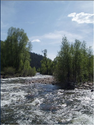
Weather Service hydrologist Bryon Lawrence said the 9.9-feet crest height [for the Yampa River] measured Wednesday morning is likely the highest the Craig area will see. It will be the third highest peak crest in 25 years. The average peak crest is 7.8 feet. “It looks like this will be the peak,” he said. “But, we expect flows to remain quite high on the Yampa River for the next few days.”[…]

At a measurement station where the Yampa crosses Colorado Highway 13, the river hit 11,575 cubic feet per second, which Lawrence said is likely the peak discharge for the year. The average peak flow for the last 25 years is 8,400.

From the Pagosa Sun (Chuck McGuire):

According to the United States Geological Survey, the San Juan River through Pagosa Springs peaked at more than 2,900 cubic feet per second (cfs) around midnight, May 30. Peak flows quickly fell to about 1,650 cfs by late last Thursday, but rose again with the onset of unseasonably warm weather over the past weekend. By late Sunday night, the river rose to more than 2,400 cfs…

The Natural Resources Conservation Service (NRCS) attributes the state’s sudden high water to rapid runoff brought on by warm, dry weather across Colorado. By June 1, in fact, the statewide snowpack had fallen to just 53 percent of average, after measuring 78 percent of average a month earlier. In the combined San Juan, Animas, Dolores basin, the June 1 snowpack measured just 19 percent of average — by far the lowest in the state. According to NRCS State Conservationist Allen Green, southern Colorado experienced the greatest snowpack decline through May. “A general lack of precipitation since early April has decreased the outlook for runoff in the southwestern corner of Colorado,” Green said in an NRCS monthly snowpack report. “What appeared to be an excellent runoff season back in mid-winter has deteriorated into a below average runoff season in the Animas, Dolores and San Miguel rivers.”[…]

Statewide, the June 1 reservoir storage was listed as 110 percent of average, with only the Rio Grande basin showing somewhat less than 100 percent of average storage. Thankfully, the combined San Juan, Animas, Dolores basin tops the list at 115 percent of average. The Gunnison, Colorado and Yampa basins were only slightly lower.

From the Summit Daily News (Robert Allen):

“Depending on conditions in the South Platte Basin in the next couple of days, the utility may have to reduce the flows through or shut off Robert’s tunnel to avoid wasting water it cannot use and remain in compliance with the Blue River Decree,” according to a Denver Water press release. The utility may only move water through the tunnel to meet demands of the South Platte. The Blue River below the dam on Thursday was flowing at 1,700 cubic feet per second at a gauge height of 3.5 feet. “We work to keep flows coming out of Dillon Reservoir to 1,800 cfs or less to help prevent flooding, but there’s only so much we can do to help manage the high flows Mother Nature is throwing at us this year,” Denver Water raw water supply manager Bob Steger said in the press release.

From the Summit County Citizen’s Voice:

In a press release, Denver Water again said that inflows to the reservoir were significantly higher than expected the past few days. The standard source for predicting flows called for a maximum inflow of about 1.300 cubic feet per second, but the actual flows peaked at slightly above 2,000 cfs, said Bob Steger, manager of raw water resources…

Denver Water has to balance variables of weather and customer water needs while operating its system to comply with the Blue River Decree, which says the utility only can take water from the West Slope for use on the East Slope when there is a need for it. Dillon Reservoir began spilling May 24. This past Sunday, Denver Water began running water through the Roberts Tunnel to fill up its South Platte Reservoir storage — space created when a river call for the South Platte Basin was placed on June 4. By starting the tunnel, the amount of water flowing out of Dillon Reservoir to the Blue River was reduced. Depending on conditions in the South Platte Basin in the next couple of days, the utility may have to reduce the flows through or shut off Roberts Tunnel to avoid wasting water it cannot use and remain in compliance with the Blue River Decree. That could bring renewed high flows downstream of the reservoir, especially if forecast rain storms materialize.

The utility also has been operating the discharge gates at Dillon Reservoir to manage the amount of water that goes downstream. This operation depends on the amount of water coming into the reservoir.
Denver Water has been monitoring the reservoir outflow multiple times a day and at night to make decisions about how much water to release through the discharge gates. The goal is to keep the total outflow below 1,800 cfs; whether or not this goal can be met depends on the amount of water going into the reservoir and how much water is needed to supplement the utility’s South Platte supplies.

From the Glenwood Springs Post Indenpendent:

Flood waters in some parts of Vail earlier this week exceeded 100-year-flows, the Federal Emergency Management Agency says…Public safety responders continue to remain on high alert in the event water levels rise following [June 6] record flows of 2,350 cubic feet per second on Gore Creek at the Red Sandstone/Eagle River Water & Sanitation District monitoring station.

From The Denver Post (Bruce Finley):

Facing flooding from fast-melting snow, Summit County authorities — normally wary of letting water be taken across the Continental Divide — are now urging Denver Water to draw all it can out of an overflowing Dillon Reservoir. But while the metro area’s water utility was pumping through a transmountain tunnel to accommodate the request, water managers warned that reservoirs on the eastern side of the Divide also are full. The use of Denver’s tunnel as a safety valve technically may violate a river compact that lets Denver divert water only for a “beneficial use.” While water attorneys pondered the point, the withdrawals from Dillon have been happening all week…

The only way to do that now is by diverting more water through the 10-foot-3-inch-diameter Roberts tunnel — which runs from Dillon Reservoir 23.3 miles under mountains to the eastern side of the Continental Divide. The diversions brought immediate relief. Water levels below the reservoir dam along the Blue River on Thursday decreased slightly to 1,700 cubic feet per second, down from 1,800 cfs earlier this week — the limit above which flooding is likely…

Diversions to Denver started [June 6]. The water is run through the tunnel down the North Fork of the South Platte River to the Strontia Springs and Chatfield reservoirs. Water lawyers were pondering whether the diversion is allowed under what is known as the Blue River Decree. Denver Water officials argued that it meets the test of “beneficial use” because the water eventually will help meet needs of 1.3 million metro-area customers — with the extra benefit of some flood control. “It is not a decreed right that we have . . . to take water through the tunnel for flood control. Our right is to take water through the tunnel for use by customers. That’s where we get into a little bit of a rub. We’re certainly willing to do things to help out here,” said David Little, Denver Water’s director of planning.

From the Fort Collins Coloradoan (Molly Armbrister):

Fort Collins received just under an inch of rain during the day Friday and overnight, according to the official Fort Collins weather station on the CSU campus.

From the La Junta Tribune-Democrat

According to the National Weather Service website, flood stage is considered to be 10 ft. At this point, minor agricultural flooding is expected. The last observed value of the level of the river was at 10:15 this morning and was at 9.56 ft. Since the level was below 10 ft, the flood warning is no longer in affect [for Otero County]. The river level is expected to continue to drop to below 9 ft. by tommorrow morning.

From The Grand Junction Daily Sentinel (Dave Buchanan):

The USDA National Resources Conservation Service estimated the Colorado River basin snowpack at 57 percent of average on June 1, and many observers didn’t think Ruedi would fill this year. But a blast of hot weather starting June 5 sent the upper Fryingpan surging, going from less than 500 cfs on June 4 to more than 1,900 cfs on June 7. It receded from that high but even late Thursday the gauges above Ruedi were reading 970 cfs. That surge surprised many long-time snowpack watchers, said Bureau of Reclamation spokesperson Kara Lamb. “We didn’t think Ruedi would even fill this year and it filled in five days,” Lamb said Thursday.

Colorado-Big Thompson Project update

A picture named olympusdam

Here’s an update from email from Reclamation (Kara Lamb):

Rain has added to the high snowmelt inflows we have been seeing into Green Mountain Reservoir for the past several days. As a result, we have once again bumped up releases from the dam. As of early this morning, there should be about 2400 cfs in the Lower Blue River below Green Mountain Dam.

From email from Reclamation (Kara Lamb):

As projected, releases from Olympus Dam to the Big Thompson did increase to 1000 cfs shortly after lunch [on Saturday]. We have now bumped up to around 1070 cfs. Those in Estes Park will notice we have opened all five gates at the dam to provide a consistent release over the dam. We anticipate holding at 1070 cfs through [Saturday] and into [Sunday].

More Colorado-Big Thompson Project coverage here.

Pagosa Area Water and Sanitation District update

A picture named sanjuan

Here’s Part V, Part VI and Part VII of Bill Hudson’t series PAWSD Makes an Apology, Of Sorts which is running in the Pagosa Daily Post.

More Pagosa Springs coverage here.