
From The Greeley Tribune (Bill Jackson):
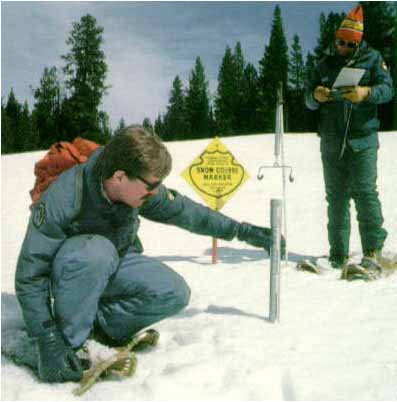
The USDA has conducted a cooperative snow survey program since 1935…The program is a federal, state and local partnership directed by NRCS and includes not only Colorado, but Arizona, Idaho, Montana, Nevada, New Mexico, Oregon, Utah, Washington and Wyoming as well. Alaska and southern Canada are also partners. California has an independent program. The program, under federal leadership, was developed following the drought of 1934, when ag leaders requested USDA’s help in forecasting water supplies for the 1935 growing season. Since then, about 1,600 snow courses have been developed. Generally, they are about 1,000 feet long and are located in small meadows protected from the wind. NRCS specialists, such as [John Fusaro and Todd Boldt with the Fort Collins NRCS office], take measurements near the first of the month during the snowpack season. In the Poudre Canyon, there are four such courses, and in the Big Thompson Canyon, there are four more…
In 1977, the NRCS began development of a network of automated radio telemetry sites for collecting snow survey data. The so-called SNOTEL network provides the agency’s offices with daily or more frequent information on streamflow potential. That comes in handy especially during periods of flood or drought. There are half a dozen or more SNOTEL sites in Larimer County and several more in northern Colorado.