Energy policy — oil and gas: El Paso County Q&A over Niobrara shale play draws around 100 people

niobrarashale

From KRDO.com (Joe Dominguez):

State and local elected leaders called the meeting educational for the public. Many of the questions from the public focused on contamination and making sure companies aren’t polluting the water and ground. “That’s why I think people are concerned,” said State Representative Marsha Looper. “When you have no water then you have no life, no economy.”[…]

It’s not just county land that’s ripe for fracking. Most of Colorado is in the Niobrara shale area. Doug Flanders, with the Colorado Oil and Gas Association, said because Colorado now sits where a western interior seaway was 90 million years ago it is now prime real estate for oil and gas companies to find new sources of domestic oil. The Banning Lewis Ranch is another area that could be home to drilling in the future. City of Colorado Springs leaders have been in talks with the oil and gas company that is buying the foreclosed property. Mayor Steve Bach said last week it is a real possibility that the land will eventually be used simply for drilling and fracking.

State Representative Looper has posted the handouts from the meeting on her website. The handouts are a great resource for anyone interested in hydraulic fracturing and the Niobrara shale play.

More oil and gas coverage here and here.

Arkansas Valley Conduit: $3 million funding study should be included in this year’s omnibus funding bill from the U.S. Congress

arkansasvalleyconduitproposed

From The Pueblo Chieftain (Chris Woodka):

The study’s nearly $3 million in funding for next year received support in committee, and should be part of an anticipated omnibus funding bill later this year, lobbyist Christine Arbogast told the Southeastern Colorado Water Conservancy District on Thursday. “We should receive just under $3 million unless there are across-the-board cuts,” Arbogast said…

The Southeastern board is the primary sponsor of the conduit, and has combined the EIS for the conduit with a master storage contract in Lake Pueblo on behalf of both conduit participants and other members of the Southeastern district.

More Arkansas Valley Conduit coverage here and here.

Lamar pipeline: Around 75 people attend first public meeting with the developer GP Resources, LLC in Lamar

lamarpipeline

From the Lamar Ledger (Lola Shrimplin):

Representatives of Otero, Bent and Prowers Counties, Lamar city officials, representatives from Kansas and concerned area residents filled the multipurpose room at the Lamar Community Center on Tuesday night to listen to Karl Nyquist with C & A companies, discuss his plans for a pipeline to take water from Lamar to Elbert County.

Calling the proposal a “win-win,” [Carl Nyquist] said the proposal would create jobs for Prowers County, while providing water for Front Range communities. “How we stumbled into water, is I came down here about 10 years ago and bought a farm, believe it or not,” Nyquist said. About 15 years ago, water tap fees were increasing rapidly and Nyquist said he began doing research and began purchasing land with water rights, the first of which was the West farm, east of Lamar…

The pipeline would run from Prowers County, into Kiowa, Cheyenne, Lincoln and into El Paso County.

An abandoned gas line easement has been purchased and the line will be put in its place, Nyquist said.A water treatment plant would provide diversification of jobs in Prowers County away from agriculture, Nyquist said, which would be a benefit. The jobs would be long term-permanent jobs, he said. Nyquist said there would be 63 sustainable jobs associated with the project and seven with the gravel pit.

Meanwhile, 300 or so attended a public meeting in Elbert County to hear about the proposed pipeline. Here’s a report from Ashley Dieterle writing for the Castle Rock News. From the article:

The meeting drew so much interest, some people had to sit on the floor of the school’s gymnasium.

Before the project can begin, the Elbert Board of County Commissioners must approve an amendment to the Elbert and Highway 86 Metropolitan District’s service plan.

Since Nyquist and his team first showed up on the board’s agenda on July 13 many people in the county have voiced concern. At the July 27 board meeting at the Elbert County Fairgrounds, more than 300 people attended, many of whom voiced their concerns about the project moving too fast. During that meeting Nyquist requested a 30-day extension in order to educate people in the county about the project.

“We would like the extension to be able to utilize this meeting and hear the comments from the public,” he said. “We believe it is a very important issue for Elbert County and we want to hear more from the public. We have heard very reasonable concerns, and we need to address those concerns.”

Questions are being raised the cost of construction and operations for the project. Here’s a report from Chris Woodka writing for The Pueblo Chieftain. From the article:

Commissioners from Bent and Otero County raised questions at last week’s meeting, concerned about similar projects that might affect their own counties.

Prowers County commissioners, who have talked with Nyquist about his plans for a gravel pit just outside Lamar, were caught off-guard because they were not told it would become a reservoir to feed a proposed treatment plant for the pipeline. Prowers County would have land-use authority under 1974’s HB1041, which allows counties to regulate statewide projects. Eagle County used that law to delay development of the Homestake II project by Colorado Springs and Aurora. Pueblo County applied conditions to the Southern Delivery System under the same law. Because of the role of commissioners as a quasi-judicial body in the 1041 process, they are restricted in what they can say about the project.

Bent County commissioners questioned Nyquist’s estimates of brine disposal based on the experience the city of Las Animas has had in dealing with reverse-osmosis. Nyquist claimed only 3 to 5 percent of the water would be lost to brine, which would then be injected into deep wells. Las Animas has far greater losses in its process.

Bent County Commissioner Bill Long also questioned the claim that GP Water’s treatment plant would increase the tax base as promised just because a private company is building it. “What if it sells to a water district?” Long asked. Nyquist said those types of questions would be addressed in 1041 negotiations.

Finally, Chris Woodka reports on the opposition to the pipeline from farmers in the lower Arkansas Valley in today’s Chieftain. From the article:

“It took us by surprise. This is my grandfather’s farm,” said Diane Gass, whose family irrigates 360 acres on the Granada Ditch. “This is my heritage, which is the reason I become so emotional at the meeting. We’re not going to go down without a fight.” The meeting she refers to was called last week by GP Water to explain to local residents its proposal to pump water from a treatment plant near Lamar to El Paso, Elbert and other Front Range counties. Another public meeting will be from 7 to 9 p.m. Tuesday at the Lamar Community Building…

While the pipeline would be slightly larger than needed to move the water historically used to irrigate 4,000 acres, there won’t be any push to buy up more rights, [Karl Nyquist, one of three principal partners in the project] said. “We’ll only take the water we own,” Nyquist said. “We’re working hard not to affect anyone on the ditches.”

Nyquist insisted the project will keep farm land viable, but didn’t entirely rule out the possibility that GP might purchase more rights in the future. “Never say never,” he said…

[Diane Gass’] farm produces wheat and hay. Much of the hay this year has been sold to Texas, where drought conditions are threatening the cattle industry. “What happens here could have a domino effect,” she said.

The larger issues are those affecting the towns near farms, something she didn’t think much about when she lived in Lamar. “When I saw a hail cloud living in town, I worried about my roof. Now I see one and think, ‘There goes my profit,’ ” she said. “When you’re talking about water to drink in these cities, nobody asks, ‘What are you going to eat?’ They just don’t think about it.”

More Lamar Pipeline coverage here.

Colorado Water Trust: CCC Ditch Project Materials Harvest Underway

http://coyotegulch.blog/wp-content/uploads/2010/02/cccditchsanmiguelriverheadgatewallcoloradowatertrust.jpg

From email from the Colorado Water Trust:

The CCC Ditch is located near Naturita on the San Miguel River. The San Miguel River is one of Colorado’s last free flowing rivers and is one of the few naturally functioning riparian ecosystems remaining in the Western United States. We have been working in partnership with the CCC Ditch Company, the Colorado Division of Wildlife, The Nature Conservancy, the Bureau of Land Management, and other interested parties to create a diversion structure that is more sensitive to fish passage issues and is safer for recreation. Better diversion management will also prevent the late-season dewatering that occurs at the diversion structure.

The funding for this project is now in place and FlyWater inc., the project contractor, is currently at the site harvesting rock and other materials needed for construction. This project would not have come to fruition, however, had it not been for Jeff Crane from the Colorado Watershed Assembly, who is one of the state’s best builder of stakeholder groups.

Follow along on our website or on Facebook. We will post pictures and provide updates as the project moves forward.

More San Miguel River watershed coverage here.

The Pueblo Board of Water Works approves lease agreement for the Donala Water and Sanitiation District

http://coyotegulch.blog/wp-content/uploads/2010/02/denveraquifer.jpg.jpg

From The Pueblo Chieftain (Chris Woodka):

The 20-year lease agreement calls for either trading or selling up to 250 acre-feet of water annually to Donala, so the water district can meet terms of a proposed court settlement with the state of Colorado in a Water Court case. The Pueblo water board would receive a one-time payment of $7,500 and from $12,000 to $96,000 annually, depending on how much water is traded or sold. The rate also escalates over time, depending on general rate increases approved by the water board…

Under the agreement, the Pueblo water board would receive $50 per acre-foot, plus a 10 percent gain in the amount of water leased in a contract exchange of its water in Turquoise Lake for Donala water in Lake Pueblo. The 10 percent gain comes because there would be no transit loss in moving water in a paper trade. Alternately, the Pueblo water board would receive $385 per acre-foot if it sells water to Donala, according to the proposed agreement…

The ranch will provide part of the water supply for Donala’s 2,700 customers, who now rely primarily on dwindling groundwater reserves from the Denver basin aquifers. In a Water Court case in March, Pueblo District Judge Dennis Maes sided with the state engineer’s opinion that Donala would need to make winter releases to augment the Arkansas River, primarily to meet the in-stream flow requirements of Willow Creek under a decree held by the Colorado Water Conservation Board. Donala chose to seek augmentation water from Turquoise Lake, but had no way of getting an account in the reservoir, said Dana Duthie, Donala manager…

Several board members wanted to make sure the water would stay within the Arkansas River basin, since Donala has a small portion of undeveloped land in the South Platte River basin. “It’s in their contract with Colorado Springs and in the (Water Court) decree that they can’t use the water outside the Arkansas basin,” Executive Director Alan Hamel said.

More Pueblo Board of Water Works coverage here.

Natural Resources Defense Council report: Western Water Supply at Risk from Dual Impacts of Oil Shale Development and Climate Change

betweenarockandahardplacecover.jpg

Here’s the release from the NRDC (Serena Ingre):

Cities & farms from Wyoming to Southern California could face water shortages due to oil shale development in the Colorado River Basin and a warming climate

San Francisco, CA (August 18, 2011) – Thirty million people from Wyoming to Southern California who depend on the Colorado River as a major source of water supply, including farmers who produce 15 percent of our nation’s crops, could face unprecedented water shortages if oil shale development increases in the Colorado River Basin alongside unchecked climate change, according to a new report released today by the Natural Resources Defense Council.

“The Colorado River – a critical source of water supply for millions of people – has become a house of cards as water use in recent years has exceeded what the basin provides,” said Monty Schmitt, senior scientist with the Natural Resources Defense Council. “If oil shale development moves forward, it will compete with farms and cities in the West for limited water supplies that will become scarcer because of climate change. The time is now for the Bureau of Reclamation and Colorado River Basin states to tackle this challenge head on, through effective planning, water smart energy policies and dramatic investments in water use efficiency – the reliable water supply of the future.”

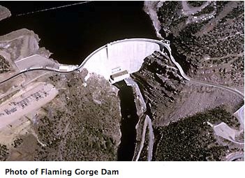
NRDC’s report, Between a Rock and a Dry Place: The Water Supply Impacts of Oil Shale Development and Climate Change on the Colorado River Basin Water Supply, explores how oil shale development would exacerbate the looming water crisis for states in the Colorado River Basin – Arizona, California, Colorado, Utah, Nevada, New Mexico and Wyoming. In conjunction with climate change, which is likely to reduce Colorado River Basin’s water supply by 9 to 25 percent by 2050, new oil shale development would further strain future supplies that already are under pressure from current water uses and ongoing growth in urban areas.

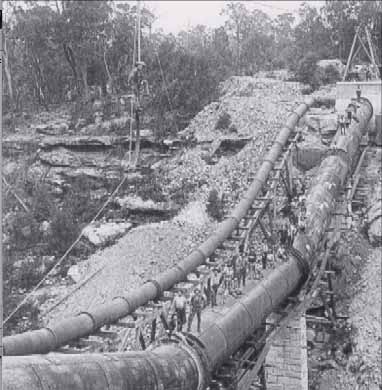
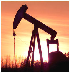
Oil shale is found largely in the arid northwestern region of Colorado and in Utah. Producing oil from this rock requires an estimated 3 to 5 barrels of water for each barrel of oil produced. A new oil shale industry producing 1.55 million barrels of oil a day would require a projected 360,000 acre-feet of water a year – the equivalent to one and a half times the city of Denver’s annual water use. This is a “mid-range” estimate of potential water use by oil shale development; high-end estimates of oil shale development could require more than a million acre-feet of water – more than four times Denver’s annual water use.

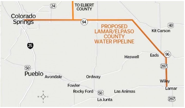
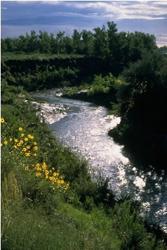
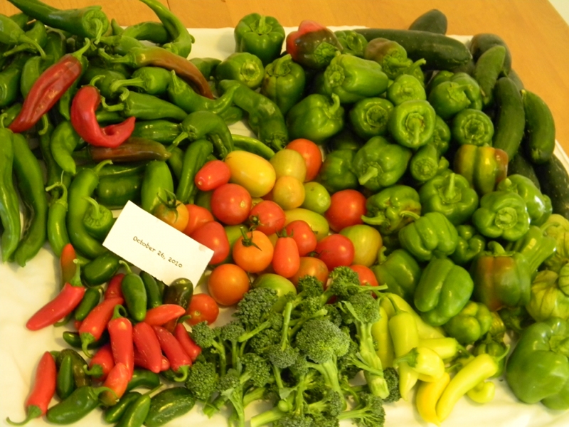
Agriculture could be most severely affected by future oil shale development. More than half of the water flowing in the Colorado River and its tributaries is used for irrigation. In Colorado, energy companies own senior water rights that could significantly reduce the water available for that state’s agricultural production if oil shale development moves forward. These senior rights would enable energy companies to divert billions of gallons of water from rivers in western Colorado for production of oil shale; much of that water is expected to come initially from agricultural water users. However, the potential impacts could reach other states and Western cities as well.

Agricultural water users today can reduce water consumption during droughts by increasing irrigation efficiency, changing crops or irrigating fewer acres. By contrast, industrial oil shale use could be inflexible in drought years. This inflexible oil shale demand could reduce the existing potential for urban areas to purchase water from agricultural users, increasing the challenge of meeting the water needs of cities during dry periods. Turning flexible agricultural water use into inflexible industrial use could increase basinwide conflicts by reducing water supply to lower basin states, particularly Arizona, making it more difficult to develop a basinwide strategy to live within the long-term supply provided by the Colorado River.

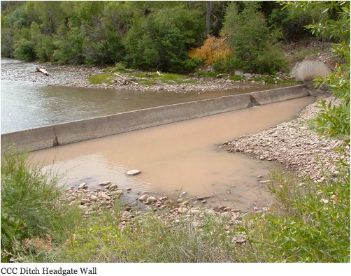
Oil shale processing is also known to significantly degrade both surface and ground water quality. Oil shale tailings and processing waste are known sources of toxic pollutants. For instance, underground oil shale processing that applies heat to oil shale deposits to extract liquefied oil, could become a cause of groundwater contamination. The potential for contamination has been shown by decades of pollution caused by a relatively small amount of spent shale waste at Anvil Points in Colorado.

Finally, the report reveals that oil shale development would significantly contribute to climate change. Oil shale production and refining results in appreciably greater greenhouse gas emissions than conventional oil fuels. Well-to-wheel greenhouse gas emission estimates for oil shale show it to have 23 to 73 percent greater emissions in comparison to diesel.

The report proposes key recommendations that NRDC advocates to ensure California, Colorado and the rest of the West have reliable sources of water:

Develop a Comprehensive Colorado River Basin Plan

The Bureau of Reclamation is currently preparing a Colorado River Basin Water Supply and Demand Study. That study should incorporate the potential state and basin-wide impacts of oil shale development and identify management options to meet future water needs.

Develop State Water Management Plans

Basin states individually and together should develop comprehensive water management plans that take into account current and likely future Basin yield, protection of listed species, climate change, future demand, and opportunities to promote local, state and regional conservation and water use efficiency.

Reconsider Oil Shale Development

Based on current information and existing technologies, proceeding with oil shale development would be inadvisable given significant impacts to water resources and the environment, including increased greenhouse gas emissions. Any further exploration should begin with an analysis of potential impacts to water users, groundwater, and sensitive protected species.

Develop Climate Change Adaptation and Greenhouse Gas Reduction Efforts

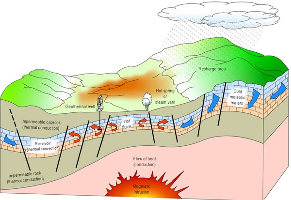
Colorado River Basin states should take immediate steps to implement a comprehensive regional greenhouse gas reduction effort, including more energy-efficient construction standards, smart growth planning to reduce vehicle miles travelled, and increased use of clean sources of energy such as wind, solar, and geothermal.

Read more about oil shale and Western water solutions from our water and lands experts:

Bobby McEnaney, public lands analyst: http://bit.ly/qLhAhW

Barry Nelson, senior Western water policy analyst: http://bit.ly/qj7SiS

Edward Osann, senior policy analyst: http://bit.ly/nr2izv

More oil shale coverage here and here.

Southern Delivery System update: Past and present Colorado Springs officials show up for ‘construction celebration’ Friday

southerndeliverysystemconstructioncelebration08192011.jpg

From The Pueblo Chieftain (Chris Woodka):

The event, called a construction celebration, was staged on the south side of the plunge pool just below the dam. Water gushed from the dam through the gates on the dam. On the far side, a crane, trucks and buildings at the future North Outlet Works provided a backdrop for a series of brief speeches before 150 people in attendance. Council and board members from all four SDS member communities — Colorado Springs, Fountain, Security and Pueblo West — attended. Commissioners from both counties were on hand. And some current and former members of the Pueblo City Council showed up, as well.

Schoolchildren from all four communities filled a time capsule that will be buried at the new water treatment plant in El Paso County. Guests signed a ceremonial section of 5 1/2-foot diameter pipe similar to that which will be buried along the 50-mile route of the pipeline to El Paso County…

Work actually began three months ago. More than 1,500 cubic yards of concrete have been poured to form the base of the North Outlet Works so far, Fredell said. The entire assembly, which will take water through the dam for river flows and to serve the SDS pipeline, should be completed in late 2012.

More coverage from Daniel Chacón writing for The Colorado Springs Gazette. From the article:

The city-owned utility celebrated another historic milestone Friday: the start of major construction on SDS. The backdrop of the ceremony was the massive concrete wall of Pueblo Reservoir, where the 62-mile, $2.3 billion water pipeline starts. “We can actually see a crane over there putting in concrete right now,” Utilities CEO Jerry Forte told dozens of dignitaries and guests, including Springs Mayor Steve Bach…

Utilities still must acquire about 120 properties where the pipeline will go. The project also lacks a “financing mechanism” similar to the now-defunct Stormwater Enterprise to maintain storm water and retention facilities as required under a crucial SDS land-use permit from Pueblo County. John Cordova, chairman of the Pueblo County Board of Commissioners, which issued the so-called 1041 permit, said he remembers when the Colorado Springs City Council disbanded the Stormwater Enterprise following the passage of ballot Issue 300 in November 2009. “We were shocked,” said Cordova, who attended Friday’s ceremony. “We had never — and that must’ve been our fault — we hadn’t considered that the citizens of Colorado Springs would vote that enterprise out of existence,” he said…

The enterprise, which levied fees on property owners, was created without voter approval, generating anger among some residents. Opponents dubbed the storm water fee a “rain tax,” and some people refused — and continue to refuse — to pay their past-due fees.

More coverage from Catharine Tsai writing for the Associated Press (via Business Week). From the article:

Colorado Springs is already served by three water pipelines, but two are more than 40 years old. Plans to expand other parts of its water system, which relies heavily on the Colorado, Arkansas and Fryingpan rivers, ran into opposition from environmentalists, the recreation industry and homeowners. Water planners see the Southern Delivery System as a needed backup amid forecasts of population growth in the region and the potential for drought. For Fountain, which gets some water from wells, the project strengthens diversity in its water portfolio.

[Southern Delivery System program director John Fredell of Colorado Springs Utilities] said the downturn in the economy is helping contain costs. Bids to date have come in under budget by about 20 percent, he said.

Building the Southern Delivery System is projected to create an annual average of 786 regional jobs, according to Colorado Springs Utilities.

From The Colorado Springs Gazette (Ben Noreen):

Whether you are an SDS supporter or critic, it’s undeniable the project has survived unlike many others, overcoming political and bureaucratic hurdles.

Most of the big water projects proposed during the last 30 years in Colorado have one thing in common — they never got built. This one has a long way to go, and there are sure to be a few bumps in the road, which happens with big construction projects.

But construction has officially begun. That cannot be said of Denver’s ill-fated Two Forks Dam, or of Homestake II, the project once planned by Colorado Springs and Aurora, or the Union Park project, which was to have diverted water from the Gunnison River Basin to the Denver area.

The era of big water projects ended when federal subsidies ended and when environmentalists began defeating projects that called for new dams. In the era that followed, intra-state political fights became the new obstacles for water projects to hurdle…

The feds aren’t paying for SDS. There’s no new dam, no endangered species issue. We’re not taking West Slope water. That’s the formula for success.

More coverage from Kendra Potter writing for KKTV.com. From the article:

With 62 miles of underground pipeline, water will be delivered from the Pueblo Reservoir to residents in four communities: Pueblo West, Colorado Springs, Security and Fountain. Officials from all four communities and the U.S. Bureau of Reclamation commemorated the historic event with a special ceremony at the base of the Pueblo Dam Friday. “This project has been so carefully considered, so hard won, and so well worth it,” said Mayor of Fountain Jeri Howells.

Guests paid witness to the crews hard at work on the project at the Pueblo dam. Something Former Colorado Springs Mayor Lionel Rivera worked 8 years in office to see. “I just feel tremendous satisfaction and tremendous hope for the future of Colorado Springs and the entire region of Southern Colorado,” said Rivera.

More coverage from Joe Hanel writing for The Durango Herald. From the article:

It will take generations to pay off the project through bonds, utility rate increases and higher fees that builders and developers have to pay for new water taps.

Colorado Springs Utilities is raising rates 12 percent per year through 2016, but it said only two-thirds of the increase is attributable to paying for the Southern Delivery System. The rest of the increase is being used to support work on the existing infrastructure.

Some work on the new infrastructure has already begun, but the celebration Friday formally marked the start of major building after roughly 20 years of planning, negotiations with regional partners and seeking various permits to start the work.

More Southern Delivery System coverage here and here.

Rio Grande River basin: The San Luis Valley Irrigation District is looking for ways to fund reservoir repairs

riograndereservoir.jpg

From The Pueblo Chieftain (Matt Hildner):

Beaver Creek Reservoir, which sits roughly five miles south of South Fork, currently can store only half its capacity of 4,400 acre-feet. The development of a sinkhole last year forced the reservoir to be drained down.

The district owns the 52,000-acre-foot reservoir that sits on the Rio Grande, roughly 20 miles southwest of Creede. Built in 1914, the Rio Grande Reservoir is in need of a spillway enhancement, a new outlet tunnel and a fix for seepage problems — repairs that are estimated to cost between $16 million and $23 million. “That’s a tall order,” said Travis Smith, the district’s superintendent…

A key aspect of this proposal is that the DOW is looking at partnering on the reservoir repairs so it can store up to 5,000 acre-feet at Rio Grande Reservoir. That amount of storage in the Rio Grande’s only on-channel reservoir could give the DOW more flexibility in how it moves both water from the basin and transmountain water, said Tom Spezze, a DOW regional director. The DOW, which is the largest holder of water rights in the valley, uses the water to enhance habitat for fish, waterfowl and other wildlife and to increase hunting and fishing opportunities. The repairs also would benefit agriculture because the irrigation district delivers water to roughly 60,000 acres of farm ground in the north-central part of the valley.

More Rio Grand River basin coverage here.

Energy policy — oil and gas: Open house to be held August 31 for Castle Rock area residents to learn about the Niobrara shale play

niobrarashale.jpg

From the Castle Rock News Press:

The Development Services Department is beginning to draft regulations regarding oil and gas drilling within the Castle Rock town limits, and the public is invited to learn more. The public is invited to attend an open house from 6-8 p.m. Aug. 31 in Town Hall Council Chambers, 100 N. Wilcox St…

“We’ve had two inquiries thus far from oil companies,” added [Development Services Director Bill Detweiler], “There’s a lot of buzz surrounding this subject and we want to be out in front with our local regulations.” The Town will draft regulations surrounding site plan approval, emergency access and access roads. The proposed regulations will go before the Planning Commission in October and then to Town Council in November.

More oil and gas coverage here and here.

The Grand County Mutual Ditch and Reservoir Company is buying Vail Ditch shares to keep the water in the upper Colorado River watershed

fraservalleycollection.jpg

From the Sky-Hi Daily News (Tonya Bina):

The shares are being sold by private landowners and individuals within the Grand County Irrigated Land Company, which historically has had access to 850 acre-feet of senior Vail Ditch water from Meadow Creek and Strawberry Creek, stored in Meadow Creek Reservoir for irrigating ranchlands. The reservoir is located at the northernmost extension of the collection system used to convey water through Denver Water’s Moffat Tunnel…

According to [Grand County Mutual Ditch and Reservoir Company’s president Bruce Hutchins], purchase of the shares preserves how the water is being used today, which is mainly for growing hay, vegetables and for irrigating pastures. The partners would likely lease the shares back to their original owners, he said. “As they come up for sale, we feel it’s better to keep them than to let them possibly go to the East Slope,” he said…

The Vail Ditch was originally built to supply water to the Granby-area mesa for the Great Western Head Lettuce Co. The Vail Ditch Company formed in 1911 when the water right was filed.

Partners with interest in benefiting streamflows for river health and human use from Winter Park on downstream formed The Grand County Mutual Ditch and Reservoir Company in 2005 as a means to purchase shares. In 2008, the Company purchased 85.5 shares using a $1.5 million state matching grant from the Colorado Water Conservation Board through the Colorado River Basin Roundtable.

More Fraser River watershed coverage here.

Energy policy — nuclear: Colorado Department of Local Affairs executive director sees econmic opportunity in proposed Piñon Ridge Mill

pinonridgesite.jpg

From The Telluride Daily Planet (Matthew Beaudin/John Lopez):

“The potential of the Piñon Ridge mill is a regional issue. Depending on where you stand and who you are, it is either the best opportunity for economic development in half a century or an environmental disaster,” [Reeves Brown] said. “I think the reality is, done right, it can be a huge boost for not only the regional economy, but for the economy statewide. There are potential environmental hazards and … the rules of the game and how they are applied are much different than five years ago, much less 50 years ago. I think there is huge opportunity there to develop that resource in a responsible manner.”

Brown, a familiar name on the Western Slope, was in Telluride and spoke to media on Wednesday morning. He was named to the DOLA post by Colorado Gov. John Hickenlooper when he took office in January. Brown had served as the executive director of Club 20, an organization representing Colorado’s 22 western counties, prior to moving to DOLA.

More nuclear coverage here and here.

Energy policy — nuclear: Cotter Corp, Inc. cited for spill at the Lincoln Park/Cotter Mill superfund site

cottercontamination.jpg

From The Denver Post (Bruce Finley):

Colorado Department of Public Health and Environment officials charged with overseeing a Superfund cleanup at the site issued the notice of violation because Cotter’s operating permit requires properly functioning equipment. But because Cotter notified department officials as required, documented the problem and fixed the broken equipment, “no further enforcement actions are anticipated,” health department spokeswoman Jeannine Natterman said. The uranium-tainted water will not add to the contamination that in the past reached groundwater in neighborhoods near Cañon City, Natterman said. An underground clay barrier installed in the 1980s and the pumping system will contain toxic material, she said.

More coverage from Tracy Harmon writing for The Pueblo Chieftain. From the article:

The accident happened when the lid to a vault containing pumps for the “pumpback” system was inadvertently left open overnight, causing the flange to freeze and rupture. The problem was discovered the next morning by Cotter personnel and corrected…

“This condition on the Cotter license is more strict than at any other uranium recovery facility and is not required by the Nuclear Regulatory Commission or Colorado regulations,” Tarlton explained. Cotter employees maintain a pumpback system to capture contaminated groundwater and pump it back to the primary impoundment for evaporation. This system prevents groundwater contaminated by pre-1978 operations from further contaminating the neighboring Lincoln Park groundwater.

More nuclear coverage here here.

Colorado-Big Thompson Project update: Horsetooth Reservoir is as full as it has been since 1999

horsetoothreservoir.jpg

From the Loveland Connection (Bobby Magill):

The surface elevation of Horsetooth Reservoir, which stores water from the Colorado River on the Western Slope, is at 5,419 feet, about 11 feet below full pool of 5,430 feet.

The Colorado-Big Thompson Project, of which Horsetooth Reservoir is a part, set an all-time record for in-flows from the Colorado River, he said. Lake Granby, Shadow Mountain Lake and Grand Lake all received 430,000 acre-feet of water from the Colorado River, more than 75,000 acre-feet more than the previous record of 355,000 acre-feet, he said…

Horsetooth and other area reservoirs are full enough to put water managers in a good position to deliver plenty of water to irrigators next year regardless of how snowy the winter is, [Northern Colorado Water Conservancy District spokesperson Brian Werner] said. We’re in good shape,” he said. “We can get by with average or below average winter snows this year and be fine next year.”

More Colorado-Big Thompson Project coverage here.

A June agreement between the Lower Arkansas Valley Water Conservancy District and Aurora may pave the way for the expansion of Pueblo Reservoir

puebloreservoir.jpg

From The Pueblo Chieftain (Chris Woodka):

“I think this [June agreement] has opened the door for success in the Arkansas basin,” Jay Winner, general manager of the Lower Arkansas Valley Water Conservancy District, told the Southeastern Colorado Water Conservancy District board on Thursday. Aurora would not be included in any federal legislation to enlarge Lake Pueblo under its agreement with the Lower Ark in June meant to settle the Lower Ark’s 2007 federal lawsuit against the Bureau of Reclamation over a 40-year contract that allows Aurora to store and ex- change water in the Fryingpan-Arkansas Project…

Now that Aurora has removed its demand to be included in the federal legislation, the district could move ahead in seeking the legislation. No new PSOP bill has been introduced. While there are 27 intergovernmental agreements that “put a fence” on Aurora’s future activities in the Arkansas Valley, the new Lower Ark agreement does other things to prevent Aurora from taking even more water from the Arkansas River basin, Winner said. One of those is stopping Aurora’s ability to build new infrastructure to move water out of the valley. “It’s cheaper to build infrastructure in 2011 than 40 years from now,” Winner said. “This stops Aurora.”[…]

“I think this agreement can open the door for more storage in Pueblo Reservoir, which this basin needs,” Winner said. “It is very protective of the Arkansas basin.”

More Arkansas River basin coverage here.

Arkansas River basin: Water year 2011 has yielded the second largest import of water through the Boustead Tunnel since project water started moving in the 1970s

fillingjugswithwateratbousteaddedicationchieftain.jpg

From The Pueblo Chieftain (Chris Woodka):

The Fry-Ark Project has brought over 98,640 acre-feet of water this year, about 4,500 more acre-feet than was projected in May, when allocations were made…

Fort Lyon Canal, the largest ditch in the valley, will get an additional 1,700 acre-feet. The water comes on top of nearly 60,000 acre-feet already being delivered to farmers through the Fry-Ark Project. Late runoff and a heavy snowpack contributed to the second-largest import of Fry-Ark water since diversions through the Boustead Tunnel began in the 1970s…

Because Arkansas River flows stayed above 700 cubic feet per second through Aug. 15, no Fry-Ark water was needed to maintain the Upper Arkansas voluntary flow program, Vaughan added…

Basinwide, more than 200,000 acre-feet of water has been imported this year through transmountain tunnels and ditches, well above the average of about 136,000 acre-feet, said Pat Edelmann, of the U.S. Geological Survey. Twin Lakes has imported about 62,000 acre-feet and continues to move water. The Homestake Project has brought over 32,000 acre-feet.

More Arkansas River basin coverage here.

Restoration: Colorado Parks and Wildlife have relocated 300 or so Rio Grande Cutthroat trout from Medano Creek to Placer Creek

cutthroattrouthistoricranges.jpg

From the Summit County Citizens Voice (Bob Berwyn):

Biologists wanted to preserve the genetics of the Medano Creek cutthroats, so they captured 300 of the wild fish, and after testing them in an aquatic lab, restocked them in Placer Creek, a stream off La Veta Pass. “It’s one of our core conservation areas for Rio Grande cutthroat trout,” said Colorado Parks and Wildlife biologist Josh Nehring, explaining that the cutthroats are protected from other trout by a fish barrier. Nehring said he’s planning to visit the stream in the near future to see if the cutthroats have started reproducing naturally in their new home. Some of the adults that were transplanted have been spotted by biologists doing other work in the area, he added.

Cutthroat are the most diverse trout species in North America, with a historical distribution covering the broadest range of any stream-dwelling trout on the continent. As they evolved in remote drainages, that isolation gave rise to 14 different sup-species, including four in Colorado: The Colorado River cutthroat trout in drainages west of the continental divide, Greenback cutthroat trout in the South Platte and Arkansas River drainages, and the Rio Grande cutthroat trout in streams that drain into the San Luis Valley.

In addition, the yellowfin cutthroat trout was historically found in Twin Lakes at the headwaters of the Arkansas drainage. Unfortunately, this predator that grew to more than 10 pounds, is now extinct.

More restoration coverage here.

Energy policy — nuclear: Department of Energy Naturita public meeting hears from uranium miner claiming that the agency was forced into the current review by ‘environmentalists’

manhattanproject1944uravan.jpg

From The Norwood Post (Ellen Metrick):

The reasons given for the sudden concern [performing an EIS on a lease that was renewed by the DOE in 2007] were simply that it’s a good time to do an EIS due to the lack of activity in the mining leases, the fact that the Piñon Ridge Mill is not yet built, and the dip in the economy, said Laura Kilpatrick, the DOE’s Uranium Leasing Program manager.

During Thursday’s public comment session, Richard Craig, a Nucla resident and Nucla Town Board member, said, “The DOE was forced into this by the environmentalists, and we’re gonna force you to make a good honest study so we can get on with our business.”[…]

The DOE will accept public comment through Sept. 9, 2011. Written comment scan be sent to Laura Kilpatrick, U.S. DOE, 11025 Dover ST., Suite 1000, Westminster, CO 80021. Comments may be submitted online at http://ULPEIS.anl.gov or by e-mail to ulpeis@anl.gov. The website will be updated as more information is available.

More coverage from David O. Williams writing for the Colorado Independent. From the article:

In Montrose, near where a Canadian company hopes to build the nation’s first new uranium processing mill in decades, the Montrose Daily Press reported a DOE meeting “generated impassioned responses from its defenders and detractors.”

In the nearby ski town of Telluride, according to the Telluride Daily Planet, the DOE “received a sharp mandate from Telluride residents: Any mining is too much, and its leasing program should be disbanded.”[…]

Some residents of remote western Montrose County welcome a revival of the uranium mining industry that provided jobs in the 1950s, 60s and 70s. Critics, many from the nearby resort town of Telluride and surrounding San Miguel County, fear a return to the industrial mining days that left a toxic legacy in the region.

Opponents not only want the DOE to reject new uranium mining in the area, they also want past contamination cleaned up.

“Instead of promoting mining when DOE has plentiful uranium stockpiles, the public has requested DOE turn its focus to the environmental and economic benefits that would flow from requiring the immediate and comprehensive reclamation of 13 of the leased tracts,” said Hillary White of Sheep Mountain Alliance. “This would require no federal monies as the reclamation responsibilities must be met by the private companies who leased these tracts.”

More nuclear coverage here and here.

Denver Water is closing a section of the Sand Creek Regional Greenway, along Havana Street from Florence Way to the Smith Road trailhead, August 22 to September 3, for work on their non-potable recycled water supply system

sandcreek.jpg

Here’s the release from Denver Water (Stacy Chesney):

A small section of the Sand Creek Regional Greenway along Havana Street from Florence Way to the Smith Road trailhead in Denver will be temporarily closed from Aug. 22 to Sept. 3. A Denver Water contractor will be installing a recycled water line that will serve irrigation water to Stapleton and the Rocky Mountain Arsenal National Wildlife Refuge. The Sand Creek Regional Greenway is a nearly 14-mile stretch of public land connecting the High Line Canal in Aurora with the South Platte River Greenway in Commerce City.

In addition to serving recycled water to the Stapleton area, the installation of this recycled water line is the final step in completing the Arsenal’s wildlife restoration program. Denver Water’s recycled water program is a part of the utility’s future water supply planning, which rests on three strategies: conservation, recycled water and new supply.

More Denver Water coverage here.

Southern Delivery System update: Colorado Springs Utilities is hosting a party at the Pueblo Dam Friday to celebrate the start of construction

pipeline.jpg

From The Colorado Springs Gazette (Daniel Chacón):

Friday’s celebration will include multiple speakers, including Colorado Springs Mayor Steve Bach, former Colorado Springs Mayor Lionel Rivera, Fountain Mayor Jeri Howells and John Cordova, chair of the Pueblo County Board of Commissioners, among others.

Children from Colorado Springs, Fountain, Pueblo West and Security will contribute to a time capsule for the project, Rummel said. Their participation is meant to “signify that this is what the project is all about,” she said…

Friday’s ceremony starts at 9:45 a.m., but people are encouraged to show up by 9:30 a.m. It will be on the east side of the reservoir, south of the State Park entrance station, according to a news release.

More coverage from Pam Zubeck writing for the Colorado Springs Independent. From the article:

In any event, given the difficulty in obtaining environmental approvals and securing water rights in these water-tight times, SDS might be the last major water project built in Colorado for years to come. The pipeline, Utilities officials say, will ultimately deliver 96 million gallons per day to partners Colorado Springs, Pueblo West, Fountain, and Security.

The first phase, which will include a 60-mile pipeline, several pump stations and a treatment plant, is expected to create an annual average of 786 regional jobs and result in $127.6 million in earnings to El Paso County residents and $35.5 million to Pueblo County residents, the city said in a press release. The first phase is to be finished by 2016. The second phase would include a storage reservoir and an exchange reservoir and expanded pumping and treatment capacity.

More Southern Delivery System coverage here and here.

Hispanic leaders form ‘Nuestro Rio’ to focus attention on the Colorado River

coloradoriverbasin.jpg

From the Nuestro Rio website:

Beginning at 10,175 feet, the Colorado River flows 1,450 miles from Rocky Mountain National Park in Colorado, through seven states and Mexico before emptying into the Gulf of California. Along the way, it irrigates 15% of the nation’s crops and feeds 13% of the nation’s livestock, including the Imperial Valley, which provides 80% of the country’s winter vegetables. The Colorado River also provides drinking water for our communities and recreational opportunities for our children.

The river is critical to our way of life, yet the river today is threatened by climate change, chronic drought and increasing pressures from development. In the past decade, we’ve used up nearly half of the Colorado River water now in reservoirs. Those reservoirs, including Lake Mead, are now almost half empty—risking the water supply to our urban and rural communities, agriculture, and small businesses across the region.

From the Associated Press (Catharine Tsai) via the Albuquerque Journal:

As western U.S. cities propose water projects to claim their share of scarce river water, Nuestro Rio, which is Spanish for “Our River,” wants to make sure Hispanic voices are heard. “This is what’s important,” said Nita Gonzales, president and chief executive officer of Escuela Tlatelolco Centro de Estudios in Denver. “Oftentimes we are not at the table around environmental issues.”

The group has received some funding from the Western Conservation Foundation but describes itself as a grass-roots effort, according to Nuestro Rio event organizer Amber Tafoya. Tafoya, also executive director of the Latina Initiative in Denver, said the river’s health might not be as high a priority for Hispanics as jobs, health care and immigration policy, but the availability of water affects all three issues. “If you don’t have water, you’re forced to migrate. If you don’t have water, you are not in good health. Jobs are hard to do without access to water,” she said…

“We’re so excited to have Latino leadership saying we need to be part of that conversation and part of the action,” Gonzales said.

More Colorado River basin coverage here.

Arkansas Valley Superditch update: Three year pilot program will move 500 acre-feet annually from the Caitlin Canal to El Paso County

arkbasinditchsystem.jpg

From The Pueblo Chieftain (Chris Woodka):

Under the three-year program, 500 acre-feet of water would be sold each year under a lease agreement to Fountain, Security and Widefield at a cost of $500 per acre-foot. The Lower Arkansas Valley Water Conservancy District has paid the legal and engineering bills for the Super Ditch so far, and heard an update on the proposed program at its meeting Wednesday. The Super Ditch board, made up of representatives from seven canal companies, heard the proposal earlier this week.

Under the plan, 400 acres of the 1,200 acres enrolled in the program would be dried up, earning an average of $945 per acre. The Catlin Canal irrigates more than 18,000 acres. Water would be taken at the Catlin headgate and either exchanged to Lake Pueblo during high-flow periods or placed into recharge ponds along the canal, consulting engineer Heath Kuntz explained…

A dozen farmers will set aside 100 acres each and fallow one third of that ground each year to refine engineering questions about the ditch. The rest would be farmed as usual, but farmers would have the opportunity to make improvements on the fallowed ground. So far, all of the participants have indicated they would rotate acreage, although Kuntz would like at least one to fallow the same ground for three years, for the sake of the engineering study. Some of those in the program own more shares than are needed to irrigate their acreage, while others are water short. Flood irrigation, sprinklers, drip irrigation and even some who mix well and surface irrigation sources have signed on. The amount of water credited to dried up ground varies from farm to farm, according to the shares per acre, cropping pattern and method of irrigation. Farms were chosen to represent as many scenarios as possible…

The water would be exchanged or traded into Lake Pueblo under a substitute water supply plan, rather than a court decree, during the pilot program. The Super Ditch plans to get approval for the plan by December. Exchanges would likely be available only during a few weeks during spring, and the Super Ditch could also move water through trades with other water users who have storage accounts in Lake Pueblo. All of the water used in the program would first flow through the Catlin Canal headgate and allowed to pass through the ditch, if it is being traded or exchanged, or moved into recharge ponds. The recharge ponds would slowly release water back to the Arkansas River over several years, mimicking the way return flows make their way back into the system. Flows that are exchanged can be measured at augmentation stations.

More Arkansas Valley Super Ditch coverage here and here.

The Front Range Water Council plans to spend $600,000 to study Colorado River basin supplies

coloradoriverbasincgs.jpg

From The Pueblo Chieftain (Chris Woodka):

The Front Range Water Council is planning to hire Grand River Consulting Corp. for $600,000 over two years to work on Colorado River issues that affect the state’s largest water providers. The Pueblo water board’s share will be $36,000 each year, or $72,000 total. The board approved the contract at its Tuesday meeting.

The council represents Denver, Aurora, Colorado Springs, Pueblo, Twin Lakes Reservoir & Canal Co., the Northern Water Conservancy District and Southeastern Colorado Water Conservancy District. Denver and Northern — the largest water providers — would pay 20 percent of the costs of the contract, while the others each have a 12 percent share. Combined, the groups provide municipal and industrial water to 80 percent of the state’s population, using about 6 percent of the total water supply. Agriculture still uses most of the water in Colorado…

Up until now, the council members have been relying on their own staff to provide input to state planning on Colorado River issues, but the tasks have grown so much that full-time staff is needed to work on the issues, said Alan Hamel, executive director of the Pueblo water board…

Among the projects of the group are:

Day-to-day management of a technical work group among the members of the council.

A water bank study to look at how to prevent curtailment of municipal diversions in the event of a Colorado River call.

Input into nonconsumptive needs studies of the Colorado River, which are primarily driven by the state roundtable process.

Working with the Bureau of Reclamation on its Colorado River basin supply and demand study. The study is looking at water availability in all seven states.

A strategic plan for the Front Range Water Council.

Coordinating work with the CWCB, including the state’s ongoing Colorado River water availability study and compact compliance study.

More Colorado River basin coverage here.

Flaming Gorge pipeline: Will the trout fishery below Flaming Gorge Dam be affected by the proposed project?

flaminggorgedamusbr.jpg

From The Denver Post (Scott Willoughby):

In the grand scheme of progress and water projects, it’s difficult to know the full impact of Fort Collins entrepreneur Aaron Million’s Flaming Gorge Pipeline proposal. But at face value, the 580-mile long pipeline he envisions transporting 250,000 acre feet of water a year between Flaming Gorge and Pueblo seems overly ambitious at best and, some say, an unnecessary evil at worst.

Million claims the water is there and Colorado needs it. Critics say the price is too high and that such diversions would degrade water quality, destroy important habitat for both endangered and sport fish and potentially interfere with water rights downstream. Multiple Wyoming and Utah counties insist such use of upper Colorado Basin water resources simply cannot be sustained.

More Flaming Gorge pipeline coverage here and here.

Climate change: ‘How the West Was Warmed’ event at Chautauqua Auditorium August 18

howthewestwaswarmed.jpg

Here’s the link to the flier from Beth Conover. The event includes remarks from Governor Hickenlooper.

Back over the summer of 2005 Ms. Conover and then Mayor Hickenlooper teamed up for a series of education pieces on water called, Wringing Water from the Rocks. It was a hoot.

More coverage from the Boulder Daily Camera (Heath Urie):

The panel will focus on how water interests are driving the agenda to understand, mitigate and adapt to climate change in the region.

Colorado Foundation for Water Education: ‘Future Horizons for Irrigated Agriculture’ tour Sept 9, 2011

longspeak.jpg

Here’s the announcement:

On September 9, join a diverse group of water professionals, public officials and educators for a day on northeastern Colorado farms! Expect to learn how agricultural water is distributed and used, the challenges associated with keeping water on farms while meeting other water demands and opportunities to secure a plentiful future for agriculture.

Here’s the registration page. Here’s the itinerary:

7:30 Registration at Colorado Corn

8:00 Welcome and Introductions
Colorado’s future water needs and the threat to agriculture
John Stulp, Governor’s Special Policy Advisor on Water
Water distribution in the South Platte Basin
Brad Wind, Northern Colorado Water Conservancy District
Local economic connections to agriculture
Professor James Pritchett, Colorado State University

9:30 Bus route through LaSalle area and stop at Eckhardt farm
Shut‐down of groundwater wells and impacts to the landscape
Frank Eckhardt, Eckhardt Farms Inc.
Recharge potential on dried up agricultural lands
Kathy Parker, Central Colorado Water Conservancy District

11:30 Lunch at Glen Fritzler’s Corn Maize

12:45 Bus route to illustrate major diversions and exchange limitations
Legal and engineering requirements for ag‐to‐urban water transfers
Andy Jones, Lawrence Jones Custer & Grasmick

1:45 Thornton farm property near Ault
Strategies for meeting municipal water demands
Emily Hunt, City of Thornton
Re‐vegetation methods on agricultural lands
Kate Green, Native Seeders and Brian Foss, City of Thornton

2:45 Bus route to USDA site
Alternative solutions to meeting future water needs in Northeast Colorado
Jim Yahn, South Platte Roundtable and North Sterling Irrigation District

3:00 Limited Irrigation Research Farm
Efficiencies in irrigation and measuring crop water use
Tom Trout, USDA and Stephen Smith, Regenesis Management Group

4:15 Arrive in Greeley

More Colorado Foundation for Water Education coverage here.

Energy policy — oil and gas: ‘Oil and Gas 101’ public meeting in El Paso County draws 300 to learn about the nexus between oil and gas exploration and production and groundwater

hooverdamspilling.jpg

From The Colorado Springs Gazette (John Schroyer):

El Paso County Commissioner Amy Lathen and state Rep. Marsha Looper, R-Calhan, convened the conference because oil in the near eastern plains is booming again, and Coloradans need to know how they can profit from it without endangering their water. State officials spent hours explaining how the oil and gas industry is regulated, how horizontal drilling and hydraulic fracturing operate, and what kind of rights are afforded to landowners trying to decide whether to lease their rights to oil companies.

The most vital message was that protecting Colorado’s groundwater should be the highest priority for both the state and landowners, said Dave Neslin, director of the Colorado Oil and Gas Conservation Commission. To that end, the state requires hydraulic fracturing (also known as “fracking”) pipes not only to be made of stainless steel, but also to be encased in concrete, said Neslin…The concrete casings are just one of dozens of requirements placed on the industry, Neslin told the crowd. Complaints can be filed by anyone at any time for any reason, and one of COGCC’s 15 inspectors around the state will respond within 24 hours, he said…

Looper called the conference the “beginning of an education,” and said there will be a lot of issues going forward. She said she doubts that a perfect balance will ever be struck between all the stakeholders. “The question is, how much water is in the ground? Is there enough for the energy companies and all of the 500,000-plus residents on the Front Range? I don’t think so,” said Looper.

niobrarashale.jpg

Meanwhile, Greeley oil company, Ranchers Exploration, held a public meeting Monday night to inform residents about their plans for the Niobrara shale play near Windsor. Here’s a report from Bobby Magill writing for the Fort Collins Coloradoan. From the article:

Ranchers Exploration intends to drill for oil 1½ miles directly beneath the neighborhoods [150 River West and Ridge West subdivision], which are in Larimer County along the Poudre River, using a drilling technique called directional drilling. That method allows drilling rigs to drill away from homes, preventing them from having to drill down into the oil from above. The specific drilling site hasn’t been determined yet, said the company’s chief operating officer Michael Ward. Each well also will be fracked, he said. Fracking companies use a granular substance and a cocktail of possibly carcinogenic chemicals to fracture an underground natural gas- or oil-saturated rock formation, helping to release the fuel into the well…

“Just reading this, I got the impression that if haste makes waste, we’re dealing with a cesspool of a company,” said resident and Colorado State University forest ecology professor Thomas Stohlgren, who received his lease in the mail Monday, after it was sent Saturday…

“This was a plan to keep us ill-informed,” he said. “We were not informed whatsoever about the chemicals used in the process, some of which may be carcinogenic. No list of chemicals came with the documents. We are not advised of whether a bond would be posted for any possible long-term environmental or health effects from fracking in a subdivision. “There are no peer reviewed studies that show no long-term effects of fracking. So, they are experimenting, and you are the guinea pigs. We are the guinea pigs.”[…]

Residents also said they are concerned about a practice called forced pooling, under which homeowners who decline to lease their minerals could be forced to by the COGCC. “If nobody signs the lease, do you still have the right to drill?” another woman asked Ward.

“Yes,” he responded. “But it’s not going to be fun.”

More coverage from T. M. Fasano writing for The Greeley Tribune. From the article:

Harold Smith owns 50 percent of the mineral rights and the homeowners own the other 50 percent. [Mike Ward, the chief operating officer for Ranchers Exploration Partners] said even if the homeowners do not sign a lease to turn over their mineral rights, which amounts to about $70 per year per property owner, the drilling will still go on because of Smith’s 50 percent ownership of mineral rights. “My job is to drill wells for people who want to access their mineral rights,” Ward said…

Ward, whose company is drilling four wells on open space farmland in Eaton, said there won’t be any drilling for at least six months, and the plan is to drill the first well on open space on the north side of River West. Ward said it’s the first time his company has drilled near a subdivision, and if the first well doesn’t produce oil or gas, the project will be stopped.

“The best hope we have to not get drilled on is if they hit a dry hole down below on River West,” [Donn Brubaker, the president of the Ridge West HOA board of directors,] said.

More oil and gas coverage here and here.

Lake Mead news: Reclamation projects the reservoir level to rise 40 feet over the next year as releases continue from Lake Powell

hooverdamspilling.jpg

From the Las Vegas Sun (Connor Shine):

According to Bureau of Reclamation spokeswoman Rose Davis, excess water from Lake Powell is being sent to Lake Mead under conditions established in the Colorado River Compact. Lake Mead’s elevation had plunged nearly 100 feet over the past decade, as a lingering drought choked the Colorado River. The lake came within six feet of dropping below the point that would have caused a water shortage. Further drops would have triggered limits on water use in the valley, but the recent increase has pushed the date of a possible shortage back to at least 2014, Davis said. “It’s too early to say the drought is over, but we’ve had a great year,” Davis said.

More Colorado River basin coverage here.

Lamar pipeline: Around 75 people attend first public meeting with the developer GP Resources, LLC in Lamar

lamarpipeline.jpg

From The Pueblo Chieftain (Chris Woodka):

Karl Nyquist, one of the partners in the GP group, outlined the scope of the project for about 75 people, including local water rights owners, county commissioners from throughout the area, state water officials and attorneys. Prowers County would gain full-time jobs, tax base and economic diversity from the project, while losing seasonal farm labor and water, Nyquist said. “We think we can provide benefits on this end, in Prowers County,” he told the group. “We have tried to engineer a project that can be supportable in Prowers County and supportable on the Front Range and good for everyone.”

Those attending the meeting questioned whether GP could treat the water in a cost-effective manner, how the brine from treatment would be dealt with and whether the tax benefits of a privately built project would last if it were turned over to a public district at some point. Nyquist explained that Water Court, the Arkansas River Compact Administration and Prowers County 1041 regulations would sort out those kinds of issues. The project is being aired at a series of public meetings in Lamar, Elbert and El Paso counties as Nyquist and his partners seek approval for expansion of their Elbert County water district.

More Lamar pipeline coverage here.

South Platte River: Benefit for the urban river ‘South Platte Pro-Am Carp Slam’ August 27

commoncarp.jpg

Here’s the website. The event is sold out.

More South Platte River basin coverage here.

Flaming Gorge pipeline: Add Utah’s Uintah County to the list of critics of the proposed project

flaminggorgepipelinemillion.jpg

From the Deseret News (Amy Joi O’Donoghue):

“If this project moves forward, we’re afraid that whatever water rights we have left (on the Green River) will be a paper water right without any wet water,” said Uintah County Commissioner Mike McKee…

As planned, Million said the project would generate 70 megawatts of hydropower from in-line storage and another 500 to 1,000 megawatts from pumped storage — an energy source he says could shore up intermittent renewables such as wind and solar that are in demand to become a larger player in Colorado’s energy portfolio.

Million said he is framing the water-use requirements around a U.S. Bureau of Reclamation preliminary analysis that shows even when future Utah and Wyoming water depletions are factored in from the Green River, Flaming Gorge has an available surplus of 165,000 acre feet a year. Another 75,000 acre feet would be diverted per year from the Green River above Flaming Gorge…

Utah’s Uintah County joins another line of critics, who aside from other accusations, describe the proposal as an “if we build, it they will come” project because of questions about the financing and customer base.

Million says the viability of the project is backed by multiple water supply studies that show sharp contrasts between Colorado’s available water supply and demands in the decades to come. That is backed by letters of interest he says he has received that represent an annual need for 400,000 acre feet of water — nearly twice what the project would deliver.

More Flaming Gorge pipeline coverage here and here.

Wastewater: The Metropolitan Wastewater Reclamation District to break ground on their Northern Treatment Plant tomorrow

wastewatertreatmentprocess.jpg

From the Metro district via the Commerce City Sentinel:

The Metro Wastewater Reclamation District, which treats wastewater for most of the Denver area, will break ground for its new treatment plant at U.S. Highway 85 and Weld County Road 2 1/2 at 10 a.m., Aug. 17. The $475 million plant marks the first satellite treatment facility for the district, and it coincides with the district’s 50th anniversary, which will be incorporated into the program…

The facility is scheduled to go online in 2015. It will serve portions of Aurora, Brighton, Commerce City and Thornton and have the capacity to serve other communities in the northern end of the metropolitan area.

The district’s service area is about 715 square miles. The main plant at 64th Avenue and York Street treats about 140 million gallons of wastewater per day.

More wastewater coverage here.

Wastewater: Palisade cancels new lift station and sewer line project, replaces it with lower cost alternative

wastewaterliftstation.jpg

From The Grand Junction Daily Sentinel (Mike Wiggins):

In a move made both out of frustration with federal guidelines and relief in having discovered a cheaper option, town trustees last week unanimously agreed to terminate a project that would have resulted in a new lift station and a three-mile pipeline to hook into the Clifton Sanitation District’s treatment plant. The board also agreed to give up a grant and loan totaling nearly $8 million that would have funded the project. Instead, the town will modify its existing lagoon system for $1 million to $1.25 million. “I’m very pleased to be able to tell ratepayers in the town of Palisade that we’re going to be able to comply with the unfunded mandates at a cost far lower than originally assumed,” Town Administrator Tim Sarmo said…

Following a lead from Delta, Palisade also learned about technology that emerged last year that allowed the town to diffuse the ammonia being released into the river. The town will make other upgrades to the lagoons.

The Colorado Department of Public Health and Environment recently approved a site plan amendment and asked the town to submit more specific construction plans. Sarmo said he hopes to win state approval of the plans by December, start construction in March and finish the work early next summer.

More wastewater coverage here.

The Colorado Water Congress’ summer newsletter is hot off the press

siltcreek.jpg

Here’s the link to the Colorado Water Congress’ August 2011 newsletter. Here’s an excerpt:

The CWC is pleased to announce the release of a new news service available on its web site called the CWC Evening News. Updated daily, the Evening News provides summaries of water-related news articles from Colorado and the West. Links to the full versions of each article are also provided. Updates generally appear each afternoon.

Colorado State University study: Changing Climate Could Cut Western Trout Habitat in Half

cutthroattrouthistoricranges.jpg

Here’s the release from Colorado State University (Kimberly Sorensen):

A new study shows a changing climate could reduce trout habitat in the Western United States by about 50 percent over the next 70 years, with some trout species experiencing greater declines than others. The results were reported by a team of 11 scientists from Colorado State University, Trout Unlimited, the U.S. Forest Service Rocky Mountain Research Station, the U.S. Geological Survey and the University of Washington Climate Impacts Group.

The study, published this week in the peer-reviewed science journal, “Proceedings of the National Academy of Sciences,” predicts native cutthroat throughout the West could decline by as much as 58 percent and introduced brook trout could decline by as much as 77 percent. Rainbow and brown trout populations, according to the study, would also decline by an estimated 35 percent and 48 percent, respectively. These losses would have major impacts on trout fishing, which generates hundreds of millions of dollars in recreation annually in the United States and is a major factor drawing anglers to Colorado and the West.

The study notes that the decline of cutthroat trout is of particular significance because cutthroats are the only trout native to much of the West and a keystone species in the Rocky Mountain ecosystem.

“The study advances our understanding of climate change impacts by looking beyond temperature increases to the role of flooding and interactions between species,” said Seth Wenger, the paper’s lead author. “The study also is notable in scope, using data from nearly 10,000 sites throughout about 400,000 square miles of the Western United States.”

“This research also builds on 15 years of work with graduate students at CSU to find ways to prevent our native cutthroat trout from going extinct in the face of declining habitat and nonnative trout invasions,” said co-author Kurt Fausch, professor in CSU’s Department of Fish, Wildlife and Conservation Biology and an expert on trout ecology and management in the West. “It’s exciting to see these ideas being used, but the impending loss of trout habitat is both startling and depressing. The West is iconic for trout fishing, but much of this is projected to go away.”

Wenger was quick to point out that, while predictions are indeed dire, there is some hope. By restoring and reconnecting coldwater drainages and by protecting existing healthy habitat largely located on public lands in the West, some of the decline in trout populations might be avoided.

“Trout Unlimited is working to protect remaining strongholds and restore degraded habitat – exactly the kind of things that need to be done to reduce the impact of a changing climate on coldwater fisheries in the West,” Wenger said.

“This report is a wake-up call,” said Chris Wood, president and CEO of Trout Unlimited. “The good news is that we’re already working to protect high-quality trout habitat, such as backcountry roadless areas on national forests. We’re reconnecting tributaries to mainstem rivers, and we’re restoring degraded habitat. It is imperative that we accelerate the scope and the pace of that work if we are to have healthy trout populations and the irreplaceable fishing opportunities they provide through this century.

“However, this study also reinforces the danger in congressional proposals that would remove protection from backcountry roadless areas and cut funding for state and federal natural resource agencies,” Wood said.

Wenger and fellow researchers used an ensemble of climate models to arrive at the study’s findings. Some models predicted more warming than others, but under even the most optimistic model, cutthroat trout populations in the West could decline by 33 percent. Scientists note that most of the 14 unique forms (subspecies) of cutthroat trout are already in trouble—two are extinct, and most of the rest now occupy less than 15 percent of their historic native range with several of these listed under the Endangered Species Act. Declines from a changing climate would impact native cutthroat trout beyond the impacts they’ve already suffered.

The study can be read in its entirety online at the Proceedings of the National Academy of Sciences website: http://www.pnas.org/content/early/2011/08/09/1103097108.

The research was funded by the National Fish and Wildlife Foundation, the U.S. Geological Survey and the U.S. Forest Service Rocky Mountain Research Station.

Here’s the abstract:

Broad-scale studies of climate change effects on freshwater species have focused mainly on temperature, ignoring critical drivers such as flow regime and biotic interactions. We use downscaled outputs from general circulation models coupled with a hydrologic model to forecast the effects of altered flows and increased temperatures on four interacting species of trout across the interior western United States (1.01 million km2), based on empirical statistical models built from fish surveys at 9,890 sites. Projections under the 2080s A1B emissions scenario forecast a mean 47% decline in total suitable habitat for all trout, a group of fishes of major socioeconomic and ecological significance. We project that native cutthroat trout Oncorhynchus clarkii, already excluded from much of its potential range by nonnative species, will lose a further 58% of habitat due to an increase in temperatures beyond the species’ physiological optima and continued negative biotic interactions. Habitat for nonnative brook trout Salvelinus fontinalis and brown trout Salmo trutta is predicted to decline by 77% and 48%, respectively, driven by increases in temperature and winter flood frequency caused by warmer, rainier winters. Habitat for rainbow trout, Oncorhynchus mykiss, is projected to decline the least (35%) because negative temperature effects are partly offset by flow regime shifts that benefit the species. These results illustrate how drivers other than temperature influence species response to climate change. Despite some uncertainty, large declines in trout habitat are likely, but our findings point to opportunities for strategic targeting of mitigation efforts to appropriate stressors and locations.

More coverage from Steve Bunk writing for NewWest.net. From the article:

Today’s paper, in the peer-reviewed Proceedings of the National Academy of Sciences, also predicts that by 2080, rainbow trout, whose native habitat includes Idaho in the Rocky Mountain states, could be reduced by 35 percent. Two introduced trout species in the study will not do well, either: Brook trout habitat could decline by an estimated 77 percent, and brown trout by 48 percent…

They base their conclusions on statistical models they constructed that use data from almost 10,000 fish surveys, which were primarily done in the western parts of Colorado and Wyoming, eastern and northern Idaho, the western half of Montana, and in much of Utah. They write that the real value of their work, rather than predicting the futures of local populations of fish species, is to help identify how species and their habitats will react to various environmental effects of climate change. As an example, they point to a 1994 laboratory study that indicated brook trout in Wyoming fare better in warm-temperature waters than cutthroat. This apparently was contradicted by a 2011 study done in the Columbia River Basin showing cutthroat do better than brookies in warm water. The authors say their study resolves this conflict by showing that cutthroat generally have a wider thermal range than brook trout, although this varies in specific habitats, due to localized genetic adaptations…

The new report takes into account temperature shifts, seasonal flooding, inter-species competition, topography, and various land uses throughout the study area. It shows that brook and brown trout, which spawn in the fall, are hurt by high water flows in winter, which scour the eggs from stream bottoms. Such flows are expected to increase with climate change. The spring-spawning cutthroat suffer a little from such high flows, but rainbow, which also spawn in spring, actually benefit from them, possibly because of genetic adaptation.

More coverage from David O. Williams writing for the Colorado Independent. From the article:

Besides Colorado State University, the study was conducted by Trout Unlimited, the U.S. Forest Service Rocky Mountain Research Station, the U.S. Geological Survey and the University of Washington Climate Impacts Group. In addition to rising water temperatures, the study looks at other factors such as “flow regimes” and “biotic interactions.”[…]

Kurt Fausch, professor in CSU’s Department of Fish, Wildlife and Conservation Biology, said the study builds on 15 years of research by CSU graduate students trying to find ways to prevent the degradation of habitat for native cutthroat trout, considered a keystone species in the Rocky Mountain ecosystem. “It’s exciting to see these ideas being used,” Fausch said, “but the impending loss of trout habitat is both startling and depressing. The West is iconic for trout fishing, but much of this is projected to go away.”

More climate change coverage here.

Aspinall Unit operations meeting August 18

curecantibluemesa.jpg

From email from Reclamation (Dan Crabtree):

The 2011 August Aspinall Operation meeting will be held starting at 1:00 p.m. on August 18th at the Elk Creek Visitors Center located on the balmy banks of beautiful Blue Mesa Reservoir. The meeting will last 2 – 3 hours depending on the depth of discussions and questions. We will be reviewing operations from this past spring and summer along with projected operations for the coming fall. The meeting is open to the public and we look forward to your questions and reports regarding activities related to operations of the Aspinall Unit. Agenda ideas are welcome.

More Aspinall Unit coverage here.

The Arkansas Basin roundtable forms committee to study the basin’s agricultural water gap

nellieslastharvest10262010.jpg

From The Pueblo Chieftain (Chris Woodka):

Reeves Brown, a Beulah rancher and member of the Lower Arkansas Valley Water Conservancy District board, will chair the committee. Brown has consistently made the point that the state’s water-planning process through the Interbasin Compact Committee and Colorado Water Conservation Board is focused on filling a municipal gap, but largely ignores the future needs of agriculture…

The IBCC has treated farmland dry-up as a default measure for obtaining future urban supplies and has concentrated on finding alternatives to that through conservation, ongoing projects, new projects and alternative ag transfers that don’t take land out of production.

More IBCC — basin roundtables coverage here.

Energy policy — geothermal: Results from Poncha Springs test hole looks promising

geothermalenergy.jpg

From The Mountain Mail (Cailey McDermott):

The first hole at Poncha Hot Springs [which demonstrated a thermal gradient of 178 degrees Celsius per kilometer] was drilled to a relatively shallow depth of 255 feet to determine if the thermal gradient is sufficient to warrant a deeper hole. Morgan said shallow holes cost about $10,000 each, while the cost of a borehole deep enough to facilitate geothermal electricity production is around $1 million. The project budget, $50,000, came from a state grant…

[Frederick Henderson of Hendco Services] said temperature readings gathered from the first hole were “really very good.” But he clarified that the number is preliminary and the hole will need to be retested when the temperature has stabilized. He said drilling machines sometimes makes a difference in air temperature in the hole and the next test may be higher or lower. Henderson said geothermal testing near Mount Princeton returned thermal gradient measurements eight times greater than normal, making it the most significant thermal gradient in the state.

More geothermal coverage here and here.

Energy policy — oil and gas: Property owners cannot deny oil companies ingress and egress to explore and produce minerals

niobrarashale.jpg

Back in the day I worked as a permit agent for one of the biggest U.S. oil companies. Once in a while I had to tell some hay farmer that I was going to take several acres of his irrigated alfalfa out of production for several years or decades. There was no guarantee, of course, that any well we drilled would turn out to be a producer. But if the well did come in the farmer would lose control of his surface for the life of the well. Operations such as re-fracturing, casing repairs, hauling off oil or condensate and connecting to a natural gas pipeline would be ongoing I told them. If that farmer owned the mineral rights he would get a royalty. More often than not the surface damages that I paid up front were the only compensation. To add insult to injury “forced pooling” may have forced the farmer to lease or sell his rights in the first place.

Fast forward to the burgeoning Niobrara shale play in Colorado. Here’s a report about leasing tactics in Elbert and Douglas counties, from Mark Jaffe writing for The Denver Post. From the article:

Across Elbert and Douglas counties, where energy companies are competing for leases, landmen are using the “forced pooling” card as leverage, property owners say. “Everybody was told the alternative to a lease was forced pooling,” said Steve Budnack, president of the homeowners association for Centennial Ranch in Douglas County.

Under the state’s 1951 Oil and Gas Conservation Act, the mineral rights of a landowner who has not signed a lease, or refuses to sign one, can by state order be force pooled, meaning he or she can be included in an energy company’s drilling plan. In 2010, the state oil and gas commission issued 136 orders for items such as variances and rule changes, and 48 of the orders were for forced pooling, according to agency data. “It sounds like eminent domain, but it is really there to assure orderly oil and gas development,” said Lance Astrella, an attorney who represents landowners. “The problem is that it can be abused.”[…]

Whether forced pooling is employed as a prod, its use in the Denver area — parts of Boulder, Arapahoe and Adams counties also sit atop the Niobrara — is likely to grow.
The horizontal wells the industry is drilling to capture oil from the Niobrara’s shale can extend 5,000 feet or more, requiring larger drilling areas that will affect more landowners, Astrella said.
“It may start out as a threat,” said Debbie Trujillo, an Elbert County homeowner who began researching leasing after landmen knocked on her door. “But when an oil company decides to drill in an area, it becomes a very real possibility.”[…]

For parcels that don’t have leases, the driller returns to the oil and gas commission seeking a pooling order. There are cases where as much as 40 percent of the land in the spacing order has been force pooled, according to the oil and gas commission staff. “It really is there to protect landowners,” said Thom Kerr, the commission’s permit manager. “It is a way to make sure they benefit from the exploitation of the resource.”[…]

A forced-pooled landowner gets a royalty equal to 12.5 percent multiplied by the fraction of the drilling area owned. For example, a property owner with 10 percent of the land in the spacing order gets a 1.25 percent royalty as soon as the well begins producing. While some oil company leases deduct some well costs from the landowner’s royalty, there are no costs deducted from a pooling royalty. When the well has produced oil and gas valued at roughly twice the cost of the well — $4 million if it costs $2 million to drill — the royalty for the pooled landowner is replaced with a working interest in the well. If a landowner owns 10 percent of the land, that person gets a 10 percent share of the well’s production, less 10 percent of the cost of operating the well.

More oil and gas coverage here and here.

Climate change: Arctic sea ice at record low for July

arcticseaiceextentjuly2011nationalsnowandicecenter.jpg

Here’s the link to the National Snow and Ice Data Center webpage. Here’s an excerpt:

Average ice extent for July 2011 was 7.92 million square kilometers (3.06 million square miles). This is 210,000 square kilometers (81,000 square miles) below the previous record low for the month, set in July 2007, and 2.18 million square kilometers (842,000 square miles) below the average for 1979 to 2000.

On July 31, 2011 Arctic sea ice extent was 6.79 million square kilometers (2.62 million square miles). This was slightly higher than the previous record low for the same day of the year, set in 2007. Sea ice coverage remained below normal everywhere except the East Greenland Sea.

More coverage from the Summit County Citizens Voice (Bob Berwyn). From the article:

During the northern hemisphere summer, the ice shrinks through September, then starts to expand again through the winter. Accurate sea ice extent measurements date back to 1979, when satellites first started delivering reliable data and photographic images…

Signalling the trend of vanishing sea ice, new data shows that more of the Arctic’s store of old and thick ice is melting. The ice melted quickly in early July, but the melting slowed down the second half of the month as a high pressure system over the Beaufort Sea, north of Alaska, broke down, bringing stormier and cooler weather to the region. The Arctic ice researchers say the weather change probably pushed the ice apart, forming a thinner but more extensive ice cover.

Lamar pipeline: The Lamar Canal priority is a prize for GP Resources

palisadepeachorchard.jpg

From The Lamar Ledger (Lois Shrimplin):

[Karl Nyquist] told the Elbert County Commissioners that the Highway 86 Commercial Metro District owns shares in the Lamar Canal, which outrank those of Pueblo, Colorado Springs and Aurora.

According to a press release from Nyquist, contributions for the pipeline from Elbert County would include the approval of the Water District Expansion Plan and temporary export of privately owned groundwater already adjucated for Municipal and Industrial (M&I) use.

“He’s stuck his stick not into a hornet’s nest, but into a rattlesnake nest,” Dan Rasmussen, who lives across from the proposed gravel pit said.

The benefits to Elbert County would be large, including Performance Improvement Framework (PIF) revenue from commercial projects and a renewable water source for the community. The oil and gas industry would not deplete groundwater supplies, the pipeline would provide economic growth and jobs, and the pipeline would provide a long term solution for communities with water issues. Additionally, property values would increase, due to a secure water supply.

Prowers County would experience some loss of irrigated farmland, export of some privately owned water out of the basin and loss of seasonal farm labor jobs, according to the release.

Meanwhile, it seems that GP Resources is looking to transfer ag water with as little impact to Prowers County as possible. Here’s a report from Chris Woodka writing for The Pueblo Chieftain. From the article:

The Grasmicks have sold their land and Lamar Canal shares to GP Water, which plans to build a treatment plant near Lamar and a pipeline to Elbert and El Paso counties to deliver drinking water to the Front Range. The family has invested in GP Water, will continue farming for GP on the Lamar Canal and sees benefits for Prowers County from the deal. “With GP, it was the first time I had talked to people who talked about how to build a project that would have benefits at both ends of the line,” said Bill Grasmick, 64, the oldest of three brothers in the family corporation. “I’m looking at this as economic development.”[…]

There have been other offers for the water from the Lamar Canal since the 1990s, along with a slew of changes. Grasmick is the president of the canal company, and those changes are a daily fact of life for him. Many areas along the canal were dried up for use by the Lower Arkansas Water Management Association, which augments depletions to the Arkansas River from well-pumping. Grasmick also sits on the LAWMA board, so he understands the conditions put on Colorado wells by the U.S. Supreme Court lawsuit with Kansas over the Arkansas River Compact. Cattle feedlots, the Colorado Division of Wildlife and the city of Lamar also have taken water from farmland under the canal over the years. There also have been water speculators — High Plains A&M, Tri-State Generation & Transmission Association and others — showing up on the doorstep over the past two decades…

The Lamar Canal has one of the most senior water rights below John Martin Reservoir, with an 1875 priority date, Grasmick explained, standing at the ditch intake on the Arkansas River in Lamar. The Lamar Canal diverts water to the south of the river for about 21 miles, where it flows into the Granada Ditch. The route goes through an area once irrigated by the Manvel, X-Y and Graham ditches, whose headgates were damaged by the 1965 flood and which now primarily provide LAWMA water. On many days, the Lamar Canal virtually “sweeps” the Arkansas River, which then gains return flows as it makes its way to Kansas…

A proposed gravel pit will be dug on 260 acres owned by GP. It eventually will become a 10,000 acre-foot storage site that would serve a water treatment plant at the beginning of the pipeline. It’s near Lamar’s sewage treatment pond in the industrial park just outside Lamar, and within sight of the old Neoplan bus plant and associated industrial buildings. One corner of a field of corn badly damaged by feeding deer shows the possibility for wildlife areas, and possibly hunting clubs. Most importantly, there are still crops being grown in both dry and irrigated fields. Grasmick said that will continue…

GP will continue to farm, through its agreement with the Grasmick family, using LAWMA shares. The advantage is that the best farmland can be irrigated, including some of the land taken out of production in the past. Pivot sprinklers eventually will replace all flood irrigation on the ditch, he predicts…

Grasmick agrees with GP’s analysis that the jobs and tax benefits that come with building a treatment plant at Lamar will offset the farm jobs and land that will be lost. There also is the possibility that treated water from the plant could be used by area water districts struggling with how to meet water quality regulations.

More Lamar pipeline coverage here.

Next Colorado Water Conservation Board meeting September 13-14

palisadepeachorchard.jpg

From email from the CWCB:

Notice is hereby given that a meeting of the CWCB will be held on Tuesday September 13, 2011, commencing at 8:00 a.m. and continuing through Wednesday, September 14, 2011. This meeting will be held at the Ute Water Conservancy District Offices located at 2190 H ¼ Road, Grand Junction, CO 81505.

The CWCB Board will also meet with the IBCC Board on Monday September 12, 2011 at the same location.

More CWCB coverage here.

Snowpack/runoff news: Nolan Doesken — ‘But it has been more typical than typical’

wyutcoprecipitation0731to09062011.jpg

From NewWest.net (Jeff Thomas):

Mike Gillespie, the state’s snow survey supervisor, said a number of survey sites in northern Colorado reported record breaking snowpack, but even more amazing was how long the snowpack has held.

“We had snowfall occurring about a month later than usual (into late June),” said Gillespie. Subsequently, the runoff, which normally tapers off in July, has lasted into August.

The Tower snow survey location, located on the Continental Divide on Buffalo Pass between Walden and Steamboat Springs, is normally the snowiest in the state and had a record year of about 80 inches of moisture content. Some of the more than 20 feet of snow that had accumulated was still there in the beginning of August, more than a month after a normal melt-out date.

Much of this was predictable, said Colorado State Climatologist Nolan Doesken, though in actuality it may have been difficult to believe how predictable it actually was this year.

The winter storms that blasted northern Colorado—and even the southern mountains had average years—are expected during a La Nina year, a periodic climate fluctuation marked by a cooling of tropical Pacific Ocean water.

“But it has been more typical than typical,” Doesken said. “You usually expect some variance (in the storm paths), but except for an early winter storm (that slipped on a more southerly track), there’s been no variance.”

Arkansas River Basin: How should the Southeastern Colorado Water Conservancy District divvy up Fryingpan-Arkansas Project revenue?

fryingpanarkansasproject.jpg

From The Pueblo Chieftain (Chris Woodka):

The Southeastern Colorado Water Conservancy District last October proposed paying off the South Outlet Works first, the Fountain Valley Conduit second and Ruedi last until the Arkansas Valley Conduit is built. The bill itself does not indicate priorities among the projects prior to completion of the new conduit.

Reclamation suggests other alternatives, including paying the majority of the funds from Ruedi, paying equal shares to all three or adjusting payments to the total amount currently owned. It has not chosen an alternative.

“Our expectations are that the East Slope facilities and obligations will be paid off first, with consideration for Ruedi in the future,” Alan Hamel, executive director of the Pueblo Board of Water Works, told Reclamation officials at a meeting to discuss the law Wednesday. “It starts to appear that there will be additional mitigation for the West Slope.”

“The alternatives are bookends,” replied Michael Collins, area manager for Reclamation. “We’re trying to look at what the debt stream would be under different assumptions.”

More Fryingpan-Arkansas Project coverage here.

The National Oceanic and Atmospheric Administration says that July was fourth warmest on record

noaadivisionaltrank-201107-201107temperatures.jpg

Here’s the link to the NOAA July statistical roundup. From the website:

Persistent, scorching heat in the central and eastern regions of the United States shattered long-standing daily and monthly temperature records last month, making it the fourth warmest July on record nationally, according to scientists at NOAA’s National Climatic Data Center. The heat exacerbated drought conditions, resulting in the largest “exceptional” drought footprint in the 12-year history of the U.S. Drought Monitor. “Exceptional” is the most severe category of drought on the drought monitor scale. Drought conditions at several locations in the South region are not as long lived, but are as dry, or drier, than the historic droughts of the 1930s and 1950s.

The average U.S. temperature in July was 77.0 degrees F, which is 2.7 degrees F above the long-term (1901-2000) average. Precipitation, averaged across the nation, was 2.46 inches. This was 0.32 inch below the long-term average, with large variability between regions. This monthly analysis, based on records dating back to 1895, is part of the suite of climate services NOAA provides.

USDA: What Counts is the Water That Actually Enters Plant Roots

tomtroutweatherstationusdaevapotranspiration.jpg

Here’s the release from the United States Department of Agriculture (Don Comis):

To help farmers make the best use of limited irrigation water in the arid West, U.S. Department of Agriculture (USDA) researchers are helping farmers determine how much water major crops actually need.

Tom Trout, research leader of the Agricultural Research Service (ARS) Water Management Research Unit (WMRU) in Fort Collins, Colo., and his colleagues are measuring crop water-use efficiency not by the traditional measure of crop yield per drop of irrigation water applied, but instead yield per drop of water actually taken in by the crop.

ARS is USDA’s chief intramural scientific research agency, and the research supports USDA’s commitment to agricultural sustainability.

Trout is in the fourth year of a study to determine how much water the four crops common to the High Plains region-corn, wheat, sunflower, and pinto beans-actually use.

Regenesis Management Group, LLC, in Denver, Colo., has signed a Cooperative Research and Development Agreement with ARS to create monitoring instruments and software for a web-based application being designed by the company, known as SWIIM™, or Sustainable Water and Innovative Irrigation Management™. Contributions to SWIIM™ are also provided through a research and development agreement with Colorado State University at Fort Collins.

Trout and his colleagues designed the study to find out if limited irrigation is best for farmers for each of these crops and to help with irrigation timing, amounts, and other options. The four crops are being grown with six levels of irrigation, from full irrigation down to only 40 percent of full.

In the first three years of the study, each acre of land produced about 10 bushels of corn for each inch depth of water consumed, or one pound of corn for each 60 gallons of water.

These results will help farmers in this region decide whether to put all their irrigation water into producing corn, or to reduce either their irrigation levels or the amount of land they plant, and sell or lease water rights on the rest.

These results are preliminary and may vary with different timing of water applications or newly developed varieties.

The scientists plan to extend the results over a wide range of conditions throughout the central high plains.

Read more about this research in the August 2011 issue of Agricultural Research magazine.

Trout published findings from this research in the trade journal Colorado Water as well as in abstracts for professional meetings, most recently at the annual Universities Council on Water Resources/National Institutes for Water Resources conference in Boulder, Colo.

Crystal River: Diligence case for reservoir at Placita now has six objectors

crystalriver.jpg

From AspenJournalism.org (Brent Gardner-Smith):

The two water districts [Colorado River District and the West Divide Water Conservancy District] are asking a judge to grant a conditional water right to dam the Crystal River at Placita, an old town site along Highway 133 just below McClure Pass. The dam would create a 4,000 acre-foot reservoir and allow for the installation of a hydropower plant fueled by 150 cubic-feet-per-second of flowing water.

Pitkin County, the Crystal River Caucus, the Crystal Valley Environmental Protection Association, American Rivers and Trout Unlimited are all opposing the districts’ efforts.

Also in opposition is Paul Durrett of Glenwood Springs, who goes by his middle name of Gregory. He served on the board of the West Divide Water Conservancy District for 16 years, starting in the 1970s. “The Placita Power Plant and Placita Reservoir fills no need in the Crystal River drainage by any credible water user,” Durrett told the court in a hand-written legal filing. “This application is a ploy to retain some interest in the Crystal River and continue the falsehood that the taxpayers in the Crystal and Roaring Fork River drainages have anything to gain from the continued taxation by the WDWCD.”

The conditional water rights tied to the West Divide Project date back to 1958.

More Crystal River watershed coverage here and here.

Energy policy — oil and gas: El Paso County Commission Chair Amy Lathen and State Representative Marsha Looper have scheduled two public meetings this week to discuss Niobrara shale exploration and production

niobrarashale.jpg

From the Colorado Springs Independent (Pam Zubeck):

Meeting information:

Tuesday, Aug. 16, 9:30 a.m. to 12:30 p.m.
Mountain View Electric Association, 11140 E. Woodmen Road
Falcon

Thursday, Aug. 18, 6 to 8 p.m.
El Paso County Public Services Facility
3255 Akers Drive
Colorado Springs

“I encourage residents to attend at least one and possibly both of these summits,” Lathen said in a press release.

More oil and gas coverage here and here.

Orchard City: Area water systems seeking to join with the town have until February 1 to meet new system requirements

fountainpavementdrawing.jpg

From the Delta County Independendent:

On Aug. 3, a filled-to-capacity meeting room at Town Hall brought to-gether for the first time the full town board, town administration, and representatives of some 40 private domestic water companies who buy their water from the town. The water powwow gave companies a chance for direct question and answer feedback from Orchard City government over its new suite of requirements…

The new Feb. 1 deadline, almost six months away, may still be too soon for some of the companies to complete the town’s new technical and legal requirements. Those requirements include mandatory installation of a backflow preventer on each private system. Mayor Don Suppes explained the rule is a state/federal requirement to prevent contamination of the town water supplies…

…Orchard City’s new legal requirements are another problem, Chinn said. Those requirements can include that the companies have written bylaws, be organized under state law, make recorded easements or provide legal access for town employees to their water systems, and provide the town with documentation for all of it. [Jim Chinn of the Northeast Thornton Pipeline Company] explained, “Five of our eight members are fruit farmers. We can’t even get a meeting of everyone together until Oct. 20,” thus making the town’s Feb. 1 deadline a hard push for them.

More infrastructure coverage here.

Federal funding may become available for the south Metro suburbs, Aurora and Denver to use for the WISE project

prairiewaterstreatment.jpg

From The Denver Post (Bruce Finley):

Suburban water authorities said the project [Water Infrastructure Supply Efficiency or WISE], designed to reduce reliance on dwindling underground water, will cost about $558 million.

U.S. Bureau of Reclamation officials said “rural water supply” funds may be available for the project, if it survives a detailed feasibility review. Congress would need to authorize the federal funding, which could decrease the bill passed on to water customers. “What we’re looking at: Is this project capable of being completed? Is the cost-benefit going to work out? Is it going to be beneficial?” Bureau of Reclamation spokesman Peter Soeth said.

Meanwhile, a crucial wastewater purchase deal with Denver and Aurora has yet to be done. How much wastewater could be diverted, and how often, remains under negotiation. The suburbs told federal officials the WISE project would deliver 5,000 to 11,000 acre-feet a year for the first five years, then as much as 37,000 acre-feet a year…

The federal rural water-supply funds could be used because suburbs with populations under 50,000 are deemed “rural,” said Mark Shively, executive director of the Douglas County Water Resource Authority. “We have very aggressively pursued this opportunity,” Shively said. “We’re now about 20 percent into the feasibility study.”[…]

Beyond pipeline construction, the proposed project involves new storage of treated wastewater in surface reservoirs and by injecting it into depleted aquifers. “We have a couple reservoirs we’re looking at,” Shively said. “Between the Chatfield and Rueter Hess (reservoirs) we have a good amount of storage.”

Here’s the report from Reclamation.

More WISE project coverage here.

Drought news: Roughly 40% of U.S. cowherd is now affected by the southern tier exceptional drought

usdroughtmonitor08092011.jpg

From the Ag Journal (Candace Krebs):

According to the U.S. Drought Monitor, the area rated in poor or very poor condition has expanded in the last couple of weeks, and roughly 40 percent of the nation’s entire cowherd is now directly impacted by it, according to Greg Highfill, Northwest Oklahoma area livestock specialist…

Extended emergency haying and grazing on Conservation Reserve acreage has been authorized in approved counties in five states: Colorado, Kansas, New Mexico, Oklahoma and Texas. Extension experts pegged daily feed costs at somewhere around $2.50 to 3.50 to maintain a cow, historically high levels. The spread between what it costs to sell a cow now and buy a replacement back later is also substantial and continues to widen as sale prices fall. Additionally, the figure is influenced by how large of a geographic area will be rebuilding herds at the same time, according to area economist Rodney Jones. Cowherd liquidation over the past decade was at a fast clip even before drought conditions accelerated it. “My assumption is very high valued replacements when conditions improve,” Jones told producers…

National weather observers gave official notice recently that signs are favorable for redevelopment of the La Nina weather pattern credited with bringing hotter, drier weather to the Southern tier of the U.S., compounding a trend climate officials in Texas have already compared to “a death spiral.”

From the Fort Collins Coloradoan (Bobby Magill):

This week’s drought monitor data, compiled by the University of Nebraska-Lincoln and the National Weather Service, show extreme drought conditions reaching north of the Arkansas River Valley in southeast Colorado, with the San Luis Valley under exceptional drought conditions — the most extreme category of drought.

The National Weather Service’s seasonal drought outlook shows that drought conditions throughout Colorado are expected to improve, but no change for better or worse is expected in Northern Colorado.