Snowpack news: Streamflow forecasts across the state are for below average flows

snotelwateryear2012precipitationpercentileranking02222012coclimatecenter.jpg

Click on the thumbnail graphic to the right for a percentile ranking of water year precipitation from the Colorado Climate Center.

Here’s a report from Bob Berwyn writing for the Summit County Citizens Voice. From the article:

Denver Water will issue its first spring reservoir outlook early next month after the March 1 snowpack figures have been compiled, and the National Weather Service this week issued its first outlook for flood potential.

No surprise, the spring runoff flood potential is slightly below average in the South Platte Basin, the Upper Colorado Basin and the North Platte Basin, including the headwaters tributaries in Grand, Jackson and Summit counties. “It should be noted that it’s still early in the snow accumulation season and conditions could change before the runoff begins,” hydrologist Treste Huse wrote in the bulletin.

Flooding is not likely because the snowpack in the Upper Colorado Basin and the North Platte Basin is only at 91 percent of average for this time of year — the second and third-lowest readings for those basins in the last 25 years.

The South Platte snowpack is at 82 percent of average, thanks to a powerful early February storm that blasted the Front Range. The highest snowpack readings are in the northern Front Range mountains, at 90 percent of average in the Cache la Poudre Basin…

Despite a snowpack that’s tracking on par with the drought year of 2002, reservoir storage levels are high, at 109 percent of average for the entire state and 119 percent of average for the Upper Colorado, or about 77 percent of capacity in the Upper Colorado storage system…

the mountain regions of Summit and Grand counties are showing as being in moderate drought on the U.S. Drought Monitor. The outlook is calling for cooler than average temps and above-normal precipitation for the next two weeks, but a return to warmer and drier than average conditions for the 30- and 90-day outlooks.

The story is similar to the west, where the outlook for the Yampa/White river system, the Green, Gunnison and Dolores and San Juan river basins are all expected to deliver below-average runoff.

NIDIS Weekly Climate, Water and Drought Assessment Summary of the Upper Colorado River Basin

wyutcoprecip0201thru02182012coloradoclimatecenter.jpg

Click on the thumbnail graphic to the right for the precipitation summary map for February 1-18, 2012. Here’s the link to the slides from yesterday’s webinar from the Colorado Climate Center.

Prior appropriation snags plans by the University of Colorado to implement a graywater system in a new dorm

graywatersystem.jpg

From the Boulder Daily Camera (Brittany Anas):

… it may be at least another year before CU can begin recycling the dorm’s water through a planned pilot program. “It’s a simple concept,” said Moe Tabrizi, CU’s campus conservation officer. “The complexity is in the water law and water rights.”[…]

So far, CU has spent $230,000 on a plumbing system in the Williams Village North building capable of recapturing water from showers and sinks, sending it to a collection tank to be disinfected through a filtration system and then re-circulating it through separate plumbing system that would only be used for toilets, said Malinda Miller-Huey, a spokeswoman for CU’s Boulder campus.

Once CU gets the green light to use the graywater system, campus officials will need to install a collection tank and filtration system, according to Miller-Huey. She didn’t have a cost estimate for that portion of the project.

A bill introduced earlier this year would have given local municipalities greater control over graywater use, allowing them to pass their own regulations. The measure, which had Boulder County’s support, died in committee.

More graywater reclamation coverage here.

Snowpack news: Central and northern basins snowpack jumps slightly with weekend storms

snowpackcolorado02222012

Click on the thumbnail graphic to the right for the latest snowpack map from the Natural Resources Conservation Service.

From The Pueblo Chieftain (Chris Woodka):

Snowpack, the major source of water for Colorado, Tuesday was at 76 percent statewide, 85 percent in the Arkansas River basin and 71 percent in the Upper Colorado River basin. Pueblo imports some of its water from the Colorado River basin.

From the Longmont Times-Call (Pierrette J. Shields):

While only 1.3 inches of snow fell in Longmont on Sunday night and Monday morning, the powder nudged the month’s total to 16.6 inches and the snowiest February since 1928, according to Times-Call weather consultant Dave Larison. So far, February 2012 ranks as the sixth snowiest February on the city’s record books…

Though February is the snowiest month since 1928, the record seems fairly safe because it stands at 30 inches. Longmont’s snowfall so far this season is 60.4 inches, while on average it’s 29 inches at this time of the year. An average season typically is 45 inches, but Larison noted that if the city gets its average snowfall through May, the total would hit about 76 inches and rank among the top three snowiest on the books…

Eagle River area water providers and Eagle County are the first groups to sign the Colorado River Cooperative Agreement

eaglecountyentitiesatcorivercoopagreementsigning.jpg

From the Associated Press via CBS4Denver.com:

Leaders from Eagle County, Eagle River Water & Sanitation District, Upper Eagle Regional Water Authority and Eagle Park Reservoir Co. met Tuesday to sign the Colorado River Cooperative Agreement…

“With this Colorado River Cooperative Agreement I really think it completes the paper trail if you will; it completes a package where Denver is no longer a threat, Denver is now a partner,” Eric Kuhn with the Colorado River District said…

The Eagle County water users are the first parties in the state to ratify the deal.

Update: I’m now linking to a corrected story from the Eagle Valley Enterprise (Derek Franz). Thanks to Diane Johnson from the Eagle River Water and Sanitation District for the heads up. Click on the thumbnail graphic above and to the right for a photo of those present at the signing (photo credit Diane Johnson).

More coverage from Derek Franz writing for the Eagle Valley Enterprise. Click through for the photo from the signing. Here’s an excerpt:

Eagle County representatives became the first large group of 40 entities to sign the Colorado River Cooperative Agreement at Tuesday’s regular commissioner meeting. The agreement addresses numerous water issues from the Continental Divide to the Utah border…

The agreement was mostly completed by April 2011, when Gov. John Hickenlooper announced, “This cooperative effort represents a new way of doing business when it comes to water. It shows that water solutions must be crafted from a statewide perspective. We hope and expect that this process will ripple across Colorado to other areas of water conflict.” Almost a year later, with some final details in place, the document still needed to be signed. Eagle County decided to get the ball rolling…

“Porzak said the Eagle River has never had any significant transmountain diversions when compared to Grand and Summit counties. Nearly 300,000 acre feet of water are diverted from Grand County and more than 100,000 from Summit County, he said. According to the Denver Water website, one acre-foot of water serves about 2 1/2 families of four for one year. The Eagle River only has about 20,000 acre feet diverted and it’s now likely to stay that way…

“Now Denver would need consent from the Eagle River Water and Sanitation District, Upper Eagle Regional Water Authority and Eagle Park Reservoir Company to expand its diversion from the Eagle River watershed,” Porzak said. In exchange, Eagle County will not oppose a future interconnect between Clinton Reservoir and Eagle Park Reservoir. Other details about the plan and how it pertains to other entities can be found at the websites of Denver Water and the Colorado River District (see info box).

More Colorado River Cooperative Agreement coverage here.

Today: ‘Rally for the River II’ — Conservationists hope to get Governor Hickenlooper’s ear regarding the Windy Gap Firming Project

windygapmoffatfirmingboulderviewpoint.jpg

From The Denver Post (Scott Willoughby):

Building on the boisterous success of last month’s Rally for the Upper Colorado River at the Environmental Protection Agency building in Denver, a coalition of conservationists hoping to derail a pair of transmountain water diversion projects is taking its message to Gov. John Hickenlooper’s doorstep today. Sportsmen, boaters, wildlife enthusiasts and others concerned about the collapsing upper Colorado River are being encouraged to meet outside the Capitol at 11 a.m. for Round 2.

The EPA, apparently having heard Defend the Colorado’s message, recently issued a letter to federal permitting authorities at the Bureau of Reclamation and U.S. Army Corps of Engineers raising concerns of “critical adverse impacts” resulting from the Northern Water Conservancy District’s Windy Gap Firming Project. The agency determined the proposal to divert up to 67 percent of the upper Colorado River’s natural flows into a tunnel across the Continental Divide may cause “significant degradation” to the struggling river and recommended “a more robust monitoring and mitigation plan” to protect it. Now it’s the governor’s turn.

As reported last week by Bruce Finley of The Denver Post, state officials stand behind Hickenlooper’s contention that Northern Water’s current plan to pull an extra 21,296 acre-feet of water a year from the Colorado River near Granby “comprehensively addresses impacts to Colorado’s fish and wildlife.”[…]

To their credit, Northern and Denver Water both bolstered mitigation efforts while seeking approval of their respective projects by the Colorado Wildlife Commission last summer. Northern has committed $250,000 to study a possible bypass around the Windy Gap Reservoir, a collection pond that pumps water back uphill.

With the federal permit decision looming, the governor can expect to be asked to help broker an agreement making the bypass a reality. He might also be asked to explain his April comment: “This state has to realize, people in the metropolitan Denver have to realize, that their self-interest is served by treating water as a precious commodity and that its value on the Western Slope is just as relevant as its value in the metro area.”

More coverage from Alan Prendergast writing for Westword. From the article:

…environmentalists say the further depletion of the river will alter the temperature, kill fish and insects that a healthy river needs, increase sediment — and generally trash the tourism business for folks in places like Fraser and Granby. A state study found a dramatic drop-off in aquatic insect species over the past two decades from previous diversions, and a recent EPA report is calling for more study and better monitoring of the project.

Opponents say the Upper Colorado can survive additional Front Range incursions, but only by developing further mitigation measures, including periodic water releases to flush out sediment gathering in the depleted riverway. Hoping to bend Hickenlooper’s ear a bit, speakers at tomorrow’s rally, which starts at 11 a.m., include Drew Peternell of Trout Unlimited and Field and Stream columnist Kirk Deeter.

More coverage from Tonya Bina writing for the Sky-Hi Daily News. From the article:

In a letter to the Army Corps of Engineers and the Bureau of Reclamation, both dated Feb. 6, the agency outlined its concerns with the proposed Windy Gap Firming Project, saying more mitigation needs to be tied to an upcoming record of decision.

Among recommendations, the agency would like to see a bypass channel constructed around Windy Gap Dam for times when the Northern Colorado Water Conservancy District and municipal subdistrict are out of priority.

The bypass channel was identified in a 2011 report by researchers of division of the Colorado Parks and Wildlife. The report spells out ongoing problems in the Upper Colorado River basin that have been worsening over the past half-century, primarily chronic sedimentation, high temperatures and a lack of high flushing flows that have already caused the disappearance of the mottled sculpin, a native fish.

“Two things must be done if there is to truly be any hope of enhancement of aquatic ecosystem in the upper Colorado River in the future,” the 2011 Nehring Parks and Wildlife study reads. “A bypass channel around Windy Gap Dam and a major investment in stream channel reconfiguration for the Colorado River below Windy Gap Dam are both equally important and the only way true enhancement has any possibility of success. Either one without the other will have virtually no chance of succeeding.”

More Windy Gap coverage here and here.

The Pueblo Board of Water Works board approves over $1 million in water sales this season

pueblo.jpg

From The Pueblo Chieftain (Chris Woodka):

The board agreed to sell nearly 14,000 acre-feet of water to eight water users in one-year lease agreements for surplus water. The sales do not affect water rights. The board also gets about $6.8 million for 21,000 acre-feet of water in long-term leases.

Rates ranged from $67.55-$150 per acre-foot, with an average of $74 per acre-foot. Most of the water is going to irrigated agriculture. Rates are about 60 percent higher than recent years because of dry weather and high prices for agricultural commodities, said Alan Ward, water resources manager. Three well augmentation groups in the Arkansas Valley will purchase 7,250 acre-feet for about $556,000, while the Bessemer Ditch will buy 6,000 acre-feet for $405,000. There were bids for 53,696 acre-feet of water.

Meanwhile, the board named the new director to take over for Alan Hamel who is retiring. Here’s a report from Chris Woodka writing for The Pueblo Chieftain. From the article:

Terry Book, 60, will take the helm of the Pueblo Board of Water Works in August, the latest step in a 33-year career that has lasted longer than he first imagined…The training period starts May 23, and Book will become executive director Aug. 30…

When Hamel became executive director in 1982, he offered Book a job as a division manager. Book stayed on, rising to his present job as deputy executive director…

“I appreciate the opportunity and the confidence the board has shown in me,” Book said. “Alan has been a mentor to me, and he has set a high standard I will try to live up to.”

More Pueblo Board of Water Works coverage here and here.

The Rio Grande Headwaters Land Trust 2011 annual report is hot off the press

riograndebasin.jpg

Here’s the link to RiGHT’s annual report. Here’s an excerpt:

Thanks to the generosity of our landowners, funders, volunteers and Conservation Partners, 2011 was our busiest year yet! We completed eight conservation projects that will permanently protect 3,400 acres of land and over four and a half miles of the Rio Grande river corridor. This brings the totals for the Rio Grande Headwaters Land Trust (RiGHT) to 20,555 acres of protected land and 19.9 miles of river corridor. We appreciate the many landowners who have chosen to conserve their lands with RiGHT!

We had a strong community engagement effort in 2011 that included seven events focused on connecting people to the land and the role of conservation. As a part of this overall effort, we launched our brand new “Conservation Partners” program aimed at involving more people in our work and sustaining our organization by increasing individual support. In November, we were honored to be recognized for our successful partnership with The Nature Conservancy with their “Phil James Award.” We are the first organization to receive this special award.

More Rio Grande River basin coverage here and here.

2012 Colorado legislation: SB12-142 goes down to defeat in the Agriculture, Natural Resources and Energy Committee

groundwatermovementusgs.jpg

From The Greeley Tribune (Eric Brown) via The Fence Post:

The first talks about a proposed bill aimed at addressing high groundwater problems in the South Platte River Basin concluded that night when the Colorado Senate Agriculture, Natural Resources and Energy Committee voted 3-3, killing the measure.

The bill [ed. SB12-142, Pilot Projects Reduce Augmentation Requirements] — sponsored by Sen. Greg Brophy, R-Wray, and Rep. Jerry Sonnenberg, R-Sterling, — would have created a pilot program to allow some water rights holders to pump more water from wells where groundwater levels are historically high. Such a move would have allowed those wells to be studied, as well as pump water from the wells to potentially bring down groundwater levels that, according to some experts, are at record highs and causing problems for many who work and live along the river.

Brophy — along with Sen. Kevin Grantham, R-Cañon City, and Sen. Lois Tochtrop, D-Thornton — voted in favor of the bill Thursday night, after about four hours of discussion and testimony, while Sen. Gail Schwartz, D-Snowmass Village, Sen. Angela Giron, D-Pueblo, and Sen. Ted Harvey, R-Highlands Ranch, voted it down.

More South Platte River basin coverage here.

Aspen: The city will restart its quest to assess geothermal potential on April 1

geothermalenergy.jpg

From the Aspen Daily News (Andrew Travers):

The city’s open space board unanimously voted Thursday evening to allow drilling from April 1 through May 25 in the city-owned parking lot of the Prockter Open Space. The lot is across Neale Avenue from Herron Park and sits near the north bank of the Roaring Fork River…

In November and early December, drillers reached 1,003 feet underground without hitting any water. They had anticipated reaching water at 1,000 feet down. McDonell said they now expect to hit water before 1,500 feet. “Our experts tell us we’re pretty close,” [city environmental programs manager Lauren McDonell] said…

City Council is holding another public meeting on Feb. 27. The council does not have to approve any aspects of the project, but McDonell and city officials want to give neighbors ample opportunity to comment.

More geothermal coverage here and here.

Silverton: River Protection Workgroup for the Animas River to meet Thursday

animasriverdurangorealestate.jpg

From The Durango Herald:

The River Protection Workgroup for the Animas River will meet from 5:30 to 8:30 p.m. Thursday at the Silverton Town Hall.

The agenda for the meeting is to determine if the information sheet can be approved. To view the sheet, visit http://ocs.fortlewis.edu/riverprotection/animas/pdf/AnimasInfoSheet_January2012.pdf. The workgroup also will discuss, the range of protection tools that have been brainstormed to date. The workgroup will discuss whether protections should be identified for the entire watershed or only the segments found preliminarily suitable for Wild and Scenic River status in the 2007 USFS/BLM Draft Land Management Plan. No final recommendations will be made.

The purpose of this workgroup is to make recommendations about how to protect values on the Animas River upstream of Bakers Bridge while allowing for suitable water development to continue.

For more information, call 247-1302, email water@frontier.net, call Steve Fearn at 946-9243, Wendy McDermott at 259-3583, Marsha Porter-Norton at 759-3110 or email porternorton@bresnan.net

More Animas River coverage here.

Snowpack news: The San Juans (Wolf Creek Ski Area) gets upwards of another foot or so

plowingsnowsanjuans.jpg

From The Pueblo Chieftain (Matt Hildner):

Wolf Creek Ski Area reported 14 inches of new snow Monday, while provisional snow gauge readings from the Natural Resources Conservation Service indicate 5-6 inches fell along other parts of the eastern San Juans. Trace amounts of snow were reported west of Del Norte and south of Great Sand Dunes National Park and Preserve, according to the National Weather Service…

In Eastern and Northeastern Colorado, about 250 miles of highways were reopened after a winter storm and high winds prompted authorities to halt traffic. Parts of Eastern Colorado remained under a high wind warning or a high-wind advisory Monday. The National Weather Service canceled a blizzard warning issued earlier in the day. Nearly 350 miles of highways were closed Monday morning and about 100 miles remained closed in the afternoon. Eastbound Interstate 70 from Denver to Kansas was among the highways that reopened.

Flaming Gorge pipeline: Wyco Water and Power’s request for proposal is drawing a lot of interest from around the world

flaminggorgepipelineearthjustice.jpg

From The Pueblo Chieftain (Chris Woodka):

There is international interest in a proposal to build a 578-mile water pipeline from the Green River and Flaming Gorge Reservoir in Wyoming to Colorado’s Front Range. “The first phone call we got this morning was from an Australian firm,” said Aaron Million, whose Wyco Water and Power Co. released a request for proposals on the pipeline project Monday…

The request for proposals will identify a contractor for the project, possibly by the end of April. A timeline in the document projects the FERC record of decision could be issued as soon as 2015, with construction of the first stage of the project by 2018…

The project has met opposition from conservation groups, the Colorado River District and communities in Wyoming. Some contend the price of building the pipeline would be three times greater than Million anticipates…

Million has not lined up specific customers for water from the pipeline, but says he’s willing to work with all who are interested. “I’m hoping the project would engender cooperation,” he said. “I think the scientific analysis of it will show that it is good for the environment.”

More Flaming Gorge pipeline coverage here and here.

Denver: Trout Unlimited and other conservation groups are hosting the ‘Rally for the [Colorado] River II’ at the state capitol building on Wednesday

coloradorivergranby.jpg

Here’s the announcement from Colorado Trout Unlimited (Randy Scholfield):

Join us at the Rally for Upper Colorado River and help deliver a giant postcard to the Governor asking for his help protecting our rivers!

– Who: Sportsmen, hikers, campers, rafters, kayakers, wildlife enthusiasts–anyone who cares about our state’s rivers and outdoor quality of life

– Why: To ask Gov. Hickenlooper to use his authority to protect the Upper Colorado River from expanded diversions such as Windy Gap and Moffat

– Where: Colorado State Capitol building, downtown Denver, west steps

– When: Wednesday, Feb. 22, from 11 a.m. to noon

“A River on the Brink”

Colorado’s namesake river is fighting for its life. A water diversion proposal could reduce the Upper Colorado River’s flows to less than 20 percent of its historic levels. As currently proposed, the Windy Gap Firming Project fails to include measures that will keep the Colorado cold, clean and healthy below Windy Gap—a stretch of the river that sustains local agriculture, mountain communities, and a thriving recreation economy. Unless the Upper Colorado receives stronger protections, this once-mighty river faces a long, continued decline and a potential ecological collapse.

Our Defend the Colorado coalition’s recent January rally in front of EPA building was a huge, noisy success, with more than 100 sign-carrying, chanting supporters calling on EPA to “be a hero” for the river (see photo above). A few weeks later, EPA issued a letter that fully vindicated and supported our position on the need for further river protections in the Windy Gap Firming Project.

Now the ball is in Gov. Hickenlooper’s court—he has a chance to use his bully pulpit to tell state and federal officials to “do the right thing” for the river and recommend additional protection.

Our healthy, free-flowing rivers are a source of pride for Coloradans—it’s why many of us live here.

Once our rivers are gone—they’re gone. Come out and tell Gov. Hick that Colorado is our home–these places are ours—and we want them protected. Gov. Hickenlooper—be a hero for our rivers!

Speakers include:

Drew Peternell, director, Trout Unlimited’s Colorado Water Project
Kirk Klancke, water manager, Fraser Valley

For more background on issue, go to www.DefendTheColorado.org

Contact:

Drew Peternell, (303) 204-3057
dpeternell@tu.org

Randy Scholfield, (720) 375-3961
rscholfield@tu.org

More Colorado River basin coverage here.

Pueblo: Winter fly-fishing is alive and well below Pueblo Dam

kidfisherman.jpg

From The Pueblo Chieftain (Amy Matthew):

The city has become one of the top fly-fishing spots in the state, thanks in large part to the Arkansas River Legacy Project that was completed in 2005. It’s especially true in winter, when our (generally) milder temperatures lure fishermen from colder spots. “For a long time, this was the best-kept secret in Colorado,” said Ben Wurster, co-owner of Steel City Anglers, a fly-fishing outfitter business. “It’s not so kept anymore. We’ve gotten a lot of attention lately. The wintertime fishing here is just phenomenal.”

The Legacy Project created 15 W- or V-shaped weirs, or small dams, and 57 clusters of boulders along a 9-mile stretch of the river. All of those create pools in which fish can feed and rest. A better environment means better, and more, fish, and that means good fishing — primarily trout. “It created a holding area for fish during the winter and in summer (the deeper pools) keep the water oxygenated,” said Wurster. “Not only are the fish getting bigger, they’re getting healthier across the board.”[…]

[Wurster’s business partner, Lou McCullough] and Wurster said there are at least 25 fishing holes on the Arkansas between the reservoir and Pueblo Boulevard

More Arkansas River basin coverage here.

Statewide Roundtable Summit March 1, registration closes Thursday

ibccroundtable.jpg

From email from the IBCC:

The Statewide Roundtable Summit is scheduled for March 1st, 2012 from 8 am to 5 pm at the Omni Interlocken Resort, 500 Interlocken Boulevard, Broomfield, CO. In addition, the IBCC is meeting during the afternoon of February 29th and a reception will follow. Conference attendees are encouraged to attend both events.

Governor Hickenlooper is invited, and John Stulp and Jennifer Gimbel will be speaking on the Colorado Water for the 21st Century Process, risk management and other topics. In addition, there will table discussion in which roundtable members and other interested parties will engage in discussions and problem solving to accomplish the following meeting goals:

Goal 1: Explore roundtable portfolios for several scenarios and their commonalities and differences
Goal 2: Brainstorm initial common implementation elements across portfolios to help inform further Basin
Roundtable portfolio development
Goal 3: Identify implementation elements that need cross basin dialogue
Goal 4: Initiate long and short-term implementation efforts to meet both consumptive and nonconsumptive
needs

Register here.

More IBCC — basin roundtable coverage here.

The latest newsletter from the Pagosa Area Water and Sanitation District is hot off the press

pagosahotsprings.jpg

Here’s the link to the current newsletter.

More San Juan River basin coverage here.

Coloradans support conservation Colorado College study finds

saguachecreek.jpg

From The Denver Post (Walt Hecox/Debbie Kelley):

As [Governor Hickenlooper] moves forward with the privately funded TBD Colorado effort, it would behoove him to review the results of the bipartisan 2012 Conservation in the West survey, sponsored by Colorado College in Colorado Springs. Results show that despite challenging economic conditions, Colorado residents are holding steady in their belief that economic development can and must be in harmony with protecting the air, water and other natural resources.

Other findings from the Colorado survey include:

• Voters across the political spectrum think of themselves as conservationists and support upholding and strengthening protections for clean air, clean water and the region’s parks and public lands, for the sake of the economy and their way of life.

• Ninety-three percent agree that “Our national parks, forests, monuments and wildlife areas are an essential part of Colorado’s economy.”

• When asked whether environmental regulations have a positive or negative impact on jobs, 44 percent said “positive impact,” compared with 29 percent responding “negative.”

• While voters believe that regulation and conservation are needed, 86 percent believe that “even with state budget problems, we should still find money to protect and maintain Colorado’s land, air and wildlife”; 82 percent say the same about state parks.

More conservation coverage here.

Adaptive Management Work Group to Meet in Tempe, Ariz., on Colorado River Topics, February 22-23

glencanyondam.jpg

Here’s the release from the U.S. Bureau of Reclamation (Lisa Iams):

The Bureau of Reclamation announced that the Adaptive Management Work Group will meet on February 22 – 23, 2012 in Tempe, Ariz., to address topics related to the Glen Canyon Dam Adaptive Management Program. The AMWG committee provides a forum for discussion of topics related to the operation of Glen Canyon Dam and ongoing monitoring of resource conditions downstream of the dam.
A number of agenda items will be covered during the two-day meeting including status updates for on-going work to define desired future conditions, socioeconomic implementation plan elements, and Colorado River resource monitoring and mitigation work. Other key agenda topics include current Upper Colorado River Basin hydrology and Glen Canyon Dam operations, the proposed water year 2013 hydrograph, the status of two Glen Canyon Dam-related environmental assessments, and an update on the environmental analysis for the Glen Canyon Dam Long-Term Experimental and Management Plan including recently concluded public scoping input.

The AMWG is a federal advisory committee appointed by the Secretary of the Interior with representatives from federal agencies, Colorado River Basin states, Native American Tribal governments, environmental groups, recreation interests, and contractors for federal power from Glen Canyon Dam. The Secretary receives recommendations on how to best protect downstream resources and balance river operations through the varied stakeholder interests represented by the AMWG.

More Colorado River basin coverage here.

Senator Udall to keep the pressure on the EPA to allow good samaritan cleanups of abandoned mines

washingtonmineillinoisgulc.jpg

Here’s the release from Senator Udall’s office:

Today, Mark Udall spoke on the Senate floor about the ongoing pollution occuring at abandoned hardrock mines across the West, raising the issue to gain support from his colleagues to find ways for Good Samaritans to clean up those contaminated sites without assuming full legal liability for contamination they did not create. Last week, Udall sent a letter specifically asking the Environmental Protection Agency for a policy that gives Good Samaritans some legal certainty for abandoned mine cleanups. Senators Michael Bennet of Colorado and Barbara Boxer of California also signed the letter.

“Hardrock mine pollution is a terrible reminder of irresponsible mining in the West. Where Good Samaritans are willing and able to responsibly clean up pollution, leaving our treasured landscapes and watersheds better than they were before, we should do everything we can to support them,” Udall said.

“Good Samaritans are too valuable of a resource to keep on the sidelines. Congress should do what is necessary to bring their efforts to bear on the cleanup of abandoned mine pollution,” Udall concluded in the speech. “Good Samaritans can’t solve all of our abandoned mine pollution problems, but we can’t afford to turn away those willing to help any longer.”

The mines pollute watersheds and endanger the health of communities and wildlife that depend on the clean water downstream. Udall has advocated for a fix to this problem since his days in the House. In 2009, Udall introduced the Good Samaritan Cleanup of Abandoned Hardrock Mines Act in the Senate (S.1777), which would free Good Samaritan volunteers to help clean up abandoned mines without taking on the liability. Since then, Udall has met with Good Samaritan groups to discuss their efforts, and he continues to work with the EPA to find a way to legally protect these groups that are willing and able to responsibly clean up polluted sites around the state.

Below is text of the speech as prepared for delivery:

Mr./Madam President, I have come to the Floor today to talk about an environmental problem that affects many parts of Colorado as well as other Western states: abandoned hardrock mines. These mines pollute thousands of miles of streams and rivers in America with a toxic soup of heavy metals, including arsenic, lead and mercury. This pollution impairs drinking water and kills aquatic and plant life for miles downstream.

This is a problem that does not get enough attention in Congress. It is my hope that by speaking today I can spur this body and the administration to take greater steps to help solve the problem. I invite my colleagues to join me in this effort.

First, a little background: Starting in the 1800s, miners flocked to the West in search of fortune following the discovery of precious minerals like gold, lead, copper and silver. They settled in places with names like Leadville and Silverton and Gypsum. Mining became an important part of our history, settlement and development in Colorado. But it also left a deadly and dirty legacy.

When a claim was mined for all it was worth, the miner frequently packed up and left without a thought about the lasting problems the mine would cause. This was an era before modern mining laws that hold miners accountable for their impacts on the land. In many cases, it is impossible to identify today the persons responsible for the vast majority of these abandoned mines.

The Government Accountability Office estimates there are over 160,000 such abandoned hardrock mines in the West: 73 hundred are in Colorado, 47 thousand are in California, and another 50 thousand are in Arizona.

Today, highly acidic water still drains from these mines, polluting entire watersheds.

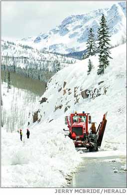
Following the logic that a picture is worth a thousand words, I want to show my colleagues what acid mine drainage looks like. This is the Red and Bonita mine in San Juan County, Colorado, near Silverton. For scale, note the pickup truck on the left hand side. Over 300 gallons of water drain from this mine every minute. The water is contaminated with all kinds of heavy metals that produce the orange and red streaks you see here.

Highly acidic water flows into Cement Creek and eventually into the Animas River, impairing water quality and aquatic life. For a region of Colorado that thrives on tourism, including angling, this situation is extremely harmful.

From EPA data we can conservatively estimate that over 10 thousand miles of streams and rivers and nearly 350 thousand acres of lakes are impaired in this country as a result of acid mine drainage.

So, what is being done?

For one, at those sites where a responsible party can be identified, the federal government has tools at its disposable to hold them accountable.

Also, the federal land management agencies have a variety of programs that mitigate abandoned hardrock mine pollution.

However, the efforts I want to focus on today are those undertaken by a third category of people – entities that had no role in creating the pollution at an abandoned mine yet want to make the site better. Appropriately enough, we refer to these entities as Good Samaritans.

One such Good Samaritan is the Animas River Stakeholders Group in southwestern Colorado. They are working to find solutions to clean up the Red and Bonita Mine.

Often these Good Samaritans are non-profits whose mission is to restore the natural environment. Sometimes they are community groups who want to improve their cities and towns. Sometimes they are mining companies looking to be good stewards in the communities they operate. And sometimes they are state and local governments.

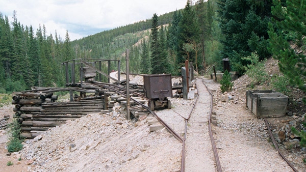
Take, for example, the Tiger Mine near Leadville, Colorado. This picture was taken before any remediation actions were taken. You can see the piles of mine waste and drainage coming from the mine flowing beside it. At peak flows, as much as 150 gallons per minute of water contaminated with cadmium, copper, lead, zinc and iron flows out of the Tiger Mine.

Some remediation work has already been completed, as you can see in this second picture. The mine waste was moved out of the way, capped and revegetated. And ditches were put in above the mine to divert surface water runoff and further reduce contamination.

You can also see in this picture that four pits have been dug below the mine. This represents the next phase of the cleanup being led by Trout Unlimited – another Good Samaritan. Eventually, these pits will become what is known as a sulfate-reducing bioreactor.
As the presiding officer knows, I was not a chemistry major. I won’t attempt to describe how this thing works. But the end result is a good thing: acid mine drainage flows in and cleaner water flows out.

However, Trout Unlimited has run into a problem that has frustrated many Good Samaritans. The bioreactor counts as a point source of pollution. Therefore, before Trout Unlimited can turn the bioreactor “on,” they must obtain a Clean Water Act permit. Trout Unlimited cannot meet the stringent permit requirements without investing in far more expensive water treatment options. Nor can they afford to assume the liability that comes with a permit.

As a result, the bioreactor sits unused. Federal law is, in effect, sidelining some of our best hopes for remediation.

I have tried for several years to give Good Samaritans some relief. I have introduced legislation every congress since 2002 that creates a unique permit specifically for this kind of work. Unfortunately, I haven’t been able to convince enough of my colleagues just how good an idea this is. But I will keep trying.

In addition, I have been working with Senator Boxer to encourage EPA to better use the administrative tools they have at their disposal. Good Samaritans report to me that administrative tools have been cumbersome to use so far and don’t offer the full Clean Water Act protection they need.

So Senator Boxer and I, along with Senator Bennet, have asked EPA to make this tool more accessible to Good Samaritans. And last week we asked the agency to provide Good Samaritans with assurances they will not be subject to enforcement for appropriate actions taken to clean up acid mine pollution.

I am grateful for the work EPA has done to focus on these issues and for Senator Boxer’s leadership.

Good Samaritans are too valuable of a resource to keep on the sidelines. Congress should do what is necessary to bring their efforts to bear on the cleanup of abandoned mine pollution.

Good Samaritans can’t solve all of our abandoned mine pollution problems. But we can’t afford to turn away those willing to help any longer.

More coverage Bob Berwyn writing for the Summit County Citizens Voice. From the article:

In addition to trying to rally political support with a speech on the Senate floor, Udall sent a letter to the EPA asking for a change in policy that would give Good Samaritans some legal certainty when it comes to the liability for cleanup efforts. Senators Michael Bennet of Colorado and Barbara Boxer of California also signed the letter.

Certain legal hooks in the Clean Water Act make it challenging for volunteers, so Udall is looking for ways that would enable Good Samaritans to clean up those contaminated sites without assuming full legal liability for contamination they did not create.

More water pollution coverage here.

Snowpack news: Current forecast for Fryingpan-Arkansas Project yield at 45,000 acre-feet with average snowfall for the rest of the season

snowpackcolorado02172012

From The Pueblo Chieftain (Chris Woodka):

However, there are two very different years to track for comparison so far: Snowpack is about the same as in 2002, when the project yield was only 13,200 acre-feet. The region was in a drought that worsened to historic proportions as the year went on. In 2010, when February levels were similar to this year, the final yield was 55,400 acre-feet — roughly average since diversions began in the mid-1970s. Heavier snowfall brought up the yield in March and April…

Statewide, conditions remain drier than usual. In the Colorado River basin, where Fry-Ark water originates, snowpack is at 71 percent [ed. 70% as of last Friday] of average — some sites are only at 50 percent of average. In the Arkansas River basin, snowpack is at 88 [ed. 85% as of last Friday] percent of average.

From the Summit County Citizens Voice (Bob Berwyn):

Low season flows into Lake Powell have been near normal in recent weeks, with the Colorado River delivering about 356,000 acre feet (99 percent of average) during January, leaving the reservoir about 63 feet below full pool…

For now, the U.S. Bureau of Reclamation’s water supply forecast for April through July is predicting an inflow of about 5 million acre feet, which is about 71 percent of average — but that outlook comes with a caveat: “At this time of year however, there is a high level of uncertainty in hydrologic forecasts and the annual release volume from Glen Canyon Dam in WY2012 will ultimately be based on the actual inflows that occur during 2012 rather than this Water Supply forecast,” the USBR wrote in the monthly update.

Looking ahead month by month, the forecasted unregulated inflow to Lake Powell is projected at 390,000 acre feet in February (99 percent of average), 550,000 AF in March (83 percent of average) and 800,000 AF in April (78 percent of average), based on a comparison with the 1981-2010 period.

The best-guess forecast for the 2012 water year is for a total of about 8.5 million AF (78 percent of average), but the forecasters tried to cover all the possible weather bases by saying the total could be as low as 5.5 million AF (51 percent of average) to as high as 12.65 million AF (117 percent of average) “depending on the range of precipitation patterns that could occur over the next several months.”

Bureau of Reclamation Historic Dams and Water Projects: Discover Our Shared Heritage Travel Itinerary

mcpheeconstruction.jpg

From the National Park Service website:

The American West is known for its expansive prairies, great mountains, and arid climate. The Bureau of Reclamation, the nation’s largest supplier of water and second-largest producer of hydroelectric power, controlled the wild rivers of the West with its historic dams and water control projects–great engineering feats constructed by many workers. Damming rivers has provided water to reclaim hundreds of thousands of acres transforming sagebrush to lush farmland, and delivered water to create towns and great cities, allowing the “desert to bloom.” Learn about the vital role of the Bureau of Reclamation in managing, developing, and protecting water in the United States. Explore the history of water in the West and visit the historic dams and water projects that created the West we know today. The Bureau of Reclamation Historic Dams and Water Projects Discover Our Shared Heritage Travel Itinerary was produced by the National Park Service’s Heritage Education Services and its Intermountain Region Heritage Partnerships Program, in partnership with the Bureau of Reclamation and the National Conference of State Historic Preservation Officers.”

Here’s the release from the National Park Service (Kathy Kupper):

The American West was dramatically transformed in the early 20th century by dams, reservoirs, and canals built to provide water for irrigation and hydropower generation. The introduction of water to the arid landscape spurred settlement, farming, and economic stability. Learn the fascinating history of 25 engineering marvels that permitted the desert to bloom in the National Park Service’s newest online travel itinerary Bureau of Reclamation Historic Dams and Water Projects: Managing Water in the West. The itinerary, loaded with essays, images, information, and maps, is available at http://www.nps.gov/history/nr/travel/ReclamationDamsAndWaterProjects/index.html.

Each of the 25 historic dams in the itinerary is listed in the National Register of Historic Places, which is maintained by the National Park Service. The dams represent the complexities and challenges of building water projects and the significant role the Bureau of Reclamation played in shaping life in the West. Bureau of Reclamation projects, today as in the past, have a sweeping impact on irrigation and municipal and industrial water supplies, hydroelectric power, navigation, flood control, and recreational opportunity.

The National Park Service’s Heritage Education Services and its Intermountain Region Heritage Partnerships Program produced this itinerary in partnership with the Bureau of Reclamation and the National Conference of State Historic Preservation Officers. This itinerary is the 54th in the online Discover Our Shared Heritage travel itinerary series. The series supports historic preservation, promotes public awareness of history, and encourages visits to historic places throughout the country.

Thanks to Bob Berwyn (Summit County Citizens Voice) for the heads up.

More infrastructure coverage here.

The La Plata Water Conservancy District to turn dirt for the long-proposed Longhollow Reservoir

longhollowreservoirsitelookingdownstreamlaplatacountygei.jpg

From The Durango Herald (Dale Rodebaugh):

The approval of an escrow agreement allows the La Plata Water Conservancy District to break ground on the Longhollow Reservoir. “It’s been 15 or 20 years,” Lee said Friday. “Things move slow, but we’re getting there.”

Groundbreaking could occur as early as next month, said Lee, president of the water district. The reservoir will be located just east of Colorado Highway 140 about five miles north of the New Mexico state line. It will store 5,400 acre-feet of water – 300 of them to help satisfy Colorado’s La Plata River obligation to New Mexico. The remainder is for irrigators in the arid southwest corner of La Plata County…

Longhollow Creek and drainage from Government Draw will fill the reservoir. The project will cost about $22.5 million.

More La Plata River coverage here.

President Obama’s budget request includes dough for the Arkansas Valley Conduit

arkansasvalleyconduitproposed.jpg

From The Pueblo Chieftain (Chris Woodka):

About $3 million is included in the president’s budget to complete the Environmental Impact Statement being prepared by the Bureau of Reclamation. “We’re very, very pleased. This allows us to finish the process and play with some of the technical pieces,” [Southeastern Colorado Water Conservancy District Executive Director Jim Broderick] said.

The draft EIS is expected to be completed by the end of this year. The project would be built by 2022 at the soonest.

More Arkansas Valley Conduit coverage here and here.

Rio Grande Roundtable meeting recap: Phase one of project to improve and restore the river between Del Norte and Monte Vista is complete

riogranderiverstateengineersoffice.jpg

From the Del Norte Prospector (Stan Moyer):

Heather R. Dutton made a “Plaza Project” presentation, describing progress in a long-term effort to improve, both in appearance and safety characteristics, of the Seven Mile Plaza Reach of the Rio Grande between Monte Vista and Del Norte.

She is the coordinator of the Rio Grande Headwaters Restoration Project (RiGHT).

A five-month study partially funded with $40,000 from the Roundtable and described as “Phase One” is finished, with decisions made on reconstruction of several diversion headgates on the river, and improvement of damaged wetlands, formerly a favorite illegal dumping spot for refrigerators and miscellaneous junk.

One of the most prominent of the areas to be restored offered three choices, Dutton said: “A concrete diversion dam, an all- rock diversion or a half-concrete, half-rock structure allowing for fish and boat passage,” the selected alternative for the Prairie Ditch Headgate.

An automated headgate has been finished by virtue of the hard work of a nearby inhabitant, a kindly human, Dutton clarified, not fish. The automation of all the headgates in the Seven Mile area has been chosen.

Stream banks near the McDonald Ditch are also expected to be shored up in the future.

More Rio Grande River basin coverage here and here.

Arkansas Valley Super Ditch administrative update: Change case administrative tool in development

arkbasinditchsystem.jpg

From The Pueblo Chieftain (Chris Woodka):

When the Lower Arkansas Valley Water Conservancy District first proposed Super Ditch to the Arkansas Basin Roundtable, Scanga said it would result in “the mother of all change cases.” The roundtable requested and received a grant from the Water Supply Reserve Account of the Colorado Water Conservation Board to develop an administrative tool to help settle differences. Scanga said it would be available to any objector to the Super Ditch change case in water court.

Thursday [ed. at the Southeastern Colorado Water Conservancy board meeting], Scanga explained the concerns of the Upper Arkansas Valley because of the potential for Super Ditch to alter river priority calls.

The case, when it is filed, will be complex because it deals with rotating dry-up of parcels on up to seven ditch systems with lingering impacts to the river over several years, Scanga said.

The Super Ditch is proposing a pilot program this year to sell 500 acre-feet of water to El Paso County water users.

Some other water users have criticized the Lower Ark district for not filing a change case before asking for a state-administered substitute water supply plan. Lower Ark officials contend more time is needed to assess the impacts.

More coverage from Bette McFarren writing for the La Junta Tribune-Democrat. From the article:

Roy Vaughan, Bureau of Reclamation, brought an update on the snow pack and showed photographs of the large pipeline valves going in at Pueblo Reservoir Dam which will enable the Southern Delivery System and possibly the Arkansas Valley Conduit and other pipelines…

The storage at Twin Lakes and Turquoise Lakes is above last year’s figures, but the Pueblo Reservoir is below last year, but still high at 121 percent of average. Twin Lakes at present is 105 percent and Turquoise Lake is 106 percent. The BOR is currently moving 200 cubic feet per second from Twin to Pueblo. The bureau will be moving 50 to 55 thousand acre- feet from October through March.

More Arkansas Valley Super Ditch coverage here and here.

Durango: Smelter Mountain disposal site monitoring well data shows a spike in uranium

smeltermountainuraniumdisposalsitedurango.jpg

From The Durango Telegraph (Tracy Chamberlin):

Readings from one of the wells at the uranium mill tailings disposal site have almost doubled in the past year, according to a report from the Department of Energy, and agency officials don’t know why. “It is high, and we don’t have a good explanation for it at the moment,” said David Shafer, an Environmental Team Leader with the DOE’s Office of Legacy Management, in Grand Junction.

The last time levels jumped up in 2009, the sight was redeveloped. Subsequently, uranium concentrations dropped. But the numbers began rising again and recently peaked at the highest concentration to date.

The DOE monitors the groundwater at the disposal site in order to detect any possible leaks from the containment cell and is required to publish an annual report on its maintenance, repair and testing results. In the 2011 Site Inspection and Monitoring Report, uranium levels in a monitoring well located near the northeast corner of the cell were far above standards and have been on the rise for the past year. Levels hovered below the site-specific standard of 0.077 milligrams per liter for most of 2010, but shot past that minimum mark in 2011. They recently hit an all-time high of 0.14 milligrams per liter. Shafer said the most recent reading, taken in the beginning of February, showed the levels back down to the 2009 highs of 0.12 milligrams per liter, but still well above the site standard and the EPA standard, which is 0.004.

More nuclear coverage here and here.

Englewood: Council briefed on proposed South Platte River corridor improvements from South Platte Park to the Denver city limits

splattetrail1

From The Englewood Herald (Tom Munds):

Bob Searns, president of the Greenway Team, and Dave Lorenz, director of South Suburban Parks and Recreation, briefed the council on proposed projects during the Feb. 13 study session. “The concept is to extend the east-side trail from Big Dry Creek to Oxford,” said Searns, who heads the consulting firm working on the project. “Additionally, the concept is to make channel and bank improvements to make create a high quality water recreation area for people in canoes and kayaks.”[…]

“The Mary Carter Greenway is heavily used by cyclists, runners and walkers,” he said. “There are safety concerns because of the number of people using the trail and the fact the fast speeds of many cyclists could cause problems when they encounter slower moving walkers, parents pushing strollers or joggers.” The proposed answer is a gravel trail on the east bank of the river for walkers and joggers. The first section from Prince to Big Dry Creek was completed last summer.

More South Platte River basin coverage here.

Tuesday: Two Eagle River area utilities and Eagle county will be the first entities to sign the Colorado River Cooperative Agreement

coloradorivercooperativeagreementmap.jpg

Here’s the release from Eagle County (Diane Johnson/Kris Friel):

Leaders from Eagle County, Eagle River Water & Sanitation District, Upper Eagle Regional Water Authority and Eagle Park Reservoir Company will gather at 2:30 p.m. Feb. 21 at the Eagle County Building to sign the Colorado River Cooperative Agreement. Five years in the making, the agreement between Denver Water and 41 Western Slope water providers, local governments and ski resort operators ensures statewide cooperation on Colorado River water issues and is the broadest in scope of its kind in state history.

The signing in Eagle will be the first to take place in the state as the agreement makes its way from the Colorado River headwaters to the Utah state line. The draft document is available on the Colorado River District website at www.crwcd.org/page_336.

Focused on cooperation, the Colorado River Cooperative Agreement brings traditional water foes together as partners for responsible water development benefiting both Denver Water and the Western Slope. According to its authors, it prevents future transmountain diversions from the Eagle River Basin, achieves better environmental health in the Colorado River Basin, promotes high-quality recreational use, and improves economics for many cities, counties and businesses impacted by the river.

The Eagle County entities were instrumental in both initiating and completing the complicated negotiations that ultimately created the agreement. “The cooperative effort represents a new way of doing business when it comes to water,” said Gov. John Hickenlooper during the April 28, 2011 announcement of the agreement. “It shows that water solutions must be crafted from a statewide perspective. We hope and expect that this process will ripple across Colorado to other areas of water conflict.”

In addition to its benefits for Denver Water and the Western Slope, the agreement will trigger a major water-sharing and conservation arrangement between Denver Water and Aurora Water and water providers in the South Denver Metro Area.

The agreement focuses on enhancing the environmental river health in much of the Colorado River Basin and its tributaries upstream of Grand Junction, and supporting many Western Slope communities and water providers to improve the quality and quantity of water through new municipal water projects and river management initiatives.

Locally, benefits to the Eagle River Basin include provisions that preclude Denver Water and any entity served by Denver from developing any future water projects in the Eagle River Basin without the approval of the Eagle County entities. Additionally, a Shoshone outage protocol will ensure sufficient flows in the Colorado River through Eagle County during times when the Shoshone Power Plant may not be operational.

Supporters agree that the historic agreement will lead to better management and protection of the Colorado River and its tributaries for years to come. Representatives of the Eagle County entities will be on hand to discuss the agreement in more detail at Tuesday’s meeting. The event will be broadcast live on ecotv18 as well as streamed live and archived for future viewing at http://www.ecotv18.com.

From the Associated Press via The Columbus Republic:

Leaders from Eagle County, Eagle River Water & Sanitation District, Upper Eagle Regional Water Authority and Eagle Park Reservoir Co. are scheduled to meet Tuesday to sign the Colorado River Cooperative Agreement…

The Eagle County entities are among parties that announced the agreement last year with Denver Water, but the parties still have to ratify it. The Eagle County entities would be the first to do so.

More Colorado River Cooperative Agreement coverage here.

Drought news: The Pueblo Board of Water Works is forecasting $1,033,382 from one-year water sales this season

spainsunflower.jpg

From The Pueblo Chieftain (Chris Woodka):

For years, the Pueblo Board of Water Works has been the primary supplier of water sold on the spot market in the Arkansas River basin, making projections early in the year and sometimes amending them as conditions change. On Tuesday, the water board will consider a staff recommendation to sell, through one-year leases, nearly 14,000 acre-feet of water for about $1 million.

What’s unusual is that the average price for an acre-foot of water jumped more than 60 percent this year to more than $70. For the past five years, it was in the $40 to $50 range. The minimum bid increased to $67.55 from $35 last year. “It’s interesting what can happen in a sealed-bid process,” said Alan Ward, water resources manager for the water board.

Click through for the cool chart of past water sale history and the details about many of the bidders.

More coverage from Chris Woodka writing for The Pueblo Chieftain. From the article:

Well groups last month complained that the Lower Arkansas Valley Water Conservancy District was competing for augmentation water and potentially driving the price up on the spot market. This week, the Lower Ark district released a report that predicts at least 50,000 acre-feet of water will be needed to augment wells, surface-fed sprinklers and the Arkansas Valley Conduit by the year 2050. The report indicated water prices probably will increase anyway as the resource becomes more scarce.

On Wednesday, the Lower Ark board met with three large well augmentation groups to look at ways they could help each other, rather than fight over a shrinking water supply. “The worst thing is to realize we are all in the same boat and the boat is sinking,” said Scott Lorenz, manager of the Arkansas Groundwater Users Association. “The Lower Ark is in the same boat we’re in. We want to work with you to create a win-win situation.”

Two other well groups, the Colorado Water Protective and Development Association and the Lower Arkansas Water Management Association, also sent representatives to the meeting.

The three well groups provide replacement water for 117,000 acres of farm ground under 1996 state rules adopted to satisfy requirements of a U.S. Supreme Court decision in the Kansas v. Colorado case. The groups use various strategies involving water rights they own, water leases or purchase of water on the spot market…

About 240,000 acres of ground are typically irrigated each year in the Lower Ark Valley, according to reports from the Division of Water Resources. “The number of sprinklers (under the surface rules) grew 12 percent last year,” said Jay Winner, manager of the Lower Ark District. “How are we going to get water for the next generation?”[…]

The well groups are looking at a state-line credit of 44,000 acre-feet that has built up over the last 10 years. Next year, the state will look at lowering a presumptive depletion factor that could reduce the amount of replacement water that is needed.

The Lower Ark board Wednesday learned of a $105,000 state grant to look at the amount of water that leaks from ponds used to feed sprinklers. The savings in water, if accepted by the state, would reduce the amount of water that irrigators are required to repay.

The studies also could be useful to determining recharge rates, which could benefit well owners as well as the fledgling Arkansas Valley Super Ditch…

“We have to work together. We need storage. Water is wasted every day and is moving toward Kansas,” said John Sliman, an AGUA member who has plans to build reservoirs on the Excelsior Ditch. “Finding an answer 20 years from today is too late.”

More Arkansas River basin coverage here.

NIDIS Weekly Climate, Water and Drought Assessment Summary of the Upper Colorado River Basin

usdroughtmonitor02162012

utwycoprecip0201thru02112012

Here are the presentations from Tuesday’s webinar, courtesy of the Colorado Climate Center.

Click on the thumbnail graphics to the right for the February 1 through February 11 precipitation map and the current U.S. Drought Monitor. February precipitation picked up for most of Colorado except the San Luis Valley, areas around Las Animas County and along the Colorado Utah border.

I live-tweeted the Colorado Water Conservation Board’s Water Availability Task Force meeting yesterday. Search Twitter for the hash tag #WATF.

The EPA recommends more protection of the Upper Colorado River in light of the proposed Windy Gap Firming Project

windygapreservoirnorthernwater.jpg

From The Denver Post (Bruce Finley):

An Environmental Protection Agency review of data used in planning the project found mathematical errors and a downplaying of “critical adverse impacts” from the $270 million project, which Colorado leaders consider crucial for millions of residents. EPA reviewers cited a separate 2011 state study that documented the disappearance of all native sculpin fish and 38 percent of aquatic insect species over 20 years as a result of existing water diversions.

An EPA document, sent to federal permitting authorities last week, recommends further analysis of the Northern Water Conservancy District’s Windy Gap Firming Project to prevent new violations of state water-quality standards and “a more robust monitoring and mitigation plan” to protect the river. “The EPA has not recommended delaying this project,” EPA regional administrator Jim Martin said. “Our recommendations are intended to provide a path forward that also protects the Colorado River…

Conservation groups say the EPA review backs what they have been saying for years. They are hoping the report will bolster their push for a bypass around Windy Gap Reservoir, which has broken the flow of the river. They also want to make sure at least 2,400 acre-feet of water — or 1,200 cubic feet per second — is released every other year to clear sediment. The state’s own study found such flushing flows are essential. But the Northern Water Conservancy District has agreed to devote only about half that much water to ensure ecosystem health.

“This project could be done in a way where the Front Range gets its water and the river is protected. But to do that, we need more mitigation and monitoring. You have to make sure you have enough high flows,” said Trout Unlimited attorney Mely Whiting. “Our hope is to have folks see the light on this and come to an agreement. Litigation is an option.”

More Windy Gap coverage here and here.

The Land Trust of the Upper Arkansas River to screen the documentary ‘Green Fire: Aldo Leopold and a Land Ethic for Our Time’ February 17

aldoleopold.jpg

From email from the Land Trust of the Upper Arkansas:

The Land Trust of the Upper Arkansas is pleased to invited you to the showing of “Green Fire: Aldo Leopold and a Land Ethic for Our Time”. The documentary will be screened from 6:00 – 7:30 Friday, February 17th at Salida Mountain Sports, 110 N. F Street.

The documentary explores Leopold’s life in the early 20th century and the many ways his land ethic ideas continue to this day. It also deals with the influence his ideas have had in shaping the conservation movement as we know it. The film was produced by the Aldo Leopold Foundation, the U.S. Forest Service and the Center for Humans in Nature.

Please join us in watching this documentary. Cost will be $ 3.00 for adults and children under 12 are free. For more information give us a call at the Land Trust, 539-7700.

More conservation coverage here.

Science Thursday: A Periodic Table of Cupcakes

periodictableofcupcakes.jpg

Click on the thumbnail graphic to get to the photo album. The baker made the cupcakes for a chemical engineering department reception.

Thanks to Professor Gigi Richard (Colorado Mesa University) for the link from her Twitter feed (@igig42).

Denver: The Colorado Coalition of Land Trusts presents ‘Conservation Excellence 2012’ March 12-13

haymeadowsneargunnison.jpg

Here’s the announcement from the Colorado Coalition of Land Trusts:

The Colorado Coalition of Land Trusts is pleased to invite you to join us for Conservation Excellence 2012. With over 40 sessions to choose from and CE credits available for attorneys, real estate professionals and appraisers, we’re confident that this is a “must attend” conference for:

Land Trust staff and volunteers
Local Government Open Space staff
Appraisers
Attorneys
Realtors
College students and faculty
Accountants
Others interested in Conservation in Colorado

Date: March 12-13
Location: The Cable Center (map)

More conservation easements coverage here and here.

Snowpack news: Statewide snowpack is at 76% of average, Arkansas basin jumps to 88%, South Platte — 85%

snowpackcolorado02152012

Click on the thumbnail graphic to the right for yesterday’s Colorado Snowpack map from the Natural Resources Conservation Service.

From the Summit County Citizens Voice (Bob Berwyn):

A series of storms [ed. over the past week] brought on and off snow to the Rockies, with Wolf Creek reporting a 35-inch total for the week, while Steamboat tallied 28.5 inches. Silverton measured a weekly total of 25 inches and Telluride benefited with 23 inches. Farther north, Loveland and Winter Park both picked up 21.5 inches of new snow for the week with 20 inches at Monarch, Copper Mountain and Purgatory at Durango Mountain Resort.

Click through for all the pictures of fresh tracks.

From the Summit County Citizens Voice (Bob Berwyn):

“It’s an enigma,” said Klaus Wolter, with the CIRES Climate Diagnostics Center. In an email updating the SWCasts website, Wolter wrote: Record-snow around here in early February is not something I would typically associate with La Niña, but will come in handy if the mountains west of us remain starved for moisture (despite some minor storms during the upcoming week).”[…]

Wolter was referring to record snow in northeastern corner of the Colorado mountains, west of Fort Collins and Boulder, where he recorded 162 inches for the season to-date at 8,500 feet, the most he’s seen in 22 years. The bottom line is that the outlook for February – March period is on the dry side for the Southwest, including most of Colorado’s mountains, with the exception of the East San Juans and the Sangre de Cristo mountains.

But Wolter said the next few weeks should be a little more active, with a progressive weather pattern off the Pacific chipping away at this winter’s moisture deficit – call La Niña’s last gasp.

Rifle: City Council approves a shiny new $25 million water treatment plant

riflegap.jpg

From the Rifle Citizen Telegram (John Gardner):

The Rifle City Council has agreed to move forward with construction of a new $25 million water treatment facility to be built along Highway 6 near the city’s raw water intake. The action came in a 5-2 vote in a special council meeting held Feb. 6.

Although the city government expects to finance the project with a low-interest loan from the state, the new plant will cause rates for city water customers to double. However, City Council is also considering asking voters to approve a 0.5 percent sales tax increase to help pay off the debt, which would lessen the burden on customers…

Dick Deussen, city utilities director, said the new plant will use advanced water treatment technologies, including a low-pressure membrane, granular activated carbon and reverse osmosis, and is expected to produce good-tasting water…

If all goes smoothly with the advance work, he said construction could begin this fall, and the plant could be complete by the end of 2014.

More water treatment coverage here.

Colorado Water 2012: The Rio Grande Headwaters Land Trust continues to protect water resources in the San Luis Valley

coloradowater2012

Here’s this week’s installment of the Valley Courier’s Water 2012 series. Here’s an excerpt:

RiGHT grew out of the Citizens for San Luis Valley Water, who were seeking a tool for the community to help keep water in the basin. One of the co-founders, Cathy McNeil, along with her husband Mike of the McNeil Ranch and neighboring ranchers on the Rock Creek corridor south of Monte Vista were among the first to conserve their own lands with conservation easements.

They did this for a number of reasons, ranging from overall estate planning to their real desire to keep their land and water intact for agriculture and not allow it to be broken into the proverbial “ranchettes” that are fragmenting far too much of Colorado’s historic ranchlands, and thereby converting agricultural water rights to domestic and other uses.

In response to the intense pressure for land development and conversion of water from agriculture to other uses, the interest in conservation has grown steadily across Colorado. RiGHT has led the nation in providing support and incentives for private land conservation, including the lottery funded Great Outdoors Colorado (GOCO). GOCO also serves as a model for the America’s Great Outdoors initiative, with Secretary of the Interior Salazar as a key proponent of that effort. Colorado has also passed significant tax benefits to encourage voluntary conservation easements.

While RiGHT continues to work throughout the entire San Luis Valley, after the drought of 2002, protecting the Rio Grande river corridor and its water resources emerged as the clear priority for San Luis Valley residents. RiGHT found that, in contrast to the highly fragmented ownership of many of Colorado’s river corridors, there is still a substantial amount of relatively intact land along the Rio Grande corridor, much of which has senior water rights associated with it. With the help of partners at The Nature Conservancy, Ducks Unlimited and many willing landowners, RiGHT launched the Rio Grande Initiative in 2007.

Since 2007, RiGHT has been able to triple the pace of conservation along the river. As of the end of 2011, more than 22,000 acres and 36 miles of the river are protected,thanks to the significant investment of many funders and landowners. A recent Trust for Public Land study indicated that every dollar invested in conservation generates six dollars of economic return in communities, meaning that those funds serve as a substantial economic driver in this rural, agricultural region.

More Colorado Water 2012 coverage here.

Cañon City: The CDPHE extends the public comment period for the shut down of the Cotter Mill

cottermillcontaminationconcerndenverpost10232011

From The Pueblo Chieftain:

The deadline has been extended from Friday to March 2 for comment on a new evaporation pond design, an on-site soil excavation and groundwater characterization plan and soil remediation criteria. In addition, public comment can be provided on a new document, dealing with a groundwater remediation water management analysis, which will be posted Friday at http://www.cdphe. state.co.us/hm/cotter/index.htm.

Comments should be submitted to Steve Tarlton, radiation program manager, Colorado Department of Public Health, 4300 Cherry Creek Drive South, Denver, CO 80246 or via email to steve.tarlton@state.co.us.

More nuclear coverage here and here.

Jon Waterman: ‘In 2008 I tried to float the length of the [Colorado] river to the sea but had to walk the last week of the trip’

jonathanwatermancoloradoriverdelta2008natgeo.jpg

I get to meet the most interesting people while blogging about Colorado water issues. At the recent Colorado Water Congress Annual Convention I was able to snag some face time with author — and lover of the Colorado River — Jon Waterman. I was surprised and flattered when he said that he had read Coyote Gulch. We exchanged email addresses with an eye towards staying in touch. Yesterday, Jon wrote in email:

My valentine to the river, with a link on my website jonathanwaterman.com to change.org to petition officials to send water to the delta.

http://www.nytimes.com/2012/02/15/opinion/where-the-colorado-river-runs-dry.html?_r=1&ref=opinion.

The link is to an opinion piece by Waterman running in the New York Times. Click through and read the whole thing. Here’s an excerpt:

Until 1998 the Colorado regularly flowed south along the Arizona-California border into a Mexican delta, irrigating farmlands and enriching a wealth of wildlife and flora before emptying into the Gulf of California. But decades of population growth, climate change and damming in the American Southwest have now desiccated the river in its lowest reaches, turning a once-lush Mexican delta into a desert…

Officials from Mexico and the United States are now talking about ways to increase the flow into the delta. With luck, someday it may reach the sea again…

In 2008 I tried to float the length of the 1,450-mile river to the sea but had to walk the last week of the trip. Pools stagnated in the cracked riverbed. Like the 30 million other Americans who depend on the river, I worry about drinking water — but I also worry about the sorry inheritance we are leaving future generations…

Jonathan Waterman is the author of “Running Dry: A Journey From Source to Sea Down the Colorado River.”

More Colorado River basin coverage here.

Colorado Water 2012: Recap of Jim Yahn’s presentation at the Logan County Historical Society

southplattebasinnonconsumptiveneedsmapswsi2010

Here’s report from Sara Waite writing for the Sterling Journal-Advocate. Click through and read the whole article. Here’s an excerpt:

Yahn explained water rights and how they work. A water right consists of seven items: location, means of diversion, appropriation date, ajudication date, amount — flow or volume (cfs or acre feet), use and other pertinent information. The date of the water right is just one key in determining who gets water when there is a shortage — the other is location. A user with a newer right may lose access to the water if someone with an older water right downstream from them lays claim to what’s available. However, downstream users with newer water rights may still have access to water in the river than those further upstream, as water is returned to the river by the priority user.

Yahn also looked at the state’s growing need for water. He showed a map that depicts how much water leaves the state in an average year, noting that some of that water is obligated to other states downstream. However, he said, there is much more that could be retained by Colorado, especially on the Western Slope. There are storage and pipeline projects in the works that could help offset the dire water shortage that is predicted by 2050, but even if 100 percent of the projects were approved, the state would still need to double its access to water to meet the need. With the permitting process in place to meet environmental concerns, Yahn predicted that maybe 50 percent of the projects would actually be approved.

More Colorado Water 2012 coverage here.

Colorado Environmental Coalition: Volunteers needed to plant willows along the Dolores River

doloresrivercanyon.jpg

Here’s the announcement from the Colorado Environmental Coalition:

Date: Saturday, February 25, 2012
Time: 10:00am – 3:00pm
Where: Meet at the Gateway Community Center, 42700 Highway 141

This project is taking place on February 25th, 26th, 27th, and 28th. Volunteers are still needed for weekday sessions (Monday the 27th and Tuesday the 28th). Please RSVP (see below) to secure your space!

Join Volunteers for Outdoor Colorado and Bureau of Land Management on any or all of the upcoming restoration days and take advantage of the opportunity to:

– Learn how to identify, cut, transport, and plant willows.
– Spend a fun winter day(s) with other volunteers.
– Enjoy the beautiful scenery and delightful surroundings of the Dolores River from red rocks to riverside plant communities, and who knows maybe even a bald eagle! Click here for more information about area resources!
– Enjoy a complimentary lunch provided by Gateway Canyons Resort.

Please dress appropriately in winter work clothes (dress in layers, wear insulated boots and gloves, and a hat) as this is a dirty, muddy job! Children ages 12 and over, accompanied by a parent, are welcome!

Space is limited so please RSVP to Fran Parker at afparker@blm.gov or 970-244-3031.

More Dolores River coverage here.

NCAR: Scientists deploy lasers, GPS technology to improve snow measurements

ncarlasersnowpackmeasuring.jpg

Here’s the release from the National Center for Atmospheric Research:

Equipped with specialized lasers and GPS technology, scientists at the National Center for Atmospheric Research (NCAR) are working with colleagues to solve a critical wintertime weather mystery: how to accurately measure the amount of snow on the ground.

Transportation crews, water managers, and others who make vital safety decisions need precise measurements of how snow depth varies across wide areas. But traditional measuring devices such as snow gauges or yardsticks often are inadequate for capturing snow totals that can vary even within a single field or neighborhood.

Now scientists are finding that prototype devices that use light pulses, satellite signals, and other technologies offer the potential to almost instantly measure large areas of snow. In time, such devices might even provide a global picture of snow depth.

“We’ve been measuring rain accurately for centuries, but snow is much harder because of the way it’s affected by wind and sun and other factors,” says NCAR scientist Ethan Gutmann. “It looks like new technology will finally give us the ability to say exactly how much snow is on the ground.”

NCAR is conducting the research with several collaborating organizations, including the National Oceanic and Atmospheric Administration (NOAA) and the University of Colorado Boulder. The work is supported by NCAR’s sponsor, the National Science Foundation.

UNCERTAIN DEPTHS
Emergency managers rely on snowfall measurements when mobilizing snow plows or deciding whether to shut down highways and airports during major storms. They also use snow totals when determining whether a region qualifies for disaster assistance. In mountainous areas, officials need accurate reports of snowpack depth to assess the threat of avalanches or floods, and to anticipate the amount of water available from spring and summer runoff.

More accurate measurements can also help meteorologists and hydrologists better understand snow physics and hydrological processes.

But traditional approaches to measuring snow can greatly underreport or overreport snow totals, especially in severe conditions. Snow gauges may miss almost a third of the snow in a windy storm, even when they are protected by specialized fencing designed to cut down on the wind’s impacts. Snow probes or yardsticks can reveal snow depth within limited areas. But such tools require numerous in-person measurements at different locations, a method that may not keep up with totals during heavy snowfalls.

Snow dunes. The three-dimensional features of a snow field above treeline is revealed by laser measurements. The laser, installed by NCAR at a test site in the Rocky Mountains, measures snow at more than 1,000 points across an area almost the size of a football field. (©UCAR, Image by Ethan Gutmann, NCAR. This image is freely available for media & nonprofit use.*))
Weather experts also sometimes monitor the amount of snow that collects on flat, white pieces of wood known as snow boards, but this is a time-intensive approach that requires people to check the boards and clear them off every few hours. The nation’s two largest volunteer efforts—The National Weather Service’s Cooperative Observer Program and the Community Collaborative Rain, Hail, and Snow Network (CoCoRaHS)—each involve thousands of participants nationwide using snow boards, but their reports are usually filed just once a day.

More recently, ultrasonic devices have been deployed in some of the world’s most wintry regions. Much like radar, these devices measure the length of time needed for a pulse of ultrasonic energy to bounce off the surface of the snow and return to the transmitter. However, the signal can be affected by shifting atmospheric conditions, including temperature, humidity, and winds.

TESTING NEW APPROACHES
The specialized laser instruments under development at NCAR can correct for such problems. Once set up at a location, they can automatically measure snow depth across large areas. Unlike ultrasonic instruments, lasers rely on light pulses that are not affected by atmospheric conditions.

New tests by Gutmann indicate that a laser instrument installed high above treeline in the Rocky Mountains west of Boulder can measure 10 feet or more of snow with an accuracy as fine as half an inch or better. The instrument, in a little over an hour, measures snow at more than 1,000 points across an area almost the size of a football field to produce a three-dimensional image of the snowpack and its variations in depth.

Gutmann’s next step, if he can secure the needed funding, will be to build and test a laser instrument that can measure snow over several square miles. Measuring such a large area would require a new instrument capable of taking over 12,000 measurements per second.

“If we’re successful, all of a sudden these types of instruments will reveal a continually updated picture of snow across an entire basin,” he says.

One limitation for the lasers, however, is the light pulses cannot penetrate through objects such as trees and buildings. This could require development of networks of low-cost laser installations that would each record snow depths within a confined area. Alternatively, future satellites equipped with such lasers might be capable of mapping the entire world from above.

Gutmann and Kristine Larson, a colleague at the University of Colorado, are also exploring how to use GPS sensors for snowfall measurements. GPS sensors record both satellite signals that reach them directly and signals that bounce off the ground. When there is snow on the ground, the GPS signal bounces off the snow with a different frequency than when it is bare soil, enabling scientists to determine how high the surface of the snow is above the ground.

Such units could be a cost-efficient way of measuring snow totals because meteorologists could tap into the existing global network of ground-based GPS receivers. However, researchers are seeking to fully understand how both the density of the snow and the roughness of its surface alter GPS signals.

“Our hope is to develop a set of high-tech tools that will enable officials to continually monitor snow depth, even during an intense storm,” Larson says. “While we still have our work cut out for us, the technology is very promising.”

“I think this technology has great potential to benefit emergency managers and other decision makers, as well as forecasters,” Gutmann says.

Thanks to the Summit County Citizens Voice (Bob Berwyn) for the heads up.

The EPA recommends more protection of the Upper Colorado River in light of the proposed Windy Gap Firming Project

windygapmoffatfirmingboulderviewpoint.jpg

Here’s the letter from the EPA to the Army Corps of Engineers via Defend the Colorado.

More Windy Gap coverage here and here.

Colorado Water 2012: The Grand County Library District is celebrating with displays in Granby and Fraser and a presentation of the film ‘Tapped Out’

eisenhowerfishing.jpg

Here’s the announcement from the Grand County Library District:

Please join the Grand County Library District as it partners with nearly 200 state and local organizations and educators in celebrating Colorado’s unique heritage as a headwaters state, and in understanding the diverse uses and values of this precious resource.
Colorado Water 2012, spearheaded by the Colorado Foundation for Water Education, is a campaign to “engage Coloradoans in a statewide celebration of water: past, present, and future.”

The goals of Colorado Water 2012 are to: raise awareness about water as a valuable and limited resource, increase support for management and protection of Colorado’s water and waterways, showcase exemplary models of cooperation and collaboration among Colorado water users, connect Coloradans to existing and new opportunities to learn about water, and to motivate Coloradans to become proactive participants in Colorado’s water future. (http://www.water2012.org)

In hopes of “connecting Coloradans to their water,” the library district is hosting a variety of displays and events:

Feb. 3 – Feb. 18 at the Fraser Valley Library and Feb. 19 – March 3 at the Granby Library: The Colorado Water 2012 traveling display will be featured with local information provided by the Grand County Water Information Network. GCWIN is a nonprofit organization that provides water quality information and educational programs in Grand County.
Feb.13-March: Jon Ewert , local aquatic biologist with Colorado Parks and Wildlife, has created a display explaining how science-based fisheries management takes place in the rivers and lakes of Grand County. It will be featured in the Urban Community Meeting Room at the Fraser Valley Library.

Thursday Feb. 16, 5:30 p.m. at the Fraser Valley Library and Wednesday, Feb. 22, 5:30 p.m. at the Granby Library: Kirk Klancke will host a presentation of the film “Tapped Out” followed by an update on the two proposed projects that are the most immediate threat to our local rivers, with time for questions and answers. Kirk Klancke is the President of the Colorado River Headwaters Chapter of Trout Unlimited, Board member of the Grand County Water Information Network, Board member of the Grand County Water Quality Control Board, Board member of the North West Council of Governments Quality and Quantity, and the recipient of the 2011 Field and Stream Magazine National Conservationist Award.

Thanks to the Sky-Hi Daily News for the heads up.

Head on over the Your Colorado Water Blog for a report on the Colorado Rural Water Association meeting held yesterday in Colorado Springs. Here’s an excerpt:

On Thursday, catch the best tasting water contest! The winner will be eligible to compete against other states at the National Rural Water Association’s Rural Water Rally held in February 2013– in 2010 the Morgan County Quality Water District of Fort Morgan won second place in this national competition…

According to the Colorado Water Quality Control Division, 96% of the state’s population drinks water that meets all health-based drinking water standards. Read more about the safety of your drinking water and the role of water treatment in the latest issue of Headwaters Magazine.

Finally, the City of Trinidad is planning their first ever water festival to celebrate Colorado Water 2012. Here’s a report from Steve Block writing for The Trinidad Times. From the article:

The stated goal of the festival is to create a vibrant, colorful community event with lots of music and food that is both fun and educational, where people of all ages can wander among tables and booths of water educational projects and take part in demonstration projects throughout the grounds.

One of the central purposes of the Water Festival is to involve students in interactive projects that help them learn about how to use water resources in the most environmentally sound way possible. Plans call for as many as 1,500 students from around the area to attend the festival.

The student activities are designed to provide an opportunity to learn about our water supply, the importance of water conservation and watershed protection through creative and interactive displays, presentations and activities. The activities will provide the students with environmental knowledge and the opportunity to share in creative ways what they have learned with the community…

The exhibition hall will include a river maze, a functioning model of a watershed, erosion control demonstrations and hands-on water testing. The Trivia Bowl is perhaps the most fun and boisterous activity at the festival. Four-person teams will be pre-selected and compete with teams from other classes. Students will compete in water questions from the categories of history, geography, water supply, conservation and water rights. Poster and essay contests stress the creative aspects of learning about water. The best entries from each school will be displayed at the festival, around town and in local newspapers.

More Colorado Water 2012 coverage here.

Snowpack news: Statewide snowpack improves slightly to 75% of average, Colorado River basin — 70%

snowpackcolorado02092012

Click on the thumbnail graphic to the right for the latest snowpack map from the Natural Resources Conservation Service.

Aspen: Opponents of the proposed hydroelectric plant hope to install stream gages on Maroon and Castle creeks to bolster their argument

microhydroelectricplant.jpg

From the Aspen Daily News (Brent Gardner-Smith):

A stream gauge suitable for inclusion in the U.S. Geological Survey (USGS) system cost between $20,000 and $35,000 to install, depending on the site, and $16,000 a year to operate. Saving Our Streams, a recently formed nonprofit that is challenging the city’s proposed hydro plant, wants at least one gauge on both Castle and Maroon creeks in order to keep an eye on how much water is left in the streams below the city’s diversion dams. Maureen Hirsch of Saving of Streams has contacted federal officials with the USGS, who have agreed to make a site visit this winter to the Aspen area…

For Our Rivers and Renewables, a new initiative from the Aspen-based Public Counsel of the Rockies, also wants gauges on those two streams. The group also is calling for new gauges on the Roaring Fork River in Aspen, on Hunter Creek and on the lower Crystal River. “It’s time to get the Roaring Fork River basin properly gauged,” said Tim McFlynn of Public Counsel for the Rockies. “It’s shockingly overdue.”

But the expense of doing so can be shocking as well. To install five streamflow gauges up to the standards of the USGS and to cover 10 years of operations and maintenance on them could cost $900,000…

Bill Blakeslee, the state water commissioner charged with managing local water diversions, said gauges are the best way to solve water disputes. “Anybody can produce a study, but without a consistent measuring device in the stream, everybody is just kind of blowing smoke,” he said. But Blakeslee warned that enthusiasm for new gauges tends to wane when it comes to paying for the ongoing maintenance and operational costs of them, which are prone to freezing up in the winter and need to be routinely checked.

Leaders from both Share Our Streams and For Our Rivers and Renewables say they are seeking funding for gauges from both private and public sources. Share Our Streams’ members include two billionaires and several other wealthy homeowners on Castle and Maroon creeks. Hirsch said one member already has agreed to fund one gauge.

More hydroelectric coverage here and here.

Piceance Basin: Bopco LP hopes to build a water treatment plant for produced water

piceancebasin.jpg

From the Oil and Gas Journal:

The US Bureau of Land Management is seeking public comments on a proposed water treatment plant west of Meeker, Colo., to treat produced water from oil and gas activity in the Piceance Basin and discharge it into Yellow Creek. BLM will accept comments through Mar. 6 for an environmental assessment it is preparing for Bopco LP’s proposed project, the agency’s Meeker field office said on Feb. 6. It said that the proposed facility would treat up to 24,000 b/d of produced water from the Fort Worth, Tex., independent producer’s Yellow Creek natural gas field and discharge up to 18,000 b/d into Yellow Creek.

Bopco already has acquired a discharge permit from the state government but will need to reach a separate agreement with the Colorado Parks and Wildlife Service to construct power lines across state land before the project is approved, BLM said.

More oil and gas coverage here and here.

Airborne electromagnetic survey of Paradox Valley will ultimately support a 3D numerical model of groundwater flow and brine discharge to the Dolores River

paradoxvalley.jpg

Here’s the release from the U.S. Bureau of Reclamation:

Over a seven-day period in October 2011, an aerial geophysical survey was conducted by SkyTEM Surveys in cooperation with the U.S. Geological Survey in an area over the Paradox Valley, Colo., and a small area in San Juan County, Utah. The purpose of the survey was to obtain geophysical measurements to map the subsurface structure of the rocks and the amount of salinity in the area’s groundwater. This survey was conducted using a low-flying helicopter with time-domain electromagnetic instruments suspended below that measure the electrical resistivity of subsurface areas at different depths and provides detailed, high-resolution data for mapping.

Measurements over the Paradox Valley were obtained in a 3 to 4.5-mile wide by 15-mile long area, from southeast of the Dolores River to the northwestern end of the valley, and in a 2.5-mile wide by 4-mile long area around Buckeye Reservoir, immediately northwest of the Paradox Valley.

The lowest resistivity area was located northeast of the town of Bedrock, Colo., near the area in which brine discharges to the Dolores River. Once all the data from the survey have been fully evaluated, it is anticipated to provide a better understanding of the three-dimensional subsurface distribution of various rock types and the quantity of salinity in the fluids they contain. Results from the analysis may also define locations where underlying salt is being dissolved and the depth to the freshwater-brine interface.

Ultimately, the results from this geophysical survey will support a three-dimensional numerical model of groundwater flow and brine discharge to the Dolores River that the USGS is preparing for the Bureau of Reclamation.

Electromagnetic survey methods have been used effectively in many groundwater studies and particularly for mapping water quality. Because the electrical properties of most rocks are primarily dependent upon the amount of water in the rock, the salinity of the water, and the distribution of the water in the rock, electromagnetic methods are well suited for investigating the subsurface distribution of brine in the Paradox Valley.

The Paradox Valley is formed by a collapsed salt dome. Groundwater in the valley comes into contact with the top of the salt formation, where it becomes nearly saturated with sodium chloride. Saline concentrations have been measured in excess of 250,000 milligrams per liter, by far the most concentrated source of salt in the Colorado River Basin. Groundwater then surfaces in the Dolores River. Reclamation studies show that the river picks up more than 205,000 tons of salt annually as it passes through the Paradox Valley.

More Dolores River basin watershed here.

2012 Colorado legislation: Two oil and gas bills, one for 1,000 foot setbacks and the other limiting the use of open reserve pits fail in committee

oilgasevaporationpond.jpg

From The Denver Post (Mark Jaffe) via Longmont Times-Call:

The setback bill failed on a 3 to 8 vote and the bill requiring “closed-loop” tank system in place of open pits went down 3 to 7. Rep. Su Ryden, D-Aurora, sponsor of the setback bill, told the House Local Government Committee the proposal was “in response to a serious situation” — the prospect of heavy oil and gas development near suburban areas. Another reason was a “lack action by the Colorado Oil and Gas Conservation Commission,” Ryden said…

The bill requiring the use of closed-loop systems to handle hydrofracturing fluids, a process in which large volumes of liquid are pumped into a well, was sponsored by Roger Wilson, D-Glenwood Springs. Wilson called the growing number of oil and gas pits in the state “an accident waiting to happen.” The bill would have required the use of the close-loop system whenever possible and not gone into effect for three years.

More oil and gas coverage here and here.