Stormwater: Springs’ Mayor Bach has proposed a combination of debt and redirected general fund cash to fund needs

Fountain Creek Watershed

From KOAA.com (Steve Folsom):

Key facts of an independent study requested by Colorado Springs Mayor, Steve Bach were presented Wednesday. The independent engineering firm CH2M Hill was called in for a second opinion after a local storm water task force came back with storm estimates showing a jump from 500 to around $800 million regionally.

The independent audit looks only at the Colorado Springs portion of the storm water needs. It shows there are over 225 projects that need to happen totaling nearly $535 million. That is $152 million decrease from the report earlier in the year, but it also shows there are $162 million in projects that need to be treated with urgency, which is an $80 million increase. It is a total that is down, but also a need for more cash to quickly get moving on repairs and improvements.

Ideas on how to pay for it are causing debate. Mayor Bach unexpectedly presented and idea to combine borrowed money from bonds with funds redirected from the city’s general fund. There are many other elected leaders from the region who want to hold town meetings and discuss with voters the possibility of asking for a storm water property fee or tax on the ballot.

From The Pueblo Chieftain (Chris Woodka):

Mayor Steve Bach’s proposal to roll stormwater into the city’s other capital needs got a cold shoulder Wednesday from members of a task force that has worked for more than a year — and from Pueblo County.

Bach laid out his plan for funding critical stormwater needs to City Council, county commissioners and nearby communities following the unveiling of a study that prioritizes projects. “We’ve already stubbed our toe once on stormwater,” Bach said. “The worst thing that can happen is that we get turned down again (by voters). We’ve got to get it right.”

He proposed spending $100 million over the next five years, lumping it into a $175 million plan that also would fund streets, roads, bridges, public safety vehicles and parks. It would take 20 years to pay off the bonds. While the bond issue would require a vote, there would not be a tax increase since payments would be similar to the current bond structure.

Bach also made an overture to create a regional stormwater authority, but said it should be funded through contributions from individual communities, funded proportionately and managed by Colorado Springs. He also said the city could review progress and determine if more funding would be needed at the end of the five-year period.

But other public officials criticized Bach’s plan for failing to address regional issues and providing a stable, sustainable source of funding. “I’m alarmed by the mayor’s proposal, which seems to be a stopgap way of funding the needs. It kicks the can down the road,” said Ray Petros, Pueblo County’s water attorney. He said it does not fulfill the promises of Colorado Springs Utilities to have a stormwater funding mechanism in place when it obtained a 1041 permit from Pueblo County for the Southern Delivery System.

“We are willing to listen to constituents and we want to hear from the community,” said Keith King, council president.

The council and El Paso County commissioners are planning three town hall meetings to discuss stormwater before finalizing funding plans. The intention is to allow county voters the chance to approve a tax, fee or some other way to fund stormwater by 2014.

But the task force members emphasized no method has been selected. No dollar figure or timetable for capital projects has been developed either. Commissioner Amy Lathen called Bach’s proposal “uninformed,” because the mayor has not been meeting with the task force.

Commissioner Dennis Hisey, who serves on the Fountain Creek Watershed Flood Control and Greenway District, said regional cooperation is needed rather than Bach’s approach. “Stormwater starts high in the watershed

More Fountain Creek coverage here and here.

‘We must have a plan that provides a secure water future for all Coloradans’ — Jay Gallagher

From Steamboat Today (Jay Gallagher):

As our state economy grows, our water needs will grow. However, in the coming decades, we now anticipate a substantial shortfall of water supplies to meet our needs. Unless we do something to manage our water future, more and more agricultural water, particularly in eastern Colorado, will be bought up to supply our growing cities, drying up hundreds of thousands of acres of productive farm land and jeopardizing our economy. Northeast Colorado alone is expected to lose approximately 20 percent of agricultural land currently under production.

This future is unacceptable. We must have a plan that provides a secure water future for all Coloradans.

This past May, the governor issued an executive order directing the Colorado Water Conservation Board to develop the Colorado Water Plan — a plan to support the aspirations of all Coloradans. The CWCB will submit a draft plan to the governor’s office by December 2014 and then will work with the governor’s office to complete the plan by the end of 2015. This is an unprecedented undertaking for Colorado, but fortunately, the citizen work groups to develop the plan are in place and their work is underway…

Colorado’s Water Plan will not be a top-down plan full of state mandates and requirements. Instead, it will be built on the foundation of the work of the CWCB, the IBCC and the basin round tables.

More Colorado Water Plan coverage here

.

Gunnison Basin Roundtable recap — What’s worth more: 50 houses in Lakewood or kayaking on Daisy Creek?

Big Wood Falls photo via American Whitewater (2011)

From the Glenwood Springs Post Independent (Hannah Holm):

That question, or something close to it (I wish I’d taken better notes), was posed on Oct. 7 following a presentation by American Whitewater staffer Chris Menges to the Gunnison Basin Roundtable on the results of a survey of flow needs for whitewater recreation in the Gunnison Basin. That’s the kind of values question that will be hovering in the background as Colorado’s water leaders struggle to develop a plan that can stretch the state’s limited water supplies to meet its growing needs…

Water managers have long been accustomed to assessing water needs for crop irrigation and household use and factored that into their long-term planning. It’s only in recent decades that flow needs to keep streams healthy have begun to be taken into consideration, and an even more recent development to consider the flows needed to keep boaters happy.

Whitewater recreation has become a big business in Colorado, as well as an icon of the “Colorado lifestyle.” In the Gunnison Basin, commercial float trips were estimated to have added more than $6 million to the economy in 2011. The Colorado River Outfitters Association estimated that statewide, whitewater boating accounted for $155 million tourist dollars spent in that same year.

And so whitewater recreation advocates are now taking their place among other stakeholders wrestling with how to guide Colorado’s water future. According to an American Whitewater announcement promoting participation in their survey, it was designed to “help American Whitewater inform future management of the Gunnison River Basin, and build support for healthy river flows threatened by drought, development, and management policies.”

Generally speaking, the survey found that the lowest flows survey respondents considered worth a repeat trip were in the range of 400-800 cubic feet per second (cfs), while flows considered “optimal” ranged between 500-10,000cfs. Respondents tended to prefer higher flows on stream segments farther downstream in the basin.

Menges pointed out that these “acceptable” flows do tend to be achieved seasonally on most of the segments considered in the survey, and that maintaining these seasonal flows also helps serve environmental needs on these streams.

Roundtable members expressed some irritation with how the whitewater boating community has interfered with other land and water users in certain instances, but also expressed appreciation for data that could help bolster the case for the need to keep adequate water on the Western Slope. They made no immediate decision on what to do with the data from the survey…

What remains to be seen is how Colorado’s water plan will make choices between consumptive and nonconsumptive demands when there’s not enough water to satisfy all of them.

More IBCC — basin roundtables coverage here.

Weekly Climate, Water and Drought Assessment of the Upper Colorado River Basin #ColoradoRiver

Water Year 2013 Precipitation Upper Colorado River Basin via the Colorado Climate Center

Click here to read the current assessment. Click here to go to the website. Click here for the archives.

More Colorado River Basin coverage here and here.

Steamboat Springs: Restoration project starting up in town along the Yampa River

Steamboat Springs
Steamboat Springs

From Steamboat Today (Matt Stensland):

The work is taking place along 210 feet of the Yampa River at the Dr. Rich Weiss Park located next to the Rabbit Ears Motel.

The park is quite popular, especially during the summer months as tubers take to the Yampa. People often will gather at the park’s Hippy Dip, an area where the natural warm water utilized at the Old Town Hot Springs drains into the river…

Craig Robinson, the Howelsen Hill and open space facilities supervisor for the city of Steamboat Springs, said one of the goals of the project is to fix an existing rock wall and its foundation.

#“The whole rock wall has been slowly falling into the river,” Robinson said. “We have some safety concerns.”

Existing access points to the river also are in bad shape and eroding. One access point will be built next to the Yampa River Core Trail bridge. Access points also are going in on either side of the Hippy Dip.

Ecological Resource Consultants and Nordic Excavating have been contracted to do the work.

The work is being paid for mainly with a $300,000 grant from Great Outdoors Colorado, which is funded by lottery proceeds. The city committed $15,000 in matching grant funds…

No kayaking water feature improvements are being done as part of the project, but Robinson said the city continues to work closely with the Friends of the Yampa group on future projects.

More Yampa River Basin coverage here and here.

Evergreen Dam held up well during the recent flooding #COflood

From The Canyon Courier (Stephen Knapp):

Granted, the violent spectacle of Cactus Jack’s awash in a white-capped brown torrent, coupled with YouTube videos of pedestrian bridges being bullied down the middle of Upper Bear Creek Road, tend to make a body fretful. But reports of the dam’s impending demise have been greatly exaggerated at least once per generation for nearly 100 years, and they’re no more valid today than they were in 1934, when creek flows soared to more than 4,600 cubic feet per second (cfs), or in 1957, when they rose to 1,640 cfs, or last month when the canyon roared with up to 1,325 cfs. Fact is, when the sun finally burns out some 5 billion years from now, Evergreen Dam may still be here to mark the occasion.

“It’s not going anywhere,” says Evergreen Metropolitan District general manager Gerry Schulte. “It doesn’t really matter how much water is in Bear Creek. It has no real effect on the dam.”

To understand why, consider first the dam’s purpose. Unlike, say, Bear Creek Lake Dam, which is intended to catch and contain floodwaters, the Evergreen Lake Dam was designed by the engineers of Denver Mountain Parks simply to provide a static 900-acre-foot reservoir (about twice its current storage) for the dual purposes of aquatic recreation and visual appreciation. Because it’s always at capacity, adding more water at the top doesn’t meaningfully increase its load.

“It’s a flow-through dam, which means water coming into the lake just flows out again over the top of the dam,” Schulte explains. “Water flows into the tub, water flows out of the tub. It doesn’t make any difference to the tub.”

Now consider the Evergreen Dam’s construction. Begun in 1926 and completed the following year, it is of that breed sometimes referred to as a “gravity” dam, meaning that its own colossal weight makes it impervious to just about anything nature can throw at it. Engineers poured a whopping 12,000 cubic yards of concrete into its long central barricade and two monstrous 52-foot abutments, creating a tidy mass that tips the scales at something very near 39 million pounds of rock-hard resolution and was, at the time, considered proof against flows in excess of 50,000 cfs. And that seemed to be good enough for most folks until 1973, when moderate rains conspired with rapid spring snowmelt to dump water into Bear Creek at a punishing rate of 1,480 cfs, inspiring residents to suddenly notice three long cracks in the dam’s face. By the time the Big Thompson flooded three years later, folks were looking to the dam’s new steward — the fledgling Evergreen Metropolitan District — for reassurance…

Under normal circumstances, about 2 inches of water flows over the top of Evergreen Dam. Last month that flow topped out at 17 inches.

Big Thompson River: Twilight for the Idylwilde Dam #COflood

Idylwilde Dam via Loveland Water and Power

From the Loveland Reporter-Herald (Jessica Maher):

In a resolution added to Tuesday’s special meeting of the Loveland City Council, councilors voted unanimously to authorize negotiations with Kiewit Corp., the contractor selected by the Colorado Department of Transportation for the U.S. 34 reconstruction project.

The agreement will include demolishing and disposing of the Idylwilde Dam. The silt, sand, cobbles and boulders now located behind the dam would go to Kiewit for much-needed project material.

Loveland Water and Power Director Steve Adams said he worked last week with the U.S. Army Corps of Engineers, the Federal Energy Regulatory Commission (FERC) and the U.S. Forest Service to fast track approvals needed to move forward with negotiations.

“We felt like this is an opportunity that presents itself to us and we wanted to take advantage of it,” Adams said. “We feel like the dam has been compromised — it was compromised in its reconstruction by a quarter of it not being anchored to bedrock — and this was even more evidence to us that the dam should be removed for safety purposes and also to help the reconstruction effort.”[…]

The Idylwilde Dam went online in 1925 and was at that time the power plant for the city. It generates about 900 kW, which is now a fraction of what Loveland Water and Power now produces, and the facility was used in recent years to help reduce the city’s costs when the Platte River Power Authority hit its peak demand.

The dam area represents about 100,000 cubic yards that contractor could use to help reconstruct the highway, according to Adams, who said the city has been in contact with Kiewit Corp officials.

From the Longmont Times-Call (Tony Kindelspire):

Longmont homeowners will see an increase in their average monthly utility bills of about 12 1/2 percent starting Dec. 1, according to votes passed Tuesday night by the Longmont City Council. Primarily because of stormwater and parks and greenway maintenance fee increases, Longmont residents’ utility fees will soon be $153 a month, up from $136 a month. The Longmont City Council voted unanimously to increase stormwater fees to $13.60 a month, which is nearly double what was proposed by the city’s public works and natural resources department. That increase — ironically — included flood control measures on stretches of the St. Vrain River.

Dale Rademacher, director of public works and natural resources, said the preliminary cost estimate of total damage to the river is about $80 million.

Barbara McGrane, the business manager for the public works department, told council that the city originally had planned $470,000 in capital projects for 2014. Post-flood, that figure is now about $3.6 million, she said. Federal Emergency Management Agency funds will reimburse the city for a portion of the needed repairs, but how much remains to be seen, McGrane said.

“We don’t really know yet what FEMA is going to want us to do with the river, but the riverbed repairs — big dollars,” McGrane said.

From The Denver Post (Electa Draper):

Garbage day after the Colorado floods is turning apocalyptic. The potential volume of flood debris is mind-blowing, given preliminary estimates of more than 1,800 homes destroyed and more than 16,000 damaged and full of soggy ruins.

State regulators are working on waivers for safety and environmental standards at landfills so they can handle the toxic mounds of refuse heaped in city drop-off sites and piled in debris fields along creeks and rivers.

Earlier this week, traffic leading to dumps, including two in Erie, was so heavy that haulers pulled out of long lines in frustration with wait times.

“It’s been wild,” said Dan Gudgel, division manager for Waste Connections, which runs the Erie landfills. “We’ve had a tremendous amount of rain here — 15 to 20 inches — and we drive on soil. We struggled Monday, but now we’re going full-bore.”

Heaps of ruined possessions are an immediate threat to public health, but they also are constant reminders of the disaster and are among the biggest obstacles to economic recovery and a restored sense of well-being, FEMA spokesman Jerry DeFelice said.

“At the forefront of recovery is debris removal,” DeFelice said.

FEMA reformed policies for helping communities with the high cost of cleanup after Hurricane Sandy, now offering reimbursement along a sliding scale for speedy removal — in excess of 75 percent of eligible costs.

“The idea is to give communities incentives to plan for disaster cleanup,” DeFelice said.

The Colorado counties so far eligible for this type of FEMA assistance are those hardest hit — Adams, Boulder, Larimer and Weld — among 17 flooded counties. The volume of refuse the cleanup will generate is impossible to estimate, Colorado Department of Public Health and Environment officials said.

Waste Connections — which operates the adjacent Denver Regional and Front Range landfills in Erie — has sent out several hundred 30- to 40-cubic-yard roll-off trash containers to storm- wrecked communities. A half dozen other companies have placed hundreds more containers.

The huge debris-filled bins are due back soon, perhaps at the end of this week, Gudgel said.

“The order of magnitude here is unreal. I couldn’t begin to guess at an amount,” Gudgel said. “I worked back east, with debris from tornadoes and ice storms, but this is unbelievable.”

It’s also impossible to determine the health risks of muck-coated possessions, including some contamination by raw sewage and now mold.

Hard-hit homeowners vouch that the yuck factor is off the charts.

“There are a lot of people who are going to be involved with this (cleanup),” said Roger Doka, CDPHE’s solid-waste permitting unit leader. “We are meeting with our water quality, hazardous waste and air pollution divisions and with local governments.”

Flood-damaged furnishings and other possessions on private property are the responsibility of the property owner, said Colorado Office of Emergency Management spokeswoman Micki Trost.

But with whole houses collapsed into waterways, propane tanks hissing down fast-moving creeks and unidentifiable objects bobbing along or deposited along stream banks, local governments aren’t sure when they’ll get on top of this mountain of debris.

Larimer County hasn’t had a break in disaster-generated debris since the 2012 High Park fire, county

Mark Taylor helps neighbors unload flood-damaged belongings Wednesday at a dump in Boulder, where residents started to clean up from last week’s massive flooding. (RJ Sangosti, T he Denver Post)
recovery manager Suzanne Bassinger said. Residents there were given three years from the date of the fire’s containment, June 30, 2012, to remove charred materials from their properties. Fire debris has been washing down creeks for months in post-fire flooding previous to last week’s catastrophic flooding in northeastern Colorado.
“We’ve never really had any let-up,” Bassinger said.

In Boulder County, emergency managers are still focused on evacuating people and using resources to carve routes to stranded communities.

“You are asking ‘the recovery question.’ We’re still trying to get our hands around that,” Boulder Office of Emergency Management spokesman Ben Pennymon said.

Managers from different departments are beginning to form a team to coordinate cleanup, he said.

But Boulder residents already are dumping around the clock into containers at 21 collection sites — even burying and surrounding them with trash. Crews are working around the clock to haul full containers away but are struggling to keep up.

The state health department is working to develop waivers that will allow landfills to accept some amounts of typically prohibited materials, such as asbestos-contaminated construction debris, Doka said.

“Every landfill has the right of refusal for materials,” Doka said. “But they all are positioning themselves to accept flood debris. I’ve contacted all of the landfills in the area to ask about air space — or how much room they have. They all say they have adequate space.”

Yet it could turn out that some landfill operators will have to excavate additional cells, he said.

Gudgel said the Erie landfills have room — including a new $2.5 million cell (a large hole for waste lined with clay and plastic and graded so fluids drain out). Work began on it earlier this summer and could be completed in a few weeks.

The Erie landfills have a remaining life expectancy of 40 years, he said, and he doesn’t think the flooding will significantly diminish that.

“We’ve got room,” Gudgel said.

Oil and gas production fluid non-detect likely due to dilution #COflood

Production fluids leak into surface water September 2013 -- Photo/The Denver Post
Production fluids leak into surface water September 2013 — Photo/The Denver Post

From KUNC (Jackie Fortier):

“The fact of the matter is an over 40 thousand gallon release of petroleum products to surface water is a very significant amount of release, but you have to put it into perspective,” Gunderson said. “It happened at a time when the flows were a couple hundred times greater than what is normal, a tremendous volume of water.”

“Some of the hydrocarbon could be diluted by just the tremendous volume of water, some of it, the water was moving very rapidly so much of it moved downstream. And then the other factor is that at least the lighter hydrocarbons with that much movement of water churning it around, those hydrocarbons would end up vaporizing into the air relatively quickly,” Gunderson said.

He adds they weren’t just looking for oil and gas pollutants.

“Needless to say a spill like that is very alarming but it occurred at a time when the volume of water was just totally overwhelming. So we did not detect any volatile organic compounds. We certainly found high levels of E. coli. The volume of raw sewage that was lost during the flood really was far greater than the volume of hydrocarbons that were spilled,” Gunderson said.

The highest E. coli rates were found in the Boulder Creek and Big Thompson River watersheds. Gunderson says municipal water lines are safe, but that people with wells in affected areas should get them tested.

The Imperial Irrigation District adopts a more equitable distribution plan for #ColoradoRiver water

All American Canal Construction circa. 1938 via the Imperial Irrigation District
All American Canal Construction circa 1938 via the Imperial Irrigation District

From the Imperial Valley Press (Antoine Abou-Diwan):

The Imperial Irrigation District Board of Directors approved some changes to the district’s pilot water apportionment program Tuesday, eliminating some of its penalties. The board adopted the pilot Equitable Distribution Plan in April to help the district better manage its share of water from the Colorado River amid concerns over a possible drought and the greater scrutiny it brings from other water users that depend on the river.

The district has to pay back nearly 155,000 acre-feet of water in 2014, water that it ordered in excess of its allotment in 2011 and 2012. Under the Colorado River Compact, the district can order a small amount of water more than its allotment under the law. However, the record-low elevation at Lake Mead obligates the district to repay the entire 2012 overrun next year under the federal inadvertent overrun and payback policy.

The pilot EDP apportions to all eligible farmers 5.45 acre-feet of water per eligible acre per year. It also allows farmers to group their fields into “farm units” to easily transfer unused water from fields that need less than 5.45 acre-feet to fields that need more. It also allows farmers to trade unused water among each other through a water clearinghouse.

To discourage water-hoarding and the possibility of a water underrun, the program had a “take-or-pay” requirement in which farmers would have had to pay a balance for their unused water at the end of the year. The board waived that requirement Tuesday.

More Colorado River Basin coverage here and here.

E.coli found in floodwater, no oil and gas contaminants in this sample set #COflood

E.coli Bacterium
E.coli Bacterium

From The Denver Post:

Samples collected in 29 locations in eight rivers in the flood zone show high levels of E. coli in the Boulder Creek and Big Thompson River watershed, the state health department said Tuesday. The testing also showed high levels of E. coli in locations in the South Platte Basin all the way to the Nebraska line The samples were collected on Sept. 26, more than two weeks after flooding began. The areas will be resampled in the next few weeks.

Although the state is tracking multiple spills — about 40,000 gallons of oil — from well and storage facilities in the South Platte Basin, the testing showed no evidence of contamination.

“Although much attention was focused on spills from oil and gas operations, it is reassuring the sampling shows no evidence of oil and gas pollutants,” Colorado Department of Public Health and Environment chief medical officer Dr. Larry Wolk said. “There were elevated E. coli levels, as we expected, in some locations.”

The highest levels of E. coli were detected in Boulder and near Niwot, where tests found the bacteria at a rate of 472-911 colonies per milliliter of water. Levels higher than about 126 parts per milliliter are considered unsafe, said Steve Gunderson, director of the state’s water quality control division.

Slightly lower levels of E. coli — 126 to 472 parts per milliliter — were detected along Boulder Creek northeast of Boulder, near Erie and near Boulder Creek’s confluence with the St. Vrain. Similarly high levels were detected near the confluence of the St. Vrain and South Platte north of Platteville, east of Milliken near the confluence of the South Platte and Big Thompson, and long the South Platte west of Kersey and near Orchard, Brush, Sterling and Julesberg.

Levels of 126 to 472 parts per milliliter also were found on the Big Thompson in two spots between Estes Park and Loveland.

State health department engineers estimate about 20 million gallons of raw sewage poured into floodwaters untreated, as well as 150 million to 270 million gallons of partially treated sewage, Gunderson said.

“It’s a wild guess,” Gunderson said. “But there were sewer systems that were out of commission for a while. Some were flooded. Some had sewer lines that were ripped out. It was pretty catastrophic.”

For example, a broken city of Boulder main allowed raw sewage to flow directly into Boulder Creek in the days after flooding began Sept. 11.

The water quality division also looked at feed lots and dairies in the flood zone. “Remarkably, those fared pretty well,” Gunderson said.

The state will test again in the next few weeks, and then return in the spring to begin assessing the impact of the flood and related contamination on aquatic life, Gunderson said.

“Not so much how fish are faring, but we’ll be looking for the bugs they feed on,” Gunderson said. “They are an indicator of aquatic life health and they are sensitive to problems in the stream — water quality, sediment smothering the rocks on the bottom where they live.”

The health department also sampled for metals that may have been released from mining areas in the mountains, but the analysis is not complete.

According to the health department, the E. coli can make people sick. However, outbreaks of communicable diseases or illnesses after floods seldom are seen and have not been reported with the recent flooding in Colorado.

Five public drinking water systems remain on boil or bottled water advisories: Jamestown, Lyons, Mountain Meadow Water Supply, Lower Narrows Campground and Sylvan Dale Ranch.

Understanding augmentation plans

Augmentation pond photo via Irrigation Doctor, Inc.

From the Valley Courier (Steve Gibson):

In the discussions of water in the San Luis Valley we hear of wells being augmented. What does this mean and what is an Augmentation Plan? These are important concepts that are applicable throughout Colorado. This article is intended to describe these concepts as there are Augmentation Plans in the San Luis Valley it is anticipated that we will continue to hear this term as the Colorado Division of Water Resources promulgate Well Rules and Regulations for irrigation wells.

According to the “Citizen’s Guide to Colorado Water Law”, published by the Colorado Foundation for Water Education, in 1969, the Colorado General Assembly allowed development of augmentation plans. An augmentation plan is a Water Court-approved plan designed to protect senior water rights, while allowing junior water rights to divert water out of priority and avoid State Engineer shutdown orders. Injury occurs to senior water right holders if the out-of-priority diversion intercepts water that would otherwise be available under natural conditions to the senior water right.

In over appropriated basins, such as the Rio Grande and Conejos River, or where no unappropriated water is available, individuals or businesses wanting to have a well are unable to obtain a well permit for tributary groundwater without an augmentation plan. This does not apply if the new well is for household use only.

Augmentation plans allow for out-of-priority diversions by replacing the water a new well owner (junior water right holder) consume, which in turn depletes the hydrologic system by an equal amount of water. The replacement water must meet the needs of senior water rights holders such as being available at the time, place, quantity and suitable quality they would enjoy absent the out-of-priority diversions. Having an augmentation plan allows a junior water user, for example, to pump a tributary groundwater well, even when a Rio Grande and Conejos River Compact call exists on the rivers.

Replacement water may come from any legally available source and be provided by a variety of means. An augmentation plan identifies the structures, diversions, beneficial uses, timing and amounts of depletions to be replaced, along with how and when the replacement water will be supplied and how the augmentation plan will be operated. Some augmentation plans use storage water to replace depletions. Others include the use of unlined irrigation ditches and ponds during the nongrowing season to recharge the groundwater aquifers that feed the river. A person who wants to divert out [of priority] must file an application with the regional Water Court. Under certain circumstances the State Engineer may approve temporary changes of water rights and plans to replace out-of-priority depletions using Substitute Water Supply Plans. This allows well pumping to continue while Water Court applications for changes of water rights or augmentation plans are being approved. A Substitute Water Supply Plan requires adequate replacement water to cover depletions of water that would injure senior water rights.

What does this mean in the San Luis Valley? There are irrigation companies that have augmentation plans and decrees that allow them to recharge the groundwater so that their members can pump water. This recharge may take place during different times of the year. Individuals and commercial or industrial well users can have augmentation plans for their specific wells.

The San Luis Valley Water Conservancy District and the Conejos Water Conservancy District (Districts) have augmentation decrees that allow them to provide augmentation water to offset the water consumed by different entities that need to use wells for their homes or businesses, but not for agricultural irrigation wells.

Without the availability of these services a person or company wanting to put in a well would have to have their own individual augmentation plan, which can be very time consuming and expensive to complete. The Districts sell the augmentation water to the well owners and make a commitment to provide the actual augmentation water back into the hydrologic system on an annual basis. This is achieved by determining how much water each well owner will consume each year, which will typically be less than the amount they pump as some of the water will typically return into the ground. The Districts will replenish into the Rio Grande and Conejos River an equal amount of water as that consumed by the users of their clients’ wells. This is done by releasing into the river systems water that the Districts own. This water in turn has come from the yield of water rights the Districts have acquired over time. These water rights were surface water rights or irrigation water rights that have been through Water Court to change the beneficial use from irrigation to the Districts’ augmentation programs. The Districts provides these services to individuals who require a well for their homes and gardens, to commercial businesses and industry, such as restaurants, solar companies, who need water to wash down their photovoltaic panels, and potato storage operators.

It is anticipated the future Well Rules and Regulations to be promulgated by the Colorado Division of Water Resources will require owners of agriculture irrigation wells to either individually augment the well if the well is not included in a Groundwater Management Subdistrict.

More water law coverage here.

Food safety issues crop up in the aftermath of the September flooding #COflood

Flooded corn crop September 2013

From the Food Safety News (Kelly Damewood):

The FDA guidance states that floodwaters may be exposed to sewage, chemicals, heavy metals, pathogenic microorganisms or other contaminants. Even if floodwaters do not come into contact with a crop, they can still cause microbial contamination, and plants may take up chemical contaminants from the soil. Additionally, the soil and plant life could develop mold and toxins from standing water.

So far, the floods have caused more than 37,000 gallons of oil to spill into or nearby rivers and also dislodged wastewater storage tanks used for hydraulic fracturing (“fracking”). Other dangers in the floodwaters include fertilizers, pesticides, animal manure, human sewage and animal carcasses.

The FDA guidance instructs producers to properly dispose of any crops that have come into direct contact with floodwaters. Other crops must be evaluated on a case-by-case basis.

The Colorado Department of Agriculture (CDA) does not have an estimate for the amount of crops impacted by the floods because the fields are under too much standing water to evaluate the damages. CDA did confirm that corn was the only animal feed left in the fields. If the corn is harvested, then CDA can test for contamination under its usual testing program.

Because most sources report that the floodwaters mostly impacted fields without crops, the more important evaluation will likely be an assessment of flood-affected fields before replanting.

Evaluating whether farmland is contaminated largely depends on whether the farm was flooded by excess precipitation or rising bodies of water, according to Elizabeth A. Bihn, Ph.D., director of the Produce Safety Alliance. A field is more likely to be contaminated if it was flooded by a nearby water source, she said.

From The Denver Post (Mark Jaffe):

Oil and gas companies in the Colorado’s flood soaked Denver-Julesburg Basin say they are drawing lessons from 500-year flood that swept across hundreds of square miles of the Front Range.

One of the biggest of those lessons was that earth berms got washed away and with them tanks storing oil and water. Metal berms — which are really more like fences -– held in even floating tanks. There have been spills of 1,042 barrels of petroleum fluids and 430 barrels of production water, containing well impurities, for a total of nearly 62,000 gallons, according to the state. Almost all that came from dislodged tanks or valves or pipes connected to tanks.

“We’ll look for anything in the lower flood plain with steel containment. … These held up really well,” said Dan Kelly, Noble Energy vice president for the DJ Basin. Noble is the largest oil and gas operator in the basin with about 8,000 wells. Noble has been using steel containment on all new wells, but there were old, legacy wells that had earthen works and the state recorded spills at four Noble sites totaling about 9,700 gallons.

Encana Corp., the fourth largest operator in the basin, with about 1,100 wells, has during the last three years replaced earthen berms with the steel fences at its 425 tank batteries, said Pete Straub, the company’s head of DJ Basin field operations. “We had some produced water tanks that that been buried and were light and floated, but nothing floated away,” Straub said.

The other technology that companies said served them well was the telemetry systems which enabled wells to be shut-in remotely. “We have the capability to close wells within a matter of minutes,” said Ted Brown, a Noble senior vice president. Noble closed 758 wells as the rains started to become heavy – some by radio, some manually. About 394 remain closed, the company said.

Noble has a control room in its Greeley headquarters where it can monitor all its wells. For Encana, whose Longmont office were surrounded by flood waters, many of the 397 wells it shut-in where handled by a Encana employee with a laptop and an Aircard, Straub said. “It gives use flexibility … and it worked,” Straub said. Encana still has 61 wells shut, some for production reasons and some because the ground around them is still not firm, Straub said.

At the peak of the flooding a total of 1,900 wells were shut-in…

The companies say they are now conducting full reviews as is the Colorado Oil and Gas Conservation Commission. “Nothing is fortunate about this but we will take the knowledge we’ve gained in the last two to three weeks and we will absolutely incorporate into future plans,” Noble’s Kelly said

The concern of environmental and conservation groups, however, is that oil and gas operations shouldn’t be located in the flood plains, regardless of the technology. “You are putting industrial activity and potential pollution in harms way,” said Gary Wockner, Colorado program director for Clean Water Action. “Oil and gas activities have to be more tightly regulated in flood plains.”

“We’ll sit down with regulators and go through all this because I know there is a lot of talk about that right now,” said Noble’s Brown.

Valuing Colorado’s Agriculture workshop: ‘The highest and best use of water changes over time’ — Harry Seeley

Arkansas Valley organic farmer Dan Hobbs photo via the Pueblo Chieftain

From The Pueblo Chieftain (Chris Woodka):

The state’s focus on meeting municipal needs at the expense of agriculture is short-sighted because feeding people is as important as building subdivisions, speakers told a crowd Monday.

Several top economists gathered for a workshop for policymakers on how to put a value on agricultural water. About 150 attended the event, cosponsored by the Colorado Ag Water Alliance and the Arkansas Basin Roundtable. “We’re in danger of losing a generation of farmers when the world needs them more than ever,” said Dan Keppen, executive director of the Family Farm Alliance. The alliance has mounted a national effort to stress the importance of irrigated agriculture, and Keppen argued that farm water should not be the default solution to filling the nation’s water needs. In fact, he suggested that water plans start with a description of how many acres need to be irrigated, then deciding how urban needs would be met.

The same fight is going on in Colorado. The roundtable is looking for ways to put agriculture on the state’s radar for several years. “After having lost water out of our valley, we began to realize that ag water is undervalued,” said Reeves Brown, a Beulah rancher who has spearheaded the roundtable’s efforts. “It’s not just a default position to support the state’s future growth.”

John Salazar, Colorado commissioner of agriculture, echoed those sentiments, saying water should be a vital piece in the upcoming state water plan. “It’s critical to the future of this state and to the water policy of the nation,” Salazar said.

Many political leaders from the county to state level attended Monday’s sessions, which featured presentations in the morning and discussions with speakers in the afternoon. Most said their eyes were opened to new ways of looking at a potential crisis in the state water supply.

To some, it was old hat. “They don’t go back far enough,” said Carl McClure, a Crowley County farmer who serves on the Southeastern Colorado Water Conservancy District board. Crowley County has been ground zero for water transfers for the five decades. “We were talking about the value of water in the 1960s with the first Twin Lakes sales,” McClure said. “This is helpful, because we never talked about all these long-term impacts when the water started selling.”

More coverage of the workshop from Chris Woodka writing for The Pueblo Chieftain:

Cities have paid millions of dollars to buy water from farmers, taking it off the land forever. But there are bigger price tags hiding in the background — for recreation, the environment and small-town Main Streets — seldom considered during prior sales of water in Colorado. “The value of water is getting it to the right place in the right time with the right amount of water,” said Michael Hanemann, a University of California-Berkeley economics professor who worked on some of that state’s biggest water deals. For water, there is always a private benefit derived when money changes hands, but also public economic concerns such as environment, recreation and the health of local economies, Hanemann said.

It may take years for the harm to become apparent. “Trying to look out 50-100 years in time is a real challenge if you don’t get it right,” said Harry Seely, a partner in West Water Research. “One of the lessons (of past water deals) is how the highest and best use of water changes over time.”

Economist Tom Binnings, whose Summit Economics company worked on a study of Front Range urban water values several years ago, said economic studies of water value often depend on who commissions the study. Immediate needs often overshadow long-term goals. “We have a short-term bias,” he said. “We have to long for long-term relationships that balance food security with population growth.”

Colorado is ahead of the rest of the nation in thinking about its water future. “I was struck by the brilliance of rotational fallowing (such as the plan promoted by the Arkansas Valley Super Ditch),” said Frank Ward, an economics professor at New Mexico State University. He called it a good way to prevent permanently taking water out of agriculture.

Bonnie Colby, an economics professor at the University of Arizona, said other values provided by agriculture such as agritourism, open space, wildlife habitat, local food supply and even as a “risk buffer” for urban water supply should be factored into the cost of transactions.

From The Greeley Tribune (Eric Brown):

In a state where more water transactions have taken place than possibly any other spot in the world, Colorado has a “well-functioning” water market — but extra efforts will be required to keep its farms, ranches and dairies operating. More data will be needed to stress to cities the “silent” opportunities of keeping water in agriculture, and the exploration of alternative water transfers between cities and ag producers needs to continue as well. Those were among the many points hammered home by agriculture economists and other industry experts during a workshop Monday.

“Valuing Colorado’s Agriculture: A Workshop for Water Policy Makers,” hosted by the Colorado Ag Water Alliance and Arkansas Basin Roundtable, was attended by Colorado Agriculture Commissioner John Salazar, Colorado State University faculty and Gov. John Hickenlooper’s special adviser on water, John Stulp, among dozens of others.

The main focus of the meeting was slowing down the ongoing “buy and dry” of farmground in Colorado — growing cities purchasing water from farmers who have left the land. At the current rate of buy and dry, 500,000 to 700,000 acres of irrigated farmground could be out of production by 2050, according to the Statewide Water Supply Initiative study, released in 2010. Already, the region’s largest water project — the 12-reservoir Colorado-Big Thompson Project — has gone from about 85 percent ownership by agricultural users when it went into operation in 1957, to only about 34 percent ag ownership now, numbers from the Northern Colorado Water Conservancy District show.

Without more efforts and cooperation in the near future, Colorado’s $40 billion ag industry — the state’s second largest-economic contributor — is in jeopardy, and climate change could only add to those challenges, presenters said Monday.

In addition to being an economic driver, a healthy ag industry provides open spaces, wetland habitats for wildlife, and food, fuel and fiber for a growing population, according to speakers, who stressed that more studies and data are needed to detail to policy makers and urban populations those benefits.

During their presentations, Bonnie Colby, an agricultural and resource economics professor at the University of Arizona, and Frank Ward, professor of water policy at the New Mexico State University, spoke of some in-the-works alternatives to ag producers selling their water rights to cities, such as rotational fallowing, where ag water providers and users agree to take some land out of production — improving the health of that soil — and lease unused water to cities, rather than selling water rights permanently.

Colby, Ward and others who presented also talked of creating water banks, deficit-irrigation farming, incorporating dryland crops onto irrigated acres and improving the state’s “use it or lose it” water policies.

Colby shared numbers with the crowd, showing that from 1987 to 2010, more water transfers took place in Colorado than any other state, and possibly any other place in the world. She and other presenters stressed that Colorado’s water market provides a good foundation for meeting its future water challenges, but more flexibility, data, cooperation and communication will be needed.

Rebecca Love Kourlis — executive director of the Institute for the Advancement of the American Legal Systems, and former Colorado Supreme Court justice — noted during her presentation that the challenge of keeping water on Colorado farms presents a “golden opportunity” for land-grant universities, like CSU, to step up their ag-water research and efforts to educate the public.

Kourlis added that the nation’s cheap food policy — which for decades made profiting in agriculture tough, leading many farmers to leave the land and sell their water to cities — should be evaluated as well.

Kourlis also encouraged ag producers to have more dialogue with the state’s 13 Water Court judges and seven Colorado Supreme Court justices about the challenges agriculture faces.

Kourlis noted, though, that she’s pleased with how the conversations have changed in Colorado from a decade ago, when farmers and ranchers were simply encouraged to conserve their water, she said.

“That doesn’t provide incentive for farmers to stay in agriculture,” she added, while complimenting Colorado officials for their current efforts to develop a comprehensive statewide water plan.

Across the board, farmers need more incentive to keep their water and stay on the farm, stressed Kourlis and Dan Keppen, a water engineer and executive director of the Family Farm Alliance, who noted during his presentation that only 6 percent of farmers today are under the age of 35.

Feds eye changes to Colorado River endangered fish conservation program

Grand Junction: CMU #ColoradoRiver Basin Conference November 6-7

51st State Initiative

51st State Initiative Map via The Burlington Record

From KUNC (Burt Hubbard) via The Greeley Tribune:

Colorado could stand to benefit financially and would see some improvement in the educational and economic standings of its remaining citizens if 10 northeastern counties should make good on their threat to secede and carve out a new state of North Colorado.

But what’s left of Colorado would also lose half of its lucrative oil wells, much of its prime farmland and some of the lowest crime areas in the state.

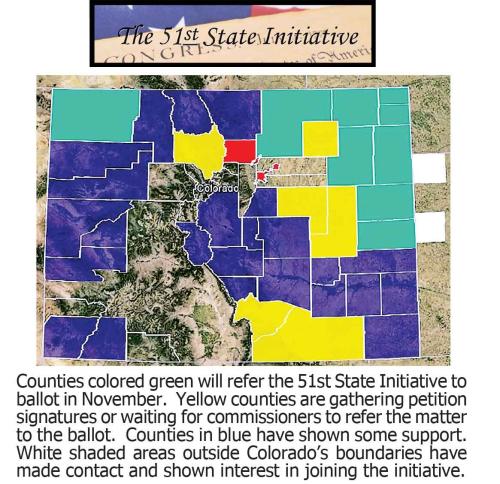
In addition to the 10 northeast Colorado counties that have a secession vote on November’s ballot, Moffat County in far northwest Colorado also will vote on whether to leave. But Moffat apparently wants to become Baja, Wyo.

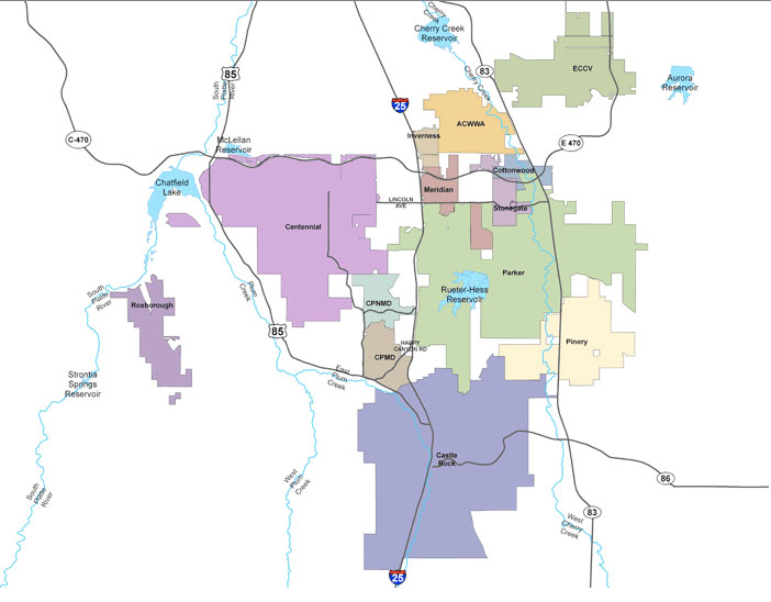
I-News at Rocky Mountain PBS analyzed census, budget, crime and voter records to develop profiles of a new 51st state and a truncated Colorado. Suffice it to say, Colorado would no longer be considered a square state. And, of course, neither would Wyoming, with its new Moffat County panhandle.

Residents of the 11 counties will decide next month whether to start the fraught with difficulty political journey to leave Colorado and, in the case of the northeast counties, become a new state.

West Virginia was the last state to manage such a separation, in 1863, during the American Civil War, a move that was validated solely by a proclamation from President Lincoln, according to a state Web site.

It isn’t that easy today. One impediment: Both houses of the U.S. Congress would have to agree.

But proponents of secession said rural Coloradans are tired of having unpopular laws like stronger gun control and mandatory alternative energy standards forced on them by a Front Range dominated state Legislature.

“What has happened is the urbanization of America has disenfranchised the rural population,” said Jeffrey Hare, one of the organizers of the 51st State Initiative.

John Straayer, political science professor at Colorado State University, said bills from the last legislative session appear to have aroused animosity toward the legislature.

“In terms of the immediate trigger, guns and probably SB 252 (requiring use of alternative energy resources),” Straayer said. “They allege that it is more than that, not being treated properly by the legislature on a variety of issues for a long time.”

The eventual exodus, if the constitutional minefield could be navigated, would create a North Colorado of about 336,000 people, supplanting Wyoming as the least populous state in the U.S. It would leave Colorado with about 4.7 million residents, dropping it to the 23rd most populous state behind Alabama.

One of the key questions is the financial viability of a new state and its impact on the remainder of Colorado.

Financially, state government in Colorado would probably come out ahead if the 11 counties left, according to I-News estimates of how much revenue the state receives from the counties compared to expenditures there.

The counties generate between $360 million and $400 million yearly for the state in sales tax, state income tax and the state’s share of vehicle registration fees. That accounts for about three-fourths of the revenue Colorado receives from those counties each year from taxes and fees.

Extrapolating forward, that would be the equivalent of between $500 million and $560 million in revenue lost to the state from the 11 counties.

The state natural resources department estimates that oil and gas operations in those counties generate about $28 million in severance tax for state coffers each year.

Historically, oil and gas operators in Weld County have contributed little or, in some years, no state severance tax because they can take credits against the state severance tax for the property taxes they have paid in each county.

On the other side of the ledger, the state spends about $520 million in the 11 counties for K-12 school funding, incarcerating criminals from the counties, providing Medicaid, running the courts and the state’s share of running a university and three community colleges.

Those costs equal about 84 percent of the state’s overall general fund spending in the secession-voting counties. Extrapolating forward, that would come to total spending of about $620 million.

Bottom line: Colorado spends between about $60 million and $120 million or more a year in the 11 counties than the revenue it receives.

“There’s still a lot of (state) money coming back to these counties,” said Brian Lewandowski, economist with the Leeds Business School at the University of Colorado at Boulder.

By comparison, a similar analysis of Denver showed the county provides more tax and fee revenue to the state than it gets back in state funding for programs.

“You’ve got densely populated areas where there is a lot of wealth like Denver County and Douglas County,” said Lewandowski.

However, advocates of secession disagree with the I-News analysis and point to their own report that shows the counties break even with state government on spending and revenue.

The differences between the two analyses involved spending figures on K-12 education, revenue from the state income tax and severance taxes from oil and gas development.

Gov. John Hickenlooper’s office had no comment on what financial impact the secession would have on Colorado.

The I-News analysis did not examine how much money the counties currently receive directly from oil and gas operations. That’s money that would help run a new state.

More than half of Colorado’s oil and gas wells would reside in the new state, mostly in Weld.

“It’s pretty amazing the amount of dollars that it generates,” Lewandowsk said.

Weld County alone gets 55 percent of its property tax revenue from exploration. That has resulted in a current $100 million county contingency fund and no debt, said Weld County Commissioner Sean Conway, a leading proponent of secession who previously was chief of staff to former U.S. Sen. Wayne Allard, R-Colo.

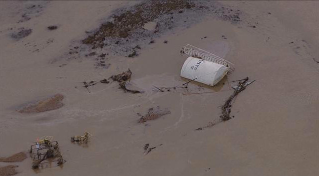
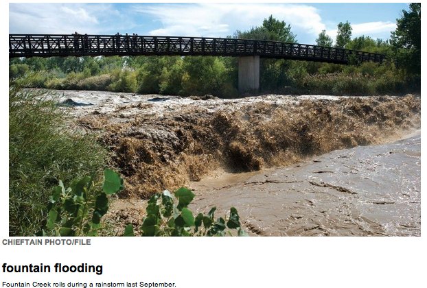
During the recent flooding, the county was able to re-open its roads on its own.

“We’ve done this on our own,” Conway said. “We haven’t got help from the state.”

Not all politicians in Weld County want to secede.

Tom Norton, the mayor of Greeley and former Republican president of the state Senate, wrote in a column in The Tribune this summer that, while some state decisions have hurt rural Colorado, collaboration with the state, not secession, is the solution.

Demographically and politically, the two states — North Colorado and Colorado — would look quite different, the I-News analysis showed.

North Colorado would be predominately Republican with the fifth highest ratio of Republicans to Democrats in the U.S.

Meanwhile, Democrats in Colorado would outnumber Republicans for the first time in years.

“We would have a red state and a blue state,” Straayer said.

The would-be exiting counties are generally poorer and less educated than the rest of Colorado, according to Census data.

College education levels in North Colorado would be on par with those of Tennessee and Oklahoma, while college graduation rates would rise in Colorado to the second highest in the nation.

North Colorado would have among the lowest crime rates in the nation, ranking from fifth to 11th lowest among states for rape, robbery, burglary and car theft.

Colorado’s overall crime rates would go up, with motor vehicle theft rates almost three times higher than those of the 51st state.

North Colorado would have a higher percentage of families among its households, be younger on average and have a higher percent of Latinos. In fact, the new state would have the 6th highest percent of Hispanics in the U.S. But its black population would only be about 1 percent, the fifth lowest in the U.S.

And then, of course, there are the issues of marijuana and tornadoes. Legal pot would stop at old Colorado’s borders. About half of the state’s tornadoes touch down every year in the counties that would leave Colorado.

Even if approved by the counties involved, secession would appear to remain a long shot. It would require both Colorado and federal approval.

State ratification could come in a citizens’ initiative, such as the one that legalized recreational marijuana, in a ballot measure from the legislature, or in an act of the legislature, said Richard Collins, professor at the University of Colorado School of Law.

If that happened, it would then need approval by both houses of Congress.

In the meantime, the effort has drawn national publicity and its share of political quips.

Last month, when Hickenlooper was looking at flood damage in Julesburg which would be part of the new state, he assured officials there that all Colorado would be working together to overcome the disaster, before quipping, “then you all can get back to seceding.”

And Conway could not resist a dig at his two least favorite counties when talking about interest in secession being voiced elsewhere — including in some counties not involved in the current effort.

“When we’re done, we might be voting Denver and Boulder off the island.”

More 51st State Initiative coverage here.

NSAA vs. USFS: Reps Polis and Tipton are pushing legislation in opposition to the USFS’s ‘taking’ of water rights

Copper Mountain snowmaking via ColoradoSki.com

From The Watch (Gus Jarvis):

Tipton’s bill, which was introduced in Congress on Sept. 26 and has the support of representatives Jared Polis (D-Colo.), Rob Bishop (R-Utah) and Tom McClintock (R-Calif.) as co-sponsors, comes as the U.S. Forest Service works to update a clause on its ski area special permits that would tie water rights to the land ski areas are on.

According to Tipton’s office, the Water Rights Protection Act would protect communities, businesses, recreation opportunities, farmers and ranchers as well as other individuals that rely on privately held water rights for their livelihood from federal takings. It would do so by prohibiting federal agencies from confiscating water rights through the use of permits, leases, and other land management arrangements.

“Long-held state water law protects the many uses vital to Colorado and Western States – from recreation to irrigation, domestic use and environmental protection,” Tipton stated in a press release. “Unfortunately, all of this is being undermined by federal intrusion that creates uncertainty and jeopardizes the livelihoods of communities, individuals, and businesses responsible for thousands of jobs. To undermine this system is to create risk and uncertainty for all Western water users.

“Our bill will restore needed certainty by ensuring that privately held water rights will be upheld and protect users from federal takings,” he added.

The U.S. Forest Service currently has a policy to keep water rights with the land when it issues permits for ski areas and codified that clause on ski area special permits in 2011 and 2012. However, the U.S. District Court, in National Ski Areas Association, Inc. v. United States Forest Service, ruled that the federal agency must vacate its 2012 Forest Service Directive on ski area water rights. The judge overseeing the case declined to rule on the substance of the Forest Service directive, but determined the clauses were a legislative rather than an interpretive rule, which means that the agency is required to provide public notice and comment before issuing a final clause.

A proposed clause tying water rights to special use permits has not yet been issued by the U.S. Forest Service for comment.

For Polis, who represents Colorado’s Second Congressional District, the inability for ski areas to own water rights for their snowmaking capabilities adds uncertainty to the future of their business and that’s why he co-sponsored the bill.

“Ski areas are in the best position to decide what water rights they need for their future operations and make a significant investment in water rights,” Polis said on Monday. Vail Breckenridge, Keystone, Winter park, Loveland, Eldora, Arapahoe Basin, and Copper Mountain are all located in Polis’ Second Congressional District. “If these businesses cannot own the water they purchase, they are forced to operate in an uncertain climate that impedes their ability to raise capital, hinders long-term planning, and reduces investments in future projects. Concern about ski area water rights being sold or moved is misguided. Ski areas have already offered to provide successor owners with an option to purchase sufficient water if that area were to be sold.”

More water law coverage here.

Water used for hydraulic fracturing poses treatment and disposal problems

The hydraulic fracturing water cycle via Western Resource Advocates

From The National Geographic (Bill Chameides):

…a paper published this week in the journal Environmental Science and Technology by Nathaniel Warner formerly of Duke University and colleagues focuses on another of those environmental costs: disposal of wastewater.

Hydraulic fracturing, as the term implies, involves water — both at the front end with fracking fluid, the water-based chemical cocktail that is injected into the shale, and at the back end where there is flowback water and produced water.

Flowback water (which literally “flows back” during the fracking process) is a mixture of fracking fluid and formation water (i.e., water rich in brine from the targeted shale gas-rich rock). Once the chemistry of the water coming out of the well resembles the rock formation rather than the fracking fluid, it is known as produced water and can continue to flow as long as a well is in operation…

As a general rule, you would not want to take a shower much less drink flowback or formation water, nor would you want to just pour the stuff into a river or stream (although that has been known to happen, as described here and here). Fracking wastewater can contain massive amounts of brine (salts), toxic metals, and radioactivity. And so the gas companies have a problem: what to do with the stuff.

Ideally, the water would be reused or recycled, eliminating the need for immediate disposal. And indeed there is a lot of that. In the Marcellus Shale gas country of Pennsylvania, for example, a large percentage of the water, in the vicinity of 70 percent, is currently reused. And methods to reuse more are being developed. Even so, that leaves a massive amount of toxic wastewater to be disposed of.

One disposal route is injection into deep wells, and a good deal of flowback and produced water from the Marcellus Shale is transported to Ohio for just such a deep burial. But this method has its own problems — the injection process has the inconvenient habit of causing an earthquake every now and again.

Another alternative is waste treatment: removing the contaminants and then dumping the“clean” water into a nearby sewer or river. But you can’t use a standard municipal water treatment plant to treat flowback and produced water as those facilities are just not designed to handle the level of contamination, especially radioactivity, found in these waters.

But there are so-called brine treatment plants that are at least in principle equipped to handle that level of contamination. Although they’ve been in use for quite some time to treat water from conventional oil and gas operations, many facilities of this type have been found lacking and some have even incurred fines for failure to meet Clean Water Act or other regulatory standards.

More oil and gas coverage here and here.

Colorado River Basin: Water shortages on the horizon? #ColoradoRiver

Colorado River Basin including out of basin demands -- Graphic/USBR
Colorado River Basin including out of basin demands — Graphic/USBR

From MSN.com (Bob Berwyn):

“The bottom line is, the [2007 shortage sharing agreements] were major progress — people could agree on reservoir levels where things are out of the normal, and we’ve hit that,” [Eric] Kuhn told MSN News. With the overall climate picture shading toward drier conditions, water managers need to be very cautious in planning for the next few years and beyond, he added.

In a July 1 memo that outlines what the looming shortages could mean for the region, Kuhn wrote that several more dry years would lead to even greater cuts in water deliveries to the arid Southwest. He said there also would be huge impacts to hydropower generation at the Hoover Dam, on the border of Arizona and Nevada.

More Colorado River Basin coverage here and here.

Chaffee County green-lights geothermal 1041 regulations

Geothermal Electrical Generation concept -- via the British Geological Survey
Geothermal Electrical Generation concept — via the British Geological Survey

From The Mountain Mail (James Redmond):

Chaffee County commissioners passed a resolution approving the county’s new geothermal 1041 regulations and lifting the moratorium on geothermal development in the county during their meeting Tuesday. The county commissioners heard and incorporated comments from Chaffee County attorney Jenny Davis on the proposed geothermal 1041 regulations. Her recommendations changed some of the recommendations made to county commissioners by the Chaffee County Planning Commission.

In July the planning commissioners asked the county commissioners to postpone any decision on their draft 1041 regulations for “Use of Geothermal Resources for the Commercial Production of Electricity.”

At the county commissioners’ Sept. 3 hearing on the proposed 1041 regulations, commissioners instructed staff members to incorporate most of the Chaffee County Planning Commission recommendations.

The Planning Commission had recommended that the 1041 regulations not govern surface uses related to geothermal development, leaving surface uses to be addressed through a county land-use change permit. Davis recommend the 1041 regulations include surface uses and not require the applicants to go through both the 1041 and the land-use change processes. Having an applicant go through both “would be a redundant process,” Davis said. Having the 1041 process address the above-ground uses would allow for more flexibility in a process tailored for geothermal projects.

Davis also recommended the commissioners keep existing language regarding use of geothermal resources in the environmental impact analysis section of the application process and not limit those uses to “legal uses.” With a domestic well, the owner has no legal right to the water’s heat, only the water itself, Fred Henderson, chief scientific officer for Mt. Princeton Geothermal, said previously. People using heat from geothermal water without a legal right to the heat can change their well permits to define and allow use of the heat, he said. Some businesses, such as bed and breakfasts or vacation rentals, may have used the heat from their wells for years, not realizing they need to change their permit to authorize that use, Don Reimer, Chaffee County development director, said previously.

Leaving the language open to all uses allows the commissioners to hear comment from all users, Davis said.
Henderson spoke in favor of keeping the change that requires a notification for exploratory drilling to a depth of less 2,500 feet, and the commissioners concurred.

Jeanne Younghaus with Chaffee County League of Women Voters, said the league has concerns about companies drilling and leaving without cleaning up their exploration.

More information about the county’s geothermal 1041 process is at http://chaffeecounty.org/Geothermal-1041.

In other business, Chaffee County commissioners instructed staff to draft a resolution that would amend Nestlé Waters North America Inc.’s 1041 and special land use permits to allow them to switch their augmentation agreement from the city of Aurora to the Upper Arkansas Water Conservancy District.

More geothermal coverage here and here.

September floods leave reaches of the pre-flood St. Vrain channel high and dry #COflood

New Saint Vrain river channel after the September 2013 floods -- photo via the Longmont Times-Call
New Saint Vrain River channel after the September 2013 floods — photo via the Longmont Times-Call

From the Longmont Times-Call (Scott Rochat):

When the St. Vrain flooded in mid-September, it not only devastated communities, it redrew its own lines. West of town. East of town. Even at spots inside Longmont. It even brought out the eraser from time to time, not just drawing a new course but wiping out the old one.

“Behind Harvest Junction, the old channel actually filled in,” said Longmont public works director Dale Rademacher, noting the shopping center in southeastern Longmont.

Putting it back won’t be so easy. The city estimates that would take $80 million, but that’s still a fluid number, so to speak. A lot depends not just on the difficulty of the project, but the will of federal authorities, including the Army Corps of Engineers and the Federal Emergency Management Agency.

FEMA already has said it will look at the river section by section when deciding which restoration plans should get funding. The Corps, meanwhile, is in talks with Longmont to decide which pieces of the river truly need to be restored. Rivers do move, after all.

“If we think we can get the river back into its channel with a reasonable amount of effort, and the Corps says it makes sense, we’ll do that,” Rademacher said. “If the Corps says ‘Sorry, folks, that looks like a reasonably safe channel,’ we’ll start planning around that, too.”[…]

The diversions and flooding along the whole western stretch — aided by dam breaches and old gravel pits — have made this area a priority in Longmont’s discussions with the Army Corps of Engineers. Near Lyons, there are pipelines that need to be inspected and put back into service. The new riverway not only cuts off several irrigation ditches, it also puts several neighborhoods further downstream into a new flood plain — most notably The Greens and Champion Greens near Airport Road and the Village near Golden Ponds.

“Our need and our ability (to restore the river) varies from point to point in the course of the channel,” Rademacher said. “West of Longmont, where it’s undermining pipelines and threatening neighborhoods, it’s pretty important.”

From The Pueblo Chieftain:

Pueblo will spend about $200,000 over the next three months cleaning up the mess left on Fountain Creek from storms to the north in El Paso County last month. Damage to an embankment on the city’s side detention pond and dangerous trees in the channel are the biggest problems, said Earl Wilkinson, public works director.

From The Greeley Tribune (Jim Rydbom):

Bit by bit, the bundles of flood debris spread across yards and streets in Weld County are getting picked up. But it will be a while before a cluster of tree limbs isn’t found twisted into a fence somewhere.

Trevor Jiricek, director of Weld County Environmental Health and General Services, said the county has handed out about 3,200 vouchers for residents to take debris to the landfill. The vouchers are unlimited and good for one pickup truck full of debris each. Jiricek said the county worked out deals with 10 different facilities, including A1 Organics and two places to dispose of tires.

Jiricek said he’s received positive feedback for the vouchers, which are available through the Weld County planning department and at the FEMA Disaster Recovery Centers in Greeley and Milliken.

Farmers and ranchers with damaged and debris-filled properties are running into frustrations with the government shutdown, as they could be eligible for financial help through federal disaster loan options or the Emergency Conservation Program. The bulk of those programs, though, require consulting with the Farm Service Agency office before doing repairs, and the FSA is a federal office.

Jiricek said the county doesn’t have the resources to clean up everyone’s private property, but officials are in the process of contracting a company to clean up the county’s right-of-ways. When that happens, he said the county will notify residents affected by the flood who are near those right-of-ways, and they can put debris out to be collected.

Jiricek said it’s important only those affected by the flood take advantage of that service, as the county depends on reimbursement from FEMA for flood-related debris only, and the costs of removing debris could go up astronomically if people start using it as a way to get rid of trash.

Immediately after the flood, Jiricek said more than a half-dozen county employees worked to talk to residents about their needs and disseminate the vouchers.

“I feel like they’ve gotten out there,” he said of the vouchers.

‘11,000 homes, 200 miles of road, destroyed…You can’t plan for that’ — Tisha Schuller #COflood

Production fluids leak into surface water September 2013 -- Photo/The Denver Post
Production fluids leak into surface water September 2013 — Photo via The Denver Post

From The Denver Post (Mark Jaffe):

As floodwater started to rise Sept. 11, some oil and gas operators began shutting wells and securing facilities. It would be five days before state regulators announced their plans. “Did the state have a disaster plan for the oil and gas fields?” asked Bruce Baziel, energy program director of the environmental group Earthworks. “It was hard to tell.”

From the start, state oil and gas regulators were gathering information and passing it on to the incident commander overseeing disaster response, said Alan Gilbert, a Colorado Department of Natural Resources official. “That’s our role as a technical agency,” Gilbert said.

Throughout the weekend, oil companies were providing information on their operations to the Colorado Oil and Gas Conservation Commission. “Demands on us to be transparent were high,” said Tisha Schuller, president of the Colorado Oil and Gas Association, an industry group.

Yet as pictures of bubbling pipes, spouting wells and floating tanks began to appear on social media, fears rose about what was happening in the flooded oil fields.

On Sept. 16, as the flood covered parts of the oil-rich Denver-Julesburg Basin, additional steps to assess impacts were announced by the oil and gas commission staff. “We intend to compile an ongoing spreadsheet with the status of operations,” said Matt Lepore, executive director of the commission.

Regulations require operators to report spills, but for the rest Lepore asked for voluntary cooperation of the industry on assessing the status of all wells. “In the middle of a disaster, it strikes me that this ought to have been required,” said Peter May-smith, executive director of Conservation Colorado. “If it wasn’t required by regulation, the governor should have issued an executive order,” May-smith said.

The steps announced were “ad hoc,” but the commission had been monitoring the situation, DNR’s Gilbert said. “We are going to have a formal review,” Gilbert said. “We’ll look at what worked and what didn’t work.”

Within days, the commission had about 18 inspectors in the field checking sites. The commission used its mapping capabilities to identify wells and facilities in floodplains and focus on those. About 1,500 wells were identified in the floodplains of the South Platte and other Front Range rivers, Gilbert said.

“For years, conservation groups have pressed for limited drilling in floodplains, and the state and the industry have fought it,” said Gary Wockner, Colorado program director for Clean Water Action. “Part of this wasn’t a natural disaster but a man-made disaster,” Wockner said.

The industry estimated that at the height of the flooding, 1 ,900 wells were shut in — there are more than 20,000 wells in the basin.

State inspectors have counted 14 “notable releases,” primarily from overturned or damaged tanks, accounting for 1,042 barrels (43,764 gallons) of petroleum products. There also were 13 releases of produced water — which contains well impurities — totaling 430 barrels (18,060 gallons), according to the state.

“That’s thousands of gallons of pollutants poisoning our waterways,” Wockner said. “It isn’t something to be dismissed.”

By Thursday, inspectors had covered 90 percent of the wells and facilities in the floodplains, Gilbert said.

“When you have an industrial activity of this scale, you need clear contingency plans,” said Conservation Colorado’s May-smith. “A clear plan in advance.”

In their review, state officials will evaluate how effective the regulations were in preventing flood spills and whether reporting was adequate and the emergency plans adequate, Gilbert said. Could that lead to new rules or plans? “That is what we are going to look at,” Gilbert said.

Still, in the face of a 500-year flood , state and industry officials contended the performance was good.

“It was chaos — 11,000 homes, 200 miles of road, destroyed,” the Oil and Gas Association’s Schuller said. “You can’t plan for that. You just have to be flexible and responsive.”

More oil and gas coverage here and here.

‘We [NISP] are mired in the environmental permitting process’ — Brian Werner #COflood

Map of the Northern Integrated Supply Project via Northern Water

Here’s a report about the proposed Northern Integrated Supply Project from Ryan Maye Handy running in the Fort Collins Coloradoan. Here’s an excerpt:

…whatever the contentious Northern Integrated Supply Project might be to Northern Coloradans, at least one thing is (mostly) certain: Despite numerous claims to the contrary, the Poudre River-fed reservoir could have done little to stem the tide of the Poudre during the September floods.

“As much as I’d like to say ‘Glade would have had a big impact on the flood,’ it really wouldn’t have,” said Brian Werner, spokesman for Northern Water, the water managers organizing the NISP project…

The project to build Glade Reservoir is roughly 30 years in the making, since President Ronald Reagan declared the Poudre a National Wild and Scenic River in October 1986. Then, the declaration was a victory for environmentalists — it limited where the river could be diverted for water conservation but set aside a portion of the river, at the bottom of the canyon, for projects such as the Glade Reservoir.

In theory, the reservoir would divert water off a swollen Poudre River when flows were high, conserving it in the reservoir for dry years, such as 2012, when extra water would be desperately needed, Werner said. The system would hypothetically pull up to 1,000 cubic feet per second from the river; typically, a Poudre flow peak reaches up to 3,000 cfs, Werner said.

But during the early September floods that pushed record levels of water down the Poudre, a loss of 1,000 cfs would have done little to mitigate the water’s power, Werner said. Glade’s ability to help Northern Colorado would be in its ability to hold water in reserve for dry times, Werner argued, not in its capacity to control a 500-year flood event…

Until it gets the results of the 2014 assessment, Northern Water is checking off the necessary boxes to put the project in order — checks that mean nothing until the project gets the go-ahead. Re-routing portions of U.S. 287, which currently runs through the center of the reservoir’s footprint, is one of those “checks.”

For the re-route, CDOT has chosen a 7-mile “rock cut route” through a hogback ridge just north of the current intersection of Overland Trail and U.S. 287, northwest of Fort Collins. It would mean new passing lanes at Ted’s Place — the intersection of U.S. 287 and Colorado Highway 14 — and would cost between $40 million and $50 million.

In the project’s early days, the highway re-route was one of its more contentious aspects. Public meetings were held to address residents’ concerns about the road changes; diverting water from the Poudre wasn’t “the overriding issue” that it has become, Werner said.

“We used to joke in the early days of this project that it was a highway reclamation project, with a reservoir on the side,” Werner added…

“We are mired in the environmental permitting process,” Werner said…

“The CDOT decision is irrelevant. Because NISP would drain and destroy the Poudre River and violate the National Environmental Policy Act, Clean Water Act and Endangered Species Act, the project will never get built,” he said in an email to The Coloradoan. “So, where CDOT proposes to put a road that will never be built for a project that will never be built is irrelevant.”

More Northern Integrated Supply Project coverage here and here.

Localized rainfall is less important to the overall water equation than a good winter snowpack #COdrought

US Drought Monitor October 1, 2013

From The Crested Butte News (Seth Manning):

Even during rainfall events over the summer that would double the amount of water in the valley’s rivers and streams overnight, often the amount of water in the reservoirs remained largely unchanged. According to Upper Gunnison River Water Conservancy District general manager Frank Kugel, that’s what happens after two years of below-average precipitation.

Kugel told the Gunnison County Planning Commission at a meeting on Friday, September 6 that there were several peaks in the amount of water in Blue Mesa Reservoir over the summer, with some dramatic drops in between. He also said the localized rainfall is less important to the overall water equation than a good winter snowpack.

“The entire Gunnison River basin got less than a quarter of its normal inflow but the good news is that much of that inflow, percentage-wise, came from the East River and Taylor. Those are the two biggest contributors as far as basin inflows, percentage-wise,” Kugel said. “As grim as it looked we were actually doing better than some of our other neighbors in other basins. In the end there was a significant volume above what we had last year. That’s the good news.”

The bad news is that after two consecutive years of below-average precipitation in the winter months, Blue Mesa isn’t going to recover anytime soon and, Kugel said, will probably drop lower than it was at the end of last year.

“We’re anticipating by late October it will hit a low point. Likely not as low as 2002, but close,” Kugel told the Planning Commissioners. “So it’s going to be a long look out from the Lake City Bridge to where the lake actually starts.”

Even the heavy rains and snow that have swept across the Western Slope throughout September have yielded only modest gains in stored water, with Blue Mesa holding steady at 350,000 acre-feet.

And while the Gunnison River, the East River and Ohio Creek have all shown tremendous, temporary spikes in streamflow this summer, even doubling in size over night, Kugel said the years of drought have drawn down aquifers to a point where they can easily absorb any amount of water dropped during a rainstorm…

But through some litigation and inter-basin agreement, the UGRWCD has made great strides in securing the water already in use in the Gunnison Basin. Now it’s focused on providing the state with a clear plan for the basin’s water as part of the governor-initiated State Water Plan.

“Our number-one priority at this point is to protect existing uses within the basin, be it by overdevelopment from here or particularly to any export to other basin,” UGRWCD board member George Sibley told the commissioners. “We want to make sure we’re operating and managing our existing resources as effectively as we can and are prepared for other circumstances that may have dramatic impact on how much water is available.”

To accomplish that, the UGRWCD hired Lakewood-based Wilson Water Group—with a $200,000 grant from the Colorado Water Conservation Board—as a contractor to help develop a water-use plan for the entire Gunnison Basin that will be submitted to the state for consideration as part of a statewide water plan to be drafted over the course of 2014.

At the same time, the UGRWCD is trying to keep information about the valley’s water supply flowing, through manual snowpack observations that are under threat of being defunded by the National Resources Conservation Service.

More Colorado Water Plan coverage here.

Streamflows in the #ColoradoRiver Basin in recent years are a cause for concern

Colorado River -- photo via Wikipedia
Colorado River — photo via Wikipedia

Here’s a report about the recent Colorado River District annual seminar from Hannah Holm writing for the Vail Daily. Click through and read the whole thing. Here’s an excerpt:

I wasn’t actually at the meeting — I was held up near Denver by landslides — but I recently caught some of the presentations on video, and so can you. The Colorado River District, which organized the meeting, has made videos of the presentations available on the Web at http://www.crwcd.org/. Slides shown by presenters are also posted there.

Colorado River District Manager Eric Kuhn set the stage for the day’s discussions with a few basic observations about the Colorado River Basin that are fundamental to understanding the challenges involved in trying to meet the needs of everyone who relies on the river: 35 million people (and growing) with 5.5 million acres of irrigated land in seven states, 10 autonomous/sovereign Native American tribes and two countries. He didn’t even have to mention the fish, cottonwoods, ski resorts or rafters to make the challenge sound daunting.

Kuhn pointed out that between 2000-13, natural flow into the Colorado River system above the Hoover Dam was 180 million acre-feet, while total water use from the basin was 210 million acre-feet, leading to a drawdown of 30 million acre-feet of water stored in reservoirs. And the Colorado River Basin Supply and Demand Study (Basin Study) released late last year forecast that demands are likely to keep growing.

This doesn’t necessarily mean that disaster lies around the next bend, but it might…

Other seminar speakers elaborated on this overall theme of shrinking supplies and growing demands, with presentations on our shrinking Rocky Mountain snowpack, dropping water levels in Lake Powell, Las Vegas strategies to adapt to dropping water levels in Lake Mead, innovative urban water conservation strategies and the challenges involved in planning to meet growing water needs within Colorado.

These issues show no signs of going away any time soon, and how they are resolved will have far-reaching implications for the whole region’s economy, environment and quality of life. Reviewing the presentations from the River District’s seminar will leave you well prepared to understand what’s going on and what’s at stake, and to add your voice to the conversation.

More Colorado River Basin coverage here and here.

Parker-based Independent Energy Partners and the School of Mines are testing a new oil shale production technology

Geothermic fuel cell well field -- via Independent Energy Partners
Geothermic fuel cell well field — via Independent Energy Partners

From The Grand Junction Daily Sentinel (Dennis Webb):

A Colorado company is working with the Colorado School of Mines on the next stage of testing for a novel approach to developing oil shale. Parker-based Independent Energy Partners is pursuing the concept of using what it calls a geothermic fuel cell to employ heat to produce oil from shale in-situ, or in place, underground. Strings of fuel cells would be stacked in wells drilled into the shale.

The idea was first conceived by Marshall Savage, whose family has extensive land holdings in western Colorado’s Piceance Basin and who serves as IEP’s vice president of technology development.

A fuel cell can convert a fuel like natural gas into electricity through a chemical process. The patented, downhole heater being developed by IEP will use the waste heat to warm up the oil shale rock in what’s called a geothermic process, versus the geothermal one of tapping heat from the ground.

The company plans to use locally produced natural gas to get the fuel cells going, but under the concept the cells then will operate on gas generated along with oil in the heating process. Electricity production will be a side benefit of the process, and IEP President and Chief Executive Officer Alan Forbes said the process would be water neutral because water produced by the fuel cell would offset consumption. Carbon emissions would be minimal because there’s no combustion, he said.

The company had Pacific Northwest National Laboratory do work to confirm the concept’s technical viability, and had Delphi, a solid oxide fuel cell maker, make a downhole prototype. Now, IEP is paying about $900,000 for the School of Mines to do prototype testing at its Colorado Fuel Cell Center. The school received a small unit earlier this year and a stacked one more recently.

Initial testing will be followed next year by in-ground tests on campus, and then field tests in oil shale formations, with a goal of producing oil in 2015. IEP holds several leases on private property in Rio Blanco County.

“It’s kind of an exciting research project,” said Jeremy Boak, director of the Center for Oil Shale Technology and Research at the School of Mines.

Said Forbes, “We’re pretty confident it’s going to work fine, it will work as advertised.”

Boak said one challenge the company might face is rock shifting when heated and damaging heaters. He said he thinks Shell faced such problems but was able to solve them. [ed. emphasis mine]

The company is pressing forward even as Shell has announced the end of its Colorado oil shale research and development project, citing a desire to focus on other global opportunities.“I know that they haven’t been doing really well at a corporate level and I think they’re just readjusting their priorities,” Forbes said.

He said IEP’s work is “moving right along.”

“We’re quite pleased with the progress and the parties we’re working with right now.”

Those parties include the energy giant Total, which also is a partner with American Shale Oil in an in-situ project in Rio Blanco County and is invested in Red Leaf Resources’ project to mine and process oil shale in Utah.

“I think Total is very energized by this (IEP) approach and other approaches and is eager to see something proceed here,” Boak said.

More oil shale coverage here and here.

‘In my experience, you don’t ever get a perfect solution’ — Diane Mitsch Bush #COflood

Flooded well site September 2013 -- Denver Post
Flooded well site September 2013 — Denver Post

From Colorado Public News (David O. Williams):

Colorado state Rep. Diane Mitsch Bush says she plans to take up the issue of water contamination and greater setbacks for oil and gas wells from waterways in the wake of this month’s devastating flooding. Mitsch Bush, a Democrat representing Routt and Eagle counties on the Western Slope, told Colorado Public News new rules need to be considered for keeping drilling away from rivers and streams. The approach is similar to the state’s new setback rules for homes and public buildings, which went into effect Aug. 1. Current rules prohibit drilling within 300 feet of streams that provides municipal drinking water – extending five miles upstream of the water intake – but that setback doesn’t apply to bodies of water in general…

Rivers across northeastern Colorado – including the South Platte and St. Vrain – have been inundated with a variety of contaminants from flooding that started Sept. 11. Mitsch Bush said she is concerned about potential health impacts of the 890 barrels of oil that regulators confirmed have spilled in the flood zone.

“Any oil, any condensate, has the BTEX [benzene, toluene, ethylbenzene, and xylene] component and many others,” said Mitsch Bush. “All of those are very contaminating in a water body in relatively small portions. I think it’s really important that we don’t minimize what’s in there, but at the same time that we don’t have a huge overreaction either.”[…]

Asked about the potential for new setback laws or rules as a result of the floods, a spokesman for the Colorado Oil and Gas Association, an industry trade group, said their continued focus is on recovery, safety and getting production back online.

“Once flooding began, over 1,900 wells were shut in,” the group’s Director of Policy and External Affairs Doug Flanders said in an email, referring to the organization’s website for shut-in procedures. “To date, this has resulted in less than 1 percent of the wells having any isolated incidents due to debris-filled flood waters…

“In my experience, you don’t ever get a perfect solution,” she said, “but you get a better, a good, a sufficient solution if you can work with all the groups and sit down, talk about it, work together and see what you can come up with.”

More oil and gas coverage here and here.

‘When the big one [flood] comes, there will be added damage from growth in Colorado Springs’ — Sal Pace

Cherry Creek Flood August 31, 1933 -- photo via the Denver Public Library
Cherry Creek Flood August 31, 1933 — photo via the Denver Public Library

From The Pueblo Chieftain (Chris Woodka):

A large dam on Fountain Creek is needed to prevent the kind of damage from flooding witnessed in Northern Colorado last week, a county commissioner says.

“When the big one comes, there will be added damage from growth in Colorado Springs and the burn scars of two large fires. The flooding will be worse than ever,” Commissioner Sal Pace said Thursday.

“We only have to look at the tragic events in Boulder and Larimer counties, in Lyons and Estes Park, to see what could happen.”

Floods, some rated as 500-year storms, overcame numerous small dams. Larger dams, such as Bear Creek and Cherry Creek reservoirs in the Denver Metro area, held up, he pointed out.

More Fountain Creek coverage here and here.

Yellow-billed cuckoo may get endangered species status

Colorado Water Center a focus for resources, expertise

Reagan Waskom via Colorado State University
Reagan Waskom photo via Colorado State University

Here’s the release from Colorado State University:

The Colorado Water Center will be faculty-led, and all water faculty who want to affiliate with the Center will have that option in one form or another. The Water Center will be led by an 11-member Executive Committee. Reagan Waskom, director of the Colorado Water Institute, will serve as the Chair of the Executive Committee. Waskom said the focus of the Water Center will likely changeas it expands its scope.

“We will be looking at how to take our current areas that are strong or potentially strong, and drive them to the next level,” said Waskom. “This will evolve, but one thing we hope to accomplish at CSU is some strategic cluster hires to take us to national prominence in a few areas such as ecohydrology, or irrigation efficiency, or water for energy, to name just a couple of possibilities.”

Provost Rick Miranda said that this year the University has taken the opportunity to add some significant resources to support faculty efforts in water research, education, and outreach.

“I am delighted that Reagan Waskom will be directing our rejuvenated Water Center to deploy these resources to greatest effect,” he said. “I am grateful to the faculty committee, chaired last year by Gene Kelly, that drafted a useful roadmap to guide our efforts in the next years, and we are committed to making further investments in this direction in years to come. I expect that the Colleges will contribute with cluster hiring of faculty and I trust that they will coordinate these efforts to maximum effect as well. We’re excited!”
New projects from within

A revitalized Colorado Water Center will begin by looking within CSU for new projects, according to Waskom. The Center has just released its request for faculty proposals that include three types of grants: multi-disciplinary teams, multi-investigative teams and faculty fellows. Grants will range from $7,500 to $25,000. The deadline for applications is Oct. 21.
More information.

“We want to foster small grants that lead to big projects,” Waskom said. “We want to build teams and capacity where we have critical mass to do something big working together. We also want to help junior faculty by fostering their ideas and key projects.”

SoGES and Water Center

One of the first efforts will be immediate work on the undergraduate Water Minor, which will be housed in the School of Global Environmental Sustainability. Students from diverse disciplines with an interest in water issues will be able to obtain a minor in water studies by the 2014 spring semester.
The ties to SoGES are especially important to Diana Wall, director of SoGES, University Distinguished Professor, and Senior Research Scientist at the Natural Resource Ecology Laboratory.

“Our Global Environmental Sustainability Minor is highly successful because students from all colleges want to make the future better,” said Wall. “The comprehensive knowledge they gain from the Water Minor will help them respond effectively to the risks and opportunities of other global environmental challenges. CSU students challenge CSU researchers to develop an integrated understanding of the complexity of environmental, societal, and economic issues. We are thrilled to house an undergraduate Water Minor which will enrich our offerings even more.”

Open house next week

The Water Center will host an open house 4:30-6 p.m. Thursday, Oct. 10, to answer questions and discuss potential projects. The open house will be held in the Montreal Conference Room in SoGES’ offices at 108 Johnson Hall. Refreshments will be served.
Waskom, current president of the Colorado Water Congress, the state’s leading water organization established to provide leadership on key water resource issues, says the sky’s the limit for conceptualizing new, innovative water-related projects.

“Anything from research teams to seeking grants or initiating seed projects; art and humanities scholarships related to water; new curriculum being developed and implemented; national conferences held at CSU; book projects; visiting distinguished scientists; or invited speakers. The only limit is our imagination.”

More education coverage here.

Fountain Creek: The El Paso County Board of Commissioners approve stormwater regional solution resolution

Fountain Creek swollen by stormwater in 2011 -- photo via The Pueblo Chieftain
Fountain Creek swollen by stormwater in 2011 — photo via The Pueblo Chieftain

From The Colorado Springs Gazette (Matt Steiner):

The Board of County Commissioners voted on the resolution Tuesday, passing it by a 3-2 vote. Lathen said Darryl Glenn and Peggy Littleton cast the dissenting votes, noting that they wanted to wait until an Oct. 9 presentation by Mayor Steve Bach and consulting firm CH2M Hill before they gave their OK.

The City Council approved the same resolution 7-1 on Sept. 24. Helen Collins opposed it and council member Andy Pico was absent.

Bach has opposed the resolutions while awaiting the consultant’s input.

The commissioners had voted unanimously to approve a resolution in February, but the City Council waited until April after Bach insisted that a private study needed to be done. The mayor also said in February that the decision needed to wait for the new council, which was seated in April.

The outgoing council defied the mayor’s request and passed a regional stormwater resolution as one of its last actions. Scott Hente, the outgoing council president, said after the April 9 vote, “Stormwater is not politics. Stormwater is floods coming into your home. This is something that’s important to the community,” he said.

Lathen echoed Hente’s statement Wednesday when asked why the city and county needed to pass the recent resolutions after both government bodies had already voted in the joint effort. The commissioner stressed that this time, City Council and the BOCC each endorsed the same plan.

“This one is the same resolution signed by both bodies, and we’re excited about that,” Lathen said.

From the Colorado Springs Independent (Pam Zubeck):

For more than a year, local officials have been trying to figure out what to do about drainage. The long-overdue debate has centered on whether it’s best for Colorado Springs to go its own way, as Mayor Steve Bach wishes, or whether all agencies in the watershed need to cooperate to tackle the problem, which by one estimate will cost nearly $1 billion.

Next week, things will come to a head when Bach unveils his long-awaited proposal, along with a report from consultant CH2MHill about whether the city’s projects list alone really totals some $700 million.

From The Pueblo Chieftain (Chris Woodka):

Apparently, Fountain Creek is a moving target when it comes to Bureau of Reclamation environmental impact studies. Buried in the documents regarding the Arkansas Valley Conduit and master storage contract for Lake Pueblo released in August is Reclamation’s response to a concern raised by Pueblo County last year.

In a Nov. 30, 2012, letter, Pueblo County’s water attorney Ray Petros asked about the discrepancy of flows on Fountain Creek between the EIS for Southern Delivery System and the conduit when it comes to Colorado Springs’ repeal of its stormwater enterprise in 2009.

Petros also asked if Reclamation intended to reopen the SDS environmental study in light of the stormwater repeal, especially looking at the cumulative impacts of both projects.

Reclamation responded that it would not open a new investigation of Fountain Creek flows because additional storage contracts for some El Paso County cities that are tied into the conduit EIS would have only negligible impact on Fountain Creek.

With regard to the discrepancy in flows on Fountain Creek — they are reduced by 12 percent in the conduit-master contract study — Reclamation responded that different time frames were used. The SDS study looked at 2006 and compared it to 2046 projections, while the conduit study looked at 2010 and compared it to 2070.

The lack of a Colorado Springs stormwater enterprise is of concern to Pueblo County commissioners because it was in existence when a previous board issued a 1041 land-use permit in 2009. Commissioners are evaluating Colorado Springs compliance with 1041 conditions.

The Lower Arkansas Valley Water Conservancy District is preparing a federal lawsuit against the Bureau of Reclamation over its lack of action on a request to reopen the EIS for SDS because of the stormwater issue.

More Fountain Creek coverage here and here.

Environment Colorado releases report — ‘Fracking by the Numbers’

Dilbert's company embraces hydraulic fracturing for competitive advantage
Dilbert’s company embraces hydraulic fracturing for competitive advantage

Here’s the release from Environment Colorado:

As Colorado assesses the extent of pollution from gas drilling sites swamped by September’s flood, a new report charges that since 2005, fracking operations in Colorado have generated 2.2 billion gallons of toxic wastewater. The Environment Colorado Research & Policy Center report “Fracking by the Numbers” is the first of its kind to measure the footprint of fracking in Colorado to date.

“The numbers don’t lie—fracking has taken a dirty and destructive toll on our environment. If fracking continues unchecked, these numbers will only get more dire,” said Lindsey Wilson, field associate from Environment Colorado. “At the very least we need to make sure that the oil and gas industry is subject to standard environmental laws, like our nation’s hazardous waste law.”

Water contamination—especially after the recent flooding across the front range—is a real concern. Cliff Willmeng, a trauma nurse who has been involved in East Boulder County’s efforts to ban fracking, was one of the first to document damaged oil and gas infrastructure during the Front Range’s historic floods. “All of these sites contain various amounts of hazardous industrial wastes that are capable of spilling into the waterways and onto agricultural land,” said Willmeng. “Many of these chemicals are carcinogenic, neurotoxic, and known endocrine disruptors.”

In addition, the “Fracking by the Numbers” report measures other key indicators of fracking threats in Colorado, including 38,150 tons of air pollution produced in 2012, and 23 million tons of global warming pollution since 2005.

The state of Colorado currently regulates oil and gas drilling, but several local communities have moved forward to ban fracking—even with the threat of lawsuits by the state looming over their heads.

“State officials must allow cities, towns, and counties to protect their own communities from the dangers that oil and gas development pose through local bans and restrictions on fracking,” said Boulder City Councilor Macon Cowles. “It is not just City Councilors who are concerned about fracking, but entire communities.”

Colorado ranks near the top of the list for all key indicators of fracking threats in the national data. In addition to the 2.2 billion gallons of toxic wastewater produced, 57,000 acres of land has been damaged by fracking since 2005—which is equivalent to one third of the acreage of Colorado’s state park system.

“The bottom line is this: The numbers on fracking add up to an environmental nightmare,” said Wilson. “For public health and our environment, we need to put a stop to fracking.”

At the federal level, the Obama administration received more than one million comments last month calling for much stronger protections from fracking for national forests and national parks. In addition, Rep. Matt Cartwright of Pennsylvania (D-Scranton) has introduced the CLEANER Act (H.R. 2825)—a bill to close the loophole exempting oil and gas waste from the nation’s hazardous waste law.

“The data from today’s report shows that Coloradans are not protected from this dirty drilling,” said Wilson. “Federal officials must step in; they can start by keeping fracking out of our forests and closing the loophole exempting toxic fracking waste from our nation’s hazardous waste law.”

More oil and gas coverage here and here.

USFWS: Golden eagle attacks deer – photos of an epic confrontation

Cache la Poudre River: The Colorado Water Trust is spearheading a diversion dam removal and restoration project

The soon to be removed Josh Ames diversion on the Poudre River -- photo via the Fort Collins Coloradaon
The soon to be removed Josh Ames diversion on the Poudre River — photo via the Fort Collins Coloradaon

From the Fort Collins Coloradoan (Kevin Duggan):

A decades-old water diversion that stretches across the river about a quarter mile west of Shields Street is scheduled to be removed in November. The Josh Ames diversion, which backs up the river about 100 yards, formerly fed an irrigation ditch that was abandoned in 1985.

Once the 8-foot-tall concrete wall and stout headgate that make up the diversion are removed, the river will flow freely with fish-friendly pools and riffles. “It will look like a natural river that doesn’t have a barrier across it,” said Tara Schutter, an engineer working with the Colorado Water Trust. “It will look nice.”[…]

Removing the diversion is connected to a series of projects the city of Fort Collins has going aimed at restoring the river and improving habitat. The projects include lowering the north bank of the Poudre near the North Shields Ponds Natural Area so the river can better connect with its natural floodplain.

Other projects linked to the restoration effort include replacing the Shields Street bridge over the Poudre River. Larimer County expects to replace the bridge in 2015.

Taking out the diversion structure is a critical piece of the overall project, said Rick Bachand of the Fort Collins Natural Areas Program and the project manager.

Occasional floodwater from the river will rejuvenate the area’s vegetation and boost habitat for a variety of aquatic creatures, he said. Public access to the ponds area will include pedestrian and bike trails.

More Cache la Poudre River coverage here and here.

The Colorado Ag Water Alliance and the Arkansas River Basin Roundtable workshop on the value of agriculture, October 7

Flood irrigation -- photo via the CSU Water Center
Flood irrigation — photo via the CSU Water Center

From the La Junta Tribune-Democrat (Candace Krebs):

On Monday, Oct. 7, water users, managers and economists will converge in Colorado Springs to discuss how to more thoroughly and accurately value water being used for agricultural production. “There are a lot of byproducts from ag production that people don’t even think about,” said Charlie Bartlett, a Merino farmer and current chairman of the Colorado Ag Water Alliance, which is hosting the workshop in conjunction with the Arkansas River Basin Roundtable.

Viable farms don’t just raise food; the commodities they produce contribute to a wide range of consumer and industrial products ranging from cosmetics to plastics, he said. Farms also preserve open space and create a refuge for birds and wildlife. Irrigation use is often responsible for maintaining stream flow, which in turn contributes to fish populations, human recreation and scenic value.

In addition, proper agricultural management provides for conservation and stewardship of natural resources, added Bartlett, as he listed off many indirect and hard-to-measure attributes of ag water use.

“We think it’s pretty important to get people thinking and to walk them through some of the possible scenarios,” he said. “If we divert water away from agriculture, we’re not only losing one of our key economic drivers, we’re losing our ability to have locally produced feed, fuel and fiber.”

Monday’s workshop is aimed at decision-makers who participate in the development of water management policies throughout the state of Colorado. Prominent legal and economic experts will share their expertise and experience.

Floodwaters have receded but health hazards have not #COflood

The mouth of Poudre Canyon September 2013 -- Photo / Drew Fisher
The mouth of Poudre Canyon September 2013 — Photo / Drew Fisher

From the Northeast Colorado Health Department via the Sterling Journal-Advocate:

The Northeast Colorado Health Department would like to remind everyone that receding flood waters don’t take all the danger with them. “Even though many residents may not have been directly affected by major flooding, there are still many lingering health and safety issues that all residents need to be aware of as we continue to clean-up and recover from this disaster,” said Dr. Tony Cappello, NCHD’s public health director.

Puddles, rivers and streams: While these may look like fun to play in, after a flood they can be deeper than they look and can be dangerous. In addition, flood waters should be considered contaminated, this water is not safe to be in at this time without proper protective equipment.

Animals: After a flood, you may find creatures in your house and yard that weren’t there before, like insects and spiders, stray dogs, or wild animals. Rabies, as well as West Nile virus, is still an issue in northeast Colorado so it’s important to follow these rules; Stay away from strange dogs and cats and other wild animals, they may be lost and scared and may bite you even though you are trying to help them. This is not the time to take in stray animals, contact animal control in your area if you come across one. If you find your dog or cat, wait and let it come to you, then consider taking it to the veterinarian for a checkup. If you see a snake, don’t touch it. Most snakes are not poisonous, but it’s best to be cautious. It is normal to see a lot of spiders and insects after a flood, especially mosquitoes. You can protect yourself from bites by wearing long pants and long-sleeved shirts, and wearing an insect repellent. Do not play in or near puddles or anywhere there is standing water. Do not touch dead animals with your bare hands. Be sure to wear gloves and wash your hands afterward. Wash your hands often.

If you touch anything that has been in the flood water, be sure to wash your hands with soap and water or an alcohol-based hand sanitizer before eating or even putting your hands near your face. If flood water touches cuts and scrapes, wash them right away.

Dr. Cappello would also like to remind residents that NCHD is providing FREE tetanus shots to anyone who had direct contact with flood waters or who are starting to clean up and have contact with flood debris. Walk-in clinics are scheduled for Wednesday, Sept. 25 and Friday, Sept. 27 at NCHD’s Sterling office, located at 700 Columbine St., from 8:30 a.m. – 4:30 p.m.; and at the Merino Community Center on Thursday, Sept., 26 from 6 – 10 p.m. NCHD is also offering free water testing for those whose wells had flooding over the well head.

In addition, NCHD has several fact sheets located under the Flood Resources page on their website. This page can be accessed on their main page, http://www.nchd.org, and it’s located on the right side under the Current Events tab. The fact sheets include information on crop and garden safety after a flood,cleanup after a disaster, cleanup after residential sanitary sewer backups, food and water safety after a flood, cleaning and sanitizing with bleach after an emergency, and information on what to do if your well or septic system floods.

Nuestro Río, et al., were in Washington D.C. this week to advocate for the #ColoradoRiver

Colorado River Delta -- photo via National Geographic
Colorado River Delta — photo via National Geographic

From The Pueblo Chieftain (Chris Woodka):

State Reps. Leroy Garcia, D-Pueblo, and Joe Salazar, D-Thornton, traveled to Washington this week to meet with members of Congress and administration officials to deliver a message from Latinos across the Southwest: Save the Colorado River.

Students from Nuestro Río, a network of 21,000 Latinos in the Southwest dedicated to wise use of the Colorado River, joined forces with Western local elected officials from the newly formed Regional Water Caucus of the Congressional Hispanic Caucus Institute to advocate for improved urban water conservation and agricultural efficiency in the Colorado River basin.

Garcia and Salazar met with both of Colorado’s U.S. senators and six of its seven U.S. representatives. “We’re trying to spread the word that the Colorado River is in trouble,” Garcia said. “If we don’t conserve, we’re courting disaster.”

The Colorado River provides water to 35 million people and grows 15 percent of the nation’s crops. But demand for the river’s water already exceeds supply, and development is expected to increase this pressure while climate change reduces the amount of water in the basin by as much as 30 percent by 2050. “This goes beyond environmental concerns — it becomes a cultural issue,” Salazar said. “Our Hispanic heritage and the Colorado River are deeply intertwined.”

More Colorado River Basin coverage here and here.

The Colorado Water Trust Year in Review is hot off the presses

Map of the Roaring Fork River watershed via the Roaring Fork Conservancy
Click here to read the email.

51st State Initiative: ‘First and foremost, water rights are private property’ — Sean Conway

20130828_014411_51-state-map-with-cutline_500From The Greeley Gazette (Sean Conway):

Since discussion of creating a 51st State began, the most asked question I have had is how will the existing water rights our farmers and communities currently own be impacted?

First and foremost, water rights are private property. And like other private property – your home, car or land that you own – they cannot be taken away because you live in another state. Many water rights throughout Colorado are currently owned by individuals and entities who do not reside in the state of Colorado. Under the constitution, any private property that might be attempted to be seized would be called a “taking” and has been deemed by the U.S. Supreme Court as unconstitutional.

Second, the U.S. Supreme Court in 1982, in the landmark case of Nebraska v. Douglas, ruled no state may impose severe withdrawal, impede, divert or keep water from flowing into another state. This case, between the State of Colorado and Nebraska, is important, because this ruling would have precedence over the Colorado State Constitution and existing State law. This ruling protects all current water right holders.

Third, existing Water Compacts between the state of Colorado and the states of Nebraska and Kansas and other states must continue to be honored under federal law. This means that the water that flows currently from the Poudre River, South Platte and St. Vrain, along with other tributaries, must continue to flow as is, uninterrupted, toward those states to meet those federal compacts.

Fourth, the largest supplier of water to Weld, Morgan, Logan and Sedgwick Counties is the Big Thompson Water Project. This project, which is operated by the Northern Colorado Water Conservancy District (NCWCD), provides 220,000 acre feet annually to northeastern Colorado and is a federal project permitted by the Army Corp of Engineers. This permit would remain and continue to operate as usual. In addition, the only thing needed to protect the current boundaries of the district in the new state would be for those boundaries to be recognized in the new state’s constitution; something that would be almost certainly the first thing the new state constitution would include.

In discussions with several water attorneys and water experts about the new state, the one common phrase that was frequently stated to me about existing water rights and protection for water right holders was it is “very attainable.” Protection for the existing counties in the NCWCD and working out an agreement with Colorado and other current compact states are very “doable” and can be accomplished.

Finally, benefits overlooked by those looking at this issue in a parochial manner include the ability of a new state to enter into new compacts with other states and the ability of a new state to address the issues of needed water storage projects as well as the “buy and dry” issues that have seen tens of thousands of acres of productive farm land along the South Platte be transferred to metro Denver communities over the last three decades.

Another item which might escape naysayers is that a new state could include several western slope counties including Grand, Garfield, and Mesa. All head water counties for the Colorado River and the origin for much of the water we currently use in Northern Colorado. If these counties were to be part of the new state, our very valuable water rights would even be more protected.
To conclude, any new state would protect current water right holders. The actions needed to protect those water rights have been identified and certainly will be acted on by the new state.

More 51st State Initiative coverage here.

NWS Pueblo: September Climate Review and October Preview

Temperature and precipitation departure from normal September 2013 -- Graphic NWS Pueblo
Temperature and precipitation departure from normal September 2013 — Graphic NWS Pueblo

From the National Weather Service Pueblo office:

September of 2013 started out very warm and dry across Colorado, as a large upper level ridge of high pressure persisted across the state. A weather system then moved into the Great Basin Region bringing a prolonged period of moist southerly flow aloft to the region from September 9th through the 15th. This moist southerly flow aloft, combined with moist low level upslope flow behind passing cold fronts across eastern Colorado, brought extreme rainfall to region, especially to portions of the Front Range, where pockets of 12 to 17 inches of rain were recorded. Unfortunately, this historic rainfall also caused deadly and destructive flooding across the state, with priliminary damage estimates of nearly 2 billion dollars to residental properties and infrastructure across the state at this time. September of 2013 then ended nearly the same as it started, with generally warm and dry conditions across the state. The following graphics depict departures from normal for both temperatures and precipitation experienced across the state over the past month.

Colorado Springs recorded 4.80 inches of rainfall over the past month of September. This is 3.61 inches above normal and makes September of 2013 the third wettest September on record, behind the 5.91 inches and the 4.97 inches recorded in September of 2011 and 2008, respectively. Colorado Springs has received other noteable amounts of precipitation over the past few months, with a combined 10.52 inches of rain recorded over the two past months. This makes August and September of 2013 the wettest on record, surpassing the 10.22 inches of precipitation recorded through August and September of 1976. Colorado Springs has also recorded a combined 15.13 inches of precipitation over the past 3 months. This makes the July through September timeframe of 2013 the wettest on record, surpassing the 12.30 inches recorded in the July through September period of 2011. In fact, the 3 month combined precipitation total of 15.13 inches is the third highest three month period precipitation total on record in Colorado Springs, just behind the 16.85 inches recorded in the June through August period of 1965, and the 15.66 inches recorded in the April through June timeframe of 1995.

As for temperature, the average September temperature in Colorado Springs was 65.5 degrees. This is 4.6 degrees above average and makes September of 2013 the third warmest on record, behind the 67.0 degrees and the 66.6 degrees recorded in September of 2010 and 1931, respectively.

Alamosa recorded 2.98 inches of rainfall over the past month of September. This is 2.07 inches above normal and makes September of 2013 the wettest September on record, surpassing the 2.62 inches recorded in September of 1938. Alamosa has also tallied a combined 5.45 inches of precipitation over the past two months, making August and September of 2013 the second wettest on record in Alamosa, just behind the 5.98 inches of precipitation recorded in the August and September period of 1993. Alamosa also recorded a combinded 6.25 inches of precipitation over the past three months, making the July through September timeframe of 2013 the third wettest on record, just behind the 6.31 inches and 6.30 inches recorded in the July through September period of 1993 and 1936, respectively. The combined 6.25 inches of precipitation recorded over the past three months in Alamosa is also the fourth highest three month period precipitation total on record in Alamosa.

As for temperature, the average September temperature in Alamosa was 57.8 degrees. This is 2.8 degrees above average and makes September of 2013 tied as the 7th warmest on record, well behind the 59.0 degrees recorded in September of 1933.

Pueblo recorded 1.27 inches of rainfall over the past month of September, which is 0.50 inches above normal. Pueblo has also recorded notable amounts of precipitation over the past two months, with a combined total in August and September of 2013 of 5.19 inches, making it the 6th wettest August and September on record.

As for temperature, the average September temperature in Pueblo was 69.6 degrees. This is 4.7 degrees above average and makes September of 2013 the 7th warmest on record, well behind the 71.0 degrees recorded in September of 1931.

Looking ahead into October, in Colorado Springs, the average high and low temperature of 68 degrees and 41 degrees on October 1st cools to 58 degrees and 31 degrees, respectively, by the end of the month, with an average monthly temperature of 49.4 degrees. Colorado Springs averages 0.82 inches of precipitation along with 2.9 inches of snow in October.

In Alamosa, the average high and low temperature of 68 degrees and 30 degrees on October 1st cools to 55 degrees and 19 degrees by the end of the month, with an average monthly temperature of 43.1 degrees. Alamosa averages 0.68 inches of precipitation and 2.1 inches of snow in October.

In Pueblo, the average high and low temperature of 75 degrees and 40 degrees on October 1st cools to 64 degrees and 29 degrees by the end of the month, with an average monthly temperature of 51.8 degrees. Pueblo averages 0.72 inches of precipitation along with 1.3 inches of snow in October.

Surface streams carved new channels in some areas during the recent flooding #COflood

Evans Colorado September 2013 via TheDenverChannel.com

From The Greeley Tribune (Eric Brown):

Water officials and water providers face a rare predicament following last month’s historic flood. Discussions on whether the region’s rivers should be put back in their previous locations are now taking place after surging floodwaters cut several new paths — relocating rivers as much as three-fourths of a mile in some spots, according to reports.

A number of water providers this week expressed support to get the rivers back to their previous locations, at least in areas where their diversion structures are no longer on the banks of the rivers, and can’t draw water into reservoirs or ditches. Without moving the rivers back, those water providers would have to build new diversion structures where the river is now located, they said, which could add up into the hundreds of thousands of dollars, maybe more.

While there’s much support to get the rivers back to their previous locations, there still are questions about permitting for the river-redirecting endeavors, legal issues, and about who would pay for the projects, among others. “This issue could be complicated,” said Dick Wolfe, state engineer with the Colorado Division of Water Resources. “In the several instances where ditch companies or others had structures that were washed out or had other damage, it’s fairly clear how those repairs should be done. But in the cases where the rivers cut a whole new channel … there’s still a lot of discussions that need to be had.”

Wolfe said he and others with the state will continue working closely with local and federal officials, including the U.S. Army Corps of Engineers, which evaluates permit applications for essentially all construction activities that occur on the nation’s waters, including rivers.

“It’s certainly not an issue the state has dealt with during my professional career,” said Wolfe, who’s worked in the water business in Colorado for 27 years. “And while the floods of 1965 and 1976 caused similar problems, the federal permitting process and other things have changed so much since then … that I’m not sure we can really use those as a road map.”

Regardless of the challenges, water providers and water users say there’s limited time to fix the problem.

“It’s definitely something we need to get done … and fairly quickly, so we can be ready to capture spring runoff (snowmelt from the mountains) next year, and be ready to irrigate,” said Steve Schultz, board president for the Ish Reservoir and Ditch Co., which provides water to about 15,000 acres between Berthoud and Johnstown, and whose diversion structure along the Little Thompson River is no longer where it can divert water, after the river changed its course during the flooding.

While the rivers changed course in several locations, they didn’t separate themselves from diversion structures at all of those spots.

Still, many water providers were impacted in some way from the flooding.

A number of representatives from irrigation ditches, reservoir companies and other water officials have reported tens of thousands of dollars in damage, much more in some cases, along their systems — ditches, dykes, gravel pits, canals, head gates and other diversion structures that need repairs, or even to be rebuilt.

The irrigating season is over for farmers, who are now concentrated on harvesting their crops as soon as their fields dry. The bigger issue, they say, could be the ability to deliver water to their fields next year.

Farmers and water experts say the silver lining in the flood — in addition to being able to store some of the flood water in reservoirs, and the needed moisture in the soil — is the timing. Had the destruction to the irrigation ditches occurred in the middle of the growing season, water wouldn’t have been deliverable to many fields, and crops could have failed under the hot summer sun, they say. Ditch and reservoir companies and other water providers now have the winter months to try and get their ditch systems in order. But fixing some of those issues could be more complex than others — such as potentially relocating rivers.

“It’s certainly more complicated than replacing a road,” noted Randy Welch, public information officer for FEMA, which is overseeing federal agencies in response to the disaster, including the U.S. Army Corps of Engineers. “There are a lot of agencies involved, at the state, local and federal levels. We’re still very early into the discussions, and still trying to pinpoint what the roles will be.”

David Bell, agriculture resources manager for Boulder County Parks and Open Space Department, has sat in on discussions pertaining to the moving the rivers back to their previous locations, or leaving them where they are. Bell — who said a diversion structure on the St. Vrain River is no longer where it can divert water to some of the department’s 100,000 acres — agreed with Wolfe and Welch, in that much is unclear on the issue, and more discussions need to take place. He also agreed with Schultz, though, noting that he and several others want to see the river moved back to its previous location, and the endeavor needs to be done in a timely manner.

Snowpack news: Widespread snow expected from storm due to arrive tonight #COsnowpack

From the National Weather Service Grand Junction office:

A strong cold front will sweep through the region this afternoon and evening, dropping temperatures into the 20s and 30s tonight, with 40s and 50s expected Friday afternoon. In addition to the cold, snow will be develop across the mountains of northeast Utah and most of western Colorado…with locally heavy snow expected tonight. Numerous winter storm warnings and advisories are in effect for the mountains and some high valleys in western Colorado…where snowfall accumulations may exceed 5 inches, with over a foot possible across some north facing slopes above 9000 feet. A hard freeze is also expected Friday night and early Saturday morning across the lower valleys of southeast Utah and west central Colorado. This storm moves out early Saturday morning with drier conditions moving back in…along with a SLOW warming trend into early next week. Please visit our website at: http://www.weather.gov/gjt for the latest information on this early season winter storm.

The South Metro Water Supply Authority scores a $688,000 grant for designing connections to WISE

South Metro Water Supply Supply Authority boundaries
South Metro Water Authority boundaries

From the Parker Chronicle:

The South Metro Water Supply Authority has received a $688,000 grant and conditional approval for an additional $882,000 grant from the State’s Water Supply Reserve Account to help offset the cost of designing pipeline connections required to deliver water bought through the WISE Partnership with authority members.

The WISE Partnership is a regional water supply project between Aurora Water, Denver Water and SMWSA that combines available water supplies and systems capacity, creating a sustainable water supply. Through WISE, Aurora Water and Denver Water will provide an average of 7,225 acre-feet per year of treated water to SMWSA for distribution to participating members. SMWSA is designing and constructing a system of pipelines, pump stations and turnouts to distribute water to participating members.

The grant was approved by the Metro Roundtable at its meeting in June and funded through the WSRA Program at the Colorado Water Conservation Board’s meeting in Telluride. The conservation board is also looking at providing financing to individual SMWSA members that have construction requirements related to WISE. The CWCB is evaluating financing of up to $44 million in loans for the WISE Partnership.

More WISE partnership coverage here.

The COGCC is tracking 15 flood related spills #COflood

Flooded well site September 2013 -- Denver Post
Flooded well site September 2013 — Denver Post

From the TheDenverChannel.com (Phil Tenser):

The Colorado Oil and Gas Conservation Commission reports the fifteenth release was discovered at a PDC location about a half mile east of Greeley, south of Highway 34. It was discovered since the commission’s Monday report.

Sixteen other sites have evidence of a “minor” oil or gas spill.

Additionally, the COGCC reports a total of 18,060 gallons of “produced water” — water extracted from the Earth along with oil or gas — have spilled from 13 locations. That liquid is regulated by the state and the EPA because of what it may contain.

COGCC teams report they completed evaluations of 991 wells or production facilities covering 80 percent of the flooded area.

From the Denver Business Journal (Cathy Proctor):

Noble’s “blanket shutdown” involved wells scattered along the South Platte, Big Thompson and St. Vrain rivers, according to the company. Those rivers swelled to damaging levels after days of rain that started on Sept. 9. Noble employees raced rising waters to reach some well sites and physically shut down the wells themselves. More than 80 percent were shut down remotely, according to company officials. As of Tuesday, 394 of those wells remain closed, and Noble executives estimated that damage to their equipment might total between $7 million and $17 million…

The company has reported four flood-related spills to the Colorado Oil and Gas Conservation Commission, totaling about 212 barrels (8,903 gallons) of oil, and 30 barrels (1,259 gallons) of “produced water,” or water pumped from the underground rock formation that carries small amounts of oil and gas with it…

Some opponents of oil and gas operations have criticized the industry for the spills, calling for moratoriums on oil and gas operations in the flooded areas.

And while company officials say any spills are too many, they’re surprised things aren’t worse given the widespread flood damage. “We feel fortunate,” said Dan Kelly, Noble’s vice president of the Denver-Julesburg Basin — a rich cache of oil and natural gas sprawls north and east of Denver, of how Noble’s operations stood up against the rushing floodwaters that wrecked roads, homes, businesses, dams and wastewater treatment facilities across 4,500 square miles.

“To have four spills out of 758 wells shut down and the 400 facilities (storage tanks at the well sites) — our equipment did what it was supposed to do,” he said. Three of the four spills came from flood-damaged storage tanks. The fourth spill stemmed from a flow line connected to a tank ripped by the rushing water.

More oil and gas coverage here and here.

Weekly Climate, Water and Drought Assessment of the Upper Colorado River Basin #ColoradoRiver

Upper Colorado River Basin September 2013 precipitation as percent of normal

Click here to read the current assessment from the Colorado Climate Center.

More Colorado River Basin coverage here and here.

Reclamation Awards $27.5 Million Contract to Rebuild Four Glen Canyon Generators #ColoradoRiver

A high desert thunderstorm lights up the sky behind Glen Canyon Dam -- Photo USBR
A high desert thunderstorm lights up the sky behind Glen Canyon Dam — Photo USBR

Here’s the release from the Bureau of Reclmation (Lisa Iams):

The Bureau of Reclamation has awarded a $27.5 million contract to Alstom of Littleton, Colo., to rebuild four of the eight hydroelectric power generation units at Glen Canyon Dam that have reached the end of their service life.

“For nearly 50 years, Glen Canyon Powerplant has generated renewable, hydroelectric power to help meet the electrical needs in the West,” said Reclamation Commissioner Michael Connor. “The units being rebuilt under this contract have been in service for nearly 30 of those years. Replacing the generation units on schedule ensures continued reliability and optimal efficiency of the powerplant for the next 30-35 years as Reclamation supports the nation’s all-of-the-above energy strategy.”

The four units to be replaced will have improved generator components – known as ‘stators’ – made from solid copper bars, increasing reliability and extending the life of the units by up to 10 years. Once the work is completed, all eight of the powerplant’s generators will have been rebuilt.

Work is scheduled to begin in the summer and continue through December 2016 with the process to rebuild each generator taking approximately seven months to complete. Only one generator will be rebuilt at a time which equates to 173 megawatt reduction in the total power plant capacity while each unit is off-line.

All power plant maintenance and replacement activities are scheduled in full coordination with the Western Area Power Administration which markets the power sold to municipalities, rural electric cooperatives, Native American tribes, and government agencies in Wyoming, Utah, Colorado, New Mexico, Arizona, Nebraska, and Nevada.

Glen Canyon Powerplant has a total capacity of 1,320 megawatts and annually produces approximately five billion kilowatt-hours of power to help sustain the electrical needs of about 5.8 million customers.

More Bureau of Reclamation coverage here.

Denver Water: The October edition of Water News is hot off the presses

Winterizing irrigation system via KC Irrigation Specialists

Click here to read the publication.

More Denver Water coverage here.

NSAA vs. USFS: Reps Polis and Tipton are pushing legislation in opposition to the USFS’s ‘taking’ of water rights

Copper Mountain snowmaking via ColoradoSki.com

From the Vail Daily (Randy Wyrick):

Scott Tipton and Jared Polis are battling a U.S. Forest Service policy that would force ski areas and other stakeholders to turn over the private water rights that ski areas need to operate. The Forest Service is requiring it before they’ll renew the permits that ski areas need to do business.

Tipton, a Western Slope Republican, and Polis, a Boulder Democrat, introduced the Water Rights Protection Act. Their congressional districts split the valley: Polis in the east and Tipton in the west.

Polis said Colorado’s 2nd Congressional District is one of the world’s most desirable ski destinations. It’s home to Vail, Breckenridge, Keystone, Winter Park, Loveland, Eldora, Arapahoe Basin and Copper Mountain. The rest of Colorado’s ski areas are in Tipton’s 3rd Congressional District.

The federal government has already done something similar to one Colorado ski area, Powderhorn on Western Colorado’s Grand Mesa, and may have Breckenridge in the crosshairs.

Vail local Andy Daly is part of the group that bought Powderhorn.

“We were forced to turn over all the water rights for all the water that originates on the forest land,” Daly said. “We’re waiting for a new water policy that hopefully will be negotiated between water users and the U.S. Forest Service.”

The feds have done the same thing to California’s Alpine Meadows and Washington’s Stevens Pass…

“That’s not the system we use out here in the West,” said Geraldine Link, the National Ski Areas Association’s director of public policy. “We were pleased to see a bipartisan bill. To us, this is about one of the most crucial issues in the West — water.”

The NSAA filed a lawsuit in federal court.

No federal statute gives the Forest Service the authority for the water, and the U.S. Supreme Court has ruled repeatedly that water is regulated by the states, Link said.

“If the Forest Service wants to own water rights, they need to get in line like everyone else and acquire them under the requirements of state law,” Link said.

The Forest Service says the policy is designed to keep ski areas from selling water rights for other purposes. Tipton said that has never happened, pointing out that ski areas use most of their water for snowmaking.

Polis said concern about ski area water rights being sold or moved is misguided. Ski areas have already offered to provide successor owners with an option to purchase sufficient water if that area were to be sold…

A federal judge ordered the Forest Service to take public comment on policy changes. The new Forest Service policy is expected in a month or so, Link said. After that, the public will have 60 days to comment.

More water law coverage here.