CWCB: The September drought update is hot off the presses #COdrought

US Drought Monitor September 24, 2013

Click here to read the update. Here’s an excerpt:

Extraordinary precipitation along the Front Range of the state in early September has eliminated drought conditions in some areas. However, not all of the state received drenching rains and drought still remains in some regions. While flooding was still severe, water providers were able to capture significant amounts of water in reservoirs during the event which will likely increase overall statewide storage levels. Water providers are also reporting reduced demands, which will further maintain storage going into the winter months.

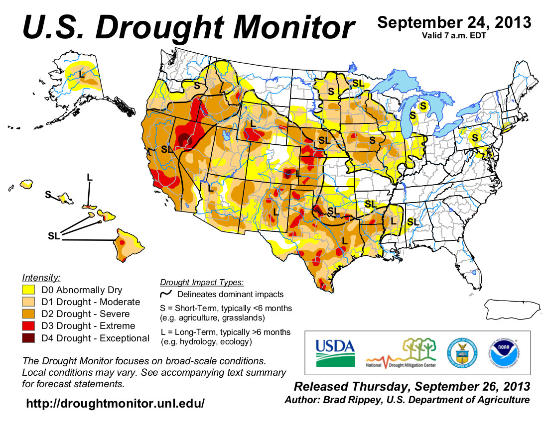
  • Exceptional precipitation events in Early September coupled with a persistent monsoon season has resulted in significant improvements to drought conditions throughout the state. Currently, 84% of the state is in some level of classification on the US drought monitor. 20% is currently characterized as “abnormally dry” while the majority of the state (67%) is in a D1 or moderate drought conditions. An additional 13% is severe, 2.5% is extreme and only 1.47% of the state remains in exceptional drought.
  • A late month heat wave in August brought temperatures for the month above average, a trend that has continued into the first half of September, with some areas seeing temperatures 8-10 degrees above average.
  • August precipitation was above average statewide at 111% of normal, while September to-date has been incredibly wet at 283% of normal statewide. This ranges from a low of 150% of average in the Gunnison to an extraordinary 536% of average in the South Platte. With these record breaking rains, some areas of Colorado have gone from well below average to near and above average for the water year, which ends September 30, 2013.
  • Reservoir storage as of September 1st remained below average, however it is likely that the recent rains will increase this value on the October 1st reporting date. There are reports of Halligan Reservoir in the South Platte rising 30 feet in roughly 36 hours during the most recent heavy rain event. Not only is this welcome for water providers, but also likely played a role in decreasing flows downstream of the reservoir in the City of Fort Collins. Many providers were able to store substantial amounts of water during this event, still other reported infrastructure breaches.
  • The Climate Prediction Center drought outlook released September 19, 2013 and valid for September 19 December 31, 2013 illustrates persistent drought across most of Colorado with the exception of the Front Range and a portion of the eastern plains where drought conditions have been largely eliminated. Temperatures are also forecasted to remain above average through October.
  • ENSO conditions remain neutral. However, the preliminary snowpack forecast for January 1st indicates the chance of early season snow in the mountains as above average and is better than in the previous two years.
  • The exceptions being in the Yampa and Rio Grande Basins which both show a slightly lower than average forecast.

    Lawsuit filed over Southwestern Willow Flycatcher habitat destruction by the Tamarisk Leaf Beetle

    Southwestern Willow Flycatcher
    Southwestern Willow Flycatcher

    From The Los Angeles Times (Louis Sahagun):

    A U.S. Department of Agriculture program designed to control invasive streamside trees by releasing exotic leaf-eating beetles has gone awry and is destroying the nesting areas of a federally endangered songbird, according to a lawsuit filed Monday by two conservation groups.

    The lawsuit filed in U.S. District Court in Las Vegas by the Center for Biological Diversity and the Maricopa Audubon Society accuses the department and its Animal and Plant Inspection Service, or APHIS, of failing to safeguard the southwestern willow flycatcher from the effects of the release of the beetles imported from central Asia to eradicate tamarisk trees.

    Flycatchers often nest where tamarisks have crowded out native cottonwood and willow trees. About 25% of the birds’ territories are in areas dominated by the tamarisk, a water-hungry tree that grows in impenetrable thickets.

    The department began releasing the beetles in 14 states in 2005 with assurances that the insects would not be introduced within 200 miles of flycatcher habitat. It also said the beetle could not survive in regions south of 37 degrees north latitude, where shorter days suppress its reproduction.

    In an environmental assessment published two years earlier, APHIS officials said the strain of beetle “exhibits a particular life history that will enable its safe release in the 14 proposed states.”

    According to the lawsuit, however, the department in 2006 introduced beetles into flycatcher-nesting areas along the Virgin River in southern Utah. Now, they are spreading into nesting areas in southern Utah, Nevada and northern and western Arizona.

    “Their agreements were broken,” Robin Silver, a spokesman for the Center for Biological Diversity, said. “The beetle is going wild below 37 degrees north latitude.”

    “If we don’t deal with this problem immediately, it will wipe out the middle part of the flycatcher’s range,” Silver said. “Eventually, there may not be enough habitat left to sustain the species.”

    More endangered/threatened species coverage here.

    Ruedi Reservoir’s $34 million debt repaid; water secured for Western Colorado

    Ruedi Dam and Reservoir -- Photo via USBR
    Ruedi Dam and Reservoir — Photo via USBR

    Here’s the release from the Colorado River District (Jim Pokrandt):

    The outstanding $34 million construction debt on Ruedi Reservoir has been paid to the federal government and 19,585 acre-feet of previously uncontracted water supply in the 102,000-acre-foot reservoir is secure for the future of Western Colorado.

    The debt was due in 2019 and uncertainty about paying it cast a shadow over how the uncontracted water in the reservoir – intended to benefit Western Colorado –would be used.

    To solve the problem, the Colorado River District for the last two years solicited West Slope interest in the remaining water and put together a package agreement with the U.S. Bureau of Reclamation, owner and operator of the reservoir straddling the Eagle-Pitkin county line.

    Seventeen entities, including the Colorado River District, stepped up, cumulatively committing to the purchase of all the uncontracted water and full repayment of the outstanding debt. The Ute Water Conservancy District, the Grand Valley’s largest water provider, secured the greatest amount: 12,000 acre-feet at a cost of $15.5 million. The Colorado River District contracted for 4,683.5 acre-feet, at a cost of $6 million. The cost per acre-foot was roughly $1,290. An acre-foot is equal to 325,851 gallons of water and is enough water to supply two to four family households for one year.

    Other entities contracting for water include:

    Wildcat Ranch Homeowners Association: 50 acre-feet
    Mid Valley Metro District: 100 acre-feet
    Crown Mountain Park Recreation District: 62 acre-feet
    Owl Creek Ranch Homeowners Association: 15 acre-feet
    Town of Palisade: 200 acre-feet
    Snowmass Water and Sanitation District: 500 acre-feet
    Town of De Beque: 25 acre-feet
    Basalt Water Conservancy District: 300 acre-feet
    Garfield County: 400 acre-feet
    City of Aspen: 400 acre-feet
    W/J Metro District: 100 acre-feet
    Summit County: 330 acre-feet
    Elk Wallow Ranch LLC: 30 acre-feet
    Wildcat Reservoir Co.: 140 acre-feet
    Town of Carbondale: 250 acre-feet

    Ruedi Reservoir is the West Slope mitigation for the federal Fryingpan-Arkansas Project, which diverts water from the Fryingpan River and Hunter Creek headwaters across the Continental Divide to the Arkansas River Basin. The debt started at $9.3 million when the Bureau of Reclamation completed the reservoir in the early 1970s. It ballooned to $34 million as the government added unpaid interest and operational expenses to the principal – because of unsold water. Absent a deal, the debt would have gone up at an ever-escalating rate.

    Ordinarily, Reclamation reservoirs are approved in connection with an entity to pay for its share of the project. In Ruedi’s case, the 1960s-era deal foresaw an oil shale boom and other energy demands as the means to pay the construction debt, which had not resulted in a full demand for Ruedi water.

    “This is an important milestone for water supply challenges on the West Slope,” said Dan Birch, the Colorado River District Deputy General Manager who spearheaded the agreement. “Water planners who are expected to provide water at the tap every time it is turned on do not like uncertainty about the future. This removes the significant shadow of doubt over Ruedi. As Colorado’s population continues to grow, this helps 17 water suppliers know where their future supplies will come from.”

    Birch pointed out that the water in Ruedi will be largely a backup supply for very dry years. Streamflows in the Fryingpan and Roaring Fork Rivers will look much as they do today.

    Birch added, “We could not have accomplished this without the great help and expertise of Lee Leavenworth, the former special counsel to the Colorado River District and other water users.

    More Fryingpan-Arkansas Project coverage here.

    Drought news: Lake Powell pool elevation rises two feet in September #ColoradoRiver

    Glen Canyon Dam -- Photo / Brad Udall
    Glen Canyon Dam — Photo / Brad Udall

    From the Arizona Sun (Todd Glasenapp):

    “September’s abundant rains that fell across eastern Utah, western Colorado and northern New Mexico in addition to recent snow in Colorado have helped saturate soils in the Lake Powell watershed,” Page-based Friends of Lake Powell said in a news release Monday. “This is an important factor in setting the stage for more normal runoff in the spring of 2014.”

    Page, located above Glen Canyon Dam at the lake’s southern end, received 2.73 inches of rain in September, more than three times its monthly average. The 4.21 inches that Page had in August and September amounted to half of its annual average precipitation.

    Further north, and in the Colorado River Basin that drains into the lake, the Animas River at Cedar Hill in New Mexico was resembling spring conditions by Sept. 22. The river topped 3,000 cubic feet per second (cfs), a faster rate than the peak of the spring runoff. The river’s normal flow rate for this time of year is 300 to 400 cfs, according to Friends of Lake Powell’s Paul Ostapuk.

    Instead of gradually falling through September, Lake Powell gained two feet of surface elevation. The National Park Service had planned to close the Antelope Point launch ramp on Sept. 23, but called the move off on the 19th…

    Reclamation released 801 thousand-acre feet (kaf) of water through the dam to the Colorado River in August and 600 kaf in September, with plans to reduce even further for October (480 kaf) and November (500 kaf)…

    “This is the worst 14-year drought period in the last hundred years,” Upper Colorado Regional Director Larry Walkoviak said in mid-August, before the heavy rains.

    More Colorado River Basin coverage here and here.

    Montezuma County is being asked to apply for a Colorado State Historic Fund Grant for the McElmo Flume

    McElmo Creek Flume -- Photo / Cortez Journal
    McElmo Creek Flume — Photo / Cortez Journal

    From the Cortez Journal (Jim Mimiaga):

    Built in the 1880s, the flume was a marvel of engineering, delivering water to Towaoc and area ranches. It operated until 1992, but was replaced by the concrete canals of the McPhee Project and has since fallen into disrepair.

    But buffing it up is seen as good for tourism and also for preserving history.

    When driving through towns while on vacation, people look for pullouts featuring historic landmarks, interpretive sites and viewpoints.

    The McElmo Flume, off of U.S. Highway 160 near the fairgrounds, has that potential. The Colorado Department of Transportation sees its value.

    CDOT has committed to constructing a paved pullout and parking lot at the flume. The $250,000 project is being paid for by the National Scenic Byway Program as part of the Trails of the Ancients tourism loop. The interpretive site will feature a sidewalk to a viewpoint overlooking the flume and may go in next summer. Stone walls, education panels and an informational kiosk also will be built.

    “But as it is right now when people walk to the overlook it is not much too look at, so we are seeking funding to restore and stabilize this piece of local history long term,” said Linda Towle, a historic site advocate and volunteer. “It reverted back to county ownership, so they must be the grant applicant for the restoration.”

    The county agreed on Monday, Sept. 16 to chip in $2,500 toward the renovation. The grant-application deadline for the $122,700 to repair the foundation and steel supports is Oct. 1.

    Giving visitors a chance to slow down, pull over and learn of the region’s innovative past is good for tourism and shows respect for previous generations, Towle said.

    “It was the first water source to Towaoc, and shows a lot of ingenuity. It needs stabilization or it will fall over,” she said. “Everyone wants the top fixed, but we have to fix the bottom structure first so it will stay standing permanently.”

    More San Juan River Basin coverage here and here.

    Say hello to the Colorado Flood 2013 website from the Colorado Climate Center

    Storm pattern over Colorado September 2013 -- Graphic/NWS via USA Today
    Storm pattern over Colorado September 2013 — Graphic/NWS via USA Today

    Click here to go to the website. Here’s the release from Colorado State University:

    An unusually persistent and moist weather pattern in Colorado Sept. 9-15 led to rainfall totals that have been observed in only a handful of events on the Front Range in the past century.

    That’s one of the conclusions in a report released Sept. 25 at the Front Range Flood Panel in Boulder. “Severe Flooding on the Colorado Front Range September 2013” was prepared by the Colorado Climate Center at Colorado State University; the CIRES Western Water Assessment at the University of Colorado; and the National Oceanic and Atmospheric Administration’s ESRL Physical Sciences Division.

    “Flooding in September is rare but not totally unprecedented. It has been a long time since we’ve experienced something like this, though,” said Nolan Doesken, State Climatologist and a co-author of the report. “Southwest Colorado had extreme flooding in September in 1970 but for the Front Range you have to go back to 1938 to find anything that comes close.”

    Analysis of conditions, data, impact

    The report includes an analysis of weather conditions that created the storm, the rainfall totals in different locations, the hydrological impact of the storm, and a discussion of the changing climate and flood risk along the Front Range in light of the September event.

    Research is underway at CIRES and NOAA to determine how human-caused climate change may have influenced this event and whether the risk of similar events occurring in the future will increase. The most plausible influence of climate change is that slightly more water vapor was made available for precipitation.

    Several CSU Atmospheric Science faculty will also be engaged in research focusing on the meteorological processes of storm formation, cloud processes and atmospheric modeling.

    To see the complete report, go to the Western Water Assessment website.

    To see the latest data on the storm as it becomes available, go to the new website created by the Climate Center to house various analyses and precipitation reports from the week-long storm and subsequent flooding, coflood2013.colostate.edu. It features charts, graphs, photos, records that place the storm in historical perspective, and a wealth of additional information on this historic weather event.

    Water Caucus of Western Latino elected officials launches Oct. 1

    Colorado River below Glen Canyon Dam -- Photo / WyoFile.com
    Colorado River below Glen Canyon Dam — Photo / WyoFile.com

    From email from Nuestro Rio:

    ADVISORY: Water Caucus of Western Latino elected officials launches Oct. 1

    WHAT: Launch of Nuestro Río Regional Water Caucus (of Western Latino elected officials)

    WHEN: Tuesday, October 1, 2013, 10:45 a.m.

    WHERE: Congressional Hispanic Caucus Institute Public Policy Conference, Washington Convention Center, Room 157

    WHO: Colorado Rep. Joe Salazar; New Mexico House Majority Leader Rick Miera; Nevada Senate Majority Leader Mo Denis; Coconino County, Arizona Supervisor Liz Archuleta

    WHY IT MATTERS: Nuestro Río advocates for saving the Colorado River by implementing commonsense options that are both cost effective and have broad political support, including improving urban conservation, improving agricultural efficiency, and establishing water banks. Nuestro Río will outline the actions it would like the Administration and members of Congress to take preserve and restore the Colorado River, which was named the most endangered river in the country.

    More Colorado River Basin coverage here and here.

    A look at ‘Fill Mead First’ operations from a supplier point of view #ColoradoRiver

    Dry Lake Mead (2010)
    Dry Lake Mead (2010)

    From TheSpectrum.com (David DeMille):

    On Monday, the Washington County Water Conservancy District issued a letter to The Spectrum & Daily News outlining its issues with the Fill Mead First plan. The district argues the method would jeopardize supplies in the upper basin and, if implemented today to fill Lake Mead’s deficiency of 13.81 million acre feet, would completely drain Powell.

    “In other words, GCI wants us to surrender enough water to sustain the entire state of Utah’s consumptive use for more than five years,” Ron Thompson, WCWCD general manager, and Dan Christiansen, general manager of the Central Utah Water Conservancy District, write in the letter.

    Fill Mead First would also threaten the legal allocation rights to upper basin states as outlined in a multistate compact signed in 1922, according to the letter, and could have “catastrophic economic consequences.”

    But advocates for Fill Mead First disagreed, saying Monday that they aren’t proposing to drain Lake Powell. Under GCI’s proposal, Lake Powell would be kept close to an elevation of 3,490 feet, high enough to allow for seasonal flow variations, power generation, reservoir-based recreation and flood control…

    At a meeting in St. George last week, Denis Strong, director of the Utah Division of Water Resources, said Myers’ study depended on inaccuracies in the way seepage is measured. Strong argued that Lake Mead may be a larger offender than Powell because it loses more water to evaporation.

    More Colorado River Basin coverage here and here.

    Federal Dam operations will march on during the shutdown

    The new north outlet works at Pueblo Dam -- Photo/MWH Global
    The new north outlet works at Pueblo Dam — Photo/MWH Global

    From The Pueblo Chieftain (Chris Woodka):

    Federal operation of dams and power plants that are part of the Fryingpan-Arkansas Project will continue during a federal shutdown. The Bureau of Reclamation controls storage and releases from Pueblo Dam, Twin Lakes, Turquoise Lake and Ruedi Reservoir as part of the project.

    It also operates the Mount Elbert power plant located at Twin Lakes.

    “All of the Fryingpan-Arkansas Project will continue to be operational,” said Kara Lamb, spokesman for the regional Bureau of Reclamation office.

    More Fryingpan-Arkansas Project coverage here and here.