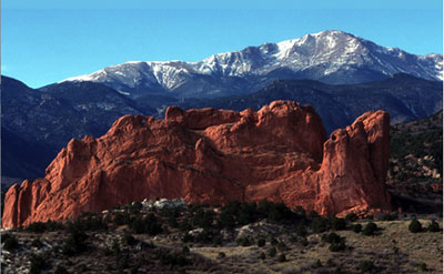
Here’s hoping that deep snow and short memories don’t add up to problems for Colorado’s water future — Scott Willoughby #COWaterPlan

Colorado Water Plan website screen shot November 1, 2013

From The Denver Post (Scott Willoughby):

Here’s hoping that deep snow and short memories don’t add up to problems for Colorado’s water future. With the March 1 mountain snowpack measuring at 116 percent of average and 161 percent compared with last year, it’s easy to take the lifeblood of the state’s outdoor recreation industry for granted.

Hopefully that won’t be the case between now and March 19, when the Colorado Water Conservation Board (CWCB) is scheduled to report on the public’s expectations for the Colorado Water Plan initiated by Gov. John Hickenlooper last year in an attempt to address the anticipated gap between statewide water supply and demand. With a directive from the governor that “Colorado’s water plan must reflect what our water values are,” time is running short for Coloradans to define those values through public input.

Just don’t forget the two-year drought the state has been dealing with up until now.

With a gloomy forecast predicting water demands outpacing available supplies as soon as 2022, everything from agriculture to angling could be threatened even in a normal water year, along with several other aspects of Colorado’s multibillion-dollar recreation industry that relies on water from healthy rivers and streams. But it’s not just food prices and fishing that hang in the balance, it’s our very identity, the unique traits that define Colorado and many Coloradans.

Above and beyond the basic necessities, water has long defined Colorado’s character, be it an Arkansas River rafting trip or the icy snowmelt portrayed in a Coors beer commercial. Our streams support wildlife for watching, hunting and fishing, entice campers and kayakers and provide the landscapes that inspire hikers and bikers. They provide the water for snowmaking at ski areas and built the halfpipe that hosted the U.S. Open snowboarding championships at Vail this weekend.

Those are just a few examples of what the world has come to think of when it hears the name Colorado. And coupled with the executive order that the Colorado Water Plan needs to focus on “a strong environment that includes healthy watersheds, rivers and streams, and wildlife,” they should provide incentive enough to ensure measures are included in the plan that protect and restore flowing rivers and the tourism and recreation opportunities they provide.

Just in case they don’t, though, Colorado’s outdoors community of boaters, fishermen, hunters, skiers, campers, backpackers, bikers, bird-watchers and the rest should take this opportunity to further the incentive by making their collective voice heard.

The CWCB has established a process for receiving formal input to Colorado’s Water Plan, including a process for specific stakeholder groups such as those vested in “Environment and Recreation.” Information can be found at http://coloradowaterplan.com and e-mails sent to cowaterplan@state.co.us.

The most effective route may be through submitting input to specific “basin roundtables” established to present perspectives and values of citizens living in each of the state’s eight major river basins and the Denver metropolitan area. The nine roundtables are in the process of developing Basin Implementation Plans that will identify solutions to meet water needs inside the various basins and statewide. A specific page dedicated to the roundtable process has been established on the CWCB website, cwcb.state.co.us, under the “Water Management” tab.

The final Colorado Water Plan incorporating the individual basin plans will be completed by December 2015.

From The Durango Herald (Joe Hanel):

Hickenlooper and former Gov. Bill Owens gave a pep talk to water experts at a statewide summit Thursday to advance work on the state water plan, which is supposed to lay out a strategy for preserving the environment, promoting agriculture and allowing the population to double.

During Owens’ tenure, the state created roundtables in each major river basin to begin thinking about a statewide consensus on water. Since then, the groups have had some 780 meetings around the state, Hickenlooper said.

“This really is the right way to go about things, to go down in the grass roots and make sure everyone’s voice is heard,” he said…

…Hickenlooper said Colorado’s water plan, and similar plans in other Western states, could form the basis of a regional plan for the country’s dry Western states. He and other governors promoted the idea to Obama and Agriculture Secretary Tom Vilsack in a meeting at the White House two weeks ago, he said.

Obama and Vilsack said they liked the idea, and they would pay for the logistics around developing the plan, but they would let states take the lead.

“There were several senior Washington officials in that room, and they said it was the first time they’d seen the governors come in organized enough that we could hold our own against the federal agencies,” Hickenlooper said…

Weld County Commissioner Sean Conway reminded Hickenlooper that Republican presidential candidate John McCain of Arizona caused a ruckus during the 2008 campaign when he suggested the Colorado River Compact needed to be renegotiated.

“We obviously would fight that tooth and nail,” Hickenlooper said. “But the best way to avoid that … is to have a relationship with the other states, and we can put ourselves in their shoes and have them put themselves in our shoes.”

[Sen. Ellen Roberts] said she is worried about Colorado’s negotiating strength if the Western states start working on a regional water agreement.

“I’m not sure I’m on board with that. I think it’s a very ambitious task just to get a state water plan,” Roberts said.

More Colorado Water Plan coverage here.

Fryingpan-Arkansas Project update: Reclamation approves cross-connection for the North and South outlet works

The new north outlet works at Pueblo Dam -- Photo/MWH Global
The new north outlet works at Pueblo Dam — Photo/MWH Global

From The Pueblo Chieftain (Chris Woodka):

Ever since it began storing water 40 years ago, the Pueblo Dam has been evolving as the needs of water users change. The next step will integrate the south outlet works with the newly constructed north outlet works on the face of the dam to provide more reliability to the urban populations that depend on Lake Pueblo as a source of water. The cross-connection is part of the package approved last week by the Bureau of Reclamation. Other pieces are the Arkansas Valley Conduit and a master contract for some members of the Southeastern Colorado Water Conservancy District.

“We get a better quality of water coming out of the reservoir. That cuts down on chemicals used for taste and odor issues,” said Terry Book, executive director of the Pueblo Board of Water Works.

The cross-connection will allow users of both outlets to continue using the dam when one outlet or the other is closed in an emergency or for planned maintenance.

“When one goes down, you can pull from the other side and still get part of your water,” Book said.

The dam was completed in 1974, but the south outlet — as the name implies, is on the south side of the Arkansas River — wasn’t used until 1983, when Pueblo West took its initial diversion of water. Two years later, the Fountain Valley Conduit, which serves Colorado Springs and four nearby water providers, began drawing from the south outlet. Pueblo hooked onto the south outlet in 2002, after gaining a license in 2000. The south outlet also supplies the Pueblo fish hatchery, operated by Colorado Parks and Wildlife.

The north outlet — formerly the primary outlet for the Arkansas River — was completed last year as part of the Southern Delivery System, which will begin serving Colorado Springs, Fountain, Security and Pueblo West in 2016.

The Southeastern district, Colorado Springs and Pueblo water board are jointly developing a hydropower project at the north outlet works, which also continues to provide water to the Arkansas River.

There also are three gates that can empty water into the basin below the dam when the north outlet is closed. The Bessemer Ditch also has a direct connection to Pueblo Dam.

Before the interconnect is constructed, it would require a 40-year contract between Reclamation and those parties using the outlets.

More Fryingpan-Arkansas Project coverage here and here.

Arkansas Basin RT Gary Barber steps down as chair #COWaterPlan

Basin roundtable boundaries

From The Pueblo Chieftain (Chris Woodka):

Gary Barber, who has chaired the Arkansas Basin Roundtable since 2007, is stepping down in order to concentrate on finishing the group’s contribution to a state water plan.

“I’ve always tried to do what’s best for the roundtable and for the basin,” Barber said.

Barber has been working on the Arkansas Basin plan that will be part of the state water plan, which comes out in draft form later this year. As chairman, Barber prepared many of the documents that will be used in the plan, but he is now a paid consultant.

“I needed to devote all of my time to the plan,” Barber said.

Vice chairman Betty Karnoski, a Monument real estate broker, will act as chairman of the roundtable.

Barber has been a central fixture in Arkansas Basin water issues for more than a decade.

As an agent for the El Paso County Water Authority, he contributed to the Colorado Water Conservation Board’s understanding of the Arkansas Valley’s municipal water gap in the 2004 Statewide Water Supply Initiative. He was a frequent critic of the Southern Delivery System, saying it did not have a wide enough regional focus, and an advocate for groundwater storage in El Paso County. Barber became a charter member of the roundtable in 2005, helping to organize the group from the beginning. He served as secretary until Alan Hamel stepped down as chairman in 2007.

In 2008, while working for El Paso County water interests, he made offers to buy farms for their water on the Bessemer Ditch, triggering a successful counteroffer by the Pueblo Board of Water Works.

In 2009, he helped to write state legislation that formed the Fountain Creek Watershed Flood Control and Greenway District after three years of meeting with the Fountain Creek Vision Task Force. Within a year, he was chosen as its first executive director.

In 2011, he went to work for Two Rivers Water Co., which has bought Pueblo County farms, and tried to expand its scope to include municipal consulting in El Paso County.

Last year, he joined WestWater Research, a Western U.S. water marketing firm, and secured a roundtable contract. He retained his position as chairman of the roundtable after an open discussion of whether the contract represented a conflict of interest.

Despite, or maybe because of, his forays into valley water activities, Barber commanded respect from other roundtable members because of his ability to sort through differences.

He nearly always ends discussions of complicated water issues with the statement: “We have consensus by the absence of dissension.”

He often interjects humor into those conversations as well. For instance, referring to Aurora’s water buys in the Arkansas Valley, he once said: “Aurora is the brother-in-law you wish your sister had never married. But he does the dishes at Thanksgiving, so you learn to live with him.”

More IBCC — basin roundtables coverage here.

Colorado signs on to Rio Grande cutthroat trout conservation agreement

Cutthroat trout historic range via Western Trout

Here’s the release from Colorado Parks and wildlife:

An updated conservation agreement and strategy plan to protect the Rio Grande cutthroat trout was recently signed by the states of Colorado and New Mexico, three Native American tribes and several federal agencies.

The agencies started working on range-wide protection plans for the species in 2003. This is a continuation of the initial agreement, but also assures that the agencies will work cooperatively to maintain the viability of this special species of trout. The agreement provides overall guidance to each agency and sets a conservation strategy that will be used in Colorado and New Mexico where significant populations of the fish exist.

“This is a voluntary agreement, but all the parties are dedicated to working on important Rio Grande cutthroat trout issues,” said John Alves, southwest region senior aquatic biologist for Colorado Parks and Wildlife.

The agencies that signed the agreement are: Colorado Parks and Wildlife, the New Mexico Department of Game and Fish, the U.S. Forest Service, the U.S. Fish and Wildlife Service, the BLM, the National Park Service, the Jicarilla-Apache Nation, the Mescalero-Apache Nation, and the Taos Pueblo tribe. The effort is also being supported by Colorado Trout Unlimited and the New Mexico Council of Trout Unlimited.

As stated in the agreement, the goal of the new 10-year plan is to “assure long-term viability of Rio Grande cutthroat trout throughout its historic range by minimizing or removing threats to the species and promoting conservation.” The agencies have completed numerous conservations projects for the species throughout Colorado and New Mexico. To read about some of the projects, go to: http://cpw.state.co.us/Research/Aquatic/CutthroatTrout/Pages/CutthroatTrout.aspx.

The trout has been a candidate for listing under the federal Endangered Species Act since 2008. A decision by the U.S. Fish and Wildlife Service on whether the species will be listed is scheduled for September.

The Rio Grande cutthroat is classified as a species of “greatest conservation need” by New Mexico, and as a “species of special concern” in Colorado. The agencies are working cooperatively to protect the populations to keep the species healthy. The cooperative effort might also provide the advantage of keeping the fish off of the federal endangered species list.

The fish is found primarily in high elevation streams and lakes of the Rio Grande, the Canadian River and the Pecos River in Colorado and New Mexico. It now only occupies just 12 percent of its historic habitat in approximately 800 miles of streams. Biologists estimate that 127 conservation populations now exist in the two states, and 57 of those populations are considered to be secure.

The historic range of Rio Grande cutthroat trout has been reduced over the last 150 years due to many changes on the landscape, including: drought, water infrastructure, habitat changes, hydraulic changes, hybridization with rainbow trout and other species of cutthroat trout, and competition with brown trout and brook trout. As a result of these changes, Rio Grande cutthroat trout populations are restricted primarily to headwater streams.

“This agreement provides a detailed road map of the ways local, state, federal and tribal agencies will work together to continue to conserve this trout,” said Kirk Patten, assistant chief of fisheries for the New Mexico Department of Game and Fish. “The Rio Grande cutthroat trout is unique. It is found only in the southwest and has the distinction of being the southernmost distribution of any form of cutthroat trout.”

For more than 20 years, agency biologists have been searching for Rio Grande cutthroat populations, studying habitat and restoring the species to streams. That work and more will continue under the conservation agreement.

Some of the work that the agencies will conduct includes: maintenance of Rio Grande cutthroat brood stock; stream surveys and habitat improvement; construction of barriers to keep non-native trout out of conservation waters; removal of non-native fish and restocking with this species; testing for disease; conducting genetic analysis; fencing sensitive riparian areas; and on-going monitoring of populations.

The agencies will meet annually to discuss projects and progress, and to plan conservation work. A full range-wide species assessment will be conducted every five years.

“Rio Grande cutthroat trout are facing many issues, including habitat loss, competition from the introduction of non-native trout, drought, fire and other changes,” Alves said. “A major, coordinated effort like this one is what’s needed to maintain this important species.”

More Rio Grande River Basin coverage here and here.

Colorado River Outfitters Association: Commercial rafting on the Arkansas River = $55 million

raftingarkriver

From The Mountain Mail (Nick Jumey):

Commercial rafting on the Arkansas River brought an economic impact of more than $55 million from 179,535 user days in 2013, according to an end-of-year report by Colorado River Outfitters Association.

The association defines a “user day” as “a paying guest on a river for any part of a day.”

To calculate economic impact, the association multiplies user days by “direct expenditures” and the “economic multiplier.”

Direct expenditures are the total cash outlay for rafting, food, lodging, etc., spent in the local area by one river rafting customer in one day. The economic multiplier is the number of times a dollar is spent in the local area before being spent outside that area – 2.56 times, according to the Colorado Tourism Board.

Overall, the report showed rivers in Colorado had an economic impact of more than $145 million in 2013, an increase of 13.5 percent from 2012’s $127 million. In addition, rafters spent nearly 50,000 more user days on Colorado rivers in 2013, including an increase of 10,000 user days on the Arkansas River alone.

The Arkansas River accounted for 38.89 percent of the market share of river rafting impact in 2013, the largest share by a wide margin. The next closest rivers in terms of market shares were the Colorado River (23 percent combined) and Clear Creek River (13.2 percent), according to the report.

Sen. Michael Bennet (D-Colo.) recently cited the association report as a reason to cosponsor S. 1794, also known as the Browns Canyon National Monument and Wilderness Act of 2013.

In a press release, Bennet cited the report’s findings, including the $55 million economic impact, and noted that the Arkansas River is particularly popular for whitewater rafters.

The bill, introduced by Sen. Mark Udall (D-Colo.), aims to protect the Browns Canyon region as “an invaluable economic and natural resource for Chaffee County and the state” and would preserve 22,000 acres along the Arkansas River as a national monument.

“The rugged and unique beauty of Browns Canyon attracts outdoor enthusiasts from around the world who come to hike, camp, climb and raft,” Bennet said in a press release. “This generates millions of dollars of revenue for our local economies.
“Designating Browns Canyon as a national monument will not only allow future generations to enjoy the whitewater rapids in the heart of the Rockies, but it will also ensure that the area remains an economic driver and job creator for the region.”
Keith Baker, Buena Vista, executive director of Friends of Browns Canyon and a retired Navy commander, said he was pleased to hear Bennet’s decision to cosponsor the bill.

“We’re pleased and honored to have Sen. Bennet on board with this important legislation, which not only protects one of Colorado’s world-class recreational destinations, but was built from the ground up by local people who do business, recreate and make their homes in this part of the state,” Baker said.

More whitewater coverage here.

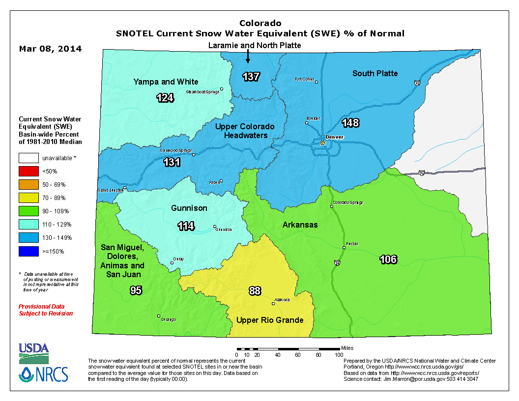
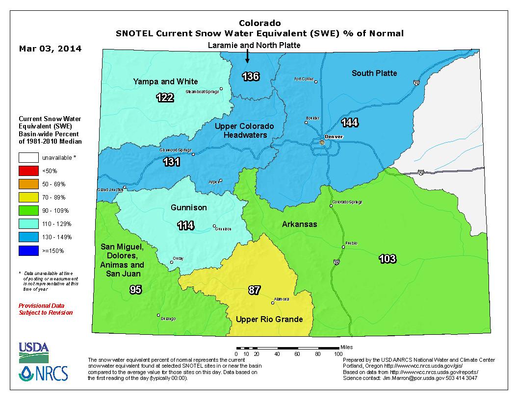
Snowpack news (% of normal): South Platte still on top = 148%, Upper Colorado = 131%, Upper Rio Grande = 88%

Statewide Snow Water Equivalent as a percent of normal March 8, 2014 via the NRCS

From The Grand Junction Daily Sentinel (Dennis Webb):

Snowpack accumulations rose even further above average in Colorado as a whole last month, but they continue to lag in the southwest part of the state.

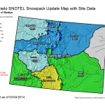
The statewide snow water equivalent was at 118 percent of median Thursday, compared to 107 at the start of February, thanks to multiple storms, the Natural Resources Conservation Service says. The Upper Colorado River Basin was at 129 percent and the Gunnison Basin, 112 percent. The Laramie/North Platte and South Platte basins are even higher than the Upper Colorado, with the South Platte at 144 percent of median.

But southwest Colorado remains a different story, with the combined San Miguel, Dolores, Animas and San Juan basins at 95 percent of median and the upper Rio Grande at just 90 percent.

“It’s sort of been the story all season long so far,” said Mage Hultstrand, assistant snow survey supervisor in Colorado for the conservation service. “It seems like the storm track’s just been missing that area somewhat. They’ve gotten some additional snow, but not what they normally get.”

The good news for the southwest is that snowpack levels rose from Feb. 1 levels of just 82 percent for the Upper Rio Grande basin and 79 percent for the four other basins.

On a statewide basis, Colorado has received above-average precipitation for three months in a row, the conservation service says. The state usually reaches peak snow accumulation on April 9, and under current conditions only needs 8 percent of typical precipitation between now and then to reach that peak, Hultstrand said.

The Upper Colorado Basin already is an inch above the 15.5 inches of snow-water equivalent it reaches during its typical peak.

Natural Resouces Conservation Services says that while reservoir storage is still below average, at 89 percent, that’s much improved from the 67 percent at this time last year.

“With the current snowpack conditions and storage volumes, drought conditions in most basins should be alleviated and reservoir storage should improve this spring,” the agency said in a news release Thursday.

“Data collected during the recent snow surveys directly reflects what the state can expect for surface water supplies this coming spring and summer. The most recent streamflow forecasts continue to point toward above to well above normal volumes for this spring and summer in most of the major river basins in Colorado; the exceptions will be the Upper Rio Grande and southwest basins.”

From The Mountain Mail (J.D. Thomas):

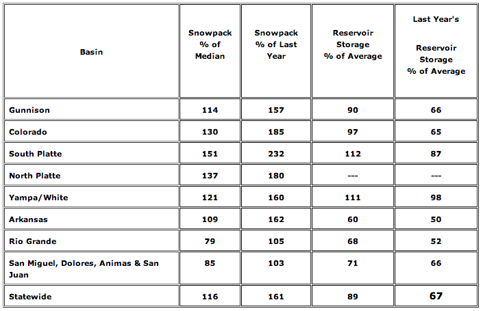
Arkansas River Basin snowpack reached 109 percent of the median as of March 1, increasing from 100 percent in early February.

Statewide snowpack was 116 percent of median, and statewide precipitation totals for February reached 133 percent of average, said Phyllis Ann Philipps, Colorado state conservationist with the U.S. Department of Agriculture Natural Resources Conservation Service.

The NRCS report released Wednesday said “weather patterns favored the northern and central mountain ranges in Colorado.”

Snowpack exceeded the median in every basin except the Rio Grande, at 79 percent, and the San Miguel, Dolores, Animas and San Juan basins, at 85 percent of median.

However, the combined San Juan basins saw a 3-percentage-point increase from last month and reached 103 percent of last year.

The highest amount of snowpack March 1 was 151 percent of median in the South Platte Basin.

Reservoir storage for the state decreased an average of 1 percent, the NRCS reported. However, storage in the Arkansas River Basin decreased 4 percent even though the snowpack increased.

Statewide reservoir storage dropped to 89 percent of average.

“The most recent streamflow forecasts continue to point toward above- to well-above-normal volumes for this spring and summer in most of the major river basins in Colorado; the exceptions will be the Upper Rio Grande and southwest basins,” the report said.

San Luis Valley: ‘We’re relying more and more on habitats that we know are artificially created and maintained’ — Michael Blenden

From The Denver Post (Bruce Finley):

Colorado’s effort to replenish its aquifers by cracking down on pumping groundwater threatens to leave the thousands of sandhill cranes that arrive here each February without the water they need.

“This certainly has the potential for changing the dynamics of what we have witnessed for the last 50 years,” said Michael Blenden, federal manager of the San Luis Valley complex of three national wildlife refuges and the Sangre de Cristo Conservation Area.

The cranes will be fine this year, but rules are kicking in that would prevent federal wildlife managers from pumping the 2.67 billion gallons they typically draw to create artificial wetlands for migratory birds. Farmers also grow barley and lay it out to help sandhill cranes, which draw visitors from around the world.

“Drying up cranes, I don’t think that’s a realistic outcome,” Blenden said. “We certainly don’t want to go there. Our responsibility is the perpetuation of the migratory bird resource.”

The cranes — about 25,000 of them are amassing in the San Luis Valley this month — need the food and the protection the marsh provides. But state officials have been working for years to control overpumping of the groundwater and prioritize who gets scarce water in a semiarid region. They say the groundwater pumping must cease unless federal officials obtain rights to surface water and leave it in rivers to offset their tapping of aquifers. If a trade can’t be worked out, that could cost more than $1 million, Blenden said.

“Just like every other groundwater user, the refuges will have to remedy the injurious stream depletions that occur due to their groundwater use,” state natural resources spokesman Todd Hartman said.

State officials and refuge managers have discussed the impending requirements, which may also force tens of thousands of irrigated acres out of production. Farmers have formed cooperative districts to try to adapt.

Scientists believe sandhill cranes in lesser numbers probably have migrated through the San Luis Valley for thousands of years. A petroglyph on the west side of the valley, depicting what appears to be a crane, may be 3,000 years old, according to federal officials. The artificial wetlands has helped ensure the cranes’ survival and now draw 95 percent of the cranes across a six-state region, federal biologist Scott Miller said. Dried-up marshes would be less appealing and may not meet cranes’ need to gain strength for their flight to nesting areas in Wyoming and Idaho and breeding there, Miller said. Cranes roost at night in wetlands, sleeping while standing in water. Coyotes or other predators are hampered as sloshing sounds can alert cranes.

“We don’t want to put the state in a position of having some kind of confrontation with us. We are contributing to the groundwater problems, just as the agricultural community is,” Blenden said.

Yet climate change creates new challenges, and preserving wildlife is part of a national mission, he said.

“We’re relying more and more on habitats that we know are artificially created and maintained. We cannot just turn our backs, because things get a little rough, and let the cranes figure it out.”

More Rio Grande River Basin coverage here.

NWS Boulder office: The chance for spring flooding due to snowmelt is elevated

NRCS: February Storms boost Colorado’s snowpack #COdrought

Snowpack and reservoir storage March 2014 via the NRCS

From the NRCS (Mage Hultstrand):

Statewide snowpack totals increased considerably during February. As a whole, Colorado received above normal snow accumulation throughout the past month as multiple storm systems moved through the state. As of March 1, the state’s snowpack was 116 percent of median and statewide precipitation total’s for February reached 133 percent of average, according to Phyllis Ann Philipps, Colorado State Conservationist with the Natural Resources Conservation Service (NRCS). Colorado’s snowpack has tracked above the long-term normal for three consecutive months.

Once again this year’s “No-Nino” weather patterns favored the northern and central mountain ranges in Colorado. The southwest part of the state, the Upper Rio Grande and the combined San Miguel, Dolores, Animas and San Juan basins, are still experiencing below normal snow conditions for this time of year. The combined San Juan basins did see a 3 percentage point increase from last month and are currently at 85 percent of median. The Upper Rio Grande basin on the other hand lost five percentage points, dropping to just 79 percent of median.

Reservoir storage across the state remains just below average, at 89 percent of average; this is a great improvement over last year’s conditions at this time when storage was just 67 percent of average. With the current snowpack conditions and storage volumes drought conditions in most basins should be alleviated and reservoir storage should improve this spring.

Data collected during the recent snow surveys directly reflects what the state can expect for surface water supplies this coming spring and summer. The most recent streamflow forecasts continue to point towards, above to well above normal volumes for this spring and summer in most of the major river basins in Colorado; the exceptions will be the Upper Rio Grande and southwest basins.

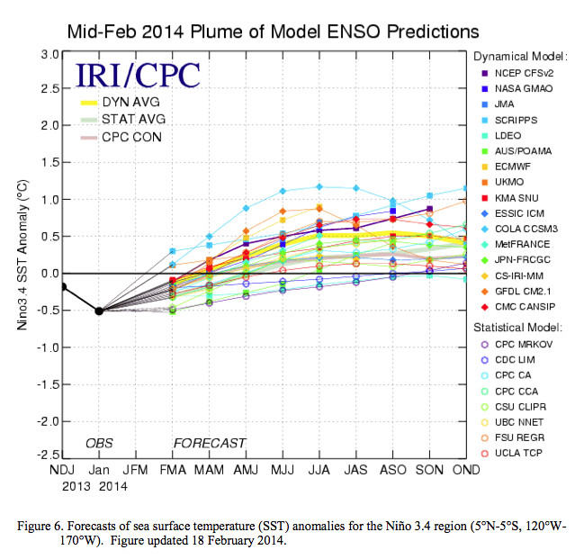
ENSO-neutral is expected to continue through the Northern Hemisphere spring 2014, with about a 50% chance of El Niño developing during the summer or fall.

mid022014plumeofmodelensopredictions

Click here to read the current discussion.

Synopsis: ENSO-neutral is expected to continue through the Northern Hemisphere spring 2014, with about a 50% chance of El Niño developing during the summer or fall.

H.R. 1839: Tipton’s Hermosa Creek Legislation Moves Forward in House

Here’s the release from U.S. Representative Scott Tipton’s office:

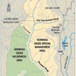
Congressman Scott Tipton’s (R-CO) Hermosa Creek Watershed Protection Act of 2013 (H.R. 1839) received a legislative hearing in the House Natural Resources Subcommittee on Public Lands and Environmental Regulation. The community-driven legislation would protect the Hermosa Creek Watershed—a 108,000 acre area in the San Juan National Forest north of Durango—as well as protect multiple use of the land.

“When it comes to land use designations, I support a balanced approach that includes respecting the environment that we all deeply value, while making the best use of our natural resources. Recreation, preservation, access and job creation are all important aspects of the multiple use management for which these lands are truly intended,” Tipton said. “I’m a firm believer that land use designations should be driven with a balance of local initiative and consideration that public lands belong to all Americans. Such is the case with Hermosa Creek Watershed, where I have worked with local citizens and groups and Senator Michael Bennet to put forward a plan to permanently protect the area while maintaining access and multiple use of the land. The Hermosa Creek Watershed Protection Act has truly been a locally-driven effort and has broad community support.”

Read Tipton’s opening statement here.

The Hermosa Creek Watershed Protection Act has been endorsed by a broad coalition of stakeholders including: the City of Durango, the La Plata County Commission, the Southwestern Water Conservation District, the San Juan County Commission, Region 9, the Colorado Snowmobile Association, Jo Grant Mining Company, Inc., in addition to numerous business and sportsmen groups, among others. Tipton submitted their letters of support to the record.

During the hearing, Scott Jones, a representative from the Colorado Snowmobile Association and other Colorado-based off road groups, testified in support of the legislation.

“The motorized community supports this legislation, as we believe the legislation represents a significant step towards protecting multiple use recreation and highly valued natural resources in the proposal areas,” said Jones. “For the motorized community there are two major components of the legislation we support, which are the release of the Wilderness Study area and designation of the special management area for the protection of motorized recreation. The motorized community does agree that the area to be designated Wilderness has generally not seen a high level of motorized recreation and the area is suitable for designation.”

Read Scott Jones’s testimony here.

Under H.R. 1839, much of the land will remain open to historic uses, including mountain biking, motorized recreation, hunting, fishing and selective timber harvesting. Grazing will be permitted in the entire watershed. This legislation ensures that areas currently open to snowmobiling on Molas Pass will remain open for future use. This will benefit outdoor recreation enthusiasts and continue to provide an important source of economic activity for the area. If this bill is not passed, then snowmobiling will cease in this region following the 2013/2014 winter season. This legislation also contains important provisions that allow for active land management in areas designated by the bill as necessary to control wildfires, insect infestations and disease outbreaks.

H.R. 1839 will now need to receive a markup in the full House Natural Resources Committee. Senator Michael Bennet (D-CO) is carrying companion legislation in the Senate (S.841).

Learn more about the Hermosa Creek Watershed Protection Act here.

From The Durango Herald (Katie Fiegenbaum):

The House Subcommittee on Public Lands and Environmental Regulation held a hearing on the Hermosa Creek Watershed Protection Act (HR 1839) on Thursday. Here’s what you should know about the act and the hearing…

Within three years of the bill’s passage, a management plan would have to be developed for the area, based on recommendations from the Hermosa Creek River Protection Workgroup, a diverse group of constituents.

About 37,000 acres of this area, on the west side of Hermosa Creek, would be designated as federal wilderness. No road, mineral or other development would be allowed inside this area.

About 68,000 acres, mostly on the east side of the creek, would be designated as the “Hermosa Creek Special Management Area.” It would remain open to historic uses, including mountain biking, hunting, fishing, motorized recreation and selective timber harvesting.

Grazing would be allowed throughout the protection area.

Why is it important?

The area in the bill has long been recommended for a wilderness designation and is some of the most pristine in Southwest Colorado. The land surrounds Hermosa Creek, which flows into the Animas River and is an important water source for Durango and surrounding areas.

“Water is the most important thing we get from this area,” said Ed Zink, a Durango rancher and small-business owner, who attended the hearing. “And to protect the water, we have to protect the land.”

He says the water in Hermosa Creek is much better quality than in the Animas and provides dilution and better overall water quality.

“It’s easier to protect the Hermosa than to fix the Animas,” Zink said…

Many studies since the Wilderness Act passed in 1964 have recommended a federal wilderness designation for this land, but it has never materialized. For the last six years or so, people in the area have worked on the bill to preserve the historic use of the land and give it a wilderness designation.

“A lot of various groups worked very hard to bring this together,” Tipton said in a phone interview after the hearing. “We’ve got something that is very appealing at the local level, and it should serve as a model for writing future legislation.”[…]

The area to be designated as federal wilderness hasn’t seen a high level of motorized recreation and is suitable for that designation, Jones said…

The House version of the bill will be scheduled for markup by the full committee and voted on.

“I am confident that there will be no pushback on the bill from the committee,” Tipton said.

He thinks the bill will move forward quickly and said he would work to expedite the process.

Sen. Michael Bennet, D-Colo., introduced the bill in the Senate in April 2013. The Senate version is co-sponsored by Sen. Mark Udall, D-Colo.

It received a committee hearing in the Senate in November, but has yet to be voted on in committee. According to Philip Clelland, Bennet’s deputy press secretary, his office is working with the committee and is hopeful that a vote will be scheduled soon.

More Hermosa Creek coverage here and here.

Basin Roundtable Summit recap

Basin roundtable boundaries

From The Pueblo Chieftain (Chris Woodka):

Colorado must work with neighboring states to develop a Western water plan, Gov. John Hickenlooper said Thursday.

“We don’t want the federal government coming in and telling us what to do,” Hickenlooper told the state basin roundtable summit.

Hickenlooper, a Democrat, and former Gov. Bill Owens, a Republican, spoke to about 300 roundtable members and other members of the state’s water community during an all-day meeting to discuss water issues.

The roundtables were formed by the Legislature in 2005, when Owens was governor. They were the brainchild of then-Director of Natural Resources Russell George.

Hickenlooper said the roundtables are providing grass-roots direction for a state water plan he has tasked the Colorado Water Conservation Board to draft by the end of this year.

“Hundreds of people have been engaged in the roundtable process,” Hickenlooper said. “We go down into the grass roots and hear those voices and let the ideas percolate up.”

Action on the water plan is needed quickly both within the state to deal with drought, floods and wildfires the state has witnessed in the last two years, he added. Climate change and compact obligations of all basins within Colorado dictate that Colorado work with other Western states to protect water supply in the future, Hickenlooper said.

“We need to be ready in the future to build relationships in order to reach the compromises we may have to reach later,” he said.

For his part, Owens stressed the need to develop more storage in Colorado.

“A lot of problems revolve around the lack of storage,” Owens said. “Through new laws, there is an emphasis on conservation, but storage has to be a key component.”

More IBCC — basin roundtables coverage here. More HB1177 coverage here.

Glenwood Springs RICD application draws 13 statements of opposition #ColoradoRiver

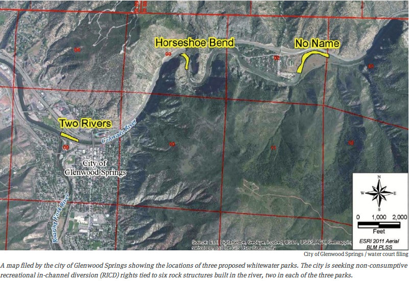
City of Glenwood Springs proposed whitewater parks via Aspen Journalism

From the Glenwood Springs Post Independent (John Stroud):

One of the 13 formal “statements of opposition” filed in the case as of Thursday comes from another of Glenwood Springs’ major recreational attractions, the Glenwood Hot Springs Pool.

The Hot Springs, in a Feb. 27 water court filing, renewed its long-standing concerns that any whitewater park features constructed in and along the river near the springs’ aquifer could potentially harm the springs.

“Operation of the [proposed] Two Rivers Whitewater Park facilities may inundate and damage portions of the Colorado River riverbed and adjacent river banks,” which could in turn damage the Hot Springs Pool facilities, according to the filing by Hot Springs attorney Scott Balcomb.

At issue would be a proposed location for a potential new whitewater park at the east end of Two Rivers Park, just above the confluence with the Roaring Fork River. It’s one of three possible locations identified in the city of Glenwood Springs’ request filed late last year for a recreational in-channel diversion, or RICD. The others are near the No Name rest area on I-70 in Glenwood Canyon, and in the Horseshoe Bend section of the river just east of town, by the No Name Tunnels…

The city now hopes to build on the economic success of the whitewater sports boom by building a second play park. To accomplish that, however, it will have to negotiate with the various entities that have filed as opposers to make sure their concerns are satisfied. That could take several years, said Mark Hamilton, a water attorney who is representing the city of Glenwood Springs in ushering the case through Colorado’s water court.

“For a case like this, that’s not unexpected,” he said of the number of entities that have taken the formal step of opposing the city’s RICD request.

Just because an entity files a statement of opposition doesn’t necessarily mean that they will ultimately object to the request, Hamilton explained. It just means that they want to be party to the negotiations so that any current or future concerns are heard as the plans take shape, he said.

Hamilton said he believes the proposed Two Rivers Park location would be far enough downstream from the hot springs that it should not be a concern.

“Obviously, everybody acknowledges that the Hot Springs Pool is and will continue to be an important part of Glenwood Springs’ economy, and their concerns are something that will have to be a part of this discussion,” Hamilton said…

Other heavy hitters that have filed to be part of the discussions include the Denver Water Board, the state’s largest water utility which owns significant water rights on the Colorado River, plus the city of Colorado Springs, the Colorado River Water Conservation District, the Colorado Water Conservation Board and several upstream and downstream water users.

Denver Water would not have been able to oppose the request by Glenwood Springs under the recent new Colorado River Cooperative Agreement it signed with Western Slope water interests, except that the request is for more water during certain times of the year than Denver had agreed to in that deal, Hamilton also said.

The city’s request seeks a “shoulder season” base flow of 1,250 cubic feet per second during the month of April each year and again from July 24 through Sept. 30. That is less than the 1,280 cfs Denver Water agreed it would not object to. However, Glenwood also requests a maximum flow rate not to exceed 4,000 cfs for up to five days between May 11 and July 6 each year, and 2,500 cfs for as many as 46 days between April 30 and May 10 and July 7-23.

The extra amount during those times could impair Denver Water’s ability to divert water under the separate Shoshone relaxation agreement, according to the utility’s statement of opposition filed Feb. 28. Further, the request could also affect Denver Water’s ability to implement its agreement with Grand County for municipal, snowmaking and environmental purposes, the utility claims.

Grand County, which recently had its own RICD request OK’d, filed a formal statement of support for the Glenwood Springs request.

“Grand County has been actively involved in efforts to preserve, protect, restore, and improve streams in the headwaters of the Colorado River and its tributaries and resolve various controversies with Denver Water,” the county stated in support of Glenwood’s application. “The [RICD] that this application seeks is consistent with Grand County’s efforts.”

Hamilton said the case has been assigned to a water referee in Glenwood Springs to oversee the initial negotiations. There will also be an administrative hearing before the Colorado Water Conservation Board, which will make a recommendation on the request.

He noted that the Grand County case is nearing completion after about 3-1/2 years, while a similar request recently granted to the town of Carbondale for a RICD on the Roaring Fork River took multiple years to process as well.

From the Aspen Daily News (Brent Gardner-Smith):

Three of the objectors are municipal water providers on the Front Range — Denver Water, Aurora Water, and Colorado Springs Utilities. They depend on water from the Colorado River basin and are concerned about new recreational water rights limiting their future water management options.

Three entities — the Colorado Department of Transportation (CDOT), the BLM and the Glenwood Hot Springs Lodge and Pool — are concerned about the proposed locations of the whitewater parks.

The Colorado River District, which represents 15 counties on the Western Slope, is generally supportive of Glenwood’s application, according to the district’s attorney Peter Fleming, but like the Front Range entities, it also has concerns about limiting the amount of water available for future junior water rights upstream of the proposed whitewater parks.

The West Divide Water Conservancy District, based in Rifle, simply told the court it “is the owner of vested water rights that may be injured by the granting of this application.”

Another four entities say they just want to monitor the case: the town of Gypsum; the Orchard Mesa Irrigation District in Palisade; the Ute Water Conservancy District and the Grand Valley Water Users Association, both in Grand Junction.

The Colorado Water Conservation Board (CWCB) also filed a statement, as it routinely does for applications of a new “recreational in-channel diversion right,” or RICD. The state agency is charged with reviewing such proposals and sending findings to water court.

And Grand County has filed a document perhaps unique to water court — a “statement in opposition in support of application.” This means Grand County supports Glenwood’s applications, but wants to be involved in the case via the filing of a required statement of opposition…

Technically, there were 13 statements of opposition filed in the case. The three Grand Valley water users, however, filed a joint application, so there are a total of 15 objecting entities. And Aurora and Colorado Springs, in addition to each filing a statement, also filed together as the Homestake Steering Committee. The two cities are partners in the Homestake Reservoir on the headwaters of the Eagle River, which flows into the Colorado River at Dotsero, which is located above the three proposed whitewater parks…

He said he expected that Denver Water would file an objection, as Glenwood has asked for the rights to more than 1,250 cubic feet per second (cfs) of water. That rate of flow is the same as the senior water right held by Xcel Energy for the Shoshone hydro plant, which also is above the three proposed whitewater parks…

And that’s the amount of water for a Glenwood whitewater park that Denver Water said it could support in the recently finalized Colorado River Cooperative Agreement, which was signed by Denver Water and 17 other entities.

“One of the provisions for support was that the recreational in-channel diversion wouldn’t exceed 1,250 cfs at the Dotsero gage,” said Travis Thompson, a media coordinator with Denver Water. “This is the amount of water needed to mimic the senior Shoshone call.”[…]

Hamilton, Glenwood’s water attorney, said the requested water rights sought above 1,250 cfs are “purely based on kayakers and boaters saying it sure would be great to have that much flow.”

He said he’s in discussions with Denver Water about Glenwood’s application and will soon be talking with all the objectors in the case…

And the Glenwood Hot Springs Lodge and Pool is concerned that wave-creating structures built in the river near the hot springs pool could harm the underground aquifer that supplies hot water to the pool. Kjell Mitchell, the president and CEO of the Hot Springs Lodge and Pool, said engineering studies have shown the boundary of the underground aquifer extends from above the pool to below Two Rivers Park. The city has proposed that one of its whitewater parks be built just above Two Rivers Park.

“The primary issue of our concern is the potential scouring of the river which could create a hole in the bottom of the river and damage the aquifer,” Mitchell said.

More whitewater coverage here.

Snowpack news (% of avg): The Upper Rio Grande basin climbs to 90% #COdrought

From the Sky-Hi Daily News:

According to the most recent USDA Natural Resources Conservation Service Kremmling Field Office snow surveys, snowpack in the high elevation mountains above Middle Park now ranges from 115 percent to 194 percent of the 30-year average, with the overall average for Middle Park at 141 percent. New record highs were set at both the Granby and Buffalo Park snow courses. At this time last year, the area was only at 75 percent of average. Snow density is averaging 28 percent, which means that for one foot of snow there is only 3.3 inches of water, which NRCS surveyors said is normal for early March.

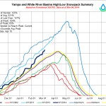
All Colorado River basins are reporting above average snowpack, except for southwestern Colorado which is 5 to 15 percent below average. Reported readings for the major river basins in Colorado are as follows: Colorado River Basin 137 percent; Gunnison River Basin, 114 percent; South Platte River Basin,145 percent; Yampa and White River Basins, 122 percent; Arkansas River Basin, 103 percent; Upper Rio Grande Basin, 85 percent; San Miguel, Dolores, Animas and San Juan River Basins 95 percent; and the Laramie and North Platte River Basins, 132 percent of average for this time of year.

From The Colorado Springs Gazette (Andrea Sinclair):

Utilities’ March Water Outlook report says snowpack levels are above average and the early season yield projections indicate a positive outlook for the year.

Water storage levels throughout the state are at 57 percent capacity, according to utilities officials. Although that’s not an ideal number, utilities spokesman Steve Berry said that’s a far cry from where levels were sitting at this time last year.

“Last year we were at about 47 percent capacity, and we were going through a severe drought,” Berry said. “It’s a good jump, and it’s really just below the 30-year average of about 62 percent capacity.”

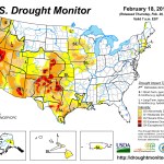
Although winter temperatures fell into the single and negative digits, an increase in snowfall accumulations in the mountains diminished drought conditions in the region, according to the U.S. Drought Monitor.

According to the National Weather Service’s Winter Review, which summarized weather from Dec. 1to Feb. 28, Colorado Springs received 19.1 inches of snow, which is 2.9 inches above normal…

As of Feb. 28, Pikes Peak snowpack levels were at 52 percent, and Rampart Reservoir at 86 percent, bringing local storage levels to 73 percent, according to utilities records. Additionally, snowpack in the Upper Colorado Basin is at 130 percent of average, and the Arkansas Basin level is at average capacity.

Drought conditions and water restrictions imposed by utilities officials encouraged area residents to conserve water, according to utilities records. February water consumption averaged 40.4 million gallons per day, about three percent less than last February. Year-to-date useage averaged 39.9 million gallons per day, a 6.1 percent decrease from last year.

Reclamation: Snowpack conditions in the Upper Colorado Region #ColoradoRiver

uppercoloradoregionsnowpack03062014

March Roundtable Summit today

Basin roundtable boundaries

I’m attending the Roundtable Summit today. I intend to live-Tweet the goings on @CoyoteGulch.

Sides agree to innovative Fraser River deal to help slake Denver Water thirst — Colorado Independent #ColoradoRiver

eisenhowerfishing

From the Colorado Independent (Bob Berwyn):

Ranchers, anglers and big-city water bosses raised a white flag in Colorado’s long-running water wars this week by setting aside bullying and threats of lawsuits and permit appeals. Instead, Grand County and Trout Unlimited have agreed to let Denver Water siphon another 18,000 acre feet from the headwaters of the Colorado River — but only under a strict checklist of requirements designed to ensure the Fraser River recovers from decades of depletion.

The deal announced Tuesday could make the Fraser the most-watched river in Colorado – and maybe in the West. It sets out an innovative, science-based plan that seeks to balance increasing urban needs for water with an imperative to restore crucial habitat for river trout…

Denver Water – Colorado’s biggest and thirstiest water provider — currently diverts more than half the Fraser River’s flow to keep toilets flushing, dishwashers running and sprinklers spouting along the Front Range. The dispute started in 2003 when the utility applied to the U.S. Army Corps of Engineers for the permit it needs to divert more water from the river — as much as three-quarters of its average annual flow — to keep up with growth in the Denver metro area…

This week’s pact seeks to honor Denver Water’s longstanding river rights while ensuring the Fraser will be protected no matter how much more water is diverted for urban use. The restoration plan will use real-time data to track critical temperature increases in key streams caused either by Denver Water’s seasonal diversions or the long-term effects of climate change. When temperatures spike, additional flows will be released to cool the water when needed. In good water years, the deal will give Denver up to 18,000 acre feet of additional water, which will mostly be tapped during the peak spring runoff season. The timing of the diversions is a key part of the utility’s promise to improve the Fraser.

“We’re not going to be diverting water all the time. We won’t divert water in critically dry years, and we’ll only divert water during spring runoff. At other times of year, we’ll put water back into the river and improve conditions,” said Jim Lochhead, Denver Water’s CEO and manager.

The agreement also will require shifts in the timing of the water harvest. High flows are needed in the spring to help flush sediments that gunk up habitat for trout and aquatic bugs…

The Army Corps of Engineers’ final environmental study is due in late April, with a formal decision on the proposed diversion project expected in early 2015.

This week’s pact minimizes the likelihood of a permit appeal or a time-consuming lawsuit by conservationists. That’s important for Denver Water, which is eager to dig its shovels into the ground as soon as possible. Some of the extremely dry years in the early 2000s — especially 2002 — already have put the water giant’s delivery system to the test.

The deal also gives Grand County some assurances that the Fraser will remain a vibrant part of its outdoor recreation economy. Anglers from throughout the state and country visit Grand County to wet their lines in a river that was favored by President Dwight Eisenhower.

The additional water will help Denver Water balance its supplies. Currently, the utility gets about 80 percent of its water through the southern portion of its collection system, from the Blue River in Summit County via the Roberts Tunnel and a chain of reservoirs along the South Platte River. Lochhead says increased diversions from the Fraser River will make urban water supplies less vulnerable to extreme events such as forest fires, which are expected more frequently because of drought and climate change. The ability to pump more water out of the Fraser when needed would give Denver a much-needed back-up plan in case of another massive blaze like the 2002 Hayman Fire in a key watershed…

West Slope water managers acknowledge Denver Water’s legal rights. But they question whether any new trans-divide diversions are needed, claiming that Front Range communities could easily meet existing and future needs with more efficient use of the water the utility already is diverting over the Continental Divide. Under any plan, they say, drawing more water from any Colorado River tributary will have ripple effects felt far downstream, from endangered Colorado River fish near Grand Junction to lettuce growers in the salty deserts near the Mexican border.

More Colorado River Basin coverage here.

‘Farmers are as certain as farmers can be that this year will be better than the last’ — Chris Woodka #COdrought

From The Pueblo Chieftain (Chris Woodka):

Farmers are as certain as farmers can be that this year will be better than the last. All indications at a still early point in the growing season are pointing toward more favorable conditions than farmers have seen in the last three years.

“It’s almost like we’ve been on an extended summer vacation,” mused Dale Mauch, a Lamar farmer and Fort Lyon Canal board member. “It would be so much fun to plant a corn crop again. You’ve got to stay optimistic in this business, if not just for your mental health.”

The Arkansas Valley’s three largest irrigation well-owner groups have submitted plans to the state with varying degrees of optimism, after they were limited in 2013. Pumping levels depend on the availability of surface supplies for augmentation.

The Lower Arkansas Water Management Association wants to pump its irrigation wells at 90 percent capacity, up from 10 percent last year. The group serves the eastern end of the valley.

“Everyone is looking forward to planting a crop,” said Don Higbee, LAWMA manager.

The Arkansas Groundwater Users Association, which augments wells on Fountain Creek and the area east of Pueblo, is a little more cautious. It plans an initial allocation of about 65 percent for farms, up from 30 percent last year. Municipal and domestic allocation will be 100 percent.

“There’s a good chance of a second allocation if snowpack is 100 percent on May 1,” said AGUA manager Scott Lorenz.

Colorado Water Protective and Development Association, which covers wells throughout the valley, is looking at something less than 65 percent, but better than 2013, when wells without an independent supply were shut down.

“Our numbers are not so good, but better than last year,” said Ann Lopkoff, CWPDA manager. “The Division of Water Resources is going to be able to work with us on a plan this year, and there is more water available. It’s not going to be zero percent again.”

If snowpack remains at high levels, ditches in the Arkansas Valley should see more normal years than the past three seasons, when flows dropped late in the year if they came at all. Commodity prices are down, and cattle herds have been thinned.

Farmers also are dealing with soil moisture deficit that affects crops like grass and alfalfa. Ample irrigation water throughout the season improves the conditions for vegetable crops and corn…

BETTER DAYS AHEAD?

Some indicators that 2014 will be an improvement for farmers:

The National Oceanic and Atmospheric Administration is predicting that chances are good for an El Nino forming over the Pacific Ocean in late summer. Such systems usually mean warmer temperatures and increased rainfall for the Southern United States, including Southern Colorado.

Snowpack was more than 125 percent in the Arkansas River headwaters, which feed the mainstem of the river.

Winter water storage, which runs Nov. 15-March 15, was almost 92,000 acre-feet at the end of February, nearly double last year’s total and 90 percent of the 20-year average

Additional water will be available from the Fryingpan-Arkansas Project, forecast at 40 percent above average as of March 1, and through leases by the Pueblo Board of Water Works.

More Arkansas River Basin coverage here.

Weekly Climate, Water and Drought Assessment of the Upper #ColoradoRiver Basin #COdrought

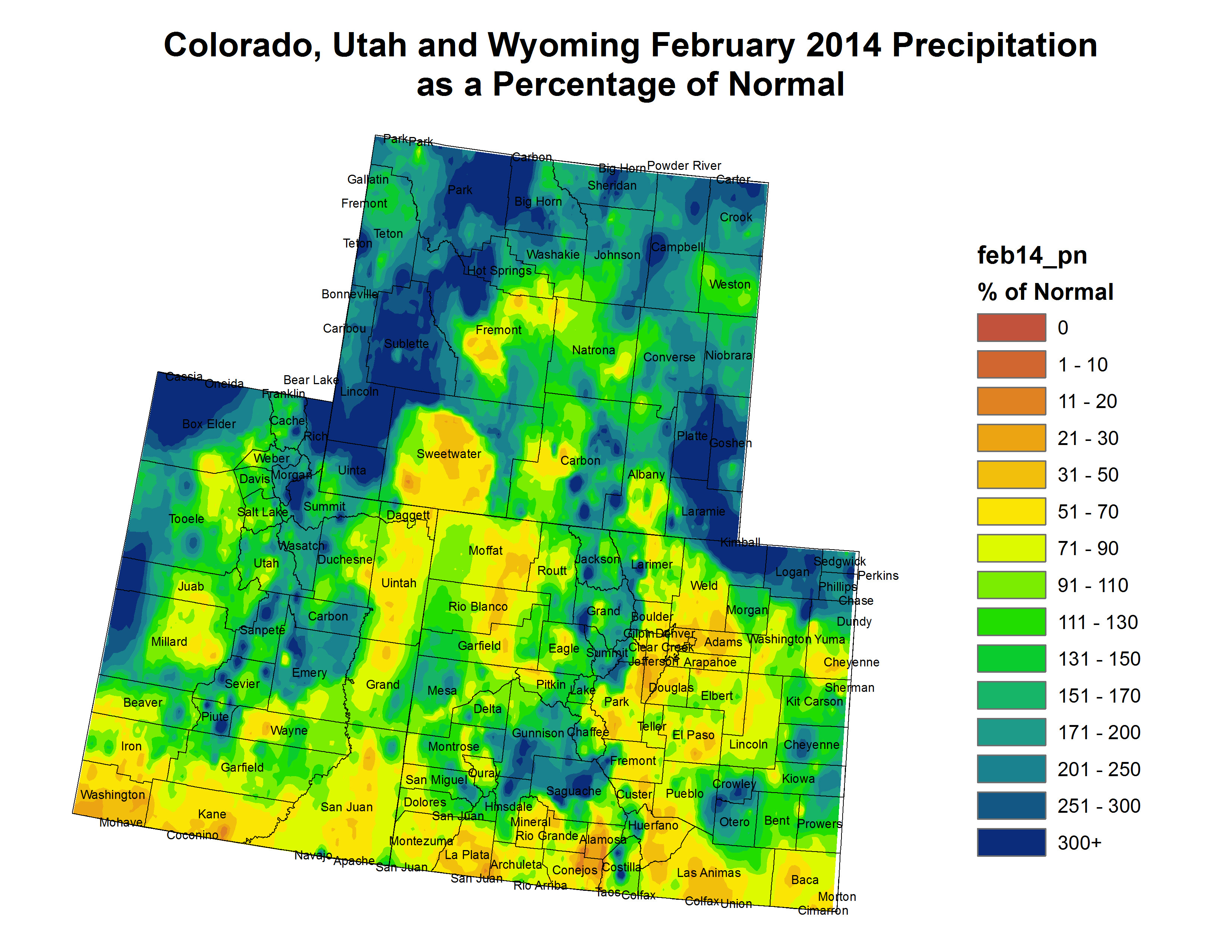
Upper Colorado River Basin February 2014 precipitation as a percent of normal

Click here to read the current assessment. Click here to go to the NIDIS website hosted by the Colorado Climate Center.

The current OWOW newsletter is hot off the presses

bootprintearth

Click here to read the newsletter. Here’s an excerpt:

The One World One Water Center is now accepting applications for the Spring 2014 OWOW Scholarship.

Qualified MSU Denver students must have declared the water studies minor and/or have enrolled in one or more water classes. Scholarship winners can be awarded up to $500! Visit the OWOW website for a full list of requirements and a link to the online submission form.

More education coverage here.

Snowpack news: Reclamation projects 73,000 acre-feet through the Boustead Tunnel

From The Pueblo Chieftain (Chris Woodka):

Winter is growing whiter and whiter in Colorado’s high country, brightening the outlook for a healthy spring runoff. While the normal peak snowpack isn’t typically reached until mid-April, Colorado continues to push the total above that peak already. Snow depths of 6 feet or more with moisture content of 16-18 inches were being reported at elevations over 10,000 feet throughout the state, according to the Natural Resources Conservation Service Snotel service. Several places added a foot of snow or more in the last week.

Ski areas also are reporting banner years. In Southern Colorado, Wolf Creek showed a base of 110 inches; Monarch, 93 inches; and Ski Cooper, 77 inches.

As of Tuesday, snowpack was 117 percent of median statewide, with the highest totals in the northern mountain ranges. In the Arkansas River basin, snowfall was 108 percent of median, but ranged from 14 percent of average at the Apishapa site northwest of Trinidad to 156 percent at Brumley, 10 miles west of Twin Lakes.

“We’ve got a lot of snow,” said Rick Sexton, Clear Creek Reservoir caretaker for the Pueblo Board of Water Works. “We’re showing 110-120 percent on all of our snow courses (all located near Leadville).”

The real work for water board crews won’t begin until April, when they start plowing out mountain ditches that bring water across the Continental Divide. But the snow already has caused some problems, including the collapse of the roof on the Sayer-McKee Building on Harrison Avenue in Leadville after a 2 foot snowfall about one month ago.

Projections for the Fryingpan- Arkansas Project, the Arkansas River basin’s largest transmountain diversion, were revised upward to 73,000 acrefeet on March 1, which is 10,000 acre-feet more than a month earlier and 20,000 acre-feet above average. The projection by the Bureau of Reclamation is based on current conditions and assumes normal accumulation of snow in the next two months. As the past two years have shown, the estimate can drop dramatically if it Water managers don’t have a crystal ball, but they’re not expecting a disastrous end to winter this year.

Because levels already have reached the normal peak for the year, the Pueblo water board this week decided to make about 5,000 acre-feet of water available to lease on the spot market.

Precipitation at lower elevations remains about average for this time of year, but farmers are still dealing with a soil moisture deficit from extended drought.

I just put 1,000 gallons back in the #ColoradoRiver — Reed Dils

‘State of the Fisheries’ meetings scheduled for Summit, Grand counties

rainbowtrout

Here’s the release from Colorado Parks and Wildlife:

As part of continuing efforts to involve the public in managing their wildlife, Colorado Parks and Wildlife will hold two “State of the Fisheries” meetings this month in Grand and Summit counties. Local anglers, guides and business owners or any interested members of the general public are invited to attend and offer their views about the management goals of several local fisheries.

The first will occur Tuesday, March 18, in the Buffalo Mountain Room at the Summit County Commons in Frisco, followed by a meeting Wednesday, March 19 at the Granby Public Library. Both meetings begin at 6:30 p.m.

“It’s important for the public to understand that we rely on their input for our wildlife management decisions and strategies,” said biologist Jon Ewert of Colorado Parks and Wildlife in Hot Sulphur Springs. “We anticipate a lively discussion and encourage everyone to come out and participate in the future of their local fisheries.”

Ewert plans the meeting as a ‘data workshop’ which he describes as being effective in encouraging discussion and interaction between the agency and sportsmen.

“As we have done in the past, anglers will have the opportunity to call out a local body of water and then I will provide data, stocking records and future plans about that fishery, followed by an open discussion,” he continued. Colorado Parks and Wildlife reminds the public that fishing licenses go on sale March 31 and are valid for one year.

Who: Colorado Parks and Wildlife

What: ‘State of the Fisheries’ meetings

Where: Tuesday, March,18 at the Summit County Commons, 37 County Road 1005, Frisco – Buffalo Mountain Room

Where: Wednesday, March 19 at the Granby Public Library, 225 East Jasper Ave., Granby

When: 6:30 p.m. each evening

Contact: For more information, contact Jon Ewert – 970-509-9150

Trout Unlimited, Denver Water, Grand County reach agreement on river protections for Moffat Project #ColoradoRiver

Gross Dam
Gross Dam

From email from EarthJustice (McCrystie Adams):

As Denver Water’s proposed Moffat Collection System Project has undergone initial federal permitting review, numerous stakeholders on both sides of the Continental Divide have raised serious concerns about the scheme to bring more water from the Fraser River to the Front Range. Today, two entities announced an agreement with Denver Water that will lead to what is being termed a Mitigation and Enhancement Coordination Plan.

McCrystie Adams, attorney in the Rocky Mountain Office of Earthjustice issued the following statement today:

“We look forward to thoroughly reviewing this private agreement to determine whether it fully addresses the impacts of the potentially river-killing Moffat expansion proposal. Any plan to mitigate additional diversions from this already heavily-stressed river system—or repair past damage—must be independently enforceable and fully funded before a decision to approve the project is made.

“The Fraser and the other streams targeted by this project are the headwaters of one of America’s great river systems, the Colorado, and are of importance far beyond Grand County. We and our conservation partners are committed to keeping these waters flowing. The Moffat permitting process is not complete, and we will continue to evaluate all alternatives to protect the long-term health and preservation of these streams.”

From the Denver Business Journal (Cathy Proctor):

Three major stakeholders involved in a project to enlarge Gross Reservoir in Boulder County, as part of Denver Water’s proposed $250 million Moffat Collection System Project, have reached an agreement to protect the Fraser River and its trout population if the project is ultimately approved. Denver Water, Trout Unlimited and Grand County were party to the Mitigation and Enhancement Coordination Plan, which was struck on Tuesday. The three parties have submitted it to state and federal agencies reviewing the project…

The Moffat project is designed to shore up Denver Water’s supply system on the north side of metro Denver, an area that came dangerously close to running out of water during the drought of 2002-2003. Denver Water first proposed enlarging Gross Reservoir, so it can hold more water from the Western Slope including the Fraser River, in 2003.

At the center of the agreement is a program to monitor the health of the stream — including water temperature, aquatic life and plant health, according to the announcement. If problems emerge, Denver Water would provide water, money and other resources to improve the condition of the river, according to the agreement.

“This plan represents a new, collaborative way of doing business together when dealing with complex water issues,” said Jim Lochhead, CEO and manager of Denver Water…

The management team will include representatives from the three parties to the agreement as well as from the Colorado Parks and Wildlife agency, the Colorado River District and the Middle Park Water Conservancy District.

“This package of protections and enhancements, if adopted in the final permit, gives us the best opportunity to keep the Fraser River and its outstanding trout fishery healthy far into the future,” said Mely Whiting, counsel for Trout Unlimited…

Lurline Curran, Grand County’s manager, said the county reached out to Denver Water and Trout Unlimited to try to get past previous disagreements about the impact of the Moffat Project.

“To all parties’ credit, this effort has succeeded,” Curran said.

The Final Environmental Impact Statement for the Moffat Project is expected by the end of April, and a final permitting decision by the Army Corps of Engineers is expected in early 2015.

From The Denver Post (Scott Willoughby):

As long as I’ve been old enough to hold a fishing rod, maybe longer, I’ve heard there’s no substitute for experience. I suppose that’s why the new Mitigation and Enhancement Coordination Plan announced Tuesday for the Fraser River’s Moffat Collection System Project seems to make so much sense at first glance.

The centerpiece of the package of river protections designed to keep the fragile Fraser River and its fish and wildlife populations healthy in the face of Denver Water’s Moffat Collection System Project is a concept stakeholders refer to as “learning by doing.” In the working world, it might be considered on-the-job training, only with the enterprising twist of entering into uncharted waters, so to speak.

The notion behind learning by doing is managing the ecological impacts of diverting a significant slice of the Fraser to Front Range water users on a cooperative basis as problems arise. Should the project permit be issued, a management team that includes Denver Water, Grand County, Trout Unlimited, Colorado Parks and Wildlife, the Colorado River District and the Middle Park Water Conservancy District will enact a monitoring program to assess stream health based on specific parameters such as stream temperature, aquatic life and riparian vegetation health.

Rather than focusing efforts on finger pointing when the Fraser’s health suffers from water depletion, the plan is to focus available resources on addressing the actual issue at hand. That means water, money and other resources committed by Denver Water through project mitigation, the Colorado River Cooperative Agreement and other agreements will be deployed to prevent declines and improve conditions as they are identified. Ideally, what’s learned from the experience will help keep the same problems from recurring again and again.

“Like the Colorado River Cooperative Agreement, this plan represents a new, collaborative way of doing business together when dealing with complex water issues,” Denver Water CEO Jim Lochhead said in a statement released Tuesday. “Since the beginning of our planning for the Moffat Project, we set out to do the right thing for the environment, and we believe coming together with Trout Unlimited and Grand County on the Mitigation and Enhancement Coordination Plan demonstrates a monumental step in making the river better. It’s satisfying that after more than 10 years of study and discussion, Trout Unlimited and Grand County have stayed at the table with us in good faith.”

Calling the agreement “a victory for the river,” Trout Unlimited said the plan closes discussions over the proposed Moffat project designed to improve the reliability of Denver Water’s system by capturing remaining water rights in the upper Colorado basin. Denver Water, Grand County and TU have submitted the Grand County Mitigation and Enhancement Coordination Plan to federal and state agencies charged with permitting the Moffat Project and have requested that it be made part of the U.S. Army Corps of Engineers’ permit.

“This package of protections and enhancements, if adopted in the final permit, gives us the best opportunity to keep the Fraser River and its outstanding trout fishery healthy far into the future,” said Mely Whiting, counsel for Trout Unlimited.

The Final Environmental Impact Statement for the Moffat Project is expected by the end of April, and a final permitting decision by the Army Corps of Engineers is expected in early 2015.

More Moffat Collection System Project coverage here and here.

Water bank for Western Slope irrigators? #ColoradoRiver

PalisadePeachOrchard

From KREXTV.com (Emily Fredrick):

he Colorado River District traveled to Montrose and Palisade Tuesday to speak with irrigators about the possibility of a water bank on the Western Slope.

The new concept would increase security for the Upper Colorado River Basin water supplies and reduce the potential negative impacts of persisting drought conditions.

“We live in a desert and all the fruit and actually all the houses and lawns and everything that are here in the Valley are here because of the water in the Colorado River essentially,” said Palisade farmer, Guy Parker.

“If Colorado is ever in a situation where we have to curtail our water usage in order to meet our obligations to our downstream neighbors under the compact, under our existing agreements that we could use those pre-compact water rights for post compact critical uses, health and human safety uses,” said Colorado River District’s Chris Treese, “When we go to them and say it’s time, we’d really like you to consider, and we’d like to compensate you, how much compensation will that take what does that market look like and will we have enough water if we put a marketplace out there. We’d like to sign people up on an option basis that you are willing to forgo either in complete or in part your historical irrigation in order to prevent a less attractive situation,” said Treese.

“I think it’s a really good idea to be very proactive because we do live in a desert and there’s not enough water to go around, we really have to be proactive and really have to be creative in our solutions to what we’re going to do,” said Parker.

More Colorado River Basin coverage here.

Arkansas Valley Conduit: Master storage contract next activity for project

Arkansas Valley Conduit Comanche North route via Reclamation

From The Pueblo Chieftain (Chris Woodka):

Construction of the Arkansas Valley Conduit is years away, but other parts of last week’s federal record of decision to approve the project are expected to move more quickly. But not too quickly, as sponsors are watching to see how pieces fall in place. The record decision by the Bureau of Reclamation also cleared the way for a master storage contract in Lake Pueblo and an interconnection at Pueblo Dam between the north and south outlets.

“Once you have signed the record of decision, those discussions can start,” said Jim Broderick, executive director of the Southeastern Colorado Water Conservancy District, sponsor for all three projects. “But we don’t want to move too quickly.”

The master contract is likely the first piece to move forward. It will allow communities within the Southeastern District to secure up to 30,000 acrefeet of storage through the year 2060. The storage is possible because Lake Pueblo seldom fills to capacity with water brought across the Continental Divide under the Fryingpan-Arkansas Project. So-called excess capacity contracts allow water users to store other water in Lake Pueblo. The long-term contract would provide more certainty that the space will be reserved than one-year contracts as well as flexibility between wet and dry years.

In recent years, 37 water districts and cities indicated they wanted to be a part of the contract — 25 also are conduit participants. The other 12 include water users in Fremont, Pueblo counties aren’t part of the conduit, but anticipate the need for storage. Among them, Pueblo West, Security and Fountain are seeking to partner in the contract, even though they already have contracts under Southern Delivery System.

The Lower Arkansas Valley Water Conservancy District also wants storage for projects such as the Super Ditch.

“We need to sit down with all of them and say, ‘All right, this is what we studied. Now how much are you going to need?’ ” Broderick said.

Another reason for waiting to begin negotiations is to see how similar talks are progressing. In 2010, Broderick watched with interest as SDS participants, led by Colorado Springs, learned that Reclamation was changing its basis for the contract from cost of service to a market-based approach. Right now, Reclamation is negotiating a similar contract with the Northern Colorado Water Conservancy District. Broderick plans to sit in on those public meetings to see what he can learn.

More Arkansas Valley Conduit coverage here and here.

Snowpack news (% of avg): South Platte best in state = 148%, Rio Grande climbing = 87%

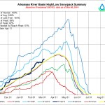
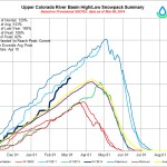
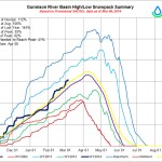
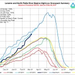
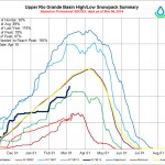
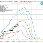
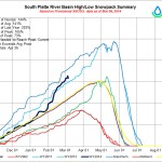
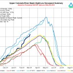
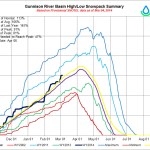
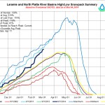
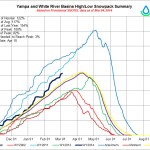
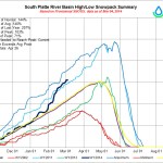
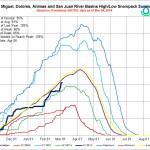
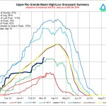
Mage at the NRCS has been busy. Click on the thumbnail graphic for your favorite basin and enjoy a gallery of good news from across the state.

Trout Unlimited, Denver Water, Grand County reach agreement on river protections for Moffat Project #ColoradoRiver

Denver Water's collection system via the USACE EIS
Denver Water’s collection system via the USACE EIS

Here’s the release via Denver Water, Grand County, and Colorado Trout Unlimited (Stacy Chesney/Lurline Curran/Mely Whiting):

Denver Water, Trout Unlimited and Grand County today announced agreement on a package of river protections designed to keep the Fraser River and its trout populations healthy.

The Mitigation and Enhancement Coordination Plan brings to a close several years of discussions over the proposed Moffat Collection System Project and its potential impacts on the Fraser River. All sides hailed the stakeholder agreement as a breakthrough that balances municipal needs and environmental health.

Trout Unlimited called the agreement “a victory for the river.”

“This package of protections and enhancements, if adopted in the final permit, gives us the best opportunity to keep the Fraser River and its outstanding trout fishery healthy far into the future,” said Mely Whiting, counsel for Trout Unlimited. “This pragmatic agreement underscores the value of a collaborative approach to water planning — one that recognizes the value of healthy rivers. It shows that, working together, we can meet our water needs while protecting our fisheries and outdoor quality of life.”

“In an effort to move past a disagreement on impacts from the Moffat Project, Grand County reached out to Denver Water and Trout Unlimited to propose additional environmental mitigations,” said Lurline Curran, Grand County manager. “To all parties’ credit, this effort has succeeded.”

“The Fraser is a river beloved by generations of anglers, boaters and other outdoor enthusiasts — it’s the lifeblood of our community,” said Kirk Klancke, president of TU’s Colorado River Headwaters chapter in Fraser and a longtime advocate for the river. “As an angler and Fraser Valley resident, I’m gratified that this agreement keeps our home waters healthy and flowing.”

The package includes environmental enhancements and protections to ensure the Fraser River will be better off with the Moffat Project than without it, said Denver Water. The Moffat Project will improve the reliability of Denver Water’s system, which serves 1.3 million people in the Denver-metro area.

The centerpiece of the agreement is Learning by Doing, a monitoring and adaptive management program overseen by a management team that includes Denver Water, Grand County, Trout Unlimited, Colorado Parks and Wildlife, the Colorado River District and the Middle Park Water Conservancy District. Upon the project permit being issued, the management team will implement an extensive monitoring program to assess stream health based on specific parameters including stream temperature, aquatic life and riparian vegetation health. Water, financial and other resources committed by Denver Water through project mitigation, the Colorado River Cooperative Agreement and other agreements will be deployed to prevent declines and improve conditions where needed.

Learning by Doing is a unique and groundbreaking effort to manage an aquatic environment on a permanent, cooperative basis. Notably, the program will not seek a culprit for changes in the condition of the stream, but will provide a mechanism to identify issues of concern and focus available resources to address those issues. Mitigation measures to prevent impacts of the Moffat Project on stream temperature and aquatic habitat will also be implemented through Learning by Doing.

“Like the Colorado River Cooperative Agreement, this plan represents a new, collaborative way of doing business together when dealing with complex water issues,” said Jim Lochhead, CEO/manager of Denver Water. “Since the beginning of our planning for the Moffat Project, we set out to do the right thing for the environment, and we believe coming together with Trout Unlimited and Grand County on the Mitigation and Enhancement Coordination Plan demonstrates a monumental step in making the river better. It’s satisfying that after more than 10 years of study and discussion, Trout Unlimited and Grand County have stayed at the table with us in good faith.”

Denver Water, Grand County and Trout Unlimited have submitted the Grand County Mitigation and Enhancement Coordination Plan to federal and state agencies charged with permitting the Moffat Project and have requested that it be made part of the U.S. Army Corps of Engineers’ permit.

The Final Environmental Impact Statement for the Moffat Project is expected by the end of April, and a final permitting decision by the Army Corps of Engineers is expected in early 2015.

For more information about the Mitigation and Enhancement Coordination Plan, see the full agreement here.

More Moffat Collection System Project coverage here and here.

Ask Questions About Colorado’s Water Plan #COWaterPlan

Cranes make annual return to San Luis Valley

Sandhill crane
Sandhill crane

Here’s the release from Colorado Parks and Wildlife:

In the San Luis Valley nature is now putting on one of its most memorable annual displays: the spring migration of greater sandhill cranes. In appreciation of this wildlife spectacle, area organizations, businesses and wildlife agencies are holding the 30th Annual Monte Vista Crane Festival, March 8-10.

“Everyone who lives in Colorado should see this migration stopover at least once,” said Rick Basagoitia, area wildlife manager for Colorado Parks and Wildlife in the San Luis Valley. “The sights and sounds are truly amazing.”

The cranes start arriving in mid-February, flying from their winter nesting ground in Socorro, New Mexico. Large wetland areas and grain fields in the San Luis Valley draw in about 25,000 birds every year. The cranes stop in the valley to rest-up and fuel-up for their trip north to their summer nesting and breeding grounds in northern Idaho, western Wyoming and northwest Colorado.

Cranes are among the oldest living species on the planet: Fossil records for cranes date back 9 million years.

The birds that migrate through Colorado are the largest of the North American sandhill subspecies standing 4-feet tall, having a wing-span of up to 7 feet and weighing in at 11 pounds. Besides their imposing size, the birds issue a continuous, distinctive and haunting call. At this time of year cranes are engaged in their mating ritual and the birds perform an elegant hopping dance as they attempt to gain the attention of other birds.

The birds are abundant in areas near the town of Monte Vista and are easy to spot. Wildlife watchers can see the birds most readily in the Monte Vista National Wildlife Refuge and in the Rio Grande, Higel and Russell Lakes state wildlife areas.

During the three days of the festival, free tours are offered at 7 a.m. and 4 p.m. when the birds are most active. Visitors take buses to various spots on the wildlife refuge, and U.S. Fish and Wildlife Service staffers talk about the migration and the refuge.

The number of cranes in the valley peaks in mid-March and many linger through the month. So, even if you can’t go the weekend of the festival there’s still plenty of time to see the birds.

Birdwatchers who travel on their own should be cautious when parking, getting out of vehicles and walking along roads. People are also asked to view birds from a distance with binoculars and spotting scopes, and to observe trail signs and closure notices.

Many other bird species – including eagles, turkeys and a variety of waterfowl – can also be seen in the area.

The festival headquarters and starting point for the tours is the Ski Hi Park building located near U.S. Highway 160 on Sherman Avenue on the east side of Monte Vista. Visitors can pick up maps, schedules and information at the headquarters. Besides the tours, a variety of workshops are put on by bird, wildlife and photography experts. An arts and crafts fair continues through the weekend at the headquarters building.

The crane festival is organized by the local crane festival committee, with help from the Colorado Parks and Wildlife, the U.S. Fish and Wildlife Service, Rio Grande County, SLV Ski Hi Stampede, Monte Vista school district, and the city of Monte Vista.

Approximate distances to Monte Vista: Denver, 220 miles; Colorado Springs, 182 miles; Salida, 85 miles; Vail, 175 miles; Durango, 135 miles; Grand Junction, 230 miles.

For more information on the Monte Vista Crane Festival, see: http://www.cranefest.com.

To learn more about sandhill cranes, go to:
http://wildlife.state.co.us/WildlifeSpecies/Profiles/Birds/Pages/SandhillCrane.aspx.

For more information on State Wildlife Areas in the San Luis Valley, go to: http://wildlife.state.co.us/LandWater/StateWildlifeAreas/Pages/swa.aspx.

More Rio Grande River Basin coverage here.

NWS Pueblo office: The 2014 Winter Review across South Central and Southeast Colorado

Aspen: Both sides in the city’s hydropower abandonment case have engaged experts to determine streamflow needs

Pelton wheel
Pelton wheel

From Aspen Journalism (Brent Gardner-Smith) via the Aspen Daily News:

A collaborative committee, formed by opposing parties in a lawsuit claiming the city of Aspen has abandoned its rights to divert water from Castle and Maroon creeks for a proposed hydro plant, is making slow progress toward its goals.

When the settlement effort was announced last year after a “stay” was filed in the case, there were hopes that a stream ecologist could be agreed upon and hired early this year to study the proposed hydro plant and the streams and make recommendations about “stream health goals.”

Steve Wickes, a local facilitator guiding the committee and working for both parties in the case, said the committee’s goals were narrowly defined: Can the two sides, with the help of a mutually trusted expert, agree on how much water can be taken out of the creeks?

But before a “request for proposals” can be written to attract a third-party stream ecologist, the committee has agreed that two experts who are working for either side should first review the list of prior studies done on the two rivers to determine where there are information gaps…

To help review the existing studies and draft the request for proposal, the city has hired Bill Miller, the president of Miller Ecological Consultants of Fort Collins, who has been working for the city on river issues since 2009.

And the plaintiffs have hired Richard Hauer, a professor of limnology (freshwater science) at the University of Montana and the director of the Montana Institute on Ecosystems. Hauer appeared at an event in Aspen in 2012 to discuss the importance of keeping water flowing naturally through a river’s ecosystem…

On the committee from the city are Steve Barwick, Aspen’s city manager, Jim True, the city attorney, and David Hornbacher, the head of the city’s utilities and environmental initiatives.

Representing the plaintiffs on the committee are Paul Noto, a water attorney with Patrick, Miller, Kropf and Noto of Aspen, and Maureen Hirsch, a plaintiff in the suit who lives along Castle Creek.

The other plaintiffs include Richard Butera, Bruce Carlson, Christopher Goldsbury, Jr. and four LLCs controlled by Bill Koch. All of the plaintiffs own land and water rights along either Castle or Maroon creeks.

Wickes said the members of the committee have agreed with his suggestion that they not discuss their ongoing work with the media, and instead refer questions to him.

The claim of abandonment against the city was filed in 2011 water court, in case number 11CW130, “Richard T. Butera et al v. the city of Aspen.”

The case was poised to go to trial on Oct. 28, 2013 and both sides filed trial briefs on Oct. 14.

On Oct. 18, however, the parties filed a stay request with the court so they could “cooperate in engaging a qualified independent, neutral, stream ecology expert.”

The ecologist is to study the rivers and the proposed plant and then “determine a bypass amount of water, to be left in the stream by Aspen.”

The opposing parties are then supposed to “use their best efforts to define the stream health goals to be achieved by said amount of water.”

That could mean, as one example, that a flow regime is agreed upon, with varying levels of water being left in the rivers below the city’s diversions at different times of year, depending in part on the natural amount of water in the rivers during any given year.

Such a protocol exists today on Snowmass Creek as it relates to diverting water for snowmaking at the Snowmass Ski Area.

The city is currently proposing to divert up to 27 cubic feet per second of water from Maroon Creek and 25 cfs of water from Castle Creek for the proposed hydro plant, on top of the water it currently diverts from both streams for municipal uses and the existing Maroon Creek hydro plant.

The city also has a policy to keep at least 13.3 cfs in Castle Creek and 14 cfs in Maroon Creek below its diversion dams in order to help protect the rivers’ ecosystems…

The plaintiffs in the suit against the city have told the court they are concerned that if the city diverts more water for hydropower, it could hurt their ability to use their junior water rights on Castle or Maroon creeks. They also claim the city intended to abandon its hydro rights connected to an old hydro plant on Castle Creek, which the city concedes it has not used since 1961.

But the city has denied it ever intended to abandon its water rights and has challenged the plaintiffs’ standing to bring the suit.

Whether the September court dates are needed likely depends on whether the two sides can agree to hire a third-party stream consultant, and then agree to follow their recommendations.

If so, Wickes thinks such an exercise could influence how rivers and streams around the West are managed.

“I’m actually hopeful that when the study is completed, not only will it inform future conversations about the hydroelectric plant, it will inform a wide number of decisions about stream ecology, how we treat our streams, and how things are interconnected,” Wickes said.

More hydroelectric coverage here.

Snowpack news: Officials are wary of this spring’s runoff #COflood

Statewide Snow Water Equivalent as a percent of normal March 3, 2014

From the Estes Park Trail-Gazette (David Persons):

With above average snow conditions, there is the very real possibility that a couple warm days in the spring could trigger a sudden runoff that could evolve into a flash flood occurrence for a community still recovering from last September’s floods. This hasn’t gone unnoticed by town officials. “We’ve been doing a lot of public outreach to prepare the community for runoff,” said Estes Park Town Administrator Frank Lancaster. “While 2014 may or may not end up being a significant runoff year, our floodplains have changed, and so runoff will certainly have different effects this year…

Will Birchfield, the town’s floodplain manager, is another official who is keenly aware of what the spring runoff could mean. He attended the 2013 Colorado Flood Forum hosted by the Colorado Association of Stormwater and Floodplain Managers and Colorado State University on Feb. 27. This forum included presentations by experts and discussions among public agencies of the 2013 flood and preparation for spring runoff.

“At this time, it’s too early to predict what runoff will bring, so we will constantly monitor, reevaluate conditions, and keep the community informed,” Birchfield said. “If current weather patterns persist, it’s possible we could see an event equal to at least a 25-year event.

“Variables include how much snowfall comes in March and April, how quickly temperatures rise in the spring, how much rain falls during snow melt, and how the new floodplains in the Estes Valley handle the melt.”

From The Greeley Tribune:

Good news for local farmers, ranchers and other water users: Greeley is receiving about 50 percent more than its normal precipitation so far in 2014, according to numbers provided by the Colorado Climate Center.

During January and February, Greeley saw 18.5 inches of snow — 7.8 inches above normal — that brought with it 2.48 inches of precipitation, surpassing the 1.6 inches of precipitation the city typically receives over the course of those two months.

It’s been colder than normal as well so far in 2014. The mean temperature was 29.6 degrees through the first two months of the year — 3.6 degrees below normal.

For February alone, snowfall amounted to 4.7 inches (0.3 inches above the normal), precipitation was 0.96 inches (0.56 inches above normal), and the mean temperature was 27.2 degrees (7.8 degrees below normal).

Senator Udall introduces bill to raise the authorization cap on Reclamation’s WaterSMART program

scada
From The Durango Herald (Katie Fiegenbaum):

One federal program implemented through the Bureau of Reclamation, which oversees water management, has been providing water-sustainability grants to states, tribes, local governments and nongovernmental organizations since 2010. The WaterSMART program, which stands for Sustain and Manage America’s Resources for Tomorrow, provides grants as well as resources and expertise in 17 Western states.

However, the program is authorized to spend only $200 million on the grants. Without raising the funding cap, the program will end in the near future.

A bill introduced Feb. 12 to the Senate and co-sponsored by Sen. Mark Udall, D-Colo., would raise the authorization ceiling for the water-conservation grants through 2023. Funds still would need to be requested through the normal budgetary process.

“Population growth and widespread drought are forcing us to do more with less water. Now more than ever, it’s essential that we make every drop count,” Udall said in a statement last week. “These programs are helping our communities develop the technology we need to conserve water, save energy and cut costs.”

The program has saved 734,000 acre-feet of water per year since 2010. One acre-foot is equal to 325,851 gallons of water and will supply slightly more than two single-family households for a year.

Dean Marrone, WaterSMART program coordinator, says the program consistently has too little funding for the number of applications it receives. It provides 50-50 cost-share grants, meaning half the money for the project must be provided by the organization requesting funds, mainly to upgrade water infrastructure…

Southwest Colorado has seen a fair amount of WaterSMART projects.

In 2013, the Uncompahgre Valley Water Users Association received a $38,758 grant through the program for head-gate automation, remote monitoring and other upgrades.

Steve Fletcher, manager of the association, applied for the grant to modernize its water system and make it more efficient using updated technology. Fletcher said he already has applied for another grant this year that would provide $850,000 for hydroelectricity projects.

The Dolores Water Conservancy District received $118,351 through the program to line its leaking clay canals and restore total efficiency to the water delivery system in 2010. It also recently received a $25,000 cost-share grant to help update its strategic plan and guide its work for the next five to 10 years…

The bill currently is in the Senate Committee on Energy and Natural Resources, on which Udall serves. A hearing was held Thursday before the Water and Power Subcommittee, where Robert Quint, senior adviser for the Bureau of Reclamation, spoke about the importance of the project…

Under the bill, the WaterSMART program also would be reauthorized to provide grants to state water resource agencies to continue to develop a National Water Census through the U.S. Geological Survey. This authority expired in 2013.

The program also pays for studies of major rivers that provide information about future water availability and recommendations for the future. A Colorado River Basin study was completed at the end of 2012.

The bill also makes sure the WaterSMART program will prioritize projects that prevent and combat drought.

More infrastructure coverage here.

The Pueblo Board of Water Works plans to lease up to 5,500 acre-feet through the spot market

Arkansas River Basin -- Graphic via the Colorado Geological Survey
Arkansas River Basin — Graphic via the Colorado Geological Survey

From The Pueblo Chieftain (Chris Woodka):

The Pueblo Board of Water Works will lease as much as 5,500 acre-feet of raw water this year on the spot market. The leases primarily provide a source of supplemental irrigation water for well or surface irrigation in the Arkansas Valley, as well as boosting supplies for some industrial or domestic users.

“I suspect there is enough demand out there for that amount of water,” said Alan Ward, water resources manager for the water board.

There were no spotmarket leases last year because of the drought.

This year, snowpack levels already have reached the average peak, giving the water board confidence that it will have some extra water to make available.

“We’ve built in three levels of conservative cushions so that this won’t leave us short of water for the next two years,” Ward said.

The amount of water available could drop if the water board finds any takers for long-term leases under a new rate structure that will charge $630.63 per acre foot. Ward still expects at least 3,500 acre-feet to be available.

While one-year leases have been increasing slightly over the past five years, hitting the $68-$150 per acre-foot range in 2012, the water board has been taking a hard look at its long-term (more than one year) water lease rates. The new rate is based on 1.5 times the rate for raw water charged to Comanche Power Plant a customer within city limits, Ward explained.

The water board’s last long-term contract was in 2012 for a 15-year agreement with Ordway Feedyard for about $376 per acre-foot (the rate increases at the same rate as city water bills). Other long-term contracts now range from $200-$400.

More Arkansas River Basin coverage here.

Arkansas Valley Conduit: Reclamation issues record of decision

Arkansas Valley Conduit Comanche North route via Reclamation

From The Pueblo Chieftain (Chris Woodka):

It would make sense to include as few turns as possible in a mostly gravity-fed pipeline from Point A to Point B. But the realities of geography, land ownership and a complex network of large and small water districts make the Arkansas Valley Conduit a much more complicated proposition.

The Bureau of Reclamation signed off on a record of decision last week that clears the way for the conduit to be built, once funding is approved by Congress. While the main trunk of the conduit will run 130 miles, spurs and loops will increase its total length to 227 miles under the concept approved by Reclamation.

“The total includes everything, all the pipes to where the water providers have facilities to do final treatment and deliver the water,” said Jim Broderick, executive director of the Southeastern Colorado Water Conservancy District, sponsors of the conduit.

The pipe, all of which will be buried underground, will range in size from 36 inches to just 4 inches as it delivers water to 40 sites serving 50,000 people. An estimated 10,256 acre-feet of water will be delivered annually through the system to large users such as St. Charles Mesa, La Junta and Lamar, to smaller water companies that use only a fraction as much water.

The most circuitous reach of the pipeline will be used in moving the water from Pueblo Dam to its first stop at St. Charles Mesa. It will first flow from the south outlet on the dam to the Pueblo Board of Water Works’ Whitlock Treatment Plant on the north side of the Arkansas River. From there, the pipeline will run south, again crossing the Arkansas River, through City Park to Thatcher Avenue. It will cross to the west side of Pueblo Boulevard somewhere along Elmwood Golf Course and then head to the prairies west of Pueblo along Red Creek Springs Road, then jog south, under the conceptual plan included in Reclamation’s study.

“Any time you get out into rural land, it drops the cost and cuts down the time needed for construction,” Broderick said.

The pipeline will swing east by the Comanche Power plant, then head north to the St. Charles treatment plant, and then north to Avondale and Boone (crossing the Arkansas River again). Spurs will take water to six districts in Crowley County and 24 districts in Otero County. Near the end of the line, the conduit will head about 25 miles north to Eads. While the total cost of the conduit is estimated to be about $400 million, the engineering phase is expected to be about $28 million.

“A lot depends on which segments we are working on,” Broderick said.

Getting a stream of federal funding to begin that process is a top priority for the Southeastern district.

More Arkansas Valley Conduit coverage here.

Governor’s Forum on Agriculture recap

Crop circles -- irrigated agriculture
Crop circles — irrigated agriculture

From The Fort Morgan Times (Marianne Goodland):

The forum began with the panel of five legislators offering brief remarks on legislation affecting agriculture in the 2014 session. In addition to Sonnenberg, the audience heard from Sen. Greg Brophy (R-Wray), who is running for governor; Sen. Gail Schwartz (D-Snowmass Village), Rep. KC Becker (D-Boulder) and Rep. Steve Lebsock (D-Thornton). All serve on the agriculture committees…

The lawmakers focused on water policy as the top topic for the agriculture committee. Schwartz pointed to the bills from the legislature’s Interim Water Resources Review Committee, which includes her, Brophy and Sonnenberg. Their bills this session covered hydroelectric projects and the state’s water plan. But it was water storage that drew much of the back-and-forth between the legislators.

Schwartz said the state needs to take a balanced approach in identifying its future needs, including how to keep the agriculture and recreation industries viable and maintain the health of the state’s rivers and streams.

“We haven’t done anything big related to storage in a couple of generations,” said Brophy, while the state population has doubled. The state needs more storage and electricity generated by that storage, he said. Sonnenberg expanded his discussion beyond agriculture. The “challenge for us rural legislators is to educate our urban cousins…one of the many issues that I view as a death by a thousand cuts for rural Colorado is storage If we can’t keep Colorado’s water in Colorado, we’re destined to lose.”

In response to an audience question, Schwartz explained that funds to build storage were raided during the recession, to the tune of $150 million. Those dollars need to be restored, she said. But she also advocated for hydroelectric projects as a companion to storage.

Water conservation also was on the minds of the audience members, but panel members reacted with different solutions. Schwartz pointed to bills on incentives for irrigation efficiency and opportunities to divert less water on the Western Slope. But Sonnenberg said that while conservation is part of the solution, “we can’t get there from here without storage.” Agriculture has led the charge on conservation and efficiency and “we haven’t had the government have to tell us how to do it.”[…]

In other news at the capitol this week:

Greg Larson of Haxtun has been named to the Colorado Ground Water Commission. Larson is also on the Republican River Water Conservation District board.

More 2014 Colorado legislation coverage here.

CWCB: The next Water Availability Task Force Meeting is March 20 #COdrought

Photo via TellurideValleyFloor.org

From email from the Colorado Water Conservation Board (Ben Wade):

A Joint Flood & Water Availability Task Force meeting will be held on Thursday, March 20, 2014 from 9:30a-12noon at the Colorado Parks & Wildlife Headquarters, 6060 Broadway, Denver in the Bighorn Room.

More CWCB coverage here.

U.S. and Mexico to send water into parched #ColoradoRiver Delta

Minute 319 signing
Minute 319 signing

Here’s a release from the Environmental Defense Fund (Chandler Clay):

The U.S. and Mexican governments have approved a plan to carry out a historic and vital step in advancing cooperative management of the binational Colorado River. The two governments, acting through the U.S. and Mexican sections of the International Boundary and Water Commission, are moving forward with a pilot “pulse flow” of water into the long-depleted delta of the Colorado River, where water has not flowed regularly since 1960.

This historic event, stemming from the groundbreaking, multi-faceted Colorado River agreement negotiated between the U.S. and Mexico known as Minute 319, will help with efforts by the U.S. and Mexico to reestablish riparian habitat, providing benefits to wildlife species and communities along the Colorado River in both countries and in the Colorado River Delta region in Mexico. The pulse flow event also creates an unprecedented model for water-sharing agreements elsewhere in the Colorado River Basin and beyond.

“The pulse flow is an unprecedented and unique event in the global context,” said Jennifer Pitt, director of the Colorado River Project at Environmental Defense Fund (EDF) and U.S. co-chair of the environmental work group that helped negotiate the framework agreement for the pulse flow. “This demonstrated commitment to environmental restoration is a shining example of what two nations can achieve when we work together, and will be very helpful for both governments to obtain information that becomes increasingly relevant as we face droughts with more frequency, not only in the Colorado River Basin but also in other watersheds.”

Starting on March 23, 2014, the United States and Mexico will release some 105,000 acre-feet—approximately 0.7% of the annual average flow of the Colorado River—into the delta below Morelos Dam, which straddles the Colorado River on the U.S.–Mexico border. The magnitude of the pulse flow will peak for several days at a high flow, and will last for nearly eight weeks, mostly at a reduced flow rate.

“The pulse flow is a vital part of our ongoing restoration efforts,” said Francisco Zamora Arroyo, director of the Colorado River Delta Legacy Program at Sonoran Institute. “We know that relatively small amounts of water can make a big difference in the health of the delta region.”

A binational team of scientific experts from U.S. and Mexican federal agencies and universities, as well as from the Sonoran Institute, The Nature Conservancy and Mexico-based Pronatura Noroeste, will be monitoring the event to determine its impacts and learn how water can stimulate river health.

“Some 380 bird species are expected to benefit from this return of water to the delta,” said Osvel Hinojosa, Water and Wetlands Program Director at Pronatura Noroeste, and Mexico co-chair of the environmental work group. “So will the local Mexican farming communities that long-ago watched the Colorado River Delta dry up.”

Signed in November 2012, Minute 319 provides numerous benefits for water users throughout the Colorado River Basin – in seven U.S. and two Mexican states – including broader sharing of water when supplies are plentiful and in times of reduced supplies, investments in water conservation, and new opportunities to store water in upstream reservoirs such as Lake Mead – the major water storage reservoir in the Lower Colorado River Basin. The pulse flow is an important element of Minute 319—a component that both countries agreed to implement in 2014.

“This flexible approach will be particularly important given the 14-year drought in the Colorado River Basin,” said Taylor Hawes, director of The Nature Conservancy’s Colorado River Program. “The agreement benefits water users throughout the Basin as well as the environment, by limiting the impact of water shortages on any one user and providing incentives for leaving water in storage while paving the way for funding future water conservation projects.”

Also under Minute 319, the Colorado River Delta Water Trust will deliver another 52,000 acre-feet (64 mcm) in “base flows” – the small but steady water supply that will sustain new habitat created by the pulse flow, in addition to trees planted at active restoration sites. A coalition of conservation organizations including EDF, Sonoran Institute, Pronatura Noroeste, The Nature Conservancy, Redford Center and National Fish and Wildlife Foundation has launched a campaign to “Raise the River” by raising the funds for the Trust to purchase rights to this water from willing sellers in the Mexicali Valley, where there is an active water rights market.

“Together, we are hoping to rewrite history to reestablish ecosystems and return some of the river’s natural amenities to local communities long deprived of a healthy environment,” said Pitt. “If we can show the long-term benefits of binational cooperation to help water users and the environment, there’s no telling what we can achieve with long-term commitments to sharing water across borders.”

More Colorado River Basin coverage here and here.

USDA Announces New Grants to Help Communities Meet Water Challenges in Coming Years

Flood irrigation -- photo via the CSU Water Center
Flood irrigation — photo via the CSU Water Center

From the USDA:

Agriculture Secretary Tom Vilsack announced today that USDA’s National Institute of Food and Agriculture (NIFA) will make $6 million in grants available this year, and up to $30 million total over the next five years as part of a new initiative to provide solutions to agricultural water challenges. The grants will be used to develop management practices, technologies and tools for farmers, ranchers, forest owners and citizens to improve water resource quantity and quality.

“Cutting edge research holds the key to tackling the complex challenges posed by prolonged drought and ensuring the future food security of our nation,” said Secretary Vilsack. “These grants will help arm America’s farmers and ranchers with the tools and strategies they need to adapt and succeed, and build on ongoing, cross-governmental efforts to provide relief to those impacted by severe drought.”

Today’s announcement builds on USDA efforts to help farmers, ranchers and forest landowners mitigate the impacts of drought, including implementation of the livestock disaster assistance programs provided through the 2014 Farm Bill and $40 million in additional conservation dollars.

NIFA has identified three critical topics that will be funded through this new challenge area: 1) ensuring the water security of surface and ground water needed to produce agricultural goods and services; 2) improving nutrient management in agricultural landscapes focused on nitrogen and phosphorous; and 3) reducing impacts of chemicals and the presence and movement of environmental pathogens in the nation’s water supply. NIFA’s approach will link social, economic, and behavioral sciences with traditional biophysical sciences and engineering to address regional scale issues with shared hydrological processes, and meteorological and basin characteristics.

NIFA is expected to make $30 million available over the next five years for the Agriculture and Food Research Initiative (AFRI) water challenge area, with the expectation that the new projects awarded this fiscal year would receive additional funding in the following four years. All additional funding is contingent on future congressional appropriations and achievement of project objectives and milestones.

Building on its investment in water research, NIFA will also fund projects through the National Integrated Water Quality Program (NIWQP), which addresses critical water resource issues including water quality protection and water conservation. The RFA for this program is expected to be released in the spring of 2014.

The NIWQP supports research, education and Extension projects and programs that address critical water resource issues in agricultural, rural and urbanizing watersheds. These projects reflect the growing need to combine knowledge from biological and physical sciences with social and economic sciences to address complex water issues.

The NIWQP focuses on addressing water issues at the watershed scale. Projects funded by the NIWQP are outcome-oriented, aiming to increase awareness and change behaviors related to water resource management.

Through federal funding and leadership for research, education and extension programs, NIFA focuses on investing in science and solving critical issues impacting people’s daily lives and the nation’s future. More information is available at: http://www.nifa.usda.gov.

More infrastructure coverage here.

Public meetings for the South Platte Basin implementation plan #COWaterPlan

South Platte River Basin via the Colorado Geological Survey

From The Greeley Tribune;

The South Platte Roundtable is hosting a series of input and information sessions around the region during the upcoming weeks, as it continues piecing together its comprehensive, long-term water plan for northeastern Colorado.

Each of the basins in Colorado is putting together individual water plans, which will help make up the collective Colorado Water Plan — an effort put in motion by Gov. John Hickenlooper.

All meetings will be from 3:30-7 p.m., will include an overview of the South Platte River Basin’s water supplies and needs, and will also feature question-and-answer sessions and information displays.

The remaining meetings will take place on:

» Wednesday at the Southwest Weld County Complex, 4209 Weld County Road 24 1⁄2 in Longmont.

» March 19 at the Fair Barn, 880 Bogue St. in Fairplay.

» April 10 in Yuma (held in conjunction with the Republican River Water Conservancy District’s regular quarterly meeting).

For more information, go to SouthPlatteBIP@hdrinc.com or http://cowaterplan@state.co.us.

From PublicNewsService.org (Stephanie Carroll Carson):

“Just add water.” Simple instructions on the back of your muffin mix, but coming up with the Colorado Water Plan dictated by the Governor last year is proving to be much more complicated. Currently, regional meetings are taking place to put together a plan that will work for the entire state, but Eagle County Commissioner Kathy Chandler-Henry said she is concerned about the competing needs of the Front Range and the mountain communities.

“The concern is that the water is on the western slope and the people are on the eastern slope,” she pointed out. “While it’s always a great idea to collaborate and work together, we always are a little protective of the water that we need to keep on the western slope.”

According to the Northwest Council of Governments, people incorrectly make several assumptions about water: that population growth can’t be contained, that there’s plenty of water on the west slope for the Front Range, and that new water projects are needed to save agricultural interests.

The Colorado Water Plan now in the works is the first of its kind and is to be complete by 2015. It will then influence water decisions for the foreseeable future.

Chandler-Henry and others also question predictions that Colorado’s population is going to double by 2050.

“We don’t think that’s necessarily true,” she said. “We’ve has some big changes with the recession recently that have slowed down population growth, and would like to see more land planning, community planning be a part of this whole water discussion.”

Colorado water allocation has historically been guided by local governments. Supporters of Colorado’s Water Plan say its goal is to get those communities to work more cohesively and streamline efforts to provide adequate water while not compromising the environment.

Link to more information on the Colorado Water Plan at http://NWCCOG.org and the relevant executive order at http://1.usa.gov/NCQbWD.

More Colorado Water Plan coverage here.
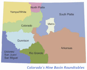
Love your water camp! :) H2O Outdoors

Flaming Gorge Pipeline: Aaron Million still has his eye on the prize #ColoradoRiver

Conceptual route for the Flaming Gorge Pipeline -- Graphic via Earth Justice
Conceptual route for the Flaming Gorge Pipeline — Graphic via Earth Justice

From the Green River Star (David Martin):

The Aaron Million water project continues on in the form of a request to the Bureau of the Interior. Million’s request, as published in the Federal Register Feb. 12, calls for a standby contract for the annual reservation of 165,000 care-feet of municipal and industrial water from the Flaming Gorge Reservoir for a transbasin diversion project…

Mayor Hank Castillon, who is a member of Communities Protecting the Green, said he isn’t sure what Million’s plans are with this latest move. Citing his previous denials from the Army Corp of Engineers and FERC, Castillon said the amount Million wants to use has dropped from the initial 250,000 acre feet of water his project would require. Castillon said he expects a battle to occur between the eastern and western sides of the continental divide. Castillon is aware Cheyenne and other cities in eastern Wyoming need water, along with locations in northern Colorado. The problem they need to address, according to Castillon, is the fact that the water isn’t available…

The Sweetwater County Commissioners commented on Million’s proposal Tuesday, voicing their opposition to the idea. Commissioner Wally Johnson said the transfer of water to Colorado isn’t in Sweetwater County’s best interest, saying “it doesn’t matter if it’s Mr. Million or Mr. Disney” making the proposal. Commissioner John Kolb also voiced his opposition, saying opposition to the idea is unanimous between Gov. Matt Mead, the Wyoming County Commissioners Association and the commissioners themselves.

“I’d like to see us not wasting our time on crazy, hare-brained schemes,” Kolb said. “(Transbasin water diversion) doesn’t work.”

More Flaming Gorge Pipeline coverage here and here.

Tougher floodplain rules for Montezuma County

La Plata Mountains from the Great Sage Plain

From the Cortez Journal (Jim Mimiaga):

New floodplain regulations were implemented in Montezuma County Jan. 13 to comply with higher standards established by the Colorado Water Conservation Board.

Colorado adopted rules to provide increased floodplain management standards in order to help communities prepare, plan for, respond to, and mitigate the effects of future flood damage.

The main change for the county, explained community services director James Dietrich, will be for critical facilities. If in a designated flood plain, those structures must now be built 2 feet above the base-flood elevation instead of the previous 1-foot standard.

Critical facilities include hospitals, schools, nursing homes, daycare facilities, power stations, and government/public buildings.

Building regulations for non-critical facilities in the floodplain did not change from the 1-foot over the base-flood elevation. Also, there were no changes to the county floodplain boundaries.

More Montezuma County coverage here.

The Colorado Water Trust is coordinating and facilitating a number of sessions at CCLT’s Conservation Excellence Conference

Saguache Creek
Saguache Creek

Click here for the pitch, to view the session descriptions, and register. Here’s an excerpt:

The Colorado Water Trust is coordinating and facilitating a number of water sessions at the Colorado Coalition of Land Trusts’ Conservation Excellence Conference in Denver in March.

The Colorado Coalition of Land Trusts (CCLT) promotes and supports land conservation at a state level and serves as the collective voice for land conservation in Colorado. CCLT’s annual Conservation Excellence Conference offers conservation professionals opportunities for learning and networking in Denver on March 17, 18, and 19.

Because water is often crucial to the conservation values of conserved lands, the Colorado Water Trust has worked closely with CCLT and the land conservation community over time. We provided general guidance, technical assistance, and educational programming specific to land conservation transactions to help professionals make informed decisions about water rights.

This year, the Colorado Water Trust is coordinating and facilitating a number of sessions and workshops at CCLT’s Conservation Excellence Conference as part of our continuing efforts to assist the land conservation community in understanding water issues.

More education coverage here.

Snowpack (% of normal) news: Upper Rio Grande (85%) inching towards normal #COdrought

From Colorado PBS (Jim Trotter):

There’s so much snow in the South Platte River Basin that water managers there are “holding their breath” for a normal, well-behaved runoff when melting begins in earnest, said assistant State Climatologist Wendy Ryan.

In other words, they don’t want an unexpected streak of 90 degree days that could create a deluge in river channels damaged from last September’s massive flooding.

Elsewhere in the state, conditions range from the mostly positive to the downright worrisome. Snowpack in the San Juan Mountains is 90 percent of average, with drier conditions in the Four Corners. In the Rio Grande and lower Arkansas River basins, however, where drought has persisted in a multi-state region for three years going on four, conditions are less promising.
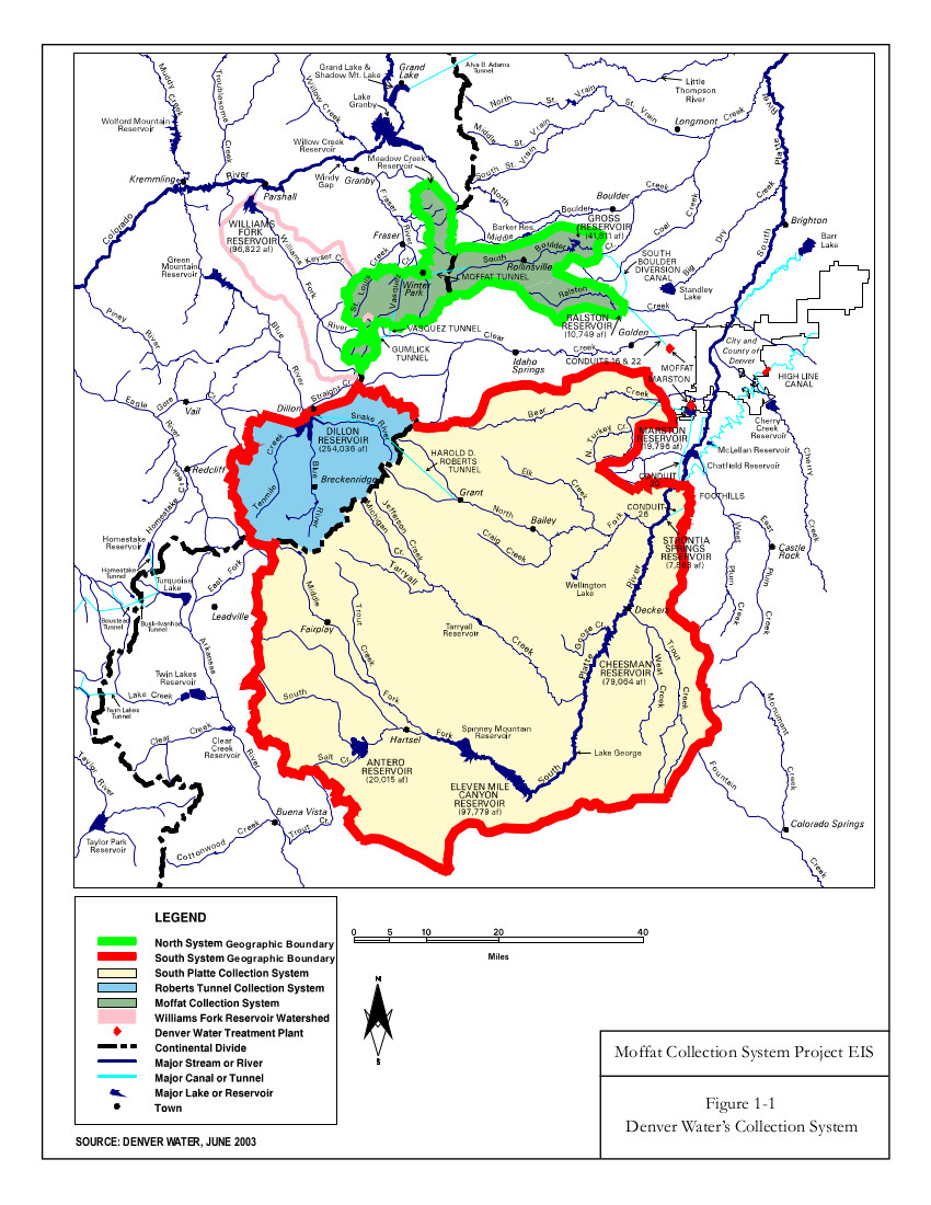
Snowpack in the Rio Grande is only 74 percent of normal, which could have grim portent for New Mexico and D2 (severe), D3 (extreme) and D4 (exceptional) drought conditions now exist in Colorado’s southeastern corner. Springs storms and a healthy monsoon season could change all of that, of course, but for now – given recent history – there are plenty of reasons to worry.

The southeastern plains received moisture from September’s epic storms, but by that time ranchers had sold off most of their cattle because there was no water and no wheat. What grew from the moisture instead is what Ryan described as an “epidemic of tumbleweed.”[…]

Among other measures followed by the climate center at Colorado State University, is reservoir water storage. There, too, the news ranged from good to not so good. Lake Dillon is standing at 111 per cent of average and 94 percent full, while Lake Granby is 91 percent of average and 47 percent full – good numbers for this time of year. But the massive Lake Powell is only 56 percent of average, 39 percent full.

Dille Diversion Dam: making progress on our facilities in Big Thompson Canyon — Kara Lamb

Learn how to protect your family & home from dangerous spring runoff — Sen. Mark Udall

Cascade: Water rates going up

pikespeak

From The Colorado Springs Gazette (Matt Steiner):

Jennifer Tanaka, an attorney for the Cascade Metropolitan District, said the $25 increase for residents with a standard, three-quarter inch tap will help the district offset costs related to a legal dispute with Colorado Springs Utilities. CSU has been leasing water to the western El Paso County town as part of a pact signed in 1990.

“The board made it clear that the fee is only for the purpose of repaying the city,” Tanaka said of the decision made at Tuesday’s meeting. “Once everything is paid off, the fee goes away.”

According to Tanaka, a trial between CSU and the district was avoided by an agreement made in mid February. The Cascade Metropolitan District has an outstanding debt of $495,000 owed to the utilities company.

More Arkansas River Basin coverage here.