
Hydraulic Fracturing & Water Stress: Water Demand by the Numbers — CERES

The hydraulic fracturing water cycle via Western Resource Advocates

Click here to register to download the report.

Thanks to the Boulder Weekly (Haley Gray) for the link. Here’s an excerpt:

Water is the lifeblood of Colorado’s Weld and Garfield counties, and lately it’s been in short supply. Both of these counties face extremely high stress in terms of water scarcity, and both have seen an intense concentration of the water-intensive hydraulic fracturing (fracking) process.
It’s a bad combination, according to a recent report issued by Ceres, a nonprofit devoted to promoting corporate responsibility and sustainability leadership.

The report, released Wednesday, Feb. 4, is titled, “Hydraulic Fracturing & Water Stress: Demand by the Numbers,” and it projects that the clash between water shortages and fracking is only going to get worse, given that a significant increase in shale development via fracking in these areas is likely. In the Denver- Julesburg (DJ) Basin alone, which covers parts of Boulder and Weld counties, Ceres predicts a redoubling of fracking activity by 2015…

CERES FOUND THAT 100 PERCENT OF THE NATURAL GAS AND OIL WELLS IN COLORADO ARE LOCATED IN AREAS FACING EXTREME WATER STRESS, 89 PERCENT OF WHICH ARE LOCATED IN WELD AND GARFIELD COUNTIES…

Ceres’ report constitutes the first systematic effort to investigate water usage by natural gas companies. One of the purposes of the report is to identify water sourcing risks to oil and gas companies, thereby generating information previously unavailable to the public. Famiglietti lauds the “deep dives,” or meticulously detailed case studies, conducted by Ceres for the report.

It is, however, by no means a comprehensive study of the risks associated with fracking. Concentrated usage of water in extremely dry regions was just one of three primary concerns Famiglietti points out regarding the report. Famiglietti listed earthquakes and the removal of water from the natural water cycle as additional issues demanding further investigation. Both of these concerns arise from the practice of using injection wells to dispose of wastewater from the fracking process by injecting it into deep formations.

The report also issues recommendations and identifies some of the most progressive current practices in the industry. It specifically mentions, among other companies, Anadarko, the single largest natural gas producer in the DJ Basin in terms of water use, as a “pocket of success.” Anadarko earned the mention for its practice of leasing wastewater from local municipalities. Even so, Anadarko is one of the most at-risk companies in terms of drilling in water-scarce areas, according to Freyman.

“In a general year, cities have more water than they can use,” says Brian Werner, public information officer of the Northern Colorado Water Conservancy District (NCWCD).

Leasing excess water to oil and gas companies to use for fracking allows municipalities to pad meager budgets. The years 2009, 2010 and 2011, for example, were wet years, according to Werner. In 2012 the Front Range was hit with a drought. Werner expects 2014 to be a particularly wet year.

According to Werner, it is not unheard of to see a town both lease excess water and impose water rationing simultaneously, since water rationing is used to keep water conservation on the public’s minds. “In most years [how much, if any, excess water leased] depends on comfort levels and a number of other factors,” Werner says.

No towns in Colorado currently lease water directly to companies for fracking purposes, according to Werner. Generally, a water leasing company such as A&W Water Service Inc. secures water from municipalities or local farmers, who might own the rights to more water than they need, and then resells the water to a third party for fracking purposes.

The increased demand for water by “deep-pocketed” oil and gas companies is not beneficial to all farmers, though. According to the Ceres report, it has driven up the price of water in Colorado, making it difficult for struggling farmers to stay afloat.
More oil and gas coverage here and here.

California plans to drop their total banked storage in Lake Mead this year #ColoradoRiver

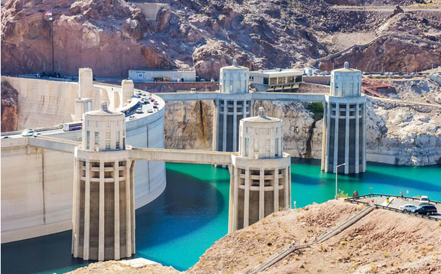
Drought Affected Lake Mead via the Mountain Town News

From the Las Vegas Review-Journal (Henry Brean):

California’s largest municipal water supply agency, the Metropolitan Water District of Southern California, took about 80,000 acre-feet from its water savings account in the lake last year. Now the agency is contemplating a withdrawal at least twice that size, enough to cause the surface of the massive reservoir to drop two feet and the shoreline to recede by as much as 60 feet.

“Things are so bad in California, unless it starts raining like crazy we are probably going to take another 150,000 to 200,000 acre-feet this year,” said Bill Hasencamp, Metropolitan’s manager of Colorado River resources.

The withdrawal is on top of the roughly 1 million acre-feet of water the agency already gets each year from California’s total annual allotment of 4.4 million acre-feet from the Colorado River…

Metropolitan deposited the water, so Metropolitan has every right to withdraw it, said J.C. Davis, spokesman for the Southern Nevada Water Authority.

“The people making an issue of this only see the negative, because water is being taken out,” he said. “But if Met hadn’t banked it in the first place, that water wouldn’t be there.”

Without the water stored in Lake Mead so far by California, Nevada, Arizona and Mexico, Davis said, the surface of the reservoir formed by Hoover Dam would be at least 10 feet lower than it is right now…

Nevada, California and Arizona won the right to store unused Colorado River water in Lake Mead as part of an interstate agreement enacted in 2007.

Mexico started banking water in the lake a few years later, after a major earthquake in April 2010 damaged canals and pipelines that country uses to divert water from the Colorado south of the border. A treaty amendment struck in 2012 expanded Mexico’s ability to store water in the reservoir.

There are restrictions on how much of the banked water, officially known as Intentionally Created Surplus, can be taken out in a single year. California’s annual withdrawals are capped at 400,000 acre-feet, Nevada’s at 300,000 acre-feet. The bank cannot be tapped during a declared shortage on the river or if federal officials determine that a withdrawal would tip the river into shortage.

All Intentionally Created Surplus accounts are subject to a 3 percent reduction each year — call it a bank fee — to account for evaporation.

Since the program began, the Southern Nevada Water Authority has socked away some 540,000 acre-feet and used about 16,000 acre-feet, leaving it with the largest bank account right now. Metropolitan has stored more water than the authority, but Southern California has withdrawn more of its water…

The surface of the lake has fallen more than 100 feet over the past 12 years amid persistent drought on the overtaxed Colorado River. If the lake level drops another 35 feet, it will trigger the first federal shortage declaration and force Arizona and Nevada to trim their use of river water. If the lake drops 60 feet, the authority will lose the use of one of two intake pipes that supply the Las Vegas Valley with nearly all of its water.

Current projections by the U.S. Bureau of Reclamation call for Lake Mead to shrink by 20 feet by the end of the year and 30 feet by April 2015, when it could hit a record low. For now, though, the lake is expected to hover just above the trigger point for a federal shortage at least through January 2016.

In other words, just a few extra feet of water in Lake Mead could make a big difference.

Even so, Davis said Southern Nevada officials have made no effort to dissuade their counterparts in California from making a withdrawal from the water bank.

“It’s for a rainy day, or rather a non-rainy day,” he said. “If you want to create a banking system and you want people to participate in it, you can’t admonish them every time they make a withdrawal. That’s the whole point of a banking system: to give people the flexibility to take the water when they need it.”[…]

Gov. Jerry Brown declared a statewide drought emergency in January, and Met’s board of directors followed that last month by issuing a water supply alert to spur conservation ahead of possible mandatory water-use restrictions.

Conditions have been so bad that Met won’t be allowed to take any water this year from the State Water Project that links Southern California to rivers and lakes some 500 miles to the north.

“We are relying heavily on the Colorado River,” Hasencamp said.

Met, as his agency is commonly known, supplies about half of the water used by 19 million Southern California residents. It serves 26 member utilities in six counties spanning an area that stretches from the Mexican border to Oxnard, north of Los Angeles, and from the coast to the Inland Empire.

Agency spokesman Bob Muir said Met currently has about 2.4 million acre-feet of water stored in “various accounts,” enough to meet its demand for a little more than one year.

More Colorado River Basin coverage here and here.

Fryingpan, Roaring Fork rivers retain Gold Medal Trout Waters designation — The Aspen Times

Map of the Roaring Fork River watershed via the Roaring Fork Conservancy

From the Aspen Times (Scott Condon):

A survey conducted by Colorado Parks and Wildlife last fall determined the rivers still have the quantity and size of fish to retain their distinguished designation as Gold Medal Trout Waters, according to Kendall Bakich, aquatic biologist for Parks and Wildlife.

“It turned out really well,” Bakich said. “The numbers we’re seeing on the river are similar to what we’ve seen in prior surveys.”

“We just confirmed that it’s Gold Medal,” she added.

A 13-mile stretch of the Fryingpan River from Ruedi Dam to the confluence with the Roaring Fork River is designated Gold Medal Trout Water as well as the Roaring Fork River from Basalt to the confluence with the Colorado River. All told, that’s a 42-mile stretch.

For years, that’s been the longest contiguous stretch of Gold Medal Trout Water in Colorado. But the local rivers lost their title in January, through no fault of their own. It’s now bestowed on a 102-mile stretch of the Upper Arkansas River from near Leadville south to near the Royal Gorge, according to Parks and Wildlife. That stretch of the Arkansas River earned Gold Medal status after years of efforts to restore the fishery, the agency said…

While the Crystal River isn’t known for its rainbow trout population, it has a larger percentage of rainbows among the overall fish population than either the Fryingpan or Roaring Fork, according to Bakich. The Crystal River has erratic flows that limit fish populations. It usually has high flows for a constrained river in the spring and extremely low flows during late summer and fall because of diversions.

The high streamflow has helped keep brown trout populations lower on the Crystal River.

“Brown trout tend to be lazy,” Bakich said. “They like slower water.”[…]

The survey showed evidence of three varieties of native fish on the Roaring Fork River. Roundtail chub were found near the confluence with the Colorado River. Flannelmouth suckers are found as far upstream as Carbondale, while bluehead suckers are found as high as Basalt, according to Bakich.

More Roaring Fork River watershed coverage here.

Rio Grande Basin Roundtable: The Rio Grande Basin Plan is essential to the Valley’s future #COWaterPlan

Pond on the Garcia Ranch via Rio Grande Headwaters Land Trust

From the Rio Grande Basin Roundtable via the Valley Courier:

The last decade has brought many changes to Colorado’s water supply outlook. Even with the recent economic recession, the state will continue to experience significant population growth. Other pressures on Colorado’s water supply include: severe drought, meeting multiple needs (e.g., municipal, agricultural, environmental , and recreational) with existing resources, and agricultural impacts due to water shortages, urbanization and transfers to new uses.

The state’s river systems generate an average 16 million acre feet (AF) of renewable water each year, however two-thirds of this water is obligated to leave the state under various interstate compacts and agreements. In addition, of the 16 million AF, about 80 percent of the water is on the Western Slope, while approximately 80 percent of the state’s population resides on the Eastern Slope. Most of the irrigated agriculture lands are on the Eastern Slope as well. Colorado’s dry climate creates many challenges for water users, who frequently move water vast distances from its source to its area of use.

These types of challenges made the water law structure that is common in the eastern United States, (riparian law) unrealistic. Riparian law says that only those with land adjoining the stream have a right to use the stream water. Colorado adopted a different system – prior appropriation . This system is commonly summed up as “first in time, first in right.” This means that those with senior (older) rights can begin to use water before junior (newer) rights holders in times of water shortages. (CFWE, 2014)

Colorado needed a clear classification of law to recognize and protect water rights, with consistent administration and enforcement, yet with the flexibility to allow those rights to be transferred, sold, or exchanged. The Colorado Doctrine of Prior Appropriation is a set of laws governing water use and land ownership adopted by the people of Colorado starting in the 1860s.

The four major principles are: All surface and groundwater in Colorado is a public resource for beneficial use by public agencies, private persons, and entities; A water right is a right to use a portion of the public’s water resources; Water rights owners may build facilities on the lands of others to divert, extract, or move water from a stream or aquifer to its place of use; and, Water rights owners may use streams and aquifers for the transportation and storage of surface water and groundwater to meet owners’ water supply needs.

Today’s water managers are tasked with solving the state’s water issues against overwhelming obstacles. This why the State Water Plan is so important. The plan will provide a framework for water managers moving forward. The plan will allow for wise and thoughtful water supply planning that addresses critical issue within each basin securing future water needs across the state. The plan must be done in a manner that considers all solutions and addresses the varied water needs of Colorado and its citizens.

The Rio Grande basin Roundtable has been tasked with preparing a multidimensional basin plan for the upper Rio Grande. Water management is an issue that touches every resident in the San Luis Valley, particularly as it pertains to aquifer sustainability.

The basin’s water is under continuous curtailment as it works to meet Compact compliance. This is why water users in the basin keep water inventory current and are taking steps to ensure reservoirs can store constructed volumes. The Rio Grande Basin Plan will provide a variety of tools that all water administrators can use to preserve the social, cultural and economic resilience of the Rio Grande Basin. As the Water Administration goals are formed the Rio Grande Basin Roundtable would like public input to be considered. The most effective methods for stakeholders to become involved is in one of three ways: 1) attend the Rio Grande Basin Roundtable monthly meetings (These meeting are held the second Tuesday of each month at the San Luis Valley Water Conservancy District office at 623 Fourth Street in Alamosa, Colorado.) or; 2) send your comments directly to us online at www. riograndewaterplan.webs. com and; 3) attend any one of the five BIP subcommittee meetings that can be found on the BIP website. The lead consultant and local liaison from DiNatale Water Consultants is Tom Spezze, Tom can be contacted at tom@ dinatalewater.comThis is the fourth article in the series from the Rio Grande Basin Roundtable, regarding the implementation of the Basin Water Plan. VALLEY The last decade has brought many changes to Colorado’s water supply outlook. Even with the recent economic recession, the state will continue to experience significant population growth. Other pressures on Colorado’s water supply include: severe drought, meeting multiple needs (e.g., municipal, agricultural, environmental , and recreational) with existing resources, and agricultural impacts due to water shortages, urbanization and transfers to new uses.

The state’s river systems generate an average 16 million acre feet (AF) of renewable water each year, however two-thirds of this water is obligated to leave the state under various interstate compacts and agreements. In addition, of the 16 million AF, about 80 percent of the water is on the Western Slope, while approximately 80 percent of the state’s population resides on the Eastern Slope. Most of the irrigated agriculture lands are on the Eastern Slope as well. Colorado’s dry climate creates many challenges for water users, who frequently move water vast distances from its source to its area of use.

These types of challenges made the water law structure that is common in the eastern United States, (riparian law) unrealistic. Riparian law says that only those with land adjoining the stream have a right to use the stream water. Colorado adopted a different system – prior appropriation . This system is commonly summed up as “first in time, first in right.” This means that those with senior (older) rights can begin to use water before junior (newer) rights holders in times of water shortages. (CFWE, 2014)

Colorado needed a clear classification of law to recognize and protect water rights, with consistent administration and enforcement, yet with the flexibility to allow those rights to be transferred, sold, or exchanged. The Colorado Doctrine of Prior Appropriation is a set of laws governing water use and land ownership adopted by the people of Colorado starting in the 1860s.

The four major principles are: All surface and groundwater in Colorado is a public resource for beneficial use by public agencies, private persons, and entities; A water right is a right to use a portion of the public’s water resources; Water rights owners may build facilities on the lands of others to divert, extract, or move water from a stream or aquifer to its place of use; and, Water rights owners may use streams and aquifers for the transportation and storage of surface water and groundwater to meet owners’ water supply needs.

Today’s water managers are tasked with solving the state’s water issues against overwhelming obstacles. This why the State Water Plan is so important. The plan will provide a framework for water managers moving forward. The plan will allow for wise and thoughtful water supply planning that addresses critical issue within each basin securing future water needs across the state. The plan must be done in a manner that considers all solutions and addresses the varied water needs of Colorado and its citizens.

The Rio Grande basin Roundtable has been tasked with preparing a multidimensional basin plan for the upper Rio Grande. Water management is an issue that touches every resident in the San Luis Valley, particularly as it pertains to aquifer sustainability.

The basin’s water is under continuous curtailment as it works to meet Compact compliance. This is why water users in the basin keep water inventory current and are taking steps to ensure reservoirs can store constructed volumes. The Rio Grande Basin Plan will provide a variety of tools that all water administrators can use to preserve the social, cultural and economic resilience of the Rio Grande Basin. As the Water Administration goals are formed the Rio Grande Basin Roundtable would like public input to be considered. The most effective methods for stakeholders to become involved is in one of three ways: 1) attend the Rio Grande Basin Roundtable monthly meetings (These meeting are held the second Tuesday of each month at the San Luis Valley Water Conservancy District office at 623 Fourth Street in Alamosa, Colorado.) or; 2) send your comments directly to us online at http://www. riograndewaterplan.webs. com and; 3) attend any one of the five BIP subcommittee meetings that can be found on the BIP website. The lead consultant and local liaison from DiNatale Water Consultants is Tom Spezze, Tom can be contacted at tom@dinatalewater.com

More Colorado Water Plan coverage here.

Reclamation issues record of decision for the Arkansas Valley Conduit

Arkansas Valley Conduit Comanche North route via Reclamation

From The Pueblo Chieftain (Chris Woodka):

Colorado’s U.S. senators hailed the federal record of decision for the Arkansas Valley Conduit this week, calling it a major milestone to bringing clean drinking water to communities in Southern Colorado.

The record of decision affirms the choice of the North Comanche route for the pipeline, as well as setting up a master contract for storage of nearly 30,000 acre-feet of water in Lake Pueblo. It also sets the path for a cross-connection at Pueblo Dam that eventually will link the north and south outlets.

Construction of the conduit, which could cost up to $400 million, still requires funding from Congress. When completed, it will provide water to 50,000 people in 40 communities east of Pueblo.

“Colorado knows well that water is an extremely precious resource, and the Arkansas Valley Conduit will help ensure families in Southeastern Colorado have access to a safe and healthy water supply,” said Sen. Michael Bennet, D-Colo. “Today’s announcement couldn’t be more important to southeast Colorado, and it demonstrates the Interior Department’s commitment to getting this project done.”

“This project, the final component of the Fryingpan-Arkansas Project, will help strengthen Colorado’s agricultural economy, our quality of life and rural communities throughout Southeastern Colorado,” said Sen. Mark Udall, D-Colo. “Water is our most valuable resource in Colorado, and we need to make every drop count.”

Bennet and Udall have led efforts to secure resources and move forward with the construction of the Conduit. In addition to advocating for quick approval of the EIS, the senators have written to the Department of Interior to provide adequate resources for construction of the Conduit in future federal budgets.

The Arkansas Valley Conduit is the final component of the Fryingpan-Arkansas Project. Once constructed, the Conduit will deliver clean drinking water to families, producers and municipalities throughout Southeastern Colorado.

Bennet and Udall worked together to enact legislation in 2009 authorizing the construction of the Conduit, and have pushed ever since for funding to keep the project on schedule. The legislation also allows revenues from federal contracts to be applied to the cost of building the Conduit.

More Arkansas Valley Conduit coverage here and here.