
Click here to read the current assessment. Click here to go to the NIDIS website hosted by the Colorado Climate Center. Here’s the summary:
Summary: January 10, 2017
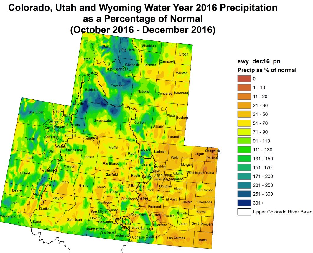
Last week saw a continuation of the active storm pattern, as snow accumulations continue to build in the higher elevations of the Upper Colorado River Basin. Widespread across the region, precipitation amounts were over 0.5 inches for the week. Many areas received over 2 inches of liquid, and some areas (particularly around Cameron Pass in northern CO and Gunnison County, CO) received in excess of 5 inches of moisture in the last 7 days. Snowpack is above average for the entire region.
East of the Continental Divide, most of the Colorado Front Range cooridor received over 0.5 inches of precipitation, mostly the result of one large snow event that occurred in the middle of the last work week. Northeast CO received between a quarter and half an inch of moisture for the week, while the Arkansas basin was a bit drier, receiving between 0.01 and 0.25 inches.
Over the past 30 days, SPIs are positive across all of the Colorado and the Upper Colorado River Basin. But longer-term, indicators begin to dry out, particularly over eastern CO. While most of the UCRB, and the high elevations along the Continental Divide, appear to be free of drought (short- and long-term) thanks to an excellent recovery of snowpack, lingering drought conditions and impacts continue to be observed and reported in the eastern plains. Water supply is likely to be in good condition for spring irrigation, but drylands may begin to suffer due to high winds and low accumulations of precipitation.
While streamflows throughout the UCRB and eastern CO are in good condition, VIC soil moisture still shows dryness in eastern CO. Fortunately, cooler than average temperatures have dominated over the past month. However, warm temperature anomalies are expected over the next couple of weeks and there does not appear to be any moisture relief soon for eastern CO.
Recommendations
UCRB: It is recommended that much of D0 in eastern UCRB (and along the higher elevations just east of the Continental Divide) be removed, based on last week’s precipitation and SNOTEL SWE percentiles (see green shape on change map).
Eastern Colorado: Status quo is recommended for the eastern plains. A trimming of D2 (purple shape) and D1 (blue shape) are recommended in northern CO and southern WY. The recommended delineations were drawn based on a combination of SNOTEL SWE percentiles, last week’s precipitation, and 6-month PRISM SPIs.