
From Agribotix (Tom McKinnon):
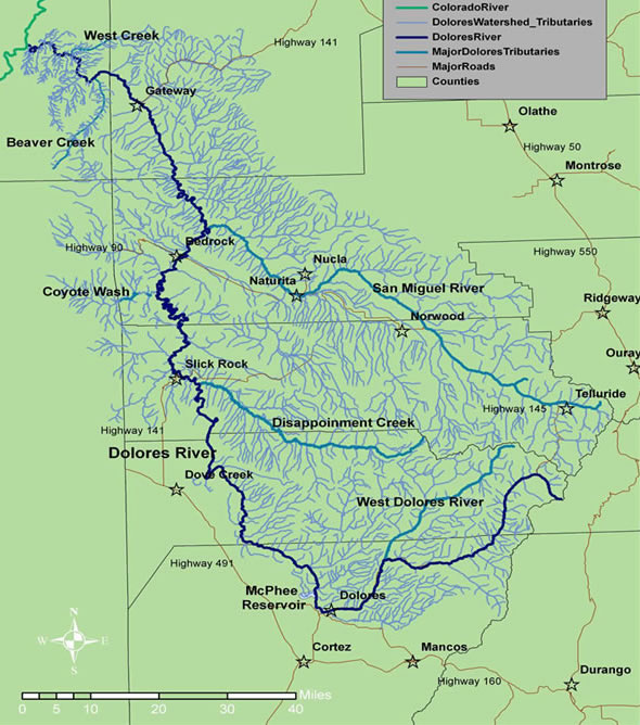
For several years The Nature Conservancy and its many partners have been studying the Dolores River ecosystem downstream of the McPhee Dam while working with water managers to improve the river’s health. It is well known that “taming” rivers, i.e. reducing or eliminating normal spring flooding, has major impacts on the flora and fauna. This year abundant snow and an abnormally warm spring have forced the Dolores Water Conservancy District to pull the lanyard on the spillway to keep the reservoir from flooding. The releases will start at around 800 cubic feet per second and will eventually reach 4000 cfs later in the spring.
All this is great news for people who care about healthy rivers. While not quite as powerful as a normal spring flood, the enhanced flows will clean sediment out of pools for fish and scour the riverbank and restore some of the flora, such as cottonwoods, to its more natural state.
To assess the changes, biologists and fluvial geomorphologists have been surveying the pre-release state of the river ecosystem. In our ongoing support efforts for The Conservancy, Agribotix volunteered to conduct aerial surveys of four sites downstream of the dam.
Agribotix founder, Tom McKinnon, flew the surveys along with Teresa Chapman, a GIS specialist at TNC. They flew both RGB and near IR cameras and returned the results as stitched mosaics at 5 cm ground sampling distance. The field mission went off without a hitch, except for a powerful spring storm that had southwestern Colorado in its sights. Fortunately the team was able to complete the final flight just minutes before the rain arrived. We’ll be headed back later in the summer for the post-release survey.