The latest “The Current” newsletter is hot off the presses from the Eagle River Watershed Council

Eagle Mine

Click here to read the newsletter. Here’s an excerpt:

New Developments on the Horizon for the Eagle Mine

Long-time residents of the Eagle Valley remember a time nearly 30 years ago when the Eagle River ran orange. Linda Jones, who worked at Battle Mountain High School, would pass by the river and its orange-stained rocks on her way to work, football games, and ski practices. Joe Macy and his colleagues at Vail Resorts (then Vail Associates) dealt with blowing orange snow on Beaver Creek’s ski slopes in the winter of 1989-90, as their snowmaking process pulls water straight from the Eagle. Those who weren’t around in the eighties might not realize that the scene at the Eagle River was not unlike the 2015 Gold King Mine spill on the Animas River. The leaching of hazardous heavy metals into the lifeblood of the Eagle Valley eventually caused the mining area to be declared a Superfund Site by the U.S. Environmental Protection Agency in 1986.

Gold and silver mining activity in the 235-acre area dates back to the 1870s, until lead and zinc mining took over in 1905. Ownership of the operation changed hands multiple times, until 1984, when the mine operator, Glenn Miller, went into bankruptcy and failed to pay the electricity bills. Without electricity, the water pumps in the mine stopped running and the mine workings began to flood. For the next five years, the water level in the mine continued to creep higher, until finally spilling over and flooding the river with lead, cadmium, copper, arsenic and zinc. Water quality began suffering long before the spill, however, as up until the Clean Water Act of 1972 was enacted, discharging contaminated water into the river was a perfectly legal and common practice.

The State of Colorado and the EPA both filed separate lawsuits against the former and current mine operators resulting in the cleanup being governed by two settlement agreements. Today, the site is owned by Battle Mountain, but the successor of Gulf + Western—CBS Corporation—is still paying for the cleanup and will continue to in perpetuity.

Over the past three decades, multiple agencies and partners have worked together to remediate, monitor, and improve the cleanup and the Eagle River. In many ways, the Superfund Site is an example of a very successful remediation in Colorado. Ore was originally processed through roasting and magnetic separation, resulting in metals-laden roaster waste. The tailings from the milling process also contained high concentrations of metals and were slurried through a pipeline away from the mine area. The deposited waste led to acid mine drainage. To date, all of the roaster waste and tailings that threatened human health and water quality have been consolidated from the old tailings pile, capped with a protective cover and revegetated to prevent any further groundwater contamination. Contaminated groundwater is currently treated at a water treatment facility before entering the river. Institutional controls and monitoring were established around the waste rock piles to determine acid generation potential and the water quality impact from runoff. The EPA also created secondary cribbing walls beneath Belden as a safeguard from waste rock crumbling into the Eagle.

Though extensive remediation has occurred on site, the primary remaining concern is water quality and the ecological risks to fish and the tiny aquatic insects they feed on. The Eagle River is currently being managed as a brown trout fishery under Colorado Parks and Wildlife. In 2008, the Colorado Water Quality Control Commission set new standards for cadmium, copper, zinc, and arsenic levels. The change in standards required a new “feasibility study,” a Superfund process for the development and evaluation of new plans for cleanup. Today, the need for further cleanup is clear as the metal levels tend to exceed limits in March and April, as the snow is melting at the Eagle Mine site but the river hasn’t hit peak flow yet.

It’s important to note while arsenic levels peak in the spring, they are still well below limits for safe consumption of fish. The highest arsenic level is about .31 micrograms per liter (ug/L), while the Colorado Department of Public Health and Environment sets the standard for safe fish consumption at 7.6 ug/L, and under the Safe Drinking Water Act the limit is 10 ug/L. At a recent panel discussion of the Eagle Mine, both project managers from the EPA and CDPHE said they would let their kids and pets play in the river, and eat a fish from it as well.

The EPA broke the site into three manageable operable units (OUs): OU1 deals with site-wide water quality; OU2 is concerned with human health, primarily in the town of Gilman; and OU3 encompasses the North Property Redevelopment, or the Battle Mountain Project. The EPA and CDPHE have recently released Proposed Plans for Operable Units 1 and 3, which can be found online here and here or at the Minturn Town Hall. These new plans outline different alternatives for future remediation of the Superfund Site, to both bring metal concentrations into compliance in the spring as well as address land use changes in the future. Public comments on the plans will be accepted until September 10th of this year and can be submitted by email or mail—the addresses for each can be found within the plans. As these Plans are the first step in determining the next actions in the ongoing cleanup of the Superfund site, the Watershed Council encourages the community to read the plans and provide comments.

Lizzie Schoder is the Education and Outreach Coordinator for Eagle River Watershed Council. The Watershed Council has a mission to advocate for the health and conservation of the Upper Colorado and Eagle River basins through research, education, and projects. Contact the Watershed Council at (970) 827-5406 or visit

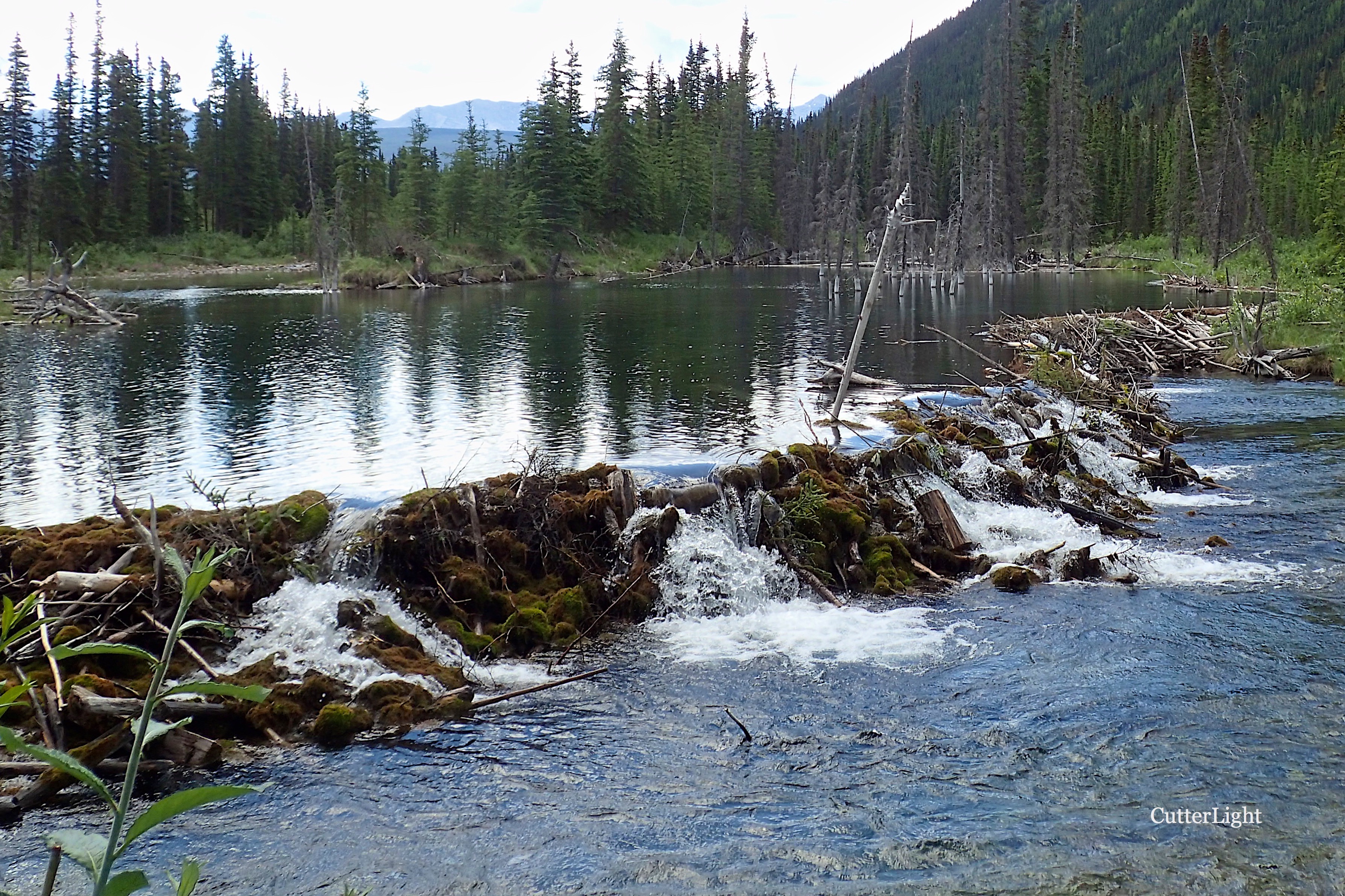
Beaver structures are being used to fight #Drought

North American beaver (Castor canadensis)

From The Public News Service:

For Montana and other parts of the West to fight drought and arid conditions, taking a cue from beavers might help.

Thought to be a nuisance by some landowners, researchers are finding that the dams beavers build on creeks and rivers actually help restore them.

Researchers describe the process as “soaking the sponge,” as these structures increase water levels both above and below ground.

Nathan Korb, freshwater director at The Nature Conservancy of Montana, says so-called beaver mimicry structures have increased in popularity as a way to restore fish and plant habitat.

“We’re creating artificial structures that raise that water level up and then planting willows and aspens and cottonwoods along the banks – now that the water is elevated, it can support those plants – with the hope that beaver populations will recolonize the area and maintain all those benefits and that greater capacity for natural water storage,” he states.

The structures also help lower water temperatures and allow streams to flow longer without drying out.

Beavers were almost wiped out in the Northwest a century ago, but have made a comeback.

Korb says drought is one of the biggest threats to humans and natural systems in this area, and climate change is exacerbating it.

“Anything that we can do to address drought or make people and nature more resilient to drought is going to be a good strategy, and this is one of our best strategies for dealing with the climate change effects,” he stresses.

Rebekah Levine, professor of environmental sciences at the University of Montana Western, also sees a lot of promise in mimicking beaver structures.

She says people are moving toward a future where every drop of water will be more valuable.

“In a world where we’re going to be up against water resources limitations, we really need to be creative and try multiple different possible solutions,” she stresses. “And this is a really great idea, and we just need to keep testing it.

Photo credit: Wisconsin Wildlife Services

A look at Vail Valley water rights

From The Vail Daily (Scott N. Miller):

In drought years, holders of the most senior water rights can “call” on those with junior rights. That means junior rights holders have to stop diverting water.

The town of Gypsum was in that situation not long ago.

Town water manager Matt Franklin said senior rights holders taking their allocated water put a significant strain on the town’s ability to provide water to residents.

“Nothing’s more stressful than trying to meet demand when there’s a call on the river and you can only put out a quarter of what you need,” Franklin said.

Gypsum, over the past 20 years or so, has acquired some of the most senior water rights on Gypsum Creek. The most senior rights came from the former Albertson Ranch, now the moribund Brightwater development. Other senior rights came from Cotton Ranch closer to town.

Still, Franklin said, there are some rights senior to the Albertson Ranch rights that can take precedence in April. That month in 2013 — a historic drought year — was tough to cover, Franklin said.

In those dry years, the town has to pull water from farther downstream, and the quality isn’t as good. Treating that water requires more chemicals, more electricity, more manpower … more of just about everything, Franklin said.

GOOD RIGHTS, GOOD SUPPLIES

Still, that town is in good shape today regarding its water inventory. So is most of the rest of the Vail Valley.

Front Range water attorney Glenn Porzac knows more than just about anyone about mountain water. He said local water providers have worked over the years to ensure steady water supplies.

The town of Eagle is a good example, Porzak said. Town officials there “have been very aggressive,” Porzak said. “They approve annexations and developments only with all the water rights. Over time, they’ve really cornered that market.”

Farther east, the Eagle River Water & Sanitation District, along with the Upper Eagle Regional Water Authority, has also put in a lot of effort to ensure steady, stable supplies of water.

Those two entities have separate elected boards, but share staff and other resources. The district and the authority have an integrated system, Porzak said, which allows water to move as needed from roughly Edwards to East Vail.

The third major player in the upper valley is Vail Resorts, which requires water for snowmaking between November and January.

Most of that water supply comes from the Eagle River, but there are a few reservoirs that play crucial roles as streamflows drop between late summer and late winter.

Aurora and Colorado Springs control most of the water from Homestake Reservoir roughly between Red Cliff and Camp Hale. From there, water is pumped to Turquoise Lake near Leadville. Then, water is pumped either into the Arkansas River for Colorado Springs or into the South Platte for Aurora.

But there’s some local water sitting in Homestake, used to ensure streamflows in the Eagle River.

MORE LOCAL SUPPLIES

Near the Climax Mine atop Fremont Pass is the Eagle Park Reservoir, which is used by local providers for streamflows and some supply. Black Lakes, atop Vail Pass, is also used for local supply.

Still, local streams can run almost dry. Porzak said he has 2013 pictures of Gore Creek running at just a trickle. Portions of Brush Creek near Eagle have run almost dry in other drought years.

That’s why the water-pumping systems used by the upper valley water and sanitation district and water authority are crucial to ensuring adequate supplies for everyone.

Another player in the mix of who controls local water is the Colorado River District, which oversees use of the Colorado River from its origin in Rocky Mountain National Park to the Colorado/Utah state line.

Porzak said the river district has contracts to provide water to a number of small developments between Wolcott and Dotsero. The river district also provides some reservoir water to back up systems in Eagle and Gypsum.

Then there’s the most-senior water right in the valley. That one, the only one in the valley that dates to the 1800s, came off the Nottingham Ranch at Avon and serves Beaver Creek.

The Vail Valley’s water supplies are more stable than they were even a few years ago. Starting in about the middle of the 20th century, Front Range cities came to the mountains looking for water to feed their growing communities.

Part of those efforts included buying ranches for their water. Park County — the Fairplay area — is among the most-affected high-mountain areas, since it’s on the eastern side of the Continental Divide.

Denver Water, which bought thousands of acre-feet of mountain water over the years, also purchased water rights at 4 Eagle Ranch north of Wolcott and on the upper Eagle River. There was at one time talk of building a large reservoir near Wolcott.

A few years ago, thanks to an agreement with local providers, Denver gave up those rights, stabilizing the water supplies for local providers.

That cooperation is starting to show up in other parts of the mountains, Porzak said.

“Denver Water and the Western Slope get along pretty well now,” he said. “You’re seeing more cooperation in Summit and Grand counties now.”

Still, Porzak said, “Eagle County is fortunate.”

Happy Labor Day


@AZwater: Feds predicting short-term improvement on the #ColoradoRiver system… and longer-term challenge #COriver

From</a the Arizona Department of Natural Resources:

Part Two of the federal government’s annual August analysis of conditions on the Colorado River system are out, and – just like Part One – the results depict a mixed bag of decreasing risk in the short-term and rapidly increasing risk in the longer-term.

River-system modeling by the federal Bureau of Reclamation is showing a much lower chance of a Lower Basin water shortage in 2019, a result of the extremely wet, snowy early winter that created higher than average snowpack on the western slopes of the Rocky Mountains.

The modeling depicts a 15 percent chance of a shortfall in Colorado River allocations beginning in January 2019, a 16 percent drop in shortfall expectations in April of this year, and a substantial drop from expectations of a year ago, when the chances of Lake Mead falling into shortfall as soon as January 1, 2018, stood at even odds.

Lake Mead falls into “shortfall” once lake levels recede to under 1,075 feet. By the terms of a 2007 agreement among the states, Arizona and Nevada would begin taking substantial cutbacks in their delivery allocations from Lake Mead at that point.

Unfortunately, the modeling – known as the Colorado River Simulation System, or CRSS – also depicts increased risk of shortfall starting in 2020.

Chances for a Lower Basin shortage increase to 42 percent in 2020, according to the modeling, and continue rising to a better-than-even chance of a shortage in 2022.

The Bureau’s River Operations Group, which conducts the modeling survey, cites a lower starting elevation at Lake Powell as the principle culprit for the quick-rising shortfall likelihood in Lake Mead.

Lake Powell serves as a regulator of water flowing downstream from the Upper Basin states of Colorado, Utah, Wyoming and New Mexico to Lake Mead.

As recently as March, analysts had been hopeful that the initially strong Upper Basin winter snowpack might produce a huge “equalization” release this year from Powell to Mead – perhaps as much as two million acre-feet above the 8.3 million acre-foot annual average.

An abnormally dry and warm late Spring, however, provided less runoff into Lake Powell. That resulted in the lower-than-anticipated Spring elevations in Powell, which nixed the hoped-for “equalization” into Mead.

Indeed, the Lower Basin water picture quickly darkens, according to the analysis.

Between 2020 and 2022, the probabilities of a shortage at Lake Mead increase by at least 10 percent a year over predictions laid out in the Bureau’s April analysis.

The Bureau’s April and August data analyses are key to making plans for water releases for the coming year.

In particular, the August 24-Month Study projections for anticipated elevations at the beginning of the next calendar year are used by the Secretary of the Interior to set the operating tiers for Lake Powell and Lake Mead.

The first part of the Bureau’s August data analysis – its determination of anticipated water-level flows in the Colorado River system – concluded that Lake Mead would end the 2017 calendar year at an elevation of 1,083.46 feet.

That determination put Mead more than eight feet above the point that Arizona and Nevada would be required to take delivery shortfalls, according to the terms of the 2007 agreement.

As Arizona Department of Water Resources Director Tom Buschatzke noted regarding the data released last week, much of the positive news coming out now about Lake Mead can be attributed to conservation efforts.

“The collective efforts of Arizona, California, Nevada and Mexico to conserve water in Lake Mead from 2014 through 2017 have created an additional 14 feet of elevation in the lake,” said Buschatzke.

Yampa River streamflow drops to below average

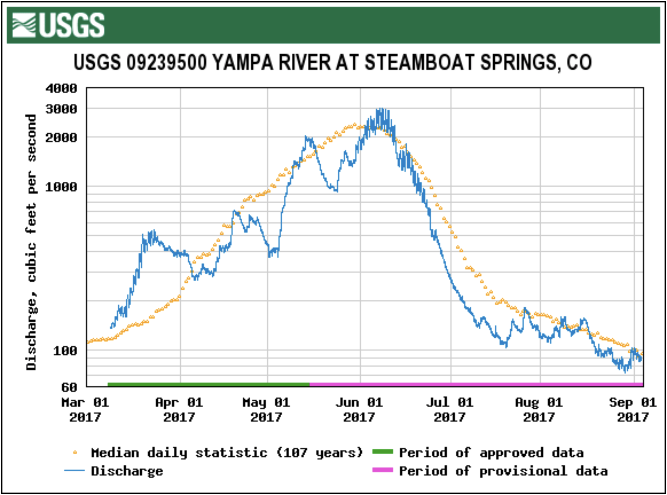
Yampa River at Steamboat Springs gage March 1 through September 4, 2017.

From The Craig Daily Press:

With the Yampa River flowing well below normal during most of the week preceding Labor Day, the city of Steamboat Springs has closed down commercial tubing in the river where it flows through the city and is asking the public to voluntarily follow suit by refraining from private tubing, paddling SUPs, swimming and fishing…

It’s not unusual for commercial tubing to be suspended by the first week in September, but the United States Geological Survey was reporting earlier this week that the river had dropped significantly below 100 cubic feet per second, the median flow for the date. Ironically, the stiff rain showers that cooled Steamboat the night of Aug 31 had temporarily boosted river flows by Sept. 1…

City of Steamboat Water Resources Manager Kelly Romero-Heaney said commercial tubing would not be restored unless river flows return to 85 cfs. But the boost in flows from the rainfall of Aug. 31 is expected to be short-lived; the National Weather Service forecast for the upper Yampa River Valley called for a 20-percent chance of isolated storms the afternoon of Sept. 1, followed by sunny to mostly sunny skies through Sept. 7

The city and the Colorado Water Trust had been collaborating since earlier this summer on boosting the flows in the Yampa with water procured from the Upper Yampa Water Conservation District’s Stagecoach Reservoir, and that effort will resume.

Romero-Heaney said efforts to boost the Yampa’s flows will likely continue until early October, when the managers of Lake Catamount, downstream from Stagecoach, begin releasing water as they draws down the reservoir in anticipation of spring runoff in 2018…

The USGS reported at midday Friday that the Yampa was flowing at 97 cubic feet per second, just below median for the date. The lowest Sept. 1 river flow measured at the Fifth Street Bridge, was the 24 cfs, reported in 1934.

The mechanism of tree death due to #drought

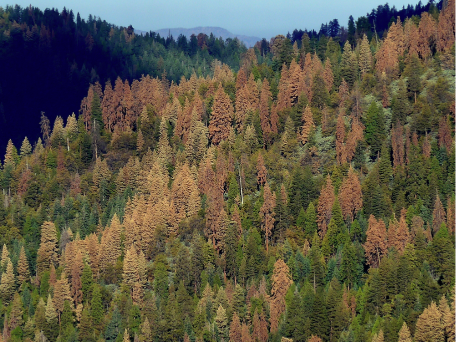
California’s hotter drought has already killed millions of trees, particularly in low-elevation forests. (Photo credit: N. Stephenson, USGS)

From Water Deeply (Jane Braxton Little):

New research into how drought kills trees has helped reveal a potentially huge climate consequence of an increase in dead and dying forests that one scientist cautioned could result in a “carbon death spiral.”

[…]

“If we understand the mechanisms of how trees die, we can make predictions and prioritize areas for management,” he said.

First we need to understand how healthy trees function. They get water from the soil, pulling it up through their roots through xylem, one of two specialized transportation tissues in vascular plants. The water flows into tree trunks and branches to leaves or needles. Sunlight turns the nutrients in water to sugar and sap, which nourish new growth.

When there is less water in the soil, trees pull harder. When they pull too hard they break the column of water in the xylem, creating air bubbles known as embolisms. This causes “hydraulic failure.” And this is what killed all of the trees studied by the research team of 62 scientists, said Adams.

But another process also causes trees to die when their response to drought deprives them of carbon.

“Trees aren’t stupid,” Adams said. To prevent losing precious water to the atmosphere through their needles and leaves, trees close the pores scientists call stomata. That keeps the water in the tree, but stomata do more than prevent water loss. They also let carbon dioxide in, allowing trees to carry out photosynthesis.

When trees close their stomata to wait out a drought, they are no longer making any food through photosynthesis. Instead, they are relying on stored sugars and starches. If the drought lasts long enough, they use up everything they have stored, and they die.

Carbon starvation contributed to tree mortality in at least 60 percent of the cases the researchers studied. They still don’t understand the critical threshold for carbon starvation but know it plays a significant role in trees dying.

Mountain pine beetles

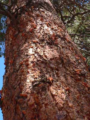
Scientists also know bark beetles contribute to tree mortality. That sticky resinous sap used to pitch out beetles is made from carbon. When trees become carbon-starved they are not only unable to metabolize the nutrients for survival; they are also unable to muster the carbon they need to defend themselves against beetles.

The connection between physiological stress caused by drought and defending against bark beetle attack is still an active area of research, Adams said. Entomologists have tended to approach tree mortality in the West through beetles, while physiologists have come at it from the drought perspective…

He and his colleagues analyzed drought-induced mortality in 26 tree species. They examined data from 19 recent experimental and observational studies from around the globe. The research will help scientists and land managers more accurately predict how trees will respond to environmental stresses that include insect damage and disease as well as drought, said Lina Patino, a section head at the National Science Foundation’s Division of Earth Sciences, which cofunded the study.

@USBR Begins Animas-La Plata Project Repayment Negotiations with Ute Mountain Ute Indian Tribe

Lake Nighthorse August 2017 via the US Bureau of Reclamation.

Here’s the release from the US Bureau of Reclamation (Marc Miller):

The Bureau of Reclamation is initiating negotiations on a proposed repayment contract for the Animas-La Plata Project with the Ute Mountain Ute Indian Tribe for the Tribe’s statutory allocation of project water. The first negotiation meeting is scheduled for Wednesday, September 13, 2017, at 1:30 p.m. at the Dolores Water Conservancy District office, 60 Cactus Street, Cortez, CO 81321.

The contract to be negotiated will provide for storage and delivery of project water and provisions for payment of operation and maintenance costs of the project.

All negotiations are open to the public as observers, and the public will have the opportunity to ask questions and offer comments pertaining to the contract during a thirty minute comment period following the negotiation session. The proposed contract and other pertinent documents will be available at the negotiation meeting, or can be obtained on our website at: http://www.usbr.gov/uc/wcao/index.html, under Current Focus or by contacting Marc Miller with Reclamation at 185 Suttle Street, Suite 2, Durango, Colorado, 81303, telephone (970) 385-6541 or e-mail mbmiller@usbr.gov.

Dark side of the moon and #climatechange — The Mountain Town News #ActOnClimate #keepitintheground

Photo credit: Allen Best, The Mountain Town News.

From The Mountain Town News (Allen Best):

Like millions of other Americans, I drove hours to dawdle in the brief darkness of the solar eclipse. Spreading our blanket along a highway in the rolling prairie of Nebraska, my companion and I were surrounded by people from Texas, Iowa and Colorado.

Across the barbed-wired fence was a ranch family, three generations of Nebraska red under the blue sky, marveling to see so many people along their lonely country road. One car an hour was the norm, said the patriarch. We talked like old neighbors, us city folks drawn from across the continent’s midsection and our country cousins we had never met. We were uniformly of good cheer. Did we vote the same last November? I doubt it, but it did not come up at this convergence of harmony.

Then darkness came, cold and quiet. Crickets chirped and Angus cows and calves bawled into the twilight. We shivered in this spectacle on the dark side of the moon, halfway expecting angels to begin dancing about. Then the light returned.

Science had predicted all this with precision. None of us gathered along the barbed wire fences in Nebraska had doubted it. President Donald Trump did not dismiss it as a Chinese hoax.

But why so little faith in climate science? If the precise increase in temperatures and extent of weather extremes remains uncertain, it’s clear that our path is fraught with risk.

Three days later, Colorado’s two senators, Cory Gardner and Michael Bennet, spoke at a Colorado Oil and Gas Association conference. They sit on opposite sides of the political fence, but in Denver they sat together in stuffed chairs to brag, as best they could, about their bipartisan efforts before a crowd clearly tired of the twitter storm in Washington D.C. But one looked over his shoulder when talking about climate change, and one looked straight ahead.

Bennet, a Democrat, has a deep background in fossil fuels. Early in his career, he was up to his elbows in oil and gas as a lieutenant for the billionaire Phil Anschutz. As a senator, Bennet bucked the environmental community in voting to authorize the Keystone XL pipeline. But this year he has been bearing down on climate change.

“As I travel Colorado, people are increasingly worried about climate,” he said. “The effect it is having on their farms and ranches, on their ski areas, and on the national forests.” He told the drillers that they will need to engage in a “constructive conversation” about climate change, because the reality “is just not going to go away.” Better for the United States to figure out the answers than another nation, he added in his own version of make America great.

Gardner, though, is the more important individual in this conversation. He’s a Republican from a town of 3,600 on the Great Plains, He doesn’t deny climate science. Occasionally he’s capable of backbone. After Charlottesville, he immediately issued a statement condemning the racism and white nationalism. At a town hall several days later, he even managed smiles while confronting one infuriated question after another about his effort to dismantle Obamacare. The Resistance can be as nasty as the Tea Party.

But in Denver, Gardner recited tired arguments recycled more times than Seinfeld reruns. He pointed out—accurately—that as a Colorado state legislator he had supported renewable energy that benefited his rural constituents. Then, like an ancient fearing the darkness of an eclipse, he warned of the unbearable costs of renewable energy to people of fixed incomes or on farmers irrigating corn and alfalfa fields. “You don’t have to go so far as to cause economic collapse,” he said.

The argument is absurd. Utilities have been scrambling to get their electrical wires around wind and solar. The Public Service Co. of Colorado on Tuesday announced ambitions to shut down two older coal-fired plants. It’s cheaper for consumers, explained PSCo president David Eves. Our technology has advanced.

Residential customers of Aspen Electric—yes, the ski resort favored by Trumps and other billionaires—got their electricity for 26 percent less in January than the farmers around Gardner’s home-town. Towns and cities can be serviced more cheaply than scattered farms. But Aspen now has 100 percent renewables; farmers remain heavily reliant on coal generation.

Scientists had the eclipse down pat. Unfortunately, they’re probably right about climate change. It will take somebody like Gardner, with the same backbone he did after Charlottesville, to clip that barbed wire fence that has made climate change a partisan issue.

R.I.P. Walter Becker

Walter Becker and Daniel Fagen — Steeley Dan.

From the BBC:

Walter Becker, co-founder and guitarist for the US band Steely Dan, has died aged 67, an announcement on his website said.

No cause of death or other details were given.

Becker missed the band’s July concerts to recover from an unspecified condition, band mate Donald Fagen said at the time.

The jazz-rock group has sold more than 40m albums and were inducted into the Rock and Roll Hall of Fame in 2001.

“Walter’s recovering from a procedure and hopefully he’ll be fine very soon,” Fagen told Billboard magazine earlier this month.

In a statement, he said his band mate was “smart as a whip, an excellent guitarist and a great songwriter.

“He was cynical about human nature, including his own, and hysterically funny,” he said.

“I intend to keep the music we created together alive as long as I can with the Steely Dan band.”

Becker and Fagen began working on music together as students in New York.

In the early 1970s they moved to California to set up the band with guitarists Jeff Baxter and Denny Dias, drummer Jim Hodder and singer David Palmer.
Steely Dan – named after a sex toy in the book Naked Lunch by William Burroughs – released its first album Can’t Buy a Thrill in 1972.

Becker, who also provided backing vocals, and keyboardist and singer Fagen remained the core band members as other musicians and singers came and left.

The band split up in 1981 but reformed in 1993 and released two more albums, one of which – Two Against nature – won the Grammy album of the year award.

Becker also had a career as a solo artist, releasing two albums including Circus Money in 2008.

Boulder Creek back in pre-2013 stream channel #ActOnClimate

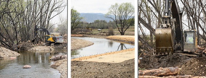
The City of Boulder’s Open Space and Mountain Parks Department (OSMP) has begun a major restoration project that will improve native fish habitat in Boulder Creek and restore natural areas surrounding the creek. This ecological project also will repair damage from the 2013 floods by returning Boulder Creek to its pre-flood channel, and will include the planting of more than 11,000 native trees and shrubs. These plantings will help improve the creek’s sustainability and resiliency, and help mitigate damage to private and public property during future floods. These efforts are occurring in two areas east of Boulder. Photo credit the City of Boulder.

Here’s a report from Charlie Brennan writing in The Boulder Daily Camera. Click through for the whole article and the photos. Here’s an excerpt:

“We are at a very significant milestone,” said Giolitto, who managed the project along with her supervisor, Don D’Amico. “The creek’s flowing back through its pre-flood path. That’s a significant milestone for us. The diversion was pretty significant. We were pretty excited on the construction crew when it happened, when we finally put the creek back.”

There was no Champagne uncorked as that benchmark was achieved several weeks back. But there was great satisfaction for those who have labored since the spring of 2014 to reverse the havoc that saw the creekbed breached, city and private funds inundated by rogue waters and sediment plugs created that impeded an effective flow in a critical drainage.

“The other reason this is a milestone, again, (is) getting the creek to convey its flow, both water and sediment. Getting the earthwork done puts the creek in a place where it can actually convey its sediment,” Giolitto said. “Which is a really important piece to getting it back to creating more resiliency.”

The project involved the contributions of more than 100 city staff, contractors, volunteers and private landowners, and ran to a final tab of $2,030,000. Roughly 25 percent of that was covered by partners that included the Colorado Water Conservation Board, the U.S. Fish and Wildlife Service, Colorado Parks and Wildlife, Environment for the Americas and the Green Ditch Company.

Boulder OSMP spokesman Phillip Yates said the city leveraged $520,000 in grants to help pay for the project, putting the city’s actual cost at $1,510,000.

Primary contractors have been North State Environmental and Left Hand Excavating, with Five Smooth Stones Restoration and Stantec providing project design work. Support has also come in the form of labor provided through the Bridge House Ready To Work program.

Finish line in sight

The project, which will involve continued management efforts for at least a couple of years going forward, has included the planting of more than 11,000 shrubs and native trees — yes to the plains cottonwood, thumbs down to the non-native crack willow — improving the native fish habitat and restoring natural areas surrounding the creek.

The project area is transected by 61st Avenue, but does not include a popular public pathway that would put it squarely in the public eye in the way that efforts at popular trail systems such as those at Chautauqua and Mount Sanitas are so visible.

“People might see the impacts of the flood as specifically a very trails-oriented impact,” Yates said. “However, there was pretty extensive damage all across the system. There were water delivery systems that we needed to fix. There was agricultural infrastructure we needed to fix. Then, there were a lot of riparian corridors that were scoured. And then we had to go back and take some steps to have some restoration efforts to then actually make those areas better.”

City restoration projects elsewhere, on trails such as Shadow Canyon South, as well as Mesa Trail, are ongoing, Yates said.

“But right now we’re nearing the finish line,” he said. “And having this (Boulder Creek project) completed is so gratifying, to see that this work is now coming to fruition and we have an ability to look and maybe see the horizon on completing our flood-recovery work.”

The enterprise along Boulder Creek has highlighted the symbiotic approach to land management that the city has strived to employ.

For example, the project repurposed hazard trees that had to be taken down elsewhere in the city, using them for Boulder Creek bank protection and to cover over pools to improve fish habitat.

“Those have been great ways to reuse materials and partner with other people and other departments” in the city, Giolitto.

Gary Bostrom leaves a water legacy — @CSUtilities

Southern Delivery System construction celebration August 19, 2011 via The Pueblo Chieftain

From Colorado Springs Utilities (Jerry Forte):

Earlier this week, our community lost a great visionary and leader. While many may not think twice about getting a glass of water from the tap, taking a shower or watering their lawns, Gary Bostrom was always planning ahead to ensure our community had the water needed to grow and thrive. It’s thanks to people like Gary that our customers don’t have to think about their water.

Gary retired from Colorado Springs Utilities as the Chief Water Services Officer in 2015 after 36 years of service on most all facets of the water system, from Homestake to Southern Delivery. His career spanned a variety of leadership roles from water supply acquisition, water and wastewater infrastructure planning and engineering, and developing regional partnerships.

Earlier this year, Gary received the Bob Appel Friend of the Arkansas Award at the Arkansas River Water Basin Forum. The award is given annually to honor an individual who has served and worked to improve the condition of the Arkansas River in southeastern Colorado. It was a well-deserved recognition.

A few of Gary’s career highlights include:

  • The design, development and negotiations for the completion of the Southern Delivery System
  • The development of the Arkansas River Exchange Program
  • The completion and implementation the 1996 Water Resource Plan
  • The establishment of the Fountain Creek Watershed Flood Control and Greenway District
  • The development of the Fountain Creek Corridor Master Plan
  • The development of Colorado Springs’ Arkansas River Exchange Program
  • Gary’s career was more than getting water to our community. He also believed in using water wisely. Under his direction, our 2008 Water Conservation Master Plan and 2015 Water Use Efficiency Plan incorporated measures that accumulate a permanent, water use reduction in our community of more than 10,000 acre feet by 2030. That’s a savings of more than 3 billion gallons of water!

    Throughout his career, Gary was actively involved in a number of water organizations.

  • Director of the Southeastern Colorado Water Conservancy District
  • Past President of the Fountain Valley Authority
  • Past director of the Aurora-Colorado Springs Joint Water Authority
  • Member of the Homestake Steering Committee
  • Past President of the Twin Lakes Reservoir and Canal Company, the Lake Meredith Reservoir Company and the Lake Henry Reservoir Company
  • He was a true water champion for our community and region. Thanks in part to Gary’s vision and direction, Colorado Springs has a secure water supply and is a leader in water reuse in the state.

    He was brilliant as an engineer and perhaps even better at building relationships and collaborating with others – even staying involved in regional water organizations after retirement.

    He was a dear friend and will be missed.

    From The Pueblo Chieftain:

    A key figure in development of the $825 million Southern Delivery System, died unexpectedly on Monday while bicycling near his home in Colorado Springs. Cause of death has not been determined.

    Gary Bostrom, 60, was the retired water services chief for Colorado Springs Utilities and shepherded SDS from its inception in the 1996 Colorado Springs Water Plan toward its eventual completion in 2016. Along the way, he fostered cooperation with Security, Fountain and Pueblo West as partners in SDS, while working to assure a clean drinking water supply for the future of Colorado Springs. He retired in 2015, but remained active in water issues. Bostrom joined the Southeastern Colorado Water Conservancy District board of directors in 2009 and was vice president of the board.

    “This is a great loss for the water community,” said Bill Long, president of the Southeastern board. “Gary’s knowledge about water, and his hard work to help achieve common goals will be sorely missed.”Former Chieftain editor and reporter Chris Woodka, who went to work for the Southeastern district last year, agreed.

    “I met Gary about 27 years ago, and we were what I would call ‘friendly adversaries’ for many of those years,” Woodka said. “Over the years, our relationship evolved into a true friendship. He was always positive and truthful even when I’d ask him tough questions while I was a reporter. As a board member, he was top-notch, and I enjoyed getting to know him better. He was a wonderful individual to spend time with.”

    Officials in Colorado Springs, including Mayor John Suthers, Utilities CEO Jerry Forte and former City Council members expressed their shock and sadness at Bostrom’s death.

    Bostrom was active in the community as well and was a member of the Colorado Springs Parks and Recreation Advisory board. He is survived by his wife, Sara, four children and three grandchildren. Services will be at 2 p.m. Sunday at Village Seven Presbyterian Church, 4040 Nonchalant Circle South, Colorado Springs.

    From The Colorado Springs Gazette (Ellie Mulder):

    Gary Bostrom, one of the driving forces behind Colorado Springs’ $825 million Southern Delivery System, died Monday while cycling on a trail along Monument Creek.

    Bostrom, 60, had worked for Colorado Springs Utilities for nearly two-thirds of his life before retiring in 2015.

    “He was just a prince of a man,” said John Fredell, former SDS program director who worked with Bostrom for many years. “All of us wish we were more like Gary Bostrom.”

    Bostrom’s body was found shortly before 7 p.m. along a section of the trail near North Nevada Avenue and Austin Bluffs Parkway, said police Sgt. James Sokolik. The cause of death has not been determined, but police do not suspect foul play.

    “We all wanted and expected another 30 years with Gary,” said former city Councilwoman Margaret Radford.

    She said she got to know him soon after she was elected in 2001, and they stayed in touch after she left the council in 2009.

    “Gary was always one who could find the good in anyone … and bring out more good, if that makes any sense,” she said.

    Bostrom worked at Utilities for 36 years before retiring two years ago, Mayor John Suthers said in a post about Bostrom on his Facebook page.

    “Gary spent his career making sure that our community had good, clean water and plenty of it,” Fredell said. “You can’t find many people who have done that for their community, and spent their careers doing it.”

    On April 26, the Utilities engineer was given the “Bob Appel – Friend of Arkansas” award at the Arkansas River Water Basin Forum.

    The SDS, a massive series of pipelines that funnels up to 50 million gallons a day of Arkansas River water to Colorado Springs, Fountain, Security and Pueblo West, began serving customers in 2016.

    Decades of planning went into the project, which is made up of 50 miles of 66- and 90-inch-diameter pipelines, including a 1-mile tunnel under Interstate 25, Fountain Creek and railroad tracks.

    Bostrom helped ensure the project was finished on time and under budget, Fredell said.

    “(Bostrom) was instrumental in getting the permit in place and moving the Southern Delivery System forward,” said Larry Small, executive director of the Fountain Creek Watershed, Flood Control and Greenway District.

    “As far as water resources, there just wasn’t anybody better,” said Small, a former city councilman and vice mayor. “I don’t know of one person who knew Gary who would say one bad thing about him.”

    Radford said she’s still grateful for what Bostrom taught her about “how valuable our utilities system – and in particular, our water system – is.” She said it altered her perspective and influenced her work as a councilwoman.

    @USDA: Crop and livestock net income could be $63.4 billion in 2017

    Photo credit: Bob Berwyn

    From KUNC (Luke Runyon):

    The latest figures from the U.S. Department of Agriculture expect farmers to bring in more money this year than initially projected. Crop and livestock producers could net $63.4 billion in 2017. That would be an increase of nearly $1 billion from 2016, and would be the first time farmers see a rise in net farm income year-to-year since 2013.

    Low commodity crop prices have caused the farm income number to slip for years, leaving some analysts to wonder when the income figures would hit bottom. This year’s projection shows at least a stabilization, if not a full rebound…

    Many commodity crop farmers are still staring down low prices and hoping merely to break even during the 2017 growing season. Still, [Todd Kuethe] says these new projections should tamp down some fears of a farm economy collapse…

    The slight boost in the projection primarily comes from livestock producers, who are enjoying the low prices for the crops they use as feed.

    The August 2017 projections are still subject to change, Kuethe says. Final net farm income figures for the year won’t be available until midway through 2018.

    “Our biggest challenge is #climatechange and what a warming climate does to the environment” — Jim Lochhead #ActOnClimate

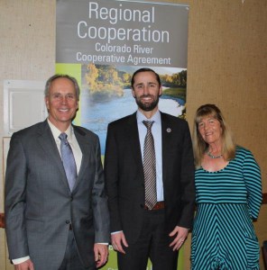
    In February 2014, Jim Lochhead (left) stood with James Eklund, Colorado Water Conservation Board director, and Karen Stiegelmeier, Summit County Commissioner, to celebrate the Colorado River Cooperative Agreement.

    From The Denver Business Journal (Cathy Proctor):

    “The Denver metro area wouldn’t be here but for those with the vision of being able to provide a secure, safe, healthy water supply to its people — it’s a responsibility that we take pretty seriously here as an organization,” Lochhead said.

    And he worries about how the West’s codified system of legacy water rights — where the oldest rights are the strongest — is not flexible enough to deal with a changing climate.

    “Our biggest challenge is climate change and what a warming climate does to the environment,” Lochhead said.

    “One way to think about it is that the climate, and everything affected by it, is moving north. If you — pick a number — look 20 years, 30, 40 years into the future, the Denver climate may look more like Pueblo. In 100 years it may look more like the climate in Albuquerque today,” he said.

    Such a change has dramatic impacts on the weather — and the water that comes with it.

    Colorado’s water supply depends on a healthy mountain [snowpack] — with the winter’s cold holding the water in deep storage until the spring runoff. But weather changes could change snow patterns. It may rain more, or less. Higher temperatures could mean more water lost to evaporation. The trees, bushes and environment that dominate mountain valleys now may be different in the future.

    “Yet we have a water right allocation system that is based on the notion that the future will look like the past,” Lochhead said.

    “In 1890, a farmer in the South Platte River basin said, ‘I need this much water’ to irrigate the crops that he had at the time, based on the technology at the time, which was open ditches, and that water right still sits there today — yet everything under the water right is changing and shifting,” he said.

    Caring for the environment surrounding the water also is crucial to long-term water quality and supply, especially for Denver Water’s network of streams, dams and pipelines supply span the Continental Divide.

    “We have a responsibility for environmental stewardship in how we operate at Denver Water,” Lochhead said.

    “If we mess up the river, what does that do for our future customers? We just destroyed our future water supply. So it’s our responsiblity to maintain the water quality and the enviroment, because the river, the environment, is part of our infrastructure.”

    #California bond issue to include $280 million for the #SaltonSea #ColoradoRiver #COriver

    Southern Pacific passenger train crosses to Salton Sea, August 1906. Photo via USBR.

    From The Desert Sun (Ian James):

    Two bills, AB18 and SB5, both include the funding for projects at the Salton Sea, where state officials are working on the initial stages of a 10-year plan that remains largely unfunded.

    “The bills are now being merged and there’s one more vote to be taken,” Assemblymember Eduardo Garcia, D-Coachella, told The Desert Sun. “There is a commitment of both the Assembly and the Senate to fully fund the management plan.”

    The funding for the Salton Sea is part of a larger bond measure, which could end up totaling nearly $4 billion and would also free up money for water projects, climate-related projects, coastal protection and parks.

    The bond measure is being finalized near the end of the legislative session, which closes on Sept. 15…

    In March, California’s Natural Resources Agency released a $383 million plan to control dust and to build thousands of acres of wetlands around the lake’s retreating shorelines over the next 10 years. Only $80.5 million has been approved so far…

    The state’s 10-year plan calls for building a total of 29,800 acres of ponds, wetlands and other dust-suppression projects.

    People in communities around the lake already suffer from high asthma rates, and the problem is likely to get much worse in the coming years as growing expanses of dry lakebed send bigger clouds of fine dust into the air.

    If state agencies fully follow through on the plan, the projects built with the bond money would cover up less than half of the more than 60,000 acres of dry lakebed projected to be left exposed over the next 10 years…

    the lake has been shrinking for years as the amounts of water flowing into it have decreased. Rising temperatures are increasing the strains on the overallocated Colorado River, contributing to the factors pushing the lake toward a drier future.

    The lake, which has no outlet and is already saltier than the ocean, has been getting progressively saltier and regularly gives off a stench resembling rotten eggs. The remaining fish appear to be disappearing and bird populations have been crashing.

    The Salton Sea is about to start shrinking more rapidly next year under the nation’s biggest farmland-to-city water transfer deal, which is sending increasing amounts of water away from the Imperial Valley to urban areas in San Diego County and the Coachella Valley.

    The 2003 agreement called for the Imperial Irrigation District to send “mitigation water” from its canals into the sea through 2017 — a period intended to give state agencies time to prepare for dealing with the effects. At the end of this year, that flow of water will be cut off and the lake’s shorelines will retreat more rapidly.

    Over the next 30 years, the sea is projected to shrink by a third.

    Agreement conveys @CWCB_DNR funded equipment to Pagosa Springs

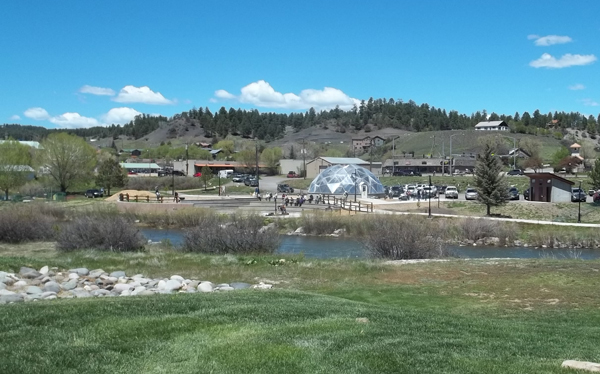
    The dome greenhouse gleams in the Sun at the center of the park. To the right is a new restroom and on the far left is the Community Garden. Along the walk way is a small paved amphitheater like space for presentations and entertainment. Photo credit The Pagosa Springs Journal.

    From The Pagosa Springs Sun (Marshall Dunham):

    The Pagosa Springs Town Council voted to enter into an operating agreement with the Geothermal Greenhouse Partnership (GGP) regarding Centennial Park during its regular meeting on Thursday, Aug. 17.

    The agreement states that structures in place at Centennial Park that were funded by various grants will be owned by the town…

    [At a recent meeting of the Town Council, Greg Schulte] talked of a grant that was awarded by the Colorado Department of Local Affairs (DoLA) to the town.

    “As a virtue of receiving that grant, the things that were paid for by that grant become town property,” explained Schulte. “On the same token, the GGP received a CWCB (Colorado Water Conservation Board) grant and essentially, as the recipient of those funds, the things that were purchased with that become property of the GGP.”

    Continued Schulte, “In a very, sort of, general sense, the CWCB money was paying for the stuff that was below the ground, we paid for most of the stuff above the ground.”

    Schulte went on to explain that, in a conversation with GGP board of directors, the question was posed of whether the GGP really cares if the town was in possession of underground pipes or not, with the GGP responding that they didn’t mind.

    “So, basically this operating agreement does detail how we operate together, but it’s going to move forward on the premise that, essentially, the GGP is going to convey to the town their interest in the infrastructure that was paid for by the CWCB,” explained Schulte. “So, essentially, what this means is that … the town does have a land lease with the GGP for a significant period of time along with the geothermal water … the infrastructure becomes part of the overall land lease.”

    Schulte added that the town doesn’t anticipate one day owning the domes or foundations on the property.

    “What we’re intending to do is to move forward with the premise that the DoLA money and the structure funded by the CWCB will essentially be owned by the town going forward,” said Schulte.

    Clear Creek: August wet weather leads to longer rafting season

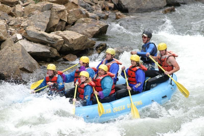
    Clear Creek rafting via MyColoradoLife.com

    From The Clear Creek Courant (Ian Neligh):

    Local rafting businesses agree they’ve already experienced a busy and prolonged rafting season in the county, and several rafting companies were still operating in mid-August. However, some have closed for the season.

    Suzen Raymond, owner of Mile-Hi Rafting, pulled her boats out of the water the week of Aug. 14.

    “We’ve quit rafting because the water just got too low for us to raft,” Raymond said, “but overall the season was a really good rafting season for us.”

    Raymond predicts that her business may see a 10 percent jump over last year.

    “It’s a pretty good spike for us every year,” Raymond said. “We traditionally run up a little bit, except, of course, in the drought years.”

    According to the Colorado Outfitters Association, late-season rafting is still going strong across the state including on the upper Colorado River and Arkansas River.

    Brandon Gonski, general manager at AVA Rafting, said the business is already experiencing a longer season on both rivers.

    “Clear Creek tends to end a little earlier, but (as of) Aug. 23, we’re pretty excited that we’ve stayed open this year this late,” Gonski said…

    Gonski said his company has also seen a good year, which he said could be in part attributed to the prolonged season. While the end of the season differs for every company, AVA ended its season last year on Aug. 16.

    @USBR grant ($965,000) to Orchard Mesa Irrigation District and Grand Valley Water Users Association for hydro plant

    Photo credit: The Grand Junction Daily Sentinel.

    From The Grand Junction Daily Sentinel (Gary Harmon):

    Construction could begin this year on upgrading the hydroelectric plant on the Colorado River near Palisade with a $965,000 federal grant.

    The Bureau of Reclamation on Tuesday awarded the grant to the Orchard Mesa Irrigation District and Grand Valley Water Users Association.

    The grant is one of 43 WaterSmart grants made to agencies around the country and will help fund a $5.2 million project to replace and upgrade the turbines at the plant.

    The turbines now in the plant are the original equipment installed in 1932, Orchard Mesa Irrigation District General Manager Max Schmidt said.

    He decided to seek the grant last year after the plant was shut down and he inspected the turbines…

    Better turbines will make it possible for the plant to generate 4.1 megawatts, or an expansion of 1.35 megawatts.

    It also will allow for the plant to generate an additional 6,000 megawatt-hours.

    The improvement and new power generation will maintain and protect the plant’s existing water right and help assure that there will be enough water in the Colorado River’s 15-mile reach for endangered fish, in particular the Colorado pike minnow, razorback sucker and humpback chub, the Colorado River District noted.

    Bicycling the Colorado National Monument, Grand Valley in the distance via Colorado.com

    Harvey Gap Reservoir to be drained for inspection of dam outlet – bag, possession and size limits removed for all species

    Harvey Gap Reservoir via the Applegate Group.

    Here’s the release from Colorado Parks and Wildlife (Mike Porras):

    Harvey Gap Reservoir to be drained for inspection of dam outlet, bag, possession and size limits removed for all species

    The Silt Water Conservancy District is announcing that they will need to drain Harvey Gap Reservoir to inspect the dam outlet structure. To save as many fish as possible, Colorado Parks and Wildlife has authorized an emergency fish salvage at the reservoir located north of Silt, effective immediately. Using conventional, legal tackle only, anglers are encouraged to catch and keep as many fish as they can, including tiger muskie, northern pike, channel catfish, black crappie, trout, yellow perch, bluegill, and largemouth and smallmouth bass.

    The use of explosives, toxicants, firearms, spearfishing, jugs or trotlines, archery, gigs or electricity will remain illegal.

    Anglers can fish at night to encourage the salvage of channel catfish.

    All anglers are required to have a valid Colorado fishing license and the usual restrictions will remain in place at all other lakes in the area, as well as throughout the state.

    According to the Silt Water Conservancy District, the reservoir will remain mostly empty until the dam is thoroughly inspected. Once the reservoir is permanently refilled, Colorado Parks and Wildlife will restock the popular fishery with approved species; however, when that will occur is undetermined.

    The public is advised to use caution as deep mud will be present as the reservoir is drained.

    Signs alerting anglers about the fish salvage will be posted.

    Anglers are advised to call Rifle Gap State Park at 970-625-1607 to get the latest conditions if they plan to launch a boat.

    Harvey Gap State Park is a day-use area only; however, fishing is allowed throughout the night. Overnight camping and pets are prohibited.

    A valid park pass is required, available at self service stations at Harvey Gap State Park, or at the Visitor Center at nearby Rifle Gap State Park.

    For questions about the reservoir draining, inspection and repairs, contact the Silt Water Conservancy District at 970-876-2393 or by email at swcd@rof.net.

    For questions about the fish salvage, contact Northwest Region Senior Aquatic Biologist Lori Martin at 970-255-6186.

    For more information and directions to Harvey Gap State Park, call 970-625-1607, or visit http://www.cpw.state.co.us/placestogo/Parks/harveygap

    Fire near Strontia Springs a worry for Metro area water suppliers

    Photo credit: Douglas County Sherriff (@dcsheriff).

    From The Denver Post (Kieran Nicholson):

    The Waterton fire grew to about 6 acres Thursday night at dusk, according to the Douglas County Sheriff’s Office.

    The fire is burning through a watershed that supplies 80 percent of the drinking water to Denver residents, according to a Pike National Forest news release.

    Firefighting crews were on scene Thursday evening, and a helicopter was making water drops on the fire, the sheriff’s office said…

    The fire is zero percent contained.

    The cause of the fire is under investigation. There was a storm, however, in the area about noon, when the fire broke out.

    Smoke jumpers from Pocatello, Idaho, were on scene Thursday and air tankers, helicopters, hand crews and additional resources were on order.

    Denver Water officials were also on scene Thursday. Officials hope to have the popular canyon open for the holiday weekend, further details on accessibility will be released Friday afternoon.