Places where the forecast odds favor a much drier than usual winter (brown colors) or much wetter than usual winter (blue-green), or where the probability of a dry winter, a wet winter, or a near-normal winter are all equal (white). The darker the color, the stronger the chance of that outcome (not the bigger the departure from average). NOAA Climate.gov map, based on data from NOAA CPC. Seasonal precipitation outlook through February 29, 2020 via CPC.
Places where the forecast odds favor a much colder than usual winter (blue colors) or much warmer than usual winter (red), or where the probability of a cold winter, a warm winter, or a near-normal winter are all equal (white). The darker the color, the stronger the chance of that outcome (not the bigger the departure from average). NOAA Climate.gov map, based on data from NOAA CPC. Seasonal temperature outlook through February 29, 2020 via CPC.
Seasonal drought outlook through February 29, 2020 via CPC.
The most recent seasonal forecast from federal forecasters at the National Weather Service’s Climate Prediction Center shows much of the Colorado River watershed with equal chances for either above or below average precipitation from December through February. Northern portions of the basin are slightly favored to see precipitation above average, while its southern reaches are projected to see below average. Winter temperatures are set to be higher than average.
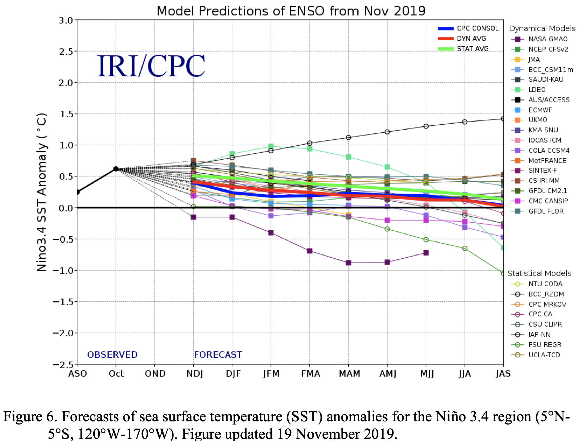
The winter bellwethers of El Niño and La Niña are absent this season. The large-scale climatic condition where longterm weather patterns are determined by the Pacific Ocean’s temperatures are in neutral conditions, making already uncertain seasonal predictions for the Colorado River watershed even moreso…
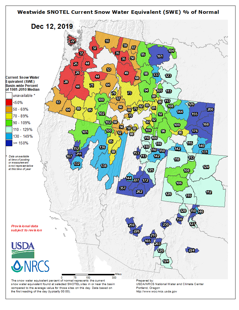
The early season spikes in snowpack totals are promising — the river’s Upper Basin is currently at 125% of average — but those who watch it closely are only cautiously optimistic…
Westwide SNOTEL basin-filled map December 12, 2019 via the NRCS.
But while it’s important to keep an eye on year-to-year snowpack to get a sense of what short-term impacts might be, University of Colorado-Boulder and Western Water Assessment researcher Jeff Lukas says you also need to look at the watershed as a whole.
“Any one year does not set the whole system into either crisis or into recovery,” Lukas said.
Whatever happens this winter — high snow, low snow or somewhere in between — he says it won’t cause the Colorado River’s biggest reservoirs to rise or fall in any dramatic way. That takes back-to-back years of extreme highs or lows. The two largest reservoirs — Lakes Powell and Mead — are both so large and managed in such a structured way that only consecutive years of extremes cause large system-wide changes.
“There’s no good that comes from a low runoff year like 2018,” Lukas said. “But it’s not the end of the world, especially if you’re lucky enough to have that followed with a high runoff year like we had in 2019.”
And if 2020 brings another high snowpack year, that doesn’t mean the Colorado River is out of crisis mode. It just means we’ve kicked the can down the road because over the long term, climate change is diminishing snowpack across the West, Lukas said.
Take a glimpse at the more than 1,000 employees who worked to deliver you water in 2019. The post Faces of your water system appeared first on News on TAP.
Photographs reveal history, passion and dedication of Gross Reservoir’s first caretaker. The post Family shares gift of a lifetime appeared first on News on TAP.