
Click the link to read the article on the Popular Science website (Zayna Syed). Here’s an excerpt:
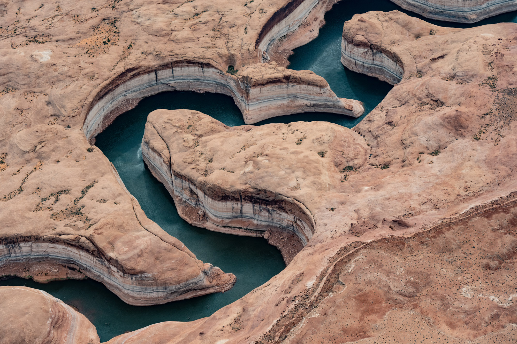
For more than a hundred years, California, Arizona, and Nevada never accounted for evaporation on the lower basin of the Colorado River as they divided its water between themselves and later with Mexico. Their logic held that as long as there was more water than people used, they could ignore small losses from natural processes. More importantly, it was politically fraught—for decades, the lower basin states have been unable to reach an agreement about how evaporation should be taken into account when sharing the river’s waters. Even as a 23-year-long megadrought sucked moisture out of the already arid region, evaporation stayed off the books with decision making. But now, as water managers scramble to find a solution to a river that’s been overused, mostly for irrigation-heavy crops like livestock feed, they’re forced into a harsh reality: every drop counts, including those that disappear into the air.

One way to measure how much water dries up in the system each year is by looking at the evaporation losses on Lake Mead and Lake Powell, the nation’s two largest reservoirs, located in Nevada and Arizona and Utah and Arizona, respectively. About 1.9 million acre-feet or 13 percent of the water from the reservoirs across the entire river is lost to evaporation each year, says Jack Schmidt, director of the Center for Colorado River Studies at Utah State University. In particular, the lower basin (which includes Lakes Mead, Mohave, Havasu, and a few smaller mainstream reservoirs) lost an average of 906,000 acre-feet of water per year to evaporation from 2016 to 2020, according to Schmidt, who cites data from the Bureau of Reclamation. To put that number into context, Nevada can legally use about 300,000 acre-feet per year with the existing deal. “The evaporation of water in the lower basin is equal to three Nevadas. Some people would say that’s a big number,” Schmidt says. Other estimates put the amount of water lost to evaporation even higher at about 1.5 million acre-feet per year, or about five Nevadas. But the overall amount of water that evaporates hasn’t actually changed that much in the past decade. That’s because there’s just less water in the reservoirs, which means there’s less water to lose,” according to Katherine Earp, a hydrologist for the Nevada Water Science Center. At the same time, she adds, as the reservoirs become shallower, the water becomes warmer, and evaporation increases slightly…
Earp cautions that scientists don’t know how much climate change and evaporation will cut into water held in the lower basin. She says there are two factors that could see direct impacts: the reservoirs’ temperature and depth. “Those are changing as the [lakes along the Colorado River] are changing,” she says. “Most of the evaporation is being done right at the surface with the wind. So that’s not changing. We’ve always had a big hot desert—we will continue to have a big hot desert.”
[…]
[Schmidt] outlines two potential solutions: consolidating water from the two major reservoirs into one or pumping some of the water underground. Schmidt did the math behind the first option. In a white paper published in 2016, he examined how much water might be saved if the lower basin states fill Lake Mead and put any remaining water into Lake Powell. “Right now we manage the system to equalize the storage contents in Lake Mead and Lake Powell, and so we sort of maximize the surface area exposed to the sun,” he says. But he found the savings would be minimal, about 50,000 acre-feet of water across the two reservoirs, and says it should be used as a second-tier strategy…In the second option, water from the reservoirs would slowly be cached underground. Arizona and California already store some water underground in recharge basins with the intention to put water back into local aquifers. But there’s a risk of not being able to track and recover all of the water that seeps back into the ground. Still, Schmidt says recharge basins might be a good option if evaporation gets worse. “It’s a technique trusted by water managers,” Schmidt says. “Yes, it’s uncertain. But those uncertainties do not concern people enough that they don’t do it.”