Click the link to read the article on the Fort Collins Coloradoan website (Miles Blumhardt). Here’s an excerpt:
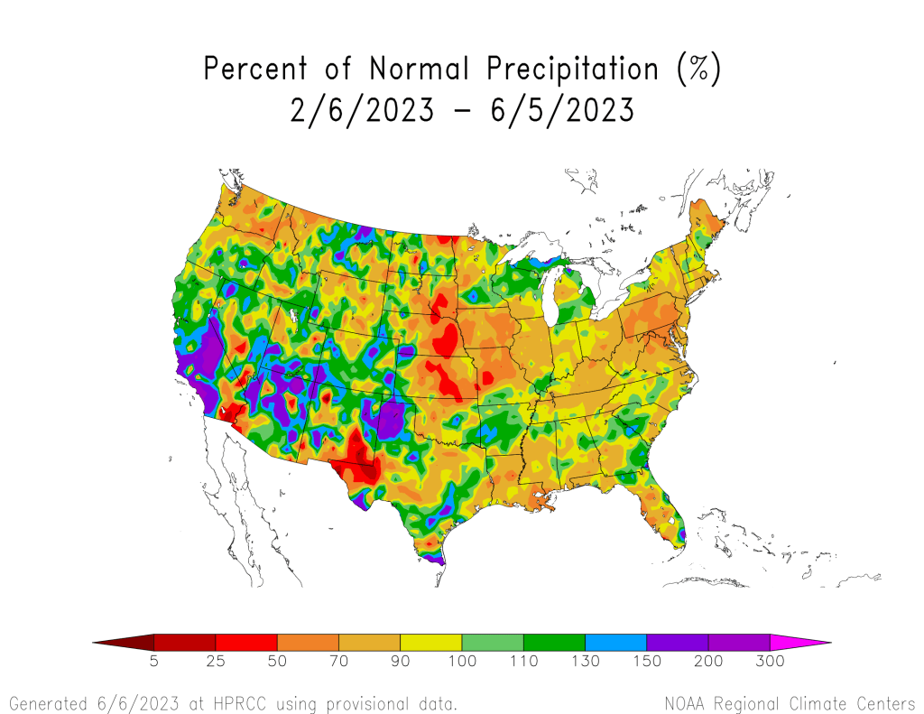
Dave Barjenburch, National Weather Service meteorologist in Boulder, said our moisture streak is much more related to where high- and low-pressure ridges are located than to the transition from a La Nina pattern to El Nino. Typically, he said, Colorado weather this time of year is dominated by a high-pressure ridge in the Southwest, which produces warmer and drier conditions for Colorado. This spring, that high-pressure ridge has moved north into the upper Midwest, which has blocked or slowed our storm track over Colorado while creating above-average temperatures and below-average moisture in Canada, resulting in devastating wildfires. A deep low-pressure ridge in the western U.S. combined with the high pressure in the upper Midwest have funneled a consistent plume of Gulf of Mexico moisture into Colorado for several weeks, and Barjenburch said that pattern “isn’t going anywhere in a hurry.”
