

Click the link to read the article on the Aspen Journalism website (Heather Sackett):
December 5, 2025
The state of Colorado is ramping up an effort to measure water use on the Western Slope, developing rules and standards and rolling out a grant program to help water users pay for diversion measurement devices.
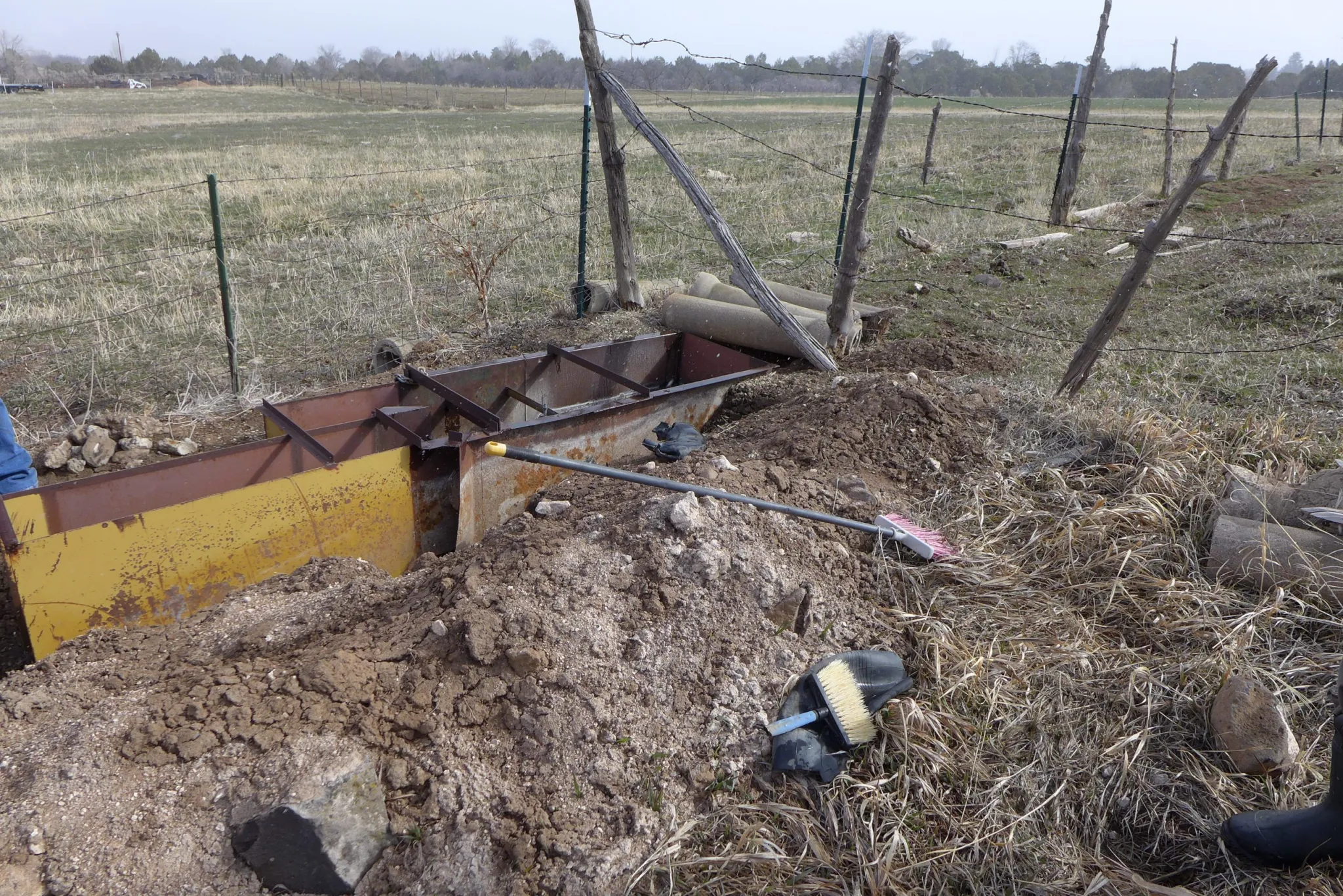
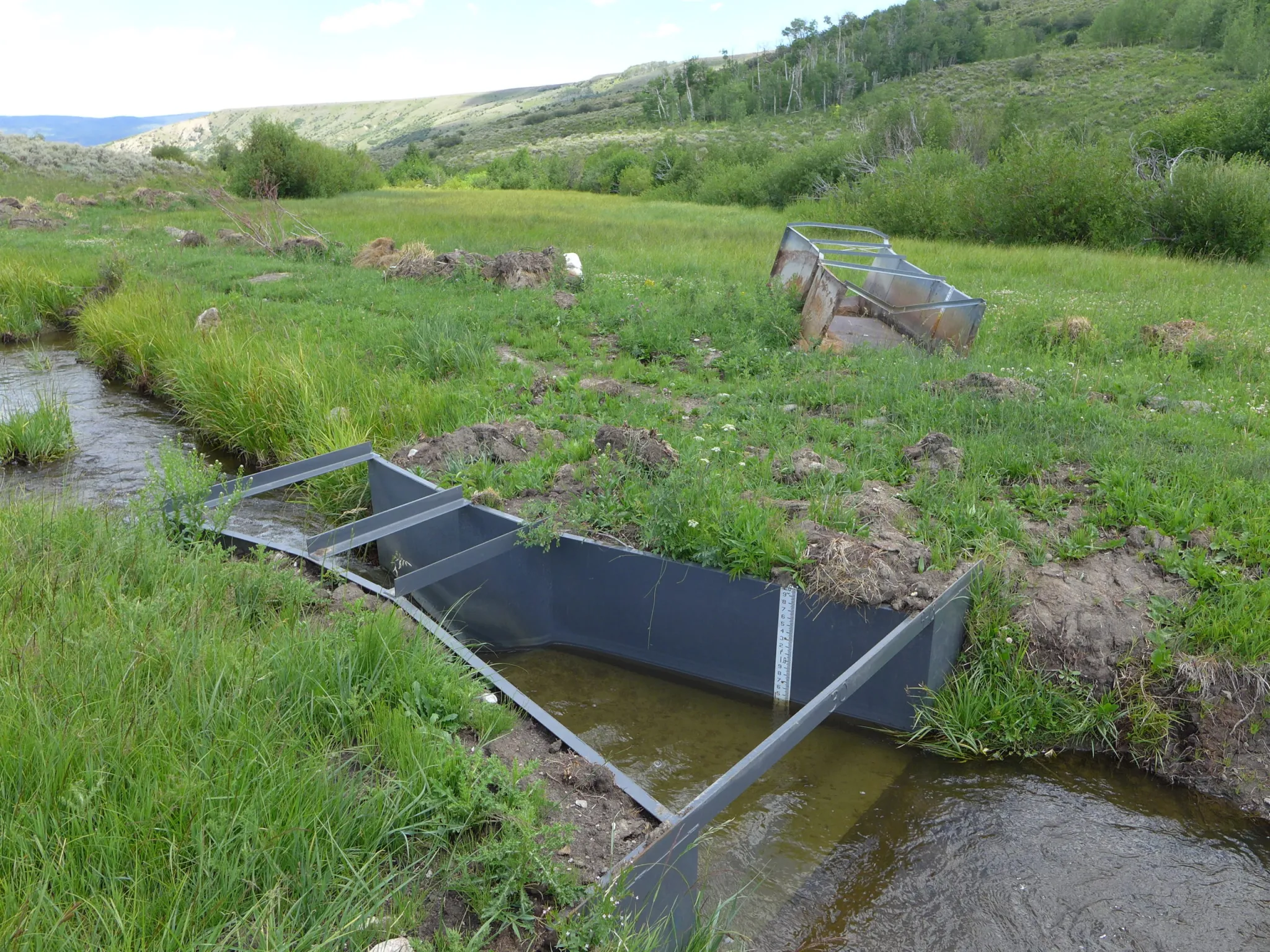
With input from water users, officials from the Colorado Division of Water Resources are creating technical guidance for each of the four major Western Slope river basins on how agricultural water users should measure the water they take from streams. The state is now doling out $7 million from the U.S. Bureau of Reclamation to eligible water users with faulty or missing devices to install structures such as flumes, weirs and pumps at their point of diversion.


Twenty-five percent of the funding is earmarked for each of the four river basins: Gunnison (Division 4); Colorado River mainstem (Division 5); Yampa-White-Green (Division 6); and San Juan-Dolores (Division 7). The first round of funding will go to Divisions 6 and 7, and applications close at the end of January. The goal is to have all the projects complete by 2029.
Measurement rules for Divisions 6 and 7 have been finalized and are in effect; rules for Division 4 are in the draft phase, and state officials are accepting comments until Dec. 19 on the draft rules in Division 5.
With thousands of diversions from small tributaries across rural, remote and mountainous areas, figuring out precisely how much water is used in Colorado has historically been challenging. According to state officials, there are about 2,800 diversions of more than 1 cubic foot per second from Western Slope rivers and streams that are not currently being measured. Historically, the state has required measuring devices on only diversions that have been involved in calls. When a downstream senior water rights holder is not getting the full amount of water they are entitled to, they can place a “call,” which forces junior upstream water users to cut back.
Compact compliance
The push for more-accurate measurement comes at a time when there is increasing competition for dwindling water supplies, as well as growing pressure on the Colorado River’s Upper Basin states (Colorado, New Mexico, Utah and Wyoming) to conserve water. Whether through forced cuts under the terms of the 1922 Colorado River Compact or through a voluntary conservation program that pays water users to cut back, the state will almost certainly face future cuts to its water use.
According to Jason Ullmann, who is the state engineer and director of the division of water resources, accurate and consistent water measurement is a prerequisite for making basinwide cuts related to the compact.
“While we’ve always been in compliance with the [1922 Colorado River] compact, we haven’t had to do a West Slope-wide administration,” Ullmann said. “We just don’t want to be in the position of having to do that on an emergency basis. We want to be proactive and provide people consistent and reliable standards for what we expect and work with them to get to a point where we do have that more accurate measurement network before that happens.”
Although the Colorado River Compact splits the river’s water evenly between the Upper Basin and the Lower Basin (California, Arizona and Nevada) with 7.5 million acre-feet each annually, the agreement says nothing about what happens when there’s not enough water to meet these allocations. A “compact call” is a theoretical legal concept, whose definition is hotly debated among water managers.
One way it could play out is that the Upper Basin states would have to cut off some water users in order to send enough water downstream to meet their obligations to the Lower Basin. If that happens, Colorado would need a plan for who gets cut off first. Under the strict application water law known as prior appropriation, the oldest water rights get first use of rivers and junior water rights are the first to be cut.
Michael Cohen, a senior fellow at the Pacific Institute, where he has written about the uncertainties of water use and measurement in the Upper Basin, said collecting better data will help water managers figure out where cuts should come from.
“Moving forward, it looks more and more likely that there’s going to be some kind of compact call,” Cohen said. “Then the state of Colorado, as well as the other Upper Basin states, need to figure out how they’re going to enforce that kind of call.”
Managing scarcity
But compact compliance is not the only reason that water measurement is needed. Scientists have shown that climate change has contributed to a 20% decline in flows from the 20th century average, and that every 1 degree Celsius of warming results in a 9% reduction in flows. The combination of climate change and a historic drought means that rivers that had never before experienced shortages or calls have started experiencing them in recent years. In the past few years, the Yampa and White rivers, in the northwest corner of the state, have had first-ever calls and have been designated “over-appropriated,” meaning there’s more water demand than supply at certain times.
“Even if you toss the compact situation out, it’s just the practical reality that we’re seeing less snowpack and we have more calls,” Ullmann said. “We’re just in need of improving that measurement accuracy because of the need for administration.”
John Cyran, an attorney who worked on developing the measurement rules for the South Platte River basin and is now a senior attorney with the Healthy Rivers department of Boulder-based environmental group Western Resource Advocates, uses the analogy of a pizza party with too-few pizzas where hungry partygoers are allowed only two slices each to illustrate how measurement is needed in times of scarcity.
“Just like sharing a shrinking pizza or Thanksgiving pie, our water supply is declining,” Cyran said. “The pie is getting smaller. So it is increasingly important to make sure that people don’t take more than their share. But we can’t manage what we don’t measure.”
Tightening up water measurement across the Western Slope could also help Upper Basin water managers as they grapple with a future conservation program that pays water users to cut back and then stores that water in a pool in Lake Powell. A criticism of past pilot programs was that the saved water was not tracked to Lake Powell. Water users downstream of a conservation project could pick up the extra water, with no guarantee that any of it reached the reservoir. Measurement rules and devices could help ensure that this conserved water is “shepherded” to Lake Powell.
Measurement is the first step toward management of a scarce public resource, Cyran said.
“The first step is measuring how much water is being diverted,” Cyran said. “The next step is management – making sure that folks only divert their share and that water we conserve stays in the stream and is not diverted by another user.”
