
Click on a thumbnail graphic to view a gallery of drought data from the US Drought Monitor website.


Click the link to go to the US Drought Monitor website. Here’s an excerpt:
This Week’s Drought Summary
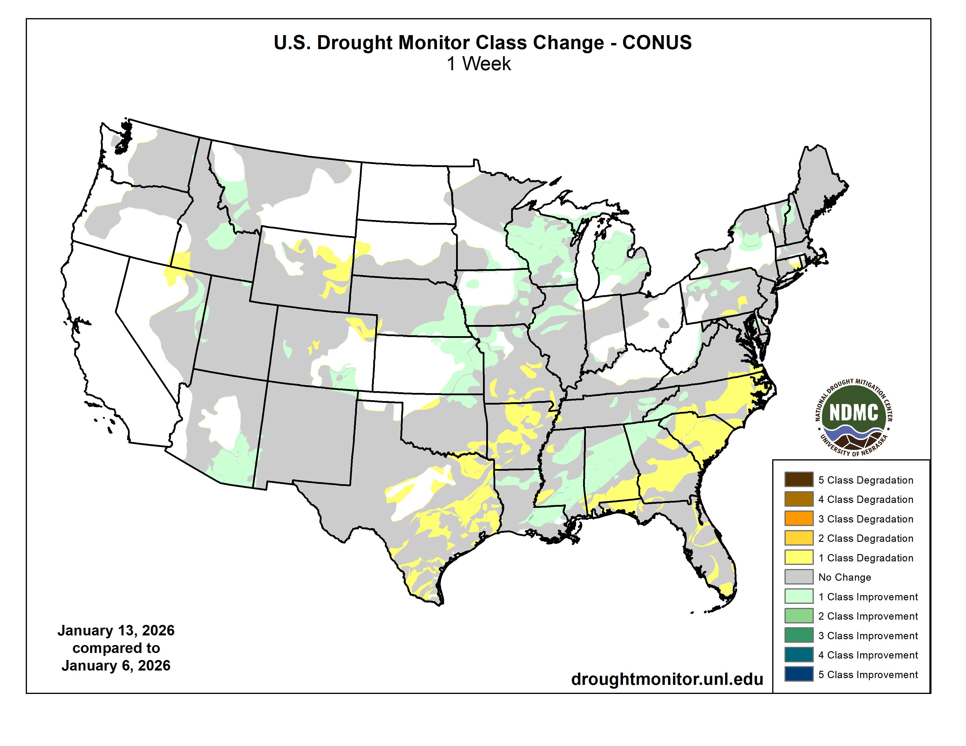
It was a more active week nationwide, with significant precipitation across the central Plains, Midwest, and Southeast. Parts of Mississippi and Alabama received more than 5 inches of rain. In the Plains and Midwest, much of the precipitation fell as rain rather than snow due to unseasonably warm temperatures. Portions of the Southwest and central Rocky Mountains also received beneficial rain and snow, slowing drought intensification and leading to localized improvements. Temperatures were warmer than normal across most of the country, with near- to slightly below-normal temperatures limited to the West and Southwest. The largest departures occurred in the upper Midwest and northern Plains, where temperatures were 15–20°F above normal…
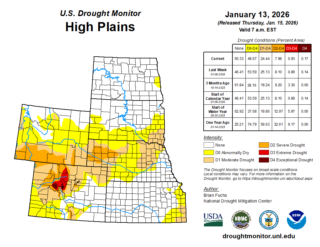
High Plains
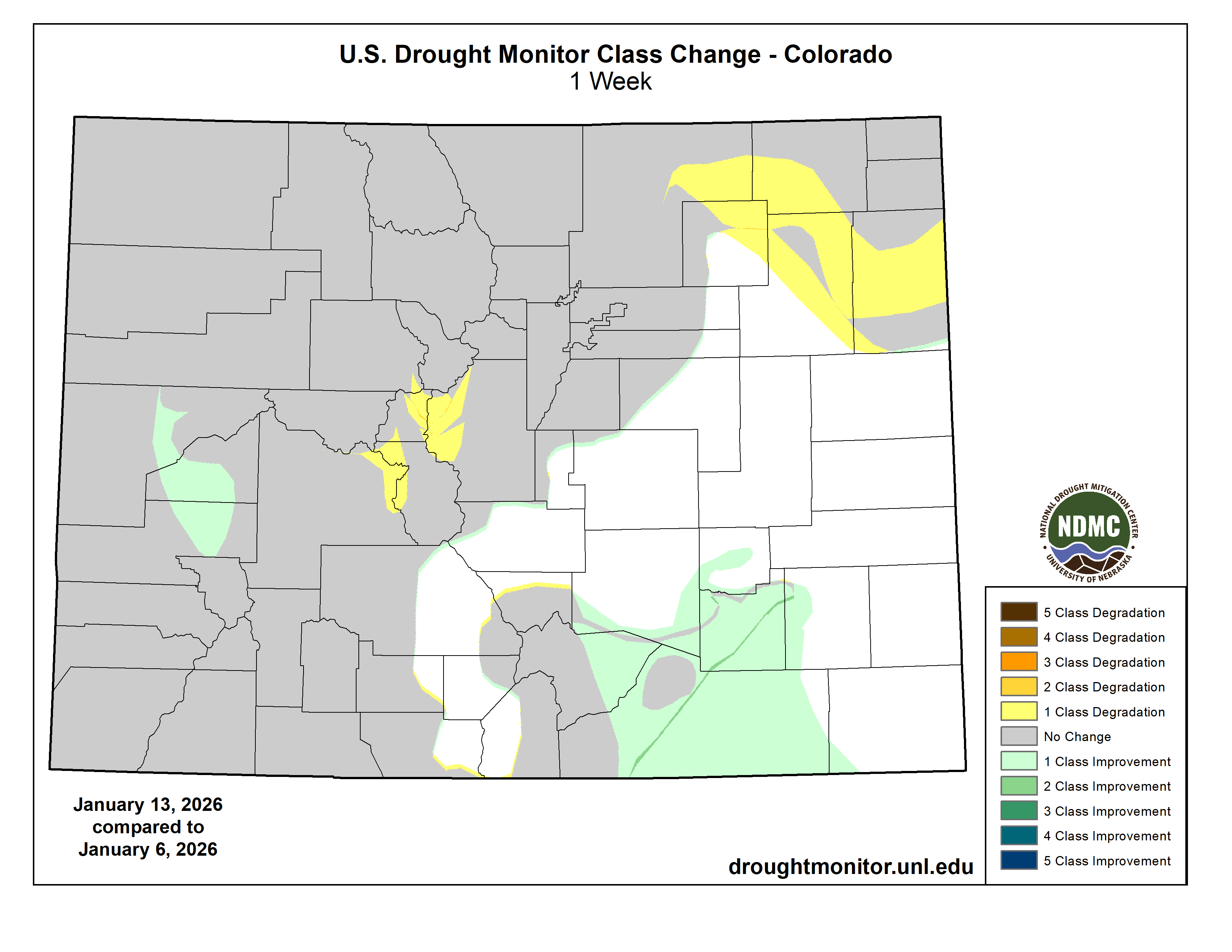
Above-normal precipitation occurred across eastern Colorado, Kansas, and southeast Nebraska, falling primarily as rain and infiltrating soils due to warm temperatures. Much of the rest of the region remained dry. Temperatures were 10–15°F above normal across most areas, with parts of the Dakotas and eastern Montana 15–20°F above normal. Southeast Colorado was the only area near to below normal. Abnormally dry and moderate drought conditions improved in southeast Nebraska, eastern Kansas, and parts of south-central Colorado. Drought expanded across eastern Wyoming, west-central South Dakota, and northeast Colorado…
West
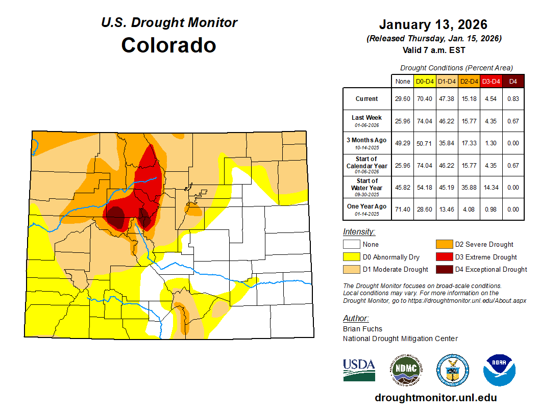
Above-normal precipitation occurred across southeast Arizona, western and central New Mexico, parts of Colorado, and western Washington. Temperatures were mixed, with California, Nevada, Utah, Arizona, and New Mexico up to 5°F below normal, while northern areas were 5–10°F above normal and parts of central Montana 15–20°F above normal. Most drought changes reflected improvement, including moderate drought and abnormally dry conditions in western Montana and central Idaho, severe drought in western Colorado, and severe to extreme drought in eastern Arizona, western New Mexico, eastern Nevada, and western Utah. However, drought expanded in southwest Idaho and northern Nevada, extreme and exceptional drought expanded in central Colorado, and abnormally dry and moderate drought conditions expanded across much of eastern Wyoming…
South
Temperatures were above normal across nearly the entire region, with departures of 9–12°F above normal in the east and 6–9°F above normal across Texas and Oklahoma. Northern Louisiana, Mississippi, central and eastern Tennessee, and southeast Arkansas received well above-normal precipitation, with southern Mississippi recording 200–400% of normal. Central and southern Texas, eastern Oklahoma, and Arkansas remained largely dry. Drought improvements occurred across Mississippi, southern Louisiana, and eastern Tennessee, including improvements to severe drought in northwest Mississippi and northern Louisiana. In contrast, drought expanded across much of Arkansas and eastern and southern Texas. Extreme drought expanded across south Texas, with a new area in northeast Texas. Moderate and severe drought also expanded across east Texas into Arkansas, while abnormally dry conditions increased in central Texas and western Oklahoma. Severe drought expanded from eastern Arkansas into western Tennessee…
Looking Ahead
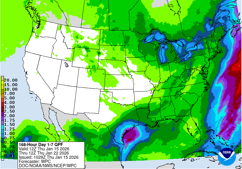
Over the next five to seven days, much of the western half of the U.S. is anticipated to be dry from the West into the Plains. The wettest areas are anticipated to be over the Great Lakes region and into the Northeast. At the end of the period, there could be some coastal precipitation in portions of south and east Texas as well as Louisiana. Temperatures during this time are anticipated to well above normal over the West, with departures of 10-13°F above normal from Nevada into Utah and Wyoming. Cooler-than-normal temperatures will be commonplace over the eastern half of the country, with the greatest departures over the upper Midwest and Great Lakes with departures of 10-13°F normal. The below-normal temperatures will migrate all the way into the South, with portions of the Southeast and Florida 6-9°F below normal.
The 6-10 day outlooks show that the likelihood of above-normal temperatures over much of the Southwest and southern Plains. The best chances of below-normal temperatures will be over the upper Midwest and into the Northeast. From the northern Plains into the Southeast and Florida and areas east of here have the best chances of below normal temperatures. Precipitation is expected to be below normal over Florida and the coastal areas of the Pacific Northwest. The best chances of above-normal precipitation are anticipated over the Tennessee Valley as well as over the Rocky Mountains and into the Southwest.
Just for grins here’s a slideshow of early January US Drought Monitor maps for the past few years.
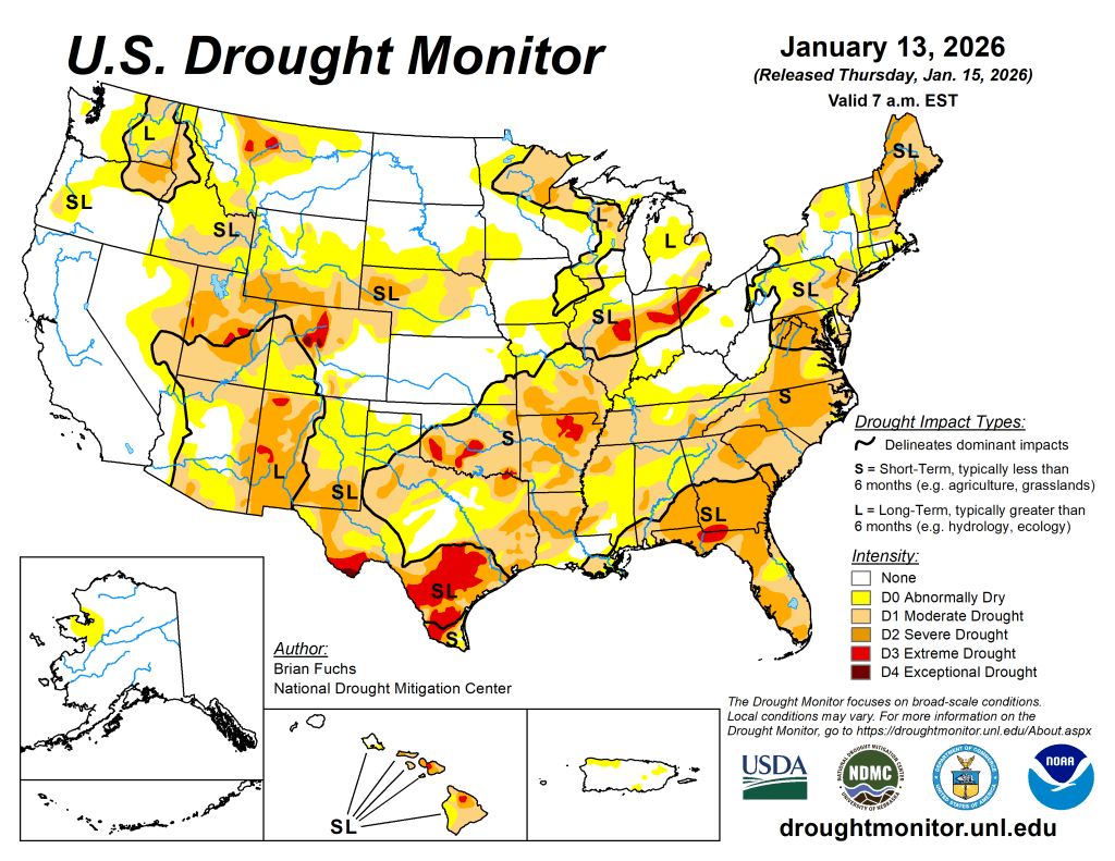
US Drought Monitor map January 13, 2026. 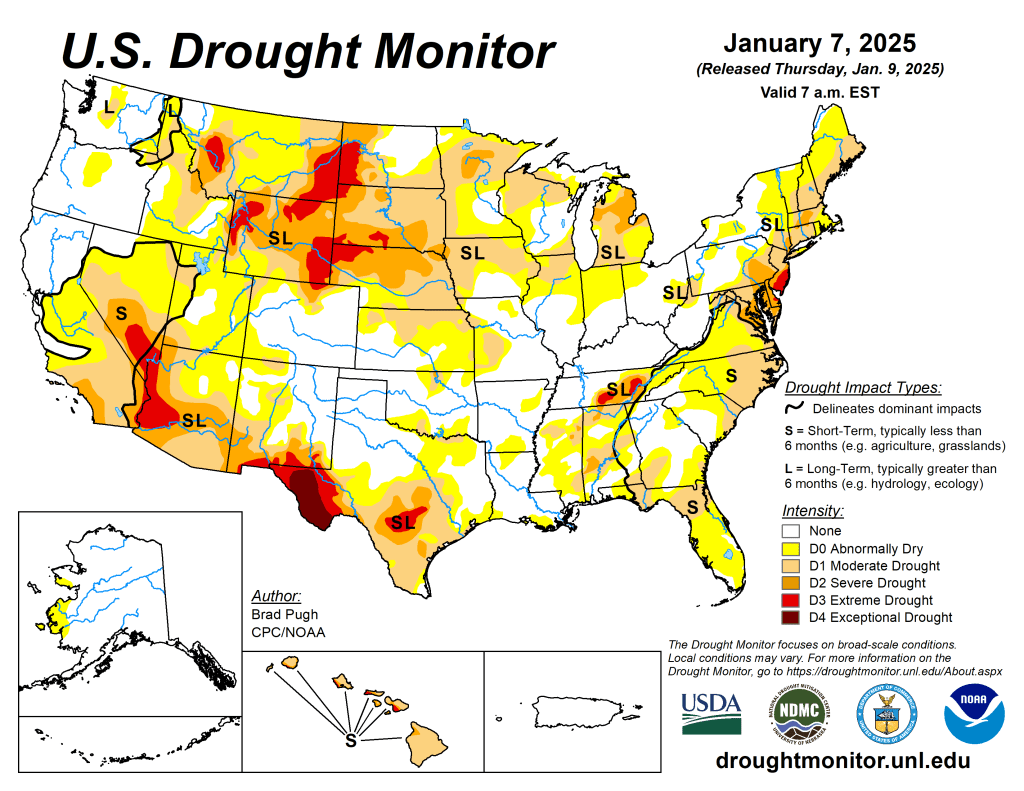
US Drought Monitor map January 7, 2025. 
US Drought Monitor map January 2, 2024. 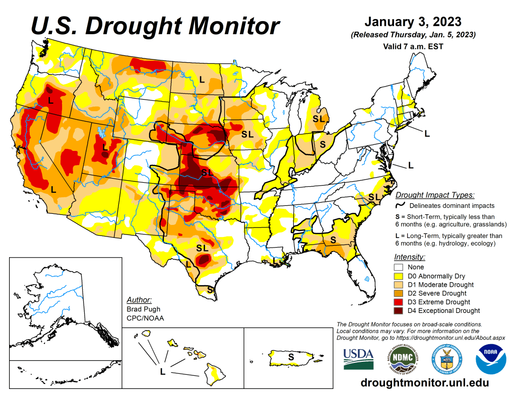
US Drought Monitor map January 3, 2023. 
US Drought Monitor map January 4, 2022. 
US Drought Monitor January 5, 2021. 
US Drought Monitor January 7, 2020. 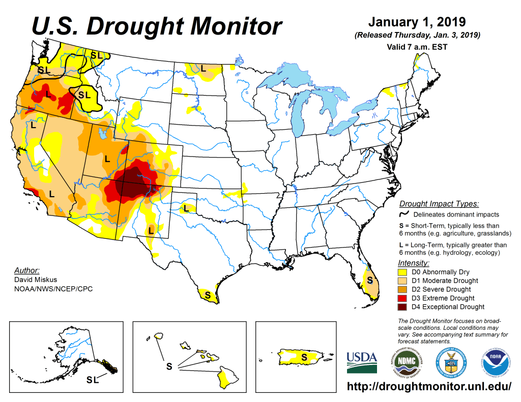
US Drought Monitor January 1, 2019. 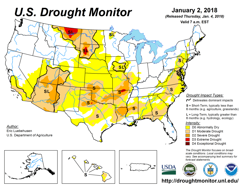
US Drought Monitor January 2, 2018. 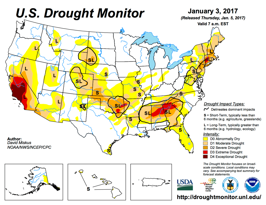
US Drought Monitor January 3, 2017. 
US Drought Monitor January 5, 2016 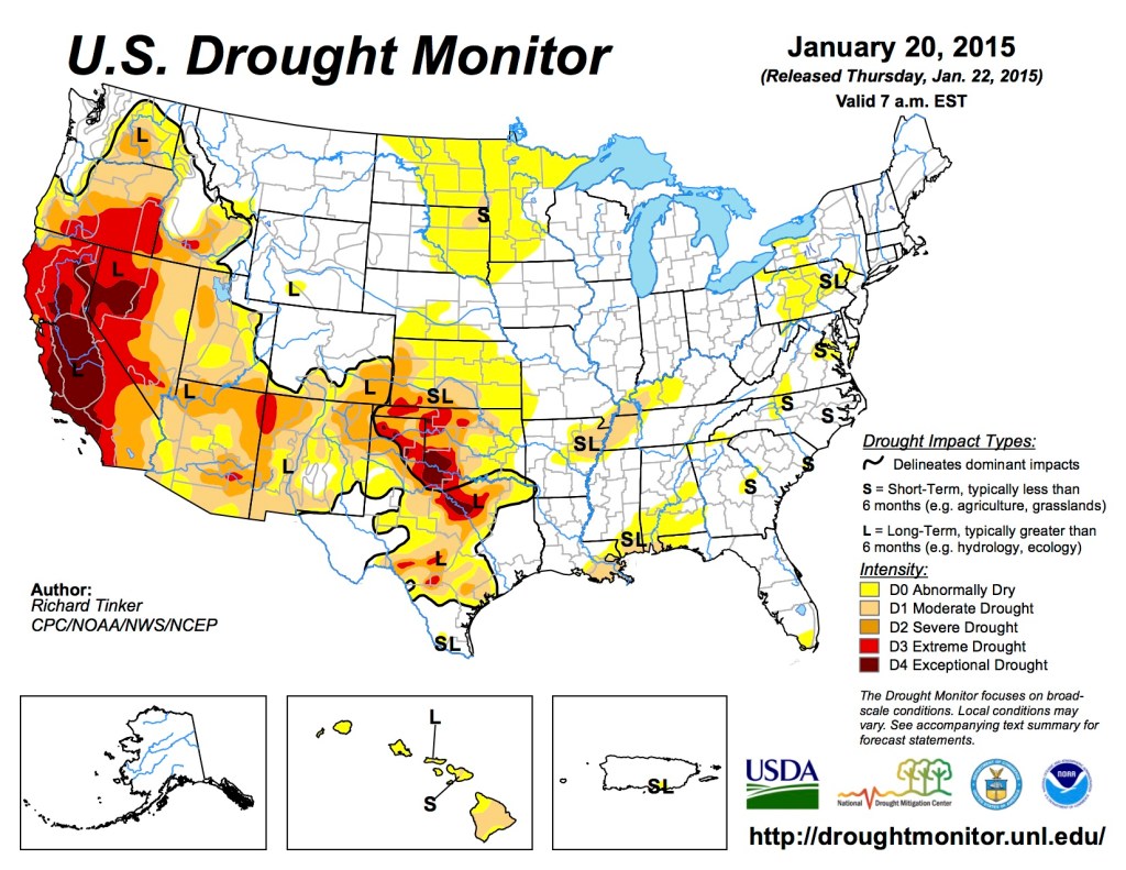
US Drought Monitor January 20, 2015 
US Drought Monitor January 7, 2014 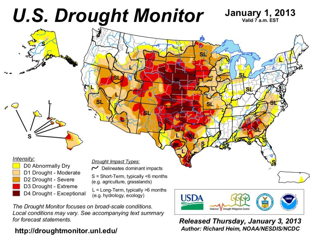
US Drought Monitor January 1, 2013. 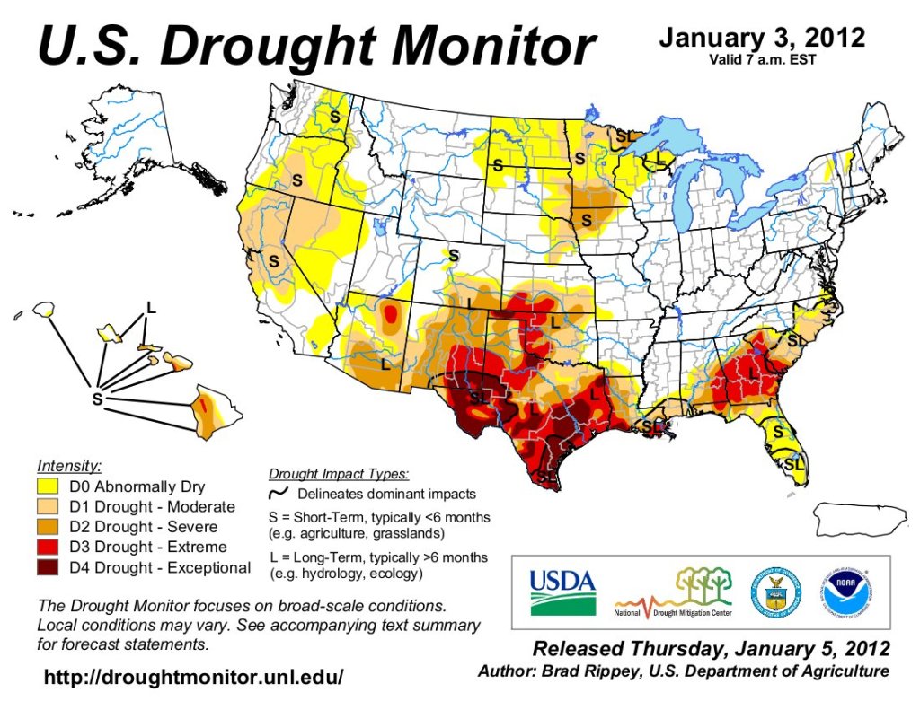
US Drought Monitor January 3, 2012. 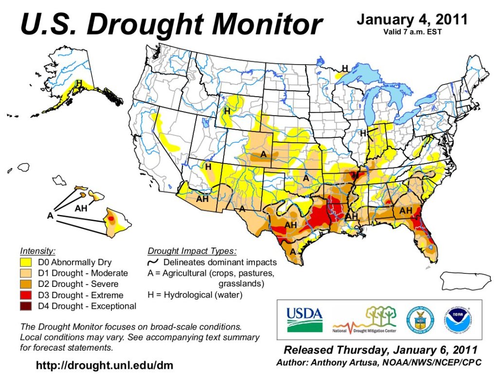
US Drought Monitor January 4, 2011.