#Colorado ranchers and consumers can team up to make beef supply chains more sustainable — TheConversation.com

Beef production provides a valuable contribution to human health while also impacting the natural environment. Brandee Gillham courtesy of the Colorado Department of Agriculture., CC BY

Jordan Kraft Lambert, Colorado State University; Jennifer Martin, Colorado State University; Kim Stackhouse-Lawson, Colorado State University, and Sara Place, Colorado State University

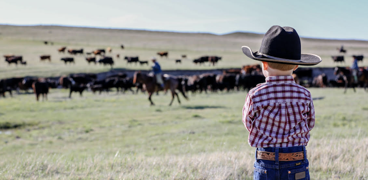
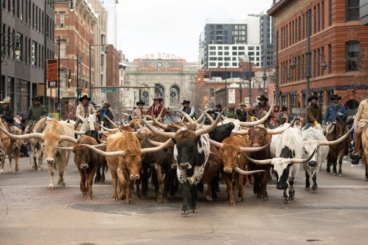
Cowboys guided a herd of longhorn cattle through downtown Denver to celebrate the opening of the annual National Western Stock Show on Jan. 8, 2026. As ranchers bring their best cattle to compete for blue ribbons over the course of this month, it’s a good time to consider whether beef production can be part of a circular economy.

A herd of longhorn cattle fills a downtown street, guided by cowboys on horseback, with the Union Station building and sign in the distance.
Longhorn cattle are herded through downtown Denver in a parade marking the beginning of the National Western Stock Show on Jan. 8, 2026. John Eisele, CSU Photography, CC BY

Circularity is an economic model where raw materials are responsibly sourced, waste products are put to best use and the system maximizes ecosystem functioning and human well-being.

As with most human activities, beef production provides a valuable contribution to human health while also impacting the natural environment, sometimes in negative ways.

We are innovators and researchers who live in Colorado and study the beef supply chain. Our work broadly focuses on investigating ways to make beef production more circular and sustainable.

Kim Stackhouse-Lawson and Sara Place are experts in cow burps and technologies to mitigate the methane associated with them. Jennifer Martin is an expert in meat processing and supply chains for byproducts like organ meats. Jordan Kraft Lambert is an expert in commercializing technologies that help farmers and ranchers steward the environment while feeding the world.

Beef is a source of complete protein. It has the full complement of amino acids humans need to build muscle and is a rich source of vitamin B12, which is necessary to ensure nervous system function and red blood cell formation. Beef produced in the U.S. each year meets the total protein needs of 40 million people and provides enough B12 to meet the needs of 137 million people, according to research.

In 2019, U.S. beef cattle production comprised about 3.7% of the country’s greenhouse gas emissions. Beef cattle production is also responsible for approximately 5% of U.S. water withdrawn from surface or groundwater, and 0.7% of the nation’s fossil fuel energy use.

Cows eating in a sun-drenched field. Black cows dot the golden field.
Cows can process waste that other animals and humans can’t, making them an important part of a circular economy. Matthew Staver, CC BY

New tech to reduce environmental impact

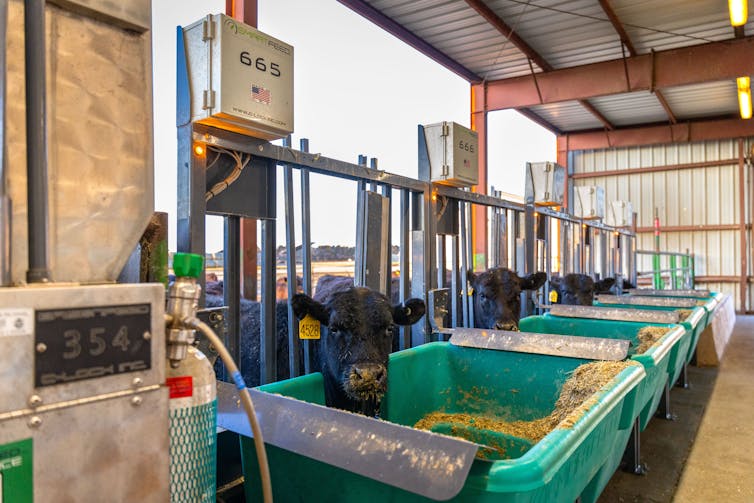
Cows are able to digest tough, fibrous plant material that humans, pigs and chickens can’t. This makes them an important part of a circular economy because they can digest what would otherwise be considered waste from other industries, like the grain left over from making beer and almond hulls from almond milk. By using these ingredients to feed cattle instead of letting it rot in landfills, U.S. feedlots decreased the amount of human-edible feeds required to produce more beef protein.

When cattle are being fed waste products like almond hulls and spent grain, it’s easy for producers to include feed additives, like herbs and custom-made molecules. These additions may reduce the cows’ methane production by changing how the microbes in their stomachs process carbohydrates.

Cows with black hair and orange tags in their ears lean in between metal slats in a barnlike structure to a green tub with feed inside.
Cattle getting their burps measured at the Colorado State University Fort Collins Agricultural Research, Development and Education Center. CSU AgNext, CC BY

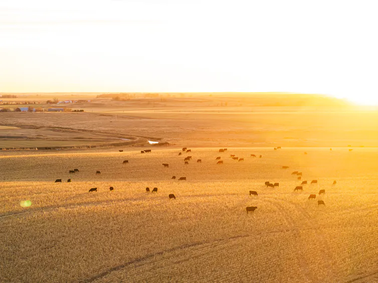
For the same reason that cows can digest what would otherwise be considered waste, cows are able to eat grass. Grazing is important in dry regions like the mountains and high plains of Colorado. If the grass isn’t removed via grazing, it dries and becomes tinder for wildfire. In addition, many of these mountainous areas are too cold, rocky and steep to grow crops. Grazing can turn land that would otherwise be difficult to farm into food-producing land.

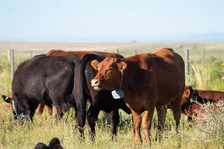
Until now, grazing required physical fences, which are costly to maintain and limit wildlife movement. But new technologies like virtual fencing allow Western Slope ranchers to use their smartphones to set digital boundaries. A collar on the cow beeps and buzzes to tell the cows where to go. Virtual boundaries are easy to change and visible only to the cow; thus, they support more environmentally-friendly grazing practices, protect streams and wildlife habitat and reduce wildfire fuel in dry seasons. While our recent research shows that this technology needs more development, it could be an important tool for beef’s role in a circular economy.

Cows out on a sunlit pasture that are wearing a green device the size of a phone around their necks.
Cattle in a pasture with virtual fence collars on the Central Plains Experimental Range near Nunn, Colo., within the larger Pawnee National Grasslands area. CSU AgNext, CC BY

Beyond steak: Organ meats, pet treats and leather

In our experience, many U.S. consumers rarely eat cuts beyond steaks and ground beef — often due to a bad first experience with organ meats, like liver, or unfamiliarity with how to cook lesser-known cuts, like heart.

When customers won’t buy these cuts, Colorado’s beef producers who sell online or at farmers markets have to send them to the landfill. That costs the producer money and wastes the water, land and feed used to make these cuts.

Studies show that these cuts are among the most nutrient-dense parts of the animal, providing high levels of iron, B vitamins, choline and and other micronutrients. Making use of these lesser-known cuts can reduce emissions by using more of the animal and keep edible meat out of landfills, where it would otherwise rot, releasing greenhouse gases.

This does not mean anyone has to suffer through a meal of rubbery liver to save the planet. Many cultures globally value organ dishes, and U.S. tastes are expanding to include foods like lengua tacos made from beef tongue. Meanwhile, cooking tools such as sous vide can improve tenderness and juiciness by holding meat at precise temperatures for longer times.

Pets also benefit from eating organ meats, so these cuts are a key ingredient in pet foods and treats.

Consumer fashion choices matter too. About 270 million bovine hides are produced globally each year, and about 70% are turned into leather. Due to insufficient demand, remaining hides are burned or sent to the landfill, both of which release greenhouse gases.

Rather than letting these hides rot, they can be turned into leather, a durable, breathable and biodegradable high-performance material. When consumers choose to buy genuine leather boots, belts and car seats, they’re engaging in the circular economy.

For these reasons, Colorado State University is hosting Future Cowboy on Jan. 25, 2026, at the National Western Stock Show. It’s an event that lets Colorado foodies, fashionistas and cattle producers come together to explore circularity firsthand. The event will feature a leather fashion show, a ranch technology showcase and an opportunity try chef-prepared bison tongue and beef heart.

Jordan Kraft Lambert, Director of Ag Innovation and Partnerships, College of Business, Colorado State University; Jennifer Martin, Associate Professor of Animal Sciences, Colorado State University; Kim Stackhouse-Lawson, Professor of Animal Science, Colorado State University, and Sara Place, Associate Professor of Feedlot Systems, Colorado State University

This article is republished from The Conversation under a Creative Commons license. Read the original article.

#Colorado author, Eugene Buchanan, hopes his ode to one of the West’s last wild rivers sparks new generation of stewards — KUNC #YampaRiver

Coyote Gulch on the Yampa River Core Trail August 2022 on the bicycle ride to the Colorado Water Congress Summer Convention.

Click the link to read the article on the KUNC website (Scott Franz). Here’s an excerpt:

January 20, 2026

Steamboat Springs author and adventurer Eugene Buchanan has lived near the banks of the Yampa River long enough to notice its rhythms and moods are often mirrored by the residents in his northwest Colorado ski town.

“The river’s pulse kind of matches your own,” he said Thursday. “You know, come springtime, you’re jazzed up, and the rivers crankin’ and flooding, and the surf waves are in and people are rafting it and (stand up paddleboarding). Then it slows down to a trickle later in the summer and people are inner-tubing it. Fly fishing it. That’s a little more of a tranquil time.”

Yampa River Basin via Wikimedia.

But as Buchanann warns in the first chapter of his new book, Yampa Yearnings, “not all is hunky dory in Yampaland.” Last summer marked the fourth time in history that there was a call on the Yampa due to drought conditions and upstream users were forced to cut back their intake.  And like other rivers across the West, Buchanan said the waterway faces growing threats from climate change and increased demands from water users. Buchanan’s book is not all about hard times and drought on the river. In between his history lessons about the Yampa and the challenges it has faced, readers will also learn about the fate of Buchanan’s efforts to help a rancher get his lost cattle back across the raging waterway. There’s also a tale of his friend’s paddling adventure from Colorado to Utah to prove the waterway can facilitate ‘interstate commerce.’ KUNC water and environment reporter Scott Franz interviewed Buchanan about his book and the state of the Yampa. Answers have been lightly edited for length and clarity.

Franz: What impact do you hope this book has for the Yampa River and its future?

Buchanan: It’s hard to say how much impact a book like this will have. It’s my hope that those who are familiar with the Yampa learn to appreciate it a little more. Maybe look at it with a different eye next time they see it. If people aren’t familiar with the Yampa and they live somewhere else, maybe they’ll look outside and see their backyard creek flowing through their town and just think about it a little more. Maybe they’ll donate to a local nonprofit that’s trying to help preserve it, or they’ll pick up some trash or get involved. Or they’ll vote appropriately, how they want to, perhaps preserve it.

Floating the tiger, “Tiger Wall” Yampa River, 2014. Photo: Brent Gardner-Smith/Aspen Journalism

A #ColoradoRiver glossary and primer — Jonathan P. Thompson (LandDesk.org) #COriver #aridification

Hoover Dam at low water. Jonathan P. Thompson photo.

Click the link to read the article on The Land Desk website (Jonathan P. Thompson):

January 20, 2026

After last week’s somewhat wonky dispatch on the Colorado River, a couple of readers asked about some of the terminology used. That, along with the fact that the deadline for an agreement on how to operate the river’s plumbing is fast approaching, prompted me to put together a bit of a glossary/primer on the Colorado River to give a little more context to related news, which is likely to come fast and furious over the next several weeks. 

If I miss anything, or if you have other questions, please let me know and I’ll try to answer them soon. Also, I’ll be doing a host of data-driven, Colorado River-related dispatches in coming weeks to go over some of last year’s statistics on water consumption, water pricing, alfalfa production and exports, and so forth.

Colorado River Basin: A 250,000 square-mile watershed that includes southwestern Wyoming, western Colorado, southern and eastern Utah, southern Nevada, western New Mexico, Arizona, and eastern California. For administrative purposes, it has been split into the Lower Basin (CA, AZ, NV) and the Upper Basin (CO, WY, UT, NM), with the dividing line at Lees Ferry.

Law of the River: This isn’t an actual law, but rather a collection of agreements, compacts, treaties, laws, and Supreme Court decisions that serve as a framework for governing the Colorado River.

Doctrine of Prior Appropriation, aka First In Time, First in Right: This is the basis for most Western water law, which says that the first entity to put a set amount of water on a stream to beneficial use at a specific place has the highest or most senior priority of water rights. If a senior rights holder is not receiving their full appropriation due to drought or overuse, they can make a “call” on the river, forcing upstream, junior rights holders to stop diverting water from the stream or its tributaries.

Acre-foot (AF): Amount of water that would cover one acre one foot deep. 1 acre-foot = 325,851 gallons. MAF = million acre-feet.

Consumptive Use: The amount of water diverted from a stream minus the amount returned to it. For example, last year Nevada pulled about 443,000 acre-feet of water from the Colorado River, mostly via pumping plants in Lake Mead. But it returned about 244,000 acre-feet of treated wastewater to the reservoir via Las Vegas Wash, leaving it with a total consumptive use of about 198,000 acre-feet for the year. Evaporation and transpiration (or uptake by and evaporation from plants) are considered consumptive uses. Agriculture is the largest consumptive user in both the Upper and Lower basins.

Colorado River Compact: In 1922, representatives from the seven Colorado River states entered into a compact aimed at ending interstate conflict and litigation to clear the way for developing dams and diversions on the river. The compact gives each basin exclusive beneficial consumptive use of 7.5 million acre-feet of water per year, but also mandates that the Upper Basin “not cause the flow of the river at Lee Ferry to be depleted below an aggregate of 75 million acre-feet” for any 10-year period. A 1944 treaty reserved an additional 1.5 million acre-feet to Mexico, which would be covered by surplus or borne equally by the two basins.

I like to run this one again from time to time, just to remind folks how much the population of the West has grown over the last century. This is what the signers of the Colorado River Compact were dealing with as far as water users go — compared to some 40 million users now. Source: USGS.
  • The Upper Basin divided its 7.5 MAF by percentage: 51.75% to Colorado; 11.25%to New Mexico; 23% to Utah; 14% to Wyoming (plus an additional 50,000 acre-feet for the portion of Arizona in the Upper Basin).
  • The Lower Basin allotted 4.4 MAF to California; 2.8 MAF to Arizona; .3 MAF to Nevada.
  • 20 million acre-feet: Presumed total annual natural flow of the river upon which the compact was based and which was considered “more than sufficient to water all lands now being irrigated and all lands which can be economically developed for forty years to come.”
  • 17.3 million acre-feet: The actual annual flow recorded by the he U.S. Geological Survey during the nine years leading up to the compact’s ratification, with yearly flows ranging from 9.9 million acre-feet to 26.1 million acre-feet. That was during an unusually wet period.
  • 14.3 million acre-feet: Median annual natural flows at Lees Ferry from 1907 to 2025.
  • 8.5 million acre-feet: Estimated natural flow at Lees Ferry in 2025.
  • 2 million to 4 million acre-feet: Estimated amount of consumptive use that must be reduced to bring the Colorado River supply and demand into balance.
September 21, 1923, 9:00 a.m. — Colorado River at Lees Ferry. From right bank on line with Klohr’s house and gage house. Old “Dugway” or inclined gage shows to left of gage house. Gage height 11.05′, discharge 27,000 cfs. Lens 16, time =1/25, camera supported. Photo by G.C. Stevens of the USGS. Source: 1921-1937 Surface Water Records File, Colorado R. @ Lees Ferry, Laguna Niguel Federal Records Center, Accession No. 57-78-0006, Box 2 of 2 , Location No. MB053635.

Natural Flow at Lees Ferry: This is a calculated estimate of the amount of water that would flow past Lees Ferry if there were no upstream dams, diversions, or human consumptive use. This estimate would guide the supply driven option for dividing up the river. The USBR describes the method for determining it as such:

  • Provisional Natural Flow at Lees Ferry = observed annual flow at Lees Ferry + average Upper Basin consumptive use for the last 5 published years +/- net change in mainstream storage +/- net change in off-mainstem storage +/- net change bank storage + mainstem reservoir evaporation.
The estimated “natural flow” at Lee Ferry. Some of the alternatives would base Lake Powell releases on recent average natural flows at Lee Ferry. If the recent past is an indicator of what’s to come, we could expect a relatively minuscule amount of water running through the Grand Canyon to the Lower Basin states. Source: Bureau of Reclamation.

Winters v. the United States: 1908 Supreme Court ruling establishing that when the federal government “reserved” land for a tribal nation, it also reserved rights to water. And the appropriation date for those water rights would be the date the reservation was established, whether or not the tribe put the water to “beneficial use” at that time. Winters did not quantify the amount of water tribes were entitled to, except that it should be “sufficient … for irrigation purposes.”

  • By rights, this would give the 30 tribal nations within the watershed the most senior rights to most if not all of the water in the Colorado River. Five lower Colorado River tribes currently have quantified and settled rights to about 900,000 acre-feet, while Upper Basin tribes have settled and quantified about 1.1 million acre-feet. But other tribes have yet to settle or quantify their rights, so they remain in a sort of limbo.
  • In many cases, the tribal nations lack the infrastructure for putting their water rights to use, meaning they end up relying on federal infrastructure — and on the respective appropriation dates for the infrastructure. An example: The Ute Mountain Ute tribe has 1868 water rights on the Dolores River in southwestern Colorado. But they actually receive their water via the Dolores Project, which only has 1968 rights — which are junior to most of the white farmers on the river. That means during very low water years, the tribe can lose most of its water.
Eugene Clyde LaRue measuring the flow in Nankoweap Creek, 1923. Photo credit: USGS

Eugene C. LaRue: One of the early 20th century’s foremost authorities on the Colorado River, who warned the Colorado Compact signatories that their negotiations were based on overestimates of the river’s supply. In 1916, he wrote: “Evidently, the flow of the Colorado River and its tributaries is not sufficient to irrigate all the irrigable lands lying within the basin.” LaRue also warned against building Hoover Dam because evaporation would further deplete water supplies and suggested banning trans-basin diversions, or exporting water from the Colorado River watershed to other parts of the seven basin states. The signatories heard LaRue but clearly didn’t heed his warning, even though he repeated it many times prior to the compact’s signing. (He eventually resigned in protest.)

Minimum Power Pool: Surface elevation of Lake Powell or Lake Mead below which hydroelectric production is no longer possible because it is lower than the dam’s penstocks. This is especially critical at Lake Powell because if water can’t be released through the penstocks and turbines, it must go through lower river outlets, which are not equipped for long-term releases and could be damaged by constant use. Also, the electricity from the dam is critical to Southwestern power grids, and sales of it raise revenue for endangered native fish recovery programs.

Deadpool: Surface elevation of Lake Powell or Lake Mead below which no water can be released from the dam. So in Lake Powell, this means the water would drop below the river outlets, which could happen if the reservoir is drawn down to the river outlet level, and then reservoir seepage and evaporation exceeds inflows (which could happen late in a hot, dry summer).

Run of the River: This is the term for when releases from a dam are equal to reservoir inflows minus evaporation and seepage at any given time. In other words, if inflows were 20,000 cfs, releases would be slightly lower, and the dam wouldn’t hold any water back (or release any storage). Glen Canyon dam operators could use this method to keep Lake Powell from dropping below minimum power pool.

Transbasin Diversion: Moving water from one watershed to another, within the same state, e.g. from the Colorado River’s headwaters to the state’s populous Front Range, or from the Navajo River (a tributary of the San Juan, which is a tributary of the Colorado) to the Chama River (a tributary of the Rio Grande).

Central Arizona Project: The 366-mile canal and pumping system that delivers Colorado River water to the Phoenix and Tucson areas. The project’s water rights have a 1968 appropriation date, making them junior to California users such as the Imperial Irrigation District. That has meant that Arizona must reduce consumption prior to California. 

Imperial Irrigation District: A major agricultural area in southern California and the Colorado River’s largest single water user.


Western water: Where values, math, and the “Law of the River” collide, Part I — Jonathan P. Thompson

Western water: Where values, math, and the “Law of the River” collide, Part II — Jonathan P. Thompson


Colorado River “Beginnings”. Photo: Brent Gardner-Smith/Aspen Journalism