The Latest in Low Technology

By Robert Marcos, photojournalist
Grand Junction, Colorado

While filming for the Nature Conservancy I learned this: Climate change has made three-quarters of our planet drier, yet at the same time the frequency of extreme downpours has increased. Raindrops that fall during these downpours hit the soil with more energy than they used to. This results with more erosion as dislodged soil is swept downstream by runoff that our increasingly dry soil is unable to absorb.

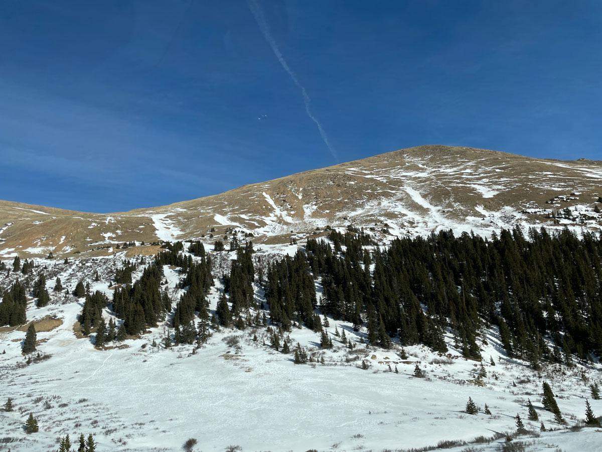
Forgive me if I left anything out of that overly-simplified explanation, but I wanted to define the problem first before describing solutions that are underway in Northwestern Colorado. The Nature Conservancy and their partners are heavily invested in a project whose goal is to improve the water quality in the Yampa River, and I was fortunate to have been invited to film work being done at three remote sites.

Joseph Leonhard – a Riparian Restoration Project Manager at the Nature Conservancy told me that his crews – which consisted primarily of AmericaCorps workers plus a few hardy scientists from the BLM and USGS, utilized Low-Tech Process-Based Restoration, (LTPBR), methods to slow the water in streams that led into the Yampa River.

LTPBR is a low cost restoration method that uses simple, hand-built structures composed of natural materials obtained locally – like branches, boulders, and sod, which mimic actual beaver dams. By restricting water these small dams encourage regenerative processes that can, over time, repair degraded landscapes, improve water retention, create habitat, and even build resilience against drought and fire.

What really impressed me was that the members of these crews – some of whom were 19-year olds while others were PhD’s, shoveled mud and waded through knee-deep water together. They displayed “group cohesiveness”- which is defined as coordinated effort toward shared objectives. During his interview Joseph Leonhard said that he and his people were “activated”, which I interpreted as meaning that instead of sitting in front of a computer, (like I am right now), they were engaged in productive physical activity that would directly benefit the environment.

For more information about the Yampa River Fund please visit: https://www.nature.org/en-us/about-us/where-we-work/united-states/colorado/stories-in-colorado/yampa-river-fund/

Adams County water district sues #Denver over contamination from fire training facility: Since the South Adams Water & Sanitation district first discovered problem in 2018, it has spent tens of millions on mitigation — The #Denver Post

Firefighting foam containing PFAS chemicals is responsible for contamination in Fountain Valley. Photo via USAF Air Combat Command

Click the link to read the article on The Denver Post website (Elliot Wenzler). Here’s an excerpt:

January 21, 2026

An Adams County water district filed a lawsuit against Denver on Tuesday [January 20, 2026], alleging that foam from the city’s fire training facility has contaminated its water for decades. The South Adams County Water and Sanitation District says the city’s Roslyn Fire Training Facility, near the Rocky Mountain Arsenal National Wildlife Refuge, has used firefighting foam containing a group of chemicals known as PFAS, also known as “forever chemicals,” since at least 1991…

“Denver has failed to eliminate or control releases of (the chemicals) at and from the fire training facility and those releases have contaminated and continue to contaminate the District’s drinking water supplies,” the lawsuit alleges.

The district serves about 75,000 residents in Commerce City and unincorporated Adams County. It first discovered the contamination in 2018. Since then, the district has spent tens of millions of dollars to mitigate the issue, according to the lawsuit. Officials there built another water treatment facility specifically to treat PFAS, and it purchased water from Denver Water to dilute the contaminated water…Even with state and federal funding, the lawsuit says, “there remains a huge deficit” from the costs associated with the firefighting foam. The district asks a U.S. District Court judge to rule that Denver is liable for the response costs and for the ongoing costs the district will incur. It notes that water district officials notified Denver city officials of this claim back in 2019. The amount that the city of Denver would have to pay, if found liable, would be determined in a trial.

#Drought in 2025 in 14 Graphics — NOAA

Loveland Pass in Summit County on Dec. 24, 2025. The lack of snow is clearly visible on the higher peaks. Photo credit: Denver Water.

Click the link to read the article on the NOAA website. Here’s an excerpt:

January 15, 2026

From the catastrophic wildfires in Southern California to historic low-water levels on the Mississippi River and record-low streamflow in the Northeast, drought and its impacts touched nearly every corner of the country. The year saw the unusual return of two La Niña events and devastating weather whiplash that brought historic floods to drought-stricken Texas. 2025 showed us that drought is even more devastating when compounded with other climate hazards, such as wildfire and flood. This list breaks down some significant drought-related events of 2025 that made 2025 a year of water extremes across the United States. 

Our thoughts are with those who lost loved ones, homes, and livelihoods in the Texas flooding and California wildfires. We hope for healing and comfort for those dealing with significant losses from these events.

Most of the U.S. Experienced Some Drought Last Year

Much of the West started and ended 2025 in drought, according to the U.S. Drought Monitor. Drought impacted the Upper Missouri River Basin and Northeastern U.S. as winter turned into spring, just as Extreme and Exceptional Drought (D3-D4) emerged in Florida and the Southwest. By late summer, drought largely improved in the East, only to emerge again in force in the Northeast U.S. In fall, drought developed in the Midwest and Southeast, and expanded in the Southern Plains and West. New Year’s Eve found drought covering 35.8% of the Nation. 

Below is a slideshow of US Drought Monitor maps for 2025.


2025: A Warm Year Overall  

Across much of the U.S., 2025 was a warm year, with annual temperature averages of up to 5° Fahrenheit (F) above normal in most areas. The greatest departures were in the Great Basin, Northern Rockies, and along the southern border. A few spotty areas around the Nation were slightly cooler than normal in 2025, particularly east of the Mississippi River. 

2025 brought a mix of precipitation to the U.S. The Pacific Northwest, Mountain West, Midwest, South, and Northeast were drier than normal. Conditions were particularly poor in the Mountain West and South Texas, where annual precipitation was 50-90% of normal. Southern California, the Dakotas, and southeastern Arizona were wetter than normal. 

Annual average temperature departure from normal across the U.S. in 2025. The map displays temperature averages compared to normal, with orange and red colors indicating above-normal temperatures. Cooler than normal areas are represented by shades of green. Data Source: High Plains Regional Climate Center
This map displays annual precipitation totals compared to the 1991–2020 normal. Shades of orange and red indicate drier-than-normal conditions (0%–90% of normal). Areas in blue and green hues represent wetter-than-normal conditions. Source: High Plains Regional Climate Center

Heatwave Leads to Early Snowmelt, Runoff in Western U.S. 

In the West, about 70% of the water supply comes from snow stored in the mountains. Across the West, snow water equivalent on April 1, 2025 was near-normal in most northern watersheds and below normal in watersheds south of the Central Rockies. But April and May brought heatwaves to the mountains, melting snow out much earlier than normal. Rapid melt out occurred across Utah, Colorado, and New Mexico, pushing some basins from above-average snowpack to snow drought conditions in under a month, with snow disappearing 1-4 weeks early. 

Snow Telemetry (SNOTEL) snow water equivalent date of water year melt out for Water Year 2025 to date (October 1, 2024–present). Red dots show snow melt out 28 or more days earlier than median and blue dots show snow melt out 28 or more days later than median. Only stations with at least 20 years of data are used. Source: USDA Natural Resources Conservation Service (NRCS).For an interactive version of this map, please visit NRCS.

La Niña Double Dips 

2025 was shaped by two La Niña events. La Niña is one of two phases of the El Niño-Southern Oscillation. La Niña typically brings cool, wet winter conditions to the Northwest U.S., and warm, dry winter conditions to the Southern U.S. The first La Niña was a borderline event, which peaked around January 2025, and then waned by the end of spring. The second was a little stronger, but still considered weak compared to most historical La Niña events. It began developing around August and continues through winter 2025-26.

This graphic illustrates the fluctuations in the Oceanic Niño Index (ONI), an index used to monitor the El Niño-Southern Oscillation. Blue shades indicate La Niña, the cooler phase, while red shades indicate El Niño, the warmer phase. Source: NOAA Climate Prediction Center.

Low Water Levels on the Mighty Mississippi

Extremely dry conditions across the Ohio River Basin and southern portions of the Midwest in August and September led to the rapid expansion of drought and decreased flows on the Ohio River and portions of the Lower Mississippi River. In Mid-September, the Ohio River was contributing only 8% of the overall water flow in the Lower Mississippi River, compared to its typical 50% contribution. The Ohio River at Cairo, Illinois (where the Ohio meets the Mississippi River) fell below 10 feet. 

A significant portion of the Ohio River Basin and Lower Midwest states received only 0-25% of normal precipitation from August 14-September 14, 2025. These extremely dry conditions led to the expansion of drought and decreased flows from rivers across the Basin. This map shows precipitation over the past 30 days as a percentage of the historical average (1991–2020) for the same time period. Green/blue shades indicate above-normal precipitation, while brown shades indicate below-normal precipitation. Source: UC Merced, GridMET. Map from Drought.gov Mississippi River Basin Drought and Water Dashboard.
On September 8 2025, the Ohio River was only contributing 8% of the overall flow of the Lower Mississippi River, as compared to its typical 50% contribution. Meanwhile, the Upper Mississippi and Missouri Rivers were contributing around 57% of the flow to the Lower Mississippi River compared to the typical 30%. Sub-basins within the broader Mississippi Basin contribute different flow amounts to the normal water levels that are recorded at Natchez, Louisiana in the Lower Mississippi River Basin. In the image above, normal flow contribution is provided in orange, while the current flow contribution is provided in red. Source: U.S. Army Corps of Engineers.

Drought Peaked in November at 36%

In late November, the 2025 drought reached its national peak, with 36.65% of the U.S. in drought (D1-D4) according to the U.S. Drought Monitor. November 2025 temperatures were above to much above average throughout most of the Western and Central U.S. Idaho, Nevada, Oregon, Texas, and Utah set new statewide records for November average temperatures. Portions of the northern Great Basin, Northwest, and Rockies and much of the country east of the Mississippi River saw below-average precipitation.

On November 25, 2025, the spatial extent of drought in the United States reached its annual peak, with 36.65% of the country experiencing Moderate Drought (D1) or worse. This map highlights the significant intensification of Extreme (D3) and Exceptional (D4) drought across the Mountain West, South, Midwest, Northeast, and Hawaii. Source: National Drought Mitigation Center, NOAA, and USDA
.

Winter Brings Rain Instead of Snow to the West

Winter 2025-2026 kicked off with warm weather and rain instead of snow. Nearly every major river basin in the West experienced a November among the top 5 warmest on record. On December 7, 2025, snow cover across the West was the lowest amount for that date in the MODIS satellite record (since 2001), at 90,646 square miles. Water Year 2026 (October 1, 2025–September 30, 2026) precipitation to date was near or above median for many parts of the West in late December. However, much warmer-than-normal temperatures caused precipitation to fall as rain instead of snow in many basins, leading to snow drought despite wetter-than-normal conditions across most of the West. At the end of 2025, snow drought was most severe across much of the Sierra Nevada in California, the Cascade Range in Washington and Oregon, the Blue Mountains of Oregon, and the Great Basin in Nevada.

Snow water equivalent (SWE) percentiles for locations in the western U.S. at or below the 30th percentile as of December 7, 2025. The colored dots show stations with SWE below the 2nd percentile (dark red), 2nd–5th percentile (bright red), 5th–10th percentile (orange), 10th–20th percentile (tan), and 20th–30th percentile (yellow). Stations with SWE above the 30th percentile are shown with a black “x.” We define snow drought as SWE below the 20th percentile. Only SNOTEL stations with at least 20 years of data were used. Stations where the median SWE value for the date is zero are not shown. Data source: USDA Natural Resources Conservation Service.

Keep Up With the Latest Conditions and Outlooks 

Find maps, publicly accessible data, and recent research about drought and wildfire on drought.gov. You can also subscribe to NIDIS emails for the latest regional drought updates, webinars, and news in our drought early warning system regions. To stay up to date on the latest drought conditions, sign up to receive drought alerts for your city/zip code when the National Weather Service updates their U.S. Drought Outlooks.  

As major #drought looms, #Colorado’s reservoirs are 85% full — Jerd Smith (Fresh Water News) #snowpack

West Drought Monitor map January 20, 2026.

Click the link to read the article on the Water Education Colorado website (Jerd Smith):

January 22, 2026

Colorado’s water storage reservoirs are about 85% full as the state faces a drought year that could be the worst in nearly a quarter century.

State officials are comparing this year with 2002, a year that would deliver one of the worst droughts on record. Whether this year will beat that mark isn’t clear yet.

Having water in storage is how Western states help offset the impacts of crippling droughts. This reservoir storage number, though below average, doesn’t worry water watchers too much right now, according to Nathan Elder, manager of water supply for Denver Water, the state’s largest water utility serving about 1.5 million people.

Denver’s storage system mirrors the statewide average at 82% full. But what worries Elder and others is what lies ahead. Snowpack and streamflow forecasts are so low that the utility is unlikely to be able to fill the reservoirs back up when snows melt this spring.

And that’s unusual. “We always fill,” he said.

In the American West, winter snows melt in the spring, filling reservoirs. Those storage pools help deliver water consistently through long summers and dry falls. Elder said Denver has enough water stored now to last roughly three years. 

Northern Water’s storage reservoirs are similarly full, but that’s not causing much cheer.  Northern provides water to hundreds of farms and nearly 1 million residents on the Front Range north of Denver.

“We’re in pretty good shape,” said Luke Shawcross, Northern’s water resources manager. “But the forecast is just dismal.”

At a meeting of the state’s Water Conditions Monitoring Committee meeting Thursday, Allie Mazurek, a climatologist with the Colorado Climate Center at CSU, reiterated what has dominated the headlines in recent weeks: December was the warmest on record.

There is little optimism that the state can shake off this record-breaking dry spell, according to Brian Domonkos, snow survey supervisor for the Natural Resources Conservation Services. The agency tracks snowpack in Colorado and other Western states.

Statewide snowpack sits at 57% of normal, Domonkos said. “It’s a record low.”

To get back to some level of normalcy the state would need to receive a series of snowstorms that would drop 145% of the state’s average amount of white flakes.

“And that is not likely,” he said.

Looking ahead, Denver Water and others have begun weekly “water shortage” meetings, with a decision likely in March about whether and what kind of new drought restrictions to impose, Elder said in an interview earlier this week.

“It’s not a good situation,” he said. “We’ve survived years like this in the past and made it through. But it’s a reminder that we live in an arid environment and we need to be conserving all the time.”

This weekend, more snow is expected, but it won’t be a drought-buster, said CSU’s Mazurek.

Still, she said, “at this point, I’ll take anything.”

More by Jerd Smith

Westwide SNOTEL basin-filled map January 22, 2026.