Click the link to read the article on the Summit Daily website (Andrea Teres-Martinez). Here’s an excerpt:
March 23, 2026
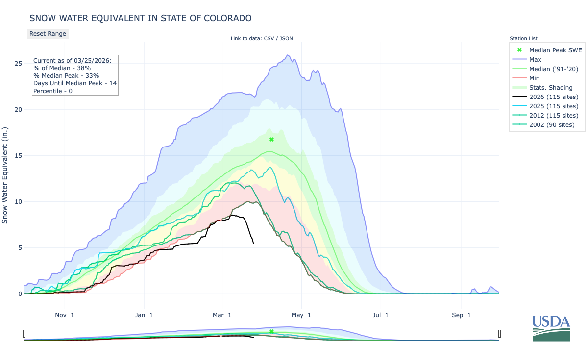
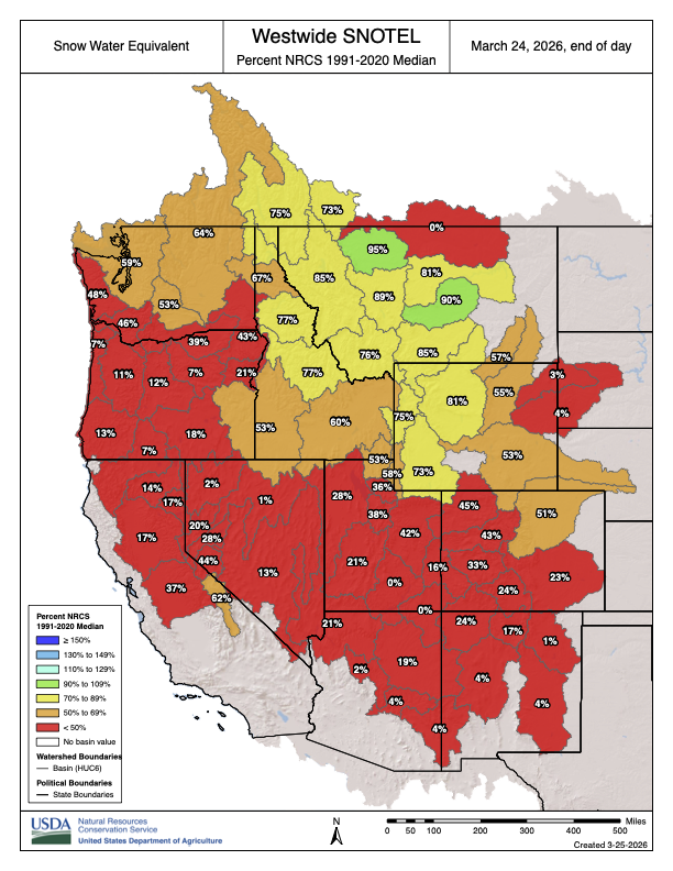
With cooler weather finally in sight following a mid-March heat wave, Colorado’s snowpack is reporting an early meltdown
Several Western Slope mountain towns experienced record-breaking temperatures last week, with some towns logging the hottest day on record in up to 65 years. On average, most towns recorded temperatures between 20-30 degrees above normal, according to National Weather Service Meteorologist Brianna Bealo…Recent warm temperatures have meant early closures for some mountain resorts. Ski Cooper, Powderhorn Mountain and Sunlight Mountain resorts all closed for the season on March 22, with other resorts limiting terrain due to little natural snow. Other areas didn’t open at all, including Cranor Ski Area in Gunnison, Lee’s Ski Hill in Ouray and the Hesperus Ski Area. The addition of another week of warmer temperatures spells bad news for Colorado’s rapidly dwindling snowpack. As of March 23, snow water equivalent in Colorado is at 44% of median with 16 days left to go until the median peak. The snowpack’s state will likely only get worse throughout the week thanks to the warm and dry weather. Historically, the state’s snowpack reaches its peak in early April before the mountain snow drains away by June or July. A warm winter compared with early snowmelt, however, means the snowpack likely already reached its peak around March 10, Bealo said, and could melt out earlier in the spring.
“It looks like we’ve already reached peak, and we’re melting out pretty rapidly,” Bealo said. “Even though we’ve only really just started seeing melt-out occurring, if we continue at the same rate that we’re seeing, we’d probably be melted out somewhere towards the end of April, early May.”