The health of our waters is the principal measure of how we live on the land — Luna Leopold
Author: Robert Marcos, photojournalist
Photojournalist based in Grand Junction Colorado. I'm focused on the conservation of western water, tribal health, and clean energy. Clients include Rocky Mountain PBS, The Nature Conservancy, the Ute Mountain Ute Tribe, and Farmers Conservation Alliance.
Tel: 760.898.8298
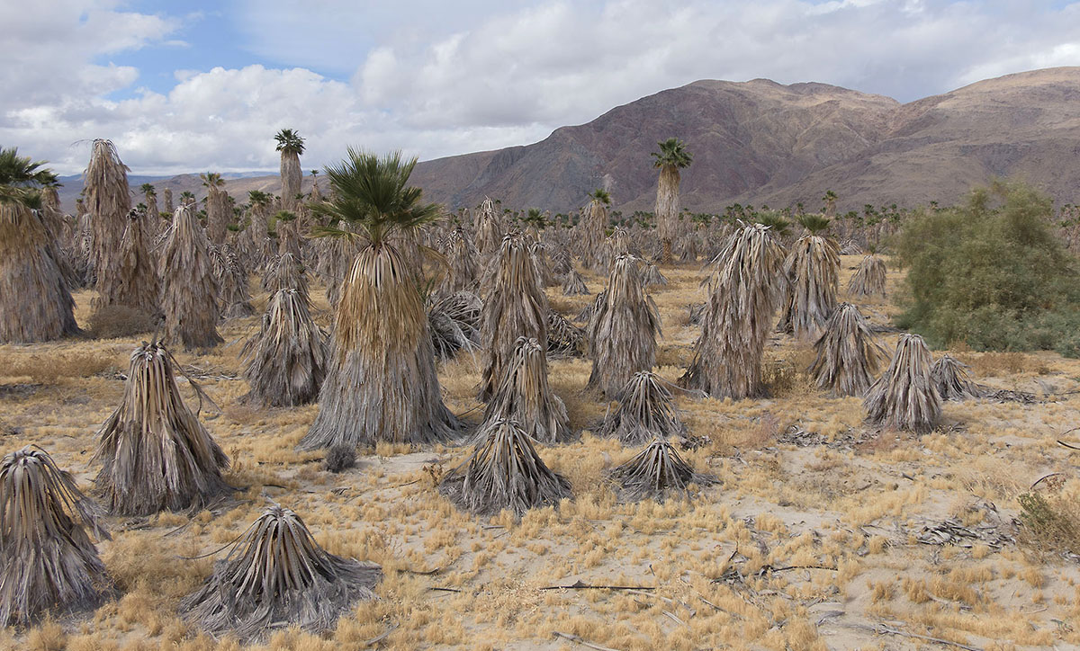
A dessicated palm grove northeast of Borrego Springs, CA. Photo by Robert Marcos.
by Robert Marcos, Photojournalist
For decades, the desert town of Borrego Springs – in eastern San Diego County, thrived upon what appeared to be an unlimited supply sunshine and groundwater. Lacking an alternative supply of water this isolated community was entirely dependent on the prehistoric groundwater that was lying beneath it. This finite resource acted as the lifeblood for two competing interests: a flourishing agricultural sector and a steady expansion of residential and resort development.1
The valley’s economic foundation was laid by industrial-scale agriculture. Beginning in the mid-20th century, farmers realized that the high water table and intense desert sun created perfect conditions for citrus, grapes, and nursery crops. Water was pumped aggressively to transform the arid landscape into a lush production hub. At its height, agriculture accounted for roughly 70% of the valley’s water consumption, providing the jobs and revenue that initially put Borrego Springs on the map.
Parallel to the farming boom, the town marketed itself as a serene, upscale getaway, leading to significant residential growth. Developers built golf courses, luxury resorts, and sprawling retirement communities that promised a “green” lifestyle in the middle of the desert. These amenities required massive amounts of groundwater to maintain verdant fairways and private pools. For years, the abundance of the aquifer made it easy to ignore the fact that the community was growing far beyond the environment’s natural recharge rate.2
However, the “golden age” of water use eventually hit a breaking point as the aquifer began to rapidly decline. Decades of extracting more water than the earth could replace caused the water table to drop by more than 100 feet in some areas. As the ground sank and the cost of pumping from deeper depths rose, the sustainability of the valley’s twin economies came into question. The very resource that invited growth became the primary limiting factor for its future.3
Today, Borrego Springs stands as a cautionary tale of desert over-extraction. Under California’s Sustainable Groundwater Management Act, the community has been forced to implement drastic water reductions, leading to the fallowing of many farms and strict mandates for residents. While the groundwater once fueled a dream of limitless desert prosperity, its depletion now dictates a new era of conservation, proving that growth without replenishment is ultimately a race toward an empty well.4
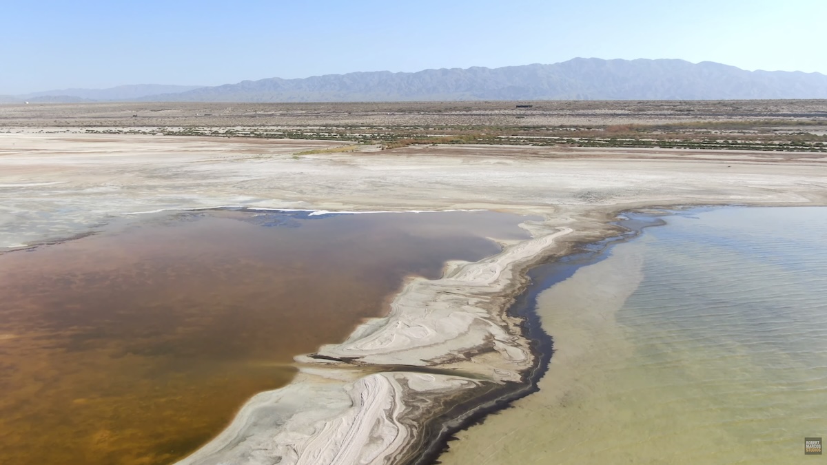
The Salton Sea is a paraodox for a multitude of reasons. The most striking is that the Salton Sea can exist only as long as the Imperial Valley continues to drain 1.3 million acre feet of salt and pesticide-laden runoff into it, annually. That’s exactly how much the Sea loses to evaporation every year. So ironically, the more Colorado River water that’s conserved by Imperial Valley’s farmers the faster the Salton Sea is going to dry up.1
Fact: In 1924 the federal government officially designated the Salton Sea as a permanent repository for agricultural drainage, which authorized the Imperial Irrigation District to use it as a drainage basin for irrigation runoff. This was necessary because increasing salt levels in the soil were threatening to put thousands of acres of highly-productive farmland out of production.2
The Imperial Valley functions as a critical “winter salad bowl” for the United States, yet this massive agricultural output creates a severe environmental health paradox for its residents. While intensive farming produces millions of tons of vegetables, it relies on practices like agricultural burning and heavy pesticide application that release fine particulate matter and toxic chemicals into the air. This pollution is compounded by a shrinking Salton Sea, which acts as a basin for agricultural runoff; as it dries, it exposes toxic lakebed dust containing arsenic and pesticides that wind then carries into local communities. Consequently, children in the Imperial Valley suffer from asthma at rates nearly double the California state average, with roughly one in five children diagnosed—a direct cost of the region’s agricultural success borne by its most vulnerable residents.3
The Salton Sea’s Top 10 Contradictions
It’s a vital yet highly-polluted refuge: The Sea acts as a critical Pacific Flyway habitat for millions of birds, yet it is highly contaminated with agricultural toxins, heavy metals, and selenium.
Sustained by Wastewater: The lake requires constant inflow of polluted farm drainage (tailwater) to survive; restricting this agricultural runoff is necessary for water quality but speeds up its drying.
Agriculture vs. Air Quality: Farming irrigation sustains the lake, but as water efficiency increases, less water reaches the sea, accelerating the exposure of dry lakebed (playa) and the resulting toxic dust storms.
Species Management vs. Habitat Collapse: State agencies work to protect endangered species, but the increasing salinity is killing the fish and food sources those species need.
Environmental Destruction as Restoration: Major restoration projects often involve breaking up existing, albeit shrinking, habitats to create smaller, managed ponds.
Terminal Lake Reality: It is a closed basin that cannot flush itself, meaning all contaminants from decades of agriculture are trapped and concentrated indefinitely.
Water Transfers vs. Regional Health: The Quantification Settlement Agreement (QSA) transfers water to urban areas, reducing inflows to the sea and damaging local communities’ health for external economic gain.
Natural vs. Artificial Conflict: It is managed as a wildlife refuge but was created entirely by a catastrophic engineering failure of a canal, resulting in a fragile “artificial” ecosystem.
Salinity vs. Stability: Efforts to reduce nutrient inflow (to curb algae) can lead to faster shrinking, while allowing nutrients causes massive fish die-offs and odor.
The “Green” Paradox: Developing the area for green energy—namely lithium extraction—requires long-term stability in a region deemed too dangerous for human health due to toxic air.
In 2050 the food on our dinner plates will look very different than it does now. A changing climate will force a shift from water and land-intensive staples like beef and dairy to more resilient alternatives. Rising temperatures and erratic weather patterns have already reduced the yields of traditional crops like potatos, coffee, bananas, wheat, corn, and rice. As those staples become harder to produce humanity will pivot toward more resiliant crops like millet, sorghum, beans and lentils—which can thrive in degraded soil and arid conditions.
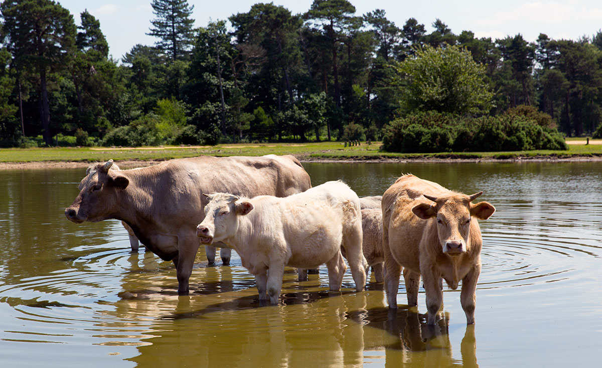
The most dramatic shift will occur in our protein consumption, specifically the move away from industrial livestock. Cattle farming is both a major contributor to greenhouse gas emissions and highly vulnerable to water scarcity. By mid-century, traditional beef and pork will likely become luxury items. In their place, lab-grown meat, insect proteins, and plant-based meat substitutes will become the norm, offering the same nutritional benefit at a fraction of the environmental cost.
Beyond meat alternatives, we can expect to see insects and algae integrated into the mainstream diet. While we turn our noses up to them now, crickets and mealworms are highly efficient protein sources that require minimal land and water. Similarly – seaweeds and microalgae like spirulina will move from health-food niches to primary ingredients, valued for their ability to grow rapidly in saltwater without the need for synthetic fertilizers or freshwater irrigation.
Technology will also personalize our nutrition to combat food insecurity and supply chain instability. With the rise of vertical farming and hydroponics in urban centers, fresh produce will be grown blocks away from where it is consumed, reducing “food miles” and spoilage. We may also see the widespread use of biofortified crops—genetically engineered to contain higher levels of essential vitamins—to compensate for the nutrient density loss currently being observed in plants grown under high CO2 levels.
Ultimately, the diet of 2050 will be defined by diversification and efficiency. The era of relying on a handful of global commodities is coming to an end, replaced by a circular food economy that prioritizes local resilience and low-impact nutrients. While these changes are born of necessity, they offer a path toward a more sustainable relationship with the planet, ensuring that a growing population can be fed sustainably in a warming world.
The concept of eco-nihilism has emerged as a somber byproduct of the modern climate crisis, representing a shift from proactive environmentalism to a philosophy of futility. Unlike traditional environmentalism, which is rooted in the hope of preservation and restoration, eco-nihilism posits that the ecological collapse of the planet is already underway and ultimately irreversible. The growth of this movement is largely fueled by the persistent gap between scientific warnings and political action. This increase in nihilistic environmental beliefs has been driven by several factors:
The “Foregone Conclusion” mindset: Many people, especially Gen Z, view climate catastrophe as inevitable. This leads to a “who cares” or “carpe diem” attitude, where long-term dreams are abandoned in favor of living only for the moment because the future feels “canceled”.
Perceived Futility: Seeing a lack of significant action from governments and corporations can make individual efforts (like recycling or reducing carbon footprints) feel meaningless.
Betrayal Trauma: Psychologists note a sense of “moral injury” or betrayal among youth who feel that older generations and leaders have failed to protect the planet, leading them to lose trust in the world’s underlying order and meaning.
Large-scale studies highlight the depth of this existential distress –
Frightening Future: A landmark 2021 survey of 10,000 young people (ages 16–25) across 10 countries found that 75% believe the future is “frightening”:
Impact on Daily Life: Over 45% of respondents in that same study reported that their feelings about climate change negatively affect their daily functioning.
Choosing Not to Have Children: Nearly 40% of young people globally are hesitant to have children due to climate change.
“Optimism” Nihilism vs. “Doomism”
While “climate doomism” often leads to paralysis and inaction, some adopt a form of Optimistic Nihilism. They accept that the world as they know it might end, but use that realization to lower the pressure of societal expectations and focus on immediate, small-scale kindness and personal joy.
Many climate activists and psychologists warn that nihilism can be a “luxury” or a coping mechanism that leads to compliance with the status quo, whereas “therapeutic hope”—acting as if change is possible—is necessary for mental resilience and actual progress.
Climate change is significantly disrupting global coffee production by altering the specific environmental conditions—mild temperatures and predictable rainfall—that coffee plants require to thrive. These shifts are leading to reduced yields, lower bean quality, and a dramatic decrease in land suitable for cultivation.
Stock photograph of coffee beans provided by Storyblocks
Key Impacts on Coffee Production
Drastic Yield Reductions: Research indicates that for every increase in average air temperature, coffee production can decrease by approximately 14%. Top producers like Brazil, Vietnam, and Colombia have already experienced significant yield losses due to extreme heat and prolonged droughts.
Loss of Suitable Land: Projections suggest that up to 50% of the land currently used for coffee farming could become unproductive by 2050. This is forcing farmers to migrate to higher, cooler elevations, which is often limited by available terrain and can lead to further deforestation.
Accelerated Pest and Disease Spread: Warmer, wetter conditions are expanding the range of devastating threats like coffee leaf rust (a fungus) and the coffee berry borer (a beetle). These pests are now reaching higher altitudes that were previously too cool for them to survive, causing billions in damages.
Declining Bean Quality: Rising temperatures cause coffee cherries to ripen too quickly, resulting in smaller beans with less complex flavor profiles and lower acidity. This particularly threatens the specialty coffee market, which relies on the delicate Arabica variety.
As of early 2026, many American cities face critical threats to their municipal water supplies due to a combination of overdrawn aquifers, shrinking reservoirs, and aging infrastructure. While historically associated with the Southwest, water stress has increasingly impacted the Northeast and Midwest due to infrastructure failures and shifting climate pattern
Here are twenty American cities most threatened by a potential reduction of municipal water supplies:
Phoenix, AZ: Rapid population growth and heavy reliance on the Colorado River, which is facing record-low supply levels.
Las Vegas, NV: Highly dependent on Lake Mead, which has hovered near “dead pool” levels where water can no longer flow downstream.
Los Angeles, CA: Relies on water imported from hundreds of miles away; recent wildfires have also exposed weaknesses in emergency water-flow capacity.
San Antonio, TX: Its primary source, the Edwards Aquifer, is under intense pressure from drought and high demand.
Miami, FL: Faced with “saltwater intrusion,” where rising sea levels push salt water into the freshwater aquifers used for municipal drinking water.
El Paso, TX: Situated in the Chihuahuan Desert with very few local water sources; it is racing to open a large-scale water purification facility in 2026.
Salt Lake City, UT: Threatened by dwindling snowpack and the shrinking of the Great Salt Lake, which affects regional groundwater recharge.
San Diego, CA: Faces chronic drought and heavy reliance on external sources, leading to massive investments in desalination and recycling.
Atlanta, GA: Struggling with aging, century-old pipes that suffer frequent major breaks, leading to multiple citywide states of emergency.
Lincoln, NE: Highly vulnerable to extreme climate swings and drought that impact its regional water table
Chicago, IL: Despite its proximity to Lake Michigan, the city faces significant water loss due to aging infrastructure and stressed inland aquifers.
New York City, NY: Massive demand and future climate pressure, combined with “subsidence” (sinking land), strain its massive tunnel delivery system.
Denver, CO: Declining snowpack in the Rockies has significantly reduced the flow of the rivers the city depends on.
Jackson, MS: Suffered a near-total system collapse due to decades of underfunding and storm damage, leaving residents without safe water for weeks.
San Jose, CA: Dealing with overdrawn aquifers that have led to significant land sinking and infrastructure damage.
Riverside, CA: High population growth and limited local supply have created a narrow margin of water safety.
Corpus Christi, TX: Its reservoirs have reached dangerously low levels, forcing the city to spend hundreds of millions on new groundwater projects.
Santa Fe, NM: A small city with extremely high vulnerability to prolonged drought due to its limited catchment area.
Philadelphia, PA: Faces increasing risk from saltwater moving up the Delaware River, which can contaminate municipal intakes.
Mathis, TX: A critical example of a small municipality where the only water source, Lake Corpus Christi, reached such low levels that intake valves risked drawing sludge.
Western water law must evolve from rigid allocation toward flexible, climate‑smart governance that treats scarcity as the new normal rather than as a temporary emergency. This means rebalancing private rights, public interests, and ecological needs as hydrologic baselines shift.1
First: Prior appropriation’s “first in time, first in right” framework must incorporate stronger rationality and waste limits that reflect hotter, drier conditions, so senior rights cannot indefinitely lock in inefficient or low‑value uses while communities and ecosystems face crisis. Enforcing existing public interest and beneficial use doctrines can gradually reorient supplies toward municipal, tribal, and environmental needs without immediately dismantling the system.2
Second, law must explicitly integrate surface and groundwater, recognizing their physical connectivity and managing them conjunctively rather than independently. This includes permitting and monitoring currently under‑regulated aquifers, tying new pumping to basin‑wide sustainable yield, and curbing withdrawals that quietly undermine river flows and senior rights.3
Third, states need adaptive institutions—water banks, drought reserves, and public or tribal “water trusts”—that can temporarily or permanently acquire rights for critical uses and instream flows. Well‑designed markets and compensated transfers can move water from low‑value irrigation to cities, habitat, and cultural uses while softening political resistance from existing right holders.4
Finally, western water law must better protect ecosystems and vulnerable communities by embedding minimum environmental flows, tribal water security, and rural drinking water reliability into baseline allocation rules, not as afterthoughts. Climate change is making yesterday’s assumptions about snowpack and river yield obsolete, so western water law must become more precautionary, data‑driven, iterative, and able to adjust allocations as science reveals a rapidly changing hydrology.5
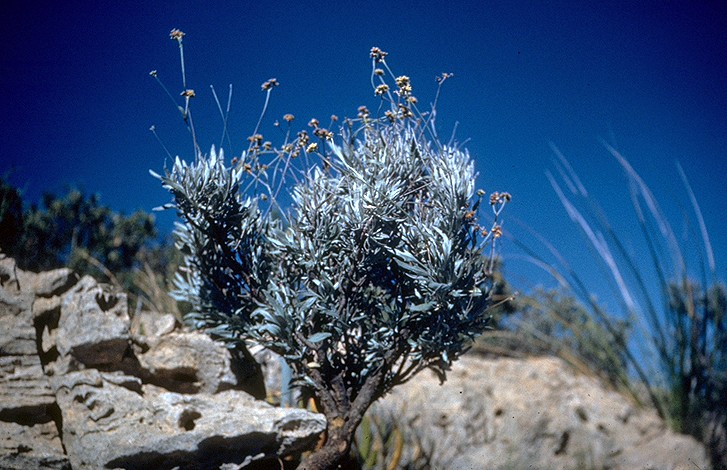
While it looks like a dusty, silver-gray desert shrub, guayule – which originated in Northern Mexico, is essentially a “living rubber factory. As of 2026 the plant gaining serious traction as a potential savior for farmers in the American Southwest—particularly in Arizona and California—who are facing catastrophic cut to their use of Colorado River water.1
Why Guayule may be a “Rescue” Crop
Farmers in the West are in a bind: water intensive crops like alfalfa, corn, and cotton are becoming nearly impossible to grow with dwindling water allotments. Guayule is stepping into that gap for several reasons:
Extreme Water Efficiency: Guayule uses roughly 50% less water than cotton or alfalfa. In Pinal County, Arizona, it’s estimated that switching to guayule could save 15% of the total agricultural water usage.2
Heat & Salt Tolerance: It doesn’t just survive the desert heat; it thrives in it. It can also handle the high-salinity soil that often plagues fields where irrigation water has evaporated over decades.
Domestic Rubber Security: Currently, almost all the world’s natural rubber comes from Hevea trees in Southeast Asia. Guayule provides a domestic, “Made in the USA” source of rubber for tires and medical supplies.3
Hypoallergenic Latex: Unlike traditional rubber, guayule latex lacks the proteins that cause “Type I” latex allergies, making it a premium material for surgical gloves.
The “Catch”
The hurdle isn’t growing the guayule; it’s the infrastructure. Farmers can’t switch overnight because they need specialized processing plants to extract the rubber from the shrub’s bark. However, companies like Bridgestone have been scaling up commercial-grade tire production using guayule, signaling that the supply chain is finally catching up to the climate reality.4
Other Resilient Contenders
While Guayule is the heavy hitter for the Southwest, a few other “underreported” crops are being trialed to rescue Western and Plains farmers in 2026:
Kernza: A perennial grain with 10-foot-deep roots. It doesn’t need to be replanted every year, preventing soil erosion and sequestering massive amounts of carbon.
Teff: An ancient Ethiopian grain that is highly drought-tolerant and serves as a high-value, water-wise forage for horses and livestock.
Amaranth: A “pseudo-cereal” that requires very little water and produces highly nutritious seeds and leaves, often used in health-food markets.
Hemp: Industrial hemp requires significantly less water per kilogram than cotton and other crops. So it can flourish with less irrigation, making it ideal for regions with scarce water resources. Hemp’s deep roots improve soil structure, which aids in water retention and prevents soil erosion and its cultivation helps to minimize agricultural runoff.
In the past two to three years there’ve been important advances both in enteric methane‑reducing feed additives and in manure‑focused technologies, and several options have progressed from the laboratory to commercial use.
What’s new?
3‑NOP (Bovaer): Now the most advanced commercial additive, approved in 60+ countries and marketed in the U.S. by Elanco, with typical methane reductions of about 30% in dairy and beef cattle at very low doses. It works by inhibiting a key enzyme in the rumen’s methanogenesis pathway without harming animal performance1.
Red seaweed and bromoform products: Asparagopsis‑based seaweed supplements can cut enteric methane by over 80–90% in controlled studies, and work is shifting toward purified bromoform or standardized products rather than raw seaweed to control variability and safety. Several pilot trials are underway in Australia, the EU, and the U.S., but broad regulatory approval is still pending2.
Other additives under study: Research programs (e.g., Teagasc, CSU AgNext) are testing oils, grain‑industry by‑products, probiotics, and other inhibitors; some trials in housed cattle report up to 30% methane reduction with no productivity loss, though pasture‑based delivery remains a major challenge3.
Adoption status: A recent technical review notes that methane‑inhibiting feed additives are now the fastest‑emerging enteric solution, with strong private investment but limited on‑farm uptake so far due to cost, regulation, and farmer skepticism4.
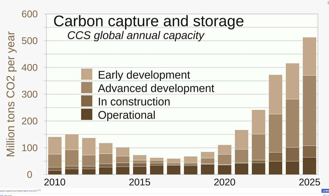
Carbon capture has moved from niche demonstrations to early commercial deployment, with rapid progress in new materials, direct air capture plants, and conversion of CO₂ into products. But unfortunately its high cost and the challenge of upscaling it restricts its large-scale implementation.
Carbon capture, utilization and storage (CCUS) covers technologies that trap CO₂ from large sources (power plants, cement, steel), move it, then either store it underground or use it in products. It complements cutting emissions at the source rather than replacing them; most climate scenarios that hit net‑zero use some CCUS for hard‑to‑abate sectors.
Bar graph of global carbon capture and storage, by RCraig09 – Own work, CC BY-SA 4.0
Main types of capture
Post‑combustion: CO₂ is removed from exhaust gases after fuel is burned, typically using chemical solvents; it is the main option for retrofitting existing plants and factories.
Pre‑combustion: fuel is converted to a mixture of hydrogen and CO₂ before burning, and the CO₂ is separated at high pressure; more common in new industrial or power processes.
Oxy‑fuel combustion: fuel burns in nearly pure oxygen, producing a flue gas that is mostly CO₂ and water, which makes capture easier but requires expensive oxygen production.
Direct air capture (DAC): large fans pull ambient air through filters or solvents that bind CO₂; the captured CO₂ is then concentrated and stored or used.
New materials and efficiency gains
New sorbents such as metal‑organic frameworks (MOFs) act like highly porous “sponges” for CO₂ and have enabled lab systems that reach around 99% capture while cutting energy use versus traditional solvents. Recent MOF‑based systems report about a 17% reduction in energy requirements and roughly 19% lower operating costs compared with older capture setups, mainly by improving how CO₂ is adsorbed and released. Solid sorbents and adsorption processes are gaining patent share as industry shifts away from classic liquid amine systems that have higher energy penalties.
Nanotechnology is a hot area: experimental nanomaterials and membranes promise lower‑pressure, lower‑energy capture, and one new nanofiltration membrane platform has been reported to make certain carbon capture steps several times more efficient and up to about 30% cheaper.
Where the captured CO₂ goes
Geological storage: CO₂ is compressed and injected deep underground into depleted oil and gas reservoirs or saline formations, where it is intended to remain trapped for centuries or longer.
Utilization: captured CO₂ can be used to make synthetic fuels, chemicals, and building materials, or for enhanced oil recovery; there is growing focus on converting CO₂ electrochemically into carbon monoxide, methane, or other feedstocks using renewable electricity.
Emerging processes link capture directly with conversion (for example, “power‑to‑gas” that turns CO₂ and hydrogen into methane), offering energy storage and product value but still facing efficiency and cost hurdles.
2026: the Promise vs. the Reality
Activity is accelerating: patent analyses show strong growth in CCUS and DAC, with particular emphasis on new materials, electrochemical processes, and better heat and mass‑transfer engineering to cut costs. Direct air capture is operating at small but growing scales; it attracts attention because it can reduce atmospheric CO₂ directly, but it remains energy‑intensive and expensive per ton compared with capturing from large point sources.
Policy incentives, such as tax credits and industrial decarbonization mandates, are driving more projects in heavy industry, especially in countries like the United States and Canada. But key concerns remain: high capital and operating costs, the need for extensive CO₂ transport and storage infrastructure, and uncertainties about the integrity of long-term storage.
As the American West gets hotter, farmers will need more water to irrigate the same amount of crops1. More water will also be required to cool the generators that will supply energy to an ever-increasing number of air conditioning systems in hundreds of thousands of homes and businesses2.
Why hotter air means thirstier crops
Warmer air has a higher vapor pressure deficit, so it “pulls” more moisture out of soil and plant leaves, increasing evapotranspiration. This means that to get the same crop yield, farmers must apply more water per acre because a larger fraction of applied water is lost to the atmosphere rather than staying in the root zone.
Earlier snowmelt and reduced snowpack in Western mountains expose soils sooner to heat and sun, drying them out faster and further increasing irrigation needs. The same corn field will need more irrigation in 2050 than it did in 1980 just to achieve the same yield, because the atmosphere is “thirstier.”
Why hotter days use more electricity
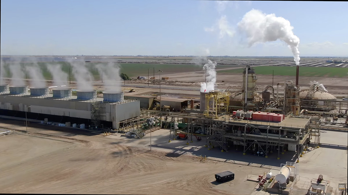
Steam rising from cooling towers at the CalEnergy JM Leathers Geothermal Plant at California’s Salton Sea. Photo by Robert Marcos
Higher temperatures drive up electricity demand because homes, offices, and industry run air conditioners and refrigeration harder and for longer periods. Much of that electricity still comes from thermoelectric power plants (coal, gas, nuclear) that use large volumes of freshwater for cooling, either withdrawing it and returning it warmer or consuming a portion through evaporation3.
As air and water warm, these plants run less efficiently and may need even more cooling water per unit of electricity generated, increasing water use just when rivers and reservoirs are under stress. In very hot, dry years, this can create a feedback: heat raises AC demand, AC demand raises power plant water demand, low flows and high water temperatures then constrain power plants, risking reliability problems4.
Warming reduces the share of precipitation that reaches reservoirs and aquifers: more evaporates or is soaked up by drier soils before it becomes runoff. Western water systems and legal allocations were designed assuming a more stable climate and more reliable snowpack; under warming, those assumptions are breaking down, reducing dependable supplies for both farms and power plants. The result is a tightening water budget: less water coming into the system at the same time that crops, cities, and energy systems are all asking for more.
Nations around the world are restoring their over-taxed river systems by establishing basin‑wide flow targets, by reserving large quantities of water to maintain riverine environments, by making major cuts in consumptive use, and by removing man-made infrastructure that impeded the natural flow of water.
Australia’s response to the “Millennium Drought” is often cited as a blueprint for the recovery of America’s Colorado River. The Water Act 2007 was Australia’s primary federal legislation for managing the Murray–Darling Basin. Enacted during the Millennium Drought, it shifted water management from a state-by-state approach to a centralized federal framework to ensure long-term water security and environmental sustainability.
Australia’s Water Act 2007 included –
Water Buybacks: The government spent billions to “buy back” water entitlements from willing farmers to return them to the environment, thereby restoring river health.
Water Markets: Australia pioneered “unbundling” water from land, allowing it to be traded as a commodity. This incentivized a shift from low-value, water-heavy crops like rice to high-value ones like almonds.
Legal and remedial reforms: Basin‑wide laws or plans that set enforceable extraction limits and prioritize maintaining minimum environmental flows. Explicit recognition of ecological flow requirements in allocation agreements, sometimes including reserved environmental flow shares in international draft treaties.
Reducing consumptive use: Cutting irrigation diversions and changing crop patterns or technologies so that more water remains in the channel, as highlighted for the Baaka‑Darling. Using pricing, buy‑backs of water rights, and efficiency programs to retire or shrink high‑impact uses while compensating users.
Restoring environmental flows and re‑operating infrastructure. Dedicating a defined volume of water each year as environmental water and delivering it strategically to key river reaches and wetlands.
Re‑operating reservoir cascades to mimic aspects of natural flow regimes (e.g., Yellow River WSRS using coordinated reservoir releases and artificial flood waves for sediment and flow objectives).
Ecological and land‑use restoration: Large‑scale re‑vegetation and land‑use change in upper basins to reduce erosion, improve infiltration, and stabilize hydrology. Floodplain, marsh, and wetland restoration to increase “sponge” capacity, store water during high flows, and sustain baseflows, as in Rhine marsh and broader European river projects.
Infrastructure removal and nature‑based solutions: Removing or modifying barriers (small and large dams, weirs) to reconnect fragmented river sections, restore sediment and fish passage, and improve overall river health; the EU has set a goal to reconnect 25,000 km of rivers by 2030 through such measures.
Implementing local, low‑tech retention structures (e.g., “beaver dams”), to enhance groundwater recharge, moderate extremes, and empower community‑based management.
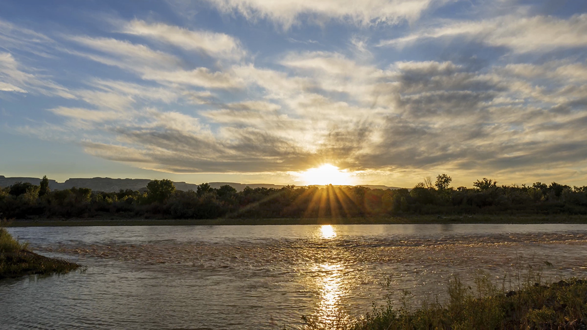
The Colorado River passing Grand Junction, Colorado. Photo by Robert Marcos.
The summer-like heat in the American West is being caused by a combination of persistent high‑pressure systems, long‑term warming from climate change, and an ever-worsening drought.1
The main condition behind the current weather is the development of strong, stagnant high‑pressure ridges, often called “heat domes,” over the western United States. In these patterns, air sinks over the region, compresses, and warms (adiabatic warming), while clear skies allow intense solar heating of the surface. Because the high pressure suppresses cloud formation and storm systems, the hot air remains parked in place for days or weeks, letting temperatures climb far above normal.2
These weather patterns are occurring on top of a background of human‑driven climate warming, which raises the baseline temperature so that heat waves start from a hotter average and break records more easily. Studies of recent western and Pacific Northwest heat waves show that such extremes would have been virtually impossible, or far less intense, without anthropogenic greenhouse gas emissions. Warmer air also increases “evaporative demand,” meaning the atmosphere pulls more moisture from soils, vegetation, and water bodies, further drying the landscape.3
At the same time, much of the West has been in a long‑running drought or “megadrought,” with declining rain and snowpack, especially in the Southwest and Colorado River basin. Low snowpack and early melt remove a natural cooling reservoir, so land surfaces heat up faster and earlier in the warm season. With drier soils and sparse vegetation, more of the sun’s energy goes directly into raising air temperature rather than evaporating water, amplifying surface heat and extending fire season.4
Finally, ocean–atmosphere patterns over the Pacific, such as persistent ridging and a positive phase of broader circulation patterns, help steer and reinforce these high‑pressure systems over the West in summer. Together, these intertwined conditions—blocking high pressure, climate‑driven warming, deepening drought, and altered atmospheric circulation—have produced the unusually intense and frequent summertime heat now characterizing the American West.5
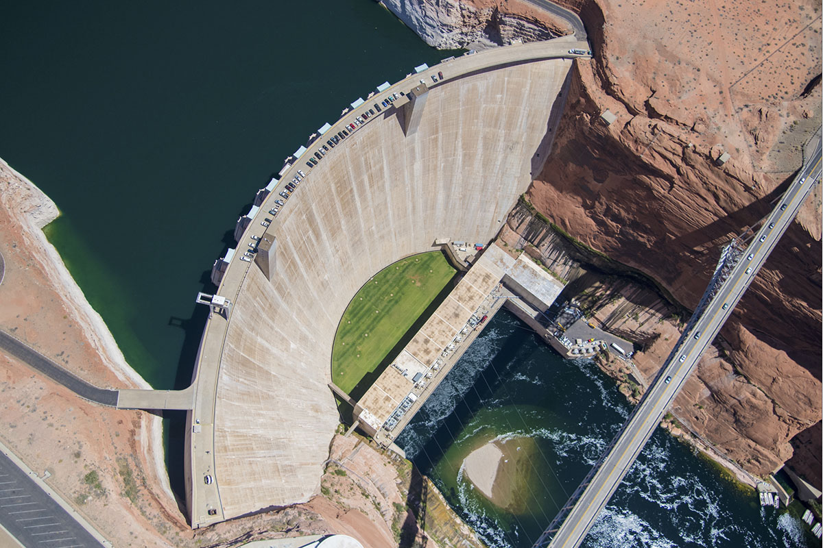
Photo of South Lake Powell and Glen Canyon Dam provided by The Water Desk. Photo by Alexander Heilner. Aerial support from LightHawk
by Robert Marcos
The electrical power that’s being produced by new wind and solar farms cannot fully replace the power being lost as the output of the Glen Canyon Powerplant continues to fall.
As of March 11, 2026, the Powerplant is producing only 60% to 65% of its maximum output. At full capacity the plant can produce 1,320 megawatts. But because of Lake Powell’s low water level it’s currently producing between 800 and 870 megawatts. While new wind and solar power will cushion the impact of Glen Canyon’s decline, the hydroelectric power is a critical component of the regional power grid. Electricity from the Glen Canyon Powerplant is operationally superior to wind and solar mainly because it is dispatchable, highly flexible, and provides critical grid‑stability services that variable renewables cannot provide on their own.
Dispatchability and reliability
Glen Canyon can generate on demand, ramping output up or down quickly to follow load; flows and generation are deliberately increased during weekday business hours to match demand.
Hydropower at Glen Canyon is not dependent on real‑time sun or wind conditions, so it can produce power at night, during calm periods, and in cloudy weather, as long as water is available in Lake Powell.
The plant provides both energy and dependable capacity for resource adequacy, which is essential during extreme heat waves and other system‑stress events when solar and wind output may not align with peak demand. Flexibility and ramping
Glen Canyon is explicitly operated for load following: its turbines adjust automatic generation control signals to continuously balance supply and demand, so actual output can be above or below the hourly schedule at any moment. The dam is allowed to fluctuate releases to provide about 40 MW of regulation capacity, with short‑lived flow changes of roughly 1,200 cfs up or down that help stabilize the grid against second‑to‑second and minute‑to‑minute imbalances.
Turbines can ramp thousands of cubic feet per second within an hour (subject to environmental constraints), providing fast ramping that complements slower, weather‑dependent changes in wind and solar output. Grid‑stability and system services
Conventional hydropower units like those at Glen Canyon provide inertia, frequency regulation, spinning reserve, voltage support, and black‑start capability, all of which are necessary to keep the system stable as variable renewables grow.
These services are inherently available from large synchronous hydro generators without needing extensive additional power‑electronics‑based equipment that wind and solar typically require for similar functions. Glen Canyon’s participation in automatic generation control helps maintain area control error near zero, directly supporting system frequency and reliability. Scale, efficiency, and cost characteristics
Glen Canyon has a total capacity on the order of 1,300 MW and produces roughly 4–5 billion kWh per year, enough for hundreds of thousands of households across seven Western states.
Modern hydro units have high conversion efficiency and very long lifetimes (often 50–100 years), which spreads capital costs over decades and yields low long‑run levelized cost of electricity compared with many newer wind and solar plus storage builds.
Revenues from Glen Canyon hydropower also fund environmental and river‑management programs in Glen and Grand Canyons, a co‑benefit not typically associated with individual wind or solar plants.
Even though the San Diego County Water Authority’s MOU has proposed an initial water transfer of only 10,000 acre feet annually, General Manager Dan Denham said the agreement, (if approved by other agencies), could clear the way for the first-ever interstate transfers of Colorado River water starting next year. Denham said, “It’s just a different way of managing water in the West”.1
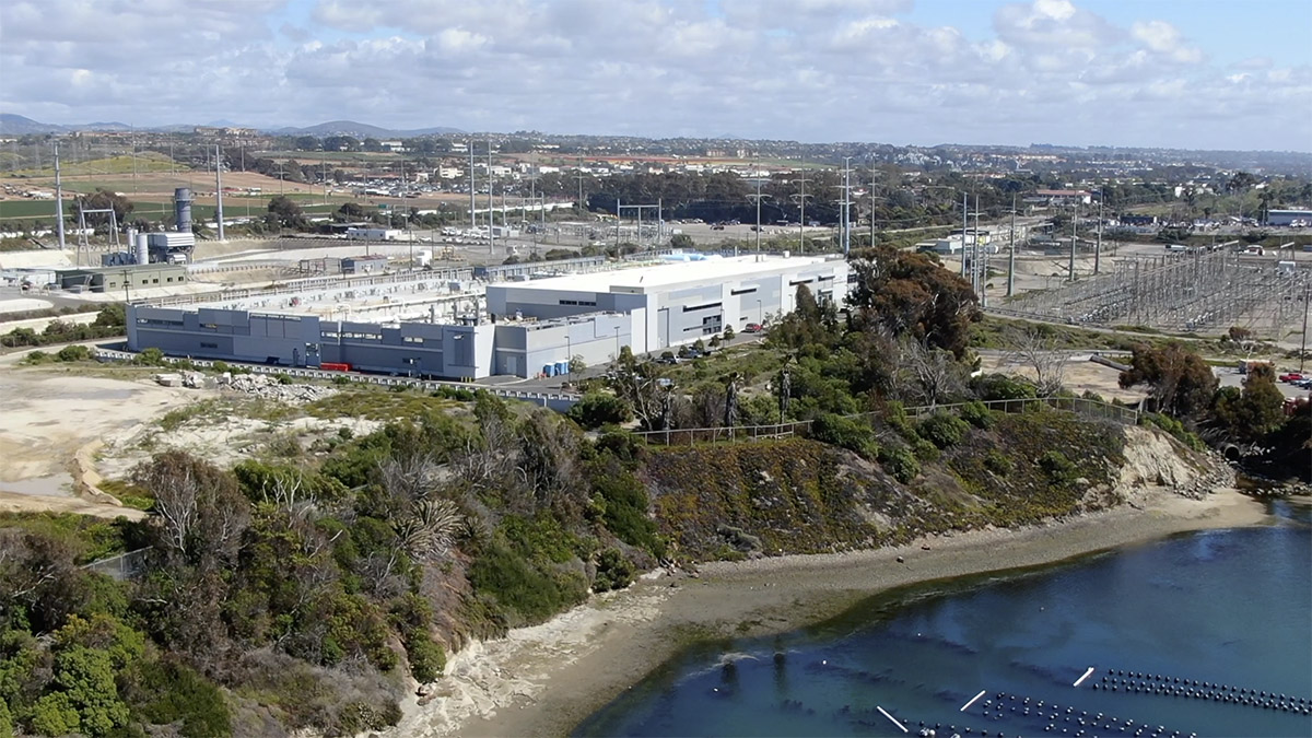
The Claude “Bud” Lewis Desalination Plant in Carlsbad, California. Photo by Robert Marcos
California Govenor Gavin Newsom has supported the idea, telling governors of the other six states in a recent letter that California would welcome joint investments in water recycling and desalination. Denham said Scott Cameron – the Trump administration’s acting head of the U.S. Bureau of Reclamation, also supports the idea.2
The laws which forbid or limit the transfer of water across state or county lines originated in the early 20th century as states sought to protect their local resources from being diverted to rapidly growing urban centers. The Colorado River Compact of 1922 was a landmark agreement that effectively “locked” water within specific basins to prevent faster-growing states like California from claiming the entire river under the “prior appropriation” (first-come, first-served) doctrine.
But the San Diego County Water Authority, Arizona Department of Water Resources, the Central Arizona Water Conservation District, and the Southern Nevada Water Authority, are exploring a strategy that could bypass these legal barriers to interstate water transfers by using “paper water” transfers rather than physically moving desalinated water across state lines.3
While this method avoids the physical impossibility of moving ocean water to the desert, it still requires federal approval from the U.S. Bureau of Reclamation, and from existing rights holders like the Imperial Irrigation District and the Metropolitan Water District which will have to ensure that these transfers do not negatively impact their own legal entitlements.
The San Diego County Water Authority’s Board of Directors today unanimously approved a landmark agreement to explore an interstate water transfer and exchange pilot program with the U.S. Bureau of Reclamation, the Metropolitan Water District of Southern California, and agencies in Nevada and Arizona.,
The memorandum of understanding (MOU) – which still needs to be ratified by the other agencies – creates a pathway that could eventually allow the Water Authority to “move” water from the nation’s largest seawater desalination plant in Carlsbad to areas in the drought-ravaged Colorado River Basin that need more water. If successfully developed, this would create the first program to transfer water across state lines within the basin.
Such a program could help reduce water costs for working families in San Diego County by optimizing the region’s investments in reliability. Water purchases from the Claude “Bud” Lewis Carlsbad Desalination Plant would generate new revenues and offset costs for residents, improving regional water affordability.
“This agreement could be a gamechanger for San Diego County and the entire Southwest because it creates the possibility of a new, collaborative path for moving water where it’s needed most while keeping reliability and affordability at the center for ratepayers,” said Water Authority Board Chair Nick Serrano. “Leveraging existing resources like our Carlsbad desalination plant in this moment simply makes sense for everyone.”
Water transfers or exchanges would occur “on paper,” meaning agencies would access supplies through existing infrastructure and avoid costly new infrastructure.
The demand is clear: In recent years, agencies in Arizona and Nevada have sought ways to tap the Pacific Ocean, but the costs of construction are prohibitive. The Arizona Department of Water Resources, Central Arizona Water Conservation District and Southern Nevada Water Authority are part of the new MOU.
For more than 20 years, the seven states in the Colorado River Basin have wrestled with drought conditions that have created growing imbalances between water supplies and demands. As the Bureau of Reclamation, Basin States, Mexico, and tribal nations consider new operating guidelines for the river, new management strategies and interstate partnerships are increasingly critical.
Over roughly the same period, the Water Authority has invested $3 billion in water reliability efforts, including the Carlsbad plant, which produces up to 54 million gallons per day. Additionally, the 2003 Colorado River Quantification Settlement Agreement – which generates conserved water in the Imperial Valley – and hard-wired conservation in the San Diego region have positioned the Water Authority to not only meet the region’s needs but also provide relief to other areas.
“Next-generation strategies must include interstate partnerships that deliver water where it’s needed most,” said Water Authority General Manager Dan Denham. “We appreciate the collaboration with the Bureau of Reclamation, Metropolitan Water District, Arizona and Nevada. New ideas are challenging to implement, but it’s in everyone’s best interest to make this work.”
Climate change is altering the chemical makeup of rainfall. It’s increased the concentration of dissolved carbon dioxide which makes rainfall more acidic1. At the same time it has shifted the levels of atmospheric pollutants that wash out when it rains. This changing chemistry is a problem because it alters how water interacts with soils, plants, aquatic systems, infrastructure, and even the atmosphere itself. Increased acidity in rainfall acts as a chemical catalyst that destabilizes both terrestrial and aquatic environments through the following mechanisms2
Nutrient Leaching: Acidic rain strips the soil of essential buffering minerals and nutrients—such as calcium, magnesium, and potassium—which are vital for plant cell structure and growth.
Heavy Metal Mobilization: As soil pH drops, naturally occurring but normally stable metals like aluminum become soluble. This “mobile” aluminum is toxic to plants, damaging root systems and preventing them from absorbing water.
Microbial Disruption: Many beneficial soil bacteria and fungi are sensitive to pH changes. Increased acidity can suppress the microbial activity responsible for decomposition and nitrogen fixation, ultimately reducing soil fertility.
Biological Stress and Mortality: Many aquatic species have narrow tolerance ranges. At a pH of 5.0, most fish eggs cannot hatch, and lower levels can lead to the death of adult fish, amphibians, and insects like mayflies.
Gill Damage: Soluble aluminum leached from nearby soil enters waterways and clogs the gills of fish. This impairs their osmoregulation and ability to breathe, often serving as the primary cause of fish kills in acidified lakes.
Food Web Collapse: The loss of acid-sensitive “base” species, such as certain plankton and invertebrates, triggers a cascade effect that starves larger predators and simplifies the entire ecosystem.
Effects on Agricultural Production
The chemical and physical shifts in rainfall are fundamentally destabilizing the economic foundations of global food systems3.
Declining Crop Productivity: For every 1°C of warming, global yields of major staples are projected to decline significantly: maize by 7.4%, wheat by 6.0%, and rice by 3.2%.
Nutritional Degradation: Increased atmospheric and altered soil chemistry reduce the concentrations of protein and essential minerals like zinc and iron in crops like wheat and soybeans.
Increased Costs: Farmers must spend more on lime to neutralize soil acidity and additional fertilizers to replace leached nutrients like calcium and magnesium.
Direct Foliar Damage: Acidic rain erodes the waxy cuticle of leaves, making plants more vulnerable to dehydration, pests, and diseases.
Impacts on Commercial Fishing
Marine fisheries and seafood industries, which supported $319 billion in sales in 2023, face major disruptions as fish stocks move toward cooler poles or become less productive4.
Catch Potential Losses: Tropical regions are predicted to see declines of up to 40% in potential seafood catch by 2050 due to warming and acidification.
Shellfish Vulnerability: Ocean and coastal acidification (exacerbated by acidic runoff) hinder calcification, weakening the shells of oysters, clams, and scallops. This is estimated to cause consumer losses of $480 million per year by the end of the century.
Ecosystem Collapse: Acidified freshwater and marine environments disrupt reproductive cycles; for instance, at a pH of 5, most fish eggs cannot hatch, leading to the collapse of local populations and the industries that rely on them.
Impacts on Water Infrastructure
More acidic rainfall significantly deteriorates water infrastructure by accelerating the chemical breakdown of both metallic and cement-based materials. When rainwater’s pH drops—oftenhttps://www.gov.nl.ca/eccc/files/waterres-reports-drinking-water-study-on-ph-adjustment-systems-task-7-study-report.pdf due to sulfuric and nitric acids—it becomes highly corrosive, leading to structural damage and water quality issues. Acidic water targets the internal and external surfaces of the pipes that transport water.5
Chemical Dissolution: Acidic rain reacts with the calcium carbonate and calcium hydroxide in concrete, dissolving these components and leaving the structure porous and weak.
Structural Failure: As the concrete matrix dissolves, the protective layer around steel reinforcements (rebar) can fail. Corroding steel expands up to six times its size, creating internal pressure that cracks the surrounding concrete.
Surface Erosion: Prolonged exposure causes surface “spalling” or peeling, exposing coarse aggregates and increasing maintenance costs for bridges, dams, and treatment basins.
Challenges for Water Treatment
Water treatment facilities must expend more resources to manage increasingly acidic sources of water.
Increased Neutralization Costs: Facilities must add more alkaline substances, such as caustic soda or soda ash, to raise the pH to a non-corrosive range (typically 6.5 to 8.5).
Disinfection Interference: Efficient chlorination is more difficult in water that is too acidic or too basic, potentially requiring higher chemical doses to ensure safety.
Contaminant Mobilization: Acid rain leaches aluminum and other minerals from the surrounding soil into reservoirs, requiring more complex filtration to remove these additional contaminants.6
For decades people believed that the Anasazi, (later renamed the Ancestral Puebloans), had vanished suddenly and under mysterious circumstances. But over the years a host of scientific disciplines has produced evidence that has largely resolved that mystery. Scientists shifted from viewing the Ancestral Puebloans’ departure as a “mysterious disappearance” to a deliberate migration triggered by a combination of environmental and social factors.
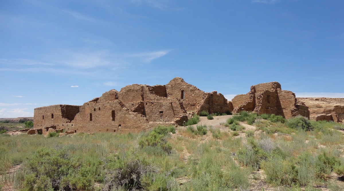
The Ancestral Puebloan great house, Pueblo del Arroyo, in Chaco Culture National Historical Park, New Mexico. Photo by Rationalobserver.
Types of evidence produced by recent studies
Prolonged megadroughts like the “Great Drought” (1276–1299) coincide with widespread abandonment of large Four Corners settlements and severe maize shortfalls.1
Tree rings and other proxies show multi‑year to multi‑decadal droughts during the broader Medieval Climate Anomaly (roughly AD 800–1300).2
Environmental degradation including deforestation and topsoil erosion around major centers like Chaco and Mesa Verde, reducing fuel and soil productivity.3
Deer bones decline and turkey bones increase after about AD 1150, suggesting overhunting of wild game and heavier reliance on domestic turkeys that competed with people for maize.4
Hydrologic stress and extreme variability: Ancestral Puebloan societies were highly dependent on winter snowpack and limited runoff; summer rains were unreliable and often arrived as intense, erosive storms.In earlier droughts (AD 150–950), people were already resorting to melting cave ice for drinking water, indicating that marginal sources became critical during dry spells.5
Climate stress resulted in conflict, and the migration of Numic‑speaking groups onto the Colorado Plateau, and rapid changes in religious and political systems.6
Crop failures undermined rain‑making rituals and institutions, social cohesion and the legitimacy of leadership likely eroded, encouraging relocation.7
In short, highly climate‑sensitive dry land agriculture, local deforestation and soil loss, and repeated multi‑year droughts combined with social pressures, all combined to make life untenable in the Mesa Verde and Chaco Canyon regions.8
Conditions in today’s American Southwest are strikingly similar.
The environmental conditions in today’s American Southwest continue to be characterized by a high-desert environment, which is defined by extreme aridity, and unpredictable precipitation patterns. In many ways this mirrors the volatile climate that challenged the Ancestral Puebloans. Much like the late 13th century—a period marked by the infamous “Great Drought”—the modern region experiences significant moisture deficits and high evaporation rates.
Farmers today contend with a bimodal precipitation cycle: winter snowpack provides the primary source of groundwater and spring runoff, while intense, localized monsoon storms in late summer offer brief but erosive bursts of rain. These erratic shifts between prolonged dry spells and sudden deluges force a reliance on micro-climates and elevation-specific planting, as the short growing season is often bracketed by late spring frosts and early autumn freezes.
Soil conditions that consist largely of alkaline, nutrient-poor substrates, are highly susceptible to erosion. In areas like the Colorado Plateau, the soil is often a mixture of sandy loams and heavy clays that lack the organic matter found in more temperate zones. These soils are prone to crusting and salinity buildup, which can inhibit seedling emergence and water infiltration.
Just as the Ancestral Puebloans utilized check dams and lithic mulching (using stones to preserve soil moisture), modern land managers must navigate these “thin” soils that offer little buffer against environmental stress. The persistence of lithic soils and wind-blown loess ensures that any successful cultivation requires sophisticated water-harvesting techniques to prevent the precious topsoil from being stripped away by the elements.
Devices that collect water from the air are generally called atmospheric water harvesters or atmospheric water generators. None of these actually create water, they just phase‑change or capture water that’s already in the atmosphere.
Why is this pertinent? As most of the Earth’s land areas dry out, our warming atmosphere is holding on to ever-increasing amounts of water vapor. The Lawrence Livermore National Laboratory reported that in 2024 the Earth’s atmosphere held almost 5% more water vapor than the average recorded between 1991–2020.
Here are the four basic types of Atmospheric Water Harvesters –
Condensation-based systems cool air below its dew point using refrigeration or heat‑pump cycles so water vapor condenses into liquid on cold coils. Theses are essentially dehumidifiers optimized for producing potable water.
Desiccant-based systems use hygroscopic materials (desiccants) such as salts or silica gel that absorb moisture from air, which are then are heated to release liquid water for collection.
Adsorption based systems use porous materials like hydrogels or metal–organic frameworks that adsorb water vapor at night or when cool, then release it when warmed by the sun or low‑grade heat, with the vapor condensed on nearby surfaces.
Fog and dew collectors are passive devices thatuse meshes or netted surfaces which collect fog droplets which collect then drain into gutters and tanks.
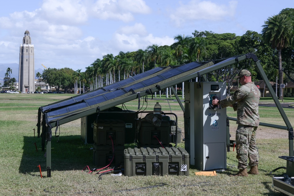
DARPA, the U.S.Army Research Lab, the Marine Corps, Air Force, and special operations units have all experimented with AWG technologies for desert and emergency conditions, most often at bases in the Middle East and on the African continent. The U.S. Army is actively testing and piloting atmospheric water generators (AWGs), but as of early 2026 they appear in research, demonstration, and limited field trials rather than as a fully standard, widely deployed water source for all soldiers.
Currently the U.S. Army Engineer Research and Development Center (ERDC) has signed multiple Cooperative Research and Development Agreements with companies such as Genesis Systems and AirJoule to develop fuel‑efficient, truck‑ or ATV‑mounted AWGs that can provide potable water at the point of need in austere environments. Genesis Systems’ WaterCube units have been “operationally fielded and commercially available,” and an Army–Genesis CRADA is specifically aimed at adapting this platform for mobile military use in field operations. Public descriptions of these efforts emphasize potential use to reduce water convoys and support future warfighters, which indicates a transition and experimentation phase rather than full-scale permanent deployment across the force.
Genesis Systems WaterCube is a ruggedized atmospheric water generation system designed for military and government use.
Water From Air is a non-profit organization that’s specifically focused on distributing atmospheric water generators in schools, villages, and water-stressed regions primarily located in East Africa and India. Their units produce clean drinking water directly from humidity in the air, bypassing the need for wells, pipes, or rainfall. Each installed unit typically provides between 200 and 400 liters of clean drinking water daily, supporting approximately 200–400 people.
More non-profits which provide clean drinking water to disadvantaged communities –
The Moses West Foundation A non-profit that deploys large-scale AWG systems during disaster relief efforts and in water-stressed areas globally, including Africa.
Innovation: Africa While primarily focused on solar-powered pumped water from aquifers, they specialize in delivering Israeli-developed water technologies to remote African villages.
Majik Water: A Kenyan-based social enterprise (start-up) that uses AWG technology to provide more than 200,000 liters of water monthly to arid regions in Kenya.
One Drop Foundation seeks sustainable access to safe water, sanitation, and hygiene for the world’s most vulnerable communities. The foundation distinguishes itself through a unique approach called Social Art for Behavior Change™, which uses art and creativity to inspire communities to adopt healthy water-related habits and take ownership of their local infrastructure.
Stratospheric aerosol injection, (SAI), is a theoretical solar geoengineering proposal that involves dispersing sulfate (or other reflective particles) into the stratosphere to reflect a portion of incoming sunlight back into space. Research into delivery methods focuses on platforms capable of reaching the stratosphere, which begins at varying altitudes depending on the latitude. Proposals range from spraying reflective particles, such as sulfur dioxides, finely powdered salt or calcium carbonate, from aircraft or high-flying balloons. None of these solar geo-engineering strategies address the underlying causes of climate change. Instead, they aim to control the amount of incoming solar radiation by emulating the sulfur-rich dust cloud that remains in the atmosphere after large volcanic eruptions.1
Proof of Concept provided by Mt. Pinatubo
The 1991 eruption of Mount Pinatubo injected approximately 17 million tons of sulfur dioxide into the stratosphere, creating a global layer of sulfuric acid haze that significantly increased the Earth’s albedo. This aerosol veil reflected incoming solar radiation back into space, resulting in a measurable drop in global mean temperatures of approximately 0.5°C (0.9°F) between 1992 and 1993. This transient cooling effect temporarily offset the trend of anthropogenic global warming and disrupted global precipitation patterns, demonstrating the profound impact that volcanic stratospheric aerosols can have on the Earth’s energy balance.2
According to one study, by sending specially designed high-altitude airplanes on roughly 4,000 total sulfate injection missions a year, humans could replicate this same level of cooling. This has the potential to offset half of the warming expected over the study’s 15-year period and counteract billions of metric tons of CO2 emissions each year. At a cost of around $2 billion annually, even medium-sized economies could afford such a program. This price tag would also be far less expensive than the potential impacts of climate change. Take the United States: the 2018 US National Climate Assessment Report estimates the impacts of climate change damages will amount to “hundreds of billions of dollars annually” by 2090, making atmospheric sulfate injection an appealing solution.3
Aerial platforms under consideration
Large commercial or military transport aircraft: These could potentially be retrofitted with specialized tanks and nozzle systems. However, most standard aircraft have flight ceilings that only reach the lower stratosphere, particularly near the poles.
Specialized Research Planes: Aircraft designed for high-altitude atmospheric research, such as those used by space agencies, can reach the higher altitudes (around 20 km) often cited as optimal for SAI. These generally have limited payload capacities.
Purpose-Built High-Altitude Jets: Many researchers suggest that a new class of specialized aircraft would be necessary for efficient, large-scale delivery. These designs would require high-lift wings and engines capable of sustained operation in thin air while carrying heavy payloads of aerosol precursors.
High-Altitude Balloons: Tethered or free-floating balloons have been proposed as a lower-cost method to loft materials into the stratosphere, though they face challenges related to stability and large-scale operational control.4
Potential benefits
Rapid Global Cooling: SAI can lower global average temperatures much faster than carbon removal methods. Historical volcanic eruptions, like Mount Pinatubo in 1991, have proven that atmospheric sulfur can cool the planet by roughly 0.5°C within a year.
Cost-Effectiveness: Compared to the trillions needed for a full green energy transition, SAI is estimated to cost between $18 billion and $27 billion per year using modified aircraft.
Life-Saving Potential: Some studies suggest SAI could save up to 400,000 lives annually by reducing heat-related mortality in the world’s hottest regions.
Glacial Preservation: By lowering surface temperatures, it could slow sea-level rise and prevent the melting of land-based glaciers and sea ice.
Reversibility: Unlike permanent carbon storage, SAI effects are temporary; if stopped, the aerosols naturally fall out of the atmosphere within 1–2 years.5
Potential risks
Termination Shock: If SAI is suddenly stopped (due to war, terrorism, or political collapse) while greenhouse gases are still high, the planet would experience a catastrophic and rapid temperature spike.
Ozone Depletion: Injecting sulfates can damage the stratospheric ozone layer, increasing harmful UV radiation and risks of skin cancer.
Disrupted Weather Patterns: Models indicate it could cause regional droughts, specifically by weakening the South Asian monsoon and reducing tropical rainfall.
Ocean Acidification: SAI only masks temperature; it does not reduce CO2 levels. The oceans would continue to absorb carbon, leading to acidification that destroys coral reefs and marine life.
Moral Hazard: The availability of a “quick fix” might reduce the political and corporate incentive to actually cut greenhouse gas emissions.
Geopolitical Conflict: There is no international governance for SAI. A single country could “control the thermostat,” potentially leading to global conflict if their actions cause weather disasters elsewhere.
Ecological Impacts: Reduced direct sunlight could decrease crop yields and interfere with solar power generation.6
While climate change and the general lack of precipitation are the most obvious causes of the aridification of the American West, there are other factors taking place in the background that are contributing to this process.
The ever-expanding southwestern shoreline of Utah’s Great Salt Lake. Photo credit: Robert Marcos
Dust on Snow: Windblown dust from disturbed desert soils and dry lake beds—such as the Great Salt Lake—settles on mountain snowpacks. This “dark topcoat” reduces reflectivity (albedo), causing snow to absorb more solar heat and melt up to three to seven weeks earlier than clean snow. This premature runoff often reaches reservoirs when they are already full or when the ground is still too frozen for agricultural use, effectively wasting the “natural reservoir” of the snowpack.1
Vapor Pressure Deficit (VPD): Often described as the “thirst of the atmosphere,” VPD measures the difference between the moisture in the air and how much it can hold. Higher temperatures exponentially increase this demand, sucking moisture directly out of soils and plants even when precipitation levels are normal. In recent years, this “atmospheric thirst” has accounted for roughly 61% of drought severity, outweighing the impact of reduced rainfall.2
Pacific Decadal Oscillation Stagnation: The “PDO” is a long-term ocean temperature pattern that typically flips every 20 years. Since the 1990s, it has remained stuck in a “negative phase,” which brings cooler water to the eastern Pacific and pushes moisture-bearing storms farther north, away from the Southwest. Recent research suggests this prolonged “stuck” phase may be driven by human-caused aerosol and greenhouse gas emissions.3
Soil and Vegetation Feedbacks: Aridification creates a self-reinforcing cycle. As soils dry out, they lose the cooling effect of evaporation, causing solar radiation to heat the ground and the air even further. Additionally, while higher CO2 levels can make plants more water-efficient, this gain is often offset by longer growing seasons and increased plant growth, which ultimately draws more total moisture from the soil through transpiration.4
Land Use and Soil Degradation: Intensive land uses, including livestock grazing and urbanization, remove protective vegetation and destabilize soil. This not only increases wind erosion (leading to more dust-on-snow events) but also reduces the soil’s ability to absorb and retain what little moisture does fall, intensifying the “baking” of the landscape.5
Invasive plants: Cheatgrass, tamarisk, and Russian olive are invasive plants most often named as contributors to the aridification of the American West. Cheatgrass transforms diverse, deep‑rooted native shrub–grass communities into shallow‑rooted, flammable annual monocultures that dry and senesce early, it depletes shallow soil moisture sooner in the growing season, and dramatically increases fire frequency. It creates a cheatgrass–wildfire feedback loop that repeatedly removes perennial vegetation, reduces soil organic matter and carbon storage, accelerates erosion, and leaves soils warmer, drier, and less able to retain water, so landscapes lose both plant cover and hydrologic function and effectively behave more like a hotter, drier, impoverished system even when long‑term precipitation totals have not changed.6
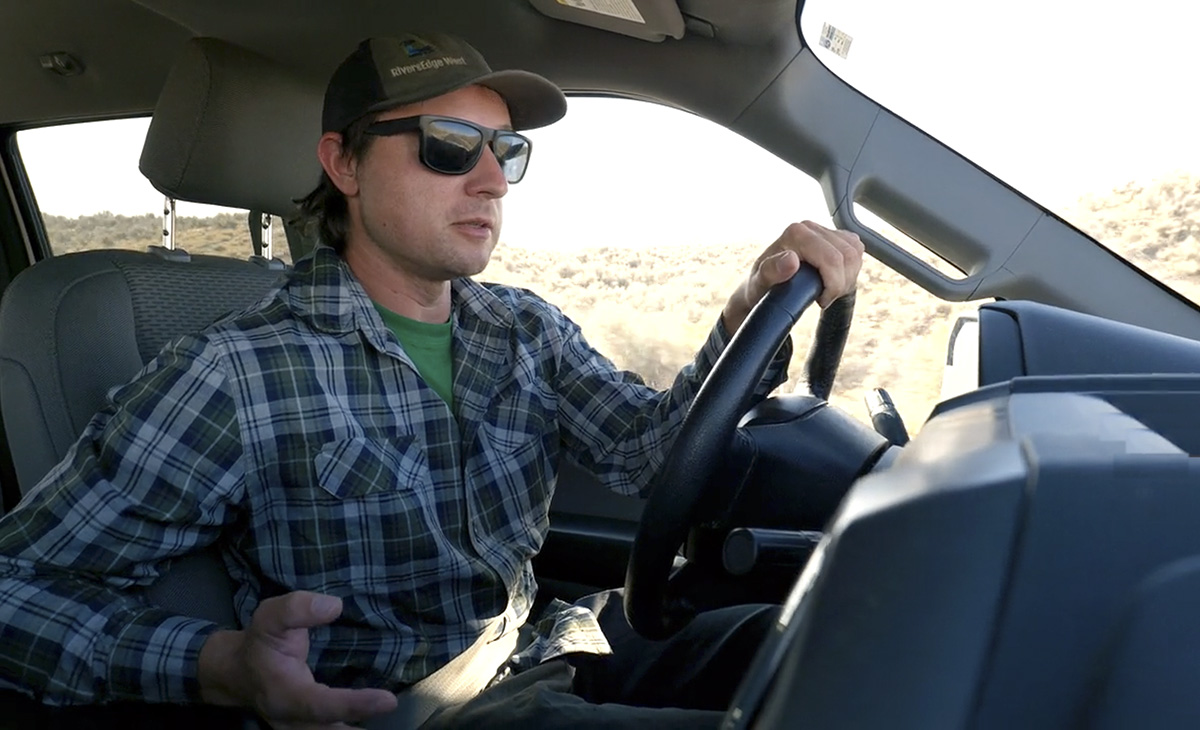
I met John Leary in the parking lot of a Tractor Supply in Rangely Colorado. There was something about the vehicles in that lot that made me think it might not be the best place to park a Toyota Yaris with California plates, so I parked around the corner, then moved my video gear into the back of John’s white utility truck.
John is a Senior Restoration & GIS Project Manager at RiversEdge West, a non-profit organization that’s leading the White River Partnership – a coalition of public, private, and nonprofit entities that are working to conserve and to restore riparian ecosystems along the White River and its tributaries.1
John had volunteered to show me some of the restoration work he and his teams had been doing on the riverbanks west of Rangely. The river had officially been designed as being “over-appropriated” in 2025. When a river is classified as being over-appropriated, it means that the total amount of water legally promised to water rights holders exceeds the supply of water that’s available in the river system at some or all times of the year.2 The designation acts as a formal recognition of water scarcity, where the demand for water is higher than the supply, often exacerbated by drought, climate change, and increased development.
John and his teams were working to reduce the number of invasive tamarisk and Russian olive trees that had crowded the White River’s banks, at the expense of wildlife and native vegetation like willows and cottonwoods. One of the methods John and his teams used was the application of tamarisk beetles. Tamarisk beetles originated in Eurasia – specifically central Asia, China, Kazakhstan, Greece, Uzbekistan, and Tunisia, and were introduced to North America as a biological control agent for invasive tamarisks. The beetles defoliate tamarisk trees by feeding on their leaves and on new growth, until the trees either weaken or die altogether.3
Since their introduction tamarisk beetles have spread across the Western U.S., including Nevada, Utah, Colorado, and even parts of Arizona, and in some areas have resulted in an 80% mortalityrate for the invasive tamarisks.4 This removal method sounds better than what I witnessed in California’s Coachella Valley, where miles of tamarisk trees had been intentionally burned by the Southern Pacific Railroad – which planted the trees in the early 1900s to keep sand off their railroad tracks.5
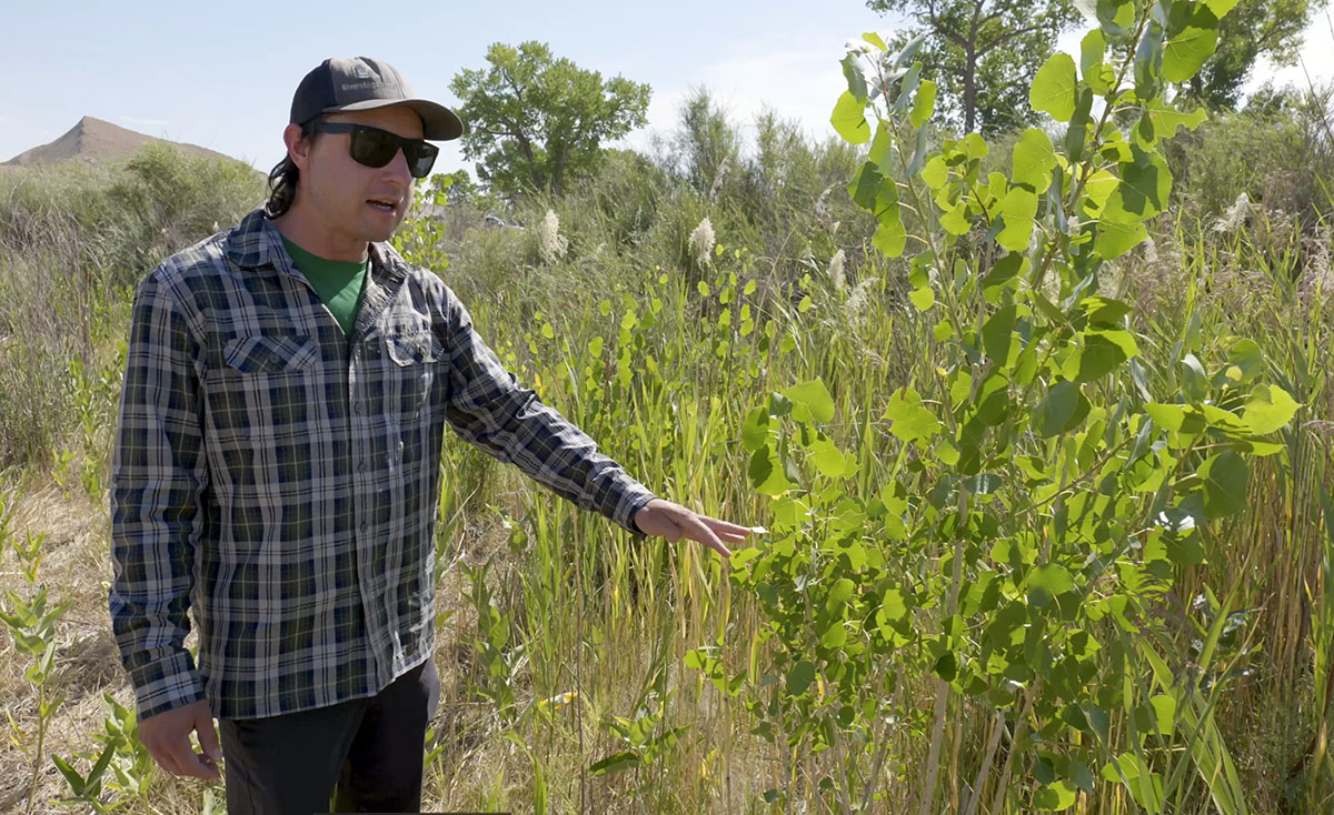
John Leary showing young native cottonwoods that are growing in an area previously occupied by tamarisks. Video link.
John and I drove west along the river and then finally parked. We hiked to a spot where John showed me a stand of native cottonwoods had sprouted up after his team removed tamarisks which had previously occupied that area. During the interview I filmed with John he repeatedly credited RiversEdge West and their partners in the White River Partnership, which included the Bureau of Land Management, Canyon Country Discovery Center, Colorado Northwestern Community College, Colorado Parks and Wildlife, State of Utah School and Institutional Trust Lands Administration, Town of Meeker, Colorado,Town of Rangely, CO, Uintah County Utah, Utah Conservation Corps, Utah Division of Wildlife Resources, Utah State University, Western Colorado Conservation Corps, the White River Alliance, and most importantly many ranchers and private land owners who supported the restoration efforts being carried out on their own riverfront property.6
The controversy surrounding Glen Canyon Dam’s River Outlet Works (ROW) centers on a critical design vulnerability: the dam may soon be unable to reliably release water if Lake Powell drops below the minimum power pool (3,490 feet). 1
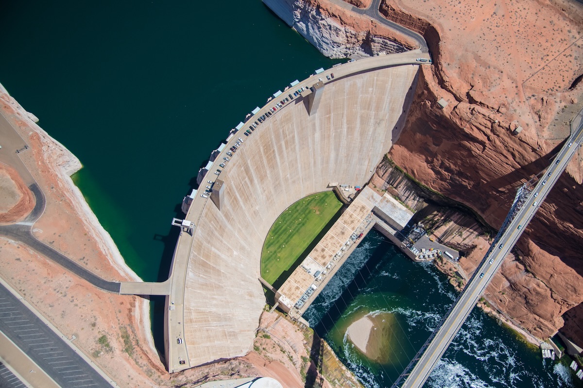
Aerial photo of the Glen Canyon Dam near Page, Arizona. Photo by Alexander Heilner/The Water Desk, with aerial support by LightHawk.
While the dam usually releases water through high-elevation penstocks to generate hydropower, the ROW—four 8-foot-wide steel pipes—is theonly way to move water once levels drop too low for the turbines. Recent inspections by the Bureau of Reclamation revealed significant damage to these pipes, including cavitation—a process where high-velocity water creates vapor bubbles that implode, eroding the steel.2
Reliability Gap: The ROW was designed for temporary use (e.g., flood control), not for the continuous, long-term operation that a “dead pool” scenario would require. A March 2024 memo from the Bureau of Reclamation warned that they should not be relied upon as the sole means of sustained water delivery.3
Legal & Economic Threat: If the ROW fails or its capacity is restricted to prevent further damage, the Upper Basin states may be unable to meet their legal obligation to deliver water to 30 million people in the Lower Basin (Arizona, Nevada, California).4
Safety Buffer: Due to the damage, the Bureau recently determined they can only safely operate the ROW at levels at least 24 feet above dead pool (3,370 feet), effectively raising the “failure point” of the dam’s plumbing.5
Proposed Fixes: Environmental groups, such as the Utah Rivers Council, advocate for drilling new, lower-level bypass tunnels around the dam to ensure water can flow even at riverbed levels. However, these modifications are costly and could take over a decade to implement.6
Mountain snowmelt is the lifeblood of the Great Salt Lake, providing the vast majority of its fresh water. On average the mountains around the lake contribute approximately 1.9 to 2.1 million acre-feet of surface runoff annually.1 However on February first of this year – with Utah’s snowpack in near record-poor condition, Utah’s Natural Resources Conservation Service released a report that forecast a reduction in snowmelt that ranges from 21% to 77% of average.2
This (potentially) dramatic drop in snowmelt forces our attention to the Great Salt Lake’s other major source of water, the Bear River, and there the news is equally alarming. The Bear River in Utah faces a variety of environmental threats primarily from human activities like agriculture, water management, and development. These impact water quality, habitats, and flows into the Great Salt Lake. The following list of challenges the river faces are ranked in order of prevalence and severity, from reports like wetland studies and conservation plans.3
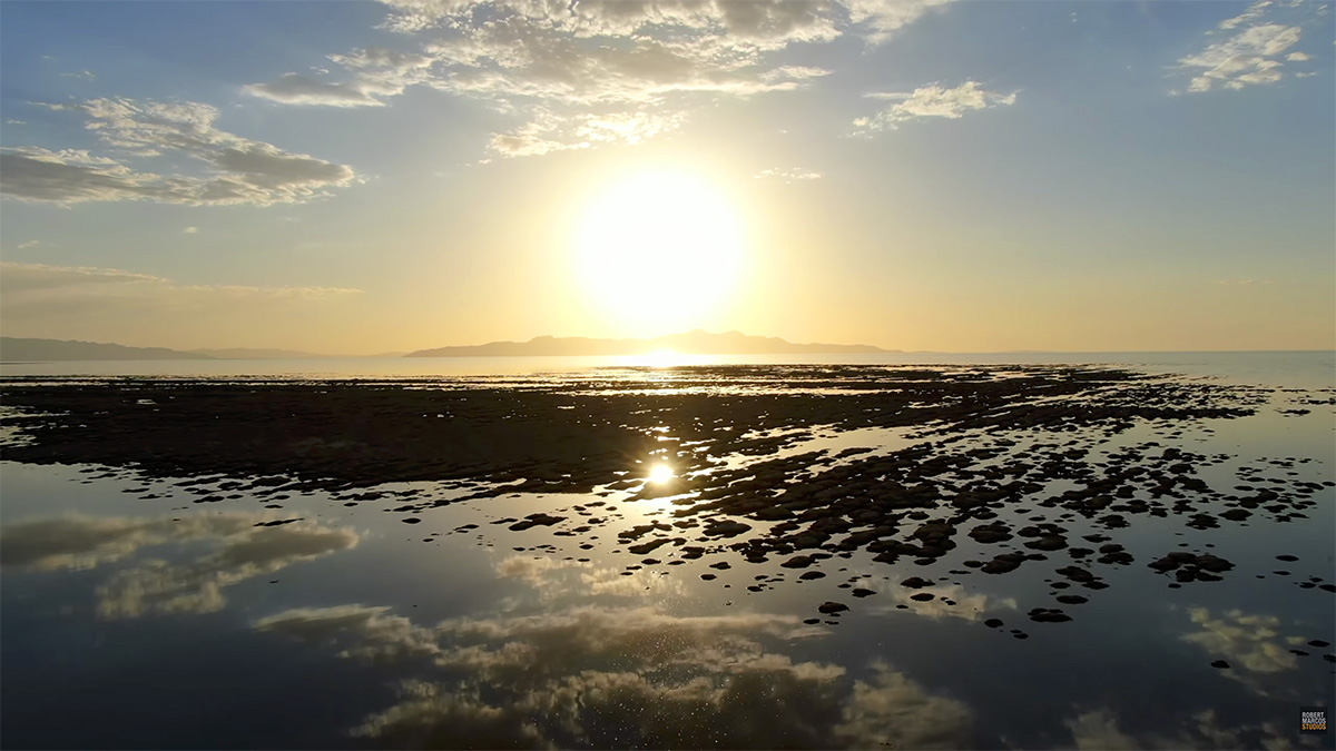
Clusters of microbialites, potentially thousands of years old, are endangered by The Great Salt Lake’s declining water levels and the water’s rising salinity. Video by Robert Marcos.
Water Diversions: Proposed and existing diversions, such as the Bear River Development project, threaten to reduce flows by up to 220,000 acre-feet annually, lowering Great Salt Lake levels by 8.5-14 inches and exposing lakebed dust with toxins like arsenic. This exacerbates drought effects and harms migratory birds reliant on Bear River Bay wetlands.4
Agricultural Runoff: Runoff from intensive farming affects 83% of wetlands, delivering excess nutrients, sediments, and pollutants that cause eutrophication, algal blooms, and oxygen depletion. The Bear River is impaired throughout the study area due to these inputs, worsened by upstream sources in Utah, Idaho, and Wyoming.5
Hydrologic Alteration: Dams, irrigation, and impoundments alter flow timing and flooding, impacting nearly all wetlands and degrading riparian habitats. Reservoirs like Cutler divert spring runoff, leading to inconsistent river flows and wetland desiccation.6
Invasive Species: Non-native plants like Phragmites australis cover 11% of wetlands, outcompeting natives and reducing biodiversity, especially in disturbed mudflats. Agricultural species such as foxtail and clover invade via forage planting.7
Sediment and Pollution: Erosion from tributaries and livestock causes siltation, while point sources (69% of wetlands) and nanoparticles from boat paints add contaminants. Legacy issues like high alkalinity and industrial wastes persist.8
The Gold King Mine spill happened on August 5, 2015, when EPA contractors accidentally released approximately 3 million gallons of contaminated wastewater into Cement Creek – a tributary of the Animas River in Colorado. The plume, containing heavy metals, flowed into the Animas and San Juan rivers. 1 The USGS – in cooperation with the EPA, gathered streamgage data in order to confirm the origin of the stream flow spike at Cement Creek and the volume of the spike estimated at three million gallons. USGS also took water and sediment samples and provided both current and historical water quality data to EPA.2
Four months later during her address to a House Committee on Natural Resources, the Secretary of the Interior Sally Jewell said, “As is so often the case, it is unfortunate that an incident like this has to happen to highlight an issue that land managers in both the state and federal governments have been grappling with for years – that addressing abandoned mine lands is a nationwide problem, and mitigating toxic substances released from many of them is a significant undertaking. Abandoned mine lands are located on private, state, federal, and tribal lands. There aretens of thousands of abandoned hardrock sites on federal lands alone. Many of these abandoned mine land sites were mined prior to the implementation of federal surface management environmental laws that require reclamation and remediation to take place. For those mine sites where no viable potentially responsible party can be determined, the federal government, and ultimately the taxpayer, often bears the burden of addressing these threats to public safety, human health, the environment, and wildlife, rather than the entities that developed and profited from the operations.”3
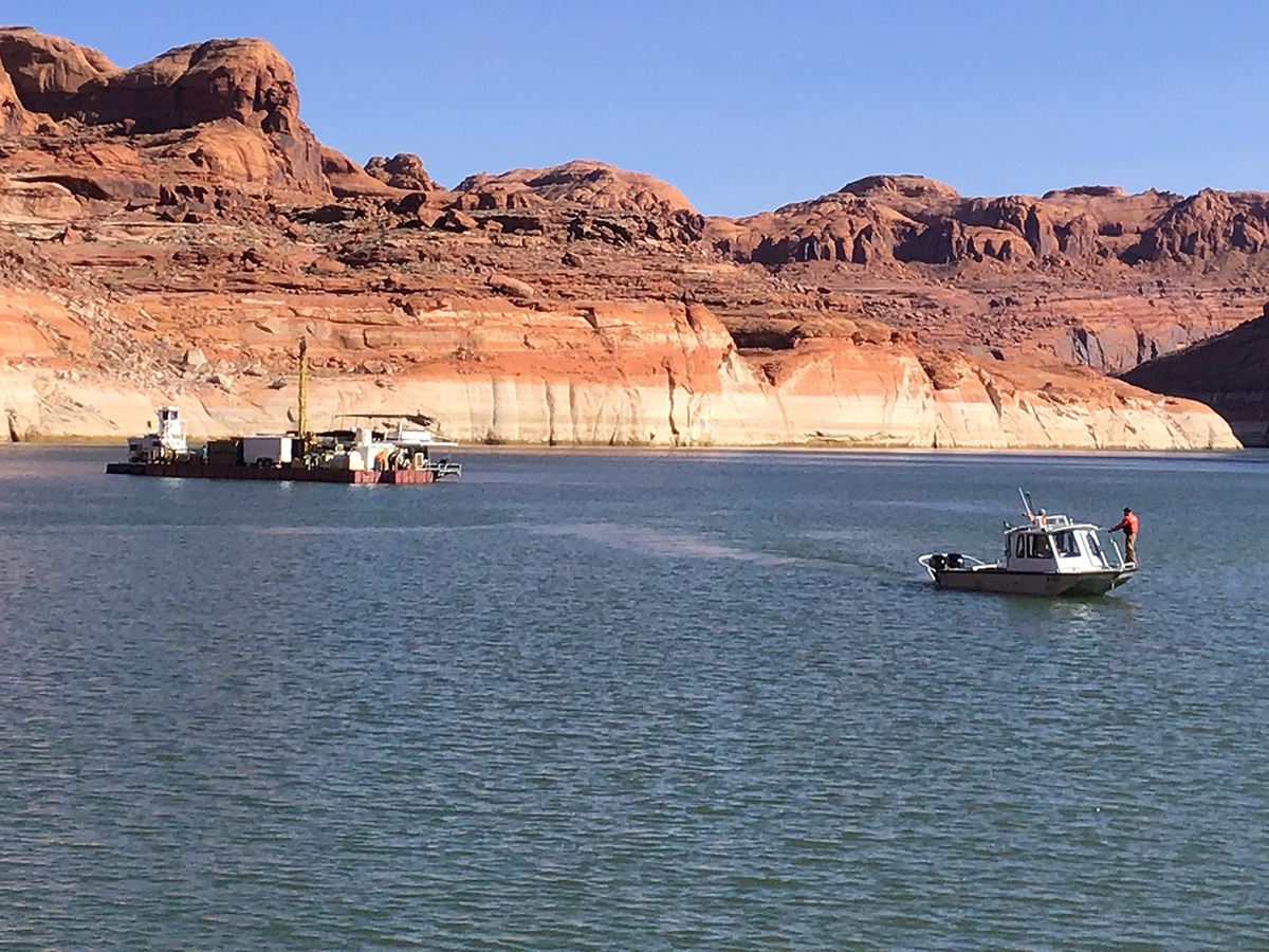
In 2018 the U.S. Geological Survey, the Utah Department of Environmental Quality, U.S. Bureau of Reclamation, and National Park Service, initiated the Lake Powell Coring Project.4 Its purpose was to retrieve and analyze hydraulic piston cores from Lake Powell sediments—primarily targeting the San Juan River delta—to reconstruct the history of sediment and contaminant deposition, including assessing whether material from the 2015 Gold King Mine spill had been sequestered there. Cores taken from 40 holes penetrated up to the pre-Glen Canyon Dam surface to evaluate metal concentrations, distribution, and bioavailability for water quality impacts.5
Preliminary results shared by USGS scientists in late 2021 shared significant findings: while the 2015 Gold King Mine spill caused detectable spikes in lead and zinc, much larger and “more concerning” spikes wereidentified from mining waste disasters that occurred in the 1970s. The following contaminants were found in core samples:6
Lead: Found in significant spikes, particularly in deeper sediment layers corresponding to mid-20th-century mining disasters.
Zinc: Often found in conjunction with lead; used as a primary indicator of mine waste runoff.
Arsenic: A major concern in the San Juan River delta, often naturally occurring but concentrated by mining processes.
Cadmium: A toxic metal frequently associated with zinc mining that was identified in the core samples.
Copper: Present in the sediment, reflecting the region’s extensive copper mining history.
Mercury: Studied due to its ability to bioaccumulate in the food chain (fish), though much of the mercury in the system is attributed to atmospheric deposition and older mining practices.
Now as Lake Powell’s water levels continue to recede amid prolonged drought and heavy upstream water use, vast expanses of toxic sediments—laden with heavy metals like arsenic, cadmium, copper, mercury, lead, selenium, and zinc from historical mining discharges including the 2015 Gold King spill—are increasingly exposed. This drying creates a heightened risk of human exposure through direct contact during boating, fishing, or shoreline recreation, as well as inhalation of windblown dust carrying bioavailable toxins, potentially leading to respiratory issues, skin irritation, and chronic health effects with repeated exposure. Without expanded monitoring or mitigation measures, these once-submerged hazards now pose an urgent public safety threat to the millions of annual visitors in this popular Southwestern reservoir. 7
As evaporation rates increase and inflow from the Colorado River falls, Lake Mead’s water volume will shrink but the total mass of dissolved minerals will remain relatively stable. This creates a concentration effect where minerals like calcium, magnesium, and salts, become more densely packed in the remaining water. Without sufficient fresh inflow to dilute these minerals, the water becomes increasingly “hard,” reaching salinity levels that pose significant challenges for regional water management.1
This increasingly hard water is a silent but growing threat to household appliances owned by residents of Las Vegas, because when hard water is heated or left to evaporate, minerals like calcium and magnesium precipitate out of the liquid, forming a rock-hard crust known as limescale. This buildup acts as an insulator in water heaters, forcing them to work harder to heat water, and clogs the delicate internal components of dishwashers and washing machines. Over time, these deposits restrict water flow and corrode seals, leading to premature mechanical failure and leaks.2
The financial burden of these mineral-heavy waters translates to shorter lifecycles for major appliances and higher utility bills. Residents may find themselves replacing water heaters every 8 years instead of the typical 12 to 15, and the efficiency loss from scale buildup can increase energy costs for water heating by as much as 25%. Between more frequent appliance replacements, the cost of professional plumbing repairs, and the potential need for expensive water softening systems, the long-term economic impact on a single household can reach thousands of dollars.3
While drinking water with elevated TDS is generally considered safe by regulatory standards, it can have some noticeable effects. Very high concentrations of minerals like sulfates can cause a laxative effect or gastrointestinal discomfort in sensitive individuals or those unaccustomed to the water. While the body requires minerals like calcium and magnesium, excessive levels can affect the water’s smell and its taste, which may motivate residents to rely more on bottled water or on in-home filtration units like reverse-osmosis, which incrementally drives up the cost of living.4
Utah’s cloud seeding program began in the early 1950s with initial winter experiments aimed at boosting snowfall in mountainous regions to enhance water supplies. These early efforts were part of broader U.S. weather modification initiatives following World War II discoveries about silver iodide’s role in nucleating ice crystals in supercooled clouds. By the 1970s, amid severe droughts in central and southern Utah, counties collaborated with the state to formalize operations, leading to the Cloud Seeding Act of 1973. This legislation empowered the Utah Division of Water Resources to regulate and fund programs, with North American Weather Consultants often handling implementation using ground-based silver iodide generators.1
The program’s foundational design targeted winter storms from November to April, releasing silver iodide particles from foothill and high-elevation sites to stimulate precipitation in key watersheds like the Uinta Mountains and central Utah ranges. Early operations in the 1973-74 season involved manual generators, with state funding starting in 1975-76 to match local contributions from participating counties such as Beaver and Sanpete. Evaluations drew from prior research, hypothesizing that seeding supercooled clouds would increase snowpack for spring runoff, and the program paused only briefly during non-drought periods but resumed consistently.2
Over decades, Utah expanded its efforts with partnerships like the Central Utah Water Conservancy District, supporting targeted areas including the West Uintas and Emery programs, while annual legislative appropriations—around $300,000 by 2021—ensured continuity. Aerial seeding with aircraft supplemented ground units in the late 1970s and 1980s, but ground-based methods proved more reliable and cost-effective. By the 2020s, amid ongoing water scarcity, the state ramped up investments, reflecting confidence in 5-15% snowfall increases backed by long-term data collection.3
Recent advancements have modernized the program into the world’s largest remote-controlled network, with 190 automated generators deployed statewide by 2025 for safer, faster activation during storms. Funding surged to nearly $16 million in 2025, enabling drone-based seeding pilots in challenging terrains like the La Sal Mountains, replacing prior airplane tests for precise cloud penetration. These innovations, overseen for environmental safety, align with Utah’s water policy to combat the impact of droughts for both agricultural and urban users.4
A UC Davis study on the Salton Sea air basin found that nitrogen oxide emissions from soils (driven by fertilizer use, irrigation, and heat) were underestimated in the official inventory by about a factor of ten. Soil NOx emissions averaged 11 tons per day, ten times the state inventory value.1 Recent work and briefs using the Salton Sea Environmental Time Series data show that nitrogen levels in the Salton Sea water column are extremely high (higher than 95% of U.S. lakes) and that government monitoring systems are missing much of the nutrient-related and hydrogen sulfide–related hazard, but they emphasize incomplete or spatially biased monitoring.2
Nitrates entering the Salton Sea primarilydrive hazardous air pollution indirectly through eutrophication and microbial processes, rather than as direct airborne nitrates.3 Nitrates from fertilizers applied in the surrounding Imperial and Coachella Valleys are taken up by arid soils, where microbial processes (nitrification and denitrification) convert them to nitrogen oxides (NOx), a key precursor to ground-level ozone (O3) and fine particulate matter (PM2.5).4
These soil NOx emissions in the Salton Sea Air Basin have been measured at 11 tons per day on average—about 10 times higher than prior state inventories—exacerbating nonattainment of federal air quality standards for ozone and PM.5 Intensive irrigation and fertilizer use amplify these pulses, especially under rising temperatures, linking agricultural nitrate management directly to regional air pollution budgets.6 High nitrate inflows fuel algal blooms, whose decomposition under low-oxygen conditions produces hydrogen sulfide (H2S) gas via sulfate-reducing bacteria.7 H2S routinely exceeds health-based thresholds (e.g., 30 ppb) around the Sea, causing odors, respiratory irritation, headaches, and potential asthma exacerbation in nearby communities like Slab City and Mecca.8 Recent UCLA studies using high-frequency sensors confirmed persistent H2S elevations tied to nitrate-driven nutrient richness, with inadequate monitoring missing peak events.9 NOx from soil and other sources forms secondary nitrate aerosols (part of PM2.5 and PM10), worsening inhalable particulate pollution already heightened by dust from the receding shoreline.10
While playa dust carries salts, metals, and legacy pesticides independently, nutrient overload indirectly worsens air quality by sustaining a chemically reactive lake environment.11 These combined pollutants contribute to chronic respiratory and cardiovascular risks in the low-population but agriculturally intense basin.12
American consumers are well aware that their electric bills have been going up, in some areas dramatically.1 The construction of AI data centers have been widely blamed for this, even though (at present) they’re responsible for only a small part of the increase. In Phoenix and Chandler Arizona – two of the nation’s hottest and driest cities – enormous factories are being built to fabricate the semiconductors used in those data centers, and they’re widely expected to drive up costs that local residents pay for both electricity and water. Since the increased costs are shared by all rate payers, it can be said that residents of Maricopa County who pay for water and power are subsidizing the cost of water and power used by these new industries.7
Water Usage Concerns
TSMC’s Phoenix plant is projected to consume over 17 million gallons a day. Critics from groups like Chip Coalition United argue this adds pressure to local supplies, potentially raising municipal costs despite recycling pledges (e.g., TSMC’s near-zero discharge goal). Phoenix officials counter with investments like a 70,000 acre-foot recycling facility by 2030 to offset shortfalls.4
The new Intel semiconductor plant in Chandler, Arizona (part of expansions at the Ocotillo campus), obtains its water from the City of Chandler. This supply is drawn from the Colorado River, Verde River, Salt River, and some groundwater sources.8 Intel heavily recycles water at its Chandler facilities, treating up to 9.1 million gallons daily on-site and returning much of it to the city or aquifer via partnerships like the Ocotillo Brine Reduction Facility. The company achieves high reuse rates (over 90% in some reports), minimizing net freshwater demand.9
Power Demand Impact
TSMC’s facility alone could require electricity for 300,000 homes, straining Arizona’s grid and emitting gases rivaling 32,000 households. Intel’s Chandler expansions add further load, prompting calls for full environmental reviews. No sources confirm explicit resident bill hikes yet, but increased grid demand often leads to higher utility rates over time.5
Manufacturer’s commitment to recycling water
TSMC and Intel’s semiconductor plants in Arizona address their substantial ultra-pure water needs for chip fabrication—primarily wafer rinsing and cooling—through advanced on-site recycling facilities designed for Arizona’s arid conditions. TSMC Arizona currently recycles about 65% of its water for cooling towers and scrubbers via in-house systems, with a new 15-acre Industrial Reclamation Water Plant (IRWP), groundbreaking in 2025 and operational by 2028, set to treat industrial wastewater back to ultrapure standards, targeting 85-90%+ recycling rates to achieve near-zero liquid discharge and minimize fresh municipal water draws. Intel, operating multiple Chandler fabs, already recycles over 80% of water through on-site reclamation plants like its 12-acre Ocotillo facility, purifying used water for reuse in manufacturing, cooling, or aquifer recharge, while pursuing net-positive water goals by 2030 via conservation and restoration. These strategies sharply reduce net consumption, with TSMC’s first fab projected to drop from 4.75 to 1 million gallons daily post-recycling, supporting sustainable expansion amid regional scarcity.6
The Arizona Water Infrastructure Finance Authority (WIFA) has welcomed proposals from project teams on diverse strategies like ocean desalination, surface water importation, wastewater reclamation, and novel technologies to develop new renewable sources that bolster the state’s long-term water security amid growing shortages. The effort by WIFA come as the state faces additional cutbacks in its Colorado River supplies and its existing sources of groundwater are stressed to the limit. 1
Concept 1: Reactivating the Yuma Desalting Plant
Persistent Colorado River shortages since the 2000s have prompted Arizona stakeholders, including the Central Arizona Project (CAP) and ADWR, to evaluate the Yuma Desalting Plant operation as a supply augmentation tool. Legislative proposals like Sen. Martha McSally’s 2020 bill sought to mandate repairs and restart, though dismissed as unfeasible due to $160-450 million in upgrades plus $25-40 million annual operations. 2
As of 2025, the plant remains in “ready reserve” with ongoing evaluations of tech upgrades and alternatives like well-field pumping to protect the Ciénega de Santa Clara wetland in Mexico, which relies on untreated drainage flows. Environmental groups oppose reactivation, citing $670+ million costs for partial operation and habitat risks, while Bureau officials prioritize conservation over YDP use. 3
Concept 2: Trading water saved through Ag conservation for Mexico’s 1.5 million acre feet of Colorado River water
Arizona has shifted away from the original IDE Technologies proposal for a Sea of Cortez desalination plant near Puerto Peñasco, Sonora, which faced transparency issues and was not exclusively pursued. Instead, the Water Infrastructure Finance Authority advanced four alternative proposals in November 2025 for further feasibility analysis.4
One of those alternative proposals has a water exchange as a core mechanism: desalinated water output supplies Mexican users (e.g., local communities or agriculture), which would free an equivalent volume of Mexico’s Colorado River allocation for Arizona diversion northward via the Central Arizona Project canal to Phoenix and Tucson. This aligns with broader WIFA-approved initiatives from partners like EPCOR and Acciona-Fengate, which propose similar Gulf of California or Baja plants producing 150,000–500,000 acre-feet by 2031–2034 in “equal-for-equal” swaps, avoiding long-distance Arizona pipelines. Challenges include high costs ($3,000+ per acre-foot), U.S.-Mexico approvals, environmental compliance for brine discharge, and contract risks in surplus years, but it leverages proven global tech to onshore supplies without Upper Basin conflicts.5
Concept 3: Investing in a new desal plant in Southern California
Arizona has explored offering to invest state funds, through its water financing authority, in a large new seawater desalination plant on or near the Southern California coast, with the core idea that Arizona would help underwrite construction and then receive a contractual share of the plant’s output. In turn, that desalinated water would be used within California to free up an equivalent portion of California’s Colorado River allocation, which Arizona would then take upstream via the Colorado River and Central Arizona Project canal, effectively turning ocean water into an additional Colorado River supply for Arizona through an interstate exchange mechanism.6
I’ve never been a strategic thinker so I’m grateful that I can utilize an AI that provides factual answers plus direct links to its sources, and while having coffee this morning Perplexity provided a response that I’d like to share. Note: while each of the first four responses deserves to be elaborated upon, in this post I’m just going to focus just on number 5.
Query: “Please provide 5 examples of under-reported factors influencing the aridification of the American West.”
Responses:
Temperature‑driven evaporative demand (not just lack of precipitation).
Groundwater depletion as a hidden component of aridification.
Progressive salinization and water‑quality‑driven “functional” scarcity.
Degradation of groundwater–surface water connectivity in headwaters.
Institutional and legacy‑infrastructure lock‑in. Definition: Institutional lock-in refers to the way established rules, organizations, and physical infrastructure create powerful inertia that resists change, even when better options exist for addressing challenges like aridification in the American West.1
This “institutional lock-in” amplifies drying Western water law, infrastructure, and allocation rules that were created around 20th‑century hydroclimate and tend to favor maintaining large, evaporative surface reservoirs and extensive canal networks rather than flexible, low‑loss storage and delivery. These institutional and physical path dependencies increase evaporation losses, slow adaptation, and channel scarce flows into rigid prior‑appropriation commitments and uses that may be economically or ecologically inefficient under a hotter, drier regime. 2
For instance, efforts to manage Colorado River salinity and shortages must operate within existing compacts and project mandates, which can prioritize delivery targets over system‑wide efficiency, effectively deepening aridification by making it harder to reallocate or conserve water in response to temperature‑driven drying. 3
Here are four specific examples of institutional and legacy‑infrastructure lock‑in in the Colorado River system…
1. Law of the River and the 7.5+7.5 maf Structure
The 1922 Colorado River Compact and subsequent “Law of the River” documents hard‑wire an overestimate of available flow (7.5 maf to each basin, plus an extra 1 maf to the Lower Basin) into the management framework, even as mean flows decline under aridification. This basin split at Lee Ferry, plus the Upper Basin’s delivery obligations to the Lower Basin and Mexico, makes it institutionally difficult to reallocate water to match a smaller, more variable river without reopening a century of compacts, court decrees, and federal statutes.4
2. Glen Canyon Dam / CRSP as a “Must‑Operate” System
Glen Canyon Dam and the broader Colorado River Storage Project (CRSP) were built to regulate flows and guarantee Lower Basin deliveries, embedding the assumption of large, stable storage and hydropower revenues into basin operations. Today, even with shrinking inflows and dead pool risk, operating rules, repayment contracts, and power‐marketing arrangements keep agencies oriented toward maintaining Lake Powell as a central regulating reservoir, rather than rapidly re‑optimizing for a different storage configuration or prioritizing ecological flow restoration.5
3. Transbasin Diversions and the Colorado‑Big Thompson Pattern
Projects such as the Colorado‑Big Thompson (C‑BT) move Upper Colorado River water across the Divide into the South Platte via large, fixed works—Adams Tunnel, canals, reservoirs like Horsetooth, Carter Lake, and Boulder Reservoir—which were sized for a wetter historical regime. Municipal and agricultural systems on the Front Range have grown around this imported supply, creating political and economic resistance to curtailing diversions or repurposing infrastructure, even as those exports reduce flexibility for in‑basin adaptation, instream flows, and tribal water development.6
4. Wellton–Mohawk Return Flows and the Yuma Desalting Plant
The Colorado River Basin Salinity Control Act led to construction of the Yuma Desalting Plant to treat saline Wellton–Mohawk return flows so the U.S. could meet water‑quality obligations to Mexico while preserving higher‑quality water in Lake Mead. A “temporary” 1977 operational workaround—bypassing those return flows to the Ciénega de Santa Clara—became the de facto long‑term solution, locking in a fragile arrangement where restarting the plant would damage a large accidental wetland and disrupt established ecological and binational expectations, while not restarting it keeps the expensive plant largely stranded infrastructure.7
In his article in Singletracks author Greg Heil said, “It’s hard to imagine but in the 1960s, there were approximately 1,000 different ski areas operated across the United States. Today, that number has been cut in half, with roughly 487 resorts still operating.” As I look outside here in Grand Junction it’s hard to believe that our current climate can support ANY ski resorts, let alone 487. But after reading Greg’s article I thought, what other industries besides snow skiing are threatened by increasing aridification?
1. Cattle & Feed: This is considered the most threatened industry because it’s the largest consumer of Western water. It’s been estimated that 55% to 70% of the water in the Colorado River Basin is used to grow livestock feed like alfalfa and hay. Farmers are either choosing or are being forced to fallow hundreds of thousands of acres. Large-scale dairies and feedlots are facing unsustainable costs to import feed and transport water.1
2. Commercial Nut & Fruit Orchards: Crops like almonds, pistachios, and citrus are considered “permanent” crops because they need to be watered year-round. In other words these fields can’t be fallowed for a year or two. The result is that farmers in California’s Central Valley have resorted to bulldozing thousands of acres of almond trees simply because there’s not enough water to keep them alive through the hot summers.2
3. Hydroelectric Power Generation: The West’s energy grid relies heavily on the power provided by falling water. As reservoir levels drop, the pressure that’s required to spin turbines decreases. Hoover Dam and Glen Canyon Dam are operating at significantly reduced capacities. If levels hit “minimum power pool,” they’ll stop producing electricity entirely, thereby forcing the use of more expensive, and sometimes less sustainable, sources of energy.3
4. Thermal Power Plants (Coal & Nuclear): Often overlooked, traditional power plants require massive amounts of water for cooling. In states like Arizona and New Mexico, coal-fired plants are facing “water bankruptcy.” Some plants may be forced into early retirement not just to meet carbon goals, but because they can no longer secure the millions of gallons of cooling water they require every day.4
5. Municipal Real Estate & Construction: In parts of Arizona and Utah, “water-aware” building moratoriums have begun to stall the suburban sprawl that has for decades defined the American West. The town of Oakley in Summit County Utah was among the first to halt new construction for projects requiring new water connections due to a lack of water. In Arizona, a 100-year assured water supply is primarily required for new subdivision developments within “Active Management Areas” that include parts of Maricopa, Pinal, Pima, Santa Cruz, and Yavapai counties.5
6. Freshwater Recreation & Tourism: This is an industry that depends on the “aesthetic and functional” presence of water. Marinas at Lake Mead are literally being moved as the shoreline retreats miles from its original docks. Rafting companies on the Rio Grande and Colorado River are seeing their optimal rafting “seasons” shortened or cancelled altogether due to record-low flows.6
7. Semiconductor Manufacturing: The “Silicon Desert” (Phoenix and surroundings), has become a hub for chip making, a process that requires “ultrapure water” to wash silicon wafers. Companies like Intel and TSMC are investing billions in water recycling technology, but the sheer volume required remains a massive long-term risk to the expansion of this critical tech sector.7
8. Winter Sports & Ski Resorts: Aridification is driven by a “snow-to-rain” transition. Warmer winters mean less snowpack and faster spring runoffs. Resorts in the Intermountain West are facing shorter seasons and a higher reliance on energy-intensive snowmaking, which itself requires significant water rights that are being challenged by thirsty cities.8
9. Extractive Mining: Mining for copper, lithium, and gold is incredibly water-intensive, often competing directly with local communities for groundwater. As groundwater levels drop, mining companies face “social license” risks and legal battles over their impact on rural wells, leading to project delays and increased operational costs.9
10. Commercial Fishing & Hatcheries: Lower river levels lead to higher water temperatures and increased salinity, which can be lethal to native fish species. Salmon and trout populations in the Northwest and Northern California are crashing. Hatcheries are struggling to maintain the cool, oxygenated water necessary to restock rivers, threatening both commercial and tribal fishing industries.10
By Robert Marcos, photojournalist Grand Junction, Colorado
While filming for the Nature Conservancy I learned this: Climate change has made three-quarters of our planet drier, yet at the same time the frequency of extreme downpours has increased. Raindrops that fall during these downpours hit the soil with more energy than they used to. This results with more erosion as dislodged soil is swept downstream by runoff that our increasingly dry soil is unable to absorb.
Forgive me if I left anything out of that overly-simplified explanation, but I wanted to define the problem first before describing solutions that are underway in Northwestern Colorado. The Nature Conservancy and their partners are heavily invested in a project whose goal is to improve the water quality in the Yampa River, and I was fortunate to have been invited to film work being done at three remote sites.
Joseph Leonhard – a Riparian Restoration Project Manager at the Nature Conservancy told me that his crews – which consisted primarily of AmericaCorps workers plus a few hardy scientists from the BLM and USGS, utilized Low-Tech Process-Based Restoration, (LTPBR), methods to slow the water in streams that led into the Yampa River.
LTPBR is a low cost restoration method that uses simple, hand-built structures composed of natural materials obtained locally – like branches, boulders, and sod, which mimic actual beaver dams. By restricting water these small dams encourage regenerative processes that can, over time, repair degraded landscapes, improve water retention, create habitat, and even build resilience against drought and fire.
What really impressed me was that the members of these crews – some of whom were 19-year olds while others were PhD’s, shoveled mud and waded through knee-deep water together. They displayed “group cohesiveness”- which is defined as coordinated effort toward shared objectives. During his interview Joseph Leonhard said that he and his people were “activated”, which I interpreted as meaning that instead of sitting in front of a computer, (like I am right now), they were engaged in productive physical activity that would directly benefit the environment.
By Robert Marcos, photojournalist Grand Junction, Colorado
Most of you have heard that California’s Salton Sea would not currently exist were it not for the nearly 1 million acre feet of agricultural runoff that’s drained into it every year. Paradoxically – the sea is both being kept alive by this salty runoff and being killed by it, in part because the Sea’s evaporation rate of six feet per year is continually concentrating its chemical-laden waters. 1
As you might expect the Salton Sea’s water is dominated by high salinity from salts, which increases dramatically as the lake shrinks. Selenium ranks next as a major metalloid of concern, often reaching ecologically harmful concentrations from runoff. Other notable contaminants include heavy metals like cadmium, copper, zinc, and nutrients driving algal blooms.2
Meanwhile 132 miles south in Sonora another body of water has formed from American-made runoff, and it’s also a paradox. Ciénega de Santa Clara is technically a brackish water wetland consisting of marshlands and lagoons, and its classification as “anthropogenic” stems from the fact that it was inadvertently created by, and entirely sustained by human engineering.3
This “human engineering” began in 1965 after the U.S.Bureau of Reclamation rerouted approximately 100,000 acre feet of salty runoff from the Wellton-Mohawk Irrigation District away from the Colorado River and 13 miles into Mexico – as a temporary way to reduce the excessively salty Colorado river water that had been killing crops in Mexico. By 1973 a permanent bypass canal was built which carried that salty runoff 50 miles further, to the Ciénega de Santa Clara in Sonora.4
But to everyone’s shock and surprise the salty runoff that was dumped at Cienega de Santa Clara resulted in the rebirth of an amazing ecosystem. The sprawling 40,000-acre wetland, now a UNESCO-recognized biosphere reserve, transformed a desolate salt flat into a lush expanse of emergent marshes dominated by dense stands of southern cattail interspersed with bulrushes and submerged aquatics. The nutrient-rich, albeit salty, waters fostered rapid plant growth, creating tangled corridors of green that ripple across the landscape, their feathery seed heads swaying in desert breezes amid shallow, mirrored pools teeming with microbial life.5
But the oasis’s vitality depends upon consistent inflows. Disruptions, like the one in 1993 that occurred during canal repairs caused a dramatic loss of vegetation, confining green regrowth to low-lying faults until the runoff flows resumed. But today “La Cienaga” endures as a testament to ecological opportunism, though looming desalination plans at Yuma threaten its future by potentially diverting the life-sustaining drainage. 6
By Robert Marcos, photojournalist Grand Junction, Colorado
A political brouhaha erupted in the early 1960s after the Wellton‑Mohawk irrigation project in Arizona discharged very saline return flows into the Colorado River, which raised salinity at the border from 800 ppm to about 2,700 ppm. In Mexicali Valley farmers said the water was virtually “useless for irrigation purposes,” and led to widespread crop failure in one of Mexico’s largest and most fertile regions.
It took the United States 12 years to find a definitive, long-term solution: from the initial crisis in 1961 to the signing of a permanent agreement, known as “Minute 242” in 1973. This agreement led with the Bureau of Reclamation investing $250 million in the development of the Yuma Desalting Plant, which would use a reverse-osmosis system to filter a percentage of salts from the river before it entered Mexico.
The expensive plant was completed in 1992 but was used for only a few months. Because in 1977 a temporary measure enacted by the BOR diverted (the salty) Wellton-Mohawk runoff to Mexico’s Ciénega de Santa Clara. This action brought the river water back into compliance while the Yuma Desalting Plant was still being built. But this “temporary measure” worked so well that it obviated the need for the expensive desalting plant.
The Bureau of Reclamation had known since the 1970’s that the Dolores River had, (for millions of years), been a significant source of the Colorado River’s salinity and in 1996 they took action. The Paradox Valley Unit removes between 50,000 to 180,000 tons of salt annually from a facility west of Montrose, Colorado. In a nutshell the operation works by intercepting saline-rich groundwater before it enters the Dolores River by the use of nine extraction wells. These wells pump out this naturally occurring brine -which is eight times saltier than seawater, before it can seep into the Dolores River.
The brine is piped to a facility where it’s injected under high pressure 3 miles down into the earth – underneath a natural salt layer that prevents it from rising back to the surface. Unfortunately, as is often seen with other types of deep fluid injections, a 4.5 magnitude earthquake was triggered and the unit had to be shut down for two years. When operations resumed it was at a reduced rate of 67% in an attempt to mitigate the seismic risks. Even so, in 2024 the unit still managed to remove 62,913 tons of salt …salt which used to show up in Mexicali Valley.
The very different types of operations that have succeeded in lowering Grand Valley’s once-massive salt load will be addressed in a future post. Thank you.
By now everybody’s sick and tired of the term “Dead Pool”. But what about reaches? Last summer as I was driving from Denver to Grand Junction I was horrified to see that the Mighty Colorado that had been flowing outside my left window had suddenly dried up, completely. This was nine miles east of Glenwood Springs. The view of the dessicated riverbed reminded me of a scene from a post-apocalyptic movie.
The culprit of course was the Shoshone Hydroelectric Generating Station which diverts 1250 cfs from a diversion at Hanging Lake, then returns that water 2-1/2 miles downstream after it’s been used to drive the plant’s hydroelectric turbines.
As the name implies Grand Junction’s “15 mile reach” is much longer. In the late summer a full 15-miles of dry river bottom can be seen along the I-70 beginning at the Cameo Diversion Dam and ending 15 miles downstream at the confluence of the Gunnison River. The Cameo Diversion Dam supplies 1.2 million acre feet of river water annually to irrigate Grand Valley farms, then returns about half of that water to the Colorado river at a variety of points downstream.
Not surprising these dry patches are hell for native fish, at least four of which are on the verge of extinction. The Bonytail – which has no wild populations left, the Colorado Pikeminnow, the Razorback Sucker, and the Humpback Chub, are all critically imperiled due to habitat loss from dams and competition from non- native species.
Gratefully one organization has ponied up to keep the water flowing. The Colorado Water Trust uses donations from people like me to buy water from sources that are upstream of these reaches in order to maintain a limited amount of water flow, year round. It may not be much but they’re hoping it’s enough to keep these fish, and many other aquatic species alive through the summer.
I can’t help but wonder whether those who are responsible for managing the river couldn’t do more to balance its many uses in order to ensure that the river’s ecological health isn’t left hanging by such a fragile thread.