The more scientists learn about the health risks of PFAS, found in everything from nonstick cookware to carpets to ski wax, the more concerning these “forever chemicals” become.
The U.S. Environmental Protection Agency now believes there is no safe level for two common PFAS – PFOA and PFOS – in drinking water, and it acknowledges that very low concentrations of other PFAS present human health risks. The agency issued the first legally enforceable national drinking water standards for five common types of PFAS chemicals, as well as PFAS mixtures, on April 10, 2024.
I study PFAS as an environmental health scientist. Here’s a quick look at the risks these chemicals pose and efforts to regulate them.
What exactly are PFAS?
PFAS stands for per- and polyfluoroalkyl substances. This is a large group of human-made chemicals – currently estimated to be nearly 15,000 individual chemical compounds – that are used widely in consumer products and industry. They can make products resistant to water, grease and stains and protect against fire.
Waterproof outdoor apparel and cosmetics, stain-resistant upholstery and carpets, food packaging that is designed to prevent liquid or grease from leaking through, and certain firefighting equipment often contain PFAS.
In fact, studies have found that most products labeled stain- or water-resistant contain PFAS, and another study found that this is even true among products labeled as “nontoxic” or “green.” PFAS are also found in unexpected places such as high-performance ski and snowboard waxes, floor waxes and medical devices.
Firefighters are concerned that PFAS in firefighting foams and protective gear could be a reason cancer rates are rising. AP Photo/Steven Senne
At first glance, PFAS sound pretty useful, so you might be wondering what’s the big deal?
The short answer is that PFAS are harmful to human health and the environment.
Some of the very same chemical properties that make PFAS attractive in products also mean these chemicals will persist in the environment for generations. Because of the widespread use of PFAS, these chemicals are now present in water, soil and living organisms and can be found across almost every part of the planet, including Arctic glaciers, marine mammals, remote communities living on subsistence diets and in 98% of the American public.
Once people are exposed to PFAS, the chemicals remain in their bodies for a long time – months to years, depending on the specific compound – and they can accumulate over time.
Research consistently demonstrates that PFAS are associated with a variety of adverse health effects. A review by a panel of experts looking at research on PFAS toxicity concluded with a high degree of certainty that PFAS contribute to thyroid disease, elevated cholesterol, liver damage, and kidney and testicular cancer.
Further, they concluded with a high degree of certainty that PFAS also affect babies exposed in utero by increasing their likelihood of being born at a lower birth weight and responding less effectively to vaccines, while impairing women’s mammary gland development, which may adversely affect a mom’s ability to breastfeed.
The review also found evidence that PFAS may contribute to a number of other disorders, though further research is needed to confirm existing findings: inflammatory bowel disease, reduced fertility, breast cancer, and an increased likelihood of miscarriage and developing high blood pressure and preeclampsia during pregnancy. Additionally, current research suggests that babies exposed prenatally are at higher risk of experiencing obesity, early-onset puberty and reduced fertility later in life.
Collectively, this is a formidable list of diseases and disorders.
Who’s regulating PFAS?
PFAS chemicals have been around since the late 1930s, when a DuPont scientist created one by accident during a lab experiment. DuPont called it Teflon, which eventually became a household name for its use on nonstick pans.
Decades later, in 1998, Scotchgard maker 3M notified the Environmental Protection Agency that a PFAS chemical was showing up in human blood samples. At the time, 3M said low levels of the manufactured chemical had been detected in people’s blood as early as the 1970s.
The Agency for Toxic Substances and Disease Registry has a toxicological profile for PFAS. And the EPA had issued advisories and health-based guidelines. But despite the lengthy list of serious health risks linked to PFAS and a tremendous amount of federal investment in PFAS-related research in recent years, PFAS hadn’t been regulated at the federal level in the United States until now.
The new drinking water standards set limits for five individual PFAS – PFOA, PFOS, PFNA, PFHxS and HFPO-DA – as well as mixtures of these chemicals. The standards are part of the EPA’s road map for PFAS regulations.
While waiting for federal action, states have taken their own steps to protect residents against the risk of PFAS exposure.
At least 28 states have laws targeting PFAS in various uses, such as in food packaging and carpets. About a dozen have drinking water standards for PFAS. But relying on state laws creates a patchwork of regulations, which places burdens on businesses and consumers to navigate regulatory nuances across state lines.
How can you reduce your PFAS exposure?
Based on current scientific understanding, most people are exposed to PFAS primarily through their diet, though drinking water and airborne exposures may be significant among some people, especially if they live near known PFAS-related industries or contamination.
The best ways to protect yourself and your family from risks associated with PFAS are to educate yourself about potential sources of exposure.
Products labeled as water- or stain-resistant have a good chance of containing PFAS. When possible, check the ingredients on products you buy and watch for chemical names containing “fluor-.” Specific trade names, such as Teflon and Gore-Tex, are also likely to contain PFAS.
Check whether there are sources of contamination near you, such as in drinking water or PFAS-related industries in the area. Strategies for monitoring and reporting PFAS contamination vary by location and PFAS source, so the absence of readily available information does not necessarily mean the region is free of PFAS problems.
If you believe you have been exposed to PFAS and are concerned about your health, contact your health care provider. The National Academies of Sciences, Engineering, and Medicine have published guidance on PFAS exposure, testing and clinical follow-up, which includes information to help health care professionals understand monitoring and clinical implications of PFAS exposure.
Blanca Wetlands, Colorado BLM-managed ACEC Blanca Wetlands is a network of lakes, ponds, marshes and wet meadows designated for its recreation and wetland values. The BLM Colorado and its partners have made strides in preserving, restoring and managing the area to provide rich and diverse habitats for wildlife and the public. To visit or get more information, see: http://www.blm.gov/co/st/en/fo/slvfo/blanca_wetlands.html. By Bureau of Land Management – Blanca Wetlands Area of Critical Environmental Concern, Colorado, Public Domain, https://commons.wikimedia.org/w/index.php?curid=42089248
Colorado lawmakers will consider a fresh proposal to grant the state authority to oversee streams and wetlands left unprotected by a U.S. Supreme Court decision last year.
House Bill 24-1379, sponsored by House Speaker Julie McCluskie, D-Dillon, Rep. Karen McCormick, D-Longmont, and Sen. Dylan Roberts, D-Frisco, would allow the Colorado Department of Public Health and Environment (CDPHE) to oversee a wide array of industrial players, including home and road builders and mining companies, and determine what steps are necessary to minimize any damage to streams and wetlands caused by their activities.
In May, the U.S. Supreme Court issued a ruling in Sackett vs. EPA that sharply limits the streams and wetlands that qualify for protection under the Clean Water Act, a decision that water observers said had a particularly broad impact in the West. In Colorado and other Western states, vast numbers of streams are temporary, flowing only after major rainstorms and during spring runoff season, when the mountain snow melts.
Colorado Rivers. Credit: Geology.com
In addition, hundreds of Colorado wetlands lack an obvious surface connection to streams, in part because so many of the state’s streams don’t flow year-round.
“As a state we don’t want to let a good crisis go to waste,” McCluskie said in a briefing last week, referring to the Sackett decision and the regulatory gap that was created. “Our water is part of the romance and tradition of being a Coloradan. Protecting those waterways could not be more important. But we recognize there needs to be clarity and certainty for our industry partners. And we have tried to be very considerate of differing viewpoints.”
At issue is how the U.S. Environmental Protection Agency now defines so-called Waters of the United States, or WOTUS, which determines which waterways and wetlands are protected under the federal Clean Water Act. The definition has been heavily litigated in the nation’s lower courts since the 1980s and has changed dramatically under different presidential administrations.
The U.S. Supreme Court decided in May that the WOTUS definition that included wetlands adjacent to streams was too broad.
In its ruling, the court said only those wetlands with a direct surface connection to a stream or permanent body of water, for instance, should be protected.
The court’s decision in the WOTUS case means it will be up to Colorado and other states to decide whether and how to handle that regulation — including permitting — and enforcement.
And last month, Republican Sen. Barbara Kirkmeyer, of Brighton, introduced Senate Bill 24-127, also designed to fill the regulatory gap. The Kirkmeyer measure, which has broad industry support, is scheduled for its first hearing April 4, but it’s likely to meet stiff resistance in the Democratic-controlled General Assembly.
Among the key differences between the two measures is that Kirkmeyer’s proposal states that any new rules can’t be more restrictive than those in place prior to the Sackett decision, while McCluskie’s says protections should be “at least as protective” as those in place at that time, according to Jarrett Freedman, spokesman for the House Democrats.
Another difference is that Kirkmeyer’s bill would place the new oversight program within the Colorado Department of Natural Resources instead of the CDPHE. Kirkmeyer said a huge permitting backlog at CDPHE shows the agency would be unable to handle dredge-and-fill permitting required under her proposal.
McCluskie, however, believes the new program would be better housed within the state health department and that new funding would alleviate permitting delays.
The first hearing on the House Bill 24-1379 has not been scheduled, Freedman said.
A broad array of environmental groups has come out in favor of McCluskie’s measure.
Iron Fen. Photo credit from report “A Preliminary Evaluation of Seasonal Water Levels Necessary to Sustain Mount Emmons Fen: Grand Mesa, Uncompahgre and Gunnison National Forests,” David J. Cooper, Ph.D, December 2003.
“Wetlands are nature’s kidneys, they filter natural pollutants, they help reduce the severity of wildfires,” said Josh Kuhn, senior water campaign manager at Conservation Colorado who spoke on behalf of the Protect Colorado Waters Coalition.
“But the Sackett decision left many of those wetlands unprotected … and we have also lost protections for seasonal streams. If pollution is dumped into streams when snow melts and runs off, that pollution gets washed into the larger rivers. … If there is mining or development activity and they are dumping fill, or dirt, into dry streambeds, when there is water moving through those streambeds it is going to take those pollutants with it and pollute our water supply,” he said.
Farm, homebuilding and mining interests have been closely watching the bill, which includes extensive exemptions for agriculture for such things as irrigation ditch repair, and on-farm water management activities. It also includes some exemptions for mining operations.
But there is still concern about the regulatory burden the new program will place on those industries and the time it will take to write new regulations and launch the program.
House Bill 24-1379 stipulates that rules be written by May 31, 2025.
“The rulemakings that they are contemplating are going to be complicated and detailed, and it’s going to be a lot to accomplish in a short period of time,” said John Kolanz, a northern Colorado attorney who often represents developers and who is tracking the bill. “It seems like a tall task.”
More by Jerd SmithJerd Smith is editor of Fresh Water News. She can be reached at 720-398-6474, via email at jerd@wateredco.org or @jerd_smith.
Ephemeral streams are streams that do not always flow. They are above the groundwater reservoir and appear after precipitation in the area. Via Socratic.org
Click the link to read the report on the USFWS website.
Under the Emergency Wetlands Resources Act of 1986, we are required to submit decadal reports to Congress on wetland status and trends (area and change). These National Wetlands Inventory (NWI) Program reports provide the data necessary to effectively manage wetlands and determine if the goal of “No Net Loss” of wetlands is achieved. This is the 6th report in a series spanning nearly 70 years. Covering the period between 2009 to 2019, the report provides the extent of wetlands in 2019, as well as changes in wetland area and type between 2009 and 2019 for the contiguous United States. It highlights the importance of wetlands in providing ecosystem services, as well as the effects of wetland loss, gain, and type change. The report includes a recommendation and four strategies aimed at achieving no net loss of wetlands, including vegetated wetlands.
Center pivot sprinklers in the Arikaree River basin to irrigate corn. Each sprinkler is supplied by deep wells drilled into the High Plains (Ogallala) aquifer.
Click the link to read the article on the AgWeb.com website (Greg Henderson). Here’s an excerpt:
March 19, 2024
Seeking collaboration on solutions to conserve and extend the lifespan of vital water resources in the High Plains, the third Ogallala Aquifer Summit brought politicians and stakeholders from across the region this week to Liberal, Kansas. Calling the Ogallala Aquifer “critical to the viability” of agriculture and maintaining historic economic growth, Kansas Governor Laura Kelly delivered the summit’s opening remarks by praising attendees for their work to address “one of the region’s most pressing issues.”
“Having a clean, stable water supply is critical to maintaining our way of life in all communities across Kansas, rural and urban alike,” Kelly said. “It’s critical to maintaining Kansas as we know it and love it.”
[…]
The impact from the Ogallala Aquifer is massive, with estimates that 95% of groundwater pumped from the aquifer each year is for irrigated agriculture, though it also supports livestock, businesses and municipal needs. The aquifer supports approximately $3.5 billion in crop production in Kansas. Throughout the summit attendees were reminded depletion of the aquifer is not a problem to be solved; it is a situation to be managed. Speakers emphasized that the region’s water resources would need constant management, technical innovation, financial and economic support and infrastructure changes…Economic analyses suggest that depletion of the aquifer could result in a $56 million annual loss for Texas and a $33 million loss for Kansas agriculture by 2050…
While crop irrigation accounts for a majority of the water use, the aquifer also supplies water for the region’s large livestock feeding operations. Those businesses are working to conserve water, too, says Joel Jarnagin, Cobalt Cattle Co. Thirty years ago Jarnagin estimates feedyards used “15 or 16 gallons of water,” per head per day. Cobalt Cattle Co., which operates six feedyards with a one-time capacity of 300,000 head, has averaged “10.5 to 11.7 gallons” water use per head, per day over the past four years.
Blanca Wetlands, Colorado BLM-managed ACEC Blanca Wetlands is a network of lakes, ponds, marshes and wet meadows designated for its recreation and wetland values. The BLM Colorado and its partners have made strides in preserving, restoring and managing the area to provide rich and diverse habitats for wildlife and the public. To visit or get more information, see: http://www.blm.gov/co/st/en/fo/slvfo/blanca_wetlands.html. By Bureau of Land Management – Blanca Wetlands Area of Critical Environmental Concern, Colorado, Public Domain, https://commons.wikimedia.org/w/index.php?curid=42089248
Click the link to read the article on the Summit Daily website (Elliot Wenzler). Here’s an excerpt:
March 22, 2024
House Bill 1379 is only one of the approaches being considered by the Colorado legislature this session. Senate Bill 127, introduced in February by Sen. Barbara Kirkmeyer, R-Brighton, proposes that the permitting system should instead be managed by the Colorado Department of Natural Resources.
“They do the floodplain planning, the water planning, they’re responsible for the streams and rivers, that’s not the health department,” she said.
Kirkmeyer argues that the permitting shouldn’t be under CDPHE because the department already has a huge backlog for its other permit programs. The two bills have several other key differences, including how they define which waters should be protected and how stringent the permitting process is for different industries, such as mining. Agricultural activities would be largely exempt under both bills. Senate Bill 172 has a more narrow approach to which state waters should be protected, largely consistent with the Sackett decision. House Bill 1379 would go somewhat beyond the scope of what was protected before that ruling…
House Bill 1379 was assigned to the House Agriculture, Water and Natural Resources Committee. Senate Bill 172 is set to be heard by the Senate Agriculture and Natural Resources Committee April 4.
Representatives from the U.S. Environmental Protection Agency met with Cove community members last week to discuss the agency’s decision to place the Lukachukai Mountains Mining District on the National Priorities List. Although the meeting was intended to be informational, tribal, Navajo EPA and community leaders expressed their uncertainty about whether the federal government will actually start addressing the cleanup of the abandoned uranium mines that landed the site on the EPA list, also known as the Superfund program. The mining district encompasses Navajo Nation communities of Cove, Round Rock and Lukachukai in the far northeastern corner of Arizona.
“We are looking at what happened in the past and how the federal government could have prevented a lot of this contamination,” said Council Delegate Amber Kanazbah Crotty, “could’ve prevented our community from getting sick. What I don’t want them (children) to have to deal with is another three or four decades before actual action happens.”
[…]
Phil Harrison remembers when his childhood community of Cove was alive with family gatherings, ceremonies, rodeos, farming and ranching, but after decades of uranium contamination, those days are a thing of the past…Harrison’s father was a miner in the uranium mines of Cove, which was where uranium was first discovered on the Navajo Nation. Uranium production in the northern and western Carrizo Mountains of the Navajo Nation began in 1948, peaked in 1955 and 1956 and declined to zero again by 1967.
Wetlands, which are havens of biodiversity, offer priceless ecological benefits. As wetlands are lost to development nationwide, critics of the dam project worry about its local impact.
(Photo Credit: John Fielder via Writers on the Range)
Outrage over the Trump-packed U.S. Supreme Court rolling back federal reproductive rights has in some ways overshadowed the now 6-3 conservative majority’s relentless assault on environmental regulations that for decades protected Colorado’s clean air and water.
Former president and current GOP candidate Donald Trump’s recently installed SCOTUS (he appointed three of the six staunch conservatives in his last term), has consistently ruled against federal environmental regulation – from carbon-spewing power plants to downwind air pollution. And it’s likely to rule against President Joe Biden’s new vehicle emissions limits.
Last year’s Sackett v. Environmental Protection Agency (EPA) decision – in which an Idaho couple simply didn’t want to have to apply for a federal wetlands dredging permit — largely flew under the national outrage radar, but it stripped away Clean Water Act protections for fully two-thirds of Colorado’s wetlands and streams, according to an amicus brief filed in support of those federal protections by Colorado Attorney General Phil Weiser.
Now Colorado lawmakers are trying to step into that regulatory void with Wednesday’s filing of the Regulate Dredge and Fill Activities in State Waters bill (HB24-1379). If passed, it would require a rulemaking process by the Colorado Department of Health and Environment’s Water Quality and Control Division to permit dredge and fill activities on both public and private land.
“There’s no mistake that [the Sackett] decision came right after Trump appointed three new justices to the Supreme Court, where there’s a conservative majority who could issue an industry-favorable ruling on this issue,” Conservation Colorado Senior Water Campaign Manager Josh Kuhn said in a phone interview.
“It’s unfortunate that the Supreme Court ruled in favor of industry but now it does create an opportunity for Colorado to create regulatory certainty, and it’s imperative that we get this done the right way,” Kuhn added. “The Supreme Court’s decision ignores the science of groundwater. What it did is it said if you are standing in a wetland, and you don’t see surface water connecting that wetland to another covered [by EPA regulation] water body, it is no longer protected.”
Iron Fen. Photo credit from report “A Preliminary Evaluation of Seasonal Water Levels Necessary to Sustain Mount Emmons Fen: Grand Mesa, Uncompahgre and Gunnison National Forests,” David J. Cooper, Ph.D, December 2003.
Anyone who’s hiked Colorado’s backcountry knows there are all sorts of water bodies that are disconnected from rivers, streams and lakes, fed by springs and often only existing on the surface when it’s been raining or following a decent snow year. In fact, the Colorado Wetland Information Center identifies 15 different types of wetland ecological systems in Colorado.
Those wetlands and ephemeral (not continually flowing) streams provide critical habitat for Colorado’s dwindling wildlife, guard against increasingly devastating wildfires fueled by manmade climate change and filter pollutants from vital sources of drinking water.
“Colorado has already lost half of our wetlands since statehood, and they are super-important for ecosystem services, where they mitigate floods, decrease the severity of wildfire, help retain water like sponges and release that water to provide base flows in drier parts of the year, providing critical wildlife habitat for about 80% of wildlife,” Kuhn said.
Now, thanks to the right-leaning SCOTUS – including Colorado’s own Neil Gorsuch – 60% of those waterbodies are currently unprotected by the Clean Water Act’s 404 permit process administered successfully for five decades by the U.S. Army Corps of Engineers. Now the state of Colorado must attempt to fill that role.
“Water is a precious resource and is critical to our economy and way of life,” Colorado Gov. Jared Polis wrote in a press release Wednesday. “I am committed to protecting Colorado’s water today and building a more water-efficient, sustainable, and resilient future. Today, we further our commitment to protect Colorado’s water for the next generation of Coloradans.”
The Polis-backed bill is sponsored in the Colorado Senate by Dylan Roberts, D-Frisco, and in the Colorado House by state Rep. Karen McCormick, D-Longmont, and Speaker of the House Julie McCluskie, D-Dillon.
A competing bill (SB24-127) was introduced last month by Republican state Sen. Barb Kirkmeyer. That proposal, dubbed the Regulate Dredged & Fill Material State Waters bill, has the backing of the Colorado Association of Homebuilders – a development trade organization that did not return a call seeking comment on the Dem-backed bill.
“Now that [definition of] Waters of the U.S. is much more limited than it was, the things that [SCOTUS] said are not ‘Waters of the U.S.’ are ephemeral streams, disconnected wetlands and fens,” Eagle County Commissioner Kathy Chandler-Henry said in a phone interview. “So on the Western Slope, the mountains, nearly all of our streams are not year-round streams. They flow when there’s water. So if those are not protected anymore by the feds, then are they going to be protected by the state or not? That’s the question that’s going be answered in these two competing legislative bills.”
Chandler-Henry is currently the Eagle County representative for and president of both the Colorado River District and the Water Quality and Quantity (QQ) program of the Northwest Colorado Council of Governments. She said both groups are likely to weigh in on the new bill at some point.
Conservation Colorado’s Kuhn said the Kirkmeyer bill “basically draws a political line. It says that if waters are outside of 1,500 feet from the historical floodplain, they would be unprotected.”
That would make state regulation of dredge and fill more expensive, he argues, because the state would then have to physically survey and determine whether bodies of water outside of that boundary should be regulated. State regulation will primarily be paid for by permit fees and possibly some federal grants. Colorado is out front nationally on this contentious issue.
Blanca Wetlands, Colorado BLM-managed ACEC Blanca Wetlands is a network of lakes, ponds, marshes and wet meadows designated for its recreation and wetland values. The BLM Colorado and its partners have made strides in preserving, restoring and managing the area to provide rich and diverse habitats for wildlife and the public. To visit or get more information, see: http://www.blm.gov/co/st/en/fo/slvfo/blanca_wetlands.html. By Bureau of Land Management – Blanca Wetlands Area of Critical Environmental Concern, Colorado, Public Domain, https://commons.wikimedia.org/w/index.php?curid=42089248
“The Kirkmeyer bill houses the program in the Department of Natural Resources, and so that would also drive up the costs because you’d have to create a new division, and you’d also have to create a new commission and staff for that commission, whereas that expertise already exists within the [CDPHE’s] Water Quality Control Division and the Water Quality Control Commission.”
Kuhn thinks Colorado’s agriculture industry should support HB24-1379.
“We’re actually hopeful that ag will not be opposing this legislation because in the existing 404 program there are longstanding exemptions and exclusions,” Kuhn said. “One of those exemptions is for certain types of agricultural activity. That would be copied and pasted into legislation and that should appease concerns from the ag community.”
And Kuhn added that while the new law will mostly focus on development aimed at dredging and filling bodies of water on private land, there’s a concern about protections for wetlands on Forest Service and U.S. Bureau of Land Management (BLM) land facing development.
“The [SCOTUS] ruling does apply to both public and private land, but the majority of the development pressure is on private land,” Kuhn said. “That doesn’t mean if there was a mining claim on Forest Service land and they wanted to build a road or something – [in the past] they would have had to secure a 404 permit — but if those waters weren’t jurisdictional today, they could just go out and destroy it without a permit.”
Mark Eddy, representing the Protect Colorado Waters Coalition, cited AG Weiser’s contention that responsible industry should not fear reasonable regulation.
“That’s the way we look at this is it’s reasonable, it’s transparent, everybody knows what the rules are, and it protects a valuable resource,” Eddy said. “It is not saying you can never touch these places; it’s that there’s a process in place to determine which ones you can touch, and then, when you do have to develop them, what kind of mitigation needs to occur.”
Tom Caldwell, co-owner and head brewer at Big Trout Brewing Company in Winter Park, said in a press release that his company needs clean, cold water to craft award-winning beer.
“Our town depends on clean water for a multitude of tourist activities that bring people from all over the world,” Caldwell said. “We need to protect our waterways and wetlands. House Speaker Julie McCluskie and Senator Dylan Roberts’ bill is a needed remedy to a terrible decision by the U.S. Supreme Court.”
Colorado Rivers. Credit: Geology.com
Click the link to read “State lawmakers propose plan after half of Colorado’s waters lost federal protections: Bill would create state program to regulate dredging and filling waterways” on The Denver Post website (Elise Schmelzer). Here’s an excerpt:
March 21, 2024
Democratic lawmakers on Wednesday night introduced a bill that requires the state to create a permitting process for people who want to fill in, dredge or pave over waterways. Colorado has had no method to regulate these dredge-and-fill activities since the May court decision removed federal protection for more than half of Colorado’s waters…House Bill 1379 would require the Colorado Department of Public Health and Environment to develop a permitting process by May 1, 2025. That process would need to minimize harm to the environment when people want to dig up or fill in waterways while building housing developments, roads or utilities. The permitting process would mirror the federal process that no longer applies to wetlands and seasonal streams…
Both wetlands and seasonal streams serve critical roles in the state’s environment, conservation advocates said. Seasonal streams deliver snowmelt to larger streams during runoff season. Wetlands act like a sponge in the ecosystem — they absorb floodwaters, serve as critical animal habitat and act as a buffer to wildfire…Half of Colorado’s wetlands have disappeared or been destroyed since the late 1800s, according to the Colorado Wetland Information Center…“
Wetlands, headwater streams, and washes are profoundly connected like capillaries of the circulatory system to larger waters downstream,” Abby Burk, senior manager of the Western Rivers Program at Audubon Rockies, said in a news release. She called the waterways “essential for birds and vital natural systems,” which support the resilience of water supplies in Colorado’s drying climate.
Colorado River headwaters near Kremmling, Colorado. Photo: Abby Burk via Audubon Rockies
Click the link to read “Democratic leaders introduce bill to protect Colorado wetlands” on the Colorado Politics website (Marianne Goodland). Here’s an excerpt:
March 21, 2024
Nearly a million acres of wetlands in Colorado could gain state protection that lost federal oversight when the U.S. Supreme Court decided last year wetlands that lacked direct connection to bodies of water didn’t require Environmental Protection Agency preservations…Last summer, lawmakers heard from municipal and state officials that Colorado needed to develop its own protections for those wetlands…
Alex Funk, director of water resources and senior counsel for the Theodore Roosevelt Conservation Partnership, said in August that almost 90% of fish and wildlife in Colorado rely on the state’s wetlands at some point during their lifecycle. That includes species such as the Gunnison sage grouse, greenback cutthroat trout, and migratory birds. These ecosystems are also crucial to the state’s economy, Funk said. They provide other benefits, such as filtering pollutants from drinking water or regulating sedimentation that may otherwise clog up infrastructure and reservoirs…
The bill would apply to about 60% of Colorado’s wetlands and is intended to cover those wetlands that are not already federally protected. The permitting framework in HB 1379 “is based on well-established approaches already used by the Army Corps of Engineers and will provide clarity on when a permit is needed. Normal farming and ranching activities, such as plowing, farm road construction, and erosion control practices would not require a permit,” the statement said. Until Sackett, the Army Corps’ permitting program protected Colorado waters from pollution caused by dredge and fill activities.
“Dredge and fill activities involve digging up or placing dirt and other fill material into wetlands or surface waters as part of construction projects,” the statement explained.
Click the link to read the article on The Denver Post website (Elise Schmelzer). Here’s an excerpt:
March 3, 2024
For decades, farmers in the Republican River basin have pumped water from the underground Ogallala Aquifer to grow wheat, beans, corn, potatoes, and feed for cattle and hogs. But the water is running out. Flows in the Republican River system are shrinking as the aquifer depletes, making it harder for Colorado to send enough water downstream to the east to fulfill its agreements with Kansas and Nebraska. To meet its obligations, Colorado is legally required to stop irrigating 25,000 acres in the southern part of the basin by the end of 2029 — more than a quarter of all irrigated acreage in that area. If the mandate is not met, state water officials say they will turn off wells for all 540,000 irrigated acres in the broader swath of the state that’s in the river basin, a move that would devastate the region’s economy and way of life…
With wells cut off, farms wouldn’t be able to grow crucial crops that feed Colorado and the wider region. The companies that sell farming supplies, such as seed, tractors and sprinklers, would lose massive amounts of business…Less local income would mean fewer meals at local restaurants in the plains towns and trips to the movie theater or bowling alley. Tax revenue would fall, potentially impacting schools and emergency and social services. Without irrigation, land values would drop — giving farmers less collateral for the loans they depend on to begin each season.
“What’s frightening about it is that it’s really an existential issue for those living in that region,” said Jordan Suter, a Colorado State University professor tasked with examining the economic fallout from that scenario. “With good reason. If irrigated production goes away, the area can’t really support a large population.”
Groundwater from the aquifer makes irrigated farming possible across a large part of Colorado’s Eastern Plains that spans about 7,000 square miles across eight counties — an area the size of New Jersey. In 2022, the counties produced more than $2.6 billion worth of agricultural products, according to the U.S. Department of Agriculture’s farm census. The state has made some progress, but even if it meets the 25,000-acre goal, the aquifer’s water level is still declining.
Kansas Geological Survey at the University of Kansas is embarking on a two-year study of playas that hold water during wet periods in Scott County and elsewhere to better understand their role in recharge of the underground Ogallala aquifer. (Bill Johnson/Kansas Geological Survey)
Aerial view of irrigated and non-irrigated fields in eastern Colorado. Photo by Bill Cotton, Colorado State UniversityOgallala Aquifer. Credit: Big PivotsRepublican River Basin overlaying the Ogallala Aquifer. Graphic credit: Deb Daniel/RRWCDThe Ogallala aquifer, also referred to as the High Plains aquifer. Source: National Oceanic and Atmospheric AdminstrationCenter pivot sprinklers in the Arikaree River basin to irrigate corn. Each sprinkler is supplied by deep wells drilled into the High Plains (Ogallala) aquifer.Kansas Aqueduct route via Circle of BluePlots of land in Finney County, Kansas, utilize irrigation water from the High Plains Aquifer. Credit: NASA via the University of KansasHistoric photo of the High Plains in Haskell County, Kansas, showing a treeless semi-arid grassland and a buffalo wallow or circular depression in the level surface. (Photo by W.D. Johnson, 1897) High Plains in eastern Colorado. Photo credit Bob Berwyn.Republican River in Colorado January 2023 near the Nebraska border. Photo credit: Allen Best/Big PivotsThe Republican River basin. The North Fork, South Fork and Arikaree all flow through Yuma County before crossing state lines. Credit: USBR/DOIKansas River Basin including the Republican River watershed. Map credit: By Kmusser – Self-made, based on USGS data., CC BY-SA 3.0, https://commons.wikimedia.org/w/index.php?curid=4390886The Republican River’s South Fork near Hale, Colorado, with the region’s seemingly endless fields. Credit: Wikimedia Commons/Jeffrey BeallSouth Fork of the Republican RiverNorth Fork Republican River via the National Science Foundation.Republican River Basin by District
A newly published study from the U.S. Geological Survey explains how salinity in the Upper Colorado River Basin has changed over the past few decades and shows how climate, irrigation and flow of groundwater contribute to salinity in the watershed. The study correlates overall salinity declines in the river basin since the 1980s with a transition from wet to dry conditions.
High salinity can limit water available for agriculture, drinking water, aquatic life and infrastructure, with significant impacts to the economy and human health. Salt occurs naturally in water, but salt loads are influenced by irrigated agriculture, geology, land cover, land-use practices and precipitation. Salinity can exacerbate corrosion of lead pipes and increase lead levels in drinking water and mobilize other metals or pollutants as well. High salinity levels in the Colorado River reduce agricultural yield, damage infrastructure and are estimated to cause $348 million per year in damage to infrastructure and crop production.
Sources/Usage: Public Domain. Salt deposits along the Paria River, UT. (Olivia Miller, USGS)
“This study shows us how irrigation and climate work together to influence salts going into streams,” said USGS hydrologist Olivia Miller, lead author on the study. “Future climate change in the Southwest, combined with changes in irrigation, may affect stream water quality, but we don’t yet understand how these interactions will play out, so our next step is developing a model to test scenarios of future climate change.”
Wet periods have higher salinity loads because increased runoff from rain and melting snow and increased groundwater movement bring more salts into rivers. In contrast, drier periods have lower salinity loads. Irrigation also plays an important role, contributing salts to the river more efficiently than any other source.
“Salt loading to the Upper Colorado River and tributaries is a significant economic and environmental concern which limits the utility of the Colorado River and creates economic damages to downstream water users,” said Don A. Barnett, Executive Director, Colorado River Basin Salinity Control Forum.
For the new study, USGS scientists created a dynamic model that simulates the flow of water and salts throughout the whole Upper Colorado Basin between 1986 and 2017, allowing them to estimate salinity in the river and identify its sources for every year over that time.
The study confirmed previous findings that salts come primarily from groundwater (66-82%), with smaller portions attributed to runoff and springs. The salts in groundwater may initially come from infiltration of irrigation water, but once dissolved in groundwater, tracing the source is difficult. Groundwater is stored for long periods underground, meaning that there can be a time lag between when the salts enter the groundwater and when they end up in the river. As a result, while salinity management efforts focused on surface runoff processes may produce small results in the short term, larger impacts may take longer to work through the groundwater system.
“The Upper Colorado River Basin States are taking actions to reduce salinity in the Colorado River for the benefit of the 40 million people who use the River’s water,” said Paul Kehmeier, Salinity Program Coordinator, Colorado Department of Agriculture. “This study helps clarify that the sources of salt vary over time and it will help inform managers on strategies to continue improving the quality of water in the Basin.”
Confluence of the Little Colorado River and the Colorado River. Climate change is affecting western streams by diminishing snowpack and accelerating evaporation. The Colorado River’s flows and reservoirs are being impacted by climate change, and environmental groups are concerned about the status of the native fish in the river. Photo credit: DMY at Hebrew Wikipedia [Public domain]
For the past 60 years, Navajo leaders have worked to settle water claims in Arizona. The aim of the Northeastern Arizona Indian Water Rights Settlement Agreement is to affirm and quantify the nation’s rights to water in the state and to secure funding to build much needed water delivery infrastructure to homes on the Navajo Nation, according to a summary of the agreement.
“When we took office last year there was a huge push for us to start talking about our water rights, our water claims,” Navajo Nation Speaker Crystalyne Curley told The Arizona Republic. “It’s been far too long, going through COVID, climate change, drought that we are facing every year, we had to take into account of what we want to secure for the next 100 years.”
The U.S. Supreme Court held last summer that the United States did not have an affirmative treaty or trust obligation to identify and account for Navajo Nation water rights on the Colorado River. Curley said that ruling was a pivotal moment that led the Navajo Nation and its water rights negotiation team to focus on completing on the settlement…
The Coconino Aquifer. The fundamental law of the Navajo (Dine) people believes water to be one of the four sacred elements that was put forth by Diyin dine’e’ (Deities) as a source of life. Water is part of prayer in the Hozho ceremonies for healing. All human and all life on Nahasdzaan (Mother Earth) have a degree of water in their system. Water is precious to native people – it is life. Credit: Dine’e’ C.A.R.E.
The agreement will settle all of the Navajo Nation, Hopi Tribe and San Juan Southern Paiute water rights for the upper and lower basins of the Colorado River, the Little Colorado River basin, the Gila River Basin (including Big Boquillas Ranch) and claims to groundwater in the Navajo Aquifer, the Coconino Aquifer and other alluvial aquifers.
Grizzly Reservoir was a bright shade of turquoise in September 2022. The man-made alpine lake has high concentrations of metals that are toxic to fish, according to a report from the Environmental Protection Agency.
CREDIT: HEATHER SACKETT/ASPEN JOURNALISM
Presenters at a public meeting Thursday [February 1, 2024] about contamination on Lincoln Creek hosted by agencies that oversee water quality offered a lot of information, but few solutions yet to the problem.
The meeting, held at the Rocky Mountain Institute in Basalt, featured the results of water quality sampling and presentations from a panel of experts from agencies including Environmental Protection Agency, Colorado Parks and Wildlife, U.S. Fish and Wildlife Service, Colorado Department of Public Health and Environment, the U.S. Forest Service, Colorado Division of Reclamation, Mining and Safety, the U.S. Geological Survey, environmental group Trout Unlimited and Pitkin County Environmental Health.
“We have a lot of questions,” said Kurt Dahl, Pitkin County environmental health manager. “Is (the contamination) going to continue to increase? What does it mean for the Roaring Fork? For my office? For human health? … There’s also this question around mitigation. I think we want to get our arms around, is this a possibility? What does this look like? What are the costs? Can we afford it?”
A report released in November by the EPA based on water-quality samples from 2022 found that Lincoln Creek in the four miles between the Ruby Mine and Grizzly Reservoir exceeds state water quality standards for aquatic life for aluminum, cadmium, copper, iron, lead, manganese and zinc. Aluminum and copper concentrations were especially high.
Water quality issues on Lincoln Creek have been a concern for years, with the creek above the reservoir often running a yellowish color, and Grizzly Reservoir often a bright turquoise. In September 2022, Lincoln Creek below the reservoir turned a milky-green color, and white and yellow sediment settled on the streambed, prompting water quality testing in the fall of 2022 and the EPA report. These conditions in 2022 could be seen downstream at the confluence with the Roaring Fork River, sparking concern for local residents and organizations.
And the problem has gotten worse in recent years. The high concentrations of aluminum and copper are toxic to fish, and Lincoln Creek and Grizzly Reservoir experienced a fish die-off in 2021. In fall of 2023, there was a fish kill downstream in the Roaring Fork in the North Star Nature Preserve, which experts say was probably due to a combination of high metals concentrations and too-warm water.
The EPA report also found that the main source of contamination is not drainage from the Ruby Mine, but is naturally occurring from a “mineralized tributary” just downstream from the mine.
During the Q&A portion of the meeting, attendees asked whether the Ruby Mine, where turn-of-the-20th-century prospectors dug for gold and silver, could really be the source of contamination. Mindi May, water quality program director with CPW, said she initially shared the audience’s skepticism that the mine wasn’t the main source of contamination, but after visiting the site she agrees with geologists’ findings that it’s naturally occurring.
“You could just see the water from the mineralized trib just seeping out of the ground,” she said. “So at this point I am convinced … that the mineralized trib and the Ruby are separate and that the mineralized trib is natural and that it really is the problem.”
The fact that the contamination of the creek is naturally occurring creates a question about who’s responsible for cleaning it up. The EPA is authorized to address elevated metals concentrations only from human-caused sources, not contamination from natural sources.
Primarily an ecological problem
Panelists addressed the potential human health impacts from the contaminated water in the creek and at Grizzly Reservoir, a popular spot for summer camping, hiking and fishing. The U.S. Forest Service manages the seven-site Portal Campground near the reservoir.
Mike Carney, a toxicologist with U.S. Fish and Wildlife Service, said his agency is primarily concerned with arsenic and lead, which have health risks but aren’t the main contaminants in Lincoln Creek. He said there’s not much risk associated with someone’s skin coming into contact with the copper and aluminum-laden water. As for drinking the water, backpacking filters are unlikely to filter out all the contamination and gastrointestinal distress could result. But would-be guzzlers of the orange-tinted water would probably be turned off by the taste.
“At those concentrations, that water would likely not be palatable because it would taste very bad,” Carney said. “This is primarily an ecological problem here.”
Carney said they did not find worrisome concentrations of metals accumulating in the tissue of fish sampled from Grizzly Reservoir. CPW restocks the fish every summer so they may not spend enough time living in the reservoir to build up metals concentrations before they die or are caught and eaten by anglers.
Twin Lakes collection system
Lincoln Creek feeds into the Twin Lakes Reservoir and Canal Company’s transmountain diversion system, in which Grizzly Reservoir is used as a collection pool before sending water through the Twin Lakes Tunnel to the Arkansas River basin, where it is used primarily in Front Range cities, including for drinking water. Colorado Springs Utilities owns the majority of the water in the Twin Lakes system.
The November EPA report said the substantial mixing, the distance that the water travels to the Front Range and the water-treatment process limit the impacts to Colorado Springs’ drinking water.
Twin Lakes is planning to drain Grizzly Reservoir this summer so it can do a rehabilitation project, including installing a membrane over the steel face of the dam, replacing the gates that control the flow of water into the Twin Lakes Tunnel and repairing the outlet works that release water down Lincoln Creek.
Repairs to fix damage after a log got caught in the outlet works in 2015 resulted in the release of a slug of contaminated water and sediment from the reservoir that quickly boosted flows in the Roaring Fork near Aspen and turned it yellow, alarming residents. Twin Lakes board president Alan Ward said that wouldn’t happen with this summer’s planned draw-down.
“The company was very embarrassed by that, we do not want that to happen again,” he said. “We talked with our contractor about a drawdown plan and we need to make sure that as we get to those sediments, that we’re moving slowly and have a lot of sediment control in place so that we’re not putting that in the creek.”
Lincoln Creek is one of several drainages that flow into Grizzly Reservoir, a collection pool for Twin Lakes Reservoir and Canal Company. Drainage from defunct upstream mines may be partly responsible for the water’s yellow color. Photo credit: Heather Sackett/Aspen Journalism
Leaching metals and climate change
When water and oxygen come into contact with pyrite-rich rock, it reacts to form sulfuric acid and causes the leaching of metals from the rock. One take-away from Thursday’s presentations is that this type of metals contamination of Colorado waterways is increasing with climate change.
Thomas Chapin, a research chemist with USGS, said drought and climate change have reduced the volume of streamflows, meaning metals concentrations will be higher even if the overall amount of metal leaching stays the same. But melting ice and ground that was once frozen also allow water and oxygen to come into contact with rock that used to be inaccessible to the leaching process.
Prior to mining, snowmelt and rain seep into natural cracks and fractures, eventually emerging as a freshwater spring (usually). Graphic credit: Jonathan Thompson
“The combination of the decrease in flow coming down, so less dilution, and the lowering of the water table and exposing more material to acid rock drainage, it’s a double whammy,” Chapin said.
Pitkin County isn’t the only place in Colorado where increasing metals concentrations is negatively impacting water quality. Chapin said a recent study looking at the Snake River, a tributary of the Blue River in Summit County, found a 100% to 400% increase in the amount of zinc concentrations over 30 years.
“We saw similar data with Lincoln Creek,” he said. “Those September values have gone up quite a bit.”
The recently released Climate Change in Colorado report found that temperatures have warmed more in fall than other seasons.
Dahl wrapped up the meeting, which ran 30 minutes past its scheduled time of 6 to 7:30 p.m., by saying that local water quality experts are talking about next steps and plan to hold another public meeting this spring.
“We recognize that there was a lot of information here without a lot of opportunity to ask questions,” he said. “We’ve already agreed that we need to have another public meeting.”
Blanca Wetlands, Colorado BLM-managed ACEC Blanca Wetlands is a network of lakes, ponds, marshes and wet meadows designated for its recreation and wetland values. The BLM Colorado and its partners have made strides in preserving, restoring and managing the area to provide rich and diverse habitats for wildlife and the public. To visit or get more information, see: http://www.blm.gov/co/st/en/fo/slvfo/blanca_wetlands.html. By Bureau of Land Management – Blanca Wetlands Area of Critical Environmental Concern, Colorado, Public Domain, https://commons.wikimedia.org/w/index.php?curid=42089248
What’s the best way to protect hundreds of acres of wetlands and streams in Colorado, in the absence of federal rules that once did that work? It’s one of the biggest water issues facing state lawmakers this year.
But as the legislative session kicks into high gear, there is no consensus yet on how to proceed.
Last week, Republican Sen. Barbara Kirkmeyer, introduced Senate Bill 24-127 as a first stab at figuring it out.
At issue is how the U.S. Environmental Protection Agency now defines so-called Waters of the United States, or WOTUS, which determines which waterways and wetlands are protected under the federal Clean Water Act. The definition has been heavily litigated in the nation’s lower courts since the 1980s and has changed dramatically under different presidential administrations.
In May, in Sackett v. EPA the U.S. Supreme Court decided, among other things, that the WOTUS definition that included wetlands adjacent to streams, was too broad.
In its ruling, the court said only those wetlands with a direct surface connection to a stream or permanent body of water, for instance, should be protected.
The court’s decision in the WOTUS case means it will now be up to the state to handle that regulation — including permitting — and enforcement.
Water experts said the Sackett decision and the new Colorado permitting program will have far-ranging implications for the environment, as well as agriculture, construction and mining, all major parts of Colorado’s economy.
The U.S. Geological Survey, for instance, estimates 44% of Colorado’s streams are intermittent, meaning they are sometimes dry, and 24% are ephemeral, meaning they can be dry for months or years and appear only after extraordinary rain or snow. Just 32% of Colorado streams are classified as being perennial, meaning they flow year-round.
Kirkmeyer’s bill would create a new, nine-member commission appointed by the governor that would be housed in the Colorado Department of Natural Resources. The commission would oversee a staff responsible for issuing permits regulating how any activity impacting nearby streams and wetlands, such as road building, home construction and mining, would be conducted to minimize and repair any disturbances the activity caused. It would also sharply limit the kinds of streams and wetlands that could be protected, in keeping with the narrow scope enshrined in law by the U.S. Supreme Court in its Sackett v. EPA decision, Kirkmeyer said.
“These waters are important to all of us,” the Brighton lawmaker said.
Wetlands, which are havens of biodiversity, offer priceless ecological benefits. As wetlands are lost to development nationwide, critics of the dam project worry about its local impact.
(Photo Credit: John Fielder via Writers on the Range)
The bill is supported by the Colorado Livestock Association, Weld County and the mining giant Freeport-McMoRan. Conservation Colorado and the Sierra Club, and liberal environmental nonprofits, oppose the measure.
Kirkmeyer said she proposed placing the program in the Department of Natural Resources, in part, because the Colorado Department of Public Health Environment’s Water Quality Control Division has been plagued with huge backlogs in processing permits in other programs it oversees.
Her proposal, however, may face an uphill battle in the Democratically controlled legislature. There are also questions about what the state’s new regulatory burden will mean in terms of cost.
A broad-based working group convened last year by the Colorado Department of Public Health and Environment is still analyzing options on how best to address the regulatory gap, and has been briefing lawmakers on possible options. Those options, however, would likely give the regulating job to the Colorado Department of Public Health and Environment and would likely seek to cover a broader class of streams and wetlands than Senate Bill 127 envisions, according to Alex Funk, a member of the working group who is also director of water resources and senior counsel at the Teddy Roosevelt Conservation Partnership.
Iron Fen. Photo credit from report “A Preliminary Evaluation of Seasonal Water Levels Necessary to Sustain Mount Emmons Fen: Grand Mesa, Uncompahgre and Gunnison National Forests,” David J. Cooper, Ph.D, December 2003.
Funk said he wants to see a bill that is housed within the health department and which offers broader protection for uniquely Colorado waters, such as fens, a kind of high-altitude bog, as well as playa lakes, small shallow pools found on the high plains.
“There is a real opportunity (this session) for Colorado to provide some clarity once and for all with a program that is inclusive of all stakeholders,” Funk said.
“The federal program has been a tennis ball,” he said, referring to the program’s long history of lawsuits over shifting definitions of what constitutes protected wetlands and streams.
“Everyone has agreed that hasn’t worked well. But I think Colorado can get this right.”
The Federal Energy Regulatory Commission announced a new policy requiring that any energy project seeking to build on tribal land must get the tribe’s approval before it will permit the project.
Federal officials Thursday denied preliminary permits for multiple pumped storage hydroelectric projects proposed on the Navajo Nation that would have required vast sums of water from limited groundwater aquifers and the declining Colorado River, citing a lack of support from tribal communities.
In the order, the Federal Energy Regulatory Commission announced it was implementing a new policy requiring that any project proposed on all tribal land must gain the respective tribe’s consent to be approved, a move that local tribes, opposed to the proposed hydroelectric projects, had been calling for. The decisions pave the way for increased tribal sovereignty in energy-related projects seeking federal approval across the country.
“This is a federal commission acknowledging tribal sovereignty,” George Hardeen, a spokesman for the Navajo Nation president’s office, said. “If a company wants to do business on the Navajo Nation, it, of course, needs to talk to and get the approval of the Navajo Nation. And in the eyes of FERC, that has not yet happened.”
The Navajo Nation opposed the preliminary permits for the projects through motions to intervene that were submitted by its Department of Justice in 2022 and 2023.
Future projects “should work closely with Tribal stakeholders prior to filing,” to FERC, agency officials wrote in their decision. Before this new policy, the agency had “applied the general policy of granting permits even where issues were raised about potential project impacts without a distinction for projects on Tribal lands opposed by Tribes.”
The decision is the latest setback for the development of hydropower in the U.S. While many see electricity generated by turbines in dams as a key source of renewable energy, a growing body of scientific evidence has found that the reservoirs behind dams are a significant source of carbon emissions—particularly methane, a potent greenhouse gas that’s roughly 80 times more effective at warming the atmosphere than carbon dioxide over 20 years. Hydroelectric dams also block fish from traveling upstream to their spawning grounds, which studies have long shown interfere with their ability to reproduce.
Hydropower dams have had major effects on rivers across the country, including the Colorado River and its tributaries, where four native fish species are now endangered. Such issues have led to the removal of dams along some other river systems.
Pumped hydroelectric generation illustrated. Graphic via The Mountain Town News
Pumped storage has been seen by some in the industry as a way to keep hydropower a relevant part of the renewable energy transition, as they don’t always require a river or dam to function. However, environmental problems, and opposition, remain. The projects FERC denied had garnered widespread opposition from the Navajo Nation and Indigenous and environmental groups over the lack of consultation developers offered and the impacts they would have on cultural sites, endangered species and water resources in the area.
In its motion to FERC for a project on the western part of the Navajo Nation near Page, Arizona, the tribe’s Department of Justice wrote that “meaningful consultation” between the company and the tribal government, including chapter administrations and local communities, was “unclear.”
The department also stated that the project might impact the tribe’s water rights or its use of water from the Colorado River system.
“The Navajo Nation’s interests would be directly affected by the outcome of this proceeding,” the department wrote.
Graphic credit: Jonathan P. Thompson/The Land Desk
Daryn Melvin, a Hopi Tribal member who works as the Grand Canyon manager with the Grand Canyon Trust, which opposed the projects, said the hydro projects are “just the latest in a number of developments that were threatening the area in places that are of particular importance to Native communities.” The impacts of coal and uranium mining persist to this day, he said, and local tribes and environmental groups pushed to find new ways to protect the area, including reform in the FERC permitting process.
In particular, a proposal from Nature and People First to build three pumped storage hydropower projects across 40 linear miles on Black Mesa drew intense scrutiny. Project opponents say the developer never reached out to locals about the project and attempted to pit communities in the area against one another. Representatives of Nature and People First did not respond to a request for comment in time for publication.
Nature and People First states on its website that Chilchinbeto Chapter, where one of the projects on Black Mesa would be located, supported the proposal because it would create jobs and economic opportunities. The company filed resolutions to FERC from the Western Navajo Agency Council and the chapters of Ts’ah Bii Kin and Oljato that supported the project.
How Pumped Storage Hydropower Works
Over a dozen hydro projects have been proposed in recent years on or near the Navajo Nation for pumped storage—a nearly century-old technology experiencing a surge of interest as the U.S. looks for ways to store energy from renewable sources as it pivots away from fossil fuel-generated electricity.
Pumped storage can help store electricity from wind and solar energy projects for when it is needed and serves as an alternative to utility-scale lithium-ion batteries to bank renewable energy.
Graphic credit: Inside Climate News
The projects use two water reservoirs, one above the other. Water is pumped uphill to the higher reservoir at night when energy costs are low, then sent back down through electricity-generating turbines when energy demand peaks or renewable resources can’t generate electricity, helping to ensure grid stability during system-stressing events like record-hot summers.
But to work, they need certain geographic characteristics, namely a rapid change in elevation over a short distance, leading many of the projects to be proposed in the Mountain West. But they also need water, and a lot of it, which is something lacking in many arid Western communities.
That’s led to pushback across the region as rural residentslook to protect their limited ground- and surface water supplies from diversion to pumped storage projects and, potentially, further depletion.
Impacts to Local Water Supplies
If all of the proposed pumped storage projects near the Navajo Nation were built, it would require over 2 million acre feet of water. That’s enough water for over 5 million homes in Arizona and about the same amount of water that federal officials are currently allowing the state to take from the Colorado River in recent drought conditions.
If developed, the projects would further impact flows on the Colorado River and its tributaries, as well as the levels of local aquifers that serve tribal communities. The Hopi Tribe, for example, is completely reliant on the same groundwater sources some of these hydro projects would likely pull from.
“Water scarcity is a simple fact of our region,” said Taylor McKinnon, the Southwest director for the Center for Biological Diversity, which opposed the projects. “Their failure to see that caused them to run headlong into the problem of aridity.”
The Coconino Aquifer. The fundamental law of the Navajo (Dine) people believes water to be one of the four sacred elements that was put forth by Diyin dine’e’ (Deities) as a source of life. Water is part of prayer in the Hozho ceremonies for healing. All human and all life on Nahasdzaan (Mother Earth) have a degree of water in their system. Water is precious to native people – it is life. Credit: Dine’e’ C.A.R.E.
The Black Mesa projects proposed pulling groundwater from the Coconino aquifer—colloquially known as the C aquifer—which provides the base flows for the Little Colorado River, McKinnon said. “That water comes out of the earth in Blue Springs, and it creates a river,” he said, noting that the flow was critical to an endangered fish. “That river is where the last source population of humpback chub in the world live.”
Thursday’s ruling, for now, puts an end to seven of the proposed projects in the region that would have collectively required around 1.6 million acre feet of water. “This is an agency actually stepping forward and saying, ‘we have the authority to do the right thing and we’re going to do the right thing,’” McKinnon said. “We applaud that.”
The projects have also received pushback from the Hopi Tribe, whose land is adjacent to the Navajo Nation. The projects on Black Mesa not only threatened water sources for the Hopi, but also endangered species and cultural resources, like ancestral trails and shrines, said Stewart B. Koyiyumptewa, tribal historic preservation officer for the tribe.
“We still have a vested interest in our cultural resources left by our ancestors throughout the landscape,” Koyiyumptewa said.
FERC has a policy statement for consulting with federally recognized tribes that preexisted Thursday’s order. While the commission recognizes the government-to-government relationships the U.S. holds with sovereign tribes, how it notifies tribes about proposed projects is dependent on laws, like the National Historic Preservation Act.
For Koyiyumptewa, this leaves tribes cut off from key information about proposals—especially when projects are not on the tribe’s land, but could impact it.
“We weren’t given the opportunity to provide opposition,” he said of the early process for the Black Mesa projects.
+ UT nixes Bears Ears swap; Mining Law reform … NOT!
Though it sits just 10 miles from the Grand Canyon’s south rim, the controversial Pinyon Plain (née Canyon) uranium mine goes unnoticed by the millions of people who drive past it on their way to the national park. It’s tucked in among the trees about two miles off the highway, and its total above-ground footprint is a mere 17 acres — smaller than an upscale shopping center in Flagstaff.
Officials at Energy Fuels, Pinyon Plains’ operator, highlight the facility’s inconspicuousness when responding to opposition to plans to rev up the mine. Curtis Moore, Energy Fuels’ VP of marketing, told the Navajo-Hopi Observer in 2022 that the mine “is about as small and low-impact as commercial mining gets.” There’s no gaping open pit like those at the copper mines further south in Arizona nor hulking piles of waste rock and toxic tailings and, Moore insisted, the Pinyon Plain is the most heavily regulated conventional mine in the nation, which should prevent it from contaminating groundwater or the air.
Moore’s assurances don’t ease the concerns of many Havasupai people, however, who are affected by the mine in ways that transcend regulations and the scope of conventional Western science. “We have a belief system that they don’t understand,” Havasupai elder Carletta Tilousi told The Guardian in 2022. “In our stories, that area where the mine is located is Mother Earth’s lungs. So when they dug the mine shaft, they punctured her lungs.”
This is the sort of potential harm that almost never makes it into environmental impact statements or regulators’ considerations of proposed projects. That may be changing. The United States Geological Survey has published a new report on uranium mining near the Grand Canyon, one that incorporates Indigenous knowledge to identify exposure pathways that standard risk analyses might miss. The report, by Carletta Tilousi (Havasupai Tribe) and Jo Ellen Hinck (USGS), is an eye-opening read.
In the Grand Canyon-area, high-grade uranium ore often occurs in geologic features known as breccia pipes, prompting prospectors to stake hundreds of claims there from the 1940s to the 1980s, when the domestic uranium mining industry collapsed. Interest was revived in 2007, when prices shot up again, and more claims were staked. The Pinyon Plain Mine — which was developed years ago but never produced ore — sits a few miles from Red Butte, a landform held sacred by several tribal nations, and in Mat Taav Juudva, or “sacred meeting corridor” for the Havasupai. It is now within the boundaries of Baaj Nwaavjo I’tah Kukveni – Ancestral Footprints of the Grand Canyon National Monument. New mining claims can’t be staked here, but since Pinyon Plain was an existing, valid claim when President Biden established the monument last year, it is grandfathered in.
The Havasupai Tribe has pushed back against uranium mining for decades, saying it endangers their health, land, and culture. The Pinyon Plain Mine sits above the Redwall-Muav aquifer, and mining could contaminate this precious store of groundwater. Indeed, when the mine shaft was sunk in 2016, it encountered a perched aquifer, which drained into the shaft. This not only threatens the tribe’s drinking water, but also its very existence. The report quotes Havasupai Vice-Chairman Edmond Tilousi thusly: “If the R-Aquifer becomes contaminated, and we must abandon our ancestral home of Supai Village, we will leave the blue-green waters of Havasu Creek behind and consequently will cease to be the Havasuw Baja. While we may still breathe air, we, the People of the Blue Green Water, will have become extinct.”
The aquifers are just one exposure pathway. Others will appear in standard risk assessments of mines, like this one:
Typical conceptual site framework for a mining site that highlights human health and ecological risk assessment considerations. From Park and others (2020). Source: Conceptual Risk Framework for Uranium Mining—An Update to Include Havasupai Resources at Risk. Credit: The Land Desk
And yet others are typically overlooked. This updated contaminant exposure framework shows both the pathways revealed by standard analyses, and those identified through Indigenous knowledge and the Havasupai perspective:
Contaminant exposure framework for uranium mining in the Grand Canyon region from the Havasupai perspective. Photographs by Blake McCord and Dawn Beauty. Source: Conceptual Risk Framework for Uranium Mining—An Update to Include Havasupai Resources at Risk. Credit: The Land Desk
This new report, “Expanded Conceptual Risk Framework for Uranium Mining in Grand Canyon Watershed—Inclusion of the Havasupai Tribe Perspective,” gives a far more holistic view of mining and its impacts than standard analyses. As such, it gives a much more complete vision of what is actually at stake. Hopefully other researchers and federal agencies will take note and follow the authors’ lead.
I will admit that I was pretty psyched to hear that Congress was finally taking up mining law reform. After all, the General Mining Law of 1872 hasn’t been significantly altered since then President Ulysses S. Grant signed it into law. Isn’t it about time to tighten things up a bit and end the 152 years of public land giveaways? Apparently not.
Yes, Congress is considering the Mining Regulatory Clarity Act. But no, it is not reforming the law in a good way.
See, the law currently says that for a mining claim to be valid, the claimant has to prove it contains a valuable mineral deposit. And if it’s not valid, then a mining company can’t use or occupy the claim. For decades, this requirement was more or less ignored when it came to mining companies using invalid claims on public lands to store waste rock or mill tailings. But in recent years, judges have handed down some significant rulings — most notably the Rosemont decision — blocking mines from storing waste on invalid, unproven claims.
The “Clarity Act” pushed by Rep. Mark Amodei, a Nevada Republican, would essentially validate invalid claims by removing the “valuable mineral” requirement. The language from the bill reads: “A claimant shall have the right to use, occupy, and conduct operations on public land, with or without the discovery of a valuable mineral deposit,” if the claimant pays their location fee and annual maintenance fees.
In other words, it further loosens an already lax and antiquated law.
🤯 Annals of Inanity 🤡
It really seems as if the Republican-led Utah legislature is looking to one up Congress in the dysfunction department. Nearly every day we hear some news of boneheadedness coming out of Capitol Hill, and nearly every time it’s follow up by something even more head-scratching out of Salt Lake City.
This week’s moronic moment comes to you courtesy of Gov. Spencer Cox and his comrades in the legislature, who put the kibosh on a land exchangethat would have swapped out state parcels in Bears Ears National Monument for federal land outside the monument. You might be thinking that Utah felt like they were getting the short end of the stick here, and merely wanted to renegotiate. But in fact, as Utah’s School and Institutional Trust Lands Administration officials and Utah’s congressional delegation will tell you, the swap is a really good deal for the state and for the schools and institutions revenues from the lands support.
The exchange would allow SITLA (Utah’s School and Institutional Trust Lands Administration) to dispose of discrete parcels within the monument with minimal revenue-generating potential. In return, they’d receive consolidated blocks of Bureau of Land Management land in areas targeted for lithium, potash, uranium, helium, oil and gas, and/or residential development. Meanwhile the BLM would rid itself of the headache of dealing with all of these little inholdings within the monument. SITLA officials estimated the swap would net the state hundreds of millions of dollars in additional revenue over the long term, which was good enough for Utah’s entire congressional delegation to sign onto federal legislation that would have ratified the deal (it stalled out, however, which opened the door to this week’s withdrawal).
So what’s changed that would spur the withdrawal? Nothing. Cox and his Republican colleagues claim they made this imbecilic move because: the BLM “has signaled that it will adopt an exceptionally restrictive and unreasonable land management plan {for Bears Ears NM} that would negatively impact the communities surrounding the Monument and the state’s public school children…”
Yes, Utah’s elected leaders are throwing away hundreds of millions of dollars for public schools because they perceived “signals” about something they didn’t like. The draft management plan for Bears Ears NM hasn’t even been released, and even if it is restrictive as all get out, canceling the exchange will do nothing to change it. Nothing! All this little political circus act will do is, yes: Take money away from public school children.
In other words, this whole thing is merely an exercise in ideology-driven stupidity. Echoing their GOP brethren in Washington, D.C., Utah’s Republicans are acting against their constituents’ best interest in order to make a political point. Only not even they know what that point might be.
The Bonneville Salt Flats west of the Great Salt Lake are so flat that racers can drive at mind-boggling speeds that break the sound barrier. But the expanse of salty crust began rapidly receding in the 1980s and hasn’t stopped. In just 30 years, the salt flats shrunk from 50 square miles to 35 square miles. They lost a third of their volume. The racing community pointed at nearby groundwater pumping for potash mining as the culprit, so in the late 1990s, land managers approved a process called “laydown” — mixing all the leftover mining salts with groundwater and flooding it across the flats in an effort to help the crust regrow…
Turns out, groundwater extraction — including the pumping done for brine laydown — has dramatically changed the aquifer beneath the salt flats. The subterranean water that built up the salt pan over thousands of years is now flowing away from the flats, carrying the salt away with it. Researchers published their findings in the Utah Geological Association Journal on Jan. 14. The site the potash company used to pump water for the laydown process was on the edge of the flats, next to the Silver Island Mountains. Supporters of the project may not have realized the water it extracted was linked to the aquifer beneath the shrinking salt crust.
Hundreds of growers in Colorado’s San Luis Valley could see their water costs nearly quadruple under a new plan designed to slash agricultural water use in the drought-strapped region and deflect a potential legal crisis on the Rio Grande.
A new rule approved by the area’s largest irrigation district, known as Subdistrict 1, and the Alamosa-based Rio Grande Water Conservation District, sets fees charged to pump water from a severely depleted underground aquifer at $500 an acre-foot, up from $150 an acre-foot. The new program could begin as early as 2026 if the fees survive a court challenge.
“It’s draconian and it hurts,” said Sen. Cleave Simpson, a Republican from Alamosa who is also general manager of the Rio Grande water district.
The region, home to one of the nation’s largest potato economies, has relied for more than 70 years on water from an aquifer that is intimately tied to the Rio Grande. The river begins high in the San Juan mountains above the valley floor.
Both the river and the aquifer are supplied by melting mountain snows, but a relentless multi-year drought has shrunk annual snowpacks so much that neither the river nor the aquifer have been able to recover their once bountiful supplies.
And that’s a problem. Under the Rio Grande Compact of 1938, Colorado is required to deliver enough water downstream to satisfy New Mexico and Texas. If the aquifer falls too low, it will endanger the river’s supplies and push Colorado out of compliance. Such a situation could trigger lawsuits and cost the state tens of millions of dollars in legal fees.
Subdistrict 1 has set state-approved goals to comply with the compact. Within seven years, it must find a way to restore hundreds of thousands of acre-feet of water to the aquifer, a difficult task.
Rio Grande River, CO | Photo By Sinjin Eberle
An acre-foot equals nearly 326,000 gallons of water, or enough to cover an acre of land with water a foot deep.
The specter of an interstate water fight is creating enormous pressure to reorganize the valley’s farming communities in a way that will allow them to use less water, grow fewer potatoes, and still have a healthy economy.
For more than a decade, valley water users have been working to reduce water use and stabilize the aquifer. Many have already started experimenting with ways to grow potatoes with less water by improving soil health, and to find new crops, such as quinoa, that may also prove to be profitable.
But the pumping plans, considered innovative by water experts, haven’t been enough to stop the decline in aquifer levels. The Rio Grande Basin is consistently one of the driest in the state, generating too little water to make up for drought conditions and restore the aquifer after decades of over pumping.
With the new fees, the region will likely have some of the highest agricultural water costs in the state, said Craig Cotten, who oversees the Rio Grande River Basin for Colorado’s Division of Water Resources.
Perhaps not as high as water in the Colorado-Big Thompson Project on the northern Front Range, where cities and developers and some growers pay thousands of dollars to buy an acre-foot of water.
Still it is much higher than San Luis Valley growers and others have paid historically. Fees at one time were just $75 an acre-foot, eventually reaching $150 an acre-foot. The prospect of the fee skyrocketing to $500 is shocking.
“That is high,” said Brett Bovee, president of WestWater Research, a consulting firm specializing in water economics and valuations. Typically such fees across the state have been in the $50 to $100 range, he said.
But Bovee said the water district is taking constructive action while giving growers opportunities to find their own solutions to the water shortage. “It’s putting the decision-making power into the hands of growers and landowners, rather than saying ‘everybody take one-third of your land out of production.’”
Third hay cutting 2021 in Subdistrict 1 area of San Luis Valley. Photo credit: Chris Lopez
Subdistrict 1 is the oldest and largest of a group of irrigation districts in the valley, according to Cotten. Its $500 fee has triggered a lawsuit by some growers, who believe the district is applying the new fees unfairly.
“The responsibility for achieving a sustainable water supply is to be borne proportionately based on (growers’) past, present and future usage,” Brad Grasmick, a water attorney representing San Luis Valley growers in the Sustainable Water Augmentation Group and the Northeast Water Users Association, said, referring to state water laws. “But we believe the responsibility is being disproportionately applied to our wells.”
Those growers are now trying to create their own irrigation district and they are suing to stop the new fee.
“I think that more land retirement and more reduction in well pumping is needed and that is what my group is trying to do,” Grasmick said. “No one wants to see the aquifer diminish and continue to shrink. If everybody can do their part to cut back and make that happen, that is the way forward. My guys just want to see the proportionality adhered to.”
To date, tens of millions of dollars have been raised and spent to retire wells in the San Luis Valley, with Subdistrict 1 raising $70 million in the last decade, according to Simpson. And in 2022 state lawmakers approved another $30 million to retire more wells.
Lawmakers are closely monitoring these efforts to reduce water use while protecting growers.
Sen. Byron Pelton, a Republican from Sterling, said the combined money that is going to the Rio Grande and Republican basins is critical. But the potential for legal battles, he said, is concerning.
“Agriculture is key in our communities,” Pelton said. “But the biggest thing is that we have to stay within our compacts. Sometimes you’re backed into a corner and that is just the way it has to be. I hate it, but we have to stay in compliance.”
How much irrigated land will be lost as wells are retired isn’t clear yet. Simpson said growers who have access to surface supplies in the Rio Grande will still be able to irrigate even without as many wells or as much water, but the land will likely produce less and farms may become less profitable.
And it will take more than sky-high pumping fees to solve the problem, officials said. The Division of Water Resources has also created another water-saving rule in Subdistrict 1 that will force growers to replace one-for-one the water they take out of the aquifer, instead of allowing them to simply pay more to pump more.
Cotten said the hope is that the higher fees combined with the new one-for-one rule will reduce pumping enough to save the aquifer and the ag economy.
Valley growers are already shifting production and changing crops, said James Ehrlich, executive director of the Colorado Potato Administrative Committee in Monte Vista, an agency involved in overseeing and marketing the region’s potato crops.
“There are a lot of creative things going on down here,” Ehrlich said. “But we have to farm less and learn to survive as a community together. And Mother Nature has not helped us out. We’ve stabilized but we can’t gain back what (state and local water officials) want us to gain back. It is just not going to happen.”
More by Jerd SmithJerd Smith is editor of Fresh Water News. She can be reached at 720-398-6474, via email at jerd@wateredco.org or @jerd_smith.
A bill moving through the Colorado General Assembly would require local jurisdictions to amend their landscaping codes to eliminate use of thirsty species of grasses from alongside roads such as this streetscape in Arvada. CREDIT: ALLEN BEST/BIG PIVOTS
Click the link to read the article on the Big Pivots website (Allen Best):
January 30, 2024
Minor pushback to proposed limits on new water-thirsty grasses in areas that get little or no foot traffic
This story was produced as a collaboration between Big Pivots and Aspen Journalism — two nonprofit news organizations covering Colorado’s water. It follows a five-part series that examined the intersection of water and urban landscapes in Colorado.
Colorado legislators in 2022 passed a bill that delivered $2 million to programs across the state for removal of turf in urban areas classified as nonfunctional. By that, legislators mean Kentucky bluegrass and other thirsty-grass species that were meant to be seen but rarely, if ever, otherwise used.
Now, they are taking the next step. The Colorado Senate on Tuesday voted in favor of a bill, Senate Bill 24-005, that would prevent thirsty turf species from being planted in certain places that rarely, if ever, get foot traffic, except perhaps to be mowed.
Those places include alongside roads and streets or in medians, as well as in the expansive areas surrounding offices or other commercial buildings, in front of government buildings, and in entryways and common areas managed by homeowners associations.
The bill also bars use of plastic turf in lieu of organic vegetation for landscaping.
“If we don’t have to start watering that turf in the first place, we never have to replace it in the future,” state Sen. Dylan Roberts, D-Frisco, a co-sponsor, said in making the case for the proposed new state standard.
Roberts stressed that the prohibition would not apply to individual homes or retroactively to established turf. “It applies to new development or redevelopment. It does not apply to residential homes,” he said. “This is about industrial, commercial and government property across the state.”
Kentucky bluegrass and other grass species imported from wetter climatic zones typically use far more water than buffalo grass and other species indigenous to Colorado’s more arid climate. The bill, however, does allow hybrids that use less water as well as the indigenous grass species.
Originally reviewed by an interim legislative committee in October, the bill was subsequently modified to provide greater clarity about what constitutes functional versus nonfunctional turf, while giving towns, cities and counties greater flexibility in deciding which is which within their jurisdictions. If the bill becomes law, local jurisdictions will have until Jan. 1, 2026, to incorporate the new statewide standard into their landscaping code and development review processes.
After being approved on a third reading by the Senate by a 28-5 vote on Wednesday morning, the measure now moves to the House.
Advocates do not argue that limits on expansion of what the bill calls nonfunctional turf will solve Colorado’s water problems. Municipalities use only 7% of the state’s water, and outdoor use constitutes roughly half of municipal use.
“One more tool in the toolbox,” Roberts said.
State Sen. Cleave Simpson, R-Alamosa, said if the standard had been adopted 20 to 30 years ago, perhaps 10,000 acre-feet of water could have been saved annually.
“As a percentage, it is minimal,” he conceded. “It’s closing the gaps in small increments as best you can as opposed to large sweeping change.”
The backdrop for this is more frequent drought and rising temperatures since 2002, what Simpson called the aridification of the West. The climatic shift is forcing harder choices.
“We are all trying to figure out how to live and work in this space,” Simpson said.
In a Senate Agriculture and Natural Resources Committee meeting Jan. 25, Simpson also said he was motivated to help prevent water grabs by Front Range cities from the San Luis Valley, what locals sometimes call Colorado’s south slope. Three separate attempts have been made in the past 35 years to divert water from the San Luis Valley, a place already being forced to trim irrigated agriculture to meet requirements of the Rio Grande Compact.
“That’s largely my motivation to be part of this conversation and do everything I can to reduce that pressure on my rural constituents and our way of life,” Simpson said in the committee hearing. The bill passed the committee on a 4-1 vote.
Developing water for growing cities — particularly along the Front Range but even in headwaters communities — has become problematic as the climate has veered hotter and, in most years of the 21st century, drier.
The result, as was detailed in a five-part collaboration in 2023 between Big Pivots and Aspen Journalism, has been a growing consensus about the need to be more strategic and sparing about use of water in urban landscapes.
Agriculture uses nearly 90% of the state’s water, as was noted by state Sen. Chris Hansen, D-Denver. At Tuesday’s Senate hearing, he chided Roberts, Simpson and other legislative sponsors for not addressing efficiency in agriculture.
Hansen, who grew up in a farm town in Kansas near the Colorado border, applauded the bill but questioned why the interim committee hadn’t come up with legislation to improve efficiency of agricultural water use. He cited the use-it-or-lose-it provision of Colorado water law that he suggested discouraged farmers and ranchers from innovating to conserve water.
“I feel the interim water committee let us down by not bringing forth anything that advances conservation on what is by far the largest category of use, almost 90%,” he said. “I want to know what is next on that front.”
The San Luis Valley is one of several areas of Colorado where irrigated agriculture must be curbed in order to meet interstate river compacts. Top: Grassy areas along a street in Arvada. Photos/Allen Best
Hansen got strong pushback. Simpson responded that agriculture in the San Luis Valley has already been forced to change. To comply with the Rio Grande Compact, his district is trying to figure out how to take 10,000 to 20,000 acres out of agricultural production. On his own farm, he said, water deliveries that traditionally lasted until mid-July have ended as early as May 20. “I have to figure out a way to grow crops that are less water-consumptive, more efficient and ultimately take irrigated acreage out of production,” Simpson said.
State Sen. Byron Pelton, R-Sterling, also took the occasion to cite incremental gains in irrigation efficiency and the loss of production in the Republican River basin. There, roughly 25,000 acres need to be taken out of production for Colorado to meet interstate compact requirements.
As had been the case several days before at the bill’s legislative committee hearing, most of the limited opposition in the Senate was against the notion that cutting water used for landscaping is a statewide concern. It’s a familiar argument — a preference for local control — used in many contexts.
A representative of the Colorado Municipal League (CML), a consortium of 270 towns and cities, told the Senate committee that the proposal constituted state overreach in a one-size-fits-all approach.
Heather Stauffer, CML’s legislative advocacy manager, cited the regulations of Aurora, Greeley and Aspen as examples of approaches created to meet specific and local needs. “We would advocate that the state put more money into funds that address turf removal programs that have been very successful among municipalities across the state,” Stauffer said.
In 2023, Boulder-based Resource Central completed 604 lawn-replacement projects along the Front Range. With aid of state funding, it plans to expand its turf-removal and popular Garden In A Box programs to the Western Slope this year.
No representatives from any towns or cities showed up to oppose the bill. But representatives of three local jurisdictions, including Vail-based Eagle River Water and Sanitation District and the water provider for unincorporated Pueblo West, testified that the bill filled a need.
Denver is behind the bill. Denver Water, which provides water to 1.6 million people, including the city’s 720,000 residents as well as many suburban jurisdictions, has committed to reducing the water devoted to urban turf in coming years by 30%, or roughly the turf covering 6,000 acres. Utility representatives have said they don’t want to become frugal with water devoted to existing landscapes only to see water used lavishly in new development.
Andrew Hill, government affairs manager for Denver Water, called the bill a “moderate approach” in creating a new waterwise landscaping standard, one in which imported grasses are not the default.
“It makes real changes statewide, but it’s narrow enough to only apply to areas [where] I think a consensus exists,” Hill said at the committee hearing.
Sod last autumn was removed from this library in Lafayette. Many local jurisdictions in Colorado have participated in sod-removal programs. Photo/Allen Best
Local governments can go further, and many have already. Thirty-eight local governments and water providers in Colorado offer turf-replacement programs. Western Resource Advocates found last fall that 17 of the jurisdictions already limit new turf while another nine plan to do so.
Aurora and Castle Rock, late-blooming municipalities in the metropolitan area, have adopted among the most muscular regulations in Colorado, taking aim at water devoted to new homes’ front yards. Both expect to continue growing in population, and together they plan to pursue importations of water currently used for farming along the South Platte River in northeastern Colorado. Aurora also still owns water rights in the Eagle River basin that it has been trying to develop for the past 40 years.
In the full Senate debate, Republican leaders argued for incentives, such as the expanded buy-back program for turf removal, instead of a statewide thou-shalt-not approach.
The Colorado River Drought Task Force recommended legislators allocate $5 million annually for turf-removal programs. Key legislators have already indicated they plan to introduce legislation to do just that.
But is this the answer? Such programs are “inefficient and not cost-effective” if water-thirsty grass species continue to be planted in questionable places, the policy manager for municipal conservation at Western Resource Advocates said in the committee hearing last week.
The policy manager, Lindsay Rogers, said passing the bill would build the momentum to “help ensure that Coloradans live within our water means and particularly in the context of a growing state and worsening drought conditions.”
The Associated Landscape Contractors of Colorado, which represents 400 Colorado landscape and supplier companies, testified in support of the bill but hinted at future discussions as the bill goes through legislative sausage-making. Along with sod growers, they quibble over the dichotomous phrasing of nonfunctional versus functional turf. They prefer the words recreational and utility.
On the flip side of these changes, some home gardeners might find buffalo grass and other indigenous grasses more conserving of water but less appealing. Buffalo grass, for example, greens up a month or so later in spring and browns up a month earlier in fall.
Water in urban landscapes is also on the agenda for three programs this week at the annual meeting of the Colorado Water Congress, the state’s preeminent organization for water providers. Included may be a report from a task force appointed by Gov. Jared Polis last February that met repeatedly through 2023 to talk about ways to reduce expansion of water to urban landscapes.
Click the link to read the interview on the USDA website (Elizabeth Creech):
Dr. Joseph (Joe) Prenger is the Wetlands Lead for the Conservation Effects Assessment Project (CEAP), an effort led by USDA’s Natural Resources Conservation Service (NRCS) to quantify the effects of voluntary conservation across the nation’s working lands. In this Ask the Expert, Dr. Prenger answers questions about new CEAP findings on the capacity of wetlands to capture and store nutrients from cropland fields, associated water quality benefits, and NRCS resources to support wetlands on private and Tribal lands.
Dr. Joseph (Joe) Prenger is the Wetlands Lead for USDA’s Conservation Effects Assessment Project, CEAP. Photo Credit: Dr. Prenger
Let’s start with the basics: What are wetlands, and how do they improve local water quality?
Wetlands occur where water covers or is present near the soil’s surface, either seasonally or year-round. Wetlands in agricultural settings may capture and store sediment and nutrients from the surrounding environment, reduce flooding, contribute to climate change mitigation by serving as a carbon sink, increase biodiversity, and provide wildlife habitat.
This nutrient capture and storage component is key for local water quality. We know nutrients, namely nitrogen and phosphorus, support healthy, productive crops. When nutrients are lost from cropland fields and enter local waterbodies, however, they may contribute to harmful algal blooms and hypoxic or low oxygen zones, and compromise water quality.
Supporting farmers in making targeted, site-specific decisions to effectively manage nutrients is critical. It’s very difficult to achieve 100% crop uptake and 0% nutrient loss, though, even with strong planning. We need SMART Nutrient Management to reduce the amount of nutrients lost from cropland fields, plus a way to capture and store those nutrients that are lost before they reach local waterbodies. Wetlands in agricultural landscapes have the potential to serve this second function, particularly when restored or constructed with this goal in mind.
You recently published findings on increasing the water quality benefits of agricultural wetlands. What are the key takeaways for farmers?
We published a new Conservation Insight on this topic in January 2023. Findings pull from a literature review of studies reporting field measurements for prairie-pothole wetlands found throughout parts of Iowa, Minnesota, Montana, North Dakota, and South Dakota. In short:
Nitrogen retention by these wetlands ranged from 15% to 100%, and phosphorus retention ranged from 0% to 100%.
These are large ranges. An individual wetland’s effectiveness in capturing and storing nutrients depended largely on upland management practices.
Accumulation of sediment from agricultural fields, for instance, may eventually lead to infilling of wetlands and associated reductions in water storage capacity. A buffer between cultivated cropland and the adjacent wetland – such as a grass filter strip – may reduce this sedimentation and deliver significant improvements to water storage and nutrient capture.
Here is the bottom line for farmers: When strategically integrated in operation-wide conservation planning, wetlands can offer a suite of benefits. The key is to plan them as part of an overall strategy that carefully manages the contributing areas to reduce contaminant loading and preserve wetland functions. Wetlands can significantly reduce nutrient loss to waterways, supporting water quality goals both locally and in terminal waterbodies like the Great Lakes or Gulf of Mexico. In addition, wetlands can help reduce flooding and recharge groundwater supplies, serve as a carbon sink, increase biodiversity, and provide wildlife habitat.
Wetlands, like these in the Prairie-Pothole Region of North Dakota, may capture and store nutrient runoff from cropland fields. Photo Credit: U.S. Fish and Wildlife Service
Does USDA support farmers and other land managers in wetlands conservation efforts?
Absolutely, yes. Through NRCS, USDA offers financial assistance and one-on-one technical support for farmers and other land managers interested in wetlands conservation. Specifically:
NRCS supports land managers in implementing voluntary practices to conserve natural resources and strengthen working lands. This includes practices – such as filter strips – that capture nutrients and sediments prior to entering streams and wetlands, thus improving the potential for wetlands to store water and recycle nutrients over the long term. Filter strips are also a climate-smart mitigation activity, with the potential to increase soil carbon and sequester carbon in perennial biomass while improving water quality.
I encourage anyone interested in wetlands conservation across their working lands to contact the NRCS office at their local USDA Service Center.
Where can I learn more about CEAP assessments?
Through CEAP, USDA quantifies and reports on trends in conservation practices, and associated outcomes, over time. You may learn more about CEAP assessments by visiting our new webpage – nrcs.usda.gov/ceap. Our Wetlands Assessments webpage provides information on the effects of conservation efforts related to agricultural wetlands, including additional publications.
Dr. Joseph (Joe) Prenger is the CEAP Wetlands Lead for the NRCS Resource Inventory and Assessment Division. He can be reached at joseph.prenger@usda.gov.
New Mexico Lakes, Rivers and Water Resources via Geology.com.
Click the link to read the article on the Source NM website (Danielle Prokop):
January 31, 2024
Even as New Mexico water supplies are predicted to decline by more than 25% over the next five decades, Gov. Michelle Lujan Grisham said she always views the glass as half-full, in the Tuesday presentation of a long-awaited report addressing the state’s water needs for the next 50 years.
Or really: “45 years, since it took us five years to write it,” the governor quipped.
Without action, New Mexico will have a shortage of 750,000 acre feet of water in that time period, according to the document.
The 23-page document proposes using water conservation, new water supplies and protections for watersheds to address the shortfall. It breaks down further into 11 subsections with points to develop public education campaigns, improve infrastructure, modernize wastewater treatment plants and protect and restore watersheds.
“It conserves water and it reduces waste,” Lujan Grisham said. “If it’s leaking, and it’s evaporating, we don’t know where it is, and if we’re not protecting it and if it gets polluted.”
Lujan Grisham described the quantities of brackish water (salty water) in deep underground aquifers to be as vast as an “ocean.”
“We should not be using our fresh drinking water in a number of industries,” she said. “Because we don’t need to make that choice between your safe drinking water and your business. We have the chance here to do both. And that’s exactly the path we’re on.”
Lujan Grisham said that treated produced and brackish water would not be used for drinking water or agricultural sources, but only in manufacturing and industrial uses, at this time.
It’s unclear how much brackish water would be available to support the governor’s goals, said State Geologist J. Michael Timmons, because the New Mexico Bureau of Geology and Mineral Resources has not received full funding for an aquifer mapping project. An executive budget request asked for $9 million dollars for aquifer mapping.
“There are probably vast amounts of water, we need to better understand the quantity and quality of that water,” Timmons said. “It leads to the details of how accessible it is, to draw it through the rock formations. There’s a lot of work to be done on our part as a state agency, and others, to better understand those resources.”
At the press conference, Lujan Grisham was joined by the governors from Sandia and Santa Clara Pueblos, the New Mexico Environment Department secretary, the Clovis mayor and several lawmakers.
Some water advocates celebrated the priorities in the plan upon first review. Allyson Siwik, the executive director of Gila Resources Information Project, said she was pleased to see watershed pollution protections, restoration projects, stormwater management and drinking water infrastructure included.
Others said the plan did not address the issues facing New Mexico’s water crisis, including Melissa Troutman, a climate and energy advocate for WildEarth Guardians.
“The governor’s water plan ignores critical water threats in New Mexico, such as daily oil and gas spills that go unpenalized,” Troutman said in a written statement. “And her Strategic Water Supply incentivizes water-intensive industrial development like hydrogen, manufacturing, and fossil fuels that are inappropriate for any arid bioregion.”
How did we get here?
Lujan Grisham has been calling for a 50-year water plan since 2019. While lawmakers declined to fund the plan in prior years, New Mexico In Depth reported lawmakers provided $250,000 annually for the 50-year water plan and granted $500,000 in a one-time appropriation to the Office of the State Engineer in 2023.
A draft of the 50-year water plan circulated in 2022. What was presented today, “evolved” from that draft, said the governor’s spokesperson Maddy Hayden.
“The Action Plan released today evolved from the draft 50-Year Water Plan shared with the public and Water Task Force members in 2022 and reflects the Governor’s priority actions to provide water security for future New Mexicans,” Hayden wrote.
Hayden continued to say that the plan “complements many ongoing state agency programs” and that the implementation will have community involvement.
It bears little resemblance to those other reports.
The New Mexico Water Policy and Infrastructure Taskforce led by state environmental agencies, but also with lawmakers, conservation nonprofits, local water districts, tribal governments and more, issued a 90-page report that included detailed recommendations for funding more data collection. The group outlined dollar amounts for future legislation and staffing levels to sustain these water plans.
The 50-year action plan asks for recurring funding of $1.25 million per year for aquifer mapping and any additional funds would provide more than 100 monitoring wells in the next 12 years.
The other funding request in the plan asks for $500 million in 2024 and 2025 for the Strategic Water Supply Project. The “Return on Investment” for that project, according to the document, would be 100,000 acre feet of new water by 2028. By 2035, the report says, 50,000 feet to treat brackish water would be available for “recharging freshwater aquifers,” or used for “communities, farms, aquatic ecosystems and interstate compact compliance.”
The report assigns deadlines for actions in the next few years, but does not indicate how much the goals cost to accomplish.
In one section, the report says in order to address contaminated groundwater across hundreds of sites – including legacy uranium sites, petroleum releases and other polluted spots, New Mexico will “develop a dashboard of all known contaminated groundwater sites, including the status and estimated cost of cleanup for each site.”
It would then, “launch a state program to pay for the remediation of 100 neglected sites with no responsible party,” by 2025.
About: This highly interactive event convenes water management leaders and others from across the Ogallala region to learn about and from each other’s work to slow aquifer decline and support ecosystem and community resilience.
When? Please plan to attend both days :
Monday, March 18 1 pm-5 pm CDT & evening social 6:30-8:30 pm
Critical minerals for the clean energy transition are abundant in the Southwest, but the dozens of mines proposed to access them will require vast sums of water, something in short supply in the desert.
One by one, leaders from across Arizona gave speeches touting the importance of water conservation at Phoenix City Hall as they celebrated the announcement of voluntary agreements to preserve the declining Colorado River in November.
“The two largest foreign-based multinational mining companies in the world intend to construct the massive Resolution Copper Mine near Superior,” said Etpison, the vice chairman of the San Carlos Apache Tribe. “This mine will use, at a minimum, 775,000 acre feet of groundwater, and once the groundwater is gone, it’s gone. How can this be in the best interests of Arizona?”
The question is one the state and the Southwest must answer. Mine claims for the elements critical to the clean energy transition are piling up from Arizona to Nevada to Utah. Lithium is needed for the batteries to store wind and solar energy and power electric vehicles. Copper provides the wiring to send electricity where it will be needed to satisfy exploding demand. But water stands in the way of the transition, with drought playing into nearly every proposed renewable energy development, from solar to hydropower, as the Southwest debates what to do with every drop it has left as the region undergoes aridification due to climate change and decades of overconsumption.
Mining opponents argue the proposals could impact endangered species, tribal rights, air quality and, of course, water—both its quantity and its quality. Across the Southwest, the story of 2023 was how water users, from farmers in the Colorado River Basin to fast-growing cities in the Phoenix metropolitan area, needed to use less water, forcing changes to residential development and agricultural practices. But left out of that conversation, natural resource experts and environmentalists say, is the water used by mining operations and the amount that would be consumed by new mines.
The San Carlos Apache Tribe has fought for years to stop Resolution’s proposed mine. It would be built on top of Oak Flat, a sacred site to the Apache and other Indigenous communities, and a habitat of rare species like the endangered Arizona hedgehog cactus, which lives only in the Tonto National Forest near the town of Superior. The fate of the mine now rests with the U.S. District Court in Arizona after the grassroots group Apache Stronghold filed a lawsuit to stop it, arguing its development would violate Native people’s religious rights.
But for communities located near the mine and across the Phoenix metropolitan area, the water it would consume is just as big of an issue.
Throughout the mine’s lifespan, Resolution estimates it would use 775,000 acre feet of water—enough for at least 1.5 million Arizona households over roughly 40 years. And experts say the mine would likely need far more.
“By pumping billions of gallons of groundwater from the East Salt River Valley, this project would make Arizona’s goal for stewardship of its scarce groundwater resources unreachable,” one report commissioned by the San Carlos Apache Tribe reads. In one hydrologist’s testimony to Congress, water consumption was estimated to be 50,000 acre feet a year—about 35,000 more than the company has proposed drawing from the aquifer.
The Resolution copper mine isn’t the only water-intensive mining operation being proposed. Many of what the industry describes as “critical minerals,” like lithium and copper, are found throughout the Southwest, leading to a flurry of mining claims on the region’s federally managed public lands.
“Water is going to be scarcer in the Southwest but the mining industry is basically immune from all these issues,” said Roger Flynn, director and managing attorney at the Western Mining Action Project, which has represented tribes and environmental groups in mining-related lawsuits, including the case over Oak Flat.
President Ulysses S. Grant signed the bill into law as a way to continue the country’s development westward, allowing anyone to mine on federal lands for free. To do this, all one needs to do is plant four stakes into the ground where they think there are minerals and file a claim. Unlike other industries that make use of public lands—such as the oil and gas industry—no royalties are paid for the minerals extracted from the lands owned by American taxpayers.
Flynn referred to mining as the last of the “Lords of Yesterday”—a term coined by Charles Wilkinson, a long-time environmental law professor at the University of Colorado who died earlier this year—referring to the industries like oil and gas drilling, ranching and logging that were given carte blanche by the federal government to develop the West after the Civil War and push Indigenous populations off the land. All of those industry regulations have changed, Flynn said, except mining.
That’s led mining to be viewed as the top use of public lands by regulators who give it more weight than conservation or recreational activities, he said.
“You don’t have to actually demonstrate that there are any minerals in a mining claim, you don’t have to provide any evidence that there is a mineral there at all,” said John Hadder, the executive director of Great Basin Resource Watch, an environmental group based in Nevada that monitors mining claims. “You can just be suspicious—and there’s a lot of suspicion going around.”
Most of Nevada is completely reliant on groundwater, an increasingly scarce resource. Without water, companies hunting critical minerals can’t mine, Hadder said, so they look to acquire water rights from other users, typically by buying up farms and ranches, changing the economics and demographics of a community. When the mines are developed, they can impact local streams, groundwater levels and the quality of the water as toxins seep into aquifers and surface supplies over the years. Now, with the clean energy transition gaining traction, there’s a new mining boom, prompting increasing concerns over how local ecosystems will be impacted. In Nevada alone, there are more than 20,000 mining claims related to lithium, the biggest of which are, of course, drawing controversy.
A large-scale evaporation pond at the Silver Peak lithium mine on Oct. 6, 2022. The evaporation process can take a year and a half to complete. (David Calvert/The Nevada Independent)
Now, Canada-based Rover Metals is looking to drill a lithium exploration project near the Ash Meadows National Wildlife Refuge, a wetland habitat in Nevada near the California border that supports a dozen endangered and threatened species and is one of the most biodiverse places on the planet, which environmentalists call “the Galapagos of the desert.”
“Nevadans almost more than any other state have had to wrestle with the availability or lack thereof of water for development for its entire history,” said Mason Voehl, the executive director of the Amargosa Conservancy, an environmental group that has helped lead the push to protect the refuge. “This is sort of compounding that already really complex challenge.”
The uranium-mining buzz is reaching a fevered pitch lately as uranium prices climb above $100 per pound, the highest since October 2007. I already reported on Energy Fuels’ intent to begin or resume production at its Pinyon Plain and La Sal complex mines. But nearly every day another press release lands in my inbox touting a big find or big plans somewhere on the Colorado Plateau.
Let’s start with the headline that irks me the most: “Churchrock could pump out 31 million lb of US uranium over three decades, Laramide PEA shows.” On its surface, this one looks like just another attempt to drive up share prices. And it probably is. But it’s the location and the name that gets to me: The project is just a couple of miles from the 1979 Church Rock disaster, when a uranium mill tailings dam failed, sending 94 million gallons of acidic liquid raffinate and 1,100 tons of uranium mill tailings rushing down the Puerco River and across the “checkerboard” area of the Navajo Nation. The slug of material, containing an estimated 1.36 tons of uranium and 46 trillion picocuries of gross-alpha activity, continued past Gallup and down the Puerco for another 50 miles or more, seeping into the sandy earth and the aquifer as it went, and leaving behind stagnant and poisonous pools from which livestock drank.
The Rio Puerco, an ephemeral tributary of the Rio Grande, west of Albuquerque, crossing the eastern edge of the Tohajiilee Indian Reservation; December 2016. By Dicklyon – Own work, CC BY-SA 4.0, https://commons.wikimedia.org/w/index.php?curid=54602926
It seems like an appropriate site for a memorial, warning about the potential dangers of mining and energy development. But a new mine? I’m afraid so. For years, Hydro Resources worked to build an in-situ recovery operation there (and at another site closer to Crownpoint). ISR is a form of mining in which a solution is pumped underground to dissolve the uranium ore and then it’s pumped back out and processed. As one might expect, area residents, the Navajo Nation, and environmental advocates pushed back on the proposal.
Last year Laramide bought the project from Hydro Resources and is now looking to jumpstart it. I doubt it will come without a fight. In other mining news:
Laramide is busy these days: They also recently announced the U.S. Forest Service has restarted the environmental review and permitting process for the company’s proposed La Jara Mesa project north of Grants, New Mexico. During the uranium industry’s last “renaissance” (lasting from 2007 to 2011), Laramide looked to open an underground mine on Cibola National Forest land. They made it as far as a draft environmental impact statement, released in 2012, before low uranium prices stalled the project.
Nexus Uranium says it will begin exploratory drilling on its Wray Mesa claims near La Sal, Utah, on the northern edge of the Lisbon Valley.
Anfield’s subsidiary, Highbury Resources, acquired another 12 Department of Energy uranium leases from Gold Eagle Mining in the Uravan Mineral Belt in western Colorado. The tracts are near Slickrock, on Monogram Mesa south of the Paradox Valley, and near Uravan. Anfield also says it plans to reopen the Shootaring uranium mill near Ticaboo, Utah, although it appears to have made little progress in that regard.
Thor Energy says it has found high-grade uranium at its Wedding Bell and Radium Mountain projects on a mesa just east of the Dolores River in western Colorado.
Kraken Energy got the Bureau of Land Management’s go-ahead to drill on Harts Point, right along the northeast border of Bears Ears National Monument in Utah. This is the second time the company (or its partners Atomic Minerals and Recoupment Exploration) have purportedly received a drilling permit for the slickrock peninsula adjacent to the Indian Creek climbing area. The first time the company failed to come up with a reclamation bond and the permit was cancelled.
Australia-based Okapi Resources is set to begin exploratory drilling near Cañon City, Colorado, raising concerns among the locals.
And, perhaps the only big buzz in the lithium space right now (lithium prices are in the dumps): American Battery Metals is pushing its Lisbon Valley lithium project. Well, that is to say they are looking to get exploratory drilling permitted.
A new year brings a new opportunity for Colorado decision-makers to shore up water resource vulnerabilities and accelerate resilience and stewardship practices. Policy is born by addressing a solution to a problem. Impacts of climate change and unsustainable water demand bring uncertainty to Colorado’s birds, communities, watersheds, and waterways. Resilience and stewardship are top themes for 2024 legislation on water, our most valuable natural resource. Audubon Rockies is busy working with lawmakers, agencies, and partners to prioritize healthy, functioning, and resilient watersheds and river systems for people and birds—the natural systems that we all depend upon.
Below are the two top water priorities for Audubon in the 2024 Colorado legislative session. Please make sure you’re signed up to hear about opportunities to engage with them.
Healthy mountain meadows and wetlands are characteristic of healthy headwater systems and provide a variety of ecosystem services, or benefits that humans, wildlife, rivers and surrounding ecosystems rely on. The complex of wetlands and connected floodplains found in intact headwater systems can slow runoff and attenuate flood flows, creating better downstream conditions, trapping sediment to improve downstream water quality, and allowing groundwater recharge. These systems can also serve as a fire break and refuge during wildfire, can sequester carbon in the floodplain, and provide essential habitat for wildlife. Graphic by Restoration Design Group, courtesy of American Rivers
1. Clean Water Stewardship for Colorado
Speaker of the House McCluskie mentioned the need to restore protections removed from the Sackett vs. Environmental Protection Agency decision in her opening 2024 legislative session remarks:
“Water is intrinsic to the Colorado Spirit, and the lifeblood of our agriculture industry and tourism economies. The recent United States Supreme Court decision about the definition of Waters of the United States leaves many of our waterways in Colorado unprotected. In the wake of this difficult decision, we have an opportunity to take action to reestablish these critical protections.”
It is imperative to protect our waterways for all of Colorado to thrive. The United States passed the Clean Water Act (CWA) in 1972 for water quality and related public health protections, realizing the outsized importance of our rivers, streams, and wetlands to communities and wildlife. At the time when waterways were literally burning with industrial waste, Congress recognized the threat to public health and addressed the widespread problem with bipartisan support and passage of the CWA. The CWA aimed to restore and maintain the chemical, physical, and biological integrity of the nation’s waters and took a watershed approach due to the connectivity of waters from headwaters to lowlands. The CWA protects waterways and their many benefits by requiring certain activities such as the construction of highways to minimize or mitigate their impact.
Despite the CWA’s successes over the last 50 years, there has been a lot of litigation and legal interpretations over the years. Most recently, the United States Supreme Court, through the Sackett case decision, effectively rewrote the CWA by severely narrowing the scope of its protections. Before Sackett, the CWA provided for the protection of the majority of Colorado’s wetlands and streams at the federal level.
So what is the void created by the Sackett decision for Coloradospecifically? In Colorado, we no longer have a federal partner to help protect our waterways. The decision upended a regulatory system that protected water quality for public health. Wetlands and streams are crucial ecosystems, particularly in Colorado, where we are semi-arid to arid. Before Sackett, the CWA would have protected all Colorado waters with a significant affect on downstream water quality and availability. After the Supreme Court decision, protections were sharply reduced.
Here are some examples of waterways that now have reduced or no federal protections in Colorado:
These wetlands, located on a 150-acre parcel in the Homestake Creek valley that Homestake Partners bought in 2018, would be inundated if Whitney Reservoir is constructed. The Forest Service received more than 500 comments, the majority in opposition to, test drilling associated with the project and the reservoir project itself. Photo credit: Heather Sackett/Aspen Journalism
Wetlands that are not adjacent to a flowing river
Playa lakes, which are groundwater-dependent,
Iron Fen. Photo credit from report “A Preliminary Evaluation of Seasonal Water Levels Necessary to Sustain Mount Emmons Fen: Grand Mesa, Uncompahgre and Gunnison National Forests,” David J. Cooper, Ph.D, December 2003.
Fens, (a type of peat-accumulating wetland fed by mineral-rich ground or surface water)
Colorado River headwaters tributary in Rocky Mountain National Park photo via Greg Hobbs.
Headwater streams that flow only after precipitation events
In Colorado, 26 percent of streams only flow in response to rainfall, and 59 percent flow seasonally. By some estimates, as much as two thirds of Colorado’s waterways have lost protections.* Nationwide, approximately 63 percent of all wetlands are now unprotected.
With the loss of 3 billion birds in the past 50 years—in part due to dwindling wetlands and significant development of natural spaces—and Audubon science showing that two-thirds of North American bird species are at risk of extinction from climate change, action is needed at the state and federal levels to protect the water bodies and habitat that birds need to survive. Protecting water quality is a bipartisan stewardship issue and brings broad public support. We look forward to working with the state as it creates a wetlands and streams protection program for water quality protection that works for Colorado’s unique waterways. If Colorado does this right, it could be a model for other semi-arid Western states to follow suit.
Colorado snowpack basin-filled map April 16, 2023 via the NRCS.
2. Resilient tools to deal with long-term uncertainty in the Colorado River
Despite near-term optimism (and a momentary sigh of relief) from a heavy 2023 snowpack and recent January storms, climate change and unprecedented drought conditions in the Colorado River Basin for the last 24 years are threatening Colorado’s ability to satisfy water users, ecosystem needs, water-related recreation, and, potentially, interstate obligations. There are real consequences for people, birds, and every other living thing that depends on rivers in this region.
In 2023, the Colorado General Assembly determined that it is in the best interest of Colorado to form a task force to provide recommendations for programs to assist Colorado in addressing drought in the Colorado River Basin and the state’s interstate commitments related to the Colorado River and its tributaries (SB-295, Section 1). From August through December 2023, the Colorado River Drought Task Force and a sub-task force on Tribal matters, met to draft a report on recommendations for further actions. You can learn more about the recommendations here.
As Colorado contends with near-certainty of continued warming, severe drought, and declining river flows over the next several years, we need more flexible ways to manage and deliver water to support the Colorado River we love. Colorado needs tools and resources to proactively respond to drought conditions and maximize the benefits to the state, its water users, and river ecosystems from once-in-a-generation competitive federal funds available to address the Colorado River Basin drought. Audubon will be engaging this session for solutions that will provide new and innovative solutions to the water threats we face.
*The State is waiting for additional guidance from the United States Environmental Protection Agency and Army Corps of Engineers to determine exactly how many of Colorado waters may lose protection.
Pictorial representation of the In situ uranium mining process. Graphic credit: (source: Heathgate Resources)
Click the link to read the article on The Denver Post website (Elise Schmelzer). Here’s an excerpt:
[Marijane] Sisson is among many residents of South T Bar Ranch alarmed by an Australian company’s plans to drill in the subdivision as a way to learn more about the uranium deposits beneath it. An appeal by a homeowner to stop the prospecting failed last week, allowing Global Uranium and Enrichment to proceed. It could drill as many as 20 holes in the area this year. While original homeowners in the community owned some of the mineral rights and knew drilling was a possibility, the plans caught others by surprise, said Skip Blades, who owns three parcels in South T Bar Ranch. He appealed the company’s plans…
The drilling by Global Uranium and Enrichment, previously known as Okapi Resources, comes as prices for the radioactive element soar. They reached a 16-year high Monday as global supplies tighten and demand for nuclear power rises — and as alternatives to oil and gas energy become more appealing. The market shift has spurred the opening of new uranium mines in the United States for the first time in eight years — including three in the Mountain West.
The company plans to drill over a 60-day period between May and December. The goal is to extract samples of the rock and minerals for further study. Crews will work 24/7 to drill 5-inch-diameter holes 700 feet into the ground to collect the samples, according to the company’s application for a Colorado Division of Reclamation, Mining and Safetypermit. Each hole will require a drill pad area of 6,400 square feet, cleared of grass and rocks, and will remain open for about six days. After the samples are extracted, the company will fill and cover the holes. More than 1,400 such holes have been drilled in the vicinity as different companies have come and gone…
Blades and Sisson worry the drilling could disrupt wildlife and contaminate their water supply. The drills will push through underground aquifers. Some of the drilling will occur near Tallahassee Creek, which feeds into the Arkansas River. Company representatives and staff from the Division of Reclamation, Mining and Safety said water contamination was unlikely. Company representatives also said they would comply with wildlife officials’ recommendations to mitigate harm to wildlife and would try to minimize disturbances to the neighborhood. In a written response to Blades’ formal complaint, a company representative said the drill areas would quickly revegetate. The company also said it would point lights toward the ground at night to minimize light pollution, adding that noise from the drill to be used “is relatively muted when compared to other drills.”
Fund will retire approximately 11,296 acre-feet of water
When Colorado Senate Bill 28 was adopted during the 2022 legislative session, it created the Groundwater Compact Compliance Fund with $30 million earmarked for irrigators in the Upper Rio Grande Basin.
The state money derived from Colorado’s share of federal COVID dollars that came through the American Rescue Plan Act would serve to incentivize local farmers to permanently retire more groundwater wells. Doing so would further reduce groundwater pumping and translate to fewer irrigated acres in the Valley as a whole.
Seven months after opening applications to the fund, the Rio Grande Water Conservation District has enough contracts to spend nearly the entirety of the $30 million. The contracts represent the full retirement of approximately 34 crop circles and partial restrictions on 28 circles, according to an accounting from the Rio Grande Water Conservation District.
When it’s all said and done, the $30 million will have paid for the retirement of approximately 11,296 acre-feet of water. An acre-foot represents around 326,000 gallons, or enough water to cover an acre of land.
Each application submitted to the Groundwater Compact Compliance Fund was reviewed by the Rio Grande Water Conservation District and Colorado Division of Water Resources. So far six applications representing $4,772,204 have been closed and the RGWCD now owns those water rights, according to deputy general manager Amber Pacheco.
The remaining applications have to be approved or rejected by March 31.
The senate bill also directed $30 million to sustainability efforts on the Republican River Basin in the eastern plains. Like the Rio Grande Water Conservation District, the Republican River Water Conservation District has been successful in administering the program, Pacheco said.
“We’ve been pretty successful,” she said at the Jan. 16 board meeting of the Rio Grande Water Conservation District. “It’s pretty shocking that in six months that amount of money was obligated.”
A small amount of funding will likely remain after current applications are all reviewed, Pacheco said.
The RGWCD received a total of 27 applications. Here’s a breakdown of applications by subdistrict. The applications represent 11,296 acre-feet of past annual withdrawals that would be retired.
Applications total approximately $29,000,000
14 applications in Subdistrict 1* – $11,700,000 2 applications in Subdistrict 3* – $1,200,000 1 application in Subdistrict 4 – $500,000 4 applications in Subdistrict 5 – $5,100,000 2 applications in Subdistrict 6 – $1,300,000 4 applications in Subdistrict 7 (Trinchera Subdistrict) – $9,300,000
*SD1 and SD3 both offered some type of incentive on top of the SB28 program.
Rio Grande and Pecos River basins. Map credit: By Kmusser – Own work, Elevation data from SRTM, drainage basin from GTOPO [1], U.S. stream from the National Atlas [2], all other features from Vector Map., CC BY-SA 3.0, https://commons.wikimedia.org/w/index.php?curid=11218868
Following the U.S. Supreme Court’s decision narrowing the reach of the Clean Water Act, states including Colorado must now pick up the slack to protect water the federal government no longer will.
The new definition of “waters of the United States,” or WOTUS, excludes a large number of wetlands that now require state regulation if they are to be protected. Brett Hartl, government affairs director at the Center for Biological Diversity, said the clear impact of the 2023 Sackett v. Environmental Protection Agency case is that many small streams and wetlands are no longer protected by the Clean Water Act.
Hartl said the sooner Colorado acts to create regulations around wetlands the better, because right now it would be legal if someone wanted to dredge and fill a wetland for development. He said the state should start by simply looking at what used to be protected by the Clean Water Act and create a similar regulation system where people need to apply for a permit and mitigate damage.
Millions of acres of wetlands recently lost federal protection under the Clean Water Act after a U.S. Supreme Court ruling. Some states are attempting to fill the void, but permitting programs — and the staff needed to enforce them — have proven costly. Flickr/USDA NRCS TX
“My guess is that the state has a fairly good idea of what areas within the state face the most development pressure at any given time — a wetland high up in the mountains inside a park or wilderness area or state forest or whatever is probably not at as great a threat as something maybe on the outskirts of Boulder or Denver where there’s intense pressure to develop,” Hartl said.
Katherine Jones, a spokesperson for Colorado Gov. Jared Polis, said up to 50% of state waters are at risk of no longer being protected by the Clean Water Act following the Sackett decision. Colorado’s Department of Public Health and Environment’s Water Quality Control Division said the Sackett ruling “will likely result in all ephemeral and many intermittent waters, which constitute the majority of Colorado’s stream miles, being outside the scope of federal Clean Water Act jurisdiction.”
Polis’ proposed 2024 budget included “a placeholder of $600,000” to serve as an initial investment toward a clean water program, Jones said. CDPHE requested supplemental funding from the Colorado Legislature so it can prepare for development of a program to protect vulnerable waters and has engaged with interested stakeholders since the Trump administration’s efforts to change the Clean Water Act in 2020.
“One of Governor Polis’ top priorities is protecting Colorado’s environment and our precious, clean water resources for the health and safety of Coloradans, as well as industries like agriculture and recreation,” Jones said in a statement.
As the state gets started, Hartl said it could quickly establish an interim standard to maintain the status quo and to prevent anyone from “cynically taking advantage of the situation” as it takes the time to determine the best course of action.
‘Enforcement actions’
The Water Quality Control Division approved an enforcement policy in July so the state can track unpermitted discharges of dredge and fill material into state waters. The new policy encourages entities to notify the state when they plan to dredge and fill in state waters, and it also leaves room for unspecified “enforcement actions” in cases when an entity pursues dredge and fill activity in waters that would have been protected before the Sackett ruling. It does not apply to larger projects that would require significant mitigation and previously would have required a federal 404 permit.
Kelly Hunter Foster, senior attorney for Waterkeeper Alliance, said it’s good how quickly CDPHE took action after the Sackett decision, but that action is not a long-term solution. Creating a permanent system can be complex, she said, as the state must develop a permitting system, standards and mitigation requirements.
“There is a need to figure out what can be added to existing regulations and what statutory changes are necessary in order for the state to step in,” Foster said. “In particular, a permitting program will have to be set up for dredging and filling of wetlands and other waters that lost federal protections, and I think that the state agency needs additional resources to fill the major hole in clean water protections that was left as a result of the Sackett decision.”
Colorado Parks and Wildlife has a Wetland Wildlife Conservation Program that offers funding for projects that will protect wetland habitats, with over $1.1 million available. Joey Livingston, spokesperson for Parks and Wildlife, said the program has been around since 1997.
“The level of federal protection for wetlands has fluctuated over the years, so the importance of voluntary, incentive-based wetland conservation programs (like ours) is highlighted during times like these,” Livingston said of the Sackett decision.
Hartl said the loss of any one wetland won’t have drastic consequences, but more cumulative impacts arise as more and more wetlands are destroyed. In particular, he said wetlands help with flood mitigation as they soak up excess water, and floods have continuously gotten worse the more wetlands are lost. Hartl said it’s well documented how the U.S. has seen evidence of this with wetlands being dredged and filled since colonization, and “the court just ignored it.”
“Wetlands store pollution, they address flooding and runoff, they are very much part of what helps maintain clean water and drinking water as well as healthy ecosystems that support wildlife,” Hartl said. “If you get rid of all of those natural functioning systems and you pour concrete over them, when rain happens and when there is a wet year or floods, this is why oftentimes floods get worse, because we’ve eliminated all the natural ability to slow those floods.”
Healthy mountain meadows and wetlands are characteristic of healthy headwater systems and provide a variety of ecosystem services, or benefits that humans, wildlife, rivers and surrounding ecosystems rely on. The complex of wetlands and connected floodplains found in intact headwater systems can slow runoff and attenuate flood flows, creating better downstream conditions, trapping sediment to improve downstream water quality, and allowing groundwater recharge. These systems can also serve as a fire break and refuge during wildfire, can sequester carbon in the floodplain, and provide essential habitat for wildlife. Graphic by Restoration Design Group, courtesy of American Rivers
Greetings in 2024, which promises to be an interesting year, along the Colorado River and beyond it too. May we come out of it affirmed nationally in our commitment to democratic governance, and improved in our execution of it on our river.
Back in the earlier part of the last century, the great conservationist and ecologist Aldo Leopold advised us to ‘think like a mountain’ – a large entity occupied by many life forms working together, sometimes cooperatively, sometimes competitively, but keeping the whole system in a living, dynamic balance. Remove any part – the wolves, in his story – and something else would start to go out of balance (the deer) and a kind of disorder would spread through the whole system. When intruding on an ecosystem, he was saying, tread carefully and move incrementally, stop often to observe your unfolding consequences….
“New plot using the nClimGrid data, which is a better source than PRISM for long-term trends. Of course, the combined reservoir contents increase from last year, but the increase is less than 2011 and looks puny compared to the ‘hole’ in the reservoirs. The blue Loess lines subtly change. Last year those lines ended pointing downwards. This year they end flat-ish. 2023 temps were still above the 20th century average, although close. Another interesting aspect is that the 20C Mean and 21C Mean lines on the individual plots really don’t change much. Finally, the 2023 Natural Flows are almost exactly equal to 2019. (17.678 maf vs 17.672 maf). For all the hoopla about how this was record-setting year, the fact is that this year was significantly less than 2011 (20.159 maf) and no different than 2019” — Brad Udall
Were Leopold here today, as we undertake the sobering Anthropocene task of more effective management strategies for the Colorado River we’ve created from the river we found here, he might advise us to ‘think like a river’ – being careful first to be sure we are working with the river we actually have today, not the river we thought we had a century ago when we began to develop the management strategies that finally crashed at their century mark in 2022. [ed. emphasis mine]
Am I suggesting that the river actually ‘thinks,’ like we humans (supposedly) think? No. I don’t pretend to know if anything else in the universe thinks like we think (when we choose to). But it ought to be evident, here in the Anthropocene Epoch, when we are altering – consciously or unconsciously – a lot of the planet’s systems, that we could be better at thinking things through than we seem to be, and we ought to be able to learn something about thinking things through from looking closely at the systemic behavior of things that have been working much longer at the challenge of surviving, even thriving, with a measure of sustainable grace…. Like our rambunctious river, before we went to work on it.
Illustration of the Hyporheic Zone, from D. Tonina and J. M. Buffington, 2009, Hyporheic Exchange in Mountain Rivers I: Mechanics and Environmental Effects. Geography Compass 3 (2009): 10.1111/j.1749-8198.2009.00226.x
Watching a river (one of my favorite occupations), the first superficial observation might be: this is a stream of water that is leaving, flowing away from land that was not able to put it to use, so it is leaving the premises – usually carrying some of the land with it. This is an accurate perception of one of the river’s functions (without which, there would be no ‘downstream’), but that is not to say that the flowing stream is nothing but a drainage ditch. The flowing stream actually interacts with the land it is moving through as much as it can, through what hydrologists call ‘hyporheic exchange’ – either moving some of its water into the land it is flowing through, or picking up groundwater trickling into the stream. And it isn’t just purely water that gets exchanged both ways: the water is full of micro-organisms and dissolved and particulate minerals and gases, nutrients that also move into or out of the land.
A river’s boundary does not end at the channel margins. Even when not in flood, the river’s water reaches out laterally, beneath the riparian forest and floodplain, and vertically, into the substrate beneath the channel.
This underground world, where water originating in the river channel is percolating, in darkness, through the spaces between grains of gravel and sand, is called the hyporheic zone. The term Hyporheic means, literally, “beneath the river.” The distinguishing feature of this underground world is that surface water percolates down into it, moves through it for a while, and then reemerges from the streambed, becoming part of the surface water again further downstream.
This exchange of surface and subsurface water happens all along the river channel, giving the hyporheic water a character distinct from ordinary groundwater. And in the process, the surface water becomes changed as well.
One of the changes that happens when water enters the hyporheic zone is that it becomes cooler. We have all had the experience of going into the basement of an old house on a hot day, and noticing how cool the air can be down there. Temperatures below ground are cooler in the summer time, and more constant throughout the day. The streambed is no different.
The water flowing in the hyporheic zone becomes cooled, and when it reemerges, it cools the surface water as it mixes. This is one of the ways that a stream can remain cool in the sunlight, and cool off again in the shade after flowing through blistering sunlight.
Since the water flowing into the hyporheic zone carries dissolved substances from the surface water, including oxygen, carbon dioxide, and other nutrient substances that nurture growth of plants and fungi, there is life in this underground world. Each grain of gravel and sand becomes coated with a living film of microbes, a “biofilm,” that is nurtured by this flowing water and thrives in the absence of sunlight. Microscopic creatures, and even larger creatures, big enough to be seen by our eyes, such as copepods, tardigrades, insect larvae, tube worms, roundworms, and even juvenile fish enter, and live in, the hyporheic zone.
It is this biological activity that leads to another important function of the hyporheic zone: water filtration and purification. The streambed acts as a sand filter, physically straining out tiny particles of silt and organic matter, helping keep the surface water clear. The biofilm absorbs chemicals out of the water. Some of these chemicals nourish the microbes making up the biofilm. Other chemicals, including toxins from human pollution like road runoff, are absorbed by the biofilm, and in some cases broken down into harmless substances by the microbes.
Hydrologists call a stream picking up water from the land it’s moving through a gaining stream, and a stream that is giving some of its water to the land a losing stream. I think the latter ought to be called a ‘giving stream,’ but I guess we’ve got to go with the hydrologist terminology. (It’s Trumpthink to call the stream a ‘loser’ for trying to be generous with its water.) Whether a stream loses or gains water from the land it is passing through depends on the level of the water table in the groundwater in the vicinity of the stream: if the water table near the stream is higher than the surface level of water in the stream, the stream gains from groundwater that trickles in. If the stream level is higher than the water table near the stream, the stream ‘loses’ (gives) water to the surrounding land.
Another observation about how a river behaves comes from looking at the material a stream is carrying, material it has cut, ground or otherwise eroded from its mountains, and realize that a river is both a creative and destructive force creating the landscape like a sculptor. Some sculptor – maybe Michelangelo? – said that his task was to remove the excess stone from a block of marble to reveal the beautiful figure within; so does the river create our magnificent vistas of mountains, couloirs, bowls and valleys by cutting into and moving stone.
Healthy mountain meadows and wetlands are characteristic of healthy headwater systems and provide a variety of ecosystem services, or benefits that humans, wildlife, rivers and surrounding ecosystems rely on. The complex of wetlands and connected floodplains found in intact headwater systems can slow runoff and attenuate flood flows, creating better downstream conditions, trapping sediment to improve downstream water quality, and allowing groundwater recharge. These systems can also serve as a fire break and refuge during wildfire, can sequester carbon in the floodplain, and provide essential habitat for wildlife. Graphic by Restoration Design Group, courtesy of American Rivers
This reductively creative, creatively destructive process is enhanced in our river basin by the fact that most of the river’s water supply comes from a winter snowpack that melts out quickly over a couple months in what passes for spring in the mountains, and most of the river’s water goes ripping and tearing down the mountains, far too fast for more than a fraction of it to sink in as groundwater. But what does sink in is important to the river after that fast runoff; the groundwater moves at a leisurely pace through the ground – ranging from days and weeks to as much as a century – making its way down to the low places where the surface streams flow, and arriving in the post-runoff time, late summer and fall, when the stream needs the gain. The US Geological Survey has determined, through sophisticated studies of isotopes, that roughly half of the water in the Colorado River below its steeper tributaries entered the river as groundwater.
When the downhill slope gentles, even surface flows slow and the streams begin to drop the debris they have torn out and are carrying, and they move that debris around – or move around the debris themselves: so doing, they create meadows and floodplains through which they loop and meander, generating a lot of hyporheic exchange. Much of this exchange may be only into immediate riparian areas; but when streams roll into their own created floodplains, they spreads their excess bounty more broadly, raising a water table that might nurture grassy meadows, cottonwood forests – or lots of agricultural land. A good runoff makes a stream’s floodplains live up to their name, with shallow floods spreading new layers of silt and nutrients over them.
In trying to ‘think like a river,’ we do have to think about land-based life too, and the relationship of land-based life to water – which of course is existential: without water, there is no life as we know it on the planet. And land-based life depends absolutely on freshwater, which – remember from the last post here – is less than one percent of the water on the planet. And two-thirds of that modest percent is bound up in the ice sheets on Greenland and Antarctica.
All the life on the planet depends on access to the remaining tiny fraction of freshwater – which, by the time it has accumulated in streams and rivers is on its way back to the salty seas, despite their efforts to slow the process by meandering and offering their waters in hyporheic exchanges. More freshwater will come – or at least it always has – as the sun distills it again from the salty seas and precipitates it over the land, but still…. All that freshwater, essential to life, just running off to the seas where it disappears into the salt water, freshwater’s equivalent of dying….
If one wanted to let the imagination fly like an untethered kite for a moment – land-based life itself might be described as a freshwater strategy for confounding gravity’s pull back into the ocean. We – all of us, plants, animals, fungi, bacteria – are made up of highly specialized little vessels whose chief component when we are alive, is water. This is true of aquatic life that stays in the water, but it is also true of the rest of the planet’s life project that came out of the water to live on the land, a diversity of stacks and arrays and mobile units of tiny specialized cells full of a mix of minerals and gases dissolved in water. The watery cells that arrange themselves as molecular bucket brigades in trees lift water as much as three hundred feet into the atmosphere, against gravity, profligately venting most of that water back into the atmosphere to maintain that upward flow. We animals carry water everywhere, against gravity, far from the rivers. In this flight of imagination, humans, around 70 percent water, could be described as water that stood up to look around and think and dream.
Beaver ponds and meadows. Photo Credit: Sarah Marshall via American Rivers
Reeling that kite in – land-based life does interact with surface freshwater in many ways, some of which facilitate water’s willingness to carry out hyporheic exchanges with the land and the water-using organisms on the land, and some of which work against such exchanges. Beavers work to slow the flow of water through the land, pooling it up in ways that slow but don’t stop the flow, and so doing, nurture wetlands and wet-meadow ecosystems. And we humans move water out back out onto the land to irrigate it, again and again with the same water in the arid lands, using it to grow life that would never grow there at all unassisted.
Many river stretches in Colorado have been impacted by human use. In her book “Virtual Rivers,” Ellen Wohl describes how rivers and headwater systems have been degraded over time. “As land-use changes have resulted in changes to the water and sediment entering stream channels, these channels may become unsightly, pose a hazard to human life and property because of excessive scouring or sediment filling, or no longer provide some desired function, such as fishing.”
Here we see an unhealthy system with an incised stream channel that is disconnected from its floodplain, resulting in reduced water storage, less groundwater recharge, and degraded water quality. Unlike in a wetland system, runoff and flood water flow quickly out of a degraded meadow because they cannot spread out and seep in. Increased flows cause further erosion, cutting deeper and wider channels that are less meandering and sending more sediment downstream. Graphics by Restoration Design Group, courtesy of American Rivers
We are also guilty of occasionally conspiring with the vagaries of nature to destroy the hyporheic exchange between streams and the land they run through, as when we unconsciously overgraze a wet meadow in a dry year – then a summer afternoon storm drops an inch or two of cloudburst rain on the meadow, and a raging torrent rushes down through the vulnerable sun-baked meadow, creating in an hour or so a gully that deepens in subsequent years, and draws down the water table of the former meadow, causing an ecosystemic change from a wetland ecology to a dryland ecology. Or a dam is built across the river, drowning the aquatic and riparian ecosystems above the dam and altering the ecosystems below the dam. Some of these kinds of changes are unfortunate; others are just unavoidable as we try consciously to make the planet more ‘fitting’ for human survival in ever-increasing numbers.
There are two further observations about these processes that seem almost confoundingly contradictory: the slower the flow, the more the stream or river gets to interact with the land. But at the same time, the more the water is spread out in those interactions, the more vulnerable the water is to the sun’s power. Among ourselves we say ‘use it or lose it.’ But in the bigger picture, it is ‘use it and lose it’ through increased evaporation and transpiration, as we ‘spread it out to dry.’
So given all of that – what can we say about ‘thinking like a river’ today, as we start planning for the operation and maintenance of our Colorado River in the hotter and probably drier Anthropocene? Given that it is only two-thirds the river we thought it was a century ago when we started to ‘develop’ it?
The most obvious thing from observing the river at its own work is to do what can be done to ‘slow the flow’ of water back to the sea – but to do it in ways that don’t just ‘spread it out to dry’ under the sun whose power is enhanced by our atmospheric changes.
One way to do this is to get more of the water underground but retrievable. Back in the 1930s, there was discussion about how best to bring the on-again off-again firehose of the Colorado River mainstem under a measure of control. The Bureau of Reclamation and the Army Corps of Engineers wanted big bold mainstem dams, like Hoover’s dam (already under construction), but the brand-new Soil Conservation Service favored a lot of small reservoirs and erosion-restoration projects up in the headwaters of the western rivers, followed by better farming, logging and mining methods. The idea was to raise water tables and increase the quantity of groundwater making its slow way downhill underground and out of the sun, before joining the river in its hyporheic games.
We know who won that discussion. But today, there is a growing movement to restore degraded landscapes by repairing gullied valleys and raising water tables, getting more water underground and out of the increasingly brutal sun. City utilities are cautiously exploring aquifer recharge, where over-pumping hasn’t already collapsed the aquifers. And we are moving toward consent about the fact that bypassing Glen Canyon Dam would increase the amount of water available for use by a third to half a million acre-feet, with no realistic loss of storage (put it all in Mead Reservoir). Had we given fewer resources to the Bureau of Reclamation and more to the Soil Conservation Service in the ‘30s, we would probably have more water in the river today.
I am not one of those who laments the fact that ‘the Colorado River no longer flows to the ocean,’ and don’t find that fact inconsistent with ‘thinking like a river.’ The amount of active freshwater on the planet is so relatively miniscule in the big picture that I think it would be just fine if land-based life figured out ways to put all of it to work on the care and maintenance of land-based life. That will of course never happen with a vast watershed like the Mississippi – although, given the dead zone its runoff is creating in the Gulf of Mexico, it might be better if it was all used up before New Orleans. I do realize that the lack of Colorado River water flowing into the Gulf of California has impacts on sea life there, but everything seems to involve choices, and in this one, I am inclined by nature to come down on the side of land-based life….
I think it would be nice if we could dedicate one percent of the river’s water to restoration of the beautiful old Colorado River delta – but it would be even better if we could figure out how to make the vast ‘desert delta’ we have created instead (Phoenix on the east through all the Lower Colorado ag lands to Los Angeles on the west) something we could love rather than dislike so much as we seem to…. Can we not build beautiful cities, desert ‘arcologies’ that we’d like to live in rather than ‘auto-urbs’ under a carbon-gas smog spreading out like a cow pooping on a flat rock? Or agricultural lands that aren’t rural industrial slums plagued by inequity?
Thinking like a river – water driven back to sea level by gravity (‘It’s the law!’) but doing what it can to slow its flow in places where it can give water back to the land as well as carry water off the land…. The water has systematic processes going on that we can participate in – have to, being water vessels ourselves needing constant replenishment. We’ve presumed, both consciously and unconsciously, to take charge of those systems along with a lot of other planetary systems; that’s what the Anthropocene Epoch is, and either we rise to the challenges there we’ve imposed on ourselves, or we will preside over our own slow and tedious unraveling. And maybe the first big challenge is slowing our own flow enough to begin to really think through the systems we’ve often just overrun in enthusiastic arrogance.
Click the link to read the article on the InkStain website (John Fleck):
This was a big flow year on New Mexico’s Middle Rio Grande, but weird, in ways that highlight the challenges we face.
FLOW IN THE RIVER
Total flow into New Mexico’s Middle Rio Grande Valley (measured at Otowi) sits at 1.26 million acre feet with two more days’ flow to go, so round it off to 1.3maf.
Rio Grande flow at Otowi, with Brad Udall-style plots of 20th and 21st century means. Credit: John Fleck/InkStain
So a big year! Yay! Look at all that water in the picture above, a bank-full Rio Grande flowing past Rio Rancho, New Mexico, in December. And yet there I was in August watching dogs gamboling on the sand bed of a nearly dry Rio Grande. What’s up with that?
The answer involves the interaction between a climate change-driven megadrought, the use of the river by human communities, and the tangle of rules that govern management of the 21st century Rio Grande.
The short term tangle involves El Vado Dam, currently being renovated and therefore unusable for storage. That meant that by August the declining inflow of late summer with a lousy monsoon left the river nearly dry, regardless of the winter snowpack.
This problem, which will go on for several more years, means that irrigators will depend on run-of-the-river operations for late summer irrigation for a while yet. Given that irrigation water also supports environmental flows on its way to the irrigation diversions, this is also bad for things like the endangered Rio Grande silvery minnow and the river flowing through my city.
The longer term tangle involves competing community values among the various ways we use water, combined with a lack of tools to reduce that use.
Because, with climate change there is less water.
Albuquerque’s Rio Grande, drying September 3, 2023. Photo credit: John Fleck/InkStain
INKSTAIN IS READER SUPPORTED
Inkstain has been a Nazi-free zone for more than 20 years, mostly because it’s just my blog and I’m not a Nazi. (If you don’t know what I’m talking about, bless you. Google “Substack” and “Nazis”, it’s the latest digerati kerfuffle.)
But, like all your favorite Substackers, it is reader supported! Thanks as always to our readers. (And if you don’t know what Substackers are, again, bless you.)
THE TANGLE: MOVING WATER IN TIME
First let’s pin some data to our bulletin board:
Total storage on New Mexico’s Rio Grande and the Rio Chama, its main tributary. Credit: John Fleck/InkStain
There’s an old water management adage: Canals move water in space, reservoirs move water in time. We built them to store water in wet years, effectively moving it in time to dry years. So how much did we so move this year?
Inspired by Jack Schmidt’s monthly Colorado River posts, I spent my Saturday coffee wakeup this morning totaling up sorta year-end storage in the reservoirs I care about (from top to bottom Heron, El Vado, Abiquiu, Cochiti, Elephant Butte, and Caballo). It took longer than I expected because I was so distracted by all the amazing history embedded in this graph. 1986-87, yowza, what’s up with that?
Flow this year was ~440k acre feet above the 21st century average. Total end of year storage is up ~220k acre feet. There’s so much mixing of apples, oranges, durian, and pawpaw here that it’s not a straight up comparison, but it should give you a feel for the challenge: we only saved a part of the bonus water. We used a lot of it.
The Management Levers
Let’s imagine for a moment that we wanted to pull some water management levers to change that balance by reducing consumptive use (by “use” I mean evapotransporation, human and non-human) in the Middle Rio Grande Valley. We’ve basically got four different categories of use:
The cities, especially Albuquerque
The Middle Rio Grande Conservancy District, which manages irrigation water for some commercial farms and a lot of custom and culture/lifestyle stuff
Domestic wells
The river – evaporation and riparian consumption by our beloved bosque
Let’s take these in order of smallest to largest water use.
THE CITIES
We’ve already cranked down pretty hard on this lever. With a combination of water use reductions and a shift from groundwater pumping to imported Colorado River water, we’ve already cranked down extremely hard on this lever. This is the one area of the system that is already aggressively regulated.
If you want to crank down harder on this lever, the two points of entry in the legal/political/policy system are the Office of State Engineer/Interstate Stream Commission, which do the regulating, and the Albuquerque Bernalillo County Water Utility Authority Board, which is made up of elected city councilors and county commissioners.
THE DISTRICT
Consumptive use by the Conservancy District’s irrigators is several times larger than the cities. The District took voluntary action this year to reduce use, delaying the start of irrigation season and cutting diversions once they started by 20 percent to try to get more water to Elephant Butte Reservoir.
With federal money, the District paid folks irrigating a relatively small portion of the valley’s acreage to fallow this year, and the acreage is going up in 2024. But the numbers remain small relative to the size of the problem.
If you want to crank down harder on this lever, it’s not clear to me what the state’s legal authority might be. There may be some, but it’s not been tested. But the District is governed by an elected board. That’s a lever, though it’s worth pointing out that the board got a lot of crap this year from irrigators about they steps they did take. Incentives in all of this are weird, it’s tricky to figure out how to work this lever.
DOMESTIC WELLS
We don’t regulate these at all. We have no idea how much water they use, but it sure looks to use like there’s a lot. We don’t really even know how many there are, there seem to be a lot drilled illegally. (If you’re a UNM Water Resources Student, hit me up on this! We have some ideas for a really impactful masters degree research project.) We probably need to think about building a lever here, but we currently don’t have one. The state legislature might be a place to start? Maybe some un-exercised legal authority at the Office of State Engineer? (See NMAC 19.27.5.14, my day job, such as it is, is at a law school, though IANAL it sure looks like that could only apply to new wells, so horse out of barn etc.)
Birds and water at Bosque de Apache New Mexico November 9, 2022. Photo credit: Abby Burk
THE BOSQUE
The biggest water user, likely larger than irrigation, is the riparian corridor itself. It’s largely unnatural, vegetation exploiting a niche created when we built levees and constrained the river’s flow, but whatever. It feels like “nature”, and we love it. And even if we didn’t it’s not clear what a lever to reduce that use might look like.
VALUES
Each one of these uses is valued by some segment of our community, and we seem to lack the tools to reconcile these competing values, which is why I’m pretty excited about the 2023 Water Security Planning Act.
A NOTE ON SOURCES AND METHODS
The reservoir data is from the USBR’s reservoir data archive. The latest 2023 data is from Dec. 18, so I matched up this year’s with Dec. 18 in previous years. My quick sensitivity check led me to conclude “Meh, good enough for a blog post.” For the early years, the USBR just reports a single year-end number for El Vado. My quick sensitivity check led me to conclude “Meh, good enough for a blog post.”
It is, in fact, spelled “gage“, just ask Bob, he’ll tell you.
I currently have 26 browser tabs open, including one with an amazing list of obscure fruit, did you know that Mark Twain called cherimoya “the most delicious fruit known to men.”? I had a bunch more I wanted to say, but that’s enough, it’s time to hit “publish”. Thanks for reading.
Rio Grande and Pecos River basins. Map credit: By Kmusser – Own work, Elevation data from SRTM, drainage basin from GTOPO [1], U.S. stream from the National Atlas [2], all other features from Vector Map., CC BY-SA 3.0, https://commons.wikimedia.org/w/index.php?curid=11218868
CPW will award over $1.1 million in funds from Great Outdoors Colorado (GOCO) and Colorado Waterfowl Stamps to projects in Colorado that support the Wetlands Program Strategic Plan’s two main goals:
Improve the distribution and abundance of ducks, and opportunities for public waterfowl hunting. Applications supporting this goal should seek to improve fall/winter habitat on property open for public hunting (or refuge areas within properties open for public hunting), or improve breeding habitat in important production areas (including North Park and the San Luis Valley in Colorado, and other areas contributing ducks to the fall flight in Colorado).
Improve the status of declining or at-risk species. Applications supporting this goal should seek to clearly address habitat needs of these species. See species list on the Wetlands Priority Species page. Also see the identified threats, recommended conservation actions and progress to date for these species in the Colorado State Wildlife Action Plan (SWAP) Conservation Dashboards.
The application deadline is Monday, Feb. 12. The Wetlands Funding Request for Applications is available on our website, and can be downloaded by clicking here.
What’s new for 2024 For projects on CPW properties (State Wildlife Areas and State Parks), CPW’s Regional Water Specialist must be consulted before applying. For additional questions, contact CPW Wetlands Program Coordinator Brian Sullivan at brian.sullivan@state.co.us.
About the program The Colorado Wetlands for Wildlife Program is a voluntary, collaborative and incentive-based program to restore, enhance and create wetlands and riparian areas in Colorado. Funds are allocated annually to the program and projects are recommended for funding by a CPW committee with final approval by the Director.
“Wetlands are so important,” said CPW Wetlands Program Coordinator Brian Sullivan. “They comprise less than two percent of Colorado’s landscape, but provide benefits to over 75 percent of the wildlife species in the state, including waterfowl and many declining species. Since the beginning of major settlement activities, Colorado has lost half of its wetlands.”
Since its inception in 1997, the Colorado Wetlands Program and its partners has preserved, restored, enhanced or created more than 225,000 acres of wetlands and adjacent habitat and more than 210 miles of streams. The partnership is responsible for more than $50 million in total funding devoted to wetland and riparian preservation in Colorado.
Click the link to read the article on the Pagosa Springs Sun website (Derek Kutzer). Here’s an excerpt:
At a Dec. 21 meeting, the Pagosa Springs Town Council voted to change the language of an amend- ment to its tap agreement with The Springs Resort and Spa. Since 2009, the agreement has provided a certain amount of “raw geothermal water” to The Springs Resort for commercial uses. The town currently obtains water rights to two geothermal wells down- town. The new language adopted by the council will leave open the possibility of raising the rate that the town charges The Springs Resort for municipal geothermal water to even higher than the $12,000 per-year rate in the current drafted amendment.
At the meeting, Town Manager David Harris said, “The existing rates are set to expire in this calendar year,” which prompted the town and The Springs Resort to draft this amendment for the council to consider.
Harris explained that this new amendment was the product of discussions with the owners of The Springs and that both parties believe it is a “fair” agreement.
A proposed state law would take aim at thirsty turf varieties planted along streets and roads in new developments. This housing project, Leyden Rock in Arvada, has less space devoted to front-yard turf than many older subdivisions. CREDIT: ALLEN BEST/BIG PIVOTS
The deepening troubles of the Colorado River, a significant source of water for most of Colorado’s 5.9 million residents, has implications for the types of grasses we grow in our yards and in street medians.
Speaking in Las Vegas recently, former Arizona Gov. and former U.S. Interior Secretary Bruce Babbitt recalled warnings of worsening drought and imbalances between supplies and demand. “There’s going to be a day of reckoning,” Babbitt, 85, told Politico’s E&E News, referring to the warnings of scientists during past decades. “Here we are. The crisis has arrived.”
Colorado’s mounting efforts to limit new expanses of thirsty turf won’t solve the Colorado River problems. Colorado is just one of seven states in the basin. And even within Colorado, agriculture consumes roughly 90% of Colorado’s water and cities about 7%. Exterior use, such as for watering thirsty Kentucky bluegrass yards, consumes 40% to 60% of municipal water.
But if this water use is on the margins, it’s one that many water managers believe must be addressed. A bill that originated in the Water Resources and Agriculture Review Committee in October has the support of two of the state’s largest cities and has sponsors from both political parties from across Colorado.
This proposal would preclude the installation of nonfunctional turf as well as artificial turf in commercial, institutional or industrial properties or in transportation corridors, such as along streets or in road medians. Nonfunctional turf is defined as grasses that are predominantly ornamental — and that few will ever walk on unless to mow, yet still require heavy watering. Think, for example, of those giant carpets of green grass that commonly surround business parks such as the Denver Tech Center or Broomfield’s Inverness business park.
The bill, however, does not address residential water use.
Many urban landscapes in Colorado are planted in Kentucky bluegrass and other thirsty species that require close to double what the semiarid climate delivers. Native grasses such as blue gramma and even some imported species can survive with far less or even no supplemental water.
Continued population growth also adds pressure to city water utilities. The Colorado Water Plan projects growth of the state’s current population to at least 7.7 million by 2050, mostly along the Front Range.
Legislators have been advised by the state’s Colorado River Drought Task Force to bump funding to $5 million per year for turf removal. In 2022, they allocated $2 million, which has now been exhausted in grants to local jurisdictions.
Also informing Colorado’s path forward will be recommendations from another task force, appointed by Gov. Jared Polis last January, to investigate opportunities for an accelerated transformation in use of water in urban landscapes. The 21 committee members were drawn from the ranks of local governments, academia, environmental advocacy groups and developers.
At their eight meetings, committee members wrestled with what should be the proper mix of incentives and mandates and ultimately just how far the state should push into matters of local land use. One member suggested that banning new turf in road medians was a no-brainer. Another member urged flexibility for local jurisdictions to achieve state goals. “We’re going to be on this journey for a long time,” said Catherine Moravec of Colorado Springs Utilities. “Less controversy will help keep us together.”
In final meetings, now concluded, members agreed on the need to support state legislation. The Colorado Water Conservation Board, which oversaw the process, emphasizes that the task force’s report will have no direct connection to legislation. The task force’s pending report “may be used by decision-makers at state, local or even neighborhood scales,” said Jenna Battson, the agency’s outdoor water conservation coordinator. “It’s a resource.” The task force recommendations are expected to be released in late January after review – and perhaps tweaking – by Polis.
Northern Water maintains a demonstration garden at its headquarters in Berthoud that illustrates various landscaping alternatives.
CREDIT: ALLEN BEST/BIG PIVOTS
Changing the status quo
Water scarcity underlies all these discussions. Specific circumstances vary. Some jurisdictions, most notably those between Denver and Colorado Springs, depend upon receding underground aquifers for most of their water. They get very little or no Colorado River water.
Most other jurisdictions do rely upon the Colorado River. Ambiguity has long dogged the Colorado River Compact, the agreement reached by delegates from the seven basin states in 1922. What if runoff declined substantially? The river since 2000 has delivered an average 12.3 million acre-feet per year, far short of the 20 million acre-feet that delegates had assumed.
Must Colorado and the three other upper-basin states — New Mexico, Utah and Wyoming — leave more water to flow downstream if runoff declines even more? That would cause curtailment of diversions with water rights after 1922. A study commissioned by the Glenwood Springs-based Colorado River Water Conservation District found that 96% of Front Range water use could be subject to curtailment.
That includes diversions by Denver Water. “It is possible that Denver Water’s deliveries of Colorado River basin supplies could be curtailed for a period of time,” advised a statement from Denver Water issued in August 2022 when the utility was issuing new water bonds.
That statement was issued the same month that Denver Water and 30 other utilities from Colorado to California that rely upon Colorado River Basin water committed to removing urban turf, with a goal of 75 million square feet in the case of Denver Water. That’s an area roughly equivalent in size to 1,800 football fields. At the current rate, that will be achieved in 100 years, according to Denver Water.
Even so, that was a sharp reversal for Denver Water, a utility that delivers water to 1.5 million people in Denver and 17 other municipalities in the metro area. Even after severe drought 20 years before, Denver made no move to remove turf. If drought got bad enough, the agency reasoned, it could ask customers to stop watering their yards. The utility now plans a pilot program in 2024 in conjunction with Resource Central to cost-share lawn removal with customers.
Greg Fisher, Denver Water’s manager of demand planning and efficiency, told legislators in October that spending money to help remove turf makes no sense if thirsty nonnative turf species are simultaneously being planted elsewhere.
“Ultimately, success for us is changing the status quo, creating a new cultural landscape that will benefit Colorado’s environment and save water at the same time,” he said. Fisher cited the ancillary benefit of providing habitat for pollinators, which is not provided by imported grasses. Denver supports the bill.
The proposed state law up for consideration in the 2024 session would also preclude artificial turf in lieu of grass. The bill says artificial turf releases harmful chemicals into watersheds and exacerbates the heat island effect compounded by rising temperatures in coming decades.
Colorado is famously a local-control state. Its towns and cities, many of them operating under home-rule charters, jealously guard local prerogatives. They, not the state, decide the speed limits on their streets and don’t like the state telling them what to do, particularly in land use. Always, there is tension.
But in water, the state has already adopted efficiency requirements. Any toilet sold in Colorado must consume no more than 1.2 gallons per flush. Colorado law also requires the most efficient pop-up sprinklers.
Should state law also override local authority in deciding landscaping choices? If still a sensitive area, even cities normally inclined to tell legislators to butt out are now more inviting of state engagement or at least inclined to remain neutral.
“Aurora will typically be one of the communities that shows up and says don’t do anything at the state level that impedes our local control,” Marshall Brown, general manager of Aurora Water, told the legislative committee in October in support of the ban on planting new vegetation with high water needs. This proposal, he added, retains local control while providing strong guidance from the state.
Real estate developers in Aurora typically created lavish areas devoted to turf along streets, including this one, but a 2022 law dramatically reduced what is permitted in future developments.
CREDIT: ALLEN BEST/BIG PIVOTS
When Aurora changed its mind
For many years, Aurora tried voluntary programs for turf removal, in order to stretch its water. It made no sense if others then planted large amounts of grass. “We didn’t have success until we mandated a ban on nonfunctional turf,” Brown said.
In September 2022, Aurora City Council adopted a wide-ranging ordinance that is among the most aggressive in Colorado. It bans Kentucky bluegrass and other thirsty cool-weather grass in front yards of new residential developments. New golf courses are allowed, but not with thirsty grasses. They must have grasses that use less water. New ornamental water features, such as fountains, are also banned.
Several decades ago, Aurora had gained a reputation for lacking greenery due to the mostly treeless landscape of newer subdivisions.
“I would ask those people to go east of Aurora and see what they see,” said Tim York, water conservation manager for Aurora. “They won’t see turf and they won’t see very many trees. Although we aren’t against trees. We definitely need trees. Just be sure to put them in the right places.”
Aurora, now with a population of 400,000, for many decades believed it needed well-watered turf in its urban landscapes. Even in the late 1980s, the city water department had just one employee devoted to conservation.
“In retrospect, installing landscapes for aesthetic purposes that require over 2 feet of water per year was probably not the right way to do it,” said York.
US Drought Monitor June 25, 2002.
The 2002 drought forced a new reckoning. That hot, dry, windy year revealed the inadequacy of Aurora’s portfolio of water rights and storage, both for that intense drought but also in regard to projected population growth. The city’s utility manager warned of dire reductions if snow didn’t arrive. It did the next spring, on St. Patrick’s Day of 2003, but the episode revealed the city’s vulnerabilities.
Both reuse and conservation became an active part of the municipal agenda. Since then, per-capita water use has declined by 36%. The population during that time has grown by 30%. The city offered rebates to residents willing to replace their thirsty turf.
In 2022, though, the city recognized the fallacy of creating a bigger problem that would have to be addressed later.
York, a landscape architect by training with experience in Las Vegas, contends that pleasant urban landscapes can be created with lesser volumes of water. It just takes more thoughtfulness about the function.
“That function should not be that ‘It looks pretty’ and that is all that it does,” York said. “A water-wise landscape, done correctly with species variation, can be far more attractive than the monotonous green carpet turf found in most places.”
Aurora Mayor Mike Coffman said homeowners resisted the ban at first, as did some members of the City Council, who saw it as going too far. They were convinced by Coffman that taking action now may prevent more dramatic actions in the future if the Colorado River situation deteriorates further. Aurora gets 25% of its water from multiple sources in the Colorado River basin.
There were also arguments that water-wise landscaping is ugly.
“I don’t think it’s ugly,” Coffman said in an interview. “What is ugly is when homeowners, because of the cost of water, give up on their yards. That’s ugly. But anyway, it’s the new reality we live in, and people have to get used to it.”
Native grasses use far less water than Kentucky bluegrass and other imported species but can look bedraggled, as was evident in September at this site near the Colorado State University Spur Campus in Denver.
CREDIT: ALLEN BEST/BIG PIVOTS
Down the Colorado River
Nevada and California have adopted far more significant restrictions.
A century ago, when the Colorado River Compact was crafted, Las Vegas had a population of little more than 2,000. The compact allocated only 300,000 acre-feet to Nevada, compared with 4.4 million acre-feet for California.
By 1996, Las Vegas was becoming a metropolitan area, and lawns replicating those found in Midwestern towns were still being planted in an environment of soaring summer heat and only 4 inches of average precipitation. The Southern Nevada Water Authority began offering incentives for turf removal. That program has since then cost $285 million, according to a January 2023 report prepared for the Colorado Water Conservation Board.
In 2021, with the notion of an empty Lake Mead becoming an all-too-real possibility, Nevada banned all ornamental turf dependent upon Colorado River water. Ornamental in this case applies to grass used in street medians, entrances to developments and office parks — in general, places where people rarely set foot except to mow. This covers about 31% of all the grass in the Las Vegas area.
California also took a very aggressive step in 2023. The law, Assembly Bill 1572, prohibits using drinking water for purely decorative grass in medians and outside business and in common areas of homeowner association neighborhoods, the Los Angeles Times reported in September. The ban will take effect in phases between 2027 and 2031. It exempts sports fields, parks, cemeteries and residences.
Metropolitan Water, the agency that supplies wholesale water to most of Southern California, estimates that the bill will save 300,000 acre-feet. That’s equal to Nevada’s Colorado River allocation.
Sterling Ranch may be Colorado’s best example of judicious water use. The development of more than 3,000 houses lies in the southwest corner of metropolitan Denver. The developer set out to do better than 0.75 acre-feet annually per single-family residence, which is Douglas County’s requirement. It aimed for 0.4 acre-feet but has come in at 0.2 acre-feet. The developer expects an apartment complex will yield even less consumption, at 0.14 acre-feet per unit.
Andrea Cole, general manager of Dominion Water & Sanitation District, the water provider at Sterling Ranch, said “conservation” is not used in messaging “because it implies that it was yours to use and we are asking you to please use less.” At Sterling Ranch, she said, developers combined demand-management techniques — including higher rates for outdoor water use — with land-use planning to dial down water use.
Several Colorado jurisdictions have taken more-limited action in the past several years. In August, for example, Broomfield adopted a code limiting new turf grass to 30% of front and side yards of detached single-family homes and commercial properties. Turfgrass must primarily consist of low-water grasses. Both a city and a county, Broomfield has 77,000 people but with expectations of growing to 125,000 as land is developed.
In Edgewater, a municipality of moderately dense neighborhoods west of downtown Denver, redevelopment will be the primary target of regulations adopted in November. The regulations limit Kentucky and other cool-weather grasses to 25% of residential areas. It also has limitations in commercial and other areas similar to what is proposed in the proposed state law.
Paige Johnson, sustainability director for Edgewater, said the primary goals are saving water and creating and sustaining robust and diverse natural ecosystems.
In Castle Rock, areas surrounding a football field are planted with native grasses that use less water. Waterwise regulations typically exempt athletic fields, parks and other common and higher-use areas from prohibitions against imported grasses.
CREDIT: ALLEN BEST/BIG PIVOTS
And in Castle Rock
Castle Rock gets virtually no water from the Colorado River except for a tiny bit of reused water. It was a late bloomer among cities of metro Denver with fewer than 4,000 residents in 1980. The limited water from Plum Creek combined with wells drilled into aquifers of the underling Denver Basin were just fine.
It now has 80,000 residents but plans for 142,000 in decades ahead. In anticipation of that much larger population, it has been offering rebates of $1.50 per square foot for replacement of water-thirsty grasses with native species that use less water. Those who replace grass with concrete or artificial turf can get only $1. Both exacerbate heat-island effects of high temperatures and create more runoff problems during rains.
Castle Rock calls these less-thirsty yards “ColoradoScapes.” Such areas must have 75% vegetation to qualify.
In October 2022, after several years of outreach, Castle Rock adopted regulations that lifted the bar several notches higher. No thirsty grasses can be planted in front yards. Backyards, where families tend to gather, can have a maximum of 500 square feet. Castle Rock also banned new ornamental turf — grass that no one actually walks on — in road medians and at entrances to housing projects.
Mark Marlowe, director of Castle Rock Water, emphasizes cost in justifying the restrictions. Building water-treatment plants and distribution to meet peak demand during the hot days of summer bears a large price tag. Getting additional water from more distant places is also expensive.
Castle Rock residents today use 118 gallons per capita on average daily. “If we can get our community below 100 gallons per capita a day, we can save upward of $70 million in long-term water rights and infrastructure,” Marlowe said.
Similar to other Colorado cities, 50% of Castle Rock’s water was devoted to outdoor landscaping. That has declined to 42%. Marlowe projects it will continue to drop as Castle Rock Water has set a goal of removing 30% of the current non-functional grass turf in the municipality and replacing it with Coloradoscape by approximately 2050.
Limiting water devoted to outdoor landscaping helps Castle Rock in another way. Water applied to outdoor landscapes mostly disappears into the atmosphere, while about 90% of water used indoors gets treated. In many places in Colorado, this treated water is released into streams and rivers to satisfy those with water rights downstream.
Because it draws the water from the aquifers, Colorado water law allows Castle Rock to reuse that water repeatedly, to “extinction.” Overall, the city hopes to achieve 75% renewable water by midcentury, reserving use of the Denver Basin aquifers to droughts.
Denver has a very different situation. A century ago, when Castle Rock was a small ranch town of fewer than 500 residents, Denver already had 256,000 people. Envisioning a far larger city, civic leaders had laid plans for Colorado’s first major transmountain diversion to take water from the Fraser River via the Moffat Tunnel.
Now, the city is landlocked, able to grow upward but not outward. Water use has leveled off. The city has a strong water portfolio but wants to help residents learn how to use less water for landscaping.
“You don’t have to have wall-to-wall grass to have an inviting city,” said Denver Water’s Fisher. He cautioned against pointing fingers at those with cool-weather turf. “I do think we’re trying to slowly change how people approach their landscapes and make that connection back to water,” he said.
Only trees get watered at the Hugo Golf Club, located in Lincoln County in eastern Colorado. The fairways consist of buffalo grass, cactus and sand.
CREDIT: COURTESY PHOTO/LINCOLN COUNTY ECONOMIC DEVELOPMENT CORPORATION
A golf course without water hazards
In Colorado Springs, the state’s second-largest city, overall water demand has remained relatively flat since the mid-1980s. During that time, the city’s population has nearly doubled. Most of that 40% decline in per-capita water use has occurred since 2001. Other Front Range cities similarly report substantial declines of 35% to 40%.
Colorado Springs Utilities has championed the use of native grasses in urban landscaping but also paid careful attention to the efficiency of preinstalled irrigation systems as it plans for a population of 800,000 in coming decades. It’s now at 500,000.
The city also wants to help residents maintain their yards using water-wise techniques. Between 25% and 30% have stopped irrigating their yards. That neglect “has a significant, negative impact on our collective quality of life and economic vitality,” said Colorado Springs Utility in a statement. “Our work is to reach those customers as well.”
The changing climate also poses challenges. Julia Galluci, supervisor of water conservation for Colorado Springs, said the city expects to have water resources available for outdoor watering about one day a week by 2050. “We are trying to implement the kinds of landscapes that can survive in that kind of climate and environment,” she said.
Colorado Springs has been moving slowly, only this year moving into its messaging of the more general population. “It’s not a quick fix,” said Galluci.
Of course, if the Colorado River situation deteriorates rapidly, city and state policies may accelerate. After last winter’s strong snowpack, the big reservoirs— Mead and Powell — rebounded slightly after dropping to perilously low levels. In April 2022, railroad tracks on a ledge of the canyon wall that had been abandoned upon completion of the Glen Canyon Dam re-emerged after being underwater since soon after the dam was completed in 1966. Those artifacts are underwater again, but no one knows for how long.
As for new golf courses, they may look different in the future. Aurora’s recent commitment to restrictions was triggered by a golf course approved long before. The golf course has been granted authority to move ahead after agreeing to use a grass variety that will cause it to use 250 acre-feet annually instead of the 400 acre-feet that would be needed by more conventional grass.
Developers of the golf course will tap an aquifer with a projected 50-year supply. When that aquifer goes dry, they will not seek to use city water, Other golf course developers may also want to study new hybrid species of grass. A new type of Bermuda grass, for example, uses 50% to 75% less water.
Colorado has two golf courses that use no more water than comes from the sky. One is a nine-hole municipal course at Springfield, in southeast Colorado. The other lies 100 miles east of Aurora, near Hugo. The Hugo Golf Club falls under the heading of “pasture golf.” It has 300 trees that get watered, but the fairways where bison once grazed now consist of native buffalo grass, cactus and sagebrush. For greens, it has sand. Naturally, it has no water hazards.
The 32-foot-tall sound erected at Northglenn’s Northwest Open Space is hiding a test drill. The city is testing pumping drinking water underground to store it at the site. Credit: Courtesy / City of Northglenn
“Normally what we do is pump our water from Berthound Pass into Standley Lake, but there are evaporative losses there,” said Northglenn Water Resource Administrator Silas Adams. “What we’re testing is storing this water in case we need it. You say you plan for a rainy day, but we’re trying to set some water aside in case we have a dry day — or an extended drought period.”
Crews were set to begin drilling into the aquifers at the city’s 2350 W. 112th Ave. water treatment facility in the Northwest Open Space during the first week of January. Drilling should be finished in April…Denver Water has tested underground storage, but Northglenn is the first northern metro community to try it. The plan is to test the water’s quality before pumping it underground, beginning in April. The tests will look for trace elements, minerals and potential pollutants. Then, water will be pumped out from the aquifer a year or more later and will be tested again…
Water stored in Colorado’s Denver Basin aquifers, which extend from Greeley to Colorado Springs, and from Golden to the Eastern Plains near Limon, does not naturally recharge from rain and snow and is therefore carefully regulated. Courtesy U.S. Geological Survey.
Colorado’s Front Range sits atop several aquifers, from Wyoming south to Colorado Springs — the Dawson, Denver, Arapahoe, Laramie/Fox Hills and the Pike Rampart aquifers. Adams said Northglenn’s goal is to pump water it gets from Berthoud Pass via Clear Creek into the Arapahoe and Laramie/Fox Hills aquifers. The Arapahoe aquifer covers some 4,700 square miles and is as deep as 1,700 feet below ground. More than 1,000 wells have been drilled into the aquifer, including several Colorado municipalities. The deeper Laramie/Fox Hills aquifer covers 6,700 square miles and is 2,400 feet below ground at its deepest points — the deepest of the Front Range aquifers. Adams said Northglenn crews will need to drill about 500 feet down to reach the Arapahoe aquifer and 1,400 feet to reach the Laramie/Fox Hills aquifer…Northglenn already has the rights to pump a limited amount of water from the aquifers, but Adams said there is no limit to how much water it can pump in and then pump back out.
State Engineer Kevin Rein is retiring at year’s end and agreed to join The Valley Pod podcast for an interview with host Chris Lopez before he departs. We’re calling it an exit interview.
In it, Rein talks about the importance of bringing sustainability to the unconfined aquifer of the Rio Grande Basin, how the economic future of the San Luis Valley and its agricultural industry is at stake without a sustainable aquifer system, the unique nature of the Rio Grande compared to the Colorado River Basin and others, and the urgency of achieving sustainability in the face of prolonged drought and climate change.
“I wish there was enough water for everybody, but we developed agricultural and municipal uses in a state that is largely a desert and it often has an abundance for a couple months out of the year,” Rein said. “I think it’s good for us to at least feel comfortable that we have that structure in place. But the other thing we need to know, as I alluded to, is that that structure is going to cause us to make difficult decisions, especially as we see climate change, the effects of climate change reducing our water supply, and we see our demands grow.”
Here’s an edited version of the conversation. The full Valley Pod episode is here.
ALAMOSA CITIZEN: Thank you again for giving us some of your time as you exit. And again, congratulations on your retirement. Is the stress of the job starting to subside?
KEVIN REIN: No. The stress, if we can call it that, is not subsiding at all. This trepidation that I face with the idea of retirement and ending a job that I really love doing, weighs pretty heavily on me and wanting to get in every last bit of good work I can do. That’s weighing on me. Yes. Yeah, it’s very important for me to try to finish this. We’re doing as much as I can.
Rio Grande and Pecos River basins. Map credit: By Kmusser – Own work, Elevation data from SRTM, drainage basin from GTOPO [1], U.S. stream from the National Atlas [2], all other features from Vector Map., CC BY-SA 3.0, https://commons.wikimedia.org/w/index.php?curid=11218868
AC: We want to start with some local issues with you of the Rio Grande Basin and then stretch more into the role of the state engineer for Colorado, if you don’t mind. First, can you sum up the importance of the upcoming year 2024 and the influence upcoming water court trials will have on the Rio Grande Basin? And we’re thinking specifically of the water trial around Subdistrict 1 Plan of Water Management, the alternative plan for operating in that particular subdistrict with the Sustainable Water Augmentation Group court filing, and then the idea of the U.S. Supreme Court weighing in on a new settlement between Texas, New Mexico and Colorado when it comes to the Rio Grande Compact. 2024 seems like a significant year in water court.
REIN: It’s going to be very significant that affects the people in the Valley to greater or lesser degrees depending on those three items that you just mentioned. And so that is critical. And Chris, I’ll apologize to you and the listeners that I’m going to be very cautious about my comments on these because of the legal implications and the fact that it’s really active litigation in three areas and regarding the lawsuit on the Rio Grande Compact with Texas and New Mexico. And then as you mentioned the United States, I will probably not say much at all about that because the facts are there and I don’t want to step in front of our good legal staff and say something that is not quite true to the case in terms of the legal implications of what’s going on. But when it comes to SWAG and that case and the groundwater management plan containing the plan of water management for Subdistrict 1, those are very important issues. And I will admit that I’m going to be a little guarded in my comments about those two because pardon me, as you know, the SWAG case was dismissed, but they have re-filed and we may see that play out in a similar fashion. And without saying too much about that and the groundwater management plan for the subdistrict, from my perspective as a state engineer, there’s one critical aspect of that for both cases and that is the sustainability of the unconfined aquifer. As we know, that’s a difficult component of groundwater management in the Valley because we have a statutorily required sustainability objective. And that has found its way into the rules and into the groundwater management plan for the subdistrict. And I’ll speak to the existing groundwater management plan that’s in place right now that has a deadline of 2031 to meet the objectives, the sustainability objectives, that that very plan sets out. As we all know, and I’ve been on record through letters and public comments, that it’s going to be very difficult to meet that sustainability objective under that existing plan of water management. And I know that the subdistrict has worked hard toward an alternative in this current plan that I approved and is before the court and the way that plays out is going to be so important to the irrigators in the Valley under the rules under their annual replacement plans. And I look forward to seeing the resolution of that. Obviously I won’t be the state engineer at the time and I’m not certain to what extent I personally will stay involved in that, but it is critical to get resolution on that for the irrigators. And since we are under active litigation, if I can use that term for the groundwater management plan component of the plan of water management, I’ll stop right there, but I will mention that as we know, the SWAG applicants have also attempted to address sustainability, at least in their previous application they did. That was dismissed. And for this upcoming application, I’ll admit that I have not reviewed that in detail yet, but that will be also very important to properly review and respond to sustainability objectives in the upcoming SWAG case.
AC:Why is it important for the water court to be dealing with these particular issues now? Can you address the importance of the court doing its work in 2024 and what’s the best scenario in terms of how the court adjudicates these trials or deals with these cases?
REIN: The importance of the water court’s involvement now is because the issue is important now in 2024. The reason it’s important right now is because we’re currently working under the 2031 deadline, and that seems, it doesn’t just seem it is seven years away, it seems like a lot of time, but as we know, we’re under sustained drought in the valley and obviously the economic future is at stake. We can’t just shut down production. So we need to find that way to address sustainability now. And as I said, we’re under sustained drought. There’s no confidence I think from anyone in saying that that will turn around and end. You have to assume a difficult case scenario. And with that seven years is not a lot of time to make up the perhaps 1 million acre-foot gain that would be necessary to get to the sustainability standard. Therefore it is timely.
AC: Do you think groundwater users as a whole in Division Three are making good or reasonable enough progress in solving our water security challenges and what stands out for you there?
REIN: Yeah, so a broader water groundwater availability use challenges, and I need to break away from this sustainability discussion for a minute and just talk about the efforts of all the water users through seven subdistricts under the rules in the Rio Grande Basin. And as we know, the rules that became final in 2019 and are now completely applicable do hold the water users to a high standard. It’s a standard that we have statewide. It’s a standard that came out of our 1969 water right Determination and Administration Act that we need to administer groundwater in conjunction with surface water in the prior appropriation system. That’s what came upon the water users in the Rio Grande gradually over the last 10 to 15 years, but again, in 2019 and certainly a couple years later, finally hit them. And what they have done is developed very comprehensive, very complex annual replacement plans that allow them to pump and comply with the law. What is compliance with the law? Basically it means replacing depletions to the stream system in time, location and amount to prevent injury to senior surplus water rights, and obviously the stay of compliance with a compact. And let me just say quickly, we have a unique situation in Division Three, the Rio Grande Basin, that instead of replacing depletions, they can enter into forbearance agreements to just compensate financially for that. But that’s what they have done to respond to this groundwater challenge is they have developed these annual replacement plans, they have gotten their sources of replacement water, they operate according to the Rio Grande decision support system to ensure that their depletions are properly recognized at the time, location, and the amount so that they can be replaced. I think it’s very gratifying. I wish I could take more credit, but I think it’s very gratifying that the water users, excuse me of the basin, have responded as they’ve needed to, but responded in such a complete and detailed and verifiable way. And I really can’t say that without also addressing the division of water resources staff in our Alamosa office, Craig Cotton and his highly competent staff, they’ve just put in countless hours to analyze and verify and approve these annual replacement plans. Without those, the wells just simply are not pumping.
AC: I want to ask you one more question about 2024 and the Rio Grande Compact because there’s a lot of people scratching their heads around the federal government’s opposition to the negotiated agreement between Texas, New Mexico and Colorado is also a party, too. And I just wonder if you’ve figured out the federal government’s motivation in that case?
REIN: Chris, that’s a very good question and if you don’t mind, I’d like to just not answer that because of the legal implications and I leave those questions to our attorney general staff.
AC: No, I appreciate that. One of the issues or one of the programs right now is the Groundwater Compact Compliance Fund and the $60 million that was put into that fund through Senate Bill 28. What should be the overall outcome of that $60 million for both the Rio Grande Basin, the Republican River Basin as it’s spent? What’s the expectation and what is the advantage gained by spending that money on those two basins?
REIN:The ultimate outcome for both basins is similar but distinct and the mechanism by which those outcomes are realized is also pretty similar. But let me just start with the end game. The outcome for the Republican River Basin, first of all, is to assist in the retirement of irrigated acres to comply with a 2016 resolution entered into by the states of Kansas, Nebraska, and Colorado. And it’s tempting to get into great detail, but just let me say at a high level that part of compact compliance in the Republican River Basin is operating a compact compliance pipeline to deliver water at the state line to make up for overuse of Colorado’s allocation in the Republican River Basin. That works well except for a detail that not all the water is delivered exactly where it should be. And to deal with that, the three states entered into a resolution that among other things, allows a consideration that Colorado is meeting the compact. If Colorado retires 25,000 acres, this began in 2016, by the year initially 2027 but now 2029, with that background, how to retire 25,000 acres, it’s very difficult because people own land, they have water rights, they want to continue irrigating. So it’s through funding. The funding is difficult, you’re assessing fees, you are asking people to help fund this out of their economic development. Senate Bill 28 for the Republican (River Basin) then brought that $30 million in to help fund the irrigated acres, the reduction of irrigated acres, and it’s just purely economic incentive. People want to do the right thing, but it’s very helpful to have that economic incentive. So thank you for letting me go into some detail, but that is the outcome. The desirable outcome is to stay in compact compliance by tying that 25,000 acres in the south port and it’s working well. We’ve met an intermediate goal for the Rio Grande. It is a similar situation as you know, with great interest toward meeting sustainability obligations in the unconfined aquifer, but in general throughout the basin, reducing groundwater usage. And then to do that, and let me just go back specifically to our sustainability discussion in the unconfined aquifer. Subdistrict 1, reduce those irrigated acres. Their current plant of water management has a goal of reducing 40,000 irrigated acres. Reduce that and then you’re going to reduce groundwater consumption. That helps the water balance so that the aquifer can begin to, and they can meet their sustainability obligation. But we have to say that it’s not limited to Subdistrict 1 or the unconfined if we are reducing groundwater usage throughout the basin. The endgame again is to meet the sustainability obligations and also it makes it easier to comply with a compact if we do that, but reduce the pumping from the aquifers and reduce that groundwater usage.
AC: Does it look to you now that that money, all $60 million, $30 million for each basin will get appropriated at this point? Does it look like the conservation districts have put in place enough of the programs for that money to get spent?
REIN: I believe first of all on the Republican (River Basin) that since they had a structure in place and were already retiring acres in the south, just not at the pace they wanted, that with that structure in place, they are on a good pace to use that funding. For the Rio Grande, they did not have as much of a structure in place and have developed that. But with that development, I believe they have the interest, the applications, I can’t quantify that or go into detail on that, but they certainly will have the interest. And I believe that I would have to really check in with some of the district and subdistrict folks to see what their projection is. But certainly the need is there and the funding is there. So we would hope those come together to see the effective use of all that funding to accomplish the goals.
AC: When you think of the work that’s been done and being done both on the Rio Grande Basin and then Colorado River Basin, what lessons, if any, can be learned from those efforts as we work to bring sustainability to our water resource, our water supply? What are the lessons or what is the work that stands out for you now.
Map credit: AGU
REIN:My role as state engineer, I like to keep my eyes on a few different things just to ensure balance. And we need to look in both the Rio Grande Basin and the Colorado River Basin, first and foremost at the importance of agriculture and how important that is in the Rio Grande Basin. It’s the culture, it’s the economy, it’s a way of life. That’s what sustains that basin. And that’s also true in the Colorado River Basin, but in different ways for the Rio Grande. We just need to balance that attention to the importance of agriculture, to compliance with the law, balance those and balance the importance of agriculture with a compact. And that’s why we have to make these difficult decisions to reduce irrigated acreage because with drought and with demands, the water is just not there. We can’t achieve a water balance. And so that’s how we do that. And I can’t therefore go to the Rio Grande Basin and encourage as much beneficial use as they can possibly accomplish because that would run counter to this effort to comply with the Arps and to achieve sustainability in a slightly different way. I have to deliver a message to the Colorado River Basin that says, yes, our balance is important to the way we regard agriculture and it’s important. And my message to them is, if you have water available and you have a beneficial use and you have the right to water as your water administrator, I’m going to tell you to divert it. I don’t have a basis to tell you to try to conserve, to try to curtail because this is important. I deliver a message of beneficial use on the Colorado River Basin. Now that’s within their water right. And within our system of prior appropriation and in consideration of the fact that in the Colorado River Basin, those tributaries in Colorado and the other three upper basin states, we use less than our allocation under the compact. But there’s no basis to tell people as the state engineer, I want you to conserve. That might be a message from someone else, but not from me. And that’s the message I have to deliver there. But at the same time, we need to be mindful of what other obligations could be put on Colorado in the future. And perhaps you or others who’ve heard me talk about that in the Colorado River Basin right now, we are well in compliance with a compact 75 million acre-feet over every running 10 years. Well in compliance. I spoke to the task force about it just a couple days ago, and we have to be mindful of that number. And if we ever do drop below that number as four upper basin states, the next question is ‘Did we cause it?’ Which really goes to the language of the compact. So it’s very complex and it’s inquiry based. I can’t really project in the near future that we would be out of compliance with a compact. So that’s that different message. But still responsible water usage is the same.
AC: I want to switch to another general topic here, and that’s water for the state of Colorado and the Front Range communities as a whole. In your judgment, have Front Range communities secured enough water for their future or what has to happen for the Front Range to be able to maintain any of its population growth?
REIN: I’m going to give you some quick background as far as our role, and then I’ll be giving you a couple of thoughts on your question. But first of all, it’s good to understand that the role of the Division Water Resources from a statutory standpoint is somewhat limited. And certainly when there’s a development in an unincorporated area, we have a statutory responsibility to provide an opinion to the county, whether the water supply for that developing area is adequate and can be delivered without causing injury. So we do that and that really helps the developments incorporated areas take the steps to ensure that they don’t overextend themselves so that they don’t develop land that has no reliable water supply. When we look at the big municipal and quasi-municipal water providers along the Front Range, it’s a different approach because we don’t have that role or that authority to review their portfolio, review their developments, and ensure that they have enough water. And my observation, even though it’s not a statutory obligation, is that their approach is to develop their water supplies, look closely at their developments, and then they have their role, to things like water and restrictions or other steps. They might take incentives for turf removal, conservation measures, funding conservation measures, or encouraging conservation measures. And that’s how they, and by they I mean greater minds than mine, run municipal water systems. That’s how they keep that balance and ensure that they’re able to provide the water they need to, for their communities in the future.
AC: We’re used to associating you with the enforcement of groundwater rules in the San Luis Valley and Rio Grande Basin. But in reality, that’s just a portion of what the state engineer’s responsible for. Explain the larger role and where the majority of the focus is in the state engineers position.
REIN:The state engineer’s role is just so interesting, and I can’t help but go back about 140 years to 1881 when the position of the state hydraulic engineer was created. And that was created largely to major stream flows so that we could implement these tenets of our prior appropriation system and know the stakes of our 10 newly appointed water commissioners, how to administer water rights that called for the state hydraulic engineer. And over time some of those responsibilities developed to approving bridge design and highway design and reviewing county surveys. But it has both narrowed and expanded in the last 140 years and actually, beginning a hundred or more years ago, to administering these water rights in prior appropriations statewide and supporting our local staff that does that. And of course our dam safety and our water information program. But to answer your question more directly, it is that oversight and support of on-the-ground, bread-and-butter water administration. We have a hundred, 120 water commissioners on the ground that do this work and do it well. What do we need to do to support them? That’s often engineering and technical support. And that comes to a large degree through our involvement in water court, ensuring that we have decrees that are administrable that can be implemented through proper accounting. And then one other facet of that that is very significant, Chris, that I’d like to highlight is what I call or what are known as administrative approvals. And those administrative approvals substitute water supply plans or in the case of the Valley, annual replacement plans, or in the case of the Arkansas, replacement plans. And these are plans that allow water users to use water out of priority, which otherwise would just be disallowed, and recognize their efforts to quantify their impacts to the stream and mitigate those impacts usually through replacement water. This is a significant matter, particularly in the South Platte, the Arkansas and the Rio Grande Basin, and it’s much of what we talked about earlier.It is recognition that groundwater, our formal recognition in 1969, groundwater impacts surface water diversions and we need to account for that in prior appropriation. So since we talked about that in depth before, I will say that much of our staff is actively reviewing the engineering and the administration and the legal aspects of these plans to use groundwater out of priority with replacement to the stream to keep the stream and therefore the other water users whole.
AC: What should the general public know about water as a resource when you think of the years ahead?
REIN: First, I would say that we’re very fortunate in Colorado that we started 150, 160 years ago with a structure in the system called prior appropriation that although it can be very rigid and very harsh, gives us structure and order in what we do so that people have a reasonable ability to project how their water supply may or may not be affected by future conditions and how it might be administered. That structure is so important. I wish there was enough water for everybody, but we developed agricultural and municipal uses in a state that is largely a desert and it often has an abundance for a couple months out of the year. I think it’s good for us to at least feel comfortable that we have that structure in place. But the other thing we need to know, as I alluded to, is that that structure is going to cause us to make difficult decisions, especially as we see climate change, the effects of climate change, reducing our water supply, and we see our demands grow.Those two curves have unfortunately crossed and when they cross, we call it over-appropriation. So we’ve got to implement that. But I think people should also know that Coloradans are smart, they’re creative, they’re solution-oriented. So a lot of these areas where we do see that crossing of those curves, that conflict of the water balance between demand and supply, we’re trying to solve that in ways that address people’s needs. And that may be, or it is so well articulated in our Colorado water plan, but it also is what you see daily on the ground as people maybe seek new initiatives to the general assembly on ways to do things or just creative ways to share water with each other all within the legal structure of our prior appropriation system. Of course. And that’s what I see for the future of Colorado water. We’ve got a difficult balance to achieve, but people are being creative within the system to achieve it.
Water sustains the San Luis Valley’s working farms and ranches and is vital to the environment, economy and livelihoods, but we face many critical issues and uncertainties for our future water supply. (Photo by Rio de la Vista.)
AC: What is the effect of these drought periods and the warming temperatures that we definitely are feeling in the San Luis Valley and across Colorado?
REIN:Let me be very specific and then work my way out to a more geographically diverse answer to that. But let’s go back to the unconfined aquifer again. Why are we struggling? The fact is that with the prolonged at this point, 20-plus year drought, oh, we’ve had a couple of good years, but the trend is, it’s a 20-year drought that reduced inflows into the unconfined aquifer. There are sources that recharge either through import or through natural inflow. These sources recharge the unconfined aquifer and provide water for the wells to pump, plain and simple. When that inflow is reduced, there’s less water to pump. And that’s also made more difficult by the fact that under these drought conditions, higher temperatures, drier climate, then those crops are going to demand more water. So we get hit twice by that climate impact, and that’s just the unconfined aquifer. If we look at the Rio Grande Basin in general and the reduced snowpack and the San Juans and the Sangres, then we’re going to see less water in the rivers available for diversion. And of course, the compact is somewhat complex in the way that flows are indexed within the state and result in the need to deliver a certain amount to the state line. That’s of course more difficult because of the prolonged drought and the climate change. That’s the impact in the Rio Grande statewide, because we are this headwater state, because we rely so heavily on snowpack that occurs in our central mountains and flows out of the state, then that reduced snowpack is a big part of what’s going to impact us and we’ll get less runoff typically. And that reduced runoff also may occur later, earlier in the season, more likely earlier, and that changes the dynamics. But then the crops are going to demand irrigation at different timing. And again, like I said, for the Rio Grande, the crops have a higher demand if we have a hot or drier climate, so we get hit twice. Again, all in all, it’s that reduced supply generally from snow, excuse me, generally from snowpack that’s going to impact our water users. Now you’ve noticed my focus is really on agriculture because as most Coloradoans know around 85 percent of our diversions go toward agriculture. Now consumption is always a different, more complex matter, but at least 85 percent or so of our diversions go toward agriculture. The municipal supplies are being managed, but that’s where we see the big impact, our lion’s share of diversions.
AC: What is the most worrisome aspect you see when it comes to water as a natural resource?
REIN: I would say that the most worrisome aspect is, again, watching your irrigators. Let me say our irrigators in the Valley. I’ve spent enough time and I seem to know those folks and have a high regard for them. So hopefully they’ll let me say our irrigators in the Valley and the impacts it has on them as they try to deal with this reduced water supply. It’s happening in the Republican River Basin, it’s happening on the South Platte, all of our irrigators in their diversions in the Colorado River Basin. And when I say that, I mean all the tributaries from the YM of the white, the Colorado main stem, the Gunison, the San Juan Animas, La Plata, Dolores, all those areas on the west slope that contribute to the Colorado River. Their irrigation diversions are incredibly important to them. They’re necessary. It’s part of the economy on the west slope. So I spent a lot of time thinking about their need for solutions and strategies and initiatives. That’s an answer to your question of what is worrisome to me. But again, I need to go back to what I said earlier, it’s worrisome but then I also watch creative people with creative solutions. So maybe that takes away some of my worry.
AC: Are there improvements that have to happen so Colorado and the Division of Water Resources get a better at reading snowpack levels with what we’re seeing in the changes of the environment? Because you hear different things about the snowpack itself and is it really as strong as it appears?
REIN:I think that Colorado can benefit from more measurement. I won’t say that Colorado has to get better because Colorado does so many things so well, but I’ll be geographically specific and address the Rio Grande Basin. Due to the nature of the compact and the way Craig Cotton has to administer the compact, I know that he is uniquely interested in good snowpack data because he needs literally to forecast amounts of water so that he knows how much will need to be delivered to the state line on a year-to-year, sorry, maybe I should say on a month-to-month basis. And in order for him to do that, he is actively curtailing water rights again, just to ensure that he comes close to hitting that target and that target is so dynamic based on the types of flows that are occurring. So he has that unique interest in being able to see what’s up in the mountains early on and what could occur as runoff around the state in general, we do have an interest in that. It helps our water users, our municipalities, our producers, forecast what they’re going to see and maybe they can make their own economic decisions too. More data is always good, so I won’t deny that, but I’ll fall short of saying Colorado needs to do better.
AC: Fair enough. Again, we really appreciate all the time you’ve given us. Let me ask you, what’s the advice you leave for your successor when dealing with the Rio Grande Basin and Colorado River issues moving forward?
REIN:My advice for my successor in the Rio Grande and the Colorado River Basin probably applies statewide, but you are right on target that those are two very sensitive areas. And my advice is we really need to give our water users the assurance that the structure I described – prior appropriation, water court decrees – are in place and they’re there for a reason. They’re there for us to abide by them, but we also need to keep one eye on solutions that are based on flexibility, technical innovation that you described, new ways of looking at old problems and being very thoughtful and deliberative about those potential solutions. Can we, under our very rigid system, entertain those solutions? And of course, the answer should be yes, but it requires a character that is willing to say, let me look at that. Let me consider, even though I have concerns right now, let me consider whether there are ways that we can make that work and not injure other water users and not step outside of our very important legal tenants that we have to follow.
AC: What’s next for you?
REIN:Oh boy. I am so looking forward to doing more things with my wife, who, of course, she’s my bride all that time and love in my life, and I have kids and a grandson. And so to have so much of my time opened up to do that is important. Will I step away from water? That would be very hard to do. Do I have a specific plan? No, but I do intend to, either as an observer or something beyond a passive participant, I plan to stay mentally engaged in water.
“I can’t downplay the frequency of the ‘bad water years’ and the fact that persistent drought has impacted both surface water users and groundwater users; that impact is felt across the Basin.” – Kevin Rein, director of the Colorado Division of Water Resources. Photo credit: Alamosa CitizenKevin Rein, Colorado state water engineer, explains why Colorado needs stepped-up measuring of water diversions in the North Park and other rivers in Northwest Colorado while Erin Light, Division 6 engineer, looks on during a meeting in Walden on Oct. 22, 2021. Credit: Allen BestThe Colorado Water Conservation Board is hoping the nine basin roundtables adopt their code of conduct. From left, back row: Steve Anderson, Dan Gibbs, Kevin Rein, Jim Yahn, Heather Dutton, Russell George, Curran Trick, Greg Felt; front row: Jessica Brody, Gail Schwartz, Celene Hawkins, Jaclyn Brown, Becky Mitchell.
CREDIT: HEATHER SACKETT/ASPEN JOURNALISMKevin Rein. Photo credit: Aspen Journalism
Millions of acres of wetlands recently lost federal protection under the Clean Water Act after a U.S. Supreme Court ruling. Some states are attempting to fill the void, but permitting programs — and the staff needed to enforce them — have proven costly. Flickr/USDA NRCS TX
Earlier this year, the U.S. Supreme Court stripped federal oversight from millions of acres of wetlands long protected under the Clean Water Act. Now, erecting safeguards to ensure those waters are not polluted, drained or filled in by developers falls to the states.
They’re finding that it’s not easy.
“States and tribes already didn’t have enough funding to support the programs they have, and now they are being put in a position where they need to step up,” said Marla Stelk, executive director of the National Association of Wetland Managers, a nonprofit group that represents state and tribal regulators.
Wetlands play a crucial role in filtering pollution and nutrient runoff. They also absorb stormwater, help to recharge aquifers and provide essential habitat for many species. When wetland areas are lost, water managers say, communities may suffer from flooding, become more vulnerable to droughts or require expensive treatment plants to make water safe to drink.
In some states, the loss of federal rules means that many waters are now largely unregulated. Some lawmakers, mostly in Democratic-led states, are looking to craft rules to replace the lost Clean Water Act protections, but they expect a yearslong process just to get new regulations on the books.
Other states have had strong rules in place even without the federal coverage. But now they can no longer rely on federal partners such as the U.S. Environmental Protection Agency to help enforce those standards. Regulators in those states are asking lawmakers for millions of dollars to hire more staff to process permits and monitor water quality.
States and tribes already didn’t have enough funding to support the programs they have, and now they are being put in a position where they need to step up.
– Marla Stelk, executive director with the National Association of Wetland Managers
Meanwhile, some conservative states view the rollback as an opportunity for developers and industry. Soon after the court decision, North Carolina passed a law eliminating all state protections that exceeded the federal standard. Environmental advocates say other business-friendly states are unlikely to enact their own protections, and fear that some will follow North Carolina’s lead by cutting existing rules.
“It ought to help with regard to costs and predictability,” said Ray Starling, president of the NC Chamber Legal Institute, the legal strategy arm of the business advocacy group, in a June interview with Stateline. “The Supreme Court knew that this would end up yielding quite a bit more jurisdiction to the states. We would argue that’s actually good.”
State leaders say they remain unclear on exactly which waters have lost federal oversight following the Supreme Court decision and a subsequent EPA rule based on it. Officials expect plenty of litigation as they attempt to make sense of murky legal definitions from the feds. Some fear that developers may take advantage of the confusion, using states’ uncertainty as implicit permission to bulldoze wetlands.
“Every state’s risk has increased,” said Julian Gonzalez, senior legislative counsel for policy and legislation at Earthjustice, an environmental law group. “The whole point of the Clean Water Act was to ensure that there’s not a patchwork of regulations. Even when EPA had full jurisdiction, there were tons of enforcement issues all across the country. This is only going to exacerbate them.”
Staffing shortfalls
In May, the Supreme Court ruled that the Clean Water Act does not cover wetlands that lack a continuous surface connection to a larger body of water, which excludes many waters that connect underground. The court also narrowed the law to exclude from protection “ephemeral” streams that flow only seasonally.
Of the nation’s 118 million acres of wetlands, more than half could lose federal protection under the new definition, Earthjustice estimated. The EPA in August issued a new rule revising its regulation known as the “waters of the United States” rule to meet the court’s limitations.
“We still don’t know how [courts] are fully going to interpret what constitutes a surface connection, but we’re still assuming that at least 50% of [Washington’s] wetlands are no longer jurisdictional [under the Clean Water Act],” said Lauren Driscoll, manager of the wetlands program with the Washington State Department of Ecology.
With the feds bowing out, Driscoll’s agency may have to process an additional 50 to 100 permits a year, up from the 12 or so it currently handles. The agency is currently enforcing state wetland standards using a customized administrative order for each permit. Regulators are asking state lawmakers to enact a dedicated permit program that would create a standardized application process.
The agency also is seeking 10 more staffers to process permits, and three more temporary workers to help develop the new program. Once established, the permit program will cost about $2.2 million per year to administer, Driscoll said.
In California, regulators say they’ll also need more funding and staff to enforce state wetlands laws. For waters that are losing federal protection, states such as California will lose access to environmental analyses, expertise and staff capacity from federal partners such as the U.S. Army Corps of Engineers.
“We are anticipating no longer having support from the [U.S.] Army Corps of Engineers for things we’ve relied on them to do on the technical side” in waters that are no longer protected as waters of the United States, said Karen Mogus, deputy director of the Division of Water Quality within the State Water Resources Control Board. “We have protections in place, we have state authority, but we are certainly seeking additional resources to cover the gap that we have estimated is going to be opened up.”
While the agency’s specific funding request remains confidential, Mogus said, the loss of federal support could delay the issuance of permits. Regulators also might have to set up a state version of a federal pollution discharge program that covers wastewater plants and other industries.
GET THE MORNING HEADLINES DELIVERED TO YOUR INBOX
SUBSCRIBE
A few states already have passed laws that are broader than the federal standard, with well-established permit programs to uphold them. In Minnesota, for instance, state officials say their efforts will be largely unaffected by the court decision. But they acknowledge that other states may be hard-pressed to enact protections such as Minnesota’s 1991 Wetland Conservation Act.
“It would be very difficult to even consider doing something like that today,” said Dave Weirens, assistant director for programs and policy with the Minnesota Board of Water and Soil Resources. “Democrats and Republicans found it easier to find common cause to solve problems than they do today.”
Last year, New York lawmakers passed a measure to expand the wetlands covered by state regulators, in part because of the pending Supreme Court case. Officials with the state Department of Environmental Conservation did not grant an interview about that effort, but supplied a statement saying the expansion would protect an additional 1 million acres of wetlands.
Making investments
Other states are working to put firmer protections on the books. In New Mexico, officials already had been working prior to the ruling to establish a surface water permitting program.
While the state currently has standards to protect wetlands, it’s enforcing them via administrative orders rather than a well-defined program. Agency officials have been coordinating with counterparts in Washington state, which is also using administrative orders, even as both states work toward a more defined program.
“We’d like to get away from boutique permits, these individual one-off permits and standardize this,” said John Rhoderick, director of the Water Protection Division within the state Environment Department. “Each permit is an adventure to say the least.”
Rhoderick said it will take about five years to get the state program fully established, requiring an additional 35 to 40 staff members and $5 million to $6 million per year. He said state lawmakers have been supportive of that effort, and he anticipates they will empower his agency to begin a rulemaking process late next year.
Colorado is among the states without strong wetlands protections. Gov. Jared Polis, a Democrat, has proposed $600,000 in his budget request as an “initial investment” toward developing a program, spokesperson Katherine Jones said in an email. The governor’s office declined an interview request seeking more details on that proposed program. Developers in the state say they’re monitoring the process, while environmental advocates say they’re working with officials to craft laws that will restore protections for Colorado’s waters.
“We are fully intent, both advocates and the government, to get a program in place that will at a minimum return us to where we were at [with federal oversight],” said Ean Tafoya, Colorado state director with GreenLatinos, an environmental justice organization. “What’s frustrating is that we could have been taking these steps a few years ago.”
While Polis’ budget request may help to kick-start a rulemaking process, Tafoya said, establishing a full regulatory program will cost millions of dollars. While specific bill language hasn’t been released, he said he expects lawmakers to consider legislation that would direct the state Water Quality Control Division to establish standards by a certain date.
Illinois activists also are pushing for legislative action.
“Wetlands are one of the few natural tools we have to filter our nutrient pollution, and they have the capacity to hold water, which helps mitigate flooding,” said Eliot Clay, land use programs director with the Illinois Environmental Council. “They are going to help us get through some of the worst impacts of climate change.”
At present, Clay said, the state’s wetlands protections are vague, and the state Department of Natural Resources is understaffed. But he believes Democratic Gov. JB Pritzker is interested in bolstering the state’s standards, and advocates expect to see a bill in the legislature next year.
Pritzker’s office did not respond to a request for comment.
SUPPORT NEWS YOU TRUST.
DONATE
Stateline is part of States Newsroom, a nonprofit news network supported by grants and a coalition of donors as a 501c(3) public charity. Stateline maintains editorial independence. Contact Editor Scott S. Greenberger for questions: info@stateline.org. Follow Stateline on Facebook and Twitter.
What a great learning experience yesterday in Greeley at the 2023 South Platte River Forum. The panels were all excellent as were the speakers (even the presentation by Brent Young about crop insurance 😊).
Myriad proposals to tap lithium deposits in southeastern Utah are progressing from the conceptual to the exploratory phases. But they are running up against a familiar obstacle in these arid parts: concern about how the projects might affect diminishing water supplies in the Colorado River Basin.
Lithium is the primary ingredient in lithium-ion batteries, which power everything from cell phones to electric vehicles to grid-scale energy storage. Demand for the stuff has shot up tremendously over the last decade, which has also elevated prices. That, in turn, has sparked interest in developing a domestic lithium industry, with projects sprouting in Nevada, at the Salton Sea and Great Salt Lake, in southern New Mexico, and in the Paradox Formation in the Four Corners Country.
The Paradox Basin and Anson/A1/Blackstone’s main target areas: A. Green River Project; B. Paradox Project; C. Wayne County water rights (and possible future processing plant?).
The Paradox Formation (or Basin), stretching from the northwestern edge of the San Juan Basin up to the town of Green River, Utah, contains oodles of lithium (along with potash and bromide and so on). That’s because some 300 million years ago a sea covered the area, then evaporated, then flooded the area, then evaporated, repeating this cycle about 29 times over the course of 15 million years. The process left behind thick deposits of salts and other materials. Over the ensuing millennia, rock piled up atop the salt, squeezing it into fault lines, where the salt was pushed up into domes that shaped the overlying landscape. Those salt deposits contain lithium.
Geologic cross-section of a portion of the Paradox Basin showing a salt dome.
Companies have poked around in the Paradox Formation in search of potash for years. Now they’re going after lithium in a big way, with several firms staking claims in the Lisbon Valley and beyond.
Anson Resources’ Paradox and Green River Projects are probably the furthest along (if investor presentations are to be believed). The Australian company and its subsidiaries — A1 Lithium, Blackstone Minerals, and Blackstone Resources — have been staking claims fervently among the sandstone formations northwest of Moab between the Green and Colorado Rivers over the last several years, amassing more than 1,000 federal mining claims. They also acquired private land surrounding the Department of Energy’s uranium tailings disposal site on the southern edge of the town of Green River as well as securing leases on Utah state land.
Conventional lithium operations pump mineral-filled water to the surface, put it in shallow ponds, and allow the water to evaporate, concentrating the lithium and associated materials. Potash is extracted like this, as well — a complex of potash evaporation ponds near Moab have gone viral as instagram targets due to their vivid colors. This method not only requires a lot of land for the ponds, but also is water-intensive, with as much as 200,000 gallons of water evaporating for each ton of material produced. Plus, the process can produce a lot of waste and takes a long time.
Anson plans a different approach. They say they will partner with China-based Sunresin and use that firm’s patented direct lithium extraction, or DLE, method. Anson would drill a well (or redrill an old oil and gas well), pump the brine to the surface, and use resin beads to extract the lithium from the water, without evaporation ponds. After the lithium is extracted, the water is injected back underground. That, in theory, makes it a non-consumptive use of the water, meaning it shouldn’t have as much of an effect on water supplies.
But direct lithium extraction is a largely unproven technology, and it’s not clear that it will work in the Paradox Basin. The technique may require fresh water to be injected into the lithium deposits before pumping it to the surface, since the minerals may not be adequately saturated. In the 1950s and 1960s, a couple of facilities in Moab pumped up brine for use in the Atlas uranium mill; they had to pump fresh water into the subterranean salt beds, first, in order to dissolve the salts. Plus, any time you drill deep into the earth and remove or inject water, you’re potentially screwing with the hydrology — and even the geology.
Paradox Valley via Airphotona.com
This has been shown in the oil and gas fields, where “produced water,” or wastewater left over from the drilling and extraction process, is often reinjected deep underground. The process has induced seismic activity, or triggered earthquakes, in the Permian Basin and elsewhere. During the coalbed methane drilling boom in the San Juan Basin in the 1990s, all sorts of weirdness occurred, from methane flowing from water taps to a freshwater spring suddenly becoming hotter — all likely the result of pumping billions of gallons of water from the coal beds to “liberate” the methane, and then shooting it back into the ground. And in the Paradox Basin, a project that captures salt before it can enter the Dolores River and then injects it 16,000 feet underground (to keep Colorado River salinity levels in check) also triggered tremors in western Colorado.
In other words, while direct lithium extraction could be a “game changer” for the industry, making it feasible to commercially extract lithium from geothermal brines under the Salton Sea, for example, many unknowns remain about the technology in general and this proposal specifically.
What we do know is that Anson is looking to secure a bunch of water for its operations. Their water right applications seek:
Dead Horse State Park panorama via the State of Utah.
19 cfs (13,755 acre-feet or 4.5 billion gallons per year) from wells located on Utah state land north of Dead Horse Point state park. The brine presumably would then be piped to a processing plant near the Colorado River, the lithium would be extracted, and the wastewater injected back underground. Intrepid Potash, the National Park Service, and a coalition of environmental groups protested the application, in part for its lack of detail and because, well, there really isn’t any extra water available.
Green River Basin
Another 19 cfs from several 8,000- to 9,000-foot deep wells on the south end of Green River adjacent to the uranium tailings depository. After extracting the lithium from a plant on this property, they would inject the wastewater into 5,000- to 7,000-foot deep wells. The Bureau of Reclamation protested this application because of its close proximity to the Green River and the potential to affect surface water supplies and quality. They also worry about direct lithium extraction, writing: “Data shows the success of DLE is hard to predict, consumes both freshwater and brine water, contaminates aquifers, reduces the groundwater table, hurts wildlife, worsens soil conditions …” Ooof.
And they leased 2,500 acre-feet (814 million gallons) per year from the Wayne County Water Conservancy District. This water may be used for processing, but it’s not clear where, yet. Anson has indicated it could have processing facilities in Green River and on the Colorado River below Moab, neither of which is near Wayne County (home of Hanksville). Perhaps they also plan on having a processing plant there.
The water rights applications are still pending.
For more information, check out John Weisheit’s post for FarCountry.org, the website of the Canyonlands Watershed Council.
Months of discussion on who will help decide the future of water supply in Douglas County have come to an end now that county leaders have chosen 11 members of a new volunteer board…The forming of the new volunteer board — the Douglas County Water Commission — comes against the backdrop of a controversial proposal to pump about 22,000 acre-feet of water per year to Douglas County from the San Luis Valley in the southern part of the state…Last year, county leaders Abe Laydon and Thomas joined together in deciding not to move forward with that project, while elected leader George Teal has continued to support it. [Sean] Tonner, one of the principals of Renewable Water Resources, attracted news media attention for throwing his hat in the ring to serve on the water commission…The water commission is expected to help create a plan regarding water supply and conservation, among other aspects of water in the county. It’ll consist of unpaid volunteers, according to the county…The main members of the water commission, named on Nov. 6, include the following.
Representing District I, or northeast Douglas County:
• James Eklund, who had worked on the state’s water plan, according to county staff.(Removing the requirement for being a landowner or a resident of Douglas County allowed for choosing Eklund, who told county leaders he is “in the city and county of Denver.”)
• Jack Hilbert, formerly one of Douglas County’s elected leaders.
• Donald Langley, who serves on the Parker Water board.
Representing District II, including central and south Douglas County:
• Clark Hammelman, a former Castle Rock town councilmember.
• James Maras, a Perry Park Water and Sanitation District board member.
• Roger Hudson, a Castle Pines city councilmember.
Representing District III, or northwest Douglas County:
• Frank Johns, who said he has worked on various water plans for communities over the years. Johns serves on the board of the Centennial Water and Sanitation District, which serves Highlands Ranch.
• Evan Ela, a longtime water attorney.
• Harold Smethills, a member of the Dominion Water and Sanitation District board and a developer of the Sterling Ranch area in northwest Douglas County.
Appointees “at large,” meaning from the county as a whole, include Tonner and Tricia Bernhardt, who has a bachelor’s degree in agricultural economics from Colorado State University and a master’s degree in environmental policy and management from the University of Denver, according to a LinkedIn page.
Potential Water Delivery Routes. Since this water will be exported from the San Luis Valley, the water will be fully reusable. In addition to being a renewable water supply, this is an important component of the RWR water supply and delivery plan. Reuse allows first-use water to be used to extinction, which means that this water, after first use, can be reused multiple times. Graphic credit: Renewable Water Resources
Creating a balance of water that’s taken from aquifers and water that replenishes aquifers is an important aspect of making sure water will be available when it’s needed.
Image from “Getting down to facts: A Visual Guide to Water in the Pinal Active Management Area,” courtesy of Ashley Hullinger and the University of Arizona Water Resources Research Center
Click the link to read the article on the Aurora Sentinel website (AP — Brittany Petersen). Here’s an excerpt:
For some pumpkin growers in states like Texas, New Mexico and Colorado, this year’s pumpkin crop was a reminder of the water challenges hitting agriculture across the Southwest and West as human-caused climate change exacerbates drought and heat extremes. Some farmers lost 20% or more of their predicted yields; others, like Mazzotti, left some land bare. Labor costs and inflation are also narrowing margins, hitting farmers’ ability to profit off what they sell to garden centers and pumpkin patches. This year’s thirsty gourds are a symbol of the reality that farmers who rely on irrigation must continue to face season after season: they have to make choices, based on water allotments and the cost of electricity to pump it out of the ground, about which acres to plant and which crops they can gamble on to make it through hotter and drier summers. Pumpkins can survive hot, dry weather to an extent, but this summer’s heat, which broke world records and brought temperatures well over 100 degrees Fahrenheit (38 degrees Celsius) to agricultural fields across the country, was just too much, said Mark Carroll, a Texas A&M extension agent for Floyd County, which he calls the “pumpkin capital” of the state…
Steven Ness, who grows pinto beans and pumpkins in central New Mexico, said the rising cost of irrigation as groundwater dwindles is an issue across the board for farmers in the region. That can inform what farmers choose to grow, because if corn and pumpkins use about the same amount of water, they might get more money per acre for selling pumpkins, a more lucrative crop. But at the end of the day, “our real problem is groundwater, … the lack of deep moisture and the lack of water in the aquifer,” Ness said. That’s a problem that likely won’t go away because aquifers can take hundreds or thousands of years to refill after overuse, and climate change is reducing the very rain and snow needed to recharge them in the arid West.
Ventucci Farm pumpkin harvest back in the day. Photo credit: Facebook.com
WASHINGTON – The Biden-Harris administration today announced next steps in the Administration’s efforts to protect the stability and sustainability of the Colorado River System and strengthen water security in the West. The Department of the Interior’s Bureau of Reclamation released a revised draft Supplemental Environmental Impact Statement (SEIS) as part of the ongoing, collaborative effort to update the current interim operating guidelines for the near-term operation of Glen Canyon and Hoover Dams to address the ongoing drought and impacts from the climate crisis.
In order to protect Glen Canyon and Hoover Dam operations, system integrity, and public health and safety through 2026 – at which point the current interim guidelines expire – an initial draft SEIS was released in April 2023. Following a historic consensus-based proposal secured by the Biden-Harris administration in partnership with states – which committed to measures to conserve at least 3 million-acre-feet (maf) of system water through the end of 2026 enabled by funding from President Biden’s Investing in America agenda – Reclamation temporarily withdrew the draft SEIS to allow for consideration of the new proposal.
Today’s revised draft SEIS includes two key updates: the Lower Basin states’ proposal as an action alternative, as well as improved hydrology and more recent hydrologic data. The release of the revised draft SEIS initiates a 45-day public comment period.
“Throughout the past year, our partners in the seven Basin states have demonstrated leadership and unity of purpose in helping achieve the substantial water conservation necessary to sustain the Colorado River System through 2026,” said Deputy Secretary Tommy Beaudreau, who led negotiations on behalf of the Administration. “Thanks to their efforts and historic funding from President Biden’s Investing in America agenda, we have staved off the immediate possibility of the System’s reservoirs from falling to critically low elevations that would threaten water deliveries and power production.”
“The Colorado River Basin’s reservoirs, including its two largest storage reservoirs Lake Powell and Lake Mead, remain at historically low levels. Today’s advancement protects the system in the near-term while we continue to develop long-term, sustainable plans to combat the climate-driven realities facing the Basin,” said Reclamation Commissioner Camille Calimlim Touton. “As we move forward in this process, supported by historic investments from the President’s Investing in America agenda, we are also working to ensure we have long-term tools and strategies in place to help guide the next era of the Colorado River Basin.”
Key Components of Revised Draft SEIS
Reclamation conducted updated modeling analyses using June 2023 hydrology for the No Action Alternative, Action Alternatives 1 and 2 from the initial draft SEIS, and the Lower Division proposal. The results of that modeling indicate that the risk of reaching critical elevations at Lake Powell and Lake Mead has been reduced substantially. As a result of the commitment to record volumes of conservation in the Basin and recent hydrology, the chance of falling below critical elevations was reduced to eight percent at Lake Powell and four percent at Lake Mead through 2026. However, elevations in these reservoirs remain historically low and conservation measures like those outlined by the Lower Division proposal will still be necessary to ensure continued water delivery to communities and to protect the long-term sustainability of the Colorado River System.
Based on these modeling results, Reclamation will continue the SEIS process with detailed consideration of the No Action Alternative and the Lower Division Proposal. The revised SEIS designates the Lower Division Proposal as the Proposed Action. Alternatives 1 and 2 from the initial SEIS were considered but eliminated from detailed analysis.
Historic Funding from Investing in America Agenda
President Biden’s Investing in America agenda is integral to the efforts to increase near-term water conservation, build long term system efficiency, and prevent the Colorado River System’s reservoirs from falling to critically low elevations that would threaten water deliveries and power production. Because of this funding, conservation efforts have already benefited the system this year.
This includes eight new System Conservation Implementation Agreements in Arizona that will commit water entities in the Tucson and Phoenix metro areas to conserve up to 140,000-acre feet of water in Lake Mead in 2023, and up to 393,000-acre feet through 2025. Reclamation is working with its partners to finalize additional agreements. These agreements are part of the 3 maf of system conservation commitments made by the Lower Basin states, 2.3 maf of which will be compensated through funding from the Inflation Reduction Act, which invests a total of $4.6 billion to address the historic drought across the West.
Through the Bipartisan Infrastructure Law, Reclamation is also investing another $8.3 billion over five years for water infrastructure projects, including water purification and reuse, water storage and conveyance, desalination and dam safety.
To date, the Interior Department has announced the following investments for Colorado River Basin states, which will yield hundreds of thousands of acre-feet of water savings each year once these projects are complete:
$281 million for 21 water recycling projects that are expected to increase annual water capacity by 127,000 acre-feet annually;
$71 million for 32 drought resiliency projects to expand access to water through groundwater storage, rainwater harvesting, aquifer recharge and water treatment;
$50 million over the next five years to improve key water infrastructure and enhance drought-related data collection across the Upper Colorado River Basin; and
The process announced today is separate from the recently announced efforts to protect the Colorado River Basin starting in 2027. The revised draft SEIS released today would inform Reclamation’s ongoing efforts to set interim guidelines through the end of 2026; the post-2026 planning process advanced last week will develop guidelines for when the current interim guidelines expire.
Updated Colorado River 4-Panel plot thru Water Year 2022 showing reservoirs, flows, temperatures and precipitation. All trends are in the wrong direction. Since original 2017 plot, conditions have deteriorated significantly. Brad Udall via Twitter: https://twitter.com/bradudall/status/1593316262041436160
Questions raised whether retirement of Trinchera wells would help reduce groundwater use
Monty Smith, president of the Trinchera Groundwater Management Subdistrict, raised objections at last week’s Rio Grande Water Conservation District quarterly board meeting with how two applications to retire groundwater wells from the Trinchera subdistrict are being reviewed through rules the water conservation district adopted to administer the Groundwater Compact Compliance Fund established under Colorado Senate Bill SB22-028.
Smith and Trinchera subdistrict engineer Jason Lorenz said Trinchera irrigators are not getting the same consideration as irrigators in the Valley’s other subdistricts to access the $30 million in the Groundwater Compact Compliance Fund due to how the subdistrict allocates groundwater each irrigation season.
“I’m kind of feeling like our applicants are being treated unfairly because they happen to be part of a subdistrict that took the bull by the horns from the beginning and did something that makes a real difference for the subdistrict as a whole,” said Smith.
The Trinchera subdistrict operates within the Trinchera Water Conservancy District and away from Rio Grande Water Conservation District governance. Two farmers operating in the Trinchera subdistrict have applied to be compensated through the Groundwater Compact Compliance Fund for retiring groundwater wells under the rules the Rio Grande Water Conservation District adopted to access money in the fund.
“You’re changing the rules for Costilla County, you are,” said Lorenz, who designed the water allocation formula the Trinchera subdistrict uses to tell farmers how much they can use each irrigation season. Like irrigators in the six subdistricts of the Rio Grande Water Conservation District, irrigators in the Trinchera subdistrict have to contribute to the overall sustainability of the aquifers under state groundwater pumping rules.
The debate centers around whether the retirement of the groundwater wells in the Trinchera subdistrict will actually contribute to the state’s overall goal to reduce the amount of groundwater pumped by Valley irrigators.
“We have not denied those applications. They are still in the line for the money,” said Amber Pacheco, deputy general manager for the Rio Grande Water Conservation District.
She said the review of the two applications from the Trinchera subdistrict are ongoing in consultation with the Colorado Division of Water Resources, which has to also approve each application to the state’s Groundwater Compact Compliance Fund.
“The state engineer does have the same concerns as the (Rio Grande Water Conservation District) board in general,” said Craig Cotten, the state water engineer in the Valley. He said State Engineer Kevin Rein is concerned whether the applications from the Trinchera subdistrict farmers will withstand state audits of the money since there are questions whether the retirement of the Trinchera wells would lead to a cutback in groundwater use.
Smith said each of the applicants is nearing retirement and could use the money to help retire farm debt since they likely won’t continue on with farm operations.
“If you don’t approve these funds, it sucks for them. You’re just hurting them. You’re not hurting the subdistrict,” said Smith. “By reading the rules, we think they are eligible for this money. The rules are clear. I think you did a good job. They are very straight forward. But when it came to the application of them, it feels like the rug got pulled back from us.”
The Rio Grande Water Conservation District has approved at least two contracts with crop producers worth $1.2 million through the Groundwater Compact Compliance Fund. While it reviews additional applications submitted initially, it has opened up a second-round of applications that allows crop producers to submit proposals to get compensated through the fund by retiring groundwater wells.
The federal government will fight the 11th hour settlement that came down last year, and will stretch into 2024 at least.
Whether the water is low or high, the Supreme Court fight over Rio Grande water stretches on.
The latest iteration of the legal fights that span decades, is the Texas claim before the U.S. Supreme Court that New Mexico groundwater pumping below Elephant Butte Reservoir shorts the downstream state its rights to the river’s water.
This would be a violation of the 1938 Rio Grande Compact, which splits the water between Colorado, New Mexico and Texas.
A recent settlement proposal between the three states was accepted by a federal judge overseeing the case as special master in July.
Not everyone is on board.
The federal government officially laid out its objections to the special master’s recommendation that the U.S. Supreme Court adopt a compromise to end the lawsuit over the Rio Grande’s water between Texas and New Mexico.
In a 96-page document, Solicitor General Elizabeth Prelogar and other Department of Justice attorneys lay out three legal arguments arguing why the high court should reject the deal.
First and foremost, they argue, settlement is impossible without the federal government’s consent.
A settlement requires consent from each party, and the agreement adds a “host of obligations,” on the federal operation of the Rio Grande Project, which delivers water in a series of canals and ditches to two regional irrigation districts and to Mexico.
Finally, the federal government argues the settlement violates the compact by moving the location of water deliveries, and fails to recognize a “1938 baseline,” of minimal groundwater pumping.
Creating a balance of water that’s taken from aquifers and water that replenishes aquifers is an important aspect of making sure water will be available when it’s needed.
Image from “Getting down to facts: A Visual Guide to Water in the Pinal Active Management Area,” courtesy of Ashley Hullinger and the University of Arizona Water Resources Research Center
The proposed settlement uses a mathematical model to determine splitting the water, based on drought conditions from 1951 until 1972, when drought and development pushed pumping to increase significantly. Much of the region’s agriculture and its entire residential use is pumped from groundwater.
The federal government argues using the model violates the Compact.
“But the baseline on which the Compact was predicated was the baseline that existed when the Compact was signed — not decades later, after groundwater pumping in New Mexico had greatly increased and drawn water away from the Project,” the federal government wrote.
The region is already expecting the state government to curb pumping – with the New Mexico Office of the State Engineer announcing the need to cut 17,000 acre feet to meet the settlement using the proposed model.
TheElephant Butte Irrigation District and El Paso County Water Improvement District No. 1 supported the federal government’s position in legal briefs of their own.
They agreed that the state compacts have no authority over the operation of the Rio Grande Project.
The Supreme Court has accepted the federal government’s arguments over a special master’s recommendation in this case before. In 2018, justices unanimously admitted the Department of Justice as a party into the case.
Additional responses and replies from the party will be collected into 2024, and there’s no expectation of scheduling a hearing with the Supreme Court until then.
Rio Grande and Pecos River basins. Map credit: By Kmusser – Own work, Elevation data from SRTM, drainage basin from GTOPO [1], U.S. stream from the National Atlas [2], all other features from Vector Map., CC BY-SA 3.0, https://commons.wikimedia.org/w/index.php?curid=11218868
Fields in the Humboldt River Basin in Lovelock on Oct. 3, 2023. (David Calvert/The Nevada Independent)
Click the link to read the article on Nevada’s only statewide nonprofit newsroom The Nevada Independent website (Daniel Rothberg):
The Pershing County Water Conservation District’s headquarters in Lovelock sits off Interstate 80 a few miles before the Humboldt River disappears into a desert sink. Farmers here have priority rights to water in times of drought, according to the laws that govern the Humboldt River, which rises in northeastern Nevada and cuts a meandering blue line through valleys of sagebrush.
But despite their high-priority rights, these irrigators face shortage after shortage.
In three of the past 20 years, Lovelock farmers received no water from the river. In nine of those years, they received less than 50 percent of their allocations, according to a presentation the water district gave to state lawmakers in May. For some farmers, it meant no crops that year. Lovelock is a town of about 2,000 and the consequences were felt across the local economy.
Recent droughts have hit the Humboldt River hard, yet drought alone is not to blame. Officials with the district point to another factor that’s depleting the river’s flows: groundwater extraction.
As is true across Nevada and the West, groundwater and surface water — rivers, streams and springs — can act as one interconnected supply. In certain parts of the Humboldt Basin, thirsty wells intercept water that would have otherwise flowed into the river, according to the U.S. Geological Survey, which is working to model and quantify how underground pumping captures surface water.
All the while, farmers downstream are getting less water. Ryan Collins, the general manager of the water district, said that the pumps have stayed on, even in years of drought and in places where groundwater use exceeds what is considered sustainable.
When the district’s water allocations are cut to zero, “they’re still getting their full allocation,” Collins said.
Ryan Collins, manager of the Pershing County Water Conservation District in Lovelock on Oct. 3, 2023. (David Calvert/The Nevada Independent)
Since the mid-1900s, extensive groundwater pumping has become stitched into the Northern Nevada economy. It’s the backbone of vast upstream agricultural fields, drinking water supplies and the massive gold mines along I-80. State water regulators have long struggled to keep pumping in check.
The problem extends beyond the Humboldt River watershed. Groundwater stretched far beyond its limits is a nationwide issue, causing the ground to sink in some places, springs to disappear in others and river tributaries to run drier than usual.
After prodding, lawsuits and rulings (many of which have generated more litigation), the state is trying to do something about the issue of groundwater depletion in the Humboldt and elsewhere, from the Walker River Basin to central Nevada. Exactly how to curtail groundwater pumping has proven to be a headache. Regulatory rules are often contested, and the law is far from settled.
Now, armed with $25 million in federal funds, the state is trying a different tack: Pay irrigators to voluntarily cut back.
Following a handful of other states, Nevada officials are now looking to fund entities that want to facilitate the buyback and retirement of state-issued water rights. Where there is simply not enough water to go around, policymakers want to take water allotments off the balance sheets.
Six entities, from the Southern Nevada Water Authority to the Nevada Land Trust, applied to the state program earlier this month, requesting a total of just over $65 million in funding.
An advisory committee plans to review the applications and provide feedback to the state’s natural resources agency and Conserve Nevada, which is responsible for allocating the grants. The state expects to issue the grants shortly after the advisory board meets Oct. 26.
The grant applications exceed the funding budget by $40 million, demonstrating the high interest in addressing groundwater overuse across the state. In Southern Nevada, the water authority and Clark County are looking for $18 million to address water rights involved in the Lower White River Flow System, which feeds the Muddy River, a tributary to the Colorado River. The area is the subject of a contentious groundwater dispute before the Nevada Supreme Court.
What happens next is being closely watched by water users in overextended aquifers. Many water managers see the program as a test for a permanent buyback program.
Entity
Project Name
Funds Requested
Central Nevada Regional Water Authority
Water Right Retirement Program
$15,000,000.00
Nevada Land Trust
Forest Legacy Eastern Sierra
$950,000.00
Humboldt River Basin Water Authority
Water Right Retirement Program
$10,000,000.00
Nevada Land Trust
Carson River – Ricci Ranch
$3,091,500.00
Walker Basin Conservancy
Walker Groundwater Retirement
$15,292,570.00
Southern Nevada Water Authority
LWRFS Water Rights Retirement
$3,000,000.00
Nevada Land Trust
Red Rock Water Retirement
$3,150,000.00
Clark County Desert Conservation Program
Muddy River Acquisition
$15,000,000.00
Grant requests totaled more than $65 million. (Source: Department of Conservation and Natural Resources)
“This is an opportunity to demonstrate that it’s an effective tool for addressing water shortages in the state,” said Jeff Fontaine, who submitted applications on behalf of the Humboldt River Basin Water Authority and Central Nevada Regional Water Authority, two organizations that he leads.
“We’re looking at the long-term here,” he added.
The concept of using public funds to retire water rights is not new. Colorado, Kansas and Oregon have set up similar programs. Such buyback programs are meant to provide financial incentives to willing sellers, what Sen. Pete Goicoechea (R-Eureka) has referred to as a “soft landing” for irrigators in areas where groundwater tables are dropping.
When lawmakers met in Carson City earlier this year, Goicoechea introduced legislation to create a permanent water buyback program. It received little formal opposition and backing from a coalition of agricultural and environmental interests. Even though legislators failed to advance the proposal, the state was able to fund a temporary program using $25 million in conservation funds, allocated to Nevada as part of the federal American Rescue Plan.
“There’s probably a number of different scenarios” that would motivate an agricultural user to participate in a program, according to Doug Busselman, who leads the Nevada Farm Bureau.
One scenario could be a farmer close to retirement, looking to cash out as they wind down their operation. Another might be someone who sees an opportunity to continue farming with less water. Another reason looming in the background: state action. If the water rights are at risk of being cut-off as state regulators crack down on overuse, irrigators might be willing to sell now.
Photo from the Smith Valley, Walker River, Yerington area with a focus on the Anaconda copper mine site taken on Thursday, Aug. 15, 2019. (David Calvert/The Nevada Independent)
Infrastructure associated with a groundwater well in the Lower White River Flow System on Aug. 13, 2020. (Jeff Scheid/The Nevada Independent)
The federal funding is a one-time allocation, and even supporters acknowledge that $25 million is not enough to fix the larger problem. State officials are going to have to make difficult choices about how to prioritize the limited funding. Still, Peter Stanton, executive director of the Walker Basin Conservancy, said the program could ease some pressures groundwater overuse puts on a watershed.
“I see this largely as a demonstration program,” Stanton said . “It’s going to take more work like this — with local solution, state support and probably bringing in federal support — to make long-term movement on the withdrawal [of water] within these groundwater basins.”
The goal of the conservancy is to secure water to restore Walker Lake, and addressing groundwater overuse is a part of those efforts. The Walker River starts in the eastern Sierra and flows through the Nevada communities of Smith Valley, Yerington and Schurz, until it reaches Walker Lake. Once a critical habitat for birds and a tourist draw for Mineral County, the lake has shrunk to a fraction of its former size due to agricultural diversions.
Over time, groundwater withdrawals have depleted water stored underground and affected the river’s efficiency. That could make it harder to move water downstream in the future.
“We want to work with farmers and ranchers who are already at points of transition [and] are facing increased pressure — whether we’re talking about economic development or climatic variation and challenges in farming — to identify willing sellers” of groundwater, Stanton said.
Several other conservation groups have backed the concept of water buybacks.
If the pilot program is well-executed, the Nature Conservancy’s Laurel Saito said she sees an opportunity to develop a permanent and long-term program in the state. Saito, the group’s water strategy director for Nevada, has advocated for a program that considers ecosystems naturally dependent on the way groundwater interacts with wetlands, springs, playas, rivers and streams.
“If it’s done right, it could be a stepping stone,” she said.
There are many ways in which future programs could address overuse while prioritizing ecosystem restoration. Oregon’s program in the Harney Basin, just north of the Nevada border, includes incentives for retiring water rights that affect groundwater-dependent ecosystems — a structure she said that the nonprofit could potentially help seek funding for in Nevada.
In this pilot phase, though, those larger conversations are constrained by a key factor: time.
With limits on federal funding, the $25 million must be spent on a tight turnaround. The state is aiming to have seller contracts in place for the transfer of water rights by next fall.
One year might sound like a lot of time, yet in the world of water rights, that deadline is already fast-approaching. Once awarded the grant, entities will have to work on developing a price for the water. They will also have to conduct outreach to get the word out that a program is in place. Then they will have to prioritize how to divide up funds.
Figuring out the value of water can be extremely hard, said Fontaine, whose organizations have looked to what other states have done and have worked with a consulting group to model prices.
“That’s the tricky part here,” Fontaine said. “We have to be good stewards of these dollars … We need to make sure we’re not overvaluing the water and paying more than they’re really worth. On the other hand, we want to be fair and respectful to those who are considering selling their water rights — and purchase water rights so we can make a difference in these basins.”
In recent years, state and federal agencies have often looked to publicly funded conservation as a way to address water shortages in the West, particularly in the Colorado River Basin. Many of these programs have implemented temporary conservation measures, such as paying irrigators to fallow their land or to improve farming efficiency when drought conditions were most severe.
What makes buyback programs different is that they are permanent cutbacks to supply in places where there is a structural imbalance, with more rights to water than there is water to go around.
Low-elevation sprinklers irrigate a field in Diamond Valley in August 2020. Under a management plan, farmers in the valley are required to cut use. (Daniel Rothberg/The Nevada Independent)
Springs on the north side of Diamond Valley on Aug. 26, 2020. The state allowed for pumping water to offset losses to the spring’s natural flow. (Daniel Rothberg/The Nevada Independent)
Taking water rights off the books, Goicoechea said earlier this year, is “better than just ignoring it and looking the other way, and that’s what we’ve kind of been doing over the last 40 years.”
In many places, state and federal officials allowed for excessive water use by issuing rights that exceeded the supply and incentivizing farmers to move to areas where water was scarce. Even when the issue was identified, state regulators sometimes turned a blind eye, deferring action.
This was particularly pronounced in Diamond Valley outside of Eureka. In 2015, Diamond Valley was designated the state’s first critical management area, and irrigators had to come up with a plan to cut back. Some are eyeing the buyback program as one way to get there.
“They see this as an opportunity to reduce some of the conflict, where the state buys back the water and they are out of the game,” said Jake Tibbitts, who serves as the natural resources manager for Eureka County. “But it’s all going to come down to the dollars and cents.”
Some groundwater users in Diamond Valley are waiting to see what price the buyback program offers and have voiced different opinions about what their water rights are worth. Tibbitts noted that there’s also “concern from quite a few of the agricultural water rights holders about establishing a value for water outside of a typical real estate transaction.”
As for the Humboldt River, the Pershing County Water Conservation District has backed water buyback programs as one potential solution for reducing groundwater use.
During the drought, the district petitioned the state to regulate upstream groundwater overuse, linked to diminishing streamflow in the Humboldt River. But it has also continued to pursue its case through the courts, said Collins, the district’s general manager.
Sitting at a conference room table in the district’s office building — filled with old maps and a bulletin board displaying the ever-important amount of water held in upstream reservoirs — he was hopeful that the buyback program could be one part of the solution.
“It can be a piece of the puzzle,” he said. “But it’s not the silver bullet.”
Union Canal in Lovelock on Oct. 3, 2023. (David Calvert/The Nevada Independent)
Map of Nevada’s major rivers and streams via Geology.com.
San Luis Valley center pivot. Photo credit: Chris Lopez/Alamosa Citizen
From email from the Alamosa Citizen (Chris Lopez):
When it meets this week, the Rio Grande Water Conservation District Board will announce it has closed on its first two deals with crop producers to purchase groundwater wells that will be permanently retired. The deals are part of the $30 million earmarked to the Rio Grande Water Conservation District under state Senate Bill 28, which was adopted to pay Valley irrigators for their groundwater wells as part of Colorado’s efforts to reduce groundwater usage among Valley farmers and save the Rio Grande Basin. The Rio Grande Water Conservation District is paying $1.2 million to two crop producers in the first of the deals. The district opened up a second-round of applications on Oct. 10 that allows crop producers to submit a proposal for the state dollars. The second-round application period ends on Dec. 29.
One of the large bodies of water in Douglas County, the Rueter-Hess Reservoir is a drinking-water storage facility owned and operated by the Parker Water and Sanitation District, the entity that provides drinking water to much of Parker and some nearby areas. Photo credit: Parker Water & Sanitation
More than 50 people applied to serve on the Douglas County Water Commission, a new entity that is expected to help shape the future of water supply in a continually growing county. After county leaders narrowed the pool of applicants down to 12 whom they wanted to bring in for interviews, the applicants fielded questions, including ones about their connections and any conflicts of interest they might carry. The water commission is expected to help create a plan regarding water supply and conservation, among other aspects of water in the county. It’ll consist of unpaid volunteers, according to the county’s elected leaders.
The forming of the new body comes against the backdrop of a controversial proposal to pump about 22,000 acre-feet of water per year to Douglas County from the San Luis Valley, a region of Southern Colorado. Renewable Water Resources is the private company that proposed the project. Last year, county leaders Laydon and Lora Thomas joined together in deciding not to move forward with that project, while county leader George Teal has continued to support it.
Potential Water Delivery Routes. Since this water will be exported from the San Luis Valley, the water will be fully reusable. In addition to being a renewable water supply, this is an important component of the RWR water supply and delivery plan. Reuse allows first-use water to be used to extinction, which means that this water, after first use, can be reused multiple times. Graphic credit: Renewable Water Resources
In response to claims by principals of Renewable Water Resources, officials this week with the Colorado Division of Water Resources reiterated that the Upper Rio Grande Basin is over-appropriated and has no surface or groundwater available for a new appropriation.
The reply from state water officials came in response to questions from Alamosa Citizen after the Douglas County Future Fund made a series of claims in a recent newsletter it publishes to influence decision-makers in Douglas County.
RWR principals, who include former Colorado Gov. Bill Owens and political strategist Sean Tonner, have been working to convince Douglas County commissioners that there is water available in Rio Grande Basin that Douglas County could own and pump into the Front Range bedroom community.
The search for a future water source by suburban communities like Douglas County is one of the pitched battles of the climate-influenced 21st century. The storyline goes like this: Sprawling suburban communities that blew up during the 1980s and ’90s and first decades of the 21st century are on the hunt for new water sources as periods of extreme drought and intensified changes to surface temperatures reduce the availability of water as a natural resource.
The agricultural corridors of America, meanwhile, are working to reduce their own consumption of water through technological advances and through reducing the amount of acreage used to grow crops.
Potential Water Delivery Routes. Since this water will be exported from the San Luis Valley, the water will be fully reusable. In addition to being a renewable water supply, this is an important component of the RWR water supply and delivery plan. Reuse allows first-use water to be used to extinction, which means that this water, after first use, can be reused multiple times. Graphic credit: Renewable Water Resources
It’s a classic new battle: population centers vs. rural regions, and there is no clearer example of the conflict than Renewable Water Resources and its efforts to export 22,000 acre-feet of water from the Upper Rio Grande Basin to Colorado’s Front Range on a perpetual basis.
“The San Luis Valley has 1.02 billion acres of unused water, because it sits over the second-largest aquifer in the United States,” is one of the claims RWR made in a Douglas County Future Fund newsletter in September.
Another claim it made as fact: “The RWR project proposes to use 22,000 acre-feet. This water would come from the confined aquifer in the San Luis Valley, which is fully renewable within five days of runoff from the San Luis Valley mountain ranges.”
Neither is the case and both claims fly in the face of state groundwater rules governing irrigators’ use of water in the Valley. The lack of recharge and dropping levels of the confined and unconfined aquifers of the Rio Grande Basin have pushed state water engineers to develop specific groundwater usage rules in an effort to restore the aquifers and save the Rio Grande Basin. Each irrigation season, the state curtails water usage along the Rio Grande Basin, which impacts farming and ranching production in the Valley as Colorado works to control the water availability and meet its own obligations to New Mexico and Texas under the Rio Grande Compact.
“At this time the Division of Water Resources is not going to comment on the specific details included in the newsletter produced by the Douglas County Future Fund. However, due to the over-appropriated nature of our water system, there is no surface or groundwater available for a new appropriation in Water Division 3, the Rio Grande Basin in Colorado,” said state water Division 3 Engineer Craig Cotten.
Douglas County recently created a 12-member water commission to advise it on water issues. The new committee includes Tonner, who uses the Douglas County Future Fund newsletter to make the case for Renewable Water Resources’ water exportation proposal.
The Douglas County water commission members include:
District 1 Merlin Klotz, James Myers, Donald Lagley
District 2 Clark Hammelman, James Maras, Roger Hudson
District 3 Frank Johns, Evan Ela, Kurt Walker, Harold Smethillis
At-large Seats Sean Tonner, Tricia Bernhard
Water managers on the Rio Grande Basin continue to monitor the efforts in Douglas County. The county government in Douglas County is not set up to be a water provider and is dealing with its own conflicts.
The Douglas County commissioners have been advised by attorneys that the Renewable Water Resource concept is littered with problems and would have difficulty gaining traction in state district water court.
Any effort to export water from the San Luis Valley would get tied up for years in state water court. The six counties in the San Luis Valley also recently banded together to create local planning rules that local officials believe would block a water exportation plan from moving forward.
Potential Water Delivery Routes. Since this water will be exported from the San Luis Valley, the water will be fully reusable. In addition to being a renewable water supply, this is an important component of the RWR water supply and delivery plan. Reuse allows first-use water to be used to extinction, which means that this water, after first use, can be reused multiple times. Graphic credit: Renewable Water Resources
Click the link to read the article on the Colorado Politics website (Marianne Goodland). Here’s an excerpt:
A Douglas County commissioner recommended individuals who contributed to his campaign to sit on a new water commission that would be tasked with ensuring sufficient future water supply for the county. The individuals included two principals of a water development firm that has been trying to get buy-in for a proposal to pipe water from the San Luis Valley into Douglas County, a move that has been met with stiff opposition from governments in the valley.
Douglas County commissioners, from left: George Teal, Lora Thomas and Abe Laydon. Courtesy Douglas County
Douglas County’s commissioners met earlier this week to begin deciding who they would put on the new 11-member water commission, which will include three representatives of each district and two at-large members. The nominees were among those who submitted applications for the water commission, a list that has been kept confidential.
During Monday’s discussion, Commissioner George Teal announced his eight picks for members: Three for his district, three for another district, plus two at-large members. Five of his picks have made substantial contributions to his political campaigns, including two principals from Renewable Water Resources, the firm that pitched moving water from San Luis Valley’s groundwater to Douglas County…On Aug. 13, 2021, Renewable Water Resources principals, their spouses and friends contributed to pay down Teal’s 2020 campaign debt. The contributions totaled $16,000. Among the funders were Tonner and John Kim, both RWR principals, and Craig Broughton, an associate of Tonner’s. All three are on Teal’s list for the water commission. He also named Castle Pines City Councilman Roger Hudson, who is deputy chief of staff for the House Minority caucus at the state Capitol and who also made several contributions to Teal’s campaign for the 2020 election. Teal also recommended Harold Smethills, who doesn’t live in Douglas County but owns property in Sterling Ranch. Smethills has also contributed to Teal’s campaign. In a previous discussion, Teal had proposed allowing people who don’t live in the county but own property there to apply for the water commission.
The U.S. Forest Service-owned parcel known as Janeway is adjacent to the Crystal River. A potential nature-based aquifer recharge project could reconnect the historic floodplain to the river and retime spring flows as part of a water supply replacement plan. CREDIT: HEATHER SACKETT/ASPEN JOURNALISM
Two studies have shown that a large meadow on the east side of the Crystal River known as Janeway shows promise as a potential site for a water-replacement project. But at least one Pitkin County official is questioning the need for a basin-wide water replacement plan at all.
Engineers say the 50-acre, 1,000-foot-wide historic floodplain just downstream of the Crystal’s confluence with Avalanche Creek could work as a location for a project to help junior water users solve shortages in dry years. One study looked at inundating that floodplain with water from the Crystal River during spring runoff, which would percolate through layers of earth and be stored as groundwater before seeping back to the river days, weeks or even months later.
This type of nature-based aquifer recharge project that retimes water from spring runoff could also have added benefits for the riparian ecosystem by reconnecting the floodplain to the river, which has been channelized by decades of development in the Crystal River Valley including the construction of Highway 133 and the railroad before that. The historic Janeway townsite is marked by the ruins of a log structure and old railroad grade, but the U.S. Forest Service parcel is now dominated by native grass, potato cactus, mountain mahogany, sagebrush and juniper.
“I think the Janeway is of particular interest given its location,” said Fay Hartman, southwest regional program conservation director with environmental group American Rivers, who worked on the nature-based solutions study. “It’s a pretty good-sized floodplain, which is obviously important. In the initial analysis it seems like it’s the best fit.”
Janeway was also one of the sites considered by Colorado River Engineering, which is the engineering firm that conducted an analysis for the West Divide Water Conservancy District and the Colorado River Water Conservation District of potential water-supply replacement options. This draft study considered more traditional water-replacement methods that are not natural-process based. If the nature-based concept does not move forward at Janeway, West Divide may explore the construction of a recharge pond at the same location.
“It is a similar concept with a more simplified approach,” the study reads. “It would not provide the riparian floodplain benefits that the nature-based solutions project does, but would have reduced costs for construction, operation and maintenance.”
The Crystal River flowing in late June just downstream of Janeway. Studies have identified the historic floodplain as a potential site for aquifer recharge as part of a valley-wide augmentation plan.
CREDIT: HEATHER SACKETT/ASPEN JOURNALISM
Historic call spurs studies
The two studies aimed at finding replacement water came at the direction nearly five years ago of engineers from Division 5 of Colorado’s Division of Water Resources. During the hot, dry summer of 2018, the Ella Ditch, which pulls water from the Crystal River and irrigates hayfields south of Carbondale, placed a call on the river for the first time. That means the Ella Ditch wasn’t getting the full amount to which it is entitled and upstream junior water users had to stop taking water so that the Ella could get its full amount.
The Ella Ditch, which irrigates agricultural land south of Carbondale, placed a call on the Crystal River for the first time ever in 2018. Photo credit: Brent Gardner-Smith/Aspen Journalism
The Ella Ditch has water rights that date to 1902, and any water rights younger than that — including those held by the town of Carbondale, the Marble Water Company and several residential subdivisions along the Crystal River — were subject to being shut off under a strict administration of the river by DWR. Under Colorado’s system of water law known as prior appropriation, those with the oldest water rights have first use of the river.
Most junior water rights holders have what’s known as an augmentation plan, which allows them to continue using water during a call by releasing water from a backup source, such as a nearby reservoir. The problem is that some of the in-home water users on the Crystal don’t have an augmentation plan.
The goal of the two studies, which were largely funded by grants from the state of Colorado and the River District, was to find potential sources of augmentation water. The initial study by Colorado River Engineering looked at traditional sources of replacement water like off-channel storage ponds.
A second study by American Rivers and others looked at nature-based solutions like aquifer recharge. That study looked at four potential project sites — Thompson Creek Open Space, Avalanche Creek confluence, Coal Creek and Janeway — with the Janeway site being the most promising. To address environmental concerns from Pitkin County and others, the River District has promised that any storage constructed as part of an augmentation plan will not happen on the main stem of the Crystal River.
Finding potential augmentation supply sites in the Crystal River Valley has been difficult, said Brendon Langenhuizen, director of technical advocacy at the River District.
“It’s a really tight basin. It’s really narrow with lots of steep tributaries, which means there’s not a lot of off-channel reservoir sites,” he said. “There’s not a lot of valley bottom where we could develop something.”
Source: Crystal River Augmentation Plan Feasibility Study. Credit: Laurine Lassalle – Aspen Journalism
Amount of water needed
Although Janeway is the most promising area for a nature-based solution and the one overlapping potential project site of the two studies, it still has drawbacks. The aquifer recharge project with additional environmental benefits is estimated to cost $1.5 million. The project could include a 765-foot excavated channel at the south end of the floodplain so it could be hydrologically connected to the river. Small porous wood structures across the floodplain would aid in ponding and water retention and revegetation efforts could include willows, cottonwoods and wetland sedges.
But this project wouldn’t meet all of the augmentation needs. And there are also still unanswered questions about the retiming of flows: The lagged natural return flows may not align with when water is needed. According to the Colorado River Engineering study modeling, the Janeway project site could provide up to 60 acre-feet of lagged return flows to the river over the course of the summer, with the most occurring in June. But the highest water demands are in July and the most likely months for a call are July, August and September, so the Janeway site is estimated to only provide 10 to 20 acre-feet toward solving a shortage.
Engineers are applying to the U.S. Forest Service for permits to install measurement devices known as piezometers to gather more information about the groundwater on the site.
“We have a request in to run some localized tests on the aquifer to see how fast water could move back to the Crystal River,” Langenhuizen said. “What we are looking for is some delay. Our peak demands are in July and if we could get two to three months delay that would be really helpful.”
According to the study, the total replacement water needed is 105 acre-feet. An acre-foot is the amount of water needed to cover an acre of land to a depth of one foot and could supply one to two families a year. July’s potential requirement is 34 acre-feet.
Other sources of augmentation water could be up to 38 acre-feet from Beaver Lake, which is located in Marble and managed by Colorado Parks and Wildlife; 10-15 acre-feet from Upper Basin Pond, a small, off-channel pond on private land upstream of Marble; and about 10 acre-feet from Rapid Creek Pond, a small off-channel parcel on private land downstream of Marble.
Other sites like the Orlosky Reservoirs in Marble, upper Coal Creek and lower Avalanche Creek were deemed not workable for a variety of reasons. The study also says that irrigators were approached about an agreement where they could temporarily cease irrigation to make water available to other users, but there was limited interest.
All four identified supplies would need to be built at their maximum capacities to meet a potential 20% future increase in demand of 11 acre-feet, according to the study.
This illustration from the study from Colorado River Engineering shows four potential sources of augmentation water and their general location in the Crystal River basin. The Janeway site would involve an aquifer recharge project that supplies 10 to 20 acre-feet of replacement water during the time it’s needed most.
Pitkin County concerns
Assistant Pitkin County Attorney Laura Makar is skeptical that an expensive, complicated augmentation plan for junior water users on the Crystal is necessary.
“We are talking about such a small amount of water that is needed so it still seems to me there is a pretty substantial flaw in not looking to see if there is any use of water on the Crystal that shouldn’t be occurring or isn’t occurring legally right now,” Makar said.
Like most places on the Western Slope, agriculture is king on the Crystal, with ranches on the lower reaches using far more water to grow hay and alfalfa than what’s needed to keep residential taps flowing.
Making sure all water users on the Crystal are held to the same standard should be the first step toward finding water to meet demands, Makar said.
“Why would we not want to look at low-hanging fruit that might be politically difficult but is actually engineering-wise and physically easy?” Makar said. “Instead we are looking at very difficult physical engineering solutions because we aren’t looking at what exists in the system.”
According to Division 5 Engineer James Heath, the wells for indoor water use that triggered the augmentation plan studies use less than 1% of the water used by agriculture on the Crystal. He said he has never shut off wells for in-home domestic use due to them using water out of priority, and probably would not in the future. His office has said it will not shut off indoor use as long as water users are working toward finding a solution, although outdoor watering of lawns, gardens and landscaping may be curtailed.
“Generally, what we try to do is limit the outdoor use and allow for indoor use to continue,” he said. “We can get the biggest bang for the buck by curtailing the outdoor use, which is where most of the consumption happens.”
The Crystal River at the fish hatchery just south of Carbondale was running at about 10 cubic feet per second on Oct. 13, 2020, much lower than the state’s instream flow standard of 60 cfs. Rivers in the Roaring Fork watershed have seen below-average streamflows in water year 2020, which ended Oct. 1, despite a slightly above-average snowpack. Dry soil conditions threaten to bring a similar scenario in water year 2021. Photo credit: Heather Sackett/Aspen Journalism
Heath said in general agricultural water users are not wasting water on the Crystal. The problem, he said, is that there is sometimes not enough water in the river to meet demands, especially in late summer of dry years. He said during the summers of 2020, 2021 and 2022, some irrigators were not getting their full share and could have placed a call, but chose not to.
But waste has occurred at least once in recent years. In 2018 — the same year as the first-ever call on the Crystal — a water commissioner from the Division of Water Resources turned down the headgate of the Lowline Ditch for what he said was waste, based on state guidelines.
During the 2018 call, the East Mesa Ditch loaned 1 cubic foot per second of water to the town of Carbondale — under an emergency substitute water-supply plan that allowed a temporary change in water use from agriculture to municipal — so it could continue to legally supply about 50 homes on the Nettle Creek pipeline with water. Makar said there’s no legal reason water users couldn’t craft a similar more permanent agreement, which could be activated if a call ever comes on again.
“It certainly has been done and done successfully,” she said.
“Whether we had a good (water) year or not, we know there’s a lot to address and deal with … I encourage you to continue with your discussions and continue talking.” Those were the final words from District 3 Water Court Judge Michael Gonzales just before adjourning court last Thursday in the Sustainable Water Augmentation Group case. The water court trial may have ended suddenly, but the issues surrounding the unconfined aquifer do not, and therein lies the problem. The irrigators in Subdistrict 1, who are responsible for restoring the unconfined aquifer and feel the pressure of the clock running on a state engineer order to make it happen by 2031 or else, just did adopt and the state engineer approved, a new strategy to recover the aquifer. Problem is the plan, called the Fourth Amended Plan of Water Management for Subdistrict 1, will undoubtedly end up in District 3 Water Court due to objections. And once it lands there, it’s likely to be a couple of more years before the chief water judge makes a decision on whether to approve, according to the experts. In the meantime, expect more retired acres to permanently retire water. It seems to be the only way.
WHEN the town of Del Norte terminated its agreement this week to lease water to the Sustainable Water Augmentation Group, it effectively killed the SWAG’s efforts to get an alternative augmentation plan through state District 3 Water Court.
Sustainable Water Augmentation Group withdrew its application Thursday for its own augmentation plan separate from Subdistrict 1 of the Rio Grande Conservation District, whose rules SWAG operators have been following and now will continue to follow in the irrigation seasons ahead. The owners of SWAG irrigate 17,255 acres in Alamosa, Rio Grande and Saguache counties and had proposed fallowing 5,014 under the plan.
The withdrawal of SWAG’s application was a sudden end to a water court trial that had been scheduled to last five weeks by Chief District Water Court Judge Michael Gonzales due to the technical and complicated issues of managing the supply of water for irrigators in the San Luis Valley.
Gonzales’ ruling earlier in the day Thursday, in which he denied a motion by SWAG on how it wanted to address the loss of the Del Norte water in its application, convinced members of SWAG to withdraw.
Since it had lost the Del Norte water as a replacement source for groundwater pumping, SWAG attorneys had proposed that they be allowed to update their application with data from the 2023 water year to demonstrate how the SWAG plan never really needed the Del Norte water to begin with.
Gonzales ruled that wouldn’t be fair to water users and the state Division of Water Resources opposing the plan. Gonzales said SWAG knew going into the water trial that the Del Norte water may not be legally available to it and could have anticipated that before Del Norte actually took the water away.
“The Del Norte lease went away on the second day of trial through no fault of the applicant. I realize that,” Gonzales said. SWAG at that point, he said, had an option to “simply remove reference to the Del Norte water” from its application and provide updated numbers for the trial to move forward.
Instead, said Gonzales, “the applicant made what may be a strategic decision … to amend their disclosures to not only reflect that they would no longer be relying on the Del Norte water, but in addition to that to incorporate the 2023 numbers from the subdistrict and to ultimately change their theory of the case. I think that’s the best way to summarize it.”
“That I find significant. That is significant and substantial,” Gonzales said.
The district court judge told applicants and opposers that it was unfortunate for the trial to come to such a sudden end given the important and complicated issues facing irrigators in Subdistrict 1 as they work to restore the unconfined aquifer of the Rio Grande Basin.
“I’m sorry we’re at this point … I think our issues that we as a community and we as a district number three have to address, those don’t end today. We know that full well. Whether we had good (water) year or not, we know there’s a lot to address and deal with … I encourage you to continue with your discussions and continue talking.”


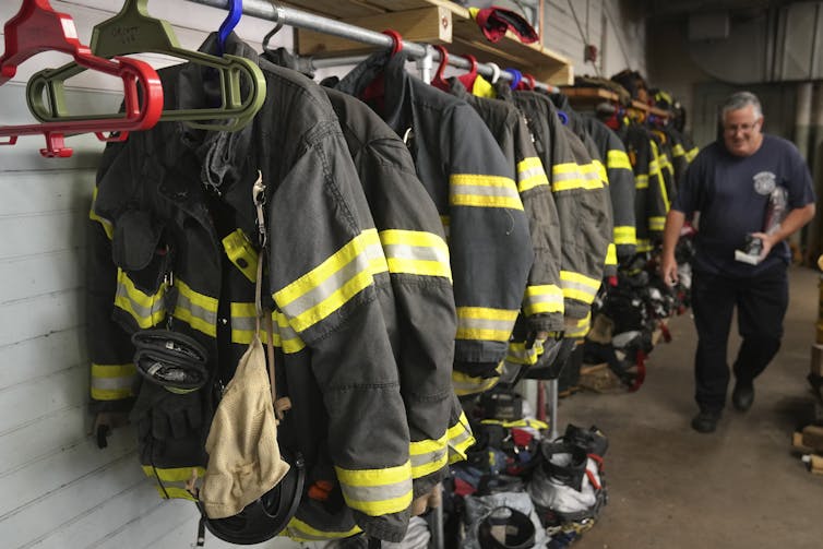


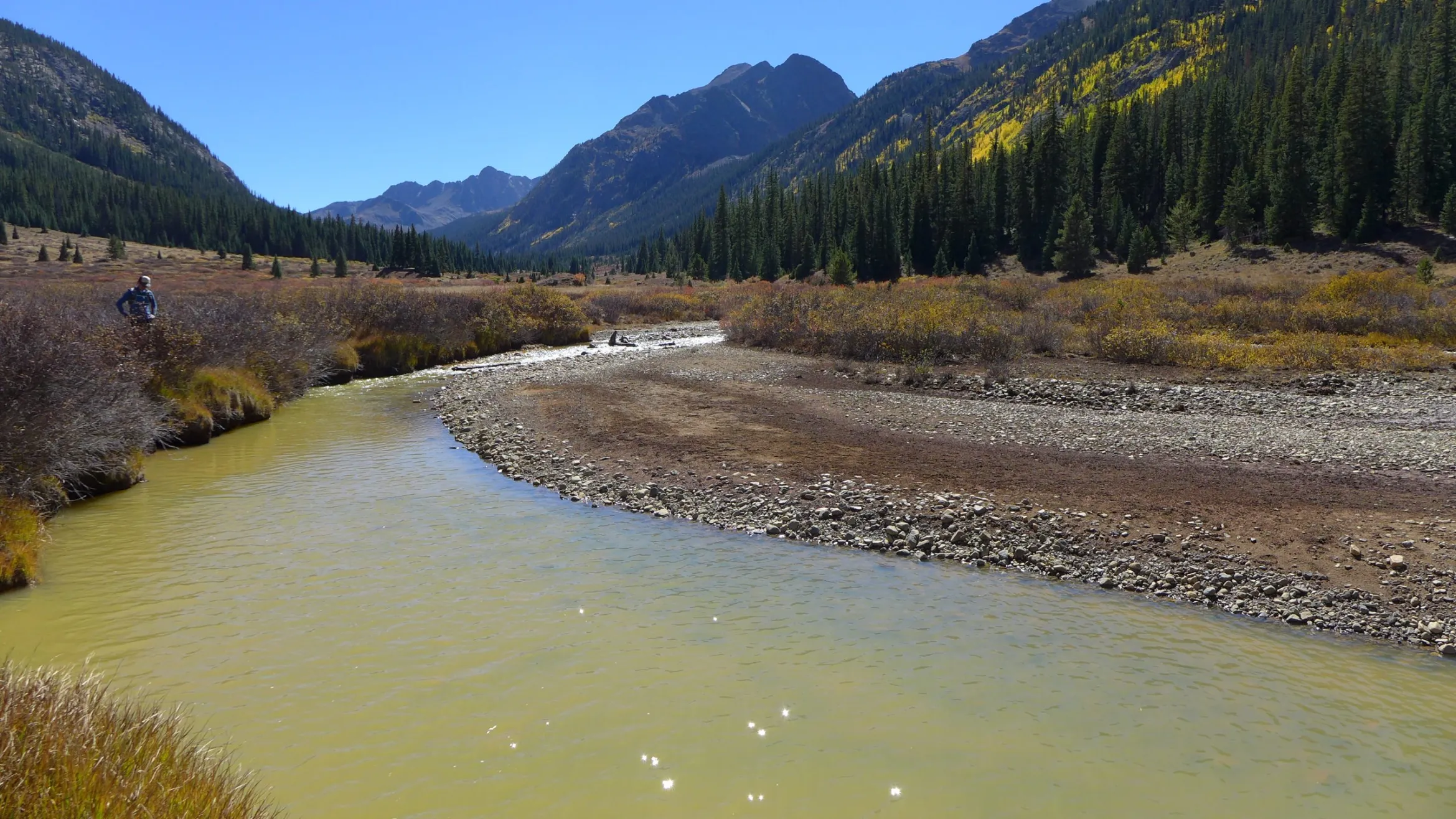


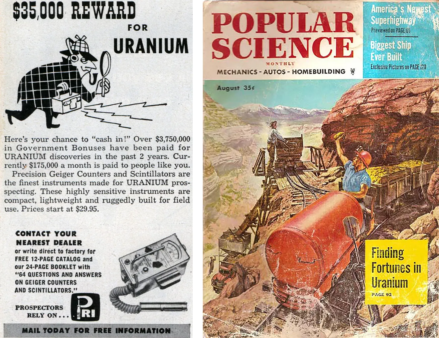
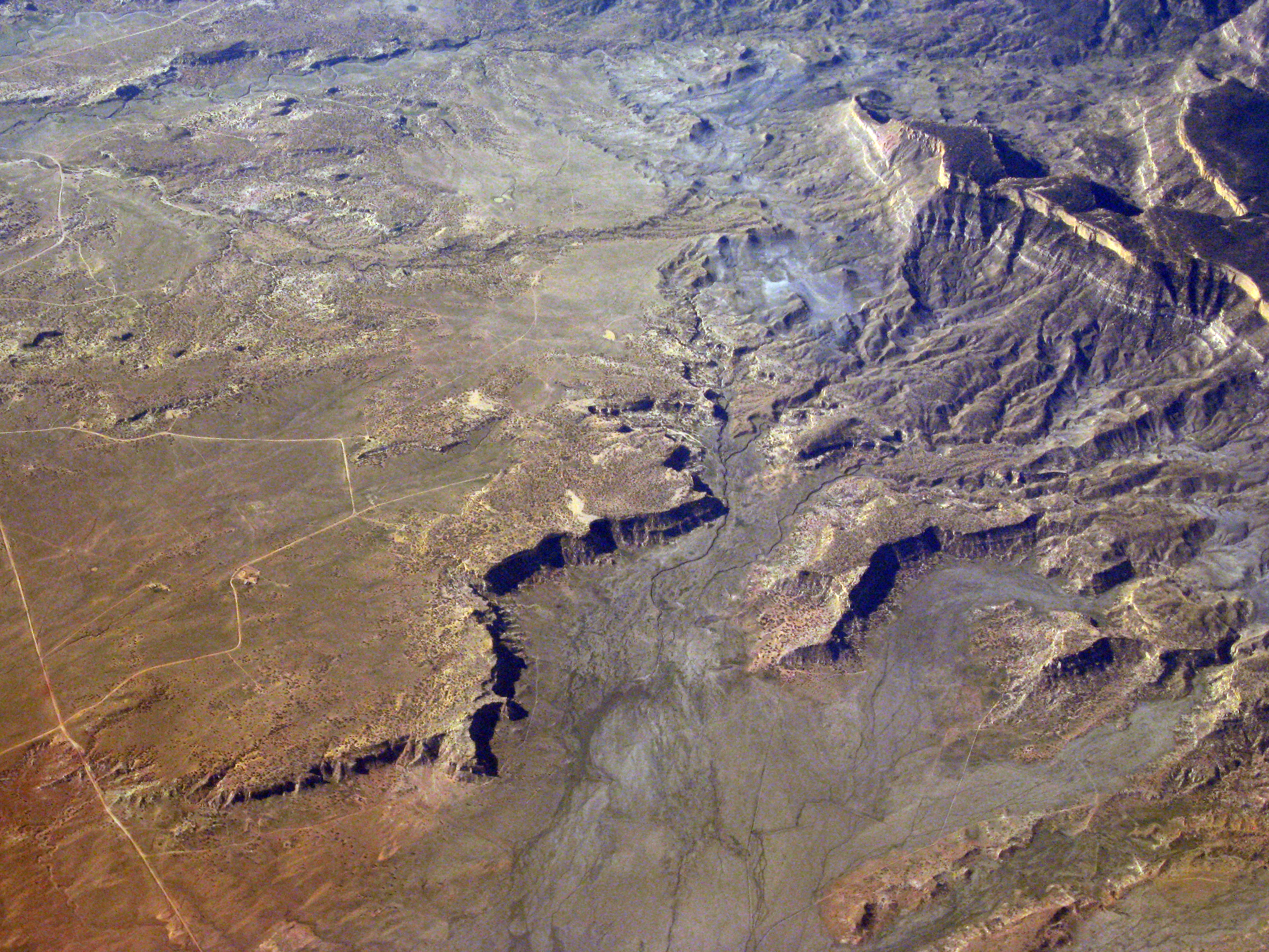
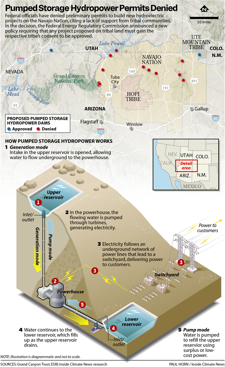

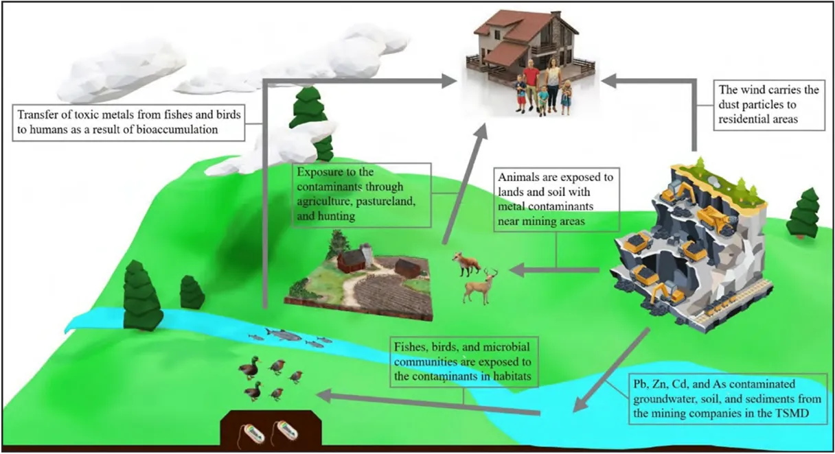
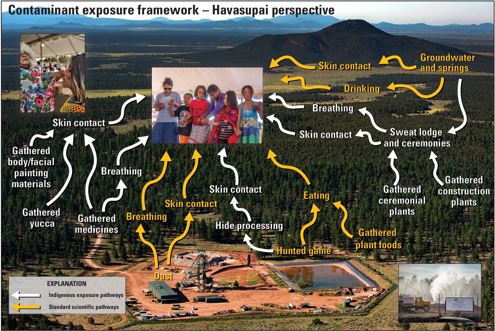

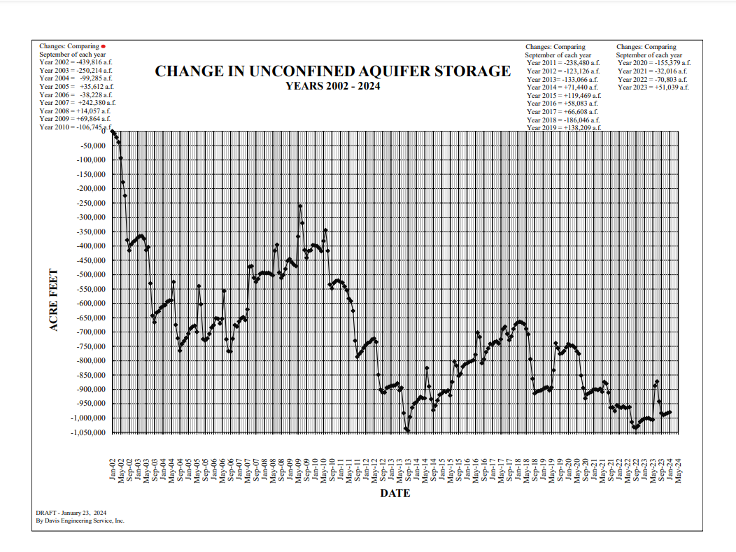
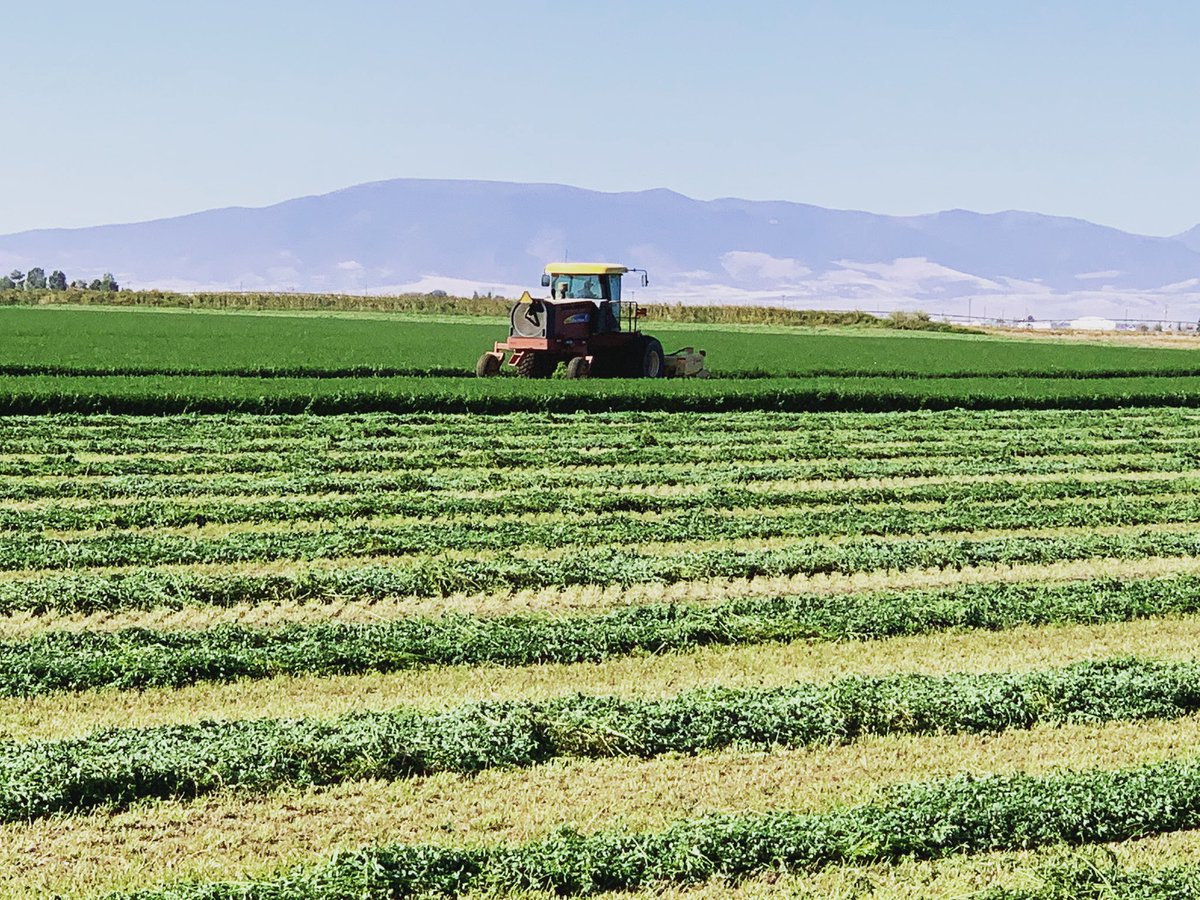


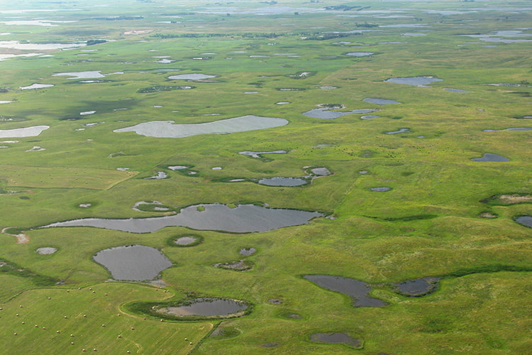


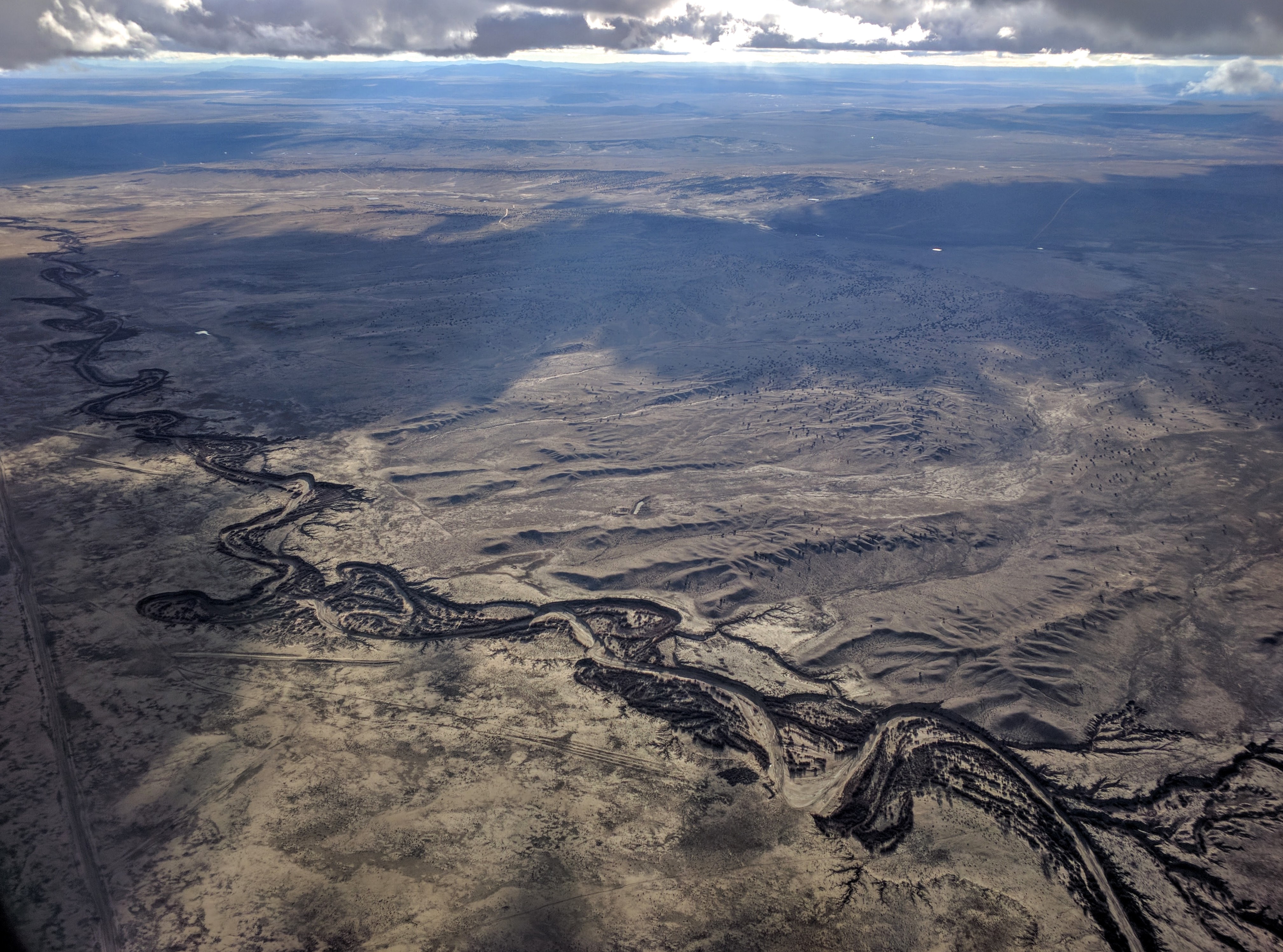


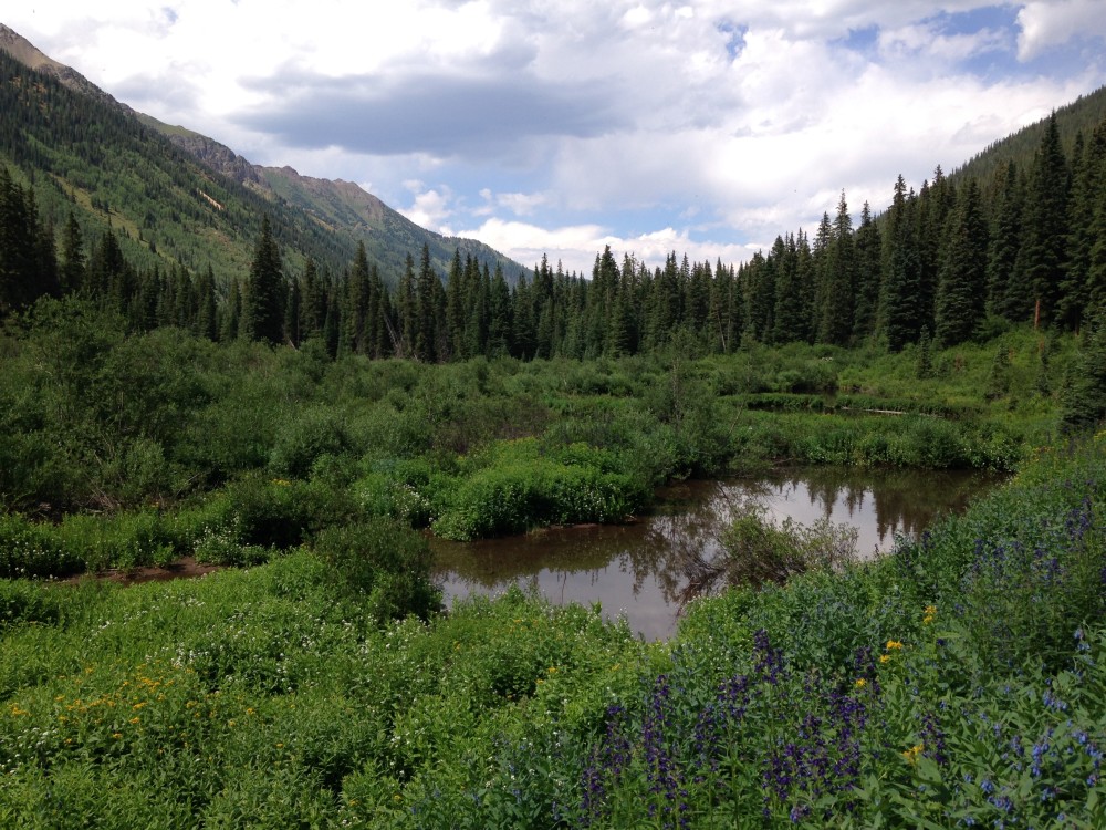
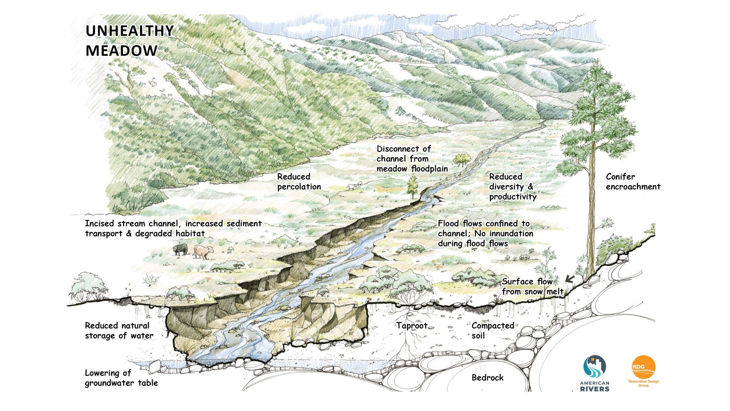


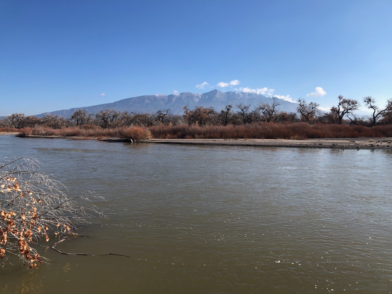
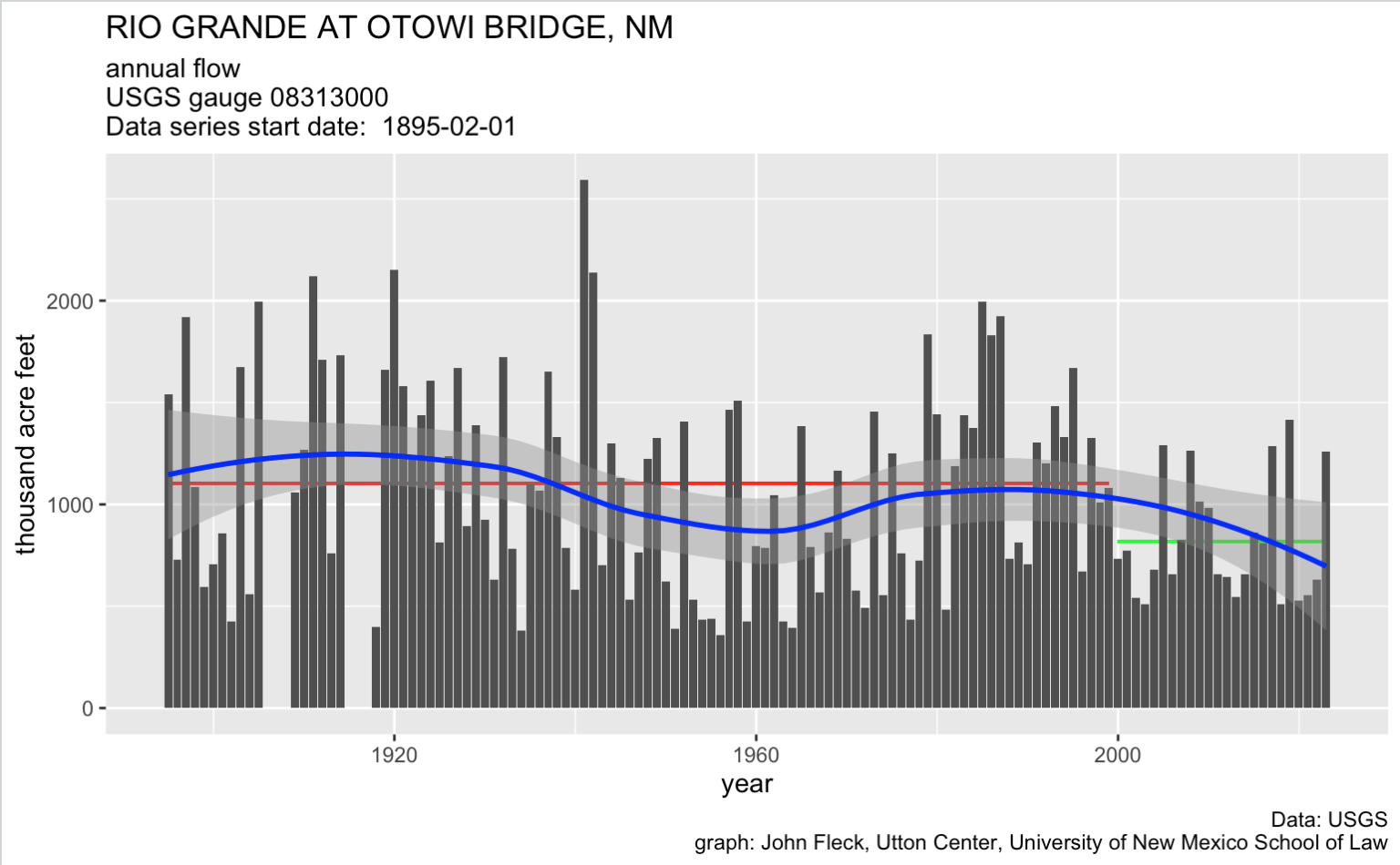
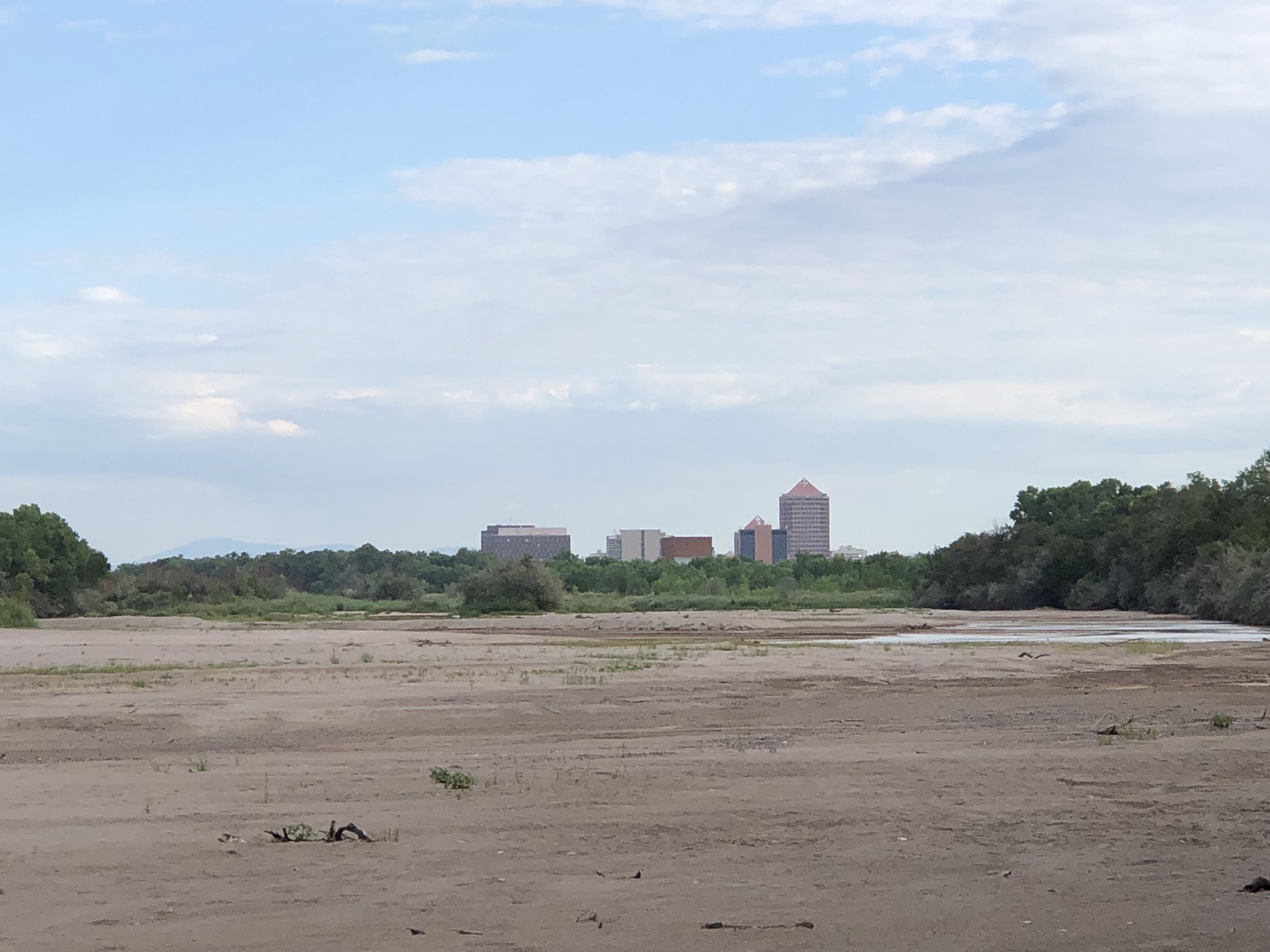
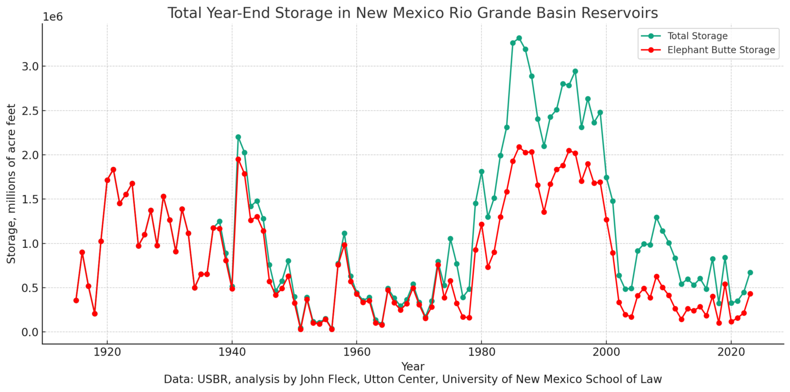


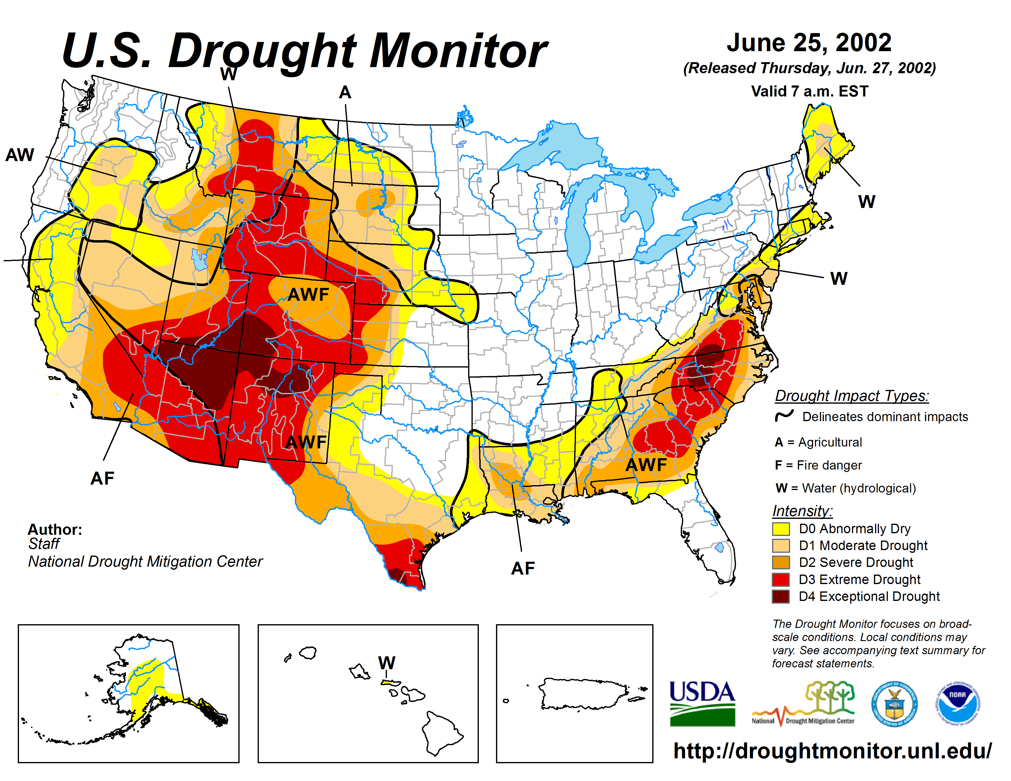


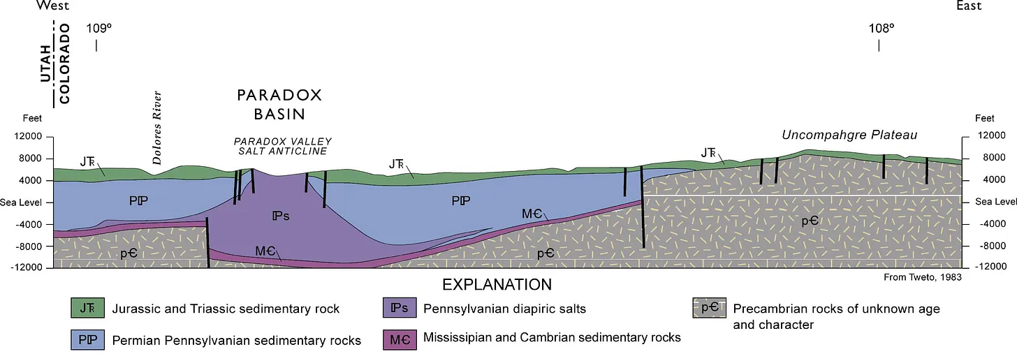


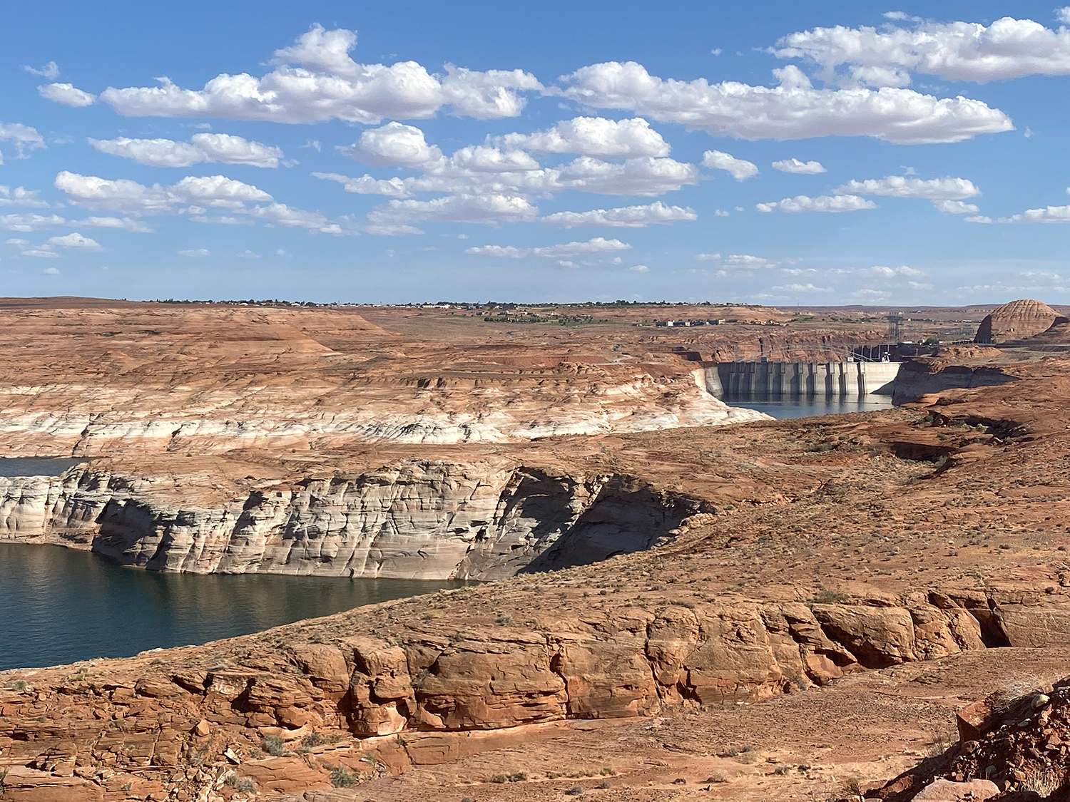

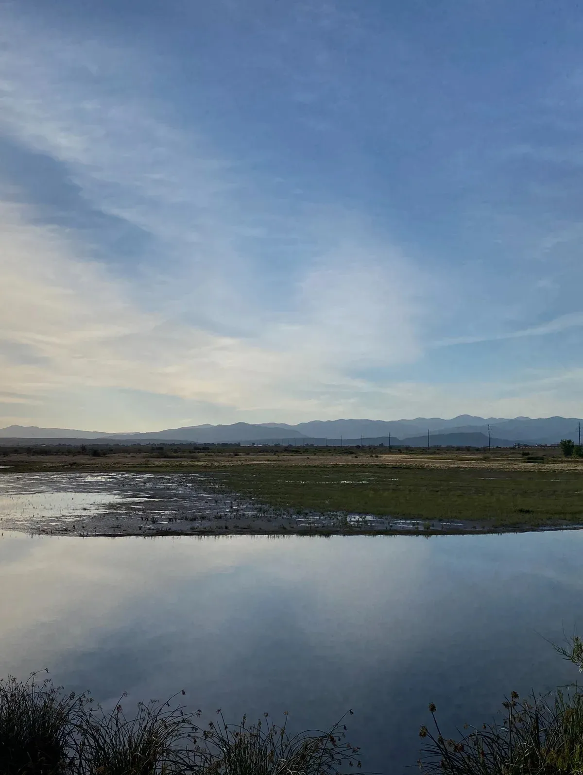
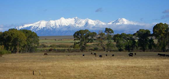


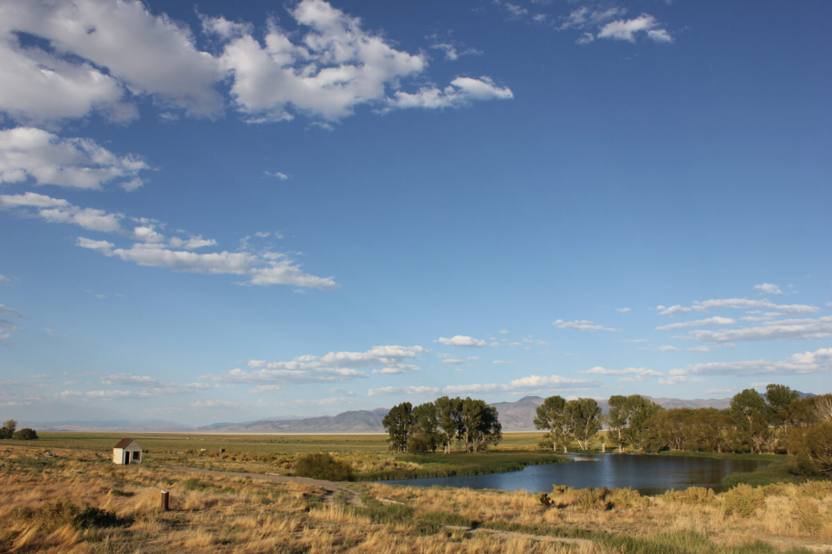


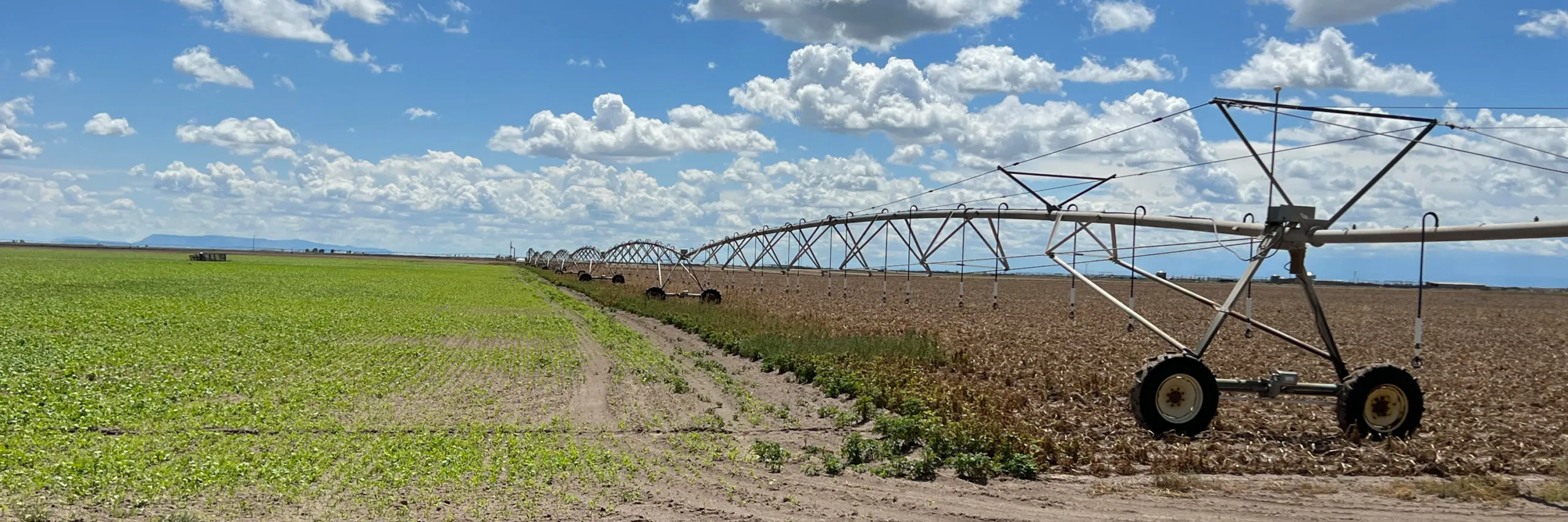
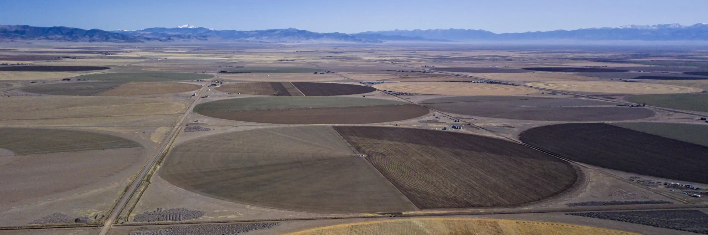
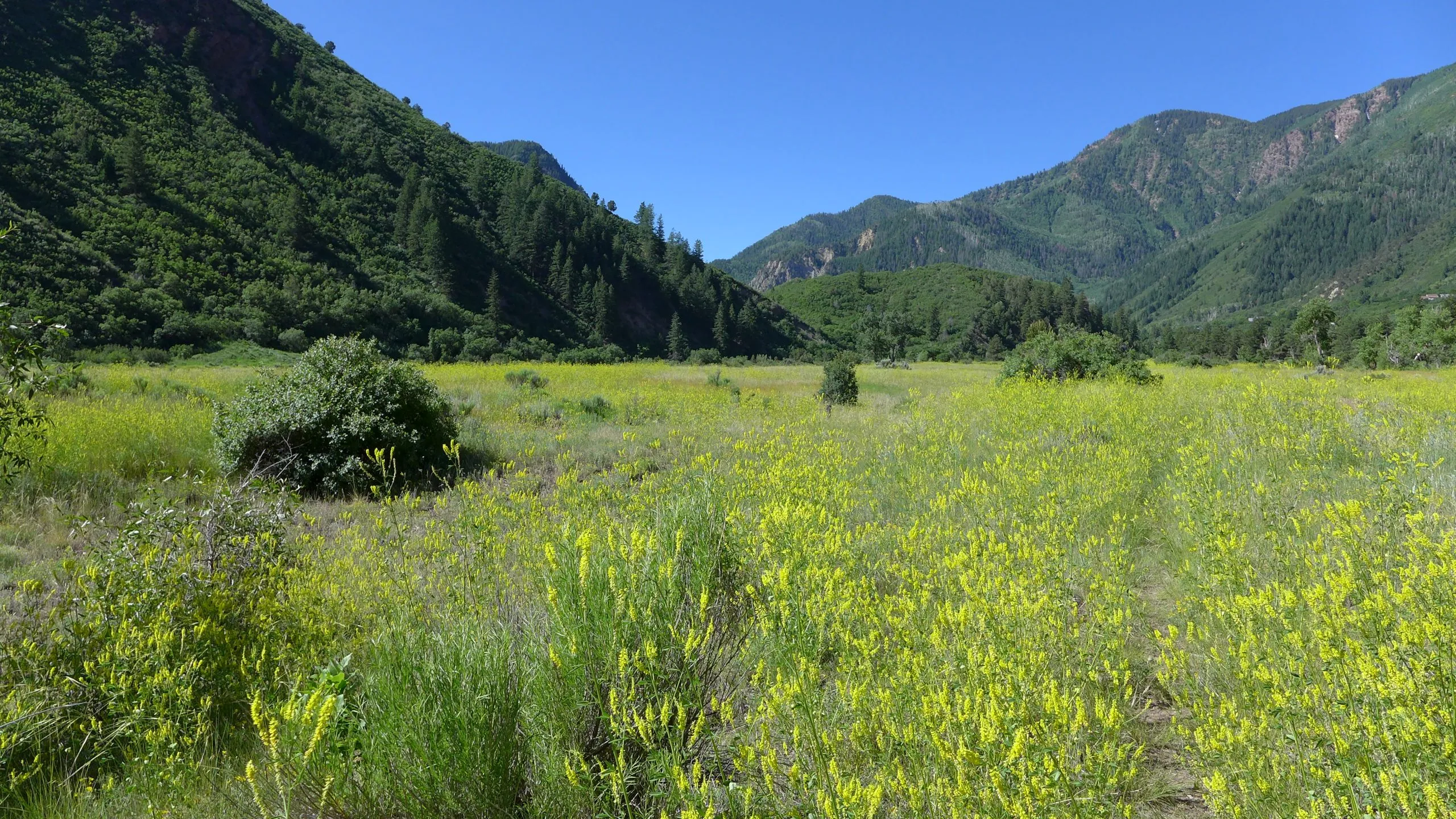

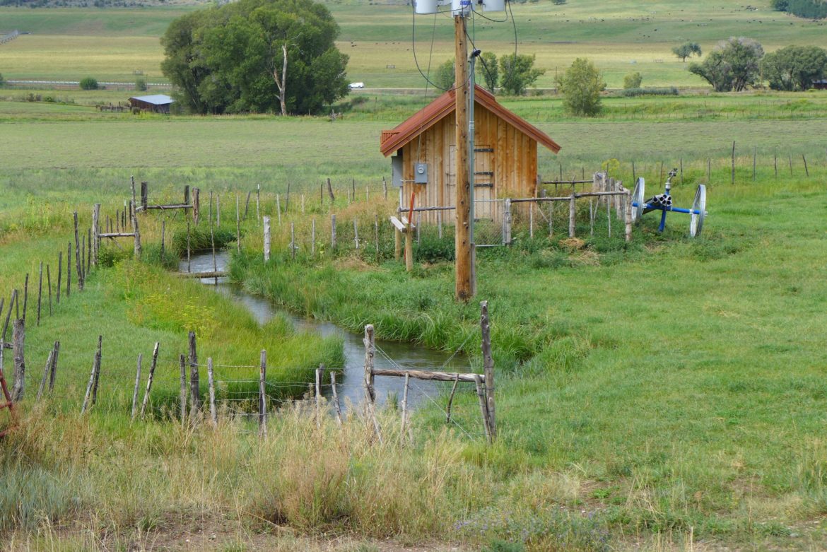
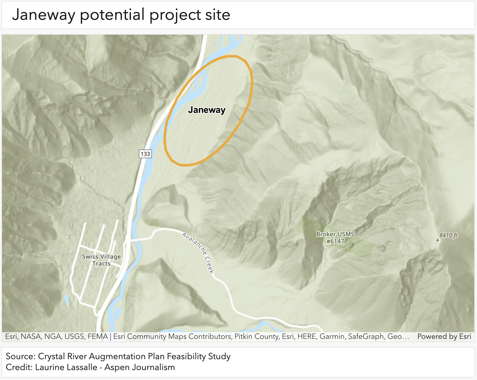
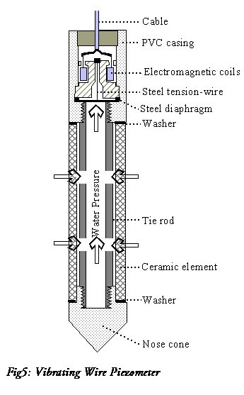

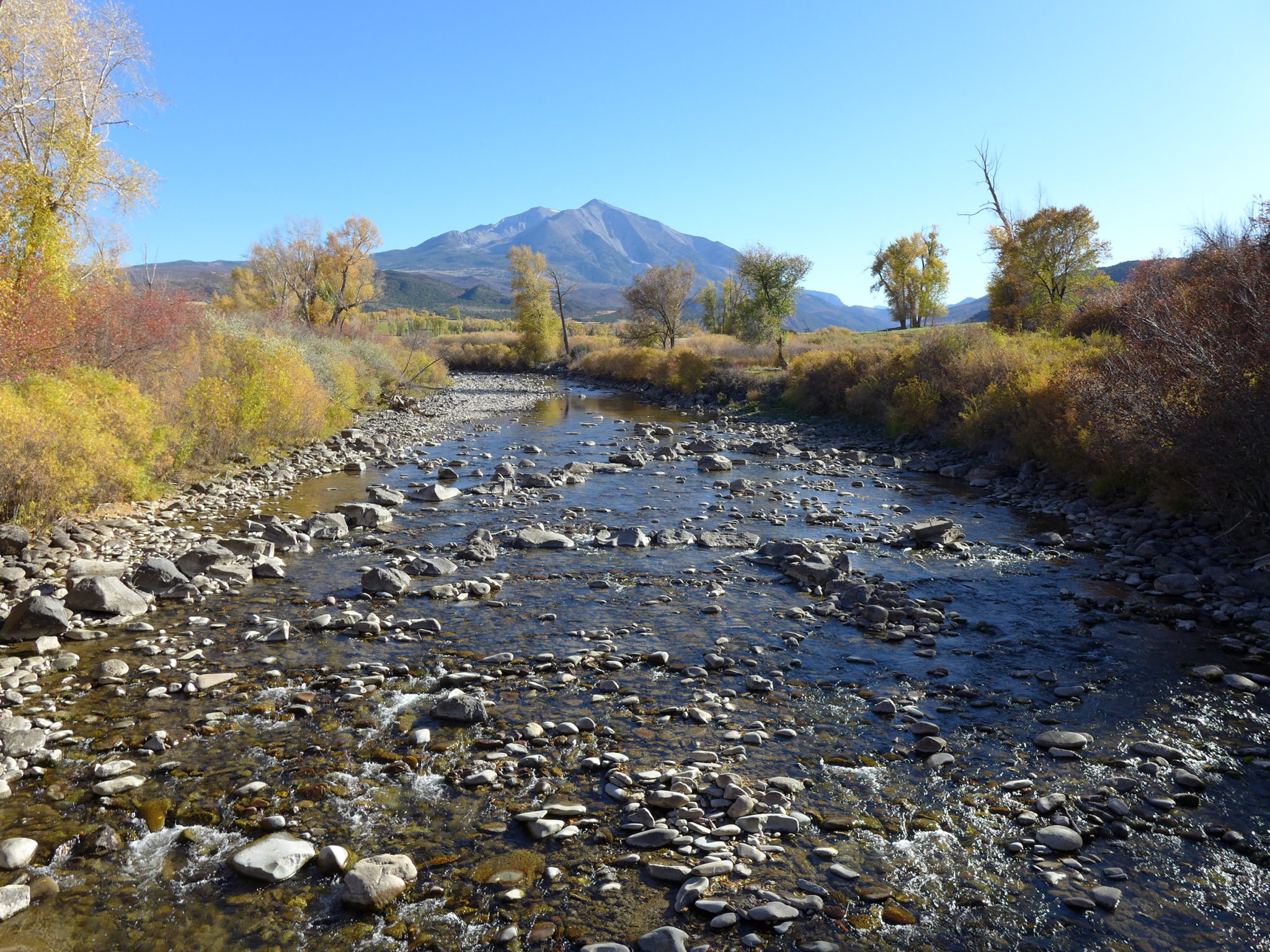


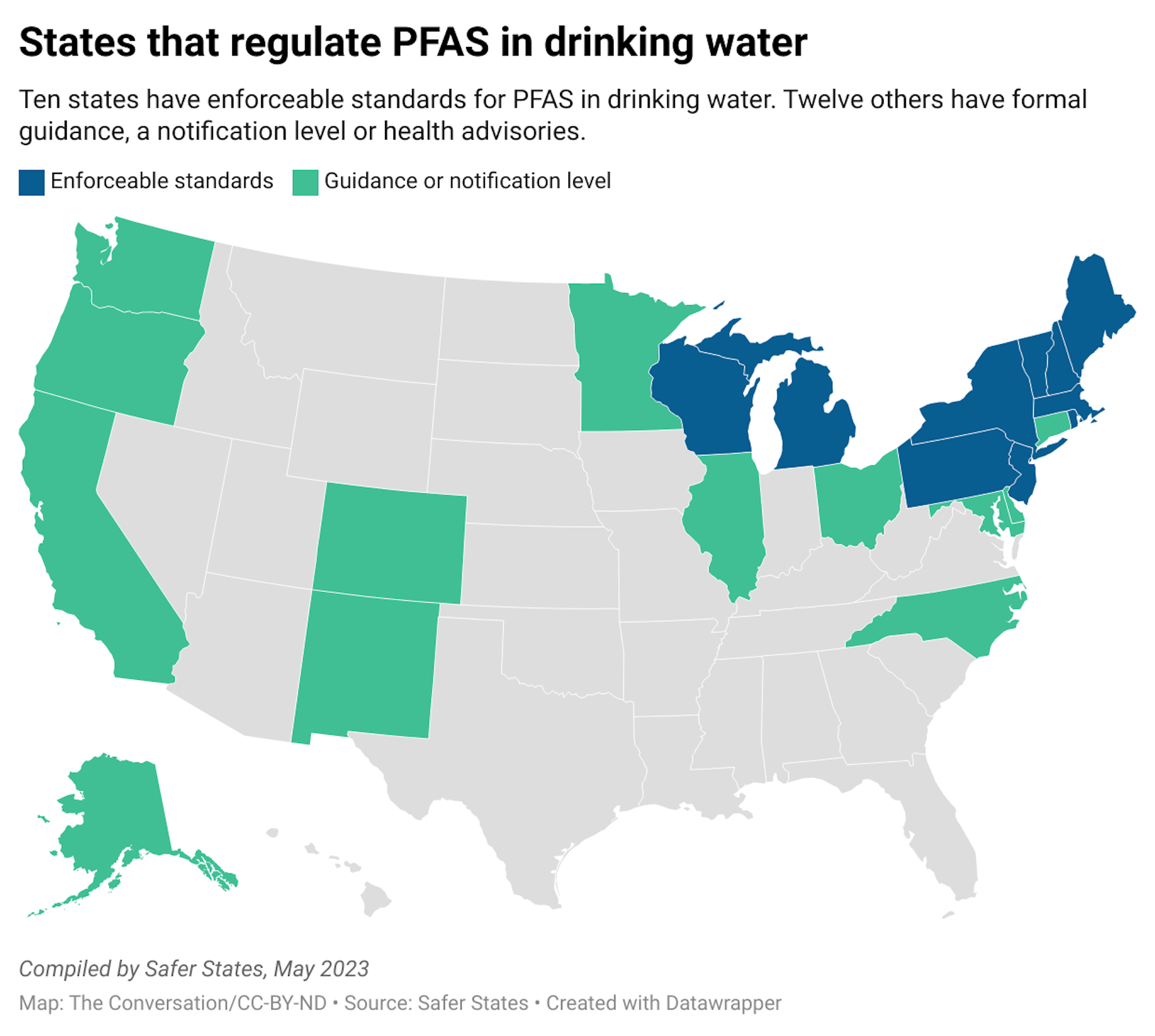