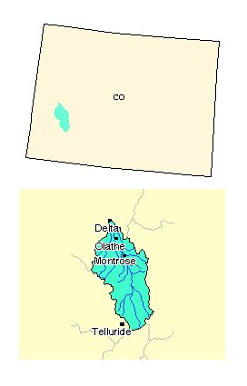
Uncompahgre River watershed: Streamflow management study and plan

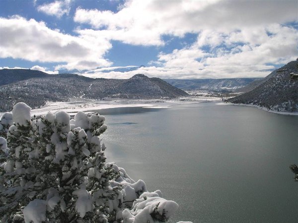
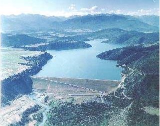
Ridgway Reservoir during winter

From The Telluride Daily Planet (Tanya Ishikawa):

Whitmore volunteered to oversee Ouray County’s grant application submission to the Colorado Water Conservation Board to get funding for a stream management study and plan. The study is aimed at confirming and expanding the information from a 2016 water needs study by Wright Water Engineers that concluded the county has current unmet needs and will need additional water supplies for the future, especially in the area of storage.

Last year’s study was initiated by the county and the Ouray County Water Users Association, a group organized to represent agricultural water users, and Tri-County Water Conservancy District, which manages the operation of the Ridgway Dam and supplies water to an area including parts of Ridgway, Montrose, Olathe and Delta. The county commissioners approved a memorandum of understanding between the three entities on July 11, to give the county permission “to take the lead in moving forward with development of the water rights” to supply future water projects such as building reservoirs for storage. Tri-County approved the agreement on Wednesday, and the water users group was reviewing the document this week but had not yet approved it…

The stated purpose of the stream management plan is “to assist in balancing water needs amongst various users and the development of additional sustainable multipurpose water supplies including both consumptive and non-consumptive demands.” To complete the plan, the recommended tasks include further evaluation of water needs in the upper Uncompahgre River water supply area, possible storage development, potential development of voluntary water transfer agreements between water rights holders, and identification of ditch irrigation efficiency projects.

Tri-County water rights being considered for potential storage and storage expansion projects are located on Dallas Creek and Cow Creek. Proposed project locations are Dallas Divide, Ram’s Horn and the Sneva Ditch.

The county plans to invite various stakeholders to create a steering committee to manage and implement the stream management plan and grant. Whitmore said that in creating the committee, “We want to make sure we are bringing all our knowledge and experience together so we hopefully have the support of the whole community. The support of the whole community is important because whether we look at exchanges, new water rights or storage, we need to go through water court. If everyone agrees, it’s less likely those plans will run into opposition.”

Pete Foster, Wright Water’s vice president and senior project engineer, and Cary Denison, a Ouray County resident and Trout Unlimited’s Gunnison Basin project coordinator, assisted in developing a draft grant application. Foster will be paid out of the county budget, and possibly some funding from Tri-County and the water users group, for related consulting work on the grant, steering committee administration and plan development and implementation.

The county expects to submit the application for an amount under $100,000 by early October, and if funding is awarded, complete the study by the end of 2018.

@USBR: Releases Draft Environmental Assessment for Phase II of Piping Cattleman’s Ditches

Credit: Cattleman’s Ditches Pipeline Project II Montrose County, Colorado EIS via USBR.

Here’s the release from the US Bureau of Reclamation (Justyn Liff, Jenny Ward):

The Bureau of Reclamation has released a draft environmental assessment on Phase II of the Cattleman’s Ditches Piping Project located in Montrose County, Colorado. The project would replace approximately 6.1 miles of open irrigation ditch with 5.1 miles of buried water pipeline. The purpose of the project is to reduce salinity loading in the Colorado River Basin.

The draft environmental assessment is available online at http://www.usbr.gov/uc/envdocs/index.html or a copy can be requested by contacting Reclamation.

Reclamation will consider all comments received by September 15, 2017. Submit comments by email to jward@usbr.gov or to: Ed Warner, Area Manager, Bureau of Reclamation, 445 West Gunnison Ave, Suite 221, Grand Junction, CO 81501.

10th Annual Ridgway RiverFest this Saturday, June 24, 2017

From email from the Uncompahgre Watershed Partnershiip Coalition:

10th Annual Ridgway RiverFest 20 years in the making

In 1997, when the town of Ridway applied for its first grant to restore the Uncompahgre River in town limits, a group of visionaries imagined the area becoming a river recreation attraction for the community. Little did they know that the restored length of river and the 11-acre park on its west bank would become the site of a major watershed celebration, attracting about 500 people each year for 10-plus years.

The town is celebrating the 10th annual Ridgway RiverFest, a free community festival at Rollans Park (next to the Highway 62 bridge), on Saturday, June 24.

The first riverside celebration was organized by the town government in July 2003 when a Great Outdoors Colorado grant was awarded to the town for major river restoration. But, the official Ridgway River Festival was started by a local nonprofit, the Mosaic Community Project, in 2008. The nonprofit was formed by local mothers hoping to establish a charter elementary school in Ridgway. Though they were unsuccessful, they had lots of energy and wanted to give back to the community so they raised funds through various events and awarded grants to service projects proposed by local students.

The group funded the installation of a bench by local artist Lisa Issenberg next to the river, and a bike rack by Jeff Skoloda by the pedestrian bridge in Rollans Park. The river festival became its signature event from 2008 to 2013. In addition to a watershed education area and nonprofit booths, the festivals featured live music, food vendors, Colorado beers and margaritas, including frozen ones created by Glenda the Blenda bike. The bike had been created by the Mosaic Community Project as a way of raising funds at local events.

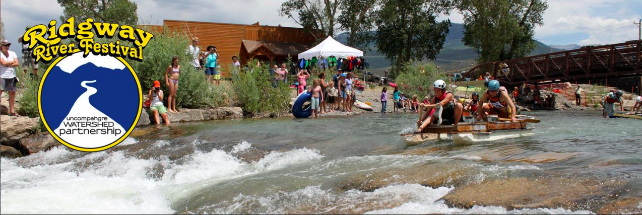
Since 2008 until today, the festival has also featured on-river activities and races including hard shell and inflatable boats as well as standup paddleboards. The highlight is the “Junk of the Unc” where competitors race on home-made river-crafts made of all kinds of repurposed materials.

In 2011, the Uncompahgre Watershed Partnership, a local group that aims to protect and restore local water resources through collaborative projects, joined in the festival organization. The group was created in 2007 to bring stakeholders together to monitor and improve the water quality in the Uncompahgre River and surrounding watershed, and became a nonprofit in 2013.

The partnership took over the organization of the entire festival in 2014. About half the proceeds from sponsorships, silent auction purchases and drink sales at the festival pay for the entertainment and other expenses, and the other half of the proceeds funds future water monitoring, mine remediation and other related projects.

Part-time staff and volunteer board members have kept it going by enlisting the support of dozens of volunteers and nearly a hundred sponsors each year. Ouray Mountain Rescue Team and local resident Chris Haaland have kept the river races going every year and still volunteer their time to ensure the river activities are safe and fun.

While the same popular festival activities like live music from bluesman Kipori Woods and friends are repeated each year, some special additions have been made to the 10th annual event. The silent auction area, which was initiated a few years ago, has been dubbed the River Rat Marketplace and will offer more great deals than ever on donated products, services and certificates from nearly 50 companies. A Ute flute player will join Ute elder Roland McCook to share their traditional culture. Youth areas will include a River Fairy Forest with four activity stations and a bug science demonstration. Plus, a commemorative mural will be colored by the community, and drinks will be served in reusable, collectible festival cups.

The 10th Annual Ridgway RiverFest will be Saturday, June 24, from 10 a.m. to 6 p.m. For the festival schedule and information, visit http://ridgwayriverfest.org.

Uncompahgre River Valley looking south

Uncompahgre Water Partnership: We’ve been slimed!

Macro Invertebrates via Little Pend Oreille Wildlife Refuge Water Quality Research

From the Uncompahgre Water Partnership:

Every year, a few weeks before Halloween, the Uncompahgre River seems to blossom with slimy, bubbling growths in areas of the lowest flow. This substance is green algae, decaying and releasing bubbles that are often trapped by iron deposits. Though the algae appears more prominently and abundantly in this season, it’s actually present in the river – even in high flow areas – year round. This fall, the slime may be more noticeable due to more pronounced bubbles caused by the unusually warm temperatures.

While this algae is a typical condition of many river systems and streams, it suffocates macroinvertebrates. According to Uncompahgre Watershed Partnership board member and River Watch volunteer Dudley Case, River Watch experts explained that the zinc in the Uncompahgre River negatively effects both fish and macroinvertebrates, and the slime clogs up areas where they might nest and reproduce.

“Macroinvertebrates are a food source for fish, so the less macroinvertebrates, the less fish. Since the slime is so endemic in the river, reducing the slime safely would be a useful project,” said Case.

Observing and reporting on these types of water issues is one of the goals of the Uncompahgre Watershed Partnership (UWP) as we monitor watershed conditions and communicate with stakeholders. We are reviewing our Watershed Plan this winter so we can make updates related to project and study results from recent years. We hope you will contribute your observations and ideas about priorities to the review and update process. Please feel free to contact us anytime with your thoughts, and we will be back in touch with you to collect input in the coming months, too.

Uncompahgre River watershed

Aspinall Unit operations update: Gunnison Tunnel turning off, 600 cfs in Black Canyon

Fog-filled Black Canyon via the National Park Service

From email from Reclamation (Erik Knight):

Releases from Crystal Dam will be decreased from 1500 cfs to 600 cfs on Tuesday, November 1st. This reduction will follow the shutdown of diversions to the Gunnison Tunnel. Release reductions will be coordinated with Gunnison Tunnel diversion reductions throughout the morning of November 1st. River flows downstream may fluctuate during the shutdown period but flows should steady out at the current level by the afternoon. The current content of Blue Mesa Reservoir is 610,000 acre-feet which is 73% full.

Flows in the lower Gunnison River are currently above the baseflow target of 1050 cfs. Flows are expected to remain above the baseflow target for the foreseeable future.

Pursuant to the Aspinall Unit Operations Record of Decision (ROD), the baseflow target in the lower Gunnison River, as measured at the Whitewater gage, is 1050 cfs for November through December.

Currently, diversions into the Gunnison Tunnel are around 900 cfs and flows in the Gunnison River through the Black Canyon are around 600 cfs. After this release change Gunnison Tunnel diversions will be at zero and flows in the Gunnison River through the Black Canyon should still be around 600 cfs. Current flow information is obtained from provisional data that may undergo revision subsequent to review.

Uncompahgre Valley Water Forum Sept. 1 — The Montrose Press

Uncompahgre River Valley looking south

From The Montrose Press:

John Stulp, special advisor to the Governor and director of the Inter Basin Compact Committee for the State of Colorado, will speak at the Uncompahgre Valley Water Forum Sept. 1.

The event will be held at the Montrose County Fairgrounds in Friendship Hall 6:30-9 p.m. Stulp’s presentation will be focused on what the State Water Plan says about agricultural water.

He will address the extent to which everyone is a recipient of the benefits that ag. water provides – not just the foods and fibers grown and raised that require water, but also important community amenities, like city parks, soccer fields and cemeteries which often depend on ag. water to keep grass growing and green.

Shavano Conservation District is hosting the Uncompahgre Valley Water Forum to create a medium for landowners to be aware of ideas and views on local and state agricultural water.

Other speakers at the Forum include Marc Catlin, who is the Water Development coordinator for Montrose County, sits on the Colorado River Water Conservation Board,and also on the Gunnison Basin Roundtable.

Dick Wolfe, state engineer for the Colorado Division of Water Resources; Steve Anderson, manager of the Uncompahgre Valley Water Users Association; and MaryLou Smith from the Colorado Water Institute at Colorado State University, will also be on hand.

Those planning to attend should RSVP by Aug. 29 to either Bert at 970-249-8407, ext. 115, or by email to bertha.earle@co.nacdnet.net.

@USBR: The next Aspinall Unit operations meeting is Thursday #ColoradoRiver #COriver

Aspinall Unit dams
Aspinall Unit dams

From email from Reclamation (Eric Knight):

The next Aspinall Operations meeting will be held this Thursday, August 18th at the Elk Creek Visitor Center at Blue Mesa Reservoir. Start time is 1 PM.

New seven-year water #conservation plan to be reviewed Tuesday by the Montrose City Council

View along Main Street in early Montrose (between 1905 and 1915). Shows a horse-drawn carriage, bicycles, and two men talking. Signs include: "The Humphries  Mercantile Co. Dry Goods, Clothing, Hats & Shoes" "Montrose National Bank" and C. J. Getz, Pharmacist, Druggist." via http://photoswest.org
View along Main Street in early Montrose (between 1905 and 1915). Shows a horse-drawn carriage, bicycles, and two men talking. Signs include: “The Humphries
Mercantile Co. Dry Goods, Clothing, Hats & Shoes” “Montrose National Bank” and C. J. Getz, Pharmacist, Druggist.” via http://photoswest.org

From The Montrose Daily Press:

Montrose City Council will consider the 182-page document at its regular meeting Tuesday evening.

Public comment will be accepted and following the hearing, a resolution to adopt the plan may be considered.

Drawing the plan began shortly after the Colorado Water Conservation Board determined each public entity distributing 2,000 acre-feet per year or more of water to encourage efficient use of water, according to city documents provided in Tuesday’s council agenda packet.

In the document, the city spells out how the plan will be implemented, monitored, reviewed and revised over the next seven years. It also estimates how much water will be conserved by implementing the plan.

“The goal of the City of Montrose Water Conservation Plan is to increase the efficient use of water throughout the city by identifying challenges and methods for overcoming each,” an executive summary of the plan says…

A complete copy of the plan is available at http://www.cityofmontrose.org/300/Water.

#ColoradoRiver: Aspinall Unit operations update #COriver

Aspinall Unit
Aspinall Unit

From email from Reclamation (Erik Knight):

Releases from Crystal Dam will be increased from 1850 cfs to 2000 cfs on Friday, July 15th. Flows in the lower Gunnison River have been dropping quickly over the last week and are now just under the baseflow target. This increase is intended to raise flows in the lower Gunnison River as well as manage the reservoir content to reach the end of year winter target elevation. The current April-July runoff forecast is now at 91% of average. The current content of Blue Mesa Reservoir is 796,000 acre-feet which is 96% full.

Flows in the lower Gunnison River are currently below the baseflow target of 1500 cfs. This increase should restore flows to a level at or above the baseflow target.

Pursuant to the Aspinall Unit Operations Record of Decision (ROD), the baseflow target in the lower Gunnison River, as measured at the Whitewater gage, is 1500 cfs for July.

Currently, diversions into the Gunnison Tunnel are around 1050 cfs and flows in the Gunnison River through the Black Canyon are around 850 cfs. After this release change Gunnison Tunnel diversions will still be at 1050 cfs and flows in the Gunnison River through the Black Canyon should be around 1000 cfs. Flows in the river may be less than 1000 cfs if the maximum capacity of the Crystal powerplant proves to be less than 2000 cfs. Current flow information is obtained from provisional data that may undergo revision subsequent to review.

Aspinall Unit operations update: Black Canyon peak flow target 5,000+ cfs over 10 days

Sunrise Black Canyon via Bob Berwyn

From email from Reclamation (Erik Knight):

The May 1st forecast for the April – July unregulated inflow volume to Blue Mesa Reservoir is 525,000 acre-feet. This is 78% of the 30 year average. Based on the May 1st forecast, the Black Canyon Water Right and Aspinall Unit ROD peak flow targets are listed below:

Black Canyon Water Right

The peak flow target will be equal to 3,349 cfs for a duration of 24 hours.

The shoulder flow target will be 300 cfs, for the period between May 1 and July 25.

Aspinall Unit Operations ROD

The year type is currently classified as Average Dry

The peak flow target will be 8,070 cfs and the duration target at this flow will be 10 days.

Pursuant to the Aspinall Unit Operations ROD, releases from the Aspinall Unit will be made in an attempt to match the peak flow of the North Fork of the Gunnison River to maximize the potential of meeting the desired peak at the Whitewater gage, while simultaneously meeting the Black Canyon Water Right peak flow amount. The latest forecast for flows on the North Fork of the Gunnison River shows a peak of around 2,000 cfs occurring this weekend. This peak is followed by a couple days of lower flows and then higher flows are expected to return by the next weekend. If the forecast for flows on the North Fork of the Gunnison River continues to show a rise, the start of the ramp up towards the peak release may begin next week.

It is expected that the ramp up to the peak release will take 8 days. The current projection for spring peak operations shows flows in the Gunnison River through the Black Canyon in the 5,000 to 5,500 cfs range for 10 days in order to achieve the desired peak flow and duration at Whitewater. If actual flows on the North Fork of the Gunnison River are less than currently projected, flows through the Black Canyon could be even higher.

With this runoff forecast and corresponding downstream targets, Blue Mesa Reservoir is currently projected to fill to an elevation of around 7499.0 feet with an approximate peak content of 654,000 acre-feet.

Gunnison Ag Producers’ Water Future Workshop, May 3 #COWaterPlan

Ag Workshop Gunnison Flyer

Click here to register.

From the announcement:

A Gunnison Basin Ag Producers’ Water Future Workshop will take place on Tuesday, May 3, 2016 from 11:30 a.m. to 1:30 p.m. at Delta-Montrose Technical College in the Enterprise Room. The Colorado Water Plan encourages the use of “alternative transfer methods” to keep water in agriculture while addressing the anticipated gap in future water supply given projected population growth. What does this mean for agricultural water users in the Gunnison Basin? Irrigators will hear about opportunities for cost sharing of efficiency improvements, water leasing programs, and concerns about “use it or lose it” at this workshop sponsored by the Colorado Ag Water Alliance with assistance from Colorado Cattlemen’s Association and CSU’s Colorado Water Institute.

Brief presentations will be followed by dialogue in which agricultural producers will have a chance to discuss challenges and barriers to these opportunities. Those presenting include Carlyle Currier from the Colorado Ag Water Alliance, Frank Kugel from the Gunnison Basin Roundtable, State Engineer Dick Wolfe, Perry Cabot from Colorado State University Extension, Aaron Derwingson from The Nature Conservancy, Phil Brink from Colorado Cattlemen’s Association, and MaryLou Smith from CSU’s Colorado Water Institute.

#ClimateChange impacting future water management — Ouray County Plain Dealer

uncompahgreriver

From the Ouray County Plain Dealer (Dalton Carver
):

Nearly 40 million people in the seven Colorado River basin states rely on the body of water and its tributaries, including the Gunnison, for their water needs.

However, climate change is being blamed for creating an imbalance in western water that could impact how Colorado River water is managed.

If the imbalance is left unchecked, it could impair the ability of the Colorado River to fulfill the needs of the almost 40 million people it sustains.

The 2016 SECURE report built upon the original basin studies that were published at the end of 2012.
The climate change data, gathered by an Intergovernmental Panel on Climate Change assessment, identified milestones, such as a temperature increase of five to seven degrees by the end of the century, as much as a seven percent decrease in April and July streamflow in several river basins and a decrease of precipitation over the southwest and south central areas of the country.

“A whole bunch of global climate models that are run by various research institutions are part of putting that together,” said Carly Jerla, a BuRec leader on the Colorado River Basin study. “[The Bureau of] Reclamation teamed up with those groups to take those projections and downscale them into hydrology stream flows we can then use to do projections on how our river systems operate with those kind of climate change adjusted flows in place.”

#COWaterPlan: The Irrigation and Water Efficiency Conference, January 20

Ridgway via AllTelluride.com

From The Montrose Daily Press (Devin O’Brien):

The Shavano Conservation District will provide an opportunity for area residents to slake their thirst for information about the Colorado Water Plan and water management.

The Irrigation and Water Efficiency Conference will address the recently adopted plan as well as management methods, Colorado water law, funding for irrigation improvements and wildlife habitat, according to a press release. Shavano Conservation District President Ken Lipton said information about the future of water use in Colorado is applicable to those whose interest is agricultural, environmental or otherwise.

“It’s important that every citizen understands the Colorado Water Plan,” Lipton said. “It’ll affect everyone.”

One of the areas the conference will cover will be small acreage management, which, according to Lipton, is growing in popularity in Montrose and Ouray counties.

John Rizza, a Small Acreage Management Specialist, is one of the speakers at the event. Water rotation among small farms and crops able to withstand drought are among the subjects he will address.

Oftentimes small acreage farms are formed by dividing land from a larger farm. In terms of water, this means a source is being used by multiple people for the first time, according to Rizza. Communication with other landowners is necessary to ensure a water source isn’t compromised through multiple people watering their fields on the same day. This is especially important in areas prone to droughts.

Another method of small acreage water management comes in the form of the perennial farm system. Perennial crops, such as the feed crops of Needle and Thread, Blue Grama, Indiana Rice Grass and Wheatgrass, are able to adapt to waterless conditions by hibernating. What results is a crop that is able to thrive until precipitation returns to an area.

“They can handle a little bit of drought and still produce a well for landowners,” Rizza said…

Other speakers include Special Policy Advisor to the Governor for Water John Stulp and former Division Four Water Court Referee Aaron Clay.

The conference is sponsored by the Bureau of Reclamation, the Colorado Department of Agriculture, the Natural Resource Conservation Service in addition to the Shavano Conservation District…

The event will be 2 p.m. Wednesday Jan. 20 at the 4-H Event Center in Ridgway. Attendees are encouraged to RSVP by calling (970) 249-8407, or emailing mendystewart@co.nacdnet.net

Registration now open for the 4th Annual Western Colorado Food and Farm Forum

View along Main Street in early Montrose (between 1905 and 1915). Shows a horse-drawn carriage, bicycles, and two men talking. Signs include: "The Humphries  Mercantile Co. Dry Goods, Clothing, Hats & Shoes" "Montrose National Bank" and C. J. Getz, Pharmacist, Druggist." via http://photoswest.org
View along Main Street in early Montrose (between 1905 and 1915). Shows a horse-drawn carriage, bicycles, and two men talking. Signs include: “The Humphries
Mercantile Co. Dry Goods, Clothing, Hats & Shoes” “Montrose National Bank” and C. J. Getz, Pharmacist, Druggist.” via http://photoswest.org

Click here to register for the forum. From the Western Colorado Food and Farm Forum website:

The conference has a wide array of breakout sessions which convey vital, regionally specific agricultural information in areas including maximizing crop and livestock production, innovative agricultural marketing and management strategies, and specialty crops. Please join us in improving the sustainable production, marketing and consumption of local food.

The conference is for anyone with an interest in the future of agriculture, including: ranchers, farmers, gardeners, students, and ag professionals. Whether you’re looking to improve or innovate on your existing practices, the forum has myriad resources and networking opportunities.

Watering the West: How pioneers built local towns through irrigation — The Watch

Dolores River watershed

From The Watch (Regan Tuttle):

Telluride’s early days, survival depended dearly on water. The enterprises that built the region — farming, ranching and mining — required irrigation from rivers, and lots of it. Of course, water becomes scarcer the farther one moves from the mountains or from the San Miguel River.

For the pioneers, creating an infrastructure that could sustain them in the short term and withstand the march of progress was no easy task. Suffering cold conditions, subsisting on biscuits and beans, laboring with shovels, axes and other hand tools, pioneers worked to channel water from its source to where they needed it.
Back then, this was legal. Just decades ago, as the old-timers established our local towns, “Water could be diverted from the stream, and ditches built across public and private land to convey water to its place of beneficial use,” the Colorado Foundation for Water Education reported.

“In a dry and thirsty land it is necessary to divert the waters of the streams from their natural channels,” Colorado Chief Justice Moses Hallet said in the late 1800s.

Telluride

During Telluride’s early days, water was hauled from the San Miguel River and from springs on the east side of town. Wilson Rockwell said in his book “Uncompahgre Country” that a man named Dutch George in the late 1800s delivered five-gallon buckets of water from the spring at Cornet Creek to saloons and businesses on what is now Colorado Avenue for 10 cents each, two buckets at a time, balanced by a yoke around his neck.

When attorney L.L. Nunn needed water for his commercial bathhouse on the east end, he ran a garden hose from Cornet Falls. Later, in 1886, H. H. Corbin constructed a 370-foot vertical pipeline that transported water from Cornet Creek into town.

Though people then said it couldn’t be done, high pressure water was flumed from Trout Lake to help establish the Ames power plant, and later the Ilium plant, that would put Telluride on the map as the first city in the world to be powered by alternating electric current. Of course, the purpose was to support the mining industry.

Nucla

For some, creating access to water was more difficult. The Town of Nucla, formerly Tabeguache Park, was founded by a socialist organization whose members wanted to escape their greedy landlords in Denver. By accident, they discovered the location that provided everything they desired: mild winters, ample sunlight, virgin soil — but no water.

Called the Colorado Cooperative Company, the members, or comrades, set up camp in the late 1800s in what became the second largest city in Montrose County to bring water to the homesteads for which they’d filed claims.
They were told their task was impossible.

“I believe [that] actually helped build the ditch. When you are told you can’t, you’ll bust a tug to do it,” Leonard F. Zatterstrom said in a memoir published in Marie Templeton’s book “The Visionaries.”

The Colorado Cooperative Company constructed a 17-mile-long wooden flume, called the CC Ditch, built along the wall of the San Miguel River canyon. David Lavender in “One Man’s West” writes that those who worked on the ditch were compensated by “credit at the commissary for food and supplies, plus water credits toward the purchase of ditch rights. The canal succeeded, and several prosperous farms sprang up.”

People like Zatterstrom worked eight-hour days building the flume, sleeping in the bunkhouse, buying their food through the company store and receiving rations of milk from the cooperative’s dairy cows.

Nucla was born when the project was completed in 1904, and “Piñon became a ghost town practically overnight,” Zatterstrom said.

But the hard work didn’t pay off for everyone. Mary Rogers was a 9-year old girl during the CC Ditch project. Because both her parents died, she went to live with her grandmother and uncles, the Heinemans, who worked on the CC Ditch. Like others, the German family came to Piñon in search of a better life, and hoped to one day own a farm.

“My mother worked in the garden and did dishes,” Norma McKeever, now 88, said. According to her, the conditions were not pleasant, especially in the winter. Rogers said the food was terrible, just biscuits and beans at the camp’s boardinghouse in the cold season. But it was worth it to the family. They’d filed a homestead claim with hopes that when the CC Ditch was done, they’d have irrigation water and could build a life.

Rogers was in her teens by the time the CC Ditch was completed. But the water didn’t reach the Heineman’s farm in 1904. The majority of the CC Ditch workers had accomplished what they’d needed for their own homesteads, and they weren’t willing to extend the project. What can you do with a farm that has no water?

Grandmother Heineman went to work as a washerwoman and housekeeper for those who owned prosperous farms. Mary Rogers got a job at the Western Hotel in Norwood. One of her uncles moved to Nevada and never came back.

McKeever said the Heinemans, buried in the pauper site at Nucla Cemetery, weren’t the only ones to feel cheated out of their homestead dreams.

Though socialism failed, the town has not. Water still serves Nucla to this day, though the wooden flume has mostly been replaced by more practical means. The town celebrates the water victory every July with their Water Days celebration.

Norwood

Wilson Barrett of Redvale is the ditch rider — the patroller or inspector — for the waterway that is the lifeblood of Norwood, the Gurley Ditch. He is the only employee of Farmer’s Water Development, the stock company that “owns” the Gurley and divides its shares of water. But nobody really owns the water in Colorado, he said, just the rights to use it. According to him, life in Norwood wouldn’t be possible for anyone if the old-timers hadn’t dug the ditch.

In the late 1800s, when pioneers began settling Wrights Mesa, Rockwell said Ed Joseph — of the Joseph family, one of the first to settle the area — began construction of a reservoir east of the Lone Cone in the high country.

Some people disagree as to who later built the Gurley Ditch and finished the reservoir above it. Barrett said it was Naturita Land and Cattle Company. Regardless, whatever company worked on the project went bankrupt. One of the owners in that outfit was named Charles Gorley. Over time, the spelling of “Gorley” evolved into “Gurley,” which is used today.

To avoid losing the rights to use their water, local farmers and ranchers on the mesa decided to purchase the floundering company, buying it out of bankruptcy, and then established Farmer’s Water Development.

Now irrigation water runs from the dam through Beaver Park and to Wrights Mesa, mostly for agricultural purposes, but a small percentage is used for domestic water in town.

Barrett’s great uncle, Gordon Barrett, was one of the first workers to help dig the Gurley.

“They came in 1914, and they worked on the ditch in the fall. If you worked in the fall, you could get shares in the company,” Barrett said. “He was nominated to work on the ditch as part of the family so they could get more water.”

Recently, going through old paperwork, Barrett found one of the original invoices for equipment. He discovered a purchase order, sandwiched between old papers, for picks, boxes of dynamite, shovels and other tools that made the Gurley.

Without the ditch, Barrett said, Norwood would not have survived.

Ridgway

Most people probably don’t know that Ridgway almost didn’t survive. Years ago, in the 1960s, there were plans for a dam to be constructed just north of where Ridgway now sits. Had the original plans been executed, Ridgway would now be under water.

Some refer to it as “the town that refused to die,” and Ridgway lucked out when officials in the 1970s decided to move the dam farther north. Now, the Ridgway Reservoir, constructed in the late ‘80s, covers what was the old ghost town of Dallas.

Though Ridgway is situated on the Uncompahgre River, that stream is not the town’s source of water. Sometimes running yellow or orange, the Uncompahgre is known as a “dirty river” due to the minerals it contains. The town of Ridgway sourced its water in the late 1800s from Hartwell Lake, now Lake Otonowanda, below Mount Sneffels.

Ridgway completed a major expansion of its reservoir last summer.

Today

Today, being on town water is a luxury most people probably don’t think much about. While just 100 years ago we were hauling water and digging ditches through the local mountains, most folks now just turn on the tap. Our pioneers have made it possible for us to have access to water even in places where water didn’t naturally occur.

Those who live further out in the country have other water issues, and real estate in many parts of Colorado becomes complicated when water rights enter the picture. Sometimes water rights are a part of landownership; sometimes they’re not. Water is overseen by water commissions and boards in various regions.

These days, one cannot simply dig a diversion ditch from an existing stream or take water from a manmade ditch. Now, water projects involve planning, permits, engineering work and financing. The Colorado Doctrine, a set of laws pertaining to water use and landownership, has been in place since the 1860s.

Some producers, especially the new farmers without water rights, have trouble wrapping their heads around the laws.

Last July Leila Seraphin, formerly of California, bought a property in Norwood that the Gurley Ditch runs through. She said she wishes she could use some of that water for her own farming and gardening, but she knows it’s against the law.

“We were told right when we moved here water was a big issue and taking from the Gurley was not allowed, and that all the water was owned,” she said.

Building a life as a new producer on Wrights Mesa, she has learned a lot about where her water comes from.

“It’s hard to imagine water being free to use, as every drop has a price tag,” she said.

Barrett said people living in this region should be grateful for their water.

“The water we have — 99 percent of it was done with a shovel and a pick. Without the pioneers, there would be nobody here,” he said.

He believes that is especially true for Wrights Mesa, as he said that before the Gurley ditch, life didn’t exist in Norwood.

“The early homesteaders had to go clear into the San Miguel River or into Naturita Creek with wagons and barrels to haul it to have any water at all,” he said. “I’d say for most people [this] is new information.”

Uncompahgre River Valley looking south

Reclamation Releases the Final Environmental Assessment for Developing Hydropower at Drop 5 of the South Canal

South Canal hydroelectric site -- via The Watch
South Canal hydroelectric site — via The Watch

Here’s the release from the US Bureau of Reclamation (Justyn Liff/Jennifer Ward):

Reclamation announced today that it has released a draft environmental assessment for a hydropower project at Drop 5 of the South Canal, part of the Uncompahgre Project in Montrose, Colorado.

The project, proposed by the Uncompahgre Valley Water Users Association, will be located approximately four miles downstream from the Drop 4 hydropower project on the South Canal. A Lease of Power Privilege will authorize the use of federal facilities and Uncompahgre Project water to construct, operate and maintain a 2.4 megawatt hydropower facility and associated interconnect power lines.

The hydropower plant will operate on irrigation water conveyed in the South Canal and no new diversions will occur as a result of the hydropower project. Construction activities and operation of the hydropower plant will not affect the delivery of irrigation water.

The draft environmental assessment is available and can be received by contacting Jennifer Ward by phone at 970-248-0651 or email jward@usbr.gov.

Reclamation will consider all comments received prior to preparing a final environmental assessment. Comments can be submitted by email to lmcwhirter@usbr.gov or to: Ed Warner, Area Manager, Bureau of Reclamation, 445 West Gunnison Ave, Suite 221, Grand Junction, CO 81501. Comments are due by Monday, September 14, 2015.

The South Canal and the future of energy — Allen Best

South Canal hydroelectric site -- via The Watch
South Canal hydroelectric site — via The Watch

From The Denver Post (Allen Best):

The South Canal was sculpted through hardscrabble hills to deliver water imported from the Black Canyon of the Gunnison. The water irrigates 66,000 acres of farms and orchards in the Delta-Montrose area. Emerging from a tunnel, the water drops rambunctiously in several places, with electricity-generating potential that was obvious even when William Howard Taft, our most portly of presidents, visited Montrose in 1908 to dedicate the Uncompahgre Project.

Instead of developing small, local power sources, however, electrical providers in the Delta-Montrose area turned to giant new power sources: the massive new dams of the Colorado River and ever-bigger coal-fired power plants. It was a national trend. After World War II, in response to burgeoning demand, power generation became like products from Costco: big and bigger.

In recent years, Delta-Montrose Electrical Association has challenged that paradigm. It’s among 22 electrical co-operatives in Colorado set up in the late 1930s to service primarily rural areas. Several of them — along with co-ops in other states — in 1952 created a wholesale provider, Tri-State Generation and Transmission. Tri-State a decade ago pushed to build another giant coal-fired power plant, this time near Holcomb, Kan. It wanted commitments until mid-century from its 44 member co-ops.

Delta-Montrose, along with Kit Carson Electric, a co-operative in Taos, N.M., refused. Flattening demand has, at least for now, idled plans for the giant new coal plant.

Delta-Montrose instead set out in 2008 to develop the raw power of water in the South Canal. Two turbines able to produce 7.5 megawatts of electricity have been installed. The cost of that electricity is relatively low, 4.5 to 5 cents per kilowatt-hour, says Jim Heneghan, renewable energy engineer for Delta-Montrose.

Then, Percheron Power proposed to yoke the energy of a remaining 14-foot drop with a technological variation of the Archimedes screw. Would Delta-Montrose buy the power?

Yes, Delta-Montrose was interested, but it had a problem. It was already procuring 5 percent of its own power, the maximum that Tri-State policy allows member co-ops to produce on their own. So Delta-Montrose appealed to the Federal Energy Regulatory Commission, an agency with broad powers in the byzantine world of energy regulation. Delta-Montrose argued that a 1978 federal law trumped Tri-States’ so-called all-requirements contract. FERC agreed.

“We find that Delta-Montrose is obligated to purchase power” from the independent provider, FERC declared in June.

How about Tri-State’s 43 other members? In mid-October, FERC indicated the ruling applies to the other distribution co-operatives. Some think it may apply to others among the nation’s 840 electrical co-ops. Much depends upon whether individual co-ops choose to take advantage of the opportunity.

The FERC decision can be seen in tandem with other Colorado news of late: the debate about net-metering and Boulder’s goal of accelerating innovation and energy transformation by getting a divorce from Xcel Energy.

Even without carbon-reduction goals, market forces have been changing the energy landscape. “The cost of local generation from renewables is rapidly declining while the cost of electricity from traditional sources continues its steady rise,” says John Covert, who has worked to foster innovation of business models in the San Luis Valley.

Montrose Water Sports Park wins Starburst Award — Montrose Daily Press

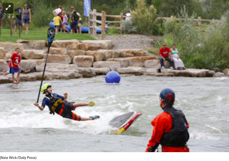
Miles Harvey of Salida takes  a spill off his standup paddle board into the Uncompahgre River during FUNC fest on Saturday
Miles Harvey of Salida takes a spill off his standup paddle board into the Uncompahgre River during FUNC fest on Saturday

From the Montrose Daily Press:

The Colorado Lottery honored Montrose recently with one of its 2015 Starburst Awards.

The award recognizes Montrose’s excellence in use of lottery funds in creating the Montrose Water Sports Park; the City of Montrose is to formally accept the award at city council’s Sept. 15 meeting.

“This award provides further acknowledgement of all of the planning and effort that went into creating the Water Sports Park,” City Manager Bill Bell said in a statement Friday.

“While the city had a central role in creating this amazing community asset, the finished product represents the collaborative effort and vision of many organizations and individuals in the community. This award recognizes everyone who had a share.”

Great Outdoors Colorado (funded by lottery proceeds) provided partial funding to build the water park, as well as new trails along the Uncompahgre River and improvements to nearby Montrose Recreation District facilities.

Colorado Lottery noted exceptional collaboration among local entities in choosing Montrose for the Starburst Award. Montrose was one of 19 communities to receive a Starburst Award.

“These projects display how important outdoor recreation is to both Coloradans and visitors,” Lottery Director Laura Solano said in the statement.

“The Lottery congratulates and recognizes the 2015 Starburst winners for their vision in creating quality recreation opportunities in their communities.”

The Water Sports Park is located at Riverbottom Park on Apollo Road. It boasts six “wave simulator” structures within the river, several rock-terraced spectator areas, nearly one-half mile of recreation trails, Americans with Disability Act-compliant access ramps at each end of the park, two rock-climbing boulders and several fish-habitat improvements.

Reclamation Releases a Draft Environmental Assessment for Developing Hydropower at Drop 5 of the South Canal

South Canal hydroelectric site

Here’s the release from the US Bureau of Reclamation (Justyn Liff/Jennifer Ward):

Reclamation announced today that it has released a draft environmental assessment for a hydropower project at Drop 5 of the South Canal, part of the Uncompahgre Project in Montrose, Colorado.

The project, proposed by the Uncompahgre Valley Water Users Association, will be located approximately four miles downstream from the Drop 4 hydropower project on the South Canal. A Lease of Power Privilege will authorize the use of federal facilities and Uncompahgre Project water to construct, operate and maintain a 2.4 megawatt hydropower facility and associated interconnect power lines.

The hydropower plant will operate on irrigation water conveyed in the South Canal and no new diversions will occur as a result of the hydropower project. Construction activities and operation of the hydropower plant will not affect the delivery of irrigation water.

The draft environmental assessment is available and can be received by contacting Jennifer Ward by phone at 970-248-0651 or email jward@usbr.gov.

Reclamation will consider all comments received prior to preparing a final environmental assessment. Comments can be submitted by email to lmcwhirter@usbr.gov or to: Ed Warner, Area Manager, Bureau of Reclamation, 445 West Gunnison Ave, Suite 221, Grand Junction, CO 81501. Comments are due by Monday, September 14, 2015.

The Ouray County Water Users Association hopes to score $50,000 in grant dough for engineering #ColoradoRiver

Ouray
Ouray

From the Ouray County Plain Dealer (Sheridan Block):

Making an effort to be prepared for the state’s uncertain water future, Ouray County water users are taking necessary measures to protect their supply.

In a joint discussion on the state of local waters last month, local water user groups left with a general consensus of pursuing a water engineering analysis, which would analyze data for the Upper Uncompahgre Basin and ultimately provide options for solutions to future water needs.

The analysis is estimated to cost about $50,000, and last week county attorney and representative on the Gunnison Basin Roundtable, Marti Whitmore, submitted a grant application for a joint project to the Roundtable.

“In talking with other people in the region, including people in the Colorado River District, everyone is supportive of such a widely supported and cooperative effort among many water users in Ouray County,” Whitmore told the Plaindealer. “This cooperative effort will benefit everybody. It’s a positive step in a positive direction and I’ve gotten a lot of favorable feedback.”

According to the grant application, the county (which for the project will also include the City of Ouray, Town of Ridgway, Ouray County Water Users Association and various Log Hill water user entities) is requesting $25,000 from the Gunnison Basin Roundtable and $25,000 from the Colorado Water Conservation Board.

More Uncompaghre River watershed coverage here.

Beautiful photo of a snowy Uncompahgre river — Colorado River Watch #ColoradoRiver

USDA Selects First Projects for New, Innovative RCPP Program

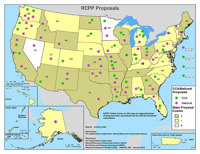
RCPP Proposals map via the USDA

Here’s the release from the United States Department of Agriculture (Petra Barnes). (Click through for the data):

Agriculture Secretary Tom Vilsack today announced that 100 high-impact projects across all 50 states, including Colorado will receive more than $370 million as part of the new Regional Conservation Partnership Program (RCPP).

RCPP’s historic focus on public-private partnership enables private companies, local communities and other non-government partners a way to invest in efforts to keep our land resilient and water clean, and promote tremendous economic growth in agriculture, construction, tourism and outdoor recreation, and other industries.

This year’s projects in Colorado will accomplish a wide diversity of agricultural and natural resource goals from facilitating the conversion of flood irrigation systems to more resource-efficient pressurized irrigation systems with integrated hydropower to significantly increasing water use efficiency by coordinating expanded efforts and by integrating off-farm irrigation conveyance system and on-farm water application efficiency improvements.

“Partners are seeing the value of conservation and investing in their future,” Vilsack said. “These partnerships are forging a new path for getting conservation on the ground and are providing opportunities for communities to have a voice and ownership in protecting and improving our natural resources. The Regional Conservation Partnership Program ushers in a new era of conservation, and we’re excited about the down-the-road benefits from this new Farm Bill program.”

This year’s projects will engage hundreds of partners with wide-ranging interests, including communities, conservation districts, agribusiness, non-government organizations, for- and non-profit organizations, state and federal agencies and Tribal governments. In addition to USDA funds, partners’ will contribute an estimated $400 million, more than doubling USDA’s investment.

“RCPP puts our partners in the driver’s seat,” said Elise Boeke, Acting USDA’S Natural Resources Conservation Service state conservationist in Colorado. “Projects are led locally, and demonstrate the value of strong public-private partnerships that deliver solutions to tough natural resource challenges.”

More than 600 pre-proposals were submitted for RCPP in 2014. Of those, more than 200 were invited to submit full proposals. “With so many strong project proposals, the project selection process was extremely competitive. RCPP is a 5-year $1.2 billion USDA commitment; projects not selected in this first year may be eligible in subsequent years,” Boeke said.

For more information on all RCPP projects please visit http://www.nrcs.usda.gov/.

To learn about technical and financial assistance available through conservation programs, visit http://www.nrcs.usda.gov/GetStarted or local USDA service center.

Uncompahgre River Valley looking south

From The Grand Junction Daily Sentinel (Gary Harmon):

Nearly $10 million in federal funding will go to boost water efficiency in the Gunnison Basin and boost the generation of electricity from irrigation systems.

The Colorado River Water Conservation District will administer $8 million to be used with regional conservation partnership programs, which were established in the 2014 Farm Bill, to use water more efficiently and reduce the amount of salts and selenium carried in the Colorado River and its tributaries.

The grant “will really help our agricultural producers implement new conservation practices that not only produce more ‘crop per drop’ of water, but significantly reduces their environmental footprint,” said Dave Kanzer, senior water resources engineer for the River District.

The agency will coordinate efforts to boost water efficiency by coordinating canals, ditches and pipes that deliver water to farms with improvements in the way water is delivered to crops, frequently by eliminating flood irrigation in favor of sprinkler and other irrigation systems.

The River District will use the money from the Agriculture Department to match funding from the Interior Department, as well as state, local and River District funds, to pay for the projects, Kanzer said.

“This grant is a big win-win for agricultural, economic and environmental sustainability,” Kanzer said.

The program will focus on the Bostwick Park, North Fork and Crawford water conservancy districts, as well as the Uncompahgre Valley Water Users Association, for the projects, Kanzer said.

Micro-hydroelectric plant

The Colorado Department of Agriculture will coordinate a $1.8 million grant to support development of hydropower generation from agricultural canals and ditches.

Congress previously approved legislation easing the development of small hydropower projects by U.S, Rep. Scott Tipton, R-Colo.

Tipton and U.S. Sen. Michael Bennet, D-Colo., each served on their houses’ respective agriculture committees, which crafted the Farm Bill.

“These projects will help Colorado and other states across the West better manage our water resources in the face of increased demand and persistent drought conditions,” Bennet said in a statement.

More conservation coverage here. More hydroelectric/hydropower coverage here

The November 2014 Uncompahgre Watershed Partnership newsletter is hot off the presses

Uncompahgre River watershed

Click here to read the newsletter. Here’s an excerpt:

UWP completes first mine remediation project at Michael Breen Mine

The unpredictable early fall weather made UWP’s first mine remediation project at the high elevation Michael Breen Mine on Engineer Pass road very uncertain. But, we crossed our fingers for a glorious fall and forged ahead. First, Jack Pftersh of Alpine Archaelogical Consultants, LLC in Montrose completed site recordation and assessment of a historic ore load-out structure, just as the first snow blanketed the high country at the end of September. An expedited review of his report by the State Historical Preservation Office (SHPO) gave us the green light to proceed with stabilization of the load-out. Meanwhile, Jeff Litteral of Colorado’s Division of Reclamation, Mining and Safety (DRMS) finalized agreements and plans to construct a diversion ditch for a draining adit, install a culvert and stabilize the structure. The remediation work began in early October. The weather turned warm and dry and all major tasks were completed by Halloween.

More Uncompahgre River watershed coverage here.

Muddy Mine Waters Spill into Sneffels Creek in Ouray County

Reclamation Releases the Final Environmental Assessment for Two Salinity Control Projects

Uncompahgre River Valley looking south

Here’s the release from the US Bureau of Reclamation (Terry Stroh/Justyn Hock):

Reclamation announced today that it has released a final environmental assessment and Finding of No Significant Impact for two proposed salinity control projects. The documents assessed and addressed the potential effects of the Bostwick Park Water Conservancy District’s Siphon Lateral Salinity Control Project in Montrose County, Colorado and the Forked Tongue/Holman Ditch Company’s Salinity Control Project located in Delta County, Colorado.

The Bostwick Park Project will pipe 1.76 miles of existing earthen ditch and will result in an annual reduction of 413 tons of salt contributions to the Colorado River. The Forked Tongue/Holman Ditch Project will pipe 1.89 miles of existing earthen ditch and will result in an annual reduction of 412 tons of salt contributions to the Colorado River. The purpose of both projects is to improve the efficiency of water delivery to canal users and reduce salinity loading in the Colorado River Basin.

Wringing juice from irrigation canals — Mountain Town News

South Canal hydroelectric site

From the Mountain Town News (Allen Best):

In 1909, President William Howard Taft arrived in Montrose on a train to dedicate one of the federal government’s first reclamation projects. With aid of federal funds, a 5.8-mile tunnel was bored from the Black Canyon of the Gunnison River to divert water onto the fertile fields of the Uncompahgre Valley.

Even when the portly president (he weighed 340 pounds and once overflowed a bathtub), there was talk in Montrose about harnessing the power of fast-moving water to produce electricity. Emerging from the Bureau of Reclamation’s tunnel from April through October, the time of irrigation, the water churns with great power as it tumbles toward the 80,000 acres of irrigation around the towns of Montrose and Delta.

At long last, electrical production began last year. The first small hydroelectric plant began generation in June 2013 and the second two months later. Both were developed by Delta-Montrose Electrical Association. Together, the two units can produce 7.5 megawatts of electricity.

Two more are now being built, both by a private company called Shavano Falls Hydro. They are expected to be completed in spring of 2015 and produce a maximum 7.6 megawatts.

The four units altogether will produce 15.1 megawatts.

Delta-Montrose will sell the power to co-op members, while Shavano will sell the power to Municipal Energy Agency of Nebraska. Among others, MEAN sells energy to the municipalities of Delta and Aspen.

Jim Heneghan, renewable electricity engineer for Delta-Montrose, says the return on investment is 11 years. However, a better way of calculating the investment may be that it produces electricity for 3 cents per kilowatt hour more cheaply than the power delivered by wholesale supplier Tri-State Generation and Transmission.

Both these figures are without a rate increase in the wholesale price. Coal-fired electricity has been rising rapidly in cost, however. The water will be essentially free and the turbines should last at least 50 years before they need to be retooled.

More hydroelectric/hydropower coverage here.

Reclamation Releases the Final Environmental Assessment for Developing Hydropower at Drop 4 of the South Canal

Uncompahgre River watershed

Here’s the release from the US Bureau of Reclamation (Terry Stroh/Justyn Hock):

Reclamation announced today that it has released a final environmental assessment and Finding of No Significant Impact for a hydropower project at Drop 4 of the South Canal, part of the Uncompahgre Project in Montrose, Colorado.

The project, proposed by the Uncompahgre Valley Water Users Association, will be located at existing Reclamation facilities on the South Canal. A Lease of Power Privilege will authorize the use of federal facilities and Uncompahgre Project water to construct, operate, and maintain a 4.8 megawatt hydropower facility and 1.27 miles of associated interconnect power lines.

The hydropower plant will operate on irrigation water conveyed in the South Canal, and no new diversions will occur as a result of the hydropower project. Construction activities and operation of the hydropower plant will not affect the delivery of irrigation water.

The final environmental assessment and Finding of No Significant Impact is available on our web site or a copy can be received by contacting Reclamation.

More hydroelectric/hydropower coverage here.

Uncompahgre River: Float Highlights River Improvements, Future Visions — The Watch

From The Watch (William Woody):

Last Sunday [August 17, 2014], under beautiful sunny skies, members of the Friends of the River Uncompahgre (FORU) hosted a tour of the river from boats launched at an access point behind Chipeta Lake to a take-out near Taviwach Park on the city’s north side.

The tour was developed to give local officials and residents a first-hand experience of the river since improvements were made along its banks earlier this year; the improvements will continue in 2015 as part of the city’s continuing Uncompahgre River Master Plan, completed in 2011.

Along with local boaters, officials from the city, county, Bureau of Land Management, Parks and Wildlife and the Montrose Recreation District clambered into rafts and kayaks for the three-hour float.

Along the way, wooden markers on the river’s banks highlighted both public and private property boundaries bordering the water. Officials and residents are continuing to brainstorm ideas for possible public-property development. With a trained eye, one could see the next phases of the river master plan, which includes the addition of a whitewater park set for construction next year.

The whitewater park will be located between the pedestrian bridge in Baldridge Park and the West Main Street Bridge.

Due to the rising popularity of river sports, the trend in adding whitewater parks has continued in recent years in sites across the country as a way to draw more visitors.

“We wanted to get some ideas on how we make the river safe for families,” said Montrose City Manager Bill Bell. “We’re really trying to give locals who like the fishing or the outdoor recreation a chance to come and do that in a family friendly environment. But we also want to attract visitors and tourists.”[…]

Durango added its “watermark” years ago, incorporating its downtown with the Animas River through boardwalks and a variety of businesses. Unlike Durango, the Uncompahgre River is fed with water from the Ridgway Reservoir and the Gunnison Tunnel. This means water levels can be more sustainable throughout the year, whereas the Animas runs very low later in the summer.

The sustainable water flow offers the potential for Montrose to become a destination for whitewater companies and guides, allowing them to teach and float later in the season.

Another reason for the whitewater park is to give boaters a safer place to have fun in the rapids. With local knowledge, boaters can learn to ride the famed “M-Wave,” a large, continuous whitewater wave located on the south canal, east of Montrose. Using the park – at least at first – and avoiding the M-Wave will reduce the risk of injury, lawsuits and fatalities, according to officials…

In February, heavy equipment and surveyors with Evergreen-based Ecological Resources Consultants, Inc., spent weeks digging out a 1,500-foot stretch of the river to improve fishing habitat. The work took place directly south of the fishing bridge in Baldridge Park behind the park’s softball fields.

Re-shaping the river’s channel will not only improve the fishing habitat but also riparian wildlife areas along with entire river corridor, according to Renzo DelPiccolo of Colorado Parks and Wildlife in Montrose…

Through grants, lottery funds and city contributions, the cost of renovating the river corridor has amounted to about $900,000 so far, according to Bell.

More Uncompahgre River watershed coverage here.

No more fluoride dosing for Uncompahgre Water

Uncompahgre River Valley looking south

From The Watch (William Woody):

Last week, the Project 7 Water Authority, which provides drinking water to the Montrose, Olathe and Delta communities (and the Menoken, Chipeta and Tri-State water districts, as well) stopped using sodium silicofluoride in its water treatment to boost fluoride levels.

At Monday’s work session of the Montrose City Council, Public Works Director John Harris explained he has already received some positive comments about the change. Harris, who also sits on the Project 7 board, said the supply of sodium silicofluoride, produced by a manufacture in Louisiana, was interrupted due to hurricane Katrina in 2005. He said that supply never recovered, leaving municipalities in the United States looking elsewhere, including China.

In July — just as supplies were running out — Harris said the Project 7 board voted in favor to end the practice.

“I’m not willing to take a risk on a Chinese-based project,” Harris told The Watch Monday. “Something would have to change to make us rethink that.”

Harris said residents can use supplemental fluoride found in toothpastes and mouthwashes, but because of the shortage, fluoride “just wouldn’t be added to the drinking water.”

Although fluoride can occur naturally, sodium silicofluoride has been used in America’s public drinking water for more than half a century, for prevention of tooth decay.Studies published by the Centers for Disease Control and Prevention suggest there has been an 18-to-40 percent reduction in cavities, in children and adults, as a direct result of water fluoridation.

In a press release, Project 7 said “sodium silicofluoride will no longer be added to boost the naturally occurring fluoride in the water to the “optimum level” as defined by the EPA…

“We can no longer obtain sodium silicoflouride that is manufactured in the USA, with the only supplier being China,” ” said Adam Turner, manager of Project 7. “We are not comfortable with the long-term quality control of the product we would be adding.”

According to the Project 7 website, water supplied to Project 7 from the Blue Mesa Reservoir contains a concentration range of naturally occurring fluoride (from 0.15 to 0.25 mg/l); the EPA limit of fluoride in water is 4 mg/l. Consuming levels higher than 4 mg/l, the EPA states, can cause bone disease and, for children, pits in their teeth…

For more information visit: http://www.project7water.org. or call 970/249-5935.

More water treatment coverage here.

A rise in alternative energy demand has led to a fourth hydroelectric power facility on South Canal — The Watch

southcanalhydroelectricsitethetelluridewatch

From The Watch (William Woody):

A rise in alternative energy demand has led to a fourth hydroelectric power facility now in the planning stages for the South Canal, east of Montrose.

The Delta-Montrose Electrical Association currently operates two facilities, at Drop 1 and Drop 3, with plans for a facility on Drop 2.

Last week, the U.S. Bureau of Reclamation released its draft environmental assessment for yet another proposed hydropower project, at Drop 4. Drops 1 and 3 is currently producing approximately 6.5 megawatts of power this summer, according to James Heneghan, renewable energy engineer for DMEA.

The proposed Drop 4 location, 0.8 miles downstream from the existing Drop 3 hydropower plant that was completed last year, drops approximately 71 ft. from Drop 3 to Drop 4. With a fourth facility, water would be diverted into a penstock and through the hydropower plant and returned to the canal to meet mounting irrigation delivery demands downstream.

The project also includes 1.27 miles of new overhead interconnection line across federal Bureau of Land Management and Reclamation lands.

“The purpose of the Drop 4 Hydropower Project is to develop a 4.8 megawatt (MW) hydropower plant on the South Canal at Drop 4 to provide a clean, renewable energy source that is locally controlled,” according to the bureau’s assessment. “Current federal policy encourages non-federal development of environmentally sustainable hydropower potential of Federal water resource related projects.”

The project, proposed by the Uncompahgre Valley Water Users Association and a private developer, and would not affect the seasonal delivery of irrigation water.

Like Drops 1 and 3, the power generated at Drop 4 would be handled by DMEA, and transmitted to the Municipal Energy Association of Nebraska.

“The electricity generated by the Project would provide the UVWUA with an additional source of revenue that can be used to defray annual operating expenses and assist in the maintenance and improvement of the Uncompahgre Project,” according to the assessment.

Structural plans for Drop 4 call for a new concrete intake canal connecting to an intake structure; a metal bar trash screen would remove debris as the water is forced into a 10-ft. pipe and flushed 1,347-ft. downstream to a new 30-ft. by 40-ft. powerhouse with a power generating turbine. It’s the same method now used in Drops 1 and 3…

When completed, the Drop 4 station could produce about 15,744 megawatt hours of energy per year, with an offset reduction of 32,000,000 to 34,000,000 pounds of CO2 and other greenhouse gases.

On May 14 of this year, a Preliminary Lease of Power Privilege was entered into by the UVWUA and the Bureau of Reclamation for the project, putting it on the fast track. “I would say with the promise of privilege being drafted, Drop 4 will be competed before Drop 2,” Heneghan told The Watch this week…

Amendment 37 to the Colorado Constitution established a Renewable Energy Standard, an initiated state statute approved by voters in 2004, requires Colorado providers of retail electric services serving over 40,000 customers to secure a minimum percentage of electricity from renewable energy sources (such as wind, solar, and hydroelectricity to be 10 percent) by 2020. DMEA is close to achieving that standard, thanks in large part to the two existing South Canal projects. The Drop 2 project could be the next addition of renewable energy to DMEA’s portfolio, Heneghan said.

Wholesalers, like Tri-State Generation have to reach 20 percent by 2020.

The draft environmental assessment is available online at http://www.usbr.gov/uc/envdocs/index.html, or a copy can be received by contacting the U.S. Bureau of Reclamation.

Comments can be submitted to the Terry Stroh at the email address above, or to Ed Warner, Area Manager, Bureau of Reclamation, 445 West Gunnison Ave, Suite 221, Grand Junction, CO 81501, up until Aug. 8. The bureau will consider all comments received by that date, prior to preparing a final environmental assessment.

More hydroelectric/hydropower coverage here.

Aspinall Unit operations update: 1,000 cfs in Black Canyon

From email from Reclamation (Erik Knight):

Releases from Crystal Dam will be reduced from 2000 cfs to 1900 cfs on Monday, July 28th at 10:00 AM. Flows in the lower Gunnison River are currently above the baseflow target of 1500 cfs. The weather forecast calls for rain in the basin over the next few days and the river forecast shows flows continuing to increase during this time.

Pursuant to the Aspinall Unit Operations Record of Decision (ROD), the flow target in the lower Gunnison River, as measured at the Whitewater gage, is 1500 cfs for August.

Currently, diversions into the Gunnison Tunnel are 1100 cfs and flows in the Gunnison River through the Black Canyon are around 1000 cfs. After this release change Gunnison Tunnel diversions will still be 1100 cfs and flows in the Gunnison River through the Black Canyon should be around 900 cfs. Current flow information is obtained from provisional data that may undergo revision subsequent to review.

More Aspinall Unit coverage here.

Colorado Parks and Wildlife: Event to honor builders of Ridgway dam and reservoir

Ridgway Reservoir during winter

Here’s the release from CPW:

This year marks the 25th anniversary of the construction of the Ridgway dam and the establishment of Ridgway State Park. A special event to recognize those who worked on the construction project is scheduled for the weekend of Aug. 8 at the park.

Did you work on the project? Or do you know someone who did? This includes former or current employees of the Bureau of Reclamation or other government agencies, construction workers, and municipal and county officials who assisted with the project. If so, please send your contact information via e-mail to: rhonda.palmer@state.co.us, or call her at 970-626-5822, ext. 11. You’ll be contacted about the event.

Planning for the Dallas Creek Project, as it is called formally by the BOR, began shortly after the end of World War II. Construction eventually started in 1978 and the reservoir filled completely for the first time in 1990. The dam stores water for agricultural, municipal and industrial uses for the Uncompahgre Valley in western Colorado.

One of Colorado’s premier recreational facilities, Ridgway State Park offers camping, hiking, bicycling, boating, fishing and swimming. More than 300,000 people visit the park every year.

For more information about Ridgway and all of Colorado State Parks, see: http://cpw.state.co.us.

More Uncompahgre River watershed coverage here.

Water Lines: Hydropower kicks off at nearby Ridgway Dam #ColoradoRiver

Ridgway Dam
Ridgway Dam

From the Glenwood Springs Post Independent (Hannah Holm):

When Ridgway Dam was constructed on the Uncompahgre River back in the 1970s and 1980s, hydropower was anticipated to be one of its uses — along with providing irrigation water, drinking water and flood control.

Mike Berry, general manager of Tri-County Water (company operating the dam), continues to look for opportunities to start generating hydropower since 2002.

It wasn’t until this month, however, this vision was finally realized.

In June, Tri-County Water officially commissioned a new eight-megawatt generating station powered by water flowing through the dam.

Finding a customer to buy the power at the right price was the key allowing the project to go forward.

The $18 million project is financed through the City of Aspen. The agreement includes payment of a premium for the power generated by Ridgeway Dam for a few years of the 20-year contract in exchange for better rates later.

Tri-County will also sell power to Tri-State Generation & Transmission and the Town of Telluride.

The power generated by Ridgway Dam will vary seasonally, with peak generation coinciding with large summer releases of water to downstream irrigators. The Grand Junction Sentinel reported last week the plant will produce a total of about 24,000 megawatt hours of electricity in an average year — enough to supply 2,500 average homes and eliminate 50 million pounds of carbon dioxide emissions.

The Ridgway Dam generating station was commissioned just one year after the completion of a 7.5-megawatt power generation project on the South Canal — carrying water from the Gunnison Tunnel near Montrose to the irrigators of the Uncompahgre Valley.

Both the Ridgway Dam and South Canal projects avoid the opposition previous hydropower projects faced because it’s installed on existing infrastructure and harvesting power from the regular operations of the facilities. As a result, irrigation deliveries are uninterrupted and no additional disruptions to river flows.

Interest in retrofitting existing water infrastructure to add power generation capability has surged in recent years. Both the State of Colorado and the federal government have made moves to support the trend with new laws to streamline the permitting process.

Finding customers for the power generated at affordable prices for construction is one of the key challenges faced by those interested in developing such facilities. Low prices for natural gas and the irregular supplies generated by such projects are complicating factors in working out power purchase agreements.

On the other side of the equation, renewable energy standards passed by Colorado and other states have created new opportunities.

From The Watch (Samantha Wright):

A decades-long quest to convert the power represented by the 84,600 acre feet of water pent up behind the dam into clean, green hydropower came to fruition at a commissioning ceremony hosted by Tri-County Water Conservancy District [June 6].

Tri-County’s new 8 megawatt hydroelectric plant will produce approximately 24,000 megawatt-hours of electricity in a typical water year, enough energy to supply about 2,500 homes, on average. The emissions reduction benefit from the new plant is equivalent to removing approximately 50 million pounds of carbon dioxide from the atmosphere (the same effect as taking about 4,400 cars off the road each year).

Federal officials including Larry Walkoviak, the Upper Colorado Regional Director of the Bureau of Reclamation, and U.S. Congressman Scott Tipton were on hand at the commissioning ceremony on Friday to praise the project’s merits.

But the folks who are really celebrating this historic moment are those who have steered the hydro project through choppy waters toward its completion including officials from Tri-County and the City of Aspen, which helped fund the project and is purchasing a significant portion of the energy it produces.

From The Grand Junction Daily Sentinel (Gary Harmon):

Green and grassy, Ridgway Dam looms high 15 miles southeast of Montrose, holding back Ridgway Reservoir. It’s flanked by a rocky ridge and U.S. Highway 550, with the Uncompahgre River bubbling up from the base of the dam to a prized stretch of trout water running through Ridgway State Park.

There is more to Ridgway Dam, though, than appearance.

“It’s not just a beautiful pile of dirt,” said Ion Spor, who has managed the dam for decades for the Tri-County Water Conservancy District.

Ridgway Dam is now generating electricity, eight megawatts worth during the height of the water year.

Tri-County — referring to Montrose, Delta and Ouray counties — commissioned the generating station earlier this month, marking the culmination of a project that was anticipated well before construction of Ridgway Dam, begun in 1978 and completed in 1987. Ridgway Reservoir filled in 1990.

The dam was built with hydropower in mind. Pipes were run through the dam in anticipation of someday being hooked up to generators, said Mike Berry, Tri-County general manager.

After years of debate, Tri-County opted to move ahead with the $18 million project. It reached agreements with Aspen, Telluride and Tri-State Generation and Transmission to get enough money for the project.

The station also generates power for the Delta-Montrose Electric Association and the San Miguel Power Association.

As part of its agreement to purchase power, Aspen is buying renewable-energy credits created by the project during winter months. Telluride is purchasing the credits that are created by the project during summer months.

Renewable-energy credits represent the added value and environmental benefits of the electricity produced by the generating station.

Tri-County will use the revenues generated from the sale of the electricity and renewable-energy credits to repay loans on the project for the first 30 years and then to offset its operating expenses, Berry said.

Tri-County’s generating station contains two turbines and generators.

The smaller is a 0.8-megawatt system, which will operate solo during the winter when flows are low, in the range of 30 to 60 cubic feet per second. The larger, 7.2-megawatt system will operate on flows of 500 cfs during the summer.

Both generators are in a powerhouse at the base of the dam.

The plant will produce about 24,000 megawatt-hours of electricity in an average water year, enough energy to supply about 2,500 average homes and eliminate the equivalent of 50 million pounds of carbon dioxide emissions.

Now, Tri-County needs one thing to make the system work, Berry said.

“We’re counting on Mother Nature,” Berry said, “To bless us with enough water to repay the notes.”

More hydroelectric/hydropower coverage here.

Hydropower used to replace flood irrigation and to lessen ag runoff and salinity

Hydropower sprinkler system via Homelink Magazine

From ColoradoBiz Magazine (Allen Best):

And now come new efforts across Colorado to further yoke the power of falling water. One such example is near Yampa, a town between Vail and Steamboat Springs. The site is just a few miles from where the Bear River takes a sharp turn and becomes the Yampa River. On his ranch, Gary Clyncke decided three years ago to use the 126-foot drop in elevation of his irrigation water to power a new center-pivot irrigation system.

Clyncke’s hydro-mechanical center-pivot doesn’t produce electricity. It does, however, preclude the need for stringing up power lines to operate the center-pivot sprinklers. The sprinkling system, in turn, saves water — which is worth money. The 90 acres were previously irrigated with flood irrigation from ditches spread across the field of timothy, brome and clover several inches thick. Center-pivot irrigation requires just one-sixth the water.

That savings motivated Clyncke to invest in center-pivot. This hydro-mechanical system cost $13,000, of which $6,000 came from the Natural Resources Conservation Service, a federal agency. That left Clyncke a cost of $7,000. Payback on that investment is achieved in three years.

Federal aid is motivation, at least in part, because of concerns about salinity. When large volumes of water are applied to fields in flood irrigation, the water picks up salts that are then returned to creeks and then rivers. It’s a major problem on the Western Slope, where water can be used two times for flood irrigation before it enters Utah. Downstream in California’s Imperial Valley, an important source of food for the nation, some fields have become so salty they have been abandoned.

One of the most saline areas is in the Uncompahgre Valley, where Delta, Montrose and Paonia are located. An ancient sea left salts and the element of selenium in unusually large quantities in the Mancos shale. Both are harmful to endangered fish downstream in the Colorado River. “Anything that you can do that helps with salinity also helps with selenium, and vice versa,” says “Dev” Carey, manager of the Delta Conservation District.

Saving money is a strong argument by itself. Farmers spend an average of $33,000 each year on electricity, more than half of that to power irrigation pumps, according to the Colorado Energy Office. Using hydropower to operate these pumps doesn’t work everywhere. Farms near Sterling, for example, tend toward flatness. Still, the state agency estimates Colorado has untapped capacity in pressurized irrigation systems to deliver 30 megawatts in direct production of electricity or avoided electricity. To put that into context, it’s enough electricity for 12,125 homes, says Kurt Johnson, president of the Colorado Small Hydro Association.

More potential exists in irrigation ditches. Not just any irrigation ditch will do. It must have flows of more than 100 cubic feet per second, a relatively large volume. And there must be drops of at least 150 feet. When falls of that steepness occur, various devices are used to contain the force.

One such canal is located east of Montrose, where water from the Gunnison River is diverted through a tunnel that emerges near U.S. Highway 50. From there, the water flows through South Canal toward the head of the Uncompahgre Valley. In 2012, the Delta-Montrose Electric Association completed a project that had been talked about for more than 100 years. The two powerhouses generate electricity equal to what is needed for 3,000 homes.

In nearby Delta County, the state has identified nine sites on irrigation ditches where it would be economical to install small hydro systems, collectively producing 0.8 megawatts. That’s given current prices of electricity. Should electricity prices go up, as they have steadily, more potential would exist near Delta and many other locations.

More hydroelectric/hydropower coverage here.

Runoff/snowpack news: Good year to fill storage — if we had it to fill

Northern Integrated Supply Project via The Denver Post

From CBS Denver:

Flooding along the Cache La Poudre River damaged nearly two dozen homes and businesses in Greeley last week, and according to officials at the Northern Colorado Water Conservancy District, the Poudre River does not have any dams or reservoirs specifically for flood control. But there is an effort underway to change that.

The Poudre River is full of melted snow — so much so right now that levels are well above average in Larimer and Weld counties, spilling over banks, and flooding homes and businesses.

“We could fill a reservoir in a year like this,” Brian Werner with the Northern Colorado’s Water Conservancy District said.

He points out farmers’ irrigation dams inside the Poudre Canyon, but says water cannot be diverted to those to prevent flooding. He says there is no reservoir along the river because the idea was unpopular in the past.

“I think the general public is more aware when they see these flows and saying, ‘Boy, couldn’t we just store a little bit of that?’ Which is what this proposal does,” Werner said.

Northern Water wants to build two reservoirs off stream that could store water during high flow times. Planners estimate the project would cost $500 million, including $40 million to re-route Highway 287 to make room for Glade Reservoir, and build a smaller one north of Greeley…

But the federal approval process is moving slowly.

“We’ve been working on this in some form for over 20 years, taking some of the flood flows here on the Poudre and storing it,” Werner said.

They do expect to get some news on the status of studies being conducted on the project by the end of this year. It’s unlikely building would start before 2018.

From the Fort Collins Coloradoan (Ryan Maye Handy):

Several of the reservoirs that feed Northern Colorado are full, or approaching overfull, said Brian Werner, a spokesman for the Northern Colorado Water Conservancy District, which helps manage the reservoirs. Carter Lake, southwest of Loveland, is full, and Lake Granby near Rocky Mountain National Park is about to overflow, Werner added.

“We wouldn’t have guessed that in a million years a year ago,” Werner said Tuesday. Only a month ago, it was fifty-fifty if the reservoir would spill. “Now it looks like it will spill.”

Horsetooth is just 2 feet shy of being full, the highest the reservoir has been in late May and early June in the past six years.

The reservoir can hold enough to submerge 156,735 football fields in a foot of water. As of June 3, Horsetooth was holding 154,480 acre-feet of water, putting it around 98.5 percent full, said Zach Allen, a spokesman for Northern Water.

But what happens if Horsetooth does get full? The answer, Werner said, is basically “nothing.”

“We can control all the inflows to Horsetooth,” he said. Flatiron Reservoir and the Big Thompson River feed Horsetooth, and Northern Water controls all the outflows and inflows to the reservoir; Horsetooth’s water level can’t get higher than Northern Water wants it to, Werner said…

Lake Granby, on the other hand, is fed with snowmelt straight from the mountains. It’s levels are uncontrollable, and it could spill over any day now, Werner said.

“You can’t control what nature is going to do” with Granby, he added…

Northern Water for years has pursued an expansion of its water storage capacity to take advantage of plentiful water years. The Northern Integrated Supply Project would build a reservoir larger than Horsetooth northwest of Fort Collins. The proposal has drawn opposition from environmental groups and is in a yearslong federal review of its potential environmental impacts expected to be released late this year…

Much of Northern Colorado’s snowpack, around 200 percent of normal levels after an early May snow, has yet to melt, which brings the potential for much more water to come down from the mountains in the coming weeks.

From email from Reclamation (Kara Lamb):

We have seen the water level at Green Mountain Reservoir rise to the spillway gates as snow melt runoff inflows continue to come into the reservoir. As a result, we were able to increase the release from the dam to the Lower Blue River by 300 cfs today [June 9], using the spillway.

We are now releasing 1800 cfs to the Lower Blue.

From email from Reclamation (Kara Lamb):

The weekend went pretty smoothly for runoff here on the east slope of the Colorado-Big Thompson Project. Thunderstorms boosted runoff to the Big Thompson River slightly with inflow into Lake Estes peaking early this morning around 721 cfs. But this is still a downward trend.

As a result, outflow through Olympus Dam to the Big Thompson Canyon dropped today down to about 125 cfs. As we move into the rest of the week, visitors to and residents of the canyon will continue to see nightly flows rise with snow runoff, enhanced some by rain runoff, just as they have seen for the past week.

Deliveries to the canal that feeds Horsetooth Reservoir have brought Horsetooth back up to full. Its water level elevation has been fluctuating within the top foot of its storage between 5429 and 5430 feet. With it back up near 5430, we have curtailed the canal to Horsetooth and increased the return of Big Thompson River water to the canyon at the canyon mouth using the concrete chute. By 5 p.m. this evening the chute should be running around 300 cfs.

The drop off in snowmelt runoff inflows will allow us to begin bringing some Colorado-Big Thompson Project West Slope water over again using the Alva B. Adams Tunnel. We anticipate the tunnel coming on mid-week and importing somewhere between 200-250 cfs.

Once the tunnel comes back on, we will also turn the pump to Carter Lake back on, probably on Wednesday of this week. Carter’s water level elevation dropped slightly during runoff operations. It is around 95% full. Now that Horsetooth is basically full, Carter will receive the C-BT water. Turning the pump back on to Carter means residents around and visitors to the reservoir will see it fill for a second time this season.

Pinewood Reservoir, between Lake Estes and Carter Lake, is seeing a more typical start to its summer season. It continues to draft and refill with power generation as it usually does this time of year. This is also true for Flatiron Reservoir, just below Carter Lake and the Flatiron Powerplant. Both are expected to continue operating this way through June.

That is the plan we anticipate the East Slope of the C-BT to follow the rest of this week, June 9-13. We will post information if there is a major change; but as it stands now, I do not plan on sending an update again until next Monday. The state’s gage page is always available for those wishing to continue watching the water on a daily basis.

From The Crested Butte News (Toni Todd):

Word on the street this spring was that Blue Mesa Reservoir would be bursting at its banks this summer. Predictions were based on official and unofficial reports of above-normal river flows. However, a 2012 Environmental Impact Statement (EIS) has changed how local dams are operated in wet years, in deference to endangered fish species downstream. This new operational protocol will preclude the reservoir from filling this year.

“The reservoir is now only scheduled to reach a maximum storage of around 80 percent capacity in 2014,” said Upper Gunnison River District manager Frank Kugel. The U.S. Bureau of Reclamation (BOR) began blasting water through Blue Mesa Dam last week, with simultaneous releases happening at Morrow Point and Crystal Reservoirs, a trifecta of water storage and management that makes up what’s known as the Aspinall Unit.

The Record of Decision (ROD) states, “The EIS modifies the operations of the Aspinall Unit to provide sufficient releases of water at times, quantities, and duration necessary to avoid jeopardy to endangered fish species and adverse modification of their designated critical habitat while maintaining and continuing to meet authorized purposes of the Aspinall Unit.”

Given this new norm of operations adapted by the bureau during wet years, will Blue Mesa ever fill again?

“That’s a valid question, since the reservoir often does not fill in dry years due to lack of supply, and now with the Aspinall EIS, it will have trouble filling in wet years,” said Kugel.

“We all signed onto this because we agreed it’s important to save these fish,” said Colorado Fish and Wildlife Aquatic Species coordinator Harry Crocket.

According to the BOR’s website, an update written by hydraulic engineer Paul Davidson, unregulated inflow to Blue Mesa is 126 percent of normal this year, April through July. That’s 850,000 acre-feet of water entering the lake during the runoff months. “This sets the senior Black Canyon Water Right call for a one-day spring peak flow of 6,400 cfs, the Aspinall 2012 ROD target at a 10-day peak flow of 14,350 cfs… Reclamation plans to operate the Aspinall Unit to meet both the water right and ROD recommendations,” said Davidson.

The Colorado pike minnow, bonytail chub, humpback chub and razorback sucker are the fish that stand to benefit. The big flows are expected to improve the fishes’ critical habitat, at a time when the fish will be looking to spawn. Water will inundate otherwise shallow or dry riverbank areas, creating calm, sheltered spots for hatchlings, and heavy flows will wash the larvae into those areas.

The Gunnison River, said Crocket, was “mostly omitted” from the EIS as critical habitat. However, he said, “Historically, it was home to at least a couple of these species.”

“It’s a highly migratory fish,” Crocket said of the Colorado pike minnow. “It’s adapted to this big river system.”

It’s a system irrefutably changed by humans. Critical habitat for the Colorado pike minnow includes 1,123.6 miles of river, to include stretches of the Green, Yampa and White rivers, from Rifle to Glen Canyon, and the Yampa River to its confluence with the Colorado River.

“They [US Fish and Wildlife] did designate critical habitat [from the mouth of the Gunnison] to the Uncompahgre confluence [at Delta],” Crocket said.

The Colorado pike minnow called the Gunnison River home through the 1960s. “After that,” said Crocket, “it blinked out. It’s not been possible for it to be re-colonized.” A new fish passage at the Redlands structure, two miles upriver from the Gunnison-Colorado River confluence at Grand Junction, allows fish to make their way around the barrier and upstream, marking the first time in more than 100 years for those downstream fish to gain passage to the Gunnison.

Meanwhile, upstream, a form of collateral damage resulting from the big water releases at Blue Mesa worries Fish and Wildlife personnel. The number of fish sucked into and blown out through the dam is staggering. The technical term for this is entrainment.
“Bigger water years mean more water through the dam, and more fish entrained,” said Gunnison area Colorado Fish and Wildlife aquatic biologist Dan Brauch. “Certainly, loss of kokanee with those releases is a concern.”

From the Vail Daily (Randy Wyrick):

Water levels and snowpack are 121 percent of normal, with as much as 40 percent yet to melt at some higher elevation areas, according to Snotel data…

Snow water equivalent at the Fremont Pass Snotel site, the headwaters of the Eagle River, had 15.1 inches of snow water equivalent on Friday morning still to melt and run into the river. It hit 17 inches on March 18 and kept piling up until May 17 when it peaked at 25.6 inches. It usually doesn’t melt out until June 18, Johnson said.

Streamflow on the Eagle River in Avon may have peaked on May 30, when the daily mean discharge was 4,110 cubic feet per second, which was 249 percent of median for that date. Thursday’s daily mean discharge was 3,650 cfs, 197 percent of normal for Wednesday.

Gore Creek in Lionshead may have peaked June 4.

“Having 20 to 40 percent of the total snowpack remaining in higher elevations in the Colorado Basin is good overall. It should help sustain streamflows through the month,” [Diane Johnson] said…

Copper Mountain still has 4.1 inches of snow water equivalent. That would normally be melted out by now, Johnson said…

Reservoir storage in the state is running 95 percent of normal and 62 percent of capacity. That, however, depends on where you are.

Video: Ridgway Dam hydro project commissioned — Telluride Daily Planet

Ridgway Dam
Ridgway Dam

From the Telluride Daily Planet (Heather Sackett):

On Friday, the Tri-County Water Conservancy District officially commissioned a new hydropower project at the Ridgway Dam.

The celebratory event included refreshments, tours of the powerhouse and a history of the project. The 8-megawatt, two-turbine, two-generator plant will produce about 24,000 megawatt-hours of electricity in an average water year, enough to power 2,500 homes a year with all their electricity needs. Construction on the Uncompahgre River project began in November 2012.

The City of Aspen and Tri-State Generation and Transmission are purchasing the power and Aspen is also buying the Renewable Energy Credits created by the project during the winter months. The Town of Telluride won a bid to purchase the RECs for June through September for $48,000. RECs are market-based instruments that convey the environmental value of renewable energy between buyers and sellers. Each REC provides proof that 1 megawatt-hour of renewable energy has been generated.

Buying the RECs was a step toward achieving the Telluride Renewed Challenge, an attempt to reduce greenhouse gas emissions to 20 percent below 2005 levels by 2020 and for 100 percent of the community’s electricity to come from renewable sources by 2020. Telluride Mayor Stu Fraser says though those aims might now prove too lofty, the town still likes to lead by example…

According to a press release from the Colorado Small Hydro Association, the emissions reduction benefit from the new plant is equivalent to removing approximately 50 million pounds of carbon dioxide from the atmosphere or about 4,400 cars from the road each year. Colorado Small Hydro Association President Kurt Johnson, of Ophir, said the Ridgway Dam hydro project is a great example of new hydro power on an existing dam.

“Only about 3 percent of the nation’s dams currently include hydropower,” Johnson said in a press release. “There is an enormous untapped opportunity to generate new clean energy using existing infrastructure.”

General Manager of the Tri-County Water Conservancy District Mike Berry said he is excited the project is complete and that it provided many local jobs during its construction.

“I’m glad we are coming to the end of it and the generator will be spinning for the rest of my life I hope,” Berry said.

More hydroelectric coverage here.

Aspinall Unit update: The Uncompahgre Water Users are calling for water #ColoradoRiver

Gunnison Tunnel via the National Park Service

From email from Reclamation (Erik Knight):

The Uncompahgre Valley Water Users Association (UVWUA) will be diverting an additional 100 cfs through the Gunnison Tunnel tomorrow morning Tuesday, April 8th. At the same time, releases from Crystal Dam will also be increased by 100 cfs, from 750 cfs to 850 cfs. After this change, the total flow through the Gunnison Tunnel should be about 400 cfs, which should leave about 450 to 500 cfs in the Gunnison River downstream of the tunnel.

The Tri-County Water Conservation District is bringing on two hydroelectric generation stations at Ridgway Dam

Ridgway Dam via the USBR

From The Watch (Samantha Wright):

Over the past year and a half, two hydropower generators have sprung up at the foot of the dam: a smaller, 800kV generator that should run efficiently on the low, 30-60 cubic-feet-per-second flows in winter, and a larger, 7.2 megawatt generator to run on summertime release levels.

Next week, on Feb. 24 or 25, the smaller of these two units will be turned on and start producing a steady stream of green electricity, said Mike Berry of Tri-County Water Conservation District, the entity that manages the Ridgway dam and is building the power-generating facility at its base.

The big generator should be ready for testing by April or so, Berry said. When the project goes fully online later this spring or early summer, it will have a total plant capacity of 8 Megawatts – enough renewable power to run 2,250 homes and take the equivalent, in greenhouse gases, of 4,400 cars off the road.

Both units will operate during high reservoir releases in the summer, and only the smaller unit will operate during lower wintertime releases.

Tri-State Generation and Transmission, the wholesale electric supplier for San Miguel Power Association and the Delta-Montrose Electric Association, has built two short transmission lines at the hydropower plant. One will connect to the existing 115kV line running alongside the highway, and another will connect with the generating station.

Power generation will have to be carefully calibrated in order to maintain historic release patterns at the dam – one of the requirements of the Bureau of Reclamation’s final Environmental Assessment of the project – while maintaining healthy lake levels and maximizing power production.

In times of drought, the water rights of downstream irrigators, industries and municipalities will trump power generation…

Power generated at the hydro plant will be sold to two entities: Tri-State, and the City of Aspen. Tri-County WCD first started discussing a partnership with the City of Aspen in 2002. Eventually, this partnership evolved into a Power Purchase Agreement, or PPA.

In an agreement inked in 2010, Aspen agreed to purchase the wintertime output from the hydropower project, from Oct. 1 through May 31, for 20 years, to help further its goal of powering the city with purely renewable energy. Tri-State has agreed to purchase, for 10 years, the higher summertime output.

If projections hold up, about 10,000 MWh worth of energy will be “transferred” to the City of Aspen through the PPA annually (although it is doubtful that any of the actual electrons flowing into the grid from the new hydropower plant will travel that far). This amount is not set in concrete – Berry emphasized that there will be annual fluctuations in the amount of power that is delivered to Aspen, depending on a number of factors including whether it is a wet or a dry year, the timing of the spring runoff, and the demands of downstream water rights holders.

Tri-County WCD has secured $15 million in financing for the project – including a $13 million loan from the Colorado Water Conservation Board, and a $2 million loan from Colorado Water Resources and Power Development Authority – and has sunk an additional $3 million of its own money into the project…

As the new hydropower plant at Ridgway Reservoir prepares to go online, legislation has been introduced at the state capitol to help streamline development of smaller hydropower projects throughout Colorado.

Last week, the Colorado House of Representatives overwhelmingly passed HB14-1030 by a vote of 62-3. The bipartisan legislation complements the recent streamlining of federal permitting requirements for small hydro through the Hydropower Regulatory Efficiency Act.

HB14-1030 was introduced in the House by Reps. Mitsch, Bush and Coram. Senator sponsorship includes Senators Schwartz and Roberts as well as Hodge.

In essence, the bill “makes it possible to simultaneously complete federal and state review at the same time,” said Kurt Johnson, the president of the Colorado Small Hydro Association. It also seeks to streamline the electrical inspection process for small hydro, using precedents set in the small wind industry decades ago.

The Senate Agriculture, Natural Resources and Energy Committee will hold a hearing on the pending legislation on Feb. 27.

More hydroelectric coverage here. More 2014 Colorado legislation coverage here.

The Ridgway Town Council approves bumping storage in Lake Otonowanda to 600 acre-feet

Lake Otonowanda -- photo / Applegate Group
Lake Otonowanda — photo / Applegate Group

From The Watch (Samantha Wright):

Located in Ouray County, about three miles south of Ridgway off of County Road 5, Lake O has been the Town of Ridgway’s primary municipal water source for nearly 100 years. The man-made lake is filled with water diverted into a natural basin via the Ridgway Ditch.

The Lake Otonowanda Rehabilitation Project will allow the town to exercise its full decreed storage right there by improving the lake’s capacity sixfold, from 100 to 600 acre feet, while restoring historic tunnel outlet works, which collapsed decades ago, to allow water to flow from the lake to town without having to be pumped.

The project is split into two phases, addressing tunnel restoration and lake excavation. Town officials had hoped to get started on the tunnel restoration phase last fall, but received only one response to a Request for Proposals issued in September 2013.

Hoping to attract more bidders, council and town staff agreed to broaden the scope of the contract to encompass both the tunnel restoration phase and lake excavation phase in a single package, and put the project out to bid in January.

This time around, there was a healthy response from contractors, with Town Manager Jen Coates reporting that over 30 people attended the project’s pre-bid meeting on Jan. 30; five of those companies went on to actually bid on the contract, with bids ranging from $1.4 to $1.9 million. The town budgeted up to $2 million for the construction project (bonding requirements put many smaller-scale local contractors out of the running, Coates said).

The Colorado Water Conservation Board awarded a $1.2 million grant/loan package to the Town of Ridgway last fall to help finance the Lake O project. In late January, the town applied to the Colorado River District for additional grant funds to cover a portion of the project construction.

More Uncompahgre River Watershed coverage here and here.

Ridgway is embarking on a rehabilitation project for Lake Otonowanda

Lake Otonowanda -- photo / Applegate Group
Lake Otonowanda — photo / Applegate Group

From The Watch (Samantha Wright):

The $2.4 million Lake Otonowanda Rehabilitation Project will allow the town to exercise its full decreed storage right by improving the lake’s capacity from 100 to 600 acre feet, while restoring the tunnel outlet near the reservoir to make the delivery system more efficient.

The town’s municipal water right on Lake O predates the Colorado River Compact, a 1922 deal made by seven U.S. states in the basin of the Colorado River in the American Southwest, which to this day governs the allocation of the water rights to the river’s water.

Currently, due to Lake O’s modest size and declining condition, the Ridgway stores only a fraction of the water to which it is legally entitled; the renovation will allow the town to maximize Lake O’s historic adjudicated capacity. Stored water will supply the town when its flow rights are out of priority, ensuring enough water for most anticipated situations, even during drought years, and accommodating growth well into the future.

When the renovation is complete, the town will be able to supply water to the community for a minimum four-month period in a drought event, compared to its current storage capacity of only 10‐14 days’ worth of water.

The rehabilitation project got the big green light earlier this month, when the Town of Ridgway finalized a $1.2 million grant/loan package with the Colorado Water Conservation Board that will contribute significantly toward financing the project…

Arguably among the most scenic municipal reservoirs in the nation, Lake O is located about three miles south of Ridgway off of County Road 5, in an alpine meadow encircled by ponderosa forests and pristine views of the Cimarrons and Sneffels mountain ranges. It is the town’s primary municipal water source; the town also holds junior flow rights on Beaver Creek and Cottonwood Creek/Happy Hollow that are more vulnerable to calls. Generally, the lake provides enough water for the town’s needs (with an average of 280 acre feet diverted each year), but in the drought of 2002, all of Ridgway’s water rights were called by downstream senior water rights holders. The state water engineer subsequently put the town on notice to shore up water rights and storage strategies to prevent this situation from happening again.

More Uncompahgre River Watershed coverage here and here.

New federal hydroelectric permitting laws would have helped Ouray with their project

ouray

Here’s a report from Allen Best writing for The Mountain Town News. Click through and read the whole thing. Here’s an excerpt:

[Ouray] Mayor Bob Risch wishes that the two new federal laws signed by President Barack Obama in August had been adopted before he set out to get his project approved.

Those two new laws simplify the federal government’s process for small hydroelectric projects involving pre-existing infrastructure. Promoters say the laws will make it easier to harness the power of flowing water in existing irrigation canals, small dams, and even municipal water lines. Neither of the new laws will result in new dams or diversions. They apply only to existing infrastructure and to installations of 5 megawatts or less.

The previous process was cumbersome. “It was unbelievable,” says Risch, of requirements for the Federal Energy Regulatory Commission permit. “They sent you a list of all the steps you have to go through. For example, it included a list of 55 organizations to which we had to send letters, informing them that we were going to start this process and invite comment from them.”

More hydroelectric coverage here and here.

Aspinall Unit operations update: 550 cfs in Black Canyon

fogfilledblackcanyonofthegunnisonnps.jpg

From email from Reclamation (Erik Knight):

Due to the continuance of precipitation throughout the Gunnison River basin, flows in the lower Gunnison River, as measured at the Whitewater gage, have remained above the Aspinall Unit ROD baseflow target of 890 cfs. Scattered rainfall is forecast to occur over the basin during the next week, which will hopefully keep streamflows at or above their current levels.

Therefore, in order to conserve some storage in the Aspinall Unit, releases from Crystal Dam shall be decreased by 50 cfs (from 1,600 cfs to 1,550 cfs) at 8:00 am, Saturday, August 3rd. This will bring flows in the Gunnison River through the Black Canyon down to around 550 cfs.

Ouray: The city is trying to bolster its water rights to protect against a downstream call

ouray.jpg

From The Watch (Samantha Wright):

Thus the City of Ouray has been forever saddled with junior water rights compared to thirsty downstream irrigators, who are more and more likely to place a call on the city’s water supply as that water becomes ever scarcer in future years. This is the basic problem which the city seeks to resolve.

CDWR conducts tabulations of water rights throughout its various districts every two years. Water rights holders have one year from the time of the tabulation to object to a particular determination. The last tabulation of water rights affecting the City of Ouray took place in 2012, and the next one occurs in 2014.

The City of Ouray, through [City Attorney Kathryn Sellars], intends to file an official objection to the CDWR’s 2012 tabulation which enabled the M&D Canal to make a call on the city’s water supply last year.

In a position paper sent to to Division 4 Water Engineer Bob Hurford on June 13 outlining this objection, Sellars related the complicated history of water adjudication in Colorado and exposed special circumstances which, she argued, underline several flaws in the system when applied to Ouray.

Central to her argument is the so-called “subordination clause” in the first general adjudication decree in Division 4 in 1888 which “subordinates” agricultural water uses to so-called domestic water use but has been interpreted narrowly so as not to equate “domestic” with modern-day municipal water use…

“We don’t have the authority to tabulate a water right in the way the City of Ouray is asking,” [Jason Ullman, Assistant Division Engineer for CDWR’s Division 4] argued. “We have told them we would not oppose them if they filed with the water court to request that the seniority of water rights be clarified, and see what the water court judge says. They really need to take the matter to someone who has the authority to direct us to retabulate.”

CDWR’s research has not produced any other examples of other Colorado municipalities in the same situation as Ouray.

“It’s just the way the priority system was developed in Colorado,” Ullman said. “They couldn’t foresee this problem back then. It’s worked well for over 100 years, but there are some quirks in the system. The point is, we would not file an opposition to their request for retabulation, but the court needs to give its blessing to that. Because there is no other municipality in this situation.”

More Uncompahgre River Watershed coverage here and here.

Aspinall Unit operations update: 700 cfs in the Black Canyon

crystaldamspill052009.jpg

Even with the recent increase in releases from the Aspinall Unit, the forecast for flows on the lower Gunnison River continues to decline. Without additional water, flows at the Whitewater gage are again expected to approach the 900 cfs baseflow target by this weekend.

In order to meet the environmental commitments set forth in the Aspinall ROD, releases from Crystal Dam shall be increased again, starting at 8:00 am on Wednesday, June 26, by 100 cfs (from 1,600 cfs to 1,700 cfs). This will increase flows in the Gunnison River through the Black Canyon to around 700 cfs. At this level, flows in the canyon will be above the Black Canyon Water Right peak flow target of 685 cfs. Flows through the canyon are expected to remain at this level for the foreseeable future.

More Aspinall Unit coverage here.

Aspinall Unit operations update: Releases from Crystal Dam bumping up 100 cfs to

aspinallunitdescription.jpg

Click on the thumbnail graphic for project background.

From email from Reclamation (Erik Knight):

The forecast for flows on the lower Gunnison River continues to decline as the last remaining snow melts away. Even with the additional water released from the Aspinall Unit yesterday, it appears that flows on the Gunnison River as measured at the Whitewater gage will again recede towards the 900 cfs baseflow target by next week.

In order to meet the environmental commitments set forth in the Aspinall ROD, releases from Crystal Dam shall be increased again, starting at 8:00 am on Sunday, June 23, by 100 cfs (from 1,500 cfs to 1,600 cfs). This will increase flows in the Gunnison River through the Black Canyon to around 600 cfs

More Aspinall Unit coverage here and here.

Aspinall Unit operations update: The Black Canyon Water Right one day peak flow target is 685 cfs #COdrought

aspinallunit.jpg

From email from Reclamation (Dan Crabtree)

Based on the May 1st April-through-July runoff forecast of 335,000 ac-ft for Blue Mesa Reservoir, the Black Canyon Water Right one day peak flow target is 685 cfs. Today’s flow through the Black Canyon is 300 cfs.

Due to the dry conditions and low Blue Mesa Reservoir content, the Whitewater baseflow target for June and July is 900 cfs. Current flows at Whitewater are around 1600 cfs. As tributary flows to the Gunnison diminish, and Whitewater flows approach 900 cfs, Reclamation will increase releases to attempt to maintain the target at Whitewater. We will provide as much advanced notice as possible regarding these release changes. We anticipate this operation will allow the Black Canyon one day peak target to be met sometime in the latter part of June, however, if insufficient, we intend to supplement releases with additional power releases as necessary to meet the target. We will keep you updated as things progress.

More Aspinall Unit coverage here and here.

Say hello to the Ouray County Water Users Association

ouray.jpg

From The Watch (Samantha Wright):

Irrigators and other upper Uncompahgre River water users took preliminary steps last week to form a new organization which can act as a unified voice for various Ouray County water users in local, regional and statewide water use negotiations.

Ridgway attorney Andy Mueller, a senior partner at the Tisdel Law Firm in Ouray, led the discussion, which occurred last Thursday, May 9 at the Ouray County Land Use building, with about 30 water users and other interested parties in attendance.

Mueller is a member of the Colorado River District Board of Directors representing Ouray County, and has extensive water law experience. He expressed growing concern that as water becomes ever scarcer throughout the West, Ouray County water users still do not have an organized entity through which to assert their collective interest.

This puts them at a distinct disadvantage compared to entities such as the Uncompahgre Valley Water Users Association, Tri-County Water and the Upper Gunnison Water Conservancy District, “all of whom are very organized and very well versed in water administration and protecting their own rights and how they can best be served,” Mueller observed. “I wouldn’t suggest by any means that these folks are enemies, but just like anybody else, they are not necessarily there to look out for us. I think that’s our job as water users.”[…]

The association would take the form of a nonprofit corporation whose members use water from the Upper Uncompahgre River for any number of beneficial uses that are recognized by the state constitution. The entity would be self-governed and independent of county government. And, Mueller stressed, the organization first and foremost would respect the ownership and control of water rights as utilized within Colorado’s prior appropriation system – the “first in time, first in right” doctrine which in times of water shortage, permits a senior right to place a “call” on a stream to obtain a full supply. “This is not an effort to subvert water appropriation,” Mueller said. “It’s more to understand it and work within that system to the benefit of the water users.”[…]

The group could also focus on flushing out the “big picture” of water usage in the county, studying when and where shortages occur, and focusing on various solutions to address those shortages. Ultimately, the association could propose the formation of a new Water Conservancy District, the formation and funding of which would need to be put to a vote in Ouray County. Such an entity would have the authority to construct and acquire upstream reservoirs for county-wide water rights augmentation purposes that could be operated for the benefit of the county’s municipalities and irrigators alike, as well as for other water users, Mueller said…

A stakeholders group comprised of local ranchers Daris Jutten, Ken Lipton, Jack Flowers and Ken Orvis, and representatives from the Town of Ridgway and the City of Ouray, agreed to meet again in the near future to further explore the concept of forming a Ouray County Water Users Association. The next community-wide meeting on the topic is tentatively scheduled for Thursday, June 13 at 7 p.m. at the County Land Use building north of Ridgway.

More Uncompahgre River Watershed coverage here.

Aspinall Unit operations update: Diversions through the Gunnison Tunnel bumped to 600 cfs #ColoradoRiver

fogfilledblackcanyonofthegunnisonnps.jpg

From email from Reclamation (Erik Knight):

A recent flow measurement by the USGS has shown us that the Gunnison River below the Gunnison Tunnel is currently running around 375 cfs. The Uncompahgre Valley Water Users could use more water to keep up with irrigation demands. Therefore, tomorrow morning, April 11th, diversions to the Gunnison Tunnel will increase by 75 cfs or so, leaving 300 cfs in the Gunnison River below the Gunnison Tunnel. There will be no change to Crystal releases. After this increase in diversion, flow in the Gunnison Tunnel should be around 600 cfs.

More Aspinall Unit coverage here and here.

Grand Junction: Aspinall Unit operations meeting April 25

gunnisontunnelnps.jpg

From email from Reclamation (Dan Crabtree):

The Uncompahgre Valley Water Users began diversions through the Gunnison Tunnel [last] week. Consequently, releases from Crystal Dam are about 750 cfs, the Tunnel is currently diverting about 400 cfs, with the balance through the Canyon/Gorge. Reclamation plans to continue to operate in accordance with the Aspinall Operations Record of Decision and to allow the Black Canyon Water Right to be met. As the Tunnel increases diversions over the next few weeks, mild fluctuations in the Gunnison River in the Canyon/Gorge may occur.

The April 1 Blue Mesa forecast for unregulated April through July runoff is 315,000 ac-ft which is 47% of average. The April Operations Meeting will be held on April 25th in Reclamation’s Western Colorado Area Office, 2764 Compass Drive Suite 106, beginning at 1:00 p.m.

More Aspinall Unit coverage here and here.

Reclamation Releases a Final Supplemental Environmental Assessment and Finding of No Significant Impact on Ridgway Dam Hydropower Interconnection Facilities

ridgwayreservoir

Here’s the release from the Bureau of Reclamation (Steve McCall/Justyn Hock):

Reclamation announced today that it released a final Supplemental Environmental Assessment and Finding of No Significant Impact on Ridgway Dam Hydropower Interconnection Facilities. The supplemental EA and FONSI augments the 2012 Ridgway Hydropower EA and FONSI and addresses additional details and information on the interconnection and transmission facilities.

Reclamation will issue a license agreement to Tri-State Generation and Transmission Association for construction of interconnection facilities to interconnect Tri-County Water Conservancy District Hydropower facilities to the existing 115-kV transmission line that runs along U.S. Highway 550. In addition, a memorandum of agreement will be signed with Tri-County to relocate dry storage facilities and utilities operated by Colorado Parks and Wildlife as part of Ridgway State Park.

Tri-County is currently constructing the hydropower facilities at Ridgway Dam on the Uncompahgre River in Ouray County, Colo. and operates and maintains Ridgway Dam.

The final EA and FONSI are available on our website under the “environmental documents” heading [or] by contacting Steve McCall with Reclamation in Grand Junction at (970) 248-0638.

More hydroelectric coverage here and here.