




Click the link to view the conference posts on Twitter(X) (Click the “Latest” tab).
I apologize, I missed the first Session Friday, “Near-term analysis of Colorado River Basin Storage” with Eric Kuhn, Sarah Porter, and Jack Schmidt. Here’s the link to “Colorado River Insights 2025: Dancing with Deadpool“. Their contribution is in Chapter 1, “Colorado River Reservoir Storage – Where We Stand”.
Click the link to view my posts on Twitter(X).

Click the link to read the article on the Water Education Colorado website (Shannon Mullane):
December 17, 2025
LAS VEGAS — About [1,700] people from every corner of the Colorado River Basin flocked to the palm tree-lined Caesars Palace casino in Las Vegas this week thirsty for insights into the stalled negotiations over the future management of the river.
New insights, however, were sparse as of Tuesday morning.
The highly anticipated Colorado River Water Users Association conference is the largest river gathering of the year. It’s a meet up where federal and state officials like to make big announcements about the water supply for 40 million people, and when farmers, tribal nations, city water managers, industrial representatives and environmental groups can swap strategies in hallway chats.
The meetings started Tuesday morning before the conference officially kicked off. Officials from basin states, including Colorado, set the tone by digging into their oft-repeated rhetoric about the worrisome conditions in the basin, impacts in their own states and conservation efforts. Conference-goers pushed state leaders for more transparency and progress in the discussions over the river’s future.
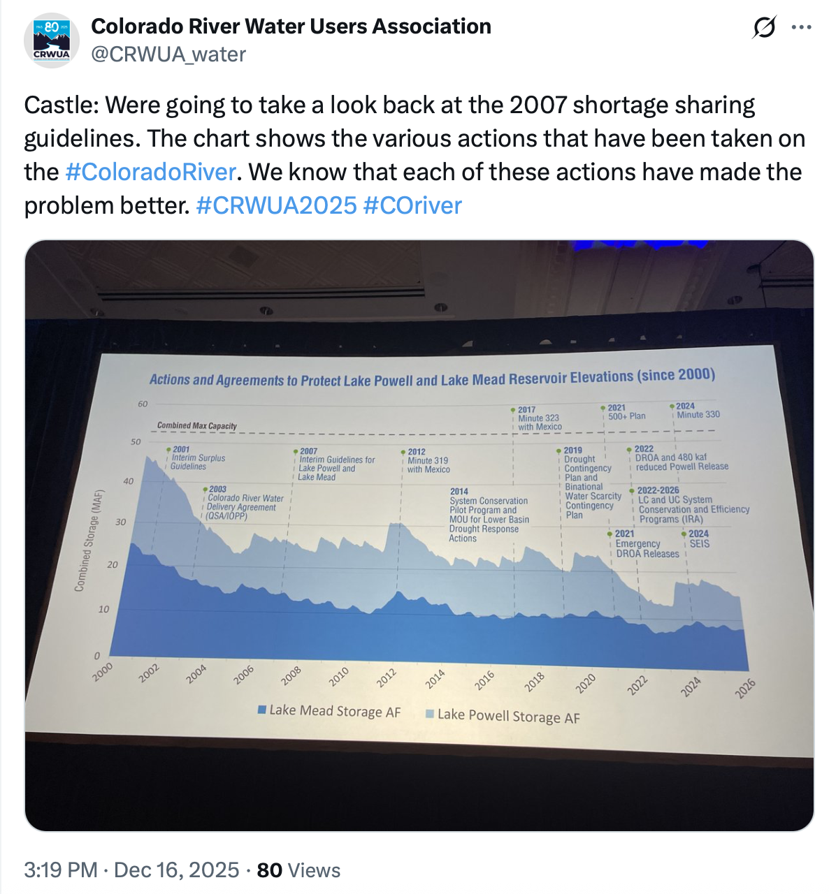
The basin’s main reservoirs, lakes Mead and Powell, have fallen to historic lows despite pouring state and federal dollars into broad conservation efforts, said Commissioner Becky Mitchell, Colorado’s governor-appointed negotiator on Colorado River issues.
“We’re in a precarious time because none of that is enough,” Mitchell told hundreds of audience members during an Upper Colorado River Commission meeting Tuesday. “It has not been enough.”

As the river’s water supply is strained by a 26-year drought and human demands, officials are trying to replace an expiring agreement from 2007, which manages how Mead and Powell capture water from upstream states and release it downstream for water users in Arizona, California, Nevada and Mexico.
The Department of the Interior is managing the effort, dubbed the post-2026 process, but deciding new rules is simpler said than done: Basin officials will have to address a changing climate and decide on painful water cuts going forward.
The Interior Department has given the seven basin states until Feb. 14 to reach a consensus. If they can agree, the feds will use the states’ proposal to manage the basin’s reservoirs. If not, the federal officials will decide what to do.

Officials from the Upper Basin states — Colorado, New Mexico, Utah and Wyoming — did not share examples of progress in the post-2026 negotiations. They said the basin’s water cycle, not its legal issues, are the main problem.
“It’s not political positions. It’s not legal interpretations,” Brandon Gebhart, Wyoming’s top negotiator, said. “It’s the hydrology of the entire basin.”

Others, including some of the 30 tribes in the basin, saw it differently. Some tribal representatives called for more transparency. Others said they couldn’t support a plan that is geared toward sending water to downstream states.
“Despite those that think hydrology is the problem, it’s not, and it can’t always be the scapegoat,” said Kirin Vicenti, water commissioner for the Jicarilla Apache Nation, located within New Mexico just south of the Colorado state line. “Our planning and policies must allow flexibility, and innovative and dynamic solutions.”

A basin divided by a Rome-inspired wall
Relationships between upstream states and Lower Basin states — Arizona, California and Nevada — have been strained since the post-2026 effort kicked into gear in 2022 and 2023.
On the other side of the casino wall from the Upper Basin meeting, the Colorado River Board of California met Tuesday morning. Each audience could hear muffled clapping from the other room as the officials spoke to their constituents.
“We know one thing for sure, which is that we have a smaller river and that requires less use,” JB Hamby, chairman of the Colorado River board and California’s top negotiator, told the gathering.
He lauded California’s “massive” and expensive efforts to address the river’s shrinking supply while still growing the state’s economy and agriculture industry.

California has cut its water use to 3.76 million acre-feet, the lowest it has been since 1949, state officials said. It has a proposed plan to conserve 440,000 acre-feet of river water per year.
One acre-foot roughly equals the annual water use of two to three households.
“We hear lots of applause lines from our friends next door, and we encourage them to take some examples from what California has been able to put together,” Hamby said. “We must all live with the resources we have, not the ones that we wish for.”
Crossing basin lines
While the states might be divided in water politics, conference attendees like Ken Curtis of Colorado moved between the rooms to hear each group’s discussion.
“We appear to be talking past each other,” said Curtis, the general manager of the Dolores Water Conservancy District in southwestern Colorado.
Some water managers from central Utah said they were already looking beyond the current negotiations to the next few decades. The basin’s challenges don’t end next fall — this is just a speed bump in a long future ahead, they said.
Others were waiting for updates from federal officials, scheduled for Wednesday. The Department of the Interior is set to release a highly anticipated look at different options for how to manage the basin around the end of the year.
Curtis said he is at the conference mainly to learn how other states were grappling with the tough water conditions and to get more insight into the negotiations beyond what’s in the media, he said.
“Squeezing it (water) out of the Upper Basin isn’t going to make enough water for the Lower Basin demands,” Curtis said. “And that may be a biased view, obviously, so I’m trying to get a little bit beyond my own biases.”


Click the link to read the discussion on the NOAA website:
December 11, 2025
ENSO Alert System Status: La Niña Advisory
Synopsis: La Niña is favored to continue for the next month or two, with a transition to ENSO-neutral most likely in January-March 2026 (68% chance).
La Niña persisted in November, as indicated by the continuation of below-average sea surface temperatures (SSTs) across the central and eastern equatorial Pacific Ocean. The latest weekly Niño-3.4 index value was -0.5°C, with the other Niño index values between -0.2°C and -0.4°C. Recent negative subsurface temperature anomalies weakened slightly (averaged from 180°-100°W; but below-average temperatures continued from the surface to 200m depth in the eastern half of the equatorial Pacific. The tropical atmosphere reflected La Niña, with low-level easterly wind anomalies evident in the central Pacific and upper-level westerly wind anomalies observed across most of the equatorial Pacific Ocean. Enhanced convection persisted over Indonesia and suppressed convection was near the Date Line. The traditional and equatorial Southern Oscillation indices were positive. Collectively, the coupled ocean-atmosphere system remains consistent with La Niña.
The IRI multi-model predictions indicate La Niña will continue in the December-February (DJF) 2025-26 season, but then ENSO-neutral is favored for January-March (JFM) 2026. Together with the North American Multi-Model Ensemble, the team continues to slightly support a weak La Niña through DJF (54% chance), before transitioning to ENSO-neutral in JFM. Even after equatorial Pacific SSTs transition to ENSO-neutral, La Niña may still have some lingering influence through the early Northern Hemisphere spring 2026 (e.g., CPC’s seasonal outlooks). In summary, La Niña is favored to continue for the next month or two, with a transition to ENSO-neutral most likely in January-March 2026 (68% chance).
This discussion is a consolidated effort of the National Oceanic and Atmospheric Administration (NOAA), NOAA’s National Weather Service, and their funded institutions. Oceanic and atmospheric conditions are updated weekly on the Climate Prediction Center web site (El Niño/La Niña Current Conditions and Expert Discussions). A probabilistic strength forecast is available here. The next ENSO Diagnostics Discussion is scheduled for 8 January 2026.
To receive an e-mail notification when the monthly ENSO Diagnostic Discussions are released, please send an e-mail message to: ncep.list.enso-update@noaa.gov.
Toni Lyn Morelli, UMass Amherst; U.S. Geological Survey and Diana Stralberg, University of Alberta
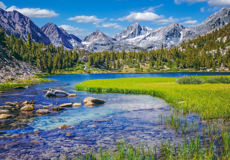
The idea began in California’s Sierra Nevada, a towering spine of rock and ice where rising temperatures and the decline of snowpack are transforming ecosystems, sometimes with catastrophic consequences for wildlife.
The prairie-doglike Belding’s ground squirrel (Urocitellus beldingi) had been struggling there as the mountain meadows it relies on dry out in years with less snowmelt and more unpredictable weather. At lower elevations, the foothill yellow-legged frog (Rana boylii) was also being hit hard by rising temperatures, because it needs cool, shaded streams to breed and survive.

As we studied these and other species in the Sierra Nevada, we discovered a ray of hope: The effects of warming weren’t uniform.
We were able to locate meadows that are less vulnerable to climate change, where the squirrels would have a better chance of thriving. We also identified streams that would stay cool for the frogs even as the climate heats up. Some are shaded by tree canopy. Others are in valleys with cool air or near deep lakes or springs.
These special areas are what we call climate change refugia.
Identifying these pockets of resilient habitat – a field of research that was inspired by our work with natural resource managers in the Sierra Nevada – is now helping national parks and other public and private land managers to take action to protect these refugia from other threats, including fighting invasive species and pollution and connecting landscapes, giving threatened species their best chance for survival in a changing climate.

Across the world, from the increasingly fire-prone landscapes of Australia to the glacial ecosystems at the southern tip of Chile, researchers, managers and local communities are working together to find and protect similar climate change refugia that can provide pockets of stability for local species as the planet warms.
A new collection of scientific papers examines some of the most promising examples of climate change refugia conservation. In that collection, over 100 scientists from four continents explain how frogs, trees, ducks and lions stand to benefit when refugia in their habitats are identified and safeguarded.

The study of climate change refugia – places that are buffered from the worst effects of global warming – has grown rapidly in recent years.
In New England, managers at national parks and other protected areas were worried about how species are being affected by changes in climate and habitat. For example, the grasshopper sparrow (Ammodramus savannarum), a little grassland songbird that nests in the open fields in the eastern U.S. and southern Canada, appears to be in trouble.
We studied its habitats and projected that less than 6% of its summer northeastern U.S. range will have the right temperature and precipitation conditions by 2080. https://www.youtube.com/embed/W2VmrdbCbmU?wmode=transparent&start=0 The grasshopper sparrow. American Bird Conservancy
The loss of songbirds is not only a loss of beauty and music. These birds eat insects and are important to the balance of the ecosystem.
The sand plain grasslands that the grasshopper sparrow relies on in the northeastern U.S. are under threat not only from changes in climate but also changes in how people use the land. Public land managers in Montague, Massachusetts, have used burning and mowing to maintain habitat for nesting grasshopper sparrows. That effort also brought back the rare frosted elfin butterfly for the first time in decades.
In Canada, the climate is warming at about twice the global average, posing a threat to its vast forested landscapes, which face intensifying drought, insect outbreaks and destructive wildfires.
We have been actively mapping refugia in British Columbia, looking for shadier, wetter or more sheltered places that naturally resist the worst effects of climate change.

The mapping project will help to identify important habitat for wildlife such as moose and caribou. Knowing where these climate change refugia are allows land-use planners and Indigenous communities to protect the most promising habitats from development, resource extraction and other stressors.
British Columbia is undertaking major changes to forest landscape planning in partnership with First Nations and communities.
On the sweeping vistas of East Africa, dozens of species interact in hot spots of global biodiversity. Unfortunately, rising temperatures, prolonged drought and shifting seasons are threatening their very existence.
In Tanzania, working with government agencies and conservation groups through past USAID funding, we mapped potential refugia for iconic savanna species including lions, giraffes and elephants. These areas include places that will hold water in drought and remain cooler during heat waves. The iconic Serengeti National Park, home to some of the world’s most famous wildlife, emerged as a key location for climate change refugia.

Combining local knowledge with spatial analysis is helping prioritize areas where big cats, antelope, elephants and the other great beasts of the Serengeti ecosystem can continue to thrive – provided other, nonclimate threats such as habitat loss and overharvesting are kept at bay.
The Tanzanian government has already been working with U.S.-funded partners to identify corridors that can help connect biodiversity hot spots.
By identifying and protecting the places where species can survive the longest, we can buy crucial decades for ecosystems while conservation efforts are underway and the world takes steps to slow climate change.
Across continents and climates, the message is the same: Amid our rapidly warming world, pockets of resilience remain for now. With careful science and strong partnerships, we can find climate change refugia, protect them and help the wild things continue to thrive.
Toni Lyn Morelli, Adjunct Full Professor of Environmental Conservation, UMass Amherst; U.S. Geological Survey and Diana Stralberg, Adjunct professor, Department of Renewable Resources, University of Alberta
This article is republished from The Conversation under a Creative Commons license. Read the original article.
Click here to peruse my Tweets from day 1 of the Colorado River Water Users Association annual conference. (Click on the “Latest” tab.)

Click the link to read the article on the Big Pivots website (Brian McNeece):
December 15, 2025
Where Colorado and other Upper-Basin states need to retreat from trying to develop full compact allocation. But Lower Basin states need to acknowledge Mother Nature.
This was published on Dec. 13, 2025, in the Calexico Chronicle, a publication in California’s Imperial Valley. It is reposted here with permission, and we asked for that permission because we thought it was an interesting explanation from a close observer who was reared in an area that uses by far the most amount of water in the Colorado River Basin.
This week is the annual gathering of “water buffaloes” in Las Vegas. It’s the Colorado River Water Users Association convention. About 1,700 people will attend, but probably around 100 of them are the key people — the government regulators, tribal leaders, and the directors and managers of the contracting agencies that receive Colorado River water.
Anyone who is paying attention knows that we are in critical times on the river. Temporary agreements on how to distribute water during times of shortage are expiring. Negotiators have been talking for several years but haven’t been able to agree on anything concrete.
I’m just an observer, but I’ve been observing fairly closely. Within the limits on how much information I can get as an outsider, I’d like to propose some principles or guidelines that I think are important for the negotiation process.
A. When Hoover Dam was proposed, the main debate was over whether the federal government or private concerns would operate it. Because the federal option prevailed, water is delivered free to contractors. Colorado River water contractors do not pay the actual cost of water being delivered to them. It is subsidized by the U.S. government. As a public resource, Colorado River water should not be seen as a commodity.
B. The Lower Basin states of Arizona, California, and Nevada should accept that the Upper Basin states of Colorado, New Mexico, Utah, and Wyoming are at the mercy of Mother Nature for much of their annual water supply. While the 1922 Colorado River Compact allocates them 7.5 million acre-feet annually, in wet years, they have been able to use a maximum of 4.7 maf. During the long, ongoing drought, their annual use has been 3.5 maf. They shouldn’t have to make more cuts.
C. However, neither should the Upper Basin states be able to develop their full allocation. It should be capped at a feasible number, perhaps 4.2 maf. As compensation, Upper Basin agencies and farmers can invest available federal funds in projects to use water more efficiently and to reuse it so that they can develop more water.
D. Despite the drought, we know there will be some wet years. To compensate the Lower Basin states for taking all the cuts in dry years, the Upper Basin should release more water beyond the Compact commitments during wet years. This means that Lake Mead and Lower Basin reservoirs would benefit from wet years and Lake Powell would not. In short, the Lower Basin takes cuts in dry years; the Upper Basin takes cuts in wet years.
E. Evaporation losses (water for the angels) can be better managed by keeping more of the Lower Basin’s water in Upper Basin reservoirs instead of in Lake Mead, where the warmer weather means higher evaporation losses. New agreements should include provisions to move that water in the Lower Basin account down to Lake Mead quickly. Timing is of the essence.
H. In the Lower Basin states, shortages should be shared along the same lines as specified in the 2007 Interim Guidelines, with California being last to take cuts as Lake Mead water level drops.
I. On the home front, Imperial Irrigation District policy makers should make a long-term plan to re-set water rates in accord with original water district policy. Because the district is a public, non-profit utility, water rates were set so that farmers paid only the cost to deliver water. Farmers currently pay $20 per acre foot, but the actual cost of delivering water is $60 per acre foot. That subsidy of $60 million comes from the water transfer revenues.
J. The San Diego County Water Authority transfer revenues now pay farmers $430 per acre-foot of conserved water, mostly for drip or sprinkler systems. Akin to a grant program, this very successful program generated almost 200,000 acre-feet of conserved water last year. Like any grant program, it should be regularly audited for effectiveness.
K. Some of those transfer revenues should be invested in innovative cropping patterns, advanced technologies, and marketing to help the farming community adapt to a changing world. The Imperial Irrigation District should use its resources to help all farmers be more successful, not just a select group.
L. Currently, federal subsidies pay farmers not to use water via the Deficit Irrigation Program. We can lobby for those subsidies to continue, but we should plan for when they dry up. Any arrangement that rewards farmers but penalizes farm services such as seed, fertilizer, pesticide, land leveling, equipment, and other work should be avoided.
M. Though the Imperial Irrigation District has considerable funding from the district’s QSA water transfers, it may need to consider issuing general obligation bonds as it did in its foundational days for larger water efficiency projects such as more local storage or a water treatment plant to re-use ag drain water.
Much progress has been made in using water more efficiently, especially in the Lower Basin states, but there’s a lot more water to be saved, and I believe collectively that we can do it.

Click the link to read the release on the Colorado River Board of California website:
State leaders seek durable post-2026 plan and make significant contributions
December 16, 2025
Las Vegas – California’s water, tribal, and agricultural leaders today presented a comprehensive framework for a durable, basin-wide operating agreement for the Colorado River and highlighted the state’s proposal for conserving 440,000 acre-feet of river water per year.
At the annual Colorado River Water Users Association conference, California underscored the state’s leadership in conservation, collaboration, and long-term stewardship of shared water resources that inform its approach to post-2026 negotiations.
California takes a balanced approach, relying on contributions from the upper and lower basins to maintain a shared resource. California supports hydrology-based flexibility for river users, with all states contributing real water savings. Any viable framework would need to include transparent and verifiable accounting for conserved water, along with several other elements outlined in the California framework.
State leaders also noted that they are willing to set aside many of their legal positions to reach a deal, including releases from Lake Powell under the Colorado River Compact, distribution of Lower Basin shortages, and other provisions of the Law of the River, provided that there are equitable and sufficient water contributions from every state in the Basin and the country of Mexico.
Constructive California
“California is leading with constructive action,” said JB Hamby, chairman of the Colorado River Board of California. “We have reduced our water use to the lowest levels since the 1940s, invested billions to modernize our water systems and develop new supplies, partnered with tribes and agricultural communities, and committed to real water-use reductions that will stabilize the river. We are doing our part – and we invite every state to join us in this shared responsibility.”
Despite being home to 20 million Colorado River-reliant residents and a farming region that produces the majority of America’s winter vegetables, California’s use of Colorado River water is projected at 3.76 million acre-feet in 2025 – the lowest since 1949.
That achievement comes on top of historic reductions in water use over the past 20 years, led by collaborative conservation efforts. Urban Southern California cut imported water demand in half while adding almost 4 million residents. And farms reduced water use by more than 20% while sustaining more than $3 billion in annual output. Tribes also have made critical contributions, including nearly 40,000 acre-feet of conserved water by the Quechan Indian Tribe to directly support river system stability.
Going forward, California is prepared to reduce water use by 440,000 acre-feet per year – in addition to existing long-standing conservation efforts – as part of the Lower Basin’s proposal to conserve up to 1.5 million acre-feet per year, which would include participation by Mexico. When conditions warrant, California is also committed to making additional reductions to address future shortages as part of a comprehensive basin-state plan.
The state’s history of conservation illustrates what can be accomplished through collaboration, and all Colorado River water users in California are preparing to contribute to these reductions – agricultural agencies, urban agencies, and tribes.
Framework for a Post-2026 Agreement
In addition to conservation contributions, California provided a framework of principles for the post-2026 river operating guidelines to advance a shared solution for the seven Basin States, the tribes and Mexico. More specifically, California outlined the following key components for a new framework:
- Lake Powell releases – California supports a policy of hydrology-based, flexible water releases that protects both Lake Powell and Lake Mead. Flexibility must be paired with appropriate risk-sharing across basins, avoiding disproportionate impacts to any one region.
- Upper Initial Units (Colorado River Storage Project Act) – Releases should be made when needed to reduce water supply and power risks to both basins.
- Shared contributions – The Lower Basin’s proposed 1.5 million acre-feet per year contribution to address the structural deficit, including an equitable share from Mexico (subject to binational negotiations), is the first enforceable offer on the table. When hydrology demands more, participation by all seven Basin States is essential.
- Interstate exchanges – Interstate exchanges need to be part of any long-term solution to encourage interstate investments in new water supply projects that may not be economically viable for just one state or agency.
- Operational flexibility – Continued ability to store water in Lake Mead is vital to maintain operational flexibility. California supports continuation and expansion of water storage in Lake Mead as a long-term feature of river management and to encourage conservation. We also support Upper Basin pools for conservation, allowing similar benefits.
- Phasing of a long-term agreement – California supports a long-term operating agreement with adaptive phases. Tools like water storage in Lake Mead and Lake Powell need to extend beyond any initial period due to significant investments required to store conserved water in the reservoirs.
- Protections and federal support: Any agreement should be supported with federal funding and any necessary federal authorities, allow agriculture and urban areas to continue to thrive, protect tribal rights, and address the environment, including the environmentally sensitive Salton Sea.
“There are no easy choices left, but California has always done what is required to protect the river,” said Jessica Neuwerth, executive director of the Colorado River Board of California. “We have proven that conservation and growth can coexist. We have shown that reductions can be real, measurable, and durable. And we have demonstrated how states, tribes, cities, and farms can work together to build a sustainable future for the Colorado River.”
What California agencies are saying:
“The future of the Colorado River is vital to California – and our nation. As the fourth largest economy in the world, we rely on the Colorado River to support the water needs of millions of Californians and our agricultural community which feeds the rest of the nation. California is doing more with less, maintaining our economic growth while using less water in our urban and agricultural communities. We have cut our water use to its lowest levels in decades and are investing in diverse water supply infrastructure throughout California, doing our part to protect the Colorado River for generations to come. We look forward to continued discussions with our partners across the West to find the best path forward to keep the Colorado River healthy for all those who rely on it.” – Wade Crowfoot, Secretary, California Natural Resources
“Metropolitan’s story is one of collaboration, of finding common ground. We have forged partnerships across California and the Basin – with agriculture, urban agencies and tribes. And through that experience, we know that we can build a comprehensive Colorado River Agreement that includes all seven states and the country of Mexico. We must reach a consensus. That is the only option.” – Adán Ortega, Jr., Chair, Metropolitan Water District Board of Directors
“California’s leadership is grounded in results, and the Imperial Valley is proud to contribute to that record. Our growers have created one of the most efficient agricultural regions in the Basin—cutting use by over 20% while supporting a $3 billion farm economy that feeds America. Since 2003, IID has conserved more than nine million acre-feet, and with the Colorado River as our sole water supply, we remain firmly committed to constructive, collaborative solutions that protect America’s hardest-working river.” – Gina Dockstader, Chairwoman, Imperial Irrigation District
“The path to resiliency requires innovation, cooperation, and every Basin state’s commitment to conservation. The San Diego County Water Authority supports an approach that provides flexibility to adapt to changing climate conditions. That means developing a new framework that allows for interstate water transfers to move water where it’s most needed and incentivizes the development of new supplies for augmentation.” – CRB Vice Chair Jim Madaffer, San Diego County Water Authority
“Palo Verde Irrigation District is committed to maintaining a healthy, viable river system into the future. We at PVID have always gone above and beyond in supporting the river in times of need. Since 2023 our 95,000-acre valley, in collaboration with Metropolitan and the U.S. Bureau of Reclamation have committed over 351,000 acre-feet of verifiable wet water to support the river system and Lake Mead. It is important to our stakeholders in the Palo Verde Valley and all of California that Colorado River water continues to meet the needs of both rural and urban areas. We must find workable solutions that keep food on people’s plates and water running thru the faucets of homes.” – Brad Robinson, Board President, Palo Verde Irrigation District
“California continues to lead in conservation and collaboration, setting the standard for innovation and sustainability. Together, we strive to ensure reliability for millions of people, tribes, and acres of farmland. For decades, CVWD has invested in conservation efficiency, alongside investments from growers. Additionally, we have saved more than 118,000 acre-feet of Colorado River water since 2022 — underscoring our shared commitment to long-term sustainability. CVWD remains dedicated to finding collaborative solutions to protect the river’s health and stability.” – Peter Nelson, Board Director, Coachella Valley Water District
“As stewards of the Colorado River since time immemorial, our Tribe is committed to protecting the river for the benefit of our people and all of the communities and ecosystems that rely on it. We believe partnerships and collaboration, such as our agreement with Metropolitan Water District and the Bureau of Reclamation to conserve over 50,000 acre-feet of our water in Lake Mead between 2023 and 2026, are essential to ensure that we have a truly living river.” – President Jonathan Koteen, Fort Yuma Quechan Indian Tribe
“Bard Water District remains committed to continued system conservation and responsible water management. While small in size, the District continues to make meaningful contributions to regional sustainability efforts on the Colorado River.” – Ray Face, Board President, Bard Water District
“LADWP is dedicated to delivering and managing a water supply that prioritizes resilience, high quality, and cost-effectiveness. These investments illustrate that achieving urban water resiliency is indeed feasible.” – Dave Pettijohn, Water Resources Director, Los Angeles Department of Water & Power


Click the link to read the article on The Land Desk website (Jonathan P. Thompson):
December 16, 2025
🥵 Aridification Watch 🐫
A new report from the Colorado River Research Group, aptly named “Dancing with Deadpool,” paints a grim picture of the critical artery of the Southwest. Reservoir and groundwater levels are perilously low, the 25-year megadrought is likely to persist — perhaps for decades, and the collective users of the river have yet to develop a workable plan for cutting consumption and balancing demand with the river’s dwindling supply.
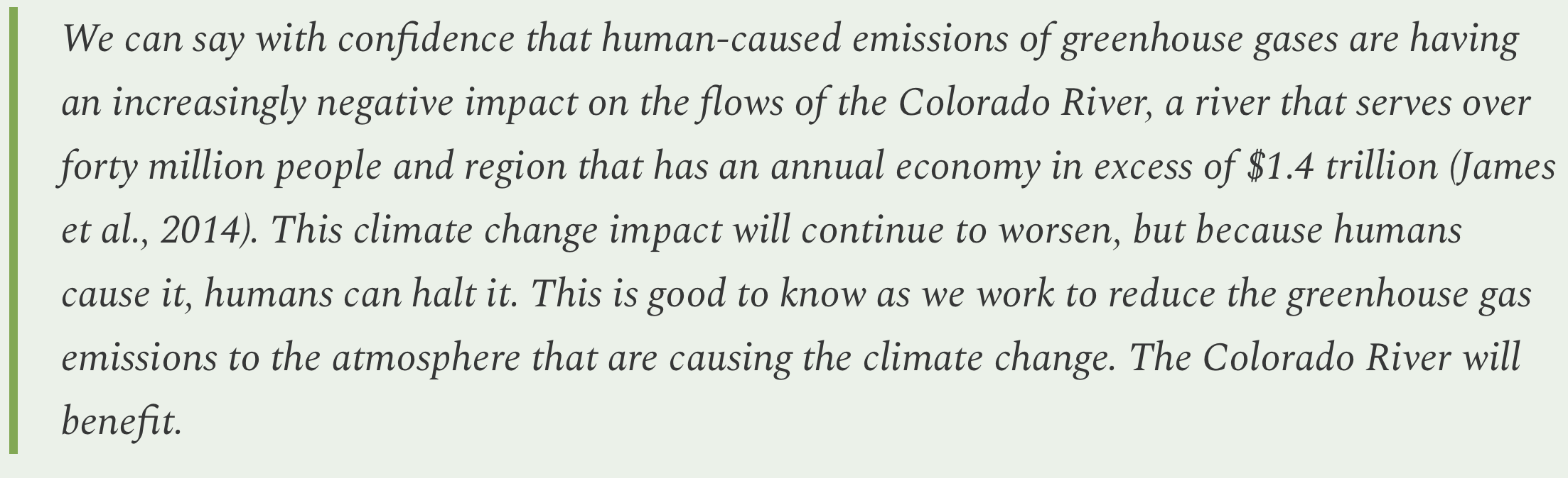
Amid all the darkness however, the report also delivers a few glimmers of hope, noting that mechanisms do exist to avert a full-blown crisis, and that humans do have the power to slow or halt human-cased global heating, which is one of the main drivers of reduced flows in the river.
Those reduced flows seem like a good place to start, since the Colorado River Basin is experiencing the very phenomenon that Jonathan Overpeck and Brad Udall write about in the second chapter, “Think Natural Flows Will Rebound in the Colorado River Basin? Think Again.”
The authors call the Southwest “megadrought country,” since tree rings and other sources show that severe, multi-decadal dry spells — like the one gripping the region currently — have occurred somewhat regularly over the last 2,000 years. The current drought, then, is likely a part of this natural climate variability.
But there’s a catch: The previous megadroughts most likely resulted from, primarily, a lack of precipitation. The current dry-spell is also due to lack of precipitation, but it is intensified by warming temperatures, which are the clear and direct result of climate change. They also find evidence that climate change may also be exacerbating the current climate deficit.
The takeaway is that even when we move through the current dry part of the cycle, the increasingly higher temperatures will offset some of the added precipitation and continue to diminish Colorado River flows. And, when the natural cycle comes back around to the drought side, it’s going to be even worse thanks to climate change.

Water year 2026 is so far looking like an example of the former, with normal to above-normal precipitation accumulating, but as rain, not as snow, leaving much of the West with far below normal snowpack levels.
If the trend continues, it will not bode well for the Colorado River, according to the chapter written by Jack Schmidt, Anne Castle, John Fleck, Eric Kuhn, Kathryn Sorensen, and Katherine Tara. In an updated version of a paper they put out in September, they find that if water year 2026 (which we’re about 2.5 months into) is anything like water year 2025, Lake Powell is in trouble, and “low reservoir levels in summer 2026 will challenge water supply management, hydropower production, and environmental river management.”
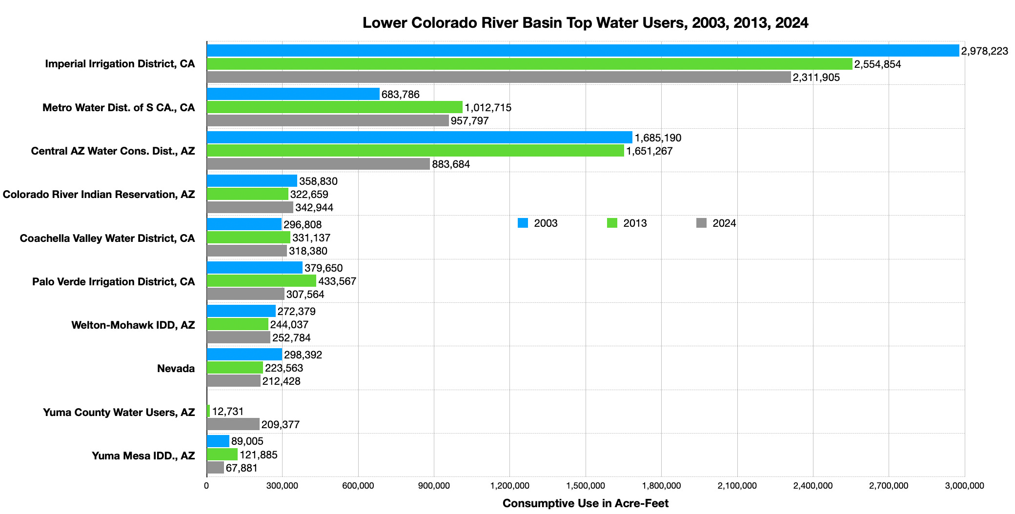
In order to avoid a full-blown crisis in the near-term, Colorado River users must significantly and quickly cut water consumption — independent of whatever agreement the states come up with for dividing the river’s dwindling waters after 2026.
While there is a long-running debate over whether the Upper Basin or the Lower Basin will have to bear the brunt of those cuts, the math makes it indisputable that the agricultural sector in both basins will have to pare down its collective consumption. That’s because irrigated agriculture accounts for about 74% of all direct human consumptive use on the River, or about three times more than municipal, commercial, and industrial uses.
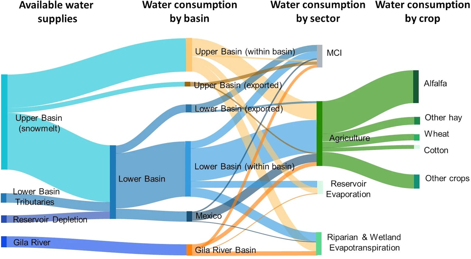
That’s why, in recent years, the feds and states have paid farmers to stop irrigating some crops and fallow their fields. While this method has achieved meaningful cuts in overall water use in those areas, it is in most cases not sustainable because the deals are temporary, and because they rely on iffy federal funding. So, in another of the report’s chapters, Kathryn Sorensen and Sarah Porter offer a different proposal: The federal government should simply purchase land from willing sellers and stop irrigating it (or at least compensate landowners for agreeing to stop or curtail irrigation permanently).
They emphasize that this is not a “buy-and-dry” proposition, where a city buys out the water rights of farms to serve more development. That doesn’t actually save any water, since the city is still using it, and it wrecks farms and communities. Instead, this proposal would actually convert the farmland into public land, and put the water back into the river. This proposed program would target high-water-use, low economic-water-productivity land in situations where the water savings would benefit the environment and the land transfer would help local communities.
Even then, this would be disruptive, in that it would take land out of agriculture and potentially remove farms — and the farmers — from the community. There would also be the question of how to manage the freshly fallowed fields so that they don’t become weed-infested wastelands or sources of airborne, snow-melting dust.
Lamenting the McElmo effect and loss of irrigation-landscapes in an era of aridification — Jonathan P. Thompson
In the following chapter, a quartet of authors suggests a slightly softer approach, in which farmers adapt to dwindling water amounts by shifting crops or to reduce cattle herd sizes or approaches.
The report concludes with a call for a basin-wide approach to managing the Colorado River, and the creation of an entity that would address Colorado River issues in a more comprehensive, transparent, and inclusive way. The current approach, which arbitrarily cuts the watershed in half along an imaginary line, pitting one set of states against another while excluding sovereign tribal nations, and trying to operate within an outdated framework known as the Law of the River, is an opaque mess that has thus far resulted only in gridlock.
The authors propose, instead:

And, finally, a little smidgeon of hope from the report’s second chapter, although it’s hard to be hopeful about reversing climate change in times like these and with a presidential administration intent on burning more and more fossil fuels …
Western water: Where values, math, and the “Law of the River” collide, Part I — Jonathan P. Thompson

🦫 Wildlife Watch 🦅
The News: Colorado Parks and Wildlife last week thanked New Mexico wildlife officials for successfully capturing gray wolf 2403, a member of Colorado’s Copper Creek pack that had roamed over the state line. The wolf was re-released in Grand County, Colorado, where officials hope it will find a mate.
The Context: WTF!? Are these folks trying to bring an extirpated species back to a state similar to the one that existed before it was systematically slaughtered — i.e. the “natural” state — or are they running a zoo?
The CPW said that the wolf’s capture was in compliance with an agreement with bordering states that is purportedly intended to “protect the genetic integrity of the Mexican wolf recovery program, while also establishing a gray wolf population in Colorado.”
I’m no wildlife biologist, but it sure does seem to me that if a gray wolf from Colorado heads to New Mexico in search of a mate, as is their instinctual tendency, then that’s a good thing. And trying to confine the wolves to artificial and arbitrary political boundaries is counterproductive.
“Historically, gray wolf populations in western North America were contiguously distributed from northern arctic regions well into Mesoamerica as far south as present day Mexico City” explained David Parsons, former Mexican Wolf Recovery Coordinator for the US Fish and Wildlife Service in a written statement. “The exchange of genes kept gray wolf populations both genetically and physically healthy, enhancing their ability to adapt and evolve to environmental changes.” He added that 2403’s walkabout, along with that of “Taylor,” the Mexican gray wolf that has defied attempts to constrain him to southern New Mexico by traveling into the Mt. Taylor region, were “simply retracing ancient pathways of wolf movements. Rather than being viewed as a problem, these movements should be encouraged and celebrated as successful milestones toward west-wide gray wolf recovery efforts.”
Amen to that.
It’s clearly very tough to run a predator reintroduction program in the rural West, fraught as it is with political and cultural complications. And I respect and admire the folks that are running the project, and understand they are working within serious constraints. Still, there has to be a better way to let nature run its course.
Longread: On wolves, wildness, and hope in trying times — Jonathan P. Thompson


I’m in Las Vegas for the 2025 Colorado River Water Users Association annual conference! Follow along on the CRWUA Twitter (X) feed: https://x.com/CRWUA_water. Take a look back at our LinkedIn, blog, and Instagram posts from this year.

December 15, 2025
The effort to permanently protect the historic Shoshone water rights gained additional momentum as two more west slope communities committed funding in their 2026 budgets toward the Colorado River District’s $99 million purchase agreement with Xcel Energy. The Town of Breckenridge has pledged $100,000, and the Town of Gypsum has committed $15,000, underscoring the importance of reliable Colorado River flows for communities from the headwaters to the state line and beyond.
By committing financial support for the Shoshone Water Rights Preservation Project, Breckenridge and Gypsum join a large and growing coalition of Western Slope partners working to safeguard flows that support local economies, healthy rivers, and long-term water security for Colorado.

“The Shoshone water rights are a cornerstone of the Colorado River system and a critical part of protecting our quality of life in the high country,” said Breckenridge Mayor Kelly Owens. “Breckenridge is proud to stand with partners across the West Slope and headwaters region to keep water in the river, support our outdoor recreation economy, and protect this vital resource for generations to come.”

“Look, in Gypsum we see it every single day, our local ranches, our jobs, our families all depend on the Eagle and the Colorado running strong and flowing,” said Gypsum Mayor Steve Carver. “Backing Shoshone just makes sense. It gives us some certainty when water gets tight. We’re happy to jump in with everybody else and keep that water right here on the Western Slope.”
The Shoshone Water Rights Preservation Coalition, led by the Colorado River District, now includes 35 local governments, water entities, and regional partners across the Western Slope, as well as support from across the state. Together, these partners have committed over $37.3 million toward the $99 million purchase price, in addition to state and federal investments to protect a critical piece of Colorado’s water security.
“Communities across the West Slope continue to step up together in a powerful way,” said Andy Mueller, general manager of the Colorado River District. “Support from Breckenridge and Gypsum reflects a shared understanding that Shoshone is about more than one community or region. It’s about working together to keep the Colorado River and its tributaries flowing for the environment, agriculture, recreation and local communities across Colorado that rely on this water.”
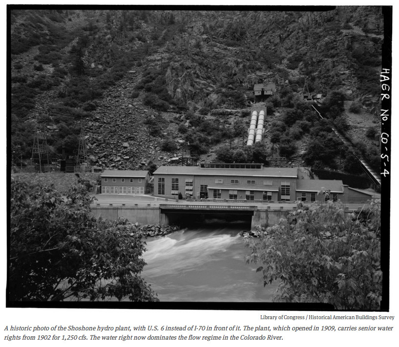
The Shoshone hydroelectric plant, located in Glenwood Canyon, holds nonconsumptive senior water rights that date back to 1902. These rights are essential for supporting flows in the Colorado River, benefiting agriculture, recreation, rural economies, and water users across the West Slope and beyond.
In December 2023, the Colorado River District entered a purchase and sale agreement with Xcel Energy to acquire and permanently protect the water rights, with plans to negotiate an instream flow agreement with the Colorado Water Conservation Board. This agreement would safeguard future flows, regardless of the Shoshone plant’s operational status.
In January 2025, the Bureau of Reclamation awarded $40 million in federal funding through a program authorized by the Inflation Reduction Act. The River District continues to work with the Bureau and remains optimistic that the project’s broad support and clear public benefit will secure the necessary federal funds to complete this once-in-a-generation investment.
Learn more about the Shoshone Water Rights Preservation Project & Coalition at KeepShoshoneFlowing.org.


Click the link to read the article on the AZCentral.com website (Brandon Loomis). Here’s an excerpt:
December 15, 2025
Key Points
- Seven states and 30 tribes that depend on the Colorado River are looking for ways to share a shrinking resource, but environmental groups fear little will be left for the river itself.
- A wetlands at the end of the river and a fishery at its midpoint show what can happen when water is managed to preserve nature’s needs.
- Growing demand on the river and competing interests, including electric power providers, could force negotiators for the states to confront difficult decisions.
CIÉNEGA DE SANTA CLARA, Mexico — The rusty observation tower at the edge of this wastewater-fed marsh offers an osprey-eye view of two possible futures for the parched and overworked Colorado River. To one side, the marsh spreads across more than 20 square miles of pools and islands choked with cattails and phragmites, convoys of pelicans descending and splashing down for a rest on their journey south from the Great Salt Lake or other western waters. Dragonflies hover below, while a fish hawk circles above, scanning the open water between the reeds. This is a vision of a future in which partners across the Western United States and Mexico save enough water that they can spare some for nature, even if it means irrigating it with the salty dregs. On the tower’s other side, boundless flats of sand and cracked mud spread to the horizon across what was, prior to the river’s damming a century ago, one of Earth’s great green estuaries.

Jennifer Pitt leaned against a rail atop the tower and scanned that dusty horizon. A century ago, she said, the river had meandered so widely and soaked so much verdant ground there that the naturalist Aldo Leopold had written in “A Sand County Almanac” that “the river was nowhere and everywhere,” unable to “decide which of a hundred green lagoons offered the most pleasant and least speedy path to the Gulf (of California).”
Now the Grand River’s delta supports just a handful of green lagoons, all fed either by wastewater or by targeted environmental irrigation. Pitt leads the Audubon Society’s Colorado River program. She has toiled for decades alongside American and Mexican conservationists to rebuild slivers of living delta from what’s left of the water after dams, farm ditches and growing cities divert most of the great river along its 1,450-mile route from the Rocky Mountains toward its dry mouth on the Sea of Cortez near here. A century ago, the river would have wandered a soaked delta teeming with birds, jaguars and legendary biodiversity. Now, a wastewater marsh must do the ecological heavy lifting.

“If we can’t prioritize taking care of a place like this, I fear for our ability to take care of ourselves,” Pitt said.
The next few months will be a turning point in efforts to preserve a measure of nature here and across the river’s length, as the seven U.S. states that split the bulk of the water struggle to reach a new deal among themselves that could also determine how much water is available to nurse a remnant of the river’s own environment. Federal officials have said Interior Secretary Doug Burgum is prepared to impose his own cuts if the states can’t reach their own deal, and have said they need a negotiated plan by late winter to avoid that outcome. More than two decades of “megadrought,” unprecedented in U.S. history, have left little wiggle room for year-to-year operations. Reservoirs that were near their 58.48 million-acre-foot capacity in 2000 began the 2026 water year on Oct. 1, with just 21.8 million acre-feet behind the dams. Each acre-foot contains about 326,000 gallons and is roughly enough to support three households for a year, though the bulk of the water flows to the region’s farms.

Shuang-Ye Wu, University of Dayton
The summer of 2025 brought unprecedented flash flooding across the U.S., with the central and eastern regions hit particularly hard. These storms claimed hundreds of lives across Texas, Kentucky and several other states and caused widespread destruction.
At the same time, every hurricane that formed, including the three powerful Category 5 storms, steered clear of the U.S. mainland.
Both scenarios were unusual – and they were largely directed by the polar jet stream.
Jet streams are narrow bands of high-speed winds in the upper troposphere, around four to eight miles (seven to 13 kilometers) above the surface of the Earth, flowing west to east around the entire planet. They form where strong temperature contrasts exist.
Each hemisphere hosts two primary jet streams:

The polar jet stream is typically found near 50 to 60 degrees latitude, across Canada in the Northern Hemisphere, where cold polar air meets warmer midlatitude air. It plays a major role in modulating weather systems in the midlatitudes, including the continental U.S. With winds up to 200 mph, it’s also the usual steering force that brings those bitter cold storms down from Canada.
The subtropical jet stream is typically closer to 30 degrees latitude, which in the Northern Hemisphere crosses Florida. It follows the boundary between tropical air masses and subtropical air masses. It’s generally the weaker and steadier of the two jet streams.

These jet streams act like atmospheric conveyor belts, steering storm systems across continents.
Stronger (faster) jet streams can intensify storm systems, whereas weaker (slower) jet streams can stall storm systems, leading to prolonged rainfall and flooding.
Most summers, the polar jet stream retreats northward into Canada and weakens considerably, leaving the continental U.S. with calmer weather. When rainstorms pop up, they’re typically caused by localized convection due to uneven heating of the land – picture afternoon pop-up thunderstorms.
During the summer of 2025, however, the polar jet stream shifted unusually far south and steered larger storm systems into the midlatitudes of the U.S. At the same time, the jet stream weakened, with two critical consequences.
First, instead of moving storms quickly eastward, the sluggish jet stream stalled storm systems in place, causing prolonged downpours and flash flooding.
Second, a weak jet stream tends to meander more dramatically. Its broad north-south swings in summer 2025 funneled humid air from the Gulf of Mexico deep into the interior, supplying storm systems with abundant moisture and intensifying rainfall.

This moisture surge was amplified by unusually warm conditions over the Atlantic and Gulf regions. A warmer ocean evaporates more water, and warmer air holds a greater amount of moisture. As a result, extraordinary levels of atmospheric moisture were directed into storm systems, fueling stronger convection and heavier precipitation.
Finally, the wavy jet stream became locked in place by persistent high-pressure systems, anchoring storm tracks over the same regions. This led to repeated episodes of heavy rainfall and catastrophic flooding across much of the continental U.S. The same behavior can leave other regions facing days of unrelenting heat waves.
The jet stream also played a role in the 2025 hurricane season.
Given its west-to-east wind direction, the southward dip of the jet stream – along with a weak high pressure system over the Atlantic – helped steer all five hurricanes away from the U.S. mainland.
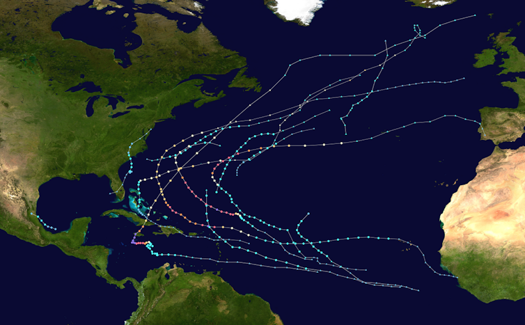
Most of the year’s 13 tropical storms and hurricanes veered off into the Atlantic before even reaching the Caribbean.

So, how does climate change influence the jet stream?
The strength of jet streams is controlled by the temperature contrast between the equatorial and polar regions.
A higher temperature contrast leads to stronger jet streams. As the planet warms, the Arctic is heating up at more than twice the global average rate, and that is reducing the equator-to-pole temperature difference. As that temperature gradient weakens, jet streams lose their strength and become more prone to stalling.

This increases the risk of persistent extreme rainfall events.
Weaker jet streams also meander more, producing larger waves and more erratic behavior. This increases the likelihood of unusual shifts, such as the southward swing of the jet stream in the summer of 2025.
A recent study found that amplified planetary waves in the jet streams, which can cause weather systems to stay in place for days or weeks, are occurring three times more frequently than in the 1950s.
As the global climate continues to warm, extreme weather events driven by erratic behavior of jet streams are expected to become more common. Combined with additional moisture that warmer oceans and air masses supply, these events will intensify, producing storms that are more frequent and more destructive to societies and ecosystems.
In the short term, the polar jet stream will be shaping the winter ahead. It is most powerful in winter, when it dips southward into the central and even southern U.S., driving frequent storm systems, blizzards and cold air outbreaks.
Shuang-Ye Wu, Professor of Geology and Environmental Geosciences, University of Dayton
This article is republished from The Conversation under a Creative Commons license. Read the original article.
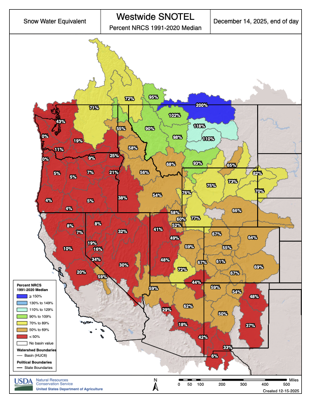
Click the link to read the article on The Denver Post website (Elise Schmelzer). Here’s an excerpt:
December 11, 2025
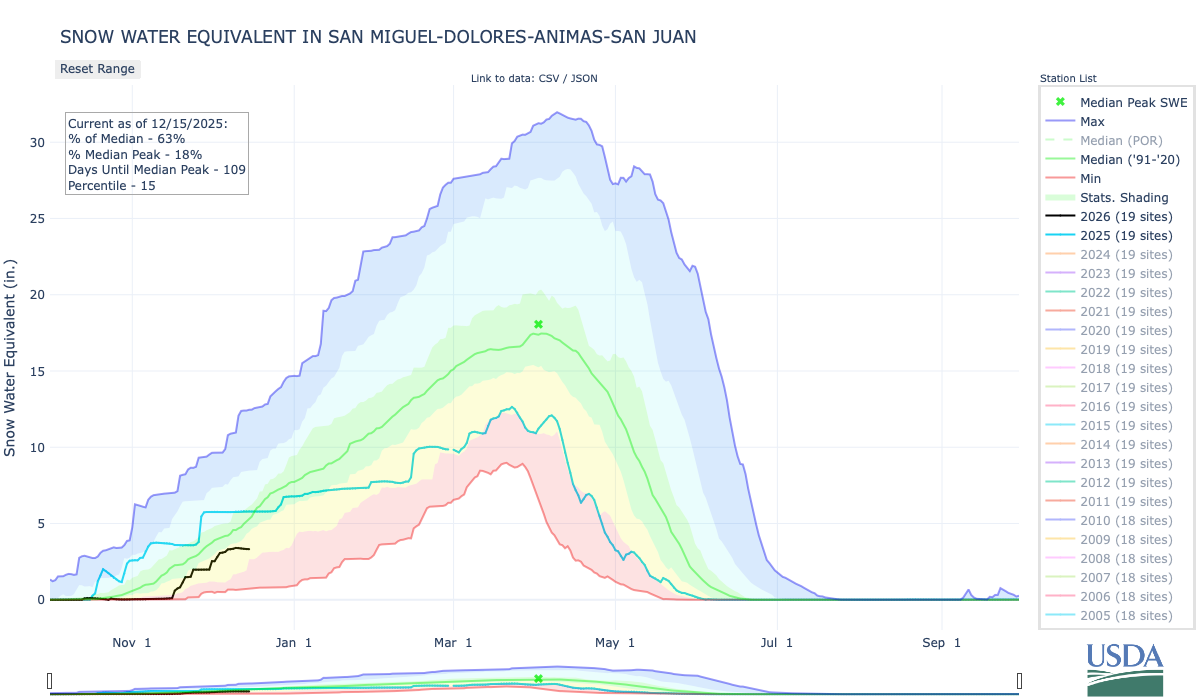
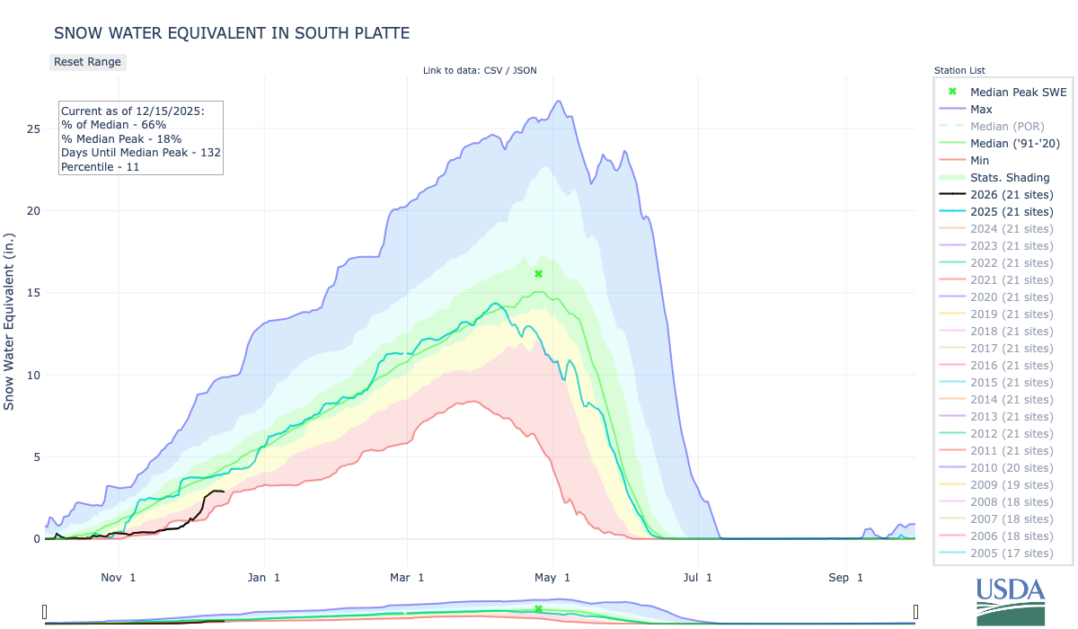
Following an abnormally warm and dry year, Colorado’s snow season is off to an abnormally warm and dry start — and not much is expected to change in the near future. Colorado’s statewide snowpack on [December 12, 2025] sat at 70% of the median recorded between 1991 and 2020, according to data collected by the U.S. Department of Agriculture’s National Water and Climate Center. Storms in the first week of December boosted the amount of snow in the mountains from near-record lows, helping struggling ski resorts, but forecasts with little chance of flurries in the near future could counteract those gains.

“It’s early, but man, we could use some snow soon,” said Zach Hiris, a meteorologist with the National Weather Service in Boulder.
The dryness is distributed relatively evenly across the state. The Upper Arkansas River Basin’s snowpack level is the strongest in the state, at 77% of median, and the Colorado River Headwaters area is the driest, at 61% of median.

The rest of the Intermountain West is not faring much better, according to a report released this week by the Cooperative Institute for Research in Environmental Sciences at the University of Colorado Boulder. All of Colorado and nearly the entire Western U.S. experienced temperatures several degrees above normal in October and November, according to the Western Water Assessment. Colorado’s Western Slope measured temperatures more than 6 degrees above normal in November. November was the third-warmest November on record, dating back to 1895, according to a report released Thursday by the Colorado Climate Center. Sections of the Western Slope experienced their warmest fall on record.


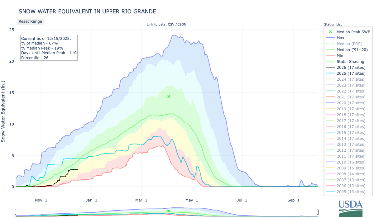


I’m heading to Las Vegas this morning for the 2025 Colorado River Water Users Association annual conference. Follow along on the CRWUA Twitter Feed.
I am using Turo for my EV rental this trip. I was able to snag a Tesla Model Y. The combination of the Model Y, the Tesla charging network, and the integration with the Tesla navigation system can’t be beat for these EV road trips.

Click the link to read the article on The Land Desk website (Jonathan P. Thompson):
December 8, 2025
🐓 Regulatory Capture Chronicles 🦊
The rhetoric of the so-called sagebrush rebels, members of the Wise-Use movement, the anti-federal land management crowd, public lands ranchers, and the like gives a certain impression: They are salt-of-the-earth folks who are just trying to eke out a meagre living and feed the nation from the hostile land of the Western U.S., and they are doing battle with the coastal elites and moneyed environmentalists who have the federal bureaucrats in their pockets.
There are certainly instances in which this holds true, when a rancher can’t afford pasture of their own, so they rely on the public lands, the public forage, and the taxpayer-subsidized fees to stay afloat. But just as often, these “cowboys” are actually millionaires — sometimes even billionaires — who are accumulating even more cash with the help of the American taxpayers. (And sometimes the public land ranchers and the moneyed environmentalists are one and the same).
Two recent pieces from the folks over at Public Domain — which is run by long-time public lands reporters Jimmy Tobias and Chris D’Angelo — shed more light on this phenomenon. Tobias and ProPublica’s Mark Olalde looked into how ultra-wealthy ranch-owners were benefitting from absurdly low federal grazing fees for High Country News. When you get a chance, check it out.
And it turns out one of those millionaires is high-ranking Interior Department official Karen Budd-Falen. Public Domain managed to pry her financial disclosure from the Trump administration and they posted it online. The Land Desk dove into it and followed a few segues to find not only that Budd-Falen and her husband Frank have done quite well for themselves, amassing large amounts of acreage in the process, but that their ranches have also benefitted from federal subsidies — even as they battled the federal government.
As Land Desk readers are likely aware, Wyoming attorney Budd-Falen built a career fighting federal and state land management agencies on behalf of sagebrush rebels and members of the Wise-Use movement. She and her husband, Frank Falen, once argued that a public lands grazing permit actually conveyed a “private property right” protected by the Constitution. She described land-management agencies as part of “a dictatorship” and in the 1990s helped draft a New Mexico county’s resolution declaring that federal and state land-management officials “threaten the life, liberty, and happiness of the people of Catron County … and present danger to the land and livelihood of every man, woman, and child.”
But Budd-Falen has also been a part of the federal land-management bureaucracy. She worked in Ronald Reagan’s Interior Department under James Watt, and then signed on as deputy Interior solicitor for wildlife and parks under the first Trump administration. Now she is the department’s associate deputy secretary, which gives her plenty of power and influence without the need to be confirmed by the Senate. Notably, she headed up a closed-door meeting early this month aimed at giving Utah more sway over national park management.
The financial disclosure, which is missing the usual signature from an Interior ethics official to verify it is in compliance with the law, shows that Budd-Falen’s firm — which is now owned entirely by her husband — continues to represent clients that her department may regulate. She holds stock in oil and gas companies that operate on public land. And she and her husband own millions of dollars worth of land in Nevada and Wyoming.
Here’s a rundown of their land-holdings, per the disclosure:
- A ranch in Big Piney, Wyoming, valued between $1 million and $5 million, leased out to a 3rd party for between $50,000 and $100,000 annually. Karen Budd-Falen owns this several-thousand-acre spread with her siblings and says they reinvest the proceeds back into the property
- Home Ranch LLC in Orovada and UC Cattle Company LLC in McDermitt, Nevada, each valued at over $1 million, and each with a livestock operation that brings in over $1 million in income annually. Together, Home Ranch and UC Cattle Company cover about 11,740 acres in northwestern Nevada.
The ranches were previously owned by Frank’s parents, John and Sharon Falen. The late John Falen, who once leased nearly 300,000 acres of public land for grazing, was featured in a 1991 Newsweek story titled “The War for the West” due to his conflict with the BLM for requiring him to fence off streams that provided habitat for imperiled Lahontan cutthroat trout. “I never figured I’d be fighting my own government to defend my way of life,” he told the reporter.
But they also relied pretty heavily on the feds for their livelihood. Not only did they pay well below-market rates for grazing on public land, but the elder Falens’ livestock operation received over $1.3 million in USDA subsidies between 1995 and 2015, according to the EWG Farm Subsidy Database.
Home Ranch LLC in Nevada received an additional $580,000 in federal farm subsidies between 2016 and 2024, while Home Ranch LLC and UC Cattle Company — both registered by Frank Falen at the Budd-Falen law office’s address in Cheyenne — received yet another $871,000 from 2022-2024.
Both Home Ranch and UC Cattle are listed as grazing permittees under the BLM’s Humboldt River Field Office. And in 2020, Home Ranch applied for a grazing permit renewal on the 106,000-acre Jordan Meadows allotment, but after a rangeland health analysis found that several categories did not meet standards, the process was canceled. Currently the allotment is listed as active and permitted for 11,720 animal unit-months, with 8,939 suspended AUMS.- L-F Enterprises LLC, a cattle operation and rentals, in Cheyenne, Wyoming, valued at $1 million to $5 million that brings in between $100,000 and $1 million annually. A note on the disclosure says Budd-Falen is a “passive” owner of this entity.
- Divide Ranch, a cattle operation covering about 2,800 acres in Wheatland, Wyoming, valued at $1 million to $5 million. There is a lot of loopy stuff in this disclosure: This one has a footnote that says L-F Enterprises grazes cattle on land owned by Divide Ranch, meaning the Budd-Falens are leasing land from themselves.
- Five residential properties in Cheyenne and Laramie, Wyoming, each valued between $250,000 and $500,000 that together bring in a rental income of between $50,000 and $165,000 annually.
- Two commercial properties in Cheyenne, each valued between $500,000 and $1 million, that together bring in between $115,000 and $1.1 million annually.
And then there are the stocks:
- Budd-Falen has held between $15,000 and $50,000 worth of shares in Enterprise Products Partners L.P. That’s the midstream oil and gas company that owns and operates the pipeline that spilled about 97,000 gallons of gasoline near Durango, Colorado, last December. The spill contaminated groundwater, forced people to move out of their homes, and is still being cleaned up — recently the EPA joined the effort.
- And she held between $15,000 and $50,000 shares in Exxon Mobil Corp., the oil and gas giant that drills on the same public lands Budd-Falen oversees.
I know it’s cliche, but I can’t help but think that this is yet another example of the foxes guarding the henhouse, something that the Trump administration seems to specialize in.
🤖 Data Center Watch 👾
The Big Data Center Buildup continues, with larger and larger projects put on the table every day, many in places that one wouldn’t expect. This has sparked a backlash of growing intensity, both among those worried about the centers’ electricity and water consumption, and those who see AI — which is driving much of the growth — as a threat.
This week, a group of more than 200 environmental, social justice, and consumer organizations sent a letter to Congress calling for a nationwide ban on new data centers. It says, in part:
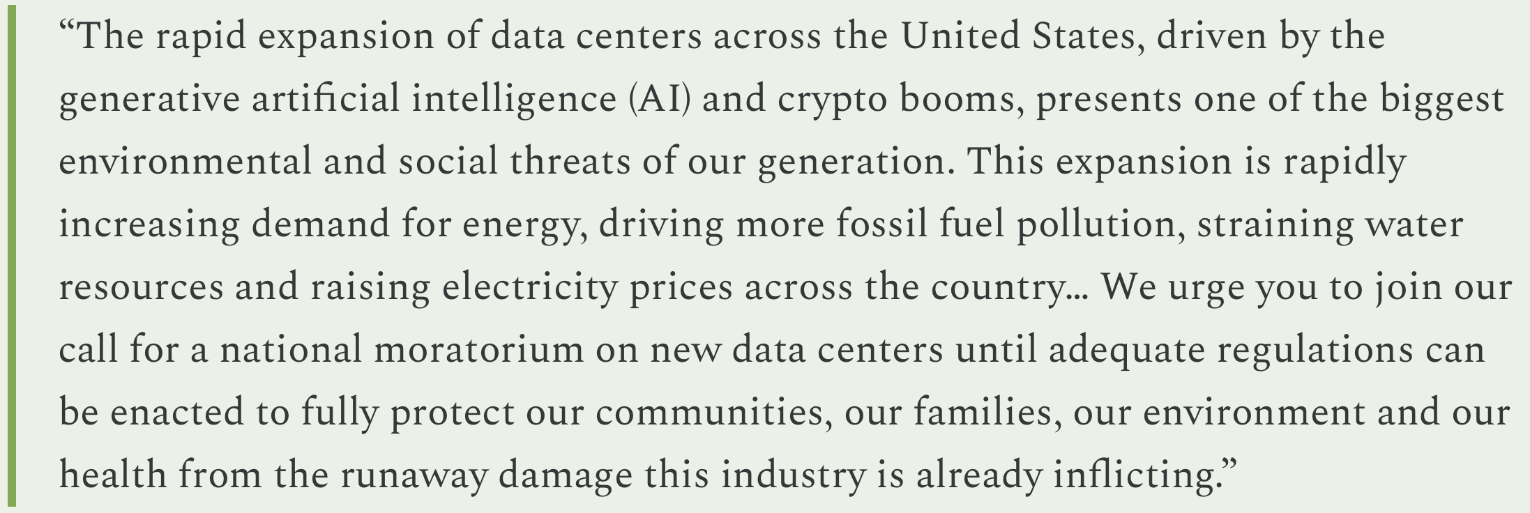
Given the Trump administration’s fondness for AI, and donations from Big Tech, I don’t see the GOP-dominated Congress acting on this.
More news tidbits:
- As if to verify the opposition groups’ concerns, the developers of the massive proposed Project Jupiter data center complex near Santa Teresa, New Mexico, recentlyy asked state regulators for permission to generate more power than the state’s largest utility and emit more greenhouse gases than both Albuquerque and Las Cruces combined, according to a Source NM report. The latter figure was so high that many observers assumed it was a typo. But then, given its purported size — developers say the complex will cost $165 billion — and ginormous energy consumption, fueled by methane, it surely will emit a lot of carbon, typo or not.
- Then there’s Beale Infrastructure’s Project Blue, the hyperscale data center planned for 290 acres outside of Tucson that was originally slated to be occupied and operated by Amazon Web Services. From the outset, it has run into stiff local opposition, nixing plans to annex it into Tucson so it could use recycled wastewater for cooling. The developers shifted gears, saying they would use air-cooling instead to save water in the very water-constrained area. But that was a no-go for Amazon, which pulled out of the deal last week. Beale says other tenants have lined up in the tech giant’s stead. Meanwhile, the Arizona Corporation Commission approved the data center’s power purchase deal with Tucson Electric Power.
- And in the places-you-wouldn’t-expect-a-data-center beat: An obscure UK-based developer has proposed building a $10-billion, 1-gigawatt data center on 500 acres of land it plans to purchase from the city of Page, Arizona.

Details remain sketchy: It’s not clear who, exactly, the developer is; a land-purchase agreement indicates the data center might generate its own power, but no fuel source is listed — and 1 GW is the capacity of a big coal or natural gas plant; they plan to “acquire, develop, construct, and use water in a sufficient quantity and quality to continuously serve the Data Center and Energy Project,” yet don’t say where they would get this water; and the developer said the project would create 500 permanent jobs, which is a rather large staff to oversee a bunch of computer processing units. A majority of the city council has supported the $7 million land sale, which is contingent on a successful feasibility study, and the attendant tax revenues and jobs. That is not a surprise given the economic blow dealt by Navajo Generating Station’s 2019 closure and lower visitor numbers at Lake Powell and Glen Canyon National Recreation Area. But local opposition is growing and may derail the plans — if the lack of water doesn’t.
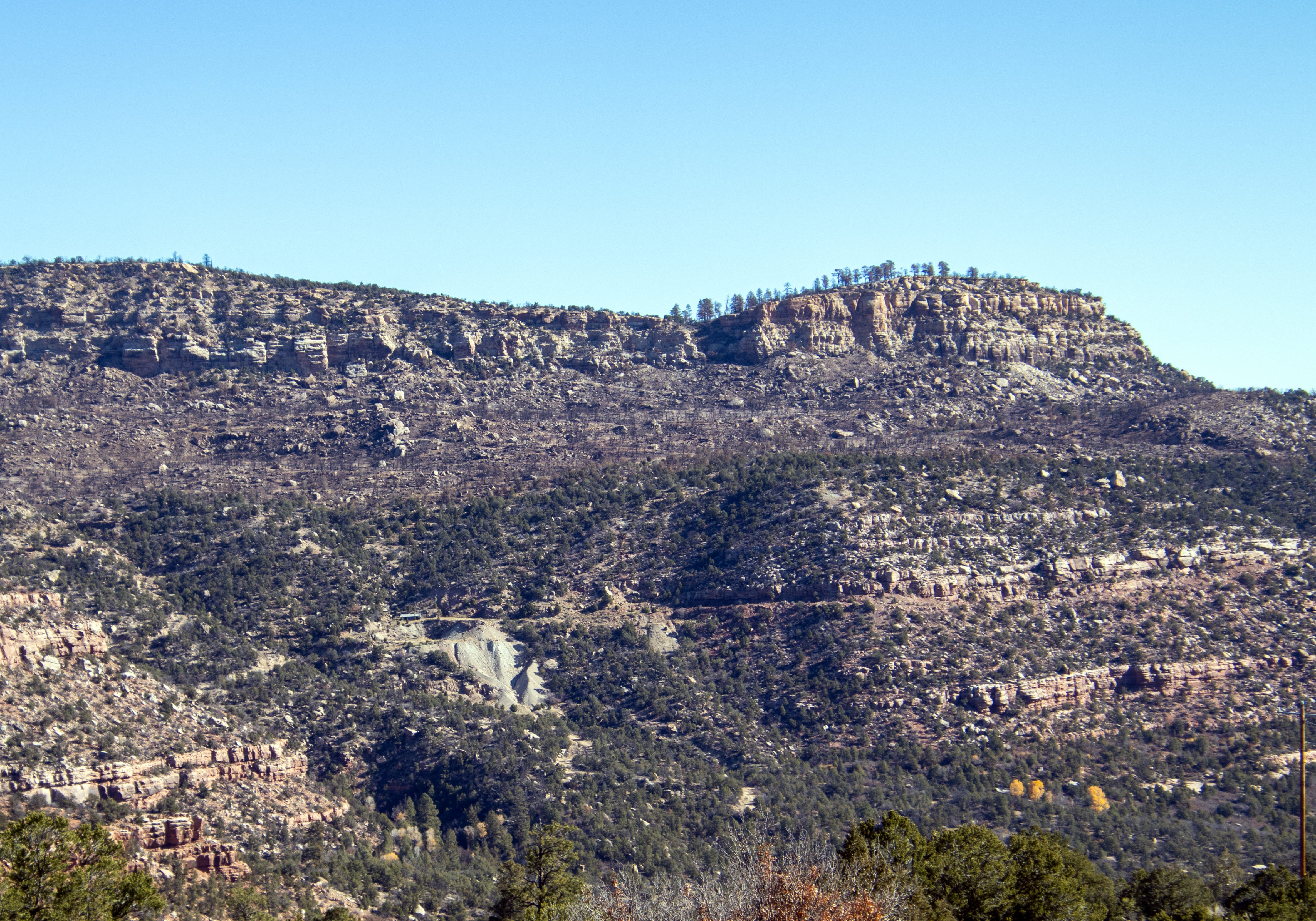
Another uranium project is coming to the Lisbon Valley in southeastern Utah, though this one is a bit unconventional. Last month, Mandrake Resources signed onwith Disa technologies to use its “high-pressure slurry ablation,” or HPSA, technology to “recover saleable uranium and other critical minerals” from old mining waste piles on Mandrake’s 94,000 project area south of La Sal.
The Nuclear Regulatory Commission’s environmental review of the Disa’s proposal to remediate abandoned mine dumps with HPSA describes the technology as involving …
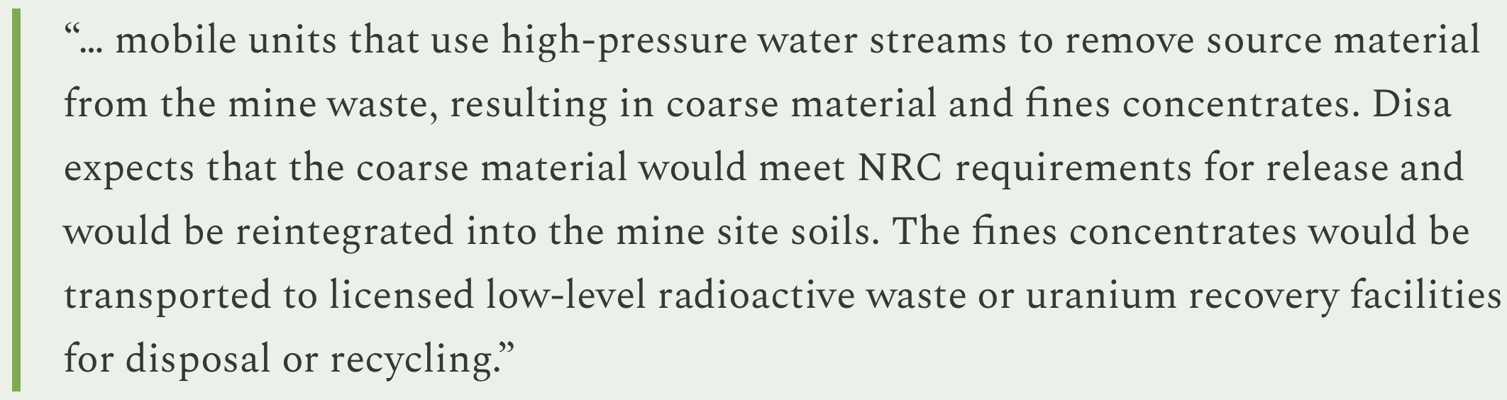
Because the process is separating uranium and thorium fines from ore, it is considered a form of milling, not mining. And that’s an important distinction, because when you mill uranium ore, you leave behind mill tailings, which must be disposed of according to NRC and Environmental Protection Agency standards. Instead, the “coarse material,” as the waste is described, would be reintegrated into the mine site — even though it may contain radioactive and other harmful materials.
Nevertheless, the NRC granted Disa a license to use HPSA to remediate waste rock at abandoned uranium mines. “The NRC failed to define and regulate the wastes that would be produced by the HPSA process at former uranium mine sites in accordance with the Atomic Energy Act and NRC and EPA regulations applicable to the wastes from the processing of any ore for its uranium content,” said Sarah Fields, of Uranium Watch.
Also of concern is water use: Disa says it would obtain water from offsite, trucking it in at volumes between 10,000 and 40,000 gallons daily. Most likely this would come from a nearby municipal water supply, but it’s not clear which municipality that would be for the Mandrake/Lisbon Valley project.
Mandrake originally acquired and staked hundreds of mining claims on federal and state lands in the Lisbon Valley to extract lithium. But when its drilling samples showed high levels of uranium — and when lithium prices crashed — the Australian company switched gears, or perhaps just broadened their scope. The firm’s website still refers to the land-holdings as its “Utah Lithium Project.”
🗺️ Messing with Maps 🧭

This is a pretty cool tool released by the U.S. Census Bureau a little while back. It shows how many housing units were added (or lost), along with the percent change, from each state, county, town, and even census tract between 2020 and 2025. Assuming it’s accurate, it could really help inform discussions about housing supply and demand, about the drivers of the housing affordability crisis, and whether land-use regulations and NIMBYism are really shutting down housing construction.
Check it out here and play around with it a little. Here are some screenshots of more detailed views of Phoenix and Durango.


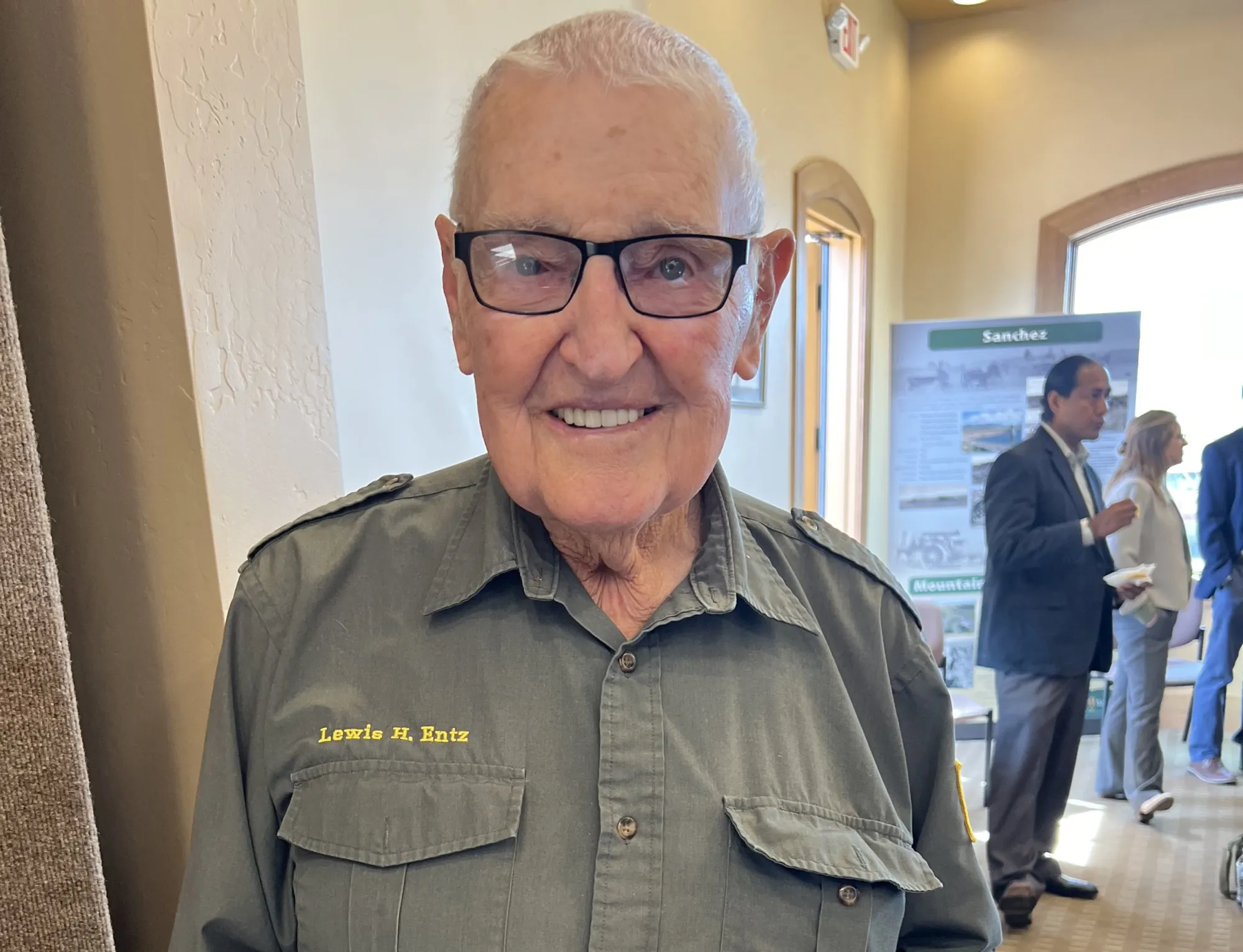
Click the link to read the article on the Alamosa Citizen website:
December 11, 2025
Longtime public servant and former state senator died December 10, 2025 at 94
Lewis H. Entz was one of those public servants who never stopped serving. The former state legislator was revered up until his death, which came Wednesday evening, December 10, 2025. He was 94.
Entz was Mr. San Luis Valley. Born in Monte Vista and a farmer from Hooper, he represented the Valley in the Colorado House of Representatives for 16 years from 1982-98, and then in 2001 became state senator when he succeeded then-State Sen. Gigi Dennis following her resignation.
He served in the state senate until 2006, and before any of that served for 14 years as an Alamosa County Commissioner.
“Five young Republicans talked me into running,” he told the Monte Vista Journal of how he got his start in politics.
Even out of office, Entz maintained his public service. Every year he was part of the annual Alamosa Veterans Day Parade as a former U.S. Marine who fought in the Korean War, and was a regular in the Ski-Hi Stampede Parade and all the parades and gatherings across the Valley.
He was part of the Early Iron Club, which afforded him the opportunity to display his passion of restoring and maintaining vehicles. His baby was his 1943 Ford jeep, which he drove in all the parades year after year.
One of his final meetings was at breakfast in November with state Sen. Cleave Simpson of Alamosa, and former state senators Gigi Dennis and Larry Crowther. It was an occasion to gather together all the former Republican state senators who have represented the San Luis Valley to mingle and enjoy each other’s company.
“So glad we had breakfast together a few weeks ago. Such an honorable public servant, I am so proud to have known him and work with him on important Valley issues,” Simpson said.’
The tributes to Entz on Alamosa Citizen Facebook, which first reported the news of his death, are extensive. “Lew was a great fellow and solid friend of the Upper Arkansas Water Conservancy District. He will be missed,” wrote Ralph Scanga. Wrote Ronald W. Jablonski Jr., “Enjoyed working with Mr. Entz during my time at Rio Grande NF. He was a fair and honest champion for his SLV constituents.”
The lasting question of his legacy is the H in his name, which he always used in life and on the extensive number of legislative bills he authored.
“When my twin sister and I were brought home from the hospital, we went by Homelake. It’s been in my mind ever since,” he told a magazine writer in 2004.
Lewis H. Entz is preceded in death by his wife, Lorie Entz, who passed away Sept. 7, 2014. They married on Nov. 24, 1952.
He is survived by his wife, Kathryn “Kitty” Bigley-Entz. Funeral arrangements and obituary are pending through Rogers Family Mortuary.

Click the link to read the article on the Big Pivots website (Allen Best):
December 12, 2025
New ‘book’ explores the evolving thoughts about an increasingly dire situation
To put that into perspective, the Colorado River Compact assumed an average 16.5 million acre-feet at that site, Lees Ferry. The river this century has produced far less. Since 2020, the river flows have declined even more, to an average of 10.8.
Might it get worse?
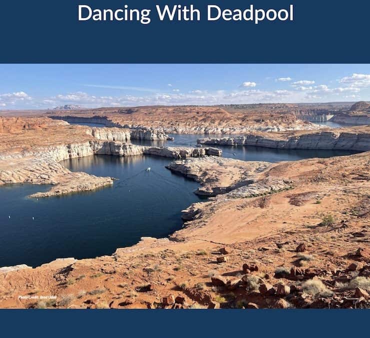
“Dancing With Deadpool,” a new product from the Colorado River Research Group, delivers the short answer.
“Another year or two of low inflows and we will completely blow through the cushions provided by reservoir storage,” says the document’s executive summary. The word “crisis” litters the 64-page production. It has eight chapters written by 22 authors from Colorado and three other Colorado River Basin states.
The Colorado River has fascinated journalists since at least the 1980s. Then, the river was still delivering water to Mexico’s Sea of Cortez but troubles were evident on the horizon. The river now, except for specially engineered releases from upstream dams, disappears entirely after crossing into Mexico.
Since 2022, the Colorado River had become a national story. Empty seats at the annual Colorado River Water Users Association conference in Las Vegas have disappeared, press credentials harder to secure.
The tension even in the last year has grown. The river runoff this year was only 55% of long-term average. The seven basin states remain at an impasse about solutions proportionate to the problem.
“We have now entered a new era: Dancing with Deadpool,” says the report.
Deadpool is the point at which reservoirs can release no water. In 2022, that moment seemed imminent as sandstone walls of Glen Canyon were exposed directly to sunlight after being submerged since shortly after Lake Powell began filling. Then a miracle winter arrived, water levels in the two big reservoirs, Powell and Mead, rose once again, the emergency receded.
Now the crisis is back — and looming larger.
You can scare yourself to death with what-ifs, but we may need something akin to a miracle to avoid full-blown crisis. We cannot have another winter and then runoff like 2002-2003. Or, as several authors point out, runoff like we had in 2025.
As it is, we need another miracle winter, something akin to what diehard Denver Broncos fans remember as “the drive” in a 1987 playoff game. John Elway led his football team 98 yards down the field in Cleveland to tie the game with 37 seconds left. They won in OT.
Brad Udall and Jonathan Overpeck warn against too much optimism. Mother Nature can be stingy. She has been in the past, with one drought period as long as 80 years during the last 2,000 years. Now, the evidence grows that our monkeying with Mother Nature has produced this drought.
In 2017, Udall and Overpeck issued the results of their study that showed that warming alone was responsible for roughly half of the reduced natural flows of the Colorado River, at that point 17%. They delivered a new phrase: “hot drought” as distinguished from “dry drought.” The warmer temperatures were robbing the Colorado River Basin of water.
Precipitation in the basin has also declined 7% in the 21st century, as compared to the 20th century. In their chapter, Udall from Colorado State and Overpeck now at the University of Michigan (but with a summer cabin in San Miguel County), cite two new studies that together provide evidence “suggesting” complicity of humans. Greenhouse gases explain the declined precipitation, too.
As science is never 100%, Udall and Overpeck use cautious language. The studies, they say, “strongly suggest we are in for extended dry periods in the Colorado headwaters in the decades ahead.”
If there is less water, then isn’t the solution simple? Use less!
Easy to say. And for the last 20 years, efforts have been made to nibble away at uses. Cities have been working to make less water-intensive urban landscapes popular. But the far larger story lies in agriculture.
In Colorado and the three upper basin states, for example, about 70% of all the Colorado River water (after trans-basin diversions for irrigation are accounted for) goes to agriculture. How can ag use less water?
Two of the chapters work on this. A trio of academics from Wyoming and one from Colorado take aim specifically at the upper basin states. “The relevant questions are not whether or when cuts will happen, but how deep will they go, how will they be distributed, and how well can the consequences be mitigated?” they ask.
The four upper-basin researchers argue that evidence already exists for success. With creativity and collaboration, they say, farmers and ranchers can sustain crop and livestock production even as water becomes scarce. They get into the details, talking about adjustments of cow-calf operation, for example, to reduce water-dependent needs. They call for more research into limited irrigation, crop switching and other practices.
Two other academics, both from Arizona State, take a somewhat broader view, acknowledging the challenge.
“In a landscape of poor choices, in a failing river system in which all solutions are deeply unpopular to some or other powerful constituency, potentially harmful to one community or another or inordinately expensive and founded on unreliable funding, it is at least worth considering another option,” write Kathryn Sorensen and Sarah Porter.
They see cuts of up to 4 million acre-feet in the basin annually being necessary. Again, that’s about 25% of what those who created the Colorado River Compact expected would be annual flows for the seven basin states.
How to get there? They introduce a new concept, “economic water productivity,” a measure of the value of water. Instead of buy and dry programs, they see need for a federally financed effort to pivot uses through incentives to reduce water use on those agricultural lands.
Similar buy-down of high-volume irrigated agriculture is underway in two groundwater depletion areas in Colorado, the San Luis Valley and the Republican River Basin. Some federal money is providing help in the latter basin. They contend federal money will be needed, and lots of it, to pay for this big pivot in the Colorado River Basin. That, they say, would be fitting, because it was federal money that financed the infrastructure for this hydraulic empire.
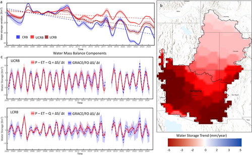
As for groundwater, that part of the Colorado River story has been generally overlooked. A study released several months ago found that nearly two-thirds of storage — both surface and groundwater — lost from 2002 to 2024 in the Colorado River actually came from groundwater depletion, mostly in Arizona.
Whoa!
“Simply shifting unsustainable surface water uses to unsustainable groundwater uses does nothing to address the core mismatch of supplies and demands,” observes Doug Kenney, who directs the Western Water Policy Program at University of Colorado Law School.
Other contributors dissect the complexities of what would seem to be simple, common sense solutions. For example, Eric Kuhn, the former general manager of the Colorado River District, works through the concept of water sharing among the states based on a percentage basis. The Colorado River Compact divides water between the upper and lower basins, a mistake in retrospect although even in 1922, when it was adopted, there had been an argument for using a percentage.
Later, when the upper-basin sates adopted a compact among themselves, they did use a percentage basis.
Kuhn goes deep into the history, as he has done with book-writing (“Science be Dammed,” 2019, with John Fleck) to sort through the thinking of this idea over the last century. It came up again earlier this year as the seven basin states tried to figure out how to share the river given the changed realities. The states, however, could not agree on what percentages should be used for sharing. It may have been just too much of a transformational change for some states to accept, he says.
However, the idea may come back if the stalemate between the upper and lower basins of the Colorado River ends up in the federal courts. Or failing that, what exactly would federal intervention look like? That’s an impolite question, but one of those what-ifs that must be wondered about. (For the record, the water people I know seem to have high regard for people in the Department of Interior in charge of looking after the Colorado River).
The large story here is that the states, with enormous aid from the federal treasury, created the infrastructure and expectations of water that no longer exists and, as per the studies of scientists, will almost certainly not return within the lifetimes of any of us. What, then, should be the federal role in defining the future balance? Once again, might the dismantling of Glen Canyon Dam be such a wild idea after all?
Thoughts in this book will likely be part of the conversations next week in Las Vegas when representatives of the seven basin states gather, as they always do, at the Colorado River Water Uses Association conference. Might a hallway conversation lead to a breakthrough?
Like huge snowstorms in the Rockies and then cool temperatures during runoff, there might be miracles, but I wouldn’t count on it. This deadpool dance might end sooner than anybody actually likes.
Click the link to access the report Dancing with Deadpool on the Getches-Wilkinson Center website (Doug Kenney1):
The rapid loss of storage in Lakes Mead and Powell is certainly deserving of the attention and angst it has generated and continues to generate, but it is the tip of larger trends altering the landscape of risk in the basin. The dismantling of many other “safety nets,” defined broadly, is happening at a pace far surpassing the already unprecedented declines in reservoir storage. Presumably that’s not an immediate problem if new post-2026 rules are able to recover and protect storage in Mead and Powell (and some of the other upstream facilities), but does anyone have that much faith in the power of new reservoir operating rules to combat the forces that have brought us to this point? What about when we have a 10 million acre-feet/year river?
From Groundwater to Governance
Perhaps the most obvious of those other diminishing safety nets is groundwater. Data on groundwater reserves throughout the basin is spotty at best. One approximation of a truly regional assessment comes from a creative use of satellite-based tools—namely NASA’s GRACE (Gravity Recovery and Climate Experiment) system that can detect tiny changes in gravitational forces associated with the fluctuating mass of aquifers losing (or gaining) storage. Those findings paint a truly disturbing picture. Despite the familiar (and troubling) images of bathtub rings emerging at Mead and Powell, researchers using GRACE data now estimate that, from 2002 to 2024, nearly two-thirds of storage—both surface and groundwater—lost in the Colorado River Basin actually came from groundwater depletions.2 Significant groundwater losses have occurred throughout the basin, but the problem is particularly acute in Arizona and is likely to accelerate as shortages in Central Arizona Project (CAP) deliveries are likely offset by groundwater pumping—an ironic outcome given that CAP was originally proposed as the solution to groundwater mining in the region. Simply shifting unsustainable surface water uses to unsustainable groundwater uses does nothing to address the core mismatch of supplies and demands.
A very different and multi-faceted trend undercutting the regional safety nets is happening within the federal government, where federal agencies, programs and science programs are being systematically dismantled under the guise of “efficiency.” It’s hard to understate the significance of these actions, as it is the federal government that, presumably, has the scope, mandate and resources to oversee the entirety of the River and the full diversity of its roles and values. Interior Department agencies in 2025, like much of the overall federal bureaucracy, have been tasked to achieve significant staffing reductions, and to eliminate (or significantly scale back) spending on key water conservation programs—including programs under the Inflation Reduction Act (IRA) and WaterSMART.3
Additionally, agencies across the federal landscape have mobilized to coerce and shut down climate-related science and scientists, despite the nearly universal acknowledgment among water managers of the central role of climate change in the unfolding crisis.4 Collectively these efforts constitute a systematic effort to discredit and hide the primary cause of the broken water budget, while sabotaging the most effective coping mechanisms available. As members of the research community, the Colorado River Research Group (CRRG)unfortunately has a front-row seat to this culling of the people and programs essential to long-term data collection and analysis. It defies logic, and is dangerous.
Unfortunately, hostility toward the people and programs essential to responding to the Colorado River crisis is not the full extent of federal obstruction. One largely unappreciated threat to the water budget resulting from federal policy shifts comes from efforts to “re-carbonize” (and accelerate) water-intensive energy generation, in part to meet the demands of AI, a particularly troubling trend given that the previous emphasis on renewable energy generation and enhanced energy conservation was one of the few positive trends working to repair the regional water budget.5 Attempts to weaken or dismantle bedrock environmental laws, such as NEPA and the Endangered Species Act, are an additional wildcard likely to inflict irreparable harm on already strained species and ecosystems.6
Given the turmoil at the federal level, it’s tempting to absolve the States for stubbornly clinging to a policy making system reliant on 7-state dealmaking, but that would ignore the reality that the governance of the river has been a problem for decades. A seemingly never-ending series of crisis-inspired negotiations, held in largely secretive forums without direct tribal involvement or tools for meaningful public or scientific engagement, is an uninspired way to manage and protect the economic, cultural and environmental heart of the American Southwest. The river is too big and too important to govern in such an ad hoc and primitive manner. [ed. emphasis mine]
That this approach mostly ”worked” to keep deliveries flowing for so long—except, of course, for the tribes and the environment—rested, in part, on the accepted norm that decisions would emerge collaboratively from the States and would not spill over to the federal courts. But even that governance safety net is eroding, as the States seem to be increasingly resigned—and almost “comfortable”—with the notion that the resolution of existing conflicts may not emerge from a negotiated 7-state agreement. For those parties and viewpoints that have historically been left out of the state-dominated processes and the resulting agreements, then maybe this prospect is welcome. But all would concede that would be a stunning outcome with ramifications that are difficult to predict.
Ever since the Arizona v. California experience, the use of litigation to resolve interstate (and/or interbasin) conflicts in the basin has been a third rail issue, and for very good reasons. As shown by the basin’s earlier foray into Supreme Court action, the process would undoubtedly be lengthy, expensive, and likely to create as many issues and questions as it resolves. It certainly wouldn’t reduce risk, as the states, and the water management community more broadly, would lose control over the process of managing the shared resource. In fact, judicial intervention might be the impetus to trigger yet another traditionally feared decision pathway to be invoked—a Congressional rewrite of river allocation and management—either before or after the litigation concludes. In this setting, the extreme disparity in political influence—as measured by the number of Congressional representatives—between the Upper and Lower Basin is an obvious concern, as is the realization that congressional involvement means the future of the Colorado now becomes a national issue and, potentially, a bargaining chip to be used in the political logrolling necessary to enact legislation in dozens of otherwise unrelated areas.
Rowing in the Wrong Direction
Managing water in the arid and semi-arid West is often more about risk than water. From the seniority concept in prior appropriation to the sizing of infrastructure based on low probability events, the goal of water management is often to clearly define and then minimize the risks of running out. Given that, you’d think that the communities dependent upon Colorado River water would be more committed to protecting (and enhancing) the safety nets that are increasingly critical as storage in Lakes Mead and Powell—the basin’s primary risk management tools—increasingly flirt with deadpool. But at the basin scale, that’s typically not what I see. Sure, individual water managers serving major cities or districts have their own risk management plans focusing on everything from new infrastructure to market solutions, but that’s far from a comprehensive or integrated approach, and safety nets designed by and for the “established players” only deepen the inequities that increasingly divide the Colorado River community.
There’s a lot of work left to do in this basin, both prior and after the 2026 deadline. Viewing the problems through the lens of risk management is not a bad place to start. But if doing so, it’s also not a bad idea to remember that poor risk management often comes at expense of diminished equity—an indispensable element of an equitable apportionment. Numerous examples around the world remind us that water scarcity can be the impetus for joint problem-solving in a spirit of camaraderie and mutual support, or it can sharpen and refine alliances that further distance the powerful from the weak. In this regard, I’m inclined to think we are rowing in the wrong direction. ●
Footnotes
1 Director, Western Water Policy Program, Getches-Wilkinson Center, University of Colorado Law School; and Chair, Colorado River Research Group.
2 Abdelmohsen, K., Famiglietti, J. S., Ao, Y. Z., Mohajer, B., & Chandanpurkar, H. A. (2025). Declining freshwater availability in the Colorado River basin threatens sustainability of its critical groundwater supplies. Geophysical Research Letters, 52, e2025GL115593. https://doi.org/10.1029/2025GL115593.
3 Finding accurate data on federal workforce reductions is challenging; see Competing numbers emerge on federal workforce reductions. Between “incentivized retirements,” RIF (reduction in force) layoffs, recently resumed terminations of employees losing court-ordered protections, remaining planned cuts, and the ongoing hiring freeze, the total workforce of the Department of Interior could drop by over a third in 2025. The Interior Department is taking steps to implement layoffs – Government Executive. Similarly, data on efforts to reduce agency budgets is difficult to compile, particularly given the complex back and forth between the administration, Congress, and, increasingly, the courts. The President’s 2026 budget request cuts Reclamation’s budget approximately by a third (Fiscal-Year-2026-Discretionary-Budget-Request.pdf (see page 28 and Table 2); Briefly: Budget proposal defunds Western water conservation grants – Water Education Colorado). Overall, proposed cuts to the Department of Interior total over $5 billion, or 30.5% of the 2025 enacted budget (Table 2). To this point, that request has not been embraced by Congress.
4 For example, within NOAA, the administration’s 2026 budget request “terminates a variety of climate-dominated research, data, and grant programs,” and “cancels contracts for instruments designed for unnecessary climate measurements,” while also cutting National Science Foundation support of research “with dubious public value, like speculative impacts from extreme climate scenarios” (Fiscal-Year-2026-Discretionary-Budget-Request.pdf; see pages 24-25, and 38).
5 Data Center Energy and Water Use Trends Explained – Circle of Blue
6 Regulatory Tracker – Environmental and Energy Law Program

Click the link to read the article on the American Rivers website (Hannah Holm):
December 11, 2025
On the evening of November 19, a packed conference room in the Denver West Marriott erupted in cheers when the Colorado Water Conservation Board approved one of the largest ever dedications of water for the environment in Colorado’s history. This new deal, if completed, will ensure that water currently running through the aging Shoshone Hydropower Plant on the Colorado River, deep in the heart of Glenwood Canyon, will keep flowing through the canyon when the plant eventually goes off-line. It’s not a sure thing yet – water court wrangling over the details and financial hurdles remain. But the Board’s action was a crucial step forward.
Currently, when the plant is running full steam, 1,400 cubic feet/ second (think 1,400 basketballs full of water passing by every second) is diverted out of the river into a tunnel and then into massive pipes visible against the canyon walls, where the power of falling water spins turbines to generate electricity. The water is then returned back to the river. Under the new deal, when the plant stops operating (it is over 100 years old and vulnerable to rockfall), the water would instead stay in the river, vastly improving conditions for fish and the bugs they eat in the 2.4-mile reach between the diversion and the powerplant’s return flows. The dedication of the plant’s water rights to that stretch of river would bring benefits that ripple hundreds of miles up and downstream because of the crucial role these water rights play in controlling the river’s flow through Western Colorado.

In Colorado, as in most of the West, older water rights take priority over newer ones when there’s not enough water to satisfy everyone’s claims. On the Colorado River, the Shoshone Hydropower rights limit the amount of water that can be taken out of the river upstream by junior rights that divert water from the river’s headwaters through tunnels under the Continental Divide to cities and farms on the eastern side of the Rocky Mountains. The new deal to enable the Shoshone rights to be used for environmental flows would preserve those limitations on transmountain diversions in perpetuity.
Upstream from the power plant, near the ranching town of Kremmling, Colorado, the river carries less than half the water it would without the existing transmountain diversions. This stresses fish populations and the iconic cottonwood groves that line the river. The Shoshone rights downstream prevent these diversions from being even larger. Because the power plant returns all the water it uses to the river without consuming it, the water continues to provide benefits downstream from the plant to rafters, farms, cities and four species of endangered fish that exist only in the Colorado River Basin. Securing these flows for the future is particularly important as climate change continues to reduce the river’s flow, which has already declined by roughly 20% over the past two decades.
The people cheering in the hearing room represented cities, towns, counties and irrigation districts from up and down the Colorado River. Their entities had pledged ratepayer and taxpayer dollars to help secure the rights in the complex transaction spearheaded by the Colorado River Water Conservation District. Environmental organizations, including American Rivers, Audubon, Trout Unlimited and Western Resource Advocates, were also parties to the hearing and supportive of the deal, but were vastly outnumbered.
The Coloradans cheering in that room were there because their constituents’ livelihoods, clean drinking water and quality of life depend on a living Colorado River. American Rivers is proud to stand with them and will continue advocating for the completion of this historic water transaction.

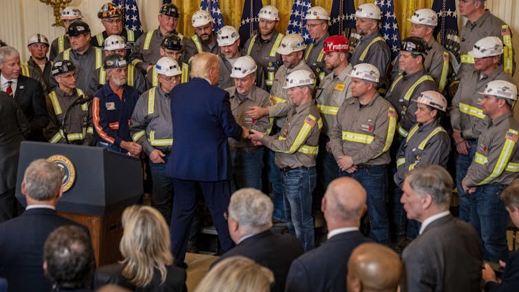
Hannah Wiseman, Penn State and Seth Blumsack, Penn State
As projections of U.S. electricity demand rise sharply, President Donald Trump is looking to coal – historically a dominant force in the U.S. energy economy – as a key part of the solution.
In an April 2025 executive order, for instance, Trump used emergency powers to direct the Department of Energy to order the owners of coal-fired power plants that were slated to be shut down to keep the plants running.
He also directed federal agencies to “identify coal resources on Federal lands” and ease the process for leasing and mining coal on those lands. In addition, he issued orders to exclude coal-related projects from environmental reviews, promote coal exports and potentially subsidize the production of coal as a national security resource.
But there remain limits to the president’s power to slow the declining use of coal in the U.S. And while efforts continue to overcome these limits and prop up coal, mining coal remains an ongoing danger to workers: In 2025, there have been five coal-mining deaths in West Virginia and at least two others elsewhere in the U.S.

Until 2015, coal-fired power plants generated more electricity than any other type of fuel in the U.S. But with the rapid expansion of a new type of hydraulic fracturing, natural gas became a cheap and stable source for power generation. The prices of solar and wind power also dropped steadily. These alternatives ultimately overcame coal in the U.S. power supply.
Before this change, coal mining defined the economy and culture of many U.S. towns – and some states and regions, such as Wyoming and Appalachia – for decades. And in many small towns, coal-related businesses, including power plants, were key employers.
Coal has both benefits and drawbacks. It provides a reliable fuel source for electricity that can be piled up on-site at power plants without needing a tank or underground facility for storage.
But it’s dirty: Thousands of coal miners developed a disease called black lung. The federal government pays for medical care for some sick miners and makes monthly payments to family members of miners who die prematurely. Burning coal also emits multiple air pollutants, prematurely killing half a million people in the United States from 1999 through 2020.
Coal is dangerous for workers, too. Some coal-mining companies have had abysmal safety records, leading to miner deaths, such as the recent drowning of a miner in a sudden flood in a West Virginia mine. Safety reforms have been implemented since the Big Branch Mine explosion in 2010, and coal miner deaths in the U.S. have since declined. But coal mining remains a hazardous job.

In both of his terms, Trump has championed the revival of coal. In 2017, for example, Trump’s Department of Energy asked the Federal Energy Regulatory Commission to pay coal and nuclear plants higher rates than the competitive market would pay, saying they were key to keeping the U.S. electricity grid running. The commission declined.
In his second term, Trump is more broadly using powers granted to the president in emergencies, and he is seeking to subsidize coal across the board – in mining, power plants and exports.
At least some of the urgency is coming from the rapid construction of data centers for artificial intelligence, which the Trump administration champions. Many individual data centers use as much power as a small or medium city. There’s enough generation capacity to power them, though only by activating power plants that are idle most of the time and that operate only during peak demand periods. Using those plants would require data centers to reduce their electricity use during those peaks – which it’s not clear they would agree to do.
So many data centers, desperate for 24/7 electricity, are relying on old coal-fired power plants – buying electricity from plants that otherwise would be shutting down.

Despite the Trump adminstration’s efforts to rapidly expand data centers and coal to power them, coal is more expensive than most other fuels for power generation, with costs still rising.
Half of U.S. coal mines have closed within the past two decades, and productivity at the remaining mines is declining due to a variety of factors, such as rising mining costs, environmental regulation and competition from cheaper sources. Coal exports have also seen declines in the midst of the tariff wars.
The U.S. Department of the Interior’s recent effort to follow Trump’s orders and lease more coal on federal lands received only one bid – at a historically low price of less than a penny per ton. But in fact, even if the government gave its coal away for free, it would still make more economic sense for utilities to build power plants that use other fuels. This is due to the high cost of running old coal plants as compared to new natural gas and renewable infrastructure.
Natural gas is cheaper – and, in some places, so are renewable energy and battery storage. Government efforts to prevent the retirement of coal-fired power plants and boost the demand for coal may slow coal’s decline in the short term. In the long term, however, coal faces a very uncertain future as a part of the U.S. electricity mix.
Hannah Wiseman, Professor of Law, Penn State and Seth Blumsack, Professor of Energy and Environmental Economics and International Affairs, Penn State
This article is republished from The Conversation under a Creative Commons license. Read the original article.

Click the link to read the article on the Colorado State University website (Stacy Nick):
November 18, 2025
We’ve all heard the phrase, “Don’t eat the yellow snow.” But are there other things in snow that aren’t so obvious?
Colorado State University snow hydrologist Steven Fassnacht says absolutely.
Snow has more surface area than rain, so it can pull more contaminants out of the air, Fassnacht recently said on CSU’s The Audit podcast. That can be anything from forever chemicals to heavy metals and dust.

“The big ones that we see around here are nitrogen and sulfur-based,” he said. “They come out of the tailpipe, out of the smokestack, et cetera. So, if you’re downwind from a major industrial source of these, then the likelihood that you have these in the snowpack is a lot higher.”
While it’s less obvious than a billowing smokestack, microplastics are another contaminant that researchers are studying in snow.
“There are just so many little bits and pieces of plastic around,” Fassnacht said. “Think about going out in the snow. You’ve got plastic ski boots on and plastic skis and poles, and your jacket and all your equipment, that’s all plastic. Any breakdown of that – which will happen over time – is going to put microplastics onto the snowpack.”
But all of this doesn’t mean you should never catch another snowflake on your tongue, he said. Just be aware of where that snow is coming from.
Fassnacht recommends avoiding snow from nearby roadways or industrial areas. Likewise, if there’s been a recent forest fire or dust storm.
“There is a lot of physics and chemistry involved in what you get within the snowpack itself and where it comes from,” Fassnacht said. “So, do you want to eat the snow? Maybe. That’s not an answer that people want to hear. They want to hear “yes” or “no.” Most of the time you’re probably OK, but you want to really be aware of where you are eating this snow from.”
Listen to this and other episodes of CSU’s The Audit here or wherever you get your podcasts.
Audio transcript (Lightly edited for clarity)
INTRO: We’ve all heard the phrase, “Don’t eat the yellow snow.” But with all the atmospheric contaminants out there – including forever chemicals from manufacturing facilities, heavy metals from car emissions and microplastics from virtually everything – should we really be eating any snow?
To find out, we talked to Colorado State University snow hydrologist Steven Fassnacht. A professor with the Warner College of Natural Resources, Fassnacht’s research focuses on studying water availability by looking at how snow and related environmental factors change over time and across different locations.
We asked him about what contaminants are making their way into snow and how and where to find the cleanest snow if you decide to partake on an icy treat.
HOST: So, really should we be eating any snow, not just avoiding the yellow kind?
FASSNACHT:We really should be looking at the snow visually; that’s often the marker, so don’t eat the yellow snow. And for other obvious visual contaminants, things like dust and airborne pollutants and sand and things like that which are pretty obvious. Needles, you don’t want to eat pine needles. But in terms of what you can find in the snow that you should really be concerned about, those are ones that we cannot see. So, that is more of an understanding of where you are and what the sources of some of those contaminants could be.
The big ones that we see around here are nitrogen and sulfur-based. So, things that we call our NOx – our nitrates, nitrites – and our SOx – sulfates, sulfites, et cetera. We have our phosphorus-based equivalents as well, and these all come from emissions. They come out of the tailpipe, out of the smokestack, et cetera. So, if you’re downwind from a major industrial source of these, then the likelihood that you have these in the snowpack is a lot higher. There is a lot of physics and chemistry involved in what you get within the snowpack itself and where it comes from. So, do you want to eat the snow? Maybe. That’s not an answer that people want to hear. They want to hear “yes” or “no.” Most of the time you’re probably OK, but you want to really be aware of where you are eating this snow.
HOST: As you mentioned, a lot of contaminants are invisible to the naked eye, but things like dust can also be an issue. That’s something that actually impacts snow melt and runoff rates too, correct?
FASSNACHT: Dust on snow and other things that are dark on the snowpack really affect the melt rates. Here in Colorado, most of our snow melt is driven by the sun. We have 300-plus sunny days. We’re here in Colorado because we love the weather. We know that from the sunburns we get because the sun’s coming at us and is reflecting off the really shiny snow. But at the same time, then you add dust, ash and black carbon from industrial sources, and that lowers the reflectivity of the surface, how shiny it is. Technically, we call that albedo. Our snowpack here in Colorado, that melt is really driven by the albedo, by the reflectivity. When we have dust coming in, that can lower it and make the snow melt a lot faster. The sources of dust are typically from the Four Corners area, the Colorado Plateau. So, in Northern Colorado, you see it a little less than you will in the San Juans, for example.
HOST: So, is shinier snow better snow?
FASSNACHT: Not necessarily. Shinier snow is just newer snow. Does that mean that it’s better quality? Not necessarily. If you have dust on the snow, that’s going to be obvious. The snow, once it’s on the ground, is going to become less shiny because it’s just changing. Think of the snowflake that you cut out when you were in kindergarten, that piece of paper, that delicate nature of snow. Well, the snow doesn’t last like that for very long. It’s going to end up being rounded, it’s going to melt, so it may be less shiny, but it still could be of good quality. By that I mean you could still eat it without having a lot of contaminants in it.
HOST: We also talk a lot about microplastics and forever chemicals in our drinking water. I’m assuming those can also be found in snow.
FASSNACHT: Definitely. That is a relatively new area that people have been exploring. We see all this in our water. We see things like caffeine; we see things like pharmaceuticals. Those make a bit more sense to be in our water because of our water treatment plants. Whereas in the snow it’s a little bit different in terms of pharmaceuticals or things that go through the human body. But we can have microplastics; we can have other forever chemicals. It depends on how they get there. So, that is part of the process as well. We typically think of dust and fine particles in the clouds when those snowflakes are forming. That’s the core of a snowflake that’s coming down. But then as the snow falls, because think of the snow again, it’s your kindergarten cut out of the piece of paper and all those different angles and all those shiny bits. That means that snow has a lot of surfaces. If you compare that to rain, rain is a ball, and the snow has many more surfaces. When it falls through the atmosphere, it can then pick up a lot more particles that are in the air. So, if you have anything that’s airborne – I think about the Cameron Peak fire of 2020 and how yellow and brown the air was – if you had rain and even more effectively if you had snow that was falling, it would wash all of those things out of the air and that then would end up in our snowpack. How do the forever chemicals and microplastics get into snow? That is not exactly known. The microplastics, there are just so many little bits and pieces of plastic around. We have the huge issue of the garbage island, the plastic island floating around the Pacific. Well, that’s big chunks of plastic, but microplastics can be anything. Just think of all the plastic we have in our lives. It can break off from whatever, and then you get these little, tiny bits. They’re pretty light, and so they can easily end up in the air. Do you have a big cloud of microplastics? Probably not. But do you have those microplastics in the air? Sure. They come off of tires, they come off of car parts, they come off your Gore-Tex coat, et cetera. There’s lots of sources. Think about going out in the snow. You’ve got plastic ski boots on and plastic skis and poles, and your jacket and all your equipment. That’s all plastic. Any breakdown of that – which will happen over time – is going to put microplastics onto the snowpack. Where do we have microplastics? Well, probably lots of places. Where do they come from? It’s not quite as obvious as a big smokestack and something being blown downwind.
HOST: What about the effects that those kinds of contaminants can have on the body when ingested? I’m guessing you’d have to eat a lot of snow to have it have an impact, but what could that possibly mean?FASSNACHT: Our snow in Colorado is still good quality. We don’t have huge industrial sources that are bringing in all of these contaminants. So, can we eat the snow? Probably. What does that mean? Usually not very much. Microplastics tend to just go through your body or they bioaccumulate. But it’s not like mercury in fish. These are things that are not as hazardous, at least as far as we know now. I am not a microchemist. I’m not a microbiologist. I don’t know how this actually will impact the body, but if you don’t have many, then it’s going to be a bit less of a hazard. It doesn’t mean you’re not going to have them. If you’re going to go out and eat snow all the time and have that as your water source, then you want to think about how you can filter some of these things out. Microfiltration is one of the better methods of taking out a lot of these constituents, but you need to know what’s in there before you can know what to take out.
HOST: I recently saw a video on social media of a woman from the Appalachian region, and she was making snow cream, which was a dessert made by mixing snow with milk, sugar and vanilla. She made a point that it needed to be fresh snowfall. But I’m wondering, one, is that a good idea, and, two, does having fresh snowfall really make that much of a difference? Her point was that it needed to be really fresh, like within the last hour or so.
FASSNACHT: That’s not going to make a difference. I’m now familiar with snow cream. I was out in the field last winter with some students, and one of the students brought a big bowl and brought some powdered sugar and some condensed milk. I don’t remember the vanilla part of it, but I’m sure you could add that. It was really tasty. Are you eating gallons and gallons? No, because think about the brain freeze, the ice cream headache you would have if you ate gallons and gallons of that, and how much sugar there would be in there. But getting back to the snow itself, to me it would be more of a texture issue. The texture of fresh snow, the characteristics, and the shape of that snow compared to older snow. And it’s just a bit more fun and it’s a bit more joyous and festive. This doesn’t have to be a holiday thing but being out in the woods and eating some of the snow, it just feels better to have this light fluffy powder. But from a contamination perspective, it’s not going to make that big a difference. The density of fresh snow is much less than that of older snow. We think of the really light fluffy powder, the stuff you can blow off your hand or blow off your windshield. It’s going to be a lot less dense and because of that you’re not necessarily having as much contaminant per unit mass, so to speak. But it’s more about texture, it’s a feeling. Chemical wise, it’s not really going to change anything.
HOST: So, is there a stratum where you want to eat the top layer of snow versus the middle layer of snow versus near the bottom? Do the contaminants sink?
FASSNACHT: The dissolved contaminants do get washed through the snow – our nitrogen, and phosphorus products, sulfur products. When the snow starts to melt, those get washed out first. So, if the snowpack is melting, those actually appear in the stream, and you see this big pulse of whatever’s in the snowpack. Any of the larger particles that don’t dissolve, our sand, our dust, et cetera, those stay within the snowpack, and what actually happens is the snowpack will melt down to them. We have a big dust storm in March that covers the landscape. Well, if we’re high enough up, we’ll get multiple snowstorms after that, and that’ll cover that dust layer. But then as the snow melts, it melts down to those physically visible layers. So, we get accumulation that way. Are you going to eat that snow? Not really. So yeah, later in the season, and maybe this goes back to the woman’s idea of eating fresh snow. It’s not going to have that accumulation where you’ve combined different layers of dust and whatnot.
HOST: Better or worse from an atmospheric contaminant perspective, catching a raindrop on your tongue or a snowflake?
FASSNACHT: It’s likely that the raindrop is going to be cleaner than the snow. But it just depends on what’s in the air. It depends on what was in the clouds when the raindrop versus the snowflake formed, and then what is below the clouds. So, if it’s a nice clean day and you don’t have a lot of chemicals in the air, then it doesn’t really matter because you’re not pulling out those chemicals when it’s raining or when it’s snowing. I can’t give you a solid answer. The conditions of what’s in the air are going to be a function of the temperature. Think of the front range and think of when do we have the haze, when do we have that brown cloud. There is some seasonality to it, so I’d be aware of that. I’d look around and think, what were the conditions when these clouds were forming? And what’s in the air?
HOST: You mentioned earlier the idea of kids cutting out the snowflake, and the raindrop is the ball, and the snowflake has a lot more surface area. Does that have an impact?
FASSNACHT: Yes. So, think of a ball. A ball is round and doesn’t have a lot of surface area to mass. A polar bear is a big round ball of fur with legs so that they minimize how much heat loss they have. And then if you think about the raindrop, that’s the same thing. Versus a snowflake which is a millipede, because it has all of these different arms. That’s a bad analogy, but I think you know where I’m going with this. It just has a lot more area per unit of mass, orders of magnitude, a hundredfold or maybe even a thousandfold, depending on how ornate the snow is. So, if there are things in the air, there’s just more surfaces to pick up whatever those chemicals are. But if you don’t have the chemicals in the air, if you’re in a clean atmosphere, then it’s not really a problem. The physics of what happens and then adding in the chemistry gets really complicated. You can have snow forming in the clouds, but then if it falls through a warm atmosphere, then it’s going to melt. It’s going to start as snow but end up as rain. Is that different than if that snow didn’t melt and you caught it with your tongue? Probably not. Again, depending on what it falls through. You can have the opposite too if you have rain forming in the clouds and then it freezes. If you have an inversion where the ground is colder than the air – it doesn’t happen that often – then it would freeze. But that’s the same as hail. Do you want to capture balls of hail on your tongue?
HOST: Ouch. I don’t think so.
FASSNACHT: I don’t think so either.
HOST: If you were going to eat snow, where would you go? Where would the safest, cleanest snow be?
FASSNACHT: I would go further away from the Front Range because the Front Range has a lot of people living here; we have a lot of industry. And if the wind is blowing up the hill, we often get upslope events where they’re coming from the east and blowing up the hill, then that’s going to be bringing those chemicals into the air and into our snowpack. Research from Niwot Ridge behind Boulder and research from Loch Vale in Rocky Mountain National Park has shown that there’s elevated nitrogen and sulfur constituents there. Not all year round, but part of the year. They’re downwind from these industrial sources, from the cars, from where all the tailpipes and the smokestacks are. So, I would shy away from areas like that. Can you eat a handful of snow? Yes. Do you want to subsist on snow coming out of the tailpipe of your car? No. If I were to go and pick a place, I’d go further away from industrial sources. I wouldn’t go right to the side of the road because you have tailpipes. I’d hike a hundred or two hundred feet in where you’re a little bit further away.
HOST: Knowing everything you know, do you ever eat snow?
FASSNACHT: I do eat snow. I take a lot of water with me when I’m out in the field, but I’ll eat a handful of snow. Yeah, I’ll eat fresh snow. For me it’s a texture thing. That density, the fresh snow is so light that you can take a handful, and you’re not getting a lot of water. Realistically, if you want a lot of water, you should stick your hand into the snow and get the older, rounder snow because you’ll have a lot more water for a handful than you would for fresh snow.
HOST: As a snow hydrologist, has your line of work changed how you see snow? Maybe while the rest of us are thinking about skiing or sledding or even shoveling, are you calculating snowpack properties and thinking about runoff rates? Does knowing so much about snow ruin the magic of it for you?
FASSNACHT: It’s a different magic. There’s science magic. There’s curiosity. There’s the questioning. During the pandemic, I told my spouse that I was going to shovel off the deck. She was looking for me a few hours later, and only half the deck – and the deck is 10 feet by 10 feet, like this is pretty small – but only half the deck was actually shoveled off because I was on my hands and knees measuring the snow properties because there were some really interesting melt features. I wanted to look at how the density and that amount of water changed because you had preferential melt, and there were certain areas in the shadows. So, yeah, I’m looking at snow from a science perspective, but there’s the curiosity, maybe not magic, but the curiosity. I spend a lot of time enjoying the snow, but from a different perspective than other people.
HOST: Well, now I think our listeners will probably be looking at it from a different perspective, too. Stephen, thank you so much for your time. I really appreciate it.
FASSNACHT: Yeah, you’re welcome. Thanks for chatting with me.
OUTRO: That was CSU snow hydrologist Steven Fassnacht speaking about the contaminants found in snow. I’m your host, Stacy Nick, and you’re listening to CSU’s The Audit.

Click the link to read the story map on the Circle of Blue website (Brett Walton). Here’s the Colorado River section:
December 9, 2025
The year is ending with the Colorado River at a critical juncture.
The big reservoirs Mead and Powell remain perilously low and the seven states that share the basin have been unable to agree on cuts that would reduce their reliance on the shrinking river.
Reservoir operating rules expire at the end of 2026. If no agreement is reached the federal government could step in, or the states could take their chances in court. It’s a risky move that no one in principle seems to want. Yet brinkmanship and entrenched positions have stymied compromise.
The basin’s Indian tribes, which collectively have rights to more than a quarter of its recent average annual flow, are adamant that their interests – and more broadly, the river itself – be protected. “Any progress made in the negotiations to date is merely rationing a reduced supply, not actively managing and augmenting it as a shared resource with strategies and tools that can benefit the entire basin,” the leaders of the Gila River Indian Community wrote on November 12.
The Colorado River Indian Tribes, whose riverside reservation includes lands in Arizona and California, voted in November to extend legal personhood to the river under tribal law.

From the report Colorado River Insights, 2025: Dancing With Deadpool (Jonathan Overpeck and Bradley Udall):
- Jonathan Overpeck is a climate scientist and Dean of the School for Environment and Sustainability at the University of Michigan; prior to moving to Michigan, he lived and worked in Colorado and Arizona for over 25 years.
- Bradley Udall is a Senior Water and Climate Research Scientist/Scholar, Colorado Water Center, Colorado State University.
Basin status update
Back in 2017, we published a peer-reviewed research paper (Udall and Overpeck, 2017) asserting that climate warming was a principal cause of the then eighteen-year Colorado River drought, a drought that had already seen a 17% reduction in natural flows of the river. We expressed confidence that warming would continue to eat away at these flows until the warming (due to greenhouse gas emissions, high confidence) ceased and suggested that increases in precipitation would likely not be able to compensate for the long-term impact of rising temperatures. We used the term “Hot Drought” to distinguish this period from the “Dry Droughts in the 20th century. This important concept continues to be researched and confirmed (King et al, 2024, Zhuang et al, 2024). Now, eight years later, as the warming has continued unabated and may be accelerating (Hansen et al, 2025, Ripple et al., 2025), it has become clearer than ever that precipitation declines have also played an important role in causing the worst drought in at least 1200 years (Williams et al., 2022). More troubling, however, is new evidence that human caused climate change is not only driving a steady increase in temperature but is also the main culprit behind the precipitation declines as well.
This is clearly bad news, but there is a silver-lining. But first, let’s review where we are with respect to the unprecedented 21st century Colorado River drought, and the new evidence suggesting the situation is worse than we first thought.
Each year one of us updates a figure3 that was first published in our 2017 paper showing the status of the Colorado River drought and its climate drivers. We’ve included this figure here, updated through the September 30th end of the 2024-25 water year (Figure 1). The combined volume of water stored in Lakes Mead and Powell has continued its decline to less than 15 maf (million acre-feet), the 26-year average naturalized flow of the Colorado River at Lees Ferry is now 12.2 maf, well below the 16.5 maf mainstem apportionments assigned to the seven Colorado River Basin states and Mexico. Critically, the 6 years since 2020 have averaged 10.8 maf/year, the same as the then-unprecedented low flows during 2000-05 at the start of this record-setting drought.
Matching the long slow decline in naturalized flows over the last century has been a similar long slow decline in precipitation in the Upper Basin of the Colorado (Figure 1, Panel C). Superimposed on this long trend are two notable drought periods with lower-than-average precipitation: one in the 1950’s-60’s and now the on-going current drought, at 26-years and counting, a multidecadal “megadrought” and the longest drought in the Colorado River Basin instrumental record. Mirroring the century-long declines in precipitation and naturalized flows is a long-term warming trend that started to accelerate in the 1970’s and that is clearly linked to on-going global warming (Williams et al., 2020, Masson-Delmotte et al., 2021). Whereas the former drought of record, in the 1950’s and 60’s, was defined almost entirely by precipitation deficit (Figure 1, left gray shaded area), the current megadrought is being driven by a precipitation deficit compounded by relentless warming (Figure 1, right gray shaded area).
The impact of a warming climate
As we highlighted in earlier peer-reviewed papers (e.g., Vano et al., 2014, Udall and Overpeck, 2017), warming exacerbates drought in multiple ways. A warming atmosphere can hold progressively more water, and thus as the atmosphere warms it can evaporate more water. At the same time, a warmer atmosphere can cause soils and vegetation to lose more water to the atmosphere via evapotranspiration, especially as the warming atmosphere also causes the growing season in the Upper Basin of the Colorado to become longer (Das et al., 2011; Udall and Overpeck, 2017). Hot, dry springs in the basin bring on early melt and green-up (Hogan and Lundquist, 2024, Lin et al., 2022). Drier soils and vegetation thus mean less water that can eventually end up in the river, and incidentally also explains why the West I experiencing more wildfire (Abatzoglou and Williams, 2016). Atmospheric warming also leads to snow loss, a shorter snow-cover season, and an associated loss of solar radiation reflectivity – this drives further warming and yet more evapotranspiration (Milly and Dunne, 2020; Ban et al., 2023).
Large changes in groundwater supplies in both the Upper and Lower Colorado River Basins have been noted from soil moisture to deeper layers since 2002 (Abdelmohsen et al., 2025, Chandanpurkar et al., 2025). It is becoming increasingly clear that dry summer soils can persist into the fall and winter soaking up snowmelt the following spring thereby reducing runoff (Das et al., 2011, Lapides et al, 2022).
Precipitation declining
Estimates vary, but it appears that up to half of the observed roughly 20% reduction in Colorado flows are likely related to the steadily warming temperatures of the Colorado River headwaters region (Udall and Overpeck, 2017; Xiao et al., 2018; Milly and Dunne, 2020, Bass et al, 2023). Moreover, since 2017 it has become increasingly clear that the other major cause of the flow reductions is a sustained decrease in precipitation (Figure 1, Panel C). Until recently, the big question is whether the observed 7% post-1999 decrease in precipitation relative to the 20th century average was due primarily to natural multidecadal climate variability or human-caused climate change. We now have good reasons to suspect the latter, and this translates to mostly bad news.
Megadrought country
It is now more clear than ever that the southwest United States, including the headwater regions of the Colorado River, is megadrought country. Tree-ring and other paleoclimatic sources reveal that multiple droughts lasting two or more decades took place over the last 2000 years (Meko et al, 2007; Gangopadhyay et al., 2022), and a good case has now been made for the current drought being among the most severe in at least 1200 years in large part because of the unprecedented amplifying effect of warming temperatures during the current sustained period of reduced precipitation (Williams et al., 2020; 2022).
However, there is another important lesson to be gleaned from the rich paleoclimatic record of pre-20th Century droughts and megadroughts. Given that global temperatures were likely significantly cooler prior to the last 50 years then they are now (PAGES 2k Consortium, 2019), it follows that themany long Upper Colorado Basin droughts that took place over the last 2000 years preceding the current drought were likely due much more to precipitation deficits alone. This means that we have good evidence that precipitation deficits exceeding those of the current on-going drought in both magnitude and duration are not rare, and that the current drought could see not just warmer temperatures in the future (a sure bet), but also even larger and longer precipitation deficits. It is thus critical that we consider what is presently causing the precipitation decline in the headwaters region of the Colorado River, and from that get a better sense of what’s most likely ahead. And for motivation, since we wrote our 2017 paper, new evidence has emerged that drought-dominated periods – likely driven mostly by precipitation declines for the reason noted above – as long as 80 years have occurred in the last 2000 years in the Upper Basin of the Colorado River (Gangopadhyay et al., 2022).
The cause of precipitation decline
Could we be in for an even longer period of reduced precipitation than the last quarter. century in the years to decades ahead? The answer depends on knowing the cause of the on-going precipitation decline, and there are two primary possibilities. The first is natural climate variability in the climate system, which can cause periods of lower precipitation to oscillate irregularly with periods of higher precipitation. Thus, if the recent period of low precipitation is due to natural climate variability, there could be periods of greater precipitation returning to the Colorado headwaters, although these wet periods would be increasingly unlikely to offset the drying impact of the steadily increasing temperatures. The second potential cause of on-going precipitation deficit is an anthropogenically-forced trend in precipitation decline due to increasing human emissions of greenhouse gases and reductions in Asian, mostly Chinese, aerosols to the atmosphere.5 Such an anthropogenic trend would likely portend continued low precipitation into the future, in synch with continued warming.
One well-known source of natural variability in precipitation in the Colorado River Basin is decadal and longer variation in the sea-surface temperature patterns of the North and tropical Pacific Ocean, giving rise to what is called the Pacific Decadal Oscillation (PDO). A peer-reviewed research paper just published (Klavans et al., 2025) reviews the scientific literature and notes that decadal and longer variability in the PDO has long been thought to have arisen from atmosphere-ocean interactions internal to the natural climate system and has in turn caused decadal and longer precipitation variability downstream over western North America. The PDO is strongly correlated with La Nina, and both are known to be associated with a dry Southwest US (Seager and Ting, 2017; Lehner et al., 2018; Hoerling et al., 2023, Seager et al., 2023). Klavans et al., 2025 also presents convincing new evidence that anthropogenic forcing in the form of human emissions of greenhouse gases and reductions in atmospheric aerosols is now the primary driver of the same elevated sea-surface temperatures and this forcing is thus the primary cause behind the precipitation decline that has been observed since the start of the on-going Colorado River megadrought. In other words, human-driven climate change has caused the PDO oscillation to lock into its negative dry phase and this situation is likely to persist into the future.
A second new paper (Todd et al., 2025) highlights that higher Northern Hemisphere temperatures from about 11,000 to 6,000 years ago, in this case due to well-understood changes in the Earth’s orbit, caused a negative PDO-like Pacific warming that in turn forced western U.S. precipitation to lock into a multi-millennia-long dry phase. This new research thus provides yet more confidence that the odds will favor lowered precipitation in the Colorado River headwaters for as long as human-caused warming persists. Both new research papers (Todd et al., 2025; Klavans et al., 2025) also note that state-of-the-art climate models underestimate the role of human-caused climate change in driving persistent drought in the region containing the headwaters of the Colorado River. Natural decadal and longer climate variability clearly caused the many droughts and megadroughts of the last 2000 years, but looking ahead today, it appears that human-caused climate change is likely to exert a stronger influence, and this will mean a higher likelihood of continued lower precipitation in the headwaters of the Colorado River into the future.

Conclusion: bad news, good news
To sum it up, since 2017 we now know quite a bit more about how climate change is altering the flows of the Colorado River. Whereas eight years ago we were able to confidently anticipate that human-caused atmospheric warming alone would continue to reduce flows in the river, we now have a better, though still emerging, understanding of how human emissions of greenhouse gases are likely to also cause a continued reduction in precipitation in the headwaters of the Colorado River. Whereas we have known since 2017 that additional future climate warming will cause continued and even larger flow reductions, two new carefully crafted studies strongly suggest we are in for extended dry periods in the Colorado headwaters in the decades ahead.
As we hinted earlier, is important to recognize that the news is not all bad, and there is indeed a silver-lining to our improved understanding of why the natural flows of the Colorado are declining, and what this means for the future. We can say with confidence that human-caused emissions of greenhouse gases are having an increasingly negative impact on the flows of the Colorado River, a river that serves over forty million people and region that has an annual economy in excess of $1.4 trillion (James et al., 2014). This climate change impact will continue to worsen, but because humans cause it, humans can halt it. This is good to know as we work to reduce the greenhouse gas emissions to the atmosphere that are causing the climate change. The Colorado River will benefit.

Literature Cited
Abatzoglou, J. T., & Williams, A. P. (2016). Impact of anthropogenic climate change on wildfire across western US forests. Proceedings of the
National Academy of Sciences, 113(42), 11770–11775. https://doi.org/10.1073/pnas.1607171113
Abdelmohsen, K., Famiglietti, J. S., Ao, Y. Z., Mohajer, B., & Chandanpurkar, H. A. (2025). Declining Freshwater Availability in the Colorado River
Basin Threatens Sustainability of Its Critical Groundwater Supplies. Geophysical Research Letters, 52(10), e2025GL115593. https://doi.org/10.1029/2025GL115593
Ban, Z., Li, D., & Lettenmaier, D. P. (2023). The Increasing Role of Seasonal Rainfall in Western U.S. Summer Streamflow. Geophysical Research
Letters, 50(9), e2023GL102892. https://doi.org/10.1029/2023GL102892
Bass, B., Goldenson, N., Rahimi, S., & Hall, A. (2023). Aridification of Colorado River Basin’s Snowpack Regions Has Driven Water Losses Despite
Ameliorating Effects of Vegetation. Water Resources Research, 59(7), e2022WR033454. https://doi.org/10.1029/2022WR033454
Chandanpurkar, H. A., Famiglietti, J. S., Gopalan, K., Wiese, D. N., Wada, Y., Kakinuma, K., Reager, J. T., & Zhang, F. (2025). Unprecedented
continental drying, shrinking freshwater availability, and increasing land contributions to sea level rise. Science Advances, 11, eadx0298
Das, T., Pierce, D. W., Cayan, D. R., Vano, J. A., & Lettenmaier, D. P. (2011). The importance of warm season warming to western U.S. streamflow
changes: WARM SEASON WARMING STREAMFLOW CHANGES. Geophysical Research Letters, 38(23), https://doi.org/10.1029/2011GL049660
Gangopadhyay, S., Woodhouse, C. A., McCabe, G. J., Routson, C. C., & Meko, D. M. (2022). Tree Rings Reveal Unmatched 2nd Century Drought in
the Colorado River Basin. Geophysical Research Letters, 49(11), e2022GL098781. https://doi.org/10.1029/2022GL098781
Hansen, J. E., Kharecha, P., Sato, M., Tselioudis, G., Kelly, J., Bauer, S. E., Ruedy, R., Jeong, E., Jin, Q., Rignot, E., Velicogna, I., Schoeberl, M. R., Von
Schuckmann, K., Amponsem, J., Cao, J., Keskinen, A., Li, J., & Pokela, A. (2025). Global Warming Has Accelerated: Are the United Nations and the
Public Well-Informed? Environment: Science and Policy for Sustainable Development, 67(1), 6–44. https://doi.org/10.1080/00139157.2025.2434494
Hoerling, M., & Kumar, A. (2003). The Perfect Ocean for Drought. Science, 299(5607), 691–694. https://doi.org/10.1126/science.1079053
Hogan, D., & Lundquist, J. D. (2024). Recent Upper Colorado River Streamflow Declines Driven by Loss of Spring Precipitation. Geophysical
Research Letters, 51(16), e2024GL109826. https://doi.org/10.1029/2024GL109826
IPCC, 2021: Climate Change 2021: The Physical Science Basis. Contribution of Working Group I to the Sixth Assessment Report of the
Intergovernmental Panel on Climate Change [Masson-Delmotte, V., P. Zhai, A. Pirani, S.L. Connors, C. Péan, S. Berger, N. Caud, Y. Chen, L. Goldfarb,
M.I. Gomis, M. Huang, K. Leitzell, E. Lonnoy, J.B.R. Matthews, T.K. Maycock, T. Waterfield, O. Yelekçi, R. Yu, and B. Zhou (eds.)]. Cambridge
University Press, Cambridge, United Kingdom and New York, NY, USA, 2391 pp. doi:10.1017/9781009157896.
James, P. T., Evans, D. A., Madly, E., & Kelly, C. (2014). THE ECONOMIC IMPORTANCE OF THE COLORADO RIVER TO THE BASIN REGION. L.
William Seidman Research Institute, W. P. Carey School of Business, Arizona State University.
King, K. E., Cook, E. R., Anchukaitis, K. J., Cook, B. I., Smerdon, J. E., Seager, R., Harley, G. L., & Spei, B. (2024). Increasing prevalence of hot drought
across western North America since the 16th century. Science Advances, 10(4), eadj4289. https://doi.org/10.1126/sciadv.adj4289
Klavans, J. M., DiNezio, P. N., Clement, A. C., Deser, C., Shanahan, T. M., & Cane, M. A. (2025). Human emissions drive recent trends in North
Pacific climate variations. Nature, 644(8077), 684–692. https://doi.org/10.1038/s41586-025-09368-2
Lapides, D. A., Hahm, W. J., Rempe, D. M., Whiting, J., & Dralle, D. N. (2022). Causes of Missing Snowmelt Following Drought. Geophysical
Research Letters, 49(19), e2022GL100505. https://doi.org/10.1029/2022GL100505
Lehner, F., Deser, C., Simpson, I. R., & Terray, L. (2018). Attributing the U.S. Southwest’s Recent Shift Into Drier Conditions. Geophysical Research
Letters, 45(12), 6251–6261. https://doi.org/10.1029/2018GL078312
Lin, Y., Takano, Y., Gu, Y., Wang, J., Zhao, B., Liou, K., & Fu, R. (2022). Investigation of Springtime Cloud Influence on Regional Climate and Its
Implication in Runoff Decline in Upper Colorado River Basin. Earth and Space Science, 9(1), e2021EA002059. https://doi.org/10.1029/2021EA002059
Meko, D. M., Woodhouse, C. A., Baisan, C. A., Knight, T., Lukas, J. J., Hughes, M. K., & Salzer, M. W. (2007). Medieval drought in the upper Colorado
River Basin. Geophysical Research Letters, 34(10). https://doi.org/10.1029/2007GL029988
Milly, P. C. D., & Dunne, K. A. (2020). Colorado River flow dwindles as warming-driven loss of reflective snow energizes evaporation. Science,
367(6483), 1252–1255. https://doi.org/10.1126/science.aay9187
PAGES 2k Consortium, Neukom, R., Barboza, L. A., Erb, M. P., Shi, F., Emile-Geay, J., Evans, M. N., Franke, J., Kaufman, D. S., Lücke, L., Rehfeld,
K., Schurer, A., Zhu, F., Brönnimann, S., Hakim, G. J., Henley, B. J., Ljungqvist, F. C., McKay, N., Valler, V., & Von Gunten, L. (2019). Consistent
multidecadal variability in global temperature reconstructions and simulations over the Common Era. Nature Geoscience, 12(8), 643–649. https://doi.org/10.1038/s41561-019-0400-0
Ripple, W. J., Wolf, C., Gregg, J. W., Rockström, J., Mann, M. E., Oreskes, N., Lenton, T. M., Rahmstorf, S., Newsome, T. M., Xu, C., Svenning, J.-C.,
Pereira, C. C., Law, B. E., & Crowther, T. W. (2024). The 2024 state of the climate report: Perilous times on planet Earth. BioScience, 74(12),
812–824. https://doi.org/10.1093/biosci/biae087
Seager, R., & Ting, M. (2017). Decadal Drought Variability Over North America: Mechanisms and Predictability. Current Climate Change Reports,
3(2), 141–149. https://doi.org/10.1007/s40641-017-0062-1
Seager, R., Ting, M., Alexander, P., Liu, H., Nakamura, J., Li, C., & Newman, M. (2023). Ocean-forcing of cool season precipitation drives ongoing
and future decadal drought in southwestern North America. Npj Climate and Atmospheric Science, 6(1), 141. https://doi.org/10.1038/s41612-023-00461-9
Todd, V. L., Shanahan, T. M., DiNezio, P. N., Klavans, J. M., Fawcett, P. J., Anderson, R. S., Jiménez-Moreno, G., LeGrande, A. N., Pausata, F. S. R.,
Thompson, A. J., & Zhu, J. (2025). North Pacific ocean–atmosphere responses to Holocene and future warming drive Southwest US drought.
Nature Geoscience, 18(7), 646–652. https://doi.org/10.1038/s41561-025-01726-z
Udall, B., & Overpeck, J. (2017). The twenty-first century Colorado River hot drought and implications for the future. Water Resources Research,
53(3), 2404–2418. https://doi.org/10.1002/2016WR019638
Vano, J. A., Udall, B., Cayan, D. R., Overpeck, J. T., Brekke, L. D., Das, T., Hartmann, H. C., Hidalgo, H. G., Hoerling, M., McCabe, G. J., & others.
(2014). Understanding Uncertainties in Future Colorado River streamflow. Bulletin of the American Meteorological Society, 95(1), 59–78.
Williams, A. P., Cook, B. I., & Smerdon, J. E. (2022). Rapid intensification of the emerging southwestern North American megadrought in 2020–
2021. Nature Climate Change, 12(3), 232–234. https://doi.org/10.1038/s41558-022-01290-z
Williams, A. P., Cook, E. R., Smerdon, J. E., Cook, B. I., Abatzoglou, J. T., Bolles, K., Baek, S. H., Badger, A. M., & Livneh, B. (2020). Large contribution
from anthropogenic warming to an emerging North American megadrought. Science, 368(6488), 314–318. https://doi.org/10.1126/science.aaz9600
Xiao, M., Udall, B., & Lettenmaier, D. P. (2018). On the Causes of Declining Colorado River Streamflows. Water Resources Research, 54(9),
6739–6756. https://doi.org/10.1029/2018WR023153
Zhuang, Y., Fu, R., Lisonbee, J., Sheffield, A. M., Parker, B. A., & Deheza, G. (2024). Anthropogenic warming has ushered in an era of temperature-
dominated droughts in the western United States. Science Advances, 10(45), eadn9389. https://doi.org/10.1126/sciadv.adn9389
Footnotes
3 https://coloradoriverscience.org/Current_conditions#The_Colorado_River_.274-panel_plot.27
4 NOAA’s nClimGrid dataset indicates that over the Upper Colorado River Basin there has been a 7% annual precipitation reduction during 2000-26 compared to 1897-1999. This reduction is not evenly spread over the seasons, however; reductions in the fall (SON), winter (DJF), spring (MAM) and summer (JJA) are 3%, 0%, 11% and 12%, respectively. Fall and winter precipitation for snowpack has thus been close to normal while spring and summer has been much reduced.
5 Sulfate aerosols are emitted in large quantities when sulfur in fossil fuels is burned. These shiny particles can end up high in the atmosphere where they reduce anthropogenic warming by reflecting sunlight. But near the surface their sulfur-based precursors cause serious human health problems and thus many countries in the last few decades have tried and succeeded in reducing these emissions. China, notably, has made great strides in reducing these emissions but the unfortunate side effect is increased warming, especially in the Pacific Ocean downwind. It is believed that this aerosol cleanup (also underway in ocean shipping) is causing at least some of the accelerated global heating now underway including the additional heating in the northern Pacific contributing to precipitation reductions in the Southwest US.

Click the link to access the report on the Getches-Wilkinson Center website:
In a collection of essays and research summaries, eleven members of the Colorado River Research Group (with eight guest contributors) touch on issues as diverse as plummeting reservoir storage, climate change trends, risk management, agricultural water conservation, equity, and governance, all against the backdrop of the need to fashion post-2026 reservoir operating rules.
Download the report here:
Colorado River Insights, 2025: Dancing with DeadpoolContents
Chapter 1. Colorado River Reservoir Storage – Where We Stand
Jack Schmidt, Anne Castle, John Fleck, Eric Kuhn, Kathryn Sorensen, and Katherine TaraChapter 2. Think Natural Flows Will Rebound in the Colorado River Basin? Think Again.
Jonathan Overpeck and Brad UdallChapter 3. The Erosion of the Colorado River “Safety Nets” is Alarming
Doug KenneyChapter 4. Water Equity in the Colorado River Basin
Bonnie Colby and Zoey Reed-SpitzerChapter 5. The Tale of Three Percentage-Based Apportionment Schemes
Eric KuhnChapter 6. A Humbly Proffered Proposal to Aid the Colorado River System: Conservation Easements & Land Purchases
Kathryn Sorensen and Sarah PorterChapter 7. Facing the Future: Can Agriculture Thrive in the Upper Basin with Less Water?
Kristiana Hansen, Daniel Mooney, Mahdi Asgari, and Christopher BastianChapter 8. Towards a Basinwide Entity: Moving from Vision to Action
Matthew McKinney, Jason Robison, John Berggren, and Doug KenneyContributors
Colorado River Research Group (CRRG) Members
Bonnie Colby, Professor, University of Arizona.
John Fleck, Writer in Residence, Utton Transboundary Resources Center, University of New Mexico.
Kristiana Hansen, Professor, Department of Agricultural and Applied Economics, University of Wyoming.
Doug Kenney, Director, Western Water Policy Program, Getches-Wilkinson Center, University of Colorado Law School; and Chair, Colorado River Research Group.
Eric Kuhn, Retired General Manager, Colorado River Water Conservation District.
Matthew McKinney, Co-director, Water & Tribes Initiative; Senior Fellow, Center for Natural Resources & Environmental Policy, University of Montana; Fulbright Specialist 2025-2027.
Jonathan Overpeck, Dean, School for Environment and Sustainability, University of Michigan.
Jason Robison, Professor of Law and Co-Director, Gina Guy Center for Land & Water Law, University of Wyoming.
Jack Schmidt, Director, Center for Colorado River Studies, Utah State University, and former Chief, Grand Canyon Monitoring and Research Center.
Kathryn Sorensen, Kyl Center for Water Policy, Arizona State University; and former Director, Phoenix Water Services.
Brad Udall, Senior Water and Climate Research Scientist/Scholar, Colorado Water Center, Colorado State University.
Guest Contributors
Mahdi Asgari, Postdoctoral Scholar, Department of Agricultural and Applied Economics, University of Wyoming.
Christopher Bastian, Professor, Department of Agricultural and Applied Economics, University of Wyoming.
John Berggren, Regional Policy Manager, Western Resource Advocates.
Anne Castle, Senior Fellow, Getches-Wilkinson Center, University of Colorado Law School; former US Commissioner, Upper Colorado River Commission; and former Assistant Secretary for Water and Science, US Department of the Interior.
Daniel Mooney, Associate Professor of Agricultural and Resource Economics, Colorado State University.
Sarah Porter, Director, Kyl Center for Water Policy, Arizona State University.
Zoey Reed-Spitzer, Research Assistant, North Carolina State University (formerly University of Arizona).
Katherine Tara, Staff Attorney, Utton Transboundary Resources Center, University of New Mexico.
Here’s the preface:
Welcome to the Colorado River Research Group’s (CRRG) inaugural Colorado River Insights report. This publication marks a new (and still evolving) direction for the CRRG, transitioning away from the group-authored policy briefs of the past to more personal “Individual Submissions” that allow members to be more focused, direct and sometimes prescriptive than in the past efforts authored jointly and requiring unanimous consent. While each of the Individual Submissions (i.e., Chapters) that follows is unique in structure and tone and detail, each member was given the same charge: to speak directly about issues on the river where they have been directing much of their current focus, and where feasible, to identify a path forward on those issues. Given this approach, each Individual Submission is truly individual—or, in several cases, the product of small groups—and thus should not be attributed to the entire body, although in practice there is usually very little internal conflict on any of the major themes featured throughout these pages. One byproduct of this approach is that it shines a light on some of the CRRG’s most glaring holes in terms of disciplines and substantive expertise, helping to steer us to new potential members (and guest contributors) and, perhaps, new approaches. Unless or until that happens, we readily acknowledge that our collective snapshot of current and emerging basin issues is far from comprehensive. But how could it be? That’s an impossible standard for a river as vast in size, importance and complexity as the Colorado.
We are hopeful that this new approach can be helpful in better funneling the knowledge emerging from the research community into the hands of decision-makers, journalists, NGOs, water users, and other concerned parties in a more hands-on position to implement the changes needed to restore the economic and environmental sustainability of the River. Clearly, we are in an era screaming for new ideas and new approaches; the status quo isn’t working. — Doug Kenney, CRRG Chair
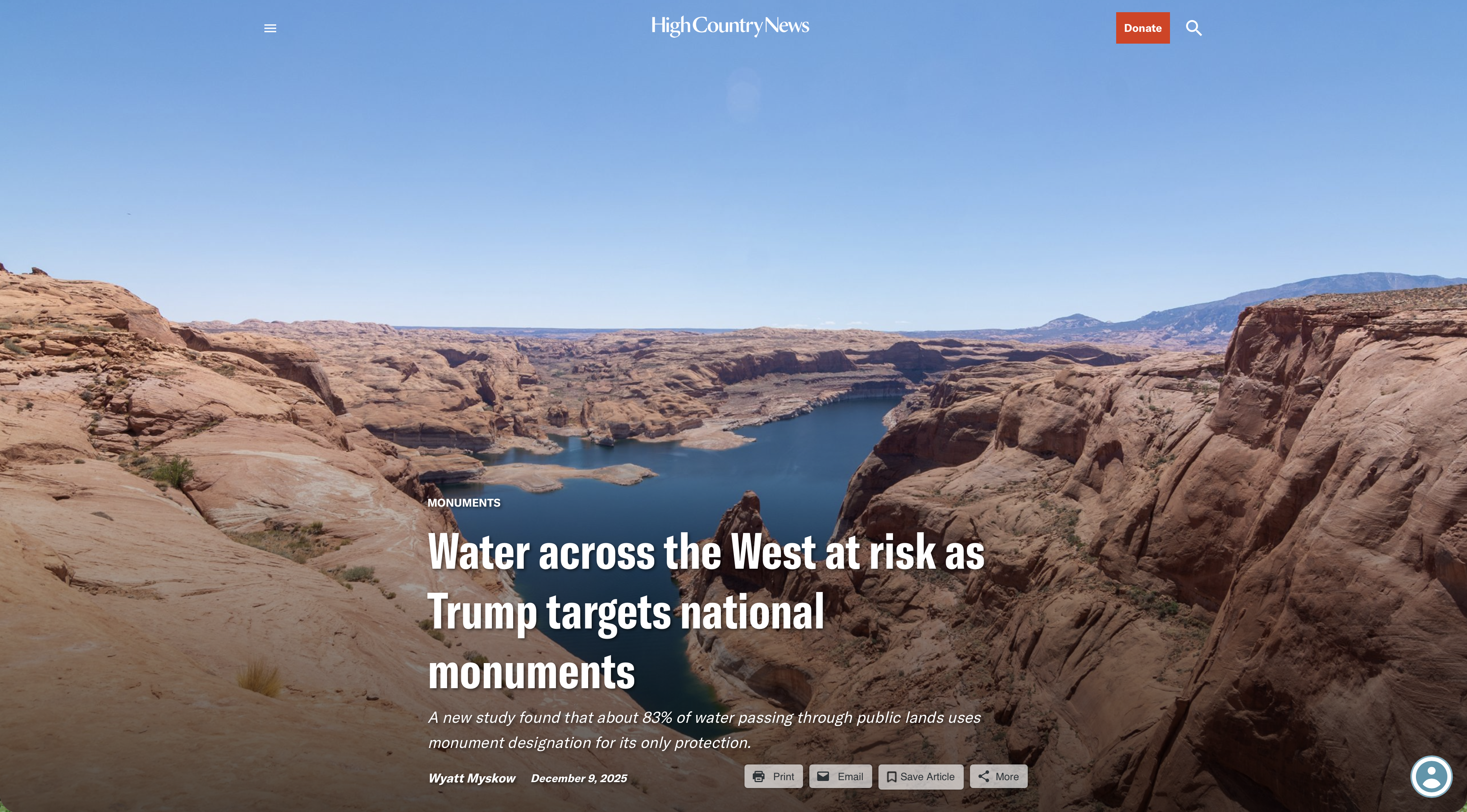
Click the link to read the article on the High Country News website (Wyatt Myskow):
December 9, 2025
This story was originally published by Inside Climate News and is republished here through a partnership with Climate Desk.
The 31 national monuments designated since the Clinton administration, which could be downsized as the Trump administration pushes to open more public lands to extractive industries, safeguard clean water for millions of Americans, according to a new analysis from the Center for American Progress.
Using geospatial data to quantify the miles of rivers and watersheds within the studied national monument boundaries, as well as the number of users who depend on that water, the report found that the water supplies for more than 13 million Americans are directly provided by watersheds within or downstream of these national monuments. About 83% of the water passing through these public lands has no other protection besides the monument designations, it found.
National monuments protect more than 21,000 miles of waterways across the U.S., nearly twice as much waterway mileage as the National Wild and Scenic Rivers System, the analysis also determined.
The report comes as the Trump administration weighs downsizing or revoking the designation of some national monuments.
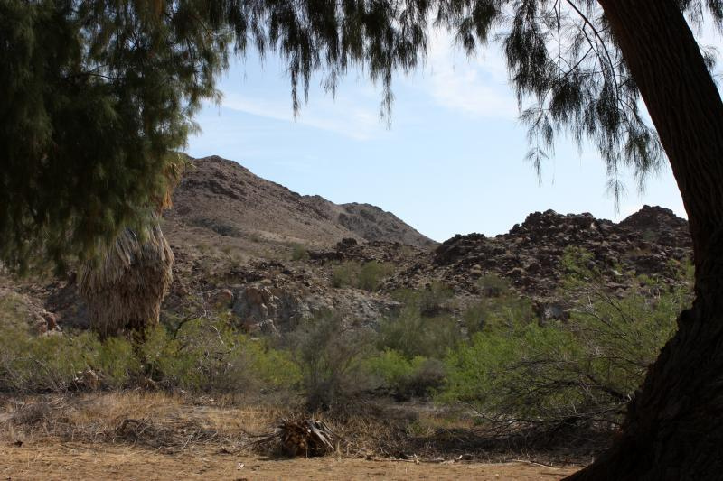
In March, the Trump administration announced it would eliminate California’s Chuckwalla and Sáttítla Highlands national monuments before removing language from a White House fact sheet announcing that decision. The following month, The Washington Post reported that the administration was considering downsizing or eliminating six national monuments, and in June, the U.S. Department of Justice issued an opinion that the president has the power to rescind national monument designations, backtracking on a decades-old determination on the matter.

During Trump’s last term, Bears Ears and Grand Staircase-Escalante national monuments, established by the Obama and Clinton administrations, respectively, were shrunk to fractions of their original sizes, but they were restored by President Joe Biden after he took office.
If national monuments are downsized or eliminated, the areas surrounding a waterway will lose protections from extractive industries, including oil and gas drilling, mining and grazing. Contamination from those industries could seep into streams and, in turn, rivers. Those industries also use water, sometimes vast amounts in arid regions, further reducing the supply that flows to nearby communities. (In certain cases, some mining and grazing are already permitted on national monument lands, but the activities are limited in scale and more regulated than they are outside the monuments.)
“Landscapes and waterways go hand in hand,” said Drew McConville, a senior fellow for conservation policy at the Center for American Progress and a co-author of the report. “The clean water depends on what comes into them from natural lands … Just protecting the wet stuff itself doesn’t guarantee that you’re keeping [water] clean and durable.”
The portion of historically marginalized communities living within the watersheds of the national monuments is greater than the average for watersheds nationally, it found. Twenty-three of the monuments studied are also found in regions expected to face water shortages due to climate change in the coming decades, making the arid regions downstream even drier.
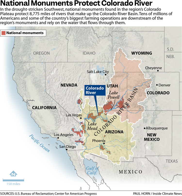
Grand Staircase-Escalante National Monument, for example, protects 2,517 miles of waterways, according to the analysis, and nearly 90% of the watersheds within the monument are expected to see declines in their water levels. The monument straddles the Upper and Lower Colorado River Basins, with the Paria and Escalante rivers flowing within its boundaries and Lake Powell, the nation’s second-largest reservoir, just to its south.
The monument is often thought of as a sparse, arid region, which it is, said Jackie Grant, the executive director of Grand Staircase Escalante Partners, a nonprofit focused on protecting the monument that has spent $11 million to protect the Escalante River watershed and all its tributaries. It remains vital to the Colorado River System, which millions of people in the Southwest rely on. Grand Staircase-Escalante helps slow water from the Paunsaugunt Plateau in Bryce Canyon National Park, much of which starts as snowpack in the park before melting and flowing downstream.
“People don’t think of water when they think of Grand Staircase-Escalante National Monument,” Grant said. “So when we can bring this view of water and how important it is to the protection of the monument, it helps us put another building block in our case for supporting the monument, because not only is it important for the animals, the native plants, the geology and the paleontology, water plays a huge role in the monument, and the monument protects the water itself.”

Stretching across 1.87 million acres of public land, Grand Staircase-Escalante National Monument is one of the country’s most expansive national monuments, protecting scores of wildlife as well as archeological resources in southern Utah. But a nine-billion-ton coal deposit is buried in the center of the monument along with deposits of minerals, including uranium and nickel. The Trump administration has long touted boosting the country’s coal production, and has established a pro-mining agenda this year.
“It’d be very easy to contaminate either one of those rivers if mining were to take place in the center section of the monument,” Grant said.
Margaret Walls, a senior fellow at Resources for the Future who has studied national monuments but was not part of this study, said national monuments are designated to protect cultural or historical landmarks, and it can be forgotten that they can also serve purposes like safeguarding water. Though she noted that even if monument protections are loosened, the areas remain federal lands, and their changes in status do not guarantee they will be developed.
“We don’t protect waterways the way we do land,” Walls said, “we’re going to get those water benefits by protecting the land.”


Click the link to read the article on the Circle of Blue website (Brett Walton):
December 8, 2025
The Rundown
- Members of Congress want Tijuana River cleanup and Rio Grande water deliveries discussed as part of the U.S.-Mexico-Canada trade agreement.
- EPA publishes a lead service line data dashboard.
- Reclamation finalizes an operating plan to increase water deliveries to farms in California’s Central Valley.
- A water pipeline break disrupts the Grand Canyon’s South Rim services.
- DOE advisory group recommends limiting scope of state Clean Water Act reviews.
- NOAA assesses the 2025 harmful algal bloom in Lake Erie.
And lastly, bipartisan bills in Congress would compensate farmers hurt by PFAS.
“In Maine, PFAS contamination affecting many different sectors, including agriculture, has been discovered over the past several years. The presence of PFAS in wastewater sludge once spread as fertilizer has prevented some Maine farms from selling their products, thus leading to significant financial hardship for these family farmers.” – Sen. Susan Collins (R-ME) speaking on the Senate floor about the Relief for Farmers Hit with PFAS Act. The bill would provide financial aid to farmers affected by PFAS contamination.
The pot of money authorized in the bill could be used in several ways, the representatives say. Reimbursement for lost income. Soil and water testing. Remediation systems. Blood testing for farmers exposed to the chemicals.
By the Numbers
River Mile 58.4: Estimated location, as of December 2, of the saltwater “wedge” in the Mississippi River in southern Louisiana. Due to dry weather, the wedge – saltwater that pushed upriver due to weak flows – has advanced 12 miles since mid-November.
2.4: Severity of the Lake Erie harmful algal bloom in 2025, according to a NOAA assessment. That corresponds to a “mild” bloom – the second mildest since 2008. The severity rating is a measure of the bloom’s biomass, not its toxicity.
News Briefs
Tijuana River Sewage in Trade Talks
California Democrats in the House and Senate want chronic sewage problems in the Tijuana River to be part of trade talks between the U.S., Mexico, and Canada.The representatives made their case in a letter to Jamieson Greer, the U.S. trade representative. The three countries are beginning to discuss revisions to the trade agreement that was signed in 2018.
The California contingent asked for:
- a multi-year funding commitment from the Mexican government
- expand the geographical scope of an infrastructure grant program to include projects in Mexico
- more financing from the North American Development Bank
- a permanent funding source
- include a formal role for existing border river institutions in the trade agreement framework.
The Tijuana River Coalition, a public interest group, also asked the Office of the U.S. Trade Representative to consider sewage pollution in a revised trade agreement.
Tijuana River sewage is not the only cross-border water problem that U.S. representatives would like to see addressed in the trade talks.
Rep. Monica De La Cruz of Texas encouraged the USTR to include Rio Grande water sharing in the agreement and to use its dispute resolution process as a way to enforce accountability. The Lower Rio Grande Valley Water District Managers’ Association also asked for Rio Grande water disputes to be handled through the trade agreement.
Studies and Reports
Lead Service Line Data
The EPA published an online dashboard with data about the number of lead service lines for each public water system.Public water systems were required to submit lead service line inventories to the EPA by October 2024. The agency estimates about 4 million lead drinking water lines in the country.
Central Valley Project Operating Plan
The Bureau of Reclamation finalized a new operating plan for the Central Valley Project, the federal canal system that delivers water south of the Sacramento-San Joaquin Delta.The new plan, which will maximize water deliveries to farms, stems from an executive order requiring the agency to do so.
Permitting and Energy Development
A Department of Energy advisory group that represents oil and gas interests submitted a report recommending limiting the scope of state water-quality reviews.Like many Republican-leaning groups, the National Petroleum Council wants to prevent states from blocking fossil fuel infrastructure through use of Section 401 of the Clean Water Act, which allows states and some tribes to review projects that could pollute their waters. Notably, New York denied a water-quality permit to the Constitution natural gas pipeline in 2016.
The council’s report calls Section 401 a “procedural chokepoint” in project permitting.
The Trump EPA is promoting a “specific and limited” use of Section 401 for water-quality considerations only.
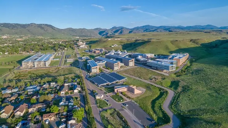
On the Radar
More Renaming
The Department of Energy has renamed the National Renewable Energy Laboratory.The new name is the National Laboratory of the Rockies.
Economic Effects of Permitting Requirements
The Congressional Budget Office is seeking information that would help it better model the economic and budgetary effects of changes in federal permitting requirements for infrastructure.Send comments to communications@cbo.gov.
Grand Canyon Water Troubles
The National Park Service is closing hotels on the Grand Canyon’s South Rim to overnight guests due to breaks in the water pipeline that serves the area.The 12-mile pipeline crosses the canyon. The park service is in the middle of a $208 million pipeline upgrade that it expects to complete in 2027.
Federal Water Tap is a weekly digest spotting trends in U.S. government water policy. To get more water news, follow Circle of Blue on Twitter and sign up for our newsletter.

Click the link to read the briefing on the Western Water Assessment website:
December 8, 2025 – CO, UT, WY
A hot and dry November left the Intermountain West with much below average snowpack conditions. November temperatures were four degrees above average region-wide and much of Utah and Wyoming baked under mean temperatures that were six to ten degrees above average. High temperatures coupled with mostly below normal precipitation caused low snow water equivalent (SWE) and worsening drought conditions.
November precipitation was much below average for much of the region, especially in Wyoming, northern Colorado and northern Utah, which received less than half of normal precipitation. Much above average November precipitation was observed in southern Utah and eastern Colorado. Record dry Novembers were observed at thirteen locations in Wyoming, ten locations in Colorado and five locations in Utah. Despite dry November conditions, regional water year precipitation is near to above average except for eastern Colorado and southeastern Wyoming.


November was an extremely warm month, especially in western Wyoming, where monthly temperatures were more than eight degrees above average. The entire region observed November temperatures that were at least four degrees above average, with all of Utah, nearly all of Wyoming and western Colorado experiencing temperatures that exceeded six degrees above average. Record warm October conditions were observed in western Colorado, southwestern Wyoming and throughout Utah.
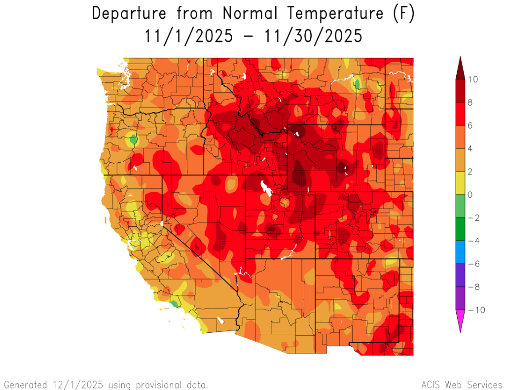
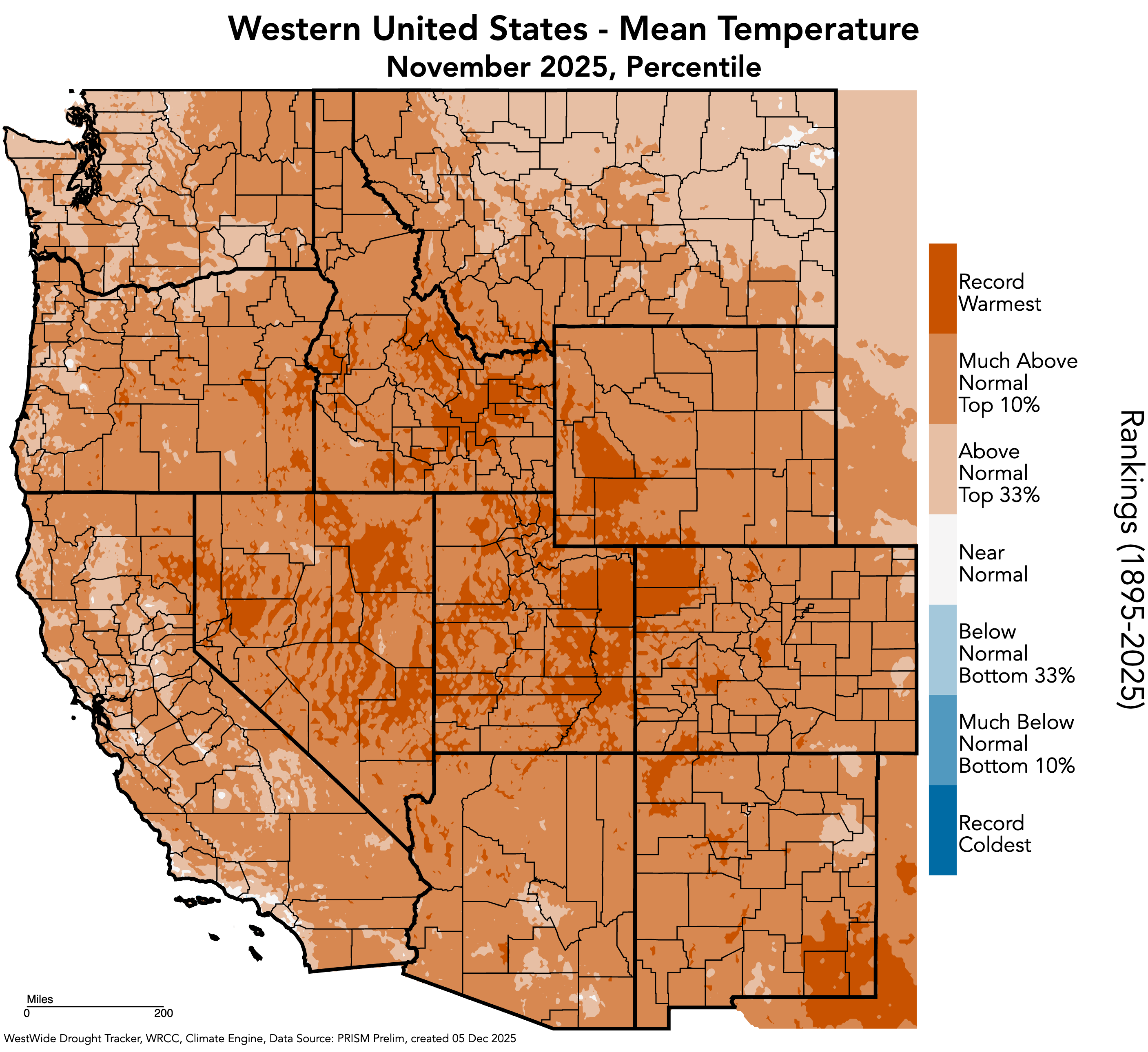
Record low SWE conditions exist at many locations in Colorado, Utah and Wyoming. A hot and dry November left most regional river basins with SWE conditions at less than 50% of average, with the least snow in the Six Creeks near Salt Lake City, where December 1st SWE is 22% of median. Slightly better SWE conditions exist in southern Colorado and southern Utah.


Regional drought coverage expanded slightly during November, increasing from 51% five weeks ago to 54% on December 2. Eastern Colorado and eastern Wyoming remain drought-free, but drought emerged along the northern Front Range and adjacent plains. Coverage of drought in Utah dropped below 100% for the first time in five months. Utah and Colorado were last free from drought six years ago, while the current drought in Wyoming began five years ago.
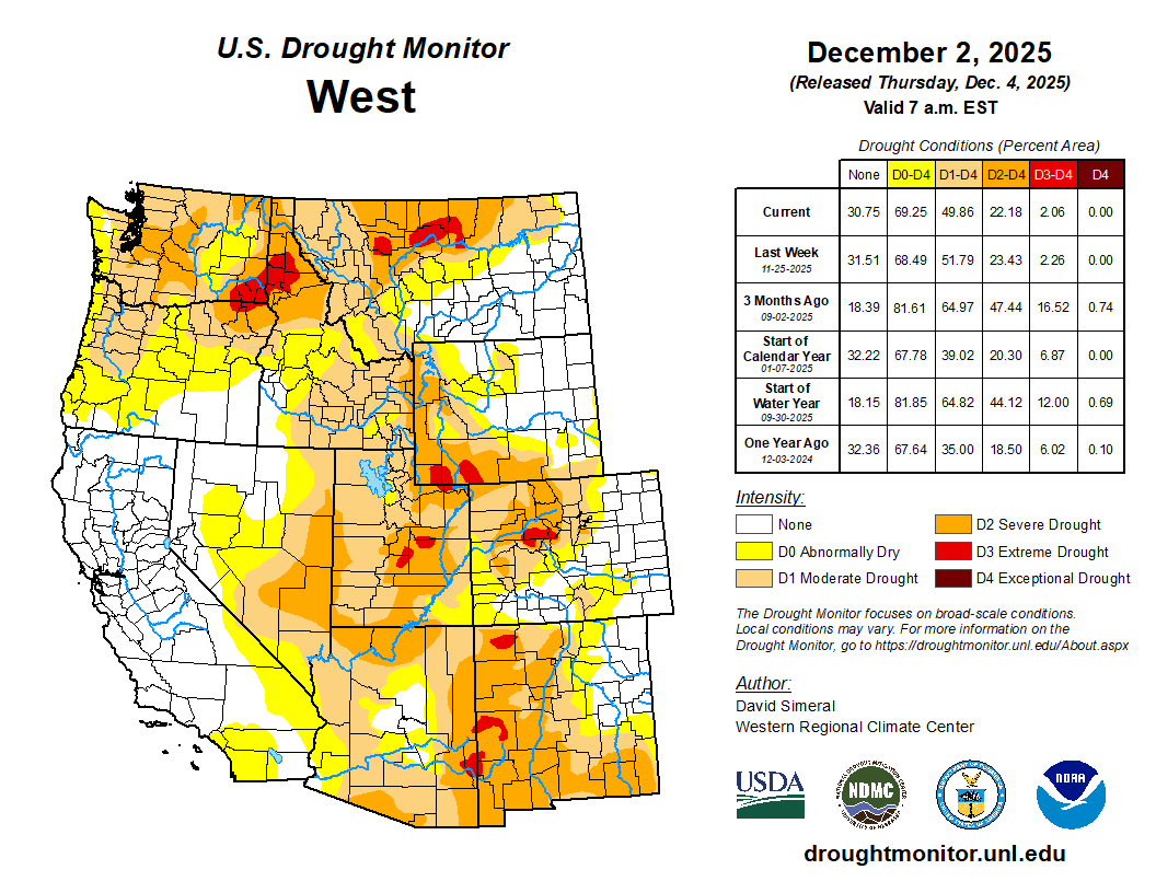

A NOAA La Niña Advisory is still in effect as eastern Pacific Ocean temperatures are below average. Weak La Niña conditions are expected to transition (60% probability) to neutral conditions by early 2026. The NOAA December Precipitation Outlook suggests above average precipitation for most of Wyoming. For the winter months (Dec-Feb), there is an increased probability for above average temperatures in Utah and southwestern Colorado. In Wyoming, there is an increased probability for above average precipitation and below average temperatures.

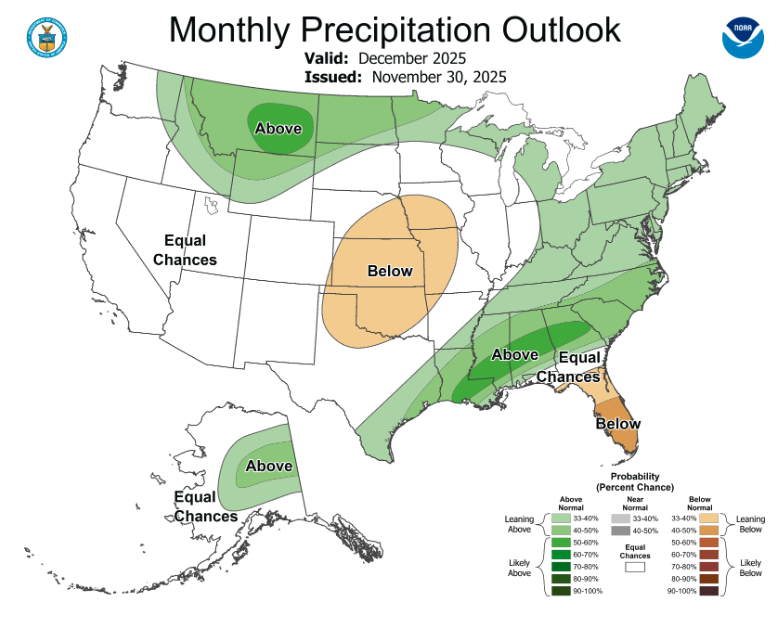

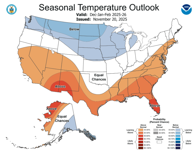
Record high temperatures drive record low snowpack. On December 1, record low SWE conditions were present at 52 regional Snotel sites in northern Colorado, northern Utah, and across Wyoming. Despite very low snowpack conditions, water year precipitation is above average for the region, except in northern Colorado. During early October, daily precipitation records were set in Utah and Colorado, including widespread flooding in southwest Colorado. Due to the tropical origin of those storms, nearly all precipitation fell as rain. Contrasting precipitation, water year temperatures are much above average with record high temperatures observed in parts of western Colorado, eastern Utah, and southwestern Wyoming. Consequently, the current snow drought is primarily the result of high temperatures rather than low precipitation. While October precipitation generally fell as rain in regional mountains, above average precipitation has increased soil moisture, which could help to bolster the efficiency of runoff in 2026.
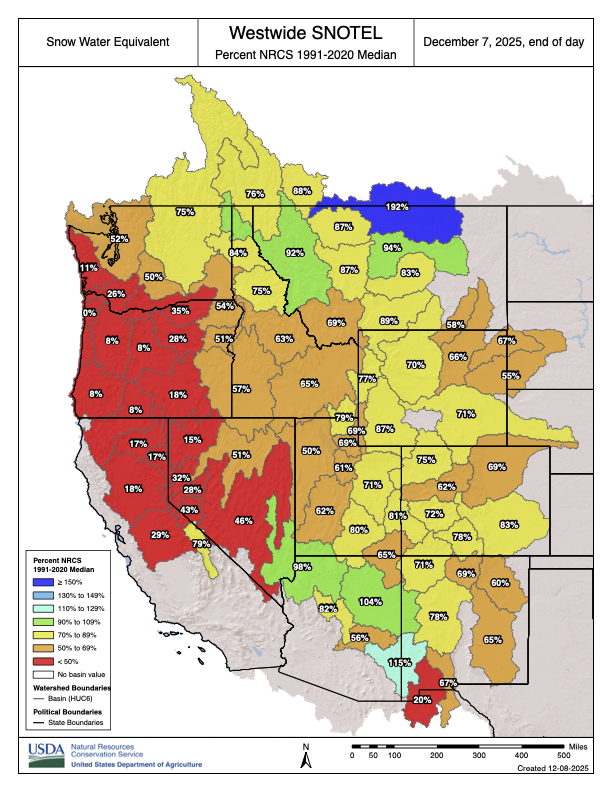


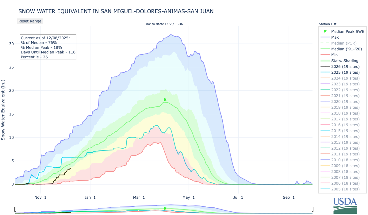


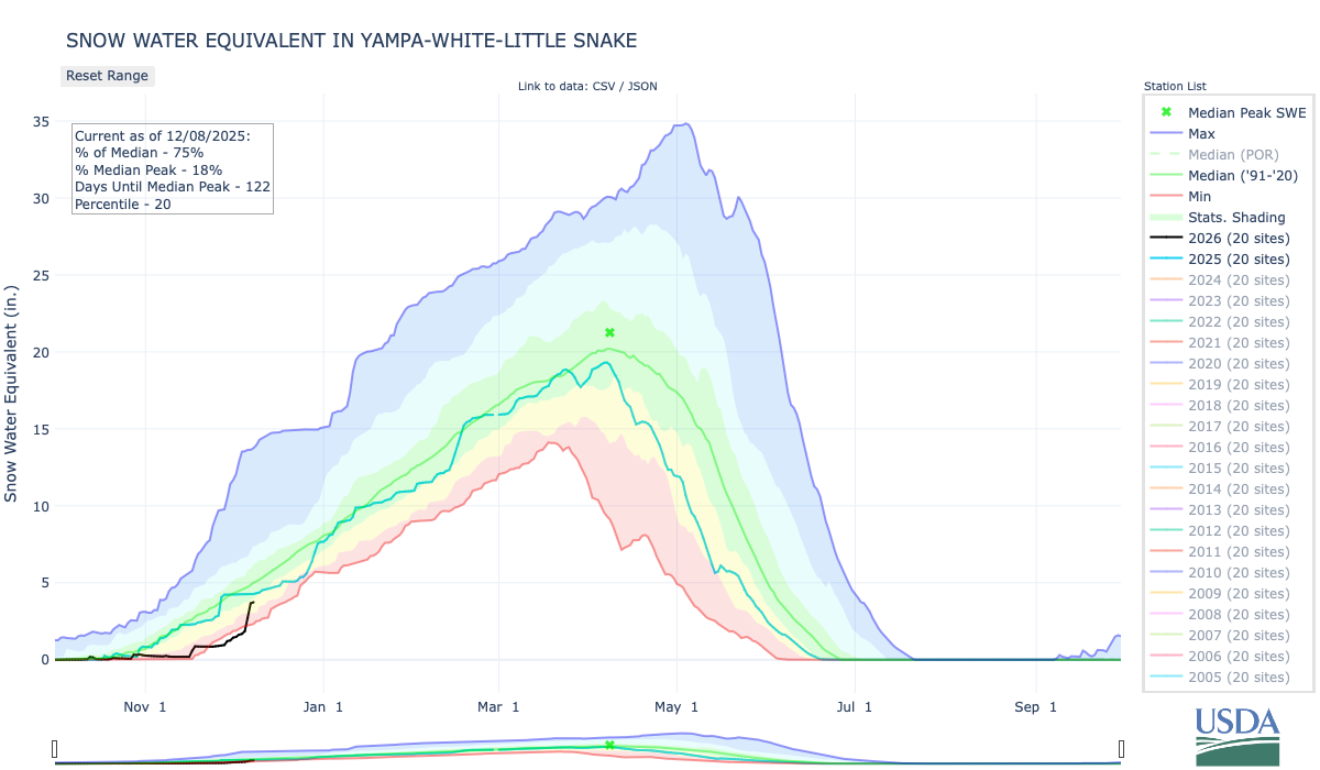
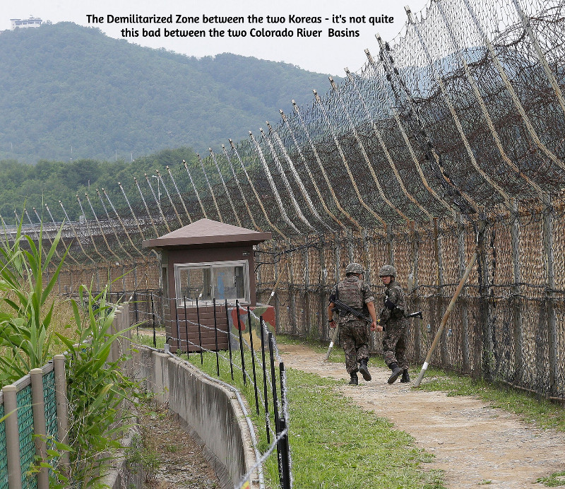
Click the link to read the article on the Sibley’s Rivers website (George Sibley:
December 2, 2025
Negotiations among the Magnificent Seven representing the seven states of the Colorado River region begin to resemble the ongoing negotiations between the military and diplomatic representatives for North and South Korea, where negotiations for something beyond an armistice have been going on for more than sixty years. Here, as there, the negotiations have reached a stalemate, and both sides are now engaged in an information war. Between the two Koreas, this war takes the form of everything from huge arrays of speakers blasting pop music across the demilitarized zone to smuggled USB drives with movies and TV shows. Here, it is mostly just propaganda bombs tossed over our ‘DMZ,’ the Grand Canyons, about each side’s virtue and the other side’s obstinacy, depending on their regional media’s love of conflict and tendency to support the home team. The missed November deadline has been seamlessly replaced – as we all suspected it would be – by a February deadline. But otherwise – nothing new on that front. We can just hope it doesn’t go on for another fortysome years.
So I’m going to take advantage of the stalemate to ask the reader to think about a bigger picture that may be more interesting. It stems from a comment from my partner Maryo, from whom I learn too much to dismiss anything she says. ‘Why are you “romancing the river”?’ she asked the other day. ‘Romance is such a cheapened concept today – bodice-ripping stories of ridiculous antagonistic love. You’re undermining the value of your work, calling it a “romance.”’
‘Well,’ I said – figuring that if she feels that way, maybe my readers raise the same question – ‘maybe one of the things a writer ought to try to do is restore the value of words and the concepts they once represented that have become devalued through misuse.’ Spoken like a true Don Quixote, another old man who took arms, sort of, against abuse of the concept of ‘romance.’
I do think that one of the things that ‘civilization’ does in civilizing us is to simplify things for us, including words whose complexity and depth embrace concepts, ideas and feelings that can be inconvenient to an orderly civilized society. A ‘romance,’ from the medieval era on into the early 20th century, was a story of an adventure in pursuit of something mysterious, exciting, challenging, something beyond everyday life. That could be the pursuit of a love relationship that was life-changing (and maybe life-endangering) for its participants – Tristan and Isolde, Launcelot and Guinevere, Romeo and Juliet, Bonnie and Clyde.
But on a much larger scale, the romantic adventure can be establishing a relationship with anything outside of ourselves that intrigues or challenges us. The relationship can emerge with a place, a house, a horse, a car, a continent, a river, an idea, as well as another person, anything that intrigues us, wakes up our imagination – arational or prerational relationships that make the civilizing forces nervous. The relationship can run the quick dynamic spectrum from arational love to its flip side arational hate, through all the intermediary love-hate variations. It can also have a mythically selective or even creative attitude toward the gray-zone relationship between ‘truth’ and fact. Which leads those trying to develop an orderly civilization to dismiss anything (ad)venturing into the mythic as a lie. It just seems simpler that way.

The first comprehensive study of the Colorado River region was uncivilized enough to state upfront its romantic origins: Frederick Dellenbaugh’s Romance of the Colorado River. Dellenbaugh’s book (available online for a pittance) delved as deeply as was possible at that time into both the First People prehistory in the region and the early history of the Euro-American invasion, from the Spanish trying to work their way up the river from its contentious confluence with the Gulf of California (‘Sea of Cortez’ to them) to the trappers imposing the first major Euro-American change on the river, stripping its tributaries of their beavers which increased the size and violence of the river’s annual spring-summer runoff of snowmelt. But the heart of the book is John Wesley Powell’s explorations to link the upper river and the lower river through its canyons.
Dellenbaugh, as a seventeen-year-old, accompanied Powell on his second Colorado River expedition, a ‘baptism under water’ (often literally) that shaped his ‘romantic’ vision. In his ‘Introduction,’ after observing that most of the great rivers that humans encountered in exploration and settlement gradually became like foster parents to those who settled along them, carrying goods for them and generally watering and growing their settlements, he says of the Colorado:
Dellenbaugh’s Romance was published in 1903. That same year, another great southwestern writer, Mary Hunter Austin came out with her Land of Little Rain, a fascinating collection of her explorations in the deserts of the lower Colorado River region. In that book she offered what might be a cautionary note about ‘romancing the river,’ in an observation about a small Arizona tributary of the Colorado River, ‘the fabled Hassayampa… of whose waters, if any drink, they can no more see fact as naked fact, but all radiant with the color of romance.’
I will now indulge my tendency to take a ‘tectonic’ look at history – looking for large chunks colliding or grating together or subducting under each other. I see the history of our engagement with the Colorado River dividing into three ‘tectonic romances’: first, the Romance of Exploration, which is chronicled in a couple different ways by those two explorers, Dellenbaugh and Austin; their 1903 publications summarize that age and put a semi-colon at the end of the period, as it were.
Second, the Romance of Reclamation: 1903 also marks the year the U.S. Reclamation Service came into being, an organization created almost specifically for settling the Colorado River deserts. Civilized people on both sides of the question would deny that there was any ‘romance’ to reclamation, but one early Bureau engineer would publicly disagree, writing in 1918 about ‘the romance of reclamation’:
C.J. Blanchard of the U.S. Reclamation Service authored that steaming verdure. The Service at that time was under the U.S. Geological Survey, a scientific organization disciplined to the ‘look before you leap’ methods of science, discerning the reality of a situation and adapting to that; but the Reclamation Service, frustrated by the seasonal flood-to-trickle flows of the Colorado, thought that changing that reality (through storage and redistribution) was a more promising route than adapting to it, and so was on its way to becoming independent of the USGS when Blanchard wrote his ‘romance of irrigation’ for an educational journal called The Mentor(thanks, Dave Primus, for calling it to my attention).

The best-known document of the Romance of Reclamation was of course the Colorado River Compact – a document in which the romance of reclamation overrode any relationship to ‘naked fact’ about the river and its flows, a situation that is now biting our collective ass. Yet an Arizona water maven said recently that any Bureau of Reclamation solution to the seven-state impasse would have to cleave closely to the Compact…. The history of the Romance of Reclamation has been written in the gaggle of Congressional acts, court decisions, treaties, regulations and directives that make up the ‘Law of the River’ (recitations of which never seem to include the 1908 Winters Doctrine allocating assumed water to federal reservations, including to the First Peoples).
The end of the Romance of Reclamation would be in the 1960s, pick your date: publication of Rachel Carson’s Silent Spring in 1962, passage of the Wilderness Act in 1964, passage of the Environmental Policy Act in 1969 – a decade in which the general American perception of the West underwent a sea change, from seeing it as a workplace for producing the resources to feed the American people and industries, to seeing it as a great natural playground to which America’s predominantly urban population could go to recharge, with a resulting desire to protect it from the very industrial consumption that supported the American ‘lifestyle.’.
This was the dawn of the third romantic epoch in our relationship with the river (and the continent in general) – the Romance of Restoration and Revision, driven by a belief that we have sinned against capital-N Nature – with many naked facts as evidence – and can only expiate our sins by preserving what remains of the nonhuman environment, restoring what we can of the damage we’ve done, and revising our own systems for consuming nature (e.g., renewable energy).
Aesthetics are at the root of our romance with capital-N Nature, aesthetics best served by the (increasingly rare) opportunity to be alone with and ‘silent on a peak in Darien,’ as Keats put it. We have a large (and growing) number of excellent writer[s] who work to elaborate on that aesthetic – Ed Abbey first, Craig Childs, Heather Hansman, Kevin Fedarko, to name a few.
But the aesthetic yearning to ultimately ‘put it back the way it was’ does not extend to other equally naked facts, like the dependence of the outdoor recreation industries on the creation of big mountain-highway traffic jams pumping big quantities of carbon and nitrogen gases into the already overladen atmosphere, as we all load up our cars with expensive gear to go off to commune with Nature. Or the naked fact that maintaining civilization-as-we-know-it for 300 million people involves a lot of nonrewable extraction from Nature that it will be very difficult to move away from entirely – unless we figure out how to control our breeding.
Just as significant achievements were achieved under the Romance of Reclamation, so significant achievements have been achieved under the Romance of Restoration and Revision – the setting aside of millions of acres of still-sort-of-wild land, instream flow laws, increasingly responsible forest management, et cetera. But we are clearly still in the early transition – half a century later – to a more realistic romance with restoring and revising to a kinder gentler relationship with the nonhuman systems of nature. And right now, we are experiencing a major counter-attack from the societal forces whose aesthetics still imagine a ‘working landscape’ of derricks, mines and other industrial-scale harvests, all suffused with the ‘smell of money,’ societal forces that believe the best of times were before we woke up to the increasingly fragile finitude of our planet under the burden of us. Let’s all go back and make America great again!

I cannot now imagine when and how this third epoch of our romance with the river will end. I think this aesthetic romance might peak with the ‘breaching’ of Glen Canyon Dam, an action that has taken on a somewhat mythic quality for today’s river romantics. I don’t think we will tear it down – let it stand as a monument to…something. But I suspect that even the Bureau of Reclamation is exploring some way of tunneling around it at river level, as we continue to flirt with the disaster of dead pool behind the dam. It will not be easy, due to the silt already piled up at the dam – but really, nothing is going to be easy anymore; that blessed civilization is now in the rear-view mirror.
I’m going to take advantage of the lull in the short-term news about the river’s management for maybe the next decade, to take a look at each of these three epochs of ‘romancing the river’ and their relationship to the ‘naked facts’ of the river – mostly see if there might be something there we’ve overlooked that might help us move forward in our ever-emerging relationship of this ‘First River of the Anthropocene.’ Onward and outward.

Click the link to read the article on the KUER website (David Condos). Here’s an excerpt:
December 3, 2025
Price Mayor Michael Kourianos drew an imaginary line in the air between two scrubby desert hills. His hand traced the path of a planned 100-foot dam for a new reservoir just north of the city in Carbon County. The project, which Kourianos described as vital to the area’s future, would provide irrigation to farmers and shore up the city’s water supply. It’s a big deal in a drought-prone area, and it could be built within five years, he said — if the federal funding that’s supposed to pay for it doesn’t disappear.
“I’m very much worried about that,” Kourianos said. “That could be at risk. That’s the unknown.”
To finish the project’s environmental impact study by next spring, he said the city and county had to scrape together about $215,000. That was after they were told there were no more federal funds to help with it due to the Trump administration’s recent cuts. The next step will be designing the reservoir, which he said is supposed to be paid for by the Natural Resources Conservation Service, part of the U.S. Department of Agriculture. The agency is set to pay 75% of construction costs, too. In all, the project will cost around $200 million. For a city of 8,216 people, that’s just not in the budget…
Price’s reservoir isn’t the only one threatened. In January, for example, the Biden administration awarded more than $70 million to 10 proposals in Utah and another $50 million to four on the Navajo Nation and Ute tribal land within the state’s watersheds. The projects range from improving wetland habitat for endangered fish to removing invasive plants, such as Russian olive trees, from riverbanks. It was part of a $388.3 million effort to improve drought resilience across the Colorado River Basin with money from the Inflation Reduction Act. Just a few days after the money was awarded, however, President Donald Trump took office and paused it. Several months later, recipients are still waiting…One of the impacted proposals is a collaboration between the Utah Division of Wildlife Resources and conservation organizations Trout Unlimited and The Nature Conservancy that would pay people to voluntarily leave water in the Price River rather than use it.

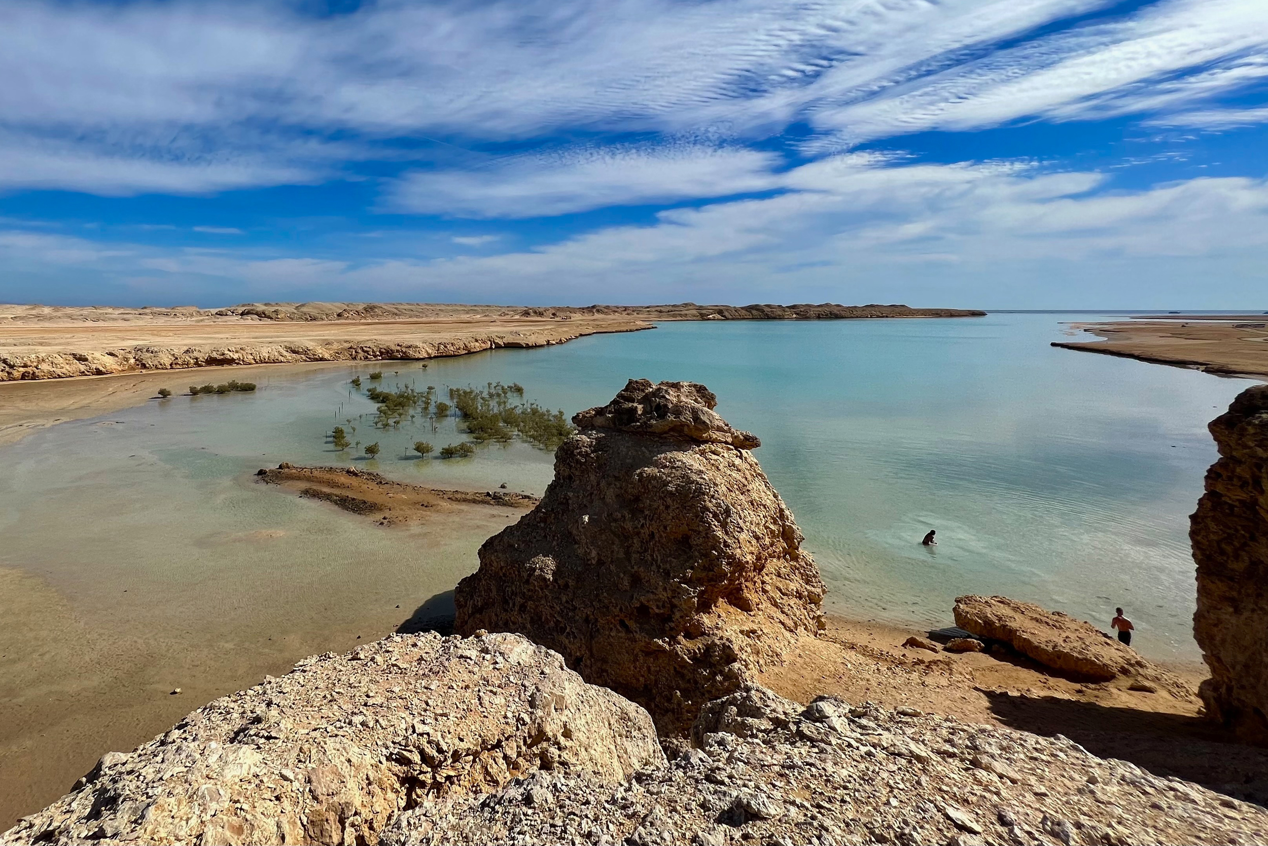
Click the link to read the article on the Inside Climate News website (Bob Berwyn):
December 4, 2025
As global warming accelerates, about 480 million people in North Africa and the Arabian Peninsula face intensifying and in some places unsurvivable heat, as well as drought, famine and the risk of mass displacement, the World Meteorological Organization warned Thursday.
The 22 Arab region countries covered in the WMO’s new State of the Climate report produce about a quarter of the world’s oil, yet directly account for only 5 to 7 percent of global greenhouse gas emissions from their own territories. The climate paradox positions the region as both a linchpin of the global fossil-fuel economy and one of the most vulnerable geographic areas.
WMO Secretary-General Celeste Saulo said extreme heat is pushing communities in the region to their physical limits. Droughts show no sign of letting up in one of the world’s most water-stressed regions, but at the same time, parts of it have been devastated by record rains and flooding, she added.“Human health, ecosystems and economies can’t cope with extended spells of more than 50 degrees Celsius. It is simply too hot to handle,” she said.
The region in the report stretches from the Atlantic coast of West Africa to the mountains of the Levant and the deserts of the Arabian Peninsula. It spans more than 5 million square miles, roughly the area of the continental United States west of the Mississippi River. Most people live near river valleys or in coastal cities dependent on fragile water supplies, making the entire region acutely sensitive to even small shifts in temperature and rainfall.
Egypt’s Nile Delta, one of the world’s lowest-lying and most densely populated coastal plains, is particularly vulnerable. The delta is sinking and regional sea levels are rising rapidly, putting about 40 million residents and more than half of the country’s agricultural output at risk.
The most recent Intergovernmental Panel on Climate Change report warns that large parts of the Nile Delta will face chronic flooding, salinized soils, and permanent inundation under nearly every future warming scenario. Some projections indicate that a third of the area’s farmland will be underwater by 2050. Because the delta is so low and flat, even modest sea-level rise will push saltwater far inland.
The new WMO report shows that the foundations of daily life across the Arab region, including farms, reservoirs and aquifers that feed and sustain millions, are being pushed to the brink by human-caused warming.
Across northwestern Africa’s sun-blasted rim, the Maghreb, six years of drought have slashed wheat yields, forcing countries such as Morocco, Algeria and Tunisia to import more grain, even as global prices rise.
In parts of Morocco, reservoirs have fallen to record low levels. The government has enacted water restrictions in major cities, including limits on household use, and curtailed irrigation for farmers. Water systems in Lebanon have already crumbled under alternating floods and droughts, and in Iraq and Syria, small farmers are abandoning their land as rivers shrink and seasonal rains become unreliable.
The WMO report ranked 2024 as the hottest year ever measured in the Arab world. Summer heatwaves spread and persisted across Syria, Iraq, Jordan and Egypt. Parts of Iraq recorded six to 12 days with highs above 50 degrees Celsius (122 degrees Fahrenheit), conditions that are life-threatening even for healthy adults. Across the region, the report noted an increase in the number of heat-wave days in recent decades while humidity has declined. The dangerous combination speeds soil drying and crop damage.
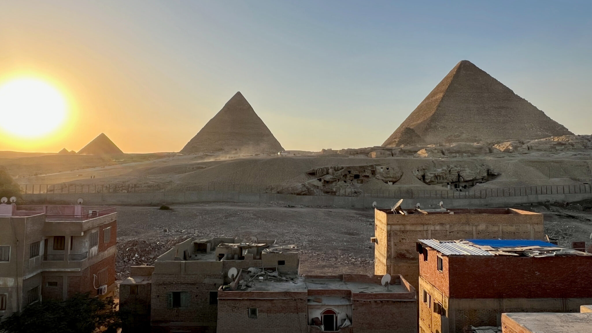
By contrast, other parts of the region—the United Arab Emirates, Oman and southern Saudi Arabia—were swamped by destructive record rains and flooding during 2024. The extremes will test the limits of adaptation, said Rola Dashti, executive secretary of the Economic and Social Commission for Western Asia, who often works with the WMO to analyze climate impacts.
Climate extremes in 2024 killed at least 300 people in the region. The impacts are hitting countries already struggling with internal conflicts, and where the damage is under-insured and under-reported. In Sudan alone, flooding damaged more than 40 percent of the country’s farmland.
But with 15 of the world’s most arid countries in the region, water scarcity is the top issue. Governments are investing in desalination, wastewater recycling and other measures to bolster water security,
but the adaptation gap between risks and readiness is still widening.
The worst is ahead, Dashti said in a WMO statement, with climate models showing a “potential rise in average temperatures of up to 5 degrees Celsius (9 degrees Fahrenheit) by the end of the century under high-emission scenarios.” The new report is important, she said, because it “empowers the region to prepare for tomorrow’s climate realities.”

Click the link to read the article on the Aspen Journalism website (Heather Sackett):
December 5, 2025
The state of Colorado is ramping up an effort to measure water use on the Western Slope, developing rules and standards and rolling out a grant program to help water users pay for diversion measurement devices.
With input from water users, officials from the Colorado Division of Water Resources are creating technical guidance for each of the four major Western Slope river basins on how agricultural water users should measure the water they take from streams. The state is now doling out $7 million from the U.S. Bureau of Reclamation to eligible water users with faulty or missing devices to install structures such as flumes, weirs and pumps at their point of diversion.

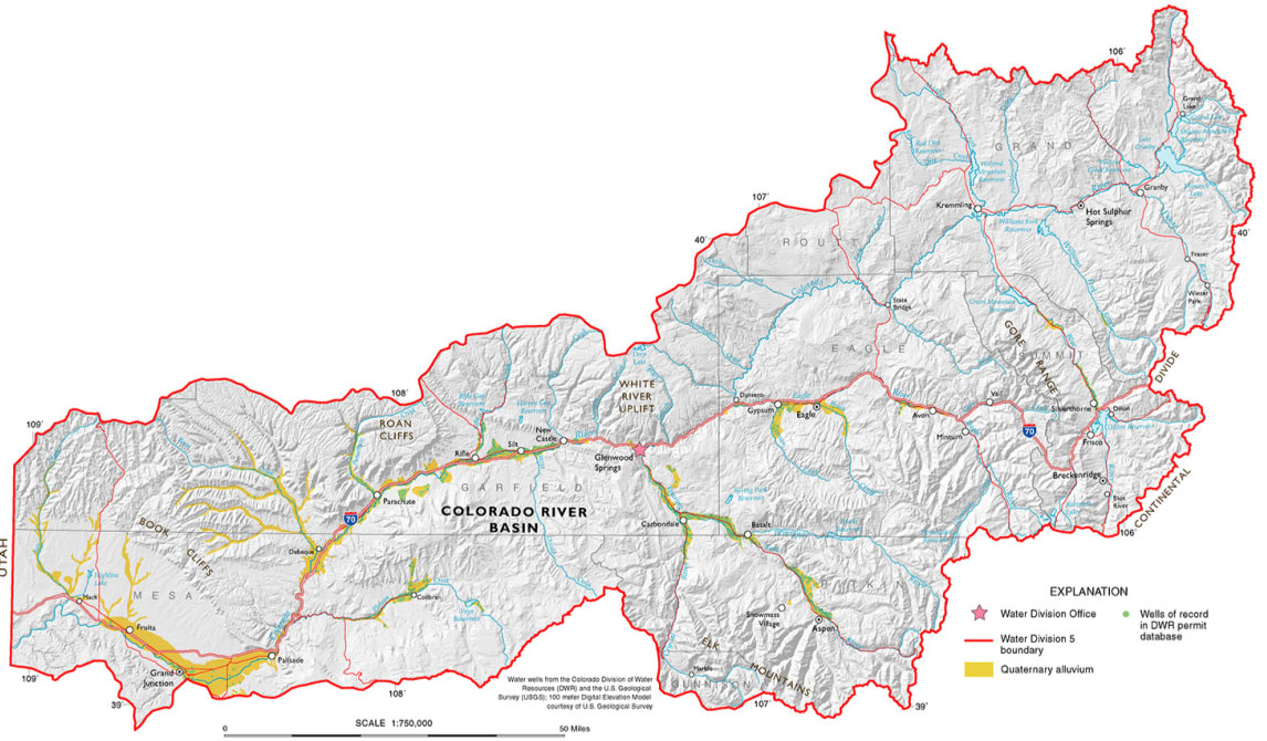

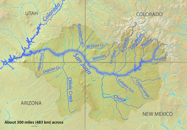


Twenty-five percent of the funding is earmarked for each of the four river basins: Gunnison (Division 4); Colorado River mainstem (Division 5); Yampa-White-Green (Division 6); and San Juan-Dolores (Division 7). The first round of funding will go to Divisions 6 and 7, and applications close at the end of January. The goal is to have all the projects complete by 2029.
Measurement rules for Divisions 6 and 7 have been finalized and are in effect; rules for Division 4 are in the draft phase, and state officials are accepting comments until Dec. 19 on the draft rules in Division 5.
With thousands of diversions from small tributaries across rural, remote and mountainous areas, figuring out precisely how much water is used in Colorado has historically been challenging. According to state officials, there are about 2,800 diversions of more than 1 cubic foot per second from Western Slope rivers and streams that are not currently being measured. Historically, the state has required measuring devices on only diversions that have been involved in calls. When a downstream senior water rights holder is not getting the full amount of water they are entitled to, they can place a “call,” which forces junior upstream water users to cut back.
Compact compliance
The push for more-accurate measurement comes at a time when there is increasing competition for dwindling water supplies, as well as growing pressure on the Colorado River’s Upper Basin states (Colorado, New Mexico, Utah and Wyoming) to conserve water. Whether through forced cuts under the terms of the 1922 Colorado River Compact or through a voluntary conservation program that pays water users to cut back, the state will almost certainly face future cuts to its water use.
According to Jason Ullmann, who is the state engineer and director of the division of water resources, accurate and consistent water measurement is a prerequisite for making basinwide cuts related to the compact.
“While we’ve always been in compliance with the [1922 Colorado River] compact, we haven’t had to do a West Slope-wide administration,” Ullmann said. “We just don’t want to be in the position of having to do that on an emergency basis. We want to be proactive and provide people consistent and reliable standards for what we expect and work with them to get to a point where we do have that more accurate measurement network before that happens.”
Although the Colorado River Compact splits the river’s water evenly between the Upper Basin and the Lower Basin (California, Arizona and Nevada) with 7.5 million acre-feet each annually, the agreement says nothing about what happens when there’s not enough water to meet these allocations. A “compact call” is a theoretical legal concept, whose definition is hotly debated among water managers.
One way it could play out is that the Upper Basin states would have to cut off some water users in order to send enough water downstream to meet their obligations to the Lower Basin. If that happens, Colorado would need a plan for who gets cut off first. Under the strict application water law known as prior appropriation, the oldest water rights get first use of rivers and junior water rights are the first to be cut.
Michael Cohen, a senior fellow at the Pacific Institute, where he has written about the uncertainties of water use and measurement in the Upper Basin, said collecting better data will help water managers figure out where cuts should come from.
“Moving forward, it looks more and more likely that there’s going to be some kind of compact call,” Cohen said. “Then the state of Colorado, as well as the other Upper Basin states, need to figure out how they’re going to enforce that kind of call.”
Managing scarcity
But compact compliance is not the only reason that water measurement is needed. Scientists have shown that climate change has contributed to a 20% decline in flows from the 20th century average, and that every 1 degree Celsius of warming results in a 9% reduction in flows. The combination of climate change and a historic drought means that rivers that had never before experienced shortages or calls have started experiencing them in recent years. In the past few years, the Yampa and White rivers, in the northwest corner of the state, have had first-ever calls and have been designated “over-appropriated,” meaning there’s more water demand than supply at certain times.
“Even if you toss the compact situation out, it’s just the practical reality that we’re seeing less snowpack and we have more calls,” Ullmann said. “We’re just in need of improving that measurement accuracy because of the need for administration.”
John Cyran, an attorney who worked on developing the measurement rules for the South Platte River basin and is now a senior attorney with the Healthy Rivers department of Boulder-based environmental group Western Resource Advocates, uses the analogy of a pizza party with too-few pizzas where hungry partygoers are allowed only two slices each to illustrate how measurement is needed in times of scarcity.
“Just like sharing a shrinking pizza or Thanksgiving pie, our water supply is declining,” Cyran said. “The pie is getting smaller. So it is increasingly important to make sure that people don’t take more than their share. But we can’t manage what we don’t measure.”
Tightening up water measurement across the Western Slope could also help Upper Basin water managers as they grapple with a future conservation program that pays water users to cut back and then stores that water in a pool in Lake Powell. A criticism of past pilot programs was that the saved water was not tracked to Lake Powell. Water users downstream of a conservation project could pick up the extra water, with no guarantee that any of it reached the reservoir. Measurement rules and devices could help ensure that this conserved water is “shepherded” to Lake Powell.
Measurement is the first step toward management of a scarce public resource, Cyran said.
“The first step is measuring how much water is being diverted,” Cyran said. “The next step is management – making sure that folks only divert their share and that water we conserve stays in the stream and is not diverted by another user.”

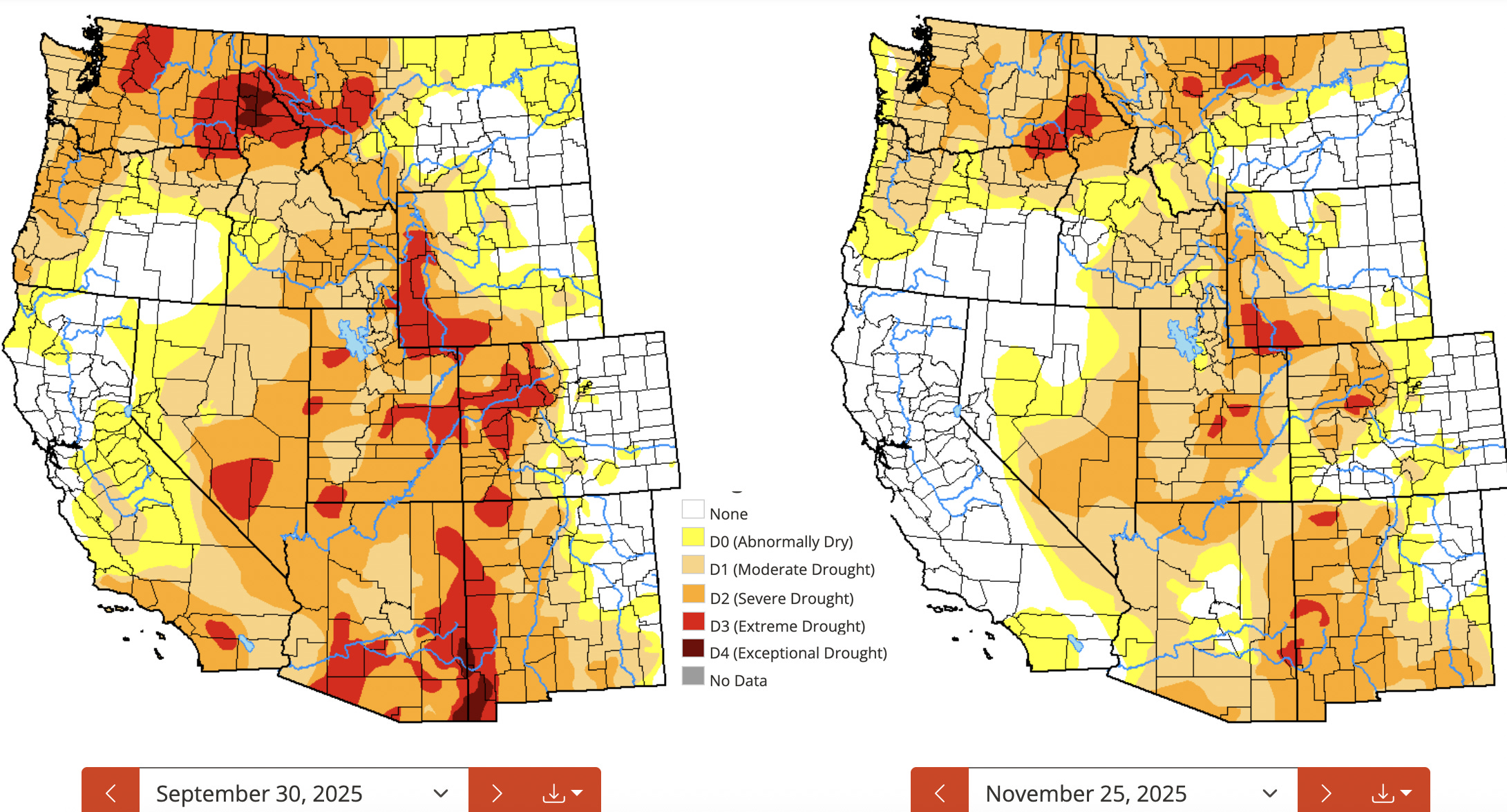
Click the link to read the article on The Land Desk website (Jonathan P. Thompson):
December 2, 2025
⛈️ Wacky Weather Watch⚡️
We are now two months into the water year — and a couple of days into meteorological winter — and so far both are pretty weird. On the one hand, much of the West is covered by one of the scantest snowpacks for early December in decades. On the other, it’s also been one of the wettest beginnings to the water year in recent memory.

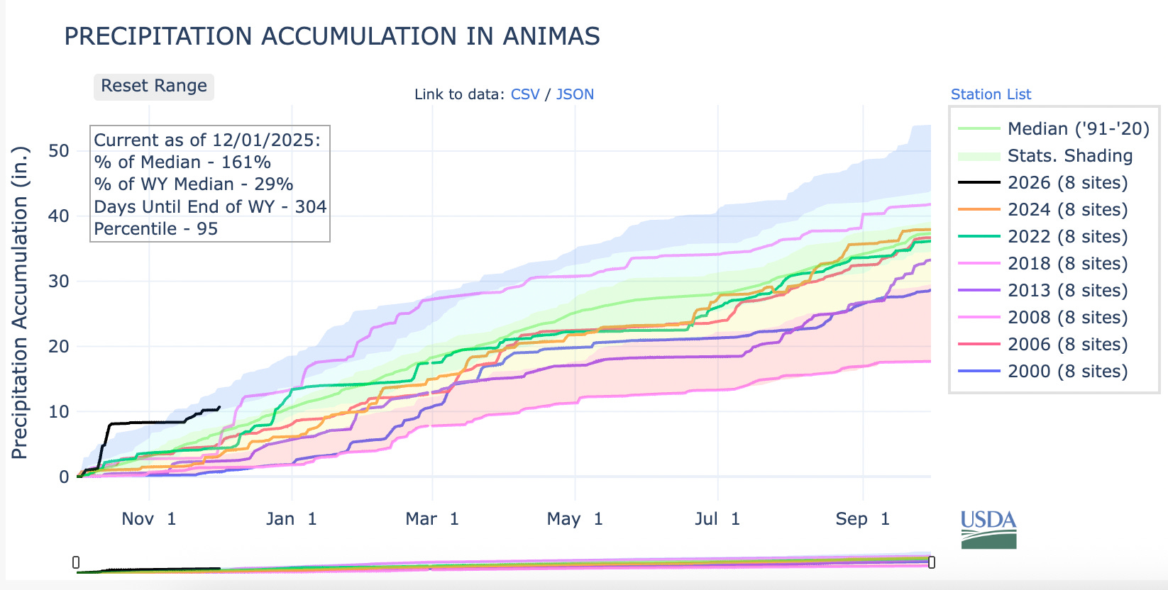
Adding to the uncanniness has been the wave of generous storms that have dumped up to a foot of snow on Colorado ski areas and snarled traffic, leading to at least two multi-car pileups on I-70 and shutting down other arteries — yet still failing to bring snowpack levels to anywhere near “normal.”
It’s a big ol’ mixed bag, in other words. The big October deluges eased the drought in much of the region, but the warm temperatures and snow drought don’t bode well for next spring’s runoff. Meagre early winter snowpacks can make and have made dramatic comebacks (e.g. water year 2008 in southwestern Colorado), and another storm is moving into the region as I write this, yet the National Weather Service’s is predicting an abnormally warm and dry winter for much of the Southwest.
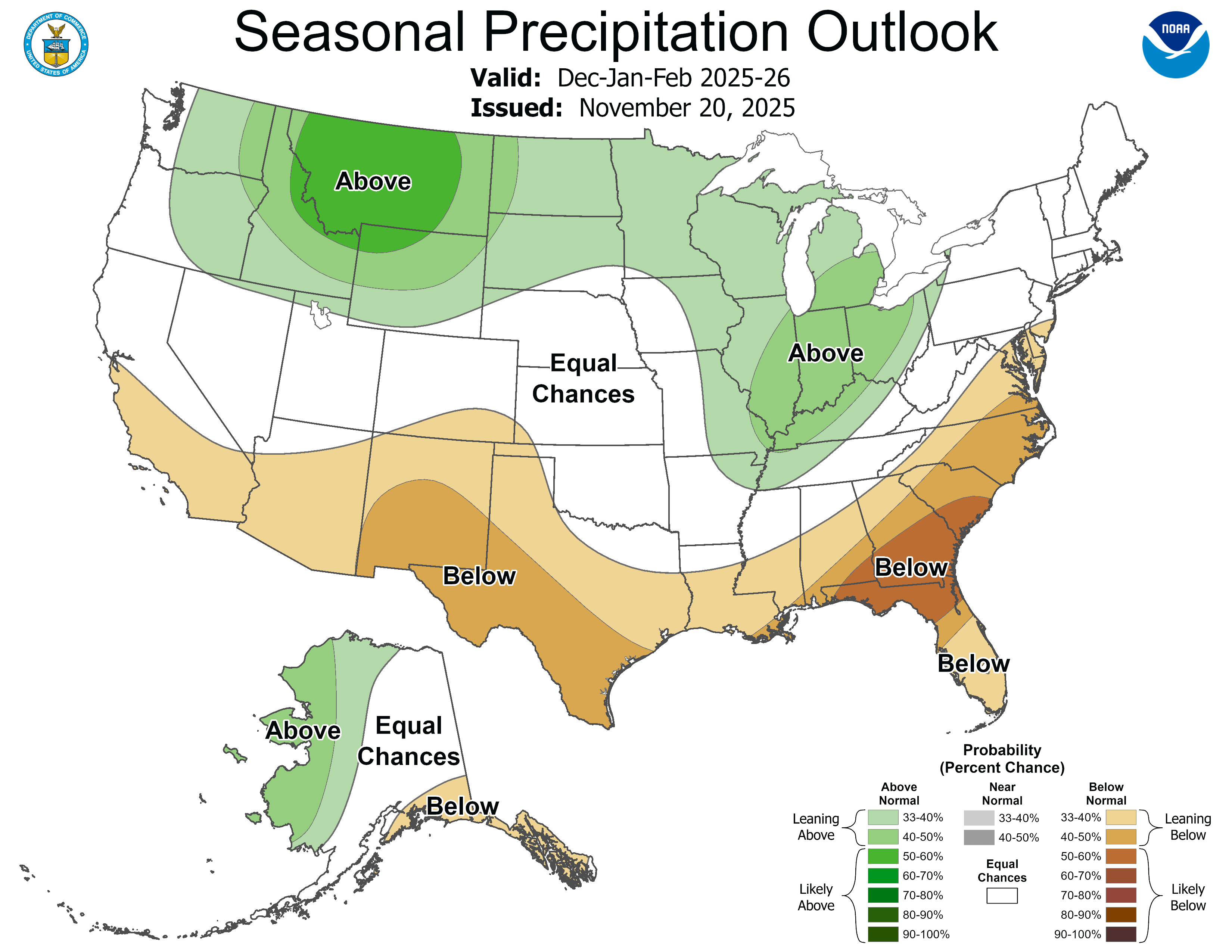
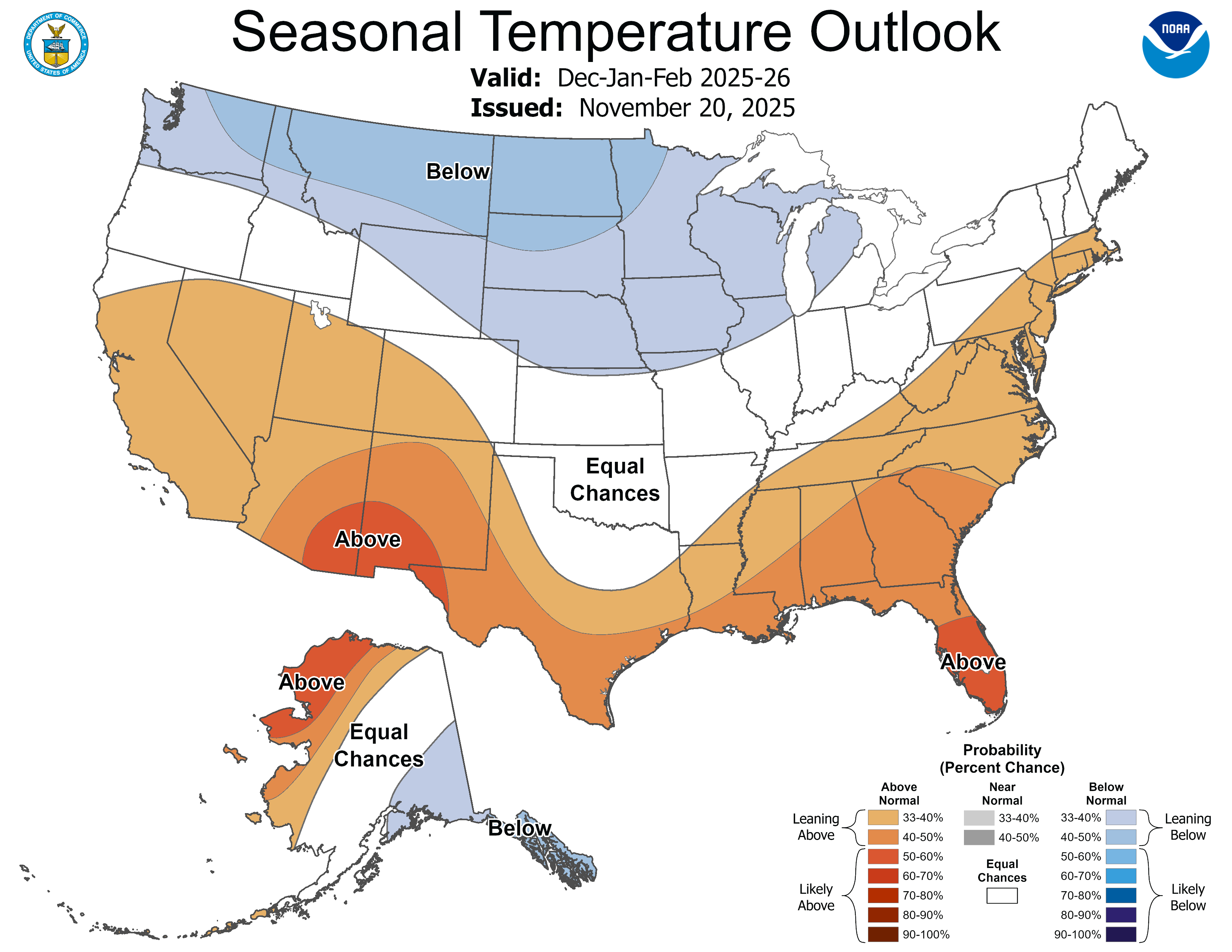
🌵 Public Lands 🌲
The Grand County commissioners’ “Access and Capacity Enhancement Alternative” plan aimed at increasing visitation at Arches National Park was just the tip of an iceberg, it seems. Yesterday (Dec. 1), Commissioner Brian Martinez presented the plan to a group of state and federal officials at a closed State of Utah and National Park Service Workshop in Salt Lake City.
Moab seeks bigger crowds? — Jonathan P. Thompson
The meeting’s purpose, according to the official agenda, is:

This may sound fairly innocuous (and maybe it is). But given some of the players, it may also be the latest volley in Utah’s long-running effort to seize control of public lands. The meeting was run by the Interior Department’s associate deputy secretary, Karen Budd-Falen, and Redge Johnson, who leads Utah’s Public Lands Policy Coordinating Office.
Budd-Falen built her legal career on fighting federal agencies, including the Interior Department, and was part of the Sagebrush Rebellion and the Wise Use movements that endeavored to turn federal land over to states and counties and to weaken regulations on the extractive industries. Johnson, meanwhile, was a driving force behind the state’s effort to take control of 18.5 million acres of Bureau of Land Management land in the state.
A Sagebrush Rebel returns to Interior — Jonathan P. Thompson
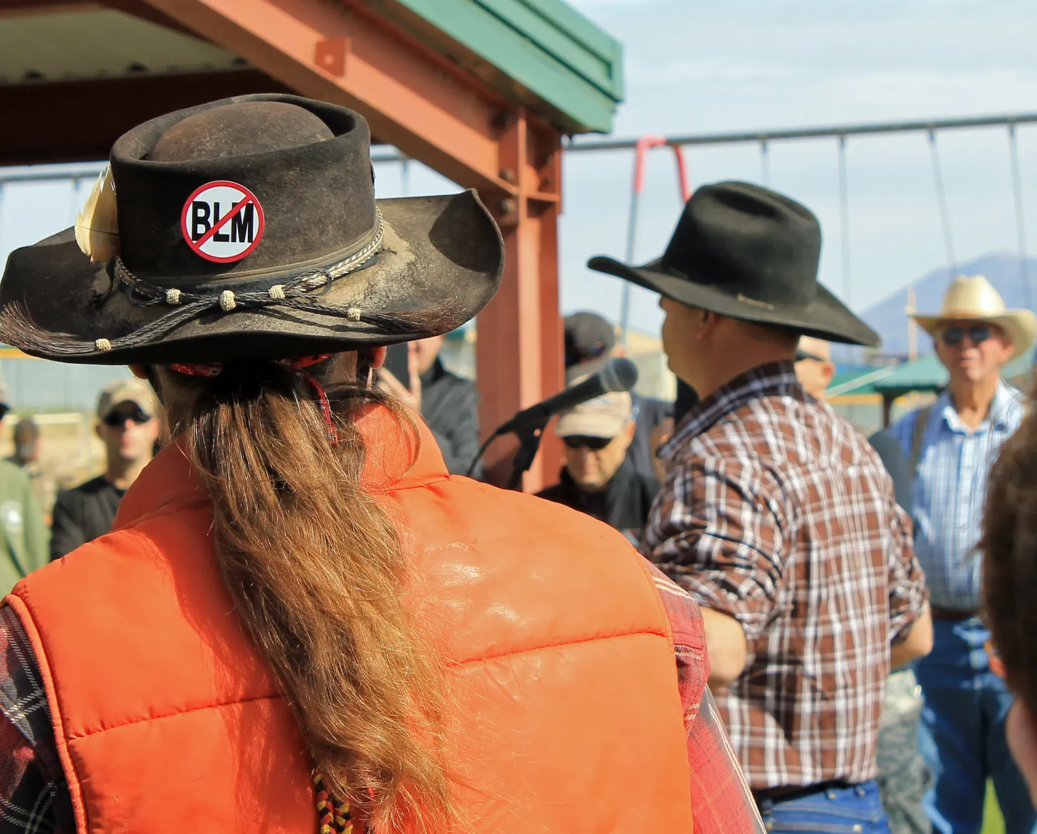
It’s not clear what is meant when they say the meeting is aimed at achieving Trump’s agenda. As far as national parks go, the administration has been rather chaotic: Freezing hiring, laying off thousands of staff (only to rehire some of them), slashing budgets, and allowing visitors to run roughshod over the parks during the government shutdown.
It sure looks like they are trying to cause the parks to fail, which would give them an excuse to further privatize their functions. Private for-profit corporations already run the lodges, campgrounds, and other services inside many parks. That’s why, during the shutdown, concessionaire-run campgrounds within parks continued to operate, while all of the government-run functions, such as entrance-fee-collection, were shuttered. In this way a false contrast was created between the functional privately-run operations and the dysfunctional public ones; visitors during that time would be excused for preferring the former.
The timing of this meeting, purportedly to receive input from gateway communities, is kind of odd. I have to wonder whether the Interior Department consulted local elected officials before raising entry fees for foreign visitors to $100 at Zion and Bryce Canyon National Parks in Utah, along with Grand Canyon, Acadia, Everglades, Glacier, Grand Teton, Rocky Mountain, Sequoia & Kings Canyon, Yellowstone, and Yosemite National Parks.
The Southwest’s tourism industry is highly reliant on international visitors. Visitation from abroad is already down, thanks mostly to the Trump administration’s “America First” creed and its general hostility to the rest of the world. Singling out foreign travelers for these higher fees — even if only at the most popular parks — is likely to dampen visitation from abroad even more, which will ripple through Western economies.
Grand County’s bid to cram even more visitors into Arches National Park won’t be too effective if would be visitors don’t even make it to the United States …
🗺️ Messing with Maps 🧭
This is just another old map that caught my attention, in part because it’s a reminder of how extensive the railroad network was, even in the rugged parts of Colorado, back in the late 1800s and early 1900s. This one shows the Denver & Rio Grande rail lines in 1893.


Click the link to read the article on the Alamosa Citizen website:
December 3, 2025
January date scrapped in favor of June 29, 2026, after ‘key witness unavailability’ — four years after Fourth Amended Plan of Water Management was first approved by Subdistrict 1 and with the unconfined aquifer still in a historic decline
The San Luis Valley’s highly-anticipated district water court case — the water trial of this century if you will — originally scheduled to last five weeks beginning in January has been pushed back six months to the summer of 2026 due to the departure of a key witness in the fallout from a series of contentious October emails.
The Fourth Amended Plan of Water Management by Subdistrict 1 in the Rio Grande Water Conservation District has lived a precarious life without ever being implemented, going back to 2022 when it was originally crafted by subdistrict managers and January 2023 when it was adopted by Rio Grande Water Conservation District board.
Later came approval by the state engineer, and then after objections were filed against the new amended plan, Colorado Water Court Division 3 Judge Michael Gonzales set a trial date to commence on Jan. 5, 2026, and to last five weeks.
That is, until the week before Thanksgiving when Gonzales scrapped the January date in favor of June 29, 2026, some four years after the plan was first approved at the subdistrict level and the unconfined aquifer still in a historic decline. The judge did so after a series of emails sent by a key expert witness for the main objectors to the plan surfaced.
The effect is that a new plan to recover the Rio Grande’s unconfined aquifer, which has been approved at the local and state levels but still requires sign-off from district water court, remains in limbo.
Following filings by the Northeast Water Users Association and Sustainable Water Augmentation Group requesting a six-month continuance to the start of the trial, and the Rio Grande Water Conservation District and state Division of Water Resources objecting to the request, Gonzales ruled the two main objectors challenging the new aquifer recovery plan had good reason to ask for a six-month continuance after Taylor Adams, an environmental and water resources engineer for Hydros Consulting in Boulder, resigned from the case due to “personal and family circumstances.”
Adams was set to challenge the Subdistrict 1 water plan on a variety of engineering fronts until a series of emails he sent in October to State Engineer Jason Ullman and Senior Assistant Attorney General Preston Hartmann came to light. In one email, he tells Ullman, “Also, GFY.” In another, he emails that he is “no longer interested in anything other than publicly exploding the rampant corruption at DWR and the AG Office.”
And in an email sent Sunday, Oct. 19, to Attorney General Phil Weiser, Adams writes, “We haven’t met, but I understand that you’re running for governor of Colorado. You should know that if you continue this pursuit without addressing the persistent and laughable perjury that has been carried out in your name by Preston Hatman (sic) and Jason Ullman, you will be the subject of my attention throughout your campaign…”
The Rio Grande Water Conservation District asked Gonzales not to delay the water court proceedings due to the urgency to recover the unconfined aquifer and the lack of “credible evidence that demonstrates that Mr. Adams is unavailable. Rather, they now assert that he ‘should not be pressured into returning to the case at the risk of further harm to his mental health.’”
“In any event,” district water attorneys argued in their objection to a trial delay, “none of this changes the fact that the unconfined aquifer is still over 1.3 million acre-feet below the water levels measured in 1976, and more than 830,000 acre-feet below the water levels previously determined by this Court and the Colorado Supreme Court to be sustainable.”

Subdistrict 1 is home to the San Luis Valley’s richest crops of potatoes, barley and alfalfa. Without recovery of the shallow aquifer, the state is threatening mass shut down of groundwater pumping wells and requires both a master plan and annual replacement plans to show recovery efforts.
The subdistrict’s proposed Fourth Plan of Water Management is its most drastic effort yet to meet the state’s orders. The new plan, crafted in 2022 and adopted by the Rio Grande Water Conservation District in January 2023, is designed to “match the amount of groundwater pumping to the amount of water coming into the subdistrict.”
It does this through a 1-to-1 augmentation, meaning for every acre-foot of water used, an acre-foot has to be returned to the unconfined aquifer through recharging ponds. The amended plan relies on covering any groundwater withdrawals with natural surface water or the purchase of surface water credits.
Farmers in the subdistrict have expressed support for the plan, which includes a $500 per acre-foot overpumping fee that farmers would pay if they exceed the amount of natural surface water tied to the property in their farming operations.
Objections are coming from farmers who do not have natural surface water coming into their property and around the steep fee for purchasing surface water credits from a neighboring operation to offset groundwater pumping irrigation. Both proponents and opponents of the plan say the $500 per acre-foot overpumping fee could put farmers who rely on groundwater pumping out of business.
The five-week water trial will sort through these issues in much more granular detail. With the trial date pushed back six months, any new strategy to recover the Valley’s ailing aquifer will shift into 2027 at the soonest.
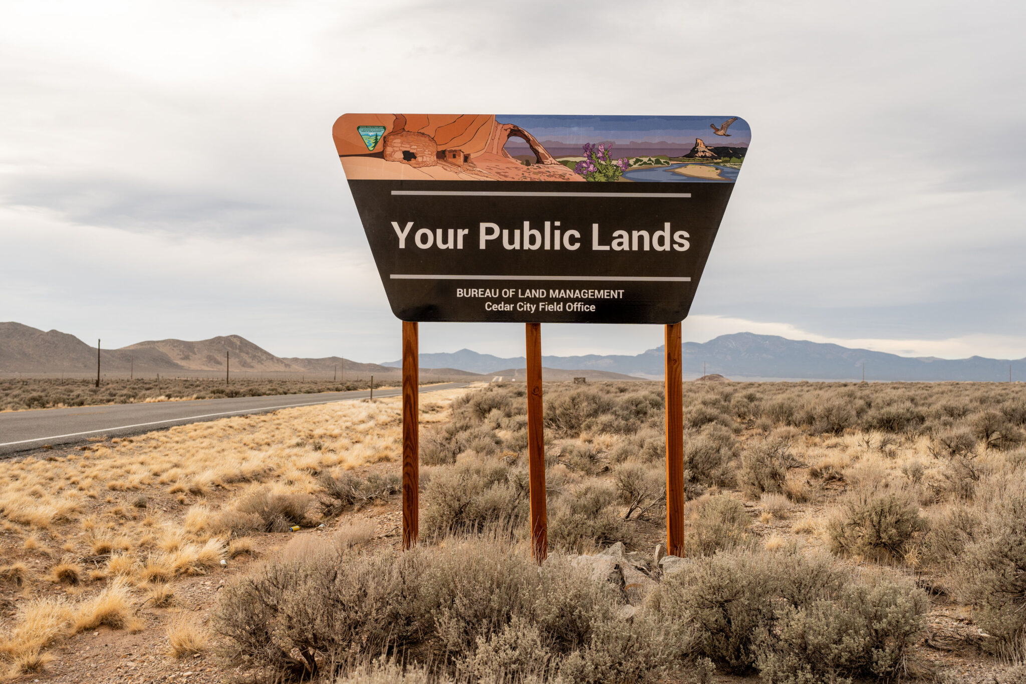
Click the link to read the article on the Utah News Dispatch website (Micah Drew):
December 4, 2025
Republicans are rallying around former New Mexico Rep. Steve Pearce, Trump’s nominee to oversee the land management agency
Conservation groups in Montana and across the West are raising concerns about Steve Pearce, a former New Mexico representative who is President Donald Trump’s newest nominee to lead the Bureau of Land Management.
The nomination has reignited a fight over the management of public lands which was highlighted during negotiations over Trump’s “One Big Beautiful Bill” due to proposed amendments to sell off federal land. The fight also spawned two new bipartisan caucuses in Congress, both co-chaired by Montanans, and predicated on public land access and management.
In Montana and the two Dakotas, the BLM manages more than 8.3 million acres of federal land. Nationwide, the BLM oversees 245 million acres of federal land, along with 700 million acres of subsurface rights for extraction and energy development, putting the position directly in the crosshairs of energy developers and outdoor industry groups.
According to the Center for Western Priorities, Pearce amassed a “lengthy anti-public lands record,” sponsoring bills to shrink national monuments and increase extraction on national forest land.
Many conservation groups are specifically honing in on Pearce’s long record of advocating to sell off federal lands, including sponsoring legislation in Congress to authorize land sales or exchanges with local governments.
In a letter to then-House Speaker John Boehner in 2012, Pearce wrote that of the federal lands located in the West, “most of it we do not even need.”
He proposed using land sales to reduce the deficit, similar to rhetoric heard earlier when Interior Secretary Doug Burgum equated federal lands to the nation’s “balance sheet.”
“We cannot afford to hand the keys to 245 million acres of our public lands over to someone who has spent his career trying to auction them off to the highest bidder,” Aubrey Bertram, staff attorney and federal policy director at Wild Montana, said. “Steve Pearce’s record is crystal clear: he believes public lands should be privatized for billionaires’ benefit, not protected for the people’s.”
But Pearce’s nomination has been greeted with enthusiasm by mining and energy companies that operate on federal land, as well as by many Republican officials, including Montana Sen. Steve Daines.
“I knew Steve in the House days, and Steve is a great pick. And I particularly like the fact that it’s a Westerner,” Daines said in an interview. “I think it’s helpful when we have leaders in those important positions that come from the West, when they understand uniquely the challenges we face as it relates to federal land, state land, private land. And Steve Pearce has lived it and breathed it.”
Daines is a member of the newly formed Senate Stewardship Caucus, which is co-chaired by Montana Sen. Tim Sheehy.
The two Montanans also bucked their party earlier this year by joining Senate Democrats in a resolution that would have prevented the use of public land sales to reduce the deficit.
Representatives for Daines and Sheehy did not respond to questions about Pearce’s nomination.
Sheehy has not publicly stated whether he will support Pearce.
But Montana’s federal delegation has been supportive of increasing coal and energy extraction in the state.
In eastern Montana, Congress recently voted to overturn a Biden-era restriction on resource extraction on federal land, reopening nearly 1.7 million acres to future coal leasing.
All members of the state’s delegation supported the move calling it vital to the state’s economy and the nation’s energy security.
Pearce has roots in the oil and gas industry that stretch beyond his political work.
In the 1980s, Pearce founded an oilfield services company in New Mexico, which he later sold when he won his first election.
Starting in 2003, he represented New Mexico in Congress for seven terms.
He lost races for the U.S. Senate in 2008 and governor in 2018.
While conservation and public land advocates have pushed back against Pearce’s nomination, industry groups have applauded Trump’s pick.
The National Cattleman’s Beef Association said Pearce’s experience makes him “thoroughly qualified to lead the BLM and tackle the issues federal lands ranchers are facing.”
The Western Energy Alliance, comprising oil and gas companies across nine western states, also put out a statement of support for Pearce.
“As a westerner coming from a state that’s nearly 20 percent BLM land, he understands the bureau’s mission. As a former congressman and chair of the Congressional Western Caucus, his record shows he’s been a champion of multiple-uses of public lands. Steve has been a longtime friend who understands the value of energy development among other uses,” the Alliance said.
This story was originally produced by Daily Montanan, which is part of States Newsroom, a nonprofit news network which includes Utah News Dispatch, and is supported by grants and a coalition of donors as a 501c(3) public charity.

Click the link to read the article on the Big Pivots website (Allen Best):
December 2, 2025
Changing a name is simple enough, if somewhat expensive and time-consuming, at least in the case of businesses.
But what to make of the National Renewable Energy Laboratory’s new name? Is the change all bad for the laboratory and for its mission of the last 34 years?
It became National Laboratory of the Rockies as of Monday. It had been known as NREL since 1991 and before that had been the Solar Energy Research Institute since its founding in 1977 during the presidency of Jimmy Carter.
The laboratory has become one of the nation’s — and perhaps the world’s — seminal institutions devoted to engineering an energy transition. As of October, it had 3,717 employees after a reduction of 114 during May.
“Clearly an effort is underway (by President Donald Trump)‚ to downplay renewable energy as a premier, viable energy source in the United States. So it is hard to separate the politics from this given the timing,” said David Renee, who worked at the laboratory from 1991 until his recent retirement.
Renee said that in part he was very disappointed to see the words “renewable energy” deleted from the name but does see the new name allowing the institution to broaden its mission to reflect needs of the ever-more-complex electrical grid.
“I can see some good, long-term benefits from this. It gives the laboratory flexibility to have a broader scope,” he said. “A lot of the work is not exclusively related to renewable energy but more related to grid reliability and expansion, of which renewables play an important part. So one could argue that the name change was overdue anyway in order to be consistent with other national laboratories, which are mostly named for their locations and not the technology.”
The United States has 17 national laboratories engaged in energy and other research, and most are named for their local geographies. New Mexico, for example, has the Sandia and Los Alamos labs, the former named for a mountain range and the latter a town. Renee arrived in Golden from the Pacific Northwest National Laboratory and retired after running the solar resource assessment program.
Ron Larson, one of the earliest employees of the solar institute who arrived in 1977, a time when solar was 100 times more expensive than it is now, also tends toward a charitable view of the name change.
A possible reason, and a valid one, he said, could be that other national labs wanted more to do on renewable energy topics and are qualified to do so. “Too, maybe some at NREL have wanted to expand into other sectors, including fossil fuels and nuclear.”
See: “Jimmy Carter’s overlooked Colorado nexus” Big Pivots, Jan. 2, 2025.
Peter Lilienthal, an NREL employee from 1990 to 2007, when he formed an energy-related business, was less charitable. He was incensed by a statement from Audrey Robertson, the assistant secretary of energy, in Monday’s announcement.
“The energy crisis we face today is unlike the crisis that gave rise to NREL,” Robertson said. “We are no longer picking and choosing energy sources. Our highest priority is to invest in the scientific capabilities that will restore American manufacturing, drive down costs, and help this country meet its soaring energy demand. The National Lab of the Rockies will play a vital role in those efforts.”
Lilienthal called that statement gaslighting. “That is just not true,” he said of Robertson’s assertion about no longer picking energy sources. He points to the promises of President Donald Trump on the campaign trail and elsewhere to restore fossil fuels and discourage renewable energy. This, he said, will slow the energy transition away from fossil fuels, he believes.
Jud Virden, the director of the renamed laboratory since October, said the new name “embraces a broader applied energy mission entrusted to us by the Department of Energy to deliver a more affordable and secure energy future for all.”
That statement clearly fits in with the narrative of Chris Wright, the Colorado-born director of the Department of Energy. A graduate of Cherry Creek High School, in south Denver, Wright was a rock climber and skier before going to the Massachusetts Institute of Technology to study engineering, first mechanical and then electrical. He also later studied at the University of California at Berkeley.
In April, Wright returned to Colorado to tour NREL. Afterward, he met with reporters, where he said that he had worked on solar energy during graduate school and then geothermal. Only later, needing a paycheck, did he begin work in the oil and gas industry. In Denver, he founded Liberty, an oil and gas field services company, in 2011.
In his remarks, Wright did not dismiss renewable energy, but he did — as he had done before — dismiss “climate alarmism.” He said the science does not support the perception of risk that has, in part, driven the work to make renewable energy affordable and integrated into the electrical grid.
Wright sees the need for more energy being paramount and climate change worries a hindrance to archiving that plentitude that will result in higher standards of living.
“The biggest barrier to energy development the last few decades is people, for political reasons, calling climate change a crisis,” he claimed.
He went on to cite 3 million people dying every year because they don’t have clean cooking fuels or the 4 or 5 million people dying because they don’t have sufficient food as well as the disconnect notices to American consumers for non-payment.
“If you call climate change a crisis and you don’t look at any data, you can pass laws to do anything.

In an essay published in The Economist in July, Wright said much the same thing.
See: “Climate change is a product of progress, not an existential crisis.”
Wright also talked about the need to deliver plentiful energy and lowering energy prices. He talked about the drive to integrate artificial intelligence data centers into the U.S. economy.
“Artificial Intelligence is critical. This is a phenomenal new technology. People are seeing the great consumer services it provides, the business efficiencies it provides, and we are very early on.”
And again, he talked about the need to expand electrical production as necessary to support artificial intelligence. Even without strong demand for data centers, he said, electricity prices have been rising.
“We’ve seen 20 to 25% rise in the price of electricity over the last four years. Americans are mad and angry and upset about that, which is why they’re all worried about AI — ‘No, we don’t want new demand on our grid that’s just going to make our prices more expensive.’ — We need to show them we can walk and chew gum at the same time. We’ve got to grow our electricity production capacity without raising the prices to consumers, and we’ve got to keep our grid stable, not just the complicated system stable, but the increasing cyber threats of people that want to do us harm on our grid.”
Chuck Kutscher took a broad view of the change. A mechanical engineer by training, he began working at NREL in the 1980s before retiring in 2018.
“NREL is widely viewed as the leading renewable energy laboratory in the world. In the U.S. and throughout the world, solar and wind dominate the new electricity generation being deployed because they are now the lowest in cost and are also the fastest to deploy, in addition to avoiding air pollution and greenhouse gas emissions. China is clearly the world leader in renewable energy development and deployment, but NREL has played a critical role in keeping the U.S. competitive,” he said in a statement.
“As a Department of Energy lab, NREL takes direction from DOE. The current administration made it clear in the last election that it would support fossil fuels. DOE does have a lab that focuses primarily on fossil fuels, the National Energy Technology Lab, so continuing to have a lab that performs R&D on renewables makes perfect sense, especially given the transition to renewable energy happening around the world. I’m sure the new lab director is working hard to preserve NREL’s tremendous expertise and important work in renewable energy while at the same time being responsive to DOE directives to strengthen the lab’s portfolio in areas such as AI and data centers.”
Click the link to read the article on the Center for Colorado River Studies website (Jack Schmidt):
In Brief
Unusually wet conditions in the Basin in October and November 2025, combined with reduced releases from some reservoirs, led to a basin-wide increase in storage for the two-month period. The combined contents of Lake Powell and Lake Mead increased during the two months for only the second time since 2010, and storage in the San Juan River basin increased by 19%, especially in Vallecito and Navajo Reservoirs. These changes were a welcome respite from the relentless depletion of storage that has dominated the last few years. Nevertheless, the upcoming winter snow season is predicted to be below average, and total active storage in the Basin is less than a 2 year supply when compared with recent Basin-wide consumptive uses and losses.
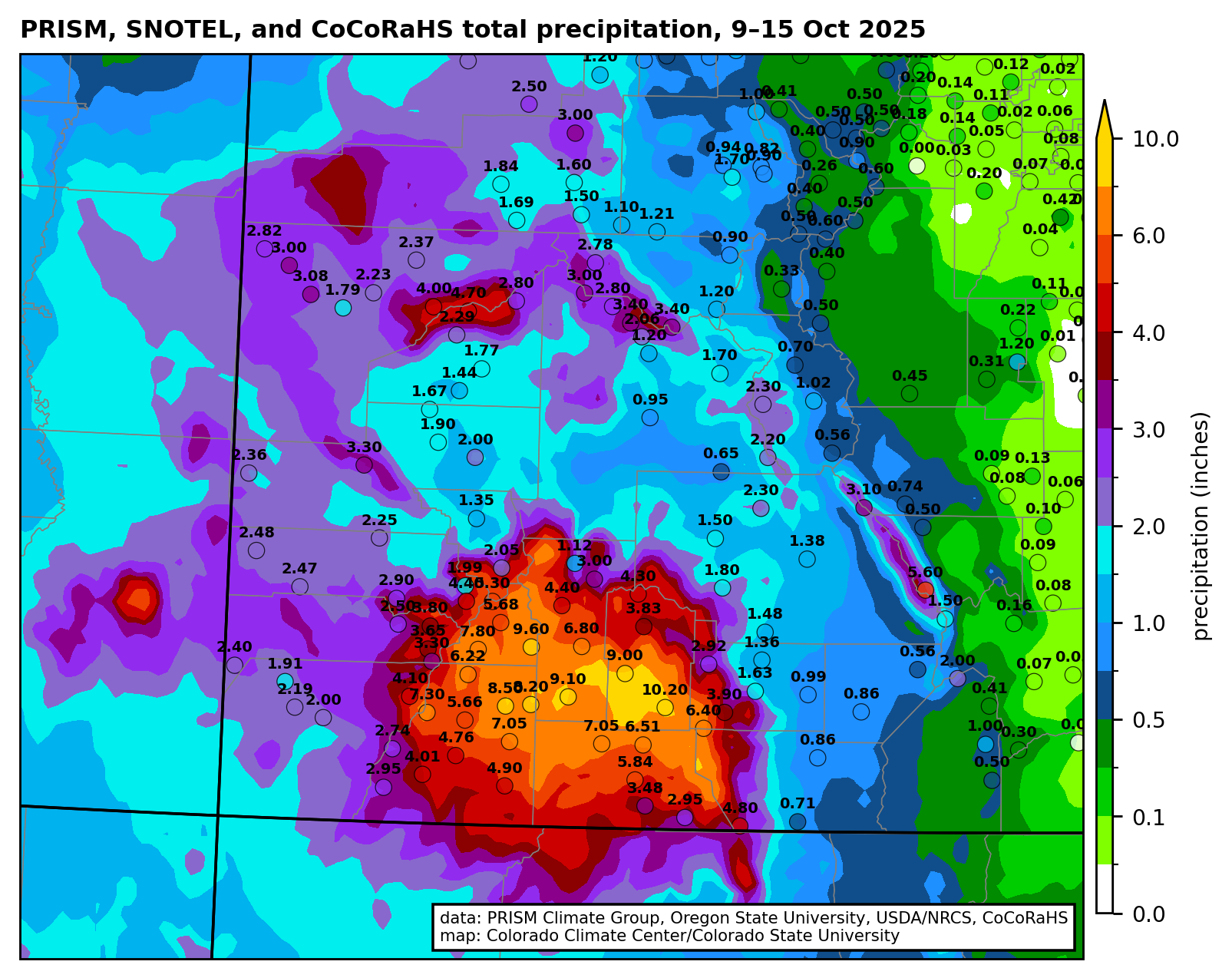
The Details
The rains of October and November 2025 slowed depletion of the Colorado River’s reservoirs due to increases in stream flow and reduced reservoir releases in some places. Water levels rose in a few reservoirs, and autumn’s rains provided a small bit of flexibility for water managers at the beginning of what is likely to be a below-average winter snow season.
As of November 30, the Basin’s 46 reservoirs held 24.63 million af (acre feet) of active storage[1], of which 90% was in 12 federal reservoirs,[2] including 15.00 million af in Lake Powell and Lake Mead (hereafter, Powell+Mead) and 4.88 million af in 8 federal reservoirs upstream from Lake Powell (Fig.1). This amount of storage is similar to conditions in early 2022, a situation that was described at that time as a crisis. If we divide the total active storage in the Basin’s 46 reservoirs by the basin-wide total annual rate of consumptive use and loss that was 12.7 million af in 2024, the basin-wide reservoir water supply would sustain Basin-wide use for less than 2 years. We continue to live at the doorstep of crisis.

Basin-wide reservoir storage stabilized in October and November, because Powell+Mead storage stabilized and storage in the San Juan River basin increased. Total Inflow to Lake Powell exceeded releases for more than one week between October 11 and October 18, when Lake Powell increased by 105,000 af[3] which is a 1.6% gain (Fig. 2). Approximately 40% of the total inflow came from the San Juan River, and the monthly October inflows were the largest since 2015. The gain in storage in Lake Powell during this weeklong period exceeded depletions during the rest of the month, and Lake Powell gained approximately 52,000 af during the month. Lake Powell lost 147,000 af in November.
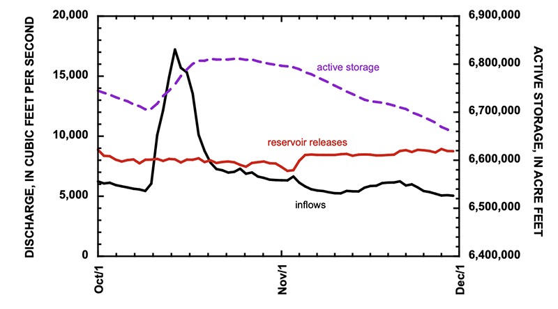
In contrast, the autumn rains did not significantly increase inflow to Lake Mead, because most of the inflows come from scheduled releases from Lake Powell. These reservoir releases were supplemented by 101,000 af of inflows downstream from Lees Ferry[4] and 8000 af from the Virgin River.[5] The most significant changes in Lake Mead occurred at the end of November when releases from Hoover Dam were significantly reduced (Fig. 3).

Together, total active storage in Powell+Mead increased by 63,000 af during October,[6] and decreased by only 38,000 af in November (Fig. 4).[7] More significant than the gains, however, was that the the pace of reservoir depletion was significantly slowed. Storage in Powell+Mead increased by approximately 25,000 af in October and November, only the second time since 2010 that total storage in these two reservoirs increased during these two months.[8]

Reservoir storage in the San Juan River basin increased more than in any other part of the Colorado River Basin. Five San Juan basin reservoirs increased by 197,000 af in October and November, mostly in Navajo and Vallecito Reservoirs.[9] Not much happened elsewhere, however. The 21 reservoirs of the upper Colorado River watershed lost 57,000 af during October and November, and 16 reservoirs in the Green River watershed lost 10,000 af during the same period.
- [1] Active storage in 46 reservoirs are reported by Reclamation at https://www.usbr.gov/uc/water/hydrodata/reservoir_data/site_map.html.
- [2] Taylor Park, Blue Mesa, Morrow Point, Crystal, Fontenelle, Flaming Gorge, Vallecito, Navajo, Lake Powell, Lake Mead, Lake Mohave, and Lake Havasu.
- [3] Inflow to Lake Powell was computed as the sum of mean daily discharge of the Colorado River at Gypsum Canyon near Hite (gage 09328960), Dirty Devil River above Poison Springs near Hanksville (09333500), Escalante River near Escalante (09337500), and San Juan River near Bluff (09379500), as reported by the U.S. Geological Survey. Outflow from Lake Powell was computed as the mean daily discharge of the Colorado River at Lees Ferry (09380000), because stream flow is measured 15 miles downstream from the dam and includes ground-water seepage around the dam. Lake Powell storage increased between October 10 and October 20, as reported by Reclamation.
- [4] Inflows within Grand Canyon were calculated as the difference between measurements of the Colorado River at Lees Ferry (09380000), Colorado River above Diamond Creek near Peach Springs (09420000), and Diamond Creek nr Peach Springs (09404208).
- [5] Virgin River below confluence Muddy River near Overton (09419530)
- [6] Between October 1 and November 1, 2025, active storage in Lake Powell increased 52,000 af and 11,000 af in Lake Mead.
- [7] Between November 1 and November 30, active storage in Lake Powell decreased by 147,000 af and increased by 109,000 af in Lake Mead.
- [8] During the previous 15 years between 2010 and 2024, total storage in Powell+Mead increased by 36,000 af in 2011. During the other 14 years of that period, the median depletion of Powell+Mead was 436,000 af.
- [9] Storage in Navajo Reservoir increased 126,000 af between October 9 and November 8 and increased by 114,000 af in October and November. Active storage in Vallecito Reservoir gained 68,000 af in October and November. At the end of November, Navajo Reservoir was 60% of its 1.65 million af capacity. Vallecito Reservoir was 77% of its 125,400 af capacity.


Click the link to read the article on the InkStain website (John Fleck):
December 3, 2025
Inspired by this morning’s Downtown Albuquerque News Climate and Transport Index (come for the bus boardings and river flow data, stay for the Shawarma restaurant news), I give you data, one of those “Science confirms the obvious, but with graphs!” things.
The overnight lows were 2.5F higher than the recent average. I wonder if that sensibly improves your quality of life if you’re sleeping rough?

Click on a thumbnail graphic to view a gallery of drought data from the US Drought Monitor website.
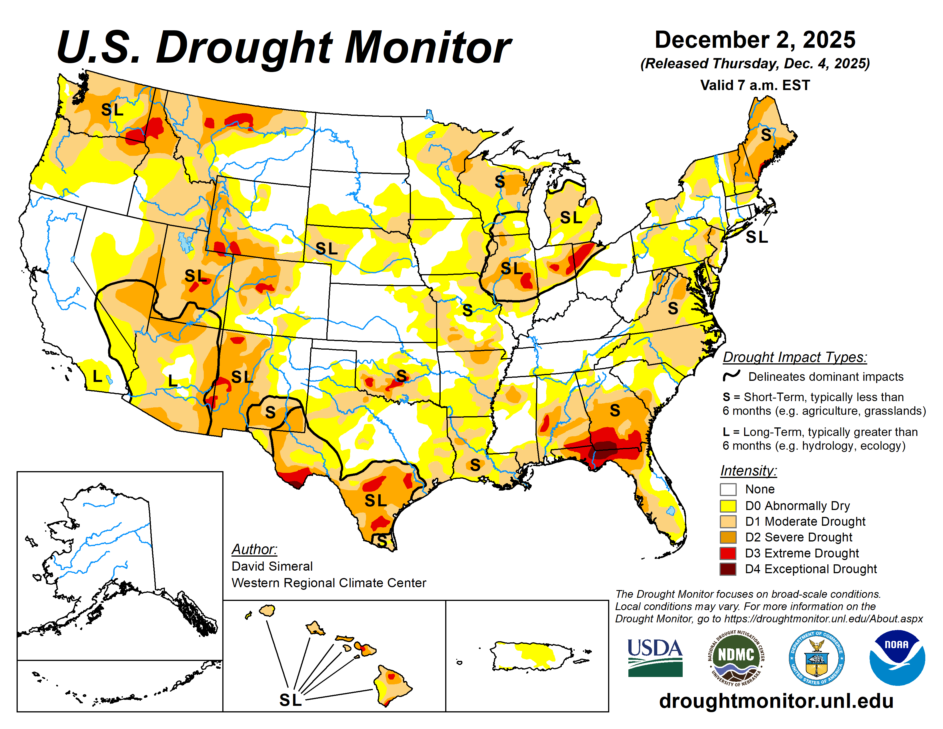

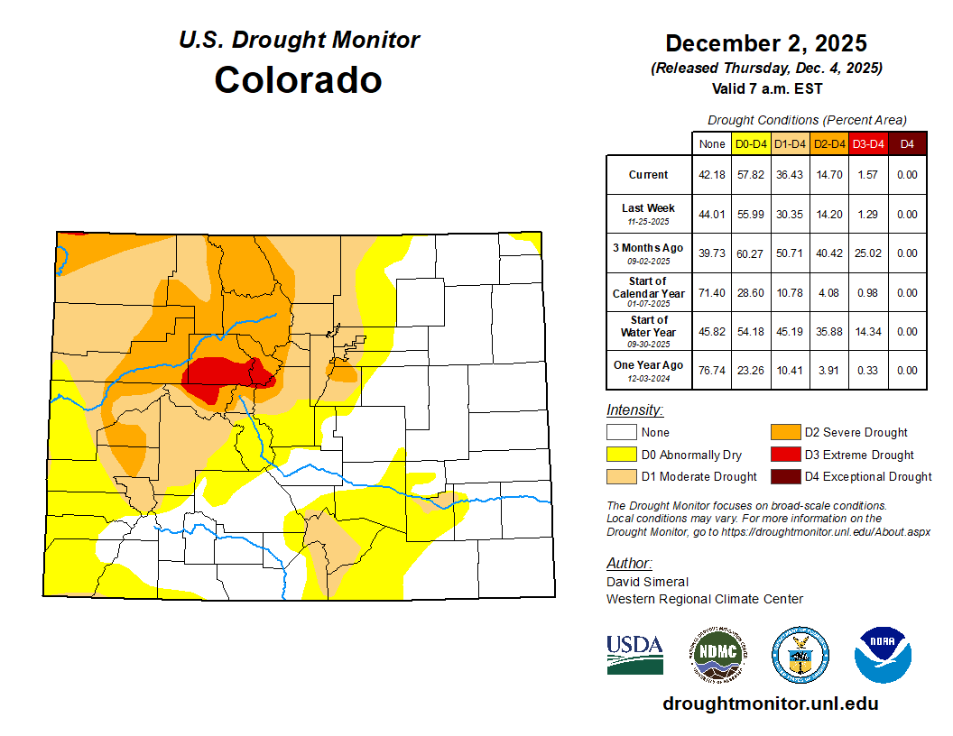
Click the link to go to the US Drought Monitor website. Here’s an excerpt:
This Week’s Drought Summary
This U.S. Drought Monitor (USDM) week saw improvement in drought-related conditions across areas of the West, Plains, Midwest, South, Southeast, and the Northeast. Out West, improvements continued in areas of eastern California and southern Nevada, where conditions since the beginning of the Water Year (October 1) have improved significantly. As of early December, mountain snowpack conditions continue to be well below normal levels for the time of year across much of the western U.S., except for isolated areas of the Southwest and southern Rockies, where recent storms have boosted snowpack conditions well above normal levels. As of December 2, the Natural Resources Conservation Service (NRCS) SNOw TELemetry (SNOTEL) network reported the following region-level (2-digit HUC) snow-water equivalent (SWE) levels: Pacific Northwest 43%, Missouri 47%, Upper Colorado 53%, Great Basin 39%, Lower Colorado 121%, Rio Grande 64%, and Arkansas-White-Red 53%. In California, the statewide snowpack was 39% of normal (December 3), with the Southern Sierra at 78%, Central Sierra at 36%, and Northern Sierra at 17%. Elsewhere on the map, conditions continued to improve in drought-affected areas of central and northeastern Texas, where precipitation during the past month has been above normal. In the Southeast, drought conditions have intensified in recent months, both in spatial extent and intensity, including in southern Georgia and Florida Panhandle where soil moisture and streamflow levels have dropped significantly in recent weeks. In the Northern Plains, Midwest, and Northeast, moderate-to-heavy snowfall accumulations provided some minor relief to drought-affected areas…
High Plains
On this week’s map, only minor changes were made in the region. In eastern Kansas, two areas of lingering Moderate Drought (D1) were removed in response to improving conditions during the past 90-day period. For the week, some beneficial snowfall was observed across the northern Plains, with accumulations ranging from 1 to 14 inches. The highest accumulations were logged in areas of North Dakota. In terms of average temperatures, cooler-than-normal temperatures (5 to 20+ degrees F below normal) were observed across the region, with the greatest anomalies observed in the Dakotas. According to NWS NOHRSC, the Upper Midwest region is currently 94.4% covered by snow (area) with an average depth of 3.7 inches and a maximum depth of 22.2 inches…
West
Out West, recent storms and overall improving conditions on short-term indicators (precipitation, soil moisture, streamflows) led to improvements on the map in California (eastern Sierra, Mojave Desert), Nevada (west-central, southern), Utah (southwestern), Wyoming (central, southwestern), Montana (northwestern, central, northeastern), and Washington (southeastern). Conversely, degradations were made on the map in areas of Oregon (central, southern), Idaho (west-central), Wyoming (southeastern), Colorado (central, north-central), and New Mexico (southeastern). For the week, most of the region experienced dry conditions except for portions of the Pacific Northwest and isolated areas in the central and northern Rockies. In the Pacific Northwest, light-to-moderate precipitation accumulations were observed along the coastal areas of northwestern Oregon and western Washington. Despite this week’s storm activity, significant precipitation deficits (2 to 10 inches since October 1) remain, with the greatest anomalies observed in the Olympic Peninsula and Cascade Range. In terms of the snowpack out West, below-normal SWE levels are being observed at SNOTEL stations across most of the West, except for areas in the southern Sierra, Colorado Plateau, and southwestern Colorado. In California, the NWS Forecast Office in Los Angeles is reporting that November was one of the wettest Novembers in the last 50+ years across southwestern California. Moreover, the city of Santa Barbara has reported the wettest water-year start on record through November with over 9.5 inches observed. Other areas in Santa Barbara County, including areas of the Santa Ynez Mountains, have received over 15 inches for the contemporaneous period…
South
On this week’s map, widespread improvements were made in drought-affected areas of Texas, while isolated areas of Oklahoma, Mississippi, Louisiana, and Tennessee saw minor improvements in response to rainfall activity during the past week. The heaviest rainfall accumulations were observed in isolated areas along the Gulf Coast of southeastern Texas, while lesser accumulations (ranging from 1 to 2 inches) were observed in other areas of the region including eastern and southern Texas, Louisiana, southeastern Oklahoma, southern Arkansas, northern Mississippi, and eastern Tennessee. In western Texas, conditions on the map deteriorated in response to drier-than-normal conditions during the past 90-day period. Looking at climatological rankings for the past 30-day period (November 2 to December 2), Austin, TX was 10th driest (-2.31-inch departure), College Station, TX 9th driest (-2.54 inches), New Orleans, LA 8th driest (-3.32 inches), Slidell, LA 2nd driest (-3.49 inches), and Hattiesburg, MS driest on record (-3.71 inches). In Texas, Water for Texas (December 3) reported statewide reservoirs at 74% full, with numerous reservoirs in the eastern part of the state in very good condition, while numerous reservoirs in the southern and western portion of the state were experiencing continued below-normal levels, including at Falcon Reservoir along the Rio Grande River (15.9% full). In terms of drought-related impacts, the National Drought Mitigation Center’s Conditions Monitoring Observer Reports (CMOR) tool showed numerous impact reports during the past 30-day period with the highest concentration of reports yielding from southern Oklahoma, northern Arkansas, and northern Louisiana. For the week, average temperatures were below normal across most the region with anomalies ranging from 4 to 10 degrees F above normal…

Looking Ahead
The NWS 7-day quantitative precipitation forecast calls for the heaviest rainfall (2 to 5 inches) to be along the central Gulf Coast, including southern Louisiana, southern Mississippi, southern Alabama, and the western Florida Panhandle, while 1 to 4 inches is expected in southern Georgia and areas of coastal South Carolina. The southern extent of the Mid-Atlantic coast is forecast to receive 1 to 3 inches, while New England is expected to have totals less than 1 inch. In the Pacific Northwest, 2 to 7+ inches (liquid) of precipitation is expected across western portions of Washington and Oregon, while the Northern Rockies—including northern Idaho, western Montana, and western Wyoming—are forecast to receive liquid totals ranging from 1 to 3 inches. These values represent liquid precipitation and may fall as rain or snow; actual snowfall amounts will vary depending on temperature and snow-to-liquid ratios. Meanwhile, much of the Intermountain West, Desert Southwest, and the central and southern Great Basin is expected to remain mostly dry, although northern portions of Utah and Colorado are forecasted to observe totals ranging from 0.25 to 2.0 inches. Across the Plains and Midwest, precipitation totals are expected to be less than 0.5 inch.
The 6–10-day temperature outlook (valid December 9 –13, 2025) calls for above-normal temperatures across the western U.S., much of the Plains, and Texas, with the highest probabilities centered over the Far West and Great Basin. Below-normal temperatures are favored across the eastern United States, with the highest probabilities in the Northeast and portions of the northern Mid-Atlantic and Great Lakes. Near-normal temperatures are expected across a narrow swath extending from the Lower Mississippi Valley through the eastern portions of the Dakotas. In terms of precipitation, the 6–10-day outlook calls for below-normal precipitation across the southern half of the continental United States, including California, Great Basin, southern half of the Intermountain West, South, and much of the Southeast. Above-normal precipitation is forecasted for much of the northern tier of the continental U.S., including the Pacific Northwest, Northern Plains, Upper Midwest, and the Northeast. Near-normal precipitation is expected across the Lower Midwest and southern Florida.
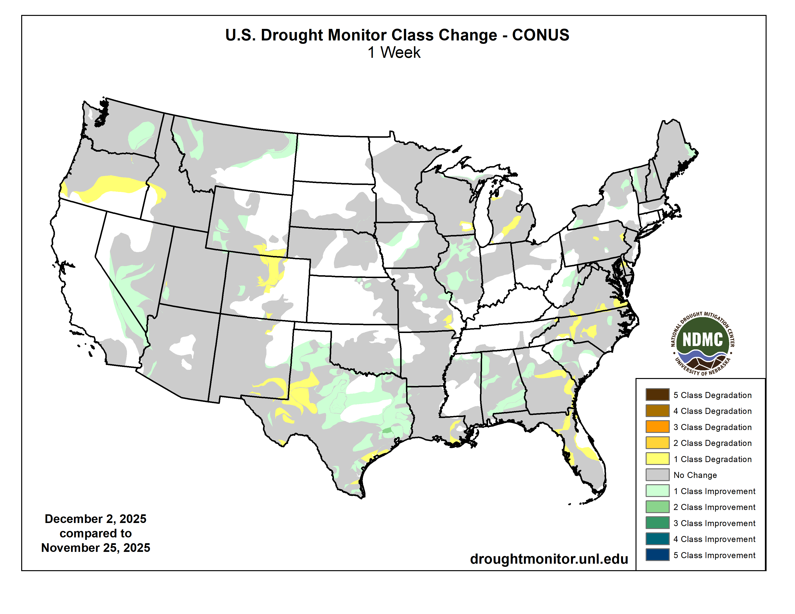
Just for grins here’s a slideshow of early December US Drought Monitor maps for the past few years.

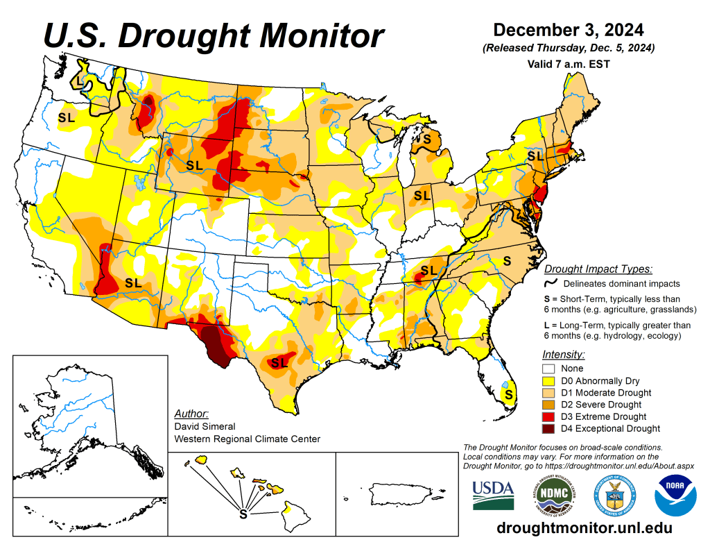
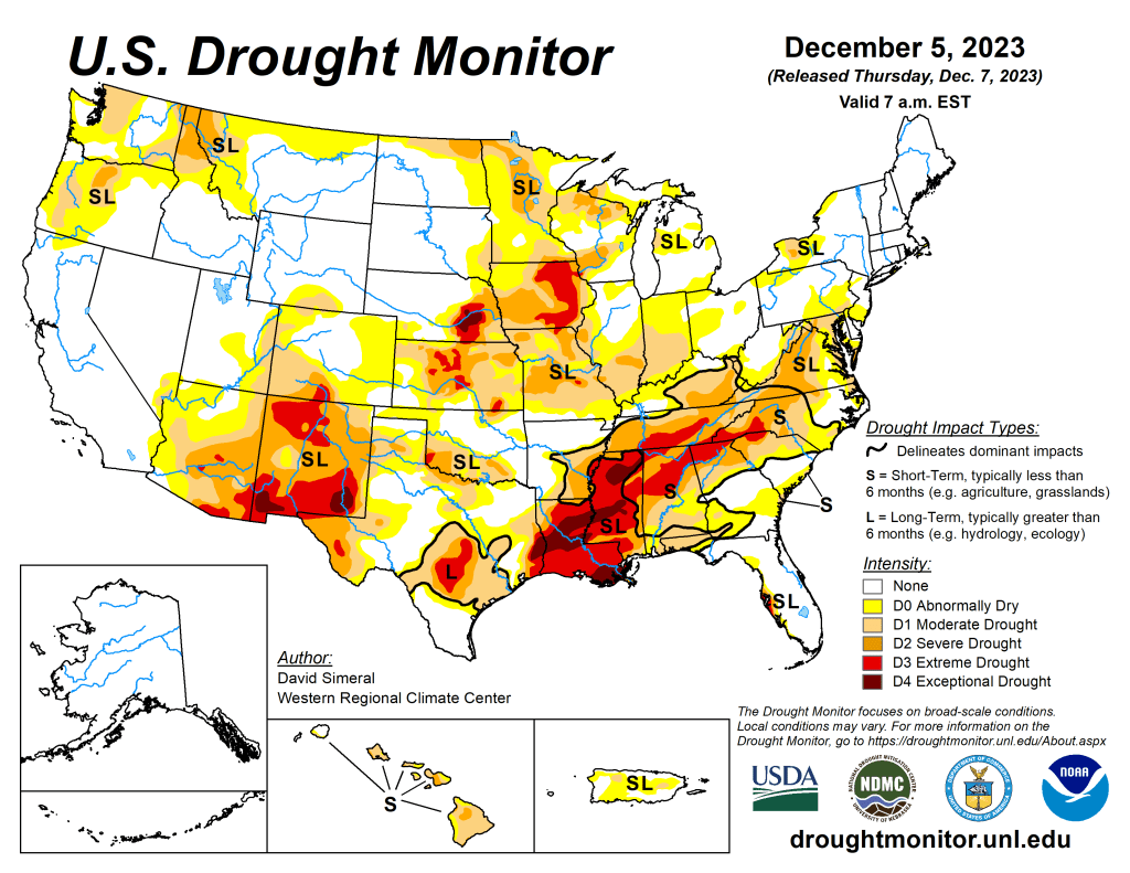
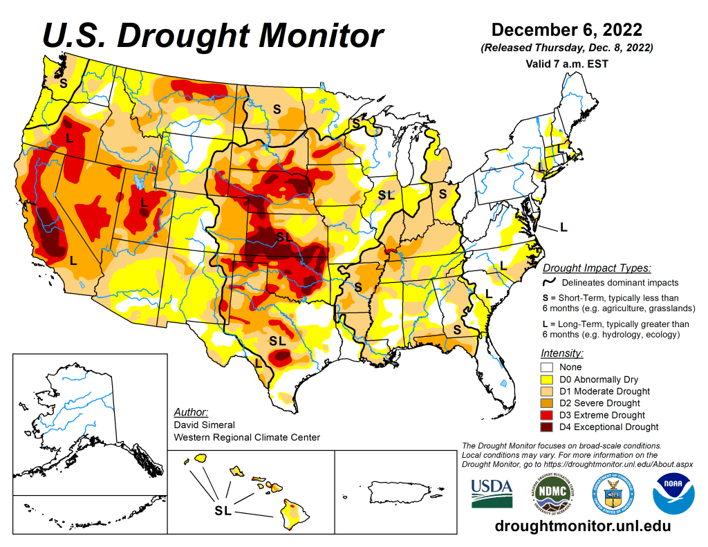

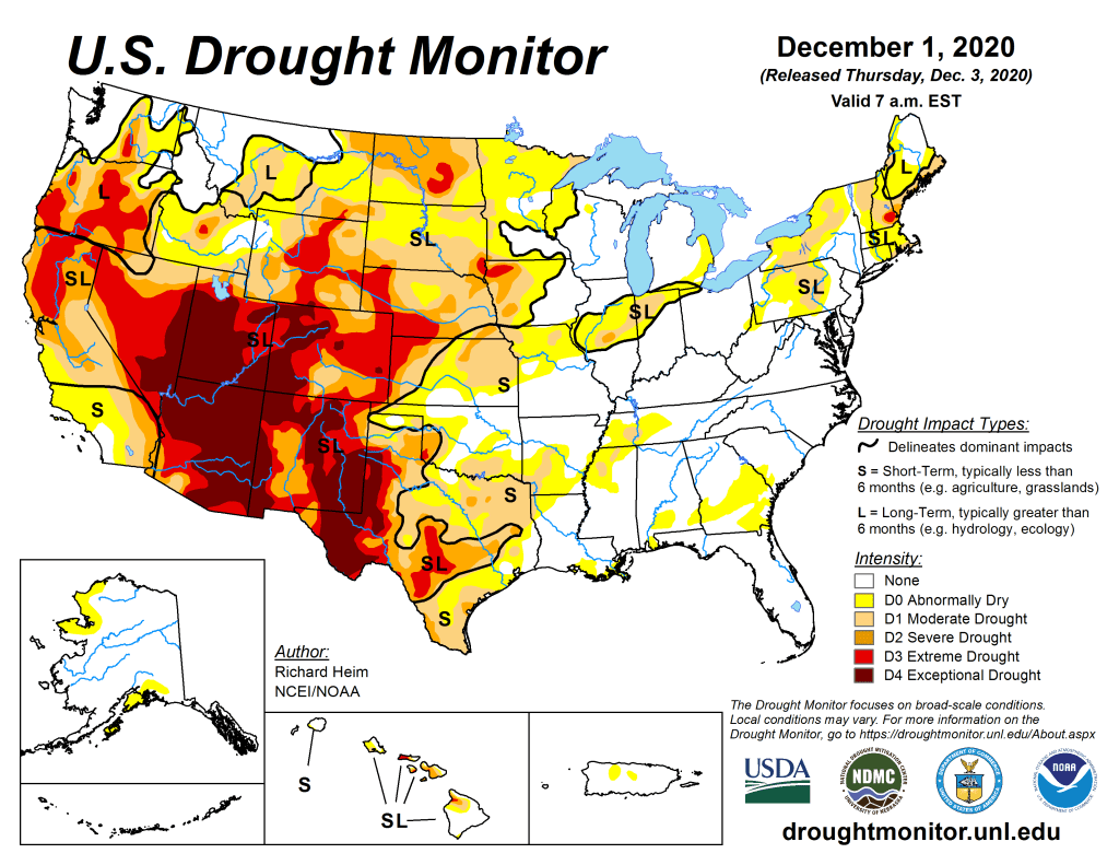

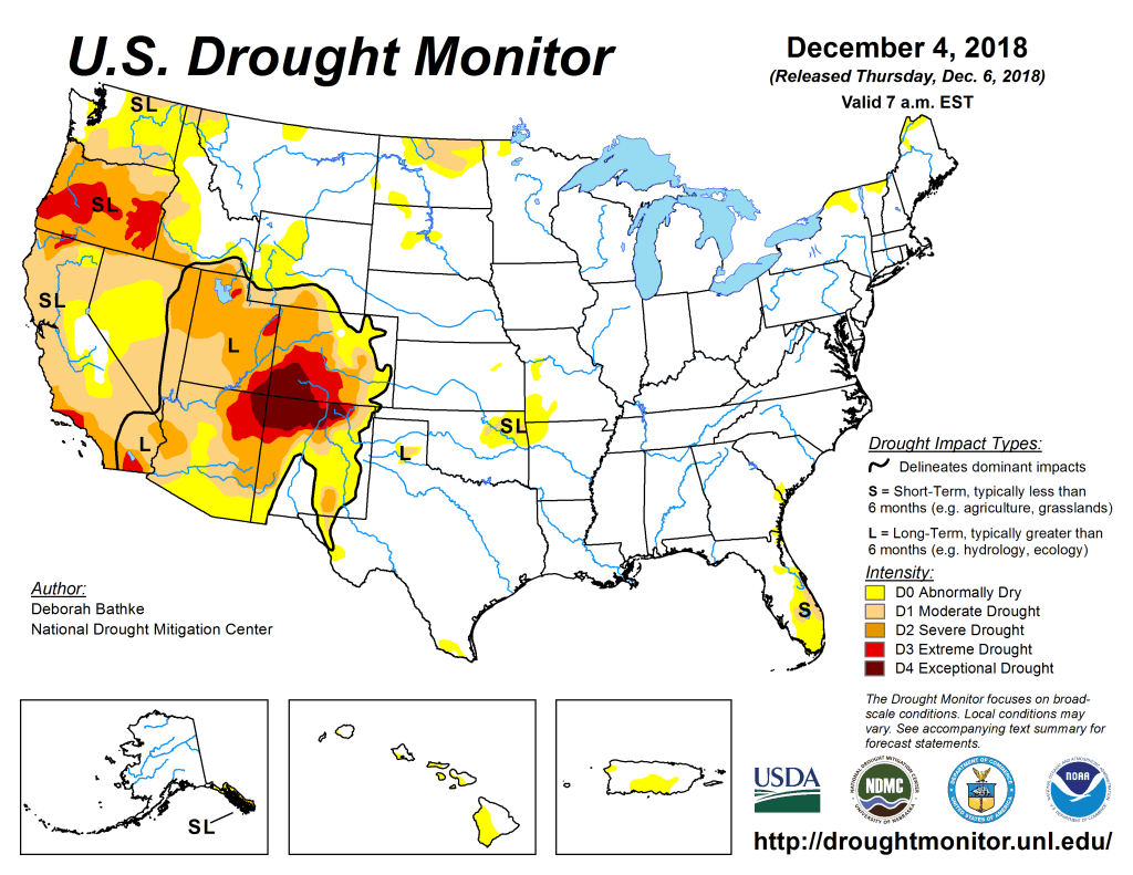
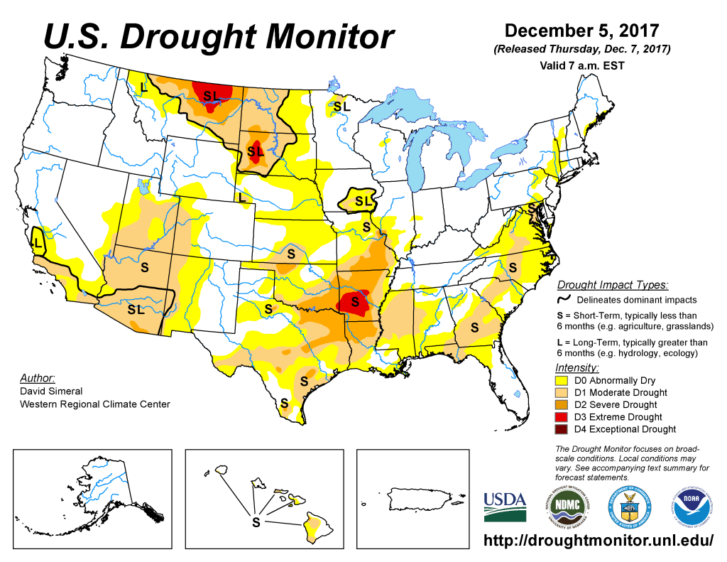

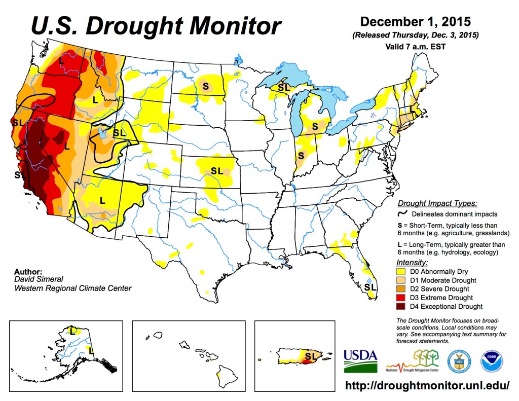
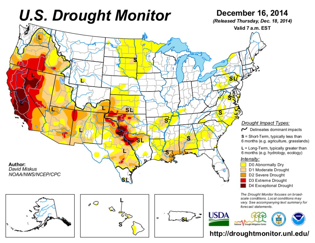
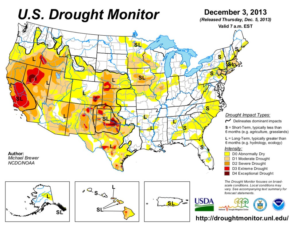


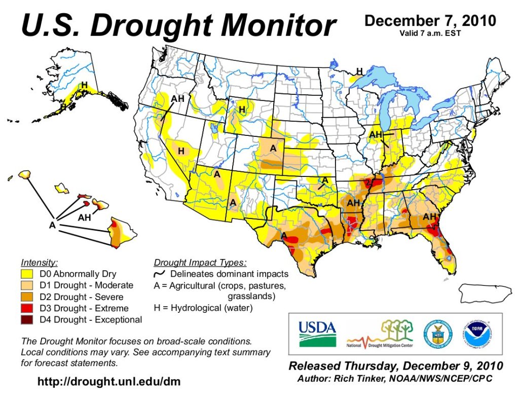
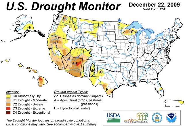
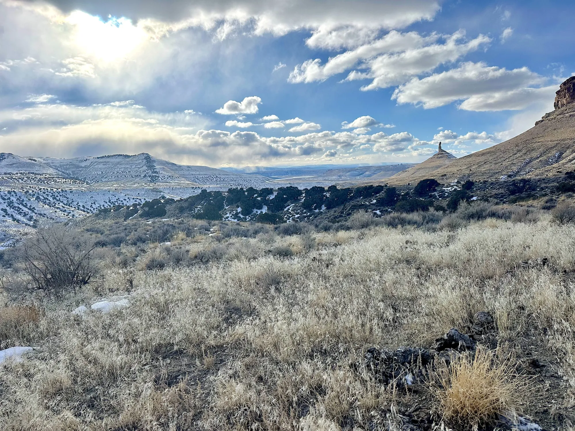
Click the link to read the article on the WyoFile website (Mike Koshmrl):
December 1, 2025
An all-hands-on-deck effort, tens of millions in funding and a breakthrough herbicide are slowing but not halting a destructive force steadily enveloping the best sagebrush left on Earth.
POWDER RIVER BASIN—Brian Mealor scanned the prairie east of Buffalo, but his mind drifted west to a haunting scene in northern Nevada.
In the burn scar of the Roosters Comb Fire, a single unwelcomed species had taken over, choking out all competitors. Mealor saw few native grasses or shrubs, scarcely a wildflower.
Not even other weeds.
“Literally everything you see is cheatgrass,” Mealor recalled of his June tour of the scar. “I just stood there, depressed.”

Mealor already knew plenty about the Eurasian species’ capacity to decimate North American ecosystems since he leads the University of Wyoming’s Institute for Managing Annual Grasses Invading Natural Ecosystems. But he was still shocked walking through the endless cheatgrass monoculture taking over the 220,000 once-charred acres northwest of Elko.
The same noxious species, he knew, is steadily spreading in Wyoming.
The ecological scourge made Silver State officials so desperate that they were planting another nonnative, forage kochia, because it competes with less nutritious cheatgrass and offers some nourishment for native wildlife, like mule deer.
“They’ll just die, because there’s nothing there,” Mealor said. “That’s why we have to do stuff. Because we could turn into that.”

Scientists, rangeland managers and state and county officials are doing everything in their power to prevent Wyoming from becoming another landscape lost to cheatgrass. There’s a powerful new herbicide that’s helping. And funds enabling the spraying of hundreds of thousands of acres are being secured and raised. Yet, Wyoming is still losing its cheatgrass fight, and ultimately far more resources are needed to turn it around.
“Let’s not kid ourselves,” said Bob Budd, executive director of the Wyoming Wildlife and Natural Resource Trust. “The magnitude of the need is utterly staggering. We’re talking hundreds of millions of dollars over the next decade. That’s daunting.”
Budd voiced that warning Tuesday while addressing a statewide group that focuses on bighorn sheep, which depend on seasonal ranges being invaded by cheatgrass. A recent study co-authored by Mealor underscores the need to act soon to protect Wyoming’s wildlife. UW researchers concluded that cheatgrass, which is only edible in spring, could cost northeast Wyoming’s already struggling mule deer half their current habitat in the next couple of decades.
On Nov. 6, the Sheridan-based professor joined fellow academics, biologists and volunteers on a field trip to a mixed-grass prairie. Like the Nevada burn scar, this was a Wyoming landscape on the mend from wildfire. In fact, it wasn’t a grassland until last year.
Before Aug. 21, 2024, the ground where they stood had been considered the best of what’s left of northeast Wyoming’s sagebrush biome.
Transformation
A lightning storm that sparked a conflagration abruptly ended that era. Over the course of two days, the House Draw Fire tore a 10-mile-wide, almost 60-mile-long gash into the landscape, inflicting over $25 million in damage. In a fiery blink, the native plant community mostly disappeared.
Once-prized sagebrush within roughly 100,000 acres of the burn area is basically gone, a worrisome loss of habitat for the region’s already struggling sage grouse. What grew back isn’t a monoculture, like in Nevada. Native species are easily found. But portions of the Powder River Basin’s rolling hills are now dominated by big densities of cheatgrass and Japanese brome, another invasive annual grass. Without mature sagebrush shrubs to compete with, there’s reason to believe the invaders, which flourish with fire, will expand their grip.
“It’s not like you have a fire and all of a sudden you’re just completely covered with cheatgrass,” Mealor said. “There’s a lag.”

The Johnson County Natural Habitat Restoration Team is throwing everything it can at the fire scar to try to prevent invasive grasses from taking over. Armed with $12 million in state funds, crews will aerially spray some 120,000 acres with a cheatgrass-killing herbicide. Aerial sagebrush seeding is also underway on 3,000 acres of burned-up sage grouse nesting habitat. And there are even funded plans to build hundreds of simple erosion-controlling Zeedyk structures to protect the wet meadows within the fire scar.
Yet, on a broader scale, Mealor is a realist about the immense challenge of keeping cheatgrass and its noxious counterparts at bay in Wyoming, let alone enabling sagebrush to stage a comeback — a costly, complicated feat.
“If we were talking about a 25,000-acre fire here and there,” Mealor said, “it would be a little different.”
About a half-million acres of northeastern Wyoming burned in 2024, the state’s second-largest fire year in modern history. Wyoming lawmakers agreed to carve out $49 million for wildfire recovery grants statewide, less than half of Gov. Mark Gordon’s requested amount. Optimistically, Mealor said, the awarded sum might be enough to treat a million acres. That sounds significant — it’s half the acreage of Yellowstone. But cheatgrass is spreading just about everywhere in a state that spans 62 million acres.

“If you think about it from a statewide level, it’s not a lot,” Mealor said of the funding. “That’s not an attack. I’m not downplaying the importance of the money that was set aside by the Legislature for this. It’s a lot of money. But it’s also not enough.”
The governor, who’s a rancher by trade, has voiced the same concern. Pushing for $20 million in cheatgrass spraying funds during the Legislature’s 2024 budget-making process, Gordon acknowledged Wyoming is “losing the battle” against invasive annual grasses. Lawmakers ultimately agreed to $9 million, less than half the requested amount, according to the budget.
‘Best of the best’
The incursions that cheatgrass, Japanese brome and fellow invasives medusahead and ventenata are making into Wyoming rangelands are significant because of what’s at stake. The Equality State is the cornerstone of what remains of the sagebrush-steppe biome, a 13-state ecosystem vanishing at a rate of 1 million-plus acres per year.
“Half of the best of the best is in Wyoming,” said Corinna Riginos, who directs the Wyoming science program for The Nature Conservancy.
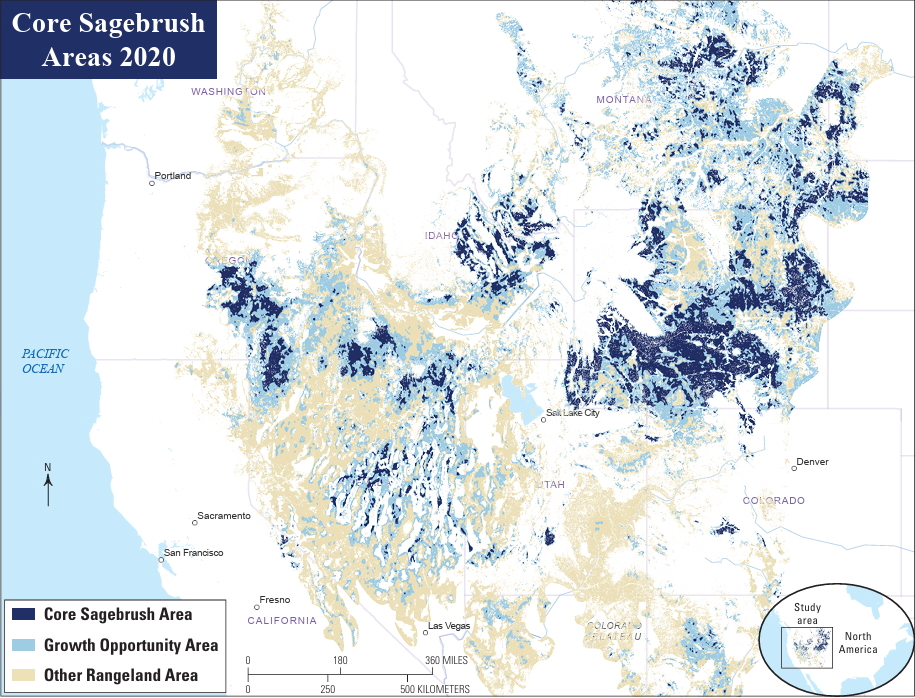
The Lander-based scientist is spearheading a Camp Monaco Prize-winning project that seeks to safeguard the Greater Yellowstone Ecosystem from cheatgrass. The flanks of the ecosystem, such as the Golden Triangle, southwest of the Wind River Range, contain some of the most expansive unbroken tracts of sagebrush remaining on Earth. Distribution maps show that almost all of those areas are in Wyoming. It’s no coincidence that the same places also host remarkable biological phenomena, like the world’s largest sage grouse lek and longest mule deer migration.
Riginos’ research is focused on defensive measures to catch and kill cheatgrass early on, when it exists at low levels. Keeping the invasion out of core tracts of sagebrush, she said, is a more efficient use of funds than trying to shift heavily contaminated landscapes back to what they used to be.
“Maybe we live with what they are, we cope with it, rather than trying to recover from it,” Riginos said of cheatgrass-dominated areas.
Within Wyoming, invasive grass experts don’t have to go far from the world’s most unsullied sagebrush stands to find heavily infested landscapes. In June 2024, Riginos toured cheatgrass treatments in the Wind River Indian Reservation’s Washakie Park area. Although they stood about 40 straight-line miles from the Golden Triangle, scientists, wildlife managers and weed experts on the tour were surrounded by hillsides purple-hued from cheatgrass.
“You have to respect it, as an organism,” Riginos said. “The adaptability and just kind of sheer ability to get a toehold and take over is pretty remarkable.”
Cheatgrass gets its name from its ability to “cheat” surrounding vegetation out of moisture and nutrients. Its mechanism for success is essentially a head start. It germinates in the fall and starts growing in cold temperatures. Then it overwinters, matures, throws off prolific amounts of seeds and dies by midsummer when native grasses and forbs are much earlier in their life cycle.

On top of the advantageous life cycle, the West’s ever-increasing, climate-driven wildfires help cheatgrass flourish. When a cheatgrass-infested area burns and becomes more cheatgrass dominant, it’s more prone to burn again, creating a vicious feedback loop.
Giving cheatgrass yet another advantage, research has shown the plant in North America adapts well to different locales. That trait enables it to flourish in a wide range of temperatures and moisture conditions across the West, Riginos said.
“I don’t want to see the West become a wasteland of cheatgrass, I really don’t,” she said. “I feel that this is the most existential, sweeping threat to our western ecosystems. It really concerns me.”
Closing in
All those traits have enabled an impressive, though foreboding, expansion. Since its introduction from Europe in the 1800s, cheatgrass has spread to all 50 states and parts of Canada and Mexico. There are signs it’s not slowing down. Rangeland ecologists have detected an eightfold increase in cheatgrass across the Great Basin since the 1990s, according to the National Wildlife Federation.
Simultaneously, sagebrush-dominated landscapes have sustained a decline. A 2022 U.S. Geological Survey reportfound that an average of 1.3 million acres are being lost or degraded every year. That’s an area larger than Rhode Island.
Although the spread of Wyoming cheatgrass hasn’t been as overwhelming as in lower-elevation, drier western states, the invasion has, and continues to be, successful. A whitepaper distributed by the Wyoming Outdoor Council in the state Capitol during the 2024 funding fight reported that invasive annual grasses already affect 26% of the Equality State’s landmass, which pencils out to over 16 million acres.

Historically, Wyoming land managers believed that much of the nation’s least-populated state was too high and too cold for cheatgrass to gain much ground. But the climate has tilted in its favor, according to Jeanne Chambers, an emeritus U.S. Forest Service research ecologist who has studied cheatgrass for decades.
“Cooler temperatures, especially those cold nighttime temperatures, used to keep cheatgrass at bay,” Chambers said. “But now that things are warming up and people and livestock and animals are all over the place, the propagules — the seeds — are getting everywhere.”
As a result, slightly lower-elevation reaches of Wyoming, like the Bighorn Basin, are seeing more and more cheatgrass, she said. The same goes for where the salt desert transitions into sagebrush in the state’s southwestern corner.
“Those areas are pretty vulnerable,” Chambers said.
Wyoming specialists in those communities corroborate the claims.
“Cheatgrass is moving into our county, primarily on the south end — but it’s not exclusive to the south end,” Sweetwater County Weed and Pest Supervisor Dan Madson said. “There are hot spots throughout the county invading mule deer, antelope and elk habitats, as well as sage grouse core areas.”
Some of the encroachments are well north into the Green River Basin and Red Desert, noted sagebrush strongholds. North of Rock Springs, north of Superior and in the Seedskadee National Wildlife Refuge are all places being actively invaded, Madson said.
Sweetwater County is scaling up its response, Madson said. The county is spending about $750,000 to spray nearly 12,000 acres of cheatgrass this year and plans to treat more like 15,000 acres in 2026.
But money is a limiting factor. Wyoming landscapes have been the recipient of many millions of federal dollars, including from the Inflation Reduction Act and Bipartisan Infrastructure Law, which have complemented the state’s contributions.
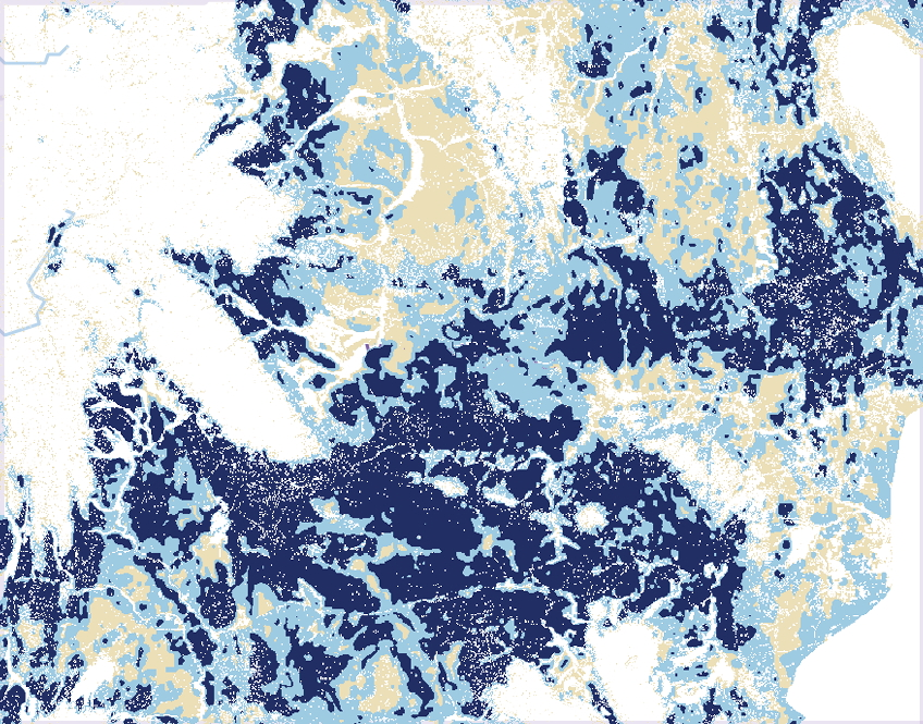
Still, the pace of infestation statewide and in Sweetwater County far exceeds the total resources available.
“We could easily, easily triple that [15,000 acres] in a year,” Madson said, “and still have enough to do for the rest of my career.”
Funding issues aren’t only due to federal government turmoil. One potential pot of $11 million that would have been directed toward spraying evaporated when the Wyoming Senate opted to forgo a supplemental budget.
“That money got lost,” said Budd, at the Wyoming Wildlife and Natural Resource Trust. “It actually hurt some parts of the state that were doing a very good proactive job, managing to keep cheatgrass down.”
‘Defending the core’
The upper Green River Basin is one example of a landscape where cheatgrass advances have been reversed. Its remoteness, harsh climate and high elevation helped, but those factors alone didn’t prevent a slow incursion of the virulent vegetation early in the century. By 2014, for example, hues of red and purple — hallmarks of cheatgrass — were painting the ridges rising over Boulder Lake.
The Sublette County Weed and Pest District fought the invasion with repeated treatments. In 2018 alone, some 30,000 acres of the western front of the Winds were aerially sprayed. It worked.
By the summer 2020, no cheatgrass was being detected at Boulder Lake, once a hotspot, District Supervisor Julie Kraft said. Nowadays, she said, no major problem areas remain in Sublette County.
Kraft even felt “good” about the future of her cheatgrass fight, expressing uncommon optimism for those grappling with an organism overtaking so many places.
“A couple of years ago, I might not have said the same thing,” Kraft said. “But with this new tool, and particularly because of the influx of money that came [during] the [Biden] administration, it allowed us to do so much more.”
That new tool is an herbicide, Indaziflam. It’s a product, also known by its trade name, Rejuvra, that provides far more enduring protection against cheatgrass than any previous chemical treatment. It works by attacking the seedbank and shallow root structure of cheatgrass, while not infiltrating the soil deep enough to kill perennial native grasses and plants like sagebrush.
“It depletes it down until there won’t be a seedbank of cheatgrass anymore,” Kraft said. “We’ve seen that on our sites. Year one, you can go out and grab handfuls of cheatgrass seed off the top of the soil. Year two, you can’t find those handfuls anymore. By year three, you can’t dig [cheatgrass seeds] out of the bottoms of sagebrush.”

The June 2024 outing that drew Riginos, the Nature Conservancy scientist, to Washakie Park along the east slope of the Winds included a stop at an experimental Indaziflam treatment plot.
Although a mix of the herbicide had been misted over strips of cheatgrass nearly four years earlier, its effect remained obvious and unmistakable. Curing, purple drooping brome blanketed untreated strips, and native green grasses filled the niches between.
“It’s holding still,” said Aaron Foster, Fremont County’s weed and pest supervisor, who led the cheatgrass treatment tour on the reservation. “It’s been holding now for four growing seasons. Pretty impressive.”
Click the link to read the article on the Alamosa Citizen website (Evan Arvizu):
November 27, 2025
Down the Stanley Road looking north in central Alamosa County are the massive solar panels that offer an unusual but common skyline in the high mountain desert west of Mosca. In the foreground of the solar structures, on 480 acres of degenerated land, is a grand new experiment by the Colorado Land Board that promises to offer new insights into carbon, the Valley’s soil, and the growing but complicated “carbon market.”
In September the state land board inked a partnership with Land & Carbon Inc., a carbon project development company, to revegetate and restore the land under an initial 15-year partnership, and then a 40-year monitoring period to determine long-term success.
This is the first contract of its kind in the Valley, but it definitely won’t be the last. With more land and water being retired from irrigation every year, the question of how to revegetate only becomes more urgent. Revegation helps not just to improve carbon sequestration, but also to prevent dangerous dust-bowl conditions that threaten an increasingly dry Valley. The water on the Stanley Road property was retired to the Rio Grande Water Conservation District in 2024, and the partnership has committed to using only the allotted 18 inches of water over the first 3 years for revegetation. This project will illuminate the possibilities for revegetation in the Valley, and is likely to lead the way for more innovative partnerships and projects focused on both land restoration and carbon sequestration in the coming years.
The Colorado State Land Board manages lands that were granted to the state in a public trust from the federal government back in 1876. It operates as the second-largest land owner in the state, holding 2.8 million acres of surface land and 4 million acres of subsurface assets. Its land management practices aim to both steward the land and produce reasonable and consistent income, a majority of which gets distributed to the Colorado Department of Education’s Building Excellent Schools Today (BEST) program.
The Land Board established an ecosystem services program, focused on generating revenue from nontraditional products, like wetland and carbon credits, as opposed to more traditional products like agriculture, grazing, mining, oil and gas, hunting, recreation and renewables. A few years ago, through this program, the Land Board started exploring the prospect of carbon sequestration and carbon credits.
“We hired a group of consultants to help us enter this market. It’s new and not well understood by most people. It’s kind of on the leading edge of being developed, what we sometimes call an emerging market,” said Mindy Gottsegen, the State Land Board’s Stewardship and Ecosystem Services manager.
The carbon market has emerged as a viable way to simultaneously restore damaged lands, while generating valuable revenue. While there are government regulations around carbon emissions and compliance with certain environmental standards, the carbon market is an entirely voluntary system that operates without large government oversight. Companies buying and selling carbon credits can join the market, and participate, as long as they meet certain standards, set by third-party organizations.
While it is a complicated system, this is generally how it works for soil carbon credits in the Valley: Every piece of land has some amount of carbon in the soil because plants take in CO2 from the atmosphere, photosynthesize, and store it. Through plant roots, and the decay of other organic matter, the soil ends up holding on to a certain amount of carbon. Different land management practices can increase or decrease the amount of carbon sequestered.
To quantify carbon sequestration and sell credits, verified companies (or land owners) must first establish a baseline carbon measurement. Then, carbon gains are estimated over time using a combination of measurements and modeling. These numbers are reviewed, and based on the additional amount of carbon stored, carbon registries issue a proportionate amount of carbon credits. These credits can be sold on the market to entities looking to offset their carbon emissions. The revenue from carbon credits helps to fund and sustain carbon sequestration and land restoration projects.
“The Biological Carbon Program framework that our board approved in April of this year was kind of saying ‘This is how we’re going to get involved in the carbon market,’” said Gottsegen.
The program allows agricultural and land lessees to partner with board-approved Qualified Project Developers (QPDs) to create and implement restorative project plans. These companies work as the middle man between land owners and the carbon market, helping to make successful and sustainable changes, while also navigating the approval and acquisition of carbon credits.
Enter Land & Carbon Inc. Founded by Dave Lawrence in 2023, Land & Carbon is an innovative project development company, restoring highly degraded lands with low-cost, science-driven solutions. The company works to regenerate and revegetate land while offsetting and storing CO2 in the soil, using carbon credits to help pay for the projects.
“I used to — well I still do — drive around the country quite a bit. I’ve observed just how much degraded and barren land there is, without healthy crops or native vegetation — brown trampled land all around the country,” said Lawrence.
Lawrence had previously served as both the chairman of the Yale Climate & Energy Institute and the executive director of the Salk Institute Harnessing Plants Initiative. In these roles, he was actively involved in carbon projects, and realized that reducing atmospheric carbon would require more than just emissions reduction.
“I recognized that there were a number of different solutions available, and that they could be used in combination,” said Lawrence. “I started Land & Carbon with this idea that we would use a combination of practices, and collaborate with communities, ranchers, farmers, land holders, and experts — local, regional, national, and global — pulling all of this together to do the best job that we could restoring degraded land, and at the same time taking carbon out of the atmosphere.”
A significant amount of the degraded land across the West is largely agricultural and sits with different state land boards. Land & Carbon reached out to the Colorado State Land Board with hopes of collaborating to regenerate these lands in a way that was mutually successful, taking advantage of best practices to sequester carbon, restore ecosystem health, and help fund the state’s public education system.
Land & Carbon got approved as the Land Board’s fourth QPD in August and the deal, officially titled Grassland Carbon Ecosystem Services Production Lease, ES 117611, came soon after.
Of the land in the State Land Board’s portfolio, the Stanley Road property was selected because of a combination of factors. The property consists of 480 acres, in between Stanley Road, the 105, and the 106. It sits within Subdistrict 1, and its water rights, all groundwater access and wells, were sold to the Rio Grande Water Conservation District in December of 2024. This means moving forward there are severe limitations to the amount of water that can be used to revegetate. The land is highly degraded from decades of agricultural use, and has been barren for years. In that time, a takeover of invasive weeds, along with harsh soil and climate conditions, have prevented any sort of natural recovery.
This property had been a challenge for the Land Board, because of the amount of damage. While this level of degradation can be seen as a deterrent for other QPDs, these types of highly degraded properties are exactly what Land & Carbon seek out. When the Land Board asked if it would be interested in taking on the challenge, the answer was a resounding “Yes.”
In any project for Land & Carbon, the first steps include a “scope and discovery” research deep dive, to better understand what has already been done, and learn how its efforts will be situated in the broader context of work in the region. In the Valley, this means looking at CSU Extension information, published papers, USDA, State Land Board and Conservation District data, conducting their own boots-on-the-ground field visits, and also engaging with the community. All of it is pulled together to assess initial land characteristics.
“We’re a big believer in talking with people and learning from people who are actually doing the work. So we participated in workshops, convened by Colorado State, that allowed us to get to know different individuals and people and groups who were already doing things,” said Lawrence. “We don’t believe we have the corner on the market on all expertise. We really try to tap into as much local knowledge as we can, as to what has worked, what hasn’t worked and why.”
After that, an exhaustive evaluation of all available data and information is done, pulling in literature, field data, and models to create an initial plan, taking into consideration resource availability and supplies. Then they take baseline measurements to determine the starting amount of carbon in the soil that is crucial to then quantify improvements and carbon credits.
The Stanley Road project is still in these early stages, and they are working to collect data, determine land characteristics, and establish a carbon baseline, before considering different solutions and strategies.
“We tailor our solutions to the land. Not everything grows everywhere and not all grazing practices work everywhere. So how can we tailor the best combination to this land?” said Lawrence.
The next steps will come in the spring, at the start of the growing season, when Land & Carbon plans to establish what it has trademarked as Innovation Sites. These five- to 20-acre patches on the property are used to test out new ideas and different combinations, seed mixes, and technologies, in order to learn what works best on this specific land. These experimental sites will run for three to five years, after which the best, most successful techniques will be used on the larger property. Many of the tests will not work, but some will, and those are what get implemented broadly.
In the years to come, these plans will continue to develop. Final decisions around irrigation, and how to use the 18 inches of water allocated for the first 3 years of the project, have not yet been made. Nor have more definitive restoration plans, though in the press release by the Land Board, it was stated that the property is expected to support regenerative grazing within four to eight years.
The project is estimated to sequester greater than 10,000 metric tonnes of CO2 in the first 15 years, which is when the initial contract ends. This will be followed by a 40-year monitoring period to ensure the permanence of the soil carbon storage.
With the state of water in the Valley, and efforts to retire agricultural land for water conservation purposes, the amount of land in need of revegetation and restoration will only continue to grow over the next few years.
Both the State Land Board and Land & Carbon expressed interest in expanding the reach of this project and methodology, once it has been established. But that will take time.
“I always think it’s good to try to do one thing very well, and to kind of get a proof point. We are very focused on this property, and of course we would love to work with others as we move along in this, and show what we have going,” said Lawrence.
“We’re just getting started. The first few take extra time, but we’re hoping that once we get these few under our belt, we’ll be able to expand,” said Gottsegen. “Hopefully we can continue to build the carbon program with more leases in the coming years.”
Lawrence emphasized that Land & Carbon aims to make this project the template for affordable, quality land regeneration using carbon credits, that will work for people in the Valley.
“The idea is that what we learn, we share. We can serve as just advisors if that’s what somebody who has all the capabilities wants, and there’s a ton of people with capabilities, or we can actually do the work,” said Lawrence. “I think we all know the challenges that we face with water in the San Luis Valley. It’s important that we take whatever we learn, in collaboration with others, and work with them to try to implement this at scale.”
Evan Arvizu
Evan Arvizu is a recent graduate of Colorado College with a degree in Environmental Anthropology and minor in Journalism. She is a former intern with the Rural Journalism Institute of the San Luis Valley. More by Evan Arvizu
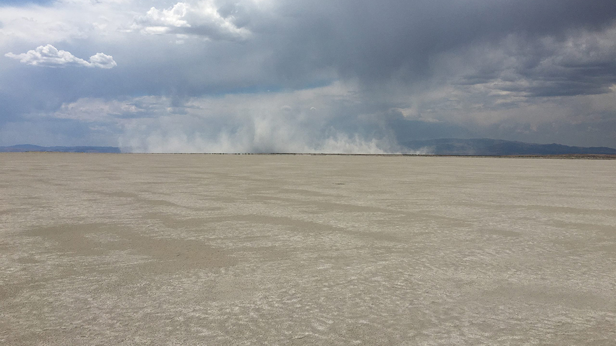
Click the link to read the article on the Grist website (Leia Larsen):
December 1, 2025
Instead of waiting for more data, a new report lays out the case for action.
This coverage is made possible through a partnership between Grist and The Salt Lake Tribune, a nonprofit newsroom in Utah.
The dust blowing from the dry bed of the Great Salt Lake is creating a serious public health threat that policymakers and the scientific community are not taking seriously enough, two environmental nonprofits warn in a recent report.
The Great Salt Lake hit a record-low elevation in 2022 and teetered on the brink of ecological collapse. It put millions of migrating birds at risk, along with multimillion-dollar lake-based industries such as brine shrimp harvesting, mineral extraction, and tourism. The lake only recovered after a few winters with above-average snowfall, but it sits dangerously close to sinking to another record-breaking low.
Around 800 square miles of lake bed sit exposed, baking and eroding into a massive threat to public health. Dust storms large and small have become a regular occurrence on the Wasatch Front, the urban region where most Utahns live.
The report from the Utah Physicians for a Healthy Environment and the Utah Rivers Council argues that Utah’s “baby steps” approach to address the dust fall short of what’s needed to avert a long-term public health crisis. Failing to address those concerns, they say, could saddle the state with billions of dollars in cleanup costs. “We should not wait until we have all the data before we act,” said Brian Moench, president of Utah Physicians for a Healthy Environment, in an interview. “The overall message of this report is that the health hazard so far has been under-analyzed by the scientific community.”
After reviewing the report, however, two scientists who regularly study the Great Salt Lake argued the nonprofits’ findings rely on assumptions and not documented evidence.
The report warns that while much of the dust discussion and new state-funded dust monitoring network focus on coarse particulates, called PM10, Utahns should also be concerned about tiny particulates 0.1 microns or smaller called “ultrafines.” The near-invisible pollutants can penetrate a person’s lungs, bloodstream, placenta, and brain.
The lake’s dust could also carry toxins like heavy metals, pesticides and PFAS, or “forever chemicals,” Moench cautioned, because of the region’s history of mining, agriculture, and manufacturing.
“Great Salt Lake dust is more toxic than other sources of Great Basin dust,” Moench said. “It’s almost certain that virtually everyone living on the Wasatch Front has contamination of all their critical organs with microscopic pollution particles.”
If the lake persists at its record-low elevation of 4,188 feet above sea level, the report found, dust mitigation could cost between $3.4 billion and $11 billion over 20 years depending on the methods used.
The nonprofits looked to Owens Lake in California to develop their estimates. Officials there used a variety of methods to control dust blowing from the dried-up lake, like planting vegetation, piping water for shallow flooding, and dumping loads of gravel.
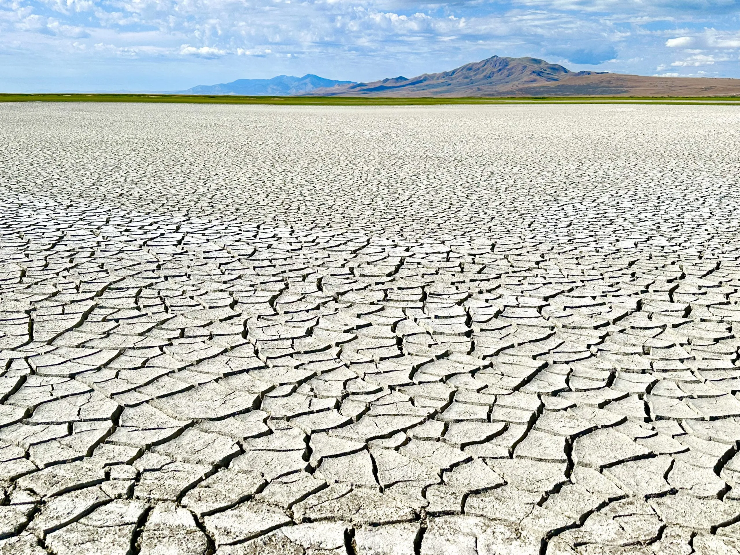
The Great Salt Lake needs to rise to 4,198 feet to reach a minimum healthy elevation, according to state resource managers. It currently sits at 4,191.3 feet in the south arm and 4,190.8 feet in the north arm.
The lake’s decline is almost entirely human-caused, as cities, farmers, and industries siphon away water from its tributary rivers. Climate change is also fueling the problem by taking a toll on Utah’s snowpack and streams. Warmer summers also accelerate the lake’s rate of evaporation.
The two nonprofits behind the report, Utah Physicians and the Utah Rivers Council, pushed back at recent solutions for cleaning up the toxic dust offered up by policymakers and researchers. Their report panned a proposal by the state’s Speaker of the House, Mike Schultz, a Republican, to build berms around dust hot spots so salty water can rebuild a protective crust. It also knocked a proposal to tap groundwater deep beneath the lake bedand use it to help keep the playa wet.
“Costly engineered stopgaps like these appear to be the foundation of the state’s short-sighted leadership on the Great Salt Lake,” the groups wrote in their report, “which could trigger a serious exodus out of Utah among wealthier households and younger populations.”
Bill Johnson, a professor of geology and geophysics at the University of Utah who led research on the aquifer below the lake, said he agreed with the report’s primary message that refilling the Great Salt Lake should be the state’s priority, rather than managing it as a long-term and expensive source of pollution.
“We don’t want this to become just about dust management, and we forget about the lake,” Johnson said. “I don’t think anybody’s proposing that at this point.”
It took decades of unsustainable water consumption for the Great Salt Lake to shrink to its current state, Johnson noted, and it will likely take decades for it to refill.
Kevin Perry, an atmospheric scientist at the University of Utah and one of the top researchers studying the Great Salt Lake’s dust, said Utah Physicians and Utah Rivers Council asked him to provide feedback on their report in the spring.
“It’s a much more balanced version of the document than what I saw last March,” he said of the report. “It’s still alarmist.”
Perry agreed with the report’s findings that many unknowns linger about what the lake bed dust contains, and what Utahns are potentially inhaling when it becomes airborne. He said he remains skeptical that ultrafine particulates are a concern with lake bed dust. Those pollutants are typically formed through high-heat combustion sources like diesel engines.
“In the report, they just threw it all at the wall and said it has to be there,” Perry said. “I kept trying to encourage them to limit their discussion to the things we have actually documented.”
The report’s chapter outlining cost estimates for dust mitigation, however, largely aligned with Perry’s own research. Fighting back dust over the long term comes with an astronomical price tag, he said, along with the risk of leaving permanent scars from gravel beds or irrigation lines on the landscape.
“Yes, we can mitigate the dust using engineered solutions,” Perry said, “but we really don’t want to go down that path if we don’t have to.”
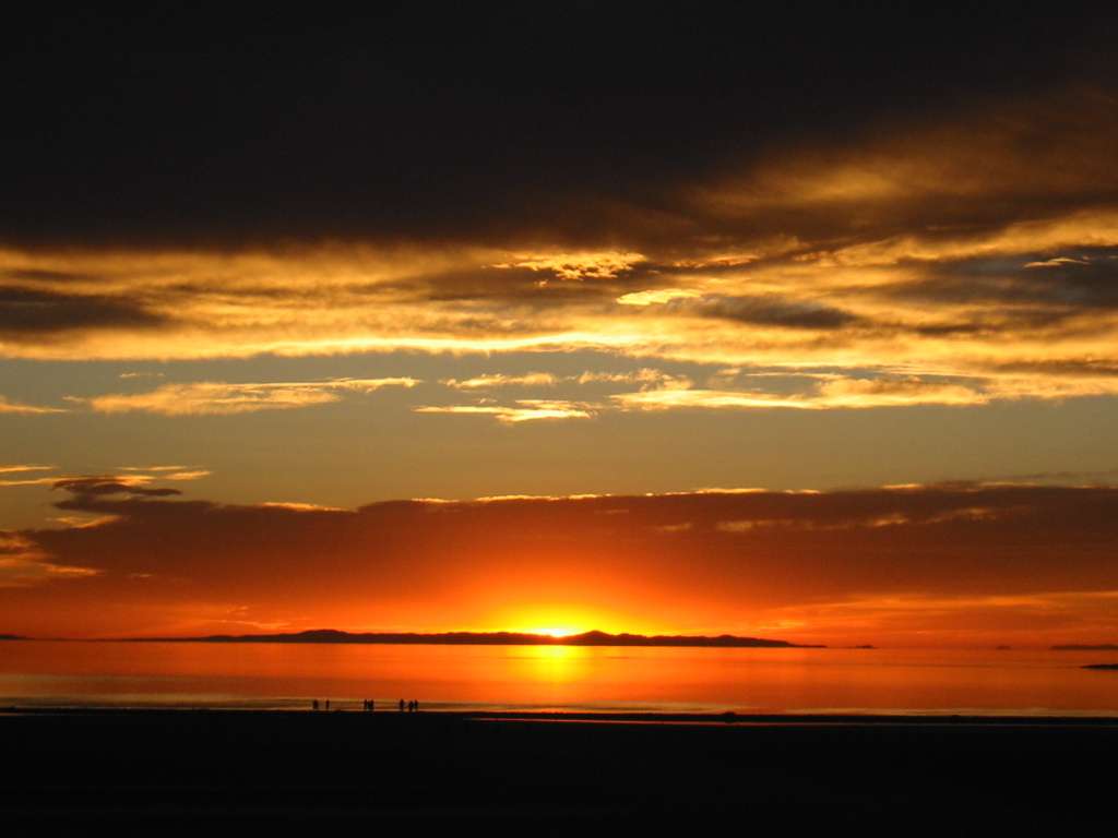
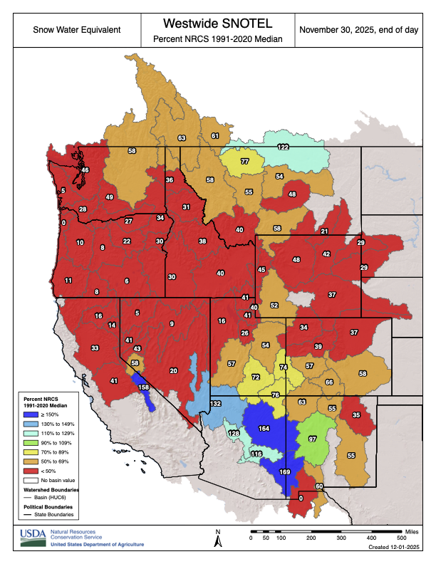
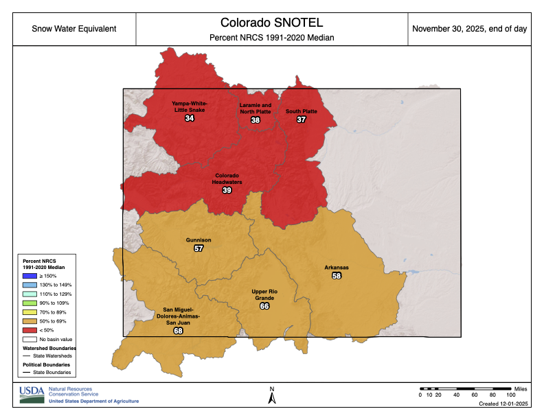
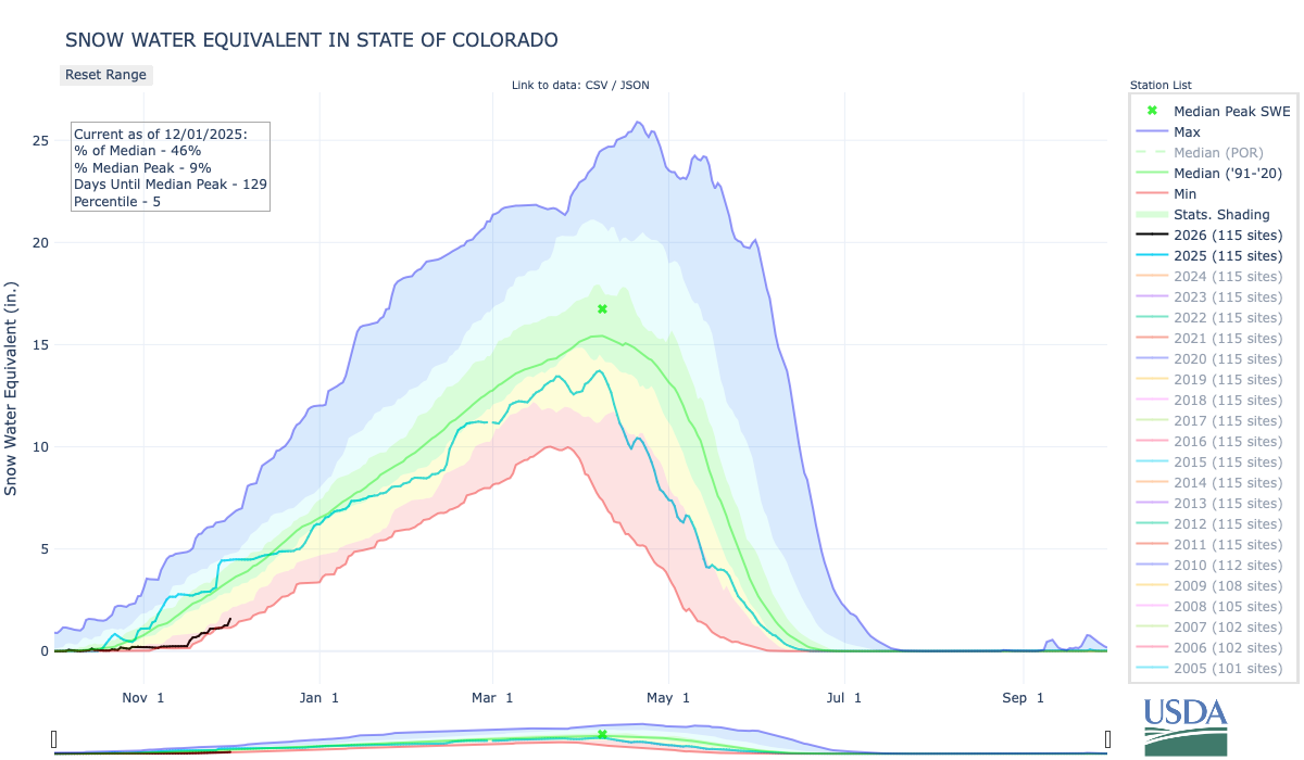


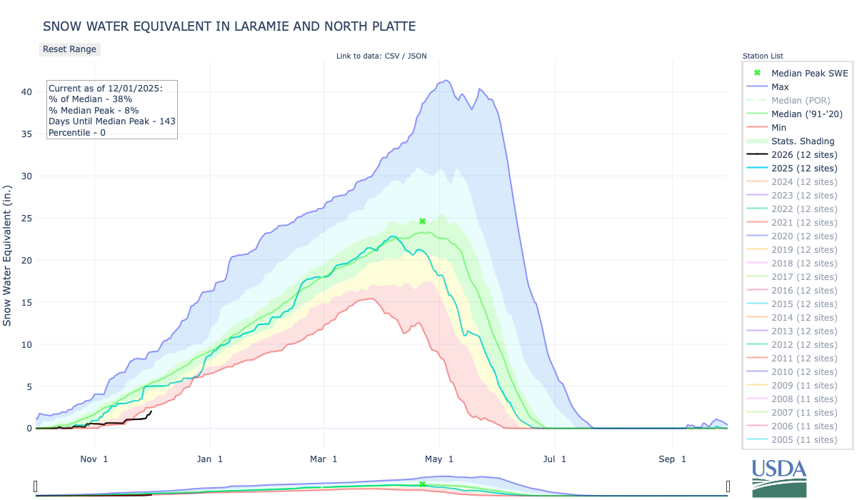


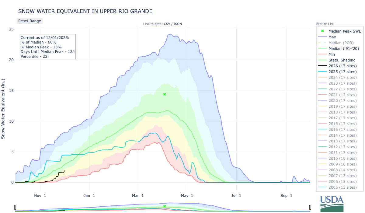


Click the link to read the article on The Land Desk website (Jonathan P. Thompson):
November 25, 2025
The News: The Trump administration last week weighed in on the 53-year battle over what waterways are covered by the 1972 Clean Water Act — with a draft rule that would narrow the definition of “Waters of the United States,” or WOTUS. The rule would effectively remove federal CWA protections from hundreds of arroyos, rivers, and ephemeral streams in the Southwest, giving developers industries more latitude to alter or pollute those waterways. The public has until Jan. 5 to submit comments.
The Context: For years, the Environmental Protection Agency and Army Corps of Engineers—the agencies charged with enforcing the CWA—considered WOTUS to include everything from arroyos to prairie potholes to sloughs to mudflats, so long as the destruction or degradation thereof might ultimately affect traditionally navigable waters or interstate commerce (which could include recreation, sightseeing, or wildlife watching). It was a broad definition that gave the agencies latitude to “restore and maintain the chemical, physical, and biological integrity of the Nation’s waters,” as Congress mandated when creating the law in 1972.
Developers and property rights ideologues pushed back on this definition, saying it was too broad and therefore gave the feds too much power to curb pollution or restrict development. The issue ended up in the courts and, ultimately, to the U.S. Supreme Court.
The waters were muddied, so to speak, by the 2006 Supreme Court split decision on the Rapanos case. The late Justice Antonin Scalia wrote what would become the right-wing’s preferred definition of waters of the U.S. He argued that they should include only “relatively permanent, standing or continuously flowing bodies of water … described in ordinary parlance as streams[,] … oceans, rivers, [and] lakes.” Scalia’s definition emphatically excluded “ephemeral streams” and “dry arroyos in the middle of the desert.” Justice Anthony Kennedy disputed Scalia, saying instead the CWA should extend to any stream or body of water with a “significant nexus” to navigable waters, determined by a wetland’s or waterway’s status as an “integral part of the aquatic environment.”
Then, in 2023, in its ruling on the Sackett case, the SCOTUS majority deferred to Scalia’s Rapanos definition, writing: “… we conclude that the Rapanos plurality was correct: the CWA’s use of ‘waters’ encompasses ‘only those relatively permanent, standing or continuously flowing bodies of water forming geographical features that are described in ordinary parlance as streams oceans, rivers and lakes.’”
It’s up to the relevant agencies to translate these rulings into actual rules, often adding their own ideological twists. The W. Bush, Obama, and Trump I administrations issued their own post-Rapanos definitions of WOTUS, Biden weighed in post-Sackett, now Trump II is submitting its own set of industry-friendly, deregulatory definitions.
The EPA’s proposed definition of ‘‘waters of the United States’’ would include:

“Relatively permanent,” under the new rule, would mean

And then there’s this weird and vague, yet critical, term, “wet season,” which the rule defines as:

Sometimes you have to wonder whether the bureaucrats who come up with these things have ever even been to the Western U.S., particularly the arid Southwest.
The “relatively permanent” requirement clearly excludes thousands of arroyos, ephemeral streams, washes, gullies, and even rios and rivers — from the Santa Cruz to the Rillito to the Santa Fe to the Puerco and the Dirty Devil — from CWA jurisdiction. Indeed, it leaves huge swaths of the Southwest without Clean Water Act protections, and at the mercy of respective states or counties. A 2008 EPA study estimates that ephemeral and intermittent streams make up 59% of all of the waterways in the U.S. (excluding Alaska) and over 81% in the arid and semi-arid Southwest (AZ, NM, UT, CO, CA).
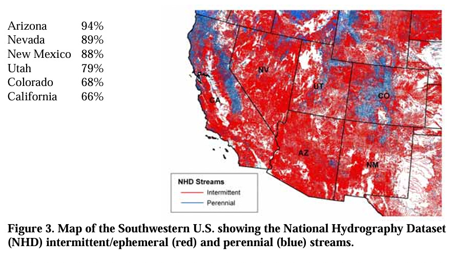
The ecological benefits of ephemeral streams are obvious to any Western wanderer who happens to venture down a seemingly dry and barren arroyo bed, where they may find cool air, the smell of water even on the hottest day, tiny tracks of animals seeking sanctuary from the sun, the lascivous bloom of a datura, and cottonwoods and even willows miles and miles away from any “relatively permanent” water source. And if that’s not enough, then consider that peer-reviewed research has found that these same ephemeral streams are major contributors to the water quantity and quality of the entire river drainage network of which they are a part.

A 2024 study by Craig Brinkerhoff et al concludes: “This ephemeral influence directly implicates downstream water quality standards: Excluding ephemeral streams from coverage under the CWA would substantially narrow the extent of federal authority to regulate water quality in the United States.”
While the administration was looking to provide “clarity,” the “wet season” provision does exactly the opposite, especially when one tries to apply it to the desert Southwest. If southern Arizona has a wet season, wouldn’t it be the days and weeks of the late summer monsoon? Many arroyos do run continuously during a good monsoon season, even if it is only for two or three weeks. So would that put them back under CWA jurisdiction?
How these proposed changes would play out on the ground is a bit of a puzzle — especially given the “wet season” ambiguity. But what is clear is that developers of big housing projects in the desert outside Phoenix or Las Vegas or Tucson, for example, would be allowed to fill in or build roads through arroyos and washes without obtaining a federal CWA permit from the Army Corps of Engineers. That would leave it to the state and county to implement their own, similar, permitting systems if they chose to do so.
As one might expect, the energy industry, developers, ranchers, and farmers generally support the changes, since it will eliminate some of the red tape that tangles up and delays projects.
“For U.S. oil and natural gas operators, this is a game-changer,” wrote the head of a Texas petroleum industry group in the Odessa American. “Picture the Permian Basin or Bakken Formation: vast swaths dotted with intermittent draws and playas that previous rules treated like sacred rivers, triggering Section 404 permits under the U.S. Army Corps that could drag on for years and cost millions in mitigation. Now, with ephemeral features sidelined and groundwater off-limits, operators can overcome those hurdles for well pads, access roads, and seismic surveys.”
If you live in the West, you probably live near at least one of the ephemeral streams that would lose federal protections under these new definitions. You might want to go walk up it sometime soon before it goes away.
In the meantime, you have until Jan. 5 to send your comments, identified by Docket ID No. EPA–HQ– OW–2025–0322, by any of the following methods:
- Federal eRulemaking Portal: https://www.regulations.gov/ (our preferred method). Follow the online instructions for submitting comments.
- Email: OW-Docket@epa.gov. Include Docket ID No. EPA–HQ–OW– 2025–0322 in the subject line of the message.
- Mail: U.S. Environmental Protection Agency, EPA Docket Center, Water Docket, Mail Code 28221T, 1200 Pennsylvania Avenue NW, Washington, DC 20460.
Read more about the Clean Water Act, WOTUS, and the value of ephemeral waterways here (but remember, you gotta become a paid subscriber to bust through the paywall!)
News Roundup: Arroyos on trial; Superstition Vistas; Lake Powell bridge — Jonathan P. Thompson
🌵 Public Lands 🌲
Congressional Republicans have apparently decided that the best way to turn over public lands to the extractive industries is to do away with the plans guiding management of those lands. Earlier this year, Congress revoked three Bureau of Land Management resource management plans in Montana, North Dakota, and Alaska. Now, they’ve done the same for the RMP for the BLM’s Buffalo Field Office in Wyoming, which covers a good portion of the coal-rich Powder River Basin.
These mark the first times ever that the Congressional Review Act, which is intended to give Congress the power to review and possibly revoke recently implemented administrative rules, has been used in this manner. That’s in part because RMPs have not been considered “rules” in the past, meaning they are not subject to congressional review.
Resource Management Plans provide a framework for managing large swaths of land and authorize the BLM to permit mining, drilling, grazing, and other activities. They endeavor to balance the agency’s multiple-use mandate with environmental protections, guiding resource extraction and development away from sensitive areas and toward more appropriate ones, for example. They can take years to develop, and incorporate science, legal considerations, court orders, tribal consultation, and input from local officials and the general public.
And then, with just a few hours of debate and no opportunity for public input, Congress can toss the whole thing into the can.
In this case, the main target was a provision of the Biden-era RMP that halted new coal leasing on that swath of public land. While the moratorium was celebrated by environmentalists and panned by fossil fuel lovers when it was implemented late last year, it was largely symbolic, since existing leases contain enough coal to meet demand at least until 2040. So revoking the ban similarly won’t lead to any new mining anytime soon, nor are resulting lease sales likely to fetch much industry interest or acceptable bids.
But in their haste to scrap the ban, Congress also may have taken away the BLM’s power to issue new leases altogether — not just for coal, but for oil and gas drilling, grazing, or any other use. And not just for the Buffalo Field Office, either. This is a bit wonky, but basically it goes like this:
- By applying the CRA to RMPs, Congress is saying that RMPs are “rules.”
- According to the CRA, rules must be submitted to Congress before they can take effect.
- No RMP that has been implemented since 1996 has been submitted to Congress.
- Therefore, no post-1996 RMP has legally taken effect, making it invalid.
- The Federal Land Policy Management Act says the BLM can only issue permits, leases, rights of way, and other authorizations “in accordance with” a valid land use plan, or RMP.
- Therefore all permits, leases, ROWs, and other authorizations issued under post-1996 RMPs — including over 5,000 oil and gas leases, and hundreds more coming up for auction in the near future — are invalid.
This summer, 31 law professors and public land experts called on Congress to refrain from using the CRA to revoke RMPs. “The resulting uncertainty could trigger an endless cycle of litigation,” they wrote, “effectively freezing the ability of the BLM and other agencies to manage public lands for years, if not decades to come.”
Just last week, a group of conservation organization legal analysts expanded on the potential for chaos, and called on the BLM to pause new leasing and address the “potential legal deficiencies” of oil and gas leases covering some 4 million acres that were issued under now potentially invalid RMPs. The agency should not issue drilling permits for those leases, the analysts wrote, and it should consider canceling the leases.
Somehow, I don’t think the BLM under the current administration is going to follow that suggestion. Given its track record, it seems more likely that the agency will see the sudden lack of valid RMPs as an open gate through which it can ferry its pro-extractive agenda. This one is almost sure to end up in court.
🦫 Wildlife Watch 🦅
The Trump administration is proposing new regulations that would dial back Endangered Species Act protections and weaken the landmark law to “strengthen American energy independence,” according to an Interior Department news release.
The new rules would:
- Make it more difficult for the U.S. Fish & Wildlife Service to designate critical habitat in areas that are not currently occupied by an endangered species — likely because they were extirpated from the area — but that are essential for the conservation of that species. This would make recovering an endangered species that much more difficult.
- Remove a rule that extends ESA protections to species that are listed as “threatened,” which is one step away from “endangered.” This would potentially remove protections for species such as the marbled murrelet, vernal pool fairy shrimp, western snowy plover, Gunnison sage grouse, northern sea otter, and many others.
- Direct agencies to give economic impacts greater weight when deciding whether to extend ESA protections to a species. This could have potentially pushed the feds to, say, back off on listing the Tiehm’s buckwheat under the ESA, because doing so would potentially restrict or nix a proposed lithium mine in its only known habitat.
- Make it more difficult for the U.S. Fish & Wildlife Service to designate critical habitat in areas that are not currently occupied by an endangered species — likely because they were extirpated from the area — but that are essential for the conservation of that species. This would make recovering an endangered species that much more difficult.
- Remove a rule that extends ESA protections to species that are listed as “threatened,” which is one step away from “endangered.” This would potentially remove protections for species such as the marbled murrelet, vernal pool fairy shrimp, western snowy plover, Gunnison sage grouse, northern sea otter, and many others.
- Direct agencies to give economic impacts greater weight when deciding whether to extend ESA protections to a species. This could have potentially pushed the feds to, say, back off on listing the Tiehm’s buckwheat under the ESA, because doing so would potentially restrict or nix a proposed lithium mine in its only known habitat.
“This plan hacks apart the Endangered Species Act and creates a blueprint for the extinction for some of America’s most beloved wildlife,” said Stephanie Kurose, deputy director of government affairs at the Center for Biological Diversity, in a written statement.
📸 Parting Shot 🎞️

And, finally, the Land Desk readers have spoken, and they have chosen El Burro Blanco as the name for the new Land Desk dispatch-mobile, with Hank coming in a distant second.
Moab seeks bigger crowds? — Jonathan P. Thompson

Click the link to read the article on The Land Desk website (Jonathan P. Thompson):
November 21, 2025
🥵 Aridification Watch 🐫
The Colorado River and its woes tend to get all of the attention, but the Southwest’s “other” big river, the Rio Grande, is in even worse shape thanks to a combination of warming temperatures, drought, and overconsumption. That’s become starkly evident in recent years, as the river bed has tended to dry up earlier in the summer and in places where it previously had continued to carry at least some water. Now Brian Richter and his team of researchers have quantified the Rio Grande’s slow demise, and the conclusions they reach are both grim and urgent: Without immediate and substantial cuts in consumption, the river will continue to dry up — as will the farms and, ultimately, the cities that rely on it.
The Rio Grande’s problems are not new. Beginning in the late 1800s, diversions for irrigation in the San Luis Valley — which the river runs through after cascading down from its headwaters in the San Juan Mountains — sometimes left the riverbed “wholly dry,” wrote ichthyologist David Starr Jordan in 1889, “all the water being turned into these ditches. … In some valleys, as in the San Luis, in the dry season there is scarcely a drop of water in the riverbed that has not from one to ten times flowed over some field, while the beds of many considerable streams (Rio la Jara, Rio Alamosa, etc.) are filled with dry clay and dust.”
Rio Grande Streamflow Mystery: Solved? — Jonathan P. Thompson
San Luis Valley farmers gradually began irrigating with pumped groundwater, allowing them to rely less on the ditches (but causing its own problems), and the 1938 Rio Grande Compact forced them to leave more water in the river. While that kept the water flowing through northern and central New Mexico, the Rio Grande’s lower reaches still occasionally dried up.
Then, in the early 2000s, the megadrought — or perhaps permanent aridification — that still plagues the region settled in over the Southwest. [ed. emphasis mine] Snowpack levels in the river’s headwaters shrank, both due to diminishing precipitation and climate change-driven warmer temperatures, which led to runoff and streamflows 17% lower than the 20th century average, according to the new study. And yet, overall consumption has not decreased.
“In recent decades,” the authors write, “river drying has expanded to previously perennial stretches in New Mexico and the Big Bend region. Today, only 15% of the estimated natural flow of the river remains at Anzalduas, Mexico near the river’s delta at the Gulf of Mexico.” Reservoirs, the river’s savings accounts, have been severely drained to the point that they won’t be able to withstand another one or two dry winters. As farmers and other users have increasingly turned to groundwater pumping, aquifers have also been depleted. The situation is clearly unsustainable.
Something’s gotta give on the Rio Grande, and while we may be tempted to target Albuquerque’s sprawl, drying up all of the cities and power plants that rely on the river wouldn’t achieve the necessary cuts.
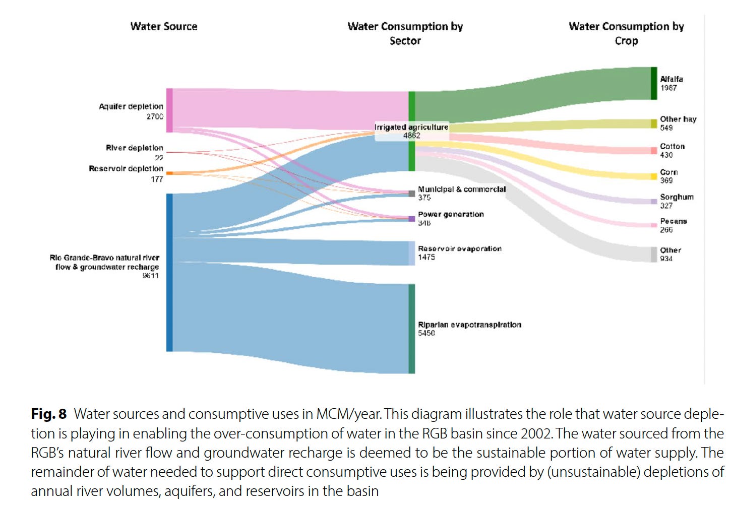
It will come as little surprise to Western water watchers that agriculture is by far the largest water user on the Rio Grande — taking up 87% of direct human consumption — and that alfalfa and other hay crops gulp up the lion’s share, or 52%, of agriculture’s slice of the river pie. This isn’t necessarily because alfalfa and other hays are thirstier than other crops, but because they are so prevalent, covering about 433,000 acres over the entire basin, more than four times as much acreage as cotton.
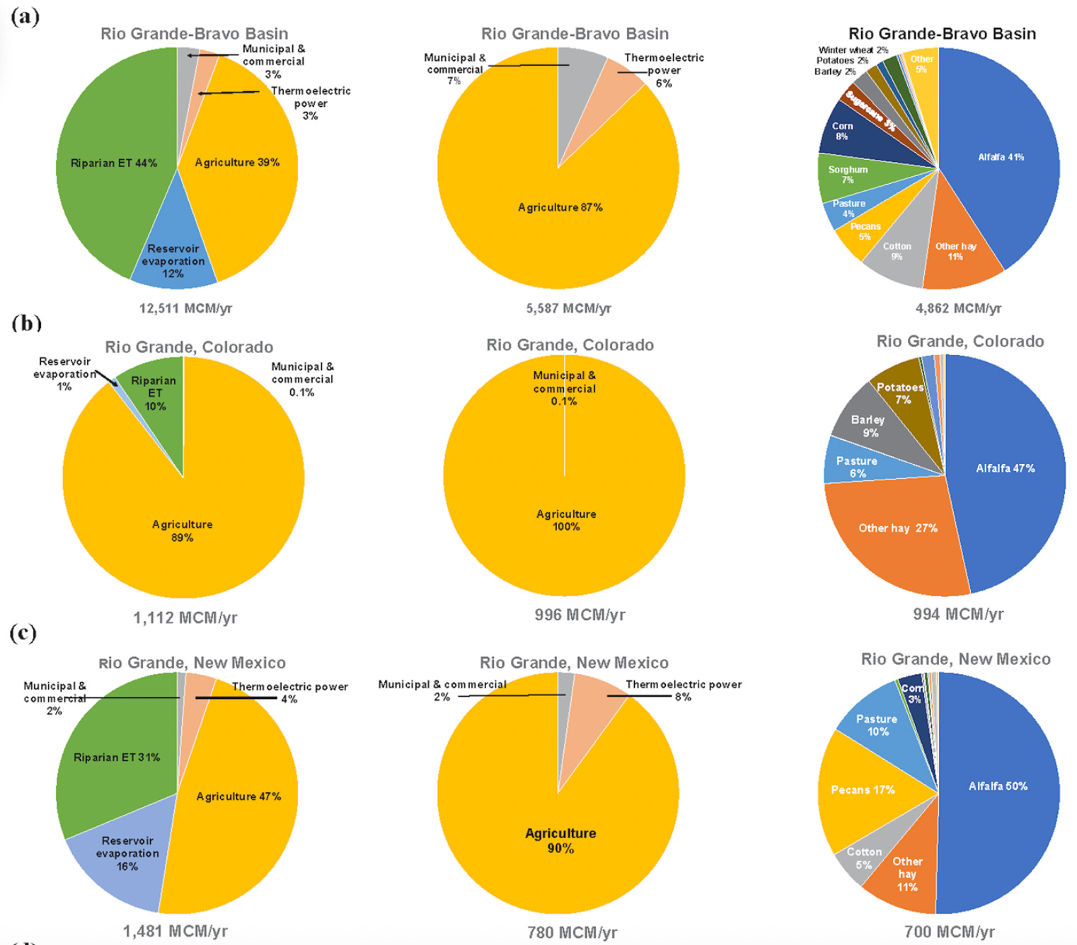
This kind of math means farmers are going to have to bear the brunt of the necessary consumption cuts — either voluntarily or otherwise. In fact, they already have: Between 2000 and 2019, according to the report, Colorado lost 18% of its Rio Grande Basin farmland, New Mexico lost 28%, and the Pecos River sub-basin lost 49% (resulting in a downward trend in agricultural water consumption). Some of this loss was likely incentivized through conservation programs that pay farmers to fallow their fields. But it was also due to financial struggles.
Yet even when farmers are paid a fair price to fallow their fields there can be nasty side effects. Noxious weeds can colonize the soil and spread to neighbors’ farms, it can dry out and mobilize dust that diminishes air quality and the mountain snowpack, and it leaves holes in the cultural fabric of an agriculture-dependent community. If a field’s going to be dried up, it should at least be covered with solar panels.
Think like a watershed: Interdisciplinary thinkers look to tackle dust-on-snow — Jonathan P. Thompson
Another possibility is to switch to crops that use less water. This isn’t easy: Farmers grow alfalfa in the desert because it’s actually quite drought tolerant, doesn’t need to be replanted every year, is less labor-intensive than other crops, is marketable and ships relatively easy, and can grow in all sorts of climates, from the chilly San Luis Valley to the scorching deserts of southern Arizona.
Alfalfaphobia? Jonathan P. Thompson
Still, it can be done, as a group of farmers in the San Luis Valley are demonstrating with the Rye Resurgence Project. This effort is not only growing the grain — which uses less water than alfalfa, is good for soil health, and makes good bread and whiskey — but it is also working to create a larger market for it. While it’s only a drop in the bucket, so to speak, this is the sort of effort that, replicated many times across the region, could help balance supply and demand on the river, without putting a bunch of farmers out of business.
***
Oh, and about that other river? You know, the Colorado? Representatives from the seven states failed to come up with a deal on how to manage the river by the Nov. 15 deadline. The feds had mercy on them, giving them until February to sort it all out. I’m not so optimistic, but we’ll see. Personally, I think the only way this will ever work out is if the Colorado River Compact — heck, the entire Law of the River — is scrapped, and the states and the whole process is started from scratch, this time with a much better understanding of exactly how much water is in the river, and with the tribal nations having seats at the table.
⛏️ Mining Monitor ⛏️
There are a bunch of wannabe uranium mining companies out there right now, locating claims and acquiring and selling claims and touting their exploratory drilling results. But there are only a small handful of firms that are actually doing anything resembling mining. One of them is the Canada-based Anfield, which just broke ground on its Velvet-Wood uranium mine in the Lisbon Valley, even without all of the necessary state permits.
Now Anfield says it has applied for a Colorado permit to restart its long-idle JD-8uranium mine. The mine is on one of a cluster of Department of Energy leases overlooking the Paradox Valley from its southern slopes, and was previously owned and operated by Cotter Corporation. The mine has not produced ore since at least 2006. Anfield says it will process the ore at its Shootaring Mill near Ticaboo, Utah, which has yet to get Utah’s green light.
🏠 Random Real Estate Room 🤑
Look! Affordable housing near Moab! Sure, it’s a cave, but it’s only $99,000. Oh, what’s that? $998,000? They’re selling a cave for a million buckaroos? But of course they are. To be fair, it’s not just a cave. It’s several of them, plus a trailer. Crazy stuff.
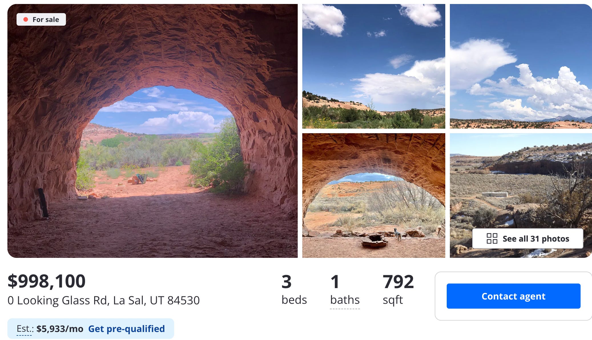
📸 Parting Shot 🎞️


Click the link to read the article on the NOAA website:
November 20, 2025
Key Points
- Start of Water Year 2026: Leading up to the start of Water Year (WY) 2026, drought conditions improved across the eastern Intermountain West, but drought expanded and intensified across western areas of the region. Storage for Lake Powell and Lake Mead reached a 30-year low for the date as of October 25, 2025.
- Water Year 2025: Precipitation was lower than average in western portions of the region, and greater than average in eastern parts of Colorado, New Mexico, and Wyoming. Much of the Intermountain West experienced warmer-than-average temperatures.
- Water Year 2025 Impacts: Hot and dry conditions led to large fires in several states. Lack of precipitation, early snowmelt, and warm spring temperatures harmed crop production and forage in many areas.
- La Niña Winter Ahead: La Niña conditions are present and favored to continue into early winter. La Niña typically brings warmer and drier winter conditions to the southern region of the Intermountain West. A transition to El Niño-Southern Oscillation (ENSO) neutral is favored for the January-March 2026 time frame. Neutral conditions mean neither El Niño or La Niña are influencing weather patterns.
This update is based on data available as of Thursday, November 20, at 7 a.m. MT. We acknowledge that conditions are evolving.

Conditions at the Start of Water Year 2026
- The start of the new water year (beginning October 1, 2025) brought intense rainstorms and flooding in parts of Utah, Arizona, New Mexico, and Colorado. However, due to warmer-than-average temperatures, combined with lower-than-average precipitation across Water Year 2025, much of the region still remains in drought, according to the U.S. Drought Monitor.
- At the start of Water Year 2026, drought conditions were split across the Continental Divide, with no drought in much of the eastern extent of the Intermountain West region. Over Water Year 2025, drought conditions persisted or intensified across western portions of Colorado, Wyoming, and New Mexico, as well as statewide across Arizona and Utah.
- Flaming Gorge Reservoir started Water Year 2026 at near-average storage levels, but many other reservoirs remained below average, including Lake Mead, Lake Powell, and Elephant Butte Reservoir. Greater-than-average runoff is needed to increase reservoir levels next spring.
- Moving into winter, soil moisture levels are better than they were in November 2024, with root zone soil moisture in headwater basins for the Upper Colorado River and the Rio Grande River experiencing a mix of wetter-than-average conditions at some locations and drier than-average conditions at others, according to both SPoRT-LIS modeled data and SNOTEL station data.
- Storage is below average for most Bureau of Reclamation–managed reservoirs in the headwaters of the Upper Colorado River Basin. As of November 18, 2025, Lake Powell is at 44% of typical storage, the lowest observed level for this date in the last 30 years.
- Storage is also below average for Elephant Butte Reservoir in the Rio Grande Basin, at 11% of average as of November 18, 2025.
- With La Niña conditions anticipated to persist from December to February, snowpack is more likely to be lower than average during these months. However, all La Niñas differ, and there is uncertainty around how this season will play out. La Niña conditions are expected to weaken into El Niño-Southern Oscillation (ENSO) neutral conditions from January to March 2026.
Water Year 2025 Brings a Mix of Drought Degradation and Recovery
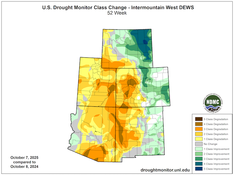
November 2025 Reservoir Storage Levels

Intermountain West Water Year 2025 Summary
- Water Year 2025 (October 1, 2024–September 30, 2025) brought varied drought conditions to the Intermountain West. Drought largely worsened west of the Continental Divide and improved to the east of the Continental Divide.
- Drought intensified and spread in Utah, Arizona, and western portions of Colorado, Wyoming, and New Mexico. Over the summer, portions of western Colorado and the southern border of Arizona and New Mexico reached Exceptional Drought (D4), according to the U.S. Drought Monitor.
- Above-average temperatures (+ 1-3 ºF) were widespread across the region in Water Year 2025, with some isolated areas being even hotter.
- Water year precipitation for the region was variable, with a wet-dry split along the Continental Divide. The Southwest Monsoon season was slow to start this year, but precipitation ramped up at the end of August for Colorado, Arizona, and New Mexico. Utah had a weaker than usual summer rain season, and Salt Lake City experienced its fourth driest summer on record.
- Utah: Total water year precipitation was below average across the entire state in 2025. The driest areas were in the south-central region of the state, and in Juab and Tooele Counties in Western Utah. Water Year 2025 was among the top five driest years on record for many portions of the state.
- Arizona: Arizona received lower-than-average precipitation. Stations in some southeastern counties measured total water year precipitation among the lowest 10% on record, with some counties recording their 5th driest water year on record. August 2025 was the 16th driest August on record for the state. Yuma County was the only area with above-average precipitation, with the 9th wettest August on record for the county.
- Colorado: Precipitation conditions were split between western and eastern Colorado. The western side of the state saw total water year precipitation between 50-90% of average. The eastern side of the state was unusually wet. Parts of Lincoln and Kit Carson Counties received over 130% of average precipitation.
- New Mexico: Water year precipitation followed a diagonal split across the state. Temperatures were warmer than average for two-thirds of the state, and near average in counties to the northeast. The western and southern areas were drier than average (50-80% of average), and the eastern half of the state was wetter than average (100-150%). Hidalgo, Grant, and Catron Counties experienced the driest water year conditions in the state. Meanwhile, multiple counties on the eastern side of the state received 130-150% of average precipitation.
- Wyoming: Total water year precipitation varied across Wyoming, ranging from 50-70% of average in parts of Sweetwater County to 120-130% of average in Converse County. Much of the state received 80-100% of average precipitation.
- April 1, 2025 snow water equivalent (SWE) was 81-96% of average for many headwater basins in the Upper Colorado, but runoff efficiency was low and yielded below-average streamflows in many reaches. The Colorado Climate Center attributed low runoff efficiency to early snowmelt and below-average spring snowfall. April 1, 2025 snowpack was much lower than average for the headwaters of the Rio Grande basin, located in southern Colorado, with SWE at ~56% of average for the basin.
- Dry conditions and high evaporative demand led to several large fires in the Intermountain West during the 2025 fire season, including the 145,000+-acre Dragon Bravo Fire in Arizona and 137,758-acre Lee Fire in Colorado (5th largest fire in Colorado history).
Near- to Below-Average Precipitation West of the Continental Divide
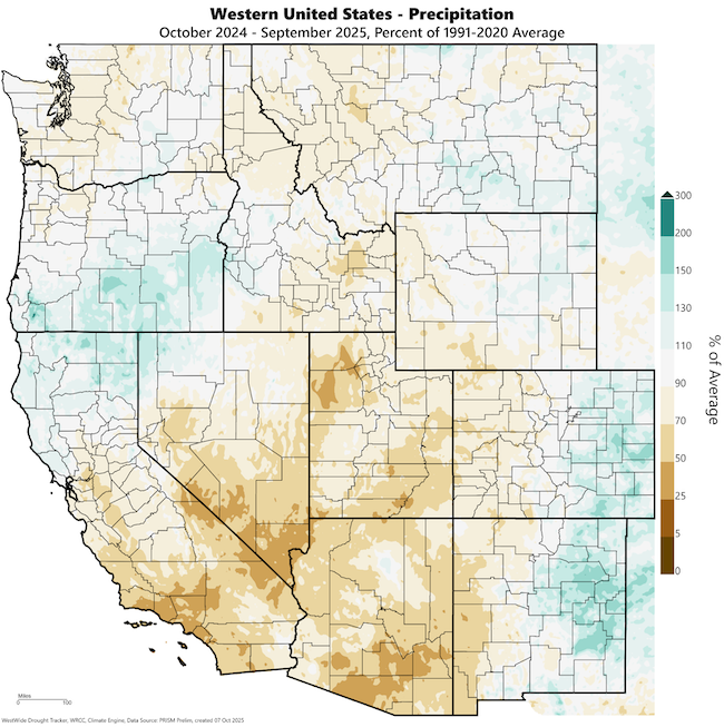

Water Year 2025 Impacts
- High evaporative demand, warmer-than-usual temperatures, lower-than-usual precipitation, and dry soils contributed to dry fuel conditions and large fires across many parts of the Intermountain West. Across the region, earlier snowmelt and warm temperatures led to longer-than-usual fire seasons.
- Wildfire impacts across the Intermountain West varied by state during Water Year 2025. Arizona and Colorado experienced record-breaking fires, including the 145,000+ acre Dragon Bravo Fire in Grand Canyon National Park and 137,000 acre Lee Fire–Colorado’s 5th largest wildfire on record. Meanwhile in Wyoming, the number of wildfire incidents increased, but acres burned decreased compared to Water Year 2024.
- By April 2025, conditions were so dry in Utah that the governor declared a drought emergency.
- Dry conditions, early snowmelt, and warm spring temperatures negatively impacted crop production in portions of all states across the Intermountain West. Poor forage conditions likewise harmed grazing in many areas, leading to curtailed grazing seasons or herd reductions.
La Niña Outlook
- As of November 17, 2025, La Niña conditions are present and expected to continue through December to February, with a transition to El Niño Southern Oscillation–neutral conditions likely from January to March.
- Every La Niña is different. For the Southwestern U.S., La Niña is typically associated with a greater statistical likelihood of warmer, drier conditions during winter months.
- Other variables also influence winter precipitation, and not all La Niñas are associated with below-average winter precipitation in the Intermountain West.
A Weak La Niña Is Here, ENSO-Neutral Forecast Early Next Year
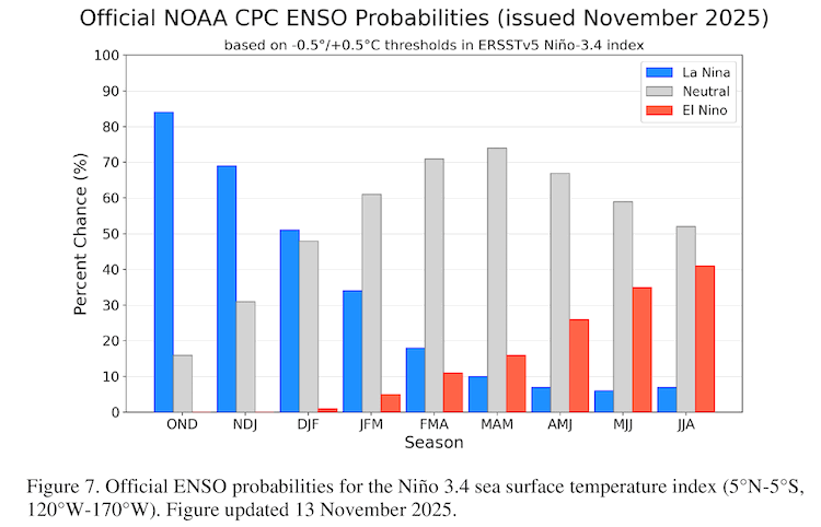
Additional Resources by State
- More local information is available from the following resources:
- Your state climatologist
- Your state page on Drought.gov:
- National Weather Service Drought Information Statements:
- November 7, 2025: Riverton, Wyoming Weather Forecast Office
- November 4, 2025: Salt Lake City, Utah Weather Forecast Office
- November 3, 2025: El Paso, Texas/Santa Teresa, New Mexico Weather Forecast Office
- Western Water Assessment 2025 Water Year Summary
- More state information is available from the following resources:
- Arizona: Interactive Drought Dashboard; State Climate Office
- California: California Water Watch; California Department of Water Resources – Drought; California State Climatologist
- Colorado: Water Conditions Monitoring Committee; Colorado Climate Center Drought Dashboard
- Nevada: Living with Drought in Nevada; Nevada Division of Water Resources – Drought; State Climate Office
- New Mexico: Office of the State Engineer, Drought page; New Mexico Climate Center
- Utah: Department of Natural Resources, Drought page; Utah Climate Center
- To report or view local drought impact information:
Elise Osenga
University of Colorado Boulder/Cooperative Institute for Research in Environmental Sciences (CIRES), NOAA/National Integrated Drought Information System (NIDIS)Meredith Muth
NOAA National Integrated Drought Information System (NIDIS)Erinanne Saffell
Arizona State Climate Office, Arizona State UniversityDave Simeral
Desert Research Institute, Western Regional Climate CenterJon Meyer
Utah Climate Center, Utah State UniversityPaul Miller
Colorado River Basin Forecast Center, National Weather ServiceSpecial Thanks
This Drought Status Update was issued in partnership between the National Oceanic and Atmospheric Administration (NOAA)/National Integrated Drought Information System (NIDIS) and partners across the Intermountain West. NIDIS is an interagency program within the Climate Program Office, which is part of NOAA’s Office of Oceanic and Atmospheric Research.
Click the link to read the article on the High Country News website (Jonathan P. Thompson):
November 25, 2025
This is an installment of the Landline, a monthly newsletter from High Country News about land, water, wildlife, climate and conservation in the Western United States. Sign up to get it in your inbox.
In early November, Texas-based New Era Energy & Digital announced plans to build a “hyperscale,” meaning massive, AI-processing data center complex in Lea County, New Mexico, the epicenter of the Permian Basin oil and gas drilling boom. The campus will be so big, and use so much power, that, if and when it is built, it will come with its own nuclear and gas power plants, with a mind-blowing combined generation capacity of about 7 gigawatts. That’s like piling the West’s largest nuclear and natural gas plants — Palo Verde and Gila River, both near Phoenix — on top of one another, and then adding another 800 megawatts. That kind of power could electrify something like 5.3 million homes, though these power plants’ output presumably will all go toward more pressing requirements: processing movie streaming, doomscrolling, social media posting and, especially, AI-related activities. [ed. emphasis mine]
Despite the enormity of this proposal, it has received very little news coverage. This is not because anyone is trying to keep it secret, but rather because such announcements have become so common that it’s hardly worth mentioning every new one. New Era’s hyperscale server farm and others like it are still a long way from generating and then devouring their own electricity. But even if only a fraction of the current proposals succeed, they will transform the West’s power grid, its landscapes and its economies as significantly as the post-World War II Big Buildup, when huge coal plants and hydroelectric dams sprouted across the region to deliver power to burgeoning cities via high-voltage transmission lines.
In fact, this transformation is already underway. A new report from the nonprofit NEXT 10 and University of California Riverside found that, in 2023, data centers in California pulled 10.82 terawatt-hours of electricity — 1 terawatt equals 1 trillion watts — from the state’s grid, or about enough to power 1 million U.S. households. This resulted in about 2.4 million tons of carbon emissions, even with California’s relatively clean energy mix. (On more fossil fuel-reliant grids, the emissions would have been twice that, or even more.) These same centers directly and indirectly consumed about 13.2 billion gallons of water for cooling and electricity generation. In Silicon Valley, more than 50 data centers accounted for about 60% of one electricity provider’s total load, prompting the utility to raise its customers rates to fund the transmission and substation upgrades and new battery energy storage the facilities required.
These facilities are also colonizing cities and towns far from Big Tech’s Silicon Valley epicenter. Over 100 data centers — structures that resemble big-box stores overflowing with row after row of computer processors — have already sprung up in Phoenix-area business parks, and the planned new ones could increase Arizona’s total power load by 300% over current levels, according to utilities. Recently, Arizona Public Service announced it would keep burning coal at the Four Corners Power Plant beyond its scheduled 2031 retirement to help meet this growing demand.
Data center developments around the West include:
- NorthWestern Energy signed on to provide up to 1,000 MW of power — or nearly all of the utility’s generating capacity — to Quantica Infrastructure’s AI data center under development in Montana’s Yellowstone County.
- The 290-mile Boardman-to-Hemingway transmission project under development in Idaho and Oregon was initially designed to serve about 800,000 PacifiCorp utility customers. But in October it was revealed that the line now will deliver all of its electricity to a single industrial customer in Oregon, most likely a new data center.
- In September, an NV Energy executive told a gathering in Las Vegas that tech firms are asking the utility to supply up to 22,000 megawatts of electricity for planned data centers. Since the utility has largely moved away from coal, this new load would likely be met by generation from existing and planned natural gas facilities, along with proposed utility-scale solar installations.
- Xcel Energy expects to spend about $22 billion in the next 15 years to meet new data centers’ projected power demand in Colorado, potentially doubling or even tripling legacy customers’ rates. Xcel and the state’s public utilities commission are currently working to reverse the planned closure of a coal plant due to projected data center-associated electricity shortages.
- Wyoming officials are doing their best to lure data centers and cryptocurrency firms to the state, and it seems to be working. This summer, Tallgrass proposed building an 1,800 MW data center, along with dedicated gas-fired and renewable power facilities, near Cheyenne. It would add to Meta’s facility in Cheyenne and the 1,200 MW natural gas-powered Prometheus Hyperscale data center under development in Evanston. Observers say electricity demand from these centers could transform the physical and regulatory utility landscape and potentially drive up costs for “legacy” customers.
- New Mexico utilities are struggling to meet growing demand from an increasing number of data centers while also complying with the state’s Energy Transition Act’s requirements for cutting greenhouse gas emissions.
- Doña Ana County approved tax incentives for Project Jupiter, a proposed $165 billion data center campus in Santa Teresa in the southeastern corner of New Mexico. Developers have indicated they plan on building dedicated power generation, though they have not yet disclosed the energy sources.
- Numerous companies are eyeing Delta, Utah, as a site for new data centers, drawn by the area’s relatively cheap land, existing agricultural water rights and the fact that it’s home to the Intermountain Power Project, a colossal coal plant built during the original Big Buildup in the years after World War II. The plant is scheduled to be converted to run on natural gas and, ultimately, hydrogen, but Utah lawmakers want at least one of its units to continue to burn coal. They just need a buyer for the dirty power it would produce, and data centers could fit the bill. Fibernet MercuryDelta is looking to construct the 20 million-square-foot Delta Gigasite there, and Creekstone Energy plans to manage 10 gigawatts of capacity there, with power coming from coal, solar and natural gas.

The Western power grid is interconnected but also divided into 38 balancing authorities, or grid operators. Nearly every one of them is expected to see an increase in data center-driven demand over the next decade or so as the Big Digital Buildup gains steam, and few of them are currently equipped to meet that demand. In fact, the North American Electricity Reliability Corp. warned this month that growing data center-driven power demand is increasing the risk of outages this winter in parts of the West. Therefore, many of the largest data centers are going to need to generate their own power, while utilities also will have to scramble to add generating capacity and associated infrastructure as quickly as possible to serve the region’s on-grid facilities. The costs of that new infrastructure will be borne by each utility’s ratepayers.
How will the needed power be generated?
There’s simply no way utilities and developers can meet the projected demand with solar and wind, alone. So, utilities are already making plans to keep existing coal plants running past previously scheduled retirement dates, and to build new natural gas plants and even nuclear reactors. Yes, nukes: Google, Switch, Amazon, Open AI and Meta are all looking to power proposed facilities with the new — so new they have yet to be developed — crop of small, modular and advanced reactors, if and when they are finally up and running.
Can data centers be “sustainable”?
These developments will have environmental consequences, some more than others. Fossil fuel burning feeds climate change and pollutes the air, and oil and gas drilling and coal mining ravage landscapes; utility-scale solar and wind facilities can harm wildlife habitat and often require hundreds of miles of new transmission lines to move the power around; and nuclear power comes with unique safety hazards and a nagging radioactive waste problem, while the uranium mining and milling industry risks reenacting its deadly Cold War legacy. Even a facility that gets all of its power from solar and batteries is still using resources that, without the extra demand, would otherwise be replacing fossil fuels on the grid. And, unless it has a closed-loop air-cooled system, the data center will still consume water for cooling, usually from municipal drinking water systems.
Wyoming-based Prometheus Hyperscale has made waves with its ambitious and seemingly visionary talk of building “sustainable” data centers with dedicated clean energy generation, water recycling and efficient cooling systems that would capitalize on the cold in the Northern Rockies. It’s even talked about harnessing the heat from the servers to warm greenhouses and shrimp-farming operations. Maybe, one day, the power will be supplemented by nuclear micro-reactors. But so far, the company’s walk is not exactly matching its talk. In the beginning, at least, the facility will run on natural gas, and Prometheus says it will offset carbon emissions by paying another company to capture and sequester carbon dioxide from biofuel plants in Nebraska.
Is resistance futile?
Resistance to the imminent server farm tsunami and its outsized energy and water use is widespread, but because these are local projects considered on local levels, battling them can feel a bit like playing whack-a-mole. After Tucson-area residents defeated the city’s plan to annex the proposed Project Blue data center, which would have enabled it to use treated wastewater for cooling, the developers simply moved the project into the county and planned to use an air-cooling system, which requires less water but more energy. When opposition continued, the firm committed to investing in enough renewable energy on Tucson Electric Power’s grid to offset all of its electricity use.
Also working against the resistance is the fact that many local governments and utilities actually welcome the onslaught. Data centers can bring jobs and tax revenues — assuming the state, county or municipality doesn’t exempt them from taxes — to economically distraught areas. Meanwhile, utilities are champing at the bit to sell more of their product and raise rates to pay for the needed additional infrastructure. When announcing all the data centers headed for Nevada, NV Energy executive Jeff Brigger noted that the utility is “excited to serve this load.”
While much of the opposition to data centers is based on their environmental impacts and the effects they might have on utility rates and on the communities where they’re built, the notion of AI itself is also a factor. It’s one thing to see a lot of water or power used to grow food, for instance, but quite another to see coal power plants continue to run simply so that a computer can write a high school essay or answer an inane question or draw a picture or even serve as a companion of sorts. To be fair, AI does have potentially significant and positive applications, such as diagnosing medical conditions and crunching large quantities of data to find, say, possible cures for cancer or solutions to geopolitical problems.
But before it goes about changing the world, maybe AI ought to start with itself and figure out how to do its thing without using so much energy and water.
