The Western United States just had its warmest December in recorded history, and likely the warmest in many thousands of years. pic.twitter.com/QrY4KKLsJ7
— Colin McCarthy (@US_Stormwatch) January 6, 2026
Category: Colorado Water
Unseasonably warm December sets temperature records as Colorado #snowpack remains poor: #Drought conditions are continuing to spread across the Western Slope, reaching ‘exceptional’ levels in Eagle and Pitkin counties — The Sky-Hi News
Click the link to read the article on the Sky-Hi News website (Ryan Spencer). Here’s an excerpt:
January 5, 2026
Across Colorado, this past December was among the hottest ever recorded. Both Denver and Grand Junction recorded their second-hottest December on record, according to the National Weather Service. Steamboat Springs, where the period of record dates to 1893, had its hottest December ever, averaging about 30 degrees through the month.
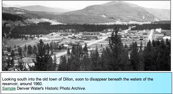
In Dillon, where the period of record dates back to 1910, this past December was also the second-warmest on record, with a monthly average temperature about 28 degrees, about one degree cooler than 1980, which was the hottest December…At one weather station in Vail, temperatures averaged about 26 degrees Fahrenheit last month, making the hottest December recorded in the period of record that dates back to 1985. In Aspen, the average monthly temperature in December was 30 degrees, compared to the normal average monthly temperature of about 22 degrees for that month…
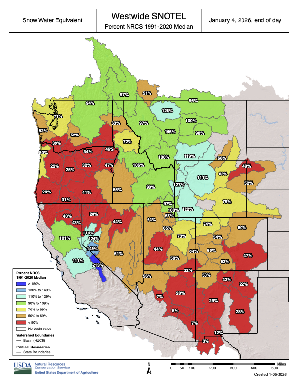
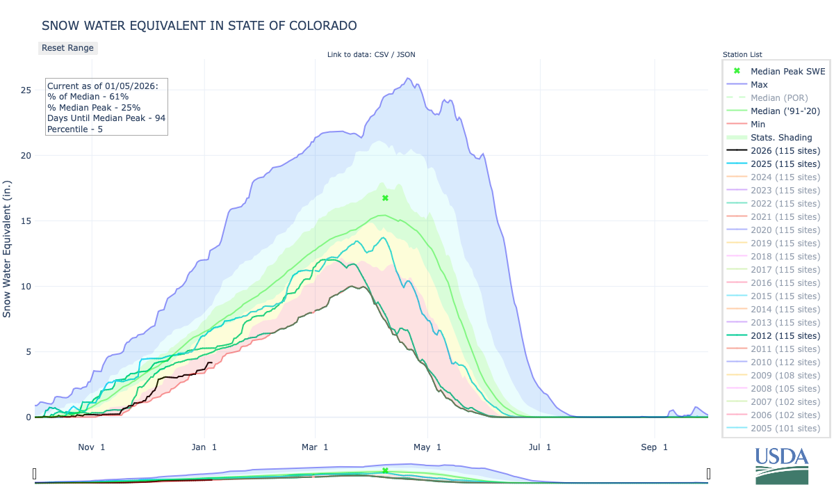
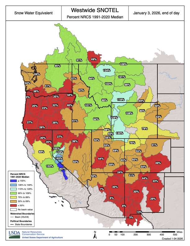
Across the state, the snowpack was also at or near record lows in several river basins, including those where popular ski resorts are located. Statewide, the sat at 59% of the 30-year median as of Friday, ranking in at the 5th percentile, meaning that 95% of years on record had more snow at this time. The Roaring Fork Basin and the Yampa River Basin both ranked in at the 3rd percentile. Meanwhile, the Eagle River Basin and the Colorado-Kremmling to Glenwood Springs Basin both came in at the zeroth percentile, meaning that the snowpack is the worst on record.

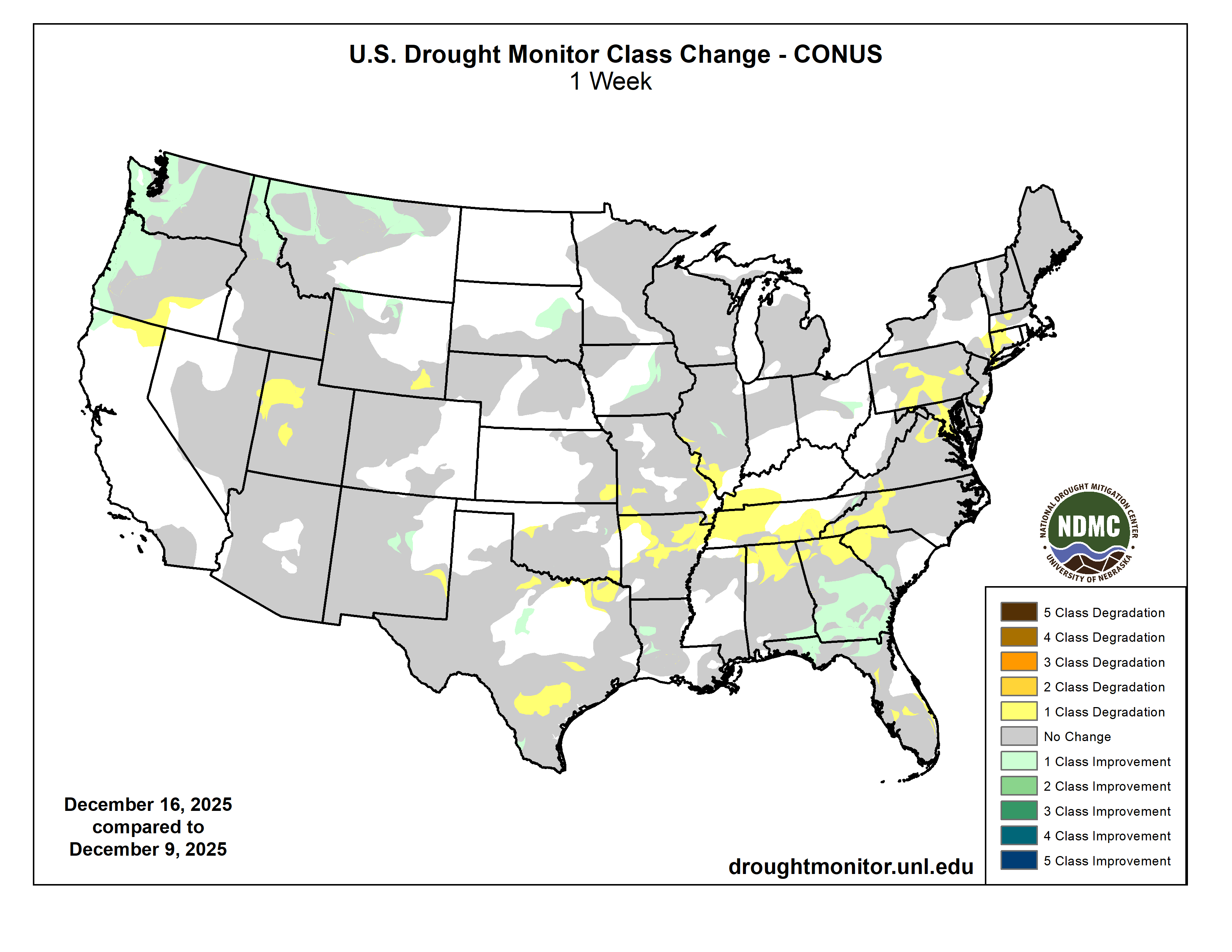
With low amounts of precipitation and hot weather, drought conditions continue to sweep over the Western Slope, according to the most recent U.S. Drought Monitor map. Substantial portions of Eagle and Pitkin counties are now facing exceptional and extreme drought. Extreme drought has also pushed into Grand County, while the rest of Northwestern Colorado is facing moderate to severe drought.
As #Colorado’s native fish struggle, wildlife scientists are working to make their lives easier — Elisabeth Kwak-Hefferan (Fresh Water News)

Click the link to read the article on the Water Education Colorado website (Elisabeth Kwak-Hefferan):
December 30, 2026
A mayfly loving trout — speckled, shiny and perfectly hand-sized for that Instagram hero shot. A five-foot-long torpedo of a predator, capable of powering through floodwaters and migrating hundreds of miles. A three-inch minnow, living only a couple of years and content with life in a small pool in an ephemeral creek. Which fish is the true Colorado native?
The answer is all of them. A state with waterways as diverse as Colorado’s has naturally produced a diverse assortment of native fish to match. We have cutthroat trout, lovers of pristine, high-elevation streams on both sides of the Continental Divide. Large, long-lived species like Colorado pikeminnow and humpback chub fight their way through the whitewater of the Western Slope. Tiny brassy minnows and redbelly dace ply the shallow, sandy creeks of the Eastern Plains. Each is adapted to its own ecological niche, body and behavior tailored to its particular home waters and the other aquatic creatures that evolved alongside it.
Humans have dramatically altered this delicate balance in a very short time span. While some native populations still thrive, many others struggle as their habitats and predators have changed. Starting a couple of hundred years ago, mining pollution, overfishing, and haphazard stocking of non-native fish led some Colorado species to plummet, or even go extinct. Today, native fish still grapple with climate change, dams, water diversions, and competition with invasive species. But humans are also working to turn back the clock and restore these native species. Follow along on this tour of Colorado’s waterways, meeting our home-state fish — and learning what it takes to help them endure.
Headwaters
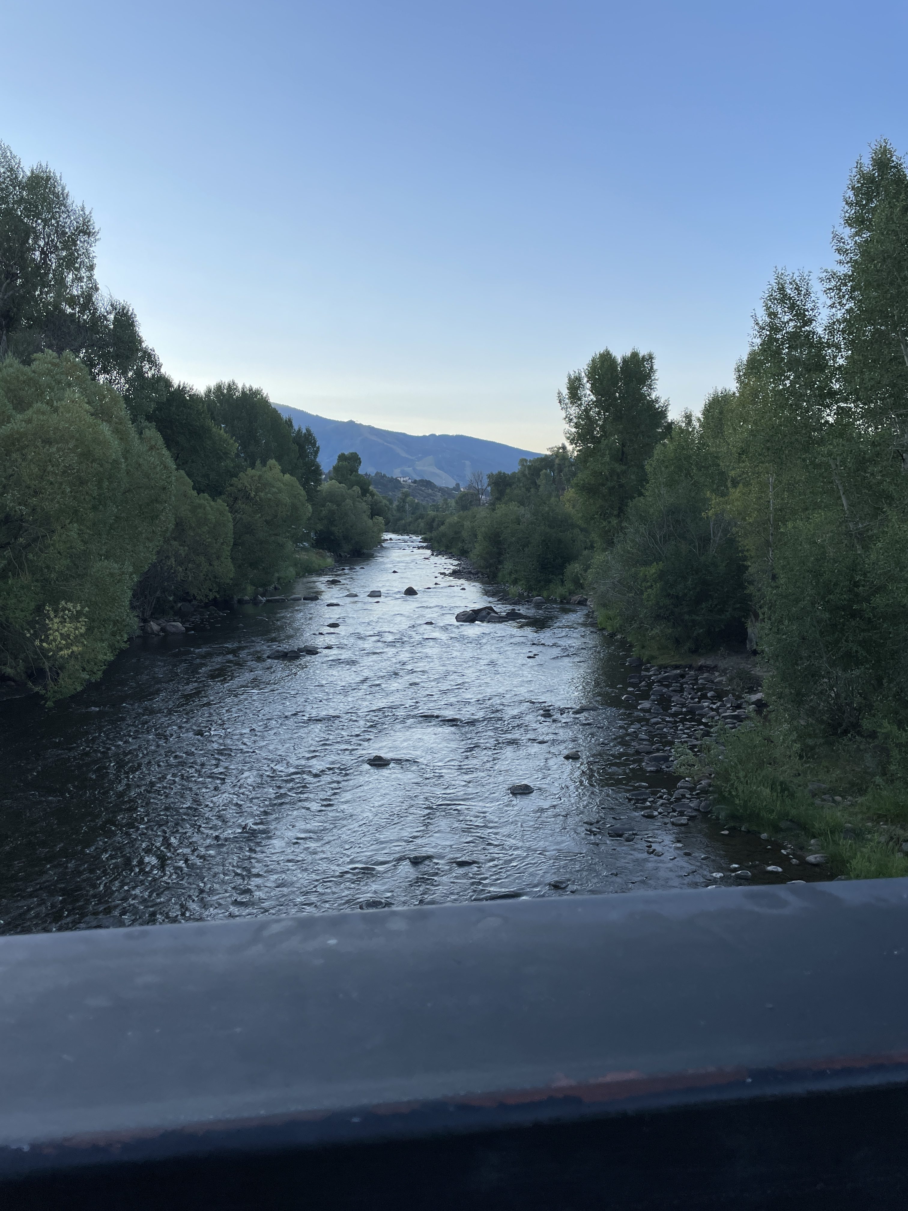
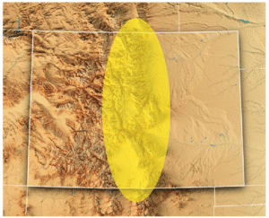
Let’s begin where the rivers do: high in the Rocky Mountains, where clean, cold streams form and flow downhill, eventually feeding the state’s largest rivers. This is the realm of Colorado’s poster fish, the cutthroat trout. Colorful, beautiful and beloved by anglers, cutthroats — recognizable by the iconic red slash markings under the jaw that give the species its name — live in the headwaters of almost every river basin in the state. Cutthroat trout are at home where there’s oxygenated water, gravelly bars for spawning, and good vegetative cover on stream banks.
“Cutthroat trout” isn’t just one type of fish in Colorado, but rather, six. There’s the greenback cutthroat trout, originally from the South Platte River Basin on the east side of the Divide. The yellowfin cutthroat came from the Arkansas River Basin, but is now considered extinct. Moving southwest, the Rio Grande cutthroat rose from the Rio Grande Basin. Then, on the Western Slope, the Colorado River cutthroat is further divided into three lineages: the Green River lineage, found in the Green, White and Yampa rivers; the Uncompahgre lineage, of the Dolores, Gunnison and Upper Colorado rivers; and the San Juan lineage, of the San Juan River Basin.
That’s not to say the average angler — or indeed, the average fish biologist — can tell the cutthroats apart just by looking at them. Nor can they be identified based on where they’re caught these days. Humans, from regular people trying to create new fishing opportunities to professional fisheries managers, spent much of the last couple of centuries moving cutthroats around the state with little understanding of the differences between subspecies. “It’s really hard to put the genie back in the bottle once that happens,” says Jim White, southwest senior aquatic biologist for Colorado Parks and Wildlife (CPW). “One of the great mysteries in cutthroat trout distributions was, what went where? What did these river basins look like before we started widespread stocking of cutthroats and non-natives?”
Biologists didn’t know the answer until 2012, when a landmark study led by University of Colorado Boulder researchers conducted DNA analysis on museum fish specimens gathered at the beginning of European contact with the West. Those results confirmed the existence of the six genetically distinct types of cutthroat — five previously known to science, and one brand-new one, the San Juan lineage trout. The study speculated that San Juan cutthroats had also gone extinct, but CPW biologists had to be sure. “We beat the bushes, surveyed all the populations, and conducted molecular tests on fin clips from all known cutthroat trout populations in the San Juan Basin,” says Kevin Rogers, CPW aquatic research scientist and co-author on the 2012 genetic study. “Indeed, there were about a half-dozen populations that [matched] the fish that had been collected in the mid- to late 1800s.”
One thing all five remaining Colorado cutthroat varieties have in common is a reduction in the amount of habitat they occupy. The state’s cutthroats are now relegated to just 12% of their historical habitat on the high end, down to half a percent on the low end, says Boyd Wright, native aquatic species coordinator with CPW. “Most of the lower elevations have been invaded by non-native trout, so cutthroats are persisting only in the headwaters,” Rogers says. Greenback cutthroats are federally listed as threatened, and Rio Grande and Colorado River cutthroats (occupying just 12% and 11% of their historic habitat, respectively) are state species of special concern. The culprits? What began with pollution, overharvesting and the stocking of non-native fish in the era of Western colonization continues today.
Non-native fish pose a major threat to native cutthroats, particularly the brown, brook and rainbow trout that have been stocked statewide and now thrive in Colorado’s waters. “To sum it up, there’s hybridization, there’s predation, and there’s competition,” White says. “All of those three things can interact to disadvantage our native fish populations.” Rainbow and cutthroat trout can breed, resulting in the hybrid cutbow. Non-native trout sometimes even eat the natives. They also compete with cutthroats for food, and often win. Brook and brown trout spawn in the fall and hatch in the spring — so when the cutthroat fry hatch in late summer, their non-native rivals have already had several months to grow bigger.
Climate change isn’t helping. “We have the two ugly stepchildren that come along with a changing climate: drought and wildfire,” Rogers notes. “The toll wildfire can take on cutthroat is substantial. The debris flows that invariably happen afterward can wipe out populations.” Drought can also lower or dry up streams, further contracting ranges.
But CPW and partner organizations like the U.S. Fish and Wildlife Service are actively working to conserve Colorado’s native cutthroats. Biologists raise the trout in hatcheries for stocking back in their native streams, but there’s a lot more to it than that. First, managers must prep the waterways by removing non-native trout, often by poisoning with natural fish toxicants, a process that can take years. Any present pathogens, like whirling disease, must be eradicated. Managers also have to make sure non-native fish can’t reinvade the stream, usually by building a barrier, like a waterfall. Despite the difficulty and expense, the state is actively working on recovery projects for all five cutthroat varieties. “That’s what we’re about, trying to preserve diversity for future generations to enjoy,” Rogers says.
Desert Rivers
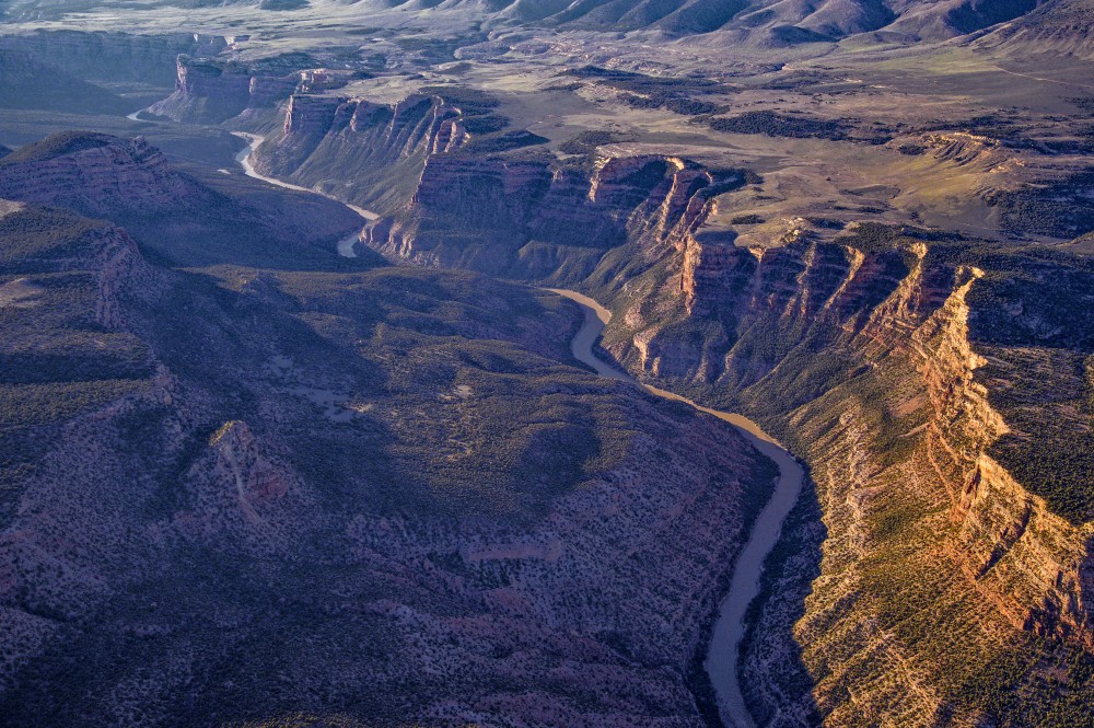
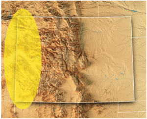
As the mountain streams follow gravity into the western lowlands, they flow into larger networks: Rivers like the Yampa, White and Animas feed the desert arteries of the Green and San Juan, and these, together with the Gunnison, Dolores and others join the Colorado. The entire basin touches seven states, from Wyoming and Colorado up north to Arizona and California in the southwest.
The cold swift headwaters give way to rivers that historically swung between huge springtime floods and slow, turbid flatwater. And the trout give way to large, long-lived fish with bodies suited to big water and wild rapids.
Just over a dozen fish species evolved with the chops to survive in the larger rivers within the Colorado River system. Three of them, called just “the three species” by biologists, are the flannelmouth sucker, bluehead sucker, and roundtail chub. These omnivorous swimmers persist in today’s rivers, though managers keep a close eye on conserving their populations so that they don’t go the way of four other native species.
These four — all federally listed as endangered or threatened — have struggled in the face of drastic, human-caused changes to their habitats. The bonytail, a large-finned, skinny-tailed omnivore, is the worst off, with no sustainable wild populations left. Its relative, the humpback chub, sports a pronounced bump behind its head, all the better to stabilize the fish in whitewater. Its populations have stayed stable over the past few years, with most of them found near the Grand Canyon, and the species was downlisted from endangered to threatened in 2021. The Colorado pikeminnow, a powerful swimmer shaped like a missile, is the largest minnow in North America. It can migrate 200 miles annually and lives 40 years or more. Its numbers are slowly increasing in the Upper Colorado and San Juan subbasins, but are declining in the Green River. And the razorback sucker, a bug- and plankton-eater, features a similar keel behind its head that helps it maneuver through high flows.
All four populations have crashed in response to human water use and reduced water availability resulting from drought and climate change, which has altered the habitats they once inhabited. “We have cross-basin diversions that feed water from the Western Slope over to the Front Range,” says Jenn Logan, native aquatic species manager for CPW. “We don’t have the volume of water that we used to see in the spring. With dams and water going into ditches and filling reservoirs, runoff is nowhere near where it used to be. We don’t have sandbars formed in the way that we used to, and these systems relied on sediment to form complex habitats.” Not only that, but dams change water temperature, with released water alternately cooling or warming the river downstream depending on where in the reservoir it comes from. And of course, they form a physical barrier for fish that evolved migrating through a huge, interconnected river system.
Then there’s the non-native interlopers — primarily smallmouth bass, northern pike, walleye, and green sunfish — all introduced, either purposely or accidentally, by humans looking for expanded angling opportunities. “They’re predatory species — they get in the river and can really compete with and consume the native fish in the Colorado River,” says Josh Nehring, deputy assistant director, aquatic branch, of the CPW fish management team. All have found happy homes in the modern Colorado River Basin with its dams, reservoirs and warmer waters.
But just as in the mountain streams, fisheries managers on the Western Slope are working aggressively to protect the natives. The Upper Colorado River Endangered Fish Recovery Program and the San Juan River Basin Recovery Implementation Program oversee the recovery of the four fish species listed as threatened or endangered. The recovery programs are coalitions of water users, federal, state and tribal agencies, plus nonprofits and energy organizations. They take steps like installing nets at the edge of reservoirs to keep non-natives contained and stocking sterile non-native fish in reservoirs to keep them from establishing a population if they do get out. Other work looks like electrofishing stretches of river — that is, introducing a current that stuns fish in the water — and physically removing the non-natives, leaving the native fish to recover and swim another day; and gillnetting northern pike in their springtime spawning habitats. Water managers go so far as to recontour river channels on the upper Yampa to cut off access to northern pike’s spawning wetlands.
Dam management is another useful tool for both helping native fish and disadvantaging the non-natives. The Upper Colorado River Endangered Fish Recovery Program works with the U.S. Bureau of Reclamation at Utah’s Flaming Gorge Dam on the Green River on timed releases — releasing water when biologists detect the year’s razorback sucker larvae “to attempt to move them down to their wetland habitats,” Logan says. They’ll release water to disrupt smallmouth bass nesting, when possible. And in the Lower Basin downstream of Lake Powell, managers have begun releasing cooler water specifically to make the Colorado River there less hospitable to smallmouth bass. As long-term drought has dropped water levels in Lake Powell, “We’ve been seeing increases in water temperature releases coming through the dam,” says Ryan Mann, aquatic research program manager for the Arizona Game and Fish Department. Some smallmouth bass made their way into the river below the dam in years past, but the water had been cold enough to keep them from reproducing. But in 2022, biologists found baby bass. Last summer’s cold-water releases prevented widespread spawning, and managers may continue them into the future.
Today’s Colorado River Basin is a radically different place than in centuries past, and, “Unless there’s some amazing technology that comes along to remove all non-native fish or a way to return flows to historic conditions we’re not going to be able to move [major river systems] back to native fish,” Nehring says. But that doesn’t mean those species are doomed. CPW and its partners are actively raising threatened species in hatcheries and reintroducing them to targeted habitats. “We’re really focusing on the tributaries, to keep the natives alive in enough areas where we know they’ll persist,” Nehring says.
Eastern Plains
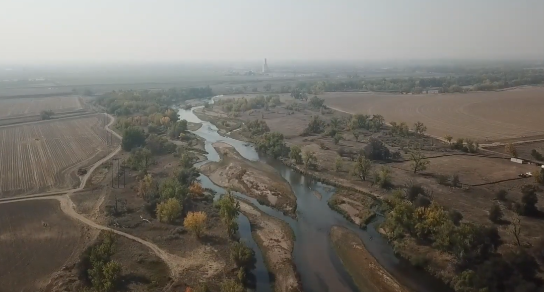
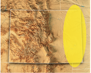
As alpine streams flow east, they meander through Front Range cities, then spread across the arid plains. The water warms, rocky beds grow sandy, and habitats shrink as creeks dry up seasonally. Waters dominated by a single species explode with different fish. “We’ve got this melting pot of biological diversity along the transition zone,” says Wright. “You go from historically a one-species profile in the mountains to more than 28 as you go farther east. These [plains] are very harsh, unpredictable environments.”
The fish that evolved to thrive on the plains, from the region’s western edges in Colorado out into Kansas, Oklahoma and Nebraska, are largely the opposite of the big, long-lived species on the Western Slope. They’re a few inches long, live just a couple of years, and reproduce early. These fish are used to biding their time in small pools until rain or spring runoff reconnects the intermittent creeks, finally allowing them a change of scenery.
But the Eastern Plains haven’t escaped the challenges affecting Colorado’s other rivers — its native fish are struggling, too. “Most of our plains fishes are declining or locally extinct because of habitat modification or loss,” says Ashley Ficke, fisheries ecologist with engineering firm GEI Consultants. Humans have diverted water to farms and municipalities, redirected streams into straight channels lacking habitat complexity, and even drained some waters completely. That hits fish like the plains minnow particularly hard, as its semi-buoyant eggs float vast distances between spawning grounds and ideal nursery habitat. “It needs vast portions of unfragmented stream habitat,” Wright says. “We’ve really lost that in Colorado, and that’s a big reason why they’re very rare.”
As elsewhere in the state, though, fish managers are working to replenish the swimmers of the plains. At a hatchery in Alamosa, CPW breeds 12 rare native fish, half of them eastern species: plains minnow, suckermouth minnow, northern and southern redbelly dace, Arkansas darter, and common shiner. “We’re working with private landowners that have streams or ponds that would be suitable for these native fish, working with them to maintain or improve that habitat, and stocking those waters with the native fish,” Nehring says. By preserving and restoring enough of the plains’ stream habitats, managers hope to give back sufficient waters for these little fish to persist.
This article first appeared in the fall edition of Headwaters magazine.

Our Four Biggest Concerns with President Trump’s Administration’s Proposed #WOTUS Rule: What are the biggest impacts on rivers and streams? — Gary Belan (AmericanRivers.org)

Click the link to read the article on the American Rivers website (Gary Belan):
November 26, 2025
In May of 2023, the Supreme Court handed down a decision that significantly limited the scope of the Clean Water Act, undoing protections that safeguarded the nation’s waters for over 50 years. Specifically, it erased critical protections for tens of millions of acres of wetlands, threatening the clean drinking water sources for millions of Americans.
While the Biden administration amended rules to comply with the Supreme Court ruling, the Trump administration recently released a new draft rule that would go further than even the Supreme Court in limiting what waters can be protected.
The Clean Water Act’s definition of “Waters of the United States” (WOTUS) is core to defining what waters are protected and which aren’t. Unfortunately, the Trump Administration’s newly proposed WOTUS rule would roll back protections for vast areas of wetlands and river tributaries. It’s estimated that close to 80% of America’s remaining wetlands would lose Clean Water Act protections. As written, the rule would leave many waterways vulnerable to pollution, degradation, and destruction, threatening water quality and community resilience across the country.

Here are our top four concerns with the new WOTUS proposal
1. The rule requires streams and wetlands to have surface water “at least during the wet season” in order to qualify for protection. But it never defines what the wet season actually is.
What this means for rivers: Wet seasons vary dramatically from region to region, and without a clear, science-based definition, many healthy and ecologically important streams risk being excluded.
2. Narrow definitions and expanded exemptions shrink the scope of protected waters.
What this means for rivers: By redefining “tributary” to include only streams with year-round or steady “wet-season” flow, and expanding exemptions for wastewater and waste-treatment systems, the new rule would eliminate protections for many intermittent streams and man-made infrastructure that function like natural streams, opening the door to more unregulated pollution. Many rivers in the Southwest only flow for part of the year. This updated definition would put many of these rivers at risk.3. The rule suggests any artificial or natural break in flow cuts off upstream protection.
What this means for rivers: Under the proposed rule, a culvert, pipe, stormwater channel, or short dry stretch can sever jurisdiction. This means upstream waters that feed larger rivers may no longer be protected, allowing pollution to still flow into nominally protected rivers and streams.
4. The rule significantly eliminates wetland protections by requiring “wetlands” to physically touch a protected water and maintain surface water through the wet season.
What this means for rivers: The new definition excludes many wetlands, which naturally store floodwater, filter pollutants, and safeguard communities. This puts the drinking water for millions at risk and increases the risks of flooding for many communities.
The health of our rivers depends on the small streams and wetlands that feed them. By discarding science, narrowing long‑standing definitions, and creating confusing jurisdictional tests, the Trump Administration’s proposed WOTUS rule risks undoing decades of progress toward cleaner, safer water. America’s rivers—and the communities that depend on them—deserve better.
These rollbacks will put our waterways and the life that depends on them in jeopardy. The public comment period to speak up and defend clean water protections is open until January 5. Please take action today and send a letter to the EPA urging them to keep the current definition of Waters of the United States in place!

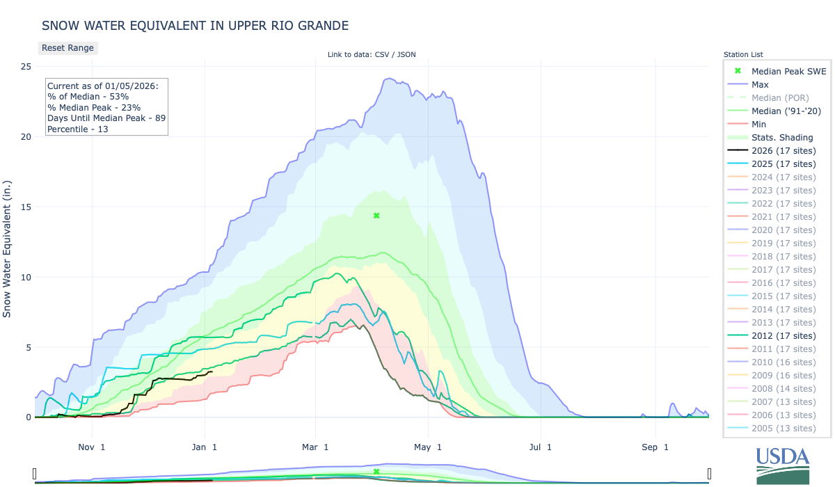
#Snowpack news January 5, 2026: An absolutely enormous swath of the western United States… just obliterated its record for the warmest December period. Temperature records across this entire half of the continent has been jack-hammered and replaced — Edgar McGregor
I’ve added the lines for 2025, 2012, and 2002 to the snow water equivalent graphs below (for Colorado). 2002 doesn’t show up in the legend but it is the line that generally follows the minimum on record.


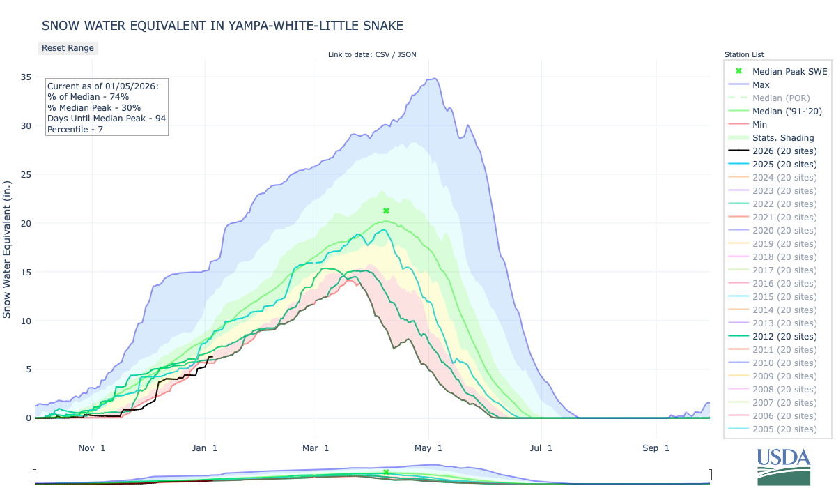
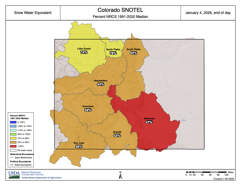
#Conservation studies findings on #Colorado’s Western Slope have lessons for water managers: Western Slope water users want Front Range to match cuts — Heather Sackett (AspenJournalism.org) #ColoradoRiver #COriver #aridification
Click the link to read the article on the Aspen Journalism website (Heather Sackett):
December 12, 2025
The findings of recent water-conservation studies on the Western Slope could have implications for lawmakers and water managers as they plan for a future with less water.
Researchers from Colorado State University have found that removing irrigation water from high-elevation grass pastures for an entire season could have long-lasting effects and may not conserve much water compared with lower-elevation crops. Western Slope water users prefer conservation programs that don’t require them to withhold water for the entire irrigation season, and having the Front Range simultaneously reduce its water use may persuade more people to participate. Researchers also found that water users who are resistant to conservation programs don’t feel much individual responsibility to contribute to what is a Colorado River basinwide water shortage.
“It’s not a simple economic calculus to get somebody to the table and get them to sign a contract for a conservation agreement,” said Seth Mason, a Carbondale-based hydrologist and one of the researchers. “It involves a lot of nuance. It involves a lot of thinking about tradeoffs.”

Over the past 25 years, a historic drought and the effects of climate change have robbed the Colorado River of its flows, meaning there is increasing competition for a dwindling resource. In 2022, water levels in Lake Powell fell to their lowest point ever, prompting federal officials to call on the seven states that share the river for unprecedented levels of water conservation.
The Upper Basin states (Colorado, New Mexico, Utah and Wyoming) have experimented for the past decade with pilot programs that pay agricultural water users to voluntarily and temporarily cut back by not irrigating some of their fields for a season or part of a season.
The most recent program was the federally funded System Conservation Pilot Program, which ran in the Upper Basin in 2023 and 2024, and saved about 100,000 acre-feet of water at a cost of $45 million. The Upper Basin has been facing mounting pressure to cut back on its use, and although some type of future conservation program seems certain, Upper Basin officials say conservation must be voluntary, not mandatory.
Despite dabbling in these pilot conservation programs, Upper Basin water managers have resisted calls for cuts, saying their water users already suffer shortages in dry years and blaming the plummeting reservoirs on the Lower Basin states (California, Nevada and Arizona). Plus, the Upper Basin has never used its entire allocation of 7.5 million acre-feet a year promised to it under the 1922 Colorado River Compact, while the Lower Basin uses more than its fair share.
But as climate change continues to fuel shortages, makes a mockery of century-old agreements and pushes Colorado River management into crisis mode, the Upper Basin can no longer avoid scrutiny about how it uses water.
“We need a stable system in order to protect rivers,” said Matt Rice, director of the Southwest region at environmental group American Rivers, which helped fund and conduct the research. “(Upper Basin conservation) is not a silver bullet. But it’s an important contributing factor, it’s politically important and it’s inevitable.”
Findings
Papers by the researchers outline how water savings on Colorado’s high-elevation grass pastures — which represent the majority of irrigated acres on the Western Slope — are much less than on lower-elevation fields with other annual crops. Elevation can be thought of as a proxy for temperature; fewer frost-free days means a shorter growing season and less water use by the plants.
“Our results suggest that to get the equivalent conserved consumptive-use benefit that you might achieve on one acre of cornfield in Delta would require five acres of grass pasture if you were up near Granby, for example,” said Mason, who is a doctoral candidate at CSU. “This is a pretty important constraint as we’re thinking about what it means to do conservation in different locations across the West Slope.”
In addition to the science of water savings, Mason’s research also looked at the social aspects of how water users decide to participate in conservation programs. He surveyed 573 agricultural water users across the Western Slope and found that attitudes toward conservation and tendencies toward risk aversion — not just how much money was offered — played a role in participation.
Many who said they would not participate had a low sense of individual responsibility to act and a limited sense of agency that they could meaningfully contribute to a basinwide problem.
If you don’t pay attention to the attitudes of water users, you could end up with an overly rosy picture of the likelihood of participation, Mason said.
“It may do well to think less about how you optimize conservation contracts on price and do more thinking about how you might structure public outreach campaigns to change hearts and minds, how you might shift language as a policymaker,” he said. “A lot of the commentary that we hear around us is that maybe this isn’t our problem, that this is the Lower Basin’s problem. [ed. emphasis mine] The more you hear that, the less likely you are to internalize a notion of responsibility.”
Mason also found that a corresponding reduction in Front Range water use may boost participation by Western Slope water users. The fact that Front Range water providers take about 500,000 acre-feet annually from the headwaters of the Colorado River is a sore spot for many on the Western Slope, who feel the growth of Front Range cities has come at their expense. These transmountain diversions can leave Western Slope streams depleted.
Western Slope water users often describe feeling as if they have a target on their back as the quickest and easiest place to find water savings.
“I think they tend to be appreciative of notions that have some element of burden sharing built into them,” Mason said. “So they aren’t the only ones being looked at to contribute as part of a solution to a problem.”
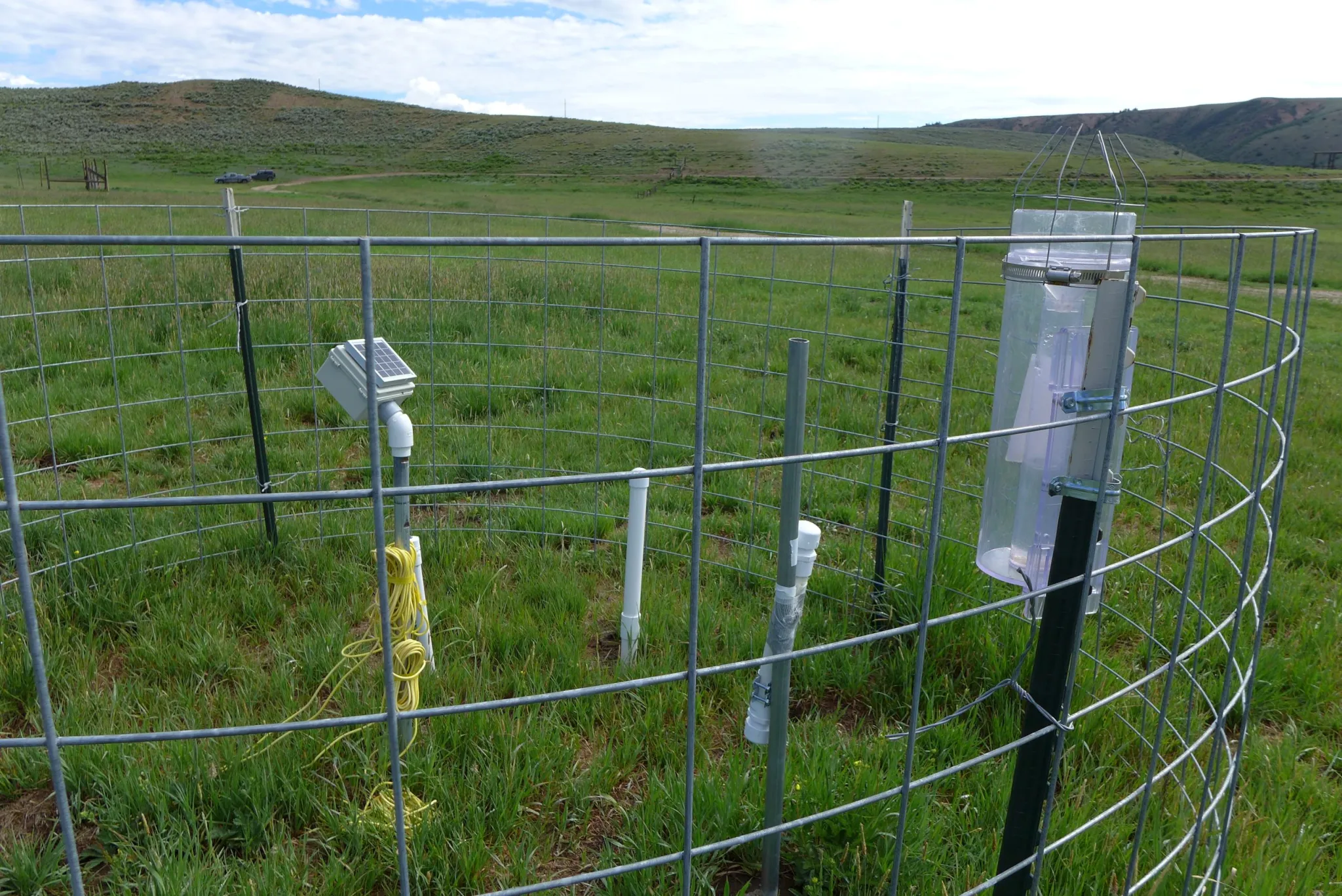
Perry Cabot, a CSU researcher who studies the effects of irrigation withdrawal and forage crops that use less water, headed up a study on fields near Kremmling to see what happens when they aren’t irrigated for a full season or part of a season. The findings showed that fields where irrigation water was removed for the entire season produced less hay, even several years after full irrigation was resumed. Fields where water was removed for only part of the season had minimal yield loss and faster recovery.
“In the full season, you can have a three-year legacy effect, so that’s where the risk really comes in if you’re a producer participating in these programs,” Cabot said. “For three years after, you’re not getting paid even though you’ve diminished that yield.”
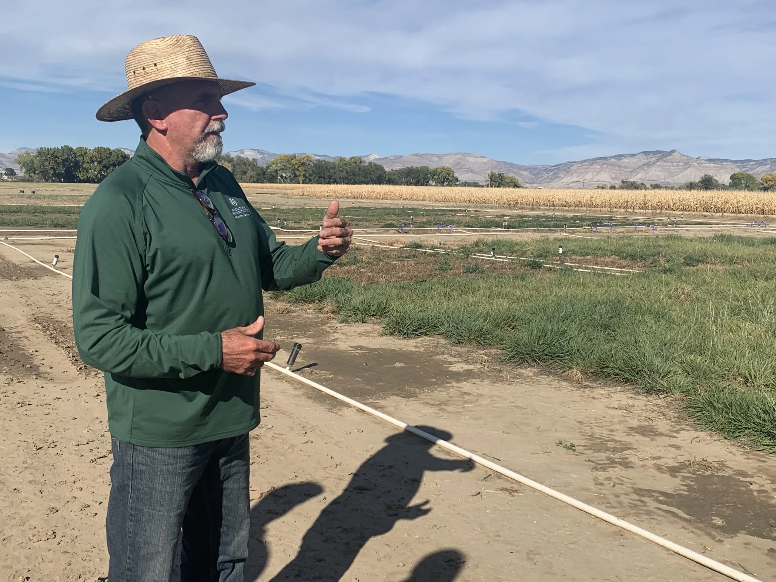
At the CSU research station in Fruita, Cabot is studying a legume called sainfoin, a forage crop and potentially an alternative to grass or alfalfa. He said sainfoin shows promise as a drought-tolerant crop that can be cut early in the season, allowing producers to have their cake and eat it too: They could maintain the income from growing a crop, avoid some of the worst impacts of a full-season fallowing, and still participate in a partial-season conservation program.
“I’d like to see flexible options that allow us to think about conservation happening on fields that still have green stuff out there,” Cabot said.
Part of the solution
The Glenwood Springs-based Colorado River Water Conservation District has been one of the loudest voices weighing in on conservation in recent years, helping to fund Cabot’s and Mason’s studies, as well as conducting its own. The River District, which represents 15 counties on the Western Slope, is not a fan of conservation programs, but it has long accepted their inevitability. It has advocated for local control and strict guidelines around a program’s implementation to avoid negative impacts to rural agricultural communities.
River District General Manager Andy Mueller said there is still a lot of resistance to a conservation program in Colorado — especially if the saved water is being used downstream to fuel the growth of residential subdivisions, computer-chip factories and data centers in Arizona. In addition to wanting the Front Range to share their pain, Western Slope water users don’t want to make sacrifices for the benefit of the Lower Basin. [ed. emphasis mine]
“They want to be part of the solution, but they don’t want to suffer so that others can thrive,” Mueller said. “That’s what I keep hearing over and over again from our producers on the ground: They are willing to step up, but they want everybody to step up with them.”
Water experts agree Upper Basin conservation is not a quick solution that will keep the system from crashing. Complicated questions remain about how to make sure the conserved water gets to Lake Powell and how a program would be funded.
And as recent studies show, the tricky social issues that influence program participation, multiseason impacts to fields when water is removed and the scant water savings from high-elevation pastures mean the state may struggle to contribute a meaningful amount of water to the Colorado River system through a conservation program.
“If the dry conditions continue, it’s hard to produce the volumes of water that make a difference in that system,” Mueller said. “But are we willing to try? Absolutely. It has to be done really carefully.”

Warm weather boosts fishing, hurts skiing and water reserves in Southwest #Colorado — The #Durango Herald #snowpack #drought
Click the link to read the article on The Durango Herald website (Jessica Bowman). Here’s an excerpt:
December 30, 2025
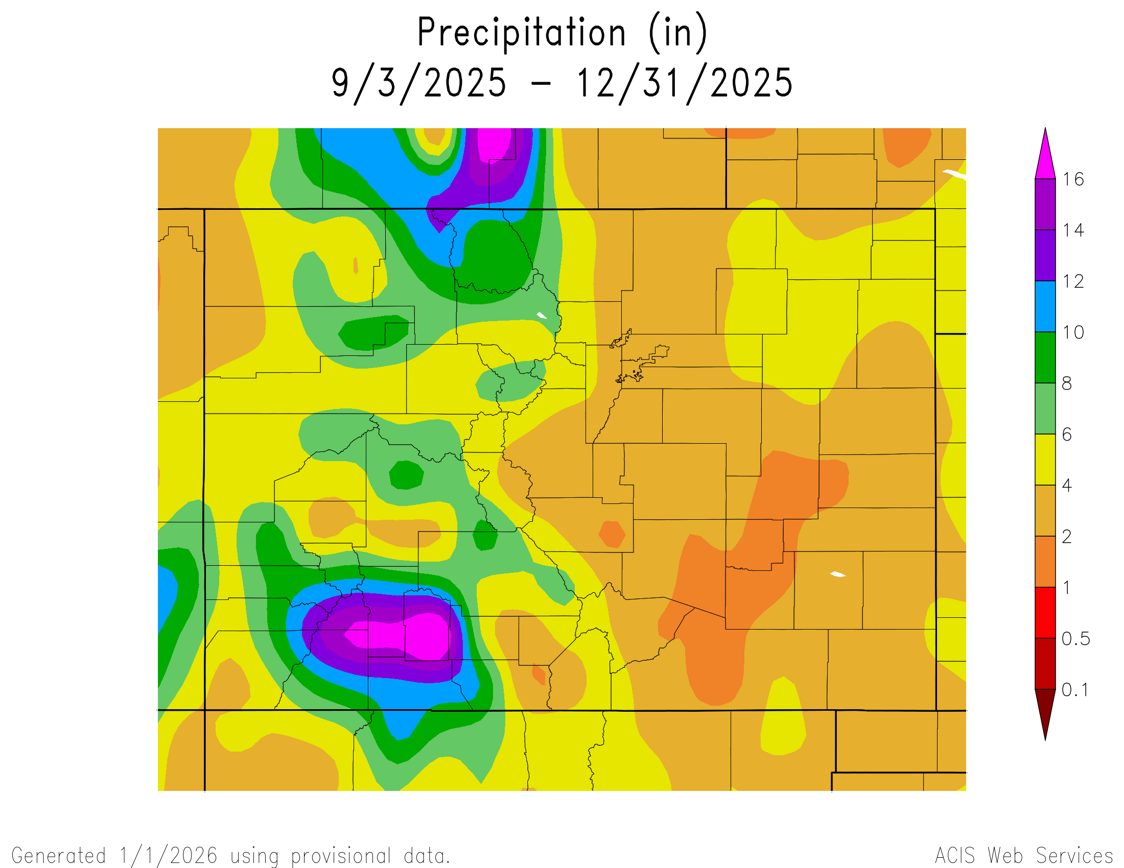
All it takes is a quick step outside to confirm that, so far, winter in La Plata County – and across much of Southwest Colorado – is unseasonably warm. Durango set record-breaking highs on Dec. 24 and Dec. 25, when the temperature climbed to 60 degrees, 5 degrees warmer than previous records for those dates, according to in-town data from the National Weather Service. The warm temperatures have been accompanied by a drier-than-normal December and scarce early season snowfall. While it has impacted and raised concerns across sectors like cattle ranchers, water management and tourism – sectors largely dependent on winter weather – no one is throwing out hope for a good winter. [ed. emphasis mine]
Local businesses have been impacted by the weather differently – good or bad, dependent on the seasonal recreation it sells. Scant snowfall is bad news for powder hounds, and bad business for ski shops that depend on winter recreation business…And while ski-related businesses wait for snow, Durango’s fishing industry has seen increased activity, as warmer temperatures keep rivers accessible later into the season…If warm, dry conditions persist long-term, Glenn said, the outlook could shift. Low river levels and heightened wildfire risk would pose serious challenges for the fishing industry in future seasons…
For the region’s ranching community, winter precipitation is closely tied to long-term water security. Low snowpack can mean less water available once irrigation ditches reopen in the spring. Although the warm weather has limited snowfall so far, heavy rains in the fall helped replenish local reservoirs, providing some reassurance heading into summer, said Wayne Jefferies, president of the Archuleta Cattlemen’s Society…Lemon and Vallecito reservoirs are now nearly three-quarters full – a significant improvement from projections at the end of last summer…
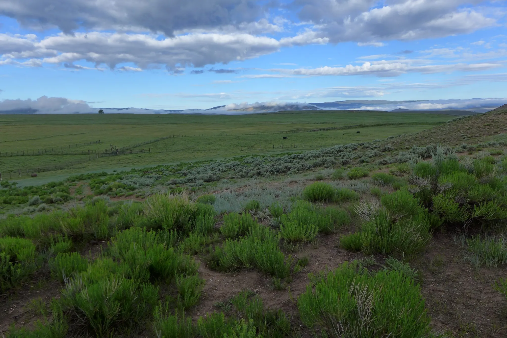
Still, Jefferies said a lack of snowfall remains concerning. If dry conditions persist into early 2026, reservoir levels alone may not be enough to offset reduced snowmelt. Ranchers – who often joke that they are “grass farmers” – rely heavily on snowmelt to recharge underground moisture that supports healthy forage growth. Beneath the surface, soil and gravel layers act like a sponge, [Wayne] Jefferies said. Snowmelt is needed to saturate that sponge before irrigation water and rain can effectively reach grasses. Without sufficient snow and spring runoff, those underground layers remain dry, he said. When irrigation begins, much of the water is absorbed below ground, leaving less available for grasses to grow. The result can be weaker forage, reduced grazing capacity and added strain on ranching operations. Jefferies added this isn’t new. Southwest Colorado has experienced persistent drought conditions for much of the past two decades, punctuated by only brief periods of relief…
Water managers, meanwhile, are entering winter in a stronger position than usual thanks to the fall floods. The October flooding caused reservoirs to rise rapidly. Vallecito Reservoir, which stores water for the Pine River Irrigation District, rose 25 feet in just a few days, said Ken Beck, PRID superintendent. The surplus of water reserves after a dry summer is a good buffer for next year, and has eased the stress of relying solely on winter precipitation, Beck said, although water supply is always subject to some degree of uncertainty.
President Trump vetoes bill to fund pipeline to bring clean water to southeast #Colorado: U.S. Representative Boebert’s Epstein vote, Colorado’s imprisonment of Tina Peters have drawn the president’s ire recently — The #Denver Post #ArkansasRiver #ColoradoRiver
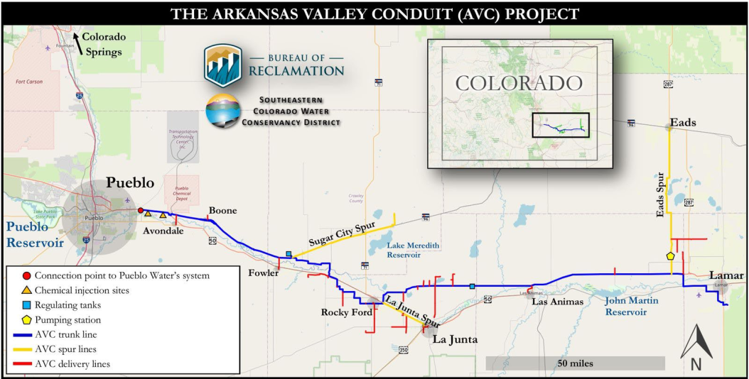
Click the link to read the article on The Denver Post website (Nick Coltrain). Here’s an excerpt:
December 31, 2025
House Resolution 131, sponsored by U.S. Rep. Lauren Boebert and U.S. Sen. Michael Bennet, both of Colorado, sought to jumpstart a project that has languished since 1962. The bill, one of two vetoed by Trump on Tuesday, would extend the repayment period for the project and lower the interest rate. It passed both chambers of Congress by voice vote earlier this year…Trump, who has recently lashed out at Colorado for a slew of grievances, cited the project’s $1.3 billion price tag and said it was supposed to be paid for by local municipalities — not the federal government — in his veto statement…
9News first reported the veto. In a statement to the news station, Boebert said, “If this administration wants to make its legacy blocking projects that deliver water to rural Americans, that’s on them.” She also told the network that she hopes “this veto has nothing to do with political retaliation for calling out corruption and demanding accountability. Americans deserve leadership that puts people over politics.”
Boebert, a Republican representing Colorado’s 4th Congressional District and a longtime ally of the president, recently broke with him by voting to mandate the release of the so-called Epstein files, a trove of documents about the notorious sex criminal with longtime ties to Trump. Trump has also singled out Colorado for retribution over the state’s imprisonment of former Mesa County Clerk Tina Peters.
Chris Woodka, senior policy and issues manager at the Southeastern Colorado Water Conservancy District, which is overseeing the project, said his team is working with Colorado’s congressional delegation on next steps.

Bipartisan #Colorado pipeline bill was noncontroversial until President Trump vetoed it — The Associated Press #ArkansasRiver
Click the link to read the article on the Associated Press website (Michelle l. Price and Meg Kinnard). Here’s an excerpt:
President Donald Trump issued the first vetoes of his second term on Tuesday, rejecting two low-profile bipartisan bills, a move that had the effect of punishing backers who had opposed the president’s positions on other issues. Trump vetoed drinking water pipeline legislation from Republican Rep. Lauren Boebert of Colorado, a longtime ally who broke with the president in November to release files on convicted sex offender Jeffrey Epstein. He also vetoed legislation that would have given the Miccosukee Tribe of Indians of Florida more control of some of its tribal lands. The tribe was among groups suing the administration over an immigration detention center in the Everglades known as “ Alligator Alcatraz.” Both bills had bipartisan support and had been noncontroversial until the White House announced Trump’s vetoes Tuesday night…
Trump did not allude to Boebert in his veto of her legislation, but raised concerns about the cost of the water pipeline at the heart of that bill. Boebert, one of four House Republicans who sided with House Democrats early on to force the release of the Epstein files, shared a statement on social media suggesting that the veto may have been “political retaliation.” Boebert’s legislation, the “Finish the Arkansas Valley Conduit Act,” aimed to improve access to clean drinking water in eastern Colorado.
Nearly every corn seed planted in #Colorado is covered in insecticide. Lawmakers may restrict the chemical. Potential limits on use of neonicotinoids is under discussion between lawmakers, advocates — The #Denver Post

Click the link to read the article on The Denver Post website (Elise Schmelzer). Here’s an excerpt:
Colorado farmers plant tens of millions of corn seeds every year, nearly every one of them covered in a thin layer of insecticide. The neonicotinoids used in the coatings protect the seed from pests in the soil and, as the crop matures, the chemical is absorbed into the plant’s tissue, where it continues to paralyze and kill insects that chomp on the crop. Farmers say the insecticide is necessary, but growing concerns about its impact on crucial pollinator species and the wider environment are prompting a push in Colorado for more regulation of the widely used class of chemicals. Environmental advocates plan to seek a bill in the state legislature in 2026 that would limit their use in hopes of protecting pollinators and water quality. While a draft bill has not yet been made public, the environmental groups working on it said the legislation would ban the use of neonicotinoids without prior approval by inspectors overseen by the Colorado Department of Agriculture.
President Trump’s ’emergency’ #Colorado #coal plant order will raise electricity costs, operator says — Chase Woodruff (ColoradoNewsline.com)

Click the link to read the article on the Colorado Newsline website (Chase Woodruff):
January 2, 2026
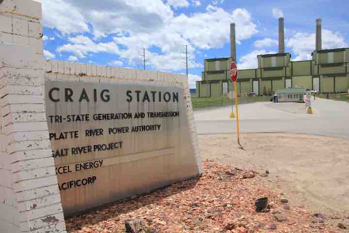
Following the Trump administration’s last-minute invocation of an energy “emergency” to order a Colorado coal plant to postpone its scheduled retirement, the electricity provider that co-owns the plant is warning that the high costs of continuing to operate it will be shouldered by Colorado utility customers.
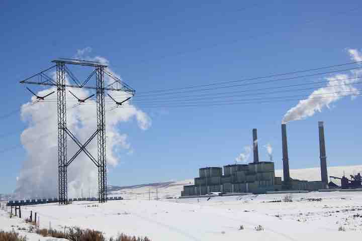
Located in Moffat County, Craig Generating Station’s 446-megawatt Unit 1 had been scheduled to go offline on Dec. 31, 2025, part of a wave of coal retirements planned across Colorado through 2030. But an emergency order issued Dec. 30 by the Department of Energy requires the plant to “take all measures necessary to ensure that Craig Unit 1 is available to operate” until at least March 30, 2026.
Tri-State Generation and Transmission Association, co-owner of Craig Generating Station, said in a press release that the “additional investments in operations, repairs, maintenance and, potentially, fuel supply” required by the order will raise costs for the plant’s customers, which include dozens of electric utilities and rural co-ops. Unit 1 was already offline due to a mechanical failure on Dec. 19, Tri-State said.
“We are continuing to review the order to determine what this means for Craig Station employees and operations, and the financial impacts,” said Tri-State CEO Duane Highley. “As a not-for-profit cooperative, our membership will bear the costs of compliance with this order unless we can identify a method to share costs with those in the region. There is not a clear path for doing so, but we will continue to evaluate our options.”
The five-page DOE order, signed by Energy Secretary Chris Wright, cites “growing resource adequacy concerns” as justification for the move, which followed similar actions in Indiana and Washington.
Shortly after taking office last year, President Donald Trump declared a “national energy emergency” in an executive order blasted by environmental advocates as a pretext for advancing the interests of fossil-fuel companies. Despite the declaration’s stated concerns about “insufficient energy production,” the administration has continued to cancel and delay major wind and solar projects.
An analysis released in December by the Sierra Club estimated that keeping Craig’s Unit 1 open for 90 days would cost ratepayers at least $20 million. Critics of the administration anticipate that the DOE’s orders will continue to be renewed every 90 days under the authority granted to the department by Federal Power Act, raising costs by $85 million to $150 million annually.
“Keeping this dirty and outdated coal plant online will harm the health of surrounding communities and hurt all of our pocketbooks,” said Michael Hiatt of environmental group Earthjustice. “This unlawful order will benefit no one but the struggling coal industry.”
The DOE order comes amid a series of Trump administration actions targeting Colorado that are widely viewed as retaliation for the ongoing incarceration of Trump ally and former Mesa County Clerk Tina Peters, who was convicted on felony charges for her role in a breach of her own office’s secure election equipment in 2021.
Colorado U.S. Sen. Michael Bennet voted to confirm Wright, a former Denver oil executive, as Trump’s pick for Energy Secretary in January 2025, calling Wright “passionate about strengthening America’s energy independence and lowering costs for Colorado families.” In a statement Wednesday, Bennet, a Democrat who is running for Colorado governor, said he was “disappointed but not surprised by this continued revenge tour.”
“The DOE order is the latest in a string of attacks against Colorado, because we refuse to bend to the President,” Bennet said. “President Trump continues to take out his personal and political grievances on Coloradans who are already struggling to make ends meet.”
Eddie Vedder “No More”
2025 finished in the top 10 for warmest year on record in the Contiguous U.S. (1895-present) — Climatologist49 (@climatologist49.bsky.social)
A World Out of Balance — Brian Richter (SustainableWaters.org) #climate

Click the link to read the article on the Sustainable Waters website (Brian Richter).
December 31, 2025
‘Sustainability’ is a foundational tenet of modern natural resource management. The concept of sustainable development gained global recognition in 1987 when the United Nations’ Brundtland Commission published its report on Our Common Future, in which sustainable development was defined as “meeting the needs of the present without compromising the ability of future generations to meet their own needs.” In simple terms, this means avoiding the depletion of natural resources and loss of species over time.

Our research group has just published our third detailed assessment of water resources management in three major river basins in the western United States. Our three studies — focusing on the Colorado River, the Great Salt Lake basin, and the Rio Grande-Bravo — clearly document that water managers and political leaders are failing in their efforts to manage these water resources for long-term sustainability, meaning that they have not balanced water consumption with natural replenishment from snowmelt runoff, rainfall, and aquifer recharge. As a result, reservoir and groundwater levels are falling, rivers are shriveling, and numerous endangered species are in great jeopardy. The livelihoods and well-being of tens of millions of people dependent on these water systems, along with the extraordinary ecological systems and species sustained by these waters, are now at great risk.
As a Native American friend said recently, “our world is out of balance.”
These systemic failures share a common history with hundreds of other stressed river basins and aquifers around the planet. For thousands of years, the human populations dependent on each water source were small enough that water consumed for human endeavors had little to no impact on water sources and associated ecosystems, i.e., their use of water was ‘renewable’ and ‘sustainable.’ But over the course of the 20th century, the growth of human populations and associated food needs grew rapidly — largely without constraint or control — to the point of consuming all of the renewable annual water supplies in many river basins, including the three we studied. Then as we entered into the 21st century, climate warming began reducing the replenishment of rivers, lakes, and aquifers. The balance between water consumption and replenishment became overweighted on the consumption side as the replenishment side got lighter. Our world went out of balance.
The Risks of Continued Imbalance Are Very Frightening
The potential consequences of this imbalance are nothing short of horrific and dangerous in the three basins we studied. Here are some of the highlights from our trilogy of recent papers:

- Colorado River Basin: Since 2000, more water has been consumed than replenished in this basin in three out of every four years, on average. These recurring deficits in the basin’s annual water budget has been offset by depleting water stored in the basin’s reservoirs and aquifers, analogous to pulling money out of a savings account to make up for overdrafts in a checking account. As a result, the basin’s two biggest reservoirs — Lake Powell and Lake Mead — are now 70% empty. There is great concern that if the water level in Lake Powell drops below 3490′ elevation (see graph below), it could become physically impossible to release sufficient water through the Grand Canyon to meet the water needs of ~30 million people downstream. In a worst case scenario, the volume of water flowing out of Glen Canyon Dam could intermittently shrink to a trickle if the dam’s managers determine that continuous use of the lowest river outlets is too structurally risky and releases into the Grand Canyon must be drastically reduced. This calamity would further imperil unique freshwater ecosystems and wipe out the $50 million/year whitewater rafting industry in the Grand Canyon. We estimate that average annual water consumption needs to be reduced immediately by at least 13% below the recent 20-year average to rebalance water consumption with natural replenishment in this basin.

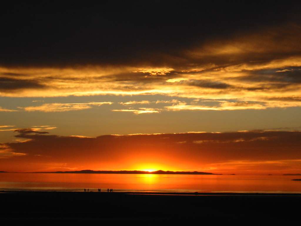
- Great Salt Lake Basin: The lake has lost nearly half of its volume since 2000, dramatically shrinking the area of the lake’s surface and exposing extensive salt flats around the lake’s perimeter. Those salty soils are loaded with toxic heavy metals including arsenic, lead, and mercury. Recurring high winds blow that dangerous dust into the nostrils and lungs of more than two million people living in the Salt Lake City area. Brine shrimp living in the lake also suffer at low lake levels due to extreme salinity, greatly reducing the food supply for more than 10 million migratory birds along the Pacific Flyway and decimating production of brine shrimp eggs that are a critical feed source for the world’s aquaculture industry. The reduced evaporation from a shrinking lake also impacts the formation of storm clouds that drop the “world’s greatest snow” onto the Wasatch Mountains, site of the upcoming 2034 Winter Olympics. Water consumption in the basin needs to be rapidly reduced by 21% to stabilize the lake.


- Rio Grande-Bravo: Reservoir storage in this large international basin is now three-quarters empty. New Mexico’s reservoirs hold only 13% of their capacity, presenting a “Day Zero” scenario in which the remaining reservoir storage could be wiped out in just one or two more bad water years. This has created heated political conflict: New Mexico has been failing to deliver the volume of water it owes to Texas under the Rio Grande Compact, and Mexico has been unable to deliver sufficient water to the US under the terms of an international water treaty. Also of great concern is plundering of the vast groundwater reserves in the basin that has accelerated as surface water supplies have run short (see map of groundwater depletion below). Only half of the water being consumed for human endeavors in this basin is sustained by natural replenishment; the other half depends on unsustainably depleting reservoirs and groundwater aquifers and drying the river.

Governance Failures
The response to these crises has been woefully inadequate. Instead of addressing these imbalances at the scale and speed necessary to avert catastrophe, political leaders and water managers have been unable or unwilling to mobilize sufficient corrective actions to rebalance these water budgets. From my observations, there are multiple interacting causes of these governance failures:
- There is continuing belief among many political leaders and water users that more bountiful replenishment years in the future will restore the massive accumulated deficits in reservoir and aquifer volumes. This belief runs contrary to the evidence of 25+ years of declining water trends and many scientific assessments warning that replenishment will continue to decline due to climate warming and aridification.
- Water users have not been adequately or truthfully educated about the potential consequences of continued depletion of reservoirs and aquifers, and the rapid rate at which risks are increasing. The lack of honest communication and misunderstanding of pending dangers perpetuates complacency and inaction. What is needed is full and honest disclosure about the degree to which water consumption is out of balance with replenishment, and which water users and economic sectors are at great risk from deepening water shortages in future years.
- Fearing hostile reaction to any mandated cutbacks in water consumption, political leaders lack the will to force or incentivize the actions required to rebalance consumption with (diminishing) replenishment. There are no plans in the three basins described above for correcting imbalances at the necessary scale and speed. Legislative appropriations to address these crises have been orders of magnitude smaller than what is needed. These meager appropriations serve to placate the general public by giving the impression that responsible actions are being taken, serving as a smoke screen hiding the monstrous dangers on the horizon.
- Instead of facing the reality that consumption needs to be speedily reduced, water managers continue to flout pipe dreams for augmenting water supplies such as long distance water importation schemes (bring water from the Great Lakes! bring water from the Yukon!), or desalinating ocean water, or recycling water ‘produced’ from oil and gas fracking operations. There is no truthful reporting of how much additional water can be secured by these schemes, how much that water will cost, and who will be able to afford it. Irrigated agriculture is by far the dominant water consumer in the three basins we studied, but there is no way that farmers are going to be able to afford these water augmentation dreams.
The Way Forward: Sustainability Principles
Throughout my career I’ve always said that one should not deliver criticism without also offering solutions. In my Chasing Water book I outlined seven principles for sustainable water management.

I continue to believe in this recipe for water sustainability. But I need to offer some important clarifications:
- Principle #1 is arguably the most important. Given that water consumed on farms is typically much greater than is consumed in cities, it is critically important to meaningfully engage farmers in water planning because they will bear the greatest burden of any limitations placed on water consumption. They can bring their best ideas forward, and in doing so help to ensure that water plans address both their concerns and their abilities to adapt. But it is essential that any water plans be built upon an honest and technically credible assessment of how much water will be available in the future.
- Principles #2 and #3 should not be permanent, static volumes. Under a changing climate, the imposed limits need to be adaptive to changing water availability; during wet periods more water can be consumed, but lesser volumes should be allocated during dry times. I believe that the best way to do this is to set a 5-year fixed volume (a “cap“) on annual consumption based on an average of how much water has been available in the recent 5 years, and then allocate portions or shares of that volume to each user (i.e., to each geopolitical unit, community, or individual water user). The cap volume needs to be updated every five years. I like a 5-year adaptive cap because it gives water users enough time to plan and implement changing allocations while not allowing any overconsumption to cause severe problems before readjusting the cap.
- Principle #6 acknowledges the reality that water conservation measures can be costly for both rural and urban users, and can impact the profitability of farms. Subsidization of these expenses or losses will be essential in rebalancing these water systems for sustainability, enabling both urban and rural communities to transition to lower water use as rapidly as possible, and with least economic and social impact. The price tags may seem exorbitant or impossible at first blush, but the costs of continued unsustainable water use will be much, much greater.
- Principle #7 requires investment in continuously monitoring reservoir, aquifer, and river levels, and enforcement of water allocations. One of the most important indicators of management performance is whether reservoir or aquifer levels or annual river flow volumes are declining. If this is the case, allocations need to be adjusted until balance returns.
Passing the Torch to a New Generation
Today is my retirement day.
In my Chasing Water book, I mused about the fact that when I was born in 1956, the western US was in the grips of one of the longest and most severe droughts in American history. It seems fitting to have spent my professional life focusing on water scarcity and environmental flows.
But I now find it quite depressing to acknowledge that our society has still not become any better at sustainable water management. Many river basins, including the three summarized above, are now facing their most dangerous crises.
When I was teaching water sustainability at the university level, I would point out to my students that in my birth year of 1956 virtually all of the Colorado River’s water was being consumed. Why we allowed greater and greater use of water in that river basin for another half-century continues to astonish and bewilder me to this day. Why is our species so incapable of recognizing clear and present dangers and so inept at responding accordingly?
But I leave you eternally hopeful. The students that I’ve taught, and the many younger adults I’ve met through my work in more than 40 countries, have the intellect and the passion to bend the arc of water management back towards sustainability, if we give them the chance. I urge them to take up this charge, to find ways to gain positions of authority and power to lead toward better days ahead.
I’ll leave these next generations with one bit of advice: The management of water cannot remain solely in the hands of hydrologists and engineers and economists. We need legions of young new professionals that understand social science, political science, behavioral science. And we need artists.
After all, managing water is about people, and the human spirit.
Adiós
Can beavers help heal burn scars after wildfires? #Colorado researchers built their own dams to find out — The #Denver Post
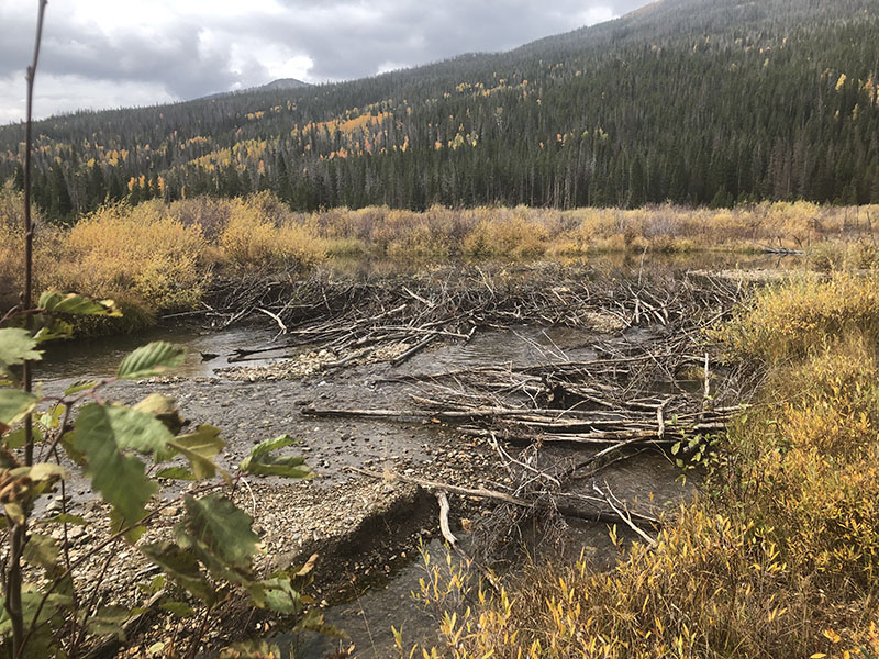
Click the link to read the article on The Denver Post website (Elise Schmelzer). Here’s an excerpt:
December 30, 2025
High in the mountains west of Fort Collins, teams of scientists and engineers are pretending to be beavers.
They may not be swimming or chewing trees, but researchers with the U.S. Forest Service and Colorado State University are building [beaver dam analogs] in burn scars to study how wetlands created by the dams impact ecosystem restoration and water quality after wildfires. The research led by Tim Fegel is some of the first of its kind, he said. Scientists have studied how meadow and wetland restoration affects wildlife habitat, but there’s been little exploration of how wetlands created by beaver dams could change water quality post-wildfire, said Fegel, a biogeochemistry lab manager with the Forest Service who is leading the project.
“It’s kind of a brave new world for us with this type of work,” said Fegel, who is also a doctoral candidate at Colorado State University.
Wildfires destabilize soils and make them less capable of absorbing rain and snowmelt, resulting in higher runoffs and increased flood probability. High volumes of water, combined with a lack of vegetation roots to hold soil in place, mean that more sediment and debris travel downstream, impacting water quality and water treatment systems.

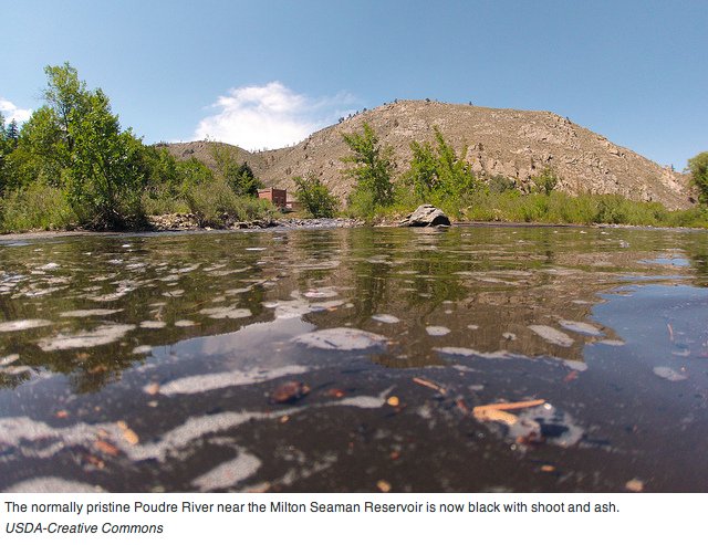
Five years ago, the Cameron Peak and East Troublesome wildfires ripped through Colorado’s northern mountains, charring more than 620 square miles across watersheds that provide water for hundreds of thousands of people who live along the Front Range. That’s where Fegel and other researchers think the [beaver dam analogs] can help. Fegel hopes the work will provide land managers and water utilities with more data and, potentially, another water-quality tool. The team installed beaver-style dams across the Cache la Poudre and Willow Creek watersheds — both burned in the 2020 wildfires — to help slow water flow and instead spread the water over a floodplain. Engineers designed the dams, which are generally made of large logs hammered into the earth with branches and other material.
Predicting Snow-to-Liquid Ratio in the Mountains of the Western United States — Peter G. Veals, Michael Pletcher, Andrew J. Schwartz, Randy J. Chase, Kirstin Harnos, Jimmy Correia, Michael E. Wessler, and W. James Steenburgh #snowpack

Click the link to access the report on the American Meteorological Society Journals website. Here’s the abstract:
August 29, 2025
The snow-to-liquid ratio (SLR) and its inverse, snow density, are crucial for forecasting snowfall in numerical weather prediction models and for estimating snow water equivalent (SWE) on the ground using remote sensing. SLR also varies widely in space and time, making it challenging to forecast accurately, particularly in the heterogenous terrain and climate of the mountains of the western United States. This study utilizes high-quality, manually collected measurements of new snowfall and new SWE from 14 mountainous sites across the region to build multiple linear regression (MLR) and random forest (RF) algorithms to predict SLR as a function of atmospheric variables. When an MLR algorithm is trained on a simple combination of wind speed and temperature from either the ERA5 reanalysis, the GFS, or the High-Resolution Rapid Refresh (HRRR), it predicts SLR with considerably more skill than existing SLR prediction methods. When a more extensive set of variables is considered, the skill improves further. The variables used to achieve the most skillful prediction of SLR are temperature, wind speed, relative humidity, specific humidity, maximum solar altitude angle during the observing period, convective available potential energy (CAPE), and HRRR quantitative precipitation forecast (QPF). When an RF algorithm is trained using these variables, it can predict SLR with R2 = 0.43 and mean absolute error (MAE) = 2.94. For the existing SLR prediction techniques currently used in operations, R2 ranges from 0.04 to 0.23 and MAE ranges from 4.01 to 9.45. Therefore, the algorithms built in this paper can drastically improve SLR prediction over the mountains of the western United States.
Oh, the irony of Craig No. 1! — Allen Best (BigPivots.com) #coal
Click the link to read the article on the Big Pivots website (Allen Best):
December 31, 2025
Trump orders Craig coal unit planned for retirement to stay open. But it so happens the unit is broken. Ludicrous says Polis team. Sierra Club challenges basis for emergency declaration.
It was no surprise. Tri-State Generation and Transmission has said for at least three months that it expected to get orders from the Trump administration to continue operating a coal-burning unit at Craig, in northwest Colorado, beyond its scheduled retirement on Dec. 31, 2025.
The order was posted at 6 p.m. MST Tuesday. Citing emergency authority claimed by President Donald Trump, Energy Secretary Chris Wright ordered the coal unit to remain in operation through March 2026. The order cited a sudden increase in demand for electricity, or a shortage of generation capacity.
The irony of the order is that it was issued when the 427-megawatt unit was out of operation, according to a statement issued by the office of Colorado Gov. Jared Polis.
“Ludicrously, the coal plant isn’t even operational right now, meaning repairs — to the tune of millions of dollars — just to get it running, all on the backs of rural Colorado ratepayers!” Polis said.
“Going backwards is an attempt to force local communities to foot the bill to extend plant operations and will cost energy consumers more. Today’s action flies in the face of this careful planning, is inconsistent with market forces, and will hurt Coloradans.”
The Polis team estimated continued operations would cost tens of millions of dollars “to keep a coal plant open that is broken and not needed.”
Tri-State, in a statement on Wednesday morning, explained that the unit “went into an outage” on Dec. 19, 2025, due to a mechanical failure of a valve. “Tri-State and the other co-owners will need to take the necessary steps to repair the valve in a timely manner,” the statement said.
“Tri-State has a policy of 100% compliance, and we will work with Unit 1 co-owners, and federal and state governments to determine the most cost-effective path to that end,” said Duane Highley, Tri-State CEO. “We are continuing to review the order to determine what this means for Craig Station employees and operations, and the financial impacts. As a not-for-profit cooperative, our membership will bear the costs of compliance with this order unless we can identify a method to share costs with those in the region. There is not a clear path for doing so, but we will continue to evaluate our options.”
As a result of the order, retaining Unit 1 will likely require additional investments in operations, repairs, maintenance and, potentially, fuel supply, all factors increasing costs, Tri-State said. “Tri-State is continuing to review the order to determine how best to comply while limiting the costs to its members, and the impacts to its employees and operations.”
Highley told Big Pivots in October that the wholesale supplier for cooperatives in Colorado and three other states did not need the electrical production at this time, as it is actually producing more than it needs.
Wright, in his order, No. 202-25-14, cited several justifications.
One justification was a 2024 report by the Western Electricity Coordinating Council that forecast growth of 8.5% in peak demand during the next decade in Colorado and several adjoining states.
The order also said that Tri-State and its co-owners — Fort Collins-based Platte River Power Authority, Phoenix-based Salt River Project, Salt Lake City-based PacifiCorp., and Denver-based Xcel Energy — “take all measures necessary” to ensure that Craig Unit 1 is available to operate at the direction of either Western Area Power Administration in its role as a balancing authority or the Southwest Power Pool West in its role as the reliability coordinator.
The Sierra Club emphasized the cost of operating Craig No. 1. It cited a recent report by Grid Strategies that found operating the unit past the retirement deadline will cost the plant owners $85 million per year. This is distinct from repairs that may be necessary.
“Trump is playing politics with coal,” said Margaret Kran-Annexstein, director of the Colorado chapter, in a statement issued shortly after the order was posted.
Matthew Gerhart, the senior attorney for the Sierra Club at its Denver office, had even stronger language in an interview with Big Pivots.
“I think this order is a joke even by this administration’s standards,” he said. “This is quite clearly just a political move. None of the documents they cite even come close to saying there is an emergency.”
Wright’s order cited the 2025-2026 Winter Reliability Assessment issued by the North America Electric Reliability Corporation. That report in November noted total and net internal demand increases of almost 1% driven primarily by data centers and commercial and industrial customer growth. Even so, the operating reserve margins in the Rocky Mountain were expected to be met before imports in all winter scenarios.
That being said, Xcel Energy almost a year ago began expressing concerns about resource adequacy.
Gerhart also found fault with Wright’s order that the unit be available to operate at the direction of the Southwest Power Pool West in its role as the reliability coordinator. SPP exists, but not the configuration — a regional transmission organization — that would allow SPP to do this, he said. SPP has a day-ahead market and also a balancing market but not the apparatus set up to manage the operation of Craig No. 1, he said.
Will Toor, director of the Colorado Energy Office, also pointed to the report from the North America Reliability Corporation that found no short-term or long-term elevated reliability risks in the Rocky Mountain region,
“These orders will take money out of the pockets of Colorado ratepayers, and especially harm rural communities across the West who could be forced to absorb the unnecessary excess costs required to keep this plant operational,” he said. “The Trump administration is engaging in Soviet-style central planning, driven by ideology rather than the realities of the electric grid, that will drive dirtier air and higher electric rates across our state. These orders are unlawful and will not improve energy security in Colorado or the region.”
Trump has claimed authority to order coal plants remain in operation under the Federal Power Act. That nearly century-old law explicitly gives presidents authority to order electrical plants to operate under duress of war or weather emergencies. Since last April, Trump has sought to expand the power, citing emergencies caused by concerns about resource adequacy. The concerns, he has said, result from retiring fossil fuel and nuclear plants, dramatic growth in demand, and the intermittency of renewables.
For a deeper dive on Trump’s contested use of the emergency clause in the Federal Power Act, see this Big Pivots story from Nov. 3: “Will feds order Colorado coal plants to stay open?”
U.S. Sen. Michael Bennet, a gubernatorial candidate, also pushed back: “The DOE order is the latest in a string of attacks against Colorado, because we refuse to bend to the President. President Trump continues to take out his personal and political grievances on Coloradans who are already struggling to make ends meet. Federal intervention like this makes long-term planning impossible – this is not how you operate a business, plan an electric grid, or help a community stay prosperous. I am disappointed but not surprised by this continued revenge tour.”
Wright’s order said that 417.3 megawatts of coal-fired generating capacity across six units at three locations have retired in Colorado since 2019. It cited the Western Electricity Coordinating Council. “Looking forward, by 2029, about 3,700 megawatts of coal-fired generating capacity in Colorado is scheduled to be retired.” The order said that during that time, 675.6 megawatts of natural gas-fired generating capacity in Colorado will retire as well.

In 2025, wind accounted for over 5,300 megawatts of Colorado’s electricity generating capacity, the order noted.
Wright’s order described wind as intermittent. Of course, coal can be intermittent, too. That has been demonstrated repeatedly at Pueblo, particularly in the case of Comanche 3. The coal unit went down again in August and is not expected to be restored into operation until June 2026. In its absence, Xcel asked — and the Polis administration agreed — that Comanche 2 would not be retired this month, as had been planned for several years.
As for Craig No. 1, its retirement was planned in an agreement reached almost a decade ago. Air quality standards in Rocky Mountain National Park and other national parks and wilderness areas are being violated in part because of emissions from the unit. The regional haze standards were federally created and state enforced. The agreement with the Colordo Air Quality Control Commission was reached in 2016.
Tri-State’s electric resource plan of 2023 showed adequate resources to maintain reliability on Tri-State’s system following the retirement of Craig No. 1 as well as two other units at Craig Station that are scheduled to close in 2028. Unit 2, which Tri-State owns with its other partners in Unit 1, has a capacity of 410 megawatts. Tri-State owns 100% of Unit 3, which has a capacity of 448 megawatts. The three units were constructed and went on line in the late 1970s and early 1980s.
The Trump administration first cited the Federal Power Act earlier this year this year for plants in Michigan and in Pennsylvania and has recently used that same emergency power to order continued operation of fossil fuel plants in Indiana and Washington.

Massive Energy Storage Project Eyed for Four Corners Region — Brett Walton (circleofblue.org)

Click the link to read the article on the Circle of Blue website (Brett Walton):
December 22, 2025
Colorado River water could enable a pumped storage hydropower project intended to make the region’s electric grid more resilient.
KEY POINTS
One of the longest-duration pumped storage hydropower projects in the country is proposed for Navajo Nation land in the Four Corners region.
The project received a $7.1 million Department of Energy grant this year for feasibility studies.
Pumped storage hydropower is the largest form of energy storage in the U.S.
Standing in a breezy parking lot on Navajo land in the state’s far northwest corner, Tom Taylor looked toward the western horizon and then upwards at the furrowed mass of the Carrizo Mountains less than 10 miles away.
If all goes to plan, the infrastructure that could one day spill from the mountain’s flanks and through its core will become an essential piece of the region’s electric grid, able to store surplus electricity from renewable energy and other power sources for when it is needed later.
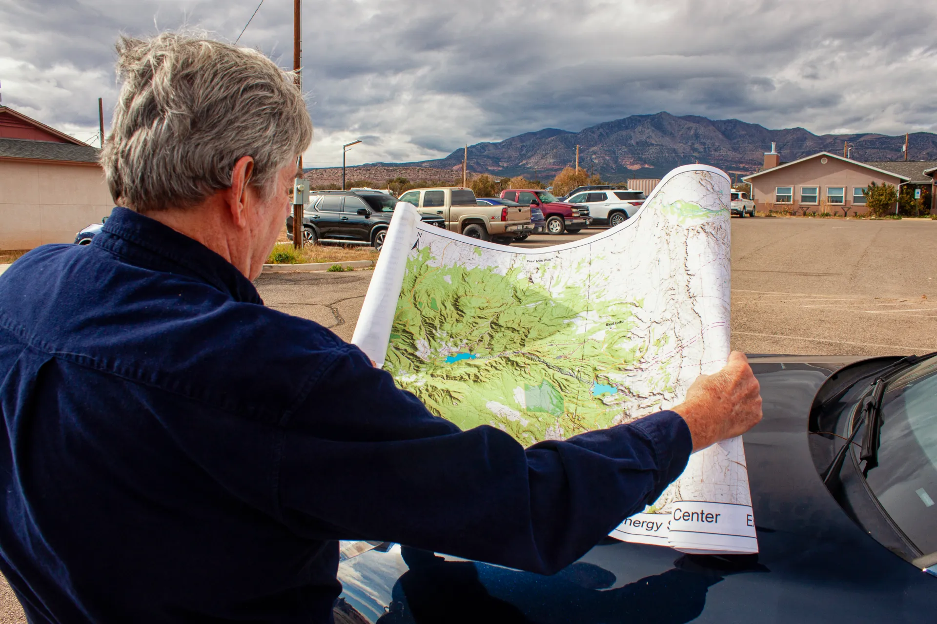
Fighting the wind that chilly November morning, Taylor used both hands to pin a detailed map against the hood of his Porsche Macan. A jumble of dashed lines and blue splotches representing proposed power lines, reservoirs, a water-supply pipeline, and access roads were printed atop the real-world geography on display in front of us.
“This will be a battery that lasts a long time,” Taylor said, holding tightly to the map.

The project is the $5 billion Carrizo Four Corners Pumped Storage Hydro Center, which is designed to be one of the largest long-duration energy storage projects in the country. Pumped storage moves water between two reservoirs at different elevations. Water is pumped uphill when excess electricity is available and released to generate electricity when power demand warrants it.
Taylor, a former mayor of Farmington and a state House representative from 2000 to 2014, is employed by Kinetic Power, the three-person, Santa Fe-based outfit behind the Carrizo proposal. The company sees the project as a way to make the region’s electric grid more durable and cost-effective, not only by smoothing the intermittent nature of wind and solar but also as a bulwark against energy emergencies like the winter storm in 2021 that caused blackouts and 246 deaths in Texas. The twinned reservoirs, using water sourced from a Colorado River tributary nearby, would have the capacity to generate 1,500 megawatts over 70 hours – a form of battery that could provide the equivalent output of a large nuclear plant for nearly three days.
“We believe that the key is delivering economic value,” said Thomas Conroy, Kinetic Power’s co-founder, who has four decades of experience developing energy projects.
What seems straightforward when placing lines on a map is much less so in three dimensions. Carrizo Four Corners, which is still in the exploratory stage and is at least five years away from breaking ground, has nearly as many questions as answers at this point. What is the geology within the Carrizo Mountains? Will it support a 3,300-foot-deep shaft, a subterranean powerhouse, and dam abutments? How will drought affect the water supply? What cultural sites and wildlife might be at risk from construction? What are the power market dynamics?
Answering those questions is the goal of a $7.1 million, two-and-a-half-year Department of Energy grant that Kinetic and its six university and research partners secured in August. (The state of New Mexico and the research partners are also contributing $7.1 million.) On the political side, will future Navajo administrations feel as favorably toward Carrizo as current president Buu Nygren?
The technical questions are but one piece of an ambitious project that touches many of the most pressing questions about natural resources in the American West today: energy development, water use, and the relationship between federal law and tribal law.
Connecting Water and Energy
Though the details are still to be worked out, the project can be described in broad strokes.
The Federal Energy Regulatory Commission, which oversees federal hydropower licensing, granted Kinetic a preliminary permit in 2021. In February 2025 FERC extended the permit, which allows for site investigations but no construction work, for another four years.
The company envisions two “off-channel” reservoirs that would not dam a flowing river. The lower reservoir will be near Beclabito. The upper, in the high reaches of the Carrizo Mountains. Both are on Navajo land, but on different sides of the Arizona-New Mexico border.
The powerhouse that holds the electricity-generating turbines will be located underground, some 3,300 feet below the upper reservoir. Some of the longest pumped storage tunnels in the country will be required to connect the reservoirs and the powerhouse.
Despite the geotechnical challenges, Conroy is particularly enthused by the site, which he said is the most optimal in Arizona and New Mexico – and possibly the entire country – to locate a pumped storage hydropower project.
The site stands out for four reasons, he said. It is near existing transmission corridors and grid connections due to the region’s legacy of enormous coal-fired power plants. And it will have a comparatively low capital cost for the energy it will produce.
The other two reasons relate to water. Because of the extreme height differential between the upper and lower reservoirs – almost three Empire State Buildings – less water will be required to produce a unit of energy than for reservoirs with a gentler gradient. And because the upper reservoir site is a deep canyon, surface area and thus evaporation will be minimized.
“Water is just top of mind here in the Southwest,” Conroy said. “And our project is as water-efficient as can be made.”
Water to fill the reservoirs would be drawn from the San Juan River, a tributary of the Colorado, via pipeline. The water would come from the Navajo Nation’s San Juan rights, which have been quantified but are not fully used.

How much water? In its FERC permit application, Kinetic estimated that the initial fill, which will take one and a half to two years, would require 38,300 acre-feet. To cover subsequent evaporation losses, the reservoirs would need to be topped up with 2,635 acre-feet per year. Those numbers will be refined in the feasibility studies.
“It’s what, about 1,300 acres of corn?” Taylor said, doing a rough mental calculation of the equivalent water consumption for the annual evaporation loss. “I think this is more valuable than 1,300 acres of corn.”
Saving for Tomorrow
So far the project has threaded the federal government’s fraught energy politics. The Trump administration is hostile to wind and solar, which in their eyes reek of liberal values. Two water-based technologies – hydropower and geothermal – have escaped condemnation and are listed in the administration’s energy dominance documents. The DOE grant that Carrizo secured is a holdover from the Biden administration’s infrastructure bill, which provided up to $10 million for feasibility studies for pumped storage projects that would store renewable energy generated on tribal lands.
Storage is the holy grail of renewable energy. Human civilization has advanced, from the dawn of agriculture to the artificial intelligence revolution today, by being able to carry a surplus from one season and one year to the next. So it is with wind and solar. To maximize their utility and counteract their intermittent nature, engineers have been searching for cost-effective ways to store energy when the sun shines and when the wind blows for the days when neither of those things happen.
“If you want to improve the resiliency of the system, you either build more firm capacity instead of more renewable, or you build longer storage,” said Fengyu Wang, a New Mexico State University assistant professor who is the principal investigator for the DOE grant.

Storage has taken many forms. Some are fantastic mechanical configurations – lifting heavy objects and dropping them, or forcing air into caverns and releasing it. Thermal options use molten salt to trap the sun’s heat. The most familiar are batteries, which leverage chemical energy. But the most common, at least in the U.S., is pumped storage hydropower.
The 43 pumped storage facilities in the U.S. represent the bulk of the country’s utility-scale energy storage. They accounted for 88 percent of the total in 2024, according to Oak Ridge National Laboratory. That is changing quickly, however, as more battery storage comes online. The share for pumped storage was 96 percent in 2022.
Still, long-duration storage is where pumped storage shines. According to Oak Ridge, the median battery storage is two hours. For pumped storage, it is 12 hours. Longer duration provides more buffer, not only from day to day but also season to season.
In that regard, Carrizo would signify a huge leap. The only comparable pumped storage project under consideration in the U.S. is Cat Creek, in Idaho. Even though its duration is 121 hours, its generating capacity is less than half, at 720 megawatts.
Carrizo will have a different use case than other U.S. pumped storage projects, Conroy said. Many facilities have one customer and one generator. A nuclear plant, for instance, might be paired with a pumped storage system so that the nuclear plant can run continuously.
For Carrizo, there might be a consortium of utilities that have multiple generating sources feeding into this project and moving the water uphill. They would take delivery of that power across a large region with different climatic conditions and different needs for when and how they use the stored power. That means operating the facility will be more complicated than a traditional pumped storage project. One thing is certain, Conroy said: the Navajo will have an equity stake.
Tribal Outlook
Caution on the part of the Navajo would be understandable. The tribe’s lands have long been the center of energy developments with environmentally ruinous but economically helpful outcomes.
Uranium mining to fuel the Manhattan Project and then the nation’s reactors polluted rivers and groundwater, as did the coal mines that fed Four Corners Power Plant and the now-shuttered Navajo Generating Station and San Juan Generating Station. On the other hand, these developments provided employment and income. Navajo Mine, which supplies Four Corners Power Plant, accounts for about 35 percent of the Navajo Nation’s general fund.
Navajo and other tribal lands in the Four Corners region have been the target for a handful of pumped storage proposals in recent years. The Navajo Nation opposed three projects proposed for the Little Colorado River watershed, which were either withdrawn by the developer or denied a permit by FERC. Two other projects – Carrizo and Sweetwater, both using San Juan River water – are still in development. Sweetwater, a smaller project with eight hours duration, is being co-developed with the Ute Mountain Ute Tribe. A third project, Western Navajo Pumped Storage, which would be located near the former Navajo Generating Station, received a FERC preliminary permit in August.
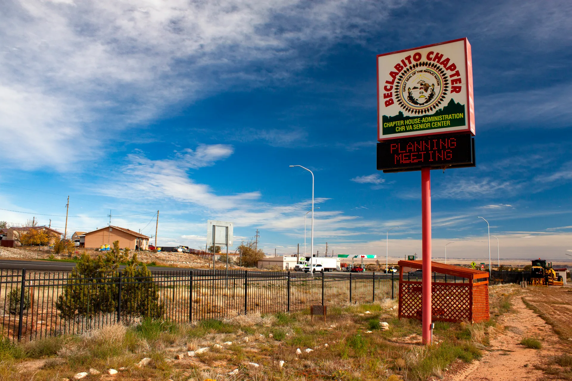
Carrizo has not run into the same level of opposition as the other proposals. In part that is due to the proposed use of the San Juan River instead of groundwater, said Erika Pirotte, an assistant attorney general in the Navajo Nation’s water rights unit. Many Navajo communities rely on groundwater, and using it for pumped storage was viewed as unreasonable.
The lack of strong opposition is also because of Kinetic’s engagement with the Navajo Nation. The company has held meetings with the Beclabito, Red Valley, and Teec Nos Pos chapters, in addition to meetings with Navajo Nation agencies and Buu Nygren, the Navajo Nation president. Kinetic has a memorandum of understanding with Nygren, who also signed a letter of support for the project’s DOE grant application.
“We have the support of the council,” Conroy said. “We have a very high level of support from the president, and he is just extraordinarily interested in this project and seeing that it moves forward.”
From the Navajo perspective, what is interesting are the “ancillary benefits” that could come from the water supply pipeline, Pirotte said. Once the reservoirs are filled and the pipeline’s full capacity is not needed, the extra space could be repurposed for tribal water supply uses.
“That’s why the feasibility studies are really important for the Nation, because they help us understand to what extent Navajo Nation resources would be used for the project,” Pirotte said.
None of this is immediately around the corner, Conroy cautions. The DOE grant extends for more than two years. The FERC permitting process could be another two to four years. With Congress and the Trump administration talking about faster permitting and better coordination, that timeline is a best guess.
And then there is the question of tribal authority in the permitting process, not just for the Carrizo project but for other such developments. Will FERC abide by its 2024 stance that preliminary permits for hydropower projects on tribal lands require tribal consent? The Trump administration would like to see that policy scrapped. If FERC approves a project must a tribe assent to all the associated infrastructure? Will the Navajo be allowed to conduct reviews and issue permits?
And then there is construction, the biggest component. That will take four to six years, Conroy said.
Even on an ambitious timeline, Carrizo is not operating until the mid-2030s.
“I’m 77,” Taylor said. “I probably won’t see it.”
This story was produced by Circle of Blue, in partnership with The Water Desk at the University of Colorado Boulder’s Center for Environmental Journalism.

#Drought news December 31, 2025: Extreme drought (D3) expanded in central #Colorado, while moderate drought (D1) expanded in S. Colorado, Abnormal dryness (D0) expanded across northeast Colorado
Click on a thumbnail graphic to view a gallery of drought data from the US Drought Monitor website.


Click the link to go to the US Drought Monitor website. Here’s an excerpt:
This Week’s Drought Summary
This week, a massive heat dome settled over the central and southern United States, creating unprecedented warmth for the holiday week. This high-pressure system shattered daily high-temperature records, with readings soaring 15 to 35 degrees above average across the region. Numerous daily records were broken between December 24 and December 27, contributing to what was forecast to be the warmest Christmas Day on record for the contiguous U.S. The weather pattern snapped violently late in the weekend as a powerful winter cyclone swept eastward from the Plains between December 27 and 29. This system drove a sharp cold front through the South, causing temperatures to plummet from record highs to near freezing overnight. Simultaneously, the storm unleashed severe winter conditions across the Upper Midwest and Great Lakes, delivering blizzard conditions and up to two feet of snow near Lake Superior, alongside significant ice accumulations that snarled travel in parts of the Northeast. Precipitation was near- to below-normal for much of the country, while much of the West, and parts of the Midwest and Northeast observed above-normal precipitation during this week. The West Coast was a notable exception where a strong atmospheric river brought heavy precipitation to most of California, dumping over 10 inches of rain in some areas and several feet of new snow in the mountains…
High Plains
Warmer-than-average temperatures dominated the High Plains this week, with departures ranging up to +25 degrees F above normal, while near- to below-normal temperatures were observed along northern portions of the region. Precipitation varied across the region, with most areas reporting near- to below-normal totals. Western Wyoming was the exception, where weekly precipitation totals were 200% to 600% of normal. Consequently, severe drought (D2) was removed from western Wyoming, while moderate drought (D1) and abnormal dryness (D0) improved. Conditions were drier on the east side of the state, justifying the expansion of abnormal dryness in those areas. The majority of the southern half of the High Plains observed temperatures 10 to 20 degrees above normal for the week, while precipitation totals were reported to be 25% or less of normal. Extreme drought (D3) expanded in central Colorado, while moderate drought (D1) expanded in southern Colorado, across northern portions of Nebraska, and in southeast Kansas. Abnormal dryness (D0) expanded across northeast Colorado, southern and northern portions of Nebraska, and in southeast Kansas…
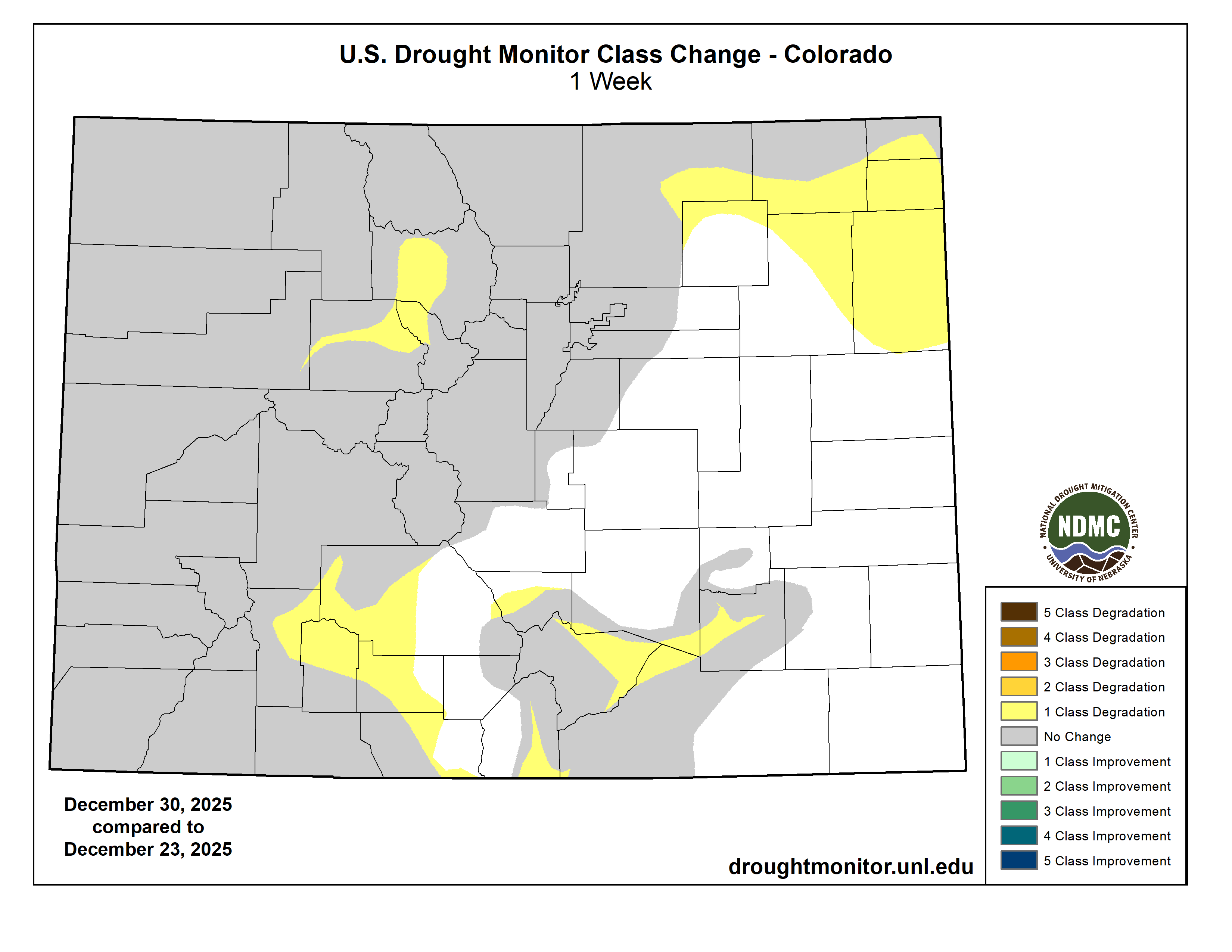
West
Temperatures were above normal across much of the West this week, while below-normal temperatures were observed along parts of the West Coast and in northern Montana. For the week, temperature departures ranged from -10 degrees F below normal in northern Montana to +25 degrees F above normal in parts of Nevada and Utah. Precipitation varied across the region, with beneficial amounts falling across much of the southwest and parts of the north. Over the past 14 days, much of the West has received 2 to 20+ inches of precipitation, with departures ranging from +1 to +8 inches above normal (150% to 800% of normal). This above-normal precipitation justified the removal of extreme drought (D3) from the Washington-Idaho-Oregon border and reduced severe drought (D2) coverage in northern Montana. Moderate to severe drought (D1-D2) conditions improved in portions of Washington, Idaho, Montana, Nevada, and southern Arizona, while moderate drought (D1) was removed in western Washington and improved in north-central Oregon and central Arizona. Abnormal dryness (D0) was removed from southern California and improved across northern portions of the region. Conversely, conditions were drier than normal across interior and eastern portions of the region. Lack of precipitation and growing deficits resulted in the expansion of severe drought (D2) in western Utah, while moderate drought (D1) and abnormal dryness (D0) expanded in central Nevada this week…
South
Below-normal precipitation and above-normal temperatures dominated the South this week, resulting in widespread drought degradation across the region. Temperatures were above normal for the entire region, with departures ranging from +5 degrees F to +25 degrees F. Dry conditions also persisted, with monthly rainfall totals ranging from 1 to 5 inches below normal (5% to 25% of normal) for December. Extreme drought (D3) expanded in central Texas, while severe drought (D2) was introduced or expanded in southeast Oklahoma, southeast Texas, west-central Louisiana, eastern Tennessee, parts of central Texas, and northeast Arkansas. Moderate drought (D1) and abnormal dryness (D0) expanded across much of the region…

Looking Ahead
During the next five days (December 30, 2025–January 3, 2026), a highly amplified pattern will create a sharp divide across the Continental U.S. An upper-level ridge situated over the West Coast will keep conditions initially quieter there, while a broad trough east of the Mississippi River will usher in cold air and active winter weather to the eastern states. A strong low-pressure system exiting the Northeast will leave behind blustery conditions and significant lake-effect snow, particularly downwind of the Great Lakes where accumulations of 1-2 feet are possible in Upstate New York. As the week progresses, a reinforcing cold front will sweep through the East on Thursday, maintaining the chill and snow chances, while the western ridge will begin to move inland. This split flow will result in a notable temperature dichotomy across the country. Below-average temperatures will grip the region from the Northern Plains to the East Coast, with the coldest conditions centered on the Upper Midwest where highs in the single digits and subzero overnight lows are expected. Dangerous wind chills may affect the central Gulf Coast and Southeast early in the period. Conversely, much of the West and High Plains will experience above-average warmth. By Thursday and Friday, the weather pattern will shift in the West as Pacific systems move in, bringing rain and mountain snow back to the coast, with potential heavy precipitation in Southern California and snow in the Sierra Nevada.
The Climate Prediction Center’s 6-10 day outlook (valid January 4–8, 2026) favors above-normal precipitation across Hawaii, the Pacific Coast and parts of the interior West, Alaska, and in parts of northern Plains and New England. Below-normal precipitation is favored from the central and southern Plains into portions of the Ohio Valley. Probabilities for above-normal temperatures are increased across most of the U.S., including most of Hawaii, while below-normal temperatures are favored across most of Alaska and much of the Northeast.
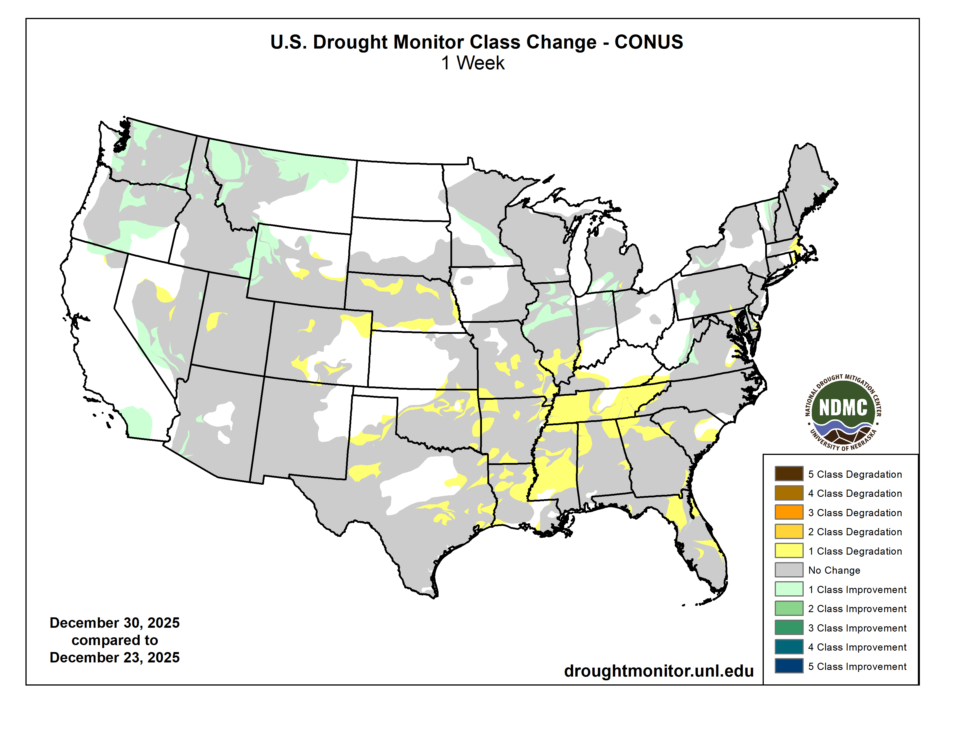
10 Big Wins for Rivers in 2025: A snapshot of our biggest river successes from this past year — Hannah Axtell (AmericanRivers.org)
Click the link to read the article on the American Rivers website (Hannah Axtell):
December 19, 2025
Despite the escalating threats to rivers, this past year brought real progress worth celebrating. To highlight the positive strides being made across the country, we’ve curated a list of 10 exciting wins for rivers, community safety, people, and wildlife. From proposed Wild and Scenic protections for nearly 100 miles of the Gallatin and Madison rivers, to major investments in river restoration and wildfire resilience in California, and stronger permit safeguards for the Rappahannock River, 2025 proved to be a year of meaningful breakthroughs for waterways nationwide.
In no particular order, here’s a snapshot of 10 of our biggest river wins of 2025:
- Secured major wins for America’s Most Endangered Rivers® of 2025
Our 2025 America’s Most Endangered Rivers® report ranked the Tijuana River #2 due to toxic pollution threatening border communities. This designation, developed with partners Surfrider Foundation and Un Mar de Colores, helped catalyze swift federal action. Within three months of the April report release, American Rivers and others were invited to meet with EPA Administrator Lee Zeldin in southern California, which helped build momentum for a landmark agreementbetween the United States and Mexico to address the ongoing public health crisis. This demonstrates how strategic advocacy, combined with persistent community leadership, drives solutions for rivers and their communities.
The Rappahannock River’s designation as one of America’s Most Endangered Rivers® of 2025 brought crucial national attention to the threats facing Virginia’s longest free-flowing river. But this spotlight did more than raise awareness; it galvanized action that delivered tangible results. Working alongside our dedicated partners, The Friends of the Rappahannock, the Rappahannock Tribe, and the Southern Environmental Law Center, we achieved a significant victory for the river and the communities that depend on it. This collaborative effort secured permit changes for a proposed data center, banning industrial cooling withdrawals and reducing drought withdrawals by millions of gallons.
- Mobilized action to protect Public Lands and Roadless Areas
Bipartisan public outcry over a disastrous sell-off provision in a massive tax and spending bill led to the protection of public lands and the rivers that flow through them. Victory was snatched from the jaws of defeat thanks to supporters like you.
The Trump administration is looking to rescind the Roadless Rule, which protects clean water and wildlife habitat by preventing road construction and timber harvest on roughly 45 million acres of national forests. This would be a significant setback (100,000 river miles) to our goal of protecting one million miles of rivers. Our team is making sure decision makers understand the impacts to clean drinking water supplies and we are mobilizing our supporters (we’ve collected more than 10,000 signatures so far) in support of these important river protections.
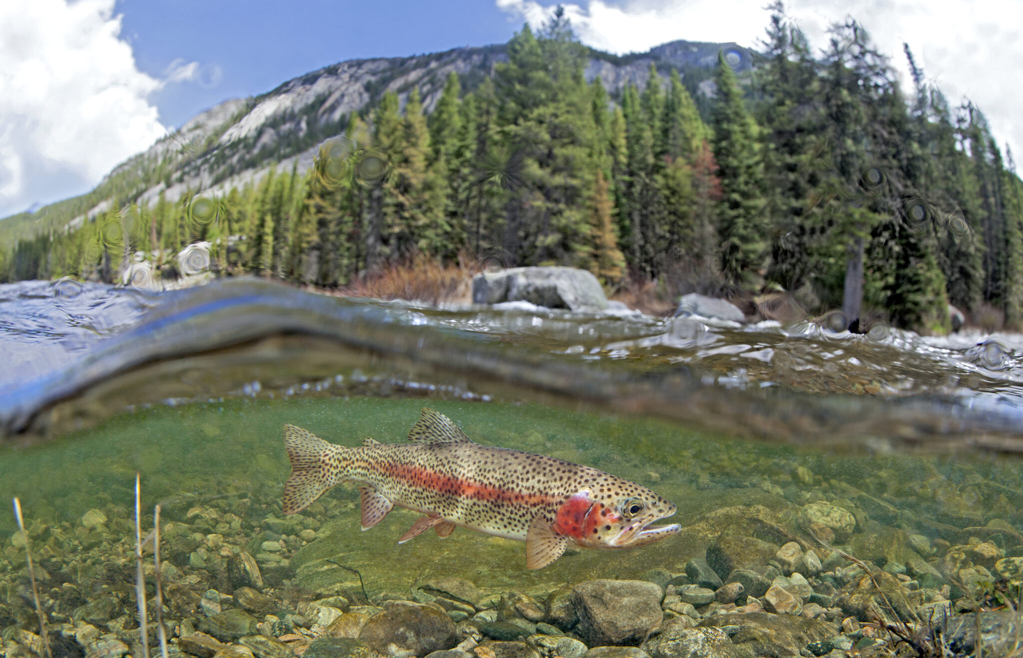
- Safeguarding Montana’s Gallatin and Madison Rivers
Rep. Ryan Zinke (MT) introduced the Greater Yellowstone Recreation Enhancement and Tourism Act (GYREAT Act) – Wild and Scenic legislation to protect nearly 100 miles of the Gallatin and Madison rivers and their tributaries in southwestern Montana. This legislation was developed through collaboration with American Rivers and our partners. If passed, these protections would create a vital corridor linking the rivers of Yellowstone National Park to the headwaters of the Missouri River.
- Defending healthy rivers and Tribal sovereignty
American Rivers helped rally national, regional, and local partners in urging the Department of Transportation to protect aquatic connectivity programs — efforts that restore fish passage, reconnect rivers and wetlands, and replace outdated culverts and road crossings. The joint comment letter was signed by 140 groups — including Tribes, anglers, businesses, universities, research institutions, conservation organizations, community leaders, agencies, faith groups, and planners — all united for healthier, more connected waterways.
Additionally, when the Department of Energy urged the Federal Energy Regulatory Commission to roll back its 2024 policy protecting Tribal sovereignty in hydropower permitting, American Rivers acted fast. Working with Tribal attorneys, Native networks, and partner organizations, we mobilized national opposition and filed formal comments — demonstrating our deep commitment to Tribal leadership and ensuring healthy rivers. We’ll continue working alongside Tribal partners to ensure these protections remain strong.
- Restoring mountain meadows in California
American Rivers is a key member of The Sierra Meadows Partnership, a coalition of environmental organizations working together to restore 30,000 acres of mountain meadows by 2030. These meadows act as natural sponges that store water, improve drought resilience, and provide essential wildlife habitat. Through this collaborative effort, we successfully secured a $24.7 million block grant from the Wildlife Conservation Board to support our restoration work.

- Advanced critical protections for New Mexico’s waterways
After naming New Mexico’s waterways #1 on America’s Most Endangered Rivers® of 2024 list, we’re celebrating significant wins across the state. In the Pecos watershed — home to elk, black bears, Rio Grande cutthroat trout, and generations-old acequia farms — the Department of Interior paused new mining claims across 165,000 acres while pursuing longer-term protections. Through advocacy with our partners, we helped secure Outstanding National Resource Waters protection for over 250 miles of rivers across five watersheds, including the Rio Grande. And now, Senator Heinrich (NM) and the All Pueblo Council of Governors are championing protection of the Caja del Rio — a 107,000-acre landscape along the Rio Grande and Santa Fe rivers that holds deep cultural significance for Puebloan and Hispanic communities while supporting diverse wildlife.
- Furthering community safety through dam awareness
American Rivers spoke on panels and hosted webinars addressing the deadly threat of low head dams, generating hundreds of participants from across the dam removal and safety industries. A low head dam is a human-made structure that spans the full width of a river and is designed to allow water to continuously flow over it, creating a dangerous hydraulic and earning them the nickname “drowning machines.” Our educational workshops brought together leading experts to discuss solutions for addressing these public safety hazards while advancing river restoration solutions.
- Building momentum for dam removal across the Northeast
American Rivers is celebrating a wave of funding that will free multiple rivers across the Northeast. We were awarded $220,000 to remove the Yopp Pond dam on the Fourmile River in Connecticut — the first barrier blocking this coastal river that drains to Long Island Sound. Fisheries biologists note this removal will be transformational for alewife runs in this critical watershed. Additionally, New Hampshire Fish and Game committed $150,000 to support two strategic dam removals: North Branch Gale dam in the Upper Connecticut River watershed and Mead Brook dam in the Contoocook River watershed. Both dams impact excellent cold-water habitat and are scheduled for removal in 2026. Additionally, the Davis Conservation Foundation granted $20,000 for our hydropower relicensing work in Maine.
- Defended Idaho’s Salmon River
Along with our partners at Advocates for the West and coalition members in Idaho, American Rivers and our Action Fund filed a lawsuit against the Forest Service to prevent a massive open-pit gold mine at the headwaters of the South Fork Salmon River. This important waterway is a national treasure that provides critical spawning habitat for the longest-distance, high-elevation salmon migration on Earth, as well as world-class whitewater recreation and fishing. It has been listed as one of America’s Most Endangered Rivers® for three consecutive years.
- Improved wildfire resilience in California
American Rivers and our partner, Terra Fuego Resources Foundation, completed prescribed fire burns on 160 acres as part of a 570-acre fuel reduction and prescribed fire project — a critical effort to protect the South Yuba River and the communities of Nevada City and Grass Valley from catastrophic wildfire. In a major boost for river restoration, the California Wildlife Conservation Board approved nearly $5 million to launch the Pickel Meadow Restoration Project on the West Walker River. Construction begins this summer, marking an exciting next chapter for this important watershed.

Klamath River tribes gain 10,000 acres in key salmon recovery area — AZCentral.com #KlamathRiver
Click the link to read the article on the AZCentral website (Debra Utacia Krol). Here’s an excerpt:
December 29, 2025
Key Points
- A new intertribal land trust has acquired 10,000 acres of land along the Klamath River from former dam operator PacifiCorp.
- The land transfer is a key step in restoring the river basin’s ecosystem following the removal of four dams.
- Indigenous values and traditional practices will guide the restoration of the land, which includes important salmon habitat.
Another milestone in restoring the Klamath River Basin has been reached. A new land trust received title to land on Dec. 22 that includes important salmon habitat and lands upstream of and adjacent to four now-removed dams and the shallow reservoirs that impeded fish and nurtured deadly algae in northern California and southern Oregon. The Klamath Indigenous Land Trust was formed by a coalition of members from four basin tribes after the historic 2002 fish kill to remove the dams as the beginning of a long-term effort to restore health to one of the West’s most imperiled rivers. PacifiCorp, the previous landowner and former hydropower operator, agreed to sell 10,000 acres to the land trust to return stewardship to the tribes who fought for decades to remove the dams as the first step in river recovery. Indigenous values and millennial-long practices which once made the basin one of the West Coast’s largest salmon habitats will direct the job of restoring the ecology of the area, which is the size of West Virginia. The Catena Foundation, the Community Foundation of New Jersey and an anonymous donor provided the funding for the purchase, which is one of the largest such purchases by an Indigenous-led land trust to date…
“Dam removal allowed the salmon to return home,” said Molli Myers, the land trust’s board president and member of the Karuk Tribe. “Returning these lands to Indigenous care ensures that home will be a place where they can flourish and recover.”
“PacifiCorp is pleased to see these lands transition to a stewardship model that honors their cultural and ecological significance,” said Ryan Flynn, president of Pacific Power, the division of PacifiCorp that serves customers in the Northwest.

Gross Dam’s successful year: Dam raise 95% complete — Jay Adams (DenverWater.org) #BoulderCreek #FraserRiver #ColoradoRiver #COriver #SouthPlatteRiver #aridification
Click the link to read the article on the Denver Water website (Jay Adams):
December 12, 2025
Workers raise dam 109 feet in 2025. Next year’s goal: Reaching the top.
The Denver Water team working on Gross Dam in Boulder County is celebrating a successful year after the dam raise is 95% complete.
“In 2025, we raised the height of the dam by 109 feet above the original structure,” said Jeff Martin, Denver Water’s program manager for the Gross Reservoir Expansion Project. “We have 22 feet left to go to reach the new height and we’re on track to reach that in 2026.”
The dam-raising aspect of the Gross Reservoir Expansion Project wrapped up for the season on Nov. 14, due to the drop in temperatures. The project is designed to nearly triple the water storage capacity of Gross Reservoir.

“We have to stop placing roller-compacted concrete when the temperatures drop below freezing,” said Casey Dick, deputy program manager for the Gross Reservoir Expansion Project.
“To prepare for winter, we put blankets on top of the new concrete to keep it from getting too cold. That’s because if the concrete freezes while it is still curing, it can lead to a weakened final product.”
Work associated with the dam raise will resume in spring 2026, when the weather warms up enough to complete the final 22 feet.
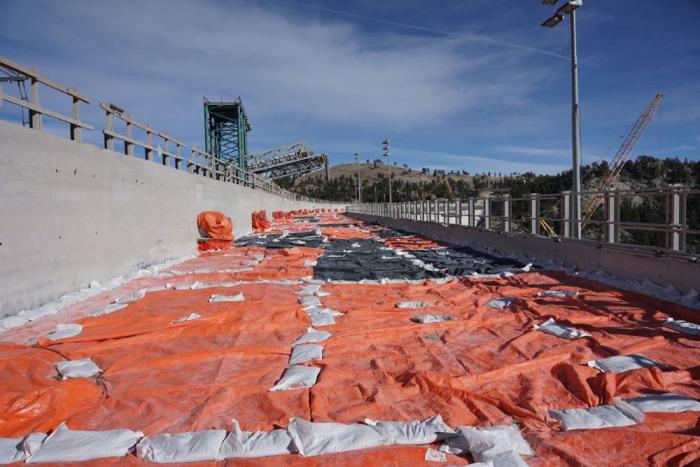
Once that work is complete, the dam will be 471 feet tall, which is 131 feet higher than the original. The completed dam also will be longer across its crest, or top. The original crest was 1,050 feet long; the higher dam will have a crest that stretches 2,040 feet from one side of the canyon to the other.
Learn more about the Gross Reservoir Expansion Project.
This year marked the second year of dam raising construction work at Gross.
As of December 2025, workers had placed more than 730,000 cubic yards of concrete. To put that in perspective, Empower Stadium at Mile High, where the Denver Broncos play their home football games, required just 29,000 cubic yards of concrete to build, about 4% of the concrete placed so far on Gross Dam.
Roller-compacted concrete is a special mix of concrete that allows crews to place it on the dam and then spread it out. The concrete is firm enough to be able to drive machinery on top of it. The process is a fast and efficient method of raising the dam. During the construction work, crews raised the height of the dam by about 1 foot per day.
Construction crews use GPS technology and survey equipment to keep track of how high they’ve raised the dam.
“The way we keep track of the elevation gain is that the bulldozers are equipped with GPS-grade control technology, which ensures that each layer of concrete is spread to the correct thickness,” Dick said.
“Once the concrete is rolled and vibrated into place, each layer ends up being 1 foot thick. It’s then checked by surveyors with their equipment to verify the exact elevation.”
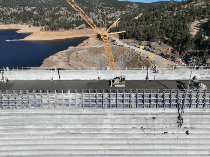
Work won’t completely stop over the winter.
Mechanical and pipe work will be done inside the dam, and crews will build a stilling basin at the base of the dam. The basin’s function is to slow the speed of water coming down the dam’s spillway and safely redirect the water into South Boulder Creek.

“This season was a huge success, and our team met a ton of challenges in raising Gross Dam,” Martin said. “We had legal challenges and adverse weather challenges. We also had wildfire safety operation challenges that shut down our power supply up here. Despite all those setbacks, the dedicated team of 500 men and women rose to the challenge. I’d just like to thank everybody who committed themselves to this project and helped us make 2025 a success.”

Scientists clash over how to track the West’s vital #snowpack: Supporters of airborne snow surveys dispute “hotspots” study on water forecasts — Mitch Tobin( WaterDesk.org)

Click the link to read the article on The Water Desk website (Mitch Tobin):
December 19, 2025
A controversial recent study highlights an old truth about the American West’s snowpack: it’s difficult to measure—and just as hard to forecast how much of its water will ultimately reach tens of millions of people and vast swaths of farmland.
Water managers have increasingly turned to aircraft that use lasers to gauge the snowpack across entire basins. But the Aug. 15 scientific paper argues for a less expensive strategy: focusing new monitoring efforts on a select number of locations known as “hotspots” that excel at predicting how much water will run off from the snowpack—a frozen reservoir that can change dramatically over short distances.
Snowfall rates vary widely with elevation, and the amount of water locked in falling snowflakes shifts from storm to storm.
On the ground, snow accumulation depends on the wind, the forest canopy overhead, the exposure to the sun and the amount of dust that lands on the snowpack. Even a homeowner armed with a ruler can find very different snow depths depending on where they poke in their backyard.
For water providers, knowing how much water is stored in the snowpack is essential. In much of the West, snowmelt supplies most of the runoff that flows through streams, rivers, reservoirs, irrigation canals and household faucets.
If water managers overestimate the snowpack, their customers can be left high and dry later in the year. But if analysts underestimate streamflows, reservoirs can fill faster than expected—raising the risk of disastrous flooding.
With climate change making the snowpack less reliable and redefining what “normal” means, the pressure on forecasters is intensifying in a rapidly growing region with a well-documented gap between water supply and demand. Even a perfect knowledge of the snowpack’s water content doesn’t guarantee accurate streamflow projections because factors such as soil moisture, groundwater levels and late-season weather cloud the picture.
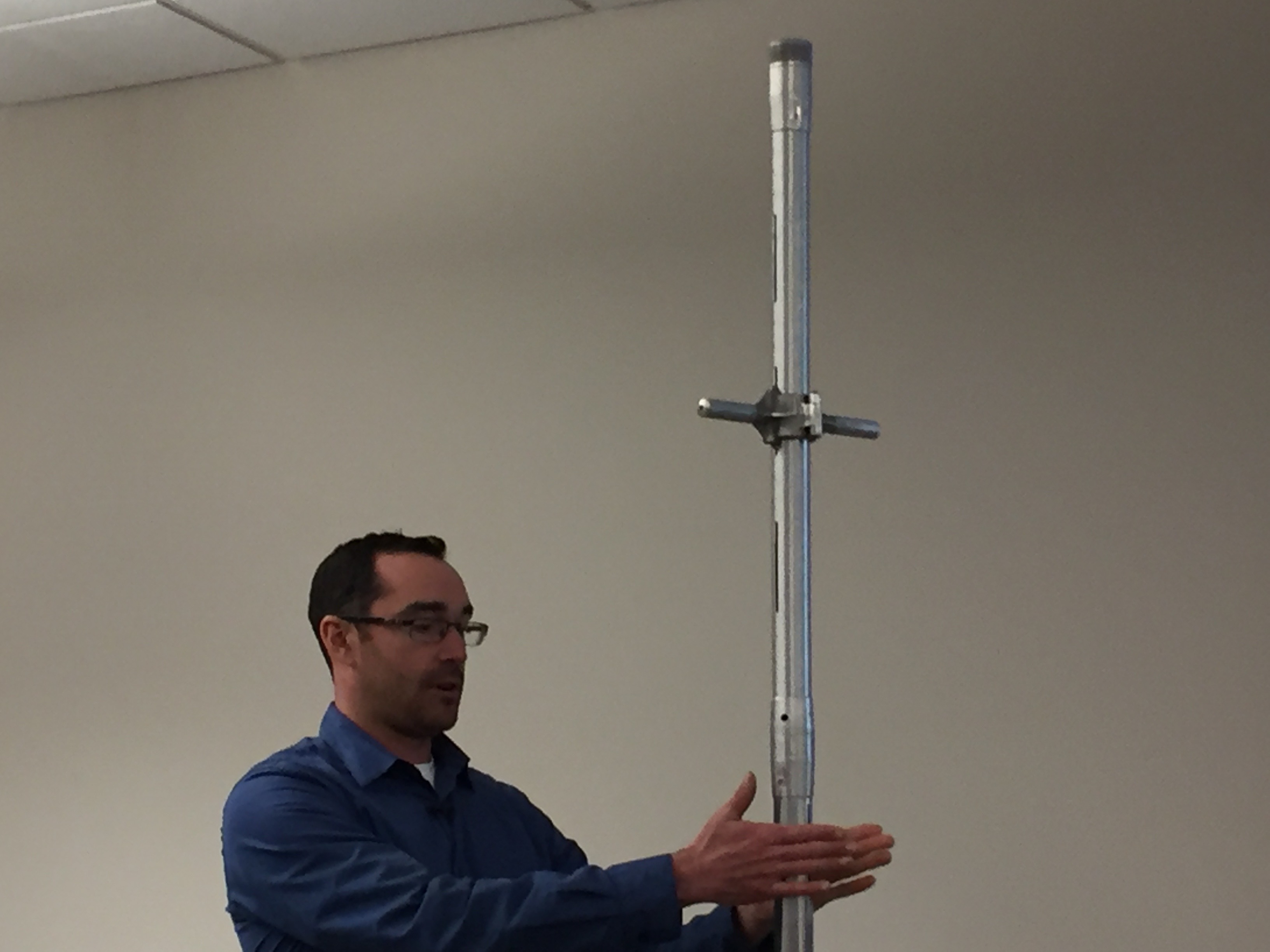
Scientists and water managers, aware of the high stakes, began formally measuring the snowpack to make water forecasts more than a century ago. They selected key locations in the high country, plunged hollow metal tubes into the snow and weighed the extracted cores to calculate the water content—a technique still used extensively today.
During the late 20th century, officials installed hundreds of automated stations across the West’s watersheds as part of the SNOTEL network. These sites use “snow pillows” to measure the weight of the overlying snow and estimate its water content. Forecasters then correlate these long-term snow records with historical streamflows to predict a basin’s water supply.
In the 21st century, airborne snow surveys have expanded rapidly. Aircraft equipped with lidar—a laser-based technology—precisely map the snow depth across entire watersheds while an onboard spectrometer scans the snowpack’s reflectivity. Snow depth is determined by subtracting lidar readings taken when snow is absent from those taken when snow is present. Scientists combine those measurements with estimates and observations of snow density to calculate the water content, known as the snow water equivalent.
Satellites also provide valuable data on the snowpack, especially its extent on the ground, but reliably measuring snow water equivalent from space remains elusive. Clouds and forests can also obscure or complicate a satellite’s view.
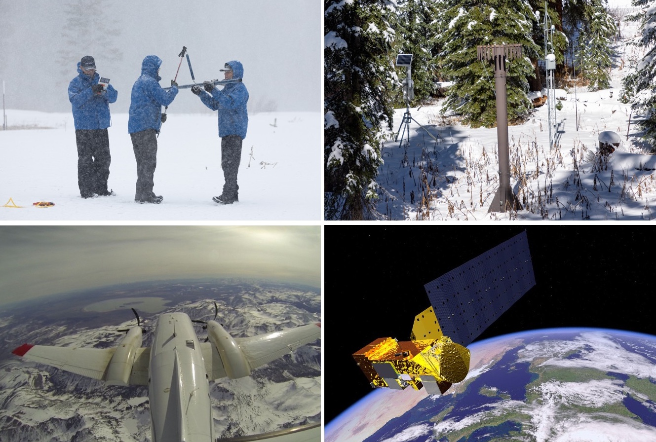
While technologies that estimate an entire watershed’s snowpack are on the rise, the recent hotspots study argues that water forecasters could gain crucial insights by targeting future monitoring at a limited set of locations.
The authors say these 62-acre hotspots not only are strong predictors of how much water will run off in the spring and summer, but also could be more cost-effective than mapping the snowpack across a whole watershed using aircraft. That approach has become more common due to the work of Airborne Snow Observatories, Inc. (ASO), a company that spun out of research at NASA’s Jet Propulsion Laboratory.
“The greatest gains in water supply prediction come from leveraging existing stations and expanding snow measurements to the right places, rather than everywhere,” the authors write in Communications Earth & Environment.
But in the tight-knit world of Western snow science, the paper has sparked pushback from supporters of airborne snow monitoring.
Jeff Deems, a co-founder of ASO, said the paper is a “statistical curiosity” and criticized both its methodology and the conclusions it draws about snowpack monitoring.
“Our datasets have become the gold standard, the benchmark against which others are evaluated,” Deems said.
The Colorado Airborne Snow Measurement (CASM) program produced a strongly worded critique of the study, which used a proxy for the ASO data, rather than actual measurements from aircraft.
“Although this paper is published in a well-known journal, it makes unsupported, misleading and editorialized claims about the cost, value, and performance of airborne lidar for streamflow forecasting,” said the rebuttal from CASM, a group of stakeholders whose planning team includes ASO, water providers, the Colorado Water Conservation Board (CWCB) and other organizations. “The authors make a series of critical logic and analysis errors which when combined with their over-broad conclusions result in a very misleading paper.”
But study co-author Cam Wobus wrote in an email that the paper “might have struck a nerve” because “it showed that wall to wall measurement of snow may not be needed to create more accurate water supply forecasts, which ASO could have perceived as a threat to their business model.”
Despite the sharp differences among snow researchers, experts agree there’s no silver bullet for monitoring the snowpack or predicting streamflows. As warming temperatures and evolving storm patterns continue to transform the snowpack, both old-school methods and newer technologies will be needed to better manage the region’s scarce water resources.
“Snowpack estimation and streamflow forecasting is a vast and unsolved field of research,” the CWCB wrote in response to questions from The Water Desk.
Although CWCB’s logo was included at the bottom of CASM’s rebuttal, the agency said in an email that the document “should not be misconstrued as an official position statement” and that “CWCB has acted as a funding and coordination partner” to CASM.

Searching for snowpack hotspots
The hotspots study set out to test an intuitive idea: in high-elevation watersheds, the snowpack in certain locations can be especially useful for predicting streamflow.
“There are places within drainage basins that, if you train your water-supply forecast on the snow record in those locations, you’ll have a better forecast than if you use the basin average,” said co-author Eric Small, a professor of geological sciences at the University of Colorado Boulder.
“If you think about a drainage basin, there’s going to be places in that drainage basin where there’s not a lot of snow, or there’s not much connection between the snowmelt and the runoff,” Small said. “There’s going to be other places in the basin where there is a lot of snow and a lot of connectivity between the snowmelt and the runoff. So it should not be a surprise that there’s locations within a basin that are more predictive of this seasonal water supply.”
In general, locations with the deepest, most persistent snow are more likely to be hotspots.
“Anyone who’s seen a basin in Colorado and sees the south-facing slopes that are bare of snow and the north-facing slopes that have snow three feet deep in the springtime recognizes that once you take an average across all of that, the stuff on the south-facing slopes isn’t going to matter at all,” said Wobus, a principal at CK Blueshift, LLC, a consulting firm that works on water and climate issues.
“It’s silly to fly an entire basin if 30% of that basin doesn’t have any snow on it, so that’s an easy fix right there,” Wobus said.
While hotspots typically accumulate lots of snow, what’s happening beneath the snowpack is just as important. “The hotspots are locations where there’s both a lot of water, and when it melts, a large fraction of that water would get into the stream,” Small said.
Hotspots tend to have shallow or relatively stable groundwater storage and soil moisture levels that don’t vary year to year.
“The hotspots are places where there’s either enough snow or minimal enough variations in storage that the water is getting to the stream and the water is getting to the stream at the right timescale,” Small said.
Each basin may have numerous hotspots. “The hotspots weren’t unicorns,” Small said. “There were many possible hotspots. We had an objective measure to choose the official hotspot in the paper, but you could have chosen many other locations that were also predictive.”
Once a hotspot is identified, the authors outline several potential ways to tap its predictive power. One option is to add a new SNOTEL station at the site, although that may not be feasible because of the terrain or land protections. Another possibility is to use remote sensing from a plane or a drone. The authors write that one or two flight paths that observe the hotspot could gather data “at a substantially lower cost than more conventional wall-to-wall basin coverage.”
Even recreationists could help gather data from snowpack hotspots. “You could use citizen science to do it. You could send a bunch of backcountry skiers out to your location for fun, give them an app,” Small said. “They’re probably already going there. If you saw where people were skiing, they would probably have mapped out the hotspots already.”
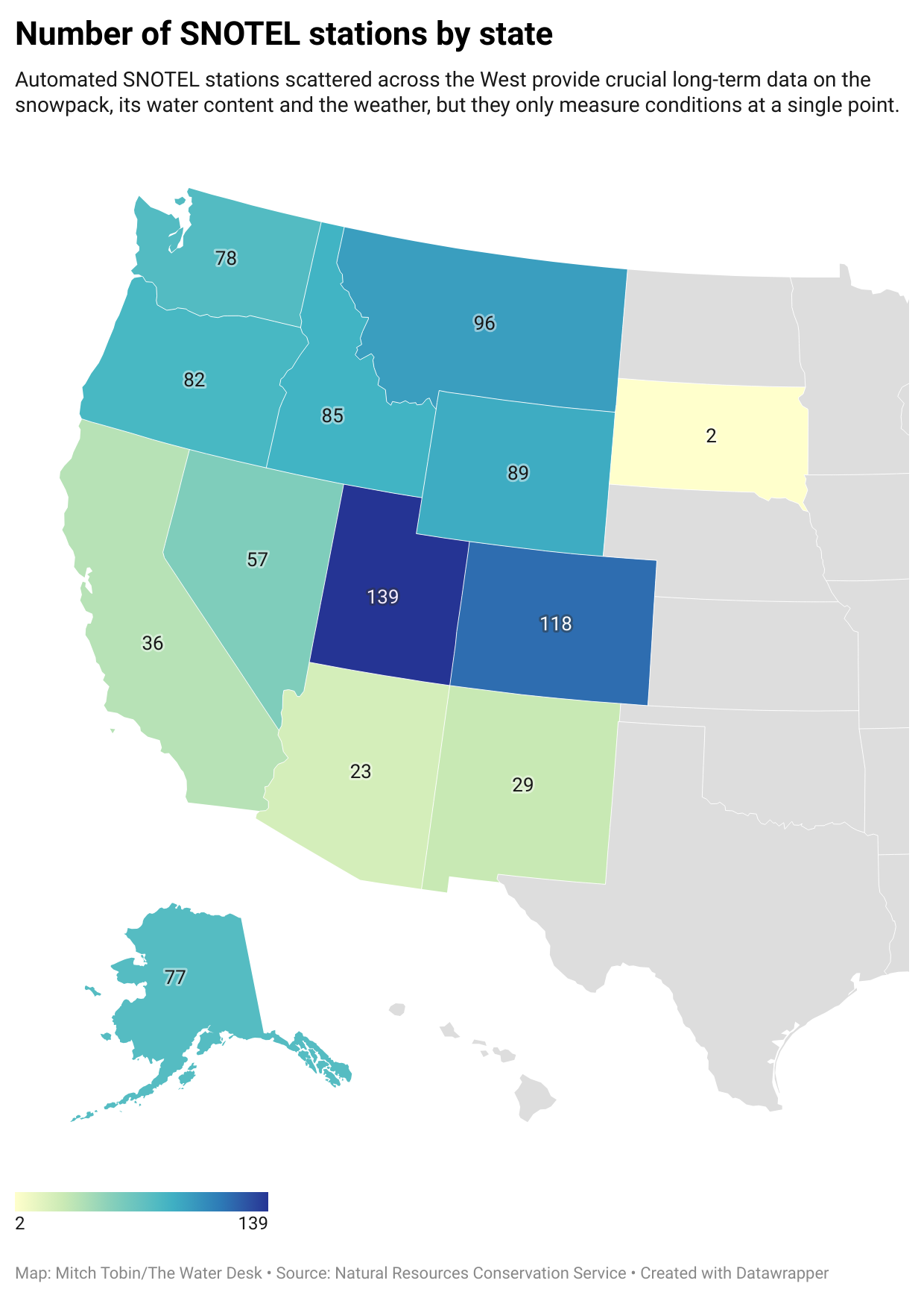
A shortcut, or a statistical trap?
Critics of the hotspots paper agree that some parts of a watershed can carry more predictive weight for streamflows than others.
“It’s not a new concept, and it’s a very seductive one. It’s essentially the premise behind the SNOTEL network,” Deems said.
But to some scientists who dispute the study, hotspots can hide as much as they reveal—and potentially mislead water managers as the West’s climate evolves and as the hydrology of high-country landscapes is reshaped by disturbances, such as the increasing frequency of wildfires.
“Even if they did everything right—found these hotspots—the likelihood of them retaining the same statistical predictive power going forward is essentially nil,” Deems said.
The rebuttals to the paper have challenged both its analysis and the real-world implications the authors infer from their results.
Noah Molotch, a professor of geography at the University of Colorado Boulder and director of the Mountain Hydrology Group at the Institute of Arctic and Alpine Research, said “the study doesn’t accurately portray the direction that water managers have been moving for a couple of decades now.”
“My concern there is that it takes us further down the path of being blind to the spatial patterns that govern water supply and that can lead to surprises for water managers,” Molotch said.
Although the hotspots study has implications for airborne snowpack monitoring, the paper didn’t analyze data gathered by aircraft, which has been collected only in select watersheds and over a shorter time period than the authors examined.
Instead, one of the ways the researchers probed the snowpack in 390 basins in the West was to combine satellite data from 2001 to 2023 with historical weather data. The satellite images, collected by the MODIS instruments aboard two NASA spacecraft, show the fraction of each pixel covered by snow and the reflectivity of the snowpack, among other metrics. Each pixel is a square with 500-meter (1,640-foot) edges.
The authors argue that this type of data serves as a reasonable “proxy” for the basin-wide estimates that could be obtained from prospective satellite missions and current airborne monitoring. Small said five different datasets were examined, and all showed similar results.
But the CASM critique argues that the proxy dataset has “a demonstrated average error of 35% (ranging from 20-60%)” when compared to airborne lidar, and its much coarser resolution further limits its utility.
The paper’s authors “make the assertion that that dataset has been shown to be accurate and, in their language, therefore serves as a reliable proxy for airborne lidar,” Deems said. “That assertion is incorrect, and that undercuts the entire rest of the paper, sadly.”
Deems said the study used the date of snow disappearance to back-calculate how much snow was there while also “blending in an atmospheric model precipitation product, which is highly uncertain.”
By contrast, Deems said, ASO creates “a highly accurate map of snow depth throughout the watershed,” which is then paired with estimates of snow density informed by SNOTEL measurements and hand-dug snow pits. What emerges, he said, is a basin-scale estimate of snow water equivalent that’s within about 1% of the actual volume.
“That’s better than we can measure streamflow,” Deems said.
Clashes over the merits of datasets are grist for the academic mill, but critics raise a broader concern: the paper takes a retrospective look at snowpack-streamflow relationships in an age of extreme weather and shifting baselines.
Scientists have an awkward name for this pivotal issue: “stationarity.” In simple terms, it’s the assumption that the past is a reliable guide to the future. But just as mutual-fund disclaimers warn that past performance is no guarantee of future returns, climate change is making historical patterns less trustworthy.
Storm tracks are migrating. Warmer temperatures mean more winter rain and less snow. Rising evaporation rates are drying out soils. And both the timing and volume of runoff are in flux as the weather changes and high-elevation wildfires remake watersheds.
One widely cited 2008 paper in the journal Science framed the problem bluntly with its title: “Stationarity Is Dead: Whither Water Management?”
The hotspots strategy, according to the CASM rebuttal, “does not test whether those sites remain predictive under shifting climate conditions or extreme events” and “what looks like a hotspot in the historical record may fail under current or future conditions.”
What to do with hotspots?
On a practical level, the hotspots paper argues that snow researchers and water managers could mine these locations for essential data by installing additional SNOTEL stations or using remote sensing. But critics say several big hurdles stand in the way of implementation, many of which are acknowledged in the study.
First, a hotspot with 500-meter edges covers nearly 2.7 million square feet, but the snowpack may vary greatly within that footprint. Where in that area should a new SNOTEL monitoring station go? Cost is another concern. “Installing and maintaining a station is not cheap either—$100,000 easily between gear and personnel time and maintenance,” Deems said.
Second, terrain and land-use rules can make installation impractical or illegal. “In many cases, it’s going to be impossible to put a station there, either because it’s sloped and the snow pillows don’t work on slopes, or because it’s in the wilderness or in avalanche terrain or something like that,” Deems said. Drone flights—another potential monitoring tool—are also prohibited in federal wilderness and face their own logistical challenges.
Third, any new station only generates data going forward. It doesn’t provide the long historical record that water managers need to train their models and make streamflow predictions. “It’s not going to be useful until you probably get about 30 years of data,” Molotch said, “and then let’s think about how much the climate may have changed over those three decades.”

At its core, the dispute over hotspots reflects a long-standing divide in hydrology. One camp relies on statistically based approaches, such as using a select number of “index” sites to measure the snowpack and predict streamflow based on historical records. Another paradigm favors physically based methods that employ the laws of physics to account for the coming and going of water molecules in a basin, such as using aircraft to map the snowpack.
“Historically, we’ve increasingly been moving toward physically based approaches in hydrology,” Molotch said. “At some point, we may have a complete passing of the baton toward physically based approaches. I don’t know if and when that will be in our future, but I think that that is the way that things are migrating over time.”
Small said that ASO data “will give you the total number of water molecules in a basin” if you accept their snow density model, but that’s only part of the story. To predict streamflow, forecasters must account for other factors, including how much water is lost to the atmosphere when it evaporates, transpires from plants or converts directly from ice to water vapor, a process known as sublimation. Soil moisture and groundwater levels also shape the hydrologic cycle.
“The total volume of water in the snowpack is not hugely predictive of streamflow compared to what you get from the hotspots, and that has to be the case,” Small said. “If you have any variations in the basin from evapotranspiration or soil moisture storage or groundwater storage—that has to be the outcome. And I think we probably should have said that in the first sentence of the paper.”
Using an “all of the above” approach
Denver Water describes the snowpack in the mountains west of the city as the utility’s biggest reservoir. To supply its 1.5 million customers, Denver Water uses a variety of techniques to track the snowpack, including manual measurements, automated SNOTEL stations, ASO flights above key watersheds and satellite data that is blended into reports that Molotch and colleagues generate at the University of Colorado Boulder.
“We take an all of the above approach,” said Taylor Winchell, climate change adaptation program lead at Denver Water. “We think that all of these systems really have their place and are all important in giving us the full picture of the snowpack that we’re hoping to gather to help us make confident decisions.”
Each type of snow monitoring has its benefits and limitations. “They each fill a gap that the other doesn’t,” Winchell said.
The SNOTEL system, for example, can provide hourly or daily readings of the snowpack and offers long historical records, but it only measures conditions at a single point. The stations also tend to sit in mid-elevation clearings that are easy to access, so they don’t necessarily reflect the diversity of the West’s terrain and overlying snowpack.
“We often don’t have measurements at those higher elevations, and it kind of leaves a blind spot in our understanding of the snowpack,” Winchell said.
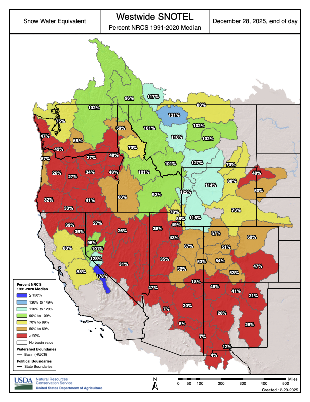
Like many water providers in the West, Denver Water has been grappling with a growing mismatch between snowpack levels and the amount of water that eventually reaches streams and rivers in the spring and summer.
“We just don’t quite expect the same amount of streamflow production nowadays as we would’ve historically with similar levels of snowpack,” Winchell said, noting the influence of soil moisture levels, evaporation and sublimation. “We can’t go off the same assumptions that we might’ve had in the past, and so every year it creates this kind of new and intensified challenge to understand how the snowpack is going to translate into streamflow.”
Denver Water has used ASO data since 2019 and spent an average of about $200,000 per year on the airborne surveys. That first year, ASO surveyed the watershed around Dillon Reservoir—a linchpin in the utility’s supply that collects runoff west of the Continental Divide so that it can be pumped through a 23-mile tunnel bored beneath the Rocky Mountains and reach the east side of the Divide, where most of Colorado’s population lives.
“With those flights, we saw kind of immediately the high value of this information for our decision-making processes,” Winchell said. ASO found the snowpack was bigger than what Denver Water expected, Winchell said, so the utility “immediately increased outflows from Dillon Reservoir so that we’d be able to capture that snowpack without flooding downstream of the reservoir.”
ASO’s high-resolution data is valuable for Denver Water because it “fills in the gaps between those station measurements,” Winchell said.
In the large watersheds that supply the utility, “you can have storms and snow patterns that are quite different from one side of the watershed to the other, and you might have different diversion systems in each part of that watershed,” Winchell said. “You might have had a forest fire in one part of the watershed that impacts the snowmelt within that sub-watershed. So really being able to have that detailed picture of the full watershed, we do find value in that.”
But the cost of airborne surveys remains a critical issue.
“It’s still been a struggle year over year to get the funding needed even to fly what we see as the baseline number of useful flights,” Winchell said. “There’s still a lot of room for both adding additional flights in watersheds that are already being flown, as well as conducting ASO flights in watersheds throughout the state that don’t currently have ASO flights.”
Costs versus benefits
In Colorado, CASM was formed in part to secure additional funding to expand ASO flights above the state. CASM’s annual budget in 2025 was $4.5 million, with state funding accounting for 52% and the rest from federal, local and other sources.
The U.S. House of Representatives recently passed bipartisan legislation that would reauthorize and update the federal Snow Water Supply Forecasting Program “to incorporate modern technologies, including LiDAR and satellite imagery, to improve the accuracy of snowpack and water-supply predictions,” according to sponsor Jeff Hurd, R-Colo.
Backers of airborne surveys acknowledge that flights aren’t cheap—two flights over a basin can cost a couple of hundred thousand dollars per year—but they say the data can generate far greater benefits. A more precise read on the snowpack can prevent flooding and allow water managers to devote excess supplies to groundwater recharge. Conversely, advance warning of shortages can help avoid disruptions for both agricultural and urban water users.
“The value of these data can be off the charts,” Deems said, with some case studies from California showing a return on investment between 50 and 200 to one.
In the headwaters of Northern California’s Feather River, which supplies the California State Water Project, Deems said ASO’s data improved water management. In 2021, the year before ASO’s flights began, water managers “thought they had a decent snowpack,” Deems said, but they had to dramatically scale back allocations, eventually to zero, “because the water just didn’t show up,” causing significant impacts to farmers and other water users.
“The following year, we started flying in the Feather River,” Deems said. “Our February flight showed that they had half the water they thought they had, so it looked like essentially a repeat of the prior year, except this time they knew about it in February, rather than finding out about it when the water didn’t show up at the stream gauge in July.”

The future of snowpack monitoring
Looking ahead, the stakes are only growing for snowpack monitoring and streamflow forecasting as the climate warms and the West continues to add new water users.
Despite their varying views, snow experts agree that a diversity of approaches will be needed in the foreseeable future. The hotspots study authors see value in the ASO flights, and backers of airborne surveys would like to see more SNOTEL stations.
“We are first in line to advocate for more observations, especially if they can be in environments that are different than the current set of observations covers,” Deems said.
The question, Wobus said, is “how do we use combinations of advanced monitoring technologies like lidar and satellite observations and things like that in a framework that will help you improve water supply forecasts without having to measure everything?”
“There’s a lot of room to improve the economics of snow monitoring,” Wobus said. “If we’re talking about the difference between flying every basin once a year and getting total coverage at a cost of, let’s say $10 million a year for the state of Colorado, versus adding a few more SNOTEL stations in a few places where you really need it—there’s a lot of real estate in between those two things.”

When ASO maps the snowpack in an entire basin, its aircraft flies back and forth in a pattern often likened to mowing a lawn. Small and Wobus said that one way to save money would be to do more limited flights and use machine learning—a type of artificial intelligence—to extrapolate the results.
“If you fly one strip and combine that with a machine-learning model, you can get like 98% of the way there, and you can save a whole boatload of money,” Wobus said. “You could just fly a straight line across the state of Colorado and then turn around and fly back and get almost as much information as you’re getting by flying like a lawnmower back and forth across the basin.”
But some backers of airborne mapping are skeptical.
“That would be bringing a lack of confidence back into the system, and that’s a difficult thing to ask a water manager to accept, especially after we’ve shown what’s possible,” Deems said.
Drones have also become part of snow hydrologists’ toolbox. While the hotspots paper argues that using lidar technology mounted on drones would be less costly than flying large aircraft, that approach “does not reflect the logistical and financial realities of operating such a program in Colorado’s mountain environments,” according to CWCB.
“Drone-based lidar systems require extensive permitting, frequent flights due to limited range and battery life, and highly trained operators to meet accuracy standards comparable to crewed aircraft,” CWCB wrote. “No program currently exists with the resources, planning, or data management structure to deploy drone surveys at the basin scale needed for operational water forecasting.”
For many snow hydrologists, the holy grail would be to launch a dedicated satellite that could look down from space and estimate the water content of the snowpack around the planet using, for example, microwave sensors. But that’s literally a heavy lift.
“There’s lots in the works,” Deems said. “But the global solution is pretty elusive, and folks have been trying to do this for decades.”
The technology exists today to measure snow water equivalent with a satellite, “but not everywhere and not all the time,” Molotch said. One major obstacle is that satellite monitoring may not work when the snowpack is wet, which is especially vexing in the warmer, maritime snowpacks near the West Coast.
“Snowpack conditions in the Sierra Nevada of California can be wet at any time of year between storms when the sun’s out and it starts to warm up,” Molotch said. “As the climate warms, we would expect that snow wetness will be increasingly problematic for microwave remote-sensing techniques. But I think on the positive side, if we’re able to make snow water equivalent measurements in some locations, that helps us provide information for models that can fill in the gaps.”
In July, NASA and India’s space agency launched NISAR, a new radar satellite built to track how Earth’s surface is evolving. While not dedicated to monitoring the snowpack, the mission will measure changes in snow, glaciers, sea ice, ice sheets and permafrost. Operating day or night, NISAR’s signals can penetrate clouds, and the satellite will observe nearly the entire Earth’s surface twice every 12 days.

The NISAR mission “introduces a promising avenue for cost-effective, large-scale snow depth and snow water equivalent” estimates, according to a January study in Frontiers in Remote Sensing. A 2024 paper in Geophysical Research Letters concluded that NISAR offers a “promising path toward global snowpack monitoring.” While errors increase in forests with a denser canopy, the 2024 study said the satellite “may be feasible for snowpack monitoring in sparse to moderate forest cover.”
What research and data would deepen understanding of the snowpack in the future?
“Where to begin?” Winchell said with a laugh.
In addition to having more manual measurements, more SNOTEL stations, more ASO flights and even a citizen-science effort, Winchell said better knowledge of snowpack temperatures would be helpful to Denver Water because that “provides a really strong indication of when the snowpack is ready to melt.” Additional soil moisture data could also improve the utility’s forecasts of how the snowpack translates into streamflows.
“The field of snowpack research is just a crucial field with really lots of exciting work ahead, especially as these new, really high-value, high-accuracy datasets are coming into play,” Winchell said. “I think decades into the future we’ll wonder how people really went about managing the snowpack water supplies without this information.”
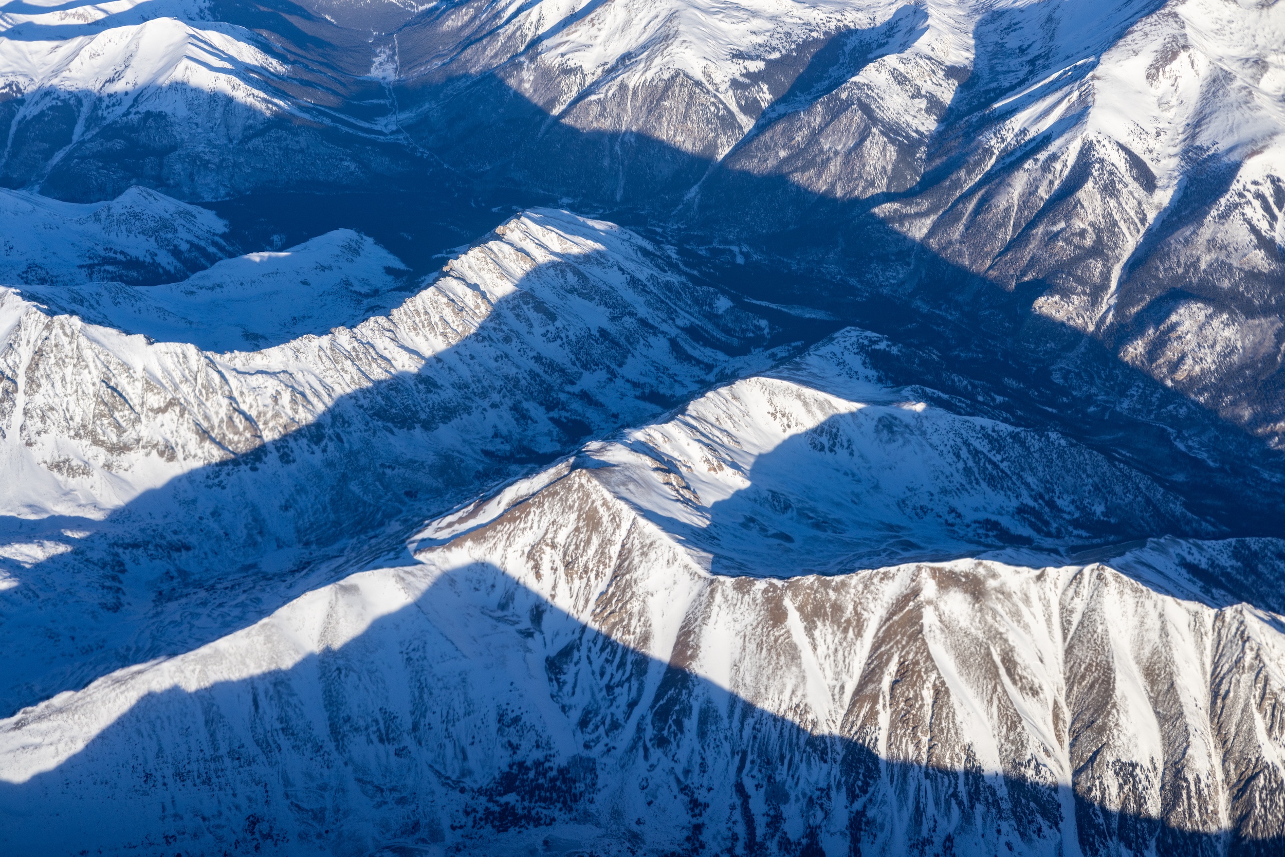
This story was produced and distributed by The Water Desk at the University of Colorado Boulder’s Center for Environmental Journalism.
Editor’s note: Two of the co-authors of the hotspots paper and one of the critics of the study are affiliated with the University of Colorado Boulder. The Water Desk is also based at the University of Colorado Boulder but operates as an editorially independent journalism initiativeand is solely responsible for its content.
How #wind and #solar power help keep America’s farms alive — Paul Mwebaze (TheConversation.com)
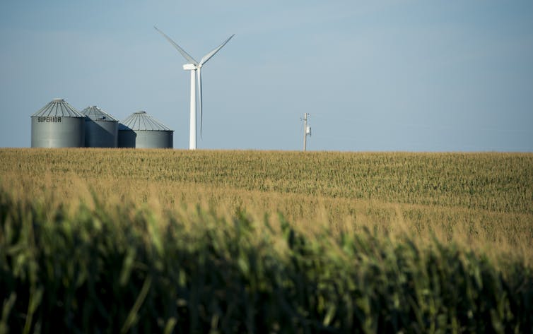
Paul Mwebaze, University of Illinois at Urbana-Champaign
Drive through the plains of Iowa or Kansas and you’ll see more than rows of corn, wheat and soybeans. You’ll also see towering wind turbines spinning above fields and solar panels shining in the sun on barns and machine sheds.
For many farmers, these are lifelines. Renewable energy provides steady income and affordable power, helping farms stay viable when crop prices fall or drought strikes.
But some of that opportunity is now at risk as the Trump administration cuts federal support for renewable energy.
Wind power brings steady income for farms
Wind energy is a significant economic driver in rural America. In Iowa, for example, over 60% of the state’s electricity came from wind energy in 2024, and the state is a hub for wind turbine manufacturing and maintenance jobs.
For landowners, wind turbines often mean stable lease payments. Those historically were around US$3,000 to $5,000 per turbine per year, with some modern agreements $5,000 to $10,000 annually, secured through 20- to 30-year contracts.
Nationwide, wind and solar projects contribute about $3.5 billion annually in combined lease payments and state and local taxes, more than a third of it going directly to rural landowners.

These figures are backed by long-term contracts and multibillion‑dollar annual contributions, reinforcing the economic value that turbines bring to rural landowners and communities.
Wind farms also contribute to local tax revenues that help fund rural schools, roads and emergency services. In counties across Texas, wind energy has become one of the most significant contributors to local property tax bases, stabilizing community budgets and helping pay for public services as agricultural commodity revenues fluctuate.
In Oldham County in northwest Texas, for example, clean energy projects provided 22% of total county revenues in 2021. In several other rural counties, wind farms rank among the top 10 property taxpayers, contributing between 38% and 69% of tax revenue.
The construction and operation of these projects also bring local jobs in trucking, concrete work and electrical services, boosting small-town businesses.

The U.S. wind industry supports over 300,000 U.S. jobs across construction, manufacturing, operations and other roles connected to the industry, according to the American Clean Power Association.
Renewable energy has been widely expected to continue to grow along with rising energy demand. In 2024, 93% of all new electricity generating capacity was wind, solar or energy storage, and the U.S. Energy Information Administration expected a similar percentage in 2025 as of June.
Solar can cut power costs on the farm
Solar energy is also boosting farm finances. Farmers use rooftop panels on barns and ground-mounted systems to power irrigation pumps, grain dryers and cold storage facilities, cutting their power costs.
Some farmers have adopted agrivoltaics – dual-use systems that grow crops beneath solar panels. The panels provide shade, helping conserve water, while creating a second income path. These projects often cultivate pollinator-friendly plants, vegetables such as lettuce and spinach, or even grasses for grazing sheep, making the land productive for both food and energy.
Federal grants and tax credits that were significantly expanded under the 2022 Inflation Reduction Act helped make the upfront costs of solar installations affordable.

However, the federal spending bill signed by President Donald Trump on July 4, 2025, rolled back many clean energy incentives. It phases down tax credits for distributed solar projects, particularly those under 1 megawatt, which include many farm‑scale installations, and sunsets them entirely by 2028. It also eliminates bonus credits that previously supported rural and low‑income areas.
Without these credits, the upfront cost of solar power could be out of reach for some farmers, leaving them paying higher energy costs. At a 2024 conference organized by the Institute of Sustainability, Energy and Environment at the University of Illinois Urbana-Champaign, where I work as a research economist, farmers emphasized the importance of tax credits and other economic incentives to offset the upfront cost of solar power systems.
What’s being lost
The cuts to federal incentives include terminating the Production Tax Credit for new projects placed in service after Dec. 31, 2027, unless construction begins by July 4, 2026, and is completed within a tight time frame. The tax credit pays eligible wind and solar facilities approximately 2.75 cents per kilowatt-hour over 10 years, effectively lowering the cost of renewable energy generation. Ending that tax credit will likely increase the cost of production, potentially leading to higher electricity prices for consumers and fewer new projects coming online.
The changes also accelerate the phase‑out of wind power tax credits. Projects must now begin construction by July 4, 2026, or be in service before the end of 2027 to qualify for any credit.
Meanwhile, the Investment Tax Credit, which covers 30% of installed cost for solar and other renewables, faces similar limits: Projects must begin by July 4, 2026, and be completed by the end of 2027 to claim the credits. The bill also cuts bonuses for domestic components and installations in rural or low‑income locations. These adjustments could slow new renewable energy development, particularly smaller projects that directly benefit rural communities.
While many existing clean energy agreements will remain in place for now, the rollback of federal incentives threatens future projects and could limit new income streams. It also affects manufacturing and jobs in those industries, which some rural communities rely on.
Renewable energy also powers rural economies
Renewable energy benefits entire communities, not just individual farmers.
Wind and solar projects contribute millions of dollars in tax revenue. For example, in Howard County, Iowa, wind turbines generated $2.7 million in property tax revenue in 2024, accounting for 14.5% of the county’s total budget and helping fund rural schools, public safety and road improvements.
In some rural counties, clean energy is the largest new source of economic activity, helping stabilize local economies otherwise reliant on agriculture’s unpredictable income streams. These projects also support rural manufacturing – such as Iowa turbine blade factories like TPI Composites, which just reopened its plant in Newton, and Siemens Gamesa in Fort Madison, which supply blades for GE and Siemens turbines. The tax benefits in the 2022 Inflation Reduction Act helped boost those industries – and the jobs and local tax revenue they bring in.
On the solar side, rural companies like APA Solar Racking, based in Ohio, manufacture steel racking systems for utility-scale solar farms across the Midwest. https://www.youtube.com/embed/Bcet_aaaMq8?wmode=transparent&start=0 An example of how renewable energy has helped boost farm incomes and keep farmers on their land.
As rural America faces economic uncertainty and climate pressures, I believe homegrown renewable energy offers a practical path forward. Wind and solar aren’t just fueling the grid; they’re helping keep farms and rural towns alive.
Paul Mwebaze, Research Economist at the Institute for Sustainability, Energy and Environment, University of Illinois at Urbana-Champaign
This article is republished from The Conversation under a Creative Commons license. Read the original article.
Where is the snow? A look at the warm, dry weather and what to expect for the start of 2026 — Allie Mazurek (#Colorado #Climate Center)
December 20, 2025
The past several weeks have felt more like an extension of fall rather than the beginning of winter in Colorado. While the warmth has been a welcome reprieve to the winter-loathers, it has been accompanied by dry conditions that have brought worsening drought, poor snowpack, and fire danger. In this post, we’ll look back at some recent trends we’ve been watching and provide a look forward at what we might expect as we head into the start of 2026.
Snowpack and snowfall
We’ll kick off the post with a late December snowpack check-in. Unfortunately for CO (and the West more broadly), there is little good news to report. Looking at percent of 30-year average (1991-2020) snow water equivalent (SWE), a fundamental snowpack metric, shows all of Colorado’s river basins running much below average as of December 18. Conditions are similarly poor throughout the state, with all major river basins sitting between 54% to 63% of their normal snowpack.
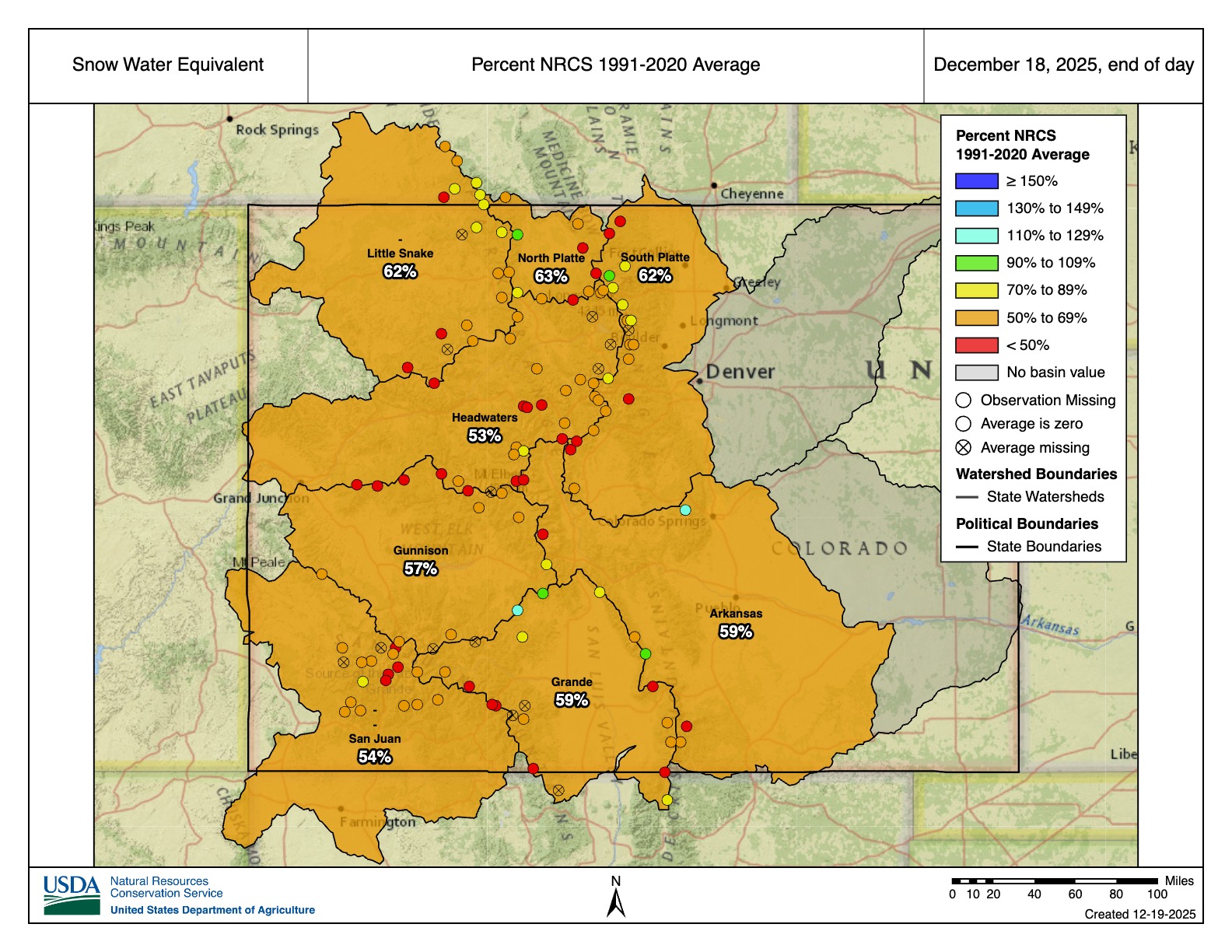
While basin-wide percentages are similar across the state, there are some particularly concerning numbers across the state’s northern basins. There, several SNOTEL stations are currently reporting their lowest or second-lowest snowpack on record. While it’s worth noting that several of these sites have relatively short record periods (~22 years) compared to others in the SNOTEL database, there are some stations with 40+ year records that are reporting record or near-record low values for this time in the winter. Even though a major portion of the snow accumulation is still ahead of us, with more dry weather in the forecast (more on that below), that is all bad news from a water perspective.
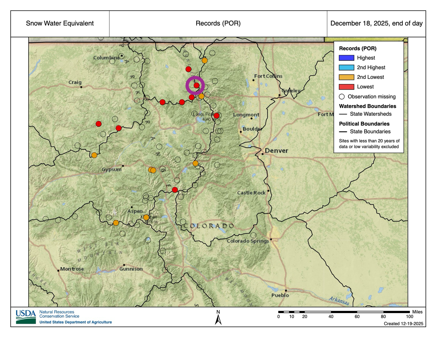

Across the lower elevations, snow is also in short supply. Boulder and Denver each saw their latest and 2nd-latest first snows on record at the tail-end of November. And so far, the Front Range Urban Corridor has only seen one shovel-able snowstorm this winter (that happened on Dec. 3). Aside from those two events, Front Range flakes have been few and far between, as warm temperatures have often favored rain over snow (though liquid precipitation has also been in short supply). And further east on the Plains, many have yet to see their first flakes.
Record-setting temperatures
Above-normal temperatures have been a familiar story throughout autumn and early winter. Fall 2025 (September-November) was the 4th warmest on record, and much of that abnormal heat can be attributed to November (ranked the 3rd-warmest on record for Colorado according to NOAA NCEI). No areas of the state were spared from the unusually warm temperatures, but the heat was most notable along the West Slope, where some locations saw their warmest fall on record.
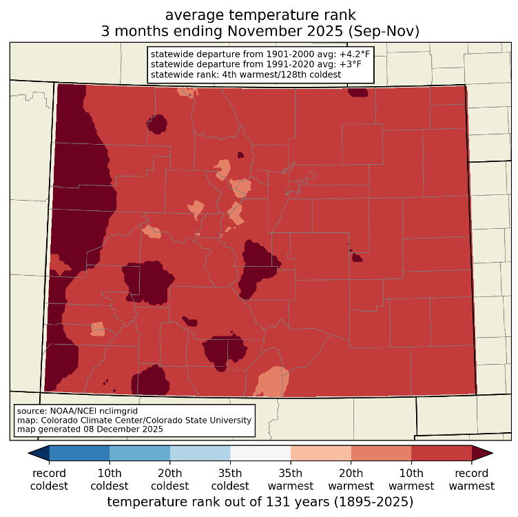
Mid-December has offered little relief from the record-setting heat, with widespread daily records in all corners of the state several days in mid-December. Here in Fort Collins, we notched our warmest 7-day December period on record over December 9-15. Denver recorded 9 straight days of temperatures exceeding 60°F, the 2nd-longest December streak of 60°F+ days on record (h/t to Chris Bianchi). December temperatures so far are running above average nearly everywhere in Colorado, exceeding 8-10°F (or more) above average in some parts of the state.
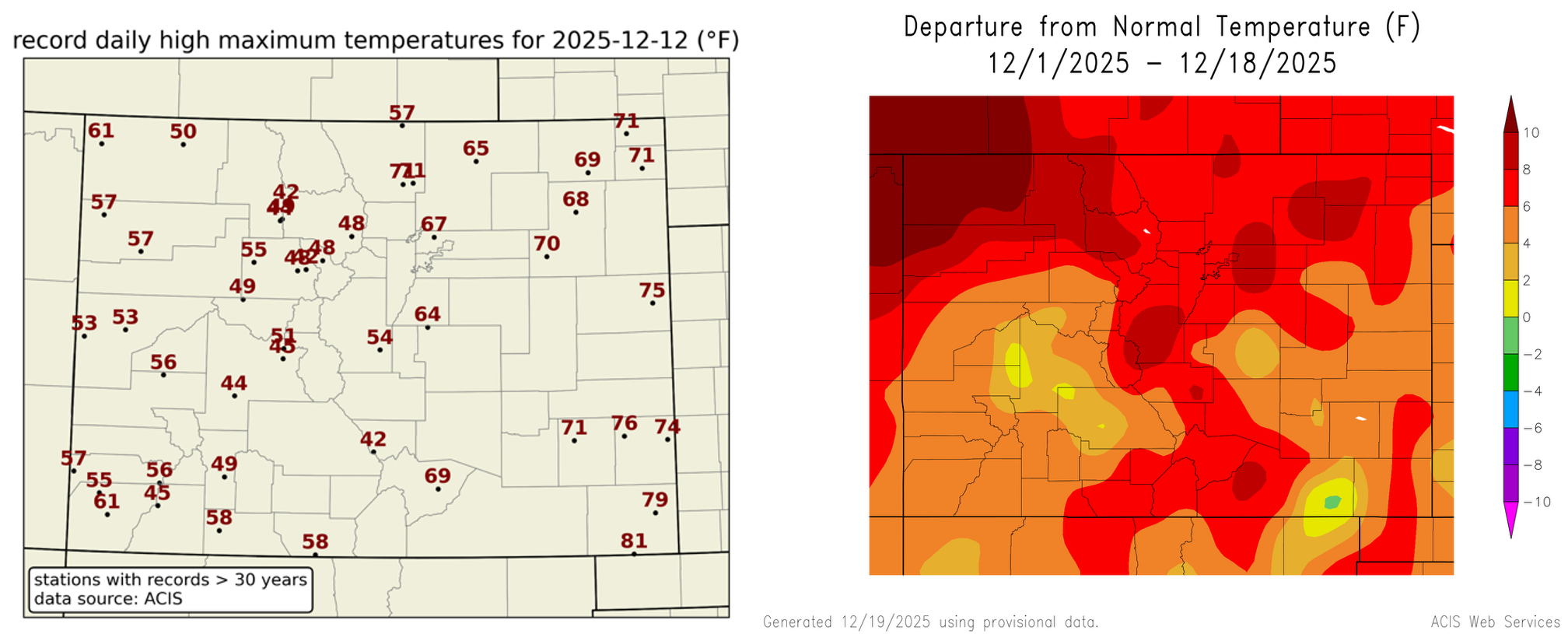
Drought
The worst drought in the state continue to be in western Colorado, though conditions have begun to worsen in other parts of the state. A notable precipitation event just before Thanksgiving prevented drought from worsening in western and southwestern Colorado, and some locations even saw some minor drought improvements according to the U.S. Drought Monitor. The story is quite different if you look at north-central Colorado, however. A very dry November led to worsening drought conditions for areas that were previously drought-free. Degradations have also occurred across south-central Colorado. As of December 16, ~36% of the state is experiencing drought. That is up from ~29% at the start of November.
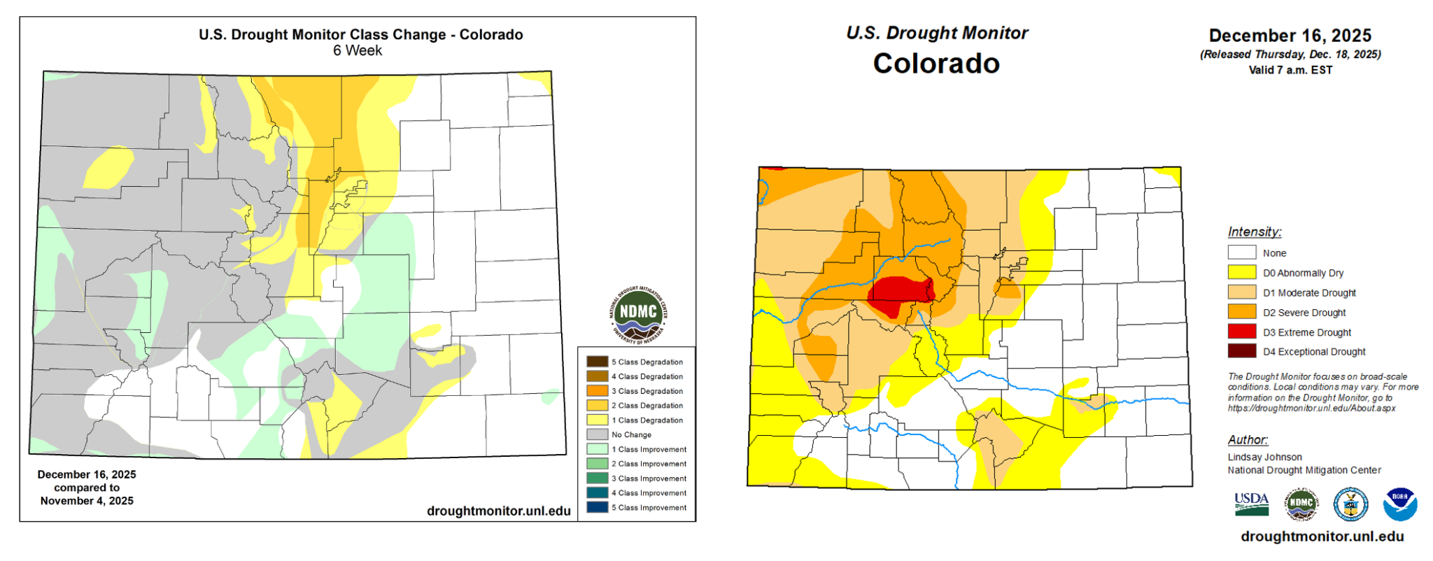
Warm and dry conditions have been accompanied by high wildfire risk. Strong winds coupled with the lack of precipitation and snow-free ground cover in the Foothills has brought favorable fire weather conditions throughout this past week. On December 17, downslope winds produced severe wind gusts in excess of 100 mph. A cold front later in the day pushed gusty winds across the Eastern Plains, fanning several fires near Yuma that were ignited by downed power lines. Exceptionally dry and windy conditions returned on December 19, prompting the NWS in Boulder issued its first-ever Particularly Dangerous Situation (PDS) Red Flag Warning on December 19, a descriptor reserved only for the most severe fire risk days. The NOAA Storm Prediction Center also included parts of the Front Range Foothills and Urban Corridor in an “extremely critical” risk area in their Fire Weather Outlook, which is uncommon to see anywhere in Colorado (no more than a few of those forecasts are issued statewide each year), but they are exceptionally rare during the wintertime. Forecast products aside, fire season is year-round for Colorado’s lower elevations, as was underscored by the devastation brought by the Marshall Fire in December 2021.

Outlook
Looking ahead at the rest of December, there is high confidence that above-normal temperatures will persist across Colorado. The 8-14 Day NOAA Climate Prediction Center Outlook shows a 70-80% chance that temperatures will be above average during the final week of 2025. For precipitation, it is likely that a series of atmospheric rivers will make landfall along the West Coast throughout the last couple of weeks of December. While impacts will be greatest for the coastal states, global numerical weather prediction models indicate that these events will bring increased moisture to Colorado, especially the western part of the state. As a result, the CPC shows elevated chances for above-normal precipitation over Western Colorado during the December 26-January 1 period, which is welcome news from a drought and snowpack perspective. Current forecast model data shows that precipitation chances over the next two weeks diminish as you head further east across Colorado, and the CPC suggests that below-normal precipitation is favored for the 8-14 day period over the far eastern part of the state.
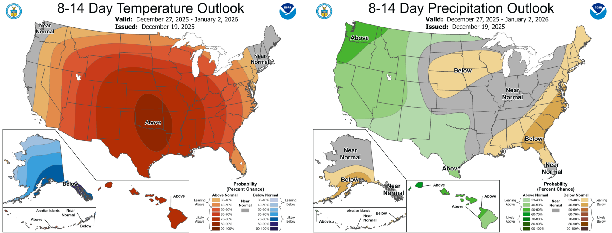
Looking further ahead towards the seasonal outlook for January-March, precipitation and temperature outlooks are less certain. The CPC outlook for the first three months of 2026 shows increased likelihood for above-average temperatures in Southwest Colorado and equal chances for above- or below-normal temperatures elsewhere. In terms of precipitation, the January outlook has Colorado sitting between increased chances of wetter than normal conditions over the Northwest U.S. and increased chances of drier than normal conditions over the Southwest U.S, highlighting uncertainty in what the rest of winter will bring. This pattern in the outlook is reflective of a typical wintertime La Niña setup, which usually situates Colorado between dry conditions to the south and wet conditions to the north (though results found in our Climate Change in Colorado Report suggest La Niña correlates with wetter conditions over the Northern Mountains, making the recent snowpack numbers even more concerning). La Niña conditions are expected to persist into early 2026 and are forecasted to shift towards the ENSO neutral phase sometime in late winter or early spring.
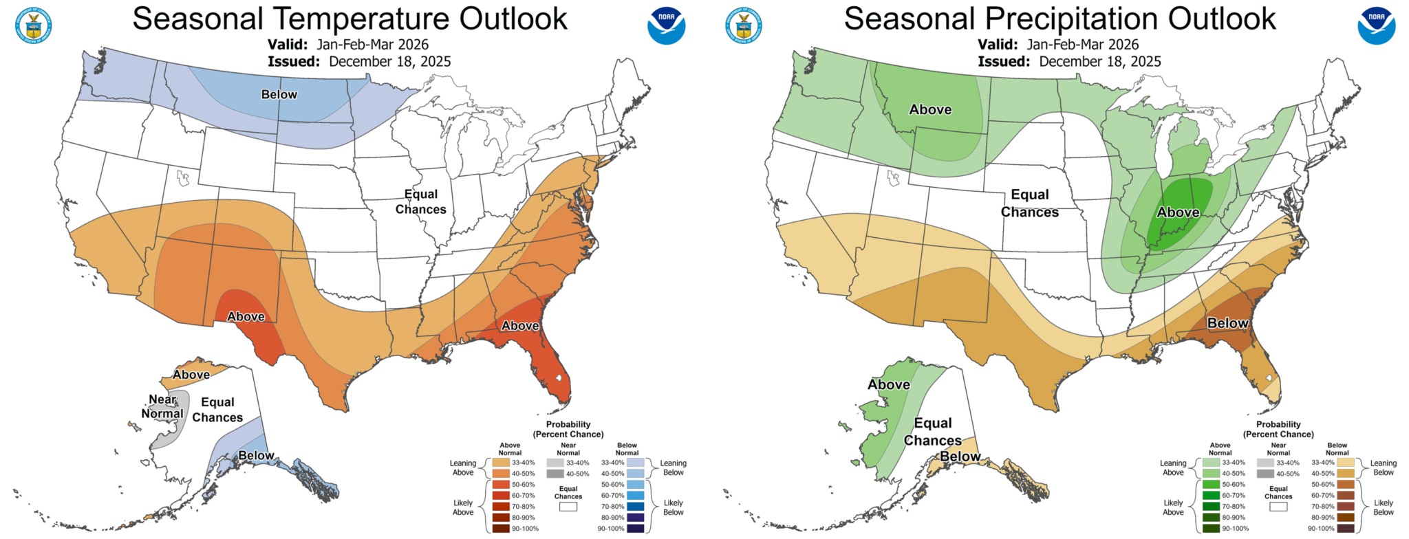

A not-so-white Christmas: #Colorado mountain towns saw rain, record-high temperatures and record-low #snowpack — The Summit Daily
Click the link to read the article on the Summit Daily website (Ryan Spencer). Here’s an excerpt:
December 27, 2025
Leadville, Breckenridge, Keystone and Aspen all experienced small amounts of rain on Christmas Day, according to the National Weather Service
Across Colorado, this Christmas holiday was not particularly white, as many mountain towns saw small amounts of rain, record-high temperatures and a record-low snowpack. As of Dec. 25, Colorado’s statewide snowpack stood at just 3.2 inches of snow-water equivalent and had reached the zeroth percentile, or its lowest point in at least the past 30 years, according to the U.S. Department of Agriculture’s snowpack telemetry, or SNOTEL, system.
“The winter of 1976-77 is generally thought to be the worst snow year in our mountains but the SNOTEL network wasn’t built out yet at that point, so it’s hard to make direct comparisons,” Colorado Climatologist Russ Schumacher said. “But the fact that we’re even in the same conversation with that winter is not good news.”
Out of the 94 SNOTEL stations in Colorado with at least 20 years of data, 22 of them were at a record-low snowpack on Christmas Day, and 10 were at their second-lowest snowpack on record, Schumacher said. He noted that warm temperatures and a lack of storms throughout December has not helped the state’s snowpack. Temperatures over the Christmas holiday were approximately 15 to 25 degrees above normal across the mountains, National Weather Service Grand Junction Office meteorologist Braeden Winters said Friday. The streak of unseasonably warm weather began toward the beginning of December and continued to get warmer through the holiday period…Rather than white, fluffy flakes for Christmas, Colorado’s mountain towns — including Leadville, at 10,154 feet, Breckenridge at 9,600, Keystone at 9,280 feet and Aspen at 7,891 feet — experienced light rain and mixed precipitation on Thursday.
#ColoradoRiver Continues to Bring Unlikely Parties Together at the Colorado River Water Users Association — Daniel Anderson (Getches-Wilkinson Center) #CRWUA2025 #COriver #aridifcation
Click the link to read the article on the Getches-Wilkinson Center website (Daniel Anderson):
December 29, 2025
The Colorado River Water Users Association annual conference met in Las Vegas [December 16-18, 2025]. Each year, over a thousand government officials, members of the press, municipal water district leaders, water engineers, ranchers, and tribal members meet to discuss the management of the mighty Colorado River. Hanging over the three-day conference was a stalemate between the upper and lower basin states over how to manage the Colorado River after current operational guidelines expire at the end of 2026.
Throughout the conference, the states’ inability to reach a consensus deal produced ripple effects. The stalemate held back progress on both near term shortage concerns (experts predict that Lake Powell will be only 28% full at the end of the ’25-’26 water year) and long-range planning, such as the development of the next “Minute” agreement between the United States and Mexico.
The closing act of CRWUA 2025 was an orderly (and familiar) report from each of the basin states’ principal negotiators that their state is stretched thin but remains committed to finding a consensus agreement. This final session had no discussion or Q&A. The basin states now have until February 14th to provide the Bureau of Reclamation with their consensus deal, which would presumably be added to an Environmental Impact Statement (EIS) draft that is expected to be released in early January. With time running short, many worry that public participation in the EIS process – vital to informed decision-making – will be greatly reduced.
Still, as Rhett Larson of Arizona State University said on the first day of the conference, “Desert rivers bring people together.” Tribal governments continue to innovate in the areas of conservation and storage, even in spite of ongoing challenges to meaningful access of federally reserved tribal water rights. For instance, the Colorado River Indian Tribes, or CRIT, shared news of a Resolution and Water Code recently passed by their Tribal Council which work together to recognize the Colorado River’s personhood under Tribal law. This provides CRIT with a holistic framework for on-reservation use and requires the consideration of the living nature of the Colorado River in off-reservation water leasing decisions. John Bezdek, who represented CRIT at the conference, put it this way: “If laws are an expression of values, then this tribal council is expressing to the world the importance of protecting and preserving the lifeblood of the Colorado River.” Among others, Celene Hawkins of The Nature Conservancy and Kate Ryan of the Colorado Water Trust also shared about the unique, and often unlikely, partnerships formed to protect stream flows and the riparian environment across the Colorado River basin.
Notwithstanding the basin states’ current deadlock, one theme rang true at CRWUA 2025: Despite the dire hydrologic and administrative realities facing decision-makers today, the Colorado River continues to bring unlikely parties together.

With stakes sky high, 3 takeaways from this year’s #ColoradoRiver conference — The Las Vegas Review-Journal #CRWUA2025 #COriver #aridification

Click the link to read the article on the Las Vegas Review-Journal website (Alan Halaly). Here’s an excerpt:
December 19, 2025
The single most important gathering of Colorado River Basin officials came and went — with no significant announcements regarding the often frustrating yet crucial seven-state negotiations for how to divvy up the river over the next 20 years…Here are three takeaways as the states wrestle with basinwide overuse of water, declining river flows due to a warming world and how to meet the federal government’s Valentine’s Day deadline for a consensus-based deal.
States far from deal — with less than 60 days left
Unlike last year’s conference, the seven states agreed to sit on a panel that was added to the agenda for the last day. The ballroom was still packed for the early morning session. That’s because the stakes are high for states to meet Burgum’s Feb. 14 deadline for a seven-state agreement. Should they not deliver one, Burgum could intervene and states are likely to sue. The Lower Basin states have agreed to shoulder the brunt of a massive deficit the system faces that totals 1.5 million acre-feet, or almost 489 billion gallons. However, the Upper Basin states of Colorado, Utah, New Mexico and Wyoming say they don’t have more water to give should cuts in their jurisdictions become necessary. Conflicts exist with state laws, too…
Temporary deal could be on the table to avoid courtroom
Nevada’s governor-appointed negotiator, John Entsminger, spoke last on the panel and called out the other six states for failing to cede any ground on further conservation in their remarks. Without some compromise from each state on these long-standing arguments, the negotiations are “going nowhere,” he said. While the states have been expected up until this point to deliver a 20-year deal, Entsminger suggested on the panel that a temporary, five-year deal could be on the table to comply with the Feb. 14 deadline.
Poor outlook sending shockwaves throughout basin
The underlying issues of the Colorado River are making this moment much more precarious. Several experts presented a dismal picture for the system at large. Carly Jerla, senior water resource program manager at the Bureau of Reclamation, said the agency’s most recent projections place flows into Lake Powell anywhere between 44 percent to 73 percent of average this upcoming year. And since 2006, that replenishment of the reservoir has declined about 15 percent because of poor snow years, evaporative losses and more…

Jack Schmidt, who leads the Center for Colorado River Studies at Utah State University, has published several papers this year alongside a group of experts throughout the basin. By his estimation, should snowpack in the Rocky Mountains fail to impress again this winter, water managers may be blowing through a crucial buffer that ensures water can be released from Lake Powell into Lake Mead — and that hydropower generation can continue.
#Snowpack news December 29, 2025: Why hasn’t it snowed much this year, and what does that mean for #Colorado? — Daniel Strain (Colorado University #Boulder News)
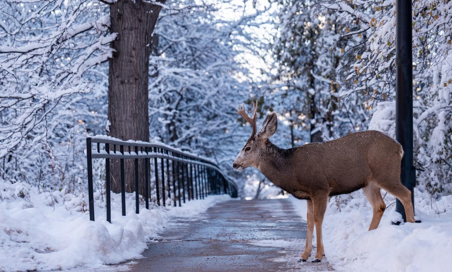
Click the link to read the article on the University of Colorado website (Daniel Strain):
December 18, 2025
In CUriosity, experts across the CU Boulder campus answer questions about humans, our planet and the universe beyond.
Jennifer Kay, professor of atmospheric and oceanic sciences and fellow at the Cooperative Institute for Research in Environmental Sciences (CIRES) at CU Boulder, talks about why this winter has been so dry.
Jennifer Kay has a message for the skies above Colorado: “Let it snow.”
Kay is an atmospheric scientist who, in her free time, likes to go cross-country skiing in the Rocky Mountains.
But this year, the season’s typical white-out blizzards haven’t arrived.
Denver didn’t get its first snow—a wimpy dusting of just 0.2 inches—until Nov. 29, the second latest first snow on record. Temperatures around the Front Range have also been downright balmy, drawing close to or even setting record highs.
Could the late start to the winter be a bad omen for Colorado’s ski industry and its future water supplies?
Kay weighs in on the question from CU Boulder’s East Campus with a view of the Flatiron Mountains behind her. They’re almost completely dry, with almost none of the sprinkling of white that usually marks them this time of year.
She says it’s not time to panic—yet.
“It’s also really early in the season still, so people shouldn’t be too worried about what’s going to happen with the ski season or water,” says Kay, a fellow at the Cooperative Institute for Research in Environmental Sciences (CIRES) at CU Boulder. “There are still a lot of different ways this season could unfold.”
In 2021, for example, Denver didn’t see its first snow until Dec. 10 (the latest on record). But snowfall totals inched closer to normal in the months that followed.
Kays says it’s not possible to predict how much snow will come to Colorado in an individual winter season months ahead of time.
A lot of that stems from a phenomenon known as the jet stream. That’s the name for a narrow band in the atmosphere above North America where winds reach tremendous speeds, sometimes over 250 miles per hour. When this band hovers above Colorado, it tends to bring big, rumbling storms to the state.
“When the jet stream brings storms to us, we get…a lot of wet, snowy days,” Kay said. “If the jet stream goes another direction, maybe to the north or south of us, we don’t get as many snowstorms.”
But, she adds, any number of complex factors can make the jet stream wiggle from month to month—although meteorologists can often predict what the jet stream will do several days in advance.
Recently, the jet stream has stuck mostly to the north of Colorado, crossing over states like Montana and the Dakotas.
This year’s less-than-snowy winter has Kay thinking about what the future may hold.
With warming, she says, many storms that might normally produce snow may instead bring rain. That could have a wide range of consequences for the state.
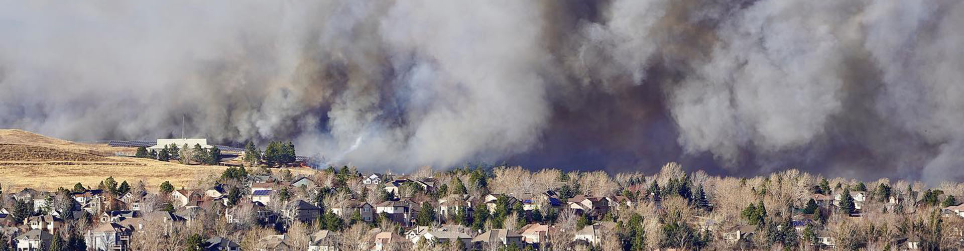
A thick blanket of snow on the ground, for example, can keep wildfires from starting and spreading. The Marshall Fire, which devastated parts of Boulder County in December 2021, erupted at a time when the ground was relatively dry, and winds were especially fierce.
Kay believes it’s important for Coloradans to prepare themselves for hotter and dryer weather.
She lives in Boulder and keeps a go-bag packed at all times, even during the winter months. It includes a change of clothes, important documents, chargers for electronic devices and contact information for her neighbors.
“I have already adapted to the reality of more fires as we get hotter and drier in Colorado,” she says. “Understanding what’s happening around you and having a plan for extreme events like the strong wind events we have along the Front Range is important.”
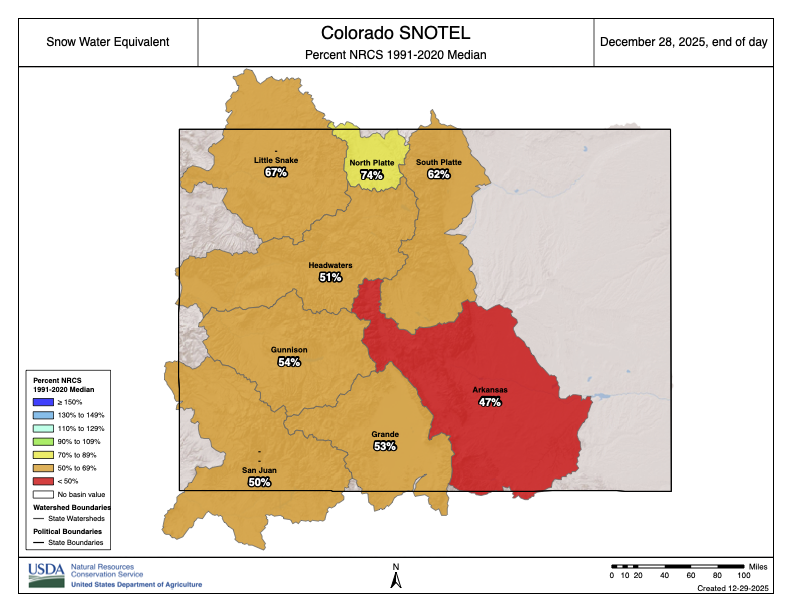
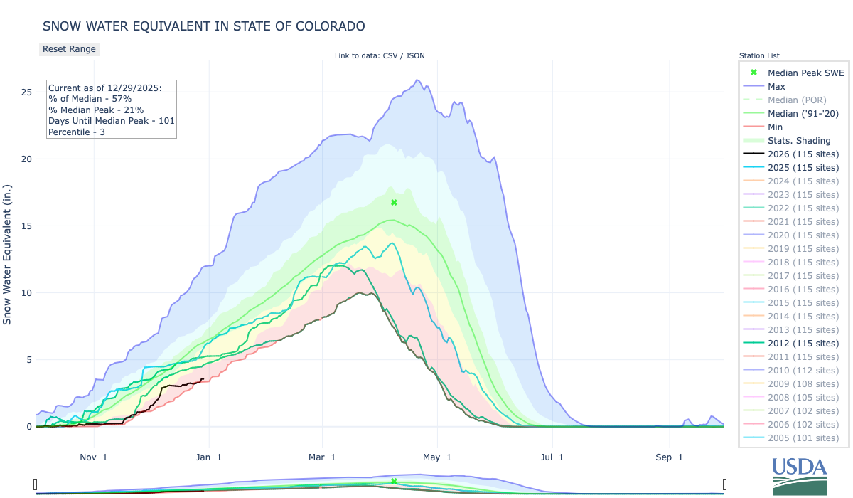
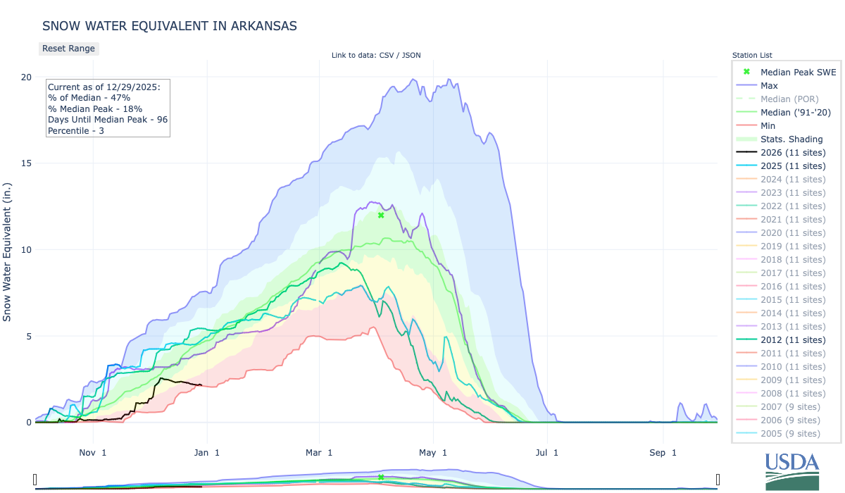
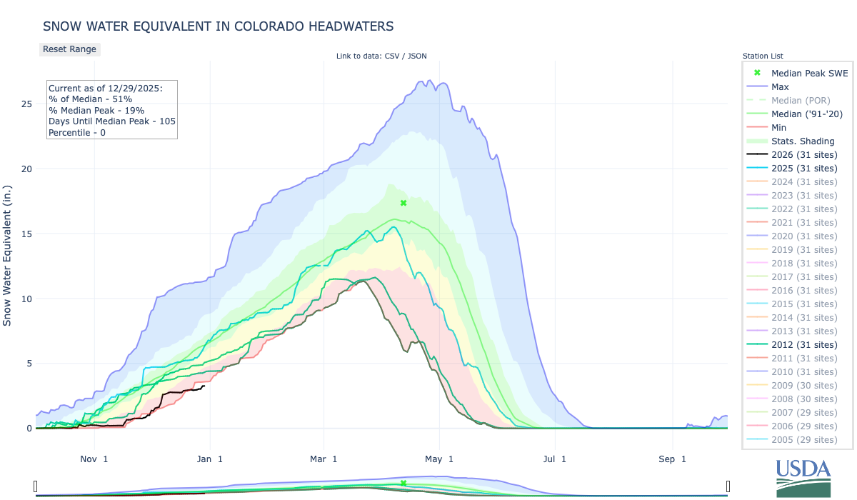
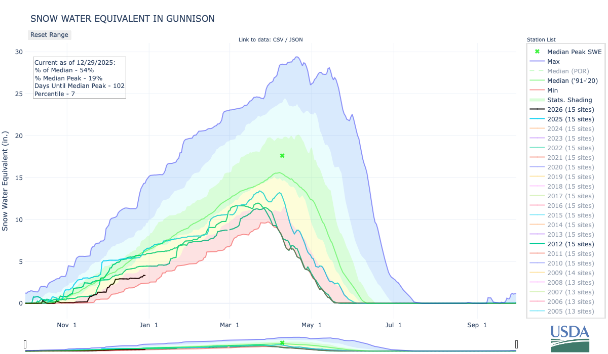
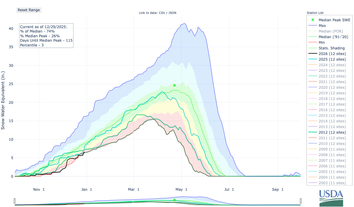

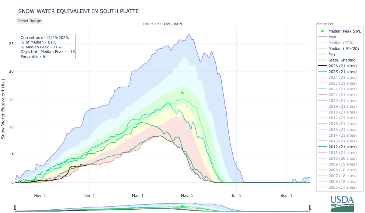
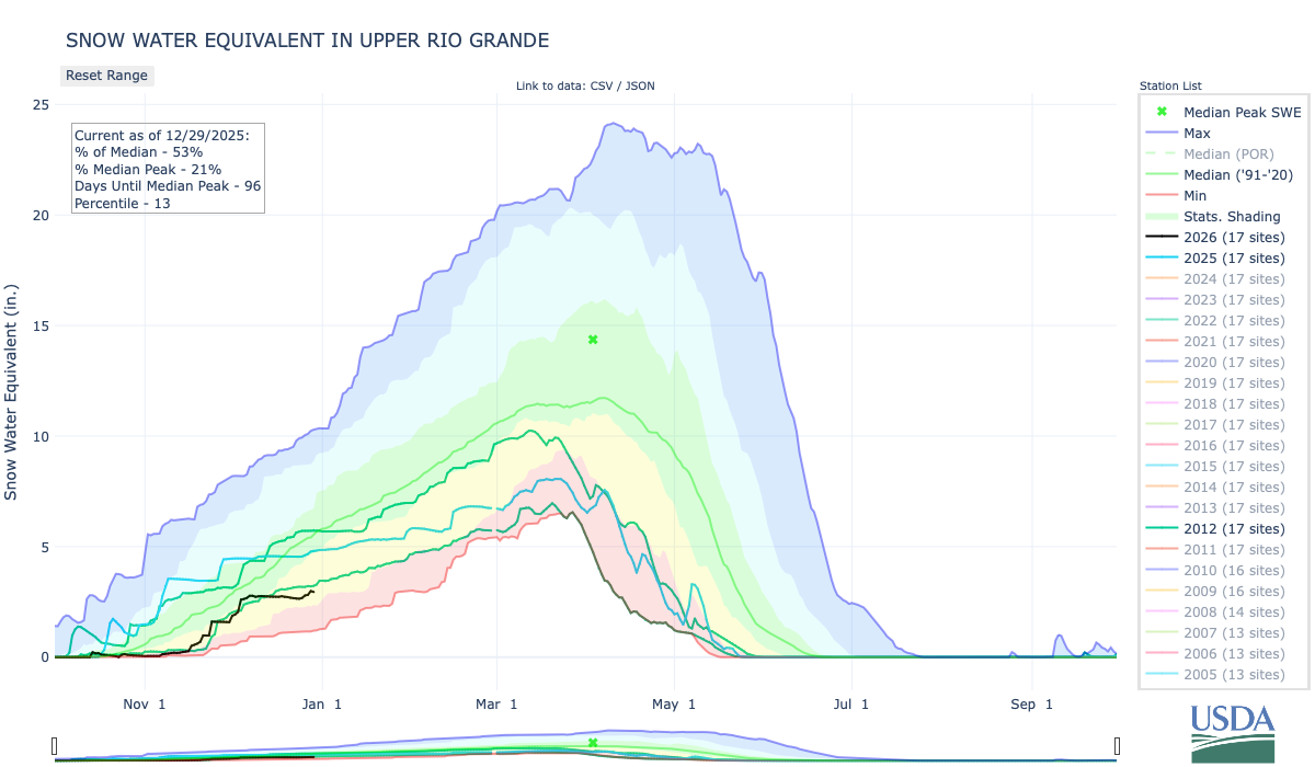
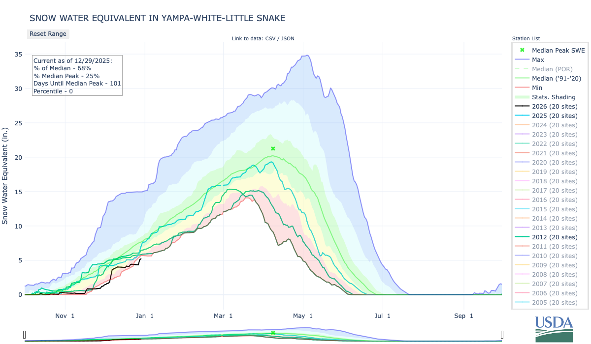
A private water company is leading a $150 million rush for Northern Colorado #groundwater — Jerd Smith (Fresh Water News) #SouthPlatteRiver
Click the link to read the article on the Water Education Colorado website (Jerd Smith):
December 23, 2025
A private development company is investing $150 million in an ambitious plan to harvest groundwater lying beneath sprawling northern Colorado ranches to serve fast-growing towns along the Interstate 25 corridor.
FrontRange H2O, backed by a Texas oil and real estate company, is behind the venture. The firm has been operating in Colorado for more than 20 years, treating and delivering wastewater from oil wells for oil industry reuse on the West Slope, and overseeing extensive real estate holdings in Denver and elsewhere, according to Brent Waller, who is president of the Loveland-based company.
“We were recycling produced water before it was cool,” Waller said. Produced water describes wastewater that is generated through oil production.
Experts say the large-scale, private urban water development is the first of its kind in Colorado and could help thirsty towns like Fort Collins and Loveland shore up their water systems.
But others worry that the privatization of water in the state could lead to price hikes and might also, because of its reliance on nonrenewable groundwater, undermine the state’s future water security.
Still, Front Range H20 believes its system will deliver water at less cost and sooner than other government-backed projects.
Until now, Colorado communities have relied on water that is captured, stored and treated by public, nonprofit water utilities, such as Denver Water. The agency is an independent entity governed by commissioners who are appointed by the Denver mayor. In other cases, cities operate their own water systems. Public entities such as these are required by law to regulate water rates, to issue bonds to finance their work, and they are subject to oversight by elected or appointed bodies.
But FrontRange H2O is a private company that is using millions of dollars in private financing to secure the water rights, obtain state permission to drill the groundwater wells, and to build a water treatment system and pipeline to carry the water. Although it must obtain state permission to drill the wells and build the water treatment plant, it is not subject to the same public oversight as a public government system would be.
“This kind of thing is common in Texas and Arizona, particularly with groundwater, but it is unique in Colorado,” said Adam Jokerst, Rocky Mountain regional director for WestWater Research, based in Fort Collins. Jokerst is a groundwater expert who has consulted with Front Range H2O on its northern Colorado plans.
FrontRange H2O refers to its current project as VitaH2O. Nine wells drilled into the aquifer are expected to generate up to 5,000 acre-feet of water initially, Waller said. An acre foot equals nearly 326,000 gallons of water and is eough to serve to two to four urban households for one year. The water will be treated at a new plant north of Nunn and then delivered down to Cobb Lake, a reservoir owned by the Fort Collins-Loveland Water District, or FCLWD.
The district was in the news earlier this year when it opted out of a large-scale water and reservoir project run by Northern Water known as NISP, the Northern Integrated Supply Project. It will instead partner with VitaH2O.

As the project moves forward, Waller said FCLWD will contribute an additional $150 million to help complete the new water supply project. Chris Pletcher, general manager of FCLWD, declined an interview request. The water district was NISP’s largest customer and was on track to pay $400 million to help build the giant system.
Colorado derives most of its water supplies from melting snows that fill its streams and rivers, but large swaths of the state, including Douglas County, rely heavily on wells drilled deep into aquifers, many of which are not recharged through rain and snow.
As the state grows, the pressure to tap these nonrenewable waters is growing as well.
According to the Colorado Division of Water Resources, interest in drilling high producing groundwater wells in northern Colorado is growing.
“There has been more activity in this area in the last 10 years,” said Tracy Kosloff, deputy state engineer at Colorado’s Division of Water Resources.
Major players in the area include Front Range H2O and the city of Greeley, among others.
The interest in nonrenewable groundwater worries people like Steve Boand, a former Douglas County commissioner and water consultant who has watched his region’s nonrenewable groundwater supplies shrink as they are used by fast-growing towns like Parker and Castle Rock.
Any project that relies on nonrenewable groundwater is problematic, Boand said.
“In general, sustainable water supplies are the preferred source,” Boand said, noting that Douglas County water providers are spending hundreds of millions of dollars to recycle water and tap rivers and streams to wean themselves off nonrenewable groundwater. Their hope is, eventually, to use their aquifers only in drought years when surface supplies are scarce.
And that is part of the plan with VitaH2O, Waller said. The project will use surface supplies that the Fort Collins-Loveland district already owns to recharge the aquifers they plan to withdraw water from, in hopes that the treated water being pumped back into the ground in wet years will extend the life of the nonrenewable aquifers.
Under Colorado water law, groundwater can be drilled by whomever owns the land above the aquifer, but they must demonstrate that they are extracting water gradually and must prove it will last at least 100 years.
Waller said he believes the surface supplies that VitaH2O will inject back into the aquifers in wet years will extend the life of the system beyond 100 years, to 300 years or more.

East of Waller’s development, the city of Greeley has already invested $85 million in developing an aquifer system under the Terry Ranch that will supply water in drought years and will also store treated water, according to Sean Chambers, Greeley’s director of water and sewer utilities.
“What you are seeing now is a new approach to diversifying surface water supplies with this deep aquifer, nonrenewable groundwater … and there is a rush on that,” Chambers said.
Looming in the background is Northern Water’s NISP project. It was originally designed to serve 15 entities, but three have already pulled out, including the largest, the Fort Collins-Loveland district. Waller said he is in talks with several other communities, including Wellington and Eaton, who are looking for an alternative to the costly $2.7 billion NISP, which will rely on renewable water supplies from the Poudre and South Platte rivers.
Brad Wind, general manager of Northern Water, said NISP’s growing cost is prompting long-time supporters to rethink their participation and that some will inevitably go with other providers, such as VitaH2O.
“People have some hard choices to make,” Wind said.
How much water is available to be mined from these aquifers isn’t clear yet, though developers such as Waller and Greeley have invested heavily in doing the hydrological analysis that gives them an estimate of what is available.
But overuse is a major concern and Chambers says that is a key issue the city is addressing as it develops its system.
“Collectively we will have to find ways over time to make sure that northern Colorado and other communities that rely on this water don’t just mine it to extinction … Greeley goes into this effort with our eyes very wide open about that,” Chambers said.
“This is a resource that should last for 10 generations or longer and provide a runway for public officials to figure out how to build resilience into all of our sources of supply,” he said.
Boand isn’t convinced that the recharge technologies and state rules designed to make the water last longer are going to be enough to protect the aquifers.
“Recharge has been somewhat successful but everybody has talked about it as if it is the great salvation, even though it is very much in the testing phase,” Boand said. “And it takes the same attention to detail that running a nuclear power plant takes … lots of engineers and lots of scientists.”
Another concern with having a private company develop a major public water supply is the stability of the company and the water system if the company should fail.
Waller says his company’s contracts provide protection for that possibility.
“If we go belly up, five years or 10 years down the road, the water districts and participants have the right to step in and take over the system. There are controls in place,” Waller said. They expect to deliver water in the first quarter of 2029.
As with most new water projects, developers go through a special court review where they must prove their water estimates are accurate and that their water use won’t harm others. Waller said his company’s water court application was filed in October.
And it is being closely watched.
Chambers, with the city of Greeley, is concerned that the VitaH2O project may impact the Terry Ranch project, which lies nearby. He said he expects to fight to defend Greeley’s rights and will object to anything he sees as threatening.
“We intend to be an objector in the water court process to protect our decree and our investments,” he said.

New report outlines the crisis on the #ColoradoRiver and the ongoing threats: Analysis comes out as water users meet in Las Vegas — The Deseret News #CRWUA2025 #COriver #aridification

Click the link to read the article on The Deseret News website (Amy Joi O’Donoghue). Here’s an excerpt:
December 16, 2025
A new report from Colorado Law’s Colorado River Research Group warns the Colorado River Basin is “out of time,” describing conditions so severe they threaten the region’s water supply, economy and governance. Called “Colorado River Insights 2025: Dancing with Deadpool,” the report details a dire assessment of the basin’s worsening crisis and offers options for reform. According to the report, reservoirs that once stored four years of river flows are now more than two-thirds empty. The authors note a single dry year or two could push Lake Powell and Lake Mead below critical thresholds, jeopardizing hydropower, water deliveries, and even physical conveyance downstream. The report concludes that current operating rules through 2026 are unlikely to prevent this scenario.
“This report underscores that the basin is out of time, the crisis is no longer theoretical,” said Douglas Kenney, director of the Western Water Policy Program of the Getches-Wilkinson Center at the University of Colorado Law School and chair of the Colorado River Research Group.
“Post-2026 negotiations must produce durable, equitable, climate-realistic solutions — and they must do so urgently. The message is stark: the Colorado River system is now dancing with Deadpool.”
Among the key challenges:
- Severe shortage risk: The authors warn that if the next two winters are dry, combined usable storage in Powell and Mead could fall below 4 million acre-feet — far short of what’s needed for water supply and compact obligations.
- Climate-driven decline: Rising temperatures, shrinking snowpack efficiency and ocean-atmosphere interactions are reducing runoff and precipitation.
- Safety nets collapsing: Groundwater reserves are rapidly depleting, while federal capacity — funding, staffing and science programs — are eroding. Interstate cooperation is fraying, and litigation may be on the table.
Authors stress that many challenges are self-inflicted and, in their view, solvable with technical, legal and financial tools already available.

The Year in Water 2025: The #ColoradoRiver — Brett Walton (circleofblue.org) #COriver #aridification

Click the link to read the article on the Circle of Blue website (Brett Walton):
December 24, 2025
The year is ending with the Colorado River at a critical juncture.

The big reservoirs Mead and Powell remain perilously low and the seven states that share the basin have been unable to agree on cuts that would reduce their reliance on the shrinking river.
Reservoir operating rules expire at the end of 2026. If no agreement is reached the federal government could step in, or the states could take their chances in court. It’s a risky move that no one in principle seems to want. Yet brinkmanship and entrenched positions have stymied compromise.

The basin’s Indian tribes, which collectively have rights to more than a quarter of its recent average annual flow, are adamant that their interests – and more broadly, the river itself – be protected. “Any progress made in the negotiations to date is merely rationing a reduced supply, not actively managing and augmenting it as a shared resource with strategies and tools that can benefit the entire basin,” the leaders of the Gila River Indian Community wrote on November 12.
The Colorado River Indian Tribes, whose riverside reservation includes lands in Arizona and California, voted in November to extend legal personhood to the river under tribal law.
National Park Sites Along #ColoradoRiver Grappling With Declining Water — National Parks Traveler #COriver #aridification
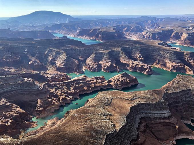
Click the link to read the article on the National Parks Traveler website. Here’s an excerpt:
December 23, 2025
At Lake Mead National Recreation Area in Nevada, “the National Park Service’s focus remains on sustaining boating access and visitor services across the park, including operations at Hemenway Harbor, Callville Bay Marina, Echo Bay, Temple Bar Marina, and South Cove to the extent feasible,” the National Parks Traveler was told.
“As part of that effort, construction began at Hemenway Harbor last summer to extend the launch ramp and help maintain access as conditions change. Lake levels are closely monitored, and NPS operations continue to be adjusted as needed to support safe recreation while protecting park resources,” the Park Service said.
Two years ago Lake Mead officials adopted a plan to “maintain recreational motorboat access in the event water declines to 950 feet.” As of Tuesday, the elevation was 1061.76 feet, according to the U.S. Bureau of Reclamation. At Glen Canyon National Recreation Area, which straddles the Utah-Arizona border, the Park Service has spent more than $100 million in recent years to extend boat ramps and relocate a takeout for river runners coming down the Colorado River through Canyonlands National Park.
“The public is encouraged to make informed decisions before they plan their visit to Lake Powell by viewing lake level data on the Bureau of Reclamation website at 40-Day Data | Water Operations | UC Region | Bureau of Reclamation and projected reservoir levels at 24-Month Study | Upper Colorado Basin | Bureau of Reclamation,” the Park Servicxe said.

Feds demand compromise on #ColoradoRiver while states flounder amid water shortage — Jennifer Solis (States Newsroom) #COriver #aridification #CRWUA2025

Click the link to read the article on the States Newsroom website (Jennifer Solis):
December 25, 2025
Western states that rely on the Colorado River have less than two months to agree on how to manage the troubled river – and pressure is mounting as the federal government pushes for a compromise and a troubling forecast for the river’s two biggest reservoirs looms.
Top water officials for the seven Colorado River Basin states — Arizona, California, Nevada, Colorado, New Mexico, Utah, and Wyoming — gathered for the three-day Colorado River Water Users Association conference at Caesars Palace in Las Vegas last week.
Colorado River states have until Feb. 14 to reach a new water sharing agreement before current operating rules expire at the end of 2026 —or the federal government will step in with their own plan.
Despite the fast-approaching deadline, states reiterated many of the same issues they did during previous years at the conference, namely, which water users will need to sacrifice more water to keep the Colorado River stable as overallocation, climate change, and rising demand sucks the river dry.
Nevada’s chief river negotiator and general manager of the Southern Nevada Water Authority John Entsminger offered a succinct but sharp assessment of the negotiations during a panel discussion Thursday.
“If you distill down what my six partners just said, I believe there’s three common things: Here’s all the great things my state has done. Here’s how hard/impossible it is to do any more. And here are all the reasons why other people should have to do more,” Entsminger said.
“As long as we keep polishing those arguments and repeating them to each other, we are going nowhere,” he continued.
The seven states that share the river’s flows have been deadlocked for nearly two years over how to govern the waterway through the coming decades — even as water levels at Lake Mead and Lake Powell are forecasted to reach record lows after two straight years of disappointing snowpack across the West.
The Colorado River’s headwaters saw a weak snowpack last winter, contributing to one of the worst spring runoff seasons on record. Water flow into the river this year was only 56% of average, leading to significant reductions in Lake Powell, according to the Interior Department’s Bureau of Reclamation.
Federal officials also released a troubling forecast of expected flows for the river in 2026, which were significantly lower than previous predictions. Projections from the Bureau of Reclamation found the Colorado River’s inflow next year would likely be 27% lower than normal, with worst-case scenarios predicting even lower flows.
Without a strong winter snow season, it’s possible Lake Powell’s levels could drop low enough to cease hydropower production by next October — a scenario that would also limit the department’s ability to send water downstream to Arizona, California and Nevada.
The federal government has refrained from imposing its own plan for the river, preferring the seven basin states reach consensus themselves. But the Interior Department has ramped up pressure on states to reach a deal.
The Bureau of Reclamation’s Acting Commissioner Scott Cameron said he and other federal officials have intensified efforts to bring states to a consensus, flying out West every other week since early April to meet with the seven states’ river negotiators.
“The expiration of the current agreements is not a distant horizon. It’s less than a year away. The time to act is now,” said Cameron.
Within the next few weeks, the Bureau of Reclamation will release a range of proposals to replace the river’s current operating rules, but said they would not identify which set of operating guidelines the federal government would prefer
During the conference, negotiators for the seven states repeated that they are still committed to finding a consensus despite missing previous deadlines. California’s biggest water districts said they were willing to “set aside many of their legal positions” in order to reach a seven-state agreement.
However, a long-term multidecade strategy for managing low river flows is likely out of reach.
“I went into this process…advocating strenuously for a 20- to 30-year deal,” said Entsminger. “I no longer believe that’s possible with the time we have left and with the hydrology that we’re facing.”
Entsminger said the “best possible outcome at this juncture” is a short-term five-year deal that sets new rules around water releases and storage at Lakes Powell and Mead.
During a panel of state negotiators, states highlighted water conservation efforts they have undertaken to reduce water use and protect the river, but all explained why their state can’t take on more cuts.
“Our savings accounts are totally depleted,” said Utah’s’s river negotiator, Gene Shawcroft. “Reserviours were full when we started this process. They’re empty now.”
One of the biggest disagreements between the Upper and Lower Basin states is over which faction should have to cut back on their water use during dry years.
The Lower Basin – Nevada, Arizona, and California – have agreed to take the first 1.5 million acre-feet in water cuts needed to address deficits and evaporation that are reducing flows in the river, but say any additional cuts during dry years must be shared with upstream states. Under the current agreement, Lower Basin states must take mandetory cuts when water levels in Lakes Powell and Mead are low.
The Upper Basin, which is not subject to mandatory cuts under the current guidelines, say they already use much less water than downstream states and should not face additional cuts during shortages.
Any more cuts to water users in downstream states during dry years will be politically perilous, explained Arizona’s top negotiator, Tom Buschatzke. Arizona requires the state legislature to approve any changes to Colorado River management rules impacting the state.
Buschatzke called for the Upper Basin – Colorado, Wyoming, New Mexico, and Utah – to split any additional water cuts with the Lower Basin states 50-50.
“We need conservation in the Upper Basin that is verifiable and mandatory,” Buschatzke said, during the panel.
“I have to go to my legislature and get that approval,” he continued. “And I will say right now, I do not think there is anything on the table from the Upper Basin that would compel me to do that today.”
New Mexico’s river negotiator, Estevan López, responded, “I think we’ve been pretty clear. We are unwilling to require additional mandatory reductions on our water users.”
This story was originally produced by Nevada Current, which is part of States Newsroom, a nonprofit news network which includes Stateline, and is supported by grants and a coalition of donors as a 501c(3) public charity.
#ColoradoRiver Reservoir Storage: Where We Stand — Jack Schmidt, Anne Castle, John Fleck, Eric Kuhn, Kathryn Sorensen, Katherine Tara (Colorado River Research Group) #COriver #aridification #LakeMead #LakePowell
Click the link to read the report from “Dancing with Dead Poll” on the Getches-Wilkinson website (Jack Schmidt1, Anne Castle2, John Fleck3, Eric Kuhn4, Kathryn Sorensen5, Katherine Tara6) Here’s Chapter 1:
In Brief
The rains of mid-October caused significant flooding in the San Juan River basin and increased reservoir storage throughout that basin and in Lake Powell.7 However, basinwide reservoir storage remains low, and the October rainfall offerings were insufficient to alleviate the peril of declining overall water supply.
While the attention of the Basin’s water management community remains focused on the thus far unsuccessful effort to forge a seven-state agreement on future long-term operating rules, the Basin continues to face the risk of short-term crisis. If winter 2025-2026 is relatively dry and inflow to Lake Powell and other Upper Basin reservoirs is similar to that of 2024-2025, low reservoir levels in summer 2026 will challenge water supply management, hydropower production, and environmental river management. Under such a scenario, it is likely that less than 4 million acre feet in Lake Powell and Lake Mead would be realistically available for use during the nine months between late summer 2026 and the onset of snowmelt runoff in 2027. If winter 2026-2027 is also dry, water supply would be further constrained. The present reservoir operating rules that remain in place through 2026 are insufficient to avert this potential water supply crisis. Action to further reduce consumptive water use across the basin is needed now.
How did we get here?
The Basin’s reservoirs were nearly full in late summer 1999,8 acting as a buffer against dry years and serving their fundamental purpose. At that time, the 46 Colorado River Basin reservoirs tracked by the Bureau of Reclamation in its Hydro database held 59.5 million acre feet (maf) in active storage,9 more than four times the Basin’s average consumptive uses and losses in the 1990s (Fig. 1).10 Beginning in 2000, five years of below average runoff11 resulted in a 46% reduction in storage in the Basin’s reservoirs.12 During that time, the reduction in storage in Lake Powell and Lake Mead accounted for 90% of the Basin’s total loss in storage, because most of the Basin’s water was stored in those two reservoirs.

During the next fourteen and a half years, the amount of storage in the Basin’s reservoirs changed little, despite four years of large runoff (2005, 2011, 2017, and 2019). The increase in storage during the few wet years was nearly completely consumed during the more frequent dry years, and active storage in Powell and Mead was only 5% greater in late July 2019 than it had been at the beginning of 2005.13 When dry years of low runoff returned between 2020 and 2022,14 the Basin’s water users had little of the buffer that they had at the beginning of the 21st century. Combined active storage of Powell and Mead was halved again between mid-July 2019 and mid-March 2023,15 reducing the combined contents of these two reservoirs to only 27% of what it had been in late summer 1999.16 If next winter’s runoff is as low as it was in 2025 17 and consumptive use is not significantly reduced, Powell and Mead will drop below the previous unprecedented low stand of mid-March 2023.
How much of active storage is realistically available?
One of the challenges of the current water supply crisis is uncertainty over how much water is actually available in the reservoirs for use. Although Reclamation regularly reports the amount of water in active storage, our analysis identifies realistically accessible storage as the more appropriate metric of the amount of water that is available for use without challenging the integrity of the dam structures, efficient production of hydroelectricity, or implementation of environmental river management protocols, especially in Grand Canyon.
Reservoir water that can be physically released from a dam is termed active storage. In virtually all reservoirs, there is a small amount of water below the elevation of the lowest outlets–the infamously named dead pool. Active storage is everything above dead pool–water that can be physically released through the reservoir’s lowest outlets.
We know, however, that not all the water above dead pool is readily usable. Engineering assessments have indicated that infrastructure constraints at Hoover and Glen Canyon Dams require that higher reservoir elevations be maintained, thereby constraining utilization of the lowest part of the active storage. We defined realistically accessible storage as the volume of water whose release does not impact previously identified engineering or hydropower-production constraints.
At Glen Canyon Dam, for example, the lowest release tubes, called the “river outlets,” are at elevation 3370 ft. Reservoir water below that elevation cannot be released and constitutes the dead pool. Above the river outlets, at elevation 3490 ft, are the intakes for the power generating turbines, known as the penstocks. The penstocks are the conduits that withdraw water from the reservoir into the powerplant to generate electricity, and thereafter discharge the water to the Colorado River downstream from the dam. When the reservoir falls below the elevation of the penstocks, the river outlets are the only means of discharging water through the dam (Fig. 2). The river outlets are not routinely used to release water; virtually all normal releases go through the penstocks.
Experience has shown that the river outlets were not designed for continuous release at the discharge rates required to meet downstream obligations. If the river outlets were to be used continuously, there is significant concern that structural damage to those outlets could occur.18
Accordingly, Reclamation has determined that it will take steps to avoid Lake Powell elevation declining below 3500 ft, considered a safe elevation for continuous withdrawal of water through the penstocks without risk of harm caused by cavitation to the turbines that produce electricity.19 Similarly at Lake Mead, Reclamation has indicated its intent to protect the reservoir from going below elevation 1000 ft.20
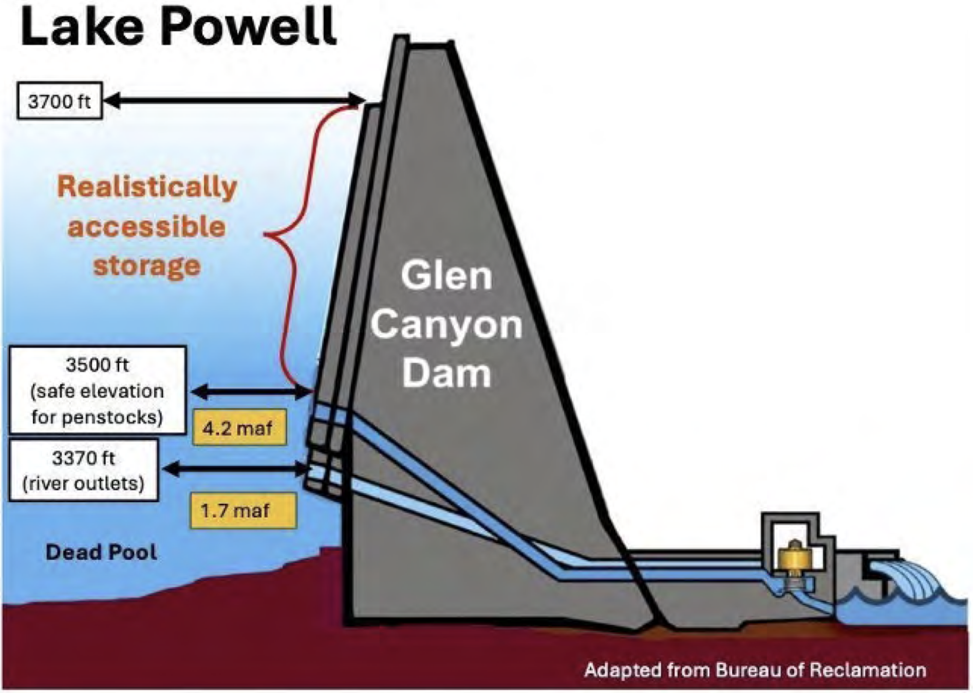
The total volume of active storage in Lake Powell above dead pool but below elevation 3500 ft is 4.2 maf. Release of this stored water is constrained, because it cannot be safely withdrawn through the penstocks, and continuous use of the river outlets is considered unwise. At Hoover Dam, there is 4.5 maf of active storage below elevation 1000 ft, also not realistically accessible. In these two largest reservoirs of the Colorado River Basin, there is a total of 8.7 maf of active storage below the elevations required for safe and efficient operation of the infrastructure (Fig. 3). Thus, of the 14.9 maf of active storage at Lake Powell and Lake Mead on November 15, 2025, only 42% of that active storage, 6.2 maf, was realistically accessible.
Implementation of environmental river management protocols at Glen Canyon Dam are constrained when the elevation of Lake Powell is low. Since 1996, controlled floods, administratively termed High Flow Experiments (HFEs), have been conducted at Glen Canyon Dam to rebuild eddy sandbars along the river’s margin and conserve sediment. HFEs are now an essential component of the Long Term Experimental and Management Plan for Glen Canyon Dam.21 Reclamation did not, however, release an HFE in 2021 or 2022 when sediment conditions were sufficient to trigger implementation of the HFE Protocol because Lake Powell was low. In early October of those years, when decisions about implementing HFEs were made, active storage in Lake Powell was 7.3 maf (elevation 3545.3 ft) and 5.8 maf (elevation 3529.4) in 2021 and 2022, respectively. Reclamation cited low storage as the reason not to release those controlled floods.22 Although administrative decisions change with time, it is doubtful that any HFEs would be released if Lake Powell fell below elevation 3500 ft.
Low reservoir levels also impact Reclamation’s ability to control the invasion into Grand Canyon of smallmouth bass, and other warm water reservoir fish species, that dominate the recreational fish community of Lake Powell. These nonnatives are significant predators and competitors of endangered or threatened native fish species and live near the surface of Lake Powell. At moderate and low reservoir elevations, water withdrawn through the penstocks (termed fish entrainment) includes some fish that survive passage through the powerplant turbines and are delivered into the Colorado River downstream from the dam. These fish have the potential to successfully spawn downstream from the dam if river temperatures are relatively warm, such as occurs when Lake Powell is low and water is only released through the penstocks.

Reclamation has implemented a protocol to eliminate the potential of smallmouth bass population establishment in Grand Canyon by releasing some cooler water through the river outlets when the water released through the penstocks is warm. The objective of these Cool Mix releases is to disrupt smallmouth bass spawning downstream from the dam. Water released through the river outlets bypasses the powerplant and does not produce electricity, and Western Area Power Administration (WAPA) must purchase electricity on the open market to replace electricity that the agency contractually committed to provide. WAPA estimated that the cost of replacing contracted electricity was $18.9 million23 and $6.5 million24 during the Cool Mix releases of 2024 and 2025, respectively. The risk of fish entrainment from Lake Powell increases significantly as Lake Powell’s elevation drops, and the need to implement the Cool Mix protocol therefore increases. The risk is minimized if Lake Powell is higher than 3590 ft (10.8 maf active storage) and significantly increases when Lake
Powell is below 3530 ft (5.8 maf active storage).25 When water is no longer withdrawn through the penstocks, the risk of entrainment decreases, because all water passes through the lower elevation river outlets.
What would happen if the coming winter and spring snowmelt is similar to 2024-2025?
In an analysis released in September 2025, we reviewed what might happen in the coming year if runoff is the same as it was last year and Basin consumptive uses and losses are the average of the past four years. We used a simple mass balance approach and estimated the available water supply and consumptive uses and losses, and calculated the difference between the two. The available water supply is the sum of the natural flow of the Colorado River at Lees Ferry plus inflows that occur in the Lower Basin, primarily in Grand Canyon. Consumptive uses and losses are those associated with diversions that support irrigated agriculture, municipal and industrial use, water exported from the Basin by trans-basin diversions, and reservoir evaporation. The difference between supply and use is the net effect on reservoir storage. We then estimated the effect of the Basinwide imbalance between supply and use on the combined realistically accessible storage in Powell and Mead, i.e., above elevations 3500 and 1000 ft in Lake Powell and Lake Mead, respectively.
In the scenario that we considered, we assumed that natural flow at Lees Ferry in the coming year will be 8.5 maf, the same as in Water Year 2025,26 and inflow in the Grand Canyon is 0.8 maf. Thus, we assumed a total supply in the coming water year of 9.3 maf. We analyzed a scenario wherein consumptive uses and losses in the United States portion of the Colorado River would be the average of the most recent four years (2021-2024), namely 11.5 maf,27 and we assumed that 1.4 maf would be delivered to Mexico.
The gap between supply and use under this scenario is 3.6 maf, which would have to be met by additional withdrawals from reservoir storage. Assuming that 75% of this deficit would be withdrawn from Lake Powell and Lake Mead (2.7 maf), then the realistically accessible storage in these two reservoirs would be reduced to 3.5 maf, slightly less than the 21st century low that occurred in mid-March 2023 (Fig. 3). Our analysis of this one realistically low inflow scenario–the coming year’s supply is just like last year’s and consumptive uses and losses are the average of the past four years–is consistent with, but less dire than, Reclamation’s most recent 24-Month Study minimum probable forecast28 for the coming year. That study projects that total storage in Lake Powell and Lake Mead will be drawn down by 3.8 maf during the next year, 2.9 maf from Lake Powell alone. Under Reclamation’s minimum probable projection, the elevation of Lake Powell would drop below 3500 ft in August 2026. All of the remaining realistically accessible storage, 2.5 maf in the scenario modeled by Reclamation, would be in Lake Mead. Under the assumption that the current operating rules remain in effect in 2027, Reclamation’s projection is that the elevation of Lake Powell would stay below elevation 3500 ft through at least July 2027.
Further complicating the situation is that the status and ownership of water in Lake Mead at very low storage levels is unclear. Lake Mead holds (a) water available for allocation in the Lower Division under the prior appropriation system, (b) at least some amount of the water due to Mexico under treaty obligations, and (c) assigned water. Assigned water, commonly known as Intentionally Created Surplus or ICS, is water that can be delivered independent of the Lower Basin’s prior appropriation water allocation system and that is held in Lake Mead by the Secretary of the Interior for the benefit of a specific entity. Assigned water also includes delayed water deliveries held for the benefit of the Republic of Mexico that can be delivered subsequently in amounts in excess of the U.S. treaty obligation to Mexico of 1.5 maf/year. Owners of assigned water have the right to withdraw that water when Lake Mead water levels are above 1025 ft, but entitlement holders in the priority system also have a right to water deliveries, as does Mexico via treaty.
So long as there is water in Lake Mead adequate to fulfill all required and requested deliveries, no conflict arises. However, as the amount of water in Lake Mead decreases, the potential for a clash increases. International treaty obligations take precedence over deliveries pursuant to the priority system within the U.S., but it is unclear how competing priorities and entitlements will be resolved within the U.S. Holders of higher-priority entitlements would likely contest the Secretary’s authority to reduce their deliveries while withholding assigned water from the priority system. As of the end of 2024, there was approximately 3.5 maf of assigned water in Lake Mead, almost the same as the amount of realistically accessible water in storage above elevation 1000 ft. If Lake Powell ever became a “run of the river” facility, the potential for conflict over access to water in Lake Mead would also increase.
Implications
We are not weather forecasters and have no crystal ball that reveals the coming winter snowpack. We are not predicting that our assumptions about the gap between supply and use/losses and the resulting drawdown of Lake Powell and Lake Mead will inevitably occur. Our scenario is merely one of many possibilities, but our assumptions are sufficiently realistic to serve as a warning of how close the Basin is to a true water crisis. Our results should serve as a call to action. We need to adopt additional and immediate measures across the Basin to reduce water consumption even further during the next year, well before any new guidelines are in place.
Taking steps now to decrease consumptive uses across the Basin will reduce the need to implement draconian measures next summer or in the following years. Every acre foot saved now is an acre foot available for our future selves, slowing the rate of reservoir decline and creating more room for creative Colorado River management solutions. If, on the other hand, we delay reducing water usage and addressing reservoir drawdown, we may find ourselves in more significant distress at the beginning of the Post-2026 guidelines. As we wrote in October, continued reduction in Lake Powell releases also brings the Basin perilously close to the Colorado River Compact “tripwire,” the point at which the ten-year rolling total of water delivered from the Upper Basin to the Lower Basin might trigger litigation asking the U.S. Supreme Court to interpret long avoided ambiguities in rules written a century ago by the drafters of the Colorado River Compact.
We do not presume to make specific recommendations about the steps that should be taken immediately to reduce consumptive use in the Basin. There are many smart and experienced individuals in the Colorado River community whose sole focus is on the mechanics of operating the Colorado River water system and the impacts of operations on their particular constituencies.
We can, however, highlight the available mechanisms for reduction of consumptive use that should be explored for their immediate utility in diminishing the looming jeopardy to the overall system. Such mechanisms include:
- Releases from federal reservoirs upstream of Lake Powell to stabilize storage in Lake Powell.
- Such releases would be made pursuant to the Drought Response Operations Agreement or similar successor agreement or pursuant to the Secretary of the Interior’s inherent authority to operate federal water projects. Obviously, such releases do nothing to solve the imbalance between supply and demand and will create additional depletions in the system when these reservoirs are refilled. Such releases can, however, provide a temporary bulwark against exceptionally low levels in Lake Powell.
- Additional reductions in deliveries from Lake Mead under the Secretary’s Section 5 delivery contracts in the Lower Basin, as authorized by Section II.B.3 of the decree in Arizona v. California, 376 U.S. 340 (1964).
- By reducing deliveries from Lake Mead, releases from Lake Powell could also be reduced without the risk of causing exceptionally low storage in Lake Mead.
- Extension of system conservation programs in the Lower Basin, and facilitation of an Upper Basin water conservation program, both funded through compensation from federal or state governments or other water users in the Basin, and requiring specific quantities of saved water.
- Relying on compensated annual forbearance alone is unsustainable, however, because it is not feasible to pay water users in the long term to forgo the use of water that nature no longer supplies. Permanent reductions in consumptive use are both necessary and also the most productive use of limited funding. In addition, to be effective, changes to state law in some Upper Basin states may be necessary, including recognition of water conservation as a beneficial use for the purpose of avoiding litigation concerning the Colorado River Compact. Finally, authorization for shepherding of saved water to the intended place of storage is essential, including across state borders.
- Reductions in deliveries to Mexico through negotiation of a new minute.
- Reductions in consumptive use by federal water projects in the Upper Basin, if allowable pursuant to the Secretary’s authority.
- It should be noted, however, that in order to benefit the Colorado River system, any such reductions must be recognized at the point of diversion and shepherded to the intended place of storage.
It is obvious that any long-term agreement for future Colorado River operations among the Basin States should be evaluated based on its immediate ability to reverse the storage declines experienced in recent years and anticipated in the future under similar hydrology. An agreement that does not reliably balance supply with uses and losses is not sustainable. Similarly, any operational alternative proffered by the Department of the Interior must achieve the same objectives. When our reservoir storage is as low as it is now, we have very little buffer to rely on–we simply cannot use more water than nature provides.
The focus within the Basin and among its principal water users and state negotiators has been on the formulation of the Post-2026 guidelines for operation of the river. But action is necessary now to avoid creating conditions that will doom the next set of operating principles by initiating their implementation when the Basin is in full crisis mode. No governmental administration, state or federal, wants to see the Colorado River system fail on its watch. Negotiators have worked tirelessly to reach agreement, yet have come up short. The hour is late. The Secretary must take decisive action.
Footnotes
1 Director, Center for Colorado River Studies, Utah State University, former Chief, Grand Canyon Monitoring and Research Center.
2 Senior Fellow, Getches-Wilkinson Center, University of Colorado Law School, former US Commissioner, Upper Colorado River Commission, former Assistant Secretary for Water and Science, US Dept. of the Interior.
3 Writer in Residence, Utton Transboundary Resources Center, University of New Mexico.
4 Retired General Manager, Colorado River Water Conservation District.
5 Kyl Center for Water Policy, Arizona State University, former Director, Phoenix Water Services.
6 Staff Attorney, Utton Transboundary Resources Center, University of New Mexico.
7 Between 9 October and 8 November, five reservoirs in the San Juan River basin gained 204,000 af in total storage, especially in Navajo and Vallecito Reservoirs. Between 9 October and 20 October, Lake Powell gained 105,000 af in active storage, and the total contents of Lake Powell and Lake Mead increased by 108,000 af between September 25 and October 27.
8 Schmidt, J.C., Yackulic, C.B., and Kuhn, E. 2023. The Colorado River water crisis: its origin and the future. WIREs Water 2023;e1672.
9 Total active storage in the Basin’s 46 reservoirs was at its maximum on 24 August 1999.
10 Total Basin consumptive uses and losses, including deliveries to Mexico, averaged 14.2 maf/yr between 1990 and 1999.
11 Average natural flow of the Colorado River at Lees Ferry, estimated by Reclamation, was 9.5 (Water Year, WY) and 9.6 (Calendar Year, CY) maf/ yr between 2000 and 2004. Average natural flow for the preceding ten years (1990-1999) was 15.0 maf/yr (WY, CY). Average natural flow for the entire 21st century between 2000 and 2025 was 12.3 maf/yr (WY, CY).
12 Total active storage of the Basin’s reservoirs was 32.0 maf on 19 October 2004.
13 Total active storage in Lake Powell and Lake Mead was 23.0 maf on 1 January 2005 and was 24.2 maf on 28 July 2019, a 5% increase.
14 Average natural flow at Lees Ferry averaged 9.0 (WY) and 9.2 (CY) maf/yr between 2020 and 2022.
15 Total active storage in Lake Powell and Lake Mead was 12.7 maf on 14 March 2023, 48% less than it had been on 28 July 2019.
16 Total active storage in Lake Powell and Lake Mead was 47.7 maf on 19 September 1999.
17 Reclamation estimates that natural flow at Lees Ferry was 8.5 (WY, CY) maf in 2025.
18 Bureau of Reclamation, Establishment of Interim Operating Guidance for Glen Canyon Dam during Low Reservoir Levels at Lake Powell (2024).18
19 Bureau of Reclamation, Supplement to 2007 Colorado River Interim Guidelines for Lower Basin Shortages and the Coordinated Operations of Lake Powell and Lake Mead, Record of Decision (2024) (SEIS ROD).
20 Id.
21 U.S. Department of the Interior, Record of Decision for the Glen Canyon Dam Long-Term Experimental and Management Plan, Final Environmental Impact Statement, December 2016.
22 Salter, G. and 7 co-authors, 2025, Reservoir operational strategies for sustainable sand management in the Colorado River. Water Resources Research 61, e2024WR038315.
23 Ploussard, Q., Pavičević, M., and Yu, A. 2025. Financial analysis of the smallmouth bass flows implemented at the Glen Canyon Dam during Water Year 2024. Argonne National Laboratory report ANL 25/44, 17 pp.
24 C. Ellsworth, Western Area Power Administration, pers. commun.
25 Eppenhimer, D. E., Yackulic, C. B., Bruckerhoff, L. A., Wang, J., Young, K. L., Bestgen, K. R., Mihalevich, B. A., and Schmidt, J. C. 2025. Declining reservoir elevations following a two-decade drought increase water temperatures and non-native fish passage facilitating a downstream invasion. Canadian Journal of Fisheries and Aquatic Sciences 82:1-19.
26 During the 21st century, natural flow at Lees Ferry was lower than this amount in 2002, 2012, 2018, and 2021, meaning that this is not a worst case scenario.
27 In 2024, consumptive uses and losses in the Upper and Lower Basins totaled 11.4 maf.
28 October 2025 24-Month Study Minimum Probable Forecast. For a discussion of why the Minimum Probable forecast has become a more reliable indicator of the future than the Most Probable 24-Month Study, see Awaiting the Colorado River 24-Month Study, Aug. 14, 2025.
Happy Birth Anniversary Mrs. Gulch! Your hand in mine, we walk the miles.

Mrs. Gulch (Early 1973): Since we’re taking the summer off for a honeymoon let’s go backpacking.
Me: No thanks, I backpacked during my time in the Boy Scouts before being asked to find another outlet for my Junior High attitude.
Mrs. Gulch: What didn’t you like about backpacking.
Me: At the top of the list — I don’t like cooking over a campfire.
Mrs. Gulch: We can get a backpacking stove.
Me: A what?
Mrs. Gulch: A backpacking stove, they use white gas that you carry in a Sigg bottle. Let’s go to the backpacking store, things have changed since you were a Boy Scout.
That was my introduction to Mrs. Gulch’s knowledge of backpacking. Of course she was way more experienced than I was but didn’t gloat. She wanted to be on the trail and she wanted to take me along. That opened up a world for me and I became obsessed with backpacking — mountains and desert — it didn’t matter, and much of my time during winter, from then on, was spent looking over USGS topo maps, trying to find a cool route to follow. Subsequent years you could find us on the trail in Colorado, Utah, Montana, Washington, and New Mexico most often with my good friend Joe. We took many folks on their first backcountry trek over the years and alternated mountains then desert, year after year.
There is a standout trek for me. Four of us started in Harris Wash, a trib of the Escalante River and walked to Coyote Gulch, another trib of the river. Mrs. Gulch and another friend met us there with a food drop so that she and I could go back upriver to our VW bus parked at the Harris Wash trailhead.
During the hike to Coyote Gulch we met up with hoards of biting flies until below 20 Mile Wash. It was miserable at times but we learned to get in the shade, kill a few, slather up with DEET, cool off and hydrate.
When Mrs. Gulch and I left the group in Coyote Gulch my friend Don asked, “You’re going back through the flies?”
When she and I hit the fly space upstream we ended up hiking from early morning until nighttime to get done as quickly as possible. The last day I was pretty agitated and tired from the trek and I missed the exit to Harris Wash. I was worried and anxious also and a little (maybe a lot) of panic set in. I’ve mentioned before how much I depended on Mrs. Gulch’s wise counsel during our 50 years of marriage and that day it showed up again.
Mrs. Gulch (calmly): Let’s get in the shade, kill a few flies. You can get your compass and the topo sheet out of your pack and figure out where we are.
Me: These flies! We missed Harris Wash? We need to get back to the bus and back to Denver! Blah, blah, blah!
Mrs. Gulch (repeating herself calmly): Look there’s a shady alcove over there, let’s go there, kill a few flies, and you can get your compass and the topo sheet out of your pack and figure out where we are.

After orienting the map and taking a good look at the terrain I saw a side canyon (Silver Falls Creek) coming into the Escalante River canyon just upstream and found it on the map. As it turns out we just needed to go back downstream a bit (just around the bend) and we would be at the confluence with Harris Wash. We didn’t miss it by much.
Wise counsel indeed.
Happy 71st birth anniversary Mrs. Gulch and thank you for your humor and wise counsel over the years.
#Drought news December 24, 2025: Across #Colorado, D4 was introduced to Eagle and Pitkin Counties
Click on a thumbnail graphic to view a gallery of drought data from the US Drought Monitor website.

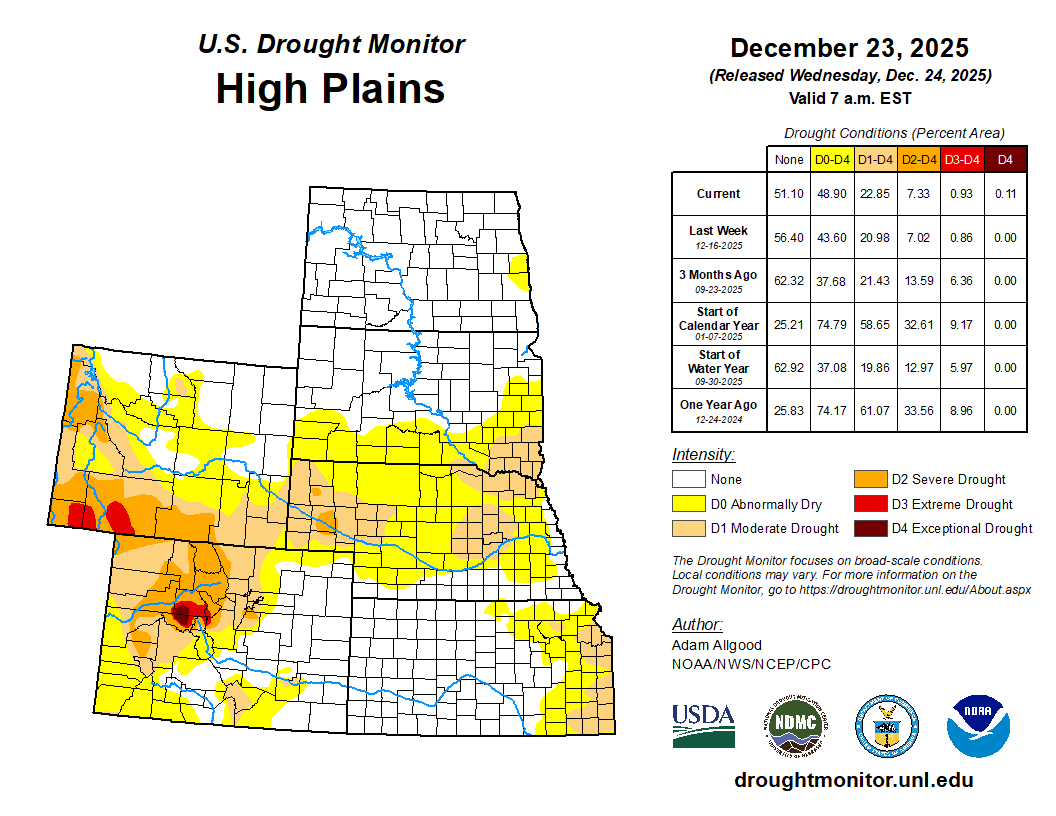

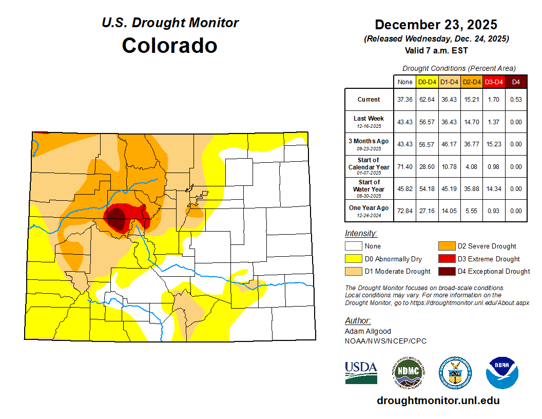
Click the link to go to the US Drought Monitor website. Here’s an excerpt:
This Week’s Drought Summary
During the last 7-days, strong anomalous ridging over the Aleutians and troughing over the Gulf of Alaska promoted northerly flow across Alaska, leading to below-normal temperatures and little snowfall. Downstream, an unusually strong ridge dominated the flow across the contiguous United States. Between the northeastern Pacific trough and this ridge, strong onshore flow and atmospheric river activity promoted copious amounts of precipitation across the Pacific Northwest, though above-normal temperatures kept snow elevations higher than normal and limited the ability of this precipitation to substantially build early season snowpack across the Cascades, northern Sierras, and northern Rockies. Little to no precipitation was observed across the Southwest through the Plains under the anomalous ridge, and much above-normal temperatures promoted degradations of drought depictions for portions of the Rockies, Great Plains, and the lower to mid-Mississippi Valley. Across the East, an active northern stream saw the development of several storm systems which brought widespread precipitation across portions of the South, the Tennessee and Ohio Valleys, and the Northeast. Warming temperatures across the region caused much of this precipitation to fall as rain, melting much of the snowpack built during the previous week in the process. This precipitation led to some modest improvements to drought and abnormal dryness, though more widespread drought reductions were limited due to frozen soils and streams across New England, and groundwater conditions that are slower to respond to precipitation across the mid-Atlantic region. Dry conditions and above-normal temperatures led to degradations across much of Florida…
High Plains
A lack of snow cover, much above-normal temperatures, and periods of strong winds led to an unusual amount of winter degradation across the High Plains region.D2 expanded across western Nebraska, with expansions of both D1 and D0 occurring across central and eastern parts of the state, where precipitation was generally less than 0.2 inch equivalent, and high temperatures soared as high as the 70s. A small area of D1 expanded across southeastern Kansas, and across Colorado, D4 was introduced to Eagle and Pitkin Counties. D0 expanded across the Plains of Wyoming, where warm temperatures, strong winds, and a record lack of snow cover promoted worsening impacts. Drought depictions remained unchanged across the Dakotas, where soils and streams have largely frozen for the winter…

West
Across the West, a series of atmospheric river events brought copious amounts of precipitation to the Pacific Northwest, with Washington and the northern Rockies continuing to be pounded, and precipitation extending further south later in the period to blanket western Oregon and northern California, which had missed out on heavy precipitation during AR events earlier in the month. While the repeated bouts of heavy precipitation continue to ease lingering drought conditions west of the Cascades, the picture is a bit more mixed at higher elevations. Temperatures during the period ranged above-normal, keeping snow elevations higher than average, which prevented the much above-average precipitation from building up substantial snowpacks in the Cascades and northern Sierras. In fact, SWE values remain below 50-percent of average across the Cascades, northern Sierras, Blue Mountains, and the Bitterroot Range, though conditions have started to improve across the remainder of the Northern Rockies. While not an immediate drought concern during the winter months, a lack of snow cover could present problems during the Spring and Summer melting season, and additional precipitation along with colder temperatures are needed to recover the snowpack conditions during this wet season. Based on these considerations, D1 and D0 were reduced along the western front of the Cascades and across small portions of the Intermountain West, but drought conditions were maintained across the higher elevations. A small area of D0 reduction was made across northern Montana, where recent storminess brought improvements to 30- and 60-day SPI values…
South
Following another week of subnormal precipitation, and with temperatures ranging above-normal, the South saw further drought degradations. A small area of heavier precipitation fell across far South Texas, resulting in reductions of D1 and D0, but drought expanded or intensified across the southern Texas plains, Hill Country, and the Piney Woods. Drought also intensified along the Red River Valley, and degradations were more widespread across the eastern two thirds of Oklahoma and Arkansas. In Arkansas, local observers continue to report drying lakes and ponds, while in Oklahoma, record warmth, strong winds, and persistently below-normal precipitation promoted expansion of D2 and D3 conditions. Across Tennessee, precipitation was more generous, and a swath of 1 inch or more fell across the central portion of the state where D0 conditions are currently in place. Despite this rainfall, 60- to 90-day precipitation levels remain below-normal, and SPI values continue to indicate dry conditions. Therefore, no improvements were made across Tennessee…

Looking Ahead
During the next few days, atmospheric river activity will continue to bring copious moisture to the West, with the focus of heavy coastal rainfall and mountain snows shifting to California. Heavy precipitation is forecast to push inland to the Great Basin and portions of the Rockies. Later in the week, as the Pacific trough moves onshore and ridging builds over the northeastern Pacific, a break in AR activity is favored through the end of Week-1. Further east, persistent ridging is forecast for the central US, leading to mostly dry conditions and much above-normal temperatures for the Plains. Across the East, a blocking ridge retrograding towards Greenland from Europe will promote backdoor front activity and cold air damming, as well as providing a focus for additional precipitation and winter storm activity. The WPC 7-day QPF forecast shows precipitation amounts exceeding an inch across most of the Northeast Region, much of which may fall as snow or a wintery mix across the mid-Atlantic. Mostly dry conditions are favored for the Southeast during Week-1, with light rain possible across the lower Mississippi Valley. During Week-2, CPC forecast indicate enhanced chances for above-normal precipitation for the western third of the CONUS, with the highest probabilities across the Southwest. A slight tilt towards above-normal precipitation extends along the northern tier to the Great Lakes region, while below-average precipitation is favored for much of the eastern seaboard. Strong anomalous ridging favors above-normal temperatures for most of the CONUS, with blocking potentially leading to below-average temperatures across the Northeast. Above-normal precipitation is favored for Hawaii, while below-normal temperatures are favored for Alaska, with drier than normal conditions expected along the southern tier of the state.
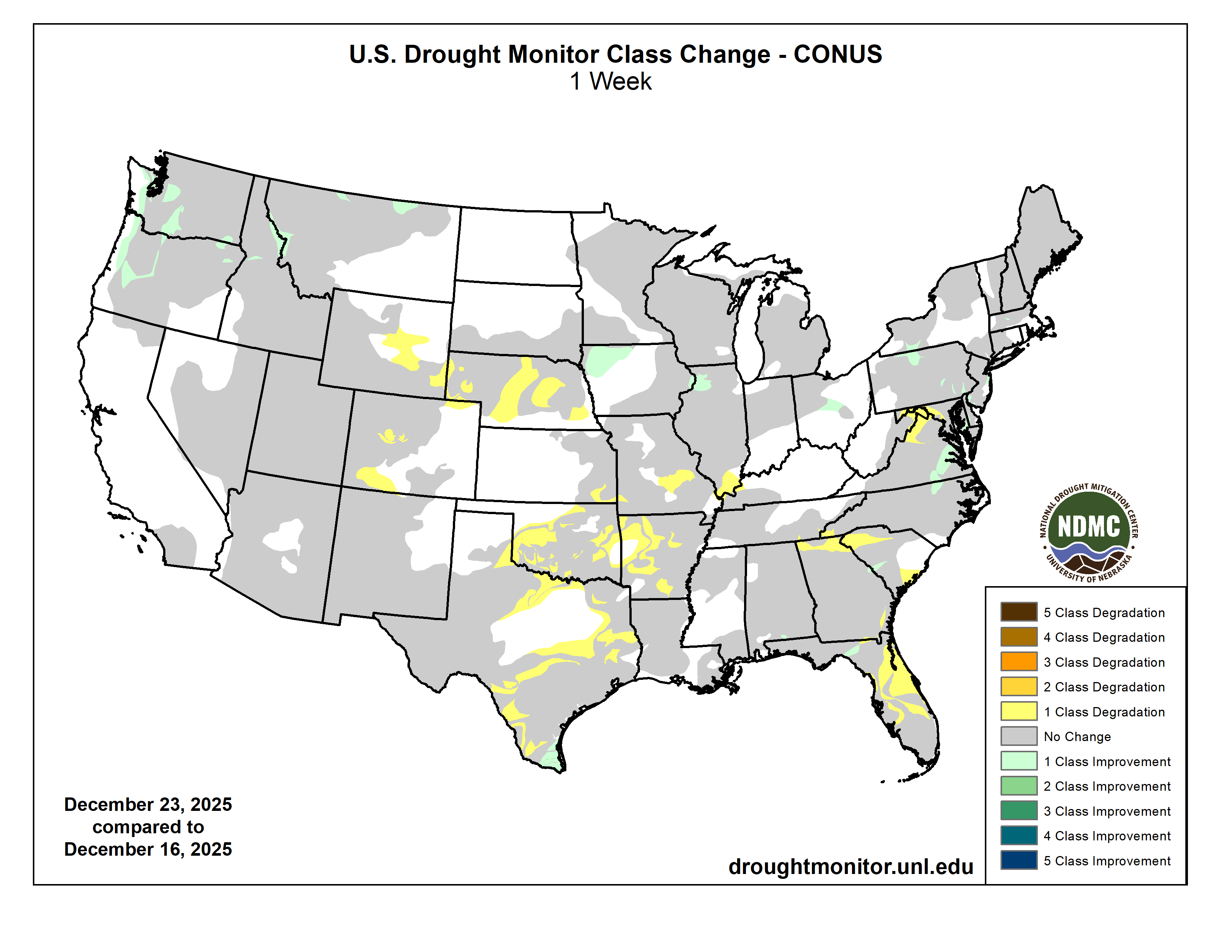
Looking for light in the season of darkness: Plus: Wacky Weather, Data Centers, more.
Click the link to read the article on The Land Desk website (Jonathan P. Thompson):

December 19, 2025
🐐 Things that get my Goat 🐐
The winter solstice teaches us that we must descend into the darkness before we can return to the light. This solstice season we find ourselves in especially dark times —figuratively speaking.
We can be fairly certain that the earth’s northern hemisphere will begin tilting back towards the light next week. Yet we can only hope that America will find similar relief from the metaphorical shroud of darkness under which it has fallen.
As I monitor the news each day, I find myself spiraling past frustration, disdain, and outrage and sinking into a mire of disbelief and despair. That our government is rife with corruption, short-sightedness, greed, and incompetence is outrageous, but neither new nor surprising. What is new is that those traits are now combined with blatant cruelty, wretchedness, moral vacuity, outright bigotry and racism, and a pathological dearth of empathy and compassion. It’s a toxic stew that emanates from the president, is lapped up by his sycophantic and unqualified cabinet — not to mention the tech broligarchs who debase themselves in hopes of holding onto a few more million of their billions of dollars at tax time, or ease the regulatory burden on their hyperscale AI-powering data centers.
Perhaps most distressing is that the safeguards that once protected the nation from the lunatics or incompetents in power — i.e. the courts, the rule of law, Congress — have themselves been broken down or infected with the same malady of wretchedness.
If you think I’m exaggerating, just consider the current situation: The U.S. military is blowing up Venezuelan boats — and then striking the wreckage again to kill any survivors — and is threatening to go to war with the country and send American soldiers into harm’s way, simply to distract the nation from Trump’s disastrous policies and his close association with known pedophile, sex-trafficker, and scam artist Jeffrey Epstein. And when Democratic members of Congress — and decorated veterans — tell soldiers they will support them if they refuse to break the law, Trump threatens to court-martial them.
That’s outrageous and despicable. That Congress and the courts and the American people aren’t rising up en masse in revolt is depressing. And that’s just one example of so, so many like it. Which explains the extra despair during this dark season.
I’m saying a little pagan prayer that the light will return next year.
But for now, I’m afraid I have some more darkness to report from the Land Desk beat:
- Back in 2024, former Mesa County clerk and right-wing conspiracy theorist Tina Peters was convicted by a jury of breaching the security of her office’s own election system in 2021 in a futile attempt to prove election fraud. Trump pardoned her, but it didn’t count because it is a state, not federal, crime, and Gov. Jared Polis wasn’t going to play Trump’s game. That made Trump mad, so, in his usual fashion, he governed by spite and is now planning to dismantle the National Center for Atmospheric Research in Boulder.
- This will not only hurt Colorado, but also science and all the people who are affected by climate and weather and the like, which is to say: everybody, this harms us all. Here’s a couple Blue Sky takes from prominent scientists:


- The U.S. House of Representatives voted yesterday to pass Rep. Lauren Boebert-sponsored legislation that would remove Endangered Species Act protections for gray wolves in the lower 48 states. The bill now goes to the Senate. Congress delisted wolves in the Northern Rockies in 2011, turning management over the states; hunting wolves is no allowed in Montana, Wyoming, and Idaho. This bill could potentially do the same for wolves in California, Colorado, Oregon, Washington, New Mexico, Nevada, and most of Utah.
- The Bureau of Land Management is going on a bit of a tear when it comes to auctioning off public land leases to oil and gas companies. Just a couple of examples of future sales (June 2026) you can weigh in on:
- In Utah, the administration is planning on offering 39 parcels covering about 54,000 acres. A bulk of the parcels are located south of the town of Green River, east of the river itself, and adjacent to Tenmile Canyon.
- And it’s looking to sell 174 oil and gas leases covering more than 160,000 acres in Colorado. They don’t have the maps up for these ones yet, but judging by the descriptions it seems they are scattered across much of the state (but not in southwestern Colorado).
⛈️ Wacky Weather Watch⚡️
Weather is wacky and probably always has been. But this month has got to be one of the weirdest, weather-wise, the West has seen in a while. It’s like the new abnormal on steroids, and it’s hard to deny that much of it has the oily fingerprints of human caused climate change smeared all over it.
This week, alone, the West has experienced:
- A succession of atmospheric rivers pounded the Northwest, dropping more than 10 inches of rain in places over a few days and bringing several rivers up to record-high flows and causing widespread flooding. The Skagit River near Mt. Vernon, Washington, jumped from about 13,500 cubic feet per-second on Dec. 4 to 133,000 cfs a week and a day later. The Snohomish River saw even more dramatic increases in flow.
The flooding and landslides severely damaged U.S. Hwy 2 through the Cascade Mountains, and it could be closed for months. And anywhere between 200,000 and 500,000 homes and businesses were left without power after the floods, rains, and severe winds toppled utility lines, reminding us once again that extreme weather is a far greater danger to the power grid than shuttering coal plants.
Atmospheric rivers and big storms aren’t abnormal. But because warm air can hold more moisture, these ones may have been intensified by global heating.- The storms came on the heels of the warmest meteorological autumn on record in the Northwest (based on 130 years of record-keeping). The result: Huge dumps, even in the mountains, falls mostly as rain, not snow, meaning the snowpack remains relatively sparse across much of the region.
- The soggy soil of the Northwest coincided with smoky skies in eastern Colorado.I had thought that I could close out my Watch Duty wildfire-monitoring tab for the season, but I had to bring it back up on Wednesday night as wicked winds combined with dry conditions and warm temperatures to whip up a trio of grass fires in Yuma County, Colorado, with another one flaring up along the Colorado-Wyoming line. All fires were contained, but they brought back memories of the 2021 Marshall Fire, which broke out in similar conditions at the end of December.
- The fires followed a nine-day warm streak on the Front Range, when the mercury in Denver topped out at 60° F or above, including reaching a daily record high of 71° on Dec. 17. The rest of the state was also abnormally warm (after a seasonably chilly beginning to the month).
- Expect the same to continue into the New Year. While Utah and western Colorado may get some precipitation, it’s likely to be either rain or sloppy snow — i.e. Schneeregen — due to unseasonably high predicted temperatures.

Most ski areas in the Interior West are open now, but that doesn’t mean the conditions are good. To the contrary, they’re generally lousy almost everywhere, with snowpack levels hovering around 50% of “normal” everywhere from Utah’s Wasatch Range to Vail to Wolf Creek in southwestern Colorado. In most of those places the story of the season is the same: It started off with heavy rainfall, followed by a succession of decent snow storms that offered false hope, only to be dashed by a run of warm snow-melting temperatures. So far the story’s even more extreme in the Sierra Nevada, where the mountains are utterly devoid of snow, despite massive, flood-inducing rains this fall. The following graphics from the Wolf Creek Pass SNOTEL station tell the story of most of the region:

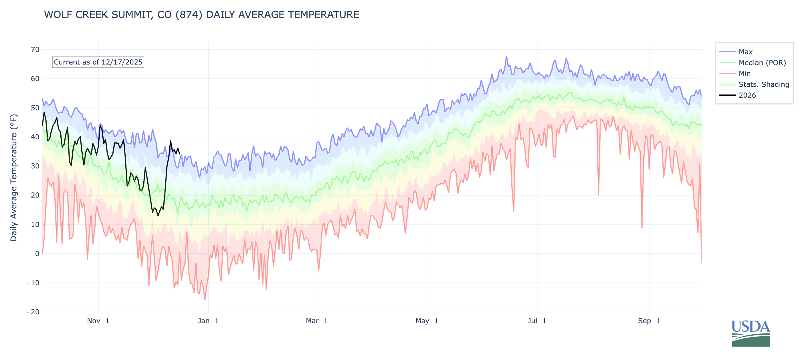
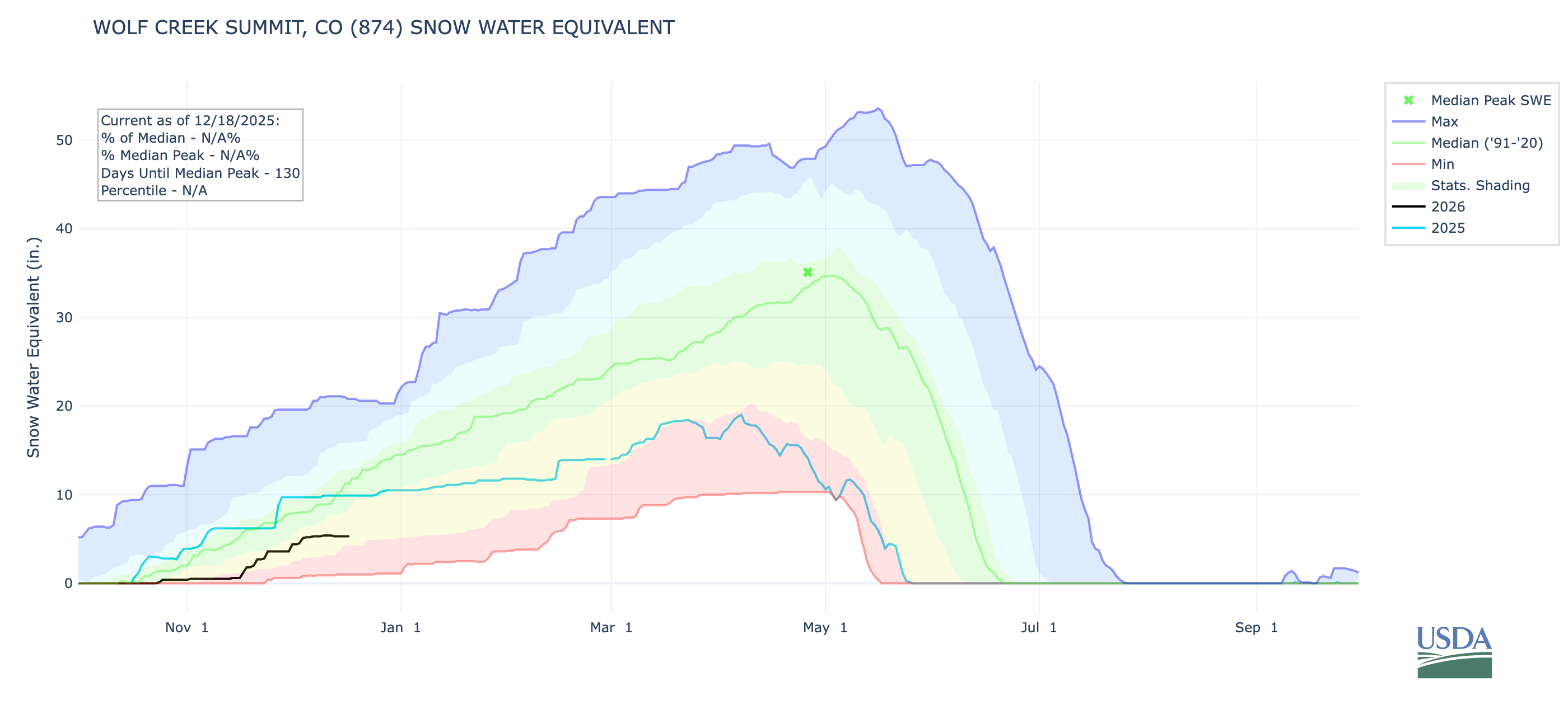
🤖 Data Center Watch 👾
The backlash to the Big Data Center Buildup is gaining steam, and the resistance to the energy- and water-guzzling server farms is scoring a few victories and suffering defeats.
- Earlier this month, Chandler, Arizona’s city council voted to reject Active Infrastructure’s proposed rezoning request that would have cleared the way for the developer to raze an existing building and replace it with an AI data center complex. The denial followed widespread opposition from residents, and in spite of lobbying by former Sen. Kyrsten Sinema in favor of the facility and the developer’s pledge to use closed-loop cooling, which consumes less water (but more energy) than conventional cooling systems.
- Opposition to a proposed data center in Page, Arizona, was dealt a blow when a referendum to block a land sale for the facility was rejected because the petition didn’t meet legal requirements. Beth Henshaw has more on the Page proposal over at the Corner Post, a cool nonprofit covering the Colorado Plateau.
- Pima County, Arizona’s supervisors approved an agreement with Beale Infrastructure advancing its proposed Project Blue data center. The developer is pledging to match 100% of its energy consumption with renewable sources and to use a less water-intensive closed-loop cooling system. Opposition to the facility has been fierce.
🌞 Good News! 😎
These days we hear a lot about how utility-scale wind and solar developments harm the flora and fauna of the desert. But one solar installation near Phoenix is providing sanctuary for wildlife, as reported by Carrie Klein in Audubon recently. Wild at Heart, a raptor rehabilitation center, rescued a bunch of burrowing owls from a housing development construction site. But instead of returning them to the wild (which is becoming more and more scarce in Arizona), they set them up in plastic tunnels they built amid a 10,000-acre solar installation. The owls are not only surviving, but are thriving and successfully reproducing. Finally, a bit of light!
📸 Parting Shot 🎞️

Coyote Gulch’s excellent EV adventure: #CRWUA2025 #ColoradoRiver #COriver #aridification
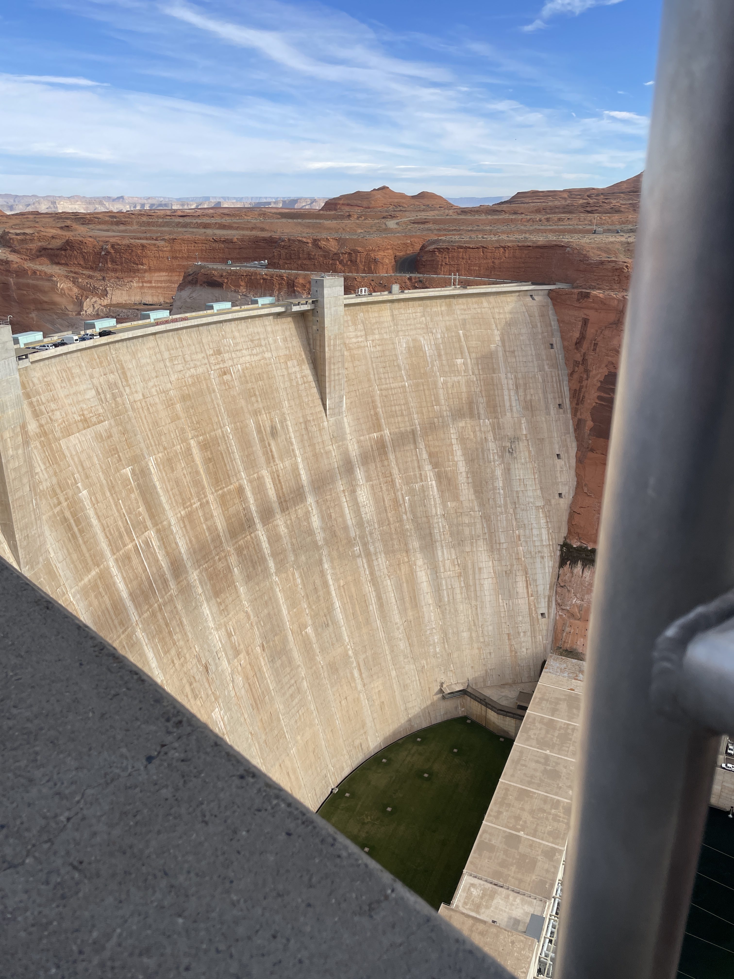
Update: I found a more complete rendering of Seldom Seen’s Prayer in the Coyote Gulch archives. Scroll to the bottom.
I’m on the road back to Denver. I decided to take a southerly route east from St. George through southern Utah and Northern Arizona to travel through country I had not seen before. A short drive from Kanab on Friday put me at Glen Canyon Dam. Although I am not religious I wanted to stop there and recite Seldom Seen’s Prayer from Edward Abbey’s “Monkey Wrench Gang” which I first read while walking down the Escalante River. My sisters and brothers that walk the tribs off Glen Canyon understand.

“Dear old God, you know and I know what it was like here, before them bastards from Washington moved in and ruined it all. You remember the river, how fat and golden it was in June, when the big runoff come down from the Rockies?… Listen, are you listenin’ to me? There’s somethin’ you can do for me, God. How about a little old pre-cision-type earthquake right under this dam? Okay? Any time. Right now for instance would suit me fine.” -Seldom Seen Smith (H/T Fisher Brewing Company)

What a joy it is to drive the Model Y with self-driving. Self-driving was particularly useful in Las Vegas with all the traffic and unfamiliar (to me) roads. The integration of the Navigation system and the Tesla Charging Network takes quite a load off cross-country road trips. For the leg between St. George and Pagosa Springs I charged at St. George, Page, Kayenta, and Durango.
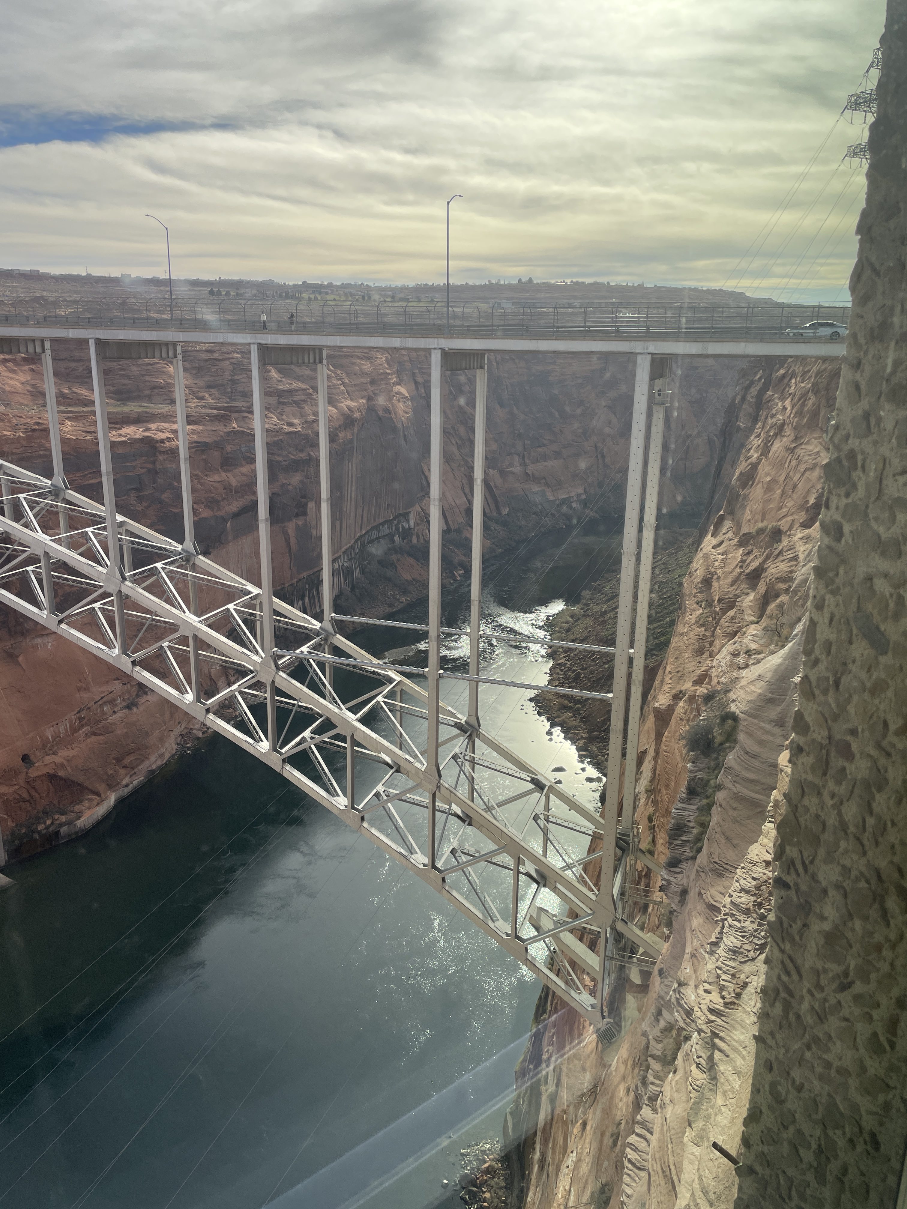
I found a more complete rendering of Seldom Seen’s prayer in the Coyote Gulch archives.
Feds issue ‘sobering’ #ColoradoRiver outlook — #Aspen Daily News #COriver #aridification #CRWUA2025

Click the link to read the article on the Aspen Daily News website (Austin Corona). Here’s an excerpt:
December 17, 2025
Federal officials have released a “sobering” forecast of 2026 water levels in the Colorado River, with expected flows plummeting from previous predictions. Precipitation later in the winter could turn those dire forecasts around, officials say, but the current outlook is grim for a river already flirting with crisis. Officials published the new forecast on Monday, only a day before negotiators and stakeholders from the river’s basin states gathered in Las Vegas for a three-day conference. The federal government has given states until February to agree on a longer-term strategy for managing low river flows. The Colorado River’s flow in 2026 (specifically, the unregulated inflow to Lake Powell) could be 27% lower than normal, according to the most probable scenario in the December forecast, with worst-case scenarios predicting even lower flows. The projection has worsened estimates released in November (16% lower than normal in most probable scenarios).
“We all know Mother Nature is a trickster and can often confound our expectations. We certainly hope she intends to do that this year,” said Wayne Pullan, the Bureau of Reclamation’s regional director for the Upper Colorado River Basin, on Tuesday. “But December’s outlook is troubling.”
The bureau, which manages federal dams, will delay water releases at Lake Powell to conserve supplies in the reservoir during the dry winter months in 2026, Pullan said. Even with those efforts, however, the lake’s water levels could fall to critical levels in 2027 as another disappointing year hits the basin. A bad water year in 2026 would compound already poor conditions from 2025, when river flows have been less than half of normal. The new forecast increases the possibility that water levels in Lake Powell could drop below the intakes for hydropower turbines and that releases from the lake could fall below the annual average required to meet the requirements of the 1922 Colorado River Compact, which governs water allocation between the seven states that use the river. Without above-average flows in future years to bring averages back up, or an interstate deal on how to manage drought, those low releases could set the stage for a legal battle on the river.
#Colorado Senate Bill Helps With Water #Conservation — Northern Water ENews
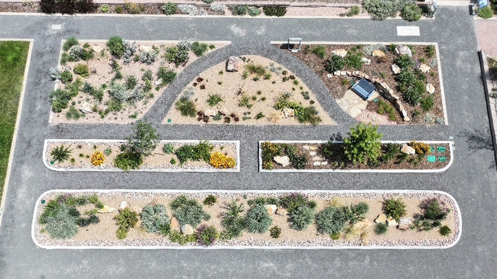
Click the link to read the article on the Northern Water website:
December 17, 2025
Colorado Senate Bill 24-005 (SB5) seeks to reduce unnecessary outdoor water use by limiting high-water landscaping in commercial areas to conserve water amid mounting drought concerns. Beginning Jan. 1, 2026, the legislation will restrict non-functional turf (irrigated grass areas used for decoration), artificial turf and invasive plant species in non-residential settings.
Implementing SB5
SB5 requires changes to land-use code to specify these restrictions for the following applications:
- Commercial, institutional and industrial properties
- Homeowner association common-interest community areas
- Public spaces such as street right-of-way, medians, parking lots and transportation corridors
Restrictions and Applications
Due to the value and appropriateness of higher water use and activity they support, SB5 does not apply to areas considered functional or recreational, including turf for athletic fields, parks and golf courses.
The bill does not impact existing development; it applies only to new developments and certain redevelopment projects that require building or landscaping permits and disturb at least 50 percent of a site’s landscape. It excludes single-family residential properties, focusing instead on public and commercial areas where landscaping serves primarily for aesthetic purposes.
New Landscape Rules Matter for Colorado’s Future
Landscapes play a vital role to communities, but historical turf-heavy designs consume significant resources to meet social expectations. Today, more sustainable solutions exist that use less water while still delivering functionality. Allocating water budgets to landscape formats that provide the highest social value for the water invested is a sensible application to managing this scarce resource.
Areas that are primarily ornamental can be designed to use less water than traditional turf grass while still providing important non-recreational functionality. For spaces that require turf-like groundcover, multiple alternatives exist that use less water than cool season Kentucky Bluegrass, including Tahoma31 warm season grass, Dog Tuff grass and a variety of native grass combinations that thrive in this climate with minimal supplemental needs. These alternatives support stormwater management, provide cooling and pollution mitigation, while also delivering enhanced benefits of habitat for Colorado’s native flora and fauna. Non-turf areas such as gardens and groves have plentiful options for perennials, groundcovers, shrubs and trees that use less water than turf while providing essential livability features to our region.
Northern Water’s Role
To support SB5 implementation, Northern Water has been providing training to regional municipalities, including the Growing Water Smart program from the Sonoran Institute. These workshops introduce new sustainable landscape options that meet municipal needs while also providing flexibility for cities to determine a unique sense of place for their regions. Northern Water and its partners also provide tools such as landscape designs and demonstrations at our Berthoud Conservation Campus so city planners and consultants can experience ColoradoScapes and understand their resource uses as they update land use codes. Many cities are excited to modernize the message their landscapes convey and have begun showcasing these features on their own properties.
Lower Water, Higher Value Landscapes
SB5 ensures that water resources are dedicated to areas with the highest essential and recreational use, while maintaining high quality, aesthetically pleasing commercial, industrial and transportation areas that require less water. These changes will create communities that show our region’s natural beauty and restore ecosystem services to our pollinators, birds and other animals, while offering an authentic Colorado experience. Learn more about all of our water efficiency services that support this water-wise future.
North Weld County Water District Rate Increase 2026 Among Lowest in Northern #Colorado
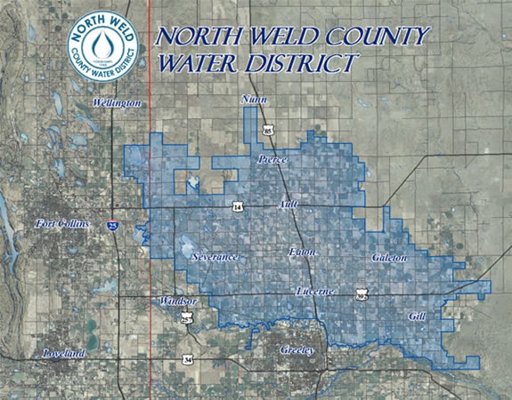
Here’s the release from the North Weld county Water District:
December 10, 2025
North Weld County Water District implements modest 4% rate increase for 2026 – still among lowest in region
WELD COUNTY, COLORADO (Dec. 10, 2026) –North Weld County Water District (NWCWD) announced a comparatively modest 4 percent rate increase for 2026 – which is less than the previous year and significantly lower than the surrounding region.
“Maintaining our water service infrastructure continues to be a priority for the district and one that we balance with our fiduciary responsibility to our rate payers,” said Eric Reckentine, General Manager, North Weld County Water District.
A diligent infrastructure improvement plan is highlighted in these key District projects designed to ensure a clean, robust, and affordable water supply:
- Weld County West Transmission Line: The District will start construction of the Weld County west 42-inch transmission line and new 6 million gallon treated water tank in 2026 with a project cost of $20 million dollars.
- Eastern Zone Distribution Line: The District will continue construction of the eastern zone 30-inch distribution line with the project’s third phase starting in 2026 and to be completed in 2027.
- Soldier Canyon Water Treatment Plant Expansion: The SCWTP treatment plant capacity was expanded from 60 million gallons per day to 68 million gallons in 2025. In collaboration with the Soldier Canyon Water Treatment Authority and nearby District partners (such as Fort Collins-Loveland Water District and East Larimer County Water District), NWCWD is finalizing the Soldier Canyon Filter Plant Master Plan, and will begin design on a plant expansion for additional treatment capacity for the District to begin in 2029.
With these improvements, the district says it can meet growth needs well into the future.
“Upgrades to our aging water delivery system allow the District to meet new treatment standards and accommodate the record-breaking growth in Northern Colorado,” Reckentine said. “A stable revenue stream from water rates enables us to accomplish that.”
About North Weld County Water District:
Weld County is the fastest growing in the state. North Weld County Water District’s cities, residents, and businesses rely on the safe, reliable, and affordable water we have been delivering for over 64 years. The District constantly plans for growing communities, which now span from agricultural to rural to urban, ensuring that all future water needs are met and we can continue to deliver the highest quality water in the growing region for decades to come. To learn more, visit NWCWD.org.
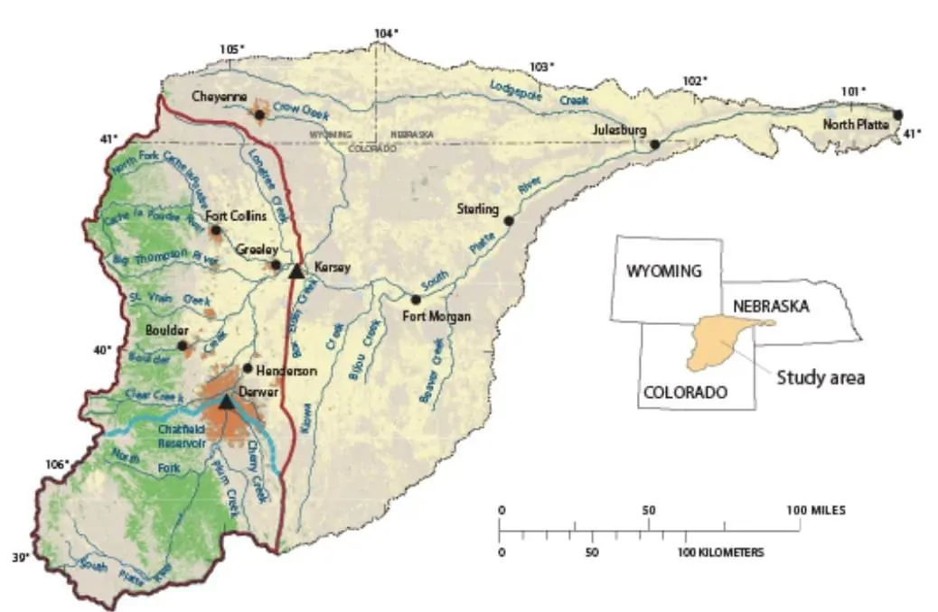
Federal Water Tap: #ColoradoRiver states have been given less than two months to agree on how to share water cuts from the shrinking river — Brett Walton (circleofblue.org) #COriver #aridification #CRWUA2025
Click the link to read the article on the Circle of Blue website (Brett Walton):
December 22, 2025
The Rundown
- Colorado River states have been given less than two months to agree on how to share water cuts from the shrinking river.
- Homeland Security waives environmental laws to speed the construction of a border wall in parts of New Mexico.
- A federal judge proclaims federal authority over the contentious Line 5 oil pipeline that crosses the Great Lakes.
- U.S., Mexican governments sign Tijuana River sewage cleanup agreement.
- The House passes a bill to change environmental reviews for infrastructure permitting.
- USGS study finds lower water levels in Colorado’s Blue Mesa reservoir the cause of increased toxic algal blooms.
And lastly, a draft EIS for post-2026 Colorado River reservoir operations, when current rules expire, will be published in the coming weeks.
“Let me be clear, cooperation is better than litigation. Litigation consumes time, resources, and relationships. It also increases uncertainty and delays progress. The only certainty around litigation in the Colorado River basin is a bunch of water lawyers are going to be able to put their children and grandchildren through graduate school. There are much better ways to spend several hundred million dollars.” – Scott Cameron, acting commissioner of the Bureau of Reclamation, speaking at the Colorado River Water Users Association conference on December 17, 2025. Cameron encouraged the states to reach an agreement on water cuts and reservoir operating rules instead of suing each other.
By the Numbers
February 14: New Interior Department deadline for the seven Colorado River states to reach an agreement on water cuts and reservoir operations. If the states fail at that, Interior could assert its own authority. There could also be lawsuits. A short-term agreement might be necessary.
The deadline, according to Interior’s Andrea Travnicek, is for several reasons. It gives states time to pass legislation, if necessary. It provides time for consultation with Mexico and the basin’s tribes. And it allows for reservoir operating decisions in 2027 to be set this fall.
“Time is of the essence, and it is time to be able to adjust those stakes, to arrange so compromises can be made,” Travnicek said.
News Briefs
Line 5 Oil Pipeline Court Case
A U.S. district judge ruled that the federal government, not the state of Michigan, has authority over the contentious Line 5 oil pipeline that crosses the Great Lakes at the Straits of Mackinac.Michigan’s top officials have attempted to shut down Enbridge Energy’s Line 5 since 2020 when Gov. Gretchen Witmer revoked the company’s easement.
In his ruling, Judge Robert Jonker determined that the federal Pipeline Safety Act gives the U.S. government the sole authority over Line 5’s continued operation, the Associated Press reports.
In context: Momentous Court Decisions Near for Line 5 Oil Pipeline
Tijuana River Sewage Pollution Cleanup
U.S. and Mexican representatives signed an agreement that will facilitate the cleanup of chronic sewage pollution in the Tijuana River, a shared waterway.Line 5 Oil Pipeline Court Case
A U.S. district judge ruled that the federal government, not the state of Michigan, has authority over the contentious Line 5 oil pipeline that crosses the Great Lakes at the Straits of Mackinac.Michigan’s top officials have attempted to shut down Enbridge Energy’s Line 5 since 2020 when Gov. Gretchen Witmer revoked the company’s easement.
In his ruling, Judge Robert Jonker determined that the federal Pipeline Safety Act gives the U.S. government the sole authority over Line 5’s continued operation, the Associated Press reports.
In context: Momentous Court Decisions Near for Line 5 Oil Pipeline
Tijuana River Sewage Pollution Cleanup
U.S. and Mexican representatives signed an agreement that will facilitate the cleanup of chronic sewage pollution in the Tijuana River, a shared waterway.Called Minute 333, the agreement outlines actions and sets timelines. A joint work group will assess project engineering and feasibility studies. Mexico will build a wastewater treatment plant by December 2028 and a sediment control basin by winter 2026-27. The agreement also addresses monitoring, planning, and data sharing.
Permitting and Land Use Bills
House Republicans used the week before the holiday break to pass a bill that changes infrastructure permitting processes.The SPEED Act, which passed with support from 11 Democrats, changes the National Environmental Policy Act and the environmental reviews it requires for major federal projects. It restricts reviews to immediate project impacts, sets timelines, and limits lawsuits.
“On net, these reforms are likely to make it easier to build energy infrastructure in the United States,” asserts the Bipartisan Policy Center.
Border Wall
Kristi Noem, the secretary of the Department of Homeland Security, is waiving environmental laws in order to speed the construction of a border wall in parts of New Mexico near El Paso, Texas.The affected laws include the Clean Water Act, National Environmental Policy Act, Safe Drinking Water Act, Migratory Bird Conservation Act, and others.
Studies and Reports
Mississippi River Recap
The U.S. Army Corps of Engineers published a December state of the Mississippi River report, noting how drought conditions this year have influenced operations on the country’s largest river system.The Corps authorized construction of an underwater dam that was completed in October in order to impede the upstream movement of salty water from the Gulf of Mexico.
Harmful Algal Blooms in Colorado Reservoir
Blue Mesa is the largest reservoir in Colorado and is part of the Colorado River basin water storage system.The U.S. Geological Survey investigated why Blue Mesa has been experiencing toxic algal blooms in recent years. Its report concluded that warmer water temperatures enabled by lower water levels are the likely cause.
The affected laws include the Clean Water Act, National Environmental Policy Act, Safe Drinking Water Act, Migratory Bird Conservation Act, and others.
Studies and Reports
Mississippi River Recap
The U.S. Army Corps of Engineers published a December state of the Mississippi River report, noting how drought conditions this year have influenced operations on the country’s largest river system.The Corps authorized construction of an underwater dam that was completed in October in order to impede the upstream movement of salty water from the Gulf of Mexico.
Harmful Algal Blooms in Colorado Reservoir
Blue Mesa is the largest reservoir in Colorado and is part of the Colorado River basin water storage system.The U.S. Geological Survey investigated why Blue Mesa has been experiencing toxic algal blooms in recent years. Its report concluded that warmer water temperatures enabled by lower water levels are the likely cause.
Reducing nutrient inflows is unlikely to help, the researchers said. There are naturally occurring phosphorus inputs and the algae can fix nitrogen from the air.
The best solution might be keeping the reservoir high enough, the report says. That will not be easy in a drying and warming region with competing water demands.
On the Radar
Colorado River Draft EIS Coming Soon
In the coming weeks – in early January if not by the end of the year – the Bureau of Reclamation will publish a draft environmental impact statement for changes to how the big Colorado River reservoirs will be managed.Reclamation began its environmental review about two and a half years ago. The agency had hoped to slot a seven-state consensus agreement into the document. But since there is no agreement, the document will instead describe a “broad range” of options, said Carly Jerla of Reclamation, who spoke at the Colorado River Water Users Association conference.
The draft will not select a preferred option, Jerla said. Instead that will come in the final version.
“We’ve set up a draft EIS that reflects a range of carefully crafted alternatives to enable the further innovation and the ability of the basin to come to a consensus agreement to be able to adopt in time for the 2027 operations,” Jerla said.
Federal Water Tap is a weekly digest spotting trends in U.S. government water policy. To get more water news, follow Circle of Blue on Twitter and sign up for our newsletter.
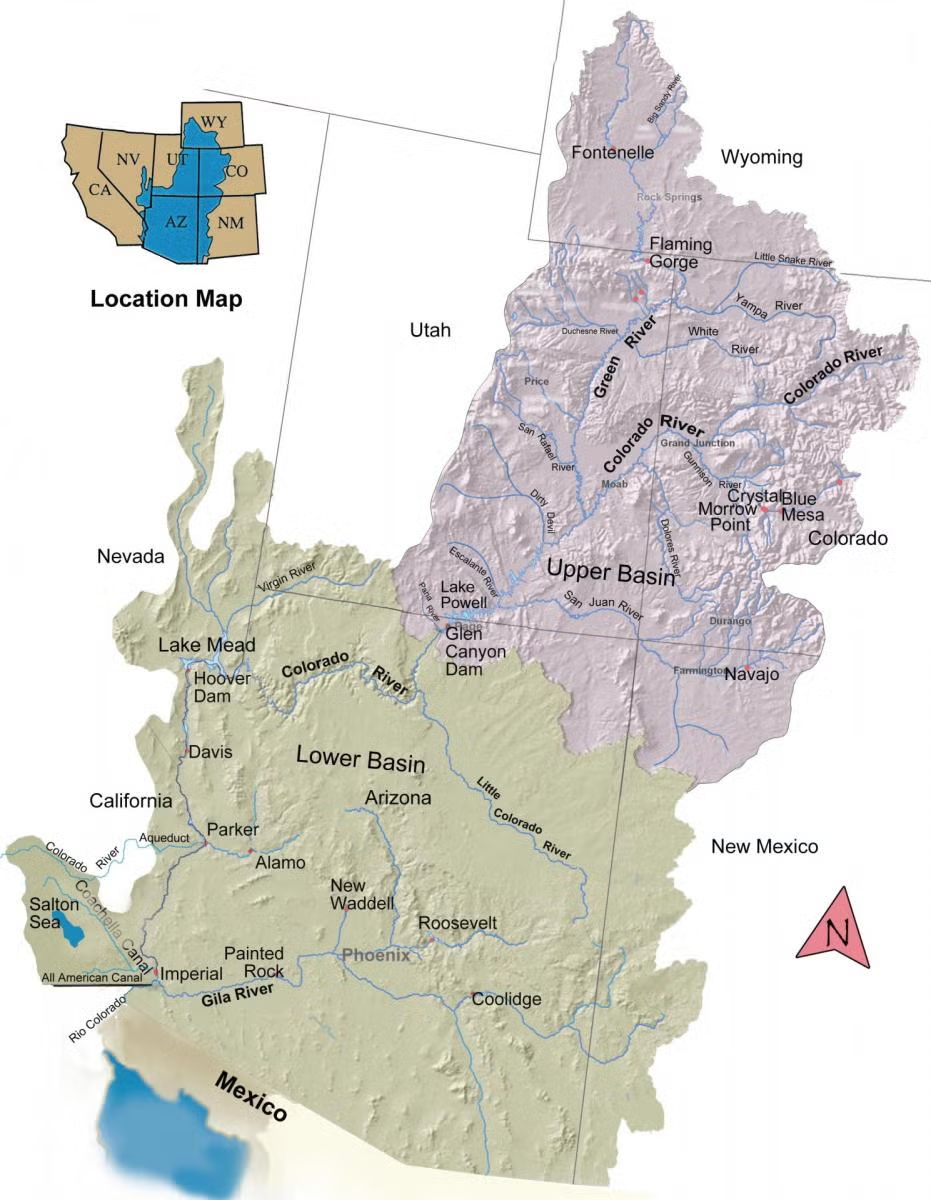
#Snowpack news: Skimpy snow makes life worse for skiers — and everyone else — Heather Hansman (High Country News)
Click the link to read the article on the High Country News website (Jr Rodriguez):
December 11, 2025
Last night, I woke up to percussion on the roof. In late November at 7,000 feet in the Rockies, you’d normally look for snow. But yet another predicted storm had petered out and come in as rain instead.
This storm was going to be big, the local weatherman promised, with some places getting up to 6 feet. But then he downgraded the forecast — and downgraded it again. By the time the system moved off to the east, no more than a few inches had fallen in a couple of high places. We’d seen no significant snow, and we were getting closer to the solstice.
Anticipation is a fickle feeling, a jittery mix of adrenaline and hope. Early winter used to make me excited, no matter where I lived in the West. I’d track storms coming in from the Pacific, waiting for Colorado’s high alpine ski resorts to battle to be the first to open or watching the snowline creep lower in the Pacific Northwest.
But lately that anticipation has been subsumed by dread. Now, the forecast hits me with the wrong kind of adrenaline. I get a cramp in my stomach when storms don’t come. Skiing has made me a barometer for winter, and the recent seasons have gone awry as they become increasingly warm and dry. In the past, I was purely excited about winter storms because I envisioned storm-day skiing and soft turns. Now I worry what the lack of snow means for the future.
As a skier, my happiness is tied to weather systems beyond my control. It might be a sick fascination to keep fixating on snowfall, but it keeps my barometer tuned and makes me look for the bigger patterns.
Skiers can be obsessive, ritualistic and superstitious, prone to worrying about upsetting the cosmic order. We joke about praying for snow, even though we know that’s not how nature works. But I still go to pre-season ski-burning bonfires and wash my car in hopes of encouraging snowstorms. What is that but praying?
There are two reasons to wish for snow: the selfish and the sustainable.
I want snowy winters partly so I can ski — so I can enjoy something I’ve done every winter since I was a tiny kid, the thing that makes me feel weightless and fast and connects me to the world around me. But when I compulsively check SNOTEL sites or ski area base depths, I’m also seeing something bigger and watching the patterns evolve.
Skiing might seem superficial, but winter clearly shows that the climate is changing. It’s made tangible through movement, or the lack of it. The things we love show us where our pain points are, and how much we stand to lose, and how little control we have.
My local ski hill pushed back its opening date this year, as did every mountain in Utah — Deer Valley for the first time in its history. Not only was there scant natural snow, it wasn’t even cold enough to make snow. That lack of snow has cascading impacts, especially on workers and communities that depend on winter tourism. But we don’t just profit from snow; it’s also our most solid water supply.
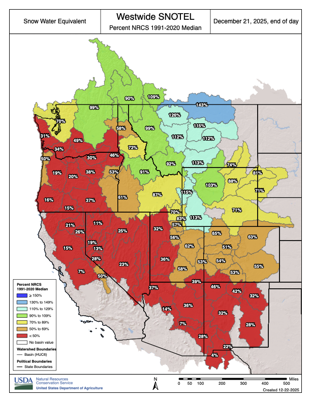
Nearly every part of the Western U.S. is in drought conditions today. As of December, the National Water and Climate Center’s map of snow-water equivalentis colored red, and most places are less than 50% of average. Snow is our most significant water supply.
Across the West, this slow winter comes after a hot dry summer, when fires crept ever closer to town. Last winter was also dry and skimpy, exacerbating the long-term drought. Ski mountains are haggling over water rights for snowmaking. Lack of snow means increased fire risk and food insecurity, along with entrenched and at times bitter fights over rivers.
We live in a system, and skiing is a specific marker for how that system is changing.
A friend who is a ski guide stopped by the other day, and when I asked him if he was getting anxious about work, he looked north up the valley toward the mountains and grimaced. “I’m not quite worried yet,” he said. Maybe that’s rational, but my worry has already kicked in.
I look at the shrinking reservoirs and the spreading drought predictions. I remember last winter’s scratchy, icy ski turns and the summer’s lack of monsoons, with fire lurking in the background. I know what it’s like to wait for snow without it ever coming.
I also know that it’s still early in the season. Things could change, storms could stack up and keep coming, even though the National Weather Service is predicting a weak and wavering La Niña. There’s a lot of flexibility in the system. I can look at the sky and still feel some hope. I can’t predict what will happen, I just know what the past has shown me.
So, yes, I am still praying for snow, but for many more reasons and with even more fervor than I did before.

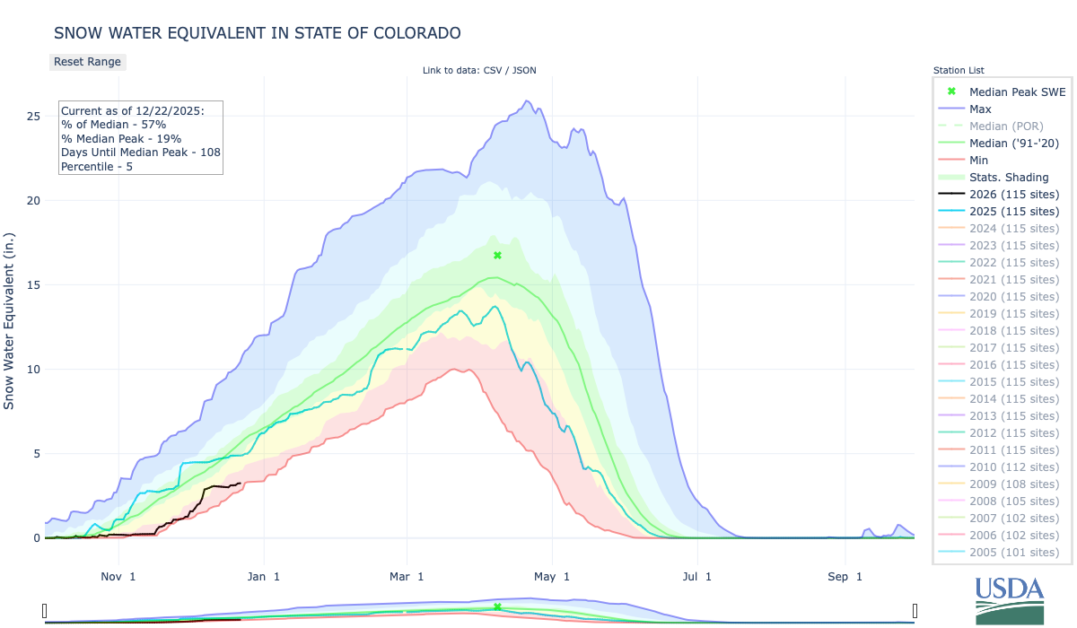

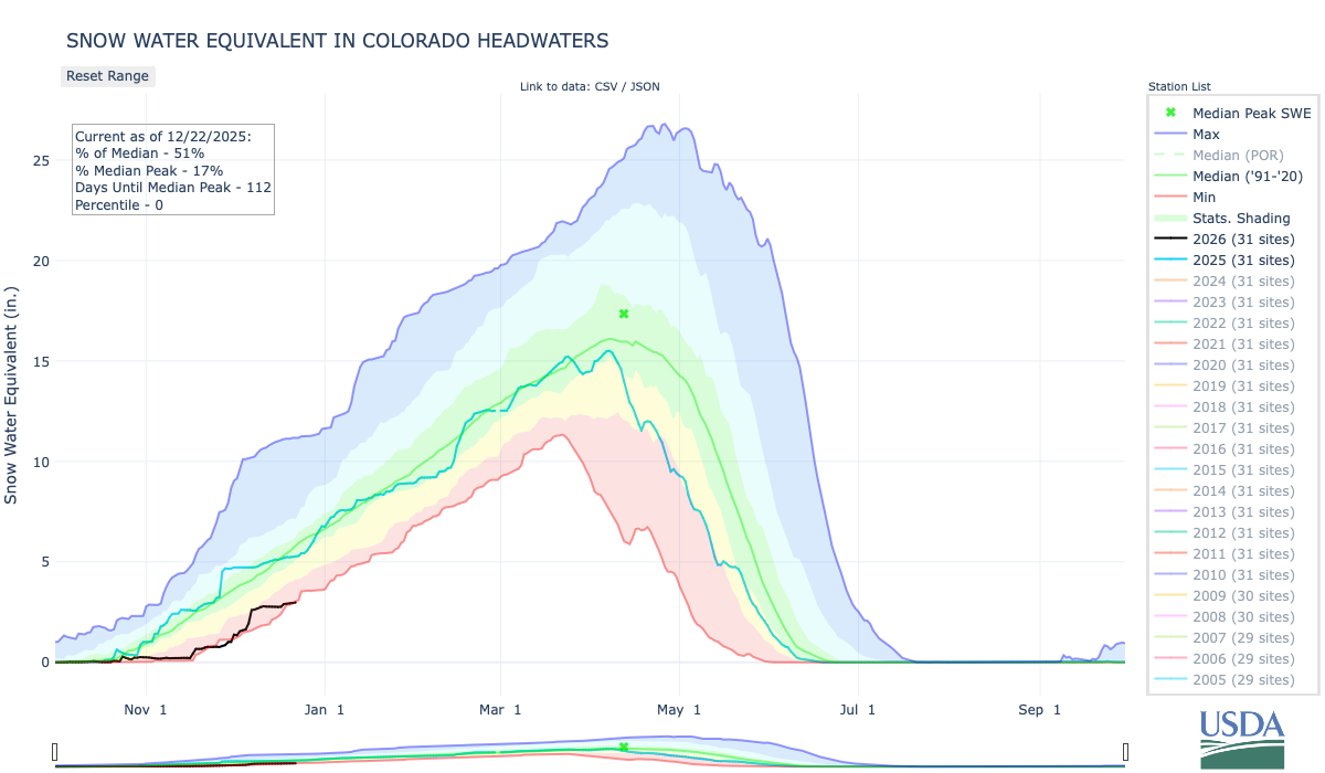
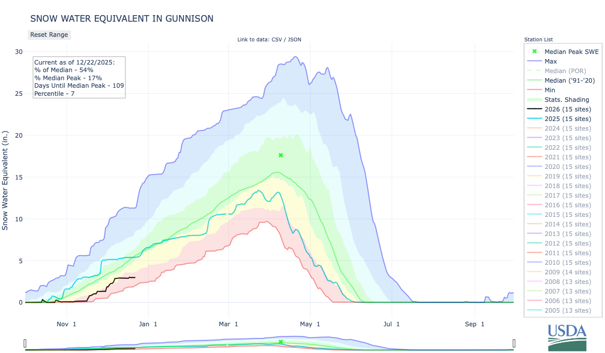


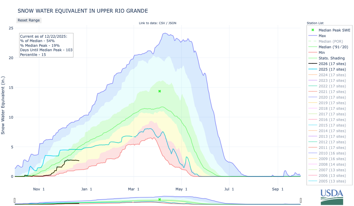
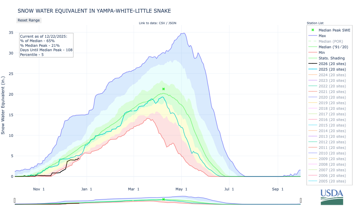
Click the link to explore the interactive graphs on the NRCS website.
#ColoradoRiver water negotiators appear no closer to long-term agreement — The Associated Press #COriver #aridification #CRWUA2025
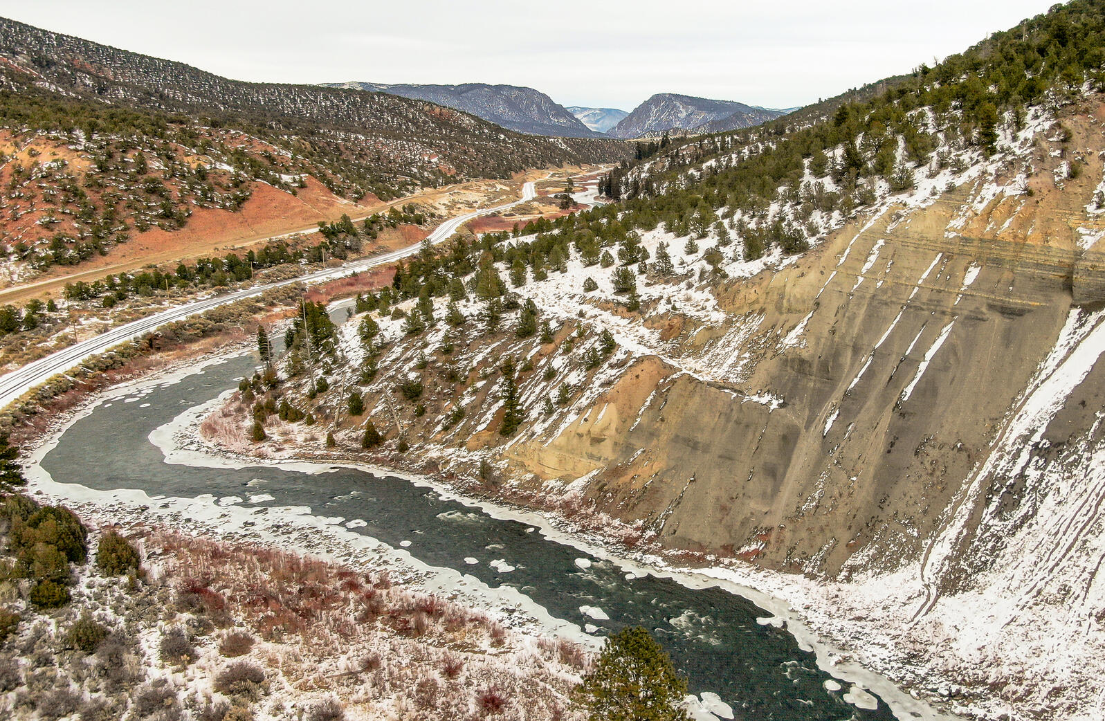
Click the link to read the article on the Associated Press website (Jessica Hill). Here’s an excerpt:
December 18, 2025
The seven states that rely on the Colorado River to supply farms and cities across the U.S. West appear no closer to reaching a consensus on a long-term plan for sharing the dwindling resource. The river’s future was the center of discussions this week at the annual Colorado River Water Users Association conference in Las Vegas, where water leaders from California, Nevada, Arizona, Colorado, New Mexico, Utah and Wyoming gathered alongside federal and tribal officials. It comes after the states blew past a November deadline for a new plan to deal with drought and water shortages after 2026, when current guidelines expire. The U.S. Bureau of Reclamation has set a new deadline of Feb. 14. Nevada’s lead negotiator said it is unlikely the states will reach agreement that quickly.
“As we sit here mid-December with a looming February deadline, I don’t see any clear path to a long-term deal, but I do see a path to the possibility of a shorter-term deal to keep us out of court,” John Entsminger of the Southern Nevada Water Authority told The Associated Press.
The federal government continues to refrain from coming up with its own solution — preferring the seven basin states reach consensus themselves. If they don’t, a federally imposed plan could leave parties unhappy and result in costly, lengthy litigation. Not only is this water fight between the upper and lower basins, individual municipalities, tribal nations and water agencies have their own stakes in this battle. California, which has the largest share of Colorado River water, has over 200 water agencies alone, each with their own customers.
“It’s a rabbit hole you can dive down in, and it is incredibly complex,” said Noah Garrison, a water researcher at the University of California, Los Angeles.
Lower Basin states pitched a reduction of 1.5 million acre-feet per year to cover a structural deficit that occurs when water evaporates or is absorbed into the ground as it flows downstream. An acre-foot is enough water to supply two to three households a year. But they want to see a similar contribution from the Upper Basin. The Upper Basin states, however, don’t think they should have to make additional cuts because they already don’t use their full share of the water and are legally obligated to send a certain amount of water downstream.
“Our water users feel that pain,” said Estevan López, New Mexico’s representative for the Upper Colorado River Commission.
December water forecast a sobering backdrop to #ColoradoRiver conference: Feds lay out tools for dealing with falling reservoir levels — Heather Sackett (AspenJournlism.org) #COriver #aridification #CRWUA2025

Click the link to read the article on the Aspen Journalism website (Heather Sackett):
December 18, 2025
Federal water officials addressed the increasingly grim river conditions and laid out their options for dealing with plummeting reservoir levels over the first two days of the largest annual gathering of water managers in the Colorado River Basin.
On Monday, the U.S. Bureau of Reclamation released its monthly report, which projects a two-year hydrology outlook for the operation of the nation’s two largest reservoirs: Lake Powell and Lake Mead. The report provided a sobering backdrop to the Colorado River Water Users Association conference at Caesar’s Palace in Las Vegas.
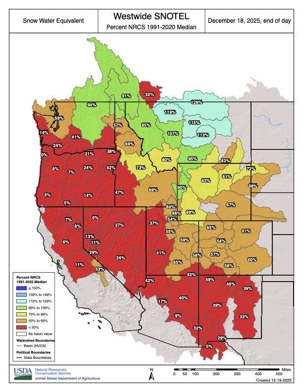
With the slow start to winter in the Upper Basin (Colorado, New Mexico, Utah and Wyoming), the report showed a drop in Lake Powell’s projected 2026 inflow of 1 million acre-feet since the November forecast. Under the “minimum” possible inflow, Lake Powell would fall below the surface-elevation level of 3,490 feet needed to generate hydropower by October 2026 and stay there until spring runoff briefly bumps up reservoir levels in summer 2027; but the water level would again dip below 3,490 in the fall of 2027.
Under the “most probable” forecast, the reservoir’s level stays above minimum power pool, but falls below the target elevation of 3,525 until the 2027 runoff. (Reservoir levels below the target elevation trigger more drastic emergency actions.) The reservoir is currently about 28% full, down from 37% at this time last year.

Wayne Pullan, regional director for the bureau’s Upper Basin, called the December projections troubling.
“That outlook is sobering for all of us,” Pullan said at Tuesday’s meeting of the Upper Colorado River Commission.
Snowpack, which is lagging across the Upper Basin, hovered at around 61% of median Wednesday. Snowpack in the headwaters of the Colorado River was 53% of median.
The Colorado River basin has been locked in the grip of a megadrought since the turn of the century. Climate change and relentless demand have fueled shortages, pushed reservoirs to all-time lows and sent water managers scrambling.
Pullan laid out four tools that the Bureau of Reclamation can use to respond to the projected low water levels to prevent the surface of Lake Powell at the Glen Canyon Dam from falling below 3,500 feet in elevation.

The first tool is shifting some winter releases to the summer months when runoff into the reservoir will compensate for those releases. The second is releasing water from upstream reservoirs to boost Lake Powell. The third is reducing releases when water levels hit a certain trigger elevation.

Representatives from the Upper Basin and Lower Basin (Arizona, California and Nevada), which share the river, have been in talks for two years — with long periods of being deadlocked in disagreement — about how to manage the river after the current guidelines expire at the end of 2026. The 2007 guidelines set annual Lake Powell and Lake Mead releases based on reservoir levels and did not go far enough to prevent them from being drawn down during consecutive dry years.
“We have learned that if we failed at all in these last 25 years, it might have been that our vision wasn’t sufficiently pessimistic,” Pullan said.
States’ representatives have said they are still committed to finding a consensus after they blew past a Nov. 11 deadline to come up with an outline of a plan. Federal officials have set a second deadline of Feb. 14 for the states to submit a detailed plan.
While water managers across the basin wait for an agreement from the states, federal officials are moving ahead with the National Environmental Protection Act review process and crafting an environmental impact statement for future reservoir operations. Reclamation officials said that they plan to release a draft EIS around the end of the year and that the alternatives analyzed in the EIS will be broad enough that they would capture any seven-state agreement. The draft EIS will not choose a preferred alternative.
“Probably all of you have heard us say, ad nauseum, this emphasis on creating a broad range of alternatives,” Carly Jerla, a senior water resource program manager at the Bureau of Reclamation, said Wednesday. “We really went about this by taking input over the last almost two years from you all … to craft a broad range that really reflects the ideas on how to operate the system.”

Not a routine water source
This isn’t the first time the basin has experienced dire straits. In 2021, as Lake Powell flirted with falling below minimum power pool, the Bureau of Reclamation made 181,000 acre-feet in emergency releases from three Upper Basin reservoirs — Flaming Gorge, Navajo and Blue Mesa — to protect critical Lake Powell elevations.
These reservoirs are part of the Colorado River Storage Project, and their primary purpose is to control the flows of the Colorado River. But the unilateral action by the feds rubbed Upper Basin water managers the wrong way. The 36,000 acre-feet released from Blue Mesa cut short the boating season on Colorado’s largest reservoir, which is on the Gunnison River.
On Tuesday, Colorado’s representative, Becky Mitchell, said Upper Basin reservoirs are not a routine water source for the Lower Basin.
“I appreciate as we’re in critical and dire situations how we use our resources to protect our infrastructure, but we have to shift,” Mitchell said. “Our biggest resource is post-2026 and figuring out how do we do this in a way that doesn’t create those to be routine water sources.”
So far, the basin has avoided the worst outcomes by getting last-minute reprieves in the form of wet years in 2019 and 2023. But overall, Jerla said, the Colorado River can expect to see persistent dry years and challenging conditions in the future, and water managers will need more adaptive, flexible solutions.
“(This is) really our last year together operating under the existing agreements, kind of stretching the flexibilities and the bounds and stability which those agreements provide,” she said.
A River That Millions Rely on for Water Is on the Brink. A Deal to Save It Isn’t — Wyatt Myskow, Blanca Begert, Jake Bolster (InsideClimateNews.org) #CRWUA2025 #ColoradoRiver #COriver #aridification
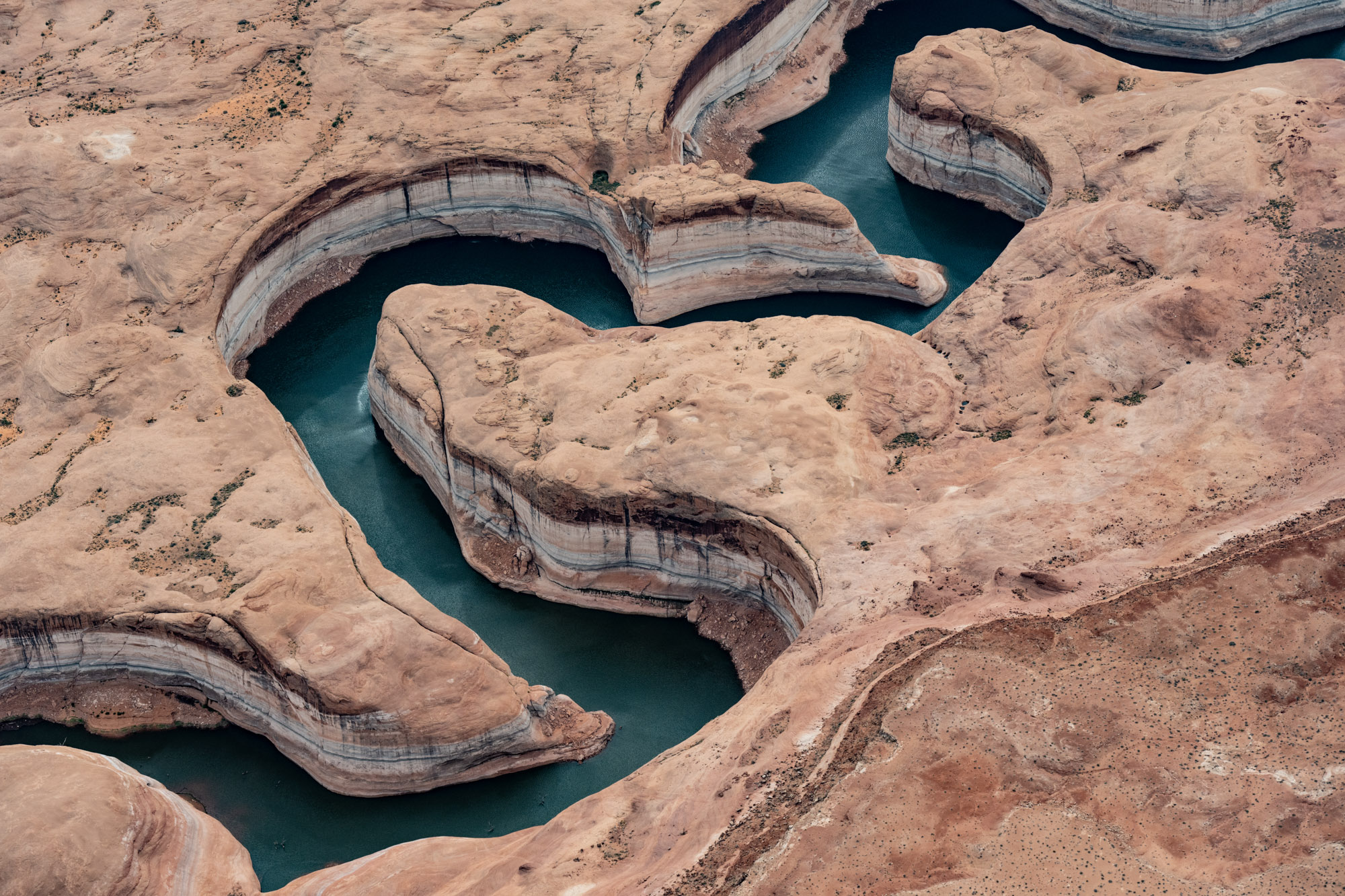
Click the link to read the article on the Inside Climate News website (Wyatt Myskow, Blanca Begert, Jake Bolster):
December 19, 2025
At the Colorado River Water Users Association annual conference in Las Vegas, Colorado River Basin states remain at an impasse over how to cut their water use as Lake Mead and Lake Powell verge on record lows.
The Colorado River Basin is, quite literally, 50 feet away from collapse, and an agreement to save it is nowhere in sight.
Water titans clashed at Caesars Palace in Las Vegas this week, where negotiators from each of the seven Colorado River Basin states outlined what they have done to protect the river—and pointed fingers at each other, demanding more.
Talks over how to manage the river after 2026, when current drought mitigation guidelines expire, began two years ago. Federal deadlines have come and gone, and the stakes are higher than ever as climate change and overuse continue to push the river that 40 million people rely on to the edge. Still, the states are refusing to budge.
“It’s now 2025, we’re here in a different hotel a couple years later and the same problems are on the table. In the last two years, we’ve been spinning our wheels,” said JB Hamby, California’s lead negotiator, at the annual Colorado River Water Users Association conference.“Time has been wasted, and like water, that’s a very precious resource.”
The Colorado River flows from Wyoming to Mexico, supplying water to seven U.S. states, two Mexican states and 30 tribes. But the bedrock law guiding its management, the 1922 Colorado River Compact, overestimated how much water the river could provide, leading to state allocations that promised more than was ultimately available. The nation’s two largest reservoirs, lakes Mead and Powell, which for decades have met the excess demand driven by overly optimistic allocations, are at the brink. Lake Mead is 33 percent full; Powell is just 28 percent full. If the latter’s water levels drop by an additional 50 feet, the water behind Glen Canyon Dam would be trapped, limiting deliveries to California, Arizona and Nevada, and preventing the dam from generating hydropower.
The federal government’s data indicate that Lake Powell could drop to that level, known as “deadpool,” by the summer of 2027 if significant cuts aren’t made.
Yet, the states remain stuck on the same points that, for years, have prevented any of them from agreeing to reduce their long-term use enough to prevent the collapse of the Colorado River system.

In a proposal to the federal government from March 2024, Arizona, California and Nevada, the three states that make up the Lower Basin, which uses the greatest amount of the river’s water and has historically over-consumed its allotments, put annual cuts of 1.5 million acre feet of water on the table for a post-2026 agreement. [ed. This includes 1.2 MAF for the “Structural Deficit”. The Lower Basin has never been charged for shrink in Lake Mead and in the Colorado River mainstream. USBR said earlier in the Post-2026 guideline negotiations that the LB would have to be charged for shrink going forward.] They want to see any necessary reductions after that, which experts estimate could range from another 2 to 4 million acre-feet per year, divided among all seven states. One acre-foot of water is enough to supply somewhere between two and four households for a year.
The Upper Basin states of Colorado, New Mexico, Utah and Wyoming have proposed taking voluntary reductions. They argue they should not face mandatory cuts because the Upper Basin has never used the full amount of water it was allocated under the 1922 compact, which apportions 7.5 million acre-feet to each basin. Due to climate change and a lack of storage infrastructure, they say they’re already living with cuts while delivering the required water to the Lower Basin.
In closing comments on Thursday, which provided a rare opportunity for the public to hear what have otherwise been behind-closed-doors conversations, negotiators expressed frustration, rehashing the same talking points they have used for years.
“As long as we keep polishing those arguments and repeating them to each other, we are going nowhere,” said John Entsminger, Southern Nevada Water Authority’s general manager, and that state’s negotiator. He added that at this point, the best he could envision was an interim five-year operating plan agreement, not the multi-decadal deal that would be necessary to bring certainty to the region. Even a short-term deal still requires resolving debates about what each state can commit to.
The impasse heightens the risk that the federal government will have to step in to implement a plan to protect its infrastructure. Many fear that a failure to reach state consensus could lead to exorbitantly expensive litigation, delay needed action for years and cause uncertainty throughout the region.
The federal Bureau of Reclamation has told the basins to develop a plan by Feb. 14, 2026, after the states blew past a previous Nov. 11 deadline, so it can include their agreement in the federal government’s environmental analysis of a post-2026 plan to operate Lakes Mead and Powell and oversee their dam releases.
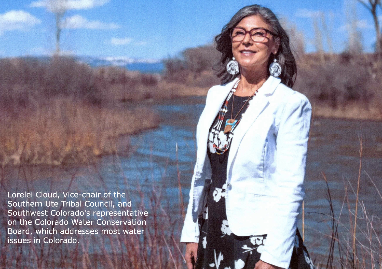
Lorelei Cloud, chair of the Colorado Water Conservation Board and co-founder of the Indigenous Women’s Leadership Network, cautioned against federal intervention. The federal government has fallen short of its trust responsibility to the tribes by failing to provide water, she said.
”All the people on the ground really need to step up and provide a solution,” she said.
Bill Hasencamp, manager of Colorado River Resources for the Metropolitan Water District of Southern California, said that federal intervention would mean reverting to pre-2007 operating guidelines under which water allocations are determined annually. That would make it harder for Metropolitan, which serves 19 million people across Southern California, to plan for the future.
“We might invest in sources that we don’t need, but also we may have to restrict water deliveries from time to time, as we’ve done in the past,” said Hasencamp. “For us, that’s a fail.”
But Tom Buschatzke, the director of the Arizona Department of Water Resources and the state’s lead negotiator, told Inside Climate News that federal leadership could break the deadlock between the states, a move that Arizona Gov. Katie Hobbs has called for recently.
Buschatzke feels that nothing the Upper Basin has proposed would withstand scrutiny from Arizona legislators, who would have to approve it. Visibly upset, he said the Upper Basin’s claim that they can’t take more cuts is “absurd” and is based on them not getting their “paper” water—a term used to refer to water that exists legally but has never been put to use or proven to currently be available.
“They need mandatory conservation that results in more water being in Lake Powell that can be moved to Lake Mead,” he said.

Upper Basin negotiators counter that it is not their responsibility to cut their use to accommodate Lower Basin users who have long overdrawn the system. “We cannot subsidize overuse,” said Becky Mitchell, Colorado’s negotiator.

At one point, the Lower Basin used several million acre-feet more water per year than it was allocated, but it has since reduced its consumption and now uses less than it is legally entitled to. California, the river’s biggest user, touted drastic conservation measures that have reduced water use to its lowest levels since the 1940s, despite booming growth in the state. Lower Basin leaders argue, too, that the region’s biggest cities, farms and economic outputs from the river are within the three states.
Upper Basin officials argue they have the right to grow as the Lower Basin has, and it’s unfair for those four states to sacrifice their future.
Earlier this week, leaders in both basins saw a preview of the federal government’s draft environmental review, which included a range of options for managing Lake Powell and Lake Mead. Some in the Lower Basin expressed concern that the options relied too heavily on them making future cuts. Hamby, California’s negotiator, emphasized that if the basin states eventually reach an agreement, it will determine how the federal government manages the river.
“Ultimately, none of it should matter if we get to a seven-state consensus,” said Hamby, who is also a board member of Southern California’s Imperial Irrigation District, the river’s single-largest water user. “But as part of the [environmental review] process, what we look forward to seeing from California is an equally balanced risk across the basin that motivates people to develop a seven-state consensus.”
Brandon Gebhart, Wyoming’s state engineer and Colorado River negotiator, called the analysis “broad enough to accommodate any seven-state consensus agreement” in an email.
Andrea Travnicek, assistant secretary for water and science at the Interior Department, said the government expects to publish the environmental impact statement in the last week of December or first week of January.
Despite the urgency, conference attendees weren’t surprised that negotiations remain stalled and no deal appeared imminent.
Cynthia Campbell, the director of policy innovation for the Arizona Water Innovation Institute at Arizona State University, said she expects one of two outcomes in the next 18 months, and perhaps both: the system will collapse or there will be litigation.
The public, she said, will then ask what happened, and leaders will have no good answers.
“I came with very low expectations, and they were met,” she said.
Feds close to releasing draft environmental review of #ColoradoRiver management options — Jennifer Solis (NevadaCurrent.com) #CRWUA2025 #COriver #aridification

Click the link to read the article on the Nevada Current website (Jennifer Solis):
December 18, 2025
In the next few weeks, the public will get their first look at a critical document two and a half years in the making that will define how the Colorado River is managed for the next decade.
The Bureau of Reclamation – which manages water in the West under the Interior Department – is on track to release a draft environmental review by early January with a range of options to replace the river’s operating rules, which are set to expire at the end of 2026.
Several elements of the draft were shared during the annual Colorado River Water Users Association’s conference in Las Vegas at Caesars Palace Wednesday.
Negotiations between federal officials and the seven western states that rely on the Colorado River have largely remained behind closed doors since 2023, but any new operating rules will be required to go through a public environmental review process before a final decision can be made.
Interior Department Assistant Secretary for Water and Science, Andrea Travnicek, said the agency is committed to meeting the self-imposed January deadline in order to finalize new rules before the current ones expire.
“The Department of the Interior recognizes a shrinking timeline is in front of us in order to operate under a new potential agreement,” Travnicek said.
In an unusual move, federal water officials said the draft will not identify which set of operating guidelines the federal government would prefer, which is typically included in environmental reviews.
“We will not be identifying a preferred alternative, but we anticipate the identification of that between the draft and the final,” said Bureau of Reclamation’s senior water resource program manager, Carly Jerla.
Instead, the draft environmental review will list a broad range of possible alternatives designed to enable states to continue working towards a seven-state consensus agreement on how to share the river’s shrinking water supply.
“We want to continue to facilitate, but not dictate these operations. The goal here is to inform decision makers and encourage parties to adopt agreements that put consultation and negotiation first,” Jerla continued.
Lower Basin states — California, Arizona, and Nevada — and Upper Basin states — Colorado, Wyoming, Utah and New Mexico — have been at an impasse for months over how to manage the Colorado River’s shrinking water supplies.
Last month, the states missed a federally-imposed deadline to submit a preliminary seven-state consensus plan that could replace the river’s operating guidelines after days of intense closed-door negotiations.
States’ last chance to share a final consensus-based plan will be mid-February 2026 in order to reach a final agreement in the summer with implementation of the new guidelines beginning in October 2026.
The Bureau of Reclamation’s Acting Commissioner Scott Cameron said he and other federal officials have intensified efforts to bring states to a consensus, flying out West every other week since early April to meet with the seven states’ river negotiators.
“There are a number of issues from decades past that some people are having some difficulty getting past,” Cameron said, adding that states must “be willing to set aside previous perceived inequities and unfairness.”
One of the biggest disagreements between the Upper and Lower Basin states is over which faction should have to cut back on their water use, and by how much.
Lower Basin states want all seven Colorado River states to share mandatory water cuts during dry years under the new guidelines. The Upper Basin, which is not subject to mandatory cuts under current guidelines, say they already use much less water than downstream states and should not face additional cuts. [ed. Also, the UB states face cuts every year from Mother Nature with the variability, but generally lower, snowpack each season.]
Despite states missing past deadlines, Cameron said he was “cautiously optimistic” states will reach a consensus deal by the February deadline.
“It’s not unusual in the negotiating process that tougher decisions get made the closer you get to the deadline. And frankly, there are tough decisions that have to be made,” Cameron said.
On Tuesday, California’s biggest water districts said they were willing to “set aside many of their legal positions” in order to reach a seven-state agreement.
The Bureau of Reclamation provided a broad overview of the components that will be included in draft’s range of options, including guidelines to reduce water deliveries from Lake Mead during shortages, coordinated reservoir operations for Lake Mead and Lake Powell, and storage and delivery mechanisms for conserved water.
Jerla, Reclamation’s senior water resource program manager, said the draft alternatives will include some components previously proposed by states.
She said the agency has adopted a number of temporary operational agreements since 2008 to address changing conditions on the river. Those agreements have served as test runs for a long term agreement and emphasized the need for more flexibility when managing the river from year-to-year.
“We want to preserve ourselves the flexibility to come back to the table, to do reviews, to make consensus adjustments if needed,” Jerla said.
That flexibility to operations will likely be needed again this year due to a less-than-average upcoming snow season, that combined with a dry spring or early summer in 2026, could create conditions for another low runoff year.
“We’re monitoring the forecast, and we’re seeing not a great start to water year 2026. It’s still early in the year, but the way things are setting up it isn’t looking good,” Jerla said.
The two biggest reservoirs in the country, Lake Powell and Lake Mead, are currently at a fraction of their full capacity. Lake Mead is at 32% capacity, while Lake Powell is at 28%.
Additionally, water inflow into the reservoirs in 2026 are projected to most likely be 75% of the average, according to the federal agency. The minimum probable inflow forecast for 2026 is 44% of average, indicating a potentially very dry year.
John Entsminger — Southern #Nevada Water Authority #CRWUA2025
#Drought news December 19, 2025: Across the central Rocky Mountains of #Wyoming and #Colorado continued warmth and limited snowfall hindered #snowpack development
Click on a thumbnail graphic to view a gallery of drought data from the US Drought Monitor website.

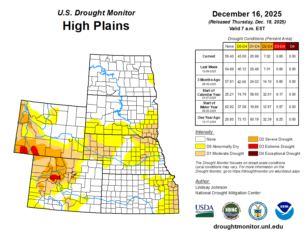
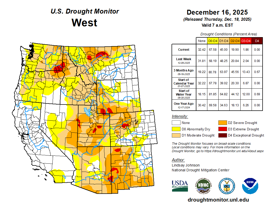

Click the link to go to the US Drought Monitor website. Here’s an excerpt:
This Week’s Drought Summary
This week, temperature and precipitation patterns varied sharply across the country. Temperatures were generally warmer in the West and colder in the east, with much of the Cascades and Rocky Mountains running well above normal while the Midwest experienced much colder-than-normal conditions. Multiple Pacific storm systems brought widespread precipitation to the Pacific Northwest and northern Rockies, falling as rain at lower elevations and snow in the mountains; however, despite recent snowfall, snowpack remains below normal for mid-December. East of the Rockies, precipitation was more limited and uneven, and where it did occur across the northern Plains and Midwest, it often fell as snow. As a result, drought conditions improved mainly across parts of the Pacific Northwest and northern Rockies. Additional localized improvements occurred in parts of the Southeast, where lingering benefits from rainfall in prior weeks continued to support soil moisture and streamflows. In contrast, areas farther south and east that missed meaningful precipitation saw conditions persist or worsen. Across portions of the southern Plains, lower Mississippi Valley, Ohio Valley, Mid-Atlantic, and Northeast, continued precipitation deficits and declining streamflows led to degradations. In the Midwest, colder temperatures limited precipitation to fall as snow, slowing hydrologic response and resulting in mostly localized changes…
High Plains
The High Plains remained largely unchanged this week. Areas of less than one inch of precipitation fell across some areas of the Dakotas and northeastern Wyoming. In east-central South Dakota, this precipitation led to minor improvements with the removal of some abnormal dryness (D0). Nebraska, Colorado, and most of Kansas remained unchanged. In southeastern Kansas along the Kansas-Missouri border, hydrologic deficits led to further deterioration and the expansion of moderate drought (D1). In southeastern Wyoming, frequent strong winds and above-normal temperatures combined with continued lack of precipitation contributed to further degradation and the expansion of moderate drought (D1)…
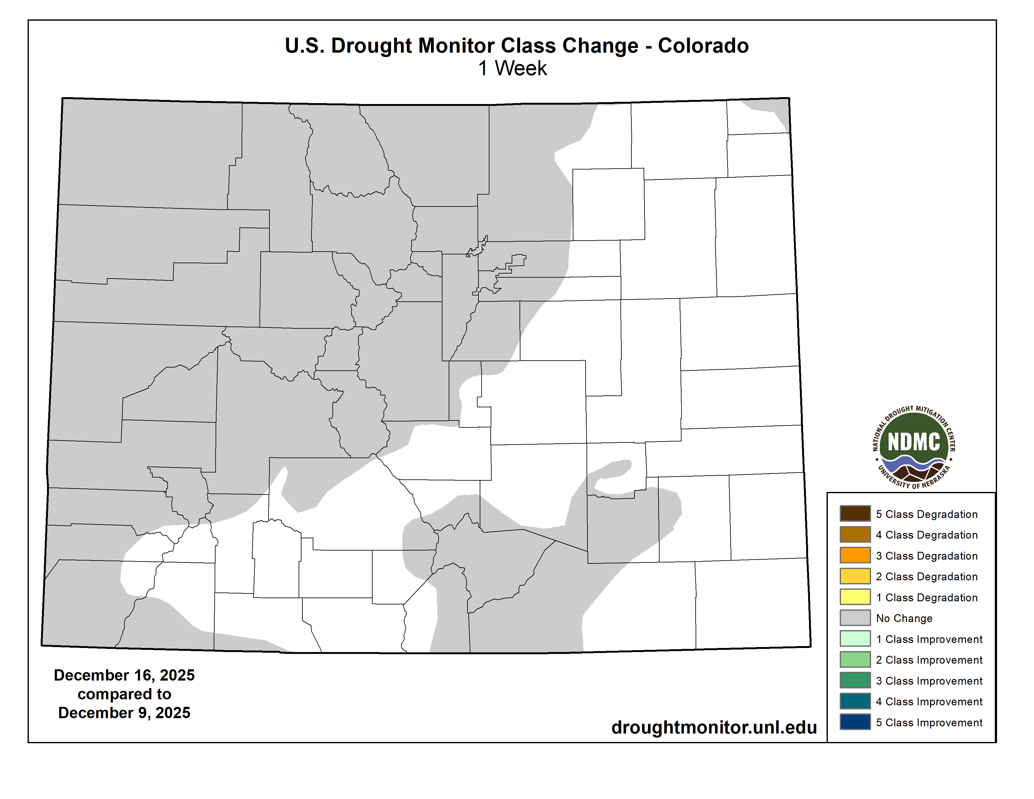
West
Across the West, drought changes were mainly determined by precipitation. In Washington and northern Oregon, multiple Pacific storm systems, associated with atmospheric river moisture, brought widespread precipitation to the Pacific Northwest. Precipitation fell mainly as rain at lower elevations and snow in the mountains, contributing to ongoing flooding in parts of western Washington and supporting widespread one-class improvements along the coast and nearby interior areas. Since the end of November, snowpack in the Cascades has slightly improved, though snow water equivalent (SWE) values remain below normal for this time of year, particularly where warmer temperatures limited snow accumulation. Across central and southern Oregon and into northern California, conditions show rapid short-term drying. [I spoke with Jeff Deem (Airborne Snow Observatories Inc.) at the Colorado River Water Users Association conference last week and he said that he flew over Lake Tahoe recently and there was NO SNOW.] However, last-minute (Dec. 15-16) rainfall of 1 to 2 inches along Oregon’s coast was enough to bring improvements where it fell while the areas that missed out on the precipitation saw abnormal dryness (D0) expanded.
In the Northern Rockies, repeated precipitation supported one-class improvements across northern Idaho and northwestern Montana. Lower elevations experienced rain or mixed precipitation, while higher elevations received snow, leading to SWE improvements in northern and central Idaho and western Montana. Despite this week’s precipitation, much of Idaho’s snowpack remains below normal with SWE at 70 percent of normal, while snowpack across western and central Montana showed the greatest improvement, with SWE near or above 90 percent of normal for this time of year. Farther east and south across central and western Montana, more widespread precipitation supported a swath of one-class improvements.
Across the central Rocky Mountains of Wyoming and Colorado, conditions were more mixed. Portions of the north-central Rockies received enough snowfall to lead to localized improvements, with SWE in some headwater areas approaching near-normal early-season levels. Elsewhere, c. Across much of western and central Utah, SWE remains below 50 percent of normal, supporting one-class degradations in north-central and central Utah. In the Southwest, localized changes were made in New Mexico, with improvements in central New Mexico where longer-term precipitation from earlier periods continued show hydrologic improvement, while precipitation deficits led to the expansion of moderate drought (D1) in the southeast part of the state…
South
Drought conditions across the South generally worsened this week, as limited precipitation did little to improve the growing moisture deficits. Louisiana and some areas of Mississippi saw some improvements due to precipitation, including the removal of severe drought (D2) in west-central Louisiana. In Texas and Oklahoma, ongoing precipitation deficits led to further expansion of abnormally dry (D0) and moderate drought (D1) conditions. In south-central Texas, longer-term hydrologic stress continued and intensified with the expansion of severe (D2) and extreme drought (D3). Across Arkansas and Tennessee, despite cooler than normal temperatures, dry conditions continued to worsen with growing precipitation deficits, drying soils, and decreasing streamflows leading to the expansion of abnormal dryness (D0) and moderate drought (D1)…

Looking Ahead
According to the National Weather Service’s 5-day (Dec. 18-23) quantitative precipitation forecast, the heaviest precipitation is forecast across the West, particularly along the Pacific Northwest coast and into northern California, where widespread totals may exceed 5 inches in some areas. Additional moderate to heavy precipitation is expected across the Cascades and into parts of the northern Rockies, with totals generally ranging from 1 to 4 inches. Lighter but still notable precipitation is forecast to extend eastward into portions of the central Rockies and the northern Plains. Across the central and eastern U.S., precipitation is expected to be more scattered and generally lighter. Portions of the Midwest, Ohio Valley, Southeast, and Gulf Coast may receive light to moderate precipitation, generally ranging from 0.5 to 2 inches. Farther east, a band of precipitation is indicated along parts of the East Coast, with locally higher amounts possible from the Southeast into the Mid-Atlantic and portions of the Northeast. Overall, the forecast highlights a wetter pattern in the West and more limited, variable precipitation across much of the central and eastern U.S.
The Climate Predictions Center’s 6 to 10 day temperature outlook (Dec. 22–26) shows an increased likelihood of above-normal temperatures across much of the central and southern U.S., extending from the West Coast through the Plains and into the Southeast. The highest probabilities for above-normal temperatures are centered over the southern Plains and Southwest, with much of the interior West, Rockies, and central Plains also favored to be warmer than normal. Near-normal temperatures are indicated across parts of the Pacific Northwest and the Great Lakes. Below-normal temperatures are most likely across portions of the Northeast, particularly northern New England, while Alaska shows a strong signal for below-normal temperatures across much of the state. Hawaii is favored to see above-normal temperatures during the period. In terms of precipitation, the 6 to 10 day outlook indicates an increased likelihood of above-normal precipitation across much of the West, including California, the Pacific Northwest, and parts of the Great Basin and northern Rockies. Near- to above-normal precipitation probabilities also extend into parts of the interior West. In contrast, below-normal precipitation is favored across much of the central Plains, lower Mississippi Valley, Southeast, and Florida, with the strongest signal centered over the southern Plains and Gulf Coast region. Near-normal precipitation probabilities are indicated across parts of the Great Lakes and Northeast, while Alaska shows mixed signals, with below-normal precipitation favored in southern portions and near-normal conditions elsewhere.