Ten rivers. Ten solutions. Ten opportunities to protect the rivers on which all life depends. America’s Most Endangered Rivers® of 2024 shines a spotlight on threats to clean water, and how pollution impacts to our health and our communities.
#1: Rivers of New Mexico New Mexico is the state hardest hit by a recent Supreme Court ruling that slashed protections for streams, threatening drinking water sources and livelihoods across the state.
#2: Big Sunflower and Yazoo Rivers A massive pumping project would impact thousands of acres of wetlands vital to wildlife and the Mississippi Delta ecosystem.
#3: Duck River The drinking water source for 250,000 people and one of the richest rivers for biodiversity is threatened by excessive water withdrawals.
#4: Santa Cruz River This symbol of restoration and resilience is threatened by climate change and water scarcity.
#5: Little Pee Dee River A major highway project is putting clean water and wildlife habitat at risk.
#6: Farmington River A hydropower dam is threatening fisheries and harming water quality in this important drinking water source.
#7: Trinity River This important tributary to the Klamath River is at risk from excessive water withdrawals, threatening both salmon and people.
#8: Kobuk River Road development and mining threaten clean water, wildlife, and Iñupiat culture.
#9: Tijuana River Pollution is choking the river, causing sickness, forcing beach closures, and endangering local economies.
#10: Blackwater River A proposed highway project would be a disaster for water quality and fish and wildlife habitat.
Children age five and younger, and women who are pregnant, planning to become pregnant or breastfeeding, are more susceptible to health impacts from commonly called “forever chemicals,” which have been found so far in unhealthy levels in one neighborhood water system in Routt County…Sleepy Bear mobile home park, located along U.S. Highway 40 on the western edge of Steamboat Springs, has recorded PFAS levels in the neighborhood water system that are higher than health advisory and national drinking water standards. The mobile home park is not part of the city water system and uses a well water system, according to the local park manager…
“Most people living in the United States have some amount of these chemicals in their blood,” according to the Colorado Department of Public Health & Environment. “People in communities that have been contaminated by PFAS — through water or other sources — are more likely to have health impacts.”
[…]
Consumer drinking water testing for Sleepy Bear showed 9.2 parts per trillion of PFOA, which is more than double the newly released legally enforceable standards set by the U.S. Environmental Protection Agency. The EPA limits PFOA and PFOS drinking water standards to four parts per trillion. The CDPHE, which issues water system permits in the state, advised Sleepy Bear residents to “consider taking action to reduce your exposure.” Since the EPA previously issued a health advisory in June 2022, Sleepy Bear voluntarily participated in a proactive testing program for PFAS water sampling in June 2023. Sleepy Bear contracted water operator Ron Krueger, owner of Crystal Clear Water Treatment in Lakewood, said Thursday he is awaiting direction from the CDPHE for next steps…
Mount Werner Water & Sanitation District General Manager Frank Alfone said the district has been conducting voluntary PFAS testing that will continue throughout 2025. The most recent testing in February showed no detectable levels of PFAS in the city drinking water supply.
Colorado River headwaters tributary in Rocky Mountain National Park photo via Greg Hobbs.
Click the link to read the article on the Colorado Politics website (Marianne Goodland). Here’s an excerpt:
April 13, 2024
This month, lawmakers looked at the dueling approaches contained in two measures seeking to implement a way for the state to manage “dredge and fill discharge” permits tied to a recent U.S. Supreme Court decision [Sackett vs. EPA] that redefined how a body of water can be protected under the Environmental Protection Agency’s “Waters of the United States” rule…Supporters of the first bill, which gives the task to the Colorado Department of Public Health and Environment, insist it’s the proper venue because it already experience dealing with permitting and water quality issues. Supporters of the second measure, which hands the responsibility to the Colorado Department of Natural Resources, maintain that the Department of Natural Resources is better equipped, since it already deals with related disciplines, such as water resource management, water rights law and land management.
In any case, policymakers agree that Colorado residents, industries and the wetlands needs certainty…Alex Funk with the Theodore Roosevelt Conservation Partnership told a legislative committee last August that almost 90% of fish and wildlife in Colorado rely on the state’s wetlands at some point during their lifecycle. House Speaker McCluskie told the House agriculture committee on April 8 that since Sackett v. Environmental Protection Agency held that only permanent streams and rivers are protected under the federal Clean Water Act, those with a continuous surface connection to another permanent water body. That puts Colorado waters at risk, she said. Pitkin County Commissioner Greg Poschman also noted that the state’s headwaters are made up of small streams that do not have year-round flow because they are under snowpack half the year — suggesting Sackett would put those waters at risk.
The more scientists learn about the health risks of PFAS, found in everything from nonstick cookware to carpets to ski wax, the more concerning these “forever chemicals” become.
The U.S. Environmental Protection Agency now believes there is no safe level for two common PFAS – PFOA and PFOS – in drinking water, and it acknowledges that very low concentrations of other PFAS present human health risks. The agency issued the first legally enforceable national drinking water standards for five common types of PFAS chemicals, as well as PFAS mixtures, on April 10, 2024.
I study PFAS as an environmental health scientist. Here’s a quick look at the risks these chemicals pose and efforts to regulate them.
What exactly are PFAS?
PFAS stands for per- and polyfluoroalkyl substances. This is a large group of human-made chemicals – currently estimated to be nearly 15,000 individual chemical compounds – that are used widely in consumer products and industry. They can make products resistant to water, grease and stains and protect against fire.
Waterproof outdoor apparel and cosmetics, stain-resistant upholstery and carpets, food packaging that is designed to prevent liquid or grease from leaking through, and certain firefighting equipment often contain PFAS.
In fact, studies have found that most products labeled stain- or water-resistant contain PFAS, and another study found that this is even true among products labeled as “nontoxic” or “green.” PFAS are also found in unexpected places such as high-performance ski and snowboard waxes, floor waxes and medical devices.
Firefighters are concerned that PFAS in firefighting foams and protective gear could be a reason cancer rates are rising. AP Photo/Steven Senne
At first glance, PFAS sound pretty useful, so you might be wondering what’s the big deal?
The short answer is that PFAS are harmful to human health and the environment.
Some of the very same chemical properties that make PFAS attractive in products also mean these chemicals will persist in the environment for generations. Because of the widespread use of PFAS, these chemicals are now present in water, soil and living organisms and can be found across almost every part of the planet, including Arctic glaciers, marine mammals, remote communities living on subsistence diets and in 98% of the American public.
Once people are exposed to PFAS, the chemicals remain in their bodies for a long time – months to years, depending on the specific compound – and they can accumulate over time.
Research consistently demonstrates that PFAS are associated with a variety of adverse health effects. A review by a panel of experts looking at research on PFAS toxicity concluded with a high degree of certainty that PFAS contribute to thyroid disease, elevated cholesterol, liver damage, and kidney and testicular cancer.
Further, they concluded with a high degree of certainty that PFAS also affect babies exposed in utero by increasing their likelihood of being born at a lower birth weight and responding less effectively to vaccines, while impairing women’s mammary gland development, which may adversely affect a mom’s ability to breastfeed.
The review also found evidence that PFAS may contribute to a number of other disorders, though further research is needed to confirm existing findings: inflammatory bowel disease, reduced fertility, breast cancer, and an increased likelihood of miscarriage and developing high blood pressure and preeclampsia during pregnancy. Additionally, current research suggests that babies exposed prenatally are at higher risk of experiencing obesity, early-onset puberty and reduced fertility later in life.
Collectively, this is a formidable list of diseases and disorders.
Who’s regulating PFAS?
PFAS chemicals have been around since the late 1930s, when a DuPont scientist created one by accident during a lab experiment. DuPont called it Teflon, which eventually became a household name for its use on nonstick pans.
Decades later, in 1998, Scotchgard maker 3M notified the Environmental Protection Agency that a PFAS chemical was showing up in human blood samples. At the time, 3M said low levels of the manufactured chemical had been detected in people’s blood as early as the 1970s.
The Agency for Toxic Substances and Disease Registry has a toxicological profile for PFAS. And the EPA had issued advisories and health-based guidelines. But despite the lengthy list of serious health risks linked to PFAS and a tremendous amount of federal investment in PFAS-related research in recent years, PFAS hadn’t been regulated at the federal level in the United States until now.
The new drinking water standards set limits for five individual PFAS – PFOA, PFOS, PFNA, PFHxS and HFPO-DA – as well as mixtures of these chemicals. The standards are part of the EPA’s road map for PFAS regulations.
While waiting for federal action, states have taken their own steps to protect residents against the risk of PFAS exposure.
At least 28 states have laws targeting PFAS in various uses, such as in food packaging and carpets. About a dozen have drinking water standards for PFAS. But relying on state laws creates a patchwork of regulations, which places burdens on businesses and consumers to navigate regulatory nuances across state lines.
How can you reduce your PFAS exposure?
Based on current scientific understanding, most people are exposed to PFAS primarily through their diet, though drinking water and airborne exposures may be significant among some people, especially if they live near known PFAS-related industries or contamination.
The best ways to protect yourself and your family from risks associated with PFAS are to educate yourself about potential sources of exposure.
Products labeled as water- or stain-resistant have a good chance of containing PFAS. When possible, check the ingredients on products you buy and watch for chemical names containing “fluor-.” Specific trade names, such as Teflon and Gore-Tex, are also likely to contain PFAS.
Check whether there are sources of contamination near you, such as in drinking water or PFAS-related industries in the area. Strategies for monitoring and reporting PFAS contamination vary by location and PFAS source, so the absence of readily available information does not necessarily mean the region is free of PFAS problems.
If you believe you have been exposed to PFAS and are concerned about your health, contact your health care provider. The National Academies of Sciences, Engineering, and Medicine have published guidance on PFAS exposure, testing and clinical follow-up, which includes information to help health care professionals understand monitoring and clinical implications of PFAS exposure.
As part of the Administration’s commitment to combating PFAS pollution, EPA announces $1B investment through President Biden’s Investing in America agenda to address PFAS in drinking water
April 10, 2024
WASHINGTON – Today, April 10, the Biden-Harris Administration issued the first-ever national, legally enforceable drinking water standard to protect communities from exposure to harmful per-and polyfluoroalkyl substances (PFAS), also known as ‘forever chemicals.’ Exposure to PFAS has been linked to deadly cancers, impacts to the liver and heart, and immune and developmental damage to infants and children. This final rule represents the most significant step to protect public health under EPA’s PFAS Strategic Roadmap. The final rule will reduce PFAS exposure for approximately 100 million people, prevent thousands of deaths, and reduce tens of thousands of serious illnesses. Today’s announcement complements President Biden’s government-wide action plan to combat PFAS pollution.
Through President Biden’s Investing in America agenda, EPA is also making unprecedented funding available to help ensure that all people have clean and safe water. In addition to today’s final rule, EPA is announcing nearly $1 billion in newly available funding through the Bipartisan Infrastructure Law to help states and territories implement PFAS testing and treatment at public water systems and to help owners of private wells address PFAS contamination. This is part of a $9 billion investment through the Bipartisan Infrastructure Law to help communities with drinking water impacted by PFAS and other emerging contaminants – the largest-ever investment in tackling PFAS pollution. An additional $12 billion is available through the Bipartisan Infrastructure Law for general drinking water improvements, including addressing emerging contaminants like PFAS.
EPA Administrator Michael Regan will join White House Council on Environmental Quality Chair Brenda Mallory to announce the final standard today at an event in Fayetteville, North Carolina. In 2017, area residents learned that the Cape Fear River, the drinking water source for 1 million people in the region, had been heavily contaminated with PFAS pollution from a nearby manufacturing facility. Today’s announcements will help protect communities like Fayetteville from further devastating impacts of PFAS.
“Drinking water contaminated with PFAS has plagued communities across this country for too long,” said EPA Administrator Michael S. Regan. “That is why President Biden has made tackling PFAS a top priority, investing historic resources to address these harmful chemicals and protect communities nationwide. Our PFAS Strategic Roadmap marshals the full breadth of EPA’s authority and resources to protect people from these harmful forever chemicals. Today, I am proud to finalize this critical piece of our Roadmap, and in doing so, save thousands of lives and help ensure our children grow up healthier.”
“President Biden believes that everyone deserves access to clean, safe drinking water, and he is delivering on that promise,” said Brenda Mallory, Chair of the White House Council on Environmental Quality. “The first national drinking water standards for PFAS marks a significant step towards delivering on the Biden-Harris Administration’s commitment to advancing environmental justice, protecting communities, and securing clean water for people across the country.”
“Under President Biden’s leadership, we are taking a whole-of-government approach to tackle PFAS pollution and ensure that all Americans have access to clean, safe drinking water. Today’s announcement by EPA complements these efforts and will help keep our communities safe from these toxic ‘forever chemicals,’” said Deputy Assistant to the President for the Cancer Moonshot, Dr. Danielle Carnival. “Coupled with the additional $1 billion investment from President Biden’s Investing in America agenda to help communities address PFAS pollution, the reductions in exposure to toxic substances delivered by EPA’s standards will further the Biden Cancer Moonshot goal of reducing the cancer death rate by at least half by 2047 and preventing more than four million cancer deaths — and stopping cancer before it starts by protecting communities from known risks associated with exposure to PFAS and other contaminants, including kidney and testicular cancers, and more.”
EPA is taking a signature step to protect public health by establishing legally enforceable levels for several PFAS known to occur individually and as mixtures in drinking water. This rule sets limits for five individual PFAS: PFOA, PFOS, PFNA, PFHxS, and HFPO-DA (also known as “GenX Chemicals”). The rule also sets a limit for mixtures of any two or more of four PFAS: PFNA, PFHxS, PFBS, and “GenX chemicals.” By reducing exposure to PFAS, this final rule will prevent thousands of premature deaths, tens of thousands of serious illnesses, including certain cancers and liver and heart impacts in adults, and immune and developmental impacts to infants and children.
This final rule advances President Biden’s commitment to ending cancer as we know it as part of the Biden Cancer Moonshot, to ensuring that all Americans have access to clean, safe, drinking water, and to furthering the Biden-Harris Administration’s commitment to environmental justice by protecting communities that are most exposed to toxic chemicals.
EPA estimates that between about 6% and 10% of the 66,000 public drinking water systems subject to this rule may have to take action to reduce PFAS to meet these new standards. All public water systems have three years to complete their initial monitoring for these chemicals. They must inform the public of the level of PFAS measured in their drinking water. Where PFAS is found at levels that exceed these standards, systems must implement solutions to reduce PFAS in their drinking water within five years.
The new limits in this rule are achievable using a range of available technologies and approaches including granular activated carbon, reverse osmosis, and ion exchange systems. For example, the Cape Fear Public Utility Authority, serving Wilmington, NC – one of the communities most heavily impacted by PFAS contamination – has effectively deployed a granular activated carbon system to remove PFAS regulated by this rule. Drinking water systems will have flexibility to determine the best solution for their community.
EPA will be working closely with state co-regulators in supporting water systems and local officials to implement this rule. In the coming weeks, EPA will host a series of webinars to provide information to the public, communities, and water utilities about the final PFAS drinking water regulation. To learn more about the webinars, please visit EPA’s PFAS drinking water regulation webpage. EPA has also published a toolkit of communications resources to help drinking water systems and community leaders educate the public about PFAS, where they come from, their health risks, how to reduce exposure, and about this rule.
“We are thankful that Administrator Regan and the Biden Administration are taking this action to protect drinking water in North Carolina and across the country,” said North Carolina Governor Roy Cooper. “We asked for this because we know science-based standards for PFAS and other compounds are desperately needed.”
“For decades, the American people have been exposed to the family of incredibly toxic ‘forever chemicals’ known as PFAS with no protection from their government. Those chemicals now contaminate virtually all Americans from birth. That’s because for generations, PFAS chemicals slid off of every federal environmental law like a fried egg off a Teflon pan — until Joe Biden came along,” said Environmental Working Group President and Co-Founder Ken Cook. “We commend EPA Administrator Michael Regan for his tireless leadership to make this decision a reality, and CEQ Chair Brenda Mallory for making sure PFAS is tackled with the ‘whole of government’ approach President Biden promised. There is much work yet to be done to end PFAS pollution. The fact that the EPA has adopted the very strong policy announced today should give everyone confidence that the Biden administration will stay the course and keep the president’s promises, until the American people are protected, at long last, from the scourge of PFAS pollution.”
“We learned about GenX and other PFAS in our tap water six years ago. I raised my children on this water and watched loved ones suffer from rare or recurrent cancers. No one should ever worry if their tap water will make them sick or give them cancer. I’m grateful the Biden EPA heard our pleas and kept its promise to the American people. We will keep fighting until all exposures to PFAS end and the chemical companies responsible for business-related human rights abuses are held fully accountable,” said Emily Donovan, co-founder of Clean Cape Fear.
More details about funding to address PFAS in Drinking Water
Through the Bipartisan Infrastructure Law, EPA is making an unprecedented $21 billion available to strengthen our nation’s drinking water systems, including by addressing PFAS contamination. Of that, $9 billion is specifically for tackling PFAS and emerging contaminants. The financing programs delivering this funding are part of President Biden’s Justice40 Initiative, which set the goal that 40% of the overall benefits of certain federal investments flow to disadvantaged communities that have been historically marginalized by underinvestment and overburdened by pollution.
Additionally, EPA has a nationwide Water Technical Assistance program to help small, rural, and disadvantaged communities access federal resources by working directly with water systems to identify challenges like PFAS; develop plans; build technical, managerial, and financial capacity; and apply for water infrastructure funding. Learn more about EPA’s Water Technical Assistance programs.
More details about the final PFAS drinking water standards:
For PFOA and PFOS, EPA is setting a Maximum Contaminant Level Goal, a non-enforceable health-based goal, at zero. This reflects the latest science showing that there is no level of exposure to these contaminants without risk of health impacts, including certain cancers.
EPA is setting enforceable Maximum Contaminant Levels at 4.0 parts per trillion for PFOA and PFOS, individually. This standard will reduce exposure from these PFAS in our drinking water to the lowest levels that are feasible for effective implementation.
For PFNA, PFHxS, and “GenX Chemicals,” EPA is setting the MCLGs and MCLs at 10 parts per trillion.
Because PFAS can often be found together in mixtures, and research shows these mixtures may have combined health impacts, EPA is also setting a limit for any mixture of two or more of the following PFAS: PFNA, PFHxS, PFBS, and “GenX Chemicals.”
EPA is issuing this rule after reviewing extensive research and science on how PFAS affects public health, while engaging with the water sector and with state regulators to ensure effective implementation. EPA also considered 120,000 comments on the proposed rule from a wide variety of stakeholders.
Background:
PFAS, also known as ‘forever chemicals,’ are prevalent in the environment. PFAS are a category of chemicals used since the 1940s to repel oil and water and resist heat, which makes them useful in everyday products such as nonstick cookware, stain resistant clothing, and firefighting foam. The science is clear that exposure to certain PFAS over a long period of time can cause cancer and other illnesses. In addition, PFAS exposure during critical life stages such as pregnancy or early childhood can also result in adverse health impacts.
Across the country, PFAS contamination is impacting millions of people’s health and wellbeing. People can be exposed to PFAS through drinking water or food contaminated with PFAS, by coming into contact with products that contain PFAS, or through workplace exposures in certain industries.
Since EPA Administrator Michael S. Regan announced the PFAS Strategic Roadmap in October 2021, EPA has taken action – within the Biden-Harris Administration’s whole-of-government approach – by advancing science and following the law to safeguard public health, protect the environment, and hold polluters accountable. The actions described in the PFAS Strategic Roadmap each represent important and meaningful steps to protect communities from PFAS contamination. Cumulatively, these actions will build upon one another and lead to more enduring and protective solutions. In December 2023, the EPA released its second annual report on PFAS progress. The report highlights significant accomplishments achieved under the EPA’s PFAS Strategic Roadmap.
Products that contain PFAS. Graphic credit: Riverside (CA) Public Utilities
Blanca Wetlands, Colorado BLM-managed ACEC Blanca Wetlands is a network of lakes, ponds, marshes and wet meadows designated for its recreation and wetland values. The BLM Colorado and its partners have made strides in preserving, restoring and managing the area to provide rich and diverse habitats for wildlife and the public. To visit or get more information, see: http://www.blm.gov/co/st/en/fo/slvfo/blanca_wetlands.html. By Bureau of Land Management – Blanca Wetlands Area of Critical Environmental Concern, Colorado, Public Domain, https://commons.wikimedia.org/w/index.php?curid=42089248
Colorado lawmakers will consider a fresh proposal to grant the state authority to oversee streams and wetlands left unprotected by a U.S. Supreme Court decision last year.
House Bill 24-1379, sponsored by House Speaker Julie McCluskie, D-Dillon, Rep. Karen McCormick, D-Longmont, and Sen. Dylan Roberts, D-Frisco, would allow the Colorado Department of Public Health and Environment (CDPHE) to oversee a wide array of industrial players, including home and road builders and mining companies, and determine what steps are necessary to minimize any damage to streams and wetlands caused by their activities.
In May, the U.S. Supreme Court issued a ruling in Sackett vs. EPA that sharply limits the streams and wetlands that qualify for protection under the Clean Water Act, a decision that water observers said had a particularly broad impact in the West. In Colorado and other Western states, vast numbers of streams are temporary, flowing only after major rainstorms and during spring runoff season, when the mountain snow melts.
Colorado Rivers. Credit: Geology.com
In addition, hundreds of Colorado wetlands lack an obvious surface connection to streams, in part because so many of the state’s streams don’t flow year-round.
“As a state we don’t want to let a good crisis go to waste,” McCluskie said in a briefing last week, referring to the Sackett decision and the regulatory gap that was created. “Our water is part of the romance and tradition of being a Coloradan. Protecting those waterways could not be more important. But we recognize there needs to be clarity and certainty for our industry partners. And we have tried to be very considerate of differing viewpoints.”
At issue is how the U.S. Environmental Protection Agency now defines so-called Waters of the United States, or WOTUS, which determines which waterways and wetlands are protected under the federal Clean Water Act. The definition has been heavily litigated in the nation’s lower courts since the 1980s and has changed dramatically under different presidential administrations.
The U.S. Supreme Court decided in May that the WOTUS definition that included wetlands adjacent to streams was too broad.
In its ruling, the court said only those wetlands with a direct surface connection to a stream or permanent body of water, for instance, should be protected.
The court’s decision in the WOTUS case means it will be up to Colorado and other states to decide whether and how to handle that regulation — including permitting — and enforcement.
And last month, Republican Sen. Barbara Kirkmeyer, of Brighton, introduced Senate Bill 24-127, also designed to fill the regulatory gap. The Kirkmeyer measure, which has broad industry support, is scheduled for its first hearing April 4, but it’s likely to meet stiff resistance in the Democratic-controlled General Assembly.
Among the key differences between the two measures is that Kirkmeyer’s proposal states that any new rules can’t be more restrictive than those in place prior to the Sackett decision, while McCluskie’s says protections should be “at least as protective” as those in place at that time, according to Jarrett Freedman, spokesman for the House Democrats.
Another difference is that Kirkmeyer’s bill would place the new oversight program within the Colorado Department of Natural Resources instead of the CDPHE. Kirkmeyer said a huge permitting backlog at CDPHE shows the agency would be unable to handle dredge-and-fill permitting required under her proposal.
McCluskie, however, believes the new program would be better housed within the state health department and that new funding would alleviate permitting delays.
The first hearing on the House Bill 24-1379 has not been scheduled, Freedman said.
A broad array of environmental groups has come out in favor of McCluskie’s measure.
Iron Fen. Photo credit from report “A Preliminary Evaluation of Seasonal Water Levels Necessary to Sustain Mount Emmons Fen: Grand Mesa, Uncompahgre and Gunnison National Forests,” David J. Cooper, Ph.D, December 2003.
“Wetlands are nature’s kidneys, they filter natural pollutants, they help reduce the severity of wildfires,” said Josh Kuhn, senior water campaign manager at Conservation Colorado who spoke on behalf of the Protect Colorado Waters Coalition.
“But the Sackett decision left many of those wetlands unprotected … and we have also lost protections for seasonal streams. If pollution is dumped into streams when snow melts and runs off, that pollution gets washed into the larger rivers. … If there is mining or development activity and they are dumping fill, or dirt, into dry streambeds, when there is water moving through those streambeds it is going to take those pollutants with it and pollute our water supply,” he said.
Farm, homebuilding and mining interests have been closely watching the bill, which includes extensive exemptions for agriculture for such things as irrigation ditch repair, and on-farm water management activities. It also includes some exemptions for mining operations.
But there is still concern about the regulatory burden the new program will place on those industries and the time it will take to write new regulations and launch the program.
House Bill 24-1379 stipulates that rules be written by May 31, 2025.
“The rulemakings that they are contemplating are going to be complicated and detailed, and it’s going to be a lot to accomplish in a short period of time,” said John Kolanz, a northern Colorado attorney who often represents developers and who is tracking the bill. “It seems like a tall task.”
More by Jerd SmithJerd Smith is editor of Fresh Water News. She can be reached at 720-398-6474, via email at jerd@wateredco.org or @jerd_smith.
Ephemeral streams are streams that do not always flow. They are above the groundwater reservoir and appear after precipitation in the area. Via Socratic.org
Blanca Wetlands, Colorado BLM-managed ACEC Blanca Wetlands is a network of lakes, ponds, marshes and wet meadows designated for its recreation and wetland values. The BLM Colorado and its partners have made strides in preserving, restoring and managing the area to provide rich and diverse habitats for wildlife and the public. To visit or get more information, see: http://www.blm.gov/co/st/en/fo/slvfo/blanca_wetlands.html. By Bureau of Land Management – Blanca Wetlands Area of Critical Environmental Concern, Colorado, Public Domain, https://commons.wikimedia.org/w/index.php?curid=42089248
Click the link to read the article on the Summit Daily website (Elliot Wenzler). Here’s an excerpt:
March 22, 2024
House Bill 1379 is only one of the approaches being considered by the Colorado legislature this session. Senate Bill 127, introduced in February by Sen. Barbara Kirkmeyer, R-Brighton, proposes that the permitting system should instead be managed by the Colorado Department of Natural Resources.
“They do the floodplain planning, the water planning, they’re responsible for the streams and rivers, that’s not the health department,” she said.
Kirkmeyer argues that the permitting shouldn’t be under CDPHE because the department already has a huge backlog for its other permit programs. The two bills have several other key differences, including how they define which waters should be protected and how stringent the permitting process is for different industries, such as mining. Agricultural activities would be largely exempt under both bills. Senate Bill 172 has a more narrow approach to which state waters should be protected, largely consistent with the Sackett decision. House Bill 1379 would go somewhat beyond the scope of what was protected before that ruling…
House Bill 1379 was assigned to the House Agriculture, Water and Natural Resources Committee. Senate Bill 172 is set to be heard by the Senate Agriculture and Natural Resources Committee April 4.
Representatives from the U.S. Environmental Protection Agency met with Cove community members last week to discuss the agency’s decision to place the Lukachukai Mountains Mining District on the National Priorities List. Although the meeting was intended to be informational, tribal, Navajo EPA and community leaders expressed their uncertainty about whether the federal government will actually start addressing the cleanup of the abandoned uranium mines that landed the site on the EPA list, also known as the Superfund program. The mining district encompasses Navajo Nation communities of Cove, Round Rock and Lukachukai in the far northeastern corner of Arizona.
“We are looking at what happened in the past and how the federal government could have prevented a lot of this contamination,” said Council Delegate Amber Kanazbah Crotty, “could’ve prevented our community from getting sick. What I don’t want them (children) to have to deal with is another three or four decades before actual action happens.”
[…]
Phil Harrison remembers when his childhood community of Cove was alive with family gatherings, ceremonies, rodeos, farming and ranching, but after decades of uranium contamination, those days are a thing of the past…Harrison’s father was a miner in the uranium mines of Cove, which was where uranium was first discovered on the Navajo Nation. Uranium production in the northern and western Carrizo Mountains of the Navajo Nation began in 1948, peaked in 1955 and 1956 and declined to zero again by 1967.
Wetlands, which are havens of biodiversity, offer priceless ecological benefits. As wetlands are lost to development nationwide, critics of the dam project worry about its local impact.
(Photo Credit: John Fielder via Writers on the Range)
Outrage over the Trump-packed U.S. Supreme Court rolling back federal reproductive rights has in some ways overshadowed the now 6-3 conservative majority’s relentless assault on environmental regulations that for decades protected Colorado’s clean air and water.
Former president and current GOP candidate Donald Trump’s recently installed SCOTUS (he appointed three of the six staunch conservatives in his last term), has consistently ruled against federal environmental regulation – from carbon-spewing power plants to downwind air pollution. And it’s likely to rule against President Joe Biden’s new vehicle emissions limits.
Last year’s Sackett v. Environmental Protection Agency (EPA) decision – in which an Idaho couple simply didn’t want to have to apply for a federal wetlands dredging permit — largely flew under the national outrage radar, but it stripped away Clean Water Act protections for fully two-thirds of Colorado’s wetlands and streams, according to an amicus brief filed in support of those federal protections by Colorado Attorney General Phil Weiser.
Now Colorado lawmakers are trying to step into that regulatory void with Wednesday’s filing of the Regulate Dredge and Fill Activities in State Waters bill (HB24-1379). If passed, it would require a rulemaking process by the Colorado Department of Health and Environment’s Water Quality and Control Division to permit dredge and fill activities on both public and private land.
“There’s no mistake that [the Sackett] decision came right after Trump appointed three new justices to the Supreme Court, where there’s a conservative majority who could issue an industry-favorable ruling on this issue,” Conservation Colorado Senior Water Campaign Manager Josh Kuhn said in a phone interview.
“It’s unfortunate that the Supreme Court ruled in favor of industry but now it does create an opportunity for Colorado to create regulatory certainty, and it’s imperative that we get this done the right way,” Kuhn added. “The Supreme Court’s decision ignores the science of groundwater. What it did is it said if you are standing in a wetland, and you don’t see surface water connecting that wetland to another covered [by EPA regulation] water body, it is no longer protected.”
Iron Fen. Photo credit from report “A Preliminary Evaluation of Seasonal Water Levels Necessary to Sustain Mount Emmons Fen: Grand Mesa, Uncompahgre and Gunnison National Forests,” David J. Cooper, Ph.D, December 2003.
Anyone who’s hiked Colorado’s backcountry knows there are all sorts of water bodies that are disconnected from rivers, streams and lakes, fed by springs and often only existing on the surface when it’s been raining or following a decent snow year. In fact, the Colorado Wetland Information Center identifies 15 different types of wetland ecological systems in Colorado.
Those wetlands and ephemeral (not continually flowing) streams provide critical habitat for Colorado’s dwindling wildlife, guard against increasingly devastating wildfires fueled by manmade climate change and filter pollutants from vital sources of drinking water.
“Colorado has already lost half of our wetlands since statehood, and they are super-important for ecosystem services, where they mitigate floods, decrease the severity of wildfire, help retain water like sponges and release that water to provide base flows in drier parts of the year, providing critical wildlife habitat for about 80% of wildlife,” Kuhn said.
Now, thanks to the right-leaning SCOTUS – including Colorado’s own Neil Gorsuch – 60% of those waterbodies are currently unprotected by the Clean Water Act’s 404 permit process administered successfully for five decades by the U.S. Army Corps of Engineers. Now the state of Colorado must attempt to fill that role.
“Water is a precious resource and is critical to our economy and way of life,” Colorado Gov. Jared Polis wrote in a press release Wednesday. “I am committed to protecting Colorado’s water today and building a more water-efficient, sustainable, and resilient future. Today, we further our commitment to protect Colorado’s water for the next generation of Coloradans.”
The Polis-backed bill is sponsored in the Colorado Senate by Dylan Roberts, D-Frisco, and in the Colorado House by state Rep. Karen McCormick, D-Longmont, and Speaker of the House Julie McCluskie, D-Dillon.
A competing bill (SB24-127) was introduced last month by Republican state Sen. Barb Kirkmeyer. That proposal, dubbed the Regulate Dredged & Fill Material State Waters bill, has the backing of the Colorado Association of Homebuilders – a development trade organization that did not return a call seeking comment on the Dem-backed bill.
“Now that [definition of] Waters of the U.S. is much more limited than it was, the things that [SCOTUS] said are not ‘Waters of the U.S.’ are ephemeral streams, disconnected wetlands and fens,” Eagle County Commissioner Kathy Chandler-Henry said in a phone interview. “So on the Western Slope, the mountains, nearly all of our streams are not year-round streams. They flow when there’s water. So if those are not protected anymore by the feds, then are they going to be protected by the state or not? That’s the question that’s going be answered in these two competing legislative bills.”
Chandler-Henry is currently the Eagle County representative for and president of both the Colorado River District and the Water Quality and Quantity (QQ) program of the Northwest Colorado Council of Governments. She said both groups are likely to weigh in on the new bill at some point.
Conservation Colorado’s Kuhn said the Kirkmeyer bill “basically draws a political line. It says that if waters are outside of 1,500 feet from the historical floodplain, they would be unprotected.”
That would make state regulation of dredge and fill more expensive, he argues, because the state would then have to physically survey and determine whether bodies of water outside of that boundary should be regulated. State regulation will primarily be paid for by permit fees and possibly some federal grants. Colorado is out front nationally on this contentious issue.
Blanca Wetlands, Colorado BLM-managed ACEC Blanca Wetlands is a network of lakes, ponds, marshes and wet meadows designated for its recreation and wetland values. The BLM Colorado and its partners have made strides in preserving, restoring and managing the area to provide rich and diverse habitats for wildlife and the public. To visit or get more information, see: http://www.blm.gov/co/st/en/fo/slvfo/blanca_wetlands.html. By Bureau of Land Management – Blanca Wetlands Area of Critical Environmental Concern, Colorado, Public Domain, https://commons.wikimedia.org/w/index.php?curid=42089248
“The Kirkmeyer bill houses the program in the Department of Natural Resources, and so that would also drive up the costs because you’d have to create a new division, and you’d also have to create a new commission and staff for that commission, whereas that expertise already exists within the [CDPHE’s] Water Quality Control Division and the Water Quality Control Commission.”
Kuhn thinks Colorado’s agriculture industry should support HB24-1379.
“We’re actually hopeful that ag will not be opposing this legislation because in the existing 404 program there are longstanding exemptions and exclusions,” Kuhn said. “One of those exemptions is for certain types of agricultural activity. That would be copied and pasted into legislation and that should appease concerns from the ag community.”
And Kuhn added that while the new law will mostly focus on development aimed at dredging and filling bodies of water on private land, there’s a concern about protections for wetlands on Forest Service and U.S. Bureau of Land Management (BLM) land facing development.
“The [SCOTUS] ruling does apply to both public and private land, but the majority of the development pressure is on private land,” Kuhn said. “That doesn’t mean if there was a mining claim on Forest Service land and they wanted to build a road or something – [in the past] they would have had to secure a 404 permit — but if those waters weren’t jurisdictional today, they could just go out and destroy it without a permit.”
Mark Eddy, representing the Protect Colorado Waters Coalition, cited AG Weiser’s contention that responsible industry should not fear reasonable regulation.
“That’s the way we look at this is it’s reasonable, it’s transparent, everybody knows what the rules are, and it protects a valuable resource,” Eddy said. “It is not saying you can never touch these places; it’s that there’s a process in place to determine which ones you can touch, and then, when you do have to develop them, what kind of mitigation needs to occur.”
Tom Caldwell, co-owner and head brewer at Big Trout Brewing Company in Winter Park, said in a press release that his company needs clean, cold water to craft award-winning beer.
“Our town depends on clean water for a multitude of tourist activities that bring people from all over the world,” Caldwell said. “We need to protect our waterways and wetlands. House Speaker Julie McCluskie and Senator Dylan Roberts’ bill is a needed remedy to a terrible decision by the U.S. Supreme Court.”
Colorado Rivers. Credit: Geology.com
Click the link to read “State lawmakers propose plan after half of Colorado’s waters lost federal protections: Bill would create state program to regulate dredging and filling waterways” on The Denver Post website (Elise Schmelzer). Here’s an excerpt:
March 21, 2024
Democratic lawmakers on Wednesday night introduced a bill that requires the state to create a permitting process for people who want to fill in, dredge or pave over waterways. Colorado has had no method to regulate these dredge-and-fill activities since the May court decision removed federal protection for more than half of Colorado’s waters…House Bill 1379 would require the Colorado Department of Public Health and Environment to develop a permitting process by May 1, 2025. That process would need to minimize harm to the environment when people want to dig up or fill in waterways while building housing developments, roads or utilities. The permitting process would mirror the federal process that no longer applies to wetlands and seasonal streams…
Both wetlands and seasonal streams serve critical roles in the state’s environment, conservation advocates said. Seasonal streams deliver snowmelt to larger streams during runoff season. Wetlands act like a sponge in the ecosystem — they absorb floodwaters, serve as critical animal habitat and act as a buffer to wildfire…Half of Colorado’s wetlands have disappeared or been destroyed since the late 1800s, according to the Colorado Wetland Information Center…“
Wetlands, headwater streams, and washes are profoundly connected like capillaries of the circulatory system to larger waters downstream,” Abby Burk, senior manager of the Western Rivers Program at Audubon Rockies, said in a news release. She called the waterways “essential for birds and vital natural systems,” which support the resilience of water supplies in Colorado’s drying climate.
Colorado River headwaters near Kremmling, Colorado. Photo: Abby Burk via Audubon Rockies
Click the link to read “Democratic leaders introduce bill to protect Colorado wetlands” on the Colorado Politics website (Marianne Goodland). Here’s an excerpt:
March 21, 2024
Nearly a million acres of wetlands in Colorado could gain state protection that lost federal oversight when the U.S. Supreme Court decided last year wetlands that lacked direct connection to bodies of water didn’t require Environmental Protection Agency preservations…Last summer, lawmakers heard from municipal and state officials that Colorado needed to develop its own protections for those wetlands…
Alex Funk, director of water resources and senior counsel for the Theodore Roosevelt Conservation Partnership, said in August that almost 90% of fish and wildlife in Colorado rely on the state’s wetlands at some point during their lifecycle. That includes species such as the Gunnison sage grouse, greenback cutthroat trout, and migratory birds. These ecosystems are also crucial to the state’s economy, Funk said. They provide other benefits, such as filtering pollutants from drinking water or regulating sedimentation that may otherwise clog up infrastructure and reservoirs…
The bill would apply to about 60% of Colorado’s wetlands and is intended to cover those wetlands that are not already federally protected. The permitting framework in HB 1379 “is based on well-established approaches already used by the Army Corps of Engineers and will provide clarity on when a permit is needed. Normal farming and ranching activities, such as plowing, farm road construction, and erosion control practices would not require a permit,” the statement said. Until Sackett, the Army Corps’ permitting program protected Colorado waters from pollution caused by dredge and fill activities.
“Dredge and fill activities involve digging up or placing dirt and other fill material into wetlands or surface waters as part of construction projects,” the statement explained.
A whistleblower and watchdog advocacy group used an EPA database of locations that may have handled PFAS materials or products to map the potential impact of PFAS throughout Colorado. They found about 21,000 Colorado locations in the EPA listings, which were uncovered through a freedom of information lawsuit. Locations are listed by industry category. (Source: Public Employees for Environmental Responsibility analysis of EPA database)
Nearly $86 million in federal funding to help small Colorado communities with the daunting task of removing so-called “forever chemicals” from their drinking water systems will begin flowing this spring, but whether it will go far enough to do all the cleanup work remains unclear.
Small Colorado communities are scrambling to find ways to remove the toxic PFAS compounds that wash into water from such things as Teflon, firefighting foam and waterproof cosmetics.
Thanks to the infusion of federal money this year, the Colorado Department of Public Health and Environment is offering what are known as small and disadvantaged community grants to help with cleanup costs.
Around the country, the EPA is racing to help communities that have historically been left out of national funding initiatives, according to Betsy Southerland, a scientist with the Environmental Protection Network, a nonprofit that advises communities nationwide on the scientific and technical issues inherent in treating water quality problems.
“This is a massive effort,” Southerland said, likening it to the nation’s $15 billion-plus effort under the Bipartisan Infrastructure Law to identify and remove aging lead pipes from drinking water delivery systems.
Hundreds of communities in Colorado, large and small, are monitoring for PFAS, and some are planning costly new treatment plants to address the issue.
Credit: City of Greeley
Greeley, which is eligible for the new grant program, has yet to detect PFAS contaminants in its treated water because much of its current water supply flows down from the headwaters of the Upper Colorado River and is relatively clean. But the fast-growing city is also planning to develop new groundwater supplies and is therefore planning a new treatment plant capable of addressing any future contamination should it occur, according to Michaela Jackson, Greeley’s water quality and regulatory compliance manager.
Colorado lawmakers are also working on new legislation to address the widespread contamination.
Still, word of the Emerging Contaminants in Small and Disadvantaged Communities Grant Program, as it is known, has been slow to spread, Colorado public health officials said, in part because the problem is still being understood and remedies are still being studied.
“Emerging contaminant funding is relatively new. Many communities are still determining if they have a project they may need to request funding for,” state health department spokesman John Michael said in an email.
Each year for the next five years, the state will offer two rounds of grants, with millions of dollars committed. Communities interested in applying can explore the program here. The next grant cycle opens in July, according to Michael.
This year, perhaps as soon as this month, the U.S. Environmental Protection Agency is expected to finalize the first PFAS drinking water treatment standard, which will require utilities to remove the contaminant at levels above 4 parts per trillion.
Prior to this, the federal oversight of the contaminants was advisory, meaning utilities were not technically required to remove it, according to state health officials. The advisory rule was set at 70 parts per trillion.
But for small communities lacking such resources, the costs and stakes are high.
Searching for millions of dollars more
The South Adams and Water Sanitation District, which serves Commerce City and unincorporated parts of Adams County, has been hard-hit by PFAS contamination in its groundwater wells. Where the toxins have come from isn’t entirely known, but could include firefighting foam used nearby at a firefighting academy owned by the City of Denver.
When PFAS was first detected in 2018, the Adams County district had to shut down its most contaminated wells, build an expensive system of filters, and buy water from Denver to dilute its water sources enough so that PFAS could no longer be detected.
It also built a cutting-edge testing lab, so that it can know within 24 hours whether its extensive treatment system is working and respond immediately if it is not.
But that isn’t enough. This year it will begin building a new $80 million treatment plant, $30 million of which will come from the new state grant program. It has also been approved for a special $30 million loan from the Colorado Water and Power Development Authority. It is still pursuing additional funding to minimize the amount it will have to seek from its customers to help cover the costs, according to Abel Moreno, the district’s manager.
“It’s absolutely critical that we find another source of funding because we don’t believe the contamination was caused by our rate payers, and we do not believe they should be asked to pay for it,” Moreno said.
And it’s not just initial construction costs for treatment systems that will need funding. Operating the systems and disposing of contaminated treatment equipment can cost millions of dollars as well, according to the American Water Works Association, which has been critical of the pending federal standard because it believes it will cost utilities and ratepayers too much money. It has advocated a lower treatment standard, of 10 parts per trillion.
The 4 parts per trillion standard will require “more than $40 billion of capital investment plus significant investment for operation and maintenance,” said Chris Moody, regulatory technical manager at the association, in an email. “The annual impact to communities and ratepayers is expected to exceed $3.8 billion, increasing household water rates by as much as $3,500 annually.”
But utilities such as the South Adams Water and Sanitation District believe there is no choice but to power ahead with the PFAS cleanup.
Rocky Mountain Arsenal back in the day
Decades of living near industrial producers and the Rocky Mountain Arsenal Superfund Site, and historic concern over the safety of its drinking water, have created a deep distrust among residents. Moreno says the district is working to rebuild faith in its water system.
“It is a priority of mine to change the trajectory of the district’s water image so the people we serve in this community have confidence in the work we’re doing and the water we are producing,” he said.
More by Jerd SmithJerd Smith is editor of Fresh Water News. She can be reached at 720-398-6474, via email at jerd@wateredco.org or @jerd_smith.
The South Platte River Basin is shaded in yellow. Source: Tom Cech, One World One Water Center, Metropolitan State University of Denver.
Wyoming Department of Environmental Quality acknowledges years of built-up pollution from Moneta Divide field but has no plan to remove black sludge 6 feet deep
Two creeks tainted by decades of dumping from Moneta Divide oilfield drillers are officially “impaired” and unable to sustain aquatic life, state regulators say in a new report.
Parts of Alkali and Badwater creeks in Fremont County are polluted to the point they don’t meet standards for drinking, consumption of resident fish or sustaining aquatic life, a report by the Wyoming Department of Environmental Quality states. The agency listed 40.8 miles of the creeks as impaired in a biannual report required by the U.S. Environmental Protection Agency.
The project is being developed by Aethon Energy Management and Burlington Resources Oil and Gas Company. Aethon Energy Management and its partner RedBird Capital Partners acquired the Moneta Divide assets from Encana Oil and Gas in May 2015. The environment impact assessment (EIA) process of the Moneta Divide field was commenced in 2011, while the final environmental impact statement (EIS) and resource management plan (RMP) for the project were released in February 2020. Photo credit: NS Energy
Parts of the creeks are polluted by oilfield discharges, including hydrogen sulfide, ammonia and chloride. The industrial activity is responsible for low levels of oxygen in the water, turbidity and a black sludge that critics say is up to 6 feet deep.
Arsenic also is present, but state monitoring couldn’t determine its origin.
The report catalogs pollution downstream of discharge points where produced water — effluent from natural gas and oil production — flows from the 327,645-acre energy field operated mainly by Aethon Energy Operating in Fremont and Natrona counties.
The “impaired” listings are a good thing that set the table for action, said Jill Morrison, who works on the pollution issue for the conservation group Powder River Basin Resource Council. But the listing comes only after years of badgering an agency that now should look to clean up the creeks.
“What we are saying is ‘thank you’ for stepping up to address these issues,” Morrison said. “We wish it was done sooner. You’ve got enforcement power; what steps are you taking to make Aethon clean this up?”
Wyoming rivers map via Geology.com
Environmental stewards
The DEQ issued a revised permit to the private Dallas company in 2020 allowing it to discharge oilfield waste into Alkali Creek, which flows into Badwater Creek and the Boysen Reservoir, a source of drinking water for the town of Thermopolis. The permit calls for monitoring and testing, among other things.
About a year ago, however, the DEQ sent the company a letter of violation for “reoccurring exceedances” of water quality standards for sulfide, barium, radium and temperature. That’s a violation of the Wyoming Environmental Quality Act, state rules and regulations, and the permit itself.
The April 28 letter states that the DEQ hopes to resolve the violation through “conference and conciliation.” DEQ wants Aethon “to show good faith efforts toward resolving the problem and to prevent the need for more formal enforcement action by this office.”
The alleged kid-glove treatment rankles Powder River’s Morrison. “They trade, back and forth, nice conversations and nothing happens,” she said.
An Aethon pump jack in the Moneta Divide oil and gas field east of Shoshoni. (Angus M. Thuermer Jr./WyoFile)
DEQ asked Aethon for a response within 30 days. WyoFile requested on March 6 that the agency provide a copy of Aethon’s response but had not received it by publication time. Aethon typically does not respond to media questions regarding regulatory enforcement and did not answer a recent request for comment.
The 2020 permit also requires Aethon to dramatically reduce the amount of chloride — salty water — it pumps onto the landscape. DEQ said the company is preparing to meet a late-summer deadline for that standard.
“Aethon continues to diligently work toward resuming treatment of effluent using the Neptune reverse osmosis treatment plant,” DEQ said in an email, “in accordance with the established chloride compliance schedule.”
Aethon’s website says the company has a “commitment to protect the environment and our people [and] operate responsibly.” The company is a “steward of the environment,” the website states.
Black sludge
The DEQ’s “impaired” listing addresses surface water in the two creeks through what’s known as a draft Integrated 305 (b) report. It is open for comments through March 25.
But there’s another issue that rankles critics, including the Wyoming Outdoor Council and the Powder River group — black sludge.
DEQ surveys of the creeks revealed “bottom deposits” containing mineral deposits, iron sulfides and dissolved solids, all contributing to low oxygen levels that kill aquatic life. After a phone conference with DEQ in February, Powder River’s Morrison said she learned that the bottom deposit of black sludge extends for about three miles and is from 6 inches to 6 feet deep.
A retired University of Wyoming professor who worked with the Powder River group analyzing Aethon’s permit called the sediments “totally loaded.” Harold Bergman said “that contaminated sediment will be leaching out contaminants into Boysen Reservoir for decades to come.”
He and Joe Meyer, a retired chemist who also worked with the conservation group, wrote that DEQ’s Aethon permit did not require enough testing for deleterious substances, did not consider what impact the mix of substances together has on aquatic life, and allowed as much as five times the proper amount of dissolved solids to flow out of the oilfield.
“You would not have that black gunk sediment if it weren’t for the Aethon discharge,” Meyer said.
A report of monitoring between 2019-’22 shows that aluminum exceeded discharge standards up to 17% of the time. Other than that, there’s still a question of what else is in the sludge.
This image of Alkali Creek shows flows downstream of the Frenchie Draw oil and gas field discharge point in October 2021, according to the image title. The Powder River Basin Resource Council obtained this and other public records through a request to Wyoming DEQ. (DEQ)
“We don’t know about individual organic chemicals,” Meyer said. Reports only mention “the gross measures of organic compounds,” he said.
“That doesn’t tell us about individual chemicals,” Meyer said. How much, if any, BTEX chemicals — Benzene, Toluene, Ethylbenzene and Xylenes that are harmful to humans — are in the sludge “we have no way of knowing.”
He stopped short of accusing DEQ of avoiding the question. For now, “they just wanted to get an overview analysis,” he said.
DEQ said it has a plan for the sludge. “DEQ’s Water Quality Division is monitoring any sediment flow in lower Badwater Creek to determine if there are any sediments that may mobilize towards Boysen Lake,” an agency official said in an email.
For Morrison, “the big question is what DEQ is going to require Aethon to do to clean up this mess,” she wrote in an email. Meyer and Bergman say simply dredging up the sludge is likely too dangerous because such an operation would dislodge substances and send them downstream. A more complex plan would be needed, they said.
Morrison criticized what she sees as the DEQ’s priorities. “They’re not putting the health and safety of these streams’ water quality, fish and downstream water users above the interests and profits of Aethon.”
The Minus Water Treatment System is one of the newest technologies inside Water TAP that is part of an effort to experiment with a more sustainable water treatment technology. Photo credit: Colorado State University
Late last year, a seemingly nondescript black shipping container made its way down National Western Drive and through the garage doors of the Colorado State University Spur campus’s Hydro building, capping off a 1,400-mile journey from Atlanta and the beginning of an effort to experiment with a more sustainable water treatment technology.
“Getting it into this building wasn’t easy,” said Todd Shollenberger, the manager of Spur’s Water Technology Acceleration Platform (TAP) Lab, who helped guide a forklift carrying the unwieldy container over sloped concrete into the facility. “But now that it’s here, it will unlock some of the endless possibilities for this space.”
What’s known as the Minus Water Treatment System is one of the newest technologies inside Water TAP. This shipping container houses a membrane-based ultrafiltration unit that can remove contaminants from stormwater without using more common treatment methods like chemicals or the energy required with ultraviolet light.
Sybil Sharvelle, the technical director of Water TAP and a professor in CSU’s Department of Civil and Environmental Engineering, said the Spur campus’s location in the heart of Denver offers a unique opportunity to test this technology.
“We obtain our stormwater from a roughly 20-acre area that’s heavily industrial and commercial, introducing a litany of contaminants,” she said. “This means that we really get to challenge the system, especially because the quality of stormwater can be highly variable and hard to predict.”
Meet Sybil Sharvelle, Professor of Civil and Environmental Engineering at Colorado State University and head of the Water Technology Acceleration Platform Lab (Water TAP) here in the Hydro building. What excites her about the work that will be done here? Take a listen
That’s where collaboration comes in. The Minus system came to CSU from Georgia Tech, and scientists from the two institutions will work together to develop a machine learning model to make its process more efficient.
“This project represents one of the first efforts of using a membrane filtration system for stormwater reuse, which is an essential strategy of enhancing the resiliency of our water supply in the context of climate change,” said Tiezheng Tong, an associate professor in the Department of Civil and Chemical Engineering who is involved in the project. “It also innovatively applies machine learning to process control, providing a novel avenue to increase the efficiency and reduce the cost of the entire system.”
The goal is that this treated water will be the necessary quality to be used to irrigate edible crops for livestock or human consumption.
“I think this is a really unique problem to try to solve, and since stormwater is often just wasted, it can have applications on a much larger scale,” Sharvelle said. “This really enables the lab to go to the next level.”
One lab, six sources of water
In addition to stormwater, the scientists at the Water TAP Lab can draw on five other sources:
Greywater.
Roof runoff.
Wastewater.
Water from the nearby South Platte River.
Water trucked in from a variety of different sources, encompassing everything
from hydrofracking waste to agricultural runoff.
This water is stored in tanks scattered throughout the lab, and can be pumped through a variety of different treatment systems, including 10 constructed wetlands that incorporate plants for potential filtration.
Sharvelle said the ultimate goal is to figure out more efficient ways to use local water sources and potentially reduce the demand on finite resources like the Colorado River.
“The whole purpose of the lab is to enable the testing of technology to move development and policy forward,” she said.
The Minus system is just one example of the technologies that will make their way through Water TAP in the coming years, and in addition to offering a real-world example of new filtration solutions to businesses, down the line, Sharvelle hopes it can also make the Spur campus itself more efficient in its water usage.
“The hope is that the water treated by the Minus system can be used to irrigate the plants on the green roof at Terra,” Sharvelle said. “The CSU Spur campus offers us endless opportunities to collaborate and test what we do in the real world.”
A volunteer with the South Yuba River Citizens League tests the water quality and temperature of the river in the Sierra foothills northeast of Sacramento. Source: South Yuba River Citizens League
When residents of the Yuba River watershed northeast of Sacramento saw a stretch of the emerald-green river suddenly turn an alarming reddish-brown on a recent winter day, they knew immediately who to call.
Though water quality concerns are the purview of federal, state and county environmental agencies, they alerted the local South Yuba River Citizens League, confident its volunteers could get to the scene quicker and investigate the discoloration faster than any regulator.
Sure enough, the group found the likely culprit within hours. One of its trained river monitors took samples at the site near the Gold Rush-era town of Nevada City, ran a series of tests, then compared the results with those from samples volunteers had routinely collected for more than 20 years – from the same section of river and the same time of year.
“Our baseline data allows us to look back on how the river has behaved at certain points in time, and lets us quickly identify anomalies,” said Aaron Zettler-Mann, the league’s executive director, who develops stream-sampling tools for volunteers as part of his post-doctorate research in geography. “We worked backward and determined it was probably just a small landslide.”
The league is among dozens of volunteer organizations that monitor the health of their local waterways and native fish populations across California and the West.
As new threats emerge, the community stream stewards bring their data and observations to the attention of environmental enforcement agencies. Colorado takes the relationship a step further by formally partnering with streamkeepers and using their data to inform decision-making.
Often referred to as “streamkeepers,” the grassroots groups are meticulous chroniclers of river conditions – the Yuba league alone records water temperature, pH, dissolved oxygen and turbidity at 37 sites across 40 river miles – and are often the first to detect problematic trends.
Information from streamkeeper groups has influenced California policymakers in setting minimum stream flow requirements for native fish, establishing water quality standards for treated wastewater disposed in streams and designating stretches of rivers “wild and scenic” to keep them free of dams and diversions.
“These groups get the data from the ground level and make it real,” said Felicia Marcus, former chair of California’s State Water Resources Control Board, which polices water quality. “Their stories can be really important and powerful in the public policy arena.”
Versatile Volunteers
Andrew Rypel
Some larger groups like Los Angeles Waterkeeper have fundraising and public relations staff and are linked to larger networks while many of the smaller, more grassroots organizations like the Friends of the Shasta River monitor waterways in more remote areas.
Native American tribes are no less active in protecting their watersheds. Several tribes are the driving force behind the ongoing removal of four hydroelectric dams on the Klamath River. At Clear Lake, just north of Napa Valley’s wineries, the Big Valley Band of Pomo Indians and the Elem Indian Colony are taking the lead on spotting toxic algal blooms that harm fish and taint water supplies.
Streamkeeper groups share similar core goals: reduce pollution, monitor stream conditions and gather data that can help officials make informed water policy decisions.
Mostly comprised of trained volunteers, the groups lead river clean-ups, survey locations for habitat restoration, conduct routine water quality testing and educate the public on the importance of healthy watersheds. Retired biologists, ecologists, conservationists and former employees of natural resource agencies are common in the ranks of volunteers as are riverside property owners.
Andrew Rypel, director of the Center for Watershed Sciences at the University of California, Davis and former member of a streamkeeper group in Alabama, cast these volunteers as the “ultimate transdisciplinary water professional.”
“They tend to know something about science, ecology, agriculture, the people who live along the waterbody and the economics of the situation,” he said. “They’re in the middle of everything.”
Punching Above Their Weight
Some California streamkeepers wield their local knowledge to spur regulatory changes.
One of the preeminent streamkeeper success stories comes from Putah Creek, an 85-mile-long stream that winds through parts of Northern California’s wine country before draining into the Sacramento River.
Having a permanent, paid stream keeper has aided the ecological recovery of Utah Creek below Monticello Dam in Northern California’s wine county. Eight miles down a smaller dam divers much of the water south to Solano County cities, farms and industry. Source: UC Davis
In 1990, the volunteer-led Putah Creek Council sued the Solano Irrigation District and Solano County Water Agency to release more water from a dam to sustain chinook salmon and other native fish species downstream. The city of Davis and UC Davis later joined the council as plaintiffs.
After a protracted legal fight, a state judge ordered a new flow schedule for the creek that requires the water agency to provide more water when certain species are spawning or migrating out to the ocean. As part of a settlement over the lawsuit, the water agency agreed to create a permanent streamkeeper position on staff.
Having a dedicated, long-term funding source for the streamkeeper position has been key to the creek’s recovery, said Max Stevenson, who assumed the full-time job in December 2021. He added that some of his most important work is done off-stream, engaging with interest groups.
“Long-term relationship building is the key,” Stevenson said. “All the users – landowners, regulatory agencies, the public and cities – they have to get along.”
The lower Putah Creek, which commonly ran dry during drought and was a haven for illegal dumping, has seen a resurgence in its salmon and steelhead trout populations thanks to consistent flows and habitat restoration, according to UC Davis researchers.
A similar effort is underway in the San Joaquin Valley, where local streamkeeper groups are among those pressing the city of Bakersfield to keep more water in the lower Kern River for fish. A state judge has ordered the parties to come up with a plan that ensures “public trust flows” to benefit fish while the case is pending.
Los Angeles Waterkeeper has routinely filed lawsuits over the past 30 years, forcing the state and local governments to curb sewage spills and reduce the flow of toxic urban runoff into streams and along the Pacific coast.
“While no one likes to go to court, a lawsuit is often the only way to get polluters and regulators to do the right thing,” said Kelly Shannon McNeill, the Los Angeles group’s associate director.
Streamkeepers are also known for rallying against new dams.
The Yuba league was hatched in the 1980s primarily to fight proposals for more dams on the river. It swayed local politicians to fight against the projects and — after nearly 20 years of lobbying — state lawmakers gave the Yuba wild and scenic status, permanently banning new dams and diversions on nearly 40 river miles. The group now has about 3,500 members.
A chinook salmon prepares to spawn in the Shasta River below Mount Shasta. Petitions files by Friends of the Shasta River and other groups prompted state water officials to temporarily limit diversion ton the stream. Photo courtesy of Carson Jeffres.
Since then, stretches of several other rivers have been added to the state’s wild and scenic list, most recently a portion of the Mokelumne River in 2018.
Near the California-Oregon border, Friends of the Shasta River has had recent success in protecting salmon and other native species on a key Klamath River tributary.
The group formed in 2019 out of frustration over the lack of streamflow protections for a river that historically produced about 50 percent of the chinook salmon in the Klamath River basin. The group, comprised of local scientists, retired natural resource professionals and riverside property owners, documents water conditions and promotes the river’s values in rural Siskiyou County.
“The Shasta River is tiny, more of a creek running through a desert, but arguably for its size it was probably the most productive salmon-bearing stream on the face of the earth,” said David Webb, a Friends of the Shasta River board member.
The Shasta streamkeepers, the Karuk Tribe and other salmon activists filed petitions that prompted the state water board to temporarily limit water diversions during the last three years on the Shasta and nearby Scott River. Regulators are currently gathering scientific data and considering whether to adopt permanent minimum flow requirements to ensure the rivers don’t run dry during critical periods for native fish.
“We’ve waited long enough; we need permanent instream flows so that public trust resources are protected,” Webb said.
A River Turns Orange
For more than three decades, Colorado has relied on a virtual army of volunteers to track the health of the state’s more than 150 rivers.
Before 1989, conditions on most of the state’s 770,000 miles of river weren’t monitored. Important water decisions were made without reliable data. To better inform decision-makers, the state created a program that enlists streamkeepers, teachers and students to gather water quality data.
A reach of the Animas River in Southwestern Colorado turns orange following a wastewater spill from Gold King Mine in 2015. State officials used volunteers’ baseline data to track progress on the river cleanup. Source: Wikimedia Commons
Today, the River Watch program managed by Colorado Parks and Wildlife and the nonprofit River Science has about 100 volunteer groups that monitor hundreds of streams. Revenue from the state lottery helps pay for the program.
Megan McConville, who manages the program for the state, says the thousands of volunteers serve as eyes and ears for Colorado’s streams, spotting trends unseen by environmental regulators.
“These students, these volunteers, they know their rivers better than I ever will,” McConville said. “What I love about this program is that I can call a volunteer and ask them ‘Hey, could you expand your monitoring to include two more locations? We want to figure out whether a culvert is introducing zinc into a waterway.’”
Streamkeepers came in particularly handy in 2015 when 3 million gallons of orange sludge spilled from an abandoned mine and tainted the Animas River, a Colorado River tributary. The state used the volunteers’ baseline data to track its progress on the river cleanup.
‘They Can Have Your Flank’
While streamkeepers have had legal fights with water suppliers and regulators, partnerships between them are becoming more common in California.
Both the South Yuba River Citizens League and the Yuba Water Agency are working with a broader coalition to restore 275,000 acres of forest in the river’s upper Sierra watershed. They are also cooperating on habitat restoration projects and a proposal to create a channel that will allow threatened green sturgeon to get around a dam on the Yuba.
Willie Whittlesey, Yuba Water Agency general manager, credited the 2008 Yuba Accord for fostering ongoing partnerships on the Yuba.
“This is a new way of doing things,” Whittlesey said of the series of agreements among the agency, environmental groups, farmers and hydroelectric producers.
Meanwhile, in California’s capital city, streamkeepers are becoming effective advocates. Marcus, the former head of the state water board, said grassroots groups have figured out creative ways to draw attention to problems in ways that regulators can’t.
Joaquin Esquivel
She credited groups, such as those that brought jars of tainted drinking water to public hearings and press conferences, for winning legislative support for more water board staff and resources to regulate rural drinking water systems.
“They can have your flank,” said Marcus, who in 1985 co-founded the grassroots Heal the Bay group to fight pollution in Santa Monica Bay and elsewhere along Southern California’s coast. “Sometimes they highlight a problem and then the agency can get the resources needed to address it.”
Streamkeepers can also aid regulators by carefully reviewing pending orders and rules. During her stint as state water board chair, Marcus said the California Coastkeeper Alliance was particularly adept at articulating the pros and cons of draft documents and then working with the regulator on useful changes. “It makes it easier for you as a regulator,” she said.
Joaquin Esquivel, the current board chair, said volunteer groups have been submitting critical water quality data to the board’s citizen monitoring program for years. The program helps streamkeepers choose monitoring techniques, perform quality control and find funding sources.
“Their concern is genuine,” Esquivel said. “Collecting and bringing in data helps us see that a watershed or stream is impaired.”
Back on the south Yuba, Zettler-Mann and his group have started monitoring the watershed for signs of emerging threats, including long-lived synthetic compounds known as PFAS and a rubber preservative in tires that federal regulators are examining for potential harm to salmon.
UC Davis’ Rypel, a professor of coldwater fish ecology who advocates “a streamkeeper for every stream,” said having passionate volunteers filling data gaps and looking out for emerging threats to streams like the Yuba and Putah can inspire neighboring watersheds to do the same.
“Of all the different management things I’ve seen tried,” he said, ”the streamkeeper thing might be the one that’s worked best.”
Know someone who wants to stay connected to water in the West? Encourage them to sign up for Western Water and follow us on Twitter, LinkedIn, Facebook and Instagram.
A newly published study from the U.S. Geological Survey explains how salinity in the Upper Colorado River Basin has changed over the past few decades and shows how climate, irrigation and flow of groundwater contribute to salinity in the watershed. The study correlates overall salinity declines in the river basin since the 1980s with a transition from wet to dry conditions.
High salinity can limit water available for agriculture, drinking water, aquatic life and infrastructure, with significant impacts to the economy and human health. Salt occurs naturally in water, but salt loads are influenced by irrigated agriculture, geology, land cover, land-use practices and precipitation. Salinity can exacerbate corrosion of lead pipes and increase lead levels in drinking water and mobilize other metals or pollutants as well. High salinity levels in the Colorado River reduce agricultural yield, damage infrastructure and are estimated to cause $348 million per year in damage to infrastructure and crop production.
Sources/Usage: Public Domain. Salt deposits along the Paria River, UT. (Olivia Miller, USGS)
“This study shows us how irrigation and climate work together to influence salts going into streams,” said USGS hydrologist Olivia Miller, lead author on the study. “Future climate change in the Southwest, combined with changes in irrigation, may affect stream water quality, but we don’t yet understand how these interactions will play out, so our next step is developing a model to test scenarios of future climate change.”
Wet periods have higher salinity loads because increased runoff from rain and melting snow and increased groundwater movement bring more salts into rivers. In contrast, drier periods have lower salinity loads. Irrigation also plays an important role, contributing salts to the river more efficiently than any other source.
“Salt loading to the Upper Colorado River and tributaries is a significant economic and environmental concern which limits the utility of the Colorado River and creates economic damages to downstream water users,” said Don A. Barnett, Executive Director, Colorado River Basin Salinity Control Forum.
For the new study, USGS scientists created a dynamic model that simulates the flow of water and salts throughout the whole Upper Colorado Basin between 1986 and 2017, allowing them to estimate salinity in the river and identify its sources for every year over that time.
The study confirmed previous findings that salts come primarily from groundwater (66-82%), with smaller portions attributed to runoff and springs. The salts in groundwater may initially come from infiltration of irrigation water, but once dissolved in groundwater, tracing the source is difficult. Groundwater is stored for long periods underground, meaning that there can be a time lag between when the salts enter the groundwater and when they end up in the river. As a result, while salinity management efforts focused on surface runoff processes may produce small results in the short term, larger impacts may take longer to work through the groundwater system.
“The Upper Colorado River Basin States are taking actions to reduce salinity in the Colorado River for the benefit of the 40 million people who use the River’s water,” said Paul Kehmeier, Salinity Program Coordinator, Colorado Department of Agriculture. “This study helps clarify that the sources of salt vary over time and it will help inform managers on strategies to continue improving the quality of water in the Basin.”
Grizzly Reservoir was a bright shade of turquoise in September 2022. The man-made alpine lake has high concentrations of metals that are toxic to fish, according to a report from the Environmental Protection Agency.
CREDIT: HEATHER SACKETT/ASPEN JOURNALISM
Presenters at a public meeting Thursday [February 1, 2024] about contamination on Lincoln Creek hosted by agencies that oversee water quality offered a lot of information, but few solutions yet to the problem.
The meeting, held at the Rocky Mountain Institute in Basalt, featured the results of water quality sampling and presentations from a panel of experts from agencies including Environmental Protection Agency, Colorado Parks and Wildlife, U.S. Fish and Wildlife Service, Colorado Department of Public Health and Environment, the U.S. Forest Service, Colorado Division of Reclamation, Mining and Safety, the U.S. Geological Survey, environmental group Trout Unlimited and Pitkin County Environmental Health.
“We have a lot of questions,” said Kurt Dahl, Pitkin County environmental health manager. “Is (the contamination) going to continue to increase? What does it mean for the Roaring Fork? For my office? For human health? … There’s also this question around mitigation. I think we want to get our arms around, is this a possibility? What does this look like? What are the costs? Can we afford it?”
A report released in November by the EPA based on water-quality samples from 2022 found that Lincoln Creek in the four miles between the Ruby Mine and Grizzly Reservoir exceeds state water quality standards for aquatic life for aluminum, cadmium, copper, iron, lead, manganese and zinc. Aluminum and copper concentrations were especially high.
Water quality issues on Lincoln Creek have been a concern for years, with the creek above the reservoir often running a yellowish color, and Grizzly Reservoir often a bright turquoise. In September 2022, Lincoln Creek below the reservoir turned a milky-green color, and white and yellow sediment settled on the streambed, prompting water quality testing in the fall of 2022 and the EPA report. These conditions in 2022 could be seen downstream at the confluence with the Roaring Fork River, sparking concern for local residents and organizations.
And the problem has gotten worse in recent years. The high concentrations of aluminum and copper are toxic to fish, and Lincoln Creek and Grizzly Reservoir experienced a fish die-off in 2021. In fall of 2023, there was a fish kill downstream in the Roaring Fork in the North Star Nature Preserve, which experts say was probably due to a combination of high metals concentrations and too-warm water.
The EPA report also found that the main source of contamination is not drainage from the Ruby Mine, but is naturally occurring from a “mineralized tributary” just downstream from the mine.
During the Q&A portion of the meeting, attendees asked whether the Ruby Mine, where turn-of-the-20th-century prospectors dug for gold and silver, could really be the source of contamination. Mindi May, water quality program director with CPW, said she initially shared the audience’s skepticism that the mine wasn’t the main source of contamination, but after visiting the site she agrees with geologists’ findings that it’s naturally occurring.
“You could just see the water from the mineralized trib just seeping out of the ground,” she said. “So at this point I am convinced … that the mineralized trib and the Ruby are separate and that the mineralized trib is natural and that it really is the problem.”
The fact that the contamination of the creek is naturally occurring creates a question about who’s responsible for cleaning it up. The EPA is authorized to address elevated metals concentrations only from human-caused sources, not contamination from natural sources.
Primarily an ecological problem
Panelists addressed the potential human health impacts from the contaminated water in the creek and at Grizzly Reservoir, a popular spot for summer camping, hiking and fishing. The U.S. Forest Service manages the seven-site Portal Campground near the reservoir.
Mike Carney, a toxicologist with U.S. Fish and Wildlife Service, said his agency is primarily concerned with arsenic and lead, which have health risks but aren’t the main contaminants in Lincoln Creek. He said there’s not much risk associated with someone’s skin coming into contact with the copper and aluminum-laden water. As for drinking the water, backpacking filters are unlikely to filter out all the contamination and gastrointestinal distress could result. But would-be guzzlers of the orange-tinted water would probably be turned off by the taste.
“At those concentrations, that water would likely not be palatable because it would taste very bad,” Carney said. “This is primarily an ecological problem here.”
Carney said they did not find worrisome concentrations of metals accumulating in the tissue of fish sampled from Grizzly Reservoir. CPW restocks the fish every summer so they may not spend enough time living in the reservoir to build up metals concentrations before they die or are caught and eaten by anglers.
Twin Lakes collection system
Lincoln Creek feeds into the Twin Lakes Reservoir and Canal Company’s transmountain diversion system, in which Grizzly Reservoir is used as a collection pool before sending water through the Twin Lakes Tunnel to the Arkansas River basin, where it is used primarily in Front Range cities, including for drinking water. Colorado Springs Utilities owns the majority of the water in the Twin Lakes system.
The November EPA report said the substantial mixing, the distance that the water travels to the Front Range and the water-treatment process limit the impacts to Colorado Springs’ drinking water.
Twin Lakes is planning to drain Grizzly Reservoir this summer so it can do a rehabilitation project, including installing a membrane over the steel face of the dam, replacing the gates that control the flow of water into the Twin Lakes Tunnel and repairing the outlet works that release water down Lincoln Creek.
Repairs to fix damage after a log got caught in the outlet works in 2015 resulted in the release of a slug of contaminated water and sediment from the reservoir that quickly boosted flows in the Roaring Fork near Aspen and turned it yellow, alarming residents. Twin Lakes board president Alan Ward said that wouldn’t happen with this summer’s planned draw-down.
“The company was very embarrassed by that, we do not want that to happen again,” he said. “We talked with our contractor about a drawdown plan and we need to make sure that as we get to those sediments, that we’re moving slowly and have a lot of sediment control in place so that we’re not putting that in the creek.”
Lincoln Creek is one of several drainages that flow into Grizzly Reservoir, a collection pool for Twin Lakes Reservoir and Canal Company. Drainage from defunct upstream mines may be partly responsible for the water’s yellow color. Photo credit: Heather Sackett/Aspen Journalism
Leaching metals and climate change
When water and oxygen come into contact with pyrite-rich rock, it reacts to form sulfuric acid and causes the leaching of metals from the rock. One take-away from Thursday’s presentations is that this type of metals contamination of Colorado waterways is increasing with climate change.
Thomas Chapin, a research chemist with USGS, said drought and climate change have reduced the volume of streamflows, meaning metals concentrations will be higher even if the overall amount of metal leaching stays the same. But melting ice and ground that was once frozen also allow water and oxygen to come into contact with rock that used to be inaccessible to the leaching process.
Prior to mining, snowmelt and rain seep into natural cracks and fractures, eventually emerging as a freshwater spring (usually). Graphic credit: Jonathan Thompson
“The combination of the decrease in flow coming down, so less dilution, and the lowering of the water table and exposing more material to acid rock drainage, it’s a double whammy,” Chapin said.
Pitkin County isn’t the only place in Colorado where increasing metals concentrations is negatively impacting water quality. Chapin said a recent study looking at the Snake River, a tributary of the Blue River in Summit County, found a 100% to 400% increase in the amount of zinc concentrations over 30 years.
“We saw similar data with Lincoln Creek,” he said. “Those September values have gone up quite a bit.”
The recently released Climate Change in Colorado report found that temperatures have warmed more in fall than other seasons.
Dahl wrapped up the meeting, which ran 30 minutes past its scheduled time of 6 to 7:30 p.m., by saying that local water quality experts are talking about next steps and plan to hold another public meeting this spring.
“We recognize that there was a lot of information here without a lot of opportunity to ask questions,” he said. “We’ve already agreed that we need to have another public meeting.”
Colorado lawmakers OK’d a measure this week backing efforts to restore Grand Lake, the state’s deepest natural lake once known for its clear waters.
Advocates hope the resolution will help fuel statewide support for the complicated work involved in restoring the lake and give them leverage with the federal government to secure funding for a new fix.
The resolution is largely symbolic and doesn’t come with any money, but it adds to the growing coalition of water interests on the Western Slope and Front Range backing the effort.
After more than a year of work, Mike Cassio, president of the Three Lakes Watershed Association, said he is hopeful the resolution will create a new path forward after years of bureaucratic stalemate. The association advocates on behalf of Grand Lake, Shadow Mountain and Lake Granby.
“It’s been a long process, but this resolution puts the state legislators in support of what we are trying to do and we will be able to take that to our congressional representatives,” Cassio said.
The measure was carried by Sen. Dylan Roberts, a Democrat from Frisco, and House Speaker Julie McCluskie, a Democrat from Dillon.
“I’m really encouraged with all the work that has been done in the past few months and I think it will hopefully lead to more progress,” Roberts said.
Colorado-Big Thompson Project map. Courtesy of Northern Water.
Owned by the U.S. Bureau of Reclamation and operated by Northern Water, what’s known as the Colorado-Big Thompson Project gathers water from streams and rivers in Rocky Mountain National Park and Grand County, and stores it in Lake Granby and Shadow Mountain Reservoir. From there it is eventually moved into Grand Lake and delivered via the Adams Tunnel under the Continental Divide to Carter Lake and Horsetooth Reservoir, just west of Berthoud and Fort Collins, respectively.
On the Front Range, the water serves more than 1 million people and thousands of acres of irrigated farmlands. But during the pumping process on the Western Slope, algae and sediment are carried into Grand Lake, clouding its formerly clear waters and causing algae blooms and weed growth, and harming recreation.
Advocates have long been frustrated at the failure to find a permanent fix to the lake’s clarity issues, whether it’s through a major redesign of the giant federal system or operational changes.
The Bureau of Reclamation, Northern Water, Grand County and other agencies and local groups have been working since 2008 to find a way to keep the lake clearer, and Northern Water and others have experimented with different pumping patterns and other techniques to reduce disturbances to the lake’s waters.
Now an even broader coalition has come together, Cassio said, led by Grand County commissioners and Northern Water’s board of directors.
“Northern Water is fully committed to the continued and collaborative exploration of options to improve clarity in Grand Lake and water quality in the three lakes,” said Esther Vincent, Northern Water’s director of environmental services.
Last year, a technical working group reconvened, and is now studying new fixes that may be possible, including taking steps to reduce algae growth and introduce aeration in Shadow Mountain, a shallow artificial reservoir whose warm temperatures, weeds and sediment loads do the most damage to Grand Lake, Cassio said.
Though much more work lies ahead, the work at the legislature is critical, he said.
“This resolution is one piece of the puzzle,” Cassio said. “We’re at the finish line and everybody is coming together. It’s a wonderful thing.”
More by Jerd SmithJerd Smith is editor of Fresh Water News. She can be reached at 720-398-6474, via email at jerd@wateredco.org or @jerd_smith.
Plastic pollution is one of the most serious environmental crises facing the world today. Between 1950 and 2015, over 90% of plastics were landfilled, incinerated, or leaked into the environment. Plastic waste is ubiquitous—from our rivers, lakes, and oceans to roadways and coastlines. It is in “the air we breathe, the food we eat, and the water we drink.” One study estimates that humans ingest up to five grams or the equivalent of one credit card worth of plastic per week. Some of the largest oil and gas companies are among the 20 petrochemical companies responsible for more than half of all single-use plastics generated globally. ExxonMobil, for example, is the world’s top producer of single-use plastic polymers.
Underpinning this plastic waste crisis is a decades-long campaign of fraud and deception about the recyclability of plastics. Despite their long-standing knowledge that recycling plastic is neither technically nor economically viable, petrochemical companies—independently and through their industry trade associations and front groups—have engaged in fraudulent marketing and public education campaigns designed to mislead the public about the viability of plastic recycling as a solution to plastic waste. These efforts have effectively protected and expanded plastic markets, while stalling legislative or regulatory action that would meaningfully address plastic waste and pollution. Fossil fuel and other petrochemical companies have used the false promise of plastic recycling to exponentially increase virgin plastic production over the last six decades, creating and perpetuating the global plastic waste crisis and imposing significant costs on communities that are left to pay for the consequences.
Big Oil and the plastics industry—which includes petrochemical companies, their trade associations, and the front groups that represent their interests—should be held accountable for their campaign of deception much like the producers of tobacco, opioids, and toxic chemicals that engaged in similar schemes. This report lays the foundation for such a claim.
• Part II provides an overview of the well-established technical and economic limitations of plastic recycling.
• Part III describes how—in response to repeated waves of public backlash against plastic waste and subsequent threats of regulation—the plastics industry has “sold” plastic recycling to the American public to sell plastic.
• Part IV outlines the evidence of the plastics industry’s fraudulent and deceptive campaigns, which are more fully detailed in Appendix C.
Petrochemical companies and the plastics industry should be held liable for their coordinated campaign of deception and the resulting harms that communities are now facing. True accountability will put an end to the industry’s fraud of plastic recycling and open the door to real solutions to the plastic waste crisis that are currently out of reach.
This funding will prevent approximately 11,661 tons of salt each year from entering the Colorado River. Quantified economic damages due to salinity in Colorado River water is currently about $332 million per year in the United States. It is estimated that damages would increase to $631 million per year without the Colorado River Basin Salinity Control Program.
“These awards will make improvements to off-farm irrigation systems like ditches and laterals in the Upper Basin States and prevent economic damages to downstream users by improving Colorado River water quality,” said Clarence Fullard, program manager for Reclamation’s Colorado River Basin Salinity Control Program. “When the projects are complete, they will benefit crop production and decrease water treatment costs and damage to water supply infrastructure in Lower Basin States.”
These projects were selected through a competitive process, open to the public. Reclamation solicits, selects and awards grants through Notice of Funding Opportunity announcements to projects sponsored by non-federal entities that control salt loading in the Upper Colorado River Basin. One of the primary selection criteria is the lowest cost per ton of salt controlled. Reclamation will distribute the $17.5 million over the next 4 years to the state of Colorado and $3.4 million to the state of Utah.
The uranium-mining buzz is reaching a fevered pitch lately as uranium prices climb above $100 per pound, the highest since October 2007. I already reported on Energy Fuels’ intent to begin or resume production at its Pinyon Plain and La Sal complex mines. But nearly every day another press release lands in my inbox touting a big find or big plans somewhere on the Colorado Plateau.
Let’s start with the headline that irks me the most: “Churchrock could pump out 31 million lb of US uranium over three decades, Laramide PEA shows.” On its surface, this one looks like just another attempt to drive up share prices. And it probably is. But it’s the location and the name that gets to me: The project is just a couple of miles from the 1979 Church Rock disaster, when a uranium mill tailings dam failed, sending 94 million gallons of acidic liquid raffinate and 1,100 tons of uranium mill tailings rushing down the Puerco River and across the “checkerboard” area of the Navajo Nation. The slug of material, containing an estimated 1.36 tons of uranium and 46 trillion picocuries of gross-alpha activity, continued past Gallup and down the Puerco for another 50 miles or more, seeping into the sandy earth and the aquifer as it went, and leaving behind stagnant and poisonous pools from which livestock drank.
The Rio Puerco, an ephemeral tributary of the Rio Grande, west of Albuquerque, crossing the eastern edge of the Tohajiilee Indian Reservation; December 2016. By Dicklyon – Own work, CC BY-SA 4.0, https://commons.wikimedia.org/w/index.php?curid=54602926
It seems like an appropriate site for a memorial, warning about the potential dangers of mining and energy development. But a new mine? I’m afraid so. For years, Hydro Resources worked to build an in-situ recovery operation there (and at another site closer to Crownpoint). ISR is a form of mining in which a solution is pumped underground to dissolve the uranium ore and then it’s pumped back out and processed. As one might expect, area residents, the Navajo Nation, and environmental advocates pushed back on the proposal.
Last year Laramide bought the project from Hydro Resources and is now looking to jumpstart it. I doubt it will come without a fight. In other mining news:
Laramide is busy these days: They also recently announced the U.S. Forest Service has restarted the environmental review and permitting process for the company’s proposed La Jara Mesa project north of Grants, New Mexico. During the uranium industry’s last “renaissance” (lasting from 2007 to 2011), Laramide looked to open an underground mine on Cibola National Forest land. They made it as far as a draft environmental impact statement, released in 2012, before low uranium prices stalled the project.
Nexus Uranium says it will begin exploratory drilling on its Wray Mesa claims near La Sal, Utah, on the northern edge of the Lisbon Valley.
Anfield’s subsidiary, Highbury Resources, acquired another 12 Department of Energy uranium leases from Gold Eagle Mining in the Uravan Mineral Belt in western Colorado. The tracts are near Slickrock, on Monogram Mesa south of the Paradox Valley, and near Uravan. Anfield also says it plans to reopen the Shootaring uranium mill near Ticaboo, Utah, although it appears to have made little progress in that regard.
Thor Energy says it has found high-grade uranium at its Wedding Bell and Radium Mountain projects on a mesa just east of the Dolores River in western Colorado.
Kraken Energy got the Bureau of Land Management’s go-ahead to drill on Harts Point, right along the northeast border of Bears Ears National Monument in Utah. This is the second time the company (or its partners Atomic Minerals and Recoupment Exploration) have purportedly received a drilling permit for the slickrock peninsula adjacent to the Indian Creek climbing area. The first time the company failed to come up with a reclamation bond and the permit was cancelled.
Australia-based Okapi Resources is set to begin exploratory drilling near Cañon City, Colorado, raising concerns among the locals.
And, perhaps the only big buzz in the lithium space right now (lithium prices are in the dumps): American Battery Metals is pushing its Lisbon Valley lithium project. Well, that is to say they are looking to get exploratory drilling permitted.
A controversial Utah oil-train proposal opposed by Colorado communities and environmentalists was dealt another blow this week when the U.S. Forest Service withdrew a key permit for the project.
In an announcement published Wednesday, Ashley National Forest Supervisor Susan Eickhoff blocked the issuance of a permit to the Uinta Basin Railway to construct 12 miles of railroad track through a protected area of the national forest in northeast Utah. The stretch of track in question is part of the proposed railway’s 88-mile connection between the oil fields of eastern Utah’s Uinta Basin and the existing national rail network.
The project has drawn fierce opposition from Coloradans. A federal “downline analysis” estimated that 90% of the resulting oil-train traffic — as many as five fully loaded, two-mile-long trains of crude oil tankers per day — would be routed through environmentally sensitive and densely populated areas in Colorado, en route to oil refineries on the Gulf Coast. The oil trains would more than quadruple the amount of hazardous materials being shipped by rail through many Colorado counties.
Colorado’s Eagle County and five environmental groups sued to overturn the Uinta Basin Railway’s approval, and in August 2023 a panel of federal judges ruled that the approval process contained “numerous” and “significant” violations of the National Environmental Policy Act. The ruling vacated portions of the project’s environmental impact statement and ordered the federal Surface Transportation Board to redo its analysis of key environmental risks.
Because the Forest Service’s decision in August 2022 to grant a right-of-way permit to the project was based on that flawed analysis, the agency has withdrawn its decision pending further proceedings at the STB.
This map, included in U.S. Forest Service documents evaluating the Uinta Basin Railway proposal, shows the 88-mile length of the route. Tunnels are shown in yellow. CREDIT: COURTESY IMAGE
“If the deficiencies are addressed and resubmitted for consideration, the Forest Service may issue a new decision,” Eickhoff wrote in a Jan. 17 letter.
“This is wonderful news for the roadless forest in Utah’s Indian Canyon and the wildlife who call it home,” said Ted Zukoski, senior attorney with the Center for Biological Diversity, one of the groups that sued to block the project. “It’s a victory for the Colorado River and nearby communities that would be threatened by oil train accidents and spills, and for residents of the Gulf Coast, where billions of gallons of oil would be refined. If the oil train’s backers attempt to revive this dangerous scheme, we’ll be there to fight it again.”
In a press release, Democratic U.S. Sen. Michael Bennet of Colorado, who had urged multiple federal agencies to put a stop to the project, applauded the Forest Service’s move.
“A derailment along the headwaters of the Colorado River could have catastrophic effects for Colorado’s communities, water, and environment,” Bennet said. “I’m glad the Forest Service has taken this important step to protect the Colorado River and the tens of millions of people who depend on it.”
Backers of the railway project include the Seven County Infrastructure Coalition, a group of Utah county governments in the oil-rich Uinta Basin. The coalition’s petition for a rehearing of the case by the U.S. Court of Appeals for the D.C. Circuit was denied in December, though the ruling could still be appealed to the U.S. Supreme Court.
“We’re still looking at options,” Greg Miles, a Duchesne County commissioner and co-chair of the coalition, said during a Jan. 11 public meeting. “We may be making a decision here within the next month.”
Dirt track to the right leads to a borehole site for a tunnel under the Ashley National Forest roadless area, part of the Uinta Basin Railway proposal which U.S. Forest Service officials approved in July 2022. CREDIT: AMY HADDEN MARSH/ASPEN JOURNALISM
Following the U.S. Supreme Court’s decision narrowing the reach of the Clean Water Act, states including Colorado must now pick up the slack to protect water the federal government no longer will.
The new definition of “waters of the United States,” or WOTUS, excludes a large number of wetlands that now require state regulation if they are to be protected. Brett Hartl, government affairs director at the Center for Biological Diversity, said the clear impact of the 2023 Sackett v. Environmental Protection Agency case is that many small streams and wetlands are no longer protected by the Clean Water Act.
Hartl said the sooner Colorado acts to create regulations around wetlands the better, because right now it would be legal if someone wanted to dredge and fill a wetland for development. He said the state should start by simply looking at what used to be protected by the Clean Water Act and create a similar regulation system where people need to apply for a permit and mitigate damage.
Millions of acres of wetlands recently lost federal protection under the Clean Water Act after a U.S. Supreme Court ruling. Some states are attempting to fill the void, but permitting programs — and the staff needed to enforce them — have proven costly. Flickr/USDA NRCS TX
“My guess is that the state has a fairly good idea of what areas within the state face the most development pressure at any given time — a wetland high up in the mountains inside a park or wilderness area or state forest or whatever is probably not at as great a threat as something maybe on the outskirts of Boulder or Denver where there’s intense pressure to develop,” Hartl said.
Katherine Jones, a spokesperson for Colorado Gov. Jared Polis, said up to 50% of state waters are at risk of no longer being protected by the Clean Water Act following the Sackett decision. Colorado’s Department of Public Health and Environment’s Water Quality Control Division said the Sackett ruling “will likely result in all ephemeral and many intermittent waters, which constitute the majority of Colorado’s stream miles, being outside the scope of federal Clean Water Act jurisdiction.”
Polis’ proposed 2024 budget included “a placeholder of $600,000” to serve as an initial investment toward a clean water program, Jones said. CDPHE requested supplemental funding from the Colorado Legislature so it can prepare for development of a program to protect vulnerable waters and has engaged with interested stakeholders since the Trump administration’s efforts to change the Clean Water Act in 2020.
“One of Governor Polis’ top priorities is protecting Colorado’s environment and our precious, clean water resources for the health and safety of Coloradans, as well as industries like agriculture and recreation,” Jones said in a statement.
As the state gets started, Hartl said it could quickly establish an interim standard to maintain the status quo and to prevent anyone from “cynically taking advantage of the situation” as it takes the time to determine the best course of action.
‘Enforcement actions’
The Water Quality Control Division approved an enforcement policy in July so the state can track unpermitted discharges of dredge and fill material into state waters. The new policy encourages entities to notify the state when they plan to dredge and fill in state waters, and it also leaves room for unspecified “enforcement actions” in cases when an entity pursues dredge and fill activity in waters that would have been protected before the Sackett ruling. It does not apply to larger projects that would require significant mitigation and previously would have required a federal 404 permit.
Kelly Hunter Foster, senior attorney for Waterkeeper Alliance, said it’s good how quickly CDPHE took action after the Sackett decision, but that action is not a long-term solution. Creating a permanent system can be complex, she said, as the state must develop a permitting system, standards and mitigation requirements.
“There is a need to figure out what can be added to existing regulations and what statutory changes are necessary in order for the state to step in,” Foster said. “In particular, a permitting program will have to be set up for dredging and filling of wetlands and other waters that lost federal protections, and I think that the state agency needs additional resources to fill the major hole in clean water protections that was left as a result of the Sackett decision.”
Colorado Parks and Wildlife has a Wetland Wildlife Conservation Program that offers funding for projects that will protect wetland habitats, with over $1.1 million available. Joey Livingston, spokesperson for Parks and Wildlife, said the program has been around since 1997.
“The level of federal protection for wetlands has fluctuated over the years, so the importance of voluntary, incentive-based wetland conservation programs (like ours) is highlighted during times like these,” Livingston said of the Sackett decision.
Hartl said the loss of any one wetland won’t have drastic consequences, but more cumulative impacts arise as more and more wetlands are destroyed. In particular, he said wetlands help with flood mitigation as they soak up excess water, and floods have continuously gotten worse the more wetlands are lost. Hartl said it’s well documented how the U.S. has seen evidence of this with wetlands being dredged and filled since colonization, and “the court just ignored it.”
“Wetlands store pollution, they address flooding and runoff, they are very much part of what helps maintain clean water and drinking water as well as healthy ecosystems that support wildlife,” Hartl said. “If you get rid of all of those natural functioning systems and you pour concrete over them, when rain happens and when there is a wet year or floods, this is why oftentimes floods get worse, because we’ve eliminated all the natural ability to slow those floods.”
Healthy mountain meadows and wetlands are characteristic of healthy headwater systems and provide a variety of ecosystem services, or benefits that humans, wildlife, rivers and surrounding ecosystems rely on. The complex of wetlands and connected floodplains found in intact headwater systems can slow runoff and attenuate flood flows, creating better downstream conditions, trapping sediment to improve downstream water quality, and allowing groundwater recharge. These systems can also serve as a fire break and refuge during wildfire, can sequester carbon in the floodplain, and provide essential habitat for wildlife. Graphic by Restoration Design Group, courtesy of American Rivers
Colorado’s health department is years behind in processing special Clean Water Act permits critical to protecting water quality in the state’s streams and rivers.
Right now, just 33% of the active discharge permits on file with the Colorado Department of Public Health and Environment’s Water Quality Control Division, are current, far below the agency’s 75% goal, according to the agency. Under the federal Clean Water Act, entities that discharge fluids into streams, including wastewater treatment plants and factories, must get approval from water quality regulators to ensure what they’re putting into the waterways does not harm them.
But it is a tough job, as pressure on streams rises due to the warming climate, populations grow, and new toxins, such as PFAS, emerge. PFAS make up a large class of chemicals used in everything from firefighting foam to Teflon. They are known as “forever chemicals” because they last decades in the environment and the human body. The EPA has just begun setting regulatory standards for them. “Colorado could be doing better and it should be doing better,” said John Rumpler, senior attorney and director of clean water at the Boston-based Environment America.
Lagging EPA standards
Permitting backlogs exist across the country, due in part to the EPA’s failure to update the standards the states work to enforce, he said.
“We’re tolerating more pollution in our waterways than the law should abide,” Rumpler said. “Old threats we have succeeded in reducing, but new ones emerge. Now we have PFAS in our waterways, urban runoff and new chemicals. We’re just not keeping up.”
In an email, EPA officials said they’re aware of the issue. “EPA currently is in the process of evaluating permitting data for all states, including backlogs, and will be posting that information on our website by the end of January,” said Rich Mylott, a spokesman for EPA’s Region 8 office in Denver.
Of the more than 10,129 active discharge permits in Colorado, 67% have been continued without a formal review. The state’s Water Quality Control Division has wrestled with the problem for several years as staffing shortages and budget shortfalls grip the agency.
Though holders of expired permits are legally allowed to discharge under the Clean Water Act, the special status means dischargers face major uncertainty about what future requirements may be and how much it will cost to meet them, said Nicole Rowan, director of Colorado’s Water Quality Control Division.
“What is challenging is when permits are backlogged and older, they aren’t current with environmental regulations,” Rowan said.
“And if a facility wants to expand or change something, we can’t do it because it is in that administrative state,” she said.
Metropolitan Wastewater Reclamation District Hite plant outfall via South Platte Coalition for Urban River Evaluation
Those facilities operating with expired permits include Metro Water Recovery in Denver, which processes wastewater for millions of metro area residents. It is Colorado’s largest wastewater treatment plant. The agency declined an interview request, but in a statement said that resolving the backlog would help everyone.
“Like many public agencies, Metro understands that the Colorado Department of Public Health and Environment is resource constrained. … Metro believes that it is in the best interest of all parties for permits to be renewed within a five-year cycle so that they are consistent with the current regulatory framework.”
The City of Aurora is also among those agencies operating with a expired permit, according to spokesman Greg Baker. Aurora’s permit expired in 2017. Baker declined to comment on the impact of the delay.
In response to the problem, state lawmakers agreed earlier this year to add $2.4 million temporarily to the division’s budget.
“What the General Assembly did was a really big step in providing us some stability,” Rowan said.
But funding lasts only until June 2025, at which point the agency must present a formal plan to lawmakers for keeping the permitting system current and adequately funded.
Rowan and others are hopeful the revamp of the system will dramatically improve the state’s ability to monitor and protect water quality. Anyone interested in participating and tracking the state’s process can do so by signing up here. The next meeting is Dec. 18.
Fresh Water News was launched in 2018 as an independent, nonpartisan news initiative of Water Education Colorado. Our editorial policy and donor list can be viewed at wateredco.org.
More by Jerd SmithJerd Smith is editor of Fresh Water News. She can be reached at 720-398-6474, via email at jerd@wateredco.org or @jerd_smith.
Romancing the River – I am aware, as you are probably aware, that when I title these posts ‘Romancing the River,’ I am talking about the life work of the kinds of people who do not usually think of themselves as ‘romantics,’ or of their water-related work as ‘romancing the river.’
Engineers, lawyers, politicians, managers, career bureaucrats, scientists – they all see themselves as rational beings just doing what must be done to rationalize a random force of nature, to put the river to beneficial use feeding, watering, powering and even entertaining us. That’s‘romancing the river’? It’s almost an insult to call these serious public servantsromantics, a term which resonates with most people today as not really very serious, just ‘love stories’ – so unserious it’s hardly worth them answering me when I call them romantics (which they don’t); easier for them to just dismiss me as some kind of nut (which they might).
“New plot using the nClimGrid data, which is a better source than PRISM for long-term trends. Of course, the combined reservoir contents increase from last year, but the increase is less than 2011 and looks puny compared to the ‘hole’ in the reservoirs. The blue Loess lines subtly change. Last year those lines ended pointing downwards. This year they end flat-ish. 2023 temps were still above the 20th century average, although close. Another interesting aspect is that the 20C Mean and 21C Mean lines on the individual plots really don’t change much. Finally, the 2023 Natural Flows are almost exactly equal to 2019. (17.678 maf vs 17.672 maf). For all the hoopla about how this was record-setting year, the fact is that this year was significantly less than 2011 (20.159 maf) and no different than 2019” — Brad Udall
So let me try again to explain myself – and why I believe it is neither criticism nor praise to suggest that the army of engineers, lawyers, politicians, career bureaucrats, scientists who have remade the Colorado River have been ‘romancing the river.’ It is a perspective to get up on the table and think about, as we find ourselves at a kind of still point: trying to figure out how to go forward from a century of river development that has ended uncomfortably close to a systemic collapse. It is hard to see 2022-23 as anything other than that, and we’ve only been temporarily reprieved with a wet winter and Biden’s infrastructure bucks giving us time to figure out how to do better for the future.
A stopover during Powell’s second expedition down the Colorado River. Note Powell’s chair at top center boat. Image: USGS
My thinking on this started with the book, mentioned here in posts more than a year ago, by Frederick Dellenbaugh, who came right out and said it in his title: The Romance of the Colorado River. Dellenbaugh, remember, first encountered the Colorado River as seventeen-year-old, in a boat with Major John Wesley Powell, on the scientist’s second trip down the canyons of the river in 1871-2.
Major Powell was better prepared and more experienced on that second trip, and actually able to accomplish some scientific work rather than just trying to survive. But for young Dellenbaugh, it was a big eye-opening experience – life-shaping, really: he spent the rest of his life exploring other unknown parts of the still-wild West, and collecting the stories of other adventurers.
He published The Romance of the Colorado River in 1902, thirty years after his formative trip with Powell – and the year the federal Reclamation Service was created as a branch of the U.S. Geological Survey, within 20 years the organization orchestrating the river’s development.
Dellenbaugh pulled no punches in describing his sense of the river and the challenge it represented. After noting in his introduction that ‘in every country, the great rivers have presented attractive pathways for interior exploration—gateways for settlement,’ serving as ‘friends and allies’ – he launches into his impression of the Colorado River:
THE GRAND CANON,
LOOKING EAST FROM TO-RO-WEAP
From “Exploration of the Colorado River of the West and Its Tributaries” By J. W . Powell, 1875
‘By contrast, it is all the more remarkable to meet with one great river which is none of these helpful things, but which, on the contrary, is a veritable dragon, loud in its dangerous lair, defiant, fierce, opposing utility everywhere, refusing absolutely to be bridled by Commerce, perpetuating a wilderness, prohibiting mankind’s encroachments, and in its immediate tide presenting a formidable host of snarling waters whose angry roar, reverberating wildly league after league between giant rock-walls carved through the bowels of the earth, heralds the impossibility of human conquest and smothers hope.’
There’s Dellenbaugh’s ‘romance of the river’ – an adventure story of rising to meet a challenge, a call to action to overcome obstacles. A veritable dragon refusing to be bridled? Impossible? Prohibiting encroachment? Smothering hope? We would see about that!
And while it’s not a conventional love story, passion is involved, the kind that can turn on a dime between love and hate. We loved the presence of water in a dry land – but the water was fickle at best, destructive at worst. Every farmer trying to irrigate from its two-month flood that turned into a trickle when they most needed it knew that love-hate relationship; it became the century-long (thus far) story of a strong and ornery people testing some new-found technological strength through picking a fight with a strong and ornery protagonist: we would teach the river to stand in and push rather than cutting and running.
Dellenbaugh was not the only one turning it into a romantic adventure. When the Colorado River Compact had been hammered out in 1922, the Commission Chair and Commerce Secretary Herbert Hoover announced that ‘the foundation has been laid for a great American conquest.’ In a 1946 report cataloging all the possible developments for the Colorado river’s upper tributaries, the Bureau of Reclamation carried forward Dellenbaugh’s assessment in its subtitle: ‘A Natural Menace Becomes a National Resource.’ These were the official public perceptions guiding our relationship with the Colorado River.
For three-quarters of the century that followed publication of Dellenbaugh’s Romance, America embraced that romantic challenge, answering the call to conquest, taking on those obstacles, not just individually but as a national project, a big last step in the ‘Winning of the West.’ And fueled by the power unleashed by buried carbon fuels, we were ready for the fight; it was the Early Anthropocene, and it was our planet to reform.
Graphic via Holly McClelland/High Country News.
Remarkable things were done to the river as a result. The ‘veritable dragon’ has been broken and bridled for commerce and ‘utility everywhere.’ Its breaking and taming for commerce and utility is so massive that it practically requires the satellite view to take it in – the vast new ‘desert delta’ where the waters of the former desert river are spread from Phoenix and Tucson on the east, around through large squared-off green agricultural developments spotted with towns and cities, through the Imperial and Coachella valleys to Los Angeles and San Diego on the west…. And that’s just downriver; upriver are the tunnels through the mountains, taking water from the headwaters into the Platte, Arkansas, Rio Grande Basins, and into the Great Basin itself – how long will it be before Anthropocene math calculates that there might be enough water left in the Green River to move some through the Central Utah Project workings to help recharge the Not-So-Great Salt Lake?
For me, the ‘utility’ that cements the idea that this has been a big romantic adventure is the way we have kept significant reaches of river ‘wild’ enough for industries replicating Dellenbaugh’s formative adventure. Slipping onto the tongue and into the thrashing maw of Lava Falls, it is still easy to imagine a ‘veritable dragon,’ and millions of people from all over the planet come out of the Grand Canyon having relived Dellenbaugh’s romantic adventure.
But at the same time…. We also have to face some things that are less to be celebrated. Which brings me to Mary Austin again, another writer of the southwestern deserts mentioned here before, and her skeptical observation on Arizona’s ‘fabled Hassayampa,’ an intermittent tributary of the Gila River west of Phoenix, ‘of whose waters, if any drink, they can no more see fact as naked fact, but all radiant with the color of romance.’ Phoenicians have been drinking from the Hassayampa for a century now, wrapped up in the romance of the happy golden years in green and sunny places – and the underlying standard American romance of great wealth to be harvested fulfilling such romantic dreams.
But the ‘naked facts’ don’t go away just because we don’t want to see them, and there’s a kind of cosmic irony in the fact that, right where the Hassayampa flows into the Gila (when it’s actually flowing), two big developments, Buckeye and Teravalis, have been shut down at least temporarily on further development because they can’t present evidence of a hundred-year water supply. (See this post last spring.)
The mayor of Buckeye, Eric Orsborn, who also owns a construction business, is not discouraged by this. ‘My view is that we’re still full steam ahead,’ he said in an article in The Guardian. ‘We don’t have to have all that water solved today…. What we need to figure out is what’s that next crazy idea out there’ for bringing in a new water supply. An idea under consideration currently is a desalinization plant down in Mexico on the Gulf of California, and a pipeline to bring the desalted water a couple hundred miles uphill to central Arizona. Crazy, and very expensive – but we’ve been saying in Colorado for decades now, as though it were a mother truth, ‘Water flows uphill toward money.’
But other naked facts have also been dimming the radiance of the Anthropocene conquest of the Colorado River. Water users have been coping for half a century with water quality issues stemming from using water over and over to irrigate alkaline soils. We also didn’t really know – and some states continue to refuse to acknowledge – how much water would be lost to evaporation from big reservoirs, hundreds of miles of open and unlined canals, and flood or furrow irrigation on subtropical desert lands. About a sixth of the river is vaporized annually.
The basic explanation for why CO2 and other greenhouse gases warm the planet is so simple and has been known science for more than a century. Our atmosphere is transparent to visible light — the rainbow of colors from red to violet that make up natural sunlight. When the sun shines, its light passes right through the atmosphere to warm the Earth.
The warm Earth then radiates some of its energy back upward in the form of infrared radiation — the “color” of light that lies just beyond red that our eyes can’t see (unless we’re wearing infrared-sensitive night-vision goggles). If all of that infrared radiation escaped back into space, the Earth would be frozen solid. However, naturally occurring greenhouse gas molecules, including not just CO2 but also methane and water vapor, intercept some of it — re-emitting the infrared radiation in all directions, including back to Earth. That keeps us warm.
When we add extra greenhouse gases to the atmosphere, though, we increase the atmosphere’s heat-trapping capacity. Less heat escapes to space, more returns to Earth, and the planet warms.
But the biggest, most unforeseen collateral fact diminishing our conquest of the river is the turbulence we’ve wrought in the climate – increasingly an unignorable ‘naked fact.’ All the heavy technology and concrete we’ve invested in controlling the river, as well as all the technology of daily living that depends on burning carbon fuels, not to mention the methane from livestock and human waste – all our gaseous carbon emissions have increased the heat-holding capacity of the atmosphere, which in turn increases the heat energy driving our weather systems. We’ve seen this just this past year: how that changing balance can result in ‘atmospheric rivers’ of vapor forming over the ocean and dumping huge snowpacks when it condenses over the mountains – but then being back on the ‘abnormally dry’ edge of drought within a few months of the day-to-day water-sucking aridification that is the shape of the future.
So we Anthropocenes have conquered the river, bridled the dragon – but as we saw in the previous post here, we lost a full third of the river as the collateral consequences, unforeseen or just ignored, of the conquest. And all responsible prognosticators project that we will lose maybe another sixth of the river by mid-century to our drying out of the planet.
There are a number of ways to look at this. One would be to say, like Eric Orsborn, okay, there have been setbacks, but we can’t stop now; we need to finish the job. And he is far from the only Phoenician saying that. The state has a governor now and a Water Resources Department who know when it’s time to call a halt, but the state also has a Water Infrastructure Finance Authority charged with creating new water supplies for the state. The Mexican desal plant and megamile pipeline is just one idea in WIFA’s portfolio of possibilities; the old unkillable idea of bringing water over from the Missouri or Mississippi Rivers is still on their list.
‘Those are big, audacious ideas, but I don’t think any are off the table,’ WIFA director Chuck Podolak told The Guardian. ‘We’re going to seek the wild ideas and fund the good ones.’ The romance of conquest throbs on; Hoover Dam was a wild idea a century ago, so why stop now?
A water policy analyst at Arizona State University, Kathryn Sorensen, toldThe Guardian that ‘the degree of [Buckeye’s] success will depend on the degree to which people are willing to pay for those more expensive solutions. But it’s absolutely feasible. We pave over rivers, we build sea walls, we drain swamps, we destroy wetlands, we import water supplies where they never would have otherwise gone. Humans always do outlandish things, it’s what we do.”
There is diminishing enthusiasm today, however, for the romance of conquest; dwellers in the megacities are increasingly reluctant to embrace higher water bills in order to finance more growth, more people, more traffic, longer lines everywhere – San Diego is an example today. The same is true for urban/suburban water conservation; there is a romantic appeal to helping one’s city by conserving in an emergency situation, a drought period or a maintenance shutdown; but conservation-in-perpetuity just to make more water available for growth lacks that romantic appeal.
For many of us, the ‘romance of the river’ has probably shifted 180 degrees over the past half century to a belated appreciation for the ‘natural river’: the Colorado River that once flowed to the ocean in a two-month flood and watered a beautiful wild delta, the river that would flow through a resurrected Glen Canyon if the dam were taken down, et cetera. This eco-rec perspective nurtures the belief that the world would be a better place if we would ‘just stop digging’ and leave it to nature to heal itself from our efforts. This idea has the ‘radiant color of romance’ for many of us, but it also has its underlying naked facts – not least of which are nature’s extreme remedies for a swarming species overpopulating its resource base.
I tend to think, myself, that, yes, we can’t stop now with our tinkering and meddling; we are all too deeply into this love-hate relationship with nature. Just as we will continue to thwart nature with vaccines against its leveling pandemics, we will continue to try to keep passable water in the pipes and faucets, on the fields, and in the recreational reaches for an ever-growing population because that is who we are; it’s what we do.
With four locations within the Upper Eagle Regional Water Authority and one location with the Eagle River Water & Sanitation District showing elevated levels of the “forever” chemical PFAS, the two entities have decided to opt out of current lawsuits against PFAS producers 3M and Dupont in expectation of future developments on the topic.
Eagle River Water & Sanitation District/Courtesy image
Board members cited confusing language in the lawsuits, potential for significant future knowledge and regulation developments regarding PFAS
During a special joint meeting on Nov. 30, the Eagle River Water & Sanitation District and the Upper Eagle Regional Water Authority both decided to opt out of accepting settlements resulting from class action lawsuits between thousands of United States public water systems against 3M and a collective of companies including DuPont de Nemours, Inc., The Chemours Company, and Corteva, Inc. Eastern Eagle County’s drinking water entities began sampling for PFAS, the catch-all name for a collection of thousands of so-called “forever chemicals,” five years ago, at the request of the state of Colorado. Three studies have been conducted in the county, with the most recent study in 2023. The 2023 data shows that PFAS has been detected in five out of 11 sources throughout the county, with four detections within the Authority, and one in the District. All five detections were below the maximum contaminant level of four parts per trillion. For reference, one part per trillion is a single drop of water in 20 Olympic-sized swimming pools…
“The main reason I put this up is to emphasize that this is super limited data. We have three sampling events, and they are snapshots in time. We have no idea about variability, and we have no idea how this data is trending over time,” said Brad Zachman, District director of operations.
PFAS contamination in the U.S. October 18, 2021 via ewg.org.
What a great learning experience yesterday in Greeley at the 2023 South Platte River Forum. The panels were all excellent as were the speakers (even the presentation by Brent Young about crop insurance 😊).
November 15, 2023: A state commission that sets water quality standards in Colorado is declining for now to wade into a debate over murky water in Grand Lake.
The Colorado Water Quality Control Commission will instead continue to monitor concerns about the popular tourist destination as federal and state authorities pursue solutions, the commission said at its regularly scheduled meeting Monday.
The lake is considered a prime jewel in Colorado’s scenic landscapes. Located on the western edge of Rocky Mountain National Park, it has been a tourist haven since the late 1800s.
But clarity deteriorated when the federal government began construction on the Colorado-Big Thompson Project, or C-BT, in the late 1930s.
The system gathers water from streams and rivers in Rocky Mountain National Park and Grand County, and stores it in Lake Granby and Shadow Mountain Reservoir.
From there it is eventually pumped up into Grand Lake and delivered under the Continental Divide via the Alva B. Adams Tunnel to Carter Lake and Horsetooth Reservoir on the Front Range to serve more than 1 million residents and hundreds of farms.
The pumping creates turbidity that clouds the lake during the resort area’s prime tourist season in the summer. Before the C-BT was built, the lake was clear to a depth of 9.2 meters, or roughly 30 feet. Now it is far less.
The U.S. Bureau of Reclamation plans to re-examine several options to fix the problem, including harvesting weeds and introducing aeration at Shadow Mountain, said Jeff Reiker, who manages the agency’s Eastern Colorado Area office. Reclamation owns the C-BT system, which is operated by Northern Water.
“We don’t have any major structural alternatives that have been identified as viable,” Rieker said. Some ideas considered previously involved things such as building a tunnel that would transport murky water from Shadow Mountain through Grand Lake, preventing the murkier water from mixing with Grand Lake’s.
“However, we are continuing our efforts to see if any structural alternatives need to be reconsidered. We want to focus on what can be done with our existing funding and authorities.”
The situation is complicated because it involves federal and state agencies, and any effort to redesign the massive system would cost hundreds of millions of dollars.
Early on locals had hoped the lake would be protected from damage caused by the project. A 1937 federal law, U.S. Senate Document 80, was approved in part to protect Grand Lake’s recreational and scenic values, and a 15-year-old state standard was designed to improve water clarity, setting a goal for clarity of 3.8 meters, or about 12.5 feet.
During the pumping process, algae and sediment from Shadow Mountain are carried into Grand Lake, clouding its formerly clear waters, causing algae blooms and weed growth, and harming recreation.
In 2008, the state water quality commission moved to set a clarity standard, but it has since been replaced with a clarity goal and the aim of achieving “the highest level of clarity attainable.”
Northern Water and others have implemented different management techniques, including changing pumping patterns, to find ways to improve water quality. In some years, Northern has been able to improve clarity, but not to historical levels.
The utility is getting better at managing clarity, meeting the 3.8-meter standard 50% of the time in recent years, up from 27% historically, said Esther Vincent, Northern Water’s manager of environmental services.
“We have made notable progress,” she said.
Grand Lake advocates did not object to the commission’s decision, but urged it to bolster efforts to improve water quality.
“There are numerous documents related to efforts to improve Grand Lake clarity,” he said. “And we have seen some improvements. But none of these agreements have moved the needle.”
During the next several months, Reclamation and Northern Water will continue leading efforts to find a fix and the commission could revisit the issue again after 2024.
At the same time, advocates hope to involve Colorado legislators in their efforts to restore the lake and plan to introduce a resolution next year asking lawmakers to endorse their efforts…
Fresh Water News is an independent, nonpartisan news initiative of Water Education Colorado. WEco is funded by multiple donors. Our editorial policy and donor list can be viewed at wateredco.org.
The city says the new application is unique because Thornton asked community members about what was most important when it comes to site selection and used that information to determine the preferred route…The application is not yet available from the Larimer County Planning Division, but the city of Thornton has posted some information and a map of the preferred route on a project website. The city also sent the Coloradoan its executive summary for the application…
Thornton says the new proposed route through the county is about 10 miles long, 16 miles shorter than what was first proposed in 2018. A pump station would be moved two miles north of where it was proposed to land owned by Water Supply and Storage Company…The new proposed placement affects 20 outside property owners, according to Thornton, whereas the last project crossed 40 properties, according to Todd Barnes, communications director for Thornton…The plan incorporates other changes the city proposed after commissioners told the city to go back to the drawing board in late 2018, like locating the pipeline along County Road 56 instead of through Douglas Road and aligning part of it with the proposed pipeline for the Northern Integrated Supply Project, a separate water project…Thornton says the new application provides precise locations for the pipeline and its parts so residents “can have a clear understanding of potential impacts from the project.”
[…]
In the new application, Thornton contends any concerns about how the project affects river levels is an issue outside of the county’s authority and is under the jurisdiction of a water court. The city also asserts that because of the court ruling, Larimer County may not consider Thornton’s potential use of eminent domain and “may not require (or criticize Thornton for not including) inclusion of concept of putting water ‘down the river.’ “
Researchers characterized the properties of microplastics in clouds at the top of Mount Tai (shown here), finding the particles could play a role in cloud formation. gutou/Shutterstock.com
Click the link to read the release on the ACS website:
From the depths of the seas to snow on mountains and even the air above cities, microplastics are turning up increasingly often. Now, in ACS’ Environmental Science & Technology Letters, researchers have analyzed microplastics in clouds above mountains. They suggest that these tiny particles could play a role in cloud formation and, in turn, affect weather.
Microplastics — plastic fragments smaller than five millimeters — originate from a myriad of items used daily, such as clothing, packaging and car tires. As research in the field evolves, scientists are not only detecting microplastics in the atmosphere but also investigating how they may play a role in cloud formation. For example, a group of researchers recently detected plastic granules, which had water-attracting surfaces, in Japanese mountaintop clouds. So, to learn more, Yan Wang and colleagues set out to look for microplastics in mountain clouds, used computer models to figure out how they could have gotten there, and tested how the particles could have impacted — and been impacted by — the clouds.
Wang and the team first collected 28 samples of liquid from clouds at the top of Mount Tai in eastern China. Then they analyzed the samples and found:
Low-altitude and denser clouds contained greater amounts of microplastics.
Particles were made of common polymers, including polyethylene terephthalate, polypropylene, polyethylene, polystyrene and polyamide.
The microplastics tended to be smaller than 100 micrometers in length, although some were as long as 1,500 micrometers.
Older, rougher particles had more lead, mercury and oxygen attached to their surfaces, which the researchers suggest could facilitate cloud development.
To investigate where the plastic particles in the clouds originated, Wang and the team developed computer models that approximated how the particles traveled to Mount Tai. These models suggested that airflow from highly populated inland areas, rather than from over the ocean or other nearby mountains, served as the major source of the fragments. In laboratory experiments, the researchers demonstrated that microplastics exposed to cloud-like conditions — ultraviolet light and filtered cloud-sourced water — had smaller sizes and rougher surfaces than those exposed to pure water or air. Additionally, particles impacted by the cloud-like conditions had more lead, mercury and oxygen-containing groups. These results suggest that clouds modify microplastics in ways that could enable the particles to affect cloud formation and the fate of airborne metals. The researchers conclude that more work is needed to fully understand how microplastics affect clouds and the weather.
The authors acknowledge funding from the National Natural Science Foundation of China.
The Archuleta County Board of County Commissioners (BoCC) heard a proposal from Planning Manager Owen O’Dell and Water Quality Manager Kevin Torrez for the county Water Quality Department to take over plan reviews from San Juan Basin Public Health (SJBPH) at its Oct. 24 work session…[Kevin Torrez] explained that the Water Quality Department would oversee licensing of local septic system installers…Development Director Pamela Flowers stated that the cost for licensing would be approximately $50, which would cover administering a test created by the state and providing a certification document. [Torrez] highlighted that the Archuleta County Board of Health would ap- prove OWTS variances and that OWTS inspections would also occur upon transfer of title for a property with an OWTS…
Torrez briefly covered inspection and maintenance of high-level treatment systems before moving on to discussing lagoons, noting that lagoons are allowed if they were permitted before 1967. He indicated that there is an after- the-fact permitting system for unpermitted lagoons, but new lagoons are not allowed…Torrez explained that the Water Quality Department would inspect these lagoons and determine if they are functional and can receive a permit or if they need to be abandoned…
In response to a request for legal advice from [Verionica] Medina, [Todd] Weaver stated that this would be possible, noting that the laws governing the dissolution of health districts are limited. He added that he did not foresee a legal challenge to this change.
Lincoln Creek was yellow as it flowed into Grizzly Reservoir in September 2022. A report from the Environmental Protection Agency says metals contamination in the creek and reservoir is a result of natural causes, not a nearby mine. CREDIT: HEATHER SACKETT/ASPEN JOURNALISM
The results of water quality testing on Lincoln Creek show that the waterway is toxic to fish and that metals concentrations have been increasing in recent years. But because the main source of the contamination is a nearby tributary — and not a mine — it is unclear who should take responsibility for cleaning it up.
A report released this week by the Environmental Protection Agency shows that Lincoln Creek in the four miles between the Ruby Mine and Grizzly Reservoir exceeds state water quality standards for aquatic life for aluminum, cadmium, copper, iron, lead, manganese and zinc. Aluminum and copper concentrations were higher than standards set by the Colorado Department of Public Health and Environment in multiple locations: in Lincoln Creek downstream of Ruby Mine, in Grizzly Reservoir and in Lincoln Creek downstream of the reservoir.
“The high concentrations of these metals are toxic to aquatic life and make Lincoln Creek uninhabitable for fish,” the report says.
The report is based on water quality sampling data from 2022.
Karin Teague, executive director of the Independence Pass Foundation, said she is glad the report is finally out so that the community can talk about what to do about the contamination. The foundation’s mission is to restore and protect the ecological integrity of the pass corridor.
“We have a dead creek on our hands,” Teague said. “It’s a hard thing to see, and it’s a disaster for the living things that used to call the creek home. It’s bad for the wildlife and has human health implications.”
But those human health implications remain unclear.
In addition to exceeding standards for aquatic life, the report says cadmium, copper, iron and nickel were present in concentrations exceeding the state standards for domestic water supply.
Lincoln Creek feeds into the Twin Lakes Reservoir and Canal Company’s transmountain diversion system, in which Grizzly Reservoir is used as a collection pond before sending water through the Twin Lakes Tunnel to the Front Range, where it is used primarily in Front Range cities, including for drinking water. Colorado Springs Utilities owns the majority of the water in the Twin Lakes system.
The report says there is a slight potential that the metals are contaminating drinking water, but the substantial mixing, the distance that the water travels and the filtration limit these impacts. Lincoln Creek is a tributary of the Roaring Fork River, but Aspen’s domestic water supply is not affected; the city’s drinking water comes primarily from Castle Creek.
Colorado Parks and Wildlife stocks Grizzly Reservoir with fish each year, making it a popular and scenic spot for summer alpine fishing and camping. There have been fish die-offs in the reservoir in recent years, including 2021. But CPW aquatic biologist Kendall Bakich said that since Grizzly Reservoir is diluted with water from several surrounding cleaner drainages, fish can still survive there and CPW plans to continue stocking.
CPW stocks the reservoir with “catchable trout,” meaning anglers can take them out and eat them. Since the trout have been raised in hatcheries with clean water and food, and have probably lived in the reservoir for only a short time (most trout that aren’t caught by anglers during the summer don’t survive the harsh winter in Grizzly), Bakich said they are not likely to pose a risk to human health. But CPW tested the tissue anyway of some of the few fish that made it through the winter since they would have the most exposure to the toxic metals.
“We haven’t gotten the results back on those tissue samples,” Bakich said. “At this point, what we know about copper and how it resides in a fish’s body, it resides in the organs and people don’t eat the organs. If you are harvesting fish in the summer, they have just been put in there.”
Grizzly Reservoir was a bright shade of turquoise in September 2022. The man-made alpine lake has high concentrations of metals that are toxic to fish, according to a report from the Environmental Protection Agency.
CREDIT: HEATHER SACKETT/ASPEN JOURNALISM
Natural source of contamination
The report points to natural sources as the culprit for creek contamination, referring to a “mineralized tributary.” The mineralized tributary in question is a drainage in a steep slope above Ruby Mine, which flows into Lincoln Creek just below the discharge from the Ruby Mine portal. Prospectors dug for gold, silver, lead and copper at now-defunct Ruby Mine in the early 1900s.
The report says that the mine discharge and the mineralized tributary have very different water chemistry and that the contamination has been traced back to the tributary, not the mine. The report estimates that the mineralized tributary contributes 98.5% of the copper contamination to Lincoln Creek.
“While historical mining does appear to play a role in some of the impacts to Lincoln Creek, all of the data and observations point to natural sources as the major component of metals loading into Lincoln Creek,” the report reads. “Therefore, cleanup or removal activities associated with Ruby Mine would have minimal benefits to improve the overall quality of Lincoln Creek.”
The EPA is authorized to address elevated metals concentrations only from human-caused sources, not contamination from natural sources.
Yellow and white sediment settled on the streambed of Lincoln Creek in September 2022, prompting concerns from residents and local organizations, and water quality testing. A report from the EPA found that the creek has metals concentrations that are toxic to fish.
CREDIT: HEATHER SACKETT/ASPEN JOURNALISM
Climate change a cause?
Water quality issues on Lincoln Creek have been a concern for years, with the creek above the reservoir often running a yellowish color, and Grizzly Reservoir often a bright turquoise. In September 2022, Lincoln Creek below the reservoir turned a milky-green color, and white and yellow sediment settled on the streambed, prompting water quality testing in the fall of 2022 and the EPA report. These conditions in 2022 could be seen downstream at the confluence with the Roaring Fork River, sparking concern for local residents and organizations.
Although water quality issues on Lincoln Creek are not new, according to the report, the metals concentrations — especially copper — have increased over the past 20 years. And climate change may be to blame.
“While the exact cause for observed trends is not known, it is suspected that climate change may be altering hydrologic cycles and thawing once-frozen rock deep in the mountain,” the report reads. “These processes could expose more metals-bearing rock to oxygen, thereby increasing potential to generate acidic drainage and dissolution of metals.”
Now that the findings have been released, the next step is figuring out what to do about the contamination and which agencies should be involved. Pitkin County Environmental Health Manager Kurt Dahl said a meeting has been scheduled for Thursday with representatives from Pitkin County, CDPHE, the U.S. Forest Service, CPW, the Roaring Fork Conservancy, EPA, and the Colorado Division of Reclamation, Mining and Safety.
“Being a natural source, (EPA) is not going to deal with it,” Dahl said. “Is there another agency that will deal with it? The question of what are the next steps is one of the more important pieces to answer.”
Teague hopes to learn more about the potential health risks of the contamination and that the community can figure out a solution to clean it up.
“This is a community that cares a lot about its backyard, the health of its wild places,” she said. “If we can talk about building $50 million trails, maybe we can talk about millions of dollars to bring a creek back to life.”
Aspen Journalism is a nonprofit, investigative news organization covering water, environment, social justice and more. Visit http://aspenjournalism.org.
Pitkin County supports Aspen Journalism with a grant from the Healthy Community Fund. Aspen Journalism is solely responsible for its editorial content.
A graphic from the city of Greeley indicating the likelihood of certain homes to have lead in customer-owned water service lines. The city is working to identify and replace all customer-owned service lines that contain lead. (Courtesy/City of Greeley)
As it works to help customers reduce their risk of lead exposure, Greeley Water must create a mapped inventory of water service line materials by October 2024 to meet federal and state regulations. This process helps the city identify and replace any remaining customer-owned lead service lines at no cost to the homeowner.
Greeley Water plans to use grant funding for the following:
Water service line inventory
Lead or galvanized service line confirmations
Geographic Information Systems (GIS) mapping and analysis
“This grant is great news for the City of Greeley. It helps speed up our inventory process. It directs more of our available funds toward replacing service lines that contain lead,” said Keri Fishlock, an engineer with Greeley’s Water and Sewer Department.
In recent years, there has been greater national awareness of the potential health risks of lead in drinking water. Water testing confirms that water leaving Greeley’s treatment facilities is treated to a high standard and is lead-free. Yet, lead may be present in older homes’ plumbing, faucets or service lines. Greeley Water is working with customers to identify and reduce those risks.
Go to www.greeleygov.com/leadsurvey to complete a short survey about your water service line. Participants can win one of three $100 gift cards awarded monthly.
The influx of salt in streams and rivers is an ‘existential threat,’ according to a research team led by a UMD geologist.
The planet’s demand for salt comes at a cost to the environment and human health, according to a new scientific review led by University of Maryland Geology Professor Sujay Kaushal. Published in the journal Nature Reviews Earth & Environment, the paper revealed that human activities are making Earth’s air, soil and freshwater saltier, which could pose an “existential threat” if current trends continue.
Geologic and hydrologic processes bring salts to Earth’s surface over time, but human activities such as mining and land development are rapidly accelerating this natural “salt cycle.” Agriculture, construction, water and road treatment, and other industrial activities can also intensify salinization, which harms biodiversity and makes drinking water unsafe in extreme cases.
The natural salt cycle is characterized by the uplifting of salts to Earth’s surface and the weathering and transport of salts to the oceans. Humans accelerate these natural processes through mining and resource extraction, which also sends more saline dust into the atmosphere. Credit: University of Maryland
“If you think of the planet as a living organism, when you accumulate so much salt it could affect the functioning of vital organs or ecosystems,” said Kaushal, who holds a joint appointment in UMD’s Earth System Science Interdisciplinary Center. “Removing salt from water is energy intensive and expensive, and the brine byproduct you end up with is saltier than ocean water and can’t be easily disposed of.”
Kaushal and his co-authors described these disturbances as an “anthropogenic salt cycle,” establishing for the first time that humans affect the concentration and cycling of salt on a global, interconnected scale.
“Twenty years ago, all we had were case studies. We could say surface waters were salty here in New York or in Baltimore’s drinking water supply,” said study co-author Gene Likens, an ecologist at the University of Connecticut and the Cary Institute of Ecosystem Studies. “We now show that it’s a cycle—from the deep Earth to the atmosphere—that’s been significantly perturbed by human activities.”
The new study considered a variety of salt ions that are found underground and in surface water. Salts are compounds with positively charged cations and negatively charged anions, with some of the most abundant ones being calcium, magnesium, potassium and sulfate ions.
“When people think of salt, they tend to think of sodium chloride, but our work over the years has shown that we’ve disturbed other types of salts, including ones related to limestone, gypsum and calcium sulfate,” Kaushal said.
When dislodged in higher doses, these ions can cause environmental problems. Kaushal and his co-authors showed that human-caused salinization affected approximately 2.5 billion acres of soil around the world—an area about the size of the United States. Salt ions also increased in streams and rivers over the last 50 years, coinciding with an increase in the global use and production of salts.
Just above the horizon here, a haboob (dust storm) can be seen heading north.
This was shot at what remains of the Salton Sea Naval Test Station. Photo credit: slworking2/Flickr
Salt has even infiltrated the air. In some regions, lakes are drying up and sending plumes of saline dust into the atmosphere. In areas that experience snow, road salts can become aerosolized, creating sodium and chloride particulate matter.
Salinization is also associated with “cascading” effects. For example, saline dust can accelerate the melting of snow and harm communities—particularly in the western United States—that rely on snow for their water supply. Because of their structure, salt ions can bind to contaminants in soils and sediments, forming “chemical cocktails” that circulate in the environment and have detrimental effects.
“Salt has a small ionic radius and can wedge itself between soil particles very easily,” Kaushal said. “In fact, that’s how road salts prevent ice crystals from forming.”
Road salts have an outsized impact in the U.S., which churns out 44 billion pounds of the deicing agent each year. Road salts represented 44% of U.S. salt consumption between 2013 and 2017, and they account for 13.9% of the total dissolved solids that enter streams. This can cause a “substantial” concentration of salt in watersheds, according to Kaushal and his co-authors.
The use of road salts in the United States rapidly increased after 1990 as they became a more popular deicing agent than sand. Road salts accounted for approximately 44% of salt use in the U.S. between 2013 and 2017. Credit: University of Maryland
To prevent U.S. waterways from being inundated with salt in the coming years, Kaushal recommended policies that limit road salts or encourage alternatives. Washington, D.C., and several other U.S. cities have started treating frigid roads with beet juice, which has the same effect but contains significantly less salt.
Kaushal said it is becoming increasingly important to weigh the short- and long-term risks of road salts, which play an important role in public safety but can also diminish water quality.
“There’s the short-term risk of injury, which is serious and something we certainly need to think about, but there’s also the long-term risk of health issues associated with too much salt in our water,” Kaushal said. “It’s about finding the right balance.”
The study’s authors also called for the creation of a “planetary boundary for safe and sustainable salt use” in much the same way that carbon dioxide levels are associated with a planetary boundary to limit climate change. Kaushal said that while it’s theoretically possible to regulate and control salt levels, it comes with unique challenges.
“This is a very complex issue because salt is not considered a primary drinking water contaminant in the U.S., so to regulate it would be a big undertaking,” Kaushal said. “But do I think it’s a substance that is increasing in the environment to harmful levels? Yes.”
###
In addition to Kaushal, other UMD-affiliated co-authors included Carly Maas (M.S. ’22, geology), geology master’s student Joseph Malin, Jenna Reimer (B.S. ’19, geology), Ruth Shatkay (B.S. ’19 architecture; M.S. ’21, environmental science and technology), geology Ph.D. student Sydney Shelton, and Alexis Yaculak (B.S. ’21, geology).
Their paper, “The Anthropogenic Salt Cycle,” was published in Nature Reviews Earth & Environment.
This research was supported by the National Science Foundation (Award Nos. GCR 2021089 and 2021015), Maryland Sea Grant (Award No. SA75281870W) and the Washington Metropolitan Council of Governments (Contract No. 21-001). This article does not necessarily reflect the views of these organizations.
A CDOT driver clears debris from the East Riverside slide south of Red Mountain Pass in early March. This slide is the deadliest on Hwy 550 between Durango and Ouray. In the ’60s a reverend and his two daughters were killed here, and plow drivers were killed by the Riverside in ’78 and ’92, not long after the (too-short) snowshed was built. Courtesy Colorado Department of Transportation.
October 2023 | Beyond Plastics & International Pollutants Elimination Network (IPEN)
Chemical recycling — or what the industry likes to call “advanced recycling” — is increasingly touted as a solution to the plastic waste problem, but a landmark new report from Beyond Plastics and IPEN shows this technology hasn’t worked for decades, it’s still failing, and it threatens the environment, the climate, human health, and environmental justice. This comprehensive report features an investigation of all 11 constructed chemical recycling facilities in the United States, their output, their financial backing, and their contribution to environmental pollution.
The petrochemical and plastics industries have been aggressively working across America to pass state laws that reclassify chemical recycling facilities as manufacturing rather than waste facilities, which reduces regulation of these polluting plants and allows the companies to grab more public subsidies. As of this report’s release, 24 states have passed such laws. Just like mechanical recycling, chemical recycling is an industry marketing tactic to distract from the real solution to the plastic problem: reducing how much plastic is produced in the first place.
Deregulating and incentivizing chemical recycling is a dangerous trend with environmental and human health repercussions, though it’s not surprising when you consider how little information is publicly available about what chemical recycling actually does, how it does it, who it affects, how little plastic it removes from the waste stream, and how little product is actually produced.
This report unmasks chemical recycling’s history of failure, its lack of viability, and its harms so that others, especially lawmakers and regulators, can see this pseudo-solution for what it is: smoke and mirrors.
The city recently completed a $35.5 million project expanding the treatment plant’s capacity and improving the quality of water the city discharges into the river. Though the city plans to rebuild and improve the front end of the process, the city’s Nitrification Project mostly expanded the capacity for biological treatment processes that remove nitrogen and phosphorous to meet state and federal regulations…Nitrogen and phosphorus support the growth of algae and aquatic plants, but too much causes algae to grow faster than ecosystems can handle, according to the Environmental Protection Agency. Algae blooms can severely reduce or eliminate oxygen in the water, harming fish populations and elevating toxins and bacterial growth in the water…
The city contracted with Garney Construction to complete the improvements at the plant, which took about 200,000 hours of work. Cadee Oakleaf, the project manager, said everyone involved had to plan carefully to prevent any interruptions in service to Greeley water customers. This included temporary piping throughout the plant and working overnight as wastewater collected in an empty basin when work required the plant to temporarily stop a step in the process.
“It was very meticulous planning, planning for months ahead of time at times,” Oakleaf said. “To bring on the new basins, we actually started talking about it a year in advance.”
Lab testing and real-time measurements at the plant have indicated the project was successful at further removing nitrogen and phosphorus, [Tyler] Eldridge said.
Products that contain PFAS. Graphic credit: Riverside (CA) Public Utilities
by Kate Cough, The Maine Monitor October 15, 2023
Editor’s Note: The following story first appeared in The Maine Monitor’s free environmental newsletter, Climate Monitor, that is delivered to inboxes every Friday morning. Sign up for the free newsletter to stay informed of Maine environmental news.
The devil is in the details, as they say, and when it comes to PFAS regulation, there are a lot of details. That was the message from Maine Department of Environmental Protection staff when they updated lawmakers earlier this month on their efforts to create rules around the first-in-the-nation PFAS reporting law.
The law, passed in 2021, requires manufacturers of products with intentionally added PFAS to report to the DEP beginning in 2025, and eventually bans certain items from being sold in Maine starting in 2030.
PFAS is in, well, basically everything, which makes reporting on it very complicated. A typical car, for instance, might contain 30,000 individual components; with the motor for a power window alone composed of 190 different substances, said DEP staff member Mark Margerum, reading from comments staff have received from industry representatives and environmental advocates since the law’s passage.
Manufacturers are struggling to identify whether their products contain PFAS because supply chains are so complex, and international companies aren’t required to disclose what’s in their products.
At any point in that chain a company may claim that information is confidential and they won’t give it up, said Margerum. “They’re not in Maine, they’re not tuned in to our statute. It becomes a difficulty for the final product manufacturer that does have business in Maine.”
The DEP got comments from around the world. “This has the attention of many organizations and entities on a global scale,” said Tom Graham, who works on rulemaking for the DEP.
Most of the companies are aware that PFAS regulation is coming, said Margerum. Their comments are that it’s really difficult, it will take time and they may not be able to get complete information. (The rule was supposed to go into effect this past January; the legislature has already delayed its implementation once.)
Several representatives, including Rep. Mike Soboleski (R-Phillips) and Rep. Richard Campbell (R-Orrington) asked repeatedly for speakers to identify numbers of people who had died or been harmed by PFAS exposure.
Soboleski, who is running for Congress to unseat Democrat Jared Golden, said he’d spoken to manufacturers who said they’d leave the state if they had to change their products to comply with the law.
“The devastation this is going to cause, without actually having a specific number or a specific of amount of damage that it’s going to cause to human life, is not justifiable.”
But Committee Chair Sen. Stacy Brenner (D-Cumberland) pushed back, saying she felt the line of questioning was “misguided.”
“No one’s death certificate is going to say ‘the cause of death was PFAS.’ It’s going to say the cause of death was cancer, it was a tumor. And the correlation that we’re talking about is the association with the exposure to the PFAS that increases the person’s risk.”
The law provides a carveout for products where there’s no current substitute for PFAS. Staff is attempting to get a list of proposed exempt products by March of 2024.
“We hear from some industries that we really need this now, because if they don’t get [the carveout] they have a multiyear process of replacing some of these chemicals and reworking their manufacturing process.”
“It would be a huge database. Just managing that would be interesting,” said Margerum, recalling a database he’d been involved in with fewer than 30 entities inputting information. “That was very challenging… I think we’re going to get a lot of requests for technical assistance.”
Some places are identifying the “low-hanging fruit” and going after it, said Margerum. Nordic and alpine ski waxes, for instance, have been banned by Park City, Utah (home to the 2002 Winter Olympics). Colorado has prohibited PFAS in broad categories of products, including cosmetics, textile furnishings and indoor and outdoor furniture.
Jonatan Kleimark, who works with a Swedish NGO called ChemSec, gave lawmakers in Maine an overview of what’s being done in the European Union, which is proposing a comprehensive PFAS ban.
ChemSec keeps a list of what it considers safer alternatives that can be used in clothes, cookware, furniture and other products. “For many of the consumer uses I would say there are alternatives,” said Kleimark.
Industrial applications tend to be more complicated, but companies are looking. “There is a business opportunity to find these alternatives,” he added, because “that will be the future.”
The E.U. has been working on restrictions of various PFAS-related substances since 2008, said Kleimark.
“It’s been a long work and there’s still a lot to do.”
Kelsee Hurshman, harmful cyanobacteria program coordinator for the Wyoming Department of Environmental Quality, lunges to grab a sample of potentially toxic water from a cove of Upper Brooks Lake in September 2023. Seasonal blooms of dense algae plague the small subalpine watershed that’s butted up against the Continental Divide. (Mike Koshmrl/WyoFile)
SHOSHONE NATIONAL FOREST—Kelsee Hurshman stepped carefully into the shallows of subalpine Upper Brooks Lake high in the Absaroka Range.
The lake bottom was muck, and the water looked nasty — pea soup colored, with a bunch of floating thingies. The green, detritus-filled cove was nothing a healthy person would think of drinking from, but a thirsty dog probably wouldn’t hesitate. And this is just what the Wyoming Department of Environmental Quality employee from Cheyenne was looking for.
The 9,100-foot-high backcountry basin has a history of harmful cyanobacterial — commonly called blue-green algae — blooms. Officials advised the public of a bloom, starting on Aug. 24. Wading in about a month later, Hurshman sought to see if the water contained enough cyanobacteria-associated toxins to warrant an additional advisory.
“I’m collecting a few different samples,” said Hurshman, DEQ’s harmful cyanobacteria coordinator. Quickly and quietly, she bottled up the algae-choked water.
The remnants of a potentially toxic cyanobacteria bloom linger in a cove of Upper Brooks Lake in September 2023. (Mike Koshmrl/WyoFile)
It was Sept. 20, and Hurshman was sampling with a couple DEQ colleagues and Shoshone National Forest hydrologist Gwen Gerber. The team logged the species of cyanobacteria present, where it was in the water column (the surface) and its color (green).
Over the course of the day, they’d hike by all the named lakes in the small watershed pressed up against the Continental Divide: first, Brooks Lake, then Upper Brooks, Rainbow and Lower and Upper Jade lakes.
Rimmed by Sublette Peak, the Breccia Cliffs and the Pinnacle Buttes, the stunning chain of lakes lies entirely in the national forest. They are remote, usually free from human presence and appear pristine. At a glance, one would never associate these picture-postcard-worthy high-altitude lakes with contamination. Yet they are dogged by nutrient problems and cyanobacteria blooms.
“All of the named lakes have had blooms over advisory levels,” Gerber said, “and two of them have had toxins over advisory levels.”
Many unknowns
A mysterious environmental influence — or combination of factors — is believed to be triggering the blooms. There are theories, but DEQ employee Ron Steg, who leads the agency’s Lander office, is clear: There’s no saying exactly why cyanobacteria are striking this area every summer.
“This particular watershed, the geology is high in phosphate,” Steg said. “It could be atmospheric deposition. We don’t know, and that’s why we are studying this.”
Shoshone National Forest hydrologist Gwen Gerber and Wyoming Department of Environmental Quality staffers Kelsee Hurshman, Ron Steg and Jillian Scott check out the shoreline of Brooks Lake Creek just below the outflow from Upper Brooks Lake. Although the water flows through a remote, wild, high-altitude landscape, the watershed is plagued by potentially harmful algal blooms. (Mike Koshmrl/WyoFile)
The DEQ is specifically examining what’s going on in the Brooks Lake watershed in detail because its 234-acre namesake lake has struggled with algal blooms that, on the worst occasions, have been implicated in fish kills so severe that fish went belly up miles downstream in the Wind River. Since 2018, Brooks Lake has occupied a slot on the Wyoming DEQ’s “impaired list.” At one time, fingers were pointed at Brooks Lake Lodge and its formerly surface-discharging sewage lagoon, but problems with nutrients and cyanobacterial blooms higher in the watershed have led to a more holistic investigation.
The Brooks Lake watershed, however, isn’t the only place in Wyoming where people and their pets are finding harmful cyanobacteria blooms in unlikely places.
Late last October, the Wyoming Department of Health issued a recreation advisory for the Wind River after a 10-pound puppy died within minutes of drinking flowing river water near the Upper Wind River Campground. Campers be forewarned: there are fall 2023 cyanobacteria toxin advisories in place for both the upper and lower Wind River campgrounds, plus in the Wind River immediately below Boysen Reservoir and two areas in the reservoir itself.
“It sounded like the animal wasn’t taken to the vet because the dog died so quickly,” Lindsay Patterson, DEQ’s surface water quality standards coordinator, said of the 2022 puppy death.
A species of cyanobacteria that resembles grass clippings floats in the water near the Brooks Lake boat ramp in September 2023. (Mike Koshmrl/WyoFile)
Those types of fast-acting cyanobacteria dog deaths can happen when canines ingest chunks of “mat-forming blooms.” Water quality specialists don’t know if one of the harmful mats came off Boysen Reservoir, flowed past the dam and stayed intact enough to still be deadly when the puppy encountered it a mile downstream, or if the mat formed in the Wind River itself.
Late summer and early fall are typically when cyanobacterial blooms are most likely to occur, but that’s not always the case.
In December of 2021, ice fisherman augering through a frozen-over Keyhole Reservoir came into a blue-green algae bloom. Three months later DEQ officials were still able to sample cyanobacteria in densities that exceeded the recreational standard.
“We went back and looked at the satellite imagery from before and it looked really, really bad,” Hurshman said. “We suspect it may have persisted.”
Then there’s the backcountry. Cyanobacteria blooms are often associated with abundances of nutrients, like fertilizer from agriculture, and warm water typically found at lower elevations. So why are blooms showing up in places like Togwotee Pass?
Shoshone National Forest hydrologist Gwen Gerber leads Wyoming Department of Environmental Quality staffers Kelsee Hurshman, Ron Steg and Jillian Scott past Brooks Lake on the hike to Upper Brooks Lake, part of a years-long investigation into nutrient imbalances and seasonal algal blooms that plague the high-elevation watershed. (Mike Koshmrl/WyoFile)
The Brooklyn Mine, northwest of Silverton, is among the worst polluters in the Animas River watershed. An innovative restoration project successfully planted 900 trees on a mine waste rock pile to help repair the landscape./ Courtesy of U.S. Forest Service
In 2016, Gretchen Fitzgerald, a forester then with the San Juan National Forest, had a rather unconventional idea: What if we planted trees in a pile of mine waste? As the restoration forester for the district, Fitzgerald identified one of the many areas around Silverton impacted by legacy mining in the San Juan Mountains, a site known as the Brooklyn Mine, just northwest of town.
“Looking around that site, I saw some seedlings naturally creeping around from the side,” Fitzgerald said in an interview with The Durango Telegraph this week. “So I said, ‘Let’s try it.’”
[…]
Now, five years later, Fitzgerald has since moved onto the Sequoia National Park in California. Her trees, however, are doing remarkably well. This summer, in the first monitoring of the site since 2019, it was confirmed that nearly 100% of the trees survived and are thriving.
“It’s exciting,” Fitzgerald said. “There’s a lot of mines around there. We could expand this and do more work.”
The “Bonita Peak Mining District” superfund site. Map via the Environmental Protection Agency
According to the findings of a new study, AMPs were detected in cloud water samples from mountain summits in Japan, which confirms that they play a key role in rapid cloud formation. Credit: Hiroshi Okochi from Waseda University
Researchers from Japan examine the presence of microplastics in cloud water and their contribution to climate change
Plastic waste that accumulates on land eventually ends up in the ocean as microplastics. However, it is now speculated that microplastics are also present in the atmosphere, contained in clouds. In a new study, researchers analyzed cloud water samples from high-altitude mountains in Japan to ascertain the amount of microplastics in them. They also shed light on how these airborne particles influence cloud formation and their negative impact on the climate.
Plastic particles less than 5 mm in size are called “microplastics.” These tiny bits of plastic are often found in industrial effluents, or form from the degradation of bulkier plastic waste. Research shows that large amounts of microplastics are ingested or inhaled by humans and animals alike and have been detected in multiple organs such as lung, heart, blood, placenta, and feces. Ten million tons of these plastic bits end up in the ocean, released with the ocean spray, and find their way into the atmosphere. This implies that microplastics may have become an essential component of clouds, contaminating nearly everything we eat and drink via “plastic rainfall.” While most studies on microplastics have focused on aquatic ecosystems, few have looked into their impact on cloud formation and climate change as “airborne particles.”
In a new study led by Hiroshi Okochi, Professor at Waseda University, a group of Japanese researchers has explored the path of airborne microplastics (AMPs) as they circulate in the biosphere, adversely impacting human health, and the climate. Their study was recently published in the journal Environmental Chemistry Letters with contributions from co-authors Yize Wang from Waseda University and Yasuhiro Niida from PerkinElmer Japan Co. Ltd. “Microplastics in the free troposphere are transported and contribute to global pollution. If the issue of ‘plastic air pollution’ is not addressed proactively, climate change and ecological risks may become a reality, causing irreversible and serious environmental damage in the future,” explains Okochi.
To investigate the role of these tiny plastic particles in the troposphere and the atmospheric boundary layer, the team collected cloud water from the summit of Mount (Mt.) Fuji, south-eastern foothills of Mt. Fuji (Tarobo), and the summit of Mt. Oyama – regions at altitudes ranging between 1300-3776 meters. Using advanced imaging techniques like attenuated total reflection imaging and micro-Fourier transform infrared spectroscopy (µFTIR ATR imaging), the researchers determined the presence of microplastics in the cloud water, and examined their physical and chemical properties.
They identified nine different types of polymers and one type of rubber in the AMPs detected. Notably, most of the polypropylene that was detected in the samples was degraded and had carbonyl (C=O) and/or hydroxyl (OH) groups. The Feret diameters of these AMPs ranged between 7.1 – 94.6 µm, the smallest seen in the free troposphere. Moreover, the presence of hydrophilic (water loving) polymers in the cloud water was abundant, suggesting that they were removed as “cloud condensation nuclei.” These findings confirm that AMPs play a key role in rapid cloud formation, which may eventually affect the overall climate.
Accumulation of AMPs in the atmosphere, especially in the polar regions, could lead to significant changes in the ecological balance of the planet, leading to severe loss of biodiversity. Okochi concludes by saying “AMPs are degraded much faster in the upper atmosphere than on the ground due to strong ultraviolet radiation, and this degradation releases greenhouse gases and contributes to global warming. As a result, the findings of this study can be used to account for the effects of AMPs in future global warming projections.”
1. Graduate School of Creative Science and Engineering, Waseda University 2. Faculty of Bioresources and Environmental Science, Ishikawa Prefectural University 3. Graduate School of Biomedical Sciences, Tokushima University 4. Faculty of Science and Engineering, Toyo University 5. Graduate School of Humanities and Sustainable System Sciences, Osaka Prefecture University 6. Meteorological Research Institute 7. Graduate School for Integrated Sciences for Life, Hiroshima University 8. PerkinElmer Japan Co. Ltd., Kanagawa, Japan
To study 11 tributaries on U.S. Forest Service land in the Yampa River basin, organizers and volunteers are traveling four seasons per year by snowmobile, ATV, raft, four-wheel drive, mountain bike or on foot to test stream water quality. The goal is to collect water quality samples and data so that the tributaries can be considered for the Outstanding Waters designation program that helps to safeguard water quality. Jenny Frithsen, environmental program manager at nonprofit Friends of the Yampa, is leading the local Outstanding Waters two-year study and application process to determine if the candidate tributaries on Forest Service land qualify for the water quality protection program. The 11 streams are located in four general areas across northern Routt County and in Steamboat Springs, including Elkhead and First creeks in the west California Park area, middle fork of the Little Snake River north of Columbine, four tributaries that feed into the Elk River east of Clark, and Fish, Walton and Soda creeks near Steamboat.
Friends of the Yampa staff are working with the Colorado River Basin Outstanding Waters Coalition formed in summer 2022 to identify and try to protect “clean water” across the state and to designate more headwater streams as outstanding waters deemed worthy of increased protections by Colorado. Frithsen said similar studies are underway in the region, for example, in the Roaring Fork and Eagle River watersheds…
The water quality sampling at 13 different sites in the Yampa River basin started in summer 2022 and will be completed in spring 2024 with a decision on the designations in summer 2024, Frithsen said. The designation would not impact irrigation water rights that are based on water quantity but would serve as an added layer of protection from dangers to water quality from point-source pollution such as wastewater treatment plant discharge or runoff or discharges from mining. Outstanding Waters is the highest level of anti-degradation protection under the federal Clean Water Act, Frithsen said. The designation prevents new or increased sources of pollution, but preexisting uses such as grazing and recreation can continue at current levels as long as pollution is not increased.
The Outstanding Waters designation is awarded through the Water Quality Control Commission of the Colorado Department of Public Health and Environment. For a stream or part of a stream to qualify, the water must meet specific quality criteria gathered across 12 key parameters such as dissolved oxygen, pH, E. coli bacteria levels, nutrients, metals and water temperature. Partners on the local project include The Pew Charitable Trusts and two nonprofits, American Rivers and Mountain Studies Institute in Durango.
Advocates for Grand Lake, Colorado’s largest and deepest natural lake once known for its crystal clear waters, will ask state lawmakers in 2024 to approve a resolution calling for its restoration in an effort to win statewide support and break a bureaucratic stalemate that has stymied efforts to restore its clarity.
The move comes one year after the legislature’s Water Resources and Agriculture Review Committee was asked to intervene in the issue, which centers on the federal Colorado-Big Thompson Project (C-BT). The C-BT moves water through Grand Lake before pumping it under the Continental Divide to the Front Range, where it serves 1 million people and hundreds of farmers. Lawmakers declined to act at that time, citing the need for more study.
Advocates have long been frustrated at the failure to find a permanent fix to the lake’s clarity issues, whether it’s through a major redesign of the giant system or more operational changes. They are hopeful that if they can get state lawmakers to approve the resolution, they may have more leverage with their federal partners.
“[The resolution] doesn’t have any teeth,” said Mike Cassio, president of the Three Lakes Watershed Association, a nonprofit focused on protecting Grand Lake and two reservoirs in the area: Granby Reservoir and Shadow Mountain Reservoir. “But it is something state legislators could vote on, and it would put people on the record.”
Map of the Colorado-Big Thompson Project via Northern Water
For years, the once-clear lake has been clouded by turbidity created by the pumping. Before the C-BT was built, clarity was 9.2 meters, roughly 30 feet. The goal now is 3.8 meters, according to Esther Vincent, Northern Water’s director of environmental services. Northern Water jointly operates and maintains the C-BT along with the U.S. Bureau of Reclamation.
Historic protections?
Early on locals had hoped the lake would be protected from damage caused by the giant water systen. A 1937 federal law, U.S. Senate Document 80, was approved in part to protect Grand Lake’s recreational and scenic values, and a 15-year-old state standard was designed to improve water clarity, but officials acknowledge more must be done.
As advocates seek to broaden support, the Three Lakes Technical Committee, a working group that includes multiple federal and state agencies and interest groups, restarted formal meetings Sept. 1 for the first time since 2014, though other groups have met more often, examining annual operating results and testing new management scenarios. The idea behind restarting the technical meetings, is in part, to identify shorter-term fixes that could be quickly implemented and paid for more easily.
Vincent sees the resumption of the technical committee meetings as a hopeful sign.
“We have a lot of people who are newer to the work and it’s important that we bring everybody up to speed,” she said. “We would like to see clarity get better.”
This year, thanks to an exceptionally wet winter and spring, and high runoff, the lake has been clearer than locals have seen it in decades.
Grand Lake Mayor Steve Kudron said seeing the lake temporarily improve this summer has been gratifying.
“My goal has always been to maintain the recreational, scenic natural quality of Grand Lake and I have that this summer … I should smile while keeping an eye on what we’re going to do when it gets worse,” Kudron said.
Grand Lake via Cornell University
A Colorado landmark
The lake is considered a prime jewel in Colorado’s scenic landscapes. Located on the western edge of Rocky Mountain National Park, it has been a tourist haven since the late 1800s.
But it changed when the C-BT began construction in the late 1930s. The system gathers water from streams and rivers in Rocky Mountain National Park and Grand County, and stores it in man-made Lake Granby and Shadow Mountain Reservoir. From there it is eventually pumped up into Grand Lake and delivered via the Adams Tunnel under the Continental Divide to Carter Lake and Horsetooth Reservoir on the Front Range
During the pumping process, algae, certain toxins and sediment from Shadow Mountain are carried into Grand Lake, clouding its formerly clear waters and causing algae blooms and weed growth, and harming recreation.
In 2008, the Colorado Water Quality Control Commission moved to set a clarity standard, but it has since been replaced with a clarity goal and the aim of achieving “the highest level of clarity attainable.”
Northern Water and others have implemented different management techniques, including changing pumping patterns, to find ways to improve water quality in all three water bodies. In some years, Northern has been able to improve clarity, but not to historical levels.
In 2016, Reclamation took the first steps required under the National Environmental Policy Act of 1969 (NEPA) to do the scientific and engineering studies and public hearings that would be required for a major structural fix to the system. But Reclamation stopped the process in 2020, saying that it could not definitively establish any structural alternatives that would work, nor could it find a way forward on funding what could be a wildly expensive project, according to Jeff Rieker, manager of Reclamation’s Eastern Colorado Area office.
Redesigning the massive 85-year-old water project could easily cost hundreds of millions of dollars, officials said and would take years of permitting. It would also likely require local partners to share some of the cost.
Long-running frustrations
Rieker said the resumption of the technical meetings, scheduled to occur monthly through next April, could help move everyone closer to a solution.
“We certainly recognize the concerns and frustrations that are out there … my hope is that through these dialogues that we are having this year, it will lead to people being less frustrated,” Rieker said.
Shadow Mountain Dam via USBR
Cassio said one avenue that may hold promise would be to focus on Shadow Mountain, a shallow manmade reservoir whose warm temperatures, high levels of algae and weeds, and sediment loads do the most damage to Grand Lake. If technology could be introduced to harvest the weeds and aerate Shadow Mountain, that could improve Grand Lake without a major federal infrastructure project.
Rieker said that his agency is very interested in that approach.
At the same time, Northern and Reclamation, along with other Grand Lake interest groups, will update the Colorado Water Quality Control Commission in November on their efforts since 2016. Whether the state will take additional action isn’t clear yet.
Cassio said he remains deeply worried that the lake’s long-term condition will not improve, especially as more frequent droughts and climate change reduce streamflows and degrade water quality even further.
Getting state lawmakers on board could generate a new level of support for the lake. “I am hoping we can get the resolution on the books and that it means something,” Cassio said. “If we have a couple more years of bad snowpack and rainfall, it’s going to be ugly.”
Fresh Water News is an independent, nonpartisan news initiative of Water Education Colorado. WEco is funded by multiple donors. Our editorial policy and donor list can be viewed at wateredco.org.
More by Jerd SmithJerd Smith is editor of Fresh Water News. She can be reached at 720-398-6474, via email at jerd@wateredco.org or @jerd_smith.
Close to 30 boats floated the Colorado River through Glenwood Canyon on Aug. 26 as part of a flotilla protesting the Uinta Basin Railway. The event turned celebratory after the Aug. 18 ruling from the U.S. Court of Appeals that overturned the Federal Surface Transportation Board’s 2021 approval of the project. CREDIT: AMY HADDEN MARSH/ASPEN JOURNALISM
Uinta Basin Railway (UBR) opponents floated a portion of the Colorado River on Aug. 26 to celebrate a setback to the UBR. Organized by two citizen groups — Colorado Rising and 350 Roaring Fork — a flotilla of about 30 boats and 100 activists put in at Grizzly Creek in the Glenwood Canyon and landed at Two Rivers Park in Glenwood Springs for a rally and picnic. The flotilla was originally planned as a protest to draw attention to the river and what would happen if a train carrying waxy crude derailed in the Glenwood Canyon.
“We’re not fighting a train. We’re not fighting increased train traffic. We’re a rail town,” said former Glenwood Springs Mayor Jonathan Godes, who is now a City Council member and who emceed the rally. “We’re fighting a train that is full of toxic, waxy crude. To think that five trains, two miles long, every day would not derail in one of the most difficult, sensitive places on the entire line is crazy.”
The Colorado River is the lifeblood for local communities and provides water to 40 million people across the western U.S. and parts of Mexico. The proposed UBR — an 88-mile line that would connect oil fields in the Uinta Basin to the national rail network near Price, Utah, in order to access Gulf Coast refineries — would increase the amount of waxy crude shipped east by rail to between 130,000 to 350,000 barrels per day. The federal Surface Transportation Board (STB) approved the UBR in December 2021, which was followed by two separate lawsuits — one filed by the Center for Biological Diversity (CBD) on behalf of four other conservation groups, and another by Eagle County. They were consolidated in February 2022. On Aug. 18, U.S. Court of Appeals for the District of Columbia Circuit Judge Robert L. Wilkins overturned the STB’s decision, transforming the planned flotilla from a protest to a celebration. Five Colorado counties and five municipalities along the national railway — the proposed route for eastbound Uinta Basin waxy crude — signed on to an amicus brief in support of Eagle County in October, making the Aug. 18 decision a victory across the state.
Ted Zukoski, CBD attorney, told Aspen Journalism that the STB and the U.S. Fish and Wildlife Service (FWS), whose flawed biological opinion (BiOp) informed the STB’s decision, must go back to the drawing board. “The existing approvals from the STB and FWS are null and void,” he said. “The UBR has been knocked back a number of steps.”
A CBD news release summarized Wilkins’ ruling by stating that the STB “violated the National Environmental Policy Act [NEPA] by failing to fully analyze the railway’s potential harm to the climate, wildlife, the Colorado River and people, including environmental justice communities along the Gulf Coast.” Key findings show a mixed bag of what counted as a violation and what did not.
According to the ruling, NEPA violations include ignoring the risk to endangered fish in the Colorado River and failure to take a hard look at upstream and downstream impacts of oil production, accident data and downline wildfire risk. The court’s discussion of the UBR’s impacts from production in the Uinta Basin and the downstream impacts on communities near refineries continues a line of precedent and keeps federal agencies accountable, said Zukoski.
“When federal agencies are the on/off switches for climate impacts, air pollution impacts, surface impacts of wildlife habitat, they can’t say, as the [STB] did here, ‘Oh, no, not our problem. We don’t control who develops oil in the Uinta Basin. We don’t know where the oil is going. We’re just approving the railway,’” he said. “The court saw through that.”
In the December 2021 decision, STB Chair Martin Oberman cast the sole dissenting vote, stating that “the environmental impacts outweigh the transportation merits.” Oberman’s opinion questioned his colleagues’ evaluation of the downstream impacts of the UBR and the overall contribution to climate change. He also cited the financial viability of the project given volatile oil prices and the shifting fossil fuel industry.
Wilkins found that the STB violated its own rail policies by looking at the UBR’s economic benefits while ignoring the full significance of the UBR’s environmental costs. He did not uphold plaintiffs’ claims about failure to address landslide risks, violation of the National Historic Preservation Act, downline impacts on biological resources, land use and recreation, or increased noise and potential impacts to the Tennessee Pass rail line.
A raft of activists protesting the Uinta Basin Railway, captained by Christina Rivera, floats the Colorado River under the Grand Avenue Bridge in Glenwood Springs as part of a flotilla protesting the Uinta Basin Railway on Aug. 26.
CREDIT: AMY HADDEN MARSH/ASPEN JOURNALISM
Glenwood Springs pleased with outcome
Glenwood Springs City Attorney Karl Hanlon, who worked on the amicus brief in support of Eagle County, told Aspen Journalism that the circuit court opinion was a “huge, huge win,” particularly for the process. “There were things that [the court] did accept and things that they didn’t,” he said. “But at the core of it, NEPA requires a more detailed analysis than [the STB] did. You can’t just sort of gloss over it and rubber-stamp a NEPA process.”
Hanlon said the money and time that Glenwood Springs and other towns spent working on the amicus brief was well spent. “I think [the ruling] lays out three really big areas,” he said. “Quantifying the reasonably foreseeable upstream and downstream impacts from increased drilling in the Uinta Basin on vegetation and special status species, the increased oil train traffic along the UP line, and the issue of environmental justice on the Gulf Coast.”
According to a 2018 feasibility study conducted as part of the EIS, most of the refineries equipped for Uinta Basin waxy crude are in MIssissippi and Louisiana, including Marathon Petroleum in Garyville, Louisiana. On Aug. 25, a massive fire at that refinery, caused by a leaky naphtha tank, produced a plume of black smoke and forced nearby evacuations. “This is the kind of harm the Uinta Basin Railway will worsen by pouring billions of gallons of crude per year into Gulf Coast refineries,” said Zukoski. “And the kind of harm that the D.C. Circuit Court of Appeals explicitly held that the [STB’s] EIS failed to take a hard look at.”
Hanlon is satisfied with the ruling and how comprehensive it was. He said it’s a win for those who work on conservation and environmental issues. “I think it affirms the rules that we all thought we were operating under, right? That these agencies have to take these analyses seriously,” he said.
Godes added that he’s proud of the stance that many Colorado communities have taken. “We are in a really good space with a recent victory,” he said at the rally. “We have a lot of support. This flotilla is proof of that. All of the neighboring communities and jurisdictions, save for Garfield County, have come out against this.”
Boaters approach the Grand Avenue Bridge in Glenwood Springs as part of a flotilla protesting the Uinta Basin Railway on Aug. 26. The event turned celebratory after an Aug. 18 ruling from the U.S. Court of Appeals, District of Columbia Circuit that overturned the Federal Surface Transportation Board’s 2021 approval of the project.
CREDIT: AMY HADDEN MARSH/ASPEN JOURNALISM
What’s next?
Aspen Journalism reached out to the Seven County Infrastructure Coalition, the quasigovernmental engine behind the UBR, for comment on the ruling. In an official email statement, Melissa Cano, strategic communications coordinator for Jones and DeMille Engineering, said the UBR team is not giving up.
“While we disagree with the D.C. Circuit Court’s recent decision, we respect the authority of the U.S. Court of Appeals,” the statement said. “We firmly believe that the railway’s environmental impact statement (EIS) contains appropriate and thorough analysis of the highlighted concerns, as it stands today. Nonetheless, we are ready, willing and capable of working with the U.S. Surface Transportation Board to ensure additional reviews and the project’s next steps proceed without further delay. We look forward to bringing this railway to the basin in a safe and cost-effective way to enable economic stability, sustainable communities and an enriched quality of life to Utahns and beyond.”
Zukoski said there are strategies the SCIC could use as result of the Wilkins ruling, including an appeal to the U.S. Supreme Court. “But they are better off just saying, ‘Well, now we have a roadmap from the courts on what we need to fix. Let’s go fix it.” He added that the “fix” would be, more or less, a do-over. “They’re going to need approval from the STB again,” he said.”They’re going to need to go through a supplemental environmental impact statement process and get a new biological opinion from the FWS that looks at the spill risk to endangered fish.”
Hanging in the balance are the September 2022 lawsuit against the U.S. Forest Service (USFS) decision to allow construction of the UBR through an inventoried roadless area (IRA); the expansion of the Wildcat Loadout Facility near Price, which would allow an increase in production, storage and transport of Uinta Basin crude regardless of the success or failure of the UBR; and the use of Private Activity Bonds (PAB) issued through U.S. Department of Transportation to fund the UBR. The City of Glenwood Springs wrote a letter to U.S. Transporation Secretary Pete Buttigeig in early August against the use of PAB bonds and requesting a meeting this month. “It would be incredibly precedent-setting if we ever started allowing our tax dollars to be utilized by a private corporation for their profit and their shareholders,” Godes said at the rally. “It doesn’t benefit Colorado and it doesn’t benefit this country.”
The Wildcat Loadout Facility, near Price, Utah, stores and transports Uinta Basin crude.
CREDIT: COURTESY PHOTO BY JOHN WEISHEIT
USFS suit undecided
The USFS approved construction of the UBR in July 2022 through 12 miles of an IRA in Utah’s Ashley National Forest. Prior to the approval, CBD and other conservation groups sent a letter to USFS Chief Randy Moore, urging him to reject the Ashley National Forest’s application. But Moore refused, stating, “By definition, a railway does not constitute a road under the Roadless Rule.”
In September 2022, CBD, Living Rivers, Sierra Club and Utah Physicians for a Healthy Environment filed suit in D.C. Circuit Court of Appeals. Zukoski told Aspen Journalism at the time that the argument goes beyond whether a railroad is a road. “We raised many issues, including a failure of the Forest Service to consider the impact on roadless values,” he said. That case has not been briefed.
Legal documents show that the court on April 24 granted an abeyance request by the USFS, the Seven County Infrastructure Coalition and the Uinta Basin Railway, temporarily suspending court proceedings until the Eagle County suit was decided. The original request shows that the USFS Record of Decision used portions of the same EIS and FWS BiOp that were used in the STB approval and that a decision in favor of Eagle County could make moot the USFS case.
On Aug. 18, the court requested that all parties involved in the suit file motions to govern future proceedings by Sept. 18. “The order suggests that the parties come up with a plan, or competing plans, for resolving the case in light of the decision in the Eagle County case,” said Zukoski. “So, it’s up to the parties to address that decision and seek further relief on the USFS decision. We’ll have to do that by Sept. 18.”
The outcome could also be compromised by the fact that federal approval no longer exists and that construction of the UBR cannot begin until all approvals are finalized. “One potential path forward is that the USFS voluntarily takes some action, such as withdrawing the ROD, and then one or more of the parties files a motion to dismiss the case,” said Zukoski. “Another potential outcome is the USFS believes that it can continue to litigate the case on the merits and we proceed to briefing.”
the location of the Wildcat Loadout Facility near Price, Utah is shown on this map.
CREDIT: FROM GOOGLE MAPS
Wildcat workaround
Meanwhile, Uinta Basin oil producers are upping their game. Utah’s output of crude oil has more than doubled in the past four years. Most of the state’s crude comes from Carbon, Daggett, Duchesne, Rich, Summit and Uintah counties — all within the Uinta Basin. Utah state Division of Natural Resources statistics show that Uinta Basin oil production has increased from a total of 31 million barrels per year in 2020 to 45.3 million in 2022. In the first five months of 2023, nearly 20.1 million barrels have come out of the ground.
Several loadout facilities currently transfer Uinta Basin oil from trucks to rail cars bound for California and the Gulf Coast. More and more tanker trucks are carrying crude over winding, two-lane highways from Myton to loadout facilities near Price, Helper, Ogden and Salt Lake City. Wildcat is one such facility near Price.
The Bureau of Land Management is considering a request from Coal Energy Group 2 to expand the capacity of the existing Wildcat Loadout Facility (WLF) to 100,000 bpd from 30,000 bpd. The project would add tank farm facilities, loading and unloading and other operations on about 13 acres of the existing right of way.
Zukoski said there are two theories about Wildcat. “One is that it’s a workaround. It’s a way to take advantage of high oil prices now,” he said. “The other is that it’s basically a proof-of-concept exercise.” The SCIC needs to show investors that there is a market for Uinta Basin crude. Mark Hemphill, who is with Rio Grande Pacific, in 2019 told the Utah Division of Oil, Gas and Mining that a minimum of 130,000 bpd would need to come out of the basin to support the UBR. But without the UBR, the increase in production has been impossible due to caps on Salt Lake City refineries and no way to transport that much crude to other refineries. Wildcat could be a way out of the financial catch-22 that has been dogging the UBR. “If industry can show a significant boost in Uinta Basin oil production and proof that refineries will take that crude, they can take it to investors,” said Zukosky. “They’re in it to make money. That’s what this whole thing is about, and they’re just trying to figure out how to do it.”
The BLM needs to decide what kind of National Environmental Protection Act (NEPA) analysis is best for the WLF expansion. ”Actions are analyzed in an EA [environmental assessment] if they are not categorically excluded, not covered in an existing environmental document, and not normally subject to an EIS,” Angela Hawkins, public affairs officer for Utah BLM, said in an email. “The EA is used to determine if the action would have significant impacts. If that is the case, then BLM would need to prepare an EIS.”
Glenwood Springs, Eagle County and conservation groups, including CBD, would prefer an EIS. Over the summer, they informed the BLM of their concerns in separate letters. CBD public lands senior campaigner Deeda Seed said in the conservation groups’ letter that the ruling in the Eagle County case “demonstrates that BLM has a duty to disclose all of the environmental harms the Wildcat Loadout Project would cause, and makes clear that BLM must weigh those harms in evaluating whether the project is in the public interest.” Zukosky told Aspen Journalism that WLF’s maximum capacity would be less than one-third of the UBR’s top capacity of 350,000 bpd. “So, presumably the upstream and downstream impacts would be reduced,” he said. ”But since they didn’t look at those [in the EIS or FWS BiOp), they have to go look at them for this project.”
Colorado state Sen. Lisa Cutter spoke out against the Uinta Basin Railway at a rally at Two Rivers Park in Glenwood Springs on Aug. 26. Cutter represents SD-20, which is in Jefferson County and includes parts of Arvada and Lakewood. CREDIT: AMY HADDEN MARSH/ASPEN JOURNALISM
Meanwhile, Colorado state Sen. Lisa Cutter (D-Senate District 20) told Aspen Journalism at the Aug. 26 rally that the state legislature has begun to take a look at rail-transport issues. She’s on the Interim Transportation Legislative Review Committee that has been meeting over the summer. One of the ideas they talked about was enhanced rail safety. But this, too, is in its initial phase.
“It’s not drafted yet, but we’re looking at several provisions,” she said. “Maybe training people along the route, training first responders, maybe having more people on board, more hazardous material specialists on board.” She figures if toxic materials are going to be transported by rail through the state, safeguards must be in place. “We’re not threatening Colorado, our forests, our water, our recreation, our hearts,” said Cutter, whose district includes Jefferson County and parts of Arvada and Lakewood. “I mean, this is the most important thing to me — the mountains, the forests and the way we live here in Colorado.”
Cutter is not sure why Colorado Gov. Jared Polis remains silent on the issue. Asked what she had to say to him about it, she replied that she knows he cares about the Colorado way of life. “Please lend your voice should the opportunity become available,” she said. Aspen Journalism has not yet received a statement from the governor’s office.
For now, citizens from Grand County to Glenwood Springs are celebrating the recent, hard-won success. But Godes urged Polis, a Democrat, and U.S. Rep. Lauren Boebert, a Republican who represents many of the communities that would be impacted by increased crude oil transport out of the Uinta Basin, to clarify their positions on the issue. Godes wonders if Boebert’s silence on the issue is a tacit objection to the UBR. “Congresswoman Boebert is not against it,” he said. “But she has not come out in support of this and that’s a victory.”
After reading, rereading, and rereading again, I can’t help but conclude that the Supreme Court’s decision in Sackett v. EPA makes no sense. The case presented the decades-old question of which waters, and by extension, the wetlands adjacent to those waters, are considered “waters of the United States” (WOTUS) and therefore subject to federal regulation under the Clean Water Act (CWA). Section 404 of the CWA requires operators to obtain a permit from the Army Corps of Engineers (Corps) before beginning dredge and fill operations on WOTUS. But the confusion surrounding the meaning of WOTUS, most of it caused by the Supreme Court itself, puts anyone potentially subject to regulation under the CWA in a difficult spot. If they fail to get a permit when one is needed, they could be subject to fines and ordered to restore any land or water they disturbed. The Corps has also been placed in the untenable position of not being able to ascertain what lands and waters are deemed WOTUS.
The Supreme Court has now issued four decisions addressing WOTUS. With each decision they seem to show greater hostility towards the law, even as they fail to offer clear guidance to the public and the agency about what activities, lands, and waters are subject to regulation.
Riverside Bayview Homeswas the first of these, issued in 1985. It was a unanimous decision upholding the Corps’ authority to regulate the proposed filling of wetlands adjacent to a navigable stream. Although Riverside was arguably an easy case, the Court signaled its intention to support a broad reading of the WOTUS, consistent with Congress’ declaration in the conference report to the CWA that they intended “the broadest possible constitutional interpretation” of federal jurisdiction.
But in its subsequent 5-4 decision in SWANCC, which came down in 2001, Justice Rehnquist, speaking for the Court, narrowly construed the CWA because it believed that a broad reading might violate the commerce clause of the constitution. Specifically, the Corps struck down the “migratory bird rule,” whereby waters used by migratory birds were deemed WOTUS. Oddly, the Court failed to even assess the scope of the CWA against the commerce clause or other constitutional authorities like the treaty clause. Had it done so, it surely would have found grounds to uphold the statute under the constitution.
The SWANCC decision forced the Corps to develop a process whereby a party could seek a “jurisdictional determination” from the Corps. This added another bureaucratic layer to the policy of protecting our nation’s waters and forced the Corps to back-off from claiming jurisdiction where the administrative cost of doing so was simply too high.
Five years later, in 2006, a divided Court once again narrowly construed the CWA in Rapanos. Justice Scalia’s plurality opinion for four members of the Court held that only those wetlands with a continuous surface connection to a traditional navigable water would be deemed WOTUS. In a concurring opinion, Justice Kennedy held that wetlands should be deemed WOTUS if they have a “significant nexus” with traditionally navigable waters. Kennedy based his opinion in part on the CWA’s main purpose of restoring and maintaining the chemical, physical, and biological integrity of the Nation’s waters. But like Scalia, and Rehnquist before him in SWANCC, he ignored Congress’ admonition that it intended WOTUS to have the “broadest possible constitutional interpretation.”
SWANCC resulted in confusion across the country for the interested public, regulated parties, administrative agencies, and the courts. EPA and the Army Corps of Engineers took the position that Justice Kennedy’s “significant nexus” test would control the issue moving forward, but the application of that new rule, forced upon federal and state agencies by the Supreme Court, would prove to be a costly and uncertain process.
That tortured history set the stage for the Supreme Court’s most recent opinion in Sackett, in which the Court compounds these mistakes by ignoring the science and prior precedent by further narrowing the CWA’s reach by defining “adjacent” to mean “adjoining.” Even using a plain meaning of the word, adjacent realistically includes wetlands that are ‘next to’ or ‘beside’ a navigable water. However, relying on Justice Scalia’s decision in Rapanos, the Court held that WOTUS covers only those relatively permanent, standing or continuously flowing bodies of water with a continuous surface connection to a traditional navigable water body. According to the Court, the surface connection must be so extensive that it is difficult to determine where the water ends, and the wetland begins.An even larger problem with the majority approach is their use of section 404(g)’s parenthetical reference to ‘adjacent wetlands’ as the justification for limiting the jurisdictional reach of the CWA. According to the Court, “because section 404(g) includes adjacent wetlands within WOTUS, these wetlands must qualify as WOTUS in their own right, i.e., be indistinguishably part of a body of water that itself constitutes waters under the CWA.”
Ephemeral streams are streams that do not always flow. They are above the groundwater reservoir and appear after precipitation in the area. Via Socratic.org
Limiting the Corps jurisdiction to only those wetlands with a continuous surface connection will result in catastrophic damage to our nation’s waters because many ecologically important areas will not be protected by the CWA. The ruling goes even farther than the Trump-era Navigable Water Protection Rule which removed protections from 51% of wetlands nationwide.
In a few weeks, the EPA and the Corps will release a proposed rule to clarify the meaning of WOTUS and issue guidance to States and Tribes looking to assume their own 404(g) permitting and compliance program. Given that EPA plans on issuing a new operational definition of WOTUS without public comment, we encourage all partners to read the pre-publication version of the § 404(g) rule which solicits comments on each area of the program, particularly funding, operations, and judicial review of final determinations. The Getches-Wilkinson Center plans to submit a comment to the EPA on this proposal. If you have any comments or concerns that you believe we should address in our comment, please feel free to reach out to me via email to andrew.teegarden@colorado.edu.
Justice Scalia’s opinion in the Rapanos case, and now Alito’s in the Sackett decision, would remove most or all intermittent or ephemeral streams from Clean Water Act protections. That would leave 94% of Arizona’s streams more vulnerable to development. Source: U.S. EPA.
A Union Pacific train travels along the Colorado River near Cameo on May 16, 2023. (Chase Woodruff/Colorado Newsline)
Click the link to read the article on the Colorado Newsline website (Chase Woodruff):
A federal court on Friday [August 18, 2023] sent regulators back to the drawing board on their approval of a new short-line railroad in the oil fields of eastern Utah, finding major flaws in how the federal Surface Transportation Board analyzed the risks of increased oil-train traffic through western and central Colorado.
The ruling from the U.S. Court of Appeals for the D.C. Circuit is a victory for Colorado local governments and environmental groups who oppose the construction of the Uinta Basin Railway, an 88-mile rail extension that would allow drillers in Utah to ship large volumes of crude oil to Gulf Coast refineries. An estimated 90% of the resulting traffic — as many as five fully loaded, two-mile-long trains of oil tankers per day — would be routed through Colorado.
The ruling, issued by Judge Robert Wilkins, grants in part a petition filed by Eagle County against the STB’s approval of the railway’s construction, and the environmental impact statement supporting the approval. Eagle County was joined by five environmental groups in suing to block the project, which is backed by a public-private partnership between Utah county governments and industry.
“The deficiencies here are significant,” the Court of Appeals ruling states. “We have found numerous (National Environmental Policy Act) violations arising from the EIS, including the failures to: (1) quantify reasonably foreseeable upstream and downstream impacts on vegetation and special-status species of increased drilling in the Uinta Basin and increased oil-train traffic along the Union Pacific Line, as well as the effects of oil refining on environmental justice communities the Gulf Coast; (2) take a hard look at wildfire risk as well as impacts on water resources downline; and (3) explain the lack of available information on local accident risk.”
In a joint statement, Democratic U.S. Sen. Michael Bennet and Rep. Joe Neguse, who have urged multiple federal agencies to put a stop to the railway project, called Friday’s ruling “excellent news.”
“The approval process for the Uinta Basin Railway Project has been gravely insufficient, and did not properly account for the project’s full risks to Colorado’s communities, water, and environment,” said Bennet and Neguse. “We’re grateful for the leadership of Eagle County and the many organizations and local officials around Colorado who made their voices heard.”
The court’s ruling vacates key sections in the EIS conducted by the STB prior to its 4-1 vote in December 2021 to approve the railway, as well as a so-called biological opinion prepared with the help of the U.S. Fish and Wildlife Service to evaluate “downline” risks to endangered species and critical habitats along the Colorado River. It also faults the STB for failing to scrutinize what critics have alleged is the Uinta Basin Railway project’s shaky financing.
“The Board failed to weigh the Project’s uncertain financial viability and the full potential for environmental harm against the transportation benefits it identified,” the ruling concludes.
The ruling remands the project’s application for approval back to the STB “for further proceedings in accordance with this opinion.”
The Price River near Kyune, Utah, where the proposed Uinta Basin Railway would meet the existing Union Pacific line, is pictured from an Amtrak passenger train on June 5, 2023. (Chase Woodruff/Colorado Newsline)
Anglers fish on the Colorado River near an idle Union Pacific freight train in western Grand County on June 12, 2023. (Chase Woodruff/Colorado Newsline)
Elected officials in Glenwood Springs are quite certain of two realities facing the largest town between the Denver metro area and Grand Junction on Union Pacific’s Central Corridor rail line: Freight rail, especially for fossil fuels, is king. And climate change is an everyday reality.
“Glenwood Springs is the poster child for climate change,” said former Glenwood mayor and current City Council member Jonathan Godes, an outspoken opponent of the proposed Uinta Basin Railway oil-train project in Utah. “Something that contributes 53 million metric tons of carbon a year … is absolutely something that our community and every other mountain community in Colorado that relies on it not being 100 degrees every day in the summer or 50 degrees in the winter should be fighting on its face.”
But the fact that the new 88-mile railroad in northeast Utah would send up to five fully loaded, two-mile-long oil trains a day through Glenwood and Denver on their way to Gulf Coast refineries has prompted the Colorado River city of 10,300 in Garfield County to support Eagle County’s litigation opposing federal approval of the project, and, more recently, to fire off letters to federal officials opposing tax-exempt funding for the railway and a Utah loading facility expansion.
On Aug. 3, Glenwood Mayor Ingrid Wussow wrote U.S. Transportation Secretary Pete Buttigieg urging him to “deny issuing funding through tax-exempt Private Activity Bonds (PABs) to the Uinta Basin Railway Project. The approval of and funding for the Railway carries grave implications for both the environmental health and economic stability of Glenwood Springs and other communities along the Railway’s corridor.”
Wussow added she’ll be in Washington, D.C., Sept. 18 to 20, with a delegation from the city and requested a meeting with Buttigieg to discuss the oil train project, which would travel along the climate-change endangered Colorado River for approximately 100 miles. In a separate letter dated Aug. 7, Wussow wrote Greg Sheehan, Utah state director of the U.S. Bureau of Land Management to request a full environmental impact statement for an oil truck and rail loading facility on BLM land in Utah rather than a less-intensive environmental assessment.
“Glenwood Springs is a world destination for outdoor recreation and the home for irreplaceable natural wonders,” Wussow wrote. “Given the magnitude of the Railway project, these risks to the natural environment are significant.”
Godes can doom scroll through a long list of climate calamities in Glenwood Springs he says are directly attributable to the burning of fossil fuels, rising temperatures and increased aridification of Colorado. He points to the Storm King Fire in 1994 that killed 14 wildland firefighters, the Coal Seam Fire in 2002 that burned down 29 Glenwood structures, and the Grizzly Creek Fire in 2020 that scoured Glenwood Canyon and shut down Interstate 70 for two weeks. The following summer, a 500-year rain event hit the burn scar and dumped mud and rock on the highway and train tracks below, shutting down I-70 for another two weeks.
“So climate change, it’s not just, ‘It’s hot in America right now,’” Godes said. “Climate change is something that threatens us in Glenwood Springs on a year-in and year-out basis. It’s ever-present. It is where our insurance rates are determined. It is where we allow houses to be built. It is where streets are contemplated for escape routes.”
One might think the environmental benefits of trains — up to 75% lower greenhouse gas emissions than moving freight by truck, according to the rail industry — would ease some of Glenwood’s concerns, but Godes argues that depends on the freight. The Uinta Basin oil should stay in the ground to begin with, he argues, while also scoffing at the notion of enhanced passenger trains as a potential tourism-boon side effect of increased rail traffic overall. [ed. emphasis mine]
“My mom comes from Iowa every year on the California’s Zephyr,” Godes said of the daily Amtrak service through Glenwood to Chicago and San Francisco. “She gets on near Burlington, Iowa, and then she comes out here, and it’s always four or five hours late. And most of the time it’s because somewhere in Colorado, and most likely between Denver and here, there was a train with a higher priority, whether it was oil or coal or other materials or commodities.”
In 2020, a billionaire New York real estate tycoon and owner of vast swaths of agricultural land in southeastern Colorado promised Pueblo-to-Minturn daily passenger service in his plan to revive the long-dormant Tennessee Pass rail line that connects to the Central Corridor at Dotsero, but he’s since pulled the plug on that concept.
“I’d love to have some kind of passenger rail like the California Zephyr be able to service the tourism industry to get tourists from the Front Range to Vail, from Pueblo, Colorado Springs, over Tennessee Pass,” Godes said. “That’s all fine and dandy. It’s a really nice, fun idea that could be helpful to our tourist economy. But if it comes with the risk of opening the door, even a crack, to regular freight rail on the Tennessee line, I think that is going to be incredibly — and it doesn’t affect me because we get that freight rail through Glenwood no matter what — but I think that is incredibly problematic for Eagle County, Chaffee County, for all the communities on that line.”
Fears about derailments
Eagle County Commissioner Kathy Chandler-Henry, whose government is the lead litigant in efforts to block the Uinta Basin project from sending oil trains through a corner of the county, was initially open to passenger rail but very leery of freight returning to the Tennessee Pass tracks along the Eagle River, which bisects the county before flowing into the Colorado River.
“If there’s going to be cargo trains and no passengers, then all we have is the impacts of noise and train crossings to deal with again,” Chandler-Henry said in 2020. “But if we also have people moving on those lines, I think this could be a great benefit to us.” A small segment of Union Pacific’s Tennessee Pass Line is currently leased by the scenic Royal Gorge Route.
Beginning in the 1950s, the United States government, at the behest of the auto and aviation industries, prioritized interstate highways and airports over passenger rail, relegating rail to primarily freight lines with little tolerance for passenger service. In 1997, the only other rail line through the Colorado Rockies — the Tennessee Pass Line — was mothballed in favor of the Central Corridor. But it had not seen passengers on its tracks since 1964.
Terry Armistead, the Minturn mayor pro tem and a member of the Minturn Railroad Committee, does not speak for the whole committee or the entire town council, but she does not want to see the revival of either freight or passenger service in the former rail and mining town off the back side of Vail Mountain.
“We’re not Europe. I just was there riding the trains, and it was incredible. But this mountain corridor is really problematic for commuter traffic and any kind of freight traffic,” Armistead said. “I have real fears about derailments, and Minturn is finally recovering from the disaster that was the Eagle Mine, with the river running orange. We can’t afford to do that again.”
“People have this romantic idea of it, but they don’t really quite understand the logistics of this rail line. I don’t think it will work for commuter traffic,” even for people who live in Leadville and work in Vail, Armistead said. “If you drove the Leadville 100 at 8 a.m. or 5 p.m. back up to Leadville, you’d understand. People aren’t giving up their cars to spend an extra hour on a train every day. I mean, people are not going to do it. They don’t have the time.”
Sal Pace, a former Pueblo County commissioner and state lawmaker who serves on the Front Range Passenger Rail board of directors, said in a previous interview that the primary focus of FRPR is passenger rail along the Front Range between Pueblo and Fort Collins, where more than 80% of the state’s population is located.
But Pace acknowledges his group has been, to a much lesser degree, exploring connectivity to the west, including the passenger trains already using Union Pacific’s Central Corridor through the Moffat Tunnel, but also by connecting to Amtrak’s Southwest Chief, which cuts through southeast Colorado on its route between Chicago and Los Angeles.
“We’re also going to explore other potential opportunities,” Pace said of currently active segments of the Tennessee Pass Line. “There’s already potential for connectivity from Pueblo to the Royal Gorge Route and it’s not out of the question that individuals could purchase a train ticket from Denver to the Royal Gorge after we build out Front Range Passenger Rail, where in Pueblo they’d change trains. The infrastructure is there, and it’s something that needs to be examined and explored.”
The Colorado Department of Transportation has identified the Tennessee Pass Line as a priority alternative to the Central Corridor line and in the past suggested the state should attempt to purchase the dormant line if it ever becomes available.
Uinta Basin rail project in Utah could result in dramatic increase of hazardous material on Union Pacific line through Colorado
State officials since last spring have quietly been reaching out to communities along Colorado’s main east-west rail line to gauge local sentiment as the state negotiates a new lease with rail giant Union Pacific, which pays $12,000 a year to send trains through the state-owned Moffat Tunnel.
Union Pacific’s 99-year lease to use the 6.2-mile Moffat Tunnel expires Jan. 6, 2025, and Kate McIntire, a regional manager for the Colorado Department of Local Affairs, has been tasked with “developing our list of concerns, potential opportunities, roles, responsibilities, and ways stakeholders would like to ensure they’re involved in the negotiation.”
McIntire, in conjunction with the Colorado Department of Transportation and the recently formed Public-Private Partnership (P3) Collaboration Unit of the Department of Personnel and Administration, will be ramping up outreach this fall and through 2024.
McIntire expects to hear more input from counties and towns along Union Pacific’s Central Corridor rail line between Denver and Grand Junction about the controversial 88-mile Uinta Basin Railway proposal in Utah. The project would send up to 350,000 additional barrels of oil per day along the route, which travels for about 100 miles along the headwaters of the endangered Colorado River.
“Yes, some of those comments came up and were addressed more directly to Union Pacific,” McIntire said of meetings the state has already held with Denver Water, which uses the Moffat Tunnel’s original 1922 bore hole for transmountain water diversions; Adams, Gilpin, Grand and Jefferson counties; and the cities of Arvada, Golden, Winter Park, Fraser and Kremmling.
Asked to characterize some of the comments she’s hearing on an oil train project that’s already been approved by the U.S. Surface Transportation Board and on the high end would more than quintuple the amount of freight rail traffic on Colorado’s Western Slope, McIntire offered this:
“I’ll just kind of draw back on the fact that we’re really early in a complex process with legal considerations, roles, responsibilities, and potential opportunities that may or may not be tied to the lease,” McIntire said. “But we’re definitely aware of those concerns, and we’ll continue to do everything we can to ensure stakeholders are engaged.”
The city of Denver estimates the Uinta Basin project will quadruple the amount of hazardous materials transported by rail through the metro area as up to five two-mile-long oil trains a day chug east through the Moffat Tunnel at the base of the city-owned Winter Park Resort ski area and then make their way down through Denver and toward Gulf Coast refineries.
Eagle County, where the Central Corridor rail line separates from Interstate 70 at Dotsero and follows the Colorado River through remote canyons northeast into Grand County, is suing the Surface Transportation Board to overturn or at least more comprehensively consider the down-the-line impacts of Uinta Basin trains from inevitable derailments, spills, wildfires and climate change.
Environmental groups have also filed suit, and Eagle County has the support of Glenwood Springs, Minturn, Avon, Red Cliff, Vail, Routt, Boulder, Chaffee, Lake and Pitkin counties.
Freight trains sit idle in rail yards in Grand Junction on May 16, 2023. (Chase Woodruff/Colorado Newsline)
Seeking more state support
“Still conspicuously absent in these efforts is the state of Colorado,” Eagle County Attorney Bryan Treu wrote in an email. “Anything the state can do to get off the sidelines and participate would be appreciated. We would encourage the state to use all tools at its disposal, including any Moffat Tunnel lease negotiations, to protect every Colorado community along the rail corridor that will be forced to face very real risks of derailment, spills, water contamination and fires.”
Asked to characterize the comments the Nebraska-based railroad company is hearing on the Uinta Basin Railway and whether it’s appropriate for Colorado to consider opposition to the Utah project in its Moffat Tunnel lease negotiation, Union Pacific spokesperson Robynn Tysver responded: “Union Pacific is aware the Moffat Tunnel lease expires in 2025, and negotiations are underway,” Tysver wrote in an email. “Union Pacific is required by federal law to transport hazardous commodities that Americans use daily, including crude oil, fertilizer and chlorine, and 99.9% of the hazardous material shipped by rail reaches its destination safely.”
Union Pacific chief safety officer Rod Doerr on Monday told the Colorado General Assembly’s Transportation Legislation Review Committee the company hasn’t specifically analyzed the risks of increased oil-train traffic from the proposed Uinta Basin Railway project. The committee will meet again in August to consider potential legislation in the next session that starts in January.
Since the General Assembly first created the Moffat Tunnel Improvement District for taxing purposes in 1922 and still owns the tunnel and administers it via DOLA, the terms of the lease might logically be a topic of discussion.
“It’s crazy that Union Pacific pays Colorado far less rent for the Moffat Tunnel than the median price of a studio apartment in Denver,” said Ted Zukoski, attorney with the Center for Biological Diversity, which is suing to stop the oil trains. “This is a once-in-a-lifetime opportunity for (Gov. Jared Polis) to protect Colorado communities, our water, our rivers, and our public lands from hazardous materials spills from trains that travel through the Moffat Tunnel.”
Eagle County’s Treu, who said he’s yet to hear from the state on the Moffat lease, would like to see a lot more pushback from the state against federal approvals for the Utah oil-train partnership backing the project, which is still seeking funding via tax-exempt U.S. Department of Transportation bonds.
“We asked the (Colorado Attorney General’s) office to participate as an amicus party in our litigation against the Surface Transportation Board,” Treu said. “The state declined, leaving us to fend for ourselves. That response was surprising considering the crux of this litigation is STB’s complete failure to consider the downline impacts to the sensitive Colorado River corridor through all of Colorado. This isn’t just an Eagle County issue.”
The office of Colorado Attorney General Phil Weiser responded with the following statement:
“As the Attorney General said in his letter to the federal government, the Uinta Basin Railway proposal is as risky to our environment and communities as it is unsupported by Coloradans. It should not move forward. And it most definitely should not receive federal subsidies. The Attorney General’s Office has visited with advocates on the risks the UBR poses to our state, has collaborated with Colorado’s congressional delegation on options to prevent construction, and is committed to visiting with any group with ideas on how to protect Colorado’s environment from this risky venture.”
From left, Glenwood Springs Mayor Jonathan Godes, state Sen. Dylan Roberts, U.S. Rep. Joe Neguse, U.S. Sen. Michael Bennet and Colorado House Speaker Julie McCluskie participate in a press conference near Interstate 70 at the confluence of Grizzly Creek and the Colorado River to voice opposition to the Uinta Basin Railway project, April 7, 2023. (Chase Woodruff/Colorado Newsline)
In various forms, both Colorado U.S. senators — Democrats Michael Bennet and John Hickenlooper — and a majority of the state’s U.S. House delegation, particularly Democratic Rep. Joe Neguse, have reached out to a variety of federal agencies to oppose the Uinta Basin Railway.
Jonathan Godes, a Glenwood Springs City Council member and former mayor whose term ended in April, said he has yet to be contacted by DOLA on the Moffat Tunnel lease, but he looks forward to hearing from McIntire, who is a former Grand County manager and former acting Jefferson County manager.
Godes says he doesn’t yet have enough information to comment on the Moffat Tunnel lease negotiations or possibly using them to restrict hazardous material transport through Glenwood.
“But I will say that I’m really glad that both of our senators, Congressman Neguse, commissioners in Eagle County, Grand County, and leaders in dozens of municipalities all agree that this is objectively and definitively a horrible idea for our communities, for the Western Slope, the mountain communities in the state of Colorado,” Godes said. “I’m looking forward to when the state decides to join up with our congressional delegation and our local leaders in solidarity against this abomination.”
Tennessee Pass Line
Terry Armistead, a Minturn Town Council member, mayor pro tem, and a member of the Minturn Railroad Committee, made it clear she was not speaking for the whole committee or the entire town council, but she acknowledged she has spoken to McIntire.
“In regards to the Tennessee Pass Line, I heard nothing in that short meeting of any substance, unfortunately. It was kind of anticlimactic,” Armistead said of a long-dormant Union Pacific rail line that connects to the Central Corridor at Dotsero and heads southeast along the Eagle and Arkansas rivers to Pueblo — a route that if revived would avoid the Moffat Tunnel and Denver altogether.
That is one of the fears Eagle County expressed in its litigation — added pressure to restart rail traffic on the Tennessee Pass Line through Avon and the former mining and railroad towns of Minturn and Red Cliff off the backside of Vail Mountain.
Armistead said she started calling Eagle County Commissioner Matt Scherr, who used to be mayor and still lives in Minturn, four years ago when the TPL revival idea first came up, telling him, “Minturn is too small a voice in the room, and we can’t do this alone; the county needs to speak for all of us.” She supports the county’s position regarding the Moffat Tunnel lease and would like to see Union Pacific be allowed to formally abandon the TPL for an outdoor recreation trail.
“I’m not going to mince words. I would love to see (the Tennessee Pass) rail ripped up,” Armistead said of the line that’s been dormant since 1997 — the year after a Union Pacific and Southern Pacific merger. “I would love to see them sell us, or sell somebody the land, and develop the rail yard in Minturn. I’ve been saying it for years.”
DOLA’s McIntire could not say if the status of the Tennessee Pass Line will be at all considered in the Moffat Tunnel lease negotiation, since it’s a separate and active Union Pacific rail line.
“We’re still very early in this process and we really haven’t determined whether that’s a separate issue or not,” McIntire said. “I don’t want to come out and say that that’s not going to be something that we’re going to address.”
For Union Pacific, which did try to formally abandon the TPL in the late 1990s after the merger — only to be snubbed on that front by the U.S. Surface Transportation Board — it’s somewhat of a moot point.
“We have no plans of reopening the Tennessee Pass,” Union Pacific’s Tysver said.
This USGS map shows the number of PFAS detected in tap water samples from select sites across the nation. The findings are based on a USGS study of samples taken between 2016 and 2021 from private and public supplies at 716 locations. The map does not represent the only locations in the U.S. with PFAS. Sources/Usage: Public Domain. Visit Media to see details.
Click the link to read the release on the USGS website:
At least 45% of the nation’s tap water is estimated to have one or more types of the chemicals known as per- and polyfluorinated alkyl substances, or PFAS, according to a new study by the U.S. Geological Survey. There are more than 12,000 types of PFAS, not all of which can be detected with current tests; the USGS study tested for the presence of 32 types.
This USGS research marks the first time anyone has tested for and compared PFAS in tap water from both private and government-regulated public water supplies on a broad scale throughout the country. Those data were used to model and estimate PFAS contamination nationwide. This USGS study can help members of the public to understand their risk of exposure and inform policy and management decisions regarding testing and treatment options for drinking water.
PFAS are a group of synthetic chemicals used in a wide variety of common applications, from the linings of fast-food boxes and non-stick cookware to fire-fighting foams and other purposes. High concentrations of some PFAS may lead to adverse health risks in people, according to the U.S. Environmental Protection Agency. Research is still ongoing to better understand the potential health effects of PFAS exposure over long periods of time. Because they break down very slowly, PFAS are commonly called “forever chemicals.” Their persistence in the environment and prevalence across the country make them a unique water-quality concern.
A USGS scientist wearing black gloves is collecting a sample of tap water from the kitchen sink using small plastic vials to test for PFAS. Sources/Usage: Public Domain. Visit Media to see details.
“USGS scientists tested water collected directly from people’s kitchen sinks across the nation, providing the most comprehensive study to date on PFAS in tap water from both private wells and public supplies,” said USGS research hydrologist Kelly Smalling, the study’s lead author. “The study estimates that at least one type of PFAS – of those that were monitored – could be present in nearly half of the tap water in the U.S. Furthermore, PFAS concentrations were similar between public supplies and private wells.”
The EPA regulates public water supplies, and homeowners are responsible for the maintenance, testing and treatment of private water supplies. Those interested in testing and treating private wells should contact their local and state officials for guidance. Testing is the only way to confirm the presence of these contaminants in wells. For more information about PFAS regulations, visit the EPA’s website on addressing PFAS.
The study tested for 32 individual PFAS compounds using a method developed by the USGS National Water Quality Laboratory. The most frequently detected compounds in this study were PFBS, PFHxS and PFOA. The interim health advisories released by the EPA in 2022 for PFOS and PFOA were exceeded in every sample in which they were detected in this study.
Scientists collected tap water samples from 716 locations representing a range of low, medium and high human-impacted areas. The low category includes protected lands; medium includes residential and rural areas with no known PFAS sources; and high includes urban areas and locations with reported PFAS sources such as industry or waste sites.
Most of the exposure was observed near urban areas and potential PFAS sources. This included the Great Plains, Great Lakes, Eastern Seaboard, and Central/Southern California regions. The study’s results are in line with previous research concluding that people in urban areas have a higher likelihood of PFAS exposure. USGS scientists estimate that the probability of PFAS not being observed in tap water is about 75% in rural areas and around 25% in urban areas.
City Council kills rail-safety ordinance ahead of Uinta Basin Railway’s potential quadrupling of hazmat traffic
As trains heading east from the Moffat Tunnel take one last sharp turn along a ridge near Eldorado Canyon State Park in Boulder County, the scenery changes abruptly.
After traveling hundreds of miles east through narrow river gorges and rugged alpine forests, the Union Pacific’s Central Corridor through Colorado emerges at last onto a high ridgeline offering dramatic views of the Denver metro area and the vast, empty Eastern Plains stretching out into the distance.
Over the next 10 miles, the railroad drops roughly 1,000 feet in elevation, meaning this section of track approaches a 2% grade, near the practical limit for major freight lines. To accomplish the steep descent, trains complete a looping series of turns at a landmark known as Big Ten Curve, where a line of disused cement-filled rail cars buried to one side of the track serves as a windbreak, placed there in the 1960s after repeated derailments caused by high winds blowing across the foothills.
With one final turn, trains leave the mountains behind for good, passing just south of the site of the former Rocky Flats nuclear weapons plant and bearing down directly into the heart of Colorado’s largest population center.
Within just a few years, this could be the route traveled daily by as many as five fully-loaded, two-mile-long crude oil trains from the Uinta Basin in eastern Utah. The additional traffic from the proposed Uinta Basin Railway, backed by a public-private partnership and granted key approvals by President Joe Biden’s administration, could quadruple the amount of hazardous materials transported by rail through Denver, city officials estimate.
This week, three Denver-area members of Congress — U.S. Reps. Diana DeGette, Jason Crow and Brittany Pettersen, all Democrats — joined a chorus of Colorado elected officials who have come out in opposition to the railway project. Echoing objections made by U.S. Sen. Michael Bennet of Colorado and Rep. Joe Neguse of Lafayette, the lawmakers faulted the federal approval process for neglecting to fully evaluate the impact the railway could have on Colorado.
“We believe transporting crude oil along the Colorado River is a risk we cannot afford to take,” they wrote in a letter to U.S. Transportation Secretary Pete Buttigieg. “Were a train to derail, it would be frontline communities who bear the brunt of the damage, in the air they breathe and the water they drink.”
Buttigieg and the U.S. Department of Transportation could soon face a decision on whether to approve the Uinta Basin Railway’s application for $2 billion in tax-exempt private activity bonds. The Seven County Infrastructure Coalition, the group of Utah county governments that has led the project’s planning and permitting, said earlier this year that it would seek the bonds, which would save the railway tens of millions of dollars annually in financing costs.
Federal regulators estimated in a “downline analysis” that the increased traffic from the Uinta Basin Railway could cause roughly one train accident a year between Kyune, Utah and Denver. Accidents severe enough to cause a spill of up to 30,000 gallons of crude oil, they predicted, would occur roughly once every five years.
With the prospect of the railway’s construction looming, environmental advocates and communities along the downline route fear that those risks could be compounded by inaction at every level of government.
In the wake of a February derailment and chemical fire in East Palestine, Ohio, and other recent train accidents — including a bridge collapse that caused a hazmat spill into the Yellowstone River in Montana last week — a bipartisan group of lawmakers in Washington has taken up rail safety legislation, which is currently pending on the Senate floor. Prospects for the bill’s passage by the Republican-controlled House, however, are uncertain, and sponsors have already pared back some of its key provisions.
In Colorado, Gov. Jared Polis has largely remained on the sidelines of the Uinta Basin Railway issue, though a spokesperson said he opposes the project’s application for the tax-exempt bonds. State agencies like the Colorado Department of Transportation and the Public Utilities Commission have limited authority over the rail industry, though some General Assembly lawmakers want to see the state take a more active role.
The Union Pacific railroad descends into the Denver metro area via the Big Ten Curve near Leyden, where a line of disused, cement-filled rail cars serves as a buffer against high winds. (Chase Woodruff/Colorado Newsline)
And at the local level, rail safety advocates were left bitterly disappointed this week when a majority of Denver City Council members voted to kill a proposed ordinance that would have more strictly regulated land use around freight rail corridors. The measure’s sponsor, longtime City Council Member-at-Large Debbie Ortega, accused outgoing Mayor Michael Hancock’s administration of a “strategic effort to completely undermine” a years-long process to develop the policy.
In the Denver metro area, the railway’s potential risks were underlined by an oil-train derailment earlier this month at the Suncor Energy refinery in Commerce City. A spokesperson for BNSF said that 16 of the 17 derailed tank cars were empty and “no hazardous materials were involved.”
“This is another reminder that derailments are far too common,” Bennet wrote on Twitter. “Had the train cars been full, this would have been a catastrophe. That’s why I’m pushing to stop Uinta (Basin) Railway oil trains from moving through our state.”
A ‘carbon bomb’
In the early summer, the broad, grassy slopes of the foothills beneath Coal Creek Canyon, green and full of blooming wildflowers, appear pristine and unspoiled — but looks can be deceiving.
To the north, the site of the Rocky Flats Plant, which manufactured plutonium pits for nuclear weapons until it was shut down in 1992, has been converted into a wildlife refuge, but longstanding fears about radioactive contamination persist. To the south, a landfill and a natural-gas-fired power plant operate next to residential developments built on the site of the former coal company town of Leyden.
Railroad tycoon David Moffat bought the Leyden Coal Mine in 1902, using it to supply coal both to his Denver, Northwestern & Pacific Railway over the mountains, better known as the Moffat Road, and to the Denver Tramway Company, which he owned jointly with other city grandees. Not unusually for the time, the Leyden mine experienced its share of deadly disasters, and workers there in 1908 likened it to a “penal colony.”
Denver Tramway ended its streetcar service in 1950, replacing its fleet with buses, and the Leyden mine was shuttered a year later. With the rise of the interstate highway system after World War II, “interurban” rail service was quickly disappearing in Colorado and across the country.
“It was a sad occasion to those who preferred the relatively smooth ride in an interurban car to the more confined jerkey ride in a bus with its accompanying exhaust fumes,” lamented the Colorado Transcript when the last passenger car left Golden for Denver on July 2, 1950.
A trolley car on Washington Avenue in Golden in June 1941. The “Interurban” lines operated by the Denver Tramway Company and other railroads fell out of favor in the mid-20th century as suburbs and the interstate highway system were developed. (Denver Public Library Special Collections, X-10126)
“It’s a natural progression that railroads fall out of favor, particularly for passengers,” said Paul Hammond, director of the Colorado Railroad Museum. “And of course, the growth of the interstate highway network creates an avenue for trucks to get around in ways that they had never been able to before.”
The car-centric, oil-dependent consumer economy that fueled U.S. growth in the postwar years had profound consequences, beginning with the supply shocks and geopolitical crises of the 1970s, and continuing in the boom-and-bust disruptions that impacted the Western Slope and Denver’s oil industry in the 1980s. But most profound of all is the impact the country’s dependency on oil has had on the Earth’s climate, with tailpipe emissions from cars, trucks and other forms of transportation now ranked as the leading source of U.S. greenhouse gas emissions.
Updated Colorado River 4-Panel plot thru Water Year 2022 showing reservoirs, flows, temperatures and precipitation. All trends are in the wrong direction. Since original 2017 plot, conditions have deteriorated significantly. Brad Udall via Twitter: https://twitter.com/bradudall/status/1593316262041436160
Climate change has hit particularly hard in the American West, where a relatively wet winter and spring haven’t changed long-term projections for aridification that will continue to stress water supplies and increase wildfire risk in the decades to come.
“We’re seeing with each day the climate emergency unfolding all around us,” said Deeda Seed, senior Utah campaigner for the Center for Biological Diversity, which has sued to block the railway project.
A train of tanker cars travels the tracks along the Colorado River near Cameo on May 16, 2023. (Chase Woodruff/Colorado Newsline)
After a two-year environmental review process, the federal Surface Transportation Board voted 4-1 in December 2021 to approve the Uinta Basin Railway. The lone vote against the project’s approval was the board’s chairman, Martin Oberman, who wrote a blistering dissent faulting the STB’s decision for neglecting to consider “the harm caused to the environment by downstream combustion of increased oil production enabled by the Line’s construction.”
Oberman further called into question what global efforts to transition to clean energy meant for the railway’s financial viability, raising the possibility “that it would be the public — and not private investors — who would bear the cost of constructing an ultimately unprofitable rail project.”
Such concerns have led major players in Utah’s oil industry to attempt a rebrand of their signature product. Compared to other kinds of crude oil, more of the Uinta Basin’s “waxy” crude — named for its high degree of paraffin, or wax — can be used for lubricants and in other industrial applications.
Jim Finley, CEO of Finley Resources, the Uinta Basin’s largest oil producer, estimates that as much as 25% to 30% of its waxy crude can be put to “non-combustible” uses, compared to less than 10% for a typical crude.
“We have taken the word ‘crude oil’ out of our vocabulary,” Finley told board members of the Seven County Infrastructure Coalition in an October 2021 meeting. “We drill for wax, we produce wax, we ship wax on rail, and we support the wax railroad.”
That sales pitch isn’t winning over the railway’s environmentalist critics. The project’s own backers estimated that it could increase total production in the basin by 350,000 barrels of oil per day, an output that could add up to over a billion barrels over the course of a few decades, even if only 70% of its oil is combusted. The result would be a significantly greater emissions impact than even Biden’s approval earlier this year of the Willow Project in Alaska, denounced by critics like former Vice President Al Gore as “recklessly irresponsible” and “a recipe for climate chaos.”
“It’s just enormous,” said Kate Christensen, an activist with Stop the Uinta Basin Railway, a coalition of Utah and Colorado environmental groups. “The amount of oil they’re going to frack out of this basin if they can build this railway will be catastrophic. It’s absolutely a carbon bomb ready to go off.”
Colorado’s railroading future
For a two-mile stretch east of Olde Town Arvada, the Union Pacific’s Central Corridor runs in parallel with light-rail passenger trains on the Regional Transportation District’s G Line, opened in 2019 after years of delays.
The G Line was one of six new passenger lines envisioned by the RTD FasTracks program passed by area voters in 2004, but challenges have mounted for the transit agency in recent years. A persistent operator shortage has lowered service reliability and forestalled expansion plans. Ridership still hasn’t fully rebounded from a pandemic-era collapse, and the expiration of federal aid programs has clouded the agency’s financial future.
Climate activists and supporters of multimodal transportation have called on local and state officials to do more to pull RTD out of its tailspin, and to further expand transit options that reduce car dependency. It’s a vision that, in large part, centers on a modern-day revival of the regional and interurban passenger lines that connected Colorado communities to one another in the late 19th and early 20th centuries.
Plans for intercity passenger rail service throughout the Interstate 25 corridor took a major step forward in 2021, when Colorado lawmakers established the Front Range Passenger Rail District with a mandate to make the long-planned line from Pueblo as far north as Cheyenne, Wyoming, a reality. Other plans for short-line service have been put forward in mountain areas, including even more ambitious proposals like a new train corridor along Interstate 70 west of Denver, studied by the Colorado Department of Transportation in 2014.
An RTD light-rail train travels south along Santa Fe Drive in Denver on June 29, 2023. (Chase Woodruff/Colorado Newsline)
Such plans could come with high price tags. But Hammond notes that no mode of transportation can exist without public subsidies, and how to allocate that funding is a “policy choice.”
“Who makes money off of the interstate highways?” Hammond said. “Airports are put together usually by counties. If the airlines had to finance every airport that they landed at, it would be a very different cost proposition.”
Freight rail, too, has a part to play in a clean-energy future, rail workers and environmental advocates say. So-called intermodal shipping, which involves moving containers of goods on flatbed freight cars over long distances before loading them onto shorter-range trucks, can be a more efficient and climate-friendly form of transport — especially if emerging technologies like battery-powered locomotives continue to mature.
“I don’t know that an electric semi is ever going to be able to haul a heavy load over Vail Pass,” said Carl Smith, the Colorado legislative director for the International Association of Sheet Metal, Air, Rail and Transportation Workers, or SMART. “But I know a freight train full of containers can get it to Grand Junction, can get it to Glenwood Springs, and then that electric truck only has to go 50 miles or less, with a much smaller load.”
But if new investments in intermodal shipping and revived passenger service make up one possible future for Colorado’s aging rail infrastructure and its dwindling rail workforce, the Uinta Basin Railway represents an entirely different vision. In effect, it would replace declining coal-train traffic on Colorado railroads with high volumes of another heavy-industrial commodity, in one of the largest sustained efforts to transport crude oil by rail ever undertaken in the U.S.
Freight trains sit idle in rail yards in Grand Junction on May 16, 2023. (Chase Woodruff/Colorado Newsline)
The railway’s projected traffic impacts — as many as five full oil trains eastbound through Denver each day, with five empty ones returning — have drawn widespread concerns that Uinta Basin trains would exceed the capacity of the Union Pacific’s Central Corridor through the Moffat Tunnel.
That would raise the possibility of the reopening of the defunct Tennessee Pass line between Leadville and Cañon City, which has been out of service since 1997. The segment’s steep grades, dismal safety record and deteriorated condition make it even more of a concern for many Coloradans than the Moffat Tunnel route. Rio Grande Pacific, the short-line railroad operator that plans to build the Uinta Basin Railway in partnership with the SCIC, is also involved with a proposal to restore tourism-focused passenger trains on Tennessee Pass, though it has assured officials in nearby communities that it doesn’t plan to transport oil on the route.
In an emailed statement, Union Pacific said it has “no plans of reopening the Tennessee Pass.”
“In the recent past, train traffic on the Utah to Denver corridor was nearly three times what it is today, in large part, because of a decline in coal trains,” the company said. “This line has the capacity to handle additional trains.”
But without additional specificity, or binding actions like the line’s formal abandonment, communities worried about the reopening of Tennessee Pass say these assurances don’t mean much.
“What they say, they may think now, but money is typically what drives decisions, no matter what anybody thinks right now,” said Matt Scherr, a commissioner in Eagle County, which has sued to overturn the Uinta Basin Railway’s approval. “We just don’t have any confidence that that’s a guarantee.”
Rail safety ordinance defeated
More than 300 miles after entering Colorado through the remote wilderness of Ruby Canyon, eastbound trains approach a point known historically as Utah Junction, in a dense industrial zone near the intersection of Interstates 70 and 25.
Beneath the dull roar of the highway viaducts to the south and east, Union Pacific and BNSF, the two companies that control virtually all of the state’s major rail routes, share the sprawling North Yard facility, which straddles the border between the City and County of Denver and unincorporated Adams County.
Denver would be the most populous city that many Uinta Basin oil trains would pass through en route to refineries in Louisiana or Oklahoma. But outside a dedicated community of climate and environmental activists, opposition to the Uinta Basin Railway in the Mile High City has been relatively muted.
“I wish that Denver was more activated about this, because our air quality is so bad,” Christensen said. “You don’t hear anything from Denver like you do the mountain communities.”
Tank cars are pictured near the Suncor Energy oil refinery in Commerce City on June 16, 2023. (Chase Woodruff/Colorado Newsline)
The lack of public outcry in Denver is in part, environmental-justice activists say, a function of which communities would be most affected by increased rail traffic.
Predominantly low-income and Latino neighborhoods on the city’s north side have long been in closest proximity to the rail yards and industrial spurs used heavily by Union Pacific and BNSF freight trains. A 2022 report by advocacy group GreenLatinos cited longstanding concerns like pollution from idling diesel locomotives, dust from coal trains and pedestrian safety risks, and it faulted the rail industry for a lack of publicly available freight-traffic data.
“Derailments happen on the mainline. They happen in Globeville. We’ve seen it,” said Ean Thomas Tafoya, GreenLatinos’ Colorado state director.
“We have legitimate alternatives to moving these goods,” he added. “We’re exporting oil for these multinational companies to pay out their dividends, and in the end, we take the harm.”
City officials have estimated that the Uinta Basin Railway could quadruple the amount of hazardous materials that travel daily through Denver within the next few years.
That looming increase, along with heightened fears following the East Palestine derailment and other recent train accidents, added new urgency to a decade-long push by Ortega, the City Council member, to more strictly regulate land use around railroad rights-of-way. Ortega’s proposed ordinance would have implemented a 100-foot setback between new buildings and railroad tracks, unless mitigation measures were implemented.
Ortega’s ordinance drew opposition from Hancock’s administration and real-estate development interests. In a letter to City Council, Rhys Duggan, the developer behind billionaire Stan Kroenke’s River Mile project in downtown Denver, faulted the proposed ordinance for seeking to “address a safety issue that seems to rank well behind other more pressing public safety concerns in the city, such as homelessness, addiction (and) violent crime.”
In a 7-5 vote on Monday, Denver City Council killed the measure.
“It’s not good policy,” Council member Amanda Sandoval said of Ortega’s ordinance prior to Monday’s vote. “I cannot be in favor of something where four major departments come out (against) it.”
In place of additional rail safety rules, emergency-management officials from Hancock’s administration told Council members they plan to request funding in next year’s budget to develop a mass evacuation plan for the city.
Mayoral candidate, Debbie Ortega, speaksDenver City Council member Debbie Ortega, then a mayoral candidate, speaks during a debate at Regis University in Denver, Feb. 9, 2023. (Kevin Mohatt for Colorado Newsline) during a debate at Regis University in Denver, CO, February 9, 2023. Kevin Mohatt for Colorado Newsline
Ortega, who will soon leave office after serving on City Council in two separate stints for a total of 28 years, said the measure’s defeat after a years-long process to study the issue and develop recommendations was unlike anything she’d experienced in her time in office.
“To just have this letter that basically is sandbagging this whole process that we’ve been engaged in collectively, without any additional recommendations of how we can do this differently, it just befuddles me,” Ortega said. “I don’t know what really is behind the opposition.”
“I’m going to be going away, but this problem is not,” she added. “You have seen more and more of these derailments happening … and if we have the Uinta Basin shipments coming through here, that quadruples the amount of petroleum products that will come through our city on a daily basis.”
Across Civic Center Park, state lawmakers on the Transportation Legislation Review Committee plan to discuss rail safety in hearings this summer, the committee’s chair, Democratic state Rep. Meg Froelich of Greenwood Village, said earlier this month.
Smith said the SMART union wants to see lawmakers pass additional rail safety laws, including limits on train length and mandating the installation of railway sensors, like so-called hot-box detectors, which can warn operators before high temperatures from wheel friction cause equipment to fail.
Some opponents of the Uinta Basin Railway have been frustrated by a lack of state-level action on the issue. To date, while nearly every Democratic member of Colorado’s congressional delegation, along with Attorney General Phil Weiser, has lodged protests with federal officials over the railway, Polis hasn’t publicly been a part of any such effort.
Colorado Gov. Jared Polis speaks at an event on climate and transportation policy at Denver’s Union Station on Sept. 1, 2021. (Chase Woodruff/Colorado Newsline)
“We haven’t heard boo from Polis,” Christensen said. “He’s letting these small mountain communities take on the oil and gas industry on their own, and doesn’t seem to have their back.”
In an email, Polis spokesperson Katherine Jones said the governor “supports the state actively evaluating potential impacts to state equities through the opportunities that exist, and has made clear to agencies that they should make these evaluations and weigh in where appropriate.” She indicated that Polis opposes the issuance of federal private activity bonds to support the railway.
“We do not want funding being diverted from the state’s key transportation needs for projects that could have damaging impacts to our rail infrastructure, adjacent road infrastructure like I-70 or the state’s key recreation and outdoor resources,” Jones wrote.
Up and down the line
Before oil trains from the Uinta Basin reach Denver, they’ll have to travel 300 miles through western and central Colorado. Before that, they’ll have to travel more than 150 miles on the existing Union Pacific tracks in Utah. And before that, they’ll have to traverse 88 miles of remote desert and pine forest on the Uinta Basin Railway itself.
Although concerns about the railway have been most acutely felt in Colorado, opponents say the oil trains will pose risks along all 500 of those miles, all the way up the line to the Ashley National Forest and the Duchesne River watershed.
“This is 88 miles of new rail construction, and just that alone would create tremendous environmental harm — everything from negatively impacting water quality to destroying sage grouse habitat,” said Seed. “But then when you add into the mix the climate impacts of this, it gets even worse.”
The Price River near Kyune, Utah, where the proposed Uinta Basin Railway would meet the existing Union Pacific line, is pictured from an Amtrak passenger train on June 5, 2023. (Chase Woodruff/Colorado Newsline)
After passing through Denver, most of the Uinta Basin oil trains would then head for refineries in Texas and Louisiana, federal regulators estimated, with a smaller percentage bound for Oklahoma. Using industry routing models, the STB’s downline analysis determined that most of the trains would travel north or northeast out of Denver, while a smaller amount of traffic would be routed south along the I-25 corridor, or east along I-70.
At a time when scientists have issued increasingly urgent warnings about the need to rapidly and dramatically lower greenhouse gas emissions, the Uinta Basin’s increased production could raise total annual U.S. emissions by nearly 1%, regulators estimated.
“Is the Line worth all of this given the activity it is intended to support?” Oberman, the STB’s chair, wrote in his 2021 dissent against the railway’s approval. “Without evidence that there is some particularized need for oil from the Basin, in the face of overwhelming evidence to the contrary, and given the irrefutable fact that this oil’s use will contribute to the global warming crisis, I cannot say that it is.”
The railway’s proponents, led by the Seven County Infrastructure Coalition, are adamant that the increased rail traffic will pose no undue risks to Colorado and other states on the downline route, writing in an op-ed earlier this month that though they “understand that project opponents feel the need to be heard,” the Uinta Basin’s toxic waxy crude “does not present an environmental concern if there were a derailment.”
“These things and far more are already going through their backyard every day,” Keith Heaton, the SCIC’s executive director, said in an interview. “The waxy crude, and the way we’re intending to do it, is probably one of the least of their worries in life … The logistics of all of this make it relatively speaking pretty safe and harmless.”
Train tracks along the Colorado River north of Gypsum in Eagle County are pictured on June 12, 2023. (Chase Woodruff/Colorado Newsline)
SCIC representatives said at the coalition’s June meeting that they plan to submit an application for the tax-exempt private activity bonds “in the near future,” setting up a potentially pivotal decision for Buttigieg and the DOT.
“We’re hopeful that the Biden administration will say no, because this sort of thing is so entirely contrary to their stated policies about addressing the climate crisis,” Seed said.
Members of Colorado’s congressional delegation wrote in a letter to Buttigieg this year that there is “no precedent” for the approval of private activity bonds to finance industrial fossil-fuel infrastructure, and opponents say that the railway’s decision to apply for them is a sign that the project is already on shaky financial ground.
“This is such a sketchy project. It’s highly speculative,” Seed said. “It seems like they’re having trouble raising the money.”
Led by Bennet and Neguse, Colorado officials have asked at least four different federal agencies to intervene to halt or re-analyze the project. Although the U.S. Forest Service last year said it would issue a key permit for a railroad right-of-way through a protected area, it has not yet issued a so-called record of decision under the National Environmental Policy Act, meaning that it could still choose to deny the permit.
A road crosses the tracks of the Union Pacific railroad near Tolland, three miles east of the Moffat Tunnel in Gilpin County. (Chase Woodruff/Colorado Newsline)
Meanwhile, the lawsuit filed by Eagle County, the Center for Biological Diversity and other environmental groups is pending, after oral arguments were heard in May by the U.S. Court of Appeals in Washington, D.C. If the court finds fault with the STB’s decision, it could choose to overturn the decision entirely, though it’s more likely, several plaintiffs said, that it would remand the case back to the agency with instructions to more closely scrutinize downline impacts and potential mitigation measures.
For many people in Colorado, however, the risks of the Uinta Basin Railway will likely always be too great to shoulder, the worst-case scenarios too numerous to count. If the railway is built, Colorado communities could face decades of anxiety about the potentially catastrophic consequences it could one day bring to their doorsteps — a truck crash in Palisade, a fire in Dotsero, a spill in Fraser, an explosion in Globeville. History and the STB’s accident analysis leave no doubt: As the years pass, the likelihood that disaster will strike at some point, somewhere down the line, grows closer to a statistical certainty.
“What we’ve seen with all of these disasters is lots of assurances from both (industries) and the railroads themselves saying that things are safe. They’re clearly not — at least not to the extent that I think the public expects,” Scherr, the Eagle County commissioner, said. “There is an accepted rate of incident, because they have those formulas, and they expect them.”
“When we’ve seen all these disasters, the public is clearly not in agreement with what may be an acceptable level of risk,” he continued. “When you increase volume, you will increase incidents. And what those incidents look like are varied, including derailments, which in this case risks dumping that freight into the water supply for 40 million people downstream.”
At 88 miles long, with a projected capacity of up to 350,000 barrels per day, eastern Utah’s Uinta Basin Railway would rank among the most ambitious efforts to haul crude oil by rail ever undertaken in the United States.
But it’s not the largest ever considered.
That label belongs to a proposed 580-mile, dual-track railroad to the northern coast of Alaska studied by the U.S. Department of Transportation in the early 1970s. The route would have hauled as much as 2 million barrels per day from the oil fields of Prudhoe Bay, but in the end it was ditched in favor of what was deemed a safer and more efficient method of transport: the Trans-Alaska Pipeline, which instead pumped the oil 800 miles to the port of Valdez, where it could be loaded into tanker ships.
It was a solution that came with its own set of risks, and in the years leading up to the pipeline’s completion, the federal government and the consortium of oil companies that built it made a series of assurances about the safeguards that would be in place. Experienced harbor pilots would guide vessels through the length of Prince William Sound. An upgraded navigation system would further reduce the chances of a ship veering off course. Tankers would be double-hulled to lower the risks of spills, and robust contingency plans would spell out effective containment measures in the event that disaster did strike.
In short, facing widespread environmental concerns, the backers of the project promised that everything would be fine. For nearly 12 years, it was.
A 1972 federal government study evaluated options for transporting crude oil from Alaska’s Prudhoe Bay. The Trans-Alaska Pipeline, which shipped oil to the port of Valdez in Prince William Sound, was selected over other options that included a 580-mile railroad extension from Fairbanks. (U.S. Department of the Interior)
Gradually, however, many of the promised safety measures went unfulfilled, ebbed away or fell victim to cost-cutting. Pilotage requirements were eased at oil companies’ request. The region’s navigation system was downgraded to save money. The Coast Guard dropped its double-hull mandate in the face of industry opposition, and contingency plans were drawn up based on unrealistic assumptions.
As the risks mounted, and minor incidents and near-misses added up, environmental advocates issued increasingly urgent warnings about the tanker traffic in Prince William Sound. Long before a tanker named the Exxon Valdez left the port late on March 23, 1989, locals knew “the Big One” was coming. On the very night that the tanker departed, in fact, marine biologist Riki Ott spoke at a public meeting of concerned Valdez residents to warn officials of the potential consequences.
“When, not if, ‘the Big One’ does occur, and much or all of the income from a fishing season is lost, compensation for processors, support industries and local communities will be difficult if not impossible to obtain,” Ott said in remarks made just hours before the Exxon Valdez ran aground in the early-morning darkness on March 24.
Of the dozens of Colorado communities lying along the “downline” route of the Uinta Basin Railway’s oil trains, fears of a potential “Big One” may be highest in Grand County, where the Colorado River and several of its fragile tributaries flow through the high alpine meadows of Middle Park. Just like Ott and other concerned Alaskans in the 1980s, residents here speak about what happens when, not if, a train derails. They’ve grown especially apprehensive following a derailment and chemical spill involving a Norfolk Southern train in East Palestine, Ohio, in February.
“The chances of derailment in Colorado along these windy canyons goes way up,” said Kirk Klancke, president of the Colorado River Headwaters Chapter of conservation group Trout Unlimited. “East Palestine, Ohio, didn’t give us any confidence, either.”
An oil spill here, not far from where the Colorado River’s headwaters flow from the western side of the Continental Divide in Rocky Mountain National Park, could immediately threaten water supplies in towns that rely on it as their one and only source. Farther along, where the railroad finally parts ways with the Colorado and turns south to follow the Fraser River’s course instead, a spill could pollute water on both sides of the divide, since much of the Fraser’s water is diverted through several tunnels under the mountains to thirsty cities on the populous Front Range.
“Damaging the environment for a long period of time — I think that would have an impact all the way down, since we’re the headwaters,” Klancke said. “Especially considering how hard it is to clean this up.”
In East Palestine and other towns nearby, residents are bracing themselves for regulatory and court proceedings that could take years to unfold, amid lingering uncertainty about exposure levels and the long-term health risks posed by hazards like the toxic vinyl chloride that was burned in the aftermath of the derailment.
An aerial view of the aftermath of the train derailment and chemical fire in East Palestine, Ohio, in February 2023. (National Transportation Safety Board)
Hilary Flint, a resident of nearby Enon Valley, Pennsylvania, said she and many others have experienced health symptoms like rashes, burning eyes and respiratory issues in the months following the accident. A cancer survivor, Flint said she plans to move out of her fourth-generation family home and relocate out of state after testing showed elevated levels of vinyl chloride and ethylhexyl acrylate, another hazardous chemical that was spilled as a result of the crash.
Along with other members of a group called the Unity Council for the East Palestine Train Derailment Community, Flint is organizing residents to make demands of Norfolk Southern and advocate for regulations to limit the risk of similar incidents occurring in the future.
“For the people that are in a town with train tracks going right through, now is the time to check and see: What training is your fire department doing?” she said. “What type of emergency response plan exists?”
“What happened in East Palestine can happen anywhere,” Flint added. “If we’re not holding these large companies accountable, this is going to keep happening in small communities, and everyone needs to be prepared for what that could look like.”
Magnified risks
After completing the last of the sharp curves that snake through Byers Canyon, eastbound trains on the Union Pacific railroad emerge directly into the town of Hot Sulphur Springs, passing between the Colorado River and the resort that has drawn visitors here for more than 150 years.
Soon, as many as five fully loaded, two-mile long crude oil trains per day could pass just a hundred feet from the naturally heated pools of mineral spring water at the Hot Sulphur Springs Resort and Spa. As they pass through town, trains block the only entrance to the resort, a dirt road that intersects with the tracks at a so-called grade crossing — one of many such crossings across rural Colorado that lack the gate arms and warning lights that are required in more highly-trafficked areas.
“There are locations all over the state that don’t have the emergency arms over the railroad tracks,” Craig Hurst, manager of the Colorado Department of Transportation’s Freight Mobility and Safety Branch, said in an interview.
“You still see far too many rail and truck events, where the truck is centered on a rail line, and a locomotive, obviously, couldn’t stop that quickly,” Hurst said. “You can’t see very far in some of these locations — you can do everything right and still be in a bad spot.”
Though they’re one of the most common causes of train accidents, collisions with cars and trucks at grade crossings are just one of many reasons trains in Colorado derail. More than 480 accidents on “mainline” rail segments across the state have been reported to the Federal Railroad Administration since 2000, with causes ranging from broken or worn-out tracks and defective equipment to rockslides, heavy snowfall and other “extreme environmental conditions,” including floods and high winds.
Railroad tracks along the Colorado River in Byers Canyon on June 11, 2023. (Chase Woodruff/Colorado Newsline)
Though railroads are tight-lipped about the freight that travels on their rails, estimates from federal regulators and summary data released by local officials suggest the Uinta Basin Railway could more than quadruple the amount of freight rail traffic through central Colorado, and dramatically increase the percentage of that traffic that is made up of hazardous materials.
“When you are significantly increasing rail traffic in one area, then whatever risks there may be — and there are always risks — those simply are magnified,” Eagle County Commissioner Matt Scherr said in an interview. Eagle County has joined five environmental groups in suing to overturn the railway’s approval.
In its environmental review of the project, the federal Surface Transportation Board analyzed “downline” impacts like the increased risk of train accidents in Colorado, including a spill of up to 30,000 gallons of crude oil roughly once every five years.
But the STB’s analysis stopped there. It didn’t examine in detail the risks that such a spill could pose to communities and ecosystems in the downline area — an omission that Eagle County’s lawsuit called “arbitrary and capricious.”
With the STB’s approval and the granting by the U.S. Forest Service of a 12-mile right-of-way permit through a protected area in Utah’s Ashley National Forest, President Joe Biden’s administration is poised to greenlight the Uinta Basin Railway over objections from Colorado officials. The project still needs to secure billions of dollars in financing before construction can begin; backers have announced plans to seek tax-exempt Private Activity Bonds that must be approved by the U.S. Department of Transportation, drawing further protests from the railway’s opponents.
From left, Glenwood Springs Mayor Jonathan Godes, state Sen. Dylan Roberts, U.S. Rep. Joe Neguse, U.S. Sen. Michael Bennet and Colorado House Speaker Julie McCluskie participate in a press conference near Interstate 70 at the confluence of Grizzly Creek and the Colorado River to voice opposition to the Uinta Basin Railway project, April 7, 2023. (Chase Woodruff/Colorado Newsline)
Even without the increased oil-train traffic, Middle Park is a region where water supplies are under threat.
In Hot Sulphur Springs, where 100% of the town’s water comes from the Colorado River, residents this spring were under the latest in a series of water conservation orders that the Public Works Department has implemented since the 2020 East Troublesome Fire. Spring runoff flowing over ash and silt in the fire’s burn scar has increased the turbidity of the water that Hot Sulphur Springs draws from the river, slowing down the rate at which it can treat drinking water.
Like most crude oils, the waxy crude produced in the Uinta Basin is a toxic cocktail of hydrocarbons and other chemicals, from heavy metals to volatile organic compounds like benzene.
When 60,000 gallons of oil were spilled into Canada’s North Saskatchewan River by a leaky pipeline in 2016, three cities that drew drinking water from the river were forced to shut down their intakes for nearly two months while authorities evaluated health risks and treatment options. A temporary 18-mile pipeline was laid to provide potable water to residents in the meantime. Similar precautions were being taken this week by communities who rely on the Yellowstone River in Montana, where a bridge collapse caused a hazmat spill from a train operated by Montana Rail Link.
The cost to clean up the Saskatchewan spill — a release of about two tanker cars’ worth of oil — totaled at least $107 million.
“If you lose your water supply,” Klancke said, “it’s going to cost these towns a lot of money to get it back.”
‘An absolute disaster’
Heading east into Granby, trains on the Union Pacific’s Central Corridor travel along the southern edge of the Windy Gap Reservoir, a potent symbol of Grand County’s vulnerable water supplies and the risks that its rivers face in a hotter, drier climate.
Disasters like the East Troublesome Fire — an unprecedented fast-moving blaze that scorched more than 150,000 acres in the headwaters region over a two-day period in late October — have laid bare the stakes of climate change. But even before the worsening risks of drought and aridification are taken into account, Grand County’s rivers and streams rank as some of the most endangered waterways in the country.
“We only have 40% of our native flows, because 60% gets diverted to Front Range cities,” Klancke said. For years, his Trout Unlimited chapter has lobbied for projects to restore the health of riparian ecosystems in the region, like a $27 million diversion channel that will allow fish to bypass the Windy Gap dam.
Located at the confluence of the Colorado and Fraser rivers, the Windy Gap Reservoir collects tens of thousands of acre-feet of water per year, which is pumped six miles north to Lake Granby and then under the Continental Divide to the watershed of the Big Thompson River. It’s part of an extensive system of reservoirs and conduits that make up the Colorado-Big Thompson Project, which supplies drinking and irrigation water to 1 million people in 33 Front Range municipalities.
It’s only one of several “transbasin” diversion projects that impact watersheds in Grand County. And the reduced flows that result from the diversions are a big reason why residents and county officials are especially worried about the consequences of an oil spill here.
“They say the solution to pollution is dilution — if you’re able to get more water to come through, eventually it will clean out,” said Rich Cimino, a Grand County commissioner. “But our rivers are shrunk. We’re spending millions of dollars over decades to narrow and deepen and shade our streams. A lot of repair work has to happen so that these streams can be healthy again, with less water.”
“If there was some kind of a spill, these little streams would just be obliterated,” Cimino added. “It would be an absolute disaster, even worse than if we didn’t have the water diversions.”
Residents here accept the inevitability of the transbasin diversions; 80% of Colorado’s precipitation falls on the western side of the Continental Divide, but 90% of its population lives on the eastern side. But the arrangement means that much of the responsibility for mitigating risks to Front Range water supplies falls on a county with only a fraction of the Interstate 25 corridor’s population and financial resources.
Granby, two miles east of the Windy Gap dam, is the largest of Grand County’s municipalities, with a whopping 2,079 residents.
“Small counties like us — we ourselves aren’t capable of cleaning up (an oil spill),” said Klancke. “Yet we’re going to be the first responders.”
Evacuees leave Granby as the East Troublesome Fire burns in the distance, Oct. 22, 2020. (Chase Woodruff/Colorado Newsline)
Grand County is hardly a hotbed of tree-hugging, anti-fossil-fuel sentiment. It’s a world away from the liberal jet-set enclaves of Vail and Aspen, and all three members of its Board of County Commissioners are Republicans.
But after hearing from concerned residents and groups like Trout Unlimited, commissioners wrote in a February letter to Colorado Gov. Jared Polis that the county would be “formally opposing” the Uinta Basin Railway unless a series of safeguards were put in place. The requested contingency measures included an emergency response plan approved by state wildlife officials and the hiring of an experienced cleanup contractor on retainer.
“Grand County is very concerned with the capacity and response times of the specialized emergency services capable of containing a crude oil spill,” commissioners wrote. “Should a spill occur in Grand County, it will have reverberating impacts across the entire state of Colorado.”
Anne Junod, a researcher with the Urban Institute who has studied the risks and community perceptions of oil trains, said in an interview that her research shows a unique set of concerns on the part of residents who live along rail corridors outside of major metropolitan areas.
“What you see is, the emergency and first responders tend to be a lot more volunteer-based — they just have fewer resources, less emergency responder capacity, smaller tax bases to invest in those types of things than your larger metros,” she said.
In recent decades, most major train disasters have occurred in rural areas like East Palestine, where, compared to densely-populated cities, there are far more miles of track and fewer people and resources to properly inspect and maintain them.
“It really is just a numbers game — there’s over 140,000 miles of track in the U.S., and well over 100,000 of those are going through rural and tribal areas,” Junod said.
“You have these larger inspection regions, where for the most part it’s impossible to adequately spend the time you need to make sure that tracks and infrastructure are adequate quality,” she added. “What we’ve been seeing over the last 15 to 20 years — a lot of the catastrophic derailments we’ve seen, (National Transportation Safety Board) findings have shown that oftentimes, it’s due to inspection issues that just weren’t caught.”
So far, Grand County hasn’t received any of the assurances it asked for. Though its opposition to the railway came too late for it to join other Colorado city and county governments in supporting Eagle County’s lawsuit in an amicus brief earlier this year, Cimino, for his part, wishes the county had understood the risks sooner.
“I’m confident we would have (joined), if we had known everything at the right time,” he said. “Just up and down, it’s only negatives to us, no positives to us.”
Long-term fallout
In the winter, trains bound for Denver climb a tree-lined ridge a few miles south of the town of Fraser, then emerge into a clearing where they can find themselves in a race with skiers just a hundred feet to their right, making their way down a beginner’s slope that runs in parallel with the railroad to the base of the Winter Park Resort.
It’s the only ski resort in America served directly by passenger rail — not an insignificant selling point, at a time of widespread angst about wintertime traffic congestion on the Interstate 70 corridor. Like so many other parts of Colorado’s railroading legacy, the “Ski Train” was pioneered by the Denver & Rio Grande Railway in 1940, Winter Park’s first year in operation, and although the service has lapsed several times since then, Amtrak has run its weekend Winter Park Express line during the ski season since 2017.
Grand County’s population can double during the busiest periods of the winter and summer tourist seasons, leaving it heavily dependent on the economic activity generated by skiing, rafting, fishing and other outdoor activities.
The Winter Park Resort is the only ski area in the U.S. directly served by passenger rail. (Chase Woodruff/Colorado Newsline)
Colorado has over 9,000 miles of fishable trout streams, but only 325 of them are deemed “Gold Medal” waters, a certification from Colorado Parks and Wildlife that a river segment can consistently produce quality stock. Forty of those miles lie within Grand County. Advocates like Klancke are proud of the hard-won designation for such a vulnerable area — and fearful that all of that progress could be suddenly undone by an oil spill.
“It means a lot of dollars on a state level. For us, it’s in the tens of millions, just in our small community,” Klancke said. “It’s a huge part of our economy, so that would be the main loss from a financial point.”
Such concerns are why, in addition to contingency plans and response equipment, Grand County asked for funds to be placed in an escrow account to cover the costs of a potential oil spill caused by a Uinta Basin train. The county’s request didn’t specify an amount, but noted that the cleanup of a 2010 oil spill in the Kalamazoo River ran to $1.2 billion.
“A bond in place to guarantee payment for loss, rather than years of being in court — in a small county, these are the ways we have to think,” Klancke said. “We don’t have the money to incur the loss of funds for a long period of time.”
It’s a lesson that opponents of the Uinta Basin Railway are drawing from countless oil spills and other disasters over the decades, from the Exxon Valdez to East Palestine. Often, the immediate ecological damage and emergency response only represent the start of a disaster that can take years to fully unfold.
In Grand County and elsewhere, the deepest fears about the railway concern the unknown — the uncertain future that would await communities along the Colorado River in the event of a catastrophe that, in the words of 10 local governments in their March legal brief supporting Eagle County’s lawsuit, “could ruin this unique region for decades.”
Anglers fish on the Colorado River near an idle Union Pacific freight train in western Grand County on June 12, 2023. (Chase Woodruff/Colorado Newsline)
For coastal communities in Alaska, some of the most devastating effects of the Exxon Valdez spill were those that accumulated gradually in the years afterwards, as the long-term harm to fisheries became clear, a court battle over damages dragged on for almost two decades, and individuals and families suffered from what psychologists call collective or disaster trauma.
Nearly five months after the East Palestine derailment, residents are steeling themselves for what could prove to be a similar experience in the months and years ahead. As is often the case, divisions within the community are forming as environmental mitigation, legal proceedings and public-relations efforts by Norfolk Southern get underway.
“A lot of the communities are split — half of the people are sick, they’re pissed off, they’re trying to fight,” Flint said. “The other half are really just kind of acting like nothing’s wrong. They’re like, ‘Well, the EPA has told us everything’s fine. Norfolk Southern is giving us a $25 million park now. That’s great.’”
Community members have asked Ohio state officials and Norfolk Southern to fund independent environmental monitoring and health testing for impacted residents, as well as to cover temporary relocation and cleanup costs for those who may be at risk of continued exposure.
“We’re almost at five months, and there are people that have never gotten to leave their home, and never had their homes professionally cleaned, that have just been exposed continually, and that’s unacceptable,” Flint said. “There’s so much incomplete information going around that it’s made it very difficult for people to understand what we’re really dealing with.”
Junod noted widespread concerns about railroad liability insurance following a 2013 explosion caused by an oil-train derailment in Lac-Mégantic, Canada. Insurers at the time offered liability coverage of up to $1.5 billion for the largest rail operators; Norfolk Southern has said it’s insured for losses of up to $1.1 billion in the wake of the East Palestine accident. But even in rural areas, damages can far exceed those amounts.
“East Palestine is the most recent, it is not unique. Most of these are happening in towns about that size or even smaller,” Junod said. “We have a market failure that cannot cover, I’m not even going to say a worst-case scenario, (just) a bad-case scenario. It just will not address the magnitude of the potential impact — economic loss, and then, of course, human loss.”
The ‘short line to Zion’
Eastbound trains approach the curve at the base of Winter Park slowly. Past the bunny slopes and the resort’s bare-bones Amtrak stop, they cross a short bridge over the Fraser River and an access road.
Then they disappear into darkness.
Railroad tycoon David Moffat didn’t live to see the completion — or even the beginning — of the 6.2-mile tunnel under the Continental Divide that bears his name. He died nearly penniless in New York in 1911, having exhausted his fortune trying and failing to end a half-century of frustration by building a direct transcontinental route over the Rocky Mountains west of Denver.
Incorporated in 1902, the Denver, Northwestern & Pacific Railway, better known as the “Moffat Road,” was the final attempt to realize what had become a lifelong fixation for Moffat, who had previously surveyed potential routes across the Divide as president of the Denver & Rio Grande in the 1880s.
In 1902, railroad tycoon David Moffat promised to end decades of frustration in Denver and build a direct route to Salt Lake City over the Rocky Mountains, but like others before it, the effort ended in failure. (Colorado State Library)
The Moffat Road achieved a partial victory in 1904, when it built what was to be a temporary line across Rollins Pass, at an elevation of nearly 12,000 feet. But tracks were subsequently laid only as far as the Yampa River Valley, never reaching Salt Lake City to complete the “short line to Zion” that Moffat had promised, and the high costs of building and maintaining the railroad in the near-constant blizzard conditions atop the mountains bankrupted the company before work on a long-planned tunnel could begin.
It took more than a decade of effort following Moffat’s death, and a large public subsidy raised by a new tax district, for crews to finally start digging. The Moffat Tunnel’s construction was among the largest and most dangerous infrastructure projects in Colorado history, costing an estimated $410 million in 2022 dollars and resulting in the deaths of 28 workers. Today, the tunnel is still owned by the state, and rented out to Union Pacific on a 99-year lease that expires in 2025.
Alongside the main tunnel, a service shaft used by workers during construction today serves a different purpose: transporting up to 100,000 acre-feet of water annually from the Colorado River Basin to the Front Range to be used by the Denver Water system.
Moffat Water Tunnel
On the Western Slope, it takes eastbound trains more than 150 miles to gradually climb from 5,200 feet in elevation near Rifle to the west entrance of the Moffat Tunnel at 9,200 feet. But after exiting the tunnel on the other side of the Divide, trains reverse that gain in a 4,000-foot descent that takes fewer than 50 miles as they charge down the steep eastern face of the Front Range into Denver.
The East Portal of the Moffat Tunnel near Tolland is pictured on June 26, 2023. (Chase Woodruff/Colorado Newsline)
Much of that descent comes in the narrow gorges of the South Boulder Creek watershed, alongside flows that in large part are diverted into the creek by the Moffat service tunnel.
“Gross Reservoir is mostly Fraser River water, with some South Boulder Creek water,” Klancke said. “So a spill there — Denver could lose a large percentage of their water supply to the north end.”
Denver Water, which serves more than 1.5 million people in the city and surrounding suburbs, oversees a large system with three water treatment plants and reservoirs in multiple watersheds, giving it “some flexibility to pull water from different sources” in the event of a major spill, a spokesperson wrote in an email. But Jim Lochhead, the utility’s CEO, wrote to U.S. Transportation Secretary Pete Buttigieg earlier this year about mitigating the risks posed by the Uinta Basin Railway.
“We joined nearby counties, organizations, elected officials and coalitions to request that more be done to protect Colorado’s water if the project is approved, including analysis of rail safety practices, an assessment of the health of railroad infrastructure through this corridor, and assistance to local authorities in preparing for — and responding to — a spill, including response plans for each county,” said Denver Water’s Jimmy Luthye.
Klancke and others in Trout Unlimited’s Headwaters chapter like to say they’re “not a fishing club,” but an environmental organization “with members who like to fish.” In such a fragile environment, near the very source of a river that so many people across Colorado and the West depend on, that attitude is born out of necessity. From Grand County, it’s not possible to travel any further upstream; damage done here, whether by a catastrophic oil spill or the mounting drought and wildfire risks posed by climate change, could very well be permanent.
“Our chapter, we live at ground zero,” Klancke said. “And we feel if we can’t save these rivers, then all the rest of the rivers in Colorado on the Western Slope are lost, too.”
Beneath the limestone cliffs, the trunk of a lone, dead lodgepole pine stuck straight up from the brush along the riverbank, looming over a remote stretch of the Colorado River in northern Eagle County.
Inside the train cars passing by on the opposite side of the river, a voice came over the loudspeaker, pointing out to passengers the dark shape perched inside the nest atop the barren tree.
“The two bald eagles are gone, but that’s one of the younger ones that hatched this year,” the Amtrak conductor said. “They won’t get their crown of white feathers on top of their head until they’re almost a year and a half old — they look like giant crows, really, the younger ones. Maybe we’ll see mom and dad fishing down here in a little while.”
Colorado River along the Colorado River Road from CO-131 to Dotsero May 21, 2023.
No part of the 51-hour journey between Chicago and Oakland is more vital to the appeal of Amtrak’s California Zephyr than the 100-mile segment between stops in Glenwood Springs and Granby. Few passengers opt for the Zephyr because it’s an efficient mode of cross-country travel; they’re in it for the scenery, and the high country of the central Rocky Mountains provides that in abundance.
The Dotsero Cutoff, as this part of the Union Pacific’s Central Corridor is known, became in 1934 the last major segment of the current route to be completed. It ended a 75-year struggle by Colorado leaders to establish a relatively direct east-to-west rail route over the Rockies to Utah, finally eliminating the southward detour to Pueblo and the Royal Gorge that had added nearly 200 miles to the journey between Denver and Salt Lake City.
With Union Pacific’s closure of the Tennessee Pass line to the southeast in 1997, the Dotsero Cutoff became the only way to travel from the Western Slope to the Front Range by rail. It’s the route that as many as five fully loaded, two-mile-long crude oil trains from Utah’s Uinta Basin could soon take on their way to refineries in Texas and Louisiana, drastically increasing the flow of hazardous materials on some of the most rugged stretches of railroad track in the country.
The project, backed by a partnership between seven Utah county governments and private industry, has received several key approvals from the Biden administration, despite mounting protests from Colorado officials. The railway’s backers have signaled they will soon apply for $2 billion in tax-exempt Private Activity Bonds that must be approved by the U.S. Department of Transportation.
By the time eastbound trains pass through Glenwood Springs, they’ve already gained nearly 2,000 feet in elevation since crossing the Colorado-Utah border, and they will gain roughly 3,000 more as they continue their charge upwards through the Colorado River Valley, nearly as far as the river’s headwaters in Rocky Mountain National Park.
After turning to the northeast at Dotsero, leaving Interstate 70 behind, the Central Corridor mainline winds through narrow gorges and sensitive wetlands along little-traveled dirt roads, and even into remote corners of wilderness where there are no roads at all. Amtrak conductors, pulling double duty as tour guides, tell passengers of the only two ways to pass through a four-mile stretch of Gore Canyon southwest of Kremmling: in comfort on the California Zephyr, or over the dangerous Class V rapids on the Colorado River below.
This was the region where the historic Denver & Rio Grande Railway, which ruled Colorado’s railroads for over a century before being acquired by the Union Pacific in 1996, earned its boastful motto of “Through the Rockies, Not Around Them.” And it’s where many Coloradans fear the Uinta Basin Railway’s crude oil trains would be most likely to cause an accident.
Passengers on Amtrak’s California Zephyr sit in the sightseer lounge on June 5, 2023. (Chase Woodruff/Colorado Newsline)
A derailment or spill in this region could be disastrous for communities and ecosystems along the river, the railway’s opponents say, especially in an era of worsening impacts from climate change. The grandeur of these mountain vistas goes hand in hand with their vulnerability, and many of them are more at-risk than ever — even before a daily deluge of crude oil trains is added to the mix.
“With the great beauty and awe of these sheer cliffs, they tend to crumble,” said Jonathan Godes, a City Council member and former mayor of Glenwood Springs. “It’s a very fragile place, as we’ve seen over just the last several years.”
‘Incredibly problematic’
General Motors executive Cyrus Osborn was traveling through Glenwood Canyon on a new diesel locomotive his company had built for the Denver & Rio Grande Railway on July 4, 1944, when the idea came to him: a passenger car with a domed roof that would allow tourists traveling the Rockies by rail to take in the sights.
The first California Zephyr train rolled through the canyon five years later with five gleaming steel Vista-Dome cars in tow, inaugurating a railroading tradition that lives on today in the domed sightseer lounges still offered on the modern-day Zephyr and six other Amtrak passenger lines. So instantly iconic were the Vista-Domes that in 1950 the Denver & Rio Grande erected a monument in Glenwood Canyon commemorating the site where Osborn had his vision, and for decades a scale replica of the silver sightseeing coach sat atop a stone arch by the Colorado River near Grizzly Creek.
But today the monument sits among the other relics in the yard at the Colorado Railroad Museum in Golden. It was evicted in the late 1980s, when crews building the final section of I-70, after decades of planning and design, finally entered the canyon.
Inspired by the scenery in Glenwood Canyon, Cyrus Osborn’s Vista-Dome inaugurated a railroad craze for sightseeing lounges, like the one pictured at left at a 1956 promotional event in Denver. A monument, top right, marking the spot of Osborn’s inspiration stood in Glenwood Canyon for a decade but was evicted ahead of Interstate 70 construction in the late 1980s and is now housed at the Colorado Railroad Museum in Golden, bottom right. (Denver Public Library Special Collections, Z-6019 & OP-11050, Chase Woodruff/Colorado Newsline)
Opened to traffic in 1992, the 12.5 miles of tunnels, bridges, viaducts and retaining walls between Dotsero and Glenwood Springs were some of the last of the more than 40,000 miles of interstate envisioned by the Federal-Aid Highway Act of 1956, and, at $40 million per mile, some of the most expensive.
Nationally, the project marked “the completion of the original U.S. interstate highway system,” federal officials declared. In western Colorado, it symbolized the final victory of cars and trucks over the iron horses that had first steamed into the Colorado River Valley a century earlier.
For the 2,000-foot rock walls of Glenwood Canyon, though, a century passes in the blink of an eye. The Colorado River has been carving through them, inch by inch, for over three million years — a process that neither the railroad nor the interstate could ever hope to stop.
Rockfalls and washouts have long wreaked havoc on any form of transportation attempted through the canyon. The dirt paths and two-lane state roads that preceded the interstate’s construction were some of Colorado’s most dangerous. Since 1976, at least 21 train accidents reported to the Federal Railroad Administration have occurred within the canyon’s boundaries.
Traffic flows along Interstate 70 through the burn scar of the Grizzly Creek Fire in Glenwood Canyon east of Glenwood Springs on June 9, 2023. (William Woody for Colorado Newsline)
Rocks on the track were to blame for the derailment of a California Zephyr train in Glenwood Canyon in 1968, and a “heavy build-up of snow on the track” caused an Amtrak derailment on Christmas 1988. A train hauling 14,000 tons of coal derailed near Grizzly Creek due to broken spikes in 2004. The partial collapse of a tunnel wall just east of Glenwood Springs caused another Union Pacific freight train to derail in May 2017.
But a new era of Glenwood Canyon dangers began with back-to-back disasters in 2020 and 2021. First, the Grizzly Creek Fire scorched more than 32,000 acres in and around the canyon during what became by far Colorado’s worst wildfire season on record. A year later, heavy rainfall triggered mudslides in the fire’s burn scar, sending heavy debris flows plummeting down its cliffs and into the river below and closing I-70 and the railroad for weeks.
Cleanup and repair costs after the 2021 mudslides ran into the tens of millions of dollars, and Gov. Jared Polis’ administration has asked the federal government for a total of up to $116 million for projects that would mitigate the risks of similar damage in the future.
For many people in Colorado, the Grizzly Creek Fire and its aftermath became a potent symbol of the dangers and disruptions the state faces as climate change worsens. Now, for many of those Coloradans, the fragile Glenwood Canyon epitomizes the additional risks posed by the Uinta Basin Railway — which would not only increase heavy freight traffic and hazardous-materials shipments through the canyon but also help fuel the very climate crisis that’s putting it under stress in the first place.
Muddy tracks and equipment are pictured from the rear of an Amtrak train traveling through Glenwood Canyon on June 5, 2023. (Chase Woodruff/Colorado Newsline)
“It’s incredibly problematic, running 10 miles’ worth of toxic waxy crude through some of the most sensitive and fragile and dangerous territory, possibly in the country,” said Godes.
In some places, the debris flows in August 2021 buried the Union Pacific tracks under several feet of mud. Less severe flows and washouts have continued to impact rail operations through the canyon, including on two separate occasions last month.
“Fortunately, there wasn’t a train going through, but it completely buried that line,” Eagle County Commissioner Matt Scherr said of the 2021 mudslides. “And at this point, if you up the volume of rail traffic to the extent they’re talking about, it’s just a much higher likelihood that any landslide that does happen is going to hit a train.”
A washout covered railroad tracks near Glenwood Springs under a layer of mud on May 2, 2023. (City of Glenwood Springs)
“We are aware of the hazards of mudslides in Colorado, which impacts both rail and highways, and we are working closely with the Colorado Department of Transportation to mitigate risks,” a Union Pacific spokesperson wrote in an email.
In April, some of Colorado’s top elected officials chose a spot beside the river in Glenwood Canyon for a press conference in which they denounced the railway project in some of their strongest language yet. Standing beside an oil drum representing one of the roughly 315,000 barrels of crude that could pass through the canyon daily, Democratic U.S. Sen Michael Bennet said approval of the project “would be a black mark on the president’s environmental record.”
“This train has no business bringing this oil from Utah through Colorado, period,” Bennet said. “Anybody who has spent any serious time in this canyon understands what the risks really are — what these mudslides really look like, what these fires really look like.”
‘Elevated risk factors’
There were no mudslides or blizzards in Glenwood Canyon on the night of Jan. 15, 1909 — just a busy railroad, two train crews speeding towards their destinations, and a system that lacked standardized safety measures and regulations.
The 1909 train wreck near Dotsero was one of the deadliest accidents in Colorado railroad history. (Colorado State Library)
By the time the crew of the westbound Denver & Rio Grande passenger train came around the bend near Spruce Creek and saw the oncoming freight train, it was too late. The passenger train’s engineer had misjudged the time by 10 minutes, and the two trains collided head-on in a fiery crash.
The Dotsero train wreck, which killed 21 people, injured more than 30 others and made headlines all around the country, remains one of the deadliest rail accidents in state history. It was one of a series of disasters in Colorado and across the country that added up to a crisis of railroad safety around the turn of the 20th century, as traffic on the rails continued to rise in the absence of accurate timekeeping, reliable equipment and adequate signaling systems.
Public outcry over such wrecks helped lead to the establishment of the Colorado State Railroad Commission in 1907. In its second biennial report to the state Legislature, issued in the wake of the Dotsero wreck, the commission decried “the appalling loss of life and property in collisions” plaguing the state. The mounting death toll was, the commission wrote in a special safety report that year, “due, in part, to the heavy volume of business being done by the roads of this state, and the further fact that many of our mountain roads have long, heavy grades, and not infrequently the air pumps or brakes, for some unaccountable reason, fail to respond at the critical period.”
Overcoming legal challenges brought by railroad companies against its constitutionality, the Railroad Commission led the charge to improve train safety in Colorado. Its work proved successful and popular enough that in 1914 the Legislature expanded the body and renamed it the Public Utilities Commission, granting it the authority to regulate the electric, gas, water and streetcar industries the way it had the railroads.
Technology and regulation have steadily improved rail safety over time, and the American Association of Railroads, an industry lobby group, calls this the safest period in the history of railroading. Industry groups are especially keen to point out data showing that transporting hazardous materials by rail is significantly safer than doing it by truck.
But a recent rise in longer, heavier trains in accordance with an industry practice known as “precision scheduled railroading” has prompted new safety concerns, and critics fault the rail industry for dragging its feet on implementing measures like modern braking systems and higher standards for tank cars. U.S. Transportation Secretary Pete Buttigieg, in a letter to Norfolk Southern following the February train derailment and chemical fire in East Palestine, Ohio, urged an end to “vigorous resistance by your industry to increased safety measures.”
Among the rail industry’s critics, the East Palestine incident and other subsequent derailments have raised fears that the bill could be coming due on decades of corporate consolidation and investor pressure on railroads to cut costs and maximize profits. Such fears were also prevalent a decade ago, when a major increase in the amount of crude oil being shipped by rail resulted in dozens of reported derailments, spills, fires and explosions, leading environmental activists to launch campaigns nationwide against what they labeled “bomb trains.”
Oil-by-rail shipments peaked at an average of over 1 million barrels per day in 2014, according to the U.S. Energy Information Administration, a surge that experts say was never likely to be permanent. A 2014 congressional report explained that the increase occurred after “rapid expansion of oil production … strained the capacity of existing pipelines,” and accurately predicted that the crude shipments by rail would ebb as the “pipeline bottleneck” was eased. By last year, those shipments had fallen to an average of about 268,000 barrels per day.
That makes the Uinta Basin Railway different than many other oil-by-rail projects in the recent past, since there’s no prospect of a conventional oil pipeline replacing it. For however long into the future drillers in eastern Utah are producing large volumes of waxy crude oil, federal regulators expect the railway would direct the vast majority of it through Colorado. At an estimated capacity of up to 315,000 barrels per day — more than was shipped by rail across the entire country in 2022, including imports from Canada — the project would make the Union Pacific route between the Kyune, Utah and Denver the nation’s new oil-by-rail superhighway.
Oil-by-rail shipments from Rocky Mountain states
In a “downline analysis,” the federal Surface Transportation Board predicted that Uinta Basin oil trains could, on average, cause a rail accident between Kyune and Denver once every 13 months. Accidents severe enough to cause a spill of up to 30,000 gallons of crude oil, regulators predict, will occur roughly once every five years.
But a coalition of 10 Colorado city and county governments argued in a legal brief earlier this year that those projections understate the true risk level. They cited federal data and an analysis by the Pipeline and Hazardous Materials Safety Administration that found that trains hauling crude oil tankers are “heavier in total, more challenging to control… (and) more prone to derailments when put in emergency braking.”
“The Board neither disclosed nor analyzed these elevated risk factors, relying instead on apples-to-oranges national averages that are inapplicable to these longer, heavier trains,” wrote the governments in a brief in support of a lawsuit filed by Eagle County and five environmental groups against the STB over its approval of the railway.
From left, Glenwood Springs Mayor Jonathan Godes, state Sen. Dylan Roberts, U.S. Rep. Joe Neguse, U.S. Sen. Michael Bennet and Colorado House Speaker Julie McCluskie participate in a press conference near Interstate 70 at the confluence of Grizzly Creek and the Colorado River to voice opposition to the Uinta Basin Railway project, April 7, 2023. (Chase Woodruff/Colorado Newsline)
Though Bennet and others in Colorado’s congressional delegation have called on the Biden administration to halt the project, some railway opponents want state-level officials to take a more active role in opposing it. So far, opposition from Gov. Jared Polis’ administration has been muted, though the governor, through a spokesperson, has expressed “concerns” about the project.
The state’s Public Utilities Commission may have been established as a railroad watchdog, but today the industry makes up only a small part of its regulatory portfolio. Following federal legislation that abolished the Interstate Commerce Commission in 1995, “the PUC doesn’t have as much authority as it did previously,” an agency spokesperson wrote in an email. The agency denied repeated interview requests with state rail safety officials, citing a lack of “media training” among staff.
In the mid-2010s, state and local opposition in the Pacific Northwest successfully blocked a series of proposals that would have dramatically increased oil-by-rail shipments to West Coast refineries. The largest of those projects, a proposed rail terminal in Vancouver, Washington, would have generated roughly the same amount of oil-train traffic as the Uinta Basin Railway, but it was abandoned in 2018.
“We fortunately were able to defeat those, because the environmental and human health risks are just too great,” said Kristen Boyles, a Seattle-based attorney with environmental group Earthjustice who worked to defeat the projects. “Which is why it’s so frustrating to have had that history, and to have had that public outcry about the danger these oil trains pose, and have that sort of die down a little bit — and then, nope, it pops up again with the train in Utah.”
‘Undesired emergency’
As trains bound for Denver approach Gore Canyon from the southwest, Amtrak conductors point out another favorite landmark: the wreckage of several cars strewn about the steep rocky slope across the river. They tumbled hundreds of feet down from the cliffside road overhead decades ago, and recovery of them is too dangerous.
Around the next bend, the wreckage disappears, and so does the road. For the next four miles, the Union Pacific railroad travels along the river alone.
On a snowy night in November 2014, a westbound Union Pacific freight train had made it roughly halfway through this remote stretch when it “had rocks fall into train,” according to the brief accident report filed later. Though only one car in the half-empty train jumped the tracks, the derailment and track damage closed the route for days.
It was the sixth train accident in Gore Canyon in the previous 16 years, according to safety records from the Federal Railroad Administration. The lead locomotive hauling a 99-car eastbound train derailed in November 1998 due to a “rock slide in face of train.” Another rock slide near one of the canyon’s tunnels derailed nine cars in 2005. The accident report filed after a six-car March 2000 derailment there simply states that the train “went into undesired emergency.”
Railroad tracks through Gore Canyon southwest of Kremmling on June 12, 2023. (Chase Woodruff/Colorado Newsline)
Perhaps more than any other scenario, opponents of the Uinta Basin Railway are haunted by the thought of what could happen if an oil-train accident occurs in one of these remote mountain canyons.
“These are very difficult places to access quickly, which makes cleaning up a spill more dangerous,” said Kirk Klancke, president of the Colorado River Headwaters Chapter of anglers’ conservation group Trout Unlimited. “The biggest threat in a spill in any of these canyons besides access is going to be the fact that it’s not just oil, which has a lot of cleanup procedures, it’s waxy crude.”
The Uinta Basin’s oil is known as “waxy” crude because of its high degree of paraffin wax, which gives it the consistency of shoe polish at room temperature. It comes out of the ground at higher temperatures and is typically stored in heated tanks before being transported.
In recent months, the railway’s proponents have accused critics of spreading “misinformation” about spill risks, claiming that the waxy crude would be transported “as a solid, not a liquid,” lowering the likelihood that large volumes could be spilled in the event of a derailment.
But in an interview, Keith Heaton, director of the Seven County Infrastructure Coalition, the public entity that has led the Uinta Basin Railway’s development to date, acknowledged that the project can’t guarantee that will always be the case.
“I don’t know that I’m guaranteeing anything,” Heaton said. “Our responsibility has been the planning and the permitting … I am not the expert on railroads, or petroleum, or any of those things.”
A coal train travels along the Colorado River north of Gypsum in Eagle County on June 12, 2023. (Chase Woodruff/Colorado Newsline)
Relatively small amounts of the Uinta Basin’s waxy crude are currently being transported by tanker trucks to one of several rail terminals along the existing Union Pacific railroad in central Utah, then shipped by rail out of state. These shipments began in 2013 using “coil-heated and insulated tank cars,” according to the Utah Geological Survey. More recently, other Uinta Basin producers have shipped waxy crude in non-heated tank cars, allowing their contents to gradually solidify in transit before being reheated at their destination.
If the railway is built, whether or not Uinta Basin tank cars are heated and insulated will be up to the producers, rail operators and refineries that purchase the oil. No law or regulation would tie their hands, and the railway project’s 3,600-page environmental impact statement doesn’t address the issue at all.
“The economics of what happens with this after that is really up to the private side of the entity, and there’s a number of different entities involved in all of this, as there is with any industry or business,” Heaton said. “But yeah, we don’t have anything that addresses that in any way, shape or form.”
Even in cases where the oil is being shipped in non-insulated tank cars, outdoor temperatures will be a major factor. Heaton said that according to the SCIC’s industry partners, the waxy crude loaded into a tank car can — “depending on ambient temperatures” — cool to below its 110-degree melting point in about five hours.
Communities along the downline route have sought more clarity from railway proponents on a number of issues relating to the waxy crude’s transport, especially when it comes to how long it would take the 30,000 gallons of oil in each tank car to cool to a solid in the summertime heat.
“For us to feel some sort of assurance, just on that specific point … there ought to be scientific data and understanding of what that is,” Scherr said. “And that is only one of all the environmental risks that we’re concerned about.”
In the absence of any detailed answers, railway opponents are deeply skeptical of claims that the oil would quickly solidify.
“It’s a very convenient thing for them to say it’s going to be solid, but that’s not what the facts show,” said Deeda Seed, the Center for Biological Diversity’s senior Utah campaigner.
“It is going to remain liquid for some period of time, it’s not clear when or if it even becomes fully solid again,” she added. “It could very well be the case that this stuff is very liquid all the way through the Colorado River Corridor.”
Scary stuff’
After passing through the town of Kremmling and tiny, unincorporated Parshall, eastbound trains enter Byers Canyon in the Hot Sulphur State Wildlife Area, described by conservationists with the Colorado Birding Trail as prime nesting habitat for Swainson’s thrush, Wilson’s warbler, and the red-naped sapsucker.
Though no official statistics are kept, railroad enthusiasts identify Byers Canyon as the site of one of the sharpest “mainline” railroad curves in the country.
Like most other high-country canyons, it’s also been the site of multiple train wrecks, including a 22-car derailment in 1982 deemed to have been caused by excessive speeds of nearly 60 miles per hour. Klancke, who’s lived in Grand County for 52 years, remembers the aftermath.
“I saw train cars down a 200-foot embankment into the river,” he said. Two other train accidents have occurred in Byers Canyon since then, including a four-car derailment in 2005 caused by rockfall on the track.
Railroad tracks along the Colorado River in Byers Canyon on June 11, 2023. (Chase Woodruff/Colorado Newsline)
In addition to predicting a spill of up to 30,000 gallons once every five years, the STB’s environmental impact statement evaluated other scenarios, including fires and explosions, that are less likely but still a potential risk.
“If the force of the accident were sufficient to ignite the crude oil, a fire could result that could remain confined to a single car or could surround other cars and cause them to rupture,” regulators said. “A fire that surrounds other cars could, in turn, cause a larger fire.”
Even if the waxy crude had solidified in transit, opponents note, a fire that ruptured one or more tank cars would heat it back up to a liquid state. If spilled and dispersed into the river, it would cool to a solid again — but the railway’s backers and their environmentalist foes have stark disagreements over what the cleanup process would look like from there.
In an op-ed earlier this month in the Deseret News, Heaton and Mark Michel of Drexel Hamilton Infrastructure Partners, the project’s private-equity developer, wrote flatly that waxy crude “does not present an environmental concern if there were a derailment.” In interviews, Heaton has repeatedly likened a spill of waxy crude to a spill of candles.
“It is like if you dropped a box of birthday candles in the kitchen sink,” he told Deseret News. “You just pick them up.”
Ted Zukoski, an attorney with the Center for Biological Diversity, ridiculed that comparison.
“It’s just like picking up candles, if candles had warning labels on them that say they may cause organ failure and cancer, like the hazardous materials sheets for the two types of waxy crude they have in the Basin do,” Zukoski said. “It’s scary stuff.”
Left: Waxy crude oil spilled into Utah’s Price River after a tanker truck crash in July 2018. Right: Waxy crude spilled into Provo Canyon in November 2015. (Utah Department of Environmental Quality, U.S. Environmental Protection Agency)
To date, reported spills of Utah’s waxy crude have largely been limited to tanker-truck crashes that released relatively small amounts of oil. But even those incidents complicate railway proponents’ characterization of the oil as easy to clean up.
In 2018, a truck hauling heated waxy crude from the Uinta Basin overturned on a bridge over the Price River near Carbonville, Utah, spilling roughly 4,000 gallons. Although fewer than 1,000 gallons were estimated to have spilled into the river itself, the crude oil “formed quarter-size to fist-sized waxy globules scattered along (a) three-mile stretch of river from the crash site,” Utah’s Department of Environmental Quality reported. A series of flash floods in the days after the crash knocked out containment booms and sent the oil even farther downstream, with “significant contamination” ending five miles from the crash, the DEQ said.
A train accident on the Colorado River could spill far more oil — a single rail tank car has a capacity of 30,000 gallons — into a river that runs much higher and faster. Data from the U.S. Geological Survey shows that flash flooding in the week after the 2018 truck crash pushed the Price River’s flow to a high of 82.8 cubic feet per second. The median flow rate of the Colorado River near Gore Canyon is more than 20 times higher; at the east end of Glenwood Canyon, the median rate is nearly 75 times higher.
“Even if (the waxy crude) is some form of a solid, the river doesn’t care,” said Godes. “The river — it breaks granite boulders apart. It’s going to be able to break this down, break it apart and threaten the water supply for 40 million Americans.”
Anglers float down Glenwood Canyon near Grizzly Creek on April 7, 2023. (Chase Woodruff/Colorado Newsline)
Exactly what impacts a major spill of hydrocarbons could have on the Colorado River is a question of vital importance to many of the communities that rely on it — but it’s another issue that the Surface Transportation Board’s environmental impact statement didn’t address at all.
In their downline analysis, STB regulators focused narrowly on the increased traffic and accident rates on the existing Union Pacific route. The majority of the potential environmental impacts their report examined — including water contamination, wildfire ignition, habitat degradation and much more — were only assessed along the 88 miles of new railroad proposed in Utah, excluding the hundreds of miles of existing track in Colorado that the vast majority of the oil-train traffic would travel.
That lack of analysis lies at the heart of the lawsuit that Eagle County filed against the STB last year, arguing that the board’s approval of the railway in December 2021 violated federal laws like the National Environmental Policy Act.
“The Board arbitrarily omitted the Union Pacific Line from its analysis of the Railway’s impacts to water resources, biological resources, historic and cultural resources, and land use and recreation,” the county’s attorneys wrote in a brief earlier this year. “It failed to provide any reasonable basis for analyzing the Railway’s operations on the proposed line but not on the Union Pacific Line.”
In their environmental review, STB regulators wrote dryly that oil-train accidents “could result in several different outcomes and associated consequences, depending on the force of the collision or derailment, the location of the accident, and the number of train cars involved.” Minor accidents, they said, would be much more likely than major catastrophes.
In the event of a disaster, however unlikely, the report offers little analysis of what might happen next — an omission that has left communities along the downline route scrambling to study past oil spills, assess the potential threat to water quality, develop emergency-response plans and seek assurances that cleanup and recovery costs would be covered. For towns and businesses that are dependent on healthy river ecosystems, such questions, though barely a footnote in the STB’s analysis, could be existential.
“How can you calculate truly the potential damages that could occur if you have a multi-car derailment in Glenwood Canyon?” asked Godes. “That would not only possibly devastate Glenwood’s economy for several years, and compromising drinking (water) and recreation facilities up and down the river — and that’s just in the immediate area, let alone the downstream impact to Grand Junction, and the Ute Water (Conservancy) District, and Moab, and even farther down.”
Denver – Colorado Department of Natural Resources Executive Director Dan Gibbs announced the appointment of the Governing Body of the Colorado Produced Water Consortium. The Consortium was created by the Colorado General Assembly to help reduce the consumption of freshwater within oil and gas operations.
The Governing Body members are; John Messner, Commissioner, Colorado Energy and Carbon Management Commission (formerly Colorado Oil and Gas Conservation Commission); Tracy Kosloff, Deputy State Engineer, Division of Water Resources; and Trisha Oeth, Director of Environmental Health and Protection, Colorado Department of Public Health and Environment.
“I am honored to appoint these dedicated public servants to lead the Colorado Produced Water Consortium, said Dan Gibbs, Executive Director, Colorado Department of Natural Resources. “John, Tracy, and Trisha bring years of experience and a wealth of expertise to this role to reduce the use of freshwater and increase the recycling of produced water in oil and gas operations.”
The Colorado Produced Water Consortium (Consortium) was established in the Department of Natural Resources by HB23-1242 to help reduce the consumption of freshwater within oil and gas operations. The Consortium’s responsibilities also include making recommendations towards developing an informed path for reuse and recycling of produced water inside and potentially outside of oil and gas operations within the state, measures to address barriers associated with the utilization of produced water and research to evaluate analytical and toxicological methods employed during produced water treatment.


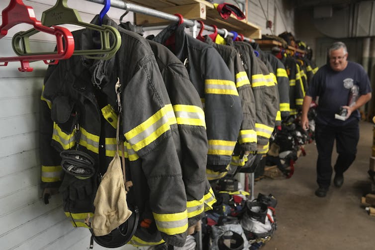


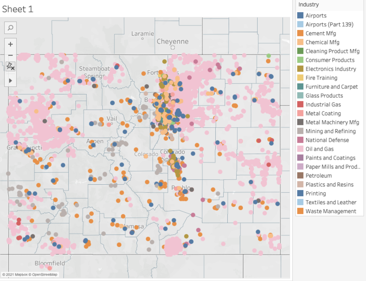

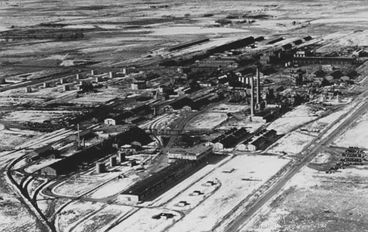


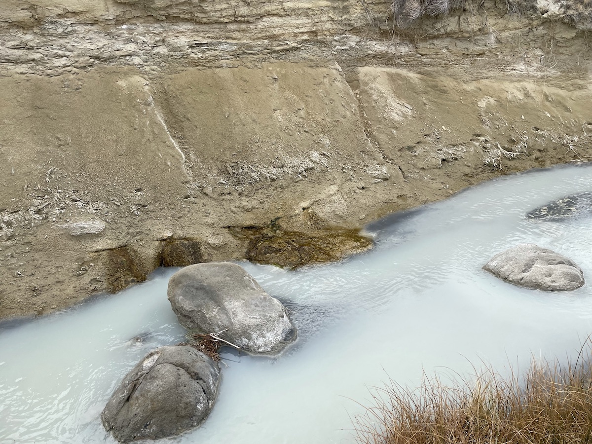
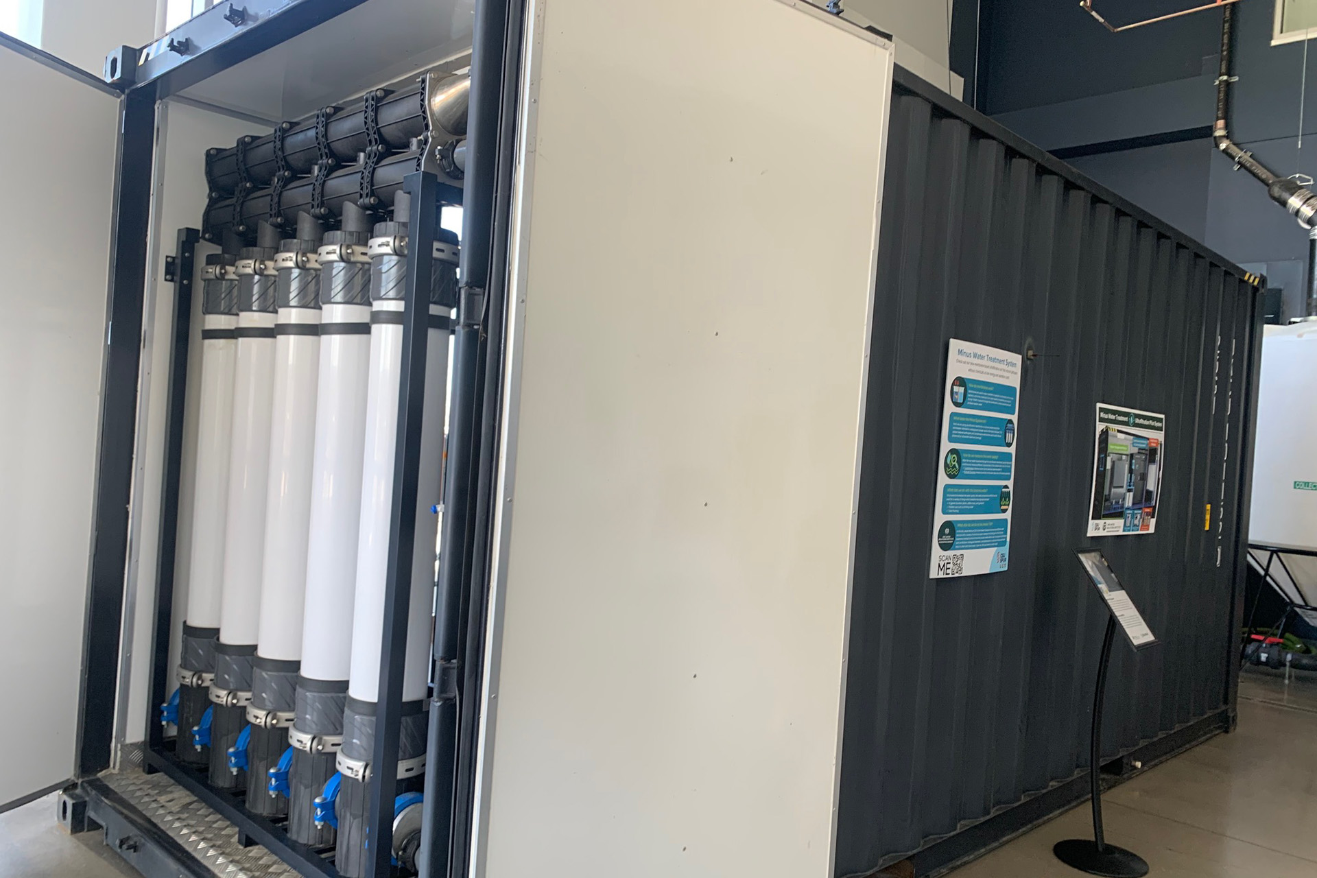
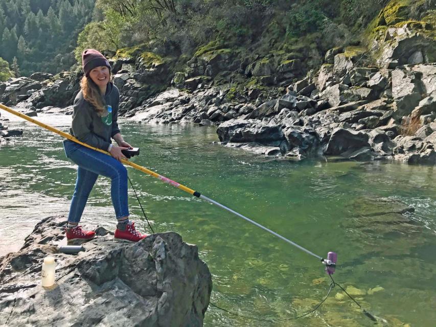


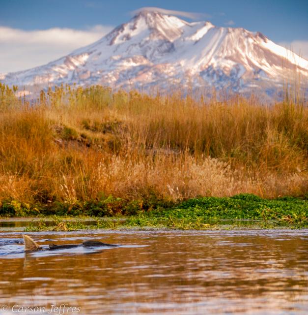
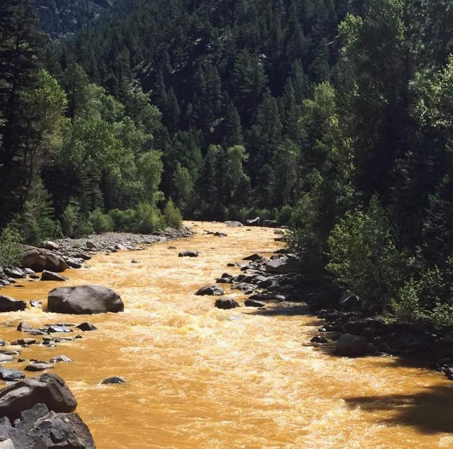


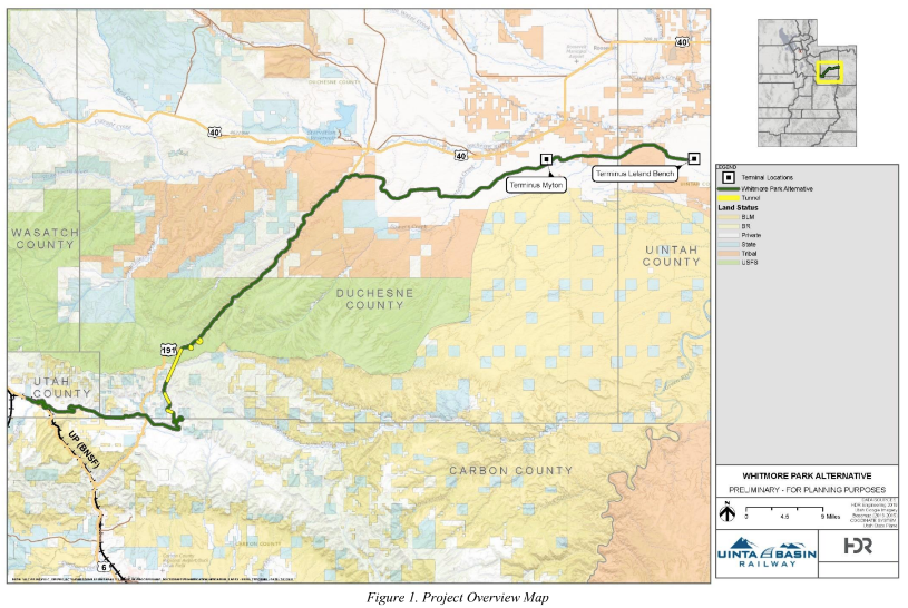
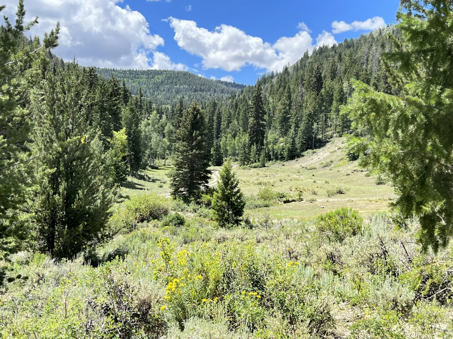
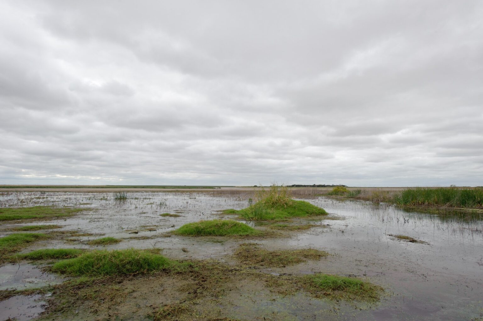

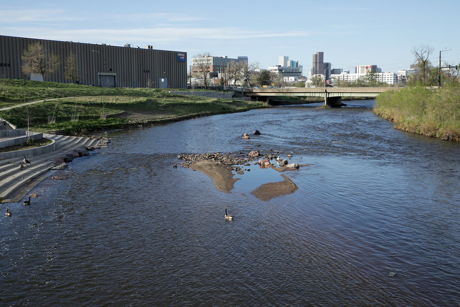


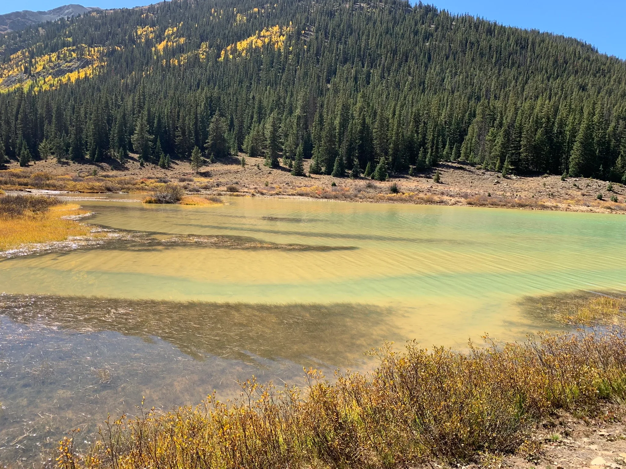


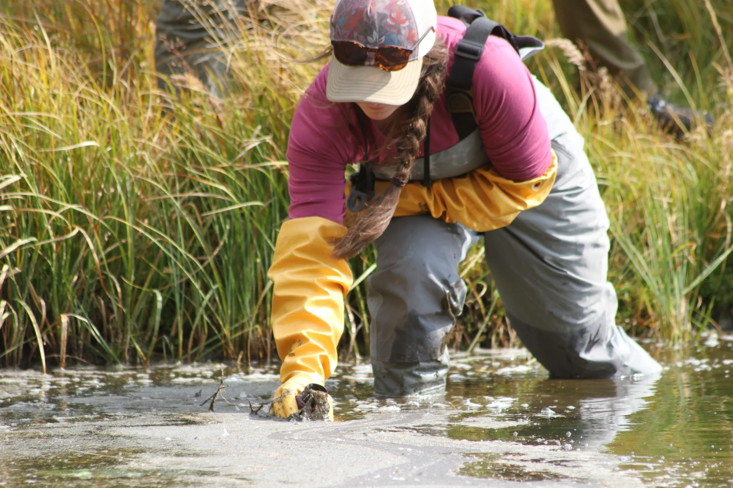


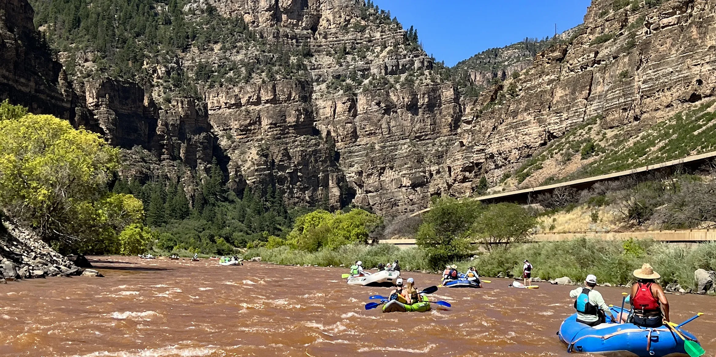


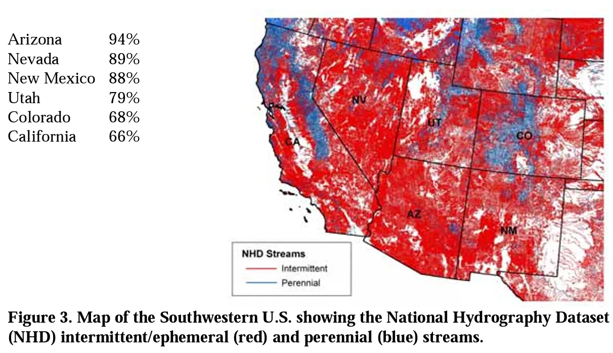
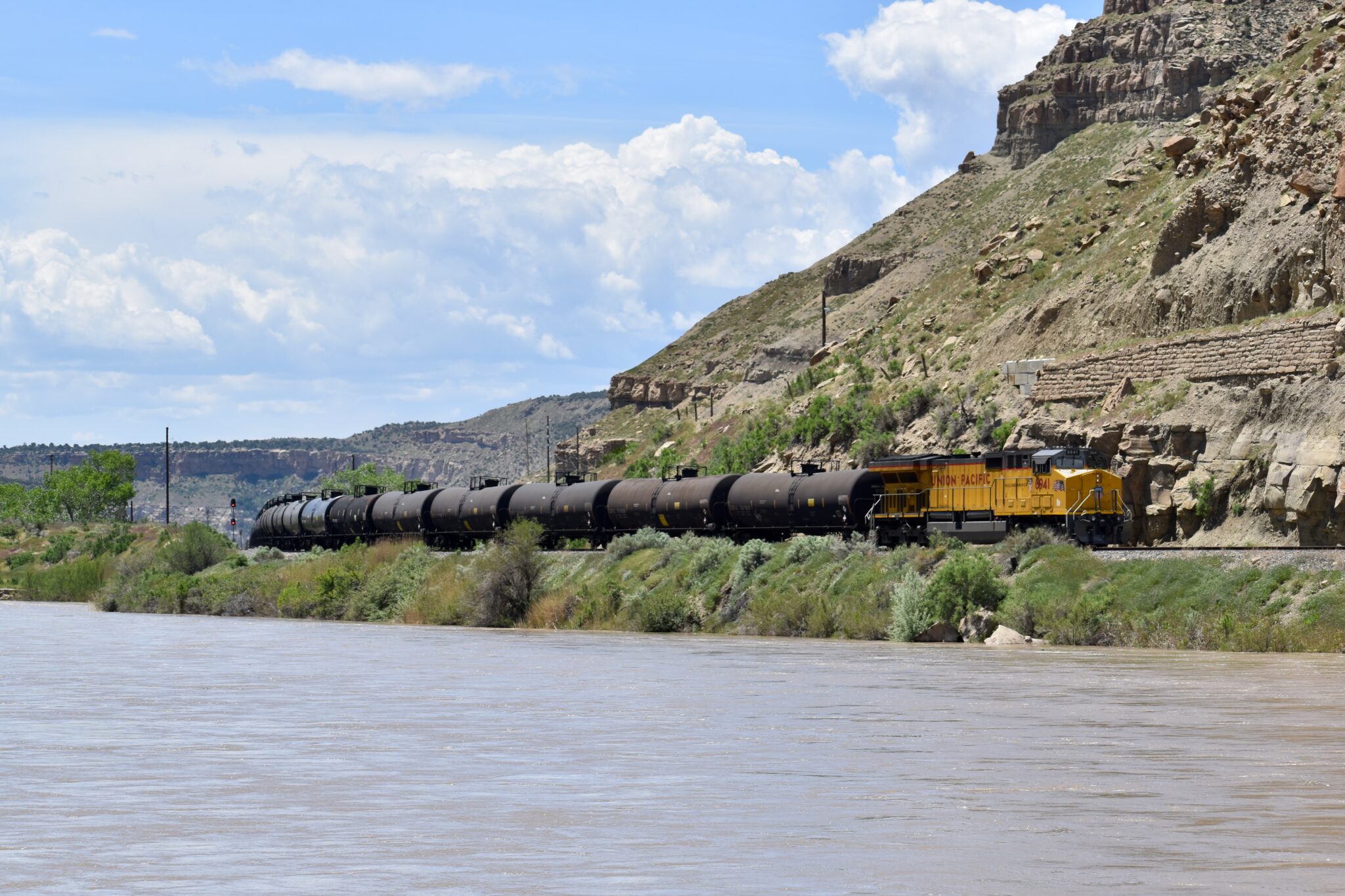
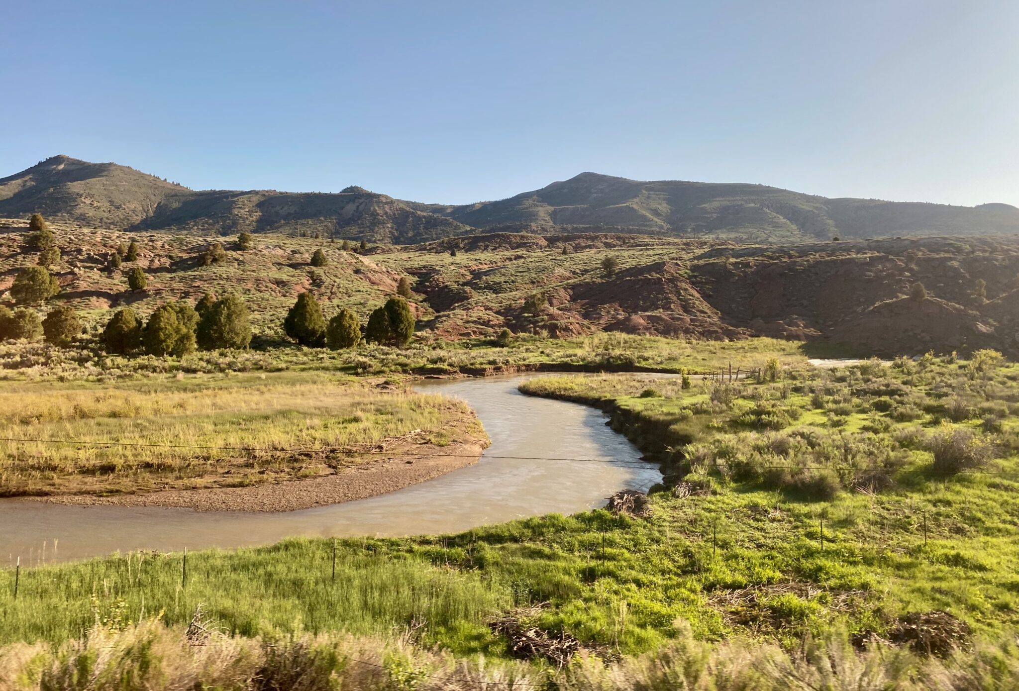
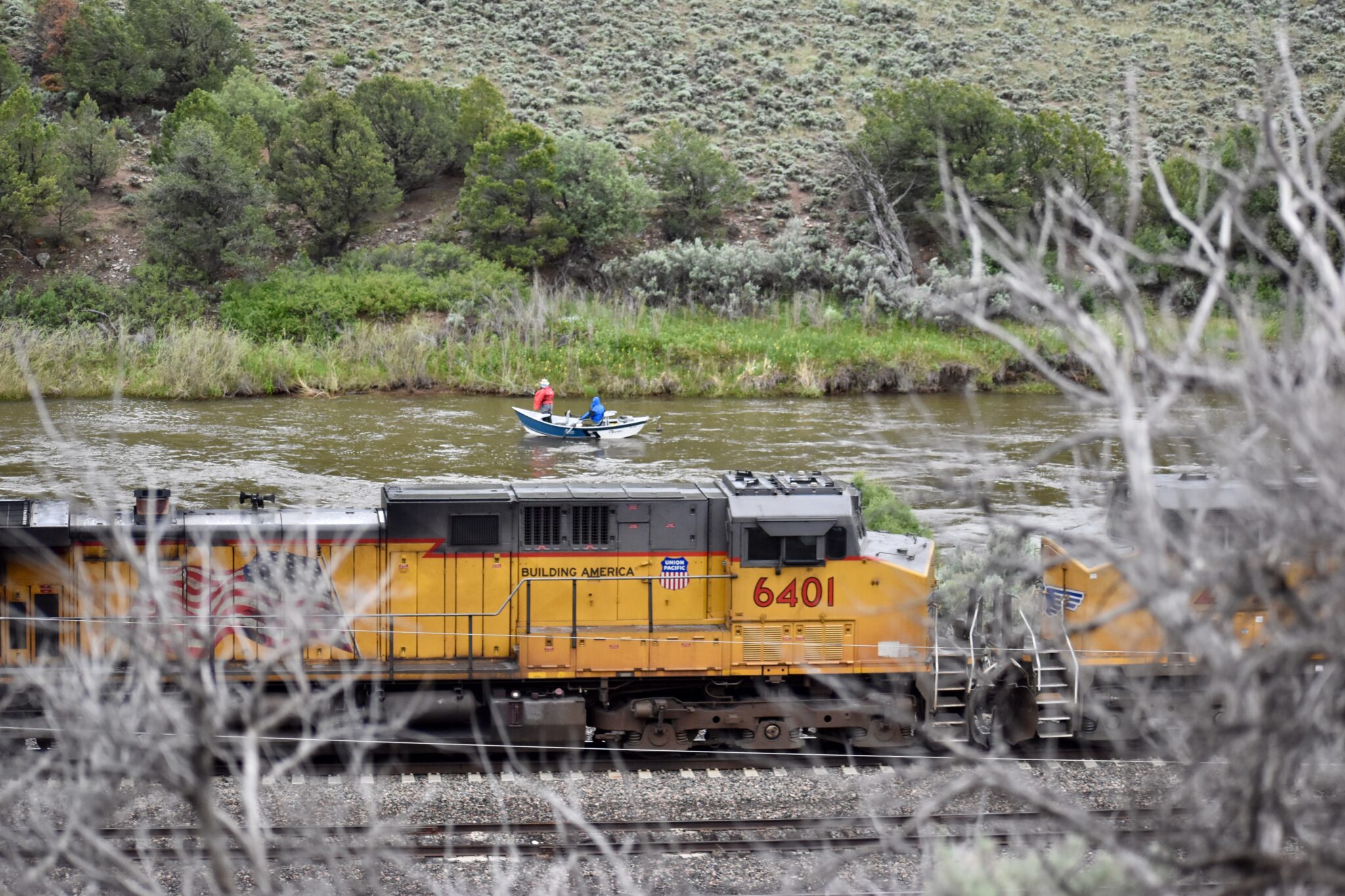
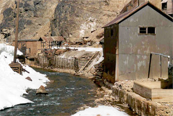
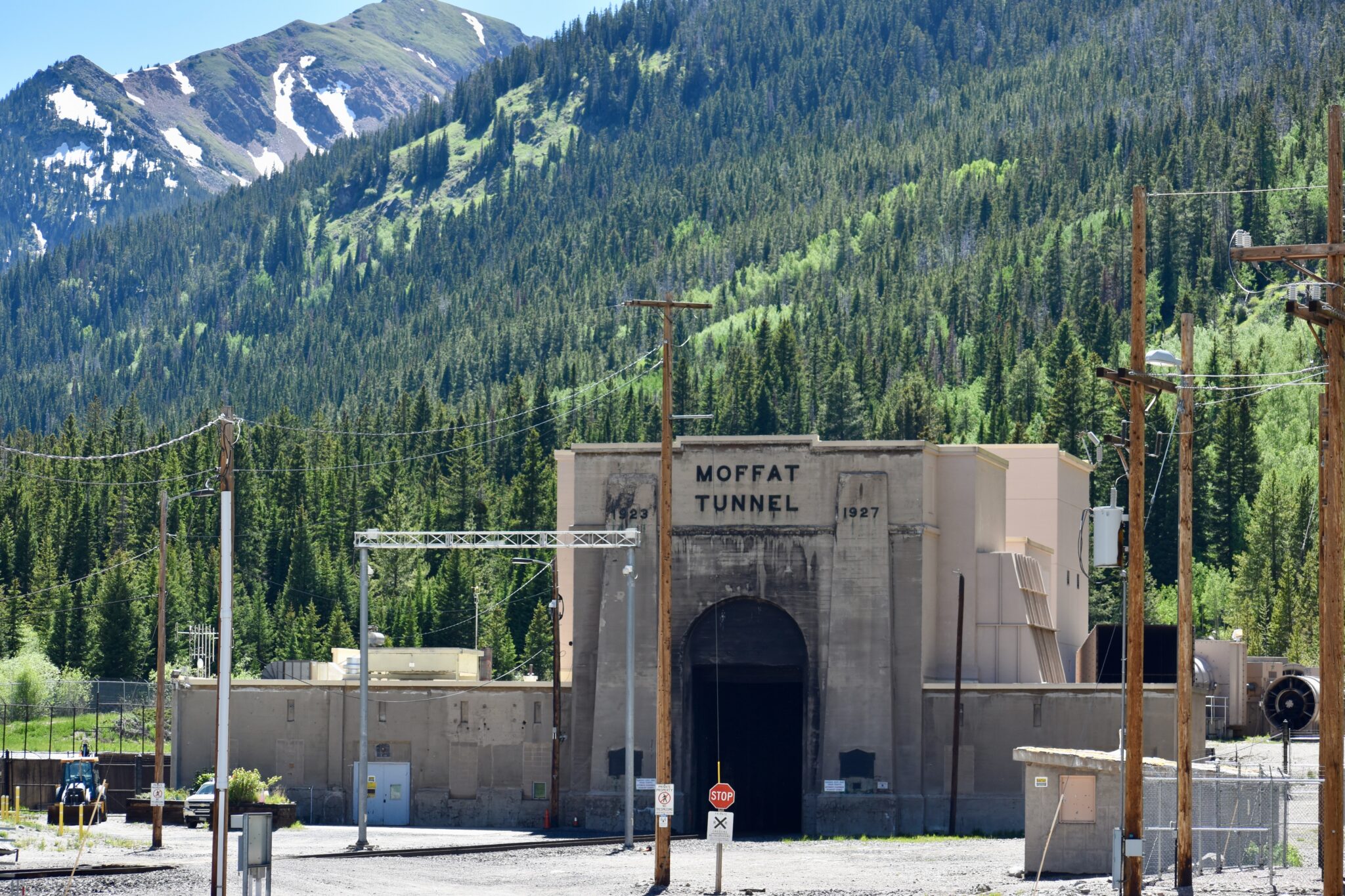
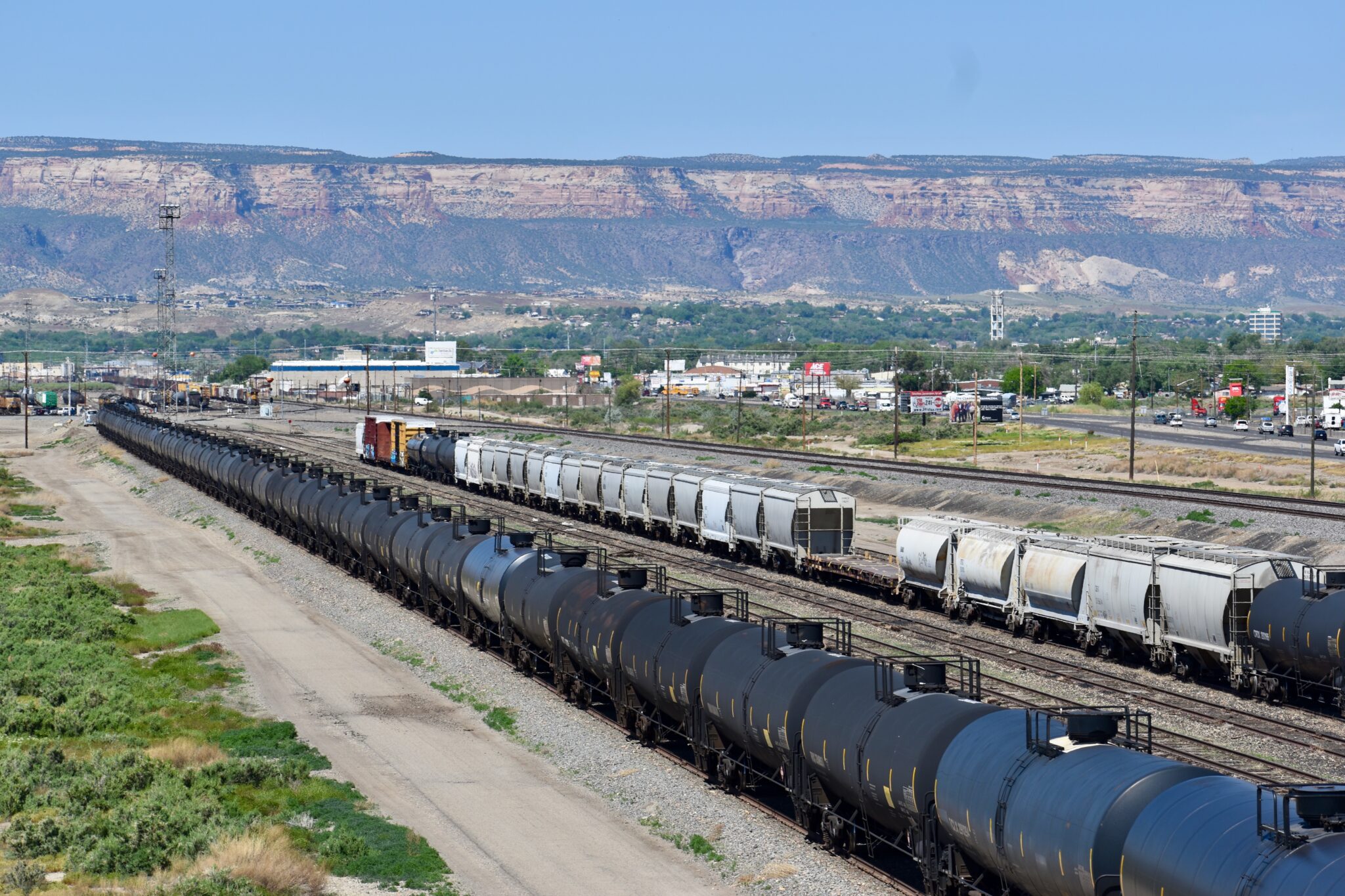
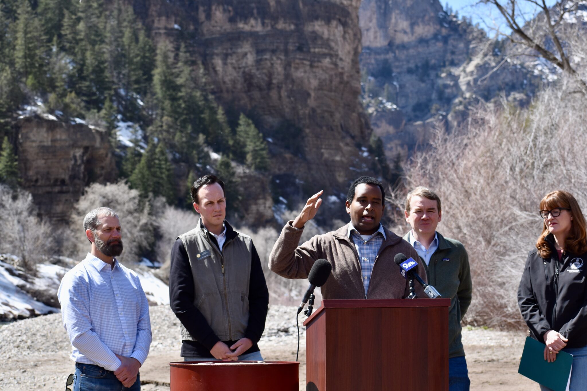

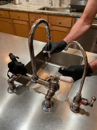
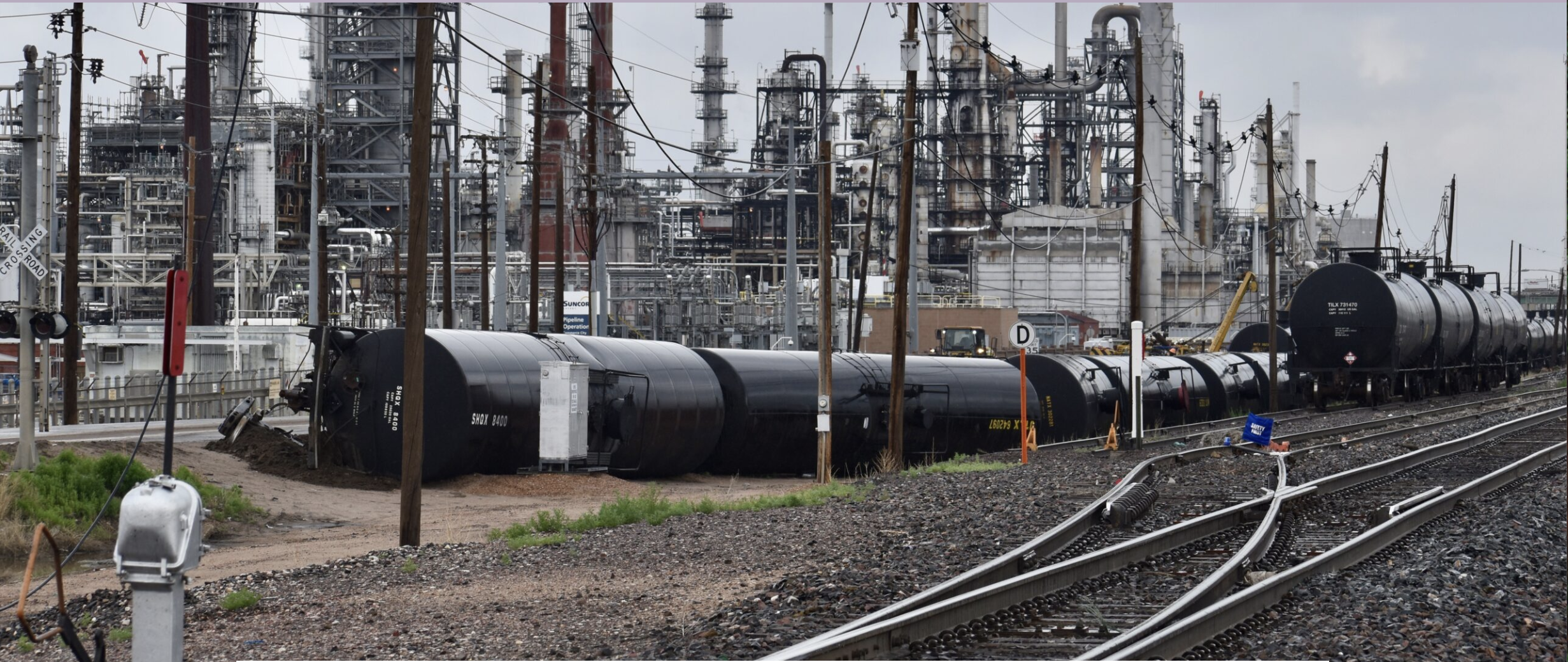

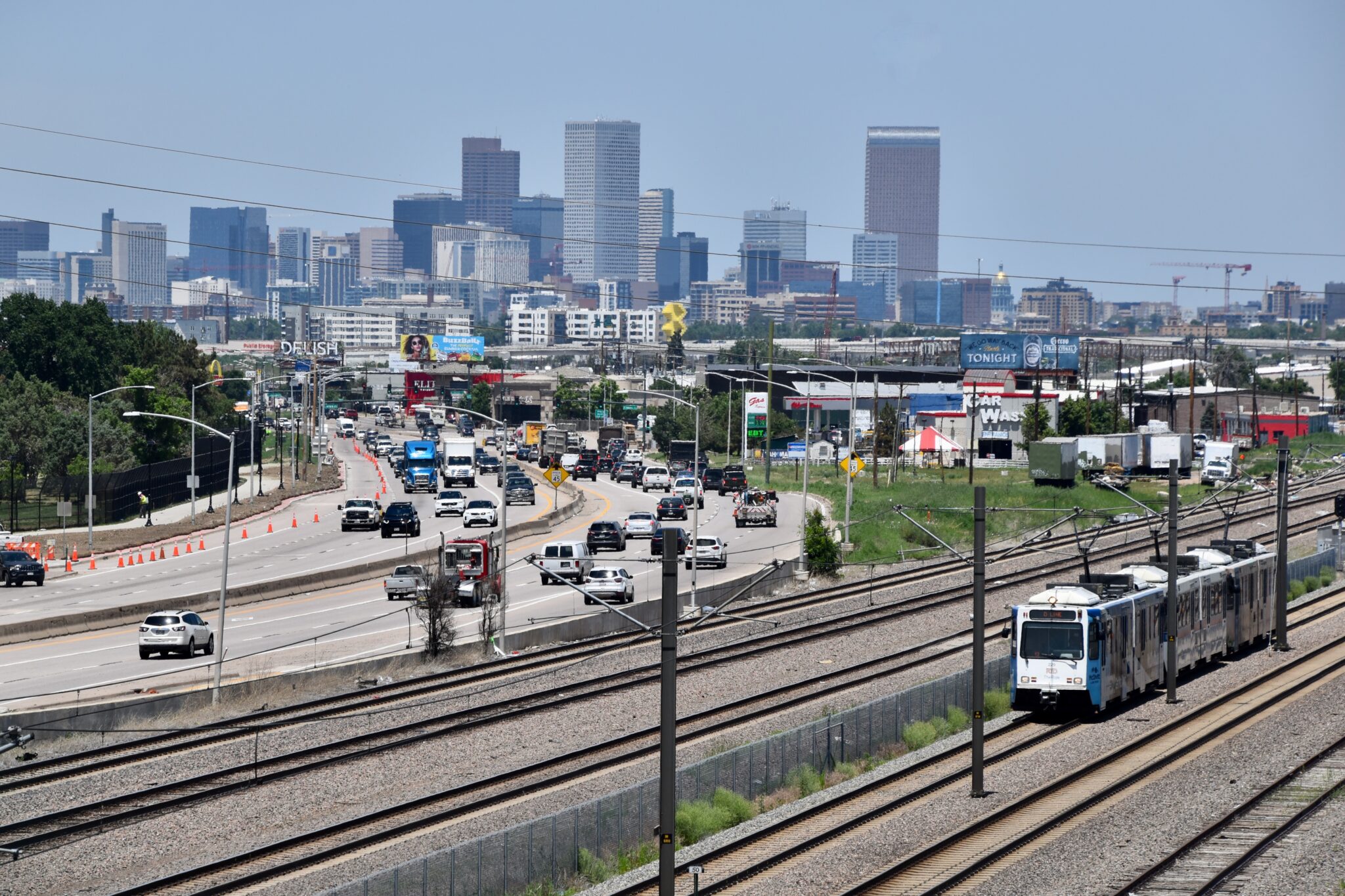
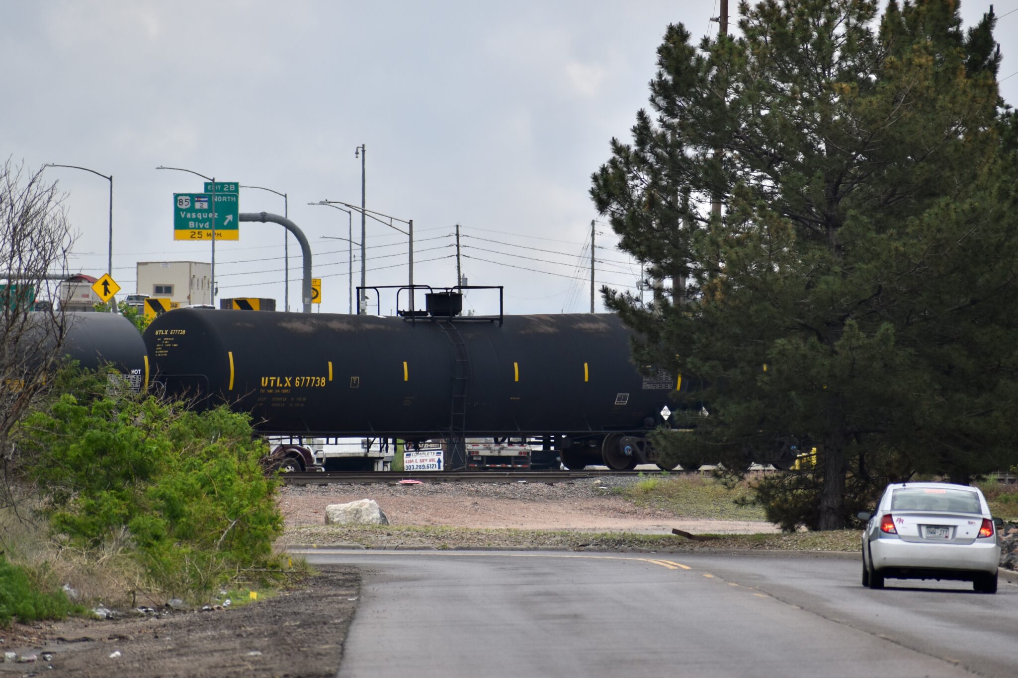
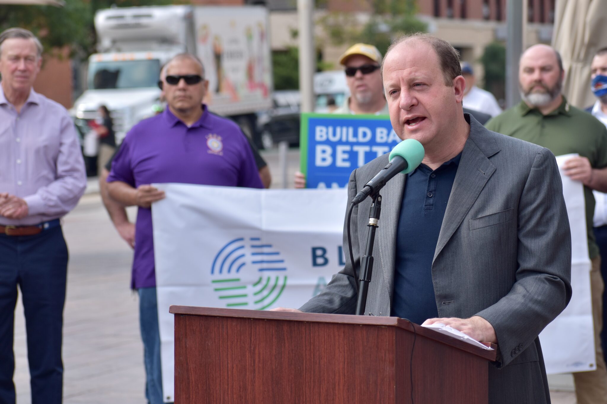
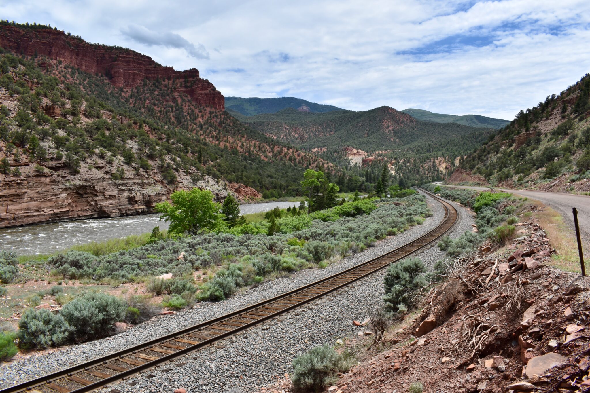
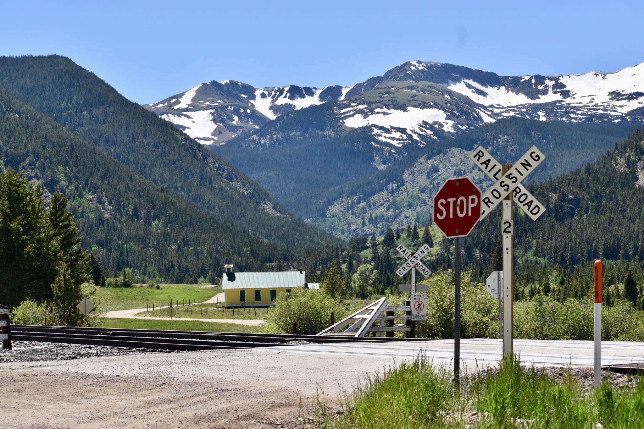
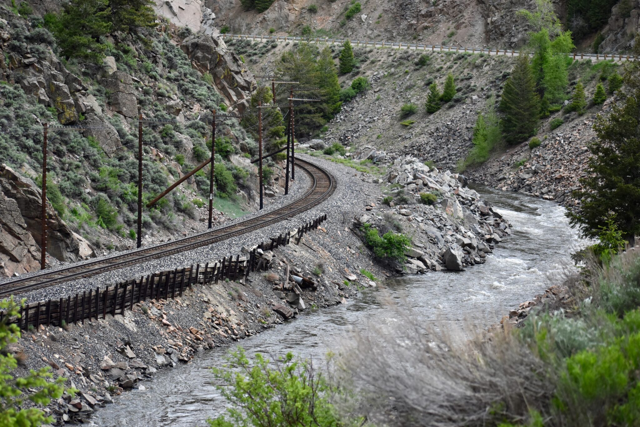
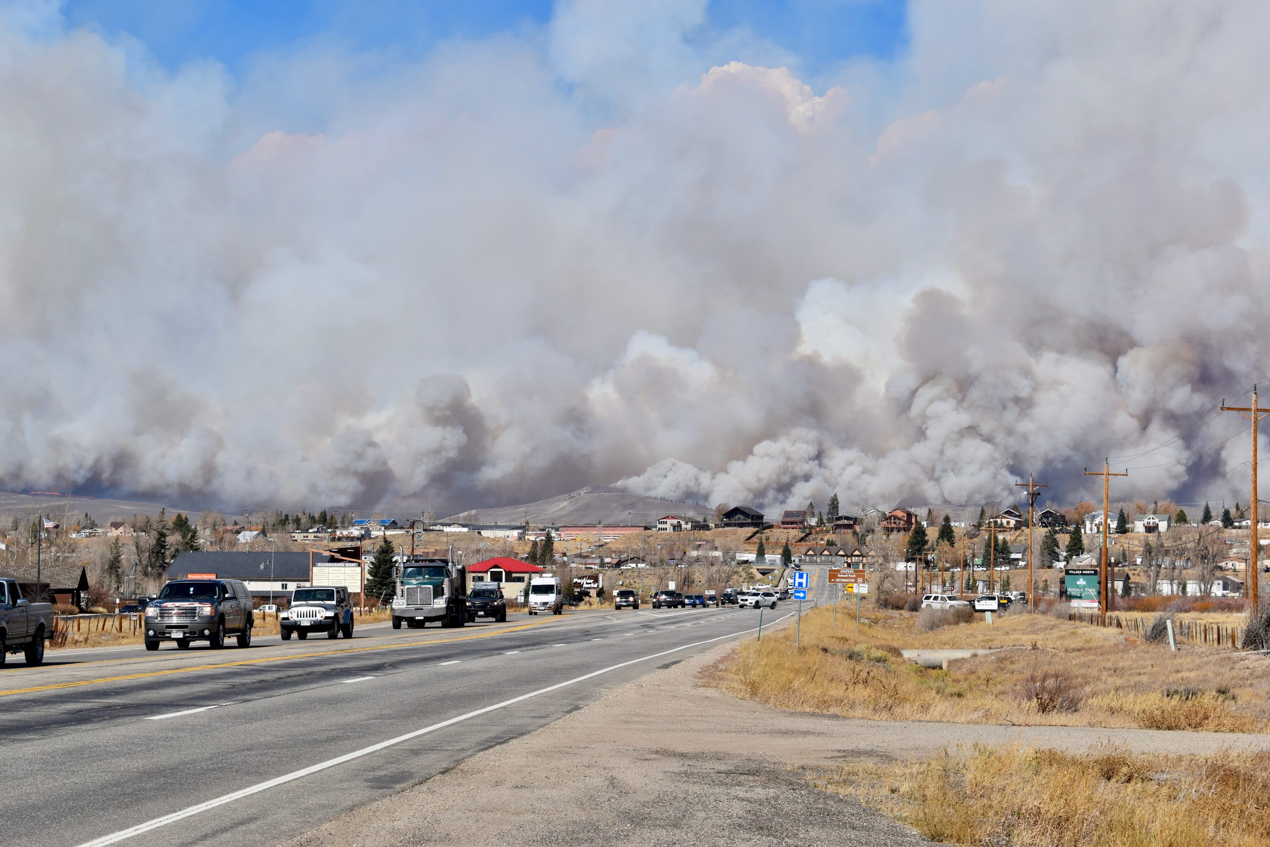
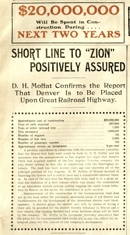

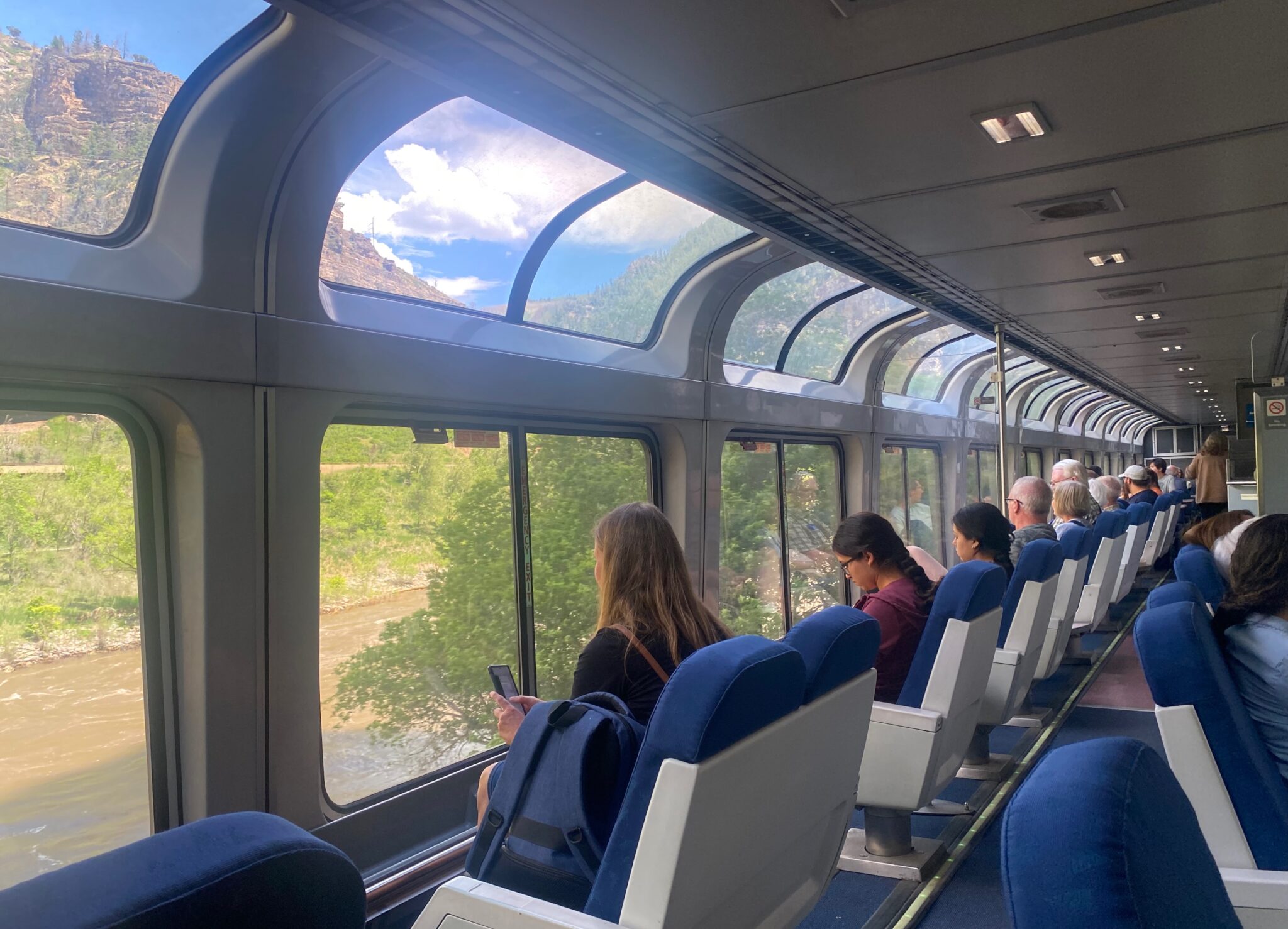
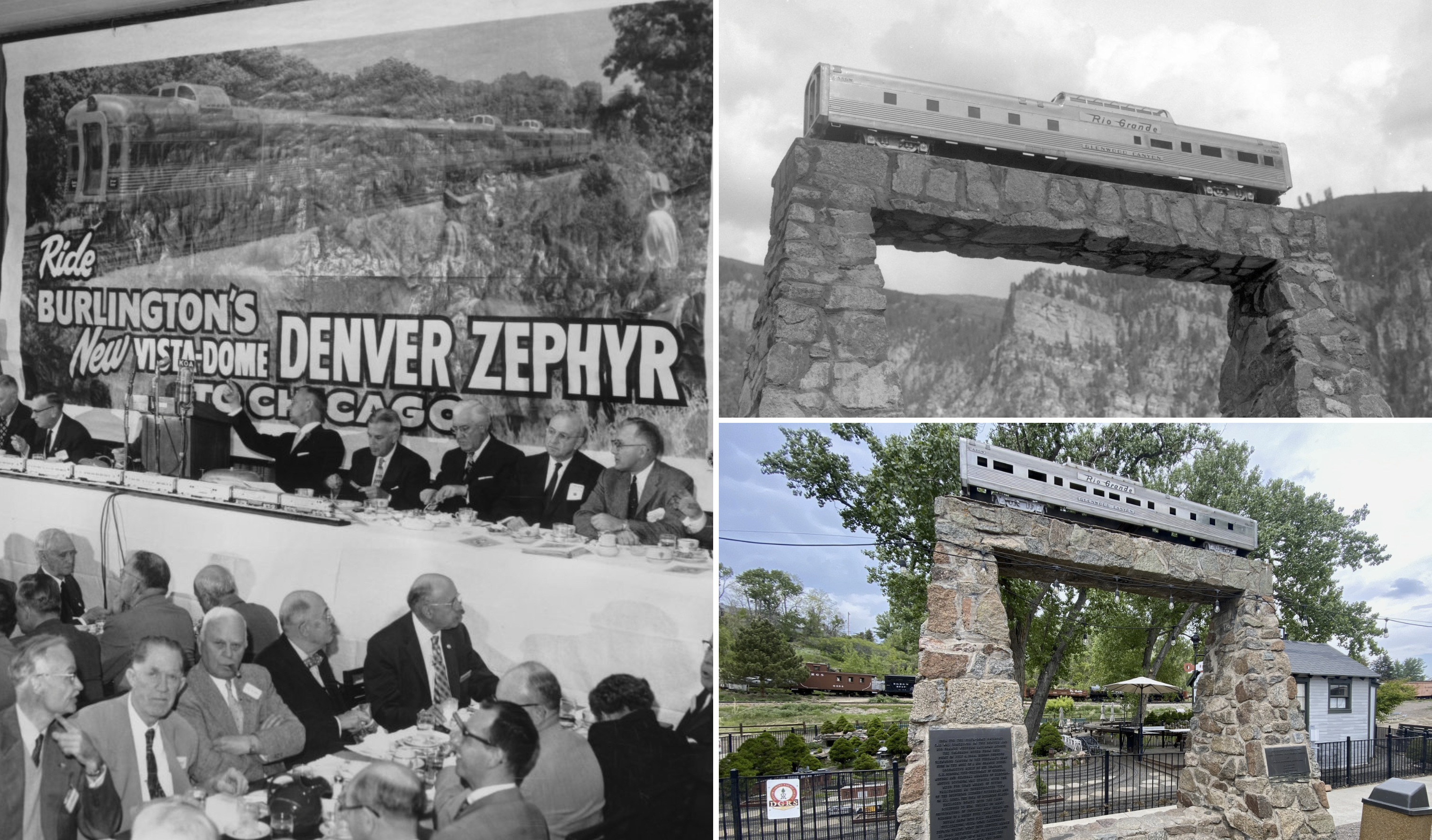
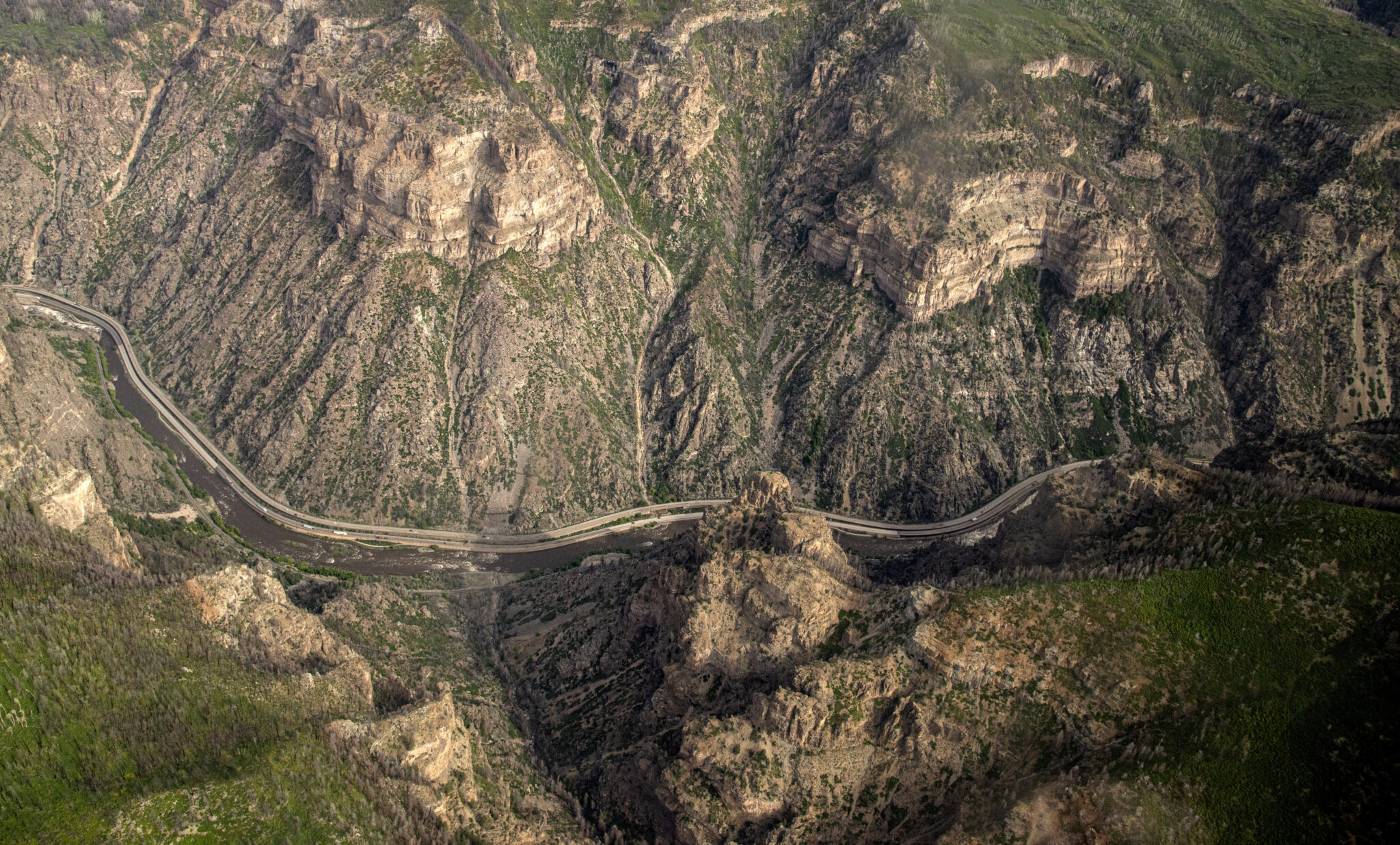
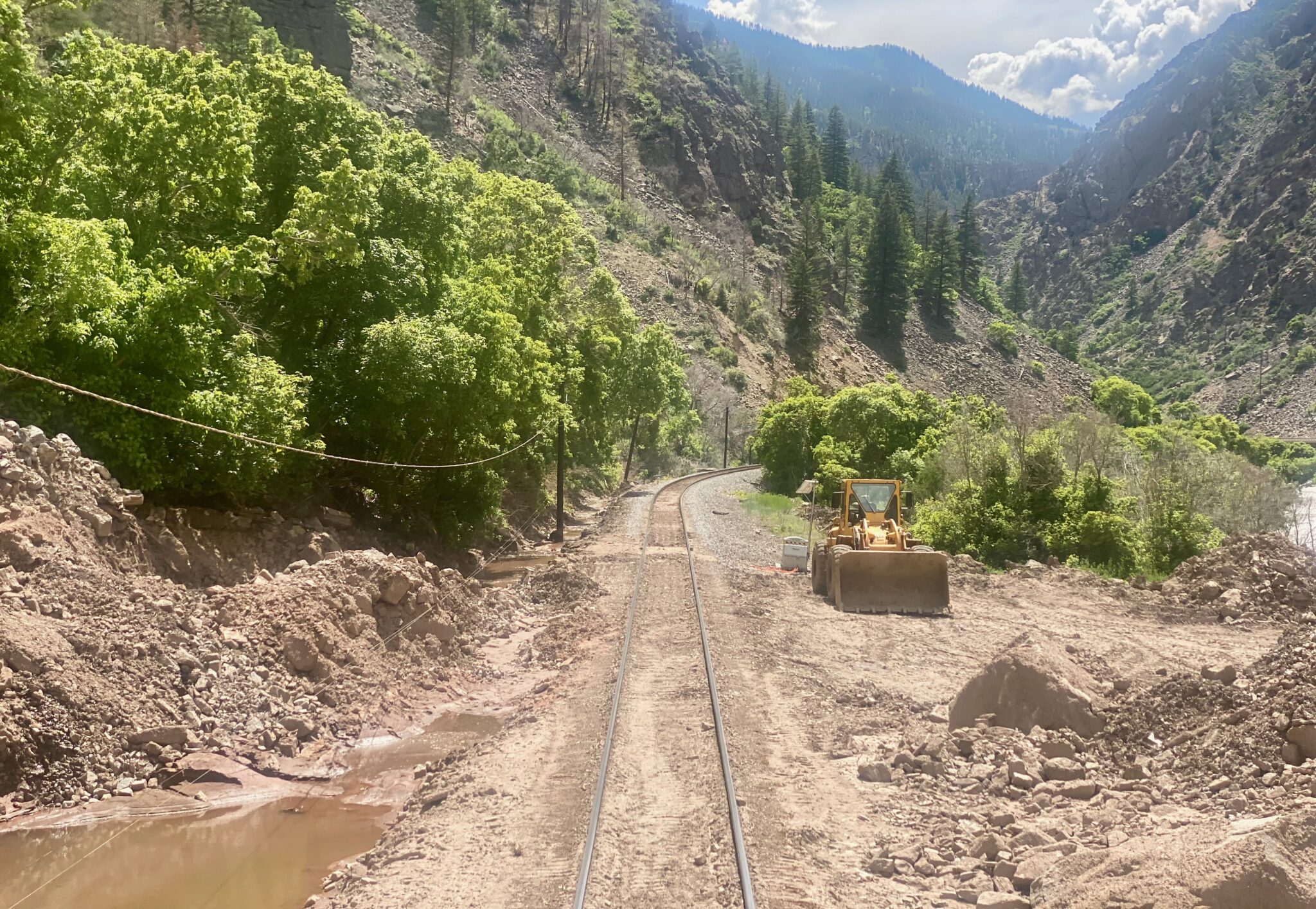
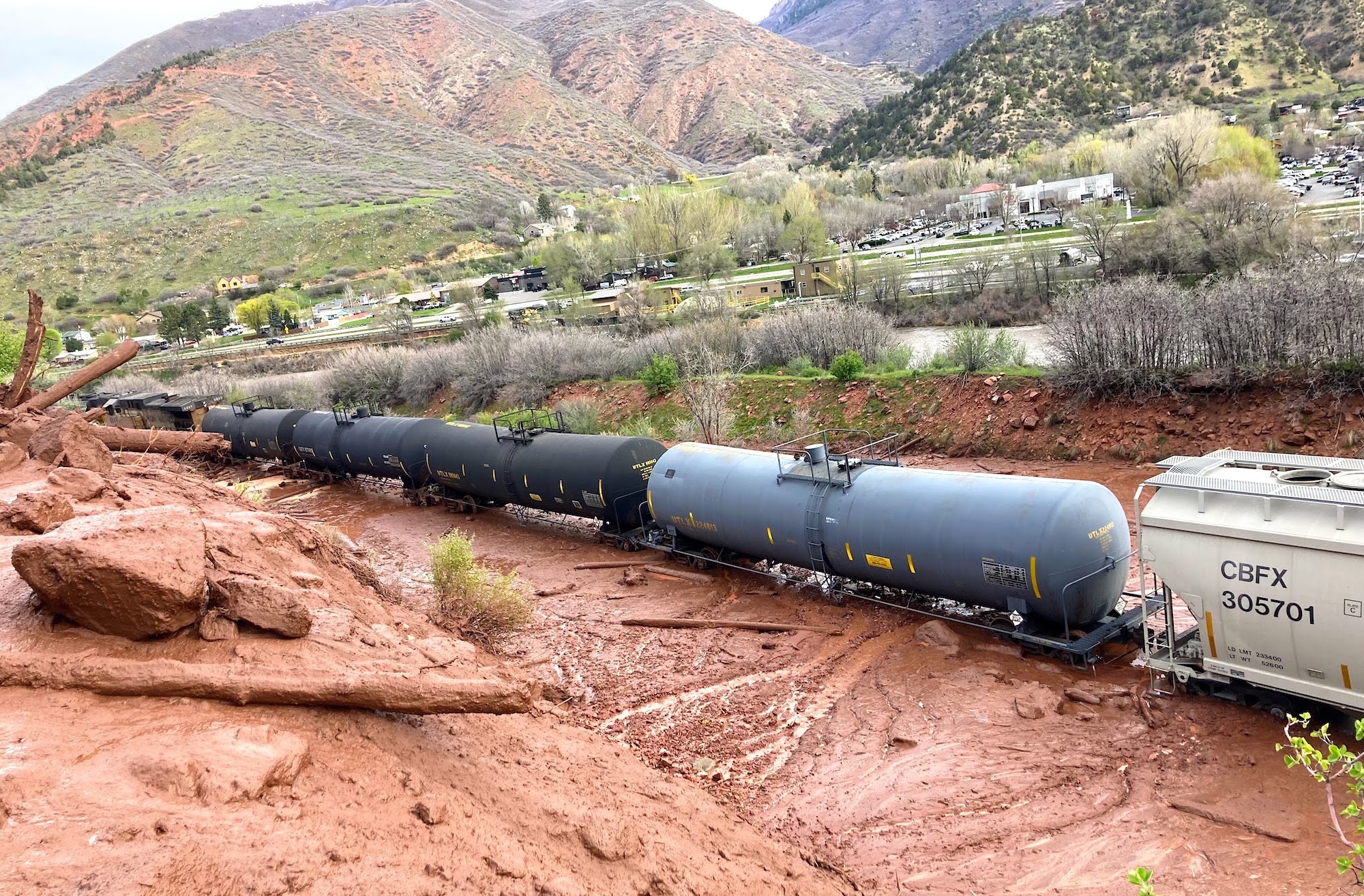
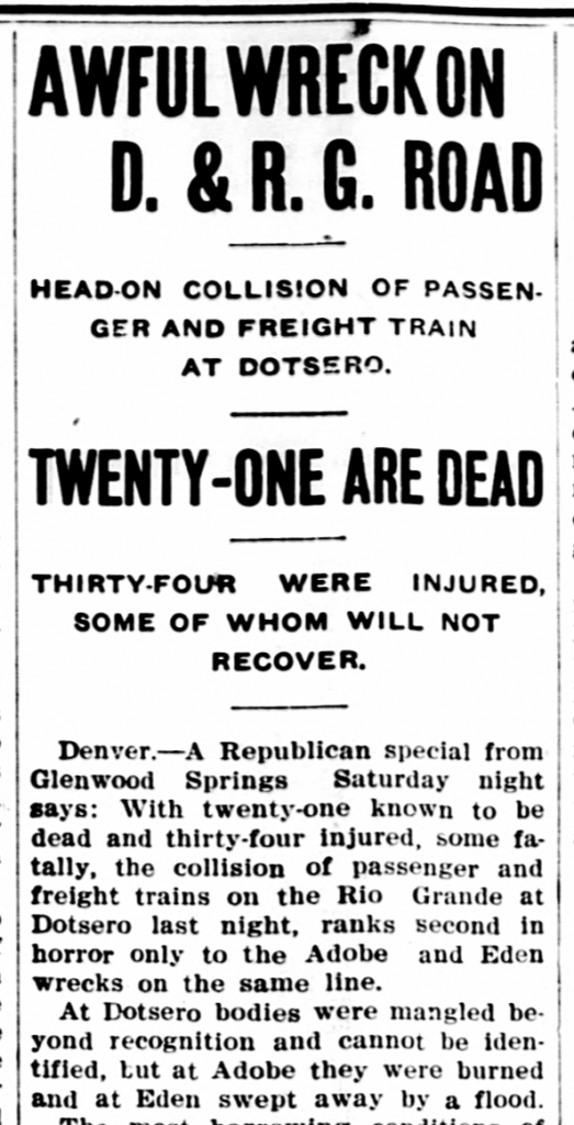
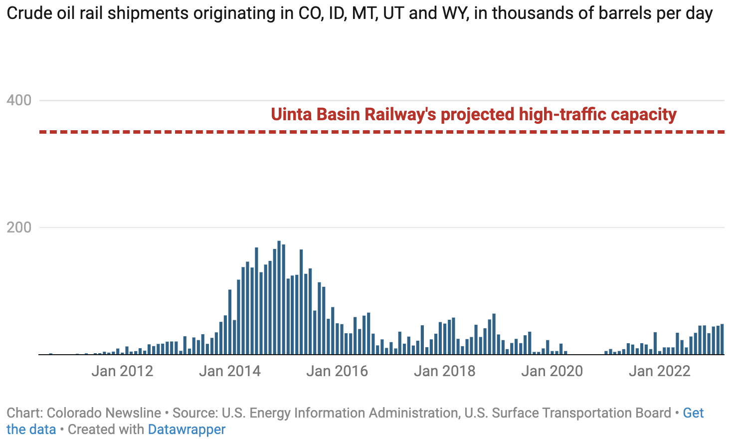
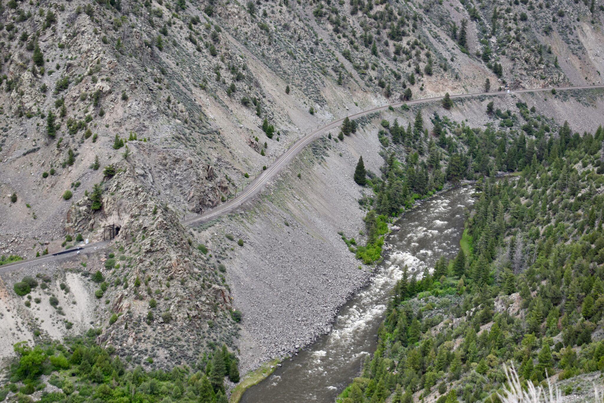

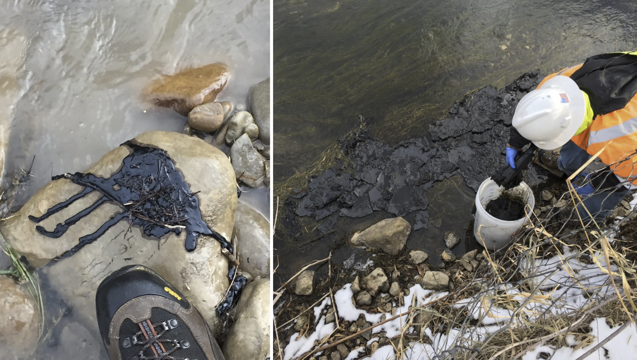


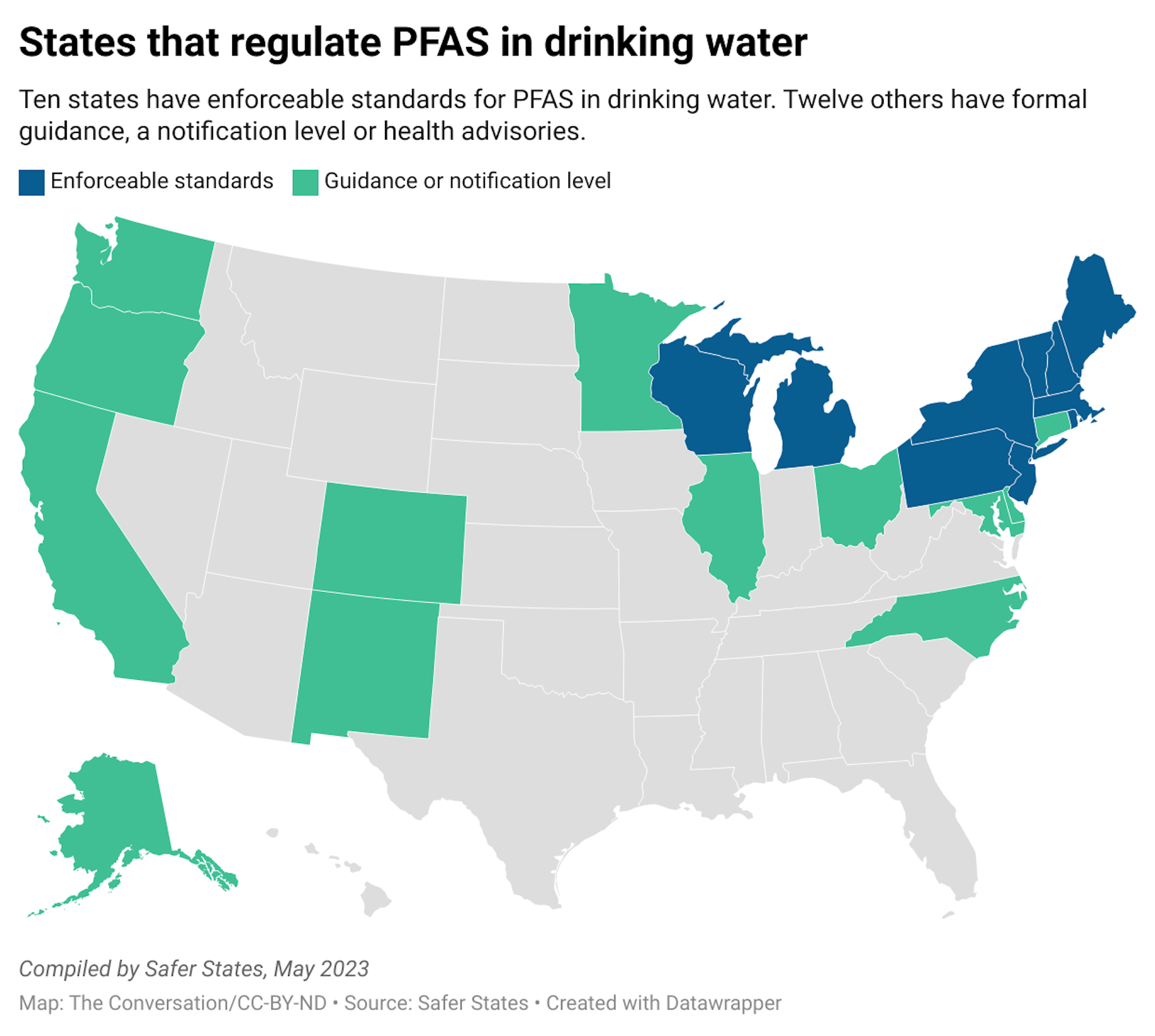