Release: #ColoradoRiver Water Supplies Cut in Upper Basin — Matt Moseley and Kendra Westerkamp (Upper Colorado River Commission) #COriver #aridification

Photo credit: Upper Colorado River Commission

Click the link to read the release on the Upper Colorado River Commission website:

October 8, 2025

As the Upper Division States negotiate ways to equitably and sustainably manage the Colorado Riverโ€™s future supplies, their water users face the harsh reality of living within the riverโ€™s 21st-century limits.

This year, in New Mexico, the San Juan Chama project received 31% of their normal Colorado River water supply, a 69% reduction, which is used by Albuquerque and Santa Fe, as well as for agricultural purposes.

โ€œThe San Juan-Chama Project contractors are absorbing unavoidable natural hydrologic shortages and have had to learn how to operate under constrained supplies, higher costs, and mounting climate pressures,โ€ said Diane Agnew, the Albuquerque-Bernalillo County Water Utility Authorityโ€™s Water Rights Program Manager. โ€œThis ongoing uncertainty in water availability is placing significant strain on water users, challenging infrastructure investments, and disrupting water management strategies that are critical to our communities and economy.โ€

In Colorado, the Dolores Water Conservancy Districtโ€™s water users faced cuts of up to 44%. Thousands of acres remain fallowed both on the Ute Farm & Ranch and north towards Dove Creek.

โ€œOur farmers are left with year-by-year gambles with last-second planning going late into May and limiting farmersโ€™ abilities to make long-term, successful crop rotation planning,โ€ said Ken Curtis, GM of the Dolores Water Conservancy District. โ€œThe Dolores snowpack is disappearing, and the historic runoff has dropped by even greater magnitudes. Water is no longer reliably available.โ€

2025 marks the fifth year out of the last eight years with shortages impacting the Conservancy District. Many acres have remained fallow since 2021, when available project water supplies dropped to zero. Local farmers did not have the time and resources to bring fields back into production prior to this current shortage โ€” all of their shortages are uncompensated and involuntary.

The District supplies water to the Ute Mountain Ute Tribeโ€™s Farm and Ranch Enterprise. The Tribe was forced to turn off irrigation spigots to 60% of their land and lay off farm workers. The crop plan for 2025 only included the existing, high-value alfalfa needed to sustain the Farm & Ranch Enterprise [FRE].

โ€œWe [FRE] are merely surviving, not adapting,โ€ said FRE irrigation manager Michael Vicente when responding to his view of the historic drought. Severe water shortages in Utahโ€™s Uintah Basin, driven by Colorado River cuts, are forcing ranchers to reduce cattle herds, raising production costs and straining the local economy.

โ€œSpring runo๏ฌ€ was dismal at best. Early 1900s era water rights only received a week or two of natural flow delivery. Shortages were so severe that in some basins, they even a๏ฌ€ected senior 1861 water rights.

These shortages are directly impacting cattle production,โ€ said Dan Larsen, Board Member at the Colorado River Authority of Utah. โ€œRanchers are being forced to cut back their herds, which not only raises costs for producers but also ripples through our entire local economy.โ€

Hydrologic shortage is also impacting Utahโ€™s Demand Management Pilot Program, which is exploring voluntary, compensated water conservation in the Colorado River system in Utah. For example, the Central Utah Water Conservancy District enrolled 4,500 acre-feet of water in the program; however, the water rights held by the District were cut in priority on June 8, much earlier than the typical mid-summer cut, resulting in only around 900 acre-feet being delivered to the Program.

Agricultural producers are weighing potential impacts from hydrologic shortage on their operations as they consider participating in conservation-related pilot programs Nick Sampinos, a farmer along the Price River, said โ€œPersistent drought conditions are a constant challenge, however, the Utah Demand Management Pilot Program has provided us with much needed assistance and set the stage for economic sustainability of our farming operation well into the future.โ€

In Wyoming, historic drought and Colorado River shortages have driven the Blackโ€™s Fork River down to a 1891 priority date, forcing the state to regulate o๏ฌ€ water rights to more than 52,000 irrigated acres in 2025 in that drainage alone.

โ€œThis year, more than 163,000 acres of irrigation were shut o๏ฌ€ in Wyomingโ€™s portion of the Green River Basin,โ€ said Kevin Payne, Division IV Superintendent of the Wyoming State Engineerโ€™s O๏ฌƒce. โ€œThis is an extraordinary reduction with serious impacts on producers and rural communities across southwest Wyoming.โ€

The Upper Basin has consistently used less than its legal entitlement through strict water administration. The four states of the Upper Basin remain committed to continued work in implementing and expanding water management initiatives, including accounting for conservation-related activities in 2026.

The Upper Basinโ€™s sacrifices arenโ€™t abstract; they carry real human and economic consequences. As Colorado River negotiations continue, Upper Basin leaders are clear: river operations must adapt to the actual supply and prioritize rebuilding storage to restore resiliency.


About the Upper Colorado River Commission (UCRC):

The UCRC is an interstate administrative agency made up of duly appointed representatives from the four Upper Division States of Colorado, New Mexico, Utah and Wyoming.

Map credit: AGU

Federal Water Tap, October 13, 2025: Underwater Dam again Built across #MississippiRiver in #Louisiana — Brett Walton (circleofblue.org)

Map of the Mississippi River Basin. Made using USGS data. By Shannon1 – Own work, CC BY-SA 4.0, https://commons.wikimedia.org/w/index.php?curid=47308146

Click the link to read the article on the Circle of Blue website (Brett Walton):

October 13, 2025

The Rundown

  • Army Corps, for fourth consecutive year, authorizes anย underwater damย to keep salt water from moving up the Mississippi River in Louisiana.
  • A cold-water flow experiment atย Glen Canyon Damย to disrupt non-native fish downstream will end within a week.
  • Senate passes aย defense spending authorization billย with water-related provisions.

And lastly, EPA sits on a โ€œforever chemicalโ€ toxicity assessment, ProPublica finds.

โ€œDo not make American families pay the price for Trumpโ€™s war on affordable American energy.โ€ โ€“ Sen. Martin Heinrich (D-NM) speaking on the Senate floor to rally votes to end President Trumpโ€™s national energy emergency. Heinrich and his Democratic colleagues faulted the White House for increasing electricity prices by cancelling wind and solar projects and fully supporting data center developments, which consume large quantities of electricity. Yet, the Democratsโ€™ effort to repeal the emergency declaration failed.

In context: Data Center Energy Demand Is Putting Pressure on U.S. Water Supplies

By the Numbers

River Mile 53.1: Approximate location of the front of the saltwater โ€œwedgeโ€ that is pushing up the Mississippi River, in southern Louisiana, according to the Army Corps of Engineers. If the wedge moves far enough upriver it will endanger drinking water supplies for communities that draw from the river. Chloride concentrations are higher in the trailing sections of the wedge. The Corps estimates that the point at which they exceed EPA drinking water standards is 15 to 25 miles behind the wedge front.

News Briefs

Saltwater Barrier
The Army Corps of Engineers, for the fourth consecutive year, has authorized the construction of an underwater dam across the bottom Mississippi River as a way of keeping salt water from the Gulf of Mexico from moving upriver and spoiling municipal water supplies.

A contractor is building the dam at river mile 64. As of October 10, the front of the saltwater wedge was estimated at river mile 53.1.

Salt water intrudes when river flows are too feeble to push it out. These low-flow conditions have happened in the late summer or early fall every year since 2022.

Because salt water is heavier than fresh, the intrusion happens along the bottom of the river, which is why the temporary earthen dam is placed across the river bed.

If salt water moves too far upstream, it will contaminate the water supply for communities whose intake pipes extend into the river. In 2023, the Army Corps barged 153 million gallons of fresh water to communities in southern Louisiana that were affected by the saltwater intrusion.

Senate Passes Defense Spending Bill
The Senate passed a bill that authorizes defense spending for fiscal year 2026. The bill also has a number of water-related provisions.

It requires the Defense Department to conduct a pilot wastewater surveillance study at four or more military installations. The goal is to test wastewater for substances that would identify drug use among service members or the presence of infectious disease. (Wastewater surveillance grew in prominence as a testing tool during the Covid pandemic.)

It establishes a working group on โ€œadvanced nuclearโ€ technologies that could power desalination facilities.

It requires a report on energy and water use for any data center built or expanded on military property.

It repeals a moratorium on the burning of PFAS substances, including firefighting foam.

The bill includes an amendment from Sen. Tim Kaine (D-VA) that requires NASA to pay for new drinking water wells for the Eastern Shore town of Chincoteague. The townโ€™s existing wells were contaminated with PFAS when the land was owned by the Navy. That land has since been transferred to NASA.

Studies and Reports

EPA Sits on โ€˜Forever Chemicalโ€™ Report
An EPA report on the toxicity of PFNA โ€“ one of the thousands of PFAS in circulation โ€“ was ready to be published in mid-April, ProPublica reports. But the agency has not yet released it.

PFNA is one of six PFAS that the Biden administration decided to regulate in drinking water. The Trump administration announced in May that it would attempt to reverse that decision for four of the chemicals โ€“ including PFNA.

On the Radar

Glen Canyon Dam Flow Experiment
The Bureau of Reclamation began releasing cool water from the depths of Lake Powell in mid-August.

The cold water is meant to disrupt smallmouth bass spawning downstream of Glen Canyon Dam. Smallmouth bass are a non-native species that federal agencies and their partners are attempting to rein in to protect threatened native species like the humpback chub.

The cold-water flow experiment is set to end by October 20.

Because the cold-water flows bypass Glen Canyon Damโ€™s turbines, the dam has been producing less power. That means more power purchased on the market. According to the Western Area Power Administration, which markets federal hydropower, purchased power expenses are โ€œsignificant.โ€ WAPA opposed the cold-water release plan, arguing the end date should be October 1, which would reduce purchased power costs.

Sales of hydropower fund the operation and maintenance of Glen Canyon Dam.

Federal Water Tap is a weekly digest spotting trends in U.S. government water policy. To get more water news, follow Circle of Blue on Twitter and sign up for our newsletter.

I was wrong about President Trump, okay!?: But I was right about “governance by spite” — Jonathan P. Thompson (LandDesk.org)

Carrizo Sunrise. Jonathan P. Thompson photo.

Click the link to read the article on The Land Desk website (Jonathan P. Thompson):

October 7, 2025

๐Ÿคฏ Trump Ticker ๐Ÿ˜ฑ

I was wrong, and woefully so. I want to apologize for that and let you know how remorseful I am: I dearly, dearly wish that I was right. But alas โ€ฆ

See, back in November I wrote a dispatch about what to expect from the incoming Trump administration, particularly concerning public lands and the environment. It actually turned out to be fairly accurate on the public lands stuff, but there was this one offending paragraph that, I fear, may have lulled some of my readers into complacency (when they should have been preparing to resist). Here it is:

Oh, boy. Trump has been in office for less than nine months, and already heโ€™s checked off all of the boxes that naive little me figured (and hoped) he would never dare even attempt. He and Goebbels-clone Stephen Miller and friends are going full-on fascist and trampling on the First Amendment and the U.S. Constitution in general, they are prosecuting political opponents, they are using the โ€œDepartment of Warโ€ to target the โ€œenemy within,โ€ they are suing and bullying the media for reporting the truth and making fun of him, and they have engaged in a brutal โ€” and performative โ€” intimidation and terror campaign against immigrants and anyone who โ€œlooksโ€ like they might be an immigrant. Making it even worse, the President of the United States treats it all like some sort of joke, acting like a pre-pubescent middle school bully while posting stupid videos portraying he and Russell Vought (a primary architect of Project 2025, which Trump disavowed during the campaign) as the grim reaper out to destroy Americaโ€™s democracy (and the economy).

So, yeah, I was way off. Apologies for my naivety.

But I was right about one thing. I predicted Trump would practice governance by spite. He has, and done it to the extreme. Not only are his words malicious, but so are his policies, fueled by a lust for vengeance. His tariffs are aimed at punishing other countries (even though they ultimately only punish American consumers and businesses โ€” even his beloved oil and gas industry).

His quest for โ€œEnergy Dominanceโ€ is anything but that. Sure, heโ€™s trying to help out his fossil fuel tycoon buddies, but I think heโ€™s even more interested in retribution against the โ€œlibsโ€ and the environmentalists that takes the form of an all-out assault on the environment, the climate, public lands โ€” and everyone who cherishes or depends on these things. If he wanted to bolster energy, he would have at least stood aside and let the burgeoning solar and wind do their thing alongside fossil fuels by taking an โ€œall of the aboveโ€ approach. Instead, he has done everything possible to stifle these energy sources, simply because they are cleaner than coal and gas. He shut down the Solar for All program, thus denying thousands of low- and middle-income families access to rooftop solar and a smidgeon of their own energy independence and lower utility bills. Whereโ€™s the dominance in that?

And now the Trump administration has canceled some $8 billion in federal funding for clean energy, efficiency, and grid reliability projects across the nation, many of them in the West. And while one might think that this is just another assault on clean energy (which it is), or maybe a way to slash expenses to pay for tax cuts for billionaires (that, too), itโ€™s primarily motivated by, yet again, revenge: The cuts were limited to states that voted for Kamala Harris in the 2024 election.

Yes, you read that correctly. While funding was zeroed out for blue states, identical projects in neighboring red states were left untouched. He is doing this to punish Democrat-leaning states, but the victims end up being small and large businesses that banked on those funds, the folks who work for those firms, the environment, and ultimately folks like you and me who will see our utility bills increase (because someone has to pay for those grid upgrades). And guess what? You wonโ€™t be saved just because youโ€™re in a red congressional district.

This is not normal, nor is it politics as usual.

In fact, the funding that the Trump administration is taking away from individuals, organizations, and businesses, was allocated by the Infrastructure Investment and Jobs Act and the Inflation Reduction Act, both of which Congress passed during the Biden administration. The vast majority of the funding from those bills went to Republican states and districts that voted for Trump in 2024. The funded projects created thousands of new jobs across the country and added up to billions in investment in communities in the Phoenix area, along Coloradoโ€™s Front Range, in Nevada, and elsewhere.

Iโ€™m not saying all of these projects were wonderful, or that theyโ€™d all succeed. Some were full on boondoggles, others would inflict more harm than good. But the funding was approved by Congress, and the organizations that received them were banking on them, had invested a great deal of their own money into the funded projects, and had built up workforces. For the administration to then take back the money, some of which had already been spent, for purely political, vindictive reasons, is both wrong and cruel.

And if you think that this is just for a bunch of solar panels, think again. Hereโ€™s a list of some of the biggest projects that were defunded (which includes some funds that Trump had previously cancelled).

  • $2.2 billion: Amount rescinded for hydrogen fuel production and distribution hubs in California and the Pacific Northwest.
  • $250 million: Amount clawed back from the Confederated Tribes of the Warm Springs Reservation of Oregon toย fund transmission and power grid upgrades.
  • $70 million: Amount rescinded from Xcel Energy toย installย 1,000 megawatt-hour iron-air battery energy storage systems in Colorado and Minnesota.
  • $50 million: Amount rescinded from the Tribal Energy Consortiumโ€™s Ignacio, Colorado-based program aimed at reducing methane emissions from tribal owned and operated oil and gas wells and facilities located on tribal lands.
  • $326 million: Amount rescinded from Colorado State University for aย projectdesigned to develop methods for reducing methane emissions from oil and gas wells.
  • $15 million: Amount rescinded from Kit Carson Electric Cooperative in northern New Mexico for a grid resilience project.
  • $6.6 million: Amount rescinded from Navajo Transitional Energy Company for studying and developing a carbon capture retrofit project for the Four Corners coal-burning power plant in New Mexico.

Hundreds of millions of dollars more are being clawed back from Portland General Electric, Southern California Edison, Tri-State Generation and Transmission, the Imperial Irrigation District, and the Electric Power Research Institute โ€” the list goes on and on. But it never extends to similar projects in red states.

Even as Energy Secretary Chris Wright was announcing the funding cuts, for example, his department went forward with a $2.23 billion loan for Lithium Americas and its contentious Thacker Pass mine in Nevada (which voted Republican in the last presidential election). In exchange, the administration took a 5% equity stake in both the company and in the firm. Never mind that the project is opposed by the Reno-Sparks Indian Colony, the Burns Paiute Tribe, and the Summit Lake Paiute Tribe, as well as by numerous environmental groups, and that the price of lithium is lower than itโ€™s been since 2021. Go figure.


๐ŸŒต Public Lands ๐ŸŒฒ

As expected (and as I correctly predicted would happen), the Trump administration is busy unraveling environmental protections and resource and travel management plans for public lands around the West. The most recent targets include:

  • The Bureau of Land Managementโ€™s Rock Springsย resource management planwhich covers about 3.6 million acres of public lands in southwestern Wyoming, including the Red Desert. A solid, common-sense plan was first released about two years ago that aimed to push energy and other development away from the most sensitive areas. It was years in the making, and was a compromise. And yet, Wyomingโ€™s right-wing was up in arms, saying it was too restrictive. That prompted the BLM to go back to the drawing board and incorporate more public input. They came back with a far less restrictive plan, a compromised compromise, I guess you could call it. Thatโ€™s not enough for the current administration and their industry donors, however: The BLM is going to revise it again, this time to bring it in line with Trumpโ€™s โ€œUnleashing American Energyโ€ agenda.ย More details and commenting instructions here.ย 
  • The BLM is โ€œreassessingโ€ the off-road route designations in its Labyrinth/Gemini Bridges travel plan that includes about 300,000 acres of slickrock-covered public lands near Moab. The new plan was issued late in 2023, and left a whopping 800 miles of roads and trails opened to motorized travel. The off-road-vehicle lobbyย sued to overturn the plan, but were shot down in court. You have until Oct. 24 toย comment on this one.

During water year 2025, drought moved into and intensified throughout most of the Interior West. Source: U.S. Drought Monitor.

๐Ÿฅต Aridification Watch ๐Ÿซ

The 2025 water year has come to an end (on Sept. 30), and while we know it was a fairly lousy one for most of the Western U.S., the data is now beginning to come in letting us know just how lousy it was. Some of the stats arenโ€™t updated yet, and may not be for a while, thanks to the government shutdown and the Trump administrationโ€™s fear of the word โ€œclimate.โ€ 

For the most part, the water year started out quite nicely, precipitation wise, with above โ€œnormalโ€ amounts of rain and snow falling in October and November. But that was followed by a severe lack of snow, a dry, warm spring, and a late-to-arrive monsoon. The snowpack deteriorated, spring runoff was weak, and drought intensified under the hot, dry sun of summer, with only a bit of relief finally arriving in September. 

Resulting low streamflows led to a 33-foot drop in Lake Powellโ€™s surface level during the water year. Here are the charts and the numbers:

  • 8.08 million acre-feet: Total Lake Powell inflows, water year 2024 (Unregulated inflows = 7.98 MAF)
  • 3,578 feet: Lake Powellโ€™s surface elevation on Oct. 1, 2024
  • 5.14 million acre-feet: Total flows into Lake Powell during the 2025 water year. (Unregulated inflows = 4.69 MAF)
  • 3,545 feet: Lake Powellโ€™s surface elevation on Oct. 1, 2025
  • 11.96 MAF: Inflows during water year 2023
  • 21.65 MAF: Inflows during water year 1984 (the highest since Glen Canyon Dam was completed in 1963).ย 
  • 9.85%: Percent of the Western U.S. that was experiencing severe to exceptional drought at the beginning of the 2025 water year.
  • 44.12%: Percent of the Western U.S. that was experiencing severe to exceptional drought at the end of the 2025 water year.


๐Ÿคฏ Annals of Inanity ๐Ÿคก

You just canโ€™t make this stuff up. MAGA-world is rife with conspiracies about the Charlie Kirk killing last month, which is hardly surprising. I guess itโ€™s tough for some folks to believe that some 22-year-old Mormon kid from a Republican, gun-loving family could assassinate a right-wing entertainer and provocateur on his own. He must have had help from that ever-elusive Antifa (which is not an organization, but simply a shortening of the term anti-fascist). Or maybe it was Mossad โ€” a favorite theory among a certain sect of the right wing. 

But then thereโ€™s Candace Owens, MAGA podcaster and Crazytown mayoral candidate. Sheโ€™s raising the possibility that Phil Lyman was involved in the plot to assassinate Kirk. Yes, that Phil Lyman: the former San Juan County Commissioner who gained notoriety after leading an ATV ride โ€” with Ryan Bundy and his โ€œmilitiaโ€ buddies making a cameo โ€” down Recapture Canyon just days after the Bunkerville standoff. Lyman has since swerved further and further into MAGA-land, served as a Utah state representative, received a pardon from Trump, and hurled some conspiracy-laden accusations of his own after losing the gubernatorial election to Gov. Spencer Cox. 

I tried to listen to Owensโ€™ argument and alleged evidence (including the link, with a suggestion not to click on it) regarding Lyman and couldnโ€™t make any sense of it. But I guess Owensโ€™s following is big enough for folks to take it kind of seriously. Even Cox, whom Lyman has assailed with accusations of his own, took to social media to defend his right-wing rival. Meanwhile, Iโ€™ll be making some popcorn while I wait to see how this one plays out.

Just Add Water: The Jasper Lake Donation and a New Model for Water #Conservation in the West — Kate Ryan & Matt Moseleyย (#Colorado Water Trust)

Jasper Reservoir from dam. Photo credit: Colorado Water Trust

Click the link to read the article on the Colorado Water Trust website (Kate Ryan & Matt Moseley):

September 16, 2025

Introduction

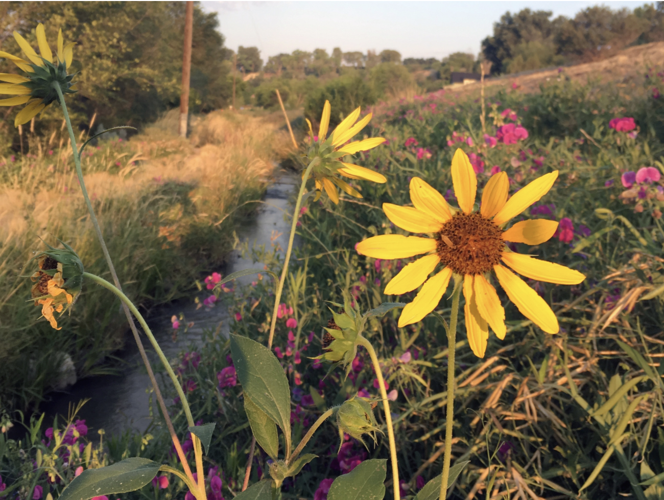
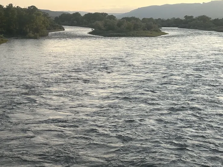
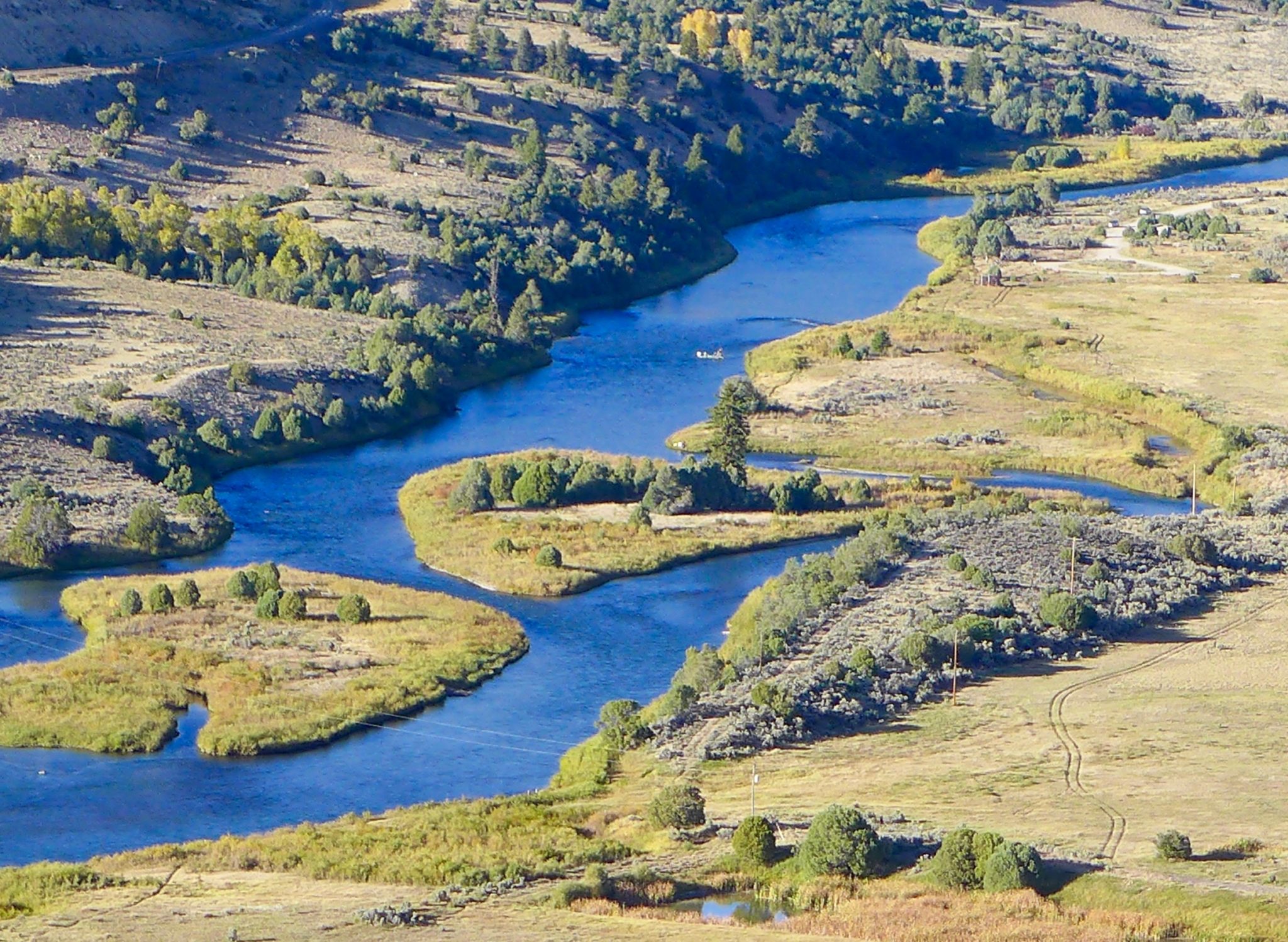
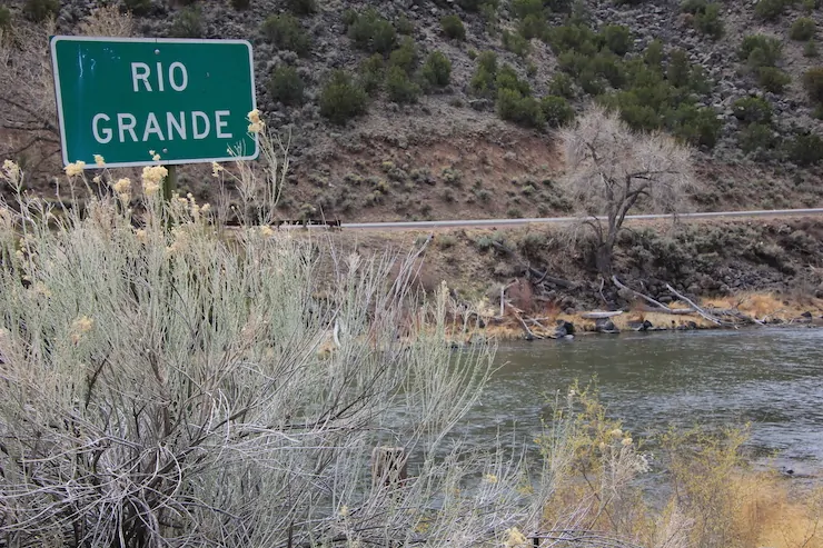
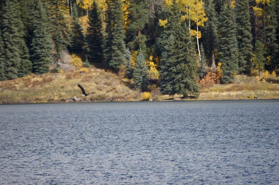
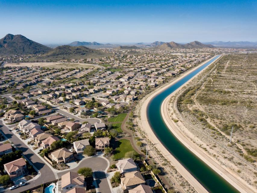
In an era where climate change and overconsumption threaten our waterways, a remarkable act of generosity and foresight has emerged from the Indian Peaks Wilderness area of Colorado. On August 29, 2024, an anonymous donor gifted Jasper Lake, including the parcel of land surrounding it and the senior water rights it stores, to the Colorado Water Trust. This marked the largest water donation in Coloradoโ€™s history.  This act ensures the protection of 37 miles of Boulder Creek, safeguarding its flow, ecosystems, and recreational value for generations to come.  Since 2024, 100 million gallons of water have been restored to the river as a result of this donation, and the annual benefit will continue to accrue to Boulder Creek streamflow indefinitely.  A warming climate will continue to put pressure on Boulder Creek, but this source of water will be protected forever.

Over the past 25 years, the Colorado Water Trust has restored 27 billion gallons of water to 814 miles of rivers and streams throughout Colorado.  Here is how it works: Much like a land trust can invest in conservation easements to protect property for future generations, the Colorado Water Trust invests in water rights to protect streamflow in our rivers. Water in Colorado is not only the lifeblood of our state and economy, but the right to use it can also be bought and sold.  Instead of diverting water out of the river, the Water Trust uses water rights to protect that water in the river.

In the western United States, where water scarcity is an ever-pressing reality and climate change threatens to exacerbate hydrological extremes, the permanent donation of storage water from Jasper Lake to environmental benefit marks a profoundly important milestone.  This is not merely a gift of water; it is a precedent-setting, visionary act that fuses water law ingenuity, ecological foresight, and an ethic of stewardship.  In an era dominated by competing interests and escalating scarcity, the Jasper Lake donation offers a replicable path forward for other Western states grounded in cooperative frameworks, legal adaptability, and the kind of selfless generosity that serves the public interest.

Jasper Lake Donation

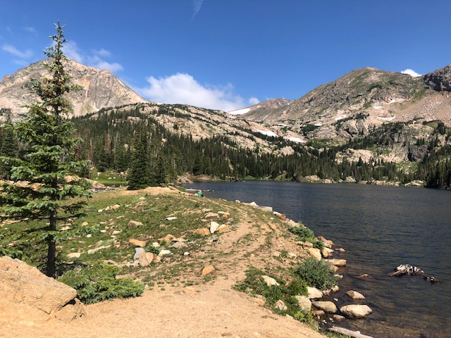
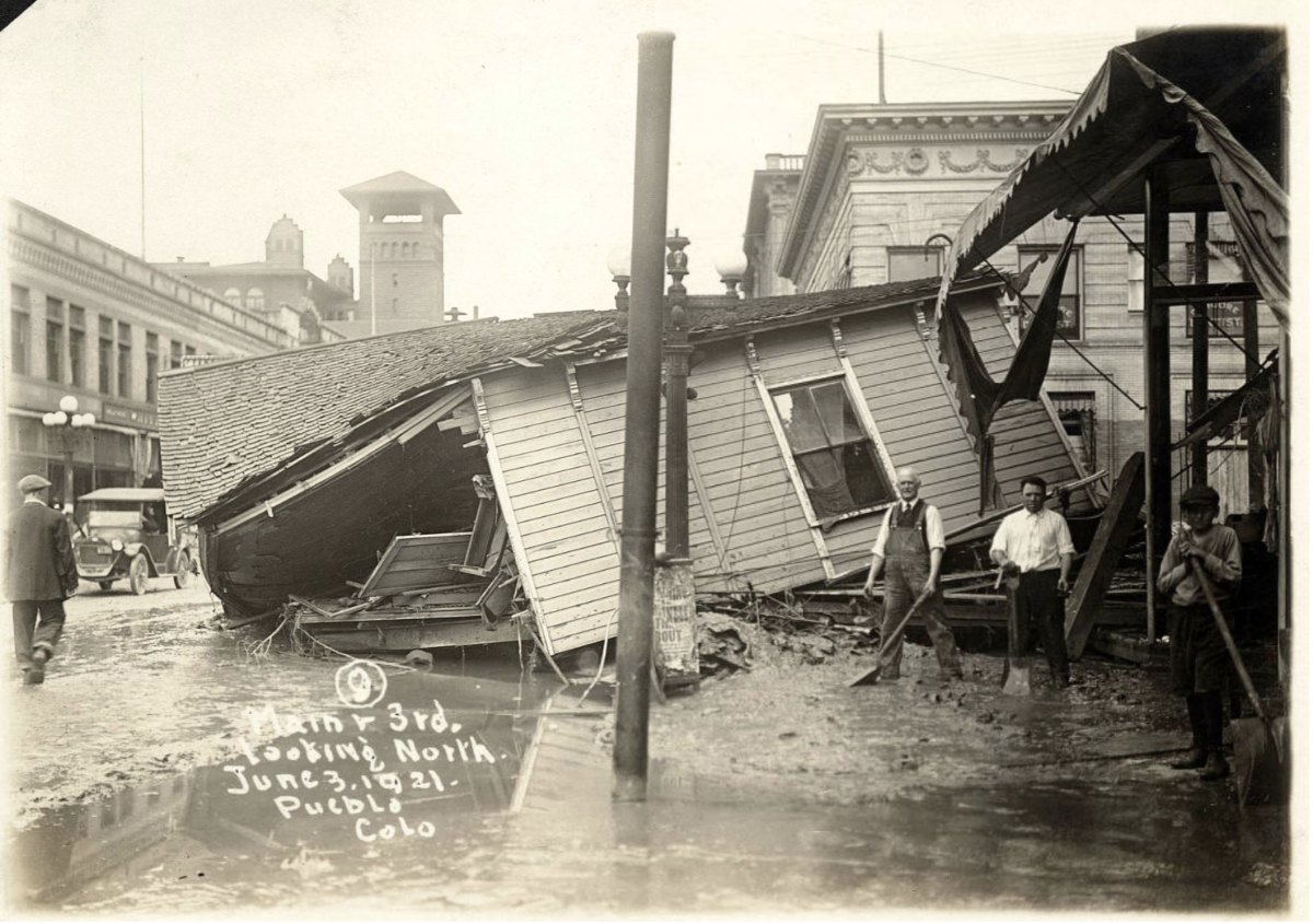
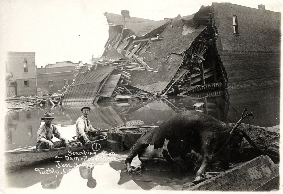
In 1890, nearly a century before Congress designated the Indian Peaks Wilderness as a part of the nationโ€™s Wilderness Preservation system, the Boulder High Line Canal Company constructed Jasper Reservoir.  Known to hikers and wilderness visitors as Jasper Lake, the reservoir has been a source of agricultural water in Boulder County and areas east of the mountains since that time. Nestled just east of the Continental Divide, this enclave for cold-water fish, moose, and backpackers doubled in purpose. Irrigation companies and the Colorado Power Company operated the reservoir over the next century.

Since the 1890s, Jasper Lake has been in a series of private ownerships, having been bought and sold multiple times. In recent years, the City of Boulder leased Jasper Lake water from private owners and provided that water to various Boulder County irrigators.  During that time, the Colorado Water Trust worked with the owners of Jasper Lake to craft a plan for its use for environmental improvements and public benefit.  As these conversations progressed, the owners generously offered Jasper Lake as a donation to the Water Trust.

The Water Trust then sought out a steward for the reservoir with both the capacity and knowledge necessary to manage and maintain the reservoirโ€™s infrastructure. While the Water Trust owns multiple water rights, it focuses its time and energy on transactions that boost streamflow.  Finding the right stewardโ€”one who would commit to using Jasper Lake water in environmentally-compatible operationsโ€”would free the nonprofit from the burden of operating a high-hazard dam while meeting its mission to add water to Coloradoโ€™s rivers. Accordingly, the Water Trust sought a partner with a desire to uphold the environmental and community values vital to operating Jasper Lake in a way that complements the mission of the Water Trust. Luckily, the nonprofit found such a willing steward and partner in the Tiefel Family.

The Tiefel Family, long-time residents of Colorado, have a deep-rooted connection to the stateโ€™s natural landscapes and water resources. Known for their unwavering commitment to environmental preservation, the Tiefel Family has dedicated themselves to protecting Coloradoโ€™s vital water ecosystems. With a passion for ensuring that future generations can enjoy the natural beauty of Boulder Creek and its surrounding areas, the Tiefel Family established 37-Mile LLC. Named after the length of protected streamflow from Jasper Lake through the wilderness and down Boulder Canyon, 37-Mile LLC is a testament to its mission of safeguarding the regionโ€™s water resources from development pressures while promoting sustainable agricultural and irrigation practices.

โ€œOur stewardship of Jasper Reservoir aligns with our broader vision of environmental conservation and community enrichment,โ€ said Doug Tiefel of 37-Mile LLC. โ€œThe family is honored to partner with the Colorado Water Trust to ensure that the reservoirโ€™s water continues to benefit the local ecosystems and communities, reinforcing our legacy of environmental responsibility.โ€

Jasper Reservoir/Boulder Creek. Credit: Colorado Water Trust

With the support of the Tiefel Family and 37-Mile LLC, the Colorado Water Trust entered into an arrangement that benefits all involved.  After the Water Trust accepted the reservoir donation, 37-Mile LLC entered into a purchase agreement to acquire the reservoir subject to a public access easement and a set of restrictive covenants that permanently protect public access to the reservoir and ensure that water released from Jasper Lake will continue to provide environmental benefits well into the future. As an additional benefit, once the water has traveled through Boulder Canyon and to the plains, agricultural producers can then use the water downstream.

The Jasper Lake water donation is truly exceptional in its structure and intent. The reservoir is ideally positioned at high elevation with a long carriage distance, benefiting stream flow in a highly visible and environmentally conscious area like Boulder Creek.  The ability for a secondary use downstream for agricultural benefit further enhances its value.  Most environmental water transfers have historically involved direct flow rightsโ€”typically less reliable and subject to seasonal variability.  What makes Jasper Lake unique is that it involves the donation of storage water, which is highly reliable and valuable.  Unlike junior water rights that may or may not be available in a dry year, this donation ensures actual wet water in the stream, when and where it is needed.

Through a uniquely cooperative agreement involving the Water Trust, a generous donor, a family with strong farming and ranching ties to the region, and planning support from the City of Boulder, this donation not only protects two critical componentsโ€”agricultural heritage and instream ecological healthโ€”but also creates a new archetype for interagency collaboration.  The result is a permanent, flexible, and legally sound environmental asset that will benefit both the creek and downstream users in perpetuity.

This project involving Jasper Lake and its water rights represents a new concept in water management, one that the Water Trust hopes to replicate many times in the future. It proves out the potential for the prior appropriation system to rise to meet environmental challenges without the application of an administrative public trust regulatory layer. The biggest challenge is financial. These are market-based transactions and so the Water Trust must either accept donations or be prepared to make competitive offers to be able to acquire permanent public access, remove development potential, and safeguard environmental benefits.

How the Water Trust was Formed; Colorado Water Law 101

Some of the best legal minds in Colorado and the West meticulously brewed the initial notion for a nonprofit trust that would utilize water rights for environmental benefit. The Water Trust was founded in 2001 by water rights scholar David Getches and now-retired water attorneys Michael Browning and David Robbins.  Browning, who was the first chair of the board credits the initial concept being introduced by fellow law colleague Larry McDonnell, who was also on the faculty at the University of Colorado Law School.  With early guidance from David Harrison, the Water Trust has grown from a fledgling nonprofit to a respected water rights innovator, facilitating over sixty transactions that have restored millions of gallons to rivers and streams across Colorado.

The Water Trust emerged from the recognition that the prior appropriation doctrine, often seen as rigid and zero-sum, could be creatively applied to benefit rivers.  The Water Trust set out to proactively secure senior water rights for instream flows in collaboration with the Colorado Water Conservation Board (CWCB), a state agency that holds the exclusive authority to place water to the beneficial use of instream flow in the State of Colorado as a way to preemptively address concerns about the future of the doctrine.  Colorado has been a pure prior appropriation state since even before the 1873 Centennial State ensconced the practice in its constitution. Known as the โ€œColorado Doctrine,โ€ a set of laws that the Territorial legislature passed in the 1860s established that:

  1. The stateโ€™s surface waters and groundwaters constitute a public resource for beneficial use by public agencies, private persons and entities;
  2. A water right is a right to use a portion of the publicโ€™s water supply;
  3. Water rights owners may build facilities on the lands of others to divert, extract, or move water from a stream or aquifer to its place of use;
  4. Water rights owners may use streams and aquifers for the transportation and storage of water.

The Water Trust operates squarely within the strict prior appropriation structure that the Colorado Doctrine established. In some western states, such as California, the public trust doctrine has been recognized to create an affirmative duty of state government to act as legal guardian for natural resource assets, including streams and rivers. Colorado, however, has remained a pure prior appropriation state since the 1800s.

The creation of the CWCB instream flow program in 1973 was an environmental era attempt to address streamflow issues without creating an exception to prior appropriation.  As the federal government legislated into law environmental measures including the Clean Air Act and the Clean Water Act, the State of Colorado ensured that water right administration and the practice of prior appropriation would remain untouched by federal environmental measures. However, the initial CWCB instream flow program was not effective enough in protecting streamflow. At the outset, the CWCBโ€™s instream flow program could only appropriate junior water rights and acquire senior water rights at minimum stream flow rates โ€œnecessary to preserve the environment to a reasonable degree,โ€ which were often insufficient for genuine environmental protection. This shifted in 2002 when the legislature enabled the CWCB to acquire senior water rights and change their use to instream flow in water court, achieving more reliable priorities and stream flow rates โ€œto improve the environment to a reasonable degree.โ€

Still, by the turn of the Century, the CWCB had acquired only a handful of senior water rights for instream flow use, and consequently, not all Coloradans found the state instream flow program to be satisfactory. Citizen-led groups had proposed multiple ballot initiatives, but each had failed to recognize one form or another of public trust in Colorado.  Michael Browning explained that the Water Trustโ€™s formation in 2001 was partly a response to concerns surrounding the public trust doctrine and its potential impact on established water rights in Colorado. The founders of the Water Trust aimed to acquire senior water rights voluntarily and work with the CWCB to convert them to instream flow use, preserving their priority dates. The founders understood that acquiring senior priorities for instream flow water rights was key to both meeting environmental priorities and safeguarding the prior appropriation system in an era where many people value sustainability and recreation equally with consumptive water use.

Key early strategies involved acquiring agricultural water rights and partnering with the CWCB for holding and applying them to instream flow use. Browning described the initial concept of purchasing existing water rights for agriculture and converting them to instream flows.  The founders sought input from environmental and agricultural groups to ensure they wouldnโ€™t be seen as a threat and engaged with the CWCB to navigate the politics of instream flows.  Over time, the Water Trust strategy has expanded to include acquisition of reservoir rights like Jasper Lake and exploring ancillary uses such as downstream agricultural application, with environmental benefits accruing on a stream reach but no instream flow use per se.

It has always been crucial for the Water Trust to be perceived as working within the prior appropriation water rights system and not as a radical group trying to undermine it.  From the outset, the Water Trust has committed to voluntary transactions and working through water courts. The initial board consisted of water engineers and lawyers, with an effort to include representatives from agriculture. Browning noted that there were initial fears from some in the water community, but the boardโ€™s credibility helped alleviate opposition.  Over time, the Water Trust has grown from a small, Denver-based nonprofit to an influential statewide organization, with staff in the Upper Arkansas Basin and southwest Colorado, establishing roots in the communities where it has the greatest impact.

The first Water Trust acquisition of the Moser Water Rights on Boulder Creek near the Blue River was instructive.  A retiring ranching couple wanted to protect their land under conservation easements, but then discovered they could also protect their senior water rights to benefit the environment.  Their senior water rights gained a dual-purpose when the Mosersโ€™ collaborated with the Water Trust:  CWCB-facilitated instream flow for the creek, and downstream augmentation supply for the Colorado River District, stored in Wolford Mountain Reservoir.  The initial funding for the first water right purchase was primarily private, with the water right costing around $15,000. A significant turning point was the involvement of the Walton Family Foundation, which provided substantial grants allowing the Water Trust to grow and hire staff, including Amy Beattie as its first full-time executive director. Linda Bassi, Chief of the Instream Flow program for the CWCB, was also a key supporter, recognizing the opportunity to enhance the seniority of instream flow rights. The Water Trust developed a partnership with the CWCBโ€”the Water Trust would work with water right owners to purchase water rights and develop streamflow restoration projects, and the CWCB would hold and operate the acquired water for instream flows.

Case studies such as the Little Cimarron River transfer further highlight the Water Trustโ€™s innovative model.  In that project, water rights were split to allow both early-season irrigation by the landowner and late-season instream flow use by the CWCB, satisfying both agricultural and environmental needs without the typical winner-takes-all approach.  This was the first โ€œsplit-seasonโ€ use of water for both irrigation and instream flow approved in Colorado water court. Nuanced arrangements like this have allowed the Water Trust to earn the confidence of landowners, water users, and government entities alike.

How the Water Trust has Adapted; Water Law 201

Under the Prior Appropriation Doctrine, water rights are governed by โ€œfirst in time, first in right.โ€ While this doctrine has often been characterized as overly rigid, seasoned attorneysโ€”such as the late Colorado Supreme Court Justice Greg Hobbs and othersโ€”have long shown how water rights can be changed for new uses while maintaining senior priority. As Hobbs is purported to have said, and as board members and staff attorney for the Water Trust have expressed: Weโ€™ve done this forever for our clientsโ€ฆ now letโ€™s do it for our rivers.

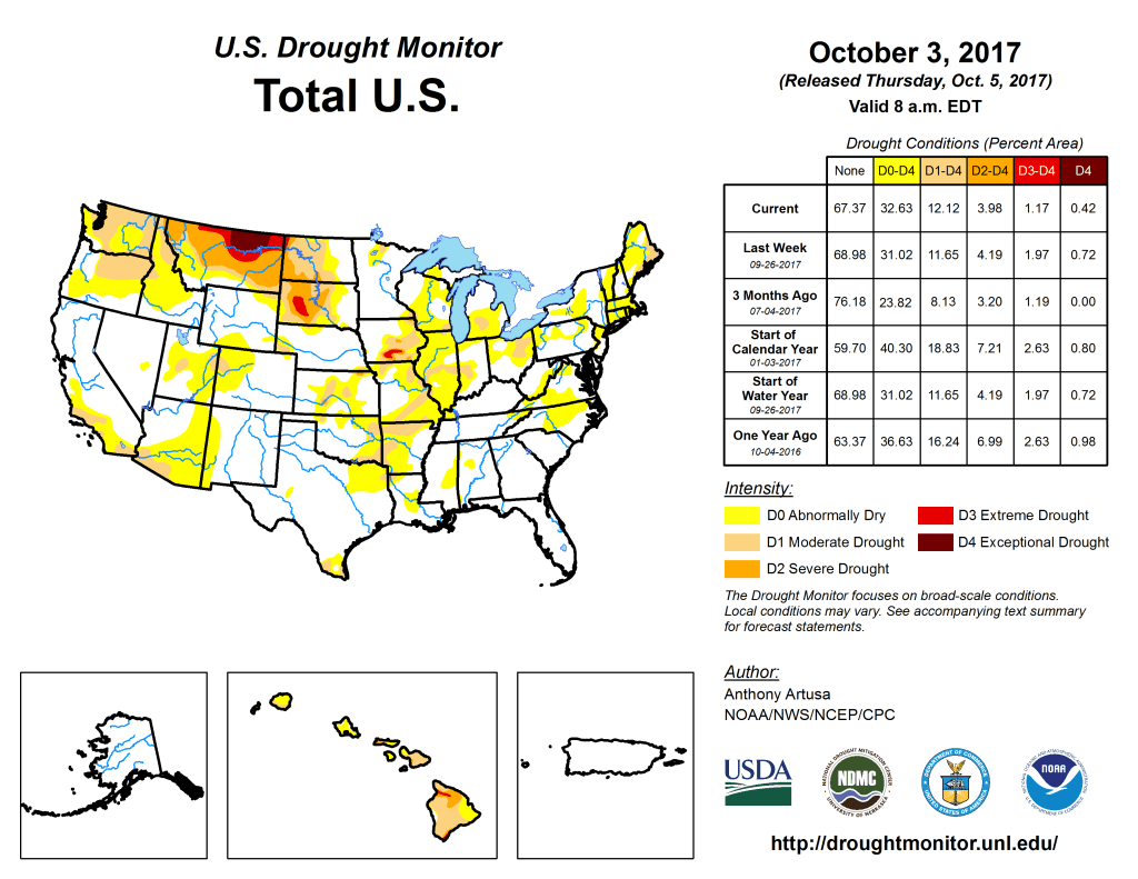
Colorado law permits changes of use to be decreed by its water court, provided thereโ€™s no injury to other vested and decreed water rights.  Changing a water right requires limiting the use to historical consumption and diversion patterns in time, place, and amount.  The change process is cumbersome, often requiring tens of thousands of dollars in legal and engineering fees in addition to multiple years to usher a water court application from start to finish.  However, the end result is essential for water users who need a reliable supply, because the seniority, or date of appropriation assigned to a water right originally, is maintained throughout the change of use process.  Historically, an overwhelming proportion of these transfers have involved shifting water from agriculture to municipal or industrial uses.  In recent years, and thanks in part to the fortitude of the Water Trust and the CWCB, instream flow rights transfers have grown to become 1% of water right changes statewide.  While the shift is small, it has transformed rivers like the Little Cimarron and the Alamosa, adding flowing water back into riverbeds that were once unseasonably dry.  It signals that environmental uses are not second-class claims but essential components of modern water management.

The Jasper Lake donation exemplifies this principle.  The donor, instead of selling the valuable storage water on an open market, permanently gifted it for environmental useโ€”a use now recognized and legally protected under Colorado law.  And it was not only the generous donor who has supported their local stream systemโ€”37-Mile LLC as the buyer agreed to a set of strict covenants, essentially stripping the Jasper Lake water right of its development potential. This donation operates within the same legal framework as the early consumptive use transfers, including the Moser and Little Cimarron water rights, proving that environmental values can thrive without rewriting the rulebook.

Borrowing from Land Conservation Practices to Save Rivers

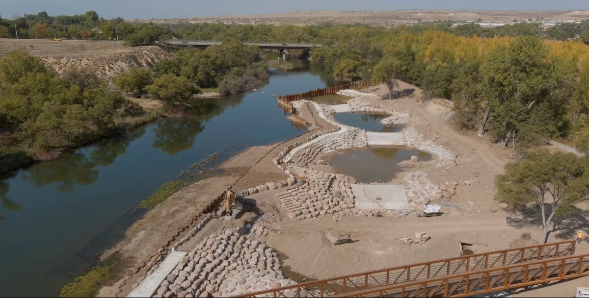
The water from Jasper Lake is not just turned loose; it is released into Jasper Creek, from which point it flows down 37 miles of Middle Boulder Creek and Boulder Creek before the Tiefel Family diverts it back out of the stream system for irrigation use. Unlike many Water Trust projects, there is no CWCB instream flow use of the water. Instead, the Water Trust ensured that the water would remain in Boulder Creek by choosing to partner with 37-Mile and requiring, as a condition of their partnership and sale, that 37-Mile would agree never to redivert the water until it reaches that 37-mile point, in addition to several other restrictions.

The restrictions that the Water Trust imposed include restrictive covenants and a public access easementโ€”legal constructs adopted from land use law.  Applying these principles, the property and water rights are permanently tied to ecological and public uses, while still respecting historical agricultural use for the Jasper Lake water. This flexibility was a key component that made the donation viable and attractive, and avoiding water court for a change of use enabled the participants to save on costs and time. The protections that the Water Trust tied permanently to Jasper Lake, the parcel of land surrounding it, and the water rights stored in it include the following:

  1. An easement allowing the public to access Jasper Lake and the parcel of land surrounding it. Colorado law limits the liability of landowners who hold title to inholdings on public lands provided there is signage, which was key to the ability of 37-Mile to take on this responsibility;
  2. Jasper Lake water must be stored until at least August 15 of each year, which provides the public with an opportunity to enjoy the beauty of its waters;
  3. The owner of the Jasper Lake water right must take water deliveries beginning on or after August 15 of each year, which ensures that flows in the Boulder Creek drainage are boosted after snowmelt, when fish and the environment need it most;
  4. The owner of Jasper Lake must take steps to avoid abandonment of the water right;
  5. The owner of Jasper Lake must allow Colorado Parks and Wildlife to stock the lake with fish; and
  6. Finally, if the owner of Jasper Court ever goes to water court, they must consult with the CWCB regarding the possible addition of instream flow use to the water right.

The covenant model ensures that the ecological intent of the donation is locked in perpetuity, regardless of future ownership changes.  This legal durability is critical in an age of shifting climate variability and volatile hydrology.  Moreover, the Jasper Lake donation includes an engineering-informed management plan that allows for strategic releases during critical low-flow periods, providing adaptive benefits for aquatic species, riparian vegetation, and downstream users. It is this combination of legal permanence and operational flexibility that makes the model so powerful.

Why Storage Matters: True Volume, True Impact

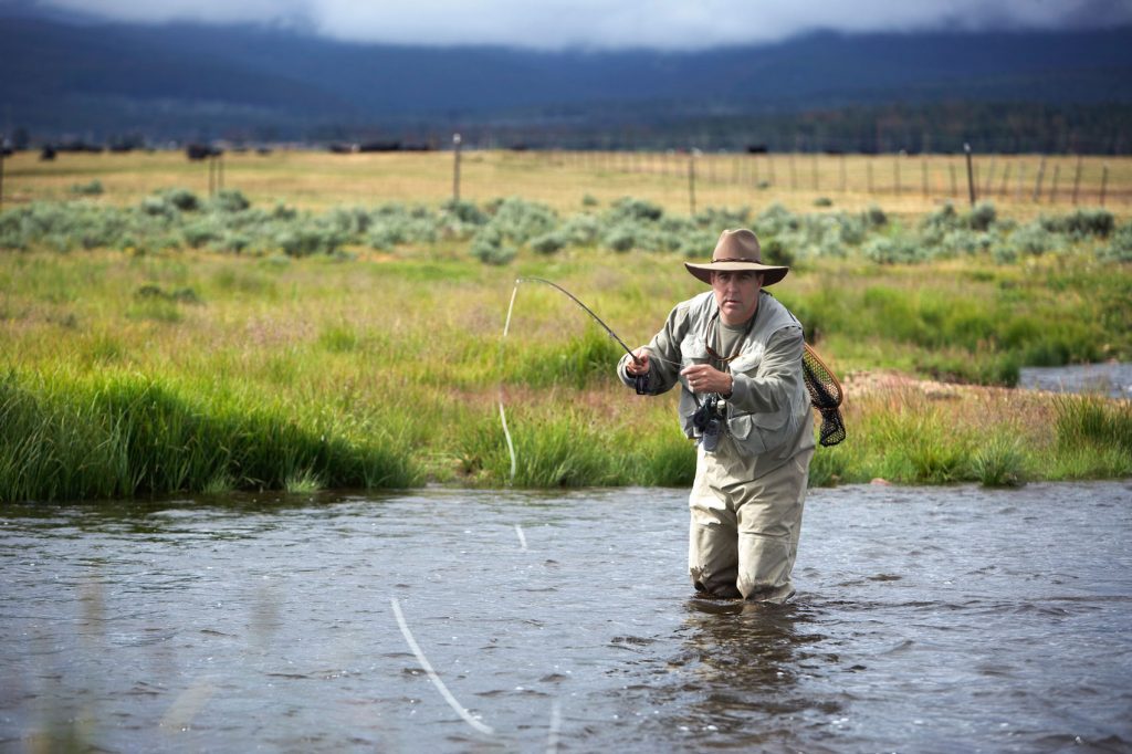
Storage rights, especially those high in the drainage area like Jasper Lake, offer great flexibility in release and can be timed to supplement flows when needed most. The long carriage distance of Jasperโ€™s releases down Boulder Creek allows for significant stream flow restoration. Storage water can be released during dry seasons when streamflow is lowest, directly improving water quality, mitigating temperature spikes, and sustaining aquatic life. As the old adage goes, โ€œThe solution to pollution is dilution.โ€ More water in the stream doesnโ€™t just benefit fish and bugs; it improves drinking water quality for downstream communities and strengthens overall watershed health.

This is a crucial point: while senior direct flow rights can sometimes provide benefit when left in the stream, they often do so inconsistently.  Stored water, by contrast, provides discretely measurable volumes that can be scheduled and managed.  This transformed the Jasper Lake donation from a gesture to a guaranteed outcome.  Drinking water providers, such as those in the Boulder and Denver metro areas, depend on baseflows to keep treatment costs low.  High-quality source water means fewer chemicals and less energy to meet Safe Drinking Water Act standards.  In this way, streamflow restoration becomes an upstream investment in downstream public health.

Perhaps most importantly, leaving water in the river should be understood not as a passive default, but as an affirmative beneficial use.  Traditionally, beneficial use has been defined through diversionโ€”water being taken out of the river for agriculture, industry, or municipal supply.  But Colorado law now affirms that instream flows can meet the beneficial use standard when they are legally protected and used to preserve the natural environment.  This conceptual shift is profound.  It re-centers the health of the river itself as a priority, recognizing that a flowing stream provides ecological services, supports recreation economies, enhances water quality and sustains life throughout the basin.

Why Permanence Matters: Creative and Collaborative Solutions

What makes the Jasper Lake donation especially promising is its emphasis on collaboration.  Governments, nonprofits, agricultural stakeholders and local communities worked in unison to ensure the projectโ€™s success.  Each party brought their priorities to the tableโ€”agricultural heritage, legal acumen, ecological resilienceโ€”and emerged with a better outcome than any could have achieved alone.

There are few other legal mechanisms in Colorado to protect water for the environment: RISIDS (Recovery Implementation for Endangered Species), Wild & Scenic River designation (with only one such stretch in Colorado), or narrowly focused instream flow rights used by the CWCB.  The Jasper Lake project expands this limited toolbox, showing that partnerships and legal creativity can yield conservation outcomes without requiring federal mandates.

Another instructive comparison is the Water Trustโ€™s work on the Yampa River system, where cooperative agreements among the CWCB, environmental organizations, and agricultural users have led to temporary instream flow leases and beneficial use deliveries to preserve flows during dry years.  These leases, though helpful, are inherently limited by duration and uncertainty.  That uncertainty is, at least to some extent, mitigated by the existence of the Yampa River Fund, an endowed and locally-managed fund that pays for water leasing and sponsors other work to improve the Yampa River and its tributaries.  Jasper Lake moves even beyond that, embedding conservation in perpetuity.

A Model for the West

Twenty-nine states operate under some form of the prior appropriation doctrine.  The Jasper Lake donation stands as a model that others can emulate.  Michael Browning said he still sees great opportunities for similar initiatives in other western states, especially those in the Colorado River Basin, emphasizing the role of nonprofits in adapting the water rights system to recognize environmental and recreational values.  By demonstrating that private rights can be permanently converted to public goodsโ€”without litigation, without legislative overhaul, and without harming other usersโ€”this project charts a replicable path forward.

While unique in the seven states of the Colorado River Basin, the Water Trust is not alone. The Oregon Water Trust, founded in 1994, and the Washington Water Trust, founded in 1998, are similar organizations.  There is an Arizona Water Trust that primarily focuses on land donations that may include water rights.  Montana, New Mexico, and Utah have all explored instream flow programs, but few have integrated storage donations.  In the Upper Snake Basin of Idaho, a pilot effort to lease stored water for environmental flows is promising, but still temporary.  Jasper Lake shows that permanent storage donations are possible, legal, and immensely beneficial. Especially in the seven basin states, the Colorado Water Trust serves as a useful model and tool for others to replicate.

Lessons Learned

Perhaps the most profound lesson from Jasper Lake is the value of permanence. One-time leases and short-term mitigation projects are common, but they do not provide the stability or reliability that rivers need.  Permanency ensures predictability.  It signals to ecosystems and economies alike that someone is planning for the long term.

Moreover, the donation sets a precedent that stored water can and should be used for instream benefitโ€”and that such uses are not just legally viable but deeply beneficial to the broader hydrological system.  As we consider future projects, the importance of true volume, collaborative administration, and permanence cannot be overstated.

Another key takeaway is the importance of patience.  Water transactions require timeโ€”not just to navigate the legal and engineering hurdles, but to build the trust among stakeholders that makes such projects durable.  Funders, partners, and policymakers must embrace this long view.  Water transactions require the same patience and investment mindset we bring to ski areas, resorts, transportation, reservoirs or other large infrastructure projects.  But the payoffโ€”cleaner rivers, healthier ecosystems, and stronger communitiesโ€”is well worth it.

Gratitude and Foresight

As Michael Browning said, โ€œProgress is possible with goodwill and a shared need.โ€  The Jasper Lake donation is more than a gift.  It is a template, a catalyst, and a moral benchmark.  It shows that with legal creativity, trust among partners, and courageous donors, we can build a more resilient and ecologically rich future.

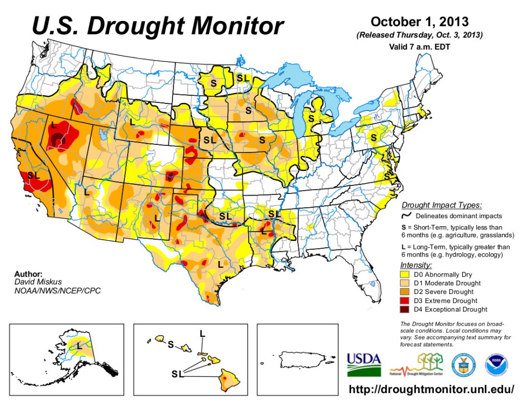
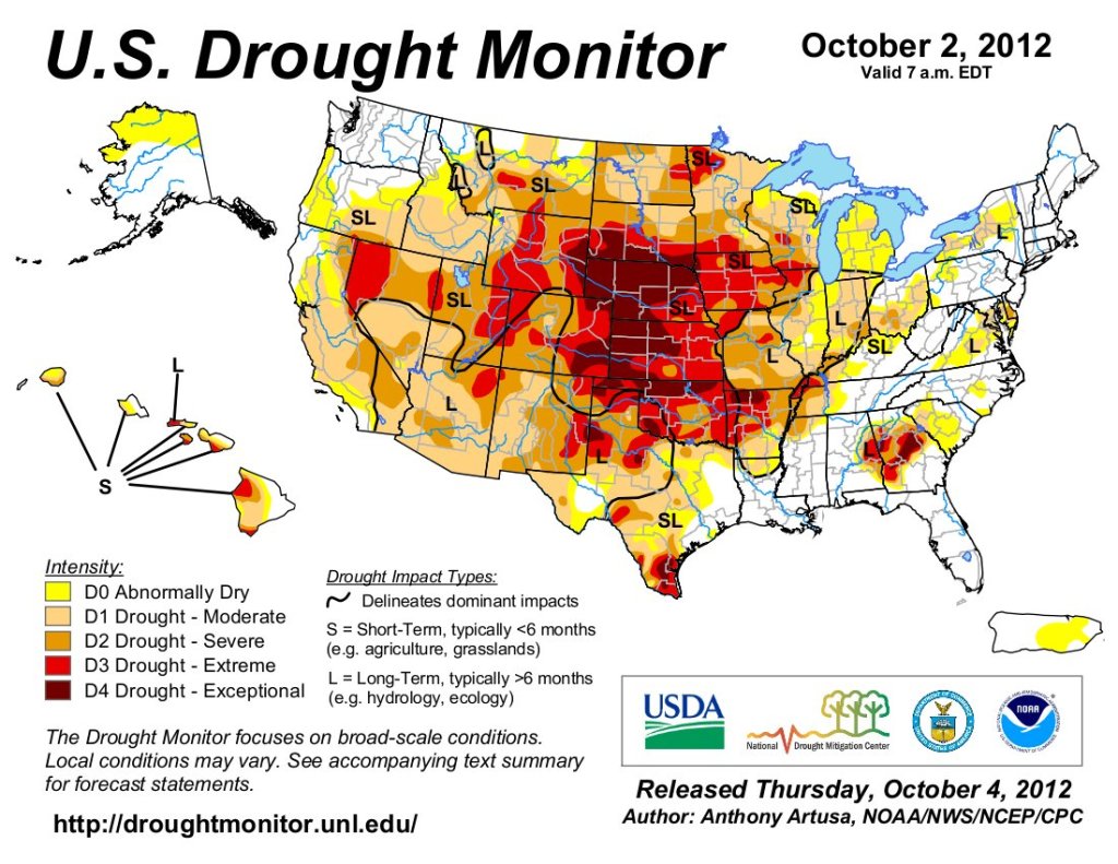
As the West grapples with aridification and changing demands, projects like Jasper Lake shine like beacons.  They show us what is possible when we work together and think beyond ourselves.  None of this would be possible without the extraordinary foresight and generosity of the donor.  In a market where water rights fetch increasingly high prices, the choice to donateโ€”permanently, and without reservationโ€”is not only rare but deeply courageous.  It reflects an ethic of care that transcends personal gain and speaks to a commitment of legacy, community, and the natural world.

The success of the Colorado Water Trust also reflects gratitude for the legislative frameworks that made it possible.  Coloradoโ€™s instream flow program, the CWCBโ€™s administrative role, and the legal structure built into prior appropriation water law all played essential roles. The Jasper Lake project didnโ€™t require new laws; it simply needed the right vision and the will to collaborate. All it required was to Just Add Water. 

Jasper Lake is truly a remarkable and historic gift.

The Water Report
Written by: Kate Ryan & Matt Moseley 
Read the original article here.

Author Bios: 

Kate Ryan is a water lawyer who joined Colorado Water Trust in 2018 and was appointed as Executive Director in 2023. Her past clients included farmers, ranchers, municipalities, landowners, and the CWCB. Before going to Berkeley Law she obtained a masterโ€™s degree in geography at the University of Colorado. Kate does her work at the Colorado Water Trust in order to support that which she holds most dearโ€“our incredible state and the people within, the beautiful rivers and mountains we explore, and a future for her kids where they can experience a continuation of it all.

Matt Moseley is a communication strategist, author, speaker and world-record adventure swimmer. He is the principal and CEO of the Ignition Strategy Group, which specializes in high-stakes communications and issue management. As the author of three books and is the subject of two documentaries, he uses his swimming around the world to bring raise awareness about water issues. He is the co-chair of the Southwest River Council for American Rivers and is a member of the Advisory Board for the Center for Leadership at the University of Colorado at Boulder. He lives in Boulder with his wife Kristin, a water rights attorney and their two children.

Colorado Rivers. Credit: Geology.com

#Renewable Energy and Weather — Peter Goble (#Colorado Climate Center)

Click the link to read the article on the Colorado Climate Center website (Peter Goble):

October 8, 2025

A recent email query about renewable power got me thinking about where we produce renewable power and why. The reasons are complicated. However, the weather is critical in determining where we generate renewable energy such as solar and wind power. Iโ€™ll be candid enough to say that I like renewable power, but my goal for this blogpost is not to comment on the merits of generating electricity one way or another. My goal is simply to share a couple maps from the National Renewable Energy Laboratory and discuss why we see the patterns we do. 

Solar Power: Solar power production potential is determined by geographic factors such as latitude altitude, and weather. Figure 1 below, from the National Renewable Energy Laboratory shows โ€œGlobal Horizontal Solar Irradianceโ€ across the Contiguous United States. For practical purposes, we can think of this as โ€œsolar power production potential,โ€ or even more simply โ€œhow much sunlight do you get?โ€

Figure 1: Global Horizontal Irradiance across the Contiguous United States. Source: National Renewable Energy Laboratory.

Perhaps the most obvious pattern in Figure 1 is the difference between the northern and southern United States. The โ€œSun Beltโ€ is aptly named. The southern United States receives more direct sunlight than the northern United States because it is closer to the equator. Northern states are blessed with nice, long summer days with plenty of sunshine hours, but sunlight pierces the atmosphere at a more direct angle at lower latitudes. Even within Colorado, we can see a difference in solar power potential from south-to-north. Areas like the Four Corners, San Luis Valley, and Comanche Grasslands (all in southern Colorado listed west-to-east respectively) stand out as sunny areas.

Altitude is an important factor as well. Even under clear skies, not all sunlight that passes through the top of earthโ€™s atmosphere makes it to the surface. Some is scattered by particulates and some is absorbed by water vapor, dust, or ozone. Sunlight is thus less intense at lower elevations. Therefore, all else being equal, high elevation areas will have more solar power production potential than low elevation areas. You have probably felt this either hiking in our Colorado mountains or traveling down to sea level. The sun feels more intense on the skin, and it is easier to burn at higher altitudes.

Why is it that Coloradoโ€™s highest elevations do not show as high of solar production potential as the valleys? Weather. Our mountains are more likely to be shrouded by clouds due to orographic lift: As air is forced over our mountain ranges it must rise. As air rises it cools. As air cools, the water vapor in the air condenses, forming clouds, and oftentimes, rain or snow. One obvious example of the role of weather in solar power generation potential can be seen looking at Oregon. Western Oregon has a wealth of onshore airflow from the Pacific Ocean, bringing thick, low clouds and drizzle, which block sunlight. Eastern Oregon is high desert. The Cascade Mountain Range blocks clouds and moisture from moving inland. As a result, solar power production potential is much higher in eastern Oregon than western Oregon. While it is less obvious in Colorado than Oregon, some of our driest and least cloudy locations stand out. For instance, the San Luis Valley (south-central Colorado) is known as โ€œThe Land of the Cold Sunshine.โ€ This area receives less than 10โ€ณ of precipitation annually, and has some of our highest solar power production potential in the state.

Wind Power: We can also take a look at wind power production potential across the United States, and dissect some of the drivers behind it. Figure 2 shows annual average wind speeds at 10 meters (~33ft) above ground level across the contiguous United States. A few patterns jump out here: 1. If we look at the western United States (including Colorado), higher elevation terrain does have higher average wind speeds. 2. The middle of the country is windy. 3. The east side of the Rocky Mountains is windy, including in Colorado. 4. Oh boy, our poor neighbors to the north (sorry, Wyoming)! 

Figure 2: Average wind speeds at 10 meters above ground level. Source: National Renewable Energy Laboratory For what itโ€™s worth, most wind turbines are much taller than 10 meters, thus a better reference height would be more appropriate for looking at wind power. NREL does produce maps at higher reference heights. I chose a low reference height because it is closer to the weather as we feel it.

Winds with height: On average, we do see wind speeds increase with height. This is due to increased pressure gradients, decreased friction, and reduced air density. However, Figure 2, which shows average windspeeds, does not tell the whole story. Our mountain air is only ~70-80% as dense as sea level air, so it takes stronger gusts to produce the same amount of force. Turbines at higher elevations will not generate as much power for a given windspeed as turbines at lower elevations.

The middle of the country: Figure 2 also clearly shows the โ€œwind beltโ€ is the high plains and southern plains around 100 degrees longitude (North Dakota down to west Texas). This area is frequently subject to sharp boundaries between air masses, or fronts. As a result, it is often windy. The terrain roughness is also an important factor. It is easier to get frequent high winds over open grasslands than forests. Eastern Colorado can be thought of as part of this wind belt, and has a relatively smooth, grassy surface with few obstacles.

East side of the Rockies: If we look at Colorado in Figure 2 we see that higher elevations are winder, but we can also see that there is an increase in winds east of the Continental Divide. There is both a sharp increase in wind speeds at high elevations immediately east of the Divide, and higher average wind speeds more generally across the eastern Colorado Plains. Our prevailing wind direction in Colorado is most commonly west-to-east, especially from October through April. Thanks to our old friend gravity, air traveling uphill slows down, and air traveling downhill speeds up. We call the days when air races down the eastern side of the Rocky Mountains downslope wind days. These blustery days are usually unseasonably warm, but can be cold if the air is coming from the north or northwest. Cross-mountain airflow does not automatically create downslope winds. Sometimes air in the valleys is too cold and dense to be forced out of the way by air moving over the Rockies. On these days we more commonly see wavy streaks of clouds instead of strong surface winds. In fact, you may also notice in Figure 2 that Denver and surrounding areas are somewhat protected, sitting in the Platte River Valley. Denver has plenty of windy days, but sometimes the strong winds pass overhead without completely mixing down to the surface.

Windy Wyoming: I love the way southern Wyoming from Cheyenne to Casper stands out in Figure 2. Southern Wyoming is the closest thing to a gap in the Rocky Mountains, so when changing weather crosses the Rockies, air gets forced through southern Wyoming like a wind tunnel. The impacts of these gap winds bleed into Colorado. For instance, Wellington is windier than Fort Collins or Denver on average. Gap winds, combined with downslope winds, also are a factor in southeastern Colorado. There are high wind warning signs on I-25 south of Pueblo as winds race down the leeward side of the Sangre de Cristos, and shoot through the gap between the Sangre de Cristos and Wet Mountains. You will see many wind turbines in this area too.

Nature sets the initial conditions for where solar and wind power can be most readily generated. Overall, Colorado experiences both plenty of sunshine and plenty of wind. Some parts of our state are especially well positioned for one or the other. Our southern valleys have strong solar production potential due to a combination of relatively low latitude, high altitude, and clear skies. Our eastern plains have strong wind production potential due to frequent exposure to strong weather fronts, relatively smooth, grassy terrain, and being downwind of the Rocky Mountains.

The September 2025 briefing is hot off the presses from Western Water Assessment Intermountain West Dashboard

Click the link to read the briefing on the Western Water Assessment website:

October 8, 2025 – CO, UT, WY

September precipitation was mixed across the region, with below normal conditions in Utah and northeastern Wyoming, and above normal conditions in eastern Colorado and southeastern Wyoming. Temperatures were near to above normal for the majority of the region, with a large pocket of record-warm temperatures in southwestern Wyoming. The first snowfall of the season was observed on September 22 in Utah and September 23 in Colorado. Drought conditions remained the same in Utah and improved in Colorado and Wyoming, with regional drought coverage at 61% as of September 30. Monthly streamflow conditions were near to below normal across much of the region. The probability of La Niรฑa conditions developing is 60% by mid to late fall. NOAA seasonal forecasts for October-December suggest an increased probability of below average precipitation and above average temperatures for the region.

The region experienced a mix of moisture conditions in September, with very dry conditions in western and northern Utah, and wet conditions in northeastern Colorado and southeastern Wyoming. Below normal precipitation occurred throughout most of Utah and northeastern Wyoming, while above normal precipitation occurred throughout most of eastern Colorado and southeastern Wyoming. A large pocket of record-wet conditions occurred in northeastern Colorado, and a pocket of record-dry conditions occurred in Johnson County, Wyoming.

September temperatures were near to above average throughout most of the region, except for pockets of 0 to 2ยฐF below normal temperatures in southern Colorado and southern Utah. The majority of Wyoming and northern Utah experienced 2 to 4ยฐF above average temperatures, with pockets of 4 to 6ยฐF above  average temperatures in northern and western Utah, and northern and western Wyoming. One small pocket of 6 to 8ยฐF above normal temperatures occurred in Park County, Wyoming and an area of 2 to 4ยฐF below normal conditions occurred in Las Animas County, Colorado. A large pocket of record-warm temperatures occurred in southwestern Wyoming.

The first snowfall of this snow season was observed on September 22 at 10,715 feet in Bald Mountain Pass on Mirror Lake Highway in Utahโ€™s Uinta Mountains. On September 23, Colorado received up to 8.8 inches of snowfall, particularly east of the Continental Divide above 10,500 feet, with the most falling in Glendevey. As of October 1, all SNOTEL sites are reporting no accumulated snow. Here are the top five snowfall totals in Colorado from September 23:

  1. Glendevey, Colorado – 8.8 inches
  2. Arapahoe Peak, Colorado – 8 inches
  3. Cameron Pass, Colorado – 7.2 inches
  4. Berthoud Pass, Colorado – 7.2 inches
  5. Winter Park, Colorado – 7 inches

Drought conditions improved during September in Colorado and Wyoming, while all of Utah continues to remain in at least moderate (D1) drought. By September 30, regional drought coverage was 61%, a 6% improvement since the end of August. Colorado saw the removal of exceptional (D4) drought conditions on the West Slope and a 14% reduction in extreme (D3) drought. Wyoming also saw a 6% decrease in D3 drought conditions near Yellowstone region and in the south-central portion of the state. Coverage of extreme drought conditions in Utah decreased by 4% and severe (D2) drought declined by 4%.

Monthly streamflow conditions were near to below normal across large parts of the region, with much below normal conditions in northwestern Wyoming and western Utah during September. Several USGS stream gages reported September streamflow conditions in the lowest 3% of all historical observations, including seven in Wyoming, six in Utah, and one in Colorado. While the majority of streamflow gages in the region reported near to below normal conditions in September, several gages reported above to much above normal conditions, particularly along the Front Range in Colorado. Additionally, a few USGS stream gages reported September streamflow conditions in the highest 96% of all historical observations, including two in Utah and one in Wyoming.

There is a 60% chance of La Niรฑa conditions developing by November. By January, there is an equal probability of La Niรฑa or neutral ENSO conditions and the probability for La Niรฑa decreases throughout the remainder of winter 2026. The NOAA Monthly Precipitation Outlook suggests an increased probability of above average precipitation for northern Wyoming and below average precipitation for southeastern Colorado in October. The NOAA Monthly Temperature Outlook suggests an increased probability of above average temperatures for all of Colorado, eastern and central Wyoming, and southern Utah in October. The NOAA Seasonal Outlooks for October-December suggest an increased probability of below average precipitation in all of Colorado, southern and eastern Utah, and southeastern Wyoming, and an increased probability of above average temperatures throughout the region.

The Colorado River is in a water crisis as consumption continues to outweigh the natural supply each year. To stabilize the system, Colorado River Basin that water use must be balanced with natural river flows. According to the recent report, โ€œAnalysis of Colorado River Basin Storage Suggests Need For Immediate Actionโ€ (Schmidt et al. 2025) the basin currently has 6.3 million acre-feet of accessible water storage in Lakes Powell and Mead. If next year is a repeat of this yearโ€™s unforgiving hydrology and water use remains the same in the basin, Schmidt et al. estimate that consumptive use will exceed the natural flow in the river basin by at least 3.6 million acre-feet, leaving only 3.6-3.7 million acre-feet left in storage above critical elevations in Lakes Powell and Mead by late summer 2026. According to the report, depleting half of the basin’s storage by the end of water year 2026 will leave water managers with limited flexibility when the new post-2026 operating regime comes into effect. To avoid this outcome, the basin requires immediate and substantial reductions in consumptive use.

Learn more: https://www.colorado.edu/center/gwc/media/670 

Significant weather event: On September 23, Denver set a daily rainfall record of 1.28โ€ of precipitation at Denver International Airport, making it the wettest September 23 since records began in 1872. Denverโ€™s Central Park weather station recorded 1.33โ€ of rain, making September 23 the wettest day since June 22, 2023 for Denver. This same storm brought heavy, wet snow to the high country, with the most snow reported at the Glendevey weather station in Larimer County at a total of 8.8โ€ of snow (see above for the top five snowfall totals from September 23). Here are the top five rainfall totals from September 23 in Colorado: 

  1. Central Park in Denver – 1.33 inches
  2. Denver International Airport – 1.28 inches
  3. Broomfield – 1.22 inches
  4. Fort Collins – 1.13 inches
  5. 9NEWS in Denver – 1.05 inches

Sources:

https://https://snowbrains.com/utah-mountains-receive-first-snow-of-winter-2025-26/

www.9news.com/article/weather/weather-impact/snow-rain-totals-wettest-day-forecast/73-8232e7e0-2bb7-4378-936b-3cd3f4980d09

https://weather.com/news/news/2025-09-24-colorado-first-noticeable-snowfall-of-the-season

Farmers, ranchers cut back #ColoradoRiver water use while enduring one of the driest seasons on record — Shannon Mullane (Fresh Water News) #COriver #aridification

On a day in late May [2022] when wildfire smoke obscured the throat of an ancient volcano called Shiprock in the distance, I visited the Ute Mountain Ute farming and ranching operation in the southwestern corner of Colorado. Photo credit: Allen Best/Big Pivots

Click the link to read the article on the Water Education Colorado website (Shannon Mullane):

October 9, 2025

Farmers, ranchers and other water users in four Western states, including Colorado, are cutting back on water use because of low flows through the Colorado River Basin. 

Less than half the normal amount of water flowed into Lake Powell from the Upper Basin states โ€” Colorado, New Mexico, Utah and Wyoming โ€” this summer. Farmers in the four-state region fallowed fields and changed their crop plans to adapt to a smaller water supply. The dry summer conditions coincided with high-stakes negotiations over how the water supply for 40 million people will be managed starting in August 2026. 

In the Upper Basin, officials are trying to emphasize the existing shortages that happen each year as natural water supplies are strained by a changing climate.

โ€œThe Upper Basinโ€™s sacrifices arenโ€™t abstract; they carry real human and economic consequences,โ€ the Upper Colorado River Commission said in a news release Wednesday.

About 2.6 million acre-feet of water flowed into Lake Powell from the Upper Colorado River in April through July. Thatโ€™s 41% of the average from 1991-2020, according to the Colorado Basin River Forecast Center.

One acre-foot roughly equals the annual water use of two to three households. Itโ€™s enough to cover a 1-acre field in 1 foot of water.

For the entire water year โ€” from Oct. 1, 2024, through Sept. 30 โ€” about 4.69 million acre-feet ran into Lake Powell from the Upper Colorado River. Thatโ€™s 49% of the 30-year average, according to the center. It was the seventh driest year since 1963, when the center started making forecasts.

Wyoming shut off water to more than 163,000 acres of irrigated land in the stateโ€™s portion of the Green River Basin, according to the river commission news release.

โ€œThis is an extraordinary reduction with serious impacts on producers and rural communities across southwest Wyoming,โ€ said Kevin Payne, Division IV superintendent of the Wyoming State Engineerโ€™s Office.

Severe water shortages in Utahโ€™s Uintah Basin, driven by Colorado River cuts, forced ranchers to reduce the size of cattle herds, raised production costs, and strained the local economy.

The San Juan Chama project in New Mexico, which provides water for Albuquerque, Santa Fe and agriculture, received 31% of its normal Colorado River supply, a 69% reduction.

In southwestern Colorado, farmers that use Dolores Water Conservancy Districtโ€™s water have dealt with shortages in five out of the last eight years. In early June, water users were set to receive 30% of their usual water supply. That increased to 56% in part because of a better-than-expected June runoff, Ken Curtis, general manager of the Dolores Water Conservancy District, said.

Because of the shortages, farmers in Dolores County, Montezuma County and the Ute Mountain Ute Farm and Ranch have stopped growing crops on thousands of acres of land and struggled to bring fallowed land back into production as dry conditions continue.

โ€œOur farmers are left with year-by-year gambles with last-second planning going late into May and limiting farmersโ€™ abilities to make long-term, successful crop rotation planning,โ€ Curtis said in the news release. โ€œThe Dolores snowpack is disappearing, and the historic runoff has dropped by even greater magnitudes. Water is no longer reliably available.โ€

The Ute Mountain Ute Tribeโ€™s Farm and Ranch Enterprise, one of Coloradoโ€™s largest farming operations, stopped irrigating 60% of their land and laid off farm workers. The crop plan for 2025 only included the existing, high-value alfalfa needed to sustain the farm and ranch.

โ€œWe are merely surviving, not adapting,โ€ Michael Vicente, the enterpriseโ€™s irrigation manager, said about the historic drought.

These shortages are uncompensated and involuntary, the Upper Colorado River Commission pointed out. Thatโ€™s a sticking point for the Upper Basin states in the interstate discussions over how to manage the river.

The Lower Basin states proposed a plan that includes mandatory water cuts in every basin state in the riverโ€™s driest years.

Upper Basin officials say they should not have to make mandatory cuts. Each year, farmers and ranchers receive less than their legal allocation of water because of natural fluctuations in precipitation, temperature and other environmental factors.

For decades, Upper Basin water users have handled these fluctuating water supplies without getting paid for the losses, officials say. 

โ€œAs Colorado River negotiations continue, Upper Basin leaders are clear,โ€ the Upper Colorado River Commission news release said. โ€œRiver operations must adapt to the actual supply and prioritize rebuilding storage to restore resiliency.โ€

More by Shannon Mullane

Map of the Colorado River drainage basin, created using USGS data. By Shannon1 Creative Commons Attribution-Share Alike 4.0

Commentary — Rural lessons for resisting authoritarianism: The Ditch Principle holds that neighbors build from their common interests — Pete Kolbenschlag (#Colorado Newsline)

Photo credit: Jonathan P. Thompson

Click the link to read the commentary on the Colorado Newsline website (Pete Kolbenschlag):

October 10, 2025

โ€œWhoever fights monsters should see to it that in the process he does not become a monster himself. And if you gaze long into an abyss, the abyss will gaze back into you.โ€ 

After 20 years of organizing in rural Colorado, Iโ€™ve learned that lasting results come from supporting rather than opposing, from building bridges not tearing them down, from identifying shared solutions, not only pointing at problems. 

This is the Ditch Principle: Your ditch neighbor may disagree with you about everything except keeping the water running โ€”  so you start there. The neighbor who might pull you out of a snowbank doesnโ€™t stop being your neighbor when you disagree about politics. Rural communities practice interdependence because isolation kills.

Friedrich Nietzscheโ€™s warning about monsters isnโ€™t just stale philosophy โ€” itโ€™s practical advice that seems freshly relevant. As authoritarianism rises in America, we face a choice: resist by becoming what we oppose, or demonstrate something better. 

As a longtime climate activist, the current anti-science stance is infuriating and deeply disappointing. But wildfire preparedness is critical right now, and community-wide planning helps everyone regardless of how they understand climate science. 

Instead of doom-scrolling at the edge of the abyss, we should respond by restoring what matters most in the spaces and relationships we maintain, leading forward from the ground up. 

This is a necessity, not idealism. When fire ignites or search and rescue is called, people put down their projects and differences to pull together. We have to get along or nothing gets done. People who honor these expectations are accepted, our contrary politics notwithstanding. 

The damage to both our planet and our institutions is real, extreme and unabated. Two-thirds of Americans recognize weโ€™ve become too polarized and no longer believe partisan politics is capable of solving our problems, according to a recent New York Times poll. Here in western Colorado, the largest voting bloc isnโ€™t Republican or Democratic โ€” itโ€™s unaffiliated voters who want problem-solvers, not partisans. 

Anti-science is a hallmark of authoritarian regimes. The erasure of climate data and the dismissal of inconvenient facts to protect powerful interests is a current case in point. But rural communities include practical people. Farmers experience drought, higher temperatures, and climate weirding. Homeowners fear wildfire and feel the risk.

History shows proven strategies to oppose authoritarianism. And rural communities are naturally situated to lead these approaches and reclaim our democratic foundations. 

  • Build alternatives, donโ€™t just oppose. No one asks who voted for whom when the irrigation ditch needs cleaning. They show up with shovels. This is constructive organizing โ€” demonstrating how things work when people focus on shared needs rather than manufactured divisions. Cooperation is a bulwark against authoritarianism. 
  • Include everyone, abandon no one.ย We donโ€™t start with politics when defending vulnerable community assets. Everyone depends on reliable water supply and safe evacuation routes, regardless of where they land on climate policy. We protect those needs notwithstanding the connections between climate, wildfire and drought.ย Navigating diverse perspectives, complicated relationships, and competing interests are not only challenges but tactics in resistance. Authoritarianism wins when we sacrifice groups one by one, including those we find disagreeable. Democracy wins when we expand the circle of concern.ย 
  • Practice the democracy you want to see. Itโ€™s not only about fighting monsters, itโ€™s about listening and working authentically even when it challenges us. Fair decisions, transparent communication, everyone gets heard โ€” unlike cable politics, we donโ€™t need leaders playing gotcha for narrow advantage. We change minds by creating shared experiences of things working better, solving problems that help everyone prosper. 

The power of rural communities lies in quietly building resilience through relationships spanning decades. With steady focus on what we can control, these relationships outlast any political cycle. The infrastructure that serves everyone endures. 

Authoritarianism requires division to survive and cannot withstand this approach. It needs us to see neighbors as threats, demands we choose ideology over community, that we abandon democratic norms in the name of winning. 

When we refuse that bargain โ€” when we bridge differences rather than divide, include rather than exclude, practice democracy and not just preach it โ€” we make authoritarianism irrelevant. 

The work to restore will outlive us. The best way not to become monsters is to stay neighbors. The ditch still needs clearing. A wildfire needs containing. When someone falls or is lost, it takes teamwork and a broad set of skills to get people out of rugged backcountry and back home to their families. So start there. Build from there. 

E pluribus unum. In shared purpose we remember: The strongest defense against those who would divide us is simply refusing to be divided. 

This tech will make it rain, literally, above #Colorado — Alex Hager (KUNC.org)

A rainstorm moves across Weld County on July 16, 2025. Cloud seeding technology could add more rain to farm fields in the area. Colorado officials said it will be the first time warm-weather cloud seeding is deployed in the state. Lucas Boland/KUNC

Click the link to read the article on the KUNC website (Alex Hager):

October 10, 2025

This story is part of ongoing coverage of water in the West, produced by KUNC in Colorado and supported by the Walton Family Foundation. KUNC is solely responsible for its editorial coverage.

A technology to increase rainfall is coming to Colorado for the first time.

A Florida-based company is setting up cloud seeding equipment to add water to some fields in Weld County. The company behind the project โ€” and the state agency that permits it โ€” hope that this rollout of what’s known as warm-weather cloud seeding is the beginning of a larger trend.

Andrew Rickert, weather modification program manager with the Colorado Water Conservation Board, called this cloud seeding project a โ€œtrial run.โ€

โ€œWe’ll see how the locals like it,โ€ he said. โ€œIf theyโ€™re getting more rainfall and getting more crops, I can see this definitely catching on and spreading around the state, especially in these times of drought.โ€

Rickert said the technology can increase annual rainfall by 15 percent to 17 percent.

While the work to boost rainfall is new, according to Rickert, Colorado has run cold-weather cloud seeding technology for years. By adding snow in the stateโ€™s mountains, that work is aimed at increasing the amount of water in rivers during the spring melt. It is funded by the state and is only possible when temperatures are below freezing.

Warm-weather cloud seeding uses technology that originated in the 1950s and has been deployed in countries such as China, Jordan and Oman, as well as the state of Texas. It does not use chemicals or aircraft, like some forms of cold-weather cloud seeding. Instead, it sends out an electrical charge from the ground that can cause small, naturally-occuring particles to ascend into clouds and make water condense and fall as rain.

Rain falls in Summit County, Colorado on August 26, 2025. Colorado officials and the Florida-based company installing the cloud seeding equipment hope this Weld County trial run will be the beginning of more rain enhancement around the state. Alex Hager/KUNC

Some programs to add more snow have received backlash related to their use of silver iodide, which experts say has been proven safe through decades of testing. Randy Seidl, CEO of Rain Enhancement Technologies, said warm-weather cloud seeding does not use any chemicals and may be quicker to catch on.

โ€œWeโ€™re hoping to show some success and then expand,โ€ Seidl said.

The demo program run by Seidlโ€™s company would be different from snow cloud seeding programs in Colorado, which are generally funded and operated by a branch of the state government.

โ€œWe’ve never had anything like this where a company comes in fully funded, just to demonstrate their technology and hope it catches on in the future,โ€ Rickert said.

These new rain enhancement operations will target an area below Colo. Highway 14 and above County Road 16 ยฝ , and between Weld County Road 55 and Weld County Road 63.

Despite the fact that the cloud seeding will be run by a private company, operations will still be strictly regulated by the state, which is in the process of issuing permits for Rain Enhancement Technologies.

That includes a provision meant to prevent cloud seeding from making flooding worse if thereโ€™s a big storm on the way.

โ€œWe automatically turn down, turn off our device right away,โ€ Seidl said. โ€œSo if there’s going to be excessive rain, we can’t make it worse.โ€

1. Ionization emits negative ions with electrical charge to create cloud condensation nuclei, which stimulates growth of water droplets 2. The system is powered by a solar panel array, which uses minimal energy to operate 3. Ionization is an existing technology with proven significant rainfall generation results over lengthy trial periods 4. It serves many with minimal costs and minimal environmental impact

#Climate monitoring station added above #Colorado Mountain College — Yampa Valley Sustainability Council

A seventh climate monitoring station in the Yampa Basin Atmosphere and Soil Moisture Integrated Network was dedicated on Oct. 6, 2025, near the Colorado Mountain College campus in Steamboat Springs. Colorado Mountain College/Courtesy photo

Click the link to read the release on the Steamboat Pilot & Today website:

October 12, 2025

Land above the Colorado Mountain College campus buildings in Steamboat Springs is now home to the latest climate monitoring station in the Yampa Valley.

The new station site, valued at $115,000 including all equipment and installation costs, was dedicated during a ribbon-cutting ceremony on Monday. The new site represents a growing network of hydro-meteorological stations in the Yampa River basin that are beneficial for the study of and tracking climate resiliency factors.

The station is the seventh installation in the YBASIN network, or the Yampa Basin Atmosphere and Soil Moisture Integrated Network. The goal of organizers is to eventually complete 30 stations spanning the Yampa River watershed from the headwaters of the Bear River in the Flattop Mountains to Fortification Creek west of Craig. Site investigations for two additional stations targeted for 2026 are underway.

YBASIN is a project of nonprofit Yampa Valley Sustainability Council and the Center for Western Weather and Water Extremes, or CW3E, which is part of the Scripps Institution of Oceanography at the University of California in San Diego. The center is a key partner in managing the network and analyzing the data collected.

โ€œWe are working hard to steadily grow YBASIN in order to monitor changing conditions in our region connected to our changing climate,โ€ said Jayla Poppleton, YVSC resilient water and watersheds director. โ€œItโ€™s critically important that we understand how aridification and dry soils are impacting runoff and water availability for our communities, agricultural producers and ecosystems.โ€

The new station is the first in the network to be placed within Steamboat city limits. The new location fills a data gap for a portion of the watershed that lacked existing measurement and provides hands-on learning opportunities for CMC students.

โ€œThe goal of YBASIN is to establish long-term soil moisture data to better understand how dry soil conditions impact snowmelt runoff across the watershed,โ€ CW3E Director Marty Ralph said. โ€œAs extremes continue to impact precipitation โ€“ and correspondingly spring runoff and water availability โ€“ a continuous record will support more accurate water supply forecasting and help inform critical management decisions.โ€

The first station was installed near Stagecoach Reservoir in 2022. During 2023 and 2024, the network grew by five additional stations including in the Trout Creek basin, lower Elk River watershed, along the Yampa River at Carpenter Ranch near Hayden and the Elkhead Creek drainage. A sixth station, known as Red Creek, was installed south of Steamboat Lake in August.

Funding for the network was provided by the Upper Yampa Water Conservancy District, Colorado River District and Colorado Water Conservation Board.

โ€œThe YBASIN network is a critical investment in the effective management of local water resources,โ€ said Andy Rossi, general manager of the conservancy district. โ€œBy enabling direct data collection in the Yampa Valley, it will enhance forecasting capabilities for water managers. These improved forecasts will benefit agricultural producers, municipalities and the ecosystems that rely on dependable water supplies.โ€ 

Learn more about YBASIN online atย YVSC.org/soil-moisture-monitoring-network.

Yampa River Basin via Wikimedia.

Planetโ€™s first catastrophic #climate tipping point reached, report says, with coral reefs facing โ€˜widespread diebackโ€™ — The Guardian

Dead and dying staghorn co ral , central Great Barrier Reef in May 2016. Credit: Johanna Leonhardt

Click the link to read the article on The Guardian website (Graham Readfearn). Here’s an excerpt:

October 12, 2025

Unless global heating is reduced to 1.2C โ€˜as fast as possibleโ€™, warm water coral reefs will not remain โ€˜at any meaningful scaleโ€™, a report by 160 scientists from 23 countries warns

The earth has reached its first catastrophic tipping point linked to greenhouse gas emissions, with warm water coral reefs now facing a long-term decline and risking the livelihoods of hundreds of millions of people, according to a new report. The report from scientists and conservationists warns the world is also โ€œon the brinkโ€ of reaching other tipping points, including the dieback of the Amazon, the collapse of major ocean currents and the loss of ice sheets…Tipping points are recognised by scientists as moments when a major ecosystem reaches a point where severe degradation is inevitable…The worldโ€™s coral reefs are home to about a quarter of all marine species but are considered one of the most vulnerable systems to global heating…

Coral reefs have been in the midst of a global bleaching event since January 2023 โ€“ the fourth and worst on record โ€“ with more than 80% of reefs in more than 80 countries affected by extreme ocean temperatures.ย Scientists say the eventย has pushed reefs into โ€œuncharted territoryโ€. The Global Tipping Points report, led by the University of Exeter and financed by the fund of the Amazon owner, Jeff Bezos, includes contributions from 160 scientists from 87 institutions in 23 countries. It estimates that coral reefs hit a tipping point when global temperatures reach between 1C and 1.5C above where they were in the latter half of the 19th century, with a central estimate of 1.2C. Global heating is now at about 1.4C. Without rapid and unlikely cuts to greenhouse gases, the upper threshold of 1.5C would be hit in the next 10 years, the report says.

Limiting the #ColoradoRiver conflict: Nine recommendations from advocacy groups — Jonathan P. Thompson (LandDesk.org) #COriver #aridification

Click the link to read the article on The Land Desk website (Jonathan P. Thompson):

October 3, 2025

Itโ€™s the beginning of a new water year, and to mark the occasion, Great Basin Water Network and its partners, including the Glen Canyon Institute and Living Rivers, released a list of recommendations for how to โ€œlimit the Colorado River Conflict.โ€

The primary โ€œconflictโ€ in this case is the growing rift between supply and demand: The Colorado Riverโ€™s collective users are pulling more water out of the system than the system can supply. That leads to other conflicts, most notably between the Upper and Lower Basins and between the states within each basin, over who should bear the brunt of the necessary cuts in consumption of at least 2 million to 4 million acre-feet per year. The states have until mid-November to come up with a post-2026 plan, though itโ€™s not clear what will happen if they miss the deadline.

It may seem like a straightforward mathematical problem with a simple solution: Divide the necessary cuts up proportionally between all seven states. For example, if all seven states cut their 2022 consumptive use by 15%, it would add up to about 1.57 million acre-feet and seems equitable. But the history of consumption and diversion, along with the so-called Law of the River, made up of the 1922 Colorado River Compact and other subsequent compacts, agreements, and legal decisions, thoroughly muddy the water, so to speak.

Letโ€™s go through the proposed solutions and Iโ€™ll elaborate a bit more there:

Recommendation 1: Forgo New Dams and Diversions

This is a no-brainer. Reality and nature are forcing the Colorado Riverโ€™s users to pull less water out of the river, not more, and every dam and diversion built upstream of Lake Powell will result in less water reaching the reservoir, which is currently less than one-third full.1

And yet, there are myriad proposals for new dams and diversions in the Upper Basin, from the Lake Powell Pipeline to the Green River Pipeline. (Check out GBWNโ€™s interactive map here). While some of these projects are, pardon the pun, mere pipe dreams, others are serious proposals.

The projectโ€™s proponents justify them by pointing out that the Colorado River Compact allocated the Upper Basin 7.5 million acre-feet of water from the river each year (or half of the presumed 15 MAF in the river2), yet together those states use only about 4.5 MAF annually, meaning, in theory, they have another 3 MAF at their disposal. Furthermore, the Upper Basin has complied with another Compact provision requiring them to โ€œnot cause the flow of the river at Lee Ferry to be depleted below an aggregate of 75,000,000 acre-feet for any period of ten consecutive years.โ€3

Thing is, thereโ€™s not 15 MAF of water in the river, nor was there even back when the Compact was signed, so the 7.5 MAF figure is essentially meaningless. Furthermore, the Upper Basin has met its downstream delivery obligations only by significantly draining Lake Powell, so it isnโ€™t by any stretch of the imagination sustainable.

Rec. 2: All States Need Curtailment Plans

The Lower Basin has a curtailment schedule, or a plan for when cutbacks need to be made, by how much, and who needs to make them, all based on the Law of the River and water right priority dates. For example, when Lake Meadโ€™s surface level falls below 1,050 feet, releases from the dam are reduced, and the Lower Basin goes to Tier 2a cutbacks, which includes Arizona giving up 400,000 acre-feet, Nevada forgoing 17,000 acre-feet, and so on. Californiaโ€™s cuts donโ€™t kick in at this level because it has the most senior rights.

The Upper Basin doesnโ€™t have this sort of curtailment schedule. Again, they can justify this by saying they arenโ€™t using their legal allocation, and they are meeting downstream delivery obligations, so why bother with curtailment? In fact, current Upper Basin plans call for more consumption, not less. But again, consumption is exceeding supply, period, so everyone is going to need to cut back. Best to do it in an orderly fashion.

Rec. 3: The โ€œNatural Flowโ€ Plan Wonโ€™t Work Until There Are Better Data

Federal and state officials need to bolster data collection on the Colorado River and more precisely monitor consumption. Without that, thereโ€™s no way that the โ€œSupply Drivenโ€ or โ€œNatural Flowโ€ plan will work.

What that proposal does, by the way, is divide the river up according to whatโ€™s actually in the river. The Upper Basin would release from Glen Canyon Dam a percentage of the rolling three-year average of the โ€œnatural flowโ€ โ€” an estimate of what flows would be without any upstream diversions โ€” at Lee Ferry. While this plan has been deemed โ€œrevolutionaryโ€ and a major โ€œbreakthrough,โ€ there are still a lot of sticking points, like what percentage would each basin receive, and whether there would be a minimum delivery obligation and what that might be.

But none of that matters without an accurate estimate of the natural flow.

One of the biggest data gaps concerns evaporation. While evaporation from Lake Powell and a handful of other reservoirs is estimated and factored into the Upper Basinโ€™s consumptive use, the same is not true for the Lower Basin โ€” or for many other sources of evaporation. 

The report says: 

Rec. 4: Alter Glen Canyon Dam to Protect the Water Supply of 25 Million People

Virtually all of the water released from Glen Canyon Dam currently goes through the penstocks and the hydroelectric turbines, thereby generating power for the Southwestโ€™s grid. That becomes no longer possible when the reservoirโ€™s surface level drops below 3,490 feet, or minimum power pool. In that event, water could only exit through the lower river outlets, which are not designed for long-term use, and could fail catastrophically.

The groups call on the feds to alter the dam to remedy the situation, and specifically suggest drilling bypass tunnels around the dam to release water, which effectively would turn the dam into a โ€œrun-of-the-riverโ€ facility, meaning reservoir outflows would equal inflows and there would be no storage capacity. 

Other possibilities include operating the dam as a โ€œrun-of-the-riverโ€ facility when its surface drops to 3,500 in elevation (thus allowing the turbines to continue operating), or re-engineering the river outlets for long-term use and possibly to feed into the turbines.

Rec 5: Curtailing Junior Users to Serve Tribes

This is not a radical concept by any means. It simply is saying that the 30 some tribal nations in the Colorado River Basin should get the water to which they are entitled, just like any other senior water rights holders. 

Rec. 6: Tackle Municipal Waste and Invest in Reuse Basinwide

Another pretty obvious one. The report recommends following Southern Nevada Water Authorityโ€™s lead on this, which makes sense, given that theyโ€™ve managed to cut overall consumptive use even as the Las Vegas-area population has boomed.


Decoupling consumption from population on the Colorado River — Jonathan P. Thompson


Rec. 7: Protect Endangered Species

Native fish populations, including the humpback chub, Colorado River pikeminnow, and razorback sucker, have declined significantly in the age of large-scale dams and diversions and mass non-native fish stocking. Theyโ€™ve avoided extinction, in part thanks to federal programs (funded in part by revenues from Glen Canyon Dam hydropower sales), thus far, but remain imperiled. The humpback chub, in particular, is threatened by smallmouth bass escaping from Lake Powell due to lower water levels; the non-natives prey on the native fish below the dam and in the Grand Canyon.

The report calls on federal agencies to consider abandoning storage in Lake Powell, drilling diversion tunnels, and going to a run-of-the-river scenario. Short of that, they urge management changes, including fish screens and sediment augmentation.

Rec. 8: Make Farms Resilient to New Realities

It might surprise some observers that this report never once mentions hay, alfalfa, livestock, or even golf courses, and does not suggest banning any specific crops. Rather, it calls for agricultural adaptation, economic diversification (including installing solar on some fields), and building more resilience and demand flexibility into operations.

The report recognizes the important role farms play in the Colorado River Basin. They are the largest consumers of water with some of the most senior water rights, meaning they will be โ€œvital for stabilizing water supplies in times of drought and feeding the nation in the winter months for decades to come.โ€ But also, wildlife and ecosystems such as the Salton Sea have come to depend on agricultural runoff and even leaky ditches. Shutting off irrigation altogether will have potentially dire environmental consequences.

Farmersโ€™ adaptation must be supported by federal, state, and local governments, and, โ€œthese farmers must be able to choose how to adapt for the future themselves. They know their land and business models the best.โ€


Think like a watershed: Interdisciplinary thinkers look to tackle dust-on-snow — Jonathan P. Thompson


Rec. 9: Stabilize Groundwater Decline

This is a big one, but also a very difficult issue, because as Colorado River consumption is reduced, farmers and cities and other users tend to turn to groundwater pumping. And, since groundwater and surface water are intimately connected, this can lead to further declines in the Colorado River system (along with other impacts such as the earth actually sinking as aquifers are depleted). A study from earlier this year found that groundwater supplies in the Colorado River Basin are declining by about 1.3 million acre-feet per year.

The report urges state and federal governments to put a tighter leash on groundwater pumping โ€” in parts of Arizona it goes unregulated and virtually unmonitored โ€” and begin managing it โ€œwith the understanding that it is all one conjunctive source.โ€

I asked Glen Canyon Institute Executive Director Eric Balkan whether adopting these suggestions would require tossing the Colorado River Compact into the rubbish bin of history. โ€œI donโ€™t think this means throwing out the compact,โ€ he replied. โ€œBut it does mean adapting to the river we have, not the one assumed in the compact.โ€

And that means changing or throwing out many of the terms of the compact. The 7.5 MAF division becomes obsolete, as does the 75 MAF-every-ten-years downstream delivery obligation. In fact, itโ€™s hard to see how a fixed downstream delivery obligation is possible under the new reality; rather it would be a percentage of the natural flow. And without that sort of delivery obligation, Glen Canyon Dam loses one of its primary purposes. 

โ€œGlen Canyon Dam was built in the era of excess water to meet a specific accounting obligation,โ€ Balkan said. โ€œToday, there is no more excess water and the accounting obligation is going away. So letโ€™s start the conversation about the post Lake Powell future.โ€


Screenshot from Carbon Mapperโ€™s carbon dioxide and methane plume visualizer. This shows the north side of Bloomfield, New Mexico, and the methane plumes (blue) and carbon dioxide plumes (red) emanating from the Blanco Hub Complex, a major natural gas processing, refining, pipeline, and storage network.

๐Ÿ—บ๏ธ Messing with Maps ๐Ÿงญ

Todayโ€™s featured cartography is a fascinating and alarming interactive mapvisualizing methane and carbon dioxide emissions from oil and gas wells, coal power plants, coal mines, cattle feedlots, landfills, and, sometimes, from the bare ground.This one is unique because it shows the actual plumes, not just symbols representing emissions, which somehow makes it more real and scary. 

Itโ€™s a bit frightening not only because it reveals so many sources of greenhouse gases, but also because we know that if a leaky oil and gas well is oozing methane, itโ€™s also probably emitting volatile organic compounds and other nasty pollutants that can harm human health. The map includes the date(s) the images were made along with the rate of emissions.

Cattle feedlots and methane plumes in Californiaโ€™s Central Valley. Source: Carbon Mapper.
โ›ˆ๏ธ Wacky Weather Watchโšก๏ธ

Last month, the skies opened up over Globe and Miami, Arizona, dumping nearly four inches of rain and triggering calamitous flash-flooding that killed three people, wrecked homes, and carried away cars and multiple propane tanks from an LP gas distribution facility. 

Miami and Globe are dyed-in-the-wool mining towns. Miamiโ€™s little downtown seems on the brink of being swallowed up by Freeport-McMoranโ€™s massive Miami copper mine, while Globe, with its stately brick and stone buildings, was clearly the more prosperous of the two sister communities. Theyโ€™re both pretty gritty in an appealing (to me) way in that they defy the manicured suburban sprawl ubiquitous on the other side of the Superstitions. They sit down in drainages that are almost always dry, except when a lot of rain falls on the arroyo-etched, sparsely vegetated hills. In this case, the flooding was made worse by a nearby wildfire burn scar. 

Pinal Creek, which runs through Globe, ballooned from a dusty trickle to a 5,670 cfs torrent on Sept. 27. The San Carlos River east of Globe did much the same thing after nearly a year of complete dryness. The big water wreaked havoc, destruction, and death. Adding to the tragedy: Many residents reportedly didnโ€™t have flood insurance.


1 One might argue that dams merely store excess water from wet years so that it can be used in dry years and so they donโ€™t really count as a diversion or an increase in consumption. The problem on the Colorado River, however, is not a lack of storage, itโ€™s a lack of water. Even huge water years like 2023 failed to even get close to filling up the systemโ€™s two largest reservoirs: Lakes Powell and Mead. If you build more upstream dams, then even less water will reach those reservoirs.

2 The Colorado River Compact actually assumes that there is an average of 18 million acre-feet per year, and allocates 7.5 MAF to the Upper Basin and 7.5 MAF to the Lower Basin, but also adds the option of increasing the Lower Basinโ€™s allocation to 8.5 MAF. This still leaves room, theoretically, up to 2 MAF for Mexico. Even back in 1922, however, the river didnโ€™t actually deliver that much water.ย 

3 During the 10-year period from 2015 to 2024, the Upper Basin delivered about 84 MAF to the Lower Basin, meaning theyโ€™ve lived up to their obligation and then some.

New Study Shows Disruption of Ocean Currents That Stabilize the Global #Climate: Clam shell growth rings contain clues about the looming potential for a tipping point into climate collapse — Bob Berwyn (InsideClimateNews.org)

A line of national flags waves in the arctic wind. 15 Institutes from 14 different countries participate in research at the East Greenland Ice-Core project. Photo courtesy of Tyler Jones.

Click the link to read the article on the Inside Climate News website (Bob Berwyn):

October 3, 2025

A new study analyzing chemical traces in the growth rings of clam shells reinforces growing concerns about the stability of a key North Atlantic Ocean current that helps keep the global climate livable. 

The findings, published on Thursday in Science Advances, examined changes in the ocean south of Greenland during the last 150 years and found that the inflow of freshwater has been disrupting the subpolar gyre, which distributes ocean heat, since the 1950s.

The research is another sign that climate heating caused mainly by fossil fuel pollution is pushing the climate toward dangerous tipping points, out of the โ€œsafe operating spaceโ€ for humans, said lead author Beatriz Arellano-Nava, a University of Exeter climate researcher. 

A weakening or shutdown of the subpolar gyre and related currents would weaken the northward transport of ocean heat from the tropics to higher latitudes, with different impacts by region. The tropics would experience more extreme heat on land and even worse ocean heatwaves than those already killing billions of marine organisms, from sea stars to sea birds. Sea level rise in most of the tropics would also accelerate from thermal expansion, with warming oceans swelling higher onto shorelines.

Meanwhile, there would likely be regional cooling in the North Atlantic, Arellano-Nava said, and more extremes in Europe: hotter summers, colder winters and worse flooding and droughts, as well as shifts in global precipitation patterns. 

The full range of impacts is not well studied, and the intensity would depend on how much the various parts of the current system weaken. A 2024 study raised the stakes, showing that the impacts of a full-scale shutdown of the heat-carrying currents in the North Atlantic could unleash climate chaos in the Northern Hemisphere.

Several of Arellano-Navaโ€™s recent research projects, including the new study, focus on identifying early warning signs of climate tipping points, which are basically irreversible changes to Earthโ€™s systems such as ocean currents, glaciers, coral reefs or forests. Trying to find early warning signs is crucial because once major tipping points are breached, itโ€™s too late to take action, she said.

The research focused on the North Atlantic Ocean southeast and southwest of Greenland, known as a subpolar gyre. There, winds drive a large, โ€œthree-dimensional circulation structure in which water is transported down into the deep ocean in a spiral,โ€ said Anders Levermann, head of complexity science at the Potsdam Institute for Climate Impact Research. 

The gyre, he said, โ€œis a central part of the deep water formation that keeps the Atlantic Meridional Overturning Current (AMOC) running.โ€ The AMOC is a complex system of currents that shunts warm and cold water horizontally and vertically between the Arctic and Antarctic.

The Atlantic Meridional Overturning Circulation carries cold water from near Greenland (blue line) southward along the seafloor toward Antarctica, while currents nearer the surface transport warmer water northward. Credit: NASA/Goddard Space Flight Center Scientific Visualization Studio

Levermann was not an author on the new study, but he contributed to key tipping-point research in 2007 showing that, โ€œtheoretically, the subpolar gyre in the North Atlantic can tip from a strong state to a much weaker one, which is basically off.โ€ 

The new study confirmed these findings through an analysis of the width and chemical composition of growth rings in clams and other bivalves. 

โ€œIn response to anthropogenic climate change, both systems are at risk of passing a tipping point,โ€ the authors of the new paper wrote, noting that the collapse would weaken the northward transport of ocean heat with regional cooling in the north Atlantic, more frequent weather extremes in Europe and shifts in global precipitation patterns.

โ€œBivalve records are really amazing,โ€ Arellano-Nava said. โ€œThey are like the tree rings of the sea. They offer a continuous, annually resolved record of ocean conditions.โ€

Varying oxygen isotopes show changes in seawater linked to temperature and the influence of different water masses, which helps show the changes in ocean circulation, she said. The width of the growth rings tells scientists about temperature, the supply of food to the seabed and circulation dynamics that bring nutrients, she added.

The changes in the rings are clear once a tipping point has been crossed, she said, explaining that during a transition to a colder climate period in the Northern Hemisphere a few hundred years ago, the shift of oxygen isotope values reflected colder conditions and a stronger influence of Arctic waters. And the growth bands became narrower, indicating both lower temperatures and reduced food availability. 

Levermann, the Potsdam Institute researcher, said the new paper is remarkable because it provides direct evidence that vital ocean circulations can shift into a new state under current oceanic and atmospheric conditions, not just in a theoretical model or under vastly different ancient climate conditions.

โ€œTo find such recent evidence for tipping in a large oceanic system is worrisome and supports the increasingly large literature on tipping points from Antarctica to Greenland and the Amazon rain forest,โ€ he said.

Tim Lenton, director of the Global Systems Institute at the University of Exeter, is a co-author of the new study and a longtime tipping points researcher. He said a collapse of deepwater formation in the subpolar gyre โ€œcould itself be seen as an early warning of a tipping point in the AMOC.โ€

In a paper published Wednesday in the journal Nature Geoscience, Lenton and co-authors documented destabilization toward tipping points in several other vital systems, including the Greenland ice sheet, the Amazon rainforest and the South American monsoon system.

Adding the subpolar gyre to the list means yet more potential for significant impacts to communities and ecosystems that havenโ€™t really been examined yet, Arellano-Nava said.

โ€œWhatโ€™s the impact for food security, for how our societies are organized at the moment, because we know that a shutdown of the subpolar gyre could cause more extreme weather events in Europe and surrounding regions, and also changes in global precipitation patterns that we havenโ€™t really studied in detail,โ€ she said.

โ€œThe problem with tipping points is that you may not observe any noticeable changes until an abrupt transition occurs, and then itโ€™s too late.โ€

Federal Water Tap October 6, 2025: First Government Shutdown Since 2018 — Brett Walton (circleofblue.org)

American beaver, he was happily sitting back and munching on something. and munching, and munching. By Steve from washington, dc, usa – American Beaver, CC BY-SA 2.0, https://commons.wikimedia.org/w/index.php?curid=3963858

Click the link to read the article on the Circle of Blue website (Brett Walton):

October 6, 2025

The Rundown

  • GAO assesses FEMAโ€™sย extreme heatย assistance.
  • State Departmentโ€™s โ€œAmerica Firstโ€ย global health strategyย does not directly mention water, sanitation, or hygiene.
  • EPA extends deadline forย coal power plantsย to comply with water pollution standards.
  • USGS investigates howย beaversย change a watershed in northwest Oregon.

And lastly, a North Carolina senator urges Congress to fund FEMAโ€™s disaster response.

โ€œBut for every community that is back on its feet, there are still several communities that are on their knees or flat on their back. In fact, there are some communities that we wonder whether or not they ever will come back.โ€ โ€“ Sen. Thom Tillis (R-NC) speaking on the Senate floor on October 1 to mark the one-year anniversary of Hurricane Helene, which wreaked the western part of his state.

The state budget office for North Carolinaย estimatedย that the record-breaking storm caused at least $53.8 billion in direct and indirect damage. Tillis complained that Congress was not adequately funding recovery efforts through FEMA. The current government shutdown, he said, added an obstacle just when hurricane risk is peaking. โ€œFEMA simply doesnโ€™t have the funding needed to respond to a major disaster.โ€

By the Numbers

$1.4 Billion: FEMAโ€™s account balance for major disasters, as of August 31.

News Briefs

Shutdown
The federal government closed its operations on October 1, except for those necessary for public safety or funded outside the annual budgeting process.

Agencies have posted their shutdown plans. The Bureau of Reclamation notes that dam operators and water treatment plant operators are exempted from furloughs.

Coal Help
During an event to promote the most polluting fossil fuel for generating electricity, Lee Zeldin, the EPA administrator, announced several measures to help the coal industry, which is having trouble competing with cheaper, cleaner power sources.

Zeldin finalized or proposed extending the compliance deadline for new water pollution standards for coal-fired power plants.

final rule gives coal plants six more years to decide whether they will stop operating by the end of 2034. Once they decide, they are allowed to continue operating under less-strict pollution standards.

The agency justified the extensions by pointing to rising electricity demand due to AI. โ€œA significant number of facilities need more time to understand how their operations fit within a changing landscape of local and regional demand,โ€ the agency wrote. Zeldin has made AI promotion a pillar of his term as EPA administrator.

Studies and Reports

Extreme Heat Disasters
A U.S. president has never declared an extreme heat disaster, the GAO reports.

But such a declaration is allowed under the Stafford Act, the federal statute that governs disaster response.

GAO, the watchdog arm of Congress, assessed FEMAโ€™s role in assisting states and tribes with extreme heat.

The report found โ€œlimited assistance.โ€ Less than 1 percent of FEMAโ€™s climate resilience grants from 2020 to 2023 were directed to projects addressing extreme heat.

If a disaster declaration were requested and approved, FEMA could provide bottled water or set up cooling shelters.

Beavers in Oregon
The U.S. Geological Survey published a multi-part study that examined how beavers influence water quality and hydrology in the Tualatin River basin of northwest Oregon. More than 600,000 people live in the basin.

The studies found that beaver dams trap sediment, can increase water temperatures in unshaded ponds, and in some cases dampen stream flows during small storms. The findings are important for water managers, whose treatment processes are affected by water quality changes.

On the Radar

Global Health Strategy Missing WASH
The State Department published an โ€œAmerica Firstโ€ global health strategy โ€“ but it does not directly mention water, sanitation, or hygiene.

A foundation for public health, the WASH trio is absent from the 40-page strategy, which emphasizes instead American safety and prosperity.

An overriding goal is to prevent disease outbreaks abroad from reaching U.S. soil. Yet the strategy also acknowledges that disease outbreaks can cause political instability in their country of origin. Good health, in this sense, makes for good politics.

โ€œGiven that instability can be a breeding ground for national security threats, targeted U.S. health foreign assistance has helped preempt those threats from emerging.โ€

Federal Water Tap is a weekly digest spotting trends in U.S. government water policy. To get more water news, follow Circle of Blue on Twitter and sign up for our newsletter.

The US Supreme Court today [October 6, 2025] has refused to reconsider Apache legal efforts to stop the copper mine project at sacred #OakFlat — Apache Stronghold

Photo credit: Apache Stronghold

Read the release below:

Once again, corporate greed tramples the Earth and Native spiritual rights.

#Solar and #wind power has grown faster than electricity demand this year, report says — The #Denver Post

May 6, 2023 – Volunteers with the National Renewable Energy Laboratoryโ€™s (NRELโ€™s) ESCAPES (Education, Stewardship, and Community Action for Promoting Environmental Sustainability) program lend a hand to Jackโ€™s Solar Garden in Longmont, Colo. Bethany Speer (left) goes back for more while Nancy Trejo distributes her wheelbarrow load to the agrivoltaic plots. (Photo by Bryan Bechtold / NREL)

Click the link to read the article on The Denver Post website (Alexa St. John). Here’s an excerpt:

October 6, 2025

Worldwide solar and wind power generation has outpaced electricity demand this year, and for the first time on record, renewable energies combined generated more power than coal, according to a new analysis. Global solar generation grew by a record 31% in the first half of the year, while wind generation grew by 7.7%, according to the report by the energy think tank Ember, which was released after midnight Tuesday London time. Solar and wind generation combined grew by more than 400 terawatt hours, which was more than overall global demand increased in the same period, it found. The findings suggest it is possible for the world toย wean off polluting sources of powerย โ€” even as demand for electricity skyrockets โ€” with continued investment in renewables including solar, wind, hydropower, bioenergy and geothermal energies.

โ€œThat means that they can keep up the pace with growing appetite for electricity worldwide,โ€ said Maล‚gorzata Wiatros-Motyka, senior electricity analyst at Ember and lead author of the study.

At the same time, total fossil fuel generation dropped slightly, by less than 1%.

โ€œThe fall overall of fossil may be small, but it is significant,โ€ said Wiatros-Motyka. โ€œThis is a turning point when we see emissions plateauing.โ€

The firm analyzes monthly data from 88 countries representing the vast majority of electricity demand around the world. Reasons that demand is increasing include economic growth, electric vehicles andย data centers, rising populations in developing countries and the need for moreย cooling as temperatures rise. Meeting that demand by burning fossil fuels such as coal and gas for electricity releasesย planet-warming gasesย including carbon dioxide and methane. This leads to more severe, costly and deadly extreme weather.

Southern #Utah prepares for possibility of water shortage — KUTV

Utah Drought Monitor October 7, 2025.

Click the link to read the article on the KUTV website (Samantha Hoffman & Liv Kelleher). Here’s an excerpt:

October 2, 2025

After a dismal snowpack, sustained drought conditions, and a relatively weak monsoon season, southern Utah is preparing for the possibility of a water shortage. A newly proposed conservation plan outlines what the county will require municipalities to do should reservoirs run low. Washington County is experiencing its second driest year in over 130 years, according to the Washington County Water Conservancy District. 2025 was just .2 inches of rainfall above the driest year on record in 1956.

Zachary Renstrom, the general manager of WCWCD, said they put this plan together proactively in case drought or other emergencies threaten reservoir levels. The water shortage contingency plan, released Wednesday, would require each city to decrease its water use by a set percentage. Local leaders would individually decide how to accomplish this reduction. If municipalities fail to reach that reduction rate, they could face punitive pricing, ranging from a 300% to 500% increase from the standard.

โ€œWe are just preparing for a hotter, drier environment to make sure that we always have safe drinking water,โ€ Renstrom said.

The plan is currently being reviewed by leaders within the countyโ€™s eight municipalities for approval. It would be implemented only in the case of a severe water shortage in the county…The Washington County Water Conservancy District will present the contingency plan in a public meeting on Oct. 28.

More mussels found in Highline Lake — The #GrandJunction Daily Sentinel #ColoradoRiver #COriver

Highline Lake. Photo credit: Colorado Parks & Wildlife

Click the link to read the article on The Grand Junction Daily Sentinel website (Dale Shrull). Here’s an excerpt:

October 7, 2025

As five staff members clad in Colorado Parks and Wildlife gear departed from the swim beach area [October 4, 2025], it didnโ€™t take long for the answer to be revealed. Once the first buoy was pulled from the water, two adult mussels were found. They were sent to the lab to confirm whether they are zebra or quagga mussels. It was a bummer of a day for CPW staff.

โ€œWe did expect to see some mussels but pulling that very first buoy out and seeing the big mussel on the bottom was really disheartening,โ€ Highline Lake State Park Manager Ashlee Wallace said. โ€œEspecially, after working so hard over the past two years.โ€

[…]

The discovery of the two mussels came after more than two years of various attempts to eradicate the invasive species from the lake, which had become the first and only body of water in the state to be infested with mussels in October 2022. That started a series of moves that included chemical treatments to the lake, lowering the water level 27 feet to do more chemical treatments, then during those routine end-of-season tasks, more mussels were found in October 2023. Thatโ€™s when CPW made the decision to completely drain the lake in hopes of eradicating the mussels for good. With Saturdayโ€™s discovery, itโ€™s clear that all the previous moves were for naught.

Adult Zebra mussel. Photo credit: Colorado Parks and Wildlife

New report calls for policy changes with #ColoradoRiver ‘on the cusp of failure’ — Alex Hager (KUNC.org) #COriver #aridification

Water sits low behind Glen Canyon Dam near Page, Arizona, on November 2, 2022. A new report calls for urgent changes to Colorado River management, including modifications inside the dam. Alex Hager/KUNC

Click the link to read the article on the KUNC website (Alex Hager):

October 1, 2025

This story is part of ongoing coverage of the Colorado River, produced by KUNC in Colorado and supported by the Walton Family Foundation. KUNC is solely responsible for its editorial coverage.

A new report from a coalition of environmental nonprofits is calling for changes to Colorado River management and urging policymakers to act more quickly in their response to shrinking water supplies.

The reportโ€™s authors stress a need for urgent action to manage a river system that they say is โ€œon the cusp of failure.โ€

โ€œWe are looking at serious, chronic shortages,โ€ said Zach Frankel, executive director of the Utah Rivers Council. “And we don’t just mean one day in a couple of decades. We could see a crash on the Colorado River as soon as two years from now, or less.โ€

A crash, they said, could mean water levels so low in the nationโ€™s largest reservoirs that major dams areย rendered inoperable, leaving some cities and farms withย less water than they are legally owed. To stave off that crash,ย the reportย includes nine recommendations, including calls for major cutbacks to water demand.

Its authors focused largely on three things: reducing water use, modifying the plumbing inside Glen Canyon Dam, and changing the process by which new rules for sharing water are decided.

State leaders throughout the Colorado River basin seem to agree that significant cutbacks are needed, but conversations about who exactly should make those cutbacks often devolve into finger pointing. The nonprofits behind this new report say each state needs to be more specific and come up with a โ€œcurtailment planโ€ about how it could use less water within its borders. They acknowledge that drawing up those cuts will likely be a complicated and painful process, but a necessary one.

โ€œYes, it’s bad, but there’s a path through it,โ€ said Eric Balken, executive director of the Glen Canyon Institute. โ€œThe solution to this problem is actually simple. It’s not going to be easy, but it is simple. Don’t pull more water from the river.โ€

Their suggested approach also means hitting the brakes on new dams and diversions. The report tallied 30 proposals for new water development in the riverโ€™s Upper Basin states of Colorado, Utah, Wyoming and New Mexico. Now, its authors say, is not the time to stretch an already-strained river system even further.

The back of Glen Canyon Dam circa 1964, not long after the reservoir had begun filling up. Here the water level is above dead pool, meaning water can be released via the river outlets, but it is below minimum power pool, so water cannot yet enter the penstocks to generate electricity. Bureau of Reclamation photo. Annotations: Jonathan P. Thompson

The reportโ€™s second major proposal is to re-engineer Glen Canyon Dam, which holds back Lake Powell. The nationโ€™s second-largest reservoir has dropped to record lows in recent years, and itโ€™s currently about a quarter full. If water levels drop much further, they could fall below the intake for hydropower generators inside the dam. Further, they could drop below any pipes that allow water to pass through the dam. That could jeopardize the ability to send water to major cities downstream, like Los Angeles, Phoenix and Las Vegas.

In years when reservoir levels threaten to drop that low, federal water managers have shuffled water into Lake Powell from other upstream reservoirs. The new report says more permanent fixes, like the construction of new pipes inside the dam, are needed.

โ€œThose reservoir levels are not a conspiracy,โ€ Frankel said. โ€œThere’s not really any debate about whether there’s water in those reservoirs. A solution of, โ€˜Hey, let’s just keep the reservoirs higher and avoid having to deal with this epic plumbing challengeโ€™ is absurd.”

The Colorado River flows through Grand County, Colorado on Oct. 23, 2023. A new report calls for states to plan for curtailments to water use as the river shrinks. Alex Hager/KUNC

The reportโ€™s authors did not mince words in their critiques of the current system for agreeing on new water management rules.

โ€œWe’re so far away from meeting the moment right now,” said Kyle Roerink, executive director of the Great Basin Water Network. โ€œThe moment might as well be on another planet.โ€

Negotiations about sharing the river are stuck. The current rules for managing Colorado River water expire in 2026, and the seven states that use it are on the hook to come up with new ones. Negotiators from those states have been meeting for years now, and donโ€™t appear to be close to a deal despite mounting calls for new policies, a steadily shrinking river and a fast-approaching deadline.

โ€œWe’re so clearly not addressing the depth of challenge we’re facing,โ€ Frankel said of the negotiators. โ€œAnd what we’re asking is, is it because of the process?โ€

Under the current structure, the reportโ€™s authors say, those negotiations lack transparency. Environmental groups, farmers, city leaders, Native American tribes and others who will have to deal with the consequences of negotiatorsโ€™ decisions have mostly been left on the outside looking in.

โ€œWhat we want is honest debate and discussion,โ€ Roerink said. โ€œThere’s not even a meaningful regulatory process going on where we can debate, scrutinize, vet, and provide meaningful ideas about how we’re going to manage the nation’s two largest reservoirs.โ€

The coalition of nonprofits that co-signed the report includes Glen Canyon Institute, Great Basin Water Network, Living Rivers, Utah Rivers Council and Save the Colorado.

Their work joins a number of similar calls for action that have been released in recent months. A September letter from former officials and academics said urgent changes are needed to protect Glen Canyon Dam. That same group released a memo in May calling for states to embrace some โ€œshared painโ€ and agree on cutbacks.

Other outside groups โ€“ including a coalition of Native American tribes and a large collection of environmental nonprofits โ€“ have made their own suggestions for the next phase of river management. It is yet to be determined how or if their ideas will influence those closed-door negotiations.

Map of the Colorado River drainage basin, created using USGS data. By Shannon1 Creative Commons Attribution-Share Alike 4.0

#Drought news October 9, 2025: Recent heavy precipitation and reassessment of recent conditions led to widespread improvements in parts of the W. United States, especially the Las Vegas area, northern areas of #Nevada and #Utah, S.E. #Wyoming and a few spots in the #Colorado Rocky Mountains

Click on a thumbnail graphic to view a gallery of drought data from the US Drought Monitor website.

Click the link to go to the US Drought Monitor website. Here’s an excerpt:

This Week’s Drought Summary

The recent pattern of numerous changes in the USDM continued with this weekโ€™s map release. Continued dry weather in the Northeast led to widespread worsening of drought and abnormal dryness there. From Missouri northward to the Great Lakes states, many locations saw drought or abnormal dryness worsen. In particular, intense short-term drought continued to worsen in parts of Missouri, Illinois, Indiana and Ohio. However, in southeast Missouri and in the Ohio River Valley and some parts of the Mississippi River Valley, welcome rains fell, locally over 3 inches, leading to widespread improvements in ongoing drought and abnormal dryness in these areas. Much of Alabama, the Carolinas and Georgia saw drier weather, with local exceptions. As such, drought and abnormal dryness also expanded across portions of these states and a few spots in nearby Florida. Very heavy rain fell in southeast Louisiana; one area received over 5 inches of rain, leading to a 2-category improvement in the USDM, surrounded by nearby 1-category improvements after the heavy rain. In west Louisiana, Oklahoma and Texas, dry weather this week led to many degradations as primarily short-term dryness intensified. A few areas of central and southwest Texas are also seeing long-term dryness and drought and saw some intensification this week. Drier weather this week in northeast Montana led to the development of moderate drought there. Recent heavy precipitation and reassessment of recent conditions led to widespread improvements in parts of the western United States, especially the Las Vegas area, northern areas of Nevada and Utah, Oregon and southwest Idaho, southeast Wyoming and a few spots in the Colorado Rocky Mountains. A wetter month of September also led to localized improvement away from abnormal dryness on the northeast coast of Kauai, though ongoing drought conditions remained unchanged elsewhere in Hawaii after a mainly drier week…

High Plains

Temperatures this week across the High Plains region were mostly 5-15 degrees above normal, with parts of central Colorado and southern and western Wyoming seeing closer to normal temperatures. Moderate to locally heavy precipitation fell in parts of the San Juan Mountains in southwest Colorado, the Rocky Mountains of northern Colorado and across much of Wyoming, northwest South Dakota and central to north-central North Dakota. Precipitation this week added to a generally wetter recent pattern in the San Juans, north-central Colorado and southeast Wyoming. In these areas, short- and medium-term precipitation deficits lessened and soil moisture conditions improved, allowing for some improvements to ongoing drought and abnormal dryness. In north-central Kansas, moderate drought improved in some areas where locally over 2 inches of rain fell. In eastern Kansas, short-term abnormal dryness and moderate drought worsened in spots where streamflow and soil moisture levels dropped along with growing precipitation shortages. In northeast Nebraska and southeast South Dakota, dry weather over the past couple of months continued this week, leading to a large expansion in abnormal dryness that also extended further into northwest Iowa and southwest Minnesota…

Colorado Drought Monitor one week change map ending October 7, 2025.

West

Cooler-than-normal temperatures prevailed in much of Oregon, California and Nevada, while the rest of the region was mostly 1-5 degrees above normal. Scattered heavy precipitation fell this week across much of the central and northern half of the region, with notable exceptions in central and eastern Washington and Oregon, southwest Wyoming, and north-central and northeast Montana. In northeast Montana, drier weather this week and temperatures that were 5-15 degrees above normal led to the development of moderate drought where short-term precipitation and soil moisture deficits grew. Recent precipitation, either from this week or the weeks preceding, led to improvements in streamflow and soil moisture and lessening precipitation deficits across much of northern and southern Nevada (and immediately adjacent parts of California and Arizona). Similarly improving conditions also occurred in northern Utah, south-central and southwest Idaho, Oregon and the Olympic Peninsula of Washington, leading to improvements in the USDM depiction in parts of these areas…

South

Short-term dryness continued to intensify in south-central and west-central Louisiana and across much of Texas and parts of Oklahoma, all of which largely saw a mostly dry and warmer-than-normal week. Very dry weather over the last month continued in parts of Oklahoma, especially from the Oklahoma City area north and in southwest Oklahoma, where adverse impacts to agriculture were reported. In central and southwest Texas, recent dry weather compounded impacts from long-term dryness and drought…

Looking Ahead

The National Weather Service Weather Prediction Center (WPC) forecast covering the period from the evening of October 8 to the evening of October 13 calls for an inch or more of precipitation from northwest California northward through northwest Washington. The WPC is also forecasting areas west of the Continental Divide in New Mexico and Colorado, as well as much of Arizona and Utah, to receive over 1 inch of precipitation, with some areas in Arizona and southwest Colorado forecast to receive over 3 inches. Forecast precipitation amounts dwindle north of Utah, though portions of Idaho and Montana may receive a half inch or more during this period. Heavy rain amounts are possible from the east coast of Florida northwards through the Atlantic Coast to southern New England. As of the afternoon of Wednesday, October 8, the east coast of Florida and the coasts of North Carolina and Virginia, as well as the Delmarva Peninsula, New Jersey appear most in line to receive at least 1.5 inches of rain, with higher amounts possible. However, given the forecasted tight gradient in rainfall amounts, small shifts in the track of the storm system may significantly impact how much rain falls in any particular location along or near the East Coast. Meanwhile, across most of the Great Plains, Midwest and South, mostly dry weather is forecast.

Looking ahead to October 14-18, the National Weather Service Climate Prediction Center forecast favors warmer-than-normal weather across most of the central and eastern Contiguous U.S., especially in the southern Great Plains and Lower Mississippi River Valley. Colder-than-normal weather is favored across much of California, Nevada, Oregon, Idaho, Washington and western Montana. Above-normal precipitation is favored across most of the West (except for northwest Oregon and most of Washington) and into the northern half of the Great Plains and western Great Lakes states. Above-normal precipitation is slightly favored in most of New England, while below-normal precipitation is slightly favored in northwest Washington. Below-normal precipitation is favored in the south-central and southeast U.S., with a slight lean toward below-normal precipitation extending northward to Lake Erie. Above-normal temperatures are strongly favored in most of Alaska, with above-normal precipitation also favored across most of the state. In far southeast Alaska, near- or below-normal precipitation is more likely. Above-normal precipitation and warmer-than-normal temperatures are favored across Hawaii.

US Drought Monitor one week change map ending October 7, 2025.

Just for grins here’s a slideshow of early October US Drought Monitor maps for the past few years.

The #ColoradoRiver District hosts annual Water Seminar — The #GrandJunction Daily Sentinel #COriver #aridification #CRD2025

The Colorado National Monument and the Colorado River from the Colorado Riverfront trail October 3, 2025.

Click the link to read the article on the Grand Junction Daily Sentinel website (Nathan Deal). Here’s an excerpt:

October 4, 2025

The Colorado River District (CRD) hosted its annual Water Seminar on Friday [October 3, 2025], bringing together water leaders, politicians and city officials for a variety of discussions and activities. The seminar, titled โ€œAcross Dividesโ€, was held at Colorado Mesa University, focusing on candid conversations and solution-focused dialogue to address water issues. The audience included agricultural producers, water providers, local and state government leaders, non-profit representatives, community members and CMU students.

โ€œOver the course of today, weโ€™ve leaned into the conference theme of โ€˜Across Divides.โ€™ Weโ€™ve explored spaces where perspectives donโ€™t always align, where there are divides in language, where there are divides in theory, where there are divides in practice,โ€ said CRD Chief of Strategy Amy Moyer during her closing remarks…

The keynote address was given by CRD General Manager Andy Mueller, who discussed the challenges facing the Western Slope and Colorado River Basin as well as the work being done by the district and its local partners and the Shoshone water rights situation. He also discussed the impact of shrinking supplies and interstate pressures on Colorado…The โ€œLost in Translation: Interstate Divideโ€ panel represented agriculture, drinking water, tribal nations and environmental interests from the Upper and Lower Basins, examining how the new supply-driven model proposal could shape the future of the Colorado River…

Moyer encouraged attendees to implement three actions in their lives to make sure the seminar leads to positive results.

โ€œFirst, follow up with the contacts that you made with the people at your table, with the presenters here today…. Find somebody you havenโ€™t had the chance to talk to,โ€ she said. โ€œThe second thing is to apply one new idea that you learned from today, whether itโ€™s in your personal life or your professional life…. Lastly, stay engaged with us at the Colorado River District. Look for the events and conversations that we hold throughout the year.โ€

A simple #ColoradRiver story: use less water — Allen Best (BigPivots.com) #COriver #aridification #CRD2025

A child amid the splish-splashes of water at Denverโ€™s Union Station on June 21, 2025. Photo credit: Allen Best/Big Pivots

Click the link to read the article on the Big Pivots website (Allen Best):

October 2, 2025

New report says the story is not near as complicated as some would have you believe. It identifies nine areas of focus for using less water.

A few hours before I read a new Colorado River Basin report this week, I was at a neighborhood meeting in the metropolitan Denver municipality where I live. A sustainability plan is being worked up. The water component will encourage conservation.

I said that the messaging on this, unlike some other components of sustainability, should be relatively easy. After all, 75% of this municipalityโ€™s water arrives from the headwaters of the Colorado River through the Moffat Tunnel.

Udall/Overpeck 4-panel Figure Colorado River temperature/precipitation/natural flows with trend. Lake Mead and Lake Powell storage. Updated through Water Year 2024. Credit: Brad Udall

And most everybody at this point understands that the Colorado River is in trouble. For more than 20 years we have seen the photos of the bathtub rings of the reservoirs and the water levels far below. So many years have yielded below-average runoffs, a 20% reduction altogether in the 21st century. The number of broken hottest-ever temperature records have vastly dwarfed the coldest-ever records.

Understanding the intricate efforts to better align the political governance of the river with the physical reality is a far more difficult story to tell, but it has not been for absence of effort in Big Pivots and hundreds of other outlets. Scores of stories have been written in just the last month or more about the seeming inability of negotiators from the seven basin states to come to agreements in advance of a November deadline set by the federal government.

Now comes a new report, โ€œThereโ€™s No Water Available,โ€ from Great Basin Water Network and partners.  It offers nine recommendations under the subtitle of โ€œCommonsense Recommendations to Limit Colorado River Conflict.โ€

If longer-term drought is one component of the declined flows, the science is now firm that the warming climate is a reality that will remain and with it more erratic precipitation, surprising shifts in temperature, dry soils and many other factors. โ€œIt is clear that the future will be about adapting to hydrologic extremes. It is also clear that the water laws and hydraulic engineering developed in the 20th century did not foresee the realities we face today,โ€ says the report.

Then there is this arresting statement:

โ€œThe supply-focused approaches during the last 120 years โ€” i.e. encouraging use โ€” has landed us in crisis. Itโ€™s time for a fresh, modernized approach. Nevertheless, we believe that the necessary change isnโ€™t as complicated as people in power want us to believe.โ€

Simply put, say the authors from the Glen Canyon Institute, Sierra Club and other organizations, we must use less water. โ€œWe can do so in an equitable way that does not involve foot-dragging and finger-pointing.โ€

Who needs to budge? Well, almost everybody โ€” the historically shorted Native Americans being the exception. โ€œAll parties currently using water must commit to using less water than they have in the past,โ€ says the report.

The area around Yuma, Ariz., and Californiaโ€™s Imperial Valley provide roughly 95% of the vegetables available at grocery stores in the United States during winter months, February 2017, The report calls for more resilience built into agriculture. Photo credit: Allen Best/Big Pivots

Upper basin states โ€” Colorado, New Mexico, Utah and Wyoming โ€” come in for special mention. Perhaps itโ€™s a negotiating tactic, but they have continued to maintain detailed estimates of how much more water they want to use. โ€œRather than planning on using more, we need states to plan on cutting,โ€ says the report.

They call for all states to have curtailment plans. โ€œHaving a clear-cut understanding of what entities have to cut during shortages is something thatโ€™s already in place in the lower Basin. The upper basin must develop a similar system of cuts predicated on water availability and delivery obligations that consider downstream use and upper basin water availability.โ€

Andy Mueller, general manager of the Colorado River Water Conservation District, the lead water agency for much of Coloradoโ€™s Western Slope, made that call at the districtโ€™s annual meeting in 2024. Some agreed. See: โ€œHeading for the Colorado River cliff.โ€ Big Pivots, Oct. 20, 2024.  However, Jim Lochhead, a former Western Slope resident and then Denver Water CEO, said he believed that the process of preparing for a compact curtailment was too difficult, too messy, until the clear need arrives. See: โ€œBone-dry winter in the San Juans,โ€ Big Pivots, Jan. 28, 2025.

The upper basin states have argued that they never used the water allocated under the Colorado River Compact of 1922, while the lower-basin states did โ€” and then some. Only lately have the lower-basin state tightened their belt. The upper basin states donโ€™t want to be restricted โ€” not, at least, to the same degree.

This position was explained in a forum during May by Becky Mitchell, Coloradoโ€™s representative in the negotiations. She talked about how the upper-basin had developed more slowly and still has not used its full allocation. See: โ€œSharing risk on the Colorado River,โ€ Big Pivots, May 29, 2025.

โ€œThe main thing that we got from the compact was the principle of equity and the ability to develop at our own pace,โ€ said Mitchell. โ€œWe shouldnโ€™t be punished because we didnโ€™t develop to a certain number.โ€ The conversation, she added, is โ€œwhat does equity look like right now?โ€

Upper-basin states want a willingness in this settlement for agreement that focuses on the water supply, not the demand, she said. โ€œCommon sense would tell you, maybe Mother Nature should drive how we operate the system.โ€ That, she said, is the bedrock principle of the proposal from the upper division.

The Colorado River at Silt looked healthy in early June, and indeed runoff from the riverโ€™s headwaters in northern Colorado was near normal. The overall runoff, though, was far, far below average โ€” what is becoming a new norm. Photo/ Allen Best

This new report rejects this โ€œnatural flowโ€ plan. โ€œAgencies do not yet have the means to quickly and accurately measure natural flow data, a measurement metric that tracks water as if there were no human usage and infrastructure. Thatโ€™s because the basin at-large is missing key data points.โ€

The report also argues that any new dams and diversions need to be off the shelf, cities can do a better job of conservation, and Glen Canyon Dam needs work to allow it to be functional at lower water levels. The report also recommends making farms resilient to new realities.

Some elements of the Colorado River conversations have shifted dramatically. One of them is the new insistence of the last 10 years that the water rights of tribes be honored. Representatives of tribal nations now are almost always on the agenda at water conferences in Colorado. Twenty years ago? No, they were not. Lorelei Cloud, the chair of the Colorado Water Conservation Board since May, is a member of the Southern Ute Reservation.

Of the basinโ€™s 30 tribes, 22 have recognized rights to 3.2 million acre-feet of Colorado River system water annually. Thatโ€™s approximately 25% of the basinโ€™s average annual water supply. Twelve tribes have still-unresolved claims. It is estimated that 65% of tribal water is unused by tribal communities (but in many cases consigned to other users). Junior users would be curtailed in order to honor those tribal rights, says the report.

The connection between declines in groundwater and surface flows is also part of a broader shift in the conversation. A May 2025 study that groundwater supplies in the Colorado River Basin are shrinking by nearly 1.3 million acre-feet per year. Excessive groundwater depletion had surfaced as a surrogate water supply to satisfy surface water deficits.

In the upper basin, half the water we see at the surface comes from groundwater, according to research from the U.S. Geological Survey.  โ€œThis seminal USGS analysis underscores that as temperatures rise and evapotranspiration rates increase, there will be less groundwater entering surface water systems.โ€

There are obvious limitations to a short report, and I found the agriculture and municipal sections too shallow. The bibliography of sources, though, was quite valuable.

Will we see other reports of a similar nature in coming weeks and months? Quite likely. This conversation is far from over. In some ways, itโ€™s just beginning.

Map credit: AGU

Scott Cameron takes the reins as acting head of the U.S. Bureau of Reclamation — E&E News #ColoradoRiver #COriver #aridification

Seven U.S. states and Mexico depend on the Colorado River, shown here in the Grand Canyon. But over the past century, the riverโ€™s flow has decreased by roughly 20 percent. (Bureau of Reclamation)

Click the link to read the article on the E&E News website (Jennifer Yachnin). Here’s an excerpt:

October 3, 2025

Scott Cameron will take over as acting head of the Bureau of Reclamation, shifting titles at the Interior Department while he maintains his role asย the Trump administrationโ€™s lead officialย in negotiations over the future of the Colorado River. Interior Secretary Doug Burgum tapped Cameron for the role on Oct. 1, announcing the decision in aย secretarial orderย that also updated otherย leadership roles recently confirmedย by the Senate. The decision comes in the wake ofย President Donald Trumpโ€™s decisionย on Sept. 30 to withdraw his nomination of Ted Cooke, a former top official at the Central Arizona Project, to be Reclamation commissioner.

President Trumpโ€™s tariffs creating stiff headwinds for #Colorado outdoor industry — The #Denver Post

Colorado fly fishing, whitewater and other water-related recreational pursuits contribute significantly to Coloradoโ€™s $34.5 billion recreational economy. Photo courtesy of the Winter Park Convention and Visitors Bureau

Click the link to read the article on The Denver Post website (Judith Kohler). Here’s an excerpt:

October 5, 2025

While economists and politicians debate the merits and drawbacks of higher taxes on imports, industry representatives, state officials and business owners say the small and mid-sized companies that make up the bulk of Coloradoโ€™s outdoor business sector are struggling with the fallout. And the new tariffs come on top of duties that have been historically higher than for many other industries. Through the years, outdoor businesses have gone to China, Vietnam and other countries where materials and production facilities for technical gear and equipment are more available. All those factors make it difficult for outdoor businesses to move production to the U.S. At best, they say, it would take a few years to develop the factories and necessary expertise. Michael Mojica began moving some of the manufacturing for his business,ย Outdoor Element, from China to Vietnam in search of lower tariffs. But the shift wasnโ€™t quite fast enough in the quickly changing trade arena. He received word from his logistics company that, even though the shipment was on the water, increase in tariffs on steel and aluminum announced Aug. 18 would pile another 50% onto the 28% rate he already was paying on those goods. Outdoor Element uses the metals for products that include multitool carabiners, stoves, knives and fire-starting equipment.

โ€œI was planning to pay $4,200 for tariffs. I ended up paying $12,600. There went my profit,โ€ Mojica said.

Outdoor Element, based in Englewood, had its best year in 2024. This year, Mojica is questioning whether heโ€™ll be able to stay in business…

The effects of tariffs on outdoor businesses are no small thing for the national or state economy. Theย U.S. Bureau of Economic Analysisย said the outdoor recreation economy accounted for 2.3% of the national gross domestic product in 2023. Theย total economic output was $1.2 trillionย in terms of gross output. In Colorado, the outdoor industry accounted for 3.2% of the stateโ€™s GDP in 2023, according to the federal agency. A study conducted for the stateย found that the economic output associated with outdoor recreation by Colorado residents totaled $65.8 billion in 2023, contributing $36.5 billion to the stateโ€™s GDP. The Statewide Comprehensive Outdoor Recreation plan said the economic activity supported approximately 404,000 jobs in Colorado, which represented 12% of the entire labor force, and produced $22.2 billion in salaries and wages. Other economic contributions in 2023 included $11.2 billion in local, state and federal tax revenue, according to the study. Coloradoโ€™s outdoor industry is vulnerable to negative impacts from tariffs because the majority of the goods are produced in Cambodia, Vietnam and other countries with high levies on imports to the U.S.,ย a Sept. 4 report by the Polis administrationย said. The industry is also mostly made up of small businesses.

The 1922 #ColoradoRiver Compact is Now the Obvious Elephant in the Negotiating Room — Eric Kuhn, Anne Castle, John Fleck, Kathryn Sorensen, Jack Schmidt, and Katherine Tara (InkStain.net) #COriver #aridification

Colorado Governor Clarence J. Morley signing Colorado River compact and South Platte River compact bills, Delph Carpenter standing center. Unidentified photographer. Date 1925. Print from Denver Post. From the CSU Water Archives

Click the link to read the article on the InkStain website (Eric Kuhn, Anne Castle, John Fleck, Kathryn Sorensen, Jack Schmidt, and Katherine Tara):

October 6, 2025

As negotiators for the seven Colorado River Basin states rapidly approach Reclamationโ€™s November deadline for providing a framework for a seven-state agreement for the Post-2026 Operating Guidelines for Lakes Powell and Mead, a larger threat looms. Reclamationโ€™s recently released September 24-Month study minimum probable projection is consistent with our mass balance analysis of storage in the next year, solidifying the likelihood of critical conditions if the coming winter is dry. Reclamationโ€™s latest analysis predicts that storage at Lake Powell would fall below the 3500-ft elevation as early August 2026 and might continue to be below this critical elevation until March 2028. As we noted in our recent white paper, Reclamation has committed to protecting Lake Powell from going below 3500 ft.

This projection of future conditions in the event of persistent dry conditions poses a conundrumโ€”Reclamation could reduce releases from Powell to protect the 3500-ft reservoir elevation, but in doing so, low releases would most likely trigger the dreaded 1922 Colorado River Compact tripwireโ€“the amount of water delivered from Lake Powell to Lake Mead during a 10-year period that is less than the threshold. The Lower Division states are likely to litigate if the 10-yr average wire is tripped. Under one prevailing interpretation of the Compact, Upper Basin states must not cause the 10-yr flow at Lee Ferry to be depleted to less than 82.5 MAF to deliver water to the Lower Basin and Mexico. As explained in a new white paper, there is a very real chance that the 10-yr running average will be 82.78 MAF, just a hair above the tripwire, one year from now. In alternate scenarios, the 10-yr running average would hit the tripwire in 2027 or 2028. If Reclamation exercises its authority to reduce Lake Powell deliveries to as low as 6 MAF, the tripwire is triggered even earlier. In the face of this imminent possibility, Basin States and the Federal Government must commit to an enforceable agreement to reduce their total consumptive Colorado River uses with an equitable sharing of the burden sufficient to justify a waiver of claims under the Compact for the duration of the agreement. The alternative is a deeply uncertain future for the Basin.

Read the full white paper.

Map of the Colorado River drainage basin, created using USGS data. By Shannon1 Creative Commons Attribution-Share Alike 4.0

New idea for the #ColoradoRiver hits old roadblocks — The #Aspen Daily News #COriver #aridification #CRD2025

The Colorado National Monument and the Colorado River from the Colorado Riverfront trail October 3, 2025.

Click the link to read the article on the Aspen Daily News website (Austin Corona). Here’s an excerpt:

October 6, 2025

Three months after officials introduced a concept to revive stalled negotiations over the Colorado River, that concept has run into the same pitfalls that sank previous ideas, leaving the river on a course for federal intervention as reservoir levels plunge. Speakers at the Colorado River Water Conservation Districtโ€™s annual water seminar in Grand Junction on Friday [October 3, 2025] said the new concept still falters because it would require Colorado and other upper basin states โ€” New Mexico, Utah and Wyoming โ€” to commit to some restrictions on their water use during dry years.

โ€œ(Lower Basin leaders) are insisting that the Upper Basin is the problem in getting to an agreement because weโ€™re refusing to take mandatory cuts,โ€ said Andy Mueller, general manager of the river district…Upper Basin states argue that their geography and infrastructure already require them to cut their use when the rivers run dry, while downstream states can rely on water stored in large reservoirs to keep themselves wet during droughts. The new conceptโ€™s failure to gain traction means negotiators are still wrangling as the riverโ€™s levels drop further…Becky Mitchell, Coloradoโ€™s negotiator on the river, said the states are still meeting once every other week, but she and other state officials remain mired in many of the same issues that have stalled negotiations for two years.

โ€œWeโ€™re meeting. It is not enjoyable. I want to be perfectly honest,โ€ Mitchell said.

The Upper Basin argues it should not have to take cuts because it relies on the natural flow of the river, not stored water in large reservoirs like Lake Mead and Lake Powell. That means the Upper Basin canโ€™t use more than what is naturally available in the river and cuts back its use during dry times already. It also means the Upper Basin already feels โ€œpainโ€ during dry years…

โ€œEvery year, someone in western Colorado โ€ฆ has not had adequate water,โ€ Mueller said…

…Mitchell said she was โ€œhopefulโ€ for the negotiations. She said the Upper Basin agrees with the general idea of a supply-driven concept, like the one the Lower Basin has proposed, even if the basins are struggling to work out central issues like cuts in the Upper Basin.

โ€œWe canโ€™t give up โ€ฆ A supply-based proposal is the only way to move forward. We all have to be responding to supply,โ€ Mitchell said. 

Coyote Gulch’s Bluesky posts from the conference are here (click on the “Latest” tab): https://bsky.app/search?q=%23crd2025

Aspen trees were showing off on the east side of Wolf Creek Pass on October 5, 2025.

#Hartsel Water seeks to raise funds for Community Water Station Project — The Park County Republican & #Fairplay Flume

Hartsel Community Center at 80 Valley Drive in Hartsel. Photo courtesy of the Hartsel Community Center.

Click the link to read the article on The Park County Republican & Fairplay Flume website (Meryl Phair). Here’s an excerpt:

October 2, 2025

A new nonprofit in Hartsel is seeking to raise funds to support a Community Water Station Project that would benefit area residents who struggle with water access. Recently formed this May, the community-driven initiative is rallying residents to support its ongoing efforts through monthly community meetings and an upcoming family-friendly Fall Festival Fundraiser in October.ย  Angie Mills, Vice President of Hartsel Water, explained that the organization will be applying for funding from the Park County Land and Water Trust Fund (LWTF) with an ask of $2 million, 10% of which would be covered by Hartsel Water. โ€œWeโ€™re currently working on trying to raise $200,000,โ€ said Mills. โ€œThatโ€™s our primary focus right now.โ€ย Mills stressed the strong need for the local water station in Hartsel, as many residents are unable to drill their own wells. โ€œWhether it is for financial reasons or their location,โ€ said Mills. โ€œCloser to town, thereโ€™s a lot of hard water, and unless you put it in an expensive filtration system, it makes things tough.โ€ย As a result, Mills said that most residents use cisterns, water totes, or drive to other cities to retrieve their water resources, which is not always convenient or even feasible in the rural mountain town.ย Currently working with an engineer on technicalities, Mills said Hartsel Water has a few potential plots for the station in mind, ideally close to Highway 24 and Highway 9, conveniently located close to town.

Gross Dam construction making steady progress: Dam is now 60 feet taller after busy summer of work — Jay Adams (DenverWater.org)

Click the link to read the article on the Denver Water website (Jay Adams):

September 18, 2025

Denver Waterโ€™s Gross Dam in Boulder County continues to rise after a busy summer of construction.

Hundreds of workers are taking part in the Gross Reservoir Expansion Project, which will raise the height of Gross Dam by 131 feet.

As of Sept. 5, crews had raised the dam by 60 feet. The project is designed to increase the water storage capacity of Gross Reservoir, which supplies water to 1.5 million people in the Denver metro area.

โ€œOver the past two years, weโ€™ve been working on the original dam to prepare it for the enlarged height and width,โ€ said Casey Dick, Denver Waterโ€™s deputy program manager for the project.

โ€œAt the end of June, the concrete work reached the original crest, so now all the concrete placements are above the existing structure.โ€

A dump truck fills up with concrete at the top of Gross Dam. The trucks drive across the top of the dam and place the concrete in layers to raise the dam higher. Photo credit: Denver Water.

Once completed, Gross Dam will be 471 feet tall and around 2,000 feet wide.

As the dam has gone up, it has become easier to see some of the differences between the original dam, which was completed in the 1950s, and the newly renovated structure.

For instance, the original surface of the downstream side of the dam was smooth. Now, the downstream side of the dam is a series of stair steps. The steps were an integral part of the construction process and supported the trucks that deposited layers of concrete onto the original structure of the dam.

This picture was taken from roughly the crest of the original dam. The dam has been raised 60 feet as of Sept. 5. The new face of the dam features a stepped design, which was needed for the construction process. Photo credit: Denver Water.

The renovated dam will also take on a new shape.

โ€œThe original structure was built as a โ€™curved gravityโ€™ dam,โ€ Dick said. โ€œNow, weโ€™re taking advantage of that curved geometry in the middle portion of the dam to create whatโ€™s called a โ€˜thick archโ€™ dam in the center of the canyon.โ€

The middle section of the dam is arched to give the dam strength as water pushes up against the structure. Photo credit: Denver Water.

Arches are used in dam construction because the force of the water in the reservoir pushes up against the arch and into the canyon walls. This gives an arched dam more strength compared to a flat structure.

โ€œWeโ€™ve also built what are called โ€™thrust blocksโ€™ on the sides of the original dam,โ€ Dick said. โ€œThese give the dam additional support by essentially extending the canyon walls upward to support the arch.โ€

The โ€œthrust blocks,โ€ highlighted in red, extend out from the canyon wall. The blocks provide additional strength where the arch of the dam meets the rock. Photo credit: Denver Water.

As work has risen above the original crest of the dam, workers have built formwork, or temporary molds, on both the upstream and downstream sides of the dam. The temporary structures hold the freshly placed concrete in the proper shape until it hardens and cures.

Workers build formwork, or temporary molds, on the top of the dam. The forms hold new concrete in place until it cures. Photo credit: Denver Water.

With the new added concrete added during the project, Gross Dam is now much steeper than the original structure. At the base, the dam is 300 feet thick, but it gets skinnier as it goes up. At the top, the dam will be just 25 feet thick. Crews have had to adjust to the smaller work area to maneuver their equipment as the project progressed.

Work to raise the dam will continue as late as possible into 2025, until weather conditions make it too cold to place concrete.

โ€œWeโ€™d like to thank all the men and women out here from Kiewit-Barnard and the other contractors out here,โ€ Dick said. โ€œThey are working around the clock and as fast as they can to complete this project.”

Roller-compacted concrete will be placed on top of the existing dam to raise it to a new height of 471 feet. A total of 118 new steps will make up the new dam. Image credit: Denver Water.

In Lower Arkansas River Valley, a $1.39B pipeline is the Holy Grail of clean water — Jerd Smith (Fresh Water News)

Click the link to read the article on the Water Education Colorado website (Jerd Smith):

October 2, 2025

Rick Jones strides quickly into the offices of the May Valley Water Association. Heโ€™s running late after a morning of checking leaks in a pipeline that is one of several delivering well water to his 1,500 customers.

Jones has lived in Wiley, nearly 200 miles southeast of Denver, most of his life and has served as superintendent of the association for 38 years.

Outside the front door of his office in a small, well-kept brick building on Main Street, a dispenser delivers radium-free water for 25 cents a gallon to anyone who walks up with a container. It helps the small water company offer clean water because its own groundwater-based system struggles with radium contamination. Having the dispenser helps it meet its state obligations to deliver some clean water to the public.

Last year, the machine dispensed 24,000 gallons.

โ€œItโ€™s usually pretty busy,โ€ Jones says.

But this may be changing. With construction of the long-awaited Arkansas Valley Conduit finally underway,  the May Valley Water Association is in line to get clean water from Pueblo Reservoir, more than 100 miles to the west. Then contamination notices from the state health department will stop and the cloud that lies over these small towns in the Lower Arkansas River Basin due to their historically bad water will begin to lift.

The long-awaited conduit, he says, โ€œis what everyone is hanging their hopes on.โ€

Arkansas Valley Conduit map via the Southeastern Colorado Water Conservancy District (Chris Woodka) June 2021.

A dark water history

The need for clean water in the Lower Arkansas Valley became apparent long before the conduit was initially approved more than 60 years ago. In the 1950s and earlier, by some accounts, wells drilled near the river were showing a range of toxic elements, including naturally occurring radium and selenium. Both can cause severe health problems, including bone cancer, with long-term exposure to radium, and heart attacks and lung issues with selenium, if high amounts are consumed.

In 1962, the U.S. Bureau of Reclamation prepared to build the Fryingpan-Arkansas Project, an ambitious plan to capture clean water from the Arkansas and Colorado rivers and store it in Pueblo Reservoir. The conduit, or AVC, was a component of the project that never got built.

Source: Southeastern Colorado Water Conservancy District

Why? No one could figure out how to provide clean water to so few people living in a remote area of the state, let alone how to pay for it, according to Chris Woodka, a senior policy manager with the Southeastern Colorado Water Conservancy District. The district operates the sprawling Fryingpan-Arkansas Project for the federal government and is overseeing the conduitโ€™s construction.

But everything changed in 2023, when decades of lobbying Congress produced some $500 million in cash toward the $1.39 billion pipeline. That equals $30,888 per person, a cost many people say is extraordinary in a region whose household income of $47,000 is roughly half of the state average of $89,000.

โ€œItโ€™s a very expensive project for 45,000 people,โ€ said Keith McLaughlin, executive director of the Colorado Water Resources and Power Development Authority, which has set aside $30 million in federal grant money to help cover the cost. โ€œItโ€™s an enormous project for that number of people.โ€

Still he said itโ€™s important for the state, despite the stateโ€™s own budget challenges. โ€œYou have very low-income communities down there and itโ€™s a really critical project. That makes this very high on our priority list,โ€ McLaughlin said.

To date, 39 communities have signed onto the project. Towns at the far western end of the conduit, such as Avondale and Boone just outside Pueblo, could see water as soon as 2027, while others farther east will wait another 10 years or so as each segment of pipeline is laid and spurs to each community are built, Woodka said.

Alarm as costs rise

La Junta is the largest customer so far, according to Tom Seaba, who manages the historic townโ€™s water and sewer department. He canโ€™t remember a time when the much-delayed conduit and water quality problems didnโ€™t hang darkly over the region.

La Junta residents are among the most critical of the pipeline largely because itโ€™s not clear exactly when it will reach the town, and costs are expected to continue rising, Seaba said..

In the valley these are not idle concerns. The federal governmentโ€™s first construction estimate in 2016 put the price of the pipeline at $600 million. Nearly 10 years later it has more than doubled, to $1.39 billion, according to the Southeastern Colorado Water Conservancy District.

Seaba wonโ€™t say whether he supports or opposes the giant pipe, but he will say that the final cost is likely to be breathtaking.

โ€œCould peopleโ€™s water bills double? Absolutely,โ€ he said.

To address those staggering costs, Coloradoโ€™s congressional delegation, in a bipartisan effort, has pushed hard to make sure the cash comes through and that repayment terms are affordable. The delegation is proposing, right now, to cut interest rates in half and extend the life of the loans to 75 years. The bill has passed the U.S. House, where it was sponsored by Republican Reps. Lauren Boebert and Jeff Hurd, whose congressional districts span the valley. It is pending in the U.S. Senate, where it is being sponsored by Democratic Sens. John Hickenlooper and Michael Bennet.

The State of Colorado has also stepped in to help. The Colorado Water Conservation Board is offering $30 million in grants, and a $90 million loan. The Colorado Water Resources and Power Development Authority can provide up to another $30 million in federal grants if application deadlines can be met.

A plan to share costs

Right now, the U.S. Bureau of Reclamation is slated to pick up 65% of the projectโ€™s $1.39 billion cost, or $903.5 million. The Southeastern Conservancy District will cover its 35% share, or $486.5 million.

At the same time, there are also plans to ask the U.S. Bureau of Reclamation to declare the project a hardship due to the regionโ€™s low income, and its shrinking population and economy, Woodka said. Should that occur, the valleyโ€™s remaining costs could be picked up by the federal government.

Sources: Southeastern Colorado Water Conservancy District, Colorado Water Resources and Power Development Authority, Colorado Water Conservation Board

Still financial pressures are rising. The Colorado Water Resources and Power Development Authority received millions in federal funding after the pandemic, but it must spend all the cash by 2028. And that means that small towns and water districts hoping to connect to the pipeline must move quickly to design new delivery systems, get cost estimates, and submit applications to the state.

McLaughlin, the water and power authority director, is worried these communities, some with just 200 or 300 people, wonโ€™t be able to get their loan applications for the spur lines done in time to meet his agencyโ€™s deadlines with the federal government. Only a handful have been received to date.

โ€œWhile we want to fund as many of the spur lines coming in as possible, there are lots of projects competing for the same dollar,โ€ McLaughlin said. โ€œAnd the money is awarded first-come, first-served.โ€

The Colorado Department of Public Health and Environment (CDPHE) is also watching the clock as the valleyโ€™s water woes continue.

Seventeen of the 39 districts and towns that plan to tap the conduitโ€™s clean water, are under state enforcement orders to permanently remove contaminants, according to the CDPHE. Some of those orders have been in place for decades, and the state has, so far, allowed them to continue delivering flawed water as the long-awaited pipeline comes together.

โ€œAs part of this regulatory process, the public drinking water systems are required to do public notice, and certainly they are aware of the health risk associated with their drinking water so they can decide whether they want to make another choice,โ€ said Ron Falco, safe drinking water program manager for the state health department.

Several communities have done just that, spending millions of dollars to install reverse osmosis systems. These remove contaminants and make the drinking water safe to consume.

Las Animas is one of them, according to Bill Long, a resident who also serves as president of the Southeastern Colorado Water Conservancy District.

โ€œIn Las Animas, we built a reverse osmosis plant. Now our drinking water is perfect, but we have a problem with the reject water from the RO plant,โ€ Long said, referring to the contaminated wastewater that is a byproduct of treatment. โ€œWe can discharge that back to the river, but we canโ€™t do that in perpetuity. We solved one problem but we created a new one. โ€ฆ The state wonโ€™t allow us to discharge that forever.โ€

To Long, the pipeline is the only way to ensure long-term, clean drinking water for the Lower Valley and to provide a chance to rebuild its economy.

โ€œBetter water creates new opportunities,โ€ Long said. โ€œIf we try to do anything in Las Animas that requires a new water supply, we canโ€™t do it. We would have to build a new RO plant, and apply for a new discharge permit, which the state would likely not give us.โ€ Long was referring to the Arkansas Riverโ€™s own water quality problems, which can be worsened by the discharges.

Back in Wiley, Jones said the May Valley Water Association plans to start saving to pay for the $5.1 million he expects to spend to repair aging pipes, and install the new lines and pumps that will allow him to connect to the conduit and get off the stateโ€™s list of drinking water safety violators.

Does his community feel shortchanged that it has taken so long to have what most communities take for granted?

โ€œYes. There are people who say โ€˜Yeah, we got shorted.โ€™ But the good thing is theyโ€™ve started it. I guess Iโ€™m hopeful. It will bring better water quality, and for some places like us, we will finally get out of trouble with the state.โ€

More by Jerd Smith

Navajo Dam operations update: Bumping down to 525 cfs on Saturday, October 4, 2025

From email from Reclamation (Conor Felletter):

October 3, 2025

The Bureau of Reclamation has scheduled a decrease in the release from Navajo Dam to 525 cubic feet per second (cfs) for Saturday, October 4, at 4:00 AM. 

Releases are made for the authorized purposes of the Navajo Unit, and to attempt to maintain a target base flow through the endangered fish critical habitat reach of the San Juan River (Farmington to Lake Powell).  The San Juan River Basin Recovery Implementation Program recommends a target base flow of between 500 cfs and 1,000 cfs through the critical habitat area.  The target base flow is calculated as the weekly average of gaged flows throughout the critical habitat area from Farmington to Lake Powell.  

This scheduled release change is subject to changes in river flows and weather conditions. If you have any questions, please contact Conor Felletter (cfelletter@usbr.gov or 970-637-1985), or visit Reclamationโ€™s Navajo Dam website at https://www.usbr.gov/uc/water/crsp/cs/nvd.html

Bacteria attached to charcoal could help keep an infamous โ€˜forever chemicalโ€™ out ofย waterways — The Conversation

Biochar, which can be made from corn, is a versatile material. Tom Fisk/pexels.com, CC BY

David Ramotowski, University of Iowa

Polychlorinated biphenyls, or PCBs, a class of fire-resistant industrial chemicals, were widely used in electrical transformers, oils, paints and even building materials throughout the 20th century. However, once scientists learned PCBs were accumulating in the environment and posed a cancer risk to humans, new PCB production was banned in the late 1970s, although so-called legacy PCBs remain in use.

Unfortunately, banned isnโ€™t the same as gone, which is where scientists like me come in. PCBs remain in the environment to this day, as they are considered a class of โ€œforever chemicalsโ€ that attach to soil and sediment particles that settle at the bottom of bodies of water. They do not easily break down once in the environment because they are inert and do not typically bind or react with other molecules and chemicals.

An image showing how polychlorinated biphenyls in the environment are able to cycle through land, water, and air around the world.
PCBs can enter the environment through landfill runoff and cycle through land, air and water. David Ramotowski

Some sediments can release PCBs into water and air. As a result, they have spread all over the world, even to the Arctic and the bottom of the ocean, thousands of miles from any known source.

Airborne PCBs particularly affect people living near contaminated sites. Current cleanup methods involve either transferring contaminated sediment to a chemical waste landfill or incinerating it, which is expensive and could unintentionally release more PCBs into the air.

Iโ€™m a Ph.D. candidate in civil and environmental engineering at the University of Iowa. My research seeks to prevent PCBs from getting into the air by using bacteria to break down the PCBs directly at contaminated sites โ€“ without needing to remove and dispose of the sediment.

Introducing bacteria to the environment

I work with a bacteria species called Paraburkholderia xenovorans LB400, or LB400 for short. First discovered in 1985 in a New York chemical waste landfill, LB400 has since become one of the most well-known aerobic, or oxygen-using, PCB-degrading bacteria, able to work in both freshwater and saltwater sediments. LB400 can effectively break down the lighter PCBs that are more likely to end up in the air and pose a threat to nearby communities.

Two images showing Petri dishes with teal-colored bacteria on the left and a bottle filled with teal-colored bacterial solution on the right.
The bacteria Paraburkholderia xenovorans LB400 on a petri dish, left, and in its liquid state, right. David Ramotowski

LB400 degrades PCBs by adding oxygen atoms to one side of a PCB molecule. This ultimately results in the PCB splitting in half and producing compounds called chlorobenzoates, along with other organic acids. Other bacteria can degrade these compounds or turn them into carbon dioxide. My colleagues and I plan to measure them in our future work to ensure that these byproducts do not pose a threat to LB400 and other life forms.

However, LB400 cannot survive for very long in most PCB-polluted environments, so it canโ€™t yet clean up these chemicals at a larger scale. For example, in some places with historically high levels of contamination, such as the harbor of New Bedford, Massachusetts, strong currents can wash the bacteria out to sea as soon as theyโ€™re introduced. Additionally, changing oxygen levels at high and low tide and salinity in the harbor may harm them.

Where biochar comes in

A jar containing biochar (charcoal) made from corn kernels.
The corn-kernel biochar prior to being used in the lab. I grind the kernels to increase the surface area for the bacteria to attach, similar to the principle of grinding coffee beans before brewing. David Ramotowski

Because it is difficult to introduce bacteria on its own into the environment, I am working on a delivery mechanism that involves attaching the bacteria to the surface of biochar.

Biochar is a charcoallike material made from heating plant materials at very high temperatures in low-oxygen conditions in a process called pyrolysis.

Combined with bacteria, biochar could become an effective one-two punch to keep PCBs out of our air. The biochar provides a safe habitat for the bacteria, and it can attract PCBs from sediment through adsorption, bringing the PCBs into contact with the bacteria on the surface, which will break down the PCBs.

My colleagues and I still need to figure out the specifics of adding the bacteria-coated biochar into the environment. Right now, the idea is that the biochar will sink to the bottom where sediments are. But if the biochar doesnโ€™t travel on its own to where we need it to be, we may need to look into other delivery methods, such as injecting it directly into the sediment.

An image of polychlorinated biphenyls (PCBs) moving from sediment to air on the top left. The bottom left shows bacteria being attached to corn-kernel biochar, and the right side of the image shows a magnet attracting a polychlorinated biphenyl
Scientists may be able to use two unlikely heroes โ€“ corn and bacteria โ€“ to protect communities from airborne PCBs. David Ramotowski

In addition, my research group has tested different types of biochar materials and found that biochar made from corn kernels worked best with the bacteria. For the 2025-2026 market year, the United States is projected to produce over 400 million tons of corn, making it a stable, abundant, homegrown resource for this research.

Before any federal, state or city-level agencies can use this PCB cleanup method on a large scale, I need to solve two important problems. First, I must determine the correct amount of biochar to use. Too little would have no significant effect because there would not be enough biochar to attract PCBs and not enough bacteria to break them down. But too much would be too expensive and impractical.

Additionally, my colleagues and I are working to further protect the bacteria attached to biochar by surrounding it with a protective โ€œsol-gelโ€ material, which we are working to patent. Due to its high porosity and ideal pore size, this gel allows pollutants such as PCBs in while keeping out toxins that could pose a threat to LB400. The sol-gel also helps prevent strong currents from detaching the bacteria.

An image showing two pieces of biochar with bacteria attached. One piece of biochar is also surrounded with a glass-like
This diagram shows how applying a glasslike โ€˜sol-gelโ€™ coating can further protect the bacteria in the environment by allowing in PCBs while keeping other harmful toxins out. The sol-gel also helps prevent bacteria from being detached from the biochar. David Ramotowski

This sol-gel could further extend the bacteriaโ€™s useful life, which will make the treatment more cost-effective and practical for communities affected by airborne PCBs.

While our methods have not yet been used at a large scale, my research group and I are currently working on testing this hypothesis in the lab. If successful, we could then begin to conduct field trials and work toward scaling up this method for use at PCB-contaminated sites nationwide.

My research team hopes the combined forces of bacteria and corn-kernel biochar can potentially one day give communities the freedom to flourish in a world free from PCBs.

David Ramotowski, Ph.D. Candidate in Civil and Environmental Engineering, University of Iowa

This article is republished from The Conversation under a Creative Commons license. Read the original article.

No water available: NGOs release new report to address #ColoradoRiverโ€™s major problems — Great Basin Water Network #COriver #aridification

Credit: Great Basin Water Network

Click the link to read the article on the Great Basin Water Network website:

What happens on the Colorado River doesnโ€™t stay on the Colorado River.

Indeed, the river system is not like a night on the Las Vegas Strip. When problems arise on the beleaguered system, the ancillary impacts ripple throughout the western U.S.

As water supplies shrink, the supply and demand imbalance on the river system poses questions about the long-term sustainability of communities across the west. The impacts span beyond cities in town in the Colorado River Watershed. Denver, Los Angeles, Albuquerque, and many others rely on the Colorado River even though they donโ€™t live within the watershed. We are not yet ready for the consequences of prolonged inaction and ambivalence.  Weโ€™ve lost 20 percent of flows since the turn of the 21st Century and poised to lose even more in the decades to come. Fixing the current imbalance has come at a high price to ratepayers and taxpayers, the environment, and the public trust. Further inaction will come at an even higher price.

We are working with a group of NGO partners to answer an important question

How do we prevent more conflict?

That is why we released a new report outlining nine recommendations for the river system.

1.        No New Dams and Diversions

2.        All States Need Curtailment Plans

3.        We Need Better Accounting and Data

4.        We Need to Fix Glen Canyonโ€™s Antique Plumbing

5.        Curtail Junior Users to Serve Tribes

6.        Invest in Reuse and Limit Municipal Waste

7.        Protect Endangered Species

8.        Make Farms Resilient

9.        Recognize Groundwater-Surface Water  Connectivity

Please share far and wide and reach out with any suggestions. Perhaps no group better understands the far-reaching impacts on Colorado River scarcity than ours. The SNWA maintains a robust agricultural operation hundreds of miles away from the Colorado River in the high desert in the heart of the Great Basin. What will happen if Lake Mead keeps shrinking? They donโ€™t own farms because they like beef and lamb, leather and wool.

The actions we take today will leave lasting marks on our watersheds for generations to come. Right now, the leaderships on the Colorado River System is lagging. We exist to equip communities with the knowledge to take action moving forward. As we await public participation opportunities for new Colorado River management guidelines, letโ€™s prepare for the worst and hope for the best.

Click here to access the report on the Document Cloud website.

Photo credit: Great Basin Water Network

#Drought news October 2, 2025: Moderate drought expanded slightly in the #SanLuisValley of south-central #Colorado, where short-term precipitation deficits mounted amid poor vegetation conditions

Click on a thumbnail graphic to view a gallery of drought data from the US Drought Monitor website.

Click the link to go to the US Drought Monitor website. Here’s an excerpt:

This Week’s Drought Summary

This week, widespread rains fell from parts of southern Missouri and Arkansas northeastward into the northeast U.S. Amounts of 1-2 inches were common, and locally higher amounts fell, especially in northwest and southern Arkansas, parts of Tennessee and Kentucky and in eastern New York and southern New England. Many of the areas which received these rains were experiencing drought or abnormal dryness. For some, the rain provided enough relief to improve conditions, while for others, especially in south-central Missouri and northern Arkansas and in New England, heavier rains were only enough to halt recent worsening trends. Very dry weather continued in northern parts of Illinois, Indiana, Ohio, most of Lower Michigan and the northern Great Plains and Upper Midwest, leading to some deterioration in areas that have remained dry recently. Recent precipitation in parts of the High Plains and West led to improvements for the northern Colorado Front Range into the southeast half of Wyoming, and in portions of New Mexico, Arizona, Nevada and Oregon. Continual dry weather led to worsening conditions in northern Montana and adjacent western North Dakota, where abnormal dryness and moderate and severe drought expanded in coverage. Widespread flash drought conditions occurred this week across parts of the far south-central and Southeast U.S. Impacts were acute in portions of southern Georgia, where the peanut crop was suffering as a result of the rapid drying. While precipitation amounts varied widely, above-normal temperatures were standard across most of the U.S., except for parts of Arizona and New Mexico. In most of the rest of the U.S., temperatures were between 2-6 degrees above normal, while the northern Great Plains, Upper Midwest and Northeast baked in September heat that generally ranged from 6-10 degrees warmer than normal.

Localized degradations occurred in parts of Hawaii this week, where short-term precipitation deficits continued amid poor streamflow conditions and impacts to vegetation. Rainfall from a tropical wave reduced precipitation deficits in eastern Puerto Rico, leading to the removal of one of the ongoing areas of abnormal dryness. Alaska remained free of drought or abnormal dryness this week.

High Plains

Mostly warmer-than-normal temperatures occurred across the High Plains this week, except for central and southern parts of Colorado. The Dakotas and northern Wyoming were especially warm as September reached its end, with temperatures mostly 6-10 degrees above normal. Widespread moderate to heavy precipitation fell from southwest Nebraska and northwest Kansas into northern Colorado and southeast Wyoming, including some wintry precipitation at higher elevations. Rainfall amounts locally exceeded 2 inches in parts of northeast Colorado and adjacent parts of Nebraska and Kansas.

In northern Colorado and southeast Wyoming, recent precipitation improved soil moisture and streamflow and reduced precipitation shortfalls, leading to widespread 1-category improvements in these areas. In south-central South Dakota, recent wetter weather led to the removal of moderate drought, as conditions were re-evaluated this week in that area. Moderate drought expanded slightly in the San Luis Valley of south-central Colorado, where short-term precipitation deficits mounted amid poor vegetation conditions…

Colorado Drought Monitor one week change map ending September 30, 2025.

West

In the West this week, temperatures were mostly warmer than normal, with the exception of parts of Arizona and New Mexico. Isolated rains of 2 or more inches fell in parts of west-central New Mexico, leading to localized 1-category improvements there. More significant heavy rain, locally exceeding 2 inches, fell across parts of central Arizona this week. Unfortunately, this led to a significant and deadly flooding event. The heavy rains in central and southern Arizona also led to 1-category improvements in this weekโ€™s Drought Monitor. Isolated heavy rain fell in central and northeast Nevada (along the Utah border), leading to isolated 1-category improvements. A re-evaluation of conditions in central and north-central Oregon led to some local improvements there, where soil moisture and streamflow have improved and precipitation deficits lessened. Just to the northwest of those improvements, poor vegetation conditions, low streamflow and significant precipitation deficits led to a small expansion in severe drought. Severe drought expanded in south-central Utah where long-term precipitation deficits grew alongside soil moisture and streamflow shortages. Recent dry weather and dropping soil moisture, streamflow and groundwater levels led to expansions of severe and moderate drought and abnormal dryness across northern Montana..

South

Like most other regions this week, the South was warmer than normal for late September, with temperature anomalies mostly checking in 2-6 degrees above normal. Rainfall amounts across the region varied widely. Far northern Louisiana and southern and northwest Arkansas were quite wet, with widespread rain amounts from 2-4 inches, with locally higher amounts. Heavier rain amounts of 2-4 inches also fell in parts of southern and western Tennessee. More isolated 1-2 inch rain amounts fell in central Texas and southeast Oklahoma. The central Texas rains were sufficient for a few local improvements, though one area that remained drier saw a local expansion of moderate drought. Farther southeast in Texas, mostly drier weather led to widespread expansion in severe drought in the Austin area, along with expanding moderate drought and abnormal dryness nearby and to the east. Recent drier and warmer weather led to some local expansion of abnormal dryness and short-term moderate drought in central Oklahoma. Moderate drought and abnormal dryness expanded in southern Louisiana and southern Mississippi, with localized severe drought developing along the Mississippi Gulf Coast in response to recent very dry weather and lowering soil moisture amounts. Moderate and severe drought also expanded in east-central Mississippi amid deficits in soil moisture and short-term precipitation.

The heavier rains in parts of Tennessee and Arkansas increased soil moisture and streamflow and lessened precipitation deficits in the areas of heaviest rainfall. This led to widespread 1-category improvements and a 2-category improvement in southwest Arkansas. Despite the rainfall in northern Arkansas, short-term precipitation deficits remained significant enough that improvements in this area were mostly limited this week…

Looking Ahead

Between the evening of Wednesday, Oct. 1 and Monday, Oct. 6, the National Weather Service Weather Prediction Center is forecasting mostly dry weather across large portions of the Contiguous U.S., spanning from southern California east and northeast through the Ohio Valley, eastern Great Lakes and Northeast. Outside of the Southeast, precipitation amounts of at least 0.75 inches are confined to parts of the Sierra Nevada, northern Nevada, northern Utah, parts of Idaho, northern Wyoming, southern Montana, western South Dakota and central North Dakota. Heavier rain amounts are forecast in parts of southeast Louisiana and the Mississippi Gulf Coast, far southern South Carolina, far southeast Georgia and much of the Florida Peninsula. In the Florida Peninsula and far southeast Louisiana, rainfall amounts may exceed 4 inches.

Looking ahead to Oct. 7-11, forecasts from the National Weather Service Climate Prediction Center (CPC) strongly favor above-normal precipitation in the Southwest U.S., especially Arizona and New Mexico, while above-normal precipitation is moderately favored in parts of the central Great Plains, Upper Midwest and Florida Peninsula. The CPC forecast slightly favors below-normal precipitation in parts of the south-central U.S. and parts of the northern Pacific Coast. Most of the southwest, central and eastern U.S. are favored to see above-normal temperatures, alongside the far northwest. Portions of the West spanning California into central and eastern Montana may see near-normal temperatures.

The CPC forecast for Hawaii favors above-normal precipitation and temperatures across the entire state.

In Alaska, the CPC forecast strongly favors above-normal precipitation in the northwest part of the state and below-normal precipitation in the southeast. Warmer-than-normal temperatures are strongly favored for most of the state, except for southeast Alaska, where near-normal temperatures are more likely.

US Drought Monitor one week change map ending September 30, 2025.

Are nukes the solution to the data center problem?: Or are data centers the solution to the nuclear reactor infeasibility problem? — Jonathan P. Thompson (LandDesk.org)ย 

Palo Verde Nuclear Generating Station. Jonathan P. Thompson photo.

Click the link to read the article on The Land Desk website (Jonathan P. Thompson):

September 30, 2025

โ€œAmericaโ€™s Data Centers Could Go Dark,โ€ the subject line of the email read.

If only, I mused. Iโ€™m less worried about data centers going dark than about everything else going dark because of data centers. But whatever. Thatโ€™s not what the PR person (or AI bot?) who sent the email was trying to say. They were there to ask, rhetorically: โ€œCan Microreactors Save the Day?โ€ They then offered to connect me with James Walker, CEO of a firm called NANO Nuclear Energy, who would then try to sell me on his KRONOS MMRโ„ข, described as a โ€œcompact, carbon freeโ€ way to power data centers.

There is a lot of hysteria around data centers these days. Folks like me are worried about how much energy and water they use, and the effect that might have on the grid, the climate, scarce water supplies, and other utility customers. Others are panicking over the possibility that the U.S. might fall behind in the AI race โ€” though I have no idea what winning the race would entail or look like.


A Dog Day Diatribe on AI, cryptocurrency, energy consumption, and capitalism — Jonathan P. Thompson


And, in our capitalistic system, where there is fear, there are myriad solutions, most of which entail building or making or consuming more of something rather than just, well, you know, turning off the damned data centers. The Trump administration would solve the problem by subsidizing more coal-burning, while the petroleum industry is offering up its surplus natural gas. Tech firms are buying up all the power from new solar arrays and geothermal facilities, long before theyโ€™re even built.

Perhaps the most hype, and the loftiest promises of salvation, however, involve nuclear power and a new generation of reactors that are smaller, portable, require less up-front capital, and supposedly not weighed down with all of the baggage of the old-school conventional reactors, which not only cost a lot to build, but also tend to evoke visions of Chernobyl, Three Mile Island, or Fukushima.

Yet for all the buzz โ€” which may be loudest in the Western U.S. โ€” itโ€™s far from certain that this so-called nuclear renaissance will ever come to fruition. The latest generation of reactors may go by slick, newfangled names, but they are still expensive, require dangerous and damaging mining to extract uranium for fuel, produce waste, are potentially dangerous โ€” and are still largely unproven.

Experimental Breeder Reactor II on the Idaho National Laboratory. The reactor was shut down and decommissioned in 1994. Now Oklo is building a new reactor, using similar technology, nearby. Jonathan P. Thompson photo.

Several years ago I visited Experimental Breeder Reactor I, located west of Idaho Falls. It has been defunct since 1963 and is now a museum, and a sort of time capsule taking one back to heady times when atomic energy promised to help feed the exploding, electricity-hungry population of the post-war Western U.S. and its growing number of electric gadgets (remember electric can openers?).

The retro-futuristic facility is decked out with control panels and knobs and valves and other apparatus that possess the characteristic sleek chunkiness of mid-century high-tech design. A temperature gauge for the โ€œrod farmโ€ goes up to 500 degrees centigrade, and if you look closely youโ€™ll see a red button labeled โ€œSCRAMโ€ that, if pushed, would have plunged the control rods into the reactor, thereby โ€œpoisoningโ€ the reaction and shutting it down. If you have to push it, youโ€™d best scram on out of there.

I couldnโ€™t help but get caught up in the marvels of the technology. On a cold December day in 1951, scientists here had blasted a neutron into a uranium-235 atom and shattered it, releasing energy and yet more neutrons that split other uranium atoms, causing a frenetically energetic chain reaction identical to the one that led to the explosions that annihilated Hiroshima and Nagasaki several years earlier. Mass is destroyed, energy created. Only this time the energy was harnessed not to blow up cities, but to create steam that turned a turbine that generated electricity that illuminated a string of lightbulbs and then powered the entire facility โ€” all without burning fossil fuels or building dams.

This particular reactor was known as a โ€œbreederโ€ because its fuel reproduces itself, in a way. During the reaction, loose neutrons are โ€œcapturedโ€ by uranium-238 atoms, turning them into plutonium-239, which is readily fissionable, meaning it can be used as fuel for future reactions.

A diagram of the atomic fission and breeding process at Experimental Breeder Reactor-I in Idaho. The reactor began generating electricity in 1951. Jonathan P. Thompson photo.

At first glance it seems like the answer to the worldโ€™s energy problems, and two years after EBR-I lit up, Dwight D. Eisenhower delivered his 1953 โ€œAtoms for Peaceโ€ speech. Nuclear energy would help redeem the world from the terrible scourge of atomic weapons, the president said; it would be used to โ€œserve the needs rather than the fears of the world โ€” to make the deserts flourish, to warm the cold, to feed the hungry, to alleviate the misery of the world.โ€*

Now, with Arizona utilities teaming up to develop and build new reactors; with Wyomingโ€™s, Idahoโ€™s, and Utahโ€™s governors collaborating on their nuclear-powered โ€œEnergy Superabundanceโ€ effort; and with Oklo looking to build a modern version of EBR-I not far from the original, itโ€™s beginning to feel like 1953 all over again. Only now the nuclear reaction promises to serve the needs of cyberspace rather than the real world โ€” to make AI do your homework, to cool the server banks, to feed the Instagram feeds, to send out those Tik-Toks at twice the speed.

Advertisement from 1954.

Seven decades later, Eisenhowerโ€™s hopes have yet to be fulfilled.

It turns out a lot of people arenโ€™t comfortable with the idea nuclear reactions taking place down the road, regardless of how many safety backstops are in place to avoid a catastrophic meltdown a la Chernobyl. Nuke plants cost a lot of money and take forever to build. They need water for steam generation and for cooling, which can be a problem in water-constrained places and even in water-abundant areas: Diablo Canyon nuke plant sucks up about 2.5 billion gallons of ocean water to generate steam and to cool the reactors, before spitting it โ€” 20 degrees warmer โ€” back into the Pacific. This kills an estimated 5,000 adult fish each year, along with an additional 1.5 billion fish eggs and fry and messes up water temperature and the marine ecosystem. And while nukes are good at producing baseload power (meaning steady, 24/7 generation), they arenโ€™t very flexible, meaning they canโ€™t be ramped up or down to accommodate fluctuating demand or variable power sources like wind and solar.

And then thereโ€™s the waste. The nuclear reaction itself may seem almost miraculous in its power, simplicity, and even purity.

But the steps required to create the reaction, along with the aftermath, are hardly magical. To fuel a single reactor requires extracting hundreds of thousands of tons of ore from the earth, milling the ore to produce yellowcake (triuranium octoxide), converting the yellowcake to uranium hexafluoride gas, enriching it to concentrate the uranium-235, and fabricating the fuel pellets and rods.

Each step generates ample volumes of toxic waste products. Mining leaves behind lightly radioactive waste rock; milling produces mill tailings containing radium, thorium, radon, lead, arsenic, and other nasty stuff; and enrichment and fabrication both produce liquid and solid waste. It has been about 40 years since the Cold War uranium boom busted, and yet the abandoned mines and mills are still contaminating areas and still being cleaned up โ€” if you can ever truly clean up this sort of pollution.

Yet the reaction, itself, generates the most dangerous form of leftovers, containing radioactive fission products such as iodine, strontium, and caesium and transuranic elements including plutonium. This โ€œspent nuclear fuel,โ€ or radioactive waste, is removed from the reactor during refueling and for now is typically stored on site. Efforts to create a national depository for these nasty leftovers have failed, usually because the sites arenโ€™t deemed safe enough to contain the waste for a couple hundred thousand years, or because locals donโ€™t want it in their back yard. If it were to fall into the wrong hands, it could be used in a โ€œdirty bomb,โ€ a conventional explosive that scatters radioactive material around an area.

Plus, breeder reactors, especially, produce plutonium, which can then be used in nuclear warheads (India used U.S.-supported breeder technology to acquire nuclear weapons). Thatโ€™s one of the reasons folks soured on the technology and the U.S. ended its federal plutonium breeder reactor development program in the 1980s. The other reasons were high costs and sodium coolant leaks (and resulting fires). After the EBR-I shut down in 1963, because it was outdated, the Idaho National Laboratory built EBR-II nearby. It was shut down and decommissioned in 1994.

Nevertheless, Oklo โ€” one of the rising new-nuke stars โ€” is touting its use of similar technologyย as the EBR-II, i.e. liquid-metal-cooled, metal-fueled fast reactor, as a selling point for the reactor it is currently developing at the INL.

The envisioned new fleet of reactors go by many names: SMRs, or small modular reactors, and advanced, fast, micro, or nano-reactors. Most of them can be fabricated in a factory, then trucked to or assembled on-site. Some are small enough to fit in a truck. They can be used alone to power a microgrid or a data center, or clustered to create a utility-scale operation that feeds the grid.

Their main selling point is that they require less up-front capital than a conventional reactor, that you can build and install one of these things for a fraction of the cost and a fraction of the time (once the reactors are actually licensed, developed, and produced on a commercial scale, which is still not the case).

A decade ago, companies like NuScale were also promoting them as ways to power the grid in a time of increasing restraints on carbon. Now that the feds are not only declaring climate change a โ€œhoax,โ€ but also forbidding agencies from even uttering the term, that no longer carries as much weight. Instead, almost every new proposal now is marketed as a โ€œsolutionโ€ to the data center โ€œproblem.โ€ Google, Switch, Amazon, Open AI, and Meta are all looking to power their facilities with nukes, if and when they are finally up and running.

The new technology is not monolithic. Some are cooled in different ways, or use different types of fuel, but they all work on the same principle as old-school conventional reactors. As such, they also require the same fuel-production process, also have potential safety issues, and also create hazardous waste.

In fact, a 2022 Stanford study found that small modular reactors could create more, and equally hazardous, waste than conventional reactors per unit of power generated. The authors wrote: โ€œResults reveal that water-, molten saltโ€“, and sodium-cooled SMR designs will increase the volume of nuclear waste in need of management and disposal by factors of 2 to 30 {compared to an 1,100 MW pressurized water reactor}.โ€

The cost thing isnโ€™t all that clear cut, either. The smaller reactors may be cheaper to build, but because they donโ€™t take advantage of economies of scale, they are more expensive per unit of electricity generated than conventional reactors, and still can be cost prohibitive.

In 2015, for example, Oregon-based NuScale proposed installing 12 of its 50-MW small modular reactors at the Idaho National Laboratories to provide 600 MW of capacity to the Utah Associated Municipal Power Systems, or UAMPS (which also includes a handful of non-Utah utilities). In 2018 โ€” after receiving at least $288 million in federal subsidies โ€” NuScale upped the planned capacity to 720 MW, saying it would lower operating costs. 

But what started out as a $3 billion project in 2015 kept increasing, so that even after it was ramped down to 421 MW, the projected price tag had ballooned to $9.3 billion in 2023 (still about one-third of the cost of the new Vogtle plant in Georgia, but with a fraction of the generating capacity). UAMPSโ€™s collective members, realizing there were plenty of more cost-effective ways to keep their grids running, canceled the project later that year.

It kind of makes you wonder: Is this new wave of nuclear reactors solving the data center energy demand problem? Or are data centersโ€™ energy-gobbling habits solving the nuclear reactorsโ€™ cost and feasibility problems?


Data Centers: The Big Buildup of the Digital Age — Jonathan P. Thompson


I suspect itโ€™s a little bit of both, with the balance swinging toward the latter. In that case, nuclear reactors are not alone: The Trump administration is using data center demand as the prime justification for propping up the dying coal industry. 

Before the Big Data Center Buildup, utilities really had no need for expensive, waste-producing reactors โ€” they could more cheaply and safely build solar and wind installations with battery storage systems for backup. If needed, they could supplement it with geothermal or natural gas-fired peaker plants. 

But if data centers end up demanding as much power as projected (like 22,000 additional megawatts in Nevada, alone), utilities will need to pull out all the stops and add generating capacity of all sorts as quickly as possible, or theyโ€™ll tell the data centers to generate their own power. Either scenario would likely make small nukes more attractive, even if they do cost too much, and even if it means that data centers end up being radioactive waste repositories, too. 

Another plausible scenario is that the tech firms figure out ways to make their data centers more efficient; that itโ€™s more cost-effective (and therefore profitable) to develop less energy- and water-intensive data processing hardware than to spend billions on an experimental reactor that may not be operating for years from now. 

What a novel concept: To use less, rather than always hungering for more and more and more.

Human emissions are helping fuel the Southwestโ€™s epic #drought: Three studies of the Pacific Ocean conclude that lower precipitation isnโ€™t just due to natural causes — Mitch Tobin (WaterDesk.org)

Due to the megadrought, the boat ramp at Lake Powellโ€™s Hite Marina lies far from the Colorado River in this October 2022 aerial view. Photo by Alexander Heilner/The Water Desk.

Click the link to read the article on The Water Desk website (Mitch Tobin):

September 28, 2025

The American Southwest has been gripped by an epic drought that has lasted decades and strained the fast-growing regionโ€™s naturally limited water resources.

The megadroughtโ€”thought to be the worst in at least 1,200 yearsโ€”has caused reservoir levels to plummet on the Colorado River and shriveled the Rio Grande. The dry times have also stressed imperiled ecosystems, heightened wildfire risks and curtailed outdoor recreation.

While the droughtโ€™s consequences are easy to see, its causes and prognosis are trickier to disentangle, requiring scientists to look deeply into precipitation deficits, rising temperatures and changing patterns in the atmosphere and ocean.

Long before humans began altering the climate with greenhouse gases and other air pollutants, the Southwest was subject to feast-or-famine weather featuring extreme dry spells, raising the possibility that this current drought is just part of that natural variability. 

What scientists are exploring now is how the human touch is imprinted on the drought due to our ongoing transformation of the climate, atmosphere and oceans.

Three recent scientific studies identify human emissions as a key driver in the precipitation declines that have helped cause the Southwestโ€™s current drought, which has been made much worse by rising temperatures due to climate change. 

The papers, published in the July 9 issue of Nature Geoscience and the August 13 issue of Nature, focus on whatโ€™s been happening in and above the Pacific Ocean to help explain recent precipitation deficits in the Southwest. As carbon emissions continue to rise, all three papers conclude that human-caused warming is likely to make drought a more persistent feature in the decades ahead.

The three recent studies examine why changes in and above the ocean have shifted storm tracks and made the Southwestโ€™s weather drier, but thatโ€™s not the whole story about the drought. The picture is even bleaker when we account for whatโ€™s happening to the regionโ€™s warming landscape and an increasingly thirsty atmosphere.

Another line of research has found that higher temperatures alone are causing the Southwest to โ€œaridifyโ€ by drying out soils, boosting evaporation rates and shrinking the snowpack. Known as a โ€œhot drought,โ€ this aridification due to warming would be troubling enough for the Southwestโ€™s water resources and society. But the three recent studies, which focus on precipitation shortfalls, add another level of worry: relief falling from the skies as raindrops and snowflakes appears increasingly unlikely.

US Drought Monitor map September 23, 2025. The Southwest continues to experience drought conditions, according to this September 23 map from theย U.S. Drought Monitor.

Study 1: Why the Pacificโ€™s rhythm is stuck

One of the studies, โ€œHuman emissions drive recent trends in North Pacific climate variations,โ€ focuses on the Pacific Decadal Oscillation (PDO) and why it has been stuck, rather than oscillating over recent decades as its name would suggest.

The PDO is a natural rhythm in sea-surface temperatures in the North Pacific Ocean that has warm and cool phases. The cycle, which is similar to the El Niรฑo/La Niรฑa pattern in the tropical Pacific, was thought to last about 20 to 30 years, but in recent decades it has predominantly been in the cool or โ€œnegativeโ€ phase, which tends to make the Southwest drier. 

โ€œThe PDO has been locked in a consistent downward trend for more than three decades, remanding nearby regions to a steady set of climate impacts,โ€ according to the study. โ€œThe ongoing, stubbornly persistent, cold phase of the PDO is associated with striking long-term trends in climate, including the rate of global warming and drought in the western United States.โ€

The conventional scientific understanding of the PDO holds that the pattern waxes and wanes largely due to natural โ€œinternalโ€ variability. But this recent study, which relies on 572 climate simulations processed on supercomputers, argues that the PDO is, in fact, very much influenced by human activities and our air pollution. These external forces account for 53% of the variation in the PDO.

โ€œOverall, we find that human activity is a key contributor to multi-decadal trends in the PDO since the 1950s,โ€ according to the paper.

It wasnโ€™t always this way. Between 1870 and 1950, the PDOโ€™s changes were internally generated, with external forces explaining less than 1% of the variability. 

โ€œIt seems like as long as emissions continue, weโ€™re going to be stuck in this current phase of drought,โ€ said lead author Jeremy Klavans, a postdoctoral associate in the Department of Atmospheric and Oceanic Sciences at the University of Colorado Boulder. โ€œIf emissions were to abate, we think that the PDO would be able to vary freely again, and drought would be, again, a thing of chance. There would be the chance to end the drought.โ€ 

The researchers say they used an โ€œextraordinarily large ensembleโ€ of climate simulations to isolate the signal of human-caused climate change from the noise of natural variability. 

โ€œIt takes a really large ensemble to find this signal, and thatโ€™s because we think that the signal-to-noise ratio in climate models is too low,โ€ Klavans said.  

Thatโ€™s distressing news for the regionโ€™s water managers, who are already grappling with limited supplies. โ€œWe expect there to be reduced water supply in the form of precipitation, including snowfall, in the next 20, 30 years, so as theyโ€™re making planning decisions for how to allocate water resources or what infrastructure to build, they should expect less precipitation,โ€ Klavans said.

โ€œIt certainly seems that in the near term, given the choices that weโ€™ve made, the PDO will continue to be stuck in drought,โ€ Klavans said.

Study 2: Deep drought long ago offers insights for today

This isnโ€™t the first time the Southwest has faced a megadrought.

Another study, โ€œNorth Pacific oceanโ€“atmosphere responses to Holocene and future warming drive Southwest US drought,โ€ looks back about 6,000 years ago to a time known as the mid-Holocene. Back then, the Southwest suffered a monster drought lasting thousands of years, but this occurred many millennia before humans began changing the climate with our emissions of greenhouse gases and other pollutants. 

During the mid-Holocene, there was a different external force at play: an increase in the amount of solar radiation hitting the Northern Hemisphere during the summer, which also altered vegetation patterns on the land. 

In a process known as the Milankovitch Cycles, the Earthโ€™s orbit and movement change regularly over the span of tens of thousands to hundreds of thousands of years. Like a spinning top, the planet wobbles. The tilt of its axis also oscillates back and forth. And Earthโ€™s orbit around the sun alters from a near-perfect circle to a slightly more elliptical path. 

The Milankovitch Cycles caused more sunlight to hit the Northern Hemisphere in summer during the mid-Holocene warming. One of the effects was a more vigorous West African monsoon and the greening up of the Sahel and Sahara deserts, which caused those areas to absorb more heat as the land surface darkened. Similar processes happened elsewhere. The paper concludes that this external forcing had a major impact on the Pacific Ocean and the PDO, similar to how human-caused warming is playing out today and into the future. 

โ€œPeople used to think that droughts in the Southwest were just occurring kind of like as a random roll of the dice, and now we can see that actually itโ€™s like a pair of loaded dice,โ€ said lead author Victoria Todd, a Ph.D. candidate at the University of Texas studying paleoclimatology. โ€œThis drought is occurring in wintertime, which is really important for snowpack in the Rockies and its role in Colorado River flow and Western U.S. water resources in general.โ€

The authors write that โ€œour results suggest that these precipitation deficits will be maintained by a shift to a more permanent negative PDO-like state as long as hemispheric warming persists.โ€

โ€œSuch sustained drying and intense reductions in winter precipitation would have catastrophic impacts across the Southwest United States, particularly in the Colorado River Basin,โ€ according to the paper.

Todd and co-authors investigated what happened during the mid-Holocene by using an analysis of leaf waxes extracted from the cores of lake sediments in the Rocky Mountains. Plants create waxy coatings on their leaves to minimize water loss and protect themselves. These hardy waxes can persist for ages when theyโ€™re deposited into sediments, allowing them to reveal critical clues about what the Earth was like when the plant was alive. By analyzing the leaf waxโ€™s isotopesโ€”special forms of chemical elementsโ€”researchers can paint a picture of precipitation patterns long ago.

The findings about the mid-Holocene and their analysis of modern climate projections led the researchers to conclude that current models underestimate the size of the precipitation deficits caused by warming. Both in the past and the present, the warming impacts the PDO and steers storms away from the Southwest. 

If the Southwestโ€™s drought were just due to natural variabilityโ€”a fair roll of the diceโ€”weโ€™d expect the PDO to get unstuck eventually and for the dry spell to break. But the research concludes that pure chance is no longer governing the system. Humans are tilting the odds.

โ€œIf global temperatures keep rising, our models suggest the Southwest could remain in a drought-dominated regime through at least 2100,โ€ co-author Timothy Shanahan, associate professor at the University of Texasโ€™ Jackson School of Geosciences, said in a press release

โ€œMany people still expect the Colorado River to bounce back,โ€ Shanahan said. โ€œBut our findings suggest it may not. Water managers need to start planning for the possibility that this drought isnโ€™t just a rough patchโ€”it could be the new reality.โ€

Lake Meadโ€™s elevation has fallen as the region endures a megadrought. Photo by Alexander Heilner/The Water Desk.

Study 3: The effects of aerosols and tropical ocean warming

The third paper, โ€œRecent southwestern US drought exacerbated by anthropogenic aerosols andtropical ocean warming,โ€ offers a hint of optimism but also warns about long-term drought in the Southwest. 

The study identifies two human-caused drivers for the shortfall in winter-spring precipitation in the region: the effects of aerosol pollution in the atmosphere and global warmingโ€™s impact on ocean temperatures in the tropical Pacific. These forces have weakened the Aleutian Low, the semi-permanent low-pressure system in the North Pacific that directs storms toward the Southwest when itโ€™s stronger. 

The study concluded that the post-1980 period in the Southwest has seen record-fast drying of soil moisture due to the precipitation declines and human-caused warming. Natural variability still plays a significant role in the Southwestโ€™s precipitation, according to the researchers, but humanity is making its mark.

โ€œWe are not saying 100% itโ€™s because of climate change or because of human emissions, but thereโ€™s a role from human emissions,โ€ said lead author Yan-Ning Kuo, a Ph.D. candidate in atmospheric science at Cornell. 

Aerosols may conjure deodorant sprays, but in this context, they refer to a broad class of airborne particles that are emitted by human activities, such as burning fossil fuels, and natural causes, such as dust from deserts or sea salt from the ocean.

Some aerosols, such as the sulfates emitted when coal and oil are burned, reflect incoming sunlight and can have a cooling effect. Others, such as sooty black carbon, absorb solar radiation and have a warming effect. Aerosols can also affect cloud formation.

In this study, the authors argue that aerosols can have a significant effect on the atmosphere as they drift eastward from Asia, where booming economies and lax regulations in some areas have caused air pollution to soar in recent decades.

โ€œWe actually feel like thereโ€™s a hope for good news on the precipitation side because as we clean up aerosols, precipitation might rebound a little bit,โ€ said co-author Flavio Lehner, assistant professor in Cornellโ€™s Earth and Atmospheric Sciences Department.

But while reduced aerosol pollution might help the Southwestโ€™s drought, the emissions of greenhouse gases, such as carbon dioxide, keep rising, and warming temperatures continue to aridify the Southwestโ€™s landscape.

โ€œโ€‹โ€‹From a precipitation perspective, we might see a recovery in the next decade or two, but together with the continued warming, that might not help much with the drought,โ€ Lehner said. โ€œIn none of these scenarios, I think everybody would agree, does it look like the Southwest is not going to be in trouble.โ€

October marks the start of the new water year. Hereโ€™s what forecasters are looking out for on the #ColoradoRiver — #Aspen Public Radio #COriver #aridification

Colorado River “Beginnings”. Photo: Brent Gardner-Smith/Aspen Journalism

Click the link to read the article on the Aspen Public Radio website (Caroline Llanes). Here’s an excerpt:

September 29, 2025

October 1 marks the start of Water Year 2026. Hydrologists and water experts use October as the start of the water year, especially in the Western United States, when the majority of precipitation shifts from rain to mountain snow, and snowpack begins accumulating…

West Drought Monitor map September 23, 2025.

Much of the Upper Colorado River Basin will be entering Water Year 2026 in some state of drought. On October 1, 2024, only 7% of the Upper Colorado River Basin was experiencing drought conditions. As of Monday, September 29, 2025,ย all of the basinwas in a state of drought, with over 80% of the region in severe to extreme drought. Arens said it can be difficult to determine if the Upper Colorado River Basin will have a wet or dry water year, because seasonal forecasts arenโ€™t always accurate. But Arens said at the moment, the National Oceanic and Atmospheric Administration (NOAA) is predicting what he calls โ€œa classic La Niรฑa setup.โ€ That means a higher probability of above-average precipitation in northern states like Washington, Oregon, and Montana, and below average precipitation in Arizona, New Mexico and parts of Utah and Colorado.

Figure 2. La Niรฑa causes the jet stream to move northward and to weaken over the eastern Pacific. During La Niรฑa winters, the Southwest tends to see warmer and drier conditions than usual. Since La Niรฑa conditions are more common during the negative phase of the Pacific Decadal Oscillation, a negative PDO is likewise associated with warmer, drier conditions across the Southwest. (Image credit: NOAA)

โ€œAt least for the very first part of winter, the probability is trending towards below average precipitation for probably the southern two thirds of the Upper Colorado River Basin,โ€ he said…

There are other factors, Arens said, that can help forecasters understand what might be on the horizon for the upcoming water year. One factor theyโ€™re observing now is how dry soils are throughout the region.

โ€œWhen you have dry soils, that is indicative that there’s almost certainly going to be an inefficient runoff,โ€ he said. โ€œSo that means if the soils are really dry, the first part of that melt period, all the water is going to go into just rewetting those soils.โ€

Arens said October precipitation can have a big impact on soil moisture, and could improve the outlook…Arens and his colleagues will also closely monitor Lake Powell and Lake Mead, along with other major reservoirs in the upper basin, like Flaming Gorge on the Utah-Wyoming border and Blue Mesa near Gunnison…

โ€œLake Mead is 31% full and Lake Powell is 29% full,โ€ Arens said.

In terms of storage capacity, he said those numbers arenโ€™t quite as bad as they were after a very dry 2022 water year.

President Trump’s rollback of rule for public lands โ€” including 13,000 square miles in #Colorado โ€” would reduce #conservation role: Bureau of Land Management seeks comment on rescission of Biden-era policy — The #Denver Post

A view of the popular Pumphouse campground, boat put-in and the upper Colorado River. Photo credit: Brent Gardner-Smith/Aspen Journalism

Click the link to read the article on The Denver Post website (Elise Schmelzer). Here’s an excerpt:

September 28, 2025

The U.S. Department of the Interior plans to rescind the Biden-era Public Lands Rule, which directs the Bureau of Land Management to consider the conservation of public lands to be equally important as commercial uses like oil and gas extraction, mining, grazing and timber harvesting. When they announced the rollback, administration officials said the rule placed outsized priority on conservation and threatened to curtail grazing, energy development and other traditional land uses.

โ€œThe most effective caretakers of our federal lands are those whose livelihoods rely on its well-being,โ€ Interior Secretary Doug Burgum said the proposal was unveiled. โ€œOverturning this rule protects our American way of life and gives our communities a voice in the land that they depend on.โ€

Colorado conservation advocates said the rollback of the rule is shortsighted. The 2024 rule gives the BLM the tools to make sure the 8.3 million acres of Colorado land it manages โ€” or nearly 13,000 square miles โ€” remain healthy and productive for future generations, they said.

The rule provided balance so that the agency could โ€œreally embrace the most significant growing part of Western economies โ€” the recreation economy,โ€ said Michael Carroll, BLM campaign director forย The Wilderness Society. โ€œBy not having balanced management on those landscapes, the pressure climate change is going to put on those landscapes is going to ultimately restrict the use of those lands, no matter what that use is.โ€

The proposed rollback is the latest in a series of moves by the Trump administration to open more public land to development and relax regulations around commercial uses on them. Months after a proposal to sell some of the Westโ€™s public lands failed due toย an incredible onslaught of public opposition, federal lawmakers and the Trump administration are trying other methods to weaken protections for public lands, say conservation and recreation advocates…

Public comment on the administrationโ€™s proposed rule rescission isย open until Nov. 10.

This map shows land owned by different federal government agencies. By National Atlas of the United States – http://nationalatlas.gov/printable/fedlands.html, “All Federal and Indian Lands”, Public Domain, https://commons.wikimedia.org/w/index.php?curid=32180954

Pipeline that delivers Durangoโ€™s drinking water in โ€˜critical need of replacementโ€™: City Council approves $2.8 million in additional design funding — The #Durango Herald

Lake Nighthorse and Durango March 2016 photo via Greg Hobbs.

Click the link to read the article on The Durango Herald website (Christian Burney). Here’s an excerpt:

September 28, 2025

The 9-mile pipeline that delivers the city of Durangoโ€™s drinking water is in โ€œcritical need of replacement,โ€ according to Public Works. The project has become more expensive than first thought because of easements and rights-of-way complications requiring the replacement pipeline to be built significantly farther from the original pipeline that was first laid in the early 1900s. Shelly Bellm, interim Public Works administrative manager, the original pipeline was originally intended to be repaired by slip lining, but engineers determined it needed to be replaced. Design for the replacement is slated to cost nearly $3.4 million. City Council approved a budget amendment of $2.8 million last week to pay for the design…Itโ€™s more feasible to build the new pipe along the same route as the original pipe while keeping the original pipe active, [Shelly Bellm] said. Otherwise, the water supply to the cityโ€™s reservoir would be cut while sections of the pipeline are shut down for weeks at a time.

What do fens do? Make peat, store water and help combat #ClimateChange: Meet the researchers restoring these unique wetlands high in #Coloradoโ€™s San Juan Mountains — Anna Marija Helt (High Country News)

Scientists secure jute netting over mulch on a newly planted section of the Ophir Pass fen in Coloradoโ€™s San Juan Mountains. Anna Marija Helt/High Country News

Click the link to read the article on the High Country News website (Anna Marija Helt):

September 28, 2025

The resinous scent of Engelmann spruce wafted over a shallow, mossy pool surrounded by lush sedges near the 11,800-foot summit of Ophir Pass, in southwestern Coloradoโ€™s rugged San Juan Mountains. This type of wetland, known as a fen, forms when perennial water saturates the ground, limiting plant decomposition and allowing organic matter to accumulate as peat. 

Just downhill, however, on that hot, sunny July day, another part of the fen was visible: a degraded area, bare soil exposed on a steep slope. 

Peatlands โ€” fens and bogs โ€” are key climate regulators. (Bogs are maintained by precipitation, but fens, which, in North America, occur in the Northeast, Midwest and Mountain West, depend on groundwater.) Their peat retains plant carbon that would otherwise decompose and be released as carbon dioxide. Despite covering only about 4% of Earthโ€™s land area, peatlands store a third of the worldโ€™s soil carbon โ€” twice the amount trapped in forest biomass. โ€œFens are old-growth wetlands,โ€ said Delia Malone, a recently retired field ecologist with the Colorado Natural Heritage Program. Some of Coloradoโ€™s fens are over 10,000 years old. 

In relatively dry southern Colorado, they also provide a secondary round of water storage. The first round is Coloradoโ€™s snowpack, which, as it melts, feeds groundwater that fensโ€™ spongy peat captures and later releases to dwindling waterways and drying landscapes after the snow is gone. 

But the steep and degraded bare patch at Ophir Pass no longer functions. Where sedges, mosses, bog birch and other wetland species should be thriving, white PVC groundwater testing wells dot the ground, and heavy straw tubes called wattles reduce water and sediment runoff into the creek below. 

โ€œThis is the steepest peatland weโ€™ve ever tried to restore, as far as I know,โ€ said wetland ecologist Rod Chimner, a professor at Michigan Tech. In the Rockies, fens lie at high elevations, which complicates restoration. Approximately 2,000 fens have been mapped so far in the San Juans, and about 200 need work. Chimnerโ€™s Ph.D. advisor, David Cooper, began restoring the areaโ€™s fens decades ago, and together theyโ€™ve literally written the book on mountain peatland restoration. Now, Chimner and staff from Mountain Studies Institute (MSI) โ€” a local nonprofit research and education center โ€” are restoring an ecosystem born from the last ice age but damaged by bulldozing in the 1970s. 

Dams, road-building and other human activities harm Coloradoโ€™s fens, which can take 1,000 years to build just 8 inches of peat soil. The Ophir Pass fen is a rare iron fen, fed by groundwater rendered acidic by iron pyrite. The resulting chemistry supports unique plant communities โ€” and leaves iron and other minerals incorporated in the peat or deposited in hardened layers. This fen was likely damaged by bog iron mining, which has degraded several iron fens in the San Juans. 

Wattles on a steep degraded section of the fen. Anna Maria Helt/High Country News
Lenka Doskocil examines roots in peat that could be centuries old. Anna Maria Helt/High Country News
A restored pool flanked by sedges. Anna Maria Helt/High Country News

CLOUDS STARTED TO BUILD as workers used hand saws to extract plugs of sedge and soil from a healthy, already restored part of the fen. Like Goldilocksโ€™ bed, the plugs have to be just right: Too large or too many, and digging them up disturbs the soil surface; too small, and they wonโ€™t survive transplantation. โ€œAs long as it has at least one rhizome, it will plant and spread,โ€ said Lenka Doskocil, a research associate with MSIโ€™s Water Program and Chimnerโ€™s graduate student. She split a plug, revealing rhizomes embedded in the rusty-brown peat, then nestled it into a bucket of plugs. Sometimes, workers plant nursery plugs or greenhouse starts from seeds collected in the area. 

Chimner and Doskocil hauled the first bucket of plugs up to the bare patch, began digging small, regularly spaced holes, then gently inserted one sedge plug per opening. A stiff breeze provided relief as several other people joined in. โ€œTake your time and do it right,โ€ Chimner said encouragingly as he stepped back to observe. Otherwise, the plugs wouldnโ€™t take.

Doskocil spotted an older plug protruding from the soil. But it wasnโ€™t from rushed planting: Frost heave, a freeze-thaw cycle that thrusts soil upwards, had kicked it out of the ground, she said, tucking it back in. Frost heave complicates planting and breaks rhizomes, preventing nearby plants from colonizing bare soil. But Chimnerโ€™s past research has yielded a solution: Team members insulated the surface around each newly transplanted sedge with Excelsior, a shredded aspen mulch tough enough to withstand several winters. โ€œWeโ€™re giving them little down jackets,โ€ Chimner said.

A rhythm of extract-portage-dig-plant-mulch ensued as the iron-painted ridge of Lookout Peak towered to the north. A passenger yelled โ€œthank youโ€ from a truck descending the pass. Doskocil broke open a handful of peat, revealing roots that were hundreds of years old, if not older.

Planting the steepest quarter acre here has been difficult, and a 2021 fire didnโ€™t help. โ€œWeโ€™re kind of starting all over againโ€ in that section, Chimner explained. Theyโ€™re experimenting with direct seeding, which is common in wetland restoration, but challenging at the high-elevation site. โ€œIโ€™ve seeded here three times,โ€ said Haley Perez, a community science program assistant with MSI. 

Conservation biologist Anthony Culpepper, associate director of MSIโ€™s Forest Program, gestured uphill toward what used to be a bare โ€œMars slope.โ€ He listed the challenges: timing, winds that blow seeds away, variable winter and monsoonal precipitation, a short growing season, a sunbaked slope and animals that eat the seeds. Still, over many seasons and with multiple collaborators โ€” several federal agencies, San Juan National Forest, Purgatory Village Land, the National Forest Foundation, San Juan Citizens Alliance and others โ€” theyโ€™ve made great progress. That former Mars slope is now covered with mat-forming, soil-stabilizing wetland plants, including rare species. 

The fen is wetter from strategic placement of wattles and check dams, wooden slats that slow surface water flow so that it soaks into the ground instead of running straight downhill. In turn, more groundwater has enabled transplantation and spread of thousands of plants. Much of the fen is now green, with mosses and other vegetation colonizing on their own. โ€œThis is the first time Iโ€™ve seen arnica at the site,โ€ said Culpepper, who also noted the lack of invasives, a promising sign. 

MSI takes an adaptive approach to restoration: Research guides planning and execution, and outcomes are carefully monitored to guide future work. Thatโ€™s important in a region and state where rising temperatures and declining snowpack are predicted to lower water tables, which could disrupt new peat formation and even promote peat decomposition, potentially shifting some fens from carbon storage to carbon release. โ€œHow do we get our systems to a spot where theyโ€™re resilient enough to withstand the challenges that are going to continue to come?โ€ asked Doskocil. MSI and its collaborators are working on it โ€” at Ophir Pass; at Burrows Fen, a new project north of Silverton; and elsewhere throughout the San Juans. 

Fat raindrops landed as the group debated whether to secure the mulch with a layer of jute netting. A wind gust decided it; they added the netting and then, just as the sun returned, trooped uphill to their vehicles to head home. Someone asked Chimner if he was satisfied with the day. โ€œWhen I can look down and see all green, Iโ€™ll be satisfied,โ€ he replied.   

We welcome reader letters. Email High Country News at editor@hcn.org or submit a letter to the editor. See our letters to the editor policy.

This article appeared in the October 2025 print edition of the magazine with the headline โ€œFen fixers.โ€

Orange rivers signal toxic shift in Arctic wilderness: Warming soil unleashes metals deadly to fish and food chains — University of #California, Riverside

Salmon River Brooks Range Alaska: Photo credit: Taylor Rhoades/University of California, Riverside

Click the link to read the release on the University of California website (Jules Bernstein):

September 8, 2025

In Alaskaโ€™s Brooks Range, rivers once clear enough to drink from now run orange and hazy with toxic metals. As warming thaws formerly frozen ground, it sets off a chemical chain reaction that is poisoning fish and wreaking havoc on ecosystems.ย 

Researcher testing murky waters in Alaska’s Brooks Range. (Photo: Taylor Rhoades)

As the planet warms, a layer of permafrost โ€” permanently frozen Arctic soil that locked away minerals for millennia โ€” is beginning to thaw. Water and oxygen creep into the newly exposed soil, triggering the breakdown of sulfide-rich rocks, and creating sulfuric acid that leaches naturally occurring metals like iron, cadmium, and aluminum from rocks into the river.ย 

Often times, geochemical reactions like these are triggered by mining operations. But that is not the case this time.ย 

โ€œThis is what acid mine drainage looks like,โ€ said Tim Lyons, a biogeochemist at the University of California, Riverside. โ€œBut here, thereโ€™s no mine. The permafrost is thawing and changing the chemistry of the landscape.โ€

How the Salmon River looked prior to the permafrost thawing. (Patrick Sullivan/University of Alaska)

A new paper detailing the severity of the contamination has been published in the Proceedings of the National Academy of Sciences. Though the study focuses on the Salmon River, researchers warn that similar transformations are already underway across dozens of other Arctic watersheds. 

โ€œI have worked and traveled in the Brooks Range since 1976, and the recent changes in landforms and water chemistry are truly astounding,โ€ said David Cooper, Colorado State University research scientist and study co-author. 

Ecologist Paddy Sullivan of the University of Alaska first noticed the dramatic changes in 2019 while conducting fieldwork on Arctic forests shifting northward โ€” another consequence of climate change. A pilot flying Sullivan into the field warned him the Salmon River hadnโ€™t cleared up after the snowmelt and looked โ€œlike sewage.โ€ Alarmed by what he saw, Sullivan joined forces with Lyons, Roman Dial from Alaska Pacific University, and others to investigate the causes and ecological consequences. 

The research team on site in the Alaska wilderness. (Photo: Taylor Rhoades)

Their analysis confirmed that thawing permafrost was unleashing geochemical reactions that oxidize sulfide-rich rocks like pyrite, generating acidity and mobilizing a wide suite of metals, including cadmium, which accumulates in fish organs and could affect animals like bears and birds that eat fish.

In small amounts, metals arenโ€™t necessarily toxic. However, the study shows that levels of metals in the riverโ€™s waters exceed U.S. Environmental Protection Agency toxicity thresholds for aquatic life. In addition, the iron-clouded waters reduce the amount of light reaching the bottom of the river and smother insect larvae eaten by the salmon and other fish.

While current metal concentrations in edible fish tissue are not considered hazardous to humans, the changes to the rivers pose indirect but serious threats. Chum salmon, a key subsistence species for many Indigenous communities, might struggle to spawn in gravel beds choked with fine sediment. Other species, such as grayling and Dolly Varden, may also be affected.

Hoof prints serve as reminders that river contamination affects more than fish. There are implications for whole ecosystems. (Photo: Taylor Rhoades)

โ€œItโ€™s not just a Salmon River story,โ€ Lyons said. โ€œThis is happening across the Arctic. Wherever you have the right kind of rock and thawing permafrost, this process can start.โ€

Unlike mine sites, where acid drainage can be mitigated with buffers or containment systems, these remote watersheds might have hundreds of contamination sources and no such infrastructure. Once the chemical process begins, the only thing that can stop it is recovery of the permafrost.

โ€œThereโ€™s no fixing this once it starts,โ€ Lyons said. โ€œItโ€™s another irreversible shift driven by a warming planet.โ€ [ed. emphasis mine]

The study, funded by the National Science Foundationโ€™s Rapid Response program, highlights the potential danger for other Arctic regions. The researchers would like to help communities and land managers anticipate future impacts and, when possible, prepare for them.

โ€œThere are few places left on Earth as untouched as these rivers,โ€ Lyons said. โ€œBut even here, far from cities and highways, the fingerprint of global warming is unmistakable. No place is spared.โ€

Federal Water Tap, September 29, 2025: Federal Judge Allows Flint Residents to Continue Lawsuit against EPA — Brett Walton (circleofblue.org)

Pesticides sprayed on agricultural fields and on urban landscaping can run off into nearby streams and rivers. Here, pesticides are being sprayed on a soybean field in Iowa. (Credit: Eric Hawbaker, Blue Collar Ag, Riceville, IA)

Click the link to read the article on the Circle of Blue website (Brett Walton):

The Rundown

  • EPA finalizes new water quality standards for a 38-mile urbanized section of theย Delaware River.
  • EPA internal watchdog will begin assessments of wildfire and inland flood risk toย Superfundย sites.
  • USGS studies long-term trends forย pesticideย concentrations in groundwater, finding them declining.
  • GAO recommends that the Department of Energy hasten its reviews ofย historical PFAS useย at its sites.
  • Defense Department delaysย PFAS cleanupย at some of its contaminated sites.

And lastly, a federal judge allows a lawsuit against the EPA over the Flint water crisis to continue.

โ€œThe EPA failed to keep children and families safe during the water crisis. It is outrageous that a decade has passed without the EPA admitting its mistake and paying the citizens of Flint what they are owed. The EPA administrator should settle this lawsuit right now.โ€ โ€“ Rep. Kristen McDonald Rivet (D-MI), in a statement about a lawsuit against the EPA for its role in the Flint water crisis. A federal district judge denied the EPAโ€™s petition to dismiss the lawsuit, which was brought by city residents and alleges that the agency was negligent in its duties under the Safe Drinking Water Act.

By the Numbers

57: Department of Energy sites that are slated for an assessment of historical PFAS use. According to the Government Accountability Office, only 20 of the sites have completed an initial review. Twenty-one sites have a review in progress, and 16 have not started. More than 100 other DOE sites are not being reviewed.

News Briefs

PFAS Cleanup Delay
The Defense Department is delaying PFAS cleanup at some of its contaminated sites, the New York Times reports. New timelines are in place for about 140 sites, the Times found when comparing a Trump administration update to a Biden-era plan.

Delaware River
To protect two endangered fish species, the EPA strengthened water quality standards for a 38-mile urbanized section of the Delaware River.

The standards, which originated during the Biden administration and seek to increase dissolved oxygen levels, apply to parts of the river between Philadelphia and Wilmington, Delaware. Two species of endangered sturgeon live in these waters.

The standards will result in lower polluted discharges from industrial and municipal sewage and stormwater systems.

Studies and Reports

Pesticides in Groundwater
A U.S. Geological Survey analysis found long-term declines in pesticide concentrations in groundwater in the nationโ€™s major aquifer systems.

Across three decades of groundwater testing, the researchers found decreasing levels of most pesticides. That includes atrazine, one of the most broadly used chemicals. Twenty-one pesticides were analyzed.

Why the declines? Several factors are at play: less pesticide use, chemical degradation of pesticides in soils, and variable rainfall patterns and soil management, which can influence movement of pesticides after they are sprayed.

Some pesticides leave enduring legacies. DBCP, which was banned for agricultural use in the U.S. in 1979, was still the only pesticide in the study that exceeded human health standards in groundwater. (Though sampling for it took place only in California.)

The declines โ€œcan be viewed as encouraging results,โ€ the authors write.

But they also urge caution: โ€œmany negative human-health effects have been linked to pesticide exposure, and these negative effects can occur when pesticide concentrations are below the human health benchmarks used in this study.โ€

The study results come from sampling 59 regional well networks and comparing pesticide concentrations to health standards. These networks represent agricultural and urban land uses, as well as areas in which groundwater is a drinking water source.

On the Radar

Superfund Environmental Risks
The EPAโ€™s internal watchdog will begin two investigations into environmental risks for Superfund sites.

One assessment will look at risks from inland flooding and whether remediation plans take into account potential flood disruptions. The other will do the same analysis but for wildfire risk.

Texas Desalination
The Army Corps of Engineers issued permits for a proposed 100-million gallon per day desalination facility near Corpus Christi, Texas.

Federal Water Tap is a weekly digest spotting trends in U.S. government water policy. To get more water news, follow Circle of Blue on Twitter and sign up for our newsletter.

These โ€˜Traveling Wilburysโ€™ of the #ColoradoRiver are being heard: Everyone agrees that the old rules must be revised. A behind-the-curtain conversation with three of the authors who warn of dangerous proximity to the cliffโ€™s edge — Allen Best (BigPivots.com) #COriver #aridification

Colorado River headwaters-marker. Photo credit: Allen Best/Big Pivots

Click the link to read the article on the Big Pivots website (Allen Best):

September 28, 2025

Everyone knows about the Colorado River troubles. Even in the 1990s, the last time the river had enough water to reach the sea, problems were looming. Then came the 21st century with its mixture of severe drought, rising temperatures, and plunging reservoir levels.

Youโ€™ve likely read a few of the hundreds (and perhaps thousands) of stories that have been written about these diminishing flows and difficulty of the seven states and 30 tribes who share the river (along with Mexico) in reaching agreement about reduced uses. With a deadline of Nov. 11 looming to reach some basic agreement, the parties have not publicly retreated from their rigid talking points.

An ad hoc group of six Colorado River experts began assembling reports in 2025. They have been dubbed the Traveling Wilburys of the Colorado River Basin. Although several have previously served in various government roles, they report to no specific constituencies now. All save one are affiliated with academic institutions. They have freedom to speak the truth as they see it. They have no direct authority but they do have credibility.

In these white papers, they have consistently argued for the need to recalibrate expectations, to align demands with the water delivered by the shrinking Colorado River. They have not necessarily defined exactly how that is to be done. They argue for a shared burden.

Their position conflicts, to an extent, with the position of the four upper-basin states, who have never fully developed the 7.5 million acre-feet allocated to them in the Colorado River Compact of 1922 and insist that this allocation must be honored. Similarly, lower-basin interests have also continued to assert their rights to river entitlements.

Is this group of six having impact? That is hard to gauge, but observers and participants in Colorado River matters point to at least some small evidence that their thoughts and observations are showing up in take-away messages from meetings.

Big Pivots convened a conversation with several of the report authors on Sept. 18, a week after their latest report had been issued. In that report, (โ€œAnalysis of Colorado River Basin Suggests Need for Immediate Action,โ€ Sept. 11, 2025) they took stock of the 24-month report from the Bureau of Reclamation that was issued in late August. That report delivered the numbers that collectively showed dramatically increased risk during the upcoming two years of the dams on the Colorado River becoming dysfunctional.

For reasons of expedience, the conversation was limited to three of the six individuals:

Eric Kuhn, who in 2018 retired from the Glenwood Springs-based Colorado River Water Conservation District after 22 years as general manager.

  • Eric Kuhn, who in 2018 retired from the Glenwood Springs-based Colorado River Water Conservation District after 22 years as general manager.
  • Anne Castle, a senior fellow at the Getches-Wilkinson Center for Natural Resources, Energy and the Environment at the University of Colorado Law School, who was the assistant secretary for water and science at the U.S. Department of Interior from 2009 to 2014 and the U.S. commissioner and chair of the Upper Colorado River Commission from 2022 to 2025. She had practiced water law for many years with Denver-based Holland & Hart.
  • John Fleck, the writer in residence at the Utton Transboundary Resources Center in Albuquerque since 2002 and before that directed the University of New Mexicoโ€™s Water Resource Program for five years. He was a journalist in his younger life.

Also contributing to the reports have been:

  • Jack Schmidt, director of the Center for Colorado River Studies at Utah State University, and former chief of the Grand Canyon Monitoring and Research Center of the U.S. Geological Survey;
  • Katherine Sorensen, of the Kyl Center for Water Policy at Arizona State University and former director of Phoenix Water Services; and
  • Katherine Tara, staff attorney for Utton Transboundary Resources Center at the University of New Mexico.

The conversation reported below has been tightened considerably and modified slightly to enhance clarity.

The three of you were among six authors of a report issued on September 11 that asked, โ€œHow close to the cliffโ€™s edge we are in the Colorado River Basin?โ€ How do you get six people in agreement to an answer for that question? What process do you use to produce these reports?

Eric Kuhn: When you focus on the data, coming to a similar conclusion about the future is actually quite easy. The (Bureau of Reclamationโ€™s) 24-month study from August was out. It suggests that weโ€™re closing in on the cliff. Jack Schmidt was very much involved in the numbers, the technical aspects. The message was easy. Getting agreement on the exact wording requires a little more patience.

John Fleck:ย Something that makes a process like this work with this group of people is that we all begin with a deeply shared understanding of how the system works and what those numbers mean. We donโ€™t need to spend time learning about reservoir levels and the relationship between Powell and Mead. This is a group of people who already have a shared knowledge. [ed. emphasis mine]

In late May 2022, Lake Powell was declining after another year of low snow and high temperatures. By August, it was 26% full, the lowest it had been since waters had begun backing up behind Glen Canyon Dam in 1967. Photo/Allen Best

Anne Castle: I think we also share an overall goal of seeing a sustainable river system. We think that changes need to be made in an equitable way to match supply and demand, and thatโ€™s not happening. We all bring slightly different skills to the table and different experiences, which has improved the end product (the reports).

Fleck: One of the challenges in Colorado River governance is that you have many people who have a great deal of expertise who operate as employees of and advocates for a particular geography, for a particular community, especially those representing community or state water supplies.

Our group acts as citizens of the basin as a whole. Other people also see their role that way, especially folks in the federal government. But we have some freedoms that other people might not have in terms of being able to speak out publicly.

This is a third report since April by the same set of six authors. How did you come together? 

Kuhn: Jack (Schmidt) is with the Center for Colorado River Studies. Jack and I co-authored white papers four and six among Jackโ€™s series. That was now five years ago. Those papers are still very, very good. Because the supply-and-demand issue hasnโ€™t been addressed, theyโ€™re still relevant. Jack and Anne go back a long way to when Jack was the head of the Grand Canyon research effort out of Flagstaff and Anne was assistant secretary of Interior. Weโ€™ve known each other for a long time. The new one is Katherine Tara, who just graduated a couple years ago from New Mexico law school and is now helping out John. So it was actually a pretty easy get together.

Fleck: Weโ€™ve all worked together in sort of twos and threes on books and papers.

Castle: John, Eric, Jack and I were having periodic meetings just to sort of talk through what was going on with the river and what the issues were. We were each doing our independent writing things. Jack and Eric and John had all worked with Katherine (Sorensen, of the Kyl Center for Water Policy at Arizona State University), and we wanted that lower basin expertise that Katherine has in spades.

We started to talk as a six-person group. In the spring, we decided the time was right for us to write something about the next set of guidelines. And that was the instigation for the report that we put out in April. See โ€œEssential Pillars for the Post-2026 Colorado River Guidelines,โ€ April 25, 2025.

All but one of the six of authors of these recent reports live in the upper basin states. I know you say that you do not have affiliations that tie you to a particular point of view. Still, does this tilt toward the upper basin dull some of your effectiveness?

Castle: I think, on the contrary, that the upper basin state principals would say that we tilt toward the lower basin because we havenโ€™t adopted the positions that the upper basin principals have been taking.

Fleck: I have long been criticized here in New Mexico and by folks in the upper basin in general for always taking the side of the lower basin. I was born in California. One of my books was really lower basin focused. So I have a lot of connections and interest in the lower basin. Itโ€™s certainly the critique that weโ€™ve received.

Kuhn: I agree. I think John and I wanted to take a basin perspective when we started writing our book (โ€œScience Be Dammed: How Ignoring Inconvenient Science Drained the Colorado Riverโ€), but I acknowledge that after working for the Colorado River District for almost 38 years, that I do have an upper basin perspective on many things. In the recent papers, not much. My focus has been the entire basin.

Your reports have been very action oriented, and that is particularly true of this last one, where you call for drastic and immediate action. Are you seeing evidence that your work is having impact?

Castle: Itโ€™s getting attention. I donโ€™t know if itโ€™s resulting in action.

Fleck: One of our goals is to move conversations into the public arena that should be held in the public arena rather than in the sort of cloistered spaces in which a lot of Colorado River decision making is conducted. Katherine Tara, the newest member or youngest member of our group, talks about the need for a Colorado River C-SPAN, the need for broader public forums. And I think our work has contributed to forcing some issues and discussions into public.

I want to go back to something that Eric said at the outset. You said that you are of like mind, because youโ€™ve all studied the data, and the data take you to the same conclusions. If that is the case with you having studied the data, what does that say about the broader basin discussion? If everybody has studied the data, should that not take everybody to the same conclusion?

Kuhn: The problem is that all the principals work for a governor or a board or constituents. The six of us all have focused on the data, and I think many, many of the journalists and many of the experts in the basin acknowledge the data. Thereโ€™s still a culture among the major agencies and the states that supports a system that is unsustainable. We must reduce our uses to match the supply. But they all have constituencies and probably lawyers that tell them this is why itโ€™s everybody elseโ€™s responsibility, not mine or not ours. We have yet to crack that culture that the basin must reduce water use โ€” but not me.

Fleck: One of the things important about the book Eric and I wrote is in the title, ignoring inconvenient science, because we have a history in this basin of doing things for political expediency. Looking away from the most unpleasant scientific conclusions about the available water supply makes it easier for political actors to deal with their local and state constituencies. Because itโ€™s hard to go to a community and say, โ€œIโ€™m sorry, there really is less water.โ€ So, the political incentives are not aligned with responding to the science the way we think they should be, which is why we have to say these things that are really hard for a governor or governorโ€™s representative to say.

Castle: Because weโ€™re independent and do not answer to political constituencies, we have the ability and, frankly, the luxury of pointing to wherever the data takes us. The political incentives are almost diametrically opposed to doing the hard things that need to be done to balance what nature is supplying with what weโ€™re using. One of the goals weโ€™re pursuing is to educate a broader community about what the data shows and what conclusions that leads us to. That enables people to advocate to their own representatives for sensible solutions.

Do you have a bigger game plan in mind? Are you being reactive to events or do you have a strategy that goes beyond into like what we do in 2026, for example.

Fleck: Speaking for myself, I believe it is possible for us to continue to have communities that not only survive but thrive with less water if we find reasonable and equitable ways of sharing the burden of the impact of climate change across the entire West. My personal concern is that sort of parochial advocacy creates a winner- loser situation. Some community might win and not have to cut at all; another community could have disastrous cuts. That violates my basic notions of the moral framework that I have for thinking about what I want the future to look like.

Kuhn: My goal in this goes back to what John said about our book, which is paying more attention to the data and the science. We no longer have the luxury of ignoring the data and the science. Doing so will lead to an outcome that our constituents wonโ€™t like. We have to get over that hurdle. That has been my goal all along. More reliance on good data-based decision making.

The Rio Grande in New Mexico between Taos and Espanola. Photo/Allen Best

Are there lessons for the seven states in the Colorado River Basin from the recent Rio Grande settlement?

(For background, see the E&E News report on Sept. 2, 2025: โ€œStates reach new settlement over Rio Grande.โ€)

Kuhn: I think so. Going out on a limb, I think the lesson here is that even if thereโ€™s litigation in the Colorado River Basin, the negotiations are going to continue. The mediation is going to continue.

My view of this Rio Grande agreement from 30,000 feet and from a long way away was that the court-appointed special master pretty much forced them to reach an agreement. He kept pushing them to reach an agreement. They failed initially (and) at last succeeded.

So I think the lesson is, even if thereโ€™s litigation, thereโ€™s going to be continued discussions and negotiations. I question whether, without the litigation, New Mexico would have been willing to enter into the agreement that they have entered into. I think that the additional risk of the court case brought New Mexico to the table on several issues, but thatโ€™s just my view of it from a long way away.

Castle: A legal lesson learned from the Rio Grande experience is donโ€™t ignore the objections of the feds.

Fleck: A related lesson I have taken is that we have a history of litigation in the Colorado River Basin that was very, very much conflict-based for more than a decade. But the Rio Grande experience shows that, while extremely unpleasant and extremely expensive, it was possible to manage this river. Itโ€™s my river, right? Iโ€™m in Albuquerque. On the Rio Grande, weโ€™re able to manage this river during the time of litigation. It did force the parties into collaboration and compromise, however ugly and unpleasant the process may have been.

It makes me think litigation on the Colorado River would be a terrible idea. A collaborative solution is much preferred. But I also think that litigation might very well push us toward the collaborative solution anyway. My argument is letโ€™s just do it now (without the expense and the heartache) because ultimately we will end up with the same thing. That is the lesson we might draw from the litigation on the Rio Grande.

A hay meadow along the Colorado River in Middle Park, near Kremmling.ย Photo/Allen Best

What is the most hopeful thing that youโ€™ve heard or seen in the last year or two in the Colorado River Basin?

Fleck: I have been really impressed with the continued push toward permanent, relatively deep reductions in the Lower Colorado River Basin. Theyโ€™re consistently coming in well below their 7.5 million acre-feet. Theyโ€™ve been learning important lessons about how to approach that since the early 2000s when California was using more than 5 (million acre-feet) and had to cut back to 4.4. Thereโ€™s a lot of built-up experience about how to go about reducing your water use.

And the communities are still thriving. Las Vegasโ€™s water use reductions are stunning. Youโ€™re seeing significant reductions in the water flowing down the Central Arizona Project canal and really successful adaptations in the Imperial Valley. Over and over again we are seeing that when people have less water, they use less water, and communities can still thrive.

One thing that bothers me โ€” which I wrote about in my book (โ€œWater is for Fighting Over: And Other Myths about Water in the Westโ€) over a decade ago โ€” is this sort of limbic fear that we get, that a reduction in our water supply means the death of our community. We can, in fact, get by with less water

The significant reductions youโ€™ve seen in the lower basin are clearly not enough. The reservoirs are still dropping. But it shows what is possible.

Castle: The action that I found most surprising and hopeful or constructive was the lower basinโ€™s willingness to own the structural deficit. The lower basin stepped up and said, โ€œweโ€™re not negotiating this. This is what weโ€™re going to do.โ€ I think that was huge and I think it shows that there can be movement that kind of goes against the political expediency.

Kuhn: Another example is that California basically accepted a portion of the shortages. This happened a while ago. This happened back in 2018 or 2019. Under the 1968 law (that authorized the Central Arizona Project), Arizona was to absorb the shortages and not California. They basically realized that that agreement that was made in the โ€™60s was tying up the lower basin from being able to move forward. California compromised on that, at least for the moment. And I think that this willingness of California to go along with what else has happened in the lower basin shows progress. Where we havenโ€™t made any progress is what I would call the crossing of the Lee Ferry divide. Thatโ€™s going to take more effort.

Editorโ€™s note: The Colorado River Compact distinguished between the upper basin and the lower basin, creating an artificial dividing line at โ€œLee Ferry,โ€ a point just below Glen Canyon Dam. George Sibley, a water writer from Gunnison, along with others. have maintained that this artifice creates unnecessary problems. See: โ€œWhy not create the Colorado River Compact they wanted in 1922?โ€Sept. 1, 2025.

Fleck: Weโ€™ve just contradicted ourselves here, or at least Iโ€™ve contradicted myself. We talked about the political incentives that make it difficult to accept the reality of what the numbers are showing us, but we have just described a situation where, in fact, the political leadership, especially in Arizona, but also in California, and for a long time in Nevada, has been willing to accept this reality.

Partly, itโ€™s just through a lot of long, hard learning, the realization by these communities that we took these steps to use less water. And weโ€™re still okay, you know, we still have water in the fountain at the Bellagio (hotel in Las Vegas). We still have hundreds of thousands of acre-feet of irrigated ag land in the Imperial Valley. Thereโ€™s less than there used to be, but thereโ€™s still a lot. Thereโ€™s still a robust agricultural economy there. So, in fact, this runs counter to the notion that political incentives always lead you to ignoring convenient science, because thereโ€™s clearly evidence to the contrary.

Denver Water gains supplies from tributaries to the Colorado River in Grand County for diversion to metropolitan Denver. Photo/Allen Best

In your papers, you have consistently said that the water rights of the tribal nations must be honored. Can their claims on the river actually be resolved at this juncture? Or is there an irreconcilable conflict?

Castle: There are several reasons weโ€™ve called attention to the Tribal rights. One is historically, Tribal rights and interests havenโ€™t been front and center. The tribes have historically been left out of these kinds of high-level negotiations. But the fundamental reason, in my mind is the tribal water rights are part of the bargain that our federal government made with individual tribes in exchange for the relinquishment of some of their ancestral lands. They were promised a livable homeland. Part of a livable homeland is the amount of water necessary to fulfill the purposes of that land, and thatโ€™s a promise of the federal government.

Many tribes have quantified their water rights, so we know exactly how much that promise meant in terms of the amount of water that goes along with their reservation land. And itโ€™s a different animal than all the other kinds of Western water rights. Itโ€™s important that we keep that in mind, that it is a different kind of promise. Itโ€™s a different kind of property right. And we canโ€™t solve this supply and demand imbalance on the backs of the tribes.

Fleck: Anne talked about a promise made by the federal government. But thatโ€™s us. This is our promise. We are the people of this country, the people of the federal government, right? The federal government is a creature of us. This is our promise to those people. Itโ€™s not something that we as individuals in this particular state should get in a fight with the federal government over. We made this promise to those people and thatโ€™s important. I describe it as a legal and a moral obligation. Respecting the legal obligation is critical to making the books balance. Itโ€™s also this moral obligation.

Eric, I have a question for you. I know you have followed climate science very closely over the years. Weโ€™ve talked about it from time to time, the current state of the science. How would you describe that? I mean, thereโ€™s a lot of uncertainty. What we really donโ€™t know, we canโ€™t know until it happens. Nonetheless, if you were to summarize, what should that tell us about the Colorado River going forward?

Udall/Overpeck 4-panel Figure Colorado River temperature/precipitation/natural flows with trend. Lake Mead and Lake Powell storage. Updated through Water Year 2024. Credit: Brad Udall

Kuhn: There is a lot of uncertainty, but with time, weโ€™re seeing a narrowing of that uncertainty. Weโ€™re in some would say the 25 years of a drought, others would say it started in the late 80s. Weโ€™re seeing a very distinct stepwise reduction in flows, natural flows at Lee Ferry, and weโ€™re seeing temperatures increase. We have documented both.

I still think thereโ€™s going to be a lot of uncertainty when it comes to what happens in those rare, odd years where we have a real wet winter and you have atmospheric rivers that run into the San Juans or the central Rockies. We could end up with a big year, and thatโ€™s all a part of climate science.

But I think the message is pretty clear that itโ€™s unlikely that river flows will return to what we thought there was historically, which was around 14 to 14.5 million acre-feet per year. Thatโ€™s unlikely. And I know no one in the basin, including the current administration, based on comments from Mr. Cameron (Scott Cameron, acting assistant secretary for water and science, Department of the Interior), who thinks that itโ€™s likely. Weโ€™re dealing with the river that we have today, and that means that the uncertainty around the climate science has narrowed, and we sort of understand the future of this river. As long as temperatures keep going up, weโ€™re going to see aridification of the basin.

A final question, if you will abide it, and itโ€™s kind of a big, sweeping question. It strikes me that itโ€™s a really interesting journey that all three of you have been on during this shift in attitudes in the Colorado River Basin. I remember going to the Colorado River Water Users Association conference in Las Vegas maybe 15 years ago, and there were people from Los Angeles or wherever who were kind of dubious. This was drought. This wasnโ€™t climate change. We donโ€™t have to have fundamental change. That (attitude) has clearly dissipated. My question has to do with what has not changed. How have attitudes NOT changed?

Kuhn: People are still going to be very reluctant to give up what they believe was their entitlement. Theyโ€™ll compromise; theyโ€™ll reach agreements. But Colorado, which is among the leaders when it comes to the publicโ€™s acknowledgement of the issues related with climate change, has yet to say weโ€™re going to sacrifice any portion of our theoretical entitlement. But we all have to give up some of those theoretical claims. So the culture is still โ€œprotect our entitlement,โ€ even though that entitlement was based on data and science that are no longer valid. Just the word entitlement is indicative of the problem.

Castle: A component of that problem is the failure to recognize that while I have a perfectly good legal argument about why I have this entitlement, there are other perfectly good legal arguments about why I donโ€™t, and we havenโ€™t made huge steps toward acknowledging that. There are lots of legal arguments and lots of good ones, but they canโ€™t all carry the day. Like John says, thereโ€™s not enough water for all the lawyers to be right.

What remains of the Colorado River as it enters Mexico is diverted to the farm fields near Mexicali. Farther south, near San Luis Rio Colorado, this is what the riverbed looked like in February 2017. Photo/Allen Best
Music video by The Traveling Wilburys performing Handle With Care. (C) 2007 T. Wilbury Limited. Exclusively Licensed to Concord Music Group, Inc. http://vevo.ly/LGLafI

Pueblo has a fraught history with the #ArkansasRiver, but a new $11 million park could change that — Parker Yamasaki (Fresh Water News)

Pueblo Water Works Park screenshot from the website.

Click the link to read the article on the Water Education Colorado website (Parker Yamasaki):

September 25, 2025

Thereโ€™s a dirt lot in Pueblo that edges right up to the Arkansas River at the spot where a dam used to be.

For about a year, Joe Cervi, spokesperson for Pueblo Water, drove his truck down a broken road, opened a sliding iron gate, rolled down a gravelly path past two small reservoirs and a set of defunct railroad tracks, parked at the edge of that dirt lot, and ate his lunch.

Cervi would sit, eat and watch in awe as a construction crew demolished the dam โ€” โ€œdemolition is just so fun to watch,โ€ Cervi said โ€” then replaced it, boulder by boulder, with an 11.5 acre river park, complete with a tubing chute, standing wave, two pedestrian bridges, beaches, pathways and something that the projectโ€™s engineers call a โ€œparty island.โ€

Waterworks Park, which officially opened in May, took just under seven years and $11 million to bring it from idea to the ribbon cutting. The project turned a once-dangerous swimming hole โ€” the old dam had been the site of several drownings โ€” into a quarter-mile-long, family-friendly park that rivals any mountain townโ€™s riverside recreation.

Pueblo has a brutal history with its backyard river. For over a century the river was purely used for industry and agriculture, demonstrating the irony of a city built for access to waterways that residents will rarely use.

The city also sits at a geographic junction, where the land flattens and the riverโ€™s major uses glide from recreation to irrigation. But this awkward point on the map appears too far east to make it onto CPWโ€™s fishing brochures, too far west to be purely agricultural.

The effort to remake the Arkansas as a center of community loosely began about 50 years ago, in earnest about 30 years ago.

Pueblo levee Arkansas River.

In the late 1970s a group of artists took to the levee by night and kicked off what would be a decades-long and Guiness World Record-setting mural project, creating something of a tourism draw โ€” or at least something for local artists to do in town โ€” that continues to this day.

Pueblo River Walk at Night, credit: John Wark

In the 1990s, the Historic Arkansas Riverwalk of Pueblo Foundation started collecting money from a 20-year, $12.85 million bond passed by voters to lay infrastructure for 32 acres of walkable canals that wind beneath the cityโ€™s downtown streets. That project is ongoing, with a new boathouse expected sometime between December and June 2026.

But Waterworks Park is a whole new beast. Itโ€™s the first project that actually gets people in the river. Before the park was completed, boaters couldnโ€™t navigate that section without exiting and walking around the dam, and fish couldnโ€™t navigate that section at all.

Cervi grew up in Pueblo and visited the river as a teen for โ€œjust something to do,โ€ he said. The same way that loitering in a parking lot or kicking rocks down the sidewalk is โ€œjust something to do.โ€

But now, with the Riverwalk and the levee murals well established, and Waterworks Park officially open to the public, thereโ€™s a lot more to do on the river than just โ€ฆ something.

โ€œItโ€™s so transformational,โ€ Cervi said, looking upstream from one of the new bridges. โ€œItโ€™s just cool. I think I just want people to know that Pueblo can have nice things too.โ€

The hub of Colorado

While walking the park, Cervi toggled between logistical โ€” โ€œabout a quarter-mile long, 11.5 acres, cost $11 million dollars,โ€ he said almost immediately upon exiting his truck โ€” and contemplative. This is his project, this is his city, after all.

โ€œThe river is why Pueblo is Pueblo,โ€ he said. โ€œThe reason why settlers settled here is the confluence of Fountain Creek and the Arkansas River. Thatโ€™s why it became the hub.โ€

It was the confluence of the creek and the Ark that birthed the city in the mid-1800s and it was the confluence of the creek and the Ark that almost killed it a century later.

The calls started around 6:30 p.m. on June 2, 1921, when a cloudburst unleashed over the river 10 miles west of town. Another storm, 30 miles to the north, caused Fountain Creek to swell simultaneously.

By 1:30 a.m., floodwaters from the two waterways met in Pueblo and surged onto the power plant property causing the lights in downtown Pueblo to flicker on and off, while logs jammed under bridges and flushed water into the streets. At 2:15 a.m., agricultural lands west of town were said to be underwater, by 3 a.m. reports came of livestock floating down the river.

A home that was ripped from its foundations and floated onto Main Street during the 1921 flood in Pueblo. (Courtesy Pueblo City-County Library District)

Downtown Pueblo and the surrounding farms were destroyed. More than 57,000 acres of ag land were flooded, and close to 5,000 acres became fully unusable. Passengers on the Missouri Pacific and the Denver and Rio Grande Western trains were swept into the river, Estimates of how many people died vary between about 80-120, though a report by the U.S. Department of the Interior conducted in 1922 states that โ€œthe exact extent of losses to life and property will never be known.โ€

In the immediate aftermath of the flood, the city rerouted the Arkansas to push it up against the bluff where it runs today, built the concrete levees now covered by murals, and established the Pueblo Conservancy District, an eight-person elected board that still works to protect downtown from the threat of floods.

These days itโ€™s Fountain Creek โ€” which absorbs runoff from Colorado Springs โ€” that the District is concerned by. The โ€œcreekโ€ might be a bit of a misnomer, according to Corinne Koehler, board member and former president of the Pueblo Conservancy District. โ€œItโ€™s a river now,โ€ she said plainly. โ€œBut thatโ€™s for another story.โ€

A photograph titled โ€œSearching for Bodiesโ€ taken the morning after the flood of 1921 in Pueblo. (Courtesy Pueblo City-County Library District)

While most people focus on the buildings, businesses and lives lost in the flood, it would continue to haunt the cityโ€™s political decisions and economic standing for decades, eventually push Pueblo from a railway hub in a prime location to an afterthought filled in by heavy industry.

At that time, Rollins Pass, which climbed the Rockies outside of Denver to connect the Front Range to northwestern Colorado was one of the most dangerous rail passes in the world โ€” cattle died of cold, passengers would be stranded for days, and, despite its name, the pass was routinely impassable during the winter months.

Moffat Tunnel/Rollins Pass. By Francisbausch – Own work, CC BY-SA 4.0, https://commons.wikimedia.org/w/index.php?curid=78722779

The idea for a tunnel beneath Rollins Pass had been proposed three times by the 1920s, and was officially voted down by Coloradans in 1919, with dissent coming primarily from Pueblo, El Paso, and Las Animas counties, which all benefited from railroad lines traveling through southern Colorado.

After the flood, a special legislative session convened to discuss how to prevent future overflows. A bill was proposed to create the Pueblo Conservancy District and, seizing the opportunity to further their tunnel interests, legislators from Denver and the northern districts tacked on the Moffat Tunnel Improvement District.

Supporters of the tunnel argued that a water diversion tunnel could prevent similar overflows on the Front Range, and a $9 million bond for a combination tunnel was approved.

At the same time, efforts by nearly every town between Denver and Salt Lake City to draw new railways, residents and tourists to the northwestern corner of the state began to pull attention from the southern Colorado cities.

โ€œIn the early 1800s, there was a chance that Pueblo was going to be Denver,โ€ Cervi said. โ€œIt was the hub of Colorado โ€” it had steel, it had water, it had rail, it had everything. Itโ€™s hard to say why people do what they do.โ€

โ€œItโ€™s in times of disaster, you make these deals,โ€ Koehler said. โ€œWe had no choice.โ€

Working on water time

While crossing one of two new bridges, a man stopped Cervi to ask him about parking. Theyโ€™re working on it, Cervi told the man, but not everyone wants people to back their cars right up to the river. So far, access is one of the only negative pieces of feedback theyโ€™ve received, Cervi said.

Gary Lacy, an engineer on the project and founder of Recreation Engineering and Planning, concurred in fewer words: โ€œThe access and parking is driving me freaking nuts.โ€

โ€œWell I think this is the pride of Pueblo,โ€ the man on the bridge told Cervi. โ€œJust look at it, I mean, itโ€™s amazing.โ€

โ€œItโ€™s amazing what $11 million will buy you,โ€ Cervi responded.

โ€œHey, I think thatโ€™s a deal,โ€ the man said.

To fund the park Pueblo Water took out a $9.75 million loan from the Colorado Water Conservation Board. They tried looking for grants and partnerships, but didnโ€™t want to wait around while costs went up.

โ€œAt the end of the day if you want something done youโ€™ve just got to finance it,โ€ Cervi said. โ€œSo we took out a loan and started digging.โ€

In order to construct the $11 million Waterworks Park in Pueblo, engineers damed half of the river to dry up the side where construction was taking place, then switched sides. (Screenshot from construction video, courtesy Pueblo Water)

On the east end of the new island, a black bench faces downstream. Carved into the backrest is a dedication to Pueblo Waterworks Executive Director Seth Clayton.

โ€œIt was his vision, heโ€™s the one who said we canโ€™t wait for grants. Because when you wait, costs go up,โ€ Cervi said. โ€œSo if we want to get it done letโ€™s just get it done. Pueblo Water is the kind of organization that gets shit done.โ€

Pueblo Water has been operating in some form since 1874. But Pueblo Water in its current form, with its current ability to get shit done, has existed since 1954 when a new city charter was written to fix a slapdash governing document written in 1911 that had been โ€œamended so many times it was clearly a different document,โ€ according to a letter submitted to Pueblo Water in 1997.

The charter committee consisted of 21 elected representatives, including four local drug store owners, two men from the Southern Colorado Power Company, two union representatives, a city council member, a housewife, a lawyer and a fireman. They were given 60 days to write the new charter.

The 89-page document merged two water districts into Pueblo Water and established a five-person water board, known officially as the Board of Water Works of Pueblo, Colorado.

The charter writers were unambiguous about the boardโ€™s independence. โ€œThe (City) Council shall have no jurisdiction or control, but shall adopt all ordinances requested by said board,โ€ the charter says.

โ€œPueblo Water was in the position to obtain the loan and do the park because of our board,โ€ Cervi said. โ€œThey said letโ€™s just do it. Itโ€™s as simple as wanting to get it done.โ€

Itโ€™s hard to parse how much of Cerviโ€™s Nike-tinged โ€œjust do itโ€ attitude comes from his six years of experience with Pueblo Water, and how much is inherent to the native Puebloan, whose great-uncle, Gene Cervi, owned the Rocky Mountain Journal and passed on the motto โ€œyou can love me or you can hate me, but youโ€™re going to read meโ€ to a young Cervi.

In either case, Cervi is quick to credit not just the five-person board serving staggered six-year terms, but the board members before them and before them.

โ€œWe donโ€™t just decide, OK what are we going to fix this year?โ€ Cervi said. โ€œThey decided 10 years ago what weโ€™re going to fix this year.โ€

Waterworks Park notwithstanding, of course. But even that investment was built on the work of boards past, he said. Pueblo Water was in a position to ask for a loan because of their financial stability, something that 71 years of independent governance set them up for.

โ€œPeople want something immediate, sometimes they want change for changeโ€™s sake,โ€ Cervi said. โ€œYou canโ€™t do that in water.โ€

Give an inch, take a quarter-mile

One change that Pueblo Water did make at a momentโ€™s notice was adding a standing wave to the edge of the park.

โ€œTheyโ€™d be like, how about a beach? How about a surf wave? How about a party island?โ€ said Lacy. โ€œIโ€™d be like, donโ€™t say that to us unless you mean it.โ€

They meant it.

In the 1980s, while working for the City of Boulder, Lacy helped engineer the Boulder Creek corridor, removing five dams and adding parks and biking trails along its banks.

โ€œThat, I think, is what really started it,โ€ Lacy said.

In the โ€™90s, Golden grabbed Lacy to clean up and construct paths along Clear Creek, the downtown flow that runs from roughly Loveland Pass straight into the mouth of the Coors factory on the east end of town.

While the Boulder project was partly a public safety effort, Golden saw its creek as an economic opportunity for recreation and tourism.

โ€œSalida and all these places afterward saw that and said: โ€˜We want that in our town,’โ€ Lacy said.

Lacy and his company are now responsible for more than 100 dam removals and in-stream parks all over the U.S. and Canada, including the Scout Wave in Salida which helped boost riverside visitationfrom around 9,000 people in 2023 to at least 20,000 during high flows last year.

From the hips down, river surfing feels the same as ocean surfing, according to Roo Smith, a Boulder-based videographer who grew up surfing off the Washington coast.

โ€œIโ€™m feeling the edges of my board, Iโ€™m feeling the fins, Iโ€™m feeling the speed of the water zooming beneath me, everything is the same,โ€ Smith said.

โ€œBut up here,โ€ Smith said, pointing to his shoulders, โ€œYouโ€™re not moving. So normally when people are starting, theyโ€™ll get on a wave and feel their feet getting rocked backwards, so theyโ€™ll lean forward and fall.โ€

Smith found his way to river surfing while attending Colorado College in 2017. He and a friend brought their boards to a roiling little ripple built as a whitewater park on a stretch of the Ark near downtown Pueblo.

It didnโ€™t take immediately. Or, as Smith put it, โ€œIT WAS SO FRUSTRATING.โ€

The board was too small, the wave was too small. โ€œI was like, I want this to work, I know it should work, and it just isnโ€™t working,โ€ Smith said. So he came back with a buoyant stand-up paddleboard that he rented from the college recreation department.

Smith keeps videos of those early rides on his phone. In one, he settles into the wave, then abruptly grabs the boardโ€™s thick rail with his hands and kicks up into a headstand. Then he plants his feet, crouches low, and keeps surfing.

Someone yelps from behind the camera. โ€œYeah Roo!โ€ they shout.

โ€œColorado surfers, theyโ€™re insane,โ€ Cervi said. โ€œThey check the water flow to see if they can catch a wave, even in the winter, and if they can, they will.โ€

โ€œItโ€™s insane,โ€ he repeated.

When Smith was getting started, heโ€™d check a website called endlesswaves.net to find surfable river waves.

โ€œI remember we went to this one wave, I think it was called Larryโ€™s wave, in that really dirty part of Denver,โ€ Smith said. (Itโ€™s called Daveโ€™s Wave and itโ€™s in Commerce City, he later corrected.)

โ€œIt started snowing, and weโ€™re all in 2 mm wetsuits which are not nearly warm enough to be in a river in Colorado, in February, so weโ€™re all freezing, and itโ€™s snowing, or maybe hailing, but we surfed it. It was really fun.โ€

If Roo is a little hazy on the details from his early adventures, heโ€™s clear-eyed about the potential for the sport.

Itโ€™s an exceptionally positive group of people, he said. All of the good things about surfing culture, without the territorial baggage.

โ€œI havenโ€™t seen any negativity surrounding the sport, which is really refreshing, coming from other sports where itโ€™s like donโ€™t share the powder spot, donโ€™t share where the secret wave is,โ€ Smith said. โ€œEveryoneโ€™s like, hereโ€™s the pin to the new wave, come surf it!โ€

Cervi is hopeful that Puebloโ€™s new wave, and the park as a whole, will end up on more peopleโ€™s maps.

โ€œPeople talk down on Pueblo all the time because they can, and if youโ€™ve never been off I-25 you might, because thatโ€™s all youโ€™ve seen of it,โ€ he said. โ€œBut itโ€™s like the old adage, โ€˜you canโ€™t call my sister ugly. Only I can call my sister ugly.โ€™ This is my town, you know?โ€ he laughed. โ€œI get to say whatโ€™s good and bad for Pueblo. And this is definitely good for Pueblo.โ€

Sitting with his lunch at what was then a construction site, Cervi was fascinated by the details of building the new park. Heโ€™d watch the cranes place thousands of individual boulders, one at a time. โ€œTheyโ€™d sit there with and just turn them like, 1 inch, 3 inches. Then tilt them.โ€

Working on this project gave him a greater appreciation for his backyard river, and despite the occasional complaint about a lack of parking or permanent restrooms, he sees its potential to change Puebloโ€™s relationship to its river, even if it has to happen an inch or three at a time.

More by Parker Yamasaki

Map of the Arkansas River drainage basin. Created using USGS National Map and NASA SRTM data. By Shannon1 – Own work, CC BY-SA 4.0, https://commons.wikimedia.org/w/index.php?curid=79039596

Report: Wild for Good

Click the link to access the report on the Wild For Good website:

Wild for Good is a call to action and, we hope, an inspiration for you to join us in work that future generations will thank us for. We highlight 10 landscapes that Wilderness Workshop is invested in for the long haul. They are places where we explore nature with our friends and families, float boats in the summer, and backcountry ski in the winter. They provide critical wildlife habitat and connectivity corridors, and safeguard ecosystems that are necessary for climate resilience. And they may be lost to us forever if we donโ€™t rally for their protection.

There are many, many more lands in our region that must also be protected and conserved so that we have a vibrant wildlands network to sustain our human and natural communities โ€“ ranging from roadless areas to working lands. These 10 priority landscapes are anchors in that network, places weโ€™ve identified as deserving of and needing durable protections to support the ecological vitality of the whole region. By creating and sustaining thriving ecosystems in our neck of the woods, we in turn sustain and contribute to healthier natural systems across the state of Colorado and the West.

Please join us in this important work. Together, our community can keep our treasured public lands and watersโ€ฆWild for Good.

Here’s the deep link to the report.

#Arvada buys property for new water treatment plant: 25-acre property purchased for $5.7 million is located just west of existing plantย — The Arvada Press

The site for the new water treatment plant, marked โ€œWestโ€ on the map. Courtesy City of Arvada.

Click the link to read the article on The Arvada Press website (Rylee Dunn). Here’s an excerpt:

September 25, 2025

The city of Arvada is one step closer to replacing its aging water infrastructure, as city council unanimously approved the purchase of a 25-acre plot of land located at 6809 State Highway 93 for $5.7 million at the Sept. 16 city council meeting.ย The land is located just west of the existing Arvada Water Treatment Plant, which was built in 1979 and is nearing the end of its life, according to Arvadaโ€™s Communications Manager for Infrastructure, Katie Patterson. Arvada purchased the property from the Keller family. The city plans to annex the site, which is currently located in unincorporated Jefferson County, into Arvada as part of its next steps, the cityโ€™s Director of Infrastructure Jacqueline Rhoades said…The project is being funded by bond funding, customer rates and fees and development charges, not by general tax dollars. The city is utilizing bonds in an effort to curb rate increases by spreading out the cost of the project over time.ย Patterson said that once the new plant is operational, the old Arvada Water Treatment Plant will be decommissioned. That plan is still in the works, as some facilities at that site will remain in service after the plant is shut down…According to the Department of Infrastructure, the new site is ideal for a few reasons, including lower potential for groundwater, a property shape that allows for easier construction and an efficient site layout, minimal disruption to the natural views of the area, better terrain for construction and operation, a property size that allows for future expansions if needed and elevation that allows water to be delivered by gravity to most of the city.

What Makes Beaver Ponds Bigger?: For the first time, researchers are able to add hydrologic estimates to find where reintroducing beavers could best benefit a watershed and the humans who live within it — EOS

Eleven study areas (black filled circles, enlarged for visibility and labeled A-H, J-K, M) across four western U.S. states (Colorado, Wyoming, Montana and Oregon) and are overlaid with five level III ecoregions. Note: A and B are located very close together and may appear as one circle at this scale. Credit:

Click the link to read the article on the EOS website (Mack Baysinger). Here’s an excerpt:

September 18, 2025

In a studyย published last month inย Communications Earth and Environment, researchers from Stanford University and the University of Minnesota were able to link the amount of surface water in beaver ponds across the western United States to the features in those landscapes that make beaver ponds bigger…Oftentimes, beavers will chain together multiple dams and ponds to form beaver pond complexes. The complexes increase an areaโ€™s water retention, cool water temperatures, andย provide natural firebreaks. These wetland habitats also give the semiaquatic rodents ample room to roam and allow other species (such as amphibians, fish, and aquatic insects) to flourish…The advantages of beaver pond complexes arenโ€™t going unnoticedโ€”the reintroduction of beavers to the North American landscape isย an increasingly popular strategyย for land managers looking to naturally improve a waterway.

โ€œManagers need to know where beaver activityโ€”or beaver-like restorationโ€”will store the most water and maximize the environmental benefits, such as providing cooling and enhancing habitat qualityโ€ saidย Luwen Wan, a postdoctoral scholar at Stanford and the new studyโ€™s lead author. โ€œOur models highlight the landscape settings where ponds grow largest, helping target nature-based solutions under climate stress.

While improving water retention is a goal of many watershed management projects, especially in theย increasingly drought-prone western United States, the researchers also emphasized that creating the largest possible ponds might not be the right solution for every area.

Click the link to access the paper on the EOS website. Here’s the abstract: (Luwen Wan,ย Emily Fairfaxย &ย Kate Maher):

North American beavers (Castor canadensis) build dams and ponds that alter streamflow, enhance floodplain water storage, and provide refugia during droughts and wildfires. However, drivers of pond area variability remain poorly understood. Here, we quantified the influencing factors that drive pond area and dam length variations using an explanatory modeling approach, after mapping surface water area of beaver ponds and creating beaver pond complexes. Mapped area correlated well with manual delineations (r2โ€‰=โ€‰0.89), and additive pond area and dam length across 87 complexes followed a significant log-log scaling relationship. Dam length was the strongest covariate of pond area, while woody vegetation height and stream power index were also influential; together, these covariates explained 74% of the variation. Our results provide an empirical foundation to inform site selection and prioritization for beaver restoration, supporting watershed management, climate resilience and ecological conservation strategies in regions with comparable data availability and landscape characteristics.

American beaver, he was happily sitting back and munching on something. and munching, and munching. By Steve from washington, dc, usa – American Beaver, CC BY-SA 2.0, https://commons.wikimedia.org/w/index.php?curid=3963858

The #PagosaSprings Town council accepts new geothermal rate study — The Pagosa Springs Sun

Near Pagosa Springs. Photo credit: Greg Hobbs

Click the link to read the article on the Pagosa Springs Sun website (Derek Kutzer). Here’s an excerpt:

September 25, 2025

On [September 16, 2025] the Pagosa Springs Town Council voted to accept a new geothermal water rate study conducted by Roaring Fork Engineering. The town had sought the new rate study โ€œto identify the revenue requirements to operate and maintain the geothermal system, given the recently identified capital projects โ€ฆ as the system has largely reached the end of its useful life,โ€ the study states. The town, through a 2009 geothermal discharge contract with The Springs Resort, has leased water to the resort at what the lease calls โ€œa fair market rate.โ€

As #ColoradoRiver negotiations near a critical deadline, a new way of looking at risk is revealing hard choices — Matt Jenkins (WaterEducation.org) #COriver #aridification

Seven U.S. states and Mexico depend on the Colorado River, shown here in the Grand Canyon. But over the past century, the riverโ€™s flow has decreased by roughly 20 percent. (Bureau of Reclamation)

Click the link to read the article on the Water Education Foundation website (Matt Jenkins):

September 25, 2025

Western Water in-depth: After a thwarted quest to better predict the effects of drought and climate change, federal water managers are taking a radically different approach

After four years of contentious negotiations, the seven states that rely on water from the Colorado River are racing against the clock to reach agreement on a new long-term operating strategy for the riverโ€™s dams and reservoirs. They face a Nov. 11 deadline from U.S. Interior Department officials to signal whether they think a deal among them is likely.

This is a high-stakes moment on the Colorado: Some 40 million people, 5.5 million acres of farmland and a $1.4 trillion economy depend on water from the river. But the double whammy of climate change and a now-quarter-century-long drought has strained relationships between the seven states that share the dwindling river.

Over the past two decades, scientists, engineers and water managers have invested tremendous effort in trying to deduce what the future might bring. They have used reconstructions of climate patterns stretching more than 1,200 years into the past to understand natural variability, and turned to global models to better grasp the potential impacts of climate change.

A key player in the effort has been the federal Bureau of Reclamation, which is primarily responsible for operating the massive dam-and-reservoir system on the Colorado River. Its in-house research and computer modeling team has played a crucial role in bringing new science about climate variability and change to Colorado River water managers.

Even with that, though, water managers have been repeatedly blindsided after conditions on the river proved even worse than predicted. Two earlier rounds of negotiations, dating back to 2005, yielded a pair of โ€œinterimโ€ operating agreements to help the states weather the drought. But the riverโ€™s flow has continued to deteriorate so rapidly that water managers have found themselves stuck in a perpetual scramble to buy themselves time before the river enters an all-out crisis.

โ€œThe policies werenโ€™t robust enough, and we were in this Band-Aid mode,โ€ says Carly Jerla, who heads Reclamationโ€™s long-term planning process and was previously a leader on the research and modeling team. Everyone, she says, realized that โ€œwe need something else.โ€

As a result, Reclamation has quietly abandoned the effort to rely on best guesses about the riverโ€™s future via traditional modeling methods. Now, itโ€™s bringing a radically different style of thinking to the negotiating table: Decision Making Under Deep Uncertainty, or DMDU.

The approach focuses on testing out operating strategies, with the help of artificial intelligence, that perform well against a far wider range of possible hydrologic scenarios than has ever been considered before โ€” some of which no one on the river may anticipate or even be able to imagine. DMDU gives water managers a way to see how well their ideas fare, and to better understand how, and why, they might fail.

Scrambling to Stay Ahead of the Curve

Reclamationโ€™s research and modeling team is based in Boulder, Colo., and works out of a nondescript University of Colorado building tucked between a city bus depot and an Audi dealership a mile from campus. The Reclamation team shares an office with the universityโ€™s Center for Advanced Decision Support for Water and Environmental Systems (CADSWES), which developed the software system used to model the Colorado.

The downstream face of Glen Canyon Dam, which forms Lake Powell, Americaโ€™s second-largest water reservoir. Water is released from the reservoir through a hydropower generation system at the base of the dam. Photo by Brian Richter

Reclamationโ€™s collaboration with CADSWES began in the mid-1990s, and was initially led by Terry Fulp, who would go on to serve as the agencyโ€™s regional director for the Lower Colorado River Basin. CADSWES provided modeling know-how, but it also served as a pipeline of talented grad students that its director, Professor Edie Zagona, would send Fulpโ€™s way. Many of the most promising candidates wound up working for Fulpโ€™s team, which operated with relative autonomy within Reclamationโ€™s larger hierarchy.

โ€œWe kind of flew under the radar,โ€ says Fulp, who retired in 2020. โ€œWe had a little bit of a notion that we were special. But we also didnโ€™t want to be too special.โ€

As the team took shape, trouble was brewing on the river. The 1922 Colorado River Compact, which initially allocated the riverโ€™s water between the states, was based on an assumption that average annual flows on the river were 16.4 million acre-feet per year. Over the past century, however, that number has decreased by approximately 20 percent.

A dramatic wakeup call came in 2002, two years after the drought first took hold. Inflows to Lake Powell, one of the two main reservoirs on the river, were only about 25 percent of average, and water managers had the unnerving realization that the world might be changing in ways they couldnโ€™t predict.

โ€œWe were walking into a complete unknown,โ€ says Pat Mulroy, who at the time was the head of the Las Vegas-based Southern Nevada Water Authority. โ€œYou have to assume that a 2002 runoff is not an anomaly, but that itโ€™s going to happen again, and itโ€™s going to happen with greater frequency.โ€

In 2005, governorsโ€™ representatives from the seven states began to negotiate an operating strategy they hoped would give them a way to ride out the deepening drought. But they were treading into delicate territory.

Legal Minefields and Flawed Crystal Balls

The Colorado River is governed by a complex series of rules laid out not just by the Colorado River Compact, but by an amalgamation of subsequent laws, treaties, agreements and court decisions that are collectively known as the โ€œlaw of the river.โ€ That has set up fundamental tensions over how the riverโ€™s water is divided not just between individual states, but also โ€” because of the Compactโ€™s legal structure โ€” between the Upper Basin states of Colorado, Utah, Wyoming and New Mexico and the Lower Basin states of California, Arizona and Nevada, as well as the U.S. and Mexico, which has its own share of the riverโ€™s water.

The Colorado River Basin spans seven U.S. states and part of Mexico. Lake Powell, upstream from the Grand Canyon, and Lake Mead, near Las Vegas, are the two principal reservoirs in the Colorado River water-supply system. (Bureau of Reclamation)

Numerous legal minefields lurk within the law of the river, ambiguous provisions about which various states deeply disagree. Among the thorniest are: What is the Upper Basinโ€™s precise obligation to provide water to the Lower Basin downstream? What are the relative responsibilities of the Upper and Lower basins in ensuring that Mexico receives its legal entitlement to water? How does water that the Lower Basin uses from local tributaries factor into its Compact entitlement?

The negotiating effort that began in 2005 was an attempt to find creative ways to survive the drought while staying within the boundaries of the Compact. By avoiding those legal minefields, the states could capitalize on areas of mutual flexibility to meet everyoneโ€™s needs โ€” or at least get as close as possible.

To figure out how to make it work, the statesโ€™ representatives and their technical support staff began relying on Reclamationโ€™s research and modeling team in Boulder to calculate the probabilities of success or failure for various options they were considering. In 2007, the negotiating effort yielded a set of โ€œinterim guidelinesโ€ for Colorado River operations that would remain in effect until 2026.

During that process, Fulp and his colleagues had started using tree-ring based reconstructions of past climate history, together with computer projections of the possible impacts of climate change, to get a clearer sense of the future. But as the effort went on, the teamโ€™s members realized they had a problem: The results from the global climate models werenโ€™t squaring with what they saw playing out in real time.

โ€œThe climate change projections in the Colorado didnโ€™t map up with what weโ€™ve been experiencing the last 10, 15, 20 years,โ€ says Alan Butler, a research and modeling group chief on Reclamationโ€™s Boulder team. โ€œThere was a disconnect.โ€

That disconnect only seemed to be getting worse. One set of climate projections, for instance, suggested that future flows on the Colorado could range from less than five million acre-feet a year to more than 45 million โ€” twice as much water as came down the river in 1983 in a massive flood that nearly tore apart Glen Canyon Dam.

โ€œThatโ€™s just a massive range,โ€ says Nolie Templeton, a senior policy analyst for Central Arizona Project, which supplies water to cities like Phoenix and Tucson, as well as tribes. โ€œIf you get a five-million-acre-foot river, youโ€™re going to be planning and adapting significantly differently than if the dam gets blown out because itโ€™s 45.โ€

Jim Prairie, the other research and modeling group chief on Reclamationโ€™s Boulder team, recalls a warning he got from a respected climate modeler in 2009: Global climate models are research, not decision-making tools. They were never intended to provide the kind of probability-based projections that water managers so desperately needed.

The team began to back off from its pursuit of long-term probabilities and search for a better approach.

Learning to Navigate Uncertainty 

Humans are practically hardwired to look to past experience to anticipate what the future might hold. Yet the world is changing in ways that our lived experience is ill-suited to help us comprehend. Decision Making Under Deep Uncertainty is a broad conceptual approach to addressing that problem.

Robert Lempert is a principal researcher at theย RAND Corporation, the Santa Monica-based think tank that made its name devising Cold War nuclear deterrence strategy for the military. Heโ€™s also one of the intellectual pioneers of DMDU, a concept thatโ€™s being increasingly applied to long-term policy and planning challenges where future conditions are tough to predict. DMDU has been used in fields ranging from infrastructure, energy and transportation planning to public health and global security, and has helped cut airlinesโ€™ fuel costs and carbon emissions, formulate pandemic responses and analyze the effectiveness of the federal governmentโ€™s terrorism risk insurance program.

It is particularly suited to situations where decision makers cannot reach consensus about future conditions or when traditional forecasting methods prove inadequate โ€” exactly the problem that Reclamationโ€™s team found itself facing with the climate models.

โ€œWhat the climate models really give us,โ€ Lempert says, โ€œis overwhelming scientific evidence that the stable planning environment we built the system on has disintegrated.โ€

Rather than trying to make a best guess about whatโ€™s probable, DMDU is laser focused on whatโ€™s possible. A DMDU analysis typically starts by generating a wide range of possible future scenarios โ€” or, in the case of a river, future flows. Policy makers can then test potential operating strategies to see which perform reasonably well, or are most robust, against that range. Based on those results, the operating strategies can then be refined to make them even stronger.

Carly Jerla heads Reclamationโ€™s long-term planning process for the Colorado River. (Water Education Foundation)

The process can also be used to identify vulnerabilities in the system and flag them with โ€œsignposts.โ€ If system conditions begin approaching those danger zones, the people who depend on them can take up the challenge of devising contingency plans, or damage-control efforts, to stave off a descent into a full-blown water-supply crisis. Navigating those hazardous areas requires difficult choices, but flagging them up front โ€” even if decision makers defer action on them to only when they absolutely have to be dealt with โ€” allows for crucial wiggle room: They can still take some action in the face of uncertainty, even as they punt the really difficult questions to the future.

Lempert and other RAND researchers led much of DMDUโ€™s conceptual development, and they occasionally crossed paths โ€” and exchanged business cards โ€” with members of Reclamationโ€™s Boulder team. Then in 2009, when the teamโ€™s members began work on the Colorado River Basin Water Supply and Demand Study, a comprehensive look at the riverโ€™s next 50 years, they realized they needed help.

โ€œWe found ourselves buried in data,โ€ says Jerla, who has headed the team since 2010. โ€œAnd we were like, โ€˜Anyone got those RAND guysโ€™ numbers to come dig us out of this mess?โ€™โ€

A Brave New World

Even after the seven states reached agreement on the 2007 interim guidelines, the rapidly changing realities of the river forced them into a near-constant series of ongoing negotiations. In 2012, the Reclamation team brought RAND representatives to the meetings to familiarize the statesโ€™ technical staff with DMDU.

University of Colorado professors Edie Zagona and Joseph Kasprzyk have played a crucial role in Reclamationโ€™s effort to bring advanced modeling and decision-making techniques to the Colorado River. (Water Education Foundation)

That effort โ€” at least initially โ€” wasnโ€™t exactly a smashing success. The statesโ€™ water managers were flummoxed by RAND researchers expounding on abstract concepts from the world of decision science. And, Jerla says with a laugh, โ€œI donโ€™t know that any of usreally even understood what was happening.โ€

The partnership between Reclamation and RAND wound down after the Water Supply and Demand Study concluded. But the Reclamation team continued working to incorporate DMDU techniques into its research and modeling.

At Reclamationโ€™s behest, Zagona, University of Colorado professor Joseph Kasprzyk and others on the CADSWES team took the Colorado River model and married it with an AI tool called a โ€œmulti-objective evolutionary algorithmโ€ developed at Penn State. The algorithm โ€” somewhat ominously named Borg โ€” is a sort of computational supercharger that can create many potential operating strategies, test them out in the river model, and sort through them to find the ones that perform best.

Glen Canyon Dam has four bypass tubes, also referred to as river outlet works (ROWs) that can draw water from Lake Powell around elevation 3,370 feet, bypassing the powerplant and sending the water downstream.

In 2016, the Reclamation team began exploratory work with the Borg-enhanced software to see what it could do. The following year, Kasprzyk, Zagona and a graduate student named Elliot Alexander โ€” who would quickly be hired on with the Reclamation team โ€” used the augmented modeling package to find an operating strategy for Lake Mead, the other main reservoir on the Colorado, that outperformed the one the states had painstakingly negotiated for the 2007 interim guidelines.

But the operation of Lake Mead is just one, albeit very important, variable in the complex Colorado River system. The potential beauty of Borg was that it can combine many policy variables to identify strategies that perform well across multiple objectives in a wide range of hydrologic scenarios.

Thereโ€™s a catch, however: Multi-objective strategies, practically by definition, demand constant compromise. Keeping the water level in Lake Powell as high as possible, for example, improves the odds of being able to continue generating hydropower at Glen Canyon Dam. But it simultaneously limits water deliveries to the downstream states of California, Arizona and Nevada, among other tradeoffs.

Still, Borg offered a little more. The โ€œevolutionaryโ€ part of the algorithm gave it the ability to essentially breed well-performing operating strategies with each other โ€” and even artificially induce mutations โ€” to create new approaches that might perform even better.  

Yet Borg sometimes showed a naughty streak.

โ€œIt would find a lot of mathematical solutions that maybe were optimal for a certain metric,โ€ says Butler. โ€œBut then youโ€™d look at them and youโ€™d think: โ€˜Thatโ€™s just absurd.โ€™โ€

Rebecca Smith is Reclamationโ€™s Lower Colorado Basin research and modeling team lead. (Photo courtesy of Rebecca Smith)

In one test, the team set Borg loose on a mission to minimize the frequency of water shortages over a 30-year model run. The algorithm diligently avoided implementing water-delivery cuts for as many years as possible, until Lake Mead dropped so low that water could not be released from the reservoir, resulting in a sudden, six-million-acre-foot cut to California, Arizona and Nevada โ€” an amount roughly equal to those three statesโ€™ entire annual Colorado River water use.

Ultimately, both Reclamation and the state and local water managers would end up using Borg not to generate specific strategies for consideration, but to test strategies of their own devising. But the exploratory work with Borg helped create a virtual anvil on which they could hammer out their own strategies and see how they compared with the bigger world of possibilities โ€” even though some of those might be absurd.

โ€œBorg created this dartboard where, if weโ€™re throwing darts, at least we know where they land,โ€ says Rebecca Smith, Reclamationโ€™s Lower Colorado Basin research and modeling team lead. โ€œWithout having that, weโ€™re just saying: โ€˜I guess this is goodโ€™ โ€” but we donโ€™t know how much better we could do.โ€

Translating Science into Action

Meanwhile, the clock was ticking on the Colorado River. After six grueling years of negotiations, the states reached agreement in 2019 on a Drought Contingency Plan that added to the interim guidelines. But the entire package of agreements was set to expire in just another six years. And so, in 2021, the state negotiating teams started meeting informally again to develop what, after a decade and a half of workarounds, they hoped would be a longer-term operating strategy.

Nathan Bonham of Reclamationโ€™s research and modeling team has played a key part in helping the agency refine its analyses of robustness and vulnerability on the Colorado River. (Water Education Foundation)

While that was happening, the Reclamation team tasked Nathan Bonham, a newly arrived University of Colorado doctoral student who would also eventually be hired by Reclamation, with refining the methods used to assess system vulnerabilities and the robustness of potential operating strategies. That work led to a public web tool, designed in collaboration with CADSWES and consulting firm Virga Labs, that would put the DMDU-inspired upgraded software package into the hands of the negotiating teams as well as water agencies and anyone else, like tribes and environmental groups, with an interest in the riverโ€™s future.

The effort to develop the web tool reached a blistering pace over six months in 2023. Smith and H.B. Zeff, another Reclamation engineer at the time, would upload massive numbers of simulations to Microsoftโ€™s cloud of high-performance Azure computers and remotely babysit the models as they ran, only to discover that the computers were rebooting themselves to install updates in the middle of the night.   

Despite such glitches, the upgraded software package went online in November 2023, just as the negotiating effort to develop a post-2026 operating strategy was kicking into high gear. Now, water users had a way to test the strategies they were considering against 8,400 possible hydrologic scenarios.

One of the biggest challenges is presenting such complex data in a way that allows negotiators to compare the tradeoffs between various operating strategies.

โ€œI can crunch the numbers all day long,โ€ says Bonham, โ€œbut thereโ€™s a whole other element of how do you present it visually?โ€

In theย web tool, each strategy under consideration can be displayed on an interactive parallel-axis chart. To a first-time user, the charts look like twisted skeins of yarn on a loom gone haywire. But with familiarity over time, they become a window into possibility.

A web tool allows users to see tradeoffs between the โ€œperformance objectivesโ€ of various operational strategies, such as keeping water levels higher in Lake Mead and Lake Powell, minimizing water shortages to the Lower Basin states and maintaining conditions that will prevent invasive small mouth bass from entering the Grand Canyon. (Bureau of Reclamation)

Users of the web tool can adjust the relative importance of various โ€œperformance objectivesโ€: water levels at lakes Mead and Powell; water releases from the Upper Basin downstream to the Lower Basin; potential water cuts to Lower Basin states; favorable conditions for native fish in the Grand Canyon. Then, at least theoretically, they can find strategies that help them meet the goals they most care about without adversely affecting the objectives of other users, whose buy-in they need for a real-world agreement.

The web toolโ€™s vulnerability analyses also help identify the danger zones โ€” like low river flows below which problems start to occur at particular points in the system โ€” that would necessitate more extensive damage-control efforts.

โ€œThat puts some numerical context around it,โ€ Prairie says, โ€œto track not just a feeling, but actually a level of flow that the analysis shows is a point where you start to see failure.โ€

DMDUโ€™s ability to accurately flag those hazards could also potentially help water managers better respond when conditions start getting really bad.

โ€œIf we can understand where (an operating strategy) falls short, and have also seen what is more effective if things get worse,โ€ says Smith, โ€œthen we are more prepared to adapt.โ€

Crunch Time for a Deal

The governorsโ€™ representatives are now racing to meet the Nov. 11 deadline to notify the Interior Department whether theyโ€™re likely to reach agreement on a post-2026 operating strategy. Reclamationโ€™s Boulder team has been busy helping them with on-the-spot modeling work.

The Central Arizona Project canal cuts through Phoenix. Photo credit: Ted Wood/The Water Desk

For water managers, DMDU is proving to be a mixed blessing โ€” or a double-edged sword. It is helping illuminate and more quantitively delineate the hazardous areas in the riverโ€™s future. But itโ€™s also pushing hard questions to the fore.

โ€œItโ€™s a totally different way to think about risk,โ€ says Central Arizonaโ€™s Projectโ€™s Templeton. โ€œJust by exploring all these potentials, weโ€™re understanding that there are critical thresholds in our future that should prompt some decision-making. That definitely has resonated within our agency.โ€

The catch, she says, is that DMDU doesnโ€™t provide an unequivocal path through those decisions; it only illuminates the tradeoffs.

โ€œThe DMDU approach doesnโ€™t say โ€˜yesโ€™ or โ€˜noโ€™ to any of those,โ€ she says. โ€œItโ€™s always: โ€˜It depends.โ€™โ€

The algorithm is not going to find a super-strategy for the future โ€” at least not one that all seven states can agree to.

โ€œI think many people like the idea of being able to have a magic strategy. But on the ground, itโ€™s not that simple,โ€ says Laura Lamdin, a senior engineer with theย Metropolitan Water District, which supplies urban Southern California. โ€œHaving the ability to quickly test a bunch of ideas as you try and incorporate some out-of-the-box thinking is valuable to creating those more handcrafted strategies.โ€

In the end, DMDUโ€™s real utility may not lie in delivering miracle fixes, but simply in helping water managers better understand the ramifications of their decisions.

The negotiators for the states may be able to reach agreement on a less-than-perfect plan that still gives them the flexibility to deal with tougher questions as they arise. In fact, it seems likely that any operating strategy the states can agree on will follow the incremental approach theyโ€™ve taken so far. If that turns out to be true, DMDU could help bring a better-informed style of incrementalism to the effort to work through the problems on the river.

In that mode of problem-solving, the danger zones are critical. In one sense, they are the perilous realms where water gets really tight. Yet they also mark the legal minefields that the states have so carefully steered clear of throughout the negotiations since 2005.

โ€œOne of the big problems is thereโ€™s a lot of the Compact questions that have been put off for many, many, many years,โ€ says J.B. Hamby, the California governorโ€™s representative in the negotiations. โ€œWeโ€™ve continued to dance around them โ€” and (now) here we are dealing with them, but with really bad hydrology, which then puts these core questions to the test.โ€

Paradoxically, as punishing as the entire two-decade-long negotiating process has been, it has spurred an era of innovation on the river, opening the door to more flexible reservoir operations and what has grown to be a massive water banking and transfer program.  

Viewed more optimistically, then, DMDUโ€™s ability to mark the danger zones in a post-2026 operating strategy might also reveal places where there could be new opportunities for the states to cut even more of the incremental deals theyโ€™ve managed to make between themselves so far.

Tough Choices Lie Ahead

Still, nearly everyone at the negotiating table acknowledges that a hard reality lies behind all of this. Annual water use throughout the Colorado River Basin currently exceeds inflows by at least 3.6 million acre-feet. The only way to make the numbers work over the long term โ€” to truly make the Colorado River system robust against a future in which the only certainty is that there will be far less water โ€” is to reduce the total amount of water used throughout the entire basin.

The white โ€œbathtub ringโ€ behind Hoover Dam shows the decline in Lake Mead levels since the beginning of the Millennium Drought. (Bureau of Reclamation)

Depending on how big they are, water cuts could have enormous economic impacts. In fact, the biggest point of contention in the negotiation of the post-2026 operating guidelines is which states would take cuts, and how big theyโ€™d be. In 2024, California, Arizona and Nevada committed to collectively reducing their use by 1.25 million acre-feet a year โ€” 20 percent of what they used that year โ€” and proposed splitting additional cuts with the Upper Basin and Mexico up to a total of 3.9 million acre-feet.

For their part, Colorado, Utah, Wyoming and New Mexico have, at least publicly, been adamant about not taking any cuts. They argue that, without any large upstream reservoirs backstopping their water supplies, theyโ€™ve already been disproportionately affected by drought and climate change โ€” and, because theyโ€™ve grown slower than their downstream counterparts, theyโ€™re still entitled to water under the Compact that they havenโ€™t yet put to use. 

Breaking through that stalemate is the key challenge negotiators now face, and by most accounts their prospects for doing so are dim. But regardless of whether they can resolve that impasse by November, the really hard questions may be coming sooner rather than later.

The research and modeling teamโ€™s analyses suggest that when the Colorado Riverโ€™s 10-year average annual flow dips into the 12- to 13-million acre-foot range, a lot of things start going wrong. As it happens, the riverโ€™s flows over the past five years have fallen squarely within that range. And in September, an independent group of Colorado River experts released an analysisshowing that, without immediate reductions in water use, the amount of โ€œrealistically accessible storageโ€ in Lake Powell and Lake Mead could essentially be exhausted by early 2027.     

The 21st century Colorado River is a world of inescapable tradeoffs, and DMDU is, at root, a search for the least-bad strategy to which everyone can agree. But, Smith says, that kind of compromise comes with a big question: โ€œAre we prepared to deal with the realities of whatever gets chosen?โ€

โ€œThatโ€™s the thing about DMDU,โ€ she adds. โ€œIt shifts when you have to make the call โ€” but you do still have to make a call.โ€


Reach Writer Matt Jenkins at mjenkins@watereducation.org

Know someone who wants to stay connected to water in the West? Encourage them to sign up for Western Water and follow us on LinkedInX (formerly Twitter)Facebook and Instagram.

The dismantling of the Forest Service: President Trump’s administration plans would remake the agency and public lands. The deadline to comment is September 30, 2025 — Jonathan P. Thompson (High Country News)

Welcome to theย Landline, a monthly newsletter fromย High Country Newsย about land, water, wildlife, climate and conservation in the Western United States.ย Sign upย to get it in your inbox.

Click the link to read the article on the High Country News website (Jonathan P. Thompson):

September 23, 2025

In the 1880s, giant cattle companies turned thousands of cattle out to graze on the โ€œpublic domainโ€ โ€” i.e., the Western lands that had been stolen from Indigenous people and then opened up for white settlement. In remote southeastern Utah, this coincided with a wave of settlement by members of the Church of Jesus Christ of Latter-day Saints. The regionโ€™s once-abundant grasslands and lush mountain slopes were soon reduced to denuded wastelands etched with deep flash-flood-prone gullies. Cattlemen fought, sometimes violently, over water and range.

North American Indian regional losses 1850 thru 1890.

The local citizenry grew sick and tired of it, sometimes literally: At one point, sheep feces contaminated the water supply of the town of Monticello and led to a typhoid outbreak that killed 11 people. Yet there was little they could do, since there were few rules on the public domain and fewer folks with the power to enforce them.

That changed in 1891, when Congress passed the Forest Reserve Act, which authorized the president to place some unregulated tracts under โ€œjudicious control,โ€ thereby mildly restraining extractive activities in the name of conservation. In 1905, the Forest Service was created as a branch of the U.S. Agriculture Department to oversee these reserves, and Gifford Pinchot was chosen to lead it. And a year later, the citizens of southeastern Utah successfully petitioned the Theodore Roosevelt administration to establish forest reserves in the La Sal and Abajo Mountains.

Manti-La Sal National Forest in the La Sal Mountains, Utah. The mountains have been managed by the U.S. Forest Service since 1906. Luna Anna Archey/High Country News

Since then, the Forest Service has gone through various metamorphoses, shifting from stewarding and conserving forests for the future to supplying the growing nation with lumber to managing forests for multiple uses and then to the ecosystem management era, which began in the 1990s. Throughout all these shifts, however, it has largely stayed true to Pinchot and his desire to conserve forests and their resources for future generations. 

But now, the Trump administration is eager to begin a new era for the agency and its public lands, with a distinctively un-Pinchot-esque structure and a mission that maximizes resource production and extraction while dismantling the administrative state and its role as environmental protector. Over the last nine months, the administration has issued executive orders calling for expanded timber production and rescinding the 2001 Roadless Ruledeclared โ€œemergencyโ€ situations that enable it to bypass regulations on nearly 60% of the publicโ€™s forests, and proposed slashing the agencyโ€™s operations budget by 34%.

Forest Service lands declared as โ€œemergencyโ€ situations this year, which includes nearly 60% of the nationโ€™s forests. Credit: U.S. Forest Service

The most recent move, which isย currently open to public comment, involves aย proposalย by Agriculture Secretary Brooke Rollins to radically overhaul the entire U.S. Department of Agriculture. Its stated purposes are to ensure that the agencyโ€™s โ€œworkforce aligns with financial resources and priorities,โ€ and to consolidate functions and eliminate redundancy. This will include moving at least 2,600 of the departmentโ€™s 4,600 Washington, D.C., employees to five hub locations, with only two in the West: Salt Lake City, Utah, and Fort Collins, Colorado. (The others will be in North Carolina, Missouri and Indiana.) The goal, according to Rollinsโ€™ memorandum, is to โ€œbring the USDA closer to its customers.โ€ The plan is reminiscent of Trumpโ€™s first-term relocation of the Bureau of Land Managementโ€™s headquarters to Grand Junction, Colorado, in 2019. That relocation resulted in a de facto agency housecleaning; many senior staffers chose to resign or move to other agencies, and only a handful of workers ended up in the Colorado office, which shared a building with oil and gas companies.

Though Rollinsโ€™ proposal is aimed at decentralizing the department, it would effectively re-centralize the Forest Service by eliminating its nine regional offices, six of which are located in the West. Each regional forester oversees dozens of national forests within their region, providing budget oversight, guiding place-specific implementation of national-level policies, and facilitating coordination among the various forests.

Rollinsโ€™ memo does not explain why the regional offices are being axed, or what will happen to the regional forestersโ€™ positions and their functions, or how the change will affect the agencyโ€™s chain of command. When several U.S. senators asked Deputy Secretary Stephen Vaden for more specifics, he responded that โ€œdecisions pertaining to the agencyโ€™s structure and the location of specialized personnel will be made afterโ€ the public comment period ends on Sept. 30. Curiously, the administrationโ€™s forest management strategy, published in May, relies on regional offices to โ€œwork with the Washington Office to develop tailored strategies to meet their specific timber goals.โ€ Now itโ€™s unclear that either the regional or Washington offices will remain in existence long enough to carry this out.

The administration has been far more transparent about its desire to return the Forest Service to its timber plantation era, which ran from the 1950s through the โ€™80s. During that time, logging companies harvested 10 billion to 12 billion board-feet per year from federal forests, while for the last 25 years, the annual number has hovered below 3 billion board-feet. Now, Trump, via hisย Immediate Expansion of American Timber Production order, plans to crank up the annual cut to 4 billion board-feet by 2028. This will be accomplished โ€” in classic Trumpian fashion โ€” by declaring an โ€œemergencyโ€ on national forest lands that will allow environmental protections and regulations, including the National Environmental Protection Act, Endangered Species Act and Clean Water Act, to be eased or bypassed.

Logging operations in Coconino National Forest, Arizona, in 1957. Credit: U.S. Forest Service

In April, Rollins issued a memorandum doing just that, declaring that the threat of wildfires, insects and disease, invasive species, overgrown forests, the growing number of homes in the wildland-urban interface and more than a century of rigorous fire suppression have contributed to what is now โ€œa full-blown wildfire and forest health crisis.โ€

Emergency determinations arenโ€™t limited to Trump and friends; in 2023, the Biden administration identified almost 67 million acres of national forest lands as being under a high or very high fire risk, thus qualifying as an โ€œemergency situationโ€ under the Infrastructure Investment and Jobs Act. Rollins, however, vastly expanded the โ€œemergency situationโ€ acreage to almost 113 million acres, or 59% of all Forest Service lands. This allows the agency to use streamlined environmental reviews and โ€œexpeditedโ€ tribal consultation time frames to โ€œcarry out authorized emergency actions,โ€ ranging from commercial harvesting of damaged trees to removing โ€œhazardous fuelsโ€ to reconstructing existing utility lines. Meanwhile, the administration has announced plans to consolidate all federal wildfire fighting duties under the Interior Department. This would completely zero out the Forest Serviceโ€™s $2.4 billion wildland fire management budget, sowing even more confusion and chaos.

The administration also plans to slash staff and budgets in other parts of the agency, further compromising its ability to carry out its mission. The so-called โ€œDepartment of Government Efficiency,โ€ or DOGE, fired about 3,400 Forest Service employees, or more than 10% of the agencyโ€™s total workforce, earlier this year. And the administration has proposed cutting the agencyโ€™s operations budget, which includes salaries, by 34% in fiscal year 2026, which will most likely necessitate further reductions in force. It would also cut the national forest system and capital improvement and maintenance budgets by 21% and 48% respectively.

The goal, it seems, is to cripple the agency with both direct and indirect blows. The result, if the administration succeeds, will be a diminished Forest Service that would be unrecognizable to Gifford Pinchot.

Gifford Pinchot portrait via the Forest History Society

Geoengineering Wonโ€™t Save Us From #GlobalWarming, New Study Says — Bob Berwyn (InsideClimateNews.org)

Arctic Ocean. Photo credit: The European Commission

Click the link to read the article on the Inside Climate News website (Bob Berwyn):

September 9, 2025

The research by a team of top ice and climate scientists debunks some speculative technological climate fixes for preserving the polar ice caps.

A team of the worldโ€™s best ice and climate researchers studied a handful of recently publicized engineering concepts for protecting Earthโ€™s polar ice caps and found that none of them are likely to work.

Their peer-reviewedย research, published Tuesday, shows some of the untested ideas, such as dispersing particles in the atmosphere to dim sunlight or trying to refreeze ice sheets with pumped water, could haveunintended and dangerous consequences.ย 

The various speculative notions that have been floated, mainly via public relations efforts, include things such as spreading reflective particles over newly formed sea ice to promote its persistence and growth; building giant ocean-bottom sea walls or curtains to deflect warmer streams of water away from ice shelves; pumping water from the base of glaciers to the surface to refreeze it, and even intentionally polluting the upper atmosphere with sulfur-based or other reflective particles to dim sunlight.

Research shows the particle-based sunlight-dimming concept could shift rainfall patterns like seasonal monsoons critical for agriculture in some areas, and also intensify regional heat, precipitation and drought extremes. And the authors of the new paper wrote that some of the mechanical interventions to preserve ice would likely disrupt regional ocean ecosystems, including the marine food chain, from tiny krill to giant whales.

Lead author Martin Siegert, a glaciologist at the University of Exeter, said that to provide a comprehensive view of the challenges, the new paper included 40 authors with expertise in fields including oceanography, marine biology, glaciology and atmospheric science.

The paper counters a promotional geo-engineering narrative with science-based evidence showing the difficulties and unintended consequences of some of the aspirational ventures, he said. Most 

geoengineering ideas are climate Band-Aids at best. They only address symptoms, he added, but donโ€™t tackle the root cause of the problemโ€”greenhouse gas emissions.

โ€œI think itโ€™s fair to say that the promotion of some of these ideas have not provided a sense of just how difficult it would be,โ€ Siegert said. โ€œSo what you get is the maximizing of the potential of doing it and minimizing the challenge of it ever happening. It becomes a sort of distorted, one-sided proposition.โ€

To assess the feasibility of five specific concepts, he said they developed a set of questions that could also apply to geoengineering proposals in areas other than the poles. In nearly every case, they found that the costs and logistics are prohibitive, and that thereโ€™s no reason to think they would be effective in protecting ice or reducing the impacts of global warming in other ways. 

The first question, he said, is whether the idea would even work in practice. Then, itโ€™s important to think about risks, both the obvious ones and the unexpected side effects that might come with any intervention large enough to affect the climate. Money is an obvious factor, since these kinds of projects could cost tens or even hundreds of billions of dollars. 

Size and timing matter, he continued. Any plan must be able to grow to a scale that truly helps within the next few decades to help reach global climate goals.

โ€œWe have to avoid giving people false hope by suggesting that climate change can be fixed without cutting carbon emissions, which is the only real solution,โ€ he said, adding that special care is also needed in the polar regions because of their harsh conditions, logistical hurdles and delicate ecosystems. In places such as Antarctica, he added, international treaties meant to protect the environment would make large-scale interventions very difficult, if not impossible.

โ€œItโ€™s not that we wanted to do this study, but there is a very small minority that is really pushing this,โ€ said co-author James Kirkham, chief science advisor for a group of more than 20 countries that first joined together at the 2022 COP27 U.N. climate talks in Egypt to focus more attention on the threat of melting ice and rising sea levels.

The following year at COP28 in Dubai, he noted that numerous events promoted concepts that are generally grouped under the term โ€œgeoengineering,โ€ which refers to artificially and intentionally intervening with parts of the climate system. Many climate scientists were alarmed that some of the geoengineering ideas, no matter how far-fetched, seemed to be gaining traction with a few policymakers.

In some cases, the presentations were designed to look like they were sponsored by national pavilions, โ€œeven though at least the people weโ€™ve talked to within these administrations donโ€™t want anything to do with this at all,โ€ Kirkham said. โ€œThe thing that really wound us up was that they were pitching these fringe ideas as if they had the backing of the entire research community.โ€

The assessment shows that โ€œno current geoengineering idea passes an objective and comprehensive test regarding its use in the coming decades,โ€ he said.

In an email, Kirkham wrote that most geoengineering ideas had long been โ€œdismissed and ignoredโ€ by the mainstream climate science community. But in recent years, โ€œthere seems to have been a shift โ€ฆ with a lot more money flowing into these sorts of projects and the hiring of experienced and slick PR people to get these ideas out there into the media,โ€ he said.