Could #Wyoming water get piped to #Colorado? A decades-old plan resurfaces — @WyoFile

Gas drilling infrastructure in the Atlantic Rim field in 2015. (Ken Driese)

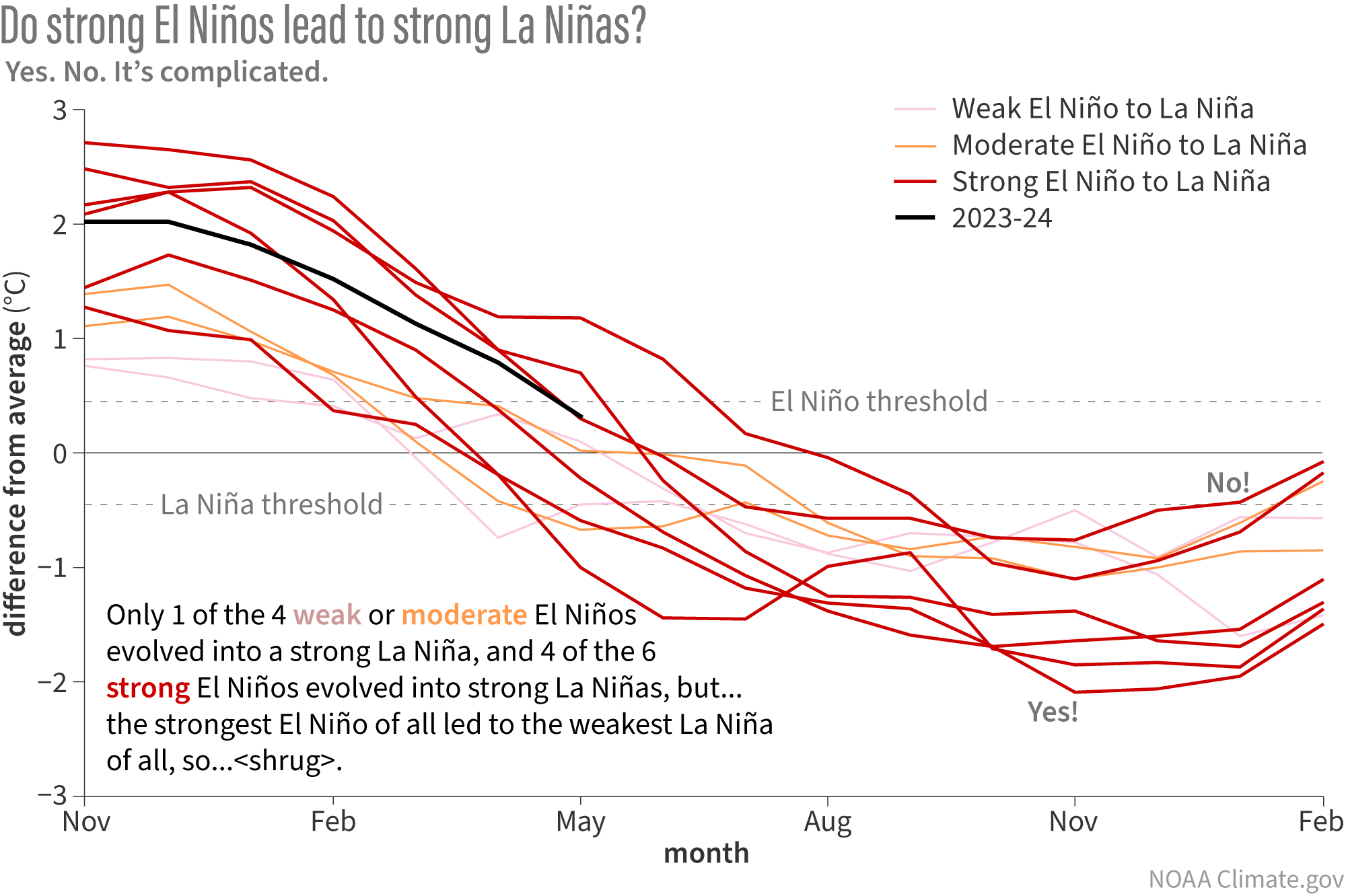
Click the link to read the article on the WyoFile website (Mike Koshmrl):

May 31, 2024

A gas exploration company with Florida ties is pursuing plans to pull groundwater out of existing coalbed methane wells in southern Wyoming, then pipe it into the lower reaches of the water-stressed Colorado River Basin

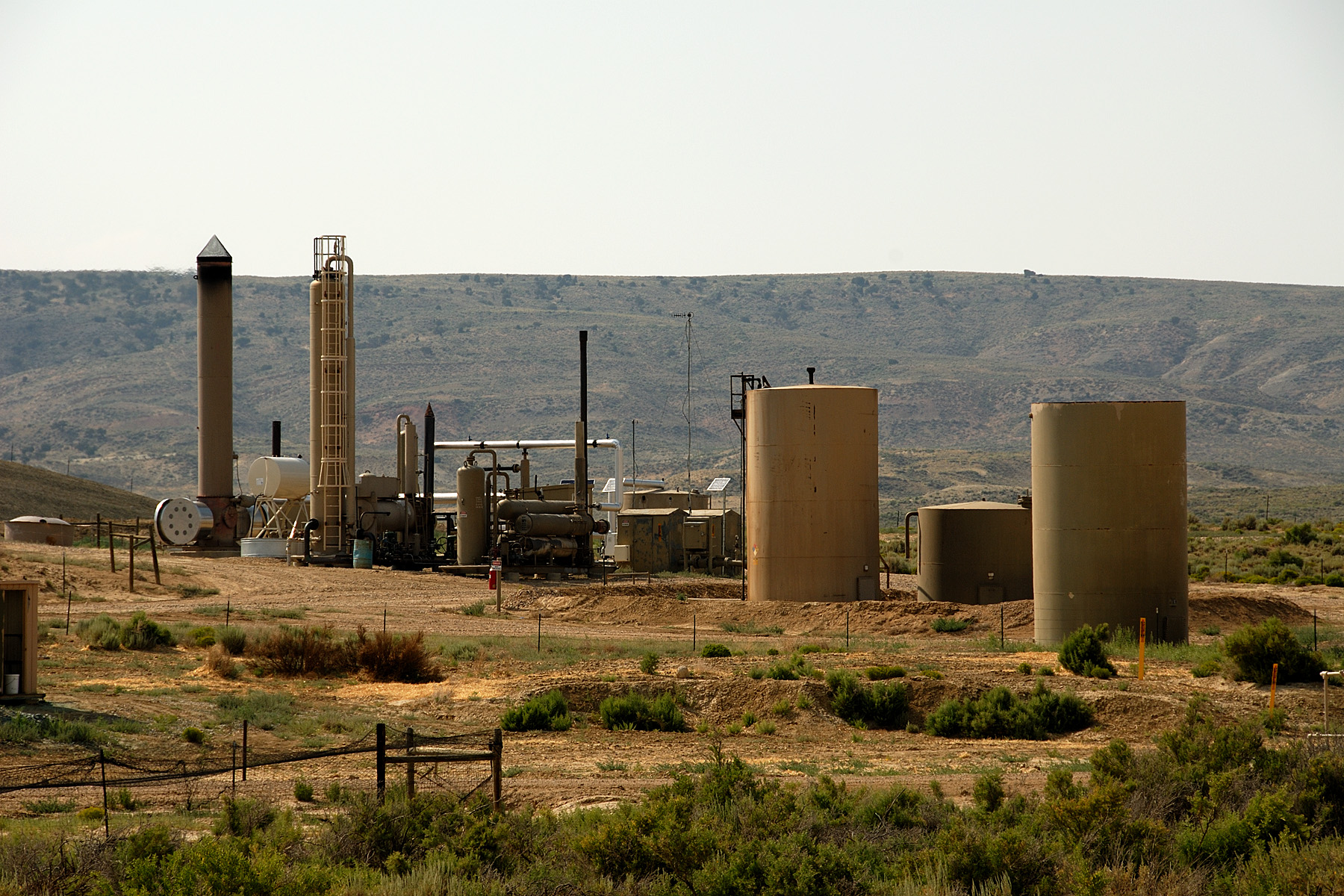
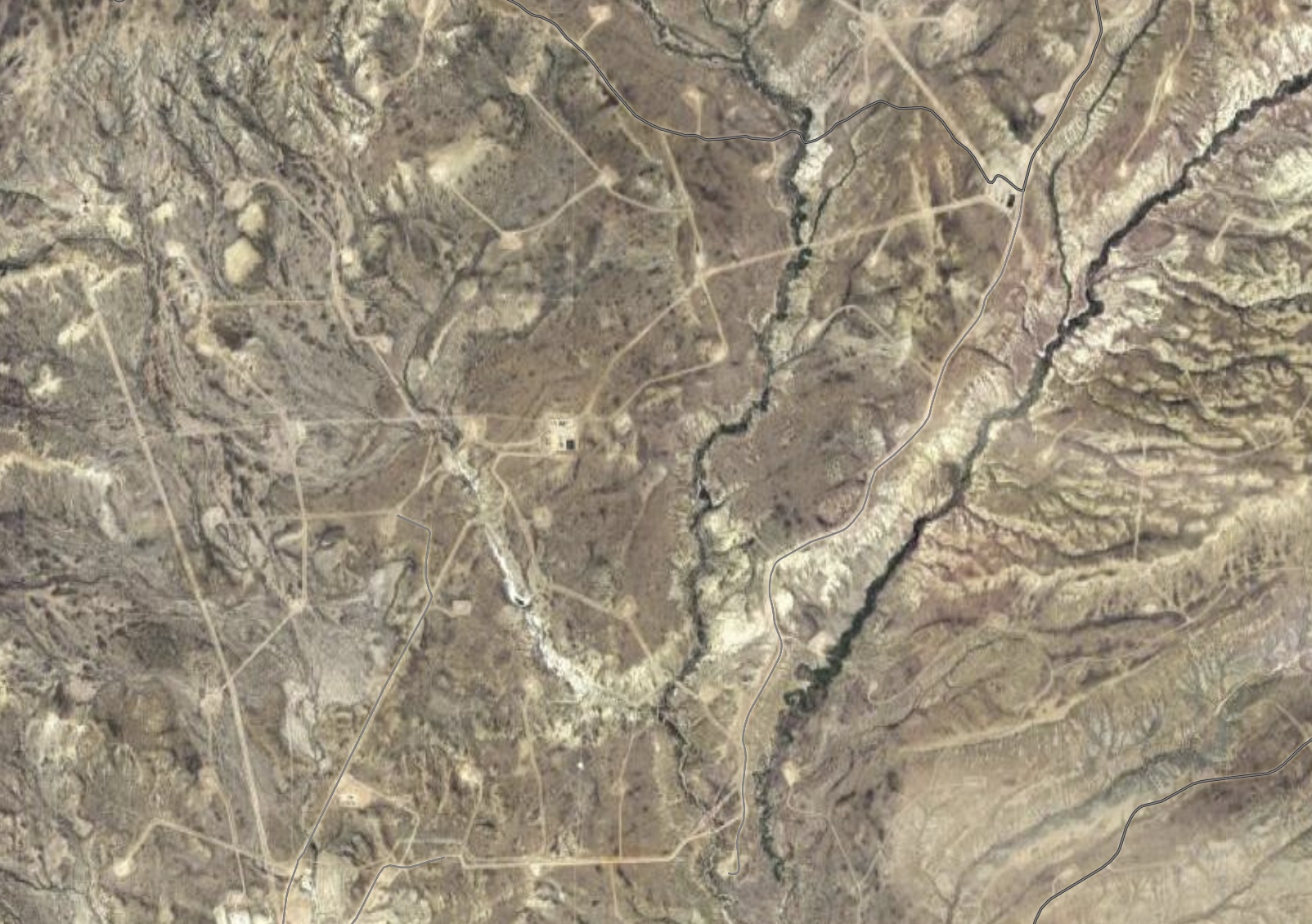
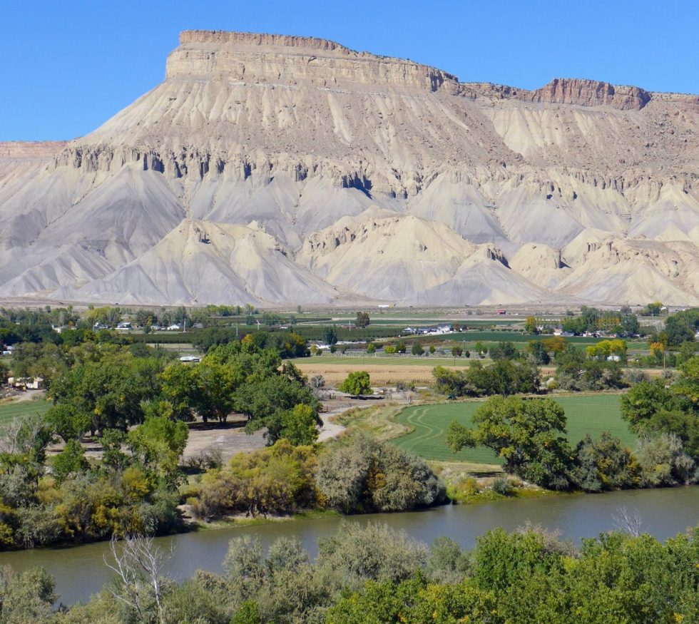
The project was formally initiated in December, when the State Engineerโ€™s Office received 21 groundwater test well applications from Mark Dolar of Dolar Energy, LLC. The test wells are all located on Bureau of Land Management property south of Rawlins in the Atlantic Rim gas field.

Two test well applications have since been rescinded by Dolar to comply with the state of Wyomingโ€™s sage grouse and big game migration policies, according to an email from State Engineer Brandon Gebhart. 

project review letter from the Wyoming Game and Fish Department summarizes what the project proponent seeks to do with the water. 

โ€œIf the water is of sufficient quality, the applicant hopes to transport groundwater to Colorado via a pipeline,โ€ states a letter signed by Habitat Protection Supervisor Will Schultz.

But Sen. Larry Hicks (R-Baggs), whoโ€™s on staff with the Little Snake River Conservation District, has met with Dolar and believes thatโ€™s one of several uses of the water being considered if the plans move forward. Exchanges within Wyoming, he said, could also be an outcome.

โ€œThe simple fact is the marketโ€™s much more lucrative now than it was 20 years ago,โ€ Hicks told WyoFile. โ€œHe doesnโ€™t have to send it to Colorado.โ€

Sen. Larry Hicks (R-Baggs) during the Wyoming Legislatureโ€™s 2024 budget session. (Mike Koshmrl/WyoFile)

Hicks used that rough historic benchmark because there have been repeated efforts since Atlantic Rim field drilling started in the mid-2000s to make use of the water surfaced during gas production. Currently, he said, the produced water is injected back into the ground โ€” which takes energy and money โ€” and it doesnโ€™t make sense given the currently dismal economics of natural gas. 

โ€œThe water is probably, at this point in time, as valuable or more valuable than the natural gas,โ€ Hicks said. โ€œItโ€™s just a matter of figuring out how you utilize that water, and whether thereโ€™s a sufficient enough quantity to justify a lot of expenditures.โ€

Energy companies in the past ultimately determined that using Atlantic Rim formation water didnโ€™t pencil out, even though itโ€™s considered pretty high quality. And theyโ€™ve tried, even building out infrastructure. 

A historic endeavor 

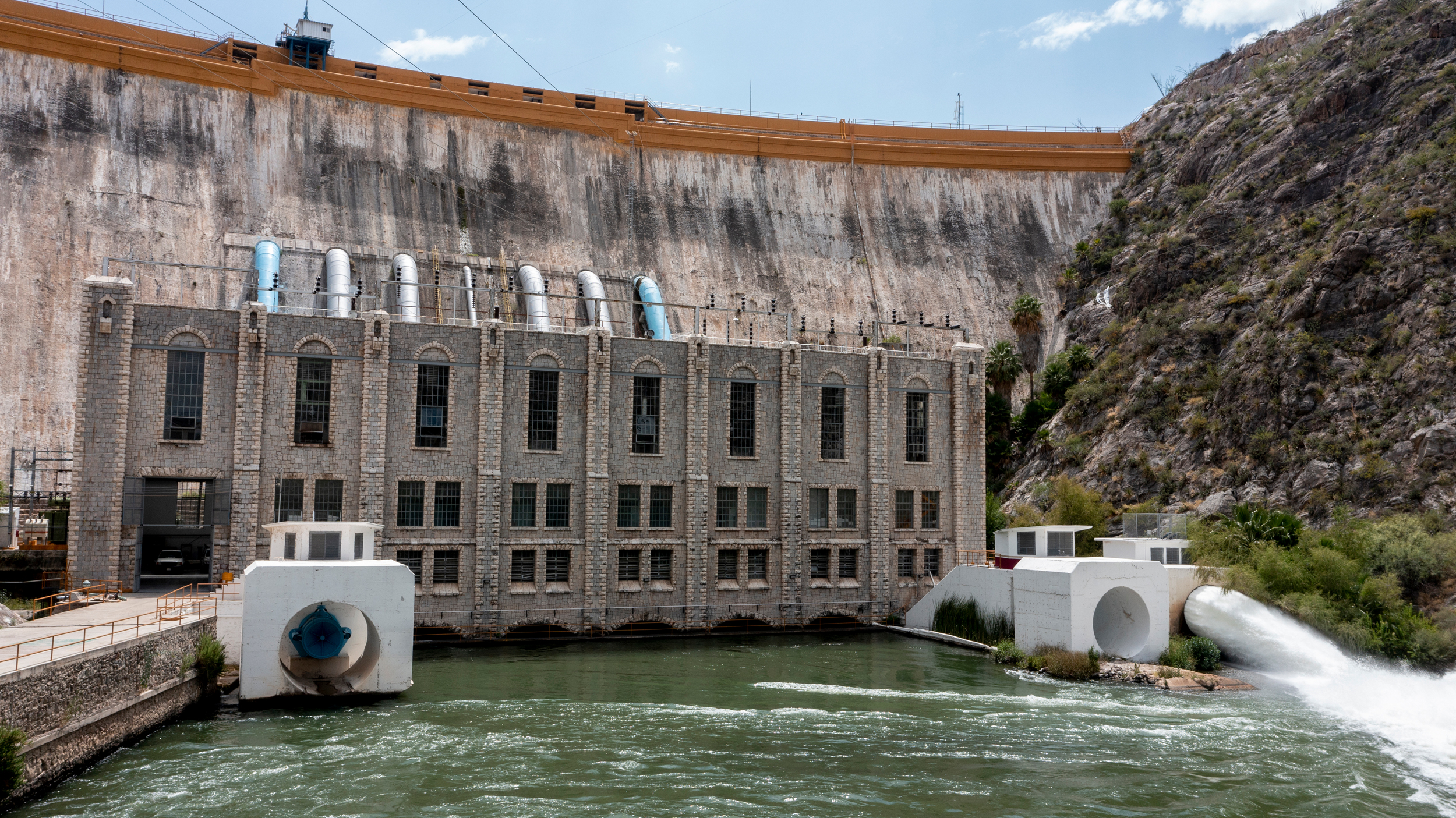
Steve Degenfelder, then a land manager for Atlantic Rim driller Double Eagle Petroleum, recalled that his former employer secured permits to surface discharge a limited volume of untreated water via a pipeline and separately desalinate other volumes. Neither worked out long-term. 

โ€œWe did discharge some into Muddy Creek, but very little,โ€ Degenfelder said. โ€œWe just got a lot of resistance from the environmental community and BLM.

Gas drilling infrastructure in the Atlantic Rim field in 2015. (Ken Driese)

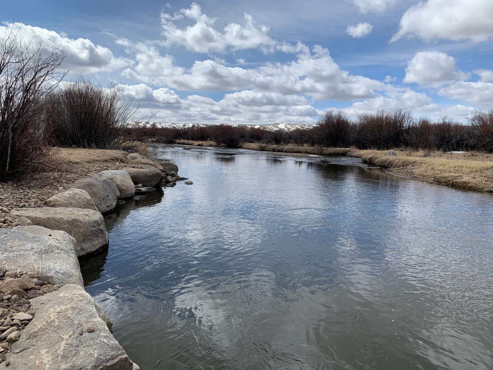
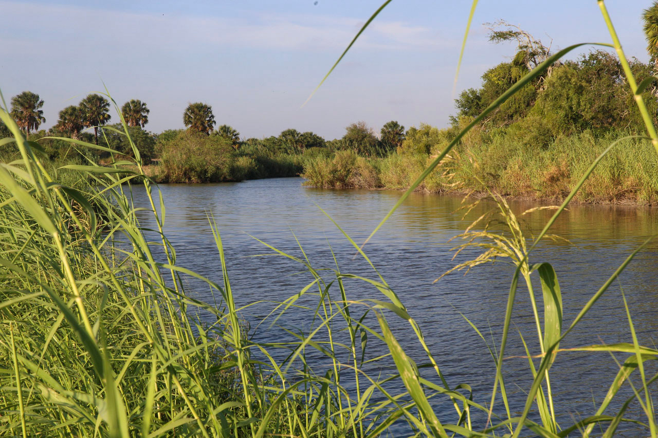
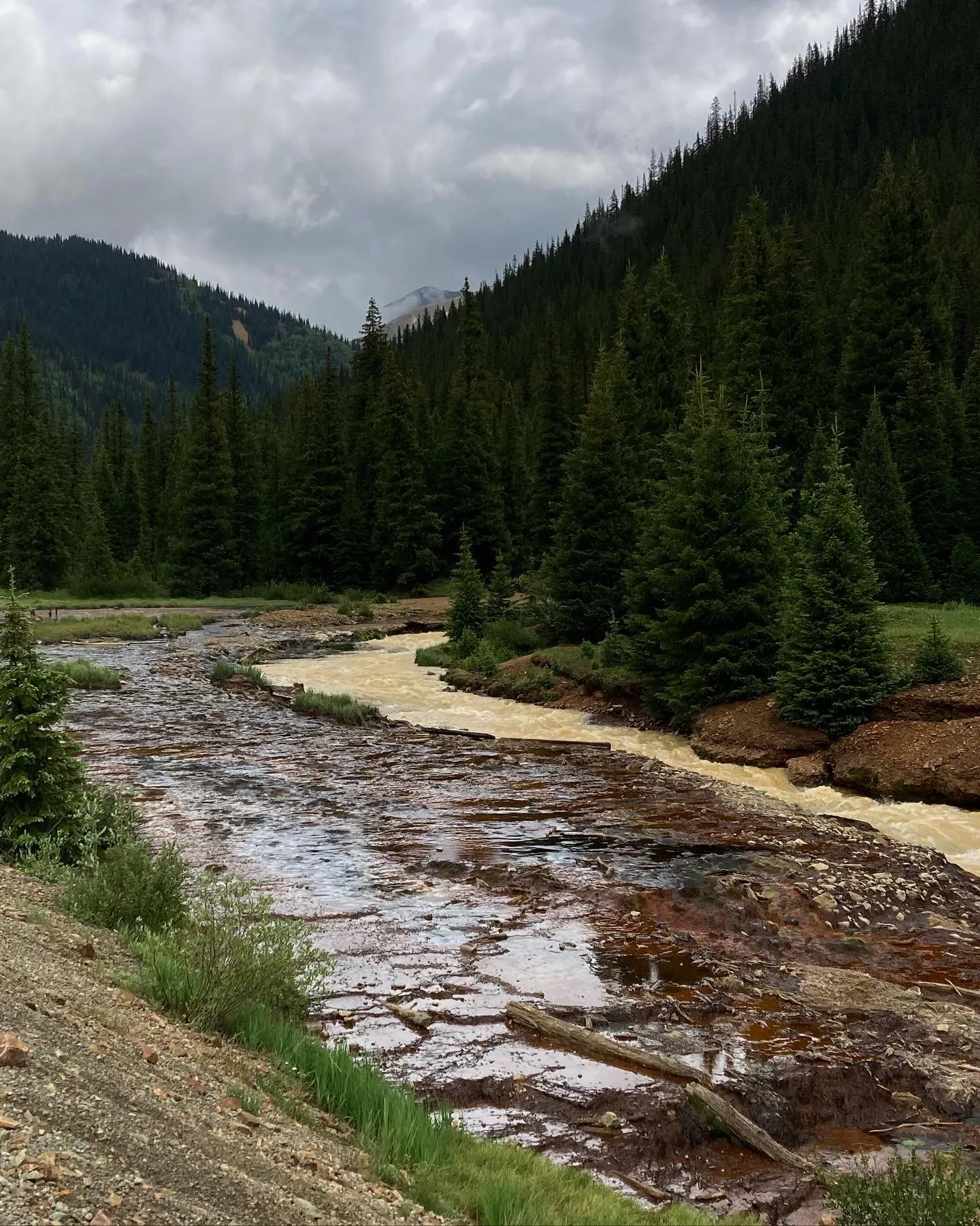
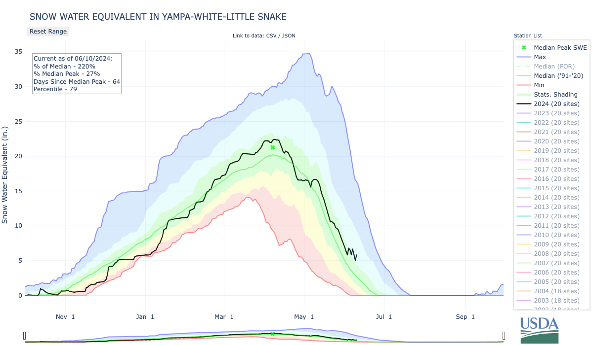
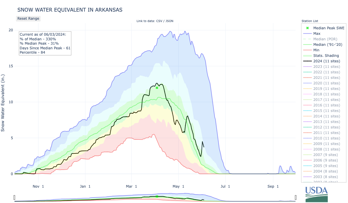
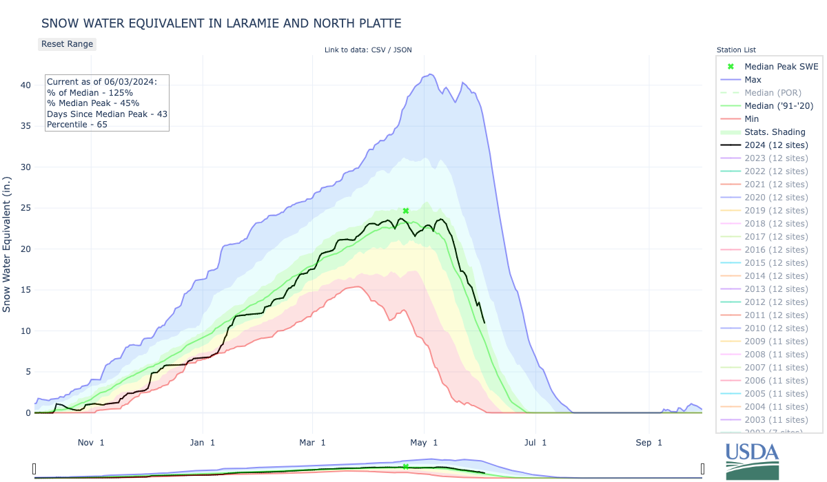
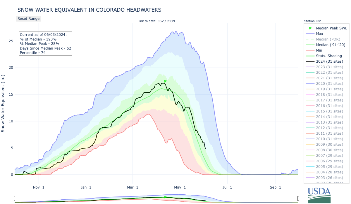
Groundwater in the Atlantic Rim area is both abundant and filled by snowmelt coming off the west slope of the Sierra Madre Range, Degenfelder said. During the heyday of the Atlantic Rim fieldโ€™s development, the two largest drilling companies were producing roughly 100,000 barrels of byproduct water daily โ€” the equivalent of a small stream that flows continuously carrying nearly 7 cubic feet per second. Oftentimes water encountered during the drilling process has a lot of organic matter like oil, but in this region, itโ€™s pretty pristine, he said.

โ€œThereโ€™s a great deal of water to be had and itโ€™s class three water [in Wyoming regulation],โ€ Degenfelder said, โ€œso itโ€™s very good for livestock and wildlife to consume.โ€ 

But itโ€™s also too salty for the most likely use: irrigation. The Wyoming Department of Environmental Quality has standards, and the Atlantic Rim water generally doesnโ€™t cut it. 

โ€œThe sodium is too high,โ€ Hicks said. โ€œ[DEQ] was concerned that when you irrigate with high-sodium water, you poison the soil. It turns white.โ€ 

White crusts of natural salts along a tributary to Muddy Creek. (Carleton Bern/U.S. Geological Survey)

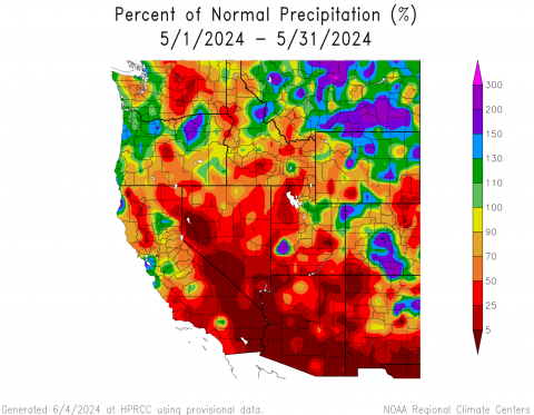
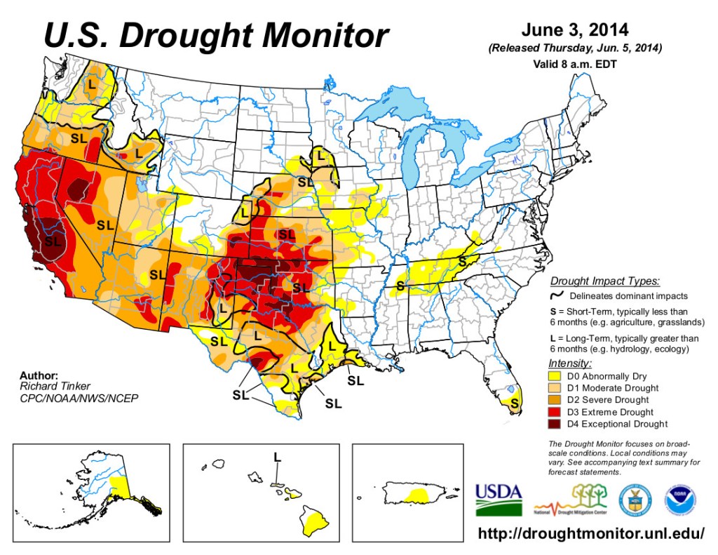
Already, there are issues with too much salt in Atlantic Rim waterways, and disturbing the soil in the region through industrial activity might have increased salinity levels at times. Salt concentrations in the main drainage in the area โ€” Muddy Creek โ€” increased by between 33% and 71% in the years 2009-2012 compared to 2005-2008, according to a 2015 U.S. Geological Survey study. But the sharp uptick in salinity also doesnโ€™t perfectly align with the height of the drilling boom, the Earth Island Journal reported at the time.

Itโ€™s unclear how Dolar Energy would deal with water thatโ€™s too salty for irrigation.

Hicksโ€™ understanding is that Dolar Energy seeks to โ€œcherry pickโ€ the highest-quality water from the test wells and potentially market that only. 

Whatโ€™s the plan this time?

Mark Dolar did not respond to multiple WyoFile requests for an interview. His companyโ€™s website includes little information, though it does feature a short podcast that describes his interest in natural gas resources in the Atlantic Rim field. A map included on the website shows that heโ€™s also done business in the Pinedale area, three parts of Utah plus Coloradoโ€™s Piceance Basin. 

Dolar Energy at one time was a registered business with the Wyoming Secretary of State Office, though itโ€™s been listed as inactive since 2018. The LLC for the oil and gas exploration company is currently registered and considered active with the Florida Department of State

Dolarโ€™s bid to put Wyoming water in a pipeline and send it to Colorado has been attempted before on a much larger scale. 

Conceptual route for the Flaming Gorge Pipeline — Graphic via Earth Justice

More than a decade ago Fort Collins, Colorado residentย Aaron Million pushed a failed proposalย to tap Flaming Gorge Reservoir and pipe the water across southern Wyoming and the Continental Divide to the Colorado Front Range. Although itโ€™s been shot down repeatedly, a fourth iteration of the project wasย still on the table as of 2022, and the dream of the largest privately funded water project in the history of the West is still not dead, according to aย recent feature storyย in the progressive magazine Mother Jones.ย 

Flaming Gorge Reservoir on the Utah side near the dam in September 2021. (Dustin Bleizeffer/WyoFile)

Degenfelder has met Dolar before but was unaware of his recent proposal. โ€œI wonder what those guys can sell Wyoming water to Colorado for?โ€ he asked. 

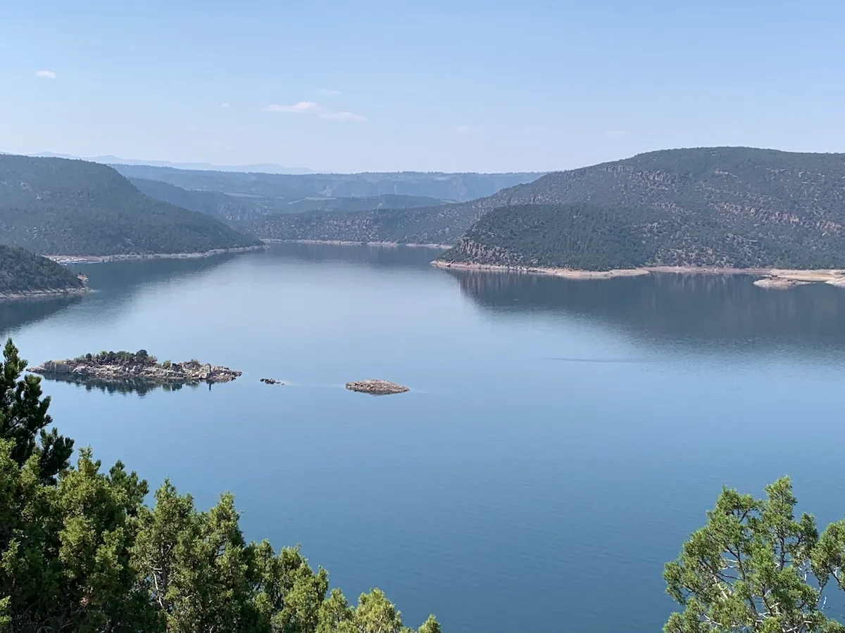
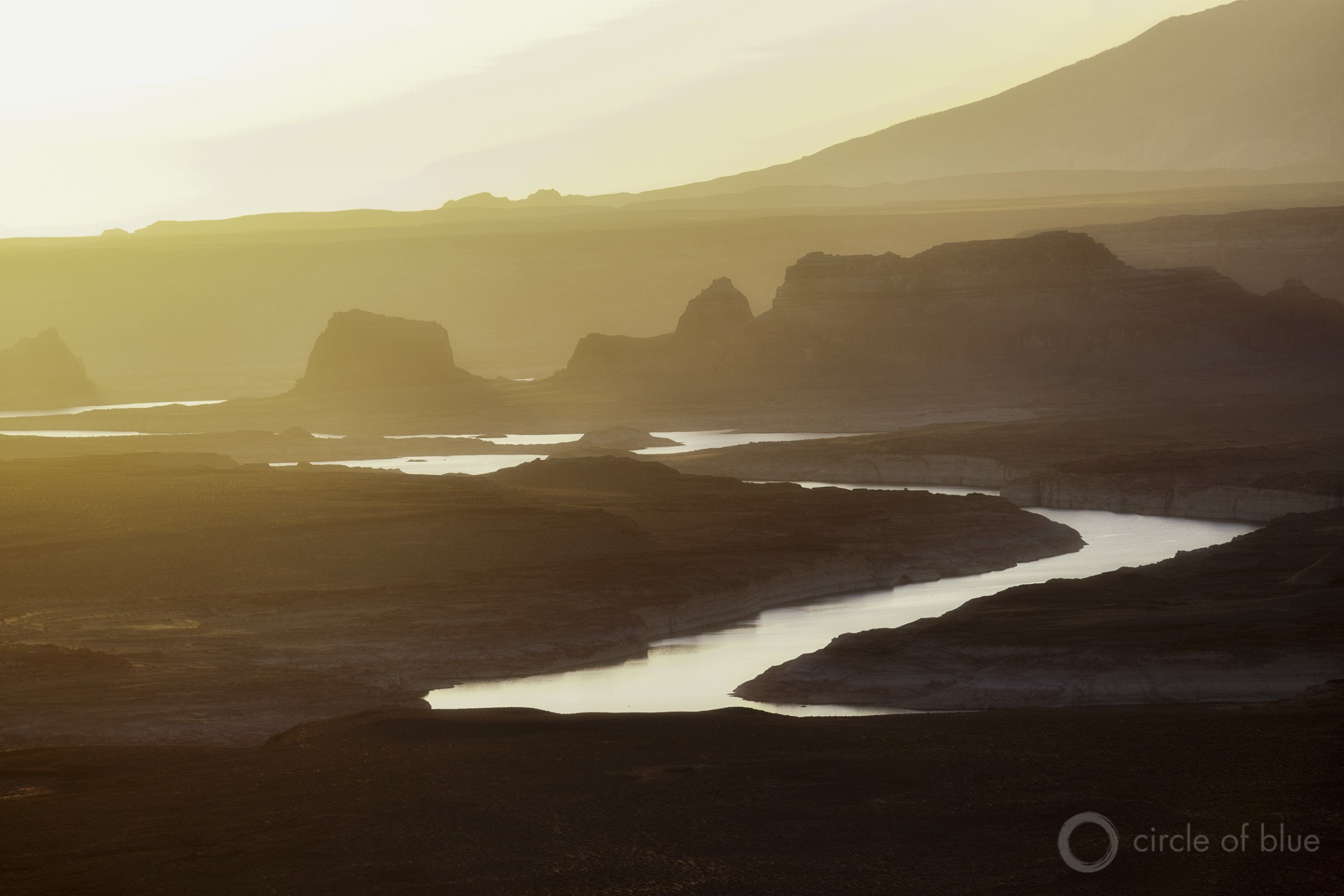
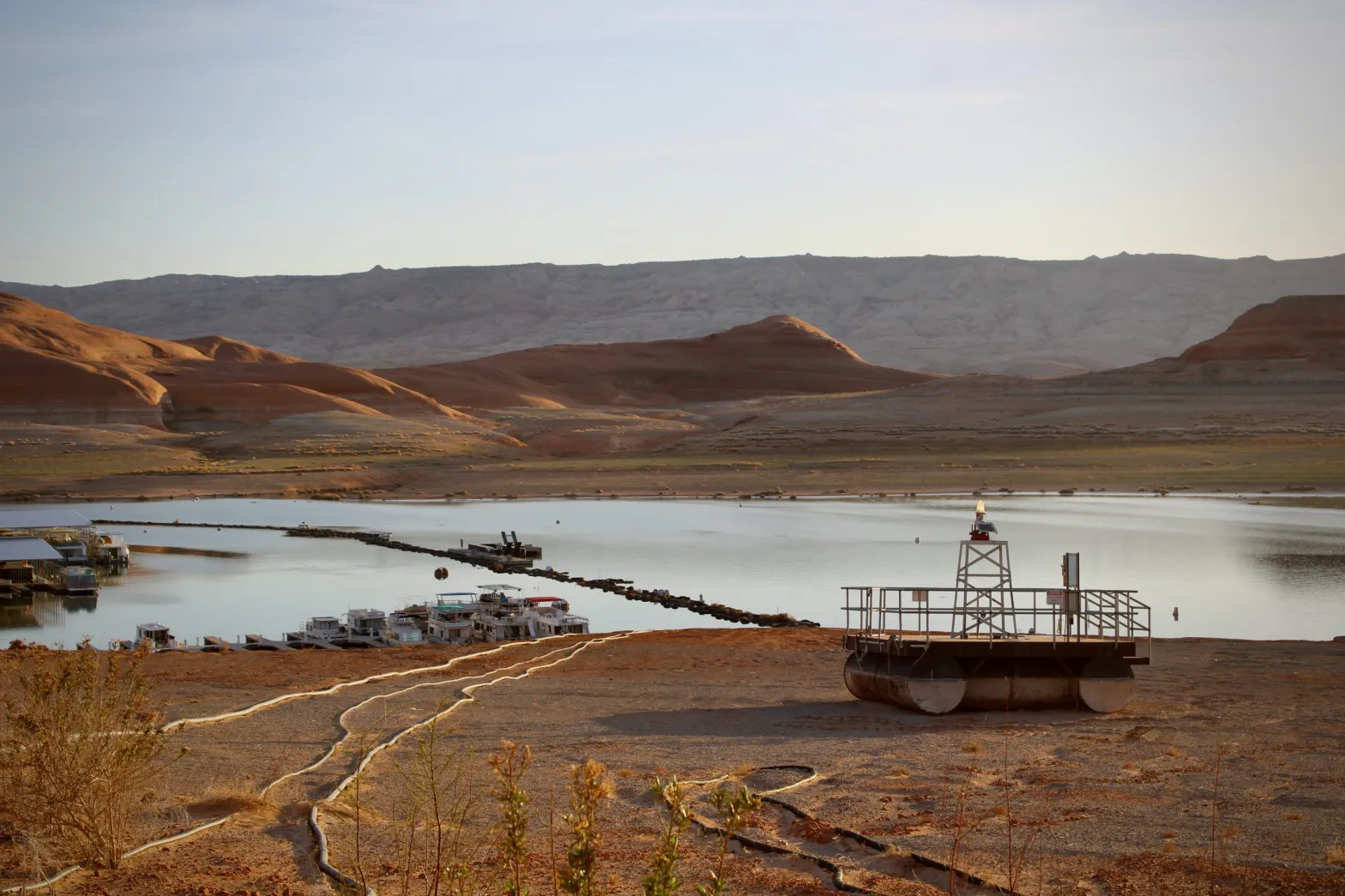
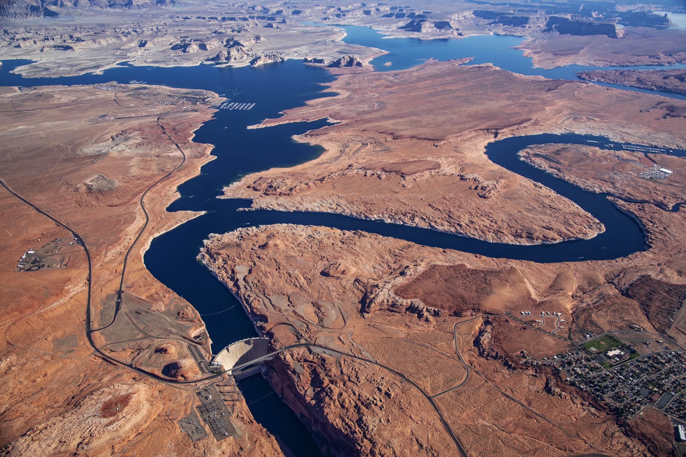
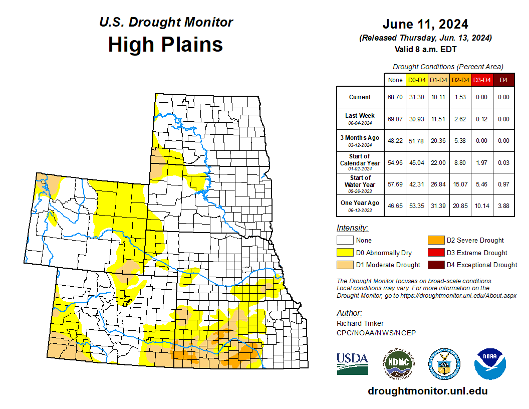
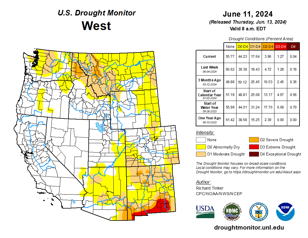
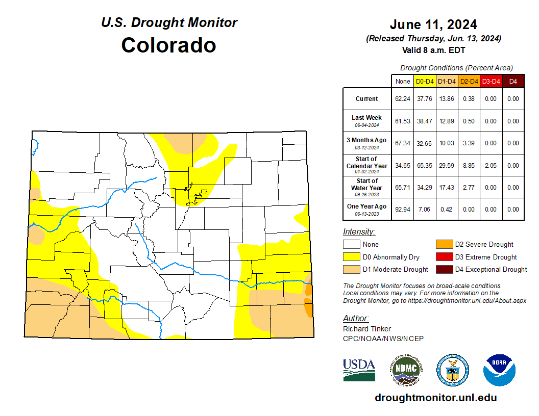
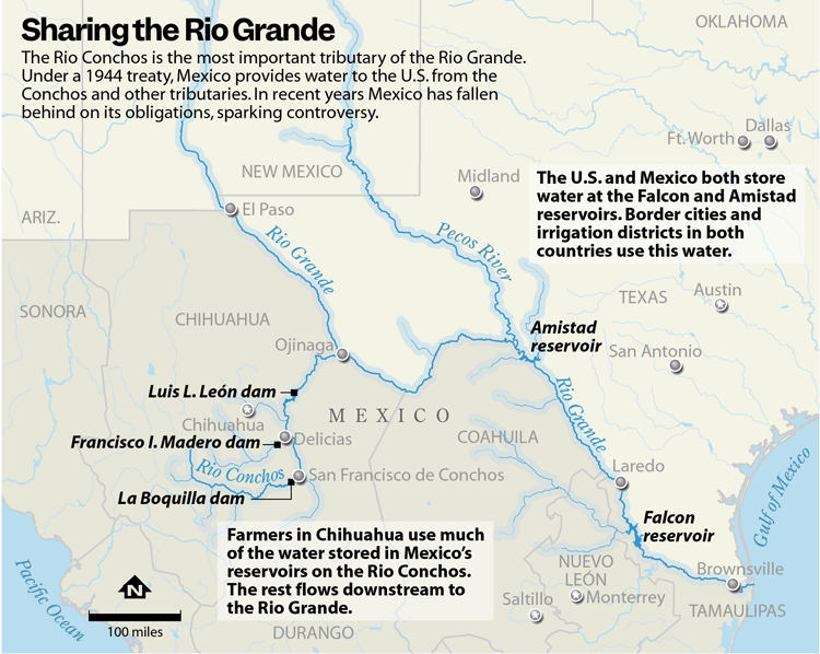
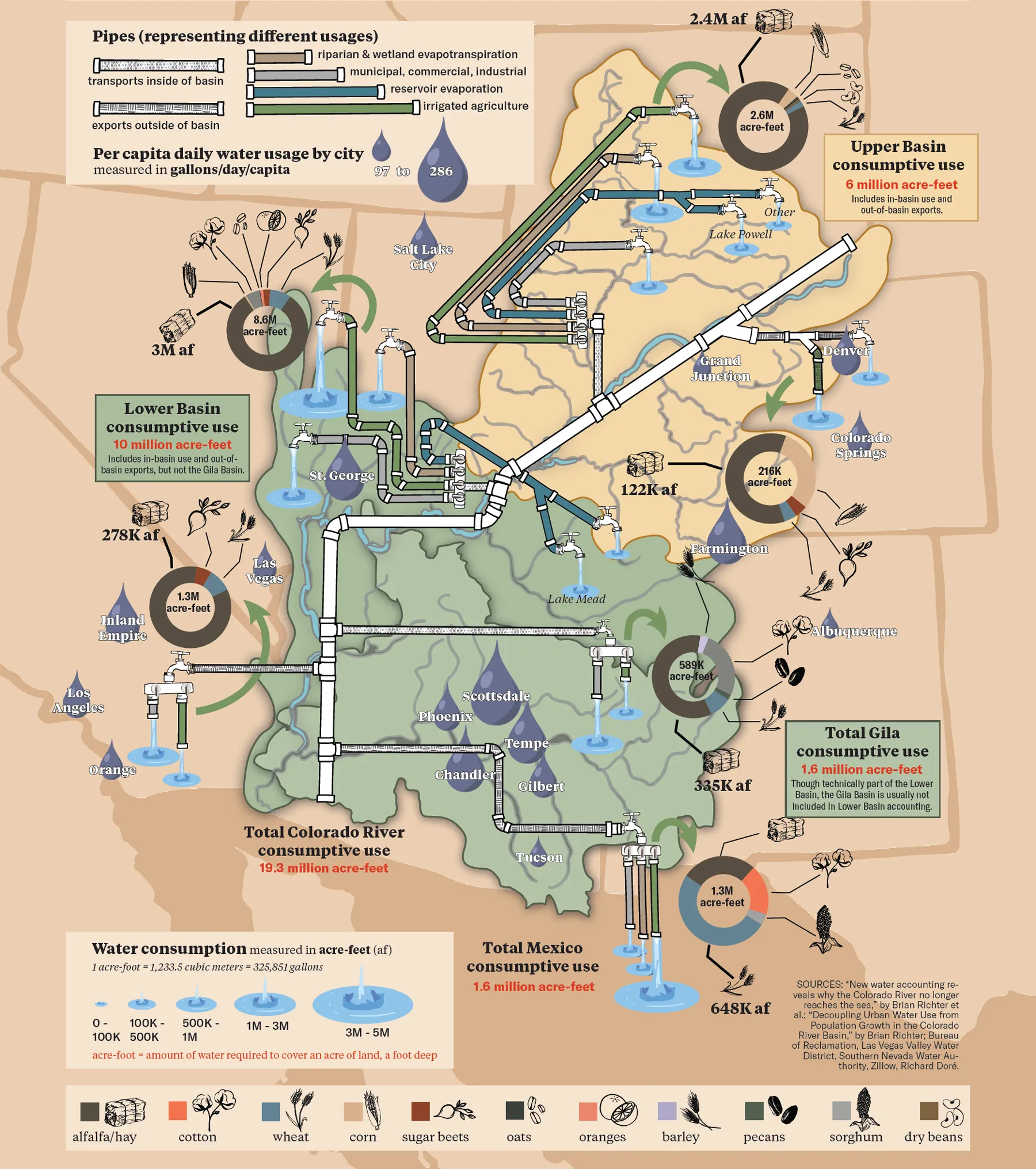
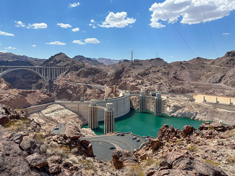
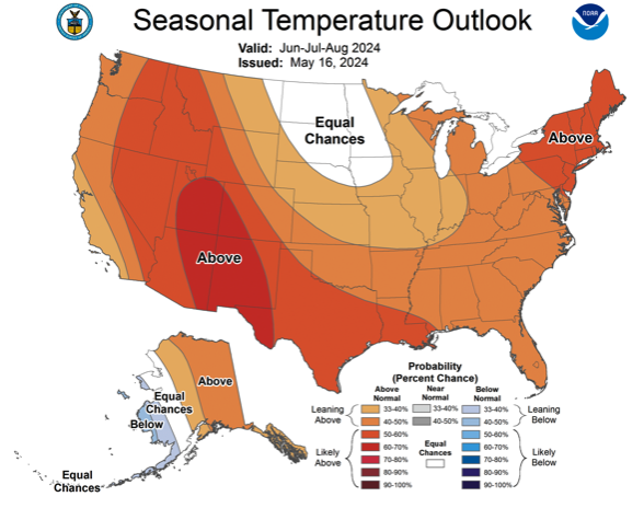
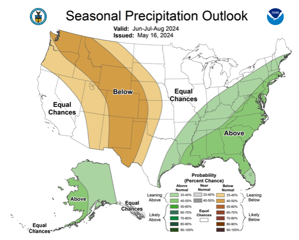
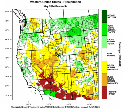
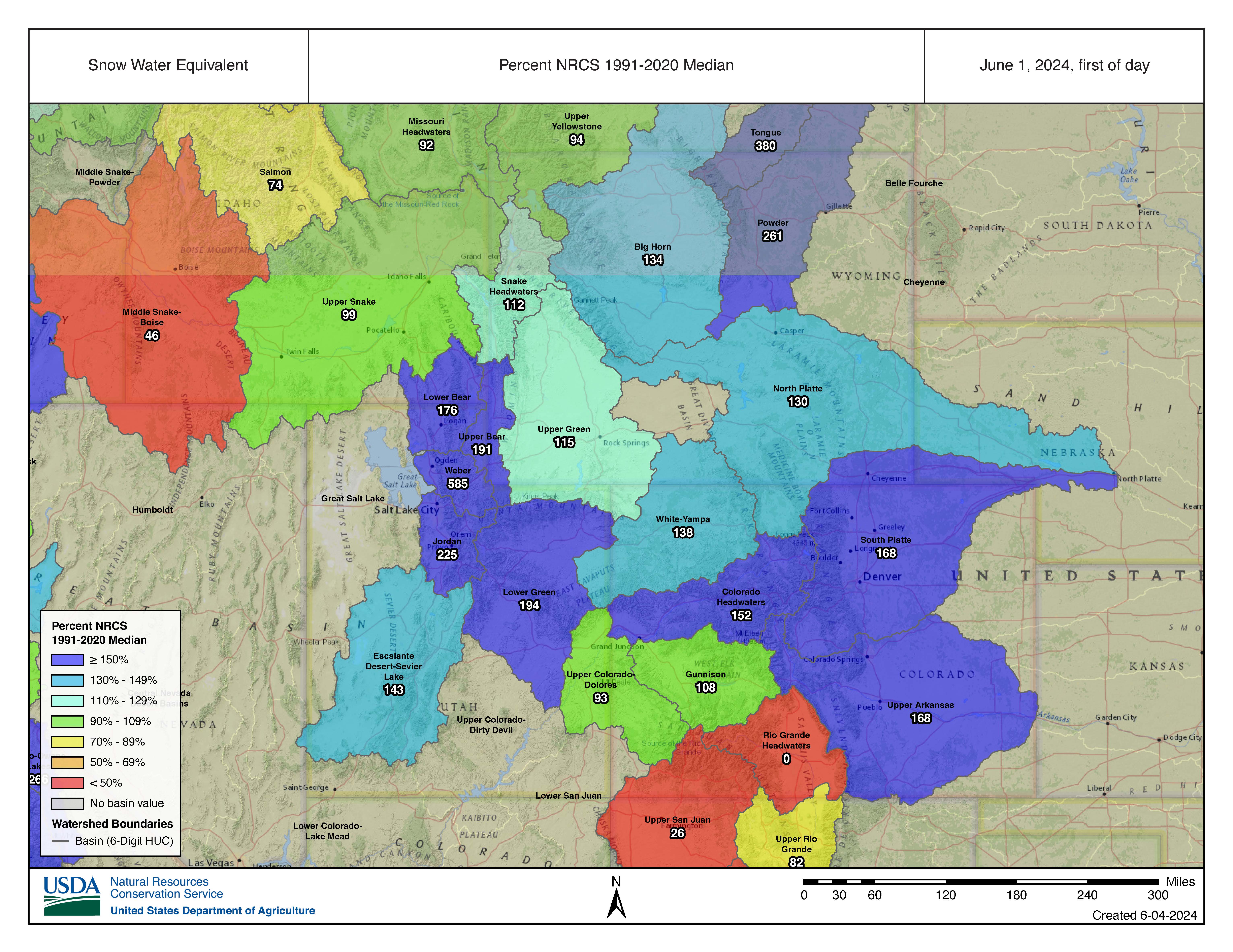
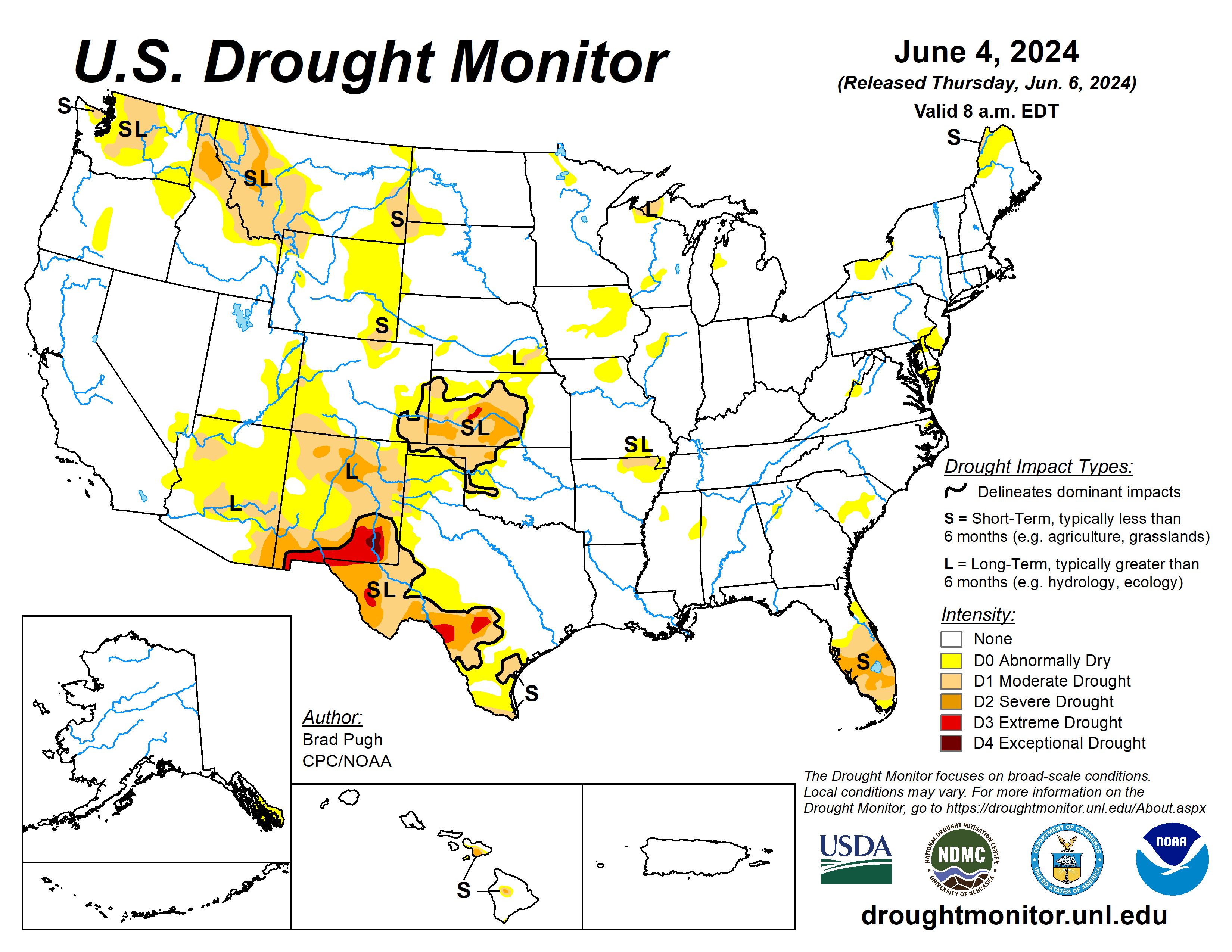
The Atlantic Rim and Muddy Creek drain into the Little Snake River Basin, a tributary of the Green River thatโ€™s part of the overallocated Colorado River Basin. Amid long-term drought, itโ€™s an era of depleted reservoirs and cuts to water allocations in the region โ€” which may be mandatory in Wyomingโ€™s portion of the basin by 2025. 

Given the shortages, Hicksโ€™ sense is that the value of water in the Colorado River Basin has increased โ€œastronomicallyโ€ and that thereโ€™d be a market for the Atlantic Rim water. Still, he said, there are many factors that could prevent the plan from coming to fruition, one of them being the economics of tapping less than two dozen abandoned wells.

โ€œIs there enough water there of sufficient quality that it doesnโ€™t have to be treated?โ€ Hicks asked. 

Hurdles and hurdles

Hicks sees another hurdle: Itโ€™s unclear whether water taken out of Atlantic Rim-area aquifers and surface discharged is subject to interstate water agreements. 

โ€œIf he produces all of that [water] and they say, โ€˜Thatโ€™s connected to the surface water,โ€™ Wyomingโ€™s only entitled to 14% of that under the Upper Colorado River Compact,โ€ the state senator said. 

Groundwater is subject to the Colorado River Compact โ€œto the extent it is Colorado River System water as that term is used in the compact,โ€ Gebhart, the state engineer, explained in an email. 

โ€œHowever, the seven states which are subject to the compact have never mutually determined to what extent groundwater constitutes Colorado River System water,โ€ Gebhart wrote. โ€œThe ability to use groundwater within Wyoming is only subject to our individual state laws.โ€

Gas drilling infrastructure in the Atlantic Rim field in 2015. (Ken Driese)

Constitutionally, the groundwater is owned by the state of Wyoming. If Dolar Energy proceeds with its plans, the company intends to file applications for the โ€œpoints of useโ€ of the Atlantic Rim groundwater, Gebhart said. 

Permitting for activities and disturbances to federal land is another potential obstacle. 

The State Engineerโ€™s Office sent Dolar Energyโ€™s 21 groundwater test well applications to the Bureau of Land Management on Feb. 15, according to the state engineer. At that time, the state office shared concerns about who would be responsible for the currently plugged and abandoned coalbed methane wells if they werenโ€™t going to be used after being reentered. 

The BLMโ€™s Wyoming office hasnโ€™t taken any action because Dolar Energy hasnโ€™t submitted anything, said Brad Purdy, deputy state director for communications. All of the leases for the old wells have been terminated, he said. 

โ€œIf the company is interested in doing commercial H2O wells off of those CBM wells, we have to get some applications,โ€ Purdy said. โ€œWe donโ€™t have any right-of-way applications, we have no [applications to drill] to reenter a plugged well. The proponent has a lot of stuff they need to submit before we can run NEPA and even begin to analyze this.โ€ 

Wildlife managersโ€™ concerns are another potential impediment to Dolar Energyโ€™s plans. 

Coalbed methane gas pads litter the Atlantic Rim field in the Muddy Creek drainage in south-central Wyoming. (Google Maps screenshot)

The Wyoming Game and Fish Departmentโ€™s review letter shows that 19 of the 21 applied-for test wells (two were later rescinded) are located within the designated Baggs Mule Deer Migration Corridor. Of those, six wells are located on ground thatโ€™s both โ€œstopoverโ€ and โ€œhigh useโ€ habitat. One well each fell solely within high use and stopover areas, while the remainder would be located within โ€œlowโ€ or โ€œmediumโ€ use areas. 

โ€œThe proposed well sites were recently plugged and the pads reclaimed,โ€ Game and Fishโ€™s letter states. โ€œWe are concerned that disturbance at these well sites, specifically within the high use area and stopovers within high use areas, will impede or reverse the reclamation process while also negatively impacting migrating mule deer.โ€ 

โ€œLastly, it should also be noted that a water pipeline in the Baggs area will likely traverse sensitive and vital wildlife habitats, much like these exploratory wells,โ€ the letter noted.

Yampa River Basin via Wikimedia.

#Colorado accepts applications for Agrivoltaics Research and Demonstration grant: Grants up to $500,000 for projects dealing in solar generation and agriculture land — @AlamosaCitixen

Photo credit: Alamosa Citizen

Click the link to read the article on the Alamosa Citizen website:

May 30, 2024

For a second straight year the Colorado Department of Agriculture is looking to distribute grants up to $500,000 for projects that demonstrate and research the use of solar generation on agriculture land. The grants are part of the stateโ€™s Agrivoltaics Research and Demonstration program which came into existence through legislation sponsored by state Sen. Cleave Simpson of Alamosa.

The grant program is particularly relevant to the San Luis Valley, where the reduction in groundwater irrigation has led to thousands of farming acres retired. Generating more renewable solar is part of the Valleyโ€™s strategy to find alternative uses for a growing number of retired fields that now dot the landscape.

โ€œThe first year of these grants was a tremendous success. Awardees have explored groundbreaking methods to effectively develop energy on the same land that is used to grow food and fiber,โ€ said Cindy Lair, Deputy Director of the Conservation Services Division. โ€œWe canโ€™t wait to see the new, innovative proposals that will be submitted for this next round of funding.โ€ 

Up to $500,000 is available for projects that study the potential, benefits, and tradeoffs of agrivoltaics in Colorado. 

The Agrivoltaics grant program is part of CDAโ€™s Agricultural Drought and Climate Resilience Office (ADCRO), which helps Colorado producers mitigate and respond to drought and a changing climate. 

Applicants can find the Grant Guidelines as well as instructions for submitting an application on the ADCRO website, at ag.colorado.gov/adcro. The maximum grant award is $249,000 for a single project application. Eligible project types include construction or expansion of agrivoltaics systems and demonstration projects, outreach and communication efforts focused on agrivoltaics benefits or obstacles, and research projects that focus on understanding the benefits, incremental costs, and tradeoffs of agrivoltaics systems.

Applications should be submitted via email to Rosalie.Skovron@state.co.us by July 21, 2024. 

ADCRO staff will host a webinar on the application process on June 18. Anyone interested in applying for the grant can participate. A recording will be available on the CDA YouTube channel. 

In the Fiscal Year 2023-24, seven different projects received grant funding to showcase diverse ways of generating electricity from solar arrays on Colorado farms and ranches. One of the projects, completed by Longboard Power, included installing solar wind breaks on a farm and monitoring soil benefits and energy output. Another, through the Colorado Cattlemenโ€™s Agricultural Land Trust, is creating template conservation easement language that would allow for solar power generation while maintaining ag production and applying conservation values.

The other five projects were by Namaste Solar, Colorado State University, American Farmland Trust, Sandbox Solar, and Summit Cellars.

Webinar Information

Date and Time: Tuesday, June 18, 2024 from 1:00 p.m. โ€“ 2:00 p.m. MDT 

Registration link: June 18 registration link or go to ag.colorado.gov/ADCRO

Description: This grant encourages innovative projects, including demonstrations of agrivoltaics, research projects, and outreach campaigns to further agrivoltaics and Coloradoโ€™s agricultural economy. CDA staff will explain the application process for the grant and answer questions.


Colorado acepta solicitudes para la subvenciรณn de Investigaciรณn y Demostraciรณn de Agrivoltaicos

Por segundo aรฑo consecutivo, el Departamento de Agricultura de Colorado busca distribuir subvenciones de hasta $500,000 para proyectos que demuestren e investiguen el uso de generaciรณn solar en tierras agrรญcolas. Las subvenciones son parte del programa estatal de Investigaciรณn y Demostraciรณn de Agrivoltaicos, que se creรณ a travรฉs de una legislaciรณn patrocinada por el senador estatal Cleave Simpson de Alamosa.

El programa de subvenciones es particularmente relevante para el Valle de San Luis, donde la reducciรณn del riego con agua subterrรกnea ha llevado a retirar miles de acres de tierras de cultivo. Generar mรกs energรญa solar renovable es parte de la estrategia del Valle para encontrar usos alternativos para un nรบmero creciente de campos retirados que ahora salpican el paisaje.

โ€œEl primer aรฑo de estas subvenciones fue un รฉxito tremendo. Los beneficiarios exploraron mรฉtodos innovadores para desarrollar eficazmente la energรญa en la misma tierra que se utiliza para cultivar alimentos y fibras,โ€ declarรณ Cindy Lair, Subdirectora de la Divisiรณn de Servicios de Conservaciรณn. โ€œTenemos muchas esperanzas de ver propuestas nuevas e innovadoras que se puedan presentar en esta prรณxima ronda de financiamiento.โ€

Se dispone de hasta $500,000 para proyectos que estudien el potencial, los beneficios y las soluciones intermedias y compensatorias de la agrovoltaica en Colorado.

El Programa de Subvenciones Agrovoltaicas forma parte de la Oficina de Sequรญa Agrรญcola y Resiliencia Climรกtica (ADCRO) de CDA, que ayuda a los productores de Colorado a mitigar y responder a la sequรญa y al cambio climรกtico.

Los solicitantes pueden encontrar las directrices para la concesiรณn de subvenciones, y las instrucciones para postularse, en la pรกgina de internet de ADCRO ag.colorado.gov/adcro. El mรกximo de subvenciรณn para una solicitud es $249,000 para un solo proyecto. Los proyectos elegibles incluyen la construcciรณn o ampliaciรณn de sistemas agrovoltaicos; proyectos de demostraciรณn; esfuerzos de divulgaciรณn y comunicaciรณn centrados en los beneficios u obstรกculos de la agrovoltaica, y proyectos de investigaciรณn centrados en comprender los beneficios, costos incrementales y las soluciones intermedias y compensatorias de los sistemas agrovoltaicos.

Las solicitudes deben enviarse al correo electrรณnico Rosalie.Skovron@state.co.us antes del 21 de julio de 2024.

ADCRO organizarรก una junta virtual para ver el proceso y los detalles de solicitud el 18 de junio. Cualquier persona interesada en postularse para la subvenciรณn puede participar. La grabaciรณn quedarรก disponible en el canal de YouTube de CDA.

En el ejercicio fiscal 2023-24, siete proyectos diferentes recibieron subvenciones para mostrar diversas formas de generar electricidad a partir de paneles solares en granjas y ranchos de Colorado. Uno de los proyectos, realizado por Longboard Power, incluรญa instalar un cortavientos solar en una granja y monitorear los beneficios para el suelo y la producciรณn de energรญa. Otro, a travรฉs del Fondo de Tierras Agrรญcolas de los Ganaderos de Colorado, estรก creando un modelo de servidumbre de conservaciรณn que permitirรญa generar energรญa solar mientras siga la producciรณn agrรญcola y aplicando los valores de conservaciรณn.

Los otros cinco proyectos son de Namaste Solar, Colorado State University, American Farmland Trust, Sandbox Solar y Summit Cellars.

Informaciรณn sobre el webinario

Fecha y hora: martes, 18 de junio de 2024 de 1:00 a 2:00 p. m. (zona horaria MDT)

Enlace de inscripciรณn: regรญstrese para la reuniรณn del 18 de junio o visite ag.colorado.gov/ADCRODescripciรณn: esta subvenciรณn fomenta proyectos innovadores como demostraciones de agrovoltaica, proyectos de investigaciรณn y campaรฑas de divulgaciรณn para impulsar la agrovoltaica y la economรญa agrรญcola de Colorado. CDA explicarรก el proceso de solicitud de la subvenciรณn y responderรก preguntas en esta junta virtual.

When dams come down, what happens to the ocean? — @HighCountryNews #ElwhaRiver

Pterygophora kelp grows in new sediment in the Strait of Juan de Fuca after the Elwha River Dam was breached in 2011. Ian Miller/Washington Sea Grant

Click the link to read the article on the High Country News website (Natalie Mesa):

April 19, 2024

In late August, Steve Rubin, a fish biologist with the United States Geological Survey, will dive into the frigid, briny water of the Strait of Juan de Fuca, roughly a mile from the mouth of the Elwha River. It will be Rubinโ€™s 12th dive at the site since the Elwha Dam was breached in 2011, sending a centuryโ€™s worth of accumulated sediment surging downstream.

The megatons of sediment that were released by the damโ€™s removal were expected to help rebuild the twists and turns of the Elwha River. But some feared that they might end up suffocating the coastal ecosystems near the delta. 

During Rubinโ€™s first post-removal dive, he documented kelp, algae, invertebrates and fish. The changes he saw were striking: Where there had been dense kelp forests, there was now bare ocean floor. The water was opaque with suspended sediment. At some dive sites near the delta, he could hardly see his outstretched hand. โ€œItโ€™s hard to describe. In some of our sites there was nothing โ€” literally zero individuals of some of these kelp and algae species,โ€ Rubin said. 

Evolution of the shoreline around the Elwha River mouth before, during and after dam removal, from 2011 to 2017. Two large dams were removed from the Elwha River between 2011 and 2014, which released more than 20 million tons of sediment downstream. These images show the effects of new sediment depositing around the river mouth and being reworked by waves and currents. Warrick and others/Scientific Reports

The kelp density near the river mouth decreased 77% in just a year, a worrisome development that the Seattle Times described as a โ€œkelp Armageddon.โ€ The removal of the Glines Canyon Dam, 8 miles upriver of the Elwha River and 14 miles from the delta, started in 2013, releasing even more sediment. Kelp continued to decline in 2013, decreasing by 95% since before dam removal.

That wasnโ€™t the whole story, though. When Rubin returned in 2015, he saw that, in many of his survey sites, the kelp had started to rebound. In 2018, studies revealed that the density of kelp in these sites resembled pre-removal levels. Researchers believe that the initial die-off was due to suspended sediment blotting out much of the sunlight that kelp needs to grow. Once that sediment settled or washed away, the kelp recovered. 

USGS divers Steve Rubin and Reg Reisenbichler lay out a survey transect. Rubin, a fish biologist with the United States Geological Survey, has dove the Strait of Juan de Fuca 11 times since the Elwha Dam was breached in 2011. Ian Miller/USGS

More than a decade after the Elwha Damโ€™s removal, researchers are finally getting a fuller picture of its impact on coastal ecosystems. When the dams were breached, the coastline near the riverโ€™s mouth was completely remodeled. Sediment built stretches of sandy beaches and a series of swirling sand bars that peek above the waterโ€™s surface. These beaches and bars have allowed water to pool, forming a series of brackish lagoons. Plants and animals quickly colonized the new ecosystem. โ€œIt was like seeing a geologic event in a human timeframe,โ€ said Anne Shaffer, executive director and lead scientist of the Coastal Watersheds Institute and affiliate professor at Western Washington University. 

Though some of the early arrivals were invasive plants, like dunegrass, yearly surveys reveal that the beaches are now dominated by native plants. The increased turbidity of the water initially decimated invertebrate species, including insects and crabs. But preliminary research led by the Lower Elwha Klallam Tribe shows that since around 2018, invertebrate populations have rebounded, and the species diversity continues to increase.  

In late 2023, Rubin, Miller and their team reported the results of their 11 years of SCUBA surveys in the journal Frontiers in Ecology and Evolution. At some of their survey sites along the delta, there have been lasting changes: The sediment released when the dam came down still covers the coarse, rocky seafloor. โ€œAs long as theyโ€™re buried, itโ€™s a different kind of substrate with different species,โ€ Rubin said. 

But while such sites canโ€™t support kelp, other species are finding a home. The Pacific sand lance, a silver, sword-shaped fish that buries into soft sediment and is a key food source for salmon, was not seen in these areas before dam removal. โ€œNow, you dive there, and you can barely swing a cat without hitting a sand lance,โ€ said Miller. Geoducks and Dungeness crabs have also settled into the sandy depths.

The Elwha shoreline has clearly changed, but it is also undeniably healthier as a whole, said Shaffer, noting that restoration is a long process that takes decades. The removal has reversed the erosion of beaches near the riverโ€™s mouth, and the riverโ€™s undamming has transformed them into โ€œa beautiful deltaic habitat. Itโ€™s gorgeous,โ€ she said. And the salmon have also likely benefited from more than just fish passage in the river: Thereโ€™s been a noticeable increase in the number of surf smelt spawning on the deltaโ€™s beaches, Shaffer said. 

A rainbow sea star and urchins seen during Elwha River Delta surveys in 2023. Preliminary research led by the Lower Elwha Klallam Tribe shows that since around 2018, invertebrate populations have rebounded, and the species diversity continues to increase. Photo credit: USGS

Rubin and Miller also noted that dam removal might not be responsible for all the changes seen in the delta since the dams came down. Around 2014, for example, sea star wasting disease decimated the regionโ€™s starburst-like sunflower sea stars, while a heat wave starting in 2014 disrupted dozens of marine species, including kelp.

Right now, other researchers are preparing to study the removal of four dams from the Klamath River in southern Oregon and Northern California. As with the Elwha removals, some locals worry that the sediment will harm the coastal ecosystem near the delta. But scientists donโ€™t expect trouble: Since the Klamath flows into the open ocean, where the currents are strong and fast, the sediment is likely to wash away quickly. As the sediment moves south along the coast, however, it may help to rebuild and bolster beaches eroded by sea-level rise, making them more resistant to flooding.

This summerโ€™s survey of the Elwha River Delta will be the last of its kind, as the projectโ€™s funding is set to expire. The delta is still changing and remodeling, so how its newly established communities will evolve in the long run remains uncertain. Even the most persistent sediment deposits may erode in the coming years, decades or centuries. โ€œThe key takeaway is if you remove a dam, you can change the marine ecosystem,โ€ Miller said.

Shaffer noted that the Elwha River offers an important lesson for future dam removal projects: Conserving and restoring nearshore habitats should not be an afterthought. โ€œThe nearshore is a critical zone for fish like salmon and forage fish,โ€ she said. โ€œInclude your nearshore (in restoration planning); donโ€™t overlook it. When you restore it, things come back quickly.โ€

Elwha River. By Elwhajeff at English Wikipedia, CC BY-SA 3.0, https://commons.wikimedia.org/w/index.php?curid=9740555

Colorado River Water Use in Three States Drops to 40-Year Low: #Arizona, #California, and #Nevada take less water from the struggling river — Circle of Blue #COriver #aridification

The Colorado River flows into Lake Powell, on the Arizona-Utah border. Photo ยฉ J. Carl Ganter / Circle of Blue

Click the link to read the article on the Circle of Blue website (Brett Walton):

June 14, 2024

As the Colorado River declines, one fundamental question hangs over the Southwestโ€™s most important waterway: can its people and industries slash their water use, thus aligning their water demands with a shrinking supply?

The answer so far โ€“ with important caveats โ€“ is a clear but qualified โ€˜yes.โ€™

The latest evidence: the three lower basin states of Arizona, California, and Nevada whittled their take from the river last year. Their combined consumption of just under 5.8 million acre-feet is the lowest annual total since 1983. That represents a decline of 13 percent compared to 2022, when Lake Mead, the basinโ€™s largest reservoir hit a record low and a simmering crisis morphed into a full-blown emergency.

The 2023 water consumption numbers are detailed in a Bureau of Reclamation report published last month. Reclamation is the federal agency that oversees the basin.

The report comes as the seven basin states โ€“ including Colorado, New Mexico, Utah, and Wyoming in the upper basin โ€“ plus the basinโ€™s tribes and the federal government are negotiating how the river should be managed in the future. The centerpiece of those talks is how to reduce demand.

Tom Buschatzke, director of the Arizona Department of Water Resources, told Circle of Blue that the drop in water consumption last year is an indicator that longer-term reductions are possible.

โ€œI think it is a good precursor to getting used to living with less water as the river is expected to shrink,โ€ Buschatzke said.

The report provides headline numbers, but it does not explain why demand fell. Water agencies in the basin point to at least three factors that contributed to the drop.

One is the availability of other water sources. Californiaโ€™s Colorado River consumption was just 3.7 million acre-feet last year, the lowest since 1949, according to Bill Hasencamp, the manager of Colorado River resources for the Metropolitan Water District of Southern California, a big regional wholesaler.

Met, as the district is known, is Californiaโ€™s largest municipal user of Colorado River water, and it reduced its take from the river by 40 percent last year. It was able to do so, in part, because of a robust snowpack in the Sierra Nevada mountains. That meant more water was available from the State Water Project, a canal system that exports water from Northern California to purveyors like Met hundreds of miles away.

โ€œWhen you have a good year from the State Water Project, we can back off on our Colorado use,โ€ Hasencamp explained. โ€œSo that has this โ€˜yo-yo effectโ€™ for our demands on an annual basis. Sometimes more, sometimes less.โ€

For Met, the unreliability of these distant sources is a second factor, Hasencamp said. Met and other agencies are attempting to source more water locally, through reuse, desalination, or cleaning up groundwater basins contaminated with industrial chemicals. Met is in the design stage of the countryโ€™s largest water recycling facility, a roughly $8 billion project that will eventually provide water for 1.5 million people.

The move away from distant sources is already evident. Hasencamp said that Metโ€™s imported water from Northern California and the Colorado River combined is down by more than half in the last two decades.

The third and most essential factor is conservation. Some reductions have occurred organically as outdated and wasteful appliances and toilets have been replaced with newer, more efficient models, as residents have swapped grass lawns with drought-tolerant landscaping, and as subdivisions have supplanted irrigated farmland, the largest water user in the basin.

Much of the recent conservation, however, has taken a different form. Some of the cuts were voluntary and compensated with cash payments. But most were mandated by rules put in place in 2007 and then expanded in 2019 under the basinโ€™s drought contingency plan, or DCP. For instance, Arizonaโ€™s voluntary and mandatory conservation, compared with the volume of water it is legally entitled to consume from the river, was nearly 1 million acre-feet last year.

Conservation got an extra boost in 2022, when Congress passed the Inflation Reduction Act. That law provided $4 billion for drought response in the Colorado River and other western states. In effect, it enabled payments to farmers and cities to conserve water. Arizona, California, and Nevada worked out a deal last year that their water users would be paid not to use 2.3 million acre-feet over the next three years, through 2026.

Payments are an appealing carrot when forced to cut demand rapidly. What happens when that funding runs out? Current operating rules for the basin will expire at the end of 2026, and future conservation is not likely to be so generously compensated.

โ€œClearly the Inflation Reduction Act conservation money was a critical piece of achieving the additional conservation beyond our required DCP and 2007 guidelines shortages in Arizona,โ€ Buschatzke said. โ€œAnd there is a question about how or if you can maintain that post-2026.โ€

Cuts in water demand last year have stabilized โ€“ but not rescued โ€“ the basinโ€™s reservoirs. Lake Powell is 38 percent full, and Lake Mead just 34 percent. There are still sharp disagreements between states, farmers, cities, and tribes about the distribution and severity of future water cuts. The conservation success in 2023 provided a rosy view of possibility. But take off the glasses, and the outlook is a bit fuzzier.

Map credit: AGU

PFAS are toxic โ€˜forever chemicalsโ€™ that linger in our air, water, soil and bodies โ€“ hereโ€™s how to keep them out of your drinkingย water

Exposure to PFAS during pregnancy can lead to a childโ€™s low birth weight and accelerated puberty. RUNSMART/Digital Vision via Getty Images

Jessica Ray, University of Washington

Close to half of Americaโ€™s tap water contains PFAS, or perfluoroalkyl and polyfluoroalkyl substances. These โ€œforever chemicalsโ€ are in thousands of products, from clothing and cosmetics to cleaning products, and are linked to cancers, liver damage, high cholesterol and asthma.

Dr. Jessica Ray, assistant professor of civil and environmental engineering at the University of Washington, explains what PFAS are, how scientists are trying to remove them from the environment, and what you can do to reduce the impact of PFAS on your own health. https://player.vimeo.com/video/946246279 Dr. Jessica Ray discusses PFAS in our water supply.

The Conversation has collaborated with SciLine to bring you highlights from the discussion, which have been edited for brevity and clarity.

What are PFAS, and how are they used?

Jessica Ray: PFAS are a class of thousands of synthetic chemicals originally manufactured and heavily used in the 1950s. They were the active ingredient in fire suppressant foams that were used at military bases on aircraft fires.

Since then, theyโ€™ve been used in many applications and consumer products โ€“ shampoos, dental floss, nail polish. Theyโ€™ve been used in waxy coatings found in food containers. They have also been applied as nonstick coatings; for example, in cookware. Theyโ€™ve been used in outerwear to help with rain protection.

Why are PFAS called โ€œforever chemicalsโ€?

Jessica Ray: It is difficult for PFAS to degrade naturally in the environment or even during processes like water treatment.

How do PFAS move through the environment?

Jessica Ray: Unfortunately, PFAS like to stick to solid surfaces like soils. They can dissolve in water and enter the Earthโ€™s atmosphere. And because PFAS can permeate air, water and soil, humans and animals can be exposed to them in a multitude of ways.

For example, if PFAS are present in ocean water, and then the fish ingest and become contaminated with PFAS, and then we consume those fish, then we are exposed to PFAS. And unfortunately, researchers have detected PFAS in many, many different drinking water sources worldwide. Not just surface water and groundwater, but bottled water as well.

What are the health impacts of PFAS?

Jessica Ray: PFAS have been linked to liver tissue damage and kidney cancer. If a fetus is exposed to PFAS during pregnancy, that can lead to low birth weight and accelerated puberty. PFAS have also been linked to impairments of the immune system.

How can we reduce personal exposure to PFAS?

Jessica Ray: You can do a number of things. If youโ€™re cooking, you could purchase and use stainless steel or cast iron cookware, very tried and true cookware that should not contain PFAS.

Also look for products that explicitly state they are PFAS-free. And you could buy organic products, those should have lower PFAS loads. Finding ways to reduce PFAS loads to the environment and to drinking water will be important given the Environmental Protection Agency ruling in April 2024 to regulate several PFAS in drinking water. https://www.youtube.com/embed/UpobOQ54bWc?wmode=transparent&start=0 The Environmental Protection Agency has targeted six chemicals for removal from drinking water.

How can we remove PFAS from our drinking water?

Jessica Ray: A handful of companies are selling essentially a version of a Brita water filter that are targeted for PFAS. Generally though, just using something like a Brita or Pur water filter at home should help reduce exposure to not only PFAS, but other contaminants that might persist even in drinking water thatโ€™s distributed to your tap at home.

What about your research on removing PFAS from water?

Jessica Ray: My research group is exploring two different approaches for treating PFAS in water. One approach is to remove or separate PFAS from water. The other is to destroy PFAS in water.

For the separation approaches, weโ€™re looking at existing water treatment processes used in drinking water and wastewater treatment, and then trying to modify those processes to selectively target PFAS in water apart from other contaminants that might be in the water.

How is your group trying to improve PFAS filtration?

Jessica Ray: If you are filtering your water at home using a filtration cartridge, then that can help to remove a wide variety of contaminants. These contaminants can include heavy metals or other dissolved contaminants in water.

But often, PFAS in drinking water sources tend to exist in very, very low concentrations, while other contaminants exist at much higher ones. Filters only have so many adsorption sites available where contaminants are bound. And so there is a strong likelihood the adsorption sites will be occupied before the PFAS can be removed from the water.

One approach that weโ€™ve been using is to develop new adsorbents that help target PFAS. My group has been developing this material for the last couple of years. And weโ€™ve been talking to people who can help commercialize this technology so consumers can apply these kinds of point-of-use treatments to help protect them from PFAS. Itโ€™s hard to say exactly how long it will be until the treatments will be commercially available โ€“ maybe in one or two years.

Are there alternatives to PFAS that are safer to use?

Jessica Ray: Researchers are looking into whatโ€™s called green chemistry โ€“ designing chemicals that behave similarly to PFAS but arenโ€™t as toxic and will break down in the environment. So there is hope for the future.

Watch the full interview to hear more.

SciLine is a free service based at the nonprofit American Association for the Advancement of Science that helps journalists include scientific evidence and experts in their news stories.

Jessica Ray, Professor of Civil & Environmental Engineering, University of Washington

This article is republished from The Conversation under a Creative Commons license. Read the original article.

Water Flowing, Again, in the #ColoradoRiver Delta — John Fleck (InkStain.net) #COriver #aridification #gwcwti2024

With engineering help, water flowing into the Colorado River Delta. Photo courtesy Raise the River

Click the link to read the article on the InkStain.net website (John Fleck):

June 10, 2024

Forgotten in all of the noise around the Colorado River right now is this moment of hope โ€“ water again flowing in the Colorado River Delta.

Under the 2017 agreement between the United States and Mexico known as Minute 323, we have 210,000 acre feet of water set aside for environmental flows through 2026 โ€“ one third provided by the United States, one third by Mexico, and one third by environmental NGOs โ€“ in the long-dry river channel through the Colorado River Delta.

Audubonโ€™s Jennifer Pittโ€™s mention of the flow came during the last panel of last weekโ€™s Getches-Wilkinson Center annual Colorado River conference at the University of Colorado Law School. Managing the pulse flow to maximize environmental benefit requires, ironically, the same sort of engineering that on a much larger scale dried the delta river channel in the first place โ€“ routing water through an irrigation system to deliver it at the point of maximum environmental benefit, feeding a strip of riparian vegetation. Thatโ€™s how we do environmental flows now.

It made me smile, remembering the joy of watching the pulse flow a decade ago, an event that was a pivot point in my life. It was a reminder that, amid sturm und drang of the current Colorado River, good stuff is possible.

OUT OF THE SHADOWS

Co-sponsored by the Water and Tribes Initiative, the conference again moved the role of the Colorado River Basinโ€™s 30 sovereign Tribal Nations into the foreground, in particular celebrating the new water settlement among the Navajo, Hopi, Southern San Juan Paiute tribes, the state of Arizona, and the federal government. Itโ€™s a sweeping agreement that could, if it can cross the next hurdles before it, ensure water supplies for what one a member of my brain trust once described as the place of greatest water poverty in the nation.

โ€œWe refused to be in the shadows any longer,โ€ Hopi Chairman Tim Nuvangyaoma said during a Friday morning session.

Lorelei Cloud, vice chair of the Southern Ute Tribal Council and a member of the Colorado Water Conservation Board, talked about the importance of normalizing tribal voices at the decision making table, which should have been obvious a century ago, but is increasingly a no-brainer today.

As the Colorado River community debates where and how cuts should be made to bring water use into line with a climate change-shrunken supply, โ€œFirst peoples of this land should be the last to be cut,โ€ Gila River Indian Community Gov. Stephen Roe Lewis said.

STILL IN THE SHADOWS

The shadowy ongoing discussions among the seven U.S. basin states got a brief airing in a panel of six of the seven statesโ€™ principals โ€“ the governorsโ€™ representatives in the ongoing negotiations. They appear as stuck as theyโ€™ve been since Decemberโ€™s CRWUA fireworks and the competing proposals of March.

I am sympathetic to the difficult position these people are in โ€“ political demands from the home crowd to fight for their water colliding with the reality that the water the homers want is simply not there in the quantity they would like. The result was a litany of โ€œpraise us for the conservation weโ€™ve already doneโ€ without much clarity beyond everyoneโ€™s public negotiating positions: the Lower Basinโ€™s โ€œWe own the structural deficit and if deeper cuts are needed they need to be shared,โ€ and the Upper Basinโ€™s โ€œWe already suffer cuts, itโ€™s on the Lower Basin to cut deeper if needed.โ€

On its face thatโ€™s a conflict being readied for the Supreme Court, and Iโ€™ve begun to think seriously about what such a path might look like in practice. Everyone says they want to avoid this, yet seem powerless to prevent it. A friend noted the seeming powerlessness being voiced by the state officials, helpless to keep the bus theyโ€™re driving out of the ditch.

Theyโ€™re like Howard the Duck, โ€œTrapped in a world they never made.โ€

AI image. Credit: Sibley’s Rivers

BACK OUT OF THE SHADOWS: A C-SPAN FOR COLORADO RIVER BASIN WATER MANAGEMENT TALKS?

My favorite question of the day came from an audience member asking whether there should be some sort of a C-SPAN-like public forum so we could all watch the discussions now conducted behind closed doors. There was a time not that long ago that I would have seen that as a terrible idea. The people involved need a safe space to explore the sort of compromises that would get them crucified back home if they did it in public, I used to think.

But given the current logjam in the statesโ€™ discussions, which seems to leave us at increasing risk of potentially disastrous litigation, Iโ€™m not so sure that the safe space is serving us particularly well. While the Basin Statesโ€™ discussion remains opaque and unproductive, in a way that increasingly doesnโ€™t seem to be serving me as a โ€œstakeholderโ€ whose communityโ€™s water depends on the river, a bunch of parallel processes happening in far more public ways โ€“ see for example the discussion of tribal issues above, and the work on restoring environmental flows in the delta โ€“ seem increasingly to be where the useful action is.

John Berggren, from Western Resource Advocates, made this point in a talk about Colorado River process, quoting here from a chapter he and I and some other folks wrote for the book Cornerstone:

Along the C-SPAN lines, Berggren noted the work of the Arizona Reconsultation Committee, which has been super C-SPAN-like in the way it has created a framework for a big messy public discussion in Arizona about the important questions.

The flaw in the current process is made clear by basin statesโ€™ impasse.

Berggren warmed my heart with this quote from Reuel Olson, whose 1926 doctoral thesis was the first detailed academic look at the Colorado River Compact:

(Fun aside: Comparing notes after his talk, both John and I seem to have bought our copies of Olsonโ€™s book from the same Salt Lake City used bookstore.)

A century after Olson said that, we seem to have the same impasse. Tough negotiations by the various states trying to protect their own interests leaves out all kinds of equities, all kinds of values โ€“ including mine.

To paraphrase Californiaโ€™s J.B. Hamby, all water users in the basin can reduce their use. Iโ€™m sure Hamby wasnโ€™t paraphrasing me when he said that, but he could have been. Hereโ€™s how I put it in the concluding chapter of my book Water is For Fighting Over:

Meditations on #solar, Joshua trees, and the movement to kill clean energy — Jonathan P. Thompson (www.landdesk.org) #ActOnClimate

A sign in Norwood opposing a proposed solar installation nearby. Jonathan P. Thompson photo.

Click the link to read the article on The Land Desk website (Jonathan P. Thompson):

June 12, 2024

Does it make sense to kill 3,500 Joshua trees to clear the way to power 180,000 homes with carbon-free energy from the sun? Thatโ€™s a question Iโ€™ve been pondering as I peruse the public comments on the Biden administrationโ€™s Western Solar Plan and in the wake of a debate thatโ€™s erupted over the social-media-waves regarding this very question. 

The kerfuffle was sparked late last month after the Los Angeles Timesโ€™ Melody Petersen reported that renewable energy developer Avantus had begun clearing thousands of the iconic desert trees to make way for the 530-megawatt Aratina solar-plus-storage project on a swath of the Mojave Desert in southern California. Even worse: They were apparently shredding the trees onsite or using other measures to hide the apparent act of agave-cide (Joshua trees arenโ€™t trees at all, but members of the agave family). This stirred up a lot of anger and concern, naturally. 

But the real brouhaha broke out after another LA Times journalist, Sammy Roth, wrote a column about hard clean energy choices developers and regulators must make to tackle the climate crisis, concluding: โ€œHence the need to accept killing some Joshua trees in the name of saving more Joshua trees.โ€

Joshua tree in the Mojave Desert. Jonathan P. Thompson photo.

Now, I think Roth is one of the best Western energy journalists out there, and I admire his ability to embrace the complexity of the energy transition. He rightly points out that human-caused climate warming poses an existential threat to Joshua trees and other species, and to fight climate change weโ€™ll need to displace fossil fuel generation with cleaner energy sources, such as solar and wind. Roth is right on when he argues this will require utility-scale energy development, and when he dismisses the simplistic solution of merely putting solar panels on residential rooftops. And critics accusing him of being a pawn of corporate energy developers (or a member of the โ€œclimate cult religionโ€) are way off. 

But bulldozing pristine public land and killing thousands of Joshua trees (or desert tortoises or sage grouse or pronghorn) to make way for a solar development that will purportedly save Joshua trees from going extinct? Okay, sure, if the choice were really that stark โ€” if it was a desert-flora version of the trolley problem: where a bystander must decide whether to direct a runaway streetcar onto a track where it would kill several people, or onto another where it would kill just one person โ€” then maybe that argument would fly. Thatโ€™s not quite the situation here, however. In the trolley problem, there are only two choices, both horrible; in the Joshua tree-solar problem there are myriad options, some better than others. 

I first caught wind of the proposed Arantina project many months ago, when I stumbled across a news piece about opposition from nearby residents, who were worried about dust kicked up during construction and potential impacts to views and property values. I frequently encounter these sorts of stories with another one of my gigs compiling an energy newsletter for the Energy News Network. Nearly every utility-scale solar proposal out there runs into opposition from someone, especially those planned for relatively undisturbed public lands. 

But this one stuck out because of where itโ€™s located. First off, itโ€™s not being built on public land, but rather 2,300 acres of private land in eastern Kern County amid a county landfill, a major highway, and a rail line. The residents worried about dust and views live in the communities of Boron and Desert Lake (a more accurate monicker would be Desert Dry Lake, but hey). To its credit, Avantus responded to the concerns by setting the project further back from the towns, where they would be less visible. Of course, this also put them a bit deeper into the desert, possibly endangering more Joshua Trees in the process and bringing up additional concerns among locals, most notably that stirring up the desert may also disperse the fungus that causes valley fever.

The towns, recently featured in the LA Times for their cheap real estate, would be within a half-mile of the solar facility, so their concerns are understandable. And yet, less than a mile in the other direction looms Rio Tintoโ€™s massive, open-pit Borax Mine, which spans more than 13 square miles, where house-sized machinery extracts some one million tonnes of refined borates and consumes more than 300 million gallons of water annually โ€” in a frigginโ€™ desert! Not only that, but right next to the mine is the Southwestโ€™s largest liquefied-natural-gas processing plant, a potentially explosive situation, if you know what I mean. 

And theyโ€™re worried about a photovoltaic installationโ€™s dust and harm to views and property values?

Iโ€™m not saying the presence of the mine or the apparent lack of concern about it invalidates townspeopleโ€™s concerns about the solar installation, nor does it justify the solar projectโ€™s harm to Joshua trees. I just find this apparent contradiction โ€” one that Iโ€™m seeing more and more often in relation to renewable energy โ€” curious.

Another interesting note in all of this is that in 2022 Avantus, the solar installationโ€™s developer, purchased grazing rights on 215,000 acres of public land elsewhere in Kern County and retired them as part of the Onyx Conservation Project. The project is sort of a prelude to the BLMโ€™s public lands rule, which opens the door to conservation leases on public lands that can be used by energy developers to mitigate, or make up for, impacts they wreak elsewhere. In theory, at least, the Onyx project will protect thousands of Joshua trees โ€” along with a variety of other wildlife โ€” which would then โ€œoffsetโ€ the killing of all those other Joshua trees near Boron. 

Itโ€™s great that Avantus retired grazing in โ€” and eliminated a lot of impacts on โ€” a huge piece of the Mojave Desert. And it certainly earns the company some social capital. But Iโ€™m not sure it mitigates the harm done to the Joshua grove near Boron. Can you really โ€œoffsetโ€ a shredded plant by simply not cutting down another one that may have continued living unharmed for another century or more? Wouldnโ€™t it be easier to put the solar installation in a place where there arenโ€™t so many Joshua Trees?ย 

A utility-scale solar installation when it was under construction near Red Mesa on the Navajo Nation. Jonathan P. Thompson photo.

A few years ago, if a story showed up in the media about opposition to a utility-scale solar project, the pushback likely was inspired by the harm these projects โ€” and scraping the desert bare of flora, fauna, and topsoil โ€” do to relatively undisturbed public lands, wildlife, and ecosystems. In the past year or so, however, opposition to โ€œcleanโ€ energy like wind and solar has not only grown, but also changed in nature and motivation. 

Now it seems like almost every utility-scale solar and wind installation proposal garners pushback from somewhere, whether itโ€™s on private or public land, previously disturbed or not. In Arizona, Idaho, and Colorado, livestock operators and state lawmakers are rising up against solar because it may impede upon public land grazing allotments. Others donโ€™t like public land solar because it wrecks their view or gets in the way of OHV-riding or other recreational pursuits.

Last year, a company called OneEnergy proposed building a 100-megawatt utility-scale solar array on about 640 acres of private and state-owned land southwest of Norwood, Colorado, in green-leaning San Miguel County. The developers said it would create some 300 construction-phase jobs and generate millions in tax and lease revenue and clean power for thousands of homes. They also planned to make it an agrivoltaic project, meaning livestock grazing would continue underneath the solar panels. Local opposition was vociferous, however. Most critics said they supported renewable energy, just not there โ€” or anywhere else in their immediate vicinity. The county responded by imposing a moratorium on large-scale utility development in unincorporated areas to allow it time to develop regulations for such projects. The six-month moratorium has been extended twice, so far, and is set to end in November. 

This sentiment is becoming more widespread, making for a tough row for utility-scale clean energy developers to hoe. Residents of La Plata County pushed back on a proposed commercial photovoltaic installation on private land last year. That project is also in limbo. In 2022, Delta County rejected a proposed solar array on private land because it would take the parcel out of agricultural use. It later approved the plan after the developers rejiggered the project to allow for sheep grazing among the panels. Soon thereafter, though, the county enacted its own moratorium on large-scale solar. Similar moratoria are popping up in rural, conservative counties from Washington to Idaho to Arizona โ€” where Mohave County banned solar installations while clearing the way for a natural gas plant expansion next to a retirement community. 

Sometimes there are legitimate environmental concerns driving the opposition, even when the projects lie entirely on private land. But other times the reasoning isnโ€™t so solid. Many lament the potential โ€œloss of agricultural land,โ€ even if the parcels in question havenโ€™t been farmed due to economics or water scarcity or just poor soil health, and their ownersโ€™ only way of remaining in agriculture is to earn some money by leasing land to solar developers. Others bring up the age-old โ€œproperty valueโ€ argument โ€” which sounds absurd coming from just about any corner of the West, where property values could use a bit of de-inflation. Besides, if proximity to radioactive waste and Superfund sites hasnโ€™t devalued properties (e.g. Moab or Silverton), how can a bunch of solar panels do so? 

An official of another Colorado town told me plans were scrapped to install solar panels on a piece of town land after the local pickleball mob protested, saying they needed the land for their courts. And up in Ophir โ€” where avalanches and extreme weather can not only shut off access, but also take out the only utility lines serving the place โ€” residents voted to nix a solar-powered microgrid with battery backup that would have enabled them to weather extended outages. This is the same town that voted in 2018 to work toward transitioning to 100% greenhouse gas-free electricity. And now theyโ€™ve turned down a project with state and federal funding that would have helped them meet that goal, while also giving them independence from a tenuous power grid, because it would have meant putting up some solar panels in their open space.

Look, if youโ€™re pushing back on a solar project in the Nevada desert because it will displace or kill tortoises or Joshua trees, or if youโ€™re battling a green-energy-carrying transmission line that slashes through an ecologically and culturally significant river valley โ€” Iโ€™m right there with you. But if youโ€™re worried that your cattle might be disturbed by a turbine as they trample the landscape and chomp vegetation on public land, or if you prioritize pickleball over PV panels? Forget about it.

This is when I understand Rothโ€™s frustration: No matter how hard the solar and wind developers try to site their projects responsibly, someone comes up with some reason โ€” legitimate or otherwise โ€” to try to kill it, thereby delaying the very necessary clean energy transition. Sometimes this means the facility just doesnโ€™t get built; other times it can actually push the development from a reasonably suitable location to one that may be farther away from people, but where thereโ€™s more potential for environmental harm.

Itโ€™s not just the opposition thatโ€™s frustrating. The industry plays a part in it, too. Quite often developers donโ€™t try to compromise or site their projects responsibly. In fact, theyโ€™re more likely to behave a bit like the oil and gas industry: As if theyโ€™re entitled to put their installations wherever suits them because they are producing something we all need, consequences be damned. Thatโ€™s because solar and wind companies, like most businesses, are generally in it to make money โ€” we live in a capitalist system, after all. And itโ€™s often cheaper, and therefore more profitable, to site these things on public lands in the desert than to try to piece together a puzzle of private land parcels or brownfields. 

The best way to prod a developer to site responsibly is through strong, clear regulations that guide development toward previously disturbed areas with lower conflict potential and away from culturally or ecologically significant lands at the outset. The Obama administration tried that in 2012 with its Western solar plan; now Bidenโ€™s Bureau of Land Management is working to update and improve the plan. The agencyโ€™s preferred alternative would leave 22 million acres of BLM lands open to development, while putting more than 200 million acres off-limits. Dustin Mulvaney, an environmental studies professor at San Jose State University, isnโ€™t so impressed, summing it up like this in a Bulletin of the Atomic Scientists piece

The Bureau of Land Managementโ€™s Western Solar Plan update inverts the original intent of the planning process from one that sought to avoid wildlife and cultural resource conflict to one that prioritizes transmission developer and utility interests on these publicly owned landscapes.

Nevertheless, industry is pushing to make it even less restrictive, urging the agency to remove slope restrictions (which prohibit development on slopes over a certain steepness), to allow clean energy development in areas of critical environmental concern (I think not!), and to further streamline permitting. They invariably say the 2012 plan, which is currently in place, is too prohibitive, even though dozens of massive solar installations have been permitted and built on public lands in the 12 years since it was implemented.

No matter how the plan turns out, however, it wonโ€™t have much bearing on projects like Aratina, since itโ€™s on private land (which is where public lands advocates generally would like to see these installations โ€” Joshua trees notwithstanding.)

***

Even in Boron, the developer could have gone in a different, less-destructive direction while still bringing clean energy to the grid. The Borax mine is surrounded by waste piles, old reclaimed mining zones, and other disturbed areas that offer up plenty of solar-appropriate land. It might have been slightly more complicated to work out deals with the mining company and to level some of the piles, but building there would have sparked far less conflict and killed little if any vegetation. They could have shared dust-control duty with the mine. And I think the viewshed would be just fine.

In northwestern New Mexico, developers are building the San Juan solar project on private land near the shuttered San Juan Generating Station coal-fired plant. Itโ€™s massive, and has impacts of its own, but is far better for everyone than the pollution-spewing power plant was.

On another project altogether, the developers of the SunZia transmission line that will carry wind power from New Mexico to the Phoenix area could have routed the line along I-10 rather than up the ecologically and culturally significant San Pedro River Valley. Yes, it may have cost a bit more, and may have spurred its own opposition (from motorists worried about their freeway viewshed?), but the bigger-picture costs would have been far less. The BLM, however, failed in its mission to site such projects where they do the least harm, and now SunZia is getting battered with legal challenges (albeit so far unsuccessful ones). 

Avantus, the same company behind Aratina, is proposing the 2,000-megawatt solar plus 2,000-megawatt battery storage Buttonbush installation on private farmland in the Central Valley. Thatโ€™s a massive amount of energy โ€” one of the largest such installations in the world if and when itโ€™s completed. Somebody will probably protest it, since it will represent a loss of farmland in a major agricultural zone. Yet itโ€™s also a place wracked by drought and climate change, where groundwater pumping has depleted aquifers and water shortages are the norm. While a solar facility still uses water for dust-control and cleaning, it generally uses far less than most crops. And besides, the landowners wouldnโ€™t sell or lease their fields to solar folks if they felt they were most viable as farmland. 

This is where the value choice is made: Is it better to lose some farmland that would be fallowed anyway? Or 3,500 to 4,200 Joshua trees? 

Blanketing every home rooftop in Los Angeles with solar panels is an admirable goal, but also logistically near-impossible. Either youโ€™d have to convince millions of homeowners to fork out the cash for their own panels โ€” which is now less financially rewarding since state regulators slashed net metering incentives โ€” or a developer or utility would have to lease rooftop space from millions of individuals. It ainโ€™t gonna happen. 

But covering every warehouse and big box store rooftop and parking lot with solar panels? Thatโ€™s an entirely different story. Parking lots and commercial structures span some serious acreage, and just as Avantus is piecing together 132 private parcels in the Central Valley for its Buttonpush project, so could a developer work with hundreds of industrial or commercial urban landowners to cover rooftops and parking lots with installations. Yes, Iโ€™m suggesting utility-scale, front-of-the-meter developments spread across the built landscape. Of course, behind-the-meter developments, where each landowner installs their own array, works, too, but it doesnโ€™t play as well into the vertically integrated utility, centralized power model that currently dominates.

The federal, state, and local governments need to fashion strong regulations and incentives to help guide developers to make the right choices. And the environmental groups that push back on utility-scale development on public lands must also present โ€” and fight for โ€” more suitable, and realistic, siting options. This means urging regulators to compensate rooftop and community solar at retail rates or higher, but it also means rejecting knee-jerk opposition to utility-scale solar based on frivolous or ideological concerns.

I like to think Iโ€™m an optimist in these matters, and it is heartening to see places like Silverton and Rico continue to work on establishing solar-powered microgrids (Silverton may put their solar panels on a mill tailings disposal pile), to see community solar taking off in New Mexico, and to see solar installations directly replacing coal facilities, as is also happening in New Mexico. But then I read about Wyoming and Utah lawmakers interfering in markets to keep coal plants running, and about the huge strain data centersโ€™ and AIโ€™s electricity demands are going to put on the grid, and I get discouraged. We can build all the solar and wind we want, but until we can slow capitalismโ€™s never-ending hunger, its incessant need to continue to grow and to consume, we wonโ€™t solve the crises we face.

Iโ€™ll leave you on a slightly brighter note with some numbers I gathered a while back for a dataviz piece in High Country News. And after that, Iโ€™d love to hear your thoughts in the comment section about all of these issues!

44,800 megawatts: Potential generating capacity if solar canopies covered Los Angeles Countyโ€™s 18.6 million parking spaces.

15,400 megawatts: Potential generating capacity if solar panels covered all 3,495 miles of Californiaโ€™s aqueducts and canals.

21,363: Number of big-box stores in the Western U.S.

31,035,098 megawatt-hours: Estimated total annual energy output if solar arrays were installed to cover all those storesโ€™ rooftops, enough to power 3 million homes. 

1,155 megawatts: Estimated generating capacity if solar panels covered all 370 miles of the Los Angeles Aqueduct, as LA officials propose.

37,500 Gigawatthours per year: Energy output of solar canopies if all of Phoenix, Arizonaโ€™s 12.2 million parking spots were covered. 

139: Number of desert tortoises relocated to make way for the Yellow Pine Solar Project in southern Nevada in 2021. Within a few weeks, 30 of them were killed, possibly by badgers.

4,200: Estimated number of Joshua trees that will be destroyed or moved when solar industry giant Avantus develops its Aratina project near Boron, California. 

215,000 acres: Grazing leases bought and retired in the Mojave Desert in California by Avantus to protect wildlife habitat and Joshua trees. The Onyx Conservation project is a partnership with federal and state land management agencies to โ€œoffsetโ€ the impacts of the companyโ€™s developments elsewhere in the region.

1.3 million: Estimated number of Joshua trees destroyed by the 2020 Dome Fire, thought to be exacerbated by climate change, in the Mojave National Preserve in California. 

14,905,215 megawatt-hours: Estimated total annual energy output if solar arrays were installed on all of Californiaโ€™s 10,260 big-box store rooftops. 

16,477,306 megwatt-hours: Total energy output of Diablo Canyon Nuclear Power Plant in 2020. 

2,602 megawatts: Potential generating capacity if solar panels covered every rooftop on Arizonaโ€™s 2,288 big-box stores. 

June 2024 update: #LaNiรฑa likely by late summer — NOAA #ENSO

Click the link to read the article on the NOAA website (Rebecca Lindsey):

June 13, 2024

After a year of dominance, El Niรฑo released its hold on the tropical Pacific in May 2024, according to NOAAโ€™s latest update. El Niรฑoโ€”the warm phase of the El Niรฑo-Southern Oscillation (ENSO), our planetโ€™s single largest natural source of year-to-year variations in seasonal climateโ€”has been disrupting climate in the tropics and beyond since May 2023, likely contributing to many months of record-high global ocean temperatures, extreme heat stress to coral reefsdrought in the Amazon and Central America, opposing wet and dry precipitation extremes in Africalow ice cover on the Great Lakes, and record-setting atmospheric rivers on the U.S. West Coast

(Thatโ€™s an incomplete list! Iโ€™d love to see readers use the comments to identify all the seasonal climate extremes over the past year that are consistent with the typical influence of El Niรฑo.)

Thatโ€™s a lot of climate upheaval. Is ENSO going to give us some time to idle in neutral (a state in between the warmer and cooler extremes of the El Niรฑo-La Niรฑa cycle) and catch our breaths? Not much, apparently. The tropical Pacificโ€™s climate pendulum appears to be swinging back toward its other extreme: La Niรฑa. In the Pacific, La Niรฑa brings cooler-than-average temperatures in the central-eastern part of the basin, stronger winds both near the surface and at high altitudes, and heavier rain than normal over Indonesia and the rest of the Maritime Continent. The forecasting team thinks thereโ€™s a 65 percent chance that La Niรฑa will arrive by July-September. 

For each upcoming 3-month season, NOAA forecasts the chances of El Niรฑo (red bars), La Niรฑa (blue bars), or neutral conditions (gray bars) in the tropical Pacific. Neutral is overwhelmingly favored for the May-July period (labeled MJJ on the graph), but the chances for La Niรฑa increase rapidly as soon as the June-August (JJA) period. By late summer (July-August-September, JAS), odds of La Niรฑa are 65 percent. NOAA graph by Michelle Lโ€™Heureux.

That timing means thereโ€™s a pretty good chance La Niรฑa will be around to influence the peak of the Atlantic hurricane season. (1) Even if the transition occurs more slowly, the odds of La Niรฑa being in place by Northern Hemisphere winter are still 85 percent, which is similar to the NOAA forecast in previous months. Given those odds, itโ€™s probably a good idea to refresh your memory of the typical impacts of La Niรฑa on U.S. temperature and precipitation. 

The slow pokey ocean

Emily explained in our April update that the atmospheric part of El Niรฑoโ€”weak-to-absent east-to-west trade winds across the tropical Pacific, dryness over Indonesia, strong convection and rainfall east of the International Datelineโ€”had more or less shut down by early April. But surface water temperatures in the central-eastern tropical Pacific were still more than a degree Celsius (nearly 2 degrees Fahrenheit) warmer than the long-term average (long-term = 1991-2020), and some parts of the tropics still appeared to be experiencing El Niรฑoโ€™s typical side effects. Forecasters concluded it was too soon to issue El Niรฑoโ€™s curtain call. 

Without the atmosphere reinforcing those warm anomalies (anomaly means โ€œdifference from averageโ€), however, surface temperatures cooled off significantly through April and May. Weโ€™re already seeing stronger easterly (from the east) trade winds, which have cooled the overheated surface waters. You can see it happening in the animation below. 

This animation shows weekly sea surface temperatures in the Pacific Ocean compared to average from March 18-June 9, 2024. Orange and red areas were warmer than average; blue areas were cooler than average. Warmer-than-average sea surface temperatures in the key ENSO-monitoring region of the tropical Pacific (outlined with black box) have started to be replaced by cooler-than-average watersโ€”a sign that La Niรฑa may be brewing. NOAA Climate.gov animation, based on Coral Reef Watch Data and maps from NOAA View. View the full-size version in its own browser window.

The most recent weekly and monthly observations from the key ENSO-monitoring region (dubbedย โ€œNiรฑo 3.4โ€) show surface temperatures are close to average, and now cooler, deeper waters have begun surfacing. Now that both the atmosphere and the ocean have shifted away from El Niรฑo, the event is truly over. Beneath the surface of the eastern pacific, a pool of cool water has been lurking for several months in standby mode, ready to re-supply the surface and intensify the cool anomaly required to create and maintain La Niรฑa.ย 

Water temperatures in the top 300 meters (1,000 feet) of the tropical Pacific Ocean compared to the 1991โ€“2020 average in Februaryโ€“April 2024. NOAA Climate.gov animation, based on data from NOAA’s Climate Prediction Center.

Historically, does big El Niรฑo=big La Niรฑa? 

Of course, one of the most common questions we receive from readers is how strong do we expect the predicted La Niรฑa to be? As far as model forecasts go, itโ€™s too soon to put much stock in the forecasts: weโ€™re just barely out of the notorious spring predictability barrier. The spread of possible outcomes is still pretty wide. 

So, how about historical events? Does coming off a relatively strong El Niรฑo like the recent one mean the developing La Niรฑa will also be strong? Thatโ€™s the question I posed to the team via email earlier this week. In true scientist fashion, Michelle answered me with a plot (2), which I have translated below.

Since 1950, there have been 10 cases in which the ENSO climate pattern flipped from El Niรฑo to La Niรฑa with no neutral winter in between. Each line on this graph shows the evolution of sea surface temperature anomalies in the Niรฑo-3.4 region of the tropical Pacific (the key ENSO-monitoring region) through the switch. Many, but not all, of the strongest El Niรฑos (red lines) evolved into strong La Niรฑas. NOAA Climate.gov image, based on analysis by Michelle L’Heureux.

First things first, letโ€™s acknowledge that there have only been 10 times in the historical record where ENSO flipped from El Niรฑo into La Niรฑa within a year. Thatโ€™s not enough examples to draw any solid conclusions from. Still, itโ€™s interesting to look at what we have and speculate as to what it might mean, so thatโ€™s all I am doing here. 

Each line on the graph above represents a year in which the tropical Pacific shifted from El Niรฑo to La Niรฑa with no neutral winter in between. The lines are colored based on the strength of the El Niรฑo: red for strong events (peak Niรฑo 3.4-region sea surface temperature anomalies above 1.5 หšC, or 2.7 หšF), orange for moderate events (peak anomaly between 1 and 1.5 หšC, or 1.8-2.7 หšF), and pink for weak events (peak anomaly less than 1 หšC, or 1.8 หšF). 

The relationship between the strength of the El Niรฑo and the strength of the subsequent La Niรฑa is kinda messy. Itโ€™s unlikely, but not impossible, for weak and moderate El Niรฑos to lead to a strong La Niรฑa (Niรฑo 3.4 temperature anomaly of more than 1.5 หšC below average). Only one of the pink and orange lines gets below that threshold. Meanwhile, 4 of the 6 strong El Niรฑos do evolve into strong La Niรฑas. But before we put too much stock in that pattern, we should note that the strongest El Niรฑo of all (top red line at the left hand side of the graph) wound up developing into the weakest La Niรฑa (3). Soโ€ฆyeah. Itโ€™s complicated. 

Strong events not required for strong impacts 

The likely strength of the upcoming La Niรฑa will become clearer the closer we get, and youโ€™ll hear more about that in coming posts. Of course, itโ€™s also important to remember that the strength of a given El Niรฑo or La Niรฑa isnโ€™t a good predictor of the strength of the temperature or precipitation impacts in a particular place. Stronger events do make it more likely that places prone to be influenced by El Niรฑo or La Niรฑa will experience some level of their typical impacts, but they donโ€™t necessarily lead to stronger impacts. In other words, even a moderate or weak La Niรฑa can have a strong impact on a given place. So itโ€™s important to pay attention to what we already know, which is that odds are very high (85% chance) that this winter will feature La Niรฑa. If youโ€™d like to know more about what a La Niรฑa winter might mean for your part of the world, here are some great places to start. 

Footnotes

  1. Later this month, weโ€™ll have a guest post about how La Niรฑa influenced NOAAโ€™s 2024 seasonal hurricane outlooks from lead forecaster Matt Rosencrans of NOAAโ€™s Climate Prediction Center. In the meantime, you can readย a vintage post from our early daysย and aย more recent oneย with some additional detail.)ย 
  2. Scientists use the wordย plotย to refer to any data visualization, whether map or graph.
  3. This analysis defines strength based on how temperatures in the Niรฑo 3.4-region compare to the long-term average in that area. By this definition, that top line is occupied by the 2015-16 El Niรฑo. But as we haveย blogged about before, when it comes to ENSO impacts, what may matter more is how warm temperatures in that area are relative to the rest of the tropical oceans. Relative to the tropics-wide average, the warm anomaly associated with the 2015-16 event might not have been large enough to really count as record strong,ย which might explain why the La Niรฑa that followed it was also not very strong.ย 

Using less of the #ColoradoRiver takes a willing farmer and $45 million in federal funds — @AspenJournalism #COriver #aridification

Leslie Hagenstein stands in front of the New Fork River on Mar. 27, 2024. Through the federally-funded System Conservation Pilot Program, she was able to make 13 times more than she would have by leasing her fields out to grow hay. CREDIT: ALEX HAGER/KUNC

Click the link to read the article on the Aspen Journalism website (Heather Sackett and Alex Hager):

May 30, 2024

This story was reported and produced collaboratively with Northern Colorado-based public radio stationย KUNC,ย as a part of KUNCโ€™s ongoing coverage of the Colorado River supported by the Walton Family Foundation. Additional editing resources and other support for this story came from The Water Desk, an independent initiative of the University of Colorado Boulderโ€™s Center for Environmental Journalism.ย 

Upper Basin conservation program dogged with concerns over cost and efficacy

Wyoming native Leslie Hagenstein lives on the ranch where she grew up and remembers her grandmother and father delivering milk in glass bottles from the familyโ€™s Mount Airy Dairy. 

The cottonwood-lined property, at the foot of the Wind River Mountains south of Pinedale, is not only home to Hagenstein, her older sister and their dogs, but to bald eagles and moose. But this summer, for the second year in a row, water from Pine Creek will not turn 600 acres of grass and alfalfa a lush green. 

On a blustery day in late March, Hagenstein stood in her fields, now brown and weed-choked, and explained why she cried after she chose to participate in a program that pays ranchers in the Upper Colorado River basin to leave their water in the river.

โ€œYou have these very lush grasses, and you have a canal or a ditch thatโ€™s full of this beautiful clear, gorgeous water that comes out of these beautiful mountains. Itโ€™s nirvana,โ€ Hagenstein said. โ€œAnd then last year, it looks like Armageddon. I mean, itโ€™s nothing, itโ€™s very sad, thereโ€™s just no growth at all. Thereโ€™s no green.โ€

Wyoming rancher Leslie Hagensteinโ€™s fields were brown and weed-choked after she didnโ€™t water them in 2023. She made 13 times more by participating in a conservation program that pays her to leave her water in the river than she could have leasing her fields out to grow hay. CREDIT: HEATHER SACKETT/ASPEN JOURNALISM

The Colorado River basin has endured decades of drier-than-normal conditions, and steady demand. That imbalance is draining its largest reservoirs, and making it nearly impossible for them to recover, putting the regionโ€™s water security in jeopardy. Reining in demand throughout the vast western watershed has become a drumbeat among policymakers at both the state and federal level. Hagensteinโ€™s ranch is an example of what that intentional reduction in water use looks like. 

“New plot using the nClimGrid data, which is a better source than PRISM for long-term trends. Of course, the combined reservoir contents increase from last year, but the increase is less than 2011 and looks puny compared to the โ€˜holeโ€™ in the reservoirs. The blue Loess lines subtly change. Last year those lines ended pointing downwards. This year they end flat-ish. 2023 temps were still above the 20th century average, although close. Another interesting aspect is that the 20C Mean and 21C Mean lines on the individual plots really donโ€™t change much. Finally, the 2023 Natural Flows are almost exactly equal to 2019. (17.678 maf vs 17.672 maf). For all the hoopla about how this was record-setting year, the fact is that this year was significantly less than 2011 (20.159 maf) and no different than 2019” — Brad Udall

In Sublette County, Hagenstein said itโ€™s rare for people to make a living solely on raising livestock and growing hay anymore. In addition to ranching, she worked as a nurse practitioner for more than 40 years before retiring. And when she looked at her bank accounts, she realized she needed a better way to meet expenses if she was going to keep the ranch afloat in the future. Hagenstein said it was a no-brainer. She signed up for the System Conservation Pilot Program (SCPP) in 2023. Through the federally funded program, she was able to make 13 times more than she would have by leasing it out to grow hay.

Since its inception as a mass experiment in water use reduction, the program has divided farmers and ranchers. Concerns over the high cost, the limited water savings, the difficulty in measuring and tracking conserved water, and the potential damage to local agricultural economies still linger. But without fully overhauling the Westโ€™s water rights system, few tools exist to get farmers and ranchers โ€” the Colorado Riverโ€™s majority users โ€” to conserve voluntarily.

โ€œIโ€™m a Wyoming native,โ€ Hagenstein said. โ€œI donโ€™t want to push our water downstream. I donโ€™t want to disregard it. But I also have to survive in this landscape. And to survive in this landscape, you have to get creative.โ€

A ditch runs dry through Leslie Hagensteinโ€™s fields near Pinedale, Wyo. on Mar. 27, 2024. She signed up for a program that pays her to pause irrigation on her land in order to save Colorado River water. Some experts say the System Conservation Pilot Program, or SCPP, is costly and may not be the most effective way to save Colorado River water. CREDIT: ALEX HAGER/KUNC

SCPP participation doubles in 2024

Driven by overuse, drought and climate change, water levels in Lake Powell fell to their lowest point ever in 2022. The nationโ€™s second-largest reservoir provided a stark visual indicator of the Colorado Riverโ€™s supply-demand imbalance. Those falling levels also threatened the ability to produce hydroelectric power and prompted officials from the U.S. Bureau of Reclamation to call on states for an unprecedented level of water conservation. The agency gave the seven states that use the Colorado River a tight deadline to save an additional 2 million to 4 million acre-feet of water. (An acre-foot is the amount of water needed to fill 1 acre of land to a height of 1 foot. One acre-foot generally provides enough water for one to two households for a year.)

States gave the federal government no plans to save that much water in one fell swoop, instead proposing a patchwork of smaller conservation measures aimed at boosting the reservoirs and avoiding infrastructural damage. 

The Upper Colorado River Commission (UCRC), an agency that brings together water leaders from Colorado, Utah, Wyoming and New Mexico, offered up the โ€œ5-Point Plan,โ€ one arm of which was restarting the SCPP. 

In 2023, after the federal government announced it would spend $4 billion from the Inflation Reduction Act (IRA) on Colorado River programs, the Upper Colorado River Commission decided toย rebootย the SCPP, which was first tested from 2015 to 2018. The program pays eligible water users in the four Upper Basin states to leave their fields dry for the irrigation season and let that water flow downstream.ย 

But a hasty rollout to the SCPP in 2023 meant low participation numbers. Only 64 water-saving projects were approved, and about 38,000 acre-feet of water was conserved across the four states, which cost nearly $16 million. Water users complained about not having enough time to plan for the upcoming growing season and said an initial lowball offer from the UCRC of $150 per acre-foot was insulting and came with a complicated haggling process to get a higher payment. UCRC officials said the short notice and challenges with getting the word out about the program contributed to low participation numbers in 2023. 

A University of Wyoming study surveyed the regionโ€™s growers about water conservation between November 2022 and March 2023. Eighty-eight percent of respondents in the Upper Basin were not even aware that the SCPP existed. 

UCRC commissioners voted to run the program again in 2024, but said this time that projects should focus on local drought resiliency on a longer-term basis. UCRC officials tweaked the program based on lessons learned in 2023, and the 2024 program had nearly double the participation, with 109 projects and nearly 64,000 acre-feet of water expected to be conserved. 

โ€œI view the doubling of interest and participation from one year to the next as a significant success,โ€ said UCRC Executive Director Chuck Cullom. 

What happens to conserved water?

Despite one of its stated intentions โ€” protecting critical reservoir levels โ€” water being left in streams by SCPP-participating irrigators is not tracked to Lake Powell, the storage bucket for the Upper Basin. 

In total, across 2023 and 2024, the program spent $45 million to save a little more than 1% of the Colorado River water allocated to Colorado, Utah, Wyoming and New Mexico. 

Although engineers have calculated how much water is saved by individual projects, known as conserved consumptive use, officials are not measuring how much of that conserved water ends up in Lake Powell. And the laws that govern water rights allow downstream users to simply take the water that an upstream user participating in the SCPP leaves in the river, potentially canceling out the attempt at banking that water.

These types of temporary, voluntary and compensated conservation programs arenโ€™t new to the Upper Basin. In addition to the pilot program from 2015 to 2018, the state of Colorado undertook a two-year study of the idea of a demand management program by convening nine workgroups to examine the issue. 

System conservation and demand management, while conceptually the same, have one big difference: A demand management program would track the water so that downstream users donโ€™t grab it and create a special pool to store the conserved water in Lake Powell. With system conservation, the water simply becomes part of the Colorado River system, with no certainty about where it ends up.

This lack of accounting for the water has some asking whether the SCPP is accomplishing what it set out to do and whether it is worth the high cost to taxpayers. 

Even if all the roughly 64,000 acre-feet from the SCPP in 2024 makes it to Lake Powell, itโ€™s still a drop in the bucket for the reservoir; last year, 13.4 million acre-feet flowed into Lake Powell. The reservoir currently holds about 8.2 million acre-feet and has a capacity of about 25 million acre-feet. 

โ€œI still havenโ€™t really seen evidence of total water savings or anything like that,โ€ said Elizabeth Koebele, a professor of political science and director of the graduate program of hydrologic sciences at the University of Nevada, Reno. Koebele wrote her doctoral dissertation on the first iteration of the SCPP. โ€œAs far as getting water to reservoirs, Iโ€™m not sure that weโ€™ve seen a lot of success from the System Conservation Pilot Program so far.โ€ 

And the program has been expensive. For the 2024 iteration of the program, UCRC officials offered a fixed price per acre-foot that applicants could take or leave โ€” no haggling this time. Colorado, Utah and Wyoming paid agricultural water users about $500 an acre-foot; the Navajo Agricultural Products Industry, New Mexicoโ€™s sole participant in 2023 and 2024, received $300 an acre-foot. Projects that involved municipal or industrial water use were compensated on a case-by-case basis, and those that involved leaving water in reservoirs were paid $150 an acre-foot. The majority of projects in both years involved taking water off fields for the whole season or part of the season, known as fallowing.

The UCRC doled out nearly $29 million in payments to water users in 2024. The program paid about $45 million to participants in 2023 and 2024 combined. Some participants are using these payments to upgrade their irrigation systems, Cullom said, which helps maintain the vitality of local agriculture.

But even with this amount of money spent, Koebele said it may still not cover the costs to participants for things such as long term impacts to soil health that come with taking water off fields for a season or two. After the infusion of IRA money runs out, itโ€™s unclear how such a program would be funded in the future. 

โ€œI also worry that we donโ€™t have an endless supply of money to compensate users for conservation in the basin,โ€ Koebele said. โ€œAnd perhaps we need to be thinking about โ€” rather than doing temporary conservation โ€” investments in longer-term conservation beyond what weโ€™re already doing.โ€

The New Fork River runs past Leslie Hagensteinโ€™s property south of Pinedale, Wyoming. A program in the Upper Colorado River basin is paying farmers and ranchers like Hagenstein to conserve water. Photo credit: Heather Sackett/Aspen Journalism

Western Slope water managers critical of SCPP

Some groups have concerns with the SCPP beyond its issues with accounting for how much water ends up in Lake Powell. 

The Glenwood Springs-based Colorado River Water Conservation District represents 15 counties on Coloradoโ€™s Western Slope. Their mission is to protect, conserve, use and develop the water within its boundaries, which has often meant fighting Front Range entities that want to take more from the headwaters of the Colorado River in the form of transmountain diversions. Sometimes, that means voicing concerns about conservation programs that it thinks have the potential to harm Western Slope water users. 

River District officials have been vocal critics of the SCPP, pointing out the ways that it could, if not done carefully, harm certain water users and rural agricultural communities. Because of the way water left in the stream by participants in the SCPP can be picked up by the next water user in line, some of which are Front Range cities, at least two of the projects this year could result in less โ€” not more โ€” water in the Colorado River, according to comments that the River District submitted to the state of Colorado. (One of these projects dropped out in 2024.)

โ€œWithout significant improvements, it would be hard for the River District to support additional expenditures on system conservation,โ€ said Peter Fleming, the districtโ€™s general counsel.

The River District had also wanted a say in the SCPP process in 2023, going as far as creating their own checklist for deciding project approval, but UCRC officials said the commission had sole authority to approve projects. 

Water users from all sectors โ€” including agriculture, cities and industry โ€” are allowed to participate in the program, but, in practice, all of the 2023 and 2024 projects in Colorado involve Western Slope agricultural water users. Thatโ€™s partly because the price that the SCPP offered was less than the market value of water on the Front Range. 

โ€œIf youโ€™re simply basing it on a set dollar value per acre-foot, youโ€™re going to result in disproportionate impacts to areas of the state where the economic value of water is not as high as others,โ€ Fleming said. โ€œYouโ€™re going to end up with all the water coming from the Western Slope. โ€ฆ You shouldnโ€™t create sacrificial lambs.โ€ 

This alfalfa field near Carbondale is irrigated with water from the Crystal River. All of the projects in a conservation program that pays water users in the Upper Colorado River basin to cut back involve Western Slope agriculture. CREDIT: HEATHER SACKETT/ASPEN JOURNALISM

Upper Basin facing increased pressure

The Upper Basinโ€™s conservation program is playing out against the backdrop of watershedwide negotiations with the Lower Basin states (California, Arizona and Nevada) about how to share the river after the current guidelines governing river operations expire in 2026. 

After failing to come to an agreement, the Upper and Lower basins submitted competing proposals to the U.S. Bureau of Reclamation. Lower Basin officials committed to a baseline of 1.5 million acre-feet in cuts, plus more when conditions warrant. They also called for the Upper Basin to share in those additional cuts when reservoirs dip below a certain level.

Upper Basin officials have balked at the notion that their water users should share in any cuts, saying they already suffer shortages in dry years. The source of the problem, they say, is overuse by the Lower Basin.

Plus, without ever having violated the 1922 Colorado River Compact by using more than the 7.5 million acre-feet allotted to them, they say thereโ€™s no way to enforce mandatory cuts on the Upper Basin. 

But under increased pressure from the Lower Basin, and facing a drier future as climate change continues to rob the Colorado River of flows, Upper Basin water managers have made one small concession. In their proposal, they have offered to continue โ€œparallel activitiesโ€ like the SCPP, but said these programs will be separate from any post-2026 agreement with the Lower Basin. The congressional authorization for the SCPP expires at the end of 2024, and itโ€™s unclear whether water managers will implement a program in 2025 or beyond.

Inherent in the Upper Basinโ€™s stance is a contradiction: Why maintain that both the source of the problem and responsibility for a solution rest with the Lower Basin, but then agree to do the SCPP or a conservation program like it?

โ€œI think that theyโ€™re basically saying that the Lower Basin needs to get their act together before we actually really need to come to the table in a realistic way,โ€ said Drew Bennett, a University of Wyoming professor of private-lands stewardship. โ€œI think they feel like, โ€˜We donโ€™t actually really need to do anything.โ€™ That the SCPP is actually above and beyond what they need to be doing. Is that reality? I donโ€™t know. But I think thatโ€™s sort of the message theyโ€™re trying to send in negotiations.โ€

Docks and buoys, once floating atop dozens of feet of water, sit stranded on the sand at Lake Powellโ€™s Bullfrog Marina on April 9, 2023. Record-low levels at the reservoir helped spur water officials to reboot the System Conservation Pilot Program. CREDIT: ALEX HAGER/KUNC

Grower attitudes key to program success

Some experts say the programโ€™s real value is not getting water into depleted reservoirs. It is testing out a potential tool to help farmers and ranchers adapt to a future with less water. They frame it as an experiment that provides crucial information and lessons on how an Upper Basin conservation program could be scaled up. It also continues to ease water users into the concept of using less should a more permanent water conservation program come to pass.

โ€œThis program kind of, I think, helps grease the skids for that process that gets people comfortable for how it operates,โ€ said Alex Funk, who worked for the Colorado Water Conservation Board in 2019 and helped to guide the stateโ€™s demand management study with regard to agricultural impacts. โ€œJust seeing the doubling of the amount of acre-feet conserved under the second year and then the interest shows that, yeah, I think there could be some longevity to the program. โ€ฆ I think one has to be optimistic because I donโ€™t see how the Upper Basin navigates a post-2026 future without such a program.โ€

Funk now works as senior counsel and director of water resources at the nonprofit Theodore Roosevelt Conservation Partnership. The group receives funding from the Walton Family Foundation, which also funds a portion of Colorado River coverage from KUNC and The Water Desk.

Cullom, executive director of the agency that runs the SCPP, pushed back on the idea that it is intended to help correct the supply/demand imbalance on the river, which he said is the fault of the Lower Basin. 

โ€œThe intent of the program is to develop new tools for the upper division water users to adapt to a drier future,โ€ he said. โ€œWeโ€™re trying to develop tools that benefit the local communities and producers and water users in the four upper division states through drought resiliency, new tools, the ability to explore crop switching and irrigation efficiencies.โ€

Of all the challenges in setting up a program such as this โ€” funding, pricing, calculating water saved, getting the word out โ€” the biggest may be the attitudes of water users themselves, some of whom have a deep-seated mistrust of the federal government. Like Hagenstein, all of the water users that Aspen Journalism and KUNC interviewed for this story said financial reasons were the biggest driver behind their participation in the SCPP. 

Bennettโ€™s research also explained some of the reasons why growers may be hesitant to enroll in conservation programs such as the SCPP. It found that farmers and ranchers trusted local organizations to administer conservation programs significantly more than state or federal ones. 

If demand management strategies were deployed, 74% of survey respondents said theyโ€™d prefer to have a local agency manage the program, as opposed to a state or federal agency. Only about 14% of growers said there is a high level of trust between water users and water management agencies in their states. The same percentage said their stateโ€™s planning process was adequate for dealing with water supply issues.

These findings point to a stumbling block that the UCRC and other agencies must overcome if they hope to create a longer-term conservation program.

Hagenstein, the Wyoming rancher, has experienced those attitudes firsthand. She has been on the receiving end of insults and name-calling because of her participation in the SCPP. 

But Hagenstein says the SCPP has allowed her to have money in her pocket to continue ranching long term. 

โ€œI didnโ€™t anticipate it would be so beneficial,โ€ she said. โ€œIt bought us time to stay in ranching is the long and the short of it. So, Iโ€™m most grateful for the abundance that the federal government offered us. โ€ฆ You know, some would call it a golden goose.โ€

This story ran in the June 5 edition ofย The Aspen Timesย andย Inside Climate News.

Oops! 40,000 acre-feet of water slipped through the cracks at #LakePowell — Fresh Water News #ColoradoRiver #COriver #aridification

The downstream face of Glen Canyon Dam, which forms Lake Powell, Americaโ€™s second-largest water reservoir. Water is released from the reservoir through a hydropower generation system at the base of the dam. Photo by Brian Richter

Click the link to read the article on the Water Education Colorado website (Jerd Smith):

June 13, 2024

As the drought-strapped Colorado River struggled to feed water into Lake Powell to keep its massive storage system and power turbines from crashing in 2021 and 2022, the U.S. Bureau of Reclamation, its operator, was scrambling to bring in extra water from Flaming Gorge and Blue Mesa reservoirs.

Since the return of healthier flows in 2023, water levels in Flaming Gorge and Blue Mesa have been restored, as required under a 2019 Colorado River Basin drought response plan.

But the subsequent shifting of water in 2023 to balance the contents of lakes Powell and Mead, required under a set of operating guidelines approved in 2007, resulted in an accidental release of 40,000 acre-feet of water that will not be restored to the Upper Basin because it is within the margin of error associated with such balancing releases, according to Alex Pivarnik, supervisory hydrologist with Reclamationโ€™s Upper Colorado Basin Region.

โ€œUnder the 2007 Interim Guidelines, this was the first time Reclamation balanced the contents between lakes Powell and Mead in near real-time, working against quickly changing hydrology over the course of just a few months. Getting it within 0.5% is pretty remarkable, given the circumstances,โ€ Pivarnik said via email, referring to the hundreds of thousands of acre-feet of water that was being moved at the time relative to the size of the mistake.

Though 40,000 acre-feet of water isnโ€™t much on the massive Colorado River, it is enough to serve some 80,000 houses for one to two years, to irrigate 20,000 acres of corn on the Eastern Plains or to keep the taps flowing in the Grand Junction-area for two years.

โ€œSome people might wonder whatโ€™s the harm,โ€ said Mark Ritterbush, water services manager for Grand Junction. The city is one of three water providers in the Grand Valley, some of whom also rely on the Colorado River. โ€œBut does it matter? Absolutely. It is all one water.โ€

Map credit: AGU

The seven-state Colorado River Basin is divided into an upper and lower section, with the Upper Basin covering Colorado, New Mexico, Utah and Wyoming and the Lower Basin comprising Arizona, California and Nevada.

The Upper Basin is home to four major reservoirs. Flaming Gorge, on the Utah-Wyoming border, Coloradoโ€™s Blue Mesa, New Mexicoโ€™s Navajo, and Lake Powell. They serve as liquid bank accounts, ensuring the Upper Basin states can meet their legal obligations to deliver water to states in the Lower Basin, where Lake Mead serves a similar function.

Looking ahead, Upper Basin states say the way the reservoirs are managed during drought emergencies needs to change to protect against such mistakes and to better protect Upper Basin water supplies.

โ€œReclamation missed its operating target for releases by 40,000 acre-feet. Everyone should recognize that this is a shortcoming of the 2007 guidelines,โ€ said Chuck Cullom, executive director of the Upper Colorado River Commission, which oversees the Colorado River for the Upper Basin states.

โ€œItโ€™s almost impossible to hit perfect. But this is a function of trying to balance contents [of Powell and Mead],โ€ Cullom said.

Despite the drought response and a healthy water year in 2023, lakes Powell and Mead have returned to critical low levels, leaving the system vulnerable in ways similar to those that existed prior to the emergency loans from the Upper Basin states, according to the Colorado Water Conservation Board (CWCB), whose staff presented a memo on the topic at its May meeting. The CWCB is the stateโ€™s lead water planning agency.

As the giant river system continues to struggle to serve 40 million people, tribal communities, farmers and Mexico, tense negotiations to redo the 2007 operating guidelines, which expire in 2026, are underway.

โ€œWith regard to future reservoir operations in the post-2026 negotiations,โ€ Cullom said, โ€œI would say that the upper division states have learned a great deal from the operation of the [drought response plan], and in the event that the federal government wants to continue to have the flexibility to move the water from upper basin units to protect the operation of Lake Powell. โ€ฆ I would expect those lessons would be reflected [in the new operating guidelines].โ€

More by Jerd SmithJerd Smith is editor of Fresh Water News. She can be reached at 720-398-6474, via email at jerd@wateredco.org or @jerd_smith.

As tribal leaders sign water deals, they demand equal standing in #ColoradoRiver talks — AZCentral.com #COriver #aridification

From left: Amelia Flores, Colorado River Indian Tribes chairwoman, Secretary of the Interior Deb Haaland and Arizona Gov. Katie Hobbs approve the tribeโ€™s authority to lease, exchange or store its portion of Colorado River water. Credit: Noel Lyn Smith/Inside Climate News

Click the link to read the article on the AZCentral.com website (Debra Utacia Krol). Here’s an excerpt:

At a ceremony at the tribe’s waterside resort in April, [Interior Secretary Deb] Haaland, Colorado River Indian Tribes Chairwoman Amelia Flores, Arizona Gov. Katie Hobbs signed the agreement, which will enable the 4,300-member tribe to move forward with enacting lease agreements, river conservation and other strategies. Over the past two months, Arizona tribes have celebrated several victories in the effort to secure water rights and the resources to use the life-giving water at the heart of their communities and for tribes with the most senior water rights to have more direct control over those waters…

CRIT first pondered leasing some of its water 40 years ago, said the tribe’s former water attorney Margaret Vick. But despite having senior water rights dating back to 1865 when its reservation was established, the tribe was legally barred from leasing some of its Arizona-side allocation of 662,000 acre feet. The tribe also has rights to about 57,000 acre feet on the California side of its reservation…In May, the Tohono O’odham Nation received nearly $1.59 million for a new treatment plant to address rising arsenic levels in groundwater wells in Sells. The San Carlos Apache Tribe will replace wells impacted by E. coli contamination thanks to a $986,000 grant. Those two grants were part of more than $225 million allocation to improve water and wastewater infrastructure across Indian Country. The Navajo Nation, Hopi Tribe and San Juan Southern Paiute Tribe signed onto theย Northeastern Arizona Indian Water Rights Settlement Agreement, which, if confirmed by Congress, will enable the three tribes to claim a share of Colorado River water.

โ€˜Time for a reckoning.โ€™ Kansas farmers brace for water cuts to save #OgallalaAquifer — The #Kansas Reflector

Sprinklers irrigate a field in Hamilton County, Kansas, where some farmers have petitioned to be removed from a local groundwater management district. State lawmakers are pressuring the district to do more to conserve water in the Ogallala Aquifer. (Allison Kite/Kansas Reflector)

Click the link to read the article on the Kansas Reflector website (Allison Kite and Kevin Hardy):

June 13, 2024

After decades of local inaction, Kansas lawmakers are pushing for big changes in irrigation.

This story, the second in an occasional series about water challenges facing the American heartland, is a partnership between Kansas Reflector and Stateline. Read the first story here.

JETMORE, Kan. โ€” An inch or two of corn peeks out of the dirt, just enough to reveal long rows forming over the horizon.

Sprinkler engines roar as they force water from underground to pour life into dusty fields.

Thunder cracks. The wind whips up dirt as a trail of dark storms looms. The crashing hot and cold fronts would probably set off tornado sirens โ€” if there were any in this remote part of the state.

Itโ€™s spring in southwest Kansas, a hub for the nationโ€™s crop, dairy and beef industries.

Ogallala aquifer via USGS

As the familiar seasonal rhythm plays out, some farmers are bracing for major changes in how they use the long-depleting Ogallala Aquifer. The nationโ€™s largest underground store of fresh water, the Ogallala transformed this arid region into an agricultural powerhouse.

After 50 years of studies, discussions and hand-wringing about the aquiferโ€™s decline, the state is demanding that local groundwater managers finally enforce conservation. But in this region where water is everything, theyโ€™ll have to overcome entrenched attitudes and practices that led to decades of overpumping.

โ€œIt scares the hell out of me,โ€ farmer Hugh Brownlee said at a recent public meeting in the district on the changes to come.

Last year, Kansas lawmakers passed legislation squarely targeting the Southwest Kansas Groundwater Management District, which spans a dozen counties. Unlike the two other Kansas districts that sit atop the crucial aquifer, this one has done little to enact formal conservation programs that could help prolong the life of the aquifer. The new law aims to force action.

The district has come under fire from legislators increasingly incensed by its substantial travel expenses, its lack of formal conservation policies and its alienation of farmers who are trying to save water. At a hearing in February on a bill meant to help farmers in one county leave the district, a Kansas House member floated the idea of doing away with the organization, also known as Groundwater Management District 3, altogether.

โ€œMaybe thatโ€™s something that we need to consider โ€” just dissolve GMD 3 so that these other boards that are doing good work are not affected,โ€ said state Rep. Cyndi Howerton, a Republican from Wichita.

District leaders think the criticism is unfair. But even they acknowledge that painful change is brewing. Change that will force farmers to cut back.

Clay Scott, a farmer and rancher who has served on the districtโ€™s board for more than two decades, said most local farmers are ready to change. Thatโ€™s partly because they donโ€™t want to give the state a reason to impose its own restrictions, he said.

Scott said the problem of overuse has been generations in the making and canโ€™t be reversed overnight.

โ€œItโ€™s going to take us time to turn this ship around,โ€ he said.

But critics say the organization has already had plenty of time. Decades.

โ€œMy biggest disappointment with GMD 3 is theyโ€™ve had 50 years to build a consensus on conservation and they failed to do it,โ€ said Frank Mercurio, who works for a dairy with facilities across southwest Kansas and southeast Colorado.

The discussions here mirror those occurring not just across the eight Ogallala states (Colorado, Kansas, Nebraska, New Mexico, Oklahoma, South Dakota, Texas and Wyoming) but also across the country. The dual threat of climate change and overpumping of groundwater threatens farming and agricultural communities coast to coast.

Outside the town of Syracuse, Kansas, Brownlee runs a small farm with dryland and irrigated fields divided by a curvy two-lane blacktop. More than 200 years ago, Mexican and American traders following the Santa Fe Trail crossed this part of the plains on ox-pulled wagons.

Brownlee, who farms part time and drives a propane truck, said he understands the shrinking water supply. But he thinks the state is to blame โ€” not farmers. Decades ago, Kansas officials issued more water rights than the aquifer can sustain.

The state should fix that, rather than punishing farmers with across-the-board cuts, he said.

โ€œThey want to be able to flip the switch and just stop it,โ€ Brownlee said. โ€œThatโ€™s not going to do anybody no good.โ€

Hugh Brownlee walks by a dry creek bed on his farm near Syracuse, Kansas. Farmers such as Brownlee could face irrigation cutbacks following legislation from Kansas lawmakers. (Allison Kite/Kansas Reflector)

โ€˜Should have been done 40 years agoโ€™ 

In a community center on Main Street in Lakin, Kansas, a few dozen farmers in feed and seed hats last month pulled folding chairs off a big metal rack.

Just below the stained drop ceiling panels, a tilted projector shone onto a bare beige wall the districtโ€™s plans to comply with the new law. The first step: identifying priority areas for its conservation efforts.

An expert from the Kansas Geological Survey pointed to maps of the district. Blood red blots showed where aquifer conditions were most severe. In some parts of the district, the aquifer is already all but gone. Other areas have more than 60 years of water left even if they donโ€™t cut back their usage.

But at this and a series of meetings across southwest Kansas, district leaders outlined plans to declare its entire territory a priority area. Some critics viewed the move as a stall tactic, but district leaders say it leaves all options available to them. The district in 2026 will have to present an action plan, which it says will reflect the huge variations in aquifer conditions.

Kansasโ€™ chief engineer, Earl Lewis, who will evaluate the boardโ€™s plan and future conservation efforts, said the board likely can designate the whole region a priority, though heโ€™s not sure it meets โ€œthe spiritโ€ of the law.

In the series of meetings, farmers ran through familiar questions, concerns and excuses.

What about the farms pumping the aquifer down in Oklahoma?

What about all the new dairies and feedlots coming in?

What about city drinking water wells?

Crop irrigation accounts for 85% of all water use in Kansas โ€” even more in western Kansas.

The group also discussed the possibility of paying growers to shut down their wells.

But one farmer said he canโ€™t farm his sandy soil without irrigation. After the meeting, he declined to be named, saying he could get in big trouble for sharing his real feelings.

Local farmer Steve Sterling interjected at the first meeting in Garden City to say conservation planning โ€œshould have been done 40 years ago.โ€ Some of his neighbors abandoned their farm when he was 12, he said. They were out of water.

Katie Durham, who manages Groundwater Management District 1 in western Kansas, drove south to attend some of the meetings in GMD 3. She said she hoped the farmers in attendance understood that change is coming under the new law.

โ€œThis is happening,โ€ Durham said. โ€œI just hope that urgency and sense of wanting to be involved and kind of taking ownership of the future on a local level โ€” I just hope people are understanding that.โ€

McGuire, V.L., and Strauch, K.R., 2022. Data from U.S. Geological Survey.

โ€˜This is a cultural thingโ€™

Between the 1950s and the 1970s, Kansas created the fundamental problem that allows aquifer depletion by granting farmers the right to pump more water out of the aquifer each year than returns to it via rainfall. But the state has largely left it up to locals to find solutions to the problem.

The state charged the three groundwater management districts over the Ogallala with protecting both the agricultural economy and aquifer water. But their five-decade histories primarily have been marked by further decline of the Ogallala Aquifer. Two districts have made progress in recent years and helped farmers to slow, or even stop, the decline.

GMD 3 is different.

Burke Griggs, a water attorney who previously worked for the state, argues the southwest Kansas district isnโ€™t doing much compared with the other two.

โ€œThe law is the same. The regs are basically the same,โ€ he said. โ€œThis is a cultural thing.โ€

He argues the state should take a firmer stance in aquifer management.

โ€œI think itโ€™s time for a reckoning,โ€ Griggs said.

District officials say farmers in GMD 3 have used 13% less water in the past 10 years compared with the decade before. But itโ€™s unclear how much of that change is intentional โ€” from conservation โ€” or a reflection of the limited water available in the declining aquifer.

Though its territory is twice the size of the other two districtsโ€™ combined, the southwest Kansas district hasnโ€™t accomplished as much. The other districts have offered financial assistance to farmers investing in water-efficient irrigation systems and championed large-scale restrictions on pumping.

GMD 3 has done none of that. Between 2010 and 2022, financial records show, the district spent, on average, only 13% of the money it budgeted for conservation. In most years, it didnโ€™t spend anything on conservation.

Mark Rude, who has been the organizationโ€™s executive director for nearly two decades, said the districtโ€™s entire budget supports water conservation. The district takes in more than $1 million per year and spends 70% of that on salaries and benefits, according to financial documents received through a records request. The rest goes largely to office equipment, travel and other administrative costs.

โ€œI mean, ultimately, thatโ€™s why weโ€™re here,โ€ Rude said, โ€œand if you look at the $600,000-plus we (spend) on staff, why is the staff here?โ€

This summer, the district board will consider a 38% increase in the fee it imposes on water users, which is expected to raise more than $200,000 each year. Rude said that money would primarily be used to hire two new employees to help with grant projects offering technical assistance to farmers trying to conserve water.

Between 2010 and 2022, GMD 3 spent about four times as much on travel for Rude and staff as on water conservation. On average, the GMD pays more than $20,000 each year for Rudeโ€™s travel โ€” plus another $20,000 for the rest of its staff members โ€” compared with $10,000 for water conservation.

Last year, the district changed its financial statements, reporting fewer, broader categories. The new financial structure did not distinguish travel costs from other expenses.

Rude defends the spending by saying itโ€™s necessary to build the partnerships and relationships needed to achieve district goals, including its aim of piping in water from out of state.

โ€œHow else do you do it?โ€ Rude said. โ€œReally, please show us: How else do you do it?โ€

Mark Rude, executive director of the Southwest Kansas Groundwater Management District, addresses farmers at a community center in Lakin, Kansas, on May 20, 2024. Kansas lawmakers are requiring the district to create a new plan to help preserve the Ogallala Aquifer, which spans eight states. (Allison Kite/Kansas Reflector)

Last year, lawmakers from both sides of the aisle questioned Rude during a committee hearing on why the district wasnโ€™t doing more to conserve groundwater.

State Rep. Lindsay Vaughn, an Overland Park Democrat, said during a legislative hearing that the district had 50 years to act but made no progress on addressing aquifer decline.

โ€œThe issue is only becoming more urgent,โ€ Vaughn said, โ€œand I am discouraged to see that there arenโ€™t any real efforts right now to get the ball rolling and coming up with a long-term plan.โ€

The districtโ€™s lack of action also has drawn the attention of farmers who mounted a campaign to secede.

In 2022, Hamilton County farmers submitted a petition to withdraw from the groundwater district.

They characterized the organization as a bureaucratic mess with a ballooning budget that spends little on conservation, obstructs programs meant to slow groundwater decline and provides no benefits for dryland farmers who also pay assessments.

Kansas Aqueduct route via Circle of Blue

The petition criticized groundwater district leadersโ€™ fixation on building an aqueduct across the state. The organization twice has trucked water 400 miles from the Missouri River to western Kansas in an effort to sell the idea.

In their petition, Hamilton County farmers said the project only managed to move and dump water with โ€œno tangible benefit to anyone.โ€

Richard Geven, owner of the 10,000-head Southwest Plains Dairy, was among those who signed the petition to leave.

Geven, a native of the Netherlands who has been farming here for nearly 20 years, said he sees little reason for the groundwater district. When he has issues with his wells or needs clarity on water rights, he works with state regulators.

But he pays assessments every year to the district.

โ€œWe donโ€™t know what the purpose is,โ€ he said. โ€œWe think, โ€˜What are they doing? We donโ€™t need them.โ€™โ€

Vast expanses of wheat grow in Southwest Kansas. Long an agricultural hub, the region is facing renewed pressure from state leaders seeking to preserve the quickly depleting Ogallala Aquifer. (Kevin Hardy/Stateline)

โ€˜They will face the same choicesโ€™

Across most of the Ogallala states, governments have preferred to encourage voluntary conservation rather than mandating steep cutbacks, said Kevin Wagner, director of the Oklahoma Water Resource Center at Oklahoma State University.

Oklahoma allows farmers to use up to 2 feet of water each year on every acre they own. But usage is not monitored. Farmers report annual estimates of water usage.

And the state has not banned the drilling of new irrigation wells.

Researchers have closely monitored the decline of the aquifer across the Oklahoma Panhandle โ€” itโ€™s dropping about half a foot per year, he said.

But thereโ€™s no telling how much individual farmers are using or conserving.

โ€œWhen I talk to producers in Oklahoma, thereโ€™s a lot of feeling that Oklahoma producers are doing just as good at conserving as their neighbors in Texas and in Kansas,โ€ Wagner said. โ€œAnd honestly thereโ€™s no data out there right now.โ€

Oklahoma state Rep. Carl Newton, a Republican, introduced legislation this year that would require irrigators to meter their water use.

The measure passed, but amid steep opposition from agriculture trade groups, Republican Gov. Kevin Stitt vetoed it. He called it government overreach and a violation of private property rights.

Newton said he plans to reintroduce the bill, which he described as โ€œa starting pointโ€ for conservation efforts.

โ€œYouโ€™ve got to find out where your problem is to get an idea of where to go,โ€ he said. โ€œThat was my whole goal.โ€

Kansas started requiring irrigators to install meters and report water usage in the early 1990s.

Formal conservation efforts have been underway in other parts of the region for years.

Republican River Basin. By Kansas Department of Agriculture – Kansas Department of Agriculture, Public Domain, https://commons.wikimedia.org/w/index.php?curid=7123610

In Nebraskaโ€™s Republican River Basin, groundwater regulators have helped producers install soil moisture probes and more accurate meters that use telemetry to conserve. And Colorado offers a master irrigator course to help farmers grow crops more efficiently.

In Wichita County, Kansas, just beyond the bounds of GMD 3, farmers created a conservation program that launched in 2021. Called a local enhanced management area, farmers committed to cutting water use by at least 25%.

Farmer Don Smith said the program provided a chance for locals to act together before the state stepped in.

Smith, his brother and nephews together run Smith Family Farms, which grows corn, wheat and milo against a backdrop of massive wind turbines. Shiny grain bins emblazoned with the family name tower near the office, where a curious Australian shepherd keeps watch, rearing up on hind legs to peer through the door.

The farm is mostly dryland. Its irrigated fields draw upon 38 wells, connected to advanced sprinkler systems that help reduce water use. The farm also has transitioned to no-till methods, which keeps more moisture in the soil.

Smith said the farm shows that growers can save water and still make money. Lower water use does lead to lower yields, he said. But it also makes growing crops less expensive.

Smith knows the groundwater district just to his south has deeper wells and more abundant water. But the declining aquifer eventually will force changes there.

โ€œI guess itโ€™ll be interesting to see if at some point somebody responds before the gunโ€™s to their head,โ€ he said. โ€œThey will face the same choices we all north of them have had to face.โ€

In Wichita County, Smith said, test wells show the changes have slowed or even reversed aquifer decline. But even so, he doesnโ€™t think irrigated farming will last forever. He expects the day will come when pumping small amounts of water wonโ€™t be worth the cost.

โ€œWe all understand that we are sucking water out of a bathtub,โ€ he said. โ€œAnd the rate weโ€™re taking it out of the bathtub exceeds the rate Mother Nature can put it back in.โ€

Credi: Kansas Reflector

#Drought news June 13, 2024: Some D0 [Abnormally Dry] expansion was introduced in north-central #Colorado, a dry week also allowed conditions to deteriorate in part of S.W. Colorado, with moderate drought (D1) expanding northward into west-central Colorado

Click on a thumbnail graphic to view a gallery of drought data from the US Drought Monitor website.

Click the link to go to the US Drought Monitor website. Here’s an excerpt:

This Week’s Drought Summary

A highly variable precipitation pattern was noted across the contiguous 48 states this past week, resulting in a significant number of changes in the Drought Monitor depiction. Another week of heavy rain June 4-11 continued to ease drought and abnormal dryness in parts of the central and southern Plains, with excessive amounts resulting in 2-category improvements in portions of central Kansas. Moderate to heavy rainfall also brought improvements to portions of the middle and upper Mississippi Valley, the Northeast, the Washington Cascades, and southernmost Florida. Meanwhile, deficient rainfall caused abnormal dryness and drought to expand or intensify in parts of southern New England, the mid-Atlantic region, the interior Southeast, the central and northern Florida Peninsula, a few scattered areas across Texas, part of the central Rockies, the northern High Plains, some sections of interior Washington and Oregon, and a small region in northeastern Alaska. Other areas were unchanged, including Hawaii and Puerto Rico…

High Plains

Parts of the southern High Plains Region were hit by heavy to excessive rains, bringing widespread improvement to the entrenched dryness and drought affecting much of Kansas and eastern Colorado. The heaviest amounts soaked a swath across central Kansas, with more scattered heavy rains observed farther north in Kansas and across eastern Colorado. Between 5 and 8 inches fell on central Rice, eastern McPherson, central Marion, and much of Chase Counties in central Kansas, prompting some 2-category improvements there. D3 conditions were eliminated from the High Plains Region, and severe drought (D2) is now limited to a few several-county south and west of the band where the heaviest rains fell last week. Moderate rains (over 1.5 inch) reached into southern Nebraska as well, improving conditions in southeastern Nebraska. Farther north and west, conditions were considerably drier, and most sites recorded several tenths of an inch of rain at best. This kept conditions essentially unchanged in most areas, although some D0 expansion was introduced in north-central Colorado, western Nebraska and adjacent South Dakota, and north-central South Dakota. A dry week also allowed conditions to deteriorate in part of southwestern Colorado, with moderate drought (D1) expanding northward into west-central Colorado. There was an additional, small area of improvement in part of Laramie County in southeastern Wyoming, where a mesoscale heavy rain event (2.0 to 4.5 inches) eased D0 to D1 conditions…

Colorado Drought Monitor one week change map ending June 11, 2024.

West

Similar to western Texas, moderate to heavy precipitation also doused much of eastern New Mexico last week, inducing widespread 1-category improvement. The heaviest amounts (4.5 to locally 8.0 inches) fell on southern and west-central Guadalupe County, but most of the eastern half of the state reported at least 0.5 inch. Another area that experienced some drought relief was the higher elevations of the Cascades in Washington. During the past 30 days, 8 to 15 inches of precipitation has fallen on the peaks, with the largest totals observed in Snohomish County. Another 0.5 to 2.0 inches fell along and just east of the highest elevations last week. As a result, moderate drought was reduced to abnormal dryness there. However, across the northern tier of the region to the south and east of the Washington Cascades, persistently below-normal precipitation in many areas led to the expansion of abnormal dryness (D0) and moderate drought (D1) in a few areas, in particular the north-central Oregon Cascades, part of interior southeastern Oregon, part of the central and eastern Washington plains, and a broad area of northern and central Montana from east of the Rockies to near North Dakota. Soil moisture and some streamflows have begun to reflect the past few weeks of subnormal rainfall across portions of central and eastern Montana…

South

Widespread dryness and drought continued to cover western Oklahoma, the western Texas Panhandle, and most other areas across southern and western Texas. Rainfall totals were generally unremarkable across western Oklahoma, keeping D0 to D2 conditions generally unchanged, save for a couple of small patches near the central part of the state. In contrast, rainfall was highly variable in the areas of Texas that have been affected by dryness and drought (D0 to D3) recently, leading to sizeable areas that felt both deterioration and improvement. Most of the dry areas in the Texas Panhandle received at least moderate rain last week (1.5 inches or more), with several patches soaked by 3 to 5 inches of rain. As a result, improvement was introduced in many locations across this region. Farther south, moderate to locally heavy rains were observed in portions of the southern Edwards Plateau and southward through parts of Bandera, Medina, and Bexar Counties. Totals of 1-2 inches were fairly common in this region, although a few swaths received more, up to 4 inches at a few isolated locations. Improvement was also introduced in significant parts of this region, although less broadly than farther north since heavier totals were not as widespread. In sharp contrast, dry and hot weather across Deep South Texas and western parts of the Edwards Plateau led to broad-scale deterioration in these regions. Agricultural interests in the western Edwards Plateau report slowed planting due to quickly depleting surface moisture, resulting in blowing sand and dirt with little or no soil moisture. Over the past 90 days, a broad area from the southern Big Bend southward along the Rio Grande Valley into Maverick County recorded only 10 to 50 percent of normal rainfall, with similar amounts reported across portions of the western Edwards Plateau. The remainder of the South region is nearly free of notable dryness. Moderate drought is restricted to a couple of patches in northeastern Arkansas, with abnormal dryness covering the remainder of northeastern Arkansas and a large part of northern Mississippi. Moderate rains brought limited improvement to portions of northeastern Arkansas this past week, but only light rains fell across northern Mississippi, increasing short-term moisture deficits and prompting an increase in D0 coverage. Northwestern Mississippi has recorded near or just over one-half of normal rainfall since mid-April…

Looking Ahead

During the next five days (June 13-17, 2024), tropical moisture is expected to interact with mid-level low pressure across southern Florida, resulting in heavy rain. Flood watches are currently in effect, and 3 to 5 inches of rain are expected before precipitation tapers off later in the period. Tropical moisture from the Gulf of Mexico may also push into the central Gulf Coast region, bringing 1.5 to 2.5 inches of rain to the Louisiana Bayou and southern Mississippi. Farther north, thunderstorms along a frontal boundary are expected to drop 1.5 to 3.5 inches of rain on parts of the northeastern Great Plains and Upper Mississippi Valley. Moderate precipitation is expected in other parts of the northern Great Plains, upper and middle Mississippi Valley, western Great Lakes region, eastern New England, northern Florida Peninsula, southern lower Mississippi Valley, and higher elevations of the northern Rockies and Cascades. Meanwhile, the summerโ€™s first extended period of excessive heat is forecast to develop toward the end of the period in the central Great Plains, expanding eastward across the middle and upper Mississippi Valley, the Ohio Valley, the mid-Atlantic region, and the Northeast by the end of the period. Highs well into the 90s should be widespread by the end of the period, and warm nighttime lows are expected, providing little relief. Subnormal temperatures are forecast to be limited to the Pacific Northwest.

The Climate Prediction Centerโ€™s 6-10 day outlook (valid June 18-22, 2024) favors above-normal temperatures from the southern Rockies and most of the Plains eastward to the Atlantic Ocean, with the most prohibitive odds (over 80 percent) across the Northeast and New England away from the immediate Atlantic Coast. There is a good chance that excessive heat will continue through at least part of the period across central and northern parts of the U.S. from the Mississippi Valley eastward. Farther west, subnormal temperatures are favored in many areas, but only slightly, with odds remaining below 40 percent (climatological odds are 33 percent). Below-normal precipitation is favored across the mid-Atlantic region, the Carolinas, the upper Southeast, and the Ohio Valley, as well as southeastern Alaska. However, odds tilt toward above-normal precipitation over a larger area encompassing the Gulf Coast region, the northern and southern Great Plains, the High Plains, the Great Lakes Region, the southern Rockies, the northern tier of the contiguous U.S. from the northern Rockies to the Pacific Coast, northeastern Alaska, and Hawaii. The best chances for surplus rainfall (50 to 70 percent) cover southern Texas.

US Drought Monitor one week change map ending June 11, 2024.

Warming #climate intensifies flash droughts worldwide — American Geophysical Union

Click the link to read the release on the AGU website (Liza Lester and Maheshwari Neelam):

May 21, 2024

Sudden onset of drying is a rising problem, particularly acute in South America and southern Africa. but in high mountain regions of central asia, climate change has instead brought more moisture

Sudden, severe dry spells known as flash droughts are rising in intensity around the world, with a notable exception in mountainous Central Asia, where flash drought extent is shrinking, according to new research. Heat and changes to precipitation patterns caused by a warming climate are driving these trends, the study found.

Flash droughts arrive suddenly, within weeks, hitting communities that are often not prepared and causing lasting impact. They are an emerging concern for water and food security. The new study is the first to apply a systematic, quantitative approach to the global incidence of flash drought, mapping hotspots and regions of rapid increases in recent decades.

โ€œFor many parts of the world, we saw flash droughts extending over larger areas, for longer time, with faster onset speed,โ€ said Maheshwari Neelam, a climate scientist at NASAโ€™s Marshall Space Flight Center and the Universities Space Research Association. She is the lead author of the study, published in Geophysical Research LettersAGUโ€™s journal for high-impact, short-format reports with immediate implications spanning all Earth and space sciences.

The study defined and tracked three critical measures of drought severity: speed of onset, duration and geographic extent. It analyzed 40 years of NASAโ€™s MERRA-2 climate data, from 1980 to 2019, drawn from weather observations, satellite imagery and modeled root-zone soil moisture, with the aim of improving prediction and disaster preparedness.

โ€œFor example, in watersheds in South America, onset is getting faster by about 0.12 days per year, so over a decade they are developing a day earlier. Extent is increasing by 1 to 3% per year,โ€ Neelam said. โ€œThe metrics can be used by early warning systems to incorporate rates of change in flash drought characteristics in risk assessment and disaster preparedness.โ€

South America and southern Africa are hotspots vulnerability (brown), where flash droughts are setting in faster, staying longer and affecting wider areas. Other regions are experiencing rising trends in one or two of these flash drought dimensions. Credit: Neelim and Hain (2024) Geophysical Research Letters https://doi.org/10.1029/2024GL109657 CC BY.

South America, particularly southern Brazil and the Amazon, is experiencing strong intensification in all three dimensions of flash drought, aligning with deforestation patterns in the region, high temperatures and less rain. Congo, Angola, Zambia, Zimbabwe, South Africa, Lesotho, and Madagascar are also hotspots. High temperatures were found to be more important than declining precipitation in the African watersheds.

Land cover is also important to flash drought vulnerability. Savanna and grasslands are more susceptible to flash droughts than other ecotypes, particularly in humid and semi-humid climates, the study found.

In Central Asian watersheds, centered on high mountains, including the Himalaya Karakoram, Tianshan and Hindu Kush, flash drought extent shrank over the study period, bucking the worldwide trend. Climate-driven changes in precipitation, melting snowpack and a shift from snow to rain in the mountains have kept soils moist. These changes can cause an increase in flash floods, which have been observed in the region, Neelam said.

Neelam emphasized the importance of understanding landscapesโ€™ response to disasters on a watershed scale for assessing water budgets and water management, transcending geopolitical boundaries.

โ€œNatural hazards have no political values,โ€ Neelam said. โ€œThis is why we looked at watersheds and not countries.โ€

[…]

This study was published in Geophysical Research Letters, an open-access AGU journal. Neither the study nor this press release is under embargo. View and download a pdf of the study here.

Article: #Drought Assessment in a Changing #Climate: A Review of Climate Normals for Drought Indices — American Association of State Climatologists

Click the link to read the article on the American Association of State Climatologists website (Joel Lisonbee, John Nielsen-Gammon, Blair Trewin, Gretel Follingstad, Britt Parker). Here’s the abstract:

May 30, 2024

Should drought be considered an extreme dry period based on the entire record of available data? Or, should drought be considered a low in precipitation variability within the context of a present, contemporary climate? The two most common reference periods are the full period of record (all observed data or as much as possible) and a 30-year reference climatology. However, climate non stationarity may render the “all-data” approach an inaccurate or obsolete comparison unless a trend is factored in. The aim of this review is to explore the literature for approaches to addressing these issues. The World Meteorological Organization (WMO) has recommended a 30-year reference period for most climatological applications since 1935, but for drought assessments and drought indices the modus operandi has been to use as much data as possible. However, in the literature, the โ€œall dataโ€ approach has been challenged by evident impacts from climate change-induced non-stationarity. Over the past several years, as potential errors in drought assessments became more apparent due to a stationarity assumption when applying drought indices, several studies have adopted shorter reference periods, with 30-years being the most common. Furthermore, several recent papers have recommended using short reference periods with more frequent data updates for drought assessments to be representative of a contemporary climate. Additionally, at least 18 non-stationary drought indices have been proposed in efforts to retain long datasets and account for non-stationarity in the climate system.

Read: Stationarity is dead: Whither water management?

The Other Border Dispute Is Over an 80-Year-Old Water Treaty — Inside #Climate News

Amistad National Recreation Area, Rio Grande River, Amistad Reservoir, and Amistad Dam in Val Verde County, Texas and Coahuila, Mรฉxico. Dam coordinates: 29ยฐ27โ€ฒ0โ€ณN 101ยฐ3โ€ฒ30โ€ณW. By National Park Service – http://photo.itc.nps.gov/storage/images/amis/amis-ImageF.00004.jpeg, Public Domain, https://commons.wikimedia.org/w/index.php?curid=719857

Click the link to read the article on the Inside Climate News website (Martha Pskowski):

May 28, 2024

With another hot summer looming, Mexico is behind on its water deliveries to the United States, leading to water cutbacks in South Texas. A little-known federal agency has hit a roadblock in its efforts to get Mexico to comply.

NOTE: According to Robert Salmon Mexico is not behind in deliveries. He is a former Commissioner of the International Boudary Waters Commission and was speaking at last week’s Getches-Wilkinson/Water and Tribes Initiative Colorado River Conference in Boulder, Colorado.

Lea este artรญculo en espaรฑol.

This story was reported with a grant from The Water Desk at the University of Colorado Boulder.

EL PASOโ€”Maria-Elena Giner faced a room full of farmers, irrigation managers and residents in the Rio Grande Valley of Texas on April 2. 

The local agricultural community was reeling. Reservoirs on the Rio Grande were near record lows and the state had already warned that water cutbacks would be necessary. The last sugar mill in the region closed in February, citing the lack of water.

But Mexico still wasnโ€™t sending water to the U.S. from its Rio Grande tributaries, as a 1944 treaty requires the country to do in five-year intervals. 

โ€œWe havenโ€™t gotten any rains or significant inflows,โ€ said Giner, the commissioner of the International Boundary and Water Commission. โ€œItโ€™s not looking good.โ€ 

The IBWC, based in El Paso, implements the boundary and water treaties between the two countries. Ginerโ€™s team had spent 2023 working to reach an agreement with Mexico to ensure more reliable water deliveries on the Rio Grande. In December, she was confident the U.S. and Mexico would sign a new agreement, known as a minute. But at the final hour Mexico declined to sign. 

The impasse left farmers and communities in the Rio Grande Valley facing down another hot summer with limited water supplies. The state of Texas and members of Congress joined the supplications to Mexico: Start sending the water you owe. But with the political opposition in Mexico calling for the water treaty to be renegotiatedโ€”and presidential elections approaching in Juneโ€”Mexican officials waited.

Immigration, trade and drug trafficking dominate much of the U.S. diplomatic agenda with Mexico. But in recent months water has become a more urgent topic, rising to the โ€œupper echelons of the Department of State,โ€ in Ginerโ€™s words. The 1944 treaty between the U.S. and Mexico governs water distribution on both the Rio Grande and Colorado River. Drought, climate change and politics are increasing tensions over treaty compliance. 

As of May 20, United States ownership of water at the Falcon and Amistad Reservoirs was at 20.1 percent of normal conservation capacity. South Texas farmers and municipalities are figuring out how to make do with less this summer.

Texas Republican Senators John Cornyn and Ted Cruz and members of both parties in the House are pushing for the State Department to withhold funds for Mexico. 

Giner, who herself grew up between the two countries in Ciudad Juรกrez and El Paso, remains convinced the neighboring nations can work out their differences over an 80-year-old treaty to manage shared rivers. 

โ€œ[This minute is] the tool that we have at the IBWC,โ€ Giner said during the April meeting. โ€œMexico is a sovereign country. And our tool is influence.โ€

Rio Grande and Pecos River basins. Map credit: By Kmusser – Own work, Elevation data from SRTM, drainage basin from GTOPO [1], U.S. stream from the National Atlas [2], all other features from Vector Map., CC BY-SA 3.0, https://commons.wikimedia.org/w/index.php?curid=11218868

Rio Grande Valley Farmers Fear More Losses

The Rio Grande starts its 1,900-mile journey to the Gulf of Mexico high in the mountains of southwestern Colorado. But the water that flows through the Texas Rio Grande Valley mostly originates in tributaries in Mexico. The most important is the Rio Conchos that flows from the Sierra Tarahumara through the agricultural heart of Chihuahua before joining the Rio Grande at Presidio, Texas.

The 1944 water treaty commits the U.S. to send Mexico 1.5 million acre-feet of water from the Colorado River each year. On the Rio Grande, Mexico is expected to send an average of 350,000 acre-feet of water from the Mexican tributaries each year over a five-year cycle for a total of 1.75 million acre-feet. This water flows to the Falcon and Amistad Reservoirs, which store water for the farms and communities of the Rio Grande Valley and the downstream Mexican states of Tamaulipas and Nuevo Leรณn. 

The last five-year cycle ended in conflict in 2020, with farmers in Chihuahua protesting water deliveries to the U.S. In a last-minute deal, known as minute 325, Mexico agreed to transfer water stored at the international reservoirs to the U.S. to end the cycle without a deficit.

The current cycle ends on October 25, 2025. Well into the fourth year, Mexico has sent less than 400,000 acre feet of water. At this rate it is unlikely that Mexico can meet its obligations.The main reservoirs on the Rio Conchos are at low levels, with La Boquilla at 28 percent capacity and Francisco Madero at 25.8 percent, as of May 16. The entire state of Chihuahua is currently in a drought.

With irregular water deliveries hampering agricultural production, the last sugar mill in Texas, the Rio Grande Valley Sugar Growers, closed for good in February. 

โ€œI just donโ€™t see a means by which sufficient water could be delivered right now in time to save the agricultural production for this year,โ€ said Carlos Rubinstein, a former Texas Commission on Environmental Quality Rio Grande watermaster and consultant. โ€œSo the water is going to have to come from Mother Nature this year, which is a bad spot to be in.โ€

Towns and cities in the Rio Grande Valley that rely on the river for their water could also face shortages this year. Municipalities may be forced to buy additional water or speed up plans to develop alternative water supplies, like desalination. 

The Delta Lake Irrigation District diverts water to municipalities including Raymondville and Lyford. Water for these communities is conveyed through irrigation canals; if there is no irrigation water the municipal water canโ€™t move through the canals.

โ€œWeโ€™re at a point where within the next 60 days if we donโ€™t get substantial rainfall or Mexico releases some waterโ€ฆ I donโ€™t know what my municipalities that I deliver water to are going to have to do,โ€ said general manager Troy Allen in early May.

โ€œWeโ€™ve already lost the sugar industry in the Rio Grande Valley,โ€ Allen said. He worries the citrus industry will be next. โ€œThatโ€™s my big fear.โ€

Negotiations Advance Then Falter in 2023

State and federal officials tried to avoid this. 

Minute 325, signed by the U.S. and Mexico in October 2020, set the goal of signing a new minute by December 2023 to increase โ€œreliability and predictabilityโ€ in Rio Grande water deliveries.

The Rio Grande Minute Working Group formed in 2022 with representatives from IBWC, the TCEQ, the Department of State, Mexicoโ€™s IBWC, known as CILA, and Mexicoโ€™s National Water Commission, known as CONAGUA.

In Mexico, water is federal property. But once that same water is delivered to the U.S. in the international reservoirs, it falls under the purview of the state of Texas. TCEQโ€™s Rio Grande Watermaster then manages deliveries to irrigation districts and other users. While IBWC handles direct negotiations with Mexico, the agency must work closely with TCEQ. 

Giner wrote to TCEQ Commissioner Bobby Janecka, a member of the working group, in January 2023. She wrote in an email, provided by TCEQ in a records request, that she looked forward to โ€œachieving a minute signing that will lead to predictability and reliability in the Rio Grande.โ€

TCEQ has urged IWBC to do more, and political tensions on the border have bled into the water dispute. โ€œIBWC must hold Mexico accountable,โ€ wrote the director of the agencyโ€™s Office of Water at the end of January 2023.

In late June 2023, IBWC took issue when Texas Governor Gregg Abbott ordered floating buoys designed to stop migrants to be installed in the Rio Grande near Eagle Pass. IBWC denounced the move, saying they were not consulted and the buoys could violate treaty agreements. Tensions with Mexico flared; Mexicoโ€™s top diplomatย lodged a complaintย with the U.S. government, warning the buoys violated the 1944 treaty and were possibly in Mexican territory. The U.S. Department of Justice later sued Texas. (That case is now in the Fifth Circuit Court of Appeals.ย 

On July 18, 2023 IBWC foreign affairs officer Sally Spener notified TCEQ that Mexican officials had postponed a meeting because of the incident, according to emails obtained by Inside Climate News. 

โ€œWe were able to continue our negotiations through all of that last year,โ€ Spener said in a May 2024 interview, referring to the buoy controversy. โ€œBut it was a distraction.โ€

Spener said by the second half of 2023, the working group put โ€œconcepts on paperโ€ and drafted a minute laying out what the two countries agreed on.

On December 5, the IBWC presented details of the draft minute to stakeholders in the Rio Grande Valley. Irrigation districts and farmers in the valley donโ€™t always agree with the federal governmentโ€™s approach to working with Mexico, so their buy-in was important. Commissioner Giner explained how key points in the minute would resolve long-standing disagreements about the treaty.

Some irrigation districts and politicians in Chihuahua argue that Mexico should only allocate โ€œwild water,โ€ or water that overflows the countryโ€™s domestic dams, to fulfill the treaty. The draft minute would reinforce the importance of Mexico releasing water from its domestic reservoirs, settling that debate. 

Mexicoโ€™s San Juan and Alamo Rivers have previously been used to supplement the five tributaries named in the treaty. The draft minute affirmed that, when the U.S. agrees, Mexico could allot water from these rivers to meet its obligations.

The draft also included a new โ€œprojectsโ€ working group that would focus on increasing water conservation in the drought-impacted watershed. A separate โ€œenvironmentโ€ working group would focus on the Big Bend and increasing water flow in an area that runs dry much of the year. 

โ€œThere was some of it that we didnโ€™t agree with, but it was a start,โ€ said Troy Allen of the Delta Lake Irrigation District of the draft minute. โ€œ[Commissioner Giner] is very transparent and I think she is really trying her best to help us out.โ€

IBWC was poised to sign the minute in December. Suddenly Mexican federal officials backtracked, saying they needed to โ€œundertake additional domestic consultations,โ€ according to Spener. Until those consultations were complete, Mexico wouldnโ€™t sign the minute.

Not everyone in Mexico wanted the new agreement. The heart of that opposition lies in Chihuahua.

Mexican Opposition Politicians Protest Water Deliveries

Mexican presidential candidate Xรณchitl Gรกlvez took the stage in Camargo, Chihuahua, on April 14. She spoke just a few miles from La Boquilla, where Mexican farmers protested water deliveries to the United States in 2020.

Those same farmers were out in force for Gรกlvez, who is backed by Mexicoโ€™s three main opposition parties, the PAN, PRI and PRD. Her opponent from the MORENA party, Claudia Sheinbaum, is the successor to incumbent president Andrรฉs Manuel Lรณpez Obrador. 

In 2020, Lรณpez Obrador sent the National Guard to the La Boquilla reservoir in anticipation of opening the floodgates to send water north. Protesters pushed out the National Guard and a protester was killed in the confrontations.ย 

The Boquilla Dam in Boquilla, Chihuahua is photographed with a drone in September 2023. The dam was built at the beginning of the twentieth century. A view of the La Boquilla Dam along the Rio Conchos in Chihuahua, Mexico. Credit: Omar Ornelas

Gรกlvez opened her speech this spring discussing water. โ€œWe are in the worst drought in many years,โ€ she said, before launching into criticisms of MORENAโ€™s agricultural policies.

โ€œThe treaty payment to the United States in 2025 has to be renegotiated,โ€ she said to cheers. โ€œI promise I will defend the water of Chihuahua.โ€

Chihuahua governor Marรญa Eugenia Campos Galvรกn also opposes water deliveries. Representing the PAN, Campos Galvรกn is one of the few opposition governors in Mexico. For her, defending the water of Chihuahua means challenging the federal officials who send water to the United States.

Chihuahua Congressman Salvador Alcรกntar, also of the PAN, was instrumental in the 2020 protests. He is steadfast that the water stored at the reservoirs along the Rio Conchos should not be sent to the United States.

โ€œWe are in an extreme drought in Mexico. Right now it will be difficult to comply with the commitments in the treaty,โ€ he said in an interview in Spanish. โ€œNo one is obligated to give what they donโ€™t have.โ€

Texas and IBWC officials acknowledge that Mexicoโ€™s upcoming presidential election on June 2 cast a shadow over the minute negotiations. Sheinbaum is heavily favored to win. But the federal government is not expected to take action on the treaty or water deliveries in the interim.

NOTE: Claudia Sheinbaum is the President-Elect of Mexico as of June 12, 2024.]

โ€œWe continue to push for the minute,โ€ said IBWCโ€™s Spener. โ€œAnd even without the minute [Mexico] can make water deliveries.โ€

CONAGUA, which manages water allocations on the Rio Conchos, did not respond to questions from Inside Climate News. 

Bad Weather and Bad Politics

Mexico alone doesnโ€™t shoulder the blame for water shortages this year. A prolonged drought and climate change are pummeling the Rio Grande watershed and Mexican tributaries alike. Extreme heat is already taking a toll on agriculture in the Rio Grande Valley. These trends are only expected to continue.

Temperatures throughout the Rio Grande basin are projected to increase by four to 10 degrees Fahrenheit this century, according to theย Bureau of Reclamation. Higher temperatures decrease snow accumulation and snow melt. More water evaporates from reservoirs as temperatures warm.

The Rio Grande meanders through a balmy former wetland in Cameron County, Texas, as it nears the Gulf of Mexico, pictured in July 2022. Credit: Dylan Baddour/Inside Climate News

Drought and rising temperatures are also impacting the Conchos basin in Mexico. Annual runoff in the Conchos basin could decline by up to 25 percent by 2050 because of changes in precipitation and higher temperatures, according to the 2015 Mexico Water Vulnerability Atlas. A study in the Journal of Climate this year projected that Chihuahua is likely to โ€œexperience strong drying during the spring and summer monthsโ€ this century. 

Texas politicians are pressuring the Biden administration to take more decisive action to help the stateโ€™s farmers. On May 10, Sens. John Cornyn and Ted Cruz, along with eight representatives, including Republicans Monica De La Cruz and Tony Gonzales and Democrats Vicente Gonzalez and Henry Cuellar, sent a letter urging the both the House and Senate Appropriations Subcommittees on State and Foreign Operations to withhold designated funds from Mexico until the country โ€œmeets its obligations to resolve the ongoing water dispute.โ€ 

Lรณpez Obrador spoke to the treaty on May 15 during his daily press conference. He said Mexico does not have a date to make a decision. โ€œWe support this compact,โ€ he said. โ€œWe agree it shouldnโ€™t be modified and we have a very good relationship [with the United States]. But as the weather gets hot and there are elections coming up, all these issues come to light.โ€

The Department of State referred questions about the treaty negotiations to IBWC. 

Spener of the IBWC said they continue to encourage Mexico to deliver water. The minute working group held its most recent meeting in April in El Paso. 

TCEQ Commissioner Bobby Janecka wrote to Commissioner Giner on April 26, concerned that Mexico continued to allocate water to its irrigation districts without planning how to send water to Texas. He also opposed Mexico arguing that extraordinary drought prevented the country from complying with the treaty. โ€œWe are deeply concerned about these claims,โ€ he wrote.

Irrigation districts in the Rio Grande Valley worry about trade-offs when the U.S. agrees to alternative measuresโ€”beyond the five tributaries named in the treatyโ€”for Mexico to deliver the water it owes. Anthony Stambaugh, general manager of the Hidalgo County Irrigation District No. 2., said Mexico โ€œneeds to be caught up first,โ€ before the U.S. offers more concessions.

When the treaty clock runs out on October 25, 2025, both the U.S. and Mexico will have entered new presidential administrations. The incoming U.S. president will also appoint the IBWC commissioner. The tone of binational negotiations could change dramatically.

Mexicans go to the polls on June 2. Water issues, from Chihuahua to Mexico City, have taken on greater importance during the campaign. Water shortages are spreading to more neighborhoods in Mexico City as supplies dip. Frontrunner Sheinbaum is largely expected to continue her predecessorโ€™s policies if elected. She has committed to making water management a priority and would consider a revision of the National Water Law. Meanwhile, her opponent Gรกlvez has said, if elected, she would modernize agriculture to make more efficient use of water.

Six months later, the United States will hold its presidential election. Water and the 1944 treaty are hardly top campaign issues north of the border. But, if elected, Republican candidate Donald Trump would likely take a more confrontational approach in his dealings with Mexico. Meanwhile, the Biden administration has invested heavily in water conservation in Western states, including in the Colorado River Basin and the Rio Grande. These investments, through the Inflation Reduction Act and the Bipartisan Infrastructure Law, would likely continue if Biden is re-elected.

In the Rio Grande Valley, the immediate concern is how to get through a dry, hot summer with less water to go around. As water supplies dwindleโ€”and the political divide widensโ€”the immediate needs to secure water will take precedent.

Carlos Rubinstein, the former TCEQ watermaster, said resolving the root issues of water supplies on the Rio Grande requires continuous work, not just during the bad years.

โ€œItโ€™s bad weather and itโ€™s bad politics,โ€ he said. โ€œSo thatโ€™s a really tough place to be.โ€

This story was produced by Inside Climate News, in partnership with The Water Desk, an independent initiative of the University of Colorado Boulderโ€™s Center for Environmental Journalism. 

Winter #snowpack recedes earlier than usual in southern #Colorado after rare, sudden and large melt — Fresh Water News

Sneffels Range Ridgeway in foreground. Photo credit: SkiVillage – Own work, CC BY-SA 3.0, https://commons.wikimedia.org/w/index.php?curid=15028209 via Wikiemedia

Click the link to read the article on the Water Education Colorado website (Shannon Mullane):

May 30, 2024

Southwestern Colorado is left with 6% of its peak snowpack earlier than usual this season in part because of a rare, sudden and large melt in late April.

Snow that gathers in Coloradoโ€™s mountains is a key water source for the state, and a fast, early spring runoff can mean less water for farmers, ranchers, ecosystems and others in late summer. While the snow in northern Colorado is just starting to melt, southern river basins saw their largest, early snowpack drop-off this season, compared to historical data.

For Ken Curtis, the only reason irrigators in Dolores and Montezuma counties havenโ€™t been short on water for their farms and ranches is because the areaโ€™s reservoir, McPhee Reservoir, had water supplies left over from the above-average year in 2023.

โ€œBecause of the carryover, the impacts arenโ€™t quite that crazy bad,โ€ said Curtis, general manager of the Dolores Water Conservancy District. โ€œIf we hadnโ€™t had that carryover, it would have been a terrible year.โ€

A terrible year like 2021, he added, when many irrigators who depend on water from McPhee only received 10% of their normal water supply.

The snowpack in the southwestern San Miguel-Dolores-Animas-San Juan combined basin peaked at about 18 inches April 2, then plummeted by 8 inches during the last half of April. It was the largest 14-day loss of snowpack before the end of April in this basin since the start of data collection in the 1980s, according to the Colorado Climate Center at Colorado State University.

The basin still held onto 1.1 inches of snow-water equivalent, the amount of liquid water in snow, as of Wednesday. Typically, the snowpack is about twice as high in late May, according to the Natural Resources Conservation Service.

โ€œThe Rio Grande and the southwest basins, the snow is pretty much gone, and itโ€™s going to be gone within days to a week at this point,โ€ said Russ Schumacher, the state climatologist and CSU professor.

The Upper Rio Grande Basin, which spans the central-southern part of the state including the San Luis Valley, had 0.1 inch of snow-water equivalent as of Wednesday, much less than its norm for late May, which is about 1.5 inches.

Eastern and northern basins, like the South Platte Basin which includes parts of Denver, have held onto their snowpack for slightly longer than usual. These basins have above-average snowpack for late May,ย ranging from 119% to 162%ย of the historic norm, as of Wednesday [May 29, 2024].

The April decline in the southwest was caused by warm and dry conditions and sublimation, when snow and ice change into water vapor in the atmosphere without first melting into liquid water. Dust that darkens snow and speeds snowmelt also played a role, Schumacher said.

The spring runoff is a little faster than usual in the southern basins, but itโ€™s within the realm of normal, said Brian Domonkos, snow survey supervisor for the Natural Resources Conservation Service, which manages snow-measurement stations around the state.

โ€œWhat weโ€™re seeing right now is not something that I would be alarmed about,โ€ Domonkos said.

Spring snowfall, storms and cooler temperatures have slowed the speed of snowmelt in some areas as well, he said.

In Durango, the Animas Riverโ€™s flows were around 2,000 cubic feet per second Wednesday, lower than the late-May norm of 2,990 cfs.

When it comes to recreation, the lower flows might actually be a boon, said Ashleigh Tucker, who is planning a river sports event, Animas River Days, scheduled for June 1 and 2. Some races require participants to pass through hanging gates, moving both upstream and downstream through a whitewater park, she said.

โ€œIf the waterโ€™s super high, it makes it a lot harder to do. So as far as our events go, itโ€™s a good level,โ€ she said. โ€œBut thereโ€™s not much snow left, so that means we wonโ€™t really have much left for the rest of the year, which is kind of a bummer.โ€

She doesnโ€™t expect the riverโ€™s slightly lower flows to impact attendance either: Only years with really low flows, about 1,000 cfs, have discouraged people from floating the Animas, she said.

Warm and dry conditions are likely to continue through June, then weather watchers will turn their gaze to the sky in July to watch for the monsoon season.

In the meantime, Curtis is watching inflow forecasts for McPhee Reservoir. The runoff has been lower than average so far, even after an average snowpack season, he said.

That means there might not be as much water left to carry over into 2025.

โ€œThe monsoons will have the next impact,โ€ he said. โ€œIf you see everyone going on fire restrictions, you know the monsoons havenโ€™t shown up.โ€

More by Shannon Mullane

Topsoil Moisture % short/very short (s/vs) by @usda_oce

17% of the Lower 48 is short/very short; a 2% increase since last week. The East Coast saw a mix of improvement & degradation, with quick drying soils in ME, VT, & MA. In the West, all but CO & CA dried since last week.

Aspinall Unit Operations update June 11, 2024 #GunnisonRiver #ColoradoRiver #COriver #aridification

Aspinall Unit dams

From email from Reclamation (Erik Knight):

Itโ€™s a perfect storm for fire insurance — Writers on the Range #ActOnClimate

House in Douglas County, CO, courtesy Lena Deravianko, Unsplash

Click the link to read the article on the Writers on the Range website (David Marston):

June 10, 2024

Westerners have begun looking at their homes differently these days. Are those trees too close? Should I move all that firewood stacked up next to the deck?

Meanwhile, in California, some fire insurers have lost so much money theyโ€™ve pulled out of the state. Overall, fire insurance is becoming as expensive and unpredictable as the natural disastersโ€”not just wildfires but also hail and windstormsโ€”that are driving up rate increases. In some places, increases are as much as 1,000% for houses and condos nestled close to trees.

In Colorado, Tiffany Lockwood said she was dropped twice by fire insurance carriers over the 10 years sheโ€™s lived in Evergreen, a heavily forested exurb of Denver.

A former Florida resident, Lockwood, 59, only has one way out in case of a wildfireโ€”and even then sheโ€™ll have little warning. โ€œWhen I lived in Florida,โ€ she said, โ€œwe knew four days ahead when a hurricane was coming. Here we get 40 minutes.โ€

Lockwood thinks insurance companies are running scared and giving impossible directives. One insurer asked her to remove all the shrubs and trees within 30 feet of the house. But the plan meant taking down a lot of her neighborโ€™s trees, too.

Evergreenโ€™s attraction is that residents live amidst towering conifer trees. But red zones on fire maps are being expanded all over Colorado after several recent large forest fires and the wind-driven Marshall grassfire outside of Boulder, in December 2021. It destroyed more than 1,000 suburban homes and was the stateโ€™s most expensive fire yet. Formerly โ€œsafeโ€ places are now described as at-risk.

Jeff Geslin lives in high and dry La Plata County, in southwestern Colorado, surrounded by 35 acres of piรฑon and juniper trees. He and his wife Lorna are used to remediation plans, he said, and when their insurance increases, โ€œI just pay it, no questions asked.โ€

But they were shocked when their condo association in Summit County, governing their second home, lost its insurance policy.

โ€œIt might be because weโ€™re close to Forest Service land,โ€ Geslin said, โ€œwhich must be more risk.โ€ Geslin was assessed $6,772 extra for the new policy the Homeowners Association managed to findโ€”an increase of 1,000%.

Colorado State Senator Dylan Roberts is working on legislation to insure larger structures. โ€œIโ€™ve gotten calls about insurance for the last year if not two years,โ€ he said. โ€œThe single-family upset has quieted down, but the big thing I hear about is HOA and condo buildings.โ€

The state already has what is called the Fair Access to Insurance Requirements (FAIR) Plan in place for smaller buildings when insurance companies refuse to underwrite traditional coverage. Itโ€™s backed by private insurers and administered by an appointed board of insurance professionals.

โ€œWe hope to insure no one,โ€ said FAIR Plan board member Carole Walker. Sheโ€™s the executive director of an insurance trade group covering, New Mexico, Colorado, Wyoming and Utah.

โ€œThis is insurance of last resort,โ€ she said, โ€œas we donโ€™t want to compete with private insurers. Theyโ€™re  struggling after 10 straight years of unprofitability in property insurance.โ€

The FAIR Plan board, which plans to sell policies late next year, hired industry veteran Kelly Campbell as executive director this May. It will offer bare-bones coverage with high deductibles and low maximum amounts. The plan would offer coverage of $5 million per commercial structure and $750,000 per house.

โ€œEverything has escalated,โ€ said Walker. โ€œColorado is in that perfect storm of catastrophes. The number of claims and the cost to pay those claims is at a record pace. Add in the escalating number of events like hail and wildfire, and itโ€™s the hardest insurance market in a generation.โ€

Walker says Colorado established a resiliency code board via state law in 2023, with a mandate of hardening structures with fire-resistant siding, metal roofs and landscaping. โ€œWe need confidence back in the marketplace,โ€ she said about the board. โ€œUltimately, this is a life-safety issue because wildfire knows no boundaries. Youโ€™re dependent on your neighbor.โ€

David Marston. Photo credit: Writers on the Range

Kevin Parks, a State Farm insurer in Western Colorado, has some advice for Western homeowners: โ€œWiden your driveway and road to 20 feet, install a turnaround big enough for fire vehicles, remove shrubs and trees close to your house, and add a perimeter of gravel all around your structure. Finally, hope you live where two roads lead to your house.โ€

In this new age of longer and meaner fire seasons, Parks added, โ€œThe fire is comingโ€”now itโ€™s a question of being ready.โ€

Dave Marston is the publisher of Writers on the Range, writersontherange.org, an independent nonprofit dedicated to spurring lively conversation about the West.

States need to keep #PFAS โ€™forever chemicalsโ€™ out of the water. It wonโ€™t be cheap — #Utah News Dispatch

Click the link to read the article on the Utah News Dispatch website (Alex Brown):

May 26, 2024

In recent years, Michigan has spent tens of millions of dollars to limit residentsโ€™ exposure to the harmful โ€œforever chemicalsโ€ called PFAS. And some cities there have spent millions of their own to filter contaminated drinking water or connect to new, less-polluted sources.

โ€œWeโ€™ve made significant investments to get up to speed,โ€ said Abigail Hendershott, executive director of the Michigan PFAS Action Response Team, which serves as a coordinating group for the stateโ€™s testing, cleanup and public education efforts. โ€œThereโ€™s still a good chunk of the country that hasnโ€™t taken on anything.โ€

Thatโ€™s about to change.

The U.S. Environmental Protection Agency issued new standards last month for PFAS levels in drinking water, giving water systems three years to conduct testing, and another two years to install treatment systems if contaminants are detected. State officials and utilities say itโ€™s going to be difficult and costly to meet the requirements.

โ€œThis is going to take a lot more investment at the state level,โ€ said Alan Roberson, executive director of the Association of State Drinking Water Administrators, a group that convenes leaders in state health and environmental agencies. โ€œIt creates a big workload for everybody.โ€

PFAS chemicals are widespread, found in a host of everyday products and industrial uses, and they donโ€™t break down naturally, meaning they stay in human bodies and the environment indefinitely. Exposure has been shown to increase the risk of cancer, decrease fertility, cause metabolic disorders and damage the immune system.

To date, 11 states have set limits for PFAS, or perfluoroalkyl and polyfluoroalkyl substances, in drinking water. Several others have pending rules or levels that require public notice. While the federal rule builds on those efforts, it also sets limits that are stricter than the state-issued rules.

โ€œWe really have looked to the states as leaders in setting standards and doing some of the foundational science,โ€ said Zach Schafer, director of policy and special projects for the EPAโ€™s Office of Water. โ€œThe state agencies are the ones who will be playing the point role [in implementing the national rule].โ€

Schafer said the agency estimates that 6% to 10% of water systems nationwide will need to take steps to reduce PFAS contamination, at a cost averaging $1.5 billion per year over an 80-year span.

Public health advocates say the EPAโ€™s rule is an important step to ensure all Americans have access to safe water. They say state actions show that such efforts can work.

But some state regulators and water suppliers โ€” even in states that already have their own rules โ€” say the strict thresholds and timelines imposed by the feds will be difficult for many utilities to achieve. While the Biden administration has dedicated billions in funding to help clean up water supplies, experts say the costs will far exceed the available money.

โ€œIt’s going to have a significant impact nationally on water rates and affordability of water,โ€ said Chris Moody, regulatory technical manager with the American Water Works Association, a group that includes more than 4,000 utilities.

Anย estimate, conducted on behalf of the association, pegs the national cost of cleaning up contaminated water at nearly $4 billion each year. The report found that some households could face thousands of dollars in increased rates to cover the costs of treatment.

โ€˜Thereโ€™s a lot of concernโ€™

New Jersey in 2018 became the first state to issue standards for PFAS in drinking water. While the stateโ€™s regulations given New Jersey a head start, officials say they still have a difficult task ahead to meet the stricter thresholds.

โ€œWhen we bring in the EPA number, the number of noncompliant systems goes up dramatically,โ€ said Shawn LaTourette, the stateโ€™s commissioner of environmental protection. โ€œThereโ€™s a lot of concern about cost and implementation.โ€

LaTourette said state leaders are working to analyze which water systems may fall out of compliance when the federal thresholds take effect. And heโ€™s calling on lawmakers to provide more money to communities that canโ€™t afford the upgrades.

In Washington state, utilities have begun testing for PFAS under state standards passed by regulators in 2021. Officials say that roughly 2% of the water systems tested so far arenโ€™t in compliance, but that number would jump to 10% when factoring in the stricter federal limits. State leaders say theyโ€™ll be able to grandfather in the data theyโ€™ve been collecting to meet EPAโ€™s testing requirements.

The agency may ask state lawmakers for a โ€œsubstantialโ€ increase in staffing to implement the new rules, said Mike Means, capacity development and policy manager with the Washington State Department of Health.

Michigan has had its drinking water standards for PFAS since 2020. Hendershott said state officials are well prepared to incorporate the EPAโ€™s thresholds. But the strict new limits could quadruple the number of water systems that fall out of compliance.

Sarah Doll, national director of Safer States, an alliance of environmental health groups focused on toxic chemicals, said state efforts were key to bringing about the federal rule.

โ€œThey created the urgency for the feds to bring these standards,โ€ she said. โ€œStates that already have regulatory standards absolutely are in a better position.โ€

โ€˜Itโ€™s very expensiveโ€™

While many states have not enacted their own standards, some have conducted testing or taken other steps to address residentsโ€™ exposure.

Missouri has been testing water systems for PFAS for more than a decade and created maps to notify residents of potential exposure. Of the 400 systems itโ€™s sampled, 11 may have trouble complying with the EPA rule, said Eric Medlock, an environmental specialist with the state Department of Natural Resources. The agency aims to bring on a chemist and laboratory equipment to conduct more testing in-house.

Medlock expressed concern that the federal limits are so strict that theyโ€™re near the threshold of what can be detected.

โ€œWhen you get down to these really low detection levels that are right at the regulatory limit, that poses a problem,โ€ he said. โ€œWe’re going to have to enforce and regulate what EPA proposed. It is going to be an issue.โ€

Medlock and others noted that states will face longer-term issues with the storage of the waste products filtered from the water,  which carry their own PFAS contamination risk.

The infrastructure bill passed by Congress in 2021 includes $5 billion over five years to help communities treat PFAS and other emerging contaminants.

More funding for cleanup may come from state lawsuits filed against chemical manufacturers. Thirty attorneys general have filed litigation against polluters, and Minnesota settled its case against 3M Company for $850 million. But leaders say such settlements arenโ€™t a predictable funding source.

In addition to the upfront cost of installing treatment systems, utilities face ongoing expenses, such as replacing filters and disposing of waste, that are less likely to benefit from federal grants and loans. Meanwhile, some water system leaders say the federal compliance timelines may not be long enough.

โ€œIt takes time to design and build a major capital project,โ€ said Erica Brown, chief policy and strategy officer for the Association of Metropolitan Water Agencies, a policy group that advocates for public water utilities. โ€œItโ€™s not one of those things that you say, โ€˜You have to do this, and next year,โ€™ and you can just turn it on.โ€

And some officials fear the drinking water limits could lead to more state regulations on wastewater plants and other entities whose discharges may affect drinking water sources.

โ€œIt seems like it’s going to be problematic, because [treatment] is very expensive,โ€ said Sharon Green, manager of legislative and regulatory programs with the Los Angeles County Sanitation Districts, an agency whose members operate 11 wastewater treatment plants.

Both state regulators and regulated utilities say state leaders need a broader approach to the PFAS problem than just treating the water that comes out of the tap. Officials need to stop pollution at the source, regulate industrial operations and limit products that contain the chemicals.

โ€œIf we keep it out of the river in the first place, โ€ฆ [the utility] doesnโ€™t have to spend millions of dollars for treatment,โ€ said Jean Zhuang, senior attorney with the Southern Environmental Law Center, an advocacy group focused on the South.

While Southern states have not adopted drinking water standards for PFAS, Zhuang said South Carolinaโ€™s requirement that polluters disclose their discharges of PFAS is a good model to begin cutting off contamination sources.

As states face down the expenses of fixing the PFAS problem, some advocates also want them to remember the public health costs of inaction.

โ€œPeople will ultimately be consuming less of these chemicals and getting sick less often,โ€ said Melanie Benesh, vice president of government affairs at the Environmental Working Group, a public health advocacy nonprofit.

Stateline is part of States Newsroom, a nonprofit news network supported by grants and a coalition of donors as a 501c(3) public charity. Stateline maintains editorial independence. Contact Editor Scott S. Greenberger for questions: info@stateline.org. Follow Stateline on Facebook and Twitter.

Water inequality on the #ColoradoRiver: A new accounting reveals deep disparities in Western water consumption — Jonathan P. Thompson (@HighCountryNews) #COriver #aridification

Colorado River “Beginnings”. Photo: Brent Gardner-Smith/Aspen Journalism

Click the link to read the article on the High Country News website (Jonathan P. Thompson):

June 1, 2024

For the last couple of decades, water managers in southern Nevada have promoted a plethora of conservation measures, from fixing leaks in the vast system of pipes snaking beneath Las Vegas to encouraging reduced-flow faucets to banning ornamental turf. Golf courses are irrigated with treated wastewater, and water-gulping swamp coolers are discouraged. All this has helped Nevada stay within tight limits on how much it can draw from the Colorado River, bringing per capita consumption down to just over 100 gallons per day โ€” about one-fourth of what it was in 1991.

But the sacrifices arenโ€™t shared equally. A few miles off the Las Vegas Strip, for example, on the far edge of a golf course and residential development, sits a cluster of red-tile-roofed buildings. With its athletic club, tennis court, pool, lawns and grandiose structures, you might mistake it for a small private college or exclusive resort. In fact, this complex is a single-family residence that belonged to the Sultan of Brunei until November of last year, when a company associated with tech-company founder Jeffrey Berns paid $25 million for it. The home, if you can call it that, is also Las Vegasโ€™ largest water user, guzzling 13 million gallons in 2022 โ€” more than 300 times what the average resident consumes. Run down the list of the Las Vegas Valley Water Districtโ€™s top 100 users, and youโ€™ll see more of the same: While most residents are increasingly thrifty with their water, a select few โ€” often associated with multimilliondollar homes โ€” are binging on the stuff.

Call it water inequality, or the growing disparity in water consumption across the Colorado River Basin. Agriculture uses far more water than cities, and some crops are thirstier than others; Scottsdaleโ€™s per capita consumption is nine times that of Tucsonโ€™s; Californiaโ€™s Imperial Irrigation District pulls about 10 times more water from the river than all of Nevada; and the Sultan of Bruneiโ€™s Las Vegas estate sucks up 35,000 gallons each day. Meanwhile, nearly one-third of the Navajo Nationโ€™s households lack running water altogether, and residents there use as little as 10 gallons daily.

This article appeared in the June 2024 print edition of the magazine with the headline โ€œWater inequality on the Colorado River.โ€

#ColoradoRiver states clash over management, future of reservoirs — #Colorado Politics #COriver #aridification #gwcwti2024

Rebecca Mitchell, John Entsminger, Estevan Lopez, Gene Shawcroft, JB Hamby, Tom Buschatzke at the Getches-Wilkinson Center/Water and Tribes Initiative Conference June 6, 2024. Photo credit: Rebecca Mitchell

Click the link to read the article on the Colorado Politics website (Marianne Goodland). Here’s an excerpt:

June 7, 2024

An unprecedented public appearance by six of the seven commissioners who are negotiating the future of the Colorado River revealed how divided they are on solutions, and just as importantly, where they agree. The commissioners and state representatives spoke at Thursday’s 2024 Getches-Wilkinson conference on the Colorado River at University of Colorado Boulder’s law school.ย  The commissioners showed up together at a critical junctureย โ€” they are in the thick of the talks to come up with an agreement that would manage allocations and ensure that America’s two largest reservoirs, both located in the Southwest, don’t fall below critical water levels.ย ย  In addition, the negotiations are geared toward protecting the health of the river, which 40 million residents across several states rely on for drinking water.ย  That agreement is supposed to be in place starting in 2027.

One of their more striking differences is in just what defines the health of the Colorado River system. The proposal submitted to the Bureau of Reclamation in March by the Lower Basin states wants to judge that health based on seven reservoirs in the system. In addition to Lake Powell and Lake Mead, that also includes Flaming Gorge in Utah, Blue Mesa in Colorado, and Navajo, which straddles the Colorado-New Mexico borders. The Upper Basin states of Colorado, Wyoming, New Mexico and Utah want that health judged only on the two largest reservoirs โ€” Powell and Mead, both directly on the Colorado River.ย 

#ClimateChange: A serious downer for mountain streams: Also other stuff that you want to read — Jonathan P. Thompson (www.landdesk.org)

Click the link to read the article on The Land Desk website (Jonathan P. Thompson):

June 4, 2024

๐Ÿฅต Aridification Watch ๐Ÿซ

Climate change is a real bummer for mountain streams โ€” it depletes the groundwater that feed creeks and rivers and makes them dirtier, besides. Thatโ€™s the grim conclusion one reaches after reading two recently published papers. Letโ€™s take them one at a time:

The Colorado River region is in the grips of the most severe, multi-decadal drought in over a millennium. The most obvious signs of this are declining streamflows across the region. But these declines, the authors of the paper point out, โ€œcannot be explained solely by lower precipitation.โ€ In 2021, for example, the Upper Colorado River Basin received about 80% of the normal snowfall. But the riverโ€™s unregulated flow into Lake Powell was just 30% of normal โ€” indicating that some of that snow was going missing somewhere along the line.

Some of the vanishing act can be attributed to sublimation, or the direct conversion of snow to water vapor, skipping the in-between liquid state (so the snow evaporates into the atmosphere rather than into streams). Climate change-exacerbated warming temperatures and dust-on-snow (and the resulting decrease in albedo) can increase sublimation. But researchers suspected something else was also at play here, namely changes in groundwater storage. 

Scientists have long assumed that groundwater didnโ€™t play a significant role in streamflows in mountainous regions because the geology didnโ€™t support large underground storage. But newer research suggests that networks of fractures in crystalline and metamorphic rock can store more water at greater depths than previously believed. Perhaps that was what was stealing the water? 

The researchers focused their investigation on the drainage of the East River, a stream that flows from the mountains above Crested Butte, Colorado, and on whose banks the Rocky Mountain Biological Laboratory sits. They used a high-resolution hydrological model that maps whatโ€™s going on 400 meters underground. 

The East River Valley, northwest of the historic town of Gothic, home to the Rocky Mountain Biological Laboratory. The mountain with the pointed peak in the distance is Mount Crested Butte. Photo credit: Mark Stone/University of Washington

They found that, normally, groundwater storage can help stabilize streamflows during fluctuations between wet and dry years. Big snow recharges the aquifer, and the aquifer bolsters stream flows during droughts. But modeling shows that after just one extremely dry year, the groundwater storage does not recover, even after subsequent wet years. Higher temperatures, meanwhile, increase vegetationโ€™s evapotranspiration โ€” or consumption of groundwater โ€” which further diminishes groundwater storage recharge. Wintertime snowmelt actually increases groundwater recharge during the winter and early spring, but in doing so, steals water that would otherwise go to streamflow. 

So, yeah, not only does global warming diminish the snowpack, it also depletes groundwater storage, which ultimately leads to reduced Colorado River flows and more tension and conflict over how to divide up what little water โ€” that could be contaminated with metals (see below) โ€” remains. Iโ€™d recommend reading the whole paper, since my summary really doesnโ€™t do it justice. It has interesting insights into how mountain hydrology works. Hereโ€™s a diagram from the paper giving a good overview of the phenomenon:

As if that wasnโ€™t bad enough, now we learn that those depleted streams are also getting dirtier. That is, concentrations of potentially toxic metals are increasing in mountain streams. And, yes, itโ€™s thanks to human-caused climate change (though the metal-loading itself isnโ€™t necessarily human-caused). 

Itโ€™s important to note that this paper focuses on acid rock drainage as opposed to acid mine drainage. Both phenomena work the same: Water and oxygen react with sulfide minerals, usually pyrite, to form sulfuric acid. The acid then dissolves other minerals and โ€œloadsโ€ the water with those metals, such as lead, copper, aluminum, arsenic, cadmium, and zinc โ€” each of which can harm aquatic life in high concentrations. Acid rock drainage is the more overarching term, but generally refers to this reaction occurring naturally. Acid mine drainage is when mining catalyzes or exacerbates the phenomenon by introducing subterranean minerals to oxygen and water.

Cement Creek and an iron fen above Silverton, Colorado. Cement Creek is affected by both natural acid rock drainage and human-caused acid mine drainage. Jonathan P. Thompson photo.

An analysis of 40 years of water chemistry from 22 mineralized watersheds across Colorado found that sulfate, zinc, and copper concentrations were increasing by about 2% per year average โ€” and have nearly doubled over the last 30 years. Some of this may be due to declining streamflows, which carry less water to dilute the metals. But the researchers found that load โ€” or the amount of metals in the water โ€” is also increasing, and is on average โ€œat least an equal contributorโ€ as the dilution effect. They also found that loads began climbing more dramatically beginning in 2000, when the current mega-drought kicked in. 

And there appears to be a correlation between the mean annual air temperature, or MAAT, and the acid mine drainage load and concentration. This led researchers to theorize that warming temperatures are melting previously frozen ground, opening up new pathways for oxygenated groundwater flow (in the same way that mining does), which in turn leads to more formation of acid rock drainage. Similarly, declining groundwater storage could lower water tables, exposing more subterranean sulfides and minerals to oxygen, thus increasing groundwater acidity and metal loading. 

The authors conclude: โ€œOur correlation analysis therefore points to accelerating sulfide weathering rates from melting of frozen ground as perhaps the most important driving mechanism for observed regional increases in concentration and load at acidic sites.โ€


๐Ÿ“– Reading Room ๐Ÿง

In my teens and early twenties, I made a nearly annual springtime pilgrimage from Durango or Santa Fe to the Tucson area for some sunshine and desert time. One of my favorite things to do while there was to hike up Mt. Wrightson. The trailhead is at around 5,000 feet in elevation in the lush, jungle-like Madera Canyon, itself a stark contrast to the blazing cacti and scrub-smattered lowlands nearby. The well-worn trail takes you through a variety of eco-zones before topping out on the 9,456-foot summit where, inevitably, there would be snow. And, yes, I know that itโ€™s weird to hike back to the high country climate while on an escape from the same, but itโ€™s different when at the end of the day Iโ€™d be sitting in an open air cafe under a brilliant bougainvillea. 

Wrightson is in the Santa Rita Mountains, one of dozens of Madrean Sky Islands, or wildly biodiverse mountain ranges in southern Arizona and northern Mexico. The Arizona Republicโ€™s Brandon Loomis has a good and heartbreaking story about how the Sky Islands are threatened by climate change, development, and a new mining boom โ€” especially to extract so-called โ€œgreen metalsโ€ such as manganese, which is used in electric vehicle batteries. 


โ›๏ธ Mining Monitor โ›๏ธ

Defunct uranium mines and waste rock above the San Miguel River near the former townsite of Uravan in western Colorado. Jonathan P. Thompson photo.

Maybe uraniumโ€™s too hot to handle? In March we reported that Sassy Gold was set to acquire 345 uranium mining claims on 8,206 acres in La Sal Creek, the Lisbon Valley, the Uravan Mineral Belt, and on the San Rafael Swell from Kimmerle Mining and its associated firm, Three Step Partnership, both of Moab. Now Sassy is retracting its offer, saying it โ€œidentified a number of material political, environmental and technical risks associated with the propertiesโ€ that โ€œfundamentally altered the value of the proposed transaction.โ€ You donโ€™t say?

*** 

Congress continues to push legislation that would โ€œreformโ€ the 1872 General Mining Law. Good news, right? Wrong. These lawmakers โ€” which include both Democrats and Republicans from mining-heavy states โ€” are looking to codify an older interpretation of the law allowing mining companies to dump waste rock or mill tailings on federal mining claims that are not valid, i.e. they donโ€™t contain minerals of proven value. The bill passed the House and is now working its way through the Senate. Inside Climate News has more on that.

Meanwhile, efforts to actually reform the 152-year-old law to make it less of a giveaway to corporations appear to be at a standstill.

The future of the #ColoradoRiver wonโ€™t be decided soon, states say — KUNC #COriver #aridification

Six of the seven state representatives who will shape the next chapter of Colorado River rules speak on a panel at the University of Colorado, Boulder on Jun. 6, 2024. Those leaders say they need more time to bridge deep-seated disagreements over how to write new management rules for a shrinking Colorado River. Alex Hager/KUNC

Click the link to read the article on the KUNC website (Alex Hager):

June 7, 2024

This story is part of ongoing coverage of the Colorado River, produced by KUNC in Colorado and supported by the Walton Family Foundation. KUNC is solely responsible for its editorial coverage.

The future of the Colorado River is in the hands of seven people. They rarely appear together in public. This week, they did just that โ€“ speaking on stage at a water law conference at the University of Colorado, Boulder.

The solution to the Colorado Riverโ€™s supply-demand imbalance will be complicated. Their message in Boulder was simple: These things take time.

โ€œWeโ€™re 30 months out,โ€ said John Entsminger, Nevadaโ€™s top water negotiator. โ€œWeโ€™re very much in the second or third inning of this baseball game that weโ€™re playing here.โ€

The audience was mostly comprised of the people who will feel the impact of their decisions most sharply โ€“ leaders from some of the 30 Native American tribes that use Colorado River water, nonprofit groups that advocate for the plants and animals living along its banks, and managers of cities and farms that depend on its flows.

The conference comes in the middle of a tense time for the Southwestโ€™s most important river. The fate of the water supply will have an impact on kitchen faucets in major cities like Denver, Los Angeles and Phoenix, as well as sprawling farm fields which grow produce that gets consumed across the nation.

The current rules for managing the river expire in 2026, and state negotiators are under pressure to agree on a set of replacement guidelines before then. The Biden Administration wants those states to find compromise before the November election, but negotiators hinted that they may take longer than that.

In March, they found themselves divided into two groups, along lines that have split Colorado River states since the early 20th century. Those two camps โ€“ the Upper Basin states of Colorado, Utah, Wyoming and New Mexico, and the Lower Basin states of California, Arizona and Nevada โ€“ submitted two competing proposals for managing the river.

The current water level of Lake Mead behind the Hoover Dam July 2023. Photo credit: Reclamation

Since then, theyโ€™ve been meeting behind closed doors and say theyโ€™re working towards compromise. Details from those meetings have been scant, but negotiators do not appear to be finding much common ground, and are instead divided over major ideological differences about who should reduce their demand on the river.

โ€œI wouldn’t call it a breakdown, but I do think that there was kind of a hiatus,โ€ said Estevan Lรณpez, the water negotiator from New Mexico. โ€œIt’s indicative of just how difficult these issues are and how passionate people are about protecting their state’s interests.โ€

Lรณpez and his peers stressed their commitment to reaching agreement eventually, but did not explain exactly how they plan to bridge major divisions in their ideas about water-sharing.

The states do seem to agree on one thing: they all say theyโ€™d prefer to avoid this issue going to court. But when asked by the panelโ€™s moderator whether they would commit to avoid taking Colorado River negotiations to the supreme court, none of the state representatives said yes.

Nevadaโ€™s Entsminger said the threat of legal action, and the threat of the federal government stepping in and making a decision because the states canโ€™t agree, are actually motivators to work towards compromise. He said the โ€œfederal anvilโ€ hanging over negotiators has long been a part of negotiations.

New federal funding

When asked what success looks like on the Colorado River, the federal governmentโ€™s top Western water official said this.

โ€œSuccess is continuing the tradition of this basin.โ€

Camille Calimlim Touton, commissioner of the Bureau of Reclamation, said she sees success as โ€œcontinuing dialogue,โ€ expressing optimism that the regionโ€™s leaders will find some agreement about managing the Colorado Riverโ€™s next chapter.

But the โ€œtradition of the basin,โ€ is marked by disagreement and century-old rivalries.

When it comes to Western water, the federal government pretty much does what the states tell it. Reclamation, the federal agency which manages the Westโ€™s dams and reservoirs, ultimately puts new water rules into law, but depends on the states to help write them.

States, throughout the messy recent history of Western water management, have had trouble navigating the region out of crisis. Climate change has depleted the Colorado Riverโ€™s water supplies, and the states that depend on it have struggled to cut back on demand.

Previous agreements to limit water demand have staved off catastrophe, but ultimately kicked the can down the road and set up the regionโ€™s current crisis.

But there is one thing the federal government can do. Spend.

And spend they have. The Biden Administration has earmarked billions of dollars for water projects in communities around the Western U.S. On the first morning of the conference in Boulder, they allocated a big chunk of infrastructure spending for even more water conservation.

Touton and her colleagues announced that $700 million from the Inflation Reduction Act (IRA) would go to water saving in the Colorado Riverโ€™s Lower Basin. The agency said that money will go toward โ€œinnovative projects like water distribution structures, advanced metering infrastructure, farm efficiency improvements, canal lining, turf removal, groundwater banking, desalination, recycling water and water purification.โ€

Thatโ€™s a continuation of existing work. The federal government has already spent a big portion of the $4 billion of IRA money that was allocated for Colorado River projects. Perhaps most notably, sending payouts to farmers and ranchers that offered to pause growing in exchange for a federal check.

This latest $700 million spend may do some of the same. The agency said it could save more than 700,000 acre-feet of water in Lake Mead. That amount is fairly substantial โ€“ smaller than the 3 million acre-foot in water conservation proposed in a $1.2 billion deal struck in 2023, but larger than a 100,000 acre-foot conservation deal with the California farm district that uses more water than any other city or farm district in the Southwest.

The Biden Administrationโ€™s big spending on Colorado River water conservation has been a key part of buying time for water negotiators, helping to prop up water levels at major reservoirs and create space for talks about longer-term solutions. However, the spending pattern has raised some anxieties about the precedent it might set for the riverโ€™s long-term future.

Basically, this kind of funding might not come around again soon.

On the other hand, it could be a means of giving new momentum to a variety of projects that each represent a small piece of the puzzle that is a sustainable future for the Colorado River.

As one state negotiator put it, the Colorado River crisis wonโ€™t be solved by a silver bullet, but instead โ€œsilver buckshot.โ€

That buckshot approach is already underway. Hundreds of millions of dollars are currently at work to save water โ€“ from programs that pay farmers in rural Wyoming to pause growing and leave their water in the river to massive purification facilities that can help the Los Angeles area keep using more of the water it already has.

Tribes still calling for more representation

Tribes have long been left onthe sidelines of talks about sharing water from the Colorado River. In Boulder, tribal leaders celebrated recent moves to bring Native voices into negotiations, but made it clear that there is still work to be done.

After more than a century of exclusion, tribes are still asking for more representation. Leaders say that a seat at the table for tribes is especially important at this juncture in Colorado River negotiations.

โ€œWeโ€™re not participants,โ€ said Dwight Lomayesva, Vice Chairman of Colorado River Indian Tribes. โ€œOur engagement is secondhand at best.โ€

Some tribal leaders pointed to new government coordination efforts over the past few years as signs of progress. Lorelei Cloud, vice-chairwoman of the Southern Ute Indian Tribe, pointed to a new agreement between the six tribes and the four states that make up the Colorado Riverโ€™s Upper Basin.

She said leaders in water management need to build on that work.

โ€œI’m asking everybody in here to normalize tribal voices being at the decision making table,โ€ Cloud said. โ€œLetting us make those decisions that affect our people.โ€

Lorelei Cloud, Vice-chair of the Southern Ute Tribal Council, and Southwest Colorado’s representative of the Colorado Water Conservation Board, which addresses most water issues in Colorado. Photo via Sibley’s Rivers

One state negotiator raised the question of whose responsibility it is, exactly, to make sure tribal input shapes the next set of guidelines for the Colorado River.

JB Hamby, the water negotiator for California, said his state had made progress with including tribal leaders, but said the federal government is on the hook for making sure tribal voices are included.

โ€œEverybody’s comments get evaluated equally,โ€ he said. โ€œAnd ultimately, that’s a Reclamation/Interior decision about how that goes.โ€

States split into two groups to submit proposals. At least one major tribe, the Gila River Indian Community, has said publicly that it does not support the proposal put forth by Arizona, the state in which its land resides. The two competing state proposals were joined by a letter from tribal groups. A majority of tribes that use Colorado River water added their signatures to the memo, outlining common values theyโ€™d like to see represented in post-2026 river management.

Some tribal leaders said Indigenous people arenโ€™t just being excluded, but there are active efforts to keep them from having an influence on the next chapter of water-sharing rules.

โ€œThere are whisper campaigns from some of you trying to undermine tribal positions and efforts to try to pit tribes against one another,โ€ said Stephen Roe Lewis, governor of the Gila River Indian Community. โ€œThe old divide and conquer strategy.โ€

Lewis said those campaigns are not public, but thanked Jordan D. Joaquin, president of the Quechan Indian Tribe, for calling out those efforts at a recent meeting.

Native America in the Colorado River Basin. Credit: USBR

โ€œDuring Westward expansion we were conquered by the divide and conquer strategy,โ€ Lewis said. โ€œWe can’t let that happen again here in the midst of what we’re dealing with in regards to water policy.โ€

Lewis said those tactics wonโ€™t work, because โ€œat the end of the day, all the basin tribes have a common bond, a historic bond, a sacred bond that trumps the artificial constructs that non-Indians have and still use to carve upโ€ the Colorado River.

Map credit: AGU

Coordinated reservoir releases planned to aid fish — The #GrandJunction Daily Sentinel #ColoradoRiver #COriver #aridification

This map shows the 15-mile reach of the Colorado River near Grand Junction, home to four species of endangered fish. Map credit: CWCB

Click the link to read the article on The Grand Junction Daily Sentinel website (Dennis Webb). Here’s an excerpt:

May 30, 2024

Reservoir operators in the Colorado River basin upstream of Grand Junction are looking to coordinate water releases in coming days to help bolster the riverโ€™s peak runoff volumes to aid imperiled fish. The coordinated peak-flow releases would be the first that have occurred since 2020. Annual conditions such as winter snowpack accumulations, current reservoir storage levels and the pace of spring runoff help determine what years coordinated releases occur. The releases are intended to help federally endangered or threatened fish in a 15-mile stretch of the Colorado River between irrigation water diversion points in the Palisade area and the riverโ€™s confluence with the Gunnison River. Those fish include the razorback sucker, Colorado pikeminnow, humpback chub and bonytail. The goal of the releases is to intensify peak spring runoff levels in the river in order to help clean fine sediment out of gravel beds that serve as spawning habitat for the fish. Such flows also can improve habitat for insects and other macroinvertebrates that fish feed on…

The U.S. Fish and Wildlife Service hopes to see peak runoff reach 16,700 cfs during a year like this one under coordinated releases. But during an online meeting of water officials Tuesday as they look to coordinate operations, David Graf, an instream flow coordinator for the Fish and Wildlife Service, said reservoir releases that extend peak flows in the 15,000-15,500 cfs range a little longer also would be beneficial…The Bureau of Reclamation also has been making extra water releases to boost peak flows in the lower Gunnison River in recent days, again in hopes of benefiting imperiled fish. Those flow increases are expected to largely wind down before the Colorado River flows ramp up, meaning there shouldnโ€™t be a threat of flooding downstream of the confluence. Reservoir operators and water users in some years also try to boost flows in the 15-mile reach during particularly low flows later in the summer, and around early April after irrigation diversions have begun but before the river levels increase from spring runoff.

What could a La Niรฑa summer mean for #Colorado? — The Summit Daily News

Snow-dusted Gore Range in Colorado, photographed from the air.

Click the link to read the article on the Summit Daily News website (Robert Tann). Here’s an excerpt:

May 28, 2024

Early predictions point towards a dryer, warmer than normal summer. But a lot can still change โ€” and how much of an influence La Nina will be is hard to say.

So what doesย the transition from an El Nino winter and spring to a La Nina summerย mean for Colorado?ย 

Early predictions show the state could be in for a hot and dry summer.ย A three-month outlook from the Climate Prediction Centerย issued on May 16 shows Colorado has a chance of seeing above-normal temperature and below-normal precipitation from June to August.ย  Specifically, northeast Colorado has a 33% to 50% of higher-than-normal temperatures while southwestern Colorado has as much as a 60% to 70% chance. Northwest and southeast areas, as well as central Colorado, have between a 50% and 60% chance for higher temperatures.ย Practically all of the state has a 40% to 50% chance of seeing below-normal precipitation, according to the projections…

La Nina tends to have the strongest influence on summer weather in areas east of the Rocky Mountains, particularly the midwest. Any impact in Colorado tends to be concentrated around the eastern plains, with La Nina potentially bringing warmer, dryer weather, Johnson added.

Report: Advocacy in Action Sackett v. EPA: The state of our waters one year later — @AmericanRivers

Click the link to access the report on the American River website. Here’s the introduction:

Introduction
One year ago, the Supreme Court issued its sweeping decision in the case Sackett v. EPA, which invalidated federal Clean Water Act protections for most streams and wetlands in the United States. Since then, the fight for clean water protections has been at the state level. This report outlines the state of clean water protections one year out from the Sackett decision and why federal protections for our critical waters is vital in the face of worsening climate change and other threats.

In the year since the Supreme Court ruling, two states passed or introduced legislation to create new permitting programs to fill the gap in federal protections and eight states passed or introduced stronger laws and policies to strengthen state protections. Two states passed legislation weakening state-level protections, while efforts to weaken state protections failed in four other states.

Big snow, big numbers, good news … and a May surprise: Denver Water sees a late peak in #snowpack, which affects water supply, recreation and the environment — News on Tap

Click the link to read the article on the Denver Water website (Todd Hartman):

May 21, 2024

The snow that piled up in Denver Waterโ€™s collection system brought good numbers and big surprises this spring.

The numbers were strong: A peak at 100% of average in the South Platte River Basin and a peak at 124% in the Colorado River Basin.

The Continental Divide, shown here in Grand County, was buried in a wealth of snow this year (2024). Photo credit: Denver Water.

Those figures translate to a good snow year and a strong water supply for the warm months ahead.

The bigger surprise was how late into spring the snow stacked up. 

In the portion of the Colorado River Basin where Denver Water collects its water, peak didnโ€™t hit until May 15 โ€” three weeks after the typical April 24 high point for snowpack.

Such a late peak is good news for water supplies. 


Can you sing the summer watering rules? The Splashstreet Boys, with “I Water That Way.”


It means higher streamflows in the warmer months and reduces wildfire risk, among many other benefits. It often means a boost for recreation, too, with more water available for rafting season and elevated reservoirs deeper into the summer.

โ€œMost importantly, it means water availability coincides with water demand,โ€ said Nathan Elder, Denver Waterโ€™s manager of supply. โ€œWe donโ€™t see big water demands from our customers in April and May, so if the snowpack peaks later and runs off later in June and July, it keeps our reservoirs stable, sustaining our savings account, so to speak.โ€

This year, May packed a big punch, delivering a whopping 10% of the snowpack in the Colorado River Basin portion of Denver Waterโ€™s system. 

“That volume of May snowfall is rare,โ€ Elder said. โ€œWe typically see snowpack losses in May and this year it gained.”

A good snowpack and a late runoff often boosts recreation on and downstream of storage reservoirs, like Dillon Reservoir above, during the summer months. Photo credit: Denver Water.

The season produced another quirk: snowpack peaked April 10 in Denver Waterโ€™s South Platte system, creating a 35-day stretch between peaks in the two basins. 

That kind of gap has only occurred once in 44 years of data. That was in 1983, when the peaks were separated by 36 days (April 15/May 21).


Know before you go: Check denverwater.org/Recreation for updates and information about recreation on Denver Water reservoirs. 


โ€œThis gap makes for a big deviation from the norm, which typically sees both basins hit peak within a couple of days of each other, in late April,โ€ Elder said. โ€œItโ€™s another sign of how variable snowfall patterns can be in Colorado.โ€

Even so, both basins came in with strong snowpack numbers, bringing Denver Water a second straight year of healthy water supply.

The wealth of snow also means Denver Water will need to spill water from some of its reservoirs, an uncommon situation. The utility prefers to keep water in storage if it can, but a big runoff can force it to release water downstream to make room for more snowmelt coming off the high country.

In some years, a big snowpack can lead to Denver Water spilling some water from its storage reservoirs, like Strontia Springs in Waterton Canyon, to make way for the spring runoff. Photo credit: Denver Water.

Strontia Springs, located about 6 miles up Waterton Canyon southwest of Denver, along with Cheesman Reservoir further up the South Platte, began spilling in mid-May.

The healthy winter also means average reservoir storage was at 88% in early May. 

That translates to a big splash of additional water โ€” 35,000 acre-feet, greater than the capacity of Chatfield Reservoir south of Denver โ€” above what is typically stored in Denver Waterโ€™s reservoirs at this point in the year.

Finally, a cool and wet spring have helped reduce customer demand for water. That, in turn, helps keep water in reservoirs and streams for later use.

โ€œOur customers continue to watch the weather and be smart with their irrigation practices,โ€ Elder said. โ€œThey play a big part in the water supply picture.โ€

Cheesman Dam spilling June 2014 via Tim O’Hara

A cartoon by Dan Piraro — @IrenaBuzarewicz

Precipitation may brighten #ColoradoRiverโ€™s future: New study finds recovery is probable, with small risk for historic low flows — CIRES #COriver #aridification

Colorado River in Grand Junction. Photo credit: Allen Best

Click the link to read the article on the CIRES website:

May 1, 2024

The Colorado Riverโ€™s future may be a little brighter than expected, according to a new modeling study from CIRES researchers. Warming temperatures, which deplete water in the river, have raised doubts the Colorado River could recover from a multi-decade drought. The new study fully accounts for both rising temperatures and precipitation in the Coloradoโ€™s headwaters, and finds precipitation, not temperature, will likely continue to dictate the flow of the river for the next 25 years. 

Precipitation falling in the riverโ€™s headwaters region is likely to be more abundant than during the prior two decades. The work, published today in the Journal of Climate, comes as policymakers, water managers, states, and tribes look for answers on how to govern the Colorado Riverโ€™s flows beyond 2025. 

โ€œItโ€™s a sort of nuanced message,โ€ said Balaji Rajagopalan, CIRES Fellow and co-author of the study. โ€œYes, the temperature is warming, but thatโ€™s not the full storyโ€”you add precipitation and you get a fuller picture.โ€ 

CIRES affiliate Martin Hoerling and Fellow Balaji Rajagopalan worked with colleagues from several other institutions to analyze data from a suite of models, including climate projections from the Intergovernmental Panel on Climate Change (IPCC). They determined that while warming temperatures have depleted Colorado River flows in recent decades, precipitation variations have mostly explained the swings between wet and dry periods since 1895. 

Because precipitation has explained the vast majority of the ups and downs of the Colorado Riverโ€™s flows in the last century, climate models forecasting a 70 percent chance of increased precipitation offer hope that the riverโ€™s near-term future is not necessarily drier than the last two decades.

โ€œWe find it is more likely than not that Lee Ferry flows will be greater during 2026-2050 than since 2000 as a consequence of a more favorable precipitation cycle,โ€ said Martin Hoerling, the paperโ€™s lead author. โ€œThis will compensate the negative effects of more warming in the near term.โ€

The authors analyzed flow records at Leeโ€™s Ferry, the dividing point of the riverโ€™s upper and lower basins, dating back to 1895. They confirmed natural changes in precipitation have ebbed and flowed over the century, dictating extreme wet and dry periods for the river, when flows exceeded 15 million acre-feet or dropped well below that key figure. For example, the current megadrought that began in 2000 has resulted mostly from low precipitation which left the river at about 12.5 million acre-feet reducing it to dry sandy river beds in Mexico. 

Looking ahead, the team used climate models, including the latest climate projections from the IPCC, to predict the riverโ€™s flow 25 years into the future. Most of the water that feeds the Colorado River begins as snow in the region’s headwatersโ€”mountains above 10,000 feet in Colorado and Wyoming. The area represents a small slice of the basinโ€™s geography, about 15 percent, but generates 85 percent of the water that flows through seven states. So precipitation in this โ€œupper basinโ€ is integral to flows in the entire river system. And the team found it is likely to increase, partially offsetting further declines linked to rising temperatures.  

September 21, 1923, 9:00 a.m. — Colorado River at Lees Ferry. From right bank on line with Klohr’s house and gage house. Old “Dugway” or inclined gage shows to left of gage house. Gage height 11.05′, discharge 27,000 cfs. Lens 16, time =1/25, camera supported. Photo by G.C. Stevens of the USGS. Source: 1921-1937 Surface Water Records File, Colorado R. @ Lees Ferry, Laguna Niguel Federal Records Center, Accession No. 57-78-0006, Box 2 of 2 , Location No. MB053635.

While an increase in precipitation is likely, the study finds a low probability that precipitation might not recover and could decline even further. If this happens, ongoing warming would further reduce water resources, resulting in even lower flows at Leeโ€™s Ferry than those that have led to todayโ€™s crisis. 

โ€œThereโ€™s roughly a 4 percent chance that Lee Ferry flows could decline another 20 percent in the next quarter century compared to the last 20 years,โ€ Hoerling said. โ€œSo, policymakers who must especially take into account risks of extended dry times, might consider this non-zero threat that the river could yield only 10 million acre-feet a year during 2025-2050.โ€ 

As the deadline slowly approaches to determine the next set of guidelines that will govern the river for the next 25 years, the new forecast may shed new light on the future

โ€œDecision makers are confronted with a more optimistic vision of the available supply in coming decades than might have generally been foreseen previously,โ€ Hoerling said, โ€œbut also confronted with a small, but perhaps unacceptable, risk for historically low flows.โ€

“New plot using the nClimGrid data, which is a better source than PRISM for long-term trends. Of course, the combined reservoir contents increase from last year, but the increase is less than 2011 and looks puny compared to the โ€˜holeโ€™ in the reservoirs. The blue Loess lines subtly change. Last year those lines ended pointing downwards. This year they end flat-ish. 2023 temps were still above the 20th century average, although close. Another interesting aspect is that the 20C Mean and 21C Mean lines on the individual plots really donโ€™t change much. Finally, the 2023 Natural Flows are almost exactly equal to 2019. (17.678 maf vs 17.672 maf). For all the hoopla about how this was record-setting year, the fact is that this year was significantly less than 2011 (20.159 maf) and no different than 2019” — Brad Udall

The latest briefing (June 7, 2024) is hot off the presses from Western Water Assessment #snowpack #runoff

Click the link to read the latest briefing on the Western Water Assessment website:

June 7, 2024 – CO, UT, WY

Cool May temperatures coupled with continued snowpack accumulation in some mountain areas slowed snowmelt, leading to above average seasonal streamflow volume forecasts for many river basins including the Arkansas, Gunnison, North Platte, Powder, Provo, Six Creeks, Weber and Yampa. Regional drought conditions contracted to cover 8% of the region, driven largely by drought removal in northern Wyoming. NOAA seasonal outlooks predict an increased probability of above average temperatures and below average precipitation for June-August.

Regional May precipitation was a mix of above and below average conditions. Average to much-above average (150-200%) precipitation fell in northwestern and central Colorado and northern Wyoming. In Utah, the central Wasatch and western Uinta Mountains received near-average precipitation during May. Locations in western and southern Utah, southwestern and northeastern Colorado and southeastern Wyoming received less than 50% of average May precipitation. Isolated locations in Larimer and La Plata Counties in Colorado and Washington County in Utah received record low May precipitation. In Boulder, CO, total May precipitation was only 0.44โ€, the driest May in 50 years and the second driest on record.

May temperatures were below average for nearly the entire region. In central Colorado, northern Utah and western Wyoming, temperatures were 2-4ยบF below average. Region-wide (CO, UT, WY), May 2024 was the coldest since May 2019.

Despite below average May precipitation across much of the region, cool May temperatures preserved existing snowpack and regional snow water equivalent (SWE) is above-to-much-above average in most river basins. SWE is highest relative to average in Utah where SWE is 585% of average in the Weber River Basin and 225% of average in the Provo-Jordan River Basin. On a statewide basis, SWE is 136% of average in Colorado, 196% of average in Utah and 125% of average in Wyoming. Snow is completely melted in the Rio Grande River Basin and nearly melted in the Dolores and San Juan watersheds. Significant May snow accumulation occurred in Wyomingโ€™s Bighorn Mountains and in parts of the Colorado Rockies.

Seasonal streamflow volume forecasts on June 1 are generally average to slightly above average except for below average streamflow forecasts in the Cheyenne, Upper Green, Rio Grande and San Juan River Basins. Snowpack accumulation continued in some mountain regions during May and cool May temperatures slowed snowmelt for much of the month. Relative to average, the highest streamflow volumes are forecasted in northern Utah, particularly the Provo, Six Creeks and Weber River Basins. Significant increases in streamflow volume forecasts compared to May 1 were observed in the Arkansas, Gunnison, North Platte, Powder and Tongue River Basins. The lowest streamflow volumes relative to average are forecasted for the Dolores (44%) and San Juan Rivers (64%). The inflow volume forecast for Lake Powell is 80% of average (5.1 million acre-feet).

Regional drought conditions improved during May and now cover 8% of the region, compared to 10% at the end of April. Much-above average precipitation in northern Wyoming caused the removal of D1 and D2 drought conditions. Drought was entirely removed from Utah during May and the area of D1 drought contracted in western Colorado. Dry conditions in other parts of the region caused drought emergence in southeastern Wyoming, severe (D2) drought emergence in southeastern Colorado and a slight expansion of D1 drought conditions in southwestern Colorado.

The strong El Niรฑo event of 2023-2024 ended during May and Pacific Ocean temperatures are near average and ENSO-neutral conditions exist. There is at least a 70% probability of ENSO-neutral conditions remaining through summer, but by fall, there is a 50-60% probability of La Niรฑa conditions forming. The NOAA Monthly Precipitation Outlook suggests an increased probability of below average June precipitation in northern Utah and above average June precipitation for southeastern Colorado. The NOAA Seasonal Outlook for June-August forecasts an increased probability of below average precipitation and above average temperatures for the entire region.

May significant weather event:ย Front Range severe thunderstorms. On May 30, two supercell thunderstorms rapidly formed over the Front Range and caused severe hail damage in the northern Denver metro area. Very large hail fell on the north side of Denver with hail covering roads and reaching up to 2โ€ in diameter. (BoulderCast, Denver Hailstorm Recap,ย https://bouldercast.com/denver-hailstorm-recap-unexpected-nocturnal-supercells-pummeled-parts-of-the-denver-area-with-up-to-baseball-sized-hail-thursday-night/) Rainfall amounts from these thunderstorms were only a quarter to a half inch in the Denver area, but storms lingered to the northeast of Denver where up to 1.3โ€ of rain fell in Akron on 5/30-5/31.

Hail images from Jayson Luber on Xย @Denver7Traffic.

Late Season Water Supply Outlook Variable Across #Colorado — NRCS #snowpack #runoff

Click the link to read the release on the NRCS website:

June 8, 2024

A cooler and wetter May have resulted in all but the Upper Rio Grande and the combined San Miguel-Dolores-Animas-San Juan River basins maintaining an above median snowpack

A cooler and wetter May have resulted in all but the Upper Rio Grande and the combined San Miguel-Dolores-Animas-San Juan River basins maintaining an above median snowpack. With much of the lower elevation snow melted out, only 45 of Coloradoโ€™s 124 SNOTEL stations recorded snow on the ground at the end of May. Most of the remaining snowpack is in northern and central basins along the Continental Divide. โ€œDuring May, much of the central part of the state received above normal precipitation, combined with cooler temperatures, has allowed more snow to persist at higher elevations in some areas. These factors are leading to optimistic late season runoff volume forecasts for many river basins,โ€ notes NRCS Hydrologist Joel Atwood. Runoff volume forecasts for June and July across the state are generally optimistic with the Gunnison, Arkansas and the combined Yampa-White-Little Snake River basins all forecasted to have well above median runoff. In addition, the South Platte and Colorado Headwaters River basins are also expecting slightly above median runoff volumes at 109 and 108 percent of median, respectively. Atwood continues, โ€œIn southern Colorado, many SNOTEL stations in the San Juan Mountains melted off around a week earlier than normal despite a near normal peak snowpack. In addition, the northern Sangre de Cristo mountains had a below normal peak snowpack. These conditions contribute to a less optimistic late season water supply in southwest Colorado.โ€ The southwestern river basins of the combined San Miguel-Dolores-Animas-San Juan and Upper Rio Grande are forecasted to have below normal runoff volumes for June and July, at 59 and 74 percent of median, respectively.ย 

At of the end of May, reservoir storage across Colorado was 94 percent of median. Several basins were reporting above median storage, ranging from 100 percent of median in the Arkansas River basin to 112 percent of median in the Colorado Headwaters River basin. The combined San Miguel-Dolores-Animas-San Juan, Upper Rio Grande and Eastern Arkansas River basins all were reporting below median reservoir storage ranging from 70 percent of median in the Eastern Arkansas River basin to 86 percent of median in the Gunnison River basin.

Most of the state received well above median precipitation with a few exceptions. The combined Laramie-North Platte, South Platte, and San Miguel-Dolores-Animas-San Juan River basins each received 100, 89 and 63 percent of median precipitation, respectively. Other basin across the state received much higher totals compared to normal, ranging from 110 percent of median in the Colorado Headwaters River basin to 153 percent of median in the Arkansas River basin. Statewide precipitation during May was above normal at 107 percent of median.

* San Miguel-Dolores-Animas-San Juan River basin

* *For more detailed information about April mountain snowpack refer to the June 1st, 2024 Colorado Water Supply Outlook Report. For the most up to date information about Colorado snowpack and water supply related information, refer to the Colorado Snow Survey website

Reclamation Commissioner Touton outlines efforts to safeguard #ColoradoRiver basin — #Colorado Politics #COriver #aridification #gwcwti2024

Bureau of Reclamation Commissioner Camille Calimlim Touton, speaking at the June 6, 2024 Getches-Wilkinson/Water and Tribes Initiative conference on the Colorado River at CU-Boulder May 6, 2024.

Click the link to read the article on the Colorado Politics website (Marianne Goodland). Here’s an excerpt:

June 7, 2024

U.S. Bureau of Reclamation Commissioner Camille Calimlim Touton touted the accomplishments of the Biden-Harris administration over the past three years, noting efforts that have poured billions of dollars into shoring up the Colorado River basin. Those efforts mean the near-term threat to the river basin has been fended off, and the system has been stabilized to protect water deliveries, the ecosystem, and power production, Touton told the audience at the 2024 Conference on the Colorado River at the University of Colorado Boulder law school. One of those accomplishments will mean an extra five feet of water elevation at Lake Mead. That resulted from a new agreement with Mexico, called Minute 330, which went into effect in April. Touton said the new deal under the 1944 treaty with Mexico will conserve 400,000 acre-feet over 30 months through the end of 2026…

Touton also listed the various water projects headed to the Colorado River basin and funded by the Biden-Harris administration through the Bipartisan Infrastructure Act and the Inflation Reduction Act. This includes $4.1 billion for 537 projects in all the states where the bureau operates west of the Missouri River. Among her favorite projects, not necessarily all applying to the Colorado River, Touton noted the Arkansas Valley River Conduit, a President John Kennedy administration-initiated project that finally broke ground two years ago. That project will bring clean drinking water from Pueblo Reservoir through a pipeline to Lamar.

Arkansas Valley Conduit map via the Southeastern Colorado Water Conservancy District (Chris Woodka) June 2021.

Here’s the link to the Tweets using the conference hash tag.

2024 #COleg: #Coloradoโ€™s new wetlands protections lead the nation 1 year after EPA rules were struck by Supreme Court — Fresh Water News

Autumn view of the wetlands and cottonwood groves in the Yampa River basin at Carpenter Ranch, located west of Steamboat Springs, Colorado. Photo courtesy of The Nature Conservancy

Click the link to read the article on the Water Education Colorado website (Jerd Smith):

One year after  the U.S. Supreme Court removed federal regulations protecting wetlands and streams from development pressures in its Sackett v. the EPA decision, Colorado is the first state in the nation to pass legislation replacing those regulations, according to a new national report.

The report, by the Clean Water For All coalition and Lawyers for Good Government, shows that eight other states have taken action to restore some level of protection or are trying; five launched failed attempts to impose further cutbacks; and one state, Indiana, rolled back protections further. Thirty-five states have taken no action.

Environmentalists say the spotty response is a clear indication that Congress must intervene to create consistent, clearly defined protections that work for all states, and which protect rivers and wetlands that cross state boundaries.

โ€œDifferent states are struggling to see how to respond to it,โ€ said Kristine Oblock, senior campaign manager for the Clean Water for All coalition. โ€œAnd the state-by-state solutions are not going to be enough to protect our waters. โ€ฆ Our goal is to restore federal protections.โ€

The problem is particularly acute in Colorado and other Western states, where vast numbers of streams are temporary, or ephemeral, flowing only after major rainstorms and during spring runoff season, when the mountain snow melts. The Sackett decision said, in part, that only streams that flow year-round are subject to federal oversight. It also said that only wetlands that had a surface connection to continually flowing water bodies qualified for protection. Many wetlands in Colorado have a subsurface connection to streams, rather than one that can be observed above ground.

The Sackett decision came after decades of federal court battles over murky definitions about which waterways fall under the Clean Water Actโ€™s jurisdiction, which wetlands must be regulated, and what kinds of dredge-and-fill work in waterways should be permitted. There also were long-running disputes over what authority the act had over activities on farms and Western irrigation ditches, and what activities industry and wastewater treatment plants must seek permits for.

Finding a clear, bipartisan solution that Congress might embrace isnโ€™t likely to be easy. โ€œItโ€™s only been a year, so a lot of different entities are still working out the path forward,โ€ said Jonathan Wood, vice president of law and policy at Montana-based Property and Environment Research Center, or PERC, a conservative think tank that filed a brief supporting the Sacketts, in last yearโ€™s Supreme Court case. The Sacketts are private landowners.

โ€œItโ€™s possible that Congress could act,โ€ Wood said. โ€œI think there is an appetite for it but it seems unlikely. And if the suggestion is to just go back to how it was applied pre-Sackett, I donโ€™t see a path forward for that.โ€

Polls in Colorado and nationwide show majority support among Democrats, Republicans and independents for restoring protections.

Colorado lawmakers were able to win bipartisan backing for their bill after weeks of intense negotiations. Whether the same thing could occur at the national level is a big question.

โ€œBipartisan is easier at the state level because you arenโ€™t trying to regulate different hydrologies across the country. Any time youโ€™re trying to establish a rule that applies to New England and the West, it is difficult,โ€ Wood said. That Colorado lawmakers were able to agree on regulatory exemptions for agriculture, developers, some cities and other industries also likely helped propel the measure to passage, Wood said.

And there are other options besides Congress. PERCโ€™s mission is to find free market solutions to environmental problems. Wood said PERC would like to see incentives for private landowners to protect wetlands, something Indiana lawmakers approved this year, even after removing other protections. PERC would also like to see industry held accountable for paying the costs of restoring the wetlands that have already been lost.

โ€œWetlands reduce pollution from someone else, so why not make the polluters pay,โ€ Wood said. โ€œThese kinds of opportunities all provide a path forward that is less conflict ridden than the Clean Water Act regulations that have applied for the last several decades.โ€

Still, environmentalists plan to keep their eyes on Congress, said Josh Kuhn, senior water campaign manager for Conservation Colorado.

โ€œItโ€™s clear that there is bipartisan support for this effort from the public and we need them to make their voices heard,โ€ Kuhn said. โ€œDoing so will create the political will to address the threat of deteriorating water quality and the impacts of climate change,โ€ Kuhn said.

More by Jerd SmithJerd Smith is editor of Fresh Water News. She can be reached at 720-398-6474, via email at jerd@wateredco.org or @jerd_smith.

#Drought news June 7, 2024: 30 to 60-day SPI and soil moisture indicators supported an expansion of abnormal dryness (D0) and moderate drought (D1) for northern #Colorado and southeastern #Wyoming

Click on a thumbnail graphic to view a gallery of data on the US Drought Monitor website.

Click the link to go to the US Drought Monitor website. Here’s an excerpt:

This Week’s Drought Summary

Following a stormy pattern with frequent periods of heavy precipitation and severe weather outbreaks, major drought improvement occurred this spring across the Great Plains and Mississippi Valley. Recent heavy precipitation from May 28 to June 3 resulted in additional improvements to parts of the central and southern Great Plains. A dry start to the thunderstorm season and above-normal temperatures continued to result in drought expansion and intensification across the southern half of the Florida Peninsula. Anomalously heavy precipitation for late May into the beginning of June led to drought improvement across parts of Washington, northern Idaho, and western Montana. Alaska and Puerto Rico remain drought-free, while drought of varying intensity persists for parts of Maui and the Big Island of Hawaii…

High Plains

Widespread heavy precipitation (1 to 3 inches, locally more) resulted in a 1-category improvement to parts of Kansas, eastern Colorado, and southeastern Nebraska. A small area of long-term D1 was maintained for southeastern Nebraska that received less than 1 inch of precipitation this past week and a long-term drought signal continues. Based on neutral or wet soil moisture percentiles and NDMC drought blends, a 1-category improvement was made to northwestern North Dakota where more than 1 inch of precipitation occurred this past week. 30 to 60-day SPI and soil moisture indicators supported an expansion of abnormal dryness (D0) and moderate drought (D1) for northern Colorado and southeastern Wyoming…

Colorado Drought Monitor one week change map ending June 4, 2024.

West

The climatology becomes much drier during May through the beginning of June across California, the Great Basin, and Southwest. There was little to no change in Dx coverage throughout these areas. Heavy precipitation (1.5 inches or more) this past week supported a 1-category improvement to parts of northeastern New Mexico. Recent precipitation with a relatively cool late spring and SPIs at multiple time scales resulted in a 1-category improvement to western Montana and adjacent areas of northern Idaho. Unusually heavy precipitation (locally more than 3 inches) for the late spring led to a decrease in abnormal dryness (D0) and moderate drought (D1) coverage across parts of Washington. However, much of the existing moderate drought area of north-central Washington remained unchanged with precipitation averaging less than 50 percent of normal since October 1, 2023…

South

Widespread heavy precipitation (2 to 5 inches, locally more) this past week generally occurred outside of existing Dx areas of the South region. However, the heavy precipitation did overspread a few of the Dx areas. Heavy precipitation along with considerations of NDMC drought blends supported a 1-category improvement to parts of northwestern Oklahoma, Texas Panhandle, and south-central Texas. Also, a slight reduction in abnormal dryness (D0) was warranted for northeastern Arkansas and western Tennessee. 30 to 60-day SPEI and soil moisture indicators led to a 1-category degradation to parts of southern Texas and the middle Rio Grande Valley. Maximum temperatures have averaged 4 to 8 degrees F above normal during the past two weeks across the middle to lower Rio Grande Valley which is likely drying out topsoil and a factor in worsening drought conditions…

Looking Ahead

During the next five days (June 6-10, 2024), multiple cold fronts are forecast to progress across the eastern and central contiguous U.S. The heaviest precipitation (more than 1 inch) is forecast for the Northeast, Tennessee Valley, and Ozarks region. Locally heavy rainfall may accompany thunderstorms across the central to southern Great Plains. Dry weather, typical for this time of year, is forecast for the Southwest, California, and the Pacific Northwest. A heat wave will affect the Southwest and Central Valley of California during early June.

The Climate Prediction Centerโ€™s 6-10 day outlook (valid June 11-15, 2024) favors above-normal temperatures across most of the West, Great Plains, New England, and Florida. Below-normal temperatures are most likely for the Ohio and Tennessee Valleys and central to southern Appalachians. Below-normal precipitation probabilities are slightly elevated for much of the Corn Belt, Mississippi Valley, and Pacific Northwest. Above-normal precipitation is favored for the central to southern Rockies and high Plains along with the coastal Southeast and Florida.

US Drought Monitor one week change map ending June 4, 2024.

Just for grins here’s a slideshow of early June US Drought Monitor maps for the past few years.

Biden-Harris Administration Announces $700 Million from President Bidenโ€™s Investing in America Agenda for Long-Term Water Conservation in the Lower Colorado River Basin

Colorado River “Beginnings”. Photo: Brent Gardner-Smith/Aspen Journalism

Here is the release from the Department of Interior (Sally Tucker):

June 6, 2024

Investments from the Inflation Reduction Act will build a more resilient western landscape to help local, state, and Tribal communities tackle the climate crisis and enhance water securityย 

โ€ฏย WASHINGTONโ€ฏโ€“ The Department of the Interior today announced an initial $700 million investment from President Bidenโ€™s Investing in America agenda for long-term water conservation projects across the Lower Colorado River Basin. This investment โ€“ which has the potential to save more than 700,000 acre-feet of water in Lake Mead โ€“ will fund innovative projects like water distribution structures, advanced metering infrastructure, farm efficiency improvements, canal lining, turf removal, groundwater banking, desalination, recycling water and water purification. These projects are critical for enhancing the long-term drought and climate resilience of the Colorado Riverโ€™s Lower Basin.ย 

The Colorado River Basin provides water for more than 40 million people, fuels hydropower resources in seven U.S. states, is a crucial resource for 30 Tribal Nations and two states in Mexico, and supports 5.5 million acres of agriculture and agricultural communities across the West. Despite improved hydrology in recent months, a historic 23-year drought has led to record low water levels at Lake Powell and Lake Mead.โ€ฏThe Biden-Harris administration has led a comprehensive effort to address the ongoing drought and to prevent the Colorado River Systemโ€™s reservoirs from falling to critically low elevations threatening water deliveries and power production in the region.โ€ฏ 

โ€œThe Biden-Harris administration is committed to making western communities more resilient to the impacts of climate change,โ€ said Secretary Deb Haaland. โ€œBuilding on our significant efforts to protect the Colorado River System, we are continuing to make smart investments through the Presidentโ€™s Investing in America agenda to strengthen the stability and sustainability of the Colorado River System and support the 40 million people who rely on this basin now and into the future.โ€ 

The funding announced today is for โ€œBucket 2โ€ projects being funded by the Lower Colorado Basin System Conservation and Efficiency Program, which was established through the Inflation Reduction Act, which represents the largest investment in tackling climate change in history. The program uses historic investments to address the drought crisis with prompt and responsive actions by providing resources for short-term water management and long-term conservation efforts in the Colorado River Basin.โ€ฏโ€ฏ  

โ€œWe are already seeing returns on the historic investments made by the Biden-Harris administration in the Lower Colorado River Basin, with commitments to save more than 1.7 million acre-feet of water in the basin through 2026 facilitated largely through the Bucket 1 program,โ€ said Bureau of Reclamation Commissioner Camille Calimlim Touton. โ€œThese Bucket 2 projects will build long-term resiliency in the basin by investing in system efficiency projects across all sectors.โ€ 

Reclamation is working with Tribal, state and individual water entitlement holders on proposals for projects located in Arizona, Nevada and Southern California to utilize this funding. Selected projects and details of agreements will be announced on a rolling basis in coordination with basin partners.  

President Bidenโ€™sโ€ฏInvesting in America agendaโ€ฏrepresents the largest investment in climate resilience in the nationโ€™s history and is providing much-needed resources to enhance Western communitiesโ€™ resilience to drought and climate change. Through the Bipartisan Infrastructure Law, Reclamation is investing a total of $8.3 billion over five years for water infrastructure projects, including rural water, water storage, conservation and conveyance, nature-based solutions, dam safety, water purification and reuse, and desalination. The Inflation Reduction Act provides an additional $4.6 billion to strengthen drought resilience across the West.

Map credit: AGU

Eric Kuhn-Rin Tara-John Fleck on what comes next โ€“ the foundations of the Law of the #ColoradoRiver, shaky heading into the post-2026 world #COriver #aridification

Rio Grande, Alamosa Colorado, June 2024. Photo credit: John Fleck/InkStain.net

Click the link to read the article on the InkStain.net website (John Fleck):

June 4, 2024

ALAMOSA, COLORADO โ€“ Meandering toward Boulder for this weekโ€™s Getches-Wilkinson Center Colorado River conference, I stopped this evening in Alamosa, Colorado, in the San Luis Valley. I love the drive up the back way, through the San Luis Valley and into the heart of the Rockies, and I split it up into a couple of days this year to get some bike riding in.

Long western drives have always been a part of my process, quality thinking time, and the San Luis Valley is a great writing prompt. Itโ€™s broad, high, pan flat, and a really good place to grow alfalfa and potatoes. (Thereโ€™s a flatbed of alfalfa in the Walmart parking lot next to my motel, headed for a dairy somewhere โ€“ future burgers and pizza cheese.)

When the railroad and the Mormons arrived in the 1800s, they starting growing a lot of stuff to export, reducing the flow in the Rio Grande which, through a series of knock-on effects, led us in central New Mexico to import Colorado River water via the San Juan-Chama Project, which is why Iโ€™m headed to Boulder. For want of a nailโ€ฆ.

FOUNDATIONS OF THE LAW OF THE RIVER: SHAKY

Itโ€™s the San Juan-Chama linkage โ€“ critical to Albuquerqueโ€™s water supply โ€“ that got me started working on Colorado River issues nearly 20 years ago, which led to a couple of books (Water is For Fighting OverScience be Dammed) a growing list of academic publications, and this crazy blog, which Iโ€™m happy to report Emily Guerin called โ€œinfluentialโ€! The second book was a collaboration with Eric Kuhn, and during the years working at it we more than once met up at the Holiday Inn Express in Alamosa, midway between his home in Glenwood Springs and mine in Albuquerque, holed up in the breakfast area working through chapters. Is it possible to have fond memories of a Holiday Inn Express breakfast area? I do.

The collaboration continues, joined by my Utton Center colleague Rin Tara, with a couple of new papers digging into the history of the development of the Upper Colorado River Compact and its implications for 21st century river management. A preprint of the first of the two papers, a deep dive into the negotiation history, went up over the weekend and I already blogged about it.

A preprint of the second paper, Unfinished Business: 21st Century Questions Posed by Ambiguities in the Upper Colorado River Compact and the Law of the River, went up this morning. Itโ€™s our attempt to work through the modern implications of that history for 21st century river management:

All three of us will be in Boulder for Getches Wilkinson, say hi, weโ€™d love to talk about this stuff!

Worldโ€™s biggest #solar farm goes online, big enough to power a country in China: 5GW facility is roughly the same area as New York City — The Independent #ActOnClimate

Photo credit: Elisa Stone via the World Weather Attribution

Click the link to read the article on The Independent website (Anthony Cuthbertson). Here’s an excerpt:

June 5, 2024

The worldโ€™s biggestย solarย plant has come online in China, capable of powering a small country with its annual capacity of more than 6 billion kilowatt hours. The facility in a desert region of the north-west province of Xinjiang covers 200,000 acres โ€“ roughly the same area as New York City. The 5GW complex, which was connected toย Chinaโ€™s grid on Monday, is powerful enough to meet the electricity demands of a country the size of Luxembourg or Papua New Guinea.

China has led the world inย solar powerย adoption, boosting its capacity in 2023 by more than 50 per cent. The new solar farm overtakes the Ningxia Teneggeli and Golmud Wutumeiren solar projects, which are both also in China, to become the largest in the world. A recentย reportย by the International Energy Agency (IEA) described Chinaโ€™s drive towards renewables as โ€œextraordinaryโ€, with the country commissioning as much solar capacity last year as the entire world did in 2022.

Report: Advocacy in Action Sackett v. EPA: The state of our waters one year later — Clean Water for All/Protect Our Waters

Click the link to access the report on the ProtectCleanWater.org website. Here’s the introduction:

One year ago, the Supreme Court issued its sweeping decision in the case Sackett v. EPA, which invalidated federal Clean Water Act protections for most streams and wetlands in the United States. Since then, the fight for clean water protections has been at the state level. This report outlines the state of clean water protections one year out from the Sackett decision and why federal protections for our critical waters is vital in the face of worsening climate change and other threats.

In the year since the Supreme Court ruling, two states passed or introduced legislation to create new permitting programs to fill the gap in federal protections and eight states passed or introduced stronger laws and policies to strengthen state protections. Two states passed legislation weakening state-level protections, while efforts to weaken state protections failed in four other states.

Healthy mountain meadows and wetlands are characteristic of healthy headwater systems and provide a variety of ecosystem services, or benefits that humans, wildlife, rivers and surrounding ecosystems rely on. The complex of wetlands and connected floodplains found in intact headwater systems can slow runoff and attenuate flood flows, creating better downstream conditions, trapping sediment to improve downstream water quality, and allowing groundwater recharge. These systems can also serve as a fire break and refuge during wildfire, can sequester carbon in the floodplain, and provide essential habitat for wildlife. Graphic by Restoration Design Group, courtesy of American Rivers

#NewMexico to receive $18.9M in federal money for โ€˜forever chemicalโ€™ detection — Source New Mexico #PFAS

Staff from New Mexicoโ€™s Congressional Delegation, Rep. Melanie Stansbury, and U.S. Environmental Protection Agency Region 6 Director Earthea Nance present New Mexico Environment Department Secretary James Kenney, and Rebecca Roose, the infrastructure advisor to the governor, with an $18.9 million dollar check for โ€˜forever chemicalโ€™ detection on Thursday, May 23, 2024 at the Roundhouse rotunda. (Danielle Prokop / Source NM)

Click the link to read the article on the Source New Mexico website (Danielle Prokop):

May 24, 2024

Federal grant is authorized in two-year chunks, NM Environment Department aims to pull more than $47M for PFAS detection and clean-up over the next five years.

Big check energy at the Roundhouse.

National and state environmental officials celebrated a $18.9 million federal grant for most of New Mexicoโ€™s water systems to use over the next two years to detect โ€œforever chemicals,โ€ in the stateโ€™s drinking water.

State officials say they hope to pull down a total of $47.2 million in the next five years in additional rounds of federal grants. The first two years will focus on detection and subsequent phases will address removal of Per-and polyfluoroalkyl substance (PFAS for short) in drinking water.

More than 496 systems serving 231,000 New Mexicans are eligible for the funding, state officials said.

A check of this size will help the state โ€œfund its wayโ€ out of pollution, said New Mexico Environment Secretary James Kenney from the Roundhouse Rotunda.

โ€œThese forever chemicals will not be a forever legacy. We will address these chemicals and New Mexico will be the leader in the way we do that,โ€ he said.

What are PFAS?

This class of synthetic chemicals are ubiquitous, present in the blood of most people in the U.S. They are toxic and extremely hard to break down. There are nearly 15,000 types of these chemicals, according to the U.S. Environmental Protection Agency.

Their resistance to breaking down in sunlight, water, oil and fire over time makes them useful in fabrics, nonstick cookware, food packaging, in our carpets, clothes and firefighting foam. It also means they build up in our bodies, linked to cancer, heart and liver problems, developmental damage, vaccine resistance and other health issues.

Despite decades of rising concern about the dangers of these chemicals, the EPA only implemented drinking water limits for only the five most-common, releasing the final rule in April 2024.

These drinking water limits for the two most-studied and common chemicals โ€“ PFOA and PFOS โ€“ is 4 parts per trillion, the lowest limit the EPA believes to be technologically possible. The new rule requires water systems to be compliant by 2029.

The size of the problem will require billions of dollars in spending, with an estimated cost of $1.5 billion to implement the drinking water rules.

And thatโ€™s just the low estimate. The U.S. military estimated PFAS clean-up just on military bases and surrounding communities to be at least $31 billion.

New Mexico context

As the nation grapples with the reality of these contaminantsโ€™ omnipresence โ€“ in rainwaterin our bodiesin animals โ€“  New Mexico water systems are already struggling.

In 2021, the environment department found PFAS in at least 15 water systems in New Mexico, according to tests performed with federal assistance.

The most impacted communities are in Curry County and Otero County, according to that data. Thatโ€™s also where PFAS plumes from firefighting foam infiltrated the groundwater for decades next to military bases. The state tested more than three dozen cities and water systems for 28 compounds. Only five compounds are subject to the proposed limits.

Firefighting foam containing PFAS chemicals is responsible for contamination in Fountain Valley. Photo via USAF Air Combat Command

A Clovis dairy had to euthanize more than 3,600 cows after Cannon Air Force base contaminated water sources infiltrated wells on the dairy.

Rep. Melanie Stansbury described hearing about the moment, saying that the disaster made PFAS not just an economic issue, but a personal one for New Mexico.โ€

โ€œItโ€™s a big day for New Mexico. itโ€™s a big day for families, itโ€™s a big day for ranchers, and itโ€™s a big day in our fight to really tackle the chemical contaminants that affect our communities,โ€ Stansbury said.

Rebecca Roose, acting as the infrastructure czar in the governorโ€™s office said addressing PFAS is part of a larger plan to address water scarcity in the arid state.

โ€œWhen we talk about our water being polluted and contaminated and not safe, thereโ€™s few things we take more seriously than that,โ€ Roose said. โ€œPerhaps right up there with it is protecting the water so that it never becomes polluted, contaminated or unsafe, because there is not a drop of water to spare.โ€

The federal grant is funded from the 2021 Bipartisan Infrastructure Act, which contained at least $9 billion earmarked for addressing PFAS contamination.

This is the first grant of its kind in the region, said Earthea Nance, who oversees EPA Region 6, which includes Texas, Louisiana, Oklahoma and New Mexico.

Nance said there are no set plans for enforcement for holding PFAS polluters accountable in Region 6, but said that could change with more information.

โ€œI donโ€™t want to say no, because we mean, tomorrow, we could start putting a plan together,โ€ she said.

Nance said the EPA Region 6 office is relying on state officials to help determine how large the enforcement response will be.

โ€œBecause weโ€™re giving this money to the state of (New) Mexico, some of that will fall on them in terms of assessing the situation so that we can then figure out how to identify enforcement issues,โ€ Nance said.

EPA R6 Director Earthea Nance, right, sits with NMED Secretary James Kenney at Thursday, May 23, 2024 event in the rotunda. (Danielle Prokop / Source NM)

How does the program work?

The grant has the unwieldy name; Emerging Contaminants in Small or Disadvantaged Communities Program (EC-SDC). Name aside, it will allow for New Mexicoโ€™s environment leaders to spend up to $18.9 million over the next two years.

The programโ€™s first phase will oversee water sampling, creating a statewide database and outreach to water systems, according to environment department officials.

Public water systems with 10,000 or fewer connections, or communities where the median household income falls between $56,828 โ€“ $75,770 are eligible to opt in, using this form.

โ€œThe great thing about this grant is we will be hiring and controlling a lot of the contract work and actually implementing it, which does take a little bit of a relief off the water systems,โ€ said Kelsey Rader, the deputy division director for Water Protection with the state.

Rader said further federal money, two years from now, would offer more than testing, but also water treatment.

โ€œThatโ€™s whatโ€™s really special about this grant is that it covers everything from the testing, from the design to the actual remediation, in paying for the necessary upgrades,โ€ she said.

When asked if the $18.9 million is close to addressing the scope of PFAS in New Mexicanโ€™s water systems, Rader said the department doesnโ€™t have a date set on when theyโ€™ll be able to test every New Mexico system.

โ€œItโ€™s difficult to say when thatโ€™s going to happen,โ€ she said.

More work to do

Kenney said the state is still working to address current contamination, noting the environment department recently sent a letter asking for the federal government to commit to clean up water surrounding the Cannon Air Force base, not just beneath it.

A contentious court fight continues on, as the New Mexico Environment Department is still attempting to require the U.S. Air Force to follow state testing and treatment protocols over contamination at Cannon Air Force base. The case has stretched on for years in federal district court and now is in the 10th Circuit Appeals Courts.

The state is currently in mediation with the U.S. Air Force over the litigation and has been for over a year, said Bruce Baizel, the compliance and enforcement director for the environment department. The parties just extended that mediation period through late June.

The $18.9 million for clean-up would go farther, if peopleโ€™s contact with PFAS in everyday items were reduced, said Kenney.

โ€œIn our legislative session, Iโ€™d like to see a bill introduced that bans PFAS but for essential uses, like medical devices,โ€ he said. โ€œBut if given the choice of having a toxic chemical in your house that then becomes a toxic chemical in your body, I would choose not to have it in my house, or my body.โ€

Migratory freshwater fish populations โ€˜down by more than 80% since 1970โ€™ — The Guardian

Spawning Salmon in Becharof Stream within the Becharof Wilderness in southern Alaska, USA. By U.S. Fish and Wildlife Service – US Fish & Wildlife Service – [1], Public Domain, https://commons.wikimedia.org/w/index.php?curid=3525119

Click the link to read the article on The Guardian website (Phoebe Weston). Here’s an excerpt:

May 21, 2024

Migratory fish populations have crashed by more than 80% since 1970, new findings show. Populations are declining in all regions of the world, but it is happening fastest in South America and the Caribbean, where abundance of these species has dropped by 91% over the past 50 years. This region has the worldโ€™s largest freshwater migrations, but dams, mining and humans diverting water are destroying river ecosystems. In Europe, populations of migratory freshwater fishes have fallen by 75%, according to the latest update to the Living Planet Index.

Migratory freshwater fish partially or exclusively rely on freshwater systems โ€“ some are born at sea and migrate back into fresh water, or vice versa. They can in some cases swim the width of entire continents and then return to the stream in which they were born. They form the basis for the diets and livelihoods of millions of people globally. Many rivers, however, are no longer flowing freely due to the construction of dams and other barriers, which block speciesโ€™ migrations. There are an estimated 1.2m barriers across European rivers. Other causes of decline include pollution from urban and industrial wastewater, and runoff from roads and farming. Climate breakdown is also changing habitats and the availability of freshwater. Unsustainable fishing is another threat.

Herman Wanningen, founder of the World Fish Migration Foundation, one of the organisations involved in the study, said: โ€œThe catastrophic decline in migratory fish populations is a deafening wake-up call for the world. We must act now to save these keystone species and their rivers.

โ€œMigratory fish are central to the cultures of many Indigenous peoples, nourish millions of people across the globe, and sustain a vast web of species and ecosystems. We cannot continue to let them slip silently away.โ€

Arkansas Valley Conduit receives another $90 million in federal funding — Southeastern #Colorado Water Conservancy District #ArkansasRiver

Workers for Pate Construction Company install 30-inch PVC pipe on Colorado Highway 96 as part of the Arkansas Valley Conduit Project. Photo credit: Southeastern Colorado Water Conservancy District

Here’s the release from the Southeastern Colorado Water Conservancy District (Chris Woodka):

May 30, 2024

The Arkansas Valley Conduit received another $90 million in federal funding as construction continues on the drinking water line that will serve 39 water systems east of Pueblo.

โ€œThis is great news for the AVC and the people of Southeastern Colorado. Funding at this level is needed to keep the AVC moving forward, and we really appreciate the hard work that our congressional delegation and Reclamation officials at all levels have put into the AVC project,โ€ said Bill

Long, President of the Southeastern Colorado Water Conservancy District. โ€œThe Southeastern District is looking forward to the day when we can fulfill the promise to bring clean drinking water to the people of the Lower Arkansas Valley.โ€

The Department of Interior announced the funding from the Bipartisan Infrastructure Law, along with other Western water projects. The AVC received the largest amount of BIL funding for any of the projects included in this yearโ€™s funding.

Arkansas Valley Conduit map via the Southeastern Colorado Water Conservancy District (Chris Woodka) June 2021.

The AVC is being built by the U.S. Bureau of Reclamation and the Southeastern Colorado Water Conservancy District. The 130-mile pipeline will serve 50,000 people when completed. To date, federal appropriations total more than $321 million, with state loans and grants of up to $120 million pledged. Local governments have contributed about $10 million, including American Rescue Plan Act funds.

Construction began on the AVC in 2023, with Reclamation constructing the Trunk Line from its connection with the Pueblo Water system at 36th Lane and U.S. Highway 50. So far, three federal contracts totaling almost $100 million have been issued for the AVC to date. In addition, $22 million has been paid to Pueblo Water for conveyance, treatment and transmission of AVC water from Pueblo Reservoir.

The District, through its Water Activity Enterprise, has built delivery lines to Avondale and Boone,using $1.2 million contributed by the Pueblo County Commissioners through American Rescue Plan Act (ARPA) funding.

Pueblo Dam. Photo courtesy of Colorado Parks and Wildlife

Can It Be Flushed? The Answer is Likely, NO!

Click the link to read the blog post on the Water — Use it wisely website (Amy Peterson):

May 6, 2024

This blog was originally featured onย Water โ€“ Use It Wiselyย and was written by Amy Peterson, an Environmental & Water Resource Manager at the City of Surprise

THIS IS GOING TO โ€œBe GROSSโ€ Itโ€™s time to talk about something unpleasant, folks, because what you flush matters, and Iโ€™ll tell you why. Hold onto your seats while I take you through a guided tour of a typical wastewater treatment plant.

SOCKS, BASEBALLS, AND RUBBER DUCKIES. OH MY.

On any given day, wastewater treatment operators encounter a staggering variety of strange objects while operating and maintaining the equipment at their treatment plants. If it is small enough to fit through a typical household pipe, weโ€™ve seen it. While at my job, I personally have encountered baby wipes, sanitary wipes, floss, hair, socks, miscellaneous clothing, a rubber ducky, thousands of feminine products, latex products (you know what I mean), a car key fob, ID badges, bandages, fruit stickers, candy wrappers, a regulation-sized baseball, and a twenty-dollar bill. Some of my colleagues in sewer collections have even claimed to find jewelry from time-to-time while emptying out their vacuum trucks at the landfill. While these โ€œtreasuresโ€ make for funny anecdotes, they can actually create major problems in the sewer pipes as well as the treatment plants.

Itโ€™s hard to believe that this duck is still smiling after what itโ€™s been through. Photo credit: Water Use it Wisely

The simple truth is that napkins, paper towels, โ€œflushableโ€ wipes (theyโ€™re not really flushable), and other paper products should NOT go down the toilet. Period. Let alone any of the other oddities I mentioned previously.

BREAK IT DOWN FOR ME.

Toilet paper has been specifically engineered as a one-time-use product that is durable enough to โ€œdo the jobโ€ but breaks down fairly quickly when submerged and subjected to the scouring forces of the sewer or wastewater system. Other paper products, while biodegradable in the long run, do not break down quickly enough to be processed at a wastewater treatment plant. In fact, if they do make it through the miles of sewer pipe without accumulating and causing a blockage, they will have to be physically removed at the inlet end of the plant for the treatment process to continue effectively. Why is that? Traditional wastewater treatment is engineered and designed to stabilize organic waste. In other words, the main process used to treat municipal waste is the same biological process of decomposition that happens in natureโ€”but done at an industrial scale. In order to process the millions of gallons (sometimes hundreds of millions at larger plants) of municipal waste that we receive every day, the raw waste must be entirely broken down by the time it gets to our bioreactors. (Note: a bioreactor is a large tank where the biological processes of wastewater treatment occur. It is the heartโ€”or rather the stomachโ€”of a wastewater treatment plant.)

While treatment plants are designed with an initial trash-removal step that we call โ€œheadworks,โ€ the system is not foolproof, and solid debris often does make it past the initial removal phase, causing problems with downstream equipment.

Found Cousin It! Rags that get caught in the system can include flushable wipes, tampons, napkins, Kleenex, hair, floss, water bottles, towels and clothing, or candy wrappers. Photo credit: Water Use it Wisely

SHOW AND TELL.

The images shown throughout this blog are examples of the various types of equipment that operate submerged and are downstream from the plantโ€™s headworks and therefore tend to accumulate solid debris to a point of failure. About once a year, the bioreactors or oxidation ditches are individually emptied for maintenance and for repairs to the equipment housed in them. What is drained gets sent back to the start of the plant to be reprocessed. What is left after draining is a lot of solid garbage that should not enter that part of the plant in the first place. It tends to accumulate in the ditch, catching onto equipment and creating long strands of what we in the industry call โ€œrags.โ€ Rags are just a catch-all term for anything solid that doesnโ€™t break down in the sewer system before reaching the plant: flushable wipes, tampons, napkins, Kleenex, hair, floss, water bottles, towels and clothing, candy wrappers, etc. The smaller non-biodegradable materials (eggshells, dirt, sand, orange peels, basically anything that people put into their garbage disposal), settle on the bottom of the ditch and create sand bar formations of what we call โ€œgrit.โ€

Clogged mud valve. Photo credit: Water Use it Wisely

About once a year, operators climb down into the empty ditches to physically remove tangled rags from equipment and shovel piles of grit out of the bottom of the ditch. It is a very labor-intensive process and can be particularly unpleasant on a hot summer day.

THIS IS PREVENTABLE.

While the cleaning of the ditches is a preventative maintenance task that every wastewater utility conducts, it is worth noting that the accumulation of rags on equipment can and does eventually lead to failure of the equipment. Rotors and mixers can eventually experience motor failure due to working against the resistance of a heavy load from a giant rag ball. Mud valves and gate stems get stuck with rag balls while trying to close them, thus preventing us from fully isolating a piece of equipment. A new rotor can cost up to $65,000 and a mixer can cost up to $25,000.

The utilityโ€™s goal is to protect the environment while keeping costs to the rate-payers (our customers) as low as possible. The more we all take responsible flushing seriously, the longer our equipment can last for the benefit of the environment and public health.

Mixer with a giant rag ball. Photo credit: Water Use it Wisely

So, can it be flushed? The simple answer is that unless it is one of the three Pโ€™s โ€” pee, poo, paper (toilet paper) โ€“ then NO!

(OK, a fourth P can happen due to the flu or too much drinking).

Be G.R.O.S.S.

The City of Surprise Water Resource Management Department created a campaign in 2017 to help spread the word about what should and should not go down your pipes: Be G.R.O.S.S. stands for โ€œBe Guardians Regarding our Sewer System.โ€ If youโ€™re interested in learning more about wastewater treatment and the ways you can help protect your local sewer, feel free to visit surpriseaz.gov/begross or follow our Instagram page @SurpriseBeGross for more icky photos. Lastly, we hope you take a minute to enjoy our fictional movie trailer that stars some of our local wastewater heroes:

If you enjoyed this blog and the video above you may enjoyย The Case of the Missing Sign!ย Seriously, this is a great story having something to do with Winnie the Pooh (no pun intendedโ€ฆ OK, maybe it was)!

Reclamation announces $3.7M in WaterSMARTย Small-Scale Water Efficiency grants for 41 projects: The funding is used along with local and state funding to support water efficiency projects in 14 states

Click the link to read the release on the Reclamation website (Peter Soeth):

May 23, 2024

The Bureau of Reclamation announced 41 projects selected to receive $3.7 million to improve water efficiency in the Western United States. Projects receiving funding through the Small-Scale Water Efficiency Projects include the installation of flow measurement or automation in a specific part of a water delivery system, lining of a section of a canal to address seepage, or other similar projects that are limited in scope. 

“As leaders, we must recognize the pivotal role water plays in sustaining our communities and ecosystems,โ€ said Bureau of Reclamation Chief Engineer David Raff. โ€œThrough strategic investments like these, we pave the way for a more resilient future, ensuring that every drop counts and every project, no matter how small in scale, contributes to the greater goal of water efficiency and sustainability in the Western United States.” 

This announcement is for the first application period of this yearโ€™s Small-Scale Water Efficiency Projects Funding Opportunity. The funding opportunity for application period two is open and Reclamation is accepting applications through July 9, 2024.  

To apply for application period two funding, visit grants.gov/search-results-detail/350845 

For more details on a project in your area, please visit the program website

The projects selected are: 

Arizona:  

  • Joshua Valley Utility Company, Phase II: Upgrade 400 Meters to Advanced Meter Reading Technology: $100,000ย 

California: 

  • Alhambra, Improving Water Efficiency with Advanced Metering Infrastructure: $100,000 ย 
  • Long Beach, Long Beach Utilities Department High Efficiency Indoor Fixtures Program: $100,000ย 
  • El Dorado Irrigation District, Wholesale Water Replacement: A Municipal Metering Upgrade Project: $100,000ย 
  • Hallwood Irrigation Company, Flow Control Automation Upgrades Phase 1: $100,000ย 
  • Monte Vista Water District, Advanced Meter Infrastructure Installation โ€“ Phase 3: $90,000ย 
  • San Benito County Water District, Turf Removal Program: $100,000ย 
  • South Coast Water District, Water Efficiency Incentive Program: $100,000ย 
  • Western Municipal Water District of Riverside County: SCADA Master Plan โ€“ Control Systems Upgrade Phase 2 for Water Efficiency: $100,000ย 
  • Utica Water and Power Authority, The Utica Canal Lining Project: $77,640ย 

Colorado 

  • Eureka Water Company, Improving Water Efficiency for the Eureka Water Company by Updating Water Meters: $100,000ย 
  • Fruitland Irrigation Company SCADA Improvement Project: $97,790ย 
  • Orchard Mesa Irrigation District, Orchard Mesa Irrigation District Check Channel Measurement and Automation Project: $100,000ย 
  • Town of Erie, Lawrence A. Wurl Service Center Turf Replacement Project: $69,443ย 
  • Town of Vilas, Water System Improvements: $79,000ย ย 

Idaho 

  • Black Canyon Irrigation District, Black Canyon Main Canal Metering Project: $99,998ย 
  • Bilbrey Ditch Company, Limited, Bilbrey Ditch Company, Limited Canal Automation Project: $68,532ย 
  • Boise Project Board of Control, Automation of the Waldvogel Canal and Waldvogel Wasteway: $43,552ย 
  • City of Nampa, City of Nampaโ€™s โ€œ2C WaterWiseโ€ Program: Turf Replacement and Efficiency Systems Irrigation Rebate Program for Residents: $100,000ย ย 
  • Fremont Madison Irrigation District Grassy Lake Automation and SCADA Project: $30,694ย ย 
  • Greenferry Water and Sewer District, Greenferry Water and Sewer District Water Meter Upgrade Project: $100,000ย 
  • Henrys Fork Groundwater District, Henrys Fork Groundwater District Flow Meter Telemetry Project: $72,500ย 
  • Parks and Lewisville Irrigation Company, SCADA Installation Project: Phase II: $100,000ย ย 
  • Southeast Idaho Canal Company, Inc., Crosscut Canal Check Structure Automation Project: $40,425ย 
  • Teton Irrigating and Manufacturing Co, Piping of Earthen Canal along 3000 N Lateral: $87,400ย 
  • Salmon River Canal Co Limited: Salmon River Canal Company Piping Lateral 1723 and Lateral 12 Automation: $100,000ย 

Kansas 

  • City of Sharon Springs, Improving Water Efficiency Through Smart Water Meters: $100,000 ย ย 
  • Kansas Bostwick Irrigation District 2, Converting the Courtland 5th โ€“ 48.8 Lateral to a Buried Pipe System: $100,000 ย 

Montana 

  • Blue Water Task Force, Big Sky Water Conservation Program: $100,000ย 

Nebraska 

  • Central Platte Natural Resources District, Central Platte Natural Resources District, and 30-Mile Irrigation District: 30-Mile Flow: $95,542 ย 
  • Lincoln, Lincoln WaterWise Sustainable Landscapes Cost Share Program: $100,000 ย ย 
  • Little Blue Natural Resources District, Well Meter Upgrade and Water Us Efficiency Project: $100,000 ย 

New Mexico 

  • Carlsbad Irrigation District, Carlsbad Irrigation District: Prioritized Small-scale Main Canal Lining: $91,818 ย 

Nevada 

  • Moapa Valley Water District, Water Meter and Data Collection System Upgrade: $100,000 ย 

Oregon 

  • North Unit Irrigation District, Improve Water Management & Conservation Through Spill Reduction at 58-11 Pipeline: $51,285 ย 

Texas 

  • City of Universal City, City of Universal City Advanced Metering Infrastructure: $100,000 ย 

Utah 

  • Ogden River Water Users Association, Ogden River Water Users Association SCADA Project: $100,000 ย ย 

Washington 

  • Chelan County Natural Resources, Wenatchee Water Smart Gardens Program: $77,405 ย 
  • Columbia Irrigation District, Columbia Irrigation District Cox Spillway Liner Project: $88,721 ย 
  • Quincy Columbia Basin Irrigation District, Automation of W39.9 Lateral Turnout of the West Canal: $78,360 ย 

Wyoming 

  • City of Cheyenne, Measurement and Canal Efficiency Project: $100,000 ย 

Reclamation provides cost share funding the Small-Scale Water Efficiency Projects to irrigation and water districts, Tribes, states and other entities with water or power delivery authority for small water efficiency improvements that have been identified through previous planning efforts. 

Small-Scale Water Efficiency Projects are part of the WaterSMART Program. It aims to improve water conservation and sustainability, helping water resource managers make sound decisions about water use. The WaterSMART Program identifies strategies to ensure this generation and future ones will have enough clean water for drinking, economic activities, recreation and ecosystem health. To learn more, please visitโ€ฏwww.usbr.gov/watersmart.