
Click on a thumbnail graphic to view a gallery of data on the US Drought Monitor website.
Click the link to go to the US Drought Monitor website. Here’s an excerpt:
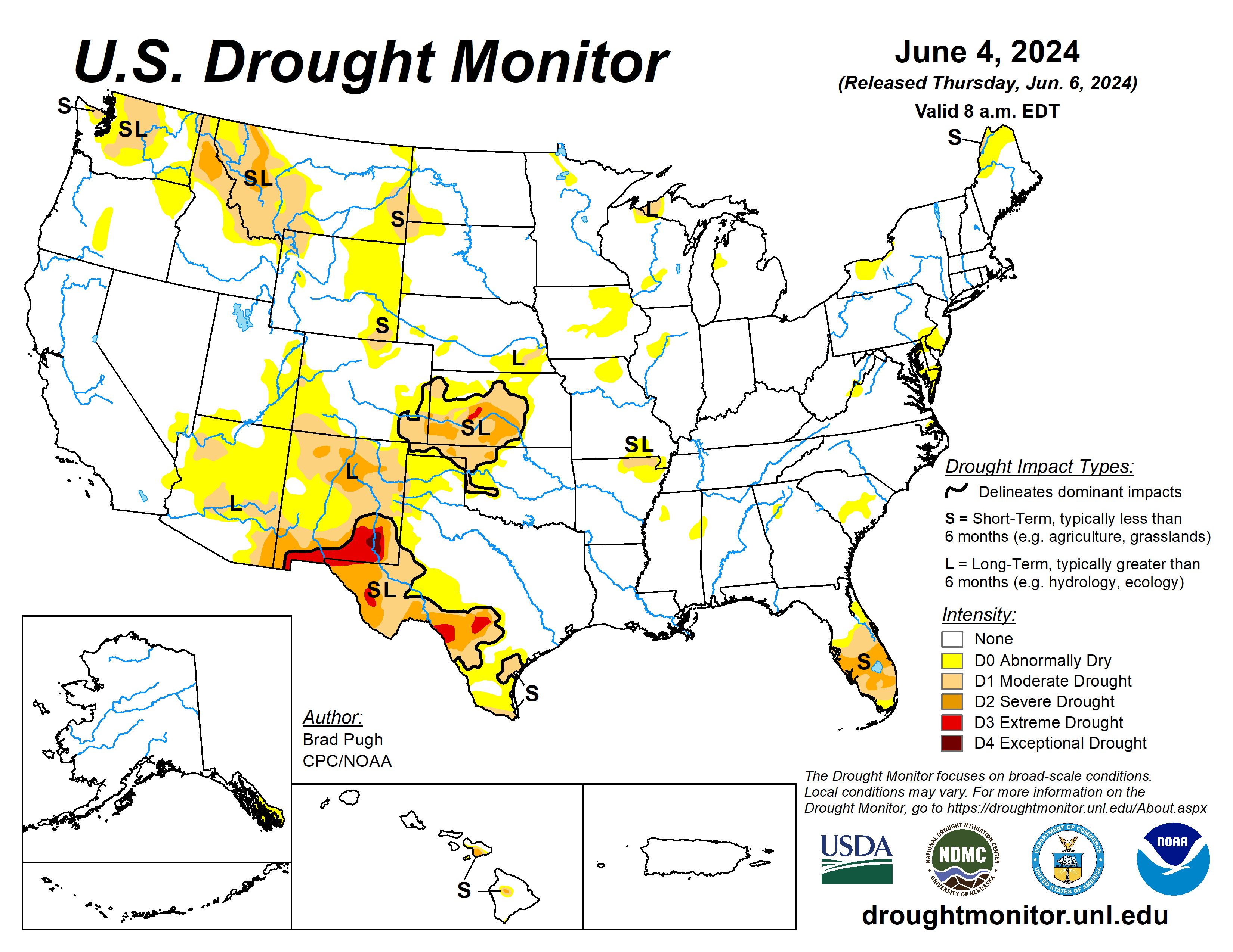
This Week’s Drought Summary
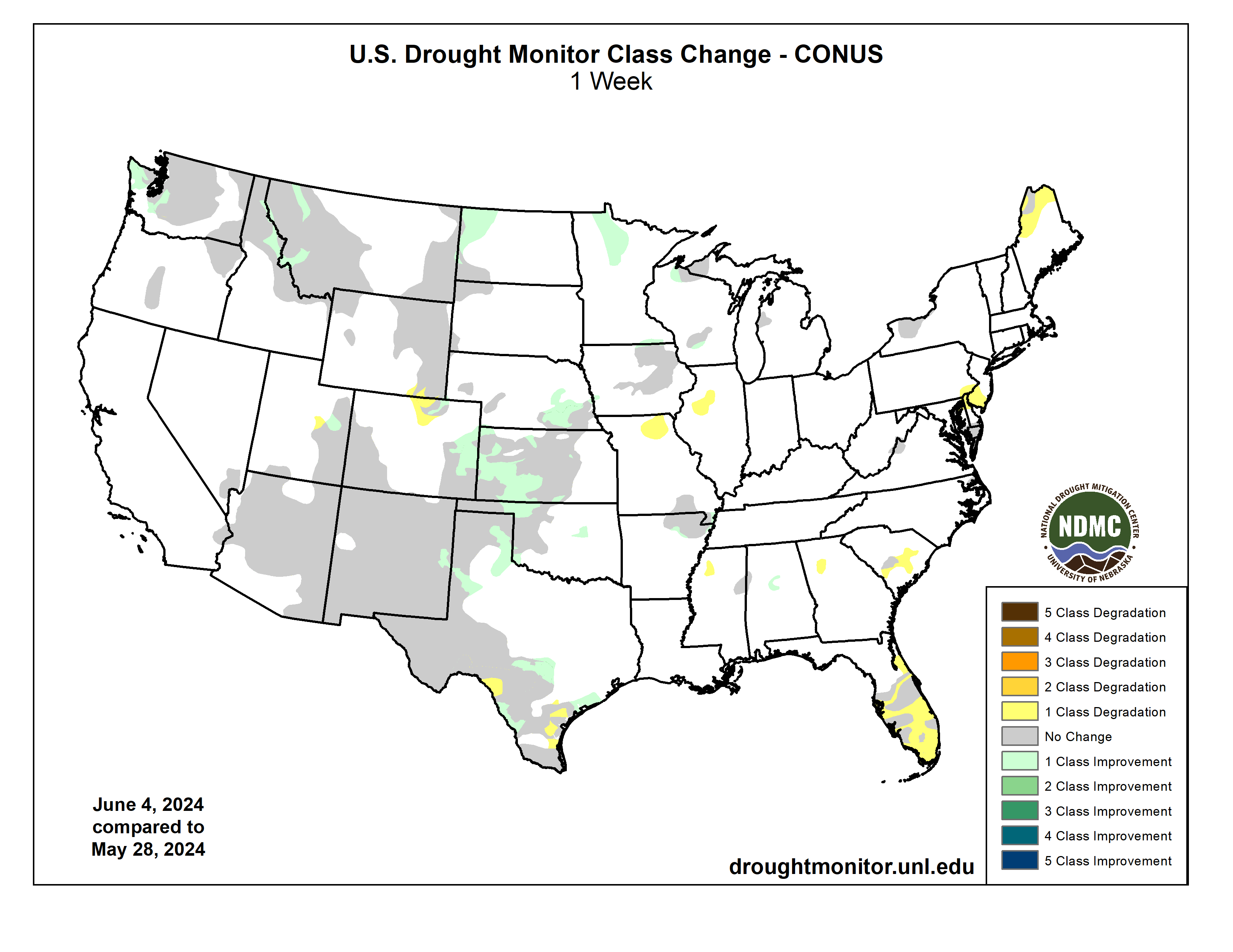
Following a stormy pattern with frequent periods of heavy precipitation and severe weather outbreaks, major drought improvement occurred this spring across the Great Plains and Mississippi Valley. Recent heavy precipitation from May 28 to June 3 resulted in additional improvements to parts of the central and southern Great Plains. A dry start to the thunderstorm season and above-normal temperatures continued to result in drought expansion and intensification across the southern half of the Florida Peninsula. Anomalously heavy precipitation for late May into the beginning of June led to drought improvement across parts of Washington, northern Idaho, and western Montana. Alaska and Puerto Rico remain drought-free, while drought of varying intensity persists for parts of Maui and the Big Island of Hawaii…
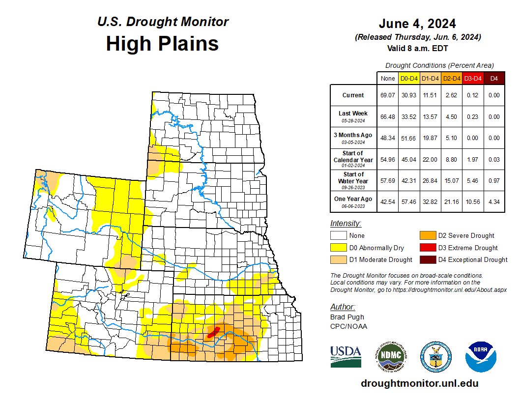
High Plains
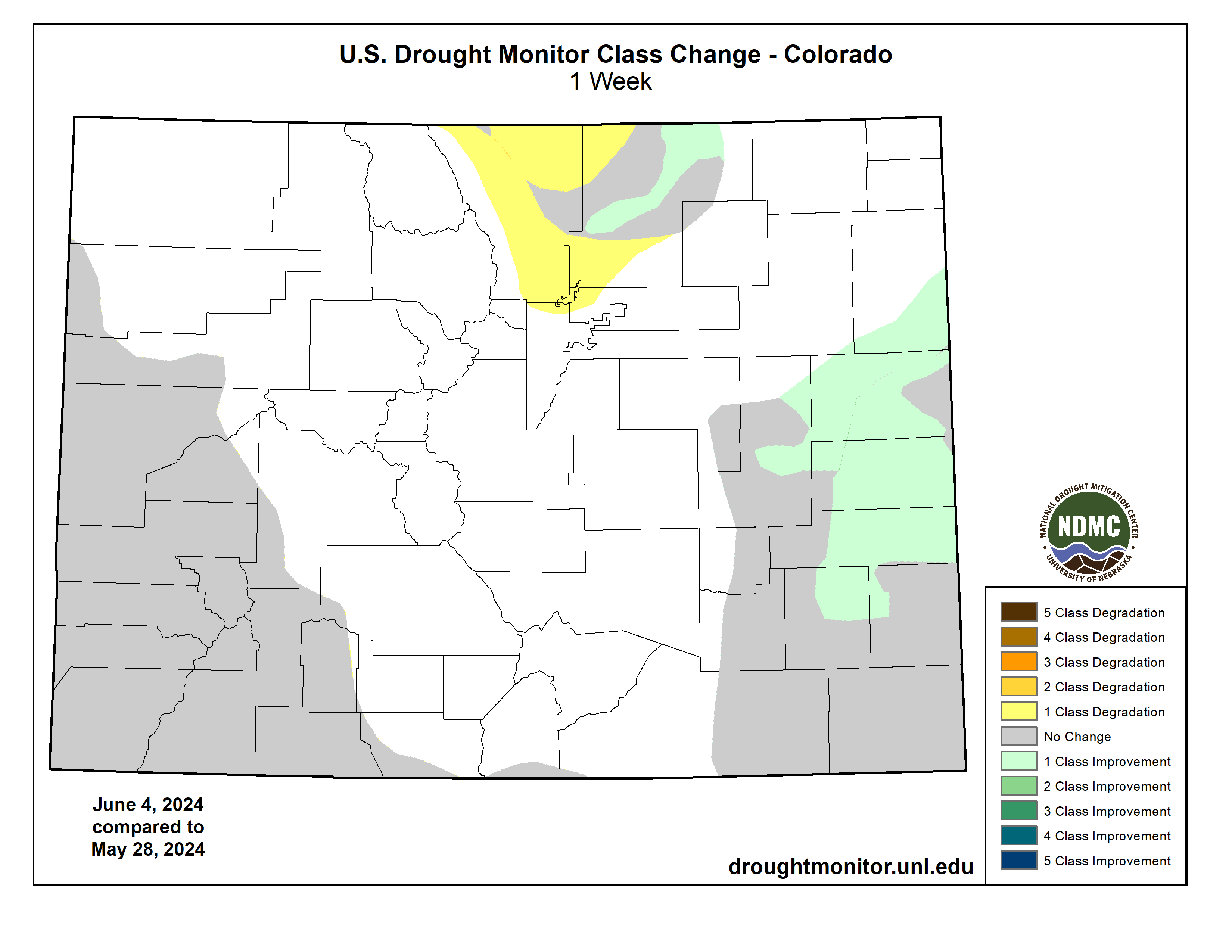
Widespread heavy precipitation (1 to 3 inches, locally more) resulted in a 1-category improvement to parts of Kansas, eastern Colorado, and southeastern Nebraska. A small area of long-term D1 was maintained for southeastern Nebraska that received less than 1 inch of precipitation this past week and a long-term drought signal continues. Based on neutral or wet soil moisture percentiles and NDMC drought blends, a 1-category improvement was made to northwestern North Dakota where more than 1 inch of precipitation occurred this past week. 30 to 60-day SPI and soil moisture indicators supported an expansion of abnormal dryness (D0) and moderate drought (D1) for northern Colorado and southeastern Wyoming…
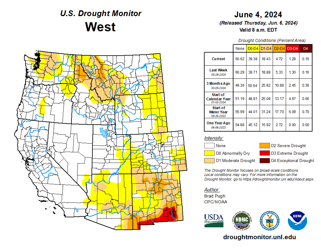
West
The climatology becomes much drier during May through the beginning of June across California, the Great Basin, and Southwest. There was little to no change in Dx coverage throughout these areas. Heavy precipitation (1.5 inches or more) this past week supported a 1-category improvement to parts of northeastern New Mexico. Recent precipitation with a relatively cool late spring and SPIs at multiple time scales resulted in a 1-category improvement to western Montana and adjacent areas of northern Idaho. Unusually heavy precipitation (locally more than 3 inches) for the late spring led to a decrease in abnormal dryness (D0) and moderate drought (D1) coverage across parts of Washington. However, much of the existing moderate drought area of north-central Washington remained unchanged with precipitation averaging less than 50 percent of normal since October 1, 2023…
South
Widespread heavy precipitation (2 to 5 inches, locally more) this past week generally occurred outside of existing Dx areas of the South region. However, the heavy precipitation did overspread a few of the Dx areas. Heavy precipitation along with considerations of NDMC drought blends supported a 1-category improvement to parts of northwestern Oklahoma, Texas Panhandle, and south-central Texas. Also, a slight reduction in abnormal dryness (D0) was warranted for northeastern Arkansas and western Tennessee. 30 to 60-day SPEI and soil moisture indicators led to a 1-category degradation to parts of southern Texas and the middle Rio Grande Valley. Maximum temperatures have averaged 4 to 8 degrees F above normal during the past two weeks across the middle to lower Rio Grande Valley which is likely drying out topsoil and a factor in worsening drought conditions…
Looking Ahead
During the next five days (June 6-10, 2024), multiple cold fronts are forecast to progress across the eastern and central contiguous U.S. The heaviest precipitation (more than 1 inch) is forecast for the Northeast, Tennessee Valley, and Ozarks region. Locally heavy rainfall may accompany thunderstorms across the central to southern Great Plains. Dry weather, typical for this time of year, is forecast for the Southwest, California, and the Pacific Northwest. A heat wave will affect the Southwest and Central Valley of California during early June.
The Climate Prediction Center’s 6-10 day outlook (valid June 11-15, 2024) favors above-normal temperatures across most of the West, Great Plains, New England, and Florida. Below-normal temperatures are most likely for the Ohio and Tennessee Valleys and central to southern Appalachians. Below-normal precipitation probabilities are slightly elevated for much of the Corn Belt, Mississippi Valley, and Pacific Northwest. Above-normal precipitation is favored for the central to southern Rockies and high Plains along with the coastal Southeast and Florida.
Just for grins here’s a slideshow of early June US Drought Monitor maps for the past few years.

US Drought Monitor map June 4, 2024. 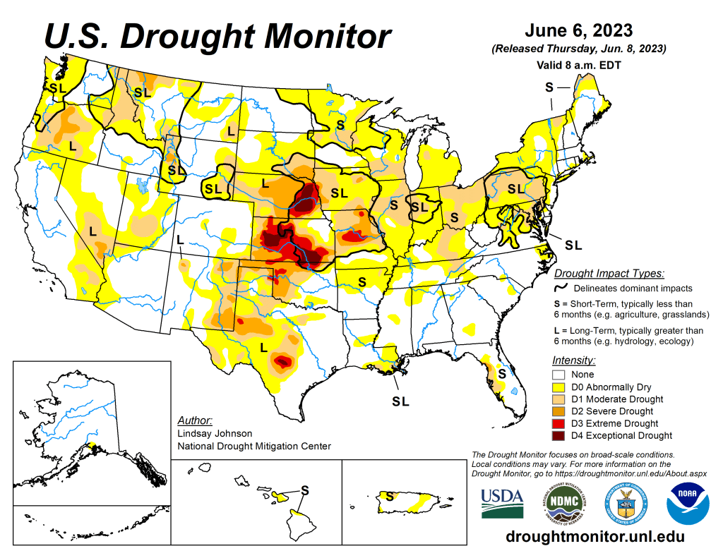
US Drought Monitor map June 6, 2023. 
US Drought Monitor map June 7, 2022. 
US Drought Monitor map June 1, 2021. 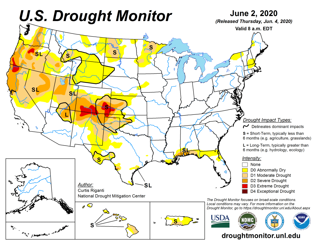
US Drought Monitor June 2, 2020. 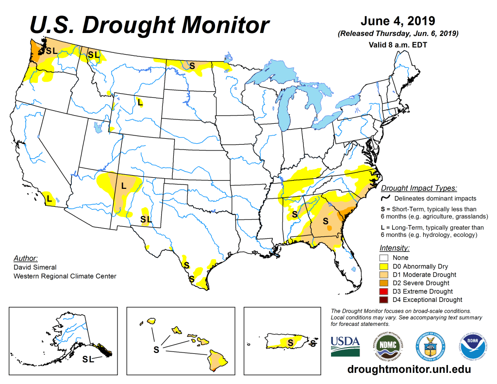
US Drought Monitor June 4, 2019. 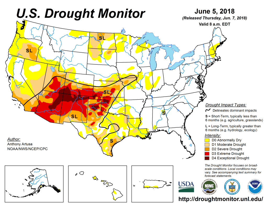
US Drought Monitor June 5, 2018. 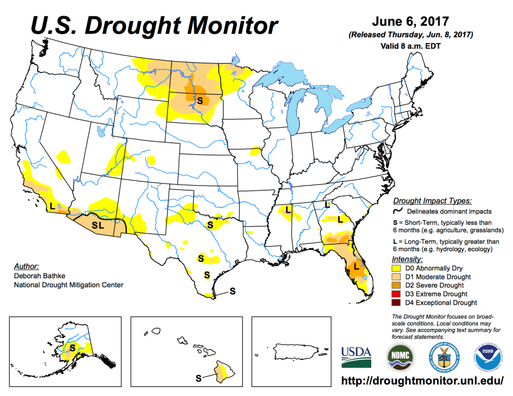
US Drought Monitor June 6, 2017. 
US Drought Monitor June 7, 2016. 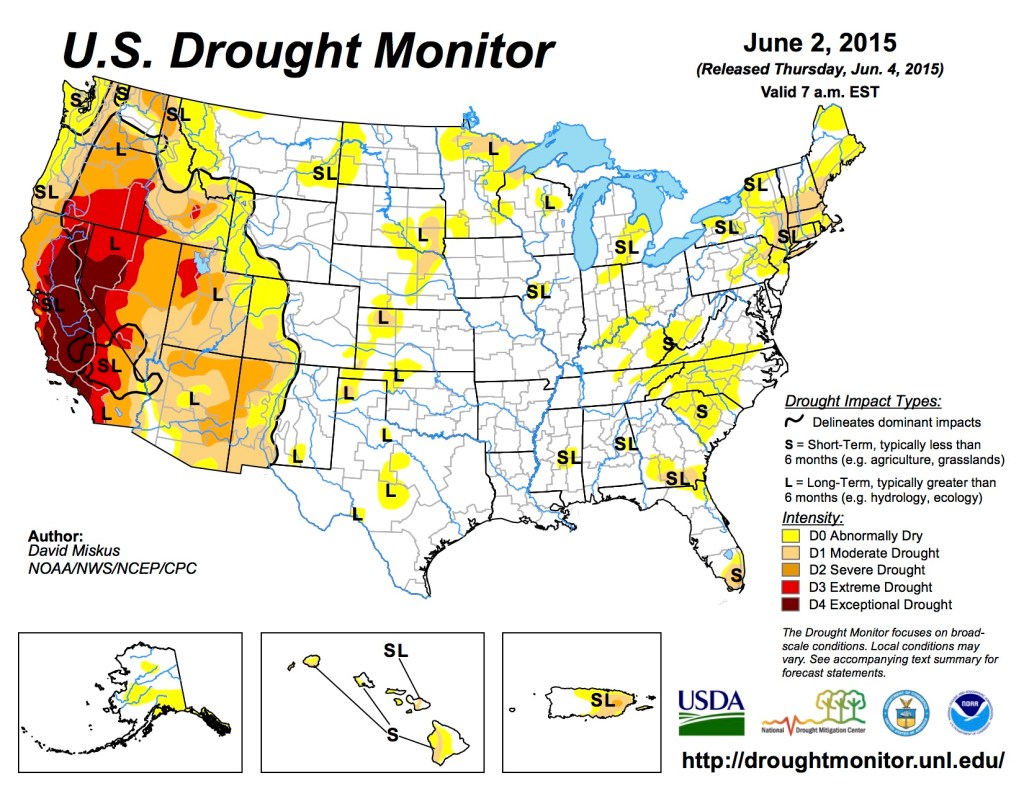
US Drought Monitor June 6, 2015. 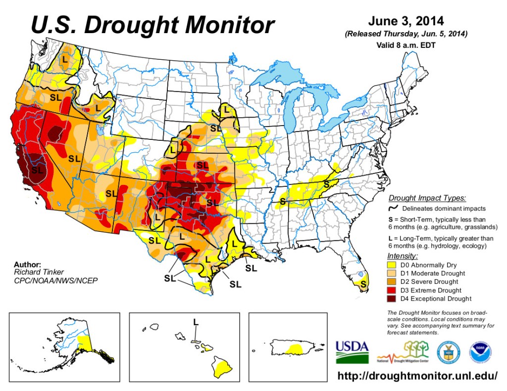
US Drought Monitor June 3, 2014 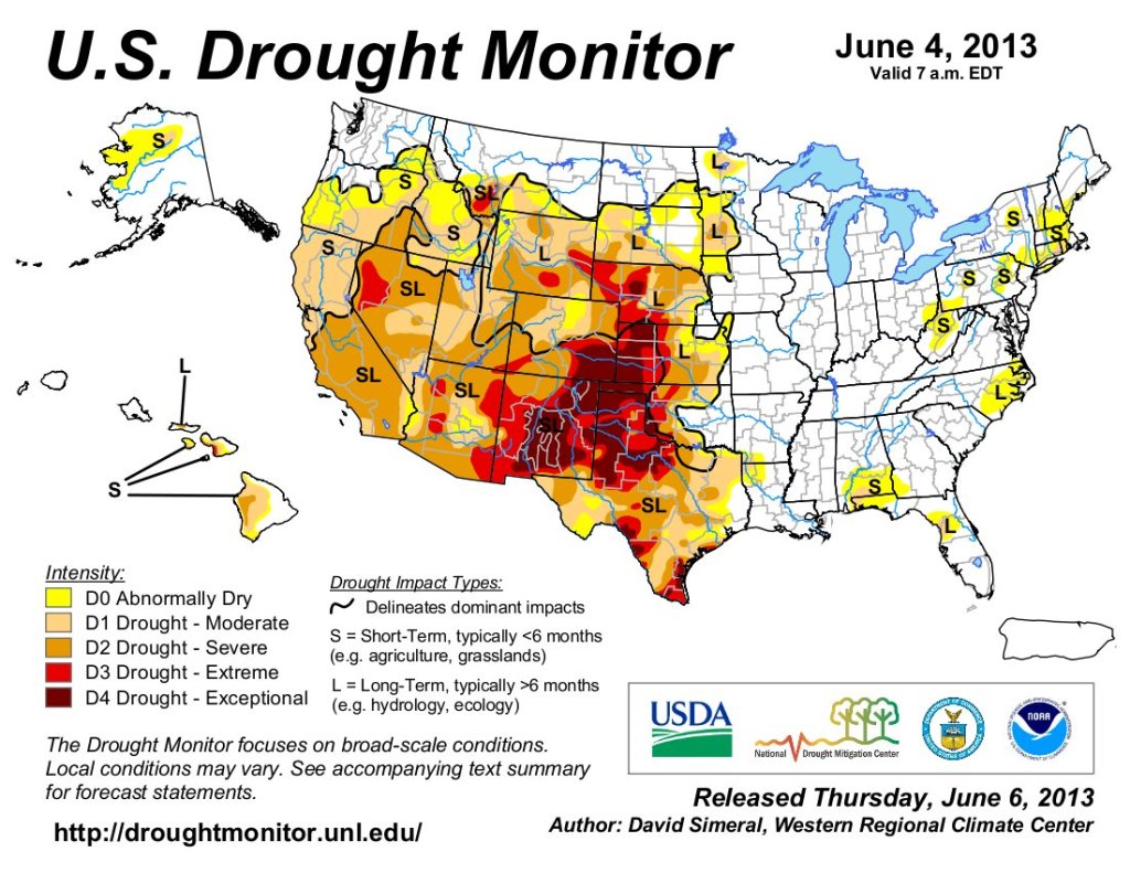
US Drought Monitor June 4, 2013. 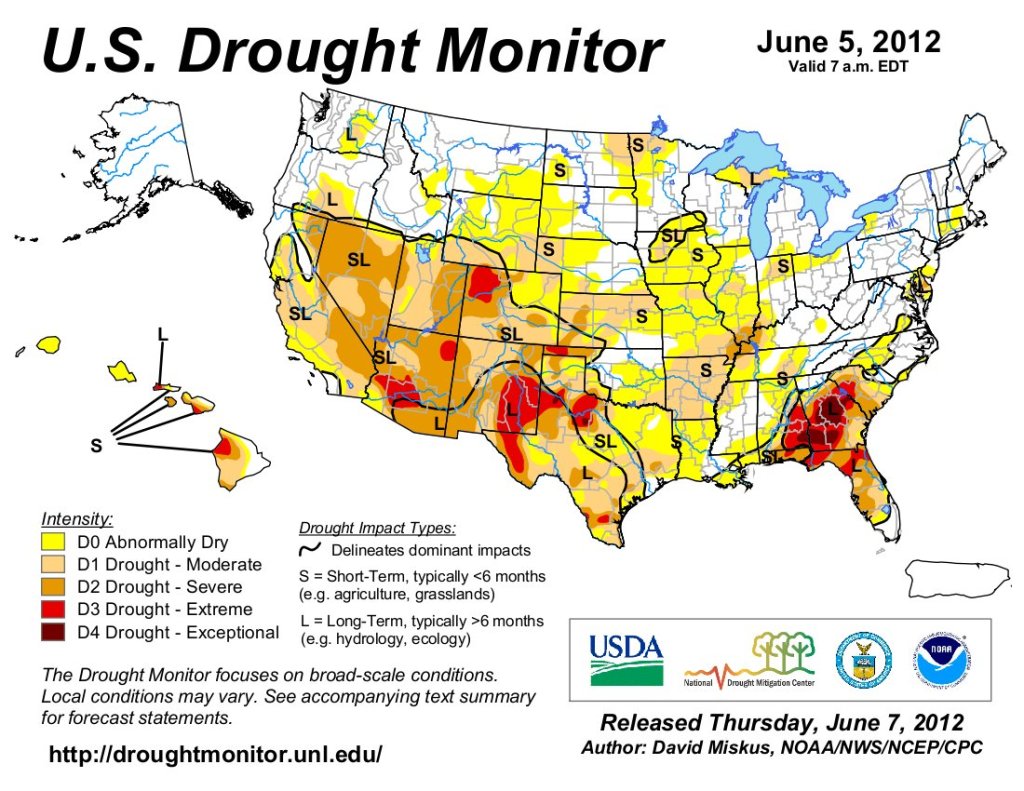
US Drought Monitor June 5, 2012. 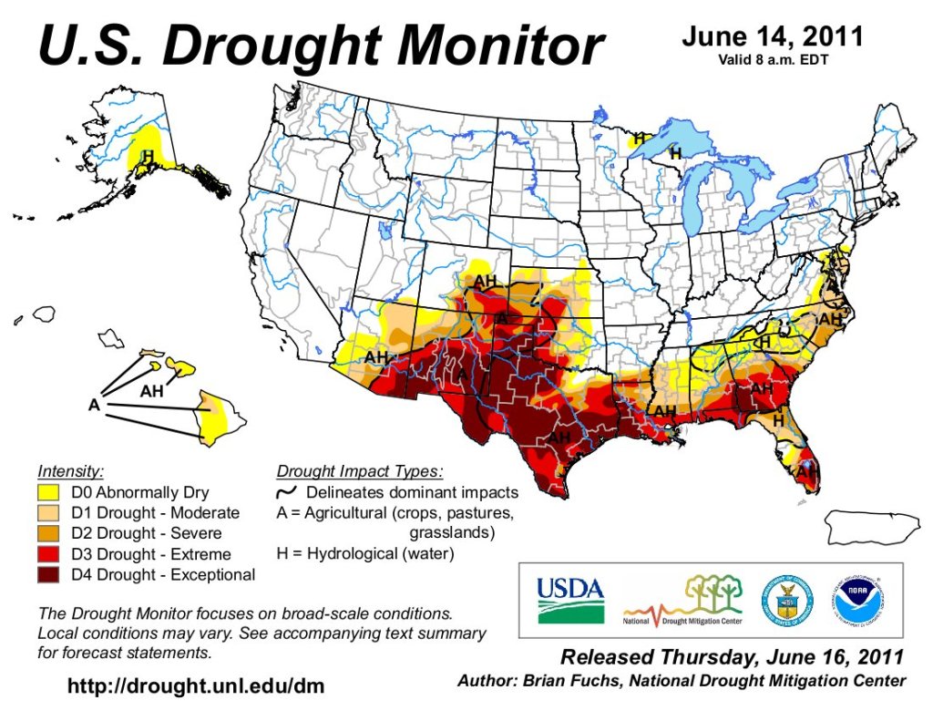
US Drought Monitor June 14, 2011. 
US Drought Monitor June 15, 2010.