Helping endangered fish on the #ColoradoRiver: @DenverWater partners with group of reservoir operators to improve river’s ecosystem

Click the link to read the article on the News on Tap website (Jay Adams and Bailee Campbell):

June 14, 2014

Denver Water partners with Front Range, West Slope, state and federal water managers to improve conditions for four species of endangered fish on the Colorado River. Learn about the Coordinated Reservoir Operations program also known as CROS. Learn more here: https://denverwatertap.org/2019/07/16…

Thanks to above-average snowpack this past winter in the northern and central mountains, a section of the Colorado River saw a burst of water in early-June as a group of reservoir operators teamed up with Mother Nature to improve habitat for endangered fish.

As part of the Coordinated Reservoir Operations program, Denver Water, the Colorado River Water Conservation DistrictColorado Springs UtilitiesNorthern Water and the U.S. Bureau of Reclamation worked together to either release extra amounts of water from their reservoirs or stopped diverting water from rivers and streams for a period of time.

The coordinated effort is timed to match the existing natural springtime rush of water down the river from melting snow in the mountains. The flows are not higher than the amount of water that would normally occur during runoff.

The combined effort created a pulse of water that came together at a 15-mile stretch of the Colorado River near Palisade in Mesa County.

The pulse helped the river’s ecosystem, which has been affected by water being diverted from the Colorado River and its tributaries over the years.

A burst of water from the Coordinated Reservoir Operations program flows down the Colorado River near Palisade in June 2019. Photo credit: U.S. Fish and Wildlife Service.

What is CROS?

The Coordinated Reservoir Operations, also known as CROS, program began in 1995 when the water managers looked for ideas to improve conditions for four species of endangered fish; the bonytail, the Colorado pikeminnow, the humpback chub and the razorback sucker.

The 2024 effort marked the 13th time since 1995 that reservoir operators have been able to coordinate their operations on the Colorado River. The voluntary operations are coordinated by staff at the Colorado Water Conservation Board.

Before the program started, each reservoir operator had its own schedule for capturing water from the rivers and releasing extra water downstream.

Water releases from the Coordinated Reservoir Operations program are aimed at improving this stretch of the Colorado River near Palisade. Photo credit: Dale Ryden, U.S. Fish and Wildlife Service.

“Reservoir operators realized that if all of us worked together, we could do something to help these endangered fish,” said Travis Bray, an environmental scientist from Denver Water. “Improving this stretch of river was critical to the survival of all four species.”

Reservoirs that can contribute to the coordinated release of water into the Colorado River include Denver Water’s Williams Fork Reservoir along with Green Mountain, Homestake, Ruedi, Willow Creek, Wolford Mountain and Windy Gap reservoirs.

“Typically during above average snow seasons, more water comes through our reservoirs than we can store,” said Cindy Brady, water supply engineer at Denver Water. “When snow conditions allow, we are able to fill our reservoirs for water supply and send the extra water downstream to help the fish habitat.”

The amount of water varies and not all water managers are able to contribute or coordinate flows each year depending on water levels, snowpack and reservoir operating conditions.

Denver Water released water from Williams Fork Dam in Grand County as part of the Coordinated Reservoir Operations program in June 2019. Photo credit: Denver Water.

Benefits to fish habitat

When the reservoir operators coordinate their releases to hit at the same time, the extra water in the river offers improves fish habitat in several ways.

For instance, when there’s more water in the river, it flows faster.

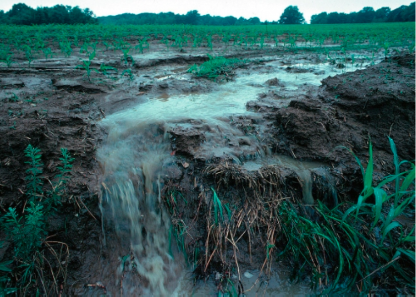
The rushing water flushes tiny pieces of sediment from the rocks on the bottom of the river, which creates space for the fish to lay their eggs. Without these flushing flows, the sediment builds up over time and leaves no room for the eggs.

There are other benefits as well, according to Don Anderson, a hydrologist with the U.S. Fish and Wildlife Service.

“The higher water creates calm side channels for young razorback suckers to swim into,” Anderson said. “The fast-moving water also triggers the Colorado pikeminnows to swim upstream and spawn in the 15-mile stretch.”

An additional benefit, according to Anderson, is that the high flow of water scours away young vegetation that encroaches on the river channel. If left unchecked, the vegetation gradually degrades the habitat available for the fish.

Is the program working?

The coordinated release program has played an important role in restoring fish habitat.

The Fish and Wildlife Service’s recent assessment of the four endangered fish species prompted the agency to propose reclassifying two of them — the razorback sucker and the humpback chub — from “endangered” status to a less-dire “threatened” designation.

The humpback chub is one of four endangered fish species on the Colorado River that will benefit from the higher flow of water this year that came from the Coordinated Reservoir Operations program. Photo credit: Utah Division of Wildlife Resources.

“The change in status signals significant progress in the recovery of these fish,” Anderson said. “Since 2014, we’ve measured record numbers of razorback suckers using a fish ladder to bypass a large dam a few miles upstream of Palisade and access additional habitat upstream.”

The higher flow of water is spread out over several days to prevent flooding in communities along the river.

This map shows the 15-mile reach of the Colorado River near Grand Junction, home to four species of endangered fish. Map credit: CWCB

Improving the environment

The coordinated releases are part of the Upper Colorado River Endangered Fish Recovery Program established in 1988 to bring the four fish species back from the brink of extinction.

The project marks a change in how reservoirs are managed. In decades past, environmental factors were not given as much consideration as they are now.

“Denver Water participates in many different programs that help the four species of endangered fish,” Bray said. “Our goal is to get as many benefits as possible out of every drop of water and be responsible stewards of the environment.”

The #ColoradoSprings Utilities Board opposes #Aurora’s recent purchase of water rights in Otero County — #Colorado Public Radio #ArkansasRiver

Straight line diagram of the Lower Arkansas Valley ditches via Headwaters Magazine

Click the link to read the article on the Colorado Public Radio website (Shanna Lewis). Here’s an excerpt:

June 4, 2024

Colorado Springs Utilities is joining a growing list of water managers and local governments across southeastern Colorado in decrying Aurora Water’s recent purchase of a large farm and water rights in Otero County. The Colorado Springs utility — which is overseen by the city council — is among the counties, cities and other agencies who say that Aurora Water is violating the terms of a 2003 agreement. That contract with the Southeastern Colorado Water Conservancy District allows Aurora to use water rights in the Arkansas River Basin along with infrastructure managed by the district but with limitations and only under certain conditions. That includes only using the water three years out of every ten and only when Aurora’s storage reservoirs are below 60 percent capacity. Colorado Springs Utilities is part of the southeastern Colorado water district, along with nine counties and dozens of municipalities, rural water systems and irrigation companies within the Arkansas River Basin stretching from Leadville to the Kansas border…

“We pay taxes to support that project (SECWCD) in the Arkansas Basin. Having that project utilized for the city of Aurora, which clearly does not sit in that basin, was problematic,” said Abigail Ortega of Colorado Springs Utilities during a recent presentation to the utilities board. She was referring to the reason for the original agreement between Aurora and the southeastern Colorado water district.

Ortega said El Paso County and Colorado Springs residents make up about 70% of the Southeastern Colorado Water Conservancy District’s more than 950,000 users. The southeastern Colorado water district and water managers in the Arkansas River Basin want legal documentation from Aurora to ensure that the water will not permanently leave the basin. Officials from Aurora and the water district met in early May to discuss the district’s concerns.

“Toss the Chevron deference and every time the EPA wants to close a facility leaching poisons into the drinking water, a federal court will decide the issue” — @CharlesPPierce

View of runoff, also called nonpoint source pollution, from a farm field in Iowa during a rain storm. Topsoil as well as farm fertilizers and other potential pollutants run off unprotected farm fields when heavy rains occur. (Credit: Lynn Betts/U.S. Department of Agriculture, Natural Resources Conservation Service/Wikimedia Commons)

Click the link to read the artilcle on the Esquire website (Charles P. Pierce). Here’s an excerpt:

Some time this week—I think—the Supreme Court is going to rule on more than one case that might change radically the structure of American government. The one with all the bells and whistles is the case on absolute presidential immunity. But it’s the others that may have the most sweeping impact. Loper Bright Enterprises v. Raimondo and Relentless, Inc. v. Department of Commerce threaten what has become known as the “Chevron deference,” whereby the federal courts must defer to the federal agencies in their interpretation of ambiguities in their statutory obligations. Toss the Chevron deference and every time the EPA wants to close a facility leaching poisons into the drinking water, a federal court will decide the issue. That would be just as bad as it sounds. Corporate interests have been itching to get rid of the Chevron deference for as long as it has existed. The chief argument mustered against it is that it allows Congress to unconstitutionally delegate its powers to federal administrative agencies or to private entities.

Biden-Harris Administration awards $4.9 million to advance drought monitoring and prediction in U.S. West through the Investing in America agenda

A visibly low water level is present in this aerial view of Enterprise Bridge on Lake Oroville in Butte County, California. On October 28, 2021, the storage was 970,851 reservoir acre-feet, which is 27 percent of total capacity (Image credit: Andrew Innerarity/California Department of Water Resources)

Click the link to read the release on the NOAA website (Monica Allen):

June 24, 2024

Today, the NOAA announced $4.9 million in funding for the agency’s labs and research partners to improve drought monitoring and prediction in the American West. 

This research combines $3.1 million in funding from NOAA’s National Integrated Drought Information System (NIDIS) program and $1.8 million from the Inflation Reduction Act to improve decision-makers’ capacity to protect life, property and ecosystems in the region from drought. 

“Thanks to President Biden’s Investing in America agenda and the historic Inflation Reduction Act, this investment will support NOAA and its partners in better preparing Western communities for droughts in the coming years and decades,” said U.S. Secretary of Commerce Gina Raimondo. “By expanding and upgrading our drought monitoring and prediction capabilities, the Biden-Harris Administration is making communities across the American West more resilient to the effects of climate change.”

US Drought Monitor June 25, 2002.

Drought is a common feature of the U.S. West, driven by the region’s unique geography, location and climate. And it can exact a high toll. 

In 2022, a single drought event in America’s West cost $23.3 billion. Federal and state water agencies, Tribal governments, water utilities, electric supply providers, reservoir operators, wildfire managers and other stakeholders frequently pose questions such as: “What is driving the extreme and unprecedented drought conditions in the West?” and “Will the drought end, or is it evidence of a long-term change?” Answers to those questions generated by this foundational and applied science research, will help communities plan and prepare for droughts which are amplified by climate warming.

“The future of the West depends on meeting the crisis of water availability with ingenuity and resolve,” said Sarah Kapnick, Ph.D., NOAA chief scientist. “I’m excited to see the results of these new investments in science that will prepare managers, stakeholders and communities to anticipate, react to and manage the increasing challenges posed by the water systems critical to their lives and economies.”

NOAA’s Climate Program Office’s Modeling, Analysis, Predictions and Projections (MAPP) program, in collaboration with the NIDIS program, will support seven innovative, impactful projects that will improve the nation’s resilience at a critical time in the fight against the drought crisis. The projects are funded for three years and will cover drought issues across the southwestern U.S.

For more information on the seven funded projects, see the full list.

Visit NOAA’s Inflation Reduction Act website to learn about current and future funding opportunities. Visit the MAPP-NIDIS Drought Research Competition webpage to learn more about current and future MAPP-NIDIS collaborations and competitions. 

#Boulder is one big step closer to putting Exxon and Suncor on trial for #ClimateChange — #Colorado Public Radio #ActOnClimate

Marshall Fire December 30, 2021. Photo credit: Boulder County

Click the link to read the article on the Colorado Public Radio website (Sam Brasch). Here’s an excerpt:

Judge Robert R. Gunning, a district court judge hearing the case in Boulder, rejected requests from both companies to dismiss the lawsuit on Friday. The ruling allows the case to proceed, setting the stage for a trial that will consider whether fossil fuel companies should pay some of the costs related to climate-related disasters like floods and wildfires. Boulder County first filed the lawsuit in 2018 in cooperation with the City of Boulder and San Miguel County. The complaint argues Exxon Mobil and Suncor Energy spent decades misleading the public about the dangers of unchecked fossil fuel consumption. The lawsuit further demands the companies pay unspecified financial damages to fund local efforts to recover from recent climate-related disasters and brace for more frequent climate-fueled catastrophes in the future…The lawsuit cites the 2010 Fourmile Canyon fire and 2013 floods as examples of climate disasters in Boulder County. The case was filed before the Marshall fire swept through the area in the winter of 2021, incinerating more than 1,000 homes and causing more than $2 billion in damage in what is now considered the most destructive wildfire in state history…

The Boulder climate damage lawsuit has also been delayed by both companies’ attempts to push the case into federal court. Those efforts failed last year after the U.S. Supreme Court declined to hear the lawsuit, clearing a path for the case to proceed in state court. The recent ruling comes as more than 20 state and local governments have filed similar lawsuits against fossil fuel companies. Boulder is among the first to prevail against motions to dismiss from Exxon Mobil and other defendants, joining Honolulu and Annapolis, Md., along with the states of Massachusetts and Delaware. 

Article: Can precipitation intermittency predict flooding? — Science Direct

Click the link to access the article on the Science Direct website (Ben Livneh, Nels R. Bjarke, Parthkumar A. Modi, Alex Furman, Darren Ficklin, Justin M. Pflug, Kristopher B. Karnauskas). Here’s the abstract:

Highlights

  • Precipitation intermittency is shown to act as a modulator of flood magnitude.
  • Floods in arid and low field capacity basins are most sensitive to intermittency.
  • As a flood predictor, intermittency requires less computation than soil moisture.

Abstract

A mystery has emerged as to why patterns of increasing extreme rainfall have not been accompanied by similar levels of flooding, garnering growing attention given concerns over future flood risks. Antecedent moisture conditions have been proposed as the missing explanatory factor. Yet, reasons for moisture variability prior to flooding remain largely unstudied. Here, we evaluate the potential utility of precipitation intermittency, defined as the dry spell length prior to a flood, to explain the variability of flooding over 108 watersheds from 1950 to 2022. Flood magnitude is shown to be sensitive to intermittency, particularly in arid and semi-arid regions (PET/P > 0.84) and for basins with low soil field capacity (<0.31 m3/m3). Following extended dry spells >20 days, floods are only possible from the most intense storms, whereas a wider range of storms can produce flooding for shorter intermittency. The flood probability decreases by approximately 0.5 % for each additional day of dry spell, with overall flood probabilities being up to 30 % lower following extended dry periods. These results underscore the potential utility of precipitation intermittency for diagnosing current and future flood risks.