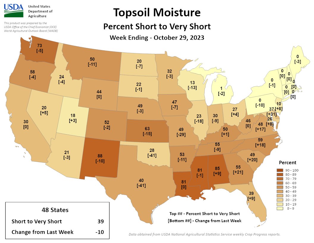
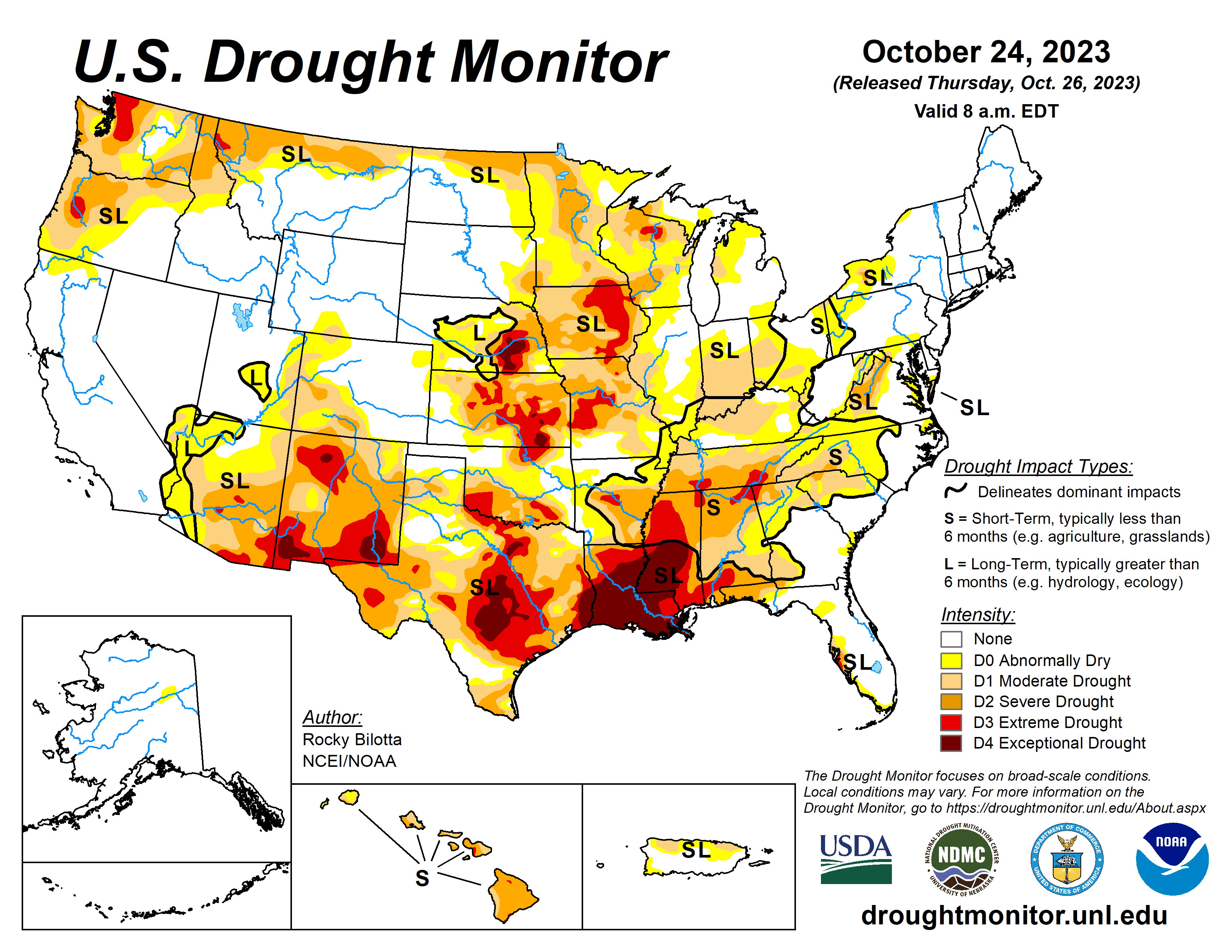
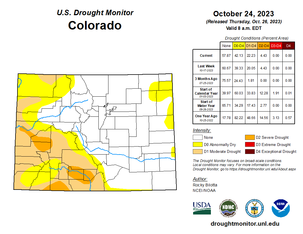
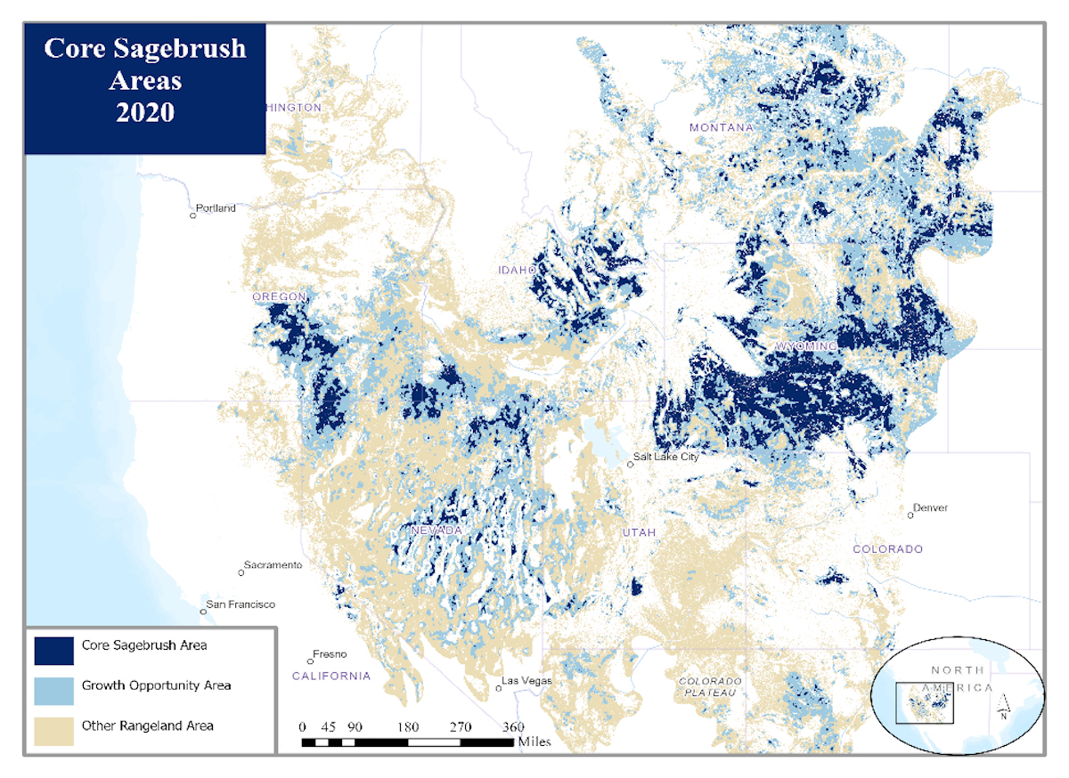
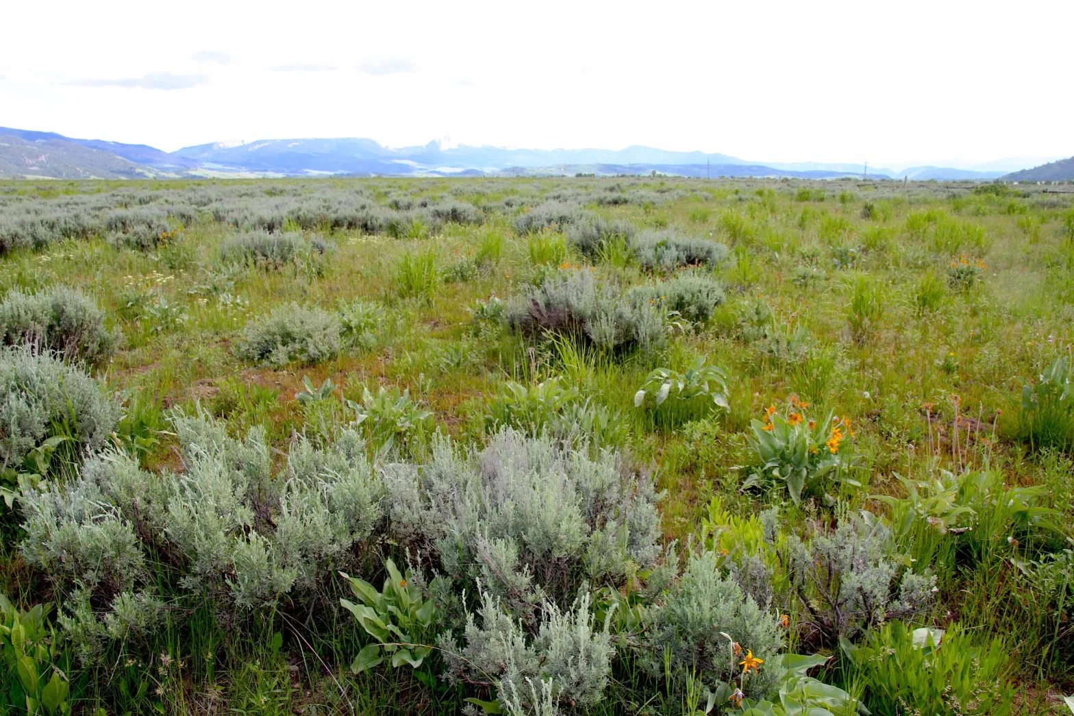
Research article: Low-intensity fires mitigate the risk of high-intensity wildfires in #Californiaโ€™s forests — Science Advances #ActOnClimate

UC Davis students, academics and members of the local Native American community take part in a collaborative cultural burn at the Tending and Gathering Garden at the Cache Creek Nature Preserve in Woodland, Calif. Photo: Alysha Beck/UC Davis

Click the link to access the article on the Science Advance website (Wu, Et al.) Here’s the abstract:

Abstract

The increasing frequency of severe wildfires demands a shift in landscape management to mitigate their consequences. The role of managed, low-intensity fire as a driver of beneficial fuel treatment in fire-adapted ecosystems has drawn interest in both scientific and policy venues. Using a synthetic control approach to analyze 20 years of satellite-based fire activity data across 124,186 square kilometers of forests in California, we provide evidence that low-intensity fires substantially reduce the risk of future high-intensity fires. In conifer forests, the risk of high-intensity fire is reduced by 64.0% [95% confidence interval (CI): 41.2 to 77.9%] in areas recently burned at low intensity relative to comparable unburned areas, and protective effects last for at least 6 years (lower bound of one-sided 95% CI: 6 years). These findings support a policy transition from fire suppression to restoration, through increased use of prescribed fire, cultural burning, and managed wildfire, of a presuppression and precolonial fire regime in California.

Weighing options for protecting the #CrystalRiver: Some say Wild & Scenic still the โ€˜gold standardโ€™ — @AspenJournalism #RoaringForkRiver

An image of the Crystal River Valley from an EcoFlight mission in August 2022. The view is downvalley, toward Mount Sopris. A group is exploring a federal designation of wild and scenic for the Crystal River in Gunnison and Pitkin counties. Courtesy of Ecoflight

Click the link to read the article on the Aspen Journalism website (Heather Sackett):

In Colorado, there are several ways to protect rivers, which vary depending on the goals. 

To maintain water quality, the Colorado Department of Public Health and Environment offers an Outstanding Waters designation. If boosting the flows for boating is the goal, municipalities can get a Recreational In-Channel Diversion (RICD) water right. And to protect the environment, the state water board acquires instream-flow water rights, designed to maintain minimum flows. 

But if the goal is preventing dams and transbasin diversions, and guaranteeing a free-flowing river, experts say a federal Wild & Scenic designation is the gold standard. That was the message from some presenters at a community summit on the Crystal River on Thursday at Roaring Fork High School in Carbondale. 

โ€œItโ€™s the strongest, most robust form of river protection,โ€ said Jennifer Back, a retired employee of the National Park Service and former member of the Interagency Wild & Scenic Rivers Coordinating Council. โ€œIf you like whatโ€™s out there right now, Wild & Scenic River designation does a really good job of protecting whatโ€™s there.โ€

Back was one of eight presenters at Thursdayโ€™s [October 26, 2023] open house, organized by a steering committee that is exploring the feasibility of Wild & Scenic designation and other management and protection alternatives. The committee is chaired by representatives from the town of Marble, Gunnison County, Pitkin County and the Colorado River Water Conservation District.

The meeting, which drew about 130 people, was the second community summit of a public stakeholder process aimed at evaluating local interest in pursuing protections for the Crystal River, which flows about 40 miles from its headwaters, in the Maroon Bells-Snowmass Wilderness, and through the towns of Marble, Redstone and Carbondale before its confluence with the Roaring Fork River. 

Some residents of the Crystal Valley, along with Pitkin County, have long been proponents of a Wild & Scenic designation. But others, wary of any federal involvement, have balked at the idea. 

Manette Anderson, one of just a handful of residents of Crystal, a tiny historic hamlet named for the river, is a member of the steering committee. She said sheโ€™s still learning and that itโ€™s too early in the process for her to yet be in favor of, or dismiss, any of the options. 

โ€œGoing into all this, I thought Wild & Scenic would probably not be an option I would be interested in, generally speaking, because of anecdotal concerns that other people in other areas of the country have had with Wild & Scenic experiences,โ€ she said. โ€œBut Iโ€™m open to learning about it.โ€

The U.S. Forest Service determined in the 1980s that portions of the Crystal River were eligible for designation under the Wild & Scenic River Act, which seeks to preserve in a free-flowing condition, rivers with outstandingly remarkable scenic, recreational, geologic, fish and wildlife, historic and cultural values.

There are three categories under a designation: wild, which describes sections inaccessible except by trail, with shorelines that are primitive; scenic, which describes shorelines largely undeveloped but accessible by roads in some places; and recreational, which describe places readily accessible by road or railroad and that have development along the shoreline.

The initial Forest Service proposal for the Crystal included all three designations: wild in the upper reaches of the riverโ€™s wilderness headwaters; scenic in the middle stretches; and recreational from Marble to the Sweet Jessup canal headgate. Each river with a Wild & Scenic designation has unique legislation written for it that can be customized to address local stakeholdersโ€™ values and concerns.

Any designation would take place upstream from the big agricultural diversions on the lower portion of the river near Carbondale. 

According to Back, the management framework for a Wild & Scenic River can be as unique as the river itself, and involve cooperative agreements between federal, state and local agencies. The โ€œteethโ€ of the designation, she said, comes from an outright prohibition on federal funding or licensing of any new Federal Energy Regulatory Commission (FERC)-permitted dam. A designation would also require review of federally assisted water resource projects.

โ€œWhat we mean by that is a project that basically is in the waterway below the ordinary high-water mark,โ€ she said. โ€œIt could be a bridge; it could be a road; it could be power lines. Itโ€™s not an outright prohibition, but they do have to be reviewed before the project goes forward.โ€

Back said there are 228 rivers in the country with a Wild & Scenic designation. Many of them are in Alaska and the Pacific Northwest. But with water managers historically unwilling to tie up potential future water development, Colorado has just 76 miles of one river โ€” the Cache la Poudre โ€” designated as Wild & Scenic.ย 

Jennifer Back, a retired National Park Service employee and former member of the Interagency Wild and Scenic Rivers Coordinating Council talks with Crystal River valley resident Larry Darien at Thursdayโ€™s community summit on the Crystal River. Darien, who is on the steering committee exploring management options, has said he is in favor of protecting the Crystal but not in the form of a federal Wild & Scenic designation.

Protection options

In addition to Outstanding Waters, instream-flow water rights and RICDs, other potential river protections detailed at Thursdayโ€™s meeting include creating a National Conservation Area or Special Management Area (environmentalists are pursuing this on the Dolores River after determining that Wild & Scenic isnโ€™t politically feasible there); 1041 regulations, which allow counties to maintain control over certain development; and local options such as riparian restoration projects and leasing agreements where water users can loan some of their water for the benefit of the environment. 

Another option would be to create a management plan that doesnโ€™t carry the same restrictions as Wild & Scenic but is still aimed at protecting ORVs, much like a stakeholder group on the upper Colorado River completed in 2020. This alternative management plan took more than 12 years to come to fruition, and participation of the stakeholders is voluntary. 

Pitkin County Commissioner Kelly McNicholas-Kury, a member of the steering committee, said she continues to think that a Wild & Scenic designation is the best option for river protection that meets the criteria laid out by the stakeholder process: prevention of dams and out-of-basin diversions; sustainable recreation and tourism; support of local agriculture, water rights and property rights; limiting future development; and maintaining a healthy river corridor. 

After Thursdayโ€™s presentations, attendees were asked to fill out a survey that ranked how well each option met these criteria.

A Wild & Scenic designation would not preclude any of the other protection options; multiple approaches could take place at the same time.

โ€œWild & Scenic would never get in the way of (Outstanding Waters), but Outstanding Waters is not going to give us what a Wild & Scenic River designation might,โ€ McNicholas-Kury said. 

According to McNicholas-Kury, the steering committee is striving for consensus among its members before it makes a recommendation to the public about a path forward for Crystal River protections. But if consensus cannot be reached, they can go to a super-majority vote that would require agreement of at least 75% of committee members.

โ€œFolks have really come in with a desire to learn and a desire to keep an open mind,โ€ she said. โ€œI think there is a ton of consensus around wanting to protect the river, so Iโ€™m hopeful that weโ€™ll get there.โ€

Map of the Roaring Fork River drainage basin in western Colorado, USA. Made using USGS data. By Shannon1 – Own work, CC BY-SA 4.0, https://commons.wikimedia.org/w/index.php?curid=69290878

#Drought news November 9, 2023: Dry conditions persisted across the High Plains where temperatures are above normal, with #Wyoming and #Colorado seeing temperatures of 3-8 degrees above normal

Click on a thumbnail graphic to view a gallery of drought data from the US Drought Monitor website.

Click the link to go to the US Drought Monitor website. Here’s an excerpt:

This Week’s Drought Summary

Residual impacts from the prior weekโ€™s storm continued to bring some improvements to the Pacific Northwest, northern Plains and upper Midwest. However, in the South and Southeast, conditions continue to rapidly deteriorate, leading to flash drought and widespread expansion of drought conditions.,,

High Plains

Dry conditions persisted across the High Plains where temperatures are above normal, with Wyoming and Colorado seeing temperatures of 3-8 degrees above normal. The eastern boundary experienced near- or slightly-above-normal temperatures, except for North Dakota where temperatures were 3 or more degrees below normal. South Dakota and northeastern Nebraska continued to see improvements as remnants of the past weekโ€™s precipitation aid in dry conditions. There were 1-category improvements along the eastern South Dakota and northeastern Nebraska borders. Areas in South Dakota are so wet that producers have reported issues with planting winter crops…

Colorado Drought Monitor one week change map ending November 7, 2023.

West

An atmospheric river cascaded over parts of the Pacific Northwest, bringing several inches of new rain and snow accumulation along with last weekโ€™s precipitation. With this continued influx of precipitation, modest 1-category improvements were made across the northwest, particularly on the windward side of the Cascade Range. Further improvements were seen in northern Idaho and Montana, which received up to 4 inches of precipitation in some areas. Despite the deluge of precipitation over the last one to two weeks, temperatures have been 1-3 degrees above normal, and south-central Montana even had temperatures of 6-9 degrees above normal. The remaining states in the West remained status quo…

South

Dry conditions continued across the South, with the entire region at or below 25% of normal precipitation. Despite this lack of precipitation, there was some relief in terms of temperatures, which were 2-4 degrees below normal. Areas of Louisiana and Mississippi were up to 8 degrees below normal. Louisiana and Mississippi did not see any drought relief, with 1-category degradations across the two states. In Louisiana, over 50% of the state is in Exceptional Drought, and in Mississippi rapid deterioration spilling eastward from Louisiana resulted in 1-category degradations. Tennessee is also in Extreme Drought, and Exceptional Drought was introduced along the tri-state border, along with Alabama and Georgia. Extreme and Severe drought also migrated northward. Texas and Oklahoma remained largely unchanged, with some improvements in central Texas and status quo conditions for Oklahoma…

Looking Ahead

Over the next five to seven days, much of the western and central Gulf Coast region will likely see 2-5 inches of precipitation as an unformed tropical depression makes its way north from Cuba into the western Gulf of Mexico. Some of this moisture will continue across the Southeast. The Casacade Mountian range and surrounding areas are likely to continue to receive more moisture. Temperatures are expected to be slightly below normal in Texas, the south Atlantic region and the Northeast. The High Plans and parts of the northern West and Midwest are likely to see maximum temperatures of 8-12 degrees above normal.

The six- to 10-day outlook shows a strong chance of above-normal temperatures centered over the eastern High Plains and western Midwest. Much of the rest of the county is also projected to experience above-normal temperatures. Below-normal precipitatation is forecasted across much of the northern regions from eastern Montana to Maryland and Maine. The West is projected to have above-normal precipitation, particularly in central and southern California as well as Alaska and Hawaii.

US Drought Monitor one week change map ending November 7, 2023.

Just for grins here’s a slideshow of early November US Drought Monitor maps for the past several years.

EPA report says #LincolnCreek contamination is naturally occurring — @AspenJournalism #RoaringForkRiver

Lincoln Creek was yellow as it flowed into Grizzly Reservoir in September 2022. A report from the Environmental Protection Agency says metals contamination in the creek and reservoir is a result of natural causes, not a nearby mine.ย CREDIT:ย HEATHER SACKETT/ASPEN JOURNALISM

Click the link to read the article on the Aspen Journalism website (Heather Sackett):

The results of water quality testing on Lincoln Creek show that the waterway is toxic to fish and that metals concentrations have been increasing in recent years. But because the main source of the contamination is a nearby tributary โ€” and not a mine โ€” it is unclear who should take responsibility for cleaning it up.

report released this week by the Environmental Protection Agency shows that Lincoln Creek in the four miles between the Ruby Mine and Grizzly Reservoir exceeds state water quality standards for aquatic life for aluminum, cadmium, copper, iron, lead, manganese and zinc. Aluminum and copper concentrations were higher than standards set by the Colorado Department of Public Health and Environment in multiple locations: in Lincoln Creek downstream of Ruby Mine, in Grizzly Reservoir and in Lincoln Creek downstream of the reservoir.

โ€œThe high concentrations of these metals are toxic to aquatic life and make Lincoln Creek uninhabitable for fish,โ€ the report says. 

The report is based on water quality sampling data from 2022.

Karin Teague, executive director of the Independence Pass Foundation, said she is glad the report is finally out so that the community can talk about what to do about the contamination. The foundationโ€™s mission is to restore and protect the ecological integrity of the pass corridor. 

โ€œWe have a dead creek on our hands,โ€ Teague said. โ€œItโ€™s a hard thing to see, and itโ€™s a disaster for the living things that used to call the creek home. Itโ€™s bad for the wildlife and has human health implications.โ€

But those human health implications remain unclear. 

In addition to exceeding standards for aquatic life, the report says cadmium, copper, iron and nickel were present in concentrations exceeding the state standards for domestic water supply. 

Lincoln Creek feeds into the Twin Lakes Reservoir and Canal Companyโ€™s transmountain diversion system, in which Grizzly Reservoir is used as a collection pond before sending water through the Twin Lakes Tunnel to the Front Range, where it is used primarily in Front Range cities, including for drinking water. Colorado Springs Utilities owns the majority of the water in the Twin Lakes system. 

The report says there is a slight potential that the metals are contaminating drinking water, but the substantial mixing, the distance that the water travels and the filtration limit these impacts. Lincoln Creek is a tributary of the Roaring Fork River, but Aspenโ€™s domestic water supply is not affected; the cityโ€™s drinking water comes primarily from Castle Creek.ย ย 

Colorado Parks and Wildlife stocks Grizzly Reservoir with fish each year, making it a popular and scenic spot for summer alpine fishing and camping. There have been fish die-offs in the reservoir in recent years, including 2021. But CPW aquatic biologist Kendall Bakich said that since Grizzly Reservoir is diluted with water from several surrounding cleaner drainages, fish can still survive there and CPW plans to continue stocking.ย 

CPW stocks the reservoir with โ€œcatchable trout,โ€ meaning anglers can take them out and eat them. Since the trout have been raised in hatcheries with clean water and food, and have probably lived in the reservoir for only a short time (most trout that arenโ€™t caught by anglers during the summer donโ€™t survive the harsh winter in Grizzly), Bakich said they are not likely to pose a risk to human health. But CPW tested the tissue anyway of some of the few fish that made it through the winter since they would have the most exposure to the toxic metals.

โ€œWe havenโ€™t gotten the results back on those tissue samples,โ€ Bakich said. โ€œAt this point, what we know about copper and how it resides in a fishโ€™s body, it resides in the organs and people donโ€™t eat the organs. If you are harvesting fish in the summer, they have just been put in there.โ€ย 

Grizzly Reservoir was a bright shade of turquoise in September 2022. The man-made alpine lake has high concentrations of metals that are toxic to fish, according to a report from the Environmental Protection Agency. CREDIT: HEATHER SACKETT/ASPEN JOURNALISM

Natural source of contamination

The report points to natural sources as the culprit for creek contamination, referring to a โ€œmineralized tributary.โ€ The mineralized tributary in question is a drainage in a steep slope above Ruby Mine, which flows into Lincoln Creek just below the discharge from the Ruby Mine portal. Prospectors dug for gold, silver, lead and copper at now-defunct Ruby Mine in the early 1900s.

The report says that the mine discharge and the mineralized tributary have very different water chemistry and that the contamination has been traced back to the tributary, not the mine. The report estimates that the mineralized tributary contributes 98.5% of the copper contamination to Lincoln Creek.

โ€œWhile historical mining does appear to play a role in some of the impacts to Lincoln Creek, all of the data and observations point to natural sources as the major component of metals loading into Lincoln Creek,โ€ the report reads. โ€œTherefore, cleanup or removal activities associated with Ruby Mine would have minimal benefits to improve the overall quality of Lincoln Creek.โ€

The EPA is authorized to address elevated metals concentrations only from human-caused sources, not contamination from natural sources.

Yellow and white sediment settled on the streambed of Lincoln Creek in September 2022, prompting concerns from residents and local organizations, and water quality testing. A report from the EPA found that the creek has metals concentrations that are toxic to fish. CREDIT: HEATHER SACKETT/ASPEN JOURNALISM

Climate change a cause?

Water quality issues on Lincoln Creek have been a concern for years, with the creek above the reservoir often running a yellowish color, and Grizzly Reservoir often a bright turquoise. In September 2022, Lincoln Creek below the reservoir turned a milky-green color, and white and yellow sediment settled on the streambed, prompting water quality testing in the fall of 2022 and the EPA report. These conditions in 2022 could be seen downstream at the confluence with the Roaring Fork River, sparking concern for local residents and organizations. 

Although water quality issues on Lincoln Creek are not new, according to the report, the metals concentrations โ€” especially copper โ€” have increased over the past 20 years. And climate change may be to blame. 

โ€œWhile the exact cause for observed trends is not known, it is suspected that climate change may be altering hydrologic cycles and thawing once-frozen rock deep in the mountain,โ€ the report reads. โ€œThese processes could expose more metals-bearing rock to oxygen, thereby increasing potential to generate acidic drainage and dissolution of metals.โ€ 

Now that the findings have been released, the next step is figuring out what to do about the contamination and which agencies should be involved. Pitkin County Environmental Health Manager Kurt Dahl said a meeting has been scheduled for Thursday with representatives from Pitkin County, CDPHE, the U.S. Forest Service, CPW, the Roaring Fork Conservancy, EPA, and the Colorado Division of Reclamation, Mining and Safety.

โ€œBeing a natural source, (EPA) is not going to deal with it,โ€ Dahl said. โ€œIs there another agency that will deal with it? The question of what are the next steps is one of the more important pieces to answer.โ€ 

Teague hopes to learn more about the potential health risks of the contamination and that the community can figure out a solution to clean it up. 

โ€œThis is a community that cares a lot about its backyard, the health of its wild places,โ€ she said. โ€œIf we can talk about building $50 million trails, maybe we can talk about millions of dollars to bring a creek back to life.โ€

Aspen Journalism is a nonprofit, investigative news organization covering water, environment, social justice and more. Visit http://aspenjournalism.org. 

Pitkin County supports Aspen Journalism with a grant from the Healthy Community Fund. Aspen Journalism is solely responsible for its editorial content.

Map of the Roaring Fork River drainage basin in western Colorado, USA. Made using USGS data. By Shannon1 – Own work, CC BY-SA 4.0, https://commons.wikimedia.org/w/index.php?curid=69290878

How about 98.5% emissions-free electricity by 2040? — Allen Best (@BigPivots)

Downtown Denver from the Denver Art Museum. Photo/Allen Best

Click the link to read the article on the Big Pivots website (Allen Best):

Study finds that existing technology can get Colorado to near-zero electricity without need for breakthroughs in geothermal, nuclear or other realms. It will require a bit of natural gas.

Colorado can decarbonize its electricity very deeply by 2040 without busting the bank. But thereโ€™s a catch.

To hit this 98.5% decarbonization level will require accepting natural gas as 1% of the mix along with a small percentage of carbon-based electricity imported into Colorado. And getting there will not require still-costly emerging technologies.

Thatโ€™s the take-away from a modeling study commissioned by the Colorado Energy Office.

How about 100% emissions-free electricity? That can be achieved, and in several different ways โ€” all of them at a higher price, according to the modeling conducted by Ascend Analytics, a Boulder-based company.

The company modeled two other scenarios deploying deep levels of geothermal, hydrogen, and advanced nuclear reactors as well as other emerging technologies. Still another scenario examined the cost of using simply wind, solar, and existing battery technology. And one scenario emphasized local generation.

These five other scenarios came in at prices of $47.1 billion to $56.2 billion in net-present value โ€” all substantially higher than the $37.5 billion of the less-than-perfect scenario using some natural gas.

Burning natural gas on an as-needed basis to ensure reliability will produce 565,000 metric tons of emissions in 2040. That compares with 40 million tons in 2005, according to the modeling study. This scenario also envisions a higher share of electricity , about 17%, being imported into Colorado.

All the scenarios in the modeling assume substantial amounts of improved energy efficiency, in effect partially eliminating the need for new generation. All models also assume that Colorado utilities will, as required by a state law, be participating in some sort of regional market for electricity by 2030.

Will Toor, director of the Colorado Energy Office, called the study results โ€œhuge.โ€

โ€œThe biggest takeaway of the study is understanding that we can get very deep emissions reductions, nearly zero emissions by 2040 while minimizing costs to utility customers. That is not something that we understood going into this study,โ€ he said in an interview.

โ€œAs we look at developing the policy framework for 2040, it will be very much informed by that understanding,โ€ he added.

The modeling study will likely deliver the justification for a bill in the legislative session beginning in January that would propose a new emissions-reduction target for Coloradoโ€™s electrical utilities. Laws adopted in 2019 and in subsequent years tasked those utilities with reducing emissions 80% by 2030. Most and perhaps all seem to be on track to get there with relative ease.

Some moving higher more quickly

Some utilities expect to get far higherโ€”and soon. Notable is Holy Cross Energy, the electrical cooperative based in Glenwood Springs. It expects to achieve 92% emissions-free electricity by early in 2024 and has a goal of 100% by 2030.

Bryan Hannegan, chief executive of Holy Cross, has long said that the path to 90% was reasonably clear. The hard part, with answers still unknown, he has said, will be that final 10%. And unlike the path to 90%, that final leg will likely be more expensive.

The modeling has any number of assumptions. Some likely are further out on the limb than others.

All the scenarios assume a 40% increase in electrical demand across Colorado during the next 17 years. Population growth will drive some of this new demand. Increased demand will also result from electricity replacing fossil fuels in both transportation and building and water heating.

To satisfy this increased demand will require new generation. Just how much new generation will depend upon the type. Wind and solar exclusively from generators within Colorado coupled with battery storage would require 74,492 megawatts of installed capacity. Having natural gas available will require far less, 44,474 megawatts.

On a more micro level and with a concrete challenge, Platte River Power Authority โ€” the supplier to Fort Collins, Loveland, Estes Park and Longmont โ€” is putting together its resource plan looking out to 2030. Directors in 2018 identified a goal of 100% renewables by 2030 but also attached a handful of conditions to that goal. Five years later, Platte Riverโ€™s planners donโ€™t see a way to 100% by 2030, at least not without risking reliability or absorbing considerable costs. One scenario calls for 85% renewables. The plan, however, is not scheduled to be completed until June.

For an explanation of the reasoning for a unanimous resolution by Platte Riverโ€™s board of directors,ย see a blog by Fort Collins Mayor Jeni Arndt, her cityโ€™s board representative.

The Crossing Trails Wind Farm between Kit Carson and Seibert, about 150 miles east of Denver, has an installed capacity of 104 megawatts, which goes to Tri-State Generation and Transmission. Photo/Allen Best

Transmission, seen by many as critical to deep levels of emissions reductions, gets relatively little mention in the modeling report. Arguably, an entire scenario could be built around potential for transmission upgrades, such as greater ease of moving electricity between the Western Interconnection grid, of which Colorado is a part, and the Eastern Interconnection, which starts at Kansas and Nebraska.

Ascend Analytics had conducted similar modeling about deep, deep decarbonization of electricity for Los Angeles Water and Power. The question in that study was what would it take for Los Angeles to achieve zero-emissions electricity?

Twenty years ago Colorado and its electrical utilities almost entirely embraced coal generation as the cheapest energy source far into the future. By 15 years ago, that resolve had weakened. Voters had adopted the stateโ€™s first renewable energy mandate and legislators had upped it. Wind prices were swooping down. Not least utilities had become confident of keeping lights on while deploying wind and solar.

A watershed year was 2017. Xcel Energy, Coloradoโ€™s largest utility, which supplies roughly half of the electricity in the state, sought bids for new electrical generation. The low prices for wind and solar dramatically undercut those of fossil fuels. Proponents of renewables were elated. A year later, Xcel Energy announced its plans for 80% decarbonization by 2030. The paradigm had shifted.

Most of those wind, solar, and storage projects bid in 2017 have now or soon will go on line. Statistics for 2023 are not yet available. However, as of 2022, renewable energy accounted for 37% of the stateโ€™s electrical generation, with wind power accounting for four-fifths of that renewable generation, according to the U.S. Energy Information Administration.

Two coal plants have closed since 2017 and now eight more will be laid down before the end of 2031. One, Pawnee, located at Brush, is to be converted to natural gas.

Toor said his agency began having discussions in 2022 about the next steps beyond 2030. The questions guided creation of the modeling study. The state called in utilities, environmental groups, industrial sectors, and others for conversations about how to frame the study.

What some said

Ean Tafoya, the Colorado director for GreenLatinos, a national advocacy group, said he remembers the first meeting occurring in May. Based on the number of those interested in environmental justice invited to participate as stakeholders, he suspects dozens of stakeholders were involved.

The results of the modeling Tafoya described as โ€œvery promising.โ€

โ€œIt shows me that the emerging technologies that my community has been very concerned about, that we donโ€™t need them,โ€ he said, referring to hydrogen, carbon capture and sequestration and direct-air capture as well as deep-well geothermal.  โ€œAnd if we can do this by 2040 without change of policy, that is very exciting.โ€

If Colorado can find ways to leverage capital through green infrastructure banking and address workforce training, Colorado โ€œcan truly be a leader nationally and globally,โ€ he added.

Xcel Energy issued a statement that said the company was โ€œencouraged by the Colorado Energy Officeโ€™s findings.โ€

โ€œWe agree there is a need for new 24/7 carbon-free technology to achieve deep carbon reductions. The stateโ€™s policies will enable us to reduce carbon emissions greater than 80% by 2030 and will inform our future investments into the local infrastructure necessary to move clean energy reliably into our customersโ€™ homes โ€“ while keeping bills low.โ€

Do Coloradoโ€™s modeling results suggest a template for other states or regions of the United States, even other countries? Toor thinks so.

โ€œIt is saying that you can get to near-zero greenhouse gas emissions and pollution from electricity generation within the next 20 years โ€”with no incremental cost to customers. Thatโ€™s true with other states, and it doesnโ€™t matter whether youโ€™re a red state or blue state. โ€œRegulators and utilities should be excited about the ability to minimize costs to customers while nearly entirely eliminating emissions. I think that is a really important conclusion.โ€

That said, added Toor, other states are starting at different places. โ€œWe have already had substantial progress.โ€

Colorado also is blessed with renewable resources. It has wind โ€“ not the best, but among the best. It also has strong solar. Again, not the best, but very good.

โ€œI want to be careful about claiming insight into other states, but I do think it is a very striking result that you can achieve such deep pollution reductions simply by developing the lowest-cost resources,โ€ said Toor.

In creating the documents, Ascent based its projected costs of various technologies on projections by the National Renewable Energy Laboratory but also Ascendโ€™s Market Intelligence Team.

How fast will technology move?

Even with those presumably careful calculations based on strong information, how good are they? After all, 20 years ago, the cost numbers argued for coal. Incredibly, some people still try to make that argument.

Also 20 years ago, many smart people projected the imminent arrival of both peak oil and, by extension, peak natural gas. Those projections, based on rear-view mirror data, failed to anticipate the rapid incremental advances in hydrofracturing, horizontal drilling and other extraction technology. From $14.50 per million Btu in 2008, natural gas prices plummeted to $2.50 with the recession โ€“ but never returned to the stratospheric levels that justified poking very deep holes across the Piceance Basin southwest of Craig. Meantime, the U.S. became a net exporter of oil.

Of course, we have had similar cost curves with wind, then solar, and now storage prices.

Might the same thing occur with geothermal, using underground heat to produce electricity, as is already done in California and some other places? Sarah Jewett, vice president for strategy at Fervo Energy, suggested cause for similar optimism in her industry during her remarks at the Colorado Rural Electric Association conference on Monday. The cost curve in recent projects in Utah and Nevada has been bending downward, she said.

Earlier that same day, a panel of experts about nuclear energy reported cause for optimism about nuclear, while yet another panel predicted reason to believe hydrogen will play an important role in the future.

Toor acknowledged the unexpected cost declines for many technologies. โ€œItโ€™s quite possible that hydrogen and other technologies will be lower cost than now projected,โ€ he said.

Regardless, he added, these near-zero or zero-emissions pathways should become the baseline.

โ€œI think it would be important that utilities are looking at new technologies and that utility regulators are able to look at getting to even deeper reductions based on what the actual cost trajectories turn out to be,โ€ he said.

Coloradoโ€™s energy regulation framework is well suited to achieving those deep reductions โ€”even deeper than the low-cost 98.5% emissions-free that this modeling suggests will be possible.

A final report, after review by stakeholders, is expected in December.

Following are what the modeling study cites as its key findings. The language is verbatim from the report:

  • The Economic Deployment scenario, which relies on current state and federal policies and is projected to meet demand at the lowest cost, is projected to reliably meet electricity needs in 2040 while achieving 98.5% reduction in greenhouse gas emissions in 2040 from a 2005 level while also achieving near zero emissions reduction in nitrous oxide and sulfur oxide.
  • Wind and solar will be the main source of electricity in Colorado in 2040. In the Economic Deployment scenario, 76% of electricity comes from in-state wind and solar; 16% comes from out-of-state imports of near zero-emissions electricity (mostly wind from a wholesale electricity market); and 10% from energy efficiency, with the rest coming from other sources. Across all other scenarios, in-state wind and solar account for more than 90% of electricity.
  • In the Economic Deployment scenario, gas-fired electricity generation meets only about 1% of total need for electricity.
  • Under current cost assumptions, the Optimized 100 scenario, which achieves zero emissions by 2040 using a technology-neutral, least-cost approach, selects a substantial amount of hydrogen and a modest amount of geothermal to complement wind, solar, and batteries. It is 25% more expensive than the economic deployment scenario.
  • The Wind, Solar and Battery scenario is 20% more expensive than the Optimized 100 scenario and 50% more expensive than the least cost Economic Deployment scenario. The Accelerate Geothermal scenario is 11% more expensive than the Optimized 100.
  • The Optimized 100 scenario retires all gas-fired generation by 2040. It replaces retiring gas capacity primarily with clean hydrogen starting in 2032. By 2040, this scenario has 5,061 MW of clean hydrogen and 125 MW of geothermal generation.
  • The model does not select gas with carbon capture or advanced modular reactors in any scenario because of the cost.
  • The Accelerated Geothermal scenario adds a requirement to have 10% of demand met with geothermal in 2040, which results in 1,989 MW of installed capacity (compared to 125 MW in the Optimized 100 scenario).
Mauna Loa is WMO Global Atmosphere Watch benchmark station and monitors rising CO2 levels Week of 23 April 2023: 424.40 parts per million Weekly value one year ago: 420.19 ppm Weekly value 10 years ago: 399.32 ppm ๐Ÿ“ท http://CO2.Earthhttps://co2.earth/daily-co2. Credit: World Meteorological Organization

Greeley Water receives $250,000 grant for lead replacement program — The #Greeley Tribune

A graphic from the city of Greeley indicating the likelihood of certain homes to have lead in customer-owned water service lines. The city is working to identify and replace all customer-owned service lines that contain lead. (Courtesy/City of Greeley)

Click the link to read the release on the City of Greeley website (Keri Fishlock):

A $250,000 grant from the Colorado Water Quality Control Division will help Greeley Water identify and inventory water service lines that contain lead. 

As it works to help customers reduce their risk of lead exposure, Greeley Water must create a mapped inventory of water service line materials by October 2024 to meet federal and state regulations. This process helps the city identify and replace any remaining customer-owned lead service lines at no cost to the homeowner.  

Greeley Water plans to use grant funding for the following:

  • Water service line inventory
  • Lead or galvanized service line confirmations
  • Geographic Information Systems (GIS) mapping and analysis

โ€œThis grant is great news for the City of Greeley. It helps speed up our inventory process. It directs more of our available funds toward replacing service lines that contain lead,โ€ said Keri Fishlock, an engineer with Greeleyโ€™s Water and Sewer Department.

In recent years, there has been greater national awareness of the potential health risks of lead in drinking water. Water testing confirms that water leaving Greeleyโ€™s treatment facilities is treated to a high standard and is lead-free. Yet, lead may be present in older homesโ€™ plumbing, faucets or service lines. Greeley Water is working with customers to identify and reduce those risks. 

Go to www.greeleygov.com/leadsurvey to complete a short survey about your water service line. Participants can win one of three $100 gift cards awarded monthly.

Contact Greeley Water if you need help at leadprotection@greeleygov.com or 970-336-4273.

#Drought #Climate Summary October 2023 — National Drought Mitigation Center

West Verde Creek in Hill Country State Natural Area in Bandera County, Texas, United States. Photo taken Oct. 14, 2023. Wikimedia Commons/ Larry D. Moore , CC BY 4.0 .

Click the link to read the story map on the NDMC website (Curtis Riganti):

Drought Overview

Oct. 31 U.S. Drought Monitor map and U.S. Drought Monitor 1-month class change from Sept. 26 to Oct. 31. Maps and more available from droughtmonitor.unl.edu .

During October, drought coverage across the U.S. decreased slightly, with regional variation. Drought expanded and worsened from southwest Virginia and North Carolina, to southwest Arkansas and adjacent Alabama, to northern Georgia and Mississippi. In Tennessee and adjacent northern Georgia, several locations experienced four-category degradations, and much of the region saw multiple-category degradations. Degradations also occurred in Hawaii, parts of the Utah-Colorado border, Arizona, New Mexico and other scattered locations.

Improvements were widespread in Oklahoma and Texas, especially in the eastern and southern portions of those states, respectively. Some improvements also occurred in the Midwest, with multiple-category improvements in Wisconsin, Minnesota and northern Nebraska. Single- or multiple-category improvements also occurred in northern North Dakota, northern Montana and portions of Oregon and Washington.

Overall, moderate or worse drought coverage dropped from 32.1% to 30.68%. Severe or worse drought coverage decreased from 18.79% to 17.65%. Extreme or worse drought coverage declined from 8.48% to 6.62%, and exceptional drought coverage dipped from 2.35% to 1.82%.

Drought Forecast

U.S. Monthly Drought Outlook for November 2023. Courtesy of NOAAโ€™s Climate Prediction Center.

During November, some improvement to ongoing drought conditions is forecast in western Washington and Oregon, according to the National Weather Service Climate Prediction Center. Isolated improvement or removal of drought is forecast in parts of central and northeast Wisconsin, and near the Twin Cities in Minnesota.

Drought improvement or removal is forecast for a narrow strip extending from Wichita, Kansas, through Kansas City to west-central Illinois, and along parts of the lower Ohio River in western Kentucky and southern Indiana. Parts of central and northeast Texas, as well as adjacent southeast Oklahoma, are forecast to experience more widespread drought improvement or removal. Drought improvement or removal is also forecast on St. Thomas and St. Croix in the U.S. Virgin Islands and in northern Puerto Rico.

Drought development is forecast to occur in parts of southwest Virginia, northwest and central North Carolina, and parts of northern and western Georgia and east-central Alabama.

Temperature

Departure from normal temperature from Oct. 1 to Oct. 31, 2023. Courtesy of High Plains Regional Climate Center.

Despite a chilly end to October, temperatures across the northern Great Plains and Northwest ended the month mostly within 3 degrees of normal. A few spots experienced temperatures 3 to 6 degrees warmer than normal. Parts of central and eastern Montana, and adjacent northern Wyoming and western South Dakota, finished October near normal or a few degrees colder than normal.

October in New England was warmer than normal, with widespread temperatures from 3 to 9 degrees above normal. The last two weeks of October were especially warm in the Northeast, with much of New England checking in at 6 to 10 degrees above normal. Much of the Midwest, south-central, and Great Plains regions finished October somewhere between near normal to 6 degrees warmer than normal for October.

Most of the Southeast saw near- or slightly below-normal temperatures for October. Temperature variations in Hawaii, while widely varying, were mostly within 3 degrees of normal. Temperatures along the Arctic Coast and in southeast Alaska were mostly 1 to 3 degrees warmer than normal, while temperatures in central Alaska were mostly 1 to 3 degrees colder than normal.

Precipitation

Departure from normal precipitation and percent of normal precipitation from Oct. 1 to Oct. 31, 2023. Courtesy of High Plains Regional Climate Center.

Drier-than-normal weather enveloped a swath of the eastern U.S. stretching from Louisiana, Mississippi and northern Alabama to the Mid-Atlantic. Below-normal precipitation also occurred in most of New Mexico, and in parts of western Montana, northern Idaho and Washington. Wetter-than-normal weather occurred in parts of eastern Montana and western North Dakota, as well as parts of central and east-central Wyoming. A swath of above-normal precipitation also occurred along the Nebraska-South Dakota border to northwest Iowa, southern Minnesota and central Wisconsin. Above-normal precipitation also occurred in north-central Texas and in the region surrounding Lubbock, Texas. In Hawaii, Oahu and the windward side of the Big Island were drier than normal during October. South-central and southwest Alaska were drier than normal during October, while the rest of the state was mostly near normal or wetter than normal…

High Plains

High Plains Drought Monitor map October 31, 2023.

Above-normal precipitation occurred in several parts of the High Plains during October. An area spanning the Nebraska-South Dakota border to central and northern Wyoming saw wetter-than-normal weather for the month, with some areas receiving at least twice their normal October precipitation. Above-normal precipitation also occurred in parts of the Rocky Mountains in central Colorado. The southern tier of the state did not fare as well, with many spots there seeing less than half of their normal October precipitation. Localized, much drier conditions also occurred in the central portion of the North Dakota-South Dakota border, where some places reported less than half of their normal October precipitation.

Overall, drought conditions decreased across the region in October. Moderate or worse drought coverage dropped from 26.84% to 21.82%. Severe or worse drought coverage dipped from 15.07% to 11.56%. Extreme or worse drought coverage decreased from 5.46% to 2.87%, and exceptional drought coverage dropped from 0.97% to 0.71%.

West

West Drought Monitor map October 31, 2023.

The West experienced several areas of drier-than-normal weather during October. Parts of western Washington, northern Idaho and Montana were much drier than normal โ€” receiving half or less of their normal October precipitation. Central and eastern Montana were generally wetter than normal, as were localized spots in Utah, southeast Idaho and northeast Oregon. Central and eastern Montana were generally a few degrees colder than normal, while the rest of the region generally ranged from near normal to 6 degrees above normal.

Drought coverage did not change substantially across the West during October. Moderate or worse drought coverage dropped from 31.24% to 30.63%. Severe or worse drought coverage dipped from 17.7% to 17.65%. Extreme or worse drought coverage decreased from 6.09% to 5.18%, and exceptional drought coverage increased from 0.7% to 0.76%.

USDA Announces Availability of Nearly $50 million to strengthen forest products economy, forest sector jobs as part of Investing in America agenda

Trees marked for forest health initiative above James Creek in Jamestown, Colorado. Credit: Jerd Smith

Click the link to read the article on the USDA website:

WASHINGTON,October 18, 2023 –

Today, the Biden-Harris Administration announced the U.S. Department of Agricultureโ€™s Forest Service is making nearly $50 million in grant funding available for proposals that support crucial links between resilient, healthy forests, strong rural economies and jobs in the forestry sector. Made possible by President Bidenโ€™s Investing in America agenda, a key pillar of Bidenomics, this funding will spark innovation, create new markets for wood products and renewable wood energy, expand processing capacity, and help tackle the climate crisis.

โ€œA strong forest products economy contributes to healthier forests, vibrant communities and jobs in rural areas,โ€ said Agriculture Secretary Tom Vilsack. โ€œThanks to President Bidenโ€™s Investing in America agenda, we are investing in rural economies by growing markets for forest products through sustainable forest management while reducing wildfire risk, fighting climate change, and accelerating economic development.โ€

This announcement is part of President Biden’s Investing in America agenda to generate economic opportunity and build a clean energy economy nationwide. The grants are made possible by President Bidenโ€™s Inflation Reduction Act, the largest climate investment in history and a core pillar of Bidenomics, as well as President Bidenโ€™s Bipartisan Infrastructure Law, an historic investment to rebuild Americaโ€™s aging infrastructure.

The open funding opportunity comes through the Forest Serviceโ€™s three key grant programs to support the forest products economy: Wood Innovations Grant, Community Wood Grant, and Wood Products Infrastructure Assistance Grant Programs. The agency is seeking proposals that support innovative uses of wood in the construction of low carbon buildings, as a renewable energy source, and in manufacturing and processing products. These programs also provide direct support to expand and retrofit wood energy systems and wood products manufacturing facilities nationwide.

The Forest Service is requesting proposals from eligible entities in the private, non-profit, and government sectors including Tribes, local and state governments, businesses and for-profit entities, institutions of higher education, as well as public utility, fire, conservation, and school districts, among others.

These investments will support forest management projects to improve forest health and reduce wildfire risk across all land ownerships. Byproducts of these activities, like small diameter timber and woody biomass, have historically been of little market value. Thanks in part to these Forest Service grant programs, funding is available to support the use of this often-unused material in many types of wood products.

Businesses that are engaged in or support the forest products economy are eligible to apply for funding to expand manufacturing capacity. These businesses are vital employers in local communities, especially in tribal or rural communities.

The investments will also support the Forest Serviceโ€™s 10-year strategy to address the wildfire crisis in the places where it poses the most immediate threats to communities. The agency is investing in projects that source wood from activities that reduce risks to communities, like prescribed fire and mechanical thinning to reduce the vegetation that fuels wildfires.

Visit the Forest Service webpage for more information on funding for the Wood Innovations, Community Wood and Wood Products Infrastructure Assistance Grant Programs. 

It was the warmest October on record by a HUGE margin, says @CopernicusECMWE

#ColoradoRiver #Drought Task Force to deliver recommendations December 15, 2023 — Fresh Water News #COriver #aridification

State Capitol May 12, 2018 via Aspen Journalism

Click the link to read the article on the Water Education Colorado website (Jerd Smith):

The chair of a special task force set up in Colorado to help protect in-state interests on the Colorado River told lawmakers Tuesday that it would deliver its final report to them Dec. 15.

Lawmakers created the Colorado River Drought Task Force when they approvedย Senate Bill 23-295ย last spring. It includes representatives of environmental and agricultural groups, urban and rural water users, and the Southern Ute and Ute Mountain Ute tribes, among others. It is charged with developing policy recommendations and new tools to help save water, and ensuring neither water users nor the environment are adversely affected by any new Colorado River programs and agreements.

The 17-member task force has drawn fire from some, who worry that its public discussions of in-state Colorado River water issues could weaken Coloradoโ€™s position as it negotiates with the other states in the basin on how to rescue the drought-strapped river system.

โ€œLast year we put a lot of money into our Colorado River negotiating team,โ€ said Sen. Jeff Bridges, D-Arapahoe County. โ€œAnd what I have heard from them is that this work is not necessarily helpful. I hope you are taking this into account.โ€

Bridgesโ€™ comments came at a meeting of the Colorado Legislatureโ€™s Water Resources and Agriculture Review Committee on Oct. 31 in Denver. Bridges is a member of the committee.

Task force chair Kathy Chandler-Henry said the group was aware of those concerns but did not share them. โ€œAs a task force, we have talked about how we can best support our negotiators โ€ฆ Our plan is to do no harm, protect Colorado, and tell the Lower Basin to clean up its act,โ€ she said. Chandler-Henry is also an Eagle County Commissioner and president of the board for the Colorado River District, which protects local water interests within the 15 counties on Coloradoโ€™s Western Slope within its boundaries.

The broader Colorado River system includes seven states, with Colorado, New Mexico, Utah and Wyoming comprising the Upper Basin, and Arizona, California and Nevada making up the Lower Basin. Chandler-Henry was referring to years of overuse in the Lower Basin, which most experts believe contributed to the current crisis on the river.

Colorado River headwaters tributary in Rocky Mountain National Park photo via Greg Hobbs.

The Colorado River system has its headwaters within Coloradoโ€™s Rocky Mountain National Park. As it flows west, Coloradoโ€™s massive mountain snowpack generates roughly two-thirds of the water that eventually serves cities from Denver to Los Angeles and millions of acres of productive farmland from Colorado to California.

But a 22-plus-year drought, widely believed to be the worst in more than 1,200 years, as well as a sharp decline in flows due to climate change nearly drained the riverโ€™s two major reservoirs, lakes Powell and Mead, last year. The crisis prompted the federal government to order the states to dramatically cut back their water use.

This year, negotiations among the states and the federal government have begun on how to stabilize the river. Suggestions include reducing water use in the Lower Basin, finding new ways to grow food using less water, and improving water delivery systems so that less water is lost to leakage and evaporation.

Interest remains high within Colorado on how to protect water usersโ€™ interests in the river here at home as well as how to protect its ecology as climate change continues to sap its flows.

Sen. Dylan Roberts, D-Avon, current chair of the Water Resources and Agriculture Review Committee, who was also a co-sponsor of the bipartisan bill that created the drought task force, said he believed the groupโ€™s report would prove useful and that it would be important to be prepared for what may lie ahead on the river.

โ€œWe are having conversations now so that tools are in place when we need them,โ€ Roberts said.

Task force staffer Kelsea Macllroy said the group will have its draft report ready for public review Dec. 1 through Dec. 7 and that public comments could be submitted during that time via its website. Once the final report is completed, lawmakers will evaluate the recommendations and determine how to proceed prior to the start of the 2024 General Assembly Jan. 9.

Fresh Water News is an independent, nonpartisan news initiative of Water Education Colorado. WEco is funded by multiple donors. Our editorial policy and donor list can be viewed at wateredco.org.

More by Jerd Smith

Jerd Smith is editor of Fresh Water News. She can be reached at 720-398-6474, via email at jerd@wateredco.org or @jerd_smith.

Map credit: AGU

Humans Are Disrupting Natural โ€˜Salt Cycleโ€™ on a Global Scale, New Study Shows — University of Maryland

Click the link to read the release on the University of Maryland website (Emily Nunez):

The influx of salt in streams and rivers is an โ€˜existential threat,โ€™ according to a research team led by a UMD geologist.

The planetโ€™s demand for salt comes at a cost to the environment and human health, according to a new scientific review led by University of Maryland Geology Professor Sujay Kaushal. Published in the journal Nature Reviews Earth & Environment, the paper revealed that human activities are making Earthโ€™s air, soil and freshwater saltier, which could pose an โ€œexistential threatโ€ if current trends continue.

Geologic and hydrologic processes bring salts to Earthโ€™s surface over time, but human activities such as mining and land development are rapidly accelerating this natural โ€œsalt cycle.โ€ Agriculture, construction, water and road treatment, and other industrial activities can also intensify salinization, which harms biodiversity and makes drinking water unsafe in extreme cases.

The natural salt cycle is characterized by the uplifting of salts to Earthโ€™s surface and the weathering and transport of salts to the oceans. Humans accelerate these natural processes through mining and resource extraction, which also sends more saline dust into the atmosphere. Credit: University of Maryland

โ€œIf you think of the planet as a living organism, when you accumulate so much salt it could affect the functioning of vital organs or ecosystems,โ€ said Kaushal, who holds a joint appointment in UMDโ€™s Earth System Science Interdisciplinary Center. โ€œRemoving salt from water is energy intensive and expensive, and the brine byproduct you end up with is saltier than ocean water and canโ€™t be easily disposed of.โ€

Kaushal and his co-authors described these disturbances as an โ€œanthropogenic salt cycle,โ€ establishing for the first time that humans affect the concentration and cycling of salt on a global, interconnected scale.

โ€œTwenty years ago, all we had were case studies. We could say surface waters were salty here in New York or in Baltimoreโ€™s drinking water supply,โ€ said study co-author Gene Likens, an ecologist at the University of Connecticut and the Cary Institute of Ecosystem Studies. โ€œWe now show that itโ€™s a cycleโ€”from the deep Earth to the atmosphereโ€”thatโ€™s been significantly perturbed by human activities.โ€

The new study considered a variety of salt ions that are found underground and in surface water. Salts are compounds with positively charged cations and negatively charged anions, with some of the most abundant ones being calcium, magnesium, potassium and sulfate ions.

โ€œWhen people think of salt, they tend to think of sodium chloride, but our work over the years has shown that weโ€™ve disturbed other types of salts, including ones related to limestone, gypsum and calcium sulfate,โ€ Kaushal said.

When dislodged in higher doses, these ions can cause environmental problems. Kaushal and his co-authors showed that human-caused salinization affected approximately 2.5 billion acres of soil around the worldโ€”an area about the size of the United States. Salt ions also increased in streams and rivers over the last 50 years, coinciding with an increase in the global use and production of salts.

Just above the horizon here, a haboob (dust storm) can be seen heading north. This was shot at what remains of the Salton Sea Naval Test Station. Photo credit: slworking2/Flickr

Salt has even infiltrated the air. In some regions, lakes are drying up and sending plumes of saline dust into the atmosphere. In areas that experience snow, road salts can become aerosolized, creating sodium and chloride particulate matter.

Salinization is also associated with โ€œcascadingโ€ effects. For example, saline dust can accelerate the melting of snow and harm communitiesโ€”particularly in the western United Statesโ€”that rely on snow for their water supply. Because of their structure, salt ions can bind to contaminants in soils and sediments, forming โ€œchemical cocktailsโ€ that circulate in the environment and have detrimental effects.

โ€œSalt has a small ionic radius and can wedge itself between soil particles very easily,โ€ Kaushal said. โ€œIn fact, thatโ€™s how road salts prevent ice crystals from forming.โ€

Road salts have an outsized impact in the U.S., which churns out 44 billion pounds of the deicing agent each year. Road salts represented 44% of U.S. salt consumption between 2013 and 2017, and they account for 13.9% of the total dissolved solids that enter streams. This can cause a โ€œsubstantialโ€ concentration of salt in watersheds, according to Kaushal and his co-authors.

The use of road salts in the United States rapidly increased after 1990 as they became a more popular deicing agent than sand. Road salts accounted for approximately 44% of salt use in the U.S. between 2013 and 2017. Credit: University of Maryland

To prevent U.S. waterways from being inundated with salt in the coming years, Kaushal recommended policies that limit road salts or encourage alternatives. Washington, D.C., and several other U.S. cities have started treating frigid roads with beet juice, which has the same effect but contains significantly less salt.

Kaushal said it is becoming increasingly important to weigh the short- and long-term risks of road salts, which play an important role in public safety but can also diminish water quality.

โ€œThere’s the short-term risk of injury, which is serious and something we certainly need to think about, but thereโ€™s also the long-term risk of health issues associated with too much salt in our water,โ€ Kaushal said. โ€œItโ€™s about finding the right balance.โ€

The studyโ€™s authors also called for the creation of a โ€œplanetary boundary for safe and sustainable salt useโ€ in much the same way that carbon dioxide levels are associated with a planetary boundary to limit climate change. Kaushal said that while itโ€™s theoretically possible to regulate and control salt levels, it comes with unique challenges.

โ€œThis is a very complex issue because salt is not considered a primary drinking water contaminant in the U.S., so to regulate it would be a big undertaking,โ€ Kaushal said. โ€œBut do I think itโ€™s a substance that is increasing in the environment to harmful levels? Yes.โ€

###

In addition to Kaushal, other UMD-affiliated co-authors included Carly Maas (M.S. โ€™22, geology), geology masterโ€™s student Joseph Malin, Jenna Reimer (B.S. โ€™19, geology), Ruth Shatkay (B.S. โ€™19 architecture; M.S. โ€™21, environmental science and technology), geology Ph.D. student Sydney Shelton, and Alexis Yaculak (B.S. โ€™21, geology).

Their paper, โ€œThe Anthropogenic Salt Cycle,โ€ was published in Nature Reviews Earth & Environment.

This research was supported by the National Science Foundation (Award Nos. GCR 2021089 and 2021015), Maryland Sea Grant (Award No. SA75281870W) and the Washington Metropolitan Council of Governments (Contract No. 21-001). This article does not necessarily reflect the views of these organizations.

A CDOT driver clears debris from the East Riverside slide south of Red Mountain Pass in early March. This slide is the deadliest on Hwy 550 between Durango and Ouray. In the โ€™60s a reverend and his two daughters were killed here, and plow drivers were killed by the Riverside in โ€™78 and โ€™92, not long after the (too-short) snowshed was built. Courtesy Colorado Department of Transportation.

Colorado River crisis averted? — Jonathan P. Thompson (@Land_Desk) #ColoradoRiver #COriver #aridification

Lake Meadโ€™s stark bathtub ring. Jonathan P. Thompson photo.

Click the link to read the article on The Land Desk website (Jonathan P. Thompson):

Maybe by now youโ€™ve heard that the collective users of the Colorado River have come together in harmony and agreed to cut water consumption significantly to avoid further depletion of Lakes Powell and Mead. Well itโ€™s true! And the feds even seem ready to sign onto the plan. Maybe youโ€™ve also heard this means the crisis is over and we can all relax and go home now. 

I donโ€™t think so. 

A refresher: The 1922 Colorado River Compact divvied up the river between the Upper and Lower Basin states (Mexico was added later). They assumed at least 16.5 million acre-feet ran down the river each year, when in fact it was more like 14 million acre-feet. This discrepancy became clear over the last two decades as the water usersโ€™ giant savings accounts โ€” Lakes Mead and Powell โ€” were depleted to critically low levels.

The โ€œNatural Flowโ€ is an estimate of how much water would flow past Lees Ferry if there were no diversions or dams upstream. Basically itโ€™s the amount of water available for all of the riverโ€™s consumers. Source: USBR

That prompted federal water officials to call on the states to cut consumption by 2 million to 4 million acre-feet per year, or else they would implement the cuts themselves. After a lot of wrangling, the Lower Basin states (Arizona, California, and Nevada) finally relented and proposed 3 million acre-feet of cuts. Perfect, right?

Wrong. Their cuts would be spread out over three years, meaning their reductions only amounted to 1 million acre-feet per year, which is far less than needed. The deal seemed to many of us like a non-starter โ€” or at least like very faulty math

But it so happens that the proposal came on the heels of an extraordinarily wet winter in the Colorado River Basin, giving a bit of a boost not only to the reservoirs, but also to forecastersโ€™ optimism regardingย river flows over the next few years. Also, water users have responded to mandated cuts and done some voluntary cuts of their own, and the wet year meant they had to irrigate less, bringing Lower Basin water consumption to itsย lowest point in decades.

“New plot using the nClimGrid data, which is a better source than PRISM for long-term trends. Of course, the combined reservoir contents increase from last year, but the increase is less than 2011 and looks puny compared to the โ€˜holeโ€™ in the reservoirs. The blue Loess lines subtly change. Last year those lines ended pointing downwards. This year they end flat-ish. 2023 temps were still above the 20th century average, although close. Another interesting aspect is that the 20C Mean and 21C Mean lines on the individual plots really donโ€™t change much. Finally, the 2023 Natural Flows are almost exactly equal to 2019. (17.678 maf vs 17.672 maf). For all the hoopla about how this was record-setting year, the fact is that this year was significantly less than 2011 (20.159 maf) and no different than 2019” — Brad Udall

All of that was enough to prompt the feds to include the proposed Lower Basin cuts in an updated environmental impact statement and to make it the preferred alternative. They seem to think it will be enough to fend off the crisis, for now. And maybe it will be. But here are some numbers to consider:

  • Lake Powell currently holds about 8.7 million acre-feet of water, which is higher than the last two years, but 2.2 million AF less than on this date in 2020.
  • Lake Mead currently holds about 8.8 million acre-feet, which is less even than in 2021.
  • Lake Powell, alone, lost 136,550 acre-feet โ€” or about 44.5 billion gallons โ€” to evaporation between July 1 and Nov. 1 of this year.
  • The combined storage of Lake Meads and Powell is currently at about 17.5 million acre feet, which is less than a third of the total capacity. In other words, the reservoirs are still two-thirds empty โ€” even after the big winter.

Crisis averted? Probably, at least for now. And with an El Niรฑo pattern likely in coming months, we might get another big winter. Still, it seems somewhat imprudent to relax efforts to cut consumption โ€” and to discount more drastic plans for dealing with the diminishing Colorado River.

Click here to read “Breaking down the’breakthrough’ Colorado River deal” from Jonathan written last May.

The Pagosa Area Water & Sanitation District board hears draft 2024 budget — The #PagosaSprings Sun

Near Pagosa Springs. Photo credit: Greg Hobbs

Click the link to read the article on the Pagosa Springs Sun website (Josh Pike). Here’s an excerpt:

Discussion of the budget opened with PAWSD Business Manager Aaron Burns stating that the budget presentation was planned to include explanations of debt service coverage and projections โ€” that PAWSD would have approximately $2,622,985 in excess debt service coverage in 2024 โ€” a budget summary, a detailed examination of budget line items and discussion of 2024 capital projects. Burns noted that PAWSDโ€™s actual expenses in a year are often lower than the budgeted expenses, which he partially attributed to difficulties in finding contractors or employees to complete the projects…

The board and District Engineer/ Manager Justin Ramsey then discussed the decision by the board at the September meeting to move forward with constructing workforce housing on a parcel adjacent to Running Iron Ranch. Ramsey noted that the funding in the budget would support initial work on creating such housing. PAWSD board member Glenn Walsh suggested that the board had not decided on the exact format for this housing, but that he believed the board was committed to โ€œdoing something really smart that helps our employees.โ€

[…]

Burns then reviewed the operating budget considerations, noting that the district is budgeting for 38 full- time equivalents โ€” up one from last year โ€” and the budget includes a 6 percent โ€œacross-the-boardโ€ wage increase. He stated that the workersโ€™ compensation experience modification for the district decreased from 1.42 to 0.78 in 2024 and that the health insurance expenses are projected to increase by 5 percent, which he noted is less than expected…

Burns explained that the districtโ€™s annual debt service coverage ratio in the water fund dipped to a low of 0.86 in 2023 due to payments on loans for the Snowball plant expansion unex- pectedly beginning in 2023, but that the district would correct the coverage ratios in 2024 due to the ongoing rate study for the district.

Biden-Harris Administration Announces Nearly $64 Million for New Water #Conservation Agreements to Protect the #ColoradoRiver System #COriver #aridification

Graphic by Chas Chamberlin, Source: Western Resource Advocates

Click the link to read the release on the Department of Interior website:

PHOENIX, Ariz. โ€” The Biden-Harris administration today announced $63.4 million in new investments as part of President Bidenโ€™s Investing in America agenda for water conservation, water efficiency, and protection of critical environmental resources in the Colorado River System. The investments, which will improve and protect the stability and sustainability of the Colorado River System now and into the future, are administered through the Lower Colorado River Basin System Conservation and Efficiency Program and funded by the Inflation Reduction Act, the largest climate investment in history.

Bureau of Reclamation Commissioner Camille Calimlim Touton joined federal, Tribal and state leaders in Phoenix today to announce the execution of seven new system conservation agreements in Arizona, which will conserve up to 162,710-acre feet of water in Lake Mead through 2026. The conservation agreements will help finance voluntary system conservation to protect Colorado River reservoir storage volumes amid persistent drought conditions driven by climate change.

The new conservation agreements build on the Biden-Harris Administrationโ€™s announcement of a historic consensus-based proposal to conserve at least 3 million-acre feet of Colorado River System water through the end of 2026, when the current operating guidelines are set to expire.

“Thanks to President Bidenโ€™s Investing in America agenda, the Lower Colorado River Basin System Conservation and Efficiency Program is helping address, improve and protect the long-term stability of the Colorado River System,โ€ said Secretary Deb Haaland. โ€œThe Biden-Harris administration is using every tool and resource at our disposal to continue our sustained, collaborative progress in increasing water conservation across the West.โ€

โ€œAddressing the drought crisis requires an all-hands-on-deck moment, and close collaboration among federal, state, Tribal and local communities. We are excited to see so many Arizona entities committing to system conservation and partnership,โ€ said Commissioner Touton. โ€œTogether, we can come together to find solutions to meet the challenges of these unprecedented drought conditions.โ€

New Conservation Agreements

The System Conservation Implementation Agreements announced today will commit water entities in Arizona to conserving water in the Colorado River System. Water entities entering into these agreements include:

Historic Funding from Investing in America Agenda

President Bidenโ€™s Investing in America agenda is integral to these efforts to increase near-term water conservation, build long term system efficiency, and prevent the Colorado River Systemโ€™s reservoirs from falling to critically low elevations that would threaten water deliveries and power production. Because of this funding, conservation efforts have already benefited the system this year. 

The seven new agreements announced today join eleven previously announced contracts in Arizona. In total, the 18 agreements executed in Arizona will commit water entities across the state to conserve up to 348,680-acre feet of water in Lake Mead in 2023, and up to 984,429-acre feet through 2026. Reclamation is working with its partners to finalize additional agreements. These agreements are part of the 3 million acre-feet of system conservation commitments made by the Lower Basin states, 2.3 million acre-feet of which will be compensated through funding from the Inflation Reduction Act, which invests a total of $4.6 billion to address the historic drought across the West. 

Through the Bipartisan Infrastructure Law, Reclamation is also investing another $8.3 billion over five years for water infrastructure projects, including water purification and reuse, water storage and conveyance, desalination and dam safety. 

To date, the Interior Department has announced the following investments for Colorado River Basin states, which will yield hundreds of thousands of acre-feet of water savings each year once funded projects are complete:ย 

#ClimateChange is turning swaths of #Californiaโ€™s mountains into โ€˜zombie forestsโ€™ — The Los Angeles Times #ActOnClimate

Pinus ponderosa subsp. ponderosa. Photo credit Wikimedia.

Click the link to read the article on The Los Angeles Times website (Alex Wigglesworth and Ian James). Here’s an excerpt:

The expanse of Sierra National Forest near Shaver Lake is a relic of the climate before global warming. Scientists believe that the conifers wonโ€™t be able to survive the current conditions. Researchers at Stanford University found inย a recent studyย that roughly one-fifth of all conifer forests in the Sierra are mismatched with the warmer climate and have become โ€œzombie forests.โ€

[…]

The findings indicate that these lower-elevation Sierra conifer forests, which include ponderosa pine, sugar pine and Douglas fir, are no longer able to successfully reproduce. Conditions have become too warm and dry to support conifer saplings, whose shallow roots require plenty of water if they are to survive into adulthood, Hill said. Giant sequoias also grow in lower-elevation areas of the Sierra Nevada, but the researchers didnโ€™t analyze the risks specific to those trees.

When these forests burn in high-severity wildfires โ€” or are wiped out by drought, disease or pests โ€” they will likely be replaced by other types of trees and brush, the scientists said. That could dramatically slash how much carbon the region can store; provide a habitat for invasive species; and displace plants and animals that call the forests home.

Will #Colorado Fill the Gaps in the post-Sackett World? — Getches-Wilkinson Center (Andrew Teegarden)

Photo credit from report “A Preliminary Evaluation of Seasonal Water Levels Necessary to Sustain Mount Emmons Fen: Grand Mesa, Uncompahgre and Gunnison National Forests,” David J. Cooper, Ph.D, December 2003.

Click the link to read the article on the Getches Wilkinson Center website (Andrew Teegarden):

Introduction

Andre Teegarden. Photo credit: Getches-Wilkinson Center

The Supreme Courtโ€™s decision in theย Sackettย caseย earlier this year dramatically altered the regulatory framework for wetlands, ephemeral waters, and intermittent streams in the United States. Now, there is a two-step process in determining whether a water is subject to the Army Corps of Engineers (Corps) jurisdiction. First, find if there is a Water of the United States (WOTUS) that is a โ€œrelatively permanent body of water connected to a traditional interstate navigable waterโ€. Second, if a WOTUS is present, then the Corps must analyze whether the wetland at issue has a continuous surface connection to the WOTUS to the extent that they are indistinguishable from one another. This change to how WOTUS is interpreted will leave many wetlands and other waters unprotected from the impacts of dredge and fill operations. Colorado estimates that 54 percent of watershed areas within the state are affected by this ruling.1

States across the country, including Colorado, will now have to step up and fill the regulatory gap created by Sackett. They will have to decide whether and how to protect the watersheds within their borders that no longer fall within the jurisdiction of the Clean Water Act. And while the legal status of those gap waters may have changed because of Sackett, their vital role in ecological protection, agriculture, and recreation has not. This work is urgent. Before we know how to deal with these impacts here in Colorado, we need to understand where the law currently stands and what the state is doing to deal with this regulatory gap.

I. Before Sackett, Coloradoโ€™s wetlands were regulated at the federal level.

In Colorado, the Corps issues permits for dredging and filling of Waters of the United States (WOTUS) under section 404 of the Clean Water Act. The process requires individuals to apply to the Corps for a permit, and the Corps then determines if the water or wetland is subject to their jurisdiction, and in turn, if a permit for dredging or filling is required. Before Sackett, this permitting program applied across the state of Colorado to all waters considered to be within the Corpsโ€™ jurisdiction under the federal Clean Water Act.

In reviewing applications for permits, the Corps must apply criteria established by the EPA known as the Section 404(b)(1) guidelines.2 The โ€œguidelinesโ€ are binding on the Corps and include the following requirements:

  • There is no practicable alternative that would have โ€œless adverse impact on the aquatic ecosystem;โ€
  • There is no violation of water quality standards or toxic effluent standards;
  • The discharge would not jeopardize a listed species or result in the destruction of adverse modification of critical habitat;
  • The discharge would not cause or contribute to significant degradation of the waters of the United States; and
  • The project must include โ€œappropriate and practicable stepsโ€ that โ€œwill minimize potential adverse impacts of the discharge on the aquatic ecosystem.โ€

The Corps also conducts a public interest review based on a range of factors and only issues a permit after weighing the proposed impacts against the potential benefits of the proposed activity.3 In addition, the Corps must comply with other federal requirements, including environmental review under the National Environmental Policy Act (NEPA), Section 7 consultation under the Endangered Species Act (ESA), identification and consideration of cultural resources under Section 106 of the National Historic Preservation Act (NHPA), as well as consulting with affected Tribes during the permitting process.

Following Sackett, these substantive and procedural protections no longer apply to the โ€œgap watersโ€ that fall outside the jurisdiction of the Corps under Section 404 of the Clean Water Act. The state program that is designed to fill the โ€œgapโ€ should be built upon a robust framework that addresses these key components of the Section 404 program.

II. The current law in Colorado is inadequate to fill the gap left by Sackett.

Currently in Colorado, the Water Quality Control Act (WQCA) provides for the protection of all watersheds by prohibiting the discharge of pollutants into state waters unless operators obtain a water quality permit from the agency.4 Colorado defines state waters as โ€œany and all surface and subsurface waters which are contained in or flow through the state, along with certain enumerated exclusions.โ€5 Colorado specifically recognizes wetlands and those other waters under the definition of state waters as โ€œthose areas that are inundated or saturated by surface or groundwater at a frequency and duration sufficient to support, and that under normal circumstances do support, a prevalence of vegetation typically adapted for life in saturated soil conditions.โ€6 The prohibition on discharge states, โ€œno person shall discharge any pollutant into any state waters from a point source without first having obtained a permit from the division for such dischargeโ€ which makes the dredging and filling of state waters illegal.7

The fundamental problem in Colorado, however, is that there is no state permitting program that applies to the discharge of dredge and fill material into state waters. Thus, a landowner has no way to get a permit that authorizes an activity that is plainly unlawful under the Water Quality Control Act. There is no funding mechanism for a permitting program authorized by the Colorado legislature. There are no substantive standards established under state law to guide the development and implementation of a gap waters permitting program. And there are no provisions for how the public would be involved in a permitting process.

These provisions do not exist under state law, because these kinds of permits have always been issued by the Corps under the federal Clean Water Act, until now. The Supreme Courtโ€™s decision in Sackett created a gaping hole in Coloradoโ€™s program for protecting and regulating discharge and fill activities, and the current state of the law in Colorado is inadequate to fill the gap.

III. Previous and ongoing efforts to develop a state-run regulatory program

 In 2020, the Colorado Department of Public Health and the Environment (CDPHE) began a stakeholder engagement process for designing and implementing a state-run regulatory program. At that time, the Trump Administration was attempting to shrink the scope of federal jurisdiction under the Clean Water Act by amending the regulatory definition of WOTUS (i.e., the Navigable Water Protections Rule). Recognizing that this process could leave a regulatory gap in Colorado, CDPHE convened stakeholder groups and produced two white papers discussing the impact of these developments within Colorado, summarizing the stakeholder engagement process, and identifying other potential issues to be considered in designing a state wetland permitting program.

Although the process started in 2020, it did not result in legislation moving through the Colorado legislature because the Navigable Water Protections Rule was enjoined by a federal court. The federal government therefore continued to implement the 2008 version of WOTUS in Colorado up until the Sackett decision earlier this year.

In response to Sackett, CDPHE issued a policy on โ€œEnforcement of Unpermitted Discharges of Dredged and Fill Material into State Watersโ€ in July of 2023. The enforcement policy states that the division โ€œdoes not intend to take enforcement actionโ€ against unpermitted discharges if owners and operators supply notice of the activity to CDPHE and the impacts do not exceed .1 acres of wetlands or .03 acres of streambed, or if the activity would not have originally required pre-construction notification to Corps regardless of size. Applicants must provide notice to CDPHE of their intent to dredge or fill and so far, the department has only received eight notifications since the policy was implemented.There are many other details, and parties should review the policy carefully if they believe their activities may be covered.

This enforcement policy is, at best, a short-term solution that suffers from potential defects or concerns, including the following:

Uncertainty for the regulated community: The enforcement policy does not result in issuance of a permit, authorize the discharge, or otherwise change the status of the activity prohibited by the WQCA. This uncertainty may complicate financing and insurance arrangements and create other uncertainties for owners and operators. The policy also applies only to a subset of relatively small projects and does not clarify how other kinds of activities will be regulated.

Lack of public participation regarding notice, permitting, and enforcement: The enforcement policy does not address how the public will be notified and involved in activities that affect state waters. There are no provisions for public notice of activities, or public involvement in the regulatory or enforcement processes, which are important components of the federal program under the Clean Water Act.

There is no funding mechanism to create additional administrative capacity: The enforcement policy does not address the long-term increase in staffing and other administrative capacity for CDPHE to effectively manage a regulatory program that had previously fallen within the Corpsโ€™ purview.

Lack of substantive standards and regulatory tools like mitigation: The enforcement policy does not establish substantive standards that guide review and authorization of proposed activities, nor does it authorize the kinds of regulatory tools like wetland mitigation that the Corps and other agencies have used to ensure a no-net loss policy.9

CDPHE has also submitted a request for funding this year to provide enforcement and compliance of gap waters not currently subject to federal regulation. The money will be used for 1 FTE to perform inspections, supply oversight of the coordinated efforts of the state and federal agencies, and to hire a consultant to formulate options for regulating dredge and fill activities at the state level. While this funding is certainly not a long-term answer, Colorado is hopeful that their non-enforcement policy will provide short-term solutions until a formal regulatory program is set up.

Addressing the permitting gap with our state waters and formalizing a plan that protects them from any further degradation is vital. Part of the plan must include legislation creating a state permitting program in Colorado that ensures robust public participation and includes the procedural and substantive safeguards that provide the foundation for the federal program. If we wait too long, we may jeopardize the ecological, social, and economic values that Coloradoโ€™s unique watersheds provide to the people of the state.


[1] Colorado Department of Public Health and Environment, Dredge and Fill White Paper No. 1: Colorado Dredge and Fill Permitting Considerations in Response to the 2020 Navigable Waters Protection Rule (Jan. 29, 2021), at 6, 9-10.

[2] 40 C.F.R. Part 230

[3] 33 C.F.R. ยง 320.4

[4] Colo. Rev. Stat. ยง25-8-501(1).

[5] Colo. Rev. Stat. ยง25-8-103(19).

[6] 5 Colorado Regulations 1002-31.5

[7] Colo. Rev. Stat. ยง 25-8-501(1),

[8] Telephone Interview with Kelly Morgan, Water Quality Control Division, Colorado Department of Public Health and Environment (October 3, 2023).

[9] No-net loss is a practical management tool requiring the creation of new wetlands in the same or similar size to the impacted area. Mandatory mitigation programs such as the no-net loss mandate are vital because of the important function wetlands provide in the natural environment.

Download a pdf of โ€œWill Colorado Fill the Gaps in the post-Sackett World?โ€

Disaster averted on #ColoradoRiver โ€” for now โ€” thanks to wet winter and statesโ€™ plan to conserve water, feds say — The #Denver Post

New plot using the nClimGrid data, which is a better source than PRISM for long-term trends. Of course, the combined reservoir contents increase from last year, but the increase is less than 2011 and looks puny compared to the โ€˜holeโ€™ in the reservoirs. The blue Loess lines subtly change. Last year those lines ended pointing downwards. This year they end flat-ish. 2023 temps were still above the 20th century average, although close. Another interesting aspect is that the 20C Mean and 21C Mean lines on the individual plots really donโ€™t change much. Finally, the 2023 Natural Flows are almost exactly equal to 2019. (17.678 maf vs 17.672 maf). For all the hoopla about how this was record-setting year, the fact is that this year was significantly less than 2011 (20.159 maf) and no different than 2019.

Click the link to read the article on The Denver Post website (Elise Schmelzer). Here’s an excerpt:

The chances that water levels will fall below critical elevations before 2027 are now 8% at Lake Powell and 4% at Lake Mead,ย according to the new analysis. Previous estimates, based on September 2022 data and an assumption that nothing would change in the management of the reservoirs, had found a 57% chance of critically low elevations at Lake Powell and 52% at Lake Mead. With the improved forecasts, the federal government appears poised to move forward withย a plan by the seven states in the Colorado River Basinย to reduce use for the next three years. Earlier this year, federal officialsย proposed forcibly cuttingย the amount of water sent downstream to the Lower Basin if the states could not find a compromise on reducing use. On Wednesday, the officials said they had ruled out those forced cuts…

The Bureau of Reclamation now will undertake a more thorough analysis of the statesโ€™ plan. The plan, created by the three Lower Basin states โ€” California, Arizona and Nevada โ€” would reduce water use by those states by 3 million acre-feet over the next three years. Most of that reduced use would be achieved through projects paid for by federal money from the Inflation Reduction Act, including conservation projects in Tucson and Phoenix. The four Upper Basin states โ€” Colorado, New Mexico, Wyoming and Utah โ€” signed onto the plan this spring.

Coloradoโ€™s top negotiator for the river said in a news release Wednesday that she and her team were reviewing the revised federal analysis and considering whether the analysis can โ€œprovide meaningful and enforceable reductions in use to address near-term challenges facing the Colorado River System.โ€

โ€œIf thereโ€™s a lesson to be learned from the last few years, it is that we must live within the means of the river if we hope to sustain it,โ€ said Becky Mitchell, the stateโ€™s Colorado River commissioner.

Colorado River “Beginnings”. Photo: Brent Gardner-Smith/Aspen Journalism

#Drought news November 2, 2023: Some improvements were made in western #Colorado while there was some slight expansion to the abnormally dry conditions in #Utah

Click on a thumbnail graphic to view a gallery of drought data from the US Drought Monitor website.

Click the link to go to the US Drought Monitor website. Here’s an excerpt:

This Week’s Drought Summary

One of the first significant storm systems of the season impacted the Plains and into the Midwest. Not only did the region see widespread precipitation, but the first real cold air also dropped in from Canada. Snow was widespread through the northern Plains and significant rain fell across portions of Kansas, Missouri, Oklahoma, Texas and Arkansas as well as in Wisconsin. The Southeast continued to be dry and warmer than normal while cold air dominated portions of Montana into Wyoming during the last week…

High Plains

Significant precipitation was recorded in North Dakota, northeast Nebraska, and central and southeast Kansas. Some of the precipitation in these regions came as snow and it is anticipated that much of the ensuing melt-off will get moisture into the soils. Temperatures were cooler than normal over most of the region with the greatest departures over the western Dakotas where temperatures were 10-15 degrees below normal. A full category improvement to the drought intensities was made over northern North Dakota, central and western Nebraska, and southeast Kansas. Some expansion of abnormally dry conditions took place over eastern Colorado and western Kansas as well as southern Wyoming…

Colorado Drought Monitor one week change map ending October 31, 2023.

West

Much of Montana and central to western Colorado saw the most significant precipitation for the week, with good amounts of snow in the higher elevations. Great Falls, Montana, recorded over 8 inches of snow for the week and Havre had 5.7 inches. Crested Butte, Colorado, recorded 13 inches of snow for the week while Steamboat Springs had 4.9 inches. Temperatures were below normal for almost all of the region with most areas 5-10 degrees below normal. Areas of Arizona and New Mexico were near normal to up to 5 degrees above normal while Montana and Wyoming received the coldest air and temperatures for the week were 20-25 degrees below normal. The precipitation in Montana allowed for improvement to the drought conditions, mainly in the northern portions of the state. Some improvements were made in western Colorado while there was some slight expansion to the abnormally dry conditions in Utah. Improvements were also made this week in central Washington as the most recent wetter pattern started showing up in the drought indices and indicators, allowing for improvements on the map…

South

Temperatures were mixed for the week as areas impacted by the strong storm system through the region were 1-3 degrees below normal while those further to the west were 9-12 degrees above normal for the week. Significant rain fell over most of Oklahoma and Texas and into northern Arkansas this week, allowing for improved drought conditions. Lake Waco, in north central Texas, gained 112,000 acre-feet over the past week, taking it from its historic low of 54.5% of conservation storage to 114% of conservation storage. Most of these areas had a full category of improvement to their drought status, with some areas of Texas seeing multiple category improvements to the drought intensity. A full category of improvement was made over much of Arkansas this week with a reduction of moderate and severe drought conditions…

Looking Ahead

Over the next 5-7 days, much of the southern half of the U.S. is expected to be dry with little to no precipitation anticipated in areas south of a line from central California to Nebraska and into the Mid-Atlantic. The Pacific Northwest as well as the northern Plains and Midwest are expected to have the most active weather and precipitation. Temperatures are expected to be warmer than normal over the Southwest, southern Plains and Southeast with departures of 8-10 degrees above normal in west Texas and into New Mexico. Cooler-than-normal temperatures are anticipated over northern California, the northern Plains and upper Midwest with departures of 5-8 degrees below normal.

The 6โ€“10 day outlooks show a good chance of a warmer-than-normal pattern over the southern U.S. and the Pacific Northwest. The best chance for below-normal temperatures is over the Great Lakes and New England regions. There is a high likelihood that temperatures over Alaska and Hawaii will also be above normal. The greatest chances of above-normal precipitation will be over northern California and southern Oregon while coastal areas from North Carolina to Maine will also have above-normal chances of recording above-normal precipitation. The best chance of below-normal precipitation is over the southern Plains and into Arizona and New Mexico.

US Drought Monitor one week change map ending October 31, 2023.

Finding Solutions for Land Use Issues Facing Agriculture — #Colorado Water Trust

Three generations looking out over their farm. Photo credit: Colorado Water Trust

Click the link to read the article on the Colorado Water Trust website (Marsha Daughenbaugh):

Heroes are sometimes hard to find. However, in the world of protecting Coloradoโ€™s environment, culture and water resources, Colorado Water Trust is a hero.

I have served on the Board of Directors with Colorado Water Trust (CWT) for five years and am continually amazed with the projects, work ethics and involvement of the staff and fellow board members. The positive, โ€œcan-doโ€ attitude is proving to be a model of what can be done to protect and improve our stateโ€™s river flows.

I became aware of Colorado Water Trust before joining the Board because of their efforts to maintain sustainable water levels in the Yampa River. As a non-legal, non-engineering individual in the water world, it was amazing to me that a non-profit had the interest and resources to purchase water for a struggling river system. My first thought was โ€œthey really care about agricultureโ€ because this extra water meant ranchers along the Yampa River would be able to irrigate hay fields and pastures that were threatened with severe drought conditions. A search of CWTโ€™s website opened my eyes to their mission, and I became intrigued with other projects.

Years later, through a strange set of events, I was asked to become part of their Board. They were looking to expand their representation throughout the state with people involved in day-to-day agricultural water and land use. I became a candidate, was accepted, and was thrilled with the opportunity to become involved.

CWT is striving to find solutions for many of the land use challenges facing agriculture: water equity, adequate water quantity, protection of natural resources, retention of properties for future generations, and respect for people who provide food and fiber to our country and world. 

Much has been accomplished and there are many successful CWT stories. We have projects in process and potential proposals are being researched. There is much to doโ€”and Colorado Water Trust is a positive leader in the efforts.

Hero is defined as a person who is admired or idealized for courage, outstanding achievements, or noble qualities. CWT is an organization  that embodies that definition, and I am proud to serve on the Board.

Marsha Daughenbaugh
Board Member, Colorado Water Trust
Rancher, Steamboat Springs

Kansas State University to lead climate change food-strengthening initiative

Photo credit: Barn Owl Drone Services

by Rachel Mipro, Kansas Reflector
October 31, 2023

TOPEKA โ€” Kansas researchers will turn their focus to wheat, millet and other crops in a federally funded attempt to tackle world hunger.

The U.S. Agency for International Development awarded Kansas State University $22 million to research how best to promote the growth of crops as climate change and global instability continues to derail the agricultural industry.

K-State will lead the Feed the Future Climate Resilient Cereals Innovational Lab, or CRCIL, focusing on sorghum, millet, wheat and rice as major world crops that need to be protected. The university will partner with several other state universities including Cornell University and Louisiana State University, along with international partners in South Asia, Eastern and Western Africa and Latin America.

Jagger Harvey, director of CRCIL and a research professor in the Plant Pathology Department at K-State, said the project will look at ways to make these crops more resilient, including researching seed modification to help double food production and crop durability as climate conditions worsen.

โ€œKansas farmers and researchers are no strangers to harsh climatic conditions impacting cereal production,โ€ Harvey said. โ€œThis makes K-State the perfect home for this new initiative.โ€

The funding will support collaborative research, along with using plant-breeding technology, such as DNA sequencing and genotyping, crop modeling and quicker growth methods, with the end goal of providing hardier crops to farmers around the world.

Dina Esposito, USAIDโ€™s assistant to the administrator for Resilience, Environment, and Food Security, said the initiative would help tackle problems of hunger and poverty.

โ€œAdvancing this work is critical to generating a pipeline of climate-adapted crops so we can strengthen the resilience of small-scale farmers and meet their current and future needs,โ€ Esposito said. 

Jared Crain, a K-State plant pathology department research assistant professor who will serve as the associate director of the innovation lab, estimated that more than 50% of the worldโ€™s caloric intake comes from cereal crops.

โ€œWith the exception of maize, CRCIL is dedicated to identifying and using genetic variation to improve farmersโ€™ production and consumersโ€™ acceptance of the top vital cereals,โ€ Crain said.

The $22 million award is the fifth award that K-State has received through Feed the Future, a federal initiative attempting to combat world hunger. USAID has invested nearly $128 million in K-State innovation labs for research into agricultural areas such as post-harvest losses and increasing harvest yields.

Kansas Reflector is part of States Newsroom, a network of news bureaus supported by grants and a coalition of donors as a 501c(3) public charity. Kansas Reflector maintains editorial independence. Contact Editor Sherman Smith for questions: info@kansasreflector.com. Follow Kansas Reflector on Facebook and Twitter.

Report: Chemical Recycling: A Dangerous Deception — Beyond Plastics

Click the link to access the report from the Beyond Plastics website:

October 2023 | Beyond Plastics & International Pollutants Elimination Network (IPEN)

Chemical recycling โ€” or what the industry likes to call โ€œadvanced recyclingโ€ โ€” is increasingly touted as a solution to the plastic waste problem, but a landmark new report from Beyond Plastics and IPEN shows this technology hasnโ€™t worked for decades, itโ€™s still failing, and it threatens the environment, the climate, human health, and environmental justice. This comprehensive report features an investigation of all 11 constructed chemical recycling facilities in the United States, their output, their financial backing, and their contribution to environmental pollution.

The petrochemical and plastics industries have been aggressively working across America to pass state laws that reclassify chemical recycling facilities as manufacturing rather than waste facilities, which reduces regulation of these polluting plants and allows the companies to grab more public subsidies. As of this reportโ€™s release, 24 states have passed such laws. Just like mechanical recycling, chemical recycling is an industry marketing tactic to distract from the real solution to the plastic problem: reducing how much plastic is produced in the first place. 

Deregulating and incentivizing chemical recycling is a dangerous trend with environmental and human health repercussions, though itโ€™s not surprising when you consider how little information is publicly available about what chemical recycling actually does, how it does it, who it affects, how little plastic it removes from the waste stream, and how little product is actually produced.ย 

This report unmasks chemical recyclingโ€™s history of failure, its lack of viability, and its harms so that others, especially lawmakers and regulators, can see this pseudo-solution for what it is: smoke and mirrors.

Drought-affected South, Southwest set heat, dryness records — National #Drought Mitigation Center #monsoon2023

Left: At the end of the third quarter, 32.1% of the U.S. and Puerto Rico was in moderate drought or worse. Drought steadily increased from the beginning of July through the end of September. (Map from droughtmonitor.unl.edu ) Right: Changes in U.S. Drought Monitor categories between July 4 and Oct. 4, 2023, showed improvement in the Northeast, as well as parts of the Midwest, High Plains and West. Degradations occurred in the South, Southwest and along the U.S.-Canadian border. (Map from the U.S. Drought Monitor, droughtmonitor.unl.edu )

From email from the National Drought Mitigation Center (Curtis Riganti):

Drought developed and expanded in parts of the Desert Southwest during an unusually hot and dry North American Monsoon. Maricopa County, Arizona, recorded a statewide average of 1.27 inches of rain (the second-lowest county average total in 43 years of data, according to the Countyโ€™s  Flood Control District ).

Widespread extreme and exceptional drought developed from central and east Texas through Louisiana and southern Mississippi, leading to impacts including wildfires in Louisiana. All five long-term climate stations in south-central and southwest Louisiana had their hottest August on record, and three of the five sites had their driest August on record, according to the National Weather Service (NWS) Lake Charles 1 .

Drought also developed or intensified along the U.S.-Canada border from Minnesota to Washington. Hawaii was another area of drought development, with areas of extreme drought on the leeward sides of Maui.

Drought and abnormal dryness from a generally drier-than-normal spring mostly improved in the Northeast.

Aspinall Unit operations update: Bumping releases down to 800 cfs November 2, 2023 #GunnisonRiver #ColoradoRiver #COriver #aridification

Grand opening of the Gunnison Tunnel in Colorado 1909. Photo credit USBR.

From email from Reclamation (Erik Knight):

Releases from the Aspinall Unit will be decreased from 1100 cfs to 800 cfs on Thursday, November 2nd.  Releases are being decreased in response to a decrease in diversions at the Gunnison Tunnel.  Tunnel diversions will be reduced by 300 cfs on November 1st, so there will be a short period of higher flow in the Gunnison River through the Black Canyon before the release change at Crystal Dam. 

Flows in the lower Gunnison River are currently above the baseflow target of 1050 cfs. River flows are expected to remain above the baseflow target for the foreseeable future. 

Pursuant to the Aspinall Unit Operations Record of Decision (ROD), the baseflow target in the lower Gunnison River, as measured at the Whitewater gage, will be 1050 cfs for November through December. 

Currently, Gunnison Tunnel diversions are 800 cfs and flows in the Gunnison River through the Black Canyon are around 320 cfs. After this release change Gunnison Tunnel diversions will be 500 cfs and flows in the Gunnison River through the Black Canyon will still be near 320 cfs.  Gunnison Tunnel diversions are expected to stay near 500 cfs for the first 2 weeks of November for late season irrigation of the winter wheat crop. Current flow information is obtained from provisional data that may undergo revision subsequent to review. 

Topsoil Moisture % Short/Very Short from — @usda_oce

39% of the US is short/very short for the week ending 10/29. Much of the US saw improvement with snow & rainfall last week, but many southeastern states saw rapid drying. WA, NM, LA, MS & AL continue to see the driest topsoil.

#NewMexicoโ€™s Largest Fire Wrecked This Cityโ€™s Water Source: Era of megafires endangers #water supplies in American West — Circle of Blue

Hermit’s Peak Fire scar. Photo credit: Circle of Blue

Click the link to read the article on the Circle of Blue website (Brett Walton):

October 25, 2023

LAS VEGAS, New Mexico โ€” The largest fire in New Mexico history began with a disastrous government agency blunder. Its consequences for land and a small northern New Mexico cityโ€™s water were magnified by man-made climate change. 

In the first week of April 2022, the U.S. Forest Service was setting a controlled burn in Santa Fe National Forest near the rocky promontory of Hermitโ€™s Peak. A tool to thin overgrown forests, prescribed fires are intended to reduce the risk of hundred-thousand-acre megafires that have recently incinerated the American West.

Fanned by shifting winds blowing across dry timber, the deliberately ignited flames jumped containment lines. Then a dormant fire in nearby Calf Canyon reignited and merged with the blaze beneath Hermitโ€™s Peak. Combined, the fire grew into an uncontrolled juggernaut that burned 341,735 acres of public and private land over four months.

But the collision between government error and climate change that produced a colossal fire disaster in the forests of northern New Mexico didnโ€™t end once the flames were extinguished. The fire was a prelude to a water supply emergency that the city of Las Vegas still reckons with.

New Mexico Lakes, Rivers and Water Resources via Geology.com.

The fire burned the upper reaches of the Gallinas River watershed, the drinking water source for more than 17,000 people in and around Las Vegas. The fire had plenty of fuel โ€” the watershed hadnโ€™t had a major burn in more than a century. Ash and sediment flushed into the river from the bald slopes of the burn scar are undeniable threats to the cityโ€™s water treatment system.

By the end of August 2022, amid heavy monsoon rains, Las Vegas had a full-blown menace: a deteriorating river and just 21 days of water remaining in storage.

The trials of Las Vegas in the last year and a half are a sharp illustration of climate vulnerability in the American West, the domino effect of climate disasters, and the cost to taxpayers of repairing the damage. Similar cautionary tales dot the regionโ€™s map. Fires in recent years have destroyed water systems in Superior, Colorado; Detroit, Oregon; Malden, Washington; and in the California locales of Paradise, Santa Rosa, and the San Lorenzo Valley. 

The risk of high-severity fire is growing due to decades of fire suppression combined with a warming planet. A fuels buildup is being conditioned to burn. As the number of burned acres trends upwards, the U.S. Forest Service expects one-third of western U.S. watersheds to experience a doubling of post-fire sediment flows in rivers by mid-century. Towns downstream of flammable terrain are a lightning strike or undoused campfire away from being unable to provide reliable water service.

The seat of San Miguel County, Las Vegas is one of the poorest municipalities in one of the countryโ€™s poorest states. The cityโ€™s poverty rate is more than 30 percent. The Hermitโ€™s Peak/Calf Canyon fire so damaged the Gallinas watershed โ€“ charring the soil and increasing the sediment load in streams โ€“ that the drinking water treatment system cannot keep up. It must be replaced. 

Unable to afford such a large expense on its own, Las Vegas turned to Congress. Lawmakers were willing to open the public purse due to the federal governmentโ€™s role in causing the disaster. The Hermitโ€™s Peak/Calf Canyon Fire Assistance Act was included in a short-term budget extension that President Biden signed on September 30, 2022. It offered $2.5 billion to compensate property owners for fire damage. The final 2023 budget bill added $1.45 billion to the pot, bringing the total federal assistance for injuries and property losses to $3.95 billion. That includes $140 million to replace water treatment facilities damaged by the fire.

Las Vegas intends a complete overhaul: a new water treatment plant, equipment to remove sediment from river water before it enters the treatment facility, and a system to purify wastewater to reuse as drinking water. Full build-out might take seven years, but when all the pieces are in place it will be the largest capital project in the cityโ€™s history.

โ€œItโ€™s huge,โ€ Mayor Louie Trujillo told Circle of Blue about the federal assistance. โ€œWe could have never done it. We donโ€™t have the budget.โ€

The muddy Gallinas River just downstream from the water intake for Las Vegas, New Mexico. Photo ยฉ Brett Walton/Circle of Blue

A Chaotic Period

As soon as the fire started, Maria Gilvarry knew that her cityโ€™s water supply was in jeopardy.

โ€œThe watershed is our water system,โ€ Gilvarry, the Las Vegas Utilities Department director, told Circle of Blue. โ€œSo the more of the watershed that burns, the more that impacts our ability to treat and provide water.โ€

Even as the forests above Las Vegas smoldered, monsoon rains pummeled the burn scar last summer, delivering huge slugs of soil and debris into the Gallinas River. โ€œIt was just day after day of brown and black water,โ€ Gilvarry recalled. The sediment load was too thick for the 1970s-era treatment facility. Two of the cityโ€™s three reservoirs were incapacitated by the muck.

Forests are on the frontlines of climate disasters. Hotter temperatures are a hair dryer pointed at mountain slopes that bristle with dense stands of trees and understory growth.

Because forests provide a disproportionately large share of the nationโ€™s drinking water, what happens in the woods doesnโ€™t stay in the woods. Though forests are water sources in eastern ranges like the Appalachians and Catskills, the water-forest-fire relationship is especially acute in the drying American West. 

According to U.S. Forest Serviceย research, national forests in the western states account for just 19 percent of the land area. But they contribute 46 percent of the surface water supply. [ed. emphasis mine]

Amanda Hohner, an assistant professor at Montana State University, has spent a decade studying the effect of wildfire on municipal water systems. She says the places most vulnerable to wildfire contamination of drinking water sources share several characteristics. They are small systems with a single, surface water source โ€” usually a river or lake. Who fits that description? The city of Las Vegas, for one.

Las Vegas has a backup groundwater well for emergencies. But Gilvarry said that mechanical problems kept it offline last summer. When the fire started, the Gallinas River was the only option.

It was a chaotic, high-stress period. Evacuated from her property, Gilvarry was running the utility department while staying in a trailer on a co-workerโ€™s property. Her husband volunteered to fight the fire.

The utility crew shifted to round-the-clock operations at the water treatment plant, watching nervously as the fire approached โ€” but never overran โ€” the facility.

โ€œYoung staff members could look out and see flames,โ€ Gilvarry said. โ€œAnd, you know, they wanted to go home with their families at night. So part of my job was to counsel them and keep them safe, while also keeping water flowing for the community. And they did it โ€” those employees were awesome.โ€

After the fire threat subsided, the task did not get easier. The Army Corps of Engineers installed 10-foot-tall steel Geobrugg netting across side canyons to catch large trees and boulders. The U.S. Geological Survey ramped up its stream monitoring. Straw-filled wattles, rock-filled gabions, berms, and barricades were deployed to prevent ash and sediment from entering the Gallinas. And yet it was not enough. Monsoon rains were severe, and sediment spiked. 

Trujillo and Gilvarry said that Las Vegas made it through the emergency period by focusing on conservation until a temporary state-funded sediment removal system could be installed at Storrie Lake, one of the storage reservoirs. Water department staff talked with restaurants and laundries. They asked car washes to voluntarily shut down. They identified pipe leaks and sealed them. Water was brought in via truck and bottle. Trujillo made frequent appearances on radio, in town hall meetings, at the senior center, at the community college.

โ€œThe citizens were ready to help us and they did,โ€ Trujillo said.

After the Hermitโ€™s Peak/Calf Canyon fire, booms and other structures were deployed in and around the Gallinas River to trap large debris and sediment. Photo ยฉ Brett Walton/Circle of Blue

โ€˜A Marathon, Not a Sprintโ€™

High-intensity fires do more than scorch trees and destroy homes. They upend the ecological function of entire watersheds. Burned forests become riddled with impairments. Shorn of trees, the land sheds more water than before. Though more water flows downstream, the costs of megafire outweigh this benefit. Without the forest buffer, floods are more destructive and more common. The land erodes easily. More nutrients are flushed downstream. 

For these reasons, the conservation groups American Rivers named the Gallinas one of the countryโ€™s most endangered rivers for 2023.

โ€œThe recovery of wildfire can be a little bit different from other natural disasters, in that the impacts can be cascading,โ€ explained Madelene McDonald, a water scientist with Denverโ€™s drinking water utility, which has also contended with the ripple effects of wildfires. โ€œTheyโ€™re not necessarily all at once, but itโ€™s those repetitive storm events that can cause the greatest impact.โ€

Subsequent rains following the Hayman Fire in 2002 led to erosion problems and silt buildup in the creeks surrounding the Cheesman Reservoir. Photo credit: Denver Water

It happens again and again in the western states. Nitrogen levels in Colorado streams spiked immediately after the 2002 Hayman fire and remained elevated for more than a decade. Nitrogen is a plant vitamin that feeds lake-befouling algal blooms. And thatโ€™s not the only contaminant. Carbon, organic matter, heavy metals, and sediment โ€” all accumulate in post-fire streams.

These chemical and physical changes to land and water are impairments that Gilvarry and her staff will face for years. More organic matter in the river can interfere with drinking water treatment. Disinfection chemicals like chlorine can produce toxic byproducts when too much carbon is in the source water. Sediment also clogs reservoirs and reduces water storage capacity.

The risks for Las Vegas were not unknown. The 1994 Gallinas River Watershed Plan, a joint effort with the city, U.S. Forest Service, and Tierra y Montes Soil and Water Conservation District, noted the need to reduce the fuel load in the watershed. The Viveash fire, in year 2000, burned mostly in the adjacent Cow Creek drainage. But some 820 acres of high-intensity fire did creep into the Gallinas watershed.

โ€œA fire of Viveashโ€™s magnitude occurring completely in the Gallinas Watershed would be disastrous for those who depend on Las Vegasโ€™ water quality,โ€ according to a March 2006 environmental assessment of prescribed fire that was prepared by the Santa Fe National Forest. That is exactly what happened with Hermitโ€™s Peak/Calf Canyon.

Though the summer of 2022 was a nightmare, the summer of 2023, in terms of water quality, was much better. Monsoon rains were a trickle, not a flood. Sediment levels have been manageable. All three reservoirs are functioning again.

A bright spot for Gilvarry is that Las Vegas itself did not burn. That means there are no contaminants to flush from drinking water pipes. Cities in California, Colorado, and Oregon had to deal with benzene and other volatile chemicalsย in their water distribution systemsย after fires burned within city limits.

Slopes above Cheesman Reservoir after the Hayman fire photo credit Denver Water.

Denverโ€™s experience with wildfire is a template for Las Vegasโ€™s future. Both the Hayman fire and the 1996 Buffalo Creek fire burned the watersheds above Strontia Springs reservoir, a storage facility through which 80 percent of Denverโ€™s drinking water passes. Denver Water is still planting trees in the burn scar. Even today, more than two decades after the fires, McDonald sees sediment levels in the reservoir climb after heavy rain.

โ€œRecovery really is a marathon and not a sprint,โ€ McDonald said.

How can communities like Las Vegas better prepare for the race? McDonald is part of the Wildland Fire Mitigation and Management Commission, a group of more than 50 national and regional fire experts tasked by Congress to recommend policy solutions to the wildfire crisis.

In September the commission submitted its report. Among its many recommendations are five specific to drinking water. In essence, they focus on prevention and response. Before a fire, utilities need to map their vulnerabilities and reduce fire risk in their watersheds by thinning and incorporating low-intensity burns. Risk assessments could identify utilities in need of water infrastructure upgrades โ€“ those like Las Vegas that have a sole surface water source or do not have the equipment to handle higher sediment levels. Portland, Oregon, for instance, is building a $1.48 billion water filtration plant, scheduled for completion in 2027, that will filter sediment from post-wildfire erosion in its forested Bull Run watershed.

Congress also has a role, the commission argues. Lawmakers could authorize grant funding for these assessments and amend existing forest restoration programs so that they explicitly target funds to areas with critical sources of drinking water, even though those areas may be far from where people live. Lawmakers could expand the timeline for disaster-relief funding, acknowledging that fire can harm water quality for years.

Gilvarry points to funding as a major obstacle to protecting water for smaller, low-income areas. Even if they are aware of the risks, can they bear the adaptation costs? โ€œFor the community to have built a top-of-the-line system ten, twenty, thirty, forty years ago to plan for this would have been multi-million dollars, but it would have come from the residents here,โ€ Gilvarry said. โ€œAnd I donโ€™t think the residents could have afforded that.โ€

There are targeted research approaches, too. The Wildfire and Water Security project is investigating how drinking water systems can become more resilient to wildfire. Led by the U.S. Forest Serviceโ€™s Pacific Northwest Research Station along with academic partners at Montana State, Oregon State, and Washington State, the initiative is considering water treatment options, water quality after fires, and the economic implications of fire damage and risk-reduction costs.

At the state level, the Colorado Water Conservation Board assessed the vulnerability of drinking water infrastructure in the state to wildfire damage. Called Wildfire Ready Watersheds, the program is intended to enable community-level preparation before a fire.

Critical to the effort is the U.S. Forest Service. Armed with $3.5 billion from the two-year-old Infrastructure Investment and Jobs Act to prepare communities for wildfire, the land management agency has adopted a โ€œfireshedโ€ approach in responding to the wildfire crisis. Firesheds are forest and rangeland units of roughly 250,000 acres that, if wildfire erupted, could damage homes, watersheds, water supplies, utility lines, and other critical infrastructure.

The U.S. Forest Service did not make any staff available for an interview. โ€œThe agency collaborates in the development and implementation of source water protection plans,โ€ the press office wrote to Circle of Blue in an email. โ€œIn many places, we have agreements with local municipalities on how activities in the municipal watershed will be carried out to ensure the drinking water supply is protected; some of these agreements go back decades.โ€

A year after being pushed to the brink, Las Vegas residents celebrated the return of the Peopleโ€™s Faire, a community arts festival held on August 26 that had been absent for three years due to Covid and the fire.

Food and crafts vendors lined the sun-dappled lawn in front of the Monticello-inspired Carnegie Library, while children plotted their moves on a giant chess board.

Trujillo, in sunglasses and a stylish floral shirt, acted as unofficial host, greeting nearly everyone who passed by. For a moment, on a warm late-summer day, the water emergency was a memory and all was right in Las Vegas.

โ€œItโ€™s nice that we have all this,โ€ an older woman told him.ย 

Her friend, who was shopping for Christmas presents, agreed. โ€œWhen I lived in Oregon, we didnโ€™t have the parades,โ€ she said. โ€œWe didnโ€™t have all this stuff that we have here. So it is nice. This little town does a lot.โ€

This article was supported byย The Water Desk, an independent journalismย initiative based at the University of Coloradoย Boulderโ€™sย Center for Environmental Journalism.

Louie Trujillo is the mayor of Las Vegas. โ€œIt was couldnโ€™t have happened at a worst time,โ€ Trujillo said about the fire. โ€œWe were just surfacing from Covid. And then the fire broke out and then as a result of the fire, of course, it caused a water crisis in our community.โ€ Photo ยฉ Brett Walton/Circle of Blue

Short-term outlook for #LakePowell, #LakeMead improves — The #Aspen Daily News #ColoradoRiver #COriver #aridification

The federal government may reduce releases from Glen Canyon Dam (pictured above) in 2023 by an unprecedented 2-3 million acre-feet, a move that would trigger severe cuts in the Lower Basin. (Source: Bureau of Reclamation)

Click the link to read the article on The Aspen Daily News website (Austin Corona). Here’s an excerpt:

A wet winter and strong runoff season have drastically reduced the possibility that water levels in lakes Powell and Mead will drop to โ€œcritical elevationsโ€ in the next three years, according to a newly updated draft statement released by the federal government on Wednesday [October 25, 2023].ย  Citing updated hydrological data, the updated draft statement indicates the short-term outlook for the two drought-stricken reservoirs is not as dire as previously thought…

Estimates in the new draft statement, released by the Bureau of Reclamation โ€” the federal agency overseeing dams at the reservoirs โ€” show a 49 and 48 percentage point decrease in the likelihood that water levels in lakes Powell and Mead will drop to critical elevations by 2027. This assumes the bureau and states take no additional action to alter existing reservoir operation guidelines. The decrease is in comparison with estimates from a previous statement released in April.ย According to the new draft statement, these likelihoods have dropped to only eight and four percent in Powell and Mead, respectively. A Wednesday press release defined โ€œcritical elevationsโ€ as low water levels that would threaten hydropower production and water releases through the Hoover and Glen Canyon dams.ย 

Wednesdayโ€™s draft statement attributes the reservoirโ€™s brighter short-term outlook to a wet 2022/23 winter and a strong runoff season in the upper Colorado River basin. The newly revised draft statement used hydrological data from June, 2023, for its modeling, whereas the original document used hydrological data from September, 2022.ย 

The newly revised draft statement, titled the โ€œNear-term Colorado River Operations: Revised Draft Supplemental Environmental Impact Statement,โ€ is the second version of a draft document released in April, which is meant to weigh the impacts of potential adjustments to dam operation guidelines at lakes Powell and Mead through 2026. According to Wednesdayโ€™s draft statement, the bureau is considering adjustments to dam operation guidelines because of โ€œextraordinary circumstancesโ€ created by dropping water levels in lakes Powell and Mead. In 2022, declining water levels had reached all-time lows in both reservoirs. The bureau has expressed concern that existing dam operation guidelines created in 2007, along with existing drought contingency plans, would not be enough to sustain the reservoirs in the face of extended drought. According to a Wednesday press release, the statement is part of an ongoing effort to โ€œaddress the ongoing drought and impacts from the climate crisisโ€ and โ€œprotect Glen Canyon and Hoover Dam operations, system integrity, and public health and safety through 2026.โ€

Grand Junction looking at #GunnisonRiver to supplement water supply — The #GrandJunction Daily Sentinel

The confluence of the Colorado River and the Gunnison River in Grand Junction. Credit: Screenshot Google Maps

Click the link to read the article on The Grand Junction Daily Sentinel website (Sam Klomhaus). Here’s an excerpt:

The City of Grand Junction is considering taking water from the Gunnison River to augment its current supply from the Kannah Creek watershed, which is estimated to need bolstering in about 15 years.

โ€œThe cityโ€™s primary water source is the Kannah Creek watershed,โ€ Utilities Director Randi Kim said at an Oct. 16 City Council workshop. โ€œAnd we are projecting that that watershed will not yield sufficient supply to carry us into the longer term future.โ€

Kim said the city could need to supplement the Kannah Creek watershed with additional sources around 2039.

โ€œWeโ€™re looking at our water rights on the Gunnison River,โ€ Kim said. โ€œTo do that, weโ€™re conducting a feasibility study this year to evaluate the conversion of two gravel pits along the Gunnison River to water storage reservoirs, and the associated piping and pumping to bring that water to our water treatment plant to supplement those supplies.โ€

[…]

The city is proposing $600,000 in its draft 2024 budget for engineering and design work on converting the gravel pits. Kim said city staffers are looking at grants to help fund the project.

Map of the Gunnison River drainage basin in Colorado, USA. Made using public domain USGS data. By Shannon1 – Own work, CC BY-SA 4.0, https://commons.wikimedia.org/w/index.php?curid=69257550

Navajo Dam operations update October 31, 2023: Bumping releases down to 400 cfs #SanJuanRiver #ColoradoRiver #COriver #aridification

Map credit: USBR

From email from Reclamation (Susan Behery):

In response to reduced irrigation demand and sufficient forecast flows in the San Juan River Basin, the Bureau of Reclamation has scheduled a decrease in the release from Navajo Dam from 450 cubic feet per second (cfs) to 400 cfs for tomorrow, October 31st, at 8:00 AM.  

Releases are made for the authorized purposes of the Navajo Unit, and to attempt to maintain a target base flow through the endangered fish critical habitat reach of the San Juan River (Farmington to Lake Powell).  The San Juan River Basin Recovery Implementation Program recommends a target base flow of between 500 cfs and 1,000 cfs through the critical habitat area.  The target base flow is calculated as the weekly average of gaged flows throughout the critical habitat area from Farmington to Lake Powell. 

#Snowpack news October 30, 2023

Colorado snowpack basin-filled map October 30, 2023 via the NRCS.
Westwide SNOTEL basin-filled map October 30, 2023 via the NRCS.

West Slope water interests make a $98.5M play for a major #ColoradoRiver water right — Fresh Water News #COriver #aridification

The Colorado River in McInnis Canyons National Conservation Area, near Grand Junction, Colorado, on April 26, 2019. Photo by Mitch Tobin/The Water Desk

Click the link to read the article on the Water Education Colorado website (Jerd Smith):

Negotiations are underway in Colorado to purchase one of the oldest, largest water rights on the Colorado River within state lines, expanding that waterโ€™s legal use to include environmental benefits, and creating one of the most significant opportunities in the state to protect streamflows for fish, habitat and wildlife.

Led by the Glenwood Springs-based Colorado River District, the proposed $98.5 million deal would allow a coalition of West Slope entities to purchase from Xcel Energy the most senior water right on that segment of the river and lease it back to Xcelโ€™s Shoshone Hydropower Plant eight miles east of Glenwood Springs.

โ€œIt feels like the biggest investment we could make for water security for this side of the mountain,โ€ said Kathy Chandler-Henry, chair of the river district board and an Eagle County Commissioner. She was referring to the Western Slope of the Continental Divide.

โ€œI know itโ€™s a big price tag, but in the future it will feel like a bargain,โ€ she said.

Thatโ€™s true in part because the volume of water is so large. According to Colorado River District documents, the water right generates anywhere from 41,000 to 86,000 acre-feet of water in a dry year. An acre-foot equals nearly 326,000 gallons. For comparison, Cheesman Reservoir, a Denver Water reservoir 50 miles southwest of the metro area, holds 79,000 acre-feet.

Shoshone Hydroelectric Plant back in the days before I-70 via Aspen Journalism

West Slope water interests have been trying for decades to find a way to purchase or at least control the Shoshone plant water right because it provides an important buffer for the river itself and for West Slope water users, Chandler-Henry said. If another electric company or water utility won control of the water right, West Slope interests worried that the water would not be managed in their interests.

Willing partner?

But Xcel has never agreed to a sale of the water right and as recently as 2018 has said it wasnโ€™t interested in changing the status quo.

Xcel declined to comment on this proposed purchase, but Andy Mueller, general manager of the Colorado River District, said a draft agreement with the utility is in place and that Xcel is ready to support the change, in part to help protect the crisis-ridden Colorado River system.

โ€œXcel has shown a renewed interest in the health and viability of the Colorado River,โ€ Mueller said via email.

In Colorado, water rights are tied to a particular stream segment and are regulated, or administered, based on the date they were first legally established. The Shoshone water right has a 1902 date.

Under the terms of the current proposal from the River District and its West Slope partners, which include 17 local governments and water entities, Xcel would continue to use the water to drive the turbines in the hydropower plant. When the plant isnโ€™t operating, if itโ€™s temporarily shut down for repairs for instance, the water would remain in the river, protected from upstream diverters by its 1902 water right.

Denver Water is one of those upstream diverters and, in years past, when the power plant wasnโ€™t operating, has been able to use water it would otherwise need to leave in the river to flow downstream to fulfill the plantโ€™s more senior water right. Whether the utility will back the purchase isnโ€™t clear. Denver Water declined to comment, saying it was waiting to learn more about the proposal.

In or out of the stream?

In the water arena, a water right can have one of several designated rights to use, including agricultural, industrial, municipal and, just since the 1970s, instream or environmental.

Water rights are also classified based on whether they take water out of the stream for the intended use, termed a consumptive use, or whether they protect water from diversion so it can continue flowing in the stream for a prescribed benefit, which is referred to as a nonconsumptive use. Most uses fall in the consumptive use category. But the Shoshone water right, because the water returns to the stream once it passes through the hydropower plant, is nonconsumptive, as are environmental and recreational flow water rights, which keep water in the stream for the benefit of fish, wildlife, habitat and recreation.

โ€œThe whole state benefits from having a good, strong environment. And because this is the most senior nonconsumptive water right on the Colorado River, its ecological and environmental benefits are huge, especially with drought and climate change,โ€ Chandler-Henry said.

The river district has agreed to contribute $20 million to the $98.5 million purchase, and is asking the Colorado Water Conservation Board (CWCB) for an additional $20 million grant. Another $10 million would be contributed by 17 governments and water agencies. The river district is seeking another $48 million from the U.S. Bureau of Reclamation under the Bipartisan Infrastructure Law, which has $4 billion set aside for drought resiliency in the Colorado River Basin, according to the grant proposal submitted to the CWCB.

Andy Mueller, the general manager of the Colorado River District, speaking at the district’s annual seminar on the Colorado RIver, on Sept. 14, 2018 in Grand Junction. Muller expressed concerns about how the state of Colorado might deal with falling water levels in Lake Powell and Lake Mead. Photo credit: Brent Gardner-Smith/Aspen Journalism

The negotiations are likely to take months, Mueller said, and will require approvals from the CWCB and potentially state legislators, as well as the Bureau of Reclamation and eventually a state water court, which will have to approve the expansion of legal uses from industrial to both industrial and environmental.

Another benefit of the Shoshone Water right is that its bountiful flows help support the Upper Colorado River Endangered Fish Recovery Program, a federal initiative that works to protect four endangered fish species on the river. Water utilities are obligated to help support the program as well and can face harsh penalties if there isnโ€™t enough water in the stream to support the fish.

โ€œImportantly, upstream and downstream water users all benefit from Shoshoneโ€™s contributions to the Upper Colorado Endangered Fish Recovery Program,โ€ Mueller said.

A unifying effect

Environmental groups such as American Rivers see the proposed purchase as a major opportunity to help stabilize the Colorado River within state lines and across its seven-state basin.

Matt Rice is southwest regional director for American Rivers. โ€œI see this as a real opportunity to do a really big transformative thing for the river and the state, and an opportunity to unify the state around the river. A big thing like this has a way of bringing people together,โ€ he said.

Chuck Ogilby is a long-time river advocate and former member of the Colorado (River) Basin Roundtable, a public group that represents local water users reliant on the Colorado River mainstem within Colorado and that helps decide how state funding is spent within the basin.

โ€œItโ€™s the best news the Western Slope could ever have,โ€ Ogilby said. โ€œAll we can do now is cross our fingers and hope the West Slope gets those water rights.โ€

New plot using the nClimGrid data, which is a better source than PRISM for long-term trends. Of course, the combined reservoir contents increase from last year, but the increase is less than 2011 and looks puny compared to the โ€˜holeโ€™ in the reservoirs. The blue Loess lines subtly change. Last year those lines ended pointing downwards. This year they end flat-ish. 2023 temps were still above the 20th century average, although close. Another interesting aspect is that the 20C Mean and 21C Mean lines on the individual plots really donโ€™t change much. Finally, the 2023 Natural Flows are almost exactly equal to 2019. (17.678 maf vs 17.672 maf). For all the hoopla about how this was record-setting year, the fact is that this year was significantly less than 2011 (20.159 maf) and no different than 2019.

Water woes, hot summers and labor costs are haunting pumpkin farmers in the West — The Associated Press

Creating a balance of water that’s taken from aquifers and water that replenishes aquifers is an important aspect of making sure water will be available when itโ€™s needed. Image from โ€œGetting down to facts: A Visual Guide to Water in the Pinal Active Management Area,โ€ courtesy of Ashley Hullinger and the University of Arizona Water Resources Research Center

Click the link to read the article on the Aurora Sentinel website (AP — Brittany Petersen). Here’s an excerpt:

For some pumpkin growers in states like Texas, New Mexico and Colorado, this yearโ€™s pumpkin crop was a reminder of the water challenges hitting agriculture across the Southwest and West as human-caused climate change exacerbates drought and heat extremes. Some farmers lost 20% or more of their predicted yields; others, like Mazzotti, left some land bare. Labor costs and inflation are also narrowing margins, hitting farmersโ€™ ability to profit off what they sell to garden centers and pumpkin patches. This yearโ€™s thirsty gourds are a symbol of the reality that farmers who rely on irrigation must continue to face season after season: they have to make choices, based on water allotments and the cost of electricity to pump it out of the ground, about which acres to plant and which crops they can gamble on to make it through hotter and drier summers. Pumpkins can survive hot, dry weather to an extent, but this summerโ€™s heat, which broke world records and brought temperatures well over 100 degrees Fahrenheit (38 degrees Celsius) to agricultural fields across the country, was just too much, said Mark Carroll, a Texas A&M extension agent for Floyd County, which he calls the โ€œpumpkin capitalโ€ of the state…

Steven Ness, who grows pinto beans and pumpkins in central New Mexico, said the rising cost of irrigation as groundwater dwindles is an issue across the board for farmers in the region. That can inform what farmers choose to grow, because if corn and pumpkins use about the same amount of water, they might get more money per acre for selling pumpkins, a more lucrative crop. But at the end of the day, โ€œour real problem is groundwater, โ€ฆ the lack of deep moisture and the lack of water in the aquifer,โ€ Ness said. Thatโ€™s a problem that likely wonโ€™t go away because aquifers can take hundreds or thousands of years to refill after overuse, and climate change is reducing the very rain and snow needed to recharge them in the arid West.

Ventucci Farm pumpkin harvest back in the day. Photo credit: Facebook.com

New 2023 Four Panel Figure for the #ColoradoRiver Basin — Brad Udall #COriver #aridification

New plot using the nClimGrid data, which is a better source than PRISM for long-term trends. Of course, the combined reservoir contents increase from last year, but the increase is less than 2011 and looks puny compared to the โ€˜holeโ€™ in the reservoirs. The blue Loess lines subtly change. Last year those lines ended pointing downwards. This year they end flat-ish. 2023 temps were still above the 20th century average, although close. Another interesting aspect is that the 20C Mean and 21C Mean lines on the individual plots really donโ€™t change much. Finally, the 2023 Natural Flows are almost exactly equal to 2019. (17.678 maf vs 17.672 maf). For all the hoopla about how this was record-setting year, the fact is that this year was significantly less than 2011 (20.159 maf) and no different than 2019.

Also from Brad in email:

“You asked about Social Media. Iโ€™m disgusted with Elon and have been completely quiet on Twitter. It is only a matter of time before I delete my account for good. ย I have both BlueSky and Threads accounts but both have only about 10 followers as I have not posted. ย Mostly the world gets me down these days and I have a hard time thinking Social Media is a force for the good. Feel free to post this.”

Carbon Monitor global COโ‚‚ emissions updates: January-September of 2023 is +0.7% than that of 2022, +3.5% of 2019 (pre-pandemic level). Data download https://carbonmonitor.org — Zhu Liu @LiuzhuLiu #ActOnClimate

Lobatos Bridge at the intersection of history, recreation — @AlamosaCitizen #RioGrande

Click the link to read the article on the Alamosa Citizen website (Chris Lopez):

One of Coloradoโ€™s oldest areas sees renewed interest

Acouple of years back there was a post on Facebook that identified locations of petroglyphs which exist in eastern Conejos County and western Costilla County, near historic Lobatos Bridge.

Vandals took notice and defaced the ancient carvings, and in turn heightened the concern among local land managers and residents who talk about the Facebook episode and fear too much public exposure to one of Coloradoโ€™s oldest areas could have a detrimental effect on preserving the cultural heritage of the southern end of the San Luis Valley.

Rio Grande. Photo credit: Ryan Scavo/Big River Collective

The Lobatos Bridge corridor has more than 10,000 years of human occupation and heritage to it, and serves as a gateway for the Rio Grande as it flows into northern New Mexico and then south into El Paso, Texas. Itโ€™s the Pass of the North, El Paso del Norte, that is considered the cradle of civilization of the Southwest United States. People followed the Rio Grande north, including into the San Luis Valley.

The traces of history are strong in the southern end of the San Luis Valley, and any efforts to bring attention to the favorite fishing holes and hunting grounds for generations of families is frowned upon and can be met with unfortunate displeasure.

It is with this understanding that two efforts are underway to carefully and thoughtfully showcase the public land corridors of the Lobatos Bridge and theย Rio Grande Natural Area. The U.S. Bureau of Land Management is moving forward on creating theย Lobatos Bridge Recreation & Interpretiveย area to showcase its history and to provide boat access and other recreational opportunities on the Rio Grande at Lobatos Bridge. BLM officials, along with champions of the project which include the Sangre de Cristo National Heritage Area and San Luis Valley Great Outdoors, met this month with residents of Conejos County to update them on a timeline for an educational outdoor classroom and public recreation in place come late 2024. Key to the timeline is an upcoming decision fromย Great Outdoors Coloradoย to provide grant funding.

A separate push is underway in Conejos County to revive the idea of connecting the Rio Grande corridor for recreational purposes from the Alamosa Wildlife Refuge through the Lobatos Bridge passageway and into northern New Mexico and the Rio Grande Gorge Bridge near Taos. Itโ€™s a conversation fraught with lessons learned from the last time the idea of creating a national monument area between the two states and along the Rio Grande was tried and met with distrust.

Both the Lobatos Bridge recreational and educational area and the idea of establishing either a national conservation area designation or national monument designation for the Rio Grande corridor into New Mexico are considered potential boons for Conejos County and its efforts to expand its recreational footprint and the potential for more discovery of the historic landmarks among tourists.

Casting an imposing shadow over all of it is one Ken Salazar, currently the U.S. ambassador to Mexico, and former U.S. senator, former U.S. secretary of the interior, former Colorado attorney general, and always a Valley native who touts his roots. His name came up at the BLM meeting on Lobato Bridge and is on the minds of local organizers working on a Rio Grande national conservation area designation. Itโ€™s both his love for his homeland and his concern for the local Conejos County economy that continues to hold his interest and help spur efforts forward, according to those who stay in touch.

Photo credit: Ryan Scavo/Big River Collective

History behind the projects

Sean Noonan, the outdoor recreation planner for BLMโ€™s field office in the San Luis Valley, provided Conejos County meeting attendees in September with the history of the Lobatos Bridge project and why now. He took the crowd back to the late 1970s and how BLM came to swap land with a local property owner to gain control of the Lobatos Bridge area, and then the years of efforts to put in place a wild and scenic river designation for the Rio Grande area from the Valley into New Mexico.

It was during the process of the wild and scenic river designation debate that the federal governmentโ€™s master planning fell off track due to its efforts to secure a guarantee of a federal water right along the Rio Grande, which raised the ire of local irrigators. Once heads cooled and the federal government backed off the guaranteed water rights concept, the designation became official. Now BLM talks about the recreation and heritage corridor at Lobatos Bridge as a way to keep history alive.

โ€œIt starts with millions of years of geology and the river that runs through it, and all the plants and animals, and all the people that have come up that river since time and memorial and the centuries of history that are literally scratched into the walls of the canyon and are still in existence from the recent past till today,โ€ Noonan told the audience at the recent Conejos County meeting held at Our Lady of Guadalupe Parish Hall.

โ€œThatโ€™s really the goal of this project,โ€ he said, โ€œto help tell that story and to continue to provide the access to the river to the public and to experience the river and to experience the landscape and to become ingrained in all of that heritage that many of you really carry in your blood.โ€

Photo credit: Ryan Scavo/Big River Collective

Should the GOCO funding come through, there is expectation that the Lobatos Bridge Recreation & Interpretive Education project will break ground in spring 2024. Local architect and designer Kelly Ortiz is hard at work building the storyboards for the educational area and actively seeking input from residents to bring their family histories to light.

One is the Mondragon Family and the trading post it once ran at the site. It was at the Mondragon Trading Post that people would pay a fee to ride the ferry that crossed through the Rio Grande at Lobatos Bridge and up the river to New Mexico. Providing boating river access once again at Lobatos Bridge is part of the BLM plan.

โ€œAt the bridge, the water was as deep as the rim of the gorge,โ€ Julie Chacon, executive director of the Sangre de Cristo National Heritage Area said of the history of the area and the period when the Mondragon store operated. She too is focused on uncovering and telling the stories for the Lobatos Bridge educational project.

Photo credit: Ryan Scavo/Big River Collective

Connecting all the river dots

Later this month another community meeting, this one in Manassa, will be held to continue conversations started in June on requesting either a national conservation area designation or national monument extension for the upper and middle portions of the Rio Grande and across two states.

Chris Canaly, the savvy leader of San Luis Valley Ecosystems Council, is among those in the room. Also helping with the conversations are Anna Vargas, well-known in Conejos County for her environmental activism, and Nathan Coombs, head of the Conejos Water Conservancy District and whose voice in Manassa and Conejos County carries weight through his leadership in the Mormon community. Staff for both Sen. John Hickenlooper and Sen. Michael Bennet are paying attention.
A federal designation has been tried before, back in 2014, and failed to gain consensus after Congress designated the Rio Grande del Norte National Monument which encompasses the Rio Grande Gorge just downstream from Lobatos Bridge. Like the Lobatos Bridge area, BLM manages the public lands of the Rio Grande national monument area and has to deal with the gnarly local issues of private land ownership and historic grazing rights in both neighboring New Mexico and the Valley.

Canaly thinks BLM gets a bad rap for its management of public lands overall. The federal agency, she said, is mindful of the importance of its engagement with community members and takes great care in its management of public lands in the San Luis Valley and Colorado.

โ€œWe are paranoid about recreation. We have to take the side of protecting the ecosystem,โ€ Canaly said of her organization. โ€œBut we also understand the importance of planning recreation well and if itโ€™s planned well, itโ€™s a huge benefit to the communities nearby.โ€

There is no better example than the Great Sands Dunes National Park and Preserve and how that designation spurred a growth in tourism through Alamosa County.

Canaly said there appears to be more openness this time around to the idea of creating a federal designation for the Rio Grande corridor through Alamosa, Conejos and into neighboring Taos County.

Photo credit: Ryan Scavo/Big River Collective

Whether the current effort results in a request for a national conservation area or national monument designation, the feeling among environmental and recreational groups is there is enough momentum with the Lobatos Bridge project that it only makes sense to finish connecting the dots of the Rio Grande and let a rich story of the nationโ€™s history come to life.

โ€œThe opportunity is there to understand the cultural resources that were here and the continuation of human activity that is well-documented here over the last 10,000 years. It is super, frickinโ€™ interesting. Why not elevate that consciousness?โ€ Canaly said.

Photos by: Ryan Scavo | Big River Collective

Eagle River Watershed Council: Drought Resiliency Task Force offers hope for #Colorado — James Dilzell in the #Vail Daily #ColoradoRiver #COriver #aridification

Recreational vehicle: Photo: Brent Gardner-Smith/Aspen Journalism

Click the link to read the guest column on the Vail Daily website (James Dilzell). Here’s an excerpt:

What are we to do in those years when weโ€™re up against poor snowpack, warmer summers and a lack of a monsoon season? Our fisheries will still need water. Our recreation-based economy relies on the river for both its whitewater and rafting season and its role in snowmaking at resorts. Ranchers will still need to irrigate. Locals, visitors and wildlife across Colorado will need to access clean drinking water. How can we better protect our communityโ€™s values when it comes to our rivers? Enter the Colorado River Drought Task Force. Senate Bill 23-295, which passed this spring, created a task force of diverse stakeholders โ€” including representatives of agriculture, recreation, conservation, natural resources, the environment, municipal water providers, state and local agencies, and Coloradoโ€™s Indigenous Peoples. The group of 17 stakeholders is tasked with providing recommendations for programs to assist Colorado in addressing drought in the Colorado River Basin and the stateโ€™s interstate commitments related to the Colorado River and its tributaries…

Ultimately, the goal is to come up with creative and proactive policies and programs that can benefit river users, the environment, and all Coloradans. Our state has been hard at work to conserve water and find reasonable solutions, but the policies that this group creates will strengthen our abilities and options when it comes to managing water. This group is meeting biweekly on Thursdays, with public comment on the agenda at every meeting. Rivers are at the mercy of Colorado River Water usersโ€™ willingness to work together and collaborate to find solutions that benefit the environment and all of us now, and well into the future. To learn more about the Colorado River Drought Task, its members, and meeting topics, visit CRDroughtTaskForce.com. If youโ€™d like to get more involved, reach out to me at ERWC.org.

How should we manage the drying #ColoradoRiver? Hereโ€™s whatโ€™s at stake in negotiations for its long-term future — The #Denver Post #COriver #aridification

Lake Mead at Hoover Dam, January 2022. Jonathan P. Thompson photo.

Click the link to read the article on The Denver Post website (Elise Schmelzer). Here’s an excerpt:

Federal officialsย announced this weekย that last winterโ€™s heavy snowpack and cuts in use likely will be enough to keep the river basinโ€™s two major reservoirs, Lake Mead and Lake Powell, from draining to water levels too low to generate power or move water downstream for at least three years. Federal officials, the seven Colorado River basin states and 30 tribes in the basin areย negotiating the future of water management on the Colorado Riverย and creating the next set of guidelines that will govern use of the critical water source in decades to come. The negotiations will be a โ€œrollercoaster ride,โ€ but history shows that the states are capable of coming to a consensus, saidย Jennifer Gimbel, a senior water policy scholar with Colorado State Universityโ€™s Colorado Water Center.

โ€œThereโ€™s hope,โ€ she said. โ€œBut itโ€™s not going to be easy.โ€

[…]

One of the key problems negotiators must address is overuse by the Lower Basin states, experts said. The three states in the Lower Basin โ€” Arizona, California and Nevada โ€” are allocated 7.5 million acre-feet a year as are the four states in the Upper Basin: Colorado, Wyoming, Utah and New Mexico. Mexico also gets 1.5 million acre-feet. An acre-foot equals the amount of water it would take to cover a football field in one foot of water, which is generally considered enough water for two householdsโ€™ annual use. The Lower Basin repeatedly hasย used more than its annual allotment of 7.5 million acre-feet while the Upper Basin uses less than its allotment. Between 2019 and 2021, theย Lower Basin used more than 9 million acre-feet every yearย while the Upper Basin used less than 5 million acre-feet. In both 2020 and 2021, millions of acre-feet more water flowed out of Lake Mead and Lake Powell than flowed in.

โ€œWeโ€™re going to have to reduce our water use, no matter what,โ€ Hawes said. โ€œWeโ€™re going to have to move away from the current sense of entitlement that a lot of water users have, and thatโ€™s not going to be easy.โ€

Officials also need to re-evaluate expected flows of the river and create a more accurate annual average flow from which to base agreements, Gimbel said. When the 1922 Colorado River Compact was signed, people estimated annual flows of up to 20 million acre-feet. That calculation was an overestimate and climate change has worsened the deficit even further. In recent years flows have been closer to 10 million acre-feet, Gimbel said.

Updated Colorado River 4-Panel plot thru Water Year 2022 showing reservoirs, flows, temperatures and precipitation. All trends are in the wrong direction. Since original 2017 plot, conditions have deteriorated significantly. Brad Udall via Twitter: https://twitter.com/bradudall/status/1593316262041436160

Coyotes at Twin Lakes Park

Coyote wood carving “Moon Song” at Twin Lakes Park in Adams County, October 27, 2023.

S(no)w pain, S(no)w gain: How does #ElNiรฑo affect snowfall over North America? — NOAA #ENSO

Click the link to read the article on the NOAA website (Michelle L’Heureux and Brian Brettschneider):

Note: The primary writer of this post is Michelle Lโ€™Heureux, but it is inspired by and reviewed by Brian Brettschneider, who is the NWS Climate Service Program manager for the Alaska region.

The last several winters have been depressingly bleak for snow lovers in the Washington, D.C. area, where we at the Climate Prediction Center (CPC) are located. Needless to say, when Brian Brettschneider (@Climatologist49) showed me that the D.C. area historically sees above-average snowfall during El Niรฑo winters, I excitedly dusted off our sleds and ordered new mittens becauseย weโ€™re expecting an El Niรฑo this winter 2023โ€“24. With that said, longtime ENSO blog readers will know that Iโ€™m wish-casting a bit and thereโ€™s S(no)w guarantee in this business!ย [And, yes, this blog post will include a painful number of snow puns].ย El Niรฑo nudges the odds in favor of certain climate outcomes, but never ensures them. There have been some D.C. area snow droughts during past El Niรฑo winters, and climate change is not our friend.ย 

Sad children trying to scrape together enough snow to make a snowball in the D.C. area last winter. Even worse, they didnโ€™t get a snow day. Photo credit: Michelle Lโ€™Heureux.

My next question to Brian was โ€œWhat exactly is this snowfall dataset you are using?โ€ As Deke Arndt (NCEI) has noted, collecting historical measurements of snow is a tricky endeavor, fraught with measurement errors, so creating a dataset of sufficient quality for climate studies is hard. But, Brian, who is a clever, outside-the-box thinker, realized that the new ECMWF ERA5 reanalysis dataset may be the ticket (footnote #1). About five years ago, my colleague at CPC, Stephen Baxter, published this wildly popular blog post on snow and La Niรฑa winters. The only problem is the dataset he used stopped updating in 2009. Thus, weโ€™ve been adrift, snow-wise, until Brian pointed us to this new snowfall analysis. So, what does it look like?

S(no)w wonder

Who are the snowfall winners (or losers) during El Niรฑo? As Emily shared with us last month, the jet stream tends to extend eastward and shift southward during El Niรฑo winters. You can think of the jet stream as a river of air, which carries more moisture and precipitation along the southern tier of the United States during El Niรฑo. As a result, it is not surprising to see a stripe of increased snowfall (blue shading) over the southern half of the country. Obviously, snowfall is limited in its southernmost reaches because it needs to be cold enough to snow, so the effects are strongest in the higher and colder elevations of the West. To the north, however, there is a reduction in snowfall (brown shading), especially around the Great Lakes, interior New England, the northern Rockies and Pacific Northwest, extending through far western Canada, and over most of Alaska. In fact, El Niรฑo appears to be the great snowfall suppressor over most of North America. 

Snowfall during all El Niรฑo winters (January-March) compared to the 1991-2020 average (after the long-term trend has been removed). Blue colors show more snow than average; brown shows less snow than average. NOAA Climate.gov map, based on ERA5 data from 1959-2023 analyzed by Michelle L’Heureux.

How about snowfall during moderate-to-strong El Niรฑo events like the one expected in winter 2023-24? In the map below, over many regions, the anomalies become stronger (anomaly = difference from the long-term average), which makes sense because El Niรฑo affects the climate. Stronger El Niรฑo events tend to land a larger punch on our atmosphere, thus increasing the chance of seeing expected El Niรฑo impacts.ย 

Snowfall during moderate-to-strong El Niรฑo winters (January-March) compared to the 1991-2020 average (after the long-term trend has been removed). Blue colors show more snow than average; brown shows less snow than average. NOAA Climate.gov map, based on ERA5 data from 1959-2023 analyzed by Michelle L’Heureux.

Snow is flakey

While the maps weโ€™ve shown above may excite or depress you depending on your situation and snow preferences, it is very important to recognize that the map is the showing the average of all winters with El Niรฑo (footnote #2). Relying on the average is a bit dangerous because a few heavy snowfall winters can give the impression that most winters are above average. Which is why itโ€™s important to recognize there can be large variation from winter-to-winter.

Below is a map showing aย countย of El Niรฑo winters: Here, we ask howย manyย of the 13 moderate-to-strong El Niรฑo winters had below-average snowfall? If it is in red shading, that means most winters had below-average snowfall. The deepest reds mean almost all past winters had below-average snowfall (black indicates no snowfall at all, which makes sense if youโ€™re sitting on a beach in South Florida). If it is in grey shading, that means most moderate-to-strong winters had above-average snowfall.

Number of years with below-average snowfall during the 13 moderate-to-strong El Niรฑo winters (January-March average) since 1959. Red shows locations where more than half the years had below-average snowfall; gray areas below-average snowfall less than half the time. NOAA Climate.gov map, based on ERA5 data from 1959-2023 analyzed by Michelle L’Heureux.

S(no)w win situation

Another major caveat related to these maps is they are just based on snowfall during El Niรฑo, and I have removed long-term trends. There is also a trend in snowfall, and it looks like this over North America during January-March.

Changes in snowfall (in inches per decade) between 1959 and 2023. Across most of the United Statesโ€”Alaska being the major exceptionโ€”snowfall has declined (brown colors). NOAA Climate.gov map, based on ERA5 data from 1959-2023 analyzed by Michelle L’Heureux.

Unsurprisingly, because of climate change, over most of the contiguous United States we have trended toward less snowy winters. This doesnโ€™t mean that it never snows, or we cannot get big snowstorms (footnote #3), but that snowfall has gradually trended downward over time. In contrast, wintertime snowfall may have actually increased somewhat over time over the colder northern latitudes of Alaska and parts of Canada (this trend reverses in the spring; see footnote #4). Why would that be the case? Well, if you think about it, the warming of our planet allows the air to hold more moisture. If the atmospheric circulation allows for it, then that moisture can be wrung out of the air and precipitate. Snowfall also depends on the air temperature remaining below the freezing point. At more northern latitudes, despite warming air temperatures, it still remains cold enough in the winter to fall as snow. But there is no such luck in more southern locations which are often closer to the freezing point. There, the tendency toward warmer winters is a snow killer. 

So, will the expected pattern of El Ni-S(รฑo)W pan out for us this winter? Time will tell, but in the meantime, it is fun to imagine the possibilities.

Footnotes

(1) We have to be careful to not take any one dataset literally, but this ECMWF ERA5 data seems to pass a few sniff tests. Sniff test #1 was โ€œDoes ERA5 snowfall reproduce the winter pattern of snowfall made with other datasets?โ€ The answer, at least when comparing with winter 2022-23, is yes. Sniff test #2 was โ€œDoes ERA5 snowfall reproduce the historical ENSO pattern that is found within other datasets?โ€ Here again, the answer is yes, we were able to reproduce ENSO composite maps that were made with the Rutgers gridded snow data in this older ENSO blog post. Sniff test #3 was comparing with our old ENSO snowfall composites made from an even older (not quality controlled) station-based dataset that has been discontinued. With that said, ERA5 is a newer dataset, it is โ€œreanalysis,โ€ which means that a very short-range weather model is used to produce snowfall from in situ observations (from the ECMWF website, it outputs the โ€œmass of snow that has fallen to the earthโ€™s surfaceโ€). Essentially a reanalysis is predicting what observed snowfall would have looked like based on past observational inputs from satellites, stations, buoys, and other observing systems. Therefore, we recommend you treat some of the finer details with a healthy degree of suspicion and try to corroborate them in other datasets. Hopefully this blog post will motivate the creation of additional snowfall datasets and scientists will explore how well ERA5 compares with these other snowfall measurements.

(2) Brian emphasizes that composites (average historical maps during El Niรฑo) are retrospectives and they are not a forecast. A forecast takes in account conditions beyond just El Niรฑo, such as long-term climate trends, soil moisture, sea ice, and other global boundary forcings.

(3) In fact, because a warmer atmosphere carries more moisture, there is published evidence that extreme snowfall events can intensify as a response to global warming (e.g. Oโ€™Gorman, P., 2014: Contrasting responses of mean and extreme snowfall to climate change. Nature512, 416โ€“418).

(4) This pattern of snow trends drastically changes if you look at the shoulder seasons, say April-June, which is warmer even in those northern latitudes. Rebecca took a look at this in this climate.gov article on spring snow cover in the Northern Hemisphere. In this season, trends are toward less snow cover over Alaska and western Canada. The ERA5 snowfall trends in April-June also reproduce the same features.

Biden-Harris Administration Announces Next Steps to Protect the Stability and Sustainability of #ColoradoRiver Basin — Reclamation #COriver #aridification #LakePowell #LakeMead

View of Glen Canyon Dam from Lake Powell. Photo credit: USBR

Click the link to read the release on the Reclamation website:

Oct 25, 2023

WASHINGTON โ€“ The Biden-Harris administration today announced next steps in the Administrationโ€™s efforts to protect the stability and sustainability of the Colorado River System and strengthen water security in the West. The Department of the Interiorโ€™s Bureau of Reclamation released a revised draft Supplemental Environmental Impact Statement (SEIS) as part of the ongoing, collaborative effort to update the current interim operating guidelines for the near-term operation of Glen Canyon and Hoover Dams to address the ongoing drought and impacts from the climate crisis.

In order to protect Glen Canyon and Hoover Dam operations, system integrity, and public health and safety through 2026 โ€“ at which point the current interim guidelines expire โ€“ an initial draft SEIS was released in April 2023. Following a historic consensus-based proposal secured by the Biden-Harris administration in partnership with states โ€“ which committed to measures to conserve at least 3 million-acre-feet (maf) of system water through the end of 2026 enabled by funding from President Bidenโ€™s Investing in America agenda โ€“ Reclamation temporarily withdrew the draft SEIS to allow for consideration of the new proposal.

Todayโ€™s revised draft SEIS includes two key updates: the Lower Basin statesโ€™ proposal as an action alternative, as well as improved hydrology and more recent hydrologic data. The release of the revised draft SEIS initiates a 45-day public comment period.

โ€œThroughout the past year, our partners in the seven Basin states have demonstrated leadership and unity of purpose in helping achieve the substantial water conservation necessary to sustain the Colorado River System through 2026,โ€ said Deputy Secretary Tommy Beaudreau, who led negotiations on behalf of the Administration. โ€œThanks to their efforts and historic funding from President Bidenโ€™s Investing in America agenda, we have staved off the immediate possibility of the Systemโ€™s reservoirs from falling to critically low elevations that would threaten water deliveries and power production.โ€

โ€œThe Colorado River Basinโ€™s reservoirs, including its two largest storage reservoirs Lake Powell and Lake Mead, remain at historically low levels. Todayโ€™s advancement protects the system in the near-term while we continue to develop long-term, sustainable plans to combat the climate-driven realities facing the Basin,โ€ said Reclamation Commissioner Camille Calimlim Touton. โ€œAs we move forward in this process, supported by historic investments from the Presidentโ€™s Investing in America agenda, we are also working to ensure we have long-term tools and strategies in place to help guide the next era of the Colorado River Basin.โ€

Key Components of Revised Draft SEIS

Reclamation conducted updated modeling analyses using June 2023 hydrology for the No Action Alternative, Action Alternatives 1 and 2 from the initial draft SEIS, and the Lower Division proposal. The results of that modeling indicate that the risk of reaching critical elevations at Lake Powell and Lake Mead has been reduced substantially. As a result of the commitment to record volumes of conservation in the Basin and recent hydrology, the chance of falling below critical elevations was reduced to eight percent at Lake Powell and four percent at Lake Mead through 2026. However, elevations in these reservoirs remain historically low and conservation measures like those outlined by the Lower Division proposal will still be necessary to ensure continued water delivery to communities and to protect the long-term sustainability of the Colorado River System.

Based on these modeling results, Reclamation will continue the SEIS process with detailed consideration of the No Action Alternative and the Lower Division Proposal. The revised SEIS designates the Lower Division Proposal as the Proposed Action. Alternatives 1 and 2 from the initial SEIS were considered but eliminated from detailed analysis.

Historic Funding from Investing in America Agenda     

President Bidenโ€™s Investing in America agenda is integral to the efforts to increase near-term water conservation, build long term system efficiency, and prevent the Colorado River Systemโ€™s reservoirs from falling to critically low elevations that would threaten water deliveries and power production. Because of this funding, conservation efforts have already benefited the system this year.

This includes eight new System Conservation Implementation Agreements in Arizona that will commit water entities in the Tucson and Phoenix metro areas to conserve up to 140,000-acre feet of water in Lake Mead in 2023, and up to 393,000-acre feet through 2025. Reclamation is working with its partners to finalize additional agreements. These agreements are part of the 3 maf of system conservation commitments made by the Lower Basin states, 2.3 maf of which will be compensated through funding from the Inflation Reduction Act, which invests a total of $4.6 billion to address the historic drought across the West.

Through the Bipartisan Infrastructure Law, Reclamation is also investing another $8.3 billion over five years for water infrastructure projects, including water purification and reuse, water storage and conveyance, desalination and dam safety.

To date, the Interior Department has announced the following investments for Colorado River Basin states, which will yield hundreds of thousands of acre-feet of water savings each year once these projects are complete:

The process announced today is separate from the recently announced efforts to protect the Colorado River Basin starting in 2027. The revised draft SEIS released today would inform Reclamationโ€™s ongoing efforts to set interim guidelines through the end of 2026; the post-2026 planning processย advanced last weekย will develop guidelines for when the current interim guidelines expire.

Updated Colorado River 4-Panel plot thru Water Year 2022 showing reservoirs, flows, temperatures and precipitation. All trends are in the wrong direction. Since original 2017 plot, conditions have deteriorated significantly. Brad Udall via Twitter: https://twitter.com/bradudall/status/1593316262041436160

Greeleyโ€™s #wastewater treatment plant improves water quality with $35.5M project — The #Greeley Tribune

Wastewater Treatment Process

Click the link to read the article on The Greeley Tribune website (Trevor Reid). Here’s and excerpt:

The city recently completed a $35.5 million project expanding the treatment plantโ€™s capacity and improving the quality of water the city discharges into the river. Though the city plans to rebuild and improve the front end of the process, the cityโ€™s Nitrification Project mostly expanded the capacity for biological treatment processes that remove nitrogen and phosphorous to meet state and federal regulations…Nitrogen and phosphorus support the growth of algae and aquatic plants, but too much causes algae to grow faster than ecosystems can handle, according to the Environmental Protection Agency. Algae blooms can severely reduce or eliminate oxygen in the water, harming fish populations and elevating toxins and bacterial growth in the water…

The city contracted with Garney Construction to complete the improvements at the plant, which took about 200,000 hours of work. Cadee Oakleaf, the project manager, said everyone involved had to plan carefully to prevent any interruptions in service to Greeley water customers. This included temporary piping throughout the plant and working overnight as wastewater collected in an empty basin when work required the plant to temporarily stop a step in the process.

โ€œIt was very meticulous planning, planning for months ahead of time at times,โ€ Oakleaf said. โ€œTo bring on the new basins, we actually started talking about it a year in advance.โ€

Lab testing and real-time measurements at the plant have indicated the project was successful at further removing nitrogen and phosphorus, [Tyler] Eldridge said.

A final environmental report for FortCollins’ Halligan Reservoir expansion is out — The #FortCollins Coloradoan #PoudreRiver

Halligan Reservoir. Photo credit: The City of Fort Collins

Click the link to read the article on the Fort Collins Coloradoan website (Rebecca Powell). Here’s an excerpt:

A final environmental impact statement for Fort Collins’ proposed Halligan Reservoirย expansion is out, and now the public has about a month to weigh in on it. The Halligan Reservoir project north of Fort Collins would expand the reservoir from 6,400 acre-feet to 14,600 acre-feet to help the city meet its projected water demands through 2065. The reservoir stores water from the Poudre River, which makes up half of Fort Collins Utilities’ water supply.

“The project will provide added space to store Utilitiesโ€™ water rights, enabling a more robust, resilient, and reliable water supply for Utilitiesโ€™ current and future customers,” according to a news release from Fort Collins Utilities.

The project would require excavation and would discharge dredged or fill material into the North Fork of the Cache la Poudre River and adjacent wetlands, so it requires approval from the U.S. Army Corps of Engineers under the federal Clean Water Act. Since a draft environmental impact study, or EIS, came out in 2019, the city has modified its plans to address some challenges in meeting guidelines for dam safety and construction. Rather than raising the height of the current dam by about 25 feet, it now plans to build a replacement dam that is 26 feet higher than the current dam. It would be located about 200 feet downstream. The existing dam, which is more than 110 years old, would be either partially or fully removed.

Water Year 2023 in Context: A Cautionary Tale — Center for #ColoradoRiver Studies (Jack Schmidt) #COriver #aridification

Photo credit: Center for Colorado River Studies

Click the link to read the article on the Utah State University website (Jack Schmidt):

The end of September marked the end of Water Year 2023 (WY2023). This is a good time to take stock of the yearโ€™s runoff and to understand how much reservoir storage improved. What kind of a year was WY2023? How long will any added storage last? Can we ease our collective effort to reduce consumptive uses and losses in the basin?

In Summary

The short answer is that WY2023 was certainly a good year for runoff, reservoir inflow, and increases in reservoir storageโ€”but the same amount of inflow would have to occur for several additional years to fully recover storage to what it was in summer 1999 when the system was last full.  Such a string of high flow years has not occurred in the 21st century and is unlikely in the future.

History also warns that we should work to conserve the gains of WY2023. In notably wet WY2011, WY2017, and WY2019, extra storage that accumulated during each yearโ€™s snowmelt runoff was totally consumed in approximately two years.ย Thus, our past shows that there is potential to quickly consume the benefits of a good water year. Weโ€™ve done it before. It is imperative to keep a keen eye toward accomplishing significant reductions in water use throughout the basin to save what we have gained.ย We should not expect Mother Nature to bail us out again.

The Details

Estimates of WY2023 unregulated inflow and natural flow indicate that the yearโ€™s runoff was the second largest in the 21st century, exceeded only by WY2011. The Colorado Basin River Forecast Center estimates that the April to July unregulated snowmelt inflow to Lake Powell was 10.6 million acre feet (maf) and that the total unregulated inflow for the year was 13.4 maf. Reclamation estimates that natural flow at Lees Ferry in WY2023 was 17.7 maf (Table 1). Unregulated inflow is the estimated stream flow if little of this yearโ€™s runoff had been stored in reservoirs upstream from Lake Powell, and natural flow is the estimated flow at Lees Ferry if there were no reservoirs in the basin and no upstream consumptive uses.

Table 1. Natural flow and total basin consumptive use in the five largest runoff years of the 21st century. Total basin consumptive use includes reservoir evaporation and use by Mexico but does not include use in Lower Basin tributaries.

Data concerning reservoir storage are made available by Reclamation at their comprehensive basin-wide hydrologic data base.ย Daily water storage data are available for 46 reservoirs in the basin including all the large reservoirs and many small ones.

Figure 1 shows how reservoir storage changed during the 21st century. Total storage in all the reservoirs reported in Reclamationโ€™s database is shown in blue, and storage in the three different parts of the watershed are distinguished. Between 60 and 80% of all reservoir storage in the basin occurs in Lake Mead and Lake Powell (orange line). Between 16 and 32% of basin reservoir storage occurs in the many reservoirs upstream from Lake Powell (green line), and between 4 and 8% of basin storage occurs in Lake Mohave and Lake Havasu (red line) that are downstream from Hoover Dam. Graph showing daily storage contents of reservoirs of the Colorado River basin, as reported by Reclamation,
between 1 January 1999 and 30 September 2023. Data do not include reservoirs on Lower Basin tributaries.

The most striking trend in these data is that reservoir storage decreased greatly between August 1999 and October 2004 when total storage decreased by 27.4 maf and storage in Lake Mead and Lake Powell decreased by 24.5 maf. There was a small amount of recovery in storage between October 2004 and August 2019; total basin storage increased by 4.1 maf, and storage in Lake Mead and Lake Powell increased by 0.9 maf. Between August 2019 and March 2023, storage plunged again, decreasing by 14.8 maf in the entire watershed of which 11.4 maf was lost from Lake Mead and Lake Powell. These trends were described in more detail by Schmidt, Yackulic, and Kuhn (2023, The Colorado River water crisis: its origins and the future. WIREs Water).

On 30 September 2023, the total storage in the watershedโ€™s reservoirs was 28.4 maf, of which 62% was in Lake Mead and Lake Powell. The storage in all reservoirs upstream from Lake Powell was 8.6 maf and comprised 30% of the total basin storage. Total basin storage in WY2023 peaked on 13 July at 29.7 maf, and the combined storage in Mead and Powell peaked on 16 July at 18.0 maf (Table 2).

How does this yearโ€™s increase in storage compare to increases in other years of large inflow? At the beginning of the WY2023 runoff season in mid-March, total reservoir storage in the basin had dwindled to 21.3 maf (Table 2), which is approximately 18 months of supply, based on the average basin-wide water consumption rate for 2016-2020. The combined storage contents of Lake Mead and Lake Powell was 12.7 maf.

Between mid-March and mid-July, total basin-wide storage increased by 8.4 maf, of which 5.3 maf accumulated in Lake Mead and Lake Powell. In comparison, the other four large runoff years of the 21stย century — 2005, 2011, 2017, and 2019 โ€“ resulted in increases in basin reservoir storage between 5.2 and 8.8 maf and increases in storage in Lake Mead and Lake Powell between 3.7 and 6.9 maf (Table 2).ย Not only was WY2023 the second largest runoff year of this century, but reservoir storage increase was also the second largest of the century.

Nevertheless, the increase in reservoir storage in WY2023 was small in comparison to the total loss in storage that had occurred since summer 1999. Between August 1999 and March 2023, the reservoir system lost 38.1 maf, and the increase in storage in WY2023 was only 22% of that amount.  It would take another 3 to 6 years of very large runoff to fully recover the basinโ€™s reservoirs to what they had been at the turn of the 21st century.

It is unrealistic to expect that the next several years will be similar to the remarkable winter of 2022-2023. No other high flow year of the 21st century was immediately followed by another high flow year. Our best hope for achieving sustainability in water supply is for the Basin States and the federal government to reach new agreements to greatly reduce basin-wide water use so that the modest recovery in reservoir storage in WY2023 might be preserved. Otherwise, our gains may quickly disappear.

Historical data from the previous wet years of this century provide a cautionary tale about how slowly the political process responds to the opportunity provided by a wet winter. Table 3 summarizes the duration of months it took to consume the increased supply of each of the previous years of large runoff.ย Half of the supply provided by the largest inflow year of WY2011 was gone 11 to 13 months after peak storage had occurred in early August 2011; 8 to 10 months after that, all of WY2011โ€™s large runoff had been consumedย (Table 3). The historical story is the same for WY2017 and WY2019.

Since mid-July when the snowmelt season had ended, reservoir storage has begun to decline. The basinโ€™s reservoirs lost 1.3 maf of storage between mid-July and 30 September of which 0.3 maf was lost from Lake Mead and Lake Powell and 0.9 maf from the reservoirs upstream from Lake Powell. The total consumption in these 2.5 months was 16% of the โ€œbenefitโ€ of WY2023. Today, the contents of Lake Mead and Lake Powell are about the same as what they were in mid-June 2021.

A Last Thought

One strategy for maintaining a public focus on water conservation would be to widely reportโ€”every monthโ€”changes in total reservoir storage.ย The Basin States, and the basinโ€™s citizens, would benefit from knowing the rate at which we are consuming the bounty of the WY2023 supply. It would be especially useful to know the point in time when we consume half of what we gained this year.ย If we reach that point in less than a year, we would have fair warning that the political process by which we now seek to reduce water consumption is too slow. Hope for a secure and sustainable water supply must rely on nimble and adaptable strategies for reducing water consumption and saving the gains of each wet year.

Colorado River “Beginnings”. Photo: Brent Gardner-Smith/Aspen Journalism

#Drought news October 26, 2023: Little to no precipitation fell over most of #Nebraska, #Kansas, #Colorado and southern #Wyoming

Click on a thumbnail graphic to view a gallery of data from the US Drought Monitor website.

Click the link to go to the US Drought Monitor website. Here’s an excerpt:

This Week’s Drought Summary

A strong upper-level ridge dominated much of the western U.S., providing anomalously warm temperatures, by as much as 20 degrees above average, and dry conditions over the central and western parts of the country. While a front extending from the Great Lakes to the Gulf Coast produced rain over parts of Ohio Valley and Great Lakes before moving eastward and bringing rain to parts of the Northeast and Southeast. The most widespread improvements were made to parts of eastern Texas, central Wisconsin and in parts of the Ohio River Valley, where above-normal precipitation was observed this past week. Dry conditions continued across much of the Southern region, with widespread degradations occurring across the Tennessee Valley, central Mississippi Valley and northern parts of the Southeast. In the Southwest, near- to record-warm temperatures coupled with below-normal precipitation for the month, resulted in degradation in the southern parts of the region. In Hawaii, drought continues to intensify across all islands, while no changes occurred on Kauai…

High Plains

Precipitation fell over the northern and eastern parts of the region, with much of the rain falling outside of the drought areas. For this reason, much of the High Plains remained as status quo this week. Little to no precipitation fell over most of Nebraska, Kansas, Colorado and southern Wyoming. This coupled with above-normal temperatures (around 10-15ยฐF above normal), along with deteriorating conditions shown in short-term SPI/SPEI, streamflow and soil moisture data, justified slight degradations across these states. Severe drought (D2) was expanded in northeast Kansas, while moderate drought (D1) was expanded in the southeast part of the state. D1 was also expanded in parts of southwest Wyoming, while abnormal dryness (D0) was expanded from southwest Nebraska into northeast Wyoming and D0 was introduced along the central border of Kansas and Wyoming…

Colorado Drought Monitor one week change map ending October 24, 2023.

West

Much of the West remained as status quo this week. Precipitation fell across much of the region, which was enough to prevent further degradation but not enough to warrant large improvements. Heavier precipitation fell across parts of Montana, with rain totals up to 300-400% above normal, over the past week. This beneficial rainfall, along with precipitation percentiles and short-term SPI/SPEI, soil moisture and streamflow data, resulted in abnormal dryness (D0) and moderate (D1) to severe (D2) drought improvements along the northern parts of Montana. As for temperature, much of the region was well above normal with temperatures up to 15ยฐF above normal. Parts of the Southwest are experiencing record warm temperatures for this month-to-date period, while Phoenix, AZ, reached 105ยฐF on October 16th and 104ยฐF on October 19th and 20th, setting the three hottest temperatures on record for this time of the year. These above-normal temperatures coupled with below-normal precipitation resulted in the expansion of D1 and D2 in southern Arizona and across the state of New Mexico. Introduction of D3 was also added to northwest New Mexico based on precipitation deficits and short-term SPI/SPEI and soil moisture data…

South

Dry conditions continued across much of the Southern region this week while heavy precipitation fell over parts of eastern Texas to southern Oklahoma. Portions of the Texas Panhandle received up to 4 inches of rainfall (up to 600% above normal) this week, resulting in removal of exceptional drought (D4) while extreme drought (D3) and severe drought (D2) conditions were improved in this region. On the dry side, a broad 1-category degradation was made to Arkansas, Tennessee and in northern parts of Mississippi and Louisiana, where little to no precipitation fell. Extreme drought was expanded in southeast Louisiana, while D3 was expanded in northern Louisiana, northern Mississippi and introduced in parts of central Arkansas and southern Tennessee. Precipitation in these areas are around 2-3 inches below normal for the month. The drought expansion and intensification was based on short-term SPI/SPEI, NDMCโ€™s short-term blend, streamflow and soil moisture data…

Looking Ahead

During the next five days (October 24-28, 2023), remnant energy and moisture from Tropical Storm Norma could stream northward to spread heavy rainfall to parts of the southern and central U.S. early to mid-next week, while chances of snow increase in the northern Rockies and into parts of the northern Plains late next week. The Weather Prediction Center has highlighted a slight risk of excessive rainfall for parts of northern Texas and west-central Oklahoma due to potential flash flooding. Well above normal temperatures will spread from the Midwest into the East (15-20 degrees above normal), while daytime maximum temperatures for the northern portions of the Rockies and Plains could be 10-20 degrees below normal.

The Climate Prediction Centerโ€™s 6-10 day outlook (valid October 28-November 2, 2023) favors near to above-normal precipitation throughout much of contiguous U.S., and Alaska with below-normal precipitation most likely from the Pacific Northwest to the northern Plains, across much of Hawaii and in parts of southeast Alaska. Increased probabilities for below-normal temperatures are forecast for much of the contiguous U.S. while above-normal temperatures are likely from Louisiana to New England, as well as much of Alaska and Hawaii.

US Drought Monitor one week change map ending October 24, 2023.

First Peoples 5: Civilized enough to get some water — George Sibley (Sibley’s Rivers) #ColoradoRiver #COriver

Click the link to read the article on the Sibley’s Rivers website (George Sibley):

Weโ€™re seeing not just being at the table, but actually having an influence on the agenda. Weโ€™re looking at the next step โ€“ because you can have a seat at the table, but not be taken seriously. And tribes, especially now in regards to water, we have to be taken seriously.ย โ€“ Stephen Roe Lewis, Governorย  Gila Indian River Community

In the last post, I took a closer look at one of the Colorado River Basinโ€™s 30 First People tribes in the Colorado Riverโ€™s natural basin, the Southern Utes, and the way in which the Ute bands adapted to the civilization that had overrun them. A warrior culture at the time they were overrun and eventually confined to a reservation, they did not take up farming like the Bureau of Indian Affairs trustees wanted them to, although some did engage in cattle and sheep ranching โ€“ herding being the least traumatic (agri)cultural transformation from the hunter-forager way of life.

But what really caught the Ute imagination was the idea of taking over the development of their gas and oil reserves, a leap over the usual agricultural transition, right into industrial culture, a competitive field that may have spoken to their residual warrior spirit. They chose, however, to plunge into capital development their way, the โ€˜Indian way,โ€™ essentially a โ€˜one for all and all for oneโ€™ social capitalism rather than the mainstreamโ€™s โ€˜rugged individualistโ€™ route of private capitalism โ€“ enabling them to collectively accumulate wealth from the fat years for the coming lean years.

But what about the other First Peoples in the Colorado River Basin โ€“ how have they adapted? Some of the other warrior Peoples retained their lack of enthusiasm for the farming way of life. The Navajo Indian Irrigation Project (NIIP), a system of canals and laterals to irrigate ultimately around 110,000 acres from the Navajo Reservoir on the San Juan River, was begun in the 1960s to facilitate a transition to farming; but when the first allotments of the NIIP land were ready for farming, not very many Navajo were interested. They had come from the far north with herds of sheep, and liked the herding way of life. So what the Navajo leaders decided to do with their irrigated land was to also jump straight to the โ€˜civilizationโ€™ stage. Like the Southern Utes with their fossil fuels, they hired Euro-American consultants and managers to create an agribusiness operation on the reservation, raising food for regional, even national markets as well as themselves. Today, the reservationโ€™s community colleges prepare young Navajos for those management positions in the tribeโ€™s agribusiness, with dividends distributed to the people. Meanwhile many of the Navajo People have individually continued small-scale family herding as their accommodation to agricultural adaptation.

Native America in the Colorado River Basin. Credit: USBR

Many of the other desert-based First Peoples, however, were willing to embrace the farming life โ€“ but most of them were already farming Peoples long before the Euro-Americans arrived. This is especially true of some of the First Peoples in Arizona โ€“ the Basin state most blessed with First Peoples, 23 of the 30 groups. A large number of those tribal groups could actually be called โ€˜post-civilizationโ€™ farmers, especially the ones in the valleys of central Arizonaโ€™s Gila and Salt River Basin: groups now known as the Salt River Pima-Maricopa Indian Community, the Gila River Indian Community, the Ak-Chin Indian Community and the Tohono Oโ€™odham Nation. These Peoples all claim descent from the Hohokam (or Huhugam) People, an advanced irrigation culture probably comparable at its peak to the early civilizations of Asia Minorโ€™s Fertile Crescent.

The story of the Hohokam โ€“ what we can deduce about it โ€“ was probably a classic illustration of the Holocene โ€˜trauma of successโ€™ cycle: population growth driving a transition from hunter-forager to either warrior cultures fighting over territory and food, or โ€˜defensive agricultureโ€™ to create defensible food supplies. That transition in turn led to farming surpluses feeding more population growth and forcing them into ever more urbanized and industrialized cultures: the โ€˜civilizationโ€™ stage that eventually, like all civilizations so far, imploded from too much density, complexity, and inequity between managing and working classes.ย 

Screen shot from episode of “Tom Talks” April 2020.

As best the archaeologists and surviving tribal peoples can estimate, the Hohokam culture probably reached its civilized peak in the 13thย and 14thย centuries by the European calendar, having spread through the entire Gila River Basin in southern Arizona, with more than 150 miles of canal works good enough to have been cleaned out and reused by early Euro-American settlers, and highly developed towns and cities in the Sonoran Desert with multi-story buildings, probably resulting from cross-fertilization with the master builders of the Ancestral Puebloan civilization in the San Juan River and Mogollon Rim regions. The division of labor to keep everyone busy extended to supporting artists creating beautiful pottery and other โ€˜high cultureโ€™ activities. All accounts of the Hohokam mention their โ€˜ball courtsโ€™; one imagines a kind of โ€˜professionalโ€™ NFL among the Hohokam centers. But by the mid-15th century, barely a century before the Spanish entrada, it all fell apart, probably triggered by a major drought on top of the constant problem of silted canals, and also probably the usual challenges of density, complexity and class inequity.ย ย 

Gila River watershed. Graphic credit: Wikimedia

Groups that survived the conflict, chaos and starvation following the collapse, went back to local community subsidence farming, still irrigating from the Gila River and its tributaries. But within the following century, the European invasion commenced, with the new European diseases moving out ahead of the waves of Second Peoples, clearing out half to three-fourths of the First Peoples who were otherwise in the way of the manifest march of Christian industrial civilization. 

Most of the Spanish entrada split around the subtropical Mojave and Sonora deserts, moving up into โ€˜Alta Californiaโ€™ and into the less forbidding high deserts of the Rio Grande Basin, thus only impacting the Colorado River Basin relatively lightly. But with the end of the War with Mexico, and the Mexican Cession that turned โ€˜El Norteโ€™ย into โ€˜the American West,โ€™ the pace picked up; the basin became both a highway and stopping-point for gold-rush unsettlers and agrarian settlers.

That was the period when confining the tribal Peoples to reservations began in a serious way in the Colorado River region โ€“ getโ€™em outa the way. With the warrior Peoples, the reservations were regarded by both sides as prisons โ€“ in 1863 the U.S. Army, angered by the Navajoโ€™s raiding, launched a massive attack on them, burning every village they could find and rounding up the Navajo, putting them on a death march to a barren place in eastern New Mexico far from their adopted homeland. They were prisoners of war, and treated as such, until they were transferred in the late 1860s from care and keeping of the War Department to the new Office of Indian Affairs, and the surviving Navajo were marched back to a piece of their old homeland.

But at that same timeย โ€“ in 1864 โ€“ a group of First Peoples who were trying to farm in the floodplain of the Colorado River went to Charles Poston, an Indian agent, andย requestedย that he get the government to create reservations for them. This group, since known collectively as the โ€˜Colorado River Indian Tribes,โ€™ felt they were going to be pushed out of their homeland by white homesteaders and gold prospectors claiming land and water under laws never really explained to the First People. They were willing to give up their traditional hunting grounds upland from the river if they could be assured that they could continue to have the floodplains for farming. Poston arranged for that, and the People named a village on their reservation for him.ย 

Wheat fields along the Colorado River at the Colorado River Indian Tribes Reservation. Wheat, alfalfa and melons are among the most important crops here. By Maunus at English Wikipedia, CC BY-SA 3.0, https://commons.wikimedia.org/w/index.php?curid=47854613

Things did not go entirely smoothly for the Colorado River Indian Tribes, however, after their reservations were created; the BIA started crowding them by moving in portions of other tribes  โ€“ and during World War II, 17,000 Japanese-Americans were held there as part of the shameful internment policy. The Colorado River Tribes were compensated for all that, however, by getting a weir, Headgate Rock Dam, built across the river to keep water in their canals โ€“ both dam and canal being built with Japanese labor during the war. I donโ€™t know whether it is ironic or just interesting to note that one of the few domestic projects built during a time of war production rationing of everything, was a dam for a group of Indians.

But by the time the dust of the Euro-American invasion across the continent had settled after the turn of the 20thย century, the First Peoples found themselves โ€“ from their perspective โ€“ eitherย confinedย on reservations orย protectedย by the reservation, depending on the life they had lived before the advent of the Second People.ย 

Either way, though, they found themselves with limited or no legal access to essential water, despite the 1908 Supreme Court Winters decision saying they had โ€˜federal reserved water rightsโ€™ dating from the creation date of their reservation. But during the decades before and after that decision, the Euro-Americans had essentially appropriated most of the Westโ€™s water for their own agriculture, towns and cities, and industries under Euro-American laws โ€“ at a time when the federal policy on the trust responsibility was to โ€˜civilize the Indiansโ€™ through forced cultural assimilation and dispersion from the reservations into the general populace, thus (they hoped) eliminating any reservation water issues. 

But by the 1970s, after the American Indian Movement had gained more popular support for the First Peoples than for the government agencies trying to control them, it was clear that forced assimilation was not going to work.ย The government was faced with the fact that the trust relationship obligated them to help the First Peoples carry out the initial purposes of the reservations.ย 

On the western reservations, this meant getting enough water on the land to nurture โ€˜civilizingโ€™ agriculture. The federal response to this obligation ran a political spectrum from outright denial of the responsibility (as reflected just this past summer in the Supremesโ€™ decision that the Interior Department had no treaty-specified responsibility for helping the Navajo determine their water rights), to efforts to actually provide water access through projects like the Navajo Indian Irrigation Project โ€“ but with no resolution of total reservation water rights. Ambiguity reigned.

Often left to their own devices, the First Peoples knew they could go to court in the wake of the Winters decision and sue for what they believed would be an appropriate quantity of water. But neither the Euro-American courts nor the federal bureaucrats had any appetite for telling other Euro-Americans that they had to give up some or all of their water for the People there first. The court process was usually lengthy, often decades, and tilted toward those already using the water โ€“ as the Jicarillo Apaches learned when the court awarded them only a sixth of what they needed. As a Justice Department lawyer put it, โ€˜When an economy has grown up premised upon the use of Indian waters, the Indians are confronted with the virtual impossibility of having awarded to them the waters of which they have been illegally deprived.โ€™ย 

There was the further fact that the courts would only quantify a water right โ€“ โ€˜paper water,โ€™ useless until systems existed to put it to use. So the First Peoples went to an alternative: to sit down with all involved parties, the feds, the state, the current water users, and work something out โ€“ with the lurking threat that, if negotiations didnโ€™t work, then everyone should plan to spend a lot of time and money in court. The People knew they would have to give up some of the water they deserved, but would hope to get out of the process some help in developing what water they could get. The โ€˜bird in handโ€™ strategy: an acre-foot of โ€˜wet waterโ€™ running to a field is better than two acre-feet of โ€˜paper waterโ€™ in the courthouse.

The settlement process began in the 1970s; by the 1990s, the Interior Department had made it a formalized process, and encouraged it over going to court. Congressional approval of most settlements is required, especially when appropriations are involved for new physical structures or payouts to Second-People farmers or communities who lost water to the tribal Peoples in a settlement. Some of the costs are to be shared by the states, individuals and tribes involved, and the cost of a settlement to the government is supposed to be no greater than a reasonable estimate of the cost of adjudication if it went to the courts.

To date, Colorado River Basin First Peoples have worked through 14 different water rights settlements, most of them in the Gila-Salt-Verde River Basin; the settlements range in size and expense from 1,550 acre-feet of water for the Yavapai-Prescott People near the Verde River with total settlement costs of $200,000, to 653,500 acre-feet for the Gila River Indian Community (including most of Southern Arizonaโ€™s Tonono Oโ€™odham Nation) at a settlement cost of more than $2 billion. For those interested in pursuing this in more depth, the Congressional Research Service has a good report on โ€˜Indian Water Rights Settlements.โ€™

What most interests me, however, is how โ€˜civilizedโ€™ this process appears to be: to realize thereโ€™s not enough water for everyone to get all they would like, but rather than deciding it on the basis of โ€˜I was here first,โ€™ or โ€˜my use is more important than your useโ€™ โ€“ let those things be said, but then go on to figure out how to equitablyย make do with what you all have.ย Maybe with some new structures, maybe some new efficiencies, maybe general conservation, maybe paying for some water now to avoid paying a lawyer later. But at the end of it all, thereโ€™s a settlement that works somewhat for all parties for at least the time being. It seems too simplistic to call such settlements โ€˜win-winโ€™; a durable settlement will be one in which the parties feel their losses do not exceed by too much what theyโ€™ve gained. And that may be as good as itโ€™s going to get in the Anthropocene.

Teresa Pijoan, a Pueblo-raised Indian story-teller, told me years ago that most stories of the First Peoples end with a sense of balance either created or restored. Stories of the Second People, on the other hand, tend to end in a win for the good guys; if they donโ€™t, the story is a tragedy. The seven basin states โ€“ each its own idea of โ€˜the good guysโ€™ โ€“ have a history of working for the win; the current efforts to negotiate a new or modified management scheme for post-2026 already have opening positions promising to โ€˜focus on making our own state strongerโ€™ (Colorado water leader). With the river already reduced by a third from the good old days of the Colorado River Compact, no state is likely to come out โ€˜strongerโ€™; but we might all come out better (if only โ€˜better peopleโ€™) if we work from a whole-river perspective, to balance equitably the losses inevitable in facing Anthropocene realities. I think we need the First People at that table; they already understand negotiation in a harsh environment.

Next post โ€“ probably a look at how the โ€˜2026 projectโ€™ is, or isnโ€™t, shaping up, and some unsolicited thoughts that are probably not going to happen, given โ€˜the way we do things,โ€™ otherwise known as โ€˜Western Civilizationโ€™.โ€ฆ.

Updated Colorado River 4-Panel plot thru Water Year 2022 showing reservoirs, flows, temperatures and precipitation. All trends are in the wrong direction. Since original 2017 plot, conditions have deteriorated significantly. Brad Udall via Twitter: https://twitter.com/bradudall/status/1593316262041436160

Sagebrush is suffering, even in #Wyoming. Saving whatโ€™s left is complicated — @WyoFile

Brome grass, treated with a herbicide, stands dead in the Kelly hayfields region of Grand Teton National Park. Next year, the land will be tilled and reseeded with a mix of native species that includes sagebrush. (Mike Koshmrl/WyoFile)

Click the link to read the article on the WyoFile website (Mike Koshmrl):

Sagebrush-steppe โ€” the ecological backbone for iconic species like pronghorn and sage grouse โ€” is in decline. How to restore it depends on where you are and who you ask.

GRAND TETON NATIONAL PARKโ€”Laura Jones spoke from the grassy flats at the base of Blacktail Butte, a place where Mormon settlers made a go at homesteading the 6,600-foot-high heart of Jackson Hole nearly a century and a half ago. 

A vegetation ecologist for the National Park Service, Jones was showcasing Teton Parkโ€™s long-running effort to do away with one undesired relic of the homesteading era: non-native smooth brome grasses planted by the cattle-raising newcomers who plowed up this slice of the valley. Park managers are trying to go back to what was, reestablishing the natural sagebrush-steppe plant community that elk, bison and other native species evolved alongside over millennia.

Laura Jones, Grand Teton National Park vegetation ecologist, guides Second Gentleman Doug Emhoff through native sagebrush habitat in Grand Teton National Park in August 2023. (Angus M. Thuermer Jr./WyoFile)

Their task isnโ€™t straightforward or easy. 

โ€œThereโ€™s no blueprint,โ€ Jones told the Park Serviceโ€™s regional director, Kate Hammond, and a host of others for a Wyldlife for Tomorrow promotional field trip in late June. โ€œWhat works? We donโ€™t really know that. Some say, โ€˜Itโ€™s not rocket science โ€” itโ€™s harder.โ€™โ€ 

Weeks later, members of Wyomingโ€™s Sage Grouse Implementation Team, who met 70 miles away in Pinedale, spoke confidently about developing a โ€œwhite paper roadmapโ€ for successful sagebrush restoration. The process, team leader Bob Budd said, starts with ensuring healthy soils, reestablishing perennial flowers and grasses and then waiting patiently for sagebrush and other native shrubs to reemerge.ย 

Bob Budd, who chairs Wyomingโ€™s Sage Grouse Implementation Team, addresses a Sublette County audience during a July 2023 meeting to gather public feedback on sage grouse core area revisions. (Mike Koshmrl/WyoFile)

โ€œThat will be a game-changer for us, because now weโ€™re looking at areas of the state where we can go in and do restoration,โ€ Budd told residents who gathered for a sage grouse-focused meeting. โ€œI think [the blueprint] is going to be a big step forward for us as far as reclamation and restoration.โ€ 

Which is it? Harder than rocket science or a simple process that requires patience? WyoFile asked around and found that land managers in Wyoming have had markedly different experiences attempting to bring back sagebrush-steppe where the embattled ecosystem has been degraded or lost, whether it was from a historic cattle pasture or expansive natural gas fields. 

In the uninterrupted sagebrush sea of the Green River Basin, which remains dominated by native species, reviving tracts of sage lost to well pads and other industrial activity has come somewhat easier than it has in Teton Park, where millions of annual visitors potentially fling nonnative seeds from mud caked to their tires. Regardless, itโ€™s unlikely that sagebrush restoration is the silver bullet solution to holding the line of a biome thatโ€™s in decline,ย along with its inhabitants.

Sagebrush-steppe within 13 western states is disappearing and degrading at a rate of 1.3 million acres a year, recent research has found. Thereโ€™s no better place to preserve whatโ€™s left than Wyoming.

โ€œThe core of the biome is Wyoming,โ€ said Matt Cahill, who directs The Nature Conservancyโ€™s sagebrush sea program. โ€œIt has the largest, most intact, least disturbed expanse of productive, resilient sagebrush sea, period.โ€ย 

Sagebrush-dominated landscapes, home to 350 species of conservation concern, are declining in the West at a rate of 1.3 million acres per year. Wyoming is a stronghold for remaining sagebrush. (U.S. Fish and Wildlife Service)

Wyomingโ€™s prized, still-uncompromised sagebrush expanse could benefit from more โ€œpreventative restoration,โ€ he said. That includes measures like controlling the spread of cheatgrass. โ€œWeโ€™ve got to get comfortable with the uncomfortable story of using chemicals to protect biodiversity,โ€ Cahill said. 

But Cahill was less convinced that โ€œintensive traditional restorationโ€ โ€” putting seeds in the ground โ€” is so important today in Wyoming on the landscape level. โ€œThere isnโ€™t a huge footprint in Wyoming right now that needs those kinds of tools,โ€ he said, โ€œbecause there arenโ€™t big expanses that are fully degraded.โ€ 

Saving unsullied sweeps of sagebrush from development and forces like wildfire is the cornerstone of a widely accepted conservation strategy for the biome, dubbed โ€œDefend the core, grow the core.โ€

The Teton experience

While Wyomingโ€™s sagebrush range is impressively intact, there are places where the biome was decimated or retreated, like in Grand Teton National Park. Along the eastern edge of the park, roughly 4,500 acres โ€” about 7 square miles โ€” of sagebrush was eliminated and replaced with non-native pasture grass a century or so ago. 

Teton Park ecologists have made progress scrubbing out brome and other exotic plants from the Kelly hayfields, as that part of the park is known. But the process has proven costly, long-lasting, labor-intensive and full of ecological wrinkles. Since making hayfield restoration a goal in aย 2007 bison and elk management plan, roughly 1,400 acres have been reseeded. That means about a third of the project has been completed some 16 years into the effort, putting it on pace for a half-century completion time.

The fence line separating sagebrush and historic pastureland marks the north end of of the state of Wyomingโ€™s school trust parcel in Grand Teton National Park, a tract known as the Kelly Parcel. (Mike Koshmrl/WyoFile)

Thereโ€™s no one reason why Teton Parkโ€™s sagebrush restoration efforts have been so slow going. Typically, between 50 and 100 acres are being restored annually. But one constraining factor is the availability of native seeds. Thereโ€™s no commercial market for buying native forb, grass and shrub seeds, and even if there was, Jones isnโ€™t convinced itโ€™d be wise to bring in seedstock from outside the region.

โ€œWe take our seeds, we hand collect it, we grow it out just for us,โ€ Jones said. โ€œItโ€™s expensive.โ€

Grand Teton National Park harvests by hand the native seed mix used to replant pastureland thatโ€™s being slowly converted to native sagebrush-steppe. (Mike Koshmrl/WyoFile)

Teton Park does get outside help on the costs. The Wyldife for Tomorrow program โ€” which lets businesses chip in to support environmental causes โ€” has chipped in about $25,000, according to its website. And the Grand Teton National Park Foundation has been a steady supporter, partnering on the project since 2016 and providing  nearly $1 million to date, communications manager Maddy Johnson said.

Still, the most recent annual budget for the restoration program eclipsed $350,000, meaning itโ€™s running tens of thousands of dollars per acre to bring sagebrush back in Grand Teton Park. 

However slowly, the remnant pastureland is gaining more semblance to what would have otherwise grown there, if not for the cattle-rearing residents of the parkโ€™s ghost town, once called Grosvont.

โ€œItโ€™s really difficult to do, but at the same time these fields of brome arenโ€™t going to replace themselves,โ€ said University of Wyoming botany professor Dan Laughlin, whoโ€™s experimenting with tilling and other techniques to try to get more sagebrush established.ย 

Where Jones and Laughlin stood at the parkโ€™s โ€œSlough South 1โ€ restoration site, brome had been killed off with a herbicide, the ground tilled and the soil subsequently reseeded with the parkโ€™s native seed mix.

Oftentimes the first plants that emerge from treated, plowed and seeded hayfields in Grand Teton National Park arenโ€™t the desired species. Instead, non-native plants like prickly lettuce and pennycress can dominate during the early years of sagebrush restoration. (Mike Koshmrl/WyoFile)

In places the native species were indeed coming back, but mostly the bare ground was sprouting with non-native plants that werenโ€™t in the Park Serviceโ€™s seed mix, like prickly lettuce and pennycress. Those โ€œlow priorityโ€ species arenโ€™t particularly noxious, and theyโ€™re largely left to live and even dominate plots in the early years of restoration.

โ€œTheyโ€™re so interspersed that youโ€™d be hard pressed to treat them,โ€ Jones said. โ€œThat would be expected โ€” that youโ€™re going to have these โ€˜first arrivers.โ€™โ€

Meanwhile in gas country

The spread of unwanted plants that arenโ€™t in the seed mix has been less of a factor in the Green River basin, a sagebrush sea stronghold where restoration goes hand-in-hand with natural gas extraction. 

โ€œWeโ€™ve been very successful in the Sublette County gas fields at getting sagebrush reestablished,โ€ said Mike Curran, an ecologist whoโ€™s worked with Jonah Energy and other companies on restoration research. โ€œThe good thing there is we donโ€™t really have a lot of non-natives in that system to begin with.โ€

Reclamation teams have had success reestablishing sagebrush on gas pads in the Green River basin, like this site pictured. (Mike Curran)

Curran, whoโ€™s studied how insect communities have responded to reclaimed gas pads, said that industry reclamation teams have found success steering early successional plant communities, especially with one native flower called Rocky Mountain bee plant. Those flowers, which thrive in disturbed soil, fade as sagebrush sprouts and matures โ€” which has happened relatively rapidly in places like the Jonah Fieldโ€™s reclaimed pads, he said.

โ€œWeโ€™ll see sagebrush come up in year one, year two, but itโ€™s year three, four, five when you actually see it put on height and mass,โ€ Curran said. โ€œBy year seven, eight, we have pretty good stands.โ€ 

About 91% of the plant cover in reclaimed swaths of the Jonah Field is taken up by native species, Curran said. Another 8% are non-natives that arenโ€™t particularly concerning, like Russian thistle, he said, and the remaining percent or so are โ€œinvasive weeds.โ€ย 

โ€œSo thatโ€™s pretty darn good, I think,โ€ Curran said.ย 

Tracts of unbroken sagebrush in the Green River basin, pictured, are part of the core of the biome. Restoration efforts have gone relatively smoothly in areas like Sublette County where non-native species havenโ€™t gained major ground. (Mike Koshmrl/WyoFile)

Curran, whoโ€™s spearheading the in-the-works restoration white paper for the Wyoming Sage Grouse Implementation Team, is optimistic that sagebrush restoration is a tool that can be deployed widely to help hold the line of a declining ecosystem. About half of the shrubland biome has been eliminated from North America since the European settlement era, and roughly 14 million acres of what remains has been lost in the last quarter century, according to a 2022 multi-agency research report

โ€œThe Green River basin, that is one of the harshest environments in the Lower 48,โ€ Curran said. โ€œWeโ€™re getting less than 50 frost-free days a year and 4 to 7 inches of precip on average down in the Jonah [Field]. If weโ€™re able to do it there, I feel like it should be easier to do it in places like Colorado and Nevada, which are at a lower latitude and have longer growing seasons.โ€ 

Room for improvement

Wyoming has also been the setting for ongoing experiments intended to optimize sagebrush restoration. Maggie Eshleman, a restoration scientist for The Nature Conservancyโ€™s Wyoming office, has spent years working with the Wyoming Department of Environmental Quality and Bureau of Land Management on seed technologies and habitat modifications to improve sagebrush establishment. 

โ€œThereโ€™s a bunch of areas throughout Wyoming that have been reclaimed, and generally speaking grass comes back pretty well, and sagebrush hasnโ€™t,โ€ Eshleman said. โ€œAre there ways we can make grass less competitive in those areas so that we can get sagebrush to establish?โ€ย 

Sagebrush seeds are โ€œsuper small, really weak, and love to fail,โ€ said Cahill, Eshlemanโ€™s Nature Conservancy colleague. 

And what Eshleman and others are trying to do is give sagebrush seeds a leg up in the race to establish amid grasses and weeds in soils with limited water and nutrients. They are experimenting with packaging small amounts of fertilizer with small amounts of seeds, ideally so that the added nutrients benefit the sagebrush plant and its root systems without stimulating weeds. It worked in the lab, but less so in their field sites: reclaimed mine land in the Gas Hills east of Riverton.

The trouble has been getting sagebrush seeds to emerge from their fertilizer-based pellet encasement: โ€œSagebrush needs light to germinate, and when they do germinate, they donโ€™t have a lot of push-power to break out of anything,โ€ Eshleman said. 

Sagebrush seeds germinated better when seeds were bathed in a thin fertilizer film, she said, but that method couldnโ€™t really deliver enough nutrients to stimulate germination and emergence.ย 

Sagebrush has succesfully matured in one of Grand Teton National Parkโ€™s oldest reclamation sites, pictured. (Mike Koshmrl/WyoFile)

The latest method being tested uses โ€œfertilizer balls.โ€ Seeds are essentially painted onto the outside, so they donโ€™t have to break out of anything and have access to light. Results are pending: the sagebrush seed-coated balls are going into the soil this fall. 

โ€œWeโ€™ll have some results next summer when we go on our hands and knees and look at tiny sagebrush seedlings that could be there or not,โ€ Eshleman said. โ€œBut it could be that next spring and summer there is a horrible drought and then you donโ€™t have seedlings.โ€ 

Then theyโ€™ll have to try again.

Whatever Eshleman and her partners devise could someday help improve restoration outcomes in Grand Teton National Park or any number of places in Wyoming. Although Cahill is emphasizing preservation and โ€œpreventative restorationโ€ to ensure the persistence of Wyoming sagebrush โ€” the โ€œcore of the biomeโ€ โ€” he said there are places where more intensive, traditional restoration could play an important role. Sagebrush resources in the Bighorn Basin, for example, are in rough shape and under siege by cheatgrass. 

โ€œIt looks like Nevada,โ€ Cahill said. โ€œPeople arenโ€™t necessarily thinking proactively about what is the risk to the rest of the state? What is the risk to Pinedale, or the Bear River valley?ย 

Itโ€™s worthwhile, Cahill said, to think about putting seeds in the ground in the โ€œconnecting corridorsโ€ that bridge and buffer compromised areas like the Bighorn Basin from the sagebrush-steppe biomeโ€™s intact core. Potential areas to consider, he said, include the Atlantic Rim and the Owl Creek Mountains. 

โ€œYouโ€™re going to put a ton of money on a few acres,โ€ Cahill said. โ€œSo make sure that those [restoration] acres are just absolutely critical to a much bigger landscape strategy. I think Wyoming has those options in spades.โ€

Leaders sprout from a sagebrush plant on the flats east of Washakie Reservoir on the Wind River Indian Reservation. (Mike Koshmrl/WyoFile)

New head of state water board (Lauren Ris) talks #conservation programs with River District — @AspenJournalism #ColoradoRiver #COriver #aridification

This hayfield near Rifle is irrigated with water from a tributary of the Colorado River. West Slope water managers say they are being left out of the process to review and approve applications of a water conservation program. CREDIT: HEATHER SACKETT/ASPEN JOURNALISM

Click the link to read the article on the Aspen Journalism website (Heather Sackett):

The newly appointed director of the state water board visited the Colorado River Water Conservation District in Glenwood Springs [October 18, 2023], and their conversation focused on a topic that has long been a concern for the district: temporary, voluntary and compensated water conservation programs.

Lauren Ris, who took over as director of the Colorado Water Conservation Board in August, replaces former CWCB director Becky Mitchell, who is turning her full attention to her position as the Colorado representative to the Upper Colorado River Commission and negotiating on behalf of the state on how to operate the Colorado River system. Ris, a water policy expert, had been deputy director of CWCB since 2017.

At the River Districtโ€™s quarterly meeting, held Wednesday, Ris talked with board members about two water conservation programs, both of which have long been contentious and critical issues for the district. In 2018, the CWCB adopted a policy statement about demand management that said it would aim to avoid disproportionate negative economic or environmental impacts to any single sub-basin or region in Colorado. Ris assured the River District that was still the case.

โ€œI donโ€™t think anything has changed about our boardโ€™s position on that,โ€ Ris said. โ€œThat has been our mantra all along.โ€

At the heart of a demand-management program would be paying Western Slope irrigators on a temporary and voluntary basis to use less water in an effort to boost Lake Powellโ€™s levels, which have fallen to historic lows as a result of overuse, drought and climate change. The participation of Western Slope agriculture is key to creating a workable program, but the River District has said propping up the Colorado River system cannot come solely at the expense of its constituents; impacts must be spread equitably across the state.

The mission of the River District, which is based in Glenwood Springs and spans 15 counties in western Colorado, is to lead in the protection, conservation, use and development of Western Slope water. Paying water users to irrigate less has long been controversial on the Western Slope, with fears that these temporary and voluntary programs could lead to a permanent โ€œbuy and dryโ€ situation that would negatively impact rural farming and ranching communities. With roughly 86% of the stateโ€™s water use in agriculture, irrigators often say they โ€œhave a target on their backโ€ when it comes to finding places to cut water use.

In 2019, the state of Colorado undertook a two-year investigation into the feasibility of a demand-management program, convening nine workgroups, but the investigation has been tabled, and so far, the state has not created a program. The River District also conducted its own parallel study of demand management.

โ€œI think itโ€™s still a question out there whether it makes sense for the state at this time with what we have available to us right now and the information we have, given everything thatโ€™s going on at the federal level, if it makes sense to pursue that,โ€ Ris said.

New director of the Colorado Water Conservation Board Lauren Ris and board president Greg Felt spoke to the Colorado River Water Conservation District board at its quarterly meeting in Glenwood Springs on Oct. 18. Board members had questions and concerns about two water conservation programs that could impact the West Slope. CREDIT: HEATHER SACKETT/ASPEN JOURNALISM

System conservation

Although a state demand-management program may not be on the immediate horizon, another upper basin water conservation program โ€” which is conceptually similar โ€” will take place for a second year, in 2024: system conservation. Administered by the Upper Colorado River Commission and funded by the federal Inflation Reduction Act, system conservation pays water users in Colorado, Wyoming, Utah and New Mexico to cut their water use, typically by drying up fields, for one season.

The River District had sought to have a say in the project approval process, going so far as developing its own criteria for projects within its boundaries. But in March, water managers said that the UCRC had sole authority over the program and that the River Districtย could not be involvedย in approving 2023 projects after all.

A recent studyย makes the case for River District involvement and points out what many already know: Water users in the Colorado River basin have a preference for local approaches to water conservation and do not trust formal programs run by state or federal officials โ€” such as the UCRC. But despite this evidence, there probably wonโ€™t be an oversight role for the River District in system conservation again in 2024.

โ€œIs there a role for the conservation districts to help them in that process of looking at applications?,โ€ River District board president and Eagle County representative Kathy Chandler-Henry asked Ris. โ€œWe feel like weโ€™re one level closer to the users on the ground and able to support that process.โ€

Ris replied that system conservation is being run by UCRC and that even the CWCBโ€™s role is fairly limited.

Greg Felt, CWCB chair and representative from the Arkansas River basin, accompanied Ris at the River District meeting. The CWCB will consider whether to approve system conservation again for 2024 at its November meeting. He said he does not like the idea of paying people not to farm, but the 2024 program will have a narrower scope that explores demand-management concepts and supports innovation and local drought resiliency on a longer-term basis.

โ€œWhat we were presented with was an additional layer, which was to prioritize projects that either helped enhance drought resiliency or conservation,โ€ Felt said. โ€œAll of a sudden, I saw a value there that I hadnโ€™t seen before. โ€ฆ I can get behind this because I think it will really help agriculture.โ€

Ris said that, going forward, the process would have more transparency, echoing a promise made by Mitchell.

For the 2023 program, the UCRC released few details about the individual projects. Payment amounts, the exact location of projects, names of participating ditches and information about water rights, including priority dates and decreed amounts of water, were redacted in the publicly available contracts between irrigators and the UCRC.

โ€œWeโ€™re committed to making some changes based on the feedback that we heard,โ€ Ris said. โ€œWe are planning on making as much information as possible available to interested parties. โ€ฆ We will still redact personal identifying information but are going to try and go light on the black pen.โ€

River District General Manager Andy Mueller said transparency for SCP 2024 was imperative, but he also pushed for a process to protect the districtโ€™s water users.

โ€œI know (demand management and system conservation) are two different programs, but they may potentially have the same effect inside of our state, and that is reducing consumptive use and potential injury,โ€ Mueller said. โ€œWeโ€™d love to work with you to continue to improve both protections on injury and how we address proportionality. We think those are really important to our water users. This board has voiced great concern.โ€

Ris said the CWCB shares that concern and that the two agencies should continue to talk about it as they go forward.

This story ran in the Oct. 22 edition ofย The Aspen Times.

A map showing the boundaries of the Colorado River District, and its 15 member counties

2023 #ArkansasRiver Compact Administration Annual(ARCA)ย and Committee Meetings

Map of the Arkansas River drainage basin. Created using USGS National Map and NASA SRTM data. By Shannon1 – Own work, CC BY-SA 4.0, https://commons.wikimedia.org/w/index.php?curid=79039596

From email from the Kansas Division of Water Resources (Kevin Salter):

This is the preliminary notice for the upcomingย 2023 Arkansas River Compact Administration Annual(ARCA)ย and Committee Meetings.ย  Please note that the meeting datesย wereย changed at the ARCA Annual Meeting held in Decemberย 2022.ย 

The Engineering, Operations, and Administrative/Legal Committees of ARCA will meet on Wednesday, December 6, 2023.  

The 2023 ARCA Annual Meeting of will be held on Thursday, December 7, 2023.  

All meetings are to be held at the Otero College Student Center, 2001 San Juan Ave in La Junta, Colorado.  The meeting specifics and draft agendas will be provided at a later date.  

Meetings of ARCA are operated in compliance with the federal Americans with Disabilities Act. If you need a special accommodation as a result of a disability please contact Stephanie Gonzales at (719) 688-0799 at least three days before the meeting.

As information becomes available, itย will be updated on ARCAโ€™s website.

The clean-energy transition is โ€˜unstoppable,โ€™ IEA says — The Washington Post

Click the link to read the article on The Washington Post website (Maxine Joselow and ย Vanessa Montalbano). Here’s an excerpt:

The clean-energy transition may be inevitable, but may not happen fast enough, IEA says

The flagship annual report from the International Energy Agency, dubbed the World Energy Outlook, offers a rosy prediction of the growth of clean-energy technologies around the world. It portrays the decline of fossil fuels, the main driver of rising global temperatures, as all but inevitable.

โ€œThe transition to clean energy is happening worldwide and itโ€™s unstoppable,โ€ IEA executive directorย Fatih Birolย said in a statement. โ€œItโ€™s not a question of โ€˜ifโ€™, itโ€™s just a matter of โ€˜how soonโ€™ โ€” and the sooner the better for all of us.โ€

[…]

The IEA envisions green technologies such as solar panels, wind turbines and electric cars taking off in the coming years, thanks to both supportive governmental policies and market forces. By 2030, it predicts:

  • Renewables’ share of the global electricity mix will approach 50 percent, up from around 30 percent today.
  • Three times as much investment will flow to offshore wind projects as to new coal- and gas-fired power plants.
  • The share of fossil fuels in the global energy supply will fall to 73 percent, down from about 80 percent today.

Still, demand for fossil fuels will remain too high for humanity to meet the goal of the Paris climate accord: limiting global temperature rise toย 1.5 degrees Celsiusย (2.7 degrees Fahrenheit) above preindustrial levels, the report says. On the supply side, the United States is churning outย record amounts of oil. Yet negotiators at this fallโ€™sย United Nationsย climate summit, known asย COP28, can make certain commitments that help keep the Paris target within reach, the IEA said. They include pledges to triple global renewable energy capacity and double the rate of energy efficiency improvements.

The shiny new cold-weather air source heat pump installed summer 2023 at Coyote Gulch Manor.