Join us for the fifth year of Water Tables, the annual fundraiser supporting the Water Resources Archive on Saturday, February 20.
You won’t want to miss this evening of dinner and conversation with experts on Western water. This year’s theme, “Across State Lines: Sharing the Resource,” promises to be livelier than ever. The event starts at 5 p.m. with a reception and tour of the Archive at Morgan Library before moving to the Lory Student Center main ballroom for dinner.
You can choose to sit with one of 20 table hosts who will hold discussions during dinner on various aspects of how states and countries share water. Archival materials on display during the reception will illuminate some of the history behind the topic.
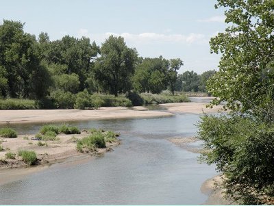
With one international and five out-of-state water experts hosting tables this year, the Water Resources Archive is giving greater attention to western water issues, as well as Colorado’s precarious position of being the Headwaters State.
Water Tables 2010 provides a unique opportunity to mingle with this special group representing diverse perspectives. Join us!
Colorado State University Libraries will host Water Tables 2010, its fifth annual fundraiser for the Water Resources Archive, at 5 p.m. Saturday, February 20th. The event starts with a reception and tour of the Archive at Morgan Library before moving to the Lory Student Center main ballroom for dinner.
The theme this year is “Across State Lines: Sharing the Resource.” Twenty table hosts will hold discussions during dinner focused on various aspects of how states and countries share water. Archival materials on display during the reception will illuminate some of the history behind the topic.
With one international and five out-of-state water experts hosting tables this year, the Water Resources Archive is giving greater attention to western water issues, broadly, as well as Colorado’s precarious position of being the Headwaters State. Water Tables 2010 provides a unique opportunity to interact with this special assemblage representing diverse perspectives.
This year’s table hosts and topics are:
Don Ament, Former Colorado Commissioner of Agriculture
Topic: Is ag dry-up inevitable?
Alan Berryman, Assistant General Manager, Engineering Division, Northern Colorado Water Conservancy District
Topic: Interstate comity is for the birds
John D’Antonio, New Mexico State Engineer
Topic: The Rio Grande Compact — sharing the resource
Derek Everett, Visiting assistant professor, History Department, Metropolitan State College of Denver
Topic: Fluid boundaries: water and western state lines
Jennifer Gimbel, Director, Colorado Water Conservation Board
Topic: The state of Colorado’s role in balancing non-consumptive needs and meeting the state’s future consumptive use demands
Neil Grigg, Professor of Civil and Environmental Engineering, Colorado State University
Topic: Water for a sustainable future: challenges to the political system
Taylor Hawes, Colorado River Program Director, The Nature Conservancy
Topic: The Colorado River Compact: is it up to the task?
Tom Iseman, Program Director for Water Policy and Implementation, Western Governors Association
Topic: How far has multi-state water management gotten us? Where will it lead us?
Frank Jaeger, District Manager, Parker Water and Sanitation District
Topic: Colorado-Wyoming Coalition: developing Colorado River water across state lines
Eric Kuhn, General Manager, Colorado River Water Conservation District
Topic: How can we keep from losing the resource? How would we deal with a compact call on the Colorado River?
Harry LaBonde, Jr., Wyoming Deputy State Engineer
Topic: The Green River Pipeline Regional Watershed Supply Project — perspectives from Wyoming
Mario Lopez Perez, Engineering and Technical Standards Manager, National Water Commission of Mexico
Topic: The Colorado River as an international river: Mexico’s perspective
Jon Monson, Director of Water and Sewer, City of Greeley
Topic: The Laramie-Poudre Tunnel and the Colorado-Wyoming Compact of 1957: a tale of transfer ag to urban
Patrick O’Toole, President of the Family Farm Alliance, and former member of President Clinton’s Western Water Policy Review Advisory Commission
Topic: A historical look at western water policy development
Jennifer Pitt, Senior Resource Analyst, Environmental Defense Fund
Topic: Si se puede? U.S.-Mexico cooperation on the Colorado River
Rock Ringling, Managing Director, Montana Land Trust
Topic: Private land conservation’s role in the preservation of wetlands and water resources
Bill Rinne, Director, Surface Water Resources Dept., Southern Nevada Water Authority
Topic: Augmenting the Colorado River — sharing the resource
David Robbins, President and Co-founder, Hill & Robbins, P.C.
Topic: Why we have to share — limits on our right to consume
Randy Seaholm, Former Chief, Water Supply Protection, Colorado Water Conservation Board
Topic: Environmental flows, Colorado’s compact entitlement and compact administration
Steve Vandiver, General Manager, Rio Grande Water Conservation District
Topic: Riding herd on the Rio Grande Compact in the San Luis Valley