
Click here to read the briefing. Click through for the graphics and detail. Here’s an excerpt:
Highlights
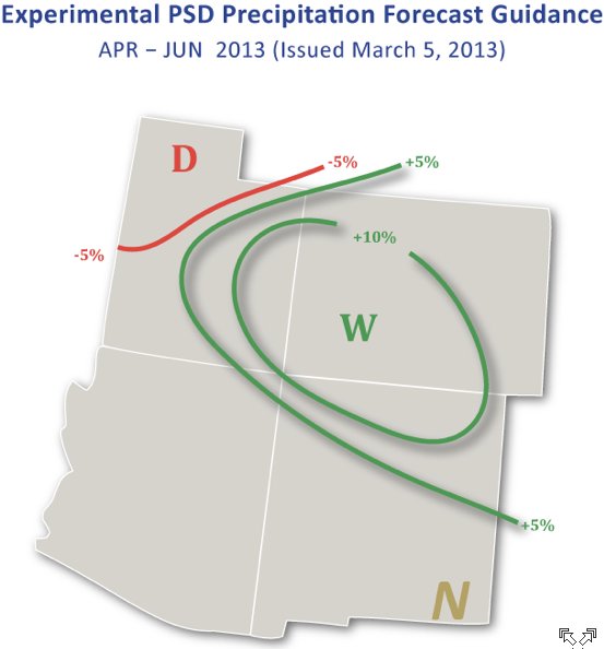
February precipitation was mainly below-average for the region, with the driest conditions across Utah; eastern Colorado and central Wyoming saw above-average precipitation. Snowpacks are now below-average in nearly every basin across the region after a dry February caused the snowpacks in Utah and western Wyoming to lose ground compared to average conditions The March 1 spring-summer streamflow forecasts for the region call for well-below-average (<70%) runoff in nearly all basins, reflecting both the low snowpacks and the unusually low soil moisture last fall The NOAA CPC seasonal climate outlooks show a dry “tilt” for spring and early summer precipitation for most of our region, though the one-month outlook for March has no tilt. In contrast, the “SWcast” for April–June shows a wet tilt over Colorado and eastern Utah.