
Here’s the update from the Colorado Water Conservation Board:
Activation of Phase 2 &3 of the State Drought Mitigation and Response Plan, and the activation of the Agricultural Impact Task Force remain in effect to respond to ongoing drought conditions throughout Colorado.
Late February and March precipitation coupled with periods of cooler than average temperatures have helped to maintain snowpack levels in the Colorado high country. However, the entire state continues to deal with drought conditions and the eastern plains remain exceptionally dry. Given current conditions, 275% of normal precipitation would be needed to reach average peak snowpack statewide, which typically occurs on April 8th. It is unlikely that this will be achieved. Consequently, water providers are preparing for continued drought conditions throughout the spring and summer and some have announced restrictions. Please visit http://www.COH2O.co for more information on restrictions in specific communities.
As of the March 19, 2013 US Drought Monitor, 100% of Colorado is experiencing some level of drought
classification. D1 (moderate) and D2 (severe) cover 52% of the state, while D3 (extreme) accounts for an additional 27%. 21% of the state is now experiencing exceptional drought (D4), a slight decrease from last month. Despite an increase in beneficial moisture during March statewide snowpack has maintained, but not improved, and is currently 77% of average. The highest snowpack in the state is in the Southwest basins (82%) while the South Platte is experiencing the lowest at 67% of normal for the water year. All other basins range from 73-79% of average.
Municipalities and water providers are actively preparing to respond to continued drought conditions with both mandatory and voluntary watering restrictions throughout the spring and summer demand season. Many major utilities will implement restrictions beginning April 1st. A website http://www.COH2O.co has been developed to help individuals determine what the restrictions in their specific community are.
Statewide reservoir storage is at 71% of average and 39% of capacity, a slight increase from last month. The highest storage levels are in the Yampa/ White River Basin, at 106% of average while the lowest storage in the state is the Rio Grande River basin at 53% of average. All other basins range from 55% to 82% of average and 16% to 65% of total capacity. Last year this time the state was at 105% of average reservoir storage.*
Surface Water Supply Index values have decreased across the entire state over the last month and all values remain negative. Below average reservoir storage and streamflow forecasts contribute to these values.
NRCS is forecasting below average spring streamflows for the entire state, with most of the basins falling within the 50-69% of average forecast range.
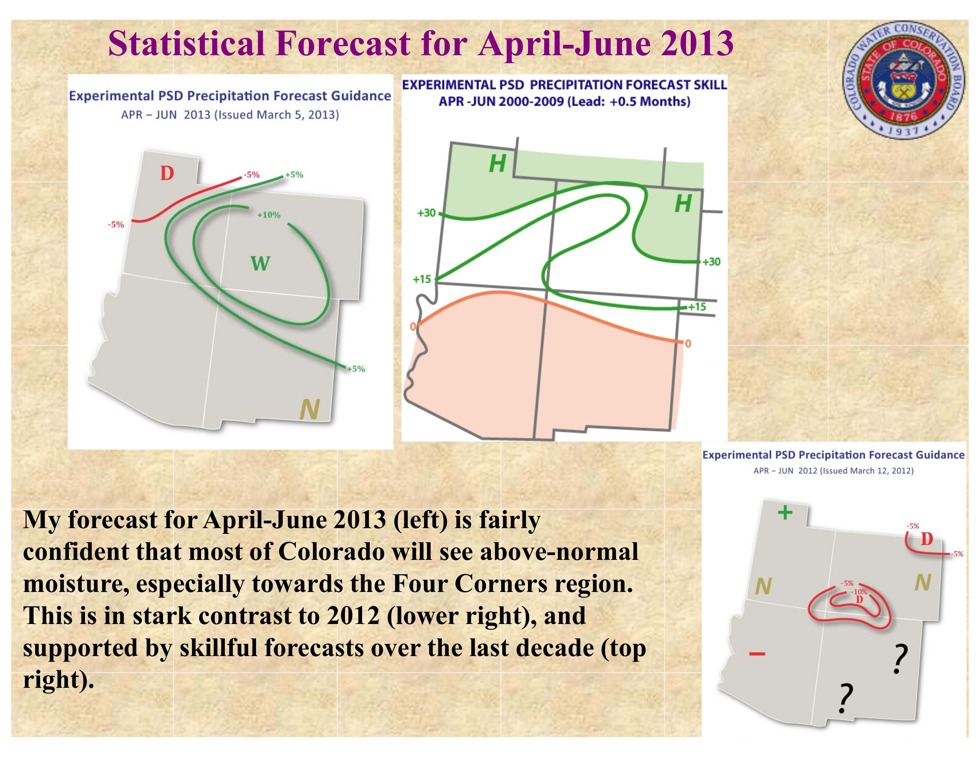
The long term experimental forecast for April through June of this year is projecting above normal moisture across most of the state, especially around the four corners region. Additionally, the Climate Prediction Center at NOAA is forecasting above average temperatures and persistent drought conditions across much of the state.
Here’s the link to the webpage where you can view all the presentations.
More CWCB coverage here.