
Click here to go to the WWA dashboard. Scroll down for the array of graphics and the current assessment. Here’s an excerpt:
Highlights
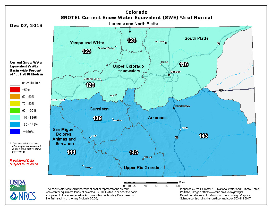
A major storm on a southerly track in late November led to much-above-average monthly precipitation for southeastern and west-central Utah and western and south-central Colorado.
Snowpacks are above normal across nearly all of the three-state region, with the wettest basins (>140% of median) in northern Wyoming, southern Utah, and the southern half of Colorado, and the driest basins (80–100% of median) in northern and central Utah and far southwestern Wyoming.
The NOAA CPC climate outlooks show a wet tilt for Wyoming over the next three months, with a slight dry tilt for southern Colorado and Utah for late winter (January–March). The NOAA PSD ‘SWcast’ is more pessimistic, showing a dry tilt for most of Colorado and Utah for late winter.