2014 Colorado legislation: SB14-017 would limit turf in new developments, supply-side land-use planning #COleg

Flood irrigation -- photo via the CSU Water Center
Flood irrigation — photo via the CSU Water Center

From The Greeley Tribune (Eric Brown):

A bill aimed at addressing one of Colorado’s most pressing agriculture and water issues didn’t receive support this past week from water experts or farmers and ranchers in the region. [SB14-017] looks to reduce the amount of “buying and drying up” of irrigated agriculture land that occurs when municipalities purchase water rights from farmers and ranchers to meet the needs of their rapidly growing cities.

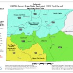
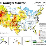
The purchasing of water rights from ag producers leaving the land is a comparatively inexpensive way for cities to acquire needed water but, according to the Statewide Water Supply Initiative study, released in 2010, Colorado is on pace to see as many as 500,000 to 700,000 acres of irrigated farmland dry up by 2050.

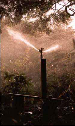
The issue is at the top of many statewide and local long-term water plans but, during this week’s South Platte Roundtable meeting, proposed legislation aimed at helping solve the problem was described as a “flawed bill.” The bill looks to prohibit local governments from approving applications for development permits if any part of the water supply for the development is changed from agricultural irrigation purposes to municipal or domestic uses. And, if former ag water is used for the development, the local government would have to adopt ordinances that limit the amount of irrigated grass on residential lots in the development to no more than 15 percent of the total aggregate area of all residential lots in the development.

Like others throughout the state, members of the South Platte Roundtable — consisting of water experts from all over northeast Colorado, who meet bimonthly, sometimes monthly, to address the region’s long-term water issues — are in search of ways to preserve the state’s agriculture industry, which has an estimated $40 billion economic impact annually. But roundtable members expressed concern Tuesday about putting in place the mandates listed in the bill, and would rather see cities and farmers work out water arrangements that meet their own unique needs in the future without injuring one another.

“It’s hard to imagine there wouldn’t unintended consequences with this,” said Doug Rademacher, Weld County farmer, Weld County Commission chairman and South Platte Roundtable member.

Rademacher and others in attendance asked where the mandates would end, and if the next step might be mandating farmers to convert a certain percentage of their ground from flood irrigation to sprinkler irrigation.

The bill is being pushed in the Senate by Sen. Ellen Roberts, R-Durango, and Sen. Mary Hodge, D-Brighton, with House support coming from Rep. Ed Vigil, D-Fort Garland, Rep. Don Coram, R-Montrose, and Rep. Randy Fischer, D-Fort Collins.

Fischer, who’s made a name for himself in pushing water legislation in recent years, said this week that, in addition to preventing the continued “buy and dry” up of ag land, the bill — with its support from West Slope lawmakers — also looks to make sure the rapidly growing East Slope is using their water supplies as wisely as possible.

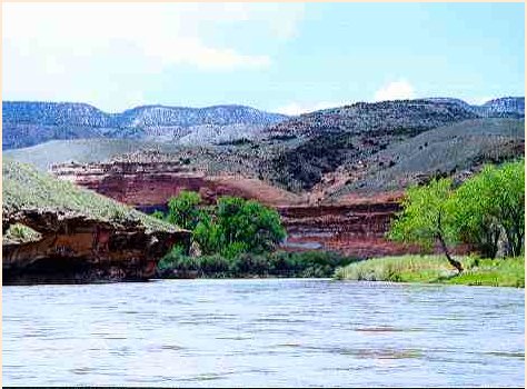
In Colorado, about 80 percent of the population lives on the East Slope — particularly in the Front Range — but about 80 percent of the water resources in the state are on the West Slope. To meet their water demands, East Slope officials have developed ways of bringing West Slope water across the Continental Divide, and say they need to continue doing so to meet their increasing needs. That has been a major source of concern with West Slope water officials, especially in the Colorado River Basin, which is widely acknowledged as one of the most stressed basins in the U.S., if not the most. It not only supplies many of Colorado’s needs, but also that of water users in states to the West.

Fischer said he supports what the bill is attempting to do, but added that he’s heard concerns from the Colorado Municipal League similar to those of the South Platte Roundtable.

Members of the South Platte Roundtable said Tuesday they hope — and believe — the Colorado Municipal League will squash the bill.

More 2014 Colorado legislation coverage here.

Arkansas Valley Super Ditch update: ‘The objective is to develop a tool to look at lease-fallowing effects’ — Rick Parsons

Straight line diagram of the Lower Arkansas Valley ditches via Headwaters

From The Pueblo Chieftain (Chris Woodka):

A comprehensive study of Arkansas River water use that will aid the Arkansas Valley Super Ditch in temporary water transfers is nearing completion. “The objective is to develop a tool to look at lease-fallowing effects and quantify the amount of water to be exchanged,” Rick Parsons, an engineering consultant, told the Lower Arkansas Valley Water Conservancy District on Wednesday. The district has helped Super Ditch since its formation in 2008 as a way to allow farmers to lease water without selling their underlying water rights, preventing the dry-up of farmland. The district and Super Ditch are working on a pilot program with Fowler this year.

The Super Ditch has contemplated several strategies for moving water, including filing an exchange decree in water court, using existing substitute water supply plans and creating pilot projects under last year’s HB1248. The problem has been getting water users to agree to how those exchanges will avoid damaging other water rights.

Since 2011, Parsons has been compiling information about how water is used in the Arkansas River basin, looking at river operations from 1980-2013. His model should be complete in May. The Super Ditch needs a model that will be generally accepted by other water users, Parsons said. Parsons has met with the state, Colorado Springs Utilities, Aurora and the Pueblo Board of Water Works to glean information. He also has worked with ditch companies to obtain additional data.

The major obstacles at this point are reconciling data from different sources and understanding reservoir operations. Some Lake Pueblo operations related to Southern Delivery System are not clear because of proprietary information held by Colorado Springs Utilities, Parsons said. Reservoirs on the Colorado, Holbrook and Fort Lyon systems are operated by private companies.

“There are a million numbers in this model, and a million in the state database. Some of them are wrong,” Parsons said. “If this is used in a court document, it will be challenged to the nth degree. It has to be as transparent as possible.”

More Arkansas Valley Super Ditch coverage here and here.

Joint Statement from Secretaries Jewell, Pritzker and Vilsack on the Drought Declaration in California

US Drought Monitor January 14, 2014

Here’s the release from the Department of Interior:

Governor Brown’s declaration today underscores the gravity of the historic drought conditions facing California – conditions that are likely to have significant impacts on the state’s communities, economy and environment in the coming months.

We are keenly aware of the need to act quickly and collectively to address the complex challenges the drought poses, and we are directing our respective agencies to work cooperatively to target resources to help California prepare for and lessen the impacts of the drought.

This week, U.S. Department of Agriculture (USDA) designated areas in 11 states, including 27 counties in California as primary natural disaster areas due to drought. This designation makes farmers and ranchers in those counties eligible for assistance through a number of USDA programs. USDA is also working with farmers and ranchers to increase their irrigation water efficiency, protecting vulnerable soils from erosion, and improving the health of pasture and range lands. The U.S. Department of the Interior’s Bureau of Reclamation is working closely with federal and state authorities to facilitate water transfers and provide operational flexibility to convey and store available water, and facilitate additional actions that can conserve and move water to critical areas. The National Oceanic and Atmospheric Administration (NOAA), part of the Department of Commerce, is providing regular updates to state officials on drought conditions. This not only includes information on weather forecasts, but also information on river water levels and potential drought impacts.

And, as called for in the President’s Climate Action Plan, the National Drought Resilience Partnership (NDRP) will help coordinate the federal response, working closely with the State of California, local government, agriculture and other partners. The NDRP is already helping to enhance existing efforts that federal agencies are working on with communities, businesses, farmers and ranchers to build resilience where drought is currently an issue across the country.

Today’s drought declaration also serves as a reminder of the long-term need to take a comprehensive approach to tackling California’s water problems. We remain committed to working with the state to provide for the sustainable management of its precious water resources.

@fortcollinsgov loses 1985 Halligan conditional water right, throws law firm under bus

Reservoirs NW of Fort Collins

From the Fort Collins Coloradoan (Kevin Duggan):

Vranesh and Raisch LLP, which represents the city on variety of water and environmental legal matters, failed to file a “diligence” application with the state Water Court to maintain the right by a Nov. 30 deadline, city officials said. As a result, the conditional storage right was canceled. The city has since reapplied for its claim on 33,462 acre feet of water on the North Fork of the Poudre River and streams that flow into it. The North Fork ties into the main stem of the Poudre River west of Fort Collins.

Managing the city’s water rights is the responsibility of the Water Resources Division of Fort Collins Utilities. The city has relied on internal documents, such as lists and spreadsheets, and communication with outside water lawyers to keep track of its conditional rights, stated Deputy City Attorney Carrie Mineart Daggett in an email to the Coloradoan.

In this case, utilities officials forwarded a notice from Water Court that an application was due on the Halligan conditional right to Vransh and Raisch on Sept. 5. But the firm did not follow through by sending in the required diligence application and $224 filing fee as expected.

Steps are being taken to ensure similar mistakes don’t happen, Daggett stated.

“The city is in the process of evaluating professional tracking systems and expects to acquire and use such a system in the near future in order to better assure timely completion of necessary actions related to city water rights,” Daggett wrote.

Eugene Riordan, a partner with Vranesh and Raisch, said the firm has communicated with Fort Collins officials about the matter…

The firm has borne the cost of reapplying for the conditional right, Daggett said.

The conditional storage right for an expanded reservoir was established in 1985 by the North Poudre Irrigation Co. and the Halligan Resources Co. The city acquired Halligan Resources’ interest in the right in 1987, and then North Poudre’s interest in 1993, city officials said…

Fort Collins has proposed expanding Halligan Reservoir, which is on the North Fork of the Poudre River, by 40,000 acre feet to shore up its water supplies for future growth and as protection against drought. The proposal is undergoing a lengthy Environmental Impact Statement and permitting process through the U.S. Army Corps of Engineers…

Before problems with Halligan right popped up, the City Attorney’s Office received approval from the City Council to add a lawyer and a paralegal to its staff to handle water-related issues. The hiring process has begun. Salaries for the posts in 2014 are expected to total about $200,000, Daggett stated.

More water law coverage here and here.

CSU Sponsors First Poudre River Forum Feb. 8

Cache la Poudre River

Here’s the release from Colorado State University (Jennifer Dimas):

The Cache la Poudre River is life-blood for Northern Colorado. In recognition of its importance to the area, the community is invited to the first Poudre River Forum, 10 a.m. – 4:30 p.m. on Saturday, Feb. 8 at The Ranch Events Complex in Loveland. The forum, “The Poudre: Working River/Healthy River,” will focus on all of the river’s stakeholders, representing perspectives from agricultural, municipal, business, recreational and environmental backgrounds. Topics to be discussed include:

• The water rights of agricultural and municipal diverters;
• Where the water in the Poudre comes from and what it does for us;
• Ecological factors such as flow, temperature, fish and sedimentation.

The forum will feature presentations and dialogue, including remarks by State Supreme Court Justice Greg Hobbs about how the Poudre itself was the site of early conflict and cooperation leading to the development of the doctrine of prior appropriation in the West, and how water law has evolved in recent years.

Following the event, a celebration of the river will be held until 6 p.m. with refreshments and jazz by the Poudre River Irregulars.

Pre-registration is required by Jan. 31. The cost is $25; students 18 and under are free and scholarships are available. To register, visit http://www.cwi.colostate.edu/thepoudrerunsthroughit

The event is sponsored by The Poudre Runs Through It Study/Action Work Group facilitated by CSU’s Colorado Water Institute.

More Cache la Poudre River watershed coverage here and here.

Colorado’s Instream Flow Program: ‘There is no more important resource than the water resource’ — Greg Hobbs

Colorado instream flow program map via the Colorado Water Conservation Board

From the Aspen Daily News (Brent Gardner-Smith):

At least $100 million a year is available annually in Colorado to spend on land conservation, but only about $1.5 million a year is available for buying water to leave in the state’s rivers. That’s according to Amy Beatie, the executive director of the Colorado Water Trust, who spoke last week at a forum in Denver marking the 40th anniversary of the state’s instream flow law…

As a result of two laws passed in 2008, the CWCB can use $1 million a year from a departmental construction fund to buy or lease water rights for instream flow purposes, and can use $500,000 a year from a species conservation trust fund to preserve endangered fish habitat.

Beatie said the Colorado Water Trust, a nonprofit that facilities the acquisition and leasing of instream flow rights, “longs for a resource” as robust as GOCO to help the “flow restoration movement” grow in Colorado.

“Don’t we all want to see healthy and flowing rivers?” Beatie asked the crowd gathered on Wednesday in the courtroom of the Colorado State Supreme Court for the event. “Don’t we all want to see healthy aquatic ecosystems in every river in the state?”

Forty years ago, Senate Bill 73-97 recognized “the need to correlate the activities of mankind with some reasonable preservation of the natural environment.”[…]

Since 1973 the CWCB has appropriated — or created — instream flow rights on 1,500 river and stream segments in Colorado, totaling 9,005 river miles. It has also acquired, through donations or long-term contracts, rights for 500 cubic feet per second (cfs) of flow in various rivers.

It may not have been. In 1975, the Colorado River District challenged the instream flow law, arguing that water had to be diverted from a river in order to be a legal water right. But Colorado’s Supreme Court upheld the law as a valid act of the state Legislature.

“As long as it’s junior to the seniors,” Colorado Supreme Court Justice Gregory Hobbs said Wednesday, standing in front of the bench he normally sits on, explaining the court’s reasoning, “and doesn’t cause injury to prior water rights, which is always the lodestar.”

Hobbs said the legal challenge made the instream flow law stronger, giving legal standing to instream flow rights. Another lawsuit in 1995, from the Aspen Wilderness Workshop, prompted a court ruling that the CWCB has a duty to enforce its instream flow rights.

In 2001, the law was expanded to allow instream flows to be used for “improving” rivers, and not just protecting them at minimum streamflow levels. And provisions have since been added to allow the CWCB to lease water from private owners without it counting against an owner’s “historic consumptive use” record — the core monetary value of a water right.

“In the future, we will see this program grow, mature,” Hobbs said. “There is no more important resource than the water resource.”[…]

But lest the waters of praise for the program rise too high during the event, Ken Ransford, an attorney and CPA from Basalt who sits on the Colorado River Basin Roundtable, stood to offer a stark assessment of the instream flow law.

“I compared the pre-1923 water rights that the CWCB holds as instream flow rights, and they amount to .31 percent of the water that we consumed in agriculture in 2005, the last year that (data) is available,” Ransford said. “If we look at our pre-1900 water rights, the CWCB holds .21 percent, so that means that two-tenths of one percent is the amount of water that the CWCB holds compared to the water that we consume in agriculture in a typical year. My point is that we have a long way to go to really make this a robust program.”

Pre-1923 water rights are valuable because they are not subject to a “compact call” from California and other downstream states, and pre-1900 water rights are generally very senior in nature.

“The Fraser River got down to 4 cfs in 2002,” Ransford continued. “The Crystal River got down to 1 cfs in 2012. The Roaring Fork River got down to 5 cfs in 2012. The Dolores River regularly dries up. These are some of our biggest rivers in the state and they all but dry up.”[…]

In addition to creating new instream flow rights, the CWCB can also buy, lease or accept as a donation senior water rights. But the process can be daunting, as the water right needs to be changed in water court.

Ransford said it took Pitkin County several years in water court and over $200,000 in legal fees to enter into a long-term lease with the CWCB to leave water in sections of Maroon Creek and the Roaring Fork River.

Drew Peternell, the director of Trout Unlimited’s Colorado Water Project, said the process should be easier.

“The irrigator who wants to make that transfer of water has to go to water court, and that’s going to be a risk for him,” Peternell said. “There is a potential that the water right could be quantified at a level that is smaller than the irrigator thinks is appropriate.”

That’s what happened to Pitkin County, which sought to leave 4.3 cfs of water in lower Maroon Creek and a section of the Roaring Fork River below its confluence with Maroon Creek. Instead, it came away with the right to leave up to 3.83 cfs in Maroon Creek, but with only 1.22 cfs being left in the stream on average between May and October. In the Roaring Fork, the county can leave up to 3.54 cfs of water, but with an average of only 1.13 cfs.

The county, however, still intends to transfer up to 35 more water rights from its open space properties to instream flow rights to the benefit of local rivers.

More instream flow coverage here.

Arkansas Valley Conduit update: Project caught up in the federal Record of Decision slog

Preferred route for the Arkansas Valley Conduit via Reclamation

From The Pueblo Chieftain (Chris Woodka):

Plans for the Arkansas Valley Conduit continue to be in a holding pattern. Federal processes have slowed the completion of a record of decision for the conduit, a master storage contract and interconnection of outlets on Pueblo Dam.

The conduit is a plan to bring clean drinking water to 40 communities and 50,000 people from St. Charles Mesa to Lamar.

The master contract would allow conduit users and others to purchase long-term storage in Lake Pueblo, while the cross-connection would give water users redundancy of water supply sources.

An environmental impact study was finalized in August, but changes in the Bureau of Reclamation leadership and a federal shutdown have delayed the ROD for five months, said Christine Arbogast, lobbyist for the Southeastern Colorado Water Conservancy District, sponsors of the projects.

“Five months seems like a long time, but it’s looking good,” Arbogast said.

She said a decision could be made in a few weeks.

The lack of the ROD for the projects means very little work is progressing.

“Anything moving forward will be on hold until we get to the point where we have a ROD,” said Jim Broderick, executive director of the Southeastern district.

This year’s federal budget includes $1 million for the conduit, but larger appropriations are needed in future years to move the project ahead.

More Arkansas Valley Conduit coverage here and here.

Snowpack news (percent of normal): Laramie and North Platte basins = 119%, best in state #COdrought

Snow water equivalent as a percent of normal January 20, 2014 via the NRCS

From The Produce News (Lora Abcarian):

Dave Nettles, division engineer for Div. 1 of the state engineer’s office in Greeley, CO, said prospects in 2014 have greatly improved in the South Platte River Basin. The basin services agricultural producers located within or near the state’s most populous metropolitan area, the Front Range. Last year was turbulent for the region’s fresh producers, who saw their ability to irrigate severely curtailed.

Craig Cotten, Nettles’ counterpart in Div. 3 in Alamosa, CO, talked about conditions in the Rio Grande River Basin and Colorado’s San Luis Valley. He summed things up this way: “We have a low of 66 percent of average to a high of 97 percent of average,” he told The Produce News in early January. “We’re the lowest basin the state.”

According to Cotten, a study released this past December by the Bureau of Reclamation of the U.S. Department of the Interior reported on the future of water in the Rio Grande. Cotten said the report stated that lack of precipitation is expected to reduce water volume by one third by 2090.

The situation in southern Colorado contrasts sharply with conditions in northern Colorado.

“Snow pack is about average for the South Platte,” Nettles said, adding that rainy conditions this past fall had two significant effects in the region. Rain caused dramatic flooding in the region, but also filled the state’s irrigation reservoirs to full or near-full conditions.

The state engineer’s office continues with rule-making processes to address water use and conservation. In northern Colorado, Nettles said final rules were adopted to regulate well metering. Agricultural producers are required to be part of water augmentation plans approved by Water Court, or they must obtain approval of a substitute water supply plan. Nettles said the substitute plans are temporary in nature.

In the San Luis Valley, Cotten said the state engineer’s office is looking to finalize rules and regulations for groundwater use by April…

Dave Nettles, division engineer for Div. 1 of the state engineer’s office in Greeley, CO, said prospects in 2014 have greatly improved in the South Platte River Basin. The basin services agricultural producers located within or near the state’s most populous metropolitan area, the Front Range. Last year was turbulent for the region’s fresh producers, who saw their ability to irrigate severely curtailed.

Craig Cotten, Nettles’ counterpart in Div. 3 in Alamosa, CO, talked about conditions in the Rio Grande River Basin and Colorado’s San Luis Valley. He summed things up this way: “We have a low of 66 percent of average to a high of 97 percent of average,” he told The Produce News in early January. “We’re the lowest basin the state.”

According to Cotten, a study released this past December by the Bureau of Reclamation of the U.S. Department of the Interior reported on the future of water in the Rio Grande. Cotten said the report stated that lack of precipitation is expected to reduce water volume by one third by 2090.

The situation in southern Colorado contrasts sharply with conditions in northern Colorado.

“Snow pack is about average for the South Platte,” Nettles said, adding that rainy conditions this past fall had two significant effects in the region. Rain caused dramatic flooding in the region, but also filled the state’s irrigation reservoirs to full or near-full conditions.

The state engineer’s office continues with rule-making processes to address water use and conservation. In northern Colorado, Nettles said final rules were adopted to regulate well metering. Agricultural producers are required to be part of water augmentation plans approved by Water Court, or they must obtain approval of a substitute water supply plan. Nettles said the substitute plans are temporary in nature.

In the San Luis Valley, Cotten said the state engineer’s office is looking to finalize rules and regulations for groundwater use by April.

Secretary Jewell honors group that is trying to water the #ColoradoRiver Delta

Colorado River Delta -- photo via National Geographic
Colorado River Delta — photo via National Geographic

From National Geographic Water Currents (Jennifer Pitt):

The Colorado River agreement, known as Minute 319, is groundbreaking in its approach, moving away from a focus on “who gets what” to a more modern, flexible framework that allows the U.S. and Mexico to share surplus when water is plentiful and share shortage when water is scarce. The agreement also commits the two nations to work together on water conservation and restoration of the Colorado’s long-desiccated delta by committing water to sustain it.

This cooperative framework to water management creates benefits for water users on both sides of the border, demonstrating that with a broad approach to river and water management, there is room to negotiate a win for multiple stakeholders – a model that water leaders might use to solve problems elsewhere in the Colorado River basin. Moreover, it stands as what is likely the first agreement between nations to jointly commit water to sustain a river’s natural values.

But Minute 319 also stands as a reason to celebrate what people of diverse cultures and interests can accomplish when they come together to focus on a common goal. I salute all of the men and women who toiled for years to make possible a new era of binational cooperation on the Colorado River…

To get to a place where we could meaningfully address the degraded delta’s environment, river restoration advocates had to work on success in every aspect of the U.S.-Mexico agreement, including surplus and shortage sharing, rules that would allow Mexico to store water in U.S. reservoirs, binational financing of a canal lining project, and a venue for discussing future cooperative binational projects like ocean water desalination. Moreover, we had to ensure that myriad stakeholders from both countries remained interested in working on all elements of the agreement, even when the potential for failure loomed on the horizon.

It took early “get-to-know-you” meetings, where border crossings were arranged for officials who had not previously spent much time abroad. It took dinners – complete with wine and tequila – where negotiators from top levels of government broke bread and got better acquainted. It took field trips to the border where these leaders could see firsthand how the Colorado River is managed between nations.

All told, it took close to five years to negotiate a five-year agreement. But Minute 319 truly demonstrates the adage that the process is the product. The U.S. and Mexican negotiators’ investment in getting to know people, water systems, laws, and politics brought the two nations into the Minute 319 framework where their interests on the Colorado River became more aligned than ever before.

Today, each country has a real stake in how the other conducts Colorado River management, and in collaborating to make real improvements including environmental restoration and water conservation. This alignment will serve water users in both countries well for years to come. I am proud and honored to have been able to witness and participate in the process.

More Colorado River Basin coverage here and here.

‘There’s a real urgency to this. We only have two years before wells are shut down’ — LeRoy Salazar

Acequia San Antonio via Judy Gallegos

From the Valley Courier (Ruth Heide):

A water purchase nearly four decades ago may provide a major solution in the current challenge to keep farmers in business in the San Luis Valley. Representatives from the San Luis Valley Irrigation Well Owners Inc. received unanimous support from the Rio Grande Interbasin Roundtable on Tuesday to perform a feasibility study to see if surface water rights they own can be used to offset depletion requirements for various groundwater management sub-districts throughout the Valley. The budget for the study is $180,000, with the local roundtable approving $8,000 of its basin funding for the project and supporting a request for $142,000 in statewide funds, which will be considered at the state level in March. The well owners group will provide $30,000 as its match.

The nonprofit well owners corporation was formed in 1973 to address groundwater rules and regulations that appeared imminent at the time, SLV Irrigation Well Owners Vice President Monty Smith told members of the Valley-wide roundtable group on Tuesday. In preparation for the rules/regs at that time, the well owners group, comprised of people who own irrigation wells, began an augmentation plan that incorporated the purchase of Taos Valley #3 water rights on the San Antonio River for augmentation water, Smith added.

“The augmentation plan was never completed and never needed to be used,” Smith explained.

“Thirty eight years later we find ourselves in a situation where we need to use that water and we need to complete the project.”

He added, “We feel this water is an absolutely crucial piece of our replacement for not only the Conejos area but it provides benefit for the entire basin. We need to figure how it can best be used.”

Agro Engineering Engineer Kirk Thompson provided more information about this potential water project and its importance to Valley water users, especially now that state groundwater rules and regulations for the Rio Grande Basin will soon be promulgated. Thompson said the Taos Valley #3 water rights were a relatively junior water right on the San Antonio dating to 1889. They were originally adjudicated for 500 cubic feet per second (cfs) and used for irrigation and storage. Since that time, however, a portion of the water rights was abandoned, leaving 245 cfs, which is what the well owners bought in 1976 for their augmentation plan. They converted 230 cfs of the 245 cfs total from irrigation to augmentation water and left the remaining 15 cfs in irrigation, Thompson explained. The well owners are considering converting that 15 cfs into augmentation water as well.

The well owners bought the water for the purpose of augmenting injurious depletions in the streams resulting from well pumping, Thompson said. Since 1976, the 230 cfs, also known as the Middlemist water, has been left in the San Antonio for the benefit of the entire river system, Thompson said. Since the state did not promulgate groundwater rules in the 1970’s , there was no formal requirement for augmentation in the intervening 38 years, he added.

Since this was a junior water right, some years the Middlemist water produced zero effect on the river system, and in other years it provided as much as 29,000 acre feet, Thompson said. Most years averaged about 10,000 acre feet of water from this water right to the river systems.

“This is a significantly large amount of water we are talking about and a valuable consideration as we move forward,” Thompson said.

Thompson reminded the attendees at the Tuesday roundtable meeting that the state is in the process of promulgating rules governing groundwater use in the San Luis Valley, and wells will no longer be allowed to pump unless their injurious depletions to surface rights are covered in a groundwater management sub-district or augmentation plan. Thompson said the state engineer’s goal is to have the rules/regulations to the water court by this spring, and Colorado Division of Water Resources Division 3 Division Engineer Craig Cotten confirmed that in his report to the roundtable.

Cotten also confirmed that the well owners’ augmentation plan would have to go back to court, since it never was finalized in the ’70’s . The plan would have to be more specific on how it would provide augmentation and would have to prove it could deliver water where it needed to go, he said.

Thompson said the well owners group wants to perfect its Middlemist/Taos Valley #3 water right so that water can be used for augmentation purposes in a way that will benefit well owners in sub-districts throughout the Valley. Individual augmentation plans for every well owner would not be realistic at this point, so most well owners plan to join sub-districts as a means of meeting the pending state regulations. The purpose of the well owners’ project is to consider ways in which their surface water right could benefit those sub-districts , Thompson explained.

“As of today, there’s certainly not enough augmentation water currently perfected to go around and ” will be in very short supply and probably at high value,” Thompson said.

He said the average total depletions that well owners throughout the entire basin will have to replace will be about 30,000 acre feet every year. If the approximately 10,000 acre feet the Middlemist water produces every year could be used to offset those depletions, it could amount to about a third of the annual requirement.

Smith said, “This is a way to carry on our living and our way of life that we all enjoy in this Valley and to keep the Valley a viable place to live. I have farmed my entire life. I am third generation. My goal is to be able to continue to preserve my wells, to replace my injuries to the streams. This is one piece in that puzzle to bring that all together.”

The group asked the roundtable for help in funding a hydrologic feasibility study to consider the potential for using the Taos Valley #3 water for either surface water storage or groundwater recharge. Thompson said storage options are limited, so he believed recharge was a more viable option. The feasibility study would look at how the recharge could be accomplished so the water would go into the ground where it was needed to replace injurious depletions. The study would look at both confined and unconfined recharge options..

Those who will be involved in conducting the feasibility study will be Thompson of Agro Engineering, Eric Harmon of HRS Water Consultants, Allen Davey of Davis Engineering and in an advisory capacity, Steve Vandiver of the Rio Grande Water Conservation District , the sponsoring entity for the water management sub-districts .

The study would be the first of a multi-phased project . Phase 2 would look at physical infrastructure to get surface water where it needs to go, and the third phase would involve the court process to perfect the water right as an augmentation right, Thompson explained.

He said the well owners want to begin some wintertime well monitoring right away, using their $30,000 match. They want to begin this study as soon as possible since Harmon envisions the feasibility phase as taking a full year.

“If we don’t have the feasibility done this year we are talking another one or two years to get into the courts,” Thompson said. “If rules are released this spring, the subdistricts are under the gun to get formed and under the gun to find sources of water to replace injurious depletions in short order.”

LeRoy Salazar added, “There’s a real urgency to this. We only have two years before wells are shut down ” We don’t have a lot of time.”

Salazar said this project is key to replacing injurious depletions to surface water rights; creating a sustainable water table; and maintaining the Valley’s economy.

More Rio Grande River Basin coverage here.

Mesa County Commissioners want federal help for stormwater mitigation

Grand Junction with the Grand Mesa in background

From The Grand Junction Daily Sentinel (Emily Shockley):

Mesa County commissioners are asking the federal government to help local governments pay the tab for storm water damage mitigation and monitoring. Commissioners unanimously adopted a resolution Monday asking the federal government to take financial responsibility for storm water that flows from federal lands onto other land, potentially causing damage.

Federal regulations in many cases require local government entities to absorb costs associated with construction, maintenance, treatment and cleanup geared toward storm water cleanliness and damage mitigation. The resolution seeks federal support with those efforts because “a significant portion” of storm water problems in Mesa County are associated with unrestricted storm water flowing from federal lands onto other property.

“The purpose is to call the federal government to the ropes,” Julie Constan with the county’s Public Works Department told commissioners. “We’d like to have more of their active participation with the storm water management issues we do deal with, especially with storm water that comes off of federal lands.”

The resolution has been passed by the town of Palisade, the cities of Fruita and Grand Junction, the 5-2-1 Drainage Authority and the Grand Valley Drainage District as well.Constan said it will likely be reviewed by state legislators this year. The goal is to get Congress to read the resolution and act on it.

Specifically, the resolution requests federal assistance with the cost of conducting studies to determine which construction projects or repairs should be done and in what order when it comes to storm water that falls on federal lands. The resolution also seeks establishment of a program that would provide “timely financial assistance or reimbursement” to local governments for construction of flood detention or retention facilities and federally mandated storm water monitoring, analysis and treatment.

“I think it’s a great step in the right direction,” Commissioner Rose Pugliese said.

More stormwater coverage here.

The latest Greeley Water Conservation newsletter is hot off the presses

Greeley Irrigation Ditch No. 3 construction via Greeley Water

Click here to read the newsletter. Here’s an excerpt:

5 Ways To Save Water and Money in 2014

1. Review the graphs on your water bill. Compare the “this month” column with the “water budget” column. If your monthly use exceeds your budget, you could make adjustments to save more water. This is most critical when lawn watering begins and many people use more water than their lawns need.

2. Year-round wastewater rates are based on January and February water use. Practice indoor water conservation early in the year and save all year long.

3. Heating water for showering, bathing, shaving, cooking, and cleaning also requires a considerable amount of energy. Homes with electric water heaters, for example, spend one-fourth of their total electric bills just to heat water.

4. Winter months are the prime time to check water use and see if you may have a leak. If a family of four exceeds 10,000 gallons per month in the winter, you probably have leaks!

5. Give you bathroom a mini-makeover. Buy a new toilet that uses less water and you may be eligible for a water conservation rebate. Switch out your showerhead with a new model at no cost when you participate in Greeley’s Showerhead Exchange program. Add aerators to sinks, they slow the flow and can be picked up at Greeley’s showerhead exchange events.

2014 Colorado legislation: Ag leaders hope to bridge the Ag-Urban divide this session #COleg

51st State Initiative Map via The Burlington Record

From the La Junta Tribune-Democrat (Candace Krebs):

While leaders meeting recently in Loveland considered last year’s general assembly a failure and even a disaster, they could at least take solace knowing they made headway in getting their concerns heard. A nationally publicized secession campaign in northeastern Colorado gained enough traction to help unseat two prominent Democratic legislators and forced a third to resign in order to keep the seat under Democratic control.

National media has tended to portray gun legislation as the biggest source of the rift. Clearly, gun control laws are unpopular among farmers, many of whom hunt or live in remote areas where local law enforcement is hindered from responding quickly to security concerns.

But ag leaders who met in mid-December seemed to indicate that House Bill 252, mandating the state get 20 percent of its energy from renewable sources by 2020, had driven the deepest wedge.
Rep. Lori Saine, a House ag committee member from the Fort Lupton area and one of several lawmakers who met with farmers during a legislative town hall event, described it as an “injustice” that would end up boosting electricity rates by 20 percent in rural areas while having little or no impact on Front Range utilities.

Greg Brophy, of Wray, a state senator and Republican candidate for governor, advocated the repeal of 252, saying it needed to be eliminated before any money was sunk into meeting the new requirements.

Among the bill’s criticisms is that it does not include hydropower as a renewable energy source. Hydropower makes up a significant portion of the energy portfolio for rural electric cooperatives, and hopes are widespread that further hydropower development can be piggybacked onto infrastructural improvements needed following the August floods.

Others questioned whether the new bill would actually contribute to a cleaner environment.
Randy Traxler, a wheat farmer from Otis, pointed out that coal is still being mined in the West, only now it’s being exported to China, a country where pollution controls are lax…

Rep. Fischer, a Democrat from Fort Collins, is chairman of the House ag committee.

“My sense is agriculture is very well represented at the legislature, but it doesn’t necessarily translate into total agreement on all of these issues,” he said at one point.
However, he added, there does appear to be an urban-rural “disconnect.”

“I think it’s real, and I think it’s something the state needs to address,” he said during a panel wrap-up.

His statements drew a compliment from Wray’s Brophy, who sits on the state’s Senate ag committee.

“I’ve watched you really grow into your role as committee chairman,” Brophy said to Fischer, recalling how his House colleague went from sponsoring the infamous “tractor tax” targeting heavy equipment emissions in 2010 to backing important water conservation legislation this year to study groundwater management alternatives along the South Platte River.

Brophy called it “the most significant water bill of the year for farmers.”

More 2014 Colorado legislation coverage here.

2014 Colorado legislation: Conservation bills detailed at Southeastern Water board meeting #COleg

Low flow toilet cutout via The Ultimate Handyman

From The Pueblo Chieftain (Chris Woodka):

Two bills that would conserve water in Colorado were floated by proponents in Pueblo last week. The Southeastern Colorado Water Conservancy District heard the presentations for a lawn-watering limitation bill and more water-efficient home appliances at its monthly board meeting Thursday.

The two bills are among more than a dozen water proposals waiting in the wings at the state Capitol this year. As of Friday, only six bills had been assigned to committees.

Steve Harris, who represents Southwest Colorado on the Interbasin Compact Committee, explained a concept to limit new developments to 15 percent lawns beginning in 2016. Harris came up with the idea, and it has garnered widespread support in the Colorado River basin.

More 2014 Colorado legislation coverage here.

Pueblo West: Metropolitan board approve $40,000 for pipeline easement costs

Pueblo West
Pueblo West

From The Pueblo Chieftain (Tracy Harmon):

The Pueblo West Metropolitan District board took another step last week toward saving its precious water resources from evaporation. The board voted unanimously Tuesday to fund $40,000 worth of appraisals for its proposed Wildhorse Pipeline easement. The valuations will help the board reach agreement with property owners.

The board proposes to build a roughly 7-mile pipeline to prevent the estimated 70 percent loss of water due to evaporation or seepage as it is discharged from the Pueblo West treatment plant into Wildhorse Creek, where it is measured for water credit.

“If we can get a good portion of that 70 percent back, it would add up to roughly 1,000 to 1,200 acre-feet of water — enough to supply 2,400 to 3,600 homes annually. It’s a lot of water,” said Jack Johnston, district manager.

The district will need to secure 100 easements, about half of which are through Pueblo city-owned property. Because the district has not been able to reach agreement with the city of Pueblo, it filed a lawsuit in December seeking the right of eminent domain to condemn the property it needs for “the greater public purpose,” Johnston said.

“Water conservation is a statewide interest. We have just about 11,000 water taps but we are not done growing,” Johnston said.

In 2013, Pueblo West received 49 new home permit applications. Johnston said the district also would like to have more water available should a new manufacturing business require significant water.

“To add to our water portfolio for future growth is a solid investment for a community. We also are able to lease any excess water we have,” Johnston explained.

Johnston said the filing of the district court lawsuit was not a step Pueblo West leaders wanted to take. He said he still is hopeful of reaching an agreement with Pueblo officials before the case is heard June 12-13.

“For two government agencies to fight each other does not make sense to me,” said Lew Quigley, board member. “The taxpayers come out the losers.”

Meanwhile, Pueblo County has updated their 1041 regulations, partially in response to Pueblo West’s project. Here’s a report from The Pueblo Chieftain (Peter Roper):

City Council adopted an arsenal of new land-use regulations last week that gives it more voice over the routes of new water pipelines, power plants, transmission lines and even new sewage treatment plants. The unanimous vote came Jan. 13 even as the city and the Pueblo West Metropolitan District are at odds over the route of the Wildhorse Reuse Pipeline Project.

That long-sought project would be a return-flow pipeline from the Pueblo West sewage treatment plant to the Arkansas River below Pueblo Dam. The project has been on the drawing board for several years with agreement of Colorado Springs, Aurora, the Pueblo Board of Water Works — all players that have cooperated on a program to maximize flows in the river.

Pueblo city planners have challenged the proposed route of the pipeline, which Pueblo West officials want to acquire through eminent domain, including some city-owned land. The metro district filed a suit in Pueblo District Court last month to force Pueblo to comply.

On the advice of new City Attorney Dan Kogovsek, council adopted the broader land-use powers. They are commonly called 1041 regulations because they are named after a 1974 law granting local governments a voice over projects that cross multiple jurisdictions.

While Pueblo County attorney, Kogovsek was involved in enforcing the county’s 1041 regulations on Colorado Springs over the route for the Southern Delivery System water pipeline north from Pueblo Dam.

Kogovsek told council it should exercise more authority over projects that cross city lands or will require the extension of city services. He mentioned the Pueblo West pipeline project as well as the possible development of Pueblo Springs Ranch — a 24,000-acre proposed annexation north of the city.

Council approved the new regulations without much debate. Councilman Chris Kaufman asked for assurances the city’s broader power would not restrict business development and Kogovsek said it wouldn’t.

More infrastructure coverage here.

2014 Colorado legislation: First #COflood bill HB14-1004 makes it out of committee

Here’s an excerpt from The Denver Post article (Kurtis Lee):

At its core, [HB14-1004] makes changes to the way emergency management functions are administered, allowing the governor to make a disaster declaration independent of one at the federal level.

The change, say the bill’s sponsors, will allow the state to move more quickly to extend aid to individual victims of future disasters. Current law authorizes the governor to provide financial assistance to individuals and families affected by a major disaster, only if the president has declared that such a disaster exists.

Millions of state and federal dollars have been doled out to communities across Colorado after September’s floods, which spanned 24 counties and killed 10 people. Moreover, millions of dollars were distributed in the aftermath of wildfires that ravaged much of the state last summer.

The measure is one of several flood related bills presented since lawmakers reconvened last week. Among those measures are bills that address infrastructure, how local communities can use money in recovery efforts and tax credits for businesses impacted by a natural disaster. Many of the measures stem from a bipartisan flood recovery committee that met numerous times in weeks prior to the session.

“I’m pleased we’re getting the flood bills into the pipeline,” said Rep. Mike Foote, D-Lafayette, who is the sponsor of HB 4, along with Rep. Steve Humphrey, R-Severance. “We have strong bipartisan support for actions to ensure the fullest possible recovery in our flood-damaged communities.”

More 2014 Colorado legislation coverage here.

5.8 MW hydroelectric generation station under design for the North Outlet Works at Pueblo Dam

The new north outlet works at Pueblo Dam -- Photo/MWH Global
The new north outlet works at Pueblo Dam — Photo/MWH Global

From The Pueblo Chieftain (Chris Woodka):

A small hydroelectric generation project at Pueblo Dam is moving into a preliminary design phase. The proposal would create a 5.8 megawatt hydroelectric generator at the recently completed North Outlet Works, which was constructed as part of the Southern Delivery System. It would generate about 21 million kilowatt-hours annually, said Kevin Meador, an engineer with the Southeastern Colorado Water Conservancy District at the board’s meeting Thursday.

“We started this process in February 2012, and we have to finish the application by August,” Meador said. “We’ve got the pedal to the metal and we’re pushing to get these tasks done.”

The Southeastern district has partnered with Colorado Springs Utilities and the Pueblo Board of Water Works in an agreement with the Bureau of Reclamation to build the hydro plant.

Power likely would be sold to Black Hills Energy and then to other users. Details are being negotiated.

Right now, the district is working through planning, permitting and technical issues, Meador said.

More hydroelectric coverage here and here.

Restoration: ‘I have been a full-time student of water and fish as far back as I could remember’ — Shannon Skelton

Boulders placed to enhance habitat via CFI Global Fisheries Management

From the Fort Collins Coloradoan (Ryan Maye Handy):

“I have been a full-time student of water and fish as far back as I could remember,” he said in early January. In college, he spent most of his year guiding flying fishing trips on private ranches. “And on some of these private pieces that kind of led me to saying, ‘You know, ranch owner, this could be a lot sexier.’ ”

As he guided clients on riverfronts damaged by decades of cattle grazing, all Skelton could see was room for natural improvement.

“Sexier” for Skelton means bigger fish, deeper pools, more insects and lush riverbanks. Skelton’s job is to put them all there, changing the river flow or seeding riverbanks.

In 1997, he founded CFI in Fort Collins and made “playing God” on the river a profession. In 2012, CFI garnered national attention when a private equity fund, Sporting Ranch Capital Management, hired Skelton’s team of seven employees to restore a few miles of river on private ranches in Colorado and Utah.

Sporting Ranch paid CFI $2 million in 2013 for its river work. The going rate for a mile of river restoration can be about $250,000, Skelton said.

With drought and a changed economy, working ranchers are embracing stream enhancement for anglers as a potential moneymaker. In the past four to five years, Skelton has seen an increase in interest in enhancement projects as “there has been more of a push toward land and habitat stewardship,” he said. In Colorado, where real estate investors can purchase stretches of riverbed, stream enhancement boosts the prospects of an already lucrative real estate deal.

More restoration/reclamation coverage here.

Justin Roth performs: Shower with a friend #ColoradoRiver

Thanks to Save The Colorado for the link (NSFW).

Drought news: Another dry year for the San Luis Valley? #COdrought

From The Valley Courier (Ruth Heide):

It’s still early in the snowfall season, but at this point water administrators are predicting another below-average year.

“Most of our stations in the Valley are 80-90 percent,” Colorado Division of Water Resources Division 3 Division Engineer Craig Cotten reported this week. The San Antonio site is at 66 percent, while Ute Creek is 99 percent of normal, he said, “but every day we don’t have snow that goes down.”

He added, “We are projecting another below-average year at this point for most of the rivers and streams here in the Valley, but we do have some months still to go. If we do get some moisture, we can definitely get above that 100 percent.”

Cotten said both the Rio Grande and Conejos River systems were below average last year. The Conejos system produced about 152,000 acre feet or about half of the 300,000-acre-foot average, and the Rio Grande ran at 460,000 acre feet, also substantially less than the long-term average of 650,000 acre feet annual index.

The good news was that Colorado met its obligation to downstream states through the Rio Grande Compact, Cotten said. The state ended the 2013 year with a credit, he said. The exact numbers will be finalized during an engineer advisors’ meeting next month and ratified during the annual Rio Grande Compact meeting in Santa Fe in March.

The USDA Natural Resources Conservation Service (NRCS) released its first water forecast for the year. The NRCS is predicting limited water supply west of the Continental Divide and normal water supply east of the Continental Divide.

“Right now the West Coast is all red,” NRCS Hydrologist Tom Perkins said. “Early indications are it will be very dry in the western part of the West, but wetter as you travel east. There are some exceptions to this, as New Mexico, Arizona, parts of Utah and southern Colorado are also expected to be dry.”

He added, however, “But that could all change by the end of the season. This is early in the season who knows? It always changes.”

The National Oceanic and Atmospheric Administration’s (NOAA) Climate Prediction Center’s seasonal forecast is calling for a milder and somewhat drier winter for much of the West.

As of the first part of this month, the Rio Grande basin snowpack was in the 80 to 100 percent of normal range according to NRCS, with the same range in most of the basins in the state. The Upper Rio Grande basin currently has some of the lowest forecasts in the state. San Antonio River at Ortiz is forecast to flow at 66 percent of average for the April to September period and the Los Pinos River near Ortiz is expected to run at 77 percent of average for the same period. However, the Rio Grande at Thirty Mile Bridge is expected to run at 94 percent of average.

Snow accumulation in the mountains was above normal during October, November and early December, with the second half of December much drier.

NRCS State Conservationist Phyllis Ann Philipps was encouraged by the early winter moisture.

This is a great start to the 2014 water year,” she said. “As we saw in 2012 and ¦ See DRY page 3 2013, early seasons deficits are difficult to make up later in the season; so being right where we should be this time of year gives us a head start compared to the past couple of years.”

Snowpack totals for January 1 for the Rio Grande basin were at 99 percent of the median, an improvement over last year when the snowpack was just 67 percent of median on January 1.

Rio Grande Water Conservation District General Manager Steve Vandiver was also encouraged by moisture last fall that provided some recovery in the Valley’s aquifers.

The unconfined aquifer study prepared by Davis Engineering for many years reflected a recovery during the August-October time frame last year. Vandiver said there’s only been one other year, 2006, in quite some time that showed that same type of recovery. The unconfined aquifer study area reflected a jump of 80,000-85 ,000 acre feet, Vandiver said.

This proves “the aquifer can recharge if we have the water and we reduce the pumping,” he said.

More Rio Grande River Basin coverage here.

Lower Arkansas Valley Water Conservancy District board meeting recap

Arkansas River Basin -- Graphic via the Colorado Geological Survey
Arkansas River Basin — Graphic via the Colorado Geological Survey

From the La Junta Tribune-Democrat (Bette McFarren):

The Lower Arkansas Valley Water Conservancy District Directors listened to a report from Water Resource Engineer Rick Parsons and a report on snowpack and storage from Roy Vaughan of the Bureau of Reclamation; also the Board passed three resolutions…

Water Resources Engineer Rick Parsons is working on a model of the Lower Arkansas River Basin, as all-inclusive as possible, to be used as a tool by the LAVWCD and the general public to see where water is stored, how much is stored, recharge water to the river and the amount of water in use at each location allocated. The district is interested in quantifying returns from recharge ponds and groundwater to the river, important for well users and the Super Ditch program. The information, paid for by the state, is also to be public information. “It must be clear to water users in the basins that programs may occur without harm to their operation,” said Parsons. All information has been made available to him except the Southern Delivery System concerning Colorado Springs, which is confidential. Much of the data appears to be conflicting, so rough approximations are necessary. “If the state pays, the information must be available to all,” said Parsons.

Bureau of Reclamation Engineer Roy Vaughan of Pueblo reported that snowpack is about average so far and the storage water as of Jan. 13 is as follows: Pueblo Reservoir, 151,919 acre-feet; 109,143 a/f project water; 21,735 a/f of excess capacity water; 18,630 a/f of winter water. There are 147,806 a/f of Project space in Pueblo and 42,130 a/f of Project space in Twin Lakes and Turquoise Lake.

More Lower Arkansas Valley Water Conservancy District coverage here.

Redlands Water and Power Co. is asking shareholders to approve an increase in share assessments

Gunnison River
Gunnison River

From The Grand Junction Daily Sentinel (Gary Harmon):

Low summertime flows in the Gunnison River and wintertime ice floes in the river have combined to grind down Redlands Water and Power Co.‘s finances. The squeeze has officials preparing to ask shareholders in the company to pay $20 a year more for their irrigation water, up to $145 from the current $125. That’s a 16 percent increase, but it also comes on the heels of four consecutive years with no increases, officials said.

“We probably should have had moderate increases for the last five years,” Redlands board Chairman Chuck Mitisek said.

Instead of increasing rates, Redlands used much of its fund balance, leaving the nonprofit company with about $100,000 in cash reserves. Redlands also has about $250,000 in emergency reserve, but it’s now time to rebuild cash reserves, Mitisek said.

Redlands Water and Power was founded to supply water from the Gunnison River to orchards on the Redlands, some 300 feet above the river. To get Gunnison River water up to its shareholders, Redlands employs a series of pipes and pumps, as well as a hydropower generator on Power Road that powers the system. Redlands Water and Power also relies on the generator to generate cash in the winter by pumping electricity into the grid, resulting in payments by Xcel Energy Co. back to the company. The generator, which was installed in 1933, is aging, but is still in operation. Ice can slow or stop it, resulting in reduced revenues, Redlands Superintendent Kevin Jones said.

Redlands Water and Power spent $27,000 more than budgeted last year to buy electricity from Xcel to operate its system while low water levels and ice took a share of electricity revenues, which were $83,000 below the amount the company took in 2010, company officials said.

To make up the difference, Redlands had to eat into its cash reserves. Officials will ask shareholders to approve the increase, amounting to $3.33 per month per share, at a meeting on Feb. 11 at the Redlands Community Center, 2463 Broadway.

The change doesn’t affect domestic water to the Redlands, which is supplied by the Ute Water Conservancy District.

Even with the increase, the irrigation water supplied by Redlands Water and Power is a bargain, Jones said, noting the amount of water it supplies over a six-month irrigation season.

“We’re asking for 145 bucks for a million gallons of water,” Jones said.

More infrastructure coverage here.

Udall Helps Secure Critical Arkansas Valley Conduit Funding in Bipartisan Budget Deal

arkansasvalleyconduitproposed

Here’s the release from US Senator Mark Udall’s office:

Mark Udall, a strong advocate for smarter water conservation and storage, heralded the inclusion of $1 million for the Arkansas Valley Conduit in the bipartisan budget deal the president is expected to sign into law. The funding, which Udall has championed in Congress, is a down payment on the completion of this water project, which will improve water quality for the counties along the Arkansas River.

The Arkansas Valley Conduit is the final component of the Fryingpan-Arkansas Project, a water diversion and storage project in the lower Arkansas Valley. Once constructed, the Conduit will deliver clean drinking water to families, producers and municipalities throughout Southeastern Colorado.

“Water forms the very foundation of Colorado’s agricultural economy, our quality of life and rural communities throughout southeastern Colorado. This funding, which I helped secure in the bipartisan budget deal, will ensure that this final component of the Fryingpan-Arkansas Project is up and running as quickly as possible,” Udall said. “I will keep fighting to ensure the Bureau of Reclamation continues robust funding for this project, while we work to develop and smartly conserve Colorado’s most important resource — its water. We must make every drop count.”

“Given the budget battles and constraints of late, I am glad to see the full $1 million appropriation for this fiscal year,” said Bill Long, president of the Southeastern Colorado Water Conservancy District. “We are at a critical juncture with the completion of environmental compliance and moving forward with next steps of design and engineering, which will require significantly higher funding in fiscal year 2015 and beyond. We are grateful for the support of our congressional delegation, which has been and will continue to be key to getting the project under construction, completed and providing safe drinking water in compliance with federal mandates. The lower Arkansas Valley has been waiting a long time for this final but important piece of the Fryingpan-Arkansas Project.”

Udall has been a tireless advocate for Colorado’s water users, water managers and communities. He helped broker a deal last year to maintain funding for the Snow Survey and Water Supply Forecasting Program, which monitors snowpack in Colorado’s mountains and helps water managers forecast supply issues before they occur. Udall also worked with the U.S. Forest Service in November 2013 to end the agency’s effort to transfer ski area permit holders’ water rights. Udall also has been the leading advocate of protecting the Colorado River and finding innovative ways to better manage water to meet rising demand throughout the West.

Denver Water: Ashland Reservoir — Treated Water Tank Replacement

El Paso County: ‘Once you have built a structure, you have to maintain it’ — Andre Brackin

Fountain Creek Watershed

From The Pueblo Chieftain (Chris Woodka):

While needed capital stormwater projects that benefit Fountain Creek top $750 million, El Paso County still is lagging in maintaining its current infrastructure. El Paso County needs to be spending at least $5 million a year more to maintain the stormwater structures it already has in place, County Engineer Andre Brackin told elected officials Thursday.

“There has been a lack of long-term maintenance and monitoring these structures over time,” Brackin said. “Once you have built a structure, you have to maintain it.”

In addition, many of the older structures in Fountain Creek are the wrong type because they move water faster to the stream rather than allowing it to infiltrate as it did before development, he said.

New structures have to be able to handle intermediate floods rather than the 100-year or 500year monsters that cause extensive damage. To do that, El Paso County has to put more emphasis on regional planning and time projects for the most benefit.

“We can’t move ahead without a master plan,” Brackin said.

Besides the gap in maintenance, the revised list of flood control projects for Colorado Springs and El Paso County, finalized this month, fails to fully take into account the mitigation that will be needed for the 2012 Waldo Canyon Fire.

Mayors from the incorporated cities in the county began the process of discussing how costs will be shared on Thursday.

More stormwater coverage here.

2014 Colorado legislation: Ellen Roberts’ new bill, ‘addresses lawn irrigation in new subdivisions.’ #COleg

watersprinkler

From The Durango Herald (Ellen Roberts):

My first bill has been introduced, and it addresses lawn irrigation in new subdivisions when the water used is transferred from agricultural use. It would take effect in 2016. I’ve received lots of input on the bill.

Most people understand the need to address Colorado’s water shortage, especially as our state’s population grows. It’s anticipated our population will double by 2050, yet we don’t have the water supply needed to support that growth.

It has been suggested the bill is heavy-handed, and I understand that sentiment. The bill is a work in progress, and I’m committed to as many meetings as it takes to get a variety of responses and to consider suggested alternatives on this proposal.

While some view it as being a Western Slope versus Front Range approach, it’s not intended that way. It is true, though, I’m concerned about where the new water is going to come from to support the growth projected for Colorado.

Given the private property rights’ nature of Colorado water, the bill clearly allows agricultural water transfers to occur. The focus is on municipal water – half of which goes for lawns and three-quarters of that water for lawns is consumed by evaporation. If this bill is passed, Colorado would lose less water to evaporation, which is a significant consumer, particularly given the dryness of our semi-arid climate.

My constituent, Steve Harris, a water engineer from Durango, proposed the bill idea to me, and it was developed to address the widespread concern that our state is rapidly losing land in agricultural production because of municipalities buying the water rights for their growth. Food independence is even more important than energy independence, so this proposal struck a chord for me.

From The Denver Post (Vincent Carroll)

Sen. Ellen Roberts appears somewhat surprised by herself. The Durango Republican is not used to carrying bills imposing mandates on local governments, and it makes her “personally uncomfortable” that she is doing so now.

But she’s convinced, she told me, that “Colorado needs to have a conversation” about the way cities and towns purchase water from farms and ranches and what it will do to rural Colorado as our population continues to grow. So she and three other lawmakers, two Democrats and another Republican, have filed Senate Bill 17, which bars any residential development that relies on former ag water from having lawns covering more than 15 percent of its area.

You can see how homebuilders and local governments are just going to love this unprecedented meddling in their prerogatives. I’m not so crazy about the idea, either — as a state mandate. But Roberts’ goal of a major reduction in water use by developers is worth touting, and is achievable without sacrificing homebuyer appeal.

At least that’s what Harold Smethills is banking on in his Sterling Ranch development in northwest Douglas County, which will be moving dirt this year for the first 1,000 lots of what is expected to max out over time at 30,000 residents.

Smethills and his partners have spent a fortune measuring how much water is used on traditional landscaping and testing options that use much less but still appeal to a wide swath of buyers. Those buyers don’t want a purely “rocks and cactus” look, he told me recently.

Traditional bluegrass requires 25 gallons of water annually per square foot, he said. But Sterling Ranch thinks of grass “as a throw rug rather than a carpet” and will coordinate it with perennials and shrubs, he added.

Sterling Ranch has built demonstration plots that use as little as 12½ gallons and even 7 gallons per square foot annually.

“We don’t think the market is ready for the 7,” he said. “We think it’s very ready for the 12.”

If so, Sterling Ranch will use less than half the water of a traditional development even before it counts savings from its most distinctive concept: rainwater harvesting. It plans to capture rain from rooftops and storm drainage systems to reduce landscaping needs — a practice that was illegal until lawmakers passed a bill in 2009 allowing the experiment.

Rainwatering harvesting was outlawed decades ago in order to prevent it from poaching a resource that belonged to downstream users. So Sterling Ranch is involved in complex tests overseen by state officials to determine how much water actually runs off into streams or penetrates to groundwater.

“We owe the river only the water that made it to the river,” Smethills explains, adding that surprisingly little does. Still, he says, “we’re probably five or six years” from going to a water court to establish a finding.

Yet rainwater will play a big role in the project from the outset, reducing outdoor consumption by an extra third.

Sen. Roberts says she put a ceiling for lawns of 15 percent in her bill because experts say the average lawn is 30 to 50 percent of a lot, and half of a typical home’s water is used outdoors. But if that’s the case, her mandate would probably reduce consumption by less than what Sterling Ranch is poised to achieve.

And if that proves true, it’s almost certain that local communities along the Front Range will begin pushing for similar savings on their own.

Supply side land-use planning. More 2014 Colorado Legislation coverage here.

All that recent cold weather? Blame a wobbly Polar Vortex

Wavy Polar Vortex January 5, 2014 via NOAA

From NOAA:

‘Polar vortex’ is the new buzzword of 2014 for the millions of Americans learning about its role in producing record cold temperatures across the country. Meteorologists have known for years that the pattern of the polar vortex determines how much cold air escapes from the Arctic and makes its way to the U.S. during the winter. Now climate scientists want to know if a warmer Arctic is influencing its behavior.

The polar vortex is a high altitude low-pressure system that hovers over the Arctic in winter. When the polar vortex is strong, it acts like a spinning bowl balanced on the top of the North Pole. The image on the right shows a strong phase of the polar vortex in mid-November 2013. Dark purple depicts the most frigid air tightly contained in an oval-shaped formation inside the invisible bowl. The light purple line forming the outermost boundary of the cold Arctic air is the jet stream in its normal west-to-east pattern.

In early January, the polar vortex weakened and broke down*, allowing fragments of cold air to slosh out of the bowl into mid-latitudes. The image on the left shows the weakened vortex formation on January 5, 2014. The high pressure building up in the Arctic slowed down the jet stream, which caused it to buckle into deep folds and flow farther south than usual, introducing cold Arctic air into the central and eastern U.S.

In recent years, climate scientists have noticed that the jet stream has taken on a more wavy shape instead of the more typical oval around the North Pole, leading to outbreaks of colder weather down in the mid-latitudes and milder temperatures in the Arctic, a so-called “warm Arctic-cold continents” pattern. Whether this is normal randomness or related to the significant climate changes occurring in the Arctic is not entirely clear, especially when considering individual events. But less sea ice and snow cover in the Arctic and relatively warmer Arctic air temperatures at the end of autumn suggest a more wavy jet stream pattern and more variability between the straight and wavy pattern.

Understanding the connections between the Arctic warming trend and more severe weather in the mid-latitudes remains an active area of research. But even as Earth’s average temperature rises, natural patterns of climate variability are expected to still operate in a warmer world. There have been many other cases of natural climate oscillations influencing our winter weather in recent years. The unusually cold winter of 2009-2010 proved that record-breaking snowstorms can still coexist with global warming, as did the frigid start to 2011, which resulted in another wintry winter for the eastern United States.

*CORRECTION: This sentence originally attributed the breakdown of the polar vortex to a sudden stratospheric warming event, which did not actually develop.

2014 Colorado legislation: Drought, floods, USFS taking of water rights

Trail map for Powderhorn Ski Area via liftopia

From the Glenwood Springs Post Independent (Hannah Holm):

We entered the year facing an epic drought, which then dissipated. Epic floods on the Front Range in September inflicted significant damage to water infrastructure. And epic amounts of indignation flared as the U.S. Forest Service attempted to require ski areas to transfer their water rights to the federal government as a condition of permit approvals.

All of these issues are reflected in proposed water legislation that has been introduced in the Colorado legislature in 2014…

• Senate Bill 14-017 seeks to limit the replacement of irrigated farmland with irrigated lawns. The bill would prohibit approval of new subdivisions that buy agricultural water rights to serve their residents unless lawns are limited to 15 percent or less of the total area of the residential lots.

• House Bill 14-1026 seeks to make it easier for agricultural users to lease some of their water right to other users as an alternative to permanent “buy and dry.”

The bill would allow those who free up water through fallowing some land, deficit irrigation (giving crops less water than they really want) or planting less thirsty crops to ask the state engineer for permission to change the use of that water without having to designate exactly what the new use will be. Water court wouldn’t be involved unless there was an appeal.

• Senate Bill 14-023 seeks to remove “use it or lose it” disincentives for irrigation efficiency improvements that could benefit streams.

The bill would allow irrigators west of the Continental Divide, who reduce water diversions through increased efficiency, to transfer or loan the rights to the “saved” water to the state to improve streamflows and would ensure that those rights are not legally abandoned. This only applies to water that was not consumed under pre-efficiency practices, but rather lost in transit, and is only allowed if it won’t damage someone else’s water right…

• HB 14-1002 would appropriate $12 million for a new grant program to repair water infrastructure damaged by a natural disaster.

• HB 14-1005 would reduce legal hurdles for rebuilding irrigation diversions in cases where flooding changed the stream in such a way that the original diversion point would no longer work.

The bill allows water-right holders to relocate a ditch headgate without filing for a change in water court, as would normally be required, as long as the change won’t damage someone else’s water right…

Colorado ski areas and other water interests strongly opposed a recent U.S. Forest Service policy requiring ski areas to transfer their water rights to the federal government as a condition for approving permits.

Ski areas sued, and the Forest Service backed down last fall, but the residue of the controversy can be seen in HB 14-1028. This bill would label any water right obtained by the federal government as a condition for a permit as “speculative” and cause it to revert back to the original owner.

More Colorado legislation coverage here.

Snowpack news: Early season snow kickstarts the schussing season

Snow water equivalent as a percent of normal January 16, 2014 via the NRCS

From KUNC (Luke Runyon):

In the West, some states are enjoying their best snowpack in years. And early too. In others, the new year has only brought more dry weather. That’ll mean significant water problems later in the year…

Northern Colorado has been deluged with snow this winter. Storm after storm has delivered, leaving river basins for the South and North Platte well above average percent for the amount of precipitation received so far this water year, which begins Oct. 1…

While Northern Colorado is sitting pretty, the southern half of the state could be in for some trouble if spring snow storms don’t roll through. There’s been little respite for residents of the Arkansas River valley near Rocky Ford. Dust storms were kicked up in high winds at Christmas-time outside La Junta.

Conditions aren’t nearly as bad in Colorado’s San Luis Valley, an agricultural powerhouse, but could devolve quickly. Farmers in the traditionally dry region are paying close attention.

From The Denver Post (Steve Raabe):

Colorado’s ski season is off to a strong start, with the largest group of resorts reporting a 22 percent increase in skier visits through the end of December. Heavy early-season snowfall allowed ski areas to open more terrain than usual and contributed to the good launch, according to a report released Monday by Colorado Ski Country USA.

While the increase was vivid compared to relatively weak performance in the same period last year, the industry trade group said early-season activity was 6.7 percent higher than the five-year average for the period from October through December.

“Riding momentum from last spring and buoyed by early-season snow this fall, the season got off to a very positive start,” Melanie Mills, president and chief executive of Colorado Ski Country USA, said in a release. “While we’ve set a brisk pace, there is still a lot of ski season left. With such wonderful conditions we’re optimistic that the momentum will continue.”

The group’s report was compiled from 21 member resorts in Colorado, representing most ski areas except those operated by nonmember Vail Resorts, which owns Vail, Beaver Creek, Breckenridge and Keystone in the state.

In a separate report released Monday, Broomfield-based Vail Resorts also said it saw gains for its Colorado and Utah resorts this season through Jan. 5. But Vail’s overall results for the ski season to date were mixed at its eight mountain resorts in Colorado, Utah, California and Nevada. Vail’s five ski areas in Colorado and Utah reported a 7.4 percent increase in skier visits compared with last year. But at its three resorts surrounding Lake Tahoe, where early snowfall has been poor, visits were down 23.4 percent.

Vail Resorts chief executive Rob Katz said in the release Monday that he is confident that the company will meet its financial projections. “However,” he said, “our confidence is predicated on more normalized conditions returning to Tahoe.”

Vail said ticket revenue in Colorado and Utah was up 11.7 percent.

The good snow that boosted Colorado resorts’ performance through December has maintained in early January.

In a 48-hour period through Monday afternoon, Steamboat reported 13 inches of new snow, 12 inches at Copper Mountain, 11 inches at Eldora and 10 inches at Telluride.

The snow allowed resorts to open more terrain earlier, prompting comparisons to the 2007-08 ski season.

2014 CWCB ISF Workshop, January 29

Colorado instream flow program map via the Colorado Water Conservation Board

From email from the Colorado Water Conservation Board (Ben Wade):

The CWCB’s annual Instream Flow Workshop will be held on the afternoon of January 29, 2014 at the Hyatt Regency Denver Tech Center in conjunction with the Colorado Water Congress Annual Convention. There is no fee for this particular workshop, and registration with the Colorado Water Congress is not required.

Each year, the CWCB’s Stream and Lake Protection Section hosts an annual workshop that provides state and federal agencies and other interested persons an opportunity to recommend certain stream reaches or natural lakes for inclusion in the State’s Instream Flow (ISF) Program. The entities that make ISF recommendations will present information regarding the location of new recommendations as well as preliminary data in support of the recommendation. There will be an opportunity for interested stakeholders to provide input and ask questions. This year’s workshop will include: (1) an overview of the ISF Program and the new appropriation process; (2) discussion of pending ISF recommendations from previous years; and (3) discussion of the role the ISF Program can play in meeting the Basin Roundtables’ nonconsumptive goals and measurable outcomes.

For a general overview of the new appropriation process, please visit: http://cwcb.state.co.us/environment/instream-flow-program/Pages/InstreamFlowAppropriations.aspx

Date: Wednesday, January 29, 2014
Time: 1:30 p.m. – 3:30 p.m.
Location: Hyatt Regency Denver Tech Center, Grand Mesa F Meeting Room, 7800 East Tufts Ave, Denver, Colorado 80237

More instream flow coverage here.

Dust on snow has an effect on runoff in the #ColoradoRiver Basin

Dust streaming across Four Corners April 29, 2009 via MODIS

From New West (Allen Best):

Neither rare nor normal…dust storms have been significantly denting the flow of the Colorado River, scientists report in a paper published recently in a journal, the Proceedings of the Academy of Natural Sciences. They say the dust causes the snowpack to absorb more solar energy during the spring, hastening runoff and robbing the river of water of 5 percent of its flow before it reaches the Grand Canyon. They believe the dust is mostly caused by human activities in desert regions…

Brad Udall, managing director of the Western Water Assessment and a co-author of the study, points out that this volume of water, 750,000 acre-feet annually, is twice the water right owned by Las Vegas, about half of what gets drawn through the Central Arizona Project, and about twice what the city of Denver uses.

“It’s a large chunk of water,” he says in a video posted at in a video posted at the Cooperative Institute for Research in Environmental Sciences website.

Udall goes on to say that this understanding presents opportunity. Pinched by rapid population growth and what looks to be rapidly rising temperatures, cities of the Southwest have already begun studying their options…

If causes of the desert dust can be abated, says Udall, more native water will be available to cities and farms of the Southwest. However, the lower-basin states of Arizona, California and Nevada have so far shown little interest in the dust-on-snow findings, says Eric Kuhn, general manager of the Colorado River Water Conservation District, an agency based in Glenwood Springs, Colo. It contributed $10,000 this year to the dust-on-snow research.

“I have my doubts that it will ever get much traction,” Kuhn adds. “My guess is that many will consider dust a problem without a real solution. What are the options, reducing recreation and development in the deserts?”

This growing understanding of how activities in desert country can affect high-mountain snowpacks was triggered by a casual observation one June day in the late 1990s. Tom Painter, then a graduate student, was hiking up a mountain peak near Aspen with his father. They paused that morning near a lingering patch of dirty-looking snow. Idly, the younger Painter scraped off the top layer of dirty snow, leaving a gleaming, white surface. Returning late in the afternoon, the Painters observed the darkened snow had shrunk significantly. The snow scraped clean that morning stood higher, like a mushroom, as it had melted far less.

Painter understood what had happened. White surfaces reflect more solar radiation than dark surfaces, a phenomenon called albedo. After all, snow on an asphalt driveway melts more rapidly than on a concrete one. What Painter didn’t know was the source of the dust and its larger effect in melting mountain snowpacks.

After getting his Ph.D., Painter teamed with Chris Landry, who had recently established the Center for Snow and Avalanche Studies in Silverton. Landry had grown up in Aspen and Whitefish, Mont., where he learned to ski. He had recently received a master’s degree in snow and avalanche studies at Montana State University. Settling in Silverton, an old mining town located at an elevation of 9,300 feet, Landry found an above-timberline valley called Senator Beck Basin suitable for ongoing alpine research. Although close to a paved road, it’s inaccessible to four-wheelers, unused by snowmobilers, and was never substantially tainted by mining.

But the snow is by no means pristine. Pits dug to the ground in May or June at elevations of 11,000 to 12,200 feet reveal a snowpack that in places looks like an angel-food cake layered with chocolate frosting. Each layer represents a different storm. As the snow melts, the dust remains. By late May during the last two years, the snowpack in the San Juan Mountains has looked like a beige carpet…

Frequency of dust storms varies. In eight years of record-keeping, there have been as few as three and as many as 12. They have come anywhere form October to June, although most often in spring. Depending upon origin, including Utah, California and even Mexico, the dust sprinkled on snow looks red, black or tan.

Humans cause much of this dust. Studying sediments from an above-timberline lake accumulated during the last 1,200 years, scientist Jason Neff found an enormous change beginning in the 1800s. Dust deposition increased 600 percent. Later, after the 1930s, dust levels fell back to 500 percent. This increase in dust coincides with American settlement of the desert southwest. Later, in the 1930s, Congress adopted restrictions on grazing of public lands – possibly explaining the small decrease since then.

Working in the desert country of southeast Utah, U.S. Geological Survey researcher Jayne Belnap documented how dust gets picked up and blown. Setting up portable wind tunnels to simulate storms, she found undisturbed land yielded little dust. Disturbed lands
were another matter.

Still, a nagging question from water-user groups remained. “They would say, ‘We understand the influence on timing and rates (of runoff), but how does this affect yields?’” says Landry. “I had to say, ‘We don’t know yet. We don’t have a good answer for you yet.”

For that answer, Painter and associates set out to model the findings from Senator Beck Basin more broadly across the upper Colorado River Basin. Nearly all the water in the river comes from the upper basin, which also includes portions of Wyoming, Utah and New Mexico…

Laurna Kaatz, climate scientist, describes the study as interesting, but says the effect of accumulating greenhouse gases on Denver’s water supply remains unclear.

“I don’t think we’re at a point we can say definitely that we know what will happen in the future and what we need to be prepared for in the future,” says Kaatz. “At Denver Water, we are doing our best to be prepared for the uncertainties that unfold.”

Kuhn admits he was surprised by the model that delivered the 5 percent estimate, which he believes could change with additional study. “The number is only as good as the model, but whether it’s 4 percent or 6 percent, that’s a lot of water.”

Driving frequently for the last 30 years between Glenwood Springs and Flagstaff, Ariz., where his parents live, Kuhn believes that livestock grazing no longer disturbs the soil significantly. Instead, he blames recreation, development and roads for breaking the microbial layers on desert soils, allowing dust to be picked up by winds.

The researchers are continuing their work, this time with a $1.6 million grant from NASA. They also seek to expand the dust-measuring network across the Colorado River Basin to other mountain research stations. Entirely new monitoring stations are needed in places such as Wyoming’s Wind River Range, a major source of Colorado River water, says Deems.

More Colorado River Basin coverage here and here.

‘Zero precipitation is below average pretty much anywhere’ — John Fleck

2014 Colorado legislation: Flurry of activity to help mitigate the effects of the September #COflood

Plume of subtropical moisture streaming into Colorado September 2013 via Weather5280

From the Fort Collins Coloradoan (Ryan Maye Handy):

Environmental disasters — flood and fire — have inspired several new bills in both the House and Senate that could change how Colorado residents and businesses interact with the state’s natural resources. Other bills are meant to clear hurdles for those working to rebuild from recent disasters…

At least six bills came out of the Flood Disaster Study Committee, which convened for special sessions this fall after the catastrophic floods in September.

House Bills 1001, 1003 and 1006 offer tax exemptions to property owners, business owners and disaster relief workers affected by the flood. House Bill 1002 would set aside $12 million for grants to wastewater treatment facilities that suffered damage in the flood, such as the city of Loveland’s wastewater system.

Other flood-related bills:

• House Bill 1004 proposes changes to the Colorado Department of Public Safety that would allow for deploying certain disaster relief resources prior to a presidential declaration.

• House Bill 1005 addresses the issue of replacing ditch headgates wiped out by the September floods. The bill would change the process of how new gates are approved by eliminating the requirement that they be approved by Colorado Water Courts.

• House Bill 1006 is a tax remittance for local marketing districts. It sounds esoteric, but it was designed to help cities and towns, such as Estes Park, generate more cash flow while their businesses recover from flood damage, said Sen. Kevin Lundberg, R-Berthoud, a sponsor of the bill.

The bill would permanently change quarterly filings of lodging taxes to monthly filings, giving resort towns such as Estes Park a more steady stream of revenue to help bring in visitors.

• Senate Bill 007 is a bipartisan effort backed by Lundberg, Sen. John Kefalas, D-Fort Collins, and Rep. Brian DelGrosso, R-Loveland, among others, that would allow county leaders to transfer money from a county’s general fund to pay for road and bridge repairs for up to four years following a governor’s declaration of disaster in their county.

More 2014 Colorado legislation coverage here.

Colorado Springs Mayor Bach touting regional stormwater solutions, eschews tax increase to pay for them

Flooding in Colorado Springs June 6, 2012

From The Pueblo Chieftain (Chris Woodka):

Mayor Steve Bach acknowledged that Fountain Creek stormwater control is a regional issue, but said his job is to look after his own “sandbox.”

“We know it has to be a regional solution,” Bach told a gathering of El Paso County elected officials, including mayors from five other cities, Thursday. “But don’t expect me to sign off on a tax increase.”

That said, Bach said it would be the job of Colorado Springs City Council and El Paso County commissioners to determine the budget, but his responsibility is to make sure the money is spent wisely. He acknowledged that upstream users have an obligation to relieve downstream problems caused by development or deteriorating infrastructure.

Bach provided a list of stormwater projects in this year’s budget that total $24.8 million. The money will make a small dent in the city’s $534 million backlog of stormwater projects. The figure includes $11 million in new funds and $13.8 million in carryover funds from 2013 — money that was budgeted but never spent. It also includes wildfire mitigation funds that were not envisioned in 2009, when Colorado Springs made commitments on Fountain Creek flood control to downstream users in Pueblo County as part of its permit process for Southern Delivery System.

At the same time, El Paso County has a backlog of $189 million in stormwater projects, some of which overlap Colorado Springs boundaries. Meanwhile, Fountain has compiled its own list of $40 million in needed flood control projects.

Councilwoman Jan Martin repeated council’s concerns that a sustainable funding source is needed to meet SDS requirements and to protect Colorado Springs.

“I think the public is looking for us to come up with one solution, not multiple solutions,” Martin said. “We’re not that far apart.”

After the meeting, Council President Keith King said Pueblo needs to be included in regional discussions.

“I would hope that any regional solution includes Pueblo County and the city of Pueblo,” King said. “We need to look to the Fountain Creek watershed district for a solution.”

A regional task force that has been meeting for the past two years plans to make recommendations for a sustainable funding solution by the end of February, El Paso County Commissioner Amy Lathen said.

In the past, Bach has resisted any solution that would increase taxes.

Meanwhile here’s a report about a recent study of stormwater issues from Matt Steiner writing for The Colorado Springs Gazette. Here’s an excerpt:

Dave Munger, of the Pikes Peak Runoff and Flood Control Task Force, which is comprised of business leaders, city councilors, county commissioners, water district representatives and Colorado Springs Utilities representatives, presented the results of the November survey at the [El Paso County] commissioners regular meeting on Tuesday. The survey of 402 county voters showed most favor a regional solution with a steady stream of funding, but are adamant that the money shouldn’t come from added sales and property taxes or fees for El Paso County residents.

Hisey stressed that in order to find a long-term solution, however, new taxes and fees will likely be an inevitable reality…

Munger’s presentation Tuesday showed that flood coverage by media and several public meetings have kept awareness high since the first flash flood closed Highway 24 near Cascade on June 30, 2012, shortly after the Waldo Canyon Fire was contained.

While 61 percent of those surveyed said they had not been personally impacted by the flooding, 64 percent said flood control and storm runoff is “very important” to the entire Pikes Peak region.

The survey also took into consideration a series of mid-September floods that reached from southern El Paso County along the entire Front Range north to the Wyoming border. During those storms, thousands of people were displaced, roadways were washed out and 10 people were killed, including two in El Paso County.

Hisey said the next step in battling floods and regional stormwater issues is to “come up with some good ideas that might solve the problem” that will compliment several projects that have already been done by the county, the city of Colorado Springs, the U.S. Forest Service and Colorado Department of Transportation. He said the task force plans to heed the results of the survey and have solid recommendations by the end of February for the best possible long-term plan.

More stormwater coverage here.

Secretary Jewell Presents 2013 Partners in Conservation Awards #ColoradoRiver

Jonathan Waterman paddling the ooze in the Colorado River Delta

Here’s the release from the Bureau of Reclamation. Here’s an excerpt:

Minute 319 Bi-National Partnership
For decades, environmental and water supply concerns over the Colorado River have been the subjects of controversy, dispute, and litigation along the U.S.-Mexico border. After years of intense negotiation, a historic partnership agreement, “Minute 319,” has been touted as one of the most innovative negotiated agreements between nations to include environmental river flows. Signed in November 2012, Minute 319 provides the authority and framework under the 1944 Water Treaty to implement actions under consideration by multiple administrations dating back to the late 1990s. This implementing agreement was only possible with the partnership of the Colorado River Basin states, water users and environmental organizations in both countries, and it provides a unique example of cooperation for other basins worldwide.

More Colorado River Basin coverage here/a> and here.

‘New Mexico drought forecast looks bad, but hey, at least we’re not as bad off as California!’ — John Fleck

US Drought Monitor January 14, 2014

Click here to go to the US Drought Monitor website. Here’s an excerpt:

Central Plains
Rain, ice, and snow in eastern portions of the region contrasted with mostly dry weather on the central High Plains, where Severe to locally Exceptional Drought (D2-D4) persist. Much of the Central Plains’ Extreme Drought (D3) has received less than half of normal precipitation over the past 90 days, while precipitation totals in the D4 area of southeastern Colorado during the same period are less than 30 percent of normal (locally less than 20 percent). These same Exceptional Drought areas are also exhibiting extremely low (D4-equivalent) Standardized Precipitation Indices (SPI) dating back over the past 24 to 36 months, highlighting the ongoing long-term component to the central Plains’ drought as well…

Southern Plains and Texas
Despite a pair of storms brushing the region, most of the core drought areas of Texas and the southern Plains remained dry. Rain, ice, and snow (0.25 to 1.50 inches) were limited to eastern-most portions of Texas and Oklahoma, offering little in the way of drought relief. Short- and long-term drought is prevalent from northern Texas into central Oklahoma, where 90-day precipitation has totaled 50 percent of normal or less (locally less than 30 percent of normal). Topsoil and subsoil moisture remained extremely limited across much of north-central Texas and neighboring portions of Oklahoma; soil moisture percentile rankings are in the 5th percentile or lower in the Extreme and Exceptional Drought (D3-D4) areas of the southern Plains. The drought continues to take a toll on Texas’ winter wheat, which was rated 38 percent very poor to poor as of January 12. In southeastern Texas, areas that mostly missed the past week’s 1-inch rainfall were included in the expanded D0 area (Abnormally Dry) to reflect drier-than-normal conditions over the past 60 days (50 to 60 percent of normal) and increasingly low soil moisture (10th percentile or lower)…

Western U.S.
Despite the arrival of rain and high-elevation snow in the Northwest, drought persisted or intensified across the region. The most notable drought increases were from central California into the Pacific Northwest.

In northern portions of the region, a surge of Pacific moisture generated rain and mountain snow from the Cascades into the northern Rockies. Precipitation totals were highly variable, with 2- to 7-inch totals (liquid equivalent) in the northern Cascades contrasting with amounts generally less than 2 inches over southern portions of the range. Despite the moisture, the post-event statistics highlighted the intensifying drought in the region. The updated water-year precipitation totals stood at a meager 15 to 25 percent of normal in the Salmon Mountains of northwestern California, 25 to 55 percent in western Oregon, while northern portions of the Cascades (Washington) averaged 55 to 85 percent of normal precipitation for the water year. Snow Water Equivalent (SWE) in the Cascades of Oregon averaged 10 to 35 percent of normal, while the mountains of western Washington fared slightly better (30 to 60 percent of normal). Consequently, Severe Drought (D2) was expanded northward — despite the precipitation — to account for SWE rankings in the 15th percentile or lower (locally below the 5th percentile). SWE rankings in the eastern portions of Washington’s Cascades are likewise mostly in the 20th percentile or lower (locally in the lowest 5th percentile), reflecting the abnormally warm weather which has resulted in much of the precipitation falling as rain. Moderate Drought (D1) was also expanded across the Columbia River Valley in northern Oregon and central Washington due to increasing short-term dryness (water-year precipitation at 20 to 45 percent of normal) and declining soil moisture.

Farther south, a disappointing water year continued, with warm, dry weather firmly entrenched from central and southern California into the Great Basin. Most notably, Extreme Drought (D3) expanded across much of central and northern California into northwestern Nevada. Water-year precipitation in most of the D3 area was now less than 20 percent of normal, with locales from the southern San Joaquin Valley to the Pacific Coast reporting less than 10 percent of normal. Mountain snowpacks in the Sierra Nevada continued to dwindle as well, with SWE averaging between 10 and 30 percent of normal (10th percentile or lower, with many locations now in the bottom 5th percentile). Soil moisture across the northern two-thirds of California remained in very short supply, with similar moisture shortages noted in northwestern Nevada.

In the Four Corners region, changes to this week’s drought depiction were minimal. Minor increases were noted in D0 (Abnormal Dryness) across southwestern Colorado, while locally heavy precipitation (1 to 2 inches liquid equivalent, locally more) led to some D0 reduction in north-central Colorado. Otherwise the region remained mostly in a holding pattern with respect to drought intensification, with drought concerns most pronounced (water-year precipitation less than 50 percent of normal) from southeastern Arizona into central and eastern New Mexico. [ed. emphasis mine][…]

Looking Ahead
Little — if any — drought relief is expected from the Plains to the Pacific Coast states, with precipitation during the upcoming monitoring period mostly confined to the northeastern quarter of the nation. A stronger-than-normal ridge of high pressure will span from the Canadian Rockies into the Southwest, maintaining dry, warmer-than-normal weather across much of the west. Temperatures will regularly top the 60-degree mark as far north as the central High Plains, and will exceed 80°F in the Desert Southwest. Farther east, a modest surge of cool air into the eastern one-third of the U.S. will be followed by another round of below-normal temperatures across the Midwest and East toward week’s end. On Wednesday night and Thursday, a high-wind event can be expected across the northern and central Plains and the western Corn Belt, while blizzard conditions will affect the Red River Valley. The NWS 6- to 10-day outlook for January 21-25 calls for near- to below-normal temperatures from the Mississippi Valley to the East Coast, while warmer-than-normal weather will continue from the Pacific Coast to the Plains. Meanwhile, near-normal precipitation from the Great Lakes region into the Northeast will contrast with drier-than-normal conditions across the remainder of the country.

Fort Collins loses 1985 Halligan Reservoir conditional storage right, no diligence filing

Reservoirs NW of Fort Collins

From the Northern Colorado Business Report (Steve Lynn):

The Coloradoan first reported last week that the city had lost the water right due to failure to file the required paperwork. Utilities officials said Wednesday they did not know the value of a water right canceled by a water court last month.

“It’s not a straight calculation,” Lisa Rosintoski said. “There are a lot of variables involved. Our efforts are to quantify that accurately.”

The city bought the junior water right in 1985 as part of a project to expand Halligan on the North Fork of the Poudre River from 6,400 acre-feet to 21,000 acre feet. The expansion is part of the Halligan-Seaman Water Management Project, which involves expanding Fort Collins’ Halligan Reservoir and Greeley’s Milton Seaman Reservoir…

The utility’s conditional water right amounted to more than 33,000 acre feet…

City officials say, however, that the loss of the water right will not affect the Halligan expansion.

“We have the water rights to support filling the bucket,” Rosintoski said.

Utilities officials will report to City Council on the value of the water right and what impacts the lost water right might have, if any. A date for such a presentation hasn’t been set yet.

“We need to do some internal analysis on how you break out what we spent on the project to try to figure out what the price of the right would be,” said Donnie Dustin, water resource manager for Fort Collins Utilities.

More Cache la Poudre River Watershed coverage here and here.

NRCS: Year’s First National Water Forecast Predicts Limited Supply West of the Continental Divide

Streamflow forecasts January 1, 2014 via the NRCS

Here’s the release from the NRCS:

A limited water supply is predicted west of the Continental Divide, according to the USDA Natural Resources Conservation Service (NRCS) National Water and Climate Center (NWCC) in its first forecast of 2014. The NWCC also predicts normal water supply east of the Continental Divide and will continue to monitor, forecast and update water supplies for the next six months.

Monitoring snowpack of 13 western states, the center’s mission is to help the West prepare for spring and summer snowmelt and streamflow by providing periodic forecasts. It’s a tool for farmers, ranchers, water managers, communities and recreational users to make informed, science-based decisions about future water availability.

“Right now the West Coast is all red,” NRCS Hydrologist Tom Perkins said. “Early indications are it will be very dry in the western part of the West, but wetter as you travel east. There are some exceptions to this, as New Mexico, Arizona, parts of Utah and southern Colorado are also expected to be dry.”

“But that could all change by the end of the season. This early in the season – who knows? It always changes,” Perkins said.

The National Oceanic and Atmospheric Administration’s (NOAA) Climate Prediction Center’s seasonal forecast is calling for a milder and somewhat drier winter for much of the West. According to NRCS Meteorologist Jan Curtis there is a very small chance for normal precipitation on the West Coast.

“The North Cascades in Washington might have a normal year, but Oregon and California are unlikely to have normal precipitation,” Curtis said.

NRCS Oregon lead Snow Surveyor Melissa Webb said she isn’t alarmed yet.

“Oregon snowpack looks grim right now, but the season is young and storms are on the horizon,” Webb said. “While concerned, we’re hopeful for some recovery in the next couple of months.”

Although NRCS’ streamflow forecasts do not predict drought, they provide information about future water supply in states where snowmelt accounts for the majority of seasonal runoff.

In addition to precipitation, streamflow in the West consists largely of accumulated mountain snow that melts and flows into streams as temperatures warm into spring and summer.

NRCS scientists analyze the snowfall, air temperature, soil moisture and other measurements taken from remote sites to develop the water supply forecasts.

“USDA streamflow forecasts play a vital role in the livelihood of many Americans,” NRCS Chief Jason Weller said. “With much of this region greatly affected by drought, our experts will continue to monitor snowpack data and ensure that NRCS is ready to help landowners plan and prepare for water supply conditions.”

Since 1935, NRCS has conducted snow surveys and issued regular water supply forecasts. Since the late 1970s, NRCS has been installing, operating and maintaining an extensive, high-elevation automated system called SNOTEL, designed to collect snowpack and related climatic data in the western United States and Alaska.

View January’s Snow Survey Water Supply Forecasts map or view information by state.

Click here for the Colorado forecast discussion.

Drought news: The #COdrought is not over by a long shot, 15 counties designated by USDA

From The Pueblo Chieftain (Chris Woodka):

Pueblo and 14 other Colorado counties have received drought disaster designation from the U.S. Department of Agriculture. The designation makes farmers in the counties eligible for federal assistance, including Farm Service Agency emergency loans.

The Arkansas Valley has been in a widespread drought since August 2010, but some areas have experienced drought conditions since 2000. [ed. emphasis mine] Lower precipitation, decreased stream flows and declining soil moisture levels have degraded farm and rangeland. Farmers have thinned cattle herds and cut back on production.

Ten other counties contiguous to those also are in the drought disaster declaration.

“Farmers in Southeastern Colorado are facing extreme drought conditions that are devastating their crops and hurting local economies,” U.S. Sen. Michael Bennet said. “The availability of these needed resources will be welcome news for struggling family farms that have worked this land for generations.”

Bennet added the designation underscores the need for a comprehensive farm bill to give agricultural producers more certainty and stability.

The counties included in the drought designation are: Baca, Bent, Cheyenne, Crowley, El Paso, Kiowa, Kit Carson, Las Animas, Lincoln, Otero, Phillips, Prowers, Pueblo, Sedgwick and Yuma. Surrounding counties are: Arapahoe, Costilla, Custer, Douglas, Elbert, Fremont, Huerfano, Logan, Teller and Washington.

NOAA: The National Climactic Data Center 2013 National Overview is hot off the presses

Graphic via NOAA
Graphic via NOAA

Click here to to to the website. Here’s an excerpt:

In 2013, the contiguous United States (CONUS) average temperature of 52.4°F was 0.3°F above the 20th century average, and tied with 1980 as the 37th warmest year in the 119-year period of record. The 2013 annual temperature marked the coolest year for the nation since 2009. The 2013 CONUS average temperature was 2.9°F cooler than the 2012 average temperature, which was the warmest year on record for the nation. Since 1895, when national temperature records began, the CONUS has observed a long-term temperature increase of about 0.13°F per decade. Precipitation averaged across the CONUS in 2013 was 31.17 inches, 2.03 inches above the 20th century average. This marked the 21st wettest year on record for the nation and the wettest since 2009. Compared to 2012, which was the 18th driest year on record, the CONUS was 4.50 inches wetter in 2013. Over the 119-year period of record, precipitation across the CONUS increased at an average rate of 0.17 inch per decade.

On a statewide and seasonal level, 2013 was a year of precipitation extremes, with temperature extremes being more muted than the previous year. Above-average temperatures during 2013 were observed in parts of the West, Northeast, and in Florida. No state had annual temperatures that ranked among the ten warmest. California tied its 12th warmest year with a statewide average temperature of 60.3°F, 1.4°F above average. Below-average annual temperatures were observed from the Northern Plains, through the Central Plains and Midwest, and into the Southeast. No state had annual temperatures that ranked among the ten coolest. Despite no state having a record warm or cool year, numerous locations across California and Florida had their warmest year on record, while numerous locations across the Plains and Mid-South had their coolest year on record. A map of those stations is available here. Based on NOAA’s Residential Energy Demand Temperature Index (REDTI), the contiguous U.S. temperature-related energy demand during 2013 was 7 percent above average and ranked as the 49th lowest in the 1895-2013 period of record. On a local level during 2013, approximately 26,100 daily warm temperature records were tied or broken (10,100 warm daily maximum records and 16,000 warm daily minimum records); while approximately 28,800 daily cool temperature records were tied or broken (16,900 cool daily maximum records and 11,900 cool daily minimum records).

Overall, much of the CONUS was wetter than average for the year, particularly east of the Rockies. The largest precipitation departures from average were observed in the Northern Plains, the Upper Midwest, and the Southeast. In total 10 states had annual precipitation totals that ranked among the ten wettest years on record. Michigan had its wettest year on record with 40.12 inches of precipitation, 8.9 inches above average. This bested the previous record wet year of 1985 by 0.64 inch. North Dakota also had its wettest year on record with 24.54 inches of precipitation, 7.18 inches above average. This bested the previous record wet year of 2010 by 0.29 inch. In contrast, portions of the West were dry. California had its driest calendar year on record with 7.38 inches of precipitation, 15.13 inches below average. This was 2.42 inches below the previous record dry year of 1898. By the end of 2013, 27.6 percent of California was in Severe Drought. To the north, Oregon had its fourth driest year, while Idaho had its 12th driest. Numerous locations across the Southeast, Midwest, Northern Plains, and Rockies experienced their wettest year on record, while locations in California, Idaho, and Washington had their driest. A map of those stations is available here. In term of drought, according to the U.S. Drought Monitor, conditions improved across much of the southeastern and central U.S. during 2013, but deteriorated in the Far West and Northeast. At the end of 2013, about 31.0 percent of the contiguous U.S. was experiencing drought, down from 61.1 percent at the beginning of the year.

SB14-023: Transfer Water Efficiency Savings To Instream Use

Colorado instream flow program map via the Colorado Water Conservation Board

Click here to read the bill in its present form.

From the Colorado Water Congress website:

Section 1 of the bill defines “water efficiency savings” as that portion of a water right used solely for agricultural irrigation or stock watering purposes in water division 4, 5, 6, or 7 that is nonconsumptive under existing practices and that results from efficiency measures, determined as the difference between:

* The lesser of the decreed diversion amount and the maximum amount that had been historically diverted using the existing facilities for a beneficial use under reasonably efficient practices to accomplish without waste the purpose for which the appropriation was lawfully made; and

* The diverted amount needed to meet the decreed beneficial use after increased efficiency in the means of diversion, conveyance, storage, application, or use.

Section 2 allows water efficiency savings to be changed or loaned, pursuant to existing water court and water loan statutes, only to the Colorado water conservation board, only for instream use, and only if:

* The application was filed within 2 years after the diversions were decreased due to efficiency measures;

* The change or loan will not materially injure decreed water rights; and

* The change or loan will not adversely affect Colorado’s interstate compact entitlements or obligations. The change decree or loan approval must identify the amount of water efficiency savings and the stream reaches within which water efficiency savings, as changed or loaned, will be used. Water efficiency savings that have been changed or loaned are not subject to abandonment. The parties who enter into a change or loan of water efficiency savings may provide conditions by which the original decreed diversion rate may be preserved for a future use by the water right owner who implements the efficiency measures if use of the efficiency measures is discontinued.

Status
01/08/2014 Introduced In Senate – Assigned to Agriculture, Natural Resources, & Energy

More 2014 Colorado legislation coverage here.

Happy 40th anniversary — Colorado Instream Flow Program

Weekly Climate, Water and Drought Assessment of the Upper #ColoradoRiver Basin

Upper Colorado River Basin precipitation month to date thru January 12, 2014 via the Colorado Climate Center

Click here to read the current assessment. Click here to go to the NIDIS website hosted by the Colorado Climate Center.

More Colorado River Basin coverage here and here.

South Platte Basin: Irrigators hope HB12-1278 study will help curtail pumping curtailment

HB12-1278 study area via Colorado State University

From KUNC (Grace Hood):

Many Northern Colorado wells were shutdown, or access to them was reduced, by a 2006 Colorado Supreme Court ruling. Other owners had to follow augmentation plans, spending thousands of dollars to replace water they’ve taken out of the South Platte River.

Prompting the study was the issue of high groundwater in some locations along the river. When some farmers weren’t allowed to pump, homeowners were starting to see flooding in their basements.

Colorado State University’s Colorado Water Institute spent more than a year holding stakeholder meetings and researching the 209-page report [.pdf] — much of it before last year’s flooding. The report found a connection between the lack of pumping and required augmentation plans. It also said the system helped to protect senior surface water rights from injury.

The study proposes reintroducing well pumping as a way to manage the issue in specific locations like Gilcrest and Sterling. Other CWI recommendations call for more data collection abilities for the Colorado Division of Water Resources and a basin wide entity focused on more flexible management of water rights…

Longtime farmer Bob Sakata poked at the augmentation policy requiring well owners to cover past depletion of surface water. He thinks the situation was improved by the September floodwater.

“We should not have to pay past depletion,” said Sakata to applause. “That is the biggest nonsense there is in the rule.”

Republican State Senator and gubernatorial hopeful Greg Brophy enthusiastically took on the issue of erasing all past well debt along the South Platte.

“I agree with you guys,” Brophy said, announcing plans to co-sponsor a bill with Democratic Rep. Randy Fisher to wipe out those past pumping depletions as of Sept. 12, 2013.

Scientists question just how much September’s floods filled up the South Platte’s aquifers.

Colorado Water Institute Director Reagan Waskom says that floodwater replenishment may be true for wells right next to the South Platte. But that’s not the case miles away from the river.

“The groundwater data outside of the river floodplain was not affected by the flood,” Waskom said.

Meantime, Colorado legislators will need to introduce other bills to implement the recommendations of the Colorado Water Institute.

Rep. Randy Fisher says study recommendations that require funding — like proposed pilot projects in Gilcrest and Sterling — will require follow up…

In the last decade, [Nursery owner Gene Kamerzell] says state management of water rights has become more political than scientific, and farmers are suffering.

“A lot of our friends have gone out of business,” Kamerzell said. “We have friends that have large operations that have relocated to New Mexico because the water policy in this state isn’t being managed right.”

Kamerzell hopes that the scientific report and the proposed legislation will help restore a different balance. Along with most things in Colorado water policy though, he knows it can take years — not days — to measure progress.

More South Platte River Basin coverage here.

Rocky Ford: 10th Annual Arkansas Valley Farm/Ranch/Water Symposium and Trade Show, Feb. 6

Rocky Ford Melon Day 1893 via the Colorado Historical Society

From the La Junta Tribune-Democrat:

The 10th Annual Arkansas Valley Farm/Ranch/Water Symposium and Trade Show is scheduled for 8 a.m. to 4:30 p.m. on Thursday, Feb. 6, at the Gobin Community Building in Rocky Ford.

The morning session will feature these presentations: Farm Service Agency Updates – Chuck Hanagan; Natural Resources Conservation Service Updates – Jason W. Peel and Lana Pearson; Heirs in Agriculture – Leaving a Lasting Legacy – Jeffrey Tranel, Colorado State University; Lessons Learned from Drought Grazing – Gracy Grissom, Rancho Largo Cattle Company; Barriers to Successful Re-Vegetation – Joseph Benjamin, USDA-Agriculture Research Service, Maysoon M. Mikha, Ph.D., USDA-Agriculture Research Service, Matt Heimerich, Crowley County Land Use Administrator; What to Expect in 2014 – Brian Bledsoe, KKTV.

The afternoon session will feature these presentations: Marketing – Back to the Basics – Wendy Lee White, Colorado Department of Agriculture; Good Agricultural Practices Update – Martha Sullins, Colorado State University; State Water Plan – James Eklund, Colorado Water Conservancy Board; Filling the Identified Augmentation Gap – Gary Barber, West Water Research, Travis Smith, San Luis Valley Irrigation District, Jeris Danielson, Purgatoire Water Conservancy District, Bill Tyner, P.E., Colo. Division of Water Resources, Jay Winner, Lower Arkansas Valley Water Conservancy District.

The 2014 Trade Show will feature several vendors from throughout eastern Colorado.

When: 8 a.m. to 4:30 p.m. Thursday, Feb. 6
Where: William L. Gobin Community Building, 105 N. Main St., Rocky Ford
Cost: Registration (by Jan. 31): per person, $20; per couple, $30; per student, $5. Additional $5 after Jan.31.

For more information: CSU Extension Office-Otero County, 254-7608; website: http://www.farmranchwater.org; Facebook: http://www.facebook.com/farmranchwater.

More Arkansas River Basin coverage here.

‘Water affects us all’ — Rachel Richards #COWaterPlan

Gore Canyon rafting via Blogspot.com

Here’s a letter to the editor about the Colorado Water Plan written by Rachel Richards that is running in the Aspen Times:

Water affects us all

Gov. John Hickenlooper’s mention of the Colorado Water Plan in his 2014 State of the State address reinforces just how important the issue of water is for everyone in every region of Colorado. Water is critical to our common future, not just for growing cities, but to support Colorado’s traditional economies of agriculture and tourism, the natural environment and recreation opportunities.

Whether you are visiting the state, or a local out there hunting, fishing, skiing, rafting or just enjoying the scenic views, the health of our rivers and environment is what most determines the great Colorado outdoor experience. And that great experience, enjoyed by so many on or along the Colorado River and its tributaries, generates $26 billion annually for the economies of Colorado and the Southwest as well as a quarter million sustainable American jobs.

I and other members of the Northwest Colorado Council of Governments look forward to working with the governor on the Colorado Water Plan. His focus on conservation and practical solutions will be critical to ensuring a balanced protection of water for our cities, farms and the rivers that sustain our Colorado way of life.

From Steamboat Today (Paul Stettner):

The number of water users is growing and the demand on this limited resource is increasing — in some situations leading to curtailment of use…

Two primary documents that guide the planning process are the Colorado Water for the 21st Century Act (The Act) of 2005 and the Governor’s Executive Order D2013-005. Both documents set forth key values to be incorporated in the water plan. These are: a productive economy that supports vibrant and sustainable cities; viable and productive agriculture and a robust skiing, recreation and tourism industry; efficient and effective water infrastructure promoting smart land use; and a strong environment that includes healthy watersheds, rivers and streams and wildlife.

Overall, we, the Community Alliance of the Yampa Valley, agree with these values, but are concerned that healthy watersheds, rivers and streams might be sacrificed for the other values.

In our comments to the Yampa/White River Basin Roundtable, the Community Alliance encouraged members of the roundtable to ensure that the value of a healthy river system is given high priority in the Yampa/White Basin Plan. Our full comment may be found on the http://www.cayv.org website under the Yampa Basin tab.

Various sources tell us that the Yampa River is under-allocated, has surplus flows and therefore is targeted by some for more development and higher utilization. This can have many meanings, and effects — some detrimental to the health of the river system. The Community Alliance does not agree with the idea of unmitigated higher utilization and thinks that as one of the remaining free-flowing rivers, its natural hydrograph has value now and in the future and should remain as such. Approval of any proposed project should only be given after a rigorous analysis shows no negative impacts on existing water users or on the health of the river system.

More Colorado Water Plan coverage here.

Federal Disaster Aid for Colorado Flooding Tops $245 Million #COflood

Surfing Boulder Creek September 2013 via @lauras

Here’s the release from FEMA:

Since heavy rains brought flooding in September 2013, Colorado survivors have received more than $245 million in federal recovery assistance.

More than $214 million has come from disaster grants, flood insurance payments and low-interest disaster loans. More than $31 million has been obligated under the Federal Emergency Management Agency’s Public Assistance program to repair and rebuild critical infrastructure and restore vital services.

To date:

  • FEMA has granted $54.5 million for housing assistance in 11 designated counties and more than $4.6 million in other needs assistance, such as disaster-related medical expenses or personal property loss. Flood survivors have also received disaster unemployment assistance and disaster legal services.
  • FEMA has obligated $31.3 million to publicly owned entities and certain nonprofits in 18 designated counties. Through its Public Assistance cost-share program, FEMA reimburses 75 percent for eligible, disaster-related costs for debris removal, emergency measures and permanent work to repair and replace disaster-damaged public facilities. The remaining 25 percent nonfederal share comes from state and local sources. The state manages the grants for all projects.
  • The U.S. Small Business Administration has approved $96 million in federal disaster loans to Colorado homeowners, renters, businesses and private nonprofit organizations that sustained damage from the severe storms and flooding.
  • The National Flood Insurance Program has approved $59.3 million to settle 1,973 claims.
  • FEMA is providing manufactured housing units for 44 households who have no other suitable housing available.
  • The January 2014 Colorado Basin Outlook report is hot off the presses from the NRCS

    Click here to read the report. Here’s an excerpt:

    Summary

    Compared to the last couple of years, the 2014 water year is off to a great start. The state saw above normal snow accumulation during October and November and into early December. The beneficial moisture dried up a bit in the latter part of December, especially in the south and southwest portion of the state, but the early season snow was enough to keep snowpack totals near to above normal across the state as of January 1. Statewide reservoir storage has also improved since the last water year, thanks mostly to the extreme precipitation events some areas of the state saw in September. It is still early in the season and anything can happen, but if weather patterns persist, this could be a good year for water supply and recreation in Colorado.

    Snowpack

    All major basins in Colorado are reporting snowpack totals to be at near to above normal levels as of January 1. The state benefited from multiple early season snow storms in October and November. Early December also boasted decent additions to the snowpack totals, while the last few weeks in December saw modified weather patterns. The northern basins continued to receive snow, but at more normal accumulation rates while in contrast, conditions in the southern part of the state were very dry. Statewide the snowpack is at 103 percent of median; January 1 snowpack readings in 2012 and 2013 were just 71 and 70 percent of median, respectively. There is currently not much variability in snowpack totals between the major basins in Colorado. This will likely change if we continue to see drier conditions in the south while the northern basins continue to accumulate snow. The highest snowpack readings in the state are in the combined Yampa, White and North Platte basins at 111 percent of median. The lowest reading statewide was 99 percent of median for both the South Platte and the Upper Rio Grande basins.

    Precipitation

    Precipitation received in the mountains during the first few months of this water year has really demonstrated how weather patterns affect the regions of our state differently. During October, precipitation was well above normal for the northern basins (Gunnison, Colorado, South Platte & Yampa, White, & North Platte), while the southern basins (Arkansas, Upper Rio Grande, and San Miguel, Dolores, Animas, & San Juan) all recorded below normal totals. The reverse was true for November, with the southern basins seeing well above normal totals and the northern basins coming in below normal. In December all basins received below normal precipitation amounts with the southern basins seeing totals much lower than the northern basins. Statewide monthly precipitation totals measured at SNOTEL sites were 112 percent of average for October, 98 percent of average for November, and 80 percent of average in December. Between basins, percentages for the month of December ranged from 54 percent of average in the Arkansas basin to 93 percent of average for the Yampa, White & North Platte basins. Year to date precipitation is holding at 96 percent of average statewide, as a result of the wet conditions observed during October and November. So far this water year the Arkansas basin has received the lowest amount of precipitation, as a percent of average; the basin is reporting 87 percent of average for the year as of January 1. The Yampa, White and North Platte basins came in with the highest totals, as a percent of average, on January 1, at 107 percent of average. All in all this is a much better start than last year. Statewide year to date totals are 141 percent of last year’s totals at this same time.