Climate Change Worse Than We Thought, Likely To Be ‘Catastrophic Rather Than Simply Dangerous’ – Huffington Post

Cloud photo via Wikipedia

From the Huffington Post (Nick Visser):

Climate change may be far worse than scientists thought, causing global temperatures to rise by at least 4 degrees Celsius by 2100, or about 7.2 degrees Fahrenheit, according to a new study.

The study, published in the journal Nature, takes a fresh look at clouds’ effect on the planet, according to a report by The Guardian. The research found that as the planet heats, fewer sunlight-reflecting clouds form, causing temperatures to rise further in an upward spiral.

That number is double what many governments agree is the threshold for dangerous warming. Aside from dramatic environmental shifts like melting sea ice, many of the ills of the modern world — starvation, poverty, war and disease — are likely to get worse as the planet warms.

“4C would likely be catastrophic rather than simply dangerous,” lead researcher Steven Sherwood told the Guardian. “For example, it would make life difficult, if not impossible, in much of the tropics, and would guarantee the eventual melting of the Greenland ice sheet and some of the Antarctic ice sheet.”

New floodplain maps may force some victims of the #COflood off their land

Flooding St. Vrain River September, 2013 via Voice of America

From the Associated Press via The Pueblo Chieftain:

Scores of Colorado residents whose homes were damaged or destroyed by September’s floods might have to move rather than rebuild because their lots are now considered too vulnerable to future flooding. Local governments are hustling to update old hazard maps, and the revisions could make some existing neighborhoods off-limits for construction, The Denver Post reported Sunday.

More than 17 percent of the houses that were destroyed or damaged in four hard-hit counties — Boulder, Larimer, Logan and Weld — weren’t in designated flood plains at the time of the deluge, the newspaper said. Some of those houses were built long before hazard maps were drawn up, and some of those maps maps were 30 years old.

The mid-September floods killed nine people and damaged or destroyed nearly 2,000 homes.

Larimer County is preparing to tell 77 homeowners they cannot rebuild because of flood danger, officials said, but they can appeal.

In the Weld County town of Milliken, officials said a mobile home park might be re-designated as a flood plain. The town has warned the owners of 33 mobile homes they could be required to move if that happens. Park residents said town officials required them to sign an affidavit acknowledging that possibility before they could get a building permit for flood repairs.

“We were trapped — you either sign it or you don’t get your house back,” resident Martha Gutierrez said.

Gutierrez said it feels like the town is using the flood as an excuse to get rid of park residents. Town officials said they don’t want to lose the residents but wanted to give them fair warning.

“We just wanted to be transparent and let them know that we care and we want them to know,” Johnson said. “We don’t know if it’s going to be in the flood plain at all,” said Anne Johnson, the town’s economic development director.

State and federal laws do not prohibit construction in flood plains or even floodways, where the deepest floodwater is predicted. Communities make their own rules, and typically, people are not allowed to build in a floodway but can live on the fringes of the flood plain.

State flood-management officials plan to have preliminary revisions of flood plain maps for counties that were flooded in about a month, said Kevin Houck, chief of watershed and flood protection for the Colorado Water Conservation Board.

“Communities are absolutely clamoring to get information as fast as possible so life can go on and planning decisions can be made,” Houck said. “This has been by far the biggest push to update them that I’ve seen in at least my 10 years here.”

Officials still don’t have conclusive evidence between hydraulic fracturing and the leaking well near De Beque

Debeque phacelia via the Center for Native Ecosystems

From The Grand Junction Daily Sentinel (Dennis Webb):

Authorities are still awaiting test results that could help determine the cause of a leak at a 32-year-old, nonproducing oil and gas well seven miles southwest of De Beque.

The Maralex Resources well is now producing about 100 barrels, or 4,200 gallons, of fluids a day into a containment pit, about a week and a half after the discovery of gas and fluids leaking from and around the well. Part of the leak investigation is focused on whether recent hydraulic fracturing of a nearby Black Hills Exploration & Production well could have caused the leak.

As of Tuesday, results weren’t back from water and soil tests that could confirm or rule out the presence at the leak site of frack fluids from the recent operation.

Todd Hartman, spokesman for the state Department of Natural Resources, said test results are expected the first week of January.

Black Hills drilled a well about a mile away that by design turned horizontally underground. The company believes it came within about 400 feet of the Maralex well, which is on Bureau of Land Management land. The Black Hills well is targeting the Niobrara shale formation, whereas the Maralex well was drilled deeper to reach the Dakota sandstone formation.

BLM spokesman Chris Joyner said it’s theoretically possible the two wells are as close as 260 feet. He said that in the spring, Black Hills ran measuring tools down the Maralex well, and it headed in a direction that would place the new well about 400 feet from it. But for some reason Black Hills didn’t measure the entire length of the Maralex well, so if it happened to make a 90-degree turn beneath the measured length, the wells could be as close as 260 feet, Joyner said. That’s unlikely for what is considered to be a vertical rather than horizontal well, and the 400-foot distance is probably correct, but the BLM has to consider worst-case scenarios, he said.

An unknown amount leaked from the well before it was discovered and Maralex began diverting it into the pit, from which fluids are being removed by trucks. The BLM says no surface water impacts have occurred. The nearest surface water is the Colorado River, which is anywhere from four to six miles away as measured by the winding canyons below the spill site.

Crews have built a berm and shored up the downhill side of the pad, and installed a trench to protect a nearby draw, particularly from any possible leaked fluids that may now be frozen but could flow when thawed. Soil samples also have been taken in the draw, and Joyner said it’s likely Maralex also will be ordered to install groundwater monitoring wells in the area.

Following the leak’s discovery, Maralex opened the well and installed a diversion pipe from it, and leaking around the well ceased. Flows from the well itself also have been intermittent. Joyner said some of the flows may simply consist of substances coming up from the well’s target production zone because it’s no longer shut in. That shut-in occurred in 1981, the same year the well was drilled, but it remained capable of production, the BLM says. The well showed no structural problems during a BLM inspection this summer.

The BLM has ordered Maralex to permanently plug and abandon the well and reclaim the site. Joyner said plugging could occur as soon as the end of this week, but first the problem with the well must be identified and fixed.

“Right now we’re very actively engaged in trying to figure out what the problem is with the well,” he said.

“… It’s a very controlled situation now. We just don’t have the well killed, so to speak, and fixed.”

He said the BLM has been happy with the efforts by Maralex and the industry in general, including contractors and companies that have lent equipment. Quick early actions helped contain the leaking fluids, he said.

Black Hills also has been involved on the scene.

“It’s certainly not looked at as just a Maralex problem. It’s looked at as a problem that we need to fix as a group,” he said, referring to the industry, BLM and Colorado Oil and Gas Conservation Commission.

Hartman said the COGCC has had personnel on the scene daily. He said the agency has had discussions with Maralex about a remediation plan that will be carried out after the well is plugged.

Joyner said site access has been a challenge due to alternately frozen and muddy roads.

An employee for Ignacio-based Maralex who declined to give his name said Tuesday that the company was waiting on test results before it would speak to issues surrounding the leak.

More oil and gas coverage here and here.

Pagosa Springs hopes to tap geothermal for electrical generation

Geothermal Electrical Generation concept -- via the British Geological Survey
Geothermal Electrical Generation concept — via the British Geological Survey

From the Pagosa Sun (Randi Pierce):

The Town of Pagosa Springs council met in executive session with town attorney Bob Cole last Thursday, Dec. 19, with the topic of conversation centering on matters involving funding for a possible geothermal electric utility. According to town manager David Mitchem, council gave Cole instruction during the executive session. Mitchem said that the executive session did, “move the process forward,” but that no decisions were made at the meeting. A decision, Mitchem indicated, is expected in the next three weeks to a month…

Mayor Ross Aragon said the geothermal utility discussed Dec. 19 was the same contract the county [Archuletta] earmarked money for, and said the town and county have been and are expected to continue to be on par with each other in contributing to the project.

In 2013, both the town and the county pledged $65,000 toward research on geothermal resources and the possibility of using a geothermal resource to create power. That exploration work is being done by Pagosa Verde, LLC, headed by Jerry Smith.

More geothermal coverage here and here.

The Nature Conservancy passes 1 million preserved acre mark in Montana

The Nature Conservancy has been involved in protecting a million acres in Montana, including lands along the Rocky Mountain Front such as the Rappold ranch near Dupuyer, where conservation easements restrict development. / Courtesy photo/Dave Hanna

From the Great Falls Tribune (Karl Puckett):

…combined with another recent easement on the Rocky Mountain Front, this one 14,000 acres, it put the The Nature Conservancy over a million acres of land protected in Montana. That’s about an acre protected for every resident.

“To me it’s unbelievable we’ve reached that size,” said Dave Carr, a Nature Conservancy program manager in Helena and a 24-year employee. “That’s a very large amount of land we have helped protect and conserve, and many of those lands are what I call working lands. They’re still being used. They just won’t be subdivided.”

It took 35 years for TNC to reach the million-acre milestone, which the group announced earlier this month. The largest conservation organization in the world, TNC opened its doors in Big Sky Country in 1978 when it secured its first conservation easement in the Blackfoot River Valley, one of the state’s first private conservation easements, Carr said.

Today, the organization has had a hand in protecting 1,004,308 acres of land statewide, from ranches in the Rocky Mountain foothills of northcentral Montana in grizzly bear habitat to unbroken native prairie on the northeastern plains to forested land in the river valleys of western Montana.

Lands TNC works to protect often are privately owned ranches that feature native habitat and wildlife, but the aim isn’t to end agricultural uses.

“We very much like to see lands stay in some productive use,” Carr said. “We feel that for long-term conservation, if the community is not part of that decision or doesn’t buy into that, it won’t be lasting.” [ed. emphasis mine]

Conservation easements are tailored to the needs of the landowner, but generally speaking they restrict development rights and preclude subdivisions, drainage of wetlands, plowing of native prairie and commercial gravel pits.

Easements The Nature Conservancy works on allow the landowner to continue to ranch. In some cases, harvesting timber to manage trees for beetle kill or fire hazards is allowed.

Sometimes The Nature Conservancy purchases the easements from landowners, other times they are donated. The recent 14,571-acre easement on the Rocky Mountain Front that helped push the group past the million-acre mark was an anonymous donation.

Meeting rising costs is a challenge for ranching families, and landowners, particularly those on the Rocky Mountain Front and Blackfoot River Valley, are using easements as a planning tool to keep the family ranch in business, Carr said. Money they received from The Nature Conservancy, for example, can be used to buy adjacent lands…

Almost half of TNC’s protected acreage falls within western Montana, in a geographic region called the Crown of the Continent, but some 200,000 acres (including TNC’s partnership with other land trusts, Montana Fish, Wildlife and Parks and The Conservation Fund) is now conserved along the Rocky Mountain Front and another 66,000 acres is located on northern Montana prairies. Another 320,000 acres won’t be developed in southwest Montana.

More conservation easement coverage here.

The Middle Colorado Watershed Council December newsletter is hot off the presses #ColoradoRiver

Colorado River Basin in Colorado via the Colorado Geological Survey

Click here to read the newsletter. Here’s an excerpt:

January Stakeholder Meeting – Snow Course Demonstration

A snow course is a permanent site where manual measurements of snow depth and snow water equivalent are taken by trained observers. Data collected at these sites provide important information related to forecasting water supplies among other indicators. On Friday, January 31st, the Council will be hosting a demonstration to show how snow courses are set up, sampled, and evaluated. Details of the meeting are forthcoming, but we are hoping to conduct the demonstration in the vicinity of Rifle. Look for a special invitation to this event sometime in January.

More Colorado River Basin coverage here.

Snowpack news: Most of Colorado in the average as a percent of normal range

Snow Water Equivalent as a percent of normal via the NRCS

Drought news: Parts of southeastern Colorado still deep in #COdrought

US Drought Monitor December 14,2013

Click here to go to the US Drought Monitor Website. Here’s an excerpt:

The Lower Mississippi Valley and Southern Plains
The axis of heaviest rains extended into Arkansas, so some D0 was removed from central Arkansas and along the Mississippi River. The heaviest of rains (0.5 – 2.5 inches) extended southward to eastern Texas, leading to a slight trimming of the D0 across northeastern Texas and southeastern Oklahoma. Many of the remaining sections of Texas saw drought intensify slightly due to continued dry conditions. SPI values remain well below 0 across the Texas Panhandle and southern Texas. Recent deficits out to the 90 day time period (10 – 25 percent of normal) are especially strong across northeastern New Mexico and Texas, so some adjustments to the drought depiction were made in those regions.

The Northern and Central Plains and The Midwest
Pockets of abnormal dryness were removed from Indiana, Michigan, Illinois, and Missouri due to recent rainfall. The streamflows have not responded as much as necessary to remove the D1 (moderate drought) designation for most of this area.

The Rockies Westward to The Pacific Coast
Some light to moderate precipitation fell across the northern and central Rockies, although it was frozen so had little impact on the drought conditions and water supply. Surface Water Supply Index values across much of Idaho are in the lowest 30 percentile with many in the lowest 25%. Combined with longer-term rainfall deficits (2.0 – 8.0 inches below normal) during the past 180 days and 10-20 percent of normal during the past 90 days, the drought depiction including extreme drought was not modified. Dry conditions continued east of the cascades in Washington, so D0 was expanded there. Despite some significant rains during the past 7 days, 30 day totals are near normal across much of Washington and Oregon, so no change was made to the depiction there. Severe drought was expanded slightly across northern California as SPI values out through 24 months indicated more intensely dry conditions than what was indicated on prior Drought Monitor maps.

Windsor Town Board approves purchase of 1,100 acre-foot gravel pit for storage

Kyger Pit via the Fort Collins Coloradoan

From The Greeley Tribune:

Windsor Town Board members OK’d a $4.5 million loan from the Colorado Water Conservation Board toward the purchase of the Kyger Gravel Pit, allowing the town to move forward in its process to buy the property for use as an 1,100-acre-foot water storage area. The town was midway through the process of a state-mandated leak test to make sure water couldn’t seep into or out of the reservoir when September’s flooding filled it with an estimated 1,000-acre-feet of water. Town Manager Kelly Arnold said the state recently restarted the clock on the leak test, which is expected to take 45 days.

Kevin Rein, deputy state engineer with the Colorado Division of Water Resources, said recently the new test focuses on a section of the pit damaged when flood water spilled into it in September.

“That (45-day test) started in the last week or two,” Rein said. “Should that test OK, then the pit will be OK going forward to store water as a lined pit.”

The town previously entered into and agreement to purchase the property from its owner, River Bluffs Ventures. Arnold said the town will now need to negotiate another contract amendment with the owner and have the amendment approved by the town board.

“We’ve closed this one, so now we can deliberate and negotiate another contract amendment, and we’ll bring that back to the board, probably in January, with a new closing date and whatever else needs to be negotiated,” he said.

He added that further negotiations could include the capacity of the reservoir.

“There’s a possibility that the capacity has been reduced because of the dirt that has gone into it,” Arnold said.

The term of the $4,545,000 loan is 20 years, at an interest rate of 2.75 percent. The town anticipates making annual payments of $295,000, which will be financed with revenues from the town’s Water Enterprise Utility fund, according to town finance director Dean Moyer. Revenues in the water fund include water fees and tap fees.

Beyond the loan, the town plans to finance the remainder of the estimated $6.3 million project cost from a few different sources. Moyer said the town has budgeted an additional $750,000 from the water fund, which came from money the Greenspire Subdivision paid the town for half of the cost of the lake pump house, which allowed the subdivision to buy irrigation water from the town. Instead of buying $200,000 worth of water to store in Windsor Lake, Moyer said the town instead plans to put the money toward the cost of the project. The town also budgeted $625,000 toward the project from both the Park Improvement Fund and the Capital Improvement Fund. Moyer said the town has set aside more money than is needed to allow for price fluctuations. He said in the event costs come back lower than expected, the town would likely reduce the amount taken from the loan.

Moyer said the town originally planned to spend some of the project money in 2013 before being delayed by complications caused by the flooding, and that the payments have been pushed back into 2014.

“It’s a reservoir to hold untreated water, but really it’s a big deal,” Moyer said. “Water is really precious here in Colorado … It really is an important project for us and will help us manage our water for years to come.”

More infrastructure coverage here.

Weld County agencies are moving into long-term recovery mode for #COflood

Evans Colorado September 2013 via TheDenverChannel.com

From The Greeley Tribune (Analisa Romano):

When Jane Cage, a resident and volunteer after a devastating tornado swept through Joplin, Mo., in 2011, spoke to Weld County agencies about flood recovery, she advised them not to get overwhelmed by the long process ahead. The only way to get through, she said, is to focus on one family at a time.

Weld is now moving fully into long-term recovery mode, complete with a graphically designed logo — Weld Recovers — and a recovery board with by-laws, subcommittees, case managers, counselors, churches and state, county and town liaisons. The board — comprised of eight members who head up different subcommittees, such as volunteer engagement, construction and needs assessment — meets every first and third Thursday of the month and, on the second and fourth Thursday, the entire team comes together for a community meeting. It’s a model established by FEMA which local agencies have used following disasters like Hurricane Sandy, the Windsor tornado and, in Cage’s experience, the Joplin tornado.

Cage said much of the process had to do with establishing a big-picture vision for recovery and then the details on how to get there.

“That took time,” she said. “I felt like I was constantly pulled between the need to report (a person or case in need) and to develop a real vision and plan.”

Jeannine Truswell, president and CEO of United Way of Weld County, said the recovery team has so far found the major issue to be housing, both where those displaced by the flood can afford to live and what kind of housing should be brought into the area that would fit into the region’s development plans.

“I think that’s going to take a lot of heads working together,” Truswell said.

In the meantime, Weld Recovers is working on fine-tuning its communications and resources, ensuring help isn’t duplicated and the highest unmet needs are rising to the top.

The money raised and awarded to flood victims has stayed the same, at $1.3 million raised by the Weld County Flood Relief Fund and $1.16 million given to 267 affected households. More than 60 percent has gone to households in Evans, followed by 12 percent to Milliken households and 10 percent to Greeley households.

Some of the remaining funds will go toward the start-up costs of bringing the House in a Box program to Weld, which will bring mattresses, appliances and more to 100 Weld families who were forced to relocate. Truswell said those things should get distributed sometime in early January.

Still, United Way and the Community Foundation Serving Greeley and Weld County estimate the households that applied with them for money will need an additional $1.8 million to fully recover. FEMA estimates 909 households never applied for money from Weld’s fund.

Weld also saw some money — $275,000 — from the Colorado Rising Fund, a flood benefit concert in October. That money has been recommended to go through the recovery team for allocation.

A flood recovery outreach team with 14 crisis counselors was also formed to go door to door in a wide mile radius to see what families need. Their work is funded by a $750,000 grant from FEMA. And case managers are getting hired through grants awarded to the state’s faith-based agencies, such as Catholic Charities and Lutheran Family Services.

Throughout recovery, Cage said, there were signs of improvement from the deadly Joplin tornado. All of the FEMA modular homes set up for displaced families (there were 576) have been removed at this point, and those families have found more stable places to stay.

In just another week or so, the city will reopen one of several schools wiped out in the area, and the damaged hospital is expected to finish repairs in 2015, Cage said.

She said one of the greatest obstacles in recovery is money — it’s always needed and there’s never enough. Still, Cage said she views full recovery as every person fully standing on their own again. And the fact that many are well on their way gives her peace of mind.

“Recovery is really a marathon,” Cage said. “It’s not a sprint.”

Colorado Water Congress Mentoring Program start up January 1

Browns Canyon via BrownsCanyon.org

Click here to read the pitch. Here’s an excerpt:

January 1, 2014 is the first day of the Colorado Water Congress Mentoring Program- a chance for students and advancing professionals to connect with industry experts and engage in new opportunities.

Using a LinkedIn group as a platform, the program will offer an online Question and Answer session hosted by volunteer mentors. Each month will feature two new mentors (one practitioner and one academic) who can offer advice and discuss their specific area of expertise. Quarterly calendars will list the mentors who will facilitate an upcoming month, as well as their topic of discussion.

Mentor Program Agenda
Jan 2014

Amy Beatie, Colorado Water Trust
Tom Romero, DU Sturm College of Law
Expertise: Water Law & the Environment
Feb 2014
Julie McKenna, Brandeberry & McKenna
Public Affairs
Tom Cech, Metro State University
Expertise: Lobbying for Water Policy
Mar 2014
John Currier, Colorado River District
John McCray, CO School of Mines
Expertise: Water Resource Engineering

Click here to join the POND group.

If you dig US historical maps you need to take a look at this archive from 1500s — Dave Dubois

The trouble(s) with water and the Endangered Species Act

Rio Grande Silvery Minnow via Wikipedia

The trouble(s) with water and the Endangered Species Act. Here’s an excerpt:

One of the most important ”river law” topics is the application of the Endangered Species Act to water management and use. The ESA is a crucial law for western rivers because it has been far more influential than anything else in making the environment a relevant factor in water management, especially in the operation of federal water projects. And federal river restoration efforts are overwhelmingly driven by ESA considerations.

More endangered/threatened species coverage here.

Fremont County: Four property owners sue to shut down well that has polluted surface water

Typical water well
Typical water well

From The Pueblo Chieftain (Robert Boczkiewicz):

A Fremont County water district is asserting that its 4,000 users would lose their main source of water if a judge orders a water well, which has discharged pollutants, shut down. The Park Center Water District made that assertion recently in U.S. District Court in response to a lawsuit by four property owners along Fourmile Creek, less than a mile downstream from the well.

The lawsuit was filed March 18 against the U.S. Bureau of Land Management because the well is on BLM land north of Canon City. It supplies most of the district’s water.

A judge last month granted the water district’s request to join BLM as defendants, to defend the district’s interest against the lawsuit.

The property owners are Walter and Katherine Myers, who live along the creek, and their daughter and son-in-law who own nearby land that they use occasionally for recreation and family visits. The Myers contend that they have lost the use of their drinking water well because of discharge of pollutants into the creek, which helps recharge their well.

The water district is asking a judge not to order the well shut down and says it is not currently discharging pollutants. The Myers allege that the well is continuously discharging pollutants, including arsenic and uranium, into the creek, a tributary of the Arkansas River.

The district states that BLM has been in an agreement since March 26 with the U.S. Environmental Protection Agency to remedy discharges of pollutants from the well. The district and BLM contend that, because of the agreement, there is no need for a judge to order the well shut down.

Any harm the property owners have sustained does not outweigh the harm that water district users would sustain if the judge orders shut down of the well, the district contends.

More water pollution coverage here.

Amazing: Congress is moving towards passing a water projects bill

Retaining and floodwall design via the USACE

From the Associated Press via Santa Fe New Mexican:

Republicans and Democrats who found little common ground in 2013 are rallying around a bill they hope to pass early next year authorizing up to $12.5 billion over the next decade for flood diversion in North Dakota, widening a Texas-Louisiana waterway, deepening Georgia’s rapidly growing Port of Savannah and other projects. That’s the Senate bill’s total. The House version would cost about $8.2 billion. Negotiators are confident they can merge the two and pass the package for President Barack Obama’s signature early in 2014.

Unlike a farm policy-food stamp bill also the subject of ongoing House-Senate negotiations, the differences in the two houses’ water project bills are modest and the acrimony is less.

Negotiators say the roughly $4 billion gap between the two bills is more about how they are written than substantive policy or political differences.

“The important thing is that we all care about reform,” said Rep. Bill Shuster, R-Pa., chairman of the House Transportation and Infrastructure Committee.

Shuster’s Senate counterpart, Sen. Barbara Boxer, D-Calif., has said much the same thing.

The last time Congress enacted a water projects bill was 2007, and it took two-thirds majorities in both houses to override President George W. Bush’s veto of it.

Negotiators held their first formal meeting just before Thanksgiving on blending the two versions. Staff talks continued until Congress left for its year-end break and will resume in January.

Lawmakers have been drawn to the big investment in infrastructure sketched out in both bills — and the promise of jobs that entails. Business groups, led by the U.S. Chamber of Commerce, have lobbied members to support the bills, saying they’ll help keep American businesses competitive. The bills try to address perceptions of years past that water project legislation was loaded with favors inserted by key lawmakers for their home districts and states. This time, both bills eliminate billions of dollars in dormant and duplicative projects. Shuster stressed that this bill contains no such “earmarks.”

Those reforms still aren’t enough for some conservative groups that pressed lawmakers to oppose the bills, saying they are reform in name only and don’t do enough to cut spending.

“Even before the predictable increase in authorizations as this bill goes through the process, this legislation would only shave a few billion dollars off the backlog,” Heritage Action and other groups wrote House members.

More infrastructure coverage here and here.

Chatfield Reservoir Reallocation Project: Episode One

More South Platte River Basin coverage here and here.

Irrigators working against time to get repairs in place for the growing season #COflood

New Saint Vrain River channel after the September 2013 floods -- photo via the Longmont Times-Call
New Saint Vrain River channel after the September 2013 floods — photo via the Longmont Times-Call

From the North Forty News (Jeff Thomas):

With as much as half a million acres of northeastern Colorado cropland left without adequate irrigation following the September floods, hopes are high in the water community that the federal government will open up access to Emergency Watershed Protection funds for repairing damage to ditches, reservoirs and diversion structures.

“If we aren’t able to repair this infrastructure, there is a good possibility that even if we have a good water year, it will still be a very bad year,” Northern Colorado Water Conservancy District spokesman Brian Werner said.

The repair needs of both farming and municipal irrigation ditches and reservoirs are acute. Northern Water is administrating a $2.55 million program funded by the Colorado Water Conservation Board, but that money has already been allocated to more than 100 agencies in amounts ranging between $20,000 and $25,000.

“This was really intended to be seed money, and many of these agencies are using that money for planning or engineering,” Northern Water’s resources engineer Amy Johnson said. “Some of them may be able to use CWCB emergency loans, but there are a lot of unmet needs.”

Northeastern Colorado is a huge part of the $40 billion agricultural economy in the state, but the effects from a lack of diversion infrastructure could be even more far reaching. Municipal storage is also impacted and all water rights would be further inhibited by inabilities to physically exchange water and augment those exchanges…

The Natural Resources Conservation Service understands the importance of these diversion and irrigation systems, said Eric Lane, the director of conservation services for the state Department of Agriculture, but it is also working diligently to educate other agencies, such as the Federal Emergency Management Agency, about their necessity.

“Typically, where FEMA is involved there is more concern with moving floodwaters away from communities,” Lane noted…

Though the EWP program may seem somewhat unsuited for irrigation restoration, there aren’t many federal-aid alternatives. For instance, the Conservation Stewardship Program does have a program for hazardous dams, but it is largely limited to dams initiated through the NRCS that pose an imminent threat to human life.

Snowpack news: Denver high and dry this season, mountains doing OK

Snow water equivalent as a percent of normal via the NRCS

From Weather5280.com (@brendansweather):

With just a handful of days to go before the end of the month and beginning of a new year, Denver’s seasonal snowfall is running well below normal. January 1 marks the halfway point in our 2013/14 snowfall season which begins July 1, and if December ended today we would close at just 35% of normal snowfall for the period. Denver ordinarily sees 21.2 inches of snow through December, but so far this year Denver International Airport (DIA) has only received 7.6 inches of snow.

Denver typically sees the bulk of its snow in the spring. The long-running seasonal average (1882 – 2012) is 57.5 inches of snow, with 64% of that usually falling between January and June. Although we are in quite a snow(less) hole, there is still hope for the snow lovers out there. Last season, we ended the December with just 12.4 inches of snow, but thanks to a wet spring finished the season well above normal with 78.4 inches recorded at DIA…

Snowfall numbers across Colorado are doing much better, especially compared to where we were last year at this time. Snotel stations across Colorado are reporting Snow Water Equivalent (SWE) numbers at more or less 100%.

Even with a more unfavorable pattern over the last few weeks, many mountain locations have picked up several good snows on the northwesterly flow, especially resorts like Steamboat which can do very well under these patterns.

Glenwood Springs city councilors green light RICD application

The Glenwood Wave
The Glenwood Wave

From the Glenwood Springs Post Independent (Hannah Holm):

Creating the whitewater park would involve placing structures in the river to create flow patterns to make the area more fun for kayaking and other whitewater recreation craft. The exact location of the planned park has not yet been determined. The city already has one whitewater “wave” park in West Glenwood.

According to the article, the city’s application seeks a maximum flow rate of 4,000 cubic feet per second (cfs) for up to five days between May 11 and July 6, and 2,500 cfs for up to 46 days in the periods from April 30 to May 10 and July 7-23. In addition, the application seeks “shoulder season” flow rates of 1,250 cfs between April 1-29 and from July 24 – Sept. 30. The right would be limited to between 6-9 p.m., except for special events when it could be extended to midnight.

This demonstrates both how detailed and focused a water right can be, and the recognition that keeping water in the river for recreational boaters can be a “beneficial use” that brings tourism revenues to riverside communities. Demonstrating a “beneficial use” is necessary to obtain a water right under Colorado water law.

The Colorado Legislature established a procedure for the adjudication of water rights for recreational purposes in 2001, which was amended in 2006. The legislation limited the circumstances under which such a water right, formally called a “Recreational In-Channel Diversion” (RICD), can be granted. A key condition is that the proposed right must not impair the state’s ability to develop the full amount of water the state is entitled to under interstate water compacts.

Cities that obtained decrees for RICDs prior to the 2001 legislation were not subject to these conditions. Aspen, Breckenridge, Fort Collins, Golden, Littleton and Vail obtained their rights before 2001. Avon, Chaffee County, Durango, Longmont, Pueblo, Silverthorne, Steamboat Springs, and the Upper Gunnison River Water Conservancy District have all received water-rights decrees for RICDs since the legislation was passed.

The Colorado Water Conservation Board website on RICDs lists applications from the following entities as “pending:” Grand County, for whitewater parks at Hot Sulphur Springs and Gore Canyon; Pitkin County; and the Town of Carbondale. It can take several years for an RICD to obtain final approval.

To learn more about these water rights and how RICDs are decreed, go to the Colorado Water Conservation Board’s RICD page: http://cwcb.state.co.us/ENVIRONMENT/RECREATIONAL-IN-CHANNEL-DIVERSIONS/Pages/PendingandDecreedRICDs.aspx.

More whitewater coverage here.

Mile High Water Talk blog: Your Denver Water Video

Here’s the link to the blog post.

Weekly Climate, Water and Drought Assessment of the Upper Colorado River Basin

Month to date precipitation for the Upper Colorado River Basin and surrounding areas via the Colorado Climate Center

Click here to view the current assessment. Click here to go to the website from the Colorado Climate Center.

Conservation Colorado: Did you get our December water update in your inbox last weekend? Don’t miss it.

Colorado Water Congress Annual Convention, January 29-31

Lodore Canyon via Timothy O. Sullivan
Lodore Canyon via Timothy O’Sullivan

Click here to go to the website for all the lowdown. Click here to go to the website for all the links for registration, agenda, etc.

From email this morning from Doug Kemper:

This time last year, we were winding down Water 2012 – our celebration year. It was my hope that the water community would also use this event as a springboard to continue to elevate our game.

The Water Congress has had a series of successful years that will provide the financial resources to invest in the future of the organization. Much of this year has been a construction zone for us.

I wanted to give you a few quick updates on the Water Congress as well as our Annual Convention. Early registration for the convention has been incredible. Thus far, we are nearly double the number of registrants from last year. Discounted early registration will continue through the end of the year. Expect regular updates as the convention draws closer.

Bob Berman
Our keynote speaker at the Annual Convention Thursday Luncheon will be Bob Berman. He is one of the best-known and most widely-read astronomers in the world. He wrote the popular ”Night Watchman” column for Discover for seventeen years, is currently a monthly columnist for Astronomy, and is the astronomy editor of The Old Farmer’s Almanac. He is an amazing storyteller. The title of his keynote will be: The Sun’s Heartbeat, How Solar Cycles Affect Our Weather (And Why The Sun’s Current Strangeness is a Game Changer).

David Schorr
We are excited about our partnership this year with the CSU Water Resources Archives. The annual fundraiser, Water Tables, will be at our convention on Thursday evening, January 30 and will feature David Schorr from Tel Aviv University. If you’ve ever wondered why Colorado water law is the way it is, David Schorr’s work, The Colorado Doctrine, tells the story of our water development and the founding legislative and court actions that still govern water law. He will also have a workshop on Wednesday.

Water Congress Board
In January, we adopted new Bylaws. The primary intent was to diversify the Water Congress Board to better represent our members and we added new seats. In recognition of the historic significance of the Governor and Attorney General in creating the Water Congress in 1958, new Board positions were added for their offices. This month, John Stulp was appointed to the Board by the Governor and he joins Chad Wallace from the Attorney General’s office.

We have a really great mix on the Board of new perspectives and traditional values. Of course, adding new Board members means new expectations. So we added new staff.

New Staff
We have added two new full-time staff members – Emily Brumit and Fiona Smith. As described below, new staff will greatly expand our communication capacity and member benefits.

Emily Brumit was originally hired in May of this year to help with our communications. A recent graduate from Auburn with a degree in Political Science, her responsibilities will move to the areas of water policy coordinator and legislative liaison. She will be working at the State level with our lobbyists, Orf and Orf, to increase our presence at the State Capitol and with our new Federal Liaison Board Member, Christine Arbogast, to do the same at the federal level.

Fiona Smith has been interning with us for the past 4 months. Fiona has a tremendous skill set and work ethic. In January, she will start as our new Outreach Coordinator. Her focus will be on strengthening Water Congress member engagement (particularly those members in the more rural areas of Colorado), new member development, and editing our Enews.

Web/Blog/Communications
Our new website rolled out in mid-year. It did not take long before our new staff began tailoring yet another evolution in our communications. In the first quarter of 2014, our advocacy will be driven by two new WordPress platforms. One will be used for our core activities and one for the new Colorado Water Stewardship Project. Members will continue to use the website as the portal for event registrations and getting basic information on the Water Congress as well as a work space for our standing committees.

Mary Stirling has been busy developing a new area on our website, labelled Reference. The purpose will be to ensure that we keep our historic viewpoints and water legislation in front of our members and link it to current relevant topics.

Eric Dorn is ensuring that all of the communication technology keeps functioning. New camera equipment arrives in a week and he will begin implementation of our video conferencing capability.

National Water Resources Association
This was a year of crisis for the NWRA. California and Texas dropped out of the organization creating a financial spiral that was the most serious threat in NWRA history. Considerable activity in the past several months included a complete change in management, staffing, and office location. A new strategic plan was adopted. In response, I am pleased to report that both California and Texas have voted to rejoin. But we just learned that Oregon has decided to drop out, at least for 2014. Much work remains ahead to deliver on the promises to reform the organization. I think we are up to the challenge.

I am excited about the Water Congress crew and the development of our new communications infrastructure. We look forward to ensuring that the Water Congress will continue to serve as the leading voice of Colorado’s water community for many years to come.

Poudre Runs Through It/Colorado Water Institute: Poudre River Forum, Saturday February 8

Cache la Poudre River

Click here to go to the website for the announcement:

About the Forum

The Poudre River is life-blood for Northern Colorado communities. Bringing those communities together to celebrate the river, learn more about it, and explore its opportunities and challenges is the focus of the first annual Poudre River Forum, Saturday, February 8, at The Ranch Events Complex.

The theme of the forum is The Poudre: Working River/Healthy River. Over the past year, agricultural, municipal, business, recreational, and environmental stakeholders have been meeting to teach one another about their different perspectives on the Poudre. The group’s mantra is “Let’s Make the Poudre River the World’s Best Example of a Healthy Working River.” In the spirit of that mantra, the group resolved to bring the Poudre’s communities together to learn more about the river and to celebrate it.

Understanding the water rights of agricultural and municipal diverters, learning about where the water in the Poudre comes from and what it does for us, and digging into details about ecological factors such as flow, temperature, fish and sedimentation, are all a part of getting the wide angle view of the Poudre. The group believes that only by traveling all those waters—the working aspect as well as the health aspect—will citizens have the background to form sound decisions about the Poudre’s future.

The Poudre River Forum will feature presentations and dialogue. State Supreme Court Justice Greg Hobbs will speak about how the Poudre itself was the site of early conflict and cooperation leading to the development of the doctrine of prior appropriation in the west, and how the law has evolved in recent years to make it easier for us to consider together both water rights and ecological needs.

The Poudre River Forum will take place at The Ranch Events Complex, 5280 Arena Circle, Loveland, on Saturday, February 8, from 10am to 4pm, followed by a celebration of the river until 6pm with donated local beer and jazz by the Poudre River Irregulars.

$25 pre-registration by January 31 is required. Scholarships available. Students 18 and under, free. Register now here!

The Land Trust of the Upper Arkansas to purchase conservation easement for the Boxcar Ranch

Bighorn Sheep Rams via the USGS
Bighorn Sheep via the USGS and Wikipedia

From The Mountain Mail (J. D. Thomas):

The Great Outdoors Colorado board announced Thursday that it has approved a $175,000 grant for the Land Trust of the Upper Arkansas to purchase a conservation easement.

“We applied for the grant and it was certified by GOCO,” said Andrew Mackie, executive director of Land trust of the Upper Arkansas. “Now it’s all about closing on the Boxcar Ranch property, which could take a few months.”

The property was highly rated by GOCO, Mackie said. “The land was the highest rated property ranked by GOCO,” Mackie said. “It’s right on the Arkansas River, it has frontage access to the river, and the habitat is riparian. There is also year-round bighorn sheep activity on the land.”

The property also has active agriculture and water rights attached. “That is a big deal here in Colorado,” Mackie said. “On top of all that, the land is surrounded on three sides by public land, some of which is used quite often for recreational activities.”

The $175,000 grant was the final piece of the puzzle for the Land Trust’s attempt to purchase the property. “We had funding lined up before the grant with donations from National Scenic Byway, the Gates Family Foundation, Rocky Mountain Bighorn Society, Chaffee County and the Land Trust of the Upper Arkansas,” Mackie said. “The owner of the property also donated part of the land as well.”

“The property has a lot of potential, and this was supported by the high rating from GOCO,” Mackie said. “The conservation value alone is why the property was ranked No. 1. The water and agriculture rights helped too.”

Mackie expects the Land Trust to close on the property by mid-2014.

More conservation easement coverage here.

Penrose turns dirt on pipeline project

Penrose Beaver and Northern station via Penrose History

From the Cańon City Daily Record (Charlotte Burrous):

“In 2005, (Penrose Water District) bought a ranch in Howard with water rights,” Penrose Water District manager Ron Gasser said. “We filed a change case in 2006, (and) we got that completed through court in 2010.”

These rights will augment the water used by PWD to provide a cushion during drought conditions for current residents and a back-up supply for emergencies, a press release said. However to be able to use the water, PWD has to construct a well field to divert the water through a pipeline to Brush Hollow Reservoir.

“It is (a little more than) 5 miles,” Gasser said. “The water pipe will start on the river near the Holcim Wetlands (then) follow C Street all the way through Penrose clear up to Third Street. Then, it’s going to go down Third Street and (then) on CR 42 on the west side of Penrose, where Brush Hollow is.”

More infrastructure coverage here.

The latest Colorado Water Stewardship Project newsletter is hot off the presses

Justian I first codifier of riparian rights

Click here to read the newsletter. Here’s an excerpt:

The Colorado Water Congress Board unanimously adopted a resolution opposing a public trust doctrine at its December 6th meeting.

The resolution declared:
A public trust doctrine is unwise, unnecessary, disruptive to the fair and responsible allocation and stewardship of Colorado’s scarce water resources, and an unwarranted taking of vested property interests. –December 6, 2013

The resolution cites the risks to agricultural users and major concerns for Colorado’s economic stability. The Board also opposed the doctrine because it would increase uncertainty in the ownership and right to use water, and shift control from the local water providers to the courts in the form of litigation.

Board Chairman Regan Waskom said the Colorado Water Congress will strongly encourage its membership to adopt similar resolutions. “It is important that the water community be absolutely clear that the public trust doctrine, in whatever form it might be offered, would be a disaster for Colorado citizens and for good water management.”

View the Colorado Water Congress Resolution on a Public Trust Doctrine HERE.

More Public Trust Doctrine coverage here.

The Eagle River Watershed Council: Snowmaking & Ski Area Water Rights ski tour, January 13

Copper Mountain snowmaking via ColoradoSki.com

From email from the Eagle River Watershed Council

Join us Monday, January 13th to see firsthand what snowmaking is all about!

9 – 11:30 a.m. meet @ the base of Lionshead Gondola

With the expert guidance of Dave Tucholke, Vail’s Snowmaking Manager, we will be strapping on our skis and touring Vail Mountain to learn more about snowmaking: the history, equipment and process behind the snow we have come to rely on each November. Tom Allender, Director of Mountain Planning for Vail & Beaver Creek, will share his knowledge of ski area water rights and explain the mountain’s “plumbing system” from source to snow.

This will be a unique look at Vail’s snowmaking from atop your very own skis!

****

Space is limited, so please RSVP to outreach@erwc.org to reserve your spot now!

**We will be spending most of the morning on skis so we ask that only intermediate and expert skiers/boarders sign up**

More education coverage here.

The annual Big Dry Creek Watershed Association newsletter is hot off the presses

Colorado Boulevard crossing at Big Dry Creek below the Union Pacific Railroad during the September 2013 flood

Click here to read the newsletter. Here’s an excerpt:

In September 2013, Coloradoans were reminded of the power of nature during a multi-day rainfall event. Communities along Big Dry Creek experienced significant damage to road infrastructure, businesses, homes, and agricultural lands.

The National Oceanic and Atmospheric Administration’s National Weather Service Hydromete- orological Design Studies Center (HDSC) devel- oped maps showing annual exceedance probabilities (AEPs) of the worst case rainfall for the Colorado event that started on September 9, 2013. The AEP is the probability of exceeding a given amount of rainfall at least once in any given year at a given location. It is an indicator of the rarity of amounts of rainfall and is used as the ba- sis of hydrologic design and regulation. The multi-day storm event delivered total rainfall amounts that exceeded 15 inches in some locations as it slowly moved through the area and caused extensive river flooding (HDSC 2013).

More South Platte River Basin coverage here.

2014 Colorado legislation: Legislators are floating proposals for streamlining flood recovery projects #COflood

St. Vrain River floodplain November 2013 via the Longmont Times-Call

Here’s a report from the Associated Press (Ivan Moreno) via the Summit Daily News:

Destruction from September’s Colorado floods is prompting proposals that state lawmakers say are aimed at removing bureaucratic obstacles to expedite rebuilding efforts. Some of the proposals haven’t been finalized, but the legislative session that begins next month could see several bills in reaction to one of the worst disasters in state history.

“We’re going to learn more things as we go along. For some people, it’s going to take years to recover,” said Sen. Matt Jones, a Democrat on a bipartisan committee formed to study the impacts of the floods and come up with legislation.

A bill that Jones plans to introduce would allow counties to shift some their general fund dollars to their road and bridge funds for infrastructure repair — a transfer that current law forbids. The Colorado Department of Transportation already has made repairs to state highways to reopen damaged roads before a Dec. 1 goal. But local governments are still repairing roads and bridges, and they’re facing cash flow problems while they wait for reimbursements from the Federal Emergency Management Agency, Jones said. Letting counties use their general fund money for road and bridge repair would allow them to speed up work, he said.

Another proposal addresses the damage to irrigation ditches that farmers rely on. In some cases, the point of diversion for rivers and ditches is not the same as it was before the floods, lawmakers said. A bill would allow changes to the point of diversion without going through the lengthy administrative process of water court. The goal is to allow farmers to continue producing their crops as soon as possible, said Republican Rep. Jerry Sonnenberg, who is sponsoring the bill.

Rep. Brian DelGrosso, the Republican leader in the House and a member of the flood committee, said the irrigation measure tackles a problem that’s not immediately visible to many.

“Everybody always sees the roads, they see the bridges, they see everything else that’s affected,” he said. “But it’s really hard to see some of the water infrastructure needs.”[…]

Other legislative ideas that are being considered but are not yet finalized:

— Giving schools impacted by flooding priority for grants under a capital construction program called Building Excellent Schools Today.

— Waiving or reimbursing property taxes for people who had their property destroyed.

— Not requiring out-of-state disaster workers to file or pay Colorado income taxes if they travel to the state to help.

More 2014 Colorado legislation coverage here.

Merry Christmas

Coyote Natural Bridge

Thanks to all the Coyote Gulch readers out there. Merry Christmas. I hope you’re having the time of your life.

Rio Grande Headwaters Land Trust: Garcia Ranch Conservation Easement Completed!

Pond on the Garcia Ranch via Rio Grande Headwaters Land Trust

From the Rio Grande Headwaters Land Trust website:

The Rio Grande Headwaters Land Trust is proud to announce the completion of a conservation easement on the beautiful Garcia Ranch on the Conejos River. Thanks to the generosity of owners Dr. Reyes Garcia and his daughters Lana Kiana and Tania Paloma, their working ranch will remain intact with its senior water rights in perpetuity. In addition, RiGHT greatly appreciates the funding from the North American Wetlands Conservation Act, the Colorado Water Conservation Board, through the Rio Grande Basin Round Table, the Sangre de Cristo National Heritage Area and the San Luis Valley Habitat Partnership Program Committee which all made this wonderful conservation project possible.

Fulfilling the opportunity to conserve this exceptional property has been a labor of love for both the landowners and the land trust over the past two years, with roots that go back much, much further. As a retired professor of philosophy, environmental and indigenous studies, Reyes Garcia is deeply attuned to the legacy of his family’s land and the way of life it has provided for generations. With the Garcia family having originally settled in Conejos County in the 1850’s, he has a long history rooted in the special area between the Conejos and San Antonio Rivers.

In an article for RiGHT’s spring newsletter, Dr. Garcia wrote that he chose to conserve the land in honor of his older brother, Jose, who worked the land for 50 years until his recent passing. “Surely, a conservation easement agreement is a recommitment to a more original contract between humanity and the whole of the natural world …. as a sacred promise to cherish and safeguard one another. Surely, an easement agreement is a prism through which to envision a future much like the past many of us have known during our best years here in El Valle de San Luis – a future also much like the present in which we face so many of the challenges of a period of transition and big changes – a future that will continue as far as possible to be sustainable and wholesome.”

Conserving the land and water is a way “to make my own small contribution to preserving the family legacy of ranching and the land-based culture of the ranchero tradition,” Garcia wrote. “After my brother gave me the responsibility for irrigating in 1983, I came to understand this tradition includes putting into practice ecological values by virtue of an instinctual love of the land that engenders good stewardship and a deep respect for all life forms, the seasonal rotation of livestock and their humane treatment, the acequia irrigation system especially, the transmission of skills which make self-reliance possible, along with an emphasis on cooperation with neighbors and mutual aid.

“How can we not hope that another seven generations will lay up a treasure of similar experiences and memories? How can we not bring ourselves to do what is necessary to make this possible for those who come after us?” Garcia wrote.

“Conserving a spectacular property like the Garcia Ranch truly fulfills the core purpose of the Rio Grande Headwaters Land Trust,” said Rio de la Vista, Co-Coordinator of the trust’s Rio Grande Initiative. “The rare opportunity to protect such a beautiful confluence of working lands, important water rights and exceptional wildlife habitat is always fulfilling. And this easement is all the more special due to the long-lived legacy of the Garcia family in Conejos County. We are immensely grateful to them for working with RiGHT to provide this ‘gift to the future’, of intact land and water that can sustain life and livelihoods far into the future.”

For a short film about the Garcia Ranch by co-owner Lana Garcia, click this link.

More conservation easement coverage here and here.

Grand Junction city councillors pass resolution asking for stormwater mitigation on federal land

Grand Junction with the Grand Mesa in background

From The Grand Junction Daily Sentinel (Amy Hamilton):

Grand Junction city councilors are going with the flow when it comes to asking the federal government to pay for problems caused by stormwater runoff on public lands. Every other municipality in the Grand Valley already has or is planning to sign on with a similar resolution. Major storms lately that caused infrastructure damages have prompted the request.

In Grand Junction’s presentation during Wednesday night’s council meeting, Greg Trainor, Grand Junction’s public works and utility director, referred to a photograph of U.S. Highway 50 under several feet of standing water after a July downpour.

“The gist of the resolution is to ask the federal government for maintenance and repairs,” Trainor said.

Councilors should talk more about initiating stormwater mitigation projects, which could create local jobs, Councilor Jim Doody said.

“Knowing this resolution is going to Washington, D.C., it’s not going to get much, but it’s great that we’re doing it,” he said of the resolution.

About three quarters of the land in the Grand Valley is federally owned so the U.S. government should be held responsible when stormwater from those lands damages local infrastructure, Councilor Duncan McArthur said.

“Basically we’re just asking the federal government to obey the law they passed,” he said. “There should be some assistance there.”

More stormwater coverage here.

Udall: BLM Should Challenge Mining Claims in Middle of Arkansas River, Proposed Browns Canyon National Monument

Suction dredge with sediment plume

Here’s the release from US Senator Mark Udall’s office:

Mark Udall, chairman of the U.S. Senate National Parks Subcommittee, said two pending mining claims located in the Arkansas River and his proposed Browns Canyon National Monument, show the urgent need for Congress to act and protect this area — the most popular rafting destination in the country. Udall urged the U.S. Bureau of Land Management to quickly challenge these mining claims in court.

“Over the past 18 months the people of Chaffee County have told me that Browns Canyon and the Arkansas River are two of the most important economic drivers in Chaffee County. That’s why the BLM must swiftly challenge these two mining claims. Mining on the river could destroy the pristine water quality and scenery that has made Browns Canyon one of the top rafting and fishing destinations in the country. It also could be disastrous for Chaffee County, its economy and the businesses that count on the river,” Udall said. “These claims also underscore the urgent need for Congress to join me in passing my community-driven bill to protect Browns Canyon for future generations. Without a national monument designation and the grassroots protections my bill includes, Browns Canyon could lose many of the qualities that have kept Coloradans — myself included — coming back year-after-year for its unique mix of whitewater and wilderness.”

The two mining claims were filed when a September 2012 Interior Board of Land Appeals decision temporarily removed mining protections for Browns Canyon and some other lands managed by the U.S. Bureau of Land Management across the country.

Udall’s bill would create the Browns Canyon National Monument, covering 22,000 acres between Salida and Buena Vista, including 10,500 acres of new wilderness. The bill reflects the input of local businesses, residents, ranchers and other stakeholders.

From the Chaffee County Times (Maisie Ramsay) via The Mountain Mail:

A trio of gold panning enthusiasts has found themselves caught up in Sen. Mark Udall’s push to create Browns Canyon National Monument. Udall called on the Bureau of Land Management this week to “challenge” mining claims in the Arkansas River and his proposed Browns Canyon National Monument.

“Mining on the river could destroy the pristine water quality and scenery that has made Browns Canyon one of the top rafting and fishing destinations in the country,” Udall said in a press release that characterized the claims as potentially “disastrous” for Chaffee County.

The three men who hold the claims, however, have a different take.

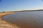
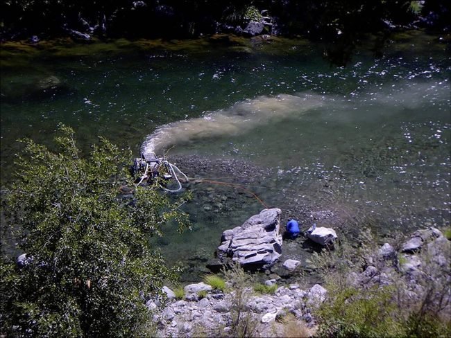
Cañon City resident Dan Scavarda and his cousin Tom Tella bought four mining claims covering 80 acres near their property at Chateau Chaparral, a recreational vehicle campground in Nathrop. The pair described themselves as amateur gold panners who had never owned a mining claim before. They planned to follow the lead of other prospectors using dredges to glean the precious metal from the riverbed.

“We’re not gold miners. We’re not looking for profit, we’re just recreational guys,” Scavarda said, describing the dredge they planned to use as a “lawnmower on a vacuum cleaner.”
The idea, Scavarda said, was to “get off the porch, mosey on down to the river, piddle around and then go have lunch.”

“We wanted to have a little motor to make it easier on us because we’re old,” Scavarda said. “That’s all we’re looking for.”

Tella echoed Scavarda’s remarks.

“The way we filed our plan was just to do a little dredging … more of a hobby than any mining activity, so to speak,” Tella said.

Wallie Robinson said he intends to use his 20-acre claim south of Nathrop in a similar fashion. Robinson makes his living in part by selling mining claims and advertises Arkansas River claims for sale on his website. However, he said his goal with the Arkansas River No. 5 placer claim is to provide a gold-panning venue for his Pic-N-Pan Prospecting Club.

“We’re not looking to bring big equipment in. We’re looking for a place to pan for gold,” Robinson said.

The size of the equipment is not the issue, said Udall spokesman Mike Saccone.

“They could sell or transfer the claim to someone who wants to do larger-scale mining that could be disruptive,” Saccone said.

Saccone also pointed to the fact that the claims were issued through a loophole in the BLM’s permitting process created by a September 2012 decision by the Interior Board of Land Appeals. That assertion was confirmed by BLM spokesman Steve Hall.

“The IBLA decision opened up areas to claims that the BLM had previously determined to be unsuitable for mining claims, like Browns Canyon,” Hall said. “This temporarily opened the Browns Canyon area to mining claims. BLM has since initiated the process to close Browns Canyon to future claims.”

This vulnerability is exactly why Browns Canyon needs the permanent protections afforded by Udall’s national monument legislation, said Keith Baker, Friends of Browns Canyon executive director.

“The issue is not what these gents would do, but what someone might do who buys that mining claim,” Baker said. “This helps illustrate our concern that the resource is protected in a more permanent way – there is vulnerability there.”

Udall has called on the BLM to “swiftly challenge” the claims.

Tella expressed surprise at Udall’s opposition, given the location of his claims. “Well, there’s a 300-campsite trailer park right there,” he said, referring to Chateau Chaparral. “It’s not like it’s in the middle of Browns Canyon in a real pristine area.”

Tella and Scavarda said they are still working with the BLM to reach a compromise on the use of a dredge.

“They said we would be allowed to use the claims without any motorized equipment, but you can do that on public land anyhow,” Tella said. “We have claims, so it should give us more rights. That’s the issue we’re struggling with.”

The BLM has not decided whether to heed Udall’s call to contest the claims, Hall said.

“The BLM has not determined a course of action of the recent claims in Browns Canyon,” he said.

Udall introduced his official legislation creating Browns Canyon National Monument Dec. 10. The bill was referred to the Senate Committee on Energy and Natural Resources.

More Arkansas River Basin coverage here.

Leadville: Evans Gulch susceptible to contamination — CDPHE survey shows

Leadville
Leadville

From the Leadville Herald Democrat (Dan Ramey):

Parkville Water District’s surface water sources in Evans Gulch have a moderate susceptibility to contamination, according to a survey performed by the Colorado Department of Public Health and Environment. The report looks at the susceptibility of a district’s sources of water to two types of contaminants.

Discrete contaminant sources are areas “from which the potential release of the contamination would be confined to a relatively small area,” according to the report. These sources include such things as Superfund sites and mining sites.

Dispersed contaminant sources are defined by the report as “broad based land uses and miscellaneous sources from which the potential release of contamination would be spread over a relatively large area.” These sources includes things such as animal pastures and septic systems.
According to the report, the district’s surface water sources in Evans Gulch are at risk from one Superfund site and 53 existing or abandoned mining sites. Meanwhile, the surface is only at risk from three dispersed contaminant sources.

The report also found that Evans Gulch surface water has a moderately high physical setting vulnerability rating. The physical setting vulnerability rating looks at how the area around a water source can buffer that source from possible contaminants. The higher the rating, the less of a buffer the water source has.

Another survey from the state also assessed the susceptibility of the district’s other water sources, all of which are groundwater sources. All of those five groundwater sources had a total susceptibility rating of moderately low. Those five water sources are threatened by just seven possible discrete contaminants and 18 dispersed contaminants, according to the report.
The physical setting vulnerability ratings for those water sources vary from moderately low to moderate.

The survey is part of the state health department’s Source Water Assessment and Protection program. The surveys are also an important part of the water district’s Source Water Protection Plan. The plan uses information found in the two state health department surveys to develop ways to prevent the district’s water sources from becoming contaminated.

Contamination of the district’s sources, especially those in Evans Gulch, could prove disastrous, Parkville General Manager Greg Teter said. The district has other sources besides those in Evans Gulch, but those other sources would likely only be able to supply half of the community’s demand.

“We’re trying to stay ahead of a potential situation,” Teter said.

One of the keys to the protection plan is the sharing of information between Parkville and other local entities. The district recently signed an intergovernmental agreement with Lake County.
As part of the agreement the county and the district will share both GIS data and information, Teter said.

For example, the Lake County Building and Land Use Department will share information with the district about potential mining applications near Parkville water sources. This will allow the district to be proactive about protecting its water sources, Teter said.

Another key part of the plan is education and ensuring that businesses and community members know where Parkville’s water sources are, Teter said. The intergovernmental agreement and protection plan do not create any new restrictions on land uses around water sources, Teter said. They merely facilitate the sharing of information and create an awareness of potential threats to the community’s water sources.

In addition to protecting the community’s water sources, the Lake County watershed is also important because of its location along the Arkansas River.

“Ours isn’t the biggest, but it’s important because it’s the first on the Arkansas,” Teter said.

More infrastructure coverage here.

AWRA Colorado: Holiday Happy Hour, January 9

Republican River Basin: Compliance pipeline a go for 2014

Republican River Basin

Here’s an insider’s look at operating the compliance pipeline in 2014, from Deb Daniel, Republican River Water Conservancy District General Manager, running in The Yuma Pioneer:

Colorado, Kansas, Nebraska and Colorado have unanimously approved a resolution that allows Colorado to operate the Compact Compliance Pipeline and deliver water to the North Fork of the Republican River for one year – 2014.

It was hailed as being made possible thanks to the continuous efforts and cooperation of the Republican River Water Conservation District (RRWCD), the Sandhills Groundwater Management District and the State of Colorado.

On May 5, 2013, Colorado submitted to the Republican River Compact Administration (RRCA) the resolution approving and Augmentation Plan for the Colorado Compact Compliance Pipeline (CCP). Nebraska and Colorado voted in favor of the resolution. Kansas voted against it. Colorado then instituted mandatory non-binding arbitration disputing Kansas’ decision and requesting the arbitrator find Kansas had acted unreasonably. During a three-day hearing, October 1-3, 2013, arbitrator Martha Pagel, listened to testimony regarding the pipeline proposal. She published her decision on November 27 regarding the arbitration – finding that, although Colorado had met all the requirements for approval of the pipeline, Kansas nevertheless did not act unreasonably in not approving it.

However, one day before her decision was published, Kansas Chief Engineer David Barfield reached out to Dick Wolfe, state engineer for Colorado, with a proposal that would allow Colorado temporary use of the pipeline.

Colorado and the RRWCD carefully considered the proposal from Kansas, and with the cooperation of the Sandhills GWD, drafted and presented a new resolution during a special meeting of the RRCA held Thursday, December 19. During the special meeting, Kansas, Colorado and Nebraska discussed the resolution for the temporary use of the pipeline. Barfield stated that Kansas and Colorado have made great strides in closing the gap of disagreement concerning the use of the pipeline. Kansas continues to not agree to the resolution which Colorado presented to the RRCA in May 2013, but Barfield said he saw the temporary approval as a way of gaining experience and insight into pipeline operations.

Brian Dunnigan, RRCA Commissioner from Nebraska, stated Nebraska supported the resolution from Colorado. Dunnigan also pointed out that this resolution does not give long-term assurances to Colorado water users in their extensive efforts to try to reach compact compliance. He stated that he hoped the RRCA could reach permanent resolution of all outstanding issues.

Wolfe thanked his staff and the Colorado Attorney General’s staff in all their efforts to negotiate with Kansas. He thanked the Republican River Water Conservation District and the Sandhills GWMD for all that they have done to assist Colorado in trying to reach compact compliance. Wolfe also stated his appreciation to the legal counsel and engineering consultants for the RRWCD and their efforts in assisting Colorado with this monumental task.

Following Wolfe’s request for a vote approving the resolution, Kansas, Colorado and Nebraska voted unanimously in favor of approving the use of the compact compliance pipeline in 2014 as stated in the resolution.

Since the RRWCD will be operating the Compact Compliance Pipeline in 2014, the RRWCD Board of Directors has terminated the water lease to Cure Land, LLC and Cure Land II LLC.

Dennis Coryell, RRWCD board president, stated, “This is a great day for the people of the Republican River Basin; it is a monumental step forward towards permanent compact compliance. It supports the certainty of the future of agriculture and the economy it supports within the basin.”

“Although this approval is only temporary, it allows Colorado to show the other states the CCP can be operated and will provide a benefit to the water users in Nebraska and Kansas,” he continued. “Hopefully this is the beginning of a new era where the states can work together to solve the problems facing all three states and we can soon have permanent approval to operate the CCP.”

Coryell went on to thank Barfield for initiating this temporary approval. He thanked Wolfe and the personnel of the State of Colorado for all of their hard work. Coryell also expressed his appreciation to Barfield and Dunnigan for supporting Colorado’s resolution to operate the pipeline.

“Thanks to the Sandhills Groundwater Management District and District Manager Nate Midcap for their approval to export water from their district,” he added.

“I especially want to thank the water users within Colorado’s Republican River Basin for their long-standing and continued support of the efforts of the RRWCD,” Coryell concluded. “It’s amazing what we can accomplish when we work together and succeed in finding a way to move forward toward our goals.”

More Republican River Basin coverage here and here.

GOCO Grants Will Conserve More than 40,000 Acres for Public Use, Wildlife Habitat

Elk on Trail Ridge Road August 2011

Here’s the release from Great Outdoors Colorado (Todd Cohen):

COUNTIES AND CITIES: Basalt, Chaffee, Colorado Springs, Creede, Dolores, Eagle, El Paso, Grand, Kremmling, Las Animas, La Junta, Meeker, Mesa, Mineral, Palisade, Pitkin, Poncha Springs, Rio Blanco, Salida.

The Great Outdoors Colorado Board has approved $8.8 million in grants to preserve more than 40,000 acres of land in nine counties to establish new public open spaces, protect scenic landscapes and river corridors and protect vital habitat for big game and protected species.

One grant will also conserve a working ranch that contains the site of the historic 1879 “Meeker Massacre,” the incident that resulted in the Ute’s forced removal to reservations in Utah. Another will conserve more than 33,000 acres in southern Colorado that offer refuge for a variety of wildlife including sensitive native species populations.

The land trusts and local governments receiving these grants plan to leverage the money for more than $21 million in matching funds and land donations. Fund requests in this grant cycle outstripped available funds by more than $2 million.

The grants will:

  • establish new public open spaces in El Paso, Eagle and Mesa counties;
  • create new public access for hunting in Mineral County, and enhance existing public fishing opportunities in Rio Blanco County;
  • conserve more than 4,100 acres of lands on scenic byways and nearly 300 acres visible from major interstates and U.S. highways;
  • conserve more than 2,600 acres of wildlife habitat and linkage corridors for federally designated threatened and endangered species; and
  • conserve more than 20 miles of riparian habitat and river corridors. Continue reading “GOCO Grants Will Conserve More than 40,000 Acres for Public Use, Wildlife Habitat”

Opinion: How not to kill the #ColoradoRiver — Steve Goetting/Margaret Bowman

Colorado River Basin including out of basin demands -- Graphic/USBR
Colorado River Basin including out of basin demands — Graphic/USBR

From the Arizona Central (Steve Goetting/Margaret Bowman):

U.S. Department of Interior Secretary Sally Jewell gave a speech Dec. 13 to the major water users in the Colorado River Basin, calling on them to take immediate action to address the region’s water supply challenges.

The challenges in the Colorado River basin are large, but the good news is that cost effective solutions are available and already being tested in different parts of the basin. Implementing these solutions now will be good not only for the region’s iconic Colorado River, but also for the region’s economy…

We can reverse the river’s fate and address the water supply challenge – and do it in a way that benefits the region’s economy. By combining municipal and agricultural conservation, water recycling and other techniques to share water supplies flexibly, the region can provide enough water to meet future demands.

This is not an untested set of solutions. Communities in Arizona and across the basin are already using promising practices that can serve as a model for others across the region.

For instance, farmers on the Diamond S Ditch in Camp Verde partnered with The Nature Conservancy to automate the structure that diverts water from the river to farm fields. Farmers now can divert only the water they need, while the extra water can benefit the river – and the farmers can do all of this using their smartphones rather than driving out to the river.

And last year, Sierra Vista became the first city in the country to require certified water-efficient appliances in new homes. They are also dedicating recycled water for groundwater recharge near the San Pedro River, reducing the impact of the city’s groundwater use on the river.

A more efficient water future will not only create a more secure water supply, but will also provide a boost to the economy. Farmers can increase productivity and use less water by upgrading aging irrigation systems. And they can reap financial rewards from voluntarily sharing some of their saved water with cities and rivers.

These innovative approaches can allow cities across the basin to secure future water supplies in a cost-effective fashion without resorting to costly diversion projects.

Solving water shortages without draining rivers will preserve the Colorado River Basin’s $26 billion recreation economy that draws tourists from across the globe for fishing, hiking, rafting, camping and other activities. Arizona generates $6 billion alone, which provides nearly 54,000 jobs in the state.

To capitalize on those benefits, the region’s leaders need to take bold action to immediately implement the common-sense water conservation solutions that can put the river and the region on a path to recovery. As secretary Jewell said, “We have to do more, we have to do it more quickly, to take on the challenges that are going to be harder that what we’ve tackled before.”

More Colorado River Basin coverage here and here.

Snowpack news (% of normal): Upper Colorado = 104, South Platte = 96, Arkansas = 101

Everywhere is still average or above. No need to panic. Do your snowdance.

Lower Rio Grande Basin Study Shows Shortfall in Future Water Supply

Rio Grande and Pecos River basins

Here’s the release from the Bureau of Reclamation (Peter Soeth):

Bureau of Reclamation Commissioner Michael L. Connor released the Lower Rio Grande Basin Study that evaluated the impacts of climate change on water demand and supply imbalances along the Rio Grande along the United States/Mexico border from Fort Quitman, Tex., to the Gulf of Mexico.

“Basin studies are an important element of the Department of the Interior’s WaterSMART initiative and give us a clearer picture of the possible future gaps between water demand and our available supplies,” Commissioner Connor said. “This study of the lower Rio Grande basin will provide water managers with science-based tools to make important future decisions as they work to meet the region’s diverse water needs. In addition, the study will help inform water management discussions between the U.S. and Mexico through the International Boundary Water Commission.”

Among the findings and conclusions of the Lower Rio Grande Basin Study:

  • Climate change is likely to result in increased temperatures, decreased precipitation and increased evapotranspiration in the study area. As a result of climate change, a projected 86,438 acre-feet of water per year will need to be added to the 592,084 acre-feet per year of supply shortfall predicted in the existing regional planning process in 2060, for a total shortfall of 678,522.
  • Water supply imbalances exacerbated by climate change will greatly reduce the reliability of deliveries to all users who are dependent on deliveries of Rio Grande water via irrigation deliveries.
  • The Study includes an acknowledgment that all water management strategies recommended through the recently adopted regional water plan are part of a needed portfolio of solutions for the Study Area.
  • Seawater desalination, brackish groundwater desalination, reuse and fresh groundwater development were examined as alternatives to meet future water demands. The study found that brackish groundwater development was most suitable. Further analysis was conducted; it was found that regional brackish groundwater systems would best meet the planning objective. An appraisal-level plan formulation and evaluation process was conducted to determine potential locations of each regional brackish groundwater desalination system.

    The Lower Rio Grande Basin Study was developed by Reclamation and the Rio Grande Regional Water Authority and its 53 member entities. It was conducted in collaboration with the Texas Region M Planning Group, Texas Water Development Board, Texas Commission on Environmental Quality and International Boundary and Water Commission. It covered 122,400 square miles. The study cost $412,798 with the RGWRA paying for 52 percent of it.

    The basin study was conducted as part of WaterSMART. WaterSMART is the U.S. Department of the Interior’s sustainable water initiative that uses the best available science to improve water conservation and help water resource managers identify strategies to narrow the gap between supply and demand. Basin studies are comprehensive water studies that define options for meeting future water demands in river basins in the western United States where imbalances in water supply and demand exist or are projected to exist. Since the program’s establishment, 19 basins have been selected to be evaluated. For more information see http://www.usbr.gov/WaterSMART/bsp.

    More Rio Grande River Basin coverage here and here.

    The CPC is forecasting a likely return of #COdrought to western Colorado, SLV, South Platte and Arkansas basins

    Seasonal drought outlook for December 19, 2013 to March 31, 2014 via the Climate Prediction Center
    Seasonal drought outlook for December 19, 2013 to March 31, 2014 via the Climate Prediction Center

    Click here to go to the CPC website.

    Colorado legislative panel hopes to allow ditch company diversions impacted by #COFlood to avoid water court

    Flooding St. Vrain River September, 2013 via Voice of America
    Flooding St. Vrain River September, 2013 via Voice of America

    From The Denver Post (Kurtis Lee):

    As communities across Colorado continue to recover from September’s widespread floods, lawmakers on Friday proposed measures meant to alleviate some devastation and address future natural disasters. Among the measures proposed from the bipartisan flood recovery panel were efforts to free up cash for local jurisdictions and help landowners affected by shifts in streams and rivers. Current state law prohibits county commissioners from transferring general fund money into funds for road and bridge projects.

    “We need to give counties the flexibility to fix their roads,” said Sen. Matt Jones, D-Louisville, who is sponsoring a measure that allows such transfers. “Because here’s a challenge: Boulder County has $10 million a year for their road and bridge fund and $100 million in repairs from the floods. And because federal funds come later, it creates a cash flow problem.”

    The proposal, which has bipartisan support, allows counties to transfer money from its general funds to its road and bridge funds if the governor declares a disaster emergency in that county. Jones said the measure has also garnered the support of Colorado Counties Inc.

    September’s floods spanned 24 counties. A mix of federal and state money allowed for the reopening of 27 roads and bridges with temporary repairs. Several years of complex challenges remain in these counties as each works toward permanent fixes to roads.

    A separate proposal from Friday’s meeting at the state Capitol allows landowners with water rights to relocate, for example, a ditch head gate that becomes inoperable because of a change in the natural flow of a stream or river. Those individuals would have to consult with state engineers and meet certain criteria but would be able to bypass the state’s water court system, which can result in a lengthy process.

    “This can no question help farmers because agriculture needs to be diverting water as soon as possible for the growing seasons,” said Rep. Jerry Sonnenberg, R-Sterling, who is sponsoring the proposal.

    Several other ideas were floated by the committee, which plans to meet again in early January before the session convenes.

    Rep. Mike Foote, D-Lafayette, brought forward a suggestion — but no draft of a bill — by the Colorado Oil and Gas Conservation Commission. Foote said the commission would like to give its director authority in cases of emergency to order shutdowns of oil and gas operations. Currently such orders must come from the commission’s board.

    Sen. John Kefalas, D-Fort Collins, offered a proposal to wave the requirement that disaster recovery workers from out of state must pay Colorado state income taxes.

    “They would be totally excluded,” said Kefalas, who hopes to present a draft bill to the committee at its next meeting.

    More 2014 Colorado legislation coverage here.

    “Are you willing to really face up to the responsibilities of those water rights? — Jack Flobeck

    The Code of Hammurabi via Wikipedia Commons
    The Code of Hammurabi via Wikipedia Commons

    Here’s a guest column about the east-west chasm in water planning in Colorado, from Jack Flobeck writing for The Colorado Springs Gazette. Here’s an excerpt:

    OK, so it’s your water, but the $64 million question is: Are you willing to really face up to the responsibilities of those water rights, and what do we mean by responsibilities? We were taught years ago that if you were a citizen, you had rights, but also responsibilities.

    Solomon said, “There’s nothing new under the sun,” and wouldn’t you know, someone thought this problem through, over 4,000 years ago. I am indebted to local law historian, David Griffith, for suggesting my research into this subject.

    The Code of Hammurabi was written in stone on an 8-foot black diorite column in what is now Baghdad and contains several concepts worth considering in 21st-century America. Consider:

    No. 53 – If any one be too lazy to keep his dam in proper condition, and does not so keep it, if then the dam break and all the fields be flooded, then shall he in whose dam the break occurred be sold for money, and the money, and the money shall be paid to replace the corn which he has caused to be ruined.

    No. 54 – If he be not able to replace the corn, then he and his possessions shall be divided among the farmers whose corn he has flooded.

    No. 55 – If anyone open his ditches to water his crop, but is careless, and the water flood the field of his neighbor, then he must pay his neighbor corn for his loss.

    No. 56 – If a man let in the water, and the water overflow the plantation of his neighbor, he shall pay ten gur of corn for every ten gan of land.”

    Did Hammurabi nail responsibility; and are our irrigators with ‘first in time and first in right,’ ready to accept the consequences, which follow from most favored ownership? Is it now time, with imminent water shortages; to open the debate to include discussion of private, public, or combined public/private efforts to construct catch basins, rain harvesting culverts, and efficient localized storage for drought relief as well as for fire mitigation.

    Glenwood Springs: The city council green lights RICD application for the #ColoradoRiver

    The Glenwood Wave
    The Glenwood Wave

    From the Glenwood Spring Post Independent (John Stroud):

    A unanimous City Council, at its Dec. 19 meeting, supported filing an application in Colorado Water Court to secure what’s known as a Recreational In-Channel Diversion (RICD) surface right on the Colorado during peak spring and summer months for a second whitewater park. The application seeks a protected junior water right to be granted under the same priority system as other types of water rights, attorney Mark Hamilton explained…

    If successful, the new park would be in addition to the city’s existing West Glenwood whitewater “wave” park.

    Consultants narrowed down potential sites to a stretch of river upstream from the No Name Rest Area at the west end of Glenwood Canyon, another at west side of Horseshoe Bend downstream from No Name, and a third just upstream from the confluence with the Roaring Fork River. Each location provides direct access from bike paths, and exhibit in-stream features that would make them ideal for developing a whitewater park for kayaks, stand-up boards and other types of recreational water craft, according to the consultants.

    Glenwood Springs is unique compared to other parts of the state, Hamilton said, because the Colorado River has flows that could accommodate a whitewater event after the usual mid-June peak runoff, into early July.

    The application requests a maximum flow rate not to exceed 4,000 cubic feet per second (cfs) for up to five days between May 11 and July 6 each year, and 2,500 cfs for as many as 46 days between April 30 and May 10 and July 7-23. “Shoulder season” flow rates of 1,250 cfs are sought between April 1-29 and from July 24 through Sept. 30. The in-stream claim would be limited to the hours of 6 a.m. to 9 p.m. each day, “except during competitive events when these hours may be extended to midnight each day,” according to the application.

    Hamilton cautioned that it can be a long, drawn-out process to secure a legal RICD, including opportunities for other affected water users to comment on the request. Recent efforts by Pitkin and Grand counties to secure an RICD have taken about three years, he said…

    As a conditional water right, the city would need to have whitewater park structures in place in order to enforce the right, he said…

    Glenwood Springs resident Lori Chase cautioned against the Horseshoe Bend location for a future whitewater park.

    “I don’t believe that is a viable location, mainly because the bighorn sheep access the water there,” she said of the sheep herd that lives in that area of the canyon. “And, to put more and more stress on our natural features might not be a good idea.”

    Councilman Dave Sturges said the RICD is an opportunity for the city to build on the success of the existing whitewater park to attract more recreation tourism.

    More whitewater coverage here.

    Rio Grande Basin Roundtable: Narrowing Colorado’s Water Gap in the Rio Grande Basin #COWaterPlan

    Basin roundtable boundaries
    Basin roundtable boundaries

    From the Valley Courier:

    NOTE This is the first of monthly articles from the Rio Grande Basin Roundtable, regarding the implementation of the Basin Water Plan.

    Since the 2002-2003 drought, the Colorado Water Conservation Board has undertaken a comprehensive study of Colorado’s water. The study known as the Statewide Water Supply Initiative (SWSI) 2010 recognized that water supply is limited and as Colorado continues to grow the need is out pacing the supply. The study identified Colorado’s current and future water needs through the year 2030 and further examined approaches that could be taken to meet those needs.

    That was 2004, with the support of the General Assembly in 2006; SWSI 2 supplemented the original findings by adding technical work on water conservation, alternatives to agricultural water transfers and meeting the environmental needs of the state. SWSI brought together a collaborative approach to the resolution of these issues by establishing the basin roundtables . The roundtables were to bring together a diverse group of partners whose role was to educate and collabo- rate on water planning issues.

    These efforts were codified by Colorado Water for the 21st Century Act. The act also established the 27 member Inter Basin Compact Committee (IBCC) which serves as an intermediary to facilitate communication between the basin roundtables . Subsequently, the basins were charged with the development of a consumptive and nonconsumptive needs assessment along with proposing projects to meet those needs.
    SWSI was updated in 2010. The elements of the update included an analysis of water supply demands to 2050, a summary of the nonconsumptive needs within each basin, an examination of the water supply and availability in the Colorado River Basin, implementation plans that were tied to identified water projects, water conservation , agricultural transfers and the development of new water supplies.

    The key findings of SWSI 2010 showed that by 2050, agriculture would still be the primary user of water at 82 percent (which is down from the current 86 percent).; 15 percent would be used by municipal and industrial users, while the remaining 3 percent would be used by self-supplied industry.

    The study highlighted continued shortages for agricultural producers in all basins, which could mean a decline in irrigated acres. The study outlined significant increases in municipal demand due to a near doubling of the state’s population growing from 5 million to nearly 10 million by 2050.

    The study also identified the Front Range as being the most populous with 80 percent of the population located along its flanks. The western slope, however, would experience the fastest growth rate, establishing a need of between 600,000 and 1 million acre feet of additional water per year by 2050. An increasing energy demand in the state would also require more water.

    Supply was also examined and localized shortages were identified. The Colorado basin was identified as a possible source for new supply since compact entitlements were not fully utilized. The study further noted that between now and 2050, there needed to be a decreased reliance on ground water in order to reach a level of sustainability and reliability for future population demands. As a result of SWSI, more is known about future water demands and available supplies . It is a given that “the Gap” is widening between supply and demand. In May of 2013, Governor Hickenlooper issued an executive order that directed the Colorado Water Conservation Board to develop Colorado’s Water Plan. The CWCB has tasked both the IBCC and the Basin Roundtables with the development of Basin Water Plans. The plans will reflect a grassroots dialogue and consensus that will be necessary for the development and implementation of a robust and meaningful state-wide water plan. The timeline for final Basin Implementation Plans and, ultimately, Colorado’s Water Plan is established through distinct benchmarks that will need to be met. The purpose of the Basin Implementation Plans is to address the gaps identified in SWSI 2010. The plans will be prepared under the direction of the basin roundtables and will build on local input and planning efforts. The Basin Implementation Plans will provide a mechanism for basin roundtable members and other stakeholders to work together to overcome potential project implementation constraints, effectively implement water projects that achieve designated regional water management objectives, and address the basins’ water supply gaps.

    In addition, the plan processes will identify prospects and limitations within the basins for meeting water supply gaps, all the while considering the basins’ variable hydrologydry , average , and wet conditions. The plan will identify sources of water used in most basins including native water (surface and tributary groundwater), trans-basin water, water used by exchange, reuse, nontributary groundwater, and reservoir storage. This will result in a basin water operations summary, which will help basin roundtables and will add a better understanding of which projects and methods may be successful in meeting both the consumptive and non-consumptive gaps. This effort will form a foundation for future SWSI updates. Each Basin Roundtable is charged with developing its own plan. These Basin Implementation Plans (BIPs) will then be incorporated into Colorado’s Water Plan. The basin roundtables are at varying stages of developing their basin specific plans. The Colorado Water Conservation Board (CWCB) has committed the following resources to this effortCWCB staff and the SWSI planning contractor will assist the basin roundtables in developing their plans. The basins will be allowed to tap their Water Supply Reserve Account at both the basin and state levels. This will help to ensure that the plans are in-depth and address the specific hydrologic complexities of each basin. The CWCB has established a timeline for the Basin Roundtables during this Basin Implementation Plan effort…

    The Rio Grande Basin Roundtable is busy gathering data for the development of the Rio Grande Basin Water Plan. The Roundtable has contracted with DiNatale Water Consultants for the research and preparation of the basins plan and has set-up an operational oversight “steering” committee. The steering committee has put together a set of subcommittees to gather data and public input within their specific areas of expertise and interest. The sub-committees are as follows: education and outreach, agriculture, water administration, municipal and industrial and nonconsumptive .

    The most important part of the plan is that it is a grassroots effort. This means that the development of the plan requires input and involvement from stakeholders…

    The lead consultant and local liaison from DiNatale Water Consultants is Tom Spezze, who can be contacted at tom@dinatale water.com

    More Colorado Water Plan coverage here.

    Summit County Solstice sunrise via Bob Berwyn

    Colorado Foundation for Water Education: An Epic Ride Through the Grand Canyon: Reception and Lecture by Author Kevin Fedarko

    More education coverage here.