Fish Habitat Improved in South Boulder Creek

South Boulder Creek near the East Portal of the Moffat Tunnel via Jason Lee Davis

Here’s the release from the US Forest Service (Maribeth Pecotte):

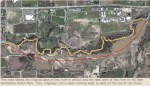
More than a mile of fish habitat along South Boulder Creek has been improved, thanks to a partnership between the Boulder Ranger District of the Arapaho and Roosevelt National Forests and Pawnee National Grassland (ARP), Colorado Parks and Wildlife (CPW), Denver Water, Boulder Flycasters (Trout Unlimited) and Union Pacific Railroad. The 1.5-mile stretch of the creek west of Rollinsville, Colo., will see enhanced in-stream habitats, allowing trout to thrive.

“”Trout biomass in Upper South Boulder Creek averages 60 lbs/acre, drastically lower than the abundance of trout within most front range streams such as the Poudre, Big Thompson, and St. Vrain Rivers,” said Ben Swigle, CPW aquatic biologist. “This project focused on improving in-stream habitats at all flows, which will allow a greater number of trout to inhabit the restored sections and support better natural reproduction.Thanks to this partnership, the fisheries and anglers of tomorrow will reap the benefits of our actions today.”

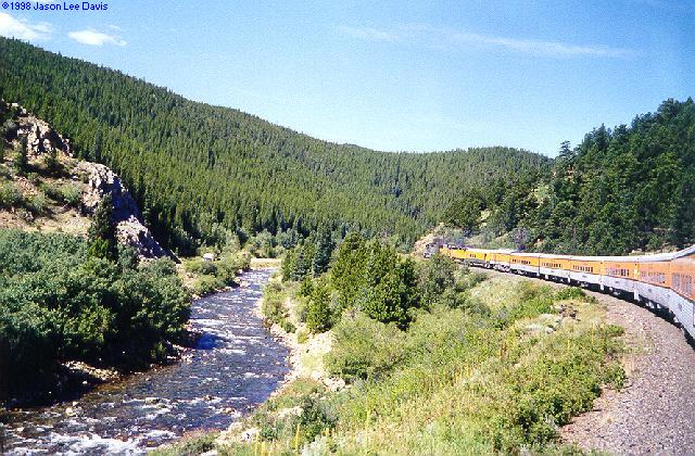
The portion of South Boulder Creek that has been improved lies between Rollinsville and the East Portal of the Moffat Tunnel. This stream picks up water from the West Slope and is carried through the Moffat Tunnel. The parties involved had long felt that significant habitat improvements could be made to benefit the fishery. In 2001, Denver Water, which operates the Moffat Tunnel, agreed to financially support habitat mitigation projects downstream of the tunnel and fund an additional $125,000 for fish habitat improvement upstream.

“Denver Water is committed to doing our part to help protect and enhance the natural environment,” said Dave Bennett, water resource manager for Denver Water. “We are happy to be a part of this collaborative effort to enhance the river for the benefit of the fish.”
Despite the floods of September 2013, the project moved forward this fall, with habitat structures and channel construction compete in early November 2013. As a result, CPW and Forest Service biologists expect to see more fish using the constructed habitat next year and larger fish in the future.

“This was an outstanding project that exemplifies how much more can be achieved when forces join together,” said Boulder District Ranger Sylvia Clark. “Enhancements to fish habitat in South Boulder Creek could not have been done by any of us alone. We’d like to extend a big ‘thank you’ to our partners, and we look forward to future opportunities for working together.”

The final phases of the project will be complete in spring 2014. The contractor will complete construction of the boardwalk for angler access off of the South Boulder Creek Trail. Disturbed sites will be revegetated with native plants with the help of Boulder Flycasters’ volunteers and staff from CPW and the USFS.

Background

This collaborative effort was the brainchild of Swigle, who worked with the ARP to find a project that would offer the greatest public benefit. The USFS initiated analysis for the project in 2012, and the decision memo was signed in March 2013.

The Boulder Flycasters applied for a CPW Fishing is Fun grant and obtained $80,000 for the project. The group also contributed an additional $4,000 and volunteer support.

The Boulder Flycasters, CPW, Denver Water and the USFS came together to select a contractor to design and construct the habitat features in South Boulder Creek and the boardwalk for angler access just west of the Moffat Tunnel.

Union Pacific Railroad allowed the use of a portion of their easement near the Moffat Tunnel for staging materials and equipment. Through close coordination, they also allowed heavy equipment to cross over the railroad tracks to access the creek.

“Farmers and ranchers…adapt’ — John Salazar

Statewide snow water equivalent January 13, 2014 via the NRCS

Here’s a guest column written by John Salazar that’s running in the Glenwood Springs Post Independent. Here’s an excerpt:

Colorado agriculture faced many weather challenges in 2013. But our state’s farmers and ranchers are a resilient bunch. They understand that weather can be unpredictable, and that conditions can drastically change from week to week. Yet, they do the job they love and believe they are meant to do. Their determination in the face of adversity not only puts food on our tables, but results in economic opportunities for our state as well.

For example, in 2013, agricultural exports will likely reach close to $2 billion, doubling the $1 billion in exports recorded in 2009. More and more of Colorado’s agricultural products are finding profitable markets in over 110 countries across the globe. And while net farm income will fall below what had been projected for the year, it will still be – at $1.58 billion – the third highest in our state’s history.

Already, we are seeing beneficial snows falling in the mountains, fueling optimism that this will be a good snow pack year. Producers are looking towards 2014 with high hopes and expectations about the weather and growing conditions. Farmers and ranchers may not always like the weather forecast, but they adapt and keep on doing what they do best – producing the food, fuel and fiber important to our state’s economy.

Wild and scenic designation for the Dolores River?

Dolores River near Bedrock

From the Cortez Journal (Jim Mimiaga):

New management plans by the BLM and Forest Service upgrade the status of two native fish, and list new sections of the river as “preliminarily suitable” for a Wild and Scenic designation.

Roy Smith, a BLM water specialist, explained that the suitability status for the Lower Dolores from the dam to Bedrock has been in place since a 1976, and the special status was reaffirmed in a recently released public lands management plan.

“It qualifies because below the dam, the lower Dolores is a free-flowing stream that has outstandingly remarkable values (ORVs),” he said. “A common misconception is that suitability means we can wave a wand and make it Wild and Scenic, but that is not true. That takes congressional action.”

The 1976 suitability study noted that the Dolores is compatible with a Wild and Scenic designation, and “McPhee dam will enhance and complement such designation.”

ORVs are obscure and sometimes controversial assessments that identify river-related natural values. They are an indication that a river could qualify as a Wild and Scenic River in the future. In the meantime, their natural values are protected in management plans.

In their recent management plan, the BLM and Forest Service upped the ante, adding the bluehead and flannelmouth suckers to ORV standard list, which already includes the bonytail chub.

The Colorado Water Conservation board also believes native fish on the river deserve additional help. They propose to issue a new in-stream flow requirement for a 34-mile section of the river from the confluence with the San Miguel River to the Gateway community.

Ted Kowalski, a CWCB water resource specialist, explained that the new instream flow is proposed to improve habitat conditions for native fish.

“In-stream flows are designed to protect the natural hydrographs on the river, and we feel they are better than top-down river management from the federal side,” Kowalski said. “The proposed instream flows on that section of the Dolores are timed to accommodate spawning needs for native fish.”

Required peak flows reach 900 cfs during spring runoff, and then taper off. Most of the water would be provided by the San Miguel River, an upstream tributary…

The Dolores Water Conservation Board and the Southwestern Water Conservation board objected to the changes, fearing the move could force more water to be released downstream. They have filed appeals and protests to stop them.

Even the preliminary Wild and Scenic status on the Dolores is strongly opposed by McPhee Reservoir operators because if officially designated, Wild and Scenic rivers come with a federally reserved water right, which would also force more water to be released from the dam.

Jeff Kane, an attorney representing SWCD, said adding two native fish as ORVs was unexpected and unfair to a local collaborative process working to identify and protect native fish needs…

Accusations that federal agencies and the CWCB hijacked a 10-year-long, grass-roots effort to protect the Dolores were expressed at the meeting, which was attended by 80 local and regional officials…

A diverse stakeholder group, the Dolores River Working Group, is proposing to make the Lower Dolores River into a National Conservation Area through future legislation. As part of the deal, suitability status for Wild and Scenic on the Lower Dolores River would be dropped.

“It is still worthwhile to get our proposal out there,” said Amber Kelley, Dolores River coordinator for the San Juan Citizen’s Alliance. “We should continue to move forward in our collaborative effort despite the concerns about the BLM changes.”

More Dolores River Watershed coverage here and here.

Climate change — show them the facts

2014 Colorado legislation: Potential groundwater bills bring hope for some irrigators in the South Platte Basin

HB12-1278 study area via Colorado State University

From The Greeley Tribune (Eric Brown):

Talks of a proposed bill, one that’s expected to draw plenty of attention, highlighted the first meeting of the Ground Water Coalition on Friday. During the meeting, guest speakers Rep. Randy Fischer, D-Fort Collins, and gubernatorial candidate Sen. Greg Brophy, R-Wray, each said they plan to push legislation that would allow South Platte River Basin groundwater users to stop making up for depletions to the aquifer that precede September’s flooding.

For someone to legally pump water out of the ground in Colorado, most wells must have an approved augmentation plan to make up for depletions to the aquifer. When Colorado’s augmentation requirements became more strict in the mid-2000s, many groundwater pumpers were not only required to fully augment for their depletions going forward, but also to make up for their estimated depletions to the aquifer going back years, or even decades. In some cases, the rules have farmers making up for depletions from as far back as the 1970s.

In their discussions Friday, Fischer, Brophy and others stressed that, with the many reports of high groundwater problems in recent years and the historic flooding in the South Platte Basin during September, the aquifer is believed to be plenty full, and groundwater pumpers — mostly farmers — only need to make up for their depletions from September 2013 and on.

The bill comes as yet another source of discussion — and likely friction — about how groundwater is used in the South Platte Basin. In general, some believe the existing rules and system work well, but others — many of whom have lost the ability to pump some of their groundwater wells — believe groundwater is being mismanaged and changes need to be made to get the maximum beneficial use out of groundwater and surface water and address the water shortages the region is expected to face in coming decades.

In 2012, the heated debate led to legislative approval of a groundwater study in the basin. That study was recently completed, and a report was delivered to lawmakers Dec. 31. Now, some lawmakers are looking to continue the discussions during the 2014 legislative session.

Talk Friday of Fischer and Brophy’s bill was music to the ears of many in attendance.

When the state increased its augmentation requirements in 2006, many farmers couldn’t afford all of the needed augmentation water, and thousands of wells were either curtailed or shut down across Weld County and northeast Colorado, and many remain so. Some have estimated that the curtailment and shutdown of the many groundwater wells has amounted to about a $50-100 million loss in agriculture’s economic impact.

Glen Fritzler — a LaSalle-area farmer and member of the new Ground Water Coalition, which was formed last month by other local farmers with the help of Weld County commissioners — said such a bill, if put into law, would help his agriculture operations, and that of others, tremendously.

The portion of water resources he’s been using to make up for his past depletions could be used for augmentation going forward. That would allow Fritzler to pump much more water from his curtailed wells without acquiring more augmentation resources.

“It’s certainly a good starting point,” said Fritzler, who, like several others in the LaSalle, Glicrest and Sterling areas, saw his basement flood and some of his fields become over-saturated from high groundwater in recent years. “There’s still a lot of things to be addressed.”

Many, like Fritzler, believe the high groundwater levels were caused by the state increasing its augmentation requirements in the mid-2000s. They’re now over-augmenting and over-filling the aquifer, they say.

But others disagree, saying the high groundwater levels were caused by a variety of factors — such as the historically wet years of 2010 and 2011 — and they believe the existing augmentation rules are needed to protect senior surface water rights. Over-pumping of groundwater — in addition to depleting the aquifer — also depletes surface flows, because it draws water that would otherwise make its way to rivers and streams over time.

All sides agree farmers years ago were pumping too much water out of the aquifer and not enough was being put back in the system. There just hasn’t been agreement on how much groundwater pumpers should be augmenting, among other issues.

The debate came to a head in 2012. That summer, Weld County farmers, along with Weld County commissioners, asked Gov. John Hickenlooper to make an emergency declaration that would allow them to temporarily pump some of their curtailed wells — in hopes of bringing down the damaging high groundwater, and to also save their crops during the ongoing drought. But objectors, and ultimately Hickenlooper, said no to the idea.

While those in attendance Friday were excited to hear of Fischer and Brophy’s proposed legislation, they’re also predicting the bill will see plenty of pushback. However, they also believe it’s just one of many things that need to be addressed when it comes to groundwater issues in the South Platte Basin.

One of the main objectives of the new Ground Water Coalition, organizers say, is to make sure groundwater is fully taken into account in the South Platte Basin and statewide long-term water plans.

“It’s a resource that’s an estimated 10 million acre feet underneath us, but we’re not including it in our long-term plans, and that’s unacceptable,” said Weld County Commissioner Sean Conway. “That’s why we started this coalition … to make sure this resource is not only a part of the equation, but is used responsibly, and to its full potential.”

The latest ENSO discussion is hot off the presses from the Climate Prediction Center

Forecasts of sea surface temperature (SST) anomalies for the Niño 3.4 region, December 17, 2013 via the Climate Prediction Center

Click here to read the latest diagnostic discussion from the CPC. Here’s an excerpt:

Synopsis: ENSO-neutral is expected to continue into the Northern Hemisphere summer 2014.

Snowpack news: ‘It’s good to be normal. After the last couple years, normal feels good’ — Diane Johnson #COdrought

From the Vail Daily (Randy Wyrick):

That puts the Colorado River Basin — that’s us — at 102 percent of normal and 141 percent of the past year’s Jan. 1 snowpack.

The moisture dried up a bit during the second half of December, especially in the south and southwest portions of the state, but the good start to the season still puts the entire state slightly above normal at 103 percent, said Phyllis Ann Phillips, state conservationist with the Natural Resource Conservation Service.

“This is a great start to the 2014 water year,” Phillips said. “As we saw in 2012 and 2013, early seasons deficits are difficult to make up later in the season; so being right where we should be this time of year gives us a head start compared to the past couple of years.”[…]

Vail Mountain SNOTEL peaks around April 25 most years, said Diane Johnson, with the Eagle River Water and Sanitation District.

“It’s good to be normal. After the last couple years, normal feels good — almost double today from where we were a year ago — that’s positive!” Johnson said.

As of Wednesday, the snow-water equivalent at the Vail Mountain SNOTEL site is 8.4 inches. The 30-year median for this date is 8.9 inches, so we are 94 percent of normal, based on the 30-year median, Johnson said.

Also as of Wednesday, the snow-water equivalent was 191 percent of one year ago…

Right now, there’s not much difference in snowpack between the major basins in Colorado. They range from 111 percent of median in the Yampa, White and North Platte basins, to 99 percent of median in both the Rio Grande and South Platte basins.

That has led to decent streamflow forecasts for the spring and summer season. Streamflows in the Colorado, South Platte, Yampa, White and Arkansas River basins are currently expected to be in the 90 to 100 percent of normal range. In the Rio Grande, Gunnison and San Juan basins forecasts as of Jan. 1 are in the 80 to 100 percent of normal range.

“All in all, these early season conditions are favorable leading into the bulk of the snow accumulation season,” Phillips said. “If weather patterns persist and continue to provide moisture to our state this could be a good year for water supply and recreation in Colorado.”

Governor Hickenlooper delivers the State of the State Address #COdrought #COflood

Governor Hickenlooper, John Salazar and John Stulp at the 2012 Drought Conference

Here’s the release from Governor Hickenlooper’s office:

Gov. John Hickenlooper today delivered his fourth State of the State address and talked about jobs and the economic health of Colorado, as well as successful efforts to create a solid budget for the state, build reserves and eliminate bureaucracy.

He also spoke about the challenges faced by Coloradans in the past year, from fires to floods to shootings.

“We know there are people out there feeling the impact of the national economy’s downturns. And we are doing everything within our power to change that,” Hickenlooper said. “But make no mistake—the state of Colorado has not only endured, it also has thrived. My fellow Coloradans, despite every unforeseen test, despite everything that was thrown at us, the state of our state is strong.” Continue reading “Governor Hickenlooper delivers the State of the State Address #COdrought #COflood”

Craig: Water and sewer rates climb in 2014

Yampa River east of Maybell March 2008

From the Craig Daily Press (Erin Fenner):

Craig City Council did its first reading of an ordinance Dec. 10 that would permit the city to raise water rates by about 6 percent and wastewater rates by about 12 percent.

The average water-use fee for residents is approximately $55 per month and $20 for wastewater, Craig City Manager Jim Ferree said.

Charter Communications req­uires the city to perform an annual review of their rates, Ferree said. Red Oak Consulting studied the rates, but the city worked to push the rates up less than what was suggested by the study, he said.

“We’ve been raising rates consistently, especially ever since we put in the water treatment plant,” Mayor Terry Carwile said.

The city has to make sure they’re keeping up with changing regulations and keeping a sufficient reserve for their water and wastewater fund, he said.

The rise in water and wastewater rates is because of new environmental regulations, paying back loans on the new water treatment plant and because of the increasing cost of treatment chemicals, Ferree said.

More infrastructure coverage here.

Sterling: ‘The plant is doing what it was built to do’ — Jim Allen

Reverse Osmosis Water Plant

From the Sterling Journal-Advocate (Sara Waite):

…Allen said they have yet to receive any reports of discolored water, and there is no evidence of issues with lines breaking due to the new water. He said he didn’t believe a problem last week with the service line to Pizza Hut was due to the water treatment system, although he acknowledged it would be hard to prove either way. But, he said, when the problem arose and city crews dug up the line, they found it was an old lead service line, which they usually replace anyway with newer materials.

Allen was reluctant to talk about the probability of those problems — he said he doesn’t like to discuss things he doesn’t want to happen — but he was happy to report that the uranium levels in the water, which prompted the need for the new treatment plant, are falling. The membranes (in the reverse osmosis system) are working, he said.

He said that the newly treated water likely has not fully replaced the “old” water in the system, as it has to cycle through the storage tanks and into the water service. The timeline on that depends on the volume of water in storage and usage.

The water is safe to drink, he reiterated.

“The plant is doing what it was built to do,” he said.

Snowpack news: Roaring fork at 109% of normal

2014 Water Course: What Citizens Need to Know about the Colorado Water Plan — CMU #COWaterPlan

Colorado Water Plan website screen shot November 1, 2013

Click here to go to the website for the pitch. Here’s the agenda:

Session 1: Physical Realities of Colorado Water Supply and Demand (Feb 3)

  • Featuring Dr. Gigi Richard and representatives from the Colorado and Gunnison Basin Roundtables.
  • Session 2: Laws, Compacts and Agreements for Meeting Future Water Needs (February 10)

  • Featuring attorneys Aaron Clay, John McClow and Peter Fleming.
  • Session 3: The Colorado Water Plan: Process and Perspectives (February 17)

  • Featuring Mike King, Executive Director of the CO Department of Natural Resources & a panel with perspectives from the South Platte River Basin, the Colorado River Basin, Trout Unlimited and agriculture.
  • More Colorado Water Plan coverage here.

    John Entsminger named to replace Pat Mulroy at the Southern Nevada Water Authority #ColoradoRiver

    Upper Basin States vs. Lower Basin circa 1925 via CSU Water Resources Archives
    Upper Basin States vs. Lower Basin circa 1925 via CSU Water Resources Archives

    From the Las Vegas Review-Journal (Henry Brean):

    John Entsminger, current deputy general manager of the Las Vegas Valley Water District, will take over the top job at the valley’s largest water utility when Mulroy departs on Feb. 6.

    The commission’s vote sets the stage for Entsminger, 42, to also take her place as general manager of the Southern Nevada Water Authority, the region’s wholesale water supplier.

    “I think the board did the right thing,” Mulroy said Tuesday morning. “This is a very difficult time on the (Colorado) River. John understands the complexities. I think John will do a fantastic job.”

    Entsminger went to work for the water district and the authority straight out of law school at the University of Colorado in June 1999. He was eventually promoted to deputy general counsel for both agencies, and he served as lead negotiator on a series of national and international agreements that secured more water for Nevada from the Colorado River.

    Mulroy named him to her executive team as deputy general manager in early 2010. When she announced her retirement last year, she quickly identified him as the best choice to replace her.

    Entsminger sees his selection for the top job as an endorsement of the good work the district and the authority have done over the past two decades, especially on the Colorado, where he believes Southern Nevada has gained more at the negotiating table than any other region.

    “I’m honored by the trust the board is placing in me,” he said.

    Asked how his approach to water policy might differ from Mulroy’s, he said: “Philosophically Pat and I are very much aligned. The question going forward is which projects do we need to secure the water supply for the community.”

    From the Las Vegas Sun (Conor Shine):

    Fifteen years after he was hired out of law school to join the Las Vegas Valley Water District’s legal department, John Entsminger has been chosen to take the agency’s top job, replacing Pat Mulroy, who will retire next month after 25 years as general manager.

    Entsminger, a senior deputy general manager at the district since 2010, was the lone candidate to replace Mulroy. Since announcing her retirement in September, Mulroy had openly endorsed Entsminger as her preferred successor…

    Entsminger’s hiring won’t be final until terms of a contract are negotiated and approved by the board. The board must also ratify its appointment at a meeting later this month due to procedural concerns about whether the meeting was properly noticed to the public.

    A separate vote is scheduled Jan. 16 to confirm Entsminger as general manager of the Southern Nevada Water Authority, the Water District’s parent organization. The two agencies are separate entities with their own staffs, budgets and governance, but Mulroy has held the top job at both since the SNWA was formed in 1999, a practice that is expected to continue with Entsminger…

    Entsminger joined the Water District’s legal department in 1999 after graduating from the University of Colorado Law School and has spent his entire career with the district. His early work covered everything from human resources to purchasing contracts. Eventually he found himself dealing with complex Colorado River water laws.

    He continued to ascend through the agency, working on a landmark 2007 water shortage agreement brokered among Colorado River states and serving as one of the lead negotiators in a water-sharing treaty with Mexico signed in 2012.

    Entsminger will take over the Water District and Water Authority at a time when the role of the agencies is changing. With the valley’s water infrastructure nearly complete, minus the under-construction third intake straw at Lake Mead, their focus will shift from construction and expansion toward managing a shrinking supply of water from the Colorado River.

    More Colorado River Basin coverage here and here.

    Drought news: No #COdrought along the northern Front Range #COflood

    US Drought Monitor January 7, 2014
    US Drought Monitor January 7, 2014

    From the The Fort Collins Coloradoan (Ryan Maye Handy):

    With snowpack and reservoir levels across the northern part of the state at or above their average levels for the start of January, climatologists say Coloradans can point to one major event as the source of drought relief — the devastating fall floods.

    “Our area is completely out of drought and that was largely due to rains that we had in September,” said Wendy Ryan, the assistant state climatologist at Colorado State University’s Colorado Climate Center. “We also got just a year’s worth of precipitation in just a few days.”

    Unlike recent Januaries, none of the reservoirs that provide water to Fort Collins or Northern Colorado hold below-average water levels.

    Mountain snowpack — the amount of water held in Colorado’s high-altitude snow — is more than double what it was in January 2013, when Colorado suffered through a dry, warm winter and a record-breaking hot summer.

    Northern Water’s Colorado-Big Thompson Project, which typically supplies Fort Collins Utilities with half of its water supply, has an excess of 100,000 acre feet of water thanks to the September floods, said Donnie Dustin, a water resources manager. With the blessing of a wet March and April, Fort Collins will likely have no water restrictions this year, he added.

    For farmers east of Fort Collins, soils on the eastern plains retained much of their September water, which has some feeling optimistic about their upcoming growing season…

    The water conservancy district that manages Horsetooth Reservoir, Northern Water, is cautiously optimistic about the early winter snowpack, said spokesman Brian Werner. Although snowpack levels in the Colorado and South Platte river basins are double what they were last year, the long-term water outlook depends on the spring, he said.

    “I guess we don’t want to get too overconfident at this point,” Werner added…

    …the floods hit at the best time possible, said Ryan.

    “The timing of the September event was really good,” she said. “Drought is highly dependent on what time of year you are in.”

    By September, the summer heat had dissipated, and most of the rainwater soaked into the ground instead of evaporating. With a cold winter hitting Colorado, the frozen ground will hold that water until the spring thaw, Ryan said. That’s a good sign for the spring, but that water won’t be enough to prevent a drought.

    “If we get into the point where it gets warm really early into the spring and we don’t get spring moisture, that could put us back into drought pretty quickly,” Ryan added.

    While Northern Colorado reaps the benefits of last fall’s rains and early snow, southeastern Colorado is suffering through a relentless “exceptional drought”— the most severe level on the U.S. Drought Monitor scale.

    “The exceptional drought presence in Crowley and Otero (Counties) has been completely missed by the storms,” Ryan said.

    On Christmas Day, dust storms roared through the bone-dry town of Lamar.

    “It’s going to take them a long time to dig out of the drought that they are in,” Ryan said.

    From the High Country News (Cally Carswell):

    What’s happening around El Nido – the sinking – is, in technical terms, known as “subsidence,” and it’s common in the San Joaquin Valley. Subsidence is caused by farms that pump large amounts of water from aquifers to wet their crops. Their thirst for groundwater tends to grow in drought years, when water supplies in above-ground canals are constrained. (“That’s possible,” explains Legal Planet blogger Richard Frank, “because California, unlike other Western states, has no statewide system of groundwater regulation.”) Ironically, reports the USGS, groundwater mining and the rapid subsidence it causes now threatens to crumble aboveground water infrastructure, quite literally.

    Absent rapid delivery of major groundwater regulation reforms — and don’t hold your breath for those — this year is shaping up to be another in which drought begets subsidence in California, among other undesirable things. Last year was the driest in the state’s recorded history. Now, California’s statewide snowpack holds only 17 percent of the water, or “snow water equivalent,” that it typically does on this date. For California, this will mark the third consecutive drought year. And each year hurts a little more than the last. As the Modesto Bee recently reported: “In 2013, State Water Project allocations were at 35 percent of requested deliveries. The initial allocation for 2014 is 5 percent, the lowest on record.”

    ‘The problem is getting all this back online before the start of the growing season’ — Ron Carleton #COflood

    New Saint Vrain River channel after the September 2013 floods -- photo via the Longmont Times-Call
    New Saint Vrain River channel after the September 2013 floods — photo via the Longmont Times-Call

    From The Denver Post (Joey Bunch):

    “The problem is getting all this back online before the start of the growing season,” deputy state agriculture commissioner Ron Carleton said of the irrigation network that was blown apart by the raging waters. “And there’s not a lot of time left.”

    Federal agriculture agencies say they expect to award emergency aid to eligible Colorado applicants in a month or two, possibly longer.

    U.S. Department of Agriculture Farm Service Agency spokeswoman Isabel Benemelis said enough money should eventually be available for each of the 236 farmers and ranchers who have applied for the agency’s most popular vehicle for disaster aid, the Emergency Conservation Program…

    Water flooded 18,033 acres of hay and alfalfa, 8,646 acres of corn and 500 acres of sugar beets. CSU estimated 100 percent of the beets, 29 percent to 40 percent of the corn and 14 percent to 19 percent of the alfalfa was ruined.

    CSU estimated total crop losses ranging from $3.4 million to $5.5 million . The tally doesn’t include damage to fences, irrigation systems, farm buildings and machinery, and losses logged by small food-crop farmers…

    the bill is huge for damage to irrigation ditches, dams and headgates. The system nourishes tens of thousands of acres of cropland that weren’t directly hit by the flood.

    The state has estimated $62 million in damage to farming ditches.

    If repairs aren’t completed by early March — and some surely won’t make the deadline — large swaths of land may go without water needed to make a crop, several state and local authorities said.

    “Our biggest fear at this point is that there’s going to be plenty of water this spring, but are we going to be able to get it to the fields?” said Brian Werner, spokesman for the Northern Colorado Water Conservancy District, which serves 120 ditch companies in northeast Colorado.

    Werner said most ditch companies are owned by groups of farmers who depend on them, and most of those partnerships have little or no money above their normally minimal operating costs.

    “They’ve never had to take on this kind of situation,” he said.

    Ken Bohl, superintendent of two ditch companies in Fort Morgan and Orchard, expected to pony up hundreds of thousands of dollars to get his systems restored.

    Now nearly 70 percent done with repairs, Bohl said he could hardly remember what aid his office manager had asked state and federal agencies for this fall. He said he needed to act quickly and couldn’t wait for government response.

    Though the state is now offering some loans and grants to ditch companies, federal sources have not, unless the projects were linked to municipalities or other public shareholders.

    “We’re the last on the totem pole to receive funds,” Bohl said, “if they have enough.”

    From The Greeley Tribune:

    To help flood-ravaged communities restore damaged or destroyed parks, trails and open spaces, Great Outdoors Colorado will provide up to $5 million in emergency grant funds.

    Communities in the 11 counties declared federal disaster areas after the flooding in mid September will be eligible to apply for the special GOCO grants starting next week.

    The grants, which are funded by GOCO’s portion of Colorado Lottery revenues, will be awarded in April.

    “The state has done an excellent job of quickly repairing damaged roads and infrastructure and finding new housing for those who were displaced,” said Lise Aangeenbrug, GOCO executive director. “But these communities have told us they will not be made completely whole until their parks, trails and open spaces that people use daily or weekly are restored as well.”

    She added, “Communities are particularly concerned because citizens are trying to access and use the recreation areas despite the damage and sometimes unsafe conditions.”

    GOCO’s flood recovery initiative is designed to be flexible so as to fit communities’ various needs, such as matching Federal Emergency Management Agency funding or to pay for items FEMA cannot, said Jim Smith, GOCO board chairman. FEMA can only pay to replace what was lost without any modifications.

    Grantees also can use funds to employ youth corps or use volunteers to perform repair work, Smith said.

    “Repairing trails damaged in the floods is another important step to reconnecting communities,” Gov. John Hickenlooper said. “These trails link all of us to Colorado’s unbeatable natural beauty and help promote the kind of active, outdoor spirit that helps make our state great. We appreciate GOCO’s efforts to further help local communities recover and rebuild.”

    Priority will be given to communities with the highest percentage of loss and those that have the least financial ability to match FEMA funding or make repairs on their own.

    FEMA provides up to 75 percent while the state is giving 12.5 percent, leaving communities to raise the remaining 12.5 percent.

    Because the funding will not be enough to meet all the needs, GOCO is looking for partners to help these communities. Outdoor companies, led by ActiveBoulder and the Outdoor Industry Association, and other corporate partners have already stepped up and raised $100,000 for the Fund to Restore Colorado’s Trails, Waterways and Parks to help communities.

    Application review will begin Feb. 7 and the board will award grants April 3.

    More information about the initiative and applications for GOCO grants are available at http://www.goco.org/flood.

    Drought news

    US Drought Monitor January 7, 2014
    US Drought Monitor January 7, 2014

    Click here to go to the US Drought Monitor Website. Here’s an excerpt:

    The Central and Northern Plains and Midwest

    Bitter cold and snows swept across most of the Plains and Midwest this past week. Given the time of year, frozen soils and lack of impacts, no changes were made on the map this week as the dryness and drought remain freeze dried in place…

    The West

    There seems to be no relief in sight as the calendar flips over to 2014. Persistent ridging has kept precipitation at bay for many, leading to record-setting dryness for many locations in California and Oregon; this has become more of an issue of late in Washington as well. Even though California sees no changes on this week’s map, more deterioration could be coming soon given the weather pattern, or lack thereof, and concern for water supply, fire and other impacts grows each week the rains and snows don’t come. In fact, many locations in California reported the calendar year 2013 as being the driest on record [ed. emphasis mine], smashing previous record dry years (including 1976). One such example is Shasta Dam, where only 16.89 inches was reported in 2013, more than 11 inches below the previous record low of 27.99 inches in 1976. Shasta’s calendar year average is 62.72 inches. Upper elevation Sierra station snowpack and snow water equivalent (SWE) values in California have been abysmal for the Water Year (since October 1) as well. The historic low precipitation totals haven’t just been confined to the upper elevations either as dozens of locations have shattered their previous record low calendar year totals.

    In the Pacific Northwest, D1 has pushed northward across western Oregon and into western Washington up to the Canadian border this week. Both snow pack and snow water equivalent SWE levels are very low as we move deeper into the wet season. In Idaho, D0 now covers the entire Panhandle and has pushed into more of extreme northwestern Montana. The D3 pockets in southern Idaho have been combined and D3 now stretches across most of the southern part of the state.

    The Southwest has also been dry for the Water Year as the monsoon season is now out of the rear view mirror as we head into the second half of the wet winter season. The resultant lack of precipitation means D0-D2 has expanded slightly in southern and central Arizona as well as in northwestern Arizona, where D2 has pressed southward out of extreme southern Nevada. Southern New Mexico also sees a slight expansion of D1 this week…

    Looking Ahead

    During the January 9-13, 2014, time period, a strong ridge appears primed to set up camp for the next couple of weeks, bringing better prospects for well above-normal temperatures across most of the country. The only notable exception is southwestern Colorado, where temperatures are expected to be slightly below the norm. A strong storm system could bring the first considerable widespread winter event to the Pacific Northwest, particularly the western halves of Oregon and Washington as well as the Idaho Panhandle. Good moisture is also predicted for the southern Plains (eastern Kansas, eastern Oklahoma and eastern Texas), Lower Mississippi Valley, Gulf Coast and the Southeast. The Northeast may also see some good precipitation materialize over this period. The Southwest and northern Plains look to remain dry.

    For the ensuing 5 days (January 14-18, 2014), the ridging pattern looks to remain entrenched bringing better odds of continued above-normal temperatures across the entire West and into the western Plains from Texas northward to North Dakota. New England is another region looking to share in the warmth. Alaska, the Great Lakes and the Gulf Coast appear to be headed for below-normal temperatures. As for precipitation, this pattern tilts the odds toward below-normal for the West and central and southern Plains while Alaska, the northern Plains, Great Lakes and the eastern Seaboard can expect a better chance of above-normal precipitation.

    ‘It would be a lot easier for a change of use to occur without having to go back to water court’ — Rep Randy Fischer #COleg

    Scales of Justice via Property Blogs
    Scales of Justice via Property Blogs
    From the Northern Colorado Business Report:

    Northern Colorado lawmakers are planning a raft of legislation to aid businesses, including measures related to the rural renewable-energy standard, angel-investment and job-incentive tax credits, flexibility in renting water and business personal property tax refunds.

    The bills are aimed at improving the economy, including helping startups and small businesses with an investment capital injection or flood recovery…

    Another bill would let irrigation ditch companies rebuild their flood-damaged infrastructure without some approvals from a water court. That would expedite repair schedules to prepare for growing season.

    “If we wait until end of the summer to get some of these projects going, we can’t afford to have our agriculture industry shut down because of lack of water,” [House Minority Leader Brian DelGrosso] said…

    Rep. Randy Fischer, D-Fort Collins, plans to introduce a bill that paves the way for authorization of a variety of uses for water without water court approval. Fischer’s bill would give farmers, for example, the ability to rent water for municipal or industrial uses without water court approval. Some kinds of water rights are limited in how the resource can be used.

    The bill stems from Fischer’s work in the Water Resources Review Committee. Fischer also serves as chairman of the Agriculture, Livestock and Natural Resources Committee.

    “It would be a lot easier for a change of use to occur without having to go back to water court,” he said.

    The latest monthly briefing from the Western Water Assessment is hot off the presses

    Doing a snowdance
    Doing a snowdance

    From the website:

    Highlights

    A major storm on a southerly track in late November led to much-above-average monthly precipitation for southeastern and west-central Utah and western and south-central Colorado.

    Snowpacks are above normal across nearly all of the three-state region, with the wettest basins (>140% of median) in northern Wyoming, southern Utah, and the southern half of Colorado, and the driest basins (80–100% of median) in northern and central Utah and far southwestern Wyoming.

    The NOAA CPC climate outlooks show a wet tilt for Wyoming over the next three months, with a slight dry tilt for southern Colorado and Utah for late winter (January–March). The NOAA PSD ‘SWcast’ is more pessimistic, showing a dry tilt for most of Colorado and Utah for late winter.

    Arkansas River: Colorado doubles Gold Medal stream miles — Colorado Parks and Wildlife

    Arkansas River near Leadville
    Arkansas River near Leadville

    Here’s the release from Colorado Parks and Wildlife (Randy Hampton):

    The Colorado Parks and Wildlife Commission is pleased to announce the upper Arkansas River as the newest addition to the statewide list of Gold Medal Trout Waters.

    The Gold Medal reach is 102 miles long from the confluence with the Lake Fork of the Arkansas River, near Leadville, downstream to Parkdale at the Highway 50 bridge crossing above the Royal Gorge.

    The designation has been 20 years in the making, and although anglers have enjoyed the improved conditions for years, it is an official acknowledgement of the myriad efforts undertaken by state and federal agencies to turn an impaired river into one of the most popular fishing destinations in Colorado.

    “The upper Arkansas River fishery is the best it has been in over a century thanks to the efforts and hard work of many agencies and individuals that have recognized its great potential,” said Greg Policky, CPW Aquatic Biologist. “I am very pleased that this outstanding river has received the Gold Medal designation and is now ranked among the elite trout fisheries in Colorado.”

    In order to receive a Gold Medal listing, a body of water must consistently support a minimum trout standing stock of 60 pounds per acre, as well as consistently support a minimum average of 12 quality trout – trout larger than 14 inches – per acre.

    In the last 20 years, the upper Arkansas River has undergone a habitat transformation. Fish populations in the area were impacted by heavy metal pollution from mining in the Leadville area. Because of the pollution, trout could not live in the area, and they did not live beyond three years old further downstream.

    Today, trout are living up to ten years old due to habitat restoration, improved water quality and creative fishery management. The present-day fish population has benefited from these habitat efforts and has met the Gold Medal designation since 1999 for both the quality of trout per acre and the standing crop.

    The Arkansas River ranked as the favorite fishing destination for residents of Colorado, according to a 2012 angler survey. Angler use reached a significant milestone in 2012 when an estimated 100,000 anglers fished the river throughout the year between Leadville and Parkdale. More than 65 percent of the river stretch is open to the angling public via federal and state-owned land and numerous state-controlled fishing leases and easements.

    With the addition of the Arkansas River, total Gold Medal stream miles in Colorado increases by 50% to 322 total miles. It will also be the longest reach of Gold Medal water in the State.

    More Arkansas River Basin coverage here.

    Construction of the Hoover Dam, 1934 — @History_pics #ColoradoRiver

    CWCB: Next Water Availability Task Force Meeting January 22 #COdrought

    Western San Juans with McPhee Reservoir in the foreground
    Western San Juans with McPhee Reservoir in the foreground

    From email from the Colorado Water Conservation Board (Ben Wade):

    The next Water Availability Task Force meeting is scheduled for Wednesday, January 22 from 9:30-11:30am & will be held at the Colorado Parks & Wildlife Headquarters, 6060 Broadway, Denver in the Bighorn Room.

    The agenda has been posted at the CWCB website.

    Snowpack news: Beneficial moisture has dried up a bit, south and southwest

    From The Durango Herald (Dale Rodebaugh):

    The snowpack on Jan. 1 in Southwest Colorado – in the Animas, Dolores, San Juan and San Miguel drainages – was right on the money.

    It was 100 percent of average for the date. Compared with last year it was well above, registering at 146 percent of the Jan. 1, 2013, level.

    In fact, the snowpack in the state’s other six basins clustered around the 100 percent mark, ranging from 99 percent to 111 percent of average.

    The overall state snowpack on Jan. 1 was 103 percent of average. It was almost half again the amount of snow on the ground on Jan. 1, 2013.

    Although the numbers are encouraging, state and federal water officials say, they won’t hold up without more moisture, which has been in short supply for the last month. The extended outlook for more snow isn’t encouraging.

    There is a chance of snow today at higher elevations and again Saturday night, Ellen Heffernan, a National Weather Service meteorologist in Grand Junction, said Wednesday…

    The Yampa, White and North Platte basin was at 111 percent of average as of Jan. 1. The Rio Grande and South Platte basins registered 99 percent…

    Reservoir storage in the seven drainages is much better than last year. Overall, reservoir storage stands at 87 percent of average, compared with 67 percent on Jan. 1, 2013.

    Reservoir storage in the Animas, Dolores, San Juan and San Miguel drainages on Jan. 1 was 69 percent, compared with 66 percent on the same date last year. Statewide, storage this year ranged from 64 to 118 percent of average, the highest being in the Yampa, White and North Platte basins.

    Public Trust Doctrine effort spurs the Colorado Water Congress to respond

    Justian I first codifier of riparian rights
    Justian I first codifier of riparian rights

    From the Northern Colorado Business Report (Steve Lynn):

    One of Colorado’s oldest, most powerful water groups is raising a war chest to battle an initiative that would place the public’s interest in the state’s hallmark rivers and streams ahead of the interests of private water-right owners, changing the state Constitution.
    The notion that the public has an inherent interest in free-flowing water is well-established in other states, which embrace what’s known as the “public trust doctrine.”

    California, Wisconsin, Montana and New Jersey, for instance, have such a doctrine, according to a 2009 report from the Center for Progressive Reform, a nonprofit policy research organization based in Washington, D.C. In Wisconsin, for example, the public interest in a water source is paramount and a water permit only can be granted if its use does not obstruct navigation, reduce flood-flow capacity or harm the public interest.

    This would mark a radical shift from Colorado’s prior appropriation system, which favors individual water rights owners, especially those with older water rights. During drought periods, water is provided to those with senior water rights while those who have junior, or newer, water rights don’t get water.

    But the Colorado Water Congress, which represents private water-right owners, contends the Public Trust Doctrine runs counter to state law and 150 years of case law. The legal principle would make rivers and streams public property, superseding water rights of property owners in some cases.

    Richard Hamilton, a retired aquatic microbiologist from Fairplay, is behind recent efforts to introduce a ballot initiative to ask voters to enact the public trust doctrine in Colorado. Hamilton and Phillip Doe have tried several times since 1988 to enact a public trust doctrine.

    “The state does not now act as a steward of the people’s property,” Hamilton said.

    “It goes ahead and decides what is the best interest of everybody and the government makes up its mind as to which of those interests shall supersede the public’s ownership.”

    Hamilton said his measure failed last year because the state did not give him enough time to gather signatures for a ballot initiative. He said he does not know whether he will pursue a ballot initiative this year.

    The Colorado Water Congress, nonetheless, is spending $325,000 on a campaign to oppose any effort to launch a public trust doctrine initiative. Founded in 1958, the not-for-profit lobbying organization represents water-right owners. The Colorado Water Congress claims an 85 percent “success rate” on state water legislation it endorses, and Colorado governors rarely have signed bills it has opposed.

    More Public Trust Doctrine coverage here.

    What the New York Times Misses About the #ColoradoRiver — National Geographic

    Colorado River Basin including out of basin demands -- Graphic/USBR
    Colorado River Basin including out of basin demands — Graphic/USBR

    From the National Geographic (Jennifer Pitt):

    The good news, as reported by the Times, is that many water managers understand the dire circumstance of reduced snowfall, as well as the options available to avoid water rationing. Water conservation – already widely employed across the region – is an imperative moving forward, whether or not the drought persists. The Great Recession temporarily slowed the region’s meteoric rise in population, but its cities are growing again. In some cities where people bathe, drink, water lawns, and wash cars with Colorado River water, historic tightening of supplies has successfully and dramatically reduced per capita use, extending supplies. Many cities use less water now than they did a decade ago, despite population growth.

    Still, even the most water-thrifty cities in the basin have a long way to go before they achieve conservation levels seen in other cities across the globe, such as those in Australia and Israel.

    Where water has been plentiful, by dint of geography or law, investments in water conservation are less common. John Fleck makes this point nicely in a recent Albuquerque Journal post: “When there is more water, people use more water. When there is less, they use less. The trick is making the transition from one to the other. New data from state water managers suggest New Mexicans are doing better at this task than I expected.”[…]

    Water conservation in agriculture will be more of a challenge. While the Times cites laser-leveling of fields as a practice to reduce farm run-off, this practice may not actually save water. Much of the water that leaves farms is already going back into our water supply where it is used over and over again. Limited but promising options for conserving water in agriculture are technologies that reduce evaporation, such as drip irrigation of high-value crops. These technologies can also add resilience to farming operations. But to make such technologies effective at saving water, farmers will need financial incentives to reduce water use and changes to law and regulation that allow them to profit from the savings.

    Historically in the West, water has been permanently taken out of agriculture to feed the thirst of our growing cities, and the acreage of irrigated fields has declined. That’s something to consider as Western communities make choices about water supply: do we want lawns if it means we have to buy-up and dry-up our irrigated open spaces and our culture of farming and ranching?

    Another important point is one Wines failed to capture in his story: what all of this – the problem of extended drought and the solutions we employ – mean for the Colorado River itself. The mighty Colorado is not simply infrastructure for water delivery. It is the lifeline of the American West. It is a river of legends, with awe-inspiring canyons that have for centuries seduced people to explore their depths. Citizens of the West and the rest of the globe alike love the Colorado River for the thrill of its rapids, the shade of its riverside forests that make for epic fishing, and the serene calm of a morning view from a houseboat on one of its large reservoirs. Colorado River recreation adds some $26 billion to the economy every year.

    Those with the power to affect Colorado River water management – our elected leaders and the officials they appoint – have the power to preserve the natural wonders of the American West. Persistent drought presents these leaders with a significant challenge, and how they respond will have an enduring impact, not only on the economic viability of our cities and rural counties, but also on the health of the Colorado River.

    More Colorado River Basin coverage here and here.

    Colorado Water Plan the focus of three-evening course — Glenwood Springs Post Independent

    Colorado Water Plan website screen shot November 1, 2013
    Colorado Water Plan website screen shot November 1, 2013

    From the Glenwood Springs Post Independent (Hannah Holm):

    …the Water Center at Colorado Mesa University is focusing its annual three-evening water course on what citizens need to know to understand what’s at stake and how to make their voices heard as the Colorado Water Plan is developed.

    This course is open to the public. It will be held on Colorado Mesa University’s campus in the University Center Ballroom from 6-9 p.m. on three consecutive Mondays: Feb. 3, Feb. 10 and Feb. 17. The cost is $45 for the whole series, or $20 per session, with scholarships available for those who can’t afford the cost.

    Feb. 3 – Physical Realities of Colorado Water Supply and Demand

    On Feb. 3, Dr. Gigi Richard will provide an overview of how Coloradans currently meet their needs for irrigation, drinking water and recreation, and what factors are necessary for healthy streams. She will also touch on the climate factors that affect our water supplies. Speakers from the Colorado and Gunnison Basin Roundtables will then discuss the water needs that have been identified for these two river basins, which meet in Grand Junction. The basin roundtables are groups of stakeholders responsible for assessing water needs and recommending projects in their river basins. Plans developed by basin roundtables across the state are to be building blocks for the statewide water plan.

    Feb. 10 – Laws, Compacts and Agreements for Meeting Future Water Needs

    On Feb. 10, attorney Aaron Clay will provide an overview of Colorado water law, focusing on how it relates to strategies for meeting future water needs. Then John McClow, Colorado’s representative to the Upper Colorado River Basin Commission, will discuss the importance of the Colorado River Compact, the 1922 agreement on how to allocate the Colorado River’s water between states. Peter Fleming, attorney for the Colorado River District, will then discuss recent and still-developing agreements designed to help address growing water needs on the Front Range while addressing the West Slope impacts of piping water over the Continental Divide.

    Feb. 17 – The Colorado Water Plan: Process and Perspectives

    On Feb. 17, Mike King, executive director of Colorado’s Department of Natural Resources, will discuss the need for a Colorado Water Plan and how the plan will be developed. Mr. King’s presentation will be followed by a panel that provides perspectives on how the Colorado Water Plan could affect the East Slope, the West Slope, agriculture and the environment. The public will also have the opportunity to provide input regarding what they would like to see in the plan.

    More education coverage here.

    A roundup of new bills. In haiku — Joe Hanel #COleg

    Here’s an excerpt:

    The King Cup Cactus.

    So sharp. Such bright red flowers.

    Your new state cactus.

    King Cup Cactus via American Southwest
    King Cup Cactus via American Southwest

    More 2014 Colorado legislation coverage here.

    @fortcollinsgov loses 1985 storage right for Halligan Reservoir, no diligence filing

    Reservoirs NW of Fort Collins
    Reservoirs NW of Fort Collins

    Here’s the story from Kevin Duggan writing for the Fort Collins Coloradon. Here’s an excerpt:

    Failure to file required paperwork has cost Fort Collins a water right on the Poudre River it has held for 28 years.

    The right was intended to help fill Halligan Reservoir, which sits on the North Fork of the Poudre River, if a project to enlarge the reservoir is ever approved and built.

    The city has been working on the enlargement proposal for many years. It secured a conditional right to receive up to 33,462 acre-feet of water in 1985 in hopes of storing part of it in Halligan to meet future water needs and protect the city’s water supply during times of drought.

    More Halligan Seaman expansion coverage here and here.

    Snowpack news (% of avg): Yampa/White best in state = 114%, San Miguel/Dolores/Animas/San Juan worst = 88%

    Mage at the NRCS has been really busy today. Click on the thumbnails to view a gallery of snowpack images for January 8, 2014.

    Upper and Lower #ColoradoRiver water supply forecasts issued by the NRCS

    Click on the links in the Tweets above to peruse your favorite area of the Colorado River Basin.

    Fort Morgan councillors pony up $90,000 in 2014 for NISP

    Map of the Northern Integrated Supply Project via Northern Water
    Map of the Northern Integrated Supply Project via Northern Water

    From The Fort Morgan Times (Jenni Grubbs):

    The Fort Morgan City Council on Tuesday night approved spending $90,000 in 2014 to continue funding work toward getting the Northern Integrated Supply Project built.

    The expenditure further ensures the city’s 9 percent stake in the massive water storage project would remain in place. NISP would involve building two reservoirs to hold water for 15 participants, including Fort Morgan and Morgan County Quality Water District, which has a 3.25 percent share…

    The money the city is giving to the Northern Colorado Water Conservancy District for 2014 participation will go toward providing more information to the Army Corps of Engineers by consultants from Northern Water, as well as to administrative costs for Northern Water, “continuing engineering efforts” and “a fair amount” of public relations work, Nation explained.

    “We’ve been working with the various members that are participants in the NISP project, and our latest report was actually one of the most positive reports that I think we’ve heard in a long time,” City Manager Jeff Wells said. “The’ve actually come up with a date when we’re going to get the supplemental (environmental impact statement)back for public comment,” likely in July.

    He said that once public comment is opened, it gets closer to ending that portion of the study and moving toward a decision about permitting the project from the Army Corps of Engineers.

    More Northern Integrated Supply Project coverage here and here.

    “The [Arkansas] basin should be saying not one drop, like the Western Slope” — Reeves Brown #COWaterPlan

    New supply development concepts via the Front Range roundtables
    New supply development concepts via the Front Range roundtables

    From The Pueblo Chieftain (Chris Woodka):

    A state water plan that fails to look at every option would put Arkansas Valley farms at risk.

    The Arkansas Basin Roundtable wants more emphasis on increasing storage and finding new water supplies in order to stop raids on agricultural supplies.

    However, the reluctance of the Western Slope to budge on those issues could doom the Arkansas Valley to more farm dry-ups as Colorado rushes to adopt a water plan.

    “It’s frustrating as hell,” said Jay Winner, the general manager of the Lower Arkansas Valley Water Conservancy District who represents the roundtable on the state Interbasin Compact Committee. “There are five or six people (on the IBCC) who just want to maintain the status quo.” Jeris Danielson, general manager of the Purgatoire River Conservancy District and the basin’s other IBCC representative, called a draft planning document “polysyllabic piffle” that prevents progress.

    “If you read it, it’s all slanted to make sure no new projects happen,” Danielson said.

    Winner suggested that a year like 2011, where snow hit near record levels in the Colorado River basin and drought began in the Arkansas River basin, could have been a starting point for discussions about maximizing use of existing projects.

    “It’s all a big stall on the Western Slope,” Winner said.

    Instead, the state has limited discussion of new projects or expanded storage.

    Roundtable Chairman Gary Barber said the Flaming Gorge Task Force, a process that involved all of the nine basin roundtables talking about statewide water projects, addressed many of the same issues the state wants to talk about in Gov. John Hickenlooper’s proposed water plan.

    But that work was stopped short in 2012 by the Colorado Water Conservation Board.

    Failing to consider new sources of supply or more storage would only increase pressure on municipal purchases of farm water in the Arkansas Valley, said Jim Broderick, executive director of the Southeastern Colorado Water Conservancy District. No one disagreed.

    “The basin should be saying not one drop, like the Western Slope,” said Reeves Brown, a Beulah rancher and Lower Ark board member who has pushed for putting a higher public value on ag water. “We ought to be able to defend our water.”

    Keeping ag water in the Arkansas Valley also benefits tourism by keeping flows in the river, said Chaffee County Commissioner Dennis Giese.

    “We need this river to run through our valley,” Giese said.

    More IBCC — basin roundtables coverage here. More Colorado Water Plan coverage here.

    Colorado’s legislative Flood Disaster Study Committee approves seven new bills #COleg #COflood

    Plume of subtropical moisture streaming into Colorado September 2013 via Weather5280
    Plume of subtropical moisture streaming into Colorado September 2013 via Weather5280

    From the Loveland Reporter-Herald (Alex Burness):

    “Our goal is to empower local governments and the state government to act swiftly and without any red tape,” said Sen. Jeanne Nicholson, D-Blackhawk, one of the bipartisan committee’s 12 members.

    One of the bills approved Tuesday will create a grant program aiming to help repair water and wastewater facilities damaged by natural disasters. Another water-related bill, which will allow any irrigation ditch’s head gate to be relocated due to changes in the natural flow of the ditch, passed earlier this month and was unanimously re-approved at the committee’s latest meeting…

    On Wednesday, the U.S. Department of Transportation awarded Colorado’s highway department $110 million to repair roads and highways damaged by flooding. The grant is part of the $450 million in emergency road repair funding that was secured for the state thanks to bipartisan legislation passed in October.

    From The Denver Post (Lynn Bartels/Kurtis Lee):

    The “biblical” floods and ferocious wildfires that Coloradans coped with last year got a starring role Wednesday at the opening of the 2014 legislative session.

    Legislative leaders outlined the efforts of those who helped, the devastation left behind and the legislation that will be introduced to try to deal with the twin disasters…

    The first bill introduced in the House, by Rep. Jonathan Singer, D-Longmont, establishes an income-tax credit for taxpayers who own property destroyed by a natural cause as determined by a county assessor…

    Lawmakers introduced more than 100 bills Wednesday, the opening day of the 2014 session. Here are some of them:

    House Bill 1: Establishes an income tax credit for a taxpayer that owns property that was destroyed by a natural cause as determined by a county assessor.

    House Bill 2: Creates a natural disaster grant fund and directs the state’s Department of Public Health and Environment to award the grants from the fund to local governments. The bill appropriates $12 million to the fund.

    From the Longmont Times-Call (Victoria A.F. Camron):

    September’s flooding damaged Erie High School so extensively that the St. Vrain Valley School District could spend $850,000 to make repairs.

    Chief operating officer Rick Ring said during Wednesday night’s school board meeting that most of the damage was caused by “expansive soils,” so the district’s insurance company won’t pay for the repairs.

    Ring and other district staff members have been meeting with officials from the Federal Emergency Management Agency, but there’s no guarantee that agency will reimburse the district, he said.

    During the flooding — which hit Erie before the storms moved to the mountains — the soil beneath the school raised up, pushing up the electrical conduits and the plumbing in the school’s crawl space, Ring said after the meeting.

    A small sewer line also broke during the storm, he said.

    From the Holyoke Enterprise (Marianne Goodland):

    Water, voter representation, animal abuse and eminent domain rights for oil pipeline companies top the agendas for the two legislators representing northeastern and eastern Colorado. The 2014 session also marks the end of the House and Senate careers of Rep. Jerry Sonnenberg, R-Sterling, and Sen. Greg Brophy, R-Wray, respectively, although both seek new elected offices in November.

    Sonnenberg’s legislative agenda includes a bill based on the “Phillips County Proposal.” That proposal arose last year during unsuccessful efforts by 11 counties, all but one in northeastern Colorado, to secede and form a 51st state.

    The bill suggests House representatives be elected by county rather than by district. “Rural Colorado would have a more appropriate voice in the legislature,” Sonnenberg said this week.

    Sonnenberg acknowledged that getting Democrats to support such a bill in the legislature would be an uphill battle, and there are constitutional issues as well. “However, I think the argument can be made that in a sovereign government, each county could have their own representation,” he said.

    But if successful (and it would require a vote to change the state’s constitution), Democrats “would have to have more rural-minded members to represent rural Colorado, and that would be a challenge,” Sonnenberg said.

    More 2014 Colorado legislation coverage here.

    The Polar Vortex Isn’t What Twitter Says It Is — Matt Makens

    Here’s an excerpt:

    The term polar vortex has been thrown around all week to describe the bitter cold that has gripped much of the nation since last weekend. While trending highly in popularity, the term polar vortex is erroneous in how it has been used. The polar vortex lives near the North Pole region year round and isn’t cold air, it is a low pressure area high in the atmosphere between 20-40,000 feet and higher. In the age of social media and “we’ll do anything for clicks” — that doesn’t seem to matter.

    It can give off a bit of its own energy to create a low pressure area that moves south into the United States, as it did this week, but that also resides well into the atmosphere.

    Although popular in news headlines of late, it’s highly inaccurate to say that the cold snap was the polar vortex. I guess its a sexier headline than saying something accurate, like “US hit by mass of cold air associated with an offshoot of the polar vortex!” But that’s a horribly long #hashtag.

    The current newsletter from the Eagle River Watershed Council is hot off the presses #ColoradoRiver

    Coyote Gulch milestones: 10,010 posts, 1,000,401 page views

    Stevens Arch viewed from Coyote Gulch photo -- Joe Ruffert
    Stevens Arch viewed from Coyote Gulch — photo Joe Ruffert

    Yesterday was a milestone day here at Coyote Gulch on WordPress. We hit 10,000 posts with this one:

    High Sierra Water Services opens new oil and gas production fluids recycling facility

    We also topped 1 million page views during the day yesterday.

    The old weblog also has over 15,000 posts. I have no idea how many hits it received over the years, and it is still getting hits today.

    Thanks to all you readers out there. It means a lot to us to know that you value our work. Keep sending those links and please keep referring Coyote Gulch to others.

    We’re writing the history of Colorado Water.

    Upper Gunnison River Water Conservancy District ‘strongly oppsoses’ another transmountain diversion #ColoradoWaterPlan

    Colorado transmountain diversions via the State Engineer's office
    Colorado transmountain diversions via the State Engineer’s office

    From The Crested Butte News (Seth Manning):

    The Upper Gunnison River Water Conservancy District has been busy developing a plan for future water use in the Gunnison Valley and, at the same time, watching other basins in the state to see where they expect their water to come from.

    However, as the process of developing a statewide water plan starts to unfold, UGRWCD manager Frank Kugel said the conversation seems to be steering clear of the dreaded talk about trans-mountain diversion.

    “Everyone acknowledged the 800-pound gorilla in the room—trans-mountain diversions,” Kugel said.

    “For now everyone kind of decided to work around that.”

    Basin representatives from around the state got together for a meeting hosted by the Colorado Water Congress in Denver on December 12. It was the first meeting of many to come related to the Colorado Water Plan and, more specifically, the Basin Implementation plans, which will be incorporated into the state plan over the next year.

    “Once the plans are developed into a final draft form next July, we’ll present them to state water board for consideration,” Kugel said. “Then those plans will begin to be assimilated into a state plan, with an initial draft due by end of 2014.”

    Kugel, who is also the chairman for the implementation planning committee for the Gunnison Basin Roundtable, says his goal for the process is to maintain water in our basin to be used, as it historically has been, for recreation, conservation and agriculture. And one of the best reasons to be close to the process, Kugel says, is to “make sure other plans do not put our plan at risk.”[…]

    With a projected decrease in the amount of water that will fall in the state over the next 35 years and an increase in the state’s population, the plan is hastily being developed and battle lines are quietly being drawn, most noticeably along the Continental Divide…

    “A key goal [of the plan] is to protect historic agricultural use and part of that is to minimize any future transfer of agricultural rights to municipal,” Kugel said. “So we’re very focused on keeping water on the land as it’s been done since 1875 in this basin.”
    To help in developing its own Basin Implementation Plan (BIP), Kugel said, the UGRWCD hired Wilson Water Group as a consultant and has Greg Johnson helping them. He worked with the Colorado Water Conservation Board until July of this year.

    “We feel very confident they bring a lot of expertise to this project,” Kugel said, adding the

    Wilson Water Group is also the consultant for the North Platte Basin Roundtable. “At the same time they recognize the basin wants a bottom-up approach that is developed by our basin roundtable with help from all of the stakeholders.”

    Having a plan that is written with an awareness of what other basins are doing could also help keep lines of communication open between the UGWRCD and other basins throughout the development of the Colorado Water Plan.

    “[The state will] need to meld the basin implementation plans together to provide a basis for the state water plan and we will need to have clear conversations about how trans-mountain diversion might play into that plan,” Kugel said, making it clear that the UGRWCD would “strongly oppose” any attempts to divert water from the Western Slope. “Diversions from other basins could put ours in jeopardy … It could put us at risk of exceeding our compact allotment. So we have to be vigilant about how that process goes.”

    Basin Implementation Plans will be presented to the Colorado Water Conservation Board on July 14.

    More Colorado Water Plan coverage here.

    Weekly Climate, Water and Drought Assessment of the Upper #ColoradoRiver Basin

    Upper Colorado River Basin precipitation as a percent of normal via the colorado Climate Center
    Upper Colorado River Basin precipitation as a percent of normal via the colorado Climate Center

    Click here to read the current assessment from the Colorado Climate Center. Click here to go to the NIDIS website from the Colorado Climate Center.

    More Colorado River Basin coverage here.

    We are pretty much right at normal (snowpack) conditions for this time of year right now — Mage Hultstrand #COdrought

    From The Greeley Tribune (Eric Brown):

    Water supplies in the South Platte River Basin are heading into 2014 at normal levels.

    A recent snowpack survey from the Natural Resources Conservation Service — the first comprehensive report for the year — showed that snowpack in the basin was 99 percent of historic average, and collective reservoir storage levels were slightly above normal, at 105 percent of average.

    The Colorado River Basin — from which the South Platte basin diverts much of its water supplies, through transmountain tunnels that cross the Continental Divide — had similar numbers. Snowpack for the Colorado basin was 102 percent of average, while reservoir levels were 98 percent of average.

    Thanks to significant early season snowfall across Colorado, the state as a whole is enjoying the best start to a winter season since 2011, according to the NRCS report.

    From The Denver Post (Kieran Nicholson):

    Early winter weather in the Colorado mountains this season has set up the high country’s snowpack to be above average in most basins.

    “We had a really good start to the season, with above average snow in October and November,” said Mage Hultstrand, an assistant snow survey supervisor with the U.S. Department of Agriculture Natural Resource Conservation Service.

    This time last year, mountain snowpack statewide was at about 70 percent of average. This year, it’s running about 103 percent of average.

    “We are pretty much right at normal conditions for this time of year right now,” Hultstrand said.

    Following some drought years, and below-normal snowpack percentages, this year’s numbers are much welcomed, Hultstrand said. “Overall, things are looking pretty good.”

    River basins running above average include: Big Thompson, 106 percent; Laramie River, 117 percent; Yampa River, 112 percent; and the North Platte River, 107 percent.

    Snow basins below average include: Boulder Creek, 85 percent; and Saint Vrain, 76 percent.

    The long-term weather forecast is neutral when it comes to how much snow the Colorado high country can expect through the winter and into the spring, said Jim Kalina, a meteorologist with the National Weather Service.

    Long-term forecast models are split on whether the state will get more- or less-than typical snowfall.

    “This year, it’s iffy,” Kalina said. “It could go either way.”

    Denver Water, which serves about 1.3 million people in the city and surrounding suburbs, depends on mountain snowpack in the Colorado and South Platte river basins.

    “We are right on track for this time of year,” utility spokeswoman Stacey Chesney said.

    The Colorado River basin is at 105 percent, Chesney said, and the South Platte River basin at 103 percent. Last year at the basins were at 55 and 48 percent respectively.

    “It’s too early to predict what it means for 2014,” Chesney said. “We have the full winter in front of us.”

    From The Grand Junction Daily Sentinel (Dennis Webb):

    Colorado’s best early-season snowpack totals in years have water-watchers grateful, but they’re also anxious about whether a recent drying trend will continue. The state’s snowpack was slightly above average at the beginning of the month in what is the best start to a winter season since 2011, the Natural Resources Conservation Service says. The state was at 103 percent of median snowpack levels as of Jan. 1.

    “This is a great start to the 2014 water year. As we saw in 2012 and 2013, early-season deficits are difficult to make up later in the season, so being right where we should be this time of year gives us a head start compared to the past couple of years,” Phyllis Ann Philipps, state conservationist with the NRCS, said in a news release.

    Snow accumulation was above normal from October through early December. Conditions became drier in the second half of December, especially in the southern and southwestern parts of the state. Still, snowpack levels are similar among major river basins, ranging from 111 percent of median in the Yampa, White and North Platte basins to 99 percent in the Rio Grande and South Platte basins. The Colorado is at 102 percent, and the Gunnison at 107 percent.

    “It certainly is a great start, the best start we’ve had for quite a number of years,” said Molina farmer and rancher Carlyle Currier.

    He said the sizable fall rain helped matters even more by moistening soil before the snow started falling. But while things are looking pretty good for now, he’s a bit worried about the relative lack of snowfall since early December.

    “It’s been about a month since any major amounts so we need to keep that (early snowfall) trend going and get some more in,” he said.

    Aldis Strautins, a National Weather Service hydrologist in Grand Junction, said the next week holds some promise thanks to a series of disturbances moving through and possibly bringing snow. Snow initially may focus on the central and northern parts of the state, but a system later in the week may dip farther south, which would be good news for a region that particularly has struggled with snowpack levels in recent years.

    Late-season snow in 2013 helped save what started out as a bleak snow year for Colorado. But while southwestern Colorado bounced back somewhat, its snow totals still weren’t that great, Strautins said.

    “They’re kind of behind the eight-ball this year also,” Strautins said, while emphasizing that it’s still early in the snowpack season.

    The southern region’s problems are exemplified in its current reservoir storage levels, which are at 64 percent of average for Jan. 1 for the Rio Grande basin; 69 percent for the San Miguel, Dolores, Animas and San Juan; and 67 percent for the Arkansas. The NRCS said heavy precipitation this fall boosted reservoir storage, which is now at 87 percent of average statewide. Storage is at 98 percent of average in the Colorado basin, 80 percent for the Gunnison basin and 118 percent for the Yampa, White and North Platte basins.

    At this point, forecasters are predicting spring and summer streamflows of between 90 and 100 percent of normal for the Colorado, South Platte, Yampa, White, and Arkansas River basins. Flows in the Rio Grande, Gunnison and San Juan basins are expected to be anywhere from 80 to 100 percent of average.

    So far, this winter is shaping up in line with what Strautins’ Grand Junction colleague, NWS meteorologist Joe Ramey, predicted back in October, with a wet start to the season followed by drying by January if not sooner. That’s based on what’s been common during other winters when neither an El Niño nor a La Niña weather pattern has established itself. Those patterns are linked to equatorial eastern Pacific Ocean water temperatures.

    Strautins said that so far, he hasn’t heard of any developments that run counter to Ramey’s early expectations of what the winter might bring. Ramey also speculated that the season could end with a wet March and April.

    Currier’s interest in snowpack goes beyond how he makes his own living. He also is involved with water politics and policymaking as a representative on the Colorado Basin Roundtable and the state’s Interbasin Compact Committee. He’s among those keeping a close eye on regional water supply concerns such as the fact that for the first time ever, less water than normal will be released from Lake Powell due to the drought. The reservoir has been dropping fairly consistently over the last decade, Currier said.

    “We need to get some replacement” water into Powell, he said.

    “We just keep hoping for more snow,” said Currier, adding that while it’s needed from a water standpoint, he’s sure ski areas and recreationists would like more too.

    At the same time, Strautins said he knows some people aren’t enjoying all the cold temperatures in the valleys.

    “But we’re still getting some snow in the mountains and that’s a good thing,” he said.

    From Steamboat Today (Michael Schrantz):

    Steamboat meteorologist Mike Weissbluth wrote on Tuesday that four waves should move through the area this week, “with snow in the forecast through next Monday.”

    “The first push of energy and moisture moved through on Tuesday night with about 1- 2 inches accumulating at most northern mountains,” Joel Gratz, of http://www.opensnow.com, wrote in Wednesday’s Colorado snow report.

    Gratz’s website predicts 2 to 4 inches of snow will fall Wednesday night, 4 to 7 inches Thursday night and 4 to 8 inches on Sunday.

    Weissbluth wrote that he expects between 6 to 12 inches of new snow when the Sunday and Monday reports are added…

    The accumulation this week will help boost the Yampa River Basin snowpack, which has been hovering just above average so far this year. As of Jan. 2, the snowpack for the Yampa/White river basins was 104 percent of average and 133 percent of last year to date…

    Across the state, [Mage] Hultstrand said, conditions are near normal levels. And while some southern areas have dried up a little since early December, she said, the northern basins are still looking good. The Yampa/White river basins in particular received some good storms in late December, she said. Hultstrand said she’s cautiously optimistic for the rest of the year.

    “It’s still early to make strong predictions,” she said. “Hopefully, these weather patterns keep up.”

    2014 Colorado legislative session starts today #COflood #COleg

    Colorado Capitol Building
    Colorado Capitol Building

    From The Denver Post (Joey Bunch):

    House Speaker Mark Ferrandino, D-Denver, told a legislative preview breakfast Tuesday that he expects flood-related bills to be among the top agenda items for the 2014 legislature.

    The Flood Disaster Study Committee later approved seven additional bills and pledged more legislation to come in the wake of the September floods.

    The legislative session opens Wednesday.

    One flood-related bill would create grants to help fix water and wastewater facilities. Another would provide tax credits for those who lost homes or had their property destroyed. A third would extend the same limited immunity volunteer firefighters have to other volunteers and organizations that help during emergencies.

    “(The flood) is one of those issues that we need to deal with both how we’re helping those people and those businesses impacted by the floods,” Ferrandino said.

    The bipartisan Flood Disaster Study Committee, created after the epic September floods, is made up of six Democrats and six Republicans.

    “When flood waters ravaged through 24 counties it didn’t look at a Democrat house or a Republican house,” he said. “It impacted everyone in Colorado the same.”

    Ferrandino told chamber members he hoped the flood legislation would set the tone for other bipartisan agreements during the session.

    The flooding from Sept. 11 to Sept. 14 killed 10 people, destroyed 1,882 structures and damaged at least 16,000 others.

    After the floods, 28,348 people registered for government disaster assistance. In the latest accounting from the state Office of Emergency Management, $204 million has gone to households through government aid, flood insurance payouts and low-interest loans.

    State and federal sources have paid $28.3 million, so far, to repair 238 infrastructure projects, including bridges and wastewater treatment systems, wrecked by floodwaters.

    More 2014 Colorado legislation coverage here.

    NWS: The 2013 Climate Summary for Alamosa, Colorado Springs and Pueblo

    Republican River Water Conservation District meeting January 9 in Burlington

    Republican River Basin by District
    Republican River Basin by District

    From the Yuma Pioneer (Tony Rayl):

    he Republican River Water Conservation Board of Directors will hold its quarterly meeting on Thursday, January 9, in Burlington. It will be from 10 a.m. to 4 p.m. at the Burlington Community and Education Center, 340 S. 14th. Public comment will be heard at 1 p.m.

    The board will hear updated reports from State Engineer Dick Wolfe and Scott Steinbrecher on the arbitration between Colorado and Kansas regarding the pipelien and Bonny proposals, as well as the RRCA’s approval for operation of the pipeline in 2014.

    Reports from the district’s engineers and attorneys also are on the agenda, as well as routine business such designating public posting places for RRWCD meetings, and hearing reports from board members.

    More Republican River Basin coverage here.

    Colorado Parks & Wildlife: Habitat improvements continue in Arkansas River

    Arkansas River  levee through Pueblo
    Arkansas River levee through Pueblo

    Here’s the release from Colorado Parks & Wildlife:

    Colorado Parks and Wildlife will continue work in the Arkansas River this month as part of an ongoing habitat improvement project. Anglers may notice heavy equipment and other signs of work, such as cloudy water, in the area.

    “The project may create some short-term inconveniences for anglers, but the result will be better fishing for years to come,” Doug Krieger, a senior aquatic biologist for Colorado Parks and Wildlife, said.

    The project is set to begin the week of Jan. 13, and will continue through mid February. The latest improvements will be made between Juniper Bridge and Valco Bridge. Work will occur Monday through Thursday.

    Heavy equipment operators will place large boulders and trees along the 1.5 mile stretch, creating deeper pools and an improved river channel design that will hold more trout and other fish species.

    “We are creating better habitat for fish to find shelter, feed, reproduce and thrive,” Krieger said. “We will also provide more fish holding structure that anglers seek for good fishing success.”

    Anglers are still able to fish in this reach of the river but are reminded to avoid areas around construction and keep away from heavy equipment.

    This habitat improvement project work is Phase II of a project that originally began in 2004. Since completion of Phase I in 2005, the Arkansas River through Pueblo has gained a reputation as a premier trout fishing location.

    A portion of the Phase II project will consist of making improvements to existing structures, while the remaining construction will provide for the installation of new structures.

    From November until the middle of March, outflows from Pueblo Reservoir are fairly stable creating opportunities for anglers to enjoy stream fishing in clear and cool water during times of the year when most streams are locked in winter conditions.

    Partners in the project include the City of Pueblo, Xcel Energy, Trout Unlimited, and the Packard Foundation, with matching funding from the US Fish and Wildlife Service Sport Fish Restoration Program.

    From The Pueblo Chieftain (Chris Woodka):

    The state is preparing to rock the Arkansas River again. Think fish, not electric guitars. Heavy equipment will be in the river in the 1.5-mile reach between the Juniper bridge and Valco bridge to install more boulders and trees in the river below Pueblo Dam. The project is a continuation of an effort that has improved fish habitat along the river.

    “The project may create some short-term inconveniences for anglers, but the result will be better fishing for years to come,” said Doug Krieger, a senior aquatic biologist for Colorado Parks and Wildlife.

    Water might be cloudy during construction, and there still will be a few trucks on area roads as part of Southern Delivery System construction — about half the number that were rumbling last fall.

    The project will begin Monday and continue until mid-February, in order to take advantage of low river levels. The work will create deeper pools and an improved river channel that will hold more trout and other species, Krieger said.

    “We are creating better habitat for fish to find shelter, feed, reproduce and thrive,” Krieger said. “We will also provide more fish holding structure that anglers seek for good fishing success.”

    Partners in the project include the city of Pueblo, Xcel Energy, Trout Unlimited and the Packard Foundation, with matching funding from the U.S. Fish and Wildlife Service Sport Fish Restoration Program.

    Meanwhile, there will continue to be some truck traffic in the area from the excavation site of the Juniper Pump Station, part of SDS. In December, trucks finished hauling dirt from the Juniper site, located near the base of the dam, to an old gravel pit on the north side of the river. Now, they are hauling rocks away from the construction site. There are fewer trucks on the road now, said Janet Rummel, Colorado Springs Utilities spokeswoman for SDS.

    “Not all of the rock is being hauled away,” Rummel said. “A good portion of the boulders will be used at the pump station site for landscaping features, and SDS contractors are collaborating with Lake Pueblo State Park staff to have some of the decorative boulder-sized rocks used for other park improvements.”

    More Arkansas River Basin coverage here.

    Groundbreaking agreement to benefit Colorado and the environment is official

    Does the Endangered Species Act Preempt State Water Law? — Robin Kundis Craig

    HB12-1278, South Platte Groundwater Study Augmentation report released

    HB12-1278 study area via Colorado State University
    HB12-1278 study area via Colorado State University

    Here’s the executive summary. Click here to access the full report.

    From The Greeley Tribune (Eric Brown):

    A long-awaited groundwater report suggests lawmakers give Colorado’s state engineer more say in future water functions, add staff to the Water Resources Division office in Greeley and further monitor areas where high groundwater caused extensive damage in recent years in Weld and Logan counties. The groundwater research endeavor in the South Platte River Basin — referred to as the HB 1278 study, and spearheaded by Colorado Water Institute Director Reagan Waskom — was initiated in 2012 and has been of great interest to many northeast Colorado farmers and other residents. Waskom’s report and his 2014 legislative suggestions had to be finished and delivered to state lawmakers by Dec. 31. He met the deadline, and his findings were posted on the Colorado Water Institute’s website on Monday morning.

    Many water providers and users might have something to gain or lose from any new policy in the state’s groundwater management. Some believe the existing system works well, but others believe changes need to be made to get the maximum beneficial use out of groundwater and surface water and address the water shortages the region is expected to face in upcoming decades. The debate goes back years and came to a head during the 2012 drought, when crops were struggling in fields but some farmers couldn’t pump their wells to provide relief, even though groundwater was at historically high levels in some spots — even seeping into basements, over-saturating fields and causing other issues. Many impacted residents and others believed the high groundwater problems were caused by the state’s augmentation rules, which had become more stringent in 2006.

    For someone to legally pump water out of the ground in Colorado, most wells must have an approved augmentation plan to make up for depletions to the rivers because groundwater pumping draws water that would otherwise make its way into nearby rivers over time. When the state increased its requirements in 2006, some farmers couldn’t afford the augmentation water, and about 8,000 wells were either curtailed or shut down in Weld County and northeast Colorado.

    In the summer of 2012, local farmers, along with Weld County commissioners, asked Gov. John Hickenlooper to make an emergency declaration that would allow them to temporarily pump some of those curtailed or shutdown wells — in hopes of bringing down the damaging high groundwater, and to also save their crops. But many other water users — particularly surface users downstream from Greeley — urged the governor not to allow it. They said it would deplete senior surface water supplies to which they were entitled. The governor didn’t allow any emergency groundwater pumping for local farmers, saying that the state would likely face a barrage of lawsuits if he did so.

    However, those 2012 discussions led to lawmakers approving the groundwater study, to see if the state has rules in place that are getting the best use out of its water supplies. Now, that study is complete.

    In his recommendations, Waskom wrote that the state engineer — the head of the Colorado Division of Water Resources, a position currently held by Weld County native Dick Wolfe — should be more involved and have more input in augmentation and recharge projects.

    Waskom also wrote that “the state engineer should be directed by the General Assembly to promulgate new rules for the S. Platte to establish a framework for the voluntary movement of excess water supplies between augmentation plans … ” and “promulgate new rules for the S. Platte to establish basin specific guidelines for the implementation of administrative curtailment orders … that reduce waste and facilitate efficient management and distribution of available water supplies …”

    A number of farmers have called for the state engineer to have more authority and more of a say in water functions, rather than being dominated by Colorado’s Water Court system.

    Additionally, Waskom also writes that:

    • “Two pilot projects should be authorized and funded by the General Assembly to allow the state engineer to track and administer high groundwater zones for a specified period of time to lower the water table at Sterling and Gilcrest/LaSalle while testing alternative management approaches.”

    • “Funding should be authorized to provide the Division 1 Engineer (Dave Nettles in Greeley) with two additional FTEs (full-time employees) and greater annual investment in technology upgrades. Additionally, Colorado DWR (Division of Water Resources) needs one additional FTE to focus on data and information services.”

    • “The General Assembly should authorize the establishment of a pilot basin-wide management entity with a defined sunset date.”

    • “The CWCB (Colorado Water Conservancy Board), CDA “Colorado Department of Agriculture” and DWR (Colorado Division of Water Resources) should work with the USGS (U.S. Geological Survey) to implement the basin-wide groundwater monitoring network outlined in this report.”

    • “The State should cooperate with the S. Platte Basin Roundtable and water organizations in the basin to fund and conduct a helicopter electromagnetic and magnetic survey to produce detailed hydrogeological maps of the S. Platte alluvial aquifer.”

    More groundwater coverage here.

    High Sierra Water Services opens new oil and gas production fluids recycling facility

    Wattenburg Field
    Wattenburg Field

    From The Greeley Tribune (Sharon Dunn):

    The sun shines, the temperature is still unaware of a looming arctic freeze and Josh Patterson chats happily in his new truck as it lumbers down a maze of Weld County roads headed northeast from High Sierra Water Services offices in west Greeley. Heading toward his company’s latest accomplishment, his truck turns, moves ahead and turns a few more times before we’re in open country of blue skies and golden plains. He tears open his breakfast burrito, and manages to swallow a few bites as he answers questions about C7, High Sierra Water Services’ latest commercial water recycling facility about 10 miles southwest of Briggsdale.

    This one is unique in that it is the first water recycling facility in Colorado that will transport water via pipeline. As of early December, the planned four miles of pipeline remain to be set to connect it to Noble Energy’s central processing facility — a centralized area that will become one of the global oil and gas company’s hubs. The facility will take in oil, natural gas, and water piped in from the wellhead, separate it all on one 40-acre space, recycle the water, and pipe out the oil and natural gas to the markets. As a unit, it will eliminate hundreds of truck miles spent transporting from one place to another. Noble plans to build a few more in the field to centralize its operations.

    “This is the big brother to C6,” says Patterson, director of operations for High Sierra Water, of the nine-acre water recycling and injection facility called C7.

    High Sierra is one of a few companies in the Wattenberg Field that recycles used production water from wells, a process that Patterson designed, and which he continues to upgrade. High Sierra’s C6 facility, unveiled publicly last year west of Platteville, is High Sierra’s other recycling facility in the Wattenberg where produced water can be recycled or injected into underground wells. The company also has a recycling facility in Wyoming.

    Recycling water has been on the rise in recent months as companies strive to become more environmentally friendly — Noble Energy, especially, with it is Wells Ranch central processing facility, and Anadarko Petroleum, are both big customers of High Sierra.

    We stop outside the sprawling Wells Ranch Central Processing facility to view the route of the four miles of pipeline to bring water in and out of the facility for Noble, which will be the chief customer at C7.

    “C7 was built in concert with C6, but it sat idle for a year,” Patterson explains. “The demand essentially wasn’t there. It took time to prove up the water quality to frac-fluid compatibility. A lot of water isn’t compatible with gel-frac chemistry. It requires a certain water quality. So we’re taking treated water and making sure it doesn’t ruin a $7 million frac job.”

    The trench for the last bit of pipeline is already dug in some spots, and workers work to fuse the pipes together along the pipeline’s route as we travel those four miles north. The pipeline typically sits about 4 feet underground, depending on the frost line.

    “There are lot of rolling hills and we want to lay the pipe out as flat as possible,” Patterson said. “We don’t do it by gravity. We have a medium pressure pipeline set at 120 psi.”

    At Weld County roads 74 and 69, we stop finally at High Sierra, where a backhoe is digging the trench that will feed into the recycling plant. To the eastern side of the site, workers are on a rig, drilling a directional well to dispose of production water that doesn’t get recycled. It is the facility’s second injection well.

    On the outside, it looks as if it’s one massive storage facility, with several tank batteries, and an open concrete pad where the company plans to place more for storage of both produced and recycled water.

    The company started operations with a 2,000-barrel sale on Thanksgiving Day. It has the capacity to process 15,000 barrels a day.

    “Now, we can store 6,000 barrels for incoming water, and 3,000 barrels for finished water,” Patterson said. Noble will have the capacity to store 80,000 barrels (enough for about one frack job) at the central processing facility, all piped in from High Sierra.

    “It’ll get to capacity and based on my projections, it will require an expansion,” Patterson said of C7’s capabilities. “With the drilling plans and projected water use (in the field), by 2018, we’ll need another facility or an expansion to that facility.”

    To date, C8, a new injection facility with planned recycling capabilities, has been built in Grover, and officials are mulling plans for future expansion.

    We walk inside to don hard hats and step into the belly of the beast. Actually, the big blue beast, an injection pump, sits in the middle pumping production water downhole into the plant’s first injection well, arguably the loudest piece of equipment in the metal building with concrete flooring. Across the room, a door leads to the recycling facility, where tanks and equipment are placed strategically and carefully in tight quarters, leaving just enough room for a body to roam through and maybe clean and check tanks. Each massive tank inside has a function in the four-step process that takes four hours from production wastewater to recycled product. The process starts by removing the suspended solids from the water, such as cuttings from the wells. Step two is dissolving other solids; step three is polishing, and step four is filtration. It’s a process that Patterson has honed in his time at High Sierra, and in which he takes enormous pride. With each step, or system design, he tries to improve on the process.

    The facility has eight employees who work on the disposal side and nine for the recycling side; the process is 24/7, and the facility is open 15 hours a day.

    After about 30 minutes, and Patterson disappearing to discuss a site production issue with staff, we’re back in the truck en route to Greeley.

    His burrito barely touched, Patterson swigs from a bottle of water nabbed for the trip, and he talks about the future needs of recycled water.

    While not every company in the field is going with recycled water, Patterson said more inquires are coming in all the time. It’s a rather expensive process, and volume dictates the cost. With a long-term contract with Noble, dealing in millions of gallons of water, the costs make it on par with trucking costs. Some companies have experimented with recycling water at the wellhead — Patterson himself has even tried it. But the amount of power needed to recycle water, makes the paltry amount coming out of wells cost-prohibitive, Patterson said.

    “It’s just not economic. Just the power required to run a treatment system brings the costs way up,” Patterson said. “A lot of companies have put together treatment technology. But there’s just not enough water. If you’re on a seven-well pad, with a seven-well pad next door, it could be economic. But it goes back to the fixed costs (which don’t fluctuate).”

    Recycling water is not the only answer in this growing field, which produces roughly 85,000 barrels of water a day, but it is growing. Between C6 and C7, High Sierra has the capacity to recycle 25,000 barrels a day. The rest must be put into injection wells. Barring additional storage capacity for a growing need for recycled water, it must go somewhere.

    “We’re still a drop in the bucket compared to the water that could be utilized,” Patterson said.

    More oil and gas coverage here.