The EPA released further details on Tuesday evening, hours before a congressional panel on Wednesday morning would interrogate Interior Secretary Sally Jewell on her department’s role in investigating the August spill that turned the Animas River a mustard-yellow color.
State officials, in a September letter, contradicted the EPA’s account of how the incident unfolded. Mike King, executive director of the Colorado Department of Natural Resources, was clear that the Colorado Division of Reclamation, Mining and Safety (DRMS) “did not have any authority to manage, assess, or approve any work at the Gold King Mine.
“(DRMS experts) were at the Gold King site the morning of Aug. 5 at EPA’s invitation, but their visit had nothing to do with work on the Gold King adit that morning, and they did not determine or advise that excavation of the adit should be continued,” King wrote.
The EPA has acknowledged fault in the incident, in which an estimated 3 million gallons of mining sludge poured into the Animas on Aug. 5. The river tested for initial spikes in heavy metals, including lead and arsenic.
The EPA found “insufficient” planning led to the spill. A contracted team was beginning reclamation work at Gold King with excavation at the entrance to the mine when debris gave way, releasing the contaminated wastewater. The team should have tested water pressure by drilling into the mine, investigations have found.
The EPA has maintained since an Aug. 24 internal investigation that the state was on board with a plan to send drainage piping through the entrance of the mine, despite King stating that “operations at Gold King were entirely under EPA management.”
In the documents released Tuesday evening, the EPA does not retract any statements regarding the state’s role, instead further underscoring its partnership.
“Throughout the winter and early spring months of 2015, EPA, DRMS and others were developing plans for an approach to assess a path forward for the (Gold King Mine) site …” the newest narrative from the EPA states.
“With consultation from DRMS as well as contractor support, the team began additional excavation to identify the location of bedrock above and around the adit …” the EPA account continues.
Despite the discrepancy between the state and federal accounts of the incident, the EPA maintains that the state played a role. “The documents released in the addendum, as well as documents released previously, reflect the cooperation between our two agencies. EPA was working collaboratively with the Colorado Division of Reclamation and Mining Safety at the Gold King Mine site as well as other sites in the area,” said Nancy Grantham, an EPA spokeswoman. “EPA was the lead agency on the site but was working closely with the state and with the Animas River Stakeholder Group. We stand by the contents of our internal review and addendum.”
Todd Hartman, a spokesman for the Colorado Department of Natural Resources, said he does not believe the additional details from the EPA were intended to address King’s concerns.
The supplemental narrative follows up on an October Interior Department review of the incident, as well as reservations expressed by the U.S. Army Corps of Engineers regarding the scope of the investigations.
“It does not appear this addendum takes into account, or was designed to address, concerns raised by the Department of Natural Resources about the descriptions of DRMS activities outlined in EPA’s Internal Review,” Hartman said. “DNR laid out those matters in a letter to the EPA Inspector General in September, and would again refer to it in addressing characterizations contained in this addendum.”
The number of people taking commercial rafting trips on Clear Creek this year was likely higher than 2014, which would make 2015 the third straight year of improvement for the industry, according to the Colorado Rafting Association.
The association saw more than 72,000 commercial customers in Clear Creek in 2014. The association hasn’t finished compiling figures for 2015 year, said executive director David Costlow, but “my guess is this year it will exceed that,” he said.
“That’s big business for Clear Creek County,” Costlow said.
According to the organization’s 2014 report:
• 60,644 people took commercial rafting trips on Clear Creek in 2011.
• 35,422 took Clear Creek trips in 2012.
• 61,172 took Clear Creek trips in 2013.
• 72,224 took Clear Creek trips in 2014.
[…]
Idaho Springs-based company Raft Masters had 6,036 visitors in 2015 — up about 7 percent from last year, said owner Dennis Wied. The company has been running trips in Clear Creek for about 10 years.
“Rafting on Clear Creek is becoming really popular,” Wied said. “Initially our Clear Creek operations made up 25 percent of our total operations between Clear Creek and the Arkansas River. Now it’s more like 40 percent.”
Wied said the county’s proximity to Denver has helped boost its image, especially for people wanting to make day trips…
Costlow said other areas have higher fees than Clear Creek. He pointed to the Arkansas River, which is called the most rafted river in the world.
“The fees there are such that a lot of (rafting companies), although they still run there, they’ve transferred a lot of their business to Clear Creek …,” Costlow said. “That’s why Clear Creek County gets the increase in revenue.”
It’s still in the early innings of winter, but many weather forecasters swung and missed when it came to November and the effects of El Nino, at least for Aspen and the surrounding mountains.
The Aspen Water Plant, an official National Weather Service station, reported it received 19.8 inches of snow in November. That is 2.31 inches, or 10.5 percent, below average for the month, the water plant’s records indicate.
October also produced less snow than average. Only 0.3 inches fell at the water plant. The average is 8.89 inches.
The situation wasn’t much better on the slopes. November was “spot on average” at Snowmass, while October was “a little low,” according to Aspen Skiing Co. spokesman Jeff Hanle. For the season-to-date through November, Snowmass has received 61 inches of snow, he said. The average is 72 inches. That’s 15 percent below average.
Multiple weather services forecast a strong start to winter, but it hasn’t materialized — yet. Steve Root of AccuWeather forecast November would see snowfall 150 to 170 percent above average, based on analysis of past El Nino winters. He said back in October that data suggested December snowfall would be 190 to 200 percent above average for the Aspen area.
The National Weather Service’s Grand Junction office had forecasted “early snow, late snow, but not in the heart of winter” for the Aspen area.
http://OpenSnow.Com hedged a bit and said winter could go either way for the four ski areas of Aspen and Snowmass Village. It forecast a total season snowfall at anywhere from 86 to 122 percent of average.
http://AspenWeather.net, a micro-forecaster, took a bigger picture view as well instead a month-by-month look. It forecast snowfall 15 percent higher than average for the season.
The Old Farmer’s Almanac didn’t hop on the El Nino bandwagon. It forecast a weak to neutral El Nino, but it still missed the mark for November. It estimated it would be warmer and wetter than average for the mountains of Colorado for the month.
For the record, the snowpack at the headwaters of the Roaring Fork River east of Aspen was 89 percent of average Tuesday.
The forecasters can get back on track in a hurry. A cold front is barreling toward Colorado from the northwest and is expected to bring powder Thursday night into Friday, with a possibility of snow over several of the following days.
Average influence of El Niño on US temperature and precipitation
Orr Manufacturing Vertical Impact Sprinkler circa 1928 via the Irrigation Museum
From the Colorado Cattleman’s Association via Ag Journal:
Governor Hickenlooper recently released the long-awaited Colorado Water Plan. Colorado Cattlemen’s Association took an active role in working to shape the portion of the plan regarding agricultural water use. The organization’s leadership and Water Committee are currently reviewing the plan and will provide further input and action items at a later date.
The creation of this statewide plan has been a two-year process with wide engagement from all of Colorado’s agriculture community. The plan addresses the importance of agriculture to the state, as well as rural communities. Colorado contains approximately 66.3 million acres of land, of which 10.6 million acres are cropland. Much of the water used to meet the ever-growing demand of municipalities was obtained by the buy-and-dry method which the newly-released plan acknowledges is not in the best interest of our state. Without changes, the Statewide Water Supply Initiative predicts that Colorado may lose 500,000 to 700,000 acres of currently-irrigated farmland to meet the municipal growth demands.
The agricultural portion of the plan contains three core elements and six action items:
Maintain Agricultural Viability: Maintain Colorado’s agricultural productivity, support of rural economies, and food security (through meaningful incentives and grassroots efforts). Facilitate Alternative Transfer Methods: Respect property rights and contributions of the agricultural industry by establishing alternative options that compete with, if not out-perform, traditional “buy-and-dry” transactions in the water market. Support Agricultural Conservation and Efficiency: Support Colorado’s agricultural industry to make it more efficient, resilient, and able to reduce water consumption without impacting agricultural productivity.
Critical Agricultural Actions: Establish an education and assistance program for farmers and ranchers to help realize more market-competitive transactions that promote implementation of ATMs, and enable Coloradans to enter the agriculture industry.
Encourage ditch-wide and regional planning to explore system-wide conservation and efficiency opportunities and tradeoffs, the potential for water sharing, and long-term infrastructure maintenance needs.
Provide grants, loans, and technical support to update and improve Colorado’s aging agricultural infrastructure, especially where improvements provide multiple benefits.
Develop model voluntary flow agreement language, facilitation, and technical support to encourage the use of these agreements when paired with irrigation efficiency practices.
Explore the development of administrative means to track and administer agricultural-conserved water for the purposes of marketing these waters. Explore expanded grant funding that supports implementation of ATM projects, related infrastructure, or entities that would help facilitate alternative transfer methods.
What is a Chinook wind, and what are the weather conditions needed to produce these potentially damaging downslope winds? Please refer to the following slides.
Chinook Winds via NWS Boulder
Chinook wind profile via NWS Boulder
Shift in mountain wave via NWS Boulder
Altocumulus Standing Lenticularus (ACSL) Mountain Wave Cloud via NWS Boulder
A new documentary slated for a January release lays bare the rigid conflicts over water use along the drought-stricken Dolores River, as irrigators, rafters and others strive for some sort of balance.
About a year ago, Dolores River Boating Advocates received a grant from Patagonia to create a film about the spectrum of issues that surround the Dolores River.
River filmmakers Rig to Flip won the bid and spent more than 50 days filming this summer. Now in post-production, project director Cody Perry said the documentary – “River of Sorrows: The Dolores River Project” – will premiere in Dolores on Jan. 15.
“The Dolores River represents some of the most important issues facing communities throughout the West,” Perry said. “It’s really a case study on the dangers of a transbasin diversion.”
The Dolores River was dammed in the late 1980s, effectively forming McPhee Reservoir, and various stakeholders drafted the Dolores Project Plan, which set out to secure water supplies – in years past water flows would either run dry or dangerously low because of overuse.
Most of the water was allocated to irrigate more than 70,000 acres of otherwise arid land, allowing farmers to extend the planting season through September. However, the top priority on the list was communities outside the river’s basin reliant on the water for domestic purposes: namely, the city of Cortez and the Ute Mountain Ute Tribe.
When all was said and done, annual downstream releases of the Dolores were more than cut in half. Add that to nearly two decades of drought in the Colorado River basin, and it’s no wonder tensions have arisen over water rights.
Critics of the Dolores Project, namely boaters, say the plan leaves little room for fisheries and recreation to thrive on the river. Though those two uses are part of the plan, high levels of water are released only in years of excess, which have become increasingly rare.
“My approach to managing the district is that all of these things matter,” said Mike Preston, general manager of the Dolores Water Conservancy District. “Providing water to farms is highly critical to those families and the local economy, and providing water to the community is obviously very important.
“But we are equally obligated by law to take care of the fishery, and provide boating days,” he said. “I take those obligations as seriously as the others.”
Lee-Ann Hill, program coordinator for the Dolores River Boating Advocates, said because water managers allocate only a few days a year to large releases, it’s difficult to plan trips in advance and sustain a livelihood…
“We wanted to portray the matrix,” she said. “Every user has an idea that’s probably through the lens of their dominant use. But at the end of the day, we need to use this source together.”
And Hill, who has rafted the Dolores River in good years, can’t express enough to those who have never had the chance how important it is to reopen the lower portions of the river.
“It’s magical,” she said. “It’s been compared to other legendary rivers and canyons, like the Grand Canyon and Salmon River, and it’s true. Passing through it is a really different experience. It just resonates.”
Perry acknowledged that in making a film as an avid rafter, backed by a boating advocate group, it was important to let the people invested in the Dolores River from all sides tell the story.
“We don’t really have an agenda, or believe in that kind of thing,” he said. “If anything, it’s the people telling the story. The story exists out there will all these constituents, and we’re really guided by a single question: What do we stand to inherit here?”
Preston said when an outsider comes in and puts a spotlight on something as sensitive as the Dolores River, it can go either way: The film can needlessly stir up emotions, or be a useful tool for communication and education…
The filmmakers are now asking for donations through an IndieGoGo page for the final editing costs associated with the documentary. Perry said he plans to show the film throughout the region and, he hopes, beyond.
Photo via the Sheep Mountain Alliance
Dolores River watershed
Dolores River south of Lizard Head Pass
Dolores River above Dolores
Western San Juans with McPhee Reservoir in the foreground
Several wetland drainages, including a protected and critical willow habitat in the riparian zone of South Boulder Creek, are home to two federally protected species: the tiny Preble’s meadow jumping mouse and the beautiful but elusive Ute ladies’ tresses orchid, says Patrick Hickey, project manager and wetland and wildlife specialist with the Colorado Department of Transportation (CDOT). This type of habitat is generally threatened by development throughout Boulder and the Front Range of Colorado.
In 2004, a project to widen US Highway 36, which connects Boulder and Denver, threatened one of these wetlands. CDOT began consultations with the US Fish and Wildlife Service (USFWS) to minimize impacts and mitigate for the unavoidable ones.
CDOT, the Federal Highway Administration (FHA), USFWS, and the city of Boulder collaborated on the project, which took place on a parcel known as the Granite Property, a degraded 24-acre parcel of land just about a mile downstream of the protected wetland.
The Granite Property had suffered from extensive grazing and dumping and had an abundance of noxious weeds. Weeds are designated as noxious when they are injurious to natural habitats, ecosystems, humans, livestock, or agricultural and horticultural crops.
“The project was a good marriage of interests,” says Hickey. “The city wanted to protect the site from being developed. We met our environmental obligations by purchasing and restoring the parcel for mitigation, which will be managed as a nature preserve by the city.”
The project took place in the spring of 2014. The new habitat includes a considerably larger area than was originally affected by the highway widening, because the USFWS requires a larger amount of land to mitigate for the land that is lost. The FHA provided most of the funding.
CDOT created, restored, or enhanced 15.9 acres of wetlands and restored 8.4 acres of upland buffer habitat, for a total of 24.3 acres.
The main goal of the project was to recreate a matrix of habitat types on the Granite Property to suit the two threatened species. This included willow habitat, a relatively dense combination of grasses, forbs (wildflowers), and shrubs. The secondary goal was to transplant some of the orchids, along with large segments of the wetland sod associated with them, says Hickey.
There was no requirement to relocate the Preble’s meadow jumping mouse, which uses several of the drainages across some 3 acres within the highway project limits, including one that was directly adjacent to the constructed wetland. The year before the project began, the threatened area was mowed so the mouse would hibernate elsewhere during the winter.
“We hoped if we created a better habitat on the Granite site, then the adjacent mouse population would be able to expand its local range. The assumption was, ‘If you build it, they will come,’” he says. “We intend to monitor the site to determine if that is true.”
Jacobs Engineering, based in Pasadena, CA, designed the wetland and CDOT provided support. Both Jacobs and CDOT provided construction oversight. Rocky Mountain Excavation of Castle Rock, CO, was the prime contractor and did all the major earthwork.
Generally, the water table in these wetland areas ranges from zero to 24 inches below the surface during the growing season. Part of the Granite Property was already wetland. Rocky Mountain excavated another half of the land to create a larger one.
“The lower surface elevation was necessary to connect the wetland habitat to the supporting water table,” explains Hickey.
On the driest land, Rocky Mountain excavated some 6 inches, primarily to remove the weed-infested soil. Crews excavated other areas to a depth of 3 feet to allow more diverse wetland vegetation to grow. No groundwater was exposed.
Western States Reclamation, which has offices in Frederick and Loma, CO, and in Kayenta, AZ, handled all the vegetative and erosion control components of the project except for the mowing. Crews used heavy equipment to drive pilot holes into the cobbly gravel soil for the coyote willow (Salix exigua) stakes and planted more than 9,700 stakes in specific areas of some 6.4 acres of the wetland.
They also planted 6,000 riparian shrubs, including chokecherry (Prunus virginiana), golden current (Ribes aureum), Wood’s rose (Rosa woodsii), and Western snowberry (Symporicarpos occidentalis) in more than 13.7 acres. They overseeded with native grasses such as blue grama (Chondosum gracilis), side oats (Bouteloua curitipendula), and sand dropseed (Sporobolus cryptandrus). In addition, they put in native pollinator attractors such as prairie coneflower (Ratibida columnifera), sidebells penstemon (Penstemon secundiflorus), and white sagebrush (Artemisia ludoviciana).
In the protected wetland, the orchids were growing in an area of about a tenth of an acre. Transplanting them posed an interesting challenge.
“The orchids don’t come up every year,” says Hickey. “We surveyed the site for several years to understand where they were occurring.”
Western States Reclamation dug up five orchid plants by hand and excavated large sections of the soil associated with them. This ensured that their root systems would be undamaged. It also ensured that seeds, mycorrhizae, bacteria, and other elements necessary to the orchids’ health and reproduction would be transferred to the constructed wetland.
Within the constructed wetland, Rocky Mountain excavated an existing 40-foot by 800-foot section of a swale to approximately 18–24 inches deep. Western States Reclamation crews placed the orchid sod in the swale, which raised the soil level up to that of the surrounding land.
“We overseeded the wetland areas to increase species diversity,” says Hickey. “The local native grasses and forbs weren’t really present anymore.”
The same upland wetland species were used throughout, including Canada wildrye (Elymus Canadensis), western wheatgrass (Pascopyrum smithii), alkali sacaton (Sporobolus airoides), Dudley’s rush (Juncus dudleyi), purple verbena (Verbena hastate), large leaf avens (Guem macrophyllum), and golden banner (Thermopsis montana).
The city of Boulder’s Open Space and Mountain Parks Program will maintain the site, he says. “The city is very active in open-space preservation. This parcel will be closed to the public and maintained as a nature preserve.”
Western States Reclamation is maintaining the wetland, mainly watering, weeding, performing noxious weed control, and other vegetative maintenance, with the assistance of LT Environmental in Arvada, CO, which is responsible for the weed monitoring and reporting.
“We’ve been pleasantly surprised by the results of the project,” says Hickey. “We had a very wet year with some big flood cycles, which is helpful for the plant communities we’re trying to establish.”
Approximately four months after construction, the willow habitat had expanded. Approximately 90% of the planted willows were doing well. The native herbaceous understory species also had expanded. Some 95% of the planted shrubs survived, and the native seed was germinating well.
“I give a lot of credit to Western States Reclamation,” says Hickey. “I think their execution of the project was very good, which is reflected in the early seeding and planting success. That’s a function of their maintenance effort and favorable climatic conditions. They really exceeded our expectations.”
US 36 wetland mitigation photo via Western States Reclamation, Inc.
US 36 wetland mitigation photo via Western States Reclamation, Inc.
From Environmental and Food Justice (Devon G. Peña):
Moderator’s Note: This is the last in a three part series and includes the source bibliography. The author is Co-Founder and President of The Acequia Institute and prepared this report during August-September 2015. The report is intended as a contribution to local agricultural, scientific, and environmental education for Costilla County residents, farmers, and public officials. The information or views presented in this report do not reflect the official views or policies of The Acequia Institute or its Board of Directors and Officers or the University of Washington. [ed. Part 1 and Part 2 here]
Profile of Contemporary Agriculture in Costilla County
According to the San Luis Valley Development Resources Group (2007), agricultural income remains a vital component of our local economy as indicated by the fact that more than 21 percent of Costilla County income is directly earned from the direct sale of farm produce and livestock. This includes sales of beef cattle and sheep; row crops like fall potato and spring wheat; field crops like alfalfa; specialized grains (maize, barley, canola); and some legumes (soybean, common bean). Costilla County is the third largest producer of fall potato and fourth in alfalfa and hay output among SLV counties. According to the USDA Agricultural Census for 2009, Costilla County in 2007 had crop sales of $22,840,000 and livestock sales of $3,820,000. The same census shows that Costilla County sales of vegetables, melons, potatoes, and sweet potatoes ranked 5th in the state in 2007 while sales of livestock varied between 46th for beef cattle and 37th for sheep, goats and their products.
The USDA census found that the biggest subsector of the Costilla County agricultural economy remains forage, or land used for all hay and haylage including alfalfa, grass silage, and ‘greenchop’. With more than $30 million in sales for 2007, Costilla County alfalfa and hay producers still only ranked 23 out of 64 in sales statewide.
Together, the alfalfa, and to a lesser extent today potato producers, in Costilla County are a substantial local presence especially in the northernmost third of the county comprised of modern industrial monoculture operations in the vicinity of Ft. Garland and Blanca and in the southernmost third of the county with a smaller number of similar operations centered around the railroad grid towns of Jaroso and Mesita.
More recent data from the National Agricultural Statistics Service (2013) indicates a modest increase in alfalfa production: Alfalfa was set at 86,000 tons harvested on 25,000 acres in 2013 compared to 76,500 tons on 17,500 acres in 2012. The NASS data further indicate that beef cow production held steady in Costilla County between 2008 and 2013 in total sales with a low of 5000 (in 2009, 2010, 2013) and a high of 5300 (in 2012). In the Culebra acequia communities, local alfalfa production largely goes toward winter feed for modest individual herds ranging between 30 and 400 cows.
The Upper Rio Grande/Rio Arriba Watershed (highlighting location of center-pivot sprinkler circles) Note: Green dots are center-pivot farm and ranch operations, most with junior groundwater withdrawal rights and subject to court-ordered mandates designed to mitigate damages to farmers with senior surface rights (including acequias) and to augment deliveries to the Rio Grande Interstate Compact. Source: NASA/MODIS files at: http://www.oneonta.edu/faculty/baumanpr/geosat2/Dry_Land_Water/Dry_Land_Water.htm
GMOs in Costilla County
As noted above, defined by tonnage at the farm-gate, the principal crops grown in Costilla County are alfalfa and potatoes with legumes (soybean) and grains (maize, barley, sorghum) a very distant third. In Costilla County, we are fortunate to be moving ahead of the curve as commercialized crops currently do not include significant acreage dedicated to GMO alfalfa . Presumably, most alfalfa acreage has not gone into a wide rotation cycle so that farmers anticipating the replanting stage have not yet widely tapped into the two-years of marketing of the Monsanto version of herbicide-resistant alfalfa (the Roundup Ready trademark). We have an opportunity to block Monsanto’s entry into the market for alfalfa before it gains traction. Acreage dedicated to GMO potatoes remains unconfirmed since the Simplot GMO potato is only now starting to be marketed. The proposed ordinance under review in Costilla County does not ban GHMO potatoes. It is worth noting, however, that of the 64 counties in Colorado, Costilla has been ranked as high as the State’s third largest potato and fourth largest producer of spring wheat. The closure of a potato processing plant located in Fort Garland appears to accompany a shift among a growing number of newer commercial operators adopting alfalfa, canola, soybean, and maize in their crop rotations.
The production of conventional non-GMO potatoes has been big business in Costilla County’s northern Trinchera watershed and most of these operations are historically located between the Ft. Garland-Mountain Home Reservoir area and the irrigated circles along U.S. 160 and including the areas south, all the way to the western county line at the turn-off to the Great Sand Dunes National Park and Preserve.
Our pilot field inspections (conducted during the summer growing seasons between 2013-15) reveal that there are two principal locales with potential for GMO alfalfa, maize, and potato production in proximity to the Culebra Center of Origin and Agrobiodiversity. One set is approximately 10 miles north/northwest of the Acequia Institute’s own 181-acre farm in the Viejo San Acacio bottomlands off Highway 142. This set includes a string of 8 large center-pivot sprinkler circle operations along County Rd. 12 northbound toward Blanca. One of these operations, about 18 miles north/northwest of the Acequia Institute, and operates more than two dozen center-pivot circles producing a rotational mix of alfalfa and specialty grains including oats for intercropping with new alfalfa. These are successful fairly large-scale commercial producers and most appear open to the adoption of GMO crops and their associated adjutant and chemical treatment protocols. The southern part of the county appears to have only one area where GMO alfalfa, and possibly maize, may be produced but most producers so far remain nonGMO. This area consists of about two dozen center-pivot monoculture operations located in and around Mesita and includes alfalfa production as close as 6 miles SSW from the Culebra acequia villages; The location of these operations is plotted in Figure 8 above and Figure 9 below. We note that as of November 2015, we have only two confirmed growers that have adopted GMO alfalfa and GMO corn. If the county adopts a ban on GMO crops, it will be fortunate to be getting ahead of the curve by adopting controls before the threat of transgenic contamination becomes a widespread problem.
Center-Pivot and Acequia Farms. The green belts along the Río Culebra and tributaries in San Acacio, San Luis, Chama, Los Fuertes and other unmarked villages are the principal acequia farm bottomlands in Costilla County. The center-pivot circles are concentrated in the Blanca-Ft. Garland vicinity to the N and the Mesita-Jaroso vicinity due W and SW of the acequia bottomlands. Source: Google Maps (screenshot).
Implications for Culebra Center of Origin and Agrobiodiversity
The Costilla County Land Use Code and Comprehensive Plan finds it to be in the public interest to protect the health, safety, and welfare of its citizens. Among the parameters the County has established to attain and sustain this goal is the protection of acequias and acequia farmlands.
The biosafety and other scientific risk assessment of GMO crops has demonstrated that the planting of genetically engineered crops is not a reasonable and prudent farm practice because genetic drift from windborne and insect carried pollens from one farm can create significant economic harm to organic farmers and other farmers who choose to grow non-genetically engineered crops (Quist and Chapela 2001; Gepts and Papa 2003; Cleveland et al 2005; Mercer and Wainwright 2008). One recent meta-analysis of gene flows between transgenic (GMO) and land race cultivars found that maize accounts for 25 percent of all introgression events since 2001 (Price and Cotter 2014).[i] The contamination threats posed by GMO crops is thus of special concern to the indigenous acequia farmers of Costilla County who are seed savers and plant breeders of several land race and introduced naturalized ‘heirloom’ parent lines of maize, bean, squash, fava, and other culturally and ecologically significant crops.
Farming practices that utilize GMOs are likely to compromise the welfare of the organic and acequias farmers of Costilla County. Acequia farmers, many of whom cannot afford the costs associated with USDA organic certification but who nevertheless play vital roles in the agricultural economy, are the principal seed savers and plant breeders of original locally adapted varieties of corn, bean, and pumpkin/squash.
Maíz de concho from Almunyah Dos Acequias.Viejo San Acacio, CO Photo by Devon G. Peña
Pollen drift from genetically engineered maize and alfalfa can and eventually will contaminate the native land race, conventional hybrid, organic, and heirloom plants and seed stocks of Costilla County farmers and gardeners. This is an effect widely documented by scientific studies and termed “introgression events” (Gepts and Papa 2003; Cleveland et al 2005; Mercer and Wainwright 2008). The acequia and organic farmers working within the rules of our adopted and extant Culebra watershed protection overlay zone, do so in such a manner such that the new transgenic technologies interfere with the citizen’s use of their lands within the Culebra watershed protection zone boundary in the manner to which they are historically and culturally accustomed.
The acequia farmers of the Culebra watershed are celebrated as multigenerational seed savers and plant breeders. Over the past 164 years, we have developed unique land race varieties of maize including maíz de concho. Chicos del horno are listed in the Slow Food USA ‘Ark of Taste’ as an endangered food and artisan production practice and these land races constitute part of the center of origin for native populations of maize. These local center of origin varieties are known to possess several unique and invaluable genetic characteristics including: adaptation to a very short growing season (with an average of 74 days from sowing to harvesting); adaptation to diurnal temperature extremes; and resistance to the desiccating effects of intense UV radiation at Costilla County’s high elevation. These land race varieties thus constitute an important gene pool of diversity and part of the in-situ and in-vivo conservation of our country’s seed stocks, and as a northern extension of the Mesoamerican/Aridoamerican centers of origin and diversity for Zea mays.
Given the proven and widespread environmental impacts of introgression events caused by gene flow, and the center of origin status of local maíz de concho and other traditional heirloom crops, there is a need for Costilla County to implement a science-based regulatory policy. This can proceed as a land use and zoning matter to ensure that indigenous acequia farmers protect their property rights to the genetic integrity of seed stocks for production, seed saving, and plant breeding activities in a manner that eliminates the threat of contamination from transgenic introgression events that can alter the integrity of the genomes of native seed stocks.
The creation of a GMO-Free Protection Zone to protect the vital land races pertaining to the Culebra Center of Origin and Agrobiodiversity could become a first step toward an alternative and realist policy based on the extension of equal protection to indigenous acequia, organic, and conventional non-GMO farmers and home kitchen gardeners in Costilla County. Such a policy would be consistent with federal environmental justice standards and guidelines for all federal agencies promulgated by four different administrations since Clinton signed Executive Order 12898 in 1994 and Obama re-affirmed and strengthened interagency collaboration in 2009.
Such a step would also complement the substantial land and water conservation projects that are already unfolding across Costilla County. These include 167,000 acres donated by Louis Bacon to the U.S. Fish and Wildlife Service and encompassing a significant swath of the northernmost section of the Sangre de Cristo Land Grant from the summits of Mt. Blanca/Sisnaajini to the piñon-juniper woodlands north of Blanca-Ft. Garland and montane, alpine, and subalpine forests south by southeast of the same. There are also two new unique conservation easement projects completed in 2014 and arranged by Colorado Open Lands, a non-profit land trust and conservation organization. These protect several hundred acres of historic acequia bottomlands and water rights in the Río Culebra watershed at Almunyah Dos Acequias in Viejo San Acacio and the Culebra Creek Ranch in Chama.
Fort Collins is preparing to spend about $7 million to repair a mountain water pipeline damaged by a slow-moving landslide south of Cameron Pass.
A portion of the 54-inch iron pipeline that carries Michigan Ditch to city-owned Joe Wright Reservoir was broken apart by tons of dirt and mud sliding downhill last spring.
The landslide has been active for many years, said Carol Webb, water resources and treatment operations manager for Fort Collins Utilities. Short-term repairs have been made to stabilize the pipeline, including realigning a section affected by the slide area in fall 2014.
“It’s been moving several inches at a time for quite a while,” Webb said. “But this last time it moved several feet.”
The slide separated the pipeline at its joints, filling it with mud and taking the ditch out of commission. As a long-term solution, the city plans to bore an 800-foot tunnel through bedrock behind the slide to protect the pipeline from further disruption, Webb said.
Construction is expected to begin in spring with the goal of having the pipeline ready to carry water in time for the 2017 spring runoff…
Michigan Ditch is about six miles long. It captures water from the upper Michigan River basin and carries it into the Poudre River basin.
City officials expect to tap into reserve funds to pay for the project. City Council likely will be asked to appropriate funds in January, Webb said.
The construction project has been prequalified for a loan from the Colorado Water Conservation Board, but the city is leaning toward funding the work itself, Webb said.
The city’s water supply is not expected to be negatively affected by the pipeline problem. Abundant snowfall last spring filled Joe Wright Reservoir and the Colorado-Big Thompson Project, meaning the city should be able to meet its needs and water-release obligations through fall 2016, according to a memo to City Council.
About 2,500 acre feet of water is released from Joe Wright Reservoir each year to meet terms of a water-use agreement involving the city, Platte River Power Authority and the Water Supply and Storage Co.
Another 900 acre feet is released from the reservoir and nearby Chambers Lake to meet the terms of an agreement between Fort Collins and Greely to support aquatic life in the Poudre River, according to city documents.
City officials in Steamboat Springs say some high water temperature readings taken in the Yampa River just west of Hayden in recent years could soon lead to a big change in how a 57-mile stretch of the river is regulated by the state.
The stretch of the Yampa that runs from the confluence of Oak Creek south of Steamboat to the Moffat County border is poised to be listed by the Colorado Department of Public Health and Environment as an impaired waterbody.
City officials are concerned that the listing could eventually lead to some costly, multi-million upgrades to such things as the wastewater treatment plants that discharge water into the river.
They are questioning the methodology used to arrive at the listing and are hoping a proposal to monitor the health of the river in more areas will help municipalities along the river avoid costly new regulations.
“Given the variability of altitude, temperature, and aquatic life throughout the 57-mile segment, the City questions whether the standard applied to such a long reach is appropriate,” city officials recently wrote in a memo to the Steamboat Springs City Council.
Kelly Heany, the city’s water resources manager, said the Water Quality Control Commission will consider whether to list the Yampa as an impaired waterbody at its Dec. 14 meeting.
“It could potentially have a costly impact n the wastewater treatment plants in Hayden, Milner and ours,” Heaney said.
She said the added regulations could call for such things as the installation of expensive cooling towers at these wastewater treatment facilities.
The classification could also add more regulations to construction de-watering permits, industrial discharge permits and stormwater permits.
Heaney will attend the Dec. 14 hearing to outline the city’s plans and the extensive efforts it has undertaken already to protect the water quality of the Yampa.
Heaney said the city does not have enough temperature data from the entire stretch of the Yampa to oppose the listing on the impaired waterbody list.
So city officials are proposing to invest more in monitoring the quality of the Yampa at more locations to better understand what impacts the temperature changes.
Yampa/White/Green/North Platte river basins via the Colorado Geological Survey
Colorado agriculture is a major $40 billion industry and is also the state’s dominant water user. Irrigated farmland covers just 9 percent of the state’s privately owned land area, but accounts for 86 percent of its total water diversions. Growing demands from competing water users threaten to reduce irrigated farming and ranching in coming decades. At the same time, the continued variability of water supplies due to drought, groundwater overdraft, and other factors may impact future water availability, delivery and timing for agricultural and other water uses…
Growing demands from Colorado’s many water users threaten to reduce irrigated farming and ranching in coming decades. In the face of water scarcity Colorado growers are adapting their farming practices to use less water. Read about those challenges and ways in which water manager, agricultural producers, and ditch companies are addressing water scarcity through the report, “Managing Agriculture and Water Scarcity in Colorado (and Beyond),” prepared by the Colorado Foundation for Water Education in partnership with CoBank. Read the report here.
Water experts from across the state are set to convene for the 2015 Colorado Ag Water Summit, taking place Dec. 15 from 7:30 a.m. to 7:30 p.m., at the First National Bank Building at The Ranch in Loveland (5280 Arena Circle).
The event is hosted by the Colorado Agricultural Water Alliance—a group of leaders from the state’s ag industry, whose goal is to empower agriculture stakeholders to make the most informed and viable decisions regarding Colorado’s water.
This year’s summit is titled, “We have the Colorado Water Plan … Now what is the future of Colorado agriculture?” During the day, topics will include the Colorado Water Plan, the loss of ag water due to growing demands elsewhere, the future of food production in the state, lessons learned from the California drought, Colorado’s “use it or lose it” water laws, and the future of water regulation in the state, among other topics.
The approximately two dozen water experts and state officials slated to speak at the summit include:
Colorado Gov. John Hickenlooper;
Gregory J. Hobbs Jr., former Colorado Supreme Court justice;
John Stulp, special adviser on water to Colorado Gov. Hickenlooper;
Dick Wolfe, state engineer and director of the Colorado Division of Water Resources;
Ajay Menon, dean of the College of Agricultural Sciences at Colorado State University;
Amy Beatie, Colorado Water Trust executive director;
A.G. Kawamura, former secretary of the California Department of Food and Agriculture;
Charlie Bartlett, Colorado Agricultural Water Alliance president, Colorado Corn Growers Association vice president and Colorado Corn Administrative Committee board member; and
Several others.
“Colorado’s water challenges no doubt demand our utmost attention and a united focus,” said CAWA President Charlie Bartlett, who farms near Merino, Colorado.
In 2010, the Statewide Water Supply Initiative study showed that Colorado would need between 600,000 and 1 million acre-feet per year of additional water by 2050 to meet its municipal and industrial needs. That same study showed that water being diverted from farms and ranches to meet Colorado’s projected municipal and industrial shortfalls could result in as many as 500,000 to 700,000 acres of irrigated farmground drying up by 2050.
“Agriculture in Colorado faces big challenges when it comes to water,” Bartlett continued. “The discussions at this year’s summit will be aimed at finding the right balance in meeting Colorado’s diverse water needs, and also examining how we can do that while honoring Colorado’s water law and protecting our state’s $40 billion-plus agriculture industry—a top two or three contributor to Colorado’s economy each year. The task at hand is a difficult one, and progress can’t be made without having conversations like the ones we’ll have at this year’s water summit.”
The work of maintaining a little nature along a thoroughly re-plumbed Colorado River is, in fact, never-ending.
Little more than a year ago these cottonwoods, willows and cattails were absent. Non-profit groups from both sides of the border have worked or paid to plow, plant and irrigate some 650 acres so far, essentially farming nature where it once grew wild.
They’re using canals to put some of the river back into its channel in strategic places.
Both countries are working to reverse some of the ecological damage, even as the growing population causes officials to seek new water supplies through reuse and saltwater desalination before the Southwest’s thirst leaves even less of a river for nature.
These woodland strands — tiny replicas of the river’s creation — are emblematic of the realities facing a 246,000-square-mile watershed, upstream to its mountain origins in Wyoming and Colorado. Anything that requires more water from a climate-stressed source won’t come easily….
An earthquake creates an opening for change
Riverside restoration — both along a dry channel south of the border and a wet one north of it — is an ambitious undertaking given how little the river has left to give. Without intensified water conservation or supply augmentation, the U.S. government predicts the Southwest will be short 3.2 million acre-feet by 2060. That gap is larger than Arizona’s share of the river.
Beyond aesthetics, this restoration is a start on securing the futures of about two dozen creatures whose existence the dams and canals built throughout the Colorado River Basin threw into jeopardy.
Negotiations between the nations and states that use the river allowed Mexico to store water in Lake Mead for ecological flows after a 2010 earthquake destroyed canals supplying Mexican farms.
The U.S. released about 105,000 acre-feet over several weeks last year. That’s more than enough to supply Tucson for a year, but less than 2 percent of annual supplies out of Lake Mead. On a small scale, it mimicked the sort of springtime floods that poured across the delta before Hoover Dam’s construction in the 1930s.
U.S. interests including the Central Arizona Project will recover some of the water long-term because the deal trades American-funded canal repairs for Mexican water left in Lake Mead.
The flood soaked the roots of newly planted cottonwoods, which in this climate can grow 10 feet or more in a year. Some of the new trees sank roots deep enough to tap groundwater; others will need continuing irrigation.
When the river dried up again, conservation groups who bought both permanent water rights and short-term leases from Mexican farmers began moving water through Mexico’s canals to periodically wet their restoration sites. The international agreement allows them to use up to 50,000 acre-feet — each acre-foot equaling 325,851 gallons — over five years, ending in 2017.
New negotiations next year are expected to produce an agreement for what happens after 2017.
The 2014 flood, officially labeled a “pulse flow,” was effectively an experiment to see how much water the delta needs to rebuild some biologically meaningful patches of bird and fish habitat.
It turned out that such a big flood of water all at once may not be the most effective restoration tool.
Colorado River pulse flow (Minute 319) reaches the Sea of Cortez for the first time since 1998 on May 15, 2014 via the Sonoran Institute
Click on a thumbnail graphic below to view a gallery of snowpack data from the Natural Resources Conservation Service. The San Miguel, Dolores, Animas, and San Juan Basin High/Low graph is omitted, the data has not updated.
Statewide snowpack map December 4, 2015 via the NRCS
Arkansas River Basin High/Low graph December 6, 2015 via the NRCS
Upper Colorado River Basin High/Low graph December 6, 2015 via the NRCS
Gunnison River Basin High/Low graph December 6, 2015 via the NRCS
Laramie and North Platte Basin High/Low graph December 6, 2015 via the NRCS
Upper Rio Grande River Basin High/Low graph December 6, 2015 via the NRCS
Yampa and White Basin High/Low graph December 6, 2015 via the NRCS
South Platte River Basin High/Low graph December 6, 2015 via the NRCS
It all started in 1988 when the federal government signed an agreement with Colorado, Utah and Wyoming, establishing what’s called the Upper Colorado River Endangered Fish Recovery Program.
Endangered fish at various stages of development can be found at the Colorado River Fishery Project, a national fish hatchery in Grand Junction, Colorado. Right now, the hatchery is home to two species, the endangered razorback sucker and the bonytail.
“Back when I first started, pikeminnow were probably doing better,” said Dale Ryden, a biologist with the U.S. Fish and Wildlife Service. “There were more big fish throughout the [Colorado River] basin. I had worked here for four years before I ever saw a razorback sucker out of the wild. They just weren’t around anymore. Same thing with bonytail. Bonytail were extremely, extremely rare.”
The recovery program includes federal and state agencies, environmentalists, hydropower associations and water user groups. Unlike some efforts to conserve other species, it hasn’t involved litigation.
“Working toward the same goal of recovering the fish, while allowing water development to continue… those two at first blush don’t seem to go together,” Ryden said. “But they actually work together very well.”
Just to the south of town on the Gunnison River, a tributary of the Colorado, sits a diversion dam built in the early 1900s. It blocked fish from traveling upstream for nearly 100 years, until Ryden said, they put a fish ladder on the dam.
“It goes up and around the Redlands Dam and provides upstream fish passage for native and endangered fish.”
The ladder is a selective passage. Biologists use it to trap fish traveling upstream. Then they hand-sort them so only native fish can continue up the Gunnison River. Two similar ladders have been installed along the Colorado and another is in the works on the Green River in Utah.
Fish ladder at the Redlands diversion dam via KVNF
The ladders might help fish get to their upstream habitats, but water levels also matter.
Brent Uilenburg with the Bureau of Reclamation said there is some recognition that “the dams and canals we operate that take water out of the Colorado River Basin have contributed to the decline of the species.”[…]
The bureau is also the largest single source of funding for the conservation program. States, water developers, and hydropower associations also contribute, totaling more than $350 million over the past 25 years.
That funding helped the Grand Valley Water Users Association in Grand Junction optimize its system. Before, said Kevin Conrad, the association’s operations manager, they diverted more water than necessary.
“Whatever they weren’t using, it went out through spillways on the canal back to the river, but it was below a point where the fish couldn’t benefit from it.”
Conrad said the upgrades also help conserve water and keep it in place for the fish.
The ultimate goal of the recovery program is to remove the fish from the endangered species list. Biologist Dale Ryden said habitat restoration, water flow improvements, hatchery programs, and invasive fish removal are helping the fish rebound.
“Probably the biggest star in terms of recovery prospects is the razorback sucker,” said Ryden. “Bonytail are really doing much better with the really robust stocking program.”
Humpback chub seem stable, but Ryden said questions remain about the Colorado pikeminnow.
This story comes from ‘Connecting the Drops’ – a collaboration between Rocky Mountain Community Radio and the Colorado Foundation for Water Education. Find out more at http://cfwe.org.
Click here to read the fact sheet from the United States Geological Survey. Here’s the introduction:
The U.S. Geological Survey’s (USGS) concept of a national census (or accounting) of water resources has evolved over the last several decades as the Nation has experienced increasing concern over water availability for multiple competing uses. The implementation of a USGS National Water Census was described in the USGS 2007 science strategy document that identified the highest priority science topics for the decade 2007–17. In 2009, the SECURE Water Act (Public Law 111–11, subtitle F) authorized the USGS to create a Water Availability and Use Assessment Program for the Nation, and in 2012, the Department of the Interior WaterSMART initiative provided funding to begin implementation of the USGS National Water Census (NWC).
Generally, the USGS NWC approaches water-availability assessment in terms of a “water budget.” The water-budget approach seeks to better quantify the inflows and outflows of water, as well as the change in storage volume, both nationally and at a regional scale and, by doing so, provides critical information to managers and stakeholders responsible for making water-availability decisions. The NWC has two primary components: Topical Studies and Geographic Focus Area Studies. Topical Studies do research on methods that can provide nationwide estimates of particular water-budget components at the subwatershed scale. Some examples of NWC Topical Studies include estimation of streamflow at ungaged locations; periodic quantification of evapotranspiration; and water use related to development of unconventional oil and gas. These efforts are planned to include additional topics in the future. Geographic Focus Area Studies (FASs) assess water availability and use within a defined geographic area, typically a surface-water drainage basin, to increase the understanding of factors affecting water availability in the region. In the FASs, local stakeholder input helps the USGS identify what components of the water budget are in most need of additional understanding or quantification. Focus Area Studies are planned as 3-year efforts and, typically, three FASs are ongoing in different parts of the country at any given time.
The Colorado River Basin (CRB) and the Delaware and Apalachicola-Chattahoochee-Flint (ACF) River Basins were selected by the Department of the Interior for the first round of FASs because of the perceived water shortages in the basins and potential conflicts over water supply and allocations. After gathering input from numerous stakeholders in the CRB, the USGS determined that surface-water resources in the basin were already being closely monitored and that the most important scientific contribution could be made by helping to improve estimates of four water-budget components: evapotranspiration losses, snowpack hydrodynamics, water-use information, and the relative importance of groundwater discharge in supporting streamflow across the basin. The purpose of this fact sheet is to provide a brief summary of the CRB FAS results as the study nears completion. Although some project results are still in the later stages of review and publication, this fact sheet provides an overall description of the work completed and cites the publications in which additional information can be found.
The Colorado River Basin. The Upper Colorado River Basin is outlined in black.
Water rights and urban development are the two biggest impediments to the acequia system that has been a part of New Mexico’s unique history since shortly after the Spanish arrived in the American Southwest more than 400 years ago.
It is said that acequias, which refer both to the irrigation infrastructure itself and the organizational structure of the water-sharing network, formed one of the first democracies on the continent. Then, as they do now, the parciantes, or acequia members, elect the mayordomo, who is in charge of managing the acequia.
To be sure, Native Americans used a channel system to irrigate crops prior to the arrival of the Spanish in New Mexico. But it was the Europeans, who learned from the Moors of North Africa – “acequia” actually an Arabic word meaning “canal” – who developed expansive irrigation systems and a system of governance that has stood the test of time.
“The fact that they are still flowing, and are governed through ancient customs and modern law, through the Spanish-colonial period, and territorial period, to statehood, speaks to their resiliency,” said Paula Garcia, executive director of the New Mexico Acequia Association, a nonprofit organization that, according to its mission statement, works to protect water and acequias, grow healthy food for families and communities, and honor the cultural heritage.
Part of that cultural heritage involves the annual spring cleaning of the acequias. That’s when the parciantes are mobilized to clear the ditches of debris, make any repairs to “compuertas,” or turnouts, and get the irrigation system ready for the growing season.
Acequia cleaning prior to running the first water of the season
“That’s an event of great cultural importance and it serves a practical need because there’s always a need to have people clean ditches,” Garcia said, adding that family members who have moved away often come home to pitch in. “It’s a part of someone’s identity to come home and help clean the ditches in March and April.”
It’s not just Hispanic families anymore. She said that members of other ethnic groups who have purchased property tied to acequias typically embrace the system.
“Today, it’s more multi-cultural,” she said.
Garcia said there are approximately 700 acequias currently operating in New Mexico, a good many more in southern Colorado and only a few left in Texas…
El agua es vida
The motto of the state acequia association is “el agua es vida,” water is life. It is what sustains us and, without it, we would not survive.
Each year, the acequia association holds a Congreso, its annual convention, at which there are workshops, seminars and an awards ceremony.
An acequia along the Las Trampas in northern New Mexico is suspended on a trestle. (Eddie Moore/Albuquerque Journal)
Colorado recreation industry and mountain town leaders spoke at the world climate summit in Paris on Sunday, pressing for a strong deal to preserve winters long enough for snow sports.
Aspen Mayor Steve Skadron told of efforts to adapt to shorter, slushier winters, joined by others on a panel, including Olympic snowboarder Seth Wescott.
“I urge world leaders to finish strong in Paris to keep the world below the tipping point and save the winter lifestyle for the world,” Wescott said in an e-mail.
They’re part of the intensifying push around the United Nations-convened talks involving 195 nations. The negotiators’ goal is to make and agree to a plan that will limit global warning to no more than 3.6 degrees Fahrenheit in the future…
Over the past year, mountain town leaders in Colorado and neighboring states have been making the case that rising temperatures, inconsistent river flows, shrinking snowpack, drought and catastrophic wildfires are worsening problems they must deal with at increased expense…
In Paris, the panel of athletes, elected officials, industry leaders and activists — coordinated by Aspen-based Snowriders International — discussed impacts on communities that depend economically on winter recreation and snow. They presented a petition with more than 1,500 signatures to leaders.
Water advocates have repeatedly clamored for recognition that climate adaptation is about shifting hydrological cycles. In Paris, they are beginning to see results. But Paris is not where adaptation will take place. Fortifying modern society against the destructive potential of a new climate falls on the shoulders of public officials in countless cities, counties, and districts in countries rich and poor. In Denver and Dallas just as in Delhi and Dhaka.
Water managers have much to think about, and the considerations vary by region. Indian cities are still trying to provide 24-hours-a-day water service to their citizens, while American counterparts are encouraging residents to use less. Still, one issue more than any other is likely to dominate the water adaption discussion in the coming decades: storage. That is, how to smooth out climate irregularities into a reliable, steady water supply.
Storage is a “huge topic,” says Peter Gleick, president of the Pacific Institute, a research group. Huge, because the stakes are so high. There are billions of dollars in public and private investment and engineering contracts in play. California voters, for instance, approved $US 2.7 billion last year to spend on storage projects. There is potential conflict between old practices and new ideas. Dams and reservoirs are the tried-and-true storage method. A suite of alternatives is available but they have been tested in only a few parts of the world.
The questions are many: build new dams, increase the capacity of existing facilities, or change how they are managed? Emphasize small dams or large ones or none at all? Is underground storage an option? Where are the best locations? Must laws and policies be altered? How does conservation fit in? The questions are not only a matter of engineering. They also reflect deep and serious debates about social, environmental, economic, and political values.
Dams Set the Stage
In the beginning all storage was natural. Groundwater reserves were built up over millennia. Lakes formed and reformed. Domestic and economic life was molded on the seasonal cycles of rain, snow, and heat.
Soon enough, the demands of the modern era overwhelmed the natural order, in the United States in particular but also in other large economies. For settlements to grow into cities and pioneer farm plots into vast commercial enterprises, the need for regular and predictable water supplies was an urgent matter.
Manmade reservoirs were the answer. An era of dam building began in earnest in the United States in the 1930s. Fifty years later reservoir storage capacity had increased by a factor of 10. China, India, South Africa, and other countries followed. Worldwide, dams radically altered watershed ecology, drove millions from their homes, and became flashpoints for environmental and social justice movements.
Despite the drawbacks, reservoir storage helps in several ways. It provides a long-term buffer against extended drought. Dams in the Colorado River Basin, for example, hold four times the river’s average annual flow. Storage also protects communities against floods. The Portland, Oregon, waterfront would be washed away every few decades if not for the dozens of dams upstream on the Columbia River in British Columbia, Idaho, Montana, and Washington.
Storage is a critical issue today because natural systems are faltering. Groundwater reserves are being drained. Mountain snowpack is shrinking and melting sooner, leading to drier conditions later in the summer. A U.S. Geological Survey study published last month found that the peak spring river flows in the northern U.S. plains moved one to two weeks earlier over the last century.
“Climate change is going to destroy snowpack storage,” Gleick told Circle of Blue. A large body of scientific research supports the claim. Watersheds in the American West, southern Europe, the Middle East, and Central Asia that supply 2 billion people face declines in snow storage, according to a study published last month in the journal Environmental Research Letters. The snow season for several basins in the American West could shrink by two months by 2050, according to a 2014 University of Idaho study.
No single action will replace the storage that will be lost, according to Paul Fleming, manager of the climate and sustainability group at Seattle Public Utilities. That means communities must discuss the menu of options and agree on the order that works for them.
“It’s fair to say that any decision on storage needs to be rooted in the values of the location and of the people who reside there,” Fleming told Circle of Blue. Fleming was also a lead author for the adaptation chapter of the 2014 National Climate Assessment. “It’s important to think of storage not in isolation but as part of an overall strategy.”
Some regions need more storage than others — places that rely primarily on natural storage and are more exposed to the whims of weather.
“There are places where we’ve under-invested in surface storage,” Gleick said, mentioning sub-Saharan Africa as one such area. “These are places where there is a higher risk of drought and flood because they don’t have the protection that reservoirs provide.”
Dams need not be the behemoth structures that flourished in the last century and continue to be built today. Small dams can slow down rivers that are swollen from a heavy rain, hold back the water, and allow it to soak into the soil. The 2015 Stockholm Water Prize, considered the Nobel for water, went to Rajendra Singh for using such methods to restore groundwater tables in India. Singh’s organization has helped build or inspire the construction of more than 8,600 johads, or small earthen dams, in his home state of Rajasthan in the last two decades…
Using Old Dams In New Ways
Communities are also adapting by renovating old dams. Denver officials want to raise the height of Gross Reservoir, to boost storage capacity. Officials in Washington state plan to link two reservoirs in the Yakima River Basin by pipeline, to maximize storage.
Gleick points to Folsom Dam as another example of how an existing reservoir can be retrofitted to match a new climate reality. The dam, on the American River, east of Sacramento, was completed in 1956 and is operated by the federal Bureau of Reclamation. Like all dams that trap snowmelt to limit flood damage, Folsom is operated according to a set of formulas called rule curves. The curves tell managers when to transition from flood control mode, when reservoirs are emptied, to water storage mode. The shift happens in the spring, but decisions are often made with old data, Gleick said.
“We have to change those curves to reflect that the nature of storms is changing,” Gleick said.
Louis Moore, Bureau of Reclamation spokesman, told Circle of Blue that Folsom’s rule curves have been updated and that there are ongoing discussions about additional changes, to match new conditions. Paul Fleming said that Seattle is also changing how it manages its reservoirs.
Rule curves are an operational change. Reclamation is also altering Folsom’s physical structure. The agency is collaborating with the U.S. Army Corps of Engineers on a $US 900 million upgrade to the dam’s spillway. This will allow managers to dump water more quickly during a flood and thus store more water behind the dam.
Gross Dam enlargement concept graphic via Denver Water
After 30 months of discussions, meetings and public input from 30,000 Coloradans, the Colorado State Water Plan is completed. As stated by Gov. John Hickenlooper in his executive order initiating the plan in May 2013, it is “Colorado’s first water plan, written by Coloradans, for Coloradans.”
For Latinos in Colorado, the plan is certainly an important first step.
It addresses many of our concerns about the protection of the Colorado River system, which is the primary source of water for Colorado and the Southwestern United States, and a significant part of Southwestern Latino culture. The river occupies a special place in Latino communities, and has been at the heart of our culture for centuries.
For us, protecting the river is not just smart water management; it also honors our heritage.
We applaud the attention paid in the plan to Latino conservation values and water priorities. The plan creates strong statewide water conservation targets in cities and towns, recommends annual funding for healthy rivers, and does not call for additional costly and controversial trans-mountain diversions, which harm rivers and local communities.
Rivers are so critical to Latino families, and before we consider large diversions, we must first ask how we protect our rivers, especially for agricultural uses that are the foundation for the economic well-being of many Latinos.
It is gratifying to see that for the first time ever the plan includes strong recommendations for funding to preserve and restore the state’s rivers and streams that play such an important role in Latino history and daily life. The plan proposes unprecedented investments in stream management plans for 80 percent of the priority list of rivers and streams as determined by Colorado’s basin roundtables. Latinos represent a sizeable percentage of the 40 million people in the Colorado River basin who rely on the river for drinking water; in fact, one out of every three people living in the states around the Colorado River is Latino (in Colorado it is one in five). While the Colorado Water Conservation Board, the water plan’s architect, was open to meetings and discussions as it developed the plan, Nuestro Rio believes the Latino community by its sheer numbers should be more involved in planning and helping to determine Colorado’s water strategies going forward.
Assuredly, hard decisions will come next as we implement key recommendations in the final state water plan.
And those decisions should not be made without more Latino voices at the table.
Our voices and values are similar to the vast majority of the 30,000 public comments submitted, supporting a strong statewide municipal conservation goal, funding to protect Colorado’s rivers, and opposing large new river-draining diversions of water from Colorado’s West Slope.
But for Latinos, the river and the land it nurtures, is also a very personal matter. For centuries, the river provides our culture with a collective sense of “querencia,” a place in which we know exactly who we are, the place from which we speak our deepest beliefs.
As we move onto the path set by the state water plan, Nuestro Rio and other Latinos in Colorado stand ready to work with Gov.
Hickenlooper and state leaders to implement the conservation values laid out in the plan — ensuring the protection of healthy river flows, our outdoor recreation industry, agricultural heritage, businesses and thriving cities — for our families now and for the generations to come.
Nita Gonzales is Colorado state director of Nuestro Río, representing Latinos living in Arizona, California, Colorado, New Mexico and Nevada, She works to educate elected officials and youth about the many ways Latinos are connected to the Colorado River. See nuestrorio.com.
Coyote Gulch enjoying a lunch break in the San Juans.
My good friend Joe sent me this photo via email yesterday. He took it in the Weminuche Wilderness that time we rode the narrow gauge along the Animas and looped around the needles, bagging Eolus, Windom, and Sunlight, before catching the train a few days later on its way back to Durango. That was a great trip — I was skipping around all day with a big smile after the photo jogged all those memories I had put away over the years.
There was the family on the train destined for the same stop and trailhead. Brand new shiny gear all. The boy, about high school age, commented on my boots, scuffed with more than one cut from encounters with rocks on mountain and desert trails, saying, “It looks like those boots have been around.”
I loved those boots mainly because of the anticipation of the day ahead when I laced them up.
There was Pat’s new tent that he insisted we use. The first night of monsoon rainfall we learned that he had not purchased a tent that was manufactured for drizzle in between downpours like you get in the San Juans in July. As the next day dawned I was up early wringing water out my down bag. Lunch that day above Vallecito Lake was extended while we took advantage of solar radiation to dry things out.
The day we climbed Windom and Sunlight there was a single-engine plane flying around and around, circling Chicago Basin. The engine noise bothered me, I can get that stuff in the city, it has no place in the back country. We thought it was probably a tourist flight taking the easy way up to view the high country.
Some hikers we ran across set us straight. A lone hiker decided to head up Eolus late in the day, by himself, without a guide book, route map, or rain gear. He hadn’t been seen since the afternoon storms moved in. The plane was searching for him.
The next day as we descended, after bagging Eolus (and North Eolus), a Chinook landed in the upper basin. Several rescuers got out and headed for the ridge below us. After a time they pulled the body bag out from behind a snow field and took it to the Chinook.
Joe, Pat, and I sat on the “Sidewalk in the Sky” eating lunch and talking about the need for preparation before you attempt these hikes, and laughing about the experiences (and good luck), that had taught us such wisdom. Danger is not far away in the back country. The mountains let you climb them.
Mrs. Gulch was elated to hear my voice when I called her from Durango. Of course she had heard that a hiker had died on Mt. Eolus and she knew that was where her backcountry tramping husband was at the time. I could really feel the love through the phone lines.
Arriving back at the homestead is always a big deal for me after a trip.
Windom, Eolus, and Sunlight — Weminuche Wilderness via 14ers.org
Vallecito Lake Weminuch Wilderness via SummitPost.org
A CH-47 Chinook helicopter at Kunsan Air Base, South Korea — photo/Senior Airman Steven R. Doty) via Wikipedia
A key figure in the San Luis Valley water community will step down from his post this spring.
Steve Vandiver said Friday he’ll resign as general manager of the Rio Grande Water Conservation District in the spring.
The district will begin a formal search for his replacement in the next 10 days.
“It’s been a long road, but a good one,” he said. “It’s time for me to do some other things and let some fresh, young, energetic minds take over.”
Vandiver, who’s been the district’s general manager since 2005 and spent 24 years before that as the division engineer in the valley, said he is stepping down for personal reasons.
“There’s nothing wrong at work. I’m not unhappy with my job,” he said.
The district hopes to hire his replacement by March 1 and Vandiver will stay on for a few months to help with the transition.
“We do so many darn things that trying to sit down in a room and tell somebody in a day what they’re going to do and have them go do it isn’t going to work,” he said.
The district is in the midst of bringing as many as six new subdistricts online in the coming years.
The subdistricts levy fees on their members to help restore groundwater levels and mitigate the impacts of pumping on surface-water users.
It has also sponsored a recovery plan for a pair of federally protected birds to help farmers and ranchers avoid the more stringent provisions of the Endangered Species Act.
The district also plays a formal role in the Rio Grande Natural Area Commission, which was founded to protect a 33mile stretch of the river above the state line.
And it expects to move into a new 7,400-squarefoot building March 1.
Beyond the transition period, Vandiver hopes he can continue to represent the district in some of its external roles.
Vandiver sits on both the Rio Grande Basin Roundtable and the statewide Interbasin Compact Committee.
He also was just appointed to the state’s Water Resources and Power Authority Board, which oversees a $2 billion revolving fund for water and sewer projects.
“I’m not just going to go fishing,” he said, although he allowed that he intended to do more angling once the transition is complete.
The La Junta native came to the valley in 1973 to work at the division engineer’s office and has since been involved in valley efforts to fight off export schemes, avoid federal encroachment on water issues and regulate groundwater use.
“I’ve really come to love this place and certainly have tried my best in my positions to protect it as best I could,” he said.
San Luis Valley. In this perspective, S is on top. Costilla County is along the edge of the southeastern side of the Valley between the Sangre de Cristo sub-range known as the Culebra Mountains (on the E) and the Rio Grande (on the W); upper left quadrant within SLV on this map. Source: http://geogdata.scsun.edu.
The country’s second largest potato producing region, is in its 18th year of drought in 2020. The San Luis Valley in Colorado is known for its agriculture yet only has 6-7 inches of rainfall per year. San Luis Lake via the National Park Service
Artesian well Dutton Ranch, Alamosa 1909 via the Crestone Eagle
San Luis People’s Ditch via The Pueblo Chieftain
Early winter along the Rio Grande on the Gilmore Ranch via the Rio Grande Initiative
The country’s second largest potato producing region, is in its 18th year of drought in 2020. The San Luis Valley in Colorado is known for its agriculture yet only has 6-7 inches of rainfall per year. San Luis Valley via National Geographic
Pond on the Garcia Ranch via Rio Grande Headwaters Land Trust
Five homebuilders have snapped up 90 percent of the available lots for the first phase of a huge residential development in northwestern Douglas County.
Brookfield Residential, CalAtlantic Homes, Lennar Homes, Meritage Homes and Richmond American Homes purchased the Providence Village sites in early November, Sterling Ranch Colorado announced Thursday.
Providence Village is the first of nine communities expected in the 12,050 home master-planned community, which spans 3,400 acres south of C-470 and the Chatfield Reservoir and west of Santa Fe Drive.
Land development is now underway, and construction is expected to start in the second quarter of 2016, with models available for viewing by the fall.
Colorado now has a plan for its water supply future, motivated by the prediction of state population doubling to around 10 million people by 2050. The plan was released on Nov. 19. It contains well over 400 pages…
Sustainable funding for plan implementation is another objective. It says, “the State will investigate options to raise additional revenue in the amount of $100 million annually ($3 billion by 2050) starting in 2020.” CWCB would start this with $50 million from the Severance Tax Perpetual Fund. CWCB proposes to use this money to establish a repayment guarantee fund to help finance projects, also a green bond fund for large scale environmental and recreational projects.
Using these funds as proposed, the plan says, “an initial $50 million investment could leverage half a billion dollars of regional projects.”
Education to improve public awareness of water issues is the final objective, for better decision making about balanced water solutions.
The plan introduction lists steps that can be taken immediately:
Proactively protect the state’s interstate water interests; apply and strengthen the doctrine of prior appropriation.
Stress that every water conversation starts with conservation and includes water storage.
Investigate options to raise additional revenue to help implement the plan, with an estimated $20 billion needed over the next 30 years for water supply, infrastructure, recreation, and the environment.
Coordinate water uses and encourage projects that provide multiple benefits, including environmental flows, irrigation that also improves wildlife habitat, recreation, and interstate water compact compliance.
Increase efficiency and effectiveness of water project permitting while properly mitigating negative environmental impacts.
Strengthen outreach and education to the general public about water issues.
The plan’s objectives, goals, and critical action steps are consolidated in the plan’s chapter 10. While this was released as the final plan, it can have ongoing updates.
A screenshot from the website for Colorado’s Water Plan.
The Cotter Corp. reported a water spill at their site [November 26, 2015] to the Colorado Department of Public Health and Environment, the CDPHE said.
“(Cotter) discovered a spill of approximately 1,800 gallons of water at the pumpback line immediately upstream of the SCS dam on Cotter property,” a CDPHE email states. “They believe that the spill occurred overnight or early that morning. All water was drained back to the sump and no standing water was left on the ground. The leak has been repaired and the pumps have been turned back on.”
The CDPHE stated this incident is currently under investigation, but they believe water did not go beyond the property.
“A multi-part containment system keeps surface water and groundwater on Cotter property from entering Lincoln Park,” the email stated. “System features include a compacted clay barrier extending to non-porous shale on the upstream side of the Soil Conservation Service Dam, a water collection pipe and three pumps. An underground cutoff wall downstream adds another layer of protection.”
Meanwhile there was another spill yesterday, December 3, 2015. Here’s a report from Sarah Rose writing for The Canon City Daily Record. Here’s an excerpt:
Thursday morning Cotter employees discovered that the pumping system shut down, CDPHE said.
“Cotter personnel then inspected the SCS pumpback line and found the location of the break,” a CDPHE email stated. “Based on the amount of time between the morning inspection and observing the 10 a.m. shutdown, Cotter estimates that approximately 500 gallons of water leaked from the pipe line. Leaked water flowed approximately 20 feet, ponded in a slight depression and infiltrated into the soil. It appears that the water stayed on Cotter property.”
From the Colorado Department of Public and and Environment:
The U.S. Environmental Protection Agency has finalized new rules designed to reduce carbon emissions from coal-fired power plants across the country. Known collectively as the Clean Power Plan, the rules are designed to maintain an affordable, reliable energy system while cutting pollution and protecting public health and the environment. The Clean Power Plan includes new source performance standards and emission guidelines for both new and existing electric generating units.
Colorado has already taken a number of regulatory initiatives to reduce carbon pollution, including retiring or repowering coal-fired units, increasing renewable energy use and energy efficiency, and reducing energy demand. The state will develop a plan that meets Colorado’s needs.
Carbon dioxide (CO2) is a greenhouse gas that contributes to climate change. Coal-fired power plants are estimated to account for as much as 40 percent of carbon dioxide emissions nationwide. The new federal rules call for a significant reduction of CO2 emissions by 2030.
Public involvement
Colorado is developing a Clean Power Plan through a public process. The process includes opportunities for input from diverse stakeholders across Colorado. Watch this website for more information about upcoming public meetings.
Public comments may be sent to cdphe.commentsapcd@state.co.us.
Upcoming meetings
January 14, 2016
Commerce City Civic Center, 7887 E. 60th Ave., Commerce City, CO 80022
6 p.m. – 9 p.m.
Focus: Urban low income communities and the Clean Energy Incentive Program
January 27, 2016
Brush High School Auditorium, 400 West Ave., Brush, CO 80723
5 p.m. – 8 p.m.
Focus: Rural low income communities and the Clean Energy Incentive Program
February 22, 2016
Colorado Department of Public Health and Environment, Sabing Cleere Room, 4300 Cherry Creek Drive South, Denver, CO 80246
8:30 a.m. – 11:30 a.m.
Potential focus: Colorado’s compliance status and compliance options
March 2016
Craig, CO (Details Pending)
Potential Focus: Demand growth, cost and reliability
In 1893, after reviewing census records of settlement in the West three years prior, the historian Frederick Jackson Turner proclaimed the frontier closed. In Colorado, the new State Water Plan says much the same thing about the water frontier.
After almost 150 years of yoking its rivers with dams, canals and other water infrastructures, the state is substantially out of raw water to develop. If Colorado doesn’t have an empty water bucket, it can at see the bottom.
This might seem odd, given that Colorado is located at the crest of the continent. No state has a higher mean elevation than Colorado, 6,800 feet. Snowmelt from the silvery peaks make it the mother lode of rivers: the Arkansas, the Rio Grande, and the Platte, among others, plus the namesake Colorado, all of them slashing down through canyons of black gneiss and red sandstone toward gentle plains and scorching deserts.
Interstate compacts mandate two-thirds be allowed to flow downstream to Nebraska, Kansas and New Mexico, and also Nevada, Arizona and California. Of what Colorado can legally keep, farmers claim the vast majority, about 85 percent, with the balance going to cities and industry.
But the compelling water statistic is told in acre-feet. One is needed every year for two single-family households. Of the 13.7 million acre-feet that originate in Colorado, only an estimated 150,000 acre-feet remain for development. Even that figure is suspect, because it assumes the climate of the 20th century. That’s a risky assumption, given what we now know about the impact of warming temperatures in the Southwest. [ed. emphasis mine]
Still, the old ways die hard. One idea calls for Colorado to develop that final share of the Colorado River by building a $5 billion pipeline to divert water 400 miles from the state’s northwest corner to the rapidly growing cities at the foot of the Rocky Mountains.
This latter idea provokes Colorado’s traditional antagonisms about transmountain diversions. Some 80 percent of water originates west of the Continental Divide, such as near the resorts of Aspen and Vail, while 89 percent of residents live east of the divide, mostly in the Front Range urban corridor. The imbalance is addressed—and created—by the 25 tunnels, canals and ditches that altogether export 450,000 to 600,000 acre-feet per year from the Pacific Ocean side of the mountains eastward to the Great Plains.
While the state plan does envision new reservoirs, to store flood waters, it also emphasizes a new frontier of sharing. For decades, Colorado’s cities have been tapping agriculture water. Many farmers have been only too happy to sell their farms – and water, too, a practice called buy and dry. But Colorado Gov. John Hickenlooper, at the plan’s adoption in late November, made it clear that this is unacceptable. “It’s in the self-interest of everyone in this state that we don’t dry up the state’s agricultural counties,” he said in introducing the new state plan. But Colorado needs to figure out ways to keep farms even as Colorado’s current population, 5.3 million, to expand to 9 or 10 million by mid-century. The new plan doesn’t spell out how this water can be shared. Innovation—technological and legal—will be needed.
Another new frontier of water will be conservation. The plan identifies a goal of wringing 400,00 acre-feet per year of savings without sacrificing uses. That’s about as much as the natural flow of the South Platte River. Just talking about limiting the length of showers misses the point, said Hickenlooper. Conservation is a broader and deeper ambition. Many argue for a new cultural norm about what constitutes an aesthetically pleasing urban and suburban landscape.
Denver has been leading the way. Just a few decades ago the city’s water agency was reviled as both gluttonous and imperious, prompting a bumper sticker that said: “Damn the Denver Water Board.” But in recent years, it has been leading the way in conservation, with a 20 percent per capita reduction in water consumption in the last decade. “And we can do more,” says Jim Lochhead, the agency’s chief executive, without sacrificing quality of life.
Colorado’s new ambitions should be viewed within the context of the seven states of the Southwest that share the Colorado River. Surpluses during the 1990s dissolved as drought left bathtub rings on the river’s two giant reservoirs, Mead and Powell. Now, even after good snow years in the headwaters, water levels in Mead continue to fall, now to 35 percent of capacity, the lowest since the 1930s, soon after Hoover Dam was completed in 1935.
Some predict even further declines as temperatures rise and population demands increase. Calculating the odds, Las Vegas bet on a new tunnel, its third into Mead, the city’s major source of water. The new tunnel, which was completed in September at a cost of $817 million, bores to the very bottom of the reservoir—just in case the reservoir empties altogether.
Water laws and infrastructure in Colorado and other Western states were created to share abundance. “Today that pendulum has swung to how ‘do you manage shortages for all?’ That’s a big difference,” says Russell George, a former state legislator in Colorado who is credited by many as the father of his state’s new plan. “So what we have to do now is sort of reinvent the total decision-making methodology based on scarcity.”
That’s a different conversation from the past, when the major argument was always that prosperity depended upon developing water and other natural resources. But with the water barrel empty, it’s time for a new conversation. In Colorado, the conversation has already begun.
Allen Best writes about energy and water issues from a base in Colorado.
Click on the graphic below to read the Colorado Water Plan Executive Summary.
From the Community Ag Alliance (Ren Martyn) via Steamboat Today:
Last summer, Colorado, along with 18 other states, sued the Environmental Protection Agency and the U.S. Army Corps of Engineers across the proposed rule expanding the reach of “Waters of the U.S.,” or WOTUS, under the Clean Water Act.
The WOTUS rule was intended to clarify which bodies of water are regulated under the Clean Water Act in light of Supreme Court rulings in 2001 and 2006 that decided U.S. Navigable Waters were not intended to be all waters and that the federal agencies had adopted an overly broad interpretation of the scope of their authority.
Colorado, along with the other states, contended the new rule was unnecessary, infringed on state sovereignty and defined waters of the U.S. so expansively the federal government could apply jurisdiction and regulation to all forms of surface water, including ephemeral streams and creeks, isolated small ponds and seasonal irrigational ditches.
The EPA indicated the rule’s goal was to provide clarity for waters of the U.S., but opponents pointed to language such as the revised definition of a tributary, which included that “land features may be deemed to be tributaries, even if they are invisible to the landowner and no longer exist on the landscape.”
Critical to Colorado at a time when the state was developing a state water plan, the concern was the WOTUS rule could undermine Colorado’s water law and threaten both agricultural water rights and the water rights of countless municipal, industrial and commercial water users.
In addition to the 18 states, more than 90 state and national agricultural organizations opposed the WOTUS rule as an overreach of federal power and an impact to historical agricultural practices and property rights. The rule differs from the current Clean Water Act, in which certain agriculture exemptions exist for “dredge and fill materials” that allow farmers and ranchers to work the land without the requirement for federal permits.
The primary objections across the agricultural community were the WOTUS rule’s proposed expansion of federally regulated waters and the fact that farming practices, such as fertilizer applications, weed control and soil conditioning, would now be regulated for discharge. Colorado’s lawsuit stated, “the rule fails to account for duration of water flow, suggesting federal agencies can assert jurisdiction over dry ponds, ephemeral streams, intermittent channels and even man-made ditches.”
In August, one day before the WOTUS rule took effect, a federal judge ruled the WOTUS rule was to be halted within the states named in the lawsuits. The EPA contended the rule would be enforced in all other states, and, on Oct. 9, the U.S. Court of Appeals expanded the stay on the WOTUS rule to the entire nation.
Colorado’s representatives and agricultural interests will continue to monitor this contentious modification to the Clean Water Act. How long the lawsuits will take to flow through the courts is unclear, and there is speculation the U.S. Supreme Court may take up the WOTUS rule June 2016.
Ren Martyn is a ranch real estate broker with Steamboat Sotheby’s International Realty and Community Ag Alliance Board member.
This image was taken during the peak outflow from the Gold King Mine spill at 10:57 a.m. Aug. 5. The waste-rock dump can be seen eroding on the right. Federal investigators placed blame for the blowout squarely on engineering errors made by the Environmental Protection Agency’s-contracted company in a 132-page report released Thursday [October 22, 2015]
Officials with the Environmental Protection Agency said Thursday they are looking forward to talks with Silverton and San Juan County officials about a possible Superfund designation to spur cleanup of leaking inactive mines contaminating Animas River headwaters.
The locals who faced the EPA-triggered Gold King Mine disaster above Silverton Aug. 5 said any designation would have to be narrow covering only the upper Cement Creek drainage — not the town or other heavily mined parts of the county.
They sent a notice to the EPA requesting talks about a priority designation but haven’t heard back, Commissioner Ernest Kuhlman said.
“We don’t want anything bigger than we have to have,” Kuhlman said. “The EPA was thinking about something much bigger.”
Gov. John Hickenlooper would have to endorse any push for a Superfund designation but has indicated he’d support local wishes.
“The EPA would like to expand it to cover a lot of our county,” though not the town, said Peter Butler, co-coordinator of the Animas River Stakeholders Group, which was founded in 1994 to pursue non-Superfund alternatives to get cleanup done. “People are worried about what happens to your property value. Can you get a loan? Can you sell your house?”
No date for talks has been set after a local resolution last week to discuss Superfund possibilities.
The EPA declined Thursday to address the scope of a possible Superfund cleanup. EPA staffers have been studying mining-related contamination of the upper Animas watershed for years and at one point asked to test children in Silverton for lead poisoning…
The local officials said they’d prefer to deal with the Colorado Department of Public Health and Environment, rather than the EPA, but recognize that a Superfund designation would entail an EPA role.
From the Glenwood Springs Post Independent (Ryan Summerlin):
As the Federal Emergency Management Agency redraws Garfield County’s floodplain boundaries, residents and local businesses may end up paying bigger insurance bills.
The latest revisions to FEMA’s floodplain maps — reviewed Thursday in a forum for local government, residents and businesses — show that several businesses and neighborhoods will be enveloped in the new 100-year floodplain boundary.
However, since the 2011 revision of those maps, several appeals have succeeded in pushing back the boundaries in some locations, such as Glenwood Hot Springs Lodge and Pool, the confluence of the Roaring Fork and Colorado rivers, El Rocko Mobile Home Park, Riverside Cottages north of Cardiff and Mitchell Creek just north of Sixth Street.
In these locations, residents found errors in FEMA’s elevation data.
But in many of these locations and others, the most recent revised maps still show growing floodplain boundaries.
For example, the floodplain running down a horseshoe street off of Center Drive in West Glenwood has expanded to encompass the entire neighborhood.
Ryan Pietramali, FEMA’s risk analysis branch chief, said these updates have come along as mapping technology has advanced — bringing data collected with technology from the 1960s and ’70s into “the digitized world.”
Glenwood Hot Springs Lodge and Pool has already begun protesting. In a Nov. 12 letter to FEMA, the Hot Springs’ attorney disputed whether the newest maps were indeed more comprehensive and accurate.
FEMA’s current floodplain shows Glenwood Hot Springs is outside the 100-year flood boundary. But it was included in the floodplain in the 2011 revision. And while the boundary around the springs has receded after successful appeals, the tourist attraction is still encompassed in the 100-year boundary…
The sudden change came with a change in policy, Pietramali said. Prior floodplain maps had considered Interstate 70 as a flood mitigation structure. But under its new policy, FEMA cannot consider the interstate as such.
Pietramali said FEMA is dealing with the issue of non-levy embankments all over the country since the implementation of that policy.
But the interstate was designed and built for transportation, not to restrain flood waters, said Pietramali.
FEMA, therefore, treats the area as though the interstate is not there at all, extending the floodplain as far as the water would go without the interstate as an obstacle.
So regardless of whether I-70 would block floodwaters from the Colorado River, Glenwood Hot Springs could get stuck with much higher insurance costs.
Pietramali noted that while the floodplain maps are used by lenders to determine where to make flood insurance mandatory and how to set insurance rates, they’re also used for land management decisions.
Following the forums Thursday, FEMA will open a 90-day period during which residents and businesses can submit appeals. That period is slated to begin in February.
Following that process, FEMA prepares the final floodplain maps, a flood insurance study and flood insurance rate maps. Those maps and reports go into effect 10 months after they’re finalized, and local governments are required to have passed ordinances adopting those maps beforehand.
In September, as world leaders began preparing for the this week’s climate change negotiations in Paris, the ski industry sent a letter of stern words to President Barack Obama. But it also mentioned a silver lining.
“Failure to act now on climate is unacceptable, and will result in damage to the environment, tourism and the economy,” said the letter, which was endorsed by 13 trade groups and associations, including the National Ski Areas Association. “This is the greatest opportunity of our time.”
The letter was indicative of a new, unified approach by the ski industry and its partners, one that emphasizes solutions, not the worrisome climate-change science. The industry has altogether elevated its climate change voice.
“We aren’t calling people who don’t believe in climate change stupid,” says David Ingemie, president of the SnowSports Industries America, a trade association representing retailers and manufacturers. “More people are listening and it’s less confrontational.”
Some individuals point to the success of Protect Our Winters, a group of athletes, after it moderated its approach. Other say they have been persuaded by the market-based approach advocated by Bob Inglis, a former Republican congressman from South Carolina. See story: Idea of carbon tax gets respectful audience
But few talk about the science.
“When you talk doom-and-gloom, that turns more people into deniers. They think things are hopeless,” says Geraldine Link director of public policy for the National Ski Areas Association, a trade association for ski area operators and suppliers in the United States.
“That has been a huge shift in the dialogue within the ski industry, that recognition that all of that doom-and-gloom is not having any effect on Washington decision-makers or on everyday people.”
Solutions, she says, draw interest from conservative lawmakers. “When you’re in Washington, the most productive conversation is about solutions, and that occurs more frequently than you would expect,” she explains. “Even the most conservative offices in Washington like to talk about solutions. They like to talk about efficiency. And so if we talk about U.S. independence and better energy security for the future, many, many offices in Washington are willing to engage in that conversation.”
Unmistakeable trends
Unmistakable warming trends, however, have also given resort operators an incentive to speak up.
“Fifteen years ago, Jackson Hole Mountain Resort was called too high, too cold and too far,” says Jerry Blann, president of the resort company. “I like to say that climate change is working on that middle one.”
Jackson Hole Mountain Resort had 20 record warm days last winter; records go back 40 years. In the nearby town of Jackson, the annual snowmobile hill climb in March was canceled for the first time ever, because of warm temperatures.
Jerry Blann via the Mountain Town News
Blann says the ski industry always has had skeptics of climate change science. “But it’s less and less so,” he reports. “It’s somewhat the result of younger people getting into our industry, and it’s also a recognition that we’re getting a lot more warmer days.”
“A reasonable person has to wake up,” he adds. “We have to lean in and do our part.”
Multiple resorts—including Aspen Skiing and Vail Resorts—have also agreed to put their names on a full-page advertisement that ran Tuesday, Dec. 1, in the Wall Street Journal. More than 100 businesses signed onto the ad, including Coca-Cola Company, QualComm, Hilton WorldWide, and Ingersoll-Rand.
The advertisement calls for an agreement that “provides long-term direction and periodic strengthening to keep global temperature rise below 2 degrees Centigrade.”
The full-page ad also encourages the U.S. government to “support investment in the low-carbon economy at home and abroad, giving industry clarity and boosting the confidence of investors.”
Aspen vs. Vail
Aspen and Vail in the past have approached climate change very differently.
Rob Katz in 2007
Vail has focused on cleaning its own house. Chief executive Rob Katz in 2008 announced a goal of achieving a 10 percent across-the-board reduction in energy use. The company succeeded in just three years. He then set a goal of another 10 percent reduction by 2020. The company has already achieved a 7 percent reduction, reports Kelly Ladyga, vice president of corporate communications.
But Katz disavowed using skiing as the axis for making a climate change argument.
“You can count me out of the group that says we need to address climate change to save skiing,” he wrote in a December 2012 op/ed published in The Denver Post, then added: “But to the folks trying to alarm people with images of melting snow, here is the dirty little secret: When the effects of climate change really show up, no one will care about skiing at Aspen and Vail.”
Aspen, while reducing its carbon footprint, has robustly embraced advocacy. This winter, for example, cards are being given out to customers of the company’s hotels and four ski areas. The card describes the shifting climate in Aspen, 2 degrees Fahrenheit warmer in the last 25 years, and correlates the shift to accumulating greenhouse gases. Aspen’s card also urges customers to contact elected officials about climate change.
Company representatives, including chief executive Mike Kaplan, have lobbied and testified in Washington D.C. Aspen Skiing also filed an amicus brief in a major lawsuit before the U.S. Supreme Court in 2006. Massachusetts and other states and cities argued that the Environmental Protection Agency was obligated under the Clean Air Act to regulate greenhouse gas emissions. The court agreed in 2007, leading to the EPA’s Clean Power Plan, which seeks to reduce greenhouse gas emissions from electrical production 30 percent by 2030 as compared to 2005 levels.
Leveraging the Clean Power Plan
The Clean Power Plan has been a fulcrum for ski industry advocacy in Utah and in New Hampshire. (See related story on the next page).
Protect Our Winters has been active in coalescing support for the Clean Power Plan. The organization was formed in 2007 by pro snowboarder Jeremy Jones and grew to include other winter athletes. “Though we can dress up for meetings, in the end we are pro athletes, dirtbags and diehards; for us, winter is not just a passion, but a way of life,” the organization’s website explains.
Nathan Rafferty via The Mountain Town News
Nathan Rafferty, chief executive of Ski Utah, a trade group, credits POW as the catalyst of change in his trade group. “I remember thinking it was the right fit,” he says. “They are one of us.” He says POW’s message resonated with the directors of Ski Utah.
“They really focused on the good things, what can be done, as opposed to the sky is falling, which really doesn’t leave a very good taste in our mouth,” he says.
Ski Utah then began investing its political capital. “We have some serious political clout in this state,” says Rafferty. “We are a $1.2 billion industry in the state, and in a state of 3 million people, that’s a big deal. We feel the time is right to use that influence to make us a better place.”
Rafferty credits—as do others—the skills of Chris Steinkamp, the director of POW. “He has a real reasonable tone about him, and with him at the helm, it gave us a comfort level that this was a group we could engage in. Our goal is just to amplify POW’s voice and craft it in a way to use it locally, different than in California or in Colorado.”
A former marketer, Steinkamp says POW has been downplaying the gloomy science of climate change for a year and a half because the science was understood. Too, people in the ski business were seeing the climate change personally.
“Everything that was being predicted was coming true. There wasn’t any real upside to talk about the dire consequences any more. I think everybody had kind of understood that, and it was basically shutting people down,” says Steinkamp.
At the same time, renewable energy has become cheaper and more effective. “We had solutions,” says Steinkamp. Instead of the gloomy changes, POW could talk about solutions.
In Lake Tahoe, Squaw Valley chief executive Andy Wirth has cited both economic and environmental reasons to support the Clean Power Plan in a September op-ed in the Reno Gazette-Journal.
Evolving stances
Andy Wirth via The Mountain Town News
Wirth detected a shift in the ski industry about five years ago, but before that, the strongest voice came from the Aspen Skiing Co.’s Auden Schendler. His alarm-bell message wasn’t particularly popular.
“Ten years ago Auden Schendler was considered a bit of a pariah,” says Wirth. “There were folks in the industry who didn’t think highly of him. He’s now regarded as a pioneer, and he has the bumps and bruises and scars to prove that.”
Schendler, now vice president of sustainability at the Aspen Skiing Co., acknowledges change. “I think I have evolved,” he says.
But the industry has also shifted toward his stance. NSAA’s SustainableSlopes Program now requires advocacy, not just in-house energy reductions.
I recently had the opportunity to speak about produce retailing at the AGROWN AgTech Investing Conference at the Ohio Agricultural Research Center in Wooster, OH. It was designed to bring the world’s leading experts in controlled environmental agriculture vegetable production together with investors seeking to expand their portfolios in commercial scale greenhouse production.
Besides presenting an education to attendees about the supermarket retail side of the business, I was likewise educated by all the professionals about the future of sustainable agricultural.
Sue Raftery, chief executive officer of AGROWN in Norwalk, OH, said, “We are focused on three areas. Shorter paths from planning and financing to marketing and production for commercial scale CEA projects — a full turnkey solution. Growing efficiencies, including the integration of renewable fuel sources, responsible use of fresh water to minimize risk and maximize profitability of commercial scale controlled environment agriculture operations. Providing proven work force training for entry-level positions as well as reliable career paths to reduce employee churn and support financial projections.”
Some of the benefits of hydroponic greenhouse production are:
The crops grow faster with larger yields, and the product is clean, bright and of very high quality.
Pesticides are not necessary.
Less land is required with the use of vertical stacking levels.
Greenhouses protect crops from harsh weather damage.
Less water is required.
Reduced farm chore labor.
Operating functions are automated by technology.
So, where is hydroponic farming headed in the future?
“We believe the largest untapped market for commercial scale growing is in the U.S. and North America,” Raftery said. “Given that food security is a national security, helping grow the controlled environment growing sector in the U.S. (predicted to be a $1.75 trillion opportunity) creates jobs, economic multipliers and provides the consumers with what they want — local/regional fresh, safe food grown close to home and breaking down the long food system supply chains. This is important to the retailer in reducing shrink and meeting their customer demand for food grown locally.”
Access to local hydroponic greenhouses will be advantageous for retailers. It will mean locally grown fresh produce can be delivered faster with added shelf life to the product. Also, it will give retailers a 52-week program, especially in cold climate areas. The close proximity will also reduce shrink.
Jeff Tomassetti, director of produce and floral for Buehler’s Supermarkets in Wooster, OH, said, “We have picked up two new local hydroponic lettuces. One is from Buckeye Fresh in Medina, Ohio, which supplies us with spring mix, spinach, arugula and basil, and is doing extremely well for us. The product has extended shelf life. Currently, we are selling more than they are able to supply as a result of the customer response to the product. We are expecting this to become a very strong new partnership. I love supporting the local farmers and seeing them succeed.”
The advanced growth of the hydroponic program could open the door to another merchandising venture in supermarket produce departments. It could become another exceptional signature section similar to packaged salads, berries, fresh-cut fruit, mushrooms and other dynamic categories.
I could visualize a large colorful sign above the subsection that reads, Locally Grown Hydroponic Produce, which would captivate shoppers who seek the freshness of produce from nearby farms on a year-round basis.
This is a changing produce business and we must keep pace with it. If we can be successful in growing hydroponic produce in space, we certainly can be successful in merchandising it on Earth.
Click here to read the newsletter. Here’s an excerpt:
When you have a staff of five faced with a large task—say, educating the leaders of a statewide citizenry about our most important resource—you’re constantly seeking opportunities to make the products of your hard work go further and accomplish more. Beyond our educational niche in the state’s water sustainability endeavor, Coloradans far and wide are increasingly looking for synergistic relationships and projects for the same reasons: limited resources and big needs. Our coverage this season aims to highlight these examples.
The most expansive example of this synergistic cooperative action in Colorado’s water community is a recent one: the final draft release on Nov. 17 of Colorado’s Water Plan, the result of 10 years of hard work by hundreds of dedicated individuals. As implementation of the plan ramps up, the need to work together for maximum effect will be just as crucial as it was during the plan’s development. Watch for a special section in both our winter and summer 2016 issues of Headwaters, our tri-annual magazine, to highlight such opportunities.
Click here to go to the US Drought Monitor website. Here’s an excerpt:
Summary
This U.S. Drought Monitor week saw improvements in drought conditions across parts of the Midwest, South, Southern Plains, and portions of the West. Starting late last week, a broad, slow-moving frontal system impacted the Central and Southern Plains as well as Texas. The system delivered mixed precipitation (freezing rain, sleet) including locally heavy rainfall accumulations (two-to-eight plus inches) to portions of Oklahoma and Texas – thus, eliminating remaining areas of drought on the map in both states. Moving northward, areas of the Northern Plains and portions of the Upper Midwest received locally heavy snowfall accumulations (six-to-ten inches) including eastern South Dakota while portions of Minnesota received two-to-eight inches of snow. In the West, conditions have steadily improved during the past twelve months in the desert Southwest leading to removal of remaining areas of drought on the map in northwestern New Mexico as well as continued improvement in northeastern Arizona. Removal of the remaining areas of drought in New Mexico marked the first time since November 23, 2010 that New Mexico was drought-free on the map. Despite overall improvements in the region, lingering longer-term hydrologic impacts remain in the managed reservoir systems including Arizona’s Salt and Verde River as well as the Lower Rio Grande of New Mexico. Elsewhere in the West, cold temperatures dominated during the past week with temperatures plummeting from five-to-twenty degrees below normal across the Far West, Great Basin, Northern Rockies, and western portions of the Southwest. In California and Nevada, the snow season has begun favorably with Natural Resource Conservation Service (NRCS) SNOTEL stations in the Central Sierras, Ruby Mountains, and the headwater region of the Humboldt River Basin in northeastern Nevada currently reporting average to above average snowpack conditions. In the Cascades of Oregon and Washington and the Northern Rockies, snowpack conditions are below normal…
The Plains
Across the Plains, improvements were made on the map in areas of Abnormally Dry (D0) in southwestern South Dakota and in areas of Abnormally Dry (D0) and Moderate Drought (D1) in Kansas and Oklahoma. This week’s storm events in Oklahoma and Kansas helped to remove short-term precipitation deficits, improve soil moisture, and enhance streamflow activity. In Oklahoma, this week’s precipitation led to the removal of all drought conditions statewide from the map. Temperatures were generally below normal across the western two-thirds of the region and slightly above normal in eastern portions…
The West
During the past week, average temperatures were well below normal across much of the West with the exception of southeastern Arizona, western New Mexico, and parts of Colorado. Elsewhere, record low temperatures were reported in California, Idaho, Oregon, Washington, and Wyoming. In the Sierras, light-to-moderate snowfall accumulations (generally less than nine inches) were observed late last week and into the weekend. Across the West, current snowpack conditions are above normal in portions of the central Sierra, Great Basin ranges, southeastern and southwestern Utah, and in areas of the southern Rockies. Below normal snowpack conditions are present in the Uintah and Wasatch of Utah, across much of the northern Rockies, and in the Cascades of Oregon and Washington. On this week’s map, improvements were made in areas of Moderate Drought (D1) in northeastern Arizona and northwestern New Mexico where drought-related conditions continue to abate as nearly all objective indicators point toward improvement. This week’s removal of the remaining area of Moderate Drought (D1) marks the first time New Mexico has been out of drought on the map since November 23, 2010. It should be emphasized, however, that the managed hydrologic systems have not fully recovered and that some of the state’s reservoirs remain below normal. In central and west-central Utah, areas of Moderate Drought (D1) and Severe Drought (D2) saw minor improvements as slow recovery in these areas continues. In central Utah, NRCS SNOTEL stations are reporting slightly above average snowpack conditions to date. In the central Rockies of Colorado, areas of Abnormally Dry (D0) were reduced as early season snowpack data supports improvement…
Looking Ahead
The NWS WPC 7-Day Quantitative Precipitation Forecast (QPF) calls for significant precipitation totals (ranging from six-to-sixteen inches) in coastal northern California, Oregon, and Washington with coastal areas of Washington expected to receive the greatest accumulations. Otherwise, more meager accumulations are forecasted for the Northern Rockies of Idaho and northern portions of the Sierras; the remainder of the West will be generally dry. In the eastern tier, heaviest precipitation accumulations (one-to-four inches) are forecasted for parts of the Southeast and Mid-Atlantic. The CPC 6–10 day outlooks call for a high probability of above normal temperatures across nearly the entire continental U.S., with the exception of normal temperatures in southern New Mexico and Texas. Across most of the West, with the exception of the Pacific Northwest and extreme northern California, there is a high probably of below normal precipitation. Below normal precipitation is forecasted to extend across the Central and Northern Plains as well as across the Midwest into the Northeast. In contrast, portions of the Southeast, Southern Plains, and Texas have a high probability of above normal precipitation.
As Colorado heads into a drier pattern this week, it’s good to know our snowpack has started out strong. Early season ski conditions have been excellent, Denver measured above average November moisture, and the current snow field covers almost the entire state.
Compared to one year ago, statewide snow is more widespread and deeper for parts of the high country. Snow water equivalent maps from National Oceanic and Atmospheric Administration show the distribution of snow on Wednesday versus Dec. 2, 2014. The Thanksgiving storm and our system on Sunday night are both responsible for the increased coverage east of the Divide. This is a welcome site for water storage in the upcoming warm season. The moisture also brought Denver its fourth wettest November on record.
Snowpack numbers from the Natural Resources Conservation Service are above normal for the whole state. All basins averaged together, Colorado has 102 percent of its snow for this time of the year. On the high end, the Arkansas River basin has 120 percent of average. On the low end, the Yampa and White River basins have 79 percent. The long range forecast models keep the storm track away from us until the end of next week. Sure, a couple of inches could land in the mountains between now and then, but generally the trend is quiet.
Westwide SNOTEL snow water equivalent as a percent of normal December 18, 2014 via the NRCS
The proposed rules that would govern pumping by roughly 4,500 high-capacity groundwater wells in the San Luis Valley have gotten comments from 21 parties.
When State Engineer Dick Wolfe submitted the proposed rules to the Division No. 3 Water Court at the end of September, he said he hoped to avoid a trial by negotiating settlements with protesters.
But to do so he’ll be contending with an array of opponents from around the valley, a number of whom have objections to the state’s computer model and the rules’ sustainability requirements for groundwater, among other issues.
When the proposed rules were submitted, some hailed the computer model as an advance over the last time the engineer’s office tried to institute rules four decades ago.
The modeling forms the basis for calculations by the engineer’s office that determine whether and by how much well pumping in a given area depletes stream flows.
But the model and the reliance of the rules upon it drew comments from seven parties.
Four municipalities, including Crestone, Del Norte, Monte Vista and Saguache, said the rules should only be implemented insofar as they are supported by accurate computer modeling. [ed. emphasis mine]
A group of 11 water users in the Alamosa River drainage already have concluded that the model is not a reliable tool for the rules, pointing to its failure to measure depletions from pumping on Arroya Springs and Arroya Creek. Moreover, they call for an avenue by which water users make comment on any changes to the model made by the state.
They also argue that the rules should contain tougher sustainability requirements for the confined aquifer. Another group from the Alamosa River and La Jara Creek drainages, this one made up of well users, also argues against the rules’ provisions for restoring the confined aquifer, which is the deeper of the valley’s two major groundwater bodies.
Their protest argues that there is not enough historical data on artesian pressures in the area to determine what their mitigation should be.
They also contend the rules don’t take into account that factors other than pumping, such as climatic conditions, hydrology and geology that can influence pressure levels of the confined aquifer in a given area.
Some of the submissions to the court stated general support for the rules while also serving as placeholders that would allow the parties to participate in the proceedings.
The Rio Grande Water Conservation District, the Rio Grande Water Users Association and the Conejos Water Conservancy District all submitted such statements.
And more submissions may be on the way.
The court extended the deadline for comment on the proposals to the end of December because published notice was delayed in Saguache County.
A pair of environmental groups are challenging a proposed land exchange by the U.S. Forest Service that would assist with repairs to the San Luis Valley’s biggest reservoir.
The Forest Service would exchange 6 acres of federal land with the San Luis Valley Irrigation District that would help the district repair the 103-year-old Rio Grande Reservoir in return for 8 acres of private land.
As part of the package, the irrigation district also has offered to sell the agency a 23-acre inholding on the Weminuche Wilderness for $1 and grant a 1,400-foot trail easement.
Jen Pelz, the wild rivers program director for WildEarth Guardians, said the groups do not object to the dam repairs.
They do, however, want the Forest Service to better analyze the impact from eliminating seepage at the dam, which ranges from zero to 6 cubic-feet-persecond, and mitigate the impact to fish and wildlife on the river segment below the dam.
Mike Blakeman, a public affairs officer for the Rio Grande National Forest, said the criticism of the agency’s analysis of the seepage was off base.
“Rio Grande Reservoir dam seepage was repaired last year and occurred on private property,” he said. “We don’t have jurisdiction over that.”
He added that the seepage also was part of the irrigation district’s water right that also was not subject to agency authority.
The reservoir, which sits roughly 20 miles west of Creede on the Rio Grande, assists the irrigation district in delivering water to roughly 70,000 acres of farm ground in the northern half of the valley.
The 54,000-acre-foot reservoir also plays a key role in helping water officials time deliveries to comply with the Rio Grande Compact and mitigate the impact to the river from groundwater pumping on the valley floor.
Resolution of the objection by WildEarth and Western Lands Project now sits with officials at the agency’s regional office in Denver.
The resolution period started Tuesday and could take anywhere from 45 to 75 days.
Tens of thousands of defunct mines poisoning waterways around Colorado and the West present, beyond environmental harm, a multi-billion dollar financial burden.
An analysis unveiled Wednesday counting abandoned mines located just on federal public lands pegged cleanup costs at up to $21 billion, including more than $1 billion in Colorado.
That’s a burden falling primarily to taxpayers and the federal agencies that manage public lands. It represents a portion of overall cleanup costs, estimated as high as $71 billion, that include tens of thousands of mines on privately-owned land.
“We need policies now that can help us address these issues,” said Jessica Goad of the Denver-based Center for Western Priorities, an advocacy group that conducted the analysis using Government Accountability Office data.
“We need our elected officials to pay attention to this problem,” Goad said. “The abandoned mines are not just an environmental time-bomb but also a financial time-bomb.”
The analysis draws on a GAO investigation that counted 99,737 abandoned mines on Bureau of Land Management and U.S. Forest Service federal land in western states, with 5,105 in Colorado. U.S. Rep. Doug Lamborn of Colorado Springs requested the 2011 GAO look into inactive mines located on public land. Center for Western Priorities analysts also relied on a 1993 Mineral Policy Center study that calculated cleanup costs.
Under federal superfund law, the Forest Service and BLM can be liable for disasters caused by and cleanup of those abandoned inactive mines.
Center for Western Priorities staffers said they are motivated to show that notions floated by politicians of states taking over management of federal lands likely would foist heavier burdens on state taxpayers. Federal and state government data on inactive mines has been scattered.
Center analysts gathered the best available estimates of the number of abandoned mines on BLM and Forest Service land in 13 western states. They melded these with average costs of cleaning up various contaminants to estimate low and high-end costs of cleaning up the mines on BLM and Forest Service land in each state.
“Colorful Colorado” may one day need to be referred to as “Crowded Colorado,” given the number of people expected to soon move here.
Weld County’s population is expected to double to half-a-million – and El Paso County will still be the largest county. It’s not just the Front Range; A Rocky Mountain PBS I-News analysis of data from the state demographer and the U.S. Census Bureau shows seven of the 10 fastest growing counties will be on the Western Slope, including Eagle, Garfield and Routt.
The numbers show an estimated 7.8 million people will call Colorado home by 2040. All that growth will take a toll on the state’s infrastructure as well as water and other natural resources.
“Colorado continues to attract those in the 24-35 year age group and that means there’s jobs here and young people are coming from all over the country to fill those jobs,” said Mark Radke, with the Colorado Municipal League.
Moon set over the Tenmile Range via The Summit County Citizens Voice

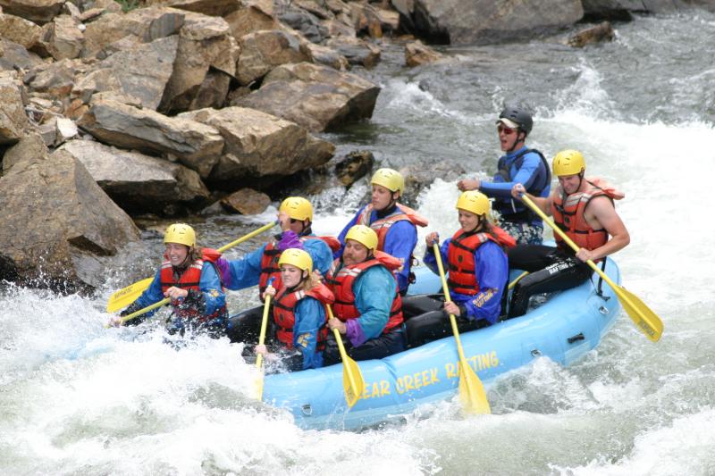
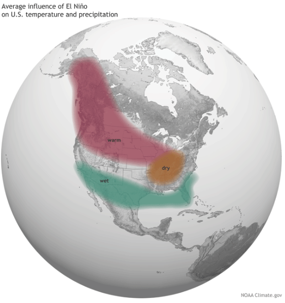


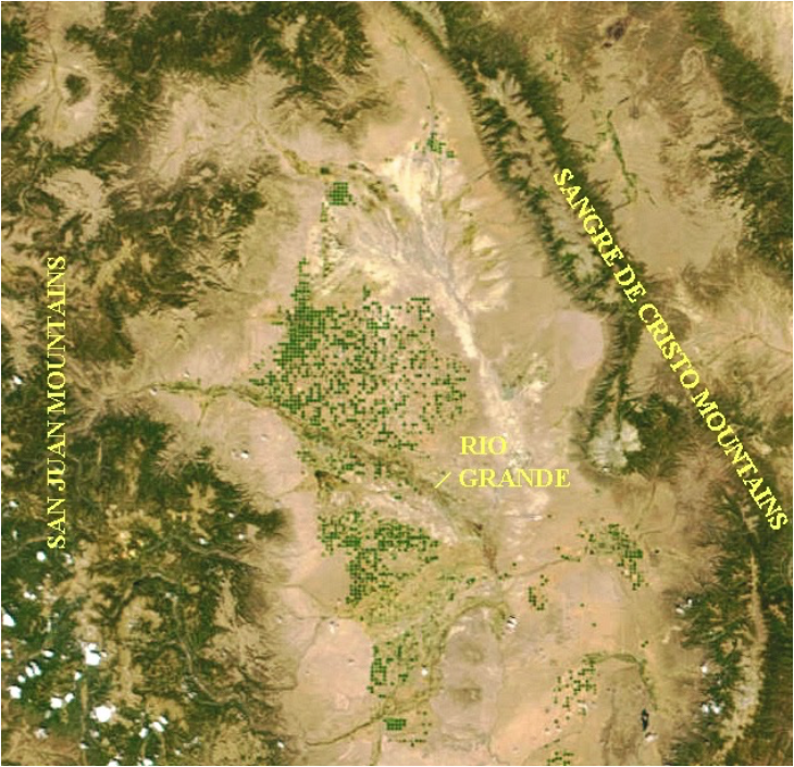
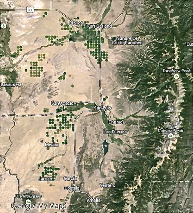


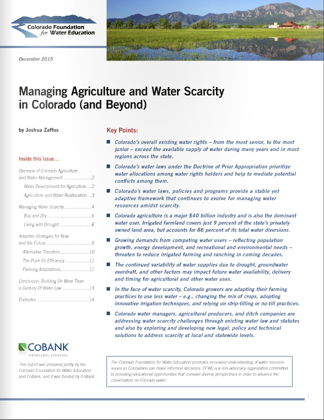


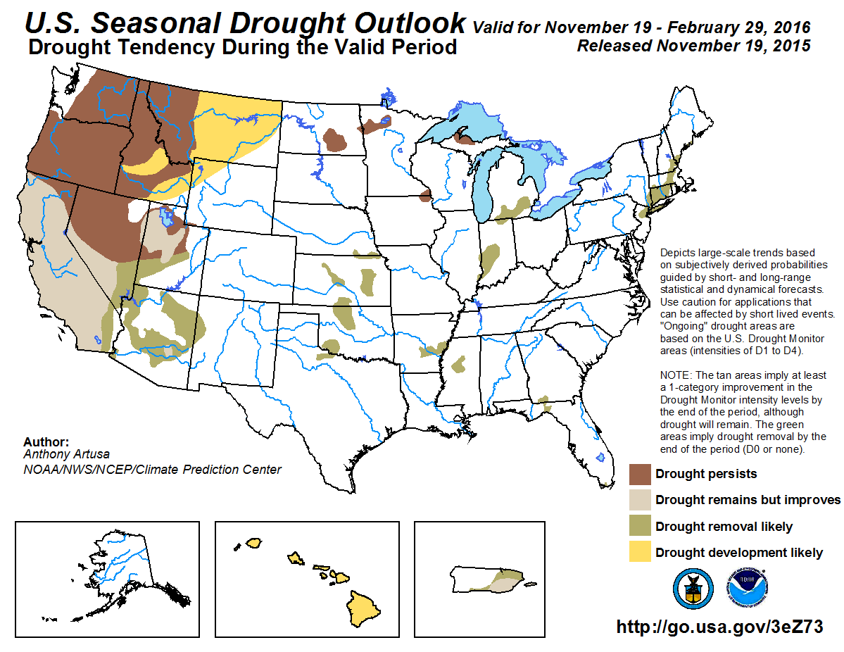


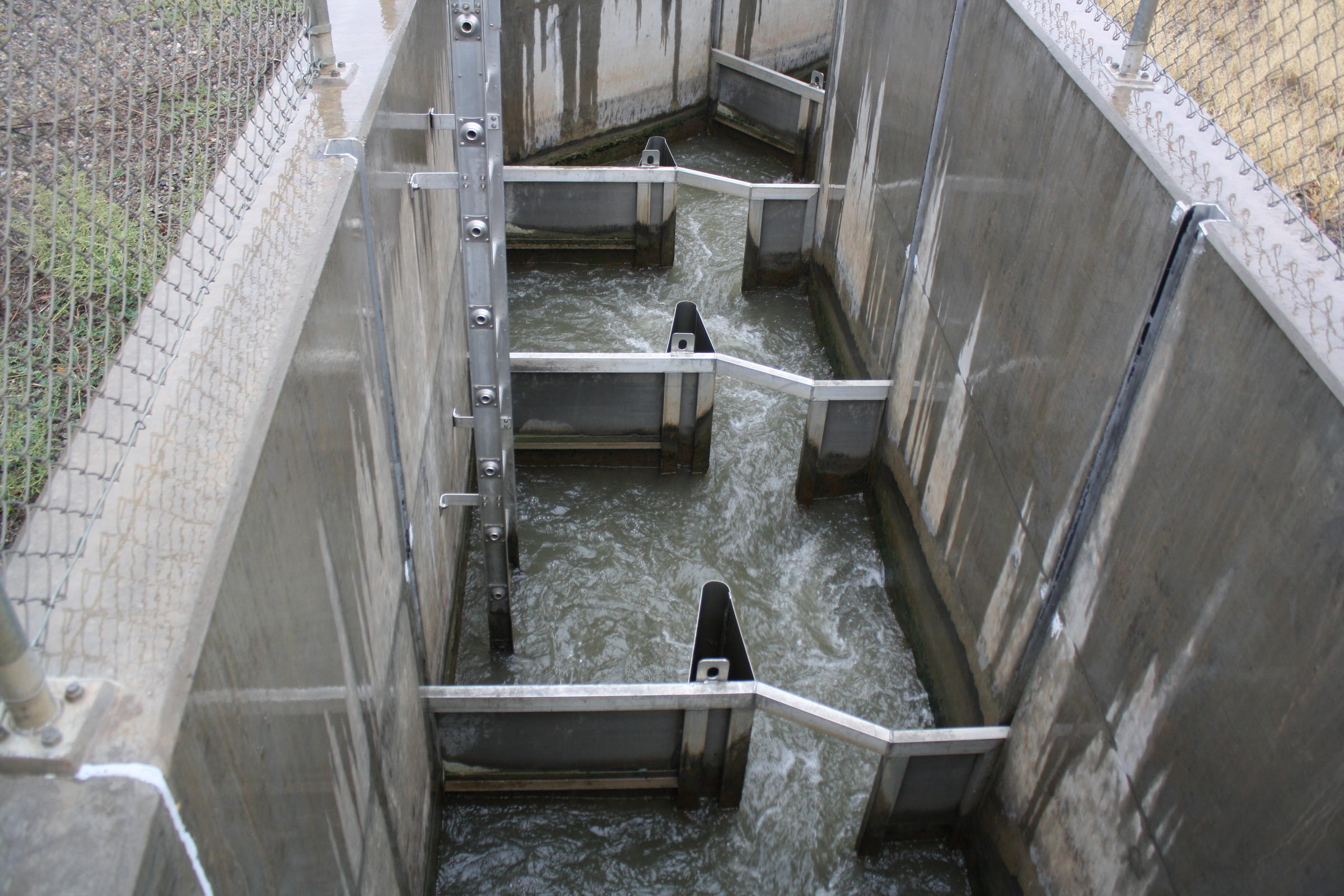

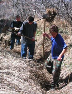
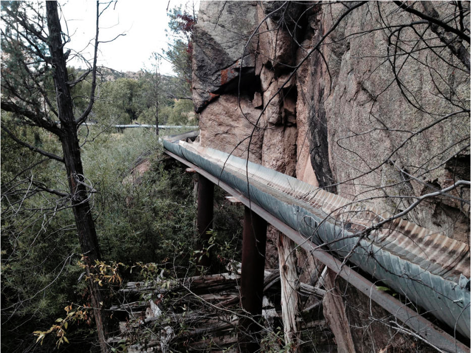


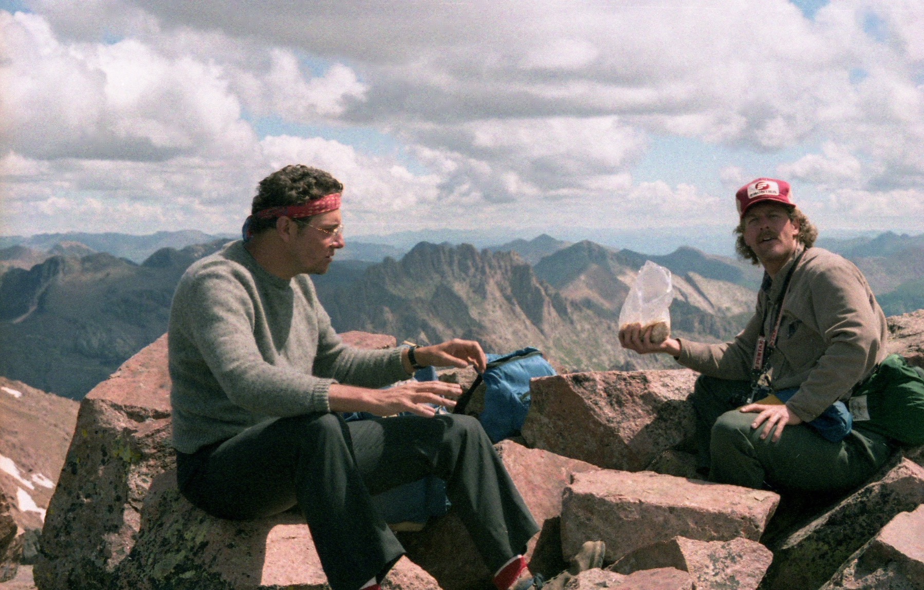


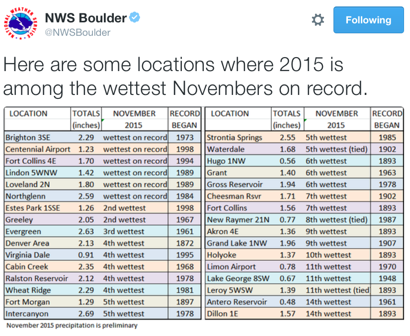


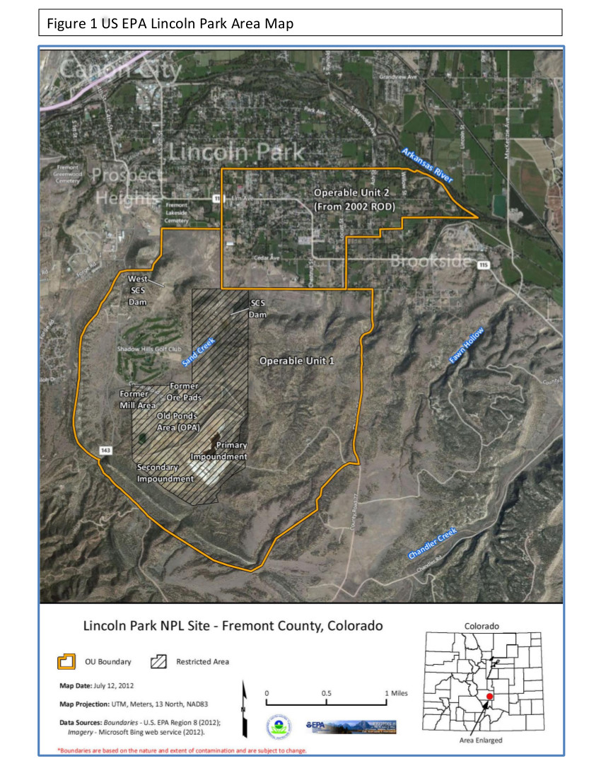

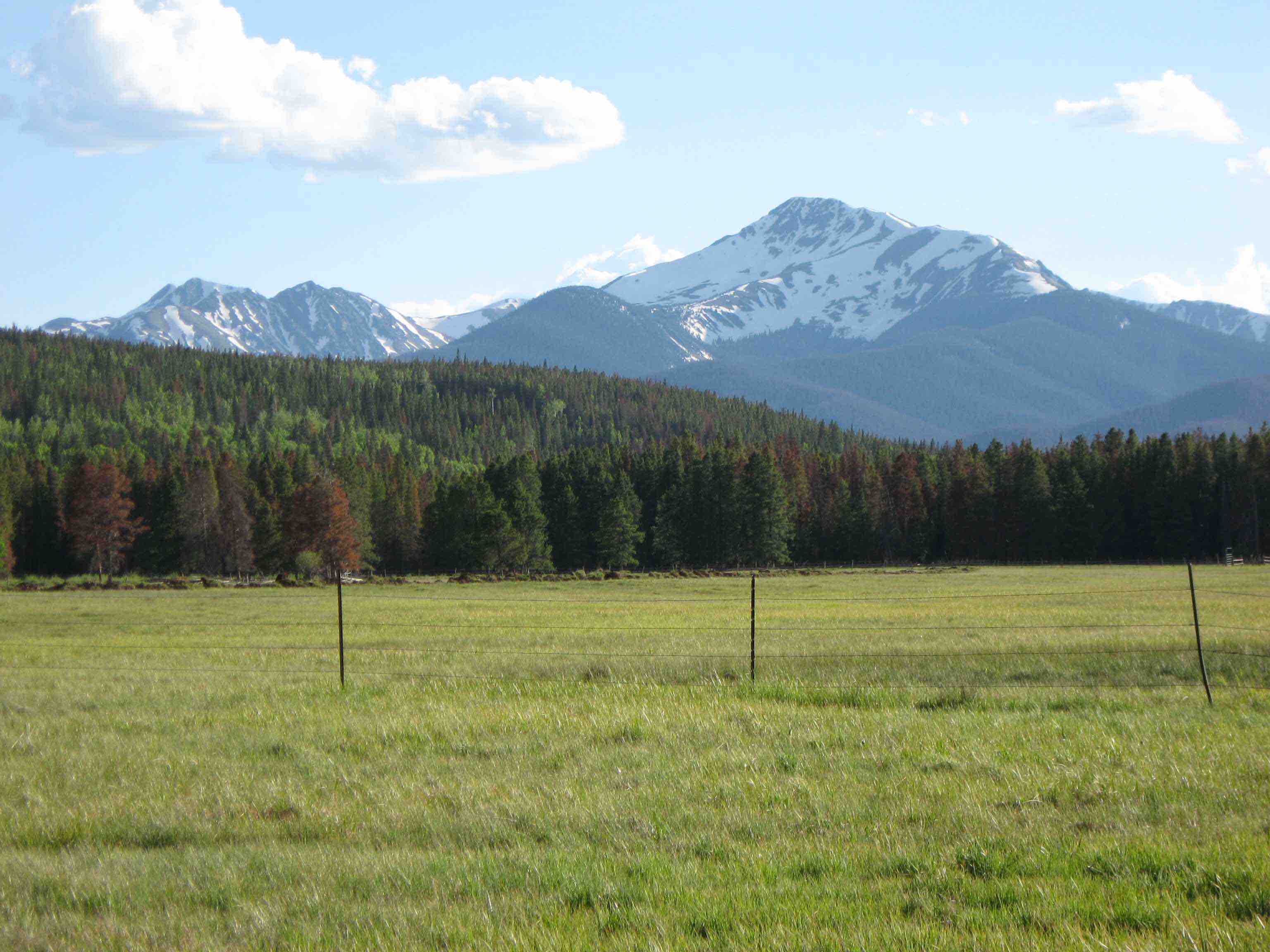
![This image was taken during the peak outflow from the Gold King Mine spill at 10:57 a.m. Aug. 5. The waste-rock dump can be seen eroding on the right. Federal investigators placed blame for the blowout squarely on engineering errors made by the Environmental Protection Agency’s-contracted company in a 132-page report released Thursday [October 22, 2015]](https://coyotegulch.blog/wp-content/uploads/2015/10/goldkingminespill1057am08052015viaepa.png)