Colorado House and Senate leaders found common ground on two CCGA-supported state bills — House Bill 16-1228 and House Bill 16-1256 — that had each passed through the 2016 Colorado Legislative Session in recent weeks, but came out of the two chambers in varying versions.
With concurrence, though, from both Senate and House leaders in more recent days, both bills are on their way to the governor for his signature.
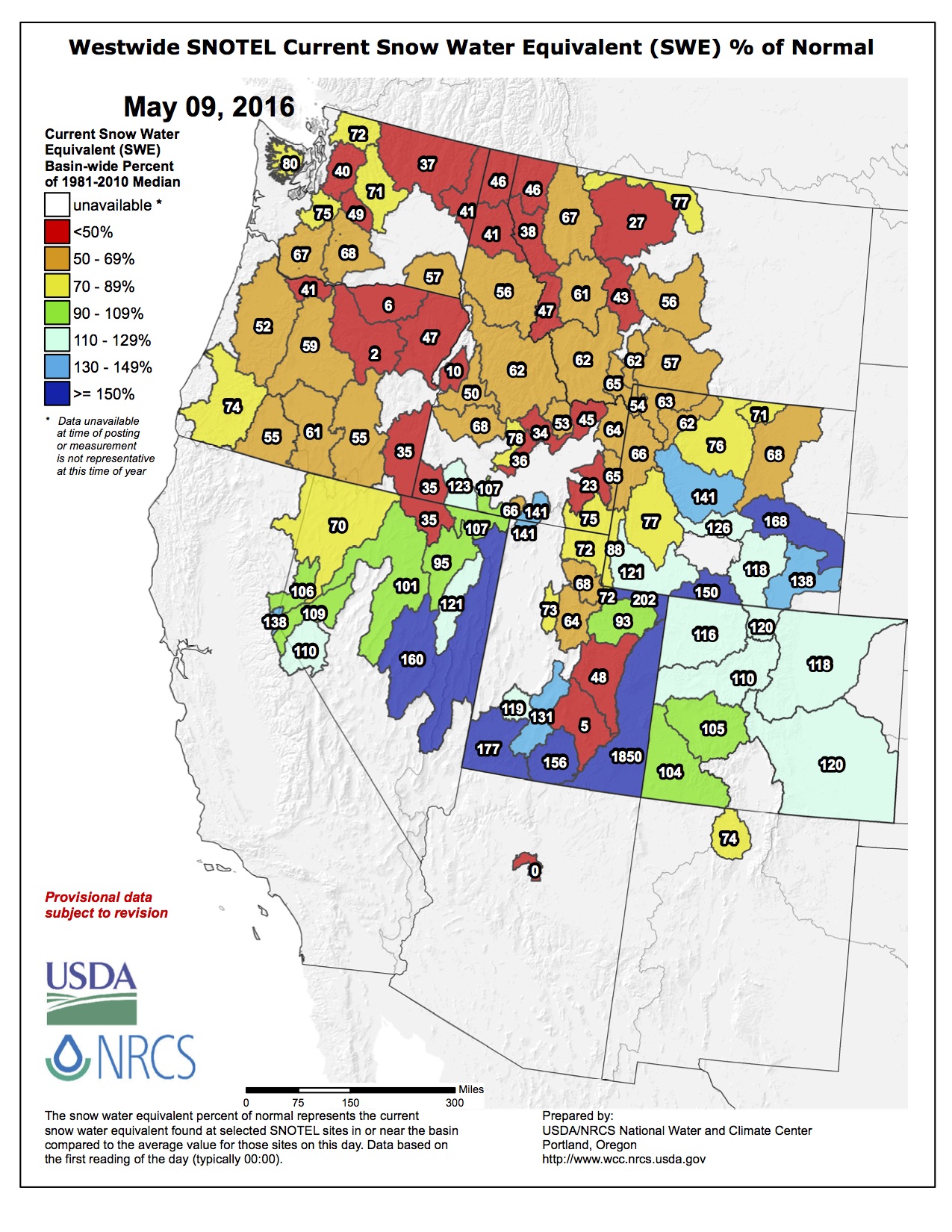
The 2016 Colorado Legislative Session ended at midnight on May 11.
House Bill 16-1228, “Ag Protection Water Right Transfer Mechanism,” would authorize owners of ag water rights to seek change-in-use decrees, allowing the transfer of up to 50 percent of the water subject to that water right, to any beneficial use for renewable one-year periods, without designating the specific beneficial use, if the owner obtains a substitute water supply plan, and other conditions are met.
House Bill 16-1256, “South Platte Water Storage Study,” would require the state to conduct or commission a study of the South Platte River Basin to determine, for each of the previous 20 years, the amount of water that has been delivered to Nebraska in excess of what’s required under compact. The study must also include locations that have been identified as possible sites for new reservoirs within the South Platte River Basin, between Greeley and Julesburg.
Granby’s long awaited water treatment plant broke ground this week. Officials from the Town, the Colorado Department of Local Affairs (DOLA), the Colorado Department of Public Health and Environment (CDPHE) and representatives of the various organizations that helped bring the project to fruition were on hand early Tuesday afternoon for the formal ground breaking ceremony…
Plans to develop the new Granby Water Treatment Plant were sparked in 2013 when tests on water wells in the SSA, south of the Fraser River, indicated that one of the three wells the Town uses to supply water for the SSA was being contaminated by ground water. The well in question was shut off at that time and Granby began reviewing options for upgrading the Town’s SSA water supply. Options included drilling new wells and building a treatment plant.
“In the end they (the Board of Trustees) determined the best choice for the immediate and long term for the water needs of the entire South Service Area would be to build a treatment facility,” said Granby Town Manager Wally Baird.
The rough price tag for the new plant is $6 million. Granby has received a $2 million grant from DOLA to apply to the project and an additional $1 million from the SilverCreek Water and Sanitation District, which is served by the SSA. The Town is also putting in $1.5 million. The $1.5 million the Town is applying to the project is derived from funds Granby received from the Granby/SilverCreek Water and Wastewater Authority after the authority was dissolved last year.
The Town is borrowing the remainder of the $6 million price tag, roughly $1.5 million, in the form of a direct loan. Baird explained the loan is analogous to a letter of credit and allows the Town to pay back only those funds which are spent on the project.
Freeport-McMoRan, the company that operates the Henderson Mill and Mine Complex in Grand and Clear Creek Counties, also provided the Town of Granby with a $20,000 grant that was used to mobilize contractors early on during the project and get construction moving forward.
Velocity Constructors is overseeing the project. The new water treatment plant will be contained within a single building, roughly 13,000 square feet, that will hold the treatment facility, offices for the SSA water operators and a garage area for equipment storage.
Baird said workmen began unloading foundation forms this week at the job site and he expects concrete pouring to begin relatively soon, after fears of late spring freezes subside. Along with the physical construction of the treatment plant’s building workers will also be required to install pipelines from the SSA’s three wells to the plant and connect the entire system to outflow pipes that distribute water to the surrounding area.
After construction is complete the well that was previously shut off due to contamination from ground water will be brought back online and its water will be filtered through the treatment plant. Officials expect the new water treatment plant to have a lifespan of 50 years or more.
The Town’s water users in the SSA can expect to see a slight uptick in their water bills. Baird estimated residents of the SSA would see an increase of about $52 in fees over the course of the entire year, which goes to helping pay back the loan used to complete the project. The rate changes will only apply to the SSA and not the North Service Area (NSA), north of the Fraser River.
The new plant will utilize a semi-permeable membrane to treat the well water that goes through the plant. The filter, which functions vaguely similar to a reverse osmosis system, utilizes the semi-permeable membrane to remove almost everything from the water besides water molecules.
Gore Canyon rafting via Blogspot.com FromThe Denver Post (Jason Blevins):
Commercial rafting remained a strong economic driver in Colorado’s high country last year with the state’s outfitters logging more than a half million user days for the sixth time in a decade.
The 508,728 commercial raft trips on 29 stretches of Colorado rivers generated $162.6 million in economic impact in 2015, setting a new record just above the economic benefit estimated for the 2014 season.
Rafting outfitters are thinking the coming season will be about the same, thanks largely to the snowy April that bolstered alpine snowpacks and the recent cool weather keeping that snow from melting too early.
The Arkansas River from above Buena Vista through Salida to Cañon City remains the state’s powerhouse. Traffic was up 3 percent on the most-rafted stretch of river in the country, with 197,000 user days in 2015. This created an overall economic impact of $62.5 million in Chaffee and Fremont counties.
Southwestern Colorado’s Animas River saw an 8 percent decline in both rafters and spending last year — blamed largely on the catastrophic Gold King mine blowout that fouled the river in August and abruptly deflated that river’s rafting season. Traffic on the Animas River dropped to 34,000 user days from 37,000 in 2014, triggering a nearly million-dollar decline in economic activity, which decreased to $10.8 million in 2015.
For the last decade or so, Colorado’s commercial rafting days have hovered around 500,000, with the exception of the wildfire-plagued 2012 and 2013 seasons when annual visits fell to the lowest points since 2005.
In the business world, that kind of stagnant growth translates into declining stock prices, fired CEOs and new strategies. Not in the realm of rubber riders. Flat is fine in Colorado, where river quotas and caps keep the number of users on several stretches of river at sustainable levels. It’s not likely rafting visits will ever climb much beyond 500,000, Costlow said.
“There’s not enough room on the river to have tremendous growth. It’s protecting the resource,” Costlow said. “We are fine with it. It’s the reality of the resource.”
[…]
Rafters directly spent a record $63.5 million in 2015, or about $125 per person, up from $116 per person in 2010.
“A lot more people do multiple activities when they come to visit,” said Alex Mickel, whose Mild 2 Wild Rafting in Durango offers whitewater and Jeep adventures around southwest Colorado. “Reservations are trending strongly this season and we are hopeful. We looking at a good runoff and I think economically, people are looking to travel this summer.”
Activities like watering the lawn and thirsty flower beds don’t require treated water from the tap. Until this week, the state technically could have fined Broderick $500 for his system.
The new law, which takes effect in August, allows homeowners to collect as much as 110 gallons of rain in up to two barrels.
‘Legalize It’
The state hasn’t issued fines in recent years. So why even bother changing the law?
Democratic Rep. Jessie Danielson of Wheatridge says in the face of climate change, drought and a taxed water supply system, rain barrels are an important conservation tool.
“It will tie the consumer to their water usage a lot more closely,” said Danielson.
The bill was first introduced in 2015 but lacked support from the agricultural community and some lawmakers. However, it struck a chord with many homeowners this year. Danielson said as she posted Facebook updates about the bill during the session, those dispatches got more responses than any other posts.
One person was so devoted to the cause they started selling t-shirts.
“They put the words ‘legalize it’ at the top, and instead of it being some marijuana-themed t-shirt it was a picture of a rain barrel,” Danielson said. “This is a fun, important environmental issue that just makes sense to people.”
Drought and water supply concerns have been a catalyst for other state legislatures in Texas, Utah and California to take up rainwater collection.
Some western cities like Los Angeles even offer rebates on equipment.
But in Colorado, where drought is still fresh on many farmers’ minds, getting the bill passed wasn’t easy.
Getting From ‘No’ To ‘Yes’
After the bill was introduced, one of the largest opponents was the Colorado Farm Bureau…
“Rain barrels were kind of looked at as the red-headed step child in a sense,” said Marc Arnusch, a farmer and member of the Colorado Farm Bureau board.
Arnusch said amendments to the 2016 version of the bill guaranteed that rain barrels wouldn’t interfere with farmers’ water rights. The final bill literally says “a rain barrel does not constitute a water right.”
The law will also require the state engineer to track adoption and usage among homeowners. That was a big selling point for Arnusch.
“We need to start preaching heavily about conservation and using water intelligently,” said Arnusch. “And that starts quite frankly in the urban areas of our state.”
Debate and research on rainwater collection stretches back almost a decade in the state. Colorado launched a small-scale study back in 2007. It found that 97 percent of the rainwater in Douglas County is lost to evaporation and vegetation. The study was a catalyst for a 2009 law that gave well owners the right to collect rain water.
In Colorado, the debate may be complicated, but rain barrel owner Aaron Broderick said owning a rain barrel is pretty simple. It takes an afternoon to set up and it can cost under $100. The end result will be a cheaper water bill.
“The thing that’s interesting is that it really isn’t much of an inconvenience,” he said.
The true test will be whether the law causes an inconvenience for water rights holders in the near future. The state engineer’s office is expected to deliver its first report on rain barrels sometime in 2019.
After two years and a downpour of controversy, Coloradans soon will be allowed to use barrels to collect rain that falls from their roofs…
Starting Aug. 10, Coloradans will be allowed to use up to two 55-gallon barrels, which cost about $100 on average.
“They promote education – pay attention to water and how it’s used – and they also promote stewardship,” Hickenlooper said of the barrels, signing the legislation in the backyard of the Governor’s Residence at Boettcher Mansion in Denver.
While the legislation seemed obvious to many observers, it struggled through the Legislature, failing last year, before picking up steam this year.
What held it back was fears that rain barrels would erode the state’s prior appropriations system, which grants water rights to the first person to take water from an aquifer or river, despite residential proximity.
Several amendments this year helped garner support from factions that ardently fight for water rights, including the Colorado Farm Bureau.
The law allows water officials to curtail use of barrels if injury to water rights is found. The law also states that using a rain barrel is not a water right, and requires the state engineer to evaluate if the use of rain barrels impacts water rights across the state.
Sen. Ellen Roberts, R-Durango, helped push the measure along over the past two years by garnering support in the Republican-controlled Senate.
“We don’t want to impact anyone’s water rights. We just want to make sure that we aren’t the only state in the union where this was illegal,” said Rep. Daneya Esgar, D-Pueblo, a co-sponsor of the bill.
Sen. Mike Merrifield, D-Colorado Springs, added: “It gives urbanites a more personal and intimate connection with the complicated water system in Colorado.”
Rep. Jessie Danielson, D-Wheat Ridge, pointed out that it was remarkable to pass a controversial piece of legislation during a contentious legislative session.
“We keep hearing that there’s this gridlock and that we’re not able to get anything done in a hyper-partisan time,” Danielson said. “This bill is an example of working across the aisle.”
HB16-1005 signing ceremony photo via @ConservationCO
Colorado Governor John Hickenlooper this afternoon signed H.B. 1005, a bill legalizing the use of residential rain barrels in Colorado.
Conservation Colorado Executive Director Pete Maysmith and Western Resource Advocates President Jon Goldin-Dubois made the following comments:
This is a victory for Coloradans who care about their state’s incredible rivers, lakes, streams, and waters. Rain barrels are an important educational tool and a great first step toward conservation and increasing awareness about the water challenges facing Colorado. Water conservation is the cheapest, fastest, and most flexible water strategy we have to addressing these challenges. Moving forward, we are ready to work with the Hickenlooper administration, our legislature, and private citizens to implement more water conservation policies, starting with the statewide water conservation goal outlined in last year’s landmark Colorado Water Plan.
Pete Maysmith, Conservation Colorado
On this bright sunny day, we are dancing in the rain!! We applaud Governor Hickenlooper and Representatives Esgar and Danielson and Senator Merrifield for their leadership in passing HB 16-1005, legalizing rain barrels. Now Colorado joins other states across the nation in ensuring everyone can use this common-sense tool to help water their gardens. The entire West is facing water challenges with a growing population, limited water supplies, and a changing climate. We need increased water conservation to help meet these challenges. Someone with a rain barrel develops a better awareness of the water cycle, leading to a needed increased water conservation ethic. We look forward to working with state leaders to build on this step and implement our new Colorado Water Plan. This legislation shows what we can do when we all work together.
Jon Goldin-Dubois, Western Resource Advocates
For more photos and a video of the event, please contact Jessica Goad at jessica@conservationco.org
“We just want to make sure we’re not the only state in the union where this is illegal. I think that’s why it gained so much national attention, even international attention,” said Rep. Daneya Esgar, a Democrat representing Pueblo.
The new law allows residents to collect and store up to 110 gallons of rainwater as long as you put it back in the ground on your property.
“We thought this was just a good Colorado common sense measure,” said Rep. Jessie Danielson, a Democrat representing Wheat Ridge. “You could take water from the roof, collect it in a barrel and water your tomato plants. Seems straight forward, right? But it wasn’t.”
Danielson’s father is a farmer in Weld County. She said lawmakers initially met resistance from ranchers who worried that allowing people to store water for use when it’s dry would mean less water and runoff downstream.
“We did come to an agreement, one that assures that agriculture and other water users across the state will not have any injury,” said Danielson.
The Colorado Farm Bureau supported the measure. Other supporters say the bill is about conservation and education about the state’s mostprecious natural resource.
“As we move into the implementation of Colorado’s water plan we know that conservation is the cheapest, most effective approach we can do,” said Hickenlooper.
Esgar was one of the first to put the new law into practice, “My wife actually purchased me a rain barrel, although I won’t say it’s been filled yet.”
Sponsors of the bill struck a compromise with farmers and ranchers, adding a provision to the bill that says if there’s any proof rain barrels are hurting downstream users, the state engineer can curtail the usage of them.
State health officials will host a public meeting for input on ablation technology that Black Range Minerals proposes to use to extract uranium in the Tallahassee area west of Canon City.
The meeting is scheduled from 6 to 8 p.m. May 31 at Quality Inns and Suites, 3075 E. U.S. 50. The Colorado Department of Public Health is working to make a determination on how to regulate use of the new technology to manage risks to the public and the environment.
Australia-based Black Range Minerals initially started exploring for uranium in the Taylor Ranch area west of Canon City in 2008 and got approval from the Fremont County commission in 2010 to expand exploration on an additional 2,220 acre site.
Black Range proposes to use ablation — dubbed “uranium fracking” — which involves drilling a hole up to 24 inches in diameter into a uranium deposit, lowering a rotating nozzle into the ground, blasting a high-pressure water jet stream into the rock in order to fracture it and develop an underground cavern before pumping a uranium-bearing slurry back to the surface for processing.
Health officials also will take public comment through July 8 via email to Jennifer.opila@state.co.us.
A bill that includes $3 million for the Arkansas Valley Conduit passed the U.S. Senate today on a 90-8 vote, with both Colorado senators working to include funding for the conduit.
The Energy and Water Development Appropriations bill (HR2028) has passed the House and now will go to President Barack Obama to sign into law.
The $3 million for the conduit will continue work on planning and land acquisition for the conduit, which will provide clean drinking water from Pueblo Dam along a 120-mile route to Lamar and Eads. A total of 40 communities serving 50,000 people will benefit.
“Some of the pieces have finally started falling into place,” said Bill Long, president of the Southeastern Colorado Water Conservancy District, the sponsor of the conduit.
Long will travel to Washington, D.C., next week to testify on behalf of legislation (S2616) that would allow the district to use miscellaneous revenues from the Fryingpan-Arkansas Project to repay nonfederal loans. The legislation is key to making the cost of the conduit, which could be as high as $400 million, affordable to Arkansas Valley communities, he said.
The $3 million was included in the administration’s budget, and Sen. Michael Bennet, D-Colo., said he fought to keep it in the bill.
“The Arkansas Valley Conduit is a critical project to deliver clean drinking water to dozens of communities in Southeast Colorado,” Bennet said. “The president’s budget included this crucial funding, and we fought to ensure it was included as the bill moved through the Senate.”
The conduit is part of the original Fryingpan- Arkansas Project, but was not built because of the expense. Now, the communities in the Lower Arkansas Valley are seeking its construction because of the escalated cost of other methods of treating water in order to reach state and federal water quality standards.
“The federal government made a commitment more than five decades ago, and this funding ensures Congress is doing its part to fulfill that promise,” Bennet said. “We will continue to pursue any avenue necessary to ensure this project is completed as promised.”
Sen. Cory Gardner, R-Colo., applauded the vote because it assisted the conduit, as well as the National Renewable Energy Laboratory in Golden.
“I’m proud to have secured the funding for two important provisions in this appropriations package that directly affect Colorado,” Gardner said. “The Arkansas Valley Conduit project will result in cleaner, safer water in Southeast Colorado, and this important funding was approved to assist in the cost of construction.”
Bennet and Gardner are co-sponsors of S2606, the bill Long is scheduled to testify about next week.
A plan to allow water to pass through Cucharas Reservoir until a new dam is built has been approved in a settlement of a legal case that has been drawn out for more than a year.
Two Rivers Water and Farming Co. filed an objection last August to a February 2015 state order to remove the dam, located 12 miles northeast of Walsenburg, claiming it still intends to build a new dam downstream. The Colorado Supreme Court returned the case to Division 2 water court, where a settlement was approved last month by Water Judge Larry Schwartz in lieu of a trial.
“The state and division engineers were very helpful in developing a common-sense plan for rebuilding the Cucharas dam,” John McKowen, Two Rivers CEO, said in a press release this week. “The plan will insure the public’s safety and increase the water efficiency inside the entire Huerfano River basin.”
Two Rivers is required in the next six months to remove the rock fill embankment of the entire length of the dam. It also must cut a channel allowing 150 cubic feet per second to pass through the reservoir and dam on the Cucharas River in Huerfano County. The Cucharas River merges with the Huerfano River before it empties into the Arkansas River.
Those remedies are more stringent than McKowen’s claim last year that the dam was safe because its crest had been removed and it was storing no water because the gates were locked open.
McKowen plans to build a new dam downstream that would allow storage at the site, which has been under restriction by the state since the old dam began leaking in 1987.
In the settlement discussions, McKowen talked with the state about using Two Rivers’ assets in the Huerfano River basin to address other water issues in the basin. Two Rivers owns all of the Orlando Reservoir in Huerfano County and canal system and 95 percent of the Huerfano- Cucharas Irrigation Co., which includes Cucharas Reservoir and farmland in Pueblo County.
While the settlement resolved issues with the state, there are still legal issues between Two Rivers and other water users in the Huerfano River basin.
As part of the settlement, Two Rivers would pay Huerfano County $100,000 if it fails to comply with the consent decree. The state has reserved the authority to evaluate compliance and to take further action, if necessary.
With boating season poised to kick off on Memorial Day weekend, it’s time to become vigilant over aquatic nuisance species — ANS, for short. These non-native troublemakers often physically change local ecosystems by altering traditional food chains, damage water infrastructure and degrade water quality, as well as limit fishing and recreational opportunities.
In Colorado, the main threat is zebra and quagga mussels, two freshwater species that are closely related and originated in Western Europe and Eastern Asia. These critters seek out dark and discreet crevices and clefts and fasten themselves to the underside of boats for protection.
Last year was a record year in the state for the number of boats found to possess these mussels by Colorado Parks and Wildlife (CPW), the agency charged with most recreation, fish and wildlife management. By this same time in 2015, inspectors discovered three boats with the nuisance species and pinpointed 24 by the end of the season.
“It’s a real threat,” said Robert Walters, invasive species specialist for CPW. “In 2016, we’ve already intercepted five watercraft coming into the state with confirmed zebra and quagga mussels, so we’re on pace to exceed what we did last year.”
This particular invasive species removes major quantities of plankton, which act as food for juvenile fish, and other nutrients from the water. On top of that, if zebra and quagga mussels then go undetected and a boat encrusted with them launches into a different body of water and unintentionally transfers them, it is practically impossible to remove them permanently once they occupy it.
At many well-attended boating spots throughout the state, CPW relies exclusively on boater education programs through prevention campaigns and instructive signage to offset ANS issues. There are other locations, though, that are considered high-priority or high-risk due to their proximity to the Front Range.
On the White River National Forest, there are just three reservoirs that are considered at heightened risk from these invasive species entering the water from boaters. Those are Dillon Reservoir, Ruedi Reservoir near Basalt in the Aspen-Sopris Ranger District and the Green Mountain Reservoir on the northern end of Summit County along the Blue River.
Denver Water, which manages Dillon Reservoir, pays for boat inspectors before vessels launch if they’ve been out of state or for residents if they’ve been in local, known infected water. Inspectors at the Ruedi and Green Mountain have in the past been financed by a combination of U.S. Forest Service regional dollars that get split up among the many districts, in addition to CPW funding.
But, as annual Forest Service budgets continue to dwindle — the White River had a general allocation of $31 million five years ago and for 2016 is operating on just $18 million — the local districts have had to make difficult choices and purge maintaining reserves for nonessential programs such as invasive species prevention. The Ruedi still has some funding streams to keep its program running, but Green Mountain has been less fortunate.
“As we’ve declined in our funding, we’ve had to prioritize what we do at the forest level,” said Bill Jackson, Dillon district ranger. “So what do we fund — seasonal employees, people, other programs or (invasive species)? Those are tough decisions to make, and some people think (infestation) is inevitable or don’t think that it’s money well spent.”
The predicament is, however, that without proper prevention measures, the cost of potential mussel contamination can be much, much higher. On some multiuse reservoirs around the country — Green Mountain is also the location of the Green Mountain Dam — maintenance can skyrocket where these problem species land because they can cause water treatment, irrigation and power generation facility snags.
“If there were quagga and zebra mussels in there,” said County Commissioner Karn Stiegelmeier, “it would cost millions and millions of dollars annually. There is a huge, very expensive problem with them in Lake Powell, for instance, and a lot of Arizona reservoirs.”
[…]
Pueblo Reservoir is the only one in the state known to have the quagga mussel, though those spotted have only been in a developmental larval stage known as a veliger. While not yet pervasive, the goal remains to avert this problem in other favorite, yet susceptible, sites for boating such as Green Mountain.
“It’s just the veligers that have been detected,” Mike Porras, CPW’s public information officer, said of Pueblo Reservoir. “The inspections are critical to help keep our waters from becoming infested.”
Stiegelmeier, along with the Dillon Ranger District and CPW, are optimistic they can locate the necessary dollars to keep up mandatory inspections before boats launch into Green Mountain Reservoir. They are looking to the Bureau of Reclamation, which owns and manages the dam there, to take on the burden of these costs, while also still searching for other proceeds.
“We are doing our best to find money for these programs,” said Jackson. “If the funding doesn’t come through, then, like other locations, we’ll have to rely on educating boaters, signs and really getting the word out through websites and social media. Otherwise, we’ll just have to close the area to boating, and we don’t want to do that.
“We haven’t given up and we’re still beating the bushes for help,” he added, “and still looking at options here in Summit County. We’re doing what we can.”
From @EcoFlight1 via the Glenwood Springs Post Independent:
EcoFlight’s student program took to the air again this week.
Students from science classes at Yampah, Roaring Fork and Glenwood Springs high schools on Wednesday got a look at the big picture of what a watershed looks like from the cockpit of small airplanes as they flew over the Roaring Fork River watershed.
Christina Medved, watershed education director from Roaring Fork Conservancy, joined EcoFlight’s educational discussion with the students about snowpack in the Elk Mountains, and how 30 million people downstream depend on water from the Colorado River for agriculture, recreation and domestic use.
“We saw so many little lakes and ponds, and where our water comes from.” Carl Wright, a junior at Yampah High.
“We were surprised to see how much agriculture we have here, and how close it is. I didn’t realize how much we had around here,” said Bella Reiley, senior at Roaring Fork High.
EcoFlight uses small airplanes to educate students, scientists and stakeholders about conservation issues, and to inspire students to have a voice for their environment. The organization’s mission overlaps with that of the Roaring Fork Conservancy, as Medved said: “Our mission is to inspire people to explore, value and protect our watershed. These are the next generation of decision-makers who will have to deal with these issues — water and growth — in the future, so why not educate them and show them firsthand how important this watershed is to us and those downstream?”
“This is an amazing opportunity that the students have been looking forward to all year. They talked about watershed and conservation issues in their public lands management unit earlier in the year, and this is a great way for them to connect what they learned in the classroom with the bigger picture,” said Brooke Bockelman, experiential programs manager at the Buddy Program.
In some ways, 2016 is mimicking last year which was marked by a moisture-laden spring that allowed for an extended, and prosperous, season for outfitters.
In 2015, Colorado’s whitewater rafting industry hit 508,728 user days, which was considered a “healthy season,” according to the Colorado River Outfitters Association, a group that represents between 80 and 85 percent of the state’s commercial operators.
While that total was about 5 percent off of the statewide record year of 2007, when 533,166 rafters paid to float, local companies would be happy for a repeat of 2015.
“We had a fantastic rafting season last year,” Ingram said. One measure of that was the ability to run the Slaughterhouse section of the Roaring Fork, known for its Class IV waterfall, deep into July…
The Arkansas River…remains the state’s most popular rafting river, hogging about 39 percent of the total market share, according to CROA. Last year there was a 3 percent increase, or almost 5,700 more people who used the “Ark,” as compared to the prior year. Because it is heavily regulated, there’s little room for growth on some of the season’s “bumper days,” according to CROA executive director David Costlow.
Commercial user days on the upper Roaring Fork (above Basalt), at 5,038, represented only a fraction of the busy Arkansas in 2015, according to CROA data.
Slow going, for now
A slow warm-up rather than a rapid meltdown is highly preferable for flooding concerns and also to better serve tourists, who are in short supply right now. So far, the snowpack has cooperated by remaining stubbornly high in the hills.
On May 12, the Roaring Fork Conservancy’s snowpack and stream flow report summarized that “snowpack in the Roaring Fork watershed is 102 percent of normal. We are poised for spring runoff with plenty of moisture still stored in the snowpack.”
The report continued: “Several sunny days and warmer overnight temperatures would significantly increase the rate of snowmelt, and cause river levels to rise.”
That was evident this past week on the Colorado River, where flows in Glenwood Springs “nearly doubled,” according to the conservancy’s report. It noted that the measuring gauge near the confluence of the Roaring Fork showed the Colorado River was running at 5,660 cubic feet per second (CFS).
Here in the upper valley, the Roaring Fork River is just now awakening from its seasonal slumber. The May 12 measurement at a Snowtel site on Independence Pass showed snowpack at 124 percent of median or providing 14.4 inches of “snow water equivalent.”
“There’s a lot of snow up there. And right now we’re doing way better than last year. We haven’t really started dumping any water,” said AWR’s Ingram. Both Aspen Whitewater and Blazing Adventures are offering early season specials on river trips.
On May 11, Ingram checked a gauge near the confluence of Maroon Creek and the Roaring Fork River about 100 yards below Slaughterhouse falls. It hovered around 270 cfs; Ingram said the company would like levels to rise to at least 500 cfs before sending a commercial trip through there, though he believes optimum range is 800-2,000 cfs. Anything higher than 2,000 cfs can be a little scary, he surmised…
River users may have fond recollections of flooding at North Star Preserve during the summer of 2015. While not a section that rafts use, the surplus of water allowed those with kayaks, paddleboards and tubes to explore channels and nooks and crannies that are usually dry.
A confluence of several factors led to last year’s North Star flooding, according to Medved. Those included a Twin Lakes reservoir at capacity, and latent demand by Front Range users that kept water from being diverted to the eastern side of the Twin Lakes tunnels. Plentiful water statewide helped keep water closer to its origin by reducing the “calls” or demands…
RFC will host its 12th annual river float on Saturday, June 4, beginning at 8 a.m. Tickets are $20 for what is touted as an “informative, fun float down the lower Roaring Fork River.” Lunch at the Coryell Ranch following the trip is included as are “educational river conversation,” gear demos and more. Go to roaringfork.org for more information.
Map of the Roaring Fork River watershed via the Roaring Fork Conservancy
Holbrook Reservoir is in a broad shallow basin formed in overburden soils overlying the Smokey Hill Member of the Niobrara Formation. Photo via Deere & Ault Consultants.
A project to upgrade the outlet flow measurement at Holbrook Reservoir near La Junta was approved by the Arkansas Basin Roundtable Wednesday.
“We’ll be better able to use the storage there,” said Nick Koch, a roundtable member from Cheraw.
The work would construct a new concrete weir at the outlet and armor the channel immediately downstream to reduce erosion. The project will allow flows to be measured in the 1-14 cubic feet per second range, a requirement by the Colorado Division of Water Resources.
It also will lower the outlet by 1 foot to allow better access to water in the reservoir, Koch said.
The reservoir holds about 6,250 acre-feet of water, which benefits farmers on the Holbrook Canal. The canal also leases space to the Recovery of Yield group (Colorado Springs, Aurora and Pueblo), as part of the program that maintains Arkansas River flows through Pueblo. Space is leased in the reservoir by the cities, so water can be exchanged or leased later.
It also provides fishing and boating opportunities, Koch said.
The project would cost $40,150 and would be completed during the Oct. 1-Dec. 15 time frame.
The Holbrook Canal is seeking a $30,000 grant from the Water Supply Reserve Account, which is funded by mineral severance taxes. The grant still must be approved by the Colorado Water Conservation Board, but the roundtable’s blessing is a crucial first step.
The Recovery of Yield Group would supply $8,150, and Holbrook would contribute $2,000.
Straight line diagram of the Lower Arkansas Valley ditches via Headwaters
Click here to go to the US Drought Monitor website. Here’s an excerpt:
Summary
An active weather pattern over much of the eastern United States brought with it cooler than normal temperatures for most areas east of the Mississippi River. Areas of the Mid-Atlantic and Florida recorded above-normal precipitation with departures of up to 2 inches above normal for the week. Temperatures were also cooler than normal over the Southwest as above-normal precipitation from southern Oregon to western Arizona helped to keep temperatures down. Areas of the central Rocky Mountains recorded up to 4 inches above normal precipitation as a series of low pressure systems developed there and tracked onto the Plains. Drier than normal conditions dominated much of the South and much of the northern United States had above-normal temperatures…
High Plains and South
Areas of Nebraska and South Dakota were above normal for precipitation this week as a series of storms tracked through the region. After a reanalysis of the region, portions of the D0 in western North Dakota were improved this week. Additional rain over the D0 areas in Kansas allowed for the removal of most of the remaining abnormally dry areas in the state with only a small area of southeast Kansas remaining. In Oklahoma, D0 was improved in the central and western portions of the state while in Texas, D1 was removed from the western panhandle and D0 was expanded to the south in the eastern panhandle. New areas of D0 were added in south Texas in response to developing dry conditions while some improvement to D0 was made in west Texas…
West
As an analysis of conditions in New Mexico and Colorado was done, D0 conditions were improved in southeast Colorado and eastern New Mexico and the D1 in eastern New Mexico was removed. Abundant precipitation in Wyoming this week allowed for a full category improvement to the D0 and D1 conditions in the southwest part of the state. Northeast Utah also was improved as D0 was removed over this portion of the state. Based upon recent conditions and discussions that started last week, areas of D2 and D3 were improved over southern Nevada and southern California. For all of the West, the indicator type was changed to “L” (long-term drought) as the areas of short-term impacts have improved enough to remove that designation…
Looking Ahead
Over the next 5-7 days, the Plains, Midwest, and Northeast remain in a very active weather pattern; the greatest precipitation amounts are projected from northeast Texas into southern Missouri, where up to 5 inches of rain is forecast. With this active pattern, a shot of cold air out of Canada will impact temperatures all the way into the south, with below-normal temperatures. Temperatures are expected to be coolest over the central Plains with departures of up to 15 degrees below normal.
The 6-10 day outlooks show that the best chances for above-normal temperatures are in Alaska and the southern United States from Texas to the Carolinas. Projections show that the below-normal temperatures could be experienced over the Pacific Northwest, Midwest, and New England. A wetter than normal pattern looks to be likely as there are above-normal chances for precipitation above normal over areas from the Pacific Northwest, Central Plains, and most of the eastern United States. The greatest chances of above-normal precipitation are expected over the lower Mississippi River Valley and the Great Basin.
The orange plume flows through the Animas across the Colorado/New Mexico state line the afternoon of Aug. 7, 2015. (Photo by Melissa May, San Juan Soil and Conservation District)
From the University of Arizona and Northern Arizona University via the Farmington Daily Times:
A study of the Gold King Mine spill being conducted by researchers from two universities is seeking participants from three communities on the Navajo Nation.
The research team is from the University of Arizona and Northern Arizona University. The study was started last year with researchers collecting and testing water, sediment and soil samples from the portion of the San Juan River that flows through the communities.
This part of the study will focus on the short-term exposure and perception of risk of residents who were impacted by the mine spill, which saw the release of millions of gallons of toxic mine waste into the Animas and San Juan rivers last August, according to a press release.
Researchers are looking for enough participants to develop four focus groups in Shiprock and Upper Fruitland and in Aneth, Utah. Each group will consist of 10 individuals, and the names and identities of participants will remain private, the release states.
A series of community meetings to explain the study will be held for Shiprock residents at 10 a.m. Friday, at 6 p.m. Monday and at 6 p.m. Tuesday. Each meeting will be at the Shiprock Chapter house.
Meetings for Upper Fruitland residents will be at 10 a.m. Saturday at the Walter Collins Center and at 6 p.m. Wednesday at the Upper Fruitland Chapter house.
The research team will also have meetings in Aneth, Utah, at 10 a.m. May 20-22 at the Aneth Chapter house.
For more information about the study, contact Karletta Chief, principal investigator, at 520-222-9801 or email her at kchief@email.arizona.edu.
Lake Mead behind Hoover Dam December 2015 via Greg Hobbs.
FromThe Grand Junction Daily Sentinel (Eric Kuhn):
I was recently reading an article on the negotiations among the Lower Basin states concerning their use of Colorado River water when I came across this phrase: “after 16 years of drought.” It’s a phrase I’ve been seeing for many years now. Except, of course last year it was “after 15 years of drought” and two years ago it was “after 14 years of drought” and so on.
That same day I read another article discussing a forecast by the National Oceanic and Atmospheric Administration (NOAA) that the El Niño is waning and the atmospheric models are predicting that by fall we have a 70 percent chance of a La Niña. These two conditions in the Pacific Ocean greatly influence Colorado precipitation patterns. Why do these two seemingly unconnected events concern me? I’m concerned because the term drought implies conditions will get better. The reality may be otherwise. [ed. emphasis mine]
Glen Canyon Dam June 2013 — Photo / Brad Udall
First, if we look at inflows to Lake Powell since the year 2000, they’ve been below the long-term average. Therefore, we can make the case that the Colorado River Basin is in a drought. However, if we look to our local conditions in Colorado, we are certainly not in a drought. In fact, since the flooding rains in the fall of 2013 I believe we’ve been in time of plenty or “pluvial.”
Let’s look at water supply conditions in Colorado. In the Upper Colorado River Basin, Granby Reservoir, the largest reservoir in the transmountain Colorado-Big Thompson Project, spilled last year and may again this year. Granby Reservoir, the second largest in the state, spills quite rarely. It last happened after the mid-1980s and late-1990s wet cycles.
Last year Denver Water barely operated the Roberts Tunnel that delivers Dillon Reservoir water under the Continental Divide to its service area. This year, it may not have to turn on the tunnel until July or August. On the West Slope, in 2015, the Colorado River through Glenwood Canyon saw the highest run-off flows since 1984. And since 2013, West Slope river calls by senior water rights holders have been infrequent. In the Arkansas River basin, Pueblo Reservoir and John Martin Reservoir, its two largest, are close to full. Again, all of this only happens after multi-year wet spells.
OK, if Colorado has not been in a drought, and Colorado’s mountains produce about two-thirds of the total run-off of the Colorado River system: Why is total storage in Lake Powell and Lake Mead continuing to decline?
I believe there several reasons: First, the demand for Colorado River water in the Lower Basin exceeds the available supply. As required by the 2007 Interim Operating Criteria, Lake Powell has been delivering a little extra water to Lake Mead. It did so in 2015, will this year and will most likely do so again in 2017. Even with this extra water, the demand for water below Lake Mead exceeds its inflow, thus it continues to lose storage.
Which in turn requires Lake Powell to continue delivering extra water. This means that even with decent inflows to Lake Powell, it can’t gain storage. Lower Basin water officials refer to this imbalance as the “structural deficit.”
They are working on solutions, but the solutions will be painful. Thus it helps to refer to what is happening in the basin as a “16-year drought.” Second, it’s looking more and more likely that warming regional temperatures have turned above-average to abundant precipitation into just average run-off. Recently published science papers have zeroed in on this problem and the consequences of warming on the Colorado River basin are very serious.
Finally, what does this have to do with a potential La Niña? Just like they have in the past, our current period of plentiful precipitation in Colorado will come to an end and it may well be replaced with a period of real drought. Often, but not always, this happens as a strong El Niño is replaced by La Niña conditions. After the 1957-58 strong El Niño, 1959, 1960 and 1961 were all dry years. After the 1973 strong El Niño, three out of the next four years, 1974, 1976 and 1977 were dry and 1977 remains the lowest single year of record for inflow to Lake Powell.
After the 1998 strong El Niño, 1999 was an OK year, but it was followed by the 2000-2004 drought, one of the driest on record for Colorado. There are, of course, exceptions. After the 1982-83 strong El Niño, conditions in Colorado remained very wet for the next four years. So I’m not making a prediction.
We don’t know exactly how deep or how long the predicted La Niña will last or if it will bring drought conditions. But, I’m putting out a warning. If we are headed for a real drought as opposed to a talking point, the consequences for the Colorado River basin are frightening. Unlike, the beginning of the 2000-2004 drought period when the Lake Mead and lake Powell were brim full, today they are only about 40 percent capacity when measured jointly!
What does this mean for western Colorado? I believe the answer is that we can’t be fooled by talk of continuing drought. Instead we need to be diligent and fully prepared for the next drought. It means a continued focus on conservation, the development of drought contingency plans, the wise use of our existing, and where possible, the expansion of water storage reservoirs. Finally, we need to better inform and educate our public on the vulnerability our water resources. If indeed, our current pluvial is replaced by drought in the next few years and we are not prepared — shame on us!
Eric Kuhn is the general manager of the Colorado River Water Conservation District, based in Glenwood Springs.
Lake Mead’s already low water levels are expected to drop even further. The “Las Vegas Sun” says the man-made reservoir could surpass its historic low after next Wednesday. And by the end of June, Lake Mead’s water level could be the lowest since its creation in 1935.
[May 2], Denver City Council passed an ordinance that makes Denver the first city in the state to allow the use of gray water for residential, commercial and industrial purposes.
Graywater is defined as the portion of wastewater that is collected from fixtures within residential, commercial, industrial buildings, or institutional facilities for the purpose of being put to beneficial use, and can be collected from bathroom and laundry room sinks, bathtubs, showers, and washing machines. Graywater can be used to flush toilets or urinals, or for subsurface irrigation of non-agricultural crops.
In 2013, the Colorado State Legislature authorized the use of graywater in Colorado, providing local health departments with the ability to monitor and regulate the use and treatment. In 2015, the Colorado Water Quality Control Commission adopted 5 CCR § 1002-86 (“Regulation 86”), which permits local governments to adopt an ordinance authorizing the use of graywater.
Denver’s ordinance was developed by Denver’s Department of Environmental Health, in coordination with Community Planning and Development and the Mayor’s Office of Sustainability. This also marks the completion of one of the commitments announced by the City at last December’s Sustainable Denver Summit.
“Water is a precious resource in Colorado and as Denver’s population grows, water conservation will be of continued importance. We’re excited to be the first to pass a measure that gives our residents and businesses the ability to save resources and money at the same time,” says Mayor Michael B. Hancock.
A graywater program will support the City’s 2020 Community Sustainability Goal for Water Quantity of reducing per capita use of potable water in Denver by 22 percent by providing a new option to conserve water.
Large facilities that have high uses of water from showers and laundry and high water demand for toilet flushing such as hotels, multi-family residential, and dormitories, could realize more significant cost savings.
It is anticipated that the greatest demand for graywater will come from new hotels, multi-family residential facilities, dormitories, and buildings pursuing a green building certification.
The Board of Environmental Health is expected to approve rules and regulations in late summer describing how the program will be implemented. Participation in the program will be completely voluntary.
An early design sketch of the Nautilus, one of five in-stream trash removal machines created by MSU Denver students as part of the inaugural Clean River Design Challenge. IMAGE: Courtesy of The Greenway Foundation.
Here’s the release from Metropolitan State University of Denver:
Taking out the trash has never been this cool, or this important.
[April 30], students from MSU Denver’s Industrial Design and Engineering departments will test in-stream trash removal machines in Cherry Creek in downtown Denver as part of the inaugural Clean River Design Challenge.
Five student teams will compete against one another for bragging rights and a $3,000 cash prize presented to their department in order to further pursue the winning concept. And that’s on top of creating a machine that could make a major impact on the environment and water quality in Colorado.
Industrial design students Mara Maxwell and TJ DiTallo teamed up to create the Nautilus, a passive device that uses the natural flow of the river to collect trash, while doubling as a public art installation that brings awareness to the issue.
“Our project balances technical elements and aesthetics,” said Maxwell. “Of course it has to work, as the primary function is to help remove trash from the waterways, but most of Colorado’s rivers are used extensively for recreation, so it can’t be an eyesore either.”
The design challenge was made possible by a grant from Rose Community Foundation’s Innovate for Good initiative, and will be hosted by The Greenway Foundation and co-sponsored by The Water Connection and MSU Denver’s One World One Water Center for Urban Water Education and Stewardship.
“The idea is to raise awareness about trash pollution in the South Platte River and its tributaries,” said Autumn Bjugstad, engagement director for The Greenway Foundation. “But we’re also hoping to find real-world solutions for removing trash from our urban waterways.”
Ten student teams initially submitted designs more than eight months ago. Five of those 10 were selected to participate in the final competition. Teams were given $1,000 each to create a working model.
Their prototypes will be put to the test this Saturday and evaluated by judges representing water interests from across the state, including Denver Water, the Department of Environmental Health for the City and County of Denver, and Metro Wastewater Reclamation District, among others.
Beyond the element of competition, the test serves as a major learning experience for students.
“We are excited to test our prototype and see how well our design actually works in the real setting,” said DiTallo. “It is always incredibly useful and exciting to test a prototype. You get to see how well your design performs and you instantly get to see how you can make improvements.”
The winning team will also present its concept to the boards of The Greenway Foundation, The Water Connection, and Urban Drainage and Flood Control, offering students an invaluable professional networking opportunity.
The Clean River Design Challenge will be held in Confluence Park and in conjunction with the CH2M Spring RiverSweep presented by The Nature Conservancy, MillerCoors and Noble Energy on Comcast Cares Day.
Photo via Greg Hobbs
Here’s the release from the Environmental Protection Agency (Lisa McClain-Vanderpool, Cathy Milbourn, Karen Gilbert):
[On May 4, 2016] the U.S. Environmental Protection Agency (EPA) announced $3.9 million in funding to two institutions to research innovative, cost-effective technologies to manage stormwater runoff and combined sewer overflows. Colorado School of Mines received $1.95M to develop a decision support tool to help communities evaluate alternative stormwater treatment technologies that consider diverse climates, regional practices and policies across the country. The tool will evaluate options and risks as well as life cycle costs associated with improving stormwater runoff management using green, gray and hybrid infrastructure. Colorado School of Mines will also create resources and hold workshops to conduct training sessions for these tools.
“EPA has done extensive research on green infrastructure to ensure the availability and quality of water in the United States,” said Thomas A. Burke, EPA Science Advisor and Deputy Assistant Administrator of EPA’s Office of Research and Development. “These grants will take this work a step further by developing green infrastructure technologies and providing an understanding of the full costs of using these new technologies over time.”
As water flows through storm drains, it carries many pollutants that end up in streams, rivers, ponds, lakes and oceans. Additionally, combined sewers carry sewage and stormwater runoff in the same pipe and when these exceed capacity, untreated water can be released into nearby waterways. Using the funding provided through these grants, researchers will produce tools and models to help communities evaluate the optimal mix of technologies that will treat stormwater with less energy, less expense and less burden on the environment. They will also research the possibility of reusing the cleaner water to help meet communities’ needs.
“Our decision support tool will help advance urban water management across the U.S. through integration of new green infrastructure technologies and by allowing decision makers to have access to state-of-the art tools, data sources and life cycle information” said Professor Terri Hogue, lead investigator at Colorado School of Mines.
Due to aging water infrastructure systems and regulatory requirements, stormwater management is an expensive challenge for many communities. The awardees will focus on the most cost-effective options like green infrastructure, practices that enhance natural ecological functions, such as growing gardens on roofs or building artificial ponds, to help manage stormwater and combined sewer overflows. Green infrastructure can replenish groundwater, provide flood control, add green spaces and parks, and revitalize neighborhoods.
The Water Environment Research Foundation in Alexandria, Virginia Also received $1.9 million to develop a life cycle cost and analysis framework, a publically accessible tool and database and a guide for decision makers that includes case studies.
From the Eagle River Water & Sanitation District (Click through for the agenda):
Eagle River Water & Sanitation District, in partnership with the Colorado River District and the Eagle River Watershed Council, is hosting the Eagle River Valley State of the River community meeting, Monday, May 16, at Colorado Mountain College in Edwards.
All members of the public are invited to hear about issues that affect Gore Creek, the Eagle River, the Colorado River, Western Colorado’s changing climate, local water supply, and streamflow and runoff projections. A reception with food and soft drinks will be held at 5:15 p.m., with presentations scheduled to begin at 6 p.m.
For more information, contact Diane Johnson, Communications and Public Affairs Manager, at 970-477-5457.
Silverton, Colo., lies an at elevation of 9,300 feet in San Juan County, and the Gold King Mine is more than 1,000 feet higher in the valley at the left side of the photo. Photo/Allen Best
FromThe High Country News (Jonathan Thompson) via The Colorado Independent:
“Instead of a pure, sparkling stream of water, an opiate for tired mind and jaded nerves, what do you see? A murky, gray stream of filthy, slimy, polluted water, a cesspool for the waste of man.” —Durango-area farmer, 1937
On the morning of Aug. 5, 2015, a deep pool of acidic, metal-laden water was backed up behind debris in the Level 7 adit of the Gold King Mine on the slope of Bonita Peak, roughly 10 miles north of Silverton, Colorado. The pool had been rising for years, imprisoned in the dark of the mine, yearning, as all water does, to be free.
Outside, on the other side of the wall, a CAT excavator scooped jerkily at the debris and the slope. A few contractors and Environmental Protection Agency employees stood in the hard light of the high-altitude sun, watching.
For most of the summer, the crew had been working down the hill on the Red & Bonita Mine, putting in a concrete bulkhead to control the drainage of toxic water from its tunnels. In late July, workers moved on to the more challenging collapsed portal of the Gold King, which in recent years had become one of Colorado’s most polluting mines. Uncertain how to proceed, the EPA’s on-scene coordinator, Steve Way, postponed the job, pending a Bureau of Reclamation site inspection.
While Way was on vacation, however, his replacement, Hayes Griswold, a thick-necked, gray-haired man in his 60s, ordered work to proceed. He knew the risks. In May, the contractor on the job had noted, in the action plan, “Conditions may exist that could result in a blow-out of the blockages and cause a release of large volumes of contaminated mine waters and sediment.” In situations such as this, the typical first step would be to drill in from above to assess the mine pool’s depth and the pressure it exerted on the dirt and rock. Instead, apparently unsure about where the actual mine portal was, the crew burrowed into the debris.
Around 10:30 a.m., a thin stream of water spurted out, steadily growing into a fountain, then a roiling torrent of thick, Tang-colored water. As the workers looked on, stunned, the water roared over the edge of the mine waste-rock dump, carrying tons of the metal-laden material with it, crashing into the gently gurgling stream of the North Fork of Cement Creek, far below.
“Should we get out of here?” one worried worker asked.
“Oh, he’s going to be pissed,” another answered. “This isn’t good.”
“What do we do now?” someone else asked, shocked yet oddly calm, as though a household plumbing project had gone awry.
The workers avoided the deluge, but one of their vehicles, left below the jobsite, was submerged in orange slime. Farther downstream, along Cement Creek, the 3 million-gallon “slug” of water and sludge, laden with high concentrations of iron, zinc, cadmium and arsenic, roared past the old town site of Gladstone and another six miles to Silverton, where it cannoned into the waters of the Animas River.
It took about 24 hours for the prow of the slug to navigate the narrow, steep gorge below Silverton and reach the Animas River Valley, seven miles upstream from Durango, where I live.
I spent most of my childhood summers in, on or near the Animas, and often watched the river turn sickly colors: Yellowish-gray after the 1975 tailings pond failure; almost black when Lake Emma burst through the Sunnyside Mine three years later. Back during the 1950s, a uranium mill in Durango dumped 15 tons of radioactive goop into the river daily. Surely, I thought, as news of the catastrophe hit social media, this couldn’t be any worse than that.
Curious, I raced out to examine the river, at a place where the valley, scoured flat by glaciers some 10,000 years ago, slows the Animas to a placid flow. Turbid, electric-orange water, utterly opaque, sprawled out between the sandy banks, as iron hydroxide particles thickened within the current, like psychedelic smoke. Downstream, the Animas was empty, not a sign of Durango’s ubiquitous boaters, swimmers and partiers. For 100 miles along the river, irrigation intakes were shut. After nightfall, the plume slipped through town like a prowler and continued toward the San Juan River and New Mexico and Utah.
In the weeks and months that followed, there was plenty of pain to go around. Durango rafting companies lost hundreds of thousands of dollars’ worth of potential business. In the small fields of the Navajo Nation, along the San Juan River, corn shriveled without water. For many Navajo, the water is spiritually significant, and seeing it marred was heartbreaking, a bitter reminder of the many times they had borne the brunt of upstream pollution.
Most of the vitriol was directed at the EPA and its careless actions on Aug. 5. But others blamed a federal mining law that hasn’t been updated in 150 years. In Durango, though, most of the ire was directed at its upstream neighbor, Silverton, which had long resisted federal efforts to use the Superfund to clean up the hundreds of now-abandoned mines that gave birth to the town and sustained it for decades.
Like a cathartic purge, the Gold King disaster swept most of that resistance away.
In February, the town of Silverton and the San Juan County commissioners voted unanimously to request Superfund designation, carefully calling the site the “Bonita Peak Mining District,” to divert attention from Silverton and mitigate impacts to its tourist industry. In Durango, and even, to my surprise, in Silverton, there was a palpable sense of relief, a feeling that the whole region might finally move beyond its messy past, clean up the river for good and embrace the future.
But I had my doubts. Having watched the decades-long collaborative effort to clean up the watershed, I knew that the problem was too complex, the wounds too deep and stubborn to easily heal. And I knew that “The Mining Town That Wouldn’t Quit” was too deeply attached to its extractive past to easily refashion a shiny new identity from the rubble of the industry’s demise.
So I went upstream to dig up the real story behind the Gold King Mine disaster, a tale of a community, of mining and of water, and the inextricable way they are entwined.
Acid mine drainage may be the perfect pollutant. It kills fish, it kills bugs, and it lasts forever. And you don’t need a factory, lab or fancy chemicals to create it. All you have to do is dig a hole in the ground. [ed emphasis mine]
The hole — assuming it’s in a mineralized area — will expose iron sulfide, aka pyrite, to groundwater and oxygen. And when these collide, a series of atom-swapping reactions ensues. Oxygen “rusts” the iron in the pyrite, yielding orange iron oxides. And hydrogen, sulfur and oxygen atoms bond to create sulfuric acid, which dissolves zinc, cadmium, lead, copper, aluminum, arsenic and other metals. Naturally occurring, acid-loving microbes then feast on the metals, vastly accelerating the whole process. The acids in this bisque can devour iron pipes, and the toxic metals render streams uninhabitable, sickening fish for miles downstream. Once the process is catalyzed, it’s almost impossible to stop. A Copper Age mine in southern Spain, abandoned four millennia ago, pollutes the aptly named Rio Tinto to this day.
Mining not only indelibly alters a watershed’s hydrology and chemistry, it also forever shapes the identity of the communities around it.
Miners first started drilling, blasting and digging holes into the mountainsides of the Silverton Caldera, a 27-million-year-old collapsed magma chamber, in 1872. The San Juan Mountains were still officially the domain of the Utes, who for centuries had followed the game into the high country every summer. Silverton was founded in 1874, and that same summer the Hayden Survey came through, marveling at the complicated mass of mountains, among the last piece of the Lower 48 to be invaded, or even visited, by European-Americans. What they found was a wilderness we can only imagine today. One of the surveyors, Franklin Rhoda, wrote about how, on Uncompahgre Peak, “at an elevation of over 13,000 feet, a she grizzly, with her two cubs, came rushing past us,” and about huge herds of mountain sheep stampeding across rolling, wildflower-spattered highlands.
Less than a decade later, the railroad reached the caldera, opening the doors to humanity and its detritus. Giant mills crowded the valley floors, tramlines hung across meadows. The mountains’ innards were honeycombed with hundreds of miles of mine workings, which served as vast, subterranean acid mine drainage cauldrons. Steep slopes were stripped of their trees, the waters ran gray with mill tailings. The wild lands that Rhoda had marveled at were now industrialized, the grizzly on the run, the Utes pushed onto a sliver of land to the south.
On April 7, the Environmental Protection Agency proposed adding the “Bonita Peak Mining District” to the National Priorities List, making it eligible for Superfund. Forty-eight mine portals and tailings piles are “under consideration” to be included. The Gold King Mine will almost certainly be on the final list, as will the nearby American Tunnel. The Mayflower Mill #4 tailings repository, just outside Silverton, is another likely candidate, given that it appears to be leaching large quantities of metals into the Animas River. What Superfund will entail for the area beyond that, and when the actual cleanup will begin, remains unclear. Eric Baker
Despite Silverton’s wind-bitten perch at 9,318 feet, its isolation, inhospitable climate and lack of coal for fuel or arable land, the town blossomed. Homes sprouted across the floor of Baker’s Park, from Quality Hill to Poverty Flats. In the early 1880s, Greene Street, the main drag, was lined with businesses, from the Saddle Rock Restaurant and Stockman Barber Shop to the Wong Ling Laundry and Lewke Shoe Shop. Nearly every other hastily constructed facade was a saloon: Tivoli, Olympic, Occidental, Cohen and, surely the rowdiest, the Diamond, run by the notorious Bronco Lou, a “wily she-devil” and “enticing seductress,” who, it was rumored, killed as many as five lovers and husbands.
Silverton’s adolescent rowdiness ultimately mellowed (Bronco Lou was even run out of town), and the prosperity snowballed. At its 1907 peak, the mining industry employed more than 2,000 men — half the local population. The mélange of ethnicities fostered a rich culture, and the relatively stable flow of cash supported several newspapers, a healthy school, and strong government institutions, as well as a powerful miners’ union.
Ugliness could arise from the amalgamation, too. In 1906, a union-led mob drove the entire Chinese-American population from town. And after a protracted, bitter strike, a company-led mob drove the labor organizers from the caldera, killing the union for good. Still, the residents enjoyed an economic equality that seems these days to have gone extinct.
“It was a blue-collar town, but an upper-class blue-collar town,” remembers Bev Rich, a Silverton native, now in her mid-60s and chairman of the San Juan County Historical Society, easily the town’s most influential nonprofit. “It was a great place to grow up, because everyone’s dad worked in the mine and everyone was equal. The community was racially diverse, and it was safe.”
Yet it all hinged on one industry, mining, prone even then to the ups and downs of the national and global market. In 1924, the once wildly profitable Gold King, beleaguered by a string of disasters and bad management, went dark. The county’s biggest mine, the Sunnyside, shut down in the late 1930s, partly because of the cost of hauling ore and pumping water uphill to get it out of the mine. And in 1953, the only major operator remaining, the Shenandoah-Dives, also went quiet.
With the industry virtually dormant, Silverton struggled through what became known as the “Black Decade.”
The town clung to life, however, thanks in part to the silver screen’s mythical Wild West and a steam locomotive that had long hauled ore from Silverton to Durango’s smelter. The train itself became a movie star, along with Clark Gable and Barbara Stanwyck, and it began to haul tourists into Silverton, where they were greeted by a surrealistic spectacle — part Western movie-set, part Third World medina — that included elaborate fake gunfights. Loudspeakers blared advertisements and merchants swarmed passengers, begging them to buy hamburgers or tchotchkes.
Tourism kept the town afloat, but it was no replacement for mining. The pay was lousy, the season short, and it banked on what Bev Rich calls a false “rinky-dink, rubber tomahawk” version of history. “You develop a foul taste in your mouth when one of the gunfight participants says, as she walks away from the pile of bodies, ‘Everyone come to the Bent Elbow, the best food in town,’ ” noted a Silverton Standard editorial in 1963, summing up the sentiment of many locals.
So when Standard Metals announced in 1959 that it would re-open the Sunnyside Mine, the people of Silverton rejoiced. The plan was to extend the existing American Tunnel — started in the early 1900s but never finished — from the old town site of Gladstone two miles underground to the Sunnyside, where ore still lingered in the rock. It worked, leading a revival of mining that lasted for three decades.
Tourism continued to grow, though the locals accepted it grudgingly. “Prosperity stemming from mining is welcome,” Ian Thompson, my father, wrote in 1964 in theStandard. “Prosperity stemming from tourists is inevitable.” Miners, working underground, looked out for one another. Tourism, on the other hand, was a crassly commercial, dog-eat-dog world. Silverton was torn apart by these conflicting identities in a long-running, Dr. Jekyll-Mr. Hyde struggle.
“The Train is the instrument of death,” George Sibley, a longtime western Colorado writer, wrote in the Mountain Gazette in 1975, referring not to the railroad itself but to the new economy it ushered in. “Among the miners, still the core of what remains of the Silverton community, there is an attitude ranging from bare tolerance to outright disgust toward The Train.”
Inevitably, though, global economics would triumph over local sentiment. Gold prices slumped, and massive open-pit mines in Chile and Nevada brought competition. By the mid-1980s, mining company bankruptcies were weekly headline fodder. Finally, in 1991, the Sunnyside shut down for good. One hundred and fifty miners lost their jobs, and Silverton lost its center. All that remained was a rich historic legacy — and the toxic water still draining from the mines.
Not long after the Gold King blowout, I sat down with Bill Simon at his earthen home north of Durango. Simon is an ecologist who has long worked to improve the environmental health of the Silverton Caldera. I first met him in 1996, when I was a cub reporter for the Silverton Standard & the Miner. Back then, Simon was leading the local effort to understand and tackle mine pollution, traipsing around the caldera, sampling streams and piloting a backhoe on remediation projects. Now, his old mop of brown hair is a roughly shorn gray, and he moves slowly and awkwardly. Simon has Parkinson’s, but its physical ravages have not affected his intellect. We talked for more than three hours, and it struck me that he carries a multidimensional map of the upper Animas watershed in his head, its geology, hydrology and history — even its politics. He’s as intent as ever on solving the caldera’s mysteries.
Simon was quick to remind me that Silverton’s pollution problem is relatively small on a global scale, paling in comparison to, say, the Bingham Canyon Mine outside Salt Lake City, which has created a 70-square-mile underground plume of contaminated groundwater, or California’s Iron Mountain Mine, the waters of which are some of the most acidic ever sampled outside the lab. More rock is scooped from a large-scale modern mine in a day than the Sunnyside Mine produced in a lifetime.
“So the problem of acid mine drainage is huge. It’s worldwide,” says Simon. “That’s why I got involved. The problem is being ignored.”
Simon’s involvement began incrementally back in 1970, when he first came to Silverton. Originally from Colorado’s Front Range, he attended the University of California, Berkeley, in the 1960s, where he helped found the Environmental Studies College and worked toward a doctorate in evolutionary ecology. After the military began taking “too much interest” in his work, though, he fled, landing in southwestern Colorado’s high country.
He worked for various mining companies, doing excavation or surface work and then big welding jobs, sometimes cleaning up a site or planting trees afterward. By then, the Colorado Department of Public Health and Environment and the state Division of Wildlife (now Colorado Parks and Wildlife) had pronounced most of the Silverton Caldera’s waters “dead,” thanks to natural mineralization, acid mine drainage and tailings spills. That’s why the wildlife agency had stopped stocking them with trout, a common practice in the state for decades. But Simon had noticed areas that he thought seemed fish-worthy.
So, when he became a San Juan County commissioner in 1984, Simon decided to test his theory, using fish as his guinea pigs and the watershed’s streams, beaver ponds and lakes as his laboratory. With a group of miners, who were also anglers, he hiked to backcountry waters carrying packs that held thousands of fingerling trout, donated by the state Division of Wildlife.
Even Simon was surprised by how many of those trout survived, including fish in seemingly sullied stretches of water. That meant that other stream segments might be able to support fish, too, if they were cleaned up. This realization ushered in Silverton’s next challenge — one that was less about the town’s economy or its historic past and more about ecology and the future.
Charged with enforcing the 1972 Clean Water Act, “the state health department took note,” Simon says, and began the process of setting water-quality standards for local streams. That made locals, Simon included, nervous. The state appeared to be working with incomplete data that did not account for natural sources of metal loading. That could result in unrealistic water standards, or even lead to the Silverton Caldera being designated under the Comprehensive Environmental Response, Compensation and Liability Act, better known as Superfund.
The last thing most people wanted was to be declared the nation’s next Love Canal. Locals dreaded an invasion of federal bureaucrats who would end any possibility of hardrock mining’s return, because once a mine has been listed, no company will touch it. As an alternative, the state agreed to help the community form a consensus-driven organization called the Animas River Stakeholders Group, hiring Simon as its coordinator. “We figured we could empower the people to do the job without top-down management,” Simon explained, “and develop stewardship for the resource, which is particularly useful in this day and age.”
Members spanned the spectrum from environmentalists to miners. Some of them — such as Steve Fearn and Todd Hennis, past and present owners of the Gold King Mine — hoped to mine here in the future.
Fearn, in particular, believed that active mining could actually result in cleaner water in a place like Silverton, which was already pocked with abandoned, draining portals. Any new mining is likely to occur in existing mines (more destructive open-pit mining is not considered feasible here) where drainage is already a problem. Re-opening such a mine would require a discharge permit, as mandated by the Clean Water Act, and a plan for treating the drainage, bringing in a responsible party — a company — where none currently existed.
Working with a team of U.S. Geological Survey scientists and intent on identifying all the ingredients of the watershed’s acid-drainage chowder, Simon and other stakeholders took thousands of water samples, studied draining mine portals and natural springs, counted bugs and subjected fish to doses of metal and acid.
They found that the concoction was considerably more complicated than just a couple of spewing mines. Nature, it turns out, is the biggest polluter in the watershed. Some springs, untouched by mining, were as acidic as lemon juice or Coca-Cola, inhabited only by extremophilic microbes. About 90 percent of the aluminum and 80 percent of the copper in the middle fork of Mineral Creek was natural, a finding that jibed with Franklin Rhoda’s 1874 observation of a stream “so strongly impregnated with mineral ingredients as to be quite unfit for drinking.”
That didn’t let mining off the hook, however. Almost 400 of the nearly 5,400 mineshafts, adits, tunnels, waste dumps and prospects in the upper Animas watershed had some impact on water quality. About 60 were particularly nasty, together depositing more than 516,000 pounds of aluminum, cadmium, copper, iron and zinc into the watershed each year.
Notably, neither the Gold King nor the Red & Bonita were on the list yet. At the time, the Gold King was technically dry. No one knew that the mines would soon become two of the state’s biggest polluters — ironically, because of the very effort to clean up a neighboring mine.
When I first moved to Silverton, in March 1996, the town seemed like a jilted lover, abandoned by mining but yearning for its return. There were no tourists; people simply didn’t visit during the springtime. What was there to do but watch the thawing snow and ice retreat, revealing an interminable winter’s worth of dog turds and other junk? Most of the windows on the century-old buildings were boarded up, awaiting train season — the only economic season remaining.
Five years after the mine shut down, the impacts still rippled through the community. The year-round population was half what it had been a decade before, and the school was left with just 60 kids in grades kindergarten through 12. About a quarter of the county’s revenue, from production taxes, had vanished. That spring, the Sunnyside Mine’s owners cut a pollution deal with the state to release them from their water discharge permit and allow them to stop treating the water still leaking from the American Tunnel, paving the way for their eventual exit.
If I’d had any money, I could have picked up a run-down mining shack for less than $30,000. I was broke, though, so I rented a tiny room in the Benson Hotel, no cooking allowed. Because almost all year-round eating establishments had fallen victim to the mine closure and the seasonal tourist season, I regularly dined at the one remaining culinary option, the Miner’s Tavern’s microwave burritos notwithstanding: The Drive-In.
Most evenings that spring, after I’d sat down with my burger and fries, a tall man in his 70s came over and sat down across from me. Russ was a fixture at the Drive-In, though his role there was unclear. Between not-so-furtive swigs of Old Crow, he occasionally pushed a dust mop across the tiled floor, or wiped down a counter, or washed a plate. Mostly, though, he waxed nostalgic about the old days, when the streets were “full of men with boots,” and any able man could make a decent wage underground.
At the time, Russ struck me as an anachronism, a bourbon-soaked leftover from days long gone. I couldn’t comprehend how or why anyone would even entertain the notion that mining might return. It was time to move on. After all, Aspen, Telluride, Park City and even Moab had all abandoned their extractive past, welcomed the feds in to clean up the mess, and cashed in on the New West’s amenity-based economy. Give it five more years, I wanted to tell Russ, and you won’t even recognize this place. I may not have been entirely wrong, but I didn’t yet understand what might be lost in pursuing such a path.
Some time later, after dandelions had replaced the springtime slush in the yards of the old mining shacks, I sat outside Silverton’s first, and (at the time) only real coffee shop, the Avalanche, eating key lime pie with Dolores LaChapelle. She had come to Silverton in the 1970s with her then-husband Ed, one of a group of snow scientists who had descended on the caldera to study the potential impacts of cloud seeding on avalanches. Ed left, but Dolores stuck around, building a reputation as an author, scholar and pioneer of Deep Ecology.
I asked her what it was like to be someone like her, writing books about sacred sex, the earth and the rapture of deep-powder skiing in a hard-core mining town. “I just told people I was writing children’s books,” she replied, a nod to the mean streak often hidden in working-class towns. She was in her early 70s then, her face deeply lined, her trademark silver braid hanging over her shoulder, her brown eyes bright as ever.
Then she spoke about the particular strain of culture that mountains foster, and about how, in Silverton, that culture was, and still is, directly tied to mining. Tearing ore out of the earth mars the landscape and might poison the water irreparably, but, like farming, it also creates an unbreakable, visceral link between people and place. The entire community depended upon this relationship — abusive though it often was — with the earth. “It seems that mining was better than what we have now, in terms of culture,” Dolores said. “Now, a lot of people just want to ruin Silverton by making it into a tourist trap.”
I think Russ, in his own way, tried to tell me the same thing. He mourned the loss not just of jobs and money, but also of authenticity and, in a way, of identity. Mining is real, genuine, palpable; tourism is entertainment. The people of Silverton had little control over whether the Sunnyside’s absentee owner mined here or not. But they did have some say over how mining’s mess is handled. And by opposing Superfund, they believed, they were not fighting against clean water. Rather, they were exerting what little power they had over their own identity and culture and future.
A few years after I arrived, it looked as if the Animas River Stakeholders Group might actually get a handle on the caldera’s dirtier legacy, and all without the feds invading.
Fearn ramped up his mining plans, inspiring hopes for economic and cultural revitalization. He wanted to re-open the long-abandoned Silver Wing Mine, testing experimental water treatment methods, as well as the Gold King, which had last been mined in the late 1980s. He also planned to overhaul the Pride of the West Mill, which he would use not only to mill the ore, but also to process mine waste, both recovering metals and removing a source of pollution.
Meanwhile, Sunnyside Gold, after spending millions of dollars remediating its own mess and that of past miners, was finally ready to shut down for good. With state and federal funding, the Stakeholders had tackled a number of projects on their own, and, in cooperation with Sunnyside Gold, plugged some draining mines that were off-limits to the Stakeholders because of liability concerns. Those combined efforts were paying off, resulting in lasting improvements to water quality. No one knew then that within Bonita Peak’s byzantine plumbing system a yet more perplexing and vile mess was brewing.
In July 1996, some 6,500 feet into the dank, dark American Tunnel, one of the last remaining Sunnyside employees screwed shut the valve on bulkhead #1 — a concrete plug about the size of a boxcar — cutting off a stream of acidic water for good. Behind the plug, the labyrinthine shafts and tunnels of the Sunnyside Mine became a 1,200-foot-deep aqueous grave. Two more bulkheads were installed closer to the surface in 2001 and 2003, to stanch water pouring into the lower section of the tunnel through cracks and faults. Together, the three plugs stopped as much as 1,600 gallons per minute of acidic water, keeping 300 pounds per day of fish-killing zinc from Cement Creek and, ultimately, the Animas River. At least, that was the plan.
But in the early 2000s, tainted water started pouring out of the Gold King, which had gone almost dry when the first section of American Tunnel was built back in the early 1900s. By 2005, the Gold King had “started to belch out seriously,” says Simon. Suddenly, it was one of the worst polluters in the state. To make matters worse, the Sunnyside water treatment plant — transferred to Fearn in 2003 — closed at about the same time, when Fearn’s mining venture went broke, killing the best hope for cleaning up the new drainages. Water quality deteriorated. In the Animas Gorge below Silverton, the number of fish per mile dropped by as much as 75 percent, and where mottled sculpins and brown, rainbow and brook trout once flourished, only a few brooks remained.
It was a baffling plot twist in a long saga that was supposed to be nearing a tidy resolution. Clearly, the American Tunnel bulkheads were responsible. But no one knew for sure where the water was coming from — whether it was the Sunnyside Mine pool, or near-surface water returning to its historic path, or perhaps a bit of both. Until the mystery is solved, no one will know who’s really responsible and how best to handle the new drainage.
The Stakeholders knew that the most logical solution was another water treatment plant, like the one that operated for years at the Sunnyside. But finding the $10 million or so to construct it, and another $1 million per year to operate it, wasn’t easy. “We’d spent all of our money, plus we knew that we had limited abilities,” says Simon. “We didn’t feel comfortable checking these out on our own, so we invited the EPA to help.” That launched a process that revived old efforts to get a Superfund designation, and it also, ultimately, inadvertently led to the Gold King blowout, some 10 years later.
Silverton is no longer the town I stumbled into two decades ago. Both Russ and Dolores are gone. The Silverton Mountain ski area, a stone’s throw from the site of all the acid mine drainage action, has kick-started a fledgling winter tourist economy. Many of the town’s historic buildings have gotten makeovers, and you can now grab a decent bite to eat, even in the dead of winter. Those mining shacks that were $30,000 in the mid-1990s? They sell for 10 times that now. Like many mining-turned-resort towns, Silverton’s chock-full of vacant homes for most of the winter, but long-term rentals are either unavailable or too expensive for the locals — the average wage remains the lowest in the state, even worse than in the chronically depressed counties out on the eastern plains. The absence of a “basic industry” is deeply felt.
For a while, it seemed that this might change. In 2007, Todd Hennis, the current owner of the Gold King, brought an upstart company called Colorado Goldfields to town, buying the Pride of the West Mill and intending to pick up where Fearn had left off. The company put out slick brochures and optimistic videos and press releases, issued shares of stock like it was Monopoly money and pulled in investors, even a handful of locals, on news of rising gold prices. Hennis soon cut ties with the company, however, and ultimately sued, taking the Gold King off the table. And without ever extracting any ore, Colorado Goldfields faded away in 2014, taking with it shareholders’ cash along with another shred of hope that mining could return. When Superfund became inevitable, the rest of the hope fluttered out the window — almost.
This February, Fearn, who has been involved in mining ventures here for 40 years, told me that Superfund will surely kill the possibility of mining the Gold King ever again. But infected with the sort of chronic optimism endemic to mining country, he thought other mines, like his Silver Wing, still had a chance.
Yet Bev Rich, who for a time sat on Colorado Goldfields’ board of directors, remains doubtful. “Mining probably won’t return,” she told me. “We are two generations removed from that economy. We’re proud of our mining history. We wouldn’t be here without it. But global economics makes it almost impossible.” Besides, even if the industry did return, its effect on the community would surely be far different than before. It would bring money, yes, but culture, equality and diversity? Maybe not.
Instead, Rich thinks, Silverton should push a more viable industry: historic preservation, perhaps, or acid mine drainage research and remediation. She has long opposed Superfund designation, but now accepts it as inevitable. Like other local leaders, she worries about how the town will handle an influx of outside EPA contractors, given the rental shortage, and the added impacts to public services and infrastructure. Mostly, though, she’s concerned that cleaning up pollution might also wipe away the artifacts of mining’s history. After all, in many cases they are one and the same.
Last year, on a winter’s eve, a friend and I, visiting for Thanksgiving, headed out for a drink at one of Silverton’s local bars. Just a few weeks earlier, local elected officials had tentatively thrown their support behind a Superfund designation. A blanket of snow covered the ground, and another storm had settled in, along with the giddiness that comes when you know the snow might close the passes, trapping you for hours, maybe days, transforming the town into the solitary domain of extremophiles. Just before darkness, the world went cerulean blue in a way that is only possible in the mountains in winter.
“The Miner’s Tavern has got to be open,” I said. It had been years, but I knew what it would be like: The dim light shining down through a haze of cigarette smoke; Judy, with her raven hair and stiletto heels, running the pool table to her rival’s chagrin; Terry, who worked in the mines like his father, bellied up to the bar with his son, who never got the chance; Ernie holding court at the round table up front, with another elected official or three, tipsily deciding the fate of the town.
It was eerily quiet, and as we made our way down the empty main drag, all the shop windows were either boarded up or dark. Maybe everyone went home early, I thought. The last few years were tough, after all: Most of the cottage industries that sprouted before the national recession were gone, the community had been ripped apart by an ugly political battle and its heart was broken by a recent domestic homicide. To top it all off, the Gold King Mine blew out, and now the community was diving into the uncertain waters of Superfund.
We pulled up in front of the Miner’s Tavern and started to get out of the car before we noticed something amiss. The neon beer signs were dark. Through the window, we saw pool tables piled with junk, and the door was padlocked from the outside. Turns out Silverton Mountain Ski Area bought the entire Miner’s Union Hall, including the tavern and theatre upstairs, and made them into its office and, apparently, storage locker.
We continued on our futile search for an open bar, an open anything, and as snowflakes swarmed the streetlights like a million falling moths, I felt an ineffable sadness, and a nagging notion that Superfund, in this instance, somehow translated to surrender.
High Country News is a nonprofit news organization that covers the important issues that define the American West. Subscribe, get the enewsletter, and follow HCN on Facebook and Twitter.
Senior Editor Jonathan Thompson writes from Durango, Colorado.
“’Polar vortex’ set to strike the U.S. as snowstorm death toll rises” (Slate). “Polar vortex transforms Mid-Atlantic to Mid-Antarctic” (Washington Post). “Economic impact of ‘polar vortex’ could reach $5B” (CBS News). These are all real headlines from 2014 and 2015, when the phrase “polar vortex” first appeared in public lexicon.
These words might evoke images of a giant spinning tornado of cold air wiping out everything in its path. However, the “polar vortex” historically describes the strong westerly winds that zoom around the northern pole in the stratosphere every winter (Waugh et al 2016) (footnote 1).
The stratosphere is the layer of the atmosphere between about 6 and 30 miles above the Earth’s surface. El Niño operates in the troposphere, the layer of the atmosphere closest to Earth’s surface. So how can El Niño be connected to the polar vortex, and why should we care?
Cold air outbreaks and the stratospheric polar vortex
The stratospheric polar vortex weakens when large-scale atmospheric waves (e.g., 800 miles across) from the lower atmosphere travel up into the winter stratosphere. When these waves break—yes, even atmospheric waves break—the polar vortex can rapidly decelerate and even reverse direction completely.
When the vortex breaks down, there is an event called a major “sudden stratospheric warming” (SSW). The “warming” refers to the dramatic increase in temperature (~50-70 degrees F in a few days!) over the polar stratosphere during these events (see the figure below). These events occur roughly every other year in the Northern Hemisphere.
The evolution of a polar vortex collapse in January 2009. (left) Prior to the event, stratospheric winds (gray arrows) circle counterclockwise, from west to east, around the pole. The vortex (solid black line) is nearly circular, and the temperatures at 10 hPa (roughly 31 km in altitude) are cooler than usual. (middle) As the waves from below break in the stratosphere, the vortex elongates and wobbles (like a spinning top that you nudge). Temperatures warm rapidly. (right) The vortex splits into two pieces, and the winds near the pole reverse direction. Note: For simplicity, only winds north of 30° are shown. NOAA Climate.gov image adapted from Butler et al. (2015).
These rapid decelerations of the stratospheric polar vortex can sometimes affect the circulation all the way to the surface and lead to changes in surface temperatures for days to weeks afterwards (Baldwin and Dunkerton 2001; see figure below). In particular, there is an increased likelihood of cold, Arctic air spilling into the mid-latitudes (where most people live) (footnote 2). Thus, these intrusions of cold air actually occur when the stratospheric polar vortex weakens or completely dissipates, not when the vortex strengthens.
Average surface temperature anomalies for 60 days following 35 vortex breakdown events (using JRA-55 reanalysis). Gray shading indicates anomalies greater than 2 standard deviations, indicating a statistically robust deviation from average. The breakdown of the polar vortex produces long-lasting temperature anomalies. Greenland and northeastern Canada become unusually warm, while Europe and Asia become unusually cold. Adapted from Butler et al (2014).
It is important to note that many intrusions of cold Arctic air, including the ones described in the headlines above, are largely unrelated to the stratospheric polar vortex, and are instead due to normal meanders of the tropospheric jet stream (footnote 3).
But understanding and predicting break downs of the stratospheric polar vortex is a potentially important opportunity for improving seasonal forecasting skill, because of the intra-seasonal to seasonal persistence of its effects on surface weather. In other words, if we had more advance warning that the polar vortex were going to weaken, it’s possible we could forecast winter temperatures more accurately farther in advance.
Because the periodic breakdowns of the polar vortex are driven by the same waves that drive tropospheric weather patterns, they generally cannot be predicted by weather models more than 10-15 days in advance. So in terms of forecasting, they may provide additional skill if your model forecast is created while an event is happening (Sigmond et al 2013); but what if you’re making a seasonal forecast (i.e., predicting 3 months in advance)? Here’s where El Niño comes in.
Perfectly placed wave trains
ENSO influences climate all over the world by generating planetary-scale “wave trains” (footnote 4) that shift the jet stream and associated weather patterns. During El Niño winters (footnote 5), these wave trains may occur more often in an ideal location (footnote 6) to strengthen into the stratosphere, causing a weaker stratospheric polar vortex in late winter and more frequent major disruptions of the polar vortex (e.g., García-Herrera et al 2006; Garfinkel and Hartmann 2007; Cagnazzo and Manzini 2009; Fletcher and Kushner 2011; Butler and Polvani 2011).
While ENSO’s influence on North American wintertime climate is directly tied to these wave trains, the wintertime climate over Europe and Asia is dominated instead by the occurrence of the polar vortex breakdown (or lack thereof) no matter the phase of ENSO (Ineson and Scaife 2009; Butler et al 2014; Richter et al 2015; see figure below). So, if a forecast model were able to simulate the enhanced probability of polar vortex breakdowns during El Niño and the subsequent impacts on surface climate (which can be a big “if”! (7)), we might see enhanced seasonal predictive skill for wintertime climate over the North Atlantic/Eurasian regions (8) (Domeisen et al 2015; Scaife et al 2016).
How sudden stratospheric warming (SSW) events modify El Niño’s impacts on winter climate. (left). Difference in winter (November-March) temperature anomalies between (left) all El Niño winters and all La Niña winters. (middle) between El Niño and La Niña winters with at least one SSW, and (right) between El Niño and La Niña winters with no SSWs. The warm temperature anomalies over North America remain similar regardless of SSW events, but the temperature anomalies over Europe, Asia, and Greenland are either negative or positive depending on the occurrence of an SSW. Solid black contour indicates statistically significant anomalies. From Butler et al. (2014).
How did the polar vortex behave during the big El Niño winter of 2015-2016?
The average response of the stratospheric polar vortex to past El Niños is weakening of the vortex in late winter and an increased chance of polar vortex breakdowns (i.e., SSWs) (9). This is generally what we saw this past winter, except that during early winter from November to mid-January the vortex was extraordinarily strong (see figure below). The strong vortex may have contributed to the hemispheric-wide warmth we saw in early winter (fewer cold air outbreaks!).
However, in February, planetary-scale waves propagated upward and began to pummel the vortex, leading to a breakdown of the polar vortex on March 5, 2016. This breakdown of the vortex was so strong that it is the earliest final breakup on record (the vortex will not return until next winter).
Daily zonal (west-to-east) winds [meters/second] in the polar stratosphere at 10 hPa (about 31 kilometers altitude) and 60°N. The grey shading shows the range of natural variability from 1979-2016. The black dashed line shows the daily average. The red line shows the daily zonal winds for 2015-2016. Data is from NCEP-NCAR reanalysis.
The circulation in the stratosphere has influenced the surface occasionally since the event (see the figure below), and may have contributed to recent record warmth over Greenland as well as a persistence of winter-like weather into spring for some mid-latitude regions.
Nevertheless, the seasonal climate impacts of final warmings are still somewhat uncertain. Overall the impacts of this event may be less than if the same event occurred two months ago during the height of winter, because its impacts are felt more prominently against a colder starting condition.
65-90°N geopotential height anomalies (standardized by the JFM mean/standard deviation) for Nov 1 2015 – April 12 2016. Geopotential height is the height above the surface at which you find a given level of air pressure. A positive anomaly means the pressure is unusually high for a given altitude, which is generally linked to warmer than usual conditions. Negative anomalies mean lower pressure and colder air. In early winter, the vortex was anomalously strong (blue shading); in Jan/Feb, the stratosphere was largely decoupled from the troposphere; and in late winter, the vortex was anomalously weak (red shading) following a final major SSW on March 5.
The bottom line is that El Niño, with its modified planetary waves, tends to promote the breakdown of the polar vortex, especially in late winter, which in turn modifies the atmospheric circulation pattern associated with the El Niño. This additional stratospheric influence on wintertime climate is major for Asia, Europe and Greenland, but is more subtle for North America. Nonetheless, it represents yet another phenomenon that could improve sub-seasonal and seasonal climate forecasts if models could capture its effects effectively.
Lead reviewer: Anthony Barnston
Footnotes
(1) There is also a stratospheric polar vortex in the Southern Hemisphere, where the winds circle clockwise around the southern pole during austral winter and spring. The strength and timing of the breakup of the Southern Hemisphere polar vortex in spring plays a major role in the annual ozone hole.
(2) This shift brings cold Arctic air into mid-latitude regions like the eastern United States, northern Europe and Asia. We also see warmer temperatures over Greenland and southern Eurasia. We see roughly opposite-signed temperature anomalies when the polar vortex is very strong. The changes are strongest over the North Atlantic-Eurasian region, and the pattern looks like the negative phase of the North Atlantic Oscillation or Arctic Oscillation.
(3) The stratospheric polar vortex is often linked (or coupled) to the tropospheric polar jet stream in wintertime, but not always—sometimes they do their own thing and there is little to no relationship between them. But when they are coupled, and the polar vortex weakens or breaks down, it causes the tropospheric polar jet stream to meander southward.
(4) In many ways, the atmosphere behaves like a fluid. It flows. It eddies. It also spawns massive waves. Planetary waves, which may show up as broad ups and downs in the flow of a jet stream, are very long waves, with 1,000 or more miles between a crest and an adjacent trough. We call them “wave trains” because the structure may consist of several peaks and troughs, making it looks like the cars of a train. Planetary wave trains may not move forward or backward, but remain approximately stationary, and when that is the case the waves in the train are known as stationary waves. During El Niño, a stationary wave train may stretch all the way from the subtropical Pacific into Canada, forming a broad right-curving arc.
(5) La Niña winters show a less robust relationship with SSWs. Most models indicate fewer SSWs during La Nina, while observations show more SSWs occurring during La Nina winters (Butler and Polvani 2011). However, that result appears to be quite sensitive to the dataset used and the threshold chosen to define La Nina events.
(6) In particular, the geopotential heights are anomalously low over the North Pacific. This encourages constructive linear interference with the climatological wave pattern (Fletcher and Kushner 2011). This means that the negative departure from the average geopotential height in the North Pacific during an El Niño adds to the already normally relatively lower heights in that location.
(7) Many models still do not simulate stratospheric processes or their linkages to the surface well.
(8) Of course, this relationship and its potential implications for improved subseasonal to seasonal forecast skill is complicated by the fact that ENSO is merely one factor that can affect the stratosphere. For example, Eurasian snow cover, Arctic sea ice, the 11-year solar cycle, the Quasi-Biennial Oscillation, and the Madden-Julian Oscillation have all been shown to potentially influence the stratospheric polar vortex.
(9) Note that this is not a perfect relationship. For example, there were no major SSWs during the last big El Niño winter 1997-98.
Butler AH, Polvani LM (2011) El Niño, La Niña, and stratospheric sudden warmings: A reevaluation in light of the observational record. Geophys Res Lett. doi: 10.1029/2011GL048084
Butler AH, Polvani LM, Deser C (2014) Separating the stratospheric and tropospheric pathways of El Niño–Southern Oscillation teleconnections. Environ Res Lett 9:024014.
Cagnazzo C, Manzini E (2009) Impact of the Stratosphere on the Winter Tropospheric Teleconnections between ENSO and the North Atlantic and European Region. J Clim 22:1223–1238. doi: 10.1175/2008JCLI2549.1
Domeisen DI V., Butler AH, Fröhlich K, et al (2015) Seasonal Predictability over Europe Arising from El Niño and Stratospheric Variability in the MPI-ESM Seasonal Prediction System. J Clim 28:256–271. doi: 10.1175/JCLI-D-14-00207.1
Fletcher CG, Kushner PJ (2011) The Role of Linear Interference in the Annular Mode Response to Tropical SST Forcing. J Clim 24:778–794. doi: 10.1175/2010JCLI3735.1
García-Herrera R, Calvo N, Garcia RR, Giorgetta M a. (2006) Propagation of ENSO temperature signals into the middle atmosphere: A comparison of two general circulation models and ERA-40 reanalysis data. J Geophys Res 111:D06101. doi: 10.1029/2005JD006061
Garfinkel CI, Hartmann DL (2007) Effects of the El Niño–Southern Oscillation and the Quasi-Biennial Oscillation on polar temperatures in the stratosphere. J Geophys Res 112:D19112. doi: 10.1029/2007JD008481
Ineson S, Scaife AA (2009) The role of the stratosphere in the European climate response to El Niño. Nat Geosci 2:32–36. doi: 10.1038/ngeo381
Richter J, Deser C, Sun L (2015) Effects of stratospheric variability on El Niño teleconnections. Environ Res Lett 10:124021.
Scaife AA, Karpechko AY, Baldwin MP, et al (2016) Seasonal winter forecasts and the stratosphere. Atmos Sci Lett. doi: 10.1002/asl.598
Sigmond M, Scinocca JF, Kharin V V., Shepherd TG (2013) Enhanced seasonal forecast skill following stratospheric sudden warmings. Nat Geosci 6:98–102. doi: 10.1038/ngeo1698
Waugh DW, Sobel AH, Polvani LM (2016) What is the polar vortex, and how does it influence weather? Bull Am Meteorol Soc. doi: 10.1175/BAMS-D-15-00212.1
View of runoff, also called nonpoint source pollution, from a farm field in Iowa during a rain storm. Topsoil as well as farm fertilizers and other potential pollutants run off unprotected farm fields when heavy rains occur. (Credit: Lynn Betts/U.S. Department of Agriculture, Natural Resources Conservation Service/Wikimedia Commons)
When considering human impacts on earth systems, disturbance to the carbon cycle grabs the headlines. But another critically important process, the nitrogen cycle, has also seen major disruption from human activity.
It turns out the nature of that disruption in the U.S. has changed over the last several decades. New Colorado State University research indicates that nitrogen cycle disturbance from emissions of agriculture-related ammonia now exceeds the effects of fossil fuel combustion emissions.
And no matter what the source, excess nitrogen in the atmosphere, as it cycles through terrestrial and aquatic ecosystems has debilitating environmental impacts. These include increased soil acidification, decreased biodiversity, and changes to the chemistry of lakes and streams.
The research team was led by Jeffrey Collett, professor and head of CSU’s Department of Atmospheric Science, and includes collaborators from the Environmental Protection Agency, the National Park Service and the National Atmospheric Deposition Program.
A slow, measurable shift
Publishing online May 9 in Proceedings of the National Academy of Sciences, the researchers describe a slow, measurable shift in sources of nitrogen deposition – reactive nitrogen moving from the atmosphere to the biosphere – that continues to wreak havoc on ecosystems. The paper’s first author is Yi Li, a recent CSU Ph.D. graduate who now works for the state of Arizona.
Since the 20th century, human-made nitrogen deposition has come from two main sources: nitrogen oxides from fossil fuel emissions, which become nitrates in the atmosphere; and ammonia, which derives mostly from livestock waste and from nitrogen fertilizers, and cycles through ecosystems as ammonium.
Over recent decades, most attention has been focused on the fossil fuel side of the equation, and as a result, major strides have been made to stem those emissions through technological improvements and government regulations. Tailpipe emissions are cleaner than ever today, and power plants are tightly regulated for nitrogen oxide pollutants.
Ammonia remains unregulated
In contrast, ammonia is not a regulated pollutant, and ammonia from agricultural processes has received little attention. The CSU researchers have found that ammonium has now surpassed nitrates as the dominant source of disruption to the nitrogen cycle.
“We are used to thinking of nitrates as driving a lot of the nitrogen deposition, and that was true in the 1980s,” Collett said. “But largely because we’ve reduced nitrates so much while ammonium deposition has increased, the balance is now shifted, and ammonium is now a bigger contributor to nitrogen deposition.”
Ammonia emissions, while not toxic to humans at current atmospheric levels, also have secondary effects, the researchers say. It is a chemical precursor to many particulate matter pollutants that are harmful to humans, including ammonium nitrate and ammonium sulfate.
Wet and dry deposition
In the paper, the researchers analyzed the shift in nitrogen deposition sources from nitrates to ammonia in the context of what’s called wet deposition – nitrogen that enters the cycle in the form of rain or snow.
Nitrogen can also undergo dry deposition, which is when a gas molecule or particle in the atmosphere is directly deposited to the earth’s surface. Quantification of dry deposition is more challenging, Collett said, and less data is available to analyze those effects.
A recent expansion in U.S. ammonia measurements allowed the team to more fully quantify nitrogen dry deposition. These findings further emphasize the importance of ammonia as a main contributor to ecosystem inputs of nitrogen.
The takeaway? “Policymakers need to be thinking about ammonia, not just nitrates,” Collett said. “We’ve worked hard at decreasing nitrates by reducing emissions of nitrogen oxides from fossil fuel combustion, but if we want to continue to make progress on reducing nitrogen deposition, we need to think about ammonia as well.”
Yellowstone Bison at the Soapstone Prairie near Fort Collins November 2015.
Buffalo at Rocky Mountain Arsenal
FromUSA Today (Gregory Korte) via the Fort Collins Coloradoan:
President Obama signed the National Bison Legacy Act into law Monday, two weeks after both houses of Congress approved the bill by what appeared to be unanimous voice votes.
Sponsored by Rep. William Lacy Clay, D-Mo., the bill has just one purpose: To declare the bison the national mammal of the United States.
The law also makes clear that it’s entirely a symbolic action: “Nothing in this act or the adoption of the North American bison as the national mammal of the United States shall be construed or used as a reason to alter, change, modify, or otherwise affect any plan, policy, management decision, regulation, or other action by the federal government,” the last clause of the bill reads.
The bison was nearly wiped out during the westward expansion of the United States, as part of a deliberate policy of depriving Native Americans of a significant source of food, clothing and shelter. But a concerted effort by conservationists in the early 20th century brought the bison back from the verge of extinction.
The bill, which recognizes the bison for its historical, cultural significance, contains the following facts about the bison:
► A bison is portrayed on two state flags;
► The bison has been adopted by three states as their official mammal or animal;
► A bison has been depicted on the official seal of the Department of the Interior since 1912;
► The buffalo nickel played an important role in modernizing the currency of the United States;
► Several sports teams have the bison as a mascot, which highlights the iconic significance of bison in the United States.
Courtesy | Tim Gaylord The Natural Resources Conservation Service has completed reconstruction of the century-old Tusher Dam across the Green River, upstream from the river’s Utah namesake town. The $7.7 million project includes fish ladders and a safe boat passage that river-running community has sought for years.
To the delight of river runners, federal authorities agreed to include a boat passage, as well as fish ladders, on the new Tusher Diversion, which becomes operational this week. Recreation advocates hope the project will enable more boaters to float the dozen miles upstream from the river’s namesake town and increase take-out traffic at Green River State Park.
However, the state Department of Natural Resources has concerns about the passage’s safety and wants to study how it performs before encouraging the boating public to run it, particularly at high water.
But melon growers and endangered fish don’t have to wait to benefit from the rebuilt dam, the fruit of a multi-agency collaboration covered mostly by federal dollars.
In a public ceremony Wednesday, the state and federal agencies behind the $7.7 million project will remove the coffers and dedicate the dam. The event is at 11 a.m. on the river’s west bank, accessed from Long Street, north of town.
“This dam will provide a secure supply of irrigation water for the many farmers, ranchers and secondary-water users in this area well into the future,” said Utah agriculture commissioner LuAnn Adams. “Water in the West can make or break a community, and this dam literally keeps the green in Green River, Utah.”
It will also keep the green in farmers’ wallets, since the river supports Grand and Emery counties’ $20 million agricultural industry. The Tusher Diversion waters 5,300 acres that produce many of the cantaloupes, casabas, honeydews, canary and other melons for which the Green River is known.
Settlers built the U-shaped rock-and-crib weir more than a century ago to divert some of the Green’s flow onto fields. But the low structure also obstructed the movement of boats and various fish species that have since come under federal protection. Most boaters had to portage the dam or take out at Swasey’s Beach, a few miles upstream. Intrepid boaters could run over the weir at certain water levels, but such a move was perilous, as the right side of the channel is littered with rebar-studded concrete and the left side is strewn with boulders disgorged from Tusher Wash.
High waters following the wet winter of 2011 hammered the aging dam, putting it a risk of a failure that would have dewatered the three canals exiting the river. The Natural Resources Conservation Service, an agency of the U.S. Department of Agriculture, targeted it for reconstruction under its Emergency Watershed Protection program, which has committed $93 million in recent years to fix and build dams and catch basins damaged in the wake of Utah’s wildfires, floods and other disasters.
The initial Tusher plan did not call for a boat passage and river runners quickly mobilized, lobbying for features that would enable boaters to replicate the Green River portion of the 1869 expedition led by John Wesley Powell.
Officials agreed a boat passage was warranted and the Utah Division of Forestry, Fire and State Lands (FFSL) put up the $153,000 to help cover increased costs. As a result of such investments, the replacement diversion is far superior to the historic structure.
“That shows the benefit of taking time. It was over two years. Some might look at it as a downside, but the positive is it allows partners, community and interest groups to express their interests and allows us to incorporate it into our design,” said Dave Brown, the Utah conservationist for the Natural Resources Conservation Service.
“We showed up and participated in the discussion,” said Nathan Fey of American Whitewater. “The state advocated for boater safety. It was no longer an issue of fish versus boaters.”
An archaeologist monitored the historic dam’s demolition in an effort to document its construction and design for an exhibit proposed for Green River’s John Wesley Powell River History Museum.
The new design also features screens to keep fish out of the diversion canals, as well as three fish passages — one for upstream swimmers and two for downstreamers — equipped with readers to count fish that have been injected with tiny electronic tags. This aspect of the project was funded and designed by state and federal wildlife agencies hoping to recover native humpback chub, Colorado pike minnow, razorback sucker and bonytail.
The state secured water rights that should ensure that water passes through the 25-foot gap at a rate of at least 147 cubic feet per second.
Now that the project is complete, however, the passage does not appear to be functioning as hoped, according Jason Curry, spokesman for the Utah Division of Forestry, Fire and State Lands.
“Something about the dam looks a little more treacherous than intended,” Curry said. “It doesn’t look like it’s 100 percent safe for all boats. We would like it to be negotiable for all traffic. The main thing was to make it safe. We will do test runs to see how the hydraulics work. … It might need some modifications.”
Upper Colorado River Endangered Fish Recovery Program
Join David Brancaccio of American Public Media’s Marketplace on Wednesday, May 11th along with national experts and journalists for the first in an urgent H2O Catalyst series of interactive town hall broadcasts that explores the nation’s decaying water systems.
America built its water systems to last. But they will not last forever. Communities throughout the country face an era of replacement, repair, and reinvestment.
The stakes are high. Leaky pipes waste trillions of gallons per year. Droughts and floods inflict deep financial wounds. Lead contamination in Flint, Michigan, and countless other cities shows the risks to public health and economic well-being because of outdated infrastructure.
Beginning May 11 and running through fall 2016, Circle of Blue, American Public Media, and Columbia University — and a global audience — will dig deep and explore the state of the nation’s water infrastructure. From what happens when pipes and policies fail to the opportunities for innovative finance, policy, and technology.
Bring your voice Wednesday May 11, 10 a.m. — 11:30 a.m. (EDT) for the first of four dynamic town halls about America’s water infrastructure.
Here’s the release from Conservation Colorado (Jessica Goad):
The Colorado state legislature on Friday night passed a bill establishing the third Saturday in May as a holiday to celebrate, as the bill’s summary states, “the significant contributions that national, state, and local public lands within Colorado make to wildlife, recreation, the economy, and to Coloradans’ quality of life.” The bill passed with bipartisan support, with a 36-29 vote in the House and a 25-8 vote in the Senate. It is now headed to the governor’s desk.
“Colorado is a national leader when it comes to conservation issues, and our support for public lands is no exception,” said Scott Braden, Wilderness and Public Lands Advocate at Conservation Colorado. “People come from far and wide to visit our mountains, deserts, forests, and grasslands, and for that they deserve to be celebrated.”
The effort to establish a Public Lands Day in Colorado was put forth, in part, as a contrast to response to extreme land seizure efforts such as the weeks-long siege of the Malheur National Wildlife Refuge by armed militants in January.
“Coloradans want to celebrate, not seize our national public lands,” continued Braden. “We have no patience for extremist attempts to privatize or undermine our shared outdoor heritage. We hope that our efforts here in Colorado send a message to the Bundys and their political sympathizers: we are going lead the West in turning the tide away from their dangerous agenda.”
More details:
Colorado has 24 million acres of national public lands, including mountains, deserts, forests, and grasslands.
59 percent of Colorado voters oppose efforts to turn national public lands over to the state.
The outdoor recreation economy generates $13.2 billion per year and supports 125,000 direct jobs in Colorado.
Halfway through a public comment period, a mere five short responses have been posted regarding the proposed Superfund designation for the mining district north of Silverton…
In the wake of the blowout, impromptu emergency meetings lighted up with bombardments toward federal agents and impassioned calls for a swift and immediate cleanup of the river.
Social media transformed into a stomping ground for the concerned, the opinionated and the distrustful – an Aug. 6, 2015, Durango Herald report generated 404 comments. And months later, several Facebook groups cropped up, dedicated to the spill.
As alarmed anger transformed into serious conversations on how to address the long-standing problem of metal loading in the Animas watershed, an even more controversial prospect entered: a Superfund designation that had been opposed for nearly two decades by Silverton and San Juan County.
Yet pressure from downstream communities swelled. After much negotiation and discussion with the EPA, Superfund listing was sought by area and state officials. Labeled the Bonita Peak Mining District that includes 48 mining-related sites, a 60-day public comment period began on April 6.
But now, it seems the flood of convictions has subsided to a trickle of concerns.
The few responses include the plain and simple: “Add the Bonita Peak Mining District in San Juan County, CO to the NPL.”
The wary: “Yes it’s scary that this could or already has happened again, but as a tourious (sic), that loves to go ATVING with my family to see all the history of the area, I’m afraid that by cleaning up all these sites, the tourisium (sic) with (sic) domenish (sic) and the towns of Silverton, Oray (sic), and many others will suffer.”
[…]
And another disagreed with inclusion of the Little Nation mine, located in the Upper Animas, on the listing.
“The Little Nation mine has no water discharge,” wrote Brad Clark, pinning a nearby drainage tunnel as the culprit discharging mine wastewater into a wetland…
First, the pre-problem stage, in which an existing issue alarms experts, but hasn’t captured much public attention. Then comes alarmed discovery: an event that thrusts the problem into the spotlight, and jars people to awareness, who in turn call for a quick fix.
In the final three stages general interest wanes. The public realizes there are no silver bullets; solutions are complicated and time intensive. Some feel discouraged, overwhelmed or bored and the issue recedes to the backgrounds of people’s minds.
And by that time, a new problem has taken its place.
Brian Burke, a psychology professor at Fort Lewis College, agreed. He said the sight of orange water activated public interest. But now, it’s out of sight, out of mind.
“The problem is much more complicated than the EPA making a mistake and leaking some disgusting poison into our river,” he said. “The problem requires critical thinking, and most people won’t take the time to do that.
“Now that it’s not orange anymore, it’s harder to notice, although pollutants are being dumped daily.”
Location map for abandoned mine near Silverton. The Silver Wing is in the upper right corner of the aerial.
American and Mexican officials have been negotiating an agreement to replace their current five-year accord, which expires in 2017. Jewell said she is optimistic about those talks, and also about recent negotiations between states on sharing cutbacks if the levels of reservoirs continue to drop.
“The Colorado River is over-allocated. There are more water demands on that river than there are resources,” Jewell said Wednesday during a hike in the newly created Sand to Snow National Monument. “What has been happening in a really powerful way is seven basin states have been getting together outside of politics to say, ‘What are we going to do about this collectively?’ Because we have a problem together that we need to solve.”
Representatives of California, Arizona and Nevada said last week they hope to have a deal finalized by the end of the year for all three states to accept cutbacks in order to keep more water in Lake Mead, the nation’s largest reservoir, and stave off a more severe shortage.
“I think it’s extraordinary collaboration. It’s extraordinary in terms of its scope and scale and the fact that people are staying at the table and working together,” Jewell said. Without mentioning California specifically, Jewell noted that some states have water rights “that don’t require them to be at the table, but they’re at the table anyway.”
[…]
She said Bureau of Reclamation Commissioner Estevan López is deeply involved in the talks with Mexican government officials.
“We need to get the next minute renegotiated – Minute 32X we call it – with the Mexican government. And those negotiations are going really, really well. So we would love to get this wrapped up,” Jewell said. “I feel optimistic that we’re going to get in a good place with the Colorado River because we have to.”
Mexico receives a share of the flows from the Colorado River under a 1944 treaty. In 2012, American and Mexican officials reached their most recent agreement, Minute 319, which specified how reductions would be shared in the event of shortages.
That landmark agreement made possible the 2014 “pulse flow” flood in an effort to help restore the long-dry Colorado River Delta. The agreement also enabled Mexico to keep some water in Lake Mead near Las Vegas for future use.
“Right now, Mexico is storing extra water in Lake Mead. That is helping drive hydroelectric power generation, and also just the elevation in that lake. That is so important for where the outtakes are from the lake,” Jewell said. “It is really important that we get that next part done because it was only a five-year program, so we don’t want the clock to run out on that.”
Much is riding on the separate negotiations between states, and between Mexico and the United States. Without changes in how the river’s flows are allocated, the potential scenarios appear dire. The Bureau of Reclamation could declare a shortage during the summer if it projects Lake Mead’s elevation would sink to an elevation 1,075 feet or lower at the beginning of next year. The U.S. Department of the Interior would take charge of water allocation if the reservoir’s level were to sink to an elevation of 1,025 feet.
“If we don’t work this out around a negotiating table, people that understand these issues deeply – and they are complicated and they are technical – we will end up in an environment that is driven by the courts and is driven by politics, and I think that’s a huge mistake,” Jewell said.
Lake Mead’s levels have declined during 16 years of drought, and climate change is projected to add significantly to the strains on the river.
Officials in California, Arizona and Nevada say that while they’ve discussed the outlines of proposals, difficult negotiations remain between water districts in each state and between the states. The federal Bureau of Reclamation is also involved in the talks.
Tanya Trujillo, executive director of the Colorado River Board of California, said recently that if agreements are reached to plan for various scenarios, “then we have that basic framework in place that we can rely on.”
[…]
The Upper Colorado River Basin states – which include Colorado, Utah, Wyoming, New Mexico and Arizona – also have been considering measures aimed at ensuring the levels of Lake Powell don’t reach critical lows. Don Ostler, executive director and secretary for the Upper Colorado River Commission, called it a “parallel process” to the talks in the Lower Basin states, but with different circumstances.
Ostler said the Upper Basin states are considering “what may be possible on a voluntary, temporary and compensated basis” to keep Lake Powell from hitting shortage levels.
Jewell said the growing stresses on the Colorado River make it vital for all of the parties to be at the table and working together.
“If we want to actually have a long-term solution to this incredibly complex issue, we need to keep politics out of it,” she said. “We need to keep the experts at the table. We need to understand each other’s issues and work through those.”
The Colorado River Basin. The Upper Colorado River Basin is outlined in black.
The May 1st forecast for the April – July unregulated inflow volume to Blue Mesa Reservoir is 525,000 acre-feet. This is 78% of the 30 year average. Based on the May 1st forecast, the Black Canyon Water Right and Aspinall Unit ROD peak flow targets are listed below:
Black Canyon Water Right
The peak flow target will be equal to 3,349 cfs for a duration of 24 hours.
The shoulder flow target will be 300 cfs, for the period between May 1 and July 25.
Aspinall Unit Operations ROD
The year type is currently classified as Average Dry
The peak flow target will be 8,070 cfs and the duration target at this flow will be 10 days.
Pursuant to the Aspinall Unit Operations ROD, releases from the Aspinall Unit will be made in an attempt to match the peak flow of the North Fork of the Gunnison River to maximize the potential of meeting the desired peak at the Whitewater gage, while simultaneously meeting the Black Canyon Water Right peak flow amount. The latest forecast for flows on the North Fork of the Gunnison River shows a peak of around 2,000 cfs occurring this weekend. This peak is followed by a couple days of lower flows and then higher flows are expected to return by the next weekend. If the forecast for flows on the North Fork of the Gunnison River continues to show a rise, the start of the ramp up towards the peak release may begin next week.
It is expected that the ramp up to the peak release will take 8 days. The current projection for spring peak operations shows flows in the Gunnison River through the Black Canyon in the 5,000 to 5,500 cfs range for 10 days in order to achieve the desired peak flow and duration at Whitewater. If actual flows on the North Fork of the Gunnison River are less than currently projected, flows through the Black Canyon could be even higher.
With this runoff forecast and corresponding downstream targets, Blue Mesa Reservoir is currently projected to fill to an elevation of around 7499.0 feet with an approximate peak content of 654,000 acre-feet.
Five automated, high-tech pumping stations do the heavy lifting of pulling water from canals and pushing it through pipes to farms. Another pump system at the Great Cut Dike pulls water from McPhee Reservoir into the Dove Creek Canal and onto the pumping stations.
The Dolores Water Conservancy District and the Bureau of Reclamation have teamed up for $8 million worth of upgrades for the 20-year-old pumping stations.
The four-year plan includes upgrading the electronic communication control system, or SCADA, which operates irrigation deliveries from a main control room.
So far, three out of six pumping plants have been overhauled: Fairview, Pleasant View and Ruin Canyon. Next on the list are Dove Creek, Cahone, the Great Cut Dike and the SCADA system. Final upgrades will begin after irrigation seasons and be completed over the next two years.
Water officials and engineers touted the upgrades during a public tour Thursday at the Pleasant View pump station. At Ruin Canyon, two pumps were rebuilt, and two variable-speed electric motors were replaced. The electronic drive systems were also replaced.
The same upgrade occurred at the Ruin Canyon pump station, with a total cost for both upgrades of $1.25 million.
“They are more efficient, run cooler and require less maintenance,” said DWCD engineer Lloyd Johnson. “They will last another 20 to 25 years.”
The variable speed pumps adjust to irrigation demand. As the pressure fluctuates, the electronic drive system directs the pumps to adjust and keep the pressure steady. The drive system automatically turns on other static pumps as demand requires.
“We’re here to meet demand of the farmer,” said engineer Ken Curtis. “They pay high dollar for volume when they want it, and that is why we have a big crew of electricians and mechanics to ensure it is all working.”
The Bureau of Reclamation built the dams and reservoirs and pays to update them, said Brent Rhees, BOR’s regional director for the Upper Colorado River region.
He explained that a portion of power revenues generated from Glen Canyon dam and other BOR hydro-electric plants are set aside to pay for project upgrades like the one at the Dolores Project.
“These upgrades are satisfying to see because they keep us grounded in our mission to deliver water,” Rheese said. “The BOR has transitioned to resource management of existing projects.”
Contamination of river sediment became a public safety concern after the Aug. 5 Gold King Mine spill that released about 3 million gallons of acid mine drainage into the river.
But heavy-metal pollution from historical mines above Silverton is an ongoing problem, and data from Mountain Studies Institute collected in February showed that aluminum and iron were at levels that could be unsafe for aquatic life if they persist at that level. Iron remained at an unsafe level for aquatic life in March, according to the MSI report.
The Environmental Protection Agency said earlier this week that it will provide $600,000 for additional monitoring, and part of that funding will help San Juan Basin Health Department, Fort Lewis College and the Colorado Department of Public Health and Environment study the river. The EPA initially designated $2 million to all the states and tribes involved for river monitoring.
“We know moms and dads are going to want to know continuously the water is safe,” Bennet said.
It is not clear how the $600,000 will be divided between the states and tribes, said Nicole Rowan, clean water program manager for CDPHE. But water and sand sampling will happen at the beach, along with other recreation sites yet to be determined, to understand how the spring runoff might change the composition of the sediment over the spring and summer, said Brian Devine, water program manager for the San Juan Basin Health Department.
If the researchers don’t find anything concerning, the testing could end in August, he said.
He could not say when the data will be released, but it would be shortly after testing is complete.
Other long-term testing to better understand the river system and alert public officials to problems also is underway.
The U.S. Geological Survey installed three water quality monitors along the Animas in Colorado in March and April that measure acidity, cloudiness and temperature that can indicate higher metal levels. No automated sensor can track the concentration of metals.
If any of these indicators reach concerning levels, local researchers receive alerts in the form of text messages, emails and phone calls, Devine said. This allows researchers to physically take samples from the river and then, if necessary, alert emergency managers at the city, county and state levels, Devine said.
“We’re pretty sure we’ll have no need for that,” he said.
These readings are also available online in real time.
Fort Lewis College also is installing two new Sonde monitors, one at Baker’s Bridge and upstream from the 32nd Street Bridge, said Heidi Steltzer, an associate professor in biology, who has led research on the river.
These sensors track similar factors monitored by the USGS and the Southern Ute Indian Tribe. The Sonde sensors also track algae, nitrates and ammonium, which indicate pollution from fertilizer, another ongoing problem in the river.
The San Juan Health Department would like to use the additional funding from the EPA to allow for the Sondes data to be live on the web.
Bonita Mine acid mine drainage. Photo via the Animas River Stakeholders Group.
FromThe Colorado Independent (Marianne Woodland) via The Sterling Journal-Advocate:
Two bills that would begin work on the state’s water plan are moving through the legislature in the waning days of the 2016 session.
The first is an annual bill that funds water projects under the direction of the Colorado Water Conservation Board. Among the projects listed in the 2016 measure:
• $200,000 to conduct a study on underground water storage along the Front Range. That study is contained in a bill that’s awaiting a final vote in the Senate. The measure, House Bill 16-1256, looks at water storage on the South Platte, and could include above-ground storage as well. James Eklund, who heads the Colorado Water Conservation Board, told lawmakers earlier this session that they could use existing data to do much of that study.
• $1 million to continue the statewide water supply initiative. Known as SWSI (pronounced SWAY-sea), the initiative, launched in 2010, developed a study that revealed the state would be short 1 million acre-feet of water by 2050. As part of the statewide water plan, the water conservation board pledged to update the 2010 study within the next year.
A second bill, Senate Bill 16-200, would create a position in the governor’s office to act as a liaison between local, state and federal agencies on water project permits for storage, hydroelectric facilities, diversions and more. The hope is the position would decrease the amount of time it takes to get state and federal permits. The position would be short-term, to end by September 2019.
The bill, which was introduced last week, won unanimous approval in the Senate Friday. Sen. Jerry Sonnenberg, R-Sterling, is sponsoring it in the Senate; Rep. Ed Vigil of Alamosa, a Democrat who chairs the House Agriculture, Livestock and Natural Resources Committee, will be its House sponsor. The bill is supported by Gov. John Hickenlooper, the Colorado Water Conservation Board and several other state agencies, according to Sonnenberg.
Hickenlooper acknowledged the problems with permitting during a news conference Wednesday. He said the Obama administration is open to shortening some of the processes around infrastructure, including water. Some of it is red tape, Hickenlooper said, and some of it is relevant process. The question becomes whether there’s a way to separate out the red tape from appropriate processes, and whether the state needs another person to do that. [ed. emphasis mine]
While Hickenlooper said he is still trying to find ways to eliminate positions, he would defer to the water conservation board and the basin roundtable groups as to whether they have the resources to handle that on their own or if another person is needed to manage that.
It’s not just a time constraint, Hickenlooper said. When the permitting process is extended, the costs climb along with it.
Here’s the release from the Natural Resources Conservation Service (Brian Domonkos):
For the first time during 2016, statewide snowpack improved over the previous month as opposed to the declines that have occurred each month since January 1st. April weather conditions yielded a seven percent improvement in snowpack, which now stands at 104 percent of normal. Mountain precipitation across the state of Colorado during April was the best of the 2016 calendar year, at 110 percent of normal. Now water year-to-date precipitation is exactly at 100 percent of normal. Brian Domonkos, Colorado Snow Survey Supervisor, illustrates how fortunate the Colorado water situation is, “At this time last year the water supply outlook was grim at best. Colorado’s current snowpack and precipitation levels are right where we want to be this time of year. Elsewhere in the Western United States seasonal snowpack during 2016 succumbed to early spring warming and did not recover as Colorado did from recent storms.”
The seven major mountain watersheds in Colorado all received 90 percent of normal April precipitation or better. Special mention is warranted in the Arkansas, Upper Rio Grande and combined Yampa, White and North Platte Basins, because these areas received 120 percent of normal or better precipitation. The seven major watersheds also have ninety percent of normal or better water year-to- date precipitation.
Snowpack metrics indicate that the North and South Platte River basins have the best snowpack in the state at 114 percent of normal. The Arkansas saw the greatest improvement in April, while the Upper Rio Grande and combined San Miguel, Dolores, Animas and San Juan Basins saw little change. It is fortunate those basins saw little change downward given that snowpack there is now 77 and 85 percent of normal respectively. Although not reflected in snowpack values, it is also fortunate that rain was abundant most particularly in the Upper Rio Grande, which added to the greater water budget.
Statewide reservoir totals increased one percent since April 1st ending the month at 112 percent of normal, with declines occurring in the Rio Grande, Arkansas and combined Yampa, White and North Platte watersheds.
For more detailed information about individual Colorado watersheds or supporting water supply related information, have a look at the Colorado Water Supply Outlook Report or feel free to go to the Colorado Snow Survey website at:
Cooler mountain temperatures and increases in precipitation during April helped improve mountain snowpack throughout Colorado. Many SNOTEL sites in the South Platte, Arkansas, and combined Yampa, White, and North Platte River basins continued to accumulate snow and had yet to reach peak snowpack for the year on May 1st. Additionally, many locations in the Gunnison, Upper Rio Grande, and combined San Miguel, Dolores, Animas, and San Juan River basins, as well as low-elevation sites in the other river basins, saw delays in melt and a brief increase in snowpack amounts. Almost all of state’s river basins experienced increases in percent of normal snowpack compared to last month. The Arkansas had the greatest improvement in snowpack with respect to normal, shifting from 92 percent on April 1st to 110 percent of median on May 1st. The Gunnison River basin also saw a substantial improvement upward to normal conditions and is now at 100 percent of the median. The South Platte, combined Yampa-White-North Platte, and Upper Colorado River basins have the healthiest snowpack with respect to normal at 114, 113, and 112 percent respectively. The Upper Rio Grande was the only major River basin that did not experience an improvement in snowpack percent of normal since last month. Additionally, despite the snowpack additions at many SNOTEL sites, the Upper Rio Grande and the combined southern river basins remain the only basins that have a below normal snowpack and are at only 77 percent and 85 percent of median snowpack respectively. These basins did not reach typical peak snowpack accumulations, so less than normal snowpack will be available to contribute to runoff this spring and summer…
Precipitation
An active weather pattern delivered abundant precipitation across Colorado during the latter half of April. Unlike many of the previous storms that favored the northern portion of the state this winter, the precipitation events during April were beneficial for all of the major river basins. Most basins accumulated precipitation that was well above normal for the month and statewide April precipitation was 110 percent of average. The Arkansas River basin experienced the greatest precipitation amounts with respect to normal at 142 percent of average. The Upper Rio Grande also had a good April and accumulated 122 percent of normal precipitation for the month. This comes as a welcome change as both of these basins have had precipitation much below normal since December. The combined San Miguel, Dolores, Animas, and San Juan was the only major river basin that did not receive above normal precipitation during April, yet still received 91 percent of average precipitation for the month. Moisture received during April helped all the major basins maintain near to above normal water year-to-date precipitation. Statewide, accumulated precipitation for the water year continues to track with normal conditions and is currently at 100 percent of average…
Reservoir Storage
End of April storage for the majority of Colorado’s reservoirs is near or above normal, which has provided another boost in percent of normal for the state, increasing statewide storage to 112 percent of average. The percent of average storage has been climbing steadily during the 2016 water year for reservoirs in the Gunnison, Upper Colorado, and combined San Miguel, Dolores, Animas, and San Juan River basins and this trend continued during April with these basins rounding out the month at 117, 115, and 106 percent of average respectively. Collective reservoir storage in the South Platte River basin also increased slightly from 107 to 108 percent of average. The Arkansas River basin held steady at 120 percent of average storage and now has the highest percent of average out of the major river basins. The Upper Rio Grande basin experienced its first drop in percent of normal this water year from 94 to 91 percent of average, but is still substantially better than last year when it was 76 percent of average at this time. The combined Yampa, White, North Platte River basin also experienced a drop in percent of normal from last month, down from 120 to 115 percent of average. This drop in reservoir storage likely reflects the abundant snowpack in this basin, as reservoir operators adjust reservoir levels in anticipation of an above normal runoff season…
Streamflow
The water budget of Colorado, as well as that of the downstream states, depends heavily on April mountain precipitation. This year April produced near normal precipitation across much of the state, but last year was a different story as was stated in the May 1, 2015 Colorado Water Supply Outlook Report, “The majority of Colorado‘s streams are expected to produce roughly 50 to 70 percent of average streamflow volumes”. This year’s forecasted streamflows are predicted to surpass last year’s forecasts in most locations by a large margin. The majority of this year’s streamflows across Colorado are projected to be between 70 and 112 percent of normal. The lower forecasted volumes in the state are mainly in the San Juan, northwestern and southern Rio Grande, and parts of the Gunnison River basins. Generally these forecasts range from 70 to 85 percent of normal, yet are far better than this time last year. Farther north and east in Colorado, projections range from 85 to 112 percent of normal, in some cases above 112 percent of normal where considerable precipitation fell over the last few weeks in areas such as Bear Creek near Evergreen, Willow Creek Reservoir Inflow, and Boulder Creek near Orodell. Although most forecast values are often consistent with others in the greater watershed, forecasts can vary more than would be expected. Therefore, be sure to reference specific forecast points of interest for the most accurate projections. Also note that confidence in a given forecast, or forecast skill, can often be indicated by the spread of the exceedance forecasts. A large range between the 90 and 10 percent forecasts can indicate lower skill than a smaller range between these forecasts. A large factor that plays into this forecast skill is future precipitation, which can be highly variable this time of year…
The latest report from the Natural Resources Conservation Service’s Colorado Snow Survey shows April snowstorms bolstered the state’s snowpack by 7 percent, pushing the snowpack statewide to 104 percent of normal and marking the first month-over-month improvement in 2016…
All seven of Colorado’s major river basins harvested 90 percent of normal April precipitation or better last month. Conditions were worse heading into April, but the heavy moisture that fell in the latter half of the month reversed what was looking to be a lean spring melt.
Measurements from the state’s mountain top stations show that the North Platte and South Platte river basins have the deepest snowpack in the state, at 114 percent of normal. The Arkansas River basin logged the most improvement in April, while the less robust southern basins of the San Miguel, Dolores, Animas and San Juan saw little change.
The lack of dust — at least on Colorado’s central and northern mountains — removes one capricious ingredient from the always tricky formula of forecasting runoff.
“Many factors impact the timing and flow of spring runoff, including soil moisture, snowpack, weather, dust on snow and solar radiation. Given all the variables that play a role, we’d hesitate to say that the lack of dust makes it easier to predict runoff,” Denver Water spokeswoman Stacy Chesney said. “The lack of dust on snow benefits water managers because, all other variables held constant, it means a slower and more predictable melting of the snowpack.”
It takes careful coordination to fill all 19 of Denver Water’s reservoirs, a balancing act that weighs a range of inflows, water rights, customer demands and projects, all influenced by dust, weather, snowpack, soil moisture and sunshine. Sometimes, water managers release water to make room for a surge of snowmelt.
Strong snowpacks in the South Platte Basin in recent years, combined with increased conservation by Front Range users in 2014, meant Denver Water diverted the least amount of Western Slope water through the Roberts Tunnel beneath Dillon Reservoir since it opened in 1963. Last year, also one of very low dust, Denver Water diverted the second-least amount since the tunnel opened.
Snow researchers in southern Colorado for 13 years have studied the red dust swirled onto the snowpack from the Colorado Plateau.
The Colorado Dust on Snow Program was launched up Red Mountain Pass outside Silverton in 2003, where researchers with the Center for Snow and Avalanche Studies had started noting stronger dust storms laminating the San Juans in a pink patina of sun-sucking dust. When the spring sun began melting the snowpack, those dust layers would collapse on top of one another, creating a dark blanket that absorbed sunshine and hastened snowmelt from a slow trickle into a sudden surge.
By 2008, the dust-on-snow researchers were studying snowpacks atop a dozen Colorado mountain passes, compiling data that now are essential tools for water managers tasked with corralling as much of Colorado’s own water before it rushes downstream to other users.
They measured three dust storms the first year. There have been big years, with as many as 12 dust events: 2008-09 and 2011-12. And there were years with only three: 2003-04 and 2014-15.
This winter was about average, with six dust events and most of them relatively small. Most interesting this year was the lack of dust accumulation on Berthoud, Loveland and Rabbit Ears passes.
The removal of 16 million tons of radioactive waste perched on the banks of the Colorado River near Moab is more than halfway complete, but the work has slowed and the project is facing funding cuts.
Rep. Jason Chaffetz, R-Utah, said any reduction in federal spending to eliminate the “massive hazard” is unacceptable, especially in light of the U.S. Department of Energy’s request for more money to spend on headquarter operations.
“While projects in the field are suffering from budget cuts, headquarter operations in Washington, D.C., were increased nearly 80 percent in 2016 and the department is requesting an additional 8 percent increase for 2017,” he wrote in a letter to U.S. Energy Secretary Ernest Moniz.
Chaffetz’s letter on April 25 noted the radioactive tailings, a legacy of the defunct Atlas uranium ore processing mill, pose a unique threat to downstream Colorado River users.
“Removal of these tailings from the former national defense site will eliminate a massive hazard from the doorsteps of Moab residents and the 25 million downstream water users in places such as Las Vegas and Los Angeles,” he wrote.
Removal of the uranium tailings has already slowed, with 31 of 112 site employees of contractor Portage laid off on April 26 and rail trips to the disposal site cut in half.
Don Metzler, the director of the Uranium Mill Tailings Remedial Action Project, said the reduction in the number of employees happened due to the shifting nature of the project.
The second phase of the disposal cell 30 miles north at Crescent Junction is nearing capacity, with little room left to hold additional quantities of the radioactive waste.
“Our capacity to put tailings at Crescent Junction got smaller and smaller,” Metzler said. Excavation for the third phase of the disposal is beginning, he added, but fewer workers are necessary until that capacity grows…
Because of the nature of the radioactive waste, the actual shipping containers are starting to corrode, he said.
“These shipping containers have worked really hard for us,” Metzler said, adding that work has shifted to repair those containers rather than just move tailings.
The project had been shipping 18,400 tons of tailings four times per week into October from the 480-acre site. The slowdown and layoffs of workers reduced those rail trips to twice weekly, hauling 9,200 tons as workers build up storage capacity.
Lee Shenton, Grand County’s community liaison on the project, said it is disappointing that the tailings removal has slowed and workers had to be let go.
“What we are seeing now is the culmination of chronic underfunding since about 2012. The project worked hard, and I saw it, and I can confirm they worked hard to avoid (layoffs) in the past,” Shenton said.
He said community leaders were informed several years ago that the U.S. Department of Energy was going to shift its funding priorities to higher risk projects, and Moab’s tailings pile doesn’t pose the type of severe threat compared to Hanford, Washington, a contaminated nuclear waste site next to the Columbia River.
The Moab project is slated to receive about $3.8 million less in funding, or 10 percent less. The timeline for completion was set for 2025, but that will now have to be reviewed.
Chaffetz is hoping to prevent any delays.
“The government must keep its committment to clean up Cold War era sites and prioritize water safety over headquarter operations in Washington, D.C.,” he said.


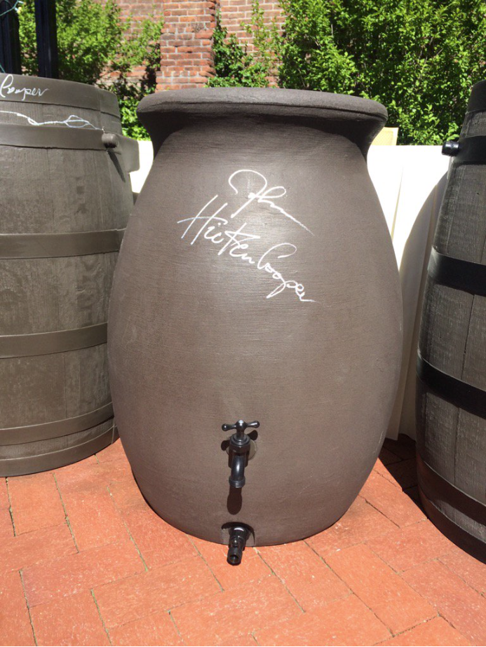
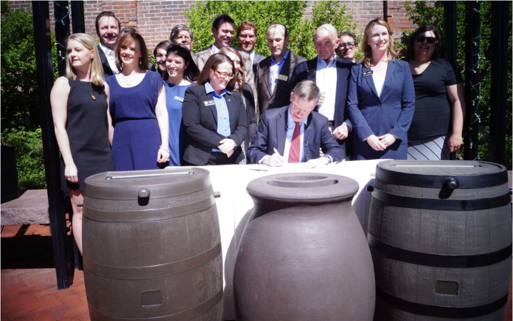
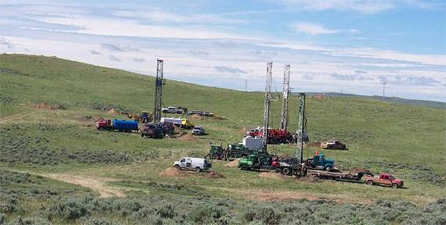


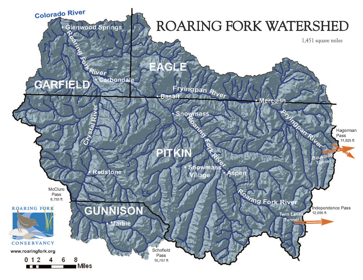
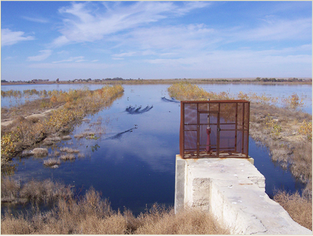


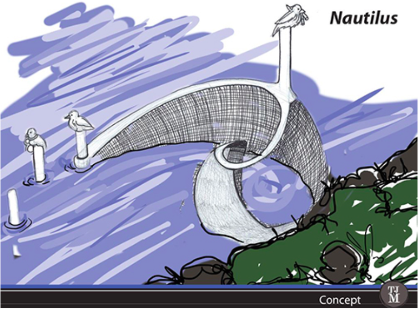

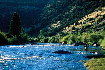
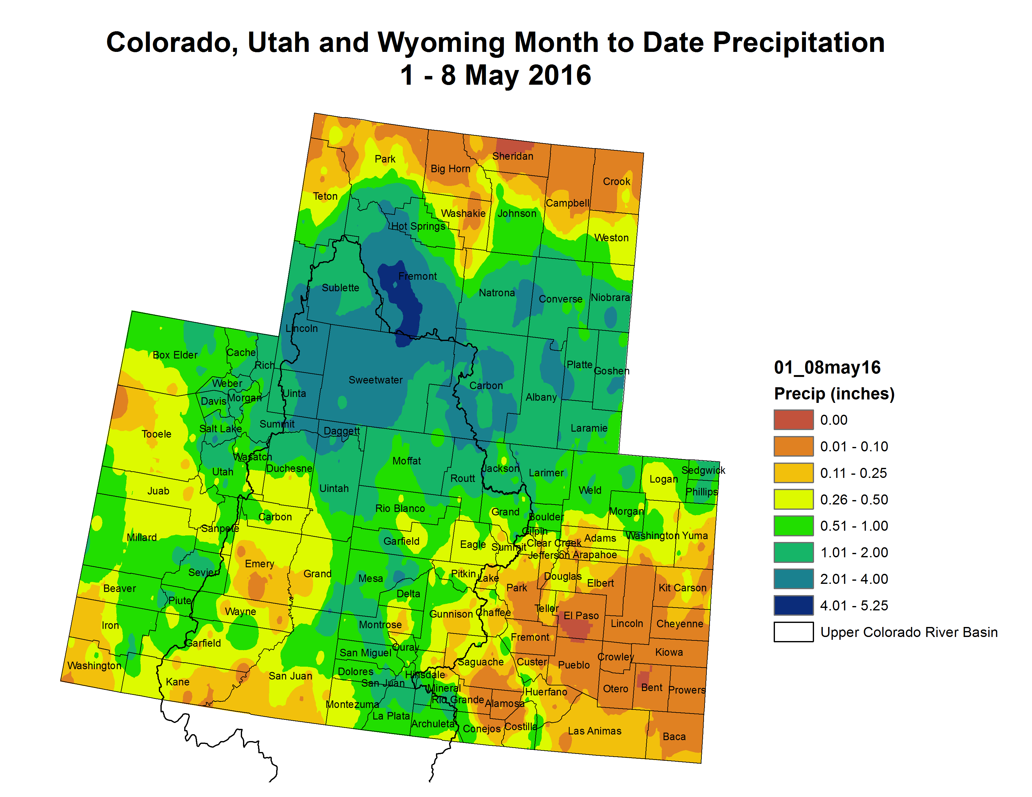


![Daily zonal (west-to-east) winds [meters/second] in the polar stratosphere at 10 hPa (about 31 kilometers altitude) and 60°N. The grey shading shows the range of natural variability from 1979-2016. The black dashed line shows the daily average. The red line shows the daily zonal winds for 2015-2016. Data is from NCEP-NCAR reanalysis.](https://coyotegulch.blog/wp-content/uploads/2016/05/fig5_avg_wind_polar_stratosphere_large.png)