FromThe Grand Junction Daily Sentinel (Dennis Webb):
City officials [assure residents and others that], while there’s no proposal to actually build the reservoirs at this time, it would be irresponsible not to continue seeking to preserve the water rights for what may be one of many approaches for meeting future needs.
“Despite the notion that the city is poised to dam Maroon Valley, in reality this filing is an action demanded by state law to protect our rights to your drinking water,” Mayor Steve Skadron wrote in a recent letter to the editor to the Aspen Daily News.
“Without knowing more about viable alternatives for water storage, it would not be prudent water management on our part to give up these water rights. After all, climate and other changes in this region are uncertain and what our needs will look like in 2066 is not something we are poised to gamble away by letting this storage right go.”
Acting on unanimous direction from City Council, the city last week applied to keep for another six years conditional water rights it has held since 1965. Its action has riled up not just local residents but conservation groups including the Carbondale-based Wilderness Workshop, American Rivers and Western Resource Advocates.
“I think if we need to find other places to get water, there’s probably other places to do that than the base of the Maroon Bells,” said Will Roush, Wilderness Workshop’s conservation director.
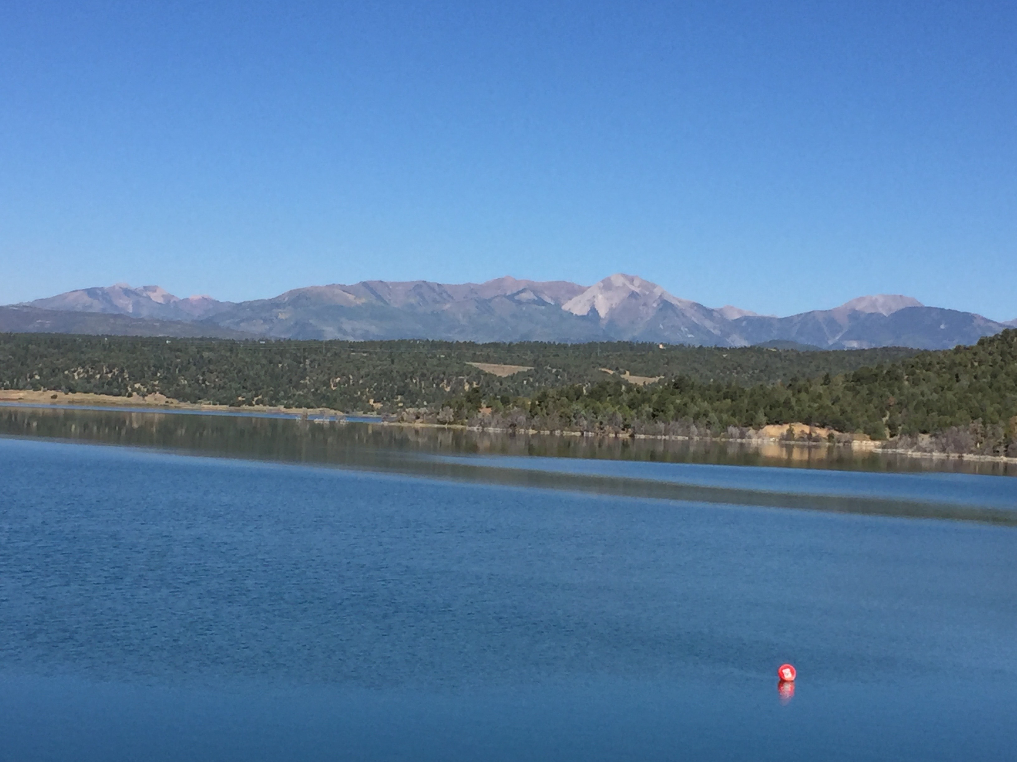
A view from where a dam would stand to form the potential Maroon Creek Reservoir. Photo via Brent Gardner-Smith @AspenJournalism.
The shapely Maroon Bells are two of the most famous of Colorado’s 50-plus Fourteeners, or peaks over 14,000 feet high. Endless photos depict the twin, red-rock, snow-fringed peaks presiding in the back of a green-forested valley, their images reflected by Maroon Lake in the foreground. So many people visit the lake for that view that vehicle access in summer is mostly restricted to buses.
Castle Creek is similarly stunning, providing access to another Fourteener, Castle Peak, as well as the ghost town of Ashcroft, the popular Conundrum Hot Springs and other attractions.
Beyond issues such as aesthetics, the Maroon Bells reservoir would lie largely within the Maroon Bells-Snowmass Wilderness Area, and a small part of the Castle Creek one would be in wilderness. That has attracted the interest of the U.S. Forest Service, which expects to file an opposition letter to Aspen’s filing in water court pointing out that it doesn’t have the authority to allow a reservoir in wilderness.
“Actually, the president of the United States does,” said Scott Fitzwilliams, supervisor of the White River National Forest.
He said he believes the president would have to approve such an action, or sign an act of Congress redrawing the wilderness area lines to exclude such a reservoir.
Fitzwilliams said he’s aware of situations where wilderness areas have been created with a specific exemption allowing for a reservoir. But this situation would be different. Roush said while it’s possible to petition a president for an exception for a new reservoir in an existing wilderness area, this provision of the Wilderness Act has never been used, and he fears that Aspen could set a damaging precedent.
David Hornbacher, Aspen’s director of utilities and environmental initiatives, said that when the city’s water rights moved forward in 1965, the acreage envisioned for the two reservoirs didn’t overlie wilderness. That changed in 1980 when the wilderness area was expanded. Regardless, the Wilderness Act provides a presidential path forward for building reservoirs in wilderness, he said.
That issue wouldn’t be the only one on the Forest Service’s mind if the city proceeded with trying to build the reservoirs.
“Certainly, flooding the Maroon Valley, we would have a host of issues that we would bring to their attention. It’s a pretty popular spot,” Fitzgerald said, chuckling at his understatement.
But while the Forest Service could hold the city responsible for mitigating effects such as flooding wetlands, it would have to let the city exercise its legal rights to store water, within reason, he said.
“There’s a limited amount of authority we can exercise when it comes to a water right,” he said.
The Maroon and Castle creek reservoir dams are envisioned as being 150 and 175 feet high, respectively, enough to swamp more than 200 acres between them.
Roush finds the city’s position on the water rights incongruous with its good record of environmental stewardship on climate change and other issues.
“Maintaining the right to put dams on these two creeks just seems a little bit out of sync with both the City Council itself but also the character of the community,” he said.
But Hornbacher said climate change is a big factor forcing the city’s hand.
“Aspen’s water supply is snow and that is changing,” he said.
The city largely relies on the snowpack-induced river flows from the two valleys now. But with a warmer climate, reflected by an average of 23 more frost-free days in Aspen today than in 1980, that snowpack’s future reliability is in question.
“Essentially what water you do have tends to be melting or leaving the valley earlier (each year) than it has in the past,” he said.
Reservoir storage would not only bolster water supplies each year, but prove valuable in cases of back-to-back drought years.
While the city has had success in implementing water conservation measures, it also is looking to more demand as a result of a growing population, its transition from a winter resort to a more year-round one, and the possibility that second-home owners could use those homes more or convert them to their primary homes, Hornbacher said.
He said it’s important for the city to make decisions today to address the uncertainties and risks of providing a safe, secure and legal water supply in the future.
Conservationists contend the city’s own water supply study this year shows the reservoirs wouldn’t be necessary. Harrison doesn’t think the city’s population ever will grow enough to warrant their construction. She’s unnerved by the due-diligence language in the city’s water rights filing that it “can and will” build the dams. That makes her think the city is leaning toward building them.
“If that’s the case it’s like, are you kidding me?” Harrison said. “There are a lot of people that are outraged.”
Hornbacher hopes that with interest in the issue being high right now, the public can be enlisted to get involved in working with the city on evaluating existing water-supply alternatives and identifying new ones. Council directed city staff to initiate such a collaborative process when it decided to have the city proceed with filing to keep the water rights.
Among the options for consideration are rethinking the size and location of the envisioned reservoirs within the two valleys, as well as how water rights might be affected if the city looked to build them in another valley.
Roush said the Wilderness Workshop would love to work with the city on studying storage, and whether it could be accomplished in other ways, such as in tanks, underground aquifers or through water-sharing with other entities.
“There’s certainly a role for stored water but in places like (Maroon and Castle creeks), they’re certainly inappropriate,” he said of the reservoirs.
The next president could be faced with ordering a first-ever reduction in water siphoned from the river by 333,000 acre feet next August, a report by the Colorado River Future Project contends. That’s an amount equivalent to the water used in 666,0000 homes.
U.S. Bureau of Reclamation officials on Tuesday confirmed the finding. Federal models show a 48 percent chance that, without cuts, lower basin states Arizona, California and Nevada would face shortages starting in 2018.
Anne Castle, President Obama’s former Interior Department Assistant Secretary for Water and Science and now a senior fellow at CU’s Getches-Wilkinson Center for Natural Resources, Energy and the Environment, led a team of five researchers. They interviewed 65 western water policy experts and decision-makers in addition to analyzing federal data.
“This really is a critical time. Action is required. We’re closer to the edge than we ever have been,” Castle said.
The report concludes the next president must prioritize a Colorado River “crisis” within the first 100 days and ensure that key positions dealing with water are filled. A convergence of events related to the river includes an essential not-done deal with Mexico, which has claims on a share of river water, and unresolved claims by Navajo and other Indian tribes.
An imbalance in water use along the river — cities and farmers for a decade have been taking more than the river gives — means future development in the arid West may not be possible because there’s not enough water, Castle said.
“It depends on how you do it. The major municipal suppliers have shown they can reduce per-capita water usage so they can serve more homes with the same amount of water,” she said. “But increasing the draw on the Colorado increases the risk of shortages for every other water user in the Colorado River Basin.”
The CU team sent the report to presidential transition teams for candidates Hillary Clinton and Donald Trump. Clinton officials said they’d like to discuss the findings, but the Trump team has yet to respond…
For a decade, cities and food growers who irrigate 5 million acres have drawn far more than the river gives. This imbalance, combined with recent dry years, has led to a draw-down of Lake Mead, created by Hoover Dam, to record low levels. On Tuesday, federal officials said the water level measured 1,076 feet (9.5 million acre feet), or 37 percent of capacity — right at the threshold for ordering cuts. A draw-down of Lake Mead forces, under legal agreements, a draw-down of Lake Powell, above the Grand Canyon, which imperils hydro-electricity essential for the western power grid.
Drawing down Mead water levels below that threshold triggers, under 2007 legal guidelines for western states, federal intervention to order cuts. The initial cuts starting in January 2018 would reduce water diverted to Arizona (by 320,000 AF out of the state’s 2.8 MAF share) and Nevada (13,000 AF out of the state’s 300,000 AF share).
Federal officials who operate dams along the Colorado River said they agree with the Colorado River Future Project’s conclusions…
“Obviously, the next administration will set its own priorities. However, we agree that follow-through on the activities identified in the Colorado River Future Project Report should be prioritized,” Bureau of Reclamation spokesman Peter Soeth said.
Obama administration officials “have prioritized science-based decision making on the Colorado River, and we are working to reach agreements within the U.S. and with Mexico to address the effects of historic drought and a rapidly changing climate,” Bureau of Reclamation Commissioner Estevan Lopez said. [ed. emphasis mine] “Our efforts to work with stakeholders, tribes, states and our neighbors in Mexico are all designed to reduce risk in the Colorado River Basin — and will provide a foundation for continued engagement and progress on the Colorado River in the months and years ahead.”
[…]
Federal officials would order and enforce the cuts in water use.
“The goal is not necessarily a far more aggressive federal oversight role,” Castle said.
“But what we are noticing is that a confluence of events in the next 12 months will have a big influence on the ability of that river to continue to provide a reliable supply for the river basin that has grown up relying on it.”
Here’s the release from Colorado State University (Coleman Cornelius):
The seed herd of 10 American bison released one year ago on northern Colorado public lands has expanded to 16 healthy animals, and the project has contributed valuable heirloom genetics to two other bison conservation efforts – with more growth ahead.
The Laramie Foothills Bison Conservation Herd galloped onto 1,000 acres at Soapstone Prairie Natural Area and Red Mountain Open Space on Nov. 1, 2015.
Since then, the project that began as a simple concept – returning an iconic species to its native landscape – is producing profound conservation and cultural rewards, both in northern Colorado and across the country.
“To see such a tremendous animal, an American icon, have its hooves touch the ground in this area again, is just beautiful,” said Ty Smith, director of the Colorado State University Native American Cultural Center.
Project partners celebrated the herd’s significance, discussed highlights from the past year, and described plans for the years ahead during a gathering in Fort Collins on Nov. 1 to kick off Native American Heritage Month.
The Laramie Foothills Bison Conservation Herd, a genetically pure, Brucella abortus-free bison herd is released in the City of Fort Collins Soapstone Prairie Natural Area and Larimer County Red Mountain Open Space, November 1, 2015, National Bison Day.
The Laramie Foothills Bison Conservation Herd is unique for representing the wellspring of heritage genetics found in and around Yellowstone National Park. With help from a scientific workaround, collectively known as assisted reproductive technologies, the herd is free from brucellosis, a worrisome infectious disease that plagues bison in the Greater Yellowstone Area and typically prevents the animals and their diverse genetics from moving beyond those geographic confines.
“I have a great amount of pride for everything we’ve accomplished as a team,” said Jennifer Barfield, a reproductive physiologist with the CSU Animal Reproduction and Biotechnology Laboratory. “This is exactly what we wanted to happen, and hopefully it will continue on a larger scale.”
Bison reintroduction was conceived during planning for public lands managed by the City of Fort Collins and Larimer County about 25 miles north of Fort Collins. The U.S. Department of Agriculture joined the effort to rehome Yellowstone bison held in quarantine on CSU’s Foothills Campus.
Barfield and her laboratory team, representing the fourth core partner agency, joined the project to contribute reproductive techniques that could propagate original bison genetics without disease. These include cleansing infected sperm cells and embryos in the laboratory, followed by in vitro fertilization or embryo transfer to produce healthy bison calves born naturally on the prairie.
A home where the bison roam
To the delight of collaborators, the bison have adapted well to their home at Soapstone Prairie Natural Area and Red Mountain Open Space – proved when six fuzzy bison calves were born unassisted under the prairie stars last spring and early summer. The newborns, three males and three females, arrived just as the American bison was declared national mammal of the United States in May 2015.
The Laramie Foothill Bison Conservation Herd at Soapstone Prarie Open Space. May 10, 2016
“The success of the calves, that was really a milestone that was fantastic to see,” said Daylan Figgs, senior environmental planner for City of Fort Collins Natural Areas.
“On the surface, this was a very simple idea,” continued Figgs, who helped develop plans for bison reintroduction in northern Colorado. “What has transpired, and what has become the strength of this project, is the partnership that came together for the conservation of a species, for the prairie ecology, and for research.”
It has been rewarding to see bison regain a foothold after an absence of 150 years, said Meegan Flenniken, resource program manager for the Larimer County Department of Natural Resources.
“It’s becoming a proven project,” said Flenniken, another originator. “We really feel a sense of pride to see that happen.”
Milestones during the first year
Partners in the Laramie Foothills Bison Conservation Herd have marked several key steps during the past year:
Six calves were born in the bison pasture at Soapstone Prairie Natural Area and Red Mountain Open Space.
Disease-free bison embryos with complete Yellowstone genetics were transferred into a total of 10 surrogate mothers in bison conservation projects overseen by the Minnesota Zoo and the Wildlife Conservation Society’s Bronx Zoo.
Embryos likewise were transferred into 10 bison cows overseen by the USDA’s Animal and Plant Health Inspection Service on the CSU Foothills Campus.
A disease-free bison bull, originally from Yellowstone and held in quarantine by USDA-APHIS Veterinary Services, joined the northern Colorado herd in spring 2016 to father as many as eight calves, whose birth is expected in spring 2017. The bull will likely move on to a conservation herd at Midewin National Tallgrass Prairie in Illinois.
Bison conservationists with the American Prairie Reserve in Bozeman, Mont., are expected to visit this fall to discuss potential collaborations.
A research project involving CSU’s Warner College of Natural Resources and Denver Zoo is assessing ecological and cultural impacts of the Laramie Foothills Bison Conservation Herd.
“It’s a dream in progress,” Matt McCollum, a wildlife biologist with USDA-APHIS Veterinary Services, said of the bison project. “We’ve been working on this for years, and this is the first year we’ve had hooves on the ground, so it’s very cool.”
Help the herd!
The Laramie Foothills Bison Conservation Herd is funded by partner agencies and private giving. Contributions help pay for fencing, animal-handling facilities, supplies, veterinary are, and laboratory staff. To donate, visit our Giving website.
The sight of a drilling rig on an Air Force base may seem unusual. The work to drill 17 wells is part of an effort at Peterson to understand how use of a firefighting foam with perfluorinated chemicals may have seeped into the groundwater…
A preliminary assessment on base identified six specific points — former training sites, fire department sites, and hangers — where fire fighting foam with PFCs could have entered the environment. Now the military is investigating each of those sites in depth, with a full report expected in mid 2017.
The firefighting foam in question is known as A-FFF: Aqueous Film Forming Foam. The Air Force began to use it in the 1970s to put out fires from lots of gasoline or jet fuel.
At a news conference, the Air Force confirmed details of one practice that could have had an impact to nearby groundwater. Col. Douglas Schiess said the base released PFC laden water about three times a year into the Colorado Springs sewer system. Those releases happened from a fire training system from 1990 to August of 2016.
“The last time that we discharged water into the sewer system was early August,” he said.
Col. Schiess said soon after that release, the Air Force tested water in its system for PFCs and found high concentrations. The decision was made to no longer “discharge [the water] into the sanitation system.”
The practice spanned 26 years. Schiess clarified that reports of a more recent discharge of 150,000 gallons in October were made in error by the Air Force.
Peterson isn’t the only base grappling with these issues.
Deputy Assistant Secretary of the Air Force for Environment, Safety and Infrastructure Mark Correll called the PFC contamination issue “a really big deal.” He said there are investigations at 183 sites across the country. The inspections alone are estimated to cost $250 million, with another $2 billion needed for cleanup.
Meantime, the Air Force has already started phasing out the PFC-laden firefighting foam at Peterson with something more environmentally friendly. The move — expected to take 14 months, Correll said — will eventually happen across all Air Force installations.
Eagle Park Reservoir is an off-channel reservoir located on property formerly owned by the Climax Molybdenum Company (Climax) at the Climax Mine in the upper Eagle River Basin, which was originally used to store mine tailings. As part of the mine reclamation process, Climax removed tailings deposits from the reservoir and converted the facility to a fresh water storage reservoir. In 1998, Eagle Park Reservoir Company (EPRC) purchased the reservoir from Climax and began using it for municipal, industrial, irrigation, and environmental water supply purposes. Photo via Leonard Rice Engineers.
From email from the Colorado Water Conservation Board (Ben Wade):
The next Water Availability Task Force meeting will be held on Tuesday, November 15, 2016 from 1-2:45pm at the Colorado Parks & Wildlife Headquarters, 6060 Broadway, Denver in the Red Fox Room.
An agenda will be posted at the CWCB website. In the event you are unable to attend the meeting in person, please email Ben Wade for call in & web conference information.
In honor of this year’s National Parks Service centennial anniversary, EcoFlight took to the air for four days in late October for combined flights connecting Aspen to Arches and Canyonlands, to the Grand Canyon and finally to Mesa Verde National Park, not to mention the thousands of miles of landscape in between.
EcoFlight, a nonprofit based out of Aspen, takes annual trips with eight college students in six-seat planes to get an aerial perspective on wildland environmental issues. The organization’s president, Bruce Gordon, took similar flights with John Denver, and they had an idea for a trip starting in Alaska, picking up celebrity-pilots along the way and arriving in Washington, D.C. for Earth Day in 2000.
After Denver passed away, Gordon wanted to pursue their shared dream and founded EcoFlight in 2002. Gordon recognized the need to share the first-hand perspective on threats to the environment with the next generation, and began the annual Flight Across America (FLAA) program. This year, eight college students crammed into small planes for a four-day whirlwind tour touching several of the national parks in the west.
“These students have a voice,” Gordon says, sitting with the students in John Denver Sanctuary in Aspen before takeoff. “I want them to see for themselves, and then tell others.”
The participants arrive from near and far, with backgrounds as different as their colleges. Included in the group is an anthropology major from Texas, a Colorado State University freshman in wildlife and conservation biology and a sustainability studies student at Colorado Mountain College in the Roaring Fork Valley. Each student brings their experiences and knowledge from a variety of study areas.
Many Indian reservations are located in or near contentious river basins where demand for water outstrips supply. Map courtesy of the Bureau of Reclamation.
Emilie Frojen, a senior at Colorado College, is writing her thesis about tribal water rights.
“I know a lot about water rights but I want to extend my knowledge into that of public lands and the intersection,” she said, explaining why she wanted to join the FLAA program, adding that she is interested in the social construction of wilderness.
Seeing the connection
Just after departing from Aspen, the students’ headsets crackle to life as Gordon speaks to the three single-engine Cessna 210 Centurion planes flying in formation. Gordon points out geological features and human impacts to the region. Heading toward Moab, Utah, the flight path takes students over mines and natural gas platforms, as well as the mostly roadless Thompson Divide area, the Colorado National Monument and sprawling rock formations in the wilderness.
“We were flying at about 7,000 feet and you can see how it is all connected from the air,” says Caleb Henderson, from University of Texas.
“You can see an obvious line across the land,” adds Cole Rosenbaum, a master’s student studying geological engineering at the Colorado School of Mines, speaking of the infrastructure that connects well pads to roads and pipelines.
The aerial perspective isn’t everything though, and the program includes ample time spent on the ground in key places discussing the issues with experts representing various perspectives.
“It’s important for the students to experience the parks as well,” according to Jane Parigter, EcoFlight’s vice president. Once on the ground in Moab, the students head to Arches National Park. Sitting beneath the iconic Double Arch they listen to Matt Gross, with Southern Utah Wilderness Alliance, and discuss the proposal for the Bears Ears National Monument, which if designated would protect 1.9 million acres in southeastern Utah that include ancient cave dwellings and sites sacred to Native Americans
The conversation about policy and land management is followed by a more personal connection to the issues the next morning as the planes touch down in Monument Valley on the Utah-Arizona border. The students sit down with members of the Navajo Nation and Bears Ears Inter-Tribal Coalition, discussing what the land means as more than just wilderness.
“We are trying to preserve the land, but also the songs and the stories,” says Jonah Yellowman, a spiritual adviser from the Many Arrows Bitterwater Clan, as he addresses the students telling tribal creation stories and how the land is connected to him. There have been desecrations of sacred cultural places, he added, and the monument designation would help protect them.
“Is it challenging to communicate with people not from this heritage, working with policy makers while you write the proposal?” asks Frojen, the Colorado College senior studying tribal water rights.
“It is hard to translate why this is sacred,” he admits.
This is a theme that is reiterated again that afternoon at Grand Canyon National Park, as locals depict the proposed Escalade development and how it affects their physical and spiritual world. The project would include hotels above the canyon rim and a tram to the Little Colorado River just upstream from its confluence with the Colorado, the place where, according to Navajo tradition, the tribe emerged into the world.
“In Navajo people don’t need to know why something is sacred, it just is. So I am a translator,” says Jason Nex, with Save the Confluence. “I translate from Navajo to English, from science to Navajo.”
Sitting on the edge of the South Rim, one speaker after another presents a variety of stories about the Grand Canyon, from overcrowding and underfunding to diversity and its inclusion in the national parks system.
“EcoFlight takes a very objective approach, presenting us with different information,” says Rosenbaum, from Mines. “At school we are well trained in the technology and the math, but there has been a push to take a more humanitarian approach.”
Mining for impact
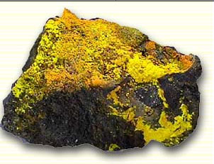
“I am here to get you inspired to save the Grand Canyon, and to not want to drink Uranium water,” says Sarah Ponticello, from the Sierra Club. “Sign the petition to really show your support to get this permanently protected.”
Julianne Nikirk, a student at Colorado State University, was surprised to learn that uranium mining is set to commence on the canyon’s doorstep.
“You just kind of assume it is protected,” she says of the Grand Canyon, as they arrive at Canyon Mine, located near the Grand Canyon’s South Rim. The Canyon Mine is not yet operational, but workers have drilled a shaft over 1,400 feet deep and mining could begin for high-grade uranium in six to eight months.
Donn Pillmore, director of operations for Energy Fuels, which operates the mine, offers a counter point, reminding the students that the U.S. is the world’s largest consumer of uranium.
“And we import 96 percent, from places that are not operating under the same environmental regulations as we are. Not even close,” he says.
Pointing out that 20 percent of all U.S. power comes from nuclear plants, Pillmore adds that when uranium comes out of the ground it is not considered a hazardous material by the Department of Transportation. Mitigation systems and measures to prevent contamination from reaching water, as well as reclamation efforts after mining finishes in as little as five years, will return the site to how it was before mining began, he says.
From the outside of the fence where Pillmore speaks to the students the site seems meager, but as the planes wing over it on their departure from the Grand Canyon they see the large swath of land it includes. As the planes cross over the Four Corners area and into Colorado the ground below becomes a maze-like network of oil and gas operations, just a few miles from Mesa Verde National Park.
Back on land in Durango, another series of experts discuss threats to the national parks, how different land management strategies affect wilderness and how to diversify park users and activists. One speaker reminds them on their next flight to think about how the landscape looks now, but also how current policy on wilderness areas will shape it in the future.
As the whirlwind tour comes to an end the students talk about how the different stops affected both them personally and the world around them. Each participant will head home with a bevy of information to digest and a plan to share their stories with their peers and others.
The participants’ first opportunity comes on the last day of the trip at Durango High School, where they coalesce three days of discussions, debates, viewpoints and seminars into a slideshow. They implore the high schoolers to care, get involved and vote, once they can.
“We take local people up to look at their local communities, with the idea being to educate and advocate,” Gordon explains to the high schoolers. “We want to inspire people to speak out.”
Lauren Fry, from Colorado State University, is committed to spread the word when she returns to Fort Collins.
“I want to really focus on outreach on campus, and not many know about Bears Ears,” she said. “Through campus radio, the local TV station and our student newspaper, I want to call attention to the issue and guide people to the petition to protect Bears Ears.”
That sentiment sounds good to Pargiter, EcoFlight’s vice president.
“We want to empower them to have a voice and get them to reach out to their peers,” she said. “This is their generation that is going to be doing a lot of the work.”
FromThe Glenwood Springs Post Independent (John Stroud):
Roland “Rolly” Fischer, the longtime head of the Glenwood Springs-based Colorado River District who guided the organization through a period of intense and often contentious change, has died.
Fischer, a petroleum engineer who came to western Colorado in the 1950s ahead of the eventual oil shale boom and bust, was secretary-engineer and general manager for what was then known as the Colorado River Water Conservation District from 1968 until 1996.
A sometimes controversial figure, Fischer remained a fixture in Glenwood Springs along with his wife, Tillie, after his retirement. He died Friday morning at the age of 88, according to family and friends.
“The entire River District is saddened by the news, and our thoughts and prayers go out to the family,” River District spokesman Chris Treese said.
“Rolly certainly deserves the credit for what the River District is today,” said Treese, who went to work for Fischer in 1991. “He was a visionary, and as manager he hired a lot of the people who make the River District the success it is today.
“First and foremost, he looked out for western Colorado and only did what he thought was best for its water interests,” Treese said. “He was willing to be the lightning rod in doing that.”
Outside of work, wife Tillie said he was the consummate family man. She accompanied him to western Colorado in 1955 when he went to work for Union Oil Co. of California to secure a water source for oil shale development.
“He was happiest when our children, George and Katie, or myself had some success,” she said. “He never wanted the success for himself, but was so happy when we did anything that made him proud.
“In the water industry, the verbal word of Rolly Fischer and a handshake were more binding than any one-inch-thick legal document,” she added.
Writer George Sibley, in a summary written for the Post Independent of his 2012 book Water Wranglers, described Fischer as a “visible, creative and often controversial leader for the West Slope’s traditional water users through his 28-year tenure.
“One of the district’s best achievements in that time was a truce with Denver, resulting in construction of the Wolford Mountain Reservoir near Kremmling using Denver money for joint East and West Slope storage.
“But Fischer’s greatest achievement may also be organizational, turning the River District from a nearly invisible two-person operation into an effective organization employing around 20 highly skilled people by the time he left,” Sibley wrote.
David Merritt, whom Fischer hired to oversee the Wolford Mountain project, said Fischer was responsible for the River District’s transition in the 1980s away from larger-scale water projects to operating existing projects and building more local projects.
“He saw the organization through that difficult time, and built up the staffing to support that,” Merritt said. “He could be irascible, and we could have our disagreements on things, but if I could convince him on something he would support me.
“As a boss, mentor and friend, I considered him par none,” Merritt said.
More recently, Fischer became embroiled in a 2010 finger-pointing controversy when former Congressman and then-gubernatorial candidate Scott McInnis, now a Mesa County commissioner, was accused of plagiarizing parts of water articles he was commissioned to write, and for which he had hired Fischer to gather research.
FromThe Grand Junction Daily Sentinel (Gary Harmon):
Roland “Rollie” Fischer, for 28 years the head of the Colorado River Water Conservation District, died Thursday night.
“Everyone at the River District is saddened by today’s news,” spokesman Chris Treese said. “Rollie was the River District for many years. The River District today and western Colorado’s water is Rollie’s legacy.”
Effective immediately, Colorado Parks and Wildlife is instituting a voluntary fishing closure at a popular area on the Frying Pan River located downstream from the Ruedi Reservoir Dam. Water that normally flows from the dam and into the pool, known locally as the ‘toilet-bowl’, has been re-routed due to the need for dam maintenance. The conditions have left the fish in the pool isolated, vulnerable, and stressed.
Maintenance of the dam – owned and operated by the Bureau of Reclamation – could continue through Nov. 10; however, dam operators say it could take longer if additional work is necessary.
“We’ve received several reports from concerned anglers that fish in the pool are stressed due to the current lack of water flow coming into the pool,” said CPW Senior Aquatic Biologist Lori Martin. “Due to these conditions, it’s just not very sporting to catch these fish right now. Releasing stressed fish that have been handled could result in them not surviving.”
Anglers can expect to see signage advising of the closure and are urged to find alternative fishing locations until conditions improve.
Although the closure is voluntary, CPW officials say a more stringent emergency closure enforceable by law is an option if angler compliance is minimal.
For more information about the voluntary fishing closure, contact Colorado Parks and Wildlife’s Glenwood Springs office at 970-947-2920.
For more information about work on the dam and dam operations, contact Tim Miller of the Bureau of Reclamation at 970-962-4394.
Map of the Roaring Fork River watershed via the Roaring Fork Conservancy
Yampa River Canyon. Photo credit John Fielder via Westword.
The Yampa River flows through the Carpenter Ranch. Photo courtesy of John Fielder from his new book, “Colorado’s Yampa River: Free Flowing & Wild from the Flat Tops to the Green.” — via The Mountain Town News
Browns Canyon — John Fielder photo via BrownsCanyon.org
Here’s an interview with John Fielder from John Wenzel and The Denver Post. Click through and read the whole thing. Here’s an excerpt:
John Fielder has long been known as Colorado’s premier wildlife photographer, his brand name as sturdy and well-defined as the stunning landscapes the 66-year-old has documented for more than four decades.
But as is often the case with people who devote their lives to their natural environment, Fielder is as much an activist as an artist and salesman, penning a 2015 Denver Post op-ed against fracking and, lately, threatening to sue the Denver Water Board for one of its Colorado River Water projects.
We talked to Fielder, the author of more than 40 books, in advance of his latest slideshow-talks (and book-sale events) across Colorado, including in Centennial and Denver (Nov. 5), Summit County (Nov. 9), Green Valley Ranch (Nov. 10), Golden (Nov. 11) and Colorado Springs (Nov. 12). Most events are free. View the full schedule, including times and addresses, at http://johnfielder.com.
Click here to order one of his books to support his work and to support water.
Chatfield was built for flood control by the U.S. Army Corps of Engineers, after the 1965 South Platte River flood. During drought, Chatfield water can be pumped to our Marston treatment plant to supplement drinking water supplies. Only water from Denver Water is currently stored behind the dam, even though the dam is federally owned. Colorado State Parks leases the land and oversees park operations.
Chatfield is used for water exchanges to trade downstream users with rights to the water, which allows Denver Water to keep water in the mountain locations of our reservoir system.
Chatfield provides recreational benefits beyond the obvious. In addition to preserving levels for recreation, we use the reservoir to capture water released from Strontia Springs Reservoir. These flows keep the river at optimum levels to support Waterton Canyon’s trout fishery.
Chatfield is about to take on even more responsibility. The Chatfield Storage Reallocation Project will increase water levels by about 12 feet. But this won’t be Denver’s water. Instead, it will help meet demands for growing Front Range communities and downstream farmers. Denver Water will still maintain its original storage pool in the reservoir. The Chatfield Reservoir Mitigation Company also is working with state agencies to develop a plan for a storage “pool” within the reservoir for the environment.
Measuring 71 miles from canyon to plains and touted one of the nation’s longest linear parks, the 130-year-old High Line Canal is evolving with Denver. Planning for its future is underway.
You’ll find the High Line Canal’s first headgate just north of Waterton Canyon’s rocky mouth, at a diversion dam on the South Platte River. That dam’s been closed for repairs, though, since the original structure was wiped out in a flood in 2013. Construction on the dam should wrap up next month — too late for this year’s run.
Denver Water owns the High Line, and contracts with seven parks and recreation agencies from Douglas County to Aurora to maintain the canal’s bordering trails and greenways. “Other than where the diversion dam broke, High Line is 100 percent functional,” says , says Tom Roode, Denver Water chief of operations and maintenance.
Despite rumors to the contrary, Denver Water intends to continue running its canal, sending irrigation water to 70 or so active contract holders situated between Waterton Canyon and Fairmount Cemetery, located at about mile 48 on the 71-mile High Line Canal Trail.
Canal users range from wildlife refuges and golf courses to private citizens filling small ponds on their private property. “Current customers,” Roode says, “will always have a water supply, no matter what the future beholds for the canal.”
Running the canal is simple: Denver Water puts water in at the canal’s headgate, and the High Line takes care of the rest. Named for the engineering principle on which it was designed, Denver’s High Line — like others in the state — follows the natural contours of the terrain, dropping a couple of feet each mile, transporting water with gravity, as opposed to a pump or electricity. “Picture a marble rolling down a smooth path really, really slowly,” says Roode.
In good water years, when it has the rights to do so, Denver Water runs its canal two or three times — in the spring and fall, and the summer, perhaps — transporting 120 to 150 cubic feet of water per second, or roughly half the quantity of water it delivered in its heyday, when the canal had 140 headgates and twice as many customers.
Historical interpretations
The English Canal Company — through one of its subsidiaries, Northern Colorado Irrigation Co. — began working on the High Line in 1879, after striking a deal with Kansas Pacific Railway to purchase up to 400,000 acres of excess railroad-grant lands for $1.25 to $2 per acre in exchange for the construction of a canal that would convey water for irrigation.
“Railroads couldn’t sell arid land in the middle of nowhere,” explains Barbara Stocklin-Steely, founder of Denver-based Square Moon Consultants, a historic preservation and planning consulting firm. “The railroad company came up with the idea of building a canal, and selling water rights at the same time it sold land.”
Prominent Colorado engineer Edwin S. Nettleton was brought on for planning, and the canal was built between 1879 and 1883, during Denver’s original gold boom. It was an overly ambitious project from the get-go. The canal was designed to irrigate 120,000 acres. That number, explains a spokesperson for Denver Water, was pared down to 80,000 acres, then 40,000 acres; only 20,000 acres are actually under cultivation.
“The High Line was a major water system when it was first created, but even then it wasn’t very profitable because it’s a leaky little canal,” says Harriet Crittenden LaMair, executive director for the High Line Canal Conservancy.
What’s more, Northern Colorado Irrigation Company was late filing for water rights; by 1879, 87 holders were already senior to the High Line. “The canal has always struggled as a good, solid water source,” explains Roode, noting that it often went empty during dry periods. Located about 100 miles southwest of Denver near Hartsel, Antero Reservoir was built to supplement the High Line’s supply, and still operates today, except in “really tough drought years,” says Roode, pointing to 2002 and 2012.
The High Line changed hands a couple of times, until Denver Water purchased it — along with Antero Reservoir — from the city in 1924. The leaky canal delivered water to many of its original contract holders for the next six decades, until customers gradually began coming off of the canal in the 1980s.
“We’ve always known the canal is an inefficient way to deliver water,” Roode says, noting that 60 to 80 percent of water put into the canal is lost to seepage and evaporation. “Now,” LaMair adds, “there are better, more sustainable and economically feasible ways to bring water to customers. For example, the Rocky Mountain Arsenal, once a major canal customer, converted to a recycled water system in 2003.
“The canal’s original purpose has changed,” Roode says. To that end, the High Line Canal Conservancy and Denver Water have undergone a comprehensive planning project to identify new long-term uses for the space.
From irrigation to recreation
As far as LaMair is concerned, “Recreational use has surpassed functional use” for the canal. Spanning 11 governmental jurisdictions (including Denver, Aurora, Greenwood Village and Highlands Ranch), winding through residential neighborhoods, public parks, golf courses and industrial spaces, the High Line’s abutting shaded path is one of the longest continuous urban trails in the country. Over 350,000 residents live within a mile of it, and, according to data reviewed by the Conservancy, more than 500,000 people use the canal path annually, for walking and hiking, biking, horseback riding and picnicking.
That path was a maintenance road that was closed to the public until the 1970s. A few years later, in 1978, the High Line Canal Trail was designated a National Recreation Trail by the U.S. Department of the Interior. “That was the beginning of the canal’s evolution into a higher purpose as a greenway,” LaMair says, adding that the trail “is more than a recreational amenity. It’s a wildlife habitat, a community connector and a mobility corridor.”
As the canal’s original purpose wanes, LaMair and her cohorts have come together through the High Line Canal Conservancy, to create a vision plan for future use. Formed in 2014 and comprised of 14 board members plus 50 advisors, the Conservancy’s members see a need for private investment in public spaces. “There aren’t enough taxes ever to do what everyone wants,” says LaMair. “Parks,” she adds, “Don’t get the funding other agencies do.”
While Denver Water will continue to manage the canal for the foreseeable future, it gave the Conservancy permission to create a vision plan for the High Line, and that plan began to materialize by way of a four-part series of Conservancy-sponsored open houses that kicked off in June.
Through October, the Conservancy hosted a dozen public gatherings, and engaged about 3,500 residents through meetings and online surveys. The idea, LaMair says, it to figure out what matters most to community members.
Visions for the future
Resident priorities, LaMair says, have been the Conservancy’s “guiding principles” when creating its vision plan. The public’s highest priority, LaMair begins, is keeping the canal natural. “From Douglas County to urbanized Denver, everyone wants a natural refuge,” she says.
Preservation is key in executing this element of the vision plan, and land acquisition isn’t out of the question, either. The canal corridor, LaMair explains, isn’t very wide. “Another goal,” she says, “is to preserve additional open spaces, and create pocket parks around the canal.”
Beyond preserving the canal’s natural landscape, there’s a desire to preserve its history, too. The Conservancy hired Stocklin-Steely’s Square Moon Consultants to do a reconnaissance survey, to identify the canal’s natural resources — infrastructures including dams, gates and flumes — and its historical resources, such as old farmhouses that once used the canal. Stocklin-Steely wrapped up her survey in September after examining 191 different properties along the canal; she says it’s “the first comprehensive look at canal history for its full 71 miles.”
“One big takeaway,” she says, “is that there’s a very small number of historic farmsteads left along the canal. There isn’t much in the way of historic interpretation along the trail.” Recommendations in a report issued to the Conversancy last week include a call for historic interpretation along the trail, in the form of digital apps and/or signs.
Beyond safeguarding nature and history, locals intend to protect neighborhood character, too. Hence, the vision plan outlines five distinct character zones along the canal, and requests a “varied” trail. “The public wants the trail to have its own unique elements in all of the different communities,” LaMair explains.
Her penultimate draft calls, too, for enhanced connectivity. There are 81 at-grade crossings on the canal’s trail, and some are “major challenges,” LaMair says, pointing to Santa Fe Drive in Douglas County.
Meanwhile, Denver, Cherry Hills Village and Arapahoe County have already begun to address one such crossing problem at the intersection of Hampden Avenue and Colorado Boulevard. Funding has been secured to reroute the trail underneath both busy roads next to Denver’s Wellshire Golf Course, and construction is expected to begin in 2017.
Degraded conditions have left some sections of the trail unusable; the Conservancy addresses physical repairs, along with connectivity, too, which has been an ongoing issue for recreational users who would like to see the High Line linked to other trail systems, as well as nearby retail and amenities.
Finally, there’s the question of what to do with the ditch itself. “It’s not overly efficient; it has a lot of issues,” says Stocklin-Steely. “But,” she adds, “I think that maintaining it as an earthen ditch with water flowing is really kind of spectacular.” It’s certainly hard to argue that a concrete-lined canal would have the same appeal for meandering visitors.
The Conservancy’s final vision element, then, explores ways to enhance the canal itself. “There’s a lot of concern over how vegetation will survive if Denver Water ever stops running the canal,” LaMair says. That’s prompted Denver Water to consider the canal for stormwater filtration, which could give the old, leaky waterway new life as a detention pond of sorts.
“We don’t know what the future holds,” Roode says, adding, “The first question we have to answer is what the vision for the canal will be.”
Every year, a few weeks before Halloween, the Uncompahgre River seems to blossom with slimy, bubbling growths in areas of the lowest flow. This substance is green algae, decaying and releasing bubbles that are often trapped by iron deposits. Though the algae appears more prominently and abundantly in this season, it’s actually present in the river – even in high flow areas – year round. This fall, the slime may be more noticeable due to more pronounced bubbles caused by the unusually warm temperatures.
While this algae is a typical condition of many river systems and streams, it suffocates macroinvertebrates. According to Uncompahgre Watershed Partnership board member and River Watch volunteer Dudley Case, River Watch experts explained that the zinc in the Uncompahgre River negatively effects both fish and macroinvertebrates, and the slime clogs up areas where they might nest and reproduce.
“Macroinvertebrates are a food source for fish, so the less macroinvertebrates, the less fish. Since the slime is so endemic in the river, reducing the slime safely would be a useful project,” said Case.
Observing and reporting on these types of water issues is one of the goals of the Uncompahgre Watershed Partnership (UWP) as we monitor watershed conditions and communicate with stakeholders. We are reviewing our Watershed Plan this winter so we can make updates related to project and study results from recent years. We hope you will contribute your observations and ideas about priorities to the review and update process. Please feel free to contact us anytime with your thoughts, and we will be back in touch with you to collect input in the coming months, too.
The EPA threatened to sue after it audited the city stormwater system in August 2015 – two months after Mayor John Suthers took office – and found no improvement since a dismal state audit in February 2013.
“We have not yet resolved the issues (with the EPA),” Suthers said in an interview Wednesday. “Our emphasis of course is looking forward: Let’s make things right. We think any kind of large fine would be unproductive. We feel we’ve done a really good job at addressing all the deficiencies.”
A new Stormwater Program Implementation Plan released Wednesday outlines how the division staff will more than double, from 28 to 66 full-time employees, all dedicated to stormwater, with 49 already on board.
The annual city budget for MS4 permit compliance climbs from about $3 million to about $7.1 million this year. That Municipal Separate Storm Sewer System permit allows the flow into interstate waters, from Fountain Creek into the Arkansas River to the Mississippi River and into the Gulf of Mexico.
The $7.1 million devoted to MS4 comes in addition to $9.2 million a year being spent on capital projects, plus $3 million from Colorado Springs Utilities, for a total of more than $19 million a year.
In order to protect water quality, strict enforcement will be launched at construction and industrial sites and with private developers who don’t comply.
In all, 71 projects will be completed over the next 20 years, with channel improvements consuming the most funds. In order to speed such improvements, though, the city might use outside contractors on capital projects until all additional staff members are on board.
Suthers had a message for the community. “We have to face the fact that Colorado Springs has underfunded its stormwater program for a number of years. And we have a lot of work to do.”
Unlike most every other city in America, he said, “We don’t have a dedicated fund for stormwater.”
The City Council could create a stormwater fund unilaterally if it chose to do so. But the mayor wants more information first, so members of public works, finance and the city attorney’s office are researching how other cities’ stormwater programs are structured…
But without a stormwater fund, how will the city pay its $16 million annual obligation?
“We’re going to get it from the general fund until we can get it from another fund. If the city falls short in any five-year period with the intergovernmental agreement (with Pueblo County), Utilities makes up the difference,” he said.
“I’m not worried about that. What I’m worried about rather is the consequences to the city if this doesn’t get funded. I would hope the average Joe would want the city of Colorado Springs to be compliant. The EPA does have jurisdiction over stormwater.”
This strong push to “make things right” comes after nearly a decade of essentially ignoring stormwater concerns. The recession started in 2008, and voters in 2009 backed Issue 300, which weakened city use of enterprise funds. The then-City Council promptly eliminated the city’s Stormwater Enterprise Fund, which levied fees based mostly on a property’s impervious surface area.
The loss of that $15 million to $16 million a year infuriated officials in Pueblo County, who threatened to withdraw the vital 1041 permit for the Southern Delivery System, an $825 million project that was 20 years in the making. Pueblo County, after all, was receiving heavy sedimentation in flows from Fountain Creek.
Suthers soon found himself surfing dual waves of stormy waters – negotiating with Pueblo County to save the delivery system, and conferring with the EPA on how best to meet requirements of the MS4 permit.
Months of frustrating negotiations with Pueblo County finally resulted in April in the 20-year agreement for the city to complete 71 capital projects, spending more than $460 million over 20 years.
The money will be spent in five-year increments, at a rate of $100 million the first five years followed by $110 million, $120 million and $130 million. Any developers’ projects or other efforts would be in addition to the promised amounts.
If the projects aren’t done in time, the accord will be extended five years. And if Colorado Springs can’t come up with the money required, the city-owned Utilities will have to do so.
But while negotiations with Pueblo County were tough, efforts to satisfy the EPA evidently have proven even more difficult. A decision from the federal agency is expected “relatively quickly,” Suthers said.
Whatever the EPA decides, Suthers long has insisted that the city’s stormwater shortcomings must be fixed.
“I mean this very sincerely,” he told The Gazette last April. “It’s the right thing to do. And it’s something we should do.”
The Paris climate agreement goes into effect today, legally requiring countries around the world to honor their pledges to cut carbon emissions. Those pledges, however, are not enough to stop climate change from reaching dangerous levels, according to a United Nations report. A separate study quantified the effect of an individual person’s carbon emissions on melting sea ice in the Arctic. In Cambodia, the government promised to investigate the sand mining industry after learning that a huge amount of illegal mining is likely taking place, putting rivers and fisheries at risk. Officials in the United States reported that the drought is over for parts of California, but many areas remain under extremely dry conditions.
“The Paris agreement sends a much-needed signal to politicians and industry that we have to build a new world, and this has to start now. However, the deal is not enough to keep people and the planet safe.” –Harjeet Singh, global lead on climate change for ActionAid, an international organization based in Johannesburg. The Paris agreement, a binding global pact to limit carbon emissions and slow global warming, goes into effect today. (Guardian)
A Pentagon team met leaders of Colorado communities whose water has been contaminated with a toxic chemical used to fight fuel fires — and a top official on Wednesday declared the Air Force will move aggressively nationwide, expecting to spend $250 million on studies and $2 billion for cleanup.
Meanwhile Environmental Protect Agency officials said the agency will back increased testing of groundwater in Colorado. Initial tests found the Fountain Creek watershed contaminated with the perfluorinated chemicals (PFCs) at levels exceeding a federal health limit nearly as far south as Pueblo. EPA officials also said they’ll consider developing regulations for PFCs, which have been linked by scientists to low birth weights, cancers of the kidneys and testicles, and other problems.
And military officials at Peterson Air Force Base, where contractors are drilling for 77 samples of soil and 24 samples of groundwater to try to find sources of PFC contamination, announced that their recent report of a 150,000-gallon spill into Colorado Springs sewers was erroneous. They said they now believe 20,000 gallons laced with PFCs flowed into a pond and evaporated.
Colorado residents in 25 homes south of the base whose municipal well water tested bad will receive reverse-osmosis water treatment systems, officials told utilities officials from Widefield, Fountain and Security. Military contractors have tested water in 68 homes so far.
In using Aqueous Film-Forming Foam (AFFF) containing PFCs to fight fuel fires at bases nationwide, the Air Force did not know PFCs could cause harm, said Mark Correll, deputy assistant secretary of the Air Force. While studies for decades have looked at these and other chemicals, Corell said none concluded AFFF shouldn’t be used. Correll rejected suggestions the Air Force was negligent…
The $250 million for studying contamination at bases nationwide and $2 billion for cleanups is in addition to a $900,000 research contract to the Colorado School of Mines to develop a system to destroy PFCs in water.
“This is a really big deal for the Air Force,” Correll said. “The business of the U.S. Air Force is to defend the people of this country. The last thing we want to do is put them at risk.”
A comparison of the Aral Sea in 1989 (left) and 2014 (right). Credit: NASA. Collage by Producercunningham. [Public domain], via Wikimedia Commons.
FromEarth & Space Science News (Amir AghaKouchak):
Imagine the Sahara Desert, but with grasslands, wetlands, eclectic wildlife, and an intricate ecosystem lushly nestled around a large freshwater lake the size of Germany. Around 6,000 years ago, Lake Mega-Chad was the largest freshwater lake on Earth. In just a few hundred years, it was reduced to a lake around a thousand times smaller, and what we know today as Lake Chad. This is an example of significant change in water availability in response to natural climate variability. In the Anthropocene era, however, natural variability is not the primary driver of the observed water stress and environmental degradation. They are human driven, or anthropogenic.
Since the beginning of industrialization, significant growth in population, agriculture, and industry have increased water use and challenged water and environmental management. In many parts of the world, human water use has exceeded available renewable water supply. Development and growth not only increases human water use, but also increases greenhouse gas emissions that, in the long run alter precipitation patterns. Droughts pose significant water and food security challenges, especially in semiarid and arid regions of the world. Droughts can be broadly categorized into four groups: meteorological droughts (deficit in precipitation), agricultural droughts (deficit in soil moisture), hydrologic droughts (deficit in runoff and/or groundwater resources), and socio-economic droughts (higher demand than the available supply). The latter is meant to account for the human impacts on droughts by describing the available resources relative to human water needs. However, a meaningful exploration of drought must go beyond supply issues to include water demands, adaptability, policy, and the two-way feedback of humans on both water supply and regional demands.
In a recent article, we call this anthropogenic drought, which is water stress caused or intensified by human activities, including increased demand, outdated water management, climate change from anthropogenic greenhouse gas emissions, growing energy and food production, intensive irrigation, diminished supplies, and land use change.
The environmental impacts of anthropogenic drought are seen around the world including in developed and developing countries. There are many stressed lakes and wetlands around the world affected by increasing water withdrawals and the resulting anthropogenic drought. For example, Lake Urmia, in northwest Iran, was once the second largest saltwater lake on Earth (figure below). We show in a commentary that over the past 40 years, the area of Lake Urmia has decreased by around 80%, most of the change occurring between 2009-2015. But this lake has survived many extreme droughts in the past. When extreme environmental conditions occur, questions often arise regarding the potential role of human-caused or natural climate change. Both are important and deserve our attention. But a question less often asked is, what is the impact of increased human water demand in creating water stress? In the past 15 years, around 20 man-made dams started operation in Lake Urmia’s basin, diverting the lake’s freshwater inflow to irrigation and farming. Lake Urmia is a hypersaline lake, and its desiccation will increase the frequency of salt storms generated from the exposed lakebed. In turn, salt storms will likely reduce productivity of the surrounding agricultural lands, causing migration out of the region. Poor air, land, and water quality all have serious health effects including birth defects, and chronic respiratory and eye diseases. This is a classic case of anthropogenic drought and human-induced changes leading to substantial environmental degradation.
The first victim of anthropogenic droughts is the natural ecosystem, evidenced by the widespread environmental degradation we see around the world. Extensive research is necessary to develop comprehensive frameworks for assessing anthropogenic drought impacts on the natural ecosystem and wildlife. This is critical if we want to sustain both economic prosperity and productive native ecosystems. A breakthrough in this area will not be possible without close collaboration of policy-makers and an interdisciplinary team of scientists.
Solar-powered water systems let livestock drink more easily and take pressure off ponds and streams
[Vance Fulton], an engineering technician with the Natural Resources Conservation Service, described the way solar energy provides an effective way for landowners to transport water to their livestock.
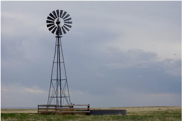
“Especially around here, (landowners) have found that solar is a much more efficient way to pump water than the old windmills,” Fulton said.
And now, with the birth of the Sage Grouse Initiative, the solar-powered systems are receiving increasing amounts of federal support. Fulton said the systems have received funding through the Farm Bill for decades — but for the last several years, SGI has targeted more money for the solar-powered projects in places where the sage grouse is affected, such as Moffat County.
Surprising as it may seem at first glance, the creation of multiple water sources for cattle helps sage grouse too.
The system often works this way: A solar panel powers a pump that drives water through an underground pipeline, and the pipeline delivers the water to troughs at various points in the land so that animals can drink. The pump often fills up a storage tank for a backup water supply, as well.
The system, as Fulton explained it, creates an efficient means of supplying water to animals on the land. By creating several water sources, the system also eases stress on the ponds, puddles and streams where animals may gather to drink. That benefits a host of creatures — including the sage grouse.
Chris Yarbrough, formerly a biologist with the Rocky Mountain Elk Foundation, who is now regional habitat biologist for Idaho Fish and Game, explained how a water system such as this can help sage grouse. If there’s only one pond on a ranch, he said, that’s where the cows will congregate.
“That area will probably get overgrazed, and you’ll probably get a lot of weeds — things that aren’t good for wildlife,” he said.
But water troughs scattered throughout the land can attract animals to different spots, easing the pressure on a pond or a stream.
“The grasses and (other plants) then have a chance to grow,” he said — something that’s good for sage grouse and lots of other species, as well.
Yarbrough said much of the funding to install solar pumping systems in Moffat County is generated by the SGI, launched by the Natural Resources Conservation Service in 2010.
Fulton said the NRCS works with about 20 landowners in Moffat County on solar watering systems, and he noted there may be others using solar power, as well. It’s a number that’s far larger, he said, than it was about a decade ago, before the SGI.
One of the Moffat County landowners who uses solar-powered system is Doug Davis, who has a ranch called Davis Family Farm LLC that lies in the eastern part of the county.
“We discovered a very good water source up high, and because it’s up high you can use gravity flow,” Davis said.
Davis explained that the solar panel on this ranch pumps water from the well into a storage tank — and from that storage tank, gravity allows the water to flow through pipes to troughs throughout the property. Davis said that, on another property, he uses the solar-powered pump to push water directly to the troughs.
Either way, Davis said he’s glad to be using solar energy. He used to use windmills, which could be tough to maintain and less reliable.
“Windmills are much higher maintenance, and the wind does not blow as consistently as the sun shines,” he said. “Solar, which has turned out to be a low-maintenance, relatively low-cost proposition for us, is a winner.”
As Fulton walked through Davis’s land on that sunny July day, he pointed to some small nuances in the equipment, including strategically placed fencing to protect the plumbing from the animals drinking from the troughs, and a “small animal escape ramp” to let otherwise trapped animals climb to safety.
Fulton said the solar-powered system works without batteries, which means that energy is transferred directly to the pumps. It also means that the amount of energy may vary from day to day, depending on the supply of sunlight at a given time. That’s where the agility of the pumps comes into play.
“These pumps are able to work on variable voltage,” he said. “They’ll even continue to pump on a slightly cloudy day.”
Storing water during the sunny days, Fulton said, creates a water supply to use on the cloudy ones.
“You store water instead of storing electricity,” he said.
Fulton said, too, that advances in technology — in the pumps and the solar panels — have made the system even better than it used to be.
“It got more dependable, more efficient through the years,” he said — a sign that the sun soaking ranches throughout the county will be put to good use for many more years to come.
FromThe Grand Junction Daily Sentinel (Dennis Webb):
Eckert alfalfa grower Paul Kehmeier has driven across large, parched swaths of eastern Colorado where agricultural water rights apparently have been sold for municipal use.
He doesn’t want Eckert to look like that, so a few years back he and his father got involved with exploring alternatives under which agriculture can temporarily transfer water for other uses rather than resorting to the permanent, “buy-and-dry” approach to meeting water supply demands in Colorado.
Kehmeier has incorporated methods such as splitting irrigation seasons or starting irrigation later in the year, and received financial compensation in return, taking advantage of funding available to explore the feasibility of such voluntary efforts in boosting overall water supplies.
He’s found that his alfalfa can withstand the changes in irrigation that result from such measures.
“So alfalfa is well-suited to it. I nominate alfalfa for this duty,” Kehmeier wryly observed Thursday during the annual Upper Colorado River Basin Water Forum put on by Colorado Mesa University’s Ruth Powell Hutchins Water Center.
Kehmeier participated in an $11 million pilot conservation program launched by the Bureau of Reclamation and several major municipal water providers to test various agriculture and municipal conservation projects in the Colorado River Basin. He’s interested in taking advantage of future opportunities to release water downstream rather than irrigate. But he also warned of shortcomings that need to be addressed, such as the laborious eight-month process it took him to get a signed contract.
“I don’t think the average farmer is going to go through that kind of hassle to lease a little bit of water,” he said.
He also suggested that such a program could be made more user-friendly for agricultural interests if it was administered through the Natural Resources Conservation Service, which has local offices and already administers the Conservation Reserve Program, under which farmers are paid to leave fields fallow. The pilot water conservation program is being administered in the Upper Colorado Basin by the Upper Colorado River Commission. It’s been extended through next year to fund another round of projects.
While the program doesn’t specifically send conserved water to Lake Powell, its goal is to look at ways to boost storage levels of that reservoir so the reservoir can be used to keep meeting Upper Colorado Basin water delivery obligations to downstream states, especially in times of drought.
In Colorado, water-transfer approaches are being explored by a working group on water banking, made up of the Colorado River District, the Colorado Water Conservation Board, The Nature Conservancy and others. Water banking is a conceptual idea for addressing the risks of water shortages through payments to water rights holders to curtail use, with the saved water being stored or held in account elsewhere, Aaron Derwingson of The Nature Conservancy said.
The working group has been involved in some of the pilot water conservation projects, and in ongoing field studies in partnership with Colorado State University, to test the ability of farms to reduce irrigation levels and later be able to return to normal levels of production. Derwingson indicated the results so far have been promising, particularly when it comes to split-season irrigation. They’ve also shown the importance of managing fields while they’re fallow to control weeds, prevent wind erosion and ensure the fields look well-managed from a community perspective, he said.
Another approach that’s being piloted involves transitioning to organic operations, with water saved during the transition and a resulting crop that can be sold at a higher price.
The next step for the working group is to try such measures at a larger scale with a project next year in the Grand Valley involving 10 farmers, 1,250 acres and 3,200 acre feet of water. The program will cost $1 million for payments to farmers and other costs including program administration and infrastructure improvements.
“It’s a significant step up from where we’ve been in the past and I think a good model for where we can go in the future,” he said.
Ultimately, he said, water banking can’t just involve agriculture.
“It must involve everyone that relies on water in the Colorado River Basin,” he said. “Everyone really shares in that risk (of a shortage) and so everyone’s got be involved in the solution.”
Brett Bovee of Westwater Research has done a financial analysis of lease-based water transfer alternatives to buy-and-dry on the Front Range. He said incentives or subsidies may be needed to induce such approaches by municipal water providers, as well as an exploration of ways to reduce costs.
“Leasing water in the long term looks to be more costly (than permanent acquisition of water rights). If it is, you have to address that to get people interested,” he said.
It also would help to focus on trying to get involvement in leasing programs by water entities that are water-stressed and have limited supply options, he said. That could help build an initial comfort level in the idea and lead to more widespread use.
James Eklund, director of the Colorado Water Conservation Board, said it will be important to learn from the pilot projects and water banking efforts.
Otherwise, he warned of “the unintended consequences of just letting inertia build to the point where monied, Front Range interests are going to want to just buy senior water rights on the West Slope and solve the (water supply) problem that way.”
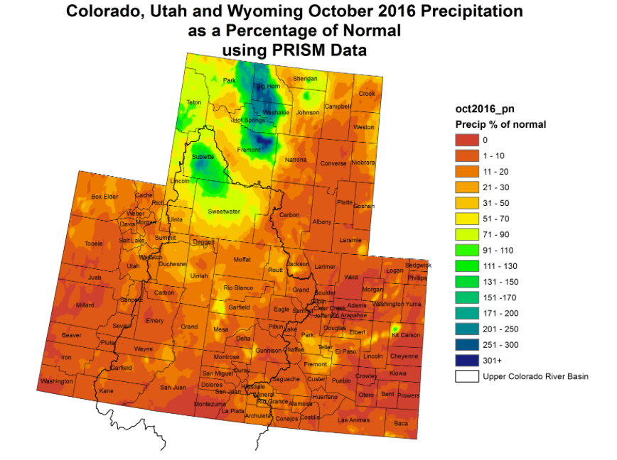
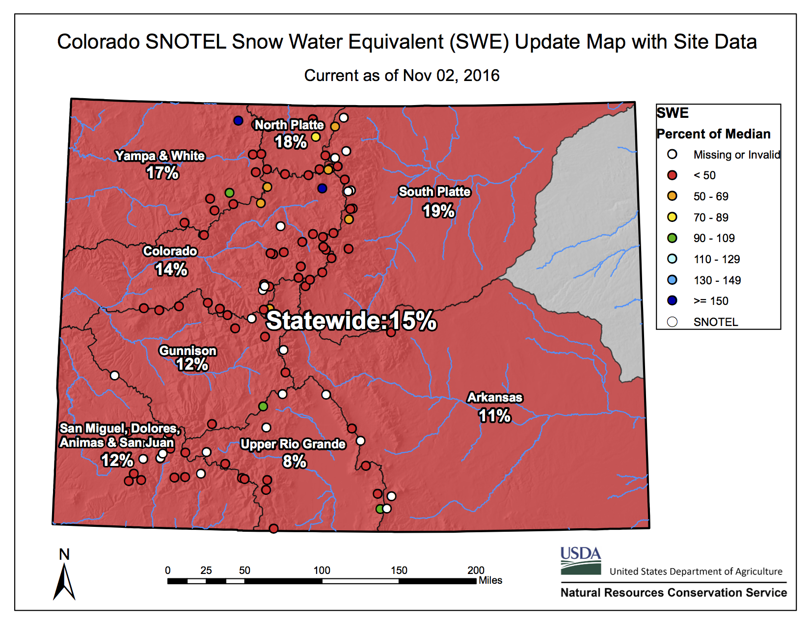
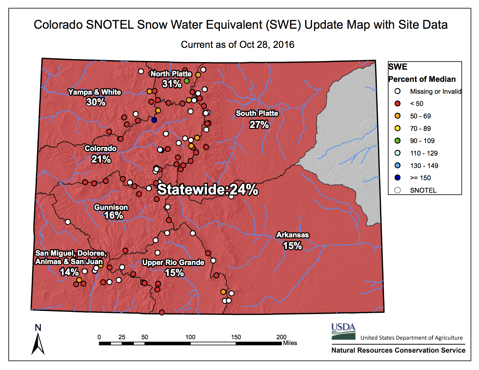
The U.S. Drought Monitor says 24.31 percent of Colorado falls into the category, including much of the Denver metro and areas to the east and south. The report also says 91 percent of the state is “abnormally dry,” including nearly all of the high country.
“A dry October resulted in the expansion of abnormally dry conditions in the northern half of New Mexico as well as across much of Colorado,” the report said. “Colorado also saw a widespread expansion of moderate drought along the higher elevations east of the Continental Divide, along the Front Range corridor, and across the eastern plains.”
[…]
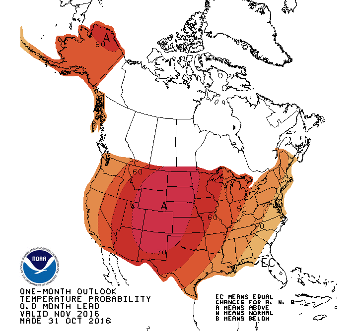
Forecasters say there isn’t an immediate end to the warm streak in sight. Jim Kalina, a meteorologist for the National Weather Service in Boulder, said earlier this week that there won’t be any major cool-off in the near future and that the Climate Prediction Center is calling for above-normal temperatures through November.
The warmth has hit Colorado’s ski areas hard as they gear up to start the season. The unseasonably warm weather has made snowmaking limited to impossible.
While some trappings of early ski season are already upon us – Arapahoe Basin has been open since October 21, several Colorado ski areas saw a few inches of natural snow this week and the Colorado Ski & Snowboard Expo opens on Friday at the Colorado Convention Center – you could be forgiven for not having skiing and snowboarding on your mind while temperatures are still in the 70s here in Denver. It’s been warm up in the hills, too: Keystone and Wolf Creek each announced this week that they’ll be postponing their opening days, previously scheduled for this Friday.
Wolf Creek is hedging even more and hasn’t announced a new date at all: There’s almost no snow on the ground yet at a resort more typically known for having the most snow in Colorado.
Loveland Ski Area historically gives Arapahoe Basin a run for its money as the first ski area in North America to open each season but has yet to announce an opening date for the 2016-2017 season.
The most recent U.S. Drought Monitor, released Thursday, shows a huge portion of Colorado newly encased in a moderate drought or abnormal dryness, the precursor to drought. About 90 percent of the state is now in drought territory, and that’s a big deal for all Coloradans because the state’s water and food resources are widespread.
Notably, moderate drought persists in Fort Collins and Denver and has now spread to Boulder, Colorado Springs and Pueblo. “Moderate” is the first of four levels of drought severity.
If conditions persist — and the National Weather Service predicts they will for Fort Collins — residents can expect damage to crops and pastures, developing or imminent water shortages and a request for voluntary water-use restrictions.
Drought or drought-like conditions haven’t spread across so much of the state since 2012-2013, when a drought of varying severity overtook all of Colorado, devastating crops, livestock and rivers. That was the last time Fort Collins saw a drought.
Drought impacts in Fort Collins have been relatively minor so far because of solid snowpack and spring moisture, but the ongoing dryness means the region will badly need plenty of winter moisture in order to avoid more severe impacts come spring, Colorado State Climatologist Nolan Doesken previously told the Coloradoan.
Seasonal forecasts are undecided for winter moisture in Northern Colorado.
Fort Collins has been in a moderate drought since August after two months of abnormal dryness. A historically dry June with only 0.05 inches of rain kick-started the arid conditions, and since then the city has gotten less than about half the normal amount of rain each month.
Compare that to Greeley, which saw close to normal rain all summer and didn’t enter near-drought conditions until last week. Denver and Boulder joined Fort Collins in moderate drought faster because they started drying up in July.
Unusually dry weather in September and October — not soaking-wet months to begin with — seems to have sealed the deal for most of the rest of the state, including Colorado Springs and Pueblo. The latter two cities and most of southern Colorado saw historic dryness during the last two months.
Drought classifications are based on weather (including precipitation), vegetation stress and other factors.
The National Weather Service’s Climate Prediction Center hasn’t released a drought outlook since the new Colorado regions entered drought, but it recently predicted Fort Collins will remain in a drought through winter. That doesn’t necessarily mean we’ll have a bone-dry winter, just that whatever we get is less likely to alleviate the drought.
Fort Collins precipitation
June: 0.05 inches (2.3 percent of the 1981-2010 normal)
A view from where a dam would stand to form the potential Maroon Creek Reservoir.
ASPEN – The city of Aspen filed two applications Monday in Division 5 Water Court for “finding of reasonable diligence” on the conditional water rights it has maintained since 1965 for the potential storage reservoirs on upper Castle and Maroon creeks.
The city told the court it has “steadily applied effort to complete the appropriation” of the conditional water rights for both of the reservoirs over the last six years, and that it has done so “in a reasonably expedient and efficient manner under all facts and circumstances.”
It then asks the court to issue conditional decrees for both reservoirs for six more years.
The “appropriation” of the current conditional water rights would mean completing the construction of the dams and the storage of water as described in the decrees, which call for a 170-foot-tall dam on upper Castle Creek to hold 9,062 acre-feet of water and a 155-foot-tall dam on upper Maroon Creek to hold 4,567 acre-feet.
The city did not cite any specific actions it has taken in the last six years in regard to investigating, designing, constructing, or financing the actual dams and reservoirs, outside of reaching agreement with two landowners in the Castle Creek Valley not to flood their property if the Castle Creek Reservoir is built.
Instead, both applications filed Monday say the reservoirs are “part of Aspen’s integrated water supply system” and are “part of Aspen’s long-range plan to maintain a water supply to meet current and future demand.”
The city’s diligence applications say it spent in excess of $6 million on its water system since 2010 and point to Colorado’s Water Right Determination and Administration Act of 1969 as to how that can help its case.
The law states that “when a project or integrated system is comprised of several features, work on one feature of the project or system shall be considered in finding that reasonable diligence has been shown in the development of water rights for all features of the entire project or system.”
The same law also says, however, that “the measure of reasonable diligence is the steady application of effort to complete the appropriation in a reasonably expedient and efficient manner under all the facts and circumstance.”
A wetland in the upper Castle Creek valley that would be flooded by a potential Maroon Creek Reservoir, which would be formed by a 170-foot-tall dam.
Directed to file
Aspen City Council unanimously passed a resolution on Oct. 10 directing staff to file the diligence applications, which were due on Oct. 31.
The last diligence decree was awarded on Oct. 11, 2010, which set the clock ticking on the last six-year diligence period.
In all previous filings, the city has filed one application covering both reservoirs, but on Monday it filed separate applications for each potential reservoir.
By Tuesday afternoon, both of the applications from the city had been processed by the water court clerk. The case number for the Maroon Creek Reservoir application is 16CW3128. The case number for the Castle Creek Reservoir application is 16CW3129.
The city has filed diligence applications for the reservoirs eight prior times, in 1972, 1977, 1981, 1985, 1989, 1995, 2002 and 2009, and each time has been awarded a new diligence decree for the conditional rights.
The required time between diligence filings changed from every four years to every six years in 1990, which accounts for the differing time spans between filings before and after that date.
When a water rights application is filed in water court, interested parties have two months to file a statement of opposition in the case.
And with the filing date for both of the city’s applications coming on Halloween, the deadline for statements of opposition to be filed has been set for New Year’s Eve, Dec. 31, 2016.
Any citizen, regardless of whether they own water rights, or might be injured by a water right claim, is allowed to file a statement of opposition in water court, although the court requires opposers to honor the court’s process, which can be time-consuming.
A group of local residents listen as Will Roush, the conservation director for Wilderness Workshop of Carbondale, describes the location, and potential impacts of, the city of Aspen’s proposed Maroon Creek dam and reservoir. The 155-foot-tall dam would be built across Maroon Creek and across the wedding meadow, just behind where Roush is standing.
The opposition to come
The U.S. Forest Service informed the city in October it intends to file a statement of opposition, especially as the Maroon Creek Reservoir is wholly on U.S.F.S. land and would inundate portions of the Maroon Bells–Snowmass Wilderness.
Matt Rice, director of the Colorado River Basin Program for American Rivers, confirmed Tuesday that the national nonprofit organization also still intends to oppose the city’s diligence applications.
“We don’t believe that new water storage dams on Castle Creek and Maroon Creek are appropriate now or anytime in the future,” Rice said.
In a press release issued Tuesday by American Rivers, Rice said, “Constructing these dams would likely cost hundreds of millions of dollars, but the price would pale in comparison to the massive environmental impacts. American Rivers and our members urge the Aspen City Council to reconsider this decision.”
Rice said that Trout Unlimited, Western Resource Advocates, Wilderness Workshop and several private landowners are “seriously considering” filing statements of opposition.
Will Roush, conservation director for Wilderness Workshop, said Tuesday his organization has yet to decide if it will oppose the city in water court.
Wilderness Workshop sent out a press release on Tuesday, however, with a quote from Roush.
“The city of Aspen’s pursuit of dams on Castle and Maroon creeks could not be more out of step with the community’s values,” he said in the release. “These two iconic creeks, universally treasured by our community, have far too many social and ecological values to build unneeded reservoirs on them.”
And the Pitkin County Healthy Rivers and Streams Board unanimously agreed on Oct. 20 to direct staff to prepare a letter or resolution urging the Pitkin County commissioners to file a statement of opposition in the diligence cases.
“We’ve always felt that reservoirs were against the mission of the Healthy Rivers and Streams Board,” said Bill Jochems of Redstone, who has served on the river board for the last seven years.
He said reservoirs deprive rivers of necessary high spring runoff and “have highly undesirable aspects from an aesthetic point of view.”
Mayor proud to file
Steve Skadron, the mayor of Aspen, sent a letter to the editor Tuesday saying he was “proud” of the city for filing the diligence applications.
“Without knowing more about viable alternatives for water storage, it simply would not be prudent water management on our part to give up these water rights,” Skadron wrote. “After all, climate and other changes in this region are uncertain and what our needs will look like in 2066 is not something we are poised to gamble away by letting this storage right go.”
Aspen’s applications say “the city continues to investigate and develop more refined tools for planning its future water needs.”
Skadron also pointed out that the council directed staff on Oct. 10 to “undertake a collaborative effort to work with the community and stakeholders to find other water storage solutions.”
A map showing the location of the potential Castle Creek Reservoir. The extent of the reservoir has been slightly modified to flood a smaller portion of private property owned by adjacent neighbors.
Reservoir size to be ‘revised’
The size of the Castle Creek Reservoir is expected to be reduced after agreements the city reached with Mark and Karen Hedstrom in May of 2010 and with Simon Pinniger sometime after mid-2012. Both the Hedtroms and Pinniger own land at the upper edge of the potential reservoir.
However, the city did not cite the size of the potentially reduced Castle Creek Reservoir in its diligence application.
“It is expected that this commitment by Aspen will result in a reduction in the volume and surface area of the Castle Creek Reservoir, and Aspen has contracted for a preliminary investigation of the anticipated revised size and volume of the Castle Creek Reservoir,” the city’s application states.
David Hornbacher, the city’s director of utilities and environmental initiatives, said on Tuesday that the city contracted for that “preliminary investigation” on Oct. 18, 2016.
The applications also include a sentence that seems to overstate how the reservoirs are referenced in the 2015 Colorado Water Plan.
“The city also participated in the development of Colorado’s State Water Plan, which resulted in the Colorado River Basin Implementation Plan, which identified the continued due diligence for the preservation of the Castle Creek and Maroon Creek storage rights as important projects for securing safe drinking water,” the city stated.
However, the two reservoirs were not identified in the basin implementation plan as “important projects” and they were specifically rejected from being included among the top three priority projects in the Roaring Fork River basin by roundtable members.
Instead, they are referenced in a broader context of “identified projects” in a chart under the theme of “secure safe drinking water.”
Under “methods,” the chart says, “Investigate the development of storage reservoirs on both Maroon and Castle creeks if no better alternative is discovered.”
And under “identified projects,” it states “Continue due diligence for the preservation of the 1972 storage rights on Maroon and Castle creeks by giving true consideration to all other potential options.”
(The rights were originally filed for in 1965 and decreed in 1971, not 1972.)
In both applications the city submitted Monday, it also says “the significant cost of permitting, design and construction” for both reservoirs “dictates that other long range plans be implemented first.”
The city did not provide estimates of costs for the dams and reservoirs in its applications.
It did say, however, that the city has spent $600,000 on water attorney fees since 2010, primarily to defend its water rights, and that expenditure should be considered as part of a finding of reasonable diligence. Those expenditures are included in the city’s overall spending figure of “in excess of $6 million” that it has spent on its water supply system in the last six years.
Editor’s note: Aspen Journalism and the Aspen Daily News are collaborating on coverage of rivers and water. The Daily News published this story on Wednesday, Nov. 2, 2016.
The next three years provide the “last chance” to limit global warming to safe limits in this century, the United Nations said, as it geared up for a conference in Morocco intended to carry forward the Paris agreement on climate change.
Unless nations move before 2020 to cut their emissions more aggressively than they have promised, the window of opportunity will close and the job that lies ahead will become more costly, it said.
The annual “emissions gap” report compares the goals of the treaty to the pledges of its signatories. In it, the United Nations Environment Program (UNEP) warned that unless reductions in carbon pollution from the energy sector are reduced swiftly and steeply, it will be nearly impossible to keep warming below 2 degrees, let alone to the 1.5 degree aspiration.
Each year’s gap report, produced by expert scientists using the latest available data, makes clearer than ever that the treaty commitments undertaken so far fall short of what is needed to keep warming below the UN’s targets.
The 2016 assessment is especially significant for three reasons. It is being published just as the treaty enters into force, as countries are starting to plan their next steps. It is the first assessment to calculate the emissions that will occur under all the pledges made last year. And it is the first to hold those pledges up not only to the long standing 2-degree goal, but to the new 1.5-degree goal that was a central accomplishment of the Paris meeting last December.
Now that the treaty has been signed by enough countries to enter into force on November 4—much sooner than many had expected—delegates arriving in Marrakech for next week’s conference of parties are keen to keep the momentum building.
UNEP said that the need for urgent, immediate action to confront the climate crisis is “indisputable.”
Early action, it said, would help find the least expensive path toward eliminating carbon dioxide emissions in time to reach the 2-degree goal.
But speed is essential if there is any hope of keeping warming to 1.5 degrees, a target of vital concern to small island states and other poor nations that are most vulnerable to climate change.
“It is likely the last chance to keep the option of limiting global warming to 1.5 degrees C in 2100 open,” the report said, “as all available scenarios consistent with the 1.5 degree C goal imply that global greenhouse gases peak before 2020.”
Put that way, the gap facing treaty adherents is daunting, especially since emissions are currently rising at a steady clip.
“The rate of global greenhouse gas emissions increase during the period 2000 to 2010 was faster (2.2 percent per year) than during the period 1970 to 2000 (1.3 percent per year), increasing in 2010 and 2011 (3.5 percent per year) and then slowing in 2012 to 2013 (1.8 percent per year),” the report said.
“In summary, global greenhouse gas emissions continue to grow, and while the indications are encouraging that the growth rate of global carbon dioxide emissions from fossil fuel use and industry is slowing, it is still too early to say whether this is likely to be permanent.”
The Paris pledges “represent a first start to initiate the required transition, but are far from being consistent with the agreed upon long-term temperature goals.” If every country fulfilled its pledges the world would be on course to warm by about 3 degrees Celsius.
Under current pledges, the world would come close by 2030 to depleting the carbon budget for 2 degrees of warming, and would well exceed the budget for staying below 1.5 degrees.
Click here to go to the US Drought Monitor website. Here’s an excerpt:
Summary
The U.S. Drought Monitor saw continued deterioration of drought conditions in the south and southeast as dry conditions and above average temperatures prevailed during the past week further impacting soil moisture and agriculture across the region. Parts of the interior U.S. also saw a deterioration in conditions due to a continued lack of rainfall combined with well above average temperatures. Conversely, rains along the coast in New England and in the Pacific Northwest provided relief to those drought stricken areas…
The Plains
Short-term precipitation deficits and well above average temperatures led to an increase in the depiction of abnormally dry conditions across parts of western and central Nebraska as well as in western Kansas. The panhandle of Oklahoma saw an increase in moderate drought (D1) and abnormally dry (D0) areas while the southeast part of the state also saw an expansion of these categories as well as in increase in severe (D2) drought…
The West
Precipitation eased drought conditions in Northern California bringing a reduction in moderate (D1) drought. Short-term drought impacts have essentially been eliminated in eastern Oregon, but longer-term hydrologic impacts (denoted by the area enclosed within the solid black line) remain. A dry October resulted in the expansion of abnormally dry conditions in the northern half of New Mexico as well as across much of Colorado. Colorado also saw a widespread expansion of moderate (D1) drought along the higher elevations east of the Continental Divide, along the Front Range corridor, and across the eastern plains…
Looking Ahead
The National Weather Service Quantitative Precipitation Forecast calls for continued dryness during the next week across the drought impacted areas of Alabama and Georgia as well as a broad area spanning from the southern half of California northeastward to North Dakota. More precipitation is forecast for the Pacific Northwest and along a band from New Mexico to the Northeast as fronts move through these areas. In general, warm conditions will dominate the temperature forecast for most of the country in the week ahead.
One month temperature outlook issued October 31, 2016 via NOAA.Upper Colorado River Basin precipitation as a percent of normal October 2016 via the Colorado climate Center.Statewide snowpack November 2, 2016 via the NRCS.
Rarely seen back of the Hoover Dam prior to first fill
FromThe Grand Junction Daily Sentinel (Gary Harmon):
The possibility that it would prove beneficial to send more water from Lake Powell downstream to Lake Mead is muddier than the Colorado River through the Grand Valley in springtime, said a Utah State University professor who has studied the reservoirs.
The “fill Mead first” idea is lacking in significant science and “could do more harm than good to the Grand Canyon,” said Jack Schmidt, watershed sciences professor at Utah State.
The idea of filling Mead before Powell — the two largest lakes on the Colorado River, each of them containing about 27 million acre-feet of water — has gained currency as annual runoff has slackened and demands have increased for restoration of Glen Canyon, which now is filled by Lake Powell.
One study has said that some 300,000 acre-feet of water could be saved by filling Mead first.
There are, however, “enormous uncertainties with the estimates of water savings,” Schmidt said in an interview at the Ruth Powell Hutchins Water Center’s sixth-annual Upper Colorado River Basin Forum at Colorado Mesa University, which is continuing today.
Schmidt was one of a group of scientists who promoted the idea of controlled flooding below dams to restore ecosystems. He served three years as chief of the Grand Canyon Monitoring and Research Center in Flagstaff, Arizona.
One of the major unknowns that underlie questions about the “fill Mead first” idea is the still unresolved issue about which reservoir suffers greater water loss to evaporation.
It’s generally considered that Mead, with apparently greater surface area and lower elevation, would suffer more losses from evaporation, but there are no state-of-the-science studies to confirm that, Schmidt said.
Another unknown lies in the silt at the bottom of Lake Powell, he said.
Tons of silt have been trapped at the bottom of the lake on what otherwise would be their sedimental journey down the river.
“Sediment really matters,” Schmidt said.
Lake Powell has trapped the sediments that would have been carried by the Colorado through the Grand Canyon and into Lake Mead. The effects of those lost sediments aren’t well studied, he said.
Upper Colorado River Basin precipitation as a percent of normal October 2016 via the Colorado climate Center.
Click here to say hello to the new website for the Weekly Climate, Water and Drought Assessment of the Upper Colorado River Basin. Click here for the current assessment.
The pipeline could supply the water commission’s share of water from the Animas-La Plata project — a water storage project that led to the creation of Lake Nighthorse south of Durango, Colo.
Aaron Chavez, the executive director of the San Juan Water Commission, said the study will examine three alternatives — construction of a small-diameter pipe that could supply water in case of emergencies, construction of a larger-diameter pipe that would provide San Juan County with all of its Animas-La Plata water rights or increased raw water storage.
Commissioner Jim Dunlap, who represents rural water users, said there will always be a lot of questions about the possibility of a pipeline.
“Nineteen-thousand or $20,000 is a small amount to pay to answer some of the questions,” he said.
He said the study could help the commission determine if a pipeline is feasible.
“It may be a good idea, but it may cost so much that we can’t afford it,” Dunlap said.
Dunlap also advocated for making the results of the study available to the public…
In other business, the commission heard a presentation from the New Mexico Interstate Stream Commission about the Colorado River Basin System Conservation Pilot Program, which aims to combat the dropping water levels in Lake Powell and Lake Mead. The two reservoirs are experiencing declining levels in light of a 15-year drought in the Colorado River Basin, which includes San Juan County, according to the presentation.
Kristin Green, a representative of the New Mexico Interstate Stream Commission, said hydropower generated at Lake Powell funds the San Juan River Basin Recovery Implementation Program. The program focuses on recovering populations of endangered fish.
Green warned that a loss of money from hydropower could impact the fish populations in the San Juan River basin.
The water conservation pilot program began in 2014 and has had several rounds of applications for project funding. The final round of project applications opened at the beginning of October. The application deadline is Nov. 30.
Of the 35 projects approved, only two have been from New Mexico. One of the two projects was a municipal efficiency improvements project, and the other involved fallowing — or taking agricultural land out of production.
Dunlap cautioned about taking agricultural land out of production to conserve water.
“If you take all the agriculture out of a community, then you kill the community,” he said.
Green said the majority of the approved projects have been fallowing projects and are temporary.
Scientists have produced the first global maps of human emissions of carbon dioxide ever made solely from satellite observations of the greenhouse gas. The maps, based on data from NASA’s Orbiting Carbon Observatory-2 (OCO-2) satellite and generated with a new data-processing technique, agree well with inventories of known carbon dioxide emissions.
No satellite before OCO-2 was capable of measuring carbon dioxide in fine enough detail to allow researchers to create maps of human emissions from the satellite data alone. Instead, earlier maps also incorporated estimates from economic data and modeling results.
The team of scientists from the Finnish Meteorological Institute, Helsinki, produced three main maps from OCO-2 data, each centered on one of Earth’s highest-emitting regions: the eastern United States, central Europe and East Asia. The maps show widespread carbon dioxide across major urban areas and smaller pockets of high emissions.
“OCO-2 can even detect smaller, isolated emitting areas like individual cities,” said research scientist Janne Hakkarainen, who led the study. “It’s a very powerful tool that gives new insight.”
The results appear in a paper titled published Nov. 1 in the journal Geophysical Research Letters.
Human emissions of carbon dioxide have grown at a significant rate since the Industrial Revolution, and the greenhouse gas lingers in the atmosphere for a century or more. This means that recent human output is only a tiny part of the total carbon dioxide that OCO-2 records as it looks down toward Earth’s surface. “Currently, the background level of carbon dioxide in the atmosphere is about 400 parts per million, and human emissions within the past year may add only something like three parts per million to that total,” said Hakkarainen. The data-processing challenge, he noted, was to isolate the signature of the recent emissions from the total amount.
The team’s new data-processing technique accounts for seasonal changes in carbon dioxide, the result of plant growth and dormancy, as well as the background carbon dioxide level. To be sure their method was correct, they compared the results with measurements of nitrogen dioxide — another gas emitted from fossil fuel combustion — from the Ozone Monitoring Instrument, a Dutch-Finnish instrument on NASA’s Aura satellite. OMI and OCO-2 are both in the A-Train satellite constellation, so the two measurements cover the same area of Earth and are separated in time by only 15 minutes.
The two measurements correlated well, giving the researchers confidence that their new technique produced reliable results.
Coauthor Johanna Tamminen, head of the atmospheric remote sensing group at the Finnish Meteorological Institute, noted that with its comparison of OCO-2 and OMI data, “The research demonstrates the possibility of analyzing joint satellite observations of carbon dioxide and other gases related to combustion processes to draw out information about the emissions sources.”
OCO-2 Deputy Project Scientist Annmarie Eldering of NASA’s Jet Propulsion Laboratory, Pasadena, California, said, “We are very pleased to see this research group make use of the OCO-2 data. Their analysis is a great demonstration of discovery with this new dataset.” Eldering was not involved in the study.
NASA uses the vantage point of space to increase our understanding of our home planet, improve lives and safeguard our future. NASA develops new ways to observe and study Earth’s interconnected natural systems with long-term data records. The agency freely shares this unique knowledge and works with institutions around the world to gain new insights into how our planet is changing.
Here’s the release from Colorado State University (Jessica Bennett):
Learning more about the complexities and inner-workings of western water law is the purpose behind the 2016 Interdisciplinary Water Resources Seminar series. The series will discuss topics including the history and evolution of western water law; state compacts and federal water law; hybrid water law systems; water quality law; groundwater law; and environmental law. The seminar series will provide attendees the opportunity for in-depth discussion about water-related court cases and interaction with prominent water resource professionals.
Each seminar is held Monday at 4 p.m. in the Behavioral Sciences Building, Room 103. All faculty, students, off-campus water professionals, and members of the Fort Collins community who are interested in water and western water law are invited to attend.
For individuals unable to attend, the seminars will be recorded and uploaded online. The full semester schedule is accessible here. Or there’s more information regarding all of the Interdisciplinary Water Resources Seminars.
Larry MacDonnell, Nov. 7
Lawrence J. MacDonnell is an attorney and consultant. He retired in 2013 as a professor of law at the University of Wyoming College of Law, where he taught water law, public land law, and natural resources law.
MacDonnell will be speaking at the Nov. 7 seminar titled “Other Systems for Allocating and Administering Water in Western States.” MacDonnell will discuss several approaches for the allocation and administration of water and water rights including the riparian doctrine for surface water, non-appropriation doctrines that are applied to use of ground water, the use of permit systems for allocation of rights, and the public trust doctrine.
MacDonnell is also a senior fellow at the Getches-Wilkinson Center and an adjunct professor of law at the University of Colorado School of Law. He was the first director of the Natural Resources Law Center at the University of Colorado School of Law, a position he held from 1983 to 1994. MacDonnell worked as an attorney and consultant in Boulder until 2009.
Uranium mining opponents got some good news when Nuclear Regulatory Commission staff indicated last week that a proposed new uranium extraction technology may be less safe than proponents indicate.
Black Range Minerals, now owned by Western Uranium of Canada, initially started exploring for uranium in the Taylor Ranch area northwest of Canon City in 2008 and got approval from the Fremont County Commission in 2010 to expand exploration on an additional 2,220-acre site. Residents concerned about the potential impact of renewed uranium mining formed the opposition group Tallahassee Area Committee.
The opponents weighed in during a public comment period hosted by state health department officials last summer as they considers what regulatory requirements should be put in place for a new proposed practice called “ablation technology.” Ablation uses finely crush particles of uranium ore and water in a pressurized manner to extract the uranium.
State health department officials also asked for input from the Nuclear Regulatory Commission.
“The NRC staff responded with a bombshell completely rejecting the Black Range Minerals/Western Uranium position that ablation is merely a continuation of mining,” said Lee Alter, who monitors government for the Tallahassee Area Committee. “They concluded that ablation technology is a uranium milling activity and should be licensed as such.”
In responding to the state’s request for information, Paul Michalak, from the office of nuclear material safety, said, “It is our understanding that no current NRC regulation explicitly addresses uranium ablation. To the best of our understanding, commercial-scale uranium ablation activities are being proposed solely in Colorado at this time.
“Given this, we believe Colorado would have the flexibility to adopt and implement program elements within the state’s jurisdiction that are not addressed by NRC,” Michalak said.
In addition, Michalak indicated that, “Since uranium ablation technology involves the extraction or concentration of uranium or thorium from any ore processed, then any wastes produced by the process would be byproduct material as defined in the Atomic Energy Act.”
Michalak offered his help to state health officials as they go forward in trying to decide how to deal with the new technology.
West Fork Fire June 20, 2013 photo the Pike Hot Shots Wildfire Today Click here to read the newsletter. Here’s an excerpt:
Wildfires and Our Mountain Streams
With the arrival of fall colors, wildfire season in the West is on the retreat. It’s important to look back on the toll these fires have taken on Colorado’s watersheds. In 2015, wildfires burned a record-breaking 10.1 million acres across the U.S., according to High Country News. We’ve seen a similar magnitude of burns this summer from California to Idaho and in our own backyard with the Hayden Pass, Cold Springs near Boulder, Beaver Creek and Sylvan Lake fires. Aside from the risks to houses and human lives, wildfires also pose threats to our watershed and river systems.
Wildfires have been scorching the earth as long as humans have existed. They are a natural force that keeps our ecosystems in check and natural cycles in motion. As human populations grow and encroach into wild places, wildfires have left that balance teetering. In mountain communities, our local firefighters, Forest Service, and water providers continuously monitor and manage the risks.
Increasing global temperatures means an increase in forest fires in the West, putting greater pressure on our natural resources, including water systems. So what kind of effects are they having on our rivers?
LOW TO MODERATE INTENSITY
Fires, when low-to-moderate in intensity, can actually maintain the long term health of forest and riparian ecosystems by facilitating vegetation succession, which leads to diverse riparian zones. Diversity and regrowth in riparian banks is essential in maintaining bank stabilization and the natural filtration capabilities of native plants. High water flow, flooding, and a surge in nutrients can provide natural habitat for fish reproduction, and can load organic matter that can spike productivity. When these fires are lower intensity, and even prescribed as a forest management tool, they carry on healthy, natural processes.
HIGH INTENSITY
The most detrimental effects to a watershed from high intensity fires are excessive erosion and runoff. Unburned forests act like sponges with rainfall, with the healthy vegetation and litter absorbing water and protecting the soil layer from intense rain. The plant layer slows down the water’s speed as it runs towards the river. The loss of vegetation after a burn leads to greater-exposed, loose soil and less absorption leading to higher runoff volumes. Some plants even release a waxy, water-resistant cover after being burned, further decreasing the forest’s absorptive capacity.
These effects can last years following a fire. The increased runoff leads to flash flooding as river banks overflow with excess volumes. Ash, woody debris, and sometimes fire retardant chemicals are flushed through our rivers, loading pollutants such as phosphorus, nitrate, and ammonia into our water systems. Increased runoff and loss of plants leads to stream banks eroding, adding on to increased sedimentation in our rivers which negatively effects spawning fish and can even clog their gills.
All of this harms aquatic insect life, water temperatures, fish habitat and reproduction, fisheries, and irrigation systems. Increases in sediment load can also put additional pressures on drinking water treatment processes and congest reservoirs downstream of the burn.
PROTECT YOURSELF
Our local firefighters and wildland specialists can only do so much to manage the force of fire — it’s essential to be proactive and aware yourself. Heed fire warnings and bans, fully put out fires while camping, and do not store your firewood on your deck. Homes should be surrounded by fire breaks, or 200 feet of defensive space between their perimeter and the nearest trees. Home consultation services, such as REALFire, exist in our valley to best protect where we live and work. More information can be found at http://www.realfire.net. If, as expected, our county population doubles by 2050, the wildland-urban interface will continue to be tested severely, but deliberate, responsible measures can prevent adding unnecessary risks to our already threatened watershed.
Lizzie Schoder is the education and outreach coordinator for Eagle River Watershed Council. The Watershed Council has a mission to advocate for the health and conservation of the Upper Colorado and Eagle River basins through research, education and projects. Contact the Watershed Council at 970-827-5406 or visit http://www.erwc.org.
Fog-filled Black Canyon via the National Park Service
From email from Reclamation (Erik Knight):
Releases from Crystal Dam will be decreased from 1500 cfs to 600 cfs on Tuesday, November 1st. This reduction will follow the shutdown of diversions to the Gunnison Tunnel. Release reductions will be coordinated with Gunnison Tunnel diversion reductions throughout the morning of November 1st. River flows downstream may fluctuate during the shutdown period but flows should steady out at the current level by the afternoon. The current content of Blue Mesa Reservoir is 610,000 acre-feet which is 73% full.
Flows in the lower Gunnison River are currently above the baseflow target of 1050 cfs. Flows are expected to remain above the baseflow target for the foreseeable future.
Pursuant to the Aspinall Unit Operations Record of Decision (ROD), the baseflow target in the lower Gunnison River, as measured at the Whitewater gage, is 1050 cfs for November through December.
Currently, diversions into the Gunnison Tunnel are around 900 cfs and flows in the Gunnison River through the Black Canyon are around 600 cfs. After this release change Gunnison Tunnel diversions will be at zero and flows in the Gunnison River through the Black Canyon should still be around 600 cfs. Current flow information is obtained from provisional data that may undergo revision subsequent to review.
October has been one of the warmest on record in Denver and temperatures around the state over the past several weeks have felt more appropriate for outdoor lounging than snow sports.
So as November begins with the promise of more above-average heat in the forecast, should Colorado’s skiers and snowboarders worry?
“It’s not time to panic just yet,” said Joel Gratz, founding meteorologist of OpenSnow, a website that tracks conditions on the slopes. “Even though we have very little snow, there’s not a very strong correlation with how the ski conditions will be toward the end of December.”
However, Gratz said, anyone looking to make early season turns might need to be patient because he predicts possible delayed opening days and limited coverage on open slopes. While Arapahoe Basin kicked off skiing and snowboarding in Colorado and North America on Oct. 21, other areas are waiting for the weather to start cooperating.
Wolf Creek Ski Area in southwest Colorado says it won’t open as planned on Friday. And Keystone Resort — also slated to open on Friday but facing a dearth of snow because of the warm temperatures — says it will make a decision in the next day or two about how to proceed.
“We’re going to cool down a little bit during the middle of (this) week, so there might be a little more high elevation snowmaking,” Gratz said Monday. “But I don’t see super cold weather coming and I don’t see around-the-clock snowmaking this week and potentially not the next week as well.”
Loveland Ski Area, which typically opens in mid-October, still had no set opening day as of Monday morning.
“We’re just waiting on Mother Nature to bring those cold temps back,” said John Sellers, Loveland’s marketing director.
Loveland began making snow on Oct. 3, but since then Mother Nature hasn’t made things easy. The good news, Sellers said, is the ski area has completed most of the work required to get its first run open, meaning a few more cold nights is all that’s needed to get the season kicked off.
Sellers said the goal is always to start getting skiers and snowboarders on the slopes as soon as possible. Last year, Loveland opened on Oct. 29…
Jim Kalina, a meteorologist for the National Weather Service in Boulder, says there won’t be any major cool-off in the near future and that the Climate Prediction Center is calling for above-normal temperatures through November.
Colorado Springs Collection System via Colorado College.
From the Colorado Springs Independent (Pam Zubeck):
Just months after activating the long-awaited Southern Delivery System Pipeline in April, Colorado Springs Utilities is hosting an open house on Wednesday, November 2 to gather comments for its Integrated Water Resource Plan.
The plan hasn’t been updated in 20 years.
Here’s the release:
With some of it traveling more than 200 miles to town, water continues to be one of Colorado Springs’ greatest challenges and opportunities. Water planners at Colorado Springs Utilities are looking to the future and how they can continue to provide reliable, safe and high-quality water for our community.
The public is invited to learn about the Integrated Water Resource Plan at an Open House Wednesday, Nov. 2 from 5:30 to 7 p.m. at the Conservation and Environmental Center (2855 Mesa Rd., Colorado Springs). We will share information about our water system and our plan to meet future needs. Residents will have a chance to weigh in on long-term planning and provide input on water decisions for Colorado Springs. Topics include:
· Water system reliability
· Potential regional water service challenges and opportunities
· Water Supply challenges and risks
· Opportunities to mitigate risks
· Tradeoffs between risk and costs
The Water Resource Plan was last updated in 1996 and laid the groundwork for the Southern Delivery System.
“We have seen a lot change since the last plan was completed. Drought, fires, greater variability in supply and demand, and other factors have really challenged our water resources. The future of our water supply system is equally uncertain,” said Kevin Lusk, Colorado Springs Utilities water planner. “We have undertaken this planning process to address these challenges. It will set the direction for 50-plus years into the future with the goal of ensuring clean, safe and reliable water service for our customers.”
Customers unable to attend the Open House can review planning documents and provide input at http://csu.org.
“This is a nonpartisan issue. There’s a confluence of urgent issues that need to be dealt with,” said Anne Castle, former assistant U.S. Department of the Interior secretary for water and science.
The new presidential administration “will have an opportunity, no matter who it is, to help bring balance to this system,” said Castle, now a senior fellow at the Getches-Wilkinson Center for Natural Resources, Energy and the Environment, which conducted the study.
The Colorado River Future Project focusing on critical issues for the river surveyed some 65 water managers, municipal and agricultural customers, conservationists plus government officials at the tribal, state, federal and Congressional levels…
It points to a continuing 16-year drought diminishing the amount of promised water and says the most urgent need is to firm up contingency plans and extend water-use agreements.
The agreements include a key share-the-shortage pact signed in 2012 between the U.S. and Mexico. It expires in December 2017 and lets Mexico “store” water at Lake Mead – helping prop up the surface level of the crucial Colorado River reservoir behind Hoover Dam.
The lake, currently at 37 percent capacity, is the measuring point for federal Bureau of Reclamation water supply decisions made every August.
So far, the level has barely remained above the point that would trigger a shortage declaration and cuts of 11.4 percent to Arizona’s usual water allotment, and 4.3 percent of Nevada’s supply…
The policy paper points to the complexity of negotiations among hundreds of water-rights holders dating to 1922, all overseen but not controlled by the federal government.
It says treaty negotiations involving the International Boundary and Water Commission are “at a decisive stage, and should not be derailed by unrelated political considerations.”
“This is too important to let concerns about immigration, drug trafficking, U.S. corporations and jobs derail it,” Castle said in a nod to hotly contested issues in the race between Republican nominee Donald Trump and Democrat Hillary Clinton.
Other urgent attention is needed, the study said, to determine whether San Diego and other Southern California water agencies will continue to replenish the shrinking Salton Sea after 2017…
“Nobody wants the feds to step in and run the process,” said Craig Mackey, co-director of the Denver-based organization Protect the Flows and one of those surveyed for the report.
He added: “But there’s a great opportunity for whoever the president is on Jan. 20 to set the tone for agreements at the local level. Hopefully we can hit the ground running.”
The Colorado River Basin. The Upper Colorado River Basin is outlined in black.

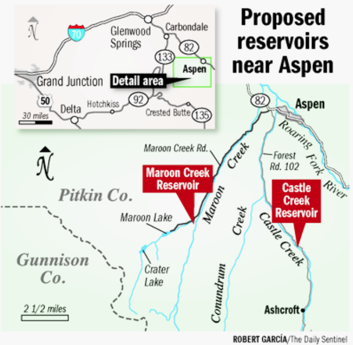
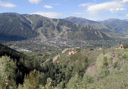


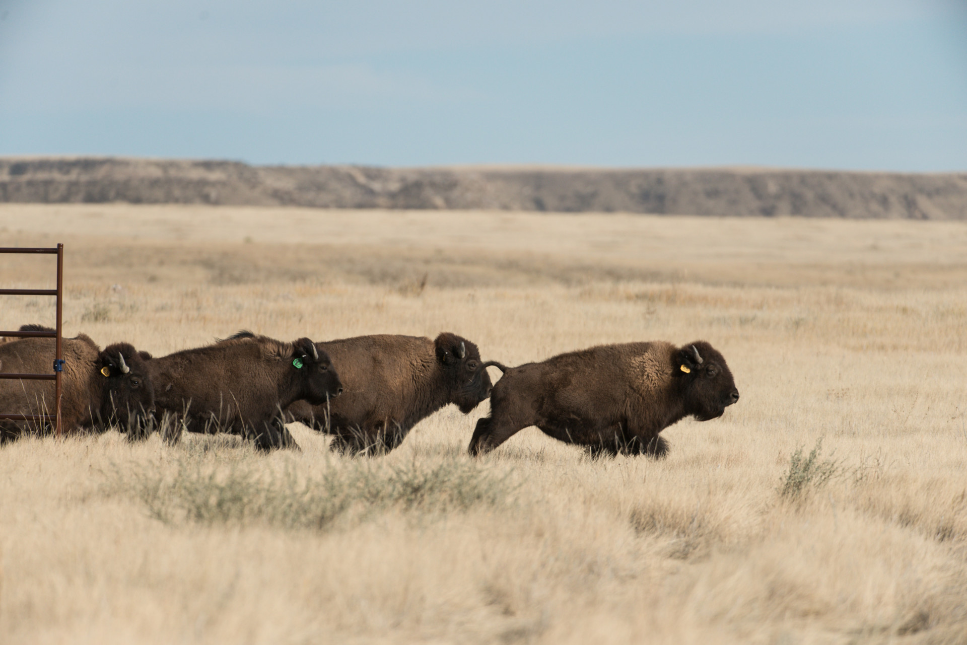


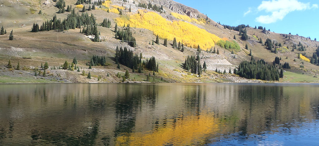



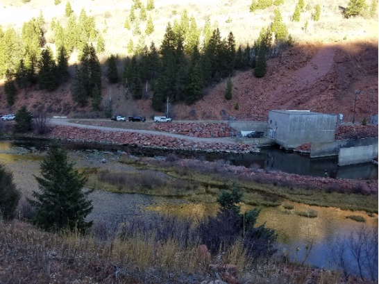
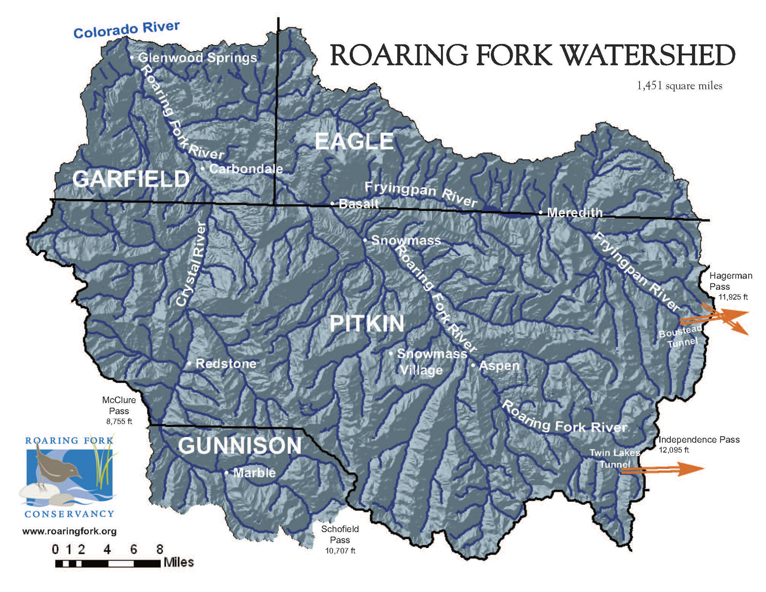




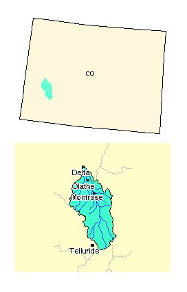



![A comparison of the Aral Sea in 1989 (left) and 2014 (right). Credit: NASA. Collage by Producercunningham. [Public domain], via Wikimedia Commons.](https://coyotegulch.blog/wp-content/uploads/2016/11/aralsea1989v2014nasa.png)