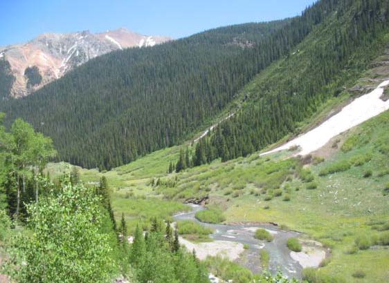
South Fork Mineral Creek, Silverton photo via hhengineering.com
Click here to read the newsletter. Here’s an excerpt:
Aquatic Life Discovered on Mineral Creek Above Silverton
Recent studies by Mountain Studies Institute and the USGS on Upper Mineral Creek have found an improving macroinvertebrate population and a naturally reproducing brook trout population. For the past 20 years, this stretch was devoid of aquatic life. The Animas River Stakeholder Group has conducted a dozen mining remediation projects above that reach on Mineral Creek, which has dramatically improved water quality. ARSG will request that the Colorado Water Quality Control Commission make an aquatic life designation under the Clean Water Act for that segment of Mineral Creek. Congratulations to ARSG and its many partners for this water quality remediation success!
Gore Creek is healthy as it emerges from the Eagles Nest Wilderness Area, but has problems soon after, via The Mountain Town News. All photos by Jack Affleck.
Click here to read the newsletter. Here’s an excerpt:
It’s been a busy year for the Watershed Council. The board and staff would like to take this time to thank everyone that participated in the wide variety of activities presented by our organization in 2016—from our educational Watershed Wednesdays series held throughout the valley, the sold out Wild and Scenic Film Festival, our annual Highway Cleanup, to our signature River Cleanup event. We would like to thank all of our funding partners that supported our mission of advocating for our rivers through educational programs, special events, restoration projects, monitoring, research, and community engagement.
Eagle River Watershed Council believes that our rivers and streams are the life-blood of our valley. Their preservation and restoration supports our economy, culture and quality of life.
The Watershed Council’s annual programs and events represent the public side of the work we do, but we are also involved in a variety of partnership efforts such as providing water quality sampling along Gore Creek, the Eagle River, and various tributary streams within the watershed. The sampling data collected and compiled by the Watershed Council is available in an interactive and easy to understand format online at http://wqcourier.erwc.org. The data also provides a baseline which can be used to identify emerging threats or effectiveness of stream health improvement projects.
Eagle River Watershed Council has coordinated the effort to improve water quality in our local streams through its participation in the Urban Runoff Group, a stakeholder committee that includes entities such as Eagle County, CDOT, Eagle River Water and Sanitation District, the towns of Avon and Vail, Vail Resorts and the Vail Recreation District. This group initiated the Gore Creek Water Quality Improvement Plan in 2013 and the Gore Creek Strategic Action Plan in 2015 culminating in the “Restore the Gore” program, for which projects are currently underway. The Watershed Council applauds the Vail Town Council for their vision in understanding that the health of Gore Creek benefits all user groups and for beginning the process of improving water quality on the Gore.
The three major factors that are likely affecting aquatic life in Gore Creek are not exclusive to that stream and can affect all urbanized waterways within the watershed. They are:
Pollution from chemicals used in urbanized areas adjacent to streams, such as fertilizers, weed killers and pesticides used in landscaping.
An increase in stormwater runoff from impervious areas such as roads, parking lots, buildings, and other hardscape areas that prevent infiltration of rain and snowmelt that would recharge the aquifer and support base flows.
Loss of vegetation along the stream. These riparian plants normally play a critical role in filtering pollutants from storm water runoff before it enters the stream.
The Watershed Council, through the Urban Runoff Group, has just completed an action plan for a segment of the Eagle River from its confluence with Gore Creek downstream to the EagleVail half diamond interchange. In assessing this section of river, the Watershed Council provided recommendations to mitigate the effects of urbanization affecting water quality. This includes recommendations for changes to land use regulations, improved storm water infrastructure, and projects to restore vegetation along the stream.
In 2017, we look forward to assisting with the implementation of the completed Action Plans and completing the same process through the other communities in the valley.
We have a full schedule of Watershed Wednesdays, filled with great tours and engaging presentations, coming together for the year as well. Our 2017 restoration projects are in design and planning now, we look forward to utilizing our wonderful cadre of volunteers this next summer in implementing those. Stay tuned if you are interested in getting involved.
With the addition of new boat ramps, increased river access through open space parcels and an increase in population over the last several years, river usage is at an all time high. We as a community need to be vigilant to balance the economic and recreational usage of our rivers that we all enjoy with the need to improve or maintain a high level of water quality throughout the watershed.
Gary Brooks is the Board Chairman for Eagle River Watershed Council. The Watershed Council has a mission to advocate for the health and conservation of the Upper Colorado and Eagle River basins through research, education, and projects. Contact the Watershed Council at (970) 827-5406 or visit http://www.erwc.org.
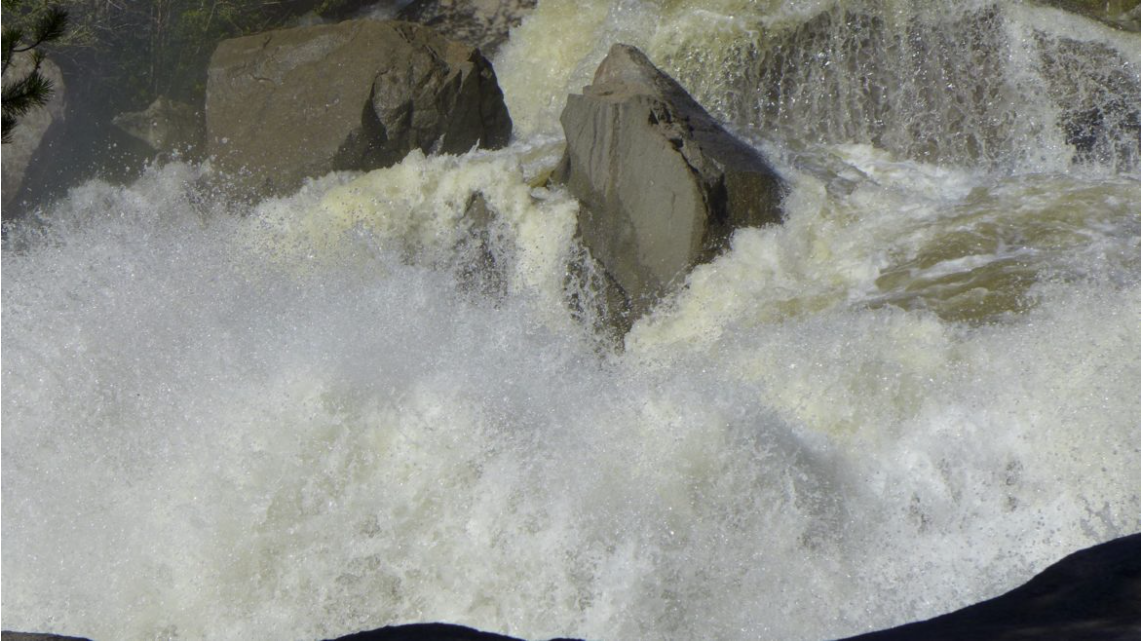
The Roaring Fork River bounding down the Grottos on Thursday, June 16, 2016, after the Twin Lakes Tunnel was closed. Photo Brent Gardner-Smith (Aspen Journalism).
From email from the Colorado Water Conservation Board (Rob Viehl):
The CWCB’s annual Instream Flow Workshop will be held on the afternoon of January 25, 2017 at the Hyatt Regency Denver Tech Center in conjunction with the Colorado Water Congress Annual Convention. There is no fee for this particular workshop, and registration with the Colorado Water Congress is not required.
Each year, the CWCB’s Stream and Lake Protection Section hosts an annual workshop that provides state and federal agencies and other interested entities and persons an opportunity to recommend certain stream reaches or natural lakes for inclusion in the State’s Instream Flow (ISF) Program. The entities that make ISF recommendations will present information regarding the location of new recommendations as well as preliminary data in support of the recommendation. There will be an opportunity for interested stakeholders to provide input and ask questions. In addition to presentations of new ISF recommendations, this year’s workshop will include: (1) an overview of the ISF Program and the new appropriation process; and (2) discussion of pending ISF recommendations from previous years.
Will Roush, left, of Wilderness Workshop, and Ken Neubecker, right, of American Rivers, hold up tape on Sept. 7 showing where the base of a 155-foot-tall dam would be located on Maroon Creek if the city of Aspen were to build a reservoir tied to one of its conditional water rights. Wilderness Workshop and American Rivers were two of 10 parties who filed statements of opposition by Dec. 31 in two water rights cases the city is pursuing.
ASPEN – The United States of America and Pitkin County are among the 10 parties that have filed statements of opposition in two conditional water rights cases being pursued by the city of Aspen in water court for Maroon Creek Reservoir and Castle Creek Reservoir.
In addition to the two governments, four environmental organizations and four private-property owners filed statements in the cases by the Dec. 31 deadline.
Such statements of opposition are typically short and generic, and simply give notice of formal entry into a case. But the statements filed by the U.S. and Pitkin County offer some insight into their concerns about the city’s water rights applications.
Attorneys at the U.S. Justice Department acting on behalf of the U.S. Forest Service told the court the city “cannot show that it can and will” complete the two reservoirs “within a reasonable time” because both potential reservoirs would flood portions of the Maroon Bells-Snowmass Wilderness.
And Pitkin County told the court the city “appears to be speculating with no reasonable demonstration of need” for the reservoirs.
The city filed two applications in Division 5 water court in Glenwood Springs on Oct. 31, one for Maroon Creek Reservoir (16CW3128) and one for Castle Creek Reservoir (16CW3129). Aspen is seeking to extend the conditional water storage rights for another six years. The rights were appropriated in 1965 and adjudicated in 1971.
The city has filed diligence applications for the reservoirs eight prior times, in 1972, 1977, 1981, 1985, 1989, 1995, 2002 and 2009, and each time has been awarded a new diligence decree for the conditional rights.
The conditional rights, as currently decreed, cannot be made absolute unless the city builds a dam 155 feet tall and an estimated 1,280 feet wide across Maroon Creek, within view of the Maroon Bells, and a dam 170 feet tall and an estimated 1,220 feet wide across upper Castle Creek.
The Maroon Creek Reservoir would hold 4,567 acre-feet of water and flood 85 acres of land, and the Castle Creek Reservoir would hold 9,062 acre-feet of water and flood 120 acres of land. Water in both reservoirs would flood some land within the wilderness boundary.
The federal case
The two statements of opposition from the federal government are nearly identical, save for the name of the potential reservoirs in each case. Both begin by saying the reservoir would require a Forest Service permit, and then they raise the wilderness issue.
“Maroon Creek Reservoir would impound water that would inundate lands within the Maroon Bells – Snowmass Wilderness Area,” the statement in the Maroon Creek case said. “Development of Maroon Creek Reservoir is not authorized by [federal law] or any existing special use permit or land use authorization.
“Under the Wilderness Act of 1964, the U.S. Forest Service cannot authorize any new development of conditional water rights, including the conditional water right requested in Case No. 16CW3128 in the Maroon Bells–Snowmass Wilderness Area,” it continued.
“Because the applicant [the city] does not hold a valid right to use or occupy national forest system lands, and the U.S. Forest Service lacks authority to authorize development of Maroon Creek Reservoir within the Maroon Bells–Snowmass Wilderness Area, the applicant cannot show that it can and will complete the claimed appropriation within a reasonable time,” the statement of opposition said.
The statements of opposition from the U.S. were signed by John Cruden, the assistant attorney general at the Environment and Natural Resources Division in the Department of Justice in Washington, D.C., and James DuBois, a trial attorney with the department, who is based in Denver.
In September, the acting district ranger in the Aspen-Sopris Ranger District, Kevin Warner, told the Aspen City Council it would take a presidential exemption to the Wilderness Act to allow the Forest Service to issue a permit for the reservoirs.
“Based on our understanding of the Wilderness Act, and the fact that there was no exception built into the designation for the Maroon Bells wilderness area … it would need to go to the president,” Warner said.
The city has not filed for a Forest Service permit for either reservoir.
Pitkin County’s view
Staff attorneys for Pitkin County told the court that the city should be held to “strict proof” to its claims, including its “ownership of or enforceable property interest” in the dam and reservoir sites.
“This water right is located within a designated wilderness area and the applicant’s ability to obtain the property interest necessary to construct the structure, as decreed, within this wilderness area is unproven,” the county told the court.
The county also told that court the city’s 2016 water supply study “demonstrates that this water right is unnecessary to meet current and future demand within a reasonable planning period using normal population growth assumptions.”
It also said recent statements by Aspen’s mayor and city council members “indicate that (the city) does not intend to effectuate these water rights in a reasonable time period,” and that the city “appears to be speculating with no reasonable demonstration of need.”
16 statements
In all, 16 statements of opposition were filed in the two water court cases by 10 different parties.
In addition to the two governments, U.S. and Pitkin County, four environmental organizations filed statements in both cases: Colorado Trout Unlimited, American Rivers, Wilderness Workshop and Western Resource Advocates.
As such, there is a common set of six parties in each case – the two governments and the four environmental groups – and they’ve filed 12 statements between them, six in each case.
There are also four different property owners, two in each case, and they each filed one statement. That adds four statements to the list of 12, for a mind-numbing total of 16.
Making it somewhat easier to track, the list does break out into eight parties in each case: two governments, four environmental organizations, and a unique pair of property owners.
The differing pairs of property owners in each case brings to 10 the total number of parties across the two cases.
A detail of a map showing the location of a potential dam forming the Castle Creek Reservoir, with underlying property owners. The map was prepared with information based on a map the city filed with the state in 1965.
Property owners
The two property owners who filed in the Maroon Creek case are Roaring Fork Land and Cattle Co. and Larsen Family LP.
Roaring Fork Land and Cattle is an entity controlled by Thomas and Margot Pritzker. The Pritzkers, who are on the Forbes billionaires list, own property near T-Lazy-7 Ranch in the Maroon Creek valley.
Marcella Larsen of Aspen is the co-manager of the Larsen Family LP, based in Boca Raton, Fla., and she signed the statement of opposition. The Larsen family owns residential property in the lower Maroon Creek valley.
The two property owners who filed in the Castle Creek case are Double R Creek Ltd. and Asp Properties LLC. Double R Creek is controlled by Robert Y.C. Ho, a member of a prominent Hong Kong family, while Asp Properties is controlled by Charles Somers, the CEO of a company based in California.
The properties owned by Ho and Somers are located under the potential dam site of Castle Creek Reservoir, two miles below Ashcroft.
A 2016 rendering from Wilderness Workshop of a potential Maroon Creek Reservoir, which would hold 4,567 acre-feet of water behind a 155-foot-tall dam. The rendering was prepared by a professional hydrologist and is based on plans submitted to the state by the city 1965.
Environmental arguments
The statements of opposition filed by the four environmental groups do not offer much insight as to why they are in the cases, but they issued press releases about their filings.
“Aspen does not need these dams for municipal water supply, climate resiliency, or for stream protection – now or at any time in the foreseeable future,” a Dec. 28 from om American Rivers quoted Matt Rice, its director of programs in the Colorado River basin, as saying.
The same release also quoted David Nickum, the executive director of Colorado Trout Unlimited, as saying, “Building dams on free-flowing streams in one of Colorado’s most iconic wilderness areas is the last approach we should be taking to meet water needs in the 21st Century.”
Wilderness Workshop of Carbondale, which is collaborating with Western Resource Advocates of Boulder, released both a press release on Dec. 21 and an article about the water court cases from its newsletter.
“Both dams would inundate portions of the Maroon Bells-Snowmass Wilderness and cause significant environmental damage: severing the streams in two, flooding important riparian habitat, and reducing the ecologically critical spring peak flows,” Wilderness Workshop’s newsletter said.
“The city council met three times this fall to discuss water rights, but those meetings focused almost exclusively on the impact of population growth and climate change to Aspen’s future water supply,” Wilderness Workshop members were told. “They were silent on the ecological impacts of the dams, the regulatory obstacles, financial costs and dubious assertion that these rights actually protect the streams. Over a dozen concerned citizens spoke, unanimously asking the city to abandon their water rights.
“Despite this outcry, the city is moving ahead. All five council members justified their vote on the basis that we might need to store water in the future despite their recent study concluding just the opposite,” the organization said.
In its press release, the Wilderness Workshop quoted Will Roush, its conservation director, as saying: “We’re filing for two reasons: first, to have a seat at the table with the city and other parties to find common ground and second, to make sure that dams are never built on Castle or Maroon Creeks.”
Castle Creek, not far below Ashcroft. This section of river would be covered by a potential Castle Creek Reservoir.
City’s position
David Hornbacher, the city’s director of utilities and environmental initiatives, declined to comment on the statements of opposition.
A resolution unanimously approved by the city council on Oct. 10 said, “the city is obligated and intends to provide a legal and reliable water supply and to that end can and will develop all necessary water rights, including but not limited to, Maroon Creek Reservoir and Castle Creek Reservoir.”
In its diligence applications, the city told the court the two reservoirs are “part of Aspen’s integrated water supply system” and “part of Aspen’s long-range plan to maintain a water supply to meet current and future demand.”
Further, the city said it has “steadily applied effort to complete the appropriation” of the water rights for the reservoirs and it has done so “in a reasonably expedient and efficient manner under all the facts and circumstances.”
However, in its Oct. 10 resolution, the city council also directed its staff to “enhance and increase the city’s efforts to investigate alternative locations and sizing requirements of the Maroon Creek Reservoir and/or Castle Creek Reservoir, and to report its findings back to City Council for further consideration and action as appropriate.”
Typically in water court cases, opposing parties are given a year to try and work out their differences under the guise of a water court referee. The discussions among parties in this phase of the process are private.
If parties cannot reach agreement within a year, they can ask for another six months. And then dates are eventually set for a trial in front of a judge.
Editor’s note: Aspen Journalism, the Aspen Daily News, and Coyote Gulch are collaborating on coverage of rivers and water. The Daily News published this story on Monday, Jan. 2, 2017.
Here’s the release from the Rio Grande Headwaters Land Trust:
In 1999 the Rio Grande Headwaters Land Trust (RiGHT) was founded as the community‘s land trust, dedicated to serving the entire San Luis Valley. In 2007, RiGHT launched the Rio Grande Initiative, the landscape scale effort with many partners to protect land and water along the Rio Grande and its tributaries. One of the first ranches they protected under the Initiative is owned by Bob and Carol Lee Dugan on the river on Swede Lane, just west of Monte Vista. Now, nearly ten years later, RiGHT is proud to announce that the Dugans have protected yet another nearby ranch with a conservation easement.
This 316-acre ranch, which combines parcels previously known as the James Ranch and the Stephens Ranch, is just south of the river between Monte Vista and Del Norte. Between the two ranches, the Dugans have now protected a total of 670 acres with conservation easements. In doing so, they have also protected the water that goes with those ranches, the wildlife habitat, the beautiful views, and the important agricultural productivity. Clearly, this represents a strong commitment to conservation by Bob and Carol Lee Dugan and they continue to recommend conservation to others, saying, “We suggest that other land owners consider preserving their ranches for the future generations of this state.”
“We are immensely grateful to the Dugan family for their dedication to their properties along the Rio Grande,” said Nancy Butler, RiGHT’s Executive Director. “Their land ethic has helped RiGHT and our partners protect more than 26,000 acres along the Rio Grande and its tributaries. That legacy will continue far into the future and that land, water and wildlife habitat will remain intact for all to enjoy.”
The conservation of the 2016 Dugan Ranch project was made possible through the generous support of the Natural Resources Conservation Service (NRCS), the Gates Family Foundation, the Colorado Water Conservation Board (via funding supported by the Rio Grande Basin Roundtable) and the Colorado Parks and Wildlife’s San Luis Valley Habitat Partnership Program Committee. Invaluable support has also been provided by individual donors who ensure that RiGHT’s conservation work can continue.
As an agency of the U.S. Department of Agriculture, the NRCS’s mission is to help people help the land. Colorado’s NRCS State Conservationist Clint Evans stated that, “Protecting vital agricultural landscapes is a top priority for NRCS. Through the Agricultural Conservation Easement Program – Agricultural Land Easement (ACEP-ALE), the natural resource benefits we all enjoy derived from prime agricultural lands can be preserved.”
“This project is an important contribution to the corridor of conservation in this area of the river, with nearly 1,500 acres already conserved nearby,” said Butler. “RiGHT has conserved four other spectacular ranches in this area, providing excellent wildlife habitat and maintaining the beautiful scenery that we all love in the San Luis Valley. Carol Lee and Bob Dugan have demonstrated immense dedication to preserving these lands in perpetuity and we are grateful that RiGHT was able to help them achieve their dreams for these special places.”
The Arctic continues to amaze. Hit by a second bout of extremely warm winter temperatures in recent days, the seasonal growth of floating sea ice has flattened out, just as it did when hit by similarly dramatic heat in November.
The area of the Arctic Ocean covered by sea ice is currently far smaller than it was in 2012 at this time of year. And while 2012 holds the all-time record for lowest ice extent in September, 2016 has been beating it since mid-October…
The current extent of Arctic ice sea is also far smaller than it was at the same time in 2010, which previously held the record for lowest Arctic sea ice extent in late December, according to records from the National Snow and Ice Data Center that date to 1979.
Clearly this is abnormal. But how abnormal?
The answer is that what has happened this year in the Arctic, and particularly the high Arctic, appears to be not only out of the norm for a stable climate — like the one on Earth before the era of fossil fuels — but also for what you might expect from our supercharged, artificially warmed climate.
Such is the upshot of a recently published “detection and attribution” analysis of November’s and December’s Arctic warmth by a group of scientists who are not waiting around for the peer review process — they are increasingly releasing these documents in near real time. And they find that “it is extremely unlikely that this event would occur in the absence of human-induced climate change.”
The analysis was conducted by a World Weather Attribution, a consortium of researchers who are perfecting the study of how a changing climate affects local weather conditions, or conditions in a specific place. It came out last week, but the researchers say that in light of another burst of Arctic warmth since, the analysis holds up. If anything, the ensuing temperatures were slightly hotter than they’d expected.
“We probably slightly underestimated the temperature as a whole for November-December, but not by much,” says Andrew King, a researcher at the University of Melbourne who worked on the study.
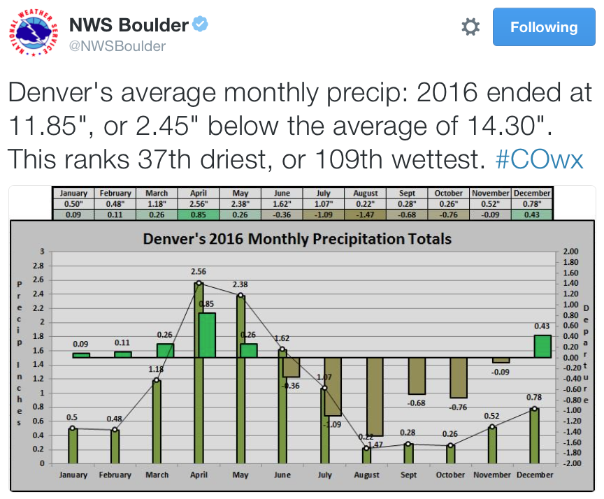
As 2016 draws to a close, the yearlong precipitation level is lower than in 2015 but not far off from the average annual precipitation.
Through Friday, 2016’s precipitation level was 11.91 inches, down when compared to 2015’s mark of 16.66 inches. When compared to the average annual precipitation of 12.55 inches, however, this year’s moisture level is only slightly lower.
According to the U.S. Geological Survey water supply website, Fountain Creek and the Arkansas River are currently above average; flows were mostly above average throughout the year.
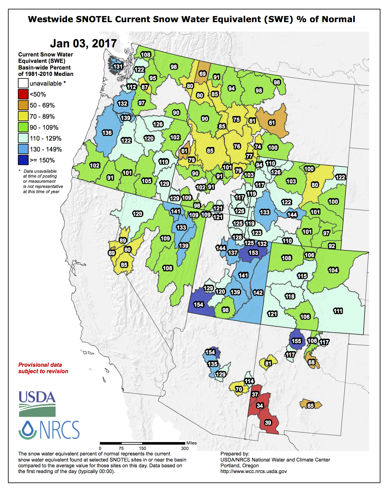
From a standpoint of moisture content in the state’s snowpack, recent holiday weather fronts proved to be a welcome gift. The fronts deposited enough snow in the mountains to put the state over the average for the year in terms of moisture content.
As of Friday, the Arkansas basin’s moisture content was at 115 percent of average, and the Rio Grande basin was at 106 percent of average.
The National Weather Service’s three-month temperature outlook indicates that Pueblo will be above average, with an equal chance of conditions being wet or dry through that timespan.
Chris Woodka of the Southeastern Colorado Water Conservancy District points out that, “We imported 59,214 acre-feet of water this year (2016) from the Fryingpan River watershed, which was just slightly above the average of 55,907 acre-feet for the Fry-Ark Project.
“It was a good year, because we were able to provide 45,000 acre-feet of supplemental water for municipal, domestic and agricultural use in the Arkansas River basin,” he said.
Statistics provided by the Board of Water Works indicate that city water consumption was higher in 2016 than the previous year: 7,900,914 gallons to 7,511,255, but under the five-year average of 8,104,317.
As far as pumpage, the water that is treated and then sent out from the plant, 8,481,644 gallons were pumped, an increase over 2015’s 7,924,727 but below the five-year average of 8,614,500.
There’s a “half full/half empty” joke in here somewhere.
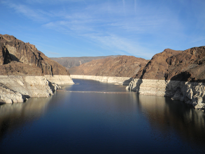
The reservoirs of the Colorado River Basin are 49 percent full/51 percent empty right now (data pdf). Despite another bad runoff year, that’s pretty much exactly where they were at the end of 2015.
Let’s go with half full then, shall we? We’ve come within a couple of inches’ elevation of halting Lake Mead’s decline. It still shrank, and absent further action it will continue to do so.
But we are close, and we can see what “further action” looks like. As I write this on New Years Eve, it looks like Mead will end 2016 at elevation 1,080 feet and change above sea level, just a couple of inches below where it ended 2015. Maybe the experience of the last couple of years suggests “inexorable” is no longer the right word?
The year-end number is still a record – the lowest since 1936, when they were first filling the big reservoir. (Despair?) But in a year with below average precipitation in the Colorado River Basin (89 percent of average into Lake Powell), this represents real progress in managing the system. “Normal” for the 21st century (the median) is an annual drop of 12-plus feet in the reservoir. It’s only gone up twice since 2000. Both times were unusually wet years. A year in which, despite sub par runoff, Lake Mead doesn’t keep dropping is a step in the right direction.
Looking at the basin more broadly, total storage at years’ end sits at 29.453 million acre feet, just a tad below 29.693 million acre feet last year at this time. This despite Upper Colorado River Basin runoff that was more than 1 million acre feet below average.
A few things are going on here:
Arizona only took 2.61 million acre feet of water in 2016, 93 percent of its full allotment.
Nevada only took 235,000 acre feet, 78 percent of its full allotment.
Over the last couple of years, the combined conservation efforts of Arizona and Nevada are equivalent to about 8 feet of elevation in Mead – water that is currently sitting in the reservoir.
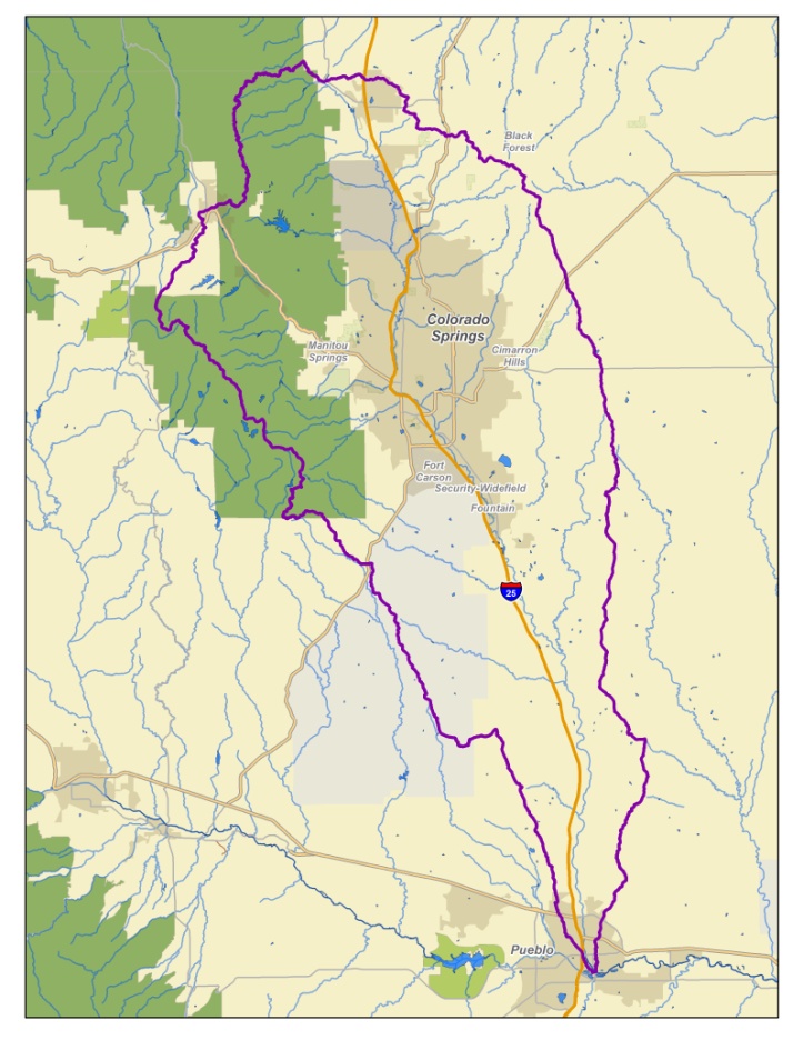
The Fountain Creek Watershed is located along the central front range of Colorado. It is a 927-square mile watershed that drains south into the Arkansas River at Pueblo. The watershed is bordered by the Palmer Divide to the north, Pikes Peak to the west, and a minor divide 20 miles east of Colorado Springs. Map via the Fountain Creek Watershed Flood Control and Greenway District.
Colorado Springs filed arguments last week to keep an Arkansas River water district from joining the federal and state lawsuit that’s demanding cures to city stormwater violations.
But with Rocky Ford melons and other crops at stake, the water district plans to fire back by the Thursday deadline with counterarguments to the U.S. District Court in Denver.
Fountain Creek flows through Colorado Springs and into the Arkansas, bringing excess sedimentation, E. coli contamination and other pollution, the Lower Arkansas Valley Water Conservancy District claims.
The lawsuit it wants to join was filed last month by the U.S. Department of Justice on behalf of the Environmental Protection Agency and by the Colorado Department of Public Health and Environment.
The EPA and Department of Justice negotiated with the city unsuccessfully over the past year to resolve the violations cited in EPA audits in 2013 and in August 2015, two months after Mayor John Suthers took office.
Suthers has made the issue a priority, crafting an agreement with Pueblo County to provide $460 million worth of stormwater projects by 2035, beefing up the city’s stormwater division with a new manager and added engineers and inspectors, and releasing an inch-thick Stormwater Program Implementation Plan on Nov. 2.
The EPA and state nonetheless filed suit one week later, on Nov. 9.
“From my perspective, they’re dwelling in the past,” Suthers said. “We feel very strongly the EPA and state health need to get down to El Paso County and see how many problems we’ve already fixed.”
The Lower Ark, as the district is known, had given notice in November 2014, that it would sue the city for violating its MS4 permit, which allows for the municipal separate storm sewer system.
That’s what the EPA and state now are suing over as well.
“We were precluded from filing our own lawsuit because our claims were essentially the same,” said Peter Nichols, lawyer for the Lower Ark.
“The question is whether the city is already putting a lot of political pressure on the state and EPA to back off. The district is concerned they might be successful with that pressure, and water quality wouldn’t be improved in Fountain Creek,” Nichols said.
The Lower Ark – which represents Bent, Crowley, Otero, Prowers and Pueblo counties – has seen Colorado Springs break stormwater promises repeatedly, said district Executive Director Jay Winner.
The city was collecting about $15 million a year through its Stormwater Enterprise Fund until voters passed ballot Issue 300 in 2009, restricting city enterprise funds. Days later, the City Council voted to phase out the fund by 2011.
Then the Waldo Canyon fire erupted in 2012, creating a burn scar that spawned widespread flooding in 2013, exacerbating problems with Fountain Creek, Monument Creek and other tributaries while spewing sediment and floodwaters downstream.
That year, the EPA audited the city’s stormwater system Feb. 4-7.
Between 2011 and 2014, the city spent $1.6 million a year average on stormwater and had nine full-time employees in that division. Degradation, widening and erosion of streambeds, combined with surface runoff, led to sedimentation and substandard water quality, the EPA and state say.
The next EPA audit, conducted on 14 sections of the city’s system Aug. 18-19, 2015, found “continuous failure” to meet standards or remediate problems highlighted in 2013.
Arizona also has a nearly-normal snowpack, with between 2 and 24 inches falling all along the Mogollon Rim and into the White Mountains in the most recent storm. However, the snow in Arizona makes only a modest contribution to runoff into the Colorado River, a vital water source in seven states — especially Nevada, California and Arizona…
meeting of the Colorado Water Users Association failed to agree to a long-term plan to protect the water supply in the chain of reservoirs along the Colorado River.
If the group can’t come to an agreement and Lake Mead falls any further, Arizona and Nevada could find themselves rationed or cut off — since California has priority when it comes time to ration the water.
The water users hoped to adjust allotments and agree on conservation measures to stretch the water supply and avert a cutoff with devastating consequences to lower-priority states. Las Vegas, Nev. is amongst the most vulnerable, since it relies almost entirely on the Colorado River.
Most of the outstanding issues involve California. Key issues remain providing enough water to keep the Salton Sea from drying up and leaving enough water in the Sacramento River delta to prevent serious environmental effects.
Payson remains in a happily secure position. The town currently relies entirely on well water. Well levels had dropped more than 100 feet until the town imposed water conservation rules a decade ago. Since then, the water table has stabilized. By 2018, Payson will roughly double its water supply with the completion of the C.C. Cragin pipeline.
Roosevelt Lake has dwindled to just 37 percent of normal, reflecting a relatively dry year to this point. However, this week the Salt River had a flow of 1,460 cubic feet per second — almost three times its normal flow. The Verde River had a flow of 797 cubic feet per second, also nearly three times normal. Tonto Creek carried 227 cubic feet per second, compared to its normal flow of just 25 cfs.
Payson has secured its water future, but other cities throughout the region have been following the drama of the disappearing Lake Mead with breathless anticipation.
The snowpack in 2015 on the Colorado River watershed was far below normal, the latest disappointing year in a 16-year, record drought. The storms of 2016 have raised hope for at least a reprieve from rationing. Forecasters say the waning El Niño sea surface warming in the Eastern Pacific could produce a wetter-than normal winter in the West.
James Eklund and Governor Hickenlooper roll out the Colorado Water Plan, Thursday, November 19, 2015 via The Colorado Independent
Here’s a guest column from Crisanta Duran that’s running in The Pueblo Chieftain:
In the American West, nothing is more vital or sacred than water.
Colorado has a rich and complicated history with the resource, one that is colored by some successes, but also many conflicts and challenges. But because of the work of thousands of Coloradans on our state’s first-ever comprehensive water plan, our water future could be very bright indeed. That bright future, however, will require a lot more hard work.
A little more than one year ago, Gov. John Hickenlooper announced the completion of Colorado’s water plan, developed by the Colorado Water Conservation Board after two years of meetings across the state, input from the state’s eight basin roundtables, and the considered comments of more than 30,000 Coloradans from across the spectrum, including Colorado’s ranchers and farmers. It is a landmark policy document that will drive decisions about Colorado’s water for decades into the future.
The plan itself is ambitious, but implementing its component parts, though challenging, will be critical to our state’s future. Smart growth of our state requires tackling looming threats to our water supply, and the plan sets out a clear guide path to do just that.
There is both a conservation and economic imperative for implementing the Colorado Water Plan. We absolutely must have healthy rivers to power Colorado’s thriving recreation and tourism economies while also defending our agricultural community’s needs. In 2014, 71.3 million visitors came to Colorado and spent $18.6 billion, much of it on activities in Colorado’s great outdoors. We must ensure our rivers remain healthy so that future generations can continue to enjoy all the benefits our waterways provide.
The Colorado Water Plan set unprecedented statewide water conservation targets in cities and towns, prioritizing conservation as never before.
The conservation goal for towns and cities equates to nearly 1 percent per year water use reduction by 2050, which, while ambitious, is absolutely achievable
If met, the conservation goals and flexibility envisioned for users enshrined in the Colorado Water Plan will help both towns and cities meet their needs and keep our farms and ranches a key part of the Colorado landscape and economy.
For example, the CWP provides more flexibility for ranchers and farmers to share water with towns and cities, and to keep water in streams without jeopardizing future access to their water rights.
The plan also creates frameworks for much more comprehensive evaluations of new water projects to avoid costly diversions, helps keep Western Slope rivers flowing, and provides for comprehensive management plans for Colorado’s rivers. In short, if it continues to be implemented, the plan will preserve our water supply for ranchers and farmers, help to foster our outdoor recreation economy, and protect our quality of life now and into the future.
Creating a sustainable water future for Colorado is not only vital economics — it is vital to our local communities and our history as a state, including Latina and Latino communities whose long history in Colorado is intrinsically linked to Colorado’s waterways.
For centuries, Colorado’s rivers and streams have been integral to Colorado’s rich culture and way of life. Our rivers provide us with a collective sense of “querencia,” a place in which we know exactly who we are, the place from which we speak our deepest beliefs.
Protecting the Colorado and other rivers is not just smart water management for our state; it builds upon our tradition of responsible use and conservation for the benefit of future generations. Colorado’s rapid growth only compounds the need for urgent and continued action.
Crisanta Duran is speaker-designate of the Colorado House of Representatives. Lucia Guzman is minority leader of the Colorado Senate. Both are Denver Democrats.
Here’s a guest column from Bart Miller that’s running in The Grand Junction Daily Sentinel:
Water is the lifeblood of Colorado, and yet demands for water to support population growth, agriculture, and businesses are increasing while available water supplies are not.
Climate change is also having a growing impact in an already water-scarce region, and Colorado’s population is predicted to double by 2050. Not surprisingly, water scarcity was found to be one of the top concerns of state residents in the latest State of the Rockies Poll Project while 77 percent of Coloradoans support more conservation and water reuse as opposed to only 15 percent who support diverting water from rivers and streams. The good news is that we’ve had a sound first year implementing the state’s new water plan and now we need our state Legislature to help.
One year ago, Colorado’s water plan established goals for ensuring enough water for vibrant cities, viable agriculture, and healthy rivers that sustain wildlife, recreation and local economies. For West Slope communities like Grand Junction, the plan contains a number of provisions to safeguard West Slope interests every bit as much as those of the Front Range.
The Colorado Water Conservation Board recently approved a new budget of $25 million annually over the next few years for implementation. This budget includes funding for water conservation to help reach our state goal of saving 400,000 acre-feet of water, which would reduce water use by approximately 1 percent per year. The budget advances cost-effective measures to help communities make the most of every drop, like fixing leaky infrastructure and increasing water reuse technologies. Also included: $5 million annually for stream management and watershed restoration plans — essential for both healthy ecosystems and our thriving recreational economy.
The plan’s criteria “checklist” for evaluating what water projects receive public funds also started to gain steam by being embedded in the grant process for local river basin roundtables. The common-sense checklist evaluates whether projects have community support, prevent environmental degradation, are feasible, and meet real water needs. Ensuring local community support is essential for protecting West Slope resources.
We’ve run a good first lap, but there are miles to go to meet new water demands and protect Colorado’s rivers. In the coming year, we need development of alternative agricultural water agreements that support agriculture rather than “buy and dry” scenarios where cities buy up water rights that never return to agricultural producers. We need urban water conservation embedded into land use decisions so new development is water-smart from the start, reducing pressure to divert water from the West Slope to the Front Range. We need funds so local stakeholders can assess river health and create local stream management plans.
Most immediately, we need the Legislature to approve the $25 million plan budget developed by the Colorado Water Conservation Board. The plan’s proposals have the support of the vast majority of Coloradans. Ultimately, the water plan’s long-term success requires collaboration among diverse stakeholders to ensure we help all local economies that rely upon Colorado’s rivers. Please join us in asking our state representatives to help by putting the water plan and our communities first.
Bart Miller leads Western Resource Advocates’ program protecting healthy rivers; improving water efficiency; and drawing the connection between water, energy, and climate change.