Click on a thumbnail graphic to view a gallery of snowpack data from the NRCS. Note that the Basin High/Low graphs may not reflect all of the snowfall from the weekend storm.

Statewide basin-filled snowpack map January 22, 2018 via the NRCS.

Statewide Basin High/Low graph January 21, 2018 via the NRCS.

Arkansas River Basin High/Low graph January 21, 2018 via the NRCS.

Upper Colorado River Basin High/Low graph January 21, 2018 via the NRCS.

Gunnison River Basin High/Low graph January 21, 2018 via the NRCS.

Laramie and North Platte Basin High/Low graph January 21, 2018 via the NRCS.

Upper Rio Grande River Basin High/Low graph January 21, 2018 via the NRCS.

San Miguel, Dolores, Animas, and San Juan Basin High/Low graph January 21, 2018 via the NRCS.

South Platte River Basin High/Low graph January 21, 2018 via the NRCS.

Yampa and White Basin High/Low graph January 21, 2018 via the NRCS.
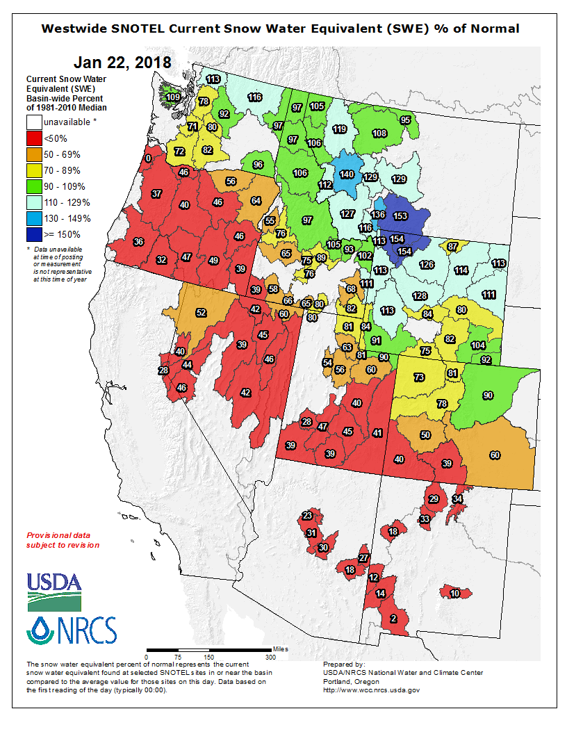
And, here’s the Westwide SNOTEL basin-filled map for January 22, 2018 from the NRCS.
From The Durango Herald (Mia Rupani):
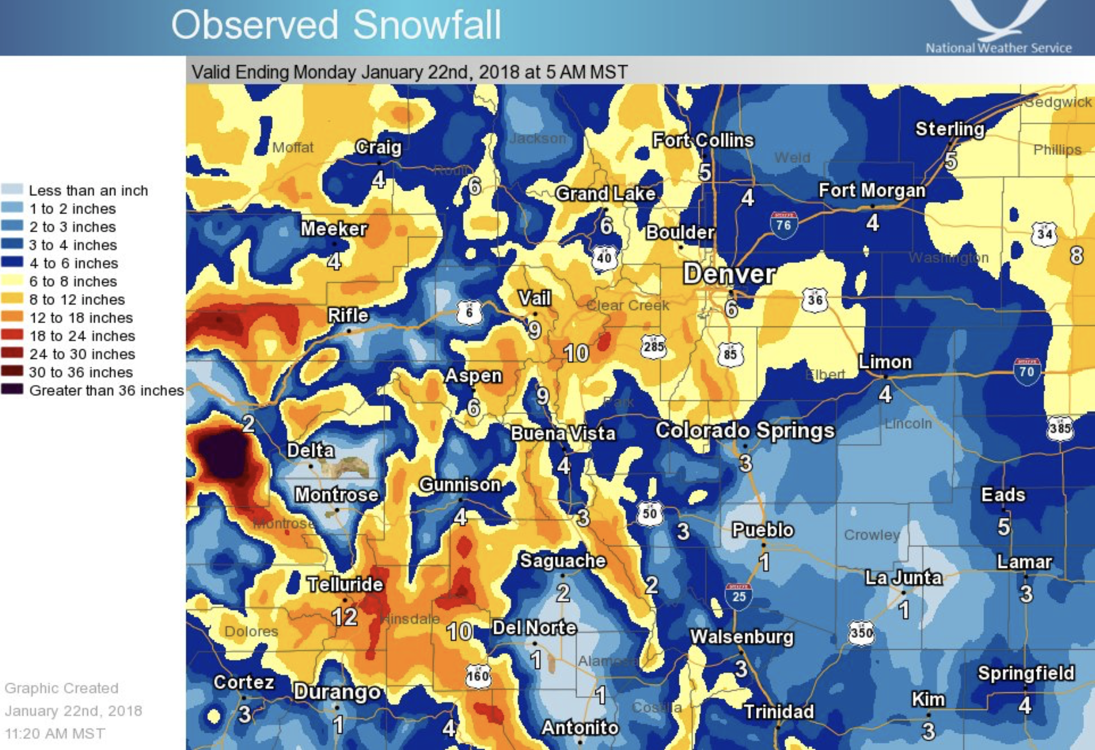
A winter weather advisory remained in effect until 2 p.m. Sunday for the San Juan Mountains, where a winter storm dumped about a foot of snow overnight…
Meteorologist Julie Malingowski of the National Weather Service in Grand Junction said the high country could see an additional 1 to 3 inches of snow Sunday afternoon before the storm moves out of the region.