Colorado program that enhances streams gets a second chance at expansion this summer — @WaterEdCO

Fryingpan River downstream of Ruedi Reservoir. Photo credit Greg Hobbs

From Water Education Colorado (Shay Castle):

With Colorado’s snowpack at historically high levels and several towns turning their attention from avalanches to potential flooding, most people in the state probably aren’t thinking about preparing for drought years. But state lawmakers, farmers and environmentalists are.

Together, they are working over the summer on potential expansions to a program that allocates water specifically to benefit streams and aquatic habitat in dry times.

The measure failed at the State Capitol this year, but HB19-1218, Loaned Water for Instream Flows to Improve Environment, will be taken up again this summer by the legislature’s Interim Water Resources Review Committee.

The first effort was championed by conservationists like The Nature Conservancy and opposed by some farmers, who worry it could harm water rights reserved for agriculture.

“Our businesses are totally based on the value of those water rights,” said Carlyle Currier, vice president of the Colorado Farm Bureau and a rancher in Molina, Colo. “We’re very concerned that changes would allow that right to be injured.”

Colorado’s Instream Flow Program was established amid the environmental movement of the 1970s to integrate environmental water needs into the state’s intricate system of water rights. Colorado’s water laws work on a priority system: Those whose water rights were established earliest get first dibs in dry years. Before the instream flow law was created, there was no mechanism to establish a water right specifically to keep water in a stream to protect fish and the environment. Rather, water rights were all about diverting that water from the stream.

The Instream Flow (ISF) Program uses water rights within that same priority system to reserve water for environmental purposes, protecting the plants and animals that depend on streamflows.

To date, 9,600 miles of stream have been protected through ISF, according to Linda Bassi, chief of lake and stream protection with the Colorado Water Conservation Board — nearly a quarter of the state’s 40,000 miles of waterways. The CWCB doesn’t have a goal for how many miles of stream it would like to eventually protect, Bassi said, instead taking recommendations from state and federal agencies, local governments and environmental groups for specific stream segments in need of protection.

The CWCB is the only entity that can legally hold ISF water rights. It gets them through establishing new, junior water rights, or by acquiring existing water rights via donation, purchase, lease or other contract. HB19-1218 was concerned with the leasing of existing water rights for ISF purposes.

Under current law, water rights holders can lease their water to the ISF Program only three years out of any 10-year period, and are limited to one 10-year timeline. After that, to maintain ISF protection on a given stretch of stream, the CWCB has to find another water rights holder to lease from, or work out another agreement to preserve the water.

The state can and does employ different means to protect a stretch of water on non-lease years. But “leases are the simplest and easiest way to pull this off,” said Andy Schultheiss, executive director of the Colorado Water Trust, a nonprofit that works with the CWCB on the ISF Program.

Under the proposed legislation, the CWCB would be able to lease water rights for five years out of 10, and the 10-year periods could be renewed twice. Extending protection to 15 years out of 30 will help sustain the environment as drought cycles become more erratic due to climate change, said Aaron Citron, policy advisor at The Nature Conservancy.

“What we’re trying to do is provide a tool that can address critically low stream conditions under a more variable future scenario,” Citron said. Even if HB19-1218 had passed as-is, the expanded ISF Program would not “fully meet the need we think we will see under climate change.”

Both Schultheiss and Citron agree that the way ISF rights are being used today shows that there is more demand for instream flow protection than supply. Two of three available years have been used in a lease of water from Stagecoach Reservoir near Steamboat Springs to benefit the Yampa River, according to Citron, and the Colorado Water Trust is holding off on using the third for when conditions are most dire.

“Last summer, there were stretches when the only water in the Yampa [River] through Steamboat Springs had been leased [for instream flow],” Schultheiss said.

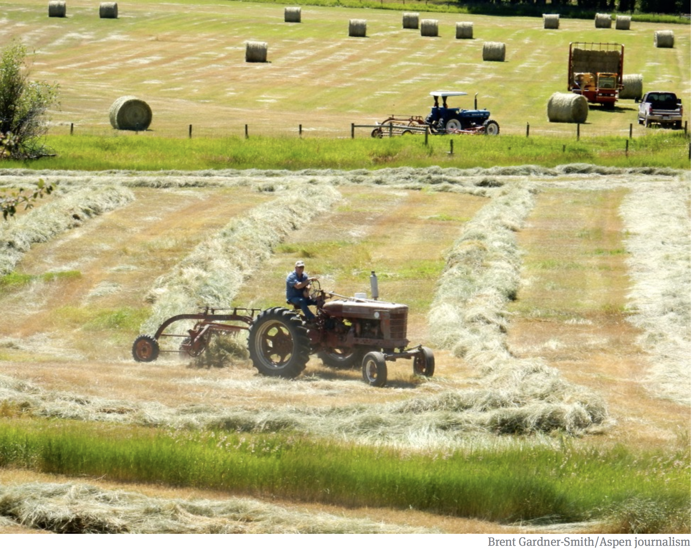
As far as the state’s farmers are concerned, expanding instream flows goes a step too far. The Colorado Farm Bureau opposed HB19-1218 for the primary reason of protecting existing water rights.

“It seems like it was a little bit of a backdoor to expand ISF rights without going through the vetting process,” said Currier. “That’s a little frightening to those of us who own water rights.”

To establish a new ISF water right on a particular stream, there is a three-year process that ends with a review by Colorado’s water court to determine, among other things, that the instream right won’t negatively impact other water rights holders. Extending lease periods that significantly without a return to water court could harm farmers, Currier said.

Under the proposed rules, Currier worries that two five-year leases could be stacked back-to-back, leaving water in streams for 10 consecutive years while fields go fallow.

The Farm Bureau is also concerned about a third proposal for the ISF Program. Currently, leased water rights can only be allocated for instream purposes in a quantity great enough to preserve the natural environment “to a reasonable degree.” The Nature Conservancy wants to go beyond preserving existing conditions to allow improvement of natural conditions as well.

“That language is a little troubling to us,” Currier said. “That is not a quantitative term. Who determines what’s an improvement? What exactly does that mean?”

The CWCB already has the authority to acquire water rights that improve the environment, Citron said, just not for ISF leases.

This and other ISF issues will be discussed at the next meeting of the legislative interim water committee as part of the 2019 Colorado Water Congress annual summer conference, being held Aug. 20-22 in Steamboat Springs. Both sides remain hopeful that a compromise could be reached, though Currier noted farmers are resistant to making changes that they feel haven’t been properly vetted for potential negative impacts.

“We’re not out to destroy the environment; we’re more dependent on it than the average citizen,” Currier said. “We really feel the existing water law is written fairly well and we don’t see a lot of need for changes to that.”

If the interim water committee is able to craft new language that satisfies agricultural and environmental interests, a new bill will be introduced during the next legislative session, which convenes Jan. 8, 2020.

Shay Castle is a freelance journalist based in Boulder, Colorado. She can be reached at shay.castle6@gmail.com

The wet spring = $3.4 million drop in sales for @CSUtilities in May but beats forecast

Colorado Springs with the Front Range in background. Photo credit Wikipedia.

From The Colorado Springs Independent (Pam Zubeck):

A damp spring that’s pushed Colorado Springs above its normal rainfall total translates to about $3.4 million less in water sales for Colorado Springs Utilities through May this year compared to the same five months last year.

The dip in sales likely is related to customers curtailing irrigation of lawns, golf courses and other vegetation.

Last year, Utilities collected $64.7 million in water sales through May, compared to this year’s $61.3 million.

The biggest gap between last year and this year came in May when Utilities’ water revenue totaled $18.3 million compared to $23.3 million in May 2018.

Water consumption in May 2018 stood at 2.9 billion gallons, compared to 2 billion gallons in May this year.

Because Utilities forecasted sales through May 2019 at $18 million but brought in $18.3 million, “We were OK,” says Utilities spokesperson Natalie Watts.

“In general,” she says via email, “when we do forecasting we tend to [err] on the side of conservativeness because we don’t want to get ourselves into a financial hardship. This is especially true during the months of May and October because the weather can be so different during those two months from year to year. We try to build in a little bit of a cushion in case of a bad year.”

#LakeMead forecast continues to brighten as water cuts are modeled — The Las Vegas Review-Journal #DCP #ColoradoRiver #COriver #aridification

Lake Mead, behind Hoover Dam, shows the effects of nearly two decades of drought. (Image: Bureau of Reclamation)

From The Las Vegas Review Journal (Henry Brean):

The outlook for Lake Mead continues to improve, as federal forecasters factor in the benefits from an unusually wet winter and a new interstate drought deal that will leave more water in the reservoir.

Instead of the familiar declines of recent decades, the lake east of Las Vegas now is expected to finish the year slightly higher than it is now, according to the latest estimates from the Bureau of Reclamation.

The projected water level of almost 1,086 feet above sea level by the end of December is about a foot higher than hydrologists were predicting a month ago.

Almost all of that difference can be traced to the extra water the reservoir will store as a result of the Drought Contingency Plans signed by the seven Colorado River states during a ceremony at Hoover Dam last month…

Bureau of Reclamation spokesman Doug Hendrix said this marks the first time the new voluntary drought cuts have been factored into the bureau’s running, two-year forecast for the Colorado…

The bureau now expects the river to swell with about 144 percent of its average flow through July, as all that snow melts and runs downstream into Lake Powell, the reservoir on the Utah-Arizona border formed by Glen Canyon Dam. That would make this the second wettest year — and just the fifth with above-average river flows — since the current drought began in 2000.

Report: Simulating the sensitivity of evapotranspiration and streamflow to large-scale groundwater depletion

Click here to read the report. Here’s the abstract:

Groundwater pumping has caused marked aquifer storage declines over the past century. In addition to threatening the viability of groundwater-dependent economic activities, storage losses reshape the hydrologic landscape, shifting groundwater surface water exchanges and surface water availability. A more comprehensive understanding of modern groundwater-depleted systems is needed as we strive for improved simulations and more efficient water resources management. Here, we begin to address this gap by evaluating the impact of 100 years of groundwater declines across the continental United States on simulated watershed behavior. Subsurface storage losses reverberate throughout hydrologic systems, decreasing streamflow and evapotranspiration. Evapotranspiration declines are focused in water-limited periods and shallow groundwater regions. Streamflow losses are widespread and intensify along drainage networks, often occurring far from the point of groundwater abstraction. Our integrated approach illustrates the sensitivity of land surface simulations to groundwater storage levels and a path toward evaluating these connections in large-scale models.

From KUNC (Luke Runyon):

Groundwater pumping is causing rivers and small streams throughout the country to decline, according to a new study from researchers at the Colorado School of Mines and the University of Arizona.

“If you pump near a stream you’re going to change the amount of water that flows through the stream, because some of that stream water is going to basically get pulled to the well instead of flowing down the stream,” said Reed Maxwell, hydrologist at Colorado School of Mines and the study’s co-author.

Maxwell says his new study with hydrologist Laura Condon at the University of Arizona goes broad, quantifying the effect of pumping across the country.

“What we found is that we have actually depleted streams quite a bit,” Maxwell said.

The study finds that since the 1950s groundwater pumping has caused some stream flows to decline upwards of 50 percent. Some streams have disappeared from the surface altogether, seeping underground to refill pumped groundwater, the study finds.

Declines are particularly stark in portions of the Colorado River basin and on the Great Plains, Maxwell said.

Using a computer model, researchers were able to envision what rivers across the U.S. would’ve looked like without widespread groundwater pumping, which took hold in the 1950s.

“Today we’re launching ‘For the Love of Colorado'” — Jon Goldin-Dubois

Colorado Rivers. Credit: Geology.com

From CBS 4 Denver (Jeff Todd):

“Today we’re launching “For the Love of Colorado” campaign. Which is a public awareness campaign that’s designed to ensure people out here in Colorado understand the challenges that we face on the Colorado River and other river systems around the west,” said Jon Goldin-Dubois, the President of Western Resource Advocates.

Dozens of advocacy groups, business organizations and state agencies have banded together to create the campaign which promotes the Colorado Water Plan…

The campaign will start rolling out around Colorado later in the year, with ads urging people to get involved and to care about water supply and water issues.

“Warmer weather means more evaporation, it means less water in our rivers. Of course that’s a challenge as we seek to meet the needs of businesses, of environment, of recreation, fish and wildlife, agriculture and of course just our drinking water supply. It is the lifeblood of Colorado’s economy, of our environment and part of our way of life. We can address these challenges head on,” Goldin-Dubois said.

#CanonCity #whitewater park expands — The Pueblo Chieftain

2015 Canon City Wave at 6,000 CFS Freestyle Kayak screen shot from RiverRestoration.org video https://www.youtube.com/watch?time_continue=45&v=OYuk3Rd3CWY

From The Pueblo Chieftain (Tracy Harmon):

The expanded park, affectionately dubbed WKRP-Canon City has been expanded to both the west and east of Centennial Park. In addition to beautification of the river corridor, workers removed existing hazards, stabilized stream banks, improved access points and fish passage, plus enhanced the river for rafting, kayaking, tubing and other in-stream activities. Work was designed and implemented by Scott Shipley’s Design and Engineering firm.

Shipley, a Lyon-based kayaker, is a three-time Olympian and World Cup slalom kayak champion who is known locally for his prowess as a long-time competitor in Salida’s FIBArk boat races.

“Canon City has an incredible resource with the Arkansas River running through town,” Shipley said. “We’re thrilled to deliver a whitewater park that gives residents and visitors better and safer access to this iconic river.”

The river improvement project was led by the local whitewater park committee thanks to funds the group raised along with city of Canon City and Fremont County funds as well as a Great Outdoors Colorado grant and private donations.

The park initially opened in 2010 along the section of river next to Centennial Park, but work this year has expanded it between the bridge and the old Reddy ice plant, said Ryan Stevens, Canon City’s interim city administrator…

Unlike other whitewater parks that often suffer flow issues, the Arkansas River boasts predictable flow rates year-round. This balances both the magnitude of the recreational experiences for different user groups as well as the duration, providing attractive flows for users and events later into the season when flows have dissipated in other rivers.

For the first time, Canon City’s river park will be a draw for slalom paddlers, with boulders strategically interspersed throughout its length to great eddies. S2O Design also incorporated a system that will allow for hanging of slalom gates which can be adjusted for different configurations and flows…

The whitewater park will be used next Friday and Saturday during the 11th annual Royal Gorge Whitewater Festival. The festival features a variety of boating events, live music, a running race and more.

For details about the festival, log onto http://www.royalgorgewhitewaterfestival.com.

Global Warming Is Pushing Microbes into Damaging Climate Feedback Loops & Raising Health Risks — Inside Climate News #ActOnClimate

In marine environments, microbial primary production contributes substantially to CO2 sequestration. Marine microorganisms also recycle nutrients for use in the marine food web and in the process release CO2 to the atmosphere. In a broad range of terrestrial environments, microorganisms are the key decomposers of organic matter and release nutrients in the soil for plant growth as well as CO2 and CH4 into the atmosphere. Microbial biomass and other organic matter (remnants of plants and animals) are converted to fossil fuels over millions of years. By contrast, burning of fossil fuels liberates greenhouse gases in a small fraction of that time. As a result, the carbon cycle is extremely out of balance, and atmospheric CO2 levels will continue to rise as long as fossil fuels continue to be burnt. The many effects of human activities, including agriculture, industry, transport, population growth and human consumption, combined with local environmental factors, including soil type and light, greatly influence the complex network of microbial interactions that occur with other microorganisms, plants and animals. These interactions dictate how microorganisms respond to and affect climate change (for example, through greenhouse gas emissions) and how climate change (for example, higher CO2 levels, warming, and precipitation changes) in turn affect microbial responses. OMZ, oxygen minimum zone.

Here’s a report from Bob Berwyn writing for Inside Climate News. Click through and read the whole article. Here’s an excerpt:

Research is raising serious concerns about the impact of climate change on the world’s tiniest organisms, and scientists say much more attention is needed.

All life on Earth evolved from microorganisms in the primordial slime, and billions of years later, the planet’s smallest life forms—including bacteria, plankton and viruses—are still fundamental to the biosphere. They cycle minerals and nutrients through soil, water and the atmosphere. They help grow and digest the food we eat. Without microbes, life as we know it wouldn’t exist.

Now, global warming is supercharging some microbial cycles on a scale big enough to trigger damaging climate feedback loops, research is showing. Bacteria are feasting on more organic material and produce extra carbon dioxide as the planet warms. In the Arctic, a spreading carpet of algae is soaking up more of the sun’s summer rays, speeding melting of the ice.

Deadly pathogenic microbes are also spreading poleward and upward in elevation, killing people, cattle and crops.

So many documented changes, along with other alarming microbial red flags, have drawn a warning from a group of 30 microbiologists, published Tuesday as a “consensus statement” in the journal Nature Reviews Microbiology.

The microbiologists, in their statement, warned about changes they’re already seeing and called for more research to understand the potential impact. The statement “puts humanity on notice that the impact of climate change will depend heavily on responses of microorganisms, which are essential for achieving an environmentally sustainable future,” they wrote.

Click here to read, “Scientists’ warning to humanity: microorganisms and climate change.” Here’s the abstract:

Abstract

In the Anthropocene, in which we now live, climate change is impacting most life on Earth. Microorganisms support the existence of all higher trophic life forms. To understand how humans and other life forms on Earth (including those we are yet to discover) can withstand anthropogenic climate change, it is vital to incorporate knowledge of the microbial ‘unseen majority’. We must learn not just how microorganisms affect climate change (including production and consumption of greenhouse gases) but also how they will be affected by climate change and other human activities. This Consensus Statement documents the central role and global importance of microorganisms in climate change biology. It also puts humanity on notice that the impact of climate change will depend heavily on responses of microorganisms, which are essential for achieving an environmentally sustainable future.

“If someone says they’re not scared, don’t get in their boat” — Christian Wright #DoloresRiver

Ponderosa Gorge, Dolores River. Photo credit RiverSearch.com.

From OutThereColorado.com (Seth Boster):

“You’re all here at a momentous time,” guide Trey Roberts said before the drop. “You’re about to raft a big, famous, rare river.”

Jeanette Healy of Utah had been waiting 10-plus years for this chance on the Dolores. Doug Nie, a kayaker from Albuquerque, had been waiting even longer. Also here were Rick and Beverly Anderson, a young couple from Albuquerque as well.

“We figured we could do the Las Animas and Arkansas out in (Buena Vista) any year,” Rick said. “But this is our one chance to do Dolores.”

Chances have been tough to come by since the 1980s, when the McPhee Dam began trapping the water that Dominguez and Escalante found to be rushing during their 1776 expedition. El Rio de Nuestra Señora de Dolores, they called it — the River of Our Lady of Sorrows…

Most joyful now are the boaters who had hoped this year’s snowpack would grant McPhee’s occasional controlled “spills.” As of last week, the Dolores Water Conservancy District expected releases to remain at or above 1,200 cubic feet per second through June 23, keeping the river fun until then at least.

That would mean a rafting season of almost one month here, which seems a short window. But longtime river rats regret to say that’s long for the Dolores.

Bill Dvorak, who’s frequented the state’s rivers since the ’60s, can’t recall a longer season. He ran the Dolores in 2017; his last time before that was 2009. “Every six to eight years is about when I get on it,” he said.

And he gets on it almost every floatable opportunity. The Dolores, after all, is easily his favorite river in Colorado…

Mcphee Reservoir

Provisions are still vague. Releases are indeed unpredictable, said Michael Preston, general manager of the Dolores Water Conservancy District. The Bureau of Reclamation factors in current reservoir levels with never-perfect forecasts. Then there’s juggling ever-increasing demand: Farmers combine for the largest allocation of the supply, recent spreadsheets show, followed by the downstream fishery, tribe and municipalities.

“McPhee is a hard-working reservoir,” Preston said. “We use every inch of our active storage capacity to take care of things.”

[…]

The height of that arch is reached at Snaggletooth, the legendary Class IV rapid aptly named. Swirling eddies are like mouths ready to inhale, the jumble of rocks like jaws ready to chomp.

From an embankment, we stopped to analyze the beast. And yes, [Christian] Wright was scared. “If someone says they’re not scared, don’t get in their boat,” he said.

Dolores River watershed

Air Force diverted $66 million from other projects for #PFAS cleanup — #ColoradoSprings Independent

PFAS contamination in the U.S. via ewg.org

From The Colorado Springs Independent (Faith Miller):

In March, the top Democrat on the Senate Environment and Public Works Committee asked the Department of Defense for details about funding diverted from other projects to pay for cleanup and testing for PFAS, a toxic group of man-made chemicals used in military firefighting foam.

On June 5, the DoD responded to Sen. Tom Carper of Delaware by acknowledging that the Air Force had diverted $66.6 million from other projects to pay for PFAS-related efforts. The Army and Navy did not have to divert any funding, according to the DoD’s letter.

Many of the projects put on hold involved cleaning up other pollution at former Air Force sites…

The funding diverted from those and other projects paid for PFAS testing at 16 former Air Force installations, along with groundwater and drinking water treatment for communities around Wurtsmith, Pease Air National Guard Base in New Hampshire and March Air Reserve Base in California.

“Congress needs to ensure that the Department of Defense has the resources needed to fully address its millions of dollars—perhaps billions of dollars—in liabilities related to the DOD-related PFAS contamination in our communities,” Sen. Carper said in a statement following the announcement. “Otherwise, the DOD will just keep robbing Peter to pay Paul by putting important projects on standby and stretching budgets to clean up PFAS contamination.”

Lawmakers are looking to the National Defense Authorization Act of 2020, which funds the Department of Defense, to procure more funding for PFAS testing and cleanup.

The bill already requires the DoD to phase out all firefighting foam that contains PFAS by 2023. While military installations including Peterson Air Force Base have switched to a version thought to be safer, and have stopped using the foam for training purposes, the military continues to use foam with “short-chain” PFAS chemicals, thought to be safer for public health and the environment.

On June 13, Sen. Michael Bennet, D-Colorado, introduced an amendment to the Defense Authorization Act that would reimburse water districts (including those in Security-Widefield and Fountain) for treating and mitigating PFAS in drinking water.

“In the wake of contamination, local water districts around Peterson Air Force Base took the initiative and covered the cleanup costs to ensure the safety of drinking water for residents,” Bennet said in a statement. “This amendment will ensure these districts receive the full reimbursement they deserve.”

A separate amendment filed by a bipartisan group of senators would expand monitoring and testing of PFAS, and set a deadline for the Environmental Protection Agency to develop a drinking water standard for PFOA and PFAS, two types of PFAS chemicals once found in firefighting foam.

#Runoff news: Upper #ColoradoRiver reservoir releases planned to bolster streamflow for #endangered fish #COriver

Katie Creighton and Zach Ahrens both native aquatics biologists for Utah Division of Wildlife Resources (UDWR) standing on the temporary Matheson screen. The Nature Conservancy and UDWR partnered together to build the structure to allow the endangered razorback sucker larvae to enter the Scott M. Matheson Wetlands Preserve without the predators also coming in. Courtesy & Copyright Katie Creighton, Photographer via Utah Public Radio

From The Grand Junction Daily Sentinel (Dennis Webb):

Entities including Front Range water utilities and the Bureau of Reclamation on Friday began coordinating water releases from upstream reservoirs in a voluntary effort to prolong peak runoff flows in what’s called the 15-Mile Reach upstream of the confluence with the Gunnison River. It’s a critical stretch of river for four endangered fish — the humpback chub, razorback sucker, bonytail chub and the Colorado pikeminnow.

River flows at Cameo exceeded 20,000 cubic feet per second Saturday. The coordinated reservoir operations are intended to slow the decline of high flows, sustaining those flows for three to five days this week. The first releases from the coordinated program were expected to arrive Monday night; the flows at Cameo earlier Monday were at 18,900 cfs, according to the U.S. Geological Survey.

Strong flows help remove fine sediment from cobble bars that serve as spawning habitat for the fish, according to the U.S. Fish and Wildlife Service. They also help reconnect the river to backwaters where the fish, especially at the larval stage, can find refuge from the stronger river flows, said Don Anderson, a hydrologist with the agency.

The releases are being made possible by this year’s ample winter snowpack, which means reservoir operators can release reservoir water without risking the ability to fill the reservoirs.

Anderson said that in some years the releases are coordinated with the goal of raising peak flows to beneficial levels, but this year the peak flows were high enough it was decided that the reservoir water instead could be used to prolong those flows.

According to a Fish and Wildlife Service news release, under the coordinated operations:

  • The Bureau of Reclamation is increasing releases at Ruedi Reservoir and Green Mountain Reservoir, with the Green Mountain releases including inflows bypassed by Dillon Reservoir, operated by Denver Water.
  • Denver Water is likely to increase releases from Williams Fork Reservoir.
  • Homestake Reservoir, operated by Colorado Springs Utilities, may participate in the releases after peak flows on the Eagle River recede.
  • The Windy Gap Reservoir and Pump Station, operated by Northern Colorado Water Conservancy District, will delay pumping water to Granby Reservoir.
  • The current effort follows reservoir releases by the Bureau of Reclamation earlier this spring on the Gunnison River to boost flows for endangered fish there. In both cases, the efforts are planned in a way intended to keep from resulting in flooding impacts downstream.

    Anderson said the coordinated spring operations on the upper Colorado River started in 1997, and by his count have occurred in 11 years since beginning…

    He said that while the coordinated releases target the 15-Mile Reach, their benefits extend as far as Moab, Utah, improving management of a river floodplain wetlands there that is being used to help in the recovery of razorback suckers.

    Entities including the Colorado River Water Conservation District, Grand Valley Water User Association, Orchard Mesa Irrigation District, Palisade Irrigation District, National Weather Service, Colorado Basin River Forecast Center, Colorado Water Conservation Board, and Xcel Energy also participate in the coordinated reservoir operations effort.

    From The Grand Junction Daily Sentinel (Dennis Webb):

    The river is flowing so fast right now that people can float the entire 25-mile Ruby-Horsethief stretch in a day — even as few as four or five hours, Baier said. He said his company is running guided one-day trips there right now and he thinks some people are realizing they can float the stretch in a day rather than needing to make reservations for Bureau of Land Management campgrounds.

    In Glenwood Canyon, raft companies currently aren’t running the Shoshone stretch of the Colorado River due to strong flows, as is typical this time of year. Ken Murphy, owner of Glenwood Adventure Co., said that closure might last perhaps a week longer this year than in a normal year. He said the Shoshone rapids have a brand appeal and people want to raft there, but high water provides lots of other good rafting options. Last year, the Roaring Fork River didn’t provide much of a rafting season, but this year is different. While it usually offers good rafting until maybe the first or second week of July, “now we’re going to be on it we hope maybe until August,” Murphy said.

    He said the Roaring Fork offers beautiful scenery away from Interstate 70 and sightings of bald eagles and other wildlife. And rapids that are usually rated Class 2 are currently Class 3.

    “It gives people enough whitewater to get wet but not scare them,” he said.

    Colorado River trips that put in at the Grizzly Creek area of Glenwood Canyon below Shoshone also are heading farther downstream than normal right now, to New Castle, due to the fast-flowing water, Murphy said…

    Murphy said his company also owns Lakota Guides in Vail. He said the Eagle River in Eagle County will be good for rafting for longer this summer due to the big water year, meaning the company can continue offering trips to guests there rather than having to bus them to Glenwood Springs or the upper Arkansas River. He said the Blue River in Summit County also will benefit from a longer boating season.

    The West’s worst fires aren’t burning in forests — @HighCountryNews

    The burn scar from the Martin Fire in Nevada as seen in this aerial photo. The largest wildfire in the state’s history, it decimated sagebrush habitat. Photo credit: Pierre Markuse/CC via Flickr

    From The High Country News (Nick Bowlin):

    Range fires get bigger every year, threatening sagebrush habitat and rural towns.

    Between the town of Elko, Nevada, and the Idaho border stretches some of the most remote land in the Lower 48, rolling hills and arid basins as far as the eye can see. Last July, this section of the Owyhee Desert was scorched by a fierce, fast-moving blaze with 40-foot flames, the largest wildfire in state history. In the end, the Martin Fire burned 435,000 acres, including some of the West’s finest sagebrush habitat. Now, the raw range wind whips up the bare earth into enormous black clouds that roil on the horizon.

    Once rare, fires that large, hot and destructive are now common in the Great Basin, a 200,000-square-mile region of mountains and valleys that includes all of Nevada and much of Utah, as well as parts of California, Idaho and Oregon. But despite the rising fire risk, a general lack of attention is putting the rangeland in growing danger.

    The fire problem “risks permanent loss” of the ecosystem, according to Jolie Pollet, a fire ecologist and the Bureau of Land Management’s division chief for fire planning and fuels management. This is a genuine crisis, she said, and it demands greater urgency and attention than it is currently getting.

    “The general public, especially urban areas, doesn’t seem to have an appreciation for the impacts on these landscapes, since the areas are so sparsely populated,” she said.

    The new ferocity of rangeland fires has an old culprit: cheatgrass, an annual originally from Eurasia that was brought to this country in cattle feed, packing material and ships’ ballast in the late 1800s. It has since proliferated through overgrazing and development. The grass burns easily and often, and it thrives on fire. In intense blazes, when native shrubs perish, cheatgrass simply drops its seeds and then expands into the burned areas. The areas of greatest fire risk in the Great Basin have a high correlation with the areas of highest cheatgrass incursion, and the increasingly dry and arid climate brought by climate change is encouraging its spread. The Great Basin now has the nation’s highest wildfire risk.

    Since 2014, 9 million acres of sagebrush have been permanently lost to fires like the Artesian Fire in 2018. Photo credit: Austin Catlin/BLM

    Historically, sagebrush habitat burned about once every century or less, but now it happens around every five to 10 years. Over the past two decades, more than 15 million acres of sagebrush have been permanently lost to fire, according to the BLM, 9 million of them since 2014. Overall, since 2000, more acres of shrubland or grasssland have burned than forest.

    If sagebrush decline continues, the approximately 350 species that depend on it are in serious trouble. The Martin Fire burned some of the best sage grouse habitat in the country and destroyed more than 35 grouse mating grounds, or leks. The fires also harm watersheds, cause erosion and destroy wildlife corridors used by pronghorn antelope, mule deer and elk.

    The impact on rural Americans is equally severe. Counties and ranchers must deal with infrastructure loss, including troughs, fencing, and damage to roads and powerlines. Many ranchers struggle with the additional costs, said Ron Cerri, a rancher and commissioner in agriculture-dependent Humboldt County, where the Martin Fire burned. Ranchers may lose hayfields in a blaze, for example, and six months of hay for 500 cattle costs about $216,000, according to Cerri. Cattle often die in the flames, and ranchers have to put down animals crippled by the smoke. Jon Griggs, a Nevada rancher whose land burned in 2007, called it the worst part of the job.

    Because sagebrush ecosystems are neglected, they get less funding, making the fire threat even worse. Indeed, the BLM receives even less money than the already-underfunded Forest Service. For 2019, the Forest Service got about $400 million in annual funding for fuel management, and about $1.3 billion for firefighting preparedness. The BLM received $85 million and $180 million respectively, even though it manages about 50 million more acres of public land. The BLM also received $11 million for fire recovery, a microscopic amount, given the scale of the problem.

    When the BLM runs out of firefighting money, it’s forced to raid other programs, as the blazes quickly burn through agency budgets.

    “The agencies run out of money and all the other programs get gutted,” said University of Montana wildlife biology professor Dave Naugle. “In the long term, it really hurts conservation.”

    Last year, Congress passed a measure that allows the BLM to access emergency fire funds without draining other initiatives. But the provision doesn’t kick in until next year, and even when it does, the BLM will remain seriously underfunded for firefighting, prevention and restoration.

    Meanwhile, wildfires are already burning across the West, and the cheatgrass is beginning to dry up, turning from its spring purple to the yellowish hue that signals its readiness to burn.

    Pollet put it succinctly: “I’m scared for 2019.”

    Nick Bowlin is an editorial intern at High Country News. Email him at nickb@hcn.org.

    Cheatgrass was introduced to North America through contaminated grain seed, straw packing material, and soil used as ballast in ships sailing from Eurasia. As a winter annual, cheatgrass seeds germinate at low fall temperatures. Seedling roots continue to grow throughout the winter, and by spring, are capable of out-competing native species for water and nutrients because most native vegetation is just getting started. Cheatgrass completes its life cycle quickly and can become dry by mid-June. Photo credit: Utah State University

    #WarmingStripes for #Colorado, 1895 through 2018 #ActOnClimate #ShowYourStripes

    Graphical representation of Colorado’s warming since 1895, from the Institute for Environmental Analytics. You can download stripes for most of the world.

    Warming stripes for Colorado, USA.

    Snow water equivalent (SWE) explained

    SNOTEL Site via the Natural Resources Conservation Service

    From the Middle Colorado Watershed Council (Erika Gibson) via The Glenwood Springs Post Independent:

    Everyone is talking about snowpack this year. The news boasts epic-sounding statistics for snowpack that is “649 percent of normal,” “128 percent of average,” “440 percent of median,” or, my personal favorite, “1,776 percent of last year.” One need not speak math to know that big snowpack is generally a good thing. But unpacking the statistical lingo can help in understanding what those numbers actually indicate.

    People generally understand snowpack to refer to snow depth. But in the context of water supply, snow depth doesn’t matter as much as snow-water equivalent. SWE is the amount of liquid water released when snow is melted instantaneously. SWE data mainly comes from automated sites across Colorado that capture, record and report daily data.

    SWE is a more useful measurement for understanding water supply than snow depth, because water content in snow layers can vary — consider the difference between two inches of wet, heavy snow and dry powder. And when discussing snowpack, what most people care about is not cubic inches of snow in the mountains; it’s how much water will flow through our rivers, ditches and reservoirs.

    This year, peak SWE for the Upper Colorado Basin was 20 inches. To add context, last year, which was dry, the SWE was 16 inches, while in the 2011 flood year it was 25 inches.

    Snowpack varies throughout the year. Imagine a mountain profile where the left side is an easy, long slope that steps up to a series of peaks, and the right side is a steep, jagged descent. This is what the actual SWE data looks like plotted for each day as snowpack starts to build in October, slowly accumulates through the winter, peaks in April, then starts to melt (with some intermittent, spring-storm gains) though June or July when it’s fully depleted.

    When most people bandy snowpack statistics around, they are referring to a point on that graph and “average” is probably the most confused term that gets used. We typically understand “average” to mean the arithmetic “mean,” which is the sum of numbers in a set divided by the number of numbers used in the set. (For example, the mean of 4, 6 and 20 is 10). But when discussing snowpack, the “average” typically refers to the median, which is the number that falls in the middle of the set. (So, the median of 4, 6 and 20 is 6.) In other words, there are different ways of describing what is “normal.”

    Snowpack averages most often compare a relevant date of the current year to the median value on that same date within the study period (for western snowpack, the dataset is from 1981 to 2010). The median is more appropriate because it is not affected by outlier years.

    You can see on an SWE graph that the median snowpack is less than the mean snowpack. This means there have been more low-snow years than high-snow years, but the high-snow years were really snowy, thus skewing the mean higher and the median lower.

    Anyway, math schmath. … What most people really care about isn’t the difference between median and mean. People care about how much water there is. We want to know when the rivers will really start to flow, whether they’ll flood, and when runoff will peter out. And the relationship between snowpack and runoff has almost as much to do with the timing and intensity of spring and summer weather as the timing of peak SWE.

    For example, because of spring-weather timing, runoff this year is late and expected to be sustained for longer. Peak snowpack also occurred later, and temperatures are staying cooler, so runoff is expected to peak in late June. Compare that to 2011, another heavy snow year, where warmer weather and rain caused runoff to peak in May, with more flooding.

    This year’s snowpack-generated runoff is good news for water users now, but how good is it for the future? It will recharge the soil and aquifers, refill reservoirs, make for long recreation and irrigation seasons, and help mitigate Colorado’s long-term drought.

    However, this region has been in a 16-year drought and needs several more years of increased snowpack and cool temperatures to alleviate the pressures on regional water supplies. According to Colorado River District engineer John Currier, we will need at least seven consecutive 2019s to fully fill lakes Powell and Mead, which are currently at historic lows.

    Understanding snowpack, in sum, has more than some depth to it.

    Erika Gibson is a contributor to this monthly column for the Middle Colorado Watershed Council, which works to evaluate, protect and enhance the health of the middle Colorado River watershed through the cooperative effort of watershed stakeholders: anyone standing in the watershed. To learn more about the MCWC, visit https://www.midcowatershed.org. You can also find the Council on Facebook at https://www.facebook.com/midcowatershed.

    Reservoir releases for endangered fish in #ColoradoRiver coming after peak flows — @AspenJournalism #COriver

    A Colorado pikeminnow taken from the Colorado River near Grand Junction, and in the arms of Danielle Tremblay, a Colorado Parks and Wildlife employee. Pikeminnows have been tracked swimming upstream for great distances to spawn in the 15-mile stretch of river between Palisade and Grand Junction. An apex predator in the Colorado, pikeminnows used to be found up to six feet long and weighing 100 pounds. Photo credit: Lori Martin, Colorado Parks and Wildlife via Aspen Journalism

    From Aspen Journalism (Brent Gardner-Smith):

    The Colorado River east of Grand Junction in DeBeque Canyon is forecast to hit its annual peak Saturday, in a quick climb to about 21,000 cubic feet of water per second, as measured at the Cameo gage, before dropping over the next week as cooler weather arrives.

    The operators of five upstream reservoirs have been closely watching this season’s large, and late, spring-runoff pattern, and they are now starting a coordinated release of water designed to improve habitat for endangered fish in a 15-mile stretch of the river below Palisade.

    The reservoir releases, which collectively will add about 1,300 cfs of water to the river, are being timed to reach Palisade on Monday or Tuesday, after this weekend’s peak flows have subsided.

    The goal of this year’s coordinated release of water is to extend the high flows, not add to the peak flow, as it is in most years, said Don Anderson, a hydrologist with U.S. Fish and Wildlife, who said care is being taken not to increase the risk of flooding this weekend.

    The releases from Ruedi, Homestake, Wolford, Williams Fork and Green Mountain reservoirs are designed to benefit four ancient species of fish.

    The well-timed higher water will send spawning cues to Colorado pikeminnows, large powerful fish that swim upstream to spawn in the gravel beds of what’s known as “the 15-mile reach.”

    Higher water will give the recent offspring of razorback suckers a chance to find refuge in calm side channels.

    Higher, faster water will scour fine silt from gravel beds, flush away dry-year vegetation growth and help the river absorb nutrients from wet floodplains.

    And the high water will also benefit populations of humpback chubb downstream of Grand Junction — at Blackrocks, in Westwater canyon and near Moab — and may also help the struggling bonytail chubb.

    Managers of Ruedi Reservoir are participating in a voluntary release of water this week to boost flows for endangered fish near Palisade. Releases are also being coordinated from Homestake, Williams Fork, Green Mountain and Wolford reservoirs, but are being timed to come after this weekend’s peak flows. Photo credit Greg Hobbs

    Ruedi releases

    As part of this year’s effort, the outflow from Ruedi Reservoir into the lower Fryingpan
    Reservoir will rise Sunday by 100 cfs, and over three days, the releases will climb from 354 cfs to 630 cfs or above, before stepping back down Wednesday.

    The flow from Rocky Fork Creek, which runs into the Fryingpan below Ruedi Dam, was adding 75 cfs to the river Friday, which means the ’Pan could be 700 cfs or above by Tuesday or Wednesday.

    Tim Miller, a hydrologist at the Bureau of Reclamation, said a flow of about 700 cfs is consistent with most of the other 10 years since 1997 that Ruedi has participated in what is called the Coordinated Reservoir Operations, or CROS, program.

    Miller’s operational goals with this year’s CROS program include keeping outflow from the reservoir below inflow, so he can fill the 102,000 acre-foot reservoir in early July, while keeping flows in the lower Fryingpan below 850 cfs.

    Water from Homestake Reservoir, on Homestake Creek in the Eagle River basin, will be sent this week down the Eagle to the Colorado River to benefit endangered species of fish. Half of Homestake is within Pitkin County’s boundaries, and the water is managed by Aurora and Colorado Springs. Photo credit: Brent Gardner-Smith/Aspen Journalism

    Regional effort

    Releases from Homestake Reservoir, which is on Homestake Creek in the Eagle River basin and is managed by Aurora and Colorado Springs, are going to climb in a similar timeframe as Ruedi’s, moving from 6 cfs to 100 cfs Monday and then stepping back down to 6 cfs by week’s end, according to a summary of the expected releases from the Colorado River Basin Forecast Center.

    Releases from Green Mountain Reservoir, which is on the Blue River north of Silverthorne and managed by Reclamation, are slated to rise from 800 cfs to 1,400 cfs and then drop back down.

    Releases from Williams Fork Reservoir, which is on a tributary of the Colorado east of
    Kremmling and managed by Denver Water, will increase from 350 cfs to 650 cfs and then drop.

    And Wolford Reservoir, on Muddy Creek north of Kremmling and managed by the Colorado River District, is currently spilling about 400 cfs of water due to high inflows. The River District regularly participates in the CROS program, but this year is spilling water in any event and not releasing water just for the CROS program as it often does.

    During a series of conference calls over the past several weeks, reservoir managers have
    described this year’s snowpack as “bashful” and “tentative” and “well-behaved” due to colder temperatures in May and June. And while the snow is still deep in the Colorado River’s headwaters, more cool weather is in the forecast.

    And every water manager sounds glad there is at least water this year to run after last year’s deep drought, and most now expect their reservoirs to fill, which gives them flexibility this week to release water for the fish and for the river.

    This year’s high flow — 21,000 cfs, forecast for Saturday — is the opposite of last year, when the Colorado peaked, as measured at the Cameo gage, on May 19 at about 6,800 cfs.

    Additions to [Durango] Whitewater Park draw concern, criticism from boaters — The Durango Herald

    Durango whitewater park plans

    From The Durango Herald (Jonathan Romeo):

    As the Animas River approaches peak flow, concerns are being raised that the city of Durango created a hazard when it added two new rapids to the Whitewater Park, resulting in many rafting companies choosing to bypass the park for safety reasons.

    “It’s an unnatural hazard at the entry of the park, and it creates a rafting experience we’re not selling to our guests,” said Alex Mickel, owner of Mild to Wild Rafting & Jeep Tours. “It’s just been unfortunate.”

    […]

    Since the 1980s, the city has made tweaks to the Whitewater Park, which flows alongside Santa Rita Park.

    But in summer 2016, the city spent $1 million to create two new features just above the park with the sole purpose of diverting more water into the city’s water intake for municipal use.

    It’s these new features that are drawing criticism and concern as the Animas River rises to higher-than-normal flows for the first time since the ledges were built. As of Friday, the river had usurped 6,000 cubic feet per second (the Animas usually peaks at around 4,700 cfs).

    “They’re manmade nightmares,” said James Wilkes, co-owner of Mountain Waters Rafting. “They’re just not natural, and it’s very difficult for a raft to pass through it.”

    Video: Sonora Rising — @AmericanRivers #ColoradoRiver #COriver #aridification

    From American Rivers:

    Water and wheat — foundations of life for millennia. In the American Southwest’s arid Sonoran Desert, water flows across Arizona from more than 300 miles away to quench the thirsts of more than four million people and sustain the food, economy, and livelihoods they rely on every day. Join us as we explore the thoughts of three visionaries in Tucson who are creating and growing a circular economy of water, forging a sustainable future for a city that could have gone in another direction. And nearly did.

    We hear from third-generation farmer Brian Wong, who grows a variety of low-water and heat tolerant organic heritage wheat in the arid plains northwest of Tucson, and Don Guerra of Barrio Bread, who bakes 1,000 loaves of artisanal bread per day using local and indigenous wheat varieties. Brian and Don are bound together by water and the City of Tucson’s ability to provide it to them, and their community. Lastly, we hear from Tim Thomure, director of Tucson Water — a visionary working to build and sustain a thriving city in the Sonoran Desert.

    American Rivers is deeply involved with a number of efforts across Arizona to help sustain the lives of millions of people across the state, ensure the viability of a thriving economy in the desert, as well as protect the vital lifeline for the entire region, the Colorado River.

    Join us as we explore these ideas, and others, across the Southwest. For more information about this work, please see our Lower Colorado River page, and follow us to keep in touch with what is going on across this important region of the country.

    #Runoff news: Lake City prepares and waits, so far so good

    The historic Hidden Treasure Dam above Lake City on Henson Creek will be removed to avoid a surge of debris which could impact the community of Lake City. Efforts will begin immediately. Hidden Treasures Dam owners, the Hurd Family, made the hard decision to remove the dam after it was determined it would likely not survive the high flow spring runoff. The decision was made following analysis conducted by an advisory group which included the Hurd Family as well as representatives from the Bureau of Land Management, Colorado Office of Emergency Management, Hinsdale County, Town of Lake City, Colorado Geological Survey and Colorado Division of Water Resources – Dam Safety. All available options to save this historic structure were considered. The Hidden Treasure Dam dates back to the 1890s when both the Hidden Treasure and Hard Tack mines were in operation. Photo credit: Hinsdale County

    From The Denver Post (Elise Schmelzer):

    Lake City, the only town in remote Hinsdale County, is one of many rural Colorado communities working to prepare for potential flooding as the winter’s epic snowpack begins to melt. Mountain towns across the state are preparing sandbags and warning visitors about high water…

    Although numerous mountain towns have prepared for high water, Lake City’s predicament was particularly dire and threatened lives before the emergency crews arrived, state officials said.

    More than 60 avalanches, some more than a half-mile wide, pushed mountainsides of trees, boulders and snow to the floors of the two river valleys surrounding the town, which sits at the confluence of Henson Creek and the Lake Fork of the Gunnison River…

    Authorities feared a wall of water could build if the logs jammed or blocked one of the two historic dams. If the debris jam or dam were to break, the surge of water sent downstream could send feet of water into some of the low-lying areas of town within 15 minutes.

    At a town meeting Tuesday, officials estimated there was a 10 percent chance that the worst-case scenario could happen if weather conditions aligned perfectly and predicted that high water could begin as early as this weekend. Federal, state and local officials have worked in the city for a few weeks to mitigate the chance of such a surge, including partially deconstructing one of the dams…

    Lake City residents knew the avalanches around their town of about 400 people this past winter were unprecedented. The avalanches in February and March caused voluntary evacuations and flattened the Hinsdale County sheriff’s house outside town.

    But it wasn’t until crews in April started exploring the two mountain roads along the river valleys that the size of the avalanches became apparent. Piles of centuries-old trees, snow and boulders covered sections of roads up to a half-mile long…

    Mitigation efforts have been broad. Personnel from the group of agencies built a berm along one of the rivers in town. They partially destroyed one of the historic dams so water could flow better. They also placed additional sensors along the rivers so the flows could be monitored in real time. They helped organize the filling and deployment of more than 18,000 sandbags around town to protect important buildings. Crews surrounded the most vulnerable homes near the confluence with 3,000-pound mega sandbags…

    Engineers recommended that the town demolish the 129-year-old Hidden Treasure Dam because they worried that avalanche debris could block the dam and cause it to fail, sending a rush of water toward town. Contractors used a remote-controlled jackhammer suspended on a sling to chip away at the top of the dam and small explosives to blast away the bottom.

    But engineers later determined the new gaps at the top and the bottom were big enough to avoid a jam…

    Signs along the Rio Grande on Wednesday prohibited anybody — or any boat — from entering the raging water. Along Colorado 149, the river overtook tree trunks and washed out boat ramps, but left houses untouched. Campgrounds and some roads in the area remained closed.

    Mineral and Rio Grande counties, as well as sections of Conejos and Saguache counties, remained on flood watch Thursday. Officials in Chaffee and Summit counties, as well as the towns of Silverthorne, Buena Vista, Avon and Ouray, have opened sandbag stations…

    In Creede, about 50 miles southeast of Lake City, waters have taken over the floodplain but haven’t threatened any structures, said Kathleen Murphy, director of the town’s chamber of commerce. The city worked last week to widen a concrete flume that directs water through town. A road north of town washed out after avalanche debris built up, releasing a surge of water. Some lower-elevation hiking trails were flooded as well.

    From The Summit Daily News (Allen Best):

    In Colorado, where snow still blankets the San Juan Mountains, the Durango Telegraph has proclaimed El Niño as the winner of this year’s Hardrock 100. The race was scheduled for mid-July.

    Organizers canceled the 100-mile foot race among the peaks of the San Juans around Silverton owing to “unprecedented avalanche debris, unstable snow bridges and high water” that compromised 40 miles of the race course.

    It was the third time in 27 years that the race had been canceled, the first being in 1995 because of too much snow and then in 2002 because of forest fires.

    At the California Weather Blog, meteorologist Daniel Swain suggests a big view of weather extremes across North America: floods in Nebraska, tornadoes in Oklahoma, a massive forest fire in Canada and record heat in the Arctic. They’re all connected, he points out.

    Emerging evidence suggests that such weather extremes may be occurring with greater frequency and intensity as the Arctic continues to warm faster than the rest of the planet.

    “Interestingly, though, this doesn’t necessarily mean that the impacts we experienced in 2019 will be exactly the same the next time this pattern repeats,” Swain wrote on his blog. Every iteration of the “wavy jet stream” produces new patterns of warmth vs. coolness and very wet vs. very dry.

    From KOAA.com (Tyler Dumas):

    The Arkansas River keeps rising in Fremont and Pueblo Counties.

    10 feet is considered flood stage in Canon City and the river reached that level at 8:30 a.m. Saturday morning. Minor flooding is expected in flatter areas, like along Raynolds Ave.

    In Avondale, flood stage is considered 7 feet, which was reached around 11 p.m. Friday night…

    Parks and Wildlife has closed off the river below the dam at Lake Pueblo State Park to swimmers and all non-whitewater boats, including inner tubes and kayaks.

    Law enforcement in Pueblo has also closed off the river east of Pueblo Blvd. to the Otero County line because of fast-moving water.

    From InkStain (John Fleck):

    The Bureau of Reclamation’s monthly storage model runs, based on the latest Colorado River Basin runoff forecasts, show Lake Powell ending the water year (Sept. 30) at 13.8 million acre feet. That’s an increase of more than a million feet over the May estimate, and 2.8 million acre feet above the Sept. 30, 2018 number:

    From email from Reclamation (James Bishop):

    Releases from Green Mountain to the Blue River will increase according to the following schedule starting at midnight [June 15, 2019] (cusp between 15 and 16 June):

    12:00 a.m. Adjust release from 1100 cfs to 1200 cfs
    3:00 a,m. Adjust release from 1200 cfs to 1300 cfs
    6:00 a.m. Adjust release from 1300 cfs to 1400 cfs

    Morgan Conservation District annual meeting recap

    The Platte River is formed in western Nebraska east of the city of North Platte, Nebraska by the confluence of the North Platte and the South Platte Rivers, which both arise from snowmelt in the eastern Rockies east of the Continental Divide. Map via Wikimedia.

    From The Fort Morgan Times (John La Porte):

    Competition for the limited water resources used to be a primary, if not the primary, issue for agriculture in northeastern Colorado.

    While quantity is still a major issue, water quality is increasingly important, particularly with deterioration of that quality.

    That was apparent at an annual locally led meeting hosted Wednesday in Brush by the Morgan Conservation District…

    The Morgan Conservation District works with the Fort Morgan NRCS field office and is a member of the Lower South Platte watershed of Morgan, Centennial, Sedgwick and Haxtun Conservation Districts.

    C.W. Scott, team leader for Morgan and Logan County NRCS, was among the leaders of the discussion, as were Madeline Hagen, Morgan district manager, and Todd Wickstrom, district board president.

    Groundwater, human consumption and whether water is safe for livestock are all concerns, participants said.

    The question is at what point does the quality deteriorate so much that water kills the crops instead of growing them.

    With more runoff this year than in recent years, water will have more foreign material in it.

    Municipalities such as Wiggins using reverse osmosis are allowed to flush the by-products of that process into the river when the flow in the river is sufficient, participants said, but that is far from the only concern.

    Human hormone supplements in the water are on the rise, as are total dissolved solids.

    Salt people put on sidewalks and residue from water softeners are also factors.

    #Colorado and hail

    From KOAA.com (Sam Schreier):

    There are many ways a storm is formed. It can be a cold front moving through a region, pushing warm and moist air up into the sky, or something as simple as warm and moist air running up a mountain slope and getting lifted into the atmosphere (orographic lift). The latter is a pretty common occurrence for southern Colorado, especially in Colorado Springs and Denver.

    Hail formation relies very heavily on an important piece of a thunderstorm, the updraft. An updraft provides the fuel and power to a thunderstorm by lifting warm and moist air into the heart of a storm…

    As water droplets move through an updraft, they collect more water and ice around them, growing larger as they travel up into the storm. Some of these ice droplets fall out of a storm as small hail or melt back to rain, but some fall back into the storm updraft. Ice droplets that fall back into an updraft will collect more water and ice their surface, growing larger as they travel up through the storm.

    Strong storms come with strong updrafts and can send hail through the center of a storm multiple times, eventually turning these ice droplets into damaging hail stones. Eventually, hailstones will get so big they can no longer be held in a storm by its updraft and fall out of the storm with the rain.

    What makes the Front Range so susceptible to large hail?

    The easy answer is probably pretty obvious, we live next to some big mountains. One of the ways storms are formed is warm or moist air being pushed up against a mountain range. This process is called orographic lift and it’s probably the most common way storms develop in Colorado.

    Storms that form over the mountains are typically not drawing in very warm or moist air, meaning they usually stay pretty weak or non-severe. On the other side of the mountains near Colorado Springs or Denver, there is usually warmer and moist air, both of which are fuel for thunderstorms. The air in and over the mountains is also less dense, meaning there’s a larger volume of air in Colorado Springs compared to Cripple Creek.

    Once storms form over the mountains, the jet stream will usually push them east into a warmer and moister airmass. This allows thunderstorms to grow explosively which in turn creates a stronger updraft and allows larger hail to form within a storm.

    This is the basic reason why Colorado Springs, Denver, and the surrounding area tend to see so many hail events through the Spring and Summer seasons. Storms that form over the mountains grow rapidly over the towns right next to the mountains and can drop small to large hail as they travel east to the plains. As Colorado Springs and Denver grow larger in area, that leaves more and more of both cities exposed to falling hail from thunderstorms.

    #Runoff news: Tenmile Creek, Straight Creek and the Snake River all approaching flood levels

    From The Summit Daily (Deepan Dutta):

    The water is roaring across Summit County. Tenmile Creek, Straight Creek and the Snake River are all approaching flood levels as the great 2019 spring runoff rushes in with thunderstorms on the way this weekend…

    Tenmile Creek is one of the best gauges of how powerful the runoff is. The stream is currently cresting at 3.88 feet, with overflows into low-lying areas in and west of Frisco beginning at 4.8 feet…

    At 5 feet, Tenmile Creek is at flood stage. At that point, there will be minor flooding of roads and properties along Tenmile Creek. At 6.5 feet, or moderate flood stage, houses begin to flood. Major flood stage starts at 7.5 feet, with significant flooding in Frisco and on the westbound lane of Interstate 70.

    Residents should take some comfort in knowing that Tenmile Creek never has gone above 5.14 feet, a mark set June 17, 1995. Frisco authorities have continued to warn residents about potential flooding, with town and county staff on standby in case banks get run over.

    The Snake River is currently sitting at 2.7 feet, with flood mitigation action called for at 3.3 feet. The Snake’s record crest was set June 6, 1972, when it reached 3.88 feet. At 3.8 feet, Keystone begins to flood, but that level has been reached only twice since record keeping began there in the 1940s.

    Straight Creek in Dillon is currently at 4.86 feet, with action stage at 5.3 feet and flood stage at 6 feet. That stage never has been reached in recorded history, with Straight Creek topping out at 5.78 feet June 17, 1995.

    Water flows into and out of local reservoirs also are rapidly speeding up. On Friday, Green Mountain Reservoir started ramping up outflows into the Blue River. Starting at 800 cubic feet per second, the reservoir will increase flows by 50 cfs every two hours until it reaches 1,400 cfs at 4 a.m. Saturday. That flow will be maintained until further notice.

    The increased flows are meant to support the Coordinated Reservoir Operations initiative which seeks to enhance spring water flows consistent with the Upper Colorado River Endangered Fish Recovery Program. The conservation program seeks to boost the number of humpack chub, razorback sucker, bonytail and Colorado pikeminnow populations in the Blue.

    Further south, the Dillon Reservoir is rapidly filling up after space was made for runoff these past few weeks. Water is dumping into the reservoir at a rate of more than 2,100 cfs, with outflows into the Blue River under the dam reaching up to 700 cfs. The reservoir is currently 83% full and just 15 feet shy of reaching peak elevation.

    From The Moab Times-Independent (Carter Pape):

    Based on historical averages, the Colorado River typically peaks near Moab during the first week of June. This year the river is projected to peak later; a forecast from the National Weather Service showed the river could reach its maximum on June 15.

    Regardless of whether the peak is already behind, the river is high this year. On Monday, June 10, the United States Geological survey measured nearly 40,000 cubic feet of water per second flowing through the Colorado near Cisco, roughly twice the average for this time of year. The National Weather Service has issued a flood advisory for the Colorado River near the Utah/Colorado state line in Mesa and Grand counties…

    Farther upstream, the National Weather Service issued a flood advisory on June 11 between Grand Junction and the Utah state line as a result of the river nearing flood levels that morning.“ Minor low land flooding is expected with impacts along recreation trails already being experienced,” the Weather Service said in its flood advisory statement. “Water levels and flows along the Colorado River in Mesa and Grand counties will continue to increase due to the recent warm trend. River levels will stay high through the week…The water is swift, [it is] cold and contains debris and snags. Know your limits if recreating on or near the Colorado. A life jacket and proper equipment is a must. Smaller tributaries in the area are also running fast and cold.”

    Down the river, the water has been higher than typical, but not a danger to areas in the floodplain. At its peak, the U.S. Geological Survey gauged the height of the river near Cisco to be over 14 feet this week…

    Local Colorado River tributaries are also higher than typical for this time of year. Near the head of the Dolores River, the USGS measured the location’s highest instantaneous flow since 1987 at 4,360 cfs.

    At Mill Creek, before the Sheley Diversion that flows into Ken’s Lake, a gauge measured an average flow rate of 88 cfs on June 8, three times the daily average for the same time of year.

    As high as the waters may seem this week, they are far from a record for the area, which had much heavier flows historically due to a lack of damming upstream. In one day in 1884, more water flowed past Moab than the city has used since January 2000.

    According to the USGS, the highest flow rate on record for the Colorado River at the gauging location near Cisco, just after the Dolores River junction, was measured on July 4, 1884. The flow rate that Independence Day was measured to be 125,000 cfs.

    #NewMexico: Reducing water demand key to Southwest’s future — Steve Harris #conservation #RioGrande #ColoradoRiver #COriver #aridification

    Map of the Rio Grande watershed. Graphic credit: WikiMedia

    Here’s guest column penned by Steve Harris that’s running in The Albuquerque Journal:

    Those of us who live and recreate in the arid Southwest have always faced serious water supply challenges; struggling to survive through endlessly recurring droughts, we understand how precious water is to our communities, livelihoods and economy.

    Today, our survival anxieties are compounded by ominous climate trends: shorter winters, declining snowpack and diminishing streamflow. There’s little doubt that water conservation and management will assume even greater importance in New Mexico in the years ahead, which is why we need forward-thinking, bipartisan policy solutions.

    In 2009, under the sponsorship of then-Sen. Jeff Bingaman, D-N.M., Congress passed the Secure Water Act, creating the West-wide WaterSMART program. Under WaterSMART, local water managers, municipal utilities and irrigation districts became eligible for funding to support an array of local water conservation projects, including water-use efficiency, water reuse and recycling, technological innovation – e.g., desalination and precision irrigation – sharing and marketing of water rights and watershed restoration.

    All of these conservation strategies aim to achieve a measure of water security in an insecure world.

    It’s gratifying to river conservationists like myself that WaterSMART also recognizes the need to protect healthy river flows and ecosystems. Here in New Mexico, WaterSmart is helping to fund the Rio Chama Flow Project, which in part restructures dam releases to serve the river’s multitude of wildlife and habitats, alongside the traditional imperative of securing water for communities and irrigators.

    A Basin Studies program was launched under WaterSMART, and one of the studies funded, the Colorado River Basin Water Supply and Demand Study, has contributed many new ideas on how to stretch the dwindling water supplies of the Colorado River system, whose millions of users are clearly confronting a future crisis. Among other achievements, the Colorado Basin Study gathered visionary ideas from each water-using sector – both consumptive, like cities, and non-consumptive, like recreation – and a variety of constituents to boost water supplies in Lake Mead, where stored water is approaching all-time lows.

    Under WaterSMART, a Rio Grande Basin Study also received funding. Thus, those of us who depend on New Mexico’s great river will have the opportunity to come together and harness our own unique abilities and resources to secure our water future.

    While the results of this cooperative approach are still to be fully realized, surely the recognition of our mutual dependence on the river offers hope that collaborative conservation can help the region “tighten its belt” in the face of a manifestly drier future.

    It’s important that Congress supports federal initiatives, such as WaterSMART, that bring people together on the local, state and regional levels to solve these looming challenges. It’s encouraging that Congress recently passed – and the president signed into law – the Colorado River Drought Contingency Plan Authorization Act, which helps the seven states in the Colorado Basin, including New Mexico, implement plans for conserving water and shoring up supplies.

    We must build upon this success and ensure our elected leaders support policy that will sustain this basin for generations to come. Federal funds can be deployed for the benefit of all taxpayers and water users, including by creating ecological resiliency in the face of drought with the kind of stream restoration being done on the Rio Chama.

    We all depend on our rivers and water, and the chain of life they support – these are things that we cannot bear to lose.

    Working together is our best hope for securing those precious resources for the future.

    Greeley Water Pollution Control Facility awarded a National Association of Clean Water Agencies (NACWA) Peak Performance Platinum 8 Award

    Photo credit: Greeley.gov

    From The Greeley Tribune (Tamara Markard):

    NACWA recognizes wastewater plants that achieve 100% compliance with the National Pollutant Discharge Elimination System (NPDES) over a consecutive five-year period.

    The Greeley wastewater plant discharges more than 7 million gallons of treated water back into the Poudre River daily. Compliance with permitted requirements ensures that water is safe for downstream users, aquatic habitats, and the environment, according to a Greeley news release…

    The wastewater plant maintains compliance through the operation and support of various systems that remove pollutants from the wastewater. Samples of the water are then tested and analyzed to ensure that the proper treatment has been performed…

    or more information on the plant, water and sewer utilities, or to inquire about a tour, call (970) 350-9360 or visit http://www.greeleygov.com/water.

    #Runoff news: Increased releases to the Big Thompson from Olympus Dam and the Fryingpan from Ruedi

    From email from Reclamation (James Bishop):

    Today, 14 June, releases from Olympus Dam to the Big Thompson increased from 380 to 550 cubic feet per second (cfs) and will remain at 550 cfs until further notice.

    From The Rio Blanco Herald Times (Nikki Turner):

    It’s going to be awhile before summer comes to the Flat Tops. According to RBC Road and Bridge Director Dave Morlan, there’s still five feet of snow at the top of Ripple Creek.

    “We’re working to get those passes open,” he said during Tuesday’s commissioner meeting in Meeker. “Burro Mountain is open to the county line. There’s still about three feet at the county line with Garfield County. Trappers still has two, two and a half feet.”

    From The Farmington Daily Times (Hannah Grover):

    The Animas River will likely continue to flow high and fast through the upcoming days.

    San Juan County Floodplain Manager Michele Truby-Tillen said the U.S. Geological Survey and the National Weather Service both project the peak of season runoff on the Animas River will occur June 15.

    That means the Animas River will likely be swifter and higher than its been all year on Saturday.

    Truby-Tillen said it has been a long time since there was this much water in the river. The abnormally deep snowpack in the mountains followed an extreme drought last year.

    According to the USGS, the last time the Animas River had this much water in it was in June 2015 when the gauge at Cedar Hill registered 8,040 cubic feet per second…

    Flows in the Animas River at Cedar Hill have been increasing. A gauge measured nearly 7,000 cubic feet per second on the morning of June 13. In a normal year, the flows would be between 2,500 cubic feet per second and 3,000 cubic feet per second in Cedar Hill, according to the USGS data.

    From email from Reclamation (James Bishop):

    Releases from Reudi Dam to the Fryingpan River will increase according to the following schedule:

    Sunday at 6 a.m.: from 429 to 479 cubic feet per second (cfs)

    Sunday at 6 p.m: from 479 to 529 cfs

    Monday at 6 a.m.: from 529 to 579 cfs

    Monday at 6 p.m.: from 579 to 629 cfs.

    After 6 p.m. Monday, releases will remain at 629 until further notice. The purpose of these increased releases is to enhance spring peak flows in a section of the Colorado River upstream of Grand Junction, CO, critical to the survival of four endangered fish species: the humpback chub, razorback sucker, bonytail and the Colorado pikeminnow. Reudi Reservoir is one of many reservoirs participating in a large, coordinated effort to improve the habitat of these endangered native Colorado fish.

    @CWCB_DNR names water mavens to demand management workgroups — @AspenJournalism #ColoradoRiver #COriver #aridification #DCP

    An impromptu workgroup works on a problem on the Colorado River. The group members came together below Doris Rapid in the Grand Canyon after a small raft flipped, and needed to be flipped back over to proceed. The CWCB could be considered to be embarking on a similar exercise in setting up eight workgroups to discuss ways to leave more water in the Colorado River system above Lake Powell. Photo credit: Brent Gardner-Smith/Aspen Journalism

    From Aspen Journalism (Brent Gardner-Smith):

    The Colorado Water Conservation Board on Monday released the names of the 74 people it has asked to volunteer on eight workgroups being formed to investigate how a demand-management program might work in the state.

    The list of people asked to serve reads like something of a who’s who of Colorado water mavens, and they will be helping the CWCB investigate what’s billed as a “voluntary, temporary and compensated” demand-management — or water-use reduction — program in the state.

    The workgroup meetings, which the CWCB considers similar to staff meetings, are to be closed to the public and the media. However, the CWCB staff members holding the meetings then plan to share the insights they’ve gleaned from the workgroup meetings in open settings, including meetings of the CWCB’s board of directors.

    “From our point of view, the workgroups are assisting the CWCB’s project-management team in framing demand management issues for public review, comment, and contributions,” said Brent Newman, the chief of CWCB’s Interstate, Federal and Water Information section. “We want to come to our usual public forums with a more informed initial ‘first stab’ at demand management.”

    The workgroups, as currently configured, include Andy Mueller, the general manager of the Colorado River Water Conservation District; Jim Lochhead, the CEO of Denver Water; Mely Whiting, an attorney for Trout Unlimited on Colorado river issues; Kathy Chandler-Henry, an Eagle County commissioner; Doug Kemper, the executive director of the Colorado Water Congress; Mark Harris, the general manager of the Grand Valley Water Users Association; and many other notable water managers and experts.

    (Please see full list of workgroup participants below).

    The workgroups are divided by the following topics: law and policy; monitoring and verification; water-rights administration and accounting; environmental considerations; economic considerations and local government; funding; education and outreach; and agricultural impacts.

    A ninth workgroup, on tribal interests, was to be formed, according to a CWCB staff presentation at the agency’s meeting in May, but a tribal workgroup was not included on the workgroup roster released Monday.

    The Colorado River Water Conservation District, which is based in Glenwood Springs and represents Western Slope water interests, has five of its employees on five different workgroups.

    They are Mueller, who also is an attorney, on the law and policy workgroup; John Currier, the district’s chief engineer, on the monitoring and verification workgroup; Chris Treese, the district’s external affairs manager, on the economic considerations and local government workgroup; Jim Pokrandt, director of community affairs, on the education and outreach workgroup; and Dave Kanzer, deputy chief engineer, on the agricultural impacts workgroup.

    Colorado, Utah, Wyoming and New Mexico are each developing demand-management programs after a series of drought contingency-planning, or DCP, agreements were signed last month by representatives of those four states and the three lower-basin states of California, Arizona and Nevada.

    The DCP agreements give the four upper-basin states an opportunity to store as many as 500,000 acre-feet of water in Lake Powell, and three other federal reservoirs in the upper basin, to use as insurance against violating the Colorado River Compact of 1922.

    The water in the new demand-management pool must be water that otherwise would have been consumed by fields, pastures, lawns and other uses, but instead has been sent down the river system to be stored.

    Before any of the demand-management programs can be launched in the four upper-basin states, they each need to be approved by the Upper Colorado River Commission, which includes representatives from the four states and the federal government.

    The commission will hold a demand-management stakeholder workshop in Salt Lake City on June 21. The workshop will be open to the public.

    The CWCB plans to hold a series of public demand-management workshops — as opposed to the closed workgroups — throughout the state this year.

    Despite the closed-door workgroup meetings, the CWCB plans to hold an orientation webinar in July for the workgroup members that also will be open to the public.

    The roster of the invited workgroup participants from the CWCB was slated to be released by June 1, but the effort was delayed after a six-page draft confidentiality agreement that was circulated by the state raised concerns among some of the potential workgroup members.

    “We heard from multiple people that it was more than was necessary to achieve the goal of being able to have open conversation, and so we really took those words to heart,” CWCB director Becky Mitchell said of the first confidentiality agreement. “After some reflection, we realized that was just not the direction we wanted to go. So we’re taking a good hard look at that.”

    An update sent out last week by CWCB staff said the agency was now “considering an approach that will entail a simpler and less restrictive agreement between the parties.”

    Mitchell said the next version of the agreement will be closer to one page, not six pages.

    The confidentiality agreements are seen by the CWCB as necessary to create “an environment for frank, candid and open discussions,” according to a recent memo to the workgroup participants.

    But the confidentiality agreements are also meant to try to keep confidential some of the information provided by the state to the members of the workgroups.

    A workgroup, of sorts, on the Colorado River in the Grand Canyon. Photo credit: Brent Gardner-Smith/Aspen Journalism

    Proposed roster of CWCB demand management workgroups

    Law and Policy

    Facilitator:
    Karen Kwon, first assistant attorney general, Colorado

    Staff:
    Brent Newman, chief, Interstate, Federal and Water Information Section, CWCB;
    Amy Ostdiek, assistant attorney general, Colorado

    Members:
    Andy Mueller, general manager, Colorado River District
    Jim Lochhead, CEO/manager, Denver Water
    Bennett Raley, attorney at Trout Raley, representing Northern Water
    John McClow, general counsel, Upper Gunnison River Water Conservancy District
    Taylor Hawes, Colorado River Program director, The Nature Conservancy
    Anne Castle, senior fellow, Getches-Wilkinson Center, University of Colorado
    Beth Van Vurst, attorney, represents Southwestern Water Conservation District
    Lee Miller, general counsel, Southeastern Colorado Water Conservancy District

    Monitoring and Verification

    Facilitator:
    Michelle Garrison, water resources specialist, CWCB

    Staff:
    Brian Macpherson, decision support systems specialist, CWCB

    Members:
    Kelley Thompson, lead modeler, Colorado Division of Water Resources
    John Currier, chief engineer, Colorado River District
    Kevin Lusk, principal engineer, Colorado Springs Utilities
    Tom Simpson, manager, Colorado and Arkansas Basins, Aurora Water
    Luke Gingrich, Western Colorado area manager, J-U-B Engineers Inc.
    Laura Belanger, water resources and env. engineer, Western Resource Advocates
    Perry Cabot, research scientist and extension specialist, Colorado State University
    Cary Denison, Gunnison Basin Project coordinator, Trout Unlimited
    Gerry Knapp, consultant, Lower Arkansas Valley Water Conservancy District
    Robert Sakata, owner, Sakata Farms
    Carrie Padgett, engineer, Harris Water Engineering

    Water-Rights Administration and Accounting

    Facilitator:
    Lain Leoniak, assistant attorney general, Colorado

    Staff:
    Mike Sullivan, deputy director, Colorado Division of Water Resources
    Kevin Rein, state engineer, Colorado Division of Water Resources
    Ryan Gilliom, water resource scientist, Colorado School of Mines

    Members:
    Frank Kugel, general manager, Upper Gunnison River Water Conservancy District
    Rick Marsicek, planning manager, Denver Water
    Drew Peternell, Colorado director, Trout Unlimited
    Kyle Whitaker, Colorado River programs manager, Northern Water
    Dick Wolfe, retired Colorado state engineer
    Steve Witte, retired Division 2 engineer
    Cleave Simpson, general manager, Rio Grande Water Conservation District

    Environmental Considerations

    Facilitators:
    Lauren Ris, deputy director, CWCB;
    Linda Bassi, chief, Stream and Lake Protection Section, CWCB

    Staff:
    Brandy Logan, hydrologist, CWCB;
    Jojo La, endangered-species policy specialist, CWCB

    Members:
    Kathy Kitzman, water resources principal, Aurora Water
    Maria Pastore, senior water resources project manager, Colorado Springs Utilities
    Melinda Kassen, senior counsel, Theodore Roosevelt Conservation Partnership
    Abby Burk, western rivers regional program manager, Audubon Rockies
    Matt Rice, director, Colorado basin program, American Rivers
    David Graf, water resource specialist, Colorado Parks and Wildlife
    Al Pfister, wildlife biologist, Western Wildscapes, LLC
    Torie Jarvis, director, NWCOG Water Quality/Quantity Committee
    Mely Whiting, Colorado Water Project legal counsel, Trout Unlimited
    Karen Wogsland, director of programs, Colorado Water Trust

    Economic Considerations and Local Government

    Facilitator:
    Amy Moyer

    Staff:
    Amy Ostdiek, assistant attorney general, Colorado

    Members:

    Chris Treese, external affairs manager, Colorado River District
    Alexandra Davis, deputy director of water resources, Aurora Water
    Seth Clayton, executive director, Pueblo Water
    Sean Cronin, executive director, St. Vrain and Left Hand Water Conservancy District
    Kathy Chandler‐Henry, Eagle County commissioner
    Barbara Biggs, general manager, Roxborough Water and Sanitation District
    Steven Ruddell, forester and environmental economist, CarbonVerde, LLC
    Patti Wells, former general counsel, Denver Water, former CWCB board member
    Liesel Hans, water conservation manager, City of Fort Collins
    Karn Stiegelmeier, Summit County commissioner
    Kelly Romero‐Heaney, water resources manager, City of Steamboat Springs

    Funding

    Facilitator:
    Anna Mauss, chief operating officer, CWCB

    Staff:
    Russ Sands, senior program manager, Water Supply Planning, CWCB

    Members:
    Ted Kowalski, Colorado River Initiative lead, Walton Family Foundation
    Dave Bennett, director, Water Resource Strategy, Denver Water
    Pat Wells, GM, water resources and demand management, Colorado Springs Utilities
    Aaron Citron, policy adviser, The Nature Conservancy
    Dick Brown, economist
    Keith McLaughlin, finance director, CO Water Resources and Power Dev. Auth.
    Alan Matlosz, executive VP, Colorado Public Finance Group, George K. Baum & Co.

    Education and Outreach

    Facilitator:
    Brent Newman, chief, Interstate, Federal and Water Information Section, CWCB

    Staff:
    Megan Holcomb, program manager, Water Supply Planning Section, CWCB

    Members:
    Jim Pokrandt, director of community affairs, Colorado River District
    Todd Hartman, media-relations coordinator, Denver Water
    Chris Woodka, issues-management coordinator, Southeastern Water
    Andy Schultheiss, executive director, Colorado Water Trust
    Hannah Holm, coordinator, Water Center, Colorado Mesa University
    Doug Kemper, executive director, Colorado Water Congress
    Laura Spann, program coordinator, Southwestern Water Conservation District
    Lisa Darling, executive director, South Metro Water Supply Authority

    Agricultural Impacts

    Facilitator:
    Alex Funk, agricultural water resources specialist, CWCB

    Staff:
    Andrew Rickert, program associate, CWCB
    Erik Skeie, special project coordinator, CWCB

    Members:
    Dave Kanzer, deputy chief engineer, Colorado River District
    Alan Ward, water resources division manager, Pueblo Water
    Eric Wilkinson, former general manager, Northern Water
    John Stulp, former water policy adviser to Colorado’s governor
    Cindy Lair, program manager, State Conservation Board, CO Dept. of Agriculture
    Mark Harris, general manager, Grand Valley Water Users Association
    Aaron Derwingson, agricultural coordinator, The Nature Conservancy
    Paul Bruchez, rancher, fly-fishing guide, member of the Colorado Basin Roundtable
    Travis Smith, senior water consultant, DiNatale Water Consultants
    Allen Distel, president, Bostwick Park Water Conservancy District, Montrose
    Ken Curtis, chief of engineering and construction, Dolores Water Conservancy District
    Tom Gray, former Moffat County commissioner, Colorado River District Board

    Aspen Journalism is collaborating with The Aspen Times and other Swift Communications newspapers on coverage of water and rivers. The Times published a version of this story on June 10, 2019.

    Possibility of City of Aspen dams on Castle and Maroon creeks eliminated — @AspenJournalism

    The location of the prospective Maroon Creek Reservoir, just below the confluence East and West Maroon creeks. Photo credit: Brent Gardner-Smith/Aspen Journalism

    From Aspen Journalism (Brent Gardner-Smith):

    When Div. 5 Water Court Judge James Boyd issued a final water-rights decree at 7:23 a.m. Tuesday in the Maroon Creek Reservoir case, he removed the prospect of the city of Aspen ever building a 155-foot-tall dam on Maroon Creek or a 170-foot-tall dam on Castle Creek below Ashcroft.

    Although the city had reached agreement in October with 10 opposing parties in two water-court cases over the city’s conditional water rights, the agreements were not in effect until the court’s decree was issued in the Maroon Creek Reservoir case.

    So now they are.

    “It means the city will not build reservoirs at Maroon or Castle,” said Margaret Medellin, a utilities-portfolio manager for the city. “The decree was the last piece we needed to finalize all our negotiations. So until that was in place, Maroon Creek Reservoir was still a possibility.”

    In issuing Aspen’s proposed decree for its conditional rights for the Maroon Creek Reservoir, the judge found that the city had been sufficiently diligent and could maintain its conditional water rights for another six years, but in doing so, he also enshrined the city’s commitment to move the rights out of the Maroon Creek valley. He did the same for the Castle Creek rights last month when he issued a decree for the conditional rights tied to the potential Castle Creek Reservoir.

    “The judge’s final decree ensures that the Maroon and Castle dams are dead,” said Matt Rice, Colorado River Basin director for American Rivers, which opposed the city’s efforts to maintain its water rights in the Castle and Maroon creek valleys. “This is a big day for Colorado, the city of Aspen, and for all people that appreciate free-flowing rivers. This collaborative outcome demonstrates that Coloradan’s can protect rivers while planning for a water scarce future.”

    The city first filed for the conditional water rights to the two potential reservoirs in 1965, and the decreed rights carry a priority date of 1971. (Please see timeline).

    The Maroon Creek Reservoir would have held 4,567 acre-feet of water just below the confluence of West Maroon and East Maroon creeks, in a pristine location in view of the Maroon Bells. The reservoir would have flooded 85 acres of U.S. Forest Service land, including some in the Maroon Bells-Snowmass Wilderness.

    The Castle Creek Reservoir would have held 9,062 acre-feet of water behind a dam on the creek two miles below Ashcroft. The reservoir would have flooded 120 acres on both private and USFS lands, including a small area in the wilderness.

    Since first claiming the rights, the city periodically filed little-noticed diligence applications to maintain them. Outside of the diligence filings, however, the city did not take any active steps to develop the two dams, although they were mentioned in various city water-planning documents over the decades.

    But the city’s last diligence filing, in October 2016, brought statements of opposition from 10 parties: the USFS, Pitkin County, American Rivers, Western Resource Advocates, Trout Unlimited, Wilderness Workshop and four private-property owners — two who owned land in the Maroon Creek valley and two who own land in the Castle Creek valley.

    During the resulting water-court process, the city reached a deal with the opposing parties, agreeing to try and move the conditional water-storage rights out of the two pristine valleys to five identified locations in the Roaring Fork River valley.

    The locations are the city golf course; the Maroon Creek Club golf course; the city’s Cozy Point open space; the Woody Creek gravel pit; and a 63-acre parcel of land next to the gravel pit, which the city bought in 2018.

    “We worked a long time, and all the parties involved really were thoughtful and creative in trying to come up with a solution that the city got the storage that they desperately need, and we protect our environment,” Medellin said. “So I think it’s a real success story.”

    In a joint press release issued Tuesday, representatives from American Rivers, Western Resource Advocates, and Wilderness Workshop praised the deal.

    “The judge’s final decree cements over two years of collaborative work to find a win-win solution that both protects Castle and Maroon Creeks in two of the regions most beloved Valleys, and ensures a sustainable future water supply for the City of Aspen,” said Will Roush, executive director of the Wilderness Workshop. “Water can be one of the most contentious issues in the west and I’m proud of our community for coming together to find a solution that benefits both people and place. Our wilderness and public lands deserve to be kept largely free of damaging developments like dams and I’m grateful to the City of Aspen for their work and commitment not only to providing water but also to protecting our environment and public lands.”

    And Jon Goldin-Dubois, the president of Western Resource Advocates, said “this final decree marks the beginning of a new era of collaboration to safeguard the Maroon Bells Wilderness and Maroon and Castle creeks. The city of Aspen should be commended for its efforts to pursue water supply alternatives that will ensure future demands are met without sacrificing our rivers and cherished natural landscapes. As growing cities across the West seek sustainable and affordable ways to provide water in the face of climate change, we encourage them to follow Aspen’s lead.”

    The city now plans to hire consultants to help it prepare an “integrated water-resource plan,” which it has not done since 1990, and then to file two “change cases” in water court seeking to modify the rights, which remain in place, with significant restrictions, for another six years.

    All of the parties who settled with the city have agreed not to oppose the city in its upcoming change cases, which must be filed by June 2025, but other parties may do so.

    Whatever the outcome of the city’s future efforts in water court, the agreements in the Maroon Creek case say, “Aspen agrees that after final entry of the final decree, it will not seek to retain any portion of the Maroon Creek Reservoir storage right at its original location.” Agreements in the Castle Creek case have similar language.

    Paul Noto, a water attorney with the Aspen-based law firm of Patrick, Miller, Noto, represented American Rivers and Trout Unlimited in the cases, as well as Roaring Fork Land and Cattle Co., a property owner in Maroon Creek.

    Noto said he was pleased with the outcome of the water-court process.

    “For American Rivers and Trout Unlimited, it’s a really good outcome because you had the specter of dams being constructed near the base of the Maroon Bells and that specter has been removed from the table,” Noto said. “We could argue about how likely that was going to be. It was very unlikely, perhaps impossible. But, regardless, that is completely off the table now. And I think that it was commendable that Aspen agreed to that.”

    Medellin, however, said climate change means the reservoirs were becoming more likely, not less.

    “Obviously, no one had a big appetite for it because we value our watersheds and the city was trying everything it could to avoid that eventuality,” Medellin said. “But when we look at what climate change is doing in our valley and in our world, there was going to be a future that we wouldn’t have been able to operate without that.”

    She also said the city made a big concession in walking away from the two reservoirs, as they would have stored water above the city’s diversion structures on lower Castle and Maroon creeks.

    “What we traded was the benefits of having a gravity-fed system with protecting those valleys,” Medellin said. “And that was a trade-off that we all felt was appropriate. But we know that by not having a gravity-fed system, it’s going take some creativity and potentially a pipeline.”

    It’s an open question for some whether the really city needs as much as 8,500 acre-feet of stored water to meet its future needs.

    A study done for the city by Headwaters Corp. concluded that the city would need 8,500 acre-feet in a much drier future, but that’s including all of the city’s current municipal indoor and outdoor needs, its current irrigation levels on the two golf courses that use city water, and enough water to keep Castle and Maroon creeks above a minimum flow level.

    “I understand their desire to plan on the high side,” Noto said. “But I don’t think they proved it and I don’t think they needed to. It was just basically a number that came from horse trading.”

    Noto also says it is possible the upcoming water-court process may end up reducing the city’s claim.

    “It’s too soon to say if they will take a haircut,” Noto said. “We have to wait and see what the proposal is. I don’t think the city has identified their fill sources and points of diversion, and that’s where the rubber meets the road in terms of the effect on nearby water rights.”

    Medellin said she expects the city to now engage with the community in a transparent discussion about the city’s future water needs.

    “People have probably lost interest in it to a certain extent, but I think now — as we move into the next phase of the project, where we talk about where are we going to store the water — I imagine that the community is going to get re-engaged,” she said.

    Aspen Journalism covers water and rivers in collaboration with The Aspen Times. The Times published this story on June 12, 2019.

    #Drought news: No change in depiction for #Colorado

    Click on a thumbnail graphic to view a gallery of data from the US Drought Monitor.

    Click here to go to the US Drought Monitor website. Here’s an excerpt:

    This Week’s Drought Summary

    This U.S. Drought Monitor week saw highly beneficial rainfall activity across drought-stricken areas of the Southeast. Across this region, locally heavy rainfall accumulations (ranging from 2 to 8+ inches) and localized flash flooding were observed. These soaking rains helped to significantly improve soil moisture as well as boost streamflow levels in some of the areas hardest hit by the recent heatwave. In parts of the Midwest, continued rains, flooding, and very moist soils delayed the planting of crops—including corn and soybeans. According to the USDA June 11th Weekly Weather and Crop Bulletin, “only 67% of the nation’s corn and 39% of the soybeans had been planted, breaking 1995 records of 77 and 40%, respectively.” In northern North Dakota, areas of drought expanded in relation to short-term precipitation deficits and reported impacts in the agricultural sector. Out West, drought intensified in the Idaho Panhandle where poor snowpack conditions during the 2018–19 season have led to below-normal snowmelt runoff conditions. Nationwide, May of 2019 was the 2nd wettest May on record for the contiguous U.S., according to NOAA’s National Center for Environmental Information (NCEI)…

    High Plains

    On this week’s map, areas of Abnormally Dry (D0) and Moderate Drought (D1) expanded in northwestern North Dakota in response to short-term precipitation deficits (30–90 days) and reported drought impacts in the agricultural sector. According to the latest drought impact report from the North Dakota State Climate Office, some producers are starting to cull herds in northwestern North Dakota because of the arrival of drought conditions. Elsewhere in the region, some isolated shower activity (generally <1.5 inch accumulations) was observed this week in the eastern plains of Colorado, Montana, and Wyoming, while areas of central Kansas and Nebraska saw accumulations ranging from 1 to 3 inches. For the past 30 days, precipitation accumulations have been above normal across much of the region including Kansas, Nebraska, and South Dakota. Average temperature for the week were 2-to-8 degrees above normal in the eastern half of the region while western portions ranged from 1-to-6 degrees below normal…

    West

    Across most of the region, dry conditions prevailed with the exception of some isolated shower activity in western Washington, the northern Rockies, as well as eastern Colorado and New Mexico where accumulations were generally less than an inch. In the Desert Southwest, a re-assessment of long-term drought conditions on the map for the Four Corners region led to reductions in areas of Abnormally Dry (D0) and Moderate Drought (D1) where the vast majority of drought indicators (within the last 12-months) and absence of drought impacts supported improvements. Both satellite-based vegetation health indices and reports on the ground have indicated widespread green-up across much of the Four Corners region. Some pockets of dryness still exist, however, in northwestern and north-central New Mexico that missed some of the precipitation events throughout the cool season. In the Panhandle of Idaho, areas of Abnormally Dry (D0) and Moderate Drought (D1) expanded in response to poor snowpack runoff and related low streamflow levels. According to the NRCS SNOTEL network, Water Year-to-Date (Oct 1st 2018 to present) precipitation accumulations in the northern Panhandle currently rank below the 10th percentile. In northeastern Montana, areas of Abnormally Dry (D0) were expanded in response to below-normal precipitation during the past 30 days. During the past week, average temperatures were well above normal across the Pacific Northwest, northern California, and the northern Rockies while the southern half of the region experienced below-normal temperatures…

    South

    Widespread showers and thunderstorms impacted the region with the heaviest rainfall accumulations observed across portions of the Gulf Coast of Louisiana and Texas where 5-to-14 inches of rain fell. Elsewhere in the region, rainfall totals were generally less than 5 inches across Arkansas, Mississippi, Oklahoma, and Tennessee. On the map, areas of Abnormally Dry (D0) were reduced in eastern and central Tennessee as well as along the Gulf Coast of Texas, while areas of dryness expanded in South Texas. For the last 60 days, precipitation has been above normal across much of the region with the exception of South Texas, southeastern Louisiana, and western Tennessee. According to the USDA (for the week ending June 9th), the percentage of topsoil moisture rated short to very short was as follows: Arkansas 7%, Louisiana 14%, Oklahoma 2%, Tennessee 12%, and Texas 10%. For the period of June 2018 to May 2019, Arkansas and Oklahoma experienced their wettest 12-month period on record (1895–2019)—while Tennessee and Texas had their 2nd wettest on record for the same 12-month period, according to NOAA NCEI…

    Looking Ahead

    The NWS WPC 7-Day Quantitative Precipitation Forecast (QPF) calls for moderate-to-heavy accumulations ranging from 2-to-4 inches across eastern portions of the Southern Plains, lower Midwest, and coastal areas extending from Georgia to North Carolina. Lesser accumulations (<2 inches) are forecasted for portions of the upper Midwest, Northeast, southern Florida, and the northern Rockies of Montana and Wyoming. Elsewhere in the West, dry conditions are expected. The CPC 6–10-day outlook calls for a high probability of above-normal temperatures across the Far West and Great Basin while areas of the Intermountain West, Great Plains, and much of the Midwest are expected to be below normal. Above-normal temperatures are forecasted for an area extending from Texas to the Southeast and northward along the Mid-Atlantic states. In Alaska, temperatures across the state are forecasted to be above normal. In terms of precipitation, there’s a high probability of above-normal precipitation across the Intermountain West and eastern half of the continental U.S., while the Pacific Northwest and eastern portions of the Desert Southwest are expected to be below normal.

    #Runoff news: #RioGrandeRiver has been shut down indefinitely from near the headwaters around Creede through Del Norte, down to Alamosa and beyond

    Elephant Butte Reservoir back in the day nearly full

    From the Associated Press (Dan Elliott):

    Last winter brought above-average snowfall to much of Colorado, Utah and Wyoming, so an abundance of snowmelt is rushing into the Colorado River, the Rio Grande and other waterways after a desperately dry 2018…

    Colorado was blanketed by 134% of its normal snowfall last winter. Utah was even better, at 138%. Southwestern Wyoming received its average amount.

    That will put so much water into the Colorado River that Lake Powell, a giant reservoir downstream in Utah and Arizona, is expected to rise 50 feet (15 meters) this year, said Marlon Duke, a spokesman for the U.S. Bureau of Reclamation, which manages Powell and dozens of other reservoirs.

    The reservoir is rising so fast — 6 to 15 inches (15 to 38 centimeters) a day — that the National Park Service warned people to keep cars and boats at least 200 yards (183 meters) from the shoreline to keep them from being submerged overnight.

    The influx into Powell will allow the Bureau of Reclamation to send enough water downstream into Lake Mead in Arizona and Nevada to avoid a possible water shortage there. Arizona, California and Nevada rely heavily on the reservoir…

    The Colorado River is expected to send more than 12 million acre-feet into Powell this year, 112% of average and a huge improvement over last year, when scant snow in the Rocky Mountains produced only 4.6 million acre-feet for the reservoir. An acre-foot, or 1,200 cubic meters, is enough to supply a typical U.S. family for a year.

    The bureau expects to release 9 million acre-feet from Powell to Mead for the fifth consecutive year.

    The news is also good for the Rio Grande, which flows from Colorado through New Mexico and then along the Texas-Mexico border to the Gulf of Mexico.

    Elephant Butte, a massive reservoir on the Rio Grande in New Mexico, had dropped as low as 10% of capacity, but it could reach 30% this year, said Carolyn Donnelly, a water operations supervisor for the Bureau of Reclamation…

    Enough snow is left that the Snowbird ski resort in Utah and Arapahoe Basin and Aspen in Colorado are still open, at least on weekends.

    From KOAA.com (Andy Koen):

    Downstream in Avondale, the river gauge data show the Arkansas crested a high point of 7.26 feet at around 8:00 p.m. Tuesday. Since then, the level has dropped below the 7 foot minor flood depth threshold and is expected to remain there for the next few days.

    “It’s minor flooding, high water, but we’ve got more coming,” said Tony Anderson, a Service Hydrologist witht he National Weather Service in Pueblo. That’s the concern and we don’t know how much or when.”

    […]

    There are active flood warnings in place until Friday for the Arkansas River in Cañon City, the Rio Grande River near Del Norte, the Saguache Creek in Saguach County, the Conejos and San Antonio Rivers in Conejos County and in the Rio Grande and San Juan drainage basins in Mineral and Rio Grande Counties.

    From The Colorado Sun (John McEvoy):

    Water is flowing so high and fast that recreational access to the Rio Grande River has been shut down indefinitely from near the headwaters around Creede through Del Norte, down to Alamosa and beyond.

    The river hit flood stage in Del Norte Wednesday afternoon, a condition that is forecast to persist at least until Monday, according to the National Weather Service. The situation could worsen if there is a stretch of days with temperatures in the high 70s to 80s, and there could be big trouble if heavy rain falls.

    Public safety managers in Mineral and Rio Grande counties worry about the risk to rafters and kayakers who this time of year would typically be plying gentle waters as they wind through the San Luis Valley. They’re also concerned for the emergency personnel who might be called upon to attempt any water rescues…

    The situation in Del Norte is emblematic of what’s happening across Colorado as rivers reach their peak after one of the snowiest winters in recent memory. From Vail to Pagosa Springs and Cañon City to Steamboat Springs, authorities are urging people to be aware…

    The worst flood conditions on the Rio Grande in Del Norte were recorded in 1911, when the river hit a peak flow of 18,000 cubic feet per second and a crest of 6.8 feet. On Wednesday, the river was flowing at about 7,980 cfs and hit 5.69 feet, according to National Weather Service records.

    Del Norte rancher Cory Off — same family, different spread — said the current flooding is a “good way for the river to cleanse itself. It clears channels that have become plugged up because of many years of low water levels and clears out the willows that have grown where they are not supposed to.”

    From The Denver Post (Carina Julig):

    The National Weather Service in Pueblo has issued a flood warning for southwestern Rio Grande County and Mineral County due to high levels of snowmelt.

    The warning will be in effect through 10:30 a.m. Friday…

    Cities that are expected to experience flooding include Del Norte, South Fork, Creede and Wagon Wheel Gap.

    A chock full Milton-Seaman Reservoir spilling June 8, 2019. Photo credit: Chuck Seest

    From The Fort Collins Coloradoan (Kevin Duggan):

    While parts of Colorado are under flood watches, the risk of flooding along the Poudre and Big Thompson rivers is low at this time, officials say.

    The Poudre has been rising in recent days, topping 2,000 cubic feet per second, or cfs, on Sunday as measured by a gauge near the mouth of Poudre Canyon. The rise is expected to continue as temperatures warm up this week.

    The river was well below flood stage as of Wednesday. Local officials had received no reports of localized flooding, said Lori Hodges, director of emergency management for Larimer County.

    But emergency managers are keeping an eye on the situation in anticipation of the Poudre peaking, possibly as soon as Father’s Day, Hodges said. Officials also are monitoring the Big Thompson River…

    The Poudre typically sees its highest flows between late May and mid-June. But given the amount of snow in the high country, this year’s peak could be two to three weeks late, said Brian Werner, spokesman for Northern Water.

    The river’s average peak flow at the canyon mouth is about 3,000 cfs. Last year, the peak was 2,210 cfs on May 27.

    However, there was little snowpack left in the mountains last year.

    On Wednesday, an automated weather station at Joe Wright Reservoir near the top of Poudre Canyon measured 29 inches of snow, according to the Natural Resources Conservation Service…

    Tunnels carrying water from the Western Slope to the Front Range as part of the Colorado-Big Thompson Project are running full, Werner said. Water levels at reservoirs fed by the pipes will likely stay high into mid-summer, depending on the demand for water.

    Carter Lake west of Loveland was 97.4% full as of Tuesday morning, according to a U.S. Bureau of Reclamation website. Horsetooth Reservoir near Fort Collins was at 92.7% of capacity.

    From The Deseret News (Amy Joi O’Donoghue):

    A trio of northern Utah reservoirs fed by the Weber and Ogden rivers are spilling, and most reservoirs in the state will fill over the next few days as more snow comes off the mountains.

    “East Canyon and Echo are spilling as is Lost Creek. Causey Reservoir is a question mark,” said Gary Henrie, a civil engineer and hydrologist with the U.S. Bureau of Reclamation’s Provo-area office.

    Pineview lacks a spillway but instead uses gates to release water. Henrie said they will likely crack the gate at Pineview to release water as it sits at 100 percent of capacity…

    This year’s generous water year will even fill Scofield Reservoir, which had dwindled to 35 percent of capacity by October of last year.

    Lake Powell, too, is slowly coming up and will fill some more, added Cory Angeroth, director of the U.S. Geological Survey’s Utah Science Center.

    The lake sits at an elevation of 3,591.7 feet compared to 3,612 feet this time last year…

    The lake has come up 23 feet from its lowest elevation this year, he said. The National Park Service Tuesday cautioned that with the water rising 6 to 15 inches a day, boaters must make sure vehicles or other gear are far enough away from the shore to avoid rising waters while they are on the lake.

    Both the bureau and the geological survey recently partnered together for the first ever 3D mapping and 3D LiDar scanning at Lake Powell to chart its bottom and understand its sedimentation deposits.

    When the data is released later this year, it will be the first time the water world has a full understanding of the reservoir’s true capacity, which covers 162,000 surface acres and is fed by the Colorado River.

    #Utah Presses Forward With #LakePowellPipeline Plans Despite #ColoradoRiver Basin Constraints — #Wyoming Public Radio #COriver #aridification

    Proposed Lake Powell pipeline. Map via the City of St. George.

    From Wyoming Public Radio (Judy Fahys):

    Despite the risk that the river resource is overcommitted and it is shrinking, four Upper Basin states – Utah, Wyoming, Colorado and New Mexico – are pushing forward with dams, reservoir expansions and pipelines like the one at Lake Powell that will allow them to capture what they were promised under the 1922 Colorado River Compact. The Lower Basin states of Arizona, Nevada and California have been using that water downstream for nearly a century.

    President Donald Trump signed the basin-wide drought contingency plan in April, just weeks after the state of Utah declared in a news release that the river, which serves 40 million people, is “a reliable source of water.”

    “What they need to do – the lower states – is use their right that’s allocated to them, and we will use our right that’s allocated to us,” said Mike Styler, who retired recently after 14 years as director of the Utah Department of Natural Resources.

    A former state lawmaker, Styler originally voted on pushing forward with the 140-mile Lake Powell Pipeline. Once completed, the diversion project, which would draw from the lake, which straddles the Utah-Arizona border, about 86,000 acre-feet a year. That’s enough water to support nearly 100,000 households…

    The St. George metropolitan area was the third-fastest growing in the nation last year, according to U.S. Census Bureau data released in April. Past data showed the area as the fastest growing in 2017 and the fifth-fastest growing between 2010 and 2018.

    Pipeline proponents anticipate the trend will continue, with the current population of around 171,000 residents expected to swell to around 509,000 by 2065. And that growth is why they insist the pipeline is necessary…

    The state has already spent more than $30 million on its application to build the pipeline. The Federal Energy Regulatory Commission is currently reviewing the project’s environmental impacts. The Washington County Water Conservancy District, a project partner, estimates that the license could be finalized in two years, construction would begin a few years later and the pipeline would be operating by around 2030.

    But pipeline critics call the project too risky, too pricey and unnecessary. They contend that too much Colorado River water has already been promised to too many people.

    “We are way beyond the budget of what the Colorado River can deliver, and when you just look at how much water is in the river and how much everyone else wants to take out, it’s just not there,” said Nick Schou, conservation director for the nonprofit Utah Rivers Council.

    Schou said the Lower Basin states are facing cuts of as much as 500,000 acre-feet at the same time the Upper Basin states are planning nine projects that will draw about 400,000 acre-feet.

    “Not only are we overusing the water, but there’s going to be a lot less to go around in the future,” Schou said…

    The project’s overall cost is another big concern for critics. Proponents estimate the pipeline’s cost between $1.1 billion and $1.8 billion. Critics say the price tag will probably be $3.2 billion or higher. And water users would be saddled with the cost, since the what used to be common federal subsidies for big water projects have evaporated.

    Aspinall Unit Spring Peak Operations Update

    From email from Reclamation (Erik Knight):

    The spring peak operation is nearing completion. The peak release period of the spring peak operation has concluded. Flows at the Whitewater gage were over 14,350 cfs for six days and a peak daily flow of 16,500 cfs occurred on June 9th.

    The ramp down period has begun and releases will continue to be decreased through Thursday, June 20th. The ramp down schedule is shown below. Daily flows for the Gunnison River below the Gunnison Tunnel should be considered as approximations. Actual flows may vary from the numbers below if side inflows to Crystal Reservoir increase or decrease the spill rate beyond what is currently forecast.

    Judge Issues Final Legal Ruling Ending the City of Aspen’s Water Storage Cases

    The City of Aspen holds conditional water rights tied to a potential 155-foot-tall dam that would flood a scenic meadow with dramatic views of the Maroon Bells. The city is seeking a diligence ruling on those rights, which it then intends to transfer to other locations. Photo credit: Brent Gardner-Smith/Aspen Journalism

    Here’s the release:

    [On June 11, 2019], Wilderness Workshop, Western Resource Advocates, and American Rivers welcomed news that a water judge has issued a final decree in the Maroon Creek case, marking the end of the court cases considering Aspen’s rights for water storage. In October 2018, the conservation organizations celebrated the completion of agreements to permanently abandon Aspen’s plans to build dams on Maroon and Castle creeks. Under the agreements, Aspen will now pursue more sustainable water supply alternatives, while protecting important wildlife and recreation areas, including portions of the Maroon Bells-Snowmass Wilderness Area.

    “This final decree marks the beginning of a new era of collaboration to safeguard the Maroon Bells Wilderness and Maroon and Castle creeks,” said Western Resource Advocates President Jon Goldin-Dubois. “The city of Aspen should be commended for its efforts to pursue water supply alternatives that will ensure future demands are met without sacrificing our rivers and cherished natural landscapes. As growing cities across the West seek sustainable and affordable ways to provide water in the face of climate change, we encourage them to follow Aspen’s lead.”

    “The judge’s final decree cements over two years of collaborative work to find a win-win solution that both protects Castle and Maroon creeks in two of the regions most beloved Valleys, and ensures a sustainable future water supply for the City of Aspen,” said Will Roush, executive director of the Wilderness Workshop. “Water can be one of the most contentious issues in the west and I’m proud of our community for coming together to find a solution that benefits both people and place. Our wilderness and public lands deserve to be kept largely free of damaging developments like dams and I’m grateful to the City of Aspen for their work and commitment not only to providing water but also to protecting our environment and public lands.”

    “The judge’s final decree ensures that the Maroon and Castle dams are dead. This is a big day for Colorado, the city of Aspen, and for all people that appreciate free-flowing rivers,” said Matt Rice, Colorado River Basin director for American Rivers. “This collaborative outcome demonstrates that Coloradans can protect rivers while planning for a water scarce future.”

    Wilderness Workshop, Western Resource Advocates, American Rivers, Trout Unlimited, and several other parties, including Pitkin County and the U.S. Forest Service, opposed the city’s plans to dam Maroon and Castle creeks. After extensive negotiations, the conservation organizations, the city, and other opposers were all able to reach agreements requiring the city to relocate its water rights and permanently abandon plans to build reservoirs with dams on Castle and Maroon creeks, regardless of whether the city is successful in moving these rights to alternative locations. The city of Aspen played a critical role in helping find solutions to protect the two creeks while maintaining an important source of water for the community.

    Planet is entering ‘new climate regime’ with ‘extraordinary’ heat waves intensified by global warming, study says — The Washington Post #ActOnClimate

    From The Washington Post (Jason Samenow):

    Simultaneous heat waves scorched land areas all over the Northern Hemisphere last summer, killing hundreds and hospitalizing thousands while intensifying destructive and deadly wildfires.

    A study published this week in the journal Earth’s Future concludes that this heat wave epidemic “would not have occurred without human-induced climate change.”

    The alarming part? There are signs record-setting heat waves are beginning anew this summer — signaling, perhaps, that these exceptional and widespread heat spells are now the norm.

    In the past few days, blistering, abnormal heat has afflicted several parts of the Northern Hemisphere, including major population centers.

    New Delhi, India’s capital, soared to 118.4 degrees (48 Celsius) Monday, its highest temperature ever recorded in June. Some parts of India have seen the mercury eclipse 122 degrees (50 Celsius) in recent days, not far off the country’s all-time high.

    On the other side of the hemisphere, the temperature in San Francisco shot up to 100 degrees (37.8 Celsius) Monday, its highest temperatures ever recorded in the months of June, July or August, or this early in the calendar year.

    Heat spread unusually far north, even up into the northern reaches of Scandinavia. Mika Rantanen, a meteorologist at the University of Helsinki, tweeted last Friday that there “are no known cases in Finland’s climate history when it has been hotter than now so early in the summer.” Temperatures above 86 degrees (30 Celsius) penetrated inside the Arctic Circle, he noted.

    A heat wave in Japan at the end of the May set scores of records, including the country’s highest temperature ever recorded in the month (103.1 degrees, or 39.5 Celsius). The oppressive conditions were blamed for five deaths and nearly 600 hospitalizations.

    While some scientists hesitate to attribute individual heat spells to climate change, Daniel Swain, a climate scientist at the University of California at Los Angeles, tweeted that his research suggests that we’ve “reached the point where a majority (perhaps a vast majority) of unprecedented extreme heat events globally have a detectable human influence.”

    Red hot planet: Last summer’s punishing and historic heat. Graphic credit: Robert Rhode/Berkeley Earth

    @ColoradoClimate: Weekly #Climate, Water and #Drought Assessment of the Intermountain West

    Click here to read the current assessment. Click here to go to the NIDIS website hosted by the Colorado Climate Center.

    #Runoff news

    From The Colorado Springs Gazette (Seth Boster):

    In Lake City this week, a small team finished building a deep channel 1,000 feet long — a diversion in case Henson Creek’s banks are breached, said the team’s Michael Davis. Another berm is being built closer to town to protect the historical buildings and unpaved roads.

    Converging streams near Lake City always have posed flooding risks, but this unprecedented threat is seen in aerial photos of new avalanche fields packed with big trees and boulders. The timber is about 300 years old, Davis said.

    “That means they’re coming from areas that have not slid in the past 300 years, and that also means we’re changing the topography of the mountains. So where we once had a dense forest of mature trees that held the snow and the rains, we now have a new slide chute.”

    It’s a slide chute for that debris to come rushing with water down into the creek, potentially building up, clogging and starting a chain of events that people on this side of the San Juan Mountains haven’t dealt with in generations…

    In several basins, about half of the accumulations are waiting to melt…

    San Juan County’s rivers are high enough to create “minor flooding,” [Jim] Donovan said. “But we still have a lot of snow in the mountains, so we’re not assuming anything.”

    […]

    Heading into June, the Colorado Water Conservation Board warned that the delayed snowmelt might heighten the flooding risk, as June is expected to be a wet month statewide. Predicted long-lasting high water, the board said unforeseen conditions, such as sustained warmth or rain, have led to floods even in years of low snowpack…

    Flash flood advisories and warnings have lingered in several parts of Colorado this month. In Huerfano County. fear of washouts and mudslides remain after last year’s major wildfire.

    On the other end of the San Luis Valley, residents of Del Norte and South Fork can’t remember when the Rio Grande looked so high…

    Stretches of the river have been closed to boating and fishing, and RV parks were on voluntary evacuation last weekend. First responders are preparing equipment and sandbags, as in Lake City.

    From CBS4 Denver:

    Pueblo officials restricted access to the Arkansas River Tuesday, one day after a Texas man lost his life farther upstream.

    The river has now been restricted to whitewater canoes and kayaks from Lake Pueblo’s dam east to the Pueblo-Otero County Line by Colorado Parks & Wildlife, the Pueblo Police Department, and the Pueblo County Sheriff’s Office. Swimmers, rafters, and innertubers, no matter how well equipped, will be ticketed if they are discovered in the water.

    According to the National Weather Service, the Arkansas River exceeded flood stage early Tuesday afternoon in the town of Avondale just downstream of Pueblo. Minor flooding is occurring…

    Above Lake Pueblo, more snowmelt from the Rocky Mountains is already on its way downhill. The NWS predicts the Arkansas will reach flood stage in Canon City shortly after midnight Friday, and stay above it for at least two days.

    Even farther upstream, rafting companies are voluntarily avoiding three sections of the Arkansas between Granite and Buena Vista, and in the Royal Gorge, following high water warnings.

    From CBS4 Denver (Matt Kroschel):

    The Arkansas River near Salida will welcome thousands of spectators and competitors this weekend to FIBArk (First in Boating on the Arkansas River). Many crowd favorite events, however, have already been scrapped due to rising waters.

    The cubic feet per second reading on the Arkansas on Monday in Salida was measured over 4,000 sending water close to the top of the historic concrete bridge on F Street in downtown. This isn’t even peak runoff flow yet.

    FIBArk announced the list of canceled events which includes the Hooligan Race, the Stand Up Paddle board event on Friday, the SUP Cross on Saturday, and the Crazy River Dog Contest on Sunday — all canceled because of unsafe conditions.

    Screen shot of Gary Pitzer’s Twitter feed June 12, 2019.

    Save the Colorado is allowed to intervene in @DenverWater lawsuit v. @BoulderCounty

    Workers build the Moffat Tunnel in the 1920s.

    From The Loveland Reporter-Herald (Sam Lounsberry) via The Denver Post:

    An environmental group’s motion to intervene in a dispute between Denver Water and Boulder County over the proposed expansion of Gross Reservoir was granted by a judge on Tuesday.

    Court documents show Boulder District Judge Andrew Ross Macdonald will allow the group, Save the Colorado, to enter the case as a party on behalf of Boulder County, the defendant in the suit.

    Denver Water filed the complaint against the county after it decided the utility would have to subject its controversial proposed dam expansion — which would be the largest construction project in the county’s history — through the county development approval process.

    The case is still moving through court, with Denver Water trying to avoid subjecting its project to county [1041 regulations].

    Dams Could Protect Ranchers From Climate Change’s Drought…But Could They Also Contribute To It? — #Wyoming Public Media

    Avalanche debris Middle Piney Dam. Photo credit: USFS

    From Wyoming Public Media (Melodie Edwards):

    There are lots of things to be stressed about in ranching, and one of the big ones is water. [Chad] Espenscheid says that’s why he’s glad the state is fixing up the Middle Piney Dam. It’s fallen into disrepair at the top where the creek flows into the Green River.

    “It would give Middle Piney Creek a little more of a steady flow instead of it all coming out in one shot and everybody really having to hustle around and capture it all at one time,” Espenscheid says…

    Not only is Espenscheid a rancher, but he’s also a water engineer and participates in an experimental water conservation program that pays ranchers to only irrigate when they have to. So in late summer after he’s hayed his fields he turns off the spigot. But Espenscheid says, fixing that dam will store a modest 4,200 acre-feet of Colorado River water.

    He’s not sure what to think about how siphoning that small amount out of the river will affect lower basin states that also rely on the Colorado River. “I don’t know, I’m just Wyoming through and true, so I’m kind of worried about Wyoming, I guess to be honest. So, I think we’ve got to take care of our own sustainability and make sure we have opportunities for growth.”

    It’s not just the Middle Piney Reservoir that’s going to start dipping from the Colorado, though. Jason Mead at Wyoming’s Water Development Office adds up all the acre-feet of water storage the state wants to build on the Green River drainage: “4,000 for Middle Piney, 10,000 for West Fork, that’s 14,000. Another eight at New Fork, so that’s 22,000, another nine between Meek’s Cabin, that’s 31,000….”

    […]

    All told, he figures Wyoming could tack on about 50,000 acre-feet on five new or expanded reservoirs, including Big Sandy, West Fork, Meek’s Cabin and Stateline. And then there are the 80,000 acre-feet that the Fontanelle Reservoir could eventually add. (The plan there is to complete that project when extreme drought draws it down low enough to finish its foundation.)

    At 130,000 acre-feet total that would be enough water to supply a city of a million people, but the population of the entire state of Wyoming is half that.

    “Every one of these projects we’re talking about really are for irrigation shortages and trying to handle the drought situations that everybody has faced over the years and trying to take water when we have good years and carry it over into years that are drier,” says Mead…

    Mead says more dams could help ranchers survive the coming droughts, but some scientists say, building more dams might actually worsen climate change. University of Wyoming soil scientist Jay Norton says, dams that manage for flood control, for example, could have a damaging effect.

    “They want the water drained out so in the event of a flood they have storage capacity,” he explains. “That can cause very low flows downstream that dry up those flood plain wetlands.”

    Norton says those wetlands store huge amounts of organic carbon.

    “There’s estimates that if we could raise soil organic carbon by about 0.4 percent per year that we would completely offset human-derived emissions of greenhouse gases.”

    Think of all the plants growing like a green snake along streams in the otherwise arid Mountain West. Wetlands on undammed waterways can take up as little as two percent of the landscape but hold 15 to 30 percent of the carbon. But if reservoirs hold back all the water those green snakes will dry up and stop holding carbon.

    But, Norton says, managed correctly, more dams in the upper basin states could actually create more wetlands and store more carbon.

    “Conceivably, it could have a positive effect on downstream wetlands, if water tables are maintained relatively high,” says Norton. “Irrigation itself expands wetlands.”

    Unfortunately, that’s not the only effect of dams on climate. One study shows that decomposing organic matter behind dams as the water level drops can produce large amounts of methane, a greenhouse gas that’s even more potent than carbon dioxide.

    But Rancher and Water Engineer Chad Espenscheid says the positives of building dams outweigh the negatives.

    The latest @CWCB_DNR “Confluence” newsletter is hot off the presses

    Water infrastructure as sidewalk art

    Click here to read the newsletter. Here’s an excerpt:

    H2infO – Water Provider Information Tool

    Peak Spatial deployed the initial seven county pilot H2infO water provider/home buyer tool on May 10th. The tool provides realtors and home buyers address specific water provider identification and information in the seven county area of Pueblo, El Paso, Teller, Douglas, Arapahoe, Denver and Adams counties. Peak built the tool with CWP and WSRF grant support from the CWCB and the Metro RT.

    The information tool can be accessed at https://h2info-co.com and includes over 320 water providers in the seven counties with links to conservation plans, rates and fees, and consumer confidence/water quality information for home buyers. The Peak team will operate the tool and work with realtor organizations and water providers to continue to refine and support data updates.

    For more information or input on the site contact Royal Koepsell at royal.koepsell@peakspatial.com or call (719) 649-3477.

    Town enjoys Montrose Water Sports Park — The Montrose Press

    Montrose Water Sports Park. Photo credit: Google

    From The Montrose Press (Monica Garcia):

    Since it’s opening there has been an increase in usage, Malloy said, who has been a kayaker for over 20 years. There has also been an increase in the popularity of stand up paddle boarding and river surfing.

    “Our park, in the way the waves are, is very conducive to stand up paddle boarding and surfing with a standup paddleboard,” City Parks and Special Projects Superintendent John Malloy said. “You almost see more stand up paddleboarders down there than kayakers utilizing the wave features.”

    The parks department has facilitated minor tweaks to the park which mainly includes maintenance to remove sediment out of pools, remove logs, etc. Each year the city tweaks to improve the wave features and for safety, Malloy said.

    Riverbottom and Cerise parks, on a sunny day, will get hundreds of visitors, Malloy said.

    The process to get the park running took at least five years, and there were several groups that collaborated to make this a reality. The City of Montrose, Montrose City Council, Montrose Recreation District, Colorado Parks and Wildlife and Friends of the River Uncompahgre were all involved, Malloy said.

    To bring about the Montrose Water Sports Park, the City of Montrose partnered with the Montrose Recreation District, and was awarded a $259,000 grant from Great Outdoors Colorado (GOCO). The city and MRD also pitched in other funds to cover the cost. The entire cost of the project was $1.1 million, Malloy said.

    The Montrose Water Sports Park is 1,100 feet long, 4,500 tons of rock were used in the construction, and 6,000 cubic yards of material were removed from the river. Under each of the six drops created there is a concrete structure underneath, each one weighing 200,000 pounds.

    Rocks were strategically placed to divert the water over the drops. There was also rock brought in for the construction of the terraced spectating area. The water sports park is accessible by ADA standards, and there are two put in and pull out spots at the park…

    The diversion from the Gunnison Tunnel in the Uncompahgre lasts from March through November. When other rivers don’t have good flows or are dried up, there is still a consistent flow at the park, Malloy said.

    ⁦‪@azwater‬⁩ Director Buschatzke’s presentation on DCP & the upcoming renegotiations of the ‘07 guidelines at the GWC Summer Conference

    If you haven’t already, watch ⁦‪@azwater‬⁩ Director Buschatzke’s presentation on DCP & the upcoming renegotiations of the ‘07 guidelines at the GWC Summer Conference:

    @Interior Secretary David Bernhardt granted an interview to The Colorado Independent thinking it was his hometown paper — @COIndependent

    Interior Secretary David Bernhardt during an interview at the Western Governors Association Conference in Vail on Monday, June 10, 2019. (Photo by Alex Burness)

    From The Colorado Independent (Alex Burness):

    Interior Secretary and native Coloradan David Bernhardt said Monday in a brief, if unintentional, interview with The Colorado Independent that he’s not worried about climate change posing an imminent threat to national parks, nor to the outdoor recreation industry.

    Climate scientists agree that rising temperatures and decreasing precipitation present a particularly high risk for many of the country’s most beloved natural spaces.

    But Bernhardt, who recently told Congress that he hasn’t “lost any sleep” over record-high carbon dioxide levels, told The Colorado Independent: “My view is that Rocky Mountain National Park, my view is that Estes Park, should be confident that whatever change occurs in the future, and we don’t know what that will be — I would think that folks would be attracted to Rocky Mountain National Park in the foreseeable future, and I don’t think you’d find any debate about that.”

    Bernhardt was in Vail to deliver what was billed as a keynote address for the three-day Western Governors Association meeting. Rather than give a speech, Bernhardt fielded mostly friendly questions from the roughly dozen governors, Democrat and Republican, in attendance.

    Bernhardt held no general press availability, but agreed to a one-on-one conversation with The Colorado Independent following his Q&A with the governors. It quickly became clear he had mistaken The Independent for the Glenwood Springs Post-Independent, his hometown paper, because Bernhardt’s first question to the Indy reporter was how long he had lived in Glenwood Springs. Bernhardt, upon realizing he was talking to the wrong news organization, agreed to an abbreviated interview.

    The Rifle native, who was confirmed as Interior secretary just last month, took the Indy’s questions on deferred maintenance at national parks, drilling and mining on public lands, and the future of the outdoor recreation industry given the threat of climate change.

    The National Parks system has a $12.6 billion maintenance backlog, according to Interior, with roads accounting for about half of that. Bernhardt said it was “out of control” well before he got this job, and that the problem has only gotten worse since.

    “A lot of our stuff at parks was built in the 60s or earlier,” said Bernhardt, who talked about buildings he recently saw in Acadia National Park that are “literally crumbling” and “not up to code.”

    “You may go look at a campground and charcoal grills are falling down, the amenities don’t work, the water doesn’t turn on when you turn it on,” he said, explaining that he’s trying to address this problem by raising entry fees and costs for visitors inside parks.

    Beyond climate change and infrastructure, environmentalists see at least one other immediate threat to public lands: the Trump administration, for which Bernhardt works. About a half-mile down the road from the luxury hotel that hosted the governors’ summit, a group of environmentalists, some of whom donned “swamp monster” masks, protested Bernhardt.

    Under Trump and Bernhardt’s predecessor, the scandal-ridden Ryan Zinke, the U.S. removed more than 2 million acres of previously protected lands in Grand Staircase-Escalante and Bears Ears national monuments — a record amount for removal of such protected space.

    Bernhardt has carried the torch since taking office, helping to facilitate the first leases to oil companies in Alaska’s Arctic National Wildlife Refuge, which was previously off-limits to drillers. The lease sale will happen this year, Interior officials have promised.

    Asked whether he’d like to see further expansion of mining and drilling operations on public lands, Bernhardt told The Independent, “I don’t have a metric that says there’s this many acres mined today and my goal is to have X many acres mined tomorrow.”

    But he did say he’s proud to be “expeditiously” processing applications for such activity.

    At that point — after three questions — Bernhardt’s spokeswoman cut off the interview.

    In Bernhardt’s public Q&A, only Oregon Gov. Kate Brown, a Democrat and a University of Colorado-Boulder graduate, pressed him, in polite tones, on public land management and the future of the outdoor recreation industry.

    Colorado Gov. Jared Polis, whose record on climate issues suggests nearly diametric opposition to Bernhardt’s past lobbying efforts and current agenda, thanked Bernhardt for collaborating on a management plan for the Colorado River and asked him about deferred maintenance in national parks.

    The room was filled with a mix of political staffers, policy-makers and corporate sponsors, including Shell Oil, Coca-Cola, Wells Fargo, TransCanada, Xcel Energy, Vail Resorts and Walmart.

    “We could not do our job (without their sponsorship)” Joe Rassenfoss, a former Rocky Mountain News journalist who now runs communications for the Western Governors Association, told The Independent. “They support bipartisan policy development. That’s how it works.”

    The governors’ summit will continue through Wednesday, and will feature additional keynotes from Labor Secretary Alexander Acosta and Housing and Urban Development Secretary Ben Carson.

    #Runoff news: #ArkansasRiver running very high, commercial rafters are avoiding some reaches

    From The Pueblo Chieftain (Tracy Harmon):

    High water advisories are in place in Pine Creek and The Numbers, both located between Granite and Buena Vista, as well as the Royal Gorge section of the river just west of Canon City. The advisories mean commercial rafters are voluntarily avoiding those sections of the river because water levels are considered dangerous.

    For example, in the gorge, that cutoff level is 3,200 cubic feet per second. The river initially exceeded that level Saturday at the Parkdale gauge when it hit 3,220, according to the U.S. Geological Survey. By Sunday, the level was 3,720; and on Monday, the level was pushing 4,000 cubic feet per second.

    “I talked to the Board of Reclamation Sunday and the cool weather Sunday helped, but there is still an awful lot of snow up top. They said they are going to have to release additional water from Twin and Turquoise Reservoirs this week and then they should be able to hold steady,” said Rob White, who manages the Arkansas Headwaters Recreation Area on behalf of Colorado State Parks.

    The Arkansas Headwaters offers access to water ranging from Class II (moderate) rapids to Class V (extremely difficult) rapids so when the water levels exceed the safety cutoffs in some sections, outfitters move their guests into different sections. That means boaters are taking on Browns Canyon north of Salida and the Big Horn Sheep Canyon west of Canon City where high water is ensuring there are still plenty of thrills.

    Browns Canyon via BrownsCanyon.org

    From KOAA.com (Zach Thaxton):

    The water keep rising in the Arkansas River, bringing with it the promise of the best whitewater river rafting season in years, but also the threats that come along with deep, cold, fast-flowing water.

    Discharge through Centennial Park now exceeds 4,000 cubic feet per second, or the equivalent force of 4,000 basketball passing a single point per second. “It’s awesome for our tourism, it’s great for the boaters, rafters, and fishermen as well,” said Fremont County Emergency Manager Mykel Kroll. “With the historic snowpack we had in the high country, we’re seeing all of the runoff from that as our temperatures have warmed up.”

    The fast, rough waters are the ideal conditions for swift-water rescue training as well. Members of the Colorado Springs Fire Department heavy rescue team practiced rescues from the foot bridge spanning the river on Monday. “For us rescuers, it’s pretty treacherous water, so we’re just getting some experience in swimming in this water,” said Brian Kurtz, head of the program. “This is a good training day that we can see lots of hydrology, different things that the river is doing, different things that we go through as rescuers, and different ways to put systems across the river so we can safely affect a rescue.”

    The water is also extremely dangerous. “If you don’t have to be in the water right now, don’t be,” Kroll said, “but if you do, make sure you’re prepared, be safe, know how to swim, wear your life jacket, your helmet, have a plan.” Three sections of the Arkansas River — Pine Creek Rapid, Numbers, and Royal Gorge — are under a High Water Advisory, meaning commercial rafting companies are recommended not to run those sections due to dangerous conditions.

    American Alpine Club library’s archive of images by early mountaineers holds clues for researchers documenting the retreat of glaciers worldwide — the #Colorado Sun

    Here’s a report from Joe Purtell that’s running in the Colorado Sun. Click through and read the whole thing. Here’s an excerpt:

    American Alpine Club Library Director Katie Sauter spends a lot of time in the climate-controlled special collections room, flipping through hundred-year-old photographs, black and white images of climbers posing in front of the world’s mountains and glaciers in the early 1900s. While the library is primarily maintained for climbers and historians, there is another interested cohort: glacier scientists.

    The Arapaho Glacier is the largest in Colorado and a key component of Boulder’s water supply. Over the last 100 years, it has receded dramatically, and climate researcher P. Thompson Davis worries it could disappear completely. Photo credit: American Alpine Club via the Colorado Sun

    Scientists periodically email the library, or even show up in Golden, looking for rare old photographs. Sauter says that while she has received requests for photos of the remote Ladakh region of India — and, closer to home, the Arapaho Glacier northwest of Nederland — they are largely focused on the same thing.

    “Glaciers, mostly,” she says, “to see how much it’s melted.”

    […]

    Ted Scambos, a senior research scientist at the Cooperative Institute for Research in Environmental Sciences, a University of Colorado and NOAA partnership, estimates the Arapaho Glacier has lost 75 percent of its ice in the last 100 years. To get an idea of the glacier’s range at the turn of the century, he turned to old photographs.

    “We probably used some of those photographs estimating the size of how the area of Arapaho Glacier has changed since the beginning of the 1900s, then moved on to satellite data more recently,” Scambos says.

    When doing his own imagery, Scambos uses high-resolution images taken from different angles to construct a three dimensional model of the glacier’s surface. His team has used ground-penetrating radar to map the glacier’s internal workings. Still, when scientists want to establish a glacier’s historic range, they are left to search through old photos…

    Beginning only a few years after the invention of the modern film camera, the Mountainview Collection offers some of the earliest available images of North American glaciers. At the time, the photographers would not have suspected their images would one day be used to recall ice flows that traversed entire ranges — ice that today appears as lakes in photos taken from the same vantage points.

    On Stressed #ColoradoRiver, States Test How Many More Diversions Watershed Can Bear — KUNC #COriver #aridification

    Gross Reservoir — The Gross Reservoir Expansion Project will raise the height of the existing dam by 131 feet, which will allow the capacity of the reservoir, pictured, to increase by 77,000 acre-feet. The additional water storage will help prevent future shortfalls during droughts and helps offset an imbalance in Denver Water’s collection system. With this project, Denver Water will provide water to current and future customers while providing environmental benefits to Colorado’s rivers and streams. Photo credit: Denver Water

    From KUNC (Luke Runyon):

    The Colorado River is short on water. But you wouldn’t know it by looking at a slate of proposed water projects in the river’s Upper Basin states of Colorado, Utah and Wyoming.

    The river and its tributaries provide water for 40 million people in the Southwest. For about the last 20 years, demand for water has outstripped the supply, causing its largest reservoirs to decline.

    In the Bureau of Reclamation’s 2012 Colorado River Basin Water Supply and Demand Study, you can pinpoint when the lines crossed somewhere around the year 2002. It’s a well-documented and widely accepted imbalance.

    That harsh reality — of the river’s water promised to too many people — has prompted all sorts of activity and agreements within the seven Western states that rely on it. That activity includes controversial efforts in some states in the Colorado River’s Upper Basin to tap every available drop before things get worse.

    The utility that owns [Gross Reservoir], Denver Water, wants to increase the size of the dam by 131 feet, and fill the human-made lake with more water from the headwaters of the Colorado River via a tunnel that traverses the Continental Divide.

    Imagine a tractor trailer hauling dam-building materials making this turn, Long says.

    “If they truck all of this material up our canyon, people in our community are gonna get killed by those trucks. Period,” Long said. “There’s a lot of other issues here but the safety thing should really be a serious priority.”

    Long and his wife, April Lewandowski, live near the reservoir in a community called Coal Creek Canyon. Like many of her neighbors, Lewandowski commutes from the sparsely populated canyon to her job on the state’s dense Front Range. Her daily commute on the canyon’s two-lane highway is the same as a haul route for trucks needed to build the dam addition.

    Long pulls up to a small parking area that overlooks the dam. It’s a deep wall of concrete, stretched between the tree-lined canyon walls of South Boulder Creek.

    “I mean you look at how the land splays out, you can see why they want to (build it),” Long said. “It’s so much wider all the way around.”

    If the expansion goes through, the place where we’re standing will be submerged in water. The addition to Gross Dam will raise it to 471 feet in height, making it the tallest dam in Colorado…

    Denver Water first started taking an expansion of Gross Reservoir seriously after the dry winter of 2002. Exceptional drought conditions took hold across the Mountain West. The utility’s CEO, Jim Lochhead, said in the midst of those historic dry conditions, a portion of its service area nearly ran out of water.

    “This is a project that’s needed today to deal with that imbalance and that vulnerability and to give us more drought resiliency,” Lochhead said.

    Since then, Denver Water has filed federal permits to start construction, and negotiated an agreement with local governments and environmental groups on the state’s Western Slope to mitigate some effects of the additional water being taken from the headwaters.

    Before leaving office, former Colorado Democratic governor and current presidential hopeful John Hickenlooper threw his weight behind the project, giving it an endorsement and suggesting other water agencies in the West take notice how Denver Water approached the process.

    But despite the political heft behind the project, it faces considerable headwinds.

    Environmentalists are suing, arguing the expansion will harm endangered fish. A group of local activists say the additional water will spur unsustainable population growth along the state’s Front Range. In recent months, the utility began sparring with Boulder County officials over whether they were exempt from a certain land use permit.

    Building a 131-foot dam addition does come with baggage, Lochhead said. But he argued his agency has done its part to address some of the concerns, like reducing the number of daily tractor trailer trips up Coal Creek Canyon and planning upgrades to the intersection where trucks will turn onto Gross Dam Road.

    “It is a major construction project. I don’t want to gloss over that. It will have impacts to the local community,” Lochhead said.

    Denver Water staff are doing more outreach in the canyon as well, Lochhead said.

    “We are committed to the project and seeing it through. We’re also committed despite the opposition to working with the local community in doing this the right way,” he said…

    The Gross Reservoir Expansion Project will add 77,000 total acre feet — 72,000 for Denver Water use and 5,000 for an environmental pool that provides additional water for South Boulder Creek during low-flow periods — nearly tripling reservoir capacity.

    The latest scuffle with Boulder County has brought the Gross Dam expansion squarely back into public view. At a county commissioner’s meeting in March, residents criticized Denver Water on all fronts, from specific concerns about the construction itself, to broader concerns about water scarcity in the Colorado River basin…

    “This project represents an effort by Denver Water … to actually grab water while they can, before federal legislation and management of the Colorado River Basin is imposed,” McDermott said.

    What McDermott is referring to is a stark disconnect in the Colorado River watershed. States downstream on the river — Arizona, Nevada and California — signed a new agreement in May called the Drought Contingency Plan that keeps them from becoming more reliant on the Colorado River. It requires cutbacks to water deliveries should levels in Lake Mead, the river’s largest reservoir, continue to drop.

    Meanwhile, upstream in Colorado, Wyoming, Utah and New Mexico, no such agreement was made. Those states wound up agreeing to study the feasibility of a program that would compensate farmers to stop irrigating their cropland if reservoirs dropped, with no solid way to pay for it. They agreed too to better coordinate releases from their biggest reservoirs to aid an ailing Lake Powell. While they figure out how to develop those two concepts, the Upper Basin states keep inching along on their development projects to divert more from the river.

    The 1922 Colorado River Compact, the river’s foundational governing document, gives Upper Basin states the legal cover to continue developing projects like the Gross Reservoir expansion. In the compact, each basin is allocated 7.5 million acre-feet of the river’s water. Over the decades the rapidly growing and intensely farmed Lower Basin has used much more than that. The less populated Upper Basin has never reached its full allotment. Those state have been using roughly 4.5 million acre-feet for the last 13 years, with the rest flowing downstream for the Lower Basin to use as it sees fit…

    Conservation programs tend to be less expensive than massive new projects, [Doug] Kenney said. But additional water supplies stored in reservoirs give more security and reliability. It’s why water leaders push for them, even when the economics don’t make sense.

    Denver Water’s collection system via the USACE EIS

    Joint Wolf Creek [Reservoir] work session between BLM and commissioners — The Rio Blanco Herald Times

    A view of the White River foreground, and the Wolf Creek gulch, across the river. The Rio Blanco Water Conservancy District has been using state funds, and their own, to study two dam options for this area between Meeker and Rangely on the White River. Photo credit: Aspen Journalism/Brent Gardner-Smith

    From The Rio Blanco Herald-Times:

    RBC | BLM White River Field Office Manager Kent Walter hosted a work session with the Rio Blanco County Board of County Commissioners, et al. on May 30 to discuss the Coal Ridge boundary map of the proposed Wolf Creek Reservoir project. Rio Blanco County Commissioners Gary Moyer and Si Woodruff were present along with the county’s water conservancy district and natural resource specialist Lanny Massey. Assisting with the BLM’s presentation of the updated boundary map and associated data was Heather Sauls, BLM planning and environmental coordinator. Representatives from the engineering firm EIS Solutions were also present.

    The discussion was primarily focused on an attempt to find an agreeable solution to designate a portion of the Coal Ridge area as off limits to motorized vehicles. As presented previously, this restricted area would include a large portion of the shoreline of the proposed Wolf Creek Reservoir.

    “This lake is going to be a really big deal economically for Rio Blanco County. We’re looking for a guaranteed buffer area along the shore for recreational purposes. This would include motorized vehicle access,” Commissioner Moyer said.

    After extensive discussion, an agreement was reached on a proposed border of the restricted area, guaranteeing a minimum of a quarter mile buffer around the proposed reservoir shoreline. It was agreed that a new plan will not preclude or restrict any Rio Blanco County projects around the reservoir perimeter and would grant engineers and construction equipment full access to the dam sites.

    #Runoff news: Efforts underway to mitigate Lake City flooding potential from the Hidden Treasure Dam

    The historic Hidden Treasure Dam above Lake City on Henson Creek will be removed to avoid a surge of debris which could impact the community of Lake City. Efforts will begin immediately. Hidden Treasures Dam owners, the Hurd Family, made the hard decision to remove the dam after it was determined it would likely not survive the high flow spring runoff. The decision was made following analysis conducted by an advisory group which included the Hurd Family as well as representatives from the Bureau of Land Management, Colorado Office of Emergency Management, Hinsdale County, Town of Lake City, Colorado Geological Survey and Colorado Division of Water Resources – Dam Safety. All available options to save this historic structure were considered. The Hidden Treasure Dam dates back to the 1890s when both the Hidden Treasure and Hard Tack mines were in operation. Photo credit: Hinsdale County

    From The Summit Daily (Allen Best):

    Lake City, which got its name in 1873, during the first flash of the mining boom in the San Juans, has a population of 400 people. Its population swells during summer, when it’s a popular destination for Texans but also mountain climbers. Several 14,000-foot peaks, including Uncompahgre and Wetterhorn, are located nearby, above Henson Creek.

    Henson Creek is what concerns Hinsdale County as well as state and other authorities. There were many avalanches during snow season. One left snow and ice 200 to 300 feet deep and a half-mile wide across the creek. The trees, boulders and other debris in the snow create the makings of a dam. Should the dam back up melted snow and then burst, Lake City could be flooded.

    “It is a totally different animal if we’re talking about a debris field of logs and trees as opposed to clear water,” explained Michael Davis, public information officer with the Hinsdale Unified Coordination Group.

    A masonry dam, called Hidden Treasure, compounds the problem. Created in 1890 to produce electricity, it lost that function long ago. It has a gaping hole in its face, the result of a breach in 1973.

    But a half-dozen experts who gathered to study it this past week concluded that trees and other materials could build up behind the dam. They say complete failure of the dam is likely, which could result in a “catastrophic flood surge,” according to the Hinsdale County website. To avert that possibility, the dam is being preemptively destroyed.

    High runoff normally occurs by June 10, Davis told the Crested Butte News, but because of the cool spring, that high runoff as of late May was expected to occur on or around June 18. The snow-water equivalent in the snowpack of the Gunnison River Basin, where Lake City is located, was 727 percent of normal as of June 2, according to the SNOTEL measuring sites. Farther south, in the Telluride-Durango area, the same measuring matrix reported 1,174 percent of average.

    Upper #ColoradoRiver Basin #drought contingency plan depends on rights holders bypassing water #COriver #aridification

    The looming possibility of mandatory curtailment of water use has raised concerns among Western Slope water managers, who feel that such cuts could harm Western Slope agricultural, such as this hay filed in the Yampa River basin. However, as water levels continue to drop to record lows in Lake Powell, mandatory curltailments are being discussed as a real possibility, especially by Front Range water managers. Photo credit: Brent Gardner-Smith/Aspen Journalism

    From The Steamboat Pilot & Today (Eleanor C. Hassenbeck):

    The collective group of [recently signed] agreements is called the Colorado River Drought Contingency Plan.

    It aims to raise the unprecedented low water levels in the largest reservoirs on the Colorado River system, Lake Powell and Lake Mead, to enable them to continue to deliver water and produce hydropower.

    In Colorado, it calls for three possible actions:

  • Creating a bank of stored water in federally owned reservoirs upstream of Lake Powell. This water would be released into Lake Powell in order to make sure Colorado continues to meet obligations to deliver a certain amount of water to downstream states under the Colorado River Compact.
  • Increasing cloud seeding and removing deep-rooted, invasive plants that take up a lot of water, such as tamarisk.
  • Creating a voluntary program that would temporarily pay agricultural water users to fallow their land and send water they have a right to downstream. This is called demand management.
  • Of the options on the table, demand management — the option that would pay farmers not to use their water — is the one most likely to impact Routt County…

    Demand management is still only a hypothetical, so the Yampa River Basin could opt out of a program if it doesn’t work for the area.

    The Colorado Water Conservation Board has assembled workgroups on topics related to demand management. These groups are now meeting behind closed doors to develop preliminary reports outlining how the program might work.

    Brown said once these reports are completed and released to the public, there will be opportunities for community members to provide input on the idea. She said there will be the “opportunity for a real, thoughtful conversation, especially in the Yampa and White (river) basins.”

    Photo essay: Crossing the Divide through Three Watersheds, the Platte, the Arkansas, the Colorado, Elk are on the move one day in May — Greg Hobbs

    South Park Dawn, Upper South Platte Watershed

    This slideshow requires JavaScript.

    Moving up Monarch Pass in the Arkansas River Watershed

    This slideshow requires JavaScript.

    Across the Divide into the Upper Gunnison watershed of the Colorado River

    This slideshow requires JavaScript.

    Returning across the Divide at Monarch Pass in snowstorm down into the Collegiate Peaks Range of the Arkansas River Basin

    This slideshow requires JavaScript.

    Full Moon reveals itself moment-by-moment along Colorado’s Front Range in the South Platte River Basin

    This slideshow requires JavaScript.

    Greg Hobbs 5/17/2019
    (Travelling from Denver to attend the Water Education Colorado board meeting at Western Colorado University, Gunnison)

    “Thinking about risk on the #ColoradoRiver” — The Colorado River Research Group #COriver #aridification

    Detailed Colorado River Basin map via the U.S. Bureau of Reclamation.

    Click here to read the paper:

    In workshops in 2017 and 2018, approximately 100 of the leading water‐supply and river managers, scientists, and stakeholders concerned about the future of the Colorado River assembled to identify key research needs in the basin. One of the most prominent themes that emerged from those discussions was the need to better understand how the river system is vulnerable to low‐probability, high‐impact events that fall outside the scope of normal expectations and existing management plans. Included in this category are completely unexpected shocks, so‐called “black swan” events, as well as the more familiar and predictable, albeit highly improbable, events. Many of these risks pertain to extreme hydrologic conditions, including megadroughts and catastrophic floods. Other risks include possible physical phenomena that might further undercut ecosystem stability affecting endangered species and environmental restoration efforts, and socioeconomic events that might stress the existing legal/management framework beyond any known circumstance. There are many reasons to believe that the likelihood of such events occurring in the Colorado River basin is increasing at the same time our water‐supply safety net—including reservoir storage, ground‐water reserves, and “unused” apportionments—is increasingly under unprecedented stress.

    As the states of the Colorado River basin reconvene in 2020 to negotiate new rules concerning how to allocate the pain of water‐supply shortage and thereby supplant the expiring Interim Shortage Guidelines and Minute 323 of the Mexican‐US Water Treaty, an opportunity and need exists to do so with an eye toward the full range of potential futures that may stress the region and the river. Many of the current management challenges in the basin—including the thorny problem of overallocation—can be traced back to poor planning assumptions regarding hydrology, climate, and consideration of the full spectrum of the river’s values and services. To do better in the future will require good data fed through well‐constructed scenarios and planning frameworks. Central to this effort will be scientifically informed anticipation about the low‐probability, high‐impact events that have thus far received little attention outside of small subsets of the scientific community. To that end, we encourage planning processes embracing a wide range of possible climate futures and societal responses to those future conditions.

    The Hydrologic Swans
    The Colorado River basin has warmed steadily in recent decades and will continue to do so as long as humans emit greenhouse gases into the atmosphere. This warming, which is already causing river flows to decrease, is a component of a wider range of interrelated climate change impacts to watershed runoff, stream flow, and water demands. More frequent and intense extreme events are expected in a warmer future. To the extent that the rarest of these events (i.e., the extreme tails of the probability curves) fall outside of what is considered reasonably possible, the occurrence of these events has the potential to blindside and overwhelm management systems.

    Perhaps the most acknowledged of these risks is megadrought—a drought measured in multiple decades rather than years. When compared to the paleohydrologic record, the first 19 years of the 21st century are already among the five driest extended periods in the past 1,200 years. Whether the current period is characterized as the beginning of a new megadrought, or whether the low basin runoff of the early 21st century is merely a consequence of an emerging aridification trend (discussed in an earlier CRRG publication1) associated with rising temperatures—or a combination of both—is unknown. Whatever the case, the present is a condition that is quite anomalous with respect to the 1906‐to‐present historic record used in most water scenario planning. This situation is disconcerting given the role of multiple megadroughts in undermining past civilizations in the region, namely the Ancestral Puebloans (Anasazi) on the Colorado Plateau (mid‐1100s and late 1200’s) and the Hohokam in Arizona (late 1200s and late 1400’s). This kind of a possible black swan hydrologic event—a protracted megadrought—demonstrates that planning scenarios should consider a longer hydrologic record than the last century. In fact, the abnormally wet period of the early 20th century that water managers have traditionally considered part of the “normal” watershed runoff pattern might be better viewed as a highly unlikely hydrologic event that cannot be assumed to be part of the future.

    There are multiple pathways for a megadrought to overtake the Colorado River Basin in the coming decades of the 21st century. First, there is the likelihood that the current drought, driven by warming as much (or more) than precipitation deficit, might continue to worsen for years or decades into the future. The risk of such aridification certainly increases with time unless greenhouse gas emissions are curbed, and could yield a more or less permanent (on human time scales) megadrought worse than any of the last 1,000 years. This scenario is in line with recent assessments of future Colorado River stream‐flow reductions driven by continued warming. Additionally, there is still the risk that natural variability could trigger megadroughts in the future, and that these megadroughts could be as long and severe as those in the recent geologic past. Megadroughts lasting as long as 50 years have occurred in the shared headwaters of the Colorado River and Rio Grande. The odds of such extreme drought happening again only go up as the planet warms.

    Perhaps less appreciated are the risks of catastrophic flooding in the basin. The spillways at Glen Canyon Dam were significantly eroded by cavitation in 1983, as were those at Oroville Dam (in California) in 2017, when floodwaters exposed weaknesses of existing infrastructure. Although weather prediction and water resource management plans have improved and been revised following the events at Glen Canyon Dam, there is nevertheless the possibility that an unusually large flood might occur in the basin headwaters. We know such great floods have occurred in the past (outside of the relatively short stream gauge period) based on field observations of the flood deposits and analysis of the paleohydrologic record. Even if Lake Powell and Lake Mead remain low, megaflood risk persists and is likely to be increasing. Precipitation intensity, and the amount of precipitation falling in the most intense events, are increasing globally and across the United States, in large part because sea surface temperatures and atmospheric water vapor content are both rising, increasing the odds of more extreme precipitation events. These trends will continue as long as emissions of greenhouse gases to the atmosphere continue.

    Recent scientific work also highlights that the climate system may have more multi‐decadal variability than previously thought, or than simulated by state‐of‐the‐art climate models. This variability has most famously manifested itself in the form of past megadroughts, but may also generate periods of above normal precipitation, or “mega‐pluvials.” It is conceivable that such a wet period could reoccur in the future, only to be supercharged by warmer sea surface temperatures and atmospheric moisture content to yield a combination of much above normal late‐season snowpack (remember 2015’s “Miracle May”), more intense melt‐season runoff, and an extreme and persistent rain event in just the right location to generate an unprecedented megaflood. Short lead times, when combined with a dependence on often untested (and perhaps under‐capacity) flood control infrastructure, often leave managers with few tools to deal with such extremes.

    Other Risks

    Adapting planning frameworks to consider threats beyond the hydrologic black swans creates even more challenges. Recent history in the basin has featured dozens of salient stressors that, while not completely unanticipated, were outside of the scope of past planning endeavors. Examples include the massive loss of forest ecosystems in the Rocky Mountains and Pacific Northwest from beetle kill, the destruction of Mexican water delivery infrastructure in the 2010 earthquake, and the introduction of new exotic species (e.g., quagga muscles). Other conceivable risks include shocks to world trade that shift energy costs or agricultural production, the potentially unpredictable impact of national immigration policy on other aspects of relations with Mexico, and regional economic booms and recessions. As the recent DCP negotiation highlighted, two of the most problematic features of the current management framework—the inability of Pinal County, Arizona farmers to easily absorb CAP curtailments, and the environmental and public health challenges associated with limiting Salton Sea inflows—have influenced, and are influenced by, matters that were heretofore considered outside of basin water management planning.

    Certainly it is not realistic to charge water managers with simultaneously addressing all possible interrelationships among water‐related sectors, especially in the context of totally unexpected black swan events. But it is reasonable to expect planning and decision‐making efforts, such as the basin states negotiations over new guidelines, to broaden the scope of scenario planning as applied to the analysis of water delivery reliability. At a minimum, environmental needs should be an integral part of that assessment. Similarly, it is increasingly evident that the decision‐making mechanisms through which new challenges are addressed must become more agile. Admittedly, identifying planning processes that are both broader in scope yet support more agile and adaptive management in application is a heavy lift, but it is a challenge the Basin’s water management and policy community must accept.

    Conclusion

    Omitting low‐probability, high‐impact events from future scenario planning efforts on the grounds that we are powerless to prepare for what we cannot fully anticipate or comprehend is both foolish and unnecessary. The reality is that we are learning a great deal about many such risks. For example, one step forward is Reclamation’s recent emphasis on “stress test” modeling, which assesses how the water delivery system would perform if the hydrology of recent decades were to persist. Perhaps the next step could take inspiration from the approach used in the Severe Sustained Drought study of the early 1990s, which used the hydrology of a megadrought from the late 1500s to test modern system performance under extreme water scarcity, focusing not only on water deliveries, but on the drought’s economic and environmental impacts, legal/political ramifications, as well as considering potential coping mechanisms. And even if we cannot predict what the next actual black swan event will be, basin managers can establish a process to continuously evaluate all of the climatic, hydrologic, socio‐political, economic, and other trends that might affect basin management, and to advise on the implications of those factors and possible ways to mitigate or address them. Many researchers in the academic community are already mobilized to assist in this effort.

    Undoubtedly, the basin will continue to experience events and conditions that surprise even the most insightful managers and diligent researchers. Effectively dealing with these risks will test the social capital built up among basin leaders and the limits of our governance regimes. The (generally) collaborative environment among water managers that has evolved over the past 15 years is a welcome asset in this increasingly turbulent period. The renegotiations of the Interim Guidelines is a looming (although not isolated) opportunity to build upon that framework, and to create increasingly broad and inclusive planning frameworks to seek truly robust management solutions.

    Centuries-old irrigation system shows how to manage scarce water — @NatGeo

    Selection of the 2015 native heirloom maize harvest of the seed library of The Acequia Institute in Viejo San Acacio, CO
    Photo by Devon G. Peña

    Here’s an in-depth look at acequia culture and administration from Robert Neuwirth writing for National Geographic. Click through to read the whole thing and to take in the illustrations and animations. Here’s an excerpt:

    It’s spring again, the time of year—for the 300th time in some instances—when New Mexico communities come together to clean the acequias, irrigation channels that carry snowmelt from the mountains to newly tilled farm fields. Each annual cleaning is one more demonstration that at least here, in these close-knit communities arrayed across arid and rugged rangeland, it’s possible for people to share scarce resources to achieve a common goal—in this case, making sure everyone in the group has enough water.

    Acequias are mutually managed, irrigation channels that have been in continuous operation in the arid American Southwest since before the formation of the United States. This communal water system traces its roots to the Spanish conquistadors, who brought their traditions to the territory in the 1600s, and who themselves borrowed it from the Muslims who invaded Spain in the 8th century. Indeed, the word acequia (pronounced ‘ah-seh-key-uh,’ stress on the ‘seh’) is an adaptation of the Arabic as-saqiya, meaning water carrier.

    There are close to 700 functioning acequias in New Mexico, according to the state’s Acequia Commission, and a score more in Colorado. Many of these gravity-fed ditches that bring runoff from the mountains to the fields have been operating for three centuries, and some were likely dug long before that.

    Most acequias are open channels and many farmers irrigate by flooding their fields, which means that lots of water leaches away or evaporates. Yet studies show that the dirt waterways provide more robust environmental benefits than concrete culverts and metal pipes, says Sam Fernald, professor of watershed management at New Mexico State University in Las Cruces and the head of the school’s Water Resources Research Institute.

    Seepage—which can range between one-third and one-half of the flow—replenishes groundwater while also fostering a rich wetlands around each ditch, Fernald says. A number of other studies suggest that irrigating with acequias extends the hay-growing season and so boosts the number of cattle that can be grazed. And the largest benefit, though much harder to quantify, is that the acequias create communities that serve as stewards of the environment.

    Parciantes—members who own water rights in an acequia community—express this in a slightly different fashion. “Belonging to the land is what’s important,” says Joseph Padilla, a retired teacher who irrigates his family’s land with water diverted from the Gallinas River into the Acequia Madre de los Vigiles just outside of Las Vegas, New Mexico. Fat snowflakes float around us, falling onto his field of newly sown winter wheat. “We don’t control it. The land owns us. We’re just a small part of it.”

    The acequias also protect traditional farming techniques. “I still have the same chile seed my ancestors grew and I still grow the same chile variety,” says Don Bustos, master-farmer and long-time mayordomo of the Acequia de Santa Cruz in the hills above Española.

    As Bustos and I stroll the fields that once belonged to his great-grandmother, he says: “This acequia does more than distribute water. It holds the community together as a spirit enterprise.”

    GoPro Mountain Games recap

    Steep Creek Championship 2016 1st Place Alec Voorhees. Photo Caleb Chicoine/Downriver Media

    From The Vail Daily (John LaConte) via The Summit Daily:

    Dane Jackson has been called the world’s best kayaker and, on Thursday, he bested boaters from all over the globe to prove the title true.

    Jackson was the only American man in the top five at the Steep Creek Championship, a timed race down Homestake Creek that doubles as the kick off to the GoPro Mountain Games every year.

    International competitors outnumbered Americans in the women’s event, with only four female competitors completing both of their preliminary round runs through the tight section of class-5 whitewater.

    Adriene Levknecht, of Greenville, South Carolina, was the fastest woman on the day.

    Colorado was well represented in the competition, with Glenwood Springs paddlers Kenny and Dally Kellogg, Peter Farmelo of Silverthorne and Alex Tansey of Kremmling holding it down as the most local kayakers in the 37-person field.

    Tansey said if they had any “home water” advantage, it was the fact that they were already acclimated to the elevation and the cold water.

    “Some of these folks aren’t used to true snowmelt water,” Tansey said. “As cold as cold can get.”

    Traveling to Colorado for the first time from Costa Rica, Arnaldo Cespedes said the water nearly paralyzed him at first.

    “Even though I was wearing a wet suit, I thought that I was going to get frozen,” he said.

    Cespedes said as a result, he didn’t perform as well as he was expecting…

    Paddlers from Chile, Argentina, Canada, France and Norway also competed.

    Second-place Gerd Serrasoles, a native of Catalonia, now calls the Columbia River Gorge home in White Salmon, Washington…

    The Ultimate Mountain Challenge tests competitors across six events of their choosing, with at least one biking and paddling event mandatory. It wraps up on Sunday with the Pepi’s Face Off, also mandatory, which sets a clock to 30 minutes and pits runners against each other in a challenge to see who can complete the most laps up the steep, 40% grade ski run at the base of Gondola One in Vail.

    “Just the idea that women can farm is new to our psyche in America even though women have been farming forever” — Harper Kaufman

    Photo credit: TwoRootsFarm.com

    Here’s a report from The Aspen Times (Scott Condon). Click through and read the whole thing and to check out the photo gallery. Here’s an excerpt:

    Working the Aspen farmers’ market booth last summer for Rock Bottom Ranch, agriculture manager Alyssa Barsanti was chatting with a customer who couldn’t believe she was one of the farmers responsible for growing the vegetables he was about to buy.

    “He asked to see my hands,” Barsanti recently recalled with a snicker.

    She’s used to the doubters, most of them Doubting Thomases. But make no doubt about it, the resurgence of small farms in the Roaring Fork Valley is coming largely on the backs and biceps of women.

    Rock Bottom Ranch in the Emma area has an all-female team of six working its fields and livestock pastures this year.

    Two Roots Farm co-owner Harper Kaufman hired two women to prepare soil, plant seeds and young plants, weed and harvest land leased from Pitkin County Open Space and Trails near the Emma schoolhouse.

    Entrepreneurs such as Vanessa Harmony are finding ways to cultivate their passion for a niche in agriculture into a business. Harmony hopes to turn a sidelight venture selling fruit trees and eligible perennials into a full-time job.

    “Just the idea that women can farm is new to our psyche in America even though women have been farming forever,” Kaufman said…

    The Edwards native got interested in farming while attending the University of Montana.

    “After college I really wanted to go somewhere where I could get my hands dirty,” she said.

    She also believed in agriculture’s ability to ease climate change through practices such as carbon sequestration rather than contributing so much to carbon emissions.

    After first working at a farm in Northern California, she landed at Rock Bottom Ranch where she served for two years as agriculture manager. That solidified her desire to get into farming on her own. She and Christian LaBar, her life and business partner, started Two Roots Farm. They rented land for two years in Missouri Heights, then earned a 10-year lease from Pitkin County at the fertile Emma property last year. They grow vegetables on 3 of the 22 acres they lease and have expansion plans in mind.

    Kaufman, 27, said she loves their decision despite “hard work, low pay and risky business.”

    “My understanding of farming has definitely evolved,” she said. “I came into it with a lot of naivety.”

    In the Roaring Fork Valley and an increasing number of areas around the country, farming isn’t economically viable because of high land costs. Initiatives such as Pitkin County Open Space’s purchase of land to preserve agriculture will be vital for the future of farming, she said.

    “It’s such small margins and such hard work,” Kaufman said. Any number of factors — drought, hail, pests — can “really cripple a farm.”

    Nevertheless, she’s encouraged that farming is attracting a lot of young, passionate newcomers and that many of them are women. She estimated that 80 percent of applicants for job openings at Two Roots are women. She senses greater interest among women in connecting to food and learning where it’s coming from.

    “Even at the farmers’ market, we tend to sell to women,” she said…

    Like Rock Bottom Ranch, Kaufman is working to encourage people to get into farming. She founded the collaborative Roaring Fork Farmers & Ranchers five years ago as a resource for people to share ideas and resources.

    “Farming is hard enough,” she said. “We don’t need to be competing and keeping secrets.”

    Kaufman said the number of farming-related, start-up businesses that have sprouted in the Roaring Fork Valley in recent years has encouraged her. Women head many of them.