Gore Creek is healthy as it emerges from the Eagles Nest Wilderness Area, but has problems soon after, via The Mountain Town News. All photos by Jack Affleck.
Many of the pesticides used to protect trees in Vail can unintentionally kill beneficial insects, both on land and in Gore Creek. As a way to reduce the negative impacts of pesticide use, town officials are asking homeowners, property managers and commercial applicators to carefully consider what they are spraying and how it is being applied, and to implement the use of Integrated Pest Management practices for all pest control.
The town’s Public Works and Environmental Sustainability departments have produced resource guides available for download here and at LoveVail.org that provide important recommendations regarding the use of pesticides in Vail. “Careful Where You Point that Thing,” a pocket guide to safe landscaping practices, fertilizer and pesticide use, is available at LoveVail.org or in print at the town offices. Homeowners can reduce the use and impacts of pesticides by considering some of the following recommendations:
Now that the mountain pine beetle epidemic is behind us, lodgepole pines no longer need annual spraying.
At the same time, a new insect, spruce beetle, is attacking natural spruce trees along Gore Creek. Attaching MCH pheromone packets to susceptible trees and removing affected trees before spring can slow their spread without the use of harmful sprays.
Work with a licensed applicator and request trunk and root applications over foliar applications. Improper pesticide use can be particularly harmful to aquatic insects, and can quickly wipe out sensitive species like mayflies, caddisflies and stoneflies for an entire season.
The Town of Vail encourages Integrated Pest Management techniques that include mechanical, cultural and biological pest control options over the use of chemicals whenever possible. These integrated resources can be found online from the Colorado State Extension office at CSU IPM.
Gregg Barrie, senior landscape architect, is encouraging property owners to take a few minutes to review the pesticide practices resource guides, then share your concerns about stream health to your commercial applicator and help get Gore Creek off of the list of impaired waterways.
For more information, contact Barrie at 970-479-2337 or email gbarrie@vailgov.com.
Click here to read the update (Taryn Finnessey/Tracy Kosloff):
For the first time in nineteen years, the U.S. Drought Monitor Map of Colorado has officially been free of D0-D4 for four weeks. The month of May brought cool temperatures across the state and midwest. Not far behind, June has delivered lower than average temperatures and increased precipitation in the form of rain and snow. The last week of June is anticipated to be fairly dry and warm following below average temperatures and above average precipitation. Streamflows are forecast to continue to increase from precipitation and remaining snowpack melt. Current reservoir storage is slightly below normal.
June has been completely free of D0-D4. The smallest amount recorded of D0 last occurred in May 2001, when only 0.13% of our state showed D0.
A weak El Niño is in effect and forecast to remain through the fall. There is an increased chance of cool and wet extremes from July to September.
The Yampa and White River Basins have accumulated 227 percent of average precipitation from the beginning of June to date while the Gunnison Basin has only received 78 percent of average precipitation this month. This is historically a drier time of year in both these basins.
As of June 24th, the precipitation in June is 150 percent of average. The upcoming months of July, August, and September are projected to have an increased chance of above average precipitation as well. July and August are considered critical months of the year, as they are the wettest for the eastern plains.
Current SNOTEL Water Year to-date precipitation is 124 percent of average, with all basins above average. June has been a wet month across the far eastern plains. According to SNOTEL, 12 percent of this year’s remaining snowpack continues to melt. The 2019 peak snowpack ranked 6th at 130 percent median among the last 34 years.
Reservoir storage across the state (as of the end of May) is 90 percent of average. This is slightly lower than last year’s statewide reservoir storage at the same time which was 106 percent of average.
Flooding in post wildfire burn scars remains a concern and is being monitored closely. The daily flood threat bulletin can be accessed May 1 through September 30 HERE.
Unless modified at a future public hearing, the moratorium shall remain in effect until March 27, 2020. A public hearing to accept public testimony and take formal action on the temporary moratorium is scheduled for Tuesday, July 16 at 4 p.m.
At a public meeting today (watch 7-min video), the Board of County Commissioners (BOCC) approved Resolution 2019-59 enacting an Emergency Temporary Moratorium on the accepting and processing of new oil and gas development applications and seismic testing in unincorporated Boulder County. Unless modified at a future public hearing, the moratorium will remain in effect until March 27, 2020.
The county commissioners approved the temporary moratorium in order to give staff time to pursue changes to the county’s existing oil and gas regulations in light of SB19-181 and to address public health and safety issues related to oil and gas development operations as authorized by the BOCC on June 4 so that any new applications to drill could be reviewed under the most protective, updated regulations.
It’s our duty and responsibility as county commissioners to do everything we can to fully safeguard the environment and people of Boulder County. To that end, it’s critical that we impose an emergency moratorium today to ensure that our regulations are as strong as they can be under the new law and that any industry proposals to drill or frack here are reviewed under these updated protections. – Board of County Commissioners Chair Elise Jones
SB 181 gives us an opportunity to regulate oil and gas activity in Boulder County in the way that we feel protects the public’s health and safety and safeguards the welfare of the environment for the people who live here. It also allows us to respond to the consistent and vocal concerns of residents who want us to put these essential protections in place. – Board of County Commissioners Vice-Chair Deb Gardner
It’s critical that we protect Boulder County residents to the full extent of the law. This moratorium will give us the needed time to create the strongest rules we can after the change in state law that prioritizes protection over profit. – Boulder County Commissioner Matt Jones.
July 16 Public Hearing
The commissioners will hold a public hearing on Tuesday, July 16 at 4 p.m. to accept public testimony and to make any changes to the temporary moratorium that may be necessary. At the public hearing, staff will provide more information about the time needed to complete the requested research into public health and safety protections allowable under SB19-181 and to develop the proposed regulations.
Based on that information and public testimony, the BOCC will then determine whether to extend, terminate, or further amend the temporary moratorium.
What: Board of County Commissioners’ Public Hearing to take testimony on the merits of the temporary moratorium on oil and gas development applications and seismic testing in unincorporated Boulder County and to determine whether the moratorium should be extended, terminated, or further amended.
When: Tuesday, July 16 at 4 p.m.
Where: Boulder County Courthouse, 1325 Pearl St., Third Floor, Boulder
Webstream: Open Meeting Portal
Public Testimony
Online Sign-up for Speaking Times at the Public Hearing: On Tuesday, July 2 at 10 a.m., the online sign-up forms for Individual Speakers and Pooled-Time Speakers will become available at http://www.boco.org/OilGas. All sign-ups will be placed in order based on the time they are received. Those wishing to sign up for pooled time will need to include the names and addresses for anyone donating time to the pool.
In-Person Speaker Sign-ups: Members of the public will be able to speak at the hearing whether or not they have signed up online in advance of the hearing. In-person speaker sign-ups will be taken beginning one-hour in advance of the hearing start time and will include individual speakers and pooled-time speakers. Anyone who signs up in-person at the time of the hearing will be placed in the queue following the online signups. The county commissioners will continue to take public testimony until all speakers have had an opportunity to comment.
Written comments may be submitted to oilgascomment@bouldercounty.org or mailed to the Boulder County Commissioners’ Office, P.O. Box 471, Boulder, CO 80306. Comments must be received by 8 a.m. on Monday, July 15 in order to be considered by the Board of County Commissioners prior to the July 16 public hearing.
Background
On April 11, 2017, the Board of County Commissioners adopted a resolution enacting the strongest set of regulations on oil and gas development in the State of Colorado. Since that date, no applications have been filed with the Boulder County Land Use Department to seek a permit for oil and gas development. Recently, however, an oil and gas operator indicated an interest in applying for a drilling permit with Boulder County.
On June 4, 2019, the commissioners authorized Boulder County staff to work on Docket DC-19-0002 Amendments to Article 12 of the Land Use Code which addresses oil and gas development in unincorporated Boulder County. The June 4 meeting was held to consider an update to the county’s oil and gas regulations following the passage of SB19-181 which prioritizes the local protection of public safety, health, welfare, and the environment in the regulation of the oil and gas industry and grants additional authority to local governments to regulate oil and gas development.
Staff intends to work on changes to the current set of oil and gas regulations as time and resources allow. It is anticipated that the Article 12 revisions will require significant staff time from multiple departments.
Coram carried or supported 40 bills in the Colorado Senate this past legislative session and is crafting more for the upcoming session that are aimed at teacher retention, providing funding for entrepreneurs and protecting the lifeblood of the Western Slope, water.
Coram said he is working on creating more stable funding for the implementation of the Colorado Water Plan, a statewide roadmap to conserve 400,000 acre-feet of water per year by 2050, by which time Colorado’s population is expected to swell by millions.
“There really isn’t any sustainable funding right now,” Coram said. “We’re looking at several options. There’s nothing off the table. We can’t rely on severance tax and that’s where we’re at right now.”
Severance taxes come from natural resource extraction, such as oil and gas. The extraction industry is entering a slowdown, with 6,000 permits waiting in the wings, plus there have been layoffs, Coram said. Less extraction means less severance tax, and it could also increase fuel prices for critical sectors such as agriculture, he said.
Additionally, millions in severance tax has been shunted to the state’s general fund over the years, Coram also said…
Helping the West End repurpose Tri-State Generation and Transmission’s power plant for possible biomass power generation remains on his agenda, too.
Sonnenberg, who just finished his 13th legislative session, served on the State, Veterans and Military Affairs and the Agriculture and Natural Resources Committees during the session, the Capital Development Committee year round and out of session is a member of the Legislative Interim Committee on School Finance, Water Resources Review Committee and the Prison Population Management Interim Study Committee.
The Capital Development Committee is responsible for reviewing funding requests for capital projects from all state agencies, and making prioritized recommendations to the Joint Budget Committee. Sonnenberg called it one of the most fun, nicest committees, noting it is truly a bipartisan committee.
Two weeks ago, the committee toured Colorado’s western slope, visiting some of the state’s assets including a veterans home and fish hatchery in Rifle, the Ute Indian Museum in Montrose, the Georgetown Loop Railroad, Fort Lewis College in Durango and Buena Vista Correctional Center…
Last week, the Water Resources Review Committee, charged with studying the conservation, use development, and financing of water resources of Colorado for the general welfare of its inhabitants, visited Sterling and northeast Colorado to tour the Lower South Platte Basin. Water Education Colorado put together the tour.
“We looked at ag, we looked at recharge, we looked at dairies and how they reuse water, those type of things, we looked at the new 70 Ranch Reservoir (located near Kersey),” Sonnenberg said.
In regards to the 70 Ranch Reservoir, the senator explained he is a little bit worried about how the reservoir works because it was built by someone who is “trying to get ag water and then sell it to the city, that’s going to be his venue to be able to do exchanges.”
“But, from my perspective anytime you build storage it’s a good thing,” Sonnenberg said. “This year worries me, that we don’t have enough storage; we have a lot of water, Nebraska’s going to get water from us, quite frankly they don’t need it this year. That becomes a challenge at the federal level how we handle agriculture in those areas through which it was flooded, there are people that will not plant an acre this year in the Midwest, because of the silt and the water still sitting in fields.”
The Cascades, on the Roaring Fork River June 16, 2016. Photo: Brent Gardner-Smith/Aspen Journalism
FromThe Glenwood Springs Post Independent (Jason Auslander):
A spate of warm weather predicted for the next several days is likely to prompt high flows for this time of year in the Roaring Fork River and other area waterways, forecasters and river watchers said this week.
That’s because the snowpack in the high country remains huge for this time of year, said Valerie MacDonald, Pitkin County’s emergency manager.
“It’s mind-blowing,” she said Thursday. “It still looks like winter in a lot of places.”
[…]
On Thursday, the Roaring Fork River at Stillwater Bridge east of Aspen was running at about 400 cubic feet per second, said April Long, Clean River Program manager for the city of Aspen. The river is expected to rise to between 600 and 650 cfs in the next three days or so and remain at about that level for the next week, according to predictions by the Colorado Basin River Forecast Center.
And while that is roughly the river’s historic level at about this time of year, generally the rivers are decreasing in flow now rather than rising, which is what’s happening, according to Long and historical data on the CBRFC website…
The river peaked above Aspen on June 21 about 900 cfs, [Greg Smith] said.
Arkansas River headwaters. Photo: Brent Gardner-Smith/Aspen Journalism
High and powerful waters in the Arkansas River have now caused a partial breach in a Canon City levee and a section of the riverwalk was forced to close…
The impacted section is about 100 feet and city leaders say that while the ground underneath has been stabilized it’s only a band-aid fix and that part of the trail has collapsed…
Kyle Horne, executive director of the Canon City Area Recreation and Park District, said, “We started seeing collapsing trail and other things, and we knew that we were going to have problems. We also saw an increase in groundwater in the parking lot in the low area adjacent to the levee.”
With the river flowing at a powerful 5,000 cubic feet per second for the last few weeks, Horne said, “It then gets into areas it normally doesn’t make it into and it starts chewing away at banks.”
Eventually, causing a slight breach in the levee and part of the trail to collapse.
Fryingpan River downstream of Ruedi Reservoir. Photo credit Greg Hobbs
The U.S. Bureau of Reclamation reduced releases from Ruedi Reservoir earlier this week but hydrologist Tim Miller acknowledged it’s a crapshoot right now whether adjustments will be required as the ample high-elevation snowpack melts out.
Ruedi was releasing in excess of 600 cubic feet per second as part of the Coordinated Reservoirs Operations program for the benefit of four endangered fish. The flows boosted the level of the Colorado River in habitat for humpback chub, razorback sucker, bonytail club and the Colorado pikeminnow upstream of Grand Junction.
Miller said about 5,000 acre-feet of water from Ruedi was released for the endangered fish program. Once the program was over, he dialed the releases back to about 350 cfs to try to ensure the reservoir fills.
The inflow to Ruedi from the upper Fryingpan River dipped to 600 cfs on Tuesday and was at 591 cfs on Thursday. That was about half of the June 22 peak of 1,300 cfs.
The federal River Forecast Center envisioned inflow rising again to 800 cfs and then gradually receding…
The big unknown is how much snowpack remains at high elevations and how it will melt out. Miller said snow telemetry sites in the Upper Fryingpan Valley have melted out. However, those automated sites are at lower elevations. There is still significant snow in higher basins. The warm weather this week is eating into the snowpack. If the inflow to the reservoir spikes again, releases also will increase.
The Rio Grande flowing through the Colorado town of Del Norte. Photo credit: USBR
The Mineral County Sheriff’s Office reported the [Rio Grande River] will remain closed [as of June 28, 2019] to all boating because of turbulent water and the ongoing search [for a missing boater]…
Thursday was the first day the river was open to boaters, Rice said. The waterway had previously been closed off due to unsafe conditions. Still, officials advised only experienced boaters should take to the water Thursday, Rice said, and people were urged to use extra caution.
The youth plaintiffs in Juliana v. United States attended the Ninth Circuit hearing in December. Photo credit: Robin Loznak
Here’s an article about Juliana v. United States from CBS News (Brit McCandless Farmer). Click through and read the whole article and check out the documents highlighted. Here’s an excerpt:
There’s a White House memorandum that addresses “the carbon dioxide problem” in straightforward terms. The process, it reads, is simple. Carbon dioxide in the atmosphere has the effect of a pane of glass in a greenhouse. With all the fossil fuels man is now burning, more carbon dioxide is entering the atmosphere and raising temperatures, which in turn will raise sea levels.
“Goodbye New York,” it reads. “Goodbye Washington, for that matter.”
The memo isn’t remarkable for its dire warning. It’s noteworthy because it is dated almost 50 years ago: September 17, 1969.
Daniel Patrick Moynihan, an adviser to President Richard Nixon at the time, authored it to raise awareness of the “apocalyptic change.”
“I would think this is a subject that the Administration ought to get involved with,” he wrote.
The memo is one of hundreds of records submitted in Juliana v. United States, a court case against the federal government. As correspondent Steve Kroft reports this week on 60 Minutes, a lawyer filed the case in 2015 on behalf of a group of kids who want the courts to block the U.S. government from continuing to support fossil fuels.
Oregon lawyer Julia Olson is leading the charge, along with 21 “climate kids” she recruited from environmental groups around the country. The kids range in age from 11 to 22 and include lead plaintiff Kelsey Juliana, a University of Oregon student.
The suit alleges that the use of fossil fuels is causing climate change, and the government’s continued support of the fossil fuel industry endangers the plaintiffs’ future and violates their constitutional rights to life, liberty, and property.
Olson began constructing the case eight years ago and has now assembled a timeline of what past presidential administrations knew about the connection between fossil fuels and climate change. The records stretch back more than 50 years, beginning with President Lyndon Johnson, and Olson feels they prove that each president since has known about the potentially catastrophic effects of fossil fuels.
“Our government, at the highest levels, knew and was briefed on it regularly by the national security community, by the scientific community,” Olson told Kroft on the broadcast. “They have known for a very long time that it was a big threat.”
One of the earliest documents is a federal science report authored in November 1965 by a panel of scientists and engineers from government, universities, and industries. The document, titled “Restoring the Quality of Our Environment,” includes a section co-authored by Charles David Keeling, the climate scientist whose readings of carbon dioxide first alerted the world to the possibility of the “greenhouse effect.”
Keeling’s section warns about high levels of atmospheric carbon dioxide and blames humans for burning coal, oil, and gas.
“Man is unwittingly conducting a vast geophysical experiment,” it reads.
Global sea level has risen by about 8 inches since scientific record keeping began in 1880. The rate of global sea level rise has increased in recent decades. The current rate is a little more than an inch per decade.
Everything you love about Colorado is connected back to water: kayaking, fishing, peaches, beer, the thriving economy. But the fact is, we’re using more water than the Colorado River supplies. Our population is booming. And snowpack, which feeds our rivers, has been below average all across Colorado most years since 2000. This year’s snowpack has been great, but it’s just a drop in the bucket compared to how much we’ll need. So in order to keep this amazing state a great place to live, work, and do business we need to support Colorado’s Water Plan.
Heart Attack on Oh Be Joyful Creek. The creek has become the most popular Class V creek run in all of Colorado. The sickening gradient slides down generally smooth flat slate resulting in surprisingly easy lines. Don’t take it too lightly though, the swims are few but there is potential for epic carnage. The creek has taken on the nickname “Oh Be Careful”. This run gets dramatically easier the more times you’ve run it. After the 2nd or 3rd time down most competent Class V boaters can bomb it in less than 10 minutes without breaking a sweat. Photo credit: American Whitewater
Will Hobbs, Greg Hobbs, Dan Hobbs, and a string of fish for dinner, Mary Alice Lake, Weminuche Wilderness, 1986 via Greg Hobbs
Palisade peach orchard
Former Colorado Gov. Bill Ritter interviews Amory Lovins at the Center of the New Energy Economy conference on Oct. 30, 2017. Photo/Maury Dobbie
Colorado Water Plan website screen shot November 1, 2013
Colorado has launched a public messaging campaign aimed at increasing public awareness of water scarcity as well as to promote the state’s water plan.
The campaign, For the Love of Colorado, was created to educate the public about water conservation, leaning on sobering facts and figures about the Colorado River.
For one, Colorado’s population is expected to double by 2050. The campaign also notes that 80% of the state’s water comes from snowpack runoff, which could shrink by as much as 50% by the end of the century.
To avoid a slow-building water supply catastrophe, the state has drafted its own water plan — which integrates work done by Colorado’s nine Basin Roundtables, the Interbasin Compact Committee, the Colorado Water Conservation Board and other organizations — since 2005 to implement water management plans.
For the Love of Colorado is trying to push the water plan into the public consciousness, inviting residents to engage in the process and learn more about efforts to protect one of the most critical water supplies in the country.
Click on a thumbnail graphic below to view a gallery of drought data from the US Drought Monitor.
US Drought Monitor June 25, 2019.
West Drought Monitor June 25, 2019.
Colorado Drought Monitor June 25, 2019.
Click here to go to the US Drought Monitor website. Here’s an excerpt:
This Week’s Drought Summary
Multiple cold fronts progressed across the central and eastern U.S. during mid to late June with widespread showers and thundershowers from the Great Plains east to the East Coast. During the past week (June 18 to 24), heavy rainfall (2 to 6 inches) maintained excessively wet conditions across eastern portions of the Great Plains, middle Mississippi Valley, and Ohio Valley. Diurnal convection resulted in locally heavy rainfall (more than 2 inches) from the Florida Panhandle south to the central Florida Peninsula. An unseasonably strong low pressure system resulted in accumulating snow to the northern and central Rockies on the first full day of the summer. More than a foot of snow was observed at elevations above 9,000 feet in the Colorado Rockies. During mid to late June, cooler-than-normal temperatures persisted throughout the western and central Corn Belt. Above average rainfall has occurred throughout a majority of the central and eastern U.S. during the past 30 days, with below average rainfall limited to scattered areas of the Southeast, south Texas, the northern Great Plains, upper Mississippi Valley, and Pacific Northwest…
High Plains
An increase in rainfall (1.5 to 3 inches) this past week (June 18 to 24) resulted in a slight reduction of D1 to D2 (moderate to severe drought) across North Dakota. In addition, 7-day maximum temperatures averaged 4 to 8 degrees F below normal throughout the northern Great Plains. Maximum temperatures remained below 80 degrees F from June 15 to 24 at Minot, North Dakota. Large variations in soil moisture continue with excessively wet conditions (above the 99th percentile) across Kansas, Nebraska, and South Dakota, while soil moisture falls below the 20th percentile across northern North Dakota. According to the National Centers for Environmental Information, Kansas had its wettest meteorological spring (March to May 2019) on record…
West
Following a dry spring across northeast Montana, more frequent rainfall occurred this past week (June 18 to 24) with 7-day rainfall amounts mostly above 2 inches. Due to this wet week and increase in topsoil moisture, an elimination of moderate drought (D1) was warranted. Moderate drought (D1) was expanded south across northern Idaho due to increasing 30 to 90-day precipitation deficits. Since 28-day stream flows have fallen below the 10th percentile, severe drought (D2) was introduced to parts of northern Idaho and adjacent areas of northwest Montana and northeast Washington. Also, 90-day SPI values generally support the expansion of moderate drought and addition of severe drought. Based on the Vegetative Health Index, the long-term drought (D1) area was reduced across western New Mexico. Following notable changes in the spatial extent and severity of drought conditions in the Pacific Northwest the previous week, no changes were necessary this week due in part to much cooler temperatures. Severe drought (D2) remains over parts of Washington which experienced its 13th driest March to May on record…
South
Frequent thunderstorms resulted in widespread, heavy rainfall (2 to 4 inches, locally more) throughout the Tennessee Valley during the past week (June 18 to 24). Due to the recent heavy rainfall, the coverage of abnormal dryness (D0) was reduced across Tennessee and northern Alabama. In addition to the heavy rainfall, numerous severe weather reports (mostly wind damage) were recorded on June 19 and 21. The Vegetative Health Index (VHI) reflects moist conditions throughout much of the region. According to the Oklahoma Mesonet network, the northeast quarter of Oklahoma has received 20 to 33 inches of rainfall during the past 60 days. Increasing 30 to 60-day precipitation deficits along with slightly above normal temperatures since mid-June led to the addition of abnormal dryness (D0) to Lafourche and Terrebonne Parishes in southeast Louisiana. Heavy rainfall (localized max of 10 inches) eliminated abnormal dryness in parts of southern Texas. However, the core drought areas in the Rio Grande Valley missed this recent rainfall thus leading to a slight increase in D1 (moderate drought) and the addition of D2 (severe drought) in Duval County…
Looking Ahead
During the next 5 days (June 27-July 1, 2019), an area of upper-level high pressure is likely to strengthen over the north-central U.S., resulting in a major warming trend across the Great Plains, Corn Belt, and Midwest. Maximum temperatures are forecast to peak in the middle 90s to near 100 (degrees F) across the central Plains and western Corn Belt. Due to the strengthening ridge aloft, the axis of heaviest rainfall (locally more than 1 inch) is expected to become focused from the northern Great Plains east to the upper Mississippi Valley and Great Lakes. An easterly wave of low pressure is forecast to shift west from the Gulf of Mexico and enhance scattered thundershowers with locally heavy rainfall across the western Gulf Coast. Scattered showers and below-normal temperatures are forecast across drought-stricken areas of the Pacific Northwest through June 28. Much above-normal temperatures along with below-average precipitation is forecast throughout much of Alaska. Ongoing heavy rainfall is expected to gradually ease across the western Hawaiian Islands. Below-average rainfall is likely to continue for Puerto Rico into the beginning of July.
The CPC 6-10 day outlook (July 2-6, 2019) favors above-normal temperatures across the north-central and eastern U.S. with the highest odds over the Southeast. Near to below-normal temperatures are most likely across the western U.S. Elevated chances for above-normal precipitation were forecast for much of the central and eastern U.S. although near to below-normal precipitation is favored across the Southeast. Increased chances for below-normal precipitation is forecast for the desert Southwest to begin July. A relatively warm and dry pattern is likely to persist across the Alaska Panhandle and southern mainland Alaska.
Mammatus clouds, associated with strong convection, grace a sunset over Fort Collins, Colorado, home of the NOAA Cooperative Institute for Research in the Atmosphere at Colorado State University. Photo credit: Steve Miller/CIRA
Click here to read the current assessment. Click here to go to the NIDIS website hosted by the Colorado Climate Center.
Here’s the release from Colorado State University (Katie Boehmer):
Water managers and policymakers are facing increasingly urgent threats to water resources worldwide and interdisciplinary tools and approaches may hold the answers to addressing these challenges. The Colorado Water Center, designated by the federal State Water Resources Research Act Program as the research institute for the state’s water resources, has announced awards of nearly $170,000 to provide seed funding for four Colorado State University research teams, two faculty fellows, and two education and engagement projects for the 2019-20 academic year.
The annual competitive grants program is one avenue through which the Center catalyzes water research, education and engagement across the state, as part of CSU’s land-grant mission. Awards support interdisciplinary collaboration and creative scholarship among the University’s faculty and students. The goal is to accelerate progress in research and enable both academic and experiential investigations into water resource challenges and opportunities.
The proposals funded for 2019-20 come from a broad range of disciplines, including engineering, natural resources, and agricultural sciences.
“CSU has a very strong and diverse group of faculty engaged in compelling water problems of the twenty-first century,” said Reagan Waskom, director of the Colorado Water Center. “Our goal with this competitive grants program is to help them increase the effectiveness and impact of their research.”
Aditi Bhaskar, an assistant professor in the Department of Civil and Environmental Engineering, will lead a research team that hopes to harness the power of crowdsourced monitoring to better understand urban street flooding. Not only will this method generate more robust on-the-ground data than is possible with sensors, this pilot project will also provide a foundation for integrating social media with a new Flood Tracker citizen science app.
John Hribljan, a research scientist in the Department of Forest and Rangeland Stewardship, and his team will investigate how peatlands in western Washington respond to changes in precipitation and temperature over time. Despite peatlands’ significant role in global carbon storage, uncertainties remain in how these systems respond to hydrologic alterations from changing climate and land use. This research will inform regional wetland management and has far-reaching implications for more northern peatlands.
Kristen Rasmussen, an assistant professor in the Department of Atmospheric Science, will use high-resolution modeling to investigate how predicted changes in climate will modify the snowpack and hydrology of the Rocky Mountains. By generating a better understanding of future snow dynamics – especially given snow’s complex interactions with the atmosphere, land cover, and terrain – her team’s work will also inform management efforts for Rocky Mountain National Park and surrounding areas.
Jay Ham, a professor in the Department of Soil and Crop Sciences, was awarded the Center’s inaugural Food-Water-Sustainability grant, which is funded in partnership with the School of Global Environmental Sustainability and the CSU Agricultural Experiment Station. Irrigation water management in agricultural and urban systems is currently hamstrung by a lack of affordable, real-time, soil moisture data; Ham’s research team seeks to remedy this gap by using the Internet of Things and cloud computing to develop better technology and infrastructure for data collection, as well as education resources for researchers deploying these new tools. Backed by research to increase soil moisture monitoring efficiency and sustainability, the end-product will be open-source and available for purchase online.
Faculty fellows
Yoichiro Kanno, an assistant professor in the Department of Fish, Wildlife, and Conservation Biology, and Michael Ronayne, an assistant professor in the Department of Geosciences, were awarded faculty fellowships by the Center. By tracing trout movement and exploring how habitat features impact their genetics, Kanno plans to produce research that will provide support for the restoration of greenback cutthroat trout in the Cache la Poudre basin. Ronayne will study the hydrogeologic processes of complex multi-aquifer systems.
Education and engagement projects
For the first time since its competitive grant program was launched at CSU in 2014, the Water Center also will fund two education and engagement projects: one led by Steven Fassnacht, professor in the Department of Ecosystem Science and Sustainability; and the other by Amy Kremen, research project manager in the Department of Soil and Crop Sciences.
Fassnacht’s team will create high school curriculum that integrates water science and poetry, the impact of which will be twofold: students, as well as their educators, will gain a better understanding of the links between the humanities and the environment – specifically ecology, climate, and hydrology – and, they hope, students will be inspired to study water and environmental sciences at the college level. Kremen and her team will also develop curriculum, one for a “Master Irrigator” education and training program in Northeastern Colorado. Her project, complemented by state and local policy efforts, will target producers and crop consultants, encouraging them to adopt water-use efficiency and water conservation practices that will ultimately help push the region toward fulfilling its water conservation goals.
fter several weeks of rising water on the Yampa River, homes near the waterway might see drier river banks soon as river level continues to fall.
“We had a big snow year,” said Jim Pokrandt, community affairs director for the Colorado River District. “Then we had a cool, wet spring even into summer as you saw in Steamboat with their snowfall.”
Officials say much of the snow in Steamboat Springs and other highland areas of the Yampa Valley hasn’t melted yet. So, unless there’s a series of exceptionally hot days, the Yampa River should stay steady…
That standing water has caused some mosquito issues in Moffat County. At least one mosquito tested positive for West Nile Virus near the South Beach boat ramp in Craig. No official human cases of West Nile Virus have been reported anywhere in Colorado yet, but officials want residents to be proactive in protecting themselves during the peak mosquito feeding times of dawn and dusk…
Though it breeds mosquitoes, much of that water has made things green up at ranches across the Yampa Valley as cows and other livestock are having their fill of the foliage.
“It’s been a great year, especially compared to last year,” [Brian Romig] said. “Farmers are happy. Farmers and ranchers seem to be a lot happier this year.”
From the Steamboat Pilot & Today (Eleanor C. Hasenbeck):
Nearly 5 inches of June precipitation and 2 inches of June snow have contributed to keeping the Yampa River flowing near peak levels since the beginning of the month.
Since the river rose to 2,300 cubic feet per second at the Fifth Street gauge in downtown Steamboat Springs on June 5, the river hasn’t fallen below that level, according to data from the U.S. Geological Survey.
“It’s a good year, and that’s no surprise to anybody at this point,” Upper Yampa Water Conservancy District General Manager Kevin McBride said. “It’s a good thing that it comes off and stays at that level for a long time, because the last thing we want to see is one big peak because that means flooding.”
[…]
Scott Hummer, Colorado Division of Water Resources water commissioner serving water users in South Routt, said the ranchers he works with say it’s peaked, but he’s still waiting to see.
“Some of my water users have told me they think the river’s peaked,” Hummer said. “I’m not particularly sold that it’s peaked. I think that everything is still totally temperature dependent. We may see a very sustained, higher-flow rate.”
Hummer added that water users in the southernmost end of the district have seen high water — with the Yampa spilling out of its banks and pooling up in fields — that hasn’t been seen for a lifetime.
“We are light years ahead of where we were last year at this particular point in time,” Hummer said. “Last Saturday (June 22), we saw record all-time inflows into Stagecoach (Reservoir). On Sunday, we saw Stagecoach spill at an all-time record amount, so it’s a much different season than last season, simply based on the snowpack.”
On Thursday, about 200 cfs of water was flowing into Stagecoach Reservoir. The mean for this date — the average of the 31-year record — is 90 cfs…
These higher flows are a boon for river runners who are still catching big waves on the Yampa and to ecosystems that rely on fluctuating flows. While ranchers are glad to have enough water to irrigate hay, the moisture and low temperatures have likely pushed back the growing season, meaning they’ll cut hay later in the season, Romero-Heaney said.
For those who hope to hit the river, it might be a better bet to rent a raft instead of a tube for awhile yet. Commercial outfitters typically start renting out tubes when the river falls below 700 cfs. The Yampa is still flowing at four times that rate.
Romero-Heaney guessed — based on data from 2011, a similar runoff year — that the river might fall to a tube-able level in mid- to late-July.
And while the water is high now, McBride cautions that it doesn’t remedy years of low flow in the greater Colorado River Basin, which the Yampa is a part of.
“As they say, don’t get too comfortable with just one year of good runoff in the Colorado Basin as a whole, but for users in the Yampa, it looks like a banner year,” he said.
Stagecoarch Reservoir outflow June 23, 2019. Photo credit: Scott Hummer
The Wildwater and Whitewater Open Canoe Downriver National Championships returned to Salida last weekend, welcoming some of the best boaters in the country with high water.
“I was very happy with the way everything went,” said Nate Lord, president of Team Colorado Whitewater Racing and race director for the national championships.
“When I originally put in the special activity use permit, I had very different race courses in mind. When the water came up so high, we had to rethink everything, but we found race courses that were fun and exciting.”
The high water also ended up being good preparation for some of the younger boaters who will be racing internationally later this summer.
“Many of the young athletes are also on the U.S. junior wildwater team and will be racing in Bosnia in July,” he said. “We needed to give them a good experience in big water.”
Developing that junior program has been a focus in recent years, he said. “Even though the water was high, we were able to work on some important skills for the junior athletes. I felt we did a good job building that base.”
Boaters came from Tennessee, Virginia, Maine, Georgia, Massachusetts, Arizona, California, the Penobscot Nation in Maine and Colorado for the championships.
Team Colorado, Lord said, “did really well.”
“Down in Durango there’s a really strong wildwater program,” Lord said. “Cully Brown and Nate Foster dominated the wildwater competition. They are outstanding.”
Foster won the men’s combined title, which included the classic (downriver) and sprint, while Californian Amanda Creek, who got started paddling at the Dawson School in Lafayette, won the women’s combined wildwater championship.
Athletes from Maine and the Penobscot Nation dominated the open canoe competitions, Lord said.
Lord also won the solo open canoe 55-plus championship to represent Colorado…
The competition was the fifth time Salida had hosted the open canoe nationals, while Lord said the town has also hosted the wildwater nationals “many times.”
Poised, determined and 18 years old, Ra’el Trosper is living proof that life’s biggest challenges don’t have to drag you down. I profiled Ra’el for Wyofile, and continue to be moved and inspired by her story. It’s a cloudy afternoon in May, the fields are vibrant green and ringing with Meadowlark song, and in Fort Washakie, […]
The dam that forms Gross Reservoir. Photo: Brent Gardner-Smith/Aspen Journalism
From the editorial board (Quentin Young) of the Boulder Daily Camera:
Denver Water serves 1.4 million people in Denver and surrounding communities, and that figure will rise substantially in the coming decades. As more residents demand service, climate change increasingly will exert its own strain on the water supply. One of the primary ways the utility plans to meet this imminent challenge is by expanding one of its northern storage facilities, Gross Reservoir, in the foothills southwest of the city of Boulder.
The project has met with intractable opposition. It’s the subject of lawsuits and uncertain government reviews. Neighbors are scandalized by the prospect of years of disruptive construction, and some environmentalists contend the project won’t even be able to perform its intended purpose.
But a dispassionate consideration of the project leads to the conclusion that Denver Water’s plan to expand Gross Reservoir is a reasonable and responsible measure, provided the utility proceeds with the utmost sensitivity to the residents who would be impacted by construction and with the expectation that increased storage is no substitute for continued conservation efforts.
The roots of the project go back to the proposed Two Forks Dam. Denver Water had proposed storing water from the Colorado and Platte rivers by building a 615-foot dam southwest of Denver near Deckers. But a coalition of environmental groups successfully opposed the project, which the Environmental Protection Agency spiked in 1990. Environmentalists argued at the time that a better option would be for Denver Water to expand a storage facility it already operated: Gross Reservoir.
Gross Dam enlargement concept graphic via Denver Water
Now that the utility is following opponents’ former advice, environmentalists have changed their mind about Gross. The project would raise Gross Dam by 131 feet to 471 feet, roughly tripling the reservoir’s current capacity of 41,811 acre-feet (for comparison, Denver Water’s largest reservoir, Dillon, has a capacity of more than 257,000 acre-feet). Critics say the expansion would result in the state’s tallest dam, and much of the opposition focuses on the project’s substantial environmental impact. It would require years’ worth of noisy construction, traffic and the removal of about 650,000 trees. The reservoir pulls water from the headwaters of the Colorado River, and critics argue that the utility should refrain from further depleting that waterway, which runs all the way to the Gulf of California and is subject to the Colorado River Compact, an agreement that governs water allocation in seven states that rely on the river as an invaluable resource. Population growth in the Southwest has stressed the river, and climate change is expected to further compromise the river’s capacity to deliver water to users. Some Gross expansion opponents even assert that there won’t be enough water available from the Colorado River Basin to fill a bigger reservoir. And anyway, the opponents say, water needs can be met through conservation rather than dam-building.
Construction to expand Gross Reservoir would indeed bring acute hardship to nearby residents, and concern for local environmental damage should not be dismissed. But construction is temporary, and the environmental impact seems less intolerable than merely regrettable when weighed against the project’s purpose of ensuring for decades the delivery of a vital resource to thousands of people.
Utilities should be judicious in exercising their rights to Colorado River Basin water, but the volume associated with the proposed Gross expansion is relatively small. The entire Denver Water utility accounts for less than 2% of the state’s total water use, while it serves about 25% of the population. As part of planning for the expansion, Denver Water worked with West Slope communities in the Colorado River Basin to earn support for the project, efforts that in 2012 resulted in the Colorado River Cooperative Agreement. The CRCA, which depends on final approval of the Gross Reservoir expansion, calls for Denver Water to help restore habitats and maintain flows in the Fraser River, a Colorado River tributary in Grand County. Some West Slope officials so favor implementation of the CRCA that a Grand County commissioner in March warned of “a ton of litigation” were Boulder to block the Gross expansion.
Colorado River flows will almost certainly decrease due to climate change in future decades. A widely cited 2017 study suggests the river increasingly will be subject to droughts, and flows could drop more than 35% by the end of the century because of higher temperatures. But this doesn’t necessarily constitute an argument against expanding Gross. No one can claim with certainty that flows would drop such to render useless an expanded reservoir, but Denver Water would certainly be justified in viewing the threat of persistent droughts and lower flows as a reason to increase storage capacity, since there’s more incentive to collect water during the fewer occasions it’s available. The utility would be seen to have failed customers were it to find itself with nowhere to store precious water to which it had rights.
That Denver Water should do more to promote conservation gets no argument here. The utility’s customers have already demonstrated that they can get by splendidly with reduced volume — they’re using about 20 percent less water today than 15 years ago, according to Denver Water CEO Jim Lochhead — and there’s much room for further conservation. But conservation has limits, and Denver Water says it won’t be able to meet future demand solely by this method. In Denver alone, the current population of 729,000 is expected to swell by more than 20% in just 20 years. Besides, the project is meant not just to add yield to the utility’s system but also stability. The vast majority of Denver Water’s storage is in the south part of its system, and forest fires near those facilities, such as the Buffalo Creek Wildfire in 1996, have exposed a vulnerability that an expanded Gross would address.
The proposed expansion of Gross Reservoir has provoked waves of protest from Boulder County residents, and the county has asserted what it claims is its right to review the project. Known as a 1041 process, the move is contested by Denver Water. But though Denver Water doesn’t serve Boulder-area residents, water users throughout Boulder County every day enjoy the use of water pulled from the Colorado River, and water customers in such Boulder County communities as Longmont, Louisville, Lafayette, Erie and Superior are participants in the proposed Windy Gap Firming Project, which involves the construction of a whole new reservoir, not just an expansion, west of Carter Lake to store water from the Colorado River Basin. (That project similarly is tied up in litigation.)
Denver Water has already secured the bulk of required regulatory approvals for the expansion of Gross Reservoir. A final decision from the Federal Energy Regulatory Commission, whose staff has already recommended approval, is pending. Denver Water needs the FERC approval, because Gross also serves as a hydroelectric facility. Roadblocks include a lawsuit brought by a coalition of environmental groups that is led by Save the Colorado and Boulder County’s 1041 review.
Boulder County officials have a legitimate interest in reviewing what would be the largest construction project in county history, and they are encouraged to take an exhaustive look at Denver Water’s plans. Any objections to the expansion of Gross Reservoir, however, should be based on factors intrinsic to the proposal, not on a mere preference for Gross to be left alone.
Quentin Young, for the editorial board, quentin@dailycamera.com, @qpyoungnews
Denver Water’s collection system via the USACE EIS
The upper part of the March 31, 1984 avalanche taken two days later by Highlands patroller ”O.J.’ Melahn from Loge Peak. Photo via Aspen Journalism
Click here to read the newsletter. Here’s an excerpt:
AJ wins award for “Taming the Snow Beast”
Aspen Journalism’s work was recognized at the Colorado Press Association’s annual awards ceremony in April, with a first-place win in the category of “Best Story/Picture Combination” in Class 1.
The award was for “Taming the Snow Beast,” an in-depth story by AJ freelancer Tim Cooney about the history of skiing in Highland Bowl.
Even if you read the piece when it was originally published in the Aspen Daily News, you owe it to yourself to explore the full multimedia package on the AJ website. It includes a series of never-before-published photographs recovered from the buried camera of one of the victims of the fatal 1984 Highlands avalanche.
Join the Blue River Watershed Group for an evening of lakeside views and local-crafted brews. Learn how we are working to protect the mountain water that helps make our local beers and spirits so delicious.
Ticket includes unlimited tastings, commemorative glass, dinner, silent auction, and live music from Ms Amy & The Jet Set!
After decades of slow progress, desalination is increasingly being used to provide drinking water around the globe. Costs for processing salt water for drinking water have dropped, but it remains an expensive option and one that creates environmental problems that must be addressed.
It’s been a long time coming for desalination — de-sal for short. For decades, we have been told it would one day turn oceans of salt water into fresh and quench the world’s thirst. But progress has been slow.
That is now changing, as desalination is coming into play in many places around the world. Several factors are converging to bring new plants on line. Population has boomed in many water-stressed places, including parts of China, India, South Africa and the United States, especially in Arizona and California. In addition, drought — some of it driven by a changing climate – is occurring in many regions that not that long ago thought their supplies were ample.
San Diego is one of those places. With just 12 inches of rain a year in the Mediterranean climate of Southern California and no groundwater, the region gets half of its water from the distant Colorado River. The amount of snow that falls in the Rocky Mountains and keeps that mighty river flowing, however, has greatly diminished over the last two decades and according to some researchers may be part of a permanent aridification of the West. Climate change is a very real phenomenon for water managers throughout the Southwest and elsewhere.
Desalination has been growing steadily in the last decade. JONES ET AL, SCIENCE OF THE TOTAL ENVIRONMENT, 2019
Meanwhile, the cost of desalinated water has been coming down as the technology evolves and the cost of other sources increases. In the last three decades, the cost of desalination has dropped by more than half.
A boom in de-sal, though, doesn’t mean that everywhere with access to the sea has found a new source of fresh water. Circumstances play a large role. “As populations increase and existing surface water supplies are being tapped out or groundwater is depleted or polluted, then the problems are acute and there are choices to be made” about de-sal, said Michael Kiparsky of the Wheeler Water Institute at the University of California, Berkeley School of Law. “There are places around the world where de-sal makes economic sense, where there is high pressure on the water resources plus a lot of available energy resources,” such as the Middle East.
De-sal proponents acknowledge the industry must confront and solve some serious environmental issues if it is to continue to grow. Desalination requires vast amounts of energy, which in some places is currently provided by fossil fuels. Kiparsky warns of a feedback loop where more de-sal is needed as the planet warms, which leads to more greenhouse gas emissions. In addition, there are serious concerns about the damage to marine life from the plant’s intake systems and extra-salty wastewater.
The Poudre and Big Thompson rivers are gushing as a wave of warm weather sends mountain snowmelt rushing toward Northern Colorado, but regional officials say flows should taper this week and don’t expect major flooding.
The Poudre flowed about 4.3 feet high at the Lincoln Street gauge Tuesday afternoon. Its volume of 956 cubic feet per second was nearly three times the median for this time of year…
A blast of summer heat will bring Fort Collins a string of days with highs above 90 degrees, starting Wednesday and holding on through Saturday, according to the National Weather Service. Hodges said flood risk isn’t a big concern, though, because so much of the mountain snowpack that feeds the Big Thompson and Poudre rivers has already melted…
Remaining snowpack is plummeting in both the North Platte and South Platte river basins, according to the Natural Resources Conservation Service…
The onset of summer also means people will divert more water from the Poudre, which loses over 60% of its water before it even gets to Fort Collins…
The Big Thompson and Poudre rivers have likely already reached their peaks, Hodges said. The Big Thompson reached about 5.8 feet — action stage for flooding is 6.5 — above the canyon mouth on Thursday, according to the Colorado Division of Water Resources…
The Poudre reached about 5.7 feet at the canyon mouth Friday. Action stage is 6.5 feet. It peaked at about 5.5 feet through town on Friday, well below the action stage of 9 feet.
The warmer temperatures in Colorado’s mountains are expected to melt quite a bit of snowpack. Be warned that Colorado’s rivers and waterways will be swollen with fast moving and powerful water, making them very dangerous. Three people have died in three separate incidents over the past week in Colorado rivers.
Here’s a guest column from Kent Vertrees that’s running in the Steamboat Pilot & Today:
For all snow, water and river junkies out there, last weekend’s weather was one of the most intense and bizarre we have seen in some time. Twenty or more inches of snow in the high country, inches of rain, massive lightning, cold temps, snow in downtown Steamboat Springs marked the official beginning of summer in the Yampa Valley.
Since 1983, the year of all water years in the Colorado Basin, 2011 was the next wettest on record. This year is now very comparable.
This is a reality of ours. Living on the spine of the continent, high up in elevation, this offers extreme variability in our climate as is. We have always experienced broad shifts in annual snowpack, rain, temperature and river flow, and the perfect scenario like last weekend is never out of our reality. We already had a deep snowpack remaining from winter and spring. Then, throw in a low front with adequate moisture and low temperature and residents woke up to snow on first day of summer.
The trick with last week’s storm is that is wasn’t all snow. We typically see river levels drop when we get cold fronts, because they shut down the snowmelt with colder temperatures. But in this case, it poured rain leading up to the snowfall which spiked our rivers, creeks and streams to their seasonal peak flows.
River flows in the Yampa Basin are notorious for having large fluctuations in their seasonal flow. With limited storage reservoirs in the basin, there isn’t the capacity for water managers to store the runoff. When the conditions are right, and Mother Nature sends us her wrath, it’s not out of the ordinary to see river levels spike.
In early June at the Yampa Basin Rendezvous that was held in Steamboat Springs, we learned all about snow, water, rivers, climate modeling and the resiliency of communities to handle shifting climate aridity. We learned from scientists that the future we can expect in the Yampa and greater Colorado River basins in general, will only continue to be more variable, extreme and a bit wilder than what we are all used to.
Years of hotter and dryer climate, drought and low river flow, followed by periods of extreme snow and rainfall along with heavier flooding seems probable in our future, and it is what many of the modeling trends are indicating. What we saw last weekend is just a glimpse into our extreme weather reality and is something that we will all have to get used to.
Kent Vertrees is the board president of the Friends of the Yampa.
A chart from the Colorado River District’s Phase III risk study, showing average annual depletions from the Western Slope, including transmountain diversions, tied to both pre and post compact rights. Graphic credit: Colorado River District via Aspen Journalism
Coloradans use, or deplete, an annual average of 2.5 million acre-feet of water from the state’s various river basins that send water down the Colorado River system to Lake Powell, according to a new study on water use and water rights presented [June 25, 2019] in Grand Junction by the Colorado River District to more than 130 water managers and users.
Of the 2.5 million of annual average consumptive use, the study found that 1.6 million is tied to pre-Colorado River Compact water rights that are not subject to curtailment under the terms of the 1922 compact, which requires that the upper-basin states of Colorado, Utah, Wyoming and New Mexico send a certain amount of water to the lower-basin states of California, Arizona and Nevada.
But that leaves 932,000 acre-feet of current consumptive water use that is subject to compact curtailment, because the use of the water is tied to post-compact water rights.
The study, which drills down into water use in the various river sub-basins on the Western Slope, found that of the 932,000 acre-feet of post-compact water use, 626,200 acre-feet is from the “Colorado River Mainstem Basin,” which includes the main stem of the Colorado and the tributaries that drain the Roaring Fork, Eagle, Blue and Fraser river basins in Pitkin, Eagle, Summit and Grand counties.
The Upper Colorado River Basin, or that section of land drained by the Colorado River, within the state of Colorado, above the Colorado River’s confluence with the Gunnison River. This basin is regulated by the state of Colorado as Division 5, and the state’s regional water court and water engineer’s office are located in Glenwood Springs. Graphic credit: Colorado River District via Aspen Journalism
Exporting water
The Colorado River Basin, for the purposes of water-rights administration, is defined by the state as Division 5. And it accounts for virtually all of the transmountain diversions from the Western Slope to the Front Range.
Of the 626,200 acre-feet of average annual post-compact use in the Colorado River basin, 532,000 acre-feet is attributed to transmountain diversions.
This isn’t breaking news for Front Range water managers, who have long known that their water from the Western Slope is based on post-compact water rights.
“I would be very surprised if any of this is a surprise to them,” said John Carron of Hydros Consulting Inc. in Boulder. He is the engineer managing the study and its complex hydraulic model, which are being paid for by both the Colorado River District and the Southwestern Water Conservation District in Durango.
But the numbers in the study showing the high reliance on post-compact water rights help illustrate how intertwined the Western Slope and the Front Range are in the face of a compact call.
“This really is a statewide issue, not just a West Slope issue, just by virtue of the fact that 60% of post-compact use in Colorado is by transmountain users,” John Currier, the river district’s chief engineer, said at Thursday’s meeting.
This graphic shows the transmountain diversions in Colorado.
Risk factors
The study also sought to determine whether future depletions from the larger Colorado River upper-basin river system would increase the likelihood of a compact call, based on the hydrology recorded from 1988 to 2015.
The upper basin is supposed to deliver between 8.25 and 7.5 million acre-feet a year to the lower basin, depending on how the compact is interpreted.
The model used in the study found that if new depletions increased by 12%, it would increase the likelihood of compact call by 46% — if the goal was to deliver 8.25 million acre feet year to the lower basin, or 82.5 million acre-feet on a 10-year running average.
If the goal was to deliver 7.5 million acre-feet a year, or 75 million acre-feet on a 10 year running average, the model indicated a 0% increase in risk, primarily because of a new agreement to use reservoirs upstream of Lake Powell, mostly Flaming Gorge Reservoir, to send water downstream.
But, Carron noted, “all models are wrong, some are useful,” and said the risk of a compact call could be higher if there is less water in the future than the amount used in the model.
The outflow of the Bousted Tunnel just above Turquoise Reservoir near Leadville. The tunnel moves water from tributaries of the Roaring Fork and Fryingpan rivers under the Continental Divide for use by Front Range cities, and Pitkin County officials have concerns that more water will someday be sent through it.
Priority dates
The study also asked if a compact call were to materialize, how far down a list of post-compact water rights, prioritized by dates, would the state have to curtail in order to send significant amounts of water downstream?
The study found that if the state needed to send 100,000 acre-feet downriver to the lower basin, it would have to curtail post-compact water rights dating back to July 1957.
That’s a notable date, because the water rights for the Fryingpan-Arkansas Project — which diverts about 52,000 acre-feet a year from the headwaters of the Fryingpan and Roaring Fork rivers — have a 1957 priority date and could be curtailed early in the process.
If the state needed to send 300,000 acre-feet downriver, it would need to curtail rights dating back to September 1940, and that could curtail Denver Water’s diversions from Dillon Reservoir through the Roberts Tunnel, which are made under water rights with a 1946 priority date.
If the state needed to send 600,000 acre-feet, it would require curtailing post-compact rights dating back to August 1935, which could curtail the rights from 1935 that allow water to flow through the Adams Tunnel to northern Colorado.
The crowd of water managers and users gathered on June 20, 2019 at the Ute Water Conservancy District to hear the latest on the Colorado River District’s risk study. Photo credit: Brent Gardner-Smith/Aspen Journalism
Water use
The study also provides an overall portrait of how Coloradans are using water from the Western Slope basins.
Of the 2.5 million acre-feet of water that Coloradans are now using from the state’s rivers that send water down to Lake Powell, including use tied to both pre- and post-compact rights, 1.2 million acre-feet is being depleted from the Colorado River Basin, or Division 5.
Of that 1.2 million acre-feet, 669,000 acre-feet is going toward in-basin uses, such as irrigation in the Grand Valley, and 551,000 acre-feet is going toward transmountain diversions.
Depletions in the other Western Slope basins include 552,000 acre-feet from the Gunnison River basin; 501,000 acre-feet from the Southwest basin, which includes the Dolores and San Juan rivers; 197,000 acre-feet from Yampa River basin; and 62,000 acre-feet from the White River basin.
When it comes to water within each Western Slope basin, most of the water being depleted from the rivers is going to grow hay, grass and alfalfa, with smaller portions being used to irrigate orchards and row crops, and still smaller portions being used to provide water to people and their lawns in cities and towns.
About 600 cfs of water from the Roaring Fork River basin flowing out of the east end of the Twin Lakes Independence Pass Tunnel on June 7, 2017. Photo: Brent Gardner-Smith/Aspen Journalism
Front Range options
Most water users in Colorado are now considering ways to use less water, and most also are concerned about new uses in the system, which could hasten a compact call.
But a specific concern for the Western Slope arises from the Front Range’s heavy reliance on post-compact transmountain diversions, which account for about 60% of Front Range use.
Front Range water managers seem to have two options in the face of a compact call: Buy up land on the Western Slope with senior water rights, and then fallow the land and send the water downstream; or ask the state to not strictly apply the priority system, based on the dates of water rights, in order to avoid junior, post-compact, rights being curtailed.
Either way, the reliance by the Front Range on post-compact water rights is expected to ripple right back to the Western Slope.
“It’s time to start talking with our colleagues on the Front Range,” Jim Pokrandt, the river district’s director of community affairs and the chair of the Colorado Basin Roundtable, said at the conclusion of Thursday’s meeting.
Barbara Biggs, the chair of the Metro Basin Roundtable, which includes the Denver metro area, was at Thursday’s meeting, and she concurred with Pokrandt.
“Talking is always better than not talking,” Biggs said. “And planning is always better than not planning.”
Aspen Journalism covers rivers and water in collaboration with The Aspen Times. The Times published this story on Monday, June 24, 2019.
Sam Ng’s students learn all about mesocyclones and tornados in his weather lab at Metropolitan State University of Denver.
But to fully understand and respect the kind of severe weather they’ll be forecasting as meteorologists, he wants them to see it for themselves. Not in textbooks but on the wind-swept plains of Colorado and surrounding states.
“So, our lab is actually outside, in the field,” said Ng, a professor of meteorology in the Department of Earth and Atmospheric Sciences.
Students in Sam Ng’s Field Observation of Severe Weather Class connect what they learn in the classroom with real-world weather events. Photo by Sam Ng via Metropolitan State University of Denver
Every spring, with cameras, weather radar and instruments in hand, Ng and his students hit the road in search of the perfect storm. Students in this year’s course – Field Observation of Severe Weather – covered 3,750 miles in four states: Colorado, Kansas, Nebraska and Oklahoma.
During the six-day road trip, the class witnessed two tornados, a mesocyclone, lightning, large hail and high winds.
Students in Sam Ng’s Field Observation of Severe Weather class hit the road every spring to observe storm structures, like this mesocyclone in Imperial, Nebraska. Photo by Sam Ng via Metropolitan State University of Denver
“Almost everything that I would want the students to see that connects the theories with observation,” Ng said, adding that he emphasizes teaching students how to observe weather safely.
“There are a lot of people out there who have been too reckless chasing storms because they want to be the first to have the (camera) click,” he said. “What I’m hoping is for my students to learn from me and my co-instructor to become responsible storm observers and responsible meteorologists.”
Looking down on camp at Big Pine, Red Canyon. The photo shows the SCREE Powell 150 expdition camp at Big Pine Campground in Red Canyon of the Green River, Utah. The large green tarp was set up to keep the kitchen area and campers dry. Two very large ponderosa pines are in the center of camp, and surely were witness to the 1869 Powell expedition. Photo credit SCREE via the USGS.
Click here to view the photo galleries from the folks that are paddling down the Green and Colorado rivers to commemorate John Wesley Powell’s first expedition.
Learn the history of ground water administration and get up to date on the new rules and regulations for ground water, at a timely presentation by Colorado’s top water official, State Engineer Kevin Rein. “The State’s Role in the Rio Grande Basin: Our Shared Water Future” will be held on Monday, July 15 at 7 pm, in Adams State University’s McDaniel Hall, Room 101. The event is free and open to the public.
Given the ever-increasing pressures on the water supply in the San Luis Valley and across Colorado, the State Engineer will provide background on the role of the State Engineer and the Division of Water Resources in administering the waters of the State. He’ll present an overview of history of ground water administration in Colorado and a hydrogeologic explanation of how wells deplete streams.
Mr. Rein will then address the State’s emerging role in the Rio Grande Basin, with the court approval of groundwater rules and regulations in March. (See: https://rgwcd.org/images/RGWCD/Decree_Case_No_15CW3024.pdf for the full text of the court ruling.) He will also discuss his letter of December 2018 to the Rio Grande Water Conservation District about efforts to restore the Valley’s aquifers and DWR’s obligations to administer the Subdistrict #1’s Plan of Water Management. (See: https://alamosanews.com/article/letter-to-the-editor-state-engineer-issues-warning.) There will be time for questions and answers as well.
The Adams State University Salazar Rio Grande del Norte Center is hosting the presentation as part of its new Water Education Initiative. They aim to bring relevant and useful information to ASU’s students and faculty and the local community about critical issues related to water in the San Luis Valley, its past and current management, and community-based approaches to sustainable water use for the future.
Parking for this free event is available in the parking lot off 1st St. just to the east of McDaniel Hall, open to the public after 5 p.m. For more information, contact Rio de la Vista, Director of the Salazar Rio Grande del Norte Center, at 719-850-2255 or riodelavista@adams.edu.
Aerial view of the San Luis Valley’s irrigated agriculture. Photo by Rio de la Vista.
Session One: The Pre-Amble to IG 2.0
The Interim Guidelines introduced major changes in river management, and established an operational framework and collaborative environment supporting additional reforms, including the recent DCPs (Drought Contingency Plans). How does this background inform and influence the path forward to new rules?
Summit County urges residents and visitors to be prepared during peak runoff season. The post Dillon Reservoir and rivers on the rise appeared first on News on TAP.
While the interest in cleaning up Fountain Creek through downtown Colorado Springs is building, the coalitions and money needed to do it are lagging.
Trout Unlimited, the nationwide organization known for advocating for water quality improvements to bolster recreation, has not been involved. The local chapter’s president, in an interview with The Colorado Sun, cast doubt on the possibility of a sustainable trout population in the stretch, but he said he would be interested in learning more.
There are cleanups of the area around the stream, but any visitor can clearly see that they aren’t solving the problem.
“We’re absolutely talking about it,” City Council President Richard Skorman said. “But, no, there’s not, like, $10 million in a fund today that’s involved in it.”
State Sen. Owen Hill, the Republican lawmaker Peak ventured into the creek with, said he is working to build support among nongovernmental organizations to complete a cleanup. Hill declined to identify the groups because he’s still in the early stages of talks to get them aboard.
“It is a little sketchy, but we aren’t going to change that without building the awareness,” Hill said, noting that he has returned many times to fish the creek. “When you look at our grandparents’ generation, they used to picnic down there and swim in the creek. And now we’re afraid to go down there without waterproof clothing on.”
Colorado Springs’ City Council recently passed ordinances increasing fines for littering and prohibiting camping within 100 feet of a public stream to help improve water quality in Fountain Creek. The latter, which adds to the city’s existing camping ban, has drawn pushback from advocates who say transients are being unfairly blamed for a bigger problem.
Skorman says homeless displacement is a concern of his, but that the city is working toward solutions. He said he envisions that one day the confluence of Monument and Fountain creeks downtown could be like Confluence Park in central Denver, where people swim, kayak and fish.
“We’re probably a good 10 years behind other communities,” Skorman said. “I dream about this at night. It’s my big passion. And I think we’re going to do it here. I think we’re going to do something special.”
As for Peak, he’s going to continue working to raise awareness of Fountain Creek’s potential.
“This isn’t something that the current city council or government did, but it is something that they have to deal with,” Peak said. “What to do? That’s the million dollar question.”
Report: Remediation Scenarios for Attenuating Peak Flows and Reducing Sediment Transport in Fountain Creek, Colorado, 2013
Check out pictures from the three-day ACE19 conference that drew more than 12,000 people to Denver. The post Learning about the latest trends in the worldwide water industry appeared first on News on TAP.
The Management Plans Working Group is the stakeholder forum for the development of the Active Management Areas Fifth Management Plans, with a goal of working to assess existing AMA conservation programs and to develop new management strategies for the 5th management period and beyond. The first meeting will detail the recommendations of the Arizona Department of […]
Learn how climate change complicates runoff season and what Denver Water is doing about it. The post Prepping for mountain snowmelt today and tomorrow appeared first on News on TAP.
Delph Carpenter’s 1922 Colorado River Basin map with Lake Mead and Lake Powell shown. The two giant reservoirs have always been part of the governance of the river.
Members of the Colorado River Commission
Delph Carpenter
In 1922, Federal and State representatives met for the Colorado River Compact Commission in Santa Fe, New Mexico. Among the attendees were Arthur P. Davis, Director of Reclamation Service, and Herbert Hoover, who at the time, was the Secretary of Commerce. Photo taken November 24, 1922. USBR photo.
Upper Basin States vs. Lower Basin circa 1925 via CSU Water Resources Archives
President Hoover at the signing of the Colorado River Compact.
Colorado River Basin with out of basin uses shown in magenta. Credit: Wikipedia.org
Here’s a historical look at the Colorado River Compact and Delph Carpenter’s influence from Eric Kuhn that’s running on InkStain. Click through and read the whole post for Eric’s insights. Here’s an excerpt:
The 1922 compact as it was signed in November 1922 was not the compact Carpenter wanted when the negotiations began in the previous January. He was a fierce advocate for state sovereignty over all the waters that originate or flow through a state, but Carpenter knew he might be on the wrong side of the United States Supreme Court on the matter…
In the early 1900s, A Colorado developer proposed a project that would divert water from the Laramie River Basin into the adjacent South Platte River Basin. In 1911, Wyoming went to the U. S. Supreme Court to protect water rights that had already been perfected in the Wheatland area. As the Colorado River negotiations began, the case had been through two oral arguments, but had not yet been formally decided. Carpenter feared that since both Colorado and Wyoming were prior appropriation states, the court would apply the doctrine to the Laramie on an interstate basis, undermining his cherished state sovereignty and, on the Colorado River, giving the advantage to faster growing lower river states.
The Laramie case loomed as representatives of the seven Colorado River Basin states came together to negotiate what would become the Colorado River Compact.
After joining Utah commissioner R. E. Caldwell during the sixth Compact Commission meeting to block a proposal to apportion water to individual states based on the amount of irrigable acreage within each state, during the seventh meeting, Carpenter made his move. Carpenter’s proposal was relatively simple. He suggested that the lower river states should allow the upper river states to develop and use water within the basin unimpeded by the states of the lower river –“the construction of any and all reservoirs or other works upon the lower river shall in no manner arrest or interfere with the subsequent development …of the upper states or the use of water therein….”
In return, Carpenter said, the upper river states would do the same- “give you absolute free unbridled rights, all objections withdrawn…” The upper river states would not litigate or oppose in Congress, any development in the lower river. Carpenter made the case that due to the canyon and mountainous topography, climate (limited growing season), and because of return flows, water use within the upper part of the basin would have little impact on the supply of water to the lower river- “the areas which may be irrigated and the consumption …. so limited by nature, that the states of origin will never be able to beneficially use even an equitable portion of the waters …. of each.” When pressed by Commission Chairman Herbert Hoover, Carpenter acknowledged that because exports out of the basin were fully consumptive the upper river would agree to limit the amount water moved across the continental divide. In Silver Fox of the Rockies, historian Daniel Tyler suggests that Carpenter and his fellow upper river commissioners would have accepted a limit of 500,000 – 600,000 acre-feet per year, about 25% less than the current exports.
Commissioners from the lower river rejected Carpenter’s proposal countering that without an overall limit on upper river use, they would not have the certainty necessary to finance their proposed projects. In June 1922, the Supreme Court unanimously ruled in favor of Wyoming and applied the concept of prior appropriation to the Laramie River as a whole, confirming Carpenter’s fears. The decision forced him to change tactics. When the commissioners reconvened in Santa Fe in November 1922, building on a proposal by the Reclamation Service’s Arthur Powell Davis (now Bureau of Reclamation) to create a compact among the two basins, Carpenter made a new proposal which became the framework for the compact that was ultimately approved. Carpenter proposed the basins be divided at Lee Ferry (a mile downstream of Lee’s Ferry), the Upper Basin would, in Carpenter’s words, “guarantee” a 10 year-flow at Lee Ferry (the negotiated number ended up at 75 million acre-feet), and each basin would share any future treaty obligation to Mexico…
In theory, new export projects out of the Upper Basin to meet the needs of the booming Colorado Front Range and Wasatch Front could be a driver for new consumptive uses, but reality suggest otherwise. There are currently only three export projects in the planning or permitting process; Denver Water’s Moffat System Expansion project, Northern Water’s Windy Gap Firming project, and the State of Utah’s Lake Powell Pipeline. The net additional consumptive of the first two projects is small, no more than about 20,000 acre-feet per year. The Lake Powell Pipeline will divert about 80,000 acre-feet per year to the St. George area, but it may not really be an export project. The water it diverts will be used in the Lower Basin. Like overall Upper Basin consumptive uses, since 1988 the trend for exports has been flat or slightly declining…
The current situation on the river raises the basic question of equity between the two basins that Carpenter recognized a century ago. The Lower Basin is using more than its 8.5 million acre-feet apportionment under the 1922 compact. The Upper Basin is using far less than its 7.5 million acre-feet, about 4.3 million acre-feet per year. Yet, with fixed obligations to the Lower Basin and Mexico under the 1922 compact, the Upper Basin still bears the brunt of the climate change risk.
Science Be Dammed is an alarming reminder of the high stakes in the management—and perils in the mismanagement—of water in the western United States. It seems deceptively simple: even when clear evidence was available that the Colorado River could not sustain ambitious dreaming and planning by decision-makers throughout the twentieth century, river planners and political operatives irresponsibly made the least sustainable and most dangerous long-term decisions.
Arguing that the science of the early twentieth century can shed new light on the mistakes at the heart of the over-allocation of the Colorado River, authors Eric Kuhn and John Fleck delve into rarely reported early studies, showing that scientists warned as early as the 1920s that there was not enough water for the farms and cities boosters wanted to build. Contrary to a common myth that the authors of the Colorado River Compact did the best they could with limited information, Kuhn and Fleck show that development boosters selectively chose the information needed to support their dreams, ignoring inconvenient science that suggested a more cautious approach.
Today water managers are struggling to come to terms with the mistakes of the past. Focused on both science and policy, Kuhn and Fleck unravel the tangled web that has constructed the current crisis. With key decisions being made now, including negotiations for rules governing how the Colorado River water will be used after 2026, Science Be Dammed offers a clear-eyed path forward by looking back.
Understanding how mistakes were made is crucial to understanding our contemporary problems. Science Be Dammed offers important lessons in the age of climate change about the necessity of seeking out the best science to support the decisions we make. About the Author
Eric Kuhn [@R_EricKuhn] , recently retired, worked for the Colorado River Water Conservation District from 1981 to 2018, including twenty-two years as general manager. The district is a water utility and policy agency covering most of the Colorado River basin within Colorado.
John Fleck [@jfleck] is director of the University of New Mexico’s Water Resources Program. A Colorado River expect, he wrote Water Is for Fighting Over and Other Myths About Water in the West.
Praise For…
“Highly significant for understanding the present water supply issues of the southwestern United States.”—Victor Baker, Hydrology and Water Resources, University of Arizona
The Cortez Sanitation District contracted with Four Corners Materials for the construction, which will include replacing 1 mile of sanitary sewer line and manholes along with reconnecting sewer services between North Ridge Drive, North Market Street and West Empire Street.
Scorched trees and a highway sign along the McKenzie Pass – Santiam Pass Scenic Highway following the Milli Fire which burned over 24,000 acres in 2017. Photo credit: Oregon Department of Transportation via the High Country News
Sparked by a lightning strike in August 2017, the Milli Fire burned for more than a month, sweeping over 24,000 acres near Sisters, Oregon. A nearby Forest Service road, along the margins of the burn area, was a stark example of the benefits of wildfire management practices. One side of the road was charred and ashen. But on the other side, the forest, which had been thinned through prescribed burning, was largely unscathed.
Yet, for Sisters, a rapidly growing town located near the Three Sisters Wilderness area, the blaze — within nine miles of city limits — served as a wake-up call. While land-use planning and wildfire management previously worked in silos, communities like Sisters are integrating the two and creating a comprehensive plan to combat the dangers wildfires present.
“You can throw firefighters at the problem as a defensive measure all day long, but the way to solve this problem is through land-use and building codes,” said Doug Green, fire safety manager with the Sister-Camp Sherman Fire District.
The 2017 fire season, at 665,000 acres burned, was the worst Oregon had seen, according to the Oregon Forest Resources Institute. The next year, a community coalition of city council members, fire managers and city planners from Sisters enrolled in the Community Planning Assistance for Wildfire program (CPAW), a federal program designed to reduce wildfire risk through improved land use planning.
Through a coordinated team of land-use planners, foresters, economists and wildfire risk modelers, CPAW, funded by the U.S. Forest Service, integrates land-use planning with fire management to help communities draft a customized plan to reduce wildfire dangers.
Community fire adaptation has been one of the more popular approaches the Forest Service has funded and promoted in the past decade, according to Pam Leshack, the national program manager of the agency’s fire-adapted communities and wildland-urban interface programs. The federal government has moved away from solely educating communities about fire dangers and towards a holistic, localized approach, she said.
“Education is good for awareness. It’s not effective for motivating change,” Leshack said. “There is no one silver bullet.”
A prescribed fire to reduce crowded brushes that fuel wildfires at The Sycan Marsh Preserve in October 2017. Photo credit: Lisa McNee / Bureau of Land Management for Oregon and Washington via the High Country News
But this combination of land-use planning and forest management can be an effective tool for mitigating the wildfire damage to a community, according to John Bailey, professor of fire management at Oregon State University. Communities can be at the mercy of fires without local urban planning and forest management, with support from the state and federal level, Bailey said. “We’re going to have to make changes,” he said. “You have to acknowledge that’s where you’re living and plan for it. Then we can adapt.”
In the past year, more than 20 communities across the country applied to be a part of the CPAW program. Four were accepted. For the counties and towns not chosen, CPAW tries to host educational forums and attended regional conferences. But the scale of these wildfires is still an issue.
To tackle wildfires on the federal level, Sen. Jeff Merkley, D-Ore., introduced a series of bills since May aimed at creating resilient communities and offsetting the economic damage that often accompanies these disasters. “These fires cause public health risks and economic damages,” Merkley said. “We have to take on this challenge.”
Back in Sisters, an example of what a wildfire-resilient community might look like continues to evolve. Last year, the community updated space and building code requirements and started to develop a map documenting the ‘hot spots’ where a wildfire is likely to spread. Ahead of the 2019 fire season, CPAW also recommended an inventory of wildfire risk to water supplies, public buildings and utilities.
“We’re in it together. When we get into these dry, windy conditions and embers are flying everywhere, you need to stand as one or fall,” Bailey said.
Liz Weber is an editorial intern working in Washington, D.C., for High Country News and a student at American University. Email High Country News at editor@hcn.org or submit a letter to the editor.
“These calculations are not just opinions or wild guesses. These projections by the IPCC are backed up by Scientific fact…We need to start living within the planetary boundaries. This will be a drastic change for many, but not for most, because most of the world’s population is already living within the planetary boundaries.” — Greta Thunberg
Here’s the release from the Uncompahgre Watershed Partnership (Tanya Ishikawa):
Sweetwater revival: High water and Sugar & the Mint return to 2019 Ridgway RiverFest
Festival goers and river racers are in for a sweet time this Saturday at the 12th annual Ridgway RiverFest due to high river flows and the return of 2018 crowd-pleasing band, Sugar & the Mint. Plus, Ute cultural presenter Regina Lopez-White Skunk, the River Rat Marketplace (silent auction) with great deals, snow cones by Voyager Youth Program, beer from Colorado Boy Brewery, margaritas from The Liquor Store, and all the food and fun of past festivals will be back at Rollans Park in Ridgway.
One of the RiverFest’s highlights is the Junk of the Unc homemade watercraft race, at about 1:30 p.m. when competitors build and ride their crafts down a short stretch of Class I river with style, ingenuity and speed. Competitors will be eligible to win as long as they start and end the race on their crafts, and awards are given to fastest, most original design, best use of recycled materials, and best in youth.
The River Races from the park to the Ridgway Reservoir will be particularly exciting this year with the increased runoff from the record-breaking snowpack this year. River runners are encouraged to come compete in the hard shell, inflatable and stand-up paddleboard categories. The top team that finishes the fastest in each category will be awarded one of the coveted RiverFest trophies, with a new design this year created by Ridgway artist Joann Taplin.
“The high river flows mean less rocks to navigate around but more large rapids over the top of rocks. We won’t be allowing inner tube entries this year due to the high, swift water and the still very cold temperatures,” said RiverFest Coordinator Tanya Ishikawa. “We welcome kayaks and rafts. Canoes and SUPs are also allowed this year, but we recommend only advanced riders on those due to conditions. Wet or dry suits are also a good idea this year. You can see race rules at ridgwayriverfest.org.”
Another planned river activity is the Safety Rope Bag toss contest where a “willing victim” hangs out in the middle of the Uncompahgre as contestants attempt to toss a safety rope bag to them, practicing an important river rescue skill. This event as well as the Rubber Ducky Race may be cancelled if conditions are deemed too difficult to keep the “victim” safely in the water or to capture all ducks at the end of the race.
“The Ouray Mountain Rescue Team will be on boats in the water and on the banks, ready to assist as necessary, but we want everyone to practice safe river etiquette, so we continue our accident-free festival record,” Ishikawa added. “Parents need to watch their children at the river’s edges. Anyone getting in the river must have a PFD (personal flotation device aka life jacket) and helmets are recommended (as well as being required of racers).”
Besides the river activities, the live band performance from 3 to 6 p.m. is always a highlight of the RiverFest. The 2019 headlining band, Sugar & the Mint from Prescott, Arizona, is being brought back by popular demand. The five-piece band’s music is informed by everything from bluegrass to baroque to current pop and country. It was the first-place winner of the Band Contest at the 2017 Telluride Bluegrass Festival and were invited back to perform at the 2018 Bluegrass Festival. Since then, they have been traveling nationally and recorded a second album.
Ute Mountain Ute Regina Lopez-Whiteskunk and her father Normal Lopez will provide a cultural presentation from 12:30 to 1:30 p.m. Lopez-Whiteskunk advocated for land, air, water and animals from an early age, and has traveled extensively throughout the nation presenting and sharing the Ute culture through song, dance and presentations. Lopez, her father who will play flute, has been a student of life and carries great respect for the land, environment and Ute way of life. He learned to make flutes by his grandfather and uncles from the hearts of the cedar trees, has played the traditional style, from his heart. The birds and wind inspire his unique sounds.
Festival sponsors include Double RL Ranch at Class V and five Class IV sponsors: Alpine Bank, BEP EarthWise Foundation, Ridgway Mountain Market, Town of Ridgway, RIGS Adventure Co., and San Miguel Power Association. The radio sponsor is MBC Grand Broadcasting: 92.3 The Moose, Magic 93.1, KNZZ, 96.1 K-star, The Vault 100.7, 95.7 The Monkey, The Team Sports Radio 101FM-1340AM, and 103.9 The Planet
Here’s the release from the Bureau of Reclamation (Peter Soeth):
The drought resiliency grants will help communities in California, Colorado, Idaho, Nebraska, New Mexico, Oregon and Texas
Bureau of Reclamation Commissioner Brenda Burman announced that 18 projects will receive a total of $9 million to prepare for drought. These projects will provide more flexibility and reliability for communities while reducing the need for emergency actions during a drought. The funding provided is part of the U.S. Department of the Interior’s WaterSMART Program.
“While the water supply in the western United States improved this year, it’s important for communities to remain proactive in building long-term resiliency to drought,” Commissioner Burman said. “These projects help communities protect themselves from the next drought by increasing water supply reliability and improving operational flexibility.” There were 18 drought resiliency projects selected in California, Colorado, Idaho, Nebraska, New Mexico, Oregon and Texas to receive funding. They will be leveraged with local cost-share to fund $166.2 million in projects.
The A&B Irrigation District in Idaho will receive $250,000 to implement, in coordination with the Twin Falls Canal Company, the Mid-Snake Recharge Injection Wells Project near the cities of Paul and Murtaugh, Idaho. They will construct six deep injection wells to recharge the Eastern Snake Plain Aquifer. The project will protect against drought for groundwater and surface water users and enhance the storage availability in Reclamation’s Minidoka and Palisades projects.
The Pueblo of Zia located in Sandoval County, New Mexico, will receive $750,000 to modernize the Zia Flume over the Jemez River and install associated buried PVC pipe. The Zia Flume brings irrigation water from Zia Lake to the Pueblo’s agricultural lands. It is critical infrastructure for the Pueblo and has experienced damage in the past that was exacerbated by an extreme flood event in 2016. This project is also supported by the Pueblo’s Drought Contingency Plan.
The Santa Margarita Water District in Orange County, California, will receive $749,999 to install pipe in residential streets and easements, upgrade an existing pump station, repurpose an existing force main, and upgrade 35 existing water meters. This project will allow recycled water to be used instead of potable water for irrigation. It is supported in the district’s 2015 Urban Water Management Plan and an adaptation strategy identified in Reclamation’s Santa Ana Watershed Basin Study.
The other projects selected are:
California
Cachuma Operation and Maintenance Board, Santa Barbara ($750,000)
City of Fullerton, Orange County ($300,000)
Long Beach Water Department, Los Angeles County ($750,000)
Pala Band of Mission Indians, San Diego County ($298,380)
Rancho California Water District, Riverside County ($750,000)
San Bernardino Valley Municipal Water District, San Bernardino ($750,000)
Stanislaus Regional Water Authority, Ceres and Turlock ($750,000)
Colorado
Tri-County Water Conservancy District, Ouray County ($106,000)
[ed. emphasis mine]
Idaho
Snake River Valley Irrigation District, Basalt ($299,910)
North Unit Irrigation District, Jefferson County ($122,485)
Texas
City of Celina ($750,000)
Texas Water Development Board, Austin ($360,631)
To learn more about the projects selected, please visit Reclamation’s drought website at https://www.usbr.gov/drought.
Reclamation’s drought resiliency projects are a component of the WaterSMART Program.
Through WaterSMART, Reclamation works cooperatively with States, Tribes, and local entities as they plan for and implement actions to increase water supply reliability through investments to modernize existing infrastructure and attention to local water conflicts. Visit https://www.usbr.gov/watersmart for additional information about WaterSMART.
A Vision of the West from the 19th and 20th Century River Expeditions
This year marks the 150th anniversary — or sesquicentennial — of the historic expedition that John Wesley Powell and his nine-man crew undertook to explore the Green and Colorado rivers in an epic story of Western discovery. Powell returned to the river for future measurements and later applied his extensive knowledge of mapping, geology, and water resources during his term as the second director of the U.S. Geological Survey (USGS). Let’s consider Powell’s plans for his original expedition and how they compare to this year’s modern-day expedition, which launches from Green River, Wyoming, on May 24.
In the 19th Century
John Wesley Powell — teacher, Civil War major, statesman, and above all, scientist — was a geology professor when he planned the first scientific expedition of the Green and Colorado rivers. His plan was to enter the Great unknown, take scientific measurements, chart the region, and complete our nation’s maps.1
Powell received support for his endeavor from such sources as the Illinois State Natural History Society, Illinois Industrial University, and the Chicago Academy of Sciences; the U.S. Congress (after some debate) passed a joint resolution authorizing the secretary of war to issue rations for the explorers’ use during the expedition.2 The expedition also had the approval of the Smithsonian Institution.3
Powell’s crew for his initial expedition in 1869 included four guides, the brother of one of these guides, the major’s youngest brother, a former U.S. Army lieutenant, an 18-year-old mule driver and Indian scout, and an Englishman interested in the adventure. Of the ten men, only Powell and five others made it all the way from the Green River in Wyoming to present-day Lake Mead; the Englishman left after the first 26 days, at Echo Park, having had enough of an adventure, and three more departed the crew at Separation Point in the Grand Canyon (their ultimate fate never to be known for certain).
Newspaper readers in 1869 were treated to letters and accounts occasionally sent by various crew members recounting colorful stories from the river, such as when one of the boats was dashed by rapids. A rash of articles in July described, falsely, how the entire party was lost on the Green River; it took letters written by Powell to his wife after the supposed date that the party was lost to disprove the story. Powell understood the importance of art in capturing the hearts of the public and engaged photographers, engravers, and painters, including Thomas Moran, in future surveys. Wood engravings and paintings from the time complement the reports and maps that Powell published after his 1869 expedition and follow-up surveys; these works of art invite us to imagine Powell reading the story of geologic time in the exposed canyons.
“It is not creditable to us as a people that a geographical and geological problem of such absorbing interest should remain unsolved for a whole generation. We hope Major Powell will secure the rewards of its solution, and he will, if intelligence and unflagging energy can accomplish it. His many friends will be glad to know that he is in the best of health and spirits, and almost confident of ultimate and complete success.” -Chicago Tribune, May 9, 1869
In the 21st Century
Powell’s “unknown” has become a highly visited, studied, and managed environment across five states and a complex patchwork of federal lands and jurisdictions, including 28 Native American reservations. Like the original, this year’s expedition is being led by a professor, Thomas Minckley of the University of Wyoming’s Geography Department. Under his direction, the Sesquicentennial Colorado River Exploring Expedition (SCREE) has spent several years planning a journey that mirrors Powell’s, and its vision statement is as ambitious as Powell’s in its scope: “this expedition is not a reenactment of the past, but rather a re-envisioning of our future that engages traditional, historic, and contemporary river ecosystem perspectives to derive proactive management strategies, integrating community values, science, and humanities through an analysis of culture, informed management, and traditional ecological knowledge.”4
Like Powell’s expedition, the SCREE endeavor is made possible through a variety of sources. The river outfitter community and private donors, in particular, have made the SCREE expedition possible, and SCREE has also received modest federal assistance.
The SCREE crew includes academics, Native Americans, artists, and USGS scientists and support staff. Almost 10 times as many people will participate in this year’s 70-day, nearly 1,000-river-mile journey as did in the original expedition. SCREE is supported by a logistics contractor and permitted by various federal agencies with jurisdiction over the rivers.
The modern expedition has the benefit of satellite communications. SCREE is continuing the legacy of connecting the public to the west via art and has developed a distributed art exhibit called “Contemporary Views of the Arid West: People, Places and Spaces,” to engage people in the issues facing the water resources and western landscapes. Rather than waiting months to hear about their adventures, the crew will broadcast daily updates, and the public may follow them on Facebook, the SCREE website, and other social media. Visit www.usgs.gov/powell150 to learn more.
1 Quote from Powell’s letter to the Chicago Tribune on May 1869; this summary of Powell’s first expedition was adapted from Mary C. Rabbitt’s article, “John Wesley Powell: Pioneer Statesman of Federal Science;” to read her full story, click here.
2 Congressional Globe record, May 25, 1868. Pages 2563-2566.
3 Letter from Joseph Henry of the Smithsonian Institution, dated April 21, 1868; included as “communications” considered during Senate debate on authorizing the use of rations (see #2).
For the last four years, Green River and Little Snake River basin ranchers have been getting paid not to irrigate in late summer to conserve Colorado River water. But the pilot phase of the program is now over. The next step is developing the technology to measure how much water is actually saved.
Big Piney Rancher and water engineer Chad Espenscheid said the key to making sure the program succeeds is proving the water was really making it down to the Colorado River…
As part of a new drought contingency agreement, Upper Basin states like Wyoming will now be able to store as much as 500,000 acre feet of conserved water to fill lower basin demands. But that’s only if they figure out how to quantify the saved water.
Espenscheid said the program is definitely worth keeping. He said it made it worth his while to participate, paying him enough to expand his cattle herd.
But as for quantifying how much water he really conserved?
“How much? Who knows,” he said. “But for sure there was water going down the creek that we probably would have used.”
Espenscheid said he plans to work on possible methods to answer that question, like developing computer models or creating measuring devices to install in streams.
Wyoming’s Trout Unlimited Director Cory Toye says the test run was popular with ranchers and translated to real benefits for native trout.
Here’s a report from Dennis Webb writing for The Grand Junction Daily Sentinel. Click through and read the whole article. Here’s an excerpt:
Upper Colorado River Basin water users are the most vulnerable on the Western Slope in the event of a call required by an interstate compact to curtail use, with much of that vulnerability resting with entities that divert water from that basin to the Front Range, new analysis shows.
John Carron, with Hydros Consulting, presented the latest work on potential risks facing the Western Slope in the case of continued long-term drought to a joint meeting of the four West Slope Basin Roundtables at the Ute Water Conservancy District in Grand Junction Thursday. This is the third phase of an analysis being conducted for West Slope water entities of risk arising from possible future water supply and demand levels.
Modeling used in the phase-three analysis found a 46 percent chance that over the next 25 years, the running 10-year average flow just below Lake Powell could fall below 82.5 million acre-feet. That threshold accounts for the average 7.5 million acre-feet a year that states in the Upper Colorado River Basin must allow to reach Lower Basin states over any 10-year period, plus another 750,000 acre-feet a year obligated to Mexico under a treaty.
Notably, the study finds that the risk doubles if annual Upper Basin water consumption increases an average of 11.5 percent a year…
New Mexico resident John Fleck…wrote a preview on Carron’s presentation last week on his blog, www.inkstain.net/fleck/. Fleck wrote that if average 10-year flows drop below 82.5 million acre-feet, “all sorts of hell could break loose, in court and/or as Colorado and other states scramble to cut back uses to meet downstream delivery obligations.”
[…]
A compact call is of most concern to those with water rights junior to 1922, when the interstate river compact was finalized. The Hydros study found that Colorado uses an average of about 2.5 million acre-feet of Colorado River water each year, with about 1.6 million of that involving pre-compact water rights, and some 932,000 acre-feet involving post-compact rights.
The upper Colorado River Basin accounts for about 626,000 acre-feet of post-compact water use, followed by southwest Colorado basins at 178,000 acre-feet, and the remainder spread between the Yampa, White and Gunnison basins. But about 532,000 acre-feet of the post-compact depletions within the upper Colorado basin are attributable to transmountain diversions, or about 57 percent of total post-compact depletions in the state, according to the report.
A curtailment of uses wouldn’t necessarily involve all 932,000 acre-feet of post-compact water in Colorado. The Hydros study dives into questions such as what are the oldest water rights (July 1957) that would be affected if 100,000 acre-feet were called, 300,000 acre-feet (September 1940), and 600,000 acre-feet (August 1935). It also breaks out the impact by acre-feet for each Colorado River sub-basin to reach each of those partial curtailment levels.
For purposes of discussion, and not because Hydros is advocating the idea, the report also explores the possibility that a curtailment in Colorado might be applied in some way other than simply on a statewide basis according to the age of water rights.
As its example, it calculates mandatory reductions in use based on each sub-basin’s post-compact water use as a percentage of statewide post-compact use.
Under such an approach, as an example, in the case of a 300,000 acre-foot statewide curtailment, the Gunnison Basin would be responsible for 18,436 acre-feet of that total, compared to 20,862 acre-feet if its percentage of overall use wasn’t considered. But southwest Colorado basins would be on the hook for about 57,000 acre-feet, about 17,000 more than when not considering sub-basin percentage of use.
This graphic shows the transmountain diversions in Colorado.
Alan Ward stands at the Ewing Ditch headgate.
Transmountain diversion, the Lost Man Canal, in the Roaring Fork River watershed
The Lost Man diversion canal, about to duck under SH 82 above Aspen, in the Roaring Fork River watershed. Photo: Brent Gardner-Smith/Aspen Journalism
The dam in the Eagle River headwaters that forms Homestake Reservoir, which diverts water to the Front Range. The Eagle River Watershed Council was granted $75,000 from the CWCB last month toward an integrated water management plan for the Eagle River basin, which faces more transmountain diversions. Photo credit Brent Gardner-Smith
West portal Moffat Water Tunnel
Colorado transmountain diversions via the State Engineer’s office
Bypass structure Grand River Ditch July 2016. Photo credit: Greg Hobbs
Grand River Ditch July 2016. Photo credit Greg Hobbs.
Middle Dutch Creek near the Grand River Ditch. Photo credit Greg Hobbs.
The outflow of the Bousted Tunnel just above Turquoise Reservoir near Leadville. The tunnel moves water from tributaries of the Roaring Fork and Fryingpan rivers under the Continental Divide for use by Front Range cities, and Pitkin County officials have concerns that more water will someday be sent through it.
A map of the Busk-Ivanhoe system, with Ivanhoe Reservoir on the left side of the map and Turquoise Reservoir on the right.
About 600 cfs of water from the Roaring Fork River basin flowing out of the east end of the Twin Lakes Independence Pass Tunnel on June 7, 2017. Photo: Brent Gardner-Smith/Aspen Journalism
The Moffat Tunnel, heading east. Photo: Brent Gardner-Smith/Aspen Journalism
Water from the Roaring Fork River basin heading east out of the end of the Twin Lakes Tunnel (June 2016), which is operated by the Twin Lakes Reservoir and Canal Co., a member of the Front Range Water Council. Photo: Brent Gardner-Smith/Aspen Journalism
Entrance to the Colorado-Big Thompson project. Photo: Brent Gardner-Smith/Aspen Journalism
Sawyer Creek, in the headwaters of the Fryingpan River, dropping into a diversion tunnel in the Fry-Ark project system. Photo: Brent Gardner-Smith/Aspen Journalism
Moffat Water Tunnel
The end of the tunnel that brings water from Hunter Creek to the Fryingpan River drainage, and then on to the eastern slope. Photo credit: Brent Gardner-Smith, Aspen Journalism.
First water through the Adams Tunnel. Photo credit Northern Water.
John F. Kennedy at Commemoration of Fryingpan Arkansas Project in Pueblo, circa 1962.
A map of the Fry-Ark system. Aspen, and Hunter Creek, are shown in the lower left. Fryingpan-Arkansas Project western and upper eastern slope facilities.
Map of the Colorado-Big Thompson Project via Northern Water
On April 7, 2016, the Environmental Protection Agency proposed adding the “Bonita Peak Mining District” to the National Priorities List, making it eligible for Superfund. Forty-eight mine portals and tailings piles are “under consideration” to be included. The Gold King Mine will almost certainly be on the final list, as will the nearby American Tunnel. The Mayflower Mill #4 tailings repository, just outside Silverton, is another likely candidate, given that it appears to be leaching large quantities of metals into the Animas River. What Superfund will entail for the area beyond that, and when the actual cleanup will begin, remains unclear. Eric Baker
Click here to read the report. Here’s the introduction:
The Bonita Peak Mining District Superfund Site (Site) is located in southwestern Colorado. The Site consists of 48 historic mines or mining-related sources where ongoing releases of metal- laden water and sediments are occurring within the Mineral Creek, Cement Creek, and Upper Animas River drainages in San Juan County. Drainages within the Site contain over 400 abandoned or inactive mines, where large- to small-scale mining operations occurred. San Juan County is comprised of 10 historic mining districts (Colorado Geological Survey 2017). Historic mining districts within the Mineral Creek, Cement Creek, and Upper Animas River drainages include Animas, Animas Forks, Cement Creek, Eureka, Ice Lake Basin, and Mineral Point. Hereafter, the term “mining districts” or “Site” is used to refer to the mining districts within these three drainages. This document is a baseline human health risk assessment (HHRA) for the mining districts. The purpose of this document is to characterize the potential risks to humans, both now and in the future, from exposures to contaminants that may be present in the mining districts, assuming that no steps are taken to remediate the environment or to reduce human contact with contaminated environmental media. The mining districts are primarily used by humans for recreational, occupational, and tribal purposes. The receptor populations of interest for the risk assessment included campers, hikers, hunters, recreational fishermen, all-terrain vehicle (ATV) guides, ATV recreational riders, and county road workers. An addendum to this risk assessment will be developed to evaluate tribal exposures once the necessary exposure data are available.
The results of this assessment are intended to help inform risk managers and the public about current and potential future health risks to humans that may occur as a result of exposure to mining-related contaminants due to recreational and occupational activities, and to help determine if there is a need for action to protect public health at the Site. Site managers will also consider the results of the ecological risk assessment and any regulatory requirements in determining appropriate remedial actions for the Site. As appropriate, discussions and recommendations on how to manage potential risks will be provided in the Feasibility Study. The identification of remedial action levels, which will guide future remediation efforts, will be provided in the Record of Decision.
The methods used to evaluate risks in this HHRA are consistent with current guidelines for human health risk assessment provided by the U.S. Environmental Protection Agency (EPA) for use at Superfund sites (EPA 1989, 1991a, 1991b, 1992, 1997, 2002a, 2002b, 2002c, 2004, 2009a).
Despite findings, agency says cleanup remains a priority
A new study has found no serious risk to human health stemming from mines included in a Superfund site around Silverton, according to the Environmental Protection Agency.
“This is a good news story,” said Christina Progess, Superfund remedial project manager. “And it’s a really important milestone for the project that paints a more full picture in terms of what cleanup work needs to be done.”
[…]
As part of the Superfund process, the EPA must evaluate the risks contamination slated for cleanup has on human health. In the case of Bonita Peak, exposure to mine waste through incidental ingestion and inhalation stood as the highest possibilities for people who visit the area.
But, for the most part, the study showed there doesn’t seem to be much risk to human health…
“Overall, there’s a lot of good news in here,” Progess said. “It doesn’t impact the local tourism industry, and folks working out in the district aren’t at risk from a human health standpoint. But (the study) also helps us highlight there are some areas that people come in contact with it.”
While Superfund sites with clear and significant human health risks receive priority within the EPA for funding, Progess said she doesn’t expect the study’s findings to affect Bonita Peak.
“Bonita Peak has always been and continues to be one of the administration’s top priority Superfund sites in the nation,” she said. “I don’t anticipate (funding) being a concern.”
In April, the EPA released a study assessing risks to aquatic habitats, which showed that in areas where water had low pH and elevated metals, fish and other aquatic life populations were highly impaired or nonexistent.
The study helped EPA identify four areas where the agency would like to improve water quality in the Animas River watershed to the point where restoration of aquatic life could be achievable.
Upper Gunnison watershed May 2019. Photo credit: Greg Hobbs
Here’s a guest column by Nathan Fey and Heather Hansman that’s running at ColoradoPolitics.com:
After nearly two decades of drought in the West, this winter’s heavy snowfall was a welcome surprise for our state. This record snowpack, and its corresponding runoff, is an incredible boon to the outdoor industry. Rafting outfitters are heralding this year as the “best in 20 years” for paddling in Colorado.
Yet we know that this year is the exception, not the rule. The creeping effects of climate change mean a slow, extended drying of the West — with river flows shrinking by up to 50 percent by the end of the century. We can’t rely on fluctuations in weather to help safeguard our long-term water supplies.
This week, as leaders, athletes, buyers, and many others from the recreation industry gathered at the Outdoor Retailer Summer Market held in Denver, a key focus was how the outdoor industry can use its collective voice to advocate for the health of our rivers.
The Colorado river system is a vital part of our economy, our communities, and our way of life. Living in Colorado means no shortage of opportunities to play, camp, fish, kayak, swim and explore.
In Colorado, rivers like the iconic Yampa and San Juan are part of an outdoor recreation economy that supports 511,000 jobs, generates $37 billion in consumer spending, supports $21 billion in wages and salaries and provides $9 billion in state and local tax revenues. These figures speak for themselves: we can’t wait each year to see if snowpack and precipitation will be sufficient to sustain our water-dependent economy.
Outdoor Retailer is a chance to come together to talk about the symbiotic relationship between our rivers and the outdoor recreation economy. Front and center were discussions about how we can work together to secure a sustainable water future in the west and the urgent need for action.
Working together we must implement forward-looking solutions, including pursuing flexible water management systems, rewarding efficient water use, investing in improving our water infrastructure statewide, and restoring river health across the state.
Funding and implementing the state’s water plan are crucial components to achieve these solutions. But many of the priorities in the plan are un-funded. The Colorado Water Conservation Board estimates we will need at least $100 million annually for the next 30 years to fund water conservation and river restoration.
We all have a part to play in protecting the health of our rivers in Colorado. With urgent and continued action and collaboration among elected, business, recreation, and community leaders across the state we can all protect our rivers, our water supply, and our way of life. We must work together to better manage our water now.
Nathan Fey is the director of the Governor’s Office of Outdoor Recreation Industry at the Colorado Office of Economic Development and International Trade.
The first wave in the Basalt whitewater park, just below the low highway bridge and the small boat ramp at Fisherman’s Park, can surprise even experienced boaters. And it can flip rafts. Photo credit: Brent Gardner-Smith/Aspen Journalism
As the flow in the Roaring Fork River at the Basalt whitewater park has climbed over 2,500 cubic feet per second this week, the park’s two “play” waves, produced by concrete structures embedded in the river, are still proving capable of flipping rafts and sending people for long, cold swims.
The two structures, built in late 2016 and early 2017 by consultants and contractors working for Pitkin County, were re-engineered last winter after complaints by experienced local boaters that the artificial waves were hazardous.
But the low flows in 2018 did not provide a fair test to see whether the rearranged waves were still a menace for rafters.
With the return of more-typical high spring flows, the two waves — meant to be fun to surf at low water and located in a section of river not otherwise considered difficult to run — are showing they can still be a challenge even for experienced boaters.
The second wave in the Basalt whitewater park, on June 19, 2019. There is a small sneak far river left, but otherwise, it’s just churning foam. Photo credit: Brent Gardner-Smith/Aspen Journalism
3 of 9
On Sunday, three rafts in a group of nine boats piloted by noncommercial rafters, or “private boaters,” flipped in the upper of the two waves.
Both of the waves have steep drops that lead directly into a nearly riverwide wall of churning foam, save for narrow and hard-to-spot “sneaks” through relatively calm water on far river let, or the left side of the river looking downstream.
Emergency personnel from the Roaring Fork Fire Rescue Authority responded Sunday to a 911 call about the flipped rafts and numerous people in the river.
“One of the first boats, if not the first, flipped in that first wave, and it’s a keeper, and it didn’t let them out,” said Robert “Sardo” Sardinsky, a volunteer with the rescue authority and who was downstream of the incident and was relaying the information he was given. “So, all of a sudden, there is a bunch of people in the water. And then, two more rafts flipped. And it sounds like the boats were being held in there.”
Sardinsky helped retrieve two of the flipped rafts, several miles downstream of the whitewater park, and he also talked with a number of the boaters in the party.
He said the group included boaters from both the Roaring Fork and Eagle River valleys, and he described them as calm, knowledgeable, experienced and well-equipped, wearing both wetsuits and personal flotation devices.
“They all appeared to be quite capable,” Sardinsky said.
The river was flowing through the whitewater park on Sunday at 4 p.m. at about 2,800 cfs, which can be calculated by subtracting the flow of the Fryingpan River from the flow of the Fork as measured downstream of the whitewater park in Emma.
“In my 30 years with the fire department and swiftwater rescue, it is the most dynamic rescue we’ve had,” he said. “It was the most number of people in river spread out over the most distance. And it’s incredibly fortunate that everyone got out.”
Sardinsky said about a week before Sunday’s events, a woman he knows had fallen off a paddle board into the first wave, at lower water, and had been trapped in the wave’s circulating hydraulic. The woman escaped by diving down to the bottom of the river, out from under the wave.
All of the boaters thrown into the river on Sunday either self-rescued or were rescued by their fellow boaters. None of them required emergency personnel to fish them out.
According to Kyle Ryan, who also volunteers with the rescue authority and was helping to coordinate Sunday’s response, the rafts that flipped were normal-sized whitewater rafts with oar frames, and were not especially small or lightweight.
“They were normal-looking whitewater rafts,” he said. “And everyone seemed to be pretty well-experienced.”
Ryan said two members of the rafting party asked to be transported to the hospital, but he said they did not appear to be seriously injured.
The first wave in the Basalt whitewater park on June 19, 2019, at about 2,500 cfs. Ut can stop, or flip, a raft, and it’s hard to gain momentum before the second wave. Photo credit: Brent Gardner-Smith/Aspen Journalism
Play wave?
Also on Sunday, a raft being run as a paddleboat by another group of experienced boaters flipped in the first wave of the whitewater park, throwing six people into the river for a “frigid and scary swim.”
According to a public post on Facebook by Mary Sundblom, she and the five other boaters, including at least one former raft guide, set out Sunday to paddle from Northstar, east of Aspen, to Glenwood Springs.
Along the way, they ran the Slaughterhouse section of the Fork below Aspen and the most technical part of the river, as well as the difficult Toothache section in Woody Creek before heading for Basalt.
She wrote that the group scouted the river before their run, “got intel from longtime river rats,” and had “great lines” and “no swims” through Slaughterhouse and Toothache.
“Then the Basalt ‘play’ wave got us, flipped the raft, dumping 6 of us in for a frigid and scary swim,” Sundblom wrote. “After floating through some big waves and getting tumbled over some shallow rocks … I was stoked to find myself next to my captain when the boat floated down to us after a few surfs of its own … where he was able to flip it back over and pull my ass in! Such a beautiful feeling of RELIEF!
“We all made it out just fine, slightly rattled, with a few bumps and bruises, but continued on. That’s how the river goes.”
Tyler Manchester, who grew up in the valley and has rowed the Colorado River through the Grand Canyon without difficulty, was in the boat with Sundblom on Sunday.
He said via text on Thursday that “we were told to sneak left, but it came up fast and we weren’t ready. We hit it a little sideways. Definitely got washing-machine tumbled in both (waves), but everyone was flushed immediately.
“Had to swim upstream to get the boat,” Manchester noted.
The Basalt whitewater park is located below the low Basalt “bypass bridge,” which crosses the Fork at the junction of upper Two Rivers Road, just upstream of downtown Basalt. Floating beneath the bridge is often dark and spooky, but the current does not usually send boats directly at the bridge’s pylons.
The whitewater park also can be described as being just below Fisherman’s Park, which has a small boat ramp, across from the entrance to Elk Run and upstream of the 7-Eleven in Basalt.
An overview of the Basalt whitewater park. There is third wave now in the park, although it’s not as burly as the first two. At least not at 2,500 cfs. Photo credit: Brent Gardner-Smith/Aspen Journalism
Watching it
Pitkin County Attorney John Ely, who has overseen the development of the whitewater park for the county, said Wednesday that he was aware of the recent raft flips, and he’s in touch with the consultants at River Restoration in Carbondale who designed the structures, oversaw their re-engineering and have been keeping a close eye on this year’s emerging waves.
Ely said he didn’t yet have enough information to determine whether the county needs to ask the consultants to do more work on the structures in the river.
The county chose the location for the park in large measure because it is just above the Fork’s confluence with the Fryingpan River, making it a good place to establish water rights tied to the wave-producing structures. Such water rights are called recreational in-channel diversion, or RICD, rights.
County officials have said their highest priority in developing the park was to establish the recreational water rights, which carry a 2010 priority date, and that the resulting recreational experience was a secondary concern.
The water rights are tied to the design of the structures, which are supposed to create fun, recreational play waves at flows between 240 and 1,350 cfs. The river on Sunday in that section of river was flowing at about 2,500 cfs, which is not unusual for June.
At higher flows, the wave structures are not necessarily meant to produce fun play waves, but they also are not supposed to produce big keeper waves, either.
Aspen Journalism covers rivers and water in collaboration with The Aspen Times. The Times published this story on Thursday, June 20, 2019.
Probably not much for Nevada. The state has near-perfected a range of water conservation and recycling measures that will likely cover any reductions in its allocations from the Colorado.
Nevada, like the other lower basin states, has signed on to further “contributions”—essentially further water allocation cuts—to Lake Mead in the event of a low water level. The Silver State has agreed to an additional 8,000-acre-foot contribution if the water level at Lake Mead falls below 1,090 feet, and a 10,000-acre-foot contribution if Lake Mead recedes below 1,045 feet.
These contributions come on top of the previously promised allocations agreed to in 2007.
Nevada is one of the smallest contributors under the plan when measured by a straight amount of acre-feet.
For example, Arizona would contribute 192,000-240,000 under the same river levels, and California would contribute 200,000-350,000, on a sliding scale determined by the river’s water levels between 1,030-1,045 feet.
As of June 1, the Lake Mead water level was just above 1,086 feet. Nevada should be fine because it gets credit for recycled water returned to the river.
“We’re in pretty good shape,” said Eric Witkoski, executive director of the Colorado River Commission of Nevada.
The state, which gets 300,000 acre-feet a year from the Colorado, has attacked water waste vigorously. Witkoski said the Southern Nevada Water Authority targeted activities such as lawn watering and car washing to discourage any use that left water in the ground, where it cannot be recycled.
The agreement will expire in 2026, so the states will continue to hash out a more long-term solution—though Schmidt doesn’t like the word “permanent.”
“The reality is we see into the future poorly,” he said, stressing that continued changes in the climate would require continued action to protect the Colorado.
How did we get here?
The world is getting hotter.
Warming temperatures mean less snowfall on average. Less snowfall means less snowpack in the Rocky Mountains, which means that each spring there’s not enough water flowing down the mountains to feed the Colorado and the streams that empty into it.
[Jack] Schmidt said the drought’s connection to climate change is “unambiguous.”
“There isn’t one serious water manager in the Colorado River basin who doesn’t take climate change seriously,” he said.
Hotter temperatures can cause more rain and less snow, higher evaporation rates and staggered snowmelt. Under the Trump administration, the United States has retreated from serious action on climate change, stepping back from the Paris Climate Agreement almost immediately after President Donald Trump was sworn into office.
Schmidt has little patience for partisan bickering around climate change. The issue, he said, [is] settled.
“There’s no time for silly political rhetoric,” Schmidt said. “We’ve got big decisions to make.”
The New River, a contaminated waterway that flows north from Mexico, spills into the Salton Sea in southwestern California’s Imperial Valley. Transborder pollution is among Jayne Harkins’ priorities as U.S. IBWC Commissioner. (Image: U.S. Bureau of Reclamation)
The United State House of Representative has passed H.R. 2740, an appropriations bill in support of a federal agreement to allot $30 million for projects which would address the environmental and health crisis at the Salton Sea.
Included in the Bill is an amendment from Representative Raul Ruiz, M.D. (D – Palm Desert) which would dedicate an added $2 million to stymie the decline of California’s largest lake.
Here’s a report from KUNC (Luke Runyon). Click through and read the whole article. Here’s an excerpt:
One morning in mid-February, David Herz went to turn on the faucet in his farmhouse outside the small western Colorado town of Paonia, and nothing came out…
Herz is president of a small water company that purchases treated drinking water from the town for him and a few of his rural neighbors. Small outages are common enough not to raise alarm. Herz started calling around to see what was happening…
“We usually we average about one (outage) a year on the line,” he said. “Something breaks, and you have to turn the water off. So it’s not uncommon.”
He quickly found he wasn’t the only person reliant on Paonia’s water with a dry tap. What he didn’t know at that point was how long the shortage would last. From mid-February to early March most of the town’s about 1,600 water customers were issued boil notices, and eventually saw their water turned off for a combined 13 days…
“What do we want growth to look like? Do we at some point in time put up the barricades and say not here?”
Those questions led to even tougher ones like whose water use is more important? And with projections for a hotter, drier Southwest, is a town like Paonia ready for climate change?
[Ken] Knight said they don’t yet have all the answers, but he’s committed to taking steps to prepare for future shortages.
“Water is the oil of the 21st century. People don’t quite understand how difficult it is to run a water system so you have clean drinking water,” he said.
If other small towns in the West aren’t prepared to handle a combination of drought and leaky infrastructure, he said Paonia’s story is a warning of things to come.
Click on a thumbnail graphic below to view a gallery of drought data from the US Drought Monitor.
US Drought Monitor June 18, 2019.
West Drought Monitor June 18, 2019.
Colorado Drought Monitor June 18, 2019.
Click here to go to the US Drought Monitor website. Here’s an excerpt:
This Week’s Drought Summary
A stationary front was a focus for frequent showers and thunderstorms with locally heavy rainfall from eastern South Carolina south to the Big Bend of Florida from June 11 to 14. The heavier rainfall resulted in short-term rainfall surpluses and drought elimination to parts of the Coastal Plain of Georgia and South Carolina. Another cold front progressed slowly south and east across the Great Plains, Corn Belt, and Mississippi Valley from June 14 to 16 before becoming stationary. Locally heavy rain (more than 2 inches) and hundreds of severe weather reports were common across the central and southern Great Plains, middle to upper Mississippi Valley, and Ohio Valley during mid-June. Excessively wet conditions continue to slow the emergence of corn and soybeans across the Corn Belt. Meanwhile, drought intensified across northern North Dakota due to a lack of rainfall since April. A strong ridge of high pressure resulted in dry weather and record high temperatures (June 11 and 12) across the Pacific Northwest where drought is also intensifying. Suppressed rainfall continues to affect parts of Puerto Rico…
Late May through mid-June is typically a wetter time of year across the northern Great Plains. However, during the past 60 days, parts of northwest North Dakota have received less than 50 percent of their normal rainfall. Given the lack of rainfall since the snow melt in early April, multiple adverse impacts to agriculture and livestock are being reported across the northern tier of counties in North Dakota. These reports include: lack of forage production on pastures, culling of cattle herds, and delayed crop growth. Based on the increasing short-term deficits, soil moisture conditions, and reported impacts, severe drought (D2) is warranted for parts of northern North Dakota. A lack of late spring rainfall also continues to result in an expansion of abnormal dryness (D0) and moderate drought (D1) across the northern half of North Dakota. In contrast to the worsening conditions across North Dakota, abnormal dryness was removed from the Big Horn Mountains of Wyoming based on a continuation of a favorably wet pattern through May and June…
The month of May tied for the 9th warmest for Washington dating back to 1895 and statewide March thru May tied for the 13th driest period on record Based on 90-day precipitation deficits of more than 8 inches along with 28-day streamflows and soil moisture below the 10th percentile, severe drought (D2) was expanded across western Washington. Levels along Rimrock Lake are extremely low with adverse impacts to boating docks. Record high temperatures during early June also played a role in the intensification of drought across western parts of Washington and Oregon. On June 12, a daily-record high of 95 degrees F was set in Seattle. In Oregon, daily-record highs on June 12 included: 98F at Portland, 99F at Medford, and 101F at Roseburg. The expansion this week of D0 and D1 across Oregon and Washington is generally reflective of the current 28-day streamflows. Long-term D0 remains in parts of southern California due to the multi-year drought. Elsewhere across California and the Great Basin, many reservoirs are full and 28-day streamflows remain high after the onset of the snowmelt season…
7-day rainfall anomalies (June 11 to 17) varied across the southern Great Plains, lower Mississippi Valley, and Tennessee Valley which is typical for this time of year. The heaviest rainfall (2 to 4 inches, locally more) was observed across scattered areas of Oklahoma, eastern Texas, and the Texas Gulf Coast. Less than an inch of rainfall was generally observed across most of Arkansas and adjacent areas of northwest Mississippi and western Tennessee. The Vegetation Drought Response Index (VegDRI) continues to reflect moist conditions throughout much of this region. Soil moisture remains above the 99th percentile across most of Oklahoma and northern Texas. According to the Oklahoma Mesonet, the northeast quarter of Oklahoma has received 12 to 18 inches of rainfall during the past 30 days. Abnormal dryness was expanded slightly across parts of the Tennessee Valley in areas where 60-day precipitation averages 50 to 75 percent of normal. However, much of this region remains drought-free since 28-day streamflows and soil moisture do not support a drought designation at this time. A slight expansion of abnormal dryness (D0) and moderate drought (D1) was necessary across Deep South Texas due to increasing short-term rainfall deficits and periods of above normal temperatures during the past month…
Looking Ahead
During the next 5 days (June 20-24, 2019), a couple of cold fronts are forecast to progress east across the northern half of the central and eastern U.S. On June 20, locally heavy rain (more than 1 inch) is expected to accompany a cold front as it crosses the Northeast and northern mid-Atlantic. A second frontal system is likely to trigger severe thunderstorms with heavy rainfall across the central U.S. The NWS WPC 5-day quantitative precipitation forecast (QPF) calls for widespread amounts of 1 to 3 inches, locally more, from eastern portions of the central and southern Great Plains east to the Midwest and Ohio Valley. Dry weather is likely to persist across southern Texas and the Pacific Northwest. The most anomalous warmth is expected across the Gulf Coast States. Overall suppressed rainfall is expected to continue for Puerto Rico through late June.
The CPC 6-10 day outlook (June 25-29, 2019) favors above-normal temperatures across much of the central and eastern U.S. with below-normal temperatures lingering over the western U.S. Enhanced odds for above-normal precipitation are forecast for much of the eastern U.S., Ohio and Tennessee Valleys, middle to lower Mississippi Valley, and southern Great Plains. A slight tilt in the odds for below-normal precipitation is forecast for southern areas of Florida and Texas, the High Plains, and central to southern Rockies. A relatively warm and dry pattern is most likely to persist across Alaska.


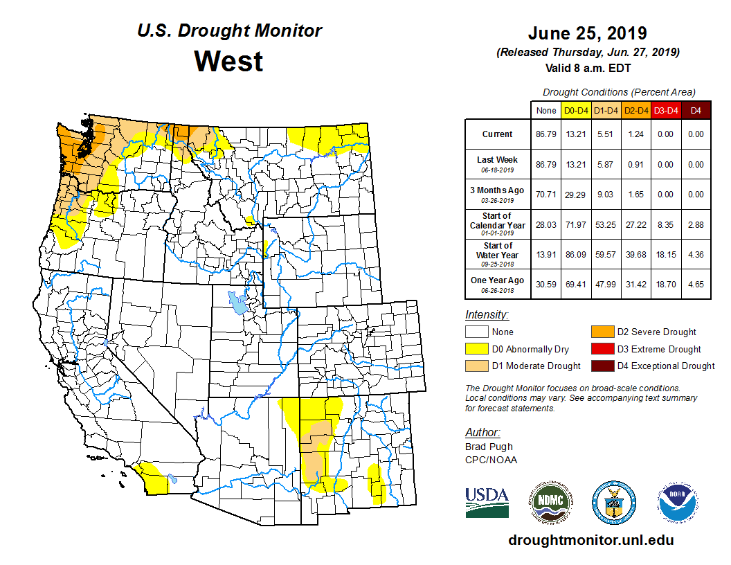


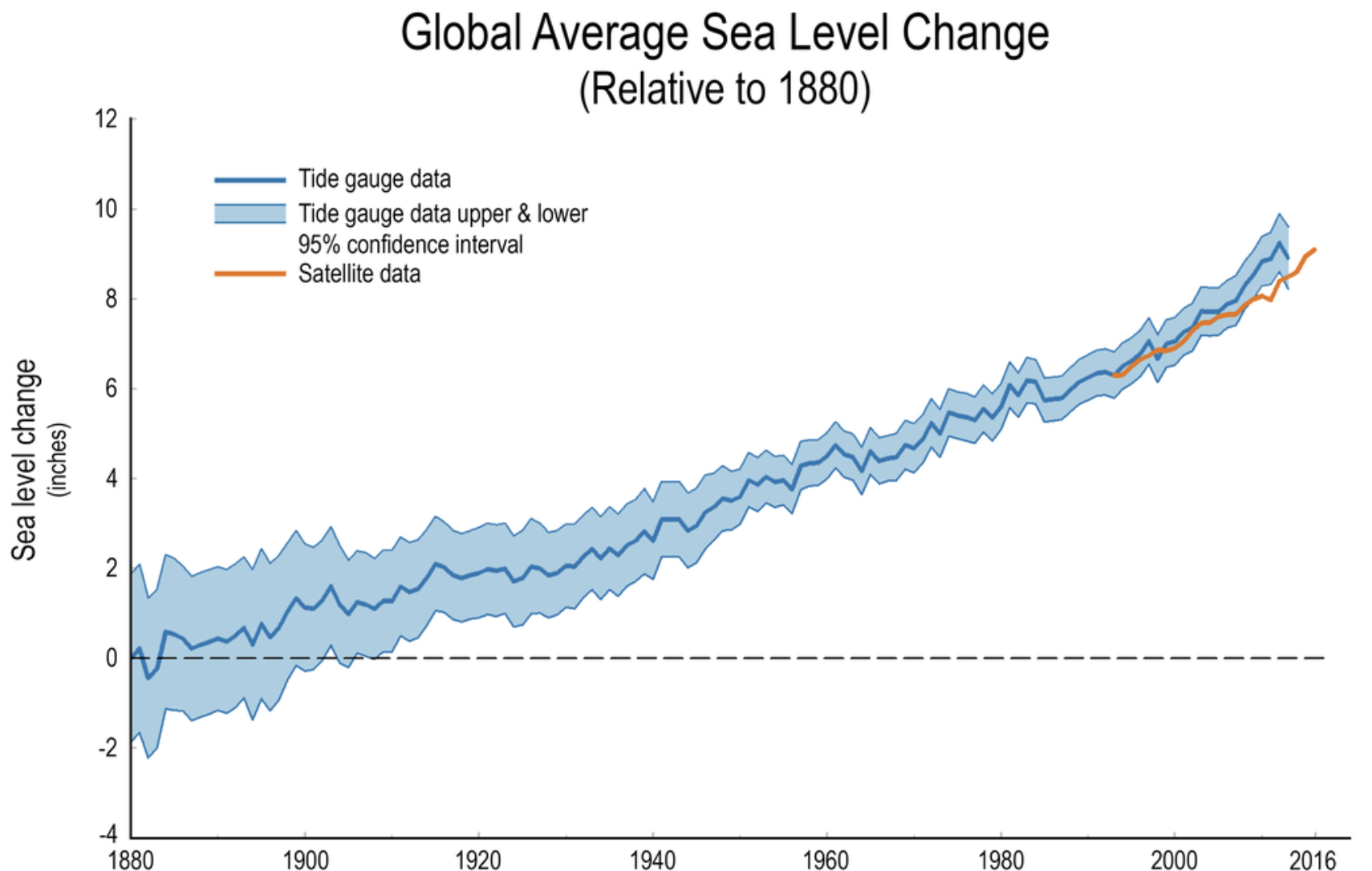


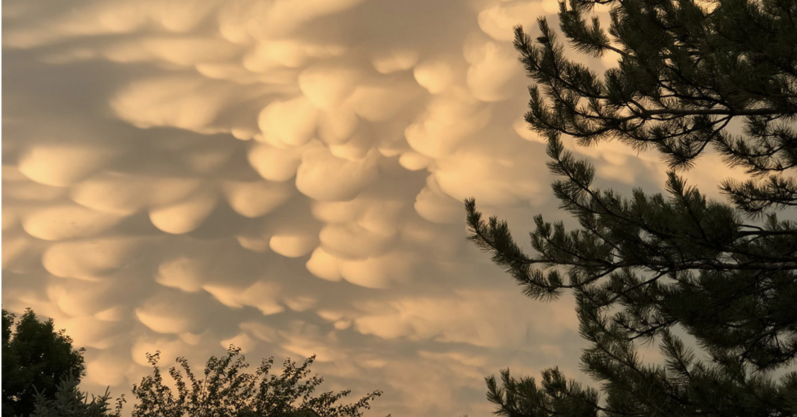


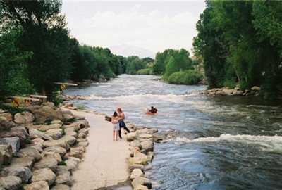

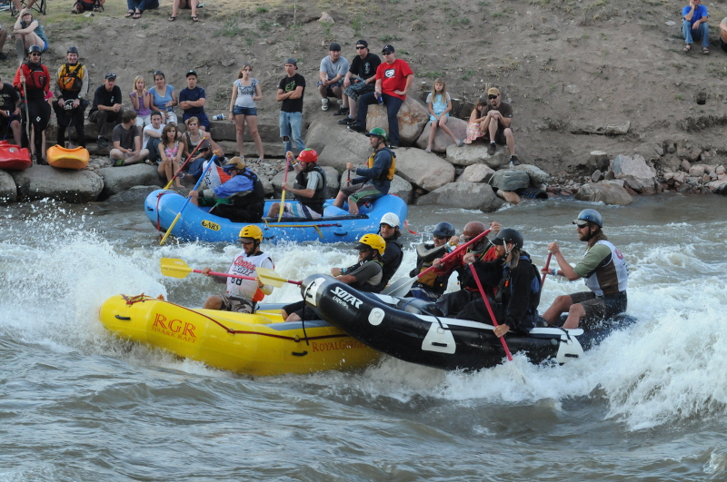
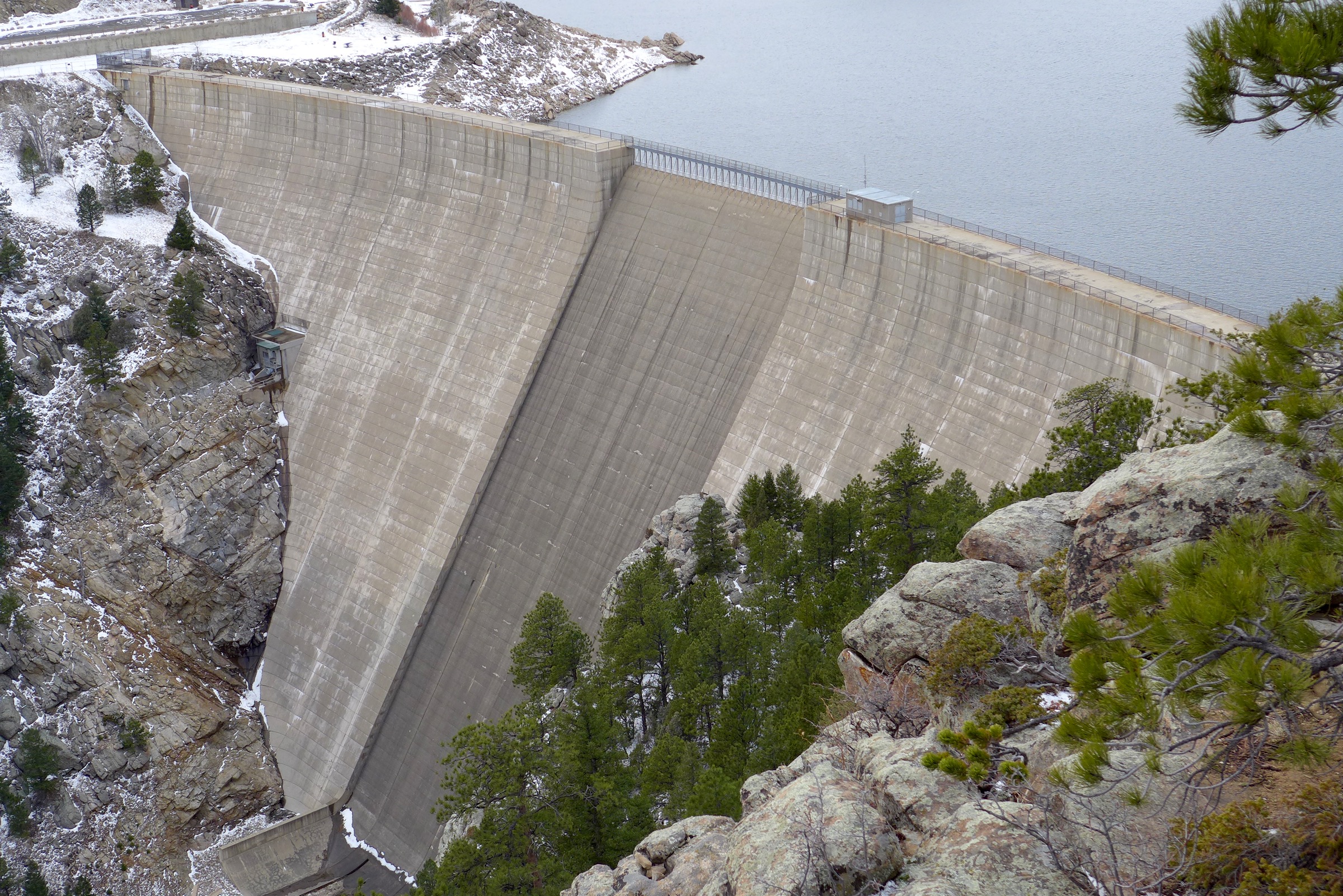


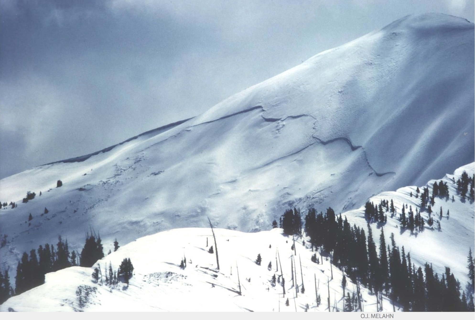
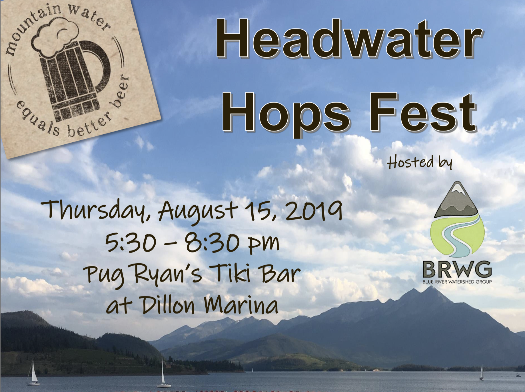

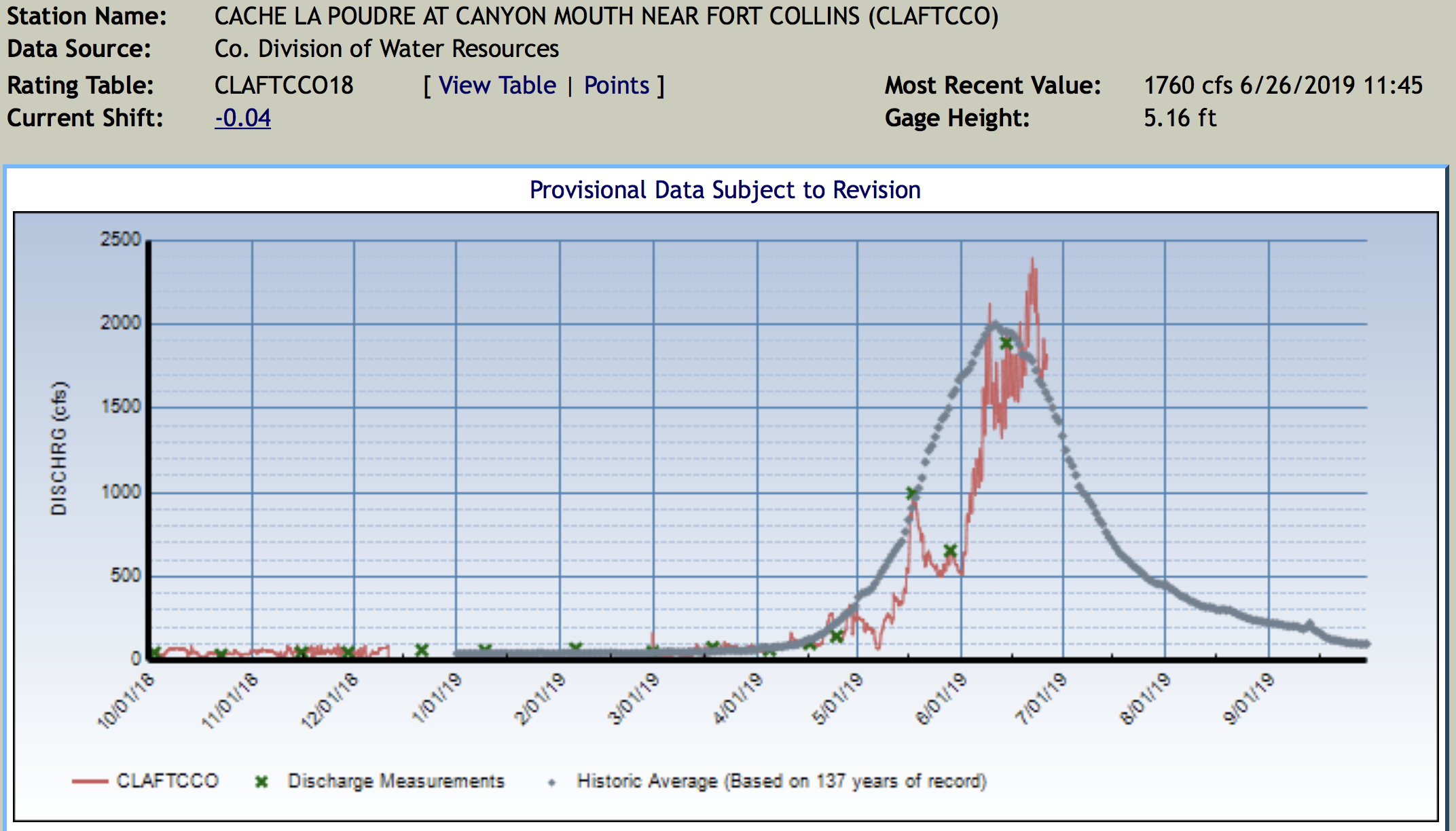
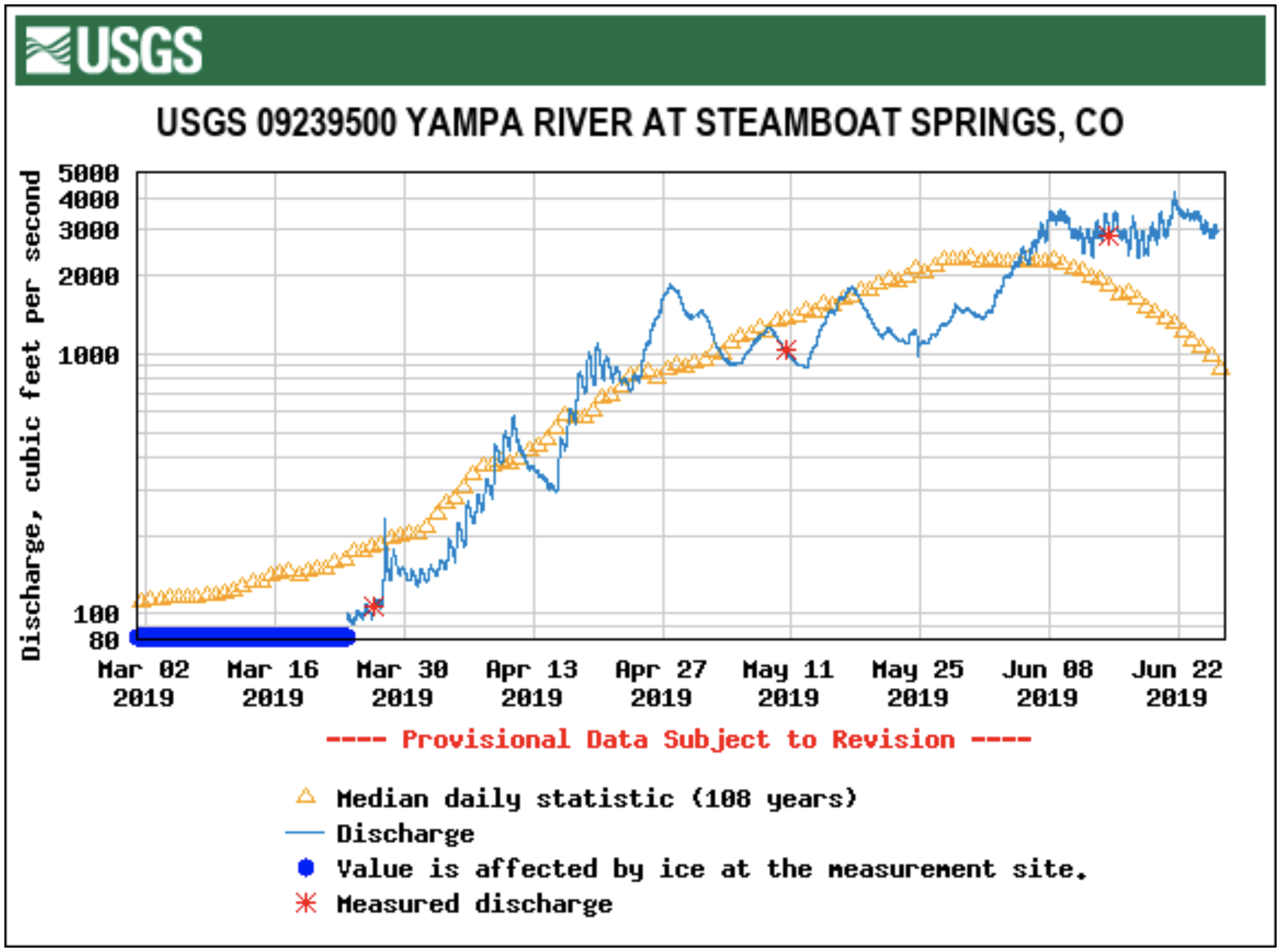
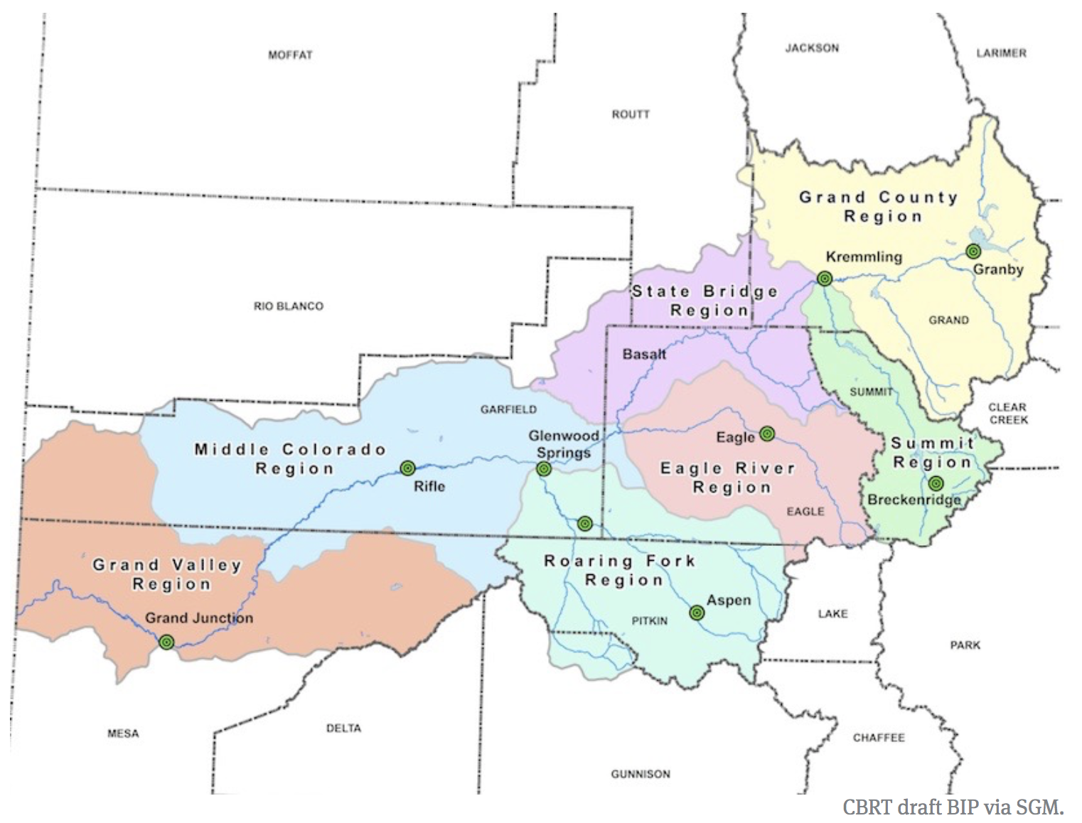
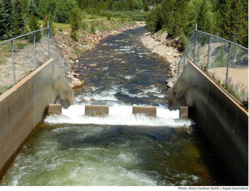
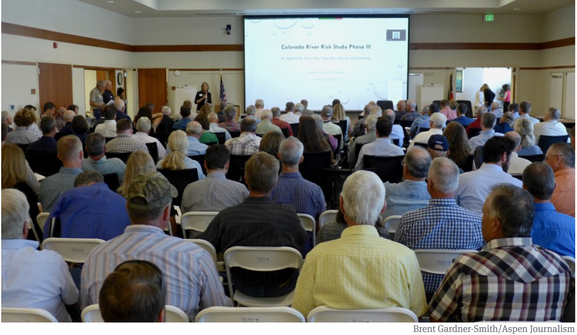

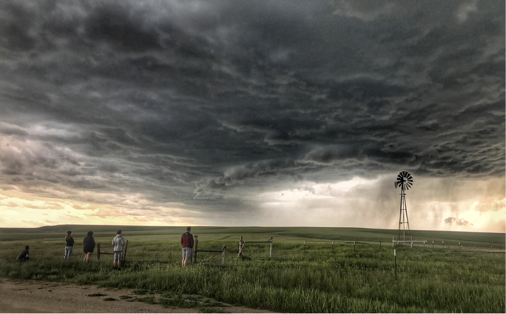

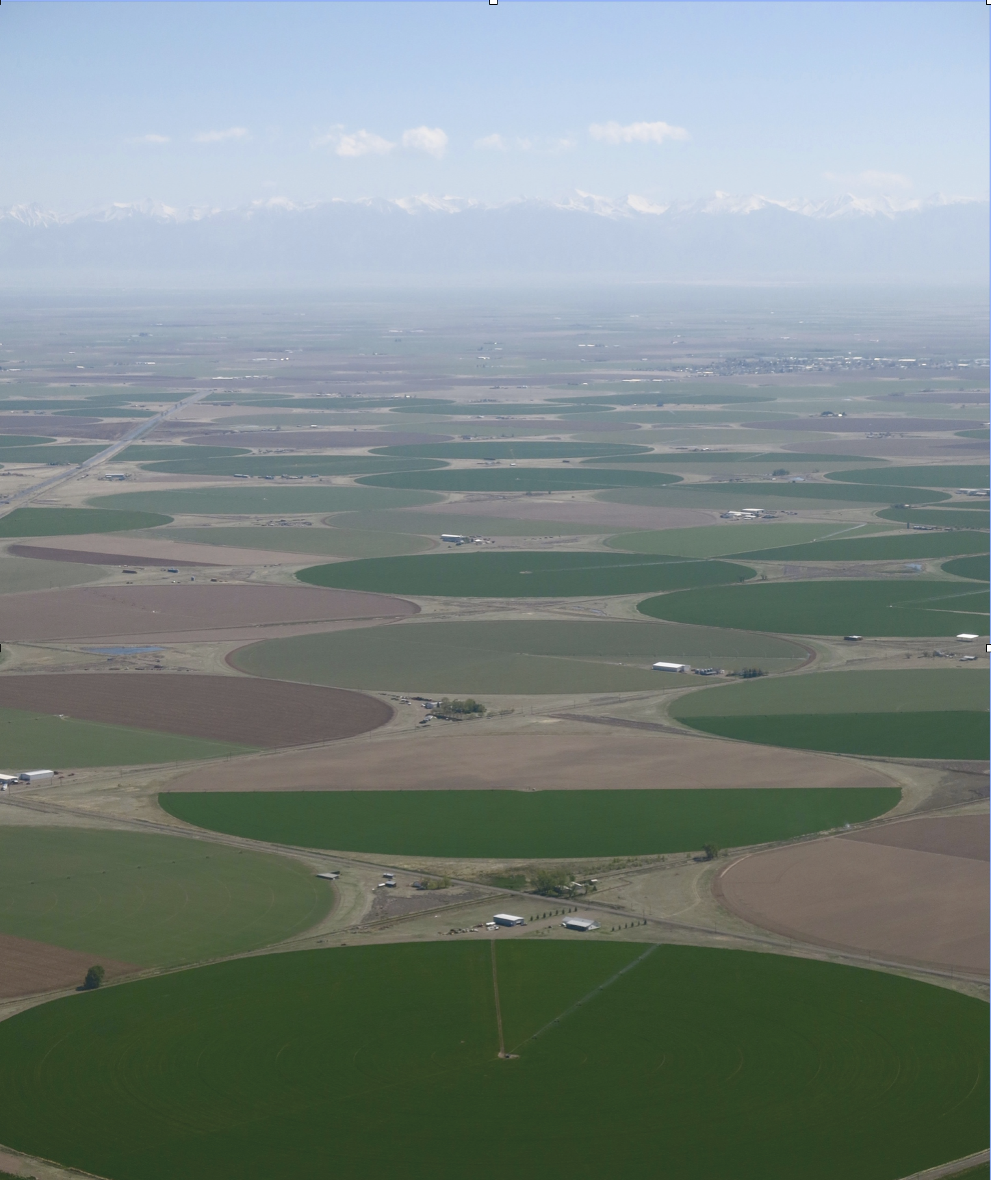
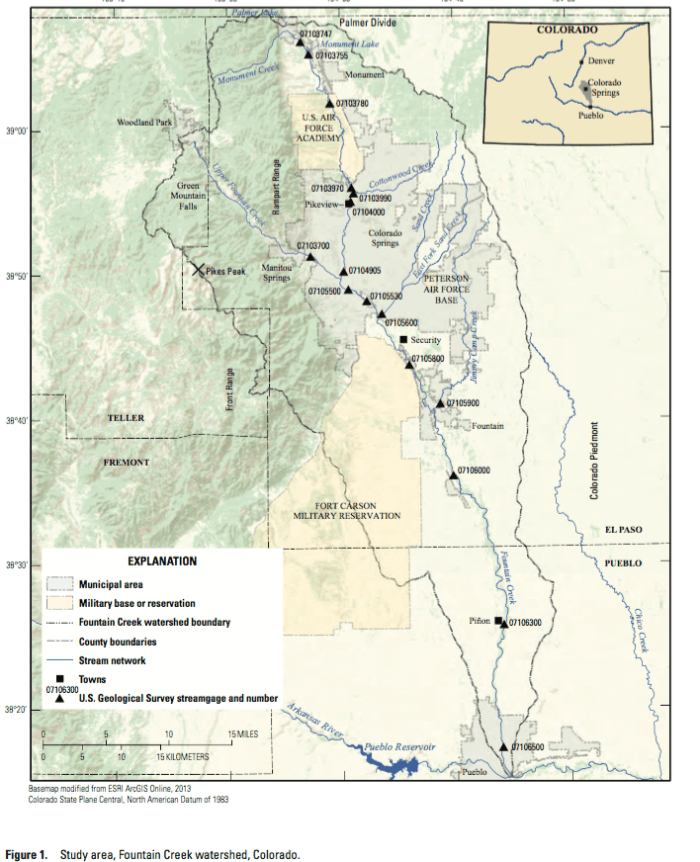


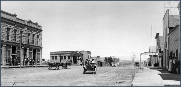
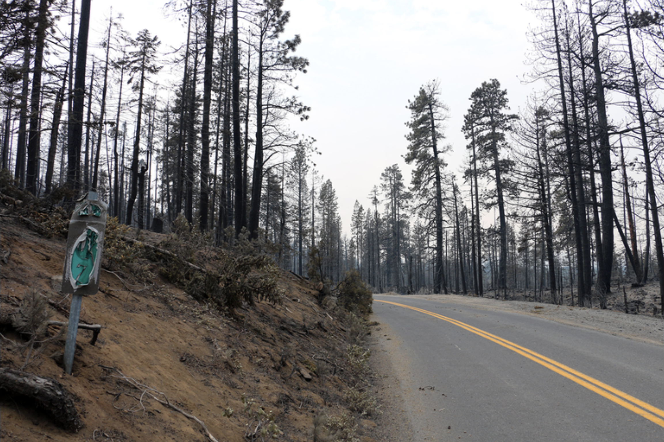


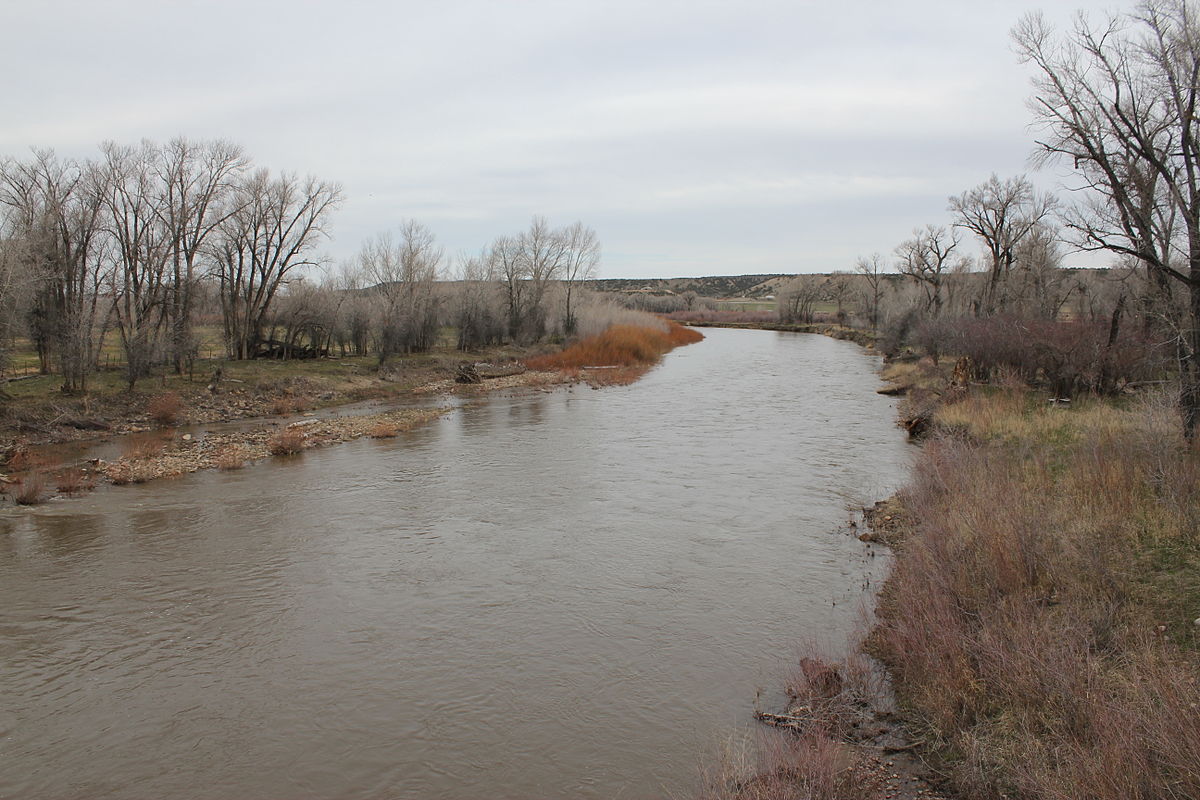


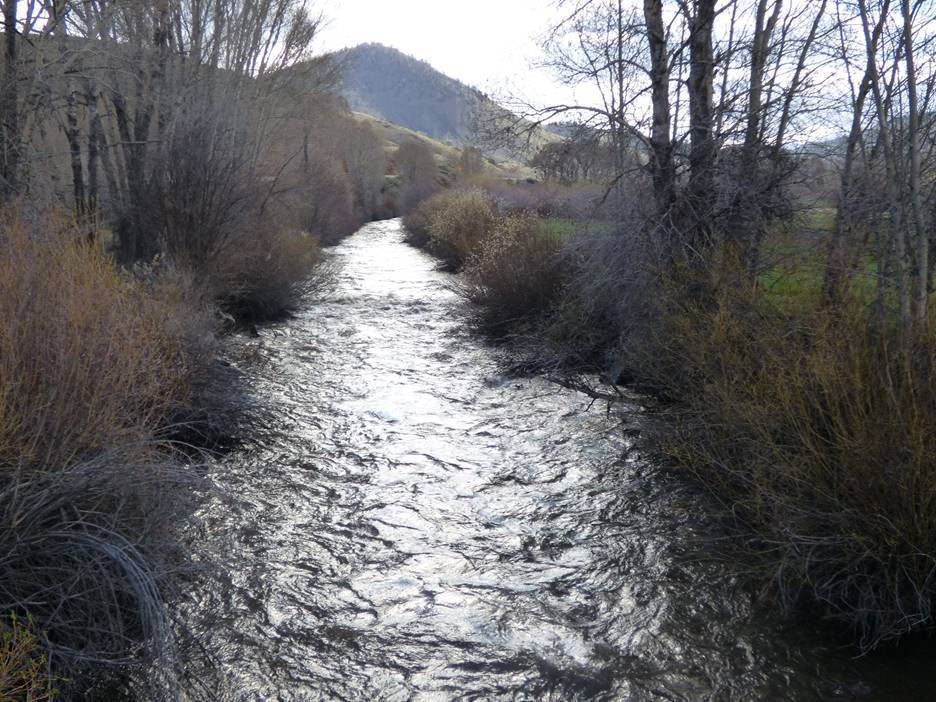


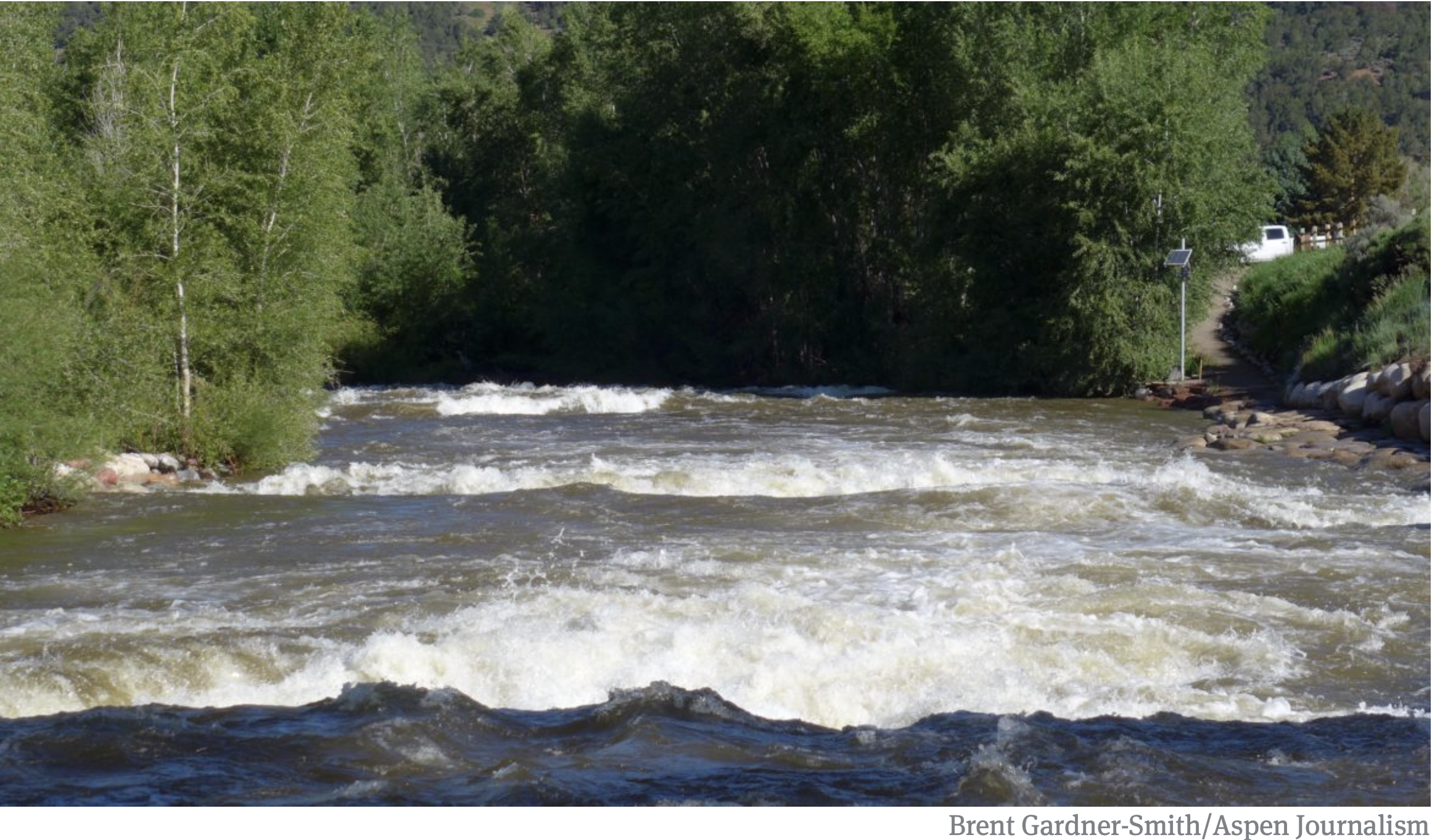


