Here’s the release from the NRCS (Brian Domonkos):
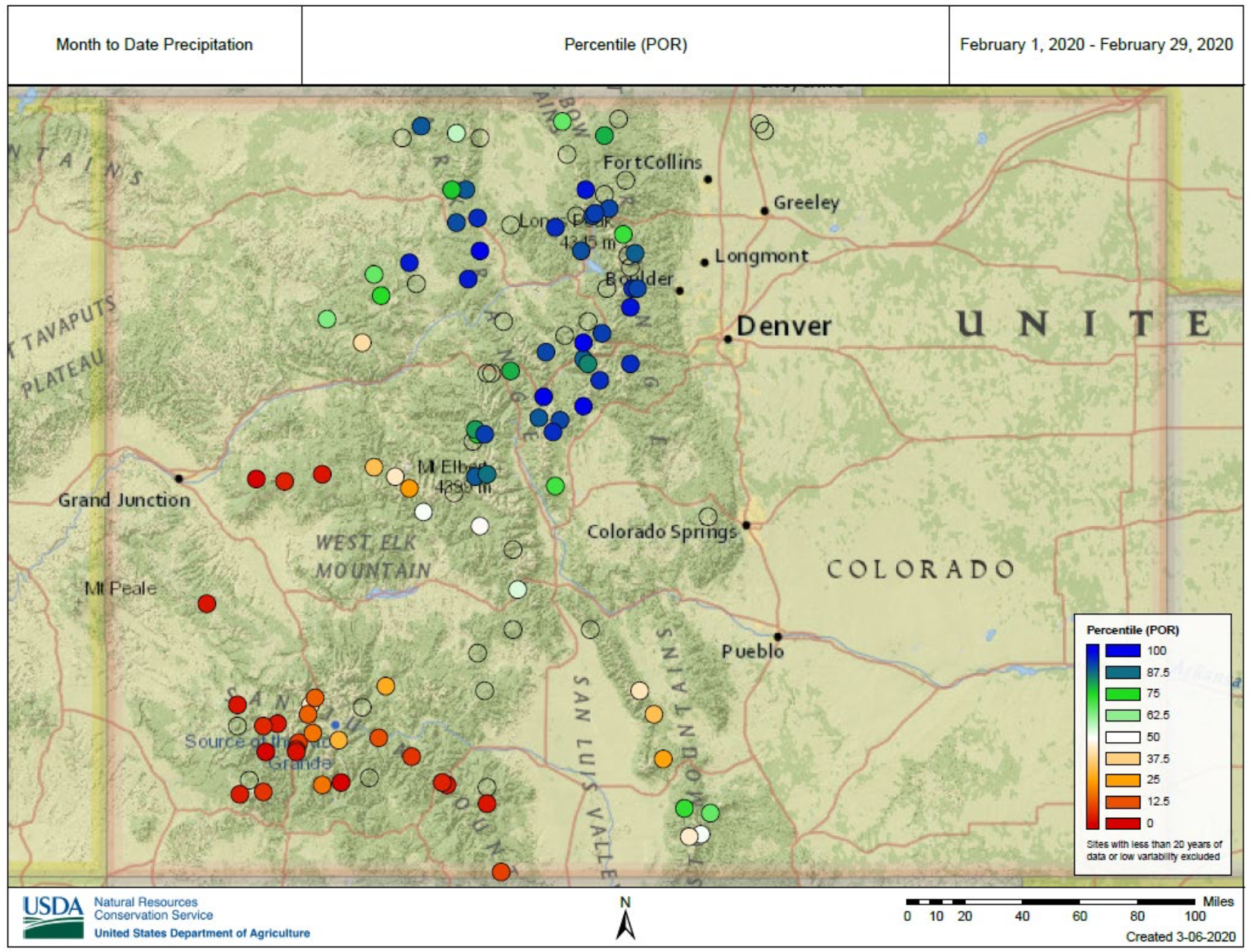
A series of storms hit Colorado throughout February uniquely favoring the northern half of the state, leaving most of Southern Colorado high and dry. NRCS Hydrologist Karl Wetlaufer notes that “This month was particularly interesting because of the feast or famine nature of the snow accumulations in different areas. It was an extremely sharp distinction between Northern Colorado which received well above average precipitation and Southern Colorado that almost uniformly received well below average accumulations.” There were 39 SNOTEL sites across Northern Colorado that received above the 90th percentile of February precipitation on the period of record, with 9 of these being the record high. Conversely, 24 SNOTEL sites in the southern half of the state were in the bottom 10th percentile and six sites observing record low precipitation. These differences resulted in notable changes to snowpack and streamflow forecasts.
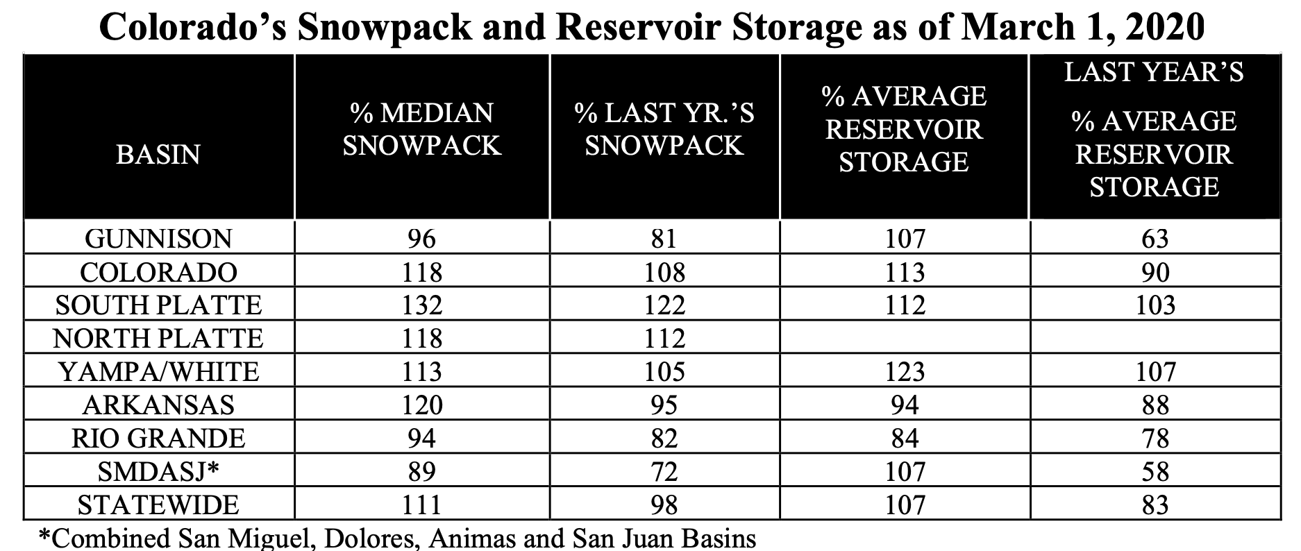
The greatest impact was seen in the San Juan Mountains where the percent of normal snowpack dropped an impressive 17 percent from 106 to 89 percent of normal in the combined, San Miguel, Dolores, Animas, and San Juan basins following the very dry month in that area. On the opposite end of the spectrum snowpack in the South Platte increased from 119 to 132 percent of normal.
“The last month has caused a stark contrast in regional snowpack and streamflow forecasts compared to what we saw at the beginning of February when conditions were much more uniform across the state. Currently statewide snowpack is 111 percent of normal however it is now more important to be aware of conditions in the individual basins.” Wetlaufer continued.
Following the trends of snowpack and precipitation, streamflow forecasts predict considerably higher values across Northern Colorado than in the southern half of the state, with respect to normal. On the low end the average of forecasts in the combined San Miguel, Dolores, Animas, and San Juan basins is for 64 percent of normal followed closely by the Rio Grande at 68 percent. The Gunnison is doing a little better with all forecast points averaging out to 72 percent of normal. The most plentiful forecasts in the state reside in the South Platte basin with some exceeding 130 percent of average in the main stem headwaters. The Arkansas, Colorado, and combined Yampa and White basins are forecasted to have near normal runoff volumes with the basin-wide average of forecasts ranging from 96 to 106 percent of normal.
Reservoir storage did not see considerable changes over the last month and only the Rio Grande and Arkansas are holding below average storage. A lot can still change over the coming months but as we get nearer to peak snow accumulation Colorado’s water supply situation continues to get more clear.
For more detailed information about January 1 mountain snowpack refer Water Supply Outlook Report. For the most up to date information about supply related information, refer to the Colorado Snow Survey website.