Click on a thumbnail graphic to view a gallery of snowpack data from the NRCS.


From The Denver Post (Chris Bianchi):
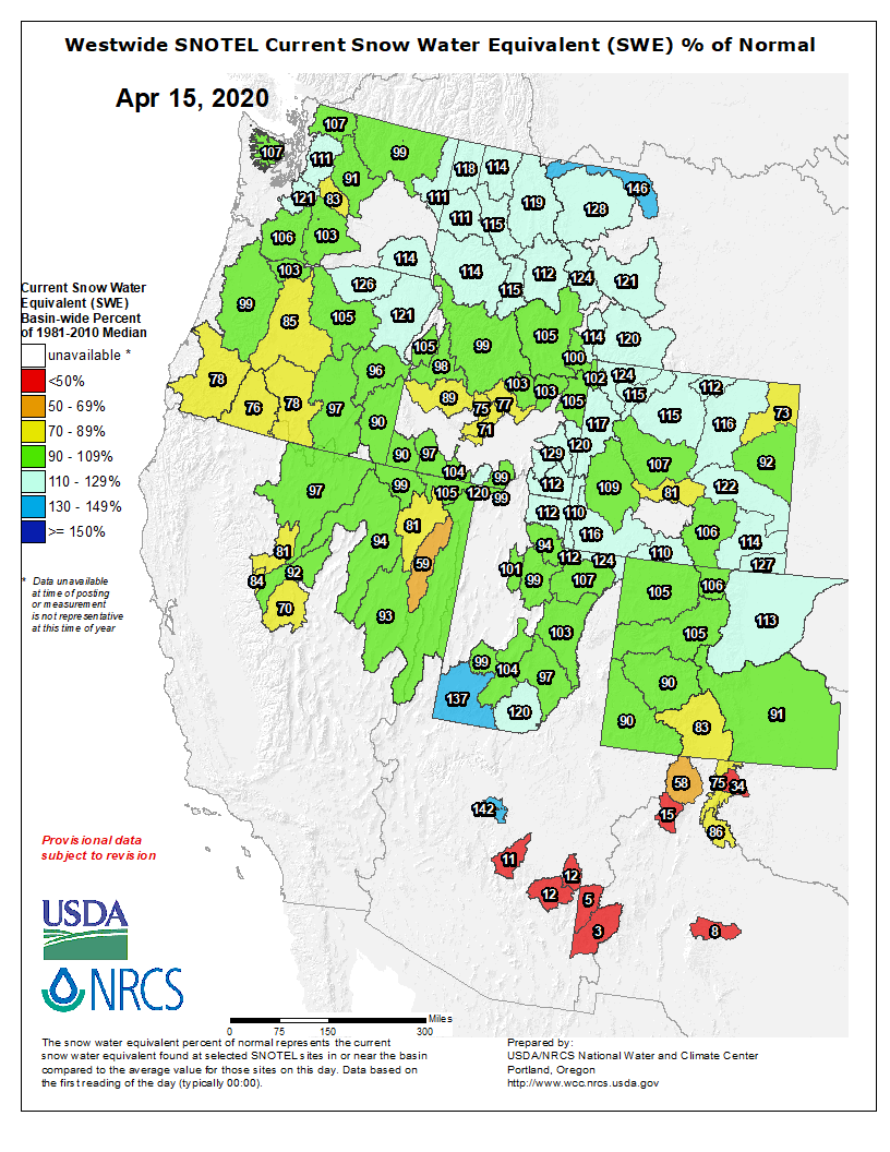
Based on official data from the Natural Resources Conservation Service on Monday, Colorado statewide snowpack is at 104% of its season-to-date average…
The above-average levels are particularly important this time of year, signaling that the 2019-20 winter will likely finish with an average or above-average snowpack…
Also key is the relatively even geographic spread of the snowpack. Of the eight major statewide river basins, none had less than 94% of their typical snowpack, and none of them had more than 113%. That said, southern Colorado has generally leaned a little lighter on the snowpack compared to northern parts of the state.
While the 2019-20 winter has generally been a solid one in terms of statewide snowfall, Colorado snowpack figures aren’t at last winter’s off-the-charts levels. That could potentially lead to a few patchy drier spots for the summer, depending in part on additional seasonal snowfall and the speed of the spring melt.
“I have a feeling, though, that lower-elevation snowpack was not quite as good as it was last year,” Bolinger said. “So, we won’t have quite as much water and meltoff as we had last year. Water supply forecasts are a bit lower than average this spring/summer. But overall, we’re in decent shape.”
[…]
Parts of southern Colorado remain in a moderate to severe drought, mostly owing to a dry 2019 summer and fall. However, snowfall runoff may help ease some of those drought conditions, depending in part on this spring’s weather.
And, here’s the Westwide SNOTEL basin filled map for April 15, 2020 from the NRCS.