Rancher and fly fishing guide Paul Bruchez’s daughter and nephew sit in a hay field at the family ranch near Kremmling. Bruchez is helping spearhead a study among local ranchers, which could inform a potential statewide demand management program. Photo credit: Paul Bruchez via Aspen Journalism
The Colorado River begins high in the Rocky Mountains of northern Colorado at Poudre Pass before flowing south and then west into Grand County, through the town of Kremmling, a small ranching community of just over 1,400 people.
It’s a hard place to have a ranch. The soils are sandy, and at over 7,000 feet, the growing season is short. But the real challenge is water. Powerful Front Range water utilities such as Denver Water own many of the senior water rights in Grand County, leaving many ranchers fearful of the day when the city might need the water they rely on to irrigate.
Paul Bruchez, a fifth-generation rancher and fly-fishing guide who raises cattle on 6,000 acres near Kremmling, knows firsthand the hardship caused by water shortages. In 2000, his father sold the family’s original homestead on the Front Range and bought two new ranches in Grand County, hoping for a fresh start away from the rapidly encroaching city. One of the property’s water rights was owned by Denver Water, which had agreed to lease it for 50 years — so long as the city could use the water in times of extreme drought. That time came just two years after Bruchez’s father bought the ranch, in 2002, leaving the family without enough water to irrigate. Forced to fallow half their fields, Bruchez’s family struggled to pay their mortgage.
The crisis prompted Bruchez to get involved in state-level water negotiations so he could help figure out creative solutions to the kind of problem his family faced. In 2015, he became an agriculture representative to the Colorado Basin Roundtable, where the concept of “demand management” began dominating conversations last year. At the heart of a demand-management program is paying irrigators on a voluntary, temporary and compensated basis to leave more water in the river in an effort to bolster levels in Lake Powell and help the state meet its downstream obligations.
Under the Colorado River Compact, Colorado and the three other Upper Basin states (Wyoming, Utah, and New Mexico) must send 7.5 million acre-feet to Lake Powell every year for the three Lower Basin states (California, Arizona and Nevada). Failing to meet those obligations triggers a so-called “compact call,” where junior water rights holders throughout the Upper Basin would see their water cut off — a disastrous situation that water managers are desperate to avoid.
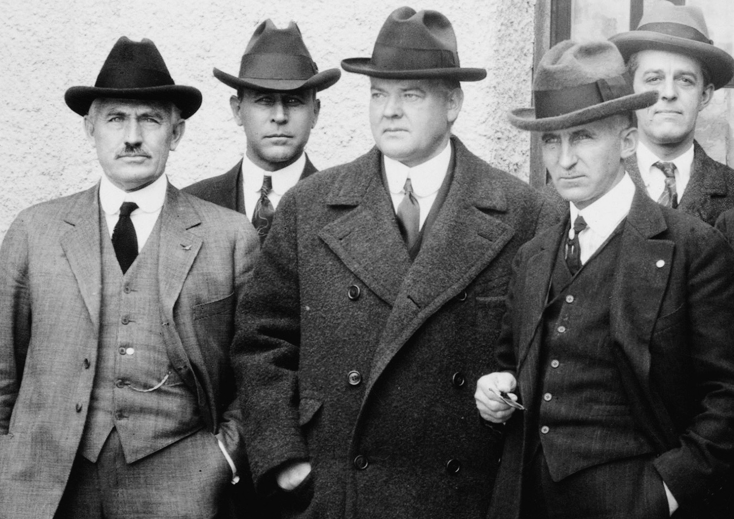
The Colorado River Commission, in Santa Fe, in 1922.
To address that threat, the Colorado Water Conservation Board (CWCB), the agency charged with managing the state’s water resources, voted last year to begin studying the feasibility of a demand-management program. But there was a problem: Although the fields in a potential demand-management program would be at various altitudes, scientists do not have much data on the impacts of reducing irrigation water on higher elevation pastures. Bruchez saw an opportunity to help those efforts by recruiting his ranching neighbors to participate in a study that would help fill the current data gap on fields such as those in the Kremmling area.
“This is our opportunity to participate in the process,” Bruchez told them. Ranchers were receptive, but they had questions. A lot of questions. How, for instance, would they get enough hay to feed their cattle if some of their fields were out of production? How would one rancher’s curtailing of water on his fields affect his neighbors’ fields? How much water savings do you achieve and what happens to the lands themselves? How quickly do they recover?
Bruchez knew that the answers to those questions could be crucial determiners for Colorado’s demand-management investigation.
“If we do this project, it could equally indicate the lack of viability or it could indicate that this is a really great opportunity,” he said. “But at least we’ll be making those decisions based on science rather than emotions or policy without real data.”
Rancher and fly-fishing guide Paul Bruchez raises cattle on 6,000 acres near Kremmling. Bruchez has taken an active role in Colorado River issues ever since his family suffered from a critical water shortage during the 2002 drought. Photo credit: Russ Schnitzer via Aspen Journalism
Demonstration project
Bruchez, 36, is somewhat of a guru for the ranching community in the Colorado water world, participating in numerous river-restoration projects and various water focus groups in addition to his role on the Colorado Basin Roundtable, one of nine groups representing each of Colorado’s main river basins (as well as the Denver area) composed of various stakeholders working to address the state’s water challenges.
In 2012, he helped create a partnership among local ranchers called the Irrigators of the Lands in the Vicinity of Kremmling (ILVK) to secure grant funding for river-restoration initiatives such as stabilizing riverbanks and reviving irrigation channels across a 12-mile stretch of the Colorado River.
Late last fall, Bruchez began discussing the idea of a water-saving study with the ILVK, and by February he had five volunteers (with the potential for two more). Among them, they had 1,200 to 1,500 acres ranging in elevation from 7,300 to 8,300 feet in which to study the ecological and economic impacts of full- and partial-season irrigation curtailment on hayfields.
In March, the CWCB awarded Bruchez’s project a $500,000 grant under its Alternative Agriculture Water Transfer Method program, which supports proposals that offer ways to boost water supplies without relying on traditional “buy and dry” transactions. The remaining funding for the $900,000 project is coming from American Rivers, Trout Unlimited, The Nature Conservancy and private donors.
Some of the ranchers will irrigate their participating fields as normal for half a season — until June 15 — before cutting off their water, while others will not irrigate at all. For the split-season irrigation, ranchers will be compensated at $225 per acre with an additional $56 per acre of risk-mitigation payment (to pay for general upkeep and other unanticipated damages that might result from the lack of irrigation). For full-season curtailment, ranchers will receive $414 per acre with an additional $207 per acre for risk mitigation.
For Bruchez’s neighbors such as Bill and Wendy Thompson, the study is an opportunity not only to help the state potentially avoid a major water crisis but to answer some of their own questions. The Thompsons ranch on 400 acres along the Colorado River a mile south of Kremmling with views of Longs Peak and Gore Range. After Bruchez broached the idea of studying the potential for an irrigation-reduction program on high-altitude pastures, the Thompsons volunteer two of their fields — one for a partial-season curtailment and the other as a “control” field, which they will irrigate as normal.
“We don’t know enough about our own consumptive use on these meadows,” Bill Thompson said. Maybe we’ll discover a new species of grass that’ll actually grow in this sandy soil.”
Conway Farrell, another Kremmling rancher whom Bruchez recruited, hopes the study will help yield the scientific research that water managers can use to create a demand-management program that will help agriculture in the long run.
“Everyone’s been talking about this for years,” Farrell said. “It’s time to finally do something.”
Colorado State University researchers led by Dr. Perry Cabot, a water-resources specialist, will use remote sensing to determine how much water plants consume on the ranchers’ pastures and how much they save by not irrigating on select fields. The researchers will also look at the recovery patterns and risks associated with subjecting pastures to different levels of irrigation curtailment.
Joe Brummer, the forage specialist for the state of Colorado and an associate professor at CSU, has conducted one of the few studies into the effects of partial- and full-season hay fallowing at different elevations in western Colorado. His findings, though limited in scope, are encouraging: While there are short-term losses, the fields recovered after a few seasons to within 10% of full production.
“Plants are resilient,” he said.
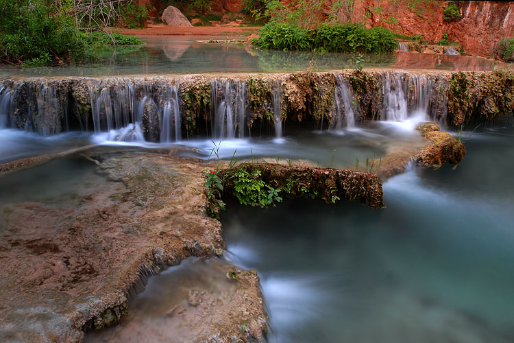
This mowed hay field is part of Reeder Creek Ranch, owned by the Bruchez family near Kremmling. Little data exists on the impacts of reducing irrigation water on higher elevation pastures like this one, but Paul Bruchez and a group of local ranchers have volunteered their fields for a study that will help scientists learn more about what happens to pastures that receive less irrigation water. Photo credit: Paul Bruchez via Aspen Journalism
Demand management
As Bruchez ironed out the details of his initiative last winter with ranchers, researchers and the other NGO partners, he had to tread carefully.
Amy Ostdiek, the deputy chief of CWCB’s Interstate, Federal and Water Information Section, emphasized that since the state is still in the initial stages of studying the feasibility of demand management, it’s too early to know how Bruchez’s initiative will play into those efforts. The other three Upper Basin states are in the middle of similar processes as part of the Drought Contingency Planning agreement that all seven Colorado River basin states signed last May.
“We can’t do anything until all Upper Basin states agree that demand management is feasible in their states,” Ostdiek said. “If other states agree that it is, then we get to the hard work of what that program would look like.”
Almost two decades ago, Bruchez’s family overcame their own water crisis by negotiating with Denver Water so that both the utility and Grand County’s agriculture community and environment could get the water they all need. For Bruchez, the experience was a lesson in the value of simple awareness and better management when it comes to solving seemingly intractable water issues.
Speaking from his ranch a couple of weeks ago via Zoom — an online video conferencing app used due to restrictions on in-person meetings because of the COVID-19 crisis — Bruchez felt more than ever the need to be proactive about a future water crisis.
“If people in Phoenix or Denver can’t drink water, what’re we going to do about it?” Bruchez said, adding that it’s no secret that agricultural water rights would be in jeopardy. “Trying to get ahead of this is super important.”
Aspen Journalism is a 501(c)(3) nonprofit organization supported by its donors and funders. This story ran in the April 15 edition of SkyHi News.
Ophelia Watahomigie-Corliss, a Havasupai tribal councilwoman, stands for a portrait by Red Butte, Kaibab National Forest, which was originally Havasupai land. “Let us rechristen the landscape here, changing the names of places, trails and springs back to the Indigenous names, the ones the tribes are comfortable sharing with the public,” she writes. Photo credit: Amy S. Martin via The High Country News
FromThe High Country News [April 14, 2020] (Ophelia Watahomigie-Corliss):
Since time immemorial, the Havasupai have lived inside the natural wonder. We face yet another peril.
If you were one of the 6.3 million people who visited Grand Canyon National Park last year, chances are you stood on the rim and noticed a green ribbon of trees thousands of feet below you. The National Park Service calls it “Indian Garden.” And it was truly a garden, once: Our Havasupai relatives, the Tilousi family, lived and gardened there a century ago, until the National Park Service kicked them out. The Bright Angel Trail hikers use to reach this area today is an old Havasupai trail. When the Fred Harvey Company set up its hospitality industry on the South Rim near the turn of the 20th century, they hired Havasupai and created a work camp for them called Supai Camp.
Last year, the park celebrated its centennial. There were special events, but I doubt you heard anything about us, the Havasupai — the Guardians of the Grand Canyon. You may not even know about Canyon Mine, the proposed uranium mine that threatens Havasu Creek, the entire water supply of the Havasupai Reservation. Historical erasure has made us invisible. Now, our very survival is at stake, and we are asking for your help.
Inside what you call Grand Canyon National Park, the Havasupai have lived since time immemorial. We still live here. Fred Harvey and the Santa Fe Railway reached the Grand Canyon in 1901, and thousands of tourists came in their wake. Billy Burro was the last Havasupai to live in Indian Garden, a place that had been enjoyed by our people for centuries. But industry began to dictate where Indians could and couldn’t be, and public areas were forbidden because it was considered bad for business. Discrimination was rampant. At the Grand Canyon, we Havasupais were no longer welcome on our own land, because now it was reserved for tourists. Eventually, it was taken away altogether. Grand Canyon became a national park in 1919, and Billy, together with all Havasupais, were kicked out of Indian Garden. The people were relocated to the Indian work camp, with little option but to work for the railway. These were heartbreaking times for us, as our home became a tourist attraction. We had to endure constant racism; people like Billy were given the last name “Burro,” for example, as if we were no more than pack animals.
It’s time Grand Canyon officials took some responsibility and helped educate visitors about our history, land and water. The South Rim was taken by the federal government to create Grand Canyon National Park, and Havasupai voices were ignored when we pleaded for our homeland. In the early 1930s, the Park Service burned Supai Camp to the ground, and our people, including elders and children, were loaded into covered wagons in the snow, taken to the canyon’s rim and forced to walk down a grueling 17-mile trail to Supai Village. That is where the Havasupai Reservation was created in 1880. Before that, however, Supai Village was used as our summer home. Our longtime winter home had always been the newly designated park, but now we had lost it forever. In the 1970s, the park hired a new superintendent, who shut off our food, septic and water supply. Fortunately, we already relied on the springs in the canyon, and so we weathered the assault.
In addition to supporting the Havasupai people, the waters in Havasu Canyon give life to an array of animals and plants. Photo credit: Amy S. Martin via The Grand Canyon Trust
Now we have a new threat to deal with. Fifteen miles from the park boundary is a uranium mine that threatens the entire water supply for the 426 permanent residents of the Havasupai Reservation. The mine shaft at Canyon Mine is 1,470 feet below the surface, and if it leaks, it will contaminate the Redwall-Muav aquifer, which discharges into Havasu Creek — our only source of water. We have been fighting uranium mining for 40 years, but we cannot do it alone, especially if we continue to be erased.
Havasuw’ Baaja means the people of the blue-green waters. Those waters are the waters of Havasu Creek, and we are the original Guardians of the Grand Canyon. Thousands of more recent arrivals have since settled this land, built homes and raised families on our ancestral lands, and we know they love the canyon, too. Like us, they’ve come to know the names of the mountains, trails and waters in the region. The Grand Canyon has called them here, to make their lives in this incredible corner of the world. We are not so different after all.
And now it’s time for them — and for everyone who loves the Grand Canyon — to stand with us, to get to know who we are, and to work with us toward a just and shared vision for the next 100 years of this national park. We want the park to recognize our histories and to share that story permanently at the visitor center — to find a place for us in all their exhibits and in permanent signage throughout the park. Let us rechristen the landscape here, changing the names of places, trails and springs back to the Indigenous names, the ones the tribes are comfortable sharing with the public. All park rangers, personnel, outfitters and river runners should receive cultural sensitivity training, so they can teach visitors about the true history of the land.
Congress should pass S.3127 – the Grand Canyon Centennial Protection Act. This law will protect the 1 million acres of public land surrounding Grand Canyon National Park from the catastrophic impacts of uranium mining; it will also protect our homes in Supai Village.
Often, we gather at Red Butte, one of our sacred sites, to protest the project. There, we educate people about the many efforts to shut down the Canyon Mine, which is just three miles away. We invite you to join us here.
You are invited to stand strong with us and help us protect this landscape we all love, which is also the place we call home — the Grand Canyon. We have been trying to do this for many years, and we will continue to do for all generations to come. Please join us.
Ophelia Watahomigie-Corliss is a Havasupai tribal councilwoman. Email High Country News at editor@hcn.org.
From the Great Basin Water Network (Kyle Roerink):
Today, after more than 30 years of fighting to defeat SNWA’s ill-conceived Las Vegas Pipeline, the Great Basin Water Network responded to the news that the Southern Nevada Water Authority will not appeal litigation addressing water rights applications and corresponding 3M plans to the Nevada Supreme Court. The litigation was another flash point in the fate of the pipeline – the 300-mile, $15.5 billion project that would drain Eastern Nevada’s groundwater supply.
“Residents of the Great Basin breathed a great sigh of relief today after learning of SNWA’s decision,” said Kyle Roerink, Executive Director of the Great Basin Water Network. “Our attorneys, White Pine County officials, tribes, and front-line communities in Nevada and Utah have all said this project was illegal for more than three decades. Today’s news vindicates their long-held fierce opposition and years of fighting a David-vs-Goliath battle. But there is still hard work that must be done. SNWA must revoke both sets of its remaining water rights applications in places like Snake Valley and withdraw its application for the pipeline’s right of way with the BLM. We have been in discussion with the SNWA over these matters and look forward to seeing what comes next. The proof of SNWA’s intent will show itself in the coming months when they take the proper next steps to nullify all of the water grab applications.”
“Judge Estes’ recent ruling completed an unbroken line of seven victories that opponents of SNWA’s Pipeline Project have won over SNWA in both state and federal court going back to 2009,” said Simeon Herskovits of Advocates for Community and Environment, lead attorney for the broad coalition of pipeline opponents. “In his March 9 Decision Judge Estes authoritatively dismantled all of SNWA’s legal arguments and their persistent misrepresentations of the facts. Over the years, water officials throughout Nevada and the West have dismissed any chance of us succeeding in this long fight and others have pleaded with us to accept the inevitability of this ill-conceived project. Instead, we have completely defeated SNWA in court. The water they’ve wanted to grab since 1989 never was there for the taking and never will be.”
FromThe Associated Press (Ken Ritter) via The Las Vegas Sun:
The Southern Nevada Water Authority said in a statement it won’t appeal a judge’s order for the authority to recalculate the amount of water that might be available below ground to supply the project.
The authority will instead update its 50-year water plan to focus on water conservation and solidifying ties to other states that, like Nevada, rely on water from the Colorado River.
That makes Judge Robert Estes’ March 9 decision the final word on the authority’s bid for state approval to use water rights obtained when SNWA bought ranch land in the 1980s in arid valleys in White Pine and Lincoln counties near the Utah border…
Opponents maintained that tribal nations’ due process rights were denied and the pumping plan did little to prevent possible damage to cultural areas including a grove of swamp cedars that area Shoshone tribes consider sacred in the uncommonly wet Spring Valley area in White Pine County.
The authority initially won approval from the state’s top water official, then-State Engineer Jason King, to draw enough groundwater to supply some 170,000 new homes per year in Las Vegas. The authority planned to build a 250-mile pipeline for the project.
In 2010, the state Supreme Court ordered King hold new hearings, and King in 2011 again approved the authority plan.
Estes in 2013 labeled King’s decisions “arbitrary and capricious” and ordered the recalculation. The state high court backed Estes and King grudgingly rejected the authority’s proposal in 2018.
Las Vegas currently gets about 90% of the water used by most of its 2.2 million residents and more than 40 million tourists a year from the Lake Mead reservoir behind Hoover Dam. The lake was last full in 1983. After 20 years of drought, it is now less than half-capacity. Officials had cast the pipeline plan as key to ensuring a reliable supply.
Patrick Donnelly, of the Center for Biological Diversity in Nevada, said opponents know the water authority still has pumping rights applications pending and still seeks right-of-way approvals from the U.S. Bureau of Land Management for the 250-mile pipeline route.
The decision means the water agency is shelving a development project that has long inflamed tensions between rural and urban Nevada, from the Legislature to the courts, and eclipsed nearly all other water issues in the state. The water authority first applied for the water rights in 1989, worried about water scarcity on the Colorado River and a growing population.
The project set off a firestorm of controversy, with environmentalists, tribes and ranchers worried that the project would dry springs, harm wildlife habitat and irreparably alter ecosystems.
Because of increased conservation, the water authority held off on the project for decades, despite pursuing entitlements for the project in state and federal court, as well as in the Legislature.
According to a statement from the water authority, it will reassess its water supply portfolio “after the current pandemic passes and normal operations are restored.” The agency plans to present an update focusing on “strengthening beneficial partnerships with other Colorado River states as well as further advancing Southern Nevada’s world-recognized water conservation efforts.”
In recent months, the water authority has discussed the possibility of investing in a Southern California reuse project, in exchange for additional water from the Colorado River, where Las Vegas gets about 90 percent of its water. It also has increased its efforts to boost conservation across the Las Vegas Valley, and investing in a desalination project remains on the table.
Although the decision ends the pipeline project in its current formation, it does not preclude the water authority from developing an importation project in the future. The water authority still owns Eastern Nevada ranches with associated water rights. It also has applications for other water rights that, if awarded by state regulators, could be tapped by Las Vegas in the future.
Kyle Roerink, the executive director of the Great Basin Water Network, called the decision not to appeal the court case “a great first step,” but he said he still had concerns about the water rights applications and a federal right-of-way from the Bureau of Land Management. He said the water authority must take the legal steps to relinquish those entitlements associated with the pipeline.
Proposed pipeline from the Snake Valley to Las Vegas.
Snow Survey Supervisor Brian Domonkos said the Colorado snowpack is at 101% compared to normal levels this week.
The Upper Colorado Headwaters, which include the northern portion of Grand Mesa, as well as Garfield, Eagle and Summit counties, is at 107% of normal.
However, southern Colorado is slightly below normal with the Gunnison snowpack at 90%.
“On Grand Mesa, the snowpack is a little bit on the lower side compared to say the rest of the Upper Colorado,” Domonkos said. “Mesa Lakes is at 62% of normal, Park Reservoir is 77% of normal and Overland Reservoir is 82% of normal.”
[…]
This spring, Domonkos said it predicts the Colorado River at Cameo will be at 102% of the median from April 1 through July 31…
However, surface streams near Cedaredge are predicted to be at 70% and the Gunnison River near Grand Junction will be at 79% of its average flow from April 1 through July 31.
Click on a thumbnail graphic to view a gallery of precipitation data from the NRCS.
Statewide Basin High/Low Water Year-To-Date Precipitation Summary via the NRCS.
Arkansas River Basin High/Low Water Year-To-Date Precipitation Summary via the NRCS.
Upper Colorado River Basin High/Low Water Year-To-Date Precipitation Summary via the NRCS.
Gunnison River Basin High/Low Water Year-To-Date Precipitation Summary via the NRCS.
Laramie and North Platte Basin High/Low Water Year-To-Date Precipitation Summary via the NRCS.
Upper Rio Grande River Basin High/Low Water Year-To-Date Precipitation Summary via the NRCS.
San Miguel, Dolores, Animas, and San Juan Basin High/Low Water Year-To-Date Precipitation Summary via the NRCS.
South Platte River Basin High/Low Water Year-To-Date Precipitation Summary via the NRCS.
Yampa and White Basin High/Low Water Year-To-Date Precipitation Summary via the NRCS.
Average snowpack for the Yampa River hit its peak around April 4 at 25 inches of snow water equivalent, according to the Natural Resources Conservation Service. Since then, snow has been slowly melting, with average snowpack falling to about 23 inches of snow water equivalent on Saturday. But with heavy snowfall this week — forecasters predict up to 18 inches of accumulation by Friday — snowpack has once again been on the rise.
As of Thursday, average snowpack rose again to 24.3 inches of snow water equivalent, according to the data.
These fluctuations point to the difficulty in determining exactly when snowpack has reached its peak in the Yampa Valley, according to Andy Rossi, district engineer with the Upper Yampa Water Conservancy District. It is not unusual for heavy snowfall to continue well into spring. The area’s contrast of low- and high-elevation terrain also makes it hard to get consistent measurements for the entire Yampa River basin…
The Conservation Service has nine measurement sites for the local basin. While sites at lower elevations are showing degrees of melting, sites at higher elevations, where melting occurs later in the year — particularly in the Flat Tops Wilderness Area and on the top of Buffalo Pass — show the snowpack continuing to climb.
Those higher-elevation measurement sites likely will not reach peak snowpack for another month, predicts Brian Domonkos, Colorado’s snow survey supervisor with the Conservation Service…
The recent bout of cold weather has stagnated the melting process, which consequently has reduced river flows. Since Tuesday, the Yampa River has been flowing at just above 500 cubic feet per second, according to the U.S. Geological Survey stream gauge at Fifth Street in downtown Steamboat Springs. This marks a decline from Sunday, during the period of warmer weather, when the river was flowing about 900 cfs.
For reference, at 2,400 cfs, portions of the Yampa River Core Trail flood and, at 3,600 cfs, portions of the baseball fields at Emerald Park flood, according to the National Weather Service.
Overall, the Yampa and White rivers have received above-average snowpack this winter, according to the Conservation Service, 110% of the median as of Thursday. That has eliminated drought conditions in Routt County, based on the U.S. Drought Monitor, a positive signal for a reduced risk of wildfires this summer.
Meanwhile, the southern parts of the state are recording moderate to severe drought conditions.
Since July, Rodriguez said Pueblo has received 35.4 inches of moisture, with the normal value being 29.5 inches…
As for mountain snowpack, it’s about 90% average for the Arkansas River basin, said Chris Woodka, senior policy and issues manager for the Southeastern Colorado Water Conservancy District.
“We are doing better (115%) in the headwaters of the Arkansas River, and at higher elevations above 11,000 feet,” Woodka explained. “In the Colorado River basin, which provides imports to Colorado Springs, Pueblo, Pueblo West and the Southeastern District, snowpack is just about average, but a little above average (120%) in the Roaring Fork basin, which supplies the Fryingpan-Arkansas Project.
“We are anticipating better-than-average imports, provided that conditions remain near normal.”
After a good start in December followed by a lackluster January, Woodka said, “overall, I would characterize the snow accumulation as steady throughout February and March.
“Snowpack has been declining in April because of warmer temperatures. The most recent snow may provide a slight bump, but is not a game-changer.”
Water storage is higher than normal, Woodka said, and plans call for “bringing over a little more water from the Western Slope, if conditions remain favorable.”
[San Juan River] Snow water equivalency (SWE) data has seen a decrease since last week as totals fell from 25.9 inches to 23.9 inches. The SWE median has slightly increased, however, going from 32.2 inches to 32.3 inches.
This week, SWE data is 74 percent of median. Last week, it was 80.4 percent of median.
Precipitation data remains unchanged since last week, remaining at 26.5 inches. The precipitation median has increased, however, from 34 inches to 35.7 inches.
This week, precipitation data is 79.9 percent of median. Last week, it was 74.2 percent of median.
And, here’s the Westwide SNOTEL basin-filled map for April 19, 2020 via the NRCS.
Westwide SNOTEL basin-filled map April 18, 2020 via the NRCS.
The coronavirus pandemic has revealed one particularly shocking thing about our societies and economies: they have been operating on a very thin margin. The edifice seems so shiny and substantial, a world of silver jets stitching together cities of towering skyscrapers, a globe of soaring markets and smartphone connectivity. But a couple of months into this disease and it’s all tottering, the jets grounded and the cities silent and the markets reeling. One industry after another is heading for bankruptcy, and no one knows if they will come back. In other words, however shiny it may have seemed, it wasn’t very sturdy. Some people—the President, for instance—think that we can just put it all back like it was before, with a “big bang,” once the “invisible enemy” is gone. But any prosperity built on what was evidently a shaky foundation is going to seem Potemkinish going forward; we don’t want always to feel as if we’re just weeks away from some kind of chaos.
So if we’re thinking about building civilization back in a hardier and more resilient form, we’ll have to learn what a more stable footing might look like. I think that we can take an important lesson from the doctors dealing with the coronavirus, and that’s related to comorbidity, or underlying conditions. It turns out, not surprisingly, that if you’ve got diabetes or hypertension, or have a suppressed immune system, you’re far more likely to be felled by covid-19.
Societies, too, come with underlying conditions, and the two that haunt our planet right now are inequality and ecological turmoil. They’ve both spiked in the past few decades, with baleful results that normally stay just below the surface, felt but not fully recognized. But as soon as something else goes wrong—a new microbe launches a pandemic, say—they become starkly evident. Inequality, in this instance, means that people have to keep working, even if they’re not well, because they lack health insurance and live day to day, paycheck to paycheck, and hence they can spread disease. Ecological instability, especially the ever-climbing mercury, means that even as governors try to cope with the pandemic they must worry, too, about the prospect of another spring with massive flooding across the Midwest, or how they’ll cope if wildfire season gets out of control. Last month, the U.S. Forest Service announced that, owing to the pandemic, it is suspending controlled burns, for instance, “one of the most effective tools for increasing California’s resiliency to fire.” God forbid that we get another big crisis or two while this one is still preoccupying us—but simple math means that it’s almost inevitable.
And, of course, all these things interact with one another: inequality means that some people must live near sources of air pollution that most of us wouldn’t tolerate, which in turn means that their lungs are weakened, which in turn means they can’t fight off the coronavirus. (It also means that some of the same people can lack access to good food, and are more likely to be diabetic.) And, if there’s a massive wildfire, smoke fills the air for weeks, weakening everybody’s lungs, but especially those at the bottom of the ladder. When there’s a hurricane and people need to flee, the stress and the trauma can compromise immune systems. Simply living at the sharp end of an unequal and racist society can do the same thing. And so on, in an unyielding spiral of increasing danger.
Since we must rebuild our economies, we need to try to engineer out as much ecological havoc and inequality as we can—as much danger as we can. That won’t be easy, but there are clear and obvious steps that would help—there are ways to structure the increased use of renewable energy that will confront inequality at the same time. Much will be written about such plans in the months to come, but at the level of deepest principle here’s what’s key, I think: from a society that has prized growth above all and been willing to play fast and loose with justice and ecology, we need to start emphasizing sturdiness, hardiness, resiliency. (And a big part of that is fairness.) The resulting world won’t be quite as shiny, but, somehow, shininess seems less important now.


