Amitav Ghosh: European colonialism helped create a planet in crisis: Indian author says pillaging of lands and killing of indigenous people laid foundation for #ClimateEmergency — The Guardian #ActOnClimate

Sun filters through the trees to be reflected on water in the Sunderbans in Bangladesh. By bri vos – Flickr, CC BY 2.0, https://commons.wikimedia.org/w/index.php?curid=2794869

From The Guardian (Hannah Ellis-Petersen South):

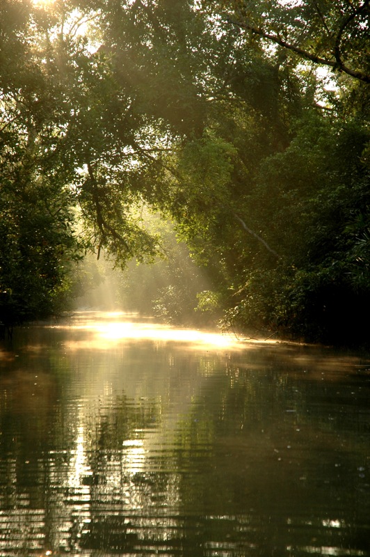
Amitav Ghosh can clearly remember his first interaction with the climate crisis. It was the early 2000s, and Ghosh, now one of India’s most celebrated authors and winner of its highest literary prize, was researching a novel set in the Sundarbans, a network of islands around the mouth of the Ganges Delta in the Bay of Bengal, which is home to the world’s largest mangrove forest.

Climate change had barely entered into public consciousness back then, but Ghosh clearly remembers “visible signs that something wasn’t right”.

“People spoke of their homes disappearing, of sea water levels rising and salt water erosion, but no one knew what was happening,” he said. “So I began researching. And as the years went on the signs became clearer and clearer.”

Twenty years on, the Sundarbans are widely acknowledged to be one of the world’s most vulnerable areas to the climate crisis. Rising sea levels are eating away at the islands while extreme weather events have decimated the ecology and made the land salty and arid. Drilling for groundwater has only exacerbated the problem as it causes the islands to sink faster. Some predict that in less than a century, the unique biosphere will disappear entirely.

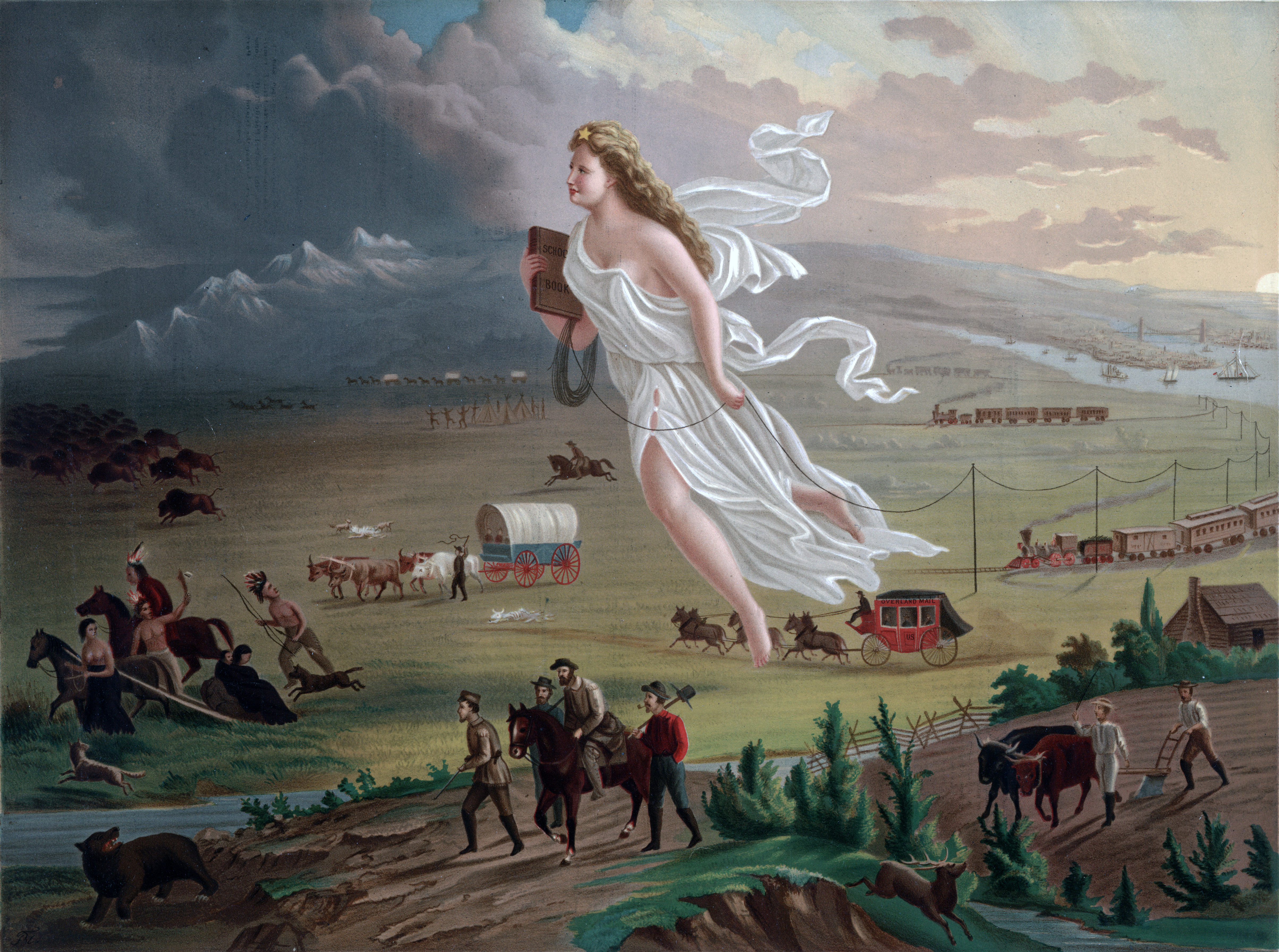
Spanning horrific incidents of European settler colonial violence carried out across Asia, America, Australia, New Zealand and Africa, Ghosh maps out how the pillaging of those lands hundreds of years ago – and the systematic extermination of their indigenous people – laid the foundation for the climate crisis that threatens the world today.

“Why has this crisis come about?” said Ghosh. “Because for two centuries, European colonists tore across the world, viewing nature and land as something inert to be conquered and consumed without limits and the indigenous people as savages whose knowledge of nature was worthless and who needed to be erased. It was this settler colonial worldview – of just accumulate, accumulate, accumulate, consume, consume, consume – that has got us where we are now.”

Yet as Ghosh sat down to write the book in March 2020, he had no idea that the ideas that had begun to take shape in his head would begin to manifest so dramatically off the page. Suddenly the pandemic hit and New York, where he lives, was one of its hardest-hit cities. “That experience really shaped the book, because the pandemic is the most visible aspect of the planetary crisis that’s unfolding us around us,” said Ghosh. “I think the pandemic more than anything else made it perfectly clear that this is a crisis you can’t hide from. Money will not protect you, power will not protect you, we’re in the midst of it already. It gave it a terrific sense of urgency.”

For Ghosh, the survival of our planet hinges on returning to interacting with Earth as a living being to be listened to, understood and respected. “The indigenous peoples of the Americas have been saying for decades that our past is your future and now that’s exactly what’s proving to be the case,” he said.

American Progress (1872) by John Gast is an allegorical representation of the modernization of the new west. Columbia, a personification of the United States, is shown leading civilization westward with the American settlers. She is shown bringing light from east to west, stringing telegraph wire, holding a book, and highlighting different stages of economic activity and evolving forms of transportation. By John Gast – This image is available from the United States Library of Congress’s Prints and Photographs division under the digital ID 09855.This tag does not indicate the copyright status of the attached work. A normal copyright tag is still required. See Commons:Licensing for more information., Public Domain, https://commons.wikimedia.org/w/index.php?curid=373152

Get Wild: The magic and science of snowflakes — The Summit Daily #snowpac

Barefoot Dance In The Snow New York, New York March 8, 1916. Girls of the Marion Morgan School of Dance in Los Angeles perform barefoot in the snow in Central Park. Underwood Archives by Underwood Archives

From The Summit Daily (Karn Stiegelmeier):

Snow dancing, Ullr calling and deep yearning for more snow this season appear to have paid off! After such a dry fall and early winter, abundant snowfall finally is allowing us to enjoy our sliding recreation — the focus for many of us.

Snow is, of course, also essential to our rivers and water supply. The 40 million people in the Colorado River basin, and the vast agricultural network that we take for granted when we shop for groceries, depend on winter snowpack. Summit snow fills reservoirs with essential spring and summer water.

We hear a lot about how many inches of powder we can expect, and we plan our days around those predictions. But how many snowflakes actually fall in these storms? Many billions of these spectacular crystals create a snowfall. One pound of snow has an average of 22,400 snowflakes. And each snow crystal is an incredible work of science and art.

What is a snowflake? Perhaps you’ve had the pleasure of folding a paper in half, then into thirds and — with good scissors in hand and some careful cutting — created a beautiful replica of one of the unique snow crystals that can be seen without magnification under the right conditions. When we say snowflake, we usually mean snow crystal: a single crystal of ice in which the water molecules line up in a precise way.

Photo via Snowflakes Bentley (Wilson A. Bentley)

How do these spectacular snow crystals form? Snow crystals generally are hexagonal (six-sided) due to the way they form. And they’re not frozen raindrops (those are sleet). Snow crystals appear when water vapor converts directly into ice without going through a liquid state. Water molecules in ice crystals join together in a hexagonal structure because it is the most efficient way. After the crystals form a small hexagonal plate, branches sprout from the six corners as the crystal grows larger and more complex.

Formation depends on the changing temperatures and humidity each crystal experiences on its unique path through the clouds as it forms and falls. This trip through clouds, wind and humidity creates a unique crystal. Indeed, no two snow crystals are alike; each has its own variety of patterns and shapes. Snowflakes are classified as hexagonal and triangular crystals, hollow columns, dendrites and irregular snowflakes. Dendrites are multibranched or tree-like crystals that can be very large, complex and often visible to the naked eye.

The six-fold symmetry in a snow crystal is created by the water molecule arrangement in the ice crystal shape. There are other snowflakes less complex and beautiful. During artificial snowmaking at our ski areas, the compressed air expands and quickly freezes water droplets. The resulting snow is a dense cloud of tiny sleet particles that lack the ornate hexagonal structures of snow crystals.

Once on the ground, snowpack can assume different qualities, depending on temperature, wind and time. Under the right conditions, we can see spectacular fern-like crystal shapes on the ground after snowfall begins to melt and reforms. These are larger than any snowflake and are easily seen without magnification along a trail, especially in wet riparian areas.

As you are gliding on, entranced with the falling snow, you can always ponder with wonder and awe about the intricacies of the amazing physics creating these works of science and art.

So keep on snow dancing. If nothing else, it’s good exercise! We have experienced a fantastic start to the new year with abundant snow. Bring on more beautiful hexagonal crystals!

“Get Wild” publishes on Fridays in the Summit Daily News. Karn Stiegelmeier is the chair-elect of Eagle Summit Wilderness Alliance, an all-volunteer nonprofit that helps the U.S. Forest Service protect and preserve the wilderness areas in Eagle and Summit counties. For more information, visit http://EagleSummitWilderness.org.

#Nebraska governor’s $500M #water plan in #Colorado puzzles politicians, experts in both states: Even if Nebraska builds a new canal in northeast Colorado, its payoff remains unclear — The #Denver Post

The upper South Platte River, above the confluence with the North Fork of the South Platte. Photo: Brent Gardner-Smith/Aspen Journalism

From The Denver Post (Conrad Swanson):

The 99-year-old South Platte River compact between the two states does outline plans for such a project, according to Anthony Schutz, an associate law professor at the University of Nebraska Lincoln. But the project was started and abandoned decades ago and the question of starting it up again might have to be decided in a costly and lengthy court battle.

Even if the canal is built, it’s unclear how much extra water it would yield to Nebraska or for what it could be used, Schutz said…

[State] Sen. Jerry Sonnenberg, R-Sterling, said the Nebraska governor must be mistaken. That list of projects comes from a report generated by legislation Sonnenberg helped pass in 2016, the senator said. And it outlines possible water projects around the state, not work that is actively being proposed…

Colorado Gov. Jared Polis said in a statement, Ricketts’ plans “seem to reflect a misunderstanding of Colorado’s locally driven water planning process.”

Officials in Colorado will look to more fully understand Nebraska’s “concerns and goals, as so far those concerns and goals are quite simply hard to make sense of,” Polis continued…

Sonnenberg said that likely means the two states will end up in court to determine whether Nebraska can use eminent domain to build the canal or whether it can take more water out of the South Platte if it’s built…

Currently, Colorado is meeting all its water obligations to Nebraska, said state Engineer Kevin Rein. During the irrigation season, April 1 to Oct. 15, the South Platte must flow at 120 cubic feet per second into Nebraska. That flow is measured at a water gate in Julesburg, just south of the Colorado border, Rein said.

Should flows dry below that threshold, Colorado officials must curtail water use in certain areas for water rights holders whose rights were established after 1897, Rein said. But Colorado has no additional obligation to increase flows.

During the non-irrigation season, there is no such requirement for Colorado and its officials believe the state has uninterrupted water rights for the South Platte, Rein said.

There is no set volume Colorado must allow to flow into Nebraska every year, Rein said.