R.I.P. Meat Loaf: “The snow is really piling up outside”

Meat Loaf being interviewed in 2009. By christopher simon – originally posted to Flickr as IMG_0094, CC BY 2.0, https://commons.wikimedia.org/w/index.php?curid=6690445

From The New York Times (Alex Marshall, Ben Sisario and Derrick Bryson Taylor):

Meat Loaf, the larger-than-life rocker whose 1977 debut, “Bat Out of Hell” — a campy amalgam of hard rock and Broadway-style bombast — became one of the best-selling albums of all time, died on Thursday. He was 74…

Meat Loaf, who was born Marvin Lee Aday and took his stage name from a childhood nickname, had a career that few could match. He was a trained Broadway belter and a multiplatinum-selling megastar whose biggest hits, like “Bat Out of Hell” and “Paradise by the Dashboard Light,” were radio staples — and barroom singalongs — for decades.

Despite his success, he earned little respect from rock critics. “Nutrition-free audio lunch meat” was how Rolling Stone dismissed “Bat Out of Hell” — which would go on to sell at least 14 million copies in the United States — in the 1993 edition of its album guidebook.

Still, some critics gave grudging admiration…

Meat Loaf also appeared in “The Rocky Horror Picture Show,” “Fight Club” and other films…

Later, Mr. Steinman was trying to write a post-apocalyptic musical based on “Peter Pan,” but, unable to secure the rights for the tale, he turned the work into “Bat Out of Hell,” bringing in Meat Loaf to give the songs the style and energy that made them hits.

The album, elaborately produced by Todd Rundgren, mingled hard-rock power chords, 1950s-style bubble gum and flashes of disco beats in songs that unfolded in multipart suites; the title track stretches nearly 10 minutes. In some ways the album resembled rock-style Broadway musicals like “Hair,” in which Meat Loaf had performed early in his career.

Its roster of backup musicians was stellar, including players from Bruce Springsteen’s E Street Band like the drummer Max Weinberg and the keyboardist Roy Bittan. Members of the New York Philharmonic and the Philadelphia Orchestra contributed; the eight-and-a-half-minute “Paradise by the Dashboard Light” even includes the Yankees announcer Phil Rizzuto giving a baseball play-by-play that doubled as the description of a seduction.

After “Bat Out of Hell,” Meat Loaf struggled to repeat his success…

His comeback came that year when he worked with Mr. Steinman on a sequel to their original hit, “Bat Out of Hell II: Back Into Hell.” It included the song “I’d Do Anything for Love (but I Won’t Do That),” a No. 1 hit that in 1994 won the Grammy Award for best solo rock vocal performance…

His first major film role came in 1975 in the cult classic “The Rocky Horror Picture Show,” in which he played Eddie, a delivery boy murdered for his brain by the cross-dressing Dr. Frank-N-Furter…

Marvin Lee Aday was born and grew up in Dallas, the son of Orvis Wesley Aday, a former policeman, and Wilma Artie Hukel, an English teacher.

History of Horsetooth Reservoir: From stone quarry to quenching thirst of fields, cities — The #FortCollins Coloradoan

A view of Stout from Larimer County Highway 38E taken in June 1946, one month before construction began at Horsetooth. Highland School is on the hill in the center.
Bureau of Reclamation

From The Fort Collins Coloradoan (Miles Blumhardt). Click through and read the whole article. Here’s an excerpt:

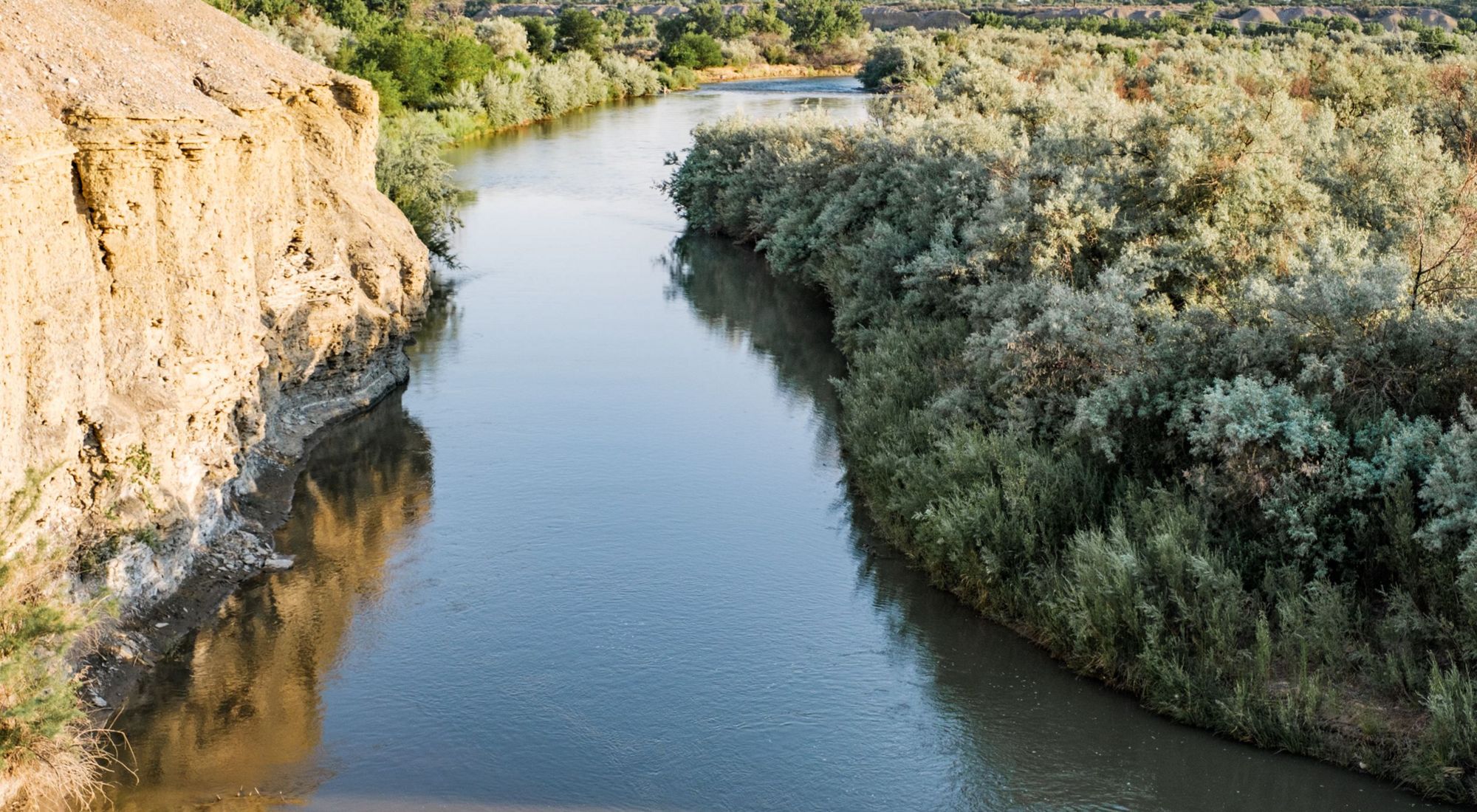
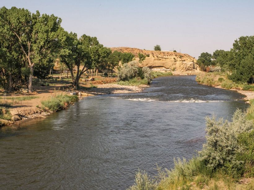
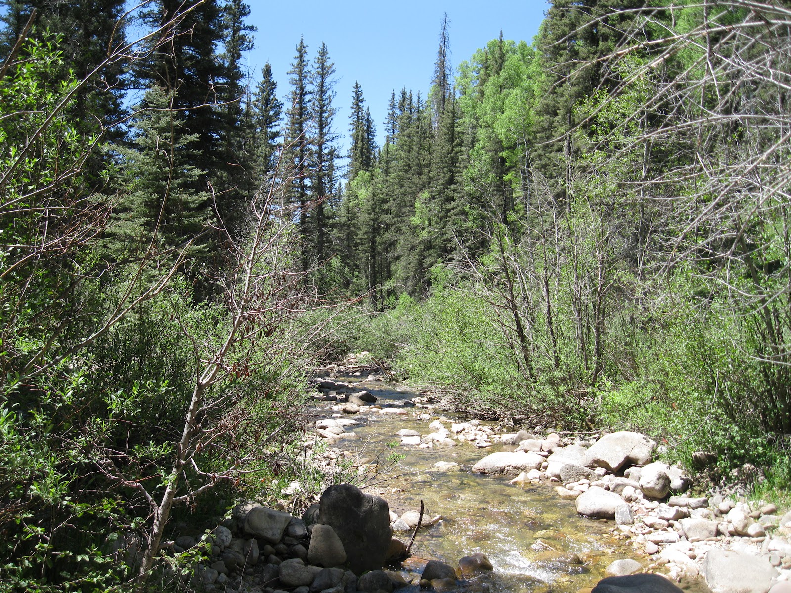
Horsetooth Reservoir stands as one of Fort Collins’ treasured trinity that includes the Poudre River and Horsetooth Rock.

A million visitors flock annually to its water cradled in the arms of four dams and its 25 miles of shoreline while hikers, mountain bikers and climbers recreate in the scenic foothills surrounding the 6.5-mile-long jewel.

But Horsetooth Reservoir was never meant to be a recreational paradise…

Though it’s become the state’s third-most visited reservoir, Horsetooth Reservoir’s main mission from the beginning was to provide water for agricultural fields on the Eastern Plains and increasingly thirsty Front Range cities such as Fort Collins.

That mission started 71 years ago on Jan. 10, 1951, when water diverted from the Western Slope began flowing into Horsetooth Reservoir as part of the massive Colorado-Big Thompson water diversion project.

Much has changed at the reservoir as well as in surrounding area since then.

In 1951, Fort Collins’ population was about 15,000 and an acre-foot of Horsetooth water sold for $4.50…

Today, Fort Collins’s population is about 174,000 and an acre-foot of Horsetooth water goes for $100,000.

In the beginning, 99% of the water went to agricultural fields and 1% to cities.

Today, that split is closer to 50-50, which is about the split Fort Collins takes from its two water sources — Horsetooth Reservoir and the Poudre River.

Here is a short history lesson of Horsetooth Reservoir’s humble beginnings, gathered from historical books, newspapers and water manager Northern Water.

Horsetooth history starts out dry

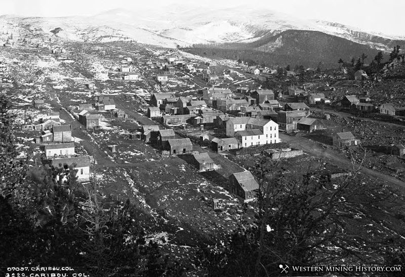
The area under what now is Horsetooth Reservoir was once where part of a town by the name of Stout was located.

Back in the day, Stout was the center of a large sandstone quarry from which deliveries still grace buildings from Fort Collins to Denver to Omaha, Nebraska, to St. Louis. They were even used in Chicago’s World’s Fair buildings.

Remnants of the once flourishing town (now the Horsetooth Heights subdivision) are visible at the south end of Horsetooth Reservoir.

Decades after the sandstone market dried up, the thirst for a consistent source of water for agricultural fields and growing cities emerged and the Colorado-Big Thompson water diversion project was born.

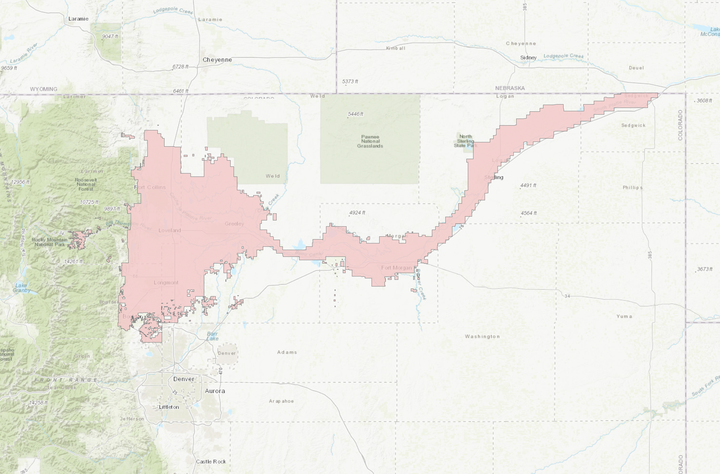
It entails a series of pump plants, tunnels, pipelines and canals that move more than 200,000 acre-feet of water per year from the Upper Colorado River basin to Lake Granby and Shadow Mountain Reservoir in Grand County before pumping it to the Front Range.

The project consists of 12 reservoirs, 35 miles of tunnels and 95 miles of canals, with the 13.1-mile long Alva B. Adams Tunnel beneath the Continental Divide serving as the key to the entire project.

As part of that project, four dams and a dike were used to wall off canyons just west of Fort Collins for Horsetooth Reservoir, which is the project’s largest Front Range reservoir.

Horsetooth Reservoir timeline

Here is a timeline on the history of how Horsetooth Reservoir came to be, gathered from historical books, newspapers and Northern Water:

1870: Irrigation history begins in Northern Colorado with the Greeley colony serving as the epicenter.

1881-82: Greeley, Salt Lake and Pacific Railroad Co. (Union Pacific) builds a rail line connecting the quarries at Stout to Fort Collins, Greeley and Denver. A trestle that bridged Spring Canyon and where a dam is now located was the largest of the 32 bridges at 262 feet long and 45 feet high.

1883: Stout boasts a population of more than 900.

1884: State engineer E.S. Nettleton conducts the first preliminary survey of a possible diversion project to import Western Slope water to the Front Range.

1893: The heyday of the stone quarry has passed, but some quarrying lingers.

1900: Stout is a ghost town.

1908: Stout post office closes.

1933: Discussion of what will become the Colorado-Big Thompson water diversion project begins amid the Dust Bowl.

1936: Congress officially renames the Grand Lake Project the Colorado-Big Thompson Project.

1937: Northern Colorado Water Conservancy District forms to build and manage the C-BT project. It is now called Northern Water.

1937: Congress approves $900,000 to build the C-BT project.

1938: C-BT construction starts. Cost of the project is about $160 million.

1940: Construction begins on the Continental Divide Tunnel (later named the Alva B. Adams Tunnel) with one crew beginning from Grand Lake on the Western Slope and a second team tunneling from a location near Estes Park. When complete, the tunnel is the longest ever built from two separate headings.

1942: CB-T construction halts due to World War II.

1943: CB-T construction resumes.

1944: The two tunnel crews meet after tunneling through the Continental Divide. NBC radio broadcasts the event live to the nation. A check of the center line and grade reveals the two sides are off by the width of a penny.

1946: Gravel road (Larimer County Road 38E) is built around the south end of Horsetooth Reservoir to Masonville to aid in construction of the reservoir.

1946-49: Construction of Horsetooth Reservoir takes place at a cost of $20 million for the reservoir and canals.

1947: First CB-T water is delivered to the Front Range.

1951 (Jan. 10): First water starts spilling into Horsetooth Reservoir.

1951 (July 21): First water releases from Horsetooth Reservoir were made to the Poudre River. An estimated 500 people line the railings for the release ceremony at the Horsetooth outlet canal at the north end of the reservoir.

1954: Larimer County assumes management of recreation at Horsetooth, Carter Lake and Pinewood Reservoir. Recreational fees that year generate $1,200.

1954: Proposal made for a road along the east side of Horsetooth Reservoir from Horsetooth Dam on the north to Soldier Canyon Dam on the south. It would later become Centennial Drive.

1956: Horsetooth Reservoir reaches full capacity.

1967: Colorado Game Fish and Parks (today’s Colorado Parks and Wildlife) purchases the 2,300-acre Howard Ranch, which became Lory State Park in 1975, on the west side of the reservoir.

1972: Annual fees at Horsetooth Reservoir include $12 for boating, $5 for vehicles and $2 for a three-day pass. Fees expected to generate $70,000.

1973: First major improvements at reservoir include 75 parking spaces, 125 campsites and four boat-in campsites and new toilets completed mostly in what now is the South Bay area.

1976: A July flash flood on the Big Thompson River kills 145 people and causes more than $35 million in property damage. Flood water and debris destroy the 240-foot-long Big Thompson Siphon (visible at the mouth of the Big Thompson Canyon), halting C-BT Project water deliveries to Horsetooth Reservoir.

1977: Drought hits northeastern Colorado, resulting in Horsetooth Reservoir reaching its lowest level since it was first filled at 15,240 acre-feet. The current capacity is 156,735 acre-feet.

1980: An estimated 200,000 visitors come to Horsetooth Reservoir.

1981: Larimer County purchases the 2,100-acre Soderberg Ranch for $3 million. The site would become Horsetooth Mountain Park just west of the reservoir.

1983: BLM predicts that if one of Horsetooth Reservoir’s dams failed, a 30-foot wall of water would rush toward Fort Collins, reaching CSU, the Poudre River and Interstate 25 in less than hour, Timnath in two hours, Windsor in three hours and Greeley in five hours.

1986: Horsetooth Rock Trail to the top of Horsetooth Rock is completed.

1987: About half of the two roads along the south and east sides of the reservoir are paved.

1988: Proposal to turn Horsetooth, Carter and Pinewood reservoirs and Horsetooth Mountain over to the state to become state parks dies.

1988-89: Horsetooth Reservoir’s Horsetooth, Soldier Canyon, Dixon and Spring Canyon dams raised 3 to 8 feet, increasing the reservoir’s ability to store water from major flood events and address safety concerns. It had been discovered in 1984 that the original dam faces had settled 3 feet. Cost of the project is $1.8 million.

1992: In February, a 9News helicopter crashes into the reservoir in heavy fog, killing two people and leaving pilot Peter Peelgrane, 46, fighting for his life.

1992: Horsetooth Falls Trail is built.

1996: First flush toilets installed at reservoir.

2001-03: Northern Water Conservancy District (now Northern Water) and the U.S. Bureau of Reclamation work to modernize Horsetooth Reservoir’s four 50-year-old dams to make the structures more earthquake resistant and reduce seepage. Cost of the project is $77 million. The work required the water level to be reduced by 70 feet to to “dead pool” storage — about 7,000 acre feet, or roughly 5% capacity.

2021: Construction of the 90,000-acre-foot Chimney Hollow Reservoir begins west of Loveland with completion of the project expected in 2025. It’s Northern Colorado’s first new reservoir in about 70 years and is expected to relieve some of the recreational pressure from Horsetooth Reservoir.

Screenshot of the Colorado-Big Thompson Project boundaries via Northern Water’s interactive mapping tool , June 5, 2019.

#Durango sewer rates to increase $2.22 per month, on average: City Council approves 3% hike to address inflation — The Durango Herald

Lake Nighthorse and Durango March 2016 photo via Greg Hobbs.

From The Durango Herald (Nicholas A. Johnson):

Durango City Council on Tuesday approved a 3% rate increase for all customers who use the city’s sewer infrastructure.

The ordinance passed with a vote of 4 to 1…

[Jarrod] Biggs said that although there is a surplus in the sewer fund, it won’t last with rising costs outpacing sewer revenues…

According to Biggs, inflation in the past year has driven up sewer operations considerably. He said the cost of chemicals used to operate the city’s water treatment facility went up 35% in 2021…

City Manager José Madrigal said the 3% increase will, on average, translate to a $2.22 increase for sewer ratepayers.

Sewer increases are tied to the base rate charges for residential and commercial customers. Those who go over the base rate of usage will not be charged anything more than they normally would for going over.

Base rates are determined by the size of a person’s water meter. Most residential homes have a water meter size of five-eights of an inch; the new base rate for homes with that meter size inside Durango city limits will be $23.71 per month…

Revenue from sewer rates in Durango is about $7.9 million per year, while the operating budget of the city’s sewage infrastructure is $3.6 million. Another $3.4 million is diverted from sewer rate revenue to pay off debt from large projects, such as construction on the Santa Rita Water Reclamation Facility.

Over the past three years, sewage revenues left over to pay for capital expenses have been around $900,000 annually. However, the annual cost of capital expenses for the sewer system has been around $2 million. Capital expenses include projects such as sewer line rehabilitation and manhole replacements, Biggs said.

“If we don’t have adjustments to bring in more revenue, we will have to watch and limit capital improvement projects, and defer maintenance,” he said.

#NewMexico #Snowpack improving, but study projects ‘low-to-no’ snow future — The #Taos News

New Mexico snowpack basin-filled map January 21, 2022 via the NRCS.

From The Taos News:

The first major snowstorm of the 2021-22 winter season came late this year, but when it finally rolled into Northern New Mexico on New Year’s Eve, dropping several inches to a couple of feet, depending on elevation, it dramatically changed the picture of what snowpack levels could look like this year.

According to data recorded by the Natural Resources Conservation Service National Water and Climate Center, precipitation levels in Taos County more than doubled from mid-December through Tuesday (Jan. 18), rising from approximately 5.1 inches on Dec. 19 to 11.6 inches as of Jan. 18.

Data from the United States Department of Agriculture shows that the Sangre de Cristos currently have between 65-82 percent of expected snowpack for a typical winter season. That varies depending on location, of course, with the lower spine of the mountain range near Santa Fe seeing about 69 percent, the area near Cimarron at 65 percent and Taos with the highest at 82 percent.

On Jan. 18, Taos Ski Valley reported 38 inches of snow at its base and 54 inches of “packed powder.” Nearly all of its lifts are open, except for two and 76 of its 110 runs are open.

Despite the sudden shift from unusually dry to snowy, historical studies of snowpack levels don’t bode well for the future of snow in the Western United States or for the ski resorts that rely on it to keep their businesses thriving.

A November 2021 study, “A low-to-no snow future and its impacts on water resources in the western United States,” estimated that snow water equivalents are expected to decline by 25 percent by 2050, largely due to persistent greenhouse gas emissions. The study drew its conclusions from what is already known: since the 1950s, snowpack in the Western U.S. has fallen by 20 percent.

The implications of this decline, and the continued reduction in snowpack for the future, predict more serious consequences than resorts suffering or recreationalists missing out on their favorite winter activities.

“Diminished and more ephemeral snowpacks that melt earlier will alter groundwater and streamflow dynamics,” the study reads. “The direction of these changes are difficult to constrain given competing factors such as higher evapotranspiration, altered vegetation composition and changes in wildfire behavior in a warmer world.”

New Mexico has been under varying levels of drought for roughly 20 years, which was part of the motivation behind a cloud seeding operation that was introduced last year by the Roosevelt Soil and Water Conservation District in Southeast New Mexico. Despite evidence that shows cloud seeding can enhance precipitation levels significantly, the application, submitted by Western Weather Consultants of Durango, Colorado, was retracted in November following strong public pushback from opponents who believe cloud seeding can be harmful to the environment and public health.

#Wildfire mitigation efforts gain urgency in #Aspen, Pitkin County: U.S. Forest Service is ready to roll with 5 projects, Pitkin County helps with funding — The Aspen Times

Above: The Lake Christine Fire, July 4, 2018. Photo: Katie Baum Hueth, Eagle County Sheriff’s Office. Photo via Wildfire Today

From The Aspen Times (Scott Condon):

The Marshall Fire that destroyed more than 1,000 structures in Boulder County Dec. 30 has increased the urgency of completing wildfire mitigation projects in the Aspen area and Pitkin County.

The U.S. Forest Service is working with the governments of Aspen and Pitkin County as well as fire districts and homeowners associations to identify places that are the highest priorities for fuels reduction. The private lands on Red Mountain and public lands surrounding the high-end neighborhood are one of the highest priorities…

Richards said the Marshall Fire that swept through parts of Louisville and Superior show the importance of fire mitigation on private lands as well as national forests…

A working group loosely referred to as the Roaring Fork Fuels Collaborative is looking at numerous wildland fire mitigation projects, including one called Sunnyside, which would treat lands adjacent to Red Mountain subdivision. Between 1,000 and 1,500 acres would be targeted, according to Kevin Warner, Aspen-Sopris District Ranger. It would require mechanical treatment of tree and vegetation removal and prescribed burns in areas away from homes. The earliest that project could advance is probably spring 2024, Warner said.

Cooperation from the homeowners would be essential so that land within the subdivision would be treated as well. Aspen Fire Chief Rick Balentine said his department is working on demonstration projects to show homeowners that easing wildfire risk doesn’t mean ruining their property…

The Forest Service led a project in 2016 to treat lands near Red Mountain in the Hunter Creek Valley. Additional work on up to 1,500 acres in Hunter Creek could be undertaken as soon as this spring, according to Gary Tennenbaum, director of the Pitkin County Open Space and Trails program. He credited the Forest Service for leading the successful 2016 project and not causing alarm in Aspen. He also credited the agency for its willingness to propose working close to Red Mountain…

Warner said five wildland fire mitigation projects throughout the region are being planned. The Forest Service and its partners probably don’t have the resources to pursue them all this year, but priorities will be dictated by factors such as moisture levels this spring and the ability to get a permit from the state over air quality.

The contending projects include 2,000 acres in Collins Creek east of the settlement of Woody Creek, 2,000 acres in Braderich Creek west of Redstone, the 1,500 acres in Hunter Creek in Aspen’s backyard, a project in Cattle Creek north of Basalt Mountain in Eagle County and a project in the Seven Castles area in Fryingpan Valley…

Pitkin County has budgeted $300,000 over three years to assist the Forest Service. The highest priority for the county is “where the forest meets homes,” said county emergency manager Valerie MacDonald. The county has collaborated in recent years on several small projects that reduced fuels on federal lands in the Crystal River Valley that are adjacent to private properties, such as Swiss Village, she said.

A project north of Redstone treated 100 acres. “It gives the historic town of Redstone a fighting chance to evacuate safety,” MacDonald said.

Like other speakers at the meeting, she said getting cooperation from private landowners is the key to building resiliency. Pitkin County is 83% public lands, but much of its private property is in what’s known as the wildland-urban interface…

The local planning comes as the U.S. Forest Service released a major new initiative called “Confronting the Wildfire Crisis.” It will target “firesheds” in the Western U.S. — areas 250,000 acres and larger with a high likelihood that an ignition could expose homes, communities and infrastructure to wildfire.

The initiative will target 20 million acres on national forestlands as well as up to 30 million acres on other federal, state and private lands over the next 10 years. It will also come up with a maintenance plan beyond the next decade.

President Joe Biden’s infrastructure bill earmarked $3 billion for the effort beyond regular funding for wildfire mitigation. The strategy is drawing criticism from some environmental groups.

#Colorado fines #Boulder County gold mine $17,000 for #water quality violations — The Colorado Sun

Caribou Colorado late 1800s. Photo credit: Western Mining History

From The Colorado Sun (Michael Booth):

All but $5,000 suspended, as mine reclamation staff says owners of Cross and Caribou mines are making “good faith” efforts to get cleanup online.

The state Mined Land Reclamation Board imposed a $17,000 fine on owners of the Cross and Caribou mines for water quality violations, but suspended all but $5,000 of the penalty as long as Grand Island Resources continues “good faith” efforts to install containment and cleanup equipment.

The state agency’s staff largely endorsed the mining company’s presentation detailing completion of a filtration system for any water emitted from the historic mine above Nederland, and said they would continue on-site review of the improvements and water sampling…

The state board was reviewing a cease and desist order issued late in 2021 that said mine owners failed to make some required pollutant reports in March and April. When the state looked deeper, it found pollutant violations in those months, but also more alleged violations before and after, from December 2020 to last August. Violations included excessive traces of heavy metals, including copper and lead, that can be dangerous to aquatic and human health.

The state’s order charged the mine with violating the Colorado Water Quality Control Act. Water quality officials ordered the owners to build a new containment and cleanup system, and said it would determine the levels of fines in January.

Ed Byrne, an attorney for Grand Island Resources, said the company is satisfied with the outcome of the hearing…

The company will keep working with state and local officials to fully comply with permits, Byrne added.

An attorney for Save the Colorado, a nonprofit environmental group that is monitoring the mine, said the testimony before the board shows the mine appears to have remedied some pollution problems…

Cross and Caribou is not currently producing gold ore, but the company has a permit to build an ore processing facility and says it has been spending millions of dollars rebuilding tunnels and cleaning up past mine operations.

Grand Island said it will also continue to work with Boulder County, City of Boulder and Nederland.

#Water Agreement Reached Between the Jicarilla Apache Nation, New Mexico Interstate Stream Commission, and The Nature Conservancy

SAN JUAN RIVER The San Juan River at the hwy 64 bridge in Shiprock, NM. June 18, 2021. © Jason Houston

Here’s the release from The Nature Conservancy (Lindsay Schlageter):

Will help address water security in the face of climate change

The Jicarilla Apache Nation, the New Mexico Interstate Stream Commission (NMISC), and The Nature Conservancy (TNC) announced today a new agreement to lease water from the Nation to the NMISC. As the western US is facing critical drought and water shortages are occurring throughout the Colorado River Basin, the Nation has worked with the NMISC and TNC to develop and implement this project.

This innovative agreement between a sovereign Tribal Nation, a Colorado River Basin state government, and a conservation organization will allow the NMISC to lease up to 20,000 acre-feet of water per year. This amount will benefit threatened, endangered, and sensitive fish and will increase water security for New Mexico.

“This first-of-its-kind project demonstrates how meaningful sovereign-to-sovereign cooperation, with support from environmental organizations, can lead to creative solutions,” said Daryl Vigil, water administrator for the Jicarilla Apache Nation. “This project should serve as a model for effective tribal collaboration and arms-length negotiations among sovereigns throughout the Colorado River Basin.”

The Jicarilla Apache Nation’s water rights provide access to water for the Nation to conduct cultural practices, provide drinking water to its community, and support economic development. The Nation subcontracts some of its water to users outside the Reservation. Subcontracts can be a source of income to help build the Nation’s economic self-sufficiency while providing water to others that need it.

For the last several decades, the Nation leased water to coal-fired power plants that are now facing closure. This transition presented a new opportunity for the Nation, the NMISC and TNC to work together.

“The Colorado River Basin’s tribal nations are among the most important leaders and partners in efforts to find lasting solutions to the pressing water scarcity and ecological challenges that face the millions of people who rely on this incredible river,” said Celene Hawkins, Colorado and Colorado River tribal engagement program director for The Nature Conservancy.

As many across the Colorado River Basin work to develop projects and solutions to address climate change and drought, the Nation, the NMISC, and TNC hope this innovative water sharing project can serve as a model for water sustainability within the basin. This project demonstrates that the Colorado River Basin’s tribal nations are important leaders and partners in crafting transformative water solutions across the West.

“This agreement is unique for New Mexico as it creates a framework for sovereign-to-sovereign contractual agreements that support and benefit both sovereigns,” said Rolf Schmidt-Petersen, director of the New Mexico Interstate Stream Commission. “It may serve as an example for other Colorado River Basin states and tribal nations that have settled water rights to find collaborative solutions that benefit multiple interests and users of the San Juan and Colorado Rivers.”

THE ANIMAS RIVER IN FLORA VISTA, NM. The Animas River in Flora Vista, NM as seen from the New Mexico County Road 350 bridge. June 18, 2021. © Jason Houston

Outstanding waters: At a time when #water in the Southwest is becoming increasingly scarce, more than 20 streams in the region are being proposed for protective safeguards — The #Durango Telegraph

Priest Creek. Photo credit: Four Corners Hikes

From The Durango Telegraph (Jonathan Romeo):

At a time when water in the Southwest is becoming increasingly scarce, more than 20 streams in the region are being proposed for protective safeguards in an attempt to preserve the waterways for years to come.

For the past two decades, a prolonged drought driven by climate change has snowpack levels in the Southwest on a continual downward trend. Obviously, that’s not good – less snow means less runoff for rivers and streams, and less water available for use.

As a result, a few years ago, a coalition of environmental groups started a process to locate and identify streams in the high country of Southwest Colorado that would qualify as Outstanding Waters (OW). The designation protects defined reaches of rivers, streams and lakes that have exceptional water quality.

The thinking, environmental groups say, is saving these pristine high-alpine streams in the face of climate change and worsening drought will ensure the long-term protection of tributaries that are vital for the region’s most important rivers, such as the Animas, Dolores, Gunnison, San Juan and San Miguel – which all feed into the Colorado River…

Really special rivers

The Outstanding Waters designation was established as part of the Clean Water Act of 1972. For streams to qualify, they must meet a set of criteria based on water quality and national resource values. And, the streams also must serve as critical habitat for aquatic life and have a component of recreational value, such as fishing or river running. Once designated, the water quality in those streams must be maintained and protected from any future development or use.

The Clean Water Act, however, left it up to states to create a process and specific criteria for streams to qualify as OW. In Colorado, that job falls to the Colorado Department of Public Health and Environment. “We protect every stream in Colorado, but this is the highest level of protection,” Blake Beyea, a water standards unit manager with CDPHE, said. “And it needs to be supported by water quality data, as well as evidence it’s an outstanding resource that requires protections.”

While the designation is somewhat seldom used, as of February 2020, Colorado had an estimated 78 stream segments and bodies of water, covering 5,869 river miles, classified as OWs, mostly located within wilderness areas and national parks. The environmental groups’ proposal – which includes SJCA, Trout Unlimited, American Waters and Pew Charitable Trust, among others – would be unique in terms of the amount of streams proposed and the fact the waterways are located outside wilderness areas, mostly on Forest Service lands…

Setting a standard

Back in 2019, the environmental groups started conversations on what streams might qualify as OWs. They looked at maps for high-altitude waterways that showed the potential for pristine water quality and impeccable habitat for aquatic life, while also escaping historical impacts from uses like mining and development over the years.

In all, nearly 30 streams emerged as potential OW candidates. Then, the next step was to prove it with on-the-ground water testing, an effort led by the Durango-based Mountain Studies Institute. That process lasted two years, with samples taken four times a year from each stream. In the end, the environmental groups ultimately proposed 26 stream segments (five in the Animas; nine in Dolores; seven in Gunnison; three in San Juan; and two in San Miguel).

An OW designation does not affect water rights and would not prohibit future development in these watersheds, Gaztambide said. It would, however, establish a baseline of water quality that cannot be impacted or degraded in the face of that development. And in some circumstances, it’s not just development; the waterways are also protected from things like an increase in recreation, which can result in elevated levels of E. coli.

Essentially, uses and development can change on the landscape; the existing, high-level water quality standards cannot…

Unintended consequences

Gaztambide and the environmental groups are optimistic all the streams they’ve proposed will attain the OW designation. And indeed, there doesn’t seem to be much pushback from other water users in the region, such as agriculture and water districts.

Steve Wolff, manager of the Southwestern Water Conservation District, which represents nine counties in Southwest Colorado, said it’s unlikely the district’s board will take a stance either way for the OW designation. To date, the board has just monitored and asked questions about any possible unintended consequences the listing may have.

One potential concern, Wolff said, is what outside impacts and degradation, like rising water temperatures driven by climate change, would have on the designation and the requirement to maintain those standards. “If that happens, what does that mean from a regulatory aspect?” Wolff said. “We really don’t know yet.”

Since most of the streams are located on Forest Service lands, another question has been raised on the impacts to grazing and logging. A Forest Service representative said Tuesday “we don’t have information to share about the designation at this time” and did not provide comment for this story. Gaztambide, however, said an OW designation does not impact uses like grazing.

A critical time

Peter Butler, who serves as a consultant for SWCD and has worked on water quality issues in the region for years, said he wasn’t aware of too many issues with the OW designation in Colorado over the years. In 2009, Hermosa Creek, for instance, was designated as the first OW outside of a wilderness area or national park, and the situation hasn’t run into any problems or controversy…

To nominate nearly 30 streams in one proposal is a big project, Butler said. But OW, though rarely used, is a way to protect precious water resources at a critical time, in a way that’s more regulatory and doesn’t have to go through a political process. In June, CDPHE’s nine-person Water Quality Control Commission is expected to vote on the proposal…

Gaztambide said the designation will also protect these vital tributaries, which provide a boost of clean water to major rivers should a large event, like the Gold King Mine spill or mudslides from the 416 Fire, seriously impact water quality and threaten drinking water for downstream towns.

When does #Vail get the most snowfall?: ‘Snowiest’ and ‘wettest’ months are different — The Vail Daily #snowpack

From The Vail Daily (Scott Miller):

Local lore holds that March is our snowiest, wettest month. That isn’t so.

Recent data from the National Centers for Environmental Information that covers the period between 1991 and 2020 show that, at least in the town of Vail, February is actually the snowiest month, with average snowfall of more than 35 inches. April is actually the wettest month, with an average of just more than 2.4 inches of precipitation.

That actually isn’t much of a change from the previous measured period, from 1981 through 2010.

State Climatologist Russ Schumacher wrote in an email that the change in the numbers is mostly seen in the western part of Eagle County. The wettest months had been in the fall in those lower-elevation areas. That shift is consistent with data across much of northwestern Colorado.

While April is the wettest month in terms of precipitation, that doesn’t necessarily equate to snowfall.

Schumacher noted that spring snow tends to be heavier, because there’s more water in that snow. The snow in mid-winter tends to be lighter, which is better for skiing but not great for accumulating water in the snowpack.

The snow measurement site on Vail Mountain is about halfway toward its peak “snow water equivalent” level.
Eagle River Water & Sanitation District/courtesy photo

At the moment, the snowfall measurement station on Vail mountain is right at halfway toward its average peak “snow water equivalent.” That number usually peaks in late April at right around 20 inches. The Jan. 17 measurement was 10.1 inches at that site, 111% of the 30-year average. The other main measurement sites, Copper Mountain, near the headwaters of Gore Creek, and Fremont Pass, near the headwaters of the Eagle River, are in that range.

Aside from the moisture content of snow, does it really matter when it comes?

Diane Johnson, the communications and public affairs manager for the Eagle River Water & Sanitation District, said there’s a lot to consider when pondering when snowfall comes.

Johnson wrote in an email that snowfall’s impact on streamflow — the source of most of the valley’s domestic water — depends on what form precipitation comes. Snow and rain have different impacts. If the snow stays high and temperatures stay low, the spring snowmelt slows, providing more consistent supplies.

“We’ve been seeing earlier melts,” Johnson wrote. That affects streamflows not only in the spring and early summer but through the rest of the season.

Westwide SNOTEL January 20, 2022.