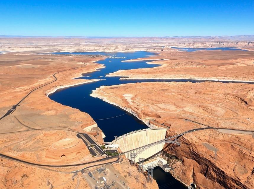
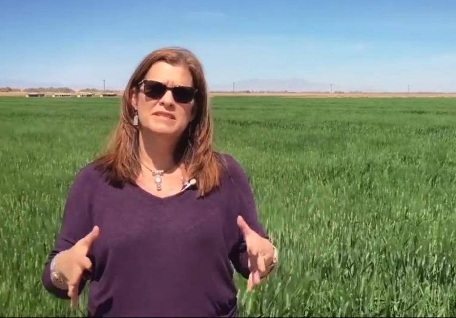
Lake Powell, a key reservoir on the Colorado River, has seen water levels drop precipitously as a result of two decades of drought. (Source: The Water Desk and Lighthawk Conservation Flying)
From The Water Education Foundation (Douglas E. Beeman):
Drought and Climate Change are raising concerns that a century-old compact that divided the river’s waters could force unwelcome cuts in use for the upper watershed
Climate scientist Brad Udall calls himself the skunk in the room when it comes to the Colorado River. Armed with a deck of PowerPoint slides and charts that highlight the Colorado River’s worsening math, the Colorado State University scientist offers a grim assessment of the river’s future: Runoff from the river’s headwaters is declining, less water is flowing into Lake Powell – the key reservoir near the Arizona-Utah border – and at the same time, more water is being released from the reservoir than it can sustainably provide.
Brad Udall: Here’s the latest version of my 4-Panel plot thru Water Year (Oct-Sep) of 2021 of the Colorado River big reservoirs, natural flows, precipitation, and temperature. Data (PRISM) goes back or 1906 (or 1935 for reservoirs.) This updates previous work with @GreatLakesPeck.
Udall’s slides and charts suggest that unless something changes soon, water levels behind Lake Powell’s Glen Canyon Dam on the Arizona-Utah border may fall so low by 2025 or 2026 that no water can get past the dam. That could ultimately leave downstream states like California, Nevada and Arizona short of water promised under the century-old Colorado River Compact that divided the river’s waters between the upper and lower watersheds.
And that has the potential to set up something that many water interests on the river say they want to avoid – a so-called “Compact call.” Such a scenario could force the Upper Basin states – Colorado, New Mexico, Utah and Wyoming – to curtail their own water use to fulfill their Compact obligation to send a certain amount of water to the Lower Basin states of California, Arizona and Nevada.
There has never been a Compact call on the river. But as evidence grows that the river isn’t yielding the water assumed by the framers of the 1922 Colorado River Compact, questions arise about whether a Compact call may be coming, or whether the states and water interests, drawing on decades of sometimes difficult collaboration, can avert a river war that ends up in court. It’s no small matter for a river that serves water to 40 million people from Denver to Los Angeles and irrigates more than 4 million acres of crops. The growing risk and the difficult actions that might be necessary to avoid a Compact call have been hot topics of discussion at several recent Colorado River conferences.
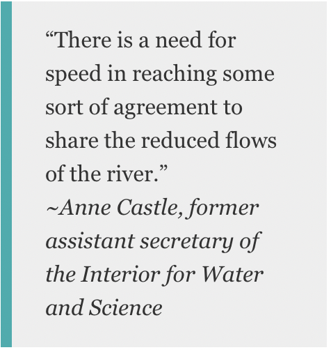
“The temperature, metaphorically, seems to be rising,” Anne Castle, a former assistant secretary of the Interior for Water and Science and a Colorado River veteran, said in an interview. “There is a need for speed in reaching some sort of agreement to share the reduced flows of the river.”
A River in Trouble
Without question, the Colorado is a river in trouble. After more than two decades of drought, both of the river’s anchor reservoirs – Lake Powell, upstream of Lee Ferry (the dividing point between the Upper and Lower Basins), and Lake Mead, the nation’s largest reservoir located downstream of Lee Ferry near Las Vegas – are only about 30 percent full. The river’s Rocky Mountain watershed has begun to see snow this winter, but many more rich winters of storms would likely be needed to undo 22 years of drought.
In August, the Bureau of Reclamation declared a first-ever shortage for next year, requiring Arizona and Nevada to cut back their annual take of the river by a total of 533,000 acre-feet (a cut of about 17 percent, mostly from Arizona) beginning this month. Based on a 2017 agreement, Mexico also will reduce its draw from the river. The move is intended to prevent already dire water levels from falling further in Lake Mead. Meanwhile, Reclamation’s most recent 24-month operating plan projects that, if hydrology remains extremely dry, the water level in Lake Powell by next September could approach the minimum needed to keep the hydropower turbines running.
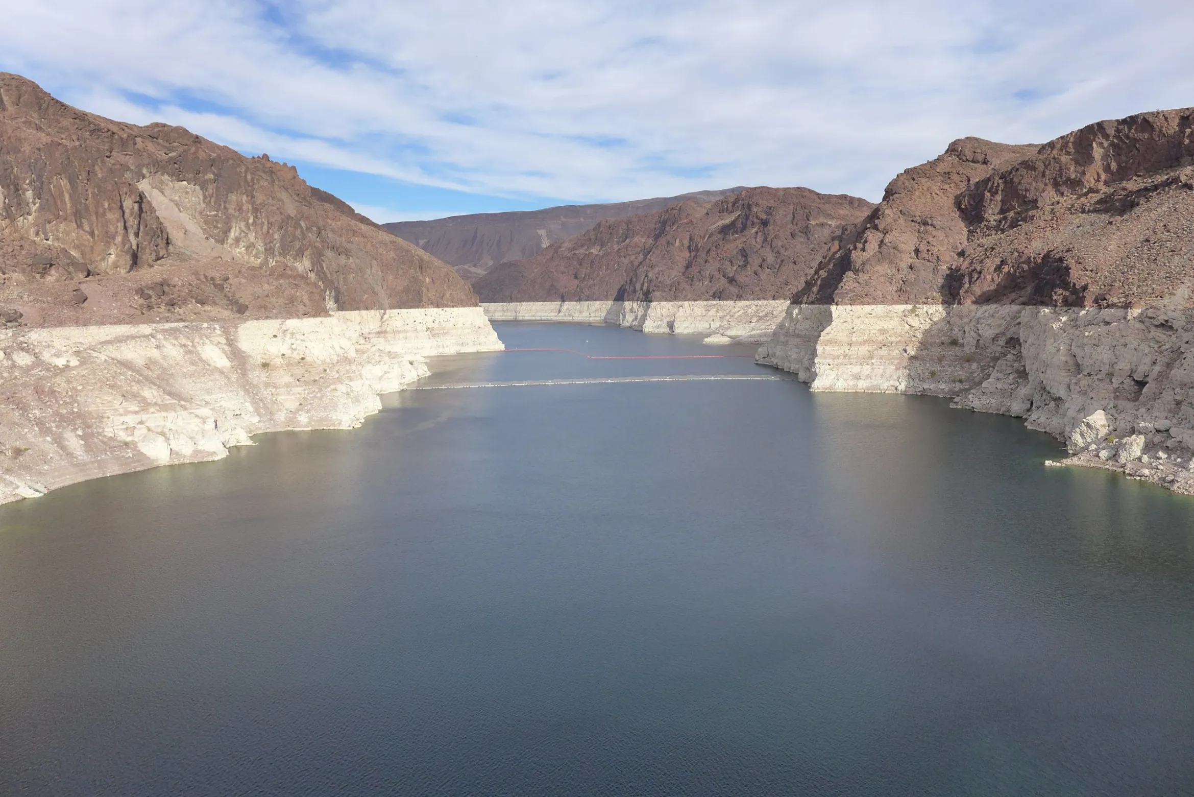
Drought in the Colorado River Basin has pushed the water level in Lake Mead, Southern Nevada's main water source, to a historic low. (Source: Southern Nevada Water Authority)
Under a set of river operating guidelines adopted in 2007, the two reservoirs are managed in tandem, with Powell releasing water to help prop up water levels at Lake Mead. That arrangement has sometimes frustrated water interests in the Upper Basin, who have at times complained that the Lower Basin is using too much water and that their own ambitions for developing the river are being stymied.
“The level of Mead dictates in part how much water is released from Powell,” Becky Mitchell, the state of Colorado’s top water official, said at a recent water conference. “It’s important to focus on what’s going out of Lake Mead, because that has the greatest impact on the [Colorado River] system.”
When commissioners from the seven Basin states gathered in 1922 to hammer out the Compact – the foundational document in a growing set of agreements, laws and court cases called the Law of the River – they believed the river routinely carried about 17.5 million acre-feet a year. On that belief, they apportioned 7.5 million acre-feet a year each to the Upper and Lower Basins. They also agreed that any water committed to Mexico by a later U.S. treaty would be supplied equally by the two Basins. Native American tribes, who are now acknowledged to hold substantial rights to the river’s water, were barely mentioned.
Senior water and climate research scientist at Colorado State University and one of the authors of the National Climate Assessment. Photo credit: Colorado State University Water Institute
But more recent Bureau of Reclamation data show river flows averaged just 12.3 million acre-feet annually from 2000 to 2021 as severe drought gripped the river basin. Udall, the veteran Colorado State University climate researcher, said at an October conference that a warming climate that is drying out the Basin is making things worse. From 2000 to 2014, he estimates, hotter temperatures reduced Colorado River flows by about 6 percent. That’s on top of reductions just from less rain and snow. By 2050, Udall said, with a continuation of the current precipitation decline the hotter temperatures could reduce runoff by 30 percent and those losses could reach 45 percent — or more — by 2100.
Udall, speaking at the annual conference of the Getches-Wilkinson Center at the University of Colorado Boulder, said releases from Lake Powell to meet the Upper Basin’s obligation to downriver users coupled with evaporative losses exceed what is flowing into Powell. That, he added, is not sustainable.
“The Upper Basin is headed to a Compact issue with the Lower Basin here at some point in time if those flows continue,” Udall said.
Risks of a Compact Call
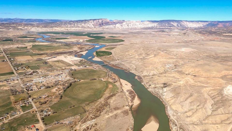
The Green and Colorado rivers cut through Utah's Canyonlands National Park. A warming climate is adding to the drought-driven declines in snowmelt and spring runoff across the Colorado River Basin. (Source: LightHawk Conservation Flying/The Water Desk)
No one knows exactly how a Compact call would work or who would set it in motion since it has never happened before. A 1948 agreement — the Upper Colorado River Basin Compact — places the responsibility for deciding how to divide any water use reductions among the states on the Upper Colorado River Commission, made up of representatives from the four Upper Basin states and one federal government representative. The commission’s responsibilities include making sure the Upper Basin meets its obligations under the 1922 Colorado River Compact.
Colorado, considered one of the headwaters states and holding the largest river apportionment in the Upper Basin, would likely feel the greatest pain from any Compact call, said Castle, the former Interior Department official, now a senior fellow at the Getches-Wilkinson Center at the University of Colorado School of Law.
Castle and writer John Fleck, at the University of New Mexico, wrote a 2019 paper looking at the risk of a Compact call, or a “Compact curtailment” as they called it. Their basic conclusions: The risk is substantial, there are options for compromises that could reduce that risk, and a so-called “demand management” program, where willing participants could be compensated for using less water, could lessen the potentially devastating risks that a forced curtailment of Colorado River water would have on users.
Anne Castle, the former assistant Interior secretary and a veteran of Colorado River issues. (Source: Water Education Foundation)
In an interview, Castle said at its worst, a Compact curtailment could pare back Colorado’s water use to levels that existed before the Compact was signed in 1922. Denver, which reaches across the Continental Divide to tap the Colorado River for its residents, could lose half of the city’s supply. That’s unrealistic, Castle said, adding that in that case Denver would likely seek out farmers with higher-priority water rights and cut deals to use their water to meet the city’s needs.
Doug Kenney, a longtime Colorado River researcher at the University of Colorado Boulder, said the Upper Basin is getting caught in a squeeze: As river flows shrink and the Lower Basin continues to draw on its 7.5 million-acre-foot annual apportionment, less water is available for the Upper Basin. A primary objective of the 1922 Colorado River Compact was to equitably divide the river’s waters, Kenney said.
“You cannot talk about Compact calls,” he said, “and be true to the spirit of what the agreement is all about.”
Addressing A Shrinking River
he Green River, one of the drought-stressed tributaries that flows into the Colorado River. (Source: LightHawk Conservation Flying/The Water Desk)
Getting to an agreement to resolve the river’s declining hydrology is unlikely to be easy. As drought and climate change dry the river basin and rob it of runoff, water interests in the Upper Basin states argue that they shouldn’t have to absorb the full impact of those declining river flows. They say Upper Basin states have been absorbing water shortages for years as the upper watershed dries out, while the Lower Basin continues to use water at a rate that’s drying out both major reservoirs. They say those declines should be shared equitably between the Upper and Lower Basins and that the Lower Basin should reduce its use of the river’s water that has contributed to the drawdown of water levels in lakes Powell and Mead.
Mitchell, Colorado’s top water official, argues that the two reservoirs – which are among the nation’s largest – provide the Lower Basin certainty and security for water deliveries. The Upper Basin states don’t have a big reservoir higher up in the watershed to provide the same kind of certainty about their water supplies, she told a Congressional hearing in October. Instead, the Upper Basin states rely primarily on runoff from annual snowpack, she said, and when the snow is thin, the water runs short.
At the same time, some Upper Basin water officials argue that they should be free to develop more projects that could allow them to use more of the water that was apportioned to them by the 1922 Colorado River Compact. Utah, for example, has been pursuing a $2 billion pipeline project to bring water from Lake Powell to fast-growing communities like St. George in southwestern Utah.
In the Lower Basin, state officials and water interests acknowledge that river flows are shrinking and reductions in use are necessary. In recent years, Lower Basin water interests have pared back their take of river water as they’ve watched levels in Lake Mead plummet. In December, they took more action: At the Colorado River Water Users Association meeting in Las Vegas, officials from California, Arizona and Nevada and the Bureau of Reclamation signed a two-year, $200 million agreement that promised to conserve an additional 500,000 acre-feet a year that would remain in Lake Mead. Half of the money would come from the federal government, with the rest split by water agencies in the three states.
But they chafe at the notion of the Upper Basin expanding its draw on the river when shrinking flows suggest more should be done to conserve what remains.
“If the goal is to get the Basin to equilibrium, where our uses are taking out of the river what we can reasonably expect the river to deal us over the next several decades, then reducing overuse while increasing new uses isn’t going to get you to that equilibrium,” John Entsminger, general manager of the Southern Nevada Water Authority, told the audience at the Getches-Wilkinson Center’s conference in October.
A Sense of Urgency
The shrinking hydrology and the simmering tensions between the Upper and Lower Basins come at a precarious time for states and water interests along the Colorado River. The key set of interim guidelines for river management, in place since 2007, are due to expire in 2026. Water-related interests – including water agencies, states, Native American tribes and nongovernmental organizations – are preparing to work out a new set of operating guidelines to guide river management and address shortages. But impacts of drought and climate change may force them to act sooner.
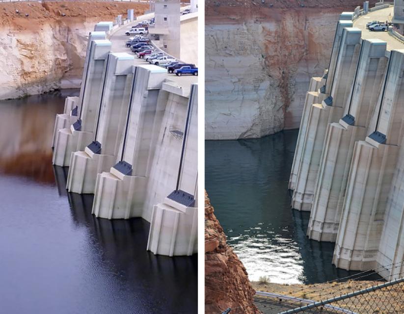
Lake Powell's decline is seen in these photos of Glen Canyon Dam taken a decade apart. On the left, the water level in 2010; on the right, the water level in 2021. (Source: Bureau of Reclamation)
At December’s Colorado River Water Users Association, an annual Las Vegas gathering of key Colorado River water interests, there was a grim sense of urgency to address the river’s needs.
“Climate change is real. We need to take innovative, proactive measures to address the effects here in the Colorado River Basin and throughout the West,” Tanya Trujillo, the Interior Department’s assistant secretary for water and science, told the group.
Although water interests in the Basin have sometimes turned to the courts to resolve disputes, Jeff Kightlinger, the former general manager for Metropolitan Water District of Southern California and a veteran of many of the Colorado River’s complex agreements over two decades, said in an interview that water interests from the Upper and Lower Basins have proven repeatedly that they can find common ground. He cited the 2007 Interim Guidelines that guide river operations, the 2017 Minute 323 agreement with Mexico that included conservation measures, and the 2019 Drought Contingency Plans as examples.
“The best result is when we stop suing each other,” Kightlinger said. “Hopefully we can stick to that model. It’s going to be hard.”
But he acknowledged that finding common ground now is likely to be more difficult given the shrinking river and declining reservoirs. When the drought started in 2000, Lake Powell and Lake Mead were nearly full, so water interests had space and time to work out agreements. “The hard part is there is no cushion anymore,” he said, “so now we’re working without a net.”
The possibility that the courts may be asked to settle how the shrinking river should be shared hangs in the background. Kenney, the veteran Colorado River researcher who recently retired from the University of Colorado Boulder, said there’s been an unwritten understanding that differences in the Basin would be settled in the conference room, not the courtroom. The Upper Basin’s fear, he said, has been that they may end up worse off in court than at the negotiating table. But as their own water resources get squeezed to bolster water levels in Lake Mead, Kenney said, the Upper Basin may decide they’re no worse off making their case in court.
Becky Mitchell, the state of Colorado's top water official. (Source: Colorado Water Conservation Board)
Yet key water managers in the Upper Basin say litigation is an outcome they hope to avoid. Mitchell, the Colorado water manager, said avoiding litigation is among the principles that guide her state’s approach to renegotiating the 2007 river operating guidelines.
Among the other principles, she told the Hutchins Water Center’s virtual November conference in Grand Junction, Colo.: Provide additional water supply security and certainty for Colorado and throughout the river basin, improve operations of lakes Powell and Mead and avoid curtailment of water uses in the Upper Basin.
Meanwhile, Mitchell said, the Upper Basin states are continuing to investigate the feasibility of a conservation effort called demand management that would compensate water users that are willing to temporarily use less water.
Eric Kuhn, a retired Colorado water manager and co-author with John Fleck of a book on the 1922 Colorado River Compact, said that while science is pointing to an accelerated decline in river flows, there are things the Upper Basin can do to have a robust economy and still conserve water. Coal-fired power plants are closing, which should free up water, he told an audience at the Getches-Wilkinson Center conference in October, and reductions in turf – both in cities and on farmland – can add to conservation.
“We can do some really, really good things in this Basin for the economy and our quality of life and still use less water,” he said.
Adapting Intelligently
In the Lower Basin, some water managers and Colorado River veterans believe the water users in Arizona, Nevada and California may have to cut their draw of the river by 1.5 million acre-feet. Entsminger, Southern Nevada’s general manager, said his agency is updating its 50-year water resource plan that anticipates the Colorado River’s annual supply will average just 11 million acre-feet instead of the 15 million acre-feet that was divided between the Upper and Lower Basins by the 1922 Compact.
Chris Harris, executive director of the Colorado River Board of California, the state agency established in 1937 to protect California’s rights and interests on the Colorado River, said water interests throughout the river basin are likely pondering a range of possible river flows. Harris said California and other Basin states will need to be flexible and adapt to whatever the river gives.
“We’ve just got to be better at being able to adapt intelligently,” Harris said.
The Imperial and Palo Verde irrigation districts in Southeastern California hold some of the earliest significant rights to the river’s water along with Native American tribes. While California is protective of its “very senior” water rights, Harris said California water users have demonstrated in the past that through collaborative agreements and partnerships, they can conserve significant water supplies on farms and in cities. And while Upper Basin water officials talk about their own water shortages as they send supplies downriver, Harris said California has been coping with drought and managing water shortages for decades. In response, he said, the state has improved water supply infrastructure and implemented conservation measures to stretch its supply.
“Hydrologic shortages are not an anomaly or an aberration in one basin or the other. They’re occurring in every state,” Harris said. “We are all dealing with a new water supply reality.”
A two-year agreement signed in December by Reclamation and water agencies in California, Nevada and Arizona committed up to $200 million for water conservation measures, including for crop fallowing on farms. Some farm areas are reluctant to embrace fallowing because of its community impacts. (Source: Water Education Foundation)
The two-year agreement signed in December by Reclamation and water agencies in California, Nevada and Arizona that committed up to $200 million for water conservation measures included money for crop fallowing on farms and urban conservation measures. Some of the conservation measures have yet to be identified. The goal is to keep 500,000 acre-feet a year in Lake Mead. Separately, Reclamation signed agreements with Gila River Indian Community and Colorado River Indian Tribes to conserve 134,250 acre-feet of water in Lake Mead. An acre-foot is about 326,000 gallons, or enough water to serve two to three households for a year.
Kightlinger, the former Metropolitan Water District general manager, believes the Lower Basin may have to reduce its draw on the Colorado River by 1.5 million acre-feet a year. Still, he added, it doesn’t all have to be done at once and it might not all involve cuts. Additional ocean desalination or wastewater recycling, he said, could help grow the pot of water. Lower Basin interests may be able to develop a 25-year plan with targeted water savings and benchmarks to measure progress. Such a reduction plan would surely include participation from agricultural water users, he said. “There’s no way to come up with that kind of number absent a strong ag participation,” Kightlinger said.
Metropolitan Water District has done partnerships in the past with agricultural water districts like Imperial and Palo Verde irrigation districts for conservation improvements or compensated land fallowing. In December, the district signed yet another partnership, a seasonal land fallowing agreement with the Quechan Tribe of the Fort Yuma Indian Reservation to conserve up to 3,500 acre-feet of Colorado River water.
Kightlinger said such agreements for farm water conservation can be done in a way that works for farmers and agricultural communities. “There’s more cooperation out there than people realize,” he said.
Tina Shields, Imperial Irrigation District’s water department manager, said her agency generally doesn’t support farmland fallowing because of the economic impacts to the community in lost jobs and support service revenues. But the agency does implement large-scale agricultural and on-farm efficiency-based conservation programs and believes there’s room for expansion. “We’re conserving a half-million acre-feet a year already,” she said.
Tina Shields, Imperial Irrigation District water manager. She said her agency has implemented water efficiency improvements for farms, but does not support fallowing as a conservation measure. (Source: Water Education Foundation)
But there are complications. One is that the district has limited options to store saved water, Shields said. The 1931 agreement that apportioned California’s share of the river gave Metropolitan Water District an exclusive right to store the state’s water in Lake Mead. More recent agreements have given IID the ability to store a modest amount of water in Lake Mead and a somewhat larger amount within Metropolitan’s system off-river, she said, but those savings accounts are full. Imperial is now partnering with Metropolitan to store another 50,000 acre-feet of conserved water in Lake Mead under Metropolitan’s account – still a tiny amount compared to Imperial’s 3.1 million-acre-foot river entitlement – and is discussing partnerships with both Metropolitan and the Bureau of Reclamation to store even more conserved water in the lake.
Another complication, Shields said, is the impact that any additional conservation has on the Salton Sea, California’s largest inland lake. Earlier water-saving agreements resulted in less farm runoff flowing to the sea. The district compensated with mitigation flows to the sea, but since those ended in 2017 the sea has been receding, creating the potential for unhealthy dust clouds from its newly exposed shoreline and rising salinity to levels that can no longer support the sea’s fishery and bird communities. The state of California is working on a 10-year restoration plan for the sea. But any further water conservation effort by Imperial Irrigation District, she said, will need to account for impacts of reduced farm runoff going to the Salton Sea – and require help from state and federal agencies.
Avoiding the Supreme Court
Across the entire Basin, there is an undercurrent of concern that as water interests try to work out an equitable solution between the Upper and Lower Basins, their lawyers are preparing legal arguments in case their interstate differences land them before the U.S. Supreme Court.
Harris, with the Colorado River Board of California, said he believes there’s a willingness and commitment to do anything and everything to avoid going to the Supreme Court.
“If you end up in the United States Supreme Court, isn’t that just a bald-faced acknowledgement of failure?” asked Harris.
At the Getches-Wilkinson Center conference in October, members of a panel titled “Time to Get Real” were asked how the Upper and Lower Basins could get beyond the legal jousting over who should get how much of the river’s waters.
Entsminger, Southern Nevada’s general manager, offered a note of concern over whether water interests in the two basins are up to the challenge of reaching an equitable solution in the face of climate change.
If this winter or the next one is as dry as last year, and the two basins cannot work together to find solutions to the river’s woes, he said, “Mother Nature is going to pick the winners and losers. And she’s going to do it really quick.”
“So we can keep shadow boxing about who’s feeling more pain, or who should have done what over the last 20 years or over the last 100 years,” he added. “Or we can come to the table and come up with a plan to use the amount of water the river’s actually going to give us.”
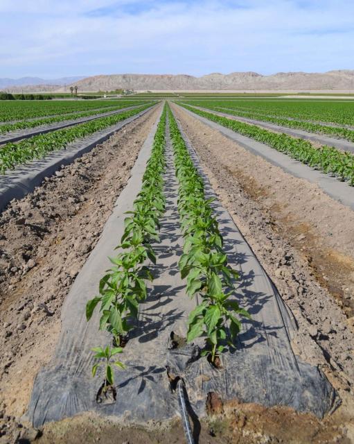
An irrigation canal in the Palo Verde Valley near Blythe, CA. Photo credit: Bureau of Reclamation
Here’s the release from the Bureau of Reclamation (Robert Manning):
The Bureau of Reclamation today submitted its initial spend plan for fiscal year 2022 funding allocations authorized in the Bipartisan Infrastructure Law to the U.S. Congress. This spend plan represents a blueprint for how Reclamation will invest in communities to address drought across the West as well as greater water infrastructure throughout the country. Reclamation will be provided $1.66 billion annually to support a range of infrastructure improvements for fiscal years 2022 through 2026.
“The Bipartisan Infrastructure Law is the largest investment in the resilience of physical and natural systems in American history,” said Assistant Secretary for Water and Science Tanya Trujillo. “Reclamation’s funding allocation for 2022 is focused on developing lasting solutions to help communities tackle the climate crisis while advancing environmental justice.”
“The Bureau of Reclamation serves as the water and power infrastructure backbone for the American West. The law represents a once-in-a-generation opportunity to improve our infrastructure while promoting job creation,” said Reclamation Commissioner Camille Calimlim Touton. “The funding identified in this spend plan is the first-step in implementing the Bipartisan Infrastructure Law and will bolster climate resilience and protect communities through a robust investment in infrastructure.”
The FY 2022 spend plan allocations include:
$420 million for rural water projects that benefit various Tribal and non-Tribal underserved communities by increasing access to potable water.
$245 million for WaterSMART Title XVI that supports the planning, design, and construction of water recycling and reuse projects.
$210 million for construction of water storage, groundwater storage and conveyance project infrastructure.
$160 million for WaterSMART Grants to support Reclamation efforts to work cooperatively with states, Tribes, and local entities to implement infrastructure investments to increase water supply.
$100 million for aging infrastructure for major repairs and rehabilitation of facilities.
$100 million for safety of dams to implement safety modifications of critical infrastructure.
$50 million for the implementation of Colorado River Basin drought contingency plans to support the goal of reducing the risk of Lake Mead and Lake Powell reaching critically low water levels.
$18 million for WaterSMART’s Cooperative Watershed Management Program for watershed planning and restoration projects for watershed groups.
$15 million for Research and Development’s Desalination and Water Purification Program for construction efforts to address ocean or brackish water desalination.
$8.5 million for Colorado River Basin Endangered Species Recovery and Conservation Programs.
Detailed information on the programs and funding provided in the Bipartisan Infrastructure Law, the FY 2022 BIL Spend Plan and materials from recent stakeholder listening sessions are available at http://www.usbr.gov/bil.
This photo from December 2021 shows the famous “bathtub ring” at Lake Mead due to declining water levels. The lower basin states are planning to save water in the reservoir through the 500 + Plan. CREDIT: HEATHER SACKETT/ASPEN JOURNALISM
Some Colorado River scholars say that a plan by the lower-basin states to leave more water in Lake Mead embodies a principle they explore in a recently published article: Dropping reservoir levels have opened a window of opportunity for water-management policies that move the river system toward sustainability.
In December, water managers from California, Nevada and Arizona signed a memorandum of understanding, or MOU, to spend up to $200 million to add 500,000 acre-feet of water in both 2022 and 2023 to Lake Mead, the nation’s largest reservoir, which has dropped precipitously low due to climate change and drought.
Water managers developed the program, known as the 500+ Plan, in just four months — lightning speed for something that requires the cooperation among — and millions of dollars from — each participant.
Water experts say part of the reason the plan came together so quickly is because it got a push from last year’s record-bad conditions. Water managers have watched reservoir levels in lakes Powell and Mead slowly dwindle for the past two decades, but 2021 was a wake-up call for many. A near-normal snowpack translated to just 31% of normal runoff, which was the second-worst inflow into Lake Powell ever.
“We had no idea how bad 2021 hydrology would be,” said Bill Hasencamp, manager of Colorado River resources for the Metropolitan Water District of Southern California. “We knew it was a dry year, but when it turned out to be 31%, it was an eye-opener.”
It wasn’t until June that water managers realized how bad the situation was, and talks about the 500+ Plan began in August, Hasencamp said. That quick turn-around tracks with the findings of a new article by John Fleck, a writer-in-residence at the Utton Center at the University of New Mexico, and Anne Castle, senior fellow at the Getches-Wilkinson Center at the University of Colorado. Their paper, “Green Light for Adaptive Policies on the Colorado River,” was published in December.
The paper says that frenzied media attention, dramatically dropping reservoirs to their lowest levels ever and the first-ever shortage declaration by federal water managers created an opening for the political will necessary for an innovative solution. Rapidly dropping reservoirs create a “green light” scenario for river management where conditions shift from a situation to be monitored to a problem that needs to be solved.
“That visceral experience we have with low reservoirs and seeing the snowpack not end up in them last year is part of what’s created this moment of opportunity,” Fleck said. “When we look at those reservoirs — which have been our safety for a long time, they have been our security blanket — and they’re gone, you see political leadership lurching to the issue.”
Click the image to go to the interactive Tableau version on Aspen Journalism’s website.
500+ Plan builds on previous work
But since political will can be fickle and fleeting, it’s important that policy solutions — usually the product of years of careful crafting — are ready to be implemented quickly when the timing is right and the “green light” window of opportunity opens. Although formal discussions about the 500+ Plan were only four months long, much of the groundwork had been laid over previous years.
“We know the technocrats behind the scenes, the people working at NGOs and government offices, they are thinking about this stuff and producing policy before we need it so they can attach it onto a problem when a problem arises,” said Elizabeth Koebele, a researcher at the University of Nevada and who studies how government policies get made collaboratively.
The lower basin is taking action after modeling showed that Lake Mead’s surface elevation could drop below 1,030 feet, which is a critical threshold identified in the 2019 Drought Contingency Plan. The reservoir is currently at 1,066 feet elevation.
The basic way the program will work is by municipal water providers paying irrigators to not use water so it can be stored in Lake Mead. It will be funded by $40 million from the Arizona Department of Water Resources; $20 million each from the Central Arizona Project, Metropolitan Water District of Southern California and Southern Nevada Water Authority; and $100 million in matching funds from the federal government.
The 500+ Plan is resonant of the System Conservation Pilot Program, which ran from 2015 to 2018 and paid upper-basin farmers and ranchers to voluntarily fallow fields in order to boost levels in Lake Powell.
“These were ideas they didn’t have to make up from scratch,” Fleck said. “I was amazed at the speed with which (the 500+ Plan) came together. It was very impressive because it built on work that had been going on behind the scenes for a long time.”
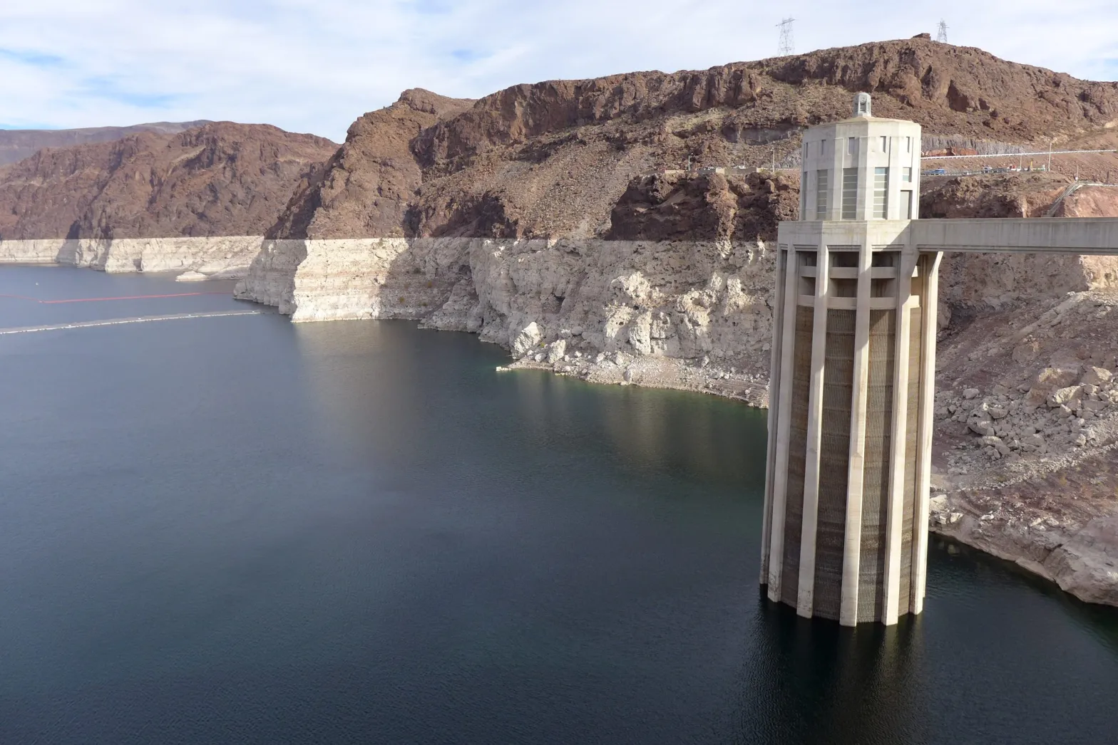
This photo from December 2021 shows one of the intake towers at Hoover Dam. California, Nevada and Arizona recently penned a deal to keep 500,000 acre-feet of water in Lake Mead to boost the declining reservoir levels. CREDIT: HEATHER SACKETT/ASPEN JOURNALISM
Upper-basin lessons?
Rebecca Mitchell, director of the Colorado Water Conservation Board and Colorado’s representative to the Upper Colorado River Commission, said in an email that she generally supports the lower basin’s efforts to take less water out of Lake Mead.
She pointed out challenges with shortages and water saving in the upper basin: Water users don’t have large reservoirs on which to rely the way that the lower basin does. Emergency releases from upper basin reservoirs last summer and fall to prop up Lake Powell and preserve the ability to make hydropower have harmed local businesses and left the reservoirs low, she said.
“Given the drastic shortages already occurring in the upper basin, coupled with these emergency releases, it is unclear how much more Colorado can provide,” Mitchell said.
Mitchell said that the upper basin states only use about half of what they are entitled to under the Colorado River Compact and that the lower basin states use far more than their share.
But with climate change continuing to rob the river of flows, the amount of water promised to each basin in the century-old agreement may no longer exist. Fleck said the other reason why the lower basin was able to come up with the 500+ Plan seemingly quickly is because water managers there have been having difficult conversations for years that acknowledge the river’s hugely diminished flows — something upper basin water managers still seem averse to.
“(The upper basin states) have to have those difficult conversations with water users who don’t want to hear it, but they might not get what the compact promised,” he said. “Those are conversations we just need to be having in the upper basin right now, and we are not having them.”
Aspen Journalism covers water and rivers in collaboration with The Aspen Times.
Lees Ferry streamgage and cableway downstream on the Colorado River, Arizona. (Public domain.)
The beginning of 2022 has brought a wonderful gift for our mountains: many feet of snow. While it’s still early in the season, we remain hopeful for more moisture to come, including out to the Plains. Recently, I presented at the Colorado River Water Users’ Association meeting to highlight the ways Colorado’s farmers and ranchers are advancing voluntary stewardship to conserve water and build resilience through dry times.
In addition to the much-needed snow, we are also celebrating the good work accomplished in 2021 by Colorado producers, CDA staff, and many others. We have distributed over $30 million of the $76 million in state stimulus grants across the state to support agricultural events, advance soil health initiatives, increase processing capacity, and help producers build drought resilience. We will continue to distribute stimulus funds in the months ahead, including through another round of Farm to Market processing grants and the launch of the first-ever CDA Revolving Loan Fund that will provide affordable financing to processors as well as beginning and underserved farmers and ranchers.
I was fortunate to hear first-hand the impact of these dollars when I attended Chaffee County’s agriculturally focused community workshop last month. Governor Polis joined us for the entire evening, sharing a meal and listening to producers from across the county. Ag Commission member and local rancher George Whitten was there to hear from folks, as well. This was one of the dozens of field visits I’ve made this year to be sure that the work we do at CDA makes sense out in the field where the work of producing food gets done.
Through all this we are saying goodbye to some incredible staff, and looking for new team members to continue to carry the torch for Colorado agriculture. In particular, I want to thank Deputy Commissioner Steve Silverman for three years of dedicated service to Colorado agriculture and CDA. We couldn’t have made it through this time without him. See below for important job openings at CDA!
The ag community is no stranger to tough times. Despite recent challenges, we keep getting back up, dusting ourselves off, and supporting each other every way we can. That’s what Colorado agriculture is all about.
Kate Greenberg
Colorado Commissioner of Agriculture
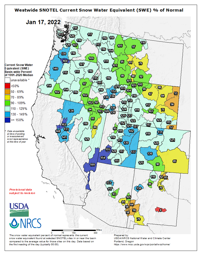
Westwide SNOTEL basin-filled map January 17, 2022 via the NRCS.